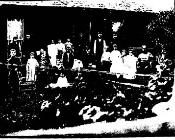
 This is the house
today.
This is the house
today.HISTORY CORNERs
From
1st
one: Dec 93 or Jan 94 TO 6-16-95
Then
a
gap, then 11-1-96 to 5-21-98
#1 12-30-93
This
article is the first in what is
planned as an ongoing series of articles about Council's fascinating
past.
With all the
digging going on in town, I
thought it would be a good time to tell about some interesting
discoveries from
the last time the town was dug up.
In 1940, the
WPA was putting in many of
the sewer lines that are now being replaced.
At the bottom of an eight foot deep trench under Galena street,
west of
what is now the Council Valley Market, the crew found a large spear
head and a
stone axe head. Both
were made of
flint. The spear head
(which may
actually have been a cutting tool) measured about four inches long.
Several arrow
heads were found during the
1940 excavations, especially around the settling tank in the west part
of town,
and along the trench leading west from the tank.
I've been told
that if the present workers
find any artifacts, the job might have to be stopped until an
archaeologist can
be called in to examine the site.
While
this is both good and bad, the immediate result is that the workers
might
simply keep quiet about anything they find in order to keep the
project
moving. That's
understandable, but if
it happens, the community will lose a once in a lifetime chance to
learn more
about how the native culture used this valley.
Future
articles, in addition to stories of
Council's history, will keep you informed of what the museum is doing. Several ambitious new
members have been
added to the museum board, and you will be seeing some good things
happen. This should
matter to you. It should
matter to you because local
history is incredibly interesting.
It
enriches our lives in ways beyond measure.
And Council has one of the best historical collections in the
state for
this size town. It
should also matter
to you because museums and other historical attractions account for a
very high
percentage of tourist dollars: cold, hard cash for our local
economy.
Stay tuned.
#2 1-5-94
HISTORY
CORNER
by Dale Fisk
One of the most striking facts of
life in the Council Valley about a century ago was the handicap of
inadequate
transportation. When the
Moser family
settled here in 1876, there wasn't a road of any kind into the valley. George Moser
used a plow to scratch a
ditch down the north side of Mesa hill, and by placing the upper
wheels of the
wagons in it, managed to keep them from tipping over.
The basic route that the Mosers
established was used up until about 1920, and is still visible in the
first
canyon east of the present highway.
It
cuts down the hill and across the old paved highway. If you look about 300 yards up the Middle Fork from the
present
highway bridge at the base of Mesa hill, you can see the abutments for
the
bridge the old "Moser grade" used.
When roads were finally built, they
were what we would call four-wheel-drive trails. These dirt roads were very often impassible (or even
dangerous) for
weeks at a time during wet seasons.
Until communities were big enough, and organized enough, to
afford such
luxuries as bridges, travelers used fords on smaller rivers, and
ferries on
larger ones.
Railroads were the only mode of
transport that was fairly dependable.
When Indian Valley was first settled in 1868, the nearest railroad was in Utah. By the time the Mosers arrived here, rails had just
crossed
Idaho's southern border. The
nearest
major supply points were Boise or Baker, although there was a small
store at
Falk's crossing, east of present day Payette.
Six years later (1882), the railroad reached Weiser.
This was a milestone in the settlement of
Council.
Now it only took a journey of two days (one way) to get tew up,
they
didn't seem to age at all, but now, many of them are old.
Some, like the Ridge school house,
have begun to lean precariously ... and some
have died. It
ust
doesn't
seem right. From my
point of
view, they were always here - like the mountains. These men have been my reference points ... my
Landmarks.
There is little we can do to prevent
the loss of living Landmarks. But
there
is much that can be done to preserve the priceless legacy they leave
behind
them. That's why
I'm researching and
writing their stories. That's
why the
Council museum exists, and why it is so important to support it.
For over a year now, the museum
board has been diligently investigating a once-in-a-lifetime
opportunity to
expand the space available for the museum's exhibits. The room we have is inadequate for even the present
collection,
not to mention other heirlooms that would be donated or loaned if
space were
available.
We
have finally come up with an approximate plan for an addition to the
City Hall
building for the museum, and nailed down an agreement toward this goal
with the
initial financial backer: Evea Powers (Vernie Harrington's daughter). She will match any
money we raise, dollar
for dollar, up to $10,000. Through
private
grants and local contributions, we plan to raise enough for the
addition.
We are hoping that the community
will pull together and help with this investment in a cultural and
economic
legacy that will benefit us and our grandchildren.
You'll be reading and hearing more
about this soon.
#3
1-12-94
HISTORY
CORNER
by Dale Fisk
It was a cold
day, less than two weeks after Thanksgiving.
The Christmas season was starting.
The older students of Council's overcrowded
old brick school were looking forward to moving into the new, $48,500 high school that was
nearing completion
across the highway from the courthouse.
People who were listening to the
radio were startled by the sudden interruption of regular programing. It was announced that
Japan had just
attacked the U.S. Naval base at Pearl Harbor, Hawaii. Soon after that, President Roosevelt announced that the
United
States was declaring war.
The word
spread quickly through Council.
Whether
they heard it in a store, or by a phone call, or on the radio, the
shock of the
news, and the date December 7, 1941, was indelibly stamped on the
memory of
everyone who was old enough to realize what had happened.
From that day on, the history of this
nation, and the lives of millions, was irrevocably altered.
A few days after Pearl Harbor, a new
siren was installed in Council to serve as a fire and air raid alarm. Military experts were
saying that attacks by
enemy planes this far inland were very probable, and blackout
instructions were
issued.
As near as we can tell, the big bell
that now sits in front of the city hall / museum building was used as
an alarm
before that time. If
anyone has any
more information about this bell, please call me: 253-4582.
A letter recently arrived at the
Council Post Office from a WWII vet who is trying to locate someone he
knew
during the war. The man
who wrote the
letter is Robert Hull, and he is looking for Robert M. Keyes.
The two men served together in the 511th Parachute
Infantry Regiment. Keyes
was the
lieutenant in charge of the Demolition Platoon, and stayed with the
unit until
it arrived in New Guinea. At
that time,
Keyes left the unit, and Mr. Hull has never heard what became of him. Mr. Hull says that Keyes
lived in the
Council area, and may have owned a ranch here.
Anyone with information on the whereabouts of Robert Keyes or
his
relatives is asked to contact Robert M. Hull at 1926 S. Johnson St.,
Visalia,
CA 93277 . He will gladly accept collect phone calls at (209)
625-3027.
#4 1-20-94
HISTORY
CORNER
by
Dale
Fisk
In my writings, I will occasionally
use the term "Landmarks".
I'll try to explain my usage of that word.
Just after 1900, a number of
homesteaders settled on "the Ridge" west of Fruitvale, and a one-room
school was built in 1915
for the
children of the new families. My
father
was one of those children.
When I checked on the old school a
couple years ago, it was in pretty sad shape.
The porch had fallen down a few years before. The brick chimney
had long
since been shot to pieces by squirrel hunters in lack of more suitable
targets. The weathered
shingles had
given up clinging to the roof, and now the whole building was leaning
to the
point of no return.
All my life I had seen that old school
as a symbol of a precious heritage, and as a landmark in more than
just the
physical sense. I saw
the ghosts of
noisy children running and laughing in the school yard.
I imagined figures whirling
around the floor at special Saturday night
dances, as the notes of a fiddle drifted above their heads.
To me, this neglected old friend represented
a way of life that had faded away like the echoes of the music and the
laughter. Now it stood
empty ... silent
... dying.
The
old school finally collapsed under the weight of a heavy snowfall on
the night
of December 8, 1992.
When
I was a boy, I used to go with my father to the cattle auction.
I would listen to the men talk about
politics, the price of cattle, or the best way to operate some
complicated
piece of farm equipment. I
thought they
must be very wise, these men who held the world in their hands.
I was intimidated by the thought of ever
being able to know as much about life as they did.
I
learned
a lot from those men. As
I grew up,
they didn't seem to age at all, but now, many of them are old.
Some, like the Ridge school house,
have begun to lean precariously ... and some
have died. It
just doesn't seem right. From
my point of view, they were always here
- like the mountains. These
men have
been my reference points ... my Landmarks.
There is little we can do to prevent
the loss of living Landmarks. But
there
is much that can be done to preserve the priceless legacy they leave
behind
them. That's why
I'm researching and
writing their stories. That's
why the
Council museum exists, and why it is so important to support it.
For over a year now, the museum
board has been diligently investigating a once-in-a-
lifetime
opportunity
to expand the space available for the museum's exhibits.
The room we have is inadequate for even the
present collection, not to mention other heirlooms that would be
donated or
loaned if space were available.
We
have finally come up with an approximate plan for an addition to the
City Hall
building for the museum, and nailed down an agreement toward this goal
with the
initial financial backer: Evea Powers (Vernie Harrington's daughter). She will match any
money we raise, dollar
for dollar, up to $10,000. Through
private
grants and local contributions, we plan to raise enough for the
addition.
We are hoping that the community
will pull together and help with this investment in a cultural and
economic
legacy that will benefit us and our grandchildren.
You'll be reading and hearing more
about this soon.
#5
1-27-94
Many long time residents of the
Council area remember when this was a well known fruit producing
region. It was a
dynamic, but relatively brief, time
in our history.
Although many
early settlers grew a few fruit trees for their own
use, William and Dora Black are generally credited with starting the
first
commercial orchard in the county.
The
Blacks lived at the present day Gossard ranch on Hornet Creek.
Even
though local fruit was of high quality, the market was mostly limited
to local
sales until after the arrival of the railroad in 1901.
By 1904, B.B. Day, who now owned the Black
place, was shipping
apples to markets
as remote as Walla Walla and Nampa.
The
next year, he was sending apples to Chicago by the railroad car full,
and area
farmers were beginning realize that there was money to be made in
fruit.
By 1909, orchards
were the rage here, and it seemed that everyone
was jumping onto the band wagon.
Local
business men came up with a logo depicting a red apple accompanied by
the
slogan "The Home of the Big Red Apple" which was placed on envelopes,
banners and other promotional material.(CL, Sept 17, 1909)
A metal printing plate for reproducing this
logo is displayed at the museum in Council.
That same year (1909), the famous
Mesa Orchards began, about 8 miles south of Council. This was also the year that the townsite of Fruitvale
was
established. The name
was doubtlessly a
result of the fruit rage.
In 1912, "The Council Valley
Orchards Company" started developing orchards on the slopes north east
of
Council, mostly east of highway 95, and between Orchard Road and Mill
Creek
Road. At one time, that
whole area was
almost one continuous orchard.
By the fall of
1912, it was estimated that there were 3,000 acres
of orchard within a twelve and a half mile radius of Council.
For about the next thirty years, fruit was a
staple of Council Valley's economy.
I have three questions this week.:
1.
My best information is that, at its peak in 1929, the Mesa
Orchards
Co. had 1,200 acres
actually growing
fruit trees. It has been
claimed that
it was anywhere from "one of the largest commercial orchards under one
head operated anywhere in the northwest", to "the biggest orchard in
the world". Does
anybody have
concrete evidence as to its actual size in relation to its peers? Newspaper claims, opinions
and memories
don't count unless they can be corroborated.
An almanac printed during the 1920s might have this info. Old horticultural journals
might hold a
clue. Any solid leads
would be very
appreciated.
2. Early in
World War II, the government
considered Mesa orchards for use as a Japanese detention camp.
It was supposedly rejected as being too
small to hold enough detainees, and yet I have read somewhere that
local people
remembered Japanese kids attending the Mesa school during the war. If anyone has memories, or
other info, about
Japanese families being detained at Mesa, please call me.
3.
In 1942, the last three apple trees that were planted by George
Moser in
1880 were destroyed. The
trees stood in
front of Bob Young's house near the corner of the high school
property, and the
street curved around them. Somebody
who
knows where this exact spot was, please give me a call.
253-4582
#6 2-3-94 History Corner
As I write this, the old parsonage
next to the Congregational church is being torn down. By the time you read this, it may already be gone... another
Landmark down the drain. Right
after I
originally had this article all written and delivered to the
newspapers, Dick
Parker's outstanding article about the parsonage was printed.
He knocked big holes in my estimation of
when the parsonage was built. I
had
found a bit in a 1910 Council Leader paper
that said, "The
Congregational church has decided to install a regular pastor in the
valley." A meeting was
reportedly
called to decide site to build new parsonage.
Dick's more dependable date (1901) from church records made me
realize
how undependable old newspapers can be.
As to the concern that the old
papers on the walls of the parsonage were lost to posterity, there was
only one
local paper: Council Journal, Mar 25, 1902.
It was an issue of which there is no original or microfilm copy
as far
as I can tell, but it didn't contain any significant news relevant to
Council
history that can't be found in other issues.
The rest of the "wall
paper" was Saturday Evening Posts and other non-local
publications.
More tidbits on the church or
parsonage from my research:
1912 - A new organ was purchased by Rev. Stover
1915 - Rev. Cox set out 20 shade
trees around the church and parsonage.
1922 - A Boy Scout troop (probably
Council's first) was organized under the sponsorship of the church.
1927 - A Mr. Summer and a Mr. Teems,
who had a sawmill on Johnson Creek, were starting a lumber yard across
the
street from the congregational church parsonage.
1935 - The parsonage was extensively
remodeled, and a bathroom was added.
1940 - The Council library was in
the "annex" of the church.
A
small rental library of new books was maintained at the parsonage,
where books
rented for 3 cents per day.
Bill Winkler said the first
religious service in the valley was held by Sylvester Shrieve, a
Methodist
minister, in 1879. There
were many
traveling preachers until the late 1880s when the first regular
services were
conducted by Rev. Hopper who came up from Midvale once a month.
In 1910, my great great grandfather,
J.L. Baker, who was a Methodist preacher at Cambridge, was sent to
Council to
establish a church here. Construction
was
finished and the building was dedicated on Sunday, Dec. 10, 1911. It was located just
across the highway,
south of the present Starlite Motel.
The parsonage was just torn down just a few years ago.
The Methodist church was abandoned
by the time the Nazarene congregation started
holding services there in the mid 1920s. In 1934, Rev. F.D. Brown moved to Fruitvale and held
Nazarene
church services in the McMahan school house. [As noted in a later
column, this
was actually another new school.] While the Congregational church
parsonage was
being remodeled in 1935, the Nazarenes were tearing down the old
Methodist
church in Council and using the lumber to build a small church at
Fruitvale. It was built
at the east end
of Jonathan Ave., just
north of the
road, and east of the ditch. The
building
was later converted to a house that was owned by Fred Burt, and is
still there. In 1938,
another Nazarene
church was built on the south east corner of Dartmouth St. and
Illinois Ave. in
Council. It was just
demolished a
couple years ago.
Coincidentally, the first LDS church
was also located in Fruitvale.
Beginning just after 1930, services were held in private homes
there for
a year or two. In 1932,
Elder J.L.
Sandidge began holding services in the Legion Hall in Council.
In 1935, construction of a log church was
started just south of Jonathan Ave. in Fruitvale. It was wired for electricity, just in case power ever
reached
Fruitvale. The building
was completed
and formally opened on Sept. 11, 1937.
Pete and Chris Friend converted the old church into a home
which they
torn down and replace with their current house a couple years ago.
As you can see, we have lost a
number of Landmarks fairly recently.
Another one that is about to fall is the old John Kesler (1867
- 1937)
house. It's the big,
white, square
house just south east of the airport.
The Keslers contracted with Adams county as a "poor house" in
the 1920s to care for county indigents.
Frenchy David, the pioneer Seven Devils prospector who shot
himself near
Bear, spent some of his last days there.
Stay tuned.
#7 2-10-94 HISTORY
CORNER
I guess a few words about
earthquakes would be appropriate, in light of recent events.
Most of us remember the quake in Idaho a few
years ago, but there have been several over the years.
The first one I could dig up in the
old newspapers was on May 13, 1890.
Miners in the Seven Devils were shaken awake in the middle of
the
night. The sound was
described as "...a
loud rumbling sound like that made by a number of horses stampeding." I think it was Al
Towsley who said he
thought someone was trying to blow up his cabin with blasting powder. Surprisingly, the
quake was not felt by
anyone on Hornet Creek.
A few local people had friends and
relatives in the great San Francisco quake of 1906, and sent help in
the way of
cash and supplies. Weiser
businessmen
sent a railroad car of flour. It
was
the biggest earthquake in the nations history at the time.
Think how horrible it must have been to have
hundreds of victims trapped under rubble before they even had any kind
of
machines to move it.
There were a couple of
local earthquakes in 1908.
The first was a fair sized trembler in the
Meadows area. The other
was a smaller
one, centered near Weiser.
In 1915, a man in the Cambridge area
awoke in the night to the sound of objects on the kitchen table
rattling
around. Half asleep, he
got up and put
the cat outside, thinking it had been knocking things off the table. The next morning everyone
was talking about
the earthquake. It was
centered
somewhere in Utah.
Only eight months later, in May of
1916, the northwest was rocked by what people in Boise called the
strongest
earthquake in the city's history.
Several chimneys collapsed, but there was little other damage.
In 1920, there was another
earthquake in the Los Angeles area.
It
was experienced by a local man, Sterling McGinley, who was there at
the time.
This week, I want to ask several
important questions.
First, when the Council area was
just getting started as a community, it had no central core that could
be
called a town. Several
years before
John Peters built a store where Shaver's now stands, he established the first store in the valley at a location
described as being on what was later "the Bedwell place".
This was about a mile, or a little less,
north of town. It most
probably would
have been somewhere along Galena Road, which was the main road out of
town. It might have been
on the east
side of the road. Does
anybody know the
place?
The first school, aside from classes
in the fort, was also said to be close to this spot north of town, on
what much
later (1943) was the Ed Shannon place.
Where was this?
Speaking of schools, the library is
collecting photos of old schools in this area. There doesn't seem to be a photo anywhere of the
Orchard
school. Does anybody
have one, or know
who might? Please,
somebody come up
with one!
Another picture we're looking for is
one of Ham's Texaco service station.
Photographs can easily be copied without even removing them
from your
home. If you have any
iformation about
these locations, or if you have any pictures from the past that you
think might
be interesting, please give me a call.
253-4582
2-17-94
4???????
HISTORY
CORNER
by Dale Fisk
Just
within the past year or so, we have
lost several Landmarks. The one with the most direct connection with
the
pioneers of the Council Valley was John Gould.
John and his brothers, Lester and Clarence, were local
institutions, and
we lost them only fairly recently.
Their father, George Gould, came to the Council Valley in the
fall
of1888. That was a
drought year
followed by a mild winter. The
next
winter ('89 & '90) happened to be just about the worst one in the
history
of this area... something like last winter, only with extensive
flooding the
following spring. Hundreds
of livestock
starved, froze or drowned that winter and spring..
In
1890, George aquired the ranch on
Cottonwood Creek that is now owned by the Fraziers. It was the Gould who built the present Frazier house.
By acquing this place, George felt he
had begun to establish
himself, and he
adopted the "90" brand in honor of the year of
this accomplishment. The
90 brand has been in uninterrupted use
by the Gould family ever since.
In Feb.
of 1893, George married a
neighbor girl, Viola Duree. All
four of
their children were born on that place: John - Jan. 3, 1894, Clarence
- Sept.
15, 1895, Annie - Dec. 27, 1897, and Lester - April 16, 1905.
In 1909, the
Goulds traded ranches with the
Becksteads who lived on a ranch 3 miles north of Council.
The Becksteads had built the large ranch
house which still stands on the Gould place.
The ranch had been settled in 1878 by George Winkler, and was
one of the
earliest homesteads in the valley.
Mr. Winkler planted some of the first fruit trees in the valley
here. Although it was
badly broken by
snow last winter, I suspect the huge apple tree in front of
the old house today was one that Winkler
planted.
The big white barn on the ranch was built
in 1915, and quickly became a landmark in itself.
In 1938, when Clarence married Nancy
Stover, the teacher at the White School just across the highway from
the ranch,
they built the smaller dwelling next to the main house for their home. Clarence has been
called a genious, and
maybe he was in some ways. To
say the
least, he was very mechanically creative.
A number of the
machines that he
built are cached away on the ranch, including a water-powered
generator, down
by the river, that provided electricity for the ranch years ago. Clarence died Aug. 8, 1987
Viola Gould died in 1948.
When George died three years later, the
estate was divided among the kids.
John and Clarence continued to run the main part of the ranch
as one unit. Lester
acquired the place that Steve and
Elsie Shumway now own.
Lester died Sept. 1987
John died June 6, 1992
Clarence's three children now own
the ranch. Donna Gould
Nelson and her
husband, Todd, now live on the Gould Ranch.
If only that land could talk - what
stories it could tell. Like
the time
in January of 1895 when George Winkler was awakened in the middle of
the night
by an uproar in the chicken house.
Sleepy-eyed, George lit a lantern, picked up his shotgun, and
stumbled
out to the coop. He
proptly encountered
the cause of the chicken's panic: a very large cougar.
Everyone but the cougar (and maybe a couple
chickens) survived the evening's entertainment.
2-24-94
?
7
HISTORY
CORNER by Dale Fisk
In one of the display cases at the
museum, there is a pair of horse snow shoes.
That's right - snow shoes that were worn by horses.
In the days before good roads or snow
plows, pack animals were
often the only
way to haul supplies to remote mining towns.
In the winter, dog teams were sometimes used between
McCall and the Warren area, especially for
carrying the mail. I
don't think they
were used much for heavier hauling.
Putting snow shoes on horses doesn't
seem to have been a very common practice.
Mickey Aitken Hendrickson said that Eston Freeman, an early
mail carrier
to Warren, introduced snowshoes for horses in this part of Idaho. People laughed at him and
said they wouldn't
work, but they did. Hendrickson
said they
were used extensively in this general area.
The
horse
snow shoes in the museum are made of metal.
This may have been an uncommon
material for this purpose.
The
ones that Hendrickson described were made of wood. Wooden snow shoes were used on horses in the Buffalo Hump
area,
north of the Seven Devils.
A man who
told about the ones used there, said they were made by crossing two
boards to
make a shoe about twelve inches by ten, with the forward corners
rounded. Holes were
burnt into the boards to fit
extra long calks and toes on the horse's regular shoes.
Each snow shoe was held on with bolts.
The horses seemed to like the snow shoes
after they learned how
to walk a little
spraddle-legged while wearing them.
The
man said that "...when
the wooden
contrivances are fitted on, they [horses] can be driven anywhere and
are enabled
to go along with greatest ease.
On
these shoes they do not sink more than six inches at any time in the
trail, and
rarely over a foot in the loose snow."(From the Salubria Citizen
newspaper, Apr 14, 1899)
A hundred years ago, if you were to
mention "snow shoes" to someone, they would have thought you were
talking about what we now call skis.
And they referred to what we call snow shoes as "webs".
In the late l800's and the early
part of this century, skiing was a whole different story from today's
sport. Almost
everyone made their own skis. They
consisted of shaped and bent wooden
slats with a loop to hold the toe of the skier's foot, and some method
of
holding the foot forward into this loop.
Our museum at Council has two pairs of these old-style skis on
the wall,
along with one pole. It's
amazing how
huge they are.
Before the 1920s, at least in this
country, skiing was primarily a way to get from one place to another,
as
opposed to recreation. Except
for
experts, it was almost literally a "straight forward" activity.
Slalom type turns were pretty much unheard
of. To go down a
hill, you simply
pointed your skis down the mountain and let gravity do the rest.
Instead of ski poles, a single,
long, heavy pole was used, primarily for balance and braking.
If your speed became excessive, the pole
was placed between your legs and the trailing end was pushed into the
snow to
create drag.
Stay
tuned.
3-3-94
9 HISTORY CORNER
Baseball was probably the first
intramural sport played in Council.
Although travel was difficult, there were games between
neighboring
communities as early as 1890. After
the
Pacific and Idaho Northern Railroad reached the towns along the Weiser
River,
games became common between teams located along the trains route.
When the teams along the tracks
adopted a league name, it was only natural to call it by the railroads
initials
- the "P&IN League".
There is a P&IN League baseball trophy in the Council
museum. In
everyday local slang, the railroad was
called the "Pin" or "the pin road".
Likewise, the sports league became known as
the Pin League. I would
assume that
when teams were added to
the league
that were from towns that were not located along the railroad, it
became known
as the "Long Pin League". If
somebody
has better info as to how "Long" got added onto the Pin
League name, please give me a call.
Weiser had a football team as early
as 1906, but some of the Council boys had never even seen a football
game, much
less played in one, until 1922.
A team
was established here, and showers were built in the old, brick,
combination
grade school / high school that year.
The first Council High School football
game was at home against Payette in November. Council lost ten to nothing.
Basketball came to Council High a
short time after football, after the Legion Hall was built in 1923. The
upstairs
of the building served as a basketball court.
Even after the old high school was built in
1941, it was occasionally used for that purpose.
I
recently came across some old Council High School year books from the
1940s. It's interesting
how much has
changed, and how some things are shared by every generation.
High School year books are a valuable
resource for recording Council's past.
The pictures are priceless.
If
you have an old Council High School year book, that you could donate,
the
Library and/or Museum would like to have it so it can be preserved for
the
whole community.
Ruth Husted has generously donated
year books from 1941-42 through 1945-46.
They are unique because construction of the high school had
just been
finished in December of 1941, and because these were the war years. Annuals from this time
frame (and into 1947)
contain photos of some well-known local folks that still live here:
Everett Harrington,
June Ryals, Leo Mink, Ferd Muller, Art and Alice Deeds, Eunice Madson,
Ruth
Husted, LaDell Merk, Alma Fisk, Mary Owens, Maxine Hallet, Norman
Kilborn, Ed
Kesler, Frank Hulin, and more.
These kids got to go to school in a
brand new high school after being cramped into the second story of the
old
brick school. The
new school must have
been a marvel to them. It
was said to
be "... not only the newest, but the most modern physical plant in the
state". It had a real
gymnasium,
and separate rooms for science, business, home economics, library,
etc.
Does anyone know when the first year
book for Council High came out?
We
would welcome the donation of annuals from any year, but especially
old
ones. They are the ones
that will be
the hardest to find, and are the most interesting. If you have a year book that you could donate, please bring
it in
to the Library, or contact me.
A few weeks ago, I asked if anyone
knew the whereabouts of Bob Keyes.
It
turns out that quite a few people knew the Keyes family, and knew that Bob now lives at
Donnelly. Several people
called or wrote to Mr. Keyes,
as well as to Mr. Hull who was looking for him. Mr. Keyes didn't remember exactly who Mr. Hull was, and
looked
through his old photos, etc. to jog his memory. I'm sure the two men had a pleasant visit, remembering
experiences of 50 years ago. My
thanks,
and theirs, to the people who helped get them together.
Now I have another "Where Are
They Now?" question. I
got a call
from Frank Thompson who went to school at Council for only one year,
during the
1940s, and moved away in about 1948.
Most of his school years were spent at the Cottonwood school. He would like to know if
anyone knows how to
get ahold of Jay or Albert Thorp.
If
anyone has an address or phone number for one of them, or of someone
who would
know how to contact them, drop a line to Frank Thompson at Valley, WA 99181 or call me at
253-4582.
I need to correct a mistake from a
couple weeks ago. I said
that in 1934,
Rev. F.D. Brown moved to Fruitvale and held Nazarene church services
in the
McMahan school house, near where Raffetys live now. It was actually the "new" Fruitvale school where these
services were held, not the McMahan school.
The McMahan school had been abandoned for about eight years by
this
time, and had collapsed under heavy snow the year before.
3-10-94
10
HISTORY
CORNER
I guess it's time to stick my neck
out. Over the years,
there has been a
running battle between two camps on the issue of "the Council
Tree". Just where was
it? And was there
more than one?
One side says there was a single
tree, and that it was located just south of Mill Creek on the west
side of
highway 95. The tree to
which they
refer is still standing, although it has long been dead.
The other group claims that there
was not one, but a grove of five Council Trees, and that they stood
just north
west of the present town of Council.
After reading every available issue of the Council Leader, the
Adams County
Leader, the Fruitvale Echo and the Council Advance newspapers between
1901 and
1944, as well as issues of the Weiser Signal, the Salubria Citizen,
the
Cambridge Citizen and the Cambridge News to cover 1882 to 1901 for
which there
were no Council papers, I have found not one single reference to a
Council tree
anywhere near Mill Creek. Instead,
I
found numerous references to five Council trees located north west of
town. For a time, the
Adams County
Leader even had a big logo, along with the paper's name, across the
top of the
front page of each issue
that showed
the five Council trees with Indians smoking a peace pipe under them.
The clincher came when I read a high
school history essay written in 1930 by Rose Freehafer (former Senator
Jim
McClure's aunt). She
personally
interviewed Bill Camp, who had known some of the Indians in the area,
and even
spoke some of the Nez Perce language.
An Indian that Camp worked with told him that the Council trees
were
located on the Kesler place about three quarters of a mile north, and
slightly
west, of Council.
Until the 1920s, there were five
pine trees in a field at this location, in a group by themselves, but
the
landowner later cut down all but one of them.
When Arthur Hallet acquired ownership the land where the
Council trees
stood in 1917, all five trees were still there. Arthur's son, Byron (Buff) Hallet said the last tree died in
1928, and was cut down for firewood.
Buff Hallet planted five young pine trees at the approximate
location of
the original Council trees in1986. They are growing on the south side
of
Airport Road, straight south of the Council airport.
I suppose this will upset a few
fondly held beliefs about "the Council tree", but it seems very
evident that there were five trees, and that they were located at the
spot
mentioned above. I have
simply not run
across one scrap of evidence to the contrary, or any hint that the
site near
Mill Creek is legitimate. If
someone
can tell me how and when this Mill Creek spot came to be associated
with the
Council tree, I'm very curious.
3-17-94
12
HISTORY
CORNER
Recently I asked for info about Jay
or Albert Thorp because their old friend, Frank Thompson, was looking
for
them. I got a call with
info as to how
to locate Jay, but before I could pass it on to Frank, I got a letter
from Jay. He gets the
Record, so he saw the article
and he sent a letter to Frank.
Last week, I wrote about the Council
Trees. Dick Parker gave
me some great
info on that story. It
seems that Ralph
Finn started the idea of a single Council tree near Mill Creek.
Before the three dams were built on the
Snake River west of here, Ralph
was an
advocate of an idea that had been proposed to build one giant dam in
Hells
Canyon instead. He felt
that the huge
reservoir created by this dam would bring a great boom to Council, and
he
pushed the idea of making a tourist park at the Mill Creek site. The pine tree growing there
was to be
promoted as the Council tree.
Dick
says that Hugh Addington, and other old timers, always referred to
there being
several Council trees, and that they were located at the spot north
west of
town. Hugh remembered
the trees as
being more or less in a line.
I also got a call from Ervin Bobo
who gave me some real gems of information.
The most exciting one, for me, concerned a pile of rocks on a
hilltop on
the Ridge, west of Fruitvale, at a spot called "Eagle Point".
This pile, made of chunks of basalt rocks,
is about five or six feet tall.
My dad
said that the pile was there when the first settlers arrived on the
Ridge. Nobody knew who
put them there, or why.
My brother and cousin once took the whole
pile apart to see what was under it, and found nothing.
They rebuilt the original pile, and heaped
up another bunch, so now there are actually two piles there.
Lewis
and Clark noted seeing a somewhat similar pile of rocks near the top
of Lolo
Pass. They said, "On
this eminence
the natives have raised a conic mound of stones six or eight feet high
and
erected a pine pole fifteen feet long." (From the "Original Journals
of the Lewis and Clark Expedition" edited by Reuben G. Thwaites, 1904,
vol
3, p 180) This Lolo trail spot has come to be known as the "Indian
Post
Office".
A few years back,
a scholar of some type found more rock piles in
the Lolo area and naturally figured they had a similar Indian origin
as the one
Lewis and Clark had mentioned. Ervin
was
watching TV one day, and saw a program about these rock piles and
their
history. He was pretty
amused, and/or
irritated at the education the public was getting about these rock
piles, and
called up the TV station. You
see,
Ervin had a pretty good idea how the piles got there. He had helped pile them up!
He was with a surveying outfit in the 1950s in that area. They used an old method of
surveying that
incorporated line of sight calibration, using telescopic instruments. Rocks were piled around the
base of a long pole with
a big white flag attached
to it. Such flags were
visible from
miles away, and served as reference points for determining survey
lines. The rock piles
were simply the remains of
these flag pole supports. I
imagine the
scholar was pretty red-faced.
Ervin said that the Council area was
surveyed in the 1880s, using this same line-of-site, flag pole method. The rock pile on the Ridge
sits on a bare
hilltop that can be seen from many miles in several directions.
The Fruitvale area was just starting to be
settled in the 1880s, and the Ridge was homesteaded after 1900, so the
pile
could have been made by surveyors before anyone lived in the vicinity. On the other hand,
since the Nez Perce
Indians made at least one known rock pile that was similar to this
one, I
suppose it could be of native origin.
Anybody have more clues?
I want to thank both Ervin and Dick
for calling me. Getting
information
like this is better than finding a gold nugget. My thanks, also, to the others who have called.
I sincerely hope that anyone who can add a
piece to the puzzle of the history of the Council area will call and
fill me
in. 253-4582
3-24-94 Missing
3-31-94
It's amazing how recently
electricity came to some parts of this area.
Thomas Edison lighted a section of New York City with
electricity in
1882, but widespread use of the technology didn't appear until about
the turn
of the century. Electric
lights had
appeared in Weiser in 1903, but no one here in the "upper country"
had entered the electrical age by that time.
(With the possible exception of Iron Springs in the Seven
Devils.)
You might be surprised to know just
how long ago plans were made for a power plant on the Oxbow of the
Snake River
south of Hells Canyon. The
present dam
was finished in 1961, but plans were made for one at this site since
just after
the turn of the century. At
least as
early as 1905, people were making big plans for that unique
convolution of the
river. A concrete
dam was planned that
was to be 800 to 1000 feet long.
An
electric generator was to be built at the bottom of a tunnel that
would be
blasted through the solid-rock neck of the bow. It was thought that the generator could supply power
to an area
including the Seven Devils mines and Baker, Oregon. The plan was finally abandoned about 1907 because of a lack
of
customers. Very few
people in the
region had a single light bulb in their home.
Grandiose schemes that put the cart before the horse was not at
all
uncommon in those days.
The same year as the Oxbow scheme
made the news (1905), Dr. Starkey built the first hotel at his
sanitorium, on
the hill north west of the present pool.
He installed electric lights in each room of the hotel, and
provided
power by installing his own water powered generating plant on Warm
Springs
Creek.
About this time, electricity was
becoming the rage in the U.S. At
first,
it was pretty much only used for lighting, but people soon
investigated just
about every possible use for the new miracle.
Since a railroad line was being contemplated north from Council
to link
Boise with Grangeville and Lewiston, it was proposed that it be an
electric
railway, powered by generating plants that would be built at intervals
along
the Salmon River.
Meadows was the first town in the
upper country to have electricity, in 1908.
I'm not sure what the initial source of power was, but in 1910,
the
County Commissioners granted permission to build a power line to
Meadows from
what must have been a generator on the Falls of the Little Salmon
River, some
miles north of town.
In 1911, Isaac McMahan's nineteen-year-old son, Ernest, installed an
electric power plant on their ranch at Fruitvale. The generator was driven by water from the irrigation ditch. Private generators like
this were relatively
rare at the time, and was thought by some to be the only one of its
kind in the
County. That claim may
or may not have
been true. Clarence
Gould built an
elaborate power plant on the Gould ranch, three miles north of
Council, during
this approximate time frame. The
building
that housed the plant is still standing, just east of the river. It think the generator
itself may even be
around the ranch somewhere.
The beginning of general public
access to electricity on the upper Weiser River valleys began in 1912
when the
Adams County Light and Power Company installed a hyro-generator on
Rush Creek,
eight miles north of Cambridge.
The
lights were turned on in Cambridge on Christmas day of that year.
Before
power lines reached Council, private generators were used by a few
businesses
in town. My guess is
that they were
driven by small gasoline engines.
By
1913, the Opera House (now the theater) had electric lights.
The next year, Charlie Warner (not the one
from Bear) installed the first electric fan in Council, in his barber
shop, for
the comfort of his patrons.
Right after the big fire that burned
half of downtown in 1915, Council signed a contract with the Adams Co.
Light
and Power Co. to supply electricity from its Rush Creek plant.
The first lights powered by this source were
turned on in a number of homes and businesses here on August 28, 1915.
In 1923, a power line was extended
north of Council to Orchard road to supply the fruit packing plants
there. Jack Darland
provided the first electricity
in Cuprum with his power plant in 1931.
A power line didn't reach the Fruitvale store until 1940. At about the same time,
line extensions gave
lower Hornet Creek, and most of Council Valley, access to electricity. I don't know when Bear and
Cuprum was
reached by power lines, but I think it was surprisingly late.
Would someone who knows give me a call?
253-4582
4-7-94
13th
History
Corner
Picture yourself living in an area
where you were born and raised, where your parents and your
grandparents, and
even their great great grandparents, were born and raised.
Imagine that these ancestors handed down a
deep spiritual tradition, involving a reverence for your family and
your
country, around which you center your life.
Now suppose man-like creatures from
another planet come into your community.
Soon, they take over. They
chop
down the trees that your great great grandfather planted, and are
burning them
in their camp fires that they build on top of your mother's grave.
They walk
into your house and tell you that you have to move out.
They tell you that your way of life is
wrong, burn your Bibles (or other sacred books), and tell you that you
are to
stop practicing your evil religion.
Next, they force you to live in concentration camps. There is
no food,
and your children slowly begin to starve to death.
Wouldn't most of us fight to our
last breath against such a fate?
The
tragedy is that a scenario very similar to this has already happened. It happened right
here in the United States
when the natives of this country were conquered by Whites.
The differences in the situation from my
imaginary one are subtle. Basically,
it
was a clash of two irreconcilably different cultures.
Indians were a source of constant
anxiety for the earliest settlers in this area. Settler's feelings towards Indians were very similar to how
we
would feel if vagrant motorcycle gangs were roaming our area today. Indians were accustomed to
a hard, or even
violent, lifestyle. White
people in the
early days generally thought of Indians as being very dirty.
And since Whites of that era usually only
took a real bath about once a year, we can assume that some American
aborigines
were pretty unsanitary by modern standards.
Indians were seen as having backward ways of acting and
talking, and
manners that often seemed rude or arrogant.
They would often camp on ground claimed by homesteaders, and
according
to some reports, would turn their horses loose to graze in grain
fields.
There were constant reports of
Indian thievery which were often unfounded, but all too frequently
were
true. Many of the
displaced natives
were desperate, and resorted to stealing to survive. They had been uprooted from their homes and the only way of
living they had ever known - left to wander in a hostile, bewildering
nightmare
with no way out.
You
can imagine what barbaric creatures white people must have seemed
through
Indian eyes. Native
Americans had a
totally different view of private ownership and property rights. The
idea of an
individual owning a piece of land was so foreign to them that they
often failed
to even grasp the concept. Their
survival
depended on being able to roam the land freely, sharing it as a group.
Any one person owning a part of the earth was as ridiculous to them as
someone
owning the air. It seems
to them that
white people cut the earth-mother into pieces to be bought and sold
like their
prostitutes, for whatever selfish purpose the owner pleased.
In
spite of the abuse that was being demonstrated against the members of
their
race, the Shoshoni Indians along the Weiser River showed themselves to
be an
extremely tolerant people.
Even after
Whites began to take away their wintering grounds by settling in
Indian Valley,
the natives remained cordial to them, even going so far as to show the
invaders
how to harvest and preserve salmon from the rivers. Indians also
became a
source of hired labor on farms, helping with the harvest of crops.
Eventually,
all of the natives in this area were forced onto the Fort Hall
reservation. They were
told they must
live like white people, but were given no means or training with which
to do
so. Food was very often
scarce or
non-existent. The
concentration-camp
existence they were forced to live under must have been almost
impossible to
bear. In their culture,
everything
sacred, everything that gave purpose and meaning to their lives was
based on
their relationship with mother earth, from whom they had been
ruthlessly
torn. What cultural
values could they
pass on to their children when almost every value they understood had
been made
irrelevant?
It seems bitterly ironic that a
culture that outwardly professed spirituality, but was really based on
materialism, so brutally crushed a culture so totally immersed in
spiritual
values. Few people,
other than women
who have been raped, can understand the crushing emotional damage that
results
from someone violating and stealing the most precious, sacred,
personal parts
of your life, and being powerless to do anything about it.
Today,
the damage that was done to the natives of this country is insidious
... the
stories of their lives mostly unknown... but their former presence
here
underlies everything that has followed them. The places where we now
live, work
and play, were all a precious legacy handed down from native fathers
and
mothers (Landmarks) to sons and daughters for almost 100 centuries
longer than
the blink of an eye that our European culture has been here.
The museum in Council has an
extensive collection of Indian projectile points and stone tools. Recently, we have begun a
long range project
to classify them as to their where they came from, and how, when and
by whom
they were used. The
result will be an
interesting display in our new museum space.
More on that subject, and how we need your help, soon.
4-14-94
15
History
Corner
by
Dale
Fisk
John Hancock was one of the very
first businessmen in Council. He
and
Milt Wilkerson built the first actual business establishment here in
1891. Called the
"Council Valley Hotel",
it stood just south of the present Ace Saloon.
The picture of this building that is in the museum is the
oldest
photograph, that I know of, ever taken in what is now the town of
Council.
About 1884, John
Hancock and a friend drove some cattle
from Salmon River into the Seven Devils.
This was a common route for taking cattle and supplies into the
Devils,
especially before a road was built from Council. After spending some time looking for stray cattle in the
direction of the Snake River, the two men headed back east toward the
Salmon
River. There were few
trails, and they
just trekked in the general direction.
When it got dark, they made camp
without really knowing where they were.
Maybe they felt a little like mountain man, Jim Bridger.
Bridger once said he had never been lost in
his life, but he had been mighty confused for several days.
When Hancock and Company got ready to build
a camp fire, they discovered they only had one match. After carefully preparing the tender and kindling, they
struck
their one and only chance at a warm supper and camp. The match flared up and promptly went out.
Soon, they heard what sounded like a
cow bell off in the distance. Following
the
sound, they found the camp of an old man who was in the area trapping
beaver. The man welcomed
them to stay
for the night, and they gladly accepted.
During the course of the evening, they asked their host where
they
were. He said, "About
six miles
west of Price Valley." Since
Hancock
and his companion admitted to being lost, they called the place
"Lost Valley". The name
has
stuck to this day.
About 1900, two brothers, Frank and
Colonel Ryan, came west from Kansas, intending to take up land near
Walla
Walla, Washington. Near
Payette, they
were told their was good homestead land available near Council.
One way or another, they found themselves in
Lost Valley, and liked the place well enough lay claim to it.
Frank built a cabin in the middle of the
Valley, and Colonel erected his more toward one edge.
Both brothers studied law during
this time. Frank got his
law degree in
1905. That same year,
the Weiser
Irrigation District filed on the land at Lost Valley for a reservoir
site. This didn't
coincide very well with the Ryan
boys' homestead idea. A
law suit
followed. While the
dispute was making
its way trough the courts, the reservoir was built in the fall of
1909. The lawsuit was
settled the next year. The
Ryans proved, ironically, that the
highest and best use of the land was as a reservoir site.
They established that they should be paid
for their homesteads on the basis of this value, and were paid $16,000
for the
two homesteads - a substantial sum in those days. Colonel went back to Kansas and practiced law.
Frank moved to Weiser, built a house at 747
W 2nd Street, and practiced law in that town until his death in 1956.
Frank's son, Harold "Hal"
Ryan, followed in his
father's
footsteps, and is now a Federal Judge in Boise. I had a nice visit with him last week, and copied two old
photographs of his dad standing in front of his Lost Valley cabin. My thanks to Kenny Schwartz
for telling me
about Hal and this great story.
As near as I can tell, Frank's cabin
site was about where the middle of where Lost Lake is now.
My dad remembers seeing a cabin floating in
the reservoir back in the late 1920s.
It was drifting near the campgrounds on the east side of the
lake, just
south of Slaughter Gulch. Colonel's
cabin
may have escaped being flooded out.
Anybody know where it might have been located?
Speaking of Slaughter Gulch, the
story I got of how it received this name is that Isaac McMahan had of
bunch of
his cattle stolen and butchered there in the early days.
Anybody know any more particulars on this
story? 253-4582
A few notes on the Reservoir from
old newspapers: 1912
- a lake trout
was caught in Lost Lake that was as long as a man's arm.
1925 - Lost Valley Reservoir Co. was
incorporated.
1928 - Nine salmon
were caught just below the Lost Valley Dam.
1929 - Lost
Valley
Reservoir Dam was
raised.
Since last week, Lila Coats told me
the power line reached Evergreen about 1950 or '51. Tina Warner and
Gay Carter
said that the power line only reached the Bear Cuprum area about 1979! Tina also informed me that
Jack Darland
would have been a pretty young boy when he was credited by the paper
as running
a power generator at Cuprum in 1931.
Maybe it was his dad, Tony, or his grandfather, John.
4-21-94 Missing
4-28-94
History
Corner
by
Dale
Fisk
Big game animals have always been a
big part of life in the Council area.
They were a basic source of food for the first miners and
settlers.
When the Wilson Price Hunt
expedition came through Idaho in the winter of 1811, the group led by
Donald
McKenzie passed through the southern part of the Seven Devils.
They almost starved for lack of game.
Deer were not plentiful in the Hells Canyon
- Seven Devils area until several years after the establishment of the
Black
Lake Game Preserve in 1912. This
preserve,
which covered 67,200 acres north of Black Lake, was abolished in
1935.
According to Charles Winkler, when
his family came to the Council Valley in 1878, white tail deer were as
common
around Council as mule deer, although he said deer in general were not
plentiful here back then. Since
that
time, and until fairly recently,
white
tailed deer were rarely seen.
Over the
past twenty years or so there has been an increase in the number of
white tail
deer in this area. They
have generally
been more common in the northern part of
the state during my lifetime.
Elk
were unheard of here in the early days.
There is a record of trappers sighting a large herd of elk in
Long
Valley in 1831, but by
the time the
Black Lake Game Preserve was established in 1912, there were no known
elk in
Idaho west of the Island Park Divide near the Wyoming border.
Council's Socialist legislator, Earl Wayland
Bowman, the author of the bill that created the Preserve, persuaded
the state
Game Warden to use $5,000 to buy Yellowstone Park elk from the U.S.
government,
and put them in the new protected area.
Another
story
says the U.S. Government donated the elk: 35 cows and 15 bulls.
At any rate, the elk arrived in 1915.
They were shipped in by rail, and when the
train stopped in Council, a crowd of fascinated locals gathers to gawk
at the
strange new animals.
The elk were released near New
Meadows, and for the next 34 years, they had a chance to adapt to
their new
habitat, undisturbed by hunters.
Elk
were originally a plains animal, and they didn't naturally take to the
higher
mountains on their own. For
instance,
the Rapid River drainage, where a number of elk herds thrive today,
was pretty
much devoid of the animals until they were pushed into the area in the
late
1940s or early '50s.
By the time the local elk hunting
season was reopened in the fall of 1949, a large herd had established
itself
near the head of the West Fork of the Weiser River, just west of Lost
Lake. On opening day of the first open season, a large number local
men
hunted this prime location. This
was
also opening day of deer season, and either sex was legal game for
both species. For some
time after it was light enough to
shoot that morning, it sounded like there was a war going on in that
vicinity. In addition to
bucks, does
and cow elk, eighteen bull elk were killed.
A number of these bulls had trophy sized antlers.
One monster bull had ten points on one side
and eleven on the other.
The State enforced game laws in the
early days as best they could, but before cars and roads were common,
it was
hard for an official to cover much territory.
Also, there were few game wardens in this part of Idaho.
For a long time, game laws were widely
ignored by local people. After
1923,
Forest Service officers were supposed to help enforce game laws. Apparently, this didn't
help much.
Some of the early Idaho game laws
are of interest:
1889 - Illegal to kill buffalo, elk,
deer antelope or mountain sheep between January 1 and Sept 1.
1903 - Moose, buffalo, antelope or caribou must not be killed at
any
time. Elk, mountain sheep and goat season Sept 1 to Dec 31.
Limits: one elk (either sex), two deer, one
mountain goat, one mt. sheep. A
hunting
and fishing license cost $1.
1907- Elk, deer, mountain sheep and
mountain goat season Sept 15 to Jan 1.
Hunting and fishing license still $1
1927
- A resident fish and game license cost $2.00
5-5-94
History
Corner
by
Dale
Fisk
Following up on last week's History
Corner, here is some info on other game animals.
Mongolian pheasants were released in
this part of Idaho sometime around the turn of the century.
Hunting them was not allowed until
1907. In 1909
there was a report that
Chinese peasants were being released into this area. Chukkar partridges were introduced to the Snake River
country,
east of here, in the 1940s. The
bird
that is being chased around the mountainsides this time of year, the
Merriam's
turkey, is a recently
introduced
species to our vicinity.
The 1907 Idaho season for prairie
chicken, pheasant, partridge and turtle dove was Sept 1 to Dec 1, with
a limit
of 12 to 18. Snipe,
plover, ducks
and geese were legal from Sept 15 to Jan 1 with a limit of
three geese, and 24 of any one of the other
birds. Quail season was
Nov 1 to Dec 1
with a limit of 18.
On a tape recording that Jim Camp
made of Hugh Addington,
Hugh commented
on how many grouse there were in the Seven Devils area in his younger
days. He said, "The
grouse... was
so thick that you could have a grouse any time you wanted one.
I've seen them on Horse Mountain after the
grasshoppers so thick... just thousands of them! That whole country
was just
saturated with them."
In 1891, a tongue-in-cheek report in
the Salubria newspaper tried to point out how rich the mining district
was by
saying that several people were making a good living by shooting Seven
Devils
grouse which had gold nuggets in their craws.
The subject of Salmon fishing could
be a whole other column, so I'll stick with the smaller species. The old pioneers of the
Council area said
that fishing was always very good here.
They considered the main Weiser River the best place to fish
for trout,
especially the deep holes in the river.
In 1899, the local fishing season
was from May 1 to November 1 for trout.
It was a felony to take fish by the use of dynamite, but that
didn't
stop some people from doing it.
As I
understand it, dynamite was put into a jar, or some other watertight
container,
the fuse was lit and the lid put on.
The jar was thrown into the river, and the shock of the
explosion would
stun or kill any nearby fish. The
fish
were collected when they floated to the surface, sometimes by the
dozen. I haven't heard
of anyone practicing this
method in
recent
years,
but it was not that uncommon for a few decades after the turn of the
century.
In 1903, there was a limit of 20
lbs. of trout, bass, catfish, grayling, or sunfish. Any fish under 4" had to be thrown back.
No use of snag hooks, explosives or nets was
allowed. It was that
year that several
Council people went on an
outing at East Fork of the Weiser River.
Dr. Brown caught 325 small trout.
The next day, L.L. Burtenshaw caught 180 and T.W. Johnson
caught 45.
By 1905, fishing was allowed year
'round. The limit was
still 20 lbs.;
limit of 30 lbs. in possession at any time.
Trout and black bass had to be at least 4" long.
In
1912, some Council men
caught over 600
fish in the Bear Crk and Lick Crk area.
In May of 1925, it was announced
that, "A new fish
hatchery is to
be built by the state on the Weiser river about 10 miles north of
Council,
..." toward Evergreen. This
hatchery
provided thousands of fish that were planted all over this area for
many years. The cement
"ponds" are still there as far as I know.
Looking back like this makes one
think. The salmon are
gone here, and
fading fast in other places... some
species
of other game fish are becoming hard to find...
and what's the limit for trout now?
So much for the "progress" we have
made by multiplying the population of our own species.
?5-12-94?
History
Corner
by
Dale
Fisk
There is a grave south east of Lost
Lake with a morbid, but interesting, story behind it.
The story begins back in 1930, when
cowboying was a lot different than it is now.
Most of the ranchers who summered cattle on the Forest's Warm
Springs
grazing allotment in the West Fork / Lost Valley area lived around
Fruitvale.
The Circle C ranch was the one exception, having bought the large
McMahan
grazing permit. Most
outfits didn't
have a truck to haul horses or cattle, and nobody had a horse trailer. When they had riding to do
anywhere on the
Forest, the only way to get there was to get on their horse and endure
however
many hours in the saddle that it took to get there.
There wasn't even a road up the West
Fork of the Weiser River beyond the Finn homestead at the mouth of
Lost Creek
until the 1950s. There
was a crude road
in to the reservoir from Tamarack that was put in when the dam was
built in
1909. The present road
from Pine Ridge
was built about 1935.
Because of the time and distances
involved in traveling to and from Lost Valley, a "cow camp" was set
up in the meadow, just over the little hill east of Lost Lake where
the cowboys
could stay. About all
that's left now
is the old log corral. The
main
campground was a couple hundred yards north west of it.
That summer of 1930, Dick Fisk (my
father who was 17 at the time), Ike Glenn, Sterling McGinley, Fred
Glenn, and
possibly some other cowboys, were camped here when a stranger, an
older
gentleman, approached the camp, carrying a pack on his back.
He introduced himself as Tom Cleggette.
During the course of their conversation,
Cleggette mentioned that he was doing some prospecting in the area,
and implied
that he had found a little gold somewhere in that part of the country. After a brief visit, the
old fellow hiked
off again. As he left,
Ike called after
him to be careful. Cleggette
replied
that he had been in the woods all his life, and knew how to take care
of
himself. It would be the
last time any
of them ever saw Tom Cleggette alive.
The next June (1931) Tommy Clay, who
was riding for the Campbell ranch, and Fitz Mink, riding for the
grazing
association, were hunting cattle south east of Lost Lake, just south
of where
the present road from Pine Ridge tops out.
As they rode through the trees, something out of place caught
there
eyes. Coming closer,
they were stunned
to find the badly decomposed body of a man crumpled up against the
trunk of a
tree.
Sheriff Bill Winkler, who by this
time was no spring chicken at the age of 65, and County coroner Bob
Young came
up from Council to investigate.
The
clues they found told a tragic tale.
From
a
hunting license in the man's wallet, he was identified as Tom
Cleggette, age
71. The rest of the
information on the
license, including where he might have come from, had been obliterated
by water
stains.
A few hundred yards from the body, a
crude camp was found. It
consisted of a
tarp stretched over a ridge pole, with vertical logs forming a wall at
one
end. A large pile of
fire wood was
stacked nearby. Cleggette
had evidently
become snow bound here during the winter.
On the margins of a road map, he had written a sort of diary,
little of
which remained readable. The
one,
ominous notation that was decipherable was dated January 11.
It consisted of the stark statement,
"All is gone." Apparently
he
had eaten the last of his food supply.
Another note began, "Tell ...", but the rest of the message
had been washed away.
There was some evidence that
Cleggette had killed and eaten a deer during his ordeal.
He had finally fashioned a crude pair of
snow shoes and tried to escape his dire predicament. After a desperate struggle through deep snow, he only made
it the
short distance to where his body was later found before giving up. It could have been that he
was too weak to
return to camp. Or maybe
he decided it was
useless to even try. In
his hand was
found a semi-automatic German Luger pistol.
Two shots had been fired.
One
had pierced his heart. Winkler
and
Young speculated that the second round, which had not entered
Cleggette's body,
had been the result of a contraction of his hand as he died.
The men had planned to transport the
body to Council for burial, but it was so decomposed that it wasn't
practical. For the past
63 years, Tom
Cleggette's body has reposed under the spot where it was discovered. No relatives or further
clues to his
identity were ever found.
If you enjoy stories like this,
please support our effort to improve the museum. The word "history" is mostly
"s-t-o-r-y". Each item
in the
museum has a tale to tell, and we want to tell it. We want to create a fitting place to preserve the incredible
stories of what happened here... for you, and for generations to come. Please consider a
contributing whatever you
can.
5-21-94???
History
Corner
by
Dale
Fisk
Lately there has been some publicity
concerning the Idaho State Seal, and the woman, Emma Edwards Green,
who designed
it. You may not know
that Emma Edwards
(her maiden name) also designed a U.S. half dollar, lived in this area
for a
time, and taught school at Lick Creek.
Emma's father, a former governor of Missouri, came west to
California in
the 1840s, and later to Boise. When
Idaho
became a state in 1890, the first legislature authorized a competition
for the design of a state seal.
By this
time, Emma had studied art in New York City.
She submitted a design, won the contest and was awarded $100
for her
work. A
painting she did of the seal
was exhibited at the 1893 Chicago World's Fair. The Idaho Historical society now has the painting.
Idaho has the distinction of having
the only state seal that was designed by a woman. Emma's name has been missing from the state seal ever since
Paul
Evans revised it in 1957. Recently,
Governor
Andrus signed a bill to put her name back on the seal, along with
Evans' name.
About
1895, while living in Salubria (near present - day Cambridge), Miss
Edwards
submitted a design for a new fifty cent piece.
The woman depicted on her drawing for the coin was patterned
after a
local young lady who was an acquaintance of hers. Emma's design was picked by the Treasury out of several
hundred
proposed. Of course the
coin is no longer
in circulation.
Emma Edwards was friends of Arthur
and Pearl Huntley. The
Huntleys were a
couple who had the ranch just south of Cuprum that is now owned by the
Speropolus family. In1896,
Emma was
teaching at the Lick Creek school.
I
assume that the Lick Creek school was near the OX Ranch headquarters
there,
which was the location of a hotel run by Charley Anderson at the time. (If anybody knows for sure
where this school
was at, please call me.) This
was ten
years before Arthur and Pearl were married in 1904, and Emma was
acquainted
with Arthur Huntley at the time.
Emma
stayed with the Huntleys for a time after their marriage.
Someone with a fertile imagination (not me
of course) might wonder if Arthur and Emma ever courted, and just what
the
relationship between the trio was later.
The
summer that Emma taught at the Lick Creek school (1896) was also the
year that
Arthur Huntley's friends, the Caswell brothers, discovered gold at
Thunder
Mountain. You may be
familiar with the
story of how Huntley had grubstaked the Caswells with $50, and
consequently
became quite wealthy from this investment.
At some point,
Emma Edwards married a miner named James Green, and
lived with him in Boise. Emma Edwards Green died in 1942.
5-17-94…
?5-24-94…?
History
Corner
by
Dale
Fisk
The
year of 1862 probably brought more change to what was soon to become
the
territory of Idaho than any other.
The
previous April, the breaking threads of national tension in the
Eastern U.S.
had turned into a rip at Fort Sumter.
By 1862 a giant gaping rent had torn the national fabric apart
as the
Civil War swung into its bloody stride.
But people in Idaho were too distracted to exhibit much
interest in the
War. It was as if a
curtain had opened,
spot lights blazed and trumpets blared.
Thousands of fortune seekers dashed onto the pristine
wilderness stage
to begin a frenzied performance.
If
one month of 1862 were to be singled out as the most pivotal, it would
be
July. It was that month
that Levi Allen
discovered copper in the Seven Devils.
That story has been told enough, including in Heidi Bigler
Cole's recent
book, that I won't detail it here.
Also in July of 1862, another rich
gold bearing area was discovered at Warren's Diggings, about 23 miles
to the
south east of Florence. At
almost the
same time, enormous gold deposits were discovered in the Boise Basin
in the
mountains north east of present-day Boise.
Another major
event that fateful month was
that Tom Goodale started a wagon trail through the Weiser
River territory. Looking for an Oregon Trail shortcut, Goodale took a train
of
about 60 wagons from Boise, through the Emmett area, and across the
Crane Creek
hills to near present day Cambridge.
Here the party was at a loss as to how to proceed for about two
weeks. Exploring to the
north, the
Cuddy and Seven Devils Mountains convinced them it was not wise to
continue in
that direction. To the
west, they ran
across John Brownlee's ferry, which he had just built across the Snake
River
near the mouth of Brownlee Creek..
Brownlee came to the wagon camp and made a deal with the group
to ferry
the wagons across the Snake without charge if they, in return, would
build a
road to his ferry. This was agreed to, and the road was built.
It probably following the well marked Indian
trail that already existed on this route.
While the wagon train was camped in
the Cambridge area, a girl named
Martha
Jane Robertson died on August 21.
She
was buried near that location. A
monument commemorating this first White grave in this part of Idaho
now stands
in front of the Cambridge museum.
Although
it was never adopted as a popular route for west bound wagon trains,
Goodale's
cutoff between Boise and eastern Oregon quickly became a major route
traveled
by thousands of miners and others coming from Oregon to the Boise
Basin gold
strike. This cutoff became known as the "Brownlee Trail".
Instead
of continuing to Oregon, three wagons from Goodale's train split from
the party
near Midvale, and headed north for the mines at Florence.
The fate of these wagons, and the story of
the eight men who accompanied them, has become a local legend.
Their story next week.
Have you written that check yet?
?6-2-94…..?
History
Corner
by
Dale
Fisk
Instead of continuing to Oregon,
three wagons from Tom Goodale's train split from the group, near
Midvale, and
headed north for the mines at Florence.
Although whites started using a trail up the Payette River that
same
year, which went through Long Valley, past Payette Lakes and on to
Warren and
Florence, these men either didn't know about this route, or it had not
yet been
established. One has to
remember that,
at this time, the vast area between Boise and Florence was totally
uninhabited
and, except for the earlier fur trappers, virtually unexplored by
white
people. These men may
have been the
first to attempt to reach Florence from the south instead of via
Lewiston. They certainly
were the first to attempt
this route with wagons.
The
best known of the men on this expedition was Dunham Wright, a distant
cousin of
Abraham Lincoln. Almost
70 years after
this journey, Wright returned to the area to recount his adventures. It was 1929, and Council
was holding the
first of several community "Pioneer Picnics".
Wright, then 87 years old, was the featured
speaker at the event. The
following is
a combination of his oratory to the crowd that day, quoted here from
the June
14, 1929 the Adams County Leader, and letters written by Wright. I have made some
punctuation changes and
added my own comments within brackets
([]).
I was here, in these
hills and valleys 67
years ago and was doing everything in my power to find a way out of
here,...
It was August
1862 that I passed through
this district, and as we drove up this morning I wanted to see some of
the old
sarvice bushes from which we picked sarvice berries on that former
trip. Friends, without
those sarvice berries, I
would not be with you today.
With seven
other men I left the main
emigrant train of 60 wagons at Middle valley and started to go to
Florence
where rich placer diggings were reported.
We started with three wagons.
The first day we left one wagon and doubled our ox teams on the
other
two. Then we rolled
rocks, cut trees,
got down steep mountains by tying trees behind the wagons, and the
hill sides
were so steep that it seemed the wagons would tip over endwise.
[They went up the Little Weiser River
drainage.] Then we came to more difficulties and finally to what
looked like
the jumping off place. [This
was at the
head of the Little Weiser, overlooking the steep drop off into Long
Valley.] There we
abandoned the other
two wagons and cut up the wood of them to make pack saddles.
One of the men was a
carpenter and had some
tools with him. Cinches
and other
straps were made from the canvas tops of the wagons. We camped here for about two weeks
We
had to
make pack animals out of our cattle and that is a mighty hard thing to
do. Cattle won't stand
for it. But we put our
blankets on them and we had one
pony that we packed with our small quantity of flour and ammunition. Everything in readiness we
took a long last
sorrowful look at our
old wagons that
we had mutilated, leaving chains, trunks, and all other paraphernalia
that
could not well go on oxen's backs.
Finally, when
we started with this pack
train, we did not proceed far when the pony rolled down the mountain
side and
landed in a small lake at the bottom.
It took two men half a day to get him back, delaying our trip
down the
mountain, dark overtaking us long before we were half way down, having
to stop
and tie our oxen to trees and so dark we had to feel for the tree,
took our
packs off and got into our blankets, etc. the best we could, tired,
hungry and
thirsty. I woke next
morning almost 15
feet below my blankets.
When we got the
pony out and repacked, we
neglected to put on the ammunition, and went away without it.
Then we found ourselves in a hostile Indian
section without ammunition. The
Indian
signs were to be seen here - figures with arrows sticking in them, and
we knew
what that meant. [On peeled trees along the trail, the Indian s had
drawn
pictures of men, and an arrow was left sticking in them.] We did not
take to
the Indian trail, but traveled after dark among the lodge pole pine -
tired,
hungry, chilled, and anything but comfortable. I was then a boy of 20.
We followed
down a stream and came to a
valley where there was high grass [Long Valley], and during camp, a
yellow
jacket swarm attacked our cattle, causing them to go bucking and
bawling in
every direction and scattering our food and bedding to every quarter
of the
compass. It was
the greatest stampede
the world has ever known for the size of it I think. Eight big steers going bucking, spiking, bawling, tails in
the
air, tinware rattling like a chaviri, they turned their packs
underneath them
and tramped our bedding and wearing apparel into strings, and tinware
into a
cocked hat, the whole thing looked as though it had passed through a
terrible
cyclone.] We spent three
days getting
things together, salvaging what food we could find through the high
grass and
what clothing and quilts we could get that would hold together.
Wright
was almost overwhelmed by the ordeal.
He felt they were hopelessly lost somewhere in the uninhabited
vastness
of the Rocky Mountains. The
men camped
at Payette Lakes for three weeks, trying to find a way out.
They climbed to the top of the highest mountain
they could find in an effort to detect smoke from a friendly camp
fire, but saw
none. They almost froze
at night;
having nothing but a few blankets to sleep under. And they soon had almost nothing to eat but service berries. He noted that in this
strange country, the
familiar stars in the sky were the only things he had ever seen
before. His gold fever,
which had burned hot until
that point, left him and never returned.
Dunham continues:
Like old Moses
leading the children of
Israel out of the wilderness, we had to lead out of that wilderness,
but while
he was forty years at it, we were only three weeks. Finally we were obliged to take the Indian trail down the
Salmon. After many
difficulties, we saw
in the distance what we thought was a band of elk, but what proved to
be
cattle. When we found
they were cattle,
we shouted for joy. We
had subsisted on
a little piece of bacon each morning and those sarvice berries.
We were hungry and exhausted, but salvation
was at hand.
The
young men finally made it to Florence, but they met with the same
disappointing
failure to strike it rich as most of the other fortune seekers there
did.
A
few years later, early residents of Indian Valley found the wagons
left behind
by Wright's party, and were puzzled as to who would have taken them to
such a
remote spot, and why. It
remained a
mystery for a good many years until Wright's story became known. These early settlers burned
what was left of
the wagons to salvage the iron.
Iron
was a precious and hard to acquire material in those days, given the
distance
to anyplace to buy it. A
good
blacksmith could turn almost any piece of iron into a useful item. The location where the
deserted wagons was
found became known as "Burnt Wagon Basin". The Forest Service has planted a permanent marker on this
spot.
In a glass case at the museum, there
are a few pieces of the wagons, some nails from them, and a photo of
Dunham
Wright. Why don't you
drop by and see
it, and while you're there, drop some money in the donation jar?
6-9-94
History
Corner
by
Dale
Fisk
All of the early mining done in the
Seven Devils was "underground" as opposed to open pit.
The term "tunnel" is usually used
to indicate a horizontal opening.
A
"shaft" refers to a vertical tunnel, and an "inclined
shaft" is a slanting tunnel that slopes at an angle, between vertical
and
horizontal.
The old style of underground mining
was similar to modern methods except that there were few machines to
do the
work. Except where huge,
extremely
expensive boring machines are used,
digging a tunnel still requires drilling and blasting.
Instead of pneumatic rock drills, early
miners used a hammer and "star drill". The hammer was usually a single or double jack.
The drill was a chisel which was up to
several feet long, and had a star design on the business end instead
of a single,
flat tip. One man would
hold the chisel
while another would drive it into the rock.
After every blow, the chisel was rotated slightly.
After the hole was deep enough, it was
filled with blasting powder. A
blasting
cap was placed on the end of a long piece of fuse and then shoved into
the
powder. The fuse was
lit, everyone
backed off a safe distance.
In a tunnel, after the smoke and
dust had cleared, the loosened ore was shoveled into ore carts.
These hand-pushed ore carts had wheels
similar to those on a railroad car, and
ran on a much smaller version of a train track.
This track was extended into the mountain as
the tunnel was dug, and led back to the "portal" or opening where the
contents of the ore carts were unloaded.
If the blasted material was not worth keeping, it was dumped
off the end
of the tracks onto the "tailings pile".
This cart and track method of
removing ore also applied to moderately inclined shafts, except that a
powered
hoist had to be used to bring up the carts.
On vertical shafts, buckets were used instead of carts.
The blasting process was not without
its hazards. Even after
dynamite
replaced black powder, it was very touchy if it was too old, or
especially if
had been frozen. And
fuses sometimes
burned much faster than they were supposed to.
One of the most common types of
accidents was the result of a "missed hole".
A typical mishap was reported in 1905, in
the Weiser Signal newspaper. The
account
said that Ed Fulp and
Fred
Powell were seriously injured at the California Mine in the Seven
Devils. A number of
charges had been fired, and all
but one exploded. Waiting
a sufficient
length of time, the men returned to investigate. As they approached the spot where they had placed the
charges,
the remaining one exploded.
Both men
were bowled over and showered with sharp pieces of rock.
They escaped with their lives, but were
badly cut and bruised.
Another missed hole accident
happened at the Queen mine in 1906.
Bill Carrick and Fred Lincoln were on the night shift.
They were digging with picks when Carrick
hit a "missed shot" left by the day shift, exploding the charge. One piece of rock hit
Carrick over the
right eye, knocking him down and rendering him unconscious for a short
time. Lincoln was
uninjured. Dr. Peacock,
the mine foreman, fired the day
shift crew for negligence and carelessness.
What may have been the most
spectacular such stories on local record
involved one of the areas best known pioneers, Charlie Allen. Charlie learned the dangers
of mining the
hard way in 1892. He and
two partners
had dug a vertical shaft at their Lobo mine in the Seven Devils. It was about 6:00 PM and
Charlie wanted to
knock loose an extra big bunch of rock so they would have plenty of
work the
next day. The other two
men cleared out
before Charlie lit the fuse. After
the
fuse was burning, Charlie yelled, "FIRE IN THE HOLE!"
As he scrambled up the first of a set of
wooden ladders, he was 110 feet underground.
Knowing the undependability of
fuses, Charlie was in a hurry... maybe too much of a hurry.
Or maybe he was just tired at the end of a
long, hard day. At the
65 foot level,
he had to change from one ladder to another.
He slipped. In an
instant, he
was falling, headfirst, into the blackness below him. About eight feet from the bottom of the shaft, he slammed
into a
rock ledge, landing on his side.
Charlie lay there in agony, knowing that he was about to die. If the fall hadn't injured
him beyond
recovery, the double charge of giant powder just two feet below him
would
certainly snuff out his life like a candle in a hurricane.
It would only be a matter of seconds
now. dependability
Charlie's companions waited at the
top of the shaft. They
listened in
horror as they heard him slip and fall.
A minute later, the muffled boom of the exploding powder shook
the dirt
under their feet. Dust
and air rushed
up the shaft in front of them. Feeling
overwhelmed
by the tragedy, they descended into the abyss to recover Charlie's
lifeless, mutilated body.
As the two men neared the bottom of
the shaft, they heard something move.
They went closer, and there, in the light of their lantern sat
Charlie,
calmly smoking his corncob pipe.
He was
scratched, badly bruised and generally a mess, but, miraculously, none
of his
injuries were life-threatening.
This account is based on an account
of the events in the Idaho Citizen newspaper of Salubria, Feb 12, 1892 The editor noted that
even though the story
was hard to believe, the men swore it happened.
6-16-94
I apologize for missing a week
sometimes in writing the History Corner.
I have the roof off of our house, and have had to to burn the
midnight
oil on my remodeling job between rain storms.
This time, I thought I would throw
together a few things about one of the families that helped make this
area what
it is today. Part of
what peaked my
interest is a grave of a fairly young woman, located under a pine tree
just off
the Council Cuprum road.
Forty-two year
old Frederick C. Wilkie, his wife Sarah, and their
four sons, (Fred, Arthur, Ralph and Richard) settled on Hornet Creek
at
"Dale" (now called "Upper Dale") in 1882.
They lived where Mill Creek meets Hornet
Creek, just south of the old Hornet Guard station.
In the spring following their
arrival here, Sarah gave birth to a fifth son, Oscar Craig Wilkie. (He was known by his middle
name, Craig.)
Almost exactly a year later, in March of 1884, Sarah died.
Her grave is about a quarter of a mile east
the Wilkie homestead, about 100 yards above the road. She was only 33 years old.
Just over a year and a half after Sarah died, in 1885, Frederick
married
Fannie Fletcher. A girl
and two
more boys were born during their ten and a half year marriage.
Frederick and Fannie were divorced in the
spring of 1896. During
the time that
Fannie was married to Frederick, she taught school at Upper Dale and
at several
locations near Salubria and Midvale.
Frederick Wilkie had been a Major in
the Union army during the Civil war, and was known locally as "Major
Wilkie". He was involved
in local
politics, serving as justice
of the
peace and county commissioner. He
and
his sons are probably best remembered for establishing one of the
first
sawmills in the area.
The first sawmill
that the
Wilkies used was one Frederick bought in 1885 from A.F. Hitt, the man
after
whom Hitt Mountain near Cambridge is named.
Hitt had run an active lumber business with this mill on Hitt
Creek some
miles west of Cambridge, until one day in 1884, while working at the
mill, he
slipped and fell into the sharp teeth of the saw. One of his feet was caught in the saw in such a way that the
heel
was cut off. It was an
extremely
painful, debilitating injury that never did heal, forcing him to sell
the mill
the next summer.
This sawmill was a "sash"
type mill that had a saw blade that reciprocated up and down.
It was outdated even at that time.
When Hitt operated the mill, the Indians in
the in the area didn't understand how it moved by itself and were
extremely
afraid of it. They would
come no where
near it. Former
residents of Norway,
however, are said to have had a different reaction to the sash mill. The mill made a peculiar
sound that
resembled the rhythm of a Norwegian folk song, and any time a
Norwegian came
within hearing distance of a sash mill, it is said they had the
irresistible
urge to do a folk dance.
By all indications, the sash mill
was a water powered mill under the ownerships of both Hitt and the
Wilkies. It is thought
that when
Wilkies operated the mill, it sat beside the creek in the depression
just north
of the Council - Cuprum road, just before the road turns up Mill
Creek. It is probable
that the creek here was named
"Mill Creek" because of the presence of this early mill.
Also, the narrow canyon through which Mill
Creek flows just before reaching Hornet Creek is called Wilkie Canyon.
There were very few sawmills in the
Council Valley vicinity during the early years of settlement, and
demand for
lumber constantly increased as more and more people came to the area. By 1891, the Wilkie sawmill
was not able to
keep up with the demand for lumber.
In
1894, they acquired new mill equipment.
The new set up probably had two circular saws which were
aligned so that
one cut the upper part of the log, and the other cut the lower part.
The Wilkies
operated mills in various locations in the head of
Hornet Creek and Crooked River.
By
1899, they had mills both on Hornet Creek and
the Middle Fork of the Weiser River.
Fred Wilkie Jr. had more scholarly
interests than his sawmilling brothers.
He worked for several newspapers, including the Weiser City
Leader, the
Idaho Citizen (at Salubria) and the Idaho Statesman. He later became president of the Northwestern Engineering
Co.
After a stint at a paper in Utah, he came back to Hornet Creek in
1900. His
house was just across the creek from the Upper Dale school.
This house later belonged to W.R. Shaw (Deb
Shaw's father).
Although he didn't seem to take to
the vocation of sawing boards, he didn't stray far from the family
business
after he moved back to the area.
He
made his living here as an architect and carpenter. When the old I.O.O.F. hall was built in Council in
1905, Fred
Wilkie drafted the plans for the building.
More on the Wilkies next week.
6-23-94
History
Corner
by
Dale
Fisk
Of
the Wilkie boys, Art and Rich were apparently the most ambitious. The two seemed almost
driven to
achieve. Whether
it started out as
the grand plan it would become, may never be known, but things began
to fall into
place in 1908. About
this time, Art
Wilkie built a planing mill at the railroad about a half mile east of
the main
Weiser River, about six and a half miles north of Council.
Here, the road to the West Fork of
the Weiser branched off of the crude wagon
trail that criss-crossed the river on up to Starkey where the trail
ended. The mill was
probably built on the flat
between the railroad tracks and the lone hill at the present site of
Fruitvale.
By the fall of
that year (1908), the
operation was in full swing and things were looking good.
The P+IN railroad even built a siding at the
mill, probably at the request of the Wilkies.
But it wasn't long until their good fortune took a turn for the
worse. Sparks from the
steam engine
that powered the planer mill started a fire which destroyed the mill,
the
lumber yard, and even
the engine
itself. Undaunted by the
major setback,
the Wilkies immediately built another, even bigger mill on the same
spot.
It
must have been late 1908 or early1909, when the Wilkies, under the
name "
Wilkie Traction and Transportation Company", built a road over the
"Ridge" to the present site of Fruitvale. The plan was to process the lumber from their sawmills here
at
their planer, and load it on train cars.
The tracks were closer to their operations at this point than
at
Council.
The Wilkies were some of the first
people to use steam powered tractors, then called "traction engines",
in this part of the country. They
almost
certainly used them to build this route which became known as "the
traction road". Stationary
steam
engines had been in common use for some time in applications such as
the Seven
Devils mines. But these
mobile engines
were something new, at least in this area.
One of the steam engines in Council's town square is thought to
have
belonged to the Wilkies.
Maps
of the area dated 1912, show the Wilkie Traction Road going east
across the
hills from the Peck place near Dale. (This is the old Armacost place -
the OK
ranch - a mile or so toward town from the old Hornet Guard station.) Traces of it can still be
seen here. The road
went across to North Hornet Creek, then continued east,
probably up what
is now known as "Traction Gulch",
to the present end of the Ridge Road.
From the head of this gulch, it most probably followed the
route of the
present Ridge Road
except for a half
mile or so just before it crosses the West Fork of the Weiser.
Here, the original road followed the creek
bottom. Sometime around
the 1940s, it
was changed to the side hill. Before
this,
the original stretch of road here was sometimes a bottomless mud bog
in
the spring.
Sometime between
1909 and 1912, homesteaders
on the Ridge built a shorter road connecting the Hornet Creek road to the Wilkie traction road.
It started just up from the Lower Dale
school and went north west up what was known as "Warner Gulch", and
connected with the traction road where the road now tees at the cattle
guard. This Warner Gulch
road, along
with the traction road that went on to the present site of Fruitvale,
became
the county road in 1912, and is now called Ridge Road.
At the time the Wilkie Traction road
was built, about 1908, there were five homesteaders living on Pleasant
Ridge. By 1912, the
Ridge had become a
booming homestead area with about 26 families living on scattered dry
land
farms across the rocky hills between Hornet Creek and Fruitvale.
Using
two traction engines, the Wilkies pulled three or four wagons at a
time with
each engine, hauling about 10,000 to 12,000 board-feet of lumber each
trip. By 1912, the
Wilkies would ship
about 7 million board feet of lumber from Fruitvale by rail.
In 1909,
a post office was
granted to a spot near
the Wilkie
planer mill. The general
area had
heretofore been referred to as "West Fork". The new post office was officially given the name
"Lincoln". At the same
time,
Art Wilkie, along with some other men, formed the Lincoln Lumber
Company, with
Art Wilkie as president. A
young man
named Andy Carroll became the first Postmaster. Carroll, a friend and sawmill employee of the Wilkies, was
also
Secretary and Treasurer of the Lincoln Lumber Company.
The post office may have been in the Lincoln
Lumber Company store which records show was managed by Carroll in
April of
1910. Andy's father,
Joseph Carroll,
who had run stores in Midvale and Council and had run the hotel at
Lick
Creek, may have been
involved with the
store at this time. Another
source says
that the store belonged to Rich Wilkie.
Almost as soon as the name Lincoln was granted by the Postal
Department,
the name was changed to "Fruitvale".
After moving to Fruitvale, Rich
Wilkie sold fire insurance, was a notary public, and helped publish a
newspaper
called the "Fruitvale Echo".
Art Wilkie, owned and operated the Fruitvale hotel for a time.
(Joslin's
house now.) Aside
from the family
operations in this area, he was also was involved in logging
operations at
Tamarack for a time.
By
1910, things were going so well that the Wilkie brothers found the
traction
road inadequate to handle the demands that lumber and freight traffic
placed
upon it. They made plans
to build a
railroad line between Fruitvale and Crooked River and organized a
stock company
to sell shares in the venture. The
planned
route was to parallel that of their traction road.
For one reason , the rail line was never
built.
More on Fruitvale and the Wilkies
next week.
6-30-94
HISTORY
CORNER
by
Dale
Fisk
At
some point, the Wilkie brothers began to form a plan that would make
the place
where their new road met the railroad nothing less than the hub of the
local
universe. Aside from
serving their own
lumber shipping needs, they realized that, with their new route,
Lincoln would
be the nearest railroad point to upper Hornet Creek and all of the
Seven Devils
mining area. And it was
also very near
the hot springs at Starkey, which, since being reached by the
railroad, was
becoming a very popular tourist destination.
As county after county was being
created across the West, the competition between towns for the prize
of
becoming the county seat was very heated.
Sometimes it even resulted in violence.
When Adams County was carved out of Washington County in 1911,
it was a
custom made opportunity for Art and Rich.
The Idaho legislature appointed Council as the temporary county
seat,
but a permanent county seat would be determined on the next election,
which
would be in November of 1912.
If
Fruitvale could become the county seat, it would turn the Wilkie real
estate
holdings into gold.
The
Fruitvale Echo newspaper began publication in April of 1912.
The publisher was listed as the
"Fruitvale Commercial Club", but public perception seems to have been
that it was published by Rich Wilkie.
And in reality, the paper may have been little more than a
vehicle for
his personal ambitions.
The new Fruitvale
newspaper was almost immediately a thorn in the
side of its rival, the Council Leader.
For months after the Echo first appeared in print, the Leader
editor,
James A. Stinson, patiently ignored the soap box editorials printed in
the Echo
as one would the tirades of a younger sibling.
His only comment was the veiled reference when the Echo first
began
publication, "It was only an 'Echo' drifted down from the
hills." Finally in September, Stinson reached his breaking point and
cut
loose with a scathing front page attack,
responding to a comment the Echo had made on an article in the
Leader. In one of the
three separate shots at the
Echo, Stinson said, "... the poor thing does the baby act by crying
that
we abused it. If you
can't stand it why
don't you get a man in your place?"
During
the
short life span of the Echo,
Rich
Wilkie waged an incessant, unrelenting, almost religious crusade to
make
Fruitvale the county seat instead of Council.
Among other virtues, he extoled the central location of
Fruitvale in
relation to other communities in the county.
Wilkie spent a great deal of time and energy traveling all over
the new
county, especially in the Seven Devils, gathering 506 signatures on a
petition
to put Fruitvale on the upcoming ballot as an official candidate for
county
seat. When the deadline
for filing the
petitions had passed, Wilkie went to court to bar New Meadows and
Council from
appearing on the ballot. Represented
by
well known attorney Frank Harris of Weiser, Wilkie claimed that
Council and New
Meadows didn't gather the number of signatures required by law.
Wilkie also contested the names of 73 New
Meadows petition signatures. He
must
have gone through them with a fine toothed comb.
The controversy dragged on for
months, but by a few days before the election, Judge E.L. Bryan ruled
that the
law didn't outline requirements for inclusion on a ballot in such a
case, and
ruled that the towns could indeed appear on the ballot.
At
this time, some Meadows Valley people were still steaming from the
fact that
the railroad had been built to New Meadows instead of to the
established town
of Meadows. They felt
that land
investors at New Meadows had pulled strings in order to make
themselves
wealthy. Some thought
that Wilkie's
motives in his lawsuit were suspiciously similar, as he and his family
had much
to gain from the success of Fruitvale.
When
election day rolled around, the weather was miserable.
A blinding storm with a mixture of rain and
snow plagued the area all day. The
weather
proved to be an ill omen for the dreams of the Wilkie family.
Council won the county seat election by a
land slide, with a total of 919 votes.
To add insult to injury, voters from the Fruitvale precinct
gave 76
votes to Council, a number almost equal to the total number of 87
votes that
Fruitvale received from all over the county!
The Seven Devils towns proved to be the most supportive of
Fruitvale,
but only by a narrow margin.
When
it became clear that Fruitvale was not going to become what the Wilkie
family
had hoped, they seemed to lose interest, and left for greener
pastures. Not long after
the election, Ralph moved to
Portland. The following
spring, Art and
Craig moved their families to Ashton, Idaho.
In the election of 1924, Art, who was still living in Ashton,
ran as a
candidate for the Idaho Supreme Court judge.
Evidently he lost in the primary election.
Rich Wilkie soon followed his
brothers to south eastern Idaho, settling in Idaho Falls.
He eventually became a lawyer there.
He died there of a heart attack, in 1925, at
the age of 49.
A few years ago, some relatives of
the Wilkies were in Council looking for local information on the
family. This was before
I collected all of this, so
if anyone knows how to reach them, please let me know.
7-7-94
History
Corner
by
Dale
Fisk
One of Council's best known places
of business in the early days was a store that once stood where the
Council
Valley Market 's parking lot is now.
The first merchants associated with the beginnings of this
store were
Sam, Harry and Abe Criss and a man named Cohen. Initially, they had no store, but traveled up and down the
Weiser
River valleys, selling goods out of a wagon.
Every week, during the mid 1890s, their ad appeared in the
Weiser paper:
COHEN
&
CRISS
The
traveling merchants will sell you
goods and strange to relate they
DON'T WANT ANY CASH!
But
prefer to take chickens, eggs,
butter, hogs and such things, allowing the highest market price for
everything,
and they come right to your door and get the produce and deliver the
goods. Carry dry goods,
notions.
By 1898, Cohen and Criss had stores
Salubria and Council. The
one in
Council was built in the fall of that year, about where Shavers is
now. It was operated by
Sam Criss. Carlos Weed's
father, Carl Weed, had been in
business with Sam Criss in one way or another about two years at this
time. Weed had joined up
with Criss
right after leaving college in Oregon in 1896, at the age of 22.
In 1900, the Salubria Citizen
newspaper reported an incident here concerning Weed: "News has been received of a prize fight or some other kind
of a scrap at Council between Carl Weed and Chas Irish.
Particulars are lacking."
And in another place in the same issue:
"Chas. Irish has sold his saloon
business in Council and left for new fields since his bout with Carl
Weed, in
which he came out second best."
In 1901, Abe Criss was on the train
headed for Weiser. Just
as the train
pulled into the depot, he dropped to the floor of the car - dead of a
heart
attack. The Council
store was soon
bought out by Bernard and Herman Haas and run as the Haas Brothers
store.
In January of 1902, the store
burned, along with several other businesses north of the town square
(now the
park) in Council. The
following
April, the company was reorganized as Haas Bros. & Co.
Sam Criss and Carl Weed became partners
with the new owners, and a new store
was built where the parking lot for the Council Valley Market
is
now. In 1905, it
measured 26 by 100
feet, and had two warehouses, one 30 X 80, the other 30 X 40.
The Knights of the Macabees held their
elaborately costumed lodge meetings upstairs.
The store became a center of
activity in Council. It
was a common
sight to see large pack trains loading supplies for the Seven Devils
mines. People came from
as far as Long
Valley to stock up here.
Sometime during the next five or
so years, Carl Weed
became the owner
and / or manager of the store. In
1909,
Tom Doughty ran it as a hardware store.
By 1912, George M. Winkler became partners with Carl Weed, and
ran the
store. He sold guns,
ammunition and
farm equipment in addition to the usual assortment of hardware.
By 1920, the business had become the
Council Grocery Company. At
some time
before this, Jim Winkler had become Carl's partner, but now was being
replaced
by Charles Weed, Carl's brother.
Charles had just returned from teaching at a college in China for about 20 years.
The store soon became known as the
"Weed & Weed" store. The
partnership
lasted until 1928, when Carl bought out his brother.
In 1941, the local paper reported
that due to "ill health",
Carl had sold the store to Sam Cream of the Weiser Grocery
Company. If the paper
had its facts straight, the new
owner apparently never operated the establishment. Soon after the Second World War started, scrap paper that
was
being collected for the war effort by school children was stored in
the empty
store building. Finally,
in 1943, the
paper reported that Ernest Winkler, who had owned the building for
several
years, was tearing it down. So
ended a
Council landmark.
It was in 1941 that the present
Council Valley Market building was built just east of the old Weed
store. It was originally
the Golden Rule Store, and
also housed the Adams County Bank.
I'm
not sure exactly when the Golden Rule went out of business, but I
remember it,
so it must have been in the late 1950s.
I wouldn't mind hearing from someone who knows when it was, who
ran it,
etc. Also, when did the
bank move
out? Did it move from
there to what is
now the drygoods section of Shaver's?
Was that a different bank?
I have shown my slide show to two
Junior High history classes, the Odd Fellows and the Grange.
It's a pretty interesting and educational
presentation, so if your group wants to see it, give me a call.
I got an interesting call from former
Council lad, Tim DeHaas, recently.
He
gets the Record where he lives in Arizona, enjoys the History Corner
and says
that his neighbors down there enjoy reading it too. And I was also able to help Barbara Pittman of Ukiah, CA get
some
info on her grandmother, Grace Hutchinson, who taught at the Upper
Dale school
in 1912. She sent a
donation toward the
museum project. So far
we haven't been
overwhelmed with people shoveling money at us, but now that I have a
roof on my
house again I'm gonna start trying to rock the boat a little.
7-14-94
HISTORY
CORNER
by
Dale
Fisk
Another store that was well known in
Council was the Cool and Donelly feed store.
It stood just east of the current location of Norm's Corner,
just south
west of the Ace building. It
was a very
long, narrow building, run by Fred Cool and Dale Donelly.
Fred's brother, L.S. Cool, started
the first newspaper in Council about 1901 or so. It was called the Council Journal. The office was on the north west corner of Moser and Main,
just
west of the old Winkler and Cox blacksmith shop. (If you've seen my slide show, you've seen both of these.) The Journal didn't stay in
publication over
a few years for some reason. It
was
replaced in 1908 by the Council Leader, which was the predecessor to
the Adams
County Leader.
Fred Cool originally had a store
across the corner of this intersection, on the south east corner of
Moser and
Main. Around
the turn of the century,
famous sawmill man, Steve Richardson had a store there.
By 1908, Cool was operating a feed store at
this location. In 1910,
The Washington
County Land and Development Company bought Cool's lot and built the
Pomona
Hotel there. Fred then
bought the lot
east of The Whiteley
Brother's Store
(now Norm's Corner) and built a new store.
In 1912, an ad in the local paper
proclaimed, "Public weighing on a Fairbanks scale by a licensed
weigher,
at Cools." also selling
"pure
river ice", grain sacks, sack needles and twine. Another mainstay that he sold was coal. About 1914, Cool was joined in the business by Dale Donelly,
who
lived on Hornet Creek. The
two men
sometimes organized shipments of hogs, cattle or other livestock via
the
railroad.
In 1922, Cool retired, selling out
the Donelly. Cool moved
to Portland and
ran a hotel there for a number of years.
Donelly continued with the business for some time.
According to my father, Dale Donelly was one
of the finest men he ever met. I
guess
that's why he named me after him. He died when I was very young - in
the 1950s.
Somebody please tell me when Donelly
closed the store, and / or when it was torn down. It was before my time.
There is a photograph in the Idaho Historical Society's file in
Boise
of the inside of the
store. But we don't have
one at the museum
yet. If any one has a
picture of the
store, please let me know. For
that
matter, you probably know by now that we are trying to collect all the
old
pictures we can. The
library even has
budgeted some funds for this. If
you
have interesting old pictures of
people
or places in the area, let me know.
Tony Schwartz loaned me a few great ones recently so I could
copy them. My thanks to
him on behalf of the community.
Just for general information, it's
easy to copy photographs. About
all you
need is a camera with a lens that can focus (like most 35 mm cameras),
and a
magnifying lens. I have
a set of lenses
that screw onto my camera lens, but before I got them, I just used a
magnifying
glass. Most of the time
I just use
whatever color film I have in my camera: anything from 100 to 400 ASA. To use color film on black
and white photos,
you have to use natural (sun) light.
If
you don't, the picture will turn out an amber color. A well lit window sill, but not with direct sun on the photo
you
are copying, works great. The
hardest
part is holding still enough if you don't use a tripod, and focusing
precisely. I've had
pretty good luck
taking hand-held shots at a 30th of a second, but a tripod is best. Give it a try. It's a great way to share old family pictures and make sure
those
memories don't get lost.
7-21-94 Missing?
7-28-94
History
Corner
by
Dale
Fisk
The events of
human history usually flow
in a gradual progression, punctuated by major events that greatly
change the
direction and magnitude of that flow.
One of the major motivators in the European "discovery" and
conquest of America was the almost insane lust for one thing: GOLD. Columbus, and those who
followed him,
including the first white people to exploit Idaho, were motivated to a
large
extent by the possibility of finding untapped sources of this precious
purveyor
of wealth and power. .
It's hard to
pinpoint an exact starting
point for the settlement of Idaho by white people, but probably the
most
influential domino to fall in the line of events occurred near the
Sacramento
River in 1848. James
Marshall was
cleaning out the ditch down stream from the water wheel at John
Sutter's
sawmill, when an unusual looking rock caught his eye. The moment he
picked up
that rock, which turned out to be a gold nugget, it was as if he had
set off an
explosion that rocked all of North America, if not the world.
Beginning the following year (1849), a
tidal wave of humanity that was almost unprecedented in the history of
this
planet surged west in a mad rush to strike it rich. This flood of tens of thousands of gold seekers soon
splashed
some of its overflow into the Northwest and Idaho.
In
1852, E.D. Pierce , a "49'er" and trader in California, came up the
Columbia River to the Clearwater River.
He soon suspected that there was gold in the area.
During the next 8 years, there were a number
of gold rushes to various areas in the North West, but resistance to
any
invasion of whites by the Nez Perce Indians prevented mineral
exploration in
the Clearwater and Salmon River areas.
A treaty was made between the United States and the Nez Perce
which was
to keep whites out of their
homeland. Pierce
however, was
determined to exploit the area, and worked incessantly toward that
end.
Wrapped
in a self righteous mantel of "Manifest Destiny", Pierce smuggled
prospecting equipment into Nez Perce territory on the North Fork of
the
Clearwater in 1860. He
did indeed find
gold, and began to energetically promote the area. Word spread all over the west that a fantastic new gold
region
had been located.
Although
it risked starting a war with the Indians, the unscrupulous Pierce
invited
prospectors to sneak into the area, and even guided them to the most
promising
locations. By May of
1861, nearly 1000
prospectors had invaded the Clearwater region to seek their fortunes,
and many
more were hot on their heels. Several
small
towns sprang up, including Pierce, Elk City, and Oro Fino.
By the end of the summer, the white
population of the area that would become Idaho had gone from almost
zero to
over seven thousand souls, all of whom were located in the Clearwater
River area.
That same year (1861), gold was discovered just to the south,
and the
boom town of Florence was established.
The gold along the Clearwater had been fairly evenly
distributed in the
ground, with few if any rich veins. But around Florence, the deposits
were
close to the surface and more concentrated.
Here, a man could become fabulously wealthy over night.
The result was an even more wild rush of
whites to the area. Faced
with such an
overwhelming deluge, the Nez Perce gritted their teeth and bitterly
did what
they could to resign themselves to their fate...at least for the time
being.
Next week - more gold discoveries,
and the rush of fortune seekers leads toward the settlement of the
Council
area.
? 8-4-94
Corner
by
Dale
Fisk
One of the most historical spots on
any tour of the Seven Devils mining district would have to be the old
townsite
of Helena. It was the
first town to be
established in the Seven Devils.
Helena
was located several miles north west of the present site of Cuprum, up
and over
the steep ridge between Indian Creek and the Snake River, and .
It was tucked into in the Deep Creek
drainage, just across Copper creek from the Peacock mine.
Levi Allen discovered copper at what
would become the Peacock mine in 1862, but because of its
remoteness and Indian wars, the
area wasn't exploited unit the mid
1880s. Mining didn't
really get started
there until Albert Kleinschmidt arrived on the scene and poured
massive amounts
of money into the mines. Albert
had the
famous Kleinschmidt Grade built in 1890.
Most of us think of the Grade as the steep set of switchbacks
south west
of Cuprum, but it actually started at the Peacock mine and Helena.
The Weiser paper reported in 1884
that a new town was being laid out in the Seven Devils that was to be
called
"Copperville." This may
have
been the beginnings of Helena, but there is some information that a
tent town
by that name, or by the name "Copper Town" existed at the South
Peacock mine, just to the south west of the main Peacock mine, prior
to the
birth of Helena.
Again in 1887, the paper said that a
new town was being established as "Anna Bristow".
Most historians have said that this was
Helena before a name change. But,
three
years later (1890) the Weiser paper again reported that "a new town"
called Helena was being started. This time, a post office and about
twenty
buildings were under construction.
Town
lots measuring 25 X 100 feet were selling for $50 to $150.
When you consider that wages at that time
were around a dollar a day, an equivalent price in todays dollars at
even $5
and hour ($40 per day), would be $2,000 to $6,000 per lot.
That's $32,000 to $96,000 per acre!
Moses Fuchs, a Salubria business man
turned miner, was apparently the main owner of
the Helena townsite, eventually holding title to 202 of the 237
lots. He became the
first postmaster,
running the post office in a store he had built. I have no idea as to the significance of these names
and dates
as yet, but Fuchs filed two plats of the townsite with the County. The first, in 1897, was
filed as the town of
"Seven Devils" and designated as "The world's Greatest Copper
Camp. Terminus - Weiser and Idaho Northern Ry [Railway]".
He filed an identical map in 1907 as the
"Helena Townsite". The
townsite was about 1500 feet long, north and south, and about 600 feet
wide. The two streets
running north and
south were labeled "Center" and "Main".
The two avenues crossing them were called
"Copper" and "Peacock".
It
is said that Helena was named after first girl born there: Helena
Smith. But it is much
more likely that the town was
named for other reasons. Helena,
Montana
was THE copper town in the U.S., and it was common practice to name a
fledgling town after a successful one in order to be associated with
it. In addition, both
Albert Kleinschmidt and
Levi Allen were from Helena, Montana.
According to one source, Helena once
had three mercantile stores, six saloons, one brewery, two assay
offices, two
saw mills, and was served by two small dairies. The town was very active during the mining boom, but, like
all
human endeavors in that district, it eventually faded away.
By 1919, there were about 25 deserted log
cabins remaining at Helena. Some
of
them had fallen in, others were roofless, and only one or two were
habitable.
In the late 1920s, the townsite was
taken by Adams County for back taxes, and sold at auction.
The entire site was bought by Jake Wallace
of New Meadows for only $15. A
few weeks
afterwards, this humorous letter appeared in the Adams County Leader:
Mr. E.D.
Wallace, President
General Manager
and Selling
Agent of Helena Townsite
Main Office,
New Meadows, Idaho
Dear Mr.
Wallace:
Having learned of your recent
acquisition of the townsite of "Helena," Idaho, I hasten to write you
to ask you if you have a good corner lot which you will sell me for a
nickel. Must be clear of
incumberences
with deed and abstract brought down to date.
Would prefer a location near the depot and post office and
preferably on
the street car line.
Yours Very Truly,
H.R. Ackley
In
1988, a camper on the Snake River near
Eagle Bar thought he was being environmentally conscientious by
burning his
toilet paper after using nature's outdoor facilities. The result was a raging forest fire that destroyed over
15,000
acres . The last two or
three remaining
structures at Helena that had stood for almost 100 years were burned
as the
fire swept through the old town site.
By the fall of 1991, erosion and salvage logging had virtually
wiped out
any sign of the town except for piles of tin cans. The cans seem to have been simply thrown out the door when
empty,
and many of the buildings had a trash pile next to it.
Today, it's even hard to find the cans.
This week, Ethel Gossard has made a
donation in memory of her late husband Mac Gossard. Thank you Ethel.
This column is written
to promote support for the Council museum.
The current balance in our account is about $1,790... we need
at least
$10,000 to start our much needed museum addition project.
Please help. Donations made as memorials will be acknowledged in this
column,
along with he name of the person in who's honor the contribution was
made. Please send
contributions to P.O. Box 252,
Council, ID 83612. Make
your check out
to the Winkler Museum.
8-11-94
History
Corner
by
Dale
Fisk
The main body of copper ore that was
mined in the Seven Devils lays in one huge underground formation. It starts at Lockwood
Saddle, and slants
downward like a giant subterranean wall, running north east all the
way to
Landore. Along its
path, the Alaska,
Queen, Blue Jacket, Helena, Arkansaw and Decorah mines tapped into it. All of these mines, except
the last two
mentioned were located in the Garnet Creek drainage.
As early as 1885, which was at the
very beginning of the influx of miners to the Devils, a camp was
established on
Garnet Creek, just below the Queen mine.
Today, the collapsed opening to this mine sits just above the
road that
goes through Garnet Creek, connecting Lockwood Saddle and the main
Cuprum -
Landore road. A huge,
old metal ore bin
has stood beside the tailings pile, right beside the road, for years.
The camp on Garnet Creek was
initially known as "Garnet", and had hopes of become a town.
I don't think it ever quite made that
status, but it is mentioned by that name as the town a few times in
newspapers
of that day. It has also
been called
the "Blue Jacket Camp", I suppose because the office for that mine
was built there in 1899. The
two story
log office building is still standing at the site of the old camp,
about 100
yards down the creek (along the old road that runs straight down the
canyon)
from the main road and the Queen mine.
In old photos, which by the way are in the album at the
library, there
was hardly any brush here. Now,
the
place is choked with it to the point that it's hard to see what's left
of the
dozen or so cabins that once stood along the creek. The walls of the old cook house are still there and easy to
see,
just across the creek from the mine office.
The old cook house was the scene of
an odd but tragic event in February of 1901.
A young man named John Shroeder had been cooking at the camp
since the
previous July. One
evening after he put
supper on tables, John stepped out the back door to get more wood for
the
stove. About an hour
passed before,
Blue Jacket mine manager, Stuart French, and his brother William,
realized that
John had not come back inside. The
two
men went to investigate. As
they
stepped outside, they saw two hands protruding from under a large pile
of
snow. It was John. Apparently, a
deep load of snow had
accumulated on top of the uncovered pile of fire wood.
Instead of disturbing the snow by taking
wood from the top of the pile, John had been undermining it for some
time by
removing wood from lower down. His
luck
ran out when he pulled out one piece too many, and the whole thing
collapsed on
top of him, killing him.
Another
death took place in one of the cabins at Garnet, or very nearby. Heidi Bigler Cole mentions
the story of his
death in A Wild Cowboy. I've
dug up a
few more details.
Albert
Kleinschmidt's sons stayed in the mining district for many years after
Albert
sold out and left the area.
Two of the
"boys", Harrison and Franz, had been living together near the Blue
Jacket mine, but at some point a disagreement occurred, and Franz
moved into
Cuprum. Harrison
spent the winter of
1937 -38 alone in the cabin with his dog.
Toward the end of March, he felt something very wrong in his
chest. He sat down at
his table and started to
write a note stating that he had suffered a heart attack and needed
help. Just how the note
was to get to anyone is
unknown. Maybe he
planned to tie it to
the dog and send him for help. As
he
wrote the note, Harrison fell off his chair onto the floor.
A
week later, John Darland, Cuprum postmaster and proprietor of the
Cuprum Hotel,
became concerned that he had not heard from Harrison in about two
weeks. Darland headed
for the cabin, finding nine
feet of snow in the area when he arrived.
When he entered the cabin, Darland found Kleinschmidt dead
where he had
fallen. The unfinished
note was lying
on the table, and the pen he had used to write it was still clasped in
his
hand.
Evidently
temperatures had been above freezing and Kleinschmidt's body had badly
decomposed in the eight days since his death.
In her book, Heidi said that Harrison's dog had eaten part of
the dead
man. I have heard this
disputed, but Bert
Warner says it's true.
Darland
went back to Cuprum and phoned sheriff Ed Wade and coroner Joe Ivie. Along with Alex Shaw, they
took Dr.
Thurston's "snowmobile" as far as Bear. The snowmobile was a model A Ford with skis instead of tires
on
the front. There was one
other like it
in the area, operated by Gene Perkins to deliver mail between Council
and
Cuprum.
The
snowmobile couldn't make it any farther than Bear, so the men rode
horseback to
Cuprum. From there, they
had to take
skis the remaining six miles to the cabin.
Kleinschmidt's decomposed body was wrapped in blankets and
strapped to a
pair of skis for the arduous journey back to Cuprum.
Harrison had a wife somewhere, and a
son who lived in Seattle, but due to the condition of his body, he was
buried
immediately in the Cuprum Cemetery.
His
photograph was integrated into the tombstone, and is still plainly
visible. The Cuprum
cemetery is located
short distance this side of Cuprum.
A
small dirt road leads north west from the main road it.
Many of the grave markers have deteriorated
or been destroyed, so the location and identity of all who are buried
here is
hard to determine.
The Council - Seven Devils tour is
still in the works. It's
just a matter
of waiting for a time when there will be less dust and the fire
danger. In the
mean time, I will be presenting my
slide show on Friday night, Sept. 23 at the Library meeting room at
8:00
PM. I'll take you on a
stroll up the
main street of Council around the turn of the century, and tell you
some things
you've never heard before about why Council is the way it is today. The informal admission
price will be a
donation of whatever size you see fit.
This column is written to promote
support for the Council museum.
The
current balance in our account is about $1,750... we need at least
$10,000 to
start our much needed museum addition project.
Please help. Donations
made as
memorials will be acknowledged in this column, along with he name of
the person
in who's honor the contribution was made.
Please send contributions to P.O. Box 252, Council, ID 83612. Make your check out to the
Winkler Museum.
8-18-94?
History
Corner
It's going to be interesting to see
just when we can schedule this tour that I keep talking about.
It would be nice if it would cool down and
rain before we invade that area.
One of the historical ranches along
our tour will be the Gossard place on Hornet Creek. William and Dora Black and their two sons settled on this
ranch
in1889.
A year after they arrived, the
Blacks traded a milk cow to a nursery man in Boise for young fruit
trees. They added to
their orchards as they were
able, and it soon became the first, and largest, commercial orchard in
Washington County. At
its peak, the
Black place had about 1500 fruit trees, and a half acre of
strawberries.
Dora Black told of an incident they had with Indians in the
early days:
"The Nez Perce
Indians came on their
annual trip to Weiser and camped near our house. We had a house full of friends from Weiser the same Sunday. In the evening we were
singing and dancing
to the music of violin and guitar, raising lots of noise, when an
Indian
messenger came asking us to keep quiet. It was Sunday and the hour for
their prayer
services. We were quite
ashamed and
kept still."
In
1892, there was an outbreak of diphtheria that killed 9 people in the
Council
area. Both of the
Black's only
children, sons died from the disease that December. Harry was two years old.
Ralph was only two and a half.
The nearest doctor was Dr. Wm. Brown, 35 miles away in
Salubria, and the
medicine he sent arrived too late to save them.
The
graves of these little boys are visible from the both roads that go by
the
place today. They were
buried under a
pine tree on the hillside, north west of the ranch buildings.
In those days it was believed that burial at
night would help prevent the spread of the disease, so many diphtheria
victims
were buried after dark. This
may well
have been how these little boys here were buried. If so, what an eerie, heart-breaking ceremony it must have
been. The vast blackness
outside the
small circle of lantern light under this tree must have made it seem
to Mr. and
Mrs. Black that they were escorting their precious sons even farther
than usual
on their journey into eternity.
Later, the family wanted to move the
boys bodies to a cemetery near Council, but authorities would not
allow it.
Diphtheria is an extremely contagious bacterial disease and it was
feared that
disturbing the graves might cause a new epidemic.
Originally an Iowa girl, Dora Black
had taught school in Oregon, and then in Montana where she met and
married
William, before coming to Idaho.
Between 1893 and 1895, she taught in almost every school in the
Council
area. Getting to
and from the Upper
Dale school was no problem, since it was practically next door. When
she taught
at the Lower Dale school, then called the "lower Hornet" school, Dora
rode six miles, to and from work, each night and morning.
When engaged at the lower Council school
(just north of town) and upper Council school (later called the
"White" school, three miles north of town) she probably boarded with
someone near the schools. Since
school
terms only lasted a few months in those days, she would often be
employed at
two or more of these schools during the same year. Dora helped mold the childhood minds of such well known local citizens as Matilda Moser,
Jose Biggerstaff - White - Allen,
and Mary and Albert Robertson.
William Black, better known as
"Billie", would seem to have been a jack of all trades who jumped
from one career to another. His
parents
may have started the trend. Originally
from
England, they emigrated to Canada where Billie was born, then moved on
to
the U.S. when he was 16 years old.
He
was about 30 years old when he came to this area.
In 1896, Billie ran unsuccessfully
against Art Wilkie and another man for the office of state
representative. Early in
1898, he was caught up in the fever
of the Klondike gold rush, and headed north to strike it rich.
Along the way, he came to his senses and
stayed in Washington until July.
No sooner had he arrived home, when
was determined to go back to Washington to make his fortune.
The Salubria Citizen reported that Billie
sold his ranch to Benjamin Day, who ran the Inland Hotel in Salubria,
for
$4,000, and in turn, the Blacks leased the hotel from Day.
Dora later said that they traded the ranch
for the hotel. She said
that one reason
they gave up the ranch was that her father had died, and that his
death added
to the loss of their sons made her not care to live there anymore.
Dora,
apparently also no stranger to a variety of careers, was already
experienced in
the hotel business, and ran the establishment while Billie went off to
chase
his dreams in Republic, Washington.
Those dreams were apparently short lived, as he returned within
a few
weeks to help run the hotel.
Benjamin B. Day, originally from
Ohio, had been a member of the Washington State Senate in 1886.
He lived in Warren before coming to Salubria
at about the same time the Blacks had come to Hornet Creek.
Upon acquiring the Black ranch, Day set out
to make it "... a summer resort and general stopping place for weary
travelers ...".
Ever on the move, the next summer
(1899), Billie Black announced his retirement from his brief career as
a hotel
magnate, and the Blacks turned the business back to Mrs. Day.
By the next spring (1900), the sale of the
ranch to Mr. Day had fallen through, Billie had become part owner of a
mine in
the Heath district, had leased the ranch to Al Jewell,
and was once again heading north with the
gleam of gold in his eyes. This
time he
hitched his star to the gold rush at Nome, Alaska. And this time he actually made it there... but he only
stayed a
short time.
The following year
(1901) Benjamin Day made another stab at buying Black's Hornet Creek
property. This time the
deal
stuck. A year later,
Billie and Dora
were back in the hotel business, leasing the Vendome hotel in Weiser. Again, this vocation didn't
satisfy Billie's
itch for very long. By
1904, he was
running a cigar store in Weiser.
From
here, Billie's trail, at least through the local newspapers, becomes
cold. He apparently ran
the cigar store for a
longer period than most of his other callings had held him.
Billie died in 1931, and Dora continued to
live in Weiser until her death in 1948.
J.R. Sowash
bought the place from D.D. Day in 1906 (for $11,000)
and then sold it to August Kampeter the next year. After August died in
1936,
his son, Bill, took over the ranch.
Bill and his wife, April, ran the ranch for many years until
they sold
it to Mac and Ethel Gossard in
1971.
I would like to thank Dr. Bruce and
Rachel Gardner for a generous donation to the museum, made in memory
of several
people who have left us within the past year or so:
Mac Gossard
Chloe Ludwig
Cleone Fraiser
Dr. Fred Stovner
This column is written to promote
support for the Council museum.
The
current balance in our account is about $1,750... we need at least
$10,000 to
start our much needed museum addition project.
Please help. Donations
made as
memorials will be acknowledged in this column, along with he name of
the person
in who's honor the contribution was made.
Please send contributions to P.O. Box 252, Council, ID 83612. Make your check out to the
Winkler Museum.
8-25-94?
History
Corner
by
Dale
Fisk
On our upcoming tour of the Seven
Devils mining district, we will stop here.
It looks like a thousand other ordinary places in the mountains
around
Council. A creek runs
through a culvert
under a gentle curve in the dirt road, brush and trees bury the
hillsides in
green, and the road continues on without giving the slightest hint of
anything
unusual. The only clue
that there is
anything special about this location is a few symmetrically piled logs
just off
the road: the rotted remains of
a
couple of cabins.
Like so many other places we pass by
each day, this nondescript turn in the road once held the hopes and
dreams of a
generation that came before us.
This
spot was once at the vibrantly beating heart of the Seven Devils
mining boom.
It started when E.D. Ford, who later
developed the Black Lake mines, built a cabin along Indian Creek here
in the
1890s. In 1898, Thomas
G. Jones came
along. He was a
flamboyant, wealthy man
who had been in on the discovery of the enormous Homesteak gold strike
in
Montana. One story says
that he won the
land here in a poker game from Lewis Hall, president of the P&IN
Railroad. At any rate,
Jones divided the
land into lots and established a townsite that he dubbed "Landore"
after his home town in Wales.
By the end of that year (1898), the
little burgh had a population of some 20 legal voters.
In 1900, a road was built from Landore to
Bear that made for a shorter trip from the mines to Council.
It would also be less steep and muddy than
the old route via Cuprum and the Huntley grade. When the road was being planned, it was said that in good
weather
the new road would save two days every trip for loaded teams, and
during the
muddy season, teams loaded for that section might make the trip in
from three
to four days less time. The
shorter
route caused Landore to replace Cuprum as the dominant town in the
mining district. A
number Cuprum and Decorah businesses moved
to Landore as a result.
Landore grew rapidly, and by 1901,
had a newspaper, a post office, several stores and hotels, and the
luxury of
long distance telephone service.
Just
about all of these were located along the one main street which is now
the
curve in the road that I described at the start.
The
next year (1902) was a bad one in the Devils, and the area was very
economically depressed as mining came to a standstill.
The newspaper, the "Seven Devils
Standard", which had only recently relocated there from Cuprum, packed
up
and moved to Meadows. Here,
its name
was changed to the "Meadows Eagle".
One of the Standard / Eagle editors, Ben Edlin, later became
editor of
the Weiser Signal for a number of years.
Things picked up in Landore and in
the Devils is general in 1904 when construction began on a copper
smelter at
Landore. T. G. Jones
gave the Ladd
Metals Co. five acres to built it on.
Charley Allen set to work to supply 300,000 ft of lumber for
the project
from his Landore sawmill, and the company advertised for 5,000 cords
of wood to
fire the smelter.
In one month, from June to July, the
population of Landore went from eight souls to nearly 200 residents. The result was a "tent town
addition". The school
also grew
from 2 students to 16. Between
July and
September, over 800 loaded freight wagons had arrived in Landore with
supplies,
machinery, etc. Every
mining company
poured tens of thousands of dollars into new machinery and general
expansion. Things had
never looked
brighter in the Seven Devils.
The size of the town of Landore is
an interesting topic. Winifred
Lindsay,
who grew up in Cuprum and Landore, said she remembers it having a peak
population of one thousand and three.
I
have serious doubts as to the validity of that figure, but I suppose
it's
possible that this number was reached for a very short time. Lindsay
said the
population was very transitory, and shrank and grew radically from
season to
season. It was said that
between 5,000
and 6,000 people once lived within a 7 mile radius of Landore during
the mining
boom.
The new wood-fired smelter at
Landore was said to have used an unusual process. The Weiser Signal
reported, "The heat is
supplied
from a gas flame... from the carbon of wet rotten white fir wood mixed
with
oxygen and hydrogen at the proper moment." This "water gas" was said to have burned with a white
glow similar to that of an electric light and was free from soot. I have no idea how much
truth there is to
all this, but the paper seemed very serious about it, mentioning it in
several
issues.
But by winter, it was clear that the
process was not working as well as the company let on.
In December, the company ordered 1,000 tons
of coke to replace the wood as fuel.
(Coke
is partially burned coal - the coal equivalent to wood charcoal, but
it burns
hotter.) This seemed to
work for
awhile, and the smelter processed 60 tons of ore each day from mines
all over
the district. At
least one pure copper
"matte" was freighted from the Landore smelter to Council.
The bar(s) measured 24" long by
10"X12" and weighed about 400 pounds.
Problems continued, and the smelter
was rebuilt with a "reverberatory" furnace made of brick.
(A reverberatory furnace radiates heat from
the roof onto the ore.) As
always, the
company said the new process was a tremendous success.
But by fall, it was announced, "On
account of being unable to procure the necessary fluxing material and
proper
fuel, without enormous extra expense to the company in the way of
transportation, the Ladd Metals Company smelter at Landore has
suspended
operations indefinitely, but it is earnestly hoped they may be able to
resume
early next year." It
never resumed
operation, and the doom of the Seven Devils mining district was
sealed.
Landore continued to struggle
through the ups and downs of the mining cycles, but never could relive
its
short-lived glory days. In
1916, half
the town burned down when the postmaster went to sleep with a candle
burning
beside his bed. Finally,
by 1920 the
town was virtually deserted, and the post office was closed.
In 1941, fire lookouts reported
dense smoke coming from Indian Creek, and they sounded the alarm. It was soon learned,
however, that it was
only someone burning the old smelter at Landore to salvage scrap iron
for the
war effort. At the time,
there was a
big pile of rotting firewood still stacked in the smelter from its
wood-fired
days - approximately 8 to 18 cords.
For years, the brick smelter chimney
stood just a short way off the road, and served as kind of a landmark. I have heard that it fell
down fairly
recently, but I'm not sure. The
old
mine office and one or two other log structures are very far gone, and
will
probably not even be visible for much longer.
If you are interested, I have
carefully drawn out a diagram with the locations and names of most of
the
buildings that once stood in Landore, based on a drawing by Anna Adams
and on
old photos. These photos
and the
diagram are in the photo album at the library. If you haven't seen this album, or haven't seen it is
a long
time, I have added over a hundred photos to it in the last year or so.
_____________________
This column is written to promote
support for the Council museum.
The
current balance in our account is about $1,700... we need at least
$10,000 to
start our much needed museum addition project.
Please help. Donations
made as
memorials will be acknowledged in this column, along with he name of
the person
in who's honor the contribution was made.
Please send contributions to P.O. Box 252, Council, ID 83612. Make your check out to the
Winkler
Museum.
??????
10-5-94????
History
Corner
by
Dale
Fisk
Two small streams enter Hornet
Creek, about nine miles out of Council.
The first is Hanson Creek.
It
was named after the Rasmus and Anna Hanson family who came to live
here about
1883. When they came to
the U.S. from
Denmark in 1881 with their infant son, Soren, they spoke no English. The Danish spelling of
their name was
"Hansen", but the immigration officials misspelled it "Hanson"
on their papers, so rather than fight bureaucracy, the family retained
that
spelling from then on.
The
Hansons came West with a group of Mormons, and spent two years living
at Logan,
Utah before coming to Idaho. The
tongue-in-cheek
story among the family was that Anna insisted on the move to
Idaho because she didn't want Rasmus to adopt the Mormon practice of
taking a
second wife.
Indians
used to come through Hornet Creek twice a year in those early days,
traveling
up the creek in the spring, and then back down in the fall.
One fall in the 1890s, as the Indians came
through, they took the Hanson's little blond-haired daughter, Anna,
with
them. It took Rasmus two
days to figure
out what had happened to her, catch
up
with the Indians and take her back.
The
Indians gave him the excuse that she had wanted to come with them. This type of casual abduction by the Indians was not an altogether
unusual
occurrence in those days.
During
the mining boom, the Hanson family made extra money by selling
vegetables to
miners in the Seven Devils. When
their
son, Bill, started school, Mrs. Hanson taught herself to read and
speak English
as Bill was learning to read. (You
may
know Bill Hanson's daughter, Mattie Thomas.)
In 1896, Rasmus hired Elisha Stevens
of East Fork and Mr. Sevey of Fruitvale to
build a big barn on his place that is still standing.
(Does anybody know Mr. Sevey's first name?
The Robertson - Sevey Ditch is 1/2 named
after him.) In later
years, the Hanson
place belonged to Sam King, and now belongs to his son, Larry Walling.
In
1902, Soren Hanson of Hanson Creek married a neighbor girl, Dora
Lakey, from
the next creek up the valley. The
next
creek up was, of course, Lakey Creek.
The
families of John and Lewis Lakey settled along this tributary of
Hornet Creek
that came to be named after them in 1881.
In the museum, there is a small pocket watch that was given to
Lewis and
Pheby Lakey on their wedding day.
( I'm
not sure if we have it on display right now.)
If I have the story straight, they were married on their way
west, near
the Continental Divide. The
watch is
said to have started west from Kansas in 1875.
Lewis
and Pheby Lakey, and their nine children, at first lived in a one
room, dirt
floor cabin. Even if
they would have
had money to buy clothes, there were no stores any closer than Weiser. Phoebe made pants for the
boys out of
seamless sacks. Unable
to buy shoes,
they often went barefoot, sometimes even in the winter.
Some
of the Lakeys operated a sawmill here, and it has been said that Lewis
planted
the first orchard on Hornet Creek.
Pheby Lakey died in 1904 or '05, and Lewis followed in 1911 . They are both buried in the
Hornet Creek
cemetery.
One dramatic Lakey family story from the spring of 1894
illustrates the
hazards of the days before good roads.
At the time, there were no bridges on the road up Hornet Creek,
and Jake
Lakey, his wife and baby had to cross Hornet creek several times
before they
made it home from Council. At
one
crossing, the team balked right in the middle of the swift, muddy
water. Just as Jake got
out to urge the team
forward, the raging torrent tipped the buck board over, throwing Mrs.
Lakey and
their baby out into the swift water.
Jake jumped toward them in time to catch the baby, and Mrs.
Lakey was
able to save her self by grabbing a hold of Jake's coat.
By making a desperate effort, Jake was able
struggle to the shore with his family intact.
Their panicked, wild-eyed horses were swept away to their
deaths,
lunging and kicking frantically to escape a broken tangle of buck
board and
twisted harness.
A donation came in from Jay Thorp
this week. You may remember that, some time back, I mentioned that
Frank
Thompson was looking for Jay. The
History
Corner got the two old friends in touch. That was the second time this happened. If any of you are curious about what became of an old
aquaintance, let me know, and I'll mention it in this column.
There are people from all over who subscribe
to the Record, and may know how to get in touch with that person.
Also, a very nice donation arrived
from "The Royal Order of the Golden Neckyoke Leatherhood", as a
memorial in memory of Lila Downey, who was a charter member of the
organization. Thank you,
on behalf of the
community and those who knew Lila.
The letter along with the check was signed by Harold and Opal
Smith. Harold did some
growing up in
the Bear area, and wrote quite an interesting book about mountain man,
Jim
Summers. His book is in
the Council library.
Thanks also to those others who
contributed this week. Every
dollar
helps and is very much appreciated.
This column is written to promote
support for the Council museum.
The
current balance in our account is about $1,750... we need at least
$10,000 to
start our much needed museum addition project.
Please help. Donations
made as
memorials will be acknowledged in this column, along with he name of
the person
in who's honor the contribution was made.
Please send contributions to P.O. Box 252, Council, ID 83612. Make your check out to the
Winkler Museum.
Don’t forget my slide show Friday
night at 8:00 ;.m. in the Council Valley Free Library meeting room.
10-13-94!
History
Corner
by
Dale
Fisk
The spot with the most concentrated
amount of history along our Oct. 22nd tour route might be the place
where the
Wildhorse road branches from the Council - Cuprum road.
Long before the arrival of settlers,
Indians used this general location as a favorite campground.
In
the late 1800's, as many as 400 head of cattle ranged the Seven Devils
area. They were allowed
to roam the
mountains with little herding. One
of
the cattlemen who had stock here during that time was John McGlinchy. The McGlinchy family
trailed cattle from
their ranch near Payette to this area for the summer. They maintained a camp here which included a cabin that
stood
just to the north east of the current cattle guard. A pile of stones from the old chimney is still in evidence.
Imagine what an isolated place this must have been in those days
before there
was a road anywhere near it.
John
McGlinchy owned Zim's hot springs north of New Meadows for a time. He sold it in 1904.
Byron and Nancy Davis bought this
land from McGlinchy in 1890, about the time that the Kleinschmidt
grade was
built and mining really got started in the Seven Devils.
Byron had been a scout for many emigrant
wagon trains coming west, and later drove freight wagons between
Umatilla
Landing and Boise City. Byron's
older
brother, Tom Davis, came to Boise City in 1864, and planted the first
orchard
and some of the first shade trees.
When
he later gave his orchard to the city for a park, he asked that it be
named
after his wife. That's
how Julia Davis
Park was established.
The Davises built a big, two-story log
house here on a stone foundation.
A daughter that
was stillborn is
buried on the bench east of the road junction.
For a while, this location was known as "Old Davis" because it
was the old Davis place.
By
1912, a log school house had been built near the Davis place.
It was called the Crooked River school.
The school continued through the late 1920s,
but by 1927, the attendance was only 4 students. This lack of students was probably what led to the closure
of the
school soon afterwards.
In the fall of 1931, Lee Zink, who
had the mail contract from Council to Cuprum, bought the school
building. He moved it a
short distance, and converted
it into a half-way stage station for winter use. Otto Russell lived here for a time, tending the horses that
were
sometimes used to relay the mail on that part of the stage line. Even
though a
truck was used on the mail route by this time, the roads were not well
maintained in winter, and horse drawn sleds often had to be used.
An illustration of just how bad
things could get on the mail route had occurred just two winters
before Lee got
the mail route. In the winter of 1929, Zink's predecessor on this
route, Frank
George, had set out for Cuprum with his mail truck, but had to abandon
it after
shoveling through snow drifts for several hours. He finally borrowed a team and sleigh and continued on. That team became too tired
from wading the
deep snow, so he borrowed another one.
With relentless dedication to getting the job done, he wore out
five
teams of horses by the time he reached Cuprum at 12 o'clock that
night. By the winter of
1932, Zink used two other
men to relay the mail to Cuprum.
Zink
took it to Old Davis, Oscar Russell took it to Bear, and Toby Warner
carried it
on to Cuprum.
In late 1938, the Boise - Payette
Lumber Co. (later called the Boise Cascade Corp.) sat up a portable
sawmill
here. A small community
sprang up in
conjunction with the mill, with a cook house, office building, tool
shed, gas
and oil house and eight portable houses.
The company originally planned to saw logs here, then haul the
rough
lumber to Council. From
there, it was
to be shipped by rail to Emmett for finishing.
A
small dam, which is still in evidence, was built to form a log pond,
but there
wasn't a adequate amount
of water to
consistently serve that purpose very well.
The plan was abandoned, and the company decided to build a
sawmill at
the present mill site in Council.
Before the portable mill was taken down, the timbers for the framework of the first
Boise - Payette
sawmill in Council were sawed here. The Council mill burned down in
1958, and
was replaced by the present mill.
In late 1939, Andy Anderson, a
logging contractor for the Boise - Payette Company, arrived in the
area, and
set up his headquarters here.
Soon,
another school was started here for the children of his logging crew. Katie Marble was probably
the first
teacher. School was
conducted in
one half of on of the portable buildings, and the teacher lived in the
other
half.
After
only few years, the logging operation moved on, and the community was
dismantled. A number of
the houses were
moved to Council and set up west of the railroad tracks.
Some of the present houses are remodeled
versions of these previously portable homes.
The big tour is set to begin at 9 AM
on the morning of October 22. Meet
in
the Council library parking lot.
Find a
friend to share a ride with if you can.
I've discovered that the road will be good enough for most
cars. Bring a lunch and
your camera. It's going
to be a memorable day of seeing
the locations of historic stage stops, mines, homesteads, schools,
graves, town
sites, geology, etc.
Because we are
raising money for the museum addition, a minimum $5 per person
donation is
requested. If you have
any questions,
call me. 253-4582
10-20-94
History
Corner
by
Dale
Fisk
Who are you?
Think about how you would answer
that question. Most of
us might include
something about where, and how, we were raised. We might mention major events in our lives at certain ages
that
made us who we are today. Without knowing how someone grew up, you can
never
completely know them.
Without knowing how and why a
community or town grew up, you can never fully know it either.
So why is the town of Council
located where it is? This
place was the
intersection of major
trails that
connected the areas north and south of here.
One trail went up Hornet Creek to the Seven Devils area.
Another went up the main Weiser River
valley, and was used by miners and pack trains to reach Warren.
The third leg of the trail connected the
other two branches with all the country to the south. I'm not sure if the trails were created by Indians or
whites, but
I would guess they were Indian routes, adopted by whites.
Apparently, the intersection of these trails
was right in front (east) of where
Ruben's
is now.
I think the trail toward Hornet
Creek angled to the northwest, around the western base of the hill,
and then
turned west, crossing the Weiser River about where the bridge is now. Later, Moser Avenue and
other streets were
laid out at right angles, and the more direct, original route of the
trail in
town was obliterated.
I'm not sure about the trail that
went north, up the main valley.
It may
have skirted the south edge of the hill like Illinois Ave. does now,
and turned
north around the east edge like Galena does.
I base this on the fact that Galena street was the road leading
north
out of town up until about 1920.
It
seems like I read somewhere that the area just north of the hill was
quite
marshy, and caused problems with the road.
Can anybody confirm this? Call me.
Why was this valley settled when it
was? It is the last
valley up the
Weiser River, and is also separated from the lower valleys by the
geographic
barriers of the steep,
narrow canyons
along the river and the hills on either side.
It also has a smaller amount of farmable land than any of the
lower
valleys. That's why it
was the last to
be settled, starting for all practical purposes in 1876, eight years
behind the
Indian Valley and Cambridge areas.
The Seven Devils played a major role
in the development Council. The
mining
activity there furnished employment, and a market for a variety of
products,
including locally grown food. But
the
thing that really made it possible for a town to blossom here was the
railroad.
In those days, the railroad was
almost literally the life-blood of a community. You have probably watched old western movies about how the
fate
of communities and individuals hinged on where the railroad was built. This was no Hollywood
fantasy. Towns in this
area, such as Salubria,
Meadows and Roseberry virtually vanished after the tracks bypassed
them. The railroad was
the only dependable way to
move people and goods. Without
it,
Council would have been nothing but a wide spot in the road,
practically cut
off from the rest of the world.
The
need to transport ore from the mines of the Seven Devils
was the major motivation for building the
railroad into the Council Valley.
This weekend you can see the places
that steered Council toward its destiny.
Like obsolete,
discarded
foundation stones of our community, the crumbling mine shafts, rotting
cabins
and rusting steam boilers lay scattered through the mountains.
If only they could talk ... the stories they
could tell.
Join us Saturday morning at 9 AM in
the Library parking lot. Come along on our tour and hear some of the
stories.
Learn about your community and the places that made it what it is
today. Bring
your car. Sahre a ride if you can. Bring a picnic lunch, a camera,
binoculars,,
etc. The roads are good enough for most cars. We are asking for a
donation to…
10-27-94 missing…
11-3-94?
Quick riches from the earth was the
dream of many around the turn of the century.
While the Seven Devils were stirring with excitement in this
area, there
were other places that sang the siren's song.
One of those was an extremely remote region of the Yukon
Territory on
the Klondike River. The
story of the
Klondike gold rush of 1898 is almost
beyond belief, and is much to long to go into here.
In short, a journey of incredible hardship
was necessary to make it to the gold region.
Three reckless young men from the Indian Valley - Salubria
area, Wylie
Anderson, Erwin Mickey and Jeff Saling, set out for the Klondike in
March of
that year.
In
early April, they reached the point in the trail called
Chillkoot Pass. At that time of year, it was a steep incline of snow,
several
hundred yards long, climbing up to the border between Alaska and
Canada. Canadian
Mounties were stationed at the top
to enforce the rule that every person had to have enough provisions to
survive
the journey to the Klondike. It
usually
took more than one exhausting trip to get one's gear and supplies to
the top of
the pass. Twenty four
hours a day there
was a shoulder-to-shoulder line of men (and a sometimes even a few
women)
climbing up the icy steps that were carved into the hill.
One fateful day, there was a
rumbling on the mountain above the trail, and a mass of snow and ice
hurtled
down the hill, burying the trail and everyone on it. About 100 people were killed.
One of the victims was Jeff Saling.
His companions, Anderson and Mickey, immediately returned home
-
thoroughly disillusioned.
Two years later (1900), there was a
similar gold rush to Nome, Alaska.
Gold
nuggets had been found on the beaches there, and it caused imense
excitement. My
grandfather, Jim Fisk,
was an experienced metal worker, and earned his passage to Nome on a
steamship
as the steamfitter on board the ship.
He said that even before the ship docked, men were jumping over
the
sides and dashing up to the beach, expecting to pick up hands full of
nuggets.
Meanwhile (1900), in Council, the
long awaited railroad was
coming, and
it caused as much excitement and uproar as any gold rush.
Several hundred men were in the area,
building the railroad grade. Buildings
were
going up right and left. Downtown
Council
went from a few stores and a blacksmith shop gathered around a town
square to looking like a real town in a very short time.
New people were moving in faster than the
old timers could keep up. As
was often
was the case with new railroad towns, part of that influx was an
element of
society that Council could have done without.
On a Friday night in January of
1900, the owner of one of the
new
hotels in Council gave a dance to celebrate the opening of his
establishment. Dan Moore
was
"calling" the dances - deciding whether the next tune would be a
waltz, a shoddish, etc., and calling the movements if it was to be a
square
dance. Sam Harphan,
undoubtedly
influenced by the liquid refreshment provided for the occasion, became
angry
with Moore for calling the wrong kinds of songs. The obnoxious Harphan kept harassing Moore throughout the
evening
until, finally, it came to blows.
During their tussle, Harphan pulled
a revolver and leveled it at Moore.
The
explosion of the shot rocked the room.
The startled crowd, their ears ringing, turned to see Mrs.
Fisher
wincing with pain. The
bullet has
missed Moore and hit her. Moore
pulled
his own pistol, and shot twice, killing Harphan on the spot.
The paper didn't say how seriously Mrs.
Fisher was wounded. Evidently,
the law
took no action toward Moore, since it was obviously an act of self
defense.
Only five months later (June of
1900), another malcontent caused a similar incident in Council.
Charles Bowman had been hanging around the
saloons of Council for two days, imbibing freely in their stock and
trade. One of the
establishments that Bowman had
patronized was the Headquarters Saloon, owned and operated by George
Bassett. The saloon was
said to have
also had a restaurant in connection, and prostitutes upstairs.
Before he was finished with his
holiday on the town, Bowman discovered that he was flat broke.
Feeling that the saloon must have taken
advantage of him, he went approached the bartender and demanded a
refund. The bartender
refused, and Bowman left. A
short time later, Bowman returned and
repeated his demand, this time at gunpoint.
The Cambridge Citizen newspaper noted that, "Just at that juncture the bar-tender had business behind
the bar in the region of the floor,..."
About
that time, Mr. Bassett
walked in, and Bowman turned the gun on him.
Bassett, evidently prepared for this turn of events, leveled
his own
weapon and fired. Bowman
was hit in the
stomach, and one arm was shattered at the elbow . Dr. Loder was called to the scene, amputated Bowman's arm
and did
what he could for the man, but the wounds were too serious.
Bowman died a day or two later.
Apparently, the law took a similar view of
this shooting.
Bassett later opened a second
Headquarters saloon in Decorah.
It was
the opulent sin palace that Winifred Brown Lindsay remembered seeing
when she
was a girl, after the saloon had closed down.
For those of you who went on our tour Saturday, I have figured
out that
Decorah really was on the wider flat just around the corner from the
sign where
we stopped. Bassett's
saloon, from
Lindsay's description, was on the right (east) side of the road, and
had a lawn
that extended back to the creek.
The Mining District tour was a big
success. Forty - five
people came
along, with 13 vehicles. There
were a
couple people from Weiser and Payette, at least three from Cambridge
and three
from New Meadows. In
spite of dire
predictions of rain and / or snow, it was a beautiful (but a little
chilly)
fall day. The icing on
the cake was
that the tour raised more money for the museum than I had dared to
hope:
$431.00! Thanks go to
all of you who
took part in the tour, especially to Kevin Gray and Gayle Dixon for
their help
and generosity. Our fund
now stands at
about $2413.00 Stay
tuned.
11-10-94!
History
Corner
by
Dale
Fisk
This week I'm going to back up to
more or less the beginning, and start a series of articles.
We
are all immigrants here in Idaho, but some of us have been here a few
thousand
years longer than others. The
first
humans wandered across the Bering Strait land bridge from north east
Asia to
North America at the end of the last ice age.
The archaeological evidence is still being collected and
evaluated, but
so far seems to indicate that the
first
humans arrived in what is now Idaho in the neighborhood of about
14,000 years
ago. One site in
Southern Idaho contains
human artifacts dated at 17,000 years ago, but this date is not
universally
accepted.
During the first era after human arrival here, it appears that
this part
of Idaho was used lightly by people who mostly passed through it. For a long time, the
climate for these
early Idahoans was cooler and wetter than it is now. Most of their activities centered on the valleys along the
Snake,
Boise and other major rivers. Then,
about
4,000 to 6,000 years ago, the annual precipitation began to decrease
and
the temperatures rose. This
brought a
climate something like we have today.
Much of southern Idaho became a desert.
Because water was more abundant here in the higher valleys
along the
upper Weiser River, they became more populated.
The oldest directly dated native
burial site in western Idaho was discovered
on the DeMoss ranch at the southern end of the Meadows Valley
in
1985. I think it was
Craig DeMoss who
was digging out a spring with a backhoe (a standard archeological tool
for
dedicate work) to get more water to flow, when he started seeing human
remains. The
Indian graves there are
estimated to be about 6,000 years old.
By the time the second group of
immigrants arrived on this continent, this time traveling west from
Europe, two
general groups of people had established themselves in what is now
Idaho. To an extent, the
two native groups were
separated by the natural geographic barriers of Hells Canyon, the
Seven Devils
mountains and the rugged country along the Salmon River.
To the north of these boundaries, was the
"Shahaptian" or "Plateau" culture, which primarily
consisted of the Nez Perce tribe.
To
the south, was the Basin culture, composed mostly of the Shoshoni
tribe. The west
central edge of Idaho south of the Snake River, and eastern Oregon was
home to
the Paiute tribe.
The
Shoshoni, made up of several subgroups, were an offshoot of the
Comanche tribe,
and the two tribes had a common language up until sometime between
1700 and
1800. In his journal of
a wagon trip
across Idaho in 1853, Henry Allyn spelled out, phonetically, the way
that the
Shoshoni pronounced the name of their tribe as "Shaw-shaw-nee".
The Shoshoni as a whole were often
referred to as the "Snake" Indians.
There are several stories as to why they came to be called by
this name,
but the most plausible one claims that a hand movement the Shoshoni
used in
"saying" their tribal name with sign language was a wiggling motion
reminding one of a snake.
Interestingly, I saw a Western movie on TV recently, involving
Comanche
Indians. A Comanche in
this movie used
a snake like movement in saying the name of his tribe in sign
language. I'd like to
know if this was based on
reality. It makes sense,
considering
the Comanche's shared linguistic history with the Shoshonis.
The
names given to various Shoshoni subgroups can be confusing because
they have
been called different names by different people. Whites often had trouble translating Indian names, and many
times
uncaringly came up with a bastardized terms that were "close enough",
or they simply made up their own names for the natives.
One of these names for the poorest of the
Shoshoni who managed to survive in the deserts of southern Idaho was
"Diggers". Many of the
tribe
names that are used today, including "Nez Perce", are non-native
labels bestowed by whites.
Aside
from the standard name of "the people", used by all tribes in
whatever language they spoke, even the Indians themselves were not
consistent,
by white cultural standards, in what they called themselves.
Sometimes it depended on where they were and
what they were doing at the time.
For
instance, when northern bands of the Shoshoni were in the mountains
where they
often hunted mountain sheep, they called themselves "Tukadeka" (Sheep
Eaters).
In general, the Indians in the
northern part of the Shoshoni territory were called "Northern" or
"Mountain" Shoshoni. The
Mountain Shoshoni group most commonly known as the Sheep Eaters were
made up of
scattered groups who ranged across the Seven Devils and Salmon River
areas. They survived by
constantly
moving from one place to another in small family groups, over a large
territory. During the
summer, they
roamed the headwaters of the Weiser, Payette, Boise, and Salmon
Rivers, and
wintered in lower elevations such as along the main Salmon and Snake
Rivers. Big Bar, in the
upper Hells
Canyon, was a favorite wintering spot.
When Charlie Warner farmed at the mouth of Kinney Creek along
the Snake
River in the early days, he found old sun-bleached mountain goat and
mountain
sheep horns that Indians had left hanging in the brush there.
The
Indians who spent a great deal of time in the general Weiser River
drainage,
were sometimes called the Weiser Shoshoni or "Weisers" by
whites. They were not
necessarily a
completely separate group from the Sheep Eaters, and in some old
accounts are
referred to as such. The
Weisers
traveled in small family groups during the summer, but often had a
common
winter camp at Indian Valley, or near the mouth of Crane Creek.
To
some extent the Shoshoni shared the northern and western edges of
their
territory with the Nez Perce and the Paiute tribes. On the north, the Nez Perce sometimes hunted and
fished in the
Seven Devils, Hells Canyon, and the upper reaches of the Weiser and
Little
Salmon Rivers. As a
result of contact
with the Nez Perce, the Weisers adopted some elements of the Nez Perce
life-style, such as heavy dependence on Salmon and Steelhead as a food
source. The interaction
was generally, but not
always, cordial. Over
the centuries
there were times when the Shoshoni and Nez Perce fought each other.
Relations
between the Shoshoni and their Paiute neighbors to the west was also
generally
friendly. The Paiutes
that often lived
with the buffalo hunting Shoshonis of Idaho and Wyoming became known
as
"Bannocks".
I would like to thank Helen
Robertson of Payette for a nice donation made in the memory of her
late
husband, Fred Robertson. Fred
passed
away 20 years ago at the Robertson's cabin at Cuprum.
This column is written to promote
support for the Council museum.
The
current balance in our account is about $2,490... we need at least
$10,000 to
start our much needed museum addition project.
Please help. Donations
made as
memorials will be acknowledged in this column, along with the name of
the
person in who's honor the contribution was made. Please send contributions to P.O. Box 252, Council, ID
83612. Make your check
out to the
Winkler Museum.
11-17-94
History
Corner
As
with most native Americans, the
life-style of the Mountain Shoshoni can be divided into at least two
eras:
before the horse, and after the horse.
Before the Weiser Indians acquired the horse (probably around
1750),
they were a quite different people from the classic romanticized image
we have
of the "noble red man". In
the
summer, they lived in woven grass mat lodges, or temporary shelters
made by
placing deer hides or other skins over a frame of willow branches.
Their style
of dress was simple and plain. It's
hard
to imagine Indians without fancy beadwork, but before Europeans
introduced
trade beads to Native Americans, the Weisers used porcupine quills,
what sea
shells they could acquire through trade, and other natural materials
to
decorate themselves.
Another item that has become
synonymous with Native Americans is the bow and arrow.
But it was not until only about 1,000 years
ago that they acquired this weapon. Until that time, the atalatal was
the only
means they had of throwing a projectile.
The projectile was dart that was a little like a cross between
an arrow
and a light spear. Most
of the so
called "arrow heads" that we find today were actually points used on
atalatal darts. Arrow
points were
generally smaller, and are sometimes misnamed "bird points" by people
who find them today. After
they
acquired the bow and arrow, Shoshoni bows made of wood and laminated
with
mountain sheep horn were highly prized among Indians all over the
West.
The source for much of the obsidian
that the Shoshoni used for projectile points came from Timber Butte,
north east
of Emmett. When highway
95 was rerouted
down the north side of Mesa Hill in the 1970s, a locally used Indian
quarry for
stone tool materials uncovered when the cut was made though the small
hill just
south of the Middle Fork bridge.
Before
the horse, the Shoshoni eked out a subsistence by hunting primarily
small game,
and making optimum use of well over 100 species of plants.
They sometimes used poison tipped arrows,
had snow shoes, and used dogs for hunting and as pack animals.
Winter was always a challenge to
their survival. One of
the first, life
saving foods that could be harvested when spring arrived was the root
of the
arrow leaf balsam root, sometimes locally known as sunflowers.
The first run of Salmon was also a vital,
early-season food source. The
Weiser
River was a major salmon spawning stream, with several species running
up the
river at different times over the summer.
The Shoshoni would gather at various locations along the Weiser
to
harvest the fish, generally catching them in nets. Two other staples of the Weiser Indian's diet was dried
chokecherries and service berries.
They
returned to this area to pick these berries up until the early 1900s.
In
the mid 1700s, the Shoshonis acquired horses, most probably from their
Comanche
cousins to the south. The
Nez Perce
acquired their first horses from the Shoshonis. Although some have claimed the Nez Perce acquired horses
from
plains tribes, this seems improbable.
The Shoshoni were more closely tied to the Nez Perce, both
socially and
geographically. Plus, there is a Nez Perce story of how they got their
first
horses from the Shoshoni and took them back over a trail through the
Seven
Devils.
After
the Shoshonis got horses, they were able to travel much farther, hunt
big game
animals more often, and meet socially in larger groups.
For the Weiser Indians the horse brought
more frequent contact with the Nez Perce, plus new contacts and trade
with more
distant tribes. As many
other tribes
had, the Shoshoni adopted many of the elements of Plains Indian
life-style
including living in hide tipis, wearing more stylish clothing such as
feathered
headdresses and war decorations, and practicing certain dances of
Plains
origins. In general,
between the coming
of the horse, and the arrival of the white man, they enjoyed a period
of
greater prosperity than they had ever known.
The
more conservative, isolated Sheep Eater groups who lived farther back
in the
mountains, did not adopt many of the new ways.
Because of the harsh terrain, they didn't even make much use of
the
horse. Although they
spoke the same
language as other Shoshonis, they retained an older, slower style of
speech. The other
Shoshoni groups
thought of these Sheep Eaters as being quite backwards.
Max Pavesic, the archeology professor at
BSU, says the Shoshoni felt toward these Sheep Easters a little like
we would
feel about ignorant hillbillies.
Stay tuned.
11-24-94
History
Corner
by
Dale
Fisk
The first white
people to enter Idaho were
those of the Lewis and Clark expedition on their way west in 1805. On their return journey
from the coast in
1806, a party was sent to the Salmon River from their camp near Kamiah
to gather
fish. The party did not
go far toward
the Seven Devils beyond the confluence of the Snake and Salmon Rivers,
but
mentioned that both rivers appeared "to enter a high and mountainous
country".
Lewis and Clark
asked some of their Indian
guides to draw a map for them, showing the principle rivers of the
region. When the
Indians obliged, their drawing
showed a great river flowing across Southern Idaho and swinging north
to near
where the expedition was camped.
Lewis
and Clark called this body of water "Lewis's River", but it later
became known as the "Snake River" because of the dominance of the
"Snake" Indians along its course in southern Idaho.
In making their own map of the North West to
take back to President Jefferson, Lewis and Clark drew in other
rivers, based
on native descriptions, and named the various rivers after members of
their
party. The Weiser River
was named after
Peter Weiser (or
"Wiser",
as
Lewis spelled it). There
was some
confusion later as to the origin of the name when a well known trapper
named
Jack Weiser became one of the first white men to trap in the Weiser
River
area.
The first
whites to venture close to
Council came west with an expedition sent by John Jacob Astor.
Astor expanded his fur company interests to
the north west coast in the spring of 1811 by establishing fort
Astoria near
the mouth of the Columbia River.
Aside
from the limited exploration of Lewis and Clark, the area inland from
there was
unknown territory to whites. Astor
knew
that the Columbia was somewhat navigable, and if he could find a route
from the
head waters of the Missouri River to the Columbia he would be several
jumps
ahead of everyone else in exploiting the new territory.
The same year
(1811), Astor hired Wilson
Price Hunt, to locate such a route.
After reaching the Henry's Fork of the Snake River in October,
Hunts
expedition made dugout canoes from cottonwood trees, and proceeded in
these
crude boats down the river. By
the time
the Hunt expedition reached a spot near the present site of the town
of Burley,
they were thoroughly defeated by the river.
They found they could no longer ride out the rapids, and often
could not
climb out of the canyon to go around them.
The party, which consisted of 65 people, including a seven
months
pregnant Indian woman and her two children (ages 2 and 4), had lost
much of
their gear, and was virtually without food.
The party split into five groups.
Three main groups continued north and west, each trying a
different
route.
The group led
by Hunt cut north to near
present day Boise, then on to where the town of Weiser would later be
established. From there, they proceeded up the Weiser River, then up
Mann Creek
to its head, and back to the Snake.
As
they continued down the river toward Hells Canyon, on the 6th of
December,
Hunt's party rejoined one of the other groups from the original
expedition. Here, Hunt
was informed
that the mountains on the west side of Hells Canyon seemed impassible,
but that
the remaining party under Donald McKenzie had continued north on the
east side
of the river. All three
divisions of
the expedition had seen no game, and was on the brink of starvation.
It seems
strange that the Hunt expedition
saw no deer along the Snake River as they approached the Hells Canyon
area in
that December and January. That
area
now has been the wintering ground of great herds of deer for many
decades.
Hunt decided to
try a route north through
the Weiser River valleys to reach the Columbia River. This route made sense, even with our present knowledge of
Idaho
geography. These valleys
are the least
mountainous way to reach the Salmon River drainage from southern
Idaho. This may well
have been why the Weiser River
was so familiar to the Nez Perce that Lewis and Clark encountered. However, the Shoshoni
that Hunt encountered
along the Weiser convinced him that the snow was too deep in this
direction.
Hunt then tried to get a Indians to
guide him over an alternate route toward the west. These natives must have thought Hunt was out of his mind to
be
trying such a journey in the dead of winter, and they wanted no part
of
it. After much arm
twisting, and
several gifts, Hunt was able to convince one of the Shoshoni men to
guide his
party over the Blue Mountains and on to the Columbia. The route they followed, with slight changes, later became a
portion of the Oregon Trail.
One has to
wonder why the snow would have
been too deep to the north of the Weiser River drainage.
The highest point, between the Weiser and
Salmon Rivers by modern road is between Price Valley and New Meadows,
and is
not significantly higher in elevation than Council. From there, a trip down the Little and main Salmon Rivers
would
have been hampered by relatively little snow.
If the main trail used by natives to reach areas to the north
was a route
resembling the Boise - Lewiston Trail route through the Seven Devils,
then it
would indeed have been impossible to have made such a journey in
winter.
12-1-94
History
Corner
by
Dale
Fisk
Donald
McKenzie led the group from Wilson Price Hunt's expedition that had
forged
on north along the east
side of the
Snake River. McKenzie
was a rugged
Scotsman from Canada. Weighing
over 300
pounds, this red-headed giant had tremendous physical strength and
endurance,
and was so energetic that he earned the nick name "Perpetual
Motion". He
was very experienced
in the fur business, and had a natural ability to lead men.
McKenzie was later to become governor of the
Territory of Manitoba, Canada.
McKenzie's
party of ten men had no horses or food.
As they struggled along the snowless breaks of the Snake River,
they
took a route high up on the ridge tops.
Although they could often see the river far below them, they
suffered
terribly from thirst. Try
as they
might, they could find no game to shoot.
Desperate for food, the men dug out an old beaver hide from one
of the
packs, and ate it.
Finally,
probably near the Seven Devils Mountains, the weakened and exhausted
group was
caught in a snow storm. Their
situation
seemed utterly hopeless. Finding
a
sheltered place, they sat down and tried to resign themselves to
certain
death. It was then that
one of the men
looked out through the swirling blizzard, and beheld a sight that must
have
made him think he was hallucinating.
There, not far up the hill, was a bighorn sheep!
The animal was humped up under a rocky
overhang, seeking shelter from the storm just as they were.
It must have taken almost all the strength
the man had left to make his way to a spot where he could get a shot
at the
sheep. He managed to
drop the animal
where it stood, which was fortunate.
Had the sheep been able to run any distance in that steep
country, the
men may well have been too weak to follow it.
It's
hard to imagine the elation these men must have felt. Their lives were
saved. No one knows just
where this
fortuitous event occurred; it would be interesting to know the spot. Not doubt the men of the
McKenzie party
would have thought it appropriate to erect a monument on this
location.
After
a difficult journey that totaled 21 days, the McKenzie group reached
the
confluence of the Salmon and Snake Rivers.
Historians have speculated the course taken by these men, and
to make a
long story short, nobody really knows.
They probably followed what would become known as the
Boise-Lewiston
Trail part of the way, but it is doubtful that they traveled through
the most
rugged part of the Seven Devils.
They
probably cut to the east, and may have traveled through some part of
the Rapid
River drainage. They may
even have gone
father to the east through Price Valley and hit the Little Salmon
before the
main Salmon. At any rate, on the Salmon River they encountered Nez
Perce
Indians who took care of them, and helped them continue down the
Salmon, and on
to the Snake and Columbia Rivers.
They
arrived at Fort Astoria in February, about a month ahead of Hunt.
In
1813, John Reid, a former member of the McKenzie's group from the Hunt
expedition, returned to the mouth of the Boise River to establish a
trapping
camp. With him was the
Indian woman,
Marie Dorion, her husband and two of her children. Everyone in this outfit, except for Marie and her children,
was
killed by Bannock Indians early the following spring.
Donald
McKenzie returned to this same area with a large group in the fall of
1818, to
trap and establish friendly relations with, and between, the Indians
of the
region. In this party
was Jack Weiser
after whom the Weiser River has mistakenly thought to be named.
Also in the group was a Canadian named
Francois Payette, after whom the town of Payette, the Payette River,
and the
Payette National Forest are named.
Francois Payette trapped and explored this part of Idaho off
and on for
about 18 years, and is said to be considered by some historians as one
of the
most important figures in the early history of southwestern Idaho.
At
the time of McKenzie's return to Idaho, there was a great deal of
fighting
going on between the Shoshoni and the Nez Perce and other
Shahptin-speaking
groups. There was also a
constant problem
with vicious Blackfoot war parties raiding deep into Idaho from
Montana. After a number
of council meetings, McKenzie
was able to bring relative peace, at least between the Idaho tribes.
In
the eastern states, it had been the practice of whites to induce
Indians to do
the actual work of trapping, in exchange for trade goods.
In the west, however, the male natives
generally spurned trapping as women's work, but by the time McKenzie
left the
area in 1821, many of the Shoshoni had begun to trap.
During
McKenzie's escapades in the Idaho
area, he wanted to see for himself whether the Hells Canyon route was
practical
for travel. About 1819,
he and a party
of men pulled a barge up the Snake River, starting from the mouth of
the
Clearwater River. After
almost two
months of superhuman effort, they actually made it through, but it
obviously
was not worth it. Nearly
50 years
passed before anyone was foolhardy enough to venture onto this stretch
of the
river with a boat.
The
first recorded mention of exploration of the Weiser River drainage is
that of a
trapping excursion led by Alexander Ross in 1824. By 1826, American trappers had penetrated deep into
the Weiser
River country as far as Payette Lake, and the Weiser River had become
one of
the area's prime sources of beaver pelts.
12-5-94
History
Corner
I got word from the courthouse last
week that they were cleaning house and had some things the museum
might
want. The most exciting
thing they had
was a stack of Adams County Leader newspapers from 1918 and 1919. Until now, there were only
three copies of
1918 Leaders remaining in existence, even on microfilm.
Now we have ten more. There
were no copies of 1919 Leaders before
this find of 42 out of a possible 52 issues!
The Leader office was moved around
town several times before it ended up where it is now.
In
one of
the moves, all of the back issues for 1916 through 1919 that were kept
in the
Leader office were lost. Former County Clerk,
Matilda Moser, who was
a member of the first family to settle in the Council Valley, was
responsible
for initially saving the issues found in the courthouse.
She saved her issues of the paper for many years. The courthouse gang also gave us back issues that Matilda
had
saved for 1925 and 1948 through 1953.
We will keep them at the museum with some other ones from
various
years. The Leader office
also has these
years issues on file, and they are on microfilm at the State Library
in Boise.
There are lots of records that the
County stores for a few years and then discards. Most of them are pretty boring statistics - records of
routine
expenditures, etc. Once
in awhile
something interesting pops up. In
some
receipts issued to Sheriff Ed Wade during the summer of 1941 there
were some
interesting expenses: 100 miles @ 7 cents per mile to investigate
"Arizona
cars with wild animals, supposed to the same people that were run out
of Canyon
County".
The same mileage rates were paid for
these duties: Investigate
two people
"living in adultery" - "let get license at Council" ...
"Move destitute woman from Hornet Creek to Mesa in order to keep them
off
Adams County" ... "Clear highway of crippled horse.
Reported by Fred Muller." ... "Get
prisoner at Weiser for stealing 1 1/2 ton Chevy truck from Mesa" ...
"Get prisoner at Walla Walla, Wash. and return to Council"
..."Wreck South of Council - L.V. Davis - two trips in cleaning up
wreck
and taking party to hospital."
I'll bet what goes on at the sheriffs office nowadays is just
as
interesting.
On many of the otherwise
uninteresting documents that were being discarded were the signatures
of some
of Council's "Landmarks":
sheriff William F. Winkler = signed as "W.F. Winkler", large,
bold, sweeping across the page ... Geo. A. Winkler = energetic and
sweeping, but
not as big as uncle Bill's ... Fred
E.
Weed = stylish, moderate in size ... Matilda Moser = classic, flawless
script
right out of the penmanship primer ... Sheriff Chester Selby (Loraine
Ludwig's
father) = large and easily read ... William Lemon (Leader editor,
probate
judge, owner of the Pomona Hotel, and owner of the big ,square, stucco
building
next to the Leader office) = signed as "Wm Lemon" with the W and the
L very large and stylish ... Sheriff Frank Yantis = a large, stylish
F, plain
Y, moderate size over all.
I thank Mike Fisk and the others at
the court house for thinking of the museum.
If anyone else has "junk" that might be historically
interesting, please let me know.
After my inquiry about an outlaw
corral somewhere in the hills east of Council a few weeks ago, someone
told me
about the remains of an old corral and cabin up Camp Crk.
Sounded like it is on a ridge on the south
"breaks" of the creek somewhere.
Anybody know the story on this?
Since this column is so fragmented
already, I'll go off on another tangent that is more or less related
to
history. This time of
year you always
hear a lot about people who "have forgotten the true meaning of
Christmas." In order to
understand
the "true meaning" or "original meaning" of something, it
pays to look at its history.
Way back before most religions were
established, people were mighty glad for the time of year when the
days stopped
getting shorter and started getting longer.
This happens on or about the 21st of December by our modern
calendar. They used to
call it the "Ule
Tide" because it was kind of like the low tide of the ocean as it
reaches
the lowest point and then starts rising again.
The celebration of this season was about the return of the sun
to bring
more light to the world. A
few thousand
years later, Christian missionaries decided to subvert this "pagan
nonsense" with their own idea of a return of "the light of the
world". Even though most
historians and theologists agree that Jesus was probably born closer
to summer
time, they began to promote the season as the time of year to
celebrate of the
birth of their Messiah, Jesus. Since
"The
Church" dominated European culture and governments for quite a
period we now have an indelibly established Christian tradition of
"Christmas" in our
culture.
There is a similar story behind
Easter. That's why we
have such a
strange mixture of eggs, bunnies and sunrise church services.
So if you disagree with the way
someone observes or doesn't observe Christmas, stop and realize that
the
tradition is thoroughly man made, and is not the original one.
There is no reason why everyone - Jews,
Muslims, atheists and Christians alike - should not make this season
special in
their own way.
I hope you have a very merry
Christmas / Ule Tide.
12-8-94
History
Corner
by
Dale
Fisk
The
next expedition to venture near the Weiser River area was that of
Captain
Benjamin Bonneville. In
1832,
Bonneville took a leave of absence from the U.S. Army to lead an
exploratory
expedition through the Northwest.
Since
claim to much of this territory in the
was in contention between the United States and England, it was
suspected that Bonneville might have been spying for the United
States. No one has ever
determined whether this was
true or not.
By this time, more outposts had been
established in the vicinity of the Columbia River. After spending some time at a base camp in southern Idaho,
Bonneville set out for Fort Walla Walla.
Apparently Bonneville, like Wilson Price Hunt, was either
undaunted by a
journey of several hundred miles in the dead of winter, or else he was
not
aware of the rigors of the terrain and climate he was to encounter. He began this journey on
Christmas day of
1833, with 3 men, cutting across southern Idaho through the Snake
River plain. Upon
reaching the Blue Mountains, they
encountered too much snow to continue west.
As they had already traveled part of the way on the frozen
surface of
the Snake River, a decision was made to return to the Snake, and
continue in
this fashion down the river through Hells Canyon. To their disappointment, the weather had warmed, and the
water
had become relatively free of ice except for narrow ribbons along the
banks,
and occasional ice "bridges" that spanned the river.
In spite of this, they went on, mostly using
the ground along the shore when it was not too steep to do so.
Imagine
what it must have been like for these men when they tested the ice. Picture yourself
hundreds of miles from
even the most crude outpost of civilization, in the dead of winter, on
the back
of a bug-eyed, snorting horse, as he edges across the rumbling,
settling ice,
while untold millions of gallons of water plunges mere inches below
you through
the deepest canyon in North America.
What must the nerves of these men endured on that last stretch
of
creaking ice before they admitted that it was just too foolish to
continue?
Where
the ice was too thin and rocky cliffs plunged straight down to the
water, the
party sometimes climbed far up the side of the canyon.
At one point, two of their horses fell into
the river. One of these
horses was
rescued, but the other was swept away by the rushing water.
It
is thought that they made it about as far as the mouth of Thirty-two
Point
Creek (just across the Snake from Sawpit Creek and Sheep Rock) before
the steep
walls of rock on either side made it impossible to continue down the
river
bank, and travel on the ice became too risky.
The
party then tried to climb over the mountains on the west side of the
river, but
after making it almost to the summit, they could find no way through
this
incredibly rugged country. Their
only
alternative was to go back down the way they had come, but this proved
even
more difficult than the climb up had been.
After an exhausting ordeal, using rappelling ropes, they were
able to
get both themselves and their horses safely back to the river.
At
this point, they considered killing their horses, drying the meat for
food, and
using the hides to make boats in which to continue down the Snake. Before resorting to this
dangerous
alternative, they decided
to try once
again to climb over the mountains to the west.
Knowing what we now know about the nature of the Snake River
through
Hell's Canyon, can you imagine trying to ride the rapids in a horse
hide bull
boat? I would have
almost certainly
have been the last mistake Bonneville ever made.
The party back-tracked about four
miles up river where they found a more passable, though still
difficult, route
over the summit, and succeeded in reaching the Imnaha River.
There, the starved and exhausted group
found some Nez Perce Indians who fed and cared for them, and
eventually guided
them to Fort Walla Walla. The
Nez Perce
had always been friendly to whites.
Captain Bonneville, as well as Lewis and Clark, noted that the
Nez Perce
were among the most friendly Indians they encountered in the West. This tribe continued to
befriend white
people up until about 45 years later when their kindness and
friendship was
rewarded with murder, imprisonment, and the theft of everything they
held
sacred.
Accounts
written by Washington Irving of the hardships of the Bonneville and
Wilson
Price Hunt expeditions in the Hells Canyon area were widely read, with
the
result that the canyon, and the Wallowa and Seven Devils mountains on
either
side of it, were avoided, and remained relatively unexplored by whites
for many
years.
About
1834, the Hudson's Bay Company built Fort Boise on the Snake River. Two years later, the fort
was moved to a location
near the mouth of the Boise River under the charge of Francois
Payette.
About
1840, the fur trade started to decline because of low prices in the
East. As the white
trappers faded from the scene
along the Weiser River, the Indians went back to their old,
undisturbed
life-style. However,
storm clouds were
brewing on the eastern horizon.
12-15-94
…
12-22-94
History
Corner
by
Dale
Fisk
In
1840, a branch of the Oregon Trail was established over the Blue
Mountains, and
by 1843 there was a flood of immigrants coming through the Boise area
on their
way to western Oregon. One
of the
wagons that came through on this route in the 1840's was that of the
Allen
family. Traveling with
them on their
way to the present site of Portland, Oregon was their young son, Levi
Allen,
who was later to play a key role in the history of the Seven Devils
and the
valleys along the Weiser River.
In
1846, the United States acquired what is now the Northwestern U.S. in
a
division of territory with the British, and even more settlers came
through on
their way to Oregon. Although
the
Weiser Indians were not directly influenced by the hordes of people,
wagons and
livestock, their neighbors along the Snake found the camp sites they
had
carefully used for untold generations destroyed. The camps and streams were filthy from the immigrant's
domestic
animals, and the surrounding areas were bare of grass, and stripped of
fuel for
fires. The Indians of
the arid Snake
River plain, who had already had to struggle to scratch out a
subsistence,
"... had to watch their food sources destroyed by whites ignorant of
Indian culture and blind to the delicate balance of the area's natural
resources."
Deprived of their usual sources of
life, the Shoshonis and Paiutes resorted to preying on wagon trains to
survive:
stealing horses and livestock. Whites
retaliated,
and the situation quickly escalated into full scale war.
In
1854, Fort Boise was abandoned because of this serious "Indian
uprising". For a number
of years,
native Idahoans along the Snake River massacred whites at every
opportunity. Aside from
futile efforts
by military authorities, most of what is now Southern and Central
Idaho was
practically "given back" to the Indians. It was expected the vicinity would remain unsettled for
another
50 years except as a stopping point for travelers who dared to pass
through on
the Oregon Trail under heavy military protection.
But the discovery of gold along the
Clearwater River started the beginning of the end of this hostile
standoff
between the races. I've
already written
about the pivotal year of 1862 in this column - Levi Allen's discovery
of
copper in the Seven Devils, Goodale's cutoff, Dunham Wright's
adventure and the
gold rush to the Boise Basin.
At
this time, most people came to settle or prospect in Idaho from more
settled
areas to the west of here, usually via the Columbia River.
The town of Boise City was established in
1863. Freight started to
be shipped to
Boise from a landing along the Columbia at Umatilla, in a sort of
reverse flow
of the usual Oregon Trail traffic of immigrants. It was not until later that central Idaho became a planned
destination for supplies and settlers from points south and east, as
"civilization"
filled in the vast unsettled areas in those directions.
I would like to thank Tom Gaston for
a generous donation to the museum.
Our
balance is now about $2670.00
This
column is written to promote support for the Council museum.
We need at least $10,000 to start our much
needed museum addition project.
Please
help. Donations made as
memorials will
be acknowledged in this column, along with the name of the person in
who's
honor the contribution was made.
Please send contributions to P.O. Box 252, Council, ID 83612. Make your check out to the
Winkler Museum.
History Corner
by
Dale
Fisk
If you have seen my slide show,
looked at the photo display I put up in the
library, or spent much time studying the pictures in the museum, you
have seen
a small, white house that was built in about 1901. It is visible behind the old Haas Bros. / Weed store that I
wrote
about a couple of weeks ago, in
a
couple of old photos. This
house, still
looking very much like it did when it was built, now stands at 104 N
Fairfield,
just north of the West One Bank.
It is
now the home of Mr. and Mrs. Keith Fish.
The house was built by one of the
giants among early Council citizens - Luther L. Burtenshaw.
Burtenshaw was a lawyer, and was known to
his friends simply as "Burt".
For almost four decades, he was an anchor of Council's civic
life. If anyone could be
called a pillar of the
community, it was Burt. It
was hard to
find a community project or organization in which he was not either
the leader
or a key player.
Burtenshaw
arrived in Council at the age of 40, just as the railroad reached town
and a
new era was beginning for the Valley.
Born in Missouri, he had come West with his parents by ox drawn
wagon to
the Willamete Valley in Oregon where he grew up. After being admitted to the bar, he practiced law in
Washington
and Oregon before coming to Council.
Burt
and his wife, Nettie had one child, Edward, who was seven years old
when the
family set out to find a place to establish a law practice.
Upon arriving in Idaho, Burt made the acquaintance
of fellow attorney, Frank Harris, at Weiser.
Harris recommended Council, and the rest is history.
Burtenshaw was a muscular, bear of a
man: stocky, and maybe a
little less
than average in height. He
was not a
person one would want for a legal adversary, much less an enemy. It was said that he was "A
man of
dominant will and personality..." "Short and snappy in manner of
conversation and often harsh in words of reproof and castigation,
[but] after
the heat of argument or battle of words he held no grudge and welcomed
a return
to friendly tranquility and good will."
Burtenshaw
was regarded by some as being the father of Adams County.
He was a tireless advocate of secession from
Washington County, and wrote the bill that created Adams County in
1911. It was Burt who
came up with the name
"Adams" for the new county.
He reasoned that since Washington County was named after the
nation's
first president, the new county formed from the upper part of it
should be
named after the second president.
When Adams County was formed, Governor James H. Hawley
appointed
Burtenshaw as the new county's first prosecuting attorney.
Burt was reelected to that office a number
of times.
Burt became an expected fixture at
high school graduation ceremonies, which were often held at the opera
house
(now the People's Theater). As
a
long-time member of the school board of trustees, he handed diplomas
to many a
Council graduate. He
could often be
counted on to give the oration for these, or many other occasions.
One
thing Burt was renowned for was trap shooting.
He had honed his expertise with a shotgun since he was a young
man. While living in
Council, he competed in trap
shooting tournaments, often traveling long distances to do so.
But he reached his peak as a competitor in
the sport after he was sixty years old.
In 1922, he won first place in more than one Idaho contest, and
then
went on to a regional competitions in Pendleton and Portland, Oregon. The next year, there was a
"Burtenshaw
trophy" that went to any trap shooter who could win it 3 times. At the
age
of 65, Burt won the Capital News "high average medal" for the 1927
Telegraphic Trapshooting Tournament by hitting 192 out of 200 targets.
Three
years later (1930), at the finals in Boise, he shot 100 consecutive
clay
pigeons without a miss. Out
of a total
of 200 shots that day, he only missed three times. The next year, at the age of 70, Burt placed close to the
top in
the National Trap Shooting Tournament.
L.L. Burtenshaw became an honorary life member of the Pacific
International Trap Shooting Association, a rare honor which had been
bestowed
upon fewer than a dozen people at the time.
Nettie
Burtenshaw was no stranger to firearms either.
She was quite a deer hunter.
After one particularly successful hunting trip in 1914, the
editor of
the Leader said of Nettie, "We will bank her against any woman
huntress in
the state."
In
1926, Burt ran on Democratic party ticket for U.S. Representative, but
lost the
election. Later, in the
1930s he became
Adams County's state senator.
The first World War brought tragedy
to the Burtenshaw household. Their
only
son, Edward, had married, become an attorney, and was practicing law
with his
father when the U.S. became involved in the War in 1917.
Edward, like many other patriotic young men,
soon found himself on the battlefields of France. He made it through the bloody conflict without a scratch,
and was
no doubt looking forward to coming home.
But in November of 1918, just ten days before the armistice was
signed
ending the war, he died from influenza.
Three and a half months later, and half a world away, his wife
gave
birth to a baby boy. He
was named
Edward after his father.
It
was over two years before the family could get Edward senior's body
shipped
back to the U.S. Finally
in June of
1921, Burtenshaws were able to lay Edward to rest under Council Valley
soil. The community
rallied around the
grief-stricken family at one of the largest and saddest funeral
services ever
held in Council. It was
held at the
opera house, which probably held more people than any other building
in town,
but it was woefully
inadequate to hold
the throng of people who came to comfort one of the town's most loved
families.
In
1938, Burt reached the end of his earthly trail, and was buried beside
his
son. The Adams County
Leader commented,
"The vacant place he leaves in the town and community cannot be filled
because Luther L. Burtenshaw was himself, a character, separate and
apart from
other men, an man that will be missed by all who knew him.
We plan to do another anthology
before too long, to raise money for the Museum. Maybe Burt or Nettie will show up there and reveal more
about
their lives and what this area was like back then.
Many of you have been reading and
enjoying the History Corner since I've been writing it.
I've spent almost every spare minute of the
past four years -
hundreds of hours -
researching and writing these stories.
I don't expect to see a penny from it for myself, but I want to
ask you
a favor ... not for me, but for yourself, your community and for
future
generations. Get out
your check book in
the next few minutes, and write out a check to the Winkler Museum ...
just for
five or ten dollars ... or more, of course, if you can afford it. Then, the next time you are
in the bank, or
at City Hall, give it to the clerk as a donation toward making a
permanent
showcase for Council's history that we will all be proud of.
It is going to happen.
Be a part of it.
History
Corner
This
one
may be out of order - don't know the date
This little piece of earth that we
inhabit is a stage upon which countless dramas have unfolded.
All around us, in the places we walk or
drive every day, events have taken place that would startle us if we
only knew
what had happened there.
In the museum there are several
pieces of mastodon jawbone that were found less than a mile south east
of
Council. It is thought
that the
earliest people here hunted these huge ancestors of the elephant. Just think what kind of
amazing scenes were
"acted out" right here.
Stories from the past can be just
under our feet, or, as in my case right now, just over my head.
Right now I'm in the middle of a major
remodeling job on our house. This
used
to be a two story house before my uncle Hub remodeled it a couple of
times. Now, I'm putting
the second
story back on. For the
past few days,
I've been taking out the original second story floor boards and joists
to
replace them. I'm
finding things there
that fell down between the subfloor and first story ceiling in the
time since
the house was built in 1910.
I guess the item I found that
relates back the farthest is a Christmas post card that was mailed to
Cora
Glenn in 1913. Cora Sult
was the
daughter of Long Valley pioneers.
She
married Joel Glenn in 1902. They
lived
here, and had this house built.
"Joe" Glenn, as he was known, came to the Council area with
his parents, William D. and Rebecca Glenn
about 1883. After
living at
Cottonwood for a short time, I think they settled the place just above
me here
on West Fork, where Harold Hoxie lives now.
Apparently, after Bill Glenn died in 1893, his son, Tom Glenn,
took over
the place until 1915. After
that James
Finn (Ralph's father) owned it, then Bolan Abshire. My mother lived there for awhile when her parents rented the
place. In later years,
Vince Schwartz,
and then Tony Schwartz owned it.
Now
Scisms have it.
According to Hardy Harp's obituary,
he settled the place where I live in the 1880s. At some point, Joe Glenn acquired it. Many of the ancient apple trees that are growing on this
place
were planted by Tom and Joe Glenn in 1912.
Joe and Cora Glenn had 14 children.
I think most of them were born, in this house. The original building was 24 feet square. Can
you imagine 14 kids living in a house
that size?
I'm not sure who
built this house, but I found a piece of
construction paper in one wall with "H.H. Cossitt and Sons, Council,
Idaho" printed on it. Cossitt
was
a builder and lumber yard owner who is credited with building the old
school
house that stood on the hill in Council around the turn of the
century. He was Adams
County's first coroner when the
County was created in 1911.
In 1924, my grandfather bought Joe
Glenn's place and moved his family here from their homestead on the
Ridge. During one trip
to haul furniture to the new
home, Dad's brother, Sam, was run over and killed by the wagon they
were
using. His funeral took
place here in
this house, a few feet from where I'm writing this.
Another of the things I found in the
old upper floor was the cardboard cover for an old Edison cylinder record.
The title of the song printed on the end cap was "The Preacher
and
the Bear". Dad remembers
well the
old phonograph that they use to play those records on when they lived
on the
Ridge homestead, long before they ever had a radio. They played some of the songs over and over again.
I also found a sheet of paper
containing "Important Information".
It was "Directions for Assembling - Operating and Maintaining
the
Aladdin Kerosene Mantle Lamp".
Another find was a metal lid that reads, "KC Baking Powder, 50
oz.
- 50 cents, Same price for over 30 years."
Other items tell of a time when my
uncle Hub lived here. This
is the house
where our County Clerk, Mike Fisk, and his sister, Linda, grew up. I found three Lincoln logs,
half a dozen
marbles, a one-piece wooden clothes pin, a few playing cards,
illustrations
from kids books from the 1950s or so, and the wrapper from a pack of
Camel
cigarettes that Hub used to smoke.
What I found the most of was dirt...
just plain soil from the ground.
I
hauled out bucket after bucket full of it - probably 40 pounds or so. There are dozens of
mud dauber wasp nests on the rafters, and
it's my theory is that the dirt came from them, built up as they fell
down over
the past 84 years. As I
swept up the
fine, powdery dust, I was reminded of how my uncle John caught
tuberculosis,
when he was a young man, from a neighbor boy who slept up there in the
bed next
to his. It cost him a
lung. In spite of the
fact that I was wearing a
good respirator, I was hoping TB bacteria don't live that long.
As I said, history is all around us
if we take the time to look and learn.
The museum's job is to help you do just that, but we need your
help. Awhile back, the
museum board was
thinking about getting a WWII display that the Historical Society
would loan
us. Then we got to
thinking... where
would we put it? There's
no room in the
museum without taking up all the space where the City Council meetings
and
other gatherings are held. There
really
isn't enough room for the displays that are there now.
We have the solution ready to launch as soon
as we get the funds. We
need your
donation.
History
Corner
by
Dale
Fisk
For the next few weeks, I'm going to
be writing about events that happened between Council and the Seven
Devils
Mining District. Some of
you went along
on the museum sponsored
tour of that
vicinity in 1990.
Since then, we have heard nothing but how
much people enjoyed it. Now
we are
planning another tour to raise money for the museum. The exact plans haven't been made yet, so keep watching this
column. It will probably
be in
September.
One of the most interesting things I
have turned up in my research concerns the first settler in the
Council
area. Whenever the
subject comes up, it
seems that the Mosers are always mentioned.
The George Moser family, who arrived in the Council Valley in
1876, was
the first family to settle here, but they were not the first
non-native people
to make a home here.
As far as I can tell, the first
person to settle in the Council area was a bachelor named Henry
Childs. He established a
home at a location that
will be on our tour. It
was about three
miles up Hornet Creek, where Old Hornet Creek road now
forks from the Council Cuprum road.
Childs arrived here in 1868, some eight
years before the Mosers.
Childs arrived here, alone, at the
age of about 32. He was
a single man
who never married. Just
why he came
here is not clear, but he may well have been looking for gold at
first. He was known to
have been a prospector. At
the time Henry Childs arrived in this
area (1868), the Salubria and Indian Valleys were just beginning to be
settled. This was at the
tail end of
some very serious Indian conflicts in Idaho, and the trouble wasn't
over yet.
Ten years later, in 1878, when Bill Munday and two other Indian Valley
men were
killed by Indians in Long Valley, Childs was with a party of miners
who were
feared to have also been attacked and killed by the same Indians. A military unit was sent to
look for them,
and they were found alive and well.
Childs lived in this area for about
42 years. He served as a
justice of the
peace in the mid 1880s. He
eventually
moved back to his home state of New York in 1910.
It is because of Henry Childs that
Hornet Creek got its name. According
to
one account, the summer
that the Mosers
arrived here was a bad one for hornets.
After one particularly bad hornet encounter that Childs had
with these
pests that summer, he apparently complained to his new neighbors, the
Mosers. From that time
on, the creek
along which Childs had settled was called Hornet Creek.
For a short time, the whole Council area was
referred to as "Hornet Creek" since it was the location of the
confluence of that creek with the Weiser River. This was a common practice.
The Fruitvale area was, at first, called West Fork.
Another spot along our upcoming tour
is the location of the Lower Dale school house. It stood near the place where the Old Hornet Creek Road
comes
back onto the Council Cuprum Road.
The
school was built in 1906. It
was called
the "Lower" Dale school to distinguish it from the school at
"Dale" farther up the road.
The school at Dale became known as "Upper Dale" as a
result.
The last mention that I can find of
the Lower Dale school being in operation was 1942. I don't know when it finally closed. I hope someone will call me and fill me in.
I would really like to know.
And when was it torn down? (Call me:
253-4582) Also, there
are some pictures
at the library of some kids in front of the Lower Dale school, with
their
teacher, Olive Addington. The
photos
may have been taken in the early 1920s.
We would really like to identify these kids. If you went to this school or knew people who did,
please go into to library see if you can
help.
Since forest fires are on our minds
lately, I can't resist throwing out an amazing story I was just
reminded
of. The fires near
McCall have been
burning for a couple weeks now, and have consumed 50,000 to 60,000
acres, last
I heard. In 1910, a fire
burned for
only two days in northern Idaho and western Montana ... an burned
THREE MILLION
ACRES. It covered an
area 160 miles
long, and fifty miles wide. Four
towns and
a number of mines and mills were destroyed, and over 100 people were
killed. It was the worst
fire in the
history of North America.
Hey! I got some great news
today. The Council
Exhibit Committee
(quilt show) is donating $300 dollars to the museum fund.
Thank you!
Now doesn't that make you feel guilty if you haven't donated
yet? I know you plan to. It doesn't have to be
a lot. If everybody in
the area would just kick in
the amount it would cost them to go out and have a hamburger, we would
have it
made. If mailing is
easier for you,
send your donation to P.O. Box 252, Council, ID 83612.
Be sure to watch for more info on
the Council - Seven Devils tour.
It
will be one of the most fascinating days you have ever spent.
History
History
Corner
by
Dale
Fisk
You have probably stopped to read
the sign at the old stage stop on the summit between the Hornet Creek
and
Crooked River drainages. This
spot
along the route of our upcoming tour is known as "Kramer" or "Summit". The Summit designation is
obvious. The name Kramer
comes from Peter and Martha
Kramer who came to live here at least as early as 1899.
It was in November of that year that Pete
got the mail contract between Council and Curprum.
By 1900, a combination saloon and
hotel called the Summit House was doing business here, run by the Ross
Brothers
- probably Dick and James, but I'm not sure.
Dick Ross had a homestead just west of Kramer, and the Creek
there is
named after him. Dick
was the City
Marshal in Council in 1909, and a pair of brass knuckles that he
confiscated
from a trouble maker is on display in the Museum. James Ross briefly
owned the
Overland Hotel which, until the fire or 1915,
stood where the Ace / Grubsteak building is now.
By 1901, Pete Kramer had a stage
leaving Council six days a week at 7 AM and arriving at Cuprum about 6
PM. It also went on to
Landore and Decorah. This
schedule varied over time. For
a while, the stage traveled from Council
to the Devils on Mon., Weds. and Fri.,
stopping at Summit (which was about halfway to the mining
district) for
the night, and continuing on the next day.
I think another stage took passengers the opposite direction,
back to
Council, on a similar schedule.
At
various times, there were also stage stops at Lick Creek (where the OX
Ranch
headquarters are now) and at Bear.
At its peak of activity, Summit was
quite a busy place. On
the west side of
the road there was the Kramer house, which doubled as a hotel.
Martha Kramer cooked for the guests.
Also on that side of the road was the post
office, saloon, store and bunk house.
Some of these probably shared a common building.
On the east side of the road was a log barn
and corrals for the horses, wagon sheds, a livery stable and
blacksmith
shop. Dances were often
held at Summit,
and people would come from miles away.
Pete Kramer was a slender, dark
haired man. He was born
in Germany
of Danish parents, and
had a heavy
accent. More than one
source has said
that he was a man who liked liquor. It is said that by the time the
stage
rolled into its destination, he would sometimes be obviously drunk. His passengers were, in
general, mostly men,
and at times, they were also pretty well inebriated.
Over the 23 years or so that he was
in business here, Pete Kramer had various drivers, routes and
vehicles. In 1904, it
was noted that his main rig was
a four-seated mountain spring wagon, built a little on the Concord
coach
pattern, like the ones in the movies.
One of his wagons held up to 12 people.
His wheeled vehicles were generally pulled by four horses. In the winter, sleds were
used, pulled by
two horse teams.
The only pictures I've seen of
Kramer's stages show open-top vehicles.
It must have been an incredibly dusty ride in the summer when
dozens of
ore and freight wagons used the Council - Cuprum road.
There is one photo in the museum of Kramer
with a load of passengers in front of the old Pomona Hotel, and the
caption
notes that all in the coach were coated with dust.
Eventually, Kramer got contracts to
deliver mail all the way from Council to Black Lake and Iron Springs,
and down
to Homestead along the Snake River.
Stage drivers made $35 a month.
A few of the drivers, aside from Pete Kramer himself, were
Norman
Nelson, Roy York, Ralph Wilkie, the notorious Tommy White and Fayette
Davis.
Fayette Davis was the son of Byron
and Nancy Davis, who settled the place where the Wildhorse road
branches
off. Fayette's wife,
Mary, was the
first postmaster when a post office was established at Kramer in 1907.
(The
post office closed in 1910.) Fayette
ran
the saloon there for a time.
During the winter of 1906, Kramer
and Bob Barbour went together on a deal to haul 3,000 tons of copper
ore from
the mines to the railroad at Council.
They hired 50 teams and sleds for the job. They wanted to have as many as 75 teams hauling ore, but
more of
the right kind of heavy sleds were hard to come by. It was reported that it took the sleds four days to make the
trip. I assume they
meant round trip.
By1920, things had pretty well fallen
apart. The mining boom
had ended. Autos and
trucks were replacing the horse
and wagon. Pete and
Martha Kramer were
divorced that year. Two
years later
Pete sold out and moved to Hillsboro, Oregon.
In 1923, Martha apparently married a man named Stevens.
M. D. Shields got the place after Kramers.
Just a couple of minor corrections
from last week. It was
an Indian who
volunteered to go bring Anna Hanson back when the Indians took her. He advised Rasmus not to
go. And it was Soren
that was in school when
Mrs. Hanson learned English, not Bill who came along later.
Also, I'm told Mr. Sevey's first name was
Loring.
We had a pretty good bunch at the
slide show Friday night. Everybody
seemed
to enjoy it, and almost $60 were raised for the museum. My
sincere thanks to those of you who turned
out. There were some
people who
couldn't make it that night, so I plan to show the slides again at
some point.
Believe it or not, the Council -
Seven Devils tour is still on. There
are
only two Saturdays that would be practical: Oct. 22 or Nov. 5.
The museum board has yet to pin it
down. Tell ya what... if
you are
interested in the tour, give me a call.
253-4582 I'm
starting a list so
we can get organized. It
will be an all
day tour. It will be a
fund raiser, so
there will be a charge. If
you have a
big vehicle, like a suburban, and could take a couple extra
passengers, that
would make things go more smoothly.
I
hope the seniors can get a bus load to go along. I was just reading that a similar tour in 1968, with
Winifred
Lindsay as one of the guides, took about 200 people along!
This column is written to promote
support for the Council museum.
The
current balance in our account is about $1,952... we need at least
$10,000 to
start our much needed museum addition project.
Please help. Donations
made as
memorials will be acknowledged in this column, along with the name of
the
person in who's honor the contribution was made. Please send contributions to P.O. Box 252, Council, ID
83612. Make your check
out to the
Winkler Museum.
History
Corner
by
Dale
Fisk
Guess what? It's on! October
22, we will be taking our Council to
Seven Devils Mining District Tour.
If you have been following this column for the past few weeks,
you know
some of what lays in store on the tour.
The mining district played an essential role in the history of
this
area. There are places
along the road
that you have seen as you drove past, but never knew the story of what
happened
there. Once you learn,
that place will
never be the same to you again.
Here's an example. Last
Saturday, Anna, Blaine and I went on a
tour of the early events in the Nez Perce War, north of Riggins. It was guided by local
historian, Ace
Barton. He showed us a
nondescript
bench where a house sits beside highway 95 that I have driven by a lot
of
times. It was the place
where Mr.
Devine, the first victim of the war, was killed with his own rifle by
Nez Perce
warriors. On up the
highway, we saw
several other scenes of violence that are right along the road.
I had heard the stories before, but had
never known just where things happened.
For our tour, we will meet in front
of the Council library on the morning of the 22nd. Mark it on your calendar.
The exact time, whether the museum will provide a lunch and
whether we
will charge a set price or ask for donations will be determined by the
time you
read this. Watch this
column next week
and look for posters around the area.
Unfortunately, elk hunting season will still be on that
weekend, but it's
just about our last chance to do this before it might snow up there. We encourage anyone who can
take an extra
passenger to do so, in order to save on unnecessary vehicles.
Some ride sharing can be arranged as we get
organized on the morning of the tour.
A
vehicle other than a low-to-the ground car would be advised.
Here's another spot along the way
that you will see on our tour: Just
about
a half mile past the Kramer stage stop at Summit is the former site of
the Rooker sawmill.
W.S. Rooker, a
former business man and then Wild Horse rancher (1904 - ?), built a
mill here
in 1926. Although
it was sometimes
called the "Crooked River Sawmill", it was actually on Dick Ross
Creek, a branch of Crooked River.
Early pioneers of Wild Horse built the
original road out of that canyon to this point along the Council -
Cuprum
road. At the time, the
Council - Cuprum
road was across the flat from the present road, on the west side of
the flat.
Rooker's
loggering crews and mill workers lived in tents until the mill was
running and
could provide lumber. Then
"lumber
jack shacks" were built all over the flat. The mill employed more than 30 men until it burned down in
the
fall of 1935.
The
summer before the mill burned, a notorious accident happened here. Frank Fanning, who was
about 75 years old,
was working underneath the mill, probably cleaning out sawdust and
pieces of
slab wood that had accumulated there.
Not realizing he was so near the whirling circular saw above
him, he
stood up right underneath it. Blood
and
hair sprayed the air as the saw cut through Frank's skull and into his
brain
cavity. Miraculously, he
was not
killed. In fact, the
next week, Dr.
Thurston announced that aside from having a metal plate where part of
his skull
used to be, Fanning would be "normal again after a few weeks."
Frank lived another 22 years, dying in a
Weiser nursing home in 1957.
Another event that happened at the
Rooker mill, was that my maternal grandparents met here.
My grandmother, Mae Baker - Kite, was a cook
for the crews as the mill was being built in 1926. My grandfather, Russell Merk, was on a logging crew, but was
hired to build an addition to the cook house where grandma was
working.
If you are interested in going on
the tour on the 22nd, please give me a call.
This is not a necessity, but it will enable us to do better
advance
planning. 253-4582
This column is written to promote
support for the Council museum.
The
current balance in our account is about $1,962... we need at least
$10,000 to
start our much needed museum addition project.
Please help. Donations
made as
memorials will be acknowledged in this column, along with the name of
the
person in who's honor the contribution was made. Please send contributions to P.O. Box 252, Council, ID
83612. Make your check
out to the
Winkler Museum.
History
Corner
by
Dale
Fisk
Soon after Idaho
Territory was established, the valleys along the
Weiser River began to be settled.
The
first non-natives to live along the Weiser were William and Nancy
Logan who ran
away from their parent's homes near Baker to get married about 1863.
At the time, Old's Ferry was about
to be established to cross the Snake River at Farewell Bend about 12
miles
below the mouth of the Weiser River.
The Oregon Trail crossed to the west side of the Snake River at
Fort
Boise, near the mouth of the Boise River.
The Logans figured that wagons
traveling the Oregon Trail would soon be continuing along the east
side of the
Snake until they reached the easier and safer crossing provided by the
new
ferry.
As
things
turned out, they were
right, and they
took advantage of the fact. The
young
couple built a house of willows and mud along the new route near the
mouth of
the Weiser River, and operated a successful road house for a short
time.
When Thomas Galloway and Woodson
Jeffreys arrived at the present site of Weiser in 1864, the area was
nothing
but sagebrush desert. Galloway
opened
a stage station and supply house, and generally catered to the
traveling public. The
location soon became known as "Dead
Fall". In 1866,
Jeffreys
established the first post office here, under the name
"Weiser Ranch". The
post office was closed in 1870, but
reopened in 1871 as "Weiser".
The location changed official title again in 1878 or 1880 to
"Weiser Bridge".
All of these activities took place
at what is now the east end of the town of Weiser, close to the Weiser
River. The
name "Weiser
Bridge" derived from the fact that there was now a bridge here across
that
river. After the
railroad arrived in
1882, the main part of town
shifted to
the west, to its present location.
In
1883, the name was changed permanently back to "Weiser".
The original section of Weiser was sometimes
referred to as "old town".
Before hordes of fortune seekers
started occupying Idaho, fighting between Indians and whites had been
mostly
restricted to the area along the Oregon Trail.
But after the non-native invasion of Idaho in 1862, the
friction spread
over a wider area.
During
the 1860s, whites in Northern California, Nevada, Eastern Oregon,
Idaho and
Montana were in a virtual state of siege as Indians rampaged anywhere
they
could. The government
tried a
combination of treaties and military force to stop the depredation. At first, nothing seemed to
work. Resentment toward
the Indians grew to the
point that statements were openly made in public newspapers advocating
genocide. In 1867, one
upstanding
citizen recommended inviting all the Indians to a feast containing
strychnine
to poison every man, woman and child of them.
Finally, in 1868, after a series of military confrontations
referred to
as the "Snake War", tensions were somewhat reduced.
Meanwhile, the loop in the Oregon
Trail to Olds Ferry had brought large numbers of emigrants across the
mouth of
the Weiser river on their way farther west.
This undoubtedly helped bring the Weiser drainage to their
attention. Many of them
must have felt
like the children of Israel wondering in the desert after months of
traveling
through mostly desolate, sagebrush wasteland.
By the time they got this far west, it was late in the season. The land would have been
baked dry by the
summer's heat and punctuated only occasionally by narrow strips of
green along
the rivers. As
they trudged along,
mile after mile, they must have grown weary of seeing land that was
devoid of
trees other than scattered Juniper.
When they reached the mouth of the Weiser River, the scenery
would still
have been the same depressing desert drab, but far off to the north
they would
have caught a glimpse of forest-clad mountains. The word that there was a lush valley somewhere in that
direction, surrounded by wooded hills must have peaked their interest.
With the winding
down of Indian wars in the general area, the idea
of ending their journey and settling in a mountain river valley
prompted some
of them to investigate the valleys along Weiser River.
More than a few families continued on to
eastern Oregon, settled down briefly, and then backtracked to this
area.
Mann Creek, and
the valley it formed, was the first farmable
ground north of the flat land near the mouth of the Weiser River. Although not along the
Weiser, it became the
first settled land along the main line of travel up that river.
My guess would be that an Indian trail
followed a similar path to the present highway to avoid the narrow
canyon just
south of present day Midvale. From
very
early on, wagon trails to reach the upper Weiser River valleys went up
Monroe
Creek, then over into Mann Creek and on into Middle Valley.
The
next valley up the Weiser River acquired the name "Middle Valley"
because it was between the upper and lower valleys along the river. The first settlers came
here in 1868, but
the actual town of Midvale wasn't started until 1903. The first bridge across the Weiser River (other than the one
at
its mouth) was built at Midvale, on the site of the present bridge. The first road to points
north crossed the
river here and proceeded through the "sand hills" to the north east.
The next valley
up the river was just north
of the sand hills, and began to be settled about 1868.
The community of Salubria was established
here, a little over a mile south east of the present site of
Cambridge. It was
granted a post office in 1870.
The location was named Salubria because it
was said to be "salubrious", which basically means "pleasant and
beneficial to ones health". The
building
of an actual town of Salubria began with the first store, which was
erected in 1885. Salubria
was the only
town in that vicinity until Cambridge was established along the
railroad when
the tracks reached the valley in 1900.
Almost no remnant of Salubria remains to mark the spot today. To reach the site of the
old town, turn
south at the power station just this side of Cambridge.
Salubria was at the first intersection south
of the highway.
The
next valley up the Weiser, where the Little Weiser River joins the
main river,
was more or less an extension of the Salubria Valley. It was called "Indian Valley" because the Weiser
Shoshoni often wintered there. The
Salubria
and Indian Valley areas began to be settled at about the same time,
about1868.
About
the time the first settlers began to inhabit the Salubria and Indian
Valleys in
1868, the first non-native person to establish a home in the Council
area
settled on Hornet Creek. He
was a 32
year old bachelor named Henry Childs.
Just what enticed Childs to this area is not exactly certain,
but he was
known to have done some mining and trapping.
He built a home and did some farming about 2.5 miles up Hornet
Creek
from the present site of Council.
His
place was located where the Old Hornet road now branches from the
Council -
Cuprum road and goes across to the west side of the creek.
Hornet Creek was named after a nasty
encounter that Childs had with a nest of hornets while he was clearing
brush.
The
Salubria and Indian Valleys, and even Middle Valley, were referred to
as the
"upper valleys" or the "upper country".
The Council and Meadows Valleys were later
included as part of the upper country.
Early upper country residents referred to the Weiser area as
the
"lower country". This
tradition continues today, and the terminology has evolved.
New-comers hearing an upper country person
say they are going "down below" are often confused until it is
explained that this generally indicates a trip to anywhere between
Weiser and
Boise.
??????
From
1862 on, some miners started traveling up the Weiser and Payette
Rivers to
reach the mining areas around Florence and Warren. As the area around Boise City grew, the Weiser River
route
through the Council Valley became a principle avenue of travel for
pack trains
carrying supplies to the gold camps at Warren.
This route was easier to travel than the more direct but
torturous
terrain along the Payette River.
The
Weiser River trail was also clear of snow earlier in the spring.
Old
timers who frequented the Council Valley in those early days told of
huge
groups of Indians gathering in the Council Valley. Perry Clark, a member of the Idaho Territorial Legislature
and
later an Indian Valley school teacher, described what he saw near the
present
town of Council. He said
that from on
top of the little hill just north of present day downtown, he could
see
"... many hundreds of Indians and thousands of head of Indian horses
at
one sight, literally covering the valley as a blanket."
In the early 1870's, Perry, who never
actually lived here, named the place "Council Valley" because of the
Indian "Councils" held here.
The
word "council" is, or course, a European term, and probably doesn't
fit the principle nature of the native gatherings. The Weiser Indians spent most of the year roaming in
independent
family groups, and had little use for political organization.
The Shoshonis were fond of festivals, and
held large gatherings at least once a year where they would, among
other
things, hold council meetings. But
trade
was probably the most important function of the gatherings, enabling
each
group to acquire items that couldn't be found in their own local area. The next priority was
probably having a good
time. At these
festivals, the Indians
would engage in competitive games, like gambling and horse racing, and
generally celebrated the beginning of the salmon runs.
Before
1862, the main annual Indian rendezvous was held in the Snake River
Valley in
the general vicinity between the mouth of the Boise River (near
Parma), and the
mouth of the Weiser River (near Weiser).
Held in the early summer, it would last for a month or more.
After
the introduction of the horse to Native Americans, members of more
distant
tribes began to attend the festive gatherings on the Snake River, and
it became
one of the biggest annual native gatherings in the Northwest.
It must have been an incredible sight:
thousands of Indians with their camps spread out across the valley,
surrounded
by enormous herds of horses.
Smaller
festivals were evidently held in the Council Valley during that time. Alexander Ross, a trapper
who explored this
area in 1824, reported encountering such a native gathering at a
location on
the Weiser River that would seem to indicate the Council Valley. Although it is thought that
he grossly
overestimated their numbers, he reported seeing about 4,500 Indians
with about
half that many horses, and 900 teepees.
After
the sky seemed to open up and rain white men around the Boise Valley
in 1862,
the big native festival was relocated to the more remote Council
Valley to
avoid contact with Whites. This
is why
Perry Clark and others saw so many Indians here. This area was chosen partly because it had been
relatively
unaffected by the storm of white activity all around it.
In addition, Eagle Eye, the most influential
leader in the area, was able to maintain peace between the various
Indian
groups.
Although
the Shoshoni band who roamed the Weiser River drainage was composed of
independent groups, they did recognize Eagle Eye as their principle
leader. Born sometime
during the fur
trade era (1820s and 30s), he would have been in his 40s or 50s when
white
intrusion began in 1862. Eagle
Eye was
very influential in avoiding native conflict, or even contact, with
Whites.
The
Nez Perce name for the Council Valley is said to have been
"Kos-ni-ma" (pronounced Quashnima).
The term indicates "red fish" or salmon.
The festivals here peaked about 1872 when
about 800 Umatillas (Cayuses), 500 Nez Perces, 75 Klikitats, and 1,125
Shoshoni
and Bannocks... a total of about 2,500... gathered here.
About 1876, the arrival of the Mosers to
settle here, the battle at the Little Big Horn, and then the Nez Perce
and
Bannock Wars brought an end to the Indian gatherings here.
History
Corner
by
Dale
Fisk
I mentioned the 1919 newspapers that
the courthouse gave to the museum.
That
year was an interesting time. The
First
World War had just ended in Europe, but the joy of the end of killing
was
dampened by the awful knowledge that it was not the end of dying. People were still dropping
by the thousands
... and not just in Europe, but right in our own home towns.
The war had been the most horrendous
the world had ever known, thanks to new inventions like airplanes,
tanks,
machine guns, submarines, trench warfare and poison gas.
But another blow followed the war like the
second half of a combination punch.
A
plague spread across the nation that, by 1919, had killed almost six
times as
many people as the number of American soldiers that had died in the
war. It was Spanish
Influenza... and it killed
millions around the world. In
the
Council area alone, 16 citizens were claimed by it.
It had started before the war had
even ended, in 1918. Reports
came in
that thousands of flu cases had appeared at Army bases across the U.S.
Minnie Zink, who had a son in the
war, ran a hospital of sorts in Council.
It was in her big square house on the corner of Railroad Street
and
Central Avenue. ( That's the spot where Dennis and Bea Maggard live
now.) Minnie's daughter,
Mary Zink, and F.H.
Morrison were kept busy nursing flu victims until they came down with
it
themselves.
Leo Rainwater ran
a grocery store in the building in which
Sam Nightengale now has his TV and appliance store. Rainwater had another store on that location when the big
fire of
1915 wiped it out, along with half the business section.
He built back on the same spot.
Leo was known as a tireless worker, but in
November of 1918, shortly after the armistice of November 11, he
became run
down and was put in the Zink hospital with a bad case of influenza. By the end of the month, he
was dead. He was only 34
years old, and left a wife
and baby behind. The
store was sold
shortly afterward to pay debts.
It was not actually the flu that
killed most, people, but complications that caused: usually pneumonia
.
Council area schools were closed;
churches stopped holding services; the People's Theater shut its
doors. All public
gatherings were banned. In
January, 1919, Ida Selby (age 40) and her son, Ray (age 20) died from the
flu on
the same day. Ida's
other son, Chet,
(Loraine Ludwig's father) was still in the army in France.
Whether by coincidence or from the
flu, Teddy Roosevelt died that month.
In Weiser a public policy statement
read, "In the hope of stamping out influenza, the Weiser City Council,
in
conjunction with the school board, has ordered that all absentees from
school
shall be reported by teachers and that investigation, looking to
quarantine,
shall immediately follow such reports.
Police officers are authorized to call a physician to
investigate any
case of suspected influenza that has not been reported.
Violaters of quarantine will be vigorously
prosecuted."
Meanwhile, in Council, Public
gatherings were allowed sporadically, as waves of the epidemic came
and
went. Eventually, three
quarters or
more of Council school kids had already had the flu, and the school
was set to
reopen. When it did,
families that had
not had the flu in their household were not required to send their
children to
school. The County Leader newspaper reported, "... the Health Officer
shall visit the schools each morning for purpose of inspection and,
further,
that teachers shall watch closely for any appearance of illness on the
part of
pupils in order that if any suspicious cases appear they may be
immediately
cared for."
By February, 1919, the paper had an
Official Notice by Board of Health on the front page. It said that the Spanish influenza epidemic seemed to be on
the
wane in the Northwestern U.S., but: "All cases of sickness in any way
similar
to influenza must be reported and a physician called AT ONCE.
Failure to do this is a misdemeanor
punishable by fine." "All cases of Influenza shall consider
themselves in rigid quarantine, the quarantine extending not only to
the person
sick but to ALL MEMBERS OF THE HOUSEHOLD for at least one week
following the
outbreak of the disease."
"Rooms occupied by Influenza patients must be thoroughly
disinfected with formaldehyde at the time that quarantine is lifted."
Over the next couple of years, even
a few cases of the flu around Council caused scares that closed
schools and
public meeting places. In
1920, there
was the flu spread across Idaho, but it was not as serious as the year
before. But in the
spring of 1922, it was bad enough
to be called an epidemic again.
The
Council school, churches and other public places closed temporarily.
Some time back, I wrote about
Council attorney, L.L. Burtenshaw.
You
may remember that his, son, Edward, died of the flu just days before
the
armistice was signed. After
reading the
1919 papers, the picture becomes even more tragic. The official War Dept. telegram bearing the news of Edward's
death said that he had died on Oct. 6.
But the Burtenshaws had just received a letter from Edward
dated Oct 20,
saying, "... I am still in the land of the living ... and ... am well
and
feel fine." The family
thought
that he must really be dead, and that the date must have been wrong on
the
notice ... but the nagging doubt before they learned for sure must
have been
terrible. To aggravate
their pain, just
over two months after the death notice came, a letter arrived at the
home of
Carney Johnson, a Midvale boy serving in France and who was officially
reported
as having been killed in action.
The
letter was from Carney saying that he was actually alive and well. A few weeks later, Edward's
wife gave birth
to their son.
Stay tuned.
History
Corner
by
Dale
Fisk
A while back, a couple of my History
Corners were about wildlife in this area.
Last week I had an interesting conversation with Jerry Thiessen
who is
researching a book on Idaho Wildlife.
He wanted information about when the first elk were released in
this
area. I was able to
provide him with
some info on their release in the Meadows Valley in 1915.
Until I talked to Jerry, it was my
impression that elk were not found in the Weiser River area before
they were
planted here. It turns
out that there
were scattered, small herds of elk in the Weiser and Payette River
drainages when
the fur trappers came here in the early 1800s.
When these mountain men traveled in large groups, as they did
with the
Hudson's Bay Co. expeditions, they often killed as many elk (or any
other food
animal) as they could when they had the opportunity. They never knew when the next chance would be, so they
stocked
up. Travelers on the
Oregon Trail
helped finish off the elk population when they passed though,
sometimes roaming
miles off the trail in search of meat.
As
a result, the elk in this part of Idaho were gone by the 1850s.
By 1885, it was feared that elk would
become extinct in Idaho.
I had always wondered if reports of
grizzly bears in this area were true or not.
Some of them probably were.
The
salmon runs here would have provided a perfect food source for them. Jerry's guess is that there
were probably
not too many because they need a large area for habitat.
Black bears, on the other hand, were
probably very common.
I had read that Big Horn Sheep were
abundant in the Seven Devils before they were killed out.
Jerry says they may have been the most
common animal in the State in the early days.
There were also antelope in the
Indian Valley area, and probably in Meadows Valley during some parts
of the
year. They were very
common in Baker
and Malheur Counties in Oregon.
The Winkler family reported seeing
many white tail deer around Council when they came here in 1878. White tails were sometimes
called
"Willow Deer" or "Brush Deer" because they liked the cover
and feed that willows provided.
The
river bottoms along the Weiser River used to be covered with dense
thickets
of willows and
cottonwood trees - prime
white tail habitat.
The story of what happened to the
white tail habitat in this area was repeated in many other places. First, livestock ate back
some of the
willows. Thorn brush
(Hawthorn) began
to be more dominant because livestock preferred the more tender
willows. Then, settlers
cleared the bottom lands for
farming. When the willow
thickets
disappeared, so did the white tails.
Before the government organized to
suppress forest fires, fires were more frequent but mostly burned the
undergrowth, not the trees. This
left
much less brush in the forests than there is now. Because of this, there were fewer deer there, particularly
mule
deer.
Bitter brush has always been a prime
source of feed for mule deer. This
large,
sage-like bush that is so common here now (sometimes called buck
brush),
was not common except in very rocky places where fires could not
easily reach
them. Bitter brush is
not at all
tolerant of fire. Willows
are fire
resistant, sprout very quickly and grow in moist ground.
That's one reason the river bottoms remained
brushy until they were cleared.
Over the years, as fires were less
common, the brush in the hills increased and so did the mule deer. Their peak population was
reached in the
1960s. (Remember when we
could buy two
deer tags and shoot either sex?)
The
brush is probably why white tail deer are becoming more common here
now too.
All this is probably an
oversimplified version of the story, but it gives the general idea.
Last week a very generous memorial
donation was made in memory of Jay Quilliam by the "Royal Order of the
Golden Neckyoke". This
group, of
which Jay was a charter member, is a "vintage collection of veteran
farmers who, at some time, planted and harvested with horses."
Much thanks. Jay was one of the nicest people and best story tellers that
I've
ever met.
This column is written to promote
support for the Council museum.
The
current balance in our account is about $2,770. We need at least $10,000 to start our much needed museum
addition
project. Please help. Donations made as memorials
will be acknowledged
in this column, along with the name of the person in who's honor the
contribution was made. Please
send contributions
to P.O. Box 252, Council, ID 83612.
Make your check out to the Winkler Museum.
History
Corner
by
Dale
Fisk
Before I begin this column, I
apologize for using the term "white" so much to indicate someone
other than a Native American / Indian.
Even though the word is not always correct (not all pioneers,
settlers
etc. were Anglo-Saxon), it has become deeply ingrained in American
culture. Sometimes there
are simply
places where "white" is the only word that gets the meaning across
without going to ridiculous lengths to be politically or technically
correct.
All
during the fighting of the 1860s, the Weiser Indians had mostly stayed
to
themselves in the more remote mountains of their territory.
Even so, they were falsely accused of numerous
atrocities. Typical of
the mind-set of
the time, Eagle Eye
acquired an
unearned reputation among many whites as being a murderous savage.
In
1867, based only on rumors, the Weiser Indians were declared to be
hostiles. A scouting
party was sent from
Fort Boise to find them, but Eagle Eye moved his band into the Salmon
River
mountains before the troops arrived.
At
the Indian's abandoned campsite along the Weiser River, the soldiers
found
footprints measuring seventeen and one-half inches long.
The newspapers made big news out of this,
and the legend of "Bigfoot" began.
(There actually was a hostile Indian named Howluck in the
Owyhee
mountains at this time that was called Bigfoot.)
In
1868, after false reports that the Weisers had been causing trouble,
soldiers
were sent from Fort Boise to capture Eagle Eye's band.
The Weisers were forewarned and moved north,
but the troopers caught up with them near the present site of Riggins. The forty-one Indians in
the group,
including Eagle Eye, were arrested without incident and taken to Fort
Boise. Among their
possessions was a
pair of moccasins over sixteen inches long, stuffed with rags and fur. Apparently, these were the
source of the
fake footprints seen the year before.
After
a personal meeting with the governor of the Idaho Territory, Eagle Eye
was able
to convince him that the Weisers were peaceful and would cause no
trouble. The Indians
were released, but public
pressure to put them on a reservation continued. At this time, the number of members of the Weiser band
fluctuated between 40 and 100 individuals.
Eagle
Eye had no intention of living on a reservation. He had seen how other Indians had faired who had surrendered
to
this fate. Some of them
were so
destitute that they had resorted to begging on the streets of Boise. Eagle Eye let it be known
that if the
government would leave his band alone, they would live in peace
without relying
on support from the government.
The
newly arrived settlers in Indian Valley also didn't want the Weisers
removed
from their area. They
realized that
Eagle Eye's peaceful group provided them with some degree of
protection from
more hostile natives that were roaming the countryside.
For
the next few years after the Snake War of 1868, there was little
fighting
between whites and Indians in Idaho, but there was constant friction. Groups of heavily armed
Indians roamed
freely throughout many parts of Idaho and Oregon. And they were not all well behaved.
All
during the 1860s and 1870s, there was continual hue and cry to put all
Indians
on reservations. But the
management of
reservations was a bureaucratic quagmire, and the money sent from
Congress to
support impounded natives was pathetically inadequate.
To keep the reservation Indians from
starving, they were allowed to leave the reservations and fend for
themselves
for extended periods.
In
1873, the Modoc Indians in south western Oregon chose to fight rather
than
return to their reservation. The
resulting
Modoc War instilled deep apprehension in both whites and natives in
Idaho. Everyone realized
that the
situation here was teetering on the brink of the same kind of
disaster.
Even
though Eagle Eye's band kept a low profile, they were the target of a
great
deal of white resentment because their territory was the site of
larger and
larger intertribal gatherings. As
tribes
from outside the Council Valley began to visit this last place of
refuge
in growing numbers, some of the outside Indians stayed permanently. In spite of the odds
against peaceful
coexistence, Eagle Eye was able to maintain relative tranquility
between the
whites and all the natives who visited, or lived, in his area.
In
March of 1874, Eagle Eye was ordered to bring his band in to the Fort
Hall
reservation. He refused,
and because of
a lack of funds, the authorities were unable to enforce the order.
The next year
(1875), the Wallowa band of
the Nez Perce tribe was ordered to surrender to reservation life, and
their
lands were opened to white settlement.
This was the band of which Chief Joseph was a member, and was
the last
of the free roaming bands of the
Nez
Perce. The Wallowas refused to come in, but the government was still
too
under-funded and disorganized to do anything about them or Eagle Eye.
The
following summer (1876), settlers on the upper Weiser heard rumors
through
local Indians about a big Indian victory over the horse soldiers. The battle had supposedly
occurred very
recently in the buffalo country east of the Rocky Mountains.
Days later, vivid accounts came from Boise
of how Indian savages had slaughtered Custer's valiant Seventh Cavalry
on the
Little Big Horn River in Montana Territory.
How the Weiser Indians had received word of this battle before
local
whites had heard about it left the settlers feeling uneasy.
News of the Custer massacre only accented
the fears of Idaho whites, and deepened their resolve to rid the
Territory of
Indians.
This column is written to promote
support for the Council museum.
The
current balance in our account is about $2670.
One of the things that
makes history interesting is seeing how different things were in the past. And one thing that has
changed around
Council is the way people make a living.
A lot of homesteaders came here with
what seemed like a vague idea of how they were going to survive. I wonder if many of them
really knew what
they were in for. It
seems like they
sometimes selected land that had no chance of
growing enough to supply an income.
To survive, a lot of them took whatever odd job was available
whenever
it was available. Come
to think of it,
there are people who move here now with the same approach, so maybe
things
haven't changed much in that regard.
At the turn of the century, it was
said that the principle industries of the area were farming, stock
raising,
mining and lumbering.
"Lumbering" centered on small sawmills scattered about the
vicinity. Of course all
the work was
done with hand tools and horses, with the exception of the saw and
carriage at
the mill itself. It
hardly resembled
the modern industry we know today, which
started in the late 1930s with the advent of practical chain
saws. Even so, lumbering
provided a good many
local, seasonal jobs.
In the early
days, it seemed like everybody and his dog around
Council had a mining claim somewhere.
In 1890, Idaho ranked third in the nation for total income from
mining. Montana was in
first place,
followed by Colorado. Local
claims
were worked whenever the owners had the time.
Frank Mathias and Lewis Winkler spent so much time at the
Golden Rule
mine, up on the South Fork of the Salmon someplace, that it was pretty
much
their second occupation. All
winter
they mostly did blacksmithing, but in the spring they would disappear
for the
summer.
Placer miners had to get to their
claims as early as possible in the spring so that they could take
advantage of
the available water flow in nearby creeks.
Water was needed to wash the gold out of the ore.
Often times, on mountain claims, the water
would only last a short time in the spring before it dried up.
This type of work must have been wet, muddy
and cold early in the season.
At one time there were actually coal
mines on the Middle Fork of the Weiser River.
The first mention I found of one was in the spring of 1895,
when Ed
Barbour was reported to have discovered a vein of coal there, "...six
miles above Farleigh's old mill".
He found pieces of coal that measured eight inches square.
In 1899, the Salubria Citizen paper
noted coal deposits on Crane Creek and Middle Fork. It said that the Middle Fork coal had been used by local
blacksmiths for several years. That
same
year, the Seven Devils Standard reported that a coal vein had been
found
on Rapid River near Pollock Mountain.
It was said to have been "between bituminous and anthracite"
in nature, and burned readily.
In 1905, The Weiser Semi-Weekly
Signal reported that Ben Shaw, C.A. Barber "and others" had found a
four foot wide vein of coal near the warm springs on Middle Fork. It said a big slab of
"absolutely pure coal"
measuring 4' X 4' X 8' was
found far down in the canyon a number of years before, and many had
been
looking for where it came from on the hillside above. In January of the 1909, Charley Whiteley and John
Kesler were working
the mine.
Does anybody have any idea where
these coal deposits were? Has
anyone
heard of Farleigh's sawmill on Middle Fork, or know where it was? And while I'm on that
general area, somebody
told me about a corral somewhere in the hills between Cottonwood Creek
and Mill
Creek that is said to have been used by outlaws (?). If you have any info on any of these, please let me know.
253-4582
This column is written to promote
support for the Council museum.
The
current balance in our account is about $2,413..
HC
-
1-22-95
Human beings are an interesting
species. When the first
non-native
people came to the West, they acted as if they had no concept of the
idea that
natural resources like timber, grazing, game animals or land had any
kind of limits. Like
kids in a free candy store, they ate as
much as they could as fast as they could.
It took a few decades for the stomach ache to set in.
Now, people have started running full speed
in the opposite direction: don't cut any timber, kill any animals,
graze any
grass ... don't do anything that isn't "natural".
And spend six million dollars replacing the
wolves that our grandparents paid to have eradicated. I guess it would be more accurate to say they are "adding
to" the wolves that are already replacing themselves.
Trying to
instantly turn around the long - time, fundamental
practices of a society in this way is like throwing a ten ton truck
into
reverse at 90 miles per hour. The
only
comfort to be found is in knowing that social tends often to go to
extremes
before they settle on a more sensible compromise somewhere in the
middle. So there is
hope.... eventually.
Last week, we were all shocked to
hear that the Boise Cascade mill will be closing. Talk about a Landmark.
Some of us can't remember a time when a mill wasn't there.
It all started in the fall of1938,
when the Boise Payette Company bought fifty-three acres from Bill
Winkler on
which to build a mill. The
paper
reported, "It is said
that the
life of the local plant during the time of cutting the adjacent timber
will be
approximately twelve years. If,
after
that, the Meadows timber holdings should come to this plant, the life
of the
local plant would be indefinite." "When this operation was originally
planned, the company had no idea of remilling and storing its lumber
at Council
but had planned to truck haul the lumber from the [portable] mill in
the woods
[at Old Davis on Crooked River] to Council, load it on cars there and
ship it
to Emmett for remilling."
"Neither the present roadbed or bridges between Council and
Crooked
river and Bear will stand the heavy traffic required by this
operation."
By the summer of
1940, the mill was in
operation. The mill, the
new technology
and the aggressive logging activity of the company brought a growth
spurt to
Council. The population
expanded as
many new families moved in. About
a
dozen portable houses were moved to Council from the camp at Old Davis
to house
these new arrivals. The
houses were put
on land the company bought on the west side of the railroad tracks
where
remodeled versions of some of them continue to be used today.
Mechanized
logging had started in the 1930s, but the Depression had put a damper
on many
business ventures. In
spite of
shortages of manpower and other basics during World War II, the demand
for
lumber and the momentum of the Boise Payette Co. was high enough to
sustain a
boom in the Council area. After
the
war, two critical factors came together to start a new era in the
timber
industry.
First,
the housing boom that followed World War II created an unprecedented
demand for
lumber. Second, by that
time, chain
saws, logging trucks, crawler tractors and other machinery needed for
modern
timber harvesting had evolved to the point of being fairly dependable
and
available. In the old
days, it had been
a monumental task to build a road into the mountains to harvest
timber. With "cats"
miles of roads could
be built with relative ease. Because
logging
had been on a comparatively small scale up until this time, there were
vast roadless tracts of virgin timber on every side of the Council
Valley. Within only
three or four decades after
1940, most of the Payette National Forest (except for Wilderness
Areas) was logged
at least once, and the majority of the roads now in existence on the
Forest
were built.
As
modes of transportation improved and the area centralized, the timber
industry
followed the same trend. Most
of the
small sawmills scattered around the country disappeared as it became
more
practical to haul logs to big mills like the one in Council.
The
Council sawmill, and its associated logging operations quickly became
a vital
anchor of the local economy. In
1957,
the Boise Payette Company merged with the Cascade Lumber Company of
Yakima,
Washington, and adopted the name by which we know it today: the Boise
Cascade
Corporation.
The
next year, (1958) the fire siren sounded in Council in the middle of
the night,
and local citizens were stunned when they peered out their windows. The sawmill was engulfed in
flames! The loss of this
prominent part of the
community was unthinkable. But
a new
mill that sported all the newest technology arose from the ashes, and
it became
even more of a source of pride than the old mill.
Now, the community faces the
unthinkable once again. Looking
at the
big picture, the fifty-five year period from 1940 to 1995 has been a
short
one. Eventually, the
pendulum will find
its equilibrium, the emotionalism and ignorance will subside, and a
sustainable
way of managing the forests that is balanced with the needs of people
will
emerge...maybe. There is
an enormous
fly in the ointment.
At the time the mill was first
built, there were just over 2 billion people on earth.
That number has more than doubled to about
5.7 billion. The number
of trees big
enough to cut has not grown, or has even decreased. In another 50 years, the world's population is expected to
double
again if we don't wise up.
I apologize for climbing on my soap
box, but I'm absolutely convinced that overpopulation is the most
serious
problem we face - not just in the future - not just in the "third
world" - right here in Council, right now. The whole ball of wax - the salmon issue, the sustainable
forest
issue, and every other environmental problem is either directly
caused, or
greatly exacerbated, by more people needing more natural resources of
which
there are continually less. There is no amount of recycling,
replanting or
conserving that can possibly keep up with the suicidal growth rate we
now have.
History
Corner
3-30-95
by
Dale
Fisk
It
was almost midnight as Edgar Hall approached the outskirts of Boise
City. His horse stumbled
and almost fell as the
exhausted animal struggled to keep going through the blackness.
The bottoms of Edgar's pant legs were stiff
with dried, lathered horse sweat.
He
had been in the saddle for 16 hours without a rest. The bones in his backside felt like they had cut completely
through the muscles to rub relentlessly against the hard leather seat
of the
saddle, and his legs ached for relief.
He had left Indian Valley at 8:00 AM that morning, and the only
thing
that had kept him going for the past 100 miles was the hope that
Sylvester
Smith was still alive, and that Edgar could send a doctor to him in
time.
The August 22, 1878 issue of Boise's
newspaper, the Idaho Tri-Weekly Statesman, was filled with accounts of
various
military units in pursuit of hostile Indians all over the West.
Almost as a casual side note, there was a
brief remark among the outlying-area news items. It said mail carrier, Solan Hall, had reported that Indians
had
stolen three horses at Indian Valley.
This simple announcement would turn out to be opening sentence
in one of
the most violent and tragic chapters in the history of Adams County.
About
a day and a half after the routine news of William Munday's stolen
horses was
printed, the quiet slumber of the troops at the Boise Barracks was
disrupted
about midnight by an exhausted, young man.
It was Solon Hall's 19 year old son, Edgar. He said that a doctor was badly needed. Three men had been killed by Indians, and a fourth victim
was
lying seriously wounded at Calvin White's cabin at Salmon Meadows (now
called
Meadows Valley).
The story of the "Long Valley
Massacre" has been retold and expounded until the real, factual
details of
the event may never be known. There
was
only one eye witness who survived the massacre, and he left no first
hand
account. It is
known that the chain of
events started on Saturday, August 17, 1878 when Indians stole some
horses at
Indian Valley. Stories
of the number of
animals that were taken range wildly, from three horses to sixty. Whatever the number,
William Munday seems to
have been the principle victim of the crime.
One
improbable account of a possible contributing factor in the thievery
was an
incident that reportedly occurred earlier that summer.
About 70 Indians under Eagle Eye's
leadership were said to have been camped at Indian Valley
near the farm of Tom Hailey.
The Hailey place was south east of
"downtown" Indian Valley, at or near the present Atkins ranch.
Hailey was said to have had an Indian
wife. The Indians
were "holding
pow-wows" in the evenings, on a hill near the Hailey house.
Hailey told them "If you don't stop
that, the Whites will kill every last one of you."
So they stopped, but "kept plotting
against the whites". Because
of
this, a grudge was supposedly initiated against Hailey and/or whites
in
general.
Spelling in those days was not
standardized as it is today. This
applied
to names as well. The
name
"Hailey" was also spelled "Healy, Healey, or Haily" in
various accounts.
Solon
Hall and his sons, Edgar and Abner (Abby), farmed at Indian Valley and
carried
mail on the 125 mile route between there and Warren. William Munday was the Postmaster at the Indian Valley Post
Office. His name could
also be spelled
"Monday". His house was
at or
near what is Ralph and Scotty Yantis's place now. If you remember, in a recent History Corner I told how the
panicked settlers had gathered at Munday's place before they built a
fort,
during the Nez Perce War the year before.
One account says that Munday was
working for Solon Hall at the time the horses were stolen, harvesting
hay or
grain. Munday reportedly
left his team
tied to a wagon for the night, and they were gone the next morning. Ellis Snow's account said
that Munday owned
a reaper drawn by four horses, and was cutting Hall's grain.
He said the horses were stolen after they
had been turned loose to graze for the night.
Munday
was said to have been friends with certain Indians, and that he had
hired them
to help on his farm. It
is doubtful
that the horses were stolen by these natives.
The Indians were probably one of many wandering fragments of
hostile
bands from outside the area that simply took advantage of the
opportunity for
the time-honored Native American practice of stealing horses from an
enemy.
To be continued next week.
This column is written to promote
the Council Museum. We
are raising
money for a badly needed addition to our current space.
(Our bank balance is now up to about
$3,350.) Please help by
making a
donation at City Hall, mailing a check to Box 252, Council, or by
dropping
something into the "Pennies for the Past" jars around town.
You don't have to put your pennies into
rolls. We can do it for
you.
Hey! We had a great turnout at the
slide show Saturday night. Thanks. Hope you all enjoyed it.
Bob Thompson sent photocopies of
pictures of Placer Basin and more.
He
also sent a list of people he remembered working there.
Thanks Bob!
I also got a call from people in Riggins who will let us copy
their
photos of Tamarack taken in 1915.
Fantastic!
We finally met with the state
archivist concerning the photo project.
I can't emphasize enough how important this project is.
For one thing, we are using your tax
money. That's where the
Idaho Humanities
Council grant funds came
from = about
$3500. To
accomplish what needs to be
done, we need your help. We
need new
pictures that I know are out there.
This is the best chance we will ever have to preserve them. One photo we are looking
for is one of Dr.
Gerber. Surely somebody
has a good one.
Also, we need to recopy some of the
photos that you have already let us copy.
Here is why. First,
this time we
will be using a much better camera for higher quality copies.
Second, the negatives will be processed and
stored in a way that will preserve them for the next hundred years and
more, so
that our grandchildren and their grandchildren will have the priceless
heritage
that we treasure.
The reason we haven't announced a
time and place to bring pictures, etc. is that we need to wrap up a
few loose
ends first. In the mean
time, please
find your old pictures - even ones not so old.
We are also interested in old, home movie footage, and are
following up
on some leads on that. If
you have any
questions or comments, please call me at 253-4582.
History
Corner
4-21-95
by
Dale
Fisk
After interviewing Sylvester Smith
at White's Cabin at Meadows, Parker's volunteer group set out for the
ambush
site. For reasons
unknown, Capt. Drum
had not yet arrived at the site, even though his unit was much closer
and knew
about the attack at least a day earlier than the volunteers.
Parker's
group found 14 empty cartridges
scattered around the bodies of the victims; their cartridge belts lay
empty
beside them. The rifles contained only empty shells. This evidently was all the ammunition the men had with them,
as
it seemed obvious to Parker and the others that the Indians had not
disturbed
the bodies at all to steal anything.
It
appeared that the Indians had left in a hurry immediately after being
unable to
find Smith.
Figuring that the army troop would
arrive soon and bury the dead, the four followed the trail of the
Indians for
two days and nights, until a heavy rain storm wiped out any sign of
the
tracks. They returned to
the battle
site, and found that the army had buried the bodies and inscribed the
names of
the victims on a rock above the common grave.
Along with the names, were the date of the ambush (August 20,
1878)
under and image of crossed rifles.
A
hand carved on the rock pointed to the grave.
Parker's group must have been
completely out of rations, because they dug discarded bacon rinds out
of the
fire pits left behind by the army, and ate them. The next day, Parker's group found the troop, spent one
night
with them and then went on to White's cabin to check on Smith.
The doctor had left for Boise the day
before, leaving the assurance that his patient was recovering so well
that he
"could not be killed with and axe".
The four then returned to Weiser.
Captain
Drum later reported what he had found at the massacre site.
He said that the bodies of the slain men
were about sixty yards from the spot where they had been killed. He continued:
"The bodies had
been thrown together
in a pile by the Indians, but had not been scalped or mutilated. At the moment of attack
Munday had been shot
dead by a bullet through he heart and had fallen from his horse,
leaving his
gun hanging to the horn of the saddle.
The gun was found where it had been dropped by Munday's horse
when he
ran from the scene. Groseclose was fatally shot soon after dismounting
and his
horse fell into the hands of the Indians, but being a vicious and
refractory
animal the horse escaped from them and was afterwards found running in
the
hills some distance from the scene of the murder and was with
difficulty caught
and brought in. Tom
Healy made a fight
with the Indians, from behind the rocks where he first took up a
position, as
three empty cartridges were found at that spot.
Parker
reported that at least some of the horses had been killed, saying,
"The
carcasses of the horses were far apart in the valley."
Smith
had said that there had been at least 75 Indians in the group that
attacked his
group, but Drum found sign of only fifteen at the most, and maybe as
few as
only five.
Drum's unit
followed the Indians trail at least eight miles past
the ambush site. Here,
at
"Pearsall's Diggins", they found the bodies of two prospectors who
had evidently been killed the day after the Munday ambush, by the same
Indians. One man was a
Mr. Wilheim from Idaho
City. Not description
was given as to how
or where his body was found, but the Statesman printed a grizzly
account of the
second victim, Daniel Crooks of Mount Idaho:
"Crooks was found some distance
from the spot where the two were first attacked, lying in the grass on
his
back. The grass was
beaten down all
around him, as if a violent struggle had taken place. He had been shot through the body, and the last shot, which
seemed to have been given where he was found, was in the head at close
range,
tearing completely of the frontal part of the skull and brain.
He still held a rope in his hand and was
probably running to get his horse,..."
Many
years later, Bill Winkler gave the distinct impression that Three
Fingered
Smith knew exactly who at least four of the Indians were.
They were supposedly Eagle Eye, War
Jack(Shoshoni), Chuck (Lemhi Shoshoni) and Booyer (Blackfoot).
Winkler said that, after spending "some
years" in Wyoming, Smith traveled about the country, locating and killing Chuck and Booyer. Apparently he
couldn't locate War Jack or
Eagle Eye.
I find Winkler's story very
improbable. All during
the
investigation, there was no indication that anyone involved had a clue
as to
the identities of the Indians. The
only
guess was made by General
Howard, at
Walla Walla. He believed
it was hostile
Nez Perce (returned from Canada) from White Bird's band who had done
the
killing. One would think
that if Smith
knew who had murdered three of his friends and neighbors, he would
have
immediately informed Captain Drum and anyone else who could bring them
to
justice. Aaron Parker
met with Smith
again only five years after the massacre (1883) and interviewed him a
second
time. Again, either
Smith evidently said
nothing about who the Indians were or about his having wreaked revenge
on them. If he had,
Parker would certainly have
included it in his account.
It is no surprise that Eagle Eye was
a prime suspect, as he was usually blamed for almost every real or
imagined
native depredation that occurred within a weeks ride. Ironically, there were eye witness reports that Eagle
Eye had
been killed in the battle with the Umatillas just the month before
this
massacre. These reports
were
false.
Old time Indian fighter Ewing Craig
"Pinky" Baird, who was an independent Indian scout during this time,
and who was later a Council resident, boasted to Bill Winkler that he
had
personally shot and killed Eagle Eye sometime after the Long Valley
Massacre. Baird bragged
that he had
shot the Indian in the back while the man was getting a drink from a
stream. Either
Baird coldly executed
an Indian that he thought was Eagle Eye, or he was a bald-faced liar.
Eagle Eye
died of natural causes years later.
Whether or not Baird actually believed he had killed Eagle Eye,
he went
so far as to give Charley Winkler a pair of moccasins that he claimed
Eagle Eye
was wearing at the time he killed the chief.
These moccasins are now in the Winkler Museum in Council.
Sylvester
Smith eventually recovered from his wounds, but his health was never
the same
again. He probably
wasn't actually
known by his nick name "Three Fingers" or Three Fingered" until
sometime after the Long Valley Massacre.
He received this title after an accident. Visiting with a friend, Smith had one foot on the
bottom rail of
a fence, with his hands folded together, resting over the business end
of his
muzzle-loading shotgun. His
foot
slipped off the rail, his knee hit the hammer of the gun and it went
off. When the smoke
cleared, the middle two
fingers on each of Smith's hands were gone.
In 1929, the Sons of Idaho
organization mounted a plaque on one of the rocks at the massacre
grave
site. Part of our
photo project, which
is funded by a grant from the Idaho Humanities Council, will be to get
some
good photos of the grave site that were taken at about the time the
plaque was
placed there. I've been
told the grave
and markers are about 200 yards north east of the Cascade Reservoir
dam. If anyone has
better directions, give me a
call. I would like to
find the spot.
We have finally set a date for our
open house and photo session at the museum.
We will be holding two afternoon - evening sessions from 1:00
PM to 8:00
PM on consecutive Fridays, May 5 and 12 at the museum. Please bring
your photos
at that time to be copied. If
you will
not be able to do this, please call me and make other arrangements. If anybody has a light
table (copy stand)
that we could use for a couple weeks to copy photos, please call me.
(253-4582) Stay
tuned for more info.
History
Corner
5-5-95
by
Dale Fisk
If you are reading this on Friday,
May 5, the museum board is at the museum copying old photos, talking
to people
about the stories behind the pictures they bring in and generally
having a good
time while working very hard. Come
on
in, whether you have photos or not.
We'll be here from 1 PM until 8 PM, and the same next Friday,
the
12th. I have a cassette
tape recorded
to go with the slide show about Council's history, so if you want to
see it,
you can on either Friday. It's
a half
hour long.
I have to tell you about the
wonderful photo discoveries so far in this project. Last week, I stopped at the Weiser Court House and saw Lisa
McKnight, the great granddaughter of
Frank
Harris. Harris was an
attorney and
judge in this area in the early days.
Lisa
has a photo album with pictures of Frenchy David and his daughter, the
inside
of the Blue Jacket Mine with men at work, views of Landore that I had
never
seen, and more. She said
I could copy
any of them I liked. I
felt like a kid
in a candy store.
The next day, I visited with Willard
Bethel in Boise. He is
June Childers's
brother, and a great guy.
He was born,
and spent many of his formative years, at Fruitvale. He had a few great photos, including area pioneers such as
Bill
and Jane Harp, Miles Chaffee and George and Martha Robertson.
He also gave me the name and number of
someone who probably has more.
Then I spent several hours looking
through the files of the State Historical Library and Archives.
I had done this before, and found over 60
photos that we don't have and are relevant to our local history. This time, I went through a
set of files I
hadn't noticed before, and found bunches more.
Maybe the most interesting one was of Sylvester "Three
Fingered" Smith, the man who survived the Long Valley Massacre that
has
been the subject of my last few articles.
It is a very poor photo, but what an exciting find!
We are working on a trade between the
Historical Society and our museum for copies of some of these
pictures.
It is really sad to think about all
the wonderful pictures that have been lost over the years.
I find mention of them once in a while in
the old newspapers. Here
are a few
examples.
In the Idaho Citizen newspaper, Aug
7, 1891, there was mention that "Professor Rhodes has taken many
photos of
the Seven Devils recently." The
same
paper, in 1896, said, "Photographer, D. Marsh, of Weiser, is in
Council where he will remain about a week." We may have some of his photos in our collection.
The Weiser Signal, July 16, 1904, talking
about happenings in the Seven Devils, said, "Every eight days, Stuart
French, the official photographer of the company, takes views of the
town
(Landore) to keep tabs on the splendid progress."
We probably have some of those too.
One that makes me very curious is a
reference in the Council Leader,
Apr
30, 1909. It mentions a
"folder" published by the Pacific & Idaho Northern Railroad with
articles and photos about the area between Weiser to Long Valley. What I wouldn't give for a
copy!
In the Council Leader,
Fri. July 2, 1909: "P. Van Graven,
Weiser photographer took some fine photos of the Council area last
week." In the
Council Leader, Fri.
July 2, 1909 it was mentioned that W.T.
Colvin has purchased the Rocky Mt. photo car, and "will be a permanent
stand hereafter at Council." Does
anybody
know what that was about?
In the Adams County Leader, Jan 23,
1931, it was reported that Frank Peters brought big timbers through
town for
the new bridge across the Weiser river at the mouth of Cottonwood
creek, from
Pole Creek with 2 four horse teams and special sleds. W.F. Winkler took a good photo.
If we have those in the museum, I don't remember seeing them.
Just about everyone has seen the
1911 or 1912 picture of Adams County's first officials standing in
front of the
first court house. J.D.
Neale was the
superintendent of schools at the time and was in the photo.
Years later, in 1936, Neale said,
"I am always impressed with the brutal
frankness with which myself and my friends there have their likenesses
recorded
for posterity."
The Adams County Leader, July 21,
1939 said that the July
10 issue of
Life magazine featured a photo of "Hell's Canyon".
Anybody have a copy of that issue?
There is a picture of Council in the
library, and at the museum, that
was
taken from an airplane. We
didn't know
exactly when it was taken, but I ran across info on it in the Adams
County
Leader for Feb 6, 1948. The
photo was
on the front page. It
was taken by
Howard Jeppson (formerly of Council) and Fred Ulrich of Boise in
January of
that year.
Speaking of old photos and losing
them. Right now would be
a good time to
get out your pen and write the names of the people on the back of your
family
photos. So many times,
the older
members of a family die and leave old pictures that nobody knows
anything
about. Please don't let
this happen to
the priceless legacy you have to leave your descendants.
Go through your old pictures, write who,
where and when on the back of them, and while you're at it pick out
the ones
that should be copied for the museum.
History
Corner
5-12-95
by
Dale
Fisk
Jim Camp told me something very
interesting about the Long Valley Massacre site. It's underwater. No
wonder
I couldn't find it. I
knew that
the Cascade Reservoir was only created fairly recently (1950s?). Jim says he's pretty sure
that the remains
of the men killed in the ambush were moved to another location.
I have seen photos of a metal plaque (placed
there in 1929) and of a marble headstone (placed when?) with the names
of the
men on it. The head
stone was surely
moved to the new grave site. If
anybody
has some information about this, especially the location of the new
grave site,
please let me in on it. This
is such a
dramatic story, that it would be nice to know.
We're making great progress on the
photo project. We have
copied about 75
new photos so far, and we know of more that will be brought in.
I went to Geneva Barry's house last week and
copied a bunch of pictures concerning Indian Valley history.
She has one of her relatives standing in front of Solan Hall's old house. The Lindsays bought Hall's
house in
1881. It stood about
where Geneva lives
now, at 700 Indian Valley road.
Geneva told me a little about how a
number of women from this area went to work in defense plants in
Seattle and
Portland during WWII. During
this 50th
anniversary of the end of the war, most of the attention is, of
course, going
to the men who sacrificed so much.
Geneva's story is an interesting example. She left two small children behind in 1942, and went to
Seattle
to work in a sheet metal plant.
She
assembled air ducts for airplanes.
Then
she worked as a welder at a ship yard in Portland for about two years. She said jobs were scarce
in this area, and
the jobs that a person could find, didn't pay much. I think she said they were paid 72 cents an hour in the
defense
plants, and that was pretty good money at the time.
Geneva is related to the Lindsays,
Linders, Haworths and Mannings of Indian Valley. Mel Manning brought in some great pictures of the Mannings
and
other Indian Valley people, places and events.
We copied some of the rodeo at the Adams County fair that was
held in
Indian Valley in, I think it was the 1920s.
The "arena" seemed to be an open field with no fence around
it, and the ground looks very hard to get bucked off onto.
Some of the pictures of area cowboys of the
time look like they came right out of Hollywood.
Speaking of the Mannings, one of the
best stories to go with a photo is the one that goes with a picture of
Edward
Manning. He is said to
have been the
one who is responsible for bringing the first crab grass to this area. He raved about the
hardiness and nutritional
value of this new variety of grass, and bought enough to plant 40
acres. Well ... it
certainly is hardy. Thanks
Ed.
Hank Daniels brought in some prints
and slides of Council in the 1960s.
Remember when the drygoods department of Shavers was a bank? Remember the old Ham's
Texaco station? Unfortunately,
Hank didn't have a good one of
the Texaco station. We
have a good one
of it in about 1925, but
we would like
a later one too. Doesn't
ANYBODY
have one?
A couple people have mentioned
having old home movies of the Council area.
The most exciting one was shot during the 1930s, and includes
the Adams
County Rodeo. We are
going to look into
how to preserve or copy or get still photos ... or ? ... from these. Anybody have any ideas or
experience with
this? We would sure like
some info.
We are still looking for some
pictures that we know are out there somewhere because they have been
published
in the local newspapers. One
is a view
of the town square with the "Addington Auto Company" in the
background. It shows a
large group of
people planting the locust trees there in 1917 on New Years day. Please, somebody help us
find this one! The text
under the picture says that it came
from "the Addington collection at the Council Library", but the
library
certainly doesn't have it now. It
was
printed in the Record - don't know what issue.
All I have is the cut out clipping from the paper.
Another one that we absolutely must
find shows the McMahan school at Fruitvale in 1907. It was brought to the Record by Millie Bethel - don't know
what
year, but it was January, and Don Mentor was the Council Mayor.
It's not important when it was in the paper,
but I hope somebody can tell me who has this photograph now.
Another one is of Council's main
street (Illinois Ave.) looking west in 1913 or1914. It shows the Weed store, Freehaffer's restaurant,
Rainwater's
grocery, and the whole north side of the street from there west to
where
Shavers is now. It ran
in the Record
twice, and was brought in by Lydia Bokamper.
Please help us track it down.
We will be at the museum again this
Friday (May 12) from 1 PM to 8 PM copying photos that you bring in,
and
generally gathering info and working on our photo project.
Bring in your photos or just drop by to get
in on the fun. If you
have photos that
are in an album, we can copy them without taking them out or harming
them in
any way.
Don't forget about donating anything
you can to our museum improvement project.
The pennies are still rolling in.
If this were a contest, the Seven Devils cafe and the Library
would be
neck and neck as to which penny collection jar received the most money
so
far.
I took my slide show to the fourth
grade class last week, and they put together a donation of $9.67 for
the
museum. Then Jeremy
Stoker brought me
another $1.50 on his own.
Our bank balance is now close to
$3800. Our very
sincere thanks to all
of you who have given to this cause, in whatever amount.
It is very, very appreciated.
History
Corner
by
Dale
Fisk
I'm sad to say that Council has lost
another Landmark: Bert Rogers, publisher of the Adams County Leader.
The first newspaper in this area to
regularly print Council news was the Weiser City Leader, established
in
1882. It changed names
and ownership
several times over the years, but is essentially the same "Signal"
paper as is printed there now.
The next was the Idaho Citizen,
beginning in 1891 at Salubria. It
soon
became the Salubria Citizen, and when Cambridge was established, the
paper
moved there and became the Cambridge News.
It is also still in business.
The first paper in what is now Adams
County was the Seven Devils Standard at Cuprum in 1898, published by
C.W.
Jones. Jones was a man
with big dreams
who didn't seem to stick with anything very long. He sold out to D.C. Boyd in February of 1899.
The Standard was shortly taken over by R.E. Lockwood
and Frank Edlin. The
paper lasted
through July 1902 when it was moved to Meadows to be published as the
"Eagle".
In the meantime, C.W. Jones is said
to have established the town site of Decorah in late 1900.
If Jones did indeed establish Decorah, he
apparently had no grandiose plans to ride this horse to fame and
fortune, and
bailed out very early in the game.
By
1902, he was in Council, busily publishing the "Advance" newspaper,
in head to head competition with
L.S.
Cool's "Council Journal"
which
had been established in October 1900.
The Journal office was located on the north west corner of
Moser Avenue
and Main Street. By
1905, Cool had
acquired the Advance. He
published this
paper in his home across Main Street and north of his former address. This house later became the
first Adams
County Courthouse in 1911, and still later, it was Bill Winkler's
home. The Advance ceased
publication when Cool
left Council for Weiser sometime in 1905.
Council had no paper for a few
years, until in October of 1908, the first issue of the Council Leader
was
published by Ivan M. Durrell. It
was a
four page paper until 1910, when it became eight pages.
Much of it was preprinted material that was
syndicated to many papers, and contained national news and
advertisements. In 1911,
the paper became owned by
stockholders in the community under the name " The Council Publishing
Company". An attorney
named James
Stinson joined the Leader staff as editor, with Durrell as manager.
At this time, there were two other
newspapers in the newly-created Adams County: the Meadows Eagle and
the New
Meadows Tribune. They
were joined the
next year by the Fruitvale Echo, and all four worked hard to promote
their
respective communities as the only one fit to become the center of
government
for the new county.
In 1912, Stinson was replaced by
Fred Mullin who had been publishing the Long Valley Advocate.
It is unclear where the Leader office was
until this point, but in November of 1913, it was moved to a little
building on
the alley behind Dr. Brown's new brick structure on the north west
corner of
Galena Street and Illinois Avenue.
Mullin was fond of editorializing,
and had an acid pen when provoked.
An
in-print feud developed in 1914, between Mullin and William Freeman of
New
Meadows who was running for political office.
Freeman finally ordered Mullin to cancel his subscription,
writing,
"Kill it! Pie it! Hell box it! Anyway to relieve me."
To which Mullin replied, "The above pus
runs from a sore in the Meadows valley that has been lanced and he
wants to
represent us in the state legislature."
In 1915, the Council Publishing
Company was dissolved, and the paper was sold to Fred Michaelson who
also
served as an Adams County probate judge.
Michaelson had run a paper in Sauk Center, Minnesota where he
employed a
young man named Sinclair Lewis.
Lewis
later went on to become one of the best known authors in the U.S. It was Michaelson who
changed the name of
the "Council Leader" to the "Adams County Leader".
Unfortunately, all the issues of the
Leader from mid 1915 through 1919 that were kept in the newspaper's
office were
lost when the office was moved to another location in town.
Most of the 1919 issues have been replaced
recently, from those kept by Matilda Moser at the Courthouse.
But the others, aside from a few, scattered
issues, are a priceless window into the past that is gone forever.
By 1920 the Leader was the only
paper being published in Adams County.
That year, the office was moved to an apartment house at __
Michigan
Avenue. This big, old, square, stucco building is still standing, and
can be
seen in old photos from as early as 1912. It is rumored to have housed
prostitutes in the apartments upstairs during Council's wilder days.
In May of 1922, the paper was sold
to E.E. Southard. He
started printing
the first comic strips to appear in the Leader. In 1926, the paper was purchased by William Lemon, another
gentleman who served as a probate judge for the County.
When
the Pomona Hotel was sold at public auction in 1928, Lemon bought it
and moved
there with his newspaper. During
the
depression, the paper almost went under.
It was reduced to its former size of four pages for a few
years. In 1937, the
present Adams County Leader
office building was constructed at 105 Michigan Avenue, just south of
its old
headquarters (the big stucco building).
In
1937, Lemon leased the paper to his right-hand man, Carryl Wines. Wines ran the paper until
1944, when Lemon
sold it to F.E. and Harriet Rogers of Long Beach, California.(Adams
County
Leader, Aug 4, 1944)
FIND WHEN F.E. DIED, THAT'S WHEN
BERT STARTED HELPING HIS MOTHER.
SHE
RETIRED FROM ACTIVE PUBLISHING IN __ .
NOTE BURT'S ACCIDENT,ETC.
Bert took over
the Leader in 1948, and has run the presses ever
since. As far as I know,
it is the last
publication of any kind to be still using the old lead type machines
that were
antiques long before now. Bert
may have
been the last person who really knew how to run one. How he kept the old machinery running, when replacement
parts
must not be made anymore, has to be a story in itself.
Our heart-felt sympathy goes out to
Shirley and the family. Bert
will be
missed.
If anyone has old copies of the
Leader for these missing dates, mid 1915 through 1918, please PLEASE
let me
look at them. The Leader
has been one
of the main sources of information for the history that I am writing. Also, any old clippings
about local history
from any source would be very welcome.
Some of you have already contributed invaluable pieces of
information
like this, and you have my sincere thanks.
Pictures are also very important.
Fran Caward just sent a wonderful photo of Dora Black and
another of
Dora and Billie. Bob
Thompson, an old
Fruitvale boy (now in Spokane), called last week to say he is sending
photos
of the Placer Basin mill
and
buildings! He says hello
to all his old
friends here.
This column is written to promote
support for the Council museum.
The
current balance in our account is about $2770.
We need at least $10,000 to start our much needed museum
addition
project. Please help. Donations made as memorials
will be
acknowledged in this column, along with the name of the person in
who's honor
the contribution was made.
Please send
contributions to P.O. Box 252, Council, ID 83612. Make your check out to the Winkler Museum.
History
Corner
2-8-95(?)
by
Dale
Fisk
During the Bannock War, a
significant wagon train reached Boise.
This group of immigrants contained more people who would become
pioneers
of the Council Valley than any single group before or since.
It also must have been one of the most
complexly interrelated groups. Among
the
crew were:
Hardy and Rena Harp, and
their two small sons
William and Jane Harp, and
two sons
Sam Harp (single)
16 year old Elizabeth Harp
George
and
Martha Robertson (Martha was the sister of Hardy, William, Sam and
Elizabeth
Harp)
James
Copeland
and his very pregnant wife, Ida
George
A.
and Letitia Winkler and their children:
George M.(1856-1920), Mark (1858-1921),
William F. (1866-1939), Lewis
(1867- 1952), James
(1869-1956)
The group was bound for the Council
Valley, enticed there by the presence of the Keslers. Martha Kesler (Alex's wife) was Letitia Winkler's sister and
Ida
Copeland's mother. When
the group had
reached Missouri, George M. Winkler (George and Letitia's son) and
Elizabeth
Harp had eloped and gotten married before returning to the caravan. Now, the Robertsons, Harps,
Copelands,
Keslers and Winklers were all related to each other through one
marriage or
another.
Since Boise was the last real
outpost of civilization in the general area, the Harps and Robertsons
decided
to stay near there until they could decide for sure where they wanted
to
settle.
The Winklers and Copelands rolled
into the Council Valley on August 6, 1878.
The worst of the Bannock War was over, but the settlers here
were still
spending time in the fort. When Ida Copeland gave birth in a small log
cabin
near the fort in September, William Copeland became the first white
child to be
born in the Council Valley. Edgar
Moser
has sometimes been credited with this distinction, but he was not born
until
about four months later, in January of 1879.
The first white girl born here was Matilda Moser, in 1881.
It is interesting to note that about
this time the Council area was often referred to as "Hornet" or
"Hornet Creek". This
seems
reasonable, since it is at this point along the Weiser River that
Hornet Creek enters
it.
Lucy McMahan said,
"In 1877 the settlers met to name
the valley. The majority
wanted to call
it "Moser Valley", but Mr. Moser objected to the name.
So they decided to call it Council
Valley,...". The
next year
(1878) the Postal Department allowed "Council Valley" as the official
name of the post office here.
George Moser's nickname was
"Buckshot", and some early residents referred to the town by that
name, even long after the it was officially named Council in 1896.
I would like to thank Mary Owens for
a donation in memory of Ed Kesler.
Thanks
Mary. Our fund stands at about $3,240.
The Pennies for the Past drive is kind of fun, and is bringing
in a
pretty good haul of them - about $50 worth so far. Keep 'em comin'! So
far,
none of our grant applications have panned out, but ACDC may be able
to get a
good chunk of money from Farm Bill funds. We'll keep our fingers
crossed.
Don't forget the slide show Saturday
night (25th) at the library at 8 PM.
I
guarantee you will learn some interesting things you didn't know about
the
history of this town.
Our plans to make plans with the
state archivist didn't pan out last week (twice), so we are trying
again today
(Friday, 24th). We kind
of have to wait
until we meet with him to start our photo gathering campaign.
The short version of the story is that we
got a grant from the Humanities Council to copy and preserve historic
photographs. Please
start digging them
out of the closets! This
is our big
chance to do it right. Remember,
we are
especially desperate for old Fruitvale photos.
There don't seem to be any of the old stores. We need pictures of people, places, events .. anything
relative
to Council's history up to the present.
Next week starts the only real story
of Indian vs Settler violence in the history of this area.
Don't miss it.
History
Corner
2-13-95
by
Dale
Fisk
The year after the Moser's arrived
(1877), two more families settled in the Council Valley: the Whites
and
Lovelesses.
Robert
and Ellenor White and their children had traveled West with the
Mosers, but had
spent the winter in Boise before continuing to Council Valley.
Robert later became Council's first
Postmaster, first school teacher, and probably the first justice of
the peace.
Zadock
Loveless was a widower who came here with his son Bill.
They took up a parcel of land that joined
the north end of the Moser property.
Lucy McMahan, an early pioneer of the area, said that Loveless
built the
first house in Council in 1876, but didn't live here until 1877.
The new families had barely settled
into their new locations, when a storm of terror blew in from the
north.
The following story is purely
fictional, although the names, ages, places and background events depicted here are true to
the facts as
recorded.
George Reibolt was dog tired and
sagged wearily in the saddle as he rode into the Council Valley. He had been riding all
night in a desperate
effort to get to Boise as soon as possible.
As Reibolt approached the Moser
place, there was a wagon and team out front. Sixteen-year-old
Lewis Harrington sat in the shade of the
wagon and watched the rider approach.
Lewis's nine year old brother, Robert, and their younger
sister, Mary,
were playing along the creek about a hundred feet south of the Moser
cabin. George dismounted
in front of Lewis.
"Son, will you water my horse
for me?" Lewis took the
reins. "Make sure he
drinks
slowly, and not too much. He's
pretty
hot," George added. Lewis
was
irritated that the man would think he needed to be told how to take
care of a
horse. After all, he was
practically a
grown man.
George turned toward the cabin as
two men sauntered out to greet him.
Introductions were made all around.
The younger man, who appeared to be about forty, was Reil
Harrington. Harrington,
a widower, had come to Indian
Valley with his four children the year before.
His oldest boy, James, had not come with them today on this
trip to
examine some potential homestead land on Hornet Creek.
George Reibolt had never met George Moser,
but he had certainly heard of him.
"You look like you're in a
devil of a hurry, George," Moser
said.
"Yes Sir, I am." Reibolt
handed him an envelope. "I left
Warrens late yesterday, and I need to get this to Governor Brayman as
soon as
possible."
Moser unfolded the letter, and, with
Reil looking over his shoulder, began reading.
The first sentence sent a chill up his spine and almost made
him drop
the letter: "The Nez Perce Indians are on the warpath."
As he read on as quickly as he could, his
anxiety grew. Names and locations of men, women and little children
who had
been murdered seemed to go on interminably.
Worst of all, it was obvious that the savages were heading
SOUTH. One statement
referring to the little town of
Mount Idaho jumped out at him:"It is greatly feared that the entire
Settlement has been annihilated...."
Moser and Harrington finished
reading the letter and looked up silently at Reibolt as if they wanted
him to
say it was all untrue. Instead,
he
added to their fears.
"It gets worse," he
started hesitantly. "Cavalry
troops
had a fight with the savages in White Bird canyon, and got beat pretty
bad ... lost 36 men. The
hostiles are
headed this way, and the soldiers can't stop 'em."
The shaken men abruptly wrapped up
their conversation, and Reibolt went on his way south.
Reil Harrington gathered his children into
the wagon and hurried along the rough wagon trail in the same
direction. The word was
spread quickly, and soon the
Whites, Lovelesses and Henry Childs followed Reibolt and the
Harringtons.
-
Some of the early "information" that spread about the Nez
Perce war was untrue or exaggerated, but is included because it is
what the
settlers heard. The
last statement,
attributed to Reibolt, is from a letter sent to Governor Brayman from
Milton
Kelley of Indian Valley, and sent on to Boise with Reibolt.
Although it was initially reported in the
letter that 36 soldiers had been killed at Whitebird, there were
really 34
killed and four wounded. No
Indians
were killed until later battles.
When the Council
Valley settlers arrived at William Munday's
farm (at or near the
present home of
Ralph and Scotty Yantis), they found about 20 to 25 women and
children, and
about that many men, gathered in a confused state of panic.
Among this congregation was the
family of Alex and Martha Kesler, and Alex's brother, Andrew.
They had arrived in the Salubria Valley
about a year earlier.
Only about
two thirds of the men had guns, and ammunition was very scarce.
George Reibolt continued on to Boise,
accompanied by Edgar or Abner Hall.
They
carried letters from the local citizens in which they practically
begged
Territorial Governor Brayman to send 100 well-armed citizens, 25 more
guns for
local men, and 2,000 rounds of ammunition.
On the outside of one letter, was penciled, "Those Indians are
blood thirsty. They are
getting all the
supplies and Liquor they want and will jump on fresh horse and come
here in 36
hours after they leave Salmon if they come this way."
The
fear that Council and Indian Valley settlers had of Indians during
this time is
hard to overstate. The
morbid details
of the Custer disaster, that had occurred almost exactly a year
earlier, were
still a common topic of discussion.
Indians were pretty much roaming wherever they pleased all over
the
Territory during this time, and now there was serious concern that
Eagle Eye's
group would join in the fighting and slaughter every white person they
could
find.
The
fear of Indian attack in this part of the Territory almost invariably
proved worse than the
actual danger. According
to Indian Valley lore, in one
tragic case, it was fatal. Margaret
Hall
was left home alone at Indian Valley a great deal of the time because
her
sons (Edgar and Abner) and husband (Solon) were often gone, carrying
mail. She was
hysterically afraid that Indians
would attack her at these times.
In
1877 her fear overcame her and she took her own life rather than live
with such
horror. Such stories are
not altogether
uncommon in the history of the West.
More than a few pioneer women felt overwhelmed by feelings of
being
trapped and alone in the middle of nowhere.
Again, I'm sad to note to passing of
another Council Valley Landmark.
Ed
Kesler was, if I have my facts straight, the great grandson of Alex
Kesler,
mentioned above. He will
be
missed. Ed was involved
with the museum
as much as his health would allow during the past couple of years. This
column is written to promote
support for the Council museum.
The
current balance in our account is about $2,900. We need at least $10,000 to start our much needed museum
addition
project. Please help. Donations made as memorials
will be
acknowledged in this column, along with the name of the person in
who's honor
the contribution was made.
Please send
contributions to P.O. Box 252, Council, ID 83612. Make your check out to the Winkler Museum.
History
Corner
by
Dale
Fisk
Human beings are an interesting
species. When the first
non-native
people came to the West, they acted as if they had no concept of the
idea that
natural resources like timber, grazing, game animals or land had any
kind of
limits. Like kids in a
free candy
store, they ate as much as they could as fast as they could.
It took a few decades for the stomach ache
to set in. Now, people
have started
running full speed in the opposite direction: don't cut any timber,
kill any
animals, graze any grass ... don't do anything that isn't
"natural". And spend six
million dollars replacing the wolves that our grandparents paid to
have
eradicated. I guess it
would be more
accurate to say they are "adding to" the wolves that are already
replacing themselves.
Trying to
instantly turn around the long - time, fundamental
practices of a society in this way is like throwing a ten ton truck
into
reverse at 90 miles per hour. The
only
comfort to be found is in knowing that social tends often to go to
extremes
before they settle on a more sensible compromise somewhere in the
middle. So there is
hope.... eventually.
Last week, we were all shocked to
hear that the Boise Cascade mill will be closing. Talk about a Landmark.
Some of us can't remember a time when a mill wasn't there.
It all started in the fall of1938,
when the Boise Payette Company bought fifty-three acres from Bill
Winkler on
which to build a mill. The
paper
reported, "It is said
that the
life of the local plant during the time of cutting the adjacent timber
will be
approximately twelve years. If,
after
that, the Meadows timber holdings should come to this plant, the life
of the local
plant would be indefinite." "When this operation was originally
planned, the company had no idea of remilling and storing its lumber
at Council
but had planned to truck haul the lumber from the [portable] mill in
the woods
[at Old Davis on Crooked River] to Council, load it on cars there and
ship it
to Emmett for remilling."
"Neither the present roadbed or bridges between Council and
Crooked
river and Bear will stand the heavy traffic required by this
operation."
By the summer of
1940, the mill was in
operation. The mill, the
new technology
and the aggressive logging activity of the company brought a growth
spurt to
Council. The population
expanded as
many new families moved in. About
a
dozen portable houses were moved to Council from the camp at Old Davis
to house
these new arrivals. The
houses were put
on land the company bought on the west side of the railroad tracks
where
remodeled versions of some of them continue to be used today.
Mechanized
logging had started in the 1930s, but the Depression had put a damper
on many
business ventures. In
spite of
shortages of manpower and other basics during World War II, the demand
for
lumber and the momentum of the Boise Payette Co. was high enough to
sustain a
boom in the Council area. After
the
war, two critical factors came together to start a new era in the
timber
industry.
First,
the housing boom that followed World War II created an unprecedented
demand for
lumber. Second, by that
time, chain
saws, logging trucks, crawler tractors and other machinery needed for
modern
timber harvesting had evolved to the point of being fairly dependable
and
available. In the old
days, it had been
a monumental task to build a road into the mountains to harvest
timber. With "cats"
miles of roads could
be built with relative ease. Because
logging
had been on a comparatively small scale up until this time, there were
vast
roadless tracts of virgin timber on every side of the Council Valley. Within only three or four
decades after
1940, most of the Payette National Forest (except for Wilderness
Areas) was
logged at least once, and the majority of the roads now in existence
on the
Forest were built.
As
modes of transportation improved and the area centralized, the timber
industry
followed the same trend. Most
of the
small sawmills scattered around the country disappeared as it became
more
practical to haul logs to big mills like the one in Council.
The
Council sawmill, and its associated logging operations quickly became
a vital
anchor of the local economy. In
1957,
the Boise Payette Company merged with the Cascade Lumber Company of
Yakima,
Washington, and adopted the name by which we know it today: the Boise
Cascade
Corporation.
The
next year, (1958) the fire siren sounded in Council in the middle of
the night,
and local citizens were stunned when they peered out their windows. The sawmill was engulfed in
flames! The loss of this
prominent part of the
community was unthinkable. But
a new
mill that sported all the newest technology arose from the ashes, and
it became
even more of a source of pride than the old mill.
Now, the community faces the
unthinkable once again. Looking
at the
big picture, the fifty-five year period from 1940 to 1995 has been a
short
one. Eventually, the
pendulum will find
its equilibrium, the emotionalism and ignorance will subside, and a
sustainable
way of managing the forests that is balanced with the needs of people
will
emerge...maybe. There is
an enormous
fly in the ointment.
At the time the mill was first
built, there were just over 2 billion people on earth.
That number has more than doubled to about
5.7 billion. The number
of trees big
enough to cut has not grown, or has even decreased. In another 50 years, the world's population is expected to
double
again if we don't wise up.
I apologize for climbing on my soap
box, but I'm absolutely convinced that overpopulation is the most
serious
problem we face - not just in the future - not just in the "third
world" - right here in Council, right now. The whole ball of wax - the salmon issue, the sustainable
forest
issue, and every other environmental problem is either directly
caused, or
greatly exacerbated, by more people needing more natural resources of
which
there are continually less. There is no amount of recycling,
replanting or
conserving that can possibly keep up with the suicidal growth rate we
now have.
History
Corner
by
Dale
Fisk
During the Bannock War, a
significant wagon train reached Boise.
This group of immigrants contained more people who would become
pioneers
of the Council Valley than any single group before or since.
It also must have been one of the most
complexly interrelated groups. Among
the
crew were:
Hardy and Rena Harp, and
their two small sons
William and Jane Harp, and
two sons
Sam Harp (single)
16 year old Elizabeth Harp
George
and
Martha Robertson (Martha was the sister of Hardy, William, Sam and
Elizabeth
Harp)
James
Copeland
and his very pregnant wife, Ida
George
A.
and Letitia Winkler and their children:
George M.(1856-1920), Mark (1858-1921),
William F. (1866-1939), Lewis
(1867- 1952), James
(1869-1956)
The group was bound for the Council
Valley, enticed there by the presence of the Keslers. Martha Kesler (Alex's wife) was Letitia Winkler's sister and
Ida
Copeland's mother. When
the group had
reached Missouri, George M. Winkler (George and Letitia's son) and
Elizabeth
Harp had eloped and gotten married before returning to the caravan. Now, the Robertsons, Harps,
Copelands,
Keslers and Winklers were all related to each other through one
marriage or
another.
Since Boise was the last real
outpost of civilization in the general area, the Harps and Robertsons
decided
to stay near there until they could decide for sure where they wanted
to
settle.
The Winklers and Copelands rolled into
the Council Valley on August 6, 1878.
The worst of the Bannock War was over, but the settlers here
were still
spending time in the fort. When Ida Copeland gave birth in a small log
cabin
near the fort in September, William Copeland became the first white
child to be
born in the Council Valley. Edgar
Moser
has sometimes been credited with this distinction, but he was not born
until
about four months later, in January of 1879.
The first white girl born here was Matilda Moser, in 1881.
It is interesting to note that about
this time the Council area was often referred to as "Hornet" or
"Hornet Creek". This
seems
reasonable, since it is at this point along the Weiser River that
Hornet Creek
enters it.
Lucy McMahan said,
"In 1877 the settlers met to name
the valley. The majority
wanted to call
it "Moser Valley", but Mr. Moser objected to the name.
So they decided to call it Council
Valley,...". The
next year
(1878) the Postal Department allowed "Council Valley" as the official
name of the post office here.
George Moser's nickname was
"Buckshot", and some early residents referred to the town by that
name, even long after the it was officially named Council in 1896.
I would like to thank Mary Owens for
a donation in memory of Ed Kesler.
Thanks
Mary. Our fund stands at about $3,240.
The Pennies for the Past drive is kind of fun, and is bringing
in a
pretty good haul of them - about $50 worth so far. Keep 'em comin'! So
far,
none of our grant applications have panned out, but ACDC may be able
to get a
good chunk of money from Farm Bill funds. We'll keep our fingers
crossed.
Don't forget the slide show Saturday
night (25th) at the library at 8 PM.
I
guarantee you will learn some interesting things you didn't know about
the
history of this town.
Our plans to make plans with the
state archivist didn't pan out last week (twice), so we are trying
again today
(Friday, 24th). We kind
of have to wait
until we meet with him to start our photo gathering campaign.
The short version of the story is that we
got a grant from the Humanities Council to copy and preserve historic
photographs. Please
start digging them
out of the closets! This
is our big
chance to do it right. Remember,
we are
especially desperate for old Fruitvale photos.
There don't seem to be any of the old stores. We need pictures of people, places, events .. anything
relative
to Council's history up to the present.
Next week starts the only real story
of Indian vs Settler violence in the history of this area.
Don't miss it.
History
Corner
by
Dale
Fisk
I've been interrupting the
chronological flow of these articles with things that come up.
This week, I'll get back to where I left
off. You may remember I
was telling
about the Indian wars in Idaho in the 1860s, then how they subsided
about 1868,
and the Weiser River Valleys began to be settled.
I mentioned Henry Childs, who was
the first known settler in the Council area.
Another old bachelor, who lived farther up Hornet Creek than
Childs, was
John Mulligan. It isn't
known just when
he arrived here, but it may have been before the first family arrived
in 1876.
By 1870, the heyday of placer mining
in Idaho Territory was over, other
occupations
pulled ahead, and the population shrank from its previous high of
20,000 down to 15,000.
All
during the 1860s and 1870s, there was continual hue and cry to put all
Indians
on reservations. But the
management of
reservations was a bureaucratic quagmire, and the money sent from
Congress to
support impounded natives was pathetically inadequate.
To keep the reservation Indians from
starving, they were allowed to leave the reservations and fend for
themselves
for extended periods.
In
1873, the Modoc Indians in south western Oregon chose to fight rather
than
return to their reservation. The
resulting
Modoc War instilled deep apprehension in both Whites and natives in
Idaho. Everyone realized
that the
situation here was teetering on the brink of the same kind of
disaster.
Even
though Eagle Eye's Shoshoni band along the Weiser River kept a low
profile,
they were the target of a great deal of white resentment because their
territory was the site of larger and larger intertribal gatherings. As tribes from outside the
Council Valley began
to visit this last place of refuge in growing numbers, some of the
outside
Indians stayed permanently. In
spite of
the odds against peaceful coexistence, Eagle Eye was able to maintain
relative
tranquility between the whites and all the natives who visited, or
lived, in
his area.
In
March of 1874, Eagle Eye was ordered to bring his band in to the Fort
Hall
reservation. He refused,
and because of
a lack of funds, the authorities were unable to enforce the order.
The
next year (1875), the Wallowa band of the Nez Perce tribe was ordered
to
surrender to reservation life, and their lands were opened to white
settlement. This was the
band of which
Chief Joseph was a member, and was the last of the free-roaming bands
of the Nez Perce. The
Wallowas refused to come
in, but the government was still too under-funded and disorganized to
do
anything about them or Eagle Eye.
The
following summer (1876), settlers on the upper Weiser heard rumors
through
local Indians about a big Indian victory over the horse soldiers. The battle had supposedly
occurred very
recently in the buffalo country east of the Rocky Mountains.
Days later, vivid accounts came from Boise
of how Indian savages had slaughtered Custer's valiant Seventh Cavalry
on the
Little Big Horn River in Montana.
How
the Weiser Indians had received word of this battle before local
whites had
heard about it left the settlers feeling uneasy. News of the Custer massacre only accented the fears of
Idaho
whites, and deepened their resolve to rid the Territory of Indians.
(I can't remember who told me the
story just mentioned. If
anyone can
give me the name of an old timer from whom they heard this, I would
feel better
about including it in my book. Call
me:
253-4582.)
The
family of George and Elizabeth Moser was the first white family to
settle in
the Council Valley, arriving in the fall of 1876. When the Mosers first arrived at the present site of
Council,
they camped along a tiny creek, a short distance west of where the
creek flowed
between a small, rocky knob and a larger hill that sat, somewhat
conspicuously,
in the southern part of the valley.
This camp site was in what would someday be the west side of
Council,
just west of the present intersection of Moser and Railroad streets,
near where
the train depot later stood.
The fact
that much of the area was a jungle of brush indicated that there was
good farm
land underneath.
Near
this location, there was a fork in the well-worn trail through the
valley. The west branch
was an Indian trail that
went up Hornet Creek, and on to the Seven Devils Mountains.
Even though copper deposits had been found
in the Seven Devils fourteen years earlier, there was little or no
mining
activity there when the Mosers arrived.
The main trail, probably also originally and Indian path, was
being used
by pack trains going on north to Salmon Meadows (later called Meadows
Valley)
and the gold mining country around Warren and Florence.
There were still no wagon roads this side
of Indian Valley at that time, but the trail north was well traveled. Since Warren had swollen to
a population of
about 5,000, pack trains
of up to 100 animals
sometimes traveled this
route, just to supply the town with flour from Cuddy's mill near
present-day
Cambridge.
Soon,
the Mosers built a log cabin (and another one shortly afterwards) just
north of
the creek and south west of the hill.
The cabins were about where Ruben's is now, west of the town
square
(park). In one old
photo, it looks like
one of the Moser cabins may have stood right in the middle of what is
now Moser
Ave. Their homestead
encompassed most
of what would become the west side of Council, including the town
square,
Courthouse hill and the land on which the schools now stand.
You may notice that
"Moser" Avenue is generally misspelled as "Mosher" on the
street signs. This
mistake was made at
least as early as 1899 by an engineer who drew the first plat of the
town. He spelled
it right every time in the plat
text, but when he wrote it on the map itself it was wrong.
Elizabeth Moser didn't notice it for a good
reason - she was illiterate. She
signed
the document with an "X".
Every time the plat was copied from then on, engineers simply
duplicated
the names from the old plat. This
is
why we have lived with this insult to Council's first family for
almost a
hundred years now. Every
editor in
every newspaper within a hundred miles of here has ignored this stupid
mistake
and printed it as "Moser" when referring to this avenue.
I think it's about time the name of the
avenue was spelled correctly.
To remind you just what the plan is
at the Council museum, if we can raise $10,000, Evea Harrington Powers
will
match that amount so that we will have $20,000 to improve the museum. We have plans drawn up and
approved to build
an addition onto the City Hall building where the museum is now housed
in very
a crowded space. We have
about $2,900
so far. We have applied
for several
grants, but none have come through.
I would like to thank Carlos and
Ella Weed for a very generous donation.
Carlos reminded me of the fact that your contribution to the
museum is
tax deductible if you itemize. I hope you will think about helping
with the
project by donating. A
museum with a
higher profile in the community is the single most cost effective
thing Council
can do to increase its tourist trade.
If you are serious about improving Council's economy, get
behind this
plan. If ever we needed
this, it is
now. We can sit and cry
about our bad
luck, or we can stand up and pull together.
Mail contributions to the Winkler Museum, Box 252, Council, ID
83612.
History
Corner 5-26-95
by
Dale
Fisk
On Saturday, Anna, Blaine and I went
on a ride with the Backcountry Horsemen.
We went through some beautiful country along the West Fork of
the Weiser
River that has some interesting history.
Unfortunately, much of the history that I have on this specific
area is
sketchy, so I would appreciate help from people who know more about
it.
Some of the riders unloaded at what
has been known during my lifetime as the Harvey and Hazel Harrington
place on
West Fork. It used to be
known as the
old Bridgewood place. I
don't know much
about James Bridgewood or his family.
They were here in 1913, and the Leader said they moved here to
stay in
the spring of 1915 from Mountain Home.
The Bill Bear family lived on this
place a few years later. Bill
had a
daughter named Frieda who was remembered as having a beautiful singing
voice. She sang at
Fruitvale literaries. Literaries
were common in the days before TV
and radio. People would
get together at
the local school house and entertain each other with popular songs and
the
recitation of long poems like "The Curfew Shall Not Ring Tonight" and
"Picture on the Barroom Floor".
I'm going to tell you about a tragic
event about the side of life that is pretty much avoided (for good
reason) by
local historians. In
talking to Heidi
Bigler Cole, and other people who know about local history, I keep
hearing
"... that's not the whole story, but it gets scandalous, and their
relatives are still living here."
If someone were insensitive, they could undoubtedly write a
whole book
on the subject. Anyway,
story of Frieda
Bear is one in which "scandal and shame" led to her death.
She became pregnant by a young man from a
well known Fruitvale family of the time.
She tried to abort the pregnancy herself, and died - probably
from
bleeding or infection.
At the beginning of our ride, we
crossed the river near the mouth of Rocky Gulch, and passed near the
old Ryals
homestead. William Ryals
married Laura
Robertson, and they had a cabin there just after 1900.
The cabin was just north of the mouth of
"Ryals Gulch" on the west side of the West Fork.
Their son, Everett (Mel Ryals's father), was
born in 1904. William worked away from home much of the time.
When he was gone, Laura was apprehensive
about the mountain lions in the area, and sometimes had her sister,
Millie
Robertson (later Bethel) come spend the night with her. William died
of what
may have been stomach cancer at the age of about 29, when Everett was
about
four years old. Laura
was better known
as being married to her later husband, Jim Ward.
We rode up Muckenstrum Canyon, and
stopped for lunch at the old Muckensturn homestead. Lee Muckensturn and his son, Frank, lived here, apparently
up
into the 1930s. Local
people pronounced
their name as "Muckenstrum" and the canyon is still known by that
name. La Dell Merk
thought their was a
second son. Anybody know
about
that?
On top of the ridge west of the
river, somewhere just south of where the power line now cuts across, we went right by the old
Fred Aiken
homestead. What a dry
place this must
have been. Aiken was a
World War I vet
who told stories about his experiences.
The whistling sound that enemy shells made as they plummeted
toward the
trenches, and the boom when they hit the earth, was stamped indelibly
on his
memory.
During prohibition, Fred drank
several alcohol - laden substitutes for liquor to get inebriated. Among his favorites were
lemon and vanilla
extract. Sometimes, he would take a wagon and
team to Council by
way of Hornet Creek, and come back intoxicated to the point of being
semi-conscious. Occasionally,
his horse
would get him as far toward home as the Marks place. They would bring him in an give him a place to sleep until
morning, when he would go on home.
Lemule Haines, a man with one wooden
leg, homesteaded
just to the west of Aikens's.
Haines had several sons.
At least one of them became blind from
drinking the rot-gut moonshine that they made.
Another son died from it.
As we rode south, back down the
ridge toward the river, we could look down on the old Farlien place. Denny Rice built the house
there, and Scisms
own it now. Jacob
Farlien, and his
sons Dan, Henry (Hank) and Bill, lived on the east side of the river,
north of
Rocky Gulch. They were
well known house
builders in this area around in the early part of the century.
Jacob died in 1913
A meadow along the river that is
known by some as the "Dillon Flat" is farther up the West Fork, and
we didn't see it on our ride.
This spot
was owned in the early 1900s by Benjamin (B. J.) and Lena Dillon. Both Dillons were
school teachers around
Council about 1903. They
married here
about that time, then moved to Hagerman, Idaho, returning to teach
here in
1906. They probably
established their
homestead on the West Fork at that time.
The couple lived in Cambridge for a short time shortly after
1909 while
Mr. Dillon apparently moonlighted as a preacher in the Council and
Cambridge
areas. By 1911, the
Dillons were again
living here.
Ben was also an attorney, and was
once described as "...one of the ablest speakers in the county
..." In 1912,
he became the first elected Adams County
Prosecuting Attorney. He
resigned from
this office in 1921.
Lena Dillon taught
at the McMahan school house, at least
during 1911, 1912 and 1922. Her
maiden
name was Wiffen, and her sister, Lillian, was married to Art Wilkie.
We were hunting mushrooms there a
couple weeks ago, and noticed that there are a bunch of blackberry
bushes still
there at the Dillon place, and one lonely apple tree. The Fruitvale Echo newspaper reported that the Dillons had
as
many as three acres planted to potatoes here in 1912. Where the house must have stood, there are the rusted
remains of
a Majestic brand cook stove and a set of bed springs.
I would appreciate hearing from
anyone who can add to this knowledge about the people I've written
about here.
253-4582
Don't forget about the nice quilts
that the Worthwhile Club made that are being raffled off
to raise money for the museum.
The quilts are on display in the window at
Shaver's where you can buy tickets.
I keep forgetting to tell everyone
that your donations to the museum are looked upon very favorably by
the Idaho
tax code. You get a 50%
tax credit for
donations up to $100 (maximum total) on your Idaho taxes for
contributions to
educational entities such as historical museums. In other words, a $100 donation to the museum could only
mean $50
out of your pocket. What
a deal!
History
Corner 5-19-95
by
Dale
Fisk
All the recent talk about state's
rights reminds me of another time in America when people were outraged
at the
Federal Government for some of the same reasons as they are now. It resulted in the biggest
loss of life in
this country that ever came before or since.
More Americans were killed over this issue than all those who
lost their
lives in the First and Second World Wars combined plus every other
U.S. war in
history thrown in. In
just three days
of this conflict over state's rights, almost as many men were killed
as were
lost in Vietnam.
Of course I'm referring to our Civil
War. Slavery was one of
the issues that
led up to the war, but think about one obvious fact. Why would anyone give their life for something they already
had? Slavery was
perfectly legal in
every state that rebelled against the Union.
Slavery didn't become a major focal point of the conflict until
Lincoln
issued the Emancipation Proclamation half way through the war, as a
tactical
maneuver designed to cause chaos in the South.
Then, as now, one of the main issues
was that many in the South saw the government as an overbearing
bureaucracy
that was dominated by city people who didn't know or care anything
about life
in the South, i.e. - Northerners who represented a more urban and
industrialized way of life.
But enough
about that.
I have to note the passing of a true
Landmark in the Council Valley - Fred Lappin.
He was a fine man. His
father
was one of the first fruit growers here, and Lappin Lane is named
after the
family. Fred ran the
ranch that Rich
Anderson has now, for many years .
Our photo session Friday was
great. We started
copying photographs
just after 1 o'clock and didn't really get a break until we quit at 8
PM. We copied about 120
photos! It's hard to
pick favorites, but Galen York
should get a prize for bringing in the only known photo of the Middle
Fork
school. Galen also
had pictures of teams
and scrapers building the Lost Valley Reservoir Dam.
Other photos included one of a
sawmill crew at Tamarack in 1915, the Shaw and Harrington families,
the old
Congregational church (the one before this one), the Adams County
rodeo in
1949, Ike, Lillie and Herbie Glenn, and many more.
Bobbie Darland brought in a photo of
a young Dr. Dora Gerber, our former resident Dentist of many years. This was in keeping with
the fact that the
Idaho Historical Society delivered some of Dr. Gerber's equipment to
the museum
that day. They brought
her old chair, a
white cabinet full of instruments, and boxes containing some other
interesting
devises, tools, denture making supplies, and ... a big box full of
wicked-looking drill bits.
An boy did the stories start to
fly! Almost everybody
who came in had a
story to tell about their experiences with Dr. Gerber.
The general consensus was that she did not
mind inflicting pain.
My own memories of her come from
early childhood. The
anticipation of
the ordeal while in the waiting room was almost as bad as the actual
drilling. She only had
the old
fashioned, slow, grinding drill that felt like your skull was going to
vibrate
apart. One of the most
welcomed news in
my young life was that my parents were going to take me to Weiser to a
dentist
that actually used novocaine to deaden my teeth before he drilled
them!
People say that she did use
novocaine for procedures other than simple drilling and filling. But that doesn't mean it
was always used
effectively. Many of you
know what a
good story teller Dick Parker is, and I can't do justice to his
talent, but
basically the story goes as follows.
Dick had a couple of teeth that were bothering him.
Dr. Gerber took a look at them and said
(almost with what seemed like delight in her voice) something to the
effect
that he could kiss those teeth goodbye.
The way she injected the novocaine was absolute proof in Dick's
mind
that speed and efficiency don't equal tender, loving medical care. The whole dose entered his
gum in about half
a second. The good
doctor immediately
brought out her pliers and wrenched the teeth from their sockets. Dick said that about the
time he walked out
the front door, the novocaine took effect.
On the positive side, people say she
made some of the finest dentures to be found anywhere.
I hear that her assistant, Mrs. Rubottom,
was a valuable asset in this regard.
There are still people wearing dentures that were made at Dr.
Gerber's
office. Her prices were
also very
reasonable.
It must have been in 1980 that the
Health Department closed Dr. Gerber down.
The Historical Society was called in to take her equipment. I'm not clear about
how they could legally
take it, but her methods had become pretty unsanitary.
Even her fellow animal lovers probably
didn't appreciate being worked on with dogs, cats and chickens
wandering about
in the same room.
The guys from the Historical Society
said that while they were hauling her equipment out the door, she kept
trying
to grab things out of the various cabinets, etc. It was a sad end to the career of a genuine pioneer.
As near as I can gather, she came to
Council from Kendrick, Idaho in the 1940s.
Her office was on the north end of the upstairs of the old Drug
Store /
Doctor's office building that now houses the Ceramic shop.
(On the north west corner of Illinois Ave.
and Galena St.) She was born in 1889, and would have been about 80
years old
when she was forced to retire. She lived to be over 100.
She had a gold mine somewhere up in
the Salmon River country. She
spoke the
Nez Perce language, and someone said that it was the Indians who told
her where
to find the gold deposit.
I would like to put together more
information about Dr. Gerber so that we can have some to go with a
display
about her and her work for the museum someday.
We also need more photos
of
her. The only one we
have shows her
long before she came to Council.
I
would also like to collect more stories and information about her. We know that she has at
least one daughter
that is said to live in Alaska.
If
someone has her address, please get it to me.
I would like to point out that we do
not have room for any of the dentist equipment, and it was crowded in
along
side the already crowded items in the museum.
This is just one example of the kind of thing we face because
we simply
are out of room. The
addition to the
museum for which we are raising money will help solve this problem. We need your help. Donations can be dropped off at City Hall, mailed to me at
box
252, Council, or put in one of the Pennies for the Past jars around
town.
6-2-95
I'm still getting conflicting
accounts about the location of the Long Valley Massacre grave site. If I find it, I'll let you
know.
The
next year after the massacre (1879) there were several murders along
the Middle
Fork of the Salmon River, and Sheep Eater Indians were accused of
committing
them. Troops were sent
into the area
from Boise to capture the "hostiles". The Army spent four months struggling through the
rugged country
just trying to locate the Indians.
Over sixty army mules or horses were lost; most of them killed
by
falling off the trail on precipitous mountainsides.
Ironically, on August
20, exactly one year to the day after the Long Valley Massacre, one of
the
cavalry units sent after the Sheep Eaters rode into a very similar,
fatal
ambush. One soldier,
Private H. Eagan
was killed. This
pathetic
four-month-long campaign that became known as the "Sheep Eater War",
managed to round up a total of 15 warriors and about 36 women,
children and old
people.
It's interesting to note that among
the captured Indians were two men that were later rumored to have been
involved
in the Long Valley Massacre: "Tamanmo" (or War Jack) and a Weiser
Indian named "Buoyer". War
Jack
was listed by Lieut. Brown, in his journal, as being part Bannock and
part
Nez Perce, and that he claimed to be the successor to Chief Eagle Eye. His wife and children were
also
captured. Brown said
that Buoyer had
only been in the area for about a year, and did not know the country
well.
In
the early 1880's some Indians still roamed the Idaho mountains. Most
were
eventually captured, or they surrendered, and were sent to the Fort
Hall
Reservation. Small
groups of Weisers
were allowed to leave the reservation from time to time to hunt, fish
and
gather berries in their old territory.
This practice continued into the early 1900's. Many of the old timers around Council when I was a kid
remembered
Indians coming through here. An
Indian
woman took a liking to Ike Glenn (Georgiana Parker's father) and tried
to buy
him from his parents.
Two
small groups of Weiser Indians under Eagle Eye and Indian Charley,
secretly
established permanent homes in a very secluded, out-of-the-way valley
south of
Long Valley, west of the Payette River, near present day Banks, Idaho. These families built
cabins, raised gardens,
and planted fruit trees. By
combining
both white and native life-styles, they were quite self-sufficient. Eagle Eye and Indian
Charley were each able
to die here, as they had lived: in peace.
I ran across an interesting item in
the Salubria Citizen newspaper for June 19,1896 quoted from another Idaho newspaper, the
"Index": "Eagle
Eye, chief of the Dry Buck
Indians is dead, and the tribes are making a powerful lamentation over
his
remains." It said they
put his
body in a pit for 10 days, and were taking it out and burning it. The paper blatantly made
the claim that
Eagle Eye, "was a leader of the band that killed Monday, Haley and
Groseclose in Long Valley about 16 years ago."
It
would seem that the type of unobtrusive settlement that Eagle Eye's
group had
established would have been an ideal solution to "the Indian
problem". For many
years, whites
didn't even know they were there.
But
when they did find out about them, the dark side of human nature
raised its
ugly head. Even though
the Indians
filed for rights to their land under the Homestead laws, they were
eventually
coerced into giving up even this last fragment of their homeland. About 1900, the last
remaining members of
this group of free native people was imprisoned at the Fort Hall and
Lemhi
Reservations.
For
native Americans, the concentration-camp existence they were forced to
live
under must have been almost impossible to bear. In their culture, everything sacred, everything that gave
purpose
and meaning to their lives was based on their relationship with mother
earth,
from who's arms they had been ruthlessly torn.
What cultural values could they pass on to their children when
almost
every value they understood had been made irrelevant? It seems bitterly ironic that a culture that outwardly
professed
spirituality, but was really based on rampant materialism, brutally
crushed a
culture so totally immersed in deep spiritual values.
Today,
the wrong that was done to the natives of this country is almost
insidious...the stories of their lives mostly unknown... but their
former
presence here underlies everything that has followed them. The places
where we
now live, work and play, were all a precious legacy handed down from
native
fathers and mothers (Landmarks) to sons and daughters for more than
100
centuries longer than the blink of an eye that our European culture
has been
here.
Imagine
a time line, with each foot representing 1,000 years. Going backwards from the present to a point14,000 years ago,
about when the first Americans arrived here, the line would be
fourteen feet
long. Columbus arrived
on this
continent only six inches ago. Idaho
Indians
got horses about 3 1/2 inches ago.
And the Mosers arrived to settle the Council Valley less than 1
1/2
inches ago.
You may remember my saying how where
we live now is like a stage where many unknown dramas have been acted
out. Maxine Hallett
found an arrow head on the
ground just outside her Coleman apartment last week. What stories lie behind it will never be known, but it
represents
volumes of fascinating tales that lie literally under our feet.
History
Corner6-9-95
by Dale Fisk
Settlement
of this area didn't stop during Nez Perce, Bannock or Sheep Eater
Wars. I mentioned
Calvin White in the Long Valley
Massacre story. It was
he who
discovered Three Fingered Smith lying wounded near Payette Lake.
White
was the first settler in the Meadows Valley, and had only arrived
there the
year of that massacre and of the Bannock War (1878). He was born in Boston in 1833, and started out his long and
eventful career when he was just a boy, going to work on sailing
ships. He followed the
sea until he was 30 years
old, traveling all over the world.
He
apparently got gold fever and wound up in the Boise Basin during the
heyday of
that area in 1863. There
is a portrait
of Cal White, taken during this time, in the files at the State
Historical
Library.
At
a social occasion near Falk's Store in the Payette Valley, White
met, and
quickly fell in love with Lydia Hopper, a girl from a wagon train
headed
west. After the train
moved on, Cal
caught up with it near Baker, and the two were married on the spot. This whirl wind romance
apparently worked
out. They eventually
had nine children.
After
living briefly in Garden Valley and Horseshoe Bend, Cal moved his
family to
Indian Valley about the time of the Nez Perce scare in 1877, and
then moved to
Meadows the next year, perhaps before the Bannock War heated up.
If
you remember, by 1878 there were only a few families in the Council
Valley. It was that
fall that Robert
White (no known relation to Calvin) became the first postmaster in
this area
when a post office named "Council Valley" was opened.
The "office" was nothing more than
a small box containing mail that he kept under his bed in his home
just north
of the present town. There
were no
individual post office boxes.
People
may have followed what was sometimes the custom in those types of
situations in
which each family looked through the box for their mail.
So much for privacy.
When
Calvin White made his move from Indian Valley to Meadows, the
Meadows Valley
was known as "Salmon Meadows".
The name later evolved to "Meadows Valley".
At the time, there was no road north of the
Council Valley. White
and his partner,
W.C. Jennings took the first wagon through between the valleys. They followed the Weiser
River bottom,
crossing the river repeatedly as the canyon narrowed. They finally gave up this tactic just beyond Starkey.
From there, they climbed up onto the ridge
tops north and west of the river.
Their
exact route is unknown, but they reportedly passed through Lost
Valley and
Price Valley.
Soon
afterwards, White and some of
the
settlers in the Council Valley, built a crude wagon trail between
the
valleys. The route
went over Fort Hall
Hill, then dove into the brushy canyon and forded the river
37 times between Glendale and Tamarack.
The
White family established the first home (not counting Packer John
Welch's
layover cabin) in Meadows Valley, as well as the first store and
post
office. Cal was the
first postmaster
and carried mail between Indian Valley and Warren. Calvin White died at the age of 94 in 1927.
As
nearly as I can tell, it was in 1879 that William Rayle Harrington,
as well as Rufus
Anderson, came from Indian Valley to settle on Hornet Creek .
It
was during this time, before Weiser became established enough to
have
well-stocked stores, Council Valley residents often went to Boise or
Baker City
for supplies. A trip
to Boise and back
took from ten days to two weeks.
Even
after a wider range of supplies were available in Weiser, it was
still a four
day journey round trip with a wagon.
In 1882,
the Oregon Short Line
Railroad reached Weiser. The
company
was building tracks from Ogden, Utah to Huntington, Oregon to meet a
line
coming east from Pendleton, Oregon.
Having a railroad as close as Weiser was a boon to the people
of the
Council Valley. It
meant that they were
that much closer to a real shipping point ... that much closer to
being
connected to the outside world.
Thanks
in large part to the closer proximity of the railroad, the
population of the
Council Valley area rapidly grew throughout the 1880s.
I
got a call from Fred Thompson, a former Fruitvale resident (Bob's
brother) on
Saturday night. . Fred
now lives in
Bishop, California. He
said he has a
picture of the Bill Bear family that I mentioned as having lived on
the West
Fork. He plans to send
us a copy of it
and some other picutures. It's
great to
here from people who used to live here and who either still get a
Council
paper, or have a clipping of the History Corner sent to them.
I hope any of you out there will keep in
mind that we are still looking for old photos of this area.
Don't hesitate to write to me at Box 252,
Council or call (208) 253-4582.
Also,
if you have other things like scrap books or other information that
can add to
the story of this area, I am very interested in seeing them.
Don't
forget our fund drive to improve the museum.
Things have been awfully quiet on that front lately.
Save your pennies too!
Our fund is about $3782 right now.
6-16-95
This week, I have the great pleasure
of announcing the most significant development concerning the museum
since the
launching of our fund drive. The
museum
project will be receiving $7,000 that ACDC
applied for from Farm Bill money!
This money will boost our funds over the top of the $10,000
that we need
to match Evea Powers's pledge to equal that amount. This means that we can go ahead with final plans to expand
the
museum!
The museum belongs to the town of
Council, and a general plan for the addition was approved by the City
Council
some time back. There
are still some
important arrangements to be made as to exactly how the museum
activities and
city activities will each compliment the function of the other.
Hopefully, these loose ends will tie up
easily and the project will get underway soon.
Even though this means we have
reached a goal that we have been working very hard toward for several
years, it
doesn't mean we will stop raising funds entirely. The amount we have nailed down should get the addition
built, but
we will still encounter some expenses as we move and improve the
displays. Basically, the
more money we have to work
with, the better job we can do of making Council a better place to
live.
Last week, I ended this column by
mentioning the rapid growth in the Council area in the 1880s.
In another History Corner some months ago, I
wrote about how the town almost got established north of where it is
now. The first two post
offices, the first store
and the first organized school were located on Galena Street (which
was the
road through the valley) about a mile north of the present town.
The first business in the Valley was
the Moser home, which was located about where Ruben's is now.
They often housed and fed travelers in their
cabin. The next business
was probably a
blacksmith shop established in 1884 by Frank Mathias. Frank and Clista
Mathias's homestead encompassed much of what is now the east side of
Council. Their home was
at or near what
was, until very recently, 303 North Galena street where Fred York's
house
stood. The blacksmith
shop was just
south of it on the same (east) side of the road
By 1885, their were about 300
settlers living in the Council Valley.
Activity in the Seven Devils had picked up with arrival of
Albert
Kleinschmidt. There
were enough
settlers living in the Cottonwood Creek area south of Council that a
post
office, called "Rose", was established there that year
In
the spring of 1885, this "news" item from the Council Valley appeared
in the Weiser City Leader: "There
is
a new town in this valley, which already has two saloons and a
blacksmith
shop; they will probably call it Snortville, or Spitfire.
There is a young lady in Council who loans
twenty dollar pieces to all parties who can give good security." One
of
the hallmarks of 19th century newspaper writers was heavy doses of inside jokes and
good-humored leg
pulling. Part of this
item in the
paper, especially the part about the young lady, may have been
exaggerated or
even untrue. Nevertheless,
it does
indicate the beginnings of a town, as opposed to a scattered
community. The
speculated names for the town were
probably based on local nicknames.
Robert White's nickname was "Uncle Snort" because he was such
a story teller. The
identity of the two
saloons is a mystery, unless someone dispensed liquor out of their
home, as
there were no saloons here at that time.
John Peters came up from Weiser to
establish the first store in the Council Valley (at the location I
mentioned
north of the present town) in 1888.
By
this time, so many new families had moved into the Valley that the
Weiser paper
said the Council Valley was "... cultivated clear up to the timbered
foothills.
Plans are being made to have an old
fashioned booth at a couple of upcoming local events, partly to
promote and
raise money for the museum.
The events
are the Arts and Crafts Festival at the Quilt Show on June 24, and the
big
fund-raiser for Council scheduled for August 5 & 6.
Some help is needed from people in the
community. A small,
horse-drawn wagon
may be needed if one hasn't been found by then. Also needed are: old-style
"prairie" type dresses, bonnets, etc. for costumes ...
two small, old-fashioned trunks ... and a
small, old-fashioned table.
The
dresses, etc. can be dropped of with Nadine at the General Store in
Council. Also,
volunteers are needed to help with the
booths. If you can
help with any of
these things, please call Irene Dodge (253-4711) or Mary Sterner
(253-6930).
6-19-96 The Jim
Summers story,
continued from the last two columns.
Last week I wrote about a fight with
Indians that involved Jim Summers and a man named Rattlesnake Jack in
1880. Rattlesnake
Jack's, real name was B.E.
Said. His earthly career
had a colorful
end when he was shot and killed by a Weiser deputy sheriff only two
years
later, in1882. Jack got
drunk in a
Weiser saloon one evening, and started getting extremely obnoxious. The sheriff's office was
notified, and a
deputy was dispatched. When
the deputy
tried to arrest him, Jack pulled his revolver and shot at the deputy. Several shots were
exchanged, and the deputy
retreated to get bigger artillery.
When
the deputy returned to the saloon with a shotgun, the gun battle
continued but
soon ended when Jack received a mortal wound to his chest.
The editor of the Weiser newspaper said that
when Rattlesnake Jack was sober, he was a quiet, industrious and
inoffensive
citizen. (Weiser City Leader, Nov 4, 1882)
Rattlesnake Jack was buried in a
location that was evidently not in an organized cemetery.
Almost twenty years after his death, his
grave was inadvertently disturbed.
It
was in late 1898 or early 1899 that the railroad began construction of
the line
to Council. As the line
was being built
from the main line at Weiser, Jack's remains were accidentally dug up
by the
grading crew. An
enterprising Weiser
business man acquired the bones and put them on display for the
"enjoyment"
of his customers.
Jim
Summers only lived about 13 years after the shootout with the Indians. Toward the end of his life,
cancer had
completely destroyed his right eye, and he wore a handkerchief to
cover it. He was in pain
much of the time, but didn't
complain about it much.
In 1889, the Weiser Leader reported
that Summers was is dangerously ill at Pine valley, Oregon, and that
there was
little hope for his recovery. "He
lost
one of his eyes several years ago, the effects of which he never
recovered. He has been
under medical
treatment for 6 months . . . now paralysis has set in."
Apparently,
Jim recovered enough to return to life on Cuddy Mountain.
In September of 1893, he
was found dead there. According
to James Thorp, his grandfather
was the one who discovered Jim's body.
Mr. Thorp writes: "My grandfather was riding for cattle on
Cuddy
Mountain and came upon an apparently abandoned camp, but upon
investigation
discovered the body of Jim Summers.
Further investigation turned up several head of horses,
corralled or
tethered, that were in bad shape for lack of feed and water.
He turned the animals loose and buried Mr.
Summers. This in itself
was a feat as
my grandfather was a one-armed man."
In his recollections of local
history, Frank Harris said that two prospector friends of Jim's found
Summer's
body. Harris said that
as they
approached a small grove of quaking aspen, they saw Summers's lying
dead among
the trees. They buried
him near that
spot.
Summers was alone when he died, so
the exact date of his death was never known.
He was 56 years old.
Jim
Summers's grave is shown on Forest Service maps, and is located right
beside
road #234. To reach Jim Summers' grave, turn west from the main
Council -
Cuprum road just before the old Hornet Creek Guard Station, and take
road
#055. For the most part,
this road was
built in about 1924 to reach the Cuddy Mountain mines, the remains of
which can
still be seen along its route, about 8.5 miles from the Council -
Cuprum
road. This rocky road is
shown on maps
as a four wheel drive road, and it is that.
At the top of the mountain, road #234 turns north along the
ridge
top. The view here in
all directions is
heart-stopping: especially that of the Pine Creek Valley in Oregon and
the Snake
River canyon far below to the west.
Summers's grave, marked with a marble headstone, and fenced
with poles,
sits right above road #234, about 3 miles from where it branches from
#055. A modern cabin and
corrals are located here
as well. The total
distance from the
main road is about 13 miles.
Ron Hillman
told me that Helena Schmidt
told him that Summers is actually buried down the canyon below the
grave
marker. I haven't
questioned Helena
about this yet, but if anyone knows
about a different grave location, please give me a call.
HISTORY
CORNERS
11-1-96
to 10-30-97
11-1-96
In 1901,
construction was started on a
gravity-operated aerial tramway which to carry the ore three quarters
of a mile
from the Summit mine to the mill below Black Lake. The unsupported span over the lake was 1,500 feet, and was
thought to have been the longest single span in the world at that
time. The cable for the
tram was freighted to the
Lake in one long piece, on two wagons.
Anna Adams said that the crews worked almost a month
"...jacking it
up over high dive, [and getting it strung out] from the mine to the
mill across
the lake."
After
a crew worked all winter to finish the mill, it began operating in May
of 1902,
with about fourty men employed, including those in the mines.
The first bullion from the mill netted
$5,000 after it was shipped to the gold mint in Denver.
The
tramway was not completed before the mill started production, and the
ore was
probably hauled to the mill by wagons.
By the time the mill shut down for the season in November, the
tram was
in place, but didn't operate properly.
It was supposed to run by gravity, with
the weight of the loaded ore buckets pulling the empty ones up. The Meadows Eagle
announced, "The
Salzer-Ford company has been
compelled to assist their gravity aerial bucket tramway with water
power. The long span
across Black lake seems to be
too much for the gravity system."
The next year (1903), the operation
was really rolling, with sixty men employed.
After the first eight days of operation in March, the mill
yielded forty
pounds of gold. This was
in stark
contrast to the copper mining part of the district, which was
suffering a
depressing lull..
Robert Barbour, the famous
moonshiner, was the first Postmaster at the post office that was
established at
Black Lake on September 18 of that year.
(Barbour was succeeded by John Nelson, a cook, who held the
position
until the post office was discontinued in October of 1907.)
By
October, the Black Lake mines had produced $75,000 in gold.
But the year was to end on a very sour
note. It started when a
shortcut was
taken in processing the ore. The
wet
ore was initially put through a drier before it was crushed.
It was discovered that the ore didn't need to
be dried to process properly, so the mill shut down, and a conveyor
belt was
built to bypass the drier. After
this
was done, the mill processed wet ore for one afternoon, and then shut
down.
The next morning was October 31 -
Halloween. At 5:30 AM,
the men awoke to
someone yelling, "FIRE!".
Smoke and flames were pouring out of the mill. A mad dash by all hands was made for water hoses.
Careful plans had been laid for just such an
emergency, even to the extent of placing the water hydrants inside the
mill so
that they would not be frozen in case of a fire during cold weather. The only problem was, the
fire was also
inside the mill, and it
was too hot for
anyone to enter. By
despirate work, the
men managed to save the bunk houses, stores and sawmill that were only
a few
yards away, but in a matter of minutes, the mill was little more than
ashes.
It
was thought that the most probable cause of the fire was spontaneous
combustion
caused by damp ore mixed with lime.
But there was a rumor that someone nursing a grudge against the
Fords
had set it. Thomas
Nelson, editor,
the Cambridge Citizen newspaper had his own explanation.
He said, "There has always been an unseen
force holding back all kinds of progress in the Seven Devils, which
may in a measure
account for the burning of the Ford mill."
Regardless
of the origin of the fire, operations at Black Lake came to a grinding
halt. Since the first
snow would fall
any day, it was too late in the year to rebuild, and the camp was
abandoned for
the winter.
The
Black Lake mill was only insured for $20,000 - just one fifth of what
it had
cost to build. In spite
of their
losses, the Ford brothers were not defeated, and immediately started
making
plans to rebuild.
More next week.
11-8-96
Construction on a new mill at Black
Lake started in the summer of 1904,
and
took only ninety days to complete.
In
the process, a water-powered electrical plant was installed and all
the
buildings were wired for electric lights. This time some fire hydrants
were
placed outside of the buildings.
By early fall, the mill jumped into
full production, processing 75 tons of ore per day - a 50% increase
over the
capacity of the old mill.
It must have seemed that editor
Nelson. might have been right about an "unseen force" haunting mining
efforts the Seven Devils when misfortune soon struck again.
Only $25,000 in gold had been produced
before a worker accidentally dropped a sledge hammer into the ore
crusher,
badly damaging it. Again,
the entire
operation was shut down.
While
repairs were being made to the crusher, another blow came.
Nick Klosaner's saloon and Bob Barbour's
store (probably containing the post office) were totally destroyed by
fire.
Still undaunted, the Fords forged
ahead. They invested in
an unusual
luxury in those days: an air-driven drill.
Drills were used, as they are now, to drill holes in which to
place
explosives. The usual
method at the
time was the old-fashioned way.
A steel
rod with a star-shaped tip on the drilling end was held by one man and
driven
by another with a sledge hammer.
In spite of all the confidence, in
spite of the years of work and hundreds of thousands of dollars
invested, the
Black Lake mines began to struggle.
In
1906, less than $10,000 worth of gold was produced. By 1909, no gold at all was reported.
In 1911, Ed Ford turned his
attention back to a project that he had started years before.
In 1905, he had found a place along Crane
Creek, south of Indian Valley, where he thought a reservoir should be
made. He worked on plans
for the reservoir for
several years. The dam
must have been
built shortly after1911. If
anybody
knows just when it was built, please let me know.
The
final blow to the mines at Black Lake came with the outbreak of World
War I in
Europe. Germany was the
primary source
of the cyanide that was so vital to processing gold ore, and the
Germans had
other plans for their cyanide than exporting it to potential enemies
like the
United States. The price
of the
chemical shot up beyond reason.
The
mill was shut down for the last time in 1914, but a small crew kept
working the
mines.
In the spring of 1916, Sim Ford was
making plans to work the mines another season.
Before he could put his plans into action, all of his supplies
burned
when a good share of the town of
Landore went up in flames.
Also
about that time, the remaining Salzer brother died, apparently without
designating ownership of his share of his Black Lake interests.
Rather than try to overcome these obstacles,
the mines and the mill were abandoned.
In some unexplained way, the Ford's and Salzer's Idaho Gold
Coin Mining
and Milling Company ceased to exist.
As
a result, there was no legal owner willing to take responsibility for
all the
equipment at the lake. It
was simply left
there.
It
has been estimated that a total of
only about $125,000 in gold was taken out of the mines at Black Lake
by the
Salzer - Ford partnership. This
would
have done little more than pay for just one of the mills they built. Winifred Lindsay, on the
other hand, said
that the company ended without any debt
By
1919, geologists, Livingston and Laney noted that most of the supplies
and
equipment at Black Lake had already ". . . been stolen or wantonly
destroyed."
My father, Dick Fisk, remembers
seeing the mill in the 1930s. He
said
there were hundreds of feet of new rope, cable and eight-inch pipe
still
there. There were scores
of tin cans
full of food, but with the labels rotted off, stacked in store rooms. The story of Alva Ingram
hauling out lengths
of pipe about this time is a classic illustration of what happened to
much of
the abandoned property.
More next week.
11-15-96
The abandoned property at Black Lake
was eventually sold off by Adams County for back taxes.
I believe the Forest Service owns much of
the ground now. Ironically,
the mill
that was built back after the disastrous fire of 1903 was
intentionally burned
again during World War Two. This
was
done to salvage the scrap iron in it for the war effort.
Charlie Winkler claimed much of the
tramway cable used at the Mesa Orchards came from the Black Lake tram. And I've been told that
Hugh Addington said
the cable from the Mesa tramway was later used to build the first ski
lift at Sun
Valley. If anyone has
any more information
on either of these stories, PLEASE tell me.
Today, the Summit mine above the
lake is still very visible. The
one
remaining tunnel is about six feet tall and about that wide.
It goes back into the mountain about 75 yards
or more. There were two
tunnels, and I
assume this was the upper one. It
followed
an ore vein that was 200 feet long and about two feet wide by 500 feet
deep. The lower tunnel
was about 200
feet below the upper tunnel and went about 1,200 feet through rock,
then about
1,000 feet on the ore vein.
The old tram supports have all
fallen down now. Until a
couple years
ago, there was one standing on the edge of the cliff overlooking the
lake. There are also
long lengths of cable and a
few broken and twisted ore buckets on the hillside between the Summit
tunnel
and the cliff. And there
are still
hundreds of rotting boards from the buildings that used to stand just
back from
the cliffs.
The
Maid of Erin mine is also still very much in evidence.
As I mentioned, it's about 300 yards east of
the outlet of the lake at the north end.
The base of a cabin still sits there, and there are a number of
boards,
peices of metal and a few bricks.
Both
of the two tunnels there have collapsed.
The lower tunnel went about 800 feet into the mountain.
Where it collapsed, there are a couple of
small openings to the surface where very cold air blows out like and
air
conditioner. There has
to be another
opening for that air to circulate through like that. It isn't coming through the upper tunnel because it's
completely
closed off. It must be
the vertical
shaft. More on that
later.
The
quartz vein at the Maid of Erin was very narrow, varying in width from
only a
few inches, up to about three feet.
It
is now exposed where the lower portal collapsed. The quartz has a very pretty reddish purple color mixed in
with a
small amount of white.
The
Maid of Erin was reworked in the late 1930s by a crew hired by Howard
Hinsdale
of Portland, Oregon his partner, a man named Higgins, who was also
from that
area.. Before it
was reworked, the
tunnel dead-ended at the 800 foot point mentioned above, and a shaft
may have
gone upwards for some distance from there.
A shaft of some kind may have gone completely to the surface,
accounting
for the strong draft that came through the mine even before it was
reworked. The reworking
opened (or
reopened) a shaft straight up, all the way to the top of the mountain. Men climbed up the
shaft on wooden ladders
or hiked up the mountain to the top and then climbed down into the
shaft on
ladders. There were
landings and side
tunnels (drifts) about every 50 to 100 feet along the shaft.
On the opposite side of the shaft from the
ladders was an ore shoot leading to the tunnel below. Ore was dumped into this chute to get it to ore cars which
ran on
tracks in the tunnel at the bottom.
The ore was taken to the mill at
Placer Basin for processing. Alta
Ingram
used his 1 1/2 or two ton truck to haul it. The road was in no better shape than it is today, and was
very
hard on tires.
Placer Basin was being reworked by
Hinsdale and Higgins also, starting about 1934. The claims were owned by the Hamill family of Fruitvale. Gilbert and Nellie Hamill
and their sons,
Ray and Harold, moved here in 1910 when they bought 80 acres at foot
of Fort
Hall hill. While
Ray was working for
the Forest Service in the 1930s, he became interested in Placer Basin. The Hamills paid $10,000
for the property. Before
the mill was built, the ore was
shipped to Murry, Utah for smelting.
The mine was closed in 1942 by Federal order because only
strategic
metal could be mined during the war.
A "mucker" working for
Hinsdale and Higgins was paid $4.50 per day.
They did all the least skilled work - shoveling ore into the
cars,
etc. A "miner" was paid
$5.00
per day. They did all
the pick work,
drilling and blasting. This
was good
money during the depression, especially when people were thankful for
any kind
of job.
I need to thank Lloyd Hamill, Robert
Thompson, and especially Paul Phillips, for much of the information in
this
week's column.
11-22-96
I found some
information concerning Olaf Sorenson's grave.
When Eliza Sorenson Draper died in 1935, the
paper said Olaf died in 1905 and "is buried in the Kesler Cemetery". So maybe his body was moved
off of the hill
after all. Just goes to
show, once
more, that the truth doesn't always make the best story.
Last year Robert Thompson sent me a
list of some of the people he remembered working at Placer Basin and
the
"Smith Mountain Mill" in the 1930s.
I'm just gonna throw 'em in for those of you who remember these
people.
Owner - Howard Hinsdale of Portland,
Oregon - also owner of Umpqua Navigation (tug boats, etc.) - later
traded it
for stock in Bohemia Lumber Co.
Superintendent of mine - Carl
Ingram. Foreman and
shift boss was his
son, Walt Ingram. Chet,
his younger
brother, was one of the miners.
Cleve Reed was a blacksmith.
Mrs. Reed (Lulu) was head cook.
She was the mother of Frankie Ingram (a
miner) - his wife, Mildred, worked in the cook house.
Harold Burns was the teamster.
From Fruitvale: Fred
Glenn (ran hoist), Hub Fisk, Ray
"Stub" Yantis, Fred Yantis, Bill Baker, Roy Benz, Clifford
"Nip" McMahan, Robert Thompson
From Council - Byron
"Buff" Hallett, Floyd Gilmer, Bill Watson, Penny Emery, Ben Barbour,
Cecil Huston and his uncle, Bill Huston, Dick Blurton, Merle Ball,
Cecil Ball
(who was killed in a cave in), Asa Whitney and sons, A.D., Floyd and
Melvin
Whitney - Chet Selby, Paul and Hank Phillips, Mr. Lee (older man) and
two sons,
Verne Lee (who was the diesel engineer and a good one) - the younger
Lee
brother's first name I can't recall, Emsley Glenn (who was killed by a
falling
tree - Earnest Lutiger was working with him in the woods cutting mine
timbers),
Max Boesigger was another diesel engineer from Boise (was captured on
Wake
Island in WWII), Ray (Roy?) Armacost, Kermit Krigbaum.
From Oregon - Roy (Ray?) Rockwell,
Ellis Allen, Carnahan (older man), Fred & Hank Titus, Fred Davis,
Mary
Gover (worked in cookhouse) Floyd Pollard, Ben South.
Ray Lindgren, from Bear, was the
step son of Jesse Smith. Jesse's
brother,
Bill Smith, helped blacksmith, Cleve Reed. Mrs. Smith worked in the cookhouse.
From Troy, Idaho - Calvin Suksdorf
and son Calvin, Tommy Gregg (don't know where he was from - was a
cousin of
Chet & Walt Ingram)
Carl Anderson from Portland was a
mining engineer. His
son, Johnny,
worked there some also. Fred
Bartels
worked with Carl Anderson. He
was from
Cottage Grove, Oregon. Owen
Terry was
another engineer.
Alva Ingram did a lot of trucking up
to the mine and mill (hauled cordwood from Landore that had been cut
during
WWI.)
_?_ Phillips also worked for Bill
Hunsacker at a small mine below Placer Basin.
It was located below the road on the last steep grade before
the
Basin. I believe it was
called the
Little Giant. [Both Hank and Paul Phillips worked there at the Little
Giant. It was about 1/4
to 1/2 mile
east of the main road. The
road to it
left the main road just at the foot of the steep grade before Placer
Basin. Bill Hunsacker
built a cabin
there about 100 yard before the turn off to the mine on the west side
of the
main road.]
Roy Garrison also worked some at
Placer Basin. Also Harry
Raines.
Museum notes - We
are planning an exhibit that we need help
with. There are some
items that we
would like to see if someone would donate to the museum, or loan for a
minimum
of two years. For
a pioneer house
exhibit we need the following items, made before 1900, or copied from
a
pre-1900 pattern: a half-size (or small) bed, a hoosier (semi-portable
kitchen
cabinet), a kerosene lamp, an old fashioned apron (maybe someone could
make
one?), and a trunk. If
you have any of
these, or have other things that would fit into this exhibit, please
call Connie
Mocaby at 253-4408
Also, we still need help at the
museum. We're usually
there on Tuesdays
from 10:00 AM to about 4:00 PM.
Our
goal now is to have it open this spring.
We're going to need volunteers to man the place.
12-13-96
Like many of the mines in the Seven
Devils district, the Iron Springs mining operation lost money for
virtually
everyone involved with it. Whether
it
was simply an elaborate scam, as many claimed, is not clear.
But in its several years of operation it is
said that not one shipment of ore ever left Iron Springs.
The story of Rankin Mill parallels
that of Iron Springs. Both
camps were
being developed at about the same time, and eventually had the same
owners.
Not
long after the Ford brothers built the road to Black Lake in 1900,
H.D. Rankin
appeared on the scene. Rankin,
a
chemist from Pittsburgh, Pennsylvania, had invented a machine that
could make
nitric acid by combining the molecules of air and water by means of an
electrical charge. Nitric
acid was used
in a leeching process to extract gold from gold bearing ore, and
Rankin's main
objective would seem not to have been to make his fortune by merely
mining
gold. He was an
ambitious business man,
and the principle stockholder in the Rankin Chemical Reduction Company
based in
Chicago, which reportedly had assets worth about $10 million.
If he could find a place to prove that his
nitric acid making device would be a practical part of gold mining
operations,
he could revolutionize the industry.
Then, as became a familiar theme in the Seven Devils, he could
find his
pot of gold in the pockets of investors in his company stock rather
than in the
ground.
Rankin
agreed to buy several mines on the West Fork of Rapid River, about 6
miles
north of Iron Springs, from Tom, George, and Jim Potter, and Jim Ross. The Star, Jackley and
Champion mines were
the principle claims. When
the Iron
Springs Company built a road into its claims in 1902 Rankin built a
road from
his holdings to connect with it.
Rankin's
operation in the Seven Devils was called the Rankin General Milling
Company. At a cost of
$50,000, he built
an ore mill, a nitric acid "factory" and a hydroelectric plant to
power them
and provide lighting.
Rankin was evidently in such a hurry to get
his operation going that he had some of the equipment brought into
this remote
location in the dead of winter.
The
Cambridge newspaper for Jan 9, 1903 reported that the Rankin Mill
machinery had
made it as far as Black Lake. The paper said the job had taken fifty
horses to
get it through snow up to fifty feet deep.
About
a quarter mile up stream from the mill, a small community sprang up
where about
55 Rankin employees lived.
The little
town was named "Rand", evidently after a man by that name.
A post office under that name was
established in the fall of 1903.
Ruth
Lake (about 2 miles south of Rankin Mill) was named after Mr. Rand's
daughter,
Ruth Rand, who was the first child born in the town. A Forest Service sign identifies the site as "Old
Town", but it was not known by that name during its active existence. Not much is known about the
town, except
that it also had a hotel and a blacksmith shop. The community
eceived
its
mail by way of Pollock, and supplies often came by pack train from
Grangeville.
More next week.
We're still making progress a little
at a time at the museum. We
got calls
on several of the items we needed for the house exhibit.
Now we would like to get an old fashioned house
dress that is small enough to fit on a mannequin. It needs to fit into the 1900, or before, time slot.
We may also need shoes for that
mannequin. Some of you
who made, or
have, clothes from the Centennial might think about what you have that
you
could loan or donate.
Another thing we need is old
fashioned windows and doors with windows to put into the walls of
several
planned exhibits, like a sheriff's office, doctor's office and
dentist's
office. These
should fit into a 1900
to 1930 time frame (or maybe a little later).
They don't necessarily have to have glass in them, as we can
replace
it. An old screen door
might even work
if it's one that we can put glass or Plexiglas into. The idea is to place these so that the exhibit can be viewed
through them, but the items will be protected from handling, etc. If you ever get a chance to
visit the Idaho
Falls museum, they have a fantastic little town set up on the lower
floor. We can't hope to
match that, at least not
yet, but that's the general idea that we are shooting for with these
exhibits. The sheriff's
office is the
one that excites me the most because we have so many things that Bill
Winkler
used when he was sheriff.
Two other items we will need:
Any track lights, track light components, or
similar, small spot-type lights.
Old-fashioned wall paper for the rooms mentioned above.
Oh, there is one other thing we
could really use: HELP. We
are usually
at the museum on Tuesdays starting at 10 AM.
Drop in to help, or just see what we're doing.
12-20-96
In September of 1903 the newspapers
reported, "These facts have been made evident by a short test run made
at
the Rankin mill on Rapid river Monday evening, when, in the absence of
a lot of
necessary machinery, 50 pounds of nitric acid, the main reducing
agent,
sufficient to reduce 2 1/2 tons of ore, was manufactured from the air
we
breathe, in one hour and fifteen minutes, and the fact was also
demonstrated
that ore can be reduced at a cost of less than two mills per pound." "The success of the Rankin
process will
make it possible for every mine of any value to be worked at a profit. The mine owner can do the
work himself if
necessary and will not need more than a week's grub stake to start in
with." In January of
1904, the
Weiser Signal claimed that Rankin had produced 500 pounds of Nitric
acid in only
thirty minutes.
As
so often was the case in the Seven Devils, much of the acclaim about
the
success of Rankin's process was exaggeration or outright falsehood. Much of the hyperbole was no doubt supplied to the
newspapers by
Rankin himself. For one
thing, the
equipment needed was not simple or cheap.
Just the ditch and flume to bring water power to the machinery
at
Rankin's mill was over a mile long and must have cost more than "a
week's
grub stake".
Only a month after the Signal's
fantastic claims about how much nitric acid Rankin was producing, it
reported
that the power the electric plant could generate was insufficient to
run all of
his equipment. Rankin
had enough power
for his acid factory and lighting, but not enough for the ore mill. This, however, may have
only been what
Rankin told the paper in trying to save face and the faith of
investors in his
invention. It is
probable that he
didn't have enough voltage to make nitric acid all along.
Nitric acid (HNO/3) is composed of hydrogen,
nitrogen and oxygen. Hydrogen
makes up
11.1% of water, and is easily combined with oxygen, which composes 21%
of
earth's atmosphere. Nitrogen,
on the
other hand is much harder to extract from the air. Even though it makes up 78% of our atmosphere, it takes a
very
powerful surge of electricity, such as a lightening bolt, to link
together the
oxygen and nitrogen as Rankin was trying to do.
The
problems with his nitric acid mill were not the only clouds in
Rankin's
sky. He still hadn't
paid for the claims
he had taken over. By
early 1904, the
Potter brothers were tired of waiting for their money.
They locked up the Star mine which was only
about 50 yards above the mill, stood at the mine entrance with rifles,
and
would not let Rankin's employees remove any ore. (James Potter claimed the whole story was false.)
The confrontation wound up in court, and the
Potters and their partner Jim Ross won the case. Apparently this was too much for Rankin.
In the summer of 1904, the post office
closed and everything was abandoned.
It is said that Rankin walked out of Rapid River with nothing
but the
clothes on his back. But
Rankin was not
totally defeated. It was
later reported
that he had a large nitric acid making plant in Joliet, Illinois, and
was
planning one at Salt Lake City.
In
1905, the Iron Springs Company bought out the Rankin Mill properties. The ore mill was converted
into a more
traditional cyanide plant.
When the Iron Springs company went
under the camp was again abandoned.
The wagon road to Rankin Mill soon deteriorated, as there was
no reason
to maintain it. Because
the area was so
remote the buildings and equipment at Rankin's diggings were left
mostly
undisturbed. As late as
the early 1950s
several of the buildings were still standing.
The last I heard there were rotting ruins of many of the
buildings, in
addition to the heavy machinery of the mill.
An ore car may still
sit on a
section of rail that ran from the mill to the portal of the old Star
mine. At
the site of the blacksmith shop, remains of the hearth, old wagon
parts, and
the metal frame of the bellows may still be there.
Museum notes. Toward
the end of the year, people think
about ways they can allocate money for the best tax advantage before
January
first. Remember that
Idaho has a 50%
tax credit for donations to educational institutions like your museum. The maximum total you can
donate and get a
tax credit is $100. The
50% credit
means you get half the amount you donated taken off of what you owe
the state
in taxes. The State is
actually giving
half your money back to
encourage you
to donate. For those of
you who would
like to help the museum, but don't have time, or live too far away,
this would
be a great way to help out.
The museum would like to thank Stan
Matthews for loaning the museum some great items for exhibits.
I'll be writing more about what we
need. One of our biggest
concerns is
the need for volunteers to man the museum next summer.
Please think about how you could help in
that way, by either volunteering or by helping to find people who
will. Bear in mind the
idea that your club or
organization could help in this way.
Since this is the last issue of the
paper before Christmas, I hope you all have a great one.
If you gather around the old photo albums,
how about doing your family a big favor: write on the pictures who is
who, and
other information, before that knowledge is lost.
12-27-96
Two of the first things people
notice when they drive trough Council are the old steam-powered
tractors sitting
in the city park. This
type of machine
was originally called a "steam traction engine".
I don't know just exactly when traction
engines started being used in the Council area. Stationary steam engines were used for a long time at places
like
the Seven Devils, but I don't think these tractors appeared until at
least some
time after 1900.
The
first portable steam engines appeared in the eastern U.S. about 1855,
and were
used only for plowing fields. Because
it
took time for a suitable steering mechanism to be developed, they did
not
come into common use until the late 1870s.
The first mention of a steam tractor that I have found in this
general
area was in the Weiser Signal in 1905.
In the Council area the Wilkie family, on Hornet Creek, were
some of the
first people to use steam tractors.
They used traction engines to build the Ridge Road about 1909,
and the
road was even called the "Traction Engine Road" for awhile.
I have no doubt that Traction Gulch, which
is a tributary of North Hornet Creek, is so named because the road
either came
up it or near it.
The most common use of traction
engines here seems to have been to power threshing machines and
sawmills. The Wilkies
used their engines to power
several sawmills and planing mills that operated all over this area. Prior to these portable
steam engines,
sawmills were limited to locations where water power was available,
such as at
the original Wilkie mill sight near the Hornet Guard Station.
Old newspapers mention threshers
operated by Jackie Duree, the Winklers, and Press Anderson before the
turn of
the century. These may
have been big
combine-like machines that were pulled through the fields by huge
teams of
horses. I don't know
just when people
started using steam engines to power stationary threshers, but it was
common by
the 1920s.
Many
of the farmers would get together and use the few available threshers. Pug Robertson of Bear, and
Jim Henson of
Pleasant Ridge were two men in this area that traveled around at
harvest time,
pulling a thresher from farm to farm behind their steam traction
engines. Looking at the
photos we have, Pug's steam
engine appears to have been made by the Rumely Products Co.
This engine probably weighed about 10 tons,
and had 20 horse power at the draw bar.
(Not very powerful compared to modern tractors.)
Threshers were also manufactured by
many of the same companies who built steam engines. Pug's thresher looks very much like an "Agitator"
model, made by J.I. Case before 1900.
These old-time threshers used the "vibration" or
"shaker" principle to separate the grain from the straw.
This method was put to use in the 1850's,
and the basic technology is still used in most modern combine
harvesters.
One aspect of operating these old
engines is one that is seldom seen anymore.
That is the use of a belt, run from the engine to the machinery
to be
powered. (If I get
something wrong
here, some of you older and wiser readers please call me and set me
straight.)
It
wasn't that long ago that most tractors came equipped with a large,
flat-surfaced pulley to run a belt.
One
end of the belt went around the pulley on the tractor (or steam
engine) and the
other end went around a similar pulley on the thresher or other
machine to be
powered. Although I will
be writing in
past tense, I realize that some farmers and ranchers are still using
some
belt-powered equipment.
One thing that always intrigued me
was that the pulley was sometimes shaped the opposite way that it
seemed it
should be: bigger around in the middle than on the edges.
This made the belt grip harder in the
middle, and that caused the belt to center on the pulley.
At least that was how it was supposed to
work. It took some
maneuvering of the
tractor to line up its pulley just right with the machine's pulley.
The belts varied in width from three
or four inches for smaller jobs, and up to about eight to ten inches
wide to
run a large machine. Sometimes
the
belts were very long, with the engine and machine being ten, twenty,
or even
more feet from each other. Depending
on
the desired direction of rotation of the machine's pulley, the belt
was
sometimes given a half turn between the engine and the machine, giving
it the
appearance of a figure eight.
The belts were made of a fiber that
was impregnated with a rubber type substance.
The ends were laced together with leather strings, or with
special clamp
that looked like a row of connected staples.
To get the belt to grip better, "belt dressing" was applied to
it. Belt dressing was a
sticky
substance with the consistency something like tar. It's too bad that smells can't be written down or recorded. The smell of a hot belt and
belt dressing is
pretty unique.
Needless to say, this kind of belt
hook up was not something you wanted to be careless around.
A loose flap of clothing or a hand could get
caught between the belt and pulley, and you could get badly hurt or
killed.
More next week.
1-3-97
With
stationary threshers, the grain had to be cut, bundled and tied into
sheaves,
and hauled to the thresher. The
sheaves
were thrown into a feeder opening.
The
cleaned grain came out a chute and into a sack. Each sack was sewn closed by hand, with string and a special
needle which was usually about 3 to 5 inches long. Sack sewers became very skillful, and took pride in the
speed and
quality of their work. The
straw and
chaff came out of the thresher through a long pipe or conveyer, making
a big
pile on the ground.
Great
care had to be taken that sparks from the steam engine's smoke stack
didn't
land on the straw pile, as it was extremely flammable.
The loss of the straw and chaff would not be
the real problem; the grain field could turn into a raging inferno in
a matter
of seconds. The very
flared smoke stack
on the Case engine in the park. was designed to reduce the number of
hot sparks
that made it out the stack.
In
addition to the crew directly involved in threshing the grain, it
sometimes
took two or more men to operate the steam engine, including hauling
wood (or
coal), and water. One of
the
motivations toward the development of gas powered tractors, aside from
reduced
fire danger, was to reduce the number of men needed to run a threshing
operation.
The
Case engine in the park is a 20 horse power model, patented in 1899. This may be the one that
the Wilkies bought
and took to their operations on Hornet Creek in the summer of 1910. It is said that this engine
was used by Jim
Hensen to power the thresher that he operated on the Ridge and the
Fruitvale
area. It may also have
been used for
plowing in that area.
In later years, Lawrence Warner used
this engine to power a sawmill near Bear.
After Warner was done with it, Hugh Addington and Merlin Naser
bought
it. They also acquired
an engine, made
by the Advance Thresher Company, that they found abandoned at Placer
Basin. The two men did
extensive
repairs on this second engine to get it running. Both engines were driven to Council under their own power. The bars, or lugs, that
were originally
bolted onto the rear wheels to provide traction were removed so they
wouldn't
damage the roads on the trip to Council .
As
Merlin was driving the Wilkie engine to town, he oversteered and it
tipped over
on its side in the Summit Creek draw between the Kramer summit and the
North
Hornet summit. Both the
engine and
Merlin were unhurt in the accident.
The
engine was left there until the next spring, when they got a logging
truck to
stop and help tip the engine back upright.
Merlin and Hugh drove the engines in parades for several years. After Naser died, Addington
parked them in
the park in the center of Council where they remain today.
Merlin Naser's son, Delbert, donated his
interest in the Advance engine to the town of Council.
It is my understanding that Hugh Addington's
son, Bruce still has the other percentage of ownership.
The
Advance Thresher Company (est. 1881), was bought by the Rumely Co. in
1911. The engine in the
park is
probably a 12 to 16 horse power tractor.
As with most other steam engine manufacturers, the Advance
Company also
made threshers.
The
rear wheels of Advance engines were generally placed farther forward
than
most. Most traction
engine builders
reasoned that the rear wheels should have all the weight possible on
them. The Advance
company, however, claimed that
the most favorable footing for the drive-wheels was where the engine
would have
sufficient power to barely slip the wheels.
They reasoned that any additional weight on the drive-wheels
would serve
no good purpose, and would bog the engine down in soft ground.
By transferring the excess of weight from
the drive to the front wheels, a better steering engine resulted.
It's pretty hard to notice the wheel
placement at the moment, since a mountain of snow has been piled on
the poor
old engine.
Just as an interesting side note,
Hugh Addington's father, Bud, tried to sell steam-powered cars when he
owned
the Addington Auto Company in what is now the "Ace" building, just
across the street to the east of the old steam engines.
An ad in the Adams County Leader, Dec 31,
1920, said that these Baker Steamer autos and trucks ran on any oil
type
fuel. This made them
less expensive to
operate, plus the vehicles got 20 to 30 miles per gallon.
Water was condensed after becoming steam,
and then reused. The ad
said that there
were fewer moving parts than in a gas engine, they lasted longer, and
needed
fewer repairs. The ad
said that these
vehicles would be the "wave of the future".
1-10-97
By this time guess most of you
realize that the flooding we just went through is a pretty historic
event. I haven't heard
of a living person who
remembers anything this bad along the Weiser River. It reminded me of stories of 1890. I already wrote about this in one of my columns, but it
seems
appropriate to look it over again since it is so similar to our
current
situation.
By 1888 it had been twelve years
since the first family ,the Mosers, had arrived, and there were quite
a number
of homesteads in and around the Council Valley. The community was in its infancy. Here are some of the things that occurred that summer:
John Peters established the first
store here, and the makings of a town were starting to form around it
about a
mile north of the present town.
Calvin
White established the first store in the Meadows Valley.
Ten bridges were built over the Weiser River
between Council and Price Valley.
(Before that it was necessary to ford the river a couple dozen
times to
make that trip.) The
first wagon load
of copper ore was taken out of the Seven Devils.
The winter of 1888 - '89 was very
mild, with little snow. By
the
following summer, a severe drought had set in.
The Weiser River was lower than anyone could remember, and the
water was
warm. The Snake River
was so low at
Weiser that a man was able to drive a wagon across it, and the water
barely
came up past the axles. In
a time when
many, if not most, people's livelihoods depended on growing crops or a
big
garden a drought like this one was very serious.
Idaho was only a territory
then. That November the
vote was taken
to determine whether it would become a state.
Council Valley people voted 30 to 28 against it.
(The rest of the Territory was in favor, and
the State was admitted to the Union the next summer.)
By
the fall of 1889, people were literally praying for rain or snow. That winter, their prayers
were answered ...
and answered ... and answered. Snow
fell
early, and kept coming. By
January,
there was four feet in Middle Valley (Midvale).
Mail carriers had trouble getting through
the canyon between Council and Meadows, and thirty feet of snow was
reported at
Warren. For some reason,
the
precipitation was not consistent throughout the region.
In some places, like Bear and Cuprum, the
snow level was at, or even below, normal.
On the first day of February, the
snow had settled to three or four feet deep in the Council Valley. That was the day it started
raining.
You may realize that if we had had
ice in the rivers this year, the flooding would have been even worse
in
places. In 1890 thick
layers of ice
broke up and formed huge jams all along the Snake and Weiser Rivers. Angry chocolate torrents
hurled headlong
over riverbanks, destroying everything in their path. Horses, cattle, sheep and buildings were swept away like
specks
of dust in a windstorm. On
Hornet Creek
alone 88 head of cattle and horses were drowned. Mud and rock slides wiped out wagon roads and railroads. Every one of the new
bridges over the Weiser
River between Council and Meadows was utterly obliterated.
Transportation all over the region was at a
complete standstill.
On the first of February there had
been three to four feet of snow in the Council Valley.
By the end of the month there was so much
bare ground that some ranchers turned their cattle out to graze.
This flooding sounds even worse than
what we just had. Of
course in those
days life was much different than it is now.
First, there were far fewer people, buildings, etc. here to
damage. The roads were
nothing more than dirt wagon
trails, and were a lot cheaper to repair.
All ten bridges up the canyon only cost $540 total to build. (Of course that would be
something like
$40,000 in today's money.) It
would
have been a lot of work to repair a washed out place in a road though
because
they had no machinery - just horse and man power. Nobody had electricity, so nobody missed it -
same for TV, telephone or radio.
Everybody had wood stoves for heat and
cooking. Nobody was used
to getting
into a vehicle and getting to Weiser in an hour. It took two days with a wagon when the roads were in good
shape. And nobody
dreamed anyone would
ever fly anywhere.
I started to write that there was no
railroad closer than Weiser to wash out.
It's pretty ironic that were basically back to the same
situation on
that score.
I tried to get out and videotape the
flooding in the area, but I could only make it a couple hundred yards
from
home, except up West Fork. What
I would
like to do is compile a video of the flooding by getting some of the
footage
that other people took. Still
photos
would work nicely too. If
it comes
together, I'll put a copy in the library.
If you would like to contribute to this video give me a call or
drop
tapes or photos off at the library.
Hopefully this won't happen again in our lifetimes, and we need
to get a
record of it.
1-17-97
Researching and writing history can
be tricky. I try very
hard to be
accurate and factual in my writing, and yet I know that some of what I
write is
untrue. All the
information I get came
from a human being in one way or another.
All history is someone's version of what happened.
Often the stories I write were filtered
through the viewpoint of several people.
For example, much of my historical information comes from old
Salubria,
Cambridge, Weiser and Council newspapers.
What was written in them was usually related to the editor by
someone
else. If he was lucky it
was eye
witness; if not he got the story from someone who heard it from a
first-hand
observer. The editor
wrote his
understanding of the story, and then I write my understanding of his
story and
put it into the context of my knowledge and understanding of the
bigger
picture. So you can see
that there is
oportunity for misinformation to creep in.
Even if you get the facts right,
there is the interpretation to worry about.
Historian, Shelby Foote, once said, "Facts are just the bare
bones
out of which truth is made."
Last
week I mentioned that the citizens of Council Valley voted 30 to 28
against
statehood in 1889. Then
I said,
"The rest of the Territory was in favor, and the State was admitted to
the
Union the next summer." A
friend
of mine took that to mean that every other part of the territory,
except
Council Valley, voted for statehood.
Of course I knew what I meant, but I didn't word it carefully
enough. I should have
said something
like, "A majority of the voters in the rest of the territory as a
whole
voted in favor, . . ." It
makes we
wonder how many times I've miss-worded something, or how many times
I've
misinterpreted what someone else wrote and then passed it on.
Sometimes
people see the same event differently, and there is more than one
version of
the same story. If the
originators of
both versions are convinced they have the one and only true account,
it gets a little
perplexing.
And even hindsight changes with
time. It's been said
that what is told
as history not only tells us about the past, but tells us much about
the time
in which it was told. Current
conditions
and social attitudes influence the viewpoint of any historian.
Writers interpret events in a way that fits
with their own sense of values and the cultural attitude of their
audience
(readers).
For instance in the last century
writers didn't have any reservations about denigrating people who were
different from the "norm" in any way. Newspapers openly printed slanderous statements about
blacks,
Chinese, Japanese, Mormons, American Indians, and even ethnic groups
that we
don't think of as minorities anymore.
One thing that became obvious early
in my research was that people will often choose to pass on an
exciting
fictional story over a not-so-exciting true account. This has led to a number of
inaccurate, local myths.
I was
bemoaning this fact to Frank Anderson one day a few years ago.
He just grinned and said, "A lie well
told and stuck to is better than the truth." That must have been the attitude of "Pinky" Baird.
His story illustrates both changes in cultural attitudes and
the fact
that people will sometimes just lie.
Ewing Craig Baird, nicknamed
"Pinky", was an old-time Indian fighter who lived in Council.
The story of his childhood says that Indians
killed several members of his family, and that this resulted in Baird
having a
life-long hatred of Indians.
There is
a pair of Indian moccasins in the Council museum that he gave to Bill
Winkler. Baird told
Winkler that the
moccasins had belonged to local Shoshoni chief, Eagle Eye.
According to Baird the last time he saw
Eagle Eye alive was when the chief was standing in a stream getting a
drink. Baird said that
the Indian
jumped in the air and fell dead, and that's how he got the moccasins. In other words this was
Baird's way of
bragging that he had killed Eagle Eye.
Today we would call it cold-blooded murder. In those days, Baird was looked up to for eliminating a
"bloodthirsty savage".
As to the truth of the story, Eagle
Eye actually died of natural causes.
Baird claimed to have killed more than one Indian in this area,
so he
may have murdered an Indian he thought was Eagle Eye. By the way Eagle Eye was known, by informed people, as more
of a
peace maker than a warrior. Less
knowledgeable
people thoughtlessly classified him, along with all Indians, as a
savage killer.
The museum still needs someone to
donate a door. We would
like one that
is fairly old-fashioned with a large window in the upper half.
It doesn't matter if it is a single pane of
glass or several smaller ones. If
it
doesn't have glass in it we can replace it.
The window area needs to be large enough that part of a room
exhibit can
be easily viewed through it.
If
you have one you can part with, please give me a call.
253-4582
Also, some of us who are working on
the video about the railroad would like to borrow any photos, videos
or home
movies you have of local trains or anything to do with the railroad. Give me a call if you can
share any.
1-24-97
This week I'm going to start basing
a series of columns on a really priceless manuscript that Edna Johnson
let me
copy. It is basically an
autobiography
written by Ida Logan Hitt. She
was the
wife of A.F. Hitt, the man after whom Hitt Mountain, near Cambridge,
is
named. It was written in
the late 1930s
when she was in her late 70s. She
died
at the age of 81 in 1939 at Portland.
Ida's mother was Lavina Anderson who
married David Logan. When
Logan died,
she remarried Tom Price in 1884.
Tom
Price is who Price Valley is named for.
Lavina's brothers, John and Rufus Anderson, were well known
Indian
Valley pioneers.
Ida had distinct memories of coming
west in a wagon train in 1868. The
1860s
was the worst decade of violence between whites and Indians in
American
history. One story in
particular
illustrates how afraid of Indians people sometimes were.
One morning the group saw what they thought
were Indians coming from a defile in the Black Hills.
"They came single file, and
seemed to be coming directly to our camp.
There being only one man and two pistols, one of the guns was
offered to
the man. He refused it,
ran and crawled
under the bed, wrapping a buffalo robe around him, also covering up
his head
and face. My mother took
the discarded
weapon, determined to do what she could to defend her children.
Another woman having the other, they were
ready to die fighting. The
Indians kept
coming until at least 300 warriors were in sight, a formidable array
for two
women with revolvers to fight. Other
women
armed themselves with axes, butcher knives and clubs; one had a
broom. I was 9 years old
and remember
this vividly. In the excitement they failed to notice that the hostile
band was
passing by the camp some hundred yards away.
All at once the procession stopped and the Indians turned their
faces
directly toward us. Oh
what joy! They were
antelope. After staring
a moment, away they ran. My
mother dropped the pistol and sat down on
the floor of the tent. Most
of the
women began to cry. For
my part, I
could not understand why they cried when they found there was not
danger."
It's beyond me why they would have
been traveling in such a small group, and were so poorly armed.
Apparently Ida's father wasn't with the
family because he had been drafted into the army. There are places in this manuscript that are very vague, or
where
things are left out.
The Logans had planned to go on to
Oregon, but decided to stay at Weiser when they found a relative
living
there. Soon they moved
on to Middle
Valley (Midvale).
In those days hogs were a common
animal to raise - both for sale and home consumption. Council's first family, the Mosers, sometimes drove large
herds
of hogs to the Boise Basin to sell them to the miners there.
Ida wrote of her family's experiences:
"As the spring advanced the hogs were turned out to forage, but were
fed a
little wheat in the evening so they would come to their covered log
pen. It was the fear of
bear that made such a pen
necessary. One night a
bear came. We heard the
pig squeal, but when the men
arrived with their guns the bear was gone, taking a nice young shoat
along. He had coolly
pulled four logs
off, seized the pig and was gone.
It
showed it was a large bear, perhaps a grizzly; his footprint was
enormous."
It was quite common during the early settlement of the valleys
along the
Weiser River for farmers to have problems with bears killing
livestock;
especially pigs. In
1882, George Moser
and some other men pursued a bear that had been killing Moser's pigs. After the dogs cornered the
bear, it
attacked Moser, badly wounding him by tearing away chunks of flesh
from his
legs. Moser recovered,
but the wounds
bothered him the rest of his life.
Some reports say that the bear that
attacked Moser was a grizzly, but this has not been confirmed.
(The museum has a few claws that are said to
be from this bear, and they do look like grizzly claws.)
Early reports of bear incidents were not
usually clear as to the species of the bear.
People in those days seemed very inclined to exaggerate and
overdramatize just about any aspect of life, so some stories about
grizzly
bears probably really involved black bears.
There probably were, however, a few grizzlies in the Council
area. The abundant
salmon in the Weiser River
would have been an ideal food source for them.
A grizzly was
said to have been killing
livestock near Alpine in 1874. This
animal
reportedly weighed over 600 pounds and had a ten inch long track. In 1896, Gilbert Smith, the
State Senator
from Meadows, killed a bear that reportedly measured 9 1/2 feet from
tip of
nose to end of tail.
More
next week.
1-31-97
History
Corner
by
Dale
Fisk
Continuing from Ida Hitt's
autobiography:
"There was no travel during the
winter excepting the mail man coming by once a week. Before spring we ran out of flour and had to grind wheat on
the
coffee mill for graham flour to make bread.
There was no chance to get any supplies until the roads could
be
traveled in the spring, as it was 150 miles to Boise, our nearest
market. We also ran out
of butter; as everyone
packed their butter in summer for winter, all the cows were dried up
in the late
fall, with no milk. (We
knew nothing about
canned milk; think it hadn't as yet been invented.)"
"When spring came Uncle John
and John Sailing took up homesteads across the Weiser River, Making it
2 miles
to their places. No one
planted
anything but gardens, as the men could go to other valley's and work
thru
thrashing and get all the wheat they needed."
"One day a man came and made a
proposition to Ma & Pa that he furnish the cows and they milk and
make
butter for half of it. It
was soon
arranged and the man brought the cows and their calves.
In those days it was not known to take the
calf away from its mother and feed it milk.
There was plenty of range for the cows.
There were 15 of them, Father milked 7, Mary 5, and I three of
the
gentlest. But alas, no
more sleeping
mornings until ready to get up.
At 5:30
we had to crawl out. Many
mornings it
seemed I just couldn't, but up I had to get.
Besides all the fresh butter we could use, we had lots of cream
and milk
to use, also cottage cheese. Mother made quantities as it was good for
the
chickens too, also milk to feed the hogs.
The butter was worked over twice, then packed in wooden tubs
made for
that purpose, 50 lbs. in each. Every
one
ate packed butter thru the winter and early spring, in fact until the
last
of May. As the cows ate
grass on the
range they also ate wild onions that grew up as early as the grass,
but by the
last of May were withered and the seed blown away."
About 1872 the Logan family moved to
the Salubria Valley. This
is the
valley in which Cambridge sits now.
Salubria
was the only town there until the railroad came in 1899.
The town of Salubria was a little over a
mile south east of present-day Cambridge.
Mary, Ida's older sister who was sixteen, married Frank Mickey
in
1873. "As Mr.
Cuddy had moved to
Cuddy Mtn., built a saw and flour mill, my sister's husband was among
the
foremost pioneers."
"As soon as the law allowed,
there was a son born to the Mickeys.
When the Nez Perce war broke out on the 20th of June 1877, they
had 3
children, Irwin, Cora and Everet; the latter was not yet two.
In the meantime my Uncle John and Uncle
Rufus had moved to Indian Valley; my mother also with us 3 children. By this time I was getting
along in years,
was 19 years old. In
that time I had
six proposals of marriage, but would have none of them until the
handsome young
Mr. Hitt came along, at least I thought him the handsomest man on this
earth,
or any other. We were
engaged for 2
years, as he had bought his partner out and had to pay it off before
we could
marry. The Indian war
changed
that."
Continued next week.
Articles from 2-1-97 thru this
one
(3-21-97) are about Ida Hitt and are straight out of my book.
This is the end of 3-21:
There are so many mistakes and
distortions in Ida's version of this story that it would take a whole
column to
straighten them out. More
from Ida next
week.
I'm told that Dr. Gerber died in the
summer of 1990. She was
born in
September of 1889, so she was almost 101 years old. We have the walls of "her" office finished in the
museum. (Actually, we
have built a
three-room complex with a sheriff's office, Dr. Gerber's office, and a
medical
office that will probably be Dr. Brown's office, more or less.)
What I would like is for people to give us
quotes about Dr. Gerber that we can print and place in the exhibit. My plan is to just put up
the quote, not
necessarily who said it, so don't be afraid to be honest.
If you can help us, please write down a very
short statement about an experience with Dr. Gerber. Here's an example of one I'd like to use: "I've gone to
sleep in a lot of dentist's chairs, but I never went to sleep in
hers." Please
either mail your
quote to me at box 252, Council, or call me at 253-4582.
Even if you just have a story that we might
be able to get a quote out of, give me a call.
Another thing we would like to do is
stuff a chicken to put in her office exhibit.
That may sound odd to someone who is unfamiliar with Dr.
Gerber, but if
she was just your average dentist do you think we would be making a
whole
exhibit in the museum around her?
It
will be an interesting exhibit.
Anyway,
we have a volunteer to do the stuffing, and think we think we may have
someone
willing to give us a chicken. But
if
you have a chicken that you are willing to give to the cause, keep us
in
mind. I'm told she
raised Bantam
chickens, among others.
If anyone has some extra 7"
stove pipe, we need a section about 3 feet long, an elbow, and a short
piece,
maybe about 6 inches long for the stove in Bill Winkler's sheriff's
office.
As always, we can still use help at
the museum every Tuesday.
3-28
Ida
Hitt's memoirs continued. It
is 1878,
after the Long Valley Massacre.
More next week.
4-3-97
This will conclude
Ida Hitt's memoirs. We
pick up her
story about 1884.
The man Amos Hitt sold his sawmill
to was Frederick Wilkie. I
found
mention of the sale in an 1885 newspaper.
Wilkie operated it near the present site of the old Hornet
Creek Guard
Station. It was one of
the first
sawmills to operate in the Council area.
Ida continues:
Ida Hitt had nine children.
She wrote the manuscript that I have quoted
from in the late 1930s. He
died in
Portland, Oregon in 1939 at the age of 81.
I hope that you have enjoyed reading
Ida's writing. I found
it fascinating
to read a first hand account of such dramatic events as the Nez Perce
and
Bannock Wars, and how they effected the people who lived in this area. In some ways those times
were not very long
ago. It's amazing how
much things have
changed.
I also hope that this makes you
realize how valuable your memoirs could be to your family someday. If you recall, some time
back I said that it
would be a priceless gift to your descendants for you to write down
the story
of your life. You may
not have lived
through such dramatic days as Ida Hitt, but things are always
changing. Someday it
will even be interesting to hear
about the first computers we had just a few years ago because they
will seem so
crude by future standards. What
am I
saying?! A computer more
than three or
four years old is already behind the times.
Anyway, if you haven't written anything down yet, there's no
time like
the present.
I'm still looking for Dr. Gerber
quotes to use. I got a
couple of good
ones this week.
In 1996, volunteers spent over 600
hours working on the museum. That's
the
equivalent of one person working almost four months. And that's not counting MANY hours some have spent at home
working on museum projects. Because
of
the legal requirements concerning the bidding process I don't feel I'm
at
liberty to say too much yet, but the museum addition is going to built
this
summer. We are planning
to follow the
example of the Cambridge Museum, and open the "old" part of the
museum (which will be almost totally new exhibits) on about May 15. The plan is to have it open
from 10 AM to 4
PM. We will need
volunteers to be at
the museum for one of the two, three-hour shifts each day: 10:00 to
1:00 and
1:00 to 4:00.
I'm still very willing to take any
pennies you may want to donate to the museum.
Another fund raiser that Connie Mocaby is organizing is a home
tour in
June. She has several
homes lined up
but needs a few more. If
you have an
interesting house in the Council area that people would enjoy seeing,
please
give Connie a call.
4-10-97
I
ran across an old "Frontier Times" magazine from May 1977 that has an
article by Charles Luck, a man who came through Council in 1902 on his
way to
the gold fields at Thunder Mountain.
Gold was discovered at Thunder Mountain in 1896 by the Caswell
brothers. They were
friends with Arthur
Huntley who owned a ranch just south of Cuprum where the Speropulos
place is
now. The Caswells cut
Huntley in on
their discovery because he gave them a grubstaked of $50.
The gold deposits at Thunder Mountain turned
out to be very big, and they all became rich.
By 1902 Thunder Mountain was big
news, and a gold rush started to the area.
The railroad had reached Council the year before, and since
this was the
nearest rail point to Thunder Mountain hundreds of people came through
here.
Mr. Luck wrote: "In
May I joined the stream and
assembled my outfit at Council, the railroad terminus on the west. There we camped for a while
and watched the
crowds go by. It was an
outfitting
station. The traders in
that little
town made money."
"As pack horses were an
essential part of every outfit, every available horse was bought and
then the
boys scoured the hill for cayuses.
They
drove them into corrals, wild eyed and with kinks in their tails. They roped and threw them,
put on a breaking
bridle, slipped the blinder over their eyes, cinched on a pack saddle
and sacks
of sand and let them buck. After
two or
three days of this they sold them to the Argonauts from the East for
trustworthy pack horses. And
the
Easterners bought greedily. They
knew a
horse when they saw one. It
was an
animal with four legs, one on each corner."
In the midst of this scramble, wagon
loads of building supplies were making their way to Arthur Huntley's
ranch
where he was constructing an extravagant, three-story mansion.
Earl Wayland Bowman arrived in
Council in 1902, and later gave a vivid description of the town:
"Dirty? My
gracious! There were pigs wallowing along the streets, beer kegs piled
out
by the half dozen saloons, trash and litter everywhere and dogs -
dogs!
Suffering saints, I never dreamed there could be so many in a place so
small!"
"Don't you remember the ricks
of manure that lined the main street - the accumulation of God knows
how many
years from the old barn where the stage horses were kept?"
"The Thunder Mountain rush was
on, and everything was hurry and hustle and rustle. Pack trains stood in front of Lowe & Peter's . . ."
[This store was where Adams County Real Estate is now.]
"Freight wagons and mountain
outfits lined the streets and Haworth's, Weed & Criss', McMahan's
were busy
- busy loading them for the hungry rush to the Devils, the Big Creek
country,
Thunder Mountain, Warrens." [Weed
&
Criss' store was where the Council Valley Market parking lot is now. McMahan's was about where
the public
restrooms are, south of the park.]
"There was money
everywhere. Things were
moving and Lew
Shaw's, Denny Ryan's, the Old Overland Bar - where Bob Braden mixed
any sort
you wanted - and all the other irrigation emporiums saved the populace
from
perishing on the arid desert of unquenched thirst!" [The Overland was
where the Ace is now.]
In spite of Bowman's mention of
freight wagons, etc. loading ". . . for
the hungry rush to the Devils, . . ." the Seven Devils mining district
was
having a dismal year. After
the
Thunder Mountain gold rush subsided somewhat, the nearness of the
railroad
helped revive the boom in the Devils.
As many as eighty wagons were eventually employed by the mines
to haul
ore. They turned the
road along Hornet
Creek, and the streets of Council, into a river of dust as they rolled
through
town to unload heavy sacks of ore onto train cars at the east end of
town.
It
was in 1902 that the first automobile that had ever passed through
Council
stopped a few minutes in the town square.
At this time cars were little more than a rich man's toy. Most local people had never
seen a car, and
it drew quite a crowd. Lucy McMahan said that the car created as much
excitement in Council as when Lindbergh later flew nonstop across the
Atlantic.
4-17-97
Those
of
you who have only been taking the Adams County Leader were probably a
little
surprised last week to get a copy of the Record instead.
The merger of the Leader and the Record
happened very quickly.
For those of you who enjoy the
History Corner, you won't be without it because of the merger.
It's hard to believe, but I have been
writing this column for both papers for three years now.
I intend to continue writing it for the
Adams County Record for as long as I can come up with a new subject
each week.
While looking for a subject to write
about this week I ran across my notes on a colorful character who used
to live
here: Hannibal F. Johnson.
Johnson was a miner and poet, who
acquired the title "Seven Devils Johnson" from the local
residents. Johnson, born
in Indiana in
1830, came west looking for gold, and was in the Boise area in the
early
1850's. He later located
a mining claim
in the Seven Devils about 1884.
The first time that I know of that
Johnson became a published poet was in the Weiser Leader, Sept 27,
1889. A 24 verse poem by
Johnson was printed in
that edition of the paper, but his name was not even mentioned.
Credit for the poem was given simply to
"a Seven Devils Miner". A
number of you have probably heard or read this well-known poem that
begins:
"I'm sitting on a mountain high
With blood and thunder in my eye,
For
I've been trying for an hour
To
bake a cake with Cuddy flour.
But
damn the stuff, it will not rise.
And
that's why blood is in my eyes.
It's
not because the dough's not sour,
For
sour as hell is Cuddy's flour."
Johnson wrote the poem as
good-natured teasing of John Cuddy.
Cuddy was having trouble adjusting the burrs in his flour mill
near
Salubria, and they were not grinding the wheat properly.
The newspaper said of Johnson's poem:
"We publish the same by request, believing it to be written in a good
spirit toward Mr. Cuddy and that it is aimed as a farewell to his burr
mill
flour." The editor
went on to say
that Cuddy had installed new milling equipment, and implied this
should improve
the quality of Cuddy's flour significantly.
About a month later, in the Oct 25,
1889 issue, the paper printed another of Johnson's poems, "Farewell to
Idaho". Again,
credit was given
only to "A Seven Devil Miner".
In 1892 Johnson ran for the office
of Washington County Senator against T.C. Galloway, of Weiser.
During the campaign, Galloway called Johnson
"Pine Tree Johnson", claiming that Johnson had real no home and lived
under a pine tree.
By this time, Galloway had already
become a living legend in this part of Idaho.
You may remember him being mentioned a couple of time in Ida
Hitt's
memoirs. Galloway was a
pioneer and
pillar of the Weiser community, and led a group of volunteer militia
during the
Indian Wars of the 1870s. A
street in
Weiser is named after him. In
spite of
the fact that Johnson had to have been a relative unknown, Johnson won
the
election and served one term.
More on Seven Devils Johnson next
week.
4-24-97
In the early 1890's
R.E. Lockwood, for whom Lockwood Saddle is named, was doing some
mining in the
Seven Devils. He was
staying at a camp
in the head of Rapid River near the North Star mine. One evening Hannibal "Seven Devils" Johnson visited the
camp, and all of the men present became caught up in lofty discussions
of
philosophy and literature. Lockwood
later
wrote that it was a "feast of reason and a flow of soul".
Johnson recited one of his poems for the
group:
"Some
sing
of life in cities fair.
Some
sing
of homes in valleys green
Some
sing
of pleasures on the beach.
Where
wealth
and gayeties are seen.
But
I will
sing of grandest scenes
That
ever
met the human eye.
Of
forests
green, of crystal streams,
Of
turrets
reaching to the sky."
Lockwood recalled, "There, with
true nature in all her vastness and grandeur spread out beneath us,
(we were at
an altitude of about 8,000 feet) with the green forests stretching
away for
miles, with mountain 'turrets reaching to the
sky' above us, it was easy to appreciate the impulses which
inspired the
lines."
I'm not sure if Lockwood already
knew Johnson at this time, or if this was their first meeting.
I'm also not sure if Lockwood was the editor
of the Weiser Signal newspaper at the time that Johnson's poems were
first
printed in that paper. He
was the
Signal editor around this time, and must have been associated with the
paper
when the campfire recitation occurred.
At any rate, Lockwood was so enthusiastic about Johnson's poems
that he
risked his own money in 1895 to publish a 125 page book of the poets
works,
entitled "Poems of Idaho".
The book sold for 50 cents.
I've
never seen a copy of it, but I remember finding it listed awhile back
as being
in an Idaho library somewhere. Many
of
Johnson's poems were about mining and life in the Seven Devils.
Johnson
apparently never married, and did a
great deal of traveling from place to place around the country,
pulling a
two-wheeled cart. He
was a good
natured man with a keen sense of humor, and seemed to be liked by
almost
everyone.
In
a time when doctors were few and far between, Johnson was in demand as
an
authority on home remedies. His
father
was a doctor, and had built the first house in Carthage, Missouri,
where
Hannibal grew up and was educated.
He
studied medicine with his father, but not liking the profession he
abandoned
it.
Since last week, I ran across some
info that should have gone with Johnson's early history. He crossed
the plains
with his parents by covered wagon, coming to Eugene, Oregon in 1853. He mined until the outbreak
of the Rogue
River Indian War when he became a soldier.
After his first term of enlistment he and five other soldiers
were
surrounded by 125 Indians. One
of the
soldiers was killed, but the rest escaped.
In 1858 Johnson was part of the Frazier River gold rush.
In 1862 he came to Florence and Buffalo
Hump, then
arren,
Walla
Walla, and Auburn, Ore. He
packed
and freighted to the Boise Basin until 1865.
That fall, he took a 28 animal pack string to Blackfoot,
Montana, where
he sold the pack outfit and started mining.
In 1868 he came to the Salmon River country and then Willamette
Valley
of Oregon. Last week I
said he came to
the Seven Devils about 1884. This
info
says he came to the Devils in 1882 and located the Golden Eagle mine. He exhibited some very rich
ore from that
mine at the Worlds Fair. He
was
offered $36,000 for this and other claims, but turned the offer down.
I'll have more on Seven Devils
Johnson next week.
I got a call from Eldora Peebles on
Monday. She lived in the
Council area
for years and now lives in Weiser.
She
says hello to all her old friends up here.
5-1-97
Hannibal Johnson had four sisters
and two brothers. One
brother, Pleasant
W. Johnson, was seven years younger than "Seven Devils", and lived
with Hannibal on Rapid River at one time.
Pleasant W. Johnson was always called P.W. Johnson in
newspapers. People were
almost always referred to by
their first two initials in early newspapers.
I have sometimes read about someone in a decade's worth of
papers before
learning their first name.
It may well have been P.W. Johnson
that induced his better-known brother to Idaho. P.W. came to Idaho in 1861, and lived in Florence during the
gold
rush there. He claimed
to have owned
the first ounce of gold that was mined at Warren. In 1862 he went to the Boise Basin, then explored Oregon and
Nevada as a prospector.
P.W. came to
Council in 1900 at the age of 63.
In
the census for that year he is listed as an accountant by trade. Within two years of coming
here, he was a
"senior member of S. Haworth & Co" and secretary of the Council
Board of Trade (which apparently was a kind of promotional
organization for the
Council area). He shared
his brother's interest
in mining, and jointly owned a gold mine with Hannibal on Rapid River. He also had claims near
Iron Springs and
Thunder Mountain. Another
thing P.W.
had in common with Hannibal is that he also never married.
In 1903 through 1905 P.W. Johnson is
listed as chairman of Council Board of Trustees. This would probably be the equivalent of a mayor's position. In 1905 he was working on a
second book:
"Fifty Years Out of Congress" ( a history of the Northwest).
His first literary work had been "Johnson's
Encyclopedia of Transportation", which became an industry standard. He wrote it during 8 years
of employment
(1880-1888) as General Freight Agent for a steam ship line on the
Oregon coast.
One source says that P.W. Johnson
homesteaded on White Bird Ridge after leaving Council.
Some of the activities of Hannibal
Johnson can be traced by following old newspaper accounts:
Salubria Citizen, Apr 21, 1899
- Seven Devils Johnson
is
"canvassing for two books . . .'The Illustrated New Testament' and a
history
of our war with Spain." [I
assume
"canvassing" means selling door to door, more or less.]
Cambridge
Citizen, Mar 15, 1901 - "H.F. Johnson has taken the agency for a
chemical
fire extinguisher, and will be traveling the area demonstrating what
his
machine will do."
Johnson
played the fiddle, and is said to have held it in a unique way.
Someone described it as "holding it on
his lap" instead of under his chin.
I would guess that he held it in the way some Cajun fiddlers
do, in the
crook of his elbow. When
someone is
holding a fiddle like this, while sitting, the elbow is often rested
on the
leg, giving the appearance of having the instrument in one's lap.
Hannibal
Johnson must have been a truly remarkable man.
At the time Lockwood heard his poetry around the campfire,
Johnson was
over 70 years old and was still wandering some of the most rugged
pieces of
real estate on earth. At
some point
between 1906 and 1910, when he was between 76 and 80 years old,
Johnson claimed a 160 acre homestead at one
of his mining claims near Rankin Mill in the Seven Devils.
Although it would have been a very high
elevation to have an orchard, it is said that he established one
there, with
about 100 trees on approximately two acres.
I've read that some of the trees are still there.
Hannibal also raised chickens and had a
large garden covering about one and a half acres. His home was a 18 X 20 one-room log cabin.
In this house, he had a sizable library,
and did a lot of writing. He
got a
pension of $8.00 per month from his Indian fighting days on the Rogue
River. He walked
10 miles to old
Pollock to get his mail, and occasionally lectured in Riggins on
political
subjects. I have heard
that Johnson
Creek (the one closer to Pollock) was named after Seven Devils
Johnson.
Johnson's "claim" to his
homestead was not a legal one. He
was
required to file under the Homestead Act of June 11, 1906 (concerning
homesteads on federal land) but, he insisted that he didn't need to
because he
had been living there before the forest reserve was created.
The Forest Service eventually persuaded him
to apply properly, and his application was approved in 1910.
Johnson sold his homestead to Jay
Rhodes at some point. This
location
later became "Hannibal Ranger Station".
Apparently
Johnson wasn't living at his homestead very much during the time he
was getting
his homestead approved. He
is said to
have moved to California in 1910, the year his homestead was approved.
During
his last few years in Idaho, Johnson spent his summers near Pollock
where he
had mining properties, and spent the winters with the Alex Kesler
family at
Council. One source says
that he was
spending his winters with a niece in California before he moved there
year
'round. Another source
says he spent
considerable time in later years at the Robinson ranch on Bear Creek.
Johnson
returned to visit friends in Idaho about 1930 at the age of 100. He died not long after that
trip, and true
to the unusual way he lived, he was one of the few men to speak at his
own
funeral. Johnson had
brought the first
phonograph to the Council Valley, and he must have had an unusual
interest, for
his time, in phonographs and recording.
With extraordinary foresight, and the help of Robert Young of
Council, Johnson
recorded his funeral oration on a phonograph record. Part of the agreement when he sold his homestead to Jay
Rhodes
was that Rhodes was to see that the recording he made was played at
his
funeral. And it was.
Connie Mocaby is organizing a home
tour for June to raise money for the museum.
She already has several interesting homes lined up, but would
like a few
more. If you are
interested in helping
the museum by allowing your house to be shown, please give Connie a
call at
253-4408.
I mentioned that we plan to stuff a
chicken for Dr. Gerber's office, and I thought we had someone in mind
who might
donate a chicken. My
mistake. We need someone
to donate a chicken - preferably
a bantee.
Your club or civic organization may
get a letter from the museum (or may already have received one) about
helping
with volunteers to man the museum this summer.
Please give it serious consideration.
We haven't determined an exact opening date at this moment, but
should
by the time this hits the presses.
It
will be some time in the second half of May.
History
Corner 5-9-97
I have a question. Does
anyone know where the Cuprum school
used to be? I'm not
talking about he
Landore - Decorah school, but one that used to be at Cuprum itself. The museum has a picture
with the school in
the background, but I don't know where it was.
The old bell from the school is still at Cuprum, sitting in
someone's
yard.
We have had some nice donations and
loans made to the museum in the last few weeks. Shirley White brought in a dinner fork she found at the old
Middle Fork CCC camp. It
has
"CCC" stamped on it and a number that I think is probably the camp
number. Bud Gross
brought in an old
fire extinguisher. Shirley
Glimser
donated some old shoe lasts from Ralph Finn's shoe repair shop that
stood where
Glimser's Adams County Real Estate building is now.
Henry Daniels donated several nice
odds and ends for our mining exhibit.
He really helped our mine tunnel exhibit by loaning us an ore
cart and
rails to put it on. It
was just what
that exhibit needed. Henry
is also
going to do a painting for the museum that will be part of the Native
American
exhibit. It will be a
scene showing a
big, native festival as seen from "school house hill".
For those of you unfamiliar with Council's
history, Council got its name from these Indian gatherings.
Indians met here from all over the Northwest
to have a big party and harvest salmon.
Early, white pioneers thought these big festivals were "council
meetings", and so called this the Council Valley.
Jack Wassard made a beautiful and
authentic atlatl for the Native American exhibit. The atlatl was a weapon what natives used for
thousands of
years before they got bows and arrows.
You'll have to come in an see it.
I should also mention some donations
that were made not so recently.
Tod
Nelson donated a big section of wooden pipe that was first used as
water pipe
in Council and then installed for irrigation at the Gould ranch. Boise Cascade gave us the
old mill
whistle. Sue Lambert
donated an
old-time kitchen apron. (By
the way,
Sue, we haven't forgotten the receipt.
Please be patient.) Don
Wood
donated an outdated resuscitation kit that was used in Council.
On behalf of the museum and the
community, I would like to thank all the people who have donated or
loaned
items, or who have helped the museum in other ways. There is so much to do, so few people, and so little time
that we
often neglect to show adequate appreciation.
So, thank you!
We have finally figured out when the
museum will open: May 31st. We
have
sent out several letters to local organizations asking for help in
staffing the
museum this summer. The
museum will be
open Wednesday through Saturday from 10 AM to 4 PM, and Sundays from 1
PM to 4
PM. This way the day can
be covered by
two, three-hour shifts. Three
hours is
not that much time to give at a time, and it will probably even be
fun. We may find it hard
to find people who are
willing to give up three hours out of their weekend or holiday, so
please give
that some thought. If
you can help,
please call Mary Sterner at 253-6930.
Over the past few months, a few
people have mentioned that they might be able volunteer at the museum
for a
shift or two. Those
people need to call
Mary. We may have
forgotten that you
said anything, or may not know if you are still able to help, so
please call.
We are still looking for a chicken
to stuff for Dr. Gerber's office.
If
you have one you can part with, please give me a call at 253-4582.
The museum is still collecting pennies
for the past, so if you have a pile of pennies lying around that you
don't want
to mess with, give me a call.
Sometime before our opening on May
31, we are going to put a "MUSEUM" sign with four-foot-high letters
on the front of the museum. Dale
Lyttle
has the letters finished. Now
it's a
matter of getting Idaho Power, or someone else with some kind of hoist
that
will reach that high, to help us put the sign up. It's about 30 feet up to where the letters need to be bolted
on. I if this sounds
like fun to you,
or if you have a farm hand, etc., that will reach up to 25 feet or
more, give
me a call. We can also
use a few hands
that aren't too afraid of heights.
History
Corner
5-15-97
When I was preschool age, in the mid
1950s, I remember going to a couple of activities at the Fruitvale
school. I had older
cousins who attended there. It
was about that time that the Fruitvale
school closed. It wasn't
too long until
Lillian and Marvin Imler bought it and converted it into a house. They're both gone now, but
the house still
overlooks Fruitvale, just up the hill east of the old post office /
store. It's boarded up
now and gets little, if any,
use.
When the Fruitvale school closed,
the kids were bussed to Council.
This
was the story of many of the similar, little, community schools in
this
area. During the 1940s
and 1950s many
of them were closed and the students were bussed to Council.
Bear was one of the last holdouts, closing
in 1968.
I remember visiting the grade school
at Council after my older brother, Clint, started attending there. Being a kid, one of
my most vivid memories
are of the big slide at one end of the building. It was for a fire escape, but, at the time, it was more
likely to
be used in case the old building started to collapse. I don't know if the kids ever actually slid down that slide
during fire (or collapse) drills, but it was my impression that they
did. I thought it must
have been tremendous fun,
and I was very envious.
Getting back to the danger of the
building collapsing. I
seem to remember
hearing that they had drills like fire drills for the kids to practice
how they
would get out of the building if it started to fall down. At the time,
that too
sounded exciting. I
don't imagine it
made any parents very happy. I
didn't
know much about the old school building until I started doing all this
research
a few years ago.
The school was built in 1907 to
replace the overcrowded one on "school house hill" just north of
downtown Council. After
the railroad
had reached Council in 1901, the population had increase a lot.
An additional wing had been put on the
school on the hill, almost doubling its size, but it soon became too
small as
well. In 1907 a two
story brick school
was built in a field at the southeast end of town. This was just east, across the street from the present LDS
church, about where Economy Roofing stacks some of their trusses, etc. There is a photograph of
the old school over
the door of Economy Roofing.
For some time there was only a grade
school in Council, and in other small, rural Idaho towns.
Council students who wanted to go on to high
school had to go at least as far as Weiser.
A few years after the brick school was built, high school
classes were
started in this building. By
1922 there
were seven high school rooms in the school.
I think it was about this time that another wing was added to
the school
because it was getting too crowded.
Many people who grew up in Council
have countless memories of days spent at this old school.
If any of you care to write down any of
them, I'd like to hear from you.
If you
do write, please let me know if I can use your stories in my column.
By 1957 the school was in bad
shape. A Boise engineer
was called in
to examine it. The
following are
snippets from the engineers report printed Adams County Leader, Dec
27, 1957:
"The Council grade school
building is a composite of two buildings.
The west half is a brick-veneered, wood frame structure
approximately 50
years old. The veneer on
the west wall
has collapsed and been replaced with wood sheathing. The east half is approximately 40 years old.
It has masonry (2-course) brick exterior
walls . . . ."
"The interior of the entire
building has been finished with wood lath and plaster.
This has been replaced on most of the
ceiling by acoustical fiber board."
Many of you probably read that part
about lath and plaster without a second thought, but some of you
younger
readers may not know what lath a plaster walls and ceilings were. I say "were" because I
don't know
that it's ever done anymore.
"Lath" was a subsurface made from strips of wood.
Each strip was about 1 to 1 1/2" wide
and about an eighth inch thick (or a little thicker). The lath strips were nailed to the studs and ceiling joists
and
spaced about a quarter inch or less apart.
Plaster was then applied over the lath.
The lath is what held the plaster to the wall or ceiling
because some of
the plaster oozed though between the strips to anchor it.
I think plaster was put on in at least two
coats - a "scratch" coat and a finish coat. Plastering used to be a trade in itself, and probably took
some
skill to do it right. Most
old
buildings have, or had, lath and plaster walls and ceilings.
I'm not sure when it started being used, but
drywall (sheetrock) has pretty much, if not completely, replaced lath
and
plaster. Drywall is much
cheaper, more
durable, and easier to install.
More on the old school next week.
On Monday, Andy Roundtree from Idaho
Power came up with a hoist, and we put up the "MUSEUM" sign on the
north side of the building. We're
hoping
people can't drive through town without seeing it.
Dale Lyttle made and painted the letters.
Dale and his dad, Lee, ran the ground
operations while Andy and I threaded our way through the power lines
and bolted
the letters on.
If you didn't catch it, the museum
is going to open on May 31st. We
won't
be "done" by any means, but I think you will be impressed with the
changes so far.
We have learned that the museum
qualifies for the Senior Community Service Employment Program.
That's a Federal program that pays people
who qualify to work at certain jobs.
What we hope to do is get a few people to man the museum this
summer so
we can cut down on the volunteer requirements.
We already have one interested person, and we would like to
have a
couple more. The job
pays minimum wage,
and would entail being at the museum and performing a few light duties
from 10
AM to 4 PM. We will try
to be flexible
on who works what days. To
qualify, you
must be 55 or older and have no more than a certain income ($9,865 for
a family
of one, $13, 265 for a family of two).
If you qualify and are interested, please call me right away at
253-4582.
This does not mean that we won't
need volunteers. We
appreciate those who
have expressed interest so far.
This is
a real head-scratcher as to just how to arrange scheduling while
keeping all
our options open. I hope
you will all
bear with us while we muddle our way through our first season.
5-22-97
Carlos Weed called me with a few
details on the old brick school.
He and
it were born the same year: 1907.
He
started school there in 1914. The
addition
was started in the summer of 1922.
That summer the basement was excavated and plumbing was
installed -
something the older part of the school didn't have. That fall, a cold snap hit, froze all the pipes, and caused
them
to burst. It must have
been
disappointing to have to continue using the outdoor toilets until new
plumbing
could be installed.
By 1957 the old school was in bad
shape. A Boise engineer
was called in
to examine it. The
following are
snippets from the engineers report printed Adams County Leader, Dec
27, 1957:
"The Council grade school
building is a composite of two buildings.
The west half is a brick-veneered, wood frame structure
approximately 50
years old. The veneer on
the west wall
has collapsed and been replaced with wood sheathing. The east half is approximately 40 years old.
It has masonry (2-course) brick exterior
walls . . . ."
"The interior of the entire
building has been finished with wood lath and plaster.
This has been replaced on most of the
ceiling by acoustical fiber board."
Many of you probably read that part
about lath and plaster without a second thought, but some of you
younger readers
may not know what lath a plaster walls and ceilings were.
I say "were" because I don't know
that it's ever done anymore.
"Lath" was a subsurface made from strips of wood.
Each strip was about 1 to 1 1/2" wide
and almost a quarter inch thick or so.
The lath strips were nailed to the studs and ceiling joists and
spaced
about a quarter inch or less apart.
Plaster was then applied over the lath.
The lath is what held the plaster to the wall or ceiling
because some of
the plaster oozed though between the wood strips to anchor it.
I think plaster was put on in at least two
coats - a "scratch" coat and a finish coat. Plastering used to be a trade in itself, and took some skill
to
do it right. Most old
buildings have,
or had, lath and plaster walls and ceilings.
I'm not sure when it started being used, but drywall
(sheetrock) has
pretty much, if not completely, replaced lath and plaster.
Drywall is much cheaper, more durable, and
easier to install.
The engineer continued his report,
referring to the two foot crawl space under the first floor and then
to the
foundation.
"The foundation wall under the
west half is of stone and mortar is approximately 2 feet thick.
There are stone and mortar pilasters 16 feet
apart under the first floor beams.
The
mortar between the stones has almost completely deteriorated in the
visible
areas. It is possible to
remove this
mortar with very little effort since it is about the same consistency
as damp
sand. The exterior of
the foundation
above the ground line also shows signs of extensive deterioration. In several spots, the
concrete can be
scraped away with the bare hand."
Referring to the 8"X8"
wood columns that supported the first floor: "Several columns are
rotted
at the ground line to the size of a 3"X3" member."
"The masonry on the exterior
walls is in an advanced state of decomposition. The bricks are badly weathered and their surfaces are
generally
soft. The mortar between
the brick is
generally soft and it was noticed in some particular areas, is
completely gone
on the outside course of brick."
"Above the first floor windows
on the south side, the masonry has bulged out to a severe degree. Since the inside wall
appears unchanged,
this displacement is no doubt in the outer course of brick only, which
means
that the two courses of brick have separated and rain water may be
trapped in
this area. If this
should be the case,
it would take very little freezing and thawing to completely disengage
this
part of the wall from the structure.
Since this is one of the major bearing walls in the east half
of the
building, a failure in this area would cause a general collapse."
The engineer said a wall on the east
end of the building was also leaning slightly: "Some of this
displacement
appears to be recent, and a wall failure in this area could be
imminent."
The electric wiring was ". . .
composed of cloth-insulated wires supported on porcelain split-knobs.
. .
." ". . . this type of
wiring
is outdated and creates a definite fire hazard."
"In our opinion, the physical
condition of the structure is such that a general failure could occur
at any
time. It is impossible to predict whether extensive collapse will
occur
immediately, or whether the structure might remain reasonably intact
for a few
more months or even a few more years.
It is apparent that the building is structurally dangerous and
far below
reasonable standards of safety for a public building of this nature."
"We recommend that you take
immediate action to condemn the building for further use in the
interest of the
safety of its occupants."
More next week.
Time is running short folks.
We need volunteers to man the museum.
We would like to get the first two weeks
booked as soon as possible. The
SCSEP
program to pay people to be at the museum is not a sure thing at this
point,
and we want to be prepared. Please
call
Mary Sterner at 253-6963. If
she's not
home, give me a call (253-4582) and tell me what days and times would
fit your
schedule.
5-29-97
The
old brick school was condemned and closed in December of 1957.
The students had an extended Christmas
vacation, then began classes on January 6, 1958. Since the old school could not be used, superintendent Jack
Wing
and a number of volunteers had to improvise.
Books and other teaching supplies and equipment were hauled to
locations
all over the community. The
1st, 2nd,
and 3rd grade classes were conducted in the Legion Hall, with "the
split
grade" at City Hall. The
4th, 5th
and 6th grades were bused all the way to the Mesa school.
The 7th and 8th grades were conducted in
rooms in the high school.
(I've covered the story of the high
school in a previous column. The
short
version is that the old brick school got very overcrowded, so a new
high school
was built in 1941. It
stood on the same
spot as the present Council High School.
More on that later.)
Covering the story of the unique
classroom locations, the Adams County Leader, January 10, 1958
reported:
"The hot lunch program has been organized and is now functioning again
with the IOOF hall being used as headquarters.
by staggering the dinner hours, the hall has been most
satisfactory. The hot
lunches are also
being transported to the Mesa school by means of private vehicles."
For those of you who aren't familiar
with the old IOOF Hall. It
stood where
the east section of Shaver's is now.
It
was a two story building with a false front, built in 1905.
I think most of us remember it as being
white, but it was painted a dark color in it's early years.
Even as classes were first starting
the scattered locations, the School Board was beginning to plan the
construction of a new grade school.
It
was to be built, ". . . just south of the high school, on the property
where the baseball diamond was formerly located. The new ball diamond will be located further south on the
former
Jim Winkler property." The
cost of
the new school was estimated at $176,576.00.
Everybody got through the remainder
of the school year with classes in the odd locations. That fall, school started, using the same, or similar,
places. Here's where my
memories kick
in again. I turned six
years old in
1958. There was no
kindergarten in
Council then, so when I turned six I started school in the first
grade. Our classroom was
in the basement of the
Legion Hall, in the southwest corner.
Our teacher was Erma Armacost.
One thing that stands out in my memory is the how the burning
coal from
the furnace smelled. That's
not a very
common smell anymore since few places heat with coal these days.
I'm not sure when the new grade
school was finished and we moved to it, but the school was dedicated
on
February 28, 1959. The
new building
seemed very big and very nice.
Five years later the high school had
become overcrowded. On
May 18, 1964
local citizens voted on a "plant facilities fund levy".
It was said that if the levy passed it
would, ". . . provide for future expansion of the [high] school
building
or buildings without the necessity of an expensive bond sale."
The levy failed. That October the levy became irrelevant when the high school
burned to the ground. There
were wild
rumors that superintendent Wing had set the fire because he was so
frustrated
that the levy had not passed. The
actual
cause of the fire was never discovered.
For the second time in less than a
decade, Council students attended classes all over town.
I remember them using the Legion Hall, the
IOOF Hall, and the Congregational church annex. There may have been more places, but I don't remember them. Incidentally, this was at
least the third time
that students attended classes all over Council. Before the old high school was finished in 1941, the old
brick
school had become so crowded that the high school kids went from
building to
building to attend classes.
Construction started on a new high
school (the present one) in the spring or summer of 1965.
As luck would have it, the building was
finished in 1966, just as I was starting high school. It was as if every time I started attending another school
they
built a new on for me. Everything
in
the new high school was new - the desks, chairs, books, doors, walls,
PE
equipment, . . . everything. There
was
not a mark or a scratch anywhere.
Don't forget the museum is opening
Saturday. Drop by
between 10 a.m. and 4
p.m.. For this summer,
the museum will
be open those hours Tuesday through Saturday, and 1 p.m. to 4 p.m. on
Sundays.
ONE missing
6-12-97 Larry
Kingsbury, the
Payette National Forest Archaeologist, sent me a copy of a letter he
ran
across, and I thought some you might enjoy it.
It is from a scout named Thomas Singleton. As usual, some of the handwriting is hard to read.
Anything within brackets are my comments or
questions. Eagle Eye,
mentioned here,
was considered the most prominent Shoshoni leader in this area.
"Fort
Boise,
I.T. [Idaho Territory] January 31st, 1869
"Sir,
"I have the honor to report
that in compliance with Special Order No 4, dated [11th?]
Ins. Fort Boise, I.T. January 18th
1869. I left this Post
on the 19th
inst. with Sergeant Howard, Privates Vernen of Co. "H" 23rd Infy. and
3 Indian Scouts provided with ten days rations and the necessary
transportation, forage, etc., for the purpose of ascertaining if Eagle
Eye and
his Warriors were still in the vicinity of Middle Fork of the Weiser
River,
I.T.
19th
-
Marched ten miles, and Camped at Dry Creek.
20
-
Marched twenty five miles, and camped at Stuarts Station, on the
Payett [sic]
River.
21st
-
Crossed the Payett River, and followed a trail leading due north, and
camped at
the head of Big Willow Creek - distance marched 30 miles.
22nd
-
Marched 30 miles, and camped at night on Crain Creek. The country through which we marched after leaving Big
Willow
Creek is very rough. The
snow varying
from 3 to 4 feet deep. At 7 O'clock P.M. it commenced snowing, and
continued 3
hours with very cold wind from the north.
23
-
Marched a few miles up Crain Creek, and came upon a trail which we
followed all
day, and which finally brought us into Eagle Eye's Camp, which is at
the head
of the South East Creek of the Weiser River, about forty miles from
Crain
Creek.
[This location would seem to be
along the Little Weiser River east of Indian Valley.]
Eagle Eye's Camp is situated in a
deep rivine. The country
on the south
side is very uneven, on the north side are the Weiser Mountains. The Indians having
discovered us descending
the hill signaled our coming by giving a few yells, and running from
one lodge
to another, for about five minutes when they all disappeared with the
exception
of one who proved to be Eagle Eye's second chief. He came out to meet us.
I
informed him that we were friends from Boise, and had come to visit
Eagle Eye
and his warriors. He
then reached me
his hand in token of friendship and passed 'round among the scouts. The leading the way, we
advanced into camp
when Eagle Eye and his band came out and bid us welcome.
I found two white men living in the camp and
that a third one lived there, but had gone down to the Settlement to
purchase
stores. I ordered the
two remaining out
of camp. I also
ascertained that 10
warriors with 18 women and children (the most miserable party I ever
beheld)
arrived in Eagle Eye's camp on the 14th inst.
24th
- Had
conversation with Eagle Eye and his warriors and learned from them
that the
reason of Eagle Eye's not reporting at Fort Boise as he agreed at the
time Col.
Sinclair brought him in, was occasioned by these three white men above
mentioned who it seems have been tampering with him. Eagle Eye promises faithfully that he will try his utmost to
keep
the white men away from their camp in future, and to report at Fort
Boise every
moon.
I gave the Indians that came into
Eagle Eye's camp on the 14th inst. to distinctly understand that if
any of them
left camp at anytime, Eagle Eye's warriors would go out and kill them. They resolved to be
submissive, and to
accept Eagle Eye as their Big Chief."
I'll continue with this letter next
week.
We now have two people to staff the
museum for the summer. Bobby
Darland
and Mike Ward are being paid through a Federal program that aims to
give senior
citizens a toehold to get back into the work force. Please stop in and see the museum soon.
I just got back from Wenatchee,
Washington where my daughter graduated from high school (with honors
and in the
top 10% or her class of 320 kids).
We
stopped in Coeur d'Alene to see Jeff Connaway.
Since leaving Council he has developed quite a sign business
there. He had to
demonstrate his computer-operated
sign machine for me, and in doing so, made the museum a nice sign for
the front
door with the hours the museum is open.
Great guy!
Don't forget the home tour on the
21st. This is an
oportunity to have a
fun day and contribute to your community.
What could be better?
6-19-97 First I need
to apologize
for the mix-up in my columns for the past couple weeks.
In my rush to leave on my trip to Washington
the same column got printed twice.
I
have one more column written about Council's schools that I will put
in next
week. In the mean time,
here is the
second half of Thomas Singleton's letter from January 1869:
"Twelve inches of snow fell
during my 36 hours stay in [Eagle Eye's] camp.
25th
-
Left for Fort Boise, I.T. Owing
to the
quantity of snow that fell during my stay in Eagle Eye's camp, and not
deeming
it advisable to recross the country through which we came, on account
of the
increase of snow, I therefore concluded to take the road leading
through the
settlements. In passing
through the
upper Valley. I found
the snow three
feet deep and it was very difficult to keep the trail.
Camped at the three Forks of the Weiser
River twenty miles from Indian camp.
[The "settlements" must
mean the new towns along the Weiser River, most of which started to be
occupied
by homesteaders just the previous spring (1868). The "upper Valley"
refers to Indian Valley.
The
Council Valley was only occupied by Henry Childs, and possibly another
bachelor
or two. There were no
wagon trails,
much less roads, north of Indian Valley.
"The three forks of the Weiser River" must refer to the
Cambridge / Salubria vicinity, since that's where the Weiser is joined
by Pine
Creek and the Little Weiser.]
26th
-
Crossed the divide from the upper Valley to the Middle Valley.
Snow from three to four feet deep.
Camped on Mans [sic] Creek distance marched
16 miles.
27th
-
Marched from Mans Creek to the head waters of the lower Valley.
Commenced raining at 3 O'clock PM and
continued until dark, when we camped at the head of lower [obscured by
National
Archives stamp] marched 25 miles.
28th
-
Marched 32 miles and camped at Butter Milk Ranch.
29th
-
Marched 32 miles and camped at Stuart's Station on the Payett River
30th
-
Marched 12 miles and camped at [unclear] Burges [?] Payett Ranch
31st
-
Marched 28 miles and reached Fort Boise I.T. at 6 o'clock P.M.
Total distance marched 330 miles.
I am Sir,
very
respectfully,
Your
obdt. Servt.
Thomas
Singleton,
Interpreter
and
Chief
of Scouts
To
The
Post
Adjutant
Fort
Boise
I.T."
I my column for two weeks ago but
not printed I thanked the volunteers who acted as hosts at the museum
during
our opening week. But
since they never
saw it, THANK YOU! We
couldn't have
been open without you. As
I said last
week, we now have two people who are being paid (thru a Federal
program) to be
at the museum. This
should mean that we
won't need volunteers except for an occasional emergency.
So if you scheduled a shift at the in
advance, you won't need to do it now.
Another thank you goes to Dale
Lyttle for the nice "Museum Entrance" sign out front.
It looks great.
It's here folks - your chance to
help the museum and have a good time.
The home tour is Saturday from 9 AM to 5 PM. Last I heard, we hadn't sold enough tickets to even pay our
printing costs. Please
buy a ticket at
U.S. Bank or the Frame Studio in Council, or at U.S. Bank or the
Heartland
Studio in Cambridge, or in New Meadows at Key Bank or Beyond the
Trees, or in
McCall at Key Bank or Krahns.
6-27-97
Bob
Hagar
wrote to me with some memories of the old Council school:
"Enjoyed your column in last week's
Record about the old grade school.
Since our family lived about a block from the school (three
blocks when
the snow was too deep to take the 'short cut'). I recall how some of us kids eagerly watched while the
covered
fire escape slide you mentioned in your column was being built on the
north
side of the building. The
slide was
wide and the bottom was lined with a piece of slick metal . . . and it
was a
test of a kid's athletic ability to try to crawl or walk up the slide.
. .
until somebody boarded up the bottom of the slide during the
summertime. A few other
memories about the old building
follow. Why is it one
always remembers
the forbidden activities? Of
course it
was the 'other kids' who always did them:
-Finding the access to the 'attic' in
the building and hiding out in the belfry or tampering with the bell
so it
couldn't be rung on time.
-During some of the winter power
failures they would dismiss school if the temperature in the room
dropped below
a certain value, so as soon as the teacher would step out of the room
for a few
minutes, enterprising students would hang the thermometer out the
window to
hasten the process.
-When the snow would start to melt
on the time roof it would create some great overhangs of snow and ice. A well thrown snow ball
would bury an
unsuspecting classmate who might be passing beneath.
-During one particularly severe
winter the snow piled up so deep under the eves that the quickest exit
from the
building at recess or lunch would be to jump out the second story
window after
distracting the poor teacher.
-The ice on the steep steps on the
west side of the building was great for sledding, except don't slip
backwards
as I did early one afternoon while in the second grade and then having
to wait
until nearly midnight until Doc Thurston got back into town so he
could set and
cast my broken arm.
-I wonder if anyone knows what
happened to the swing sets and merry-go-round that were on the school
grounds. As I recall
they were ruggedly
fabricated from heavy pipes and should survive today somewhere.
Very heavy.
It took a crew of several kids to carry the merry-go-round that
from the
school grounds to the middle of the highway 95 in front of the
People's Theater
on Halloween night."
-
I'm not sure what happened to the
swing set. (Wasn't it in
the park by
the courthouse?) The
County
Commissioners just gave the merry-go-round to the museum.
I thought maybe it was as old as the school
(1907), but the date on it says 1928.
It is heavy too. Roy
Mocaby
lifted it onto a trailer with his tractor so we could haul it off. It must have been quite a
job for kids to
carry to the highway. When
the museum
addition is done, we plan to put it on the grounds somewhere - either
fixed up
and working, or as a stationary "bench", depending on how safe we can
make it and if the City approves.
Bob Hagar's memory about rigging the
school bell reminds me of a story I once heard about a school bell at
Garden
Valley. The kids turned
the bell upside
down and filled it with fresh cow manure.
When the teacher pulled the rope the next morning, the whole
load came
down on top of her or him.
Some time I'd like to collect
stories about local Halloween pranks pulled in the past.
If any of you care to write or call me about
those, it might make an interesting column.
Seems like I remember someone saying something about a wagon
being taken
apart and reassembled on top of Sam Criss's store where Shavers is
now.
DIDN'T
COPY
THIS ONE BECAUSE IT WAS MOSTLY QUOTES
7-10-97
Last
week
I quoted the Idaho Magazine from December 1905 as it outlined
Council's
attributes. I'll
continue quoting from
it, and add comments.
"Among its [Council's] engines
of civilization is an inviting, three department school house, which
tops
Council Hill." This is
the hill
just north of downtown. It
has been
labeled with several names, but the one I'm most familiar with is
"school
house hill". This is the
school
that was replaced in 1907 by the brick school I've been writing about.
"Some 150 pupils are presided
over by an able corps of teachers; Prof. G.F. Gregg, principal, who is
admirably assisted by Mrs. Olive Freehafer and Miss Maud Peters." That's a lot of kids to put
into what was a
relatively small building!
Two of the teachers, George Gregg
and Maud Peters married each other seven months after this article was
published. Maud was the
daughter of
John Peters, an ambitious, Weiser businessman who built the first
store in the
Council Valley. After
marrying Maud,
George Gregg joined his father-in-law in running a couple of
successive
business here.
Gregg was later appointed as the
first probate judge in Adams County.
He
is shown in the well-known picture of the first County officials in
1911. (This picture is
currently on display on the
outside wall of the Bill Winkler's sheriff's office in the museum.) In this photo Gregg looks
very gaunt. The reason
is that he had tuberculosis. He
died from it only three years later, in
1914.
The other teacher, Olive Freehafer
would have been a relative of our former Senator, Jim McClure.
"The Congregational Church is
an architectural gem, as also is its parsonage, structures which
together
represent an outlay of at least $2,500, and the soul's health of this
community
is zealously looked after by the members of this denomination."
Neither of these buildings are standing
today. The article
refers to the old
Congregational church that was demolished and replaced by the present
church in
1950. The old church sat
where the
church's parking lot is now. The
parsonage
was torn down just a year or two ago.
"The I.O.O.F. have recently
erected a $3,500 building, one of the most commanding and pretentious
in the
town. Fraternally the
place is well
represented by the I.O.O.F. [Odd Fellows], Rebecahs, K.O.F.M.,
L.O.T.M., and
United Artisans." I've
written
about the Odd Fellows Hall that stood where the eastern section of
Shaver's is
now. The tall,
false-front building was
a landmark in Council for many years.
I
have to wonder if the K.O.F.M. was a misprint and should have been
K.O.T.M.
(Knights of the Macabes). I
don't know
what L.O.T.M. was unless it was a ladies' auxiliary to the K.O.T.M. I don't have a clue about
the United
Artisans.
"The Advance [newspaper], since
1901, has jealously guarded the interests of all this section and has
proven a
potent factor in its moral and material advancement. Its founder and conductor meanwhile has been L.S.
Cool." Levi S. Cool's
brother,
Fred Cool may have been better known than Levi was. Fred was Dale Donnelly's partner for many years in the Cool
and
Donnelly Feed Store. It
sat about where
the public restrooms are now, south of the town square.
The list of Council's businesses
reflects the differences in the area's economy and needs compared to
the
present. "On Council's
commercial,
industrial and professional calendar we find six general stores, one
drug
store, one planing mill, three saw mills, one harness shop, one hotel,
three
livery stables, three blacksmith shops, three restaurants, one bakery,
one
jeweler, two millinery stores, one newspaper, one physician, two
attorneys, one
meat market, two barber shops, four saloons, two stage lines, one
lodging
house, four contractors, builders and carpenters."
7-17-97
I
forgot last week to thank Terri
McFadden Ellsworth for the "Time Out" doll she made to raise money
for the museum. It was
really
cute. Terri is a alumnus
of Council
High School from the days when I walked those halls. Her doll was auctioned off in the park on the 4th, and,
unfortunately, it only brought a fraction of what the dolls regularly
sell
for. We really
appreciate all the work
she did in making the doll.
Bruce Addington's daughter, Carolyn
Addington McDonald loaned the museum several old, family photo albums
so we
could copy any photos we wanted from them.
Thanks Carolyn!
Dave Mink came through with some
Mesa Applesauce cans with labels on them!
Thanks Dave! This
seems to me
what the museum is all about: preserving things like these labels that
are so
unique and meaningful to this area.
We're still looking for a Meadows Valley Pea label.
Dave also loaned us some old letters
from Mesa that he was given. They
are
so interesting that I thought you might like to read parts of them. For those of you who are
new to the area,
Mesa Orchards was one of the biggest orchards in the Northwest.
Some claimed it was the biggest in the
world. It was spread out
over the
rolling hills around the present site of Mesa, about eight miles south
of
Council.
The letters were all written in
1930, the beginning of the Great Depression, so many of them concern
overdue
bills.
One such letter is from William
Lemon, the editor of the Adams County Leader.
It is actually dated Dec. 1, 1929:
"E.G. [Enderse Van Hoesen]:
Taxes and other items are causing me to squirm a little and a check
will be
appreciated at this time. I
did not
send the bill to Edwin Snow for publication of the Mesa Sheep Co.
dissolution
notice. It was $9.00. I can send it to him if
necessary. Lemon."
The Van Hoesen family operated the
orchards at the time, along with H.J. Woodmansee. I believe Enderse was the Secretary / Treasurer for the
Company. One of the
letter heads still
in use in 1931 says "Van Hoesen and Seymour".
Charles Seymour was killed in a fire at Mesa
in December of 1920, and off the top of my head, I don't know if
another
Seymour was involved in the orchards after that.
Many of the letters are to or from
"Reilly Atkinson & Company, Inc." of Boise.
Apparently the orchards bought many of their
supplies from them. One
letter contains
revealing details about the operation:
"Gentlemen: The
writer was sorry to have missed you when
he called on you at Mesa the other day.
No doubt your brother has given you the inventory as shown on
our books. You will note
from this inventory you are considerably
back on your payments as per our contract for this year.
Briefly, our records show - bushel tub
baskets - 65,197 - which is approximately eight cars of baskets and
you
inventory on this item as of last Thursday was approximately 600
dozen, making
you short on your payments in the neighborhood of $10,290.00 covering
approximately seven cars."
"Our records show you have on
hand - 19" corrugated caps - 79,399 but you actually have not over
three
or four thousand on hand, as of last Thursday, making a shortage on
payments on
this item of approximately $1,080.00."
"As to Liners, our records show
- bushel Hiat Liners - 100,299 - whereas you have on hand three or
four
thousand, making a shortage of payments on this item approximately
$2,220.00. The above
makes a grand
total amounting to $13,590.00 which has not been reported by you, but
which has
been used."
The above, with the notes which we
hold, amounting to $13,500.00, plus merchandised invoiced to you on
direct
shipments and items out of our Payette stock, also the two shipments
of paper,
all totaling $3,349.74 makes a grand total owing to us by you of
$30,439.74
which is entirely too much for you to be owing us at this time of the
year Our agreement was
that you were to pay for
merchandise used and you were to remit to us each week.
We realize that you have been away for some
time and no doubt have gotten behind in your payments, but we want you
to know
the exact status of your account, as it is a very serious matter with
us. We have our trade
acceptances coming due
each day and we are needing money very badly to take care of our own
obligations."
"Assuming these figures are
correct we see no reason why you can not make additional remittances
at this
time as the total owing us is much greater tan the merchandise which
you have
actually on hand."
More next week.
I just found out that the Indian
Valley Community Church is 100 years old this year, and there will be
an open
house on August 2nd and 3rd. I'll
have
more information on this next week.
The biggest news is that this week
we are finally advertising bids for the museum addition!
I don't have many details at the moment, but
things are going to be moving rapidly very soon.
7-24-97
The
thing
that makes history interesting is how it relates to the way things are
now. One example of this
is the Indian
Valley Community Church. It
is 100
years old this year, and an open house will be taking place on
Saturday and
Sunday, August 2nd and 3rd, to celebrate the centennial of this local
institution. The church
will be open from 10:00 AM to
2:00 PM on Saturday (the 2nd). Then
on
Sunday the regular services will start at 10:00 AM and last until
12:30. Following the
services there will be a
potluck dinner.
The church was originally built
nearby on land donated by Sylvester Haworth (Mrs. John Manning's
father). Mr. Haworth
also gave the community an acre
for the Indian Valley Cemetery.
Construction on the church was
started in 1897, but it was not completely finished because the cost
was more than
had been estimated. A
$400
interest-free loan was obtained in the fall of 1898 to finish the
building. That may not
sound like a lot
of money by modern standards, but at average wages of one dollar for a
ten-hour
day, that would be roughly the equivalent of $32,000 today.
(That's figuring an eight-hour day at $10
per hour times 400.) The
loan was
finally paid off 68 years later.
The Deacons of the church in 1897
are listed as: J. Alva Steward, Andy Lay, J.W. Hildereth, H.J. Imler,
David
Hutchinson, Mrs. Harriet Hutchinson, Mrs. Gray, and Marquetta Byers.
For most of its existence, the
church has had only temporary pastors.
Records show that in 1902, a lay minister named Boylan was paid
$100 to
shepherd the congregation for one year.
The money was raised through pledges.
Again the relative value of money at the time is noticeable, as
many of
the pledges were for 25 or 50 cents.
What must have seemed like a very expensive bell was purchased
for the
church about that time by A.J. Huddleson of Cambridge for $68.40.
Reverend Howard Stover, who came to
the Congregational Church in Council in 1905 and left in 1914, also
pastored
the Indian Valley church for several years.
It was very popular in those days for every community to have a
band. Under Reverend
Stover's
supervision, one was organized at Indian Valley. The band's 14 members consisted of 13 young men: Thomas and
Clarence Hutchinson, Ellis Snow, Earl Byers, Willard, Jess and Albert
McDowell,
Tilford Lindsay, Roy and Jim Hern, Phillip, and Bob and Paul Ware -
and one
girl: Orrill Lewis.
Early records of the church are
sketchy. It was
incorporated October
13, 1913. The next year
the church was
moved to its present location. It
was
put on skids and pulled by an astonishing 25 teams of horses!
This must have been quite an event, and
taken more than a little horsemanship.
The land for the new location was
donated by Jim and Flora Linder.
At some point, the Pastor of the
church was the one who held the mortgage, and the land where the
church had
formerly been was given to him to clear the debt. He later sold the property to Tom Murphy.
Records from 1916 on are almost
nonexistent. It is known
that two
American Sunday School Missionaries - a Mr. Chandler and a Mr. McKay -
worked
in the Indian Valley area.
There was a period when attendance
at the church was very low. During
this
time, Hildred Manning, Hazel Johnson, and their daughters walked to
church
every Sunday to keep the Sunday School open.
In the spring of 1949 there seemed
to be a revival of interest in the church.
Money was raised for repairs.
The place where the "annex" was pulling away from the main
auditorium was fixed, and the building was painted.
One of the more interesting fix-ups
was replacing the two front doors which were damaged during what must
have been
a wild a dance one night.
The first couple on record as being
married in the church was Lucille Manning and Richard Higgins in 1952. As part of the wedding
preparations, the
bride's parents bought new wall paneling for the church, and it was
installed
by Duane Borror, a youth pastor from Cambridge.
By 1955 the floor was so worn in one
place that it was feared that someone might fall through it.
Again, money was raised and a crew of local
men spent three days putting in a new floor.
I'll have more on the Indian Valley
Community Church next week.
The initial blueprints for the
museum addition are at the museum for anyone who cares to look at
them.
7-31-97 The story of
the church in
fairly recent times is mostly one of repair and improvement to the
building and
its facilities. In every
case, it took
hard work and dedication on the part of local people.
In 1955 a memorial fund was started.
Among other projects, it paid for new windows and casings.
When the Baptist church in Cambridge
bought new pews, the Indian Valley church bought their old ones for
$80.00. At one point the
foundation of
the church had settled badly. It
took
more than two years to raise the money to repair it.
There was a great deal of trouble
getting the deed to the church settled.
It took about 30 years to get everything straightened out.
In
1970 a furnace was installed. At
some
point, Jolaine Huey and her class cleaned up a room in the upstairs of
the
annex. A stairway was
built to it, and
it was converted it into a classroom.
Other improvements over the years include a new vestibule, new
doors, a
cross, and pew seat covers.
In 1985 & '86 a fellowship room,
kitchen and bathrooms were added.
The
added rooms had "modern day", low-maintinance siding, and an on-going
effort is being made to side the entire building with it.
In 1986 & '87 water was piped to the
church. This added a
very big
convenience. In 1987 & '88
the
sidewalks were expanded.
This year Malcolm Huey bought a
organ at an auction and gave it to the church.
The work on the church is, of
course, an on-going effort. The
belfry
has been repaired three times over the years, and is in need of work
again. The floor in one
part of the sanctuary
is starting to sag.. The
chimney needs
to be torn down and the wall straightened.
The roof and the
ceiling need
work. If the past is any
indication,
these projects, and more, will be accomplished by people with the same
kind of
spirit and dedication that has been evident at Indian Valley since
pioneer
days.
One of the most enjoyable parts of
my researching local history has been reading old newspapers.
To finish out this weeks column, here are a
few of my notes concerning Indian Valley from the newspapapers:
Idaho Citizen, Oct 30, 1891 -
New Post office established at Isaac
McMahan's store in Indian Valley called Alpine. Lucy McMahan - postmaster.
Salubria Citizen, Feb 24, 1899 –
The stage will
now leave Weiser at 7 a.m.,
railroad time, and arrives at Salubria at 2 p.m. "The time for the trip from Meadows to Weiser is 27
hours. This will cause
the stage to
make the trip from Indian Valley to Meadows in the night."
Weiser Signal, Jan 28, 1905 -
The Dale literary society debated the
Indian Valley literary society.
Council Leader, Jan
1, 1909 - Middle Valley has 25 phones.
Indian Valley has 27.
Council Leader, Sept
9, 1910 - A.E.
Hinke to build
hotel in Indian Valley 30' X 56'
Council Leader, Aug 1, 1912 -
"As many as 20 wagon loads of people from
Indian Valley, Cambridge and other points have passed through here
yesterday
and today on their way to the hills north of town after
huckleberries."
Council Leader, Aug 22, 1912 -
The Indian Valley Post office and
telephone exchange have been moved from the A.M. Henke building to the
IOOF
hall.
Council Leader, Dec 11, 1914 -
"...new road directly west from
village of Indian Valley and connecting with the public road at the
Richland
school house." A new
concrete and
steel bridge across the Little Weiser River will save miles.
Council Leader, Feb 19, 1915 -
Phone lines are hooked directly to Indian
Valley now "and we can talk to our neighbors to the south at 15 cents
per
talk instead of 40 cents, as heretofore."
Council Leader, Sept 10, 1915 - New
school room at Indian Valley.
You may have noticed that some
demolition is happening on the south side of the museum to get ready
for the
addition. By the time
you read this,
the bids on the job will have been opened.
I will announce the contractor next week.
8-7-97
First, the big
news. After five years
of work and
frustration, the plans for the addition to the museum are finally
starting to
become more than a dream. The
job will
be done by McAlvain construction.
Many of you remember, or still know,
Doug and Sarina McAlvain. They
used to
live at Fruitvale, and they still have a weekend house there.
(It was on the home tour.)
Doug told me some time back that he would
build the addition for the money we had available, and he would donate
whatever
it cost him over that. Torry
McAlvain
(Doug's son) has been planning the project along with Clinton Yaka
(who married
Tuesday McAlvain) of BRS Architects in Boise.
I couldn't say much about this until
now because we were legally obligated to advertise for bids, even
though we
couldn't imagine anyone underbidding McAlvain Construction.
Their company was the one and only
bidder. Construction
should start any
day!
My writing about Mesa Orchards got
sidetracked because of the Indian Valley Church doings, but now I'll
get back
to it.
There are several names in the old
records Dave Mink loaned me that are mentioned as having apples packed
or
shipped by the Mesa Company, or who bought baskets, etc.: Tom Nichols,
Charles
Lappin, Stephan Nock (Mesa), Phil Bury (Mesa), Gray Brothers (Mesa),
Frank
Messing (Mesa), A.H. Keckler, Clyde Rush (Mesa), H.L. Brooks, a Mr. Dahlgren, Hoover, I.L. Thurston, Wing,
Walling.
Other items from the old Mesa files:
A bill from Reilly Atkinson &
Co. of Boise lists three 8 foot ladders and two 10 foot ladders at 50
cents per
foot - twenty 10 foot, and six 12 foot "Larson" ladders
at 48 cents per foot.
A hand-written letter from Kenneth
Harrington dated Nov. 13, 1930:
"Dear Sir, I have never received my check for the last apple
picking. I left my name
and address so
the check could be mailed to me.
I am
sure it has been overlooked." The
letter
is written in pencil, as are many of the other documents.
It must have been much easier to write with
them instead of the old fountain pens or other types of pens.
A note at the bottom, in different
handwriting, says,"mail check - $19.28" and below it, "check
mailed 11/22/30".
Another letter: "January 18,
1930 - Mr. Henry Heimsoth, Council, Idaho - Dear Mr. Heimsoth: We
believe that
we have a bay horse of yors down at our barn and we will appreciate it
if you
will come up and see if it is yours because if it isn't we want to
advertise
this horse at once. Very
truly yours,
Mesa Orchard Company."
And another, unsigned letter from
the orchards, concerning Lost Valley Reservoir: "April 10, 1930
- Mr. Ed Holbrook, Tamarack, Idaho
- Dear Mr. Holbrook: I
am enclosing a few post cards which you
can fill out and send to me after you make a trip to the reservoir. Keep track of your time and
we will adjust
it with you. I do not
think it is
necessary to go over more than three times a week until the water gets
up to
the concrete part in the spillway.
Would
like to get it about half way up on the concrete before opening the
gate very
much so that we can be sure of filling the reservoir. If there isn't much change perhaps you had better shut the
gate
again."
You may know that the Mesa Company
had the reservoir built so that they could trade water rights from it
for water
rights from Middle Fork. Just
what
their involvement was in the management of the reservoir, I don't
know, but
they evidently kept a close eye on it at this time. I seem to remember seeing the Van Hoesen name on old Lost
Valley
Reservoir Company documents.
A letter from
Holbrook about this time said, "I went over to
the dam yesterday and I had some time getting over from Strawberry. It took 7 hours to make the
trip. There was a lot of
snow on the north
slopes. The water stood
at 1770. I will go over
again tomorrow and that will
give me some idea how fast it is raising."
8-14
More from the 1930
Mesa Orchards file cabinet.
There are a number of letters
similar to the one from Harry J. Deally & Co. of Pittsburgh that
begins,
"We would be pleased to represent you in this immediate territory as
to
the sale of any fruits or vegetables you may have to offer in car
lots." Others like it in
the file
are from dealers in New Orleans, Cincinnati, Minneapolis, Milwaukee,
New York,
Dallas, Houston Tulsa, Los Angeles, Chicago, Atlanta, Memphis, Kansas
City, and
St. Louis.
A letter from Mesa states: "The
Mesa Orchard Company grew and shipped a total of 265 cars of fruit
during the
past season. Five cars
of the above
consisted of pears and eighteen cars of peaches, leaving a balance of
242 cars
straight apples. Our
fruit this season
will be sold through the Federated Fruit & Vegetable Growers, Inc.
of new
York City."
In letters referring to a financial
statement, total assets of the Mesa Company are listed at $438,286.68. $197,828.45 of that amount
was the value of
buildings, the tramway, machinery and equipment, leaving $240,464.23
worth of
land and fruit trees. Liabilities
totaled
$111,858.09 most of which was not in the form of bank loans, but
"carried in the east on a long term proposition."
Mrs. Albert Campbell wrote:
"Would you please ship a box of Delicious apples to my sister, Mrs.
Henry
Fouts, 501 West Lincoln St., Clarinda, Iowa.
I want choice apples, but not the extra large size.
I hope they are not all gone.
Please send them by express, C.O.D.
I am enclosing a check for you to fill out
for the price of the apples."
Another letter asking apples to be
mailed came from the Council Pharmacy.
The letterhead says, "Council Pharmacy, The Rexall Store - A.E.
Alcorn,
Proprietor - Drugs, Tobaccos, Stationery, School Supplies".
Another Council business that wrote
to Mesa is one that you may be less familiar with. The letterhead reads, "Council Box and Lumber Co. -
Manufacturers of Pondosa Pine & Box Shooks". According to an invoice in the file, the Orchards
bought
"88 bundles Tops and Bottoms" from the company.
The sawmill operated by this company was
located just north of the old "stock yards" in the west part of
town. A big cement
foundation used for
the sawmill's machinery still sits in June Ryals's back yard.
Joseph Carr represented the
"New Zealand Insurance Company, Limited". A letter from Carr billed the Orchards for a policy covering
$3,000 worth of merchandise in the company store. Coincidentally, Carr was also a pioneer fruit grower in this
area. He is credited as
being one of
the people who started the fruit industry here, and was the originator
of the
name "Mesa Orchards".
A loan agreement in the file from
the Continental Oil Company lists a "T-176 G&B hand operated
visible
pump", along with hose, nozzle, a "Conoco advertising globe" and
three "60-gallon Bennett Hi-boys".
A letter from United States Cold
Storage Company of Kansas City, Mo. begins, "Dear Mr. Van Hoesen:
Perhaps
you remember our conversation in regard to the motion picture film of
your
orchard operations. I
would like very
much to run this picture in our booth at the Apple Show to be held in
Kansas
City, December 11th and 12th of this year.
I am sure it would be of great interest to the attending
growers, and it
would also advertise your product on this market. If you can conveniently send me the film I shall take good
care
of it and promise to return it immediately after the show."
Van Hoesen wrote back, "I have just
returned from a two weeks trip to the coast where Mrs. Van Hoesen is
now
recuperating from an operation." "It certainly would have been fine
to have shown the movies of our operations here at Mesa at the Apple
Show. However, there is
no way of getting the
films back from you in time. They
would
have to go by parcel post air mail and on account of our train service
the
parcel would arrive in Kansas City too late.
However, if you desire the film at any other time, please let
me know
and I will send them to you."
Those films may still be somewhere
on a shelf. The chances
of us getting
copies of them may be slim, but wouldn't they be priceless?
Drennan Lindsay tells me that Enderse Van Hoesen's
daughter, Beth (Mrs. Mark Adams) is living in San Francisco.
Drennan said she thinks Mynderse Van
Hoesen's son, David, is also living in that area. If anyone out there has more information on how to contact
these
people, or about the films mentioned, please contact me.
8-21-97 Awhile back
Bobbie Darland
brought a jar to the museum. It
has a
label on it that reads: "Council Valley Brand Dill Pickles - One Quart
-
Packed by J.R. Finn & Sons - Council, Idaho. On the jar's green label is a drawing of a mountain valley
in
which several Indians are gathered.
One
of the Indians, wearing a war bonnet, is holding up a jar.
The jar on which the label is glued is an
ordinary Kerr canning jar. This
is the
first I had ever heard of the Finns marketing dill pickles.
If anyone has more information about these
pickles, let me know.
I know Ralph Finn was an interesting
person, and I think he made goose calls, among other things.
It might be interesting to do an exhibit
around him some time if we can gather enough interesting items.
If anyone has some memorabilia of Ralph's
that they would like to donate, bring it by the museum.
If we get enough interest, we might like to
take a few things on loan too. I
don't
know where Eunice Finn moved to, but if anyone knows her well enough
to ask her
about items she might be willing to donate or loan . . . .
Along the line of labels, I still
haven't heard anything about a Meadows Valley Pea can label.
I heard that Bob Rumiser may have had a can
with the label on it a few years back.
I guess Bob has passed on, but maybe this will give someone out
there a
place to start looking.
Some of you may have read an article
about our museum in the Argus Observer a few weeks ago.
It had a lot of mistakes in it, but they say
any publicity is good publicity.
I'll finish up with a couple more
items from the Mesa file. On
Feb 5,
1930 Enderse VanHoesen wrote a letter to the "General Insurance
Company of
America" agent in Weiser: "We
had
a fire on December 10th around noon which destroyed our boiler-house. You are probably aware of
the fact that we
were washing apples at the time and since our water supply was shut
off we were
compelled to use a portable electric motor and pump to pump water to
the
boiler. This portable
outfit we use for
irrigation purposes and for other work dealing with our orchard
business." He went on to
list the prices of a pump and
electric motor that was lost in the fire.
The total loss was $85.
As I mentioned before, many of the
letters in the files concerned debts owed by Mesa. The most interesting one was from the "Stubbs Electric
Company" of Portland. At
the top
of the letter, a straight pin is stuck through he paper.
The letter reads, "Gentlemen:
Here's a pin. Looks a good deal like any other pin -- doesn't it?
But it isn't an ordinary 'common or garden
variety' pin. It is a
really and truly
magic pin. It will
relieve you of a lot
of bother, and us a lot of worry.
It
will set you square with us, and help us square up with the other
fellow -- so
be careful don't lose it. Better
be
sure of it and play safe, for it is the pin you will want to use to
attach your
check to this letter in payment of your balance as of January 31st
which
amounted to $14.95. Thank
you for the
check. No charge for the
smile we hope
you get out of this little letter."
Below the signature of the credit
manager is typed, "P.S. Please hurry.
We want to use the magic pin on another fellow."
Straight pins used to be used a lot
instead of paper clips, and they worked very well to hold papers
together. I suppose they
were a little painful once in
a while if you handled them wrong.
A letter to Myderse VanHoesen from
Martin Calwhite of Weiser on May 15, 1930: "Dear Friend, This is a
confidential letter to you. Sanford
Becktel
worked for me about 2 mos. I
find him very crooked and can't be trusted.
I think he has gone to Mesa to get work of you.
Mr. Williams the Banker here will tell you
the same. I feel you are
a friend of
mine is the reason for letting you know.
P.S. He is a penitentiary bird."
As I write this, nothing has been
done on the museum addition except for demolition work that I did with
help
from a few guests of our county jail.
They were great help by the way, and we appreciate it.
Hopefully we'll see big things happen on the
addition soon.
8-28-97 About a
month ago I quoted
from articles the Idaho Magazine from December 1905 about the Council
area. I got sidetracked
by other
subjects, but I want to come back to that magazine because it gives
such a
detailed picture of life in this area that year.
One paragraph said, "Alluring
indeed are the inducements hereabouts for the establishment of a
woolen mill as
at least 200,000 head of sheep are grazed in the environs of Council;
and
excelsior factory, for dense and almost incalculable is the growth of
cottonwood in all the country side.
And
this balm or cottonwood, it has been demonstrated by experiment, makes
the
finest kind of pulp for wrapping and printing papers, and excelsior
for
mattress stuffing amid for packing purposes."
Why the writer jumped from sheep to
cottonwood trees in one sentence eludes me.
My dictionary says "excelsior" is "fine curled wood
shavings used especially for packing fragile items".
I would assume that cottonwood trees must
have covered much of the valleys along local rivers before fields were
cleared. I know this was
the case along the West
Fork, plus there were great masses of brush.
"Apples grown in this region
are distinguished as among the finest and most delicately flavored of
any grown
in the United States. Moreover,
it is
noteworthy of all fruits produced here that they are absolutely free
from all
worms or other pests. Tempting
opening
here also for a bank, a creamery, a laundry, an electric light and
power plant,
a foundry and flouring mill. There
is
an exceptional opportunity for the founding of a horse ranch
hereabouts and the
introduction of blooded cattle and horses in is needed."
As far as a bank was concerned, the
"First Bank of Council" was being planned at least a month before
this issue of the magazine was printed.
The Nov 18, 1905 issue of the Council Leader said,
"A bank for Council is an assured
fact. The directors for
the first year
are C.M. Jorgans, J.F. Lowe, Frank Hahn, Isaac
McMahan, and John Ennis."
The bank had no building in which to do business as yet, but
rented half
of the first floor of the Odd Fellows Hall.
Harry Criss rented the other half for his store.
The bank opened on February 1, 1906.
In April of 1909, Jim Winkler got
the contract to build a new building for the bank. By September the building was completed.
It is still standing and very familiar to
everyone here as the present Drug Store.
Apparently the bank moved into one half of the building in
1909, and Sam
Criss used the other half as a general merchandise store.
This was a boom period for Council,
and the area was growing faster than anyone could keep track.
In February of 1910 Council got a second
bank. The "Council State
Bank" opened in a small building belonging to William Fifer.
It was located about where Shaver's parking
lot is today. Fifer ran
a jewelry store
there for many years. Being
a
"jeweler" in those days usually involved watch and clock repair. A clock that Fifer made, or
at least sold,
is hanging in the Adams County Courthouse, and still works.
When the big fire of 1915 destroyed
much of downtown Council, the cement walls of the First Bank of
Council (the
present drug store) were what stopped the flames from spreading
farther west.
The First Bank of Council failed in
January of 1926. This
infamous event is
well remembered by older members of our community. Whenever the subject of the failure of the bank comes up,
the
name N.H. Rubottom immediately surfaces.
Because he was the bank president, he was blamed for the
failure and the
consequent loss of money by many people here.
Rubottom was arrested and charged with embezzlement of $1300. The atmosphere in Council
was so heated that
the trial was moved to Weiser. He
was
found not guilty, but never came back to Council.
In January of 1940 the Adams County
Bank opened in the former First Bank of Council building (drug store). Before that time, the
building had been used
by the Howell Company as a furniture display area. A doorway was cut through the cement wall "to allow entrance
from the store". In the
back of
the "Elite Repeats" store, there is now a vault door with "Adams
County Bank" written on it. This
vault
door was moved there from the old bank next door.
In 1941 the building that is now the
Council Valley Market was built, and the Adams County Bank moved into
half of
it. The other half
became the Golden
Rule store. I remember
that store still
being in business in the late 1950s or early 1960s. The first bank in my memory here was the Idaho First
National,
located in what is now the dry goods department of Shaver's.
If I remember right, it went from there to
the present bank site.
As I write this the museum board
hasn't decided how much longer the museum will be open this fall. The program for our paid
employees runs out
at the end of August, so we are going to need volunteers to host the
museum
until it closes.
9-4-97
I would like to thank
Phil Soulen for calling me with Beth Van Hoesen's address and phone
number. Phil's father
was a brother of
Enderse Van Hoesen's wife, Freda.
I'm
going to see if she, or some of the other family members has any
photos or
other memorabilia from Mesa that they would be willing to share with
our
community.
Since I've been writing about Mesa, and because of a lack of
time to
write lately, I'm going to review some of what I've already written in
this
column about the local fruit industry.
Early
settlers in the Council area tried to be as self sufficient as
possible. This was
partly because they were so far
from any place to buy things even if they had a way to generate cash
to make
such purchases. But they
also had a
strong sense of individualism and independence that lingers in some of
their
descendants to this day. Whatever
they
could not or would not buy they either made, grew, or got by without.
Naturally
food production was basic to their survival, and they tried growing a
wide
variety of crops. Early
favorites were
corn and beans. In the
early 1890s one
traveler through the valley noted that these two vegetables were being
planted
in almost every field. Sugar
cane was
grown here very early on, and later, in the 1920s and 1930s,
sugar beets were a popular crop.
Just after 1900 peanuts and tobacco were
grown in Washington County (which included Council at the time), but
this was
probably in warmer climates closer to Weiser.
One
agricultural endeavor that was an early and immediate success here was
fruit;
especially apples. George
Moser and
George Winkler planted the first fruit trees in the Council Valley at
about the
same time, around 1880. Winkler
was the
first to actually harvest any fruit.
Although
many early settlers grew a few fruit trees for their own use William
and Dora
Black, who settled on Hornet Creek about 1888, are generally credited
with
starting the first commercial orchard in the county. The Black place is now the Gossard Ranch.
Samples of fruit from the Black's orchard
took a prize at the Chicago World's Fair in 1893, and some of their
fruit was
even sent to London and Paris for exhibition.
Even
though local fruit was of high quality the market was mostly limited
to local
sales for lack of a timely means of transporting it. This changed with the arrival of the railroad at Council in
1901. By 1904 B.B. Day,
who now owned
the Black place on Hornet Creek, was shipping apples to markets as
distant as
Walla Walla and Nampa. The
next year,
he was sending apples to Chicago by the railroad car full, and area
farmers
were beginning realize that there was money to be made in fruit. By the end of 1905 about
5,000 new fruit
trees had been planted
in the Council
area. The same number of
trees were
planted here in the spring of 1906.
Other fruit pioneers in the Council
area about this time were A.E. Wiffin, Seward Piper, Morgan Gifford, Eliza Sorenson, and Joseph
Carr. These orchards
were on the slopes just east
of town. Carr, who
arrived here in
1903, is credited by some as initiating the fruit growing boom in the
Council
Valley. In 1907 he
took an exhibit of
apples to the National Horticultural congress at Council Bluffs, Iowa,
and
brought home seven silver cups as prizes, plus a number of medals and
ribbons. At least one of
these cups,
along with others won between 1907 and 1909, are in the Council Valley
Museum.
That
same year (1907) local fruit men organized the Council Valley Fruit
Growers
Association. They
encouraged the
planting and promotion of commercial orchards, and triggered a dynamic
chapter
in Council's history.
By
1908 there were about 175 acres of young fruit trees growing in the
Council
area. The Growers
Association sent an
exhibit to the Boise fair, and won 22 first prizes and 8 second prizes
on their
apples. And apples
were again sent to
the National Horticultural Congress in Council Bluffs, Iowa where they
won 17
prizes.
Suddenly,
orchards were the rage in the area, and it seemed that everyone was
jumping
onto the band wagon. Local
business men
came up with a logo depicting a red apple accompanied by the slogan
"The
Home of the Big Red Apple" which was placed on envelopes, banners, and
other
promotional material. A
corporation
called the "Washington County Land and Development Company" was
organized to promote the development of the Council Valley.
The editor of the Council Leader
newspaper championed the cause by bragging, ". . . Council Valley
possesses a peculiar climatic condition which worms cannot become
climated
to." He also claimed,
"An
apple failure on account of frost is something that has never been
known of
here."
In the spring of 1909, about 20,500
young fruit trees were shipped to the Council Valley to be planted. The Forest Service even
joined in the frenzy
by designating the Stevens Ranger Station near the East Fork of the
Weiser
River as an experiment station where various fruit trees were to be
grown to
determine which varieties were best adapted for the local climate.
9-11-97 The most
ambitious
fruit-growing plan of all in 1909 was a project that would eventually
be called
the "Mesa Orchards Company".
The goal was nothing less than the biggest orchard in the
United States
to be planted on a mesa eight miles south of Council. There was already a post office at this location in 1908,
under
the name "Middle Fork". The
name
of the post office wasn't changed to "Mesa" until 1912.
J.J.
Allison started the idea for Mesa Orchards in 1908. He had searched all over the West for five years for just
such a
place. The land he found
south of
Council was being dry farmed without much success by several
homesteaders. Allison
interested eastern investors, and
organized the Weiser Valley Land & Water Company which purchased
several
thousand acres from the homesteaders.
The company then sold ten acre parcels to individual investors
at $400
to $500 per acre. For
that price, the
company would plant fruit trees, care for them for five years, plus
pay 3%
interest on the buyer's investment.
After five years, the owner could operate independently, or the
company
would continue to do the work for 10% of the net profit from the land. The company would also
build a house for the
buyer at what it cost the company for "materials, labor, and
supervision".
Construction on Mesa projects
actually began in 1909. Some
tree
planting was done in 1910, but irrigation was not adequate, and most
of the
trees died. An ambitious
scheme was
devised whereby they would take irrigation water for the orchard out
of the
Middle Fork of the Weiser River.
The
only problem was that all the water rights to this river had already
been
taken. Their solution
was to build a
$50,000 dam on Lost Creek, about 25 miles to the north, where they
could obtain
water rights. They would
then trade
this reservoir water for water they would take from the Middle Fork. But before a single drop of
water could be
put on the Mesa Company's land an elaborate, seven-mile-long, wooden
flume
would have to be built to convey the water from the Middle Fork, plus
several
miles of ditches (at an estimated cost of $300,000) would have to be
dug. Water was
hauled in barrels on wagons until
the irrigation system was finally completed in 1911.
By
the fall of 1909 the Lost Valley Reservoir dam had been completed and
Council
Valley fruit had won several more top prizes at the Horticultural
Congress in
Council Bluffs. The Mesa
Company had
ordered 80,000 nursery trees to set out the following spring, was
building a
sawmill on the Middle Fork to cut lumber for the flumes, and had 100
men
employed digging ditches.
Also
in 1909 a new townsite was established about seven miles north of
Council. In keeping with
the local trend of the day
it was called "Fruitvale", and most of the streets were named after
apple varieties. The
name
"Fruitvale" was the idea of Lucy McMahan. There was also a division of Weiser named Fruitvale at the
time.
Mentioning Lucy McMahan reminds me
to get on my soapbox about misspelled street names. As you know, it irritates me that the street in town named
after
the first family who settled here, the Mosers, is spelled "Mosher"
Avenue. Now they have
named a lane at
Fruitvale after the McMahans and spelled it "McMahon".
(#*'~@!!!! )
Profits
on investments in apples in
1909 were
said to be $100 per acre on six year old trees, and $600 per acre on
10 to 12
year old trees. Peaches,
pears, plums,
grapes and prunes were also becoming popular.
And strawberries were a favorite, yielding $500 to $900 per
acre to the
grower. Considering how
fast and loose
promoters played with facts and figures it is anyone's guess as to
what the
actual profits were.
The desire of investors and
homesteaders to get in on this type of money-making band wagon
produced a
multitude of land schemes during this general time period.
A popular practice of promoters was to buy
land cheap, plant fruit trees, then sell tracts at high prices to
people from
the east who had idealistic visions of a homestead in the great
western
outdoors. Thousands of
acres were
exploited in this manner, and it had a negative influence on fruit
prices at
times, even though the land involved was often not suitable for
growing fruit.
In
the spring of 1910, local growers ordered 300,000 more trees, and the
Mesa
Orchards Co. was hiring every man they could find.
More next week.
Guess what!? Work
has begun on the museum addition!
Finally.
9-18-97 By 1912 another
ambitious fruit growing effort was starting
on the slopes north east of Council, east of highway 95 between
Orchard Road
and Mill Creek Road. The
power house
behind this project, called "The Council Valley Orchards", was C.E.
Miesse (pronounced Mee-see) of Chicago.
Miesse had been the president of the Weiser Valley Land and
Water Co.,
but had resigned. Now,
as president of
this new company, he was overseeing the planting of 17,000 peach
trees, 2,000
pear trees, and the addition of 13,000 apple trees on land that a
short time
earlier had grown nothing but ". . . sage brush, rocks and a tangled
mass
of shrubbery, . . ." The
goal was
a 500 acre orchard that would employ 75 to 100 men seasonally and 1500
workers
to harvest the crop.
The
"Orchard District", as this area came to be known, included
independent fruit growers along with those in the "Council Orchard
Company". The district
developed
rapidly, and soon had a population that supported its own school. The "Orchard School" was on
the
south east corner of the intersection of Mill Creek road and Missman
road.
Since
newly planted fruit trees would not yield a crop until they had
acquired some
degree of maturity both the Mesa and Council orchards adopted the
successful
practice of growing potatoes between the young trees. Asparagus was another crop grown in this way at Mesa.
The plants kept sprouting up for years after
the company had stopped planting them.
In 1911 the Mesa Orchards Company
built a temporary school. In
the summer
of 1912, one of the more expensive school houses in Adams County was
built at
Mesa at a cost of about $5,000.
The
brick building had two classrooms plus an assembly room for public
gatherings. All this for
only nine
students initially.
By
the fall of 1912 it was estimated that there were 3,000 acres of
orchard, worth
at least $500 per acre, within a twelve and a half mile radius of
Council. The reputation
of the Council area as a
fruit-growing cornucopia was attracting investors from all over the
U.S.
That fall some Illinois men arrived
to look at the local orchards.
According to the Council Leader, they had heard that ". . .
Council
Valley was regarded as one of the safest and best fruit districts in
the state,
. . .", and they proclaimed this area was ". . . almost a miracle in
fruit raising." The
editor, who
accompanied the men on their local tour, went on to say,
"While going through Mr. Hildenbrand's
big orchard he offered us one hundred dollars if we could find a
single worm in
his orchard."
Even
though the orchards didn't seem to have any problems with insect
pests,
"blight", a contagious disease that killed trees, was present and
very much feared. A
State fruit
inspector made regular examinations of local orchards, and outbreaks
of this
affliction were taken very seriously.
Several local orchard men were actually arrested and tried in
court for
not destroying their infected trees after the inspector had ordered
them to do
so.
Local
fruit growing businesses continued to be successful, even through the
agricultural depression of the 1920s, and provided badly needed
seasonal jobs
for local residents. But
this
self-proclaimed fruit grower's Eden was not to be without its serpent. As the automobile became
more common, and
people and goods traveled faster and farther, noxious weeds and crop
damaging
insects began hitch-hiking into the area.
By 1920 the blister mite, one of the worst enemies of fruit
growers of
that time, had appeared in orchards at Council and Mesa.
In
1920 the Mesa Company finished a unique, $45,000 tramway to carry
fruit to the
railroad three and a half miles to the north.
It consisted of 48 wooden towers which varied in height from 20
to 45
feet. Its 42 steel
baskets each carried
six to eight boxes of fruit.
The community at
Mesa had its own general store /post office, a
school, several homes and a dozen smaller cottages, a bunkhouse, a
machine
shop, a number of packing sheds, storage cellars, company cookhouse,
and other
buildings. One feature
that the original
promotion had promised never became a reality.
Originally, a railroad depot was planned near the foot of the
mesa, and
a trolley line was to take passengers to and from the depot there.
It is hard to say whether the Mesa
Orchards Company achieved its goal of having the biggest orchard in
the nation. Some have
claimed that it was the biggest
orchard in the world. Since
human
nature ardently follows the adage that a good story is better than the
truth,
the actual size of the orchard in comparison to its peers is hard to
pin
down. At its
peak from 1920 to 1929,
there were 1,200 acres actually growing fruit trees at Mesa:
significantly
short of its goal of
4,000 acres. During
apple harvest, about 200 pickers were
employed and the company had a total payroll of about $150,000.
A 1929 issue of the Adams County Leader
printed what may be a realistic estimation of the Mesa Orchards as, ".
. .
one of the largest commercial orchards under one head operated
anywhere in the
northwest."
More next week.
Last week Charlie Fry's daughters
came in and donated some great pictures of the Van Hoesens and Mesa. One is a color, panoramic
shot of the
orchards from end to end, and shows the school, store, the houses,
packing
sheds, etc. The museum
is working on
collecting labels from Mesa fruit boxes, etc.
It is now possible to reproduce them with a laser color copier
so that
they look exactly like the original.
Aside from the value of exhibiting them, we may be able to
frame the
copies and sell them to raise funds.
The museum has now officially closed
for the 1997 season. Sunday,
September
14 was the last open day. Many
thanks
go to the volunteers who hosted the museum for the last two weeks. When we reopen next summer
we will probably
be operating with volunteers only, so we will need people to help. I'm hoping a number of you
will donate one
three-hour shift a week so that we don't have to continually recruit
people.
9-25-97
During the 1920s
the Orchard district
expanded until fruit trees covered almost the entire area between Mill
Creek
and Orchard Road east of the highway.
Men such as William Hoover, Lawson Hill, Addison Missman, Tom
Nichols
and Frank Scholl were some of its prominent producers.
These men, and others, built "packing
plants" where apples were sorted, boxed, and then shipped via the
railroad.
Hoover's
packing plant was located on the south east corner where Orchard Road
and
Missman Road intersect. When
it was
built in 1926 it was said to be the biggest one in the Council area,
second
only to Mesa's. It had a
cement floo r,
contained a grading machine, and could store almost 80 railroad car
loads of
apples. (The largest
cars held 795
boxes and took about a day to load.)
When the packing plant was built, it took six railroad car
loads of wood
shavings for insulation to fill the walls.
Hoover employed 40 pickers in 1927, and kept at least 40 more
workers
busy at the packing plant.
Each
box of apples from the Hoover plant was labeled with the number and
kind of
apples. Another large
label on the end
of the box featured a big red apple on which was printed, "Council
Brand,
Idaho Apples". Also on
the apple
was the image of several Indian chief's holding a council meeting. (If anyone out there has
one of these
labels, or other produce labels from this area, please consider
loaning them to
the museum for us to photocopy.
Call me
if you can help... 253-4582)
In
the early 1920s a railroad spur was built to service the packing
plants in the
Orchard area, and the power line was extended to them as well.
The rail spur left the main line about where
Orchard road now crosses the old railroad grade and went straight east
about to
the highway. Addison
Missman (for whom
Missman road is named) built a big packing plant next to the main rail
line and
just north of the new spur. Bill
Hoover
built a second building along the south side of the spur, near the
highway,
from which to load fruit into railroad cars.
Frank Scholl had a similar structure between Hoover's loading
facility
and the main railroad.
Charles
Lappin had an orchard to the north of the Orchard district on Lappin
Lane. (Lappin Lane of
course is named after
him.) Lappin had one of
the first
commercial orchards in the valley when the "fruit boom" began about
1907. In 1927 he
employed 35 workers
during the apple harvest. Frank
Galey
was another well known fruit man.
He
had a sizable orchard on Mill Creek.
Lawson Hill's place was on the south
east corner of Mill creek road and Orchard Road, and Bill Spahr's was
just
across the road to the north. Mrs.
Spahr
(Lucy) taught school at the Orchard school for a time, in the 1920s. At this writing, the old
Spahr orchard is
the only orchard in that district that has remained more or less
intact. The Spahr house
(still standing at this
writing) drew attention as being unusual when it was built in 1935. It was built out of rock,
and also sat on a
natural rock foundation from which
the
basement was reportedly created with dynamite.
Tom
Nichols built a packing house on the north side of Orchard Road, about
a
quarter mile east of Missman Road, in 1924.
Years later Herb Woods converted the packing shed into a home
where he
and his wife, Jewel, live now.
More next week.
10-3-97 The
stock market crash in the fall of 1929 proved to be
the beginning of the end for the local fruit industry.
As the nation sank into the Great Depression
local orchards were pulled down with it as fruit prices plummeted.
As
the fruit market failed to yield an adequate return, trees in the
Orchard
district were not maintained as well as they had been.
The trees were older now, requiring more
water, and water had become harder to get.
Disease began to spread through the orchards, and many of the
trees were
destroyed. Only those
trees that
received adequate water and care survived the Depression years.
Eventually all of the land in the Orchard
district was sold off for homes and small farms.
By
the mid 1930s the Mesa Orchards were so far in debt that the court
ordered its
property to be sold. The
property was
purchased by the Western Idaho Production Credit Association.
The
Mesa tramway stopped being used about 1934.
After the North - South Highway was built and paved down the
hill to the
railroad, trucks were used to haul the apples to the tracks.
In 1940, the tramway towers were in such
dilapidated condition that the highway department declared the tram a
safety
hazard, and it was torn down. One
story
says that parts of the tram were taken to Sun Valley and used for the
first ski
lift there.
During World War II, the government
used houses at Mesa to hold a few Japanese families in detention.
The
Production Credit Association sold the orchards to A.H.
Burroughs Jr. in 1943.
Burroughs was a relative of the founders of
the Burroughs calculator company.
He
ran the orchards for 11 years, and established a cannery that made
applesauce
from the inferior apples. By
that time
there were only 700 productive acres.
(We just got the photocopies of our Mesa Applesauce labels
done. They look great.)
The 1945 and 1946
seasons stood out as being profitable. Demand
and prices for apples were high.
The wooden flume continued to be
used up until Burroughs sold to the Byron Ball family in 1954.
It was abandoned when government regulations
made the cost of rebuilding unreasonable.
I picked up an interesting piece of information about the flume
recently. I'm told the
Middle Fork
downstream from the flume's diversion dam used to go dry during the
summer
because of heavy irrigation by Mesa.
After the flume was abandoned, there
was no use keeping the water rights from the Middle Fork, and they
were
sold. After a series of
crop failures
and the death of Mr. Ball, the orchards fell into disuse.
About 1967 Emma Ball sold to rancher from
Parma who took out many of the trees for pasture. Later the deal fell through.
Much of the land has since been used for livestock production
or sold
off to individuals.
Water would prove to be a critical
issue at Mesa from the beginning to the end.
In 1994, much of the land at Mesa was subdivided, and lots were
sold for
home sites. Wells
started going dry as
the water table sank.
Even
if it were possible to resurrect the success of Council's fruit
growing glory
days it could never be the same.
Modern
fruit orchards, like many other businesses, have streamlined and
standardized
their product for mass consumption until only a few varieties are now
grown. Local
orchards used to grow
many varieties of apples that few of us have even heard of today. In 1904 B.B. Day exhibited
43 varieties of
apples at the Idaho State Fair.
Seventy-five varieties were exhibited from Washington County. Since 1900, about 6,000
known varieties of
apples (86% of those ever on record) have become extinct.
Perhaps
the most sad and fitting epitaph for Council Valley's fruit industry
came when
the last of the apple trees planted by Council's first family were cut
down. George Moser had
planted an
orchard where the high school now sits.
By 1941 all but three of the original trees had died or were
removed. Out of respect
for this Moser legacy, the
street even curved around these last trees where they grew on the
corner, north
west of the, then new, high school.
They were thought to be the oldest trees in the valley.
These stalwart old Landmarks that had
witnessed the birth of a community, gave their lives to the bulldozer
for
street improvements in May of 1942.
10-9-97 Some of you
know that, in
addition to a general history book, I have been working on a
self-guided tour
book about the area from Council to the Seven Devils Mining District. I have a very rough draft
done on the
general history, but haven't had time to work on it lately.
The tour book is not even to the rough draft
stage yet. I'm going to
put some of it
in my columns so that you readers can tell me where I go wrong or add
to the
info I've gathered. If
you read
something here that you know if wrong, or if you can add to the story
please
contact me.
I don't have much on the Hornet
Creek Cemetery. The
earliest grave,
according to my info, is that of Charles Adams who was interred here
in about
1884. I have no idea who
he was. In the following
decades, many Hornet Creek
pioneers were buried here.
According
to the Adams County Leader for Sept. 8, 1922, Hornet Creek residents
formed a
corporation to "...legally hold in trust the title to the Hornet Creek
cemetery, and to procure and hold title to a road leading to the same,
and to
transact any business...." concerning the cemetery.
Except for the fact that it is still an
active cemetery, that's about all I can find on it.
The
old road up Hornet Creek used to swing north to cross North Hornet
Creek above
where it currently crosses it. The
old
route and bridge abutments are still in evidence.
If anyone knows who first settled
the place here where Hortons live now, or if you know any interesting
stories
about the place, please tell me.
I
remember a big, old, square house stood south of where Horton's is.
Before
bridges were common on country roads such as this, crossing even small
streams
like North Hornet could be a hair raising experience during spring
runoff. In the April of
1913, Bert Rose had to cross
North Hornet Creek here as he came home from Council. The Adams County Leader reported his experience:
When he drove
into the creek the current
was so strong that the horses and buggy were carried down stream about
300 feet
and it was all he could do to save the horses by cutting the tugs and
freeing
them.
The buggy was
wrecked, and besides this,
he lost his valuable slide trombone, together with a bill of
groceries,
hardware, etc., which he was taking out to his ranch.
Mr. Rose had a
desperate struggle with the
furious waters even to save his team, and can count himself fortunate,
although
the loss falls heavy on him.
I may regret this because there are
so many members of this family out there, but I'm gonna make a brief
stab at
the history of the Harrington family.
The Harrington family has roots in
the Council area that go back to the very earliest settlers here. I run into a problem right
of the bat. The earliest
Harrington patriarch here,
William Reil Harrington (1835 - 1922), was known by his middle name
which was
spelled either "Reil" or "Rayle". Evea Harrington Powers tells me she has settled on
"Rayle" as the correct spelling.
On the other hand, just about all the newspapers and other
writings have
spelled it "Reil". Also,
he
was said to have had the nick name "Riley". This would have been a play on his middle name, and leads me
to
think the name had a long "I" sound as opposed to a long
"A". Words spelled with
"ei" are often pronounced as a long "I".
Do any of you family members have any more
information?
Reil Harrington married Martha
Loveless, in Illinois. Martha
and Reil
had three sons, James, Robert and Lewis, and one daughter Mary.
Martha died in Kansas in 1871, when her
children were very young. Martha's
father,
Zadock Loveless was one of the very first settlers in the Council
Valley, arriving with his son, William, about 1877. Reil and his children came to settle in Indian Valley about
the
same time that Loveless came to the Council Valley (1877).
About 1881, Reil moved his family to Hornet
Creek. Can anyone tell
me where they
lived? Reil's brother,
Clark, also came
to Hornet Creek about this time.
Clark
was the first postmaster at Upper Dale.
Mary Harrington married John Draper
and had several children. One
son, Jim,
was one of the first automobile wreck fatalities in Adams County. Mary never learned to
read or write, but
she was very knowledgeable about folk medicine. When her grand-niece, Evea Harrington was born, the baby's
navel
didn't heal correctly. Evea's
mother
had followed the standard practice of scorching a square of cloth and
putting
it over the belly button, but for some reason, it still failed to
heal. Aunt Mary placed
four plump raisins around
the navel area, and it healed perfectly.
Lewis Harrington moved to Kooskia,
Idaho where he died in 1961 at the age of 100.
I have no idea what became of James Harrington.
Robert
Harrington began what would become the biggest and best known families
on
Hornet Creek when he married Lillie Montgomery in 1890.
Their first home was about three miles up
Hornet Creek from Council, near the old Henry Childs place. This
is near where the Old Hornet Road leaves
the Council - Cuprum Road. They
had
their first child, Elsie, there.
Family
lore says that one day, when Robert happened to be in a discouraged
mood, a man
came along and offered to trade him a jackknife for the property. Robert took him up on the
deal, and moved to
North Hornet Creek. Over
the following
years, they brought 15 more children into the world at this ranch. One died in infancy.
The Harrington family tree has to be
the most complex and interlinked ones anywhere. You know how they say that half the people in Council are
related
to each other. I'd guess
that at least
half of those are related to the Harringtons in some way.
One interesting aspect of the Harrington
story is that four of Robert's sons married all four of Bill Marks's
daughters.
10-16-97
No sooner had I
decided to leave the subject of Mesa and go to the Council - Seven
Devils tour
than I received some great Mesa material, so I'm going to be
revisiting that
subject for the next few columns.
I recently got a reply from a letter
I wrote to Beth Van Hoesen, daughter of Enderse and Freda Van Hoesen. She says:
"For starters I am sending you
some notes by my uncle, Myderse Van Hoesen, about Mesa.
I also have a scrapbook of photos and
clippings about the orchard, and I'm quite sure I have the [movie]
footage of
the Mesa Orchards operations you mentioned.
It may take awhile to locate it."
"At the moment I am recovering
from hip surgery but I'll get about it as soon as I can be more
active. I'm excited
about your project and a museum
at Council. My mother,
Freda Van
Hoesen, is still living at age 97.
Her
mind is clear, so perhaps I can get some more information from her."
"I lived at Mesa until I was 7
years old and went to the Mesa school for the first grade.
We lived in the 3rd of the large
houses. When the men
returned from work
they would parade in front of our house.
I had both a lemonade stand and later had a rummage sale from
clothes in
our attic. My father put
a stop to that
when he found me selling his tux."
I remember my father auctioning box
lunches in the hall above the garage.
The men would eat with whoever's lunch they bid on.
They put benches in for movies.
I remember seeing 'King Kong' and 'Little
Miss Marker' ."
"A friend of mine, Zelda Mae
Semour lived down the road in a two room shack. I went to her home once.
The main room was dark, and an old man was sleeping on a bunk
in his
underwear. Another man
in overalls was
eating beans out of a can. Her
mother told
Zelda Mae to take me into the bedroom, a light cheery room with violet
chenille
bedspread and a doll with a satin skirt on the pillow.
What a contrast from the dark living room.
There were 500 transient apple pickers at
harvest time. Few of the
school
children had shoes."
"The spring was beautiful with
the trees in bloom, gardens with lilies of the valley and lilacs. In summer we often went to
McCall to visit
my Uncle Harry Soulen and cousin Phil.
We also went to Starkey on the way to McCall."
This week I'll start on the notes
that Myderse Van Hoesen wrote about Mesa, and I'll continue it next
week. Myderse wrote the
following in February of
1973:
"As I recall, it was either Dr.
Carter or Captain Carter who interested a number of Eastern financial
people,
particularly in the New York, Pittsburgh or Philadelphia areas, in the
development of a fruit orchard on the "Mesa" in Idaho.
I well remember some of the publicity which
stated that the sage and buck brush grew "more lush" on the Mesa than
on the surrounding country side.
Why
shouldn't fruit trees do the same?"
Apparently a number of those who
invested in the development grew impatient with the time involved for
fruit
trees to mature, and when asked to put up more money they decided to
send my
father, David W. Van Hoesen, then a practicing corporation lawyer in
central
New York State, to Idaho to investigate the project and report back. My father became quite
enthusiastic about
the possibilities at Mesa, and advised his 'clients' that they should
'stay
with the project'. When
some of them
refused to go along my father bought out their interests and finally
became so
heavily involved financially, that he decided to give up his law
practice and
go into the fruit business a 'Mesa'.
I
think he was influenced by an inherent desire to be a producer rather
than just
a consumer, of some of the good things in life. I think we would now call it adding to the Gross National
Product. I also know
that he wanted to
get into a business that Enderse, my brother, and I could work into
and perhaps
take over."
"When the decision was made,
probably sometime around 1913 or 1914, my father influenced J.P. Gray,
a close
friend and business associate, to become a partner with him in the
project and
to go to Idaho to take over the management of the orchard development. Jude Gray did excellent
work in bringing the
Orchard into production. He
was the
Postmaster at Mesa, did all of the buying for the store and the
numerous
operating supplies for the Orchard, and sold and shipped the fruit. I recall that during this
period the jack
rabbit became and orchard pest, particularly in the winter when they
would
girdle the trees just above the snow line.
Jude Gray started raising Beagle Hounds, as they could tire out
and run
down a jack rabbit, and he raised some prize specimen of Beagles. I can almost still hear
them yelping
profusely on a rabbit chase. I
presume
they scared to death about as many rabbits as they caught, but they
kept them
under control."
Continued next week.
10-23-97
Mynders Van
Hoesen's writing, continued from last week:
"In the early Spring of 1918,
about the middle of March, my brother, Enderse, our cousin Van Hart,
and I
arrived at a railroad siding several miles from Mesa on the "Pin"
road, (The Pacific and Idaho Northern).
Our trunks and belongings were dumped off the one car train
into the
snow at the siding, and we shivered in the cold waiting for a sleigh
from Mesa
to come and pick us up, and wondering why we had ever agreed to give
up the comforts
we had become accustomed to and come to this god-forsaken place. There wasn't a person or
habitation in
sight. But after we were
established in
a tent on the townsite and had been given a hot dinner at the cook
house, then
about a half mile from the townsite at the barns and livestock area,
we became
enthusiastic again."
"It was some time before our
arrival at Mesa that my father had made an offer to J.P. Gray either
to buy him
out or to sell out to him at a specified price. Jude Gray elected to sell and later went into the fruit
business
near Nampa, Idaho, quite successfully as I recall."
"My father came to Idaho in
March of 1919, after having disposed of all his interests in New York
State. He brought with
him, as a
partner, Charles P. Seymour, a long time friend and business
associate, and
until Mr. Seymour's death in the packing house fire, I think some time
in 1920
or 1921 [It was December 1920], the Orchard was owned a operated by
the
partnership of Van Hoesen and Seymour."
"It was during this period,
commencing in the Spring of 1919, that an extensive building program
was
undertaken. The store
and Post Office
were greatly enlarged. Harry
Mills,
assisted by his good wife, Lyda, had complete management of the store
during
the entire Van Hoesen era at Mesa.
My
brother, Enderse, assisted by Lillian Pettit, a sister of Clyde Rush,
was the
Post Master. Lillian
also did all of
the book-keeping for the entire operation, including payroll records,
and
assisted in the store during rush hours."
"A large cookhouse facility was
built near the store, and a fully equipped garage and machine shop
with a
community entertainment center on the second floor, was rushed to
completion. It was
during this time
that the Van Hoesen and Seymour houses were built as well as several
smaller
houses for the year 'round employees.
The packing house and fruit storage buildings were enlarged and
the
equipment modernized, and a separate warehouse for storage of orchard
machinery
and equipment was constructed. A
well
was drilled in the center of the townsite, after Bill Lynch, our head
carpenter, located an underground stream with the use of a willow
wand. A nearly adequate
supply of excellent water
for domestic purposes was obtained, and we thereafter enjoyed the
luxury of
good water under pressure, and no longer had to melt snow in the
winter for
cooking, washing and bathing."
"One of the unique facilities
conceived by my father, and constructed during this period, was the
aerial
tramway running from the packing house over the rolling country about
three and
one-half miles down to a new siding, 'Mesa', on the 'Pin' road where
we also
built a storage facility. While
quite a
tourist attraction, the tramway was an absolute necessity during those
next few
years. the roadway was
almost
impassable in the winter months when much of the fruit was shipped,
even for
the teams of horses and sleighs, and it was difficult to keep the
fruit from
freezing on the long haul to the siding.
We could cover the tramway carriers with heavy water-proofed
canvass
which protected the boxes and baskets of fruit during the shorter trip
from
rain, cold, and sleet. Also
the tramway
could load cars at the siding twenty four hours a day without the
resulting
mix-up when one sleigh load of fruit would arrive out of sequence, and
destined
for a different car than the one being loaded.
The tramway received a lot of publicity. I recall a couple of fellows arriving at the Orchards one
day and
asking if they could inspect the tramway.
It turned out they were from Honolulu and had been sent to Mesa
by some
Hawaiian Pineapple interests to ascertain if a tramway would be
feasible to
transport pineapples from the fields to the cannery. Incidentally, we thought they would be impressed when we
told
them we had about 1250 acres in fruit trees, but upon being asked
their acreage
they replied that the small area they were thinking about contained
about
12,000 acres."
10-30-97
"After the
death of Mr. Seymour sometime around 1920, my father took in as a
partner Horace
Woodmansee, who had had a successful business career with the
Wickwire-Spencer
Steel Company in central New York State, and a long time friend of my
father. The Woodmansee
family moved
into the Seymour house. The
third home
in this area was built for Enderse I believe some time in the fall of
1922."
"Mr. Woodmansee was
instrumental in building an Evaporator near the packing house to take
care of
some of the unmarketable fruit.
It was
quite successful although we had to ship in several cars of coke, by
tramway of
course, to burn in the furnaces to "evaporate" the apples."
"Mr. Woodmansee also engineered
the construction of 'earthen storage houses', (underground storage),
when the
production of the Orchard exceeded the capacity of the existing
storage
space. It also permitted
us to hold
more of the fruit longer and wait for a possible rise in the market
price."
"It was in November of 1921
that David W. Van Hoesen was elected State Senator from Adams County -
a
Democrat from a strongly Republican County.
He was serving a second term in Boise when he died on January
15,
1923. His son, Enderse
was appointed to
fill out his term and he was elected for a second term as Senator from
Adams
County."
"Soon after my father's death,
George Donart, with his usual astuteness and wisdom recommended and
then took
care of the incorporation of the orchards and we were thereafter known
as the
Mesa Orchards Company. Throughout
all
the years we were at Mesa we leaned heavily upon George Donart for
advice and
help and he never failed us."
"Each fall of the year, when
the picking season started, many families from several miles around
Mesa would
move to the town-site, set up camp and help pick and pack the fruit. the fruit harvest and
packing could not have
been accomplished without the hard work and loyalty of these fine
families. For wrap
packing the apples,
which is quite an art, 'apple knockers' would appear from as far away
as
Florida, Texas and Southern California, where the season was earlier
and the
harvesting and packing just completed.
The favorite place to stay for this 'elite' group of
individuals was the
home of 'Mother Rush' as she was known to all, the mother of Clyde
rush. She took care of
them each year and catered
to their idiosyncrasies, which they loved."
"In our early days at Mesa the
Van Hoesen and Seymour wives, and later Mrs. Woodmansee conducted
religious
services each Sunday in the School House.
The services were well attended in spite of the fact that
usually there
had been an all night dance with supper or breakfast in the dance hall
above
the garage, or a late movie with the hand operated moving picture
machine. Bill Evans, who
for many years drove his
team of mules to Council and back every day except Sunday with the
mail and
supplies, used to occasionally bring movie films on Saturdays from the
theater
in Council. After
running them we would
put them on the early morning stage coach for delivery at Weiser. I don't think anyone
connected with the
consignment knew that the films had been hi-jacked for showing in
Mesa. Later and after
the North and South HIghway
had been constructed through Mesa and into Council, Howard Rush,
Clyde's
younger brother, used his truck to carry the mail and supplies and to
perform
the many errands in Council that were always requested."
"During all of the Van Hoesen
'era' at Mesa there were a few 'outside' owners, most of them the
original
investors who had 'stayed with the project' and owned one, two or
three ten
acre tracts in the Orchards. These
Orchard
tracts were cared for and operated under contracts with the owners
along with the balance of the Orchards under our management.
In addition there were several 'Local'
owners who lived on their tracts and cared for them individually. Some of these were Clyde
Rush, Gus Keckler,
Peter Dahlgren, John DenBoer, H.L. Brooks, Stephen Nock, the
Messingers, Ed
Hart and perhaps one or two more."
"Fruit shipped from Mesa ended
up in some of the strangest places.
I
recall receiving a letter from a fellow in Cairo Egypt, enclosing a
wrapper
from one of our apples, telling how much he had paid for the apple and
wondering how much we got out of it."
"We eventually found a market
for some of our highly colored small red apples. We learned that in the Netherlands and some of the
Scandinavian
countries it was customary to tie small red apples on trees for
Christmas,
since after Christmas they could be eaten.
Numerous car loads of these small red apples were shipped to
Holland, Norway,
Sweden and Denmark to arrive just before Christmas."
"We had a lot of fun at Mesa
and it hurts us to see the trees pulled up."
11-6-97 This week
I'll get back to
our tour going toward the Seven Devils.
Upper Dale was originally known
simply as "Dale" until a school was built much closer to town that
was called "Lower Dale". The
first
Postmaster at Dale was Clark Harrington in 1888.
The post office was almost certainly in
Harrington's house, and as postmasters changed over the years the
office moved
to the home of the new postmaster.
At
one time the post office is mentioned as being a short distance south
of the
school. I have heard
that Lee Cole's
place was a post office at one time.
In
1899 Mrs. Mose Elliott was postmaster.
The Weiser Signal, Jan 28, 1905 mentioned that the Dale
literary society
debated the Indian Valley literary society.
It also said that the "...postoffice has lately moved from Mose
Elliott's to Grandpa Wilkie's."
In
1908 George T. Russell is mentioned as postmaster at Dale.
The Upper Dale school has been a landmark
on Hornet Creek for many years.
As near
as I can tell, the present building was built about 1910.
There was another school building there
before that. Robert
Harrington and his
brothers and sisters got at least some of their educations there. I really need more
information about the
school if anyone can help me. It
must
have closed sometime in the 1940s or '50s, but I'd like to find more
precise
info. I have also read
that the
building was sold to the community for $1.00 about 1956.
Can anyone confirm that?
If you can fill me in, please call.
(253-4582)
While I'm asking for information,
here's another question. The
museum has
some square nails that are said to be from "the Mather house" that
was torn down in 1959. The
house may
have been built about 1890. I'd
like to
know where that house was, and any other information about it.
If you know something about the Upper Dale
school or this house, please don't assume that someone else has
already
called. I don't usually
get many calls
in response to questions.
The original, main road turned west
just past the school and is now called Upper Dale road.
When the county abandoned it for the present
route of the Council - Cuprum Road in 1900, Billie and Dora Black and
Dora's father,
Jeremiah Elliott, had
only lived along
the old road for a few years, and they were very angry about the
change. The
families of O.S. Shearer, Andrew Peck
and Robert Nelson benefited by the new road running closer to their
houses.
A
long letter from "Hornet creek residents" appeared in the Salubria
Citizen newspaper, blasting the road change.
In part it read, "Mr.
Peck
abandoned his location on the road for another ... and now by
cunningly devised
schemes and questionable methods seeks to deprive his old neighbors
... of the
county road ... if they do not keep the road as the county road, they
will have
gotten a good private road at public expense, . . . ."
Commenting on the new stretch of road the
letter said, "Yes, they will have a good road over a rocky hill for
about
a mile, with large rocks above it which will be continually rolling
down into
the road, and a swamp stretch for about 300 yards. The road is about two miles long, for which they seek to
throw
out one and one-half miles of the best road between Council and the
Seven
Devils."
The house that stands just across
the creek west of the Upper Dale school is an old one.
Fred A. Wilkie ( the oldest son of Frederick
Wilkie) lived here when he moved back to the area in 1900.
(I'll have more on the Wilkies later.)
In 1925, when Wilkie failed to pay his
property taxes on this place, William R. Shaw was the highest bidder
at the
County auction.
Bill
Shaw was one of Idaho's earliest pioneers.
His life began on the plains of Missouri where he was born
during his
parents trip west in a wagon train in 1858.
After living for a few years in Wyoming, the family moved to
the present
site of Weiser in 1866 or '67 and developed a homestead.
During the Nez Perce and Bannock Wars of
1877 and '78, Bill served as a scout under Captain Galloway in the
Idaho
Volunteer Militia. He
was only 18 years
old when he enlisted. When
he was 19 he
swam the Snake about a mile below Weiser to recover horses that had
been stolen
by Indians.
Bill
married his wife, Lena, in 1882.
They
eventually had 13 children. Two
of them
were twin girls that caught whooping cough and died at the age of only
five
months. Bill and Lena
came to live on
Hornet Creek (at another location) in 1917.
About 1934 Bill made medial history in the Council area by
surviving
spotted fever at the age of 76.
Bill
and Lena Shaw both died in 1942.
Bill's
and Lena's son, Delbert Shaw, was the best known of their offspring. Although he pursued several
other vocations,
"Deb", as everyone called him, became renowned as a rattlesnake
hunter.
Continued next week.
Have you seen how the museum
addition is progressing? It
really
feels good to see five years of dreaming and work finally becoming a
reality. For those of
you who live
outside the area, the addition is all framed and is scheduled to be
completed
(to the point where we will do the finish work) by about November 15.
I'd like to remind you that Idaho
has a very generous tax credit for donations to institutions like our
museum. You get half of
your donation
taken off of your State taxes! In
other
words if donate $40 you actually only lose $20 out of pocket after the
tax
credit. The maximum you
can give and
still get a tax credit is $100 which will get you the maximum credit
of
$50. Something to think
about as the
end of the year grows nearer. Also,
the
museum is going to be VERY much in need of funds after paying off the
addition
and building new exhibits to fill it.
Please send donations to "Council Valley Museum, Box 252,
Council,
ID 83612".
11-13-97
Since last week I
was informed that Mose and Hattie Elliott sold the land for the Upper
Dale
School to Adams County in September of 1902 for $50. The school was evidently built in 1903.
More on the Shaw family who lived
near the school:
Bill's
and Lena's son, Delbert Shaw, was
the best known of their offspring.
Although he pursued several other vocations, "Deb", as
everyone called him, became renowned as a rattlesnake hunter.
Deb was a butcher, and ran the
Council Meat Market in the early 1930s.
In part, the rattlesnake hunting was just another aspect of
this line of
work. He shipped snake
meat to
restaurants back east.
Deb harvested rattlers in the spring
as the snakes came out of their winter dens, and again in the fall as
they congregated
at the same dens. He
took the snakes
alive, using a wire hook fastened to the end of a broom handle.
The snakes were put into a burlap bag until
Shaw got home. Here they
were
transferred to barrels where they were kept
until they were killed, frozen and shipped. For a time Deb also shipped live snakes to be milked for
their
venom and for use in zoos.
In spite of handling live snakes for
over thirty years, Deb Shaw was never bitten by one. He did have some close calls when rattlers struck his pant
legs,
shirtsleeves, and one time even the top of his head but failed to
break the
skin. He also had other
alarming
incidents. One time Deb
came home with
three or four snakes in a sack and didn't bother to transfer them to a
barrel. Instead he put
the sack on the
floor in his house, putting off the job until after a good nights
rest. The next morning
he awoke to find a rattler
coiled and rattling in the middle of the floor. He began to wonder where the rest of them were - under
the bed,
or hidden in some other dark corner, ready to ambush him?
As it turned out, only the one snake had
escaped.
In 1960 Deb achieved a few minutes
of national fame when he appeared on the popular TV program, "What's
My
Line".
One of Deb's favorite spots to find
snakes was along North Hornet Creek.
As
early as 1906, rattlesnakes were a problem there. That year, the Weiser newspaper reported, "For a number of
years there has been known to exist a number of dens of these
snakes along the rocky bluffs that border
Hornet creek valley, and a few years ago an effort was made to
exterminate the
largest colony, at which time more than three hundred were killed in
one day
without exhausting the supply. Failing
in
the effort to kill them the ranchers living adjacent to the den fenced
the
snakes in with a tight board fence."
The last comment is probably a classic example of newspaper
humor of
that time.
Deb
was not the first in the area to profit from hunting rattlesnakes. In 1912, the Council Leader
reported that
R.B. Bailey of Glendale, "... expects to hunt rattlesnakes for a
livelihood the coming summer. He
was
very successful last season in killing rattlers, having killed
something like
two thousand, which averaged him three dollars each, or $6,000 for the
summer's
catch." The paper said
that Bailey
marketed the hides, oil, poison and gall. If he actually made that
much money
it would have been a small fortune in those days.
Deb
and his father also did some mining in the Seven Devils.
In 1936, they had just finished blasting out
a mining hole. One
charge hadn't gone
off, but did so just as Deb bent over to look in the hole.
A shower of rock was driven into his face
and chest. This type of
accident was
called a "missed hole" and was not an uncommon occurrence in mining
districts. Deb had to be
taken to Boise
to have some of the rock removed.
It
soon became apparent that the most serious damage had been done to
Deb's eyes,
and he never recovered the sight in one of them.
Deb
was not so lucky in another accident.
He was climbing through a barbed wire fence when the shotgun he
was
carrying went off. The charge hit him in the chest, killing him.
Can somebody tell me what year Deb
died?
I think I was told that the film
that was made showing Deb handling snakes has been lost, but there are
still
some pieces that were edited from the final footage. I'll be looking into getting copies of these for the museum.
The museum is trying to assemble and
exhibit on the local fruit industry for our upcoming season.
If you have items related to this subject
that you think would be interesting for this exhibit please let me
know if you
could loan or donate them. We
don't
really have much except pictures (we welcome more of them too).
We especially want box or basket
labels. Also, if you
would like to help
with this project, we need all we can get.
Also - would the person who dropped
off the Mesa apple box please remind me who you are? So many people mention things to me, and my memory leaks
like a
sieve.
11-20-97
I need to say
thanks to several people. First,
to Bob
Hildeman of US Bank in Boise for some very personal service.
Bob is helping us bridge the financial gap
between paying for the museum addition and the time we get our grant
money a
couple months from now.
The next thank you, and it's a big
one, goes to Sid and Amy Fry. Sid
is
Charlie and Elsie Fry's son. When
Elsie
died this past summer, Sid inherited a portion of her savings.
Sid and Amy felt that Elsie would have liked
the money to be donated to the Council museum, so that's just what
they
did. Their donation was
made in memory
of Charlie and Elsie Fry. We
appreciate
this so much! It
couldn't have come at
a better time. We are
facing some
serious expenses as we start telling the story of Council's past with
exhibits
in our new addition.
Remember, we need fruit industry
related artifacts, either loaned or donated.
Another thing that is very needed is "oral histories".
There is a real need to collect stories from
people who worked at Mesa and other orchards in this area.
I wish I had the time to do this, but I
simply don't. If you are
interested in
interviewing someone, maybe you have a relative who would talk to you
on tape,
let me know. Also, you
people who have
personal memories of Mesa, or for that matter any other stories from
our past,
you could write them down or record them on tape. All you have to do is look around to see how much the world
is
changing. If you and I
don't preserve a
record of how things were, no one will.
Sid Fry sent a few memories along
with the donation: "I
lived in the
Orchard area, kitty corner from the Hoover Packing House from about
1938 to
1948, and the first job I ever had was driving a John Deere tractor
pulling a
sprayer through the orchards of John Hoover."
"My first school was the
Orchard School, and I remember sometimes getting there by riding
behind my
friend Cecil Vogt on his one-eyed horse named 'Nancy'.
I also recall the day Mrs. Burt wrestled
Galen York to the floor and soaped his mouth for using foul language. I was talking to him a
couple years ago and
he also recalled that event, but in addition remembered that I was the
one that
ran outside to the water pump and found the soap that she used."
"Dale, my wife and I still have
the 'Fry Ranch' up the Middle Fork where Mesa had their dam and the
flume and
siphons originated. The
ranch brings us
back to the Council area, and the next time we are over there we will
see you
and the museum. I hope
someone has
given you a picture of that Orchard School."
As to the picture of the Orchard
School, no we have never been able to find one. If anyone has one, please let us copy it!
I suppose the news will be in this
issue of the paper, but I heard that Irene McMahan died last week. She was 102 years old. Irene was a member of the
McDowell family
who pioneered Indian
Valley. She
married into the McMahan family which
was another pioneering family, here and at Fruitvale. This reminds me of how sad it is that the lane at Fruitvale
that
was named after the McMahan family is misspelled as "McMahon".
(I'm also not gonna let up on this
ridiculous "Mosher" Avenue that should be spelled "Moser"
issue until something is done about it!)
Sally Thurston Clark was the one who
told me about Irene's passing. Sally
remarked
about Harriet Rogers, who also died recently at the age of 104, and
she (Sally) said, "Those
old gals
are probably upstairs laughing at us."
Well put.
Well, I've about used up my quota of
ink and didn't get back to the Council - Seven Devils tour route. I'll get back to it
eventually. Stay tuned.
11-26-97
Back to our
Council - Seven Devils tour. I
wrote
about the Black place a long time ago, but I hope you won't mind if I
do a
quick review.
In 1889 William and Dora Black and
their two sons settled on the Hornet Creek ranch that is owned now by
the
Gossard family. They
came from Spokane,
Washington to live near her father, Jeremiah Elliott, who had settled
here five
years earlier.
A year after they arrived, the
Blacks traded a milk cow to a nursery man in Boise for young fruit
trees. They added to
their orchards as they were
able, and it soon became the first, and largest, commercial orchard in
Washington County. At
its peak, the
Black place had about 1500 fruit trees, and a half acre of
strawberries. William
Black is thought to have dug the
original ditch to this place from Hornet Creek. A much improved version of this ditch still runs through the
ranch.
Samples of
fruit from the Black orchards
took a prize at the Chicago World's Fair in 1893, and some were sent
to London
and Paris for exhibition. This
kind of
success inspired other people in the Council area to start orchards,
and the
vicinity became famous for its high quality fruit. After the turn of the century, orchards sprang up all the
way
from Fruitvale to the famous Mesa Orchards.
Dora
Black told of an incident they had
with Indians in the early days:
The Nez Perce Indians
came on their annual
trip to Weiser and camped near our house.
We had a house full of friends from Weiser the same Sunday. In the evening we were
singing and dancing
to the music of violin and guitar, raising lots of noise, when an
Indian
messenger came asking us to keep quiet. "It was Sunday and the hour
for
their prayer services." We
were
quite ashamed and kept still.
In
1892, there was an outbreak of diphtheria that killed 9 people in the
Council
area. Both of the Black's sons died from the disease that December. The nearest
doctor was Dr. Wm. Brown, 35
miles away in Salubria, and the medicine he sent arrived too late to
save
them. My original
information was that
the boys were ages two and eight, but I've been told the ages on their
grave
stones don't agree.
The
boys were buried under a pine tree on the ranch. In those days it was believed that burial at night would
help
prevent the spread of the disease, so many diphtheria victims were
buried after
dark. This may well have
been how these
little boys here were buried. If
so,
what an eerie, heart-breaking scene it must have been.
The vast blackness outside the small circle
of lantern light under this tree must have made it seem to Mr. and
Mrs. Black
that they were escorting their precious sons even farther than usual
on their
journey into eternity.
Later, the family wanted to move the
boys bodies to a cemetery near Council, but authorities would not
allow it.
Diphtheria is an extremely contagious bacterial disease and it was
feared that
disturbing the graves might cause a new epidemic.
The fence around the graves was
built, using pickets with carved, pointed cupola type tops.
Wooden pegs were the only fastening devices
used. The white picket
fence around the
graves can be seen today in a hillside field to the north west of the
ranch
buildings, above the road. The
Gossard
family rebuilt the fence in the early 1980s.
The old pine tree that stood guard over the graves for
over 100 years began dying in the early
1990s.
Progress on the museum addition has
been slow, the drywalling is done.
A
big thank you goes to S&S Drywall for donating the labor for this
part of
the project! It's great
to have good
neighbors to help when you need it.
A gentleman from Louisiana named
Huston Fruge called me Sunday evening.
He was stationed at the CCC Camp on Middle Fork from July 1940
through
December of that year. When
he passed
through Council last summer he heard about the video of Dr. Thurston's
home
movies which includes shots of the CCC camp.
He left his address, and I mailed him a video. When he called me, he said he knew most of the boys who came
walking toward the camera in the movie footage of the camp.
They were about all from northeast
Louisiana. He said they
left there as a
group of several hundred, and about 250 of them wound up at the Middle
Fork Camp. While Mr.
Fruge was stationed here, he spent
some time at a spike camp NW of Council, and fought a fire in the
Seven Devils.
Mr. Fruge also talked about the
plaque that is located along the Middle Fork road. He said he and the other CCC boys were working on the Middle
Fork
road when Thomas J. Fletcher slipped and fell, hitting his head on a
rock. Mr. Fruge
described Fletcher as being
unconscious after the fall and blood was coming from his nose and
mouth. Fletcher died
from the fall. Mr. Fruge
didn't know for sure who put up
the plaque in honor of Fletcher, but assumes it was the CCC.
The plaque is bolted to a rock exactly seven
miles up the Middle Fork road from the highway, about eight feet up
from the road. Mr. Fruge
said that he and his friends would
like to see the plaque taken down and put in the museum because it is
being
damaged where it is. Someone
has shot
it a couple of times with a rifle.
12-4-97 In the early
spring of
1911, two wagons slowly made their way north along the muddy road into
Council. In the first
wagon was
36-year-old Jim Fisk and his 31-year-old wife, Mary. In Mary's arms was their first child, a baby boy that was
born
only a few months earlier. Tied
behind
the wagon was a colt named Rondo.
In
the second wagon was Bill and Nellie Marks and their daughters,
Mildred and
Hazel. Hazel was only
about six months
old.
The Fisks had come from Tillamook,
Oregon where they had met and married the previous year.
They had seen advertisements in newspapers
about land that was available for homesteading in this part of Idaho. On their way here, they met
Bill and Nellie
at a camping place. It
turned out that
the Markses had read the same ads and were also going to Council, so
the two
families traveled together. Grandma
remembered
the trip as being the hardest she had ever made.
It seemed to take forever to come clear
across Oregon in the wagon. It
must
have been even harder for Nellie with an additional small child.
These were some of the items in the
newspapers that spring:. Council
was
now a part of a new county named "Adams". The new "opera house" in town (now the People's
Theater) was showing moving pictures twice a week. The son of O.G. Shearer choked to death on a bean he was
eating
for lunch at the Hornet school.
Ova J.
Allen was on trial for beating a school teacher with a club at the
Bear School
because the teacher (Mrs. Burris) had corrected Allen's child.
The railroad had just reached New
Meadows. The Pomona
Hotel had just been
built and was about to open for business.
Within
the next year or so, the Fisk and Marks families took up homesteads
within
walking distance of each other on Pleasant Ridge, about seven or eight
air
miles north east of Council.
By April
of 1912 the Fisks had another baby boy, Herbert. Eight months later, their first child ate the heads off of
some
matches and died. They
later had four
more children, one of whom was my father.
The Markses had two more girls and a boy. The Fisk and Marks kids spent their early childhoods
together,
including attending the one-room Ridge school.
Rondo, the colt behind the Fisk wagon on the long trip, became
one of
the best work horses in the country, and served the family for many
years.
In 1924 my grandfather expanded his
land holdings when he bought Joe Glenn's place closer to Fruitvale and
moved
his family there. In
1926 Hazel Marks became
Hazel Harrington. She
and her four sisters each married sons
of Robert Harrington. In
1939 Hazel and
Harvey Harrington again become a neighbor of the Fisks when they
bought a ranch
a couple miles up the West Fork of the Weiser.
As I grew up on the Fisk ranch, I
came to see Hazel and Harvey as living "Landmarks" - people who
seemed like they would always be here to be reference points in the
world. As of last week
they are both gone. Every
time we lose one of our Landmarks the
world becomes a little less familiar.
I would like to thank the Worthwhile
Club for a donation they made in memory of Irene McMahan.
On a much lighter note, Sid Fry's
recollections of the Orchard school brought back some memories to
Galen
York. Galen wrote them
down and gave me
permission to use his story here.
"If I remember correctly it was
the spring of 1944. School
at Orchard
had finished, and it was a few days before fishing season opened. Eddy and I decided to go
fishing. We got some
line, hooks, and a few worms and
cut us a willow pole; fixed a first class outfit. We were fishing in the small stream about 200 feet north of
mill
creek road, a short distance west of Missman - Mill Creek intersection
known as
"Last Chance Creek". We
had 4
or 5 trout 6 or 8 inches long, and were really enjoying ourselves on a
nice
sunny day, when someone hollered at us.
We looked up to the road where this man was standing by the
fence. He said, "Hey
boys come up here, I want
to talk to you." So we
picked up
our fish, and walked up to where he was to get aquatinted.
He told us to get into the pickup.
We did because he showed us his badge, and
said he was Fred Clarke, the game warden.
We decided right off we were aquatinted!"
"Well now, it would not have
been so bad if he had just took us home, told our parents and kicked
us
out. No way! He drove up Mill Creek,
high orchard road and across Missman Road to where we started
for what
seemed like an eternity, as I think he stayed in first gear in the
pickup all
the way. He chewed our
butts, told us
how bad we were and how terrible it was to fish out of season.
His vocabulary was more than Websters
Dictionary! By the time
we got back to
our point of beginning, I am sure we had reached an agreement not to
fish out
of season again."
To this day I have never gone
fishing with Eddy Garver again.
What
with the laws and rules of today, we would probably be arrested before
we got
out of town. I would bet
the game
warden smiled as he ate those fish for supper!"
12-11-97
I heard from
Houston Fruge again, the guy who was stationed at the Middle Fork CCC
camp in
1940. For the younger
readers (well,
there might be a few who may not know this), the CCC, or Civilian
Conservation
Corp, was established by the Roosevelt administration to provide work
and job
training for young men during the Great Depression of the 1930s. Camps were established
around the country,
and were modeled after military camps.
Mr. Fruge sent me a photocopy of
kind of scrap book of the Middle Fork camp.
The cover says, "Memories of Company 6421 C.C.C. Camp Council,
F-413 - Summer 1940". Inside
the
cover is a memoriam to "Thomas H. Fletcher July 26, 1940".
The next page has a dedication to the
Company Commander, Lieut. William O. Cromwell.
A list of camp personnel shows Lieut. Nelson Singleton as
"Subaltern", Stewart McCutcheon as Camp Educational adviser, and Major
William S. Fowler as Company Commander of Co. 1996. Alvin Thurston was the camp physician which helps explain
why he
took so much movie footage of it and the men.
The Camp history says that Company
1335 CCC, Camp F-413, located about five miles south of Council, Idaho
on the
North and South highway, U.S. 95, was first organized at Fort Monroe,
Virginia,
May 21, 1933 and was designated at that time as Company 1335.
From Fort Monroe the Company moved
to Pine Valley, Utah, CCC Camp F-17.
Later it was moved to Leeds, Utah, CCC Camp F-24.
From there it was moved to Upper Beaver
Headquarters, Boise, Idaho and was known as Camp F-146.
The Camp was next moved to F-108, French
Creek, Riggins, Idaho where it was engaged on the Salmon River project
in the
Idaho National Forest during the winter and spring of 1934 and 1935. From French Creek the
Company was moved to
F-169, Cambridge, Idaho where the work project was in the Weiser
National
Forest. On January 18,
1938 the Company
was moved to the Middle Fork site south of Council.
"On July 8, 1940, Company 1996
was disbanded. Almost
immediately
Company 6421, consisting of men from southwestern Louisiana of the
Fourth
Corps, arrived and began the occupancy of Camp F-413."
"Company 6421 received its
beginning when 200 enrollees from Camp Reaves, Vernon, De Ridder,
Hackberry,
and Abbeville left Louisiana for Council, Idaho as their destination
under the
command of Lieut. William Oliver Cromwell and Lieut. Nelson Singleton
as
Subaltern."
"The Company strength at this
time stands at 196 consisting of Leaders, Specialists, Asst. Leaders
and
members."
"Following a long ride from
Louisiana across the southwest the new men arrived at Mesa siding
about 2:30
A.M. Tuesday July 9, 1940. All
were
surprised and amazed upon being aroused from their berths by the
welcoming committee
from old 1996 Company. Rapidly
a rumor
spread that a raid by the Indians was imminent, but we all too soon
learned
that Idaho is wild in looks only and that the once savage Indian has
long since
become mild."
"After a short trek into Camp
the men were given an early breakfast before starting the day's
business of
getting settled. This is
the day that
will be long remembered because the problems before us all were a bit
tough and
can now be recalled vividly. It
seems
as thought the day's routine was an endless procession of roll calls,
shots in
the arm, clothing issues, markings, hurrying from barrack to office,
to supply
room or mess hall, all midst a world of bewilderment. That evening after supper they left the camp in droves to
explore
the nearby hills which were mountains to them."
"The next day camp routine and
various programs did begin in earnest.
There was a trip to the project, and instruction in the use of
hand
tools. They were not
tenderfeet in this
respect because all knew the use of the ax and saw."
"The work project that this
Company is now engaged in is that of road construction.
They have completed about seven miles of
road up the Middle Fork of the Weiser River.
The purpose of this road is to provide protection in a forested
region
containing splendid recreational areas and in addition a stand of
timber of
commercial value."
"Much of the work is done by
hand crews, who strip the top soil along the right of way and also
remove the
brush and trees from this area.
They
are followed by a jackhammer and then powder crew who blast the rocks
and
stumps from the road bed. Bulldozer
operators
follow in the near future and it is these powerful machines that cut
the road down to the grade level charted by the surveying crew.
After this comes the finishing work of
placing sand and gravel which is leveled and smoothed by grading
machines."
"During the summer months
members of our Camp are on call for forest fire fighting duty and then
during
the winter on crew is also busy upon forest improvement work.
Other work is being done, namely: Repair
& Maintenance of Equipment and Wood Procurement."
"These various projects furnish
a wide range of experience that is used to good advantage in job
training. There is
opportunity to train several
machine operators because all machines are enrollee operated in this
company. There is
training in
mechanics, blacksmithing, warehouse man, jackhammer operation, powder
man,
surveying, carpentry and forestry.
In
addition to the above jobs, there is also the work of operating and
maintaining
the camp itself which furnished ideal training for cooks, baker,
clerks,
storekeepers and stewards."
It's interesting that
"blacksmithing" is mentioned.
This must be an indication of the state of the art of welding,
etc., at
the time. It's also
interesting to note
that the use of bulldozers was fairly new technology. Notice there is no mention of chainsaws to clear the road
right
of way. There were a
just a couple,
big, awkward power saws in this area in the late 1930s, and they were
a long
way from what we have now.
History Corner 12-18-97
by
Dale
Fisk
A couple weeks ago I was informed
that Rufus Anderson's grave headstone has been relocated to the Kesler
Cemetery. Rufus was one
of this area's
earliest settlers. He
and his wife,
Nancy, arrived on Hornet Creek, as best I can gather, in 1879.
Just how long Rufus lived here I don't
know. He lived out the
last days at the
old soldier's home at Boise and was buried in the military cemetery in
the
foothills. Janet
Johnson, who is a
relative of Rufus's, brought his original headstone here because it
was being
repeatedly vandalized in the military cemetery. She placed the stone between that was his wife and son in
the
Kesler Cemetery, and put a different marker on his grave at Boise.
I'm not sure off the top of my head
which son is buried in the Kesler Cemetery, but Rufus had two sons who
were
quite interesting to say the least.
I
wrote about them some time ago, but there have been so many new
readers since
then I give it another shot.
Preston
Anderson, or "Press" as he was more often called, was born in
1872. He homesteaded a
farm just across
the Weiser River west of Council sometime before 1900, and lived there
until
his death in 1924. His
home was in the
approximate location of Bob and Bonnie Wininger's house today.
To say the least, Press was a little
odd. He wore his hair
long, and claimed
at times to be Jesus Christ. He
put
crosses of tape on his windows to keep the devil out of his house, and
he always
left the last little patch of hay in the center of a hay field uncut
because he
thought "the devil was in there."
Press placed this ad in the Council
paper in 1901:
MENTAL SCIENTIST
P. G. Anderson
Council, Idaho
Cures all diseases by Mental
or Magnetic
Healing
Cures as easily
performed at a distance as
if present. Charges
Reasonable.
When a judge in Weiser determined
that Press was insane in 1907, it was only one of several times that
Press was
sent to the state asylum at Blackfoot.
The Weiser Signal reported:
"Anderson's
hallucination
is that he is revising the Bible, and hypnotism, claiming that he
would soon publish a Bible according to his own ideas."
"He is a man of perhaps thirty years
and is noticed by almost everybody on account of his long and unkempt
hair."
Cases like Anderson's were not rare
in those days. About
this time,
newspapers in this area contained a story almost every week about
someone going
violently insane. In
1910 the Weiser newspaper
said, "Dr. J.H. Kellogg, professor at the College of Physicians and
Surgeons says everybody will be insane 250 years from now if insanity
increases
at its present rate . . . ."
"Dr. Kellogg declared that insanity has increased 100 per cent
in
the last 100 years until there are now 34,000 lunatics and idiots to
every
million people in the world."
The widespread mental problems may
have been due to the use of substances that were not known to be toxic
at the
time. Lead is a primary
example, as it
was the principal ingredient in paint.
Even worse, tin cans, from which some people in isolated
locations
sometimes ate much of their food, were sealed with a solder that had
an
extremely high lead content. Also,
popular
patent medicines of that day often contained cocaine or other
easily-misused ingredients.
Mental illness was a factor in at
least one other member of Press's family.
His younger brother, James, also had episodes of insanity. In the spring of 1899,
Press and a neighbor,
Joe Lane, were keeping an eye on James during one of his psychotic
episodes. He kept them
both awake for
two consecutive days and nights.
Late
on the third day, James went to another neighbor, a Mr. Jackson. Explaining that Joe and his
brother were
exhausted, James asked Jackson to come sit with him that night.
Immediately after leaving the Jackson place,
James walked a short distance to Hornet Creek.
There, he removed his coat and hat, tied his hands together in
front of
him and jumped into the creek. He
was
later found there, dead.
Rumors about James's death
immediately flew fast and furious.
Several of them wound up in the Salubria paper.
The paper reported that Anderson had gone
salmon fishing, and his family was alarmed when he didn't return. The next morning, a search
party was said to
have found him dead on the banks of Hornet Creek with his hands
securely tied
behind him. It looked as
if it could
have bee murder.
An inquest was held, and James
Anderson's death was ruled a suicide.
Evidently Press's most serious
mental problems were intermittent.
His
neighbors considered him to be "a hard working man, and a good friend
to
those he liked".
He ran a blacksmith shop in
Council during
the 1890s, and also helped harvest grain in the area with his
threshing machine.
Charles and Catherine Lappin lived
on Press's place in a house that belonged to Anderson when they
arrived in the
valley in 1904. Their
oldest son, Fred,
was born here. The next
year, the
Lappins bought a ranch about 3 miles north of Council, in the
foothills to the
east of the highway. The
road to their
ranch acquired the name "Lappin Lane" by which it is still known.
In spite of his
mental problems, Press Anderson met with
a more peaceful end than his brother had.
In the fall of 1924, he was found dead in his house.
It was not known exactly what day he had
died. He was 52 years
old.
12-24-97
Some time back I
wrote about the Peck family who lived mile or two past the Upper Dale
school. They lived in
the big white
house just past where the pavement now ends, about ten miles up the
Council -
Cuprum road. Since that
time I have run
across an interesting story about two of the Peck's sons.
On October 9, 1887 the two boys, ages about
12 and 16, were hunting in the head waters of Hornet Creek.
They came across a bear cub and killed
it. Farther on, they saw
a large, male,
cinnamon-colored, black bear. They
shot
and missed, and the bear began to charge them.
The older boy stood his ground and shot, breaking the bear's
hind
leg. The bear continued
to charge, and
the boy clubbed the him over the head with his rifle. The bear bit the boy's arm and leg before the younger
brother ran
up and shot the bear in the head, killing it.
Evidently the older boy's injuries weren't serious.
The boys packed the smaller bear home, then
returned with a wagon for the big one.
The story appeared in the Weiser
newspaper, and was submitted by James Smith of Hornet Creek.
No comment was made by the paper about the
boys shooting a bear cub. People
in those
days had a different sense of their relationship to wildlife than most
of us do
now. Nature was still
very much an
obstacle to overcome - an adversary to be subdued. I remember reading a story in an old Council newspaper (I
don't
recall from what date) about a local man who shot a very unusual bird
just to
see what it was.
I have also written about the Wilkie
family, but have a little new information.
Frederick C. Wilkie, his wife Sarah, and their four sons, first
settled
on Hornet Creek at "Dale" in 1882.
Their home was at the point where the Council - Cuprum road
leaves
Hornet Creek, near the old Hornet Guard station.
Susanne Newby of Santa Anna,
California is the granddaughter of Arthur Wilkie, and she sent me a
copy of
their family history. For
the most
part, I'm going to quote what she wrote in 1973. Here it is:
It was after my mother died that he
gave it to me. He had been playing Solitaire when he got up and slowly
walked
into the bedroom and returned with the old crumpled box.
He was a tall, straight man in his
seventies. He had often
been compared
to Abe Lincoln, not only in his appearance and quiet manner, but also
because
of his interest in the law and politics.
"I was just your age, eleven
years old," he said, When my mother, Sarah, died."
He took from the old box a tiny,
long white dress with the smallest embroidered stitches I had ever
seen.
"This won't mean much to you
now, " he said, "but someday you will understand the importance of
it. My mother made this
dress for me
when I was born. It's a
christening
gown and we brought it across the plains in a covered wagon in 1876. Your great-grandmother
sewed each of these
stitches by the light of a kerosene lamp many years ago."
My grandfather, Art Wilkie, was born
in Syracuse, New York on May 20, 1873, exactly one hundred and ten
years
ago. The little dress is
gray with age
now and my grandfather has been gone for many years, but I want to put
down
what I know of him, the hardships he faced and his accomplishments.
When Art was three years old, his
mother gathered together their belongings and her three small sons,
Frederick,
Arthur and Richard, for the trip to Wyoming where her husband, Fred,
had gone a
year or so earlier. Fred
had settle in
Egbert, near Cheyenne, and was working as a stockman on a ranch. The cattle business had
spread throughout
the West after the Civil War and many men left their homes and
families to find
work. The stockman's
life was hard and
lonely and often meant long periods away on cattle drives but when
Fred was
settled, he sent for his family.
More next week.
My thanks to Mrs. John Panike for
sending me a note about Deb Shaw.
I had
asked if someone could tell me when he died.
She said he was born 10-14-05 and died 10-12-66.
Deb was her uncle.
There is a project that the museum
is going to undertake that you may be able to help with.
We are going to put together a collection of
family information relating to the early Council area.
Part of the project will be putting the
local census records on computer.
This
will be a big job. Another
part will be
entering information into a genealogy data base to track how people
are
related. If you have a
home computer
and would like to work on some aspect of this project from you home,
let me
know.
We are still looking for fruit
industry related items for an upcoming museum exhibit.
You are certainly welcome to help with that
project. One thing we
need is accounts
from people about what their experiences with the orchards here. This could be in written
form, or on tape
recording, etc. If you
would like to
help with this, by recording your memories, or by recording someone
else's,
this would be very valuable to your community.
This applies to any other local history subject.
Every time an older person dies we lose a
piece of our past. There
aren't enough
people preserving their stories.
If you
have time and interest in this, please do it.
If you need help, advice or a tape recorder to work with,
please let me
know.
One more thing. We
need a good vacuum cleaner for the
museum. We have a really
old one, but
if anyone has one to donate that is in good shape, especially one that
has a
carpet head, please let me know.
1-1-98
Before
I
continue with the Wilkie story, I forgot to include some information I
received
some time ago about the Peck family.
Shirley Dahlin, a relative of the Pecks, stopped by the
visitor's center
over a year ago. Thanks
to the host
there, Kenny Schwartz, she sent some photos of the Pecks and some
family
information.
Andrew Peck married Jullette Sopher
or (Gilmer). They came
west behind Gen.
Custer, and helped bury the dead at Little Big Horn. They first settled in Carson City, Nevada.
Children:
Rena Agusta Peck married John R.
Crawford
born 4-11-1887 at Carson
City, Nevada
died 2-23-1962 at San
Francisco
buried: Carter's
Cemetery, Tuolumne, CA
Rena and John had 5
children: Elsie, Ellen, Leslie, Chester & Arleen
Cora - born in eastern US, married
Robert Nelson, had two children: Leona & Clarence
Frank - never married
Hattie - married Bud White, had
three boys
Fred - born in Kansas, married Cora
__, no children
Blanche - married Jack (?) Johnson,
had one daughter
Since there were only two boys, the
ones in last week's story about the bears had to be Frank and Fred.
I'm continuing with the story of the
Wilkie family, written by Susanne Newby.
If you remember last week, Frederick Wilkie's wife and sons
were about
to come west to join him in Wyoming:
To three small boys, the trip West
was probably a great adventure but it must have been difficult for
their
mother, Sarah, with three small sons.
Frederick was six, Arthur was three and Richard was one.
Traveling by wagon meant only the bare
necessities could go, so they carefully packed food, clothing,
bedding, perhaps
a few farm implements and household utensils and tucked away, among
their
things, was the tiny christening dress.
After outfitting, in the spring of
1876, the wagons left. [This
was the
same year the Moser's came west to the Council Valley, and the summer
of the
Custer defeat at the Little Big Horn.]
They organized into wagon trains for it was foolhardy for a
single wagon
to attempt the westward journey.
The
wagon trains often took months to reach their destinations and were
often beset
with hardships and danger. Travel
was
hot and dusty and monotonous and many overpacked and wagons broke down
and the
trails west became littered with belongings cast away to lighten
loads. Indians seldom
menaced large, well-guarded
trains but small groups of wagons where in constant danger.
Hunger and thirst dogged the travelers and
disease was common. A
good day's travel
was about fifteen mile, often less.
After several months, the family reached Wyoming.
Egbert was a small town, hot and
dusty. Hogs and cows had
the run of the
street. The family lived
on "muddy
creek" and their fourth son, Ralph, was born there in 1878.
Life was hard in Wyoming, and few families
became permanent residents. When
the
Oregon Shortline Railroad started in Granger, Wyoming and continued
into Idaho,
it promised new work and a better life.
Fred and Sarah and their four sons
virtually followed the path of the Oregon Trail, as the railroad did,
and moved
on to Soda Springs, Idaho. Their
fifth
son, Craig, was born there in 1883.
As
the railroad progressed northward, Fred and his two oldest sons, Fred
and Art,
age thirteen and eleven, got work on the railroad operating a scraper
with
their own team. They
traveled north to
Boise and then over to Weiser River where timber was plentiful and
there was an
abundance of water and rich productive soil. The family moved on until
they
found a spot called Hornet Creek, near Council, and settled there.
Hornet Creek flowed through a lush ,
narrow valley and had a length of about fifteen miles.
It was named because of the prevalence of
this stringing pest, the nests of which were seen hanging from the
limbs of
trees all along the valley. They
selected
a spot which is now "at the fork of the road" at the end of
that valley where Hornet creek crosses the road. Huge tress still stand that shaded and cooled the family on hot summer days a hundred
years ago.
More next week.
1-8-98
Continuing
with
the story of the Wilkie family written by Susanne Newby:
"There was lots of work to be
done now that the decision had been made to settle in this remote
area. Fred and his sons
had land to clear, logs to
cut, barns, fences and a house to build.
Ditches had to be constructed for irrigation and a root cellar
dug and
gardens and orchards planted. The
log house
was chinked together between the logs with split pieces of timber and
plastered
with mud on both inside and out.
There
was a growth of cottonwood timber and trees on the mountainside so
logs where
plentiful. A fireplace
was built for
cooking and warmth."
"Fred had been injured while
serving in the Civil War and had various health problems
so much of the responsibility fell on Sarah
and her children."
At this point I to insert something
about the Civil War. I
have to wonder
what it was like for a Union officer to come to a place like the
Council area
where so many of the settlers were from the South. I have never read or heard of any conflict between the
Wilkies
and their neighbors, but it would be interesting to know what people
were
thinking in those days.
In Susanne's collection of family
papers there is a letter from Frederick Wilkie that he wrote while he
was in
the war. It is from
Strasberg, Virginia
and dated October 14, 1864. He
mentions
fighting at Harpers Ferry, Harrisburg and Fisher's Hill.
Then he tells of the battle in which he was
wounded:
"Yesterday, we were very much
surprised when three shells from rebel guns bursted within a few feet
of our
tent where we were quietly encamped.
Our division was sent out to fight the enemy. It was a the hottest fight I have been in . . . a perfect
rain of
shells and bullets. We
lost a great
many and were encamped two full weeks.
Our battalion, myself in command, and the 34th Mississippi were
the only
regiments which fell back in order.
Our
Brig. Commander was severely wounded and taken prisoner.
I was struck in the side with a piece of
shell and lost my breath so that I expected to fall every moment and
be taken
prisoner, but fortunately came in safe.
Many of our officers narrowly escaped. One of my best friends, a lieutenant in the 34th Mississippi
was
killed by a shell very near me."
Susanne continues, "Fred had
been injured while serving in the Civil War and had various health
problems, so
much of the responsibility fell on Sarah and her children.
Chores for a woman, in those days, included
cooking, washing and ironing,
gardening, canning, carrying water, making and mending clothes,
making
quilts and bedding and baking breads and biscuits. She had no electricity and no indoor plumbing.
The nearest market was a trip to Weiser, a
trip made once or twice a year, spring and falls, to buy and sell as
needed. The trip took
six days, two
days each way and a two-day rest in Weiser.
The nearest doctor was eighty miles away."
"That Spring, in March of 1884,
Sarah Wilkie died. She
was
thirty-four. Her family
buried her on a
sloping hillside not far from their house.
The site they picked was surrounded by aspen, cottonwood and
tall pine
and would, in years to come, become the graveyard for other family
members." [This grave
site is
above the Council - Cuprum road, just north of where the Upper Dale
road
rejoins that road. More
on it later.]
"Those years must have been
difficult for five 'motherless' boys.
At the time of Sarah's death. her children where; Fred,
thirteen: Art,
eleven; Richard, nine; Ralph, six; and Craig, one."
"By 1887, education in Idaho
had become compulsory so the boys were required to attend school
between the
ages of eight and eighteen or until the completion of eighth grade. For the Wilkie boys, school
meant a three
mile walk or, in winter when the snow covered fences, three miles on skis or snowshoes. [To the Upper Dale school.]
The children sat at crude desks, built by hand, and slate and
slate
pencils were used instead of paper and pencils. Heat was provided by a potbellied stove in the corner. Those near it roasted while
those farther
away were cold. In
winter, there was
always the odor of wet woolen caps and coats and mittens drying after
the trip
to school."
More next week.
Have you seen the museum?!
The addition is pretty much done.
All we need are some finishing touches and
we'll be ready to start building exhibits.
Anyone is welcome to drop by and see the progress.
We are usually there on Tuesdays from 10:00
to around 4:00. Please
remember, we are
going to need volunteers to host the museum this summer.
1-15-98
Continuing
with
the story of the Wilkie family written by Susanne Newby:
Art loved to play baseball and was
the catcher for the local team.
He got
plenty of exercise, not only in the long walk to and from school each
day, but
in the countless chores that awaited him after school.
Art was a good hunter and fisherman and had
no trouble getting deer meat, salmon and trout. Later a store in Council shortened the trip to market but
few
'store bought' items were necessary."
The first store in the Council
Valley was established in 1888 by a Weiser man named John Peters. It was located about a mile
north of
present-day Council, somewhere near the Kesler Cemetery and Chet
Madson's
place.
"There were hardships for the
early settlers but there were rewards as well living in this valley. The solitude and beauty
were
awe-inspiring. Council
mountain towered
8,000 feet above sealevel and northward the peaks of the Seven Devils
towered
in the distance. Southward
lay the
great open sagebrush plains."
"The small town of Council was
growing slowly and was incorporated in 1903.
[Actually it grew very quickly.]
The Congregational Church was built, a new school added and the
railroad
came. The mining boom
caused the
streets to be crowded with covered wagons and freight wagons.
Men carried guns strapped to their shoulders.
[?] It was a wide-open
town with six
saloons and as many brothels. Art
saw
the effects of alcohol on the miners and never drank or smoked or
allowed
liquor in his home."
Art finished the eighth grade and
went on to learn the printer's trade in Boise.
He worked as a printer for four years.
When Art was twenty-five he and his brother, Richard, opened a
sawmill
in Wilkie Canyon. It was
on the creek a
few miles from the homestead. Together
they
built the sheds and buildings necessary to house the huge saws and
equipment. Government
land was granted
to them north of Hornet Creek and they cut the timber and transported
the logs
to the sawmill."
The coming of the railroad, in 1901,
brought about the founding of Fruitvale by Art and Richard.
It was an incorporated townsite and shares
were sold and issued in the name of Fruitvale Development Company Ltd. Wagon loads of logs were
carried from the
sawmill for shipment on the railroad.
In 1907, a traction engine replaced the teams of mules that
hauled the
wagons to Fruitvale. At
Fruitvale, a
'planer shed' was constructed where the cut lumber was smoothed and
planed into
finished lumber before being sent on, by rail, to Payette.
Art entered into a partnership with a man in
Payette to sell the lumber. By
the, he
was engaged in every aspect of the lumbering business from the actual
cutting
of the timber, sawing of the logs, transporting them to Fruitvale and
then on
to Payette where the finished lumber was sold."
"Art's older brother, Fred, was
the first of the Wilkie boys to marry.
In 1892, Fred married Sallie Bach and she moved into the log
house
which, at that time, housed twelve people. Fred, senior, had remarried
after
Sarah's death, a young woman by the name of Fannie Fletcher.
Fannie, at the age of eighteen, became the
stepmother of five boys who were not much younger than she was.
Fred and Fannie had three children: Olive
born in 1887; Edward born in 1889; and Warren born in 1891.
Fannie and Fred divorced in 1896 and in the
1900 census, Sallie was the only woman in the Wilkie household that
now held
fourteen people."
On June 1, 1902, Art, a tall,
dark-haired young man of twenty-nine, married Lillian Estelle Whiffin.
Lillian
was from Council She was
born on
September 19, 1875 in Keokuk, Iowa.
Lillian's
parents were Minnie Whiffin Zink and the late Dr. William Cowan
Whiffin. Art and Lillian
were married by a Justice of
the Peace in Cuprum [J.R. Sears], a little town north of Hornet Creek. Their first child, Waldo,
was born in 1903
and their family continued to grow.
The
christening dress, made by Sarah Wilkie, was taken out for each child
to wear
and then folded carefully away."
More next week.
1-22-98
Art and Lillian Wilkie had six
children: Waldo (born 1903), Warren (b. 1904), Audrey (b. 1908), Fred
(b.
1908), a stillborn
daughter in 1913,
and Arthur Jr. (b. 1915).
"In 1905, Art and Lillian built
a white-frame house near the family homestead.
It was a one-story, two-bedroom house 'modern' house although
it was
still lit by kerosene lamps and had not plumbing. Lumber was plentiful from the nearby sawmill and fences were
built as rattlesnakes were a threat to the children. A garden and apple orchard were planted and the root cellar
still
marks the spot where the house stood although the house has long since
disappeared."
"The little graveyard on the
sloping hillside where Sarah had been buried grew. Frederick C. Wilkie was buried in 1907, two of Art and
Lillian's
children and three of Fred and Sallie's children were buried there. A family friend or cousin,
Libbie Rose, was
buried there about 1910."
"The Fruitvale Development
Company was doing well and the family moved to Fruitvale to be nearer
the
company and closer to the school for the children. The Wilkies even attempted to change the county seat to
Fruitvale
but that was unsuccessful. They
lived
in a large two-story boarding house where boarders and travelers
rented
rooms." [This is now the house of Jim and Pam Joslin.]
"Besides the lumber business, Fruitvale
had a store, a school and a blacksmith's shop."
"Art was well-thought of in the
community, honest in all his dealings and hard-working.
Art had put his money into the lumber yard
in Payette and signed a contract with his partner there, that in case
of
default, Art was to receive two hundred acres of good, prime ground. The partner failed to pay
his debts and Art
was left with the two hundred acres.
The family went down to Payette to look at the property only to
discover
that it was two hundred acres of worthless alkaline soil.
Art had been duped by his partner and his
lumbering business was ruined. He
had
trusted his partner and accepted, sight unseen, the land.
He found that the law was more binding than
a man's word. The case
went to court
and Art lost. It was
then he decided
that if the law could get you into that kind of a mess, he had better
find out
more about it."
"Art did some logging that
summer of 1909 and began studying law during the winter.
For years he studied by correspondence
courses and, on April 21, 1913, with very high grades, he passed the
bar at the
State Capital Building in Boise.
He was
forty years old."
"His brother, Fred, was a civil
engineer and was overseeing the Marysville Canal System in Ashton, a
town [in
southern Idaho] five hundred miles away.
He wrote to Art and suggested that he take up his practice of
law in Ashton
in Fremont county. The
population of
Ashton was over five hundred and the town was the center of the grain
growing
district."
"Art had lived in Council
Valley for thirty years since his family had homesteaded there and
built that
first log house but the lumbering business was behind him and the
family agreed
to move to Ashton."
I should mention here that Fred
Wilkie Jr., the one who invited Art to come to Ashton, was the
architect who
designed the old IOOF building in Council.
About the time that Art moved to
Ashton, about 1912, all of the other Wilkie family also moved away. Rich found his way to Idaho
Falls, Idaho
where he practiced law until his death in 1925 at the age of
forty-nine. Art
began what seems like a whole new life
in Ashton, and later at Idaho Falls, practicing law.
"Art bought a four-door Model T
Ford in 1916 and the family made trips back to Council every summer. The trip back 'home' was an
exciting event
and the Model T flew along the dusty roads at the rate of five miles
per
hour. They stopped along
the way to
'cool off' with the water from the water bag and, at the steepest
points,
everyone would get out and puff along behind.
If the car actually stopped, they all hurried for rocks to keep
the car
from rolling backwards a few feet.
What
a thrill when they finally reached the top and coasted down.
Choke cherries grew along the road and if
they grew out far enough, could be plucked as the car 'sped' by. Sometimes Art lowered the
top and the
children could ride 'right out in the open.'
When they reached Council, picnics and camping trips were
planned. All the
relatives would gather and go
fishing and hunting. Art
had spent a
lot of time in the wilds as a young man and taught his children many
outdoors
skills. The women would
gather
huckleberries and make huckleberry pies.
Art always spent a day cleaning and fixing up the [Wilkie]
graveyard at
Hornet Creek. He loved
those hills
where he and his brothers lived and raised themselves, motherless, and
where he
had first made his home. When
it was
time to return to Ashton, they piled in the car and amidst waving and
crying
'sped' away."
Art and Lillian moved to California
in 1946. He died there
in 1949, and
Lillian died in 1952.
"If I close my eyes I can see
them. Art, playing
Solitaire, and
Lillian playing the piano and singing, in her quavering voice, 'and
I'll cling
to that old rugged cross and exchange it someday for a
crown'."
"But most of all I remember the
day my grandfather brought out the box with the small white
christening
gown. As I run my
fingers over the tiny
stitches I marvel at the places that little dress has been.
It came across the plains, tucked away in
that covered wagon a hundred and ten years ago. It found its way to a cupboard shelf in that first log house
at
Hornet Creek and later, with each move, to other houses and other
places, to
Ashton and Idaho Falls and California.
His words come back to me.
'Someday you will understand,' he said.
I understand."
That's the end of Suzanne Newby's
writing about the Wilkie family.
Next
week I'll start on a very moving story written by Art and Lillian
Wilkie's
daughter, Audrey, about the annual visits to Council that were
mentioned above.
1-29-98 For the past
few weeks I've
been quoting the writings of Susanne Newby about the Wilkie family. This week I'll start on
something that
Susanne's mother, Audrey Wilkie Dolphin, wrote.
Audrey was the only daughter of
Arthur and Lillian Wilkie and spent the first six years of her life on
Hornet
Creek where she was born in 1907.
The
family moved to Ashton, Idaho, but as Susanne mentioned, they would
come back
to Council to visit. Audrey
titled this
piece, "Two Pictures":
"O.O. McIntyre said it was a
fact that people shunned spots and places that were precious in their
memories. I know it is
true. I think of him
when I think of my
grandmother, for he thought so often and so fondly of his
grandmother."
"Once a year, during every year
of our childhood, Mother and Dad, my three brothers and I went to see
Grandmother. Grandmother
lived in a proverbial Peaceful
Valley [Council], anyway that was my name for it. I know there is no place in the world that is as restful and
quiet and lovely or is just perfect because of the memories associated
with
it."
"My first six years of life
were spent in this valley, near Grandmother.
When we moved five hundred miles away we made annual
pilgrimages back to
see her. Several trips
were made by
train. I remember our
first car, a
Model T. I remember in
connection with
the car the narrow roads, steep hills, how when we commenced climbing
the hill
which led into Peaceful Valley Dad
stepped
into 'low' and we sped along at the rate of five miles per hour. Ever so often one of us
kids worriedly asked
Dad whether we would make it or not.
Reassured we settle back to praise our wonderful car.
I remember how we stopped to 'cool off' with
water from the water bag and how at the steepest points everyone would
get out
and puff along behind and when it actually stopped how we all scurried
for
rocks, for we were frantic when she rolled back a few feet.
It is hard to explain the ecstasy of finally
reaching the top and coasting down."
"Dad, how far do you think
she'll coast?"
"Four miles!"
"Gosh!"
Another forty or fifty miles up and
down, crossing several times a small river, I remember always
imploring Dad to
stop the car and let me pick the wild flowers.
We all wanted to get the choke cherries that grew abundantly by
the
road, and it is true, that if they grew out far enough, we could pluck
a few as
we 'sped' by. Sometimes
we coerced Dad
to put the top down so we could be right out in the open.
Oh, the feeling that came with the lowering
of the top. It buoyed us
up almost to
the bursting point, the sensation will never be recaptured!"
"On one of our trips I remember
a rain storm coming up suddenly, and Dad and the boys fastening on the
curtains, leather with ising glass windows, foldup affairs and the
darndest
things to get on."
"Well, these journeys with
their interesting happenings make other stories, personal and
sentimental. I started
to tell you about
Grandmother. She lived
in a tiny town,
more important to us than any city."
[The grandmother Audrey talks about
was Lillian's mother, Minnie Zink.
Her
house was where Dennis and Bea Maggard live in Council, on the
northeast corner
of Railroad St. and Central Ave.- just southeast of the old RR
crossing on the
road to Hornet Creek. The
house was
Council's first "hospital".
The first phone line in town ran between her house and Dr.
Frank
Brown's.]
"Her house was white and big,
we thought, and great trees and a board walk surrounded it.
There was a well and a windmill and a cellar
outdoors, a regular building with an attic, whose floor was covered
with sawdust
and an attic filled with treasures."
"There was an outdoor toilet,
scrubbed and well-supplied with reading material. There was a wood shed near by, just like the Specialist
suggests
but this was long before he suggested it.
Grandmother had another house on the grounds where Aunt Lena,
Uncle D.
and my cousins, V, M, B and B lived.
This was fine having them right there."
"Grandmother's yard was so
shady it was never carpeted in green velvet as the poets say, but
there were
grass and flowers of every kind, here and there, hit and miss, but
Grandmother
knew about each one and cared for them all, tenderly, going the rounds
with her
watering pot."
"There was a hammock too, for
us kids to fight and scramble over particularly after meals.
There was everything, even mystery, for all
along the yard at the back was a high board fence and we weren't to go
near or
over it. There was a big
ditch back
there."
"Just across the street ran the
railroad, where we saw 'the Galloping Goose' once a day and often
played on the
high platform of the warehouse there."
2-5-98
Continuing with Audrey Wilkie
Dolphin's writing:
"It seems that when we went to
Grandmother's it was sort of a reunion.
As I said, Aunt Lena lived there and also in the same town tow
of the
dearest uncles any niece or nephew ever had, Uncle L [Lee Zink] and
Uncle
Vollie [Zink]."
"I always slept in Aunt Hazel's
room. She was a trained
nurse and
sometimes was there. When
she was, I
seemed to have even more fun. She
used
to get out boxes of girlhood scraps, bits of ribbon and cloth for doll
clothes. She showed us
pictures there
were little letters we had written her, one she laughed so over was
one of my
first when I signed what I considered proper 'your loving
granddaughter.' I
always thought niece and nephew a bit hard for children to
grasp."
"Another thing that sweeps me
with nostalgia is the feeling I remember of awakening in one of
Grandmother's
high white beds, a strange yet sweetly familiar setting.
The sun was peeping in the window and tree branches
we could climb out on and slide down to breakfast. I don't think I ever did that but I thought of it."
"Grandmother was always up
first. She lighted the
fire in the
kitchen and put the water on to boil.
Other than that it seems that Mother and Dad and the aunts and
uncles
did the cooking and carrying of water and wood, but she only
relinquished the
duties by force."
"Grandmother was a church
worker and a church goer and a Christian in the true sense, but when
we had
these reunions we had every day planned and if Sunday was one of these
days
Grandmother 'skipped' church."
"One day we went to Hornet
Creek in the hills and saw the house where I was born.
Because it had a sort of little steeple I
had remembered it as a castle. Imagine
my
shock in later years to find it a small house and quite plain."
"Dad used to have a sawmill up
there on Hornet Creek and it was in those hills where he and his
brothers lived
and raised themselves, motherless.
You
see Grandmother is my mother's mother and although Dad's face always
shines and
he is cheery, I wonder how he felt when he went back up there.
He always spent one day cleaning and fixing
up the graves of his father and mother, a brother and a son and
daughter were
buried under the pines, right there in God's country."
"Another day we went to Payette
Lakes. There must have
been twenty or
thirty of us. We took up
a collection
and hired a launch to take us around the lake. . . such happiness and
fun! People who own
yachts could never know what
we experienced on that three hour journey."
"Another day we took buckets
and containers and went huckleberrying, another time fishing and
hunting sage
hens. Grandmother never
missed a day,
always there, happily smiling and examining and picking some new
flower or
plant. she could hike as
far as anyone,
never complaining or wearing out.
Mother used to say she could outwalk her."
"When these glorious days were
over and we all had to go home, Grandmother stood out in her front
yard and
under a great oak tree and waved us cheerily off. She smiled with shining eyes but never did I see her cry. Mother sniffled as
obscurely as possible and
was filled up I know. I
always bawled
outright. Good-byes are
one of the
worst things about life. The
relatives
and Grandma always accepted my uncontrolled emotion as part of me and
were
stronger for my weakness. Their
amusement
helped out the situation, I guess."
"The World War came during my
childhood. I could have
been too young
to be impressed exept for the fact that two of my uncles had to go."
"The memories of the experience
of the war made a mark, like a scar on my mind, a horrid ugly scar. My two pet uncles went
overseas and
Grandmother put a Mother's Service Flag in her window and bravely
prayed and
knitted and wrote to her sons. They
returned
and there was another glorious reunion."
Continued next week.
Believe it or not, the museum is
moving into cyberspace. By
the time you
read this our web page should be up and running. Jim Peart was kind enough to do the technical work.
We have put in access to my newspaper notes,
a short history of Adams County, a short file of notes on historical
area
people, and four years worth of History Corner columns except for
about six
months worth that were lost to a computer virus. The newspaper notes alone took several years, so there are
already thousands of hours of work literally at the fingertips of the
public
now. In time, we hope to
have access
available for local genealogical information, cemetery listings, plus
birth,
marriage and death records, census records, the museum's photo data
base and
more. We also hope to
have all this on
our computer at the museum so you will be able to access it there too. This project is in its
infancy, but the
possibilities are exciting. The
address
for our web site is "www.cyberhighway.net/~jcpeart".
Those of you who visit are welcome to
comment on how we can improve the site or what we should add.
2-12-98
Continuing with Audrey Wilkie
Dolphin's writing:
"Childhood had passed but we
went again the year I entered college.
We did all the same old splendid things. I then helped more
with the
cooking and dishwashing and was one of the women. But I still had a grand time."
"The next and last time I went
to see Grandmother I took my husband.
We drove to Hornet Creek and I showed where I was born.
We picked choke cherries and I made jelly at
Grandmother's. She
thought that was
pretty good for a bride. She
gave me an
old fashioned pieced quilt and two of her oldest old hankies and an
old dish or
two."
"Grandmother died on Christmas
Eve, 1932, when my baby was six months old.
Her children were all there but not her grandchildren.
I didn't go for the funeral, another gesture
of absolute weakness. All
I could think
of was I never could go back to Peaceful Valley again."
"Grandmother has always been
close to me, even since her death and I believe I still think of her
more often
than most anyone I have ever known."
"Five years after she was gone
[1937], my husband asked me to go with him up north to see county
superintendents to whom he was selling school supplies.
He said we would leave the children with his
mother and have a few days together.
My
son was five and my daughter, two and a half, and it was the first
time I had
left them. I left them
cheerily, for
once in my life I said good-bye that way, although I thought of them
with
little tuggings I knew they were safe and happy and were giving their
grandmother a good time as well as a lively one. We reached the "mountain of my childhood," the one that
takes you into Peaceful Valley and we soared over it at fifty per as
if it
weren't there at all and even before we started the downward stretch I
was
choking up and spilling over."
"My husband patted me and said,
'Forget Skip and Sue. They're
all right.' I tried to
grin but secretly kept dabbling
and weeping. I never
stopped. It was spring
and I saw the blue corn
flowers, the blossoms, the syringas, the sun flowers, wild onion
blossoms, blue
bells and shooting stars through the rain of my misty eyes.
I cried and thought of the rain curtains on
the old Model T and I told my husband funny things about my early days
and our
trips to Grandmother's. I
especially
tried to think of the humorous happenings as I laughed and cried at
the same
time. Just before we
reached
Grandmother's town [Council] we came to the cemetery and Lambert asked
me if I
wanted to stop."
"I said, 'Oh, no' and kept my
eyes straight ahead as we went by.
But
ahead were the living things which were worse than the things that
were really
dead. Instead of going
straight to find
Uncle Vollie, who was the only relative now living there, I went with
Lambert
to the courthouse where I intended to sit in the car and hold a little
court
for myself. He parked in
the yard back
of the building and I looked neither to the right nor to the left but
straight
ahead into my compact. I
worked
diligently for on my poor, red, swollen face.
Then I quickly pulled from a pocket in the car my favorite
screen book
which I had purchased for just this moment."
"In such surroundings with
memories pounding down upon me from every side even the movie stars in
person
could not have turned the feelings I had.
I struggled to pull myself together and went into the office of
the
county recorder, remembering I had never had a birth certificate and
wondering
if I had been recorded anywhere besides he family Bible.
I went into the office making an attempt to
be personable and asked them about my birth certificate.
The two women behind the counter knew my
family and me as a child and of course they had known my grandmother. The dam broke again and the
only thing that
saved the whole office was a great big substantial desk blotter. As I sobbed audibly, they
consoled me
something like this: 'Yes, Grandmother Zink was a fine woman and
everybody
loved her, but she lived her life, dear, and when one lives to be as
old as she
was and lived a useful and joyous life every minute she breathed,
there should
be no unhappiness.' "
They didn't just quite understand so
I dried up my tears and thanked them.
My birth was recorded at the capitol or somewhere.
I told them the next time I came back I
would be careful not to emote so much.
I bravely, laughingly retreated."
"We went to see my uncle and
his family. He had built
a house in
back and across the ditch from Grandmother's mysterious ditch.
I would have gone miles around rather than
go near that house of Grandmother's but there was no other way.
I resolved not to cry and I didn't.
I scarcely looked at the house but it reached
right out at me."
"I know my aunt and uncle must
have thought that marriage and motherhood had aged me or that I was in
the last
stages of something but I controlled everything and joked
jovially with dear, jovial,
joking Uncle
Vollie."
"Needless to say the tears
started again as soon as we got away.
If I were an interesting enough case, I'd still like a
psychologist to
analyze me and tell me how in the name of heaven I controlled myself
for that
one short ordeal or interlude."
"By evening we reached the
lakes where we had picnicked so many times.
I refused to stay. When
we got
out of the valley away from familiar scenes, the tears subsided. I was a wreck but aspirin
and sleep cured
me. Memories had put me
through the
greatest ordeal I have so far experienced."
"The next spring we went
again. It was the same
as before, tears
and heart hurt almost beyond bearing.
We stopped this time to put some cut flowers on Grandmother's
grave. Mother had asked
me to. It was the day
after Memorial Day. I
put some wild flowers there, too, from
me. On in the little
town I grabbed my
uncle's hand and burst into sobs,
which
he understood, absolutely and completely."
"Last spring we went
again. The children were
with us this
time. I told them about
things. . .
."
Audrey Wilkie Dolphin died just a
few years after this, in 1946. She
was
only thirty-nine.
I hope you have enjoyed Audrey's
memories. I found them
very
touching. It's so sad
that people and
places that hold so many memories can fade into oblivion.
Even the memories themselves die when we
lose those who have them, unless they are written down.
I've said it so often that you may be tired
of it, but the places we live our lives are like stages where
"performances" take place.
The corner where Minnie Zink's house stood is now totally
different,
except for the big trees that still give shade, and I think the ditch
may still
be there. That corner is
now making new
memories. So continues
the cycle of
life . . . and history.
2-19-98
I got a nice letter and some
pictures from Afton Logue Fanger.
She
went to the old grade school here, and now lives in Lyle, Washington. Her mother, Vava Logue,
gets the Record and
passes them on to Afton. My
writing
about the old school brought back some memories, and she was kind
enough to
write them down for us:
"I went to Council grade school
4th thru 8th grades in 1945-50. Yes, we actually had fire drills down
the old
fire escapes. On the
last day of
school, when we had games and picnic all day, we got to slide down
these a
lot. That was when they
were
covered. I know because
I went home one
of those times with the seat wore out of my jeans."
"We had Christmas programs on
the tiny stage in the upstairs auditorium, and the back part was the
library
with a long counter and walls lined with books. The lunch room had an enclosed walkway from the main
building. It was there,
waiting in line
one day, that my girlfriends informed me there was no Santa Claus, but
I didn't
believe them for one minute!"
"Seems it was in this walkway
that the "lucky" kids got to beat the chalk out of the erasers after
school. Actually there
was a little
machine with a handle that turned.
And
then there was Annie Over that we played over the lunchroom."
"Miss Trumbo came to the school
every so often to tell us stories and I'm sure our favorite was the
poem of
Little Orphan Annie. I
can still see
her cute little mouth all shaped up into an 'ooooo' sound when she
came to the
part 'and the goblins will get you if you don't watch out!'.
She was minister at the Congregational
Church close to the school. Such
a cute
lady."
"A board sidewalk went past the
church right on up to a big rock on the edge of the school grounds. The bus kids got to come on
the school
ground as soon as they got there, but the town kids had to wait at the
rock
'till the big old bell in the belfry rang."
"Us Hornet Creek kids didn't
have a school bus, usually a farmer was paid to drive us in their own
car. One year Mrs. Frank
George drove, another
time Mick Blakely drove. I
believe he
later married Naomi Mason."
"We were all a pretty good
bunch of kids in school, don't know if the rumor that Mrs. Eva
Walstrand had a
garden hose in her office that she beat bad kids with had anything to
do with
that."
"Lydia Newman came to teach in
Council on our sixth grade year and moved up with us to the 7th and
then to
8th, so we were the blessed class that had her 3 years . . . a great
teacher. For 8th grade
graduation, Mrs.
Newman would take a hit song of the day and change the words for us .
. . such
as the song 'Pawn Shop On a Corner in Pittsburgh, Pa.'
It became 'a school house on a corner in
Council, Idaho'."
"The last day of school our 8th
grade year we got to take brothers and sisters who would be starting
school the
next year. I brought my
brother, Davie
Logue, and Jim Camp brought Johnnie.
He, Ray Shepherd and others tried to get these little boys to
fight. These Little guys
at that time wouldn't have
squashed a spider, let alone fight."
"The 4th grade room of Effie
Kite had a world globe that hung from the ceiling on a pulley.
It fascinated us. Each room had a 'cloak room' for coats and overshoes, and of
course for naughty kids to sit sometimes.
There were two big wide-open staircases going up on each end of
the big
hallway we entered from the front door.
No way would we ever thought of running in that hall!"
"Besides the teachers mentioned
we had Betty Draper and Beth Hulin who I'm sure were fresh out of
teacher's
college, and we loved them. There
was
Mrs. Harvey and Chrissie Joyce too.
A
teacher from New Meadows, Mrs. Campbell, and also Mrs. Sundh. [Mildred
Sundh
was later Mrs. Fisk and then Mrs. Wilmarth.]
I never had a man teacher, but there was a neat old gentleman
from Mesa,
Mr. Burton, who was janitor. He
gave my
brother an old black dog one time.
Bud
gave him a pretty original name also, 'Old Blackie'."
"Out on the Art Thorpe ranch
where we lived there was this funny kind of sickness us kids would
get. We never found a
name for it, but it would
instantly get better as soon as the 'school bus' was out of sight. I was the 1st kid in
Council to get Scarlet
Fever in the 5th grade."
"A lot of country school kids
came into town in 7th and 8th grade from the schools at Middle Fork,
Fruitvale
and Mill Creek. Seems
Upper Dale kids
waited until 9th."
"It would sure be fun to walk
into that old school again. Bet
it was
not as big as we thought it to be.
I'm
sending a couple pictures of the school and some kids.
The photo shows the fire escape to be open,
but it was covered at one time. It was lined with linoleum.
Some kids were scared to death to come down
it."
"If you don't feel any of this
is up to repeating, that's fine.
Just
stick it in a drawer and 100 years from now it might be interest
someone as
they fly into Council on their space ship from another planet to
another. But they will
never really know how neat it
was growing up in Council, Idaho!
And
one of the neatest is getting to visit with many of those same old
friends some
40 years later!"
Ruth Husted also gave me a clipping
from a newspaper from Northwestern Washington.
It reads, "Mamie Dessiah Duncan, a life-long Whatcom County
resident, died Tuesday, Jan. 27, 1998.
She was 94. She
was born May 23,
1903, to Wiley and Gretta Wisdom Duncan in Council, Idaho."
Does anybody have any more
information about her? I
know there
were some Wisdoms living here way back when, but I don't know much
about them.
We are busily working on new
exhibits at the museum. Just
as we knew
it would, our bank account is down to its normal pittance after all
the grand
figures that poured in and out of it during our big expansion project. In other words, we need any
monetary help
you can give. There are
the things we
have to do, like finish making exhibits and paint the outside of the
building
this spring. And then
there those
projects we would like to do, which are only limited by finances. If you have enjoyed this
column for the past
four years, and if the history of our community and its people are
important to
you, please consider helping us with a donation. Remember that Idaho has a 50% tax credit for such donations
up to
a total of $100. That
means you get
half your money back! Donations
can be
made to Council Valley Museum, Box 252, Council, ID 83612.
2-26-98
When Afton Logue Fanger sent her
letter awhile back, she included a clipping from the Idaho Statesman
of May 12,
1963. The article was
written by Joy
Beckman, who use to live in Council.
The last I heard, Joy lives in Weiser now. Her article was a very interesting history of our library,
and I
thought you might like to read it.
At
the time she wrote this, the library shared space with the museum in
the same
building where the museum is now.
Here
is Joy's article:
"Library Week is every week, or
so it seems to Mrs. Ruth Winkler, librarian at the Council Valley Free
Library. On Tuesday,
Thursday and
Saturday afternoon it's a sure bet that she's the most popular adult
in town in
the eyes of the youngsters as they stream up the hill to 'trade books'
and view
the treasure trove of old relics which are on display in glass cases
in the
library."
"The centennial year seems to
have spurred many adults as well as children because the library,
which has
been open nine hours each week, will soon begin opening at 1 p.m.
instead of 2
p.m."
"Mrs. Winkler is currently
working on an inventory of the nearly 5,000 books and 65 new ones have
been
ordered since the first of the year.
Between 800 and 900 books are checked out each month."
"While the library is now a
well ordered, restful place to go, such was not always the story. Back in 1926 the Worthwhile
Club decided
Council needed a library and this group of dedicated ladies set out to
see that
it got one. Books were
collected from
hither, thither and yon."
"They continued to collect
books and began their first library on a shelf in the Legion Hall. This arrangement lasted
about a year and
then they advanced to the Odd Fellows Hall which, although it seemed
like a
step upward at the time, almost proved to be their undoing."
They nearly froze to death.
They had the use of the building for free,
but they had to furnish their own heat. Coal was bought by the sack
and their
funds just wouldn't stretch far enough to cover much of this luxury.:
"Finally a friend, Jim Kesler,
came to the rescue and they moved books and baggage into his jewelry
store
where they stayed until he retired.
It
can be assumed that this was a sad day for the women as he also
furnished the
heat."
"From there it was moved to the
[Congregational] church annex and all the while it was growing.
Then, much of the relief of the Worthwhile
Club members, it was moved to the old school house and the teachers
took over. After a
period of time it went back to the
church annex - in packing boxes where it remained until 1949 when the
city hall
was erected and it finally 'came home to stay.' "
"The club loaned money to the
building fund to help with the new building.
Then began the job of furnishing the large room and as before,
the
members pitched in and did the job."
"The women had long since given
up serving as volunteer librarians and had been paying one of their
members to
act in this capacity."
"Now that they had a permanent
home, everyone went to work cataloging the books and putting things to
order. Mrs. Hugh
Addington became the
first librarian in the new building to be followed by Mrs. Frank
Hulin. When Mrs. Ralph
Finn took over around 1952 they
were diligently trying to get tax support for their project.
Mrs. Finn stayed for nearly 10 years."
"Finally, in 1955 their work
paid off and Council became the first place in Idaho to create a
library
district to be supported by tax funds."
"The members of the Worthwhile
Club still take a very active interest in the library and only last
year
donated a bookcase and $100 toward the purchase of Idaho books.
They also collected an additional $50 from
other organizations for the same project.
currently they are preparing to join the state-wide movement to
encourage school children to read books about Idaho and the West."
Just to bring you up to date, the
current library was set up in October of 1978.
It was made from about four pre-fabricated Boise - Cascade
units.
3-5-98
The engineers' report has come in on
the structural survey of the courthouse done by Atwood-Hinzman-Jones. This was a preliminary
examination to
evaluate the building for obvious defects and find any problems that
might need
more intensive investigation. I've
tried
to translate the main points of the report into English, and have put
any
direct quotes within quotation marks.
First the engineers noted that the
job was more challenging because the building had undergone cosmetic
repairs
that concealed some of its structural defects.
The courthouse is a two-story structure over a partial
basement. It was built
in 1915. Walls are
unreinforced brick, 12 inches
thick.
One of the biggest problems in the
building is the separation of the floors and the roof from the outside walls.
"Existing wall anchorages by inspection are insufficient. It is evident that the
existing anchorage
assemblies are not effective due to the various floor to wall
separations
throughout the structure. This
issue is
quite evident and quite serious.
These
separations appear to be up to 3/4" in some areas."
The roof is fastened to the walls with
3/4" bolts every five feet, and the floors are fastened to the walls
with
1/4" steel straps every five feet.
Anchoring the walls and roof to the walls would be the biggest
expense
in bringing the courthouse up to code.
Another, associated, expense would
be installing "tension chords" in the floor and roof diaphragms. These are structural
elements which help the
floor or roof keep from pushing out on the walls when weight is put on
them. "The structure as
a whole
appears to have no significant deficiencies regarding shear wall and
floor/roof
diaphragm shear capacity. The
primary
concern is the ability of the floor and roof diaphragms to transfer
lateral
forces to the shear wall panels as previously mentioned."
It's interesting to note that some
of the ceilings in the courthouse are made of concrete, which of
course makes
them very heavy.
About the wood-truss roof, the
report says: "Water
penetration is
evident in many areas. Daylight
can be
seen from the attic area through some portions of the roof deck. Otherwise the trusses seem
to be in good
shape. A major concern
regarding the
truss-to-wall attachment occurs in the courtroom area."
Some areas of the courtroom walls show signs
of stress cracks due to outward pressure from the roof.
"This condition should be investigated
more accurately for a corresponding repair process. This issue is a primary area of concern regarding the
integrity
of the structure and will worsen with time."
There are cracks in most of the
lintels above the windows just below the roof.
Many of these cracks go clear through the brick walls.
"These structural elements are
obviously over-stressed and need repair."
Repairs of this problem usually entail installing angle iron
and plate
assemblies bolted to the walls around the windows.
The floors are not level.
This might not be serious, but it's
impossible to tell without taking things apart to see how well the
floors are
fastened to the walls. "This
should
also be properly uncovered and examined for a complete structural
investigation."
There are a number of cracks in the
brick walls, "primarily at the corners and along the roof and floor
lines." "Some cracks,
however, also appear in the mid span of the wall."
Most of them are probably due to the
building having settled over time.
This
should be investigated to make sure that's all they are.
If they are typical stress cracks caused by
settling, they "can usually be repaired with minimal effort and
cost."
The basement leaks. During
some times of the year, water runs
from the jail bunk bed area to the boiler room and into a floor drain. This problem is usually
fixed by excavating
along the outside of a basement wall, sealing the wall, and installing
gravel
and drain tile. This may
not be so
simple because the "ground" under and around the courthouse is
generally solid rock.
"A typical concern with older
structures such as this one is the accumulation of plaster layers on
the
ceiling which can become too heavy for the corresponding attachments. Some of the ceilings in
this structure show
stress cracks. This is
either due to
sagging floor joists, or internal stresses in the built-up ceiling
assembly. This issue
should be
investigated to determine the severity of the ceiling cracks."
Some pipes and ducts are not braced
well enough, but this should be fairly inexpensive to remedy.
The three primary concerns are: 1-
How well the roof and floors are attached to the outside walls.
2- The roof truss condition over the
courtroom which applies outward thrust at the bearing points.
3- Water penetration into the basement.
A change in how the building is
used, such as if it would ever be used as a library, storage for heavy
objects,
etc. could change the code requirements a great deal. For example, a library would put a lot of weight on the
floors
from all the books. Obviously
this
would make stronger floors necessary than for routine office use. For this reason, the cost
of bringing the
building up to code depends on what level of code is required,
determined by
the use of the building.
We haven't received a bill for this
inspection yet, but it was estimated at $800 to $1,000.
(The cost is being paid by the Idaho
Heritage Trust.) That
seems like a lot
for just walking through a building, taking a few pictures and typing
a
report. The biggest
headache is that to
really know the condition of the courthouse, "destructive testing"
would have to be done. In
other words
the floors or walls would have to be taken apart in places to actually
see the
critical elements, and, in some cases, apply stress to them to test
their
integrity. Bottom line:
very
expensive. One engineer
I talked to estimated
the cost of "destructive testing" to really evaluate the nature and
cost of bringing the building up to code, at $5,000 to $10,000.
The electrical and plumbing
conditions of the courthouse were not addressed by these engineers, as
their
job (and field of expertise) was only to evaluate the structural
integrity. I've read
that the building
"cannot be rewired". That's
a
new one to me. I thought
any building
could be rewired. It has
already been
rewired extensively if the conduit running everywhere means anything. It seems to me the building
is
repairable. The only
question is how
much money it would cost and how much anyone is willing to spend.
The commissioners seem to have given
up on preserving the old courthouse as a public building because of
the expense
of bringing it up to code for public use.
There has even been talk of tearing it down. Most of us hope this is not a serious alternative, at least
not
yet. That old monument
has been a
landmark in Council for longer than most of us can remember, and its
absence
would leave a hole in the heart of this community. But, if the cost is just too high, it may be that the only
realistic route is to sell the building to a private party with a
stipulation
that the outside appearance cannot be altered.
A number of people have told me that
the old courthouse would make a great museum.
Yes, it sure would. I
just don't
see how the financial hurdle of such a project could ever be cleared. Look at what a money pit
the New Meadows
depot has become. Plus,
we have already
invested five or six years of work and money into our present
location. Many people
have given so much to get us to
where we are; I can't see starting over unless some kind of trade
could be made
without losing what we've gained.
Besides,
the museum and its building belongs to the City of Council, not the
county. If you have any
ideas about all this, now is
the time to step forward.
I would like to thank Jim and Laura
Camp for a donation to the museum in memory of Carlos and Ella Weed. They were truly Landmarks. I would also like to thank
Jay Thorp for his
donation. Jay is a
former Council boy
who lives in Boise now. As
I mentioned
before, donations could not come at a better time because we're taking
on the
big job of building exhibits in our new section.
3-12-98
For years I have noticed something
on maps of the area that has made me curious.
They show an old railroad grade between the Meadows Valley and
Long
Valley. Just a couple
years ago I heard
there was actually a railroad there and that it had something to do
with
logging, but nobody I talked to knew much about it. Now there is a book out that tells exactly what that rail
line
was for and when it was built.
The book is "Lonesome Whistle -
Shay Logging in Central Idaho" by Duane L. Petersen.
Duane is a life-long resident of Cascade,
and the book was printed so recently that the ink is practically still
wet.
For most of the book, Duane covers
the locations of, and stories about, "Shay" logging in Long
Valley. I had heard the
term
"Shay" before a few times, but didn't know what it meant.
Shay was a name brand of steam locomotives
that were used for logging, and the name was generally applied to any
engine
used to pull log trains. Shay
engines
were smaller and lighter than most locomotives, and had a lower center
of
gravity for negotiating tracks that were not always well built or
horizontally
level. They could also
handle steeper
grades.
So why would anyone go to all the
work of building a railroad into an area just to log it?
I'm so used to the way things are done now
that I have to stop and think about how things were before we had all
the heavy
equipment we have today. Shay
logging
started in Long Valley about 1918, a time when automobiles and trucks
were
still in their infancy. We've
all seen
pictures of the spindly little wheels and gutless little engines those
early
vehicles had. There were
heavier trucks
designed for bigger jobs, but they were pretty inadequate.
Besides, this was an era when people did big
jobs with steam power. It's
amazing
when you realize the Panama Canal was dug with steam-powered
excavators,
locomotives and human muscle.
One thing I hadn't thought about was
how you would operate a steam engine when the temperature gets as cold
as it
does in Long Valley. Basically
you had
a big metal container full of water, so what did you do with it when
you're not
using it? They either
had to
laboriously drain al the water from the tank and every pipe every
night, or a
fire had to be maintained in the firebox 24 hours a day.
It was more practical to do the latter.
Even when logging trucks came along,
there was no such thing as antifreeze.
What's more, the old trucks had water-cooled brakes which meant
a water
tank and lines full of water. When
not
in use, vehicles had to be drained, run continuously or put in a
heated building
in below freezing temperatures.
Most
people just put their cars up on blocks and drained them for the
winter, and
went back to horse-power. Ah,
the good
old days!
In his book, Duane goes into the
stories behind the old towns of Cabarton and McGregor, plus other
locations and
the people who lived and worked there.
By 1939 most of easily accessible
areas at Long Valley had been logged, and Gordon McGregor and the
Boise Payette
Lumber Co. moved their Long Valley logging operations to New Meadows.
Big buildings and
machinery were moved by
rail on tracks built for that purpose.
The line went through Sunflower Flat, by Fish Lake, and down
into
Meadows Valley from the southeast.
The
track was never used for anything else and was soon taken out.
The above mentioned outfits built a
Shay line that joined the P&IN railroad at Rubicon and was used to
log the
Mud Creek area between 1940 and 1946.
At the same time Boise Payette was
moving into the Meadows area (1939), they moved into the Council area. Andy Anderson was one of
the Long Valley
loggers that came here with them.
That's the year construction was started on the mill here. It started operations in
1940. The arrival of
these logging companies in
New Meadows and Council brought population and economic booms to both
towns.
World War II interrupted logging to
some extent. After the
war the timber
industry here really came into its stride.
To me, one of the most fascinating parts of Duane's book is his
accounts
of how logging equipment changed over the years. I've just skimmed the surface of his interesting book. If you are interested in
buying a copy, I
don't know what he's charging, but you can order one from him at:
D&D
Books, P.O. Box 458, Cascade, ID 83611.
Phone: (208) 382-4532.
3-19-98
This week I'm trying to catch up on
some odds and ends.
Delmar Hallett was kind enough to
send me some information about the beginnings of the Council airport
quite some
time ago, but I haven't found time or opportunity to put it in this
column
until now:
"The town of Council acquired
the property where the airport is located in 1947 or 1948.
The original layout and field engineering
was done by the late Ellis B. Snow and myself with advice and
consultation from
Chet Moulton, Director of Aeronautics for the State of Idaho, and Al
Witter of
the Federal Aviation Administration.
The completed plan was submitted and approved by these
officials and
served as the basis for a grant of federal funds to complete the work
consisting of grading and gravel surfacing a runway and taxi strip. The blacktop surface of the
runway and other
improvements were done at a later date, and I am not familiar with the
details
of that part of the development."
"I distinctly recall helping
set the blue top grade stakes for final grading. I believe Hugh Addington built the first hanger on the
property
to house his plane."
I received a couple of interesting
letters concerning Dr. Gerber back when we were putting her office
together at
the museum. Roy Gould
told of some of
his childhood memories of her:
"I asked my dad [Clarence
Gould] why he thought she did not use deadening. He told me that he thought it was because Dr. Gerber
believed
that a man should be able to withstand a little pain. He told me that one summer while Dr. Gerber's husband was
working
alone at their gold mine that he had fallen and broken his leg.
After a week or so of lying in his cabin in
pain, he had shot himself. Two
or three
days later someone arrived at the cabin and found him dead.
My dad said that Dr. Gerber thought that if
her husband had just endured a little more pain that he would have
made
it. I have often thought
of the story
my dad told me and wondered if it was true.
Whether it was true or not, this story has helped me several
times when
I was not feeling well."
I'm not sure about the enduring pain
aspect of the story, but I've heard similar versions of now Dr.
Gerber's
husband died. I've heard
he went up to
the mine, which was in an isolated area north of McCall somewhere,
very early
in the season before other miners went into that vicinity.
When he broke his leg, he probably didn't
figure anyone would come along very soon.
Afton Logue Fanger also sent some of
her memories of Dr. Gerber:
"Right after arriving on Hornet
Creek [1945] my mom went looking for a dentist, with no encouragement
from us
kids of course. Her
office we found was
up the steep stairs over the drugstore on the corner."
[Now the Heartland Inn.]
"When we got to the doorway at
the bottom of the stairs we found a lady in old grubby clothes, surely
the
janitor, sweeping the stairs very energetically. Mom asked where the dentist's office was, and she said,
'Follow
me'." So up the stairs
we went,
into a room. This lady
disappeared into
another room and came out wearing a white dentist shirt, and this is
how we met
Dr. Gerber."
"In Payette many years before
that, about 1923, my mom's little brother had practically kicked her
office
apart when my grandmother took him there.
Many years after all this, I took my two little boys, Norman
and Kenny
to her for their first dental visit.
They had fonder memories: she polished and gave each of them a
dime."
Thanks everybody for your
contributions. If others
out there have
memories or good stories about this area's past, and I know you do,
everybody
enjoys reading them, so send 'em to me.
(Box 252, Council, ID 83612)
I don't remember if I mentioned
before that I'm helping Don Dopf write a book on the history of the
P&IN
railroad. One question I
have is about
the old railroad stop at Vista.
The
location is near where Cottonwood Creek meets Highway 95.
To be more precise, I believe it was just
north of Renwick's driveway on the west side of the tracks.
What little I know about it is that this is
where Mesa Orchards used to load fruit before the tramway was built in
1920. Was there a
loading platform
there? There must have been. I'm
assuming
the siding was used to load lumber from the sawmills up Cottonwood
Creek. Can anybody tell
me for sure,
and was it used for other things?
I'd
appreciate any information about this, or any other stops along the
P&IN.
I got a call last week about an
interesting alternative for use of the old courthouse building after
the new
one is built. Several
schools in Oregon
are participating in a program involving foreign exchange students,
kids from
abusive homes or ones who need to get away bad influences in urban
areas. The schools
provide housing for these
students, in some cases using existing buildings as dormitories. In one case the dormitory
was a restored
railroad depot. The
dormitories have an
adult couple live there and supervise the kids. I'm told the program is so successful that there are waiting
lists at some schools. If
anyone is
interested in more information, they can contact these participating
Oregon
schools: Harper (541-358-2473), Crane (541- 493-2641), Condon
(541-384-2581),
Mitchell (541-462-3311), or Paisley (541-943-3111).
3-26-98
Awhile back I was writing about
stories along the route up Hornet Creek to the Seven Devils.
I don't think I wrote about the bridge just
outside Council as you start that excursion.
The
place where the Council - Cuprum road crosses the Weiser River seems
to be the
original location of the first bridge accessing Hornet Creek from
Council. Before a bridge
was built here, the earliest
residents here sometimes crossed the river in a small boat.
I should mention that the Council
area, in the very earliest days of settlement, was referred to as
"Hornet", "Hornet Creek" or "Hornet Valley"
because this was the place where Hornet Creek entered the main Weiser
River. This is no
different from the
way we still refer to Middle Fork, East Fork, etc. The Fruitvale area was simply called "West Fork" at
first.
It isn't clear when the first bridge
was built here, but in1886 a new one was constructed. In May, the County Commissioners made a trip to Council to
inspect a site for it. When
they
arrived, there was a sizable crowd of local citizens gathered to
discuss the
new bridge, and anything else that came up, on what seemed to be an
excuse for
a social gathering. The
commissioners
decided to put the new bridge at the same site of the old one.
This bridge didn't last long.
One of the reasons was a severe ice jam and
resulting flood, in 1891. Lewis
Winkler
replaced the bridge in 1894.
Another source of wear to the bridge
was the fact that spring runoff sometimes piled a large accumulation
of drift
wood and debris against the bridge supports.
Once when this happened it was feared that the bridge would be
swept
away. Someone came up
with the idea of
breaking up the debris with dynamite.
This plan was carried out, and it was very successful in
removing the debris. It
also removed a big section of the
bridge!
By 1906, the bridge was in such bad
shape that freighters hauling ore from mines in the Seven Devils were
not
allowed to cross it with their heavy loads.
They had to ford the river.
Two years later, in 1908, a steel
bridge was installed here at a cost of $6,000 - a small fortune in
those
days. It was one of the
few steel
bridges in this part of Idaho at the time, and the community was very
proud of
it.
From
1901 to 1905, Steve Richardson had a sawmill just north east of the
bridge. Richardson was
an entrepreneur who
rode the wave of business opportunities that the railroad made as it
was built
up the Weiser River valleys.
He and
his son had run a sawmill and a store at Cambridge. They moved their store and mill to Council when the rail
road
arrived. The store stood
on the south
east corner of Moser and Main, where the Pomona Hotel was later built.
The coming of the railroad caused an
unprecedented building boom in Council, causing a demand for lumber. The very first lumber
hauled on the new
P&IN railroad was from Richardson's mill.
All the towns along the Weiser River were also experiencing
rapid
growth, and Richardson could have sold twice the 25,000 board feet of
lumber a
day that he was able to saw.
Adel
Parke wrote about Richardson in her book, "Memoirs of an Old Timer":
"Steve Richardson was quite an eccentric.
His favorite expression was "Bull-rye" (and some more, unfit
for print), which
preceded his every
statement. Sawdust from
his mill he
persistently dumped into the river, and was arrested and fined
frequently for
the deed. John [Routson
(Adel's
father)] repeatedly admonished him to build a pit for the waste, but
Steve
always said, 'Bull-rye, Johnnie, it's cheaper to dump it in the
river!' So there it
went."
Another
story associated with this spot involves one of Council's most
colorful early
characters, Bill Camp. Bill
was a big,
powerful man with unique, and sometimes intimidating, sense of humor. At some time, Camp was
floating logs down
the river here to a sawmill,
possibly
Richardson's. As Bill
approached the
bridge with the logs, he spied a minister inflicting a baptismal
service on a
group of local citizens at the edge of the river. Bill jumped off the logs, grabbed the preacher and
unceremoniously "baptized" him by dunking him under the water.
Telling
of the incident in later years, Bill's son, Barney Camp, said, "Dad,
he
picked the preacher up by the seat of the pants and the back of the
neck, and
throwed him out in the water that way, and I guess he just went down
like and
old dead-head log. When
he came up he'd
liked to have splashed the creek dry.
Dad swum under the bridge, and some of 'em throwed rocks at
him, and
some of 'em throwed bouquets."
In 1905 Richardson moved his mill to
Mill creek and sawed railroad ties for the new extension of the tracks
to New
Meadows. By 1910 he had
followed the
tracks to Price Valley. Again, he established a
sawmill and a
store. The post office
in his store was
dubbed "Tamarack", and the location is still known by that name. Richardson donated the land
on which the
Tamarack school was built in 1911.
4-2-98
We are busily putting together an
exhibit about the fruit industry in the Council area at the museum. If you have any pictures,
artifacts, or
other memorabilia of the local fruit industry, we would be very
interested in
borrowing them. I'd also
be interested
in your memories of fruit growing in this area. If you care to write any of them down and send them to me,
I'd
appreciate it.
I recently re-read the article that Clyde
Rush wrote about Mesa for the Weiser Signal in 1965. In it he mentions having a map of the original plat of Mesa. Does anyone know how to get
in touch with
any members of the Rush family so I could ask them if this plat is
still
around? It would be very
valuable to
have a copy of it in our museum.
If
anyone knows of any other maps of Mesa, please contact me.
Connie Mocaby and I did a little bit
of interviewing lately, getting info about Mesa and the Orchard
District. That's
something I wish I had more time to
do. It's also something
I wish more
people would get involved with.
It's as
simple as sitting down with an older person and having a tape recorder
running. Video cameras
add another dimension to it if
you care to do that. A
lot of people
have them now. I've been
using mine to
record the voices during interviews because it's so handy and the
tapes are
longer than any audio tape. It
also
comes in handy if a picture is being talked about. I hope some of you will think about doing this.
Every year we lose priceless memories
because nobody recorded them.
Speaking of losing priceless
memories. Vennes Kite
sent a donation
to the museum in memory of a number local Landmarks that we have lost
in the
past year: Harriet Rogers, Hazel Harrington, Stub Yantis, Mildred
Hancock, Ella
and Carlos Weed, and Bob Cardiff.
Our
thanks go to Vennes for the donation.
And on the same subject, I have
heard that Carl Marble died recently.
His mother, Katie Marble was a local legend as a school
teacher.
When
Katie was a young girl in Missouri, her father didn't believe girls
needed an
education, and certainly thought it was nonsense when Katie was
determined to
become a teacher. In
spite of the
opposition of her father, Katie worked at odd jobs, and paid her own
way
through high school. After
that, her
father softened his attitude, and paid Katie's tuition to teacher's
college.
At her first teaching job in 1907,
Katie was paid $25 per month during a nine month term.
Her
first
teaching job in Idaho was at Lower Dale when she came to visit
relatives
in1913, at the age of 24. Lower
Dale
was a one-room school that was about 6 miles up Hornet Creek from
Council.
Katie later told a newspaper
reporter of her experiences there: "My brother told me that he would
help
me if I would take up a homestead and his children could stay with me. I filed on a homestead the
other side of
Hornet Creek. It was
eight miles from
Council. Experience is a
dear school,
but fools will learn no other way.
I
learned a plenty. I
hired my land broke
but I put my crop in. I
had to have ten
acres in crops the first year. I
planted ten acres of corn and beans with a hand job planter.
Second year, I cultivated and planted twenty
acres of corn and beans. I
cultivated
the crops with a hoe. The
third year,
there were 40 acres to work. Betwix
and
between I worked for one neighbor then another doing this and that,
keeping the
wolf from the doors. I
had to walk
eight miles to Council for my groceries."
Apparently, Katie did no teaching
during this time, but began again in 1916, at the school that had just
been
built the previous year on Pleasant Ridge, west of Fruitvale.
After proving up on her homestead, and a
short teaching jaunt in Missouri, Katie came back to Idaho and married
Guy
Marble in 1918. They
lived on his
homestead on Pleasant Ridge, and Katie stopped teaching for a few
years.
Beginning in 1923, Katie taught at
Wildhorse, then Middle Fork (1924-25), Fruitvale (1926 - 27), Upper
Dale (1928
- 29), Pleasant Ridge
(1931), Upper
Dale (1932), Middle Fork
(1933 -1935),
Indian Valley (1936 - 40), Crooked River (1941 - 42), Fruitvale (1943
- 53),
North Crane Creek (1954 - 57). At
the
age of 68, while doing janitorial work at the North Crane Creek
school, Katie
fell and broke her back. This
ended her
45 year career as a teacher.
It's easy to see why, at one time,
almost everyone living in the Council area had once had Katie Marble
as their
teacher. During
her career, she taught
her brothers, one sister, cousins, nephews, nieces, school mates, and
her
own grandsons.
At Fruitvale, she taught the grandson of a
student she had taught years before.
Katie Marble, a true Landmark if there ever was one, died in
1963, at
the age of 74.
I've heard from a few people about
the photo I ran a couple weeks ago.
One
person thought it might be the Rush Creek power plant near Cambridge
that
supplies the first electricity to Council in 1915. That sounded good to me, then someone else said it might be
the
old power plant at Cascade near where the dam is now. That sounds even better because the rocks in the photo sure
look
like the ones there. I'm
going to
follow up on that. If
anyone has any
more information, please let me know.
4-9-98
A couple friends of mine stopped by
the museum last Tuesday: Larry
Kingsbury
is the Payette National Forest Archaeologist, and Steve Stoddard is a
musician, archaeologist and curator for the Central Idaho Cultural
Center
Museum in McCall. They
were on their
way to do a cultural survey at the place where the Wildhorse Road
leaves the
Council - Cuprum road. This
is in
preparation for the rerouting and paving of the road from Council to
Cuprum. The plan is that
the road will
go more straight there instead of making the hair-pin curve like it
does now just
past there. Anytime
something like this
is planned on government land, a survey is done to assess the
historical
information that might be lost if the project is done without such a
study.
This
seemingly nondescript spot has seen a lot.
At different times, it was the location of a prehistoric campground, a cow camp, a homestead, a school
and a
lumber camp.
I don't know much about the
particulars, but this site shows signs of definite use by people about
4,000
years ago. Larry and
Steve were taking
buckets of dirt back to McCall to wash it through screens to find tool
flakes,
etc. They normally would
have sifted it
through screens on site, but the "dirt" was more like wet clay.
In
the late 1800's, as many as 400 head of cattle ranged the Seven Devils
area. They were allowed
to roam the
mountains with little herding, but were encouraged to stay in certain
areas by
placing salt there.
One
of the cattlemen who summered stock here during that time, was John
McGlinchy.
The McGlinchy family maintained a camp here which included a cabin
that stood
just to the north east of the current cattle guard. A pile of stones from the old chimney was still in evidence
fairly recently.
The McGlinchy family homesteaded the
land in Meadows Valley in 1889 on which Zim's hot springs is located. They moved to Payette in
1903, and sold the
hot springs the following year.
Byron D. and Nancy Davis bought this
land from McGlinchy in 1890. Byron
had
been a scout for many emigrant wagon trains coming west, and later
drove
freight wagons between Umatilla Landing and Boise City.
After they were married, the Davises came
west in the same wagon train as the Groseclose family in 1876.
Byron's older brother, Tom Davis, came to
Boise City in 1864, and planted the first orchard and some of the
first shade
trees. When he later
gave his orchard
to the city for a park, he asked that it be named after his wife,
Julia. That's how Julia
Davis Park came to be.
The Davises built a big, two-story
log house here on a stone foundation.
A daughter that
was stillborn is
buried on the bench east of the road junction. For a while, this location was known as "Old Davis"
because it was the old Davis place.
I
highly recommend the book that a descendant of the Davises, Cary Davis
George,
wrote entitled, "Listen, the Pine Trees Are Singing".
She is very sentimental about this place,
and tells several stories about the people who lived here.
Steve and Larry brought the museum
some cuttings from the yellow roses that are still growing at the old
Davis
homestead. They are a
particular strain
of roses that pioneers commonly planted, and are very hardy.
What a perfect way to start our landscaping
project at the museum! If
anyone is
interested in helping with this landscaping work, please let me or one
of the
other museum people know. We
will be
needing plants and help.
While I'm thinking of it, we plan to
face the cement ramp outside with local basalt rock. We could definitely use some help getting rock as soon as
the
weather cooperates.
A school existed near the Davis
homestead for a number of years before the Forest Service donated a
log
building for that purpose in the spring of 1912. That year, nine students attended the school.
The school continued into the 1920s, but by
1927 the attendance was only four students.
This lack of pupils was probably what led to the closure of the
school
soon afterward. A second
school
operated here in the late 1930s.
In the fall of 1931, Lee Zink, who
had the mail contract from Council to Cuprum, bought the school
building. He moved it a
short distance and converted
it into a half-way stage station for winter use. Otto Russell lived here for a time, tending the horses that
were
sometimes used to relay the mail on that part of the stage line. Even though a truck was
used on the mail
route by this time, the roads were not well maintained in winter, and
horse
drawn sleds often had to be used.
An illustration of just how bad
things could get had occurred just two winters before.
Zink's predecessor on this route, Frank
George, had set out for Cuprum with his mail truck, but had to abandon
it after
shoveling through snow drifts for several hours. He finally borrowed a team and sleigh and continued on. That team became too tired
from wading the
deep snow, so he borrowed another one.
With relentless dedication to getting the job done, he wore out
five
teams of horses by the time he reached Cuprum at midnight.
By
the winter of 1932, Zink used two other men to relay the mail to
Cuprum. Zink took it to
Old Davis, Oscar Russell
took it to Bear, and Toby Warner carried it on to Cuprum.
I recently wrote about how the Shay
logging outfits came here from Long Valley.
This spot played a major part in the story. In late 1938, the Boise - Payette Lumber Co. sat up a
portable
sawmill here. A small
community sprang
up in conjunction with the mill, with a cook house, office building,
tool shed,
gas and oil house and eight portable houses.
The company originally planned to saw logs here, then haul the
rough
lumber to Council. From
there, it was
to be shipped by rail to Emmett for finishing.
Instead, they built a mill at Council.
A small dam, which is still in
evidence, was built to form a log pond, but there wasn't a
adequate amount of water to consistently
serve that purpose very well. The
plan
was abandoned, and the company decided to build a sawmill at Council. Before the portable mill
was taken down, the
timbers for the framework of the Council sawmill were sawed here.
In late 1939, Andy Anderson, a
logging contractor for the Boise - Payette Company, arrived in the
area, and
set up his headquarters here. Soon,
another
school was started here for the children of his logging crew.
Katie Marble was probably the first
teacher. School was
conducted in a half of
this portable building, and the teacher lived in the other
half.
After only a few years, the logging
operation moved on. A
number of the
houses were moved to Council and set up west of the railroad tracks. Some of the present houses
are remodeled
versions of these previously portable homes.
4-16-98
People who have researched history
or genealogy know that finding a piece of missing information can be
rewarding
beyond anything money can buy. This
past
week I found a photograph.
It was in a photo album that has
been within a few miles of me most of my life, but I didn't know it. It was in an album full of
pictures
associated with Mesa Orchards that were taken from about 1909 to 1912. It belonged to Juda P. Gray
who was in on
the ground floor of Mesa. Gray
was
postmaster and ran the store until about 1919.
I understand he gave the album to Florence Brown who gave it to
Thurn
and Phyllis Woods. I had
seen most of
the photos before, but the Woodses were kind enough to let me copy the
ones the
museum didn't have.
Just about all the photos have some
kind of caption written on them.
The
last photo in the book was captioned "A Valley North of Mesa".
I assumed it was on the Middle Fork
somewhere as there were a number of shots of that area.
As I looked at the photo to orient myself as
to where along the Middle Fork it might be, I couldn't match any of
the
landmarks. I soon
noticed a similarity
between one of the hills in the background and a hill just north of my
house. I immediately
dismissed this
crazy idea. I continued
to scrutinized
the hills for something matching someplace just north of Mesa.
Suddenly it was as if the picture yelled at
me, "THIS IS NEAR FRUITVALE!".
I just about fell over. I
was
instantly overwhelmed that I was looking back almost 90 years at a
landscape
very familiar and yet so different.
As I looked at this photo, things
fell into place, just where they should be.
There was old Bill Glenn's cabin, up the creek east of the new
house
that his sons, Ike and Herbie built later.
There was Art Wilkie's Fruitvale Hotel, standing out boldly
because no
trees stood in the way as they do now.
(It is now Jim and Pam Joslin's house.)
There was the old McMahan school, bright white with a bell
steeple at the
west end.
I had known for years that the
original road to Fruitvale went around the foothills southeast of the
townsite
and then entered the "town" going west by the Fruitvale Hotel.
This photo was taken looking northwest from
that road, up the hill east of where Dick and Georgiana Parker live
now. The view is the
same one my paternal
grandparents would have seen when they came to Fruitvale about that
time along
that road. There is not
a sign of a
road in the picture where the paved one now runs up the bottom of the
valley. It wasn't built
until about
1920.
I've often thought how fantastic it
would be to go back in time and walk the streets of Council or
Fruitvale when
they were in their infancy. Pictures
like
this are the next best thing to a time machine. I haven't had time to study the photo for more treasures,
but you
can bet I'll be spending some time with it and a magnifying glass.
Another thing I get a kick out of is
hearing stories about familiar people from the past. I mentioned in this column once that I was named after Dale
Donnelly. He had a store
that sat about
where the public restrooms are in Council.
Our unofficial "project inspector" at the museum, Paul
Phillips, told Jim Camp and I a story the other day that illustrates
how times
have changed, but men and women haven't.
Back in the 1920s, the first few radios started showing up in
this
area. Very few stations
could be
received in Council at first. Around
that
time, Charlie Roper came into Donnelly's feed store and proudly
exclaimed,
"I turned on the radio last night and got Denver, Colorado!"
Donnelly replied, "I turned on the
radio last night and got hell!"
4-23-98
I recently learned that the old
house that used to stand near Don Horton's place on North Hornet used
to belong
to Clarke Harrington. Harrington
was
the first postmaster at this general location which became known as
"Dale". Apparently, Dale
was
an inexact area, but generally referred to the area along Hornet Creek
starting
at the mouth of North Hornet and extending up the valley to the Wilkie
place at
the mouth of Mill Creek.
The old road up Hornet Creek used to
swing north to cross North Hornet Creek above where currently does. The old route and bridge
abutments are still
in evidence.
Before bridges were common on
country roads such as this, crossing even small streams like North
Hornet could
be a hair raising experience during spring runoff. In the April of 1913, Bert Rose had to cross North Hornet
Creek
as he came home from Council. The
Adams
County Leader reported his experience:
"When he drove
into the creek the
current was so strong that the horses and buggy were carried down
stream about
300 feet and it was all he could do to save the horses by cutting the
tugs and
freeing them."
"The buggy was
wrecked, and besides
this, he lost his valuable slide trombone, together with a bill of
groceries,
hardware, etc., which he was taking out to his ranch."
"Mr. Rose had a
desperate struggle
with the furious waters even to save his team, and can count himself
fortunate,
although the loss falls heavy on him."
Not far up Hornet Creek, and to the
south, is a tributary named Lakey Creek.
The families of John and Lewis Lakey settled along this
tributary of
Hornet Creek in 1881. Some
of the
Lakeys operated a sawmill here.
At
least by 1893, John Lakey had moved to Salubria.
Lewis and Pheby Lakey, and their
nine children, at first lived in a one-room, dirt floor cabin.
Even if they would have had money to buy
clothes, there were no stores any closer than Weiser. Phoebe made pants for the boys out of seamless sacks.
Unable to buy shoes, they often went
barefoot, sometimes even in the winter.
One source says Pheby died in 1904,
but a relative of the family sent me information that says she died in
1905. (I'll have to
check her headstone.) Lewis
Lakey died in 1911. They
are both buried in the Hornet Creek
cemetery. The same
family source claims
that Lewis planted the first orchard on Hornet Creek.
Speaking of the Hornet Creek
Cemetery, my information says that the earliest marked grave there is
that of
Charles Adams who was interred here in about 1884. In the following decades, many Hornet Creek pioneers were
buried
here.
In
the fall of 1922, Hornet Creek residents formed a corporation to
"...legally
hold in trust the title to the Hornet Creek cemetery, and to procure
and hold
title to a road leading to the same, and to transact any business...."
concerning the cemetery.
Burial plots
here are still being sold.
When I mentioned the first grave at
the Hornet Creek Cemetery, I was careful to say the first "marked"
grave. There seem to be
unmarked graves
in most of the cemeteries in this area.
They were probably marked with some kind of wooden marker at
first, and
after they deteriorated they were not replaced. In the case of the Winkler Cemetery, a grass fire went
through it
in 1914, burning the fence and a number of markers.
The museum could use some help from
a local metal worker. The
last step in
completing the addition is a railing along the outside ramp up to the
front
door. McAlvain
construction will pay
for the materials if we can find someone to build it. If you can help us with this I need to hear from you in just
the
next few days. I need to
know as soon
as possible so we can get this done.
There isn't much time left.
Please call me at 253-4582.
I heard from Afton Logue Fanger
again. She says she
would like to hear
from old friends who live in the Council area, or who used to live
here. Her address is
Afton Logue Fanger, PO Box
193, Lyle, WA 98635.
4-30-98
I have some partial news about the
mystery photo that I put in this column a few weeks ago - the one that
looks
like a hydroelectric plant. I
sent the
picture to the Long Valley Advocate newspaper, and they printed it
with my
question as to whether it was the old power plant at Cascade.
I got a call from a woman named Nellie (I
didn't catch her last name) who said she thought it was the old plant
there. She told me Jim
Murphy who spent part of his
childhood living in the house at the power plant. Evidently she also contacted him because Jim called me last
weekend. He said he
didn't recognize
the plant in the photo, but that it could be the old one that was
there before
his family came there about 1935.
So, the bottom line is that we don't
know for sure, but I'm leaning toward believing it's the old power
plant that
was there before the dam was put in during the 1940s. Some of you may know even less than I do about that
reservoir, so
I'll just throw in my two cents worth.
About all I know is that there was a town called Van Wyck that
was where
the Cascade Reservoir is now. The
town
was there at least as early as 1891.
That's fairly early for Long Valley.
It wasn't settled until after this area was. I once heard that George Gould went up to Long Valley when
he
first arrived here in the late 1880s, with the idea of maybe settling
there. He took one look
at the
tell-tale signs of long, hard winters and made a bee line back here to
the
Cottonwood Creek.
In July of 1905, the Weiser
Semi-Weekly Signal reported that George Shepard had robbed the saloon
at Van
Wyck. S.B. Carter and
Bona Whiteley had
pursued Shepard on horseback and caught him at Midvale.
That month the Signal also reported
that a telephone line was being built from Lardo (McCall) to Van Wyck
and from
Meadows to Warren. In
October, the
Meadows Eagle said a telephone line was proposed to connect with the
independent line from Grangeville to Whitebird. The paper said,
"With the completion of this line, and the line from here to
Van
Wyck, direct communication will be established between the north and
Boise. At present the
citizens of
Grangeville, when they desire to talk with Boise, are obliged to talk
all over
the states of Washington and Oregon and the expense is so great that
the luxury
may be enjoyed only the rich." A
similar route was necessary for a journey between those points as
well, because
there was no road between Meadows Valley and Grangeville.
The town of Van Wyck was obliterated
by the waters of the Cascade Reservoir.
I assume the town probably moved to the present site of
Cascade. The old Van
Wyck cemetery is located just a
mile or two up the east shore of the reservoir from the dam.
Another bit of Long Valley trivia
about Lardo and McCall. In
the earliest
days, people simply referred to that area as "Payette Lakes."
Lardo was the next name used, referring to
the little settlement just on the west side of the outlet of the main
lake,
where Lardo's restaurant is now.
About
the time the Union Pacific finished its Idaho Northern branch up the
Payette
River to the lake in 1914, the terminus of the line (on the east side
of the
river) was called "Lakeport".
It seems to be about then that the town
started being referred to as McCall.
The completion of the Idaho Northern
was a blow to the Pacific and Idaho Northern line up the Weiser River. The P&IN had received a
great deal of
business from Long Valley, especially tourist travel to Payette Lakes. This loss of business to
the IN line was
partially to blame for the P&IN going into receivership the next
year
(1915). The P&IN
eventually came
out of its financial troubles, but it was touch and go.
"Receivership" is a term
you don't hear or read anymore.
I had
to look it up in a dictionary.
Basically it's about the same thing as bankruptcy.
A "receiver" was appointed to
manage the affairs of and entity that went into receivership until it
could get
back on its feet, be reorganized, or sold.
I'd like to thank York Excavation
for donating a yard of sand to the museum.
We're going to be putting a rock face on the new cement work
out front,
and the sand will be used for mortar.
We won't be getting that done before we open because the brains
of the
operation (Wallace Atkinson) won't be able to ramrod the project until
a little
later.
We will be holding our "Grand
Opening" on Saturday, May 23 at 10:00 AM.
That's the first day of Memorial Day weekend which is the day
we have
chosen to open every year. We
are
working on a plan to acquire an employee or two again this year. If we do, it will be
through the Dept. of
Health & Welfare's program enabling people to work to earn their
check. This would sure
be helpful to
us. We love those of you
who generously
donate time to host the museum, but you can imagine what a hassle it
is to
round up enough people and schedule everyone.
We still may have to do that, but I have my fingers crossed for
the
employee route.
At any rate, I hope everyone will
make a point to visit the museum this summer.
Our fruit industry exhibit is really going to be a good one. Plus, Evea Harrington
Powers's exhibit is a
great addition. We may
be even less
"finished" than we were last spring when we opened, but you will find
the changes interesting and entertaining.
5-7-98
Many of us who have spent time in
the mountains have run across metal signs indicating a stock driveway. Often they have been
inscribed (by
scratching through the painted layer) with the signatures or comments
of passing
hunters or sheep herders. If
the
inscription is dated, it's interesting to see how many years ago it
was
written.
Almost every major divide or long
ridge top around here was at one time used as a route over which to
move
sheep. Stock driveways
have been used
for cattle as well, but not nearly to the extent that they have been
used for
sheep. Stock driveways are not used as much these days, partly because
there
just aren't as many sheep as there once were in the region.
In 1905, Idaho Magazine said that 200,000
sheep spent the summer in the general Council area. Idaho was fourth
in the
nation in wool production
A second reason stock driveways have
fallen into relative disuse is that sheep are most often hauled to
grazing
areas in trucks anymore.
I just have to interject a story
here to illustrate the difference between sheep and cattle, and why
you can't
herd cattle like you can sheep.
A few
years ago a few of us were moving cattle up to where they were
supposed to be
along the West Fork of the Weiser.
I
started up the road alone, driving more than half a dozen cows with
calves,
while Dean Harrington went back to bring up the horse trailer.
One by one, a cow would take off into the
brush with her calf. If
I spent a few
seconds too long getting them back, I would lose some of the others. I was riding the best
cowhorse I'd ever
ridden, and had a good dog too, but nothing short of a corral on
wheels would
have kept them together. By
the time
I'd gone a mile or two, I had two pairs left.
They took off up Grouse Creek and dived into the brush at a
hard
run. When
Dean came around the corner
with the pickup and trailer, I was sitting there with a very red face,
a horse
lathered with sweat, and no cattle.
And
people wonder why ranchers can't keep cattle in the areas where
they're
supposed to be on the Forest.
One of the biggest stock driveways
in this area is the Salmon River Stock Driveway. It enters the Payette National Forest at the southern
boundary on
Pine Creek west of Cambridge, and follows the top of Cuddy Mountain
north. It continues
north along the divide between
the Weiser River and Snake River drainages to a spot near the head of
rapid
river, where it forks. One
branch of
the driveway continues north toward the Seven Devils Mountains, and
the other
leads down the ridge between Lost Creek and the head of Boulder Creek. From there, one of its
several branches
leads to the Little Salmon River.
The
Salmon River Stock Driveway was mostly used to drive sheep to and from
summer
range. It has always
been the most used
stock driveway on the Payette National Forest, and was probably used
to move
stock through the mountains before the establishment of the Forest
Reserves in
1905. According to
government records,
when the Forest Service allotted grazing areas to stockmen, "it became
necessary to limit sheep trailing to posted and authorized routes. Between 1919 and 1923, the
center line and
side boundaries of the main trunk driveways were posted with metal
signs, some
of which are still in place." As
many
as 80,000 sheep traveled this stock driveway onto this forest in the
spring. This caused
serious overgrazing
along the routes the sheep were driven.
The people who had grazing rights on the land through which the
sheep
traveled started to be hurt by this, so the Forest Service had to
limit the
travel of sheep herds to designated stock driveways.
There is considerable evidence that
the approximate route of the Salmon River Stock Driveway was a well
used Indian
trail. Remains of
several camp sites
have been found along its course.
A tragedy that occurred in 1901
happened at or near the Salmon River Stock Driveway in the Crooked
River
area. On July 10th, an
18 year old boy
named Edwin Bantee was herding sheep there.
When he bent over to tend to a lame sheep, his .45 caliber
pistol fell
out of its holster and went off.
The
bullet hit him in the chest, two inches below his heart.
In spite of this serious injury, Edwin
walked about a third of a mile back to his camp where someone found
him. The next morning he
was carried to the
Wilkie Sawmill. Without
the advantages
of modern surgery, there wasn't much that could be done for him. He died at 9:00 that
evening of "loss
of blood and shock."
I'd like to make a request.
Several times I've heard about people in
other areas who enjoy this column, but who never lived here, or may
have never
even been here before. Of
course that
pleases me, but I make me curious as to why a column about the history
of a
small corner of Idaho would appeal to them.
I would really like to hear from somebody out there who even
occasionally enjoys reading the History Corner, but never lived here. I would get a kick out of
hearing what you
like about it. My
address is box 252,
Council, ID 83612. For
you cyber-types,
I don't have an E-mail address yet, but you can get a message to me
through the
museum's web page at: www.cyberhighway.net/~jcpeart. (Of course, I enjoy hearing from anyone who enjoys my
column.)
Remember, the museum will be opening
for our 1998 season on May 23 at 10:00 AM.
Come help us celebrate the opening of the new addition and our
new
exhibits.
5-14-98
You may have noticed an article in
this issue about an award I got from the governor. To say I was surprised is and understatement.
The words "shocked" and
"stunned" are inadequate. I
thought I was at that fancy banquet in Boise because my wife, Anna,
was
supposed to be there for work-related reasons.
You had to be there to understand what I experienced.
It was a first class dinner in the Grove,
Boise's newest (and most expensive?) hotel, and the kind of people and
organizations who were getting awards weren't exactly nobodies -
people like
Bethine Church (Senator Frank Church's widow), Channel 7 TV, and
"Idaho
Wildlife" magazine.
The awards ceremony was accompanied
by a professionally produced and narrated slide show projected on two
huge
screens. The first clue
I had to the
fact that I was getting an award was when my picture appeared on the
giant
screens and my name was announced.
I
really had to concentrate to get up, walk up to receive the plaque and
shake
the governor's hand. As
I write this,
the photos haven't yet been released, but I hope I was holding the
plaque
right-side-up. I was in
a daze.
Please don't take my writing about
this in my column as self-aggrandizement.
I'm doing it to share the experience with all of you who have
supported
the efforts to preserved this area's past.
Nobody accomplishes much alone.
A debt of gratitude is owed to all of you who have given money,
time,
artifacts, photographs, information or moral support to me, the museum
and what
we are trying to do. I
especially have
to thank Anna for putting up with all the time I spend on history
instead of
bringing home my share of the bacon.
Somebody once said, "What good
is history? You can't eat it!"
That's not completely true.
People will pay to see interesting historical things, and the
museum and
local history attracts attention and dollars to Council.
But that's not why I am involved in
historical work. I do it
because I love
it. It doesn't help me
make a living -
quite the opposite - but it sure is part of what makes life worth
living.
Another reason for telling this here
is that maybe it will help motivate people to help or keep helping
with local
historic efforts. The
whole purpose for
this column has been to generate support for those efforts.
The only payment I get is people's
appreciation and the help they give.
There is an overwhelming amount of work to do, and always too
little
time and money.
The
museum has made some pretty big strides in the past two years, but to
keep
going, we really need your support.
Even though we have pinched pennies and received generous help
to push
the addition to completion, we have spent just about all the money we
raised. Any monetary
help right now
would be very welcome. (Council Valley Museum, Box 252, Council, ID
83612) For every dollar
you give the museum (up to
$100 total for any year) the State will take half of your donation off
your
Idaho taxes.
The museum will open on May 23 at
10:00 AM. We will be
having a grand
opening a little later in the season.
Ya'll come see it!
5-21-98
One of the advantages of not being
paid to write this column is that I feel I can wander to the edges of
the
subject of history in what I write.
This issue's column will be a very personal one for me.
Over the past few months my father has had a
series of small strokes. Within
the
past week he has reached a state of pretty much being in a coma and
has very
little time left to live. By
the time
you read this, he may already be gone.
Some time back I explained how I use
the term "Landmarks" to refer to people who have been there as we
grew up, who served as reference points for our lives.
My father was always the biggest Landmark in
my life.
The reason this has anything to do
with history is that Dad was the one who inspired my love of local
history. As I grew up,
he constantly
told fascinating stories of the people who used to live around this
area, and
about the experiences of his family.
Let me back up and try to put this all in context.
First, I don't mean to slight my
mother's side of the family in writing about my Dad's side.
Mom's great grand parents settled here
earlier (about 1900). Also,
I don't
mean to portray my ancestors as being early pioneers here.
Even by 1900 this was not the wild West
anymore, but it was sure a lot different than it is now.
My father's father, Edward Fenner
Fiske, was born on a horse ranch in Texas as the oldest of eight
children. He was called
by his middle name,
Fenner. He didn't get
along very well
with his parents, and left home to make his own living when he was in
his early
teens. For a time, he
worked for
ranches in Texas. One
time as a
messenger, he rode over 100 miles in one day.
Another time he was working on a big wheat ranch and got
malaria. For many days
he lay under a wagon drinking
the only known cure at that time: quinine water.
Once
he was on his own, Fenner dropped the "e" at the end of Fiske.
He felt it looked too aristocratic and
arrogant. At some point,
Fenner
acquired the nick name "Jim".
His friends started calling him that because Jim Fisk was an
infamous
railroad tycoon at the time who was involved in a national corruption
scandal. Fenner hated
his real name,
and was glad to get the new title.
He
went by Jim Fisk, informally, the rest of his life.
He
made his living as a tinsmith for a while, traveling around the
country
building standpipes, smoke stacks, etc.
In 1900 he worked his way to Nome on a steamship.
This was during the gold rush there, and he
told how men jumped off the ship before it docked. They ran up and down the black-sand beaches expecting to
find
gold nuggets lying there.
After a brief stint as a rancher
near Sacramento, California, he wound up at a boarding house in
Tillamook,
Oregon. There he met and
married my
grandmother who was from New York.
In a
previous column I wrote about their trip from there to here with the
Marks
family in 1911.
My grandparents first lived on the
place where Eileen Nelson lives on Orchard Road. In 1912 they homesteaded on Pleasant Ridge, about three
miles
west of Fruitvale. Their
land was just
east the cattle guard where the Ridge road Ts.
The evidently took over the homestead of a man named Albert
Lewis, and
lived in the house he had built at the head of the small canyon about
a half
mile southeast of the present cattle guard.
My Uncle Hub was born there just a few days after the Titanic
sank in
April 1912. In December,
their oldest
child, Jim, died from eating the heads off of some matches.
Dad came along on November 11, 1913, then
came Sam, Amy (Glenn) and John.
There were about twenty other
families on the Ridge eventually, which is why the Ridge school was
built in
1915. When Dad was
pretty young, he,
Hub, Sam and Amy set off to school in subzero weather with fog so
thick they
couldn't see very far. They
left the
road because it was so badly drifted with snow, and they walked
cross-country
toward the school. As
they walked, they
got so cold they could barely talk, and they didn't really know where
they
were. Suddenly they
heard the school
bell ring behind them. They
had walked
past it. In another few
minutes, they
might have died. They
were literally saved
by the bell.
A few years ago Dad and I were
looking around up where he was born.
He
told me how they used to play out in the lava rocks, placing rows of
stones to
mark off rooms in imaginary houses.
It
was really a pleasant surprise to both of us to find those rocks
laying there,
just as they had left them some 70 years ago.
Most people wonder how in the world
people made a living on those rocky, dry homesteads. Well, they had a hard struggle.
And most of them eventually gave up.
My grandfather worked as a road overseer to make ends meet.
In 1924, Joe Glenn, who lived in the
house I how have, offered to sell Grandpa his place. Grandpa looked at him as if he were crazy and said he could
never
afford that. Joe said
they could
arrange payments in a way that Grandpa could afford it, and they
struck a
bargain.
More next week.
Don't forget the museum is opening
this weekend, Saturday, May 23 at 10:00 AM.
It will be open through Labor Day weekend. Come in and see what's new.
5-28-98 Missing
6-4-98
Its
been awhile since I've looked around
the old diggings
at the North Hornet Mines.
To get there, you turn
north off the Council - Cuprum
Road just before Summit Creek, before the old Kramer stage station.
As
a
teenager, a group of us high school guys went hunting up there. I think I went
with Ray and David Lakey,
Steve Paradis and
my brother,
Clint.
We explored some of the tunnels, shafts, etc. Somehow one of the guys found the entrance to one
tunnel by
digging down to it where it had
caved in.
It was only about three
feet in diameter. We
crawled back into it as
far as it went, about a
hundred yards if I remember
right. There was one shaft
about six feet across. We
dropped a rock into it,
and it was a few seconds
before we heard it hit
anything. There was no fence
or any kind of barrier around
it.
I
haven't been able to dig up much information about the North Hornet Mines. From
old
newspaper
references,
they
were
apparently
looking
for
gold.
The Adams County
Leader, Sept
17,
1926 mentions
Charlie Allen as
foreman
of
the Glenn Group of mining claims on North Hornet.
You
may remember that Charlie Allen
was the son of Levi Allen
who discovered the first copper
mine in the Seven Devils.
In 1927 a large diamond drill
was brought in with the
hope of
finding a really large vein of gold, but in January of 1928 the mine
closed
because Cooley Butler, who owned the mines, was involved in litigation
concerning the Red Ledge Mine on Deep Creek. By January of 1928,
Charlie Allen
was dismantling and removing the machinery.
In
June
of 1932, Will Freehafer set up a gold ore
mill
at
North Hornet. By 1935 Freehafer and his partner, John Freeze, had 15 to 20 men working for them
there, building a saw
mill
and
several buildings. This activity was probably brought on by an increase in
gold prices. That was the reason
the Placer Basin mine was
reopened about this
time.
I've never been able to
find out if
any gold was ever found
at North Hornet, but in
October of 1936 the
Leader reported that the
mine was in financial
trouble. Twenty-eight buildings
were being
sold for delinquent taxes.
This
was
not the first time Freehafer and Freeze had teamed up to operate a mine, and John Freeze had been
digging around the general area
for years. The first
reference I find to him in
my newspaper notes are from the Council
Leader for April 11, 1912. It
mentioned that John
Freeze had a mine near
Summit
[also known as Kramer]. At the time, he was "...associated with
Messers.
Clifton and Spoor". The paper later referred to the mine at his Peck
Mountain
mine, and said it was a promising gold mine. The mine was still in
operation in
October of 1913, under the name the "Gold Standard".
The
next
June, the paper said that John Freeze and Frank Peck discovered a rich
gold vein one and a half miles north of Hornet Reservoir. This claim,
dubbed
"Last Chance" by Peck and Freeze, sold for $30,000 in 1922 and the
name was changed to “Cuddy Mine.” That mine produced galena (lead ore)
and gold
for several years. The last time I was up there, the old icehouse was
still
standing. I wrote a History Corner about the Cuddy Mine a few years
ago. The
thing that sticks in my memory about it was the God-awful road to it.
If
you've
ever
been up there, or to Hornet Reservoir, you know what I mean.
Very
sincere
thanks go to several people for making donations to the museum in
memory of my dad, Dick Fisk: Bruce and Mary Fewkes, Harold & Rita
Balderson, Jerry Balderson and John & Lenis Balderson - Paul and
Nita
Phillips - Ethel Gossard - Nita McCullough. Thank you to all of you
for your
generosity and thoughtfulness. Dad would have appreciated how much it
will help
the museum.
The
museum
is open six days a week, Tuesday through Sunday from 10:00 a.m. to
4:00
p.m. (1:00 to 4:00 on Sundays)
6-11-98
I've
been
going back to the historic places along the Council - Cuprum road whenever I don't have other things
to write about.
You .
may
have heard that the Federal
government
is planning
to spend a big chunk
of our tax money
on improving
and
paving that road. To me it seems like a pork barrel project that will radically
change
the
character
of the area
along the
road,
but that's beside the point here.
In
1896
Frenchy David was quoted in . an area newspaper
as saying the road into
the Seven Devils mining
district, "is the best mountain
road
almost in the west;
ranches all the
way into the mines." This statement would be hard for a
modern person to swallow because
there
were few roads in those
days
that were anything more
than a dirt trail with
places that would curl the
hair of the best
teamster.
The beginning of a
modern
road from Council to
Cuprum came in the 1930s after crawler tractors
and other heavy
equipment
became available. About 1937 or 1938 local CCC crews
started
reconstruction of the road,
beginning at
the National Forest
boundary on Hornet Creek.
In 1940 the project was finished
except for "surfacing", as
far as Rocky Comfort. It
followed close to the
original wagon road route
except for the section along
Dick Ross Creek. Here the
new road stayed on the east side
of the meadow. The old
road is still visible at
some places, across the
clearing to thewest of the
present road. A fence runs
just next to it. Somewhere along
the old road there is said to be
the grave of a man named White. Information on who he was, and the location of the
grave, have been lost.
Dick Ross,
whose name
has been given to the creek named above, had a home about
a quarter of a mile past
the Kramer stage station.
Ross was the City Marshal
in Council in 1909, and a pair
of
brass knuckles that he confiscated from a trouble maker is in the Council Valley
Museum. Ross lived at this location
near Crooked River at least as early
as 1904.
A 1900 newspaper
mentioned that "the Ross
Brothers" were issued a
liquor license at Summit.
This was at the Kramer
stage stop. The location
was often called Summit
since it was near the
summit between the Hornet
Creek and Crooked River
drainages. I'm not sure
if Dick Ross was one of the
brothers, but it stands to
reason. Jim Ross is mentioned
a number of times in Seven
Devils
history, but I'm not sure if
he was Dick's brother.
Not far past Dick Ross's place,
John and Sarah Clifton
ran "a stopping place on the
road to the Devils" with "food for man and beast" according to an 1899 newspaper. They had a saloon and store. That December,
the Salubria Citizen
reported that the Clifton
house burned, and that "Lige Caulk,
who was tending bar there,
was terribly burned about
the hands and face trying
to extinguish the
flames." The next year
Cambridge Citizen for June
1, 1900
said John Clifton was
putting in a complete
blacksmith shop at his place
on Crooked river. The paper
quoted Clifton as saying
there were between 60 and 100 teams
using the road, and he felt a
blacksmith shop was a necessity. Later that year the Citizen listed "Clifton & Shell" as receiving a liquor license
for
their establishment on Crooked River.
According
to
Marguerite Diffendaffer,
many
times the Cliftons would hear the bells on the hames of the horses coming from a distance, and would get up in the middle of the night to start a fire in the
wood stove and
cook
for the freighters. Much of their work involved milking cows and making large quantities of butter, cottage
cheese, buttermilk. They
went to town once or twice
a year for food staples, otherwise
grew their own food on
their 350 acres. Mrs.
Diffendaffer says the saloon was across the
road. Their home burned
twice, first from faulty
stove pipe, and a
second, much better, prettier one
was burned when a spark
from the chimney landed
on the roof. When John
tried to rescue a large
sack of sugar from the burning
house, it melted, dripping
onto his back and burning him badly. A
third fire got the saloon
across the road. The
grinding wheel in his
blacksmith shop was powered by
a water wheel in Crooked River. The
Cliftons eventually
moved to
California to get away
from cold winters.
One
thing
that makes me curious is
that
Ms. Diffendaffer
mentions a
school that was built
about a half mile north of the Clifton's house. I've never run across
any
other information about it. Can anybody
out
there help me with that?
I
would like to thank more people who sent donations to the museum in memory of my father, Dick
Fisk: Mary Owens, Gerry & Mary Lou O'Day, Barb & Brian
McLaughlin,
LaDell & Margaret Merk, Frank & Betty Smith. Your help and
thoughtfulness
are very much appreciated.
June 18, 1998
Lately
some of the museum's business has revolved around
-cemeteries. First, the Hornet Creek Cemetery
gave us the iron fencing
that used to be around
one of the old
graves years
ago.
We are going to use it
as
part of our outside ramp railing. It is really nice old iron work that would cost
a fortune nowadays.
We owe
a
debt of gratitude to the people in charge of the cemetery. This really helps. We were
scratching our heads
wondering just
how to make the railing without spending
a
lot, and this is just the perfect answer!
There are two projects that a couple of the museum people
are working on that are going to be very useful. Kathy
Norton is helping with putting
the available census records into
a computer database. She has the
1880 census done, and
available on the'internet.
(You can access it through our
museum web site: www.cyberhighway.
net
/ -jcp eart.) She also has the 1920 census done, and is double checking it. Eventually all the
Idaho census records that are on
microfilm will be available
via the internet or on
disk.
Gayle
Dixon
is organizing a database with all the names
of people buried in Adams County. This
is in cooperation with the Idaho
Historical Society. There
are nine "organized"
cemeteries in the county:
Bear,
Cuprum, Cottonwood,
Indian Valley,
Kesler, Winkler,
IOOF,
Meadows and Hornet Creek. From what
I
can gather, the records of
whose
grave is where have
become a bit scrambled,
but Gayle and Don Horton
are working on getting
things as organized as humanly possible.
One thing that Don told me makes it understandable how the • Hornet Creek cemetery got some graves "misplaced". I guess at some point, the cemetery grounds were plowed, worked down and reseeded in order to get the nice lawn that covers it now. During this process, some grave markers were misplaced or maybe lost. I would assume
that is was
during
this project that the iron fencing
that
we were given was removed.
Gayle
is
recording burials outside of the cemeteries, and she would like any help you readers can render. The following is a
list of all
the graves
that
she knows of in Adams County outside of the nine cemeteries. She has dates on most of them, except
where noted. If
you have
any
information as to any graves not listed, please contact Gayle at 253- 4765 or
E-mail at dxgr@juno.com
or
write to Box 252
Council, ID
83612.
Also, if you can answer
the questions we have written
with the
list, please let her know.
Near
Fort
Hall Hill:
Charles
A. Webb - Patrick
Arthur Pederson - Ron Myrmel
- John Luke Knickerbacker
- Martha Denny Crouch.
Middle
Fork:
Joseph Arbuckle
- Arbuckle - Marguritte
Arbuckle
Hornet Creek:
Harry
R. Black - Ralph Black
No
Business
Canyon,
Wildhorse:
Grant
Blew - Brown
(baby)
Wildhorse:
Willard
F.
Smith
- Charles
E.
Rogers - Richard H.
Rogers -
Frank Whitcraft - Lloyd Hemenger.
Hemenger's grave was reportedly
disturbed by flood waters, but we don't know
if the remains were reinterred
near the original location
or even where that location
is or was.
Fruitvale:
Burt
(baby boy, son of Wm. Burt - when? where
is
the grave?)
Goodrich:
Orvel
John Button
- Riggs
(baby)
- Smith (baby) I
understand
that
these
graves may be in the middle of a field now, and the exact location has been lost?
Near
Lost
Valley: Tom Cleggette
Crooked
River:
Davis
(baby),
White (first name
and exact location unknown)
Big
Bar
on Snake River: John
Eckles -
Archibald Richie (anybody know the date he died? I think it's on his
marker.)
Bear:
Pete
Galligar
Pollock
Mt.
: Unidentified Indian
Indian
Valley:
Lay
(baby
girl,
daughter
of John Lay) The grave is said to be on the family's ranch in Indian Valley, but no location is listed. Does
anybody
know where
it
is?
Glendale:
Richard
Olsen
Mesa:
Moore
child
or
children -
we need names and dates
I
thought
that
Jim Summer's grave
on Cuddy Mountain
would go on this
list,
but it
is just south of the Adams County line in Washington County, believe it or not.
Hey!
I
have an
E-mail address
now.
If you would like to drop me a line, I'm at dalefisk@juno.com.
Thank
yous
go to Bob & Ilene Whiteman, and Roger & Marcy Combs for donations to the museum in memory of my dad, Dick Fisk.
Frank & Betty
Smith sent
a
donation in memory of Dad and in memory of Irene Draper. Your help and thoughtfulness
are really
appreciated.
June 25, 1998 Missing
7-2-98
In
the photo albums that
Harold
Smith loaned the museum,
some of the pictures
are identified and some
aren't. The pictures shown
here are identified,
hopefully
correctly.
The
first
is
identified as Amos Warner. I've been told some of the family may not know about this picture. The best
one l;Heidi Bigler Cole was able to find of him for her book,
"A Wild
Cowboy", was very blurred, reportedly in an attempt to obscure the fact that he smoked a pipe.
The
other
photo
here shows
a
group of students at the Bear school on the last day of school: April 25, 1913.
On
the back of the photos
is written the
name "Mary
Gaarden".
I'm
not sure
if
she is in the picture or if that means it was her photo. The man in
the picture
must be the teacher, W.H.
Grant, who is listed
as the teacher in 1912
and 1913.
Mary Gaarden had
been one
of ten students who graduated from
the
eighth grade at the Bear
school in 1912. The other
graduates were: Joel Mackey,
Ruth Mackey, Clyde Mackey, Arthur Robertson,
Dopha Barton, Edith Shelton, Bergie
Robertson, Vivian Robertson and Lottie
Smith. That was the largest
group of eighth grade
graduate's anywhere
in Adams County. County-wide
there were 56 eighth
grade graduates that
year.
In
July of 1914, the Council Leader said that Pete Gaarden's daughter, Mary,
taught in Adams
County.
"last
year and it is claimed she was the youngest teacher in Idaho."
In
1915
Mary attended classes at the State normal school at Albion, Idaho. Don't ask me why schools for
teachers were (are?) called
"normal"
schools.
Mary's
father,
Pete Gaarden was a miner in the area. An immigrant from Denmark (like
his neighbor, stage line
owner, Pete Kramer) Gaarden
came to the U.S.
in 1882
to
mine in Missouri and Colorado. He came Silver
City,
Idaho in 1890, then to Bear in
1895 at
the age of 35. One of his
principal claims seems to
have been in Deep Creek,
and there is (or was) a
trail down that drainage
named after him. Pete
Gaarden was road overseer
in the Bear district in
1927. The next year (1928),
the family's home in Beat
burned down, and the next
year (1929) Gaarden died
on April 6 at the age of 69
years plus one day. He left behind a wife
and three daughters. He is buried
in the Bear Cemetery.
The
girl
at the lower right of the photo, with only part of
her face showing,
looks like
Lois
Smith. She
had
very
long, beautiful hair, which was put up in this photo.
In
J.D.
Neale's
1912 report,
he said:
"This is one of
the
districts which are found up
among the pines, has daily
mail service, telephones,
much rich farming land, good
roads, maintains a full term of school, pays well for
the service of the teacher; has a splendid
literary organization, uses the school house as a community Center
where social
gatherings, and church services are held, has the loyal support of the
entire
population of the district, and is planning for a Rural High school
building
and full High School privileges for all grammar school graduates."
"The teacher
organized a High School where a splendid year of High School work was
accomplished. The trustees work well together, the patrons take a
great
interest and the pupils cheerfully travel a number of miles in some
cases, to
be present each day."
I'd like to thank John & Colleen Spalding and Vern and Vi Ward for donations to the Museum in Dad's memory. It really is appreciated.
"Teacher's salary—$70.00 (per month for 8 mos.] Mr. Grant has been employed to teach the coming term at $90.00 per month." "Trustees... Arthur V. Robertson, Thomas Mackey, David Milne. Average attendance ... 14."
Remember the
Museum's
Grand Opening on the 4th at 10:00. I'll be giving historical tours of
downtown
every hour, on the hour, from 11:00 a.m. to 3:00 p.m. The Museum's
regular
hours are Tues - Sat. 10:00 a.m. to 4:00 p.m, and Sundays 1:00 p.m.
to 4:00
p.m. We're still looking for a good vacuum cleaner that someone could
donate.
7-9-98
To
say
the least, the 4th of July was a success for the Museum. I've never seen so many
people in that place!
According to the guest
book, 228 people came in on the 4th and 34 the next day. We received tons of compliments
on what a nice museum we
have. The historic tours
weren't in big demand,
but the people who went
enjoyed them. If you are
interested in the tour brochure, you can
get them at the Museum. They have a
map and photos, so you can take a self-guided tour. We were giving the brochures away
during the
weekend of the 4th, but we will be charging
a
dollar each from now on
to cover our
printing costs.
Our
Grand
Opening
"ceremony"
was
very short and
to
the point. I'm not too big
on
ceremonies, but I wanted to mark
the occasion
in some way. I got so busy putting
the
new railing up on the
outside ramp and
getting the tour brochure done that I didn't have the energy
to plan
anything very organized. Mostly
what we did was cut a
ribbon. We used the big
wooden scissors (about 3
feet long) that were
used in a ceremony to open
the new highway over Mesa
Hill in 1975.
If
you
haven't seen our new railing outside the Museum, it
really looks great.
The old,
ornamental-iron
grave fencing is just perfect for our museum railing. You should have seen it before Roy
Mocaby and I started working
on it. Six of the
sections
had
been made into a rock jack at the corner of the Hornet Creek Cemetery property years ago. They had been formed into a triangle and filled
with
rocks. They were
sitting in the middle of a jungle
of that brush, and thorn
brush a couple inches
thick had grown up
through them. After about
an hour of chainsaw work
and lifting rocks out, I got
them out and hauled them to Roy's
shop. He spent about eight
hours just dismantling,
straightening and
repairing the six "posts".
Some of the sections had
moss and lichen growing all over them. It all
had to be sandblasted. At
the moment, the railing
still has some places that
need to be hammered into
shape, and we're going to paint it
black, but it looks good.
Roy brought
his
cutting torch and portable
welder
down on the 2nd and we
worked the whole day
putting it up. I'll tell
you what, Roy is a good welder! When we
got done, we talked about
how much that railing
would have cost if we had
to buy it new and have it
installed - that is
if we could find material
like that
nowadays. It surely would
have to have
been in the thousands.
I need to
thank Doug
McAIvain for the material for the hand rail we put along the old railing. Doug and Serena have been very good to the Museum. Next time you see them, tell them you appreciate it.
Another person that needs to be thanked for a repair
at the Museum is Rich Klein. He put cane in the seat of the old wheel chair. Thanks Rich, it really looks good! Another
contribution
to the Museum was made by Anna
Kamerdula. She gave us the blueprints from when the Fruitvale
school
was built in1928.
The children of early residents
of
Fruitvale had to walk all
the way
the to White school, three
miles north
of Council, on the
northeast corner of
present-day highway 95 and
Lappin Lane. About the time that
the Fruitvale townsite was established
in 1909, Fruitvale built its
own school on land donated
by Isaac and Lucy McMahan.
This was about a half mile
south west of Fruitvale.
The "McMahan" school, as it
was called, was very up to
date, being a frame structure set on a cement foundation. It measured
24 X 36
feet. By 1911 there were
40 pupils
enrolled.
During
school
hours, a barn was provided at the McMahan school in which to keep and feed the horses that
students rode to
school from
more
distant points. The school board provided the hay. The teachers also sometimes rode horses to school.
The
McMahan
school
house
was in use up until
the
end of
1928, when a new
school
was built just up the hill, east of the Fruitvale store.
For the next year
the old
school
building was regularly used for dances until
it
was auctioned off to Lester McMahan for $80. About three years later the old
building
fell in under the weight
of
heavy snow and rain.
Lester said he
had planned to tear down
"the old shack" anyway.
When Isaac and Lucy
McMahan moved back to
Fruitvale from Portland in
1934, their sons built a little
house for them to live in
on the old school's
foundation.
Classes
started
in the new Fruitvale school after Christmas vacation ended in January of 1929. One notable luxury came to the school
in 1945 when a new
well
was
drilled. The water was pumped with an electric pump since Fruitvale now had electricity. Up until
this time,
water
had been carried to the school from the store.
When
area
schools began .to consolidate in the late 1950s, the Fruitvale school was
closed, and children from the area
were bused to Council.
Marvin and Lillian Imler
converted the school into
a home which is still in part-time
use at this writing.
The older
photo shown
here is the one of Fruitvale I wrote about a few weeks
ago.
I
think it was taken about
1910 - 1912
or
so. It was taken looking northwest at
Fruitvale
from the old, pre-1920
road
to Fruitvale that ran
east of Dick
Parker's house, along the
hillside. You can still
see the old road from
the Fruitvale-Glendale
road. The Parker's house is just
to the left
of the area shown in
this photo. Unfortunately
the buildings in the
picture are so small they
are hard to see, especially
printed
in a newspaper. Building # 1 is the
McMahan
school; #2 is a small,
log
building that is still
standing in
exactly the same place
today. Just to the left
of it is Bill Glenn's house.
Its hard to see. There is a big barn today where the hay stacks are in the pbnoto, to
the left of the glenn house; #3 is where Jim & Pam Joslin live
now. It was
a hotel run by Art Wilkie at the time.
Just above #4 there is a light strip
running left to right and curving up as it goes to the right. That’s
the
railroad. Vern & Teresa Ludwig’s house now sits just above the #4 in
that darkcolored field.
The
newer
photo is taken from the same place this spring.
The
numbers correspond to the same
places and buildings. The
white building just under
#5 in the present-day
photo is the school
built in 1928. You might notice
there are more trees now, both on
the hills and in the
valley. On the hills, that's
because there were more fires in
the old days.
I'd like to thank Jim and Laura Camp for their donation to the Museum in memory of my dad.
July 16, 1998
Well,
that
was a
mistake. Last
week's
attempt to put in those photos of Fruitvale' didn't work too well. You really
could see the
buildings
and
numbers in the original photos, but by the time they
got printed it was another story.
The
reason
I've been putting in more pictures lately is
because I bought a scanner and
printer for my computer. Neither one of
them were expensive, but
they do a pretty good job.
For the newspaper, I just scan
in the photos (and number
anything that needs it),
save it on a floppy disk
and give the disk to the
gang at the paper, along
with my column (which is also on disk). I'll
be
putting in more pictures. Hopefully they will look
better as I learn what works.
When
I
gave the historical tours of downtown over the 4th, I learned something interesting.
I was asked about whether there was ever
actually
a bowling alley in Council, and the people on the tour had the story. In the
1940s there
was a three-lane alley set up in the vacant lot now occupied by the
Longbranch
Saloon between
Marvin's Cafe
(now the Seven Devils Cafe) and the
drug
store (now Bear Country
Books).
It was an outdoor affair with no roof over it. Alvin Shaw used
to set up the pins when he was a young man. He said the
balls were not much bigger
than a soft ball and had no
finger holes. This set-up
was later moved to the building now
occupied by the west end of Shavers (then the Merit Store).
I've been told the building was built as a
bowling alley, but
I'm
not sure about that.
Can anybody
fill
me in on that?
The place was called the "Sugar Bowl" and was run by Bob Dagger and Tom McCord
and their wives. They also
sold hamburgers, etc. This
location was taken over by Idaho
First
National Bank' in 1951.
(The bank was at that
location until the present
bank was built in 1971.)
When the bank
moved
in, the Leader said
they
were
moving into the "Merit Store annex", so .maybe
the
store had the building built?
On
Saturday,
I got a fantastic phone call. Beth Van Hoesen called from McCall
to
tell
me she was up there from San Francisco and that she
had a video version
of her
parent's
home movie footage taken between 1928 and the early 1930s. I drove up
to meet her and Phil Soulen's
daughter,
Teresa, at
Shore
Lodge. (Phil Soulen and Beth Van Hoesen are first cousins.) To refresh your memory, Beth's parents were Enderse and Freda
Van Hoesen who helped operate
Mesa Orchards until the mid 1930s. I
got to take the video
home and copy
it for the Museum.
When
I
got the video home and looked at it, I wasn't disappointed. Scenes shown: the dam at Lost Lake before
and after it was raised -
the dam being raised,
using horse teams and
fresnoes - an old cabin at the edge of the lake (could it be one of the Ryan brother's
homestead cabins?)
-
a pan of the Mesa Orchards at their peak (really
amazing!) - the Mesa tram
being loaded and in operation -
people
picking fruit (the trees are barely tall
enough
to need a ladder) - a
team and wagon picking up
boxes of
apples and pears in the
orchards - an
early crawler tractor pulling
a ripper between the "rows of trees - old. Fordson tractors and horse teams pulling plows and disks between the
trees - the
nice homes
that
once stood in a row at
Mesa,
with immaculate yards and
landscaping.
The
smelter
smokestack at Landore with a pan of the framework of the smelter beside
it as well as what was
left at Landore at
the time
- Mr. and Mrs. Stephans in
front of
their "Stephan's
Hotel"
in Cuprum (late 1920s, later bought by Darlands).
What
price
can you put on such a wonderful gift? It's like someone giving you a magical
keyhole through which
to see a glimpse of
another world - the world that
once
existed right here where we live.
I'd
like
to thank Bonnie Wininger for a donation to the Museum in memory of my dad, Dick Fisk. It is very much appreciated.
July 23, 1998
A few weeks ago I wrote about the
Crooked River area and the school there. Let's go on up the road.
W.S. Rooker, a former business man
and Wild Horse rancher , built a mill at what was referred to as
Crooked River
in 1926. It was actually on Dick Ross Creek, a branch of Crooked
River. It was
not far to the west of the where the Council - Cuprum road is today,
and may
have been quite close to the old road. Rooker's logging crews and mill
workers
lived in tents until the mill was running and could provide lumber.
Then
"lumber jack shacks" were built all over the flat. The mill employed
more than 30 men until it burned down in the fall of 1935. I mentioned
some
time ago that this is where my maternal grandmother, Mae Baker, met my
grandfather, Russell Merk. She was cooking there, and he was doing
carpentry
work.
The summer before Rooker's mill
burned, a notorious accident happened here. Frank Fanning, who was
about 75
years old, was working underneath the mill, probably cleaning out
sawdust and
pieces of slab wood that had accumulated under the saw. Not realizing
he was so
near the whirling circular saw above him, he stood up right underneath
it.
Blood and hair sprayed the air as the saw cut through Frank's skull
and into
his brain cavity. Miraculously, he was not killed. In fact the next
week Dr.
Thurston announced that, aside from having a metal plate where part of
his
skull used to be, Fanning would be "normal again after a few weeks."
Frank lived another 22 years, dying in a Weiser nursing home in 1957.
Lafferty Campground is hard to miss
along the Council - Cuprum road. It's a pretty nice
campground,
with
toilets and drinking water facilities, and camping spots with fire
pits.
It fills to the brim during deer, elk and turkey hunting seasons. The
Campground is named after J. B. Lafferty, the first Forest Supervisor
(Ranger)
of what is now the Payette National Forest. Lafferty was appointed to
the newly
created Weiser National Forest in the spring of 1906. His salary was
$1,000 per
year.
When Lafferty set up his office in
Weiser in 1906, he had no employees, and was in charge of an area that
was
huge, even by modern standards. He said: "During the field season the
average ranger put in something like eight hours twice a day." "Trips
that can now be made in an hour or two then took several days of hard
riding on
horseback. When a supervisor left his office, he never knew just when
he might
return. It was this uncertainty that was responsible for the custom
adopted in
some offices of kissing the clerk every time one left the office."
Lafferty would often travel the expanse
of his district on a bicycle. Shortly after his appointment in 1906,
the Weiser
Signal reported that he ". . .made the 75 mile trip from Pine to Boise
between early in the morning and noon on his bicycle.
In Ivan Doig's book English Creek,
which chronicles the fictional story a Forest Service family in
western Montana
in the 1930s, the main character, Jick McGaskill has this to say about
men such
asLafferty:
"In any Forest Service family
such as ours, lore of setting up the national forests, of the boundary
examiners who established them onto the maps of America as public
preserves,
was almost holy writ. I could remember time upon time of hearing my
father and
the other Forest Service men of his age mention those original rangers
and
supervisors, the ones who were sent out in the first years of the
century with
not much more than the legal description of a million or so acres and
orders to
transform them into a national forest." "... the tales of them still
circulated, refreshed by the comments of the younger rangers wondering
how
they'd managed to do all they had. Famous, famous guys. Sort of
combinations of
Old Testament prophets and mountain men, rolled into one."
J.B. Lafferty served as Forest
Supervisor until 1920. After being in private business for several
years, he
became a CCC camp superintendent in 1933. During the period from 1941
to about
1950, he worked intermittently as a seasonal Forest Service employee.
Lyle J.
Watts, who succeeded Lafferty as Supervisor of the Weiser Forest,
later became
chief of the Forest Service in Washington, D.C.
I understand that Lafferty's son,
George, is about 80 years old and lives in Boise. Maybe we can get a
photo or
two from him.
In 1944 and 1947, the location of
the present campground was used as a camp site by the Forest Service
timber
sale crew while the Boise-Payette Lumber Company was logging in the
area.
Forester Dave Arrivee persuaded the Company not to cut the trees at
this camp
area. Lafferty was staying at this camp during this time.
The Adams County Leader for Aug 20,
1948 reported that there was some work being done on this campground.
It was
fenced and two additional fireplaces were built. The paper said, "The
old
buildings maintained by the brush camp eventually, will be removed
..."
and reported that Gordon McGregor consented to leave the big pine
trees when he
logged here so long as the place was to be a public camp grounds.
Lafferty and his good friend, Ellis
Snow, were very interested in preserving the site as a campground, and
they
urged local organizations to buy the land for that purpose. Later that
year the
Council X Club, the Cambridge Chamber of Commerce, and the Weiser
Kiwanis Club
pooled their resources, and purchased 15 acres here for $150. These
organizations did some development, and installed tables and a toilet.
Ellis
Snow persuaded them to name the camp after Mr. Lafferty. The paper
said,
"Since the park has been improved, it has been a busy place most every
week...."
In 1966 the land was donated to the
Payette National Forest, and a new campground was finished by the next
year. On
August 6, 1967, dedication ceremonies were held here.
I would like to thank the Quilt Show
Committee for a very generous donation to the Museum. We really
appreciate
their continued support!
I would also like to thank Amy Glenn
for her donation to the Museum in memory of Amine Nichols.
Another big thank you goes to Roger and Pete
Swanstrom and Barbara (Swanstrom) Samulski for a very generous
donation. You may
recall that their mother, Lillian Swanstrom died not long ago. Roger
wrote,
"Recently my brother, sister and I learned that a small office account
our
father had at the Council bank at the time of his death in 1976 was
overlooked;
eventually it ended up with the Unclaimed Property Division of the
Idaho State
Tax Commission. Because our mother died before we learned of the
account, we
were entitled to make a claim for it. However, the three of us decided
that the
appropriate use of this "windfall" should be for some community
purpose at Council. We thought the money should go to the Council
Museum
because of the dedicated effort of people like you who are determined
ton have
an outstanding museum."
History Corner 30 July 1998
This week I'll try to catch up on
items donated to the museum lately. I should have been doing this all
along,
and haven't, so I may forget to thank people here that I should. I
hope they
will forgive me.
The most recent donation was made by
Betty Thomason. She had two bowling balls and one pin from the bowling
alley I wrote
about a couple weeks ago. The pin is about ten inches tall and looks
kind of
fat, with a small bottom end. The balls are black, about five inches
in
diameter, and are Brunswick brand. I would guess they are probably
collectors
items. I wanted to get them on display at the Museum, but didn't have
a good,
safe place to put them, plus I didn't have time to make a sign the day
I was
working there. Until we get them on exhibit, they are in the
"office". Ask whoever is hosting the Museum to show them to you if
you would like to see them. Betty also donated an old cash register
that was in
the Shabby Shop when she moved in there, and an adding machine that Sy
Winkler
used in the old Merit Store.
Another exciting donation was from
Shirley Glemser who brought in a blueprint / map of the water system
at Mesa
Orchards. It shows all the irrigation pipes, their sizes and where
they ran.
It's amazing how extensive that system was! This is another item we
don't have
out yet, but plan to as soon as possible.
Helen Lortz donated a medical bag
full of old veterinary equipment that was in one of the buildings at
Starkey
when they bought the place. I have never heard of a vet who was
associated with
Starkey. I have to wonder if Dr. Brown did some work on animals, as
there may
not have been a veterinarian in this area. If anyone has a clue about
this,
please let me know.
Nancy Thompson donated an old map of
Idaho. We don't know exactly how old yet. Speaking of maps, Barry
McDaniels
donated the big railroad map that's on the Museum wall over the ramp.
Lavonna Rudger gave us a unique, old
mortar and pestle set that came from a yard sale at Dr. Gerber's. Jess
Hulit
brought us a box full of old sheet music and song books from way back.
I
haven't had time to look through them, so I can't tell you about the
treasures
that may be in that box.
Dave Yost gave us a whole bunch of
"picking cards" for lack of a better name, from Mesa Orchards. They
were the cards that were punched with the number of baskets or boxes
of apples
someone picked.
I would like to thank all the people
who have donated or loaned things to the Museum. It's this kind of
generosity
that makes our little museum grow and improve so that we can all be
proud of
it. I would also like to
thank Mary
Owens for money donated in memory of Ivan Moser. It seems appropriate
to
remember those we've lost by contributing to an effort to preserve the
memories
of our community.
I know there are people who donated
or loaned things, and I've neglected to thank them. It's not because
your help
was not appreciated. There is always too much to do and too little
time.
On the subject of donations, people
sometimes wonder why the item they donated hasn't been put on display.
First,
because of limited space, time and money, everything the Museum has
can not be
exhibited at once. We have some very interesting items that are in
storage
right now, but it's not because the item isn't valued. It takes a lot
of time
and work to display things. It's not easy figuring out what story is
most important
to tell, and what items are available to illustrate that story. As the
Museum
fills up, any new items put on exhibit will push another item into
storage, so
we'll have to decide what gets put away. Then there's planning a way
to display
items in the available space, designing an enclosure and building it,
researching and writing labels, etc. All this is done by a very few
volunteers
with very limited time. If you would like to help with this, you are
more than
welcome.
A fair question is, "What's the
use of having artifacts if you don't display them?" First the item is,
hopefully, safer in a museum where they can be properly stored.
Second, the
item is in a place where people can come to study the item and get
information.
One of the basic functions of a museum is to educate. Almost anything
in your
museum is available for you to examine and study as long as it is done
without
harming it. Third, any item we have will probably be exhibited at some
point.
We plan to change exhibits from time to time so that you have
something new and
interesting to see.
One thing I hate to do is turn down
items that someone wants to donate. Sometimes the item doesn't help
say
anything about our history, but most often we just don't have anyplace
to put
it. We have a very limited amount of storage and exhibit space,
especially for
larger things. We have told the City that if the city shop moves to
the old
Boise Cascade shop we could sure use some of the bottom floor of the
museum /
shop building. We're keeping our fingers crossed on that.
6 August 1998
A while back I mentioned the place
that some people called "Old Davis", where the road to Wildhorse
leaves the Council - Cuprum road. "Wildhorse" refers to the area
along the Wildhorse River. The Wildhorse is formed by the conjunction
of Lick
Creek, Bear Creek and Crooked River. It runs south, almost the
opposite
direction of Crooked River, just over the ridge to the east. Wildhorse
enters
the Snake River just below Brownlee Dam. The road from the Council -
Cuprum
Road goes down the Wildhorse a long way, but you can't drive on
through to the
Snake River. The one thing Wildhorse is most known for is
rattlesnakes. If you
spend much time there, it's not a question of whether you see them,
but how
many.
Before many people had settled in
this area, John McMullough pastured his horses in this canyon. Because
of the
steep, irregular terrain, the horses could not always be rounded up
when
needed. Due to the low elevation, the winters here were relatively
mild, and
the horses were able to roam the canyon year around, and the ones that
escaped
capture for very long became very wild. That's the origin of the name
"Wildhorse". Historian, Frank Harris, said, "These animals ran
there for several years until they were killed off by prospectors who
didn't
want their saddle and pack animals to acquire bad habits by
association."
There is a limited amount of farm
ground in Widlhorse Canyon, which attracted a few early homesteaders.
Legend
has it that, before a road was built into this inaccessible canyon,
the first
settlers had to let their wagons down over steep drop-offs by means of
ropes.
A post office was established here
in 1907. It consisted mostly of a box kept by whomever was Postmaster.
The box
had pigeon holes for the mail, and a lid with a padlock. The office
was
discontinued in 1952. At
its peak, in
the 1930s, Wildhorse Canyon was home to seventeen families. A school
existed
here before 1912, but a new and larger building was constructed about
that
year. It had six students at that time. It closed in 1946.
An unexplained alteration of the
climate in Wildhorse Canyon seems to have taken place since the old
days. There
is more snow and colder temperatures in the last few decades. One
theory as to
why this occurred says that since the dams on the Snake were built in
the late
1950s and early 1960s, they seem to have effected the winter climate
in the
canyon, perhaps by changing the temperature of the air currents from
the Snake
River canyon.
I'd like to thank Margaret and
LaDell Merk for donating an old miner's lantern and a black powder,
post-splitting wedge to the Museum. I've only seen one or two of these
wedges,
but they are pretty interesting. They were used to split logs for
posts, and I
suppose sometime wood. The hollow metal wedge was filled with black
powder and
driven into the end grain of the log (maybe not in that order?). The
wedge had
a hole in the side for a fuse. I'm not sure if a cap was needed. The
force of
the blast was forced down into the log, splitting it. If anyone can
fill in
some of my knowledge about these wedges, give me a call would you?
I'm hoping that someone can identify
the sawmills in the two pictures here. They were taken in about the
1930s or
'40s I think, by a Forest Service employee. The one in the closer view
may have
been somewhere in the Bear or Cuprum area. The other one is a total
mystery.
I'm hoping they turn out well enough when printed in the paper that
you can
make them out.
If you have any info on these photos
or can add to what I know about black powder splitting wedges, please
contact
me at 253-4582 or Box 252 Council, or dalefisk@juno.com.
8-13-98
Started
story
of Nez Perce War. Edgar Hall brings word to Council Valley.
History Corner 20 August 1998
Before I return to the Nez Perce War
story, I need to catch up on some things from previous columns.
First, I'm told the sawmill in the
lower photo that I put in a couple weeks ago looks like the Turnipseed
mill
that once was up Mill Creek quite a ways. I only heard from one
person. If anyone
else has information, please let me know.
Lynn Pearson filled me in on black
powder wedges like the one the Merks donated to the Museum. Lynn
helped a man
use one when he was just a youngster. They used one to split logs
before
cutting them to length on a buzz saw. The logs were not more than
about a foot
in diameter, were about five feet long, and were generally not split
more than
once to make two halves. The logs were split lying horizontally on the
ground.
The wedge was "filled" with black powder (Lynn wasn't in charge of
this and didn't know how much the man used), then it was driven into
the log at
least two inches or so. No blasting cap was required, so about four
inches of
fuse was shoved into the hole in the side of the wedge. The fuse was
lit, and
when the charge went off the wedge flew twenty feet or so and hit the
ground
pretty hard. You didn't want to be standing in its path. The log
generally
popped open the full length, and required no further work to separate
the
halves.
The string of violent events that
led to the Nez Perce War had begun in the spring of 1877. The
government had
finally decided it was ready to back its repeated orders for the
Wallowa band
of Nez Perces to report to the reservation. The Indians submitted and
moved in the
direction of the reservation, but disaster ensued. While the main
group of Nez
Perce was camped near the town of Mount Idaho, near present-day
Grangeville,
some resentful young warriors left the main group, and settled old
scores by
killing white settlers along the Salmon River. The first murder
happened not
far north of the present town of Riggins. Things snowballed until 14
whites
were dead and the situation was completely out of control.
When Edgar Hall arrived at Indian
Valley on the morning of June 18th with news of the initial massacre,
his
father, Solon Hall, immediately wrote a letter for Edgar to take to
Milton
Kelly and the Governor. This was the same day Kelly arrived at
Salubria, 12
miles away. It would appear that, when he wrote this letter, Solon had
no
knowledge of Kelly's arrival with guns:
Indian
Valley,
June 18, 1877
Hon.
Milton
Kelly
Dear
Sir:
The Indians have broken out on
Salmon river and have killed fourteen men. We are looking for trouble
here
every minute. If you can assist us in getting something to protect
ourselves
with you will do us a great favor. We send a petition to the Governor
for arms
and ammunition; and if we can get them, please send them to Crystal
Springs by
stage or some other same conveyance. If the Governor asks security
send word
and I will be responsible. Please go with my son to the Governor.
Edgar (the
expressman) got to Warrens Saturday night, and started back the same
night and
came here in 24 hours from Warrens - getting in two days ahead of
time. The Postmaster
at Washington (Warrens) advised him to get back as soon as possible,
as he
feared that the Indians would cut him (Edgar) off the trail. My son,
the
bearer, will give you all the particulars as nearly as I could. Please
do for
us all that you can, and oblige.
Yours,
&c.,
Solon
Hall"
Continued
next
week.
History Corner 27 August 1998
Continuing with the story of the Nez
Perce War.
After his arrival at Salubria,
Milton Kelly wrote this letter:
"Salubria, June 20th
I reached here the next night after
leaving Boise City, with guns and ammunition all right. Twelve men
came up with
me from the Lower Weiser and from Mann's Creek. No one had heard of
the Indian
outbreak. The news created great excitement here and all along the
road. I was
only twenty-six hours to this place, 110 miles from Boise City. The
families on
this, the west side of the Middle Weiser Valley, gathered in here to
Abernathy's place, Salubria last night; and the men brought all the
arms they
had - which were not many - and remained here, keeping a guard out all
night.
The arms I brought were badly needed - especially the ammunition. A
company of
twenty-five men will be organized here to-day [sic] under Captain John
Sailing,
and scour around the outskirts of this and Indian Valleys to-day,
hoping that
Major Collins and command will be here to-night. The families on the
east side
of this valley, and those in Indian Valley, got together at Wilkins'
place."
Major Collins was the commander at
Fort Boise. "Wilkins' place" should have read
"Wilkerson's", although the Indian Valley gathering point was
actually at William Munday's house. The settlers from Indian Valley
and Council
(about ninety men, and fifty women and children) had first gathered at
Solon
Hall's house. That night (June 19), guards were posted in case of
attack. One
of the group later recalled, "They put out guards, but forgot to give
the
first lot out any cartridges, and they stood guard for about four
hours with
empty guns, and were so rattled (I guess that is the right name for
it) they
did not think anything about it until when the relief came they asked
for the
cartridges."
The next morning it was decided
there was too much brush near Solon Hall's house, and the settlers
moved to
William Munday's place. Munday was the Postmaster at Indian Valley,
and the
post office was undoubtedly in his home.
That day, June 20, would prove to be
an eventful day. After writing his letter that morning, Milton Kelly
accompanied twenty armed, mounted men to Indian Valley under the
leadership of
John Sailing and William Allison. Meanwhile, the first few families
moving from
the gathering place at Solon Hall's had reached William Monday's farm.
As they
were settling in, someone looked down the valley toward Salubria and
saw armed
riders coming. Adrenaline pumped through every vein as the men grabbed
their
guns and ran to the fence in front of Munday's house. One of the group
recalled, "We were sure they were Indians. We supposed they had passed
through the hills and taken Salubria and a band of them were coming up
there to
take us too, and no one knew how many there were behind."
Milton Kelly and the volunteers from
Salubria who were coming to aid the settlers had no idea they were
causing such
panic as they rode up the valley. The new guns they carried flashed in
the
sunlight and made them look very formidable to the people huddled near
Munday's
house. Id Hitt remembered the incident clearly. She said, "The women
and
children ran in to the house, all but I. I caught up my little cousin,
and hid
behind a bush with the intention when firing began I would run to the
trees
along the stream and follow down it, which I believe yet would have
saved
us."
One of the settlers named Alex later
wrote:
The house where we were was at the
upper end of a lane leading from the road, and another house, Billy
McCullough's, was at the lower end of the land, close to the road, so
this
handful of men determined to meet them at the foot of the lane and
keep as many
as possible from coming up to the house. The nine - no, only eight, as
there
was one coward among them; he wouldn't go. Mrs. Mc. said to him 'Why
don't you
go?' 'I ain't any gun.' 'Take the ax that's good for one.' But no, he
wouldn't
go but got in the house among the women, worse frightened than any of
them. The
eight crept down through the tall rye grass. As they were going, Tom
Price
said, 'Boys, every feller pick his man; that __ on the big brown horse
is
mine,' and they did. Each on had his man picked, and the only thing
that saved
them was that something got wrong with one of the saddles and they all
stopped
while the rider fixed it. They happened to be just on the other side
of the
house, so our men couldn't see them, and they thought they were
preparing for a
rush. But fortunately for them, when they started up again they saw
two men
coming down the road from Mr. Hall's and rode on up to meet them
instead of
going up the lane. When they saw the eight men with guns come out into
the road
it was their turn to be frightened, as they saw how near they had some
of them
come to being shot.
Ida Hitt said from where she was
hiding she heard William Munday shout, "You better throw up your
hands,
you damn sons of bitches!" Fortunately the settlers recognized their
neighbors before it was too late.
William Allison later remarked that he was sure he would have
been
killed if he had turned up the lane. He was the man on big brown horse
that Tom
Price had picked out to shoot, and Price was apparently known as an
expert
marksman.
To be continued next week.
The Museum will be open through
Labor Day weekend, and then close for the season. If you haven't come
in to see
it, you had better do it soon. Of course we will be open by
appointment, and on
most Tuesdays.
History Corner 3 September 1998
Continuing with the story of the Nez
Perce War. Alex, the "Old Timer" recalled what happened after the
close call with the riders from Salubria:
"Well, by night everybody in
Council and Indian valleys were camped there - some two or three
hundred, all
told. A little fun was had, in spite of our fears, by the young folks
getting a
suit of women's clothing for the coward, who brought his bed and made
it down
among the women and children, but it did not hurt his feelings. He was
a
married man, too but his family were east and were spared the shame of
seeing
him display his cowardice. They made a corral of the wagons around the
house
and guards were stationed this time with plenty of ammunition."
About the situation at Indian
Valley, Milton Kelly later wrote:
The first object was to learn the
feeling and condition of the Weiser Indians - about seventy in number,
under
Eagle Eye. Solon Hall and other citizens in this valley had already
anticipated
this movement and runners had been sent out, and the Indians were in
camp at
their regular camping ground, next to Hall's place and promised peace
and
friendship with the white people and that the men should remain in
camp until
the trouble was over. Several straggling Indians from the Malheur and
Fort Hall
agencies were seen, who had permits from the agencies to travel and
hunt, but
went into the Weiser band and promised to be peaceable and remain in
camp."
Late in the day on the 20th, George
Riebold arrived from Warren with an urgent letter for the Governor.
The letter
was dated June 18, and started off with elegant penmanship, but by the
end it
had degenerated into more hastily-scribbled script. It went into
detail,
listing every person killed by the Indians. On the fourth page there
was
reference to the town of Mount Idaho: "It is greatly feared that the
entire Settlement has been annihilated . . . ."
The letter ended with a plea for
help:
They have not made any raid upon us
as yet, but we expect it hourly. We are fortifying ourselves as best
we can,
but we are comparatively helpless - there not being sufficient arms
and
ammunition here to enable us to stand much of a siege. It is nearly
certain
that they will attack us, as several Indians have been seen skulking
around in
the mountains near us. The messenger, Mr. George Riebold, who carries
to you
this communication can tell you more particularly our situation and
needs. The
object of this communication is that you immediately dispatch to us
aid.
Very
Respectfully
Yours,
Jas.
W.
Poe
Although it was not mentioned in the
letter, Riebold had received word that an even worse disaster had
happened
involving the Nez Perce. While Edgar Hall was starting his desperate
ride from
Warrens to Indian Valley on June 17th, cavalry troops had clashed with
the
Indians on the rolling hills just north of the present town of
Whitebird. The
soldiers were brutally defeated.
Riebold got this news from a
messenger from Slate Creek. The settlers there were huddled in terror
inside a
stone cellar that can still be seen today if you drive through one of
the little
back streets of the little community there.
To be continued next week.
This is it folks. The Museum will be
open trough Monday, September 7, and then we will close except by
appointment
or when we are there working.
History Corner 10 September 1998
Last week I threw in a picture of
Edgar Hall without a caption reminding you that he was the mail
carrier who
brought the first news of the Nez Perce War to this area. He continued
to
appear in this story from time to time. Roy Gould sent me some info
that his
uncle, John Gould, gave him, including the fact that George Moser
admired Edgar
Hall enough to name his son, Edgar Moser, after him. Fort Hall Hill is
also
named after the Hall family. They had a cabin there where they would
spend the
night, if necessary, along the mail route.
I'll continue now with the story:
Upon reading Poe's letter, Milton
Kelly wrote his own letter to send on to Boise with Riebold. He
scribbled the
letter in pencil on four sheets of plain paper measuring six inches
wide by almost
nineteen inches long. His penmanship was so poor that parts of the
letter were
unreadable:
Indian
Valley
Governor
Brayman
June
20th
7'oclock PM
George Riebolt has just arrived from
Warrens with a letter which I enclose. He has one to you + He has much
later
[news] from the messenger from Slate [Creek]. The soldiers had a fight
in the
White Bird canyon and lost 36 killed. Indians say they lost 13. They
have
driven all the stock along or near Salmon River on this side of Salmon
River,
and it is expected they will come this way at any time.
There have been several stray
Indians here within the last few days, 3 were coralled and 7 passed by
; 2 from
Malheur and 1 from Fort Hall - 7 unknown. The local Indians are all
here and
peaceable with only two out, said to be out hunting. I send you a list
of names
who want guns. There are 50 women and children here about one half are
at
Abernathy's in Middle Valley and the rest here at Wm. Munday's. There
are about
90 men , but only 50 guns. I send you a list of names who want guns
here and
must have them and we must have 100 citizens who can come armed. The
people
here would feed them. Every kind of business is suspended in all of
the
valleys. We want help in time, shall we get it? Show this to Curtis +
Joe Perrault.
[Two unintelligible sentences here] Also
send
arms
and all the ammunition that can be spared for north Idaho and we will
send them
through from here. Hall's boy will be the carrier of this and Riebolt
will be
with him. I got here 26 hours from the time I started. Send 25 more
guns and
2000 rounds of ammunition by stage. Let the men get a team at Weiser
and come
to the Middle Weiser valley, the same way I did. In great haste,
Milton Kelly
On the back of the last page Kelly
penciled, "Those Indians are blood thirsty. They are getting all the
supplies and liquor they want and will jump on fresh horses and come
here in 36
hours after they leave Salmon [River] if they come this way."
Some of the early information that
spread about the conflict was untrue or exaggerated. Although it was
initially
reported in the letter that 36 soldiers had been killed at Whitebird,
there
were actually 34 killed and four wounded. No Indians were killed until
later.
Among the 27 men Kelly listed as
having guns were Zaddock Loveless, Wm Lovelace [Loveless], George
Moser, Robert
White, James Harrington, and Wm R [Ryal] Harrington. Most of these
were listed
as living at "Hornet". Other men were listed who would soon settle in
the Council area, or would play a roll in its future: Thomas Price,
Rufus
Anderson, Calvin White, Andy Kesler and Andy Bacon.
Also among those gathered at
Munday's house was the family of Alex and Martha Kesler, and Alex's
brother,
Andrew (listed as Andy Kesler). They had arrived in the Salubria
Valley about a
year earlier, and would soon move on to the Council Valley.
To be continued.
A personal side note: This has been
an interesting week for me. Last Wednesday I killed a six-point bull
elk with
my bow. The next day Anna, Blaine and I left for New Mexico to meet an
eight-year old girl we are going to adopt.
History Corner 17 September 1998
About the same time that George
Riebold and Edgar Hall got to Boise with their pleas for help, other
letters
were arriving at the governor's office. The following are short
excerpts:
From Salubria, June 19th:
"There are lots of women and children and they are scared to death . .
.
"
From Lower Payette, June 19th:
"Our citizens in this section are in a bad fix to defend themselves .
. .
we are liable to be attacked at any time, & we most earnestly
request you
to forward them [guns] by return stage." "The Weiser Indians are on
Hornet Creek, fishing."
No date or exact location: "We
the Citizens of Ada County, Weeser [sic] and Hornet Vallies [sic] do
request
that immediate assistance be furnished us in the way of arms and
ammunition.
Our last mail brings us the intelligence that the Indians have
murdered 14 of
the citizens on Salmon R. and have made threats against this portion
of our
country & we know not what hour they will be upon us."
The reason that citizens so readily
asked the Territorial Governor for guns was a policy that had been set
in place
four years earlier (1873). The Governor had requisitioned ". . . 500
breech-loading Springfield rifled muskets, and also 25,000 round of
metallic
cartridges, . . . ." from the U.S. Ordinance Department. These guns
were
to be furnished to citizens of Idaho Territory that were in "exposed
localities" and used for "the public defense". Requests to the
Governor for arms were required to be signed by ". . . at least five
good
and responsible citizens . . . ."
By June 21st, news of the defeat at
Whitebird had reached Boise, and the Statesman's headline read, "TWO
THOUSAND INDIANS IN ARMS! - Troops defeated with heavy loss". The
article
that followed said, "The country is wild with alarm. The Indians are
massacring men, women and children in Camas prairie, and the settlers
are
fleeing in all directions for safety." Backing off from the
sensational
headline, the paper stated that the bands of Joseph and White Bird had
only
about 200 members, but if other bands and tribes joined in there could
be as
many as 2,000 hostiles.
The fear of this kind of
"general uprising" inspired communities from the Wallowa Valley in
Oregon to Boise and beyond to become armed and ready to meet an Indian
attack.
Volunteer militias formed everywhere. In almost every issue of the
Statesman,
editor Kelly angrily blasted the army, and General Howard
specifically, for
undermanning forts throughout the Northwest. Kelly said there were
only eight
men available for duty at Fort Boise.
Milton Kelly went back to Boise on
June 23, but sent his right hand man, Joe Perrault (mentioned in
Kelly's letter
of the 20th) to Indian Valley to act as the paper's correspondent.
Also on the 23rd, Eagle Eye's band
began a trek toward the more remote Payette River country. The
Statesman
reported it had seen a, ". . . a letter from Mr. Wilkerson, Cal White
and
other prominent citizens of Indian valley, saying that Eagle Eye's
band was
perfectly peaceable and would remain so and were afraid to stay where
they were
for fear if the Nez Perces came this way they would do violence or
some kind of
mischief to them for not fighting the whites. They asked to move their
camp
over to the Payette, 50 miles away, where they would be out of danger.
Wilkerson and others have assented to this and wrote the letter so
that they
might not be molested by the settlers. The Indians started on Saturday
and
camped on Willow or Crain's creek on Sunday . . . ."
To be continued.
History Corner 24 September 1998
In spite of a total lack of hostile
native actions anywhere near them, the fortified settlers in
southwestern Idaho
during the Nez Perce War convinced themselves that every bush and tree
concealed
a
murderous savage. Military units and groups of armed volunteers,
including a
crew
composed
of
men from the Indian Valley / Salubria area, scoured the countryside.
Ida Hitt told a story of such a
"scouting party" in her autobiographical manuscript. It occurred
shortly after the scare they got from Galloway's volunteers:
After the excitement died down, the
older scouts decided to go out scouting. Over on Grey's Creek, 2 miles
away,
was a trail thru from the eastern part of the State, where one could
ride close
to the mountain without striking a settlement. It was always used by
Indians
visiting from one tribe to another. When the men were ready to start
we girls,
there were 3 of us, told them if they brought in an Indian we would
give them
strawberries & cream for dinner. Strawberries were a rare treat as
very few
were grown any place in the state. But one of the girls' fathers was a
gardener; he had sent for strawberry plants and replanted from shoots
until he
had a fine patch. It was only one-half mile from where we were
gathered. With
the scouts with us we felt there was a little danger, besides two
young scouts
with guns went with us.
When the scouting party returned,
consisting of John Sailing, A.F. Hitt [Ida's fiancee at the time], Tom
Brassfield and I forgot the other names. They brought their Indian.
Looking
thru a spy glass they discovered in the distance a lone horseman. He
had a
small white flag on the end of a staff in front of him. The men
selected Grey's
Creek to conceal themselves; there were bushes on each side, so two on
each
side of the creek crouched in the bushes with their guns drawn. When
the Indian
was in the creek they stepped out. The Indian threw up his hands but
showed no
surprise. So proudly the men marched in. The Indian had a small bundle
in front
of him, which he untied and held when they told him to get off his
horse. When
Mr. Sailing took it from him and unwrapped it, he held up a most
gorgeous
headdress. On the front of the head piece it had a pair of goat horns
fastened
securely; the rest of it was covered with weasel tails. One man six
feet tall
put it on, and it touched the ground.
Tom Hailey [Healey] (the squaw man)
said he [the Indian] was the war chief of the Bannock Indians. When
the
Bannocks went on the war path the next spring he wore it. The Indian
claimed he
was going into the mountains to bring in his father who was on a
fishing trip
with a few others, but why the headdress, a new rifle and a belt of
cartridges?
This part of the story of the Nez Perce war is not in the histories,
but
undoubtedly by arrangement with the Nez Perce he was to collect the
fishing
band and join the war party, and they would have come right thru
Indian Valley,
been joined by Eagle Eye's band, who were located not much more than 2
miles from
us in the canyon. What a slaughter of men, women & children there
would
have been; all prevented by 4 scouts bringing him in. This is
unwritten
history, but true. Well the scouts had their strawberries and cream,
as did the
rest of the crowd."
While Ida's assessment of the
situation was inaccurate, her account certainly illustrates the
feelings of the
time.
Continued next week.
In case you've notice a lack of
activity at the Museum, end-of-the-summer busy-ness has kept some of
the
regular volunteers (including me) from coming in. We'll start up again
soon. I
also mean to thank the volunteers who helped host the Museum over the
summer,
but right now I'm about a month behind so it will have to wait.
History Corner 1 October 1998
Milton Kelly wrote another letter to
the governor on June 23rd:
Gov. Brayman:
On receipt of the news of the
outbreak of the non-treaty Nez Perce Indians in North Idaho, and the
probability the Indians would make for Weiser Settlements in southern
Idaho . .
. [I] proceeded to Indian Valley. [I] Found the people, some ten
families
gathered in at Wm. Munday's house in great consternation over the
news. My
first object was to learn the character of the Weiser Indians in this
valley;
about 75 in number under Eagle Eye, about half bucks. They was
scattered some
but were soon brought in, and professed peace. They had heard the news
from
North Idaho but promised to a man to remain in camp and keep peace
with the
whites. [They] would send some of their squaws out to dig roots, but
bucks would
remain in camp. Found several scatterings of Indians, some from Fort
Hall, two
from Malheur Agency with permit from Indian Agent to travel and hunt.
One bunch
of seven bucks had gone through the valley the day before I arrived.
Their
destination, North Idaho, they were all well armed with from 40 - 50
rounds of
ammunition. Eagle Eye's band is pretty well armed. My opinion is that
these
Indians will remain peaceable unless the hostiles come over, with a
few that
may go [to] the fighting ground . . . "
Two days later (June 25th) Captain
Orlando Robbins arrived on the "upper Weiser" and dispatched this
letter from Indian Valley:
"To His Excellency M. Brayman,
Governor of Idaho
Sir;
I respectfully report the following.
Arrived here this afternoon with my command: 26 men besides the [?]
transport
wagon. I ascertain from reliable sources that there are hostile
Indians this
side of the mountains. No hostile act has as yet been committed. I
think this
section is closely watched by Indians. The friendly Indians have all
left the
Weiser. The people of this section are much alarmed. Women and
children have
left this valley - a fort for protection of families is being built on
the
Upper Weiser . . . [signed] O. Robbins, Capt. Co. A."
Another letter from Captain Robbins
reported that he found the "... settlers in [a] fearful state of
alarm,
constructing [a] stockade & fortifications - all farms deserted
& laid
waste to loose stock (of which there is a great many)."
As Robbins mentioned, many of the
women and children left the Salubria and Indian Valley areas. They
went to a
fort that was built near Weiser or traveled on to Boise.
According to Alex "The Old
Timer", some of the settlers holed up at Munday's place became
frightened
and started for the Weiser area at eleven o'clock one night. He said,
"Their going stampeded the valleys on down, and at daylight the next
morning they commenced coming and all day a steady string of vehicles
of all
descriptions passed along the road and night found them all camped at
Woodson
Jeffrey's. But there was not sufficient grass and water for their
teams, so in
a day or two they commenced going back, and each valley built them a
fort of
their own."
The settlers who gathered at William
Munday's farm in Indian Valley stayed there for several days, before
deciding
to build a fort closer to Salubria.
Ida Hitt described how the fort came
about: ". . . they [the settlers at Munday's] decided to go down to
the
upper part of Salubria Valley and build a fort. The settlers from
Council and
Hornet Creek were all there. At that time there was no settlers in
Meadows
Valley. The men selected a dry piece of land belonging to Wilkerson
Bro. It was
close to a hill where they built a rifle pit. The fort was built of
upright
posts, with a thickness of 3 ft. with loop holes to shoot from. Then a
heavy
gate was put up with two strong bars to lock it. The men from Weiser
helped
with the building."
Alex the "Old Timer"
said, Indian Valley
built a stockade
around the school house and all summer we stayed there most of the
time, and
everyone in that time eating their allotted peck of dirt. The crops
were
harvested after a fashion, most of the men going to the fields by day
and
returning to the fort at night.
We had a laughable scare one night
in the Indian valley fort. Cal White lived close by and the dogs got
after an
old sow of his and ran her inside the stockade. Nearly everyone was
asleep, or
trying to, and the way she leaped over beds, grunting like all
possessed, was
enough to strike terror into us fora few minutes.
Continued next week.
History Corner 10 October 1998
Pieces of the story of the
upper Weiser
valleys in the weeks following the initial events of the Nez Perce War
are
found in Statesman articles from that time period:
June
26,
1877:
Milton Kelly reports, "The fact
that several days had passed and no confirmation of the report that
the Indians
were headed for the Weiser gave a better opportunity to organize and
get more
guns and ammunition to defend themselves." "Mr. Thomas Galloway left
the Lower Weiser the next day after we did. He reports that they have
organized
two companies, one at Lower Weiser and one at Upper Weiser and Indian
valley of
about seventy men in both companies and he is asking for arms and
ammunition
from the Governor to arm seventeen men in his company, he being the
captain of
the company at Lower Weiser." "Crops of all kinds on the Weiser are
remarkably good. Never saw better grain in any country. It is to be
hoped that
serious troubles will be averted and they will have the opportunity of
gathering in a bountiful harvest."
June 28, 1877:
"Three men from Indian Valley
were out all night and saw many fresh Indian tracks. Anderson and
Riebold
started for Warrens with the mail on the evening of the 25th and would
travel
all night. After they got over the summit of the mountain Riebold
would take it
on foot as it would be the safest way to travel. Tom Clay and party
expected
from Warrens to meet Riebold at Indian valley had not arrived or been
heard
from. Riebold will return with men for the arms sent to Indian valley
for
Warrens. Andy Bacon, who lives on the main Weiser the farthest up of
anybody,
came in from Goose creek and Salmon meadows over the summit of the
mountain
between Little Salmon and the Weiser the 25th, says he saw Indians all
over the
country between Goose creek and the Weiser valleys, one and two
together as
scouts, but no large bodies."
"Many of the families who came
out to the lower valley [Weiser] have gone back. They have fortified
at
Wilkerson's place and keep out scouts all the time to give the alarm
of danger.
The people say they might as well die as lose all they have and they
will take
chances and defend their property to the last."
"Some suppose that the war will
soon be put to an end - that it will be merely local - but my own
impression is
that it is more likely to prove a general outbreak."
June 30, 1877:
". . . Capt. Robbins . . . says
that the Nez Perce scouts are watching his command on the Weiser and
that they
evidently have a line of signals and sentinels extending from the
Weiser to
their camp on the Salmon River. Their main object in this is most
probably to
guard against the approach of troops from this side . . . ."
Rumors that Indians burned Cuddy's
mill are false.
Some immigrants between Boise and
Kelton, Utah are turning back because of fear of Indian attack.
A Captain Bendire, who arrived on
the Weiser and camped at Mann Creek with 45 men had hurried there
because he
had heard that 60 men had been killed by Indians on the Weiser. He had
been
ordered to Boise, but upon hearing this rumor, he came to the Weiser.
July
3,
1877:
Page 3- "Lieut. John S. Gray,
of Company 'A' Idaho Volunteers, came into town [Boise] Sunday
evening. He
reports everything quiet on the Weiser and at Indian Valley. The women
and
children are carefully guarded at the Stockade Forts, and most of the
farmers
are busy tending to their crops. Scouts are kept out all the time, so
that
there is no danger of a surprise."
"The Weiser Indians - Several
of the Indians recently encamped near Indian Valley on the Upper
Weiser are now
encamped near this city. [Boise] Their professed business is to beg
for flour
and other provisions to take with them to the Great Camas Prairie.
They met
with poor success as the citizens here are unwilling to make Boise
City a depot
for gratuitous supplies to vagabond Indians, whom the Government and
humanitarians of the East believe to be upon Reservations under the
civilizing
and Christianizing teachings of exemplary Agents and devoted
Missionaries."
Governor Brayman ordered Robbins'
Co. "A" back to Boise on July 2nd because the presence of U.S. troops
"makes his stay no longer necessary. He will bring back the arms
intrusted
to him for delivery, unless in his careful discretion he thinks proper
to
supply responsible and reliable resident citizens who have pressing
need of
them - taking receipts." signed, Governor Brayman.
July
5,
1877:
Editor Kelly thinks returning the
guns from the upper country is a mistake because no one knows where
the hostile
Indians will go next.
The conclusion of the Nez Perce War
story next week.
There was some interesting activity
at the museum this past week. Thanks to someone required to do
community
service, the outside ramp railing got painted.
Houston Fruge (pronounced
"froo-zay") from Louisiana, and his daughter, Evelyn, came through
Council on Saturday. You may remember I mentioned Houston some time
ago as
having been in the CCC camp at Middle Fork in 1940. They looked
through the Museum
and then came out to my house for a short visit. Houston played his
Cajun
accordion for us.
Houston
reports
that the plaque along the Middle Fork Road, commemorating the death of
his
fellow
CCC
worker while building the road, is missing. He doesn't know if the
rock it was
mounted on has fallen apart and the plaque is in the rubble somewhere,
or if
someone has intentionally removed it. If anyone out there has any
information
about this, please contact me. If the plaque is to be moved, the
Museum would
like to have custody of it to make sure it isn't lost.
Other visitors to Council in search
of historical roots were Dan and Jo Palmer, from Maryland. Dan's
father manned
the Council Mountain lookout in 1918. Kevin Gray took Dan on a hike up
to the
site of the lookout, and then took him through the Museum.
A couple of memorial donations came
in this week. Vennes Kite sent a donation in memory of Dick Fisk,
Margarit
Gibbs and Zoa Hutchison. John and Lillian Ballard sent a donation in
memory of
Florence and Orley Hart. Thank you all very much for your kindness.
History Corner 15 October 1998
Since I hadn't been into the Museum
for awhile, I got behind on checking the donations there. I found a
couple of
checks that had been there since early September, and I apologize for
being
late in thanking some people for donations. Frank and Betty Smith made
a
donation in memory of Don Poulson. Jon and Janice Jones made a
donation in
memory of Florence Hart. Thank you all for your thoughtfulness and
generosity.
Continuing with Statesman newspaper
reports on the Nez Perce War: July 7, 1877:
Page one headline: "JOSEPH'S
BAND MOVED CAMP - WHEREABOUTS UNKNOWN" "Capt. Robbins, chief of
scouts, yesterday sent Oglesby with a message to Bendire to have Tom
Price, one
of the scouts, report at this place as soon as possible." [As
previously
noted, Tom Price was the man after whom Price Valley was named.]
July
10,
1877:
Fighting on the Clearwater River
near Mount Idaho. Soldiers coming through Boise, up the Weiser River
to
"Camp Bendire" and on north.
July
21,
1877:
Nez Perce fleeing on Lolo Trail -
Gen. Howard in pursuit
July
26,
1877:
Three companies of infantry that
have been camped at Indian Valley under the command of Major Egbert
were
ordered to Mount Idaho. Major
Collins
and soldiers from Fort Boise arrived at Indian Valley and ". . . soon
made
things lively about the residence of Mr. Calvin White." Collins's
company
of infantry were ordered to stay at Indian Valley. "This will give the
settlers confidence and allow them to harvest their grain. The exposed
condition in which the departure of the troops would have left them
would have
prevented any work from being done as all the men would be required to
remain
on guard to avoid surprise."
July
31,
1877:
Editor says everyone thought the Nez
Perce would hole up in the mountains in the Salmon and Snake River
area, and if
run out, they would come down the Weiser River. No one dreamed they
would
retrace to the Camas Prairie.
Letter from Statesman corespondent,
Joe Perrault: "Indian Valley, July 29 - Fort Collins in this valley is
now
completed. It is made of logs, with bastions, etc., against which
earthen
breastworks have been thrown up. Major Collins has also had a good
well dug
inside the fort. Two large arbors have Been erected in front of the
fort; one
for Major Collins and Lieut. Riley, the other for the soldiers of the
company.
Under these arbors they have pitched their tents . . . " We (Perrault
& co.) "...stopped a moment to examine Fort Growler in the Upper
Weiser
valley, and called at the residence of Mr. Wilkinson [sic], on whose
farm Fort
Growler stands."
Major Collins sent two men to guard
Cuddy's Mill.
Aug
4,
1877:
"Besides Fort Collins in Indian
Valley there were constructed during the Indian excitement Fort
Growler in
Upper Weiser valley, Fort Jefferies in Lower Weiser valley [near
Weiser] and
Fort Devens in Payette valley. These posts should be allowed to stand
as
historical souvenirs of the present Indian War." (It's a little
confusing
to me just how many forts there were at Indian Valley and
Salubria.
It
sounds like there may have been two separate forts. The term "upper
Weiser" is
confusing
as
it was used in general for anyplace between Midvale and Council.)
Aug
7,
1877:
"Hornet Valley" [Council]
residents who left for Indian Valley fort would be safe to go home and
harvest
crops. "Hornet valley is about twelve miles in the mountains, nearly
north
of Indian Valley and is one of the most beautiful places in Idaho."
By this time, it was known that the
Nez Perce were being hounded by Federal troops in Montana, and it sank
in that
Weiser River settlers were not in danger from local natives. After
things
calmed down, the Council settlers went back home. The Moser family was
concerned about their garden, but it had apparently done well in their
absence.
The little cabbage plants that George had shaded with boards had not
only
survived unattended, but had grown big enough to push over the boards.
At
some
point that year, after the Indian scare had subsided, the Kesler
family moved
from Indian Valley to the Council Valley. They settled on land that
was just
northeast of the Loveless homestead and the Council trees. The Kesler
Cemetery
is on what was the original homestead.
Well, that's the end of my
account of the Nez
Perce War as experienced by the people who lived in this area. I hope
you
enjoyed it.
I'm
just
now catching up on thanking the people who helped at the Museum this
past
season. Special
thanks
go
to several ladies who came in every week for a three hour shift:
Bobbie
Darland, June
Ryals,
Marie
Bailey, Norah York and Margaret Merk. I can't say enough how much I
apprecieated
that.
I
really dislike calling people to ask for favors, and counting on them
on a
regular basis helped
me
get
through the summer.
Other
nice
people who helped at the Museum: Kris Carr Mary Owens, Frank and Betty
Smith,
Bob Miller, Judy Huter, Mary Sterner, Jim and Laura Camp, Alma Fisk,
June and
Clarke Childers, June Davis, Vera Hutman, Jan Hill, Judy Mahon,
Gamaliel
Masters, Patty Gross, Marian Feil, Kitty Ingrahm, Resa Yantis, Cindy
Jordan,
Elenor Riggin, June Derie and Lavona Rudger. Several students helped
and got
credit for community service at the same time: Stacey Laine, Shelly
Wiskirken,
Heather Lacy, Andrea Harrington and Livia Peart. This is a very easy
way for
students to earn community service credit. I hope more take advantage
of it
next season.
History Corner 22 October 1998
Harold Smith sent me a quote:
"All the historical books which contain no lies are extremely
tedious."
- Anatole France, French author and critic (1844-1924). That must be
why people
always seem to prefer a wild story over the truth so often.
That
brings
me to a manuscript I just received from Roger Swanstrom. It contains
some pretty biased information relative to what I've been writing
about the Nez
Perce War. I'm not going to copy the whole thing here (it's 10 1/2
type-written
legal-size pages long), but I'm going to relate the story to you with
some
interpretation.
First
a
little background. Many of you have read accounts of how Mrs. Charles
Campbell's
grandmother,
Elizabeth
Osborn - Clay, lost her first husband in the opening hours of the Nez
Perce War. The manuscript is an account of Elizabeth's life, including
the
Indian attacks and her days as "The Mother of Meadows Valley".
Roger
Swanstrom
had this to say about it: "Principally, it is the story of
Elizabeth Klein who married William Osborn. After he was killed by
Indians in
1877, she married Thomas Clay in 1879. One of the Osborn children,
Caroline
became Mrs. Charles Campbell. Of this marriage, Albert, Loyal, Rollie
and
Caroline were born."
"It
is
my recollection that another child of the Osborns who survived the
Indian
attacks was Annie, and that Annie grew up and married a Krigbaum; that
Annie
lived a long time at Meadows and was one of the people who related the
early
history of the Osborn/Clay families to Betty Campbell, the daughter of
Loyal
and Mary Campbell. Betty wrote this history as a class project while
she was
attending the University of Idaho. Betty died at an early age and
about 1957
Mrs. Campbell gave a copy of Betty's history to my wife, Yvonne, who
typed
several copies of the history for Mrs. Campbell."
Elizabeth
Klein
was born in Germany in 1845. Her childhood was somewhat unhappy
because
she
was
raised
by a stepmother who treated her poorly. This may be why, when she was
18 years
old, she took an opportunity to go to America. In 1863 she and her
sixteen-year-old sister, Anna, put everything they could pack into a
flour sack
and sailed to Boston. Even though Anna was very homesick, Elizabeth
persuaded
her to continue around Cape Horn to San Francisco where their married
sister,
Mary, lived.
After
about
a year, Mary and her husband moved back to Germany. Soon after this,
"the two sisters decided to leave San Francisco and go to Portland,
Oregon, then by boat they traveled up the Columbia river, and finally
in a very
small boat they followed the Snake River until they landed at
Lewiston, Idaho
in 1865. Here they stayed one year. The town of Lewiston, Idaho, at
this time
was the important town of Idaho, as it's being located on the Snake
River
afforded transportation of all mining supplies to be sent from
Portland,
Oregon, and then packed out to the various mining camps of Florence,
Pierce,
Warrens, and Orofino."
The
standard
route to reach the Idaho gold fields was the one the sisters took.
Most of the traffic to Idaho in the earliest days came from the west
coast. You
have to remember that at the time, there was no railroad across the
U.S. (It
came in 1869.) The alternatives for reaching Idaho were: 1- Follow the
Oregon
Trail, or a similar route, cross country, or 2- take a ship to
Portland then
book passage on smaller boats to Lewiston.
At
this
time (1865) Idaho was in its infancy. When Idaho Territory was created
on Mar
3, 1863 it looked nothing like the present map of the state. It
included what
is now Montana, Wyoming, and parts of North and South Dakota and
Nebraska.
Lewiston
was
probably the biggest town, and was considered so much closer to
civilization than any other community that it was chosen as the
territorial
capitol. The Territory had four counties, ten mining towns, and an
estimated
white population of 20,000.
Three
quarters
of those people inhabited the Boise Basin area, in the mountains
northeast of Boise. For that reason the capitol of the Territory was
soon
changed to a new town that was born just that year: Boise City. No one
lived
along the Weiser River north of Weiser until about 1868.
I'll
continue
with this story next week
I
would
like to thank Jerry and Mary Lou O'Day for a donation to the Museum in
memory
of Cindy Jordan's mother, Gladys Karlburg. Your thoughtfulness is very
much
appreciated.
History Corner 10-29-1998
Continuing
with
the story of Elizabeth Osborn - Clay.
In
the
summer of 1866, the two sisters, Anna and Elizabeth, left Lewiston and
traveled
to the mining boom town of Warrens, north of present-day McCall.
"This
trip
had to be taken on horseback. Neither of the girls had ever ridden
horseback,
but that was not considered as anything out of the ordinary. So they
were each
given a horse that had been equipped with a bridle and a side-saddle.
For the
most part the horses followed the guide, so all that was required of
the girls
was to be able to sit in the saddle. this, however, became difficult
after
hours and hours of travel. They related that they never knew so many
sore spots
could develop from sitting. When helped from the horses the first nigh
they
were unable to stand. However, by morning they had rested sufficiently
to
continue the trip."
"Women
in
those days were the one thing all miners would take time to visit
with.
There was a group of men working somewhere on the trail when the party
was
announced to be coming. The men, [were] all anxious to see the two
young girls,
so they purposely felled a tree across the trail, thus the party was
held up
until the tree was cut out of the trail, and from accounts, the sawing
progressed rather slowly. Here it was that Elizabeth first met the man
she
later married."
"They
arrived
in the mining camp of Warrens in the fall of 1866. Gold had been
discovered in Warrens in 1862 and by 1863 the population had increased
to
fifteen hundred, and the population four years later was not less than
twelve
hundred. The discovery of quartz in 1868 brought in a few more men."
James
Warren
found gold at what became known as "Warren's Diggings" or
"Warren's Camp"
about
23
miles southeast of Florence in July of 1862.. The town established
here was
referred to as "Warrens" for many years, and later simply as
"Warren".
The
mention
of the discovery of deposits of quartz gold is interesting. Placer
gold
is found in nuggets or dust, and is sometimes called "free" gold
because it wasn't bound into other rock. It could be separated from
other
minerals with very few tools.
Gold
found
in quartz rock was harder to separate, and took expensive milling
equipment.
The placer deposits were always grabbed up first, and the quartz was
undertaken
by those with more money and / or patience to invest.
"As
the
placer diggings began to show signs of exhaustion they were turned
over to
the Chinamen, several hundred of whom found employment for a number of
years."
"These
Chinamen
for the most part were good people, as a matter of fact it was very
necessary thatthey obey the rules of the white miners or there were no
Chinamen."
"Elizabeth
often
told about, if a Chinaman got a leg or and arm broken or cut off, in
just
a day or so he would be no more. When they would ask about the
crippled one,
always the reply, 'The devil got him'. So she said one never saw a
crippled
Chinaman."
One
has to
wonder about that last paragraph.
"On
October
23, 1868, Elizabeth Klein was married to William Osborn, at the mining
camp of
Warrens,
Idaho.
Four children were born to this union, two girls, and two boys. They
remained in the camp until the spring of 1874."
"At
this
time the gold had become somewhat exhausted so they decided to move to
the
Big Salmon about four miles up the river from Whitebird. They had
still at this
time only pack trails through the mountains, so the family had to be
transported the 100 miles on horseback."
"The
oldest
boy, Willie, was able to ride on the horse behind his father.
Elizabeth,
the mother, packed the baby "Annie: on her lap, and the two others,
Caroline and Edward were put in boxes - these were placed in alforkses
[sic]
and lashed one on either side of the horse."
"This
was
a very trying experience as the trails were tough and very narrow.
There
was always the fear that the horse might stumble and fall, or see some
wild
animal and become frightened, if so the children certainly would have
been
doomed to death. However, the trip was completed in safety."
"They
arrived
on the Big Salmon River some time in the summer of 1874. Here Mr.
Osborn, his
brother-in-law,
Mr.
Mason, and others mined the bars along the river. While the gold was
not so
plentiful as it had been in some of the rich mining towns, they were
always
able to pan out a good living."
"Here
they
lived, worked, and were happy for three years. Mr. Osborn being 20
years
older than Mrs. Osborn, was father as well as husband. Always on
Saturday
nights after supper he would have the mother get a paper and read
aloud to him
while he bathed the children and got them ready for bed."
"At
this
time Elizabeth's dream had seemed to come true, she had found a kind
and
devoted
husband,
and
they were the parents of four healthy, happy children. With the
responsibility of motherhood, grew the desire to talk, read, and write
the
American language. She worked hard evenings by the light of a tallow
candle to
accomplish these things. However, like always in her life, she never
let
anything discourage her, and soon she was able to read the newspapers
quite
understandingly by herself."
Continued
next
week.
History Corner 11- 5 -1998
Continuing
with
he story of Elizabeth Obsorn - Clay.
"There
were
other families along the River at this time, so life was quite
complete
and happy, until the spring of 1877, when the Nez Perce Indian trouble
began to
be heard of. Elizabeth often begged to move away. Mr. Osborn would
always
comfort her by telling her there was no danger because he was friendly
with the
Indians and they liked him. She still seemed to be a great deal uneasy
and
begged him often to go."
For
several
years, the U.S. government had wanted the Wallowa Band of the Nez
Perce
tribe to move to a reservation in northern Idaho. Because of a
shortage of
money and manpower, the orders to move had not been enforced. In the
spring of
1877 the army gave the band 30 days to move onto the reservation. The
Wallowa
valley that is mention in the manuscript is in eastern Oregon, where
the towns
of Enterprise and Joseph are located now.
"There
seemed
to be a great deal of resentment among the Indians, because the whites
had settled in the Wallo Wallo [Wallowa] Valley and the Government
wanted to
put the Indians on a reservation. They could not think of giving up
this grand
country of theirs and so after determining not to give up without at
least a
last stand, Chief Joseph who was Chief of all the Nez Perce tribe,
decided to
take from the whites what they thought rightfully belonged to them."
Joseph was not Chief of all the NezPerce, but one of several chiefs in
the
Wallowa band. Some of the chiefs wanted to fight for their home, but
Joseph is
said to have talked them out of it. An agreement was reached among the
chiefs
to surrender peacefully to the reservation.
At
this
point, it should be remembered that the Nez Perce had never been at
war with
whites. They had established a record of cooperation that would be
hard to
improve. Lewis and Clark noted that the Nez Perce were about the most
intelligent and amiable natives they encountered on their journey.
This view
was confirmed many times over the years, in spite of the abuses heaped
upon
them.
"There
were
four distinct bands of non-treaty Indians: Joseph's who made their
home in
the Wallowa and Jinnaha [Imnaha] Valleys; White Bird's or the Salmon
River
Indians; Looking Glasses' whose home was on the Middle Fork of the
Clearwater;
and a small band under Toohulhulsote, the "Dreamer"; who remained on
the Snake River most of the year. Of the friendly Chiefs who were in
the
country close to Camas Prairie we may mention Kooskoos, Nela, Captain
Jon, Eagle-of-the-Light
and Black Tail."
Actually
there
were five non-treaty bands, the Wallowa band plus those led by
Whitebird,
Red Echo, Looking Glass and Too-hool-hool-zote.
"For
years
the Indians and the whites on Camas prairie had been friendly with
each other.
They had traded together, herded stock together, and been very
neighborly. So
it was very hard for the settlers to believe that any great danger
might come
from all this talk about the Indians going on the War Path."
The
following
should be taken with a grain of salt.
"Sometime
in
April 1877, a friendly Indian on the Salmon River came to the house of
Charles Cone of the Salmon and told him that the Indians surely were
going to
fight; that they would never go on the reservation; and the Indians
expected to
settle some old scores, naming a number of intended victims. This
friendly
Indian warned the settlers of what was coming, but few believed the
Indians
were in earnest. The Cones, Woods and Joshua Fockler, organized for
protection
and for one night stood guard."
Much
of
the rest of what the writer says about the conflict from here on is
questionable. As I've pointed out before in Ida Hitt's writing, people
in those
days were prone to relate events in a melodramatic way that
highlighted the
villainy of the Indian and the role of settlers as blameless victims.
"On
Camas
prairie the Indians were slowly gathering all through the month of May
and preparing for the conflict. From time to time they warned their
white
friends that trouble was coming and that they did not intend to go on
the
reservations. The red-skins visited Grangeville and Mt. Idaho in large
numbers
and purchased all the ammunition, and guns they could get, saying that
they
wanted them when they got on the reservation. They gathered their
hundreds of
ponies, bought cattle or traded for them, bought and by other means
accumulated
all the supplies they could get, and in many other ways prepared for
the coming
conflict. Nearly all of the settlers supposed they were preparing for
going on
the reservation."
"One
of
the largest Indian camps at the time was at the mouth of Rock Creek
eight
miles west of Grangeville. The smaller canyon derives its name from
its rocky
appearance. It cuts a furrow hundreds of feet deep and is four miles
long,
forming an excellent place for the Indians purpose. Here they herded
their
stock, killed their beef, dried the meat, stored their supplies in a
wonderful
cave, and prepared to take a last stand for the country they loved."
"At
the
head of South Fork of this canyon were two beautiful lakes. Around
these
lakes the Indians erected their teepees. During the early days of June
the
non-treaty's with the exception of Looking-Glass's band, assembled in
larger
numbers than ever at this delightful camping ground, holding councils
and
drills during the day time and dances at night. Regular picket lines
were set
up which told the Indians of any whites approaching. Here they argued
for and
against war, a good many were not in favor of such a step as war.
Afterwards it
was learned that the Indians were about equally divided on the
question of
going to war, or peacefully going on the reservation."
Regardless
of
how much of this is true, in the meantime the Wallowa band was making
an
arduous journey across rugged mountains and the swollen Snake River to
get to
the reservation.
Continued
next
week.
History Corner 11-12-1998
Last
week
a lot was said about the plotting of the Nez Perce to go to war. From
the
settler's point of view, the Indians were only savages with no legal
rights. As
I said, the Nez Perce had a clean record up until this time, as far as
offenses
against whites. The same could not be said for the other side. If I
remember
the story right, one of the members of the Wallowa band was shot and
killed by
a settler for the "crime" of riding his horse across a corner of a
settler's garden. A close relative of this Nez Perce man was one of
the
Wallowas being forced off his homeland. Multiply this by many times
and you can
start to see the kind of resentment that was brewing among the Nez
Perce.
I
think
it's probably hard for most of us to understand the emotional trauma
it caused
the Nez Perce to be driven out of their home. Many people today move
from place
to place with little attachment to any one location. The Nez Perce had
inhabited the Wallowa Valley for
thousands of years. Their parents and their parent's parents
were buried
there. I guess the closest I could come to an equivalent situation
would be one
of having all your children taken away. That's how broken-hearted and
angry the
Nez Perce were.
As
I start
to quote from the manuscript again, Elizabeth Osborn - Clay.
Elizabeth, her
husband,William Osborn and their children are living along the Salmon
River
north of resent-day Riggins. It's the spring of 1877. I have not
verified the
details given here. They may or may not be true. Some of them
certainly are
not. I quote all this because it illustrates the point of view of the
settlers
at that time.
"Hon.
Frank
A. Fern says that word was sent to the commander at Fort Lapwai nearly
ten days before the outbreak. Notifying that officer of the alarming
condition
of affairs on the prairie and theSalmon River."
"On
the
13th of June, Mr. Fern says Tuconllacasena, a brother of
Looking-Glass,
notified Admiral Chapman and M.H. Rice that the Indians were just
about ready
to go on the war path and that they better be on their guard."
"General
Howard
was notified of the condition and asked to send aid. He replied that
two
companies
of
cavalry were being sent, and told the mesenger to "Cheer the
people". If these Generals had known Indian habits and would have
taken
advice from settlers, a great many lives might have been saved."
"On
this
same day, the 13th of June, a number of Indians came down from the
prairie
to the Manual ranch on Whitebird Crook, where they used Mr. Manual's
grindstone
to sharpen their knives, and other edged weapons. They acted very
friendly and
nothing was thought of the incident. Further up the river, three young
Indians
stopped at the Cone house. They asked for read for themselves, and
bullets for
their guns. The Indians were given the bread, and would have been
given the
bullets except that Charlie Cone was short of ammunition so they did
not get
the bullets. They explained that they're out on a hunting trip, so
nothing was
thought of it. After talking a while with the Cones the Indians
mounted their
ponies and rode on up the river. That night, the 14th of June, they
camped in
the brush near the home of Dick Divine."
"Dick
Divine
was an old English sailor living alone on his ranch on the Salmon six
miles above John Day Creek. He had always been friendly with the
Indians, but
he did posses a new improved rifle, and it was well known to be one of
the
first guns in the country. There Indians wished very much to obtain
this gun,
which must have been the cause of them killing Mr. Divine."
The
first
murders took place just a few miles north of Riggins. You can more or
less see
the places from the highway.
"After
scouring
the rifle, and once having started the gruesome job of killing, they
took the trail back down the Salmon. Arriving at the Elfers ranch at
the mouth
of the John Day creek, this was the morning of the 14th of June, Mr.
Elfers,
Robert Bland, and Harry Beckrage were killed by them. On this fatal
morning
Beckrage and Bland went up to the bench land above the house to get
the horses.
The men were putting up hay at the time."
"Mr.
Elfers
had remained at the house to finish some chores. He had just come into
the house when two of the Indians came to the house apparently looking
for him.
They talked a bit to Mrs. Elfers then left. Mrs. Elfers supposed they
had left
the place entirely. When Mr. Elfers finished his chores he started up
the hill
to the field, and his wife stood and watched him until he was out of
sight.
This was the last time she saw him alive. The Indians shot him
immediately
after he reached the bench field. They had already killed Beckrage and
Bland.
Mrs. Elfers did not hear the shots, as the noise of the guns must have
been
drowned by the noise of the creek, but a Frenchman living a little
farther
down
John
Day Creek, saw the smoke of the guns and became suspicious that
something was
wrong.
He
at once went and told some of the other miners."
"An
invalid
named Whitefield, who had been out hunting had returned and discovered
the bodies of Elfers, Bland, and Beckrage. He notified Norman Gould
and his
hired men at the saw mill, then they got their guns and went with him
to the
scene of the murder. Mrs. Elfers did not know anything had happened
until she
saw the men bringing the three dead bodies to the house. The Indians
had
exchanged their ponies for three of Mr. Elfers horses. The horses
stolen were
very fine animals, one of them was a trained race horse. They also
took Mr.
Elfers rifle. The Indians at once left the Elfers place as they had
seen
Whitefield out hunting and knew he was armed, they feared he might
return and
make trouble."
Continued
next
week.
History Corner 11-19-1998
Continuing
with
the story of Elizabeth Osborn - Clay and the initial murders of the
Nez
Perce War.
"From
here
they [the three Nez Perce warriors] went on down the river avoiding
the
Cone house by leaving the trial. A mile and a half below the Cone
Ranch,
Charley Cone, Sr. was at his placer mine. When the redskins saw him
they rushed
down on him in a threatening manner and asked him if he knew the
horses they
were riding. Cone had, of course, recognized the horses at once but
also knew
something was wrong; he thought quickly and said he did not know the
horses. The
Indians told him to go home and stay there; that they were very mad
and would
fight."
"These
three
Indians knew that Harry Mason and Mr. Osborn were well-armed and that
Mr.
Osborn
was
an experienced Indian fighter, so they avoided any trouble at the
Mason ranch.
Near the mouth of the Whitebird creek, they met Samuel Benedict, who
was out
looking after stock, and shot him, the bullet taking affect in his
legs.
Although seriously injured he managed to crawl home, he gave his wife
all his
valuable papers and what gold dust they had and begged her to go out
and hide
in the woods. This she would not do as she would rather stay and care
for her
wounded husband though it might mean death for her. Mr. Benedict had
had some
trouble with some Indians shortly before this, so it was that reason
for
killing him."
"After
shooting
Mr. Benedict the three Indians turned their horses up Whitebird creek
and during the afternoon rejoined their fellows at the head of Rocky
Canyon.
When they arrived they told all the other Indians what they had done
and said,
"Now you have to fight", and seemed to be very happy over the deeds
they had done. this was the deciding factor; the feeling was so strong
that
they decided they would never let the three young Indians be arrested
and now
that the terrible job had been started, the Indians that night voted
to
commence general hostilities. [I don't think this is true, but several
more men
decided to join in the hostilities.] Here those same three Indians
secured
about fifteen other grease-painted followers, under the leadership of
Mox Mox
(Yellow Bull) and immediately returned to Salmon River."
"During
this
time, James Baker and Pat Price had become aware of the shooting of
Mr.
Benedict, and had warned the Manuel family of their danger. They
decided to
flee for safety at once. Mrs. Manuel and her baby were placed on one
horse, Mr.
Manuel and his seven year old daughter, Maggie, mounted another and
Mr. Baker
rode a third horse. Mrs. Manuel's father, George Popham, and Pat Price
stayed
in the brush near the house to see if any Indians returned. The family
decided
to go to a rock cellar on the Baker place, hardly had they started,
however
before Mox Mox and his warriors were upon them. Mr. Manuel and Maggie were wounded and fell from
their horse, Mrs.
Manuel and her baby were thrown from their horse, and Baker fell
mortally
wounded from arrows. Manuel was only wounded but thought dead by the
Indians,
finally he escaped to the settlement after wondering in the brush and
weeds for
thirteen days, while Maggie was later found by Pat Price and carried
to the
Fort and Mt. Idaho."
"The
Indians
carried Mrs. Manuel and the baby back to the house and forced her to
give up the ammunition that they had. After this the Indians took the
trail
down the creek, passing the Osborns and Masons and William George, but
this
party kept in the brush and the Indians appeared to be afraid to go in
after
them. In the exchange of shots George was wounded in the thumb. That
night they
decided it would be best for him to try to make his way to the Fort at
Mt.
Idaho, this he succeeded in doing and gave the first authentic news of
the
Salmon river murders."
"At
the
mouth of Whitebird creek, the Indians found Mr. Benedict, who they had
previously
wounded
and
thought dead. This time they made sure they killed him. Another man by
the
name of Bacon was also killed at this place. The Indians said
afterward that
they offered Bacon his life if he would come out and let them have
Benedict,
but this he refused to do, so both men were killed. From here they
went down
the River to H.C. Brown's store. This family had seen them coming and
escaped
in a boat to the other side of the river. Later they were picked up
near
Cottonwood and taken to Mount Idaho."
"At
Brown's
store the Indians took all the ammunition and goods found, besides
drinking freely of the liquor that was in the saloon. After getting
good and
drunk they were more fit than ever for the terrible crimes that were
committed."
"On
the
morning of the 15th the Indians started back for the Mason place.
During
the previous night the Masons and Oborns had decided to return to
their homes.
They went to the Mason ranch where they hid in a gulch near the house.
Here
they remained for some time, but they had no food, so finally the
children
became so hungry and cried for food that the party was forced to do
something
for them. They decided they would go to the Osborn home, get something
to eat
and provisions to take with them, and then escape by taking a boat
they had,
and try to drift down the Salmon to Lewiston. While they were at the
house
getting the provisions ready the Indians attacked them. The Indians
did not
like Mr. Mason
and
offered
to let the rest go if they would deliver Mason to them. Of course the
whites
refused
to do this, so the Indians attacked the little party. Osborn, Chodoza,
and Mason were killed. Mr. and Mrs.. Osborn were kneeling by a window,
he
trying to shoot the Indians as they crept up, finally a bullet pierced
his
heart. The only thing he was able to say was, "My God, why did I ever
bring you here:' the children were all hid under the bed. After the
men were
all killed, Chief Mox Mox who knew Mrs. Osborn, told her, and the
other women,
Mrs. Mason, and Mrs. Walsh to take the children and go to Slate Creek
where the
white settlers had hurriedly fixed up a temporary stockade. He said
they would
not meet any Indians. The women dragged the men's bodies out into the
yard and
covered them with blankets, laying heavy rocks along the edges of the
blankets,
to keep the wind from blowing them off."
"Here
our
once happy Elizabeth was forced to leave her loyal and devoted husband
and
father. They made their way to safety and remained at Slate Creek for
three
months. Here many times they were short on provisions, and always the
fear of
being attacked by the Indians. She said she never could have stood
those awful
days, only for the fact that she knew that now all depended on her to
make a
living for the four children who were aged three, five, seven and
nine. When
they arrived at the Fort she nor the children had any clothes except
the ones
they had on. There was a small store at Slate Creek, so the women who
were in
the fort got together and made some clothing for she and the children,
they
also provided her with enough bedding that they might be comfortable."
What
remains
of the stone cellar where the settlers fortified themselves is still
standing at Slate Creek.
11-26-98 Continuation of Elizabeth Osborn/Clay story
12-3-98
Last
week I neglected
to
comment
on Maggie
Bowman's
eye-witness
account of
the murder of her
mother by
a
man she thought was Chief Joseph. It seems very unlikely. in fact nearly impossible that his
man was Joseph. During this time Joseph was leading a group of men who
had gone
back toward the Snake River to slaughter some cattle. When he arrived back at the main camp and heard the news of the
murders,
he was appalled. He had
always advised
against violence. Even
after the outbreak
of war,
he
consistently counseled his people harm only those who attacked them.
Continuing
with
our story, Mrs. Osborn has moved back
to Warren.
12-10-98 More Elizabeth Osborn/Clay story
12-17-98 Last of Elizabeth Osborn/Clay story
12-24-98
June Shaw Wirthlin called me this week from California and filled me in on some odds
and ends about Deb Shaw.
She said she came back to
Council a few years ago
and found so many of the
places that held fond memories
for
her had changed. The Post Office had
moved, the drug store "wasn't
the
drug store anymore". the
high
school had been replaced
by a new one. the old
grade school was gone without a trace,
the Merit
Store
had
a new name and look. the bank had moved. .
. . All
these changes
have
happened since 1960. Needless to say, many of the people she knew here then
are gone. I want to take you back to a time in Council long before that... to a time when the town
looked
completely different . . . a
time earlier than the
memory of almost
anyone alive today.
This
particular journey into the past
started for
me when my sister. Elaine Whitney. told
me
she had a couple things the Museum might be interested in. She bought the
drug store building from the Pearsons. and was going through things they had left in
the store.
When I went there to see what she had, [she led me out the back door and up a cleverly contrived elevator into the storage building on the alley. My mind filled with what I knew about that building. It was built in 1909 as a bank.
Since then it has served
as a series of retail stores
of one kind or another.
So much of Council's history
is wrapped up in that one
strip of buildings on the
north side of Illinois Avenue
(what most of us think of
as Main Street).
For
someone
who likes old stuff, this storage
building full of old stuff looked
really interesting. On a
table were two big
"books". One was about a
foot and a half square
and five
inches thick. The other
was a little
less thick, but taller. Originally
they
had contained cloth samples and illrrstrations of the suits available from
the
companies whose names were
on the
covers. One cover said, "Crack-aJack
Brand
Tailoring". The other
said,
"Selig Brothers - San Francisco's leading Wholesale Tailors - Spring &
Summer,
1920". Bothbooks were
covered with a thick
layer of dust
and grit.
I opened the first book, and found
each of the stiff, cardboard pages
plastered with about a
hundred prescription forms.
They were arranged like a card file.
each 4" X 5" form overlap-. ping the other with just the edge of the next one showing.
Some of first ones I saw were
printed with the prescribing
doctor's name: "Frank E.
Brown - Physician
& Surgeon". The earliest
ones
were dated 1903. 1 started
drifting back in time.
In
1903
the main road through this area
came north into Council
and turned cast around the
town square as it does
now. At Galena Street it
turned north again. On
the corner where the road
turned north, there was a
small, false- fronted building belonging to Dr.
Frank Brown. It sat where the old drug
store
building is now. Currently
Bear Country Books and the Heartland Inn.
Dr. Brown grew up in Salem, Oregon and graduated
from
Willamette University with his M.D. in
1900. He practiced briefly in Jefferson and Portland. Oregon
before
coming to Council
with
his wife. Ida, in 1901. He owned a
ranch
about a half mile west of town. but lived just north of his office on Galena Street.
It is sometimes confusing when talking about Dr.
Brown because there were two of them around this general
area at the same time. Dr.
William Brown was at
Salubria and the towns in the
Seven Devils mining district
until he came here in 1916
to replace Dr. Frank
Brown.
Dr. Frank Brown and the railroad arrived in Council at
about the
same time. The town was at the peak of its wild
days,
with five or six saloons and several small brothels. In wet weather the streets
were
knee deep with mud. In warm weather. the air was heavy with the smell of
the horse
manure that lay piled along the streets and around
the
livery stables.
Earl Wayland Bowman arrived in town about that same
year. I
love what he wrote about what Council was like then: "Dirty? My gracious! There were pigs wallowing along the streets, beer kegs piled out by the half dozen saloons, trash and litter everywhere and dogs. Dogs! Suffering saints. I never dreamed there could be so many in a place so small!"
There were two fatal shootings in Council the year Dr. Brown arrived.
I'll have more about Council drug stores and these old books of prescriptions next week. In the meantime, I hope you all have a really great Christmas!
12-31-98
First
a
note on the crossword puzzle from last week. I
got all but a few of the words down
in the
left bottom corner. I
even had to look up some
of the historical ones
based on my writing. The
one about being able to
take a bath in the Council
Drug store in 1904 was a
little off. Actually it was
J.H. Mohler's barber shop
that offered baths that year.
The earliest prescription forms
in
the books that were in the old drug store building are dated
1903,
and have printed along the left edge,
"Take
This To the Council Drug Company - Council,
Idaho".
The first reference I can
find to this drug store is in
1902 when it burned down, along with
several other
businesses on the north side of
Illinois Ave.. It was
evidently rebuilt on the same
spot within weeks. The last
reference I find to it is in
1908. Ironically, this drug
store probably stood very
near the spot I was standing, reading
these books filled with prescriptions. The building also
housed the Post Office and
telephone office. H.M.Jorgens
was the druggist and
Postmaster. Soon
after this, maybe around
1910 or so, E.E. Ransopher
had a .drug
store in the Overland
Hotel build
ing which stood where the Ace
is
today. Some of the prescriptions
forms
from 1912 in the old books
have "Ransopher Drug Store"
printed on
them. In 1912 Ransopher's brother
in law,' a dentist named
C.P. Gillespie, came to
Council. He bought the, lot
where the Winklers had their
blacksmith shop, on the
northeast corner of Moser
and Main. He built a
two-story structure
there
that housed his dentist office upstairs and a drug store on the first floor.
A
1912 drug store ad in the Council Leader said, "Rexall will please all". I'm not
sure how far back the
Rexall
name
goes. You should
stop
in at Elaine's store and see the old Rexall banner she has up.
In
1912,
Joe Lorton bought out the stock and fixtures of the
Ransopher store. He operated
a drug store here
in
Council,
but I'm not sure if it was in the same building. In 1914 Lorton bought his brother's store in Cambridge
and ran it, as
well as the
one
in Council. By about
1920 he
had sold the Council store and
only ran the one in
Cambridge. His son continued the
operation until recently.
In 1913, Dr.
Frank
Brown replaced the little frame building on
the northwest corner of Galena St: and Illinois Ave. with the big brick building that is there today. His offices were upstairs and a drug store was downstairs.
It must have been L.E.
Griffith who ran it at first,
or at least soon after that.
In 1920
Griffith's brother
in-law, Alva
Alcorn came to Council and bought the
drug
store business. In 1929 he
also
bought the building from
Dr. Brown. Charlie Winkler
married Alcorn's
daughter, Esther, and
became the pharmacist at the store.
When Alva Alcorn died in 1944 he
took over the entire
operation. His drug store
became a Landmark for
several generations of
people here.
The names on many of the prescriptions
written
in 1903 read like a Who's
Who
of Council at the time: Mrs. L.S. Cool, Mrs. Charles Barbour,
Lydia Draper, S.F. Richardson,
L. Shaw, Hattie Houston, Mrs.
William Clark, Mr. Krigbaum, Win Hartley,
Mrs.
Jno. Hancock, Chas. Criss,
Geo..
Mitchell, Mrs. Lakey, Wm.
Keithley, Mrs. S. Wood,
Robert Harrington.
Mrs. Robert Harrington,
Mr. G.W. Robertson,
Ethel Woods, Mr. E. Manning,
Mrs. Kesler, and
Mrs. Jno. Lakey. Often the
prescription was written for "baby" so and so. One was for
"Baby Whiteley".
The
symbols
on the prescriptions are Greek to anyone but a pharmacist, but sometimes the ingredients or instructions are
legible. Digitalis is mentioned. One mentioned "morph. sulph." followed by the instructions,
"If 2
powders do
not
induce sleep, a tablet". Another says "For toothache - Cocaine
hydocl." plus some other
ingredients. A very typical
instruction from Dr. Brown was "Take 4 - one each half hour,
the last at bedtime. Take a good dose
of salts in the morning." By salts
he meant Epsom salt. Many
of these prescriptions
seem to be for bowel and
stomach problems. One
prescription for "Baby
West" was for cocoa butter suppositories.
Two
of
the prescriptions were written by a Dr. J.T. Walls
of
Portland in July of 1903. Evidently they were filled here.
The main bunch of
prescriptions
in the first book are from 1912
through 1914. Some of the
names during that time
are: Blaine Woods, Mrs.
Jno. Woods. Mrs. Sam Criss,
Lem
Haines, Mrs. Thomas Mackey. Mrs. Soren Hanson, Mrs. C.A. Phillips, Lela Kesler. Mr.
W. -Mills,
Mrs. E.C. Draper, E. Oling. Alice
Lappin, W. Freehafer, Mrs. A.
Campbell. Clyde Stewart. "Uncle Bob", Nim Duree, Mrs.
Harpham. Mrs. I.S. Carter. Mrs.
C.F.Kiser, E.D. Shaw, J.P. Gray.
Mrs. A.[August] Kampeter. Mrs. A.
Kampeter's baby (dated 1914),
Philip
H. Ware. Fred Brooks, Mrs.
Lester
McMahan, Mr. Walston of
Fruitvale, Robert Young,
Mrs. ' Robert
Young.,, Mr. Rush of Mesa, Louis Harp, Geo.. Pfann, Rev. Biggs, W.R. Brown,
Annie Gould. Hubert Woods,
Ed Hart
of
Mesa,
Sam
Whiteley's baby, L.J.
Rainwater.
Robert
Barbour (he of course often supplied his own medication), F.1:. Fife, Jess
Shaw, R.H.
Mulvihill
of
Mesa, Mrs. E. Hinkle, H. Camp, Pete Roberston, Cecil Woods. Mary Cool, Willard McDowell, V.V. Zink, M.M. Monteith. Clyde E. Walston, M. Oling. Geo.. Winkler.
Some
of
the prescriptions had instructions to "mix with feed twice daily". etc. I thought
this was odd
until I looked
at
who the prescribing doctor was. Mixed in with the other prescriptions are
ones from Dr. W.E. Fuller who was a local veterinarian.
The
"patients" are listed:
A.H. Huntely stock. Dale Donnelly's
horse. J.J. Jones horse. C.
Weed's cow, John Kesler's horse. Hancock & Koontz horse, Ellis
Hartely's
cow. etc. One must have
been for Dr. Fuller's
horse, as it is written for
"My own horse".
Other
prescribing
doctors during this time were Dr. D.L. Martin. Dr. H.T. Low. The price of the
drug(s) is written in the upper corner of the form. It is almost never over a dollar.
The
second
of the two books covers 1916 -17, and has more names familiar to long time residents. Almost all
of these prescriptions
are
written
on forms printed with "J.I.
Lorton.
Druggist
- Council. Idaho"
and
are from
Dr.
R.T. Whiteman or Dr. W.M. Brown. There are a few from Dr. C.E. Schmitz of
Cambridge.
Stuck between the pages is a form labeled "Order Form for Opium, Etc." dated 8-17-16 and signed by Dr. R.T. Whiteman. Another loose sheet has a recipe for scours medication written by Dr. Fuller in 1915: 1 oz. prepared chalk, 1/2 oz. powdered calechu. 2 drachms powdered ginger, 1/2 drachms powdered opium, 1/2 pint peppermint water. It was for W. Emery's calf.
1-7-99
I'm
going
to backtrack to the Elizabeth Osborn - Clay series for this column. I got a
nice letter and some information
that l
thought you
would
find interesting. I love it when people send me
information.
There is so much
of it to collect and
preserve.
and
it really helps when people contribute what they know or send pictures the Museum doesn't have, etc..
Ralph
is
a former Council boy who lives in Coronado, California now. He sent along
an excerpt from a book
on Idaho history.
It's about
what
Maggie Bowman said about Chief Joseph supposedly killing her mother in the opening days of the Nez Perce War.
The following
was
excerpted from the book "The River of No Return", Revised
Edition,
by Robert G. Bailey in published 1947. This portion was written
in 1933 and also published
in
the first edition of the book.
A most baffling mystery of the
Salmon
River fights between the
Indians and the whites has
to do with the supposed
murder and cremation o/'
Mrs. John J. Manual and
her small son. In a
history of North Idaho a statement is attributed to Mrs. Maggie Bowman, who at
the time of the Salmon River tragedies was seven years
v/
age, in which she claims to have been an eye witness
to
the murder of Mrs. Manual
and her
child. Mrs. Bowman was
a daughter of Mrs. Manual. In this statement Mrs. Bowman
claims to have seen Chief Joseph
deliberately drive a knife into
her
mother's breast while she
was nursing
the child. She says the
same day the house was
set on fire and Mrs.
Manual and the child
cremated; that subsequently the
charred
remains and her mother's earrings were recovered from
the ruins of the
house. James
Conley,
a resident of Lewiston, who saw much service
in the Nez Perce war,
informs the writer that he went
to the scene of
the
Manual
home,
together with
several other men, and
that they carefully raked
over the
ashes
without
finding any
trace of human bones. This was before the ashes had been disturbed.
Harry
Cone
informed me
that when Yellow Bull (Mox Mox), who was
in
command of the Salmon
River
contingent of Chief
Joseph's Indians,
encamped near his home at Slate
Creek,
subsequent to the Salmon River murders. he (Yellow Bull boasted that he
had Mrs. Manual with him
in his camp. Shortly
after this Yellow Bull
and his band departed to
join Chief Joseph and Mr.
Cone was unable to verify
the story of
Yellow Bull
or what
actually became
of
Mrs. Manual. C.T.
Stranahan
informs me that an Indian of Yellow Bull's command told him under a pledge of secrecy, that Mrs. Manual was not cremated in her dwelling. At this writing it is 56 years since the Manual mystery,
and there is little likelihood
of
its
ever being solved
.
The story as told me by Mr. Stranahan was substantially as follows: "It was generally
reported that Chief Joseph killed Mrs. Manual. This is absolutely untrue.
I have it from
two of Joseph's band that not only did Joseph take no part in the
killing, but actually defended
Mrs. Manual. He stayed
for some time by
her side
and
made his men leave her alone.
"Twenty-three
years
after the war
was over,
I cornered
Yellow Bull on this
subject. He said
Mrs. Manual was burned
in her house. I told
him he was lying: that I knew
different, and that I
knew that he knew what
became of her. After
bantering words a while,
he said, 'If you and We-sol-li-iet
(my interpreter) will
solemnly swear and promise never
to reveal during my
lifetime, what I tell
you, I will tell you the truth.'
We made solemn promise
and convinced him that
we would obey his request.
The
interpreter died many
years ago and
Yellow Bull died July 20, 1919.
Therefore
I am at liberty to make
Mrs. Manual's
fate
known to the public
for the
first time. as I have it.
"Yellow Bull said that Mrs. Manual was taken a captive and was kept in custody of one
certain Indian
until they • had Just crossed
the divide into Montana.
over the Lolo Trail.
when one night her custodian
and another Indian had a f fight over
her. The
next morning she was missing.
He said she was killed
and dragged into
the brush. He
could not
tell me
whether
she
was properly buried or not. He refused. if he
knew, to tell me who murdered
her, saying, 'I want
to live a while
yet.' 1 assumed, that the murderer was still alive and that Yellow Bull did not dare to reveal his name.
"According to
Yellow Bull's
statement,
and
I believe it to be true, Mrs. Manual was kept captive for
over a month. Judging from
the experience of
other captives.
Mrs.
Manual was never
given
any chance whatever to escape.
While riding, their
feet were tied together
under the horse, and at
night they were securely
bound."
In 1934 Mrs. Bowman (nee Maggie Manual) came from
her home in Butte. Montana,
to
visit her
daughter,
whose husband is
publishing a
newspaper in Pomeroy. Washington. I made a special trip to Pomeroy
to interview Mrs.
Bowman. She was
very explicit and clear in her detailed story
of the murder of her mother. In her mind there was no question but that Chief Joseph was
the murderer.
Mrs.
Bowman
went
intimately
into the
details of the Salmon River tragedy as she remembered them. That
her
mother
was
murdered
by Chief Joseph
she
was
certain. She saw the murder committed and afterwards friends went to the ruins of
the burned home
and rescued from
the skull
of
Mrs. Manual an earring whichMrs. Bowman later had made into
a breast pin and
which she
still
retains. This illustrates how frustrating
it
can be to find the truth about what happened in the past.
People
are strange creatures.
I
would like to thank some people who sent end-of-the-year donations to the Museum
and
took
advantage
of
Idaho's
generous
tax
credit.
Hannes
and Deborah Kury, Phil Soulen, and Joe and Cindy Jordan have our sincere
gratitude for their help.
1-14-99
This
week I'm going to
share
with you a piece of writing
by an
old-time area resident. I
wish
more people
who
saw the early days would
have written down their
memories.
The
following
was given to me a long time ago by Galen York.
It was written by
his uncle,
Sherman
York.
I put
it away, planning to put it in III
v
Column ,someday. and recently
ran across it
again.
The Weiser River country and surrounding territory offers
a
good opportunity for
a good
history writer
of pioneer
life. Many events of importance have
token
place since I came
here. I,
with my parents and five brothers, landed
here
in the summer of 1880 and
I have resided here ever since. While I cannot be considered
a real pioneer, still I would hardly be classed as a Johnny-come-lately.
In
fact the
real pioneers
are almost all gone, and
are spoken of as residents of
the past. There
are
a
few
still here who were here when
I came, such as some, of the Winklers, the Anderson boys, Jeff and Fred, Tom
Buhl and
J.L. Starr.
It was in July 1880 that
C.R. (Calvin) White in Boise City when we were on our way to
western Washington from Kansas. I told
my parents of the beautiful
Meadows
Valley, so ourselves and
horses being worn
out, we went with him from there to get us a home.
[Calvin White is
considered the father of Meadows Valley. His was the first family in
the
valley, and he established the first store and post office. He, with
some help
from the Winkers and a few others, hacked out the first wagon trail
(described
below) between Council and the Meadows Valley.]
We of course went thru the Salubria Valley, which at
that
time was covered with a dense growth of sagebrush. From where the town
of
Salubria stood, in an easterly direction it didn't
look good to us, as we were sickened with the look of sage brush, and
it all
looked alike to us. We traveled thru Indian Valley on the day Mrs. Cal
Underwood was buried: a woman
who
had committed suicide,
as
some
of
the
old timers
will
remember.
After passing thru Council Valley there was no beaten road from there on, and at times someone had to go ahead of the wagons and view out the road. When got to what is known as Fort Hall Hill, White played a funny little joke on us kids that I have never forgotten. It came about this way. There was a large pitch pine stump standing by the road with lots of pitch standing out all Over it and quite soft. We had never seen pine pitch before, so White pointed it out to us
said,
Boys, there is the place for you to get your
gum, and it's good too." So
we of course ran
to the
stump and proceeded to help ourselves. We all filled our mouths with
the white,
soft pitch, and say but if you have never tasted the stuff then you
cannot
appreciate this joke as well as one who has. Oh, such a bitter taste
in our
mouths, and I think it remained in my mouth for three days after.
When we got to the top of Fort Hall Hill, we
went
down
a rocky hill to the river and forded it. Yes, forded it endways. We had
to
cross it 37 times between there and Price Valley, and as there had never
been a
rock taken out of any of the fords, you can imagine how it was: lots of
rocks
as large as a kitchen range that we had to pass over. So you see it was
some
rough going.
We finally arrived
in
Meadows Valley on the 29th day of July, pretty well worn out and I
wish to
state that my mother and Mrs. Smith who had come with us were the
first white
women to live in Meadows Valley, except Mrs. C.R. White.
Shortly after
that, Clays
moved in and Mrs. R. [?] G. Steward. Charles and William Campbell came
the same
fall, also R.H. Martin. Well do I remember the winter of '80 and '81.
At one
time there was five feet of snow on the level, but very little effort
was made
to keep the roads open.
John Steward who now lives on Crane Creek was born
there
that winter. There were no roads broke to their place, and as there was
no
doctor there then, it depended on my mother and Mrs. White to go on
snowshoes --- of a
mile to take care of them and as my
mother had never been on snowshoes
before, it sure was some undertaking for her. But with true western
spirit she
made it fine.
1-21-99
This month marks
the
beginning of the sixth year of the History Corner. I'm going to try
something a
little different. Within the past year the Museum has cataloged
almost 500
new photographs. We didn't actually acquire all of them within the
past year;
we're playing catch-up on getting some of them cataloged. The point is
the
Museum is building quite a nice collection of historical photos: over
1500 so
far. Some of them we know a lot about, some of them we know very
little. I've
always planned to include more photos in this column, and this week I
have some
that I would like more information about.
The first two photos are more idle curiosity than anything. They show "the Club House" near McCall. The information I got with it says it was 1.5 miles from McCall. Just a short distance from the Club House, the road forked to Warren, New Meadows and Sylvian Beach, going three directions. If someone can tell me what it was, where it and about its demise. I’ll put it in next week's column.
The next photo is
of a
white house that stood in the east end of Council. A number of you
will
probably recognize it. Somebody call me and fill me in. [This turned
out to be
the old hospital.]
The last photo is of Andy Anderson's logging trucks
lined up
in front of his shop on June 14, 1942. The trucks are numbered 1 through
6 on
the radiator grill. I've been told these old trucks had ten-foot wide
bunks
and water-cooled brakes. The tanks above
the
cabs held the water for the brakes. Can somebody tell me where his
shop
was?
Contact me at
253-4582 or
Box Council, 83612 or dalefisk@juno.com.
I would like to thank several people for donations to the Museum in memory of Betty Smith's mother, Ethel Stewart: Bessie Smith, Dixie Thomas, Ralph & Mary Stephens, Margaret Koester and Jim Poole.
1-28-99
This week I
want to
share a picture with you that is kind of special. It's not the kind of
picture
that has anything very obviously special about it. It's just a bunch
of people
posing for the camera. They aren't dressed in any special way, and
there is
nothing showing that is out of the ordinary. It's the stories that
lie behind
what is shown that makes it special.
This photo
was taken
at Landore after the mining boom had peaked - about 1909 or later.
Landore was
about five miles north of Cuprum, and was the biggest town in the
Seven Devils
Mining District. The photo came from Winifred Lindsay who grew up in
Cuprum, Decorah
and Landore. Winifred's father. Dr. William Brown, ran the store shown
behind
the people in the photo. The information on the back of the photo says
the
store was deserted by this time, and was used for dances. The dances
would
start at 8:00 p.m. or earlier, and continue all night with a
midnight supper.
This picture was taken after such a dance.
As far as I
know,
all these people are dead now. I guess some of the youngest ones could
be
alive, but they would be very old. All of them lived in the area
between Bear
and Landore, and were part of a social group. The note on the back of
the photo
says, "A few of the auld bunch."
Number one is
John
Thompson. On March 22, 1916, he was appointed Postmaster at Landore.
It was
Thompson who was responsible for the destruction of the buildings
shown in
this picture and of all of the other buildings on the south side of
the main
street where the Post Office was located. He was in the habit of
reading in bed
by candle light. On one occasion he fell asleep while reading, and
the candle
set the building on fire. Fortunately all of the structures that
burned,
except the Post Office building, were empty. The cancellation stamp
and a few
other essential Post Office items were saved from the flames, and
Thompson
carried them in his pocket from then on. Thompson was Postmaster until
the
office closed June 6, 1920. By that time Landore was practically a
ghost town.
Number two is Bill Smith. Number three is hard to read on the original notes, but it looks like "Tonglice" Robertson. It must be Pug. (Did you know his real name was Isaac?) Number lour is Joe Kramer, son of Pete and Martha Kramer. More on them in a minute. One of the two guys marked X is someone named McCall. Number six is Gus Lapke. I don't know anything about Gus except that he is in a lot of the photos taken around Landore. He was undoubtedly an old prospector who probably knew every mine and miner in the Seven Devils district.
Number seven is Elizabeth David. Everyone called her "Lizzie." Her father, Arthur David was one of the earliest prospectors to come into the Seven Devils. Everybody called him "Frenchy" because he was a French Canadian. Lizzie's mother became mentally ill shortly after Lizzie was born. She was sent oft to the asylum zit Blackfoot, and I've never read another word about what became of her after that. Lizzie grew up living in Catholic boarding schools. or with friends and neighbors in the Council - Landore area, and sometimes with her father. Frenchy killed himself in 1922. After that, Lizzie was known to be in California. I wish I knew what happened to her. It would be interesting to know if she married and had children, etc.
Number eight
is Pete
Kramer and his wife, Martha, is number nine. In almost every photo
I've ever
seen of Pete he is wearing a hat and a tie. He ran the stage line
between
Council and all the towns in the mining district. She ran the
hotel-stage stop
at "Kramer," also known as "Summit" as it was at the summit
between the Crooked River and Hornet Creek drainages. Pete and Martha
were
divorced in 1920. "Two years later Pete sold out and moved to
Hillsboro,
Oregon. In 1923, Martha married number 11, Sam Stephans. They moved to
Council
and ran the Pomona Hotel for awhile. I don't know what happened to
Sam, but in
1946 Martha married Walter Wright. They ran the "Wayside Cabin Camp"
that was later replaced by the Starlight Motel. Martha died November
15, 1954
somewhere in Idaho, but I don't know where. Anybody out there know?
Her
granddaughter is trying to find out.
Number ten is
Ed
"Dirty Shirt" Brown. I don't know anything about him. [According
to the
census of
1910 Edgar Brown
was
living in Cuprum with a Walter
J. Smith. He was
born
in July, 1870 in
England.
He
died when he
fell from
a barn where he was
putting hay and broke his neck in
1917. He was
employed by
Joe Warner
on
his ranch on
Bear Creek
at the
time.]
Number 12 is Rose Groseclose Robertson. She was the matriarch of the Robertson family at Bear. As a girl, she lived at Cottonwood, and the small post office that existed there for a short time was named "Rose” after her. Her oldest brother was killed by Indians in the Long Valley Massacre in 1878. Number 13 is her third son, Arthur "Tuff" Robertson (1894-1977). Numbers 14 & 15 are simply identified as ''Robertson kids." I would assume they are Tuff's since they are right in front of him.
Number 16 is
Mrs.
Pete Gaarden. Her husband was an old-time miner. There is a trail in
Deep Creek
named after him. Their daughter,Mary, was a school teacher.
Number 17 is
another
of Rose's sons. Austin "Bud" Robertson (1891-1964). Number 18 is his
oldest brother, Hershel (18891941).
Number 19 is
Mrs.
Frank Lauzon. I don't know anything about her, but her husband was the
wildest
storyteller in the country. Number 20 is Orson Smith. If I'm not
mistaken he
was Harold "Ol' Shep" Smith's father. I would really like to have
more information on the Smith family and how they are related to the
Robertsons
and Warners. Somebody send me a family tree Would you?
This is just
skimming the surface of all the stories behind the faces of this group
of
friends. This photo represents an era, a way of life and a community
all of
which are gone forever.
Two more
donations
arrived this week in memory of Ethel Stewart. I would Two more
donations arrived
this week in memory of Ethel Stewart. I would like to thank Virgil and
Karen
Pettigrew and John and Colleen for for their generosity.
Now for what
I've
learned about last week's photos. Nobody told me where Andy Anderson's
shop or
the white house was, but I hope someone will. Thanks to Phil Soulen.
who gave
me Warren Brown's phone number, I got some info on the big Club House
at
McCall. That building is still standing. It's not far north of Lardo's
along
the Warren Wagon road. up the hill on the west side. You can see it
from the
main road if you stop and look in the right place. Warren Brown told
me his
father, Carl Brown, sawed the lumber that was used to build the Club
House
about the time Warren was born —1912. This was shortly after Carl
bought into
the sawmill on the lake and it became the Hoff & Brown Lumber
Company.
Carl hauled the lumber to the construction site with a wagon pulled
by four
big horses. He was never paid for it; Warren didn't know why.
The Club
House was a
fancy hotel, and owned land down to the lake. Warren seemed to
remember a man
named Cunnington from Nampa being associated with the hotel in its
early days.
He didn’t have any info on how successful it was or when it closed. It
is owned
now by a group of ministers who use it as a retreat.
2-4
–99
As
we
go through life, we usually notice the events and things that stand out-those
that especially
affect us
emotionally,
financially, or that change our lives. We take
pictures of special occasions
and
special
things.
Too often it's
not until
something,
or
someone,
is gone that we realize
we didn't stop to
appreciate
them.
It's a shame
that,
too often, ordinary things become extraordinary only after we lose them.
All
this
came to the forefront of my mind, partly because last week's photo was so ordinary--at least on the surface. It
stuck me
again
this
week as I was cataloging Museum photos. For years, the Museum has had a collection of over 400 snapshots
taken by
Gene
Camp
during the late
1960s and
early
'70s; I just now got caught up enough to start entering them into our
database.
(By the way,
with the
addition
of Gene's pictures, we now have over 2,300 photographs in our collection.)
The
photos
Gene took are-or at least were--very ordinary. They are mostly of people in our community-just ordinary people,
sitting in
ordinary
houses, or on the
street. They are not dressed up, or
at a
special occasion. They're
not doing anything
monumental. In spite of
this, as I looked through
them I was filled with
emotion. Many of the familiar
faces were ones I hadn't
seen in a long time-some
of
them because they halve
moved away, but
many because
they
are dead. When I saw
some
of the people, I had to say, "How young they look!"
In
a nutshell--things
change.
People change. Towns
change. The ordinary
becomes extraordinary.
Mostly, that's all a museum is: a collection of things that, in their time, were ordinary. But because they
are not ordinary
now,
we
value them as special.
The
photos
with my column this week are from Gene Camp's collection, and are classic examples of ordinary
people, places
or things
that
have become special in my memory. The Fruitvale store was a daily fixture in my childhood. Every
school day morning,
my
brothers, my sister, and
I
would
walk about a half-mile to the old store to catch the bus. Sterling and Alma McGinley ran the store (starting
in 1946), and when
it was cold
outside, they
kindly
tolerated all us noisy kids tracking in snow to
stand by the wood
stove. After
about
1964
their
daughter,
Anna,
and her husband, Henry Kamerdula ran the store.
After
school,
if we were rich, we
could
buy a Hershey bar for
a
nickel--or a
dime for the big bar. if we were really loaded. I remember the pile of Levi jeans; the price--$4.00. The
store closed sometime
in
the
1970s, but I don't know just what year. If anyone has that info, I'd really like to know.
You readers out there have been great to contribute photos and information to me and the Museum; yet I know there are more great things out there that need to be collected and preserved for our community. My plea to you is this: stop and think about the photos that you have. Do they show something or someone that was familiar to the people of this community but is gone now? These are the kind of photographs that the Museum would like to have or make copies of. If you can donate them, (let them to me any way you can. My address is Box 252, Council, ID, 83612. If you don't want to part with them. I can come to your house and copy a photo in no time flat. without even taking it out of an album. Or if you live far away, they have wonderful laser photocopiers now that can copy a photo without losing quality.
Now for the thank yous. Several people sent donations to the Museum in memory of Ethel Stewart: Paul & Vita Phillips. June Daniels. Eileen Free. and Evelyn Lester. Thank you all for your generosity and for remembering a fine lady.
This week I about fell over when I opened a letter from back east. It contained a donation to the Museum-$1500! The check is from a company out of Boise and Concord. MA. but the actual source of the money wants to remain anonymous. So, whoever you are: THANK YOU.
2-11-99
More
pictures.
These, like a couple I've put in previous columns. came from Bob Hagar. He gave us a bunch
of really great photos when he and
his wife, Christy, were
here this past summer.
The
one
of a narrow canyon with trees and a few buildings in it is a mystery to
me. On the back is
written, "Lamont ranch
on
Shingle Creek." I
probably should
know where Shingle Creek is, but I don't. If anyone out there can tell me
where this is, please let me
know.
The
next
photo shows the "Council
Lumber
Company." Somebody tell me if I'm
wrong, but I think this is the
same
mill that later operated as the
"Council Box & Lumber
Company."
The Council
Lumber
Company was apparently the first sawmill actually at Council. instead of out in the surrounding area. The first actual reference to the company
by
name, appears in the July 24. 1914
Council Leader. but there
are indications that this mill
may
have been operating as
early as 1909. The mill mentioned in the Council Leader.
Nov 26,
1909, tells of "the Council planing mill"
with two planers and an
edger. It was
finishing lumber supplied
by a sawmill on Hornet
Creek. Since this sounds exactly
like the planer the
Wilkies were operating at
Fruitvale at the time, it
could be that the paper wasn't
specific enough
about the location, and
was really talking about Fruitvale.
At
any
rate, the Council Lumber
Company
(mentioned in 1914 and shown in the photo) went bankrupt
in 1925. 1 suspect that
it was this mill that Matt
Spencer revived when he
started the Council Box
and Lumber Com
pany in 1935. It
apparently
was a sawmill with a planer. It was
located a
couple hundred
yards northwest of where the road leaving
Council
to Hornet Creek crossed the
railroad tracks. Pieces of
cement foundation from this
mill are still sitting
in June Ryals' back yard.
In 1936, S.S.
Bounds bought the mill from
Spencer. That fall, the mill
burned to the ;round. The following
year
Bounds sold his lumber business to N.
X. Hanson. Hanson, along with his partners, Carl Swanstrom,
Matt Spencer, and Charles Jackson, rebuilt the mill and
hired 25 men to run it. But, almost
as
if the mill were cursed, it
burned
down again not long after it was built in 1938. Undeterred, the men
immediately started from scratch, one more time. By that fall they had
sawed
300,000 board feet of lumber, bought that much more standing timber, and were building logging
roads.
This was the dawn of the modern
logging
age. Crawler
tractors
were becoming
available to
build logging roads. Also, chainsaws
were
starting to revolutionize
timber
harvest. The next year
(1939) things
really swung into high gear when
the
Boise-Payette Lumber Company
came to town. Andy Anderson
was their right-hand man here.
I've received
conflicting information
about the location of Anderson's
shop that was in the photo
from a few weeks ago. Some
people said he never had a
shop in Council, only in
New Meadows, near the
railroad depot. Several other
people told me his shop was near the "new" Boise Cascade shop
(now owned by the City of Council)
east of where the mill stood.
Anderson
did operate out of New
Meadows until
he came to Council in 1939.
He had a logging camp at "Old Davis" at
first.
If someone
can
give me conclusive evidence about his shop location, I’d like to
nail
it down for
posterity.
I'd
like
to thank Bert and Tina Warner for a donation to the Museum in memory of Ethel Stewart. It is very much
appreciated.
I'd
also
like to sadly acknowledge
the
passing of a good
friend
of the Museum. Nita Phillips.
Paul and Nita have been
very good to the Museum
over the years, both with
moral and monetary support. We will miss her.
2-18-99
More
pictures
from Bob
Hagar.
These
are very interesting photos, and it's too bad
we
don't have more information about
them. I
know nothing about the mill
at Shingle Flat. Did it actually make shingles, or was it a regular sawmill? The close-up photo of the mill here shows several freshly-sawed timbers about 8 inches
square lying at the lower
left, and some boards lying
at the lower right. Any information about
this mill or where the
name Shingle Flat came
from would be appreciated.
By the way, the
photo last
week at Shingle Creek can't have been taken at the Shingle
Creek that runs from the
Shingle Flat area down to East
Fork. The country in that photo is too open.
It
looks to me like the Snake River
area
west of here.
I
need to make a correction concerning the writing of Sherman York that I put in
this column a few weeks ago.
Sherman was Galen's grandfather,
not his uncle. He and his
wife, Georgia, lived near
the Adams / Washington
County line. Sherman died
in 1945.
Galen gave me
another little
piece of history the other day. He had a few documents dated 1903 concerning the construction of what
must
have been the first wagon
road up the
Payette River. A couple of
the papers are bids on
building the road. I'm not
sure how it all fits
together. but one amount mentioned is
$485 per mile. Another
place, $700 per mile is mentioned. In what appears to be
the final contract, the amount is "$500 per lineal mile for each mile of the first
seven miles of said
road,
beginning
at Smith's Ferry and continuing south along
the west side of
Payette
River,
and 8650 per mile for the remainder of the road to be built."
A price of $1.00 per cubic yard was agreed on for removing all rock that could to only be removed with dynamite. Total length of the road was to be about 18 miles to the mouth of the North Fork of the Payette River. The contractor was J.J. MacDonald of Nampa, working for The Payette Improvement & Boom Company.
The
most
interesting part to me was that the road was to be "seven
feet wide,
turnouts
to
be constructed at distances of not more than half
a mile apart." Nowadays
people call the
highway there a goat trail, but imagine what people in those days
would think
of it.
The
date
on the contract was September 14. 1903, and the
road
was supposed to be finished by December 31. A letter from MacDonald
dated
November 24 explained his difficulty:
“Owing to a very heavy snow
storm
on the
9th and continuing for several days, I had to remove my outfit to your
headquarters camp
for
this
year. It was impossible for
me
to
get
men to stay on the road to work any long- er.
I did everything possible to rush the work to completion this year. according to my contract with you. I
hired
teams at Boise and shipped
all the
men I could get to go, at my own expense but even then could not get sufficient to finish
the
work. I completed about eight
miles of the road from
Smith's Ferry down the river. With
an -early spring I ought not to
have any trouble in
finishing the road in
plenty of
time for next summers travel."
I
have one more request. I have a list of men who died in
World War Two that I
got from 1945 newspapers. I would like
to make an
accurate list of all those from
Adams
County that died in that war. Here
are the
names I have: Elwin Craddock.
Donald Ham. Walter Shearer. Fred Johnson,
Melvin Bacus, Merrill Bethel,
James
Johnstone, William Kirby, Donald Fuller, Vern Martin, Jack
Marshall. Rex Wilson, Walter
Schroff, Lee Garcia.
2-25-04
John
Dobroth
called
me and told me about the Shingle
Creek photo. He says the
Shingle Creek in the photo
comes into Rapid River
from the north just below
the fish hatchery. The photo also seems to be
looking north. John also informed me
that
his father, Herman Dobroth
was a
co-owner of the Tamarack mill with
Jerry
McCatron back in the
1940s. I
didn't know that when I
wrote about
the mill some time back.
I
still haven't had anyone identify the white house in the
photo from a few
weeks ago.
It
looked familiar to several people, but they couldn't
place
it. Someone mentioned it looks like the old
hospital
or some building
associated
with it, but it's not quite right to be it.
Bob
Hagar
keeps in touch by e-mail, and commented on the old Council Lumber Company photo. He and his
brother, Ted, seem to remember
the owner of the mill
being a man named Morrison.
The only Morrison
in my files who had a
sawmill
was
Frank Morrison
who
had a sawmill on Mill Creek in 1914--the same year as the Council Lumber Co. mill is mentioned
in the paper. Bob
or Ted also thought maybe their father, Albert Hagar, may have had an interest in the
mill or maybe just worked
there at one time.
Ted, Bob. and their sister, Lily May, grew up in a house that stood where the Coleman
Apartments are now. Their
father, Albert "Bert"
Hagar, was well known and
well liked around
Council.
He was an avid
sportsman, and from what I gather, an especially avid fisherman. Several of the scenes
in Dr. Thurston's home movies show Bert
along
on fishing expeditions to remote
mountain lakes. And old newspapers mention his other fishing trips. The Museum has
a martin
trap
that Bert set--along with
a
chunk of the tree that
eventually grew
out around the trap.
I think I mentioned that Bert Hagar is remembered for operating the Council Creamery. The creamery was built about 1915. Carl Weed was on the board of directors. It stood just oil the west side of the railroad tracks, south of the road to Hornet Creek. The Young family, who lives at that location now, told me they have found miscellaneous bottles, etc. from the creamery on that lot.
In
the
summer of 1919 the creamery closed briefly because of financial problems. Evidently local farmers
encouraged it to open
again
so they
could have a market
for
their milk and cream.
By the
spring of 1920 the Council
Creamery started making
ice cream. I don't know
how long they did that,
but they announced
the intention to continue
making it every other day
for about 8 months out of
the year. The Adams County
Leader, Feb. 24, 1922, mentioned
that W.W. Adair, who had
been managing the
Council Creamery, had left for Portland, and that Bert Hagar would
be temporarily running it.
That issue also said that
auto drivers must now buy
a license and have "the receipt
pasted
on the windshield."
Nothing
significant
is mentioned in the Leader about the creamery until 1929
when it said during low
cattle prices "a
few years
back,"
some cattlemen went
into the dairy business, getting
"a
weekly pay check from
their cream." In the same vein, the
paper mentioned a year later, "Sixty-five gallons of cream were
shipped
from Fruitvale station in
the past two
days."
Bert Hagar's "temporary" job as manager of the creamery in 1922 turned out
to be more than that. In 1939 the Leader
announced
that Bert
was resigning
from
the creamery after 17 years of service.
Six
years
later (November 1945), Bert went out duck hunting and didn't come in
that 'evening. Many in the community organized a search party and scoured the
riverbanks of the Weiser River. I believe it was
sometime that night that
they found Bert where he
had somehow drowned in the
river. The way my dad talked about
it, the whole community was hit pretty hard by this because Bert was so well liked by everyone.
I'd like to thank
Clarence and Marie McFadden for a donation to the Museum in memory of
Ethel
Stewart. Your kindness and generosity is appreciated.
3-4-99
In looking through my files I ran across something someone gave me several years ago. It was written in 1902 by William James--an employee of Arthur Huntley. Huntley owned a ranch south of Cuprum where the road from Council tees into the Kleinschmidt Grade. Some time back I told the story of how Huntley got rich after grubstaking the men who discovered gold at Thunder Mountain. In 1902, there was a gold rich to Thunder Mountain which left the Seven Devils mining district in a serious slump. The following is an account of one day on the Huntley ranch. James' reference in a couple places to a "camp starting up" I think refers to a town in the mining district getting back on its feet. Since Cuprum was the closest, it may be the town in question.
A.O. Huntley Ranche, Ida.
one day on the farm
June 20th, 1902
Arise 4:30 a.m. Build fire, wrangle horses, milk 3 cows. Breakfast 6:15 start Rider out. Haul load
wood. Hoe in garden. Business begins 9:30 Mr. Rosebury [or Rosebery] called, tells his troubles in
five minutes, sympathize with him, goes away feeling better. Keep hoeing. 11 O'clock Mr. Sprague
called, big proposition, want to buy hay and grain to start livery stable in Cuprum. Try to discourage
him, but no go. Finally consent to let him have 500 lb. hay. Agree to work it out. O.K. Goes away
happy.
11:30 Sam Morse called. (Keep hoeing) Wants to borrow wagon, tells his troubles in short time, let
him have wagon + he leaves in good spirits.
12:05 (Dinner) 1:20 Still hoeing. Mr. Flynn called. Tells about camp starting up + finally gets to
business want to buy potatoes, offers 20 ct per hundred for small ones and wants to buy good ones
on
an old
account of A.O.H. [Huntley] which occurred two or three years ago in a
case
like this: A.
agrees
to
furnish a man on road. B. hires a man for him + pays him. B. goes to
A. for
money, A. sends him to C. for money. C. would not pay + did not have
the money,
+ now he comes to one for potatoes after 3 years. Well (I keep hoeing)
+ take
the case under advisement + finally conclude to
let
him
have 3 sacks of potatoes at 1.50 per cwt for cash only + could not
agree on
price of small ones. He leaves under a cloud but will be back after
potatoes
tomorrow. (keep hoeing)
5:20
P.M.
Mr. Daggetz called said camp was starting up, sure made us both feel
good, he
left
stepping
high.
6 0'clock supper 6:40 P.M. Sam Morse came after wagon + buys wagon +
buys
two
bits
worth
of hay. goes again. 7 - o'clock Arthur Brown called wanted to borrow
the
carriage to go to Council after his mother or mother in law. I drew
the line
there. Would not loan the carriage for fear some one would come after
the house
next. Don't know how he felt, but he went away slowly
7:30
take
horses out + hobble them 8 - PM milk cows + take care of saddle horse
9:15
arrive in the
house
+
take a look at the folks + go to bed at 9:25
W.
James
For
this
long day's work, James was probably paid the going rate in those days:
$1.00
I
would
like to thank Mary Owens for a donation in memory of Nita Phillips.
The family
and the Museum appreciate your thoughtfulness.
3-11-99
This week I pulled out the Museum’s
Adams County Leader newspapers from 1920. I thought I would just lift
a few
items.
January 2 issue: “The Cool –
Donnelly Co. has had a crew of men at work putting up ice taken from
the Weiser
river. The ice is something like twenty inches in thickness and says
Mr.
Donnelly, unusually cold.”
Fred Cool and Dale Donnelly ran a
feed store that sat about where the public rest rooms are now–-south
of the
town square park.
One the same page is a list of stray
animals. The list almost fills a whole column from the top to the
bottom. The
heading on these always read, “Estray Notices.” One item reads:
“Estray—Long
yearling; red with red-white face; overslant in one ear and underslant
in
other; branded ‘50’ with half circle beneath on left ribs. W.V. Emery.
”If my
poor memory
Serves
me,
that brand sounds like Steve Shumway’s brand today.
January 9 issue: “Those who attended
the dance given at the People’s Theater on New Year’s night by the
American
Legion seem to be unanimous in the opinion that the event was one of
the most
enjoyable of the kind ever held here. There were 130 tickets sold and
we are
told that there were, spectators included, approximately 300 people in
the
hall. In short, the party came close to being an all-community
affair.”
The theater didn’t have a slanted
floor at this time, and dances were common there.
On the same page, there is a large
ad for Ford automobiles that could be purchased at the Addington Auto
Company
in Council. Bud and Hugh Addington ran the dealership in what in now
the Ace
Saloon. Bud built the building in 1916 after the Overland Hotel, which
stood
there before, burned in the big fire of 1915. The ad said the demand
for cars
far exceeded the supply, so customers needed to order as soon as
possible to
get on a first-come, first-served list. One thing I find interesting
in the ad
is this: “If you by a Ford car now, don’t think you have to ‘store’
it. It is
no longer popular to ‘lay-up’ your car for the winter. Buy a Ford car
now and
use it now.”
Antifreeze had not been invented
when early cars came along. People always put their cars into storage
for the
winter—draining the cooling system and putting them up on blocks to
relieve
weight from the tires. If the ad is accurate, antifreeze must have
come into
sue about this time. I doubt anyone around here kept a car going in
winter
because the roads around here weren’t routinely cleared of snow until
about the
1940s.
The January 16 issue listed the
students graduating from Council High School: “Ben Dillon, Dorsey
Donnelly,
Lester Gould, Olive Hallet, Lila Moore, Crystal Weed, Daisy Hancock,
Rhoma
Hancock, Harry Fuller, Ethel Downs, Grace Fuller, Claud Ham, Martin
McCall,
Mable Poynor, Opal Selby, Thelma Lampkin.”
In the “Intermediate Room,” Mildred
Winkler, Clarence Hallet and Georgia Kesler” are listed, among others.
May and
Lester Marks are listed as in “First Primary.”
May’s last name was later Harrington. Mildred Winkler will be
visiting
Council this summer—great lady.
The January 23rd issue announced
that Bernard Eastman of Payette would be at the courthouse to talk
about the
National Evergreen Highway Association. Mr. Eastman was going to talk
about the
“plans and purposes of the great highway of which the state road
through Adams
County will become a part. To those who may not be familiar with the
Evergreen
Highway, it may be stated that the plan now well under way,
contemplates the
linking and routing of the many state and federal roads, constructed
or in contemplation,
that will go in forming a continuous all-year highway across the
United
States.”
“Judging from the amount of travel
on similar roads already perfected, it is apparent that the number of
tourist
and other cars that will pass through this county when the route is
well
established will be almost beyond the comprehension of those who have
not given
the matter consideration.”
The next issue summarized Eastman’s
talk. In part, he said the average tourist car contains four people,
and that
they each spend an average of four dollars per day on gas, oil,
repairs, food,
clothing, etc. The paper continued, “He also said that after careful
calculations based upon the records of highways of less national
importance, it
is predicted that 5,000 cars—20,000 people—will pass over the route
and through
Council next season in case the road work now contracted beyond New
Meadows is
completed to the point where the highway there will be passable next
July.”
Idaho’s section of this highway
became known as the North-South Highway, and later as Highway 95. Work
done at
that time included the old Mesa Hill route that switchbacked down to
Middle
Fork, and the rerouting of the road north out of Council to its
present
location instead of on Galena Street. It also included the switchbacks
at
Whitebird and Lewiston hills. The Leader said, “One of Mr. Eastman’s
purposes
her was to urge that Council provide a suitable camping ground for
tourists. .
. “ This was pre-motel days. I know of three tourist camps that were
in Council.
The first was installed in 1922, about where the old football field
is, between
the grade school and the high school. It was basically a grassy area
where
people could camp, and had a kitchen and “waiting room” The next two
existed at
the same time, during the 1930s. The “Wayside” tourist camp was on the
corner
where the Starlite Motel is now. It had eight cabins, a store,
bathrooms with
showers, a service station, and a laundry room. The old store / gas
station is
still there on the corner. We have a set of “then & now” pictures
of that
location on display in the Museum, showing what it looked like in the
1930s.
The “Shady Rest” tourist camp was
where Crosby’s place is, on the west side of the highway, just north
of Fist
Avenue. It had cabins, a laundry room, showers, and a store. I think
some of
the old buildings are still there.
3-18-99
This column featured a map of early
Fruitvale and info on the stores over the years. All of it is in
Landmarks
3-25-99
A continuation of last week.
4-1-99
This week I went back to the 1920
Adams County Leader newspapers for some tidbits.
In 1920 the area was still very
nervous about influenza. In the previous year or two the flu had
killed several
people her, and nearly killed many others. The January 23 issue told
of the
quarantine of the homes of frank Hubbard and Randall Knight. It also
reported
five cases of the flue on Westfork in the Ed Levander household.
Levander lived
on the place Harvey and Hazel Harrington later had for years.
The papers for that period contained
advertisements for the following: B.J. Dillon—Attorney and Counselor
at Law;
L.L. Burtenshaw—lawyer; Dr. W.E. Fuller, Breeder, New Zealand
Rabbits—“Not a
hobby, but a business” [He was also the local veterinarian]; Dr. W.M.
Brown,
physician and surgeon—office adjoining the bank building [The bank was
where
Buckshot Mary’s is now (until recently the drug store) and Brown’s
office is
now Elite Repeats]; Dr. Vadney, physician and surgeon—office in rear
of the
Valley Drug Store—phone 52-W; Dr. Carter, dentist—Addington building;
James A.
Stinson, Attorney at Law; James Kesler, jeweler—watch repair a
specialty.
You may have noticed a few old silos
around Fruitvale. They were built when they became popular about 1920.
The
February 13 issue had an article containing testimonials by local
farmer who
had built and used them: A.R. McClure, George W. Phipps, G.T. Hamill,
Ernest
McMahan, John McGinley. The last two gentlemen lived at Fruitvale, and
some of
their silos are still standing. My dad told me he helped build one of
them, and
described how someone would walk around inside the silo to pack down
the
contents as it was filled.
Fur prices were amazing that year.
An extra large, number one quality coyote pelt brought $35.00. I guess
that’s
about what they are bringing today, but in 1920 a dollar went MANY
times
farther. A small, number two coyote pelt brought $5.00.
You’ve all seen the picture of a man
reading a newspaper that is painted on the side of the Library. The
painting
was copied from a photo of Steve Robertson who lived near Bear. The
February 13
issue reported his death at the age of 86 at the home of Robert Young.
The paper said, “Uncle Steve” is
“said to have spent approximately forty years in what is now Adams
County. His
wife died during the summer of 1877 and their three children died
within a
period of two years from that time. The deceased will be remembered as
a
representative of a care-free type of the early pioneer, the active
years of
whose life had been spent in the great outdoors at a time when in this
part of
the country there was no limit to elbow room—at a time when not game
laws
prevented him from bringing down a deer and the native trout sought
not the
protection of fish warden. In the lore of the wilds he was rich; of
worldly possessions
he had little or none. His old friends tell us that they had never
known him to
do an act of intentional unkindness—and much is embodied in such
tribute. May
his soul rest in peace.”
Robertson was to be buried in the
Kesler Cemetery.
The February 20 issue announced that
H.H. Cossit [former County coroner and local carpenter] had just
opened a “tire
vulcanizing shop.” Vollie Zink had joined him as partner. They used
this
“vulcanizing” process to retread tires. The paper said it “is said to
be the first
machine of the kind brought to the northwest.” That issue also
announced the
birth of a baby boy to Mr. and Mrs. John R. Manning on February 17.
That was a
busy day: Mrs. Perry Warnock of Hornet Creek also had a baby girl that
day, and
Earl Dodge married Ruby Button at Goodrich. A few days later (Feb. 23)
Mrs.
William Hahn had a baby boy.
The Museum is still looking for old
phone books, old farming and ranching artifacts, and photos of the
schools at
Indian Valley, Orchard, Bacon Creek, Grays Creek, Poverty Flat,
Johnson Creek,
Round Valley, Alpine, Hillsdale, Granger, Salmon River and Lick Creek.
I’ve
noticed a couple old school buildings still standing at Indian Valley.
I don’t
know anything about them, but I’d like to. If anyone cares to fill me
in,
please do. A photo of the old building(s) as they are now would be
nice to have
as well, if we can get some history to go with them.
I have a question. Seems like I
heard the old steam locomotives used to take on water at the spring
across the
river from the house that sits about a mile south of Starkey. Going
back from
now as near as my foggy memory can do it, some of the people who have
lived at
that location: Drew Ford, Denny Swaer (late 1970s thru mid ‘80s),
Gorelys
91960s), Armstrongs (1930s). If anyone knows about trains taking on
water here,
please give me a call.
4-8-99
In the March 5, 1920 issue of the
Adams County Leader: John Roberts Forbis and Grace Audry Branstetter
were
married Feb. 25 – both of New Meadows. J.B. Lafferty resigned as
Superintendent
of the Weiser Forest. His successor was Lyle F. Watts. “A dozen or
more” small
pox cases were reported at Goodrich.
March 26 issue: Boy born to Mrs.
W.E. Baker Mar. 19 (Wayne?).
The spring of 1920 sounds like it
was a little like this year, only it must have warmed up in march
enough for
the peach trees to blossom. The April 9 Leader reported that six
inches of snow
fell in the Orchard district on April 1. The weather had been cold
enough that
everyone was afraid all the area’s peach trees would not produce. In
the same
issue it was reported that divorces were granted to Martha Kramer from
Pete
Kramer and Hazel Childers from Claude Childers.
The April 9 issue also contained the
following: “The Addington Auto Company yesterday received a carload of
Fordson
tractors, and Mr. Addington has been giving demonstrations of the
pulling power
of the machine. Attached to a road drag, it lugged everything that got
in its
way, and it was the general opinion of those who watched the
demonstration that
the tractor is competent to do a marathon race with a bunch of gang
plows.”
April 16 issue: Mrs. Sam Woods
(Margaret) died April 5. Born 12-1-51. married Samuel Woods in 1867.
Came to
Indian Valley 1882.
May 28, 1920 issue: “We are in
receipt of a card announcing the birth of an eight-pound boy to Dr.
and Mrs.
R.T. Whiteman of Cambridge on Sunday, May 23. The newcomer’s name is
Robert
William and we’ll bet a biscuit that he looks just like his dad, even
to the
little bald spot on his thought dome.” I haven’t seen Bob lately. Does
he still
have his father’s “thought dome”?
June 18 issue: Harrison Camp died
June 12. Born 1838. Came west in 1858 as an employee in the
transportation
service of the Government and worked as a government teamster “during
the
period when the whites were establishing supremacy over the Indians.”
(Is that
politically correct or what?) Married Elizabeth Jane Fife in 1869 in
Kansas.
Came west again with three children in 1882. Lived a year in eastern
Oregon,
then came to Council in July of 1883. Homesteaded two miles north of
town.
(That’s how Camp Creek got its name. ) His wife died in 1913.
Same issue: Boxing champion, Jack
Dempsey acquitted of charges of conspiracy to evade military draft.
June 25 issue: Girl born to Mr. and
Mrs. Charles Denny on June 23. John H. Shaw of Middlefork married Miss
Essie
Ball of Cottonwood on June 22. “Born two weeks ago to Frank Del Barr
and wife,
a daughter; and to Clarence LaFay and wife, a son.”
There’s a social event that was
often announced in newspapers of those days, and I don’t quite know
what they
were: chautauquas. The one held in June of 1920 lasted five days in
Council. It
had evidently been an annual event, and plans were to continue on that
schedule. It seems to have involved musical entertainment provided by
a touring
group.
The paper said, “Our past two
chautauquas were given under contracts signed with the West Coast
concern.
Several months ago a contract was signed with the Ellison-White
Chautauquas for
next year and it is expected that by this arrangement there will be
improvement
in talent, as compared with the quite satisfactory offerings of this
year, the
latter company being an institution of national reputation.”
If someone out there can tell me
about chautauquas, please do. My dictionary says they were “lyceum and
amusement” productions. I had to look up lyceum—that’s another
frequently used
term way back when: an association providing public lectures,
concerts, and
entertainments.” Were they held outdoors?--in tents?—in the theater?
My mother and my aunt Amy tell me
the spring I asked about last week (about a mile below Starkey) was
used to
water steam locomotives. The spring fed a railroad water tank and also
supplied
water to the house across the river. Another family who lived there
was the
Elkins family who preceded the Armstrongs.
4-15-99
A couple of people contacted me
about chautauquas. Henrietta Nelson called to say she had been to one
as a girl
near Flat willow, Montana. She said it was held inside a building that
resembled a high school gymnasium. She remembered the musical parts of
the
program, and said there were other things besides music, but didn’t
have a
clear memory of what those things were. I would guess that reciting
lengthy
poems were part of the program, as this was popular at “literaries”
around
here. People would recite poems or other writings. Speeches, then
called
“oratories” were very common at any social gathering early in this
century.
Before radio came along (and before TV of course) any live
entertainment was
highly valued and well-attended.
This is illustrated by excerpts from
George Gould’s diary from 1920. (The death of Harry Camp reported in
the paper
is also mentioned. Plus he spelled Chautauqua differently.)
Saturday, June 12, 1920: “Harry Camp
died today.” Sunday, June 13, 1920: “The folks went to the Chataugua.
This was
the first day of the program.” Monday, June 14, 1920: “We went to
Harry Camp’s
funeral and afterward to the Chataugua. We went to the Chataugua
tonight. I
drove the car by lamp light for the first time. Don’t like it.”
Tuesday, June
15, 1920: “I went to the Chataugua with the folks tonight.”
Wednesday, June 16, 1920: “Went to Chataugua
in afternoon & evening.” Thursday, June 17, 1920:”We all went to
the
Chataugua tonight but John. It was the last night.”
Evidently the Goulds liked the
program. I’d like to thank Roy Gould for emailing me the above
excerpts. George
Gould kept a daily diary for years. George’s comment about driving at
night for
the first time is interesting. Cars were just becoming more common
about this
time, but few people were used to them.
I need some information for the
medical exhibit at the Museum if anyone can help me. The main subject
I need
information on is Dr. Edwards. Mostly I’d like to know when he came to
Council.
Any other information would be welcome, such as when he served in the
State
Legislature, etc. I talked to his son, Mark, and he said his dad died
in 1972.
He’s keeping his eye out for an obituary that he knows he
has—somewhere. In the
meantime, I know there was a lengthy article in the Record or the
Leader a few
years ago. Wouldn’t you know it, I didn’t cut it out and save it for
some
reason. I would really like to have a copy of it if anyone out there
can send
me one. I’m sure it has a lot of information that we could use for the
Museum
exhibit—probably even the information on Dr. Edwards.
I got a letter from jay Thorp some
time back. He responded to my mention of the Adams County men who died
in WWII.
Jay was drafted in 1944 and remembers most of the men who were killed.
He said
he remembers a bronze plaque that hung in the Ace Saloon for a few
years. I
guess it had the names of the men on it? Does anyone know about
this—maybe
where it is now?
While I’m asking for things, I'll
say that in a week or two you’re gonna see a pretty darned good
History
Corner. I’ve been given two photos—each the same train wreck near
Fruitvale in
1933. The most recent one came with an eyewitness account that will
curl your
hair. I’m just waiting for permission to put it in the paper.
Meanwhile, I'll
plug a project that I’m working on with Don Dopf. We’re putting
together a book
on the history of the P&IN Railroad. I'll tell you more about it
later. For
now, if anyone has a photograph of the Midvale depot, we could sure
use one.
Any other P&IN photos would be most welcome to—especially wrecks,
facilities and unusual events.
4-22-99
This one was about the train wreck
just above Fruitvale. It is all contained in the P&IN book.
April Kampeter gave me an obit for
Dr. Edwards. Noted that I’m still looking for a photo of the Midvale
RR depot.
The council area and the Museum lost
a good friend last week. Paul Phillips followed his wife into eternal
rest.
We’ll miss his “inspections” at the Museum on work days.
4-29-99
Continuation of last week.
I’d like to thank Cherly Ballard
Gratton asnd family for a donation to the museum in memory of Florence
and
Orley Hart.
History Corner 5-6-99
This week it's back to the
newspapers from 1920.
The July 2 issue reported that
William R. McClure married Marie C. Freehafer. The bride was the
daughter of
A.L. Freehafer. This couple would later have a son named James that
would
become
Idaho's
U.S.
Senator for many years. The McClures lived west of the bridge as you
go
out of town
toward
Hornet
Creek.
In
1921
Will McClure became Adams County's prosecuting attorney. Two years
later (1923)
a
Salubria
native
and former University of Idaho classmate of McClure's came to Council
and joined
McClure's
law
office. The new-comer was Carl Swanstom, and he had been appointed
deputy
prosecuting
attorney
for the County.
The
next
year, McClure resign as prosecuting attorney and moved his family to
Payette,
and
Swanstrom
took
over the prosecutor's office. Carl and Lillian Swanstrom were
cornerstones
of this
community
for
many many years. Carl was a slender man who literally stood head and
shoulders
above
his
fellow citizens. I don't know exactly how tall he was, but he sure
wasn't hard
to pick out in
a
crowd.
Also
in
the July 2 issue--Births: to Mr. and Mrs. Wm. Fouste, June 29, a
boy--to Mr.
and Mrs.
Wm.
H.
Shaw of Cottonwood, June 29, a girl.
July
9
issue--Fred Hancock died July 7. He was born in 1893 at Council.
William
E.
Berry died July 3. Buried at Indian Valley Cemetery.
"Gus
Sears,
carpenter in chief for the P&IN railroad, has completed the
building
of a neat pavilion at
Starkey
Hot
Springs. The structure is a hundred feet long and fifteen feet wide
and is
intended for the
accommodation
of
excursionists." This "pavilion" is visible in the right
background of the Starkey
photo.
Remember
a
few weeks ago, in George Gould's diary, he said he drove his car for
the first
time at
night.
This
week his car was hit by a train at a railroad crossing. Luckily, he
wasn't
in the vehicle
when
it
was hit.
Heavy
rain--three
cars had to be abandoned between Council and Midvale because of the
mud.
Ad
for
cattle auction to be held July 15 at the George Shaw farm on Middle
Fork by
Henry
Heimsoth
and
Roy Shaw. The auctioneer was to be W.H. Welty. [Must be Bill Welty?]
July
16
issue--Died, infant son of Mr. and Mrs. Joe Ducher of Tamarack. Buried
in
Meadows
cemetery.
Born,
boy to Mr. and Mrs. Joe Finn of Fruitvale, July 15. [I wonder if this
should have read "James" Finn?]
Gus
Vadney
has purchased the Whiteley shoe and harness business. "Under present
conditions shoe
repairing
has
developed into a high art."
The
Museum
will be opening in about three weeks. Come in and see what's new.
Caption
for
photo:
This
composite
photo of Starkey was taken during the 1920s. The "pavilion"
built in 1920 is visible on the right in the background. It appears to
be a
open-sided shelter with long rows of seats--apparently for people to
wait for
the train. If anyone knows more about this, I'd appreciate hearing
from you. It
was in 1920 that Leonard Griffith and Dr. William Brown bought
Starkey. In 1928
it was taken over by Robert and Winifred Lindsay (Brown's daughter and
son in
law). The Lindsays made Starkey into the place most of us are familiar
with.
5-13-99 Missing
May 20, 1999
Back
the
1920 newspapers.
July
23:
Seining--using any kind of net or trap--for salmon is illegal. "Salmon
may
be speared, or
caught
on
snag hooks that are not less than six inches in length."
July
30:
Elizabeth David returned from Boise to spend the rest of the summer
with her
father at Bear.
Clarence
Hoffman
married Opal Selby on July 25.
"One
day
last week B.B. Houston and Sam Warren found parts of a human skeleton
while
on a
prospecting
trip
into the Council mountain country. The find was made at a point about
four
miles
from
the
top of the east side of the mountain and about 200 yards from the
White Licks.
Only a
scattering
of
bones were located. Mr. Houston brought a jaw bone, including the
teeth, to
town with
him.
From
the decomposed condition of the bones it would be impossible to more
than guess
in
regard
to
the length of time that may have lapsed since the mortal of which it
was a part
went to his
long
rest.
The worn condition of the teeth indicated that they were of a person
well along
in years."
"On
Monday
evening the American Legion of Adams county held a smoker at Council
at
which the
service
men
of the county were well represented. A chief purpose of the meeting
was to
lay plans for
obtaining
funds
for the construction of a suitable county Legion building at Council.
The
boys have
obtained
an
option on a suitable lot where conditions are such that, in their
judgment,
a commodious
building
could
be erected at a cost not to exceed $4500." A "smoker" was
a boxing match where a
number
of opponents
were paired up to compete. The building discussed was built three
years later,
and
became
the Legion Hall.
Advertisement:
"Mary
Hoover, Piano Teacher--Advanced methods in all grades of piano
instruction.
$1
per
lesson. Phone 44 R-4;, Council.
Clarence
Hersey
and Miss Evelyn Barbour, both of Middle Fork, were married on Monday,
July 26
by
Judge
Weed.
August
13:
Mrs. Eva Leslie, teacher at the "little log school house among the
tall
pines by Crooked
river"
came
down on the auto stage and on home to Nampa. The Indian Creek school,
teacher is
Miss
Gladys
Sutton of Cambridge. The school is "on the very eyebrow of the
beetling cliff above the
Snake
river."
I'm not sure what school this Indian Creek school was. It almost
sounds like the Red
Ledge
school,
but it wasn't established until 1927, and wasn't on Indian Creek.
County
commissioners
are S.N. York (Chairman), J.H. McGinley and William Branstetter.
County
clerk
is
Matilda Moser.
Adams
County
Teachers:
Orchard--Mrs.
Lucy
J. Spahr
New
Meadows--Principal,
Mrs. Clara A. Diggles; assistant, Miss Lena Svendsen
Middle
District--Miss
Pearl Mitchell
Meadows--Principal,
Miss
Gladys Pollard; assistant, Mrs. Frances Abshire
Little
Salmon--Miss
Florence Lewis
Tamarack--Edith
Karr
Alpine--Miss
Alice
Higgins
Council--Miss
Grace
Gray; Miss Esella Ingram; Miss Mary Zink
Sept
3:
"Council's new school building is nearing completion." This must mean
the big addition to the
brick
school
that stood about where Economy Roofing is now.
"Mrs.
Otto
Brauer has leased the Addington rooming house." Mrs. Addington was
running it. This was the hotel over the Ace.
I
talked
to my cousin, Maxine Nichols, about the 1957 phone book. She worked in
the
phone office
at
that
time, as an operator. An operator was required 24 hours a day. This
ended in
1959 when a
dial
system
was installed. After that, the nearest operator was in Payette. You
may
have noticed the numbers in the old book had an "R" or a
"J" toward the end followed by a one digit number (R4, R2,
J2,
J3,
etc.). Maxine told me the letter indicated the direction a certain
switch on
the switchboard needed to be thrown (to either R or J) and the number
following
the letter was the number of rings for the party on that line.
History
Corner
5-20-99
Back
the
1920 newspapers.
July
23:
Seining--using any kind of net or trap--for salmon is illegal. "Salmon
may
be speared, or
caught
on
snag hooks that are not less than six inches in length."
July
30:
Elizabeth David returned from Boise to spend the rest of the summer
with her
father at Bear.
Clarence
Hoffman
married Opal Selby on July 25.
"One
day
last week B.B. Houston and Sam Warren found parts of a human skeleton
while
on a
prospecting
trip
into the Council mountain country. The find was made at a point about
four
miles
from
the top
of the east side of the mountain and about 200 yards from the White
Licks. Only
a
scattering
of
bones were located. Mr. Houston brought a jaw bone, including the
teeth, to
town with
him.
From
the decomposed condition of the bones it would be impossible to more
than guess
in
regard
to
the length of time that may have lapsed since the mortal of which it
was a part
went to his
long
rest.
The worn condition of the teeth indicated that they were of a person
well along
in years."
"On
Monday
evening the American Legion of Adams county held a smoker at Council
at
which the
service
men
of the county were well represented. A chief purpose of the meeting
was to
lay plans for
obtaining
funds
for the construction of a suitable county Legion building at Council.
The
boys have
obtained
an
option on a suitable lot where conditions are such that, in their
judgment,
a commodious
building
could
be erected at a cost not to exceed $4500." A "smoker" was
a boxing match where a
number
of
opponents were paired up to compete. The building discussed was built
three
years later,
and
became
the Legion Hall.
Advertisement:
"Mary
Hoover, Piano Teacher--Advanced methods in all grades of piano
instruction.
$1
per
lesson. Phone 44 R-4;, Council.
Clarence
Hersey
and Miss Evelyn Barbour, both of Middle Fork, were married on Monday,
July 26
by
Judge
Weed.
August
13:
Mrs. Eva Leslie, teacher at the "little log school house among the
tall
pines by Crooked
river"
came
down on the auto stage and on home to Nampa. The Indian Creek school,
teacher
is
Miss
Gladys
Sutton of Cambridge. The school is "on the very eyebrow of the
beetling cliff above the
Snake
river."
I'm not sure what school this Indian Creek school was. It almost
sounds like the Red
Ledge
school,
but it wasn't established until 1927, and wasn't on Indian Creek.
County
commissioners
are S.N. York (Chairman), J.H. McGinley and William Branstetter.
County
clerk
is
Matilda Moser.
Adams
County
Teachers:
Orchard--Mrs.
Lucy
J. Spahr
New
Meadows--Principal,
Mrs. Clara A. Diggles; assistant, Miss Lena Svendsen
Middle
District--Miss
Pearl Mitchell
Meadows--Principal,
Miss
Gladys Pollard; assistant, Mrs. Frances Abshire
Little
Salmon--Miss
Florence Lewis
Tamarack--Edith
Karr
Alpine--Miss
Alice
Higgins
Council--Miss
Grace
Gray; Miss Esella Ingram; Miss Mary Zink
Sept
3:
"Council's new school building is nearing completion." This must mean
the big addition to the
brick
school
that stood about where Economy Roofing is now.
"Mrs.
Otto
Brauer has leased the Addington rooming house." Mrs. Addington was
running it. This was the hotel over the Ace.
I
talked
to my cousin, Maxine Nichols, about the 1957 phone book. She worked in
the
phone office
at
that
time, as an operator. An operator was required 24 hours a day. This
ended in
1959 when a
dial
system
was installed. After that, the nearest operator was in Payette. You
may have
noticed the numbers in the old book had an "R" or a "J"
toward the end followed by a one digit number (R4, R2,
J2,
J3,
etc.). Maxine told me the letter indicated the direction a certain
switch on
the switchboard needed to be thrown (to either R or J) and the number
following
the letter was the number of rings for the party on that line.
History Corner 5-27-99
Before I get to the stuff you read
this column for, I need to ask for your help. As you may know, we
depend on
volunteers to host the Museum all summer while it's open. Last year we
had
several fine ladies who came in for a three-hour shift once a week.
That really
helped tremendously. The rest of the week I found volunteers by making
phone
calls and asking people to fill a shift. With the help of those people
who
graciously gave there time, we got through the season.
This
year,
some of the ladies who did a weekly shift last summer will not be able
to
repeat their
generosity.
Now
spending my evenings calling people and asking them for their time is
not
one of my
favorite
activities.
Being a typical male, I hate to even ask for directions; you can
imagine how hard it
is
for me
to call a bunch of people and ask them for favors. If you could
volunteer some
time at the Museum, and if you would call me and let me know what you
are
willing to do, it would sure make
life
easier
for me.
The
"job"
of hosting the Museum (being a "docent" in Museum
lingo) does not take any experience.
About
all
it entails is being there to make sure someone doesn't walk away with
anything.
Each day, one person does a three-hour morning shift (10:00 a.m. to
1:00 p.m.)
and another person does a
three-hour
afternoon
shift (1:00 p.m. to 4:00 p.m.). Our season starts Memorial Day
weekend (May
29
this
year) and ends Labor Day Weekend (Sept. 5). We are open Tuesday
through Sunday,
except
there
is no morning shift on Sundays. We're closed on Mondays. The morning
person for that day picks up the key at the Sheriff's office and opens
the
Museum, and the afternoon person locks
up
and
returns the key.
There
are
a number of high school students who could get credit for public
service time
by
volunteering
at
the Museum. This helps with scholarships, etc. Talk about an easy way
to get
this on
your
record
and make you look good! Parents, take notice. Your child may not read
this column or
realize
what
an easy way this is to benefit their future.
If
you are
willing to help (especially if you can do a once-a-week shift, even
for a few
weeks) please call me. If I can play on your sympathy or guilt (by
telling you
how many hours I spend on the Museum and writing this column that you
enjoy so
much, all without pay) I might even do that if it will persuade you.
If you
might try one shift just to see what it's like, that would be great.
We'll take
as much or as little help as you feel you can spare. If you want to do
a shift
with a friend, that's fine too. My number: is 253-4582. Please call.
Now
back
to the Adams County Leader issues from 1920. August 20 issue:
"There
will
be a meeting of the stock-holders of the Eastfork Ditch Company held
at
Council on
Saturday
afternoon
at two o'clock for the purpose of voting on a proposition to increase
the capitol
stock
of
that corporation to $60,000 to provide for the constructing a
reservoir at
Squaw Flat."
"Postmaster
Winkler
has asked that we call public attention to the fact that there is an
electric light,
with
switch
located just inside the door, available at the postoffice for those
who
wish to get mail at
night
and
that it is desirable that such light be used in preference to the
striking of
matches. It is quite
usual
for
patrons to scatter paper upon the postoffice floor, and in the evening
when
there is no office
help
on
duty the throwing of matches or cigarettes upon the floor is
particularly
dangerous."
Edward
McCallum,
of Baker, and Miss Alice Higgins, of Council were married at Baker,
August
14.
Meadows:
Clyde
Merritt died Aug 7 in Boise hospital
Indian
Valley:
old timer, Than Herington died at his home at Brain, Oregon on August
13 -- age 69.
Aug
27
issue:
Appearing
at
the People's Theater, something other than the usual movie fare:
"Crist
& Costa's
'Dancing
Kewpie
Dolls,' a musical revue with plenty of graceful and beautiful girls,
will appear on
Sat.,
Sept.
4. Saturday, Sept. 11--A company of genuine Portuguese Hawaiians in
their
enchanting
musical
production:
'In the Garden of Aloha.' Prices for these big double shows will
be: adults 75
cents;
children,
25 cents, including war tax."
"On
Monday
night, Sept 6, the American Legion will give a Labor Day dance at the
People's
Theater.
Music
will be furnished by the Musical Martins orchestra and supper will be
served at the
Palm
Cafe."
"Last
Saturday
afternoon local marksmen were furnished entertainment when a grouse
perched upon
the
roof
of the Pomona hotel. After the shooting had attracted our attention we
counted
eight shots
that
were
fired at the feathered beauty. When it had grown tired of vainly
waiting to be
killed it flew
into
a
tree west of the hotel and Mrs. E.W. Fisher amputated its head with a
twenty-two caliber rifle
bullet.
Being
short of cartridges, she turned the trick the first shot." [Can you
imagine what a stir that
would
cause
nowadays? I wonder where all the bullets landed.]
Sept.
3,
1999 issue:
"Council's
new
school building is nearing completion...." I think this refers to a
big addition being put
on
the
existing school.
Sept.
10
issue:
Arthur
H.
Nunnallee, of Cambridge, died at the hospital at Wiser on Tuesday and
will be
buried at the Cambridge Cemetery
Luther
Palmer
died at the home of his son, Charles Palmer, at the age of 72. He was
visiting from out of town.
It
was
announced that the Indian Valley Fair would be held Sept. 23 thru 25.
In those
days, the annual County Fair was held at Indian Valley. The program:
"sports, including racing and bucking
contests.
No
entrance fee will be charged in any class." Prizes would be awarded
for
many classes
of
cattle,
including: biggest and best herd, best cow, best heifer, best milk cow
(awards
for many
different
breeds).
There would also be prizes for hogs and poultry.
Bud
Addington
demonstrated one of his Ford tractors at the McGinley ranch. In those
days, very few local people used tractors; they relied on horses. The
editor
remarked, "In ground to dry to be successfully worked with horse power
the
tractor pulled a double disc plow, set to ten-inch depth, at
the
prescribed
rate of two and three-quarters miles an hour without faltering. As
far as we
understand,
the
machine would probably have kept on going as long as supplied with gas
and
oil."
James
G.
Button of Goodrich died at the Dodge sawmill near Council on Thursday
of last
week of appendicitis. Formerly ran a sawmill at Goodrich and was
sawyer of late
at the Dodge mill. Age 52.
Caption
for
photo:
The
bucking
contest at the 1920 Indian Valley Fair. The judge's stand is in the
background. There
appears
to
be no fence, and don't that ground look hard!
History Corner 6-3-99 (98?)
By 1920, cars had become fairly
common, even in the Council area. Not everyone had one by any means,
but many
people could afford a Model T Ford. The September 24, 1920 issue of
the Adams
County Leader said:
"According to Chicago
manufacturers of buggies, the horse and buggy, in which our parents
took much
pride, has become so obsolete that buggies are now being manufactured
only on
special order. An official of one big manufacturing firms says that he
has
received but two orders for buggies in the past two years. He also
stated that
his firm makes them only on special order and that the prices run up
to
$2,000."
On
the
front page of the same issue, the Ford Motor Company announced it
would reduce
prices back to pre-war levels. "The announced price reductions range
from
fourteen per cent on motor trucks to thirty-one percent on small
automobiles."
This
issue
also reported that "27 of the 43 standard articles going into the
American
family market basket decreased in price between July 15 and August
15."
J.H.
McGinley
will be selling 14 Jersey and 2 Holstein Milch Cows at an auction at
the Ham Livery Barn in Council on October 2nd.
Oct.
2
issue:
"A
dance
is announced to be held at Mesa this Friday night. the price of
tickets
will be $1.00
including
war
tax." The dance was probably held in the hall over the machine shop.
Also advertised,
Van
Hoesen
7 Seymour were selling Bartlett pears for seven cents per pound at
Mesa.
"Because
of
continuous rain but few if any people from Council attended the Indian
Valley fair last
week.
Like
others of the neighborhood, we had decided to take in the county show
but we
were
unable
to
borrow either a sail or a set of fins." The ground looks pretty dry in
last week's History
Corner
photo.
I wonder if we have the correct year on it.
"Excellent
pears
a 5c a pound, at Fel dhausen's orchard, on Mill Creek, 3 1/2 miles
north
of town."
I've
never
heard that name.
"REWARD--My
saddle
horse broke out of corral at Council on Sunday night and I will pay
$10
for
information
as
to its whereabouts; it is a bald-faced bay gelding. John M. Den Boer,
Council." Must
have
been
a good horse to pay that kind of money.
"The
Tamarack
school board has made the progressive move of purchasing a teacher's
cottage, a
neat
bungalow
at a most convenient distance from the schoolhouse, and expect to
furnish it as fast as
they
are
able. This is only the second teacherage in Adams county, the first
being built
last summer
over
at
Indian Creek district which proved the means of attracting a teacher
of good
qualifications
earlier
than
had been possible before some years."
"The
High
school now has an enrollment of 50; the grades, 125."
"It
seems
almost unnecessary to mention the great improvement this year in
Council
school building,
its
enlargement,
beautification, and complete re-construction. . . ." The
improvement is "a sightly
addition
to
the Southeastern corner of the town, and a fitting neighbor to our
beautiful
courthouse.
The
spacious
hall and broad stairways are in pleasing contrast to the old narrow,
dark passages, and
the
large
door and windows in the east side of the building add, not only to the
harmonious lighting of
the
structure,
but the former makes it safe from the charge of being a 'fire trap,
and gives every
thoughtful
parent
gratification."
Come
in to
the Museum and see the nice display Gayle Dixon has put together about
schools
in
Adams
County.
She has collected all the photos of the schools that she could find,
and put the
opening
and
closing dates with them. Some of the dates are unknown, especially
closing
dates on
some.
If
you know about when the following schools closed, would you please
give Gayle
or me a
call?
Gayle's
number is 253-4765 and mine is 253-4582. The schools we need closing
years for are:
Alpine,
Cottonwood,
Grays Creek, Lower Dale, Orchard, Hillsdale (by C. Ben Ross
Reservoir),
Little
Salmon
(near or at Pinehurst), Richland (at Indian Valley), Tamarack, and the
White School.
As
I write
this, we have weekly volunteers to host the Museum on Tuesdays (both
shifts),
Wednesday
afternoons,
Thursday (both shifts), and Friday mornings. (My eternal thanks
goes to
those
wonderful
people.) That leaves Wednesday mornings, Friday afternoons and the
weekends.
Weekends
will
probably be difficult or impossible to find someone to host on a
weekly
basis, but I'd
love
to
hear from anyone who could do even one shift. Also there will be times
when the
weekly
people
won't
be able to work their shift, so we need volunteers in waiting.
June 10, 1998 (99?) missing
History
Corner
6-17-99
I would like to thank the generous
people who have volunteered to do one shift a week at the Museum:
Norah York,
Margaret Merk, Jan Hill, Bobbie Matthews, June Davis, Vera Hutman,
Chelsea
McLaughlin, and Lin Gray. Their help makes things go so much more
smoothly!
When you see these fine folks, tell them how much you appreciate what
they are
doing. By the way, some of
these
people
can't do every week all summer, so we will need replacements from time
to time. Also,
we
always
need hosts for wekends.
All
the
items this week come from the Adams County Leader, October 15, 1920:
The
American
Legion bought the corner lot just west of the Pomona Hotel. It was
owned by Mrs. Hancock of New Meadows. The purchase was made as a first
step
looking to the Legion's
ownership
of
a building suited to its needs and which will serve as a memorial to
those
Adams
county
boys
who gave their lives in the service. The Legion members have, aside
from
paying for the
lot,
provided
$313 to cover the cost of the new concrete walk now being constructed
in front of it.
Lieutenant-Governor
Moore,
candidate for re-election on the Republican ticket, and Hon. Will H.
Gibson
will
speak at a political rally in the People's Theater Friday evening. On
Saturday evening the
theater
will
feature Harry Carey in "Bullet Proof" and Harold Lloyd in
"Just Neighbors." The following Tuesday, Lila Lee will appear in
"Such a Little Pirate," and a two-reel comedy, "Kitchen
Lady," will also be shown. On Thursday: "A Woman of Pleasure," a
spectacular melodrama of
British
South
Africa, starring Blanche Sweet. Also a two-reel Jiggs comedy. Prices
for
admission are 35 cents and 15 cents.
Robert
M.
Harris died at Indian Valley, Oct. 7. Amanda Cox died at Indian Valley
Oct. 9.
Both of these deaths were from cancer. The two-year-old son of Mr. and
Mrs. Wm.
Young died of ptomaine poisoning at Indian Valley.
"Mr.
and
Mrs. Marvin Imler have gone deer hunting."
The
annual
Council Creamery stockholder's meeting was held Saturday afternoon.
"In
the absence of Chairman Phipps...W.T. Lamkin served in that capacity.
Manager
[James] Showers submitted his
annual
report
which showed that the business is in a progressive condition. In
truth,
the progress
made
is
particularly encouraging. Since Mr. Showers took over the work and ice
cream
equipment
has
been
installed and paid for, likewise a septic tank....
Dr.
William
Brown and Leonard Griffith purchased Starkey Hot Springs from Reinhold
Kleinschmidt.
"For
years the development of Starkey had been retarded because of the
disinclination
of
its owner
to make further investment in improvements. With the near completion
of the
state
highway
the
time is now ripe to put the place in such condition that it may be
fully
enjoyed not only by the people of the county, but the traveling public
well.
Our readers will join us in wishing the new
owners
the
best of success."
At
Fruitvale:
"Isaac McMahan, Isaac Glenn and Floyd Finn have been out this
week looking after cattle."
"FOR
SALE--Span
of work horses, weight 3,000; harness included, $150. Frank
Luzon."
"M.W.
[Moses]
Addington, who went to Missouri about a year ago, is visiting in
Council as a guest
of
his
son, S.G. [Bud]. He owns a farm in Missouri, but tells us that he
expects to
sell and return to
this
neck
o' the woods." Just in case I don't get around to it, I'll flash
forward
to the Adams County Leader for Aug 26, 1921: Moses Addington was
killed in a
gunfight in Missouri. He killed one man
in
the
fight, and another that Addington shot in the incident may well die
soon. Age
68. Came to Council in 1888 and lived here until he moved to Missouri
about 4
years ago. He is survived by sons Moses Jr., John, and S.G. "Bud."
History
Corner 6-24-99
I found it! Off and on for the past
couple years I've been trying to locate the site of the Long Valley
Massacre at
Cascade. On the 15th I happened to be up there, and I went looking
again.
You
probably
remember the story of the Massacre. It filled my column for a few
weeks in the spring
of
1995.
Indians stole some horses at Indian Valley. Four local men pursued
them, and
were
ambushed
by
the Indians near present-day Cascade. Three of the men were killed;
the
fourth was
seriously
wounded
but survived.
To
get to
the site, turn west off Highway 55 on the outskirts of Cascade, just
on the
south side of the
bridge
across
the Payette River. The road you turn onto is named "Lake Way." Follow
Lake Way about .65 miles. It will pass by the dam and curve to the
right until
it is almost going north. You will
come
to an
intersection where one gravel road goes left to a campground, and
another road
turns right. Turn right and go exactly 1/4 mile (.25). The total
distance by
road from the highway is .9 mile.
On
the
left side of the road a big granite rock has "GRAVES" spray-painted
on it. About 150 feet up the hill (north) is the site. The inscription
carved
into the rock is so vague now that only a few letters can be made out.
The
bronze plaque down to the right of the inscription looks good as new.
There is
also a flag pole on top of the rock, above the carved inscription.
Since
I
wrote about this dramatic event four long years ago, and since there
have been
a number of new subscribers to the Record since then, and since we now
have
more photos of the massacre site and the people involved, I'm going to
retell
it.
Not
long
ago, I wrote about the Nez Perce War of 1877 and how it affected the
first
Council area settlers. The next summer, the Bannock War broke out. It
involved
some of the same key players from the previous war--the principal one
being
William Monday, the one-time Indian Valley Postmaster. I have been
spelling his
name as "Munday" because many of the early newspapers did so.
Obviously the modern spelling of "Monday" has become standard, plus
the inscription on the rock at the massacre site has the spelling as
"Monday", so I will try to use that spelling consistently.
Even
though
the Bannock War had reached its climax and the Idaho countryside was
relatively calm, the August 22, 1878 issue of the Idaho Tri-Weekly
Statesman,
was filled with accounts of various military units in pursuit of
hostile
Indians all over the West. Almost as a side note, there was a brief
remark
among
the news items from outlying areas. It said mail carrier, Solan Hall,
reported that Indians had stolen three horses from William Monday at
Indian Valley
on the 17th.
About
a
day and a half after the routine news of William Monday's stolen
horses was
printed, the
quiet
slumber
of the troops at the Boise Barracks was disrupted about midnight by
Edgar Hall, who
was
exhausted
from an all night ride. He said that a doctor was badly needed. Three
Indian Valley men had been killed by Indians, and a fourth victim was
lying
seriously wounded at Calvin White's
cabin
at
Salmon Meadows.
In
those
days the valley at New Meadows was known as Salmon Meadows. Calvin
White was
the
patriarch
of
the first and only family living there. They had only moved to the
location,
later to be known as the town of "Meadows," that summer. Just before
that, they had lived at Indian Valley. To be continued next week.
Caption
for
photo of man: William Monday was a central figure in the panic at
Indian
Valley during the Nez Perce War of 1877. The one-time postmaster was a
respected leader in that community.
Caption
for
photo of woman: Mrs. William Monday became a widow in the summer of
1878 as
a
result
of
one of the most dramatic events in area history.
History
Corner
7-1-99
The
story
of the Long Valley Massacre has been retold and distorted until the
truth about
some parts of the tragedy may never be known. There was only one eye
witness
who survived the massacre,
and
he
left no first hand account.
It
is
known that on Saturday, August 17, 1878, Indians stole some horses
from farmers
in Indian
Valley.
Stories
of the number of animals that were taken range wildly from three
horses
to sixty. Whatever the number, William Monday seems to have been the
principal
victim of the crime.
One
account
of a possible contributing factor in the thievery concerns an incident
that reportedly
occurred
earlier
that summer. About 70 Indians under Eagle Eye's leadership were said
to
have been
camped
at
Indian Valley. Tom Healey (also spelled Healy or Hailey) had an Indian
wife,
and the Indians were "holding pow-wows" in the evenings on a hill
near the Healey house. Healey told them, "If you don't stop that, the
whites will kill every last one of you." So they stopped, but "kept
plotting
against
the
whites." Because of this, a grudge was supposedly initiated against
Healey and/or whites in general.
Another,
unlikely
story says that Monday had often cut down trees on land that Eagle
Eye's band claimed. When the Indians complained, Monday is said to
have sworn
at them.
More
than
one account says that Monday was working for Solon Hall at the time
the horses
were
stolen,
harvesting
hay or grain. Monday reportedly left his team tied to a wagon for
the night, and they were gone the next morning. Ellis Snow's version
sounds the
most plausible: Monday owned a
reaper
drawn
by four horses, and was cutting Hall's grain; the horses were stolen
after they had been turned loose to graze for the night.
Monday
was
said to have been friends with certain Indians, and may have hired
them to help
on his farm. It's doubtful that the horses were stolen because of some
personal
grudge against Monday.
The
Indians
were probably among the many fragments of hostile bands that were
wandering the
Northwest
at
the time, and they simply took advantage of an opportunity to engage
in a
time-honored
Native
American sport: stealing horses from an enemy.
On
the
next day after the horses were stolen, Solon and Edgar Hall, and Jake
Groseclose followed the tracks left by the Indians for about ten miles
into the
mountains to the east, then turned back. The
next
day,
Monday the 19th, Jake Groseclose again took up the trail, accompanied
by William
Monday,
Sylvester
"Three Fingered" Smith, and Tom Healey.
Of
these
four men, probably the most colorful character was Sylvester
"Three-Fingered" Smith. He
was
a
tall, slender man who received his nickname after an accident.
Visiting with a
friend, Smith had
one
foot
on the bottom rail of a fence; his hands were folded together, resting
over the
business end
of
his
muzzle-loading shotgun. His foot slipped off the rail, his knee hit
the hammer
of the gun, and it went off. When the smoke cleared, one finger on
each of
Smith's hands was gone, leaving only three
to
a hand.
One imaginative myth of how he lost his fingers says that they were
shot off in
a gun fight
in
Silver
City.
Born
in
Virginia in 1829, Sylvester S. Smith had come to Idaho at the dawn of
the gold
rush in 1861. He staked a placer claim at Florence which turned out to
be one
of the richest in the area.
Depending
on
which source one believes, the claim was said to have yielded either
three
hundred or
three
thousand
dollars per day at its peak. His claim was located near what is now
named "Smith Gulch". Along with two partners, Smith also ran a store
at Florence. When gold was discovered at Warrens, Smith and his
mercantile
partners were some of the first to set up camp there.
Smith
had
evidently married a girl from Oregon while living in that state. It
has been
said that his wife
was
an
Indian woman. The Smith's first child, the first of four sons, was
born in
Oregon in 1866.
Their
second
boy, Warren, was born in 1868 in the town after which he was named.
Warren Smith was said to be the first white child born at Warren.
By
1872
the Smith family had settled on a homestead along the South Fork of
the Salmon
River at
the
mouth
of Elk Creek. Their third son, Henry, was born here. A fourth son,
Robert, was
born to
the
couple
about 1876. During the Nez Perce War of 1877, Three Fingered Smith was
involved
in bringing guns to the Warren area so that the citizens there could
be better
armed. The next year
found
him
living at Indian Valley. By this time, he was 49 years old.
To
be
continued next week.
Photo
for
this week is of Three Fingered Smith. Sorry it's so poor, but it's the
only one
I know to exist. Caption: Three Fingered Smith with one of his sons.
This is
the only photo of Smith that I
know
of.
Too bad it isn't more clear, especially by the time you see it in the
newspaper. In the
original,
you
can see that the ring finger of his left (to your right) hand is
missing.
It's hard to tell, but it
looks
to
me like the pointing finger of his right hand is missing past the
first joint
from the palm.
History
Corner 7-8-99
The
story
of the Long Valley Massacre, continued from last week.
As
the
four Indian Valley men set out after the horse thieves, they asked
their
neighbor, John
Anderson,
to
go along with them. Anderson had some experience with Indians, having
been a
military
scout
at some time in the past. He felt could not go with the expedition
because his wife was
over
eight
months pregnant, but he offered the men some words of advice. He
warned that
the
Indians
had
a two day head start on them, and could not be overtaken if they
really
wanted to get
away.
He
cautioned them that if the Indians left an obvious trail it meant that
they
were a large
enough
war
party to overpower any pursuers, and would probably ambush them. Mrs.
Anderson
recalled
Smith
making some sarcastic remark about her husband's advice as they rode
away,
implying
he
didn't respect it.
The
four
men apparently made camp somewhere along the route, and continued the
next day,
Tuesday
the
20th. They followed what indeed was an obvious trail made by shod
horses
over the
divide
into
Long Valley, about 30 miles south of Payette Lake. This was just north
of
the present
town
of
Cascade and a very short distance northeast of the present dam. At the
time,
the vicinity
was
referred
to as the "Falls of the Payette River."
About
noon
they followed the tracks up a small, boulder-studded ridge that ran
through the
valley.
Suddenly
a
lead slug slammed into Monday's chest. The Indians had waited in
ambush, just
as
Anderson
had
said they might.
There
are
several versions of the ambush. One account of the attack says that an
Indian
called
Monday
by
name just before the first shot was fired, and that this shot killed
Monday
instantly.
The
following
is Edgar Hall's account of what happened after Monday was shot, as
printed in the
Statesman.
The
story Hall heard was second-hand, as he had not been in contact with
Smith
before
he
rode to
Boise for help. The printed story was fourth hand, and undoubtedly
flawed:
At
this
moment Healy and Groseclose dismounted, when the latter was shot in
the breast,
and
turning
to
Smith said, "they have got me." Healy then got behind a rock and
asked Smith to stay with
him.
Smith
however,
being a man of experience in such matters, saw that they were
completely
outnumbered
and
at the mercy of the Indians, and not having dismounted from his mule,
turned to
flee,
when
he was fired upon by the Indians and shot through the thigh. The next
shot took
his mule
from
under
him, and being on foot and running for his life, he was again hit by a
shot,
which broke his
arm.
Smith
says
that after leaving Healy, who was completely surrounded by the
Indians, he
heard about
a
dozen
shots, and after a short interval, another shot was fired, which makes
it
certain that poor
Healy
met
his sad fate at the hand of the red fiends.
Aaron
F.
Parker wrote the only known version of the ambush told by anyone who
spoke
directly
with
Three
Fingered Smith. Parker was one of the first people to interview Smith,
speaking
to him
the
day
after the massacre.
According
to
Parker, Monday and his companions approached the ambush site riding
single
file.
Monday,
being
in the lead, was the first to be shot, his horse being killed under
him.
He was
wounded,
but
started firing after reaching the ground. The others, except Smith,
rode
quickly
forward
and
dismounted. Parker said that Three Fingers knew from experience that
it was
better to
stay
mounted
under Indian attack.
As
Healey
led his horse toward Monday, the animal was struck by a bullet. While
distracted by the
now
panicked
horse Healey was hit and fell mortally wounded, not far from Monday
who was still
firing
wildly.
(Evidence found at the scene later actually seemed to indicate that
Monday was shot in
the
heart
and died instantly.)
Parker
said
that no Indians were ever visible during this melee. Groseclose was
the
next to fall,
screaming
as
he fell, "They have got me, Smith!"
To
be
continued next week.
7-15-99 Missing
History
Corner 7-22-99
The
story
of the Long Valley Massacre, continued from last week.
At
8:00 AM
on Friday, August 23rd, Edgar Hall started his ride to Boise for a
doctor. When
he
reached
the
present site of Weiser, he encountered Company E, First regiment of
Idaho
volunteers
under
the
command of Thomas Galloway. Four members of the volunteer militia,
Aaron F.
Parker,
John
("Jack")
Smith (Monday's brother-in-law), Steve Durbin, and Ike
McKinney set out to try to
"recapture
the
stolen stock for the benefit of the widows, and with the further hopes
in
mind of
capturing
or
otherwise deposing of the murderers."
Parker
related
the experiences of the four volunteers from this point. The account is
in the third
person,
even
though he wrote it himself:
"Their
equipment
consisted of horse and saddle; a .50 caliber Springfield rifle; a
very limited supply
of
cartridges;
extra saddle blanket; one-half sack of "self-rising"
flour; and a few coffee berries and a
pinch
of
tea to chew on and prevent headaches for those who were accustomed to
the use
of these
beverages
in
peace time."
"In
those
primitive days all civilian volunteers furnished their own other
equipment for light marching
order
at
their own cost. Under such conditions most of the Indian wars of the
Pacific
northwest have
been
fought;
the volunteer companies being always in the field before troops
arrived."
The
four
men traveled throughout the night without stopping, and covered the 90
miles to
Calvin
White's
in
22 hours. Here they rested and interviewed Three Fingered Smith as to
the location
and
details
of
the ambush. This would have been August 24, four days since Smith was
wounded,
and he
must
have
been suffering terribly.
Early
the
next morning the four set out for the ambush site. None of the men
were
familiar with that
part
of the
country, but finally reached what they thought was the approximate
place just
before
dark.
Parker
continues:
"Here
they
built a camp fire, mixed a batch of "self-rising," toasted on
willow twigs, and after a
smoke
and
going through the motions of spreading their blankets, they silently
stole away
and
back-tracked
to
another camp two miles up the trail they had followed, in the hope of
deceiving the
Indians
if
any were around in search of victims. Here they camped for the night,
each
taking turns of
vigilant
watchful
waiting until daylight when they returned to the scene of the
killings, and
reconnoitered
the
topography of the region and inspected the bodies, which lay in
positions
as
outlined
by
'Three Fingers'."
"The
scene
of the massacre and the details connected therewith will remain
forever
as clear-cut
picture
never
to be effaced from the mind and memory."
"Imagine
for
yourself a trail lying at the base of a timber-clad mountain, with
huge
slabs of bare
granite
standing
perpendicularly from which twisted scrub pines and mountain mahogany
had grown
from
the
fissures. Beneath the trail the land sloped gently to the broad open
valley
through which the
river
sang,
with no protection save a few wash boulders protruding a few inches
above
the soil...."
This
last
sentence seems odd to me. There are boulders sticking up above the
soil
considerably more
than
a few
inches all over that hillside; in fact there are "huge slabs of bare
granite" all the way down
the
hill.
It looks to me as if the men would have had abundant cover.
To
be
continued next week
If
anyone
has tried to call me during the first part of July, I was out of town.
I
have a
question that I hope someone out there will research for me. Betty
Smith
donated a
commemorative
plate
from the Congregational church and I'm trying to find out when it was
issued.
At
the
time, Rev. John Brook was the pastor. Can somebody enlighten me on
this so we
can add the
plate
and
information to our church exhibit?
Just
as an
interesting note, someone asked if we had the rug that Mrs. Trumbo had
couples
stand on
when
she
married them. No, we don't, and I had never heard the story.
Apparently she
usually had
couples
stand
on a particular rug that was put together with weaving that had no end
point in some
way,
so it
kind of symbolized a marriage without end.
History
Corner 7-29-99
The
story
of the Long Valley Massacre, continued from previous weeks.
For
reasons
unknown, Captain Drum had not yet arrived at the site, even though his
unit was much
closer
and
knew about the attack at least a day earlier than the volunteers.
Parker's
group found 14
empty
cartridges
scattered around the bodies of the victims; their cartridge belts
lay empty beside
them.
The
rifles contained only empty shells. This evidently was all the
ammunition the
men had with
them,
as
it seemed to Parker and the others that the Indians had not disturbed
the
bodies at all to
steal
anything.
It appeared that the Indians had left in a hurry immediately after
being unable to find
Smith.
Parker
continues:
"They
scouted
around and soon discovered and followed the broad trail up the
mountain
in the soil
of
the
hillside."
"Anticipating
that
troops would soon be here and bury the dead, they maintained the
pursuit
for two
days
and
nights, selecting well protected spots for camps and keeping vigilant
lookouts
for possible
attacks.
Approaching
the summit, the soil of the hillsides gave way to bare granite; the
tracks
became
less
recognizable, and a summer thunder storm accompanied by hail and
torrential rain
wiped
out
the last vestige of the trail, eliminating all hope of again picking
up the
hoof prints. The
pursuers
concluded
to abandon the chase and return from whence they came."
"On
the
evening of the fifth day, they again reached the battlefield and found
that
the bodies had been
buried
where
they fell, and as a landmark to perpetuate their memory, the troop had
inscribed upon
one
of the
slabs behind which the enemy had laid concealed, the names of the
victims and
the date of
the
event
under crossed rifles. Here they camped for the night in peace, and
after raking
the still
warm
ashes
of the troopers' camp fires, they found bacon rinds which, after
washing,
[were] chewed
to
satisfy
their hunger."
The
carving
that the soldiers inscribed on the rock read, "MONDAY, HEALY AND
GROSECLOSE
--
KILLED AUG 20, 1878"
The
next
morning the four volunteers met two soldiers from Captain Drum's
company who
were
scouting
the
area south of the troop's main encampment at Payette Lake. Parker and
his
companions
camped
that
night with the main military group on the lake, then went on to Calvin
White's cabin at
Meadows.
There
they found that Dr. McKay had left to return to Boise the day before,
leaving the
assurance
that
his patient was recovering so well that he "could not be killed with
an axe." The four
volunteers
returned
to Weiser.
It
was
Drum's unit who had buried Monday, Healy and Gloseclose, and inscribed
the
memorial on
the
rock.
Captain Drum reported that the bodies of the slain men were about
sixty yards
from the
spot
where
they had been killed. He said:
"The
bodies
had been thrown together in a pile by the Indians, but had not been
scalped or
mutilated.
At
the moment of attack Monday had been shot dead by a bullet through the
heart
and
had
fallen
from his horse, leaving his gun hanging to the horn of the saddle. The
gun was
found where
it
had
been dropped by Monday's horse when he ran from the scene. Groseclose
was
fatally shot
soon
after
dismounting and his horse fell into the hands of the Indians, but
being a vicious
and
refractory
animal
the horse escaped from them and was afterwards found running in the
hills some
distance
from
the scene of the murder and was with difficulty caught and brought in.
Tom
Healy
made
a
fight with the Indians, from behind the rocks where he first took up a
position, as three
empty
cartridges
were found at that spot."
Parker
reported
that at least some of the horses had been killed, saying, "The
carcasses of the
horses
were
far apart in the valley."
To
be
continued next week.
I
still
haven't heard from anyone about when Reverend John Brooke was the
pastor at the
Congregational
church.
This
has
been such a busy summer for the Museum Board that we haven't had any
time to
landscape
the
area
south of the Museum. It needs to have some dirt hauled in, grass and
flowers
planted, etc. If
anyone
is
interested in ramroding such a project, please let me know. Of course
most of
will have to
be
done
next year. It might be a good job for an Eagle Scout project.
Caption
for
photos.
For
the
closer one: The inscription on the rocks at the massacre site was
probably
traced with chalk
for
this
1929 photo. I'll write about the plaque below it later.
Farther
photo:
This photo may have been taken in 1929 also. It is from the same
angle,
but farther
away
from
the rock with the inscription. This is looking approximately north.
Notice the
flag flying on
a
pole
that is planted on top of the rocks; it's kind of hidden in the little
pine
tree on the sky line.
History
Corner 8-5-99
The
story
of the Long Valley Massacre, continued from previous weeks.
Three
Fingered
Smith is reported to have said that there were at least 75 Indians in
the group that
ambushed
his
group, but Drum found sign of only fifteen, at the most, and maybe as
few
as five.
Drum's
unit
followed the Indians' trail at least eight miles past the ambush site.
At
"Pearsall's Diggins,"
they
found
the bodies of two prospectors who had evidently been killed by the
same Indians
on the
day
after
the Monday ambush . One man was a Mr. Wilheim from Idaho City. No
description
was
given
as
to how or where his body was found, but the Statesman printed a
grizzly
description of the
second
victim,
Daniel Crooks of Mount Idaho:
"Crooks
was
found some distance from the spot where the two were first attacked,
lying
in the grass
on
his
back. The grass was beaten down all around him, as if a violent
struggle had
taken place. He
had
been
shot through the body, and the last shot, which seemed to have been
given where
he was
found,
was
in the head at close range, tearing completely off the frontal part of
the
skull and brain.
He
still
held a rope in his hand and was probably running to get his horse. . .
."
On
the
same day that Monday's party had started in pursuit of the Indians
(Aug 19th),
another group
of
men had
left Indian Valley to return to their mining site at "Copeland's
Diggings," which was
somewhere
in
the general direction the Indians had gone. The four men were, James
Crews,
S.F.
Smith,
Perry
Clark (the man who named Council Valley) and Hornet Creek pioneer
Henry
Childs.
Drum
became
concerned that these men may also have been killed by the Indians, so
he
went to
Copeland's
Diggings
to check on them. There is no indication that the miners had any
trouble.
Many
years
later, Bill Winkler said that Three Fingered Smith knew the identities
of at
least four of
the
Indians
involved in the Long Valley Massacre. They were supposed to have been
Eagle Eye,
War
Jack(Shoshoni),
Chuck (Lemhi Shoshoni), and Booyer (Blackfoot). Winkler said
that after
spending
"some
years" in Wyoming Smith traveled about the country, locating
and killing Chuck and
Booyer.
Apparently
he couldn't locate War Jack or Eagle Eye.
This
is a
good story, but there is no evidence to back it up. All during the
investigation there was no
indication
that
anyone involved had a clue as to the identities of the Indians. The
only
recorded guess
was
made
by General Howard at Walla Walla. He believed they were hostile Nez
Perce from
White
Bird's
band
who had returned from Canada. One would think that if Smith knew who
had
murdered
three
of
his neighbors he would have immediately informed Captain Drum and
anyone else
who
could
bring
them to justice. Aaron Parker met with Smith again only five years
after
the massacre
(1883)
and
interviewed him a second time. Again, Smith evidently said nothing
about the
identities of
the
Indians
or about his having wreaked revenge on them. If he had, Parker would
certainly have
included
this
in his account.
It
is no
surprise that Eagle Eye, the primary leader of the Weiser band of
Shoshoni, was
a prime
suspect.
He
was usually blamed for every real or imagined native depredation that
occurred within a
week's
ride.
Ironically, there were eye witness reports (which turned out to be
false)
that Eagle Eye
had
been
killed in a battle with the Umatillas a month before this massacre.
Old
time
Indian fighter, Ewing Craig "Pinky" Baird, who was an independent
Indian scout during this
time
and
was later a Council resident, boasted that he had personally shot and
killed
Eagle Eye
sometime
after
the Monday massacre. A member of Baird's family had been killed by
Indians, and
he
held a
life-long grudge against all members of that race. He is said to have
assassinated a number
of
Indians
in the Council area. Baird claimed that he had shot Eagle Eye in the
back while
the chief
was
getting
a drink from a stream. Either Baird coldly executed an Indian that he
thought was Eagle
Eye,
or he
was a bald-faced liar. Eagle Eye died of natural causes years later.
Regardless
of whether
or
not
Baird actually believed he had killed Eagle Eye, he went so far as to
give Bill
or Charley
Winkler
a
pair of moccasins that he claimed Eagle Eye was wearing at the time he
killed
the chief.
These
moccasins
are now in the Council Valley Museum.
Top
be
continued next week.
The
Museum
will be open through Labor Day Weekend (Sept 5).
Caption
for
this week's photos.
Photo
of
older couple and younger man standing behind them:
"Jacob
and
Elizabeth Groseclose (seated), the parents of Jake Groseclose who was
killed in the
Long
Valley
Massacre. Standing behind the parents is Austin, Jake's brother. The
Groseclose family
moved
to
Cottonwood Creek, just south of Council shortly after the massacre,
then moved
on to
Lick
Creek,
near Bear, about 1881."
Photo
of
ladies:
"The
daughters
of Jacob and Elizabeth Groseclose (sisters of Jake Groseclose). You
want proof that
everybody
in
the Council area is related? Here it is. Please correct me if I get
any of
this tangled web
wrong,
and
tell me what I can add to it:
1-Lydia.
Her
second husband was Wm Brauer. Their daughter, Dora, married Lewis
Lakey.
Their
son,
Otto
Lakey, and his wife, Dorothy, had six children. Nancy and Dennis still
live in
Council.
Otto's
sister,
Mildred, married George Fuller. Their granddaughter, is Judy Mahon.
Now
I'm
gonna stretch things a little: Dora-Braur-Lakey's father in law, Lewis
Lakey
Senior, had a
son,
Jacob
who married Lottie Montgomery, the sister of Mrs. Robert Harrington
(Lilly).
2-
Sarah
Frances She married John Cliffton. Their children were Dan, Manila,
and Percy.
Manila
married
Victor
Oling. Their daughter, Ruth, married Arnold Emery. Their daughter,
Ann,
married
Darrell
Brown.
Another
daughter
of Manila and Victor Oling was Louise, who married Lawrence
"Toots" Rogers.
Manila-Cliffton-Oling
later
married Norbert Arterburn.
3-Charlotte,
also
called Lottie. She married one of the Linders from Indian Valley. In
one
version of
the
massacre
story, James Linder is said to have been in the volunteer group that
helped bury the
victims
of
the massacre.
4-
Rose.
She married Arthur Robertson and had eight children. Their son, Isaac
"Pug" Robertson
was
the
father of Marlene Lively. After Pug died, his wife, Nellie, married
Lew
Roberts.
History
Corner 8-12-99
This
is
the last installment of story of the Long Valley Massacre of August,
1878.
After
the
massacre, Three Fingered Smith eventually recovered from his wounds,
but his
health was
never
the
same. He continued to live at Indian Valley for a year or two. In
1879, he ran
for election
to
the
position of constable, but lost by one vote.
By
1883
Smith was back living on the Salmon River where Aaron Parker met with
him and
reviewed
the
events of the massacre. Smith never lost the gold fever that had lured
him
to Idaho. In
1889
he
made a significant gold discovery in a remote area somewhere near the
Middle
Fork of the
Salmon
River.
In
the
winter of 1889 - 1890, the Smith's youngest son, fourteen-year-old
Bobby,
volunteered for
the
hazardous
job of carrying mail into a remote location for a man who couldn't
make
the trip.
Bobby
was
not seen again until his body was found the following May.
Three
Fingered
Smith died April 28, 1892 at his Elk Creek ranch at the age of 63. His
coffin was
made
from
sluice boxes, as the ailing miner had requested the day before he
died. He was
wrapped
in
a
buffalo robe, placed in the coffin, and buried on his ranch. In spite
of the
wealth he had gained at
Florence,
Smith
died very poor. This, his friends said, was mostly a result of his
generosity, "which
he
did not
practice alone when he made lots of money, but to the last days of his
life." Several
geographic
features
in the Salmon River area are named after this pioneer: Smith Mt.,
Smith Knob,
Smith
Gulch,
and Smith Saddle.
In
the
book, "Sheepeater Indian Campaign" Johnny Carrey said Smith's wife,
Juanita and their son,
Bobby
are
also buried on the family's Elk Creek ranch. Carrey said, "Henry died
in a
Boise hospital,
Warren
passed
away at the Hacket Ranch, Sam died in an accident in Garden
Valley."
Sam
Smith
was married to Anna Jeanot, sister of Pete Jeanot who was Janet
Fleming's
father.
(Fleming's
upholstery
is on Hwy 95 just north of Council.) Janet told me that Sam and Anna
had two
daughters
and
three sons. One of the sons, Abner, was tortured to death by the
Japanese
in a WWII
prison
camp.
Johnny
Carrey
continues, "After the Smith family was gone from the ranch, Jimmy
Taylor lived there"
until
1917.
Brad and Margaret Carrey owned it for a year after that, then it was
bought by a power
company
and
a power plant was installed by a dredge company in Warren. "When the
mines shut
down,
that
was the end of the ranch. It now belongs to an outfitter and guide
business."
On
August
21, 1929, fifty-one years after the Long Valley Massacre, a memorial
service
was held at
the
grave
site near Cascade by an organization called the Sons of Idaho. A
number of
relatives of
Jake
Groseclose
who were living during the time of the massacre attended the
service. A bronze
plaque
honoring
the dead men was mounted on a rock at the site.
Well,
that's
it for this story. I hope you've enjoyed it.
Next
time
you drive by the Museum, take a look at the new sign on the front.
Captions
for
photos.
The
one
with 3 men:
"I
don't
know the significance of these men shown here at the placement of the
plaque at the
massacre
site
by The Sons of Idaho on the 50th Anniversary of the massacre, August
21,
1929.
They
are,
left to right: Byron Defenbach, Jim Wickersham, Phil Stalker.
Photo
of
boy, woman, man, two women:
"Another
picture
taken at the 50th Anniversary ceremony. Standing, left to right are
relatives of Jake
Groseclose
who's
remains lie under the ground near this location: Sarah Frances
(Groseclose)
Clifton,
Austin
or Isaac Groseclose, Rose Groseclose Robertson, Charlotte Groseclose
Linder.
Does
anyone
know who Isaac Groseclose was?"
Photo
of
stump:
"For
some
reason, the actual grave site of the men, about 150 feet south of the
engraved rocks and
plaque,
is
not marked anymore. Geneva Barry said this stump was one of the
original grave
markers,
and
that a
cross was carved into it by James Linder. The cross is not visible in
this
photo, but is in a
photo
on
file at the historical library in Boise.
History
Corner
8-19-99
First,
in
reference to last weeks list of descendants of Jacob and Elizabeth
Groseclose,
I forgot to
include
Jeanie
Boehm. Rose Groseclose and Arthur Robertson had a daughter, Vivian.
Vivian
married
Bill
Boyles. Their daughter, Velna, married Jack Aldrich. Their daughter,
Jeanie, married
Larry
Boehm.
I also realized Isaac Groseclose was
another son of Jacob and Elizabeth.
A very late thank you goes to Nancy
Lane for some really nice cards she made and donated to our
Museum as items to sell. The covers
feature interesting old photos from the Museum collection. You may
have seen
some of her cards for sale around here. They are first rate. The ones
at the
Museum would be great to send to friends and relatives who live out of
the
area.
I
would
like to thank Bob Whiteman for a donation to the Museum in memory of
Lyle
Harrington.
Thanks
to
Bill Daniels I found out the approximate period that John Brooke was
the pastor
to the
Congregational
church.
I left the note at the Museum, but I think it said late 1950s and
early
'60s.
Since
I
don't have anything earth-shaking to write about this week, I'm going
to go
back to perusing
the
local
newspapers for 1920.
October
22
issue:
Ralph
E.
Houston died at Boise on Oct. 16. The cause was blood poison brought
on by
"defective
teeth."
Services
were held in the Cottonwood school house, and burial followed in the
Cottonwood
cemetery.
Age
31.
Ben
Dillon
spoke at the Republican rally at the People's Theater last Friday
evening. Will
H. Gibson
"discussed
the
national political situation, giving particular attention to the
League of
Nations and the
tariff
question."
Candidates
for
State Senate are J.F. Lowe and David W. Van Hoesen. Candidates for
State
Representative
are
Morgan P. Gifford and L.A. Thompson. Commissioner candidates--1st
Dist.:
S.N.
York
and James Hancock--2nd Dist.: F.G. Robinson and J.H. McGinley-- 3rd
Dist.:
Jonathan
McMahan
and
A.R. Krigbaum. For Adams County prosecuting attorney: Luther L.
Burtenshaw
and
Benjamin
J.
Dillon. For County Sheriff: Robert Young and Vollie Zink. For County
Treasurer: Alice
C.
McMahan
and George A. Winkler. For Probate Judge, Fred H. Michaelson is
running
unopposed,
as
is Oriana M. Hubbard for County Superintendent of schools. For
Assessor: Wm.
Branstetter
and
Wm. Woodland.
George
Washington
Phipps or Cottonwood won numerous awards at the State Fair for his
Jersey
cattle.
His
three year old cow took first place for butterfat production, in that
age
group, edging out a
wide
field
of competitors. He took second in butterfat production in the two year
old
division.
William
G.
Koontz died at Walla Walla on Monday. He was 60 years old. Survivors
mentioned
are
a
brother,
Gene, and a son, Oscar.
There
will
be a Halloween dance at the People's Theater Oct 29.
"Elsewhere
in
this issue is a notice of dissolution of partnership of Messers. Weed
and
Winkler of the
Council
Grocery
Co., Mr. Winkler having withdrawn from the firm. His successor will be
Charles
Weed,
who
is a brother to Carl and Fred Weed, and who has been in Council during
the
week. The
gentleman
recently
returned from China where he has for something like twenty years been
the active
head
of
one of the modern colleges of that land, he having taken up the work
at the
close of the
Spanish-American
war.
We understand that it is not his intention to remain in Council."
History Corner 8-26-99
Last weekend a few friends and I
backpacked into the old mining communities of Iron
Springs
andRankin
Mill in the Seven Devils. I plan to write a column on that trip when
the pictures come back, but until then I'm
returning to the Leader
newspapers from 1920.
October
29
issue:
The
American
Legion is collecting donations with which to build "a memorial in
honor of the boys
from
this
county who lost their lives in the war. Instead of erecting a mere
monument of
cold stone it
is
planned
to build a suitable American Legion building. Since the erection of
such
buildings has
become
quite
general throughout the United States and their purpose fully known,
there
is no
apparent
necessity
for discussion as to the good sense of the plan. The boys have
contributed heavily
out
of
their own purses, and it strikes us that every person who has a spare
dollar
can well afford to
give
something--and
if all give in fair proportion to their means the problem will
be solved without
difficulty.
Personally,
we would dislike to walk past a soldier memorial in this county and
feel that we
had
not
contributed at least some small part of its construction." Come on,
folks,
let's 'kick through.'
"
At
the
People's Theater October 30: Harry Carey in "Human Stuff." On
November 2: Douglas
Fairbanks
in
"Arizona." There will be a "big dance" after the show.
A
Mesa
Orchards employee was seriously injured while driving a team under the
tramway.
The
cable
hit
his head, opening a three-inch gash.
Cool
and
Donnelly (located just east of where Norm's is now, south of the town
square
park) just
got
in a
shipment of extra large double strength sacks for oats, wheat or
potatoes.
Lampkin's
store
(where Norm's is now) is selling lady's and men's shoes priced from
$8.00
to
12.75.
Men's
sweaters are $2.00 and up. Flannel shirts for $2.50, $3.75 and $5.00.
Adams
County
Light & Power Co. is selling electric fans at cost.
November
5
issue:
"On
Friday
evening, Nov. 5, the Orchard Community is expected to meet at the
school
house for the
purpose
of
organizing a literary society."
Orchard
District:
"W.H. Hoover finished picking apples last week Wednesday and is
now
completing
the
packing of the same. Messrs. McClymonds, Missman, Hill and Annia have
all
finished
the
picking and are also busy sorting and packing."
"The
American
Legion requests that we announce that it will give a dance and basket
supper at the
People's
Theater
on the evening of Armistice day, Nov.. 11. Everybody invited."
November
12
issue, on front page: "There are many persons who predict that
gasoline-driven
automobiles
will
become obsolete when the newly-devised Baker steam car is produced in
quantities
equal
to
public demand. Specimens of the chief working parts of the car were on
exhibition at the
Addington
garage
during part of the week and attracted much attention. The mechanism of
the car
presents
a
completely new plan of auto locomotion, and upon inspection the method
appears
so
sound
and
free from technical and delicate parts that one wonders why some
genius did not
think of
it
long
ago. The engine is placed in the rear of the car. The boiler, a coil
affair,
occupies the place
given
to
the driving apparatus of a gas car. Twenty-seven gallons of water is
carried
and, it is stated,
this
quantity
is sufficient for 700 miles of travel. After the water has been
converted into steam and
served
its
power-making purpose it is returned to the tank through a condenser
and is thus
used over
and
over
again. Any low-grade fuel oil is used and it is claimed that a gallon
of crude
oil, hard cider
or
such,
will drive the car twenty to thirty miles. the engine furnishes up to
400 horse
power and, it is
said,
is
capable of driving the car at a rate of 200 miles an hour--if any
person should
be fool enough
to
want to
ride that fast. It can also be driven at a snail's pace. All in all,
the
'wagon' looks like a sure
winner
and
the members of the Addington Auto Co., who are agents both for the
machine and
stock
in
the
manufacturing company, predict that it is destined to put benzene
buggies in
general in the
second-class
division."
History
Corner 9-2-99
Adams
County
Leader, November 12, 1920:
"Notice
is
hereby given that there will be teachers' examinations for all grades
at the
court house,
Council,
on
Nov. 18, 19 and 20."
At
the
People's Theater November 22: a return engagement of Shubert's Jazz
Orchestra
Dance and
Show.
Dance
tickets are $1.50. Spectators and children - 10 cents. Two movies will
follow.
"Bring
your
cream to us. We pay 50c for butterfat. --Council Creamery." (I notice
there is a new
house
going
in right where the creamery was. I'll bet they dug up some creamery
artifacts when they
dug
down
for the footings.)
"We
are
rather tardily informed that a baby girl was born to Mr. and Mrs.
Adolph
Grossen two
weeks
ago
last Sunday."
"The
infant
son of Mr. and Mrs. D. F. Richey died last Thursday after several
months
of illness. The
little
one
had been ailing all summer at Weiser but parents hoped that the change
to
mountain air
would
prove
beneficial. Mr. Richey is teacher at the Glendale school."
Mr.
and
Mrs. W.C. Whiteley have moved to Seattle. "Mr. Whiteley is suffering
from
a severe eye
affliction
which
has caused partial blindness. . . ." They are leaving permanently.
(Whiteley and his
sons
were
well-known business men in Council. They established one of the first
stores
here. Their
first
store
was about where Council Auto is now, southwest of the town square.
Their
second,
larger,
store
was where Norm's is, south of the square. It later became the Lampkin
store,
mentioned
in
a previous issue. Whiteley Avenue is named after these Whiteleys.)
Calvin
W.
Johnston, aged 69, died at the home of his brother, Morris Johnston at
Upper
Dale, on
Nov.
9."
He was buried at Hornet Creek Cemetery.
Ed
Austin
sold his ranch on Middle fork to John Shaw. Shaw will have and auction
to
dispose of his
dairy
cattle
and household items.
November
19
issue:
"The
federal
government has ruled that persons who purchase hops and malt and,
using
the kitchen
stove
as a
brewery, therefrom create a lifelike and kickful imitation of
old-fashioned
'suds,' will
hereafter
invite
trouble as violations of the federal prohibition laws. In fact, the
new
ruling as
particularly
definite
in regard to the sale of malts to other than bakers; and as for
hops--well, as we
gather
the
facts, it appears that if some person should drink out of a spring
that has a
grasshopper in
it
he but
invites disaster." (This is so typical of the tongue-in-cheek humor
editors used in those
days.)
Reverend
Iverson
will preach at a meeting for men only on Sunday afternoon. "No boy
under fifteen
years
will
be admitted."
"Harry
Ludwig
and family and Mrs. Clyde Stewart and children have recently visited
their mother,
Mrs.
Wm.
Bevins at Payette."
"Tom
and
William Lindsay, said to be residents of Homestead, Oregon, were
arrested
here on
Saturday
evening,
as they drove up to the Addington garage, (now the Ace) on a charge of
'unlawful
transportation
and
possession of liquor.' Mr. Lindsay was taken to Weiser on Tuesday by
Sheriff
Young,
accompanied
by Prosecutor Burtenshaw, and was sentenced to pay a fine of $50
and serve
thirty
days
in jail." The men had two quart bottles of moonshine in their car,
and it was overheard
that
they
paid $28 a quart for it. (That was a lot of money in those days.)
The
election
results include those elected Justice of the Peace in the various
precincts. In the Indian
Valley
precinct,
John York lost to R.L. Gilbert, 51 votes to only 4 votes. Mesa
precinct: A.J.
Spaulding,
9
votes -- H.L. Brooks 6 votes. Goodrich: J.W. Stoneman, 14 -- E.L.
Tubbs, 2.
Council:
W.E.
Fuller (the veterinarian), 2 -- Gus Vadney, 5. Fruitvale: Pete
Robertson,
2 -- Herbert
Glenn,
5.
Wildhorse: Arthur Campbell, 1 -- Frank Fanning, 1. (What overwhelming
support
from
the
voters,
huh? They each had one friend I guess. Frank would become famous in
1935 by being
one
of the
few people to survive having his head sawed into by the main saw at a
sawmill.)
Bear:
A.V.
Robertson,
1 -- W.T. Robertson, 3. Summit: W.R. Haines, 4 -- Pete Kramer, 1.
(Not only
couldn't
old
Pete get elected that year, but his wife left him too.)
Constables
elected:
Mesa - H.E. Mills; Goodrich - E.L. Tubbs; Council - Fred Shultz;
Fruitvale -
Pete
Robertson;
Tamarack - Pete Filley; New Meadows - O.L. Lutz; Meadows - Bill
Steckman;
Cuprum
-
Bill Smith; Wildhorse - W.S. Rucker; Bear - Orson Smith; Summit -
Victor Oling;
Indian
Valley
-
W.J. Anderson. (I wonder how busy the constable was in some of these
little
wide spots in
the
road.)
History
Corner 9-9-99
Recently I mentioned that a few of
us hiked into Rankin Mill. I thought I would do a few columns about
the hike
and the history of that area.
The road to Black Lake was open
unusually late this year, but by the time we went up (August 21) it
had been
open for a couple weeks at least. We made a quick stop at Placer
Basin, then
drove up to Smith Mountain Lookout. If you want to give your flat-land
friends
and relatives a thrill, drive right up to the lookout sometime. The
road is
about as wide as your tire tracks, and the down-hill side is about a
thousand
feet of real estate that is about as steep as it gets without swallows
building
nests on it. Turning around at the top gave my heart a little
exercise. You
know second it takes to get your foot off the brake and onto the gas
pedal as
you let out the clutch? It seems like a long time when you're poised
like a
bobsled at the top of the run and all you can see is sky on three
sides.
On up past Smith Mountain, the road
suddenly drops into Deep Creek at a spot known as "High Dive". It's
not too disconcerting nowadays, but it makes the trip more
interesting. Before
it was improved, it was one of those spots where all you could see was
sky in
front of the hood for a second,and didn't know for sure just how far
you were
going to drop or how sharp the turn that immediately follows the drop
would be.
The road to Black Lake is
notoriously bad; It
always has been. As you drive it, you think how
difficult
it
must have been to build this road with horses and hand labor in 1900.
Even
in modern times with giant crawler tractors with ripper teeth, this
kind of
construction, across steep mountains and through almost solid rock in
many
places, is a challenge. Except for minimal maintenance, not much has
been done
to improve this road since the time it was first constructed.
Most
of
the stories of the nail-biting trips over the Black Lake road have
faded into
obscurity, but
one
or two
have been preserved. The Adams County Leader reported this tale in
1930:
"Alta
Ingram
made a trip with his six-wheel truck to Black Lake in the Seven Devils
district this
week
for
Griffith of Starkey and Van Hoesen of Mesa. He went to bring out some
big pipe
and
other
heavy
material [from the old mill]."
"There
are
high, narrow grades, steep and rocky and the turns are so short the
truck
has to double
back
to
get around. On one of the highest, steepest, rocky grades the big
truck got
stuck with its
monster
load
and the rear was so heavy the front would not stay on the ground at
critical times but
insisted
on
rearing up and swinging toward the down hill side. Alta was inside
with the
doors of the
cab
locked
by big shafting loaded on the sides. It was a hair-raising situation,
but
somehow he came
out
of it.
Mrs. Ingram walked over that part of the way. Griffith and Van Hoesen
carried
boulders to
throw
behind
the wheels when the truck would stop. They did that to help the brakes
keep the truck
from
making
a hasty retreat down the grade. Alta says it was all quite
interesting."
About
a
mile from Black lake, a side road turns north and down the hill. Black
Lake creek
has
decided
it
likes the road bed here more than its original course for a short
distance, so
now it feels
like
you're
driving down a river on that road. This road only goes about 200 yards
before it ends at
another
branch
of the creek. It was here, between the two branches of Black Lake
Creek
that
Salzer
-
Ford Company built their gold processing mill in 1901. The mill draped
down the
side of a
sheer
rock
face just above where the road now ends.
A
mile-long tramway was built to carry gold ore to the mill from the
"Summit" mine, high above the
lake.
The
community of "Black Lake" had a post office and store and a few year
'round residents.
The
operations
faced numerous obstacles, which led to the abandonment of the
property here about
1914.
In
some unexplained way, the Ford's and Salzer's Idaho Gold Coin Mining
and
Milling
Company
ceased
to exist. As a result, there was no legal owner willing to take
responsibility for all
the
equipment
at the lake. It was simply left in place, as if it would resume
production
on a moments
notice.
It
has
been estimated that a total of only about about $125,000 in gold was
taken out
of the mines at
Black
Lake
by the Salzer and Ford partnership. This would have done little more
than pay
for just
one
of the
mills they built. (The first one burned down.) Winifred Lindsay, on
the other
hand, said
that
the
company ended without debt.
By
1919,
geologists, Livingston and Laney noted that most of the supplies and
equipment
at Black
Lake
had
already "been stolen or wantonly destroyed."
My
father,
Dick Fisk, remembers seeing the mill in the 1930s. He said there were
hundreds
of feet
of
new
rope, cable and eight-inch pipe still there. There were scores of tin
cans full
of food, but with
the
labels
rotted off, stacked in store rooms. People from all around the area
(like
Griffith and Van
Hoesen)
came
in and helped themselves to what they could haul out. During World War
II,
the mill
was
burned
to salvage much needed scrap iron for the war effort.
Continued
next
week.
Caption
for
photo of Black Lake Mill:
The
Black
Lake mill. The cliff on which it was built looks very big here, but it
is only
about 30 feet
high.
The
tramway ended at the upper end of the complex where the ore was
dumped. The ore
was
processed
as
it moved down through the mill. The mill was very typical of the
design used
in those
days,
including
the use of large wooden vats containing cyanide to leach the gold out
of the ore.
History
Corner 9-16-99
Aside
from
me, the people along on our hike were Hannes Kury, Michael Richardson,
my son
Blaine,
and
my nephew Nathan Lacy. We reached the end of the road, below the old
Black
Lake
mill
site
at about 11:00 AM and started hiking.
This
was
the first time I'd every gone on an actual backpacking trip. I've
always had
horses to do the
dirty
work.
I still have a couple horses, but wanted to see if backpacking was
simpler. It is, in some
ways,
but
it's hard work.
The
trail,
which was originally a road, slants gently down to the east for a few
hundred
yards, but
quickly
begins
a long climb as it twists around the long, convoluted point of a ridge
and heads north.
About
three
miles later, the trail reaches a saddle overlooking a large basin
formed
by Paradise
Creek,
a
tributary of Rapid River that runs east.
We
stood
the ridgetop in awe of the view for a few minutes. South of us, Smith
mountain
stood out
against
the
sky, as it does from almost any viewpoint. To the west, the upper end
of
the Paradise
Creek
basin
is formed by a dramatic row of solid rock mountains pushed up from the
depths of the
earth
about
5.3 to 1.6 million years ago. "Right after" that (give or take
only a few million years),
during
a
period up until about 10,000 years ago, the climate here became wetter
and
cooler. There
were
about
four ice ages in this period, in which glaciers scooped out most of
Idaho's
mountain
lakes.
At
least 25 lakes in the Seven Devils area were formed by glaciers.
We
pushed
on, down a steep set of switchbacks that wound through the effects of
a fire
that came
through
here
about 1994. The entire basin is filled with dead trees--standing like
black and white
ghosts--symbols
of
death and destruction against the green regeneration of life at their
feet.
As one
peers
through
the depths of this forest of mostly stark white sticks, it's almost
like looking through a
picket
fence--or
rows of gravestones--on a green lawn. Before the fire, it would have
been difficult
to
make
out the terrain, but now every crease and hump of the basin lays bare
to
examination.
The
trail
levels out when it reaches the meadows at Paradise Flat. A sign there
says its
4.7 miles to
the
Black
Lake road. It took us three hours to hike it.
In
1932 a
man named Phiffer built a cabin and barn on Paradise Flat and
supposedly
planted a small
orchard.
He
stayed here while prospecting in the area, and planned to file for
ownership
of the
property,
but
never did. Later the Forest service used the Phiffer cabin and barn as
an
administration
site.
When
we were there, no sign of a cabin was left, and I couldn't see any
fruit trees.
It's hard to
imagine
growing
fruit up there. [this is wrong, the homestead was at the mouth of
Pardise Creek, far down in elevation.]
We
turned
up the creek to the west and tried to follow what was left of a road
to the
site of Iron
Springs.
One
of the first signs that we had reached the place was an ore car
sitting on
a small flat,
with
no
tailings pile or mine tunnel within sight. A few tool remnants, broken
bottle
parts and
miscellaneous
junk
lay scattered here and there as we kept looking.
We
finally
found the flat where the town of Iron Springs was located. There are
no
standing buildings
remaining
there,
but you can tell where some of them were. I had a drawing made by
someone for
the
Forest
Service, but it didn't seem to correspond to what we found very well.
In
1902 an
Ohio man named D.C. Nevin garnered financial support from investors,
created
the "Iron
Springs
Company
Limited," and began to develop the area along Paradise Creek.
According
to
several sources the operators of the mining company were little more
than
Eastern
swindlers
who
only mined the pockets of their investors. The Iron Springs Company
started
developing
their
claims and establishing a town site named "Iron Springs" in the
summer of 1903,
under
the
management of Charles F. Macey. First a large sawmill and planer were
brought
in to
make
lumber
for buildings. By that fall, quite a community was forming. It had a
store, hotel, seven
homes,
and
a number of other structures housing mining machinery. The store
probably
contained
the
Iron
Springs post office, which was established on September 10.
Transportation
bedeviled
all of the Seven Devils mining camps, but Iron Springs was even more
remote
than
most. By November the road from Council was snowed in, and people at
Rankin mill
(more
on
that location later) were having supplies brought in by pack trains
from
Grangeville. Macey
had
a
survey made for a road down Rapid River that would connect with the
road
between
Meadows
and
Pollock. His reasoning was that the route would be relatively clear of
snow
all the
way
to
Grangeville in the winter. A few miles of road along Rapid River
already
existed, and
additional
construction
was started in 1904, but the road was never completed.
More
on
Iron Springs, etc. next week.
The
Museum
is now closed for the season, except by appointment. I haven't had
time to
thank all the
volunteers
who
gave so generously of their time over the summer, but I will. It would
have
been
impossible
to
keep the Museum open without them.
History
Corner 9-23-99
The
"camp"
at Iron Springs was strung out along Paradise Creek for about
a mile and a quarter, with
the
mill
at the upper end and Paradise Flat at the lower. Paradise Flat was
more or less
separate
from
the
town of Iron Springs proper, with a distance of about a quarter mile
between
the two.
There
were
less than a half-dozen buildings at Paradise Flat, and it was rumored
to have
been the
red
light
district of Iron Springs. One has to take that with a big grain of
salt, first
because people
tend
to
highlight brothels whether they actually existed or not. Second, the
Seven
Devils Mining
District
in
general was not a very rowdy place. Maybe because the place was so
isolated
and the
season
was
so incredibly short, the men seemed to be pretty serious about getting
the work
done.
The
one
exception to this sober industriousness the District may have been
consumption
of alcohol,
but
apparently
not in Iron Springs.
Liquor
was
outlawed within Iron Springs, and no work was allowed on Sundays
unless there
was an
emergency
or
an accident. Reverend J. Edie Stewart (who some say was a crook)
pastored
the
local
church.
The town had no official cemetery, but there is at least one grave on
a
small knoll
overlooking
Paradise
Flat. Although a few old timers once knew the location of the grave,
there is no
record
as
to exactly where it is, or who is buried there.
In
the
early spring of 1904 a water-powered generator was installed in
Paradise Creek
that supplied
electricity
to
the community of Iron Springs. A mine employee said that, "At night,
with all three
sections
of
the camp strung out for a mile and lit up, it made a pretty sight back
in
the heart of this
isolated
mountain
place." We found a few wire insulators and part of what looked
like a light switch
in
the
remains of one or two of the buildings.
By
1904
the town had a telephone or two, probably with long distance service
as far as
Council.
Along
the
trail between the Black Lake road and Iron Springs we saw one or two
insulators
still
fastened
to
the trees where the phone wire had been hung. Actually they were not
insulators but the
threaded,
wooden
bases that ceramic or glass insulators would have screwed onto.
At
the end
of 1904 the Iron Springs Consolidated Mining Co. LTD was formed. The
company
included
The
Iron Springs Co. Limited, The Pactolian Mining Co. Limited, The
Holbrook
Mining
Co.
Limited,
a controlling interest in the Iron Mountain Mining and Reduction Co.
Limited and
numerous
other
properties located on Rapid River and Bear Creek. The corporation also
owned oil
and
gas
fields in Ohio, Pennsylvania and Wyoming.
The
next
year (1905), the company bought the claims of Hugh Kern (also spelled
Curren).
Kern
was
said
to have been the first prospector to investigate the Rapid River area.
His
claims were south
of
Iron
Springs, near Curren Mountain, which is named after him. One story
says that
Kern sparked
the
first
interest the Rapid River area. He is said to have packed a fifty pound
candle
box full of gold
ore
to the
Cornucopia mine in Oregon to have it milled. Just that one box yielded
$2,500.
The
Iron
Springs Company also bought the Rankin mill properties, to the north,
in 1905.
In the fall of
that
year,
a fifty ton capacity cyanide mill, similar to the one at Black Lake,
was
brought to Iron
Springs.
It
was installed above the town at the "Iron Chief", the company's
principle mine.
More
next
week.
I
would
like to thank Ralph & Mary Stephens and Signa & John Hutchison
for
donations to the
Museum
in
memory of Lyle Harrington. The Hutchisons also made a donation in
memory of
Ruth
Cole.
Thank
you very much. It sure seems like an fitting way to remember people
who
are so much
a
part of
local history.
I'm
still
getting things tied up from this year's Museum season. I need to get
thank you
letters out to
our
volunteers
who did such a great job. We had a total of 643 visitors, as near as
I can tell by the
guest
book.
We had 10 days when nobody came in. Overall, the average was 7.2
visitors
per day.
On
the 3rd
of July we had 38 visitors and 88 people toured the place on the 4th.
If
anyone
has an industrious steak this fall, the Museum needs basalt rocks
(lava rocks)
to face the
cement
ramp
outside. They should be small enough to lift by hand, and about six to
ten
inches thick.
If
they
have lichen or moss growing on them, that's wonderful--that's what we
want on
them
eventually.
If
you are inclined, you can leave them down by the old Museum door
someplace.
Or, if
you
have
rocks that would work well, I'd appreciate a call as to their location
and
availability. This is
going
to
be a big job. I don't know when we'll get to it. Of course any
volunteer muscle
and / or
brain
power
would be very appreciated when the time comes.
Caption
for
photos:
These
photos
were taken at Iron Springs from about the same place--one about 1900
and
the other
just
over
a month ago during our hike. The mountains in the background are the
only
things that
haven't
changed.
Both are looking west. We looked for a long time, trying to find the
rock in the
foreground
of
the old photo. It seemed like it would be a simple job, but we
couldn't find
it.
All
that
remains of the buildings are a few boards and scattered debris.
History
Corner 9-30-99
J.
Barton
Webb came to work at Iron Springs in 1905. Years later, when
interviewed by an
Idaho
Statesman
reporter,
Webb had this to say about Iron Springs:
"Typical
of
many towns in those days it was laid out in three sections which ran
uphill.
The first
contained
a
large general store and post office. There were also a few houses
close by
this main
building."
"On
the
next level, and quite high up, was the assay office, saw mill, and a
large
barn. Here also was
the
hotel,
a two story structure which had a lobby and dining room which would
seat about
60 or 70
people,
and
the kitchen which housed two huge wood ranges. Adjacent to the hotel
was a
large
storehouse."
"The
higher
level of the town was where the mine was located. A large two-story
building housed the
hoist
for
the 3,000 foot shaft, and of course the engine and the boiler.
Electricity was
generated here
for
the
whole camp and mine. At one side stood the blacksmith and tool shop."
"[That
summer
of 1905] it was necessary to shovel 10 feet of the snow out of the
pass
that led to
Iron
Springs
via Black Lake. The job was necessary as six stagecoaches carrying
stockholders
from
the
East
had to get to the mine by the Fourth of July. The holiday was
celebrated by
substituting
dynamite,
supplied
by the company, for the firecrackers."
"Mail
was
delivered twice a week to Iron Springs and daily except Sundays
elsewhere.
Meat for the
mining
camp
was supplied by the Rhodes Cattle Company who operated a slaughter
house
west of
Pollock."
The
twice
a week mail service Webb mentioned was provided by Pete Kramer's stage
line.
Pollock
at
that
time was the principle town in the area of the Salmon and Little
Salmon Rivers,
and was much
bigger
than
Riggins. Before a road was built to Black Lake, Pollock was the main
supply point for
Iron
Springs,
Rankin Mill, Black Lake, and Wine Camp. Around 1900, and for many
years
afterwards,
Pollock
was located at its original site at the mouth of Rapid River, north of
the present
site
of
Pollock.
I
mentioned Wine Camp because it was listed with the information about
Pollock
being its supply
point,
but
I don't know anything about the place. If anyone out there can fill me
in, I
would really
appreciate
it.
It's
interesting
to note that to reach Iron Springs, Webb traveled by team and wagon
"up Rapid
River
to
the end of the road some 15 miles west of Pollock." From here, it was
a
long day's walk to
Iron
Springs.
When he arrived on May 2nd, there was two feet of snow on the ground.
According
to
one source, in addition to the establishments already mentioned, there
was
also a livery
stable
and
a saloon at Iron Springs. At its peak, there were about thirty homes.
Because
of the
heavy
snow
in that area, many of the houses had covered walkways leading to the
outhouses
and
woodsheds.
The
town
was established enough by 1906 to have a Justice of the Peace and a
constable.
But
behind
the
scenes, the Iron Springs Mining Company had gone bankrupt. Over the
next year,
the
community
went
down hill rapidly, and by 1908 the camp was deserted.
Because
the
Iron Springs company was linked to so many of the operations in the
Seven
Devils,
their
failure
deeply effected both the economy and the general mood of the entire
area very
negatively.
There
was
a Forest Service Ranger Station at Iron Springs as early as 1912. In
1932 a man
named
Phiffer
built
a cabin and barn on Paradise Flat and planted a small orchard. He
stayed
here while
prospecting
in
the area, and planned to file for ownership of the property, but never
did.
Later the
Forest
service
used the Phiffer cabin and barn as an administration site.
We
didn't
notice any sign of fruit trees at Paradise Flat. I can't imagine them
growing
at that
elevation.
[WRONG!!!
The
Ranger Station as at the MOUTH of Pardise Creek—much lower in
elevation!]
Continued
next
week.
Caption
for
photo:
The
mill
at Iron Springs. We didn't find its location on our hike. There aren't
many
clues in the photo
to
indicate
just where it sat. To the right of the left building is a huge pile of
firewood.
Like
many
of the mines in the Seven Devils district, the Iron Springs mining
operation
lost money for
virtually
everyone
involved with it. Whether it was simply an elaborate scam, as many
claimed, is not
clear;
but
in its several years of operation it is said that not one shipment of
ore ever
left Iron Springs.
History
Corner
10-7-99
After
looking
around Iron Springs and Paradise Flat, our group debated whether we
had
the energy
to
go on
to Rankin Mill that day. We decided it might be too far, but we would
go at
least part way.
The
trail
out of Pardise Flat to the north is not very plain and we immediately
lost
track of it. I found
a
place
where someone long ago had laid down small logs to form a "corduroy
road" over a wet
spot,
but
there was no trail in evidence there. After we floundered up a steep
hill
through acres of
down
timber,
Nathan finally climbed way up the hill and found the trail. We had
probably crossed it
but
hadn't
recognized it. It certainly had no resemblance to a road. I assume the
trail
doesn't follow the
old
road
on that hillside.
We
hiked
about a mile before we found a semi-bare ridge with water nearby. We
spent the night
there.
The
next morning we got started about 8:00 AM, leaving our backpacks at
camp. It
felt like
our
feet
had springs without that extra weight.
Only
about
a half mile or so from camp, we climbed over a small ridge and out of
the
burned area.
Suddenly
everything
was green. Nathan commented, "Maybe now we'll start seeing some
game." He
had
hardly
finished speaking when I looked down into a basin about a hundred
yards away
and saw
a
seven
point bull elk looking at us. He didn't stick around long, but seconds
later we
saw other elk
going
through
the trees, and heard them calling to each other. In a small meadow
ahead of us, again
about
100
yards away, several spike bulls and a "rag horn" or two paraded out
into the open and
stared
at
us intently--torn between fear and curiousity. One had been in a
wallow, and
was covered
with
mud
from head to toe. They stood and looked at us for a minute or two, and
then
disappeared
into
the
timber. We saw a total of seven elk--all bulls. This was only about a
week
before the rut
was
due to
start and bow season would open, so those guys probably didn't hang
around
together
much
longer.
About
a
mile from camp we came to Holbrook Saddle. A sign there said Rankin
Mill was 4
miles
away.
It
was all downhill, but the trail had not been maintained in years.
There was
down timber
everywhere,
like
a giant game of "pick-up sticks." It was exhausting work.
The
trail
simply follows the West Fork of Rapid River, almost in a straight line
down to
the
Northwest
until
the creek connects with the larger river. At several places along the
way
we found
telephone
line
lying on the ground beside the trail. At one point, it was still
fastened
to a standing tree
where
it
had been attached almost 100 years ago.
At
about
11:00 AM, and about 3 hours from camp, the trail crossed the creek and
suddenly
we were
at
"Rand,"
a community associated with Rankin Mill. Here we found the
half-rotted remains of four
or
five
cabins and two log out-houses. On down the trail a quarter mile or so
was the
old Rankin
Mill
site,
which had an abundance of interesting things to see.
The
story
of Rankin Mill parallels that of Iron Springs. Both camps were being
developed
at about
the
same
time, and eventually had the same owners.
Not
long
after the Ford brothers built the road to Black Lake in 1900, H.D.
Rankin
appeared on the
scene.
Rankin,
a chemist from Pittsburg, Pennsilvania, had invented a machine that
could make nitric
acid
by
combining the molecules of air and water by means of an electrical
charge.
Nitric acid was
used
in a
leeching process to extract gold from gold bearing ore, and Rankin's
main
objective would
seem
not
to have been to make his fortune by merely mining gold. He was an
ambitious
business
man,
and
the principle stockholder in the Rankin Chemical Reduction Company
based in
Chicago,
which
reportedly
had assetts worth about $10 million. If he could find a place to
prove that his nitric
acid
making
device would be a practical part of gold mining operations, he could
revolutionize the
industry.
Then,
as became a familiar theme in the Seven Devils, he could find his pot
of
gold in the
pockets
of
investors in his company stock rather than in the ground.
Rankin
agreed
to buy several mines on the West Fork of Rapid River, about 6 miles
north of Iron
Springs,
from
the Potter brothers, Tom, George, and Jim; and Jim Ross. The Star,
Jackley
and
Champion
mines
were the principle claims. When the Iron Springs Compnay built a road
into its
claims
in
1902 Rankin built a road from his holdings to connect with it.
Rankin's
operation
in the Seven Devils was called the Rankin General Milling Company. At
a cost of
$50,000,
he
built an ore mill, a nitric acid "factory" and a hydroelectric
plant to power them and
provide
lighting.
Rankin was evidently in such a hurry to get his operation going that
he had some of
the
equipment
brought into this remote location in the dead of winter. The
Cambridge newspaper for
Jan
9,
1903 reported that the Rankin Mill machinery had made it as far as
Black Lake.
The paper
said
the
job had taken fifty horses to get it through snow up to fifty feet
deep.
Continued
next
week.
History
Corner 10-14-99
Before
I
get back to the story of Rankin Mill, I got some more info on Iron
Springs. Bob
Davis tells
me
there
were some buildings left there before the fire went through there in
the early
'90s. What
must
have
been the house of the man who tried to homestead at Paradise Flat
stood a
couple
hundred
yards
east of where the trail hits the flat. The roof was caved in, but some
of
the walls were
more
or
less upright.
Bob
said a
mine shaft is a quarter mile or more on up the creek from the flat
where the
buildings
were
at
Iron Springs. It's all caved in, but still forms quite a crater. This
is
probably where the
buildings
with
all the wood stacked next to them were located. There is what remains
of a
tunnel
farther
up
the basin, and a big tailings pile. The tunnel is not open, and water
runs out
of where the
opening
was.
The water is rust-colored because of its high iron content, and has
formed
terraces
where
iron
deposits from the water have built up.
Now
back
to Rankin Mill.
About
a
quarter mile up stream from Rankin's mill, a small community sprang up
where
about 55
Rankin
employees
lived. The little town was named "Rand", evidently after a
man by that name. A
post
office
under that name was established in the fall of 1903. Ruth Lake (about
2
miles south of
Rankin
Mill)
was named after Mr. Rand's daughter, Ruth Rand, who was the first
child
born in the
town.
A
Forest Service sign once identified the site as "Old Town", but it
was not known by that
name
during
its active existence. Not much is known about the town, except that it
also had a hotel
and
a
blacksmith shop. The community received its mail by way of Pollock,
and
supplies often came
by
pack
train from Grangeville.
The
first
cabin ruins we came to were at the old site of Rand. Like most old log
structures, they were
rotting
from
the bottom up, from the dampness of the ground. One thing that I'd
never
seen before
that
these
cabins had was stone chimneys. At least part of the chimneys were
stone. In one
cabin the
old
stove
pipe still stuck through the wall into the pile of stones on the
outside of the
log wall. There
were
at
least two small, log structures that someone from the Forest Service
identified
as outhouses.
In
September
of 1903, area newspapers reported, "These facts have been made
evident by a short
test
run
made at the Rankin mill on Rapid river Monday evening, when, in the
absence of
a lot of
necessary
machinery,
50 pounds of nitric acid, the main reducing agent, sufficient to
reduce 2 1/2
tons
of
ore, was manufactured from the air we breathe, in one hour and fifteen
minutes,
and the fact
was
also
demonstrated that ore can be reduced at a cost of less than two mills
per
pound. The
success
of
the Rankin process will make it possible for every mine of any value
to be
worked at a
profit.
The
mine owner can do the work himself if necessary and will not need more
than
a week's
grub
stake
to start in with."
The
following
January, the Weiser Signal claimed that Rankin had produced 500
pounds of Nitric acid in only thirty minutes.
As
so
often was the case in the Seven Devils, much of the acclaim about the
success
of Rankin's
process
was
exaggeration or outright falsehood. Much of the hyperbole was no doubt
supplied to
the
newspapers
by Rankin himself. For one thing, the equipment needed was not
simple or cheap. Just the ditch and flume to bring water power to the
machinery
at Rankin's mill was over a mile long and must have cost more than "a
week's grub stake."
Only
a
month after the Signal's fantastic claims about how much nitric acid
Rankin was
producing, it reported that the power the electric plant could
generate was
insufficient to run all of his equipment. Rankin had enough power for
his acid
factory and lighting, but not enough for the ore mill. This, however,
may have
only been what Rankin told the paper in trying to save face and the
faith of
investors in his invention.
It
is
probable that Rankin didn't have enough voltage to make nitric acid
all along.
Nitric acid
(HNO/3)
is
composed of hydrogen, nitrogen and oxygen. Hydrogen makes up 11.1% of
water,
and is easily combined with oxygen, which composes 21% of earth's
atmosphere.
Nitrogen, on the other hand, is much harder to extract from the air.
Even
though it makes up 78% of our atmosphere, it takes a very powerful
surge of
electricity, such as a lightening bolt, to link together the oxygen
and
nitrogen as Rankin claimed to have done.
If
anyone
out there knows more about if or how nitrogen can be manmade, or if
anyone has
contrary information, please let me know!
My
sincere
thanks to Lyle and Barbara Sall for a nice truck load of top soil for
the space
south of
the
Museum!
We really needed it. I hope we can get some landscaping done there by
next summer.
Now
we
need someone to spread the dirt out with a tractor.
History
Corner
10-21-99
The
problems
with his nitric acid mill were not the only clouds in H.D. Rankin's
sky. He still hadn't
paid
for
the claims he had taken over. By early 1904, the Potter brothers were
tired of
waiting to be
paid.
They
locked up the Star mine which was only about 150 yards above the mill,
stood at
the
mine
entrance
with rifles, and would not let Rankin's employees remove any ore. (In
the Feb 6, 1904
issue
of
the Weiser Signal, Jim Potter said this story was false.) The
confrontation
wound up in court,
and
the
Potters and their partner, Jim Ross, won the case. Apparently this was
too much
for Rankin.
In
the
summer of 1904, the post office closed and everything was abandoned
where it
sat. It is said
that
Rankin
walked out of Rapid River with nothing but the clothes on his back.
But
Rankin was not
totally
defeated.
It was later reported that he had a large nitric acid making plant in
Joliet, Illinois, and
was
planning
one at Salt Lake City.
In
1905,
the Iron Springs Company bought out the Rankin Mill properties. The
ore mill
was
converted
into
a more traditional cyanide plant.
When
the
Iron Springs company went under, the Rankin camp was again abandoned.
The wagon
road
to
Rankin Mill soon deteriorated, as there was no reason to maintain it.
Because
the area was
so
remote
the buildings and equipment at Rankin's diggings were left mostly
undisturbed.
As late as
the
early
1950s several of the buildings were still standing.
In
researching
Rankin Mill, I had read in a paper written in 1984, that an or car
still sat on the rails
running
out
of the Star mine. I envisioned something quite different than what we
found. There was
an
ore
car, and there were rails coming out of a collapsed tunnel, but the
car was
lying on its side
and
brush
was growing up through everything so thickly that it was hard to see
much.
Let
me try
to describe the Rankin mill area as it is today. First, the trail (old
road)
comes down a
narrow,
densely
forested canyon. Just after the trail crosses from the east side of
the
creek to the
west
side,
there is a flat, still densely wooded, where the remains of the
community of
Rand can be
found.
There
is an opening in the trees at the north edge of Rand, and a trail
branches off to the
southwest,
up
another branch of Rapid River. This trail was once a wagon road to a
mining
claim.
The
trial
tops out near Carbonate Hill, south of Horse Heaven.
The
trail
continuing down Rapid River goes north through thick trees and brush,
with the
creek down
a
steep
drop to the right and a hill rising up on the left. About a quarter
mile past
Rand, what must be
the
Star
mine tunnel (along with the ore car) sits right at the edge of the
trail on the
left side. The
tracks
once
went right across the trail to a tailings pile that slopes down to the
creek.
About
150
yards past the tunnel, we came to a flat that must have been man-made.
This was
the site
of
Rankin's
Mill. From the old photo, you can see that the flat used to be open.
Now it is covered
with
small
fir trees. The first artifact we came to was the remains of an old
wagon. The
front wheels,
the
tongue
and some of the frame were fairly intact. Next came two flattened
buildings,
side by side.
I
don't
know what they were for. It seems remarkable that so much is left of
them after
almost 100
years.
Lying
about this area were pipes--about three inches in diameter-- running
here
and there. I
saw
at
least one shutoff valve, and a couple sections of pipe made of thick
rubberized
canvas.
Just
a
stone's throw past the first two buildings are the remains of the mill
itself.
The same source in
which
I
read about the ore car said that the site of the blacksmith shop,
remains of
the hearth and the
metal
frame
of the bellows were still in evidence. Remains of the blacksmith shop
are
there, but if I
hadn't
had
a sketch of the layout of the camp I wouldn't have known what it was.
I didn't
see any
bellows
frame
or anything I was sure was a hearth. Up the hill in the
superintendent's
quarters there
was
a wood
cook stove. One wall of this building was still more or less upright.
What's
left
of the mill is, like all the other buildings, just a flat pile of
boards.
The pile is lying up and
down
a
steep hillside and covers and area about 30 yards square. There are a
number of
interesting
items
among
the ruins. There are a couple of iron machines that I couldn't
identify,
various pipes and
hoses,
and
the neck of a very large, green, glass jug.
Sitting
in
a row, from one side of the mill to the other are the remains of the
cyanide
tanks that were
used
to
leach gold out of the ore. All that is left of the wooden tanks are
piles of
round bands that
overlap
at
their threaded ends where they go through a device where nuts were
tightened to
constrict
them
around
the tanks. They were not unlike a barrel with the metal bands to hold
the side boards
together.
This
is the same way the siphons in the Mesa flume were constructed. The
tanks
at
Rankin's
mill
were about ten feet across and topped with a lid of wooden lattice for
some reason.
Just
above
the mill are several iron pipes about three inches in diameter,
several lengths
of ore car
rail,
and
some cable. All of these had never been used and were lying in piles
as if
someone had
meant
to
install them soon.
On
the
hillside above the mill is an ore crib that seems to sit in a
collapsed tunnel
entrance. I'm not
sure
about
the story there.
You
have
to be there to appreciate the remoteness of Rankin Mill. It seems
incongruous
to see this
amount
of
heavy machinery and so many buildings here. It's remoteness is the
very reason
there is so
much
left
there; it was simply too remote to be worthwhile for anyone to haul
things out.
After
we
looked around the place and took pictures it was time to face reality;
we were
a long way
from
home.
At 11:22 we hit the trail. I think it was something like 1600 vertical
feet
back up to
Holbrook
Saddle,
then back down to our camp for a quick lunch, and on down to Paradise
Flat. I'm
not
sure
what all the elevations are now, but it's enough to say that we were
climbing
or descending
more
than
a thousand feet each time we hiked from one drainage to the next. The
abrupt
climb out of
Paradise
Flat
was a killer. By this time our out-of-shape muscles were tired and our
feet were sore.
It
always
seems farther back to the pickup than it was going in.
We
reached
the pickup at about 6:30. It felt soooo good to sit down in those
padded,
reclining
seats.
Two
hours later we were home, with "hot and cold running electricity" as
a friend of mine once
called
it.
That's
the
end of the account of our adventure. I hope you enjoyed it.
Captions
for
photos:
#1--
Looking
north at the view one would have seen arriving at Rankin Mill in the
early 1900s. This is the little flat I mentioned. The old wagon frame
is
sitting right in front of where the camera must have been to take this
picture.
The flat is now overgrown with small fir tress, except for where the
buildings
lie. There are two buildings here, although it's hard to make them
out; one is
directly beyond the other. They were about the same size and shape and
stood
side by side. The mill can be seen in the background on the left.
#2--
Rankin's
mill. Again, looking north. Like other mills of its day, ore was
dumped into the upper part and was processed as it came down from one
level to
another.
#3--This
machine,
measuring about four feet across, lies in the middle of the mill
ruins. It looks like some kind of grinder, with flywheels on both
sides. It
must have been a job hauling it in here with a wagon over horrible
roads.
10-28-99
Caption
for
map: I had a request to include a map of the area I've been writing
about
in the last
few
columns,
so here it is. For those of you who aren't familiar with the area,
Cuprum, at the
lower
left,
is about 50 miles (by road) northwest of Council. One doesn't need to
go
through
Cuprum
to
get to Black Lake; it's shorter through the community of Bear, down to
the
right of
Cuprum
and
off the map.
History
Corner
Imagine growing up hearing stories
about the small Idaho town where your father was
raised.
Imagine
that 40 years later you get a chance to visit that town and you find a
street
named
after
your father, another street with your last name, other streets named
after close
relatives,
an
organized effort to preserve a building associated with your family,
and the
house
where
your
father grew up being saved as a historic landmark. That's exactly what
happened
to
someone
I
met recently.
On October 5 I got a call from
Morris Krigbaum in New Meadows. He said that
Harold
Heigho,
Edgar Heigho's grandson, was in town. The Historical Society up there
was
having
a
brunch with him at the old Heigho mansion that morning, and the
invitation was
extended
to
me so I went up ton see if I could glean a few scraps of history.
Edgar M. Heigho (pronounced Hi-ho)
was the best known and liked of any official of
the
Pacific
and Idaho Northern Railroad which ran between Weiser and New Meadows.
Heigho
was
born in Essex, England in 1867, and he came to the U.S. as a seven
year old boy
in
1874.
According
to his grandson, Harold, the name Heigho originally comes from Italy.
He said
three
Heigho
brothers left England at the same time. Edgar and George came to the
US
and the
other
brother
went to Australia. Harold didn't know what precipitated their
simultaneous
departure
from
England.
By age 11 Edgar was supporting
himself as an office boy at the Detroit Free Press. He
got
his
first railroad job at age 15, and later worked as a surveyor.
According to
Harold,
sometime
in
the late 1800s Edgar fought in the Indian Wars in Arizona. He was also
involved in
labor
union
riots in Chicago and was shot in the leg--a wound which bothered him
the
rest of his
life.
At some point Edgar married Nora
Gwin, and they homesteaded in Jackson Hole,
Wyoming. The winters there were too
severe, and they
eventually gave up the homestead. To
make
ends
meet, they didn't slaughter any of their cattle for their own use, but
ate wild
game
instead.
After
that, Edgar wouldn't allow wild game on his table because they had had
to
live on
it
during
such hard times.
Edgar began working for the Oregon
Short Line Railroad in Salt Lake City in 1899. The
Heigho's
first
child, a son named Cedric, was born there in 1901.
Edgar was employed by the
P.&
I.N.
at Weiser in 1903 as the company's auditor, but so impressed his
superiors
that he
became
Vice
President and General Manager the next year. In 1904 twin daughters,
Katherine
and
Virginia,
were born to the Heighos. Edgar resigned from the P&IN in 1909,
but was asked
to
come
back to the company as president in 1910.
Heigho became well known throughout
Idaho because of his activities in Republican
politics.
He
was appointed to the staff of Governor Gooding, and became a colonel
in the
Idaho
National
Guard
while on the staff of Governor Brady in 1909. From then on he was
known
as
"Colonel"
Heigho.
Heigho
named several P.& I.N. locomotives after the female members of his
family,
and
had
their
names painted on the sides of the tenders. Engine 102 was dubbed
"Virginia", 103 was
"Katherine",
104
was "Nora", and 105 was named "Margaret" after his
aunt.
Colonel Heigho was involved in many
aspects of life in this area. He was also president
of
the
Central Idaho Telegraph and Telephone Company, vice-president and
director of
the
Weiser
National
Bank, director of the Meadows Valley Bank, and was involved with the
Washington
County
Land and Development Company.
Heigho left his most indelible
legacy as president of the Coeur d'Or Development
Company
which
owned and developed the New Meadows townsite. He was very instrumental
in
designing
the layout of the town, especially in the placement and design of its
principle brick
buildings.
Several streets bear the
names of
Heigho family members: Nora, Cedric, Virginia and
Katherine.
A 53-room, brick hotel called the
"Hotel Heigho" cost $56,000 to build in 1911. It was
a
landmark
in New Meadows, described as one of the finest hotels in Idaho, until
it burned
down
in
1929. I'm told it was located just south of where the highways
intersect now in
New
Meadows,
and
it faced west toward the depot. Heigho's luxurious former home in the
northeast
part
of
town, also built in 1911, is now the "Heartland Inn." It sits on the
east side of Highway
95,
just
north of the above-mentioned intersection.
Harold had never been to New Meadows
before, and didn't really know what would be
left
of
the legacy of his grandparents. He stopped at the information center
at the
45th parallel
and
was
pleasantly surprised to see information about he "historic Heigho
mansion" in New
Meadows.
He
checked into the Inn, and word spread that he was in town. Before he
knew
it, a
brunch
was
scheduled for the next morning, featuring him as the guest of honor.
Half a
dozen
members
of
the Adams County Historical Society, whose chief project is
restoration of the
old
railroad
depot
in New Meadows, attended. Harold was overwhelmed with how well-known
his
family's
story
was, the street names, the depot, etc.
I'll continue with this story next
week. In the meantime, I'd like to remind you that Don
Dopf
and I
are writing a book about the history of the P&IN railroad and
would
appreciate any
photos
or
good stories you might have about this line.
All of 11-- - 99 Missing
History
Corner
12-2-99
Rita Blevins sent me more information
about charges brought against Edgar Heigho when a woman died after
witnessing a
fight between Heigho and another man.
The information is from the
records of the
Idaho Supreme Court, Volume 18, pages 566 - 577. The date given is
October 1,
1910. The following is a quote from the record as to the events
leading to a
charge of manslaughter against Colonel Heigho.
"The
facts
disclosed by the evidence are in substance as follows: On the 4th day
of
August, 1910, at Weiser, Washington County, the petitioner, Edward M.
Heigho,
hearing that one J.W. Barton had made remarks derogatory to the
petitioner's
character, called one of his employees, Frank Miller, and requested
him to
accompany petitioner to the residence of Barton. Heigho and Miller
went to
Barton's residence about 7:00 o'clock in the evening, ascended the
front porch,
and Heigho rang he
doorbell. Mr. Sylvia
Reigleman, the mother-in-law of Barton, was living at the Barton
residence, and
was in a bedroom at the front of the house, and immediately off from
adjoining
the reception room or hallway, at the time the doorbell rang, Barton
responded
to the call, and, as he passed through the front room and was about to
open the
front door, Mrs. Reigleman, who was then near him, exclaimed, "he has
a
gun." Barton stepped out of the door and found Heigho standing on the
front porch with a gun, commonly called a revolver or pistol, hanging
in a
holster or scabbard which was strapped about his body. Miller stood by
the side
of Heigho. Heigho asked Barton some questions as to the statements
Barton had
been making about him, and upon Barton asserting that he had not told
anything
that was not true or not common talk in the town, Heigho struck him in
the face
with his fist, and Barton staggered back, and fell into the wire
netting on the
screendoor. Barton did not rise for a few seconds, and in the
meanwhile his
wife came and assisted him to arise. Heigho and Miller backed off the
porch and
stood in front of the doorway. Barton advanced on Heigho and struck
him a
couple of blows, whereupon they clinched, and the wife interfered and
separated
them, and ordered Heigho and Miller off the premises. Mrs. Reigleman
was at
this time at the door crying, and had been heard to say a time or two,
"He
will kill you," or "He has a gun." Barton and wife immediately
mounted the porch where Mrs. Reigleman was on her knees, resting
against and
over
the
banister,
apparently unable to rise. She remarked to Barton that she was dying,
and again
repeated
something
about "him having a gun." She began spitting a bloody froth
and rattling in the chest. A physician was called, and was unable to
give her
any relief, and she died inside of about 30 minutes from the time of
the
appearance of Heigho on the front porch. The physician who attended
her made a
post-mortem examination, and testified that she had an aneurysm of the
ascending aorta, and this had ruptured into the superior vena cava and
caused
her death. He said that the excitement was one of three principal
caused that
will produce such a result. Heigho was therefore arrested and the
charge of
manslaughter in causing the death of Mrs. Reigleman by terror and
fright while
he was engaged in the commission of an unlawful act not amounting to a
felony."
In
a
letter to me, Rita said, "The Barton mentioned was my cousin, John
Wesley
"Wes" Barton who started his banking career in Weiser, going on to
become State Bank Examiner, and later as the president of a bank in
Minneapolis, MN. The Barton home was on West Court Street here, and is
in the
Register of Historical Homes."
Rita
also
explained that there were two banks in Weiser at that time. One was
the Weiser
National Bank, where Heigho served on the board of directors. The
other was the
First National Bank, where Ed Barton (another of Rita's cousins) was
president
and where Wes Barton worked. Rita says, "Whether there was rivalry
that
caused the fight I do not know, and sadly there is no way I can find
the answer
as all concerned are gone, and there are no younger ones who know."
With
excerpts
from the Supreme Court record, and some help from Judge Peart (which
included a photocopy of the ten-page account of the hearing) I was
able to sort
out the basic legalities of the case. First, the process of getting
the case
before the Supreme Court was not a long drawn out one, like some cases
that
take years to make it to that level.
The
prosecuting
attorneys--.L. Richards, Prosecuting Attorney, (evidently for
Washington County), and B.S. Varian, and Hawley, Pucket and Hawley for
the
State--applied for a Writ of Habeas Corpus from the Idaho Supreme
Court. This,
in essence, asked that the Court find that there was sufficient legal
grounds
to prosecute Heigho for manslaughter.
Part
of
the evidence considered was the law defining manslaughter. Part of the
definition
under Idaho law reads, ". . . a prosecution for manslaughter may be
had
where death of a human being has been caused or accomplished through
fright,
fear, terror, or nervous shock produced by the accused while in the
commission
of an unlawful act, even though the accused made no hostile
demonstration and
directed no overt act at the person of the deceased. It would seem
that in some
instances force or violence may be applied to the mind or nervous
system as
effectually as to the body."
Heigho
was
represented by Harris (probably Frank Harris of Weiser) and Smith and
N.M.
Ruick. Their basic argument was that Heigho was not committing an
"unlawful act" when the death occurred, and therefore could not be
prosecuted for manslaughter.
Several
precedent-setting
cases were quoted, but none fit the exact circumstances of
the Heigho case. The Court decided that it would not issue an opinion
on the
case and ruled that a jury should determine whether or not Heigho
could be
legally tried for manslaughter. Heigho was remanded to the custody of
the
Washington County sheriff.
Exactly
what
happened after that I don't know. Records of a trial might be found in
Washington County records. In any case, it doesn't seem that Heigho
was
convicted of any serious crime. It would have been front page news in
all the
local newspapers, and I've never seen anything about it. Also, Heigho
continued
as the President and general manager of the P&IN Railroad.
History
Corner
12-9-99
After a few weeks of finding other
interesting things to write about, I'm returning to the old Adams
County
Leaders. Before I get started on the last of the 1920 issues, I'm
happy to
report that Shirley Rogers has given the Museum all the old back
issues of the
Leader that she had in the office. They are all (or nearly all) on
microfilm,
so there wasn't any danger of losing the whole legacy, but we're so
glad to
have the privilege of preserving them. The unfortunate reality of old
newspapers is that newspapers were (and still are) printed on an
inexpensive
paper that has a fair amount of acid in it, so it eats itself up over
time.
There is no practical way to keep old newspapers intact forever.
The
other
day, I was sorting through the Leaders from the 1980s. That was just
yesterday,
and yet even in that short time, so much has changed for some of us.
The
sawmill was providing rumblings, clanging, banging and shrill whistles
as a
background to life in Council. Added to this was the low rumble of a
diesel
engine idling on the tracks, or occasionally its air horn piercing the
air. The
Pomona Hotel was not what it used to be, but even as a feed store,
this unique
historic building continued to be a source of local pride. Our
children were
younger, our parents were younger—we were all younger. Friends and
relatives were
with us that are with us no more. For the most part, we took all these
things
for granted. The book of life turns a single page, and the way things
were
becomes only a fond memory.
I
left off
at the November 19, 1920 issue of the Leader.
"A
second
dray line has been established in Council, with Earl Fuller as
proprietor." I'm not
absolutely
sure,
but Earl Fuller might be W.E. Fuller who was the local veterinarian,
appointed
deputy
state
veterinarian in this area in 1915. In 1919 Fuller was deputy sheriff,
and
resigned as
justice
of
the peace and county brand inspector because state law wouldn't allow
him to
hold those positions and serve as deputy sheriff at the same time.
"On
Tuesday
evening Messers. Bert Hagar and Clyde Rush returned from a successful
deer
hunting
trip."
"After
having
spent a few days in Council, Mr. and Mrs. John McGinley have returned
to
Boise
where
they
will remain during the winter."
"Because
of
improvement in the butter market the Council Creamery has increased
the
price for
butterfat
to
fifty-four cents."
Some
of
you will appreciate the significance of this little note in the "Short
Notes of the Week"
column:
"Mr.
and Mrs. Alcorn arrived here this week from Montana and have become
permanent
residents
of
Council, Mr. Alcorn having purchased the Council Pharmacy from his
brother-in-law, L.
Griffith."
For
a short time, Mr. Griffith was partners with Dr. Wm. Brown in owning
Starkey Hot
Springs.
His
brother-in-law, Alva Alcorn bought Griffith's the drug store--the
brick
building still
prominent
today
on the corner of Illinois Avenue and Galena Street. Charles Winkler
married
Alcorn's
daughter,
Esther, and became the pharmacist at the store for many years. When
Alva
Alcorn
died
in 1944, Charlie took over the entire operation. Charlie and his drug
store became a
Landmarks
for
several generations of people here. The old drug store (which was in
business until
about
1970)
now houses Bear Country Books and the Hearland Inn. Charles Winkler,
of
course,
was
very
influential in preserving the collection that has now become the
Council Valley
Museum.
"Mr.
and
Mrs. J.E. Mickleson and family moved to Nyssa last week Monday, where
they
have
winter
quarters.
They and others connected with the Deseret Sheep Co. began moving the
flocks
several
weeks
ago. Aaron Anderson, Chas. Poynor and Roy Shaw are helping them
through." I've
heard
people
talk about the Deseret Ranch near Council. I suppose the old Deseret
Cabin at the
head
of
East Fork had something to do with that outfit.
November
26
issue:
"The
infant
of Mr. and Mrs. Harry Jackson died and was buried Thursday in the
Indian
Valley
cemetery."
"The
Gray's
Creek school started again this Monday morning, after a five-weeks
vacation on
account
of
smallpox."
"Dr.
I.S.
Carter and Miss Mary Hoover were married at Shoshone, Idaho, on Nov.
18."
Will
Hanson
and Frank Peck have bought the livery and dray business of C.L. Ham
and
Sons.
Fred
Cool
is the county chairman of the Red Cross.
"We
are
asked to state that the Council Valley Club will give a smoker [boxing
matches]
at the
I.O.O.F.
Hall
next Monday evening, to which all men of the community are invited. It
is
expected
that
at
least one out -of-town speaker will be present. Refreshments will be
served and
it is hoped
that
the
gathering, which will be of a community get-together character, will
be
particularly pleasant."
Have
you
seen the big Mesa apple box label on the Museum yet? It really adds to
the
appearance of
the
building!
A great big thank you goes to Larry Russell and all the kids who
helped with it. I
understand
that
Economy Roofing donated some part of the materials used for it too, so
thanks Ken
and
Marion!
History
Corner
12-16-99
Adams
County
Leader, December 3, 1920
Indian
Valley.
"The cook- and bunkhouses belonging to Alvin Anderson at his saw-mill
was
destroyed
by
fire Saturday evening. They had left the mill about three o'clock in
the
afternoon to
return
to
their home four miles away, and at six the fire was discovered, but
too late to
save anything.
Five
beds
and all the kitchen equipment was destroyed."
"Last
year
the coyote's hide was worth up to twenty dollars, and he was therefore
a
much desired
animal.
Today
that hide, if particularly large and of good quality, will bring six
or
seven dollars. Extra
large
beaver
skins sold last year by the state at up to fifty dollars are said to
be
now worth but ten or
twelve."
I
wonder how much those dollar amounts would be in today's money.
"Speaking
of
mud; we have all the qualifications for a spring break-up. the roads
have
neither top
nor
bottom."
You have to remember that roads were not paved or cleared of snow
in those days.
Some
County
roads had a gravel surface, but many did not. In the spring, there was
a
difficult period
when
people
had to choose between vehicles with runners or those with wheels.
Neither worked
very
well
sometimes. Having "neither top nor bottom" is a perfect description
of a road too muddy to
support
a
vehicle on its surface, and with goo so deep it seems to have no
bottom.
"Mrs.
Oreana
M. Hubbard, county superintendent, has been making official visitation
of the
[Meadows]
Valley's
schools. Her itinerary included district No. 83 in the Little Salmon
canyon
where
Adams
and Idaho counties border." Have you seen the nice exhibit that
Gayle Dixon made at
the
Museum?
It shows the location of every Adams County school that existed that
we
know of.
New
Meadows
news: "The newly organized lodges, Modern Woodmen of America and
Royal
Neighbors
staged
a very successful dance and auction box supper Thanksgiving evening.
Each
organization
realized
a nice sum for its treasury department." This is such a typical
news item of that
time
and
earlier. Social organizations were very popular; there must have been
a dozen
of them in
this
area.
Before TV, or even radio, people socialized more, and in a more
organized way.
Births:
To
Mr. and Mrs. Floy [Floyd?] Shaw, Tamarack, a girl, born Nov. 18. To
Mr. and
Mrs.
Ora
Bush,
Council, a boy, born Nov. 29.
December
10
issue:
"Effective
last
Saturday, Boise, Nampa, Caldwell and practically the entire Boise
valley
adopted
mountain
time.
The move was made in defiance of a recent ruling of the Interstate
Commerce
Commission
and
means that the clocks have been turned ahead one hour from Pacific, or
standard
time.
It
will be recalled that this change was adopted in Council some time
ago, but did
not meet with
the
general
favor of our farmers. Whether this district will fall in line with the
plan adopted by the
state's
capital
city remains to be determined."
The
Surgeon
General released final statistics on casualties of WWI. "A total
of 34,249 U.S. soldiers
were
killed,
and 224,089 wounded. "The proportion of killed to wounded is about
the same as in
the
civil
war although mortality from gunshot wounds in the world war was only
8.26 per
cent as
compared
with
13.6 per cent in the civil war. The report said this indicated that
improved surgical
and
sanitary
methods in the recent war had saved the lives of 5.34 per cent of all
American soldiers
wounded."
"Of
every 1000 men sent to France 110 were admitted to hospital as the
result of battle
casualties.
Nearly
seven men out of every 1000 died as the result of wounds." A total
of 13,696 men
died
from
wounds. Most of the remaining casualties were from disease, including
the
deadly influenza
epidemic
that
killed millions around the world. About 70% of the wounded were
returned
to duty. A
horrifying
percentage
of men--4400 soldiers--lost one or more extremities. 11% of the
wounded lost
both
legs
at the thigh, 1% lost both legs at the knee, 9% lost both legs below
the knee,
and 1% lost
both
feet.
If I remember right, the First World War was the first time Americans
began to
realize war
was
not as
romantic as they had always tried to pretend.
Indian
Valley:
Curt Smith committed suicide by shooting himself on Sunday afternoon.
Mark
Winkler
Jr. married Lillian Williams.
John
W.
Hoover married Ida B. Cox on Dec. 6 at Weiser.
Bona
Whiteley
got his arm broken in two places near the shoulder as a result of a
kick from a horse.
"Mr.
Whiteley
went into the barn Saturday evening and was reaching for something on
the wall when
a
pet
horse reached for him."
"Call
for
bids--Up to and including Dec. 27, 1921, I will receive open bids for
putting up 100 tons
of
ice,
more or less, in the creamery icehouse. James L. Showers, Manager,
Council
Creamery." I
wonder
what
100 tons of ice looks like in one pile.
Time
is
running out if you want to get a tax write-off by donating to the
Museum. Send
them to the
Council
Valley
Museum, Box 252, Council, ID 83612. We'll send you a receipt.
History
Corner
12- 23-99
This will be another unique
departure from the normal column because I'm going to write about a
personal
recollection from not that long ago.
Many of you readers have milked cows
before, and many of you haven't. I would guess that most of you don't
do it
anymore, if you ever did, but milking cows by hand (not with a
machine) was a
very common job "in the old days." I thought I would write an account
of my experiences with milking because there are undoubtedly universal
constants
to the chore, no matter when or where it was done.
When I was a kid, we had two cows
for awhile, but most of the time we only had one. The job of milking
had to be
done every morning and every night, seven days a week, 365 days a
year, except
for a brief respite just before a cow calved ("freshened") each year
or so. (You probably only got that break if you only had one cow.) The
chore of
milking often fell to one of us kids, usually my older brother, Clint,
or me.
It was a job I disliked in the summer, and hated in winter.
During warm weather the routine
could go pretty smoothly. The first job was to find the cow, usually
in a
nearby pasture. Some cows we had would come to the barn when called. A
cow's
bag gets uncomfortably full and needs to be emptied by milking time,
so they
are usually cooperative in coming to the barn, or are even waiting
there for
you.
The barn that we had was an old,
small house that we dragged down from where the pond is along the
Ridge Road. I
helped build the stanchions: vertical boards with a latch that held
the cow's
head so she couldn't go anywhere while being milked. After locking the
cow into
the stanchion, we always gave her a gallon bucket full of ground
barley. This
was partly to supplement her diet, and partly to keep her mind off of
being
milked.
The next job was cleaning the barn
floor. Most times there was either already some manure on the floor or
the cow
deposited some as she came in. Sometimes it seemed like she
intentionally
waited until she came in the door to relieve herself of great
quantities of
green ooze. In the winter, the cow sometimes stayed inside the barn
all night,
so by morning it was an incredible mess. The cleaning process
consisted of
"shoveling" out the manure with a manure fork, which is a six or
eight-tined pitchfork. We always kept a layer of straw on the floor,
so we just
scooped under the manure, picked it up with the straw under it, and
pitched it
into a pile outside. After that part of the job was completed, a new
layer of
fresh straw was spread on the floor. Sometimes--especially at
night--after the
fresh straw was put down, the barn had such a cozy feel it almost
seemed like
it would make a comfortable place to sleep.
We always put some warm water in the
milk bucket before we went out to milk. At the barn there was a gallon
coffee
can and a rag sitting on a shelf. We poured the water into it and used
the rag
to wash off the cows faucets and bag. Sometimes this washing was quick
and
easy, but in winter it could be miserable. In cold weather the cow
often stayed
in the barn and snuggled down onto a nice warm pile of manure for the
night.
Obviously the result was a horrible mess. Even after the best cleaning
effort,
if the mess was on your side of the cow's back leg, it was right in
your face
the whole time you were milking.
Another source of unpleasantness was
the cow's tail. It could be loaded with all manner of filth--primarily
manure--and it could instantly strike anything within three feet
without
notice. I usually tied her tail or stuck it inside the hobbles so she
couldn't
hit me with it. Once when I neglected to do this, she hit me square in
my open
mouth with a tail coated with manure. I think I kept spitting for
about an
hour.
Next to the cow's tail, and an even
worse problem, was her hind feet. If her faucets were tender or if she
was just
in a cantankerous mood, she would kick at the bucket. This was the
reason we
put hobbles on her hind feet if there was any indication the cow was
going to
kick. Sometimes a cow planted a dirty hoof right down into the bucket
and the
milk. That meant a trip back to the house to wash the bucket and start
over.
Once I started milking, the worst
part of the job was over. The first tinny sounds of the streams of
milk hitting
the bottom of the bucket slowly changed to a muffled "frumm frumm
frumm" as the milk got deeper, and a layer of foam formed on the
surface.
Fairly often a little speck of dirt, grass, etc. would fall onto the
foam as I
was milking. That was no problem, as it could easily be scooped off of
the foam
with a finger.
While I was milking, if the cow
suddenly humped up in the middle and stuck out her tail, I knew she
was about
to urinate. The only thing to do was to grab the bucket and get as far
away as
possible. If you can imagine a fire hose turned full blast onto a
wooden floor,
you get an approximate picture.
Given the unsanitary conditions, it
seems fortunate we didn't get sick, considering all the raw milk we
drank.
Maybe we built up resistance to the germs in it.
One of the perks of milking cows was
that a firm grip was developed by the hours of squeezing. Some cows
are easy to
get milk out of, and others could be real work. Some had faucets so
short that
you could only get a grip with two or three fingers. Todd Nelson had
an old
Holstein cow named "Boss" that I used to milk for him whenever I
couldn't get out of it. She had great big faucets, but it took all the
strength
I had to get milk squeezed out of them.
There were always cats hanging
around the milk barn. They would wait impatiently as I milked. The
second I
finished and started to stand up, you would have thought I suddenly
became the
best friend those cats ever had in their lives as they would start
meowing and
begging for milk. We usually had an old frying pan by the door that we
poured a
pint or so of milk into it for them. Sometimes I would squirt milk at
the cats
while I was milking. Some of them got good at catching it, and would
stand
there and gulp it down as the stream shot into their mouths.
If the cow had a young calf, it was
usually kept away from her so it wouldn't drink too much milk. To feed
the calf
its allotment of milk, we put that milk in a "calf bucket" which had
a nipple coming out of the side for the calf to suck. If you look up
"eager" in the dictionary, there is a picture of a calf coming to a
bucket of milk. They will run over, or through, anything between them
and it,
and then gulp that milk down like it is their last breath of air. They
never
get enough, and will follow a just-emptied bucket to the ends of the
earth.
After feeding the cats and the calf
their share of the milk, I would unlock the cow from the stanchion and
take the
milk to the house. There was usually about 1 1/2 to two gallons of
milk. We
poured it though a strainer--usually a dishcloth, but in later days a
paper
milk filter--into gallon jars. The jars were immediately put into a
refrigerator. As it cooled, the cream would rise to the top and form a
layer
about 1 1/2" or more thick. Some cows have a higher percentage of
cream in
their milk than others. We always removed the cream with a ladle
before using
the milk. We made butter from the cream in a glass, gallon butter
churn. It was
us kids' job to turn the crank until butter formed. Itseemed like it
took
forever. In more recent years I used a blender.
I hope this gave you fond memories,
or gave you an insight into an old-fashioned "art," or both.
Have a great Christmas everyone!
History
Corner
12-30-99
Adams
County
Leader, Dec. 17, 1920:
Guert
Gilmer,
age 48, died at his home on Hornet Creek, Dec. 13 of mouth cancer. He
left a wife
and
seven
children.
Notice
to
creditors of W.G. Koontz, deceased. Dated Nov. 27
Boy
born
to Mr. and Mrs. Lester Milligan of Tamarack on Dec. 10
J.F.
Hollenbeck,
"formerly an old-time resident of these parts," died at
Pollock on Dec. 5
Adams
County
Leader, Fri Dec 24, 1920:
Big
front
page story. "One of the most unfortunate disasters within the history
of
the county occurred
last
Saturday
night when the Mesa packing plant and storage house was destroyed by
fire which
resulted
in
the death of Charles P. Seymour, of the firm of Van Hoesen &
Seymour,
proprietors of
the
big
orchard property."
"The
fire
was discovered as it broke through the roof of the warehouse soon
after
nine o'clock. Mr.
Seymour,
accompanied
by R.A. Mulvihill, the latter an employee of the firm, was seen to
enter the
building.
It
is now known that the purpose of the men was to put in operation a
fire
extinguisher.
When
they
failed to return, their fellows, protected with wet sacks over their
heads,
formed a chain
and
entered
the rapidly-burning structure. When about twenty feet from the door
they stumbled upon
the
prostrate
form of Mr. Mulvihill and dragged him to safety. He had followed a
pipe line that had
led
to the
door, but had succumbed before he could reach safety. Although nearly
unconscious, he
mentioned
the
name, 'Seymour,' thus making known that the latter was in the
building.
Further efforts
to
save
the unfortunate man were of no avail."
"When
the
walls gave way Mr. Seymour's charred remains fell free from the
building
and rested just
outside.
It
is believed that after an unsuccessful effort to put the fire
extinguisher
in operation he
attempted
to
escape through another door than that through which he had entered
but,
being
overcome
by
the smoke and flames, stumbled across a fruit conveyor from which he
did not
arise."
Seymour
was
48 years old. He came to Mesa two years ago with Van Hoesens. "The
warehouse
and
packing
plant was one of the most modern in the west and contained upwards of
fifty carloads
of
apples."
The
J.H.
McGinleys moved out to their Fruitvale ranch.
Girl
born
to Mr. and Mrs. John R. Teems of Middlefork, on Dec. 20.
"Dr.
and
Mrs. Carter returned to Council last week and have taken up quarters
over
the Lampkin
store
to
which place the Doctor has also moved his dental office."
"Orchard
school
closed temporarily on Tuesday morning on account of the illness of
their
teacher,
Mrs.
Spahr."
Adams
County
Leader, Dec 31, 1920:
S.G.
Addington
has recently been advertising Baker Steamer autos and promoting the
company's
stock.
The
cars and trucks run on any oil type fuel, which is cheaper than gas.
Water is
condensed
after
becoming
steam, and reused. Said to be fewer moving parts than a gas engine,
and last longer
with
fewer
repairs. 20 to 30 miles per gallon... they will be the wave of the
future.
Happy
new
year everybody!!
6 January 2000
History Corner
Adams
County
Leader, January 7, 1921: John Kootlas, a Greek section foreman for the
P&IN, was
found
guilty
of robbery. It all started last summer: "Fannie Montgomery, who
lives at Tamarck, went
to
Goodrich
to obtain a sewing machine left in the possession of Mr. Kootlas; also
a watch
belonging
to
her daughter; that with a revolver she forced Kootlas to sign an order
for
the watch
which,
he
claimed, had been sent to a jeweler for repairs; that in the evening
she
started to walk to
Council;
that
Kootlas waylaid her and, striking her upon the head with a club, took
the
paper he had
signed
and
some two hundred dollars in bills; that, after she was able to walk,
Mrs.
Montgomery
came
on to
Council and the matter was reported to the sheriff."
"On
Friday
morning Deputy Sheriff Fuller, accompanied by a revenue officer,
started
on a
sight-seeing
trip
into the hills south of Indian Valley." This was because someone had
reported an
illegal
moonshine
still there. "They arrested Edward Ridenour at his home about
seven miles south of
Indian
Valley.
Dr. Fuller informs us that on his place they found two sixty-gallon
barrels of
'moonshine'
mash,
many containers and enough other equipment to, in his opinion,
established
conviction.
We
are told that Mr. Ridenour explained to the officers that his reason
for
having the
mash
available
was that he intended to feed it to a pig; and that when the officers
asked to see the
pig
he
admitted that he owned no such property, but contemplated purchasing
one.
Ridenour is
stated
to
be a single man about thirty-five years of age."
"At
a
farm about a mile from the Ridenour place the officers arrested J.W.
Isley, after
they had
located
equipment
somewhat similar to that found in Ridenour's possession. We are told
that Mr.
Isley
frankly
admitted making the 'moonshine,' but claimed that he was doing so
merely to satisfy his
personal
thirst.
He is about thirty-five and unmarried." "On Saturday Deputy
Fuller arrested Ray
McKinzie
at
Weiser on a charge of making and selling 'moonshine.' McKenzie has
confessed
to
having
distributed
liquor at the time of the Christmas dance held at Council. It is
said that on
Christmas
night
McKinzie sold a number of pint bottles of kill-me-quick at five
dollars
each."
"One
of
our county officers informs us that up to this time the outgoing
county
administration has
brought
about
prosecution and conviction of thirteen cases of illicit manufacture of
sale of liquor.
Eight
of
these cases were turned over to the federal government and five were
state
cases. Since it is
being
repeatedly
demonstrated that the 'boot-legger' inevitably comes to grief, it
would seem that a
person
who
tries to beat the 'moonshine' game is as foolish as he is criminal."
The
following
story from Indian Valley should make us all appreciate modern cars
and highways:
"Mr.
Pratt
went to Cambridge Wednesday to meet his son and daughter-in-law,
Lawrence
and
bride,
who
were returning from Joseph, Ore., where they had recently been
married. As they
were
returning
home
and attempting to cross Gray's Creek at Alpine the water ran into the
sleighbox and
washed
out
the trunks, suitcases, etc., and a lot of supplies. Mrs. Pratt
narrowly escaped
with her
life.
Fortunately,
after the water had subsided they found everything, although
somewhat damaged."
Actually,
by
this time, a number of local people owned cars, but wheeled vehicles
of any
kind were
not
used
in winter. In winter, cars were put into storage, jacked up on blocks
and their
radiators
drained.
Indian
Valley:
"Thomas Andrews, son of Mr. and Mrs. Alvin Andrews, and Mrs.
Pauline Higgins, of
Rush
Creek,
were married in Council on Tuesday." [I wonder if that should have
read "Miss" Pauline
Higgins.]
Showing
at the People's Theater on Jan. 11: Wm. S. Hart in "The Breed of
Men."
"Dr.
Brown
reports the birth of a girl to Mr. and Mrs. Herschell Robertson of
Bear,
on January.
Mrs.
Robertson
and baby are at the Cossitt home in Council." Actually I changed
the spelling of the
name
in
this quote. The paper printed, "Robinson" instead of
"Robertson." It also left out the date,
just
as I
quoted.
History Corner
1-13-00
Adams
County
Leader, January 14, 1921
The Kootlas case (see last week)
will be appealed to the Idaho Supreme Court. He was sentenced to a
term of five
to twenty years in the State Penitentiary. "Because the Supreme court
is
far behind with its work it is not improbable that Mr. Kootlas will be
a guest
of the county for a considerable time."
New County Commissioners were sworn
in: Sherman York, Jonathan McMahan, and Mr. Robinson. [Robertson?]
"Every
single person whose net income for 1920 was $1,000 and every
married
person
whose net income was $2,000 or more is required to file a [tax] return
under oath
with
the
collector of internal revenue for the district in which he lives on or
before
March 15, 1921."
At
this
time, Federal income tax was a pretty new thing. I think it started in
about
1914.
Indian
Valley:
"Mrs. Thomas Murphy passed away at eight o'clock Sunday morning,
after many
months
of
suffering from cancer of the stomach, . . ." She was the daughter of
Mr.
and Mrs. Elisha
Woods.
"On
January
8th relatives from Council and Fruitvale gathered at the home of Mr.
and Ms. William
T.
Harp,
at Fruitvale, the occasion being their fiftieth wedding anniversary.
The visit
was a complete
surprise,
for
Mrs. Harp was busy making soap and Mr. Harp was hauling hay. William
T.
Harp and
Millie
Jane
Hall were married Jan. 8, 1871 near Berryville, Carrol County,
Arkansas by
James
Harp,
the
groom's father. They crossed the plains by mule team in 1880, arriving
in
Indian Valley on
July
3rd,
1880. Settled in Council in 1892, and have made this Valley their home
ever
since. Mr.
Harp
who
is now 73 and Mrs. Harp 72. . . ."
"Ten
days
ago there was no local ice suitable for harvest, but since the late
imitation of a cold snap
the
ice on
Leek's pond is ten or more inches thick. Chester Selby, Lee Zink and
Clarence
Hoffman
have
the
contract for putting up ice for the Council Meat Market, and are busy
on the
job." For
those
of
you who may not know, Leek's pond is just southeast of town. It was
formed when
the
railroad
grade
was built across that little swale. Can anyone tell me where the name
Leek came
from.
Did
someone by that name own the land there?
Adams
County
Leader, January 21, 1921:
Indian
Valley--"Miss
Margaret Leichliter and Mr. Al. Van Sant were married on
January 8 at the
home
of
the bride's aunt, Ms. Clyde Patrick, at Seattle."
Preliminary
report
on agriculture in Adams County, given out by the Director of the
Census:
484
farms,
of
which 479 are operated by white farmers and five by colored farmers.
In 1919,
some
8,540
acres
were planted to wheat (99,781 bushels); 1.207 acres in oats (25,047
bushels); 315
acres
in
barley (4,577 bushels); 21,561 acres in hay (26,179 tons). No figures
were
given on fruit.
At
the
People's Theater on Jan. 25--John Barrymore in "A Test of Honor."
Advertisement
on
back page for the Adams County Light & Power Co.--"While there has
been no
market
reduction
in electrical appliances, we will give twenty per cent discount on
all appliances and
fixtures
purchased
during the months of January and February. This is your opportunity
to save
money
if
you intend buying at some future date." The power company had a
generator
on Rush
Creek
near
Cambridge, and had supplied Council with electricity since 1915. As
you can
see, they
also
sold
electrical appliances.
The
Museum
recently acquired some photos of a dance that was held at the Legion
Hall in
the early
1940s.
I
understand dances were held there a lot during the summers during that
time. We
would
like
to
identify some of the people in them. The pictures are at the library,
so come
in a take a look.
If
you
recognize anyone, write it on the back of the photo.
1-20-00 Missing
History
Corner 1-27-00
Some time ago, Florence Brown gave
me a letter that was sent to her in 1991 from Mary Allison. I put it
in my
"to do" pile and it has been there ever since. It has some interesting
information in it about the founding of Mesa Orchards that I thought
you might
enjoy. Mary's father, J.J. Allison, along with George Weise and
Oberlin M.
Carter (often referred to as "Captain Carter"), organized the Weiser
Valley Land & Water Company which purchased several thousand acres
from the
homesteaders and started the Mesa Orchards.
My father, John J. Allison was
superintendent of schools in Boise 1896 - 1898. He then went back to
Chicago,
attended the University of Chicago for a year and was principal of a
night
school near Hull House that year. From 1899 to 1907 he was
superintendent of
the Juliet schools. With a group of Juliet men he was interested in a
rubber
and cattle plantation near Tierra Blanca, Mexico. He and my mother
went there
after their marriage in 1903. That is where he got the name "Mesa."
He had liked the West and bought some land at Darby, Montana planning
to start
an orchard. In 1907 he resigned his school position and went out to
Darby. My
mother and I (born in 1905) followed. However the sagebrush tick was
bad there,
the serum had not yet been found in the Hamilton lab, so when he had a
chance
to sell the land he did so quickly. We got to Spokane by Christmas
1907. I
remember being on a little steamer crossing Lake Coeur d'Alene.
My parents then went to Payette or
Weiser, I do not know which, for a short time then to Council. The
ranch Father
had there was four miles from Council, but I do not know what
direction. In
town my parents knew a Mr. and Mrs. Stover. He was pastor of the
church but I
believe made a living buying and selling horses. Someone has told me
that he
belonged to a local family. We saw the Stovers again in Salem, Oregon
where Mr.
Stover had one of the outlying churches--Congregational perhaps. This
was about
1928. While in Council I had whooping cough. My father got it too and
we
were
taken
to Dr. Brown. I also ran and put my hands on the living room stove to
keep from
falling,
burning
them
badly. Again I was taken to Dr. Brown in the wagon as I don't think we
had
a buggy. I had my third birthday at that ranch and remember the cake
and a
thimble mother put in it very well.
That fall of 1908 Mother was in
great pain so my parents went back to Joliet. Mother was very ill,
went to
specialists in Chicago and had a difficult operation. She was given
what was
then a new kind of anesthetic and was nearly paralized by it. Worse
because she
was pregnant. In the spring of 1909 we went back to Idaho but bought a
house in
Boise. My father went back and forth to Council on
the
P&IN
train. By this time the Mesa seems to have been started.
I
do not
know whether is was in 1908 while my parents were on the Council ranch
or early
in 1909
that
the
reservoir site for the Mesa was located and decided on by my father.
This is what
I have
been
hoping
to find out from some source or other. I know that A. L. Freehafer,
who
was an
attorney
in
Council went with him looking. Once they left their team and wagon and
went
farther into the forest. They got lost and could not find the team and
wagon.
Some way they got a fire started and took turns sleeping and keeping
it going
overnight as they were not dressed to keep warm at night. Mr.
Freehafer was a
State Senator at that time. Apparently he went along as a friend or
possibly
helped get possession of the land and water rights.
Sometime after August 1910 one of my
father's cousins came rushing out from Chicago and began paying the
expenses of
people to come from there to buy shares in the orchards. At the
expense of the
orchards, no less! Mother never quite saw how he got into it but he
was a
rascal and very clever. He had graduated at West Point as an engineer
and had
been sent to versee the deepening of the Savannah, Georgia harbor. He
did not
obey the specifications from the U.S. Congress and had to serve at
Leavenworth
prison.
He should never have had an
appointment to West Point anyway. In those days the cadets were
mounted. One
day his commanding officer said to him, "Carter (his name was Oberlin
Carter) rein up you horse." His reply was, "I can't, Sir. My little
finger is off at the first joint." He should never have gotten past
the
physical examination at the beginning. Among the people Oberlin
brought out
from Chicago was his brother, Stanton who was a successful dentist
there. After
Oberlin got all his money away from him Stanton opened a dentist's
office in
Council.
When I was in first grade, Stanton
and Minnie stayed with us a while in Boise while Minnie went to a
doctor. Not
too long after that Minnie died and we learned later that it was
cancer.
Sometime later Stanton married a young woman there in Council whose
name I
think was Mary Hoover. They had a son who as he grew up was quite
well-known as
a young pianist. Do you know what became of him?
Matters at the Mesa became too
complicated so my father sold out. With him went several of the civil
engineers
as W.A. Alexander (later he and my half-sister Marguerite), Z.N.
Vaughn, a Macy
family and so on. I do not know what year--1911 possibly.
Anyway,
we
moved to Caldwell in February 1913.
Sincerely,
Mary C. Allison
History
Corner 2-3-00
Most of my column this week will be
a letter I received from Chuck Wolfkiel in Horseshoe Bend.
He
is one
of those people who has a dream and is working hard to bring it to
reality. It
is more or
less
and
open letter to everyone in the Central Idaho area:
I'd
like
to update you on happenings with the Scenic Payette River Historical
Society
(SPRHS). Our
first
tasks
are to expand membership, raise funds and begin to restore the NP 1st
class railroad
passenger
car
recently acquired from Givens Hot Springs. Ultimately we want to build
and
operated
a
living
heritage museum.
To
attract
new members and to get donations to fund our projects, the SPRHS has
gathered
together
some
of our Long Time Residents to share remembrances of historical events
and
of their
everyday
lives
in Boise County, way back when. The first story telling and sharing of
our heritage
sessions
will
be held at the Horseshoe Bend High School - music room, at 2 PM on
Sunday
February
20,
2000. There is no charge for admission, but a freewill offering will
be
accepted.
Our
story
tellers (historians) will share their memories of different events in
their
lives here in Boise
County,
relating
to several of the following topics:
Native
Americans
in the area
Trappers
and
Miners
Early
Trails
and Roads
Pioneers
and
Early Settlers
Early
Homesteads
and Ranches
The
coming
of the Railroad
Logging
and
Mining in the area
Schools
&
Post Offices
Holidays
and
pastimes
The
Payette
River, then and now
and
much
more.
Since
all
of these events couldn't begin to be covered at one session, we will
have story
telling
sessions
every
other month. Our program plan is to have an hour of story telling,
followed by
refreshments
(homemade
pies, cakes, cookies, coffee and punch, etc.) and then a time for
others to
ask
questions
and/or to reminisce.
We
had
three (of our many to draw from) story tellers at our committee
planning
meeting tonight so
they
could
get a feel of what was planned and expected. Well they got started
telling of
events as
examples,
and
we ended up with a full fledged story telling session at our committee
meeting.
Needless
to
say we were mesmerized with their impromptu recollections, so we know
others
will
find
it
worth their time and effort to attend.
I
hope you
can find time in your schedule to plan a trip to take in our first
program, and
I don't think
you'll
be
disappointed for your time spent here. As I have mentioned to Dale
Fisk, we
share a lot of
common
heritage
with the areas of Cambridge, Indian Valley, Council, New Meadows, and
other
places,
of
the miners, the pioneer families, the railroaders, the loggers, the
sheepmen
and cattlemen.
I'd
like
to see us build on each others successes. My ultimate dream is to
someday to
see the PIN
railroad
rebuilt
from Weiser to Rubicon, and the INP railroad rebuilt from Cascade to
McCall, with
a
link
built between the two and tourist passenger train service operating
around the
loop. I believe
this
can
become a reality if we can develop our respective areas to capitalize
on the
current and
future
boom
in tourism and on the revival of railroad nostalgia, which is coming
on
strong.
Thanks,
Chuck
Wolfkiel, SPRHS
Speaking
of
historical railroads, Don Dopf and I have fired up the boilers again
on our
book about
the
P&IN,
and we could use some input. First, I'm working on a chapter about
wrecks on the line.
Janet
Fleming
told me about a time when her step father, engineer Ted Babb, was
running a train that
derailed
and
went off into the river sometime before 1945. Ted's hair turned white
almost overnight
because
of
this wreck. It was right after this that Charlie Weston became Ted's
fireman
and Frank Nichols became the conductor.
Does
anyone
know where or when this wreck happened? Any information would be
appreciated.
In talking to some former UP employees in Nampa, they told me about a
wreck
that resulted in Ted Babb being suspended for 7 months. This was
supposed to be
one that happened below the old Bodmer place past Glendale. Does
anybody know
about this one? Could it be the same one?
Also,
I
haven't run across any history about Pine Ridge. Can anyone tell me
when or how
it got started? The only info I have is that the road to Lost Lake
originally
left the highway at Tamarack. Oh! I have to add one more thing. Last
week Dave
Feil donated a 1922 dentist's setup to the
Museum!
It's
a stand with most of the hoses and fittings for water, suction and
air;
and the infamous cable-operated DRILL. Actually the last section of
the drill
mechanism was missing, but I found a piece in Dr. Gerber's stuff that
fit like
a glove and completed all but one missing part that would link
it
to her
chuck that holds the burrs. Some of you, like me, remember that old,
slow drill
and how it would vibrate your whole head as she ground away without
anything to
deaden the pain. Ahh, fond memories of childhood.
I
would
like to thank Bob Whiteman for a donation to the Museum in memory of
Stella
Moritz.
Thanks
for
your continuing support and thoughtfulness, Bob.
I
have
received only one call about the unidentified people in the photos in
the
January 20 issue.
Photo
A
has been identified as Frank "Knobby" Bower. He lived at Council and
Bear, and had a
sawmill
on
Bear Creek around 1949 or '50. He was identified by his daughter,
Shirley Pecora.
History
Corner 2-10-00
Last week I asked about a train
wreck that occurred before 1945, involving engineer, Ted Babb. No
sooner had I
sent the column off to the paper than I found a reference to that
wreck. My
thanks to Janet Fleming for the initial information and getting me
started in
the right direction. Ted Babb was her step father.
The wreck was quite a bit earlier
than 1945, so most people around today wouldn't have a personal memory
of it:
It was 7:25 on Monday morning, February 6, 1922. Engineer Ted Babb was
at the
throttle of the P&IN's Steam Locomotive No. 104. Fireman Jerry
Benson was
relaxing behind him, looking out the left window. They had just passed
the
mouth of Crane Creek and were approaching milepost 13.
Engine 104 weighed 78 tons when it
was empty, but it had just left Weiser fully loaded with 4000 gallons
(16 tons)
of water and 9 tons of coal. All 103 tons of engine and tender were
pushing a
pilot snow plow and pulling several cars at about 25 to 30 miles per
hour.
Up ahead on the track lay a
dense mass of
snow, ice and rocks that had slid off the steep, rocky hillside on the
left.
The frozen mound was about 50 feet long and five feet deep at its
center. The
left rail was deeply buried, but the right was hardly covered. The icy
Weiser
River wound its way south just below the tracks to the right.
Ted Babb saw the slide when he was
about 100 yards from it. No rocks or ice were visible under the
deceptive
covering of loose snow. He remarked to Benson that he thought the plow
would
push it aside without any problems, and increased the speed a small
amount. The
plow dived into the mass and started through it. About half way into
the slide,
Babb felt something that must have shot a
rush
of
fear through his veins. The massive engine lifted up off the rails and
slipped
toward the river!
Babb
threw
both brake switches as he yelled to Benson to jump.
Conductor
A.L.
Wiley felt his caboose jerk, jumped up, and looked out the window.
From
the
steam
in
the air up by the engine he thought maybe a hose had broken. Any break
in the
line on theWestinghouse air brake system would automatically engage
the brakes
on all the cars. Then he
saw the
locomotive lying in the river.
After the engine's wheels left the
track, it had continued to roll along the ties beside the rails until
it was
completely through the snow slide. A second or two later, all 103 tons
of the
locomotive started a slow roll into the river. Babb slipped from his
seat at
the left side of the cab and fell to the floor under the fire box door
and the
flame shield. Stuck in this position, Babb was not thrown about and
escaped
injury as the engine rolled over.
The air brakes had stopped all the
cars before they could follow the engine into the river. Only the
baggage car
derailed when it hit the demolished track, but it tore loose from the
engine
and remained on the road bed. Conductor Wiley and several passengers
ran
forward to help Babb crawl out and pull Benson's limp body from the
cab.
Benson was put on a stretcher and
carried to the baggage car. Efforts were made to revive him, but he
never
showed any signs of life. It was later revealed that his chest had
been
crushed. The 37 year
old
fireman
left a wife and four children.
Engine
104
was pulled from the river by an Oregon Short Line wrecker brought up
from
Nampa. The locomotive was only superficially damaged; the smoke stack,
running
boards, and other surface parts that stuck out were either badly bent,
broken
or torn off.
Ted Babb's hair turned white almost
overnight after this wreck. Sometime after this, Charlie Weston became
Babb's
fireman and Frank Nichols became conductor.
Don Dopf and I are looking
for more railroad
stories for our book on the history of the P&IN, so if you have
any give us
a call.
History
Corner 2-17-00
For
now,
I'm going back to the 1921 Adams County Leader. January 28 issue:
Frank
G.
Whitney, age 72, died last Sunday morning at the home of his nephew,
Roy E.
Cameron,
who
lives
south of Council.
"These
are
good days for logging. Louis Hayter has employed Alva Ingram to help
him
deliver logs
to
Morrison's
sawmill. Andy Gerulf has 'Slim' Fry helping him deliver logs to the
same place. Oliver
Anderson
has
for some time been, and still is, delivering a fine lot of logs to
Olaw
Pierson's mill
where
the
latter will convert them into lumber as soon as the spring season
opens. The
heavy and
continuous
rains
played havoc with many of the canyon roads this winter causing extra
work
and
much
inconvenience."
"Louis
Prout
is sawing logs into stovewood lengths, with his Ottaw saw, for Mr.
McClure." First,
what
in
the world is an "Ottaw" saw? Next, the McClure mentioned would be
William McClure,
former
US
Senator, Jim McClure's father.
"Wm.
Camp
is sawing wood on the Hoover homestead, using his Wade saw. Harry
Lakey is
helping
at
the
same place." So what is a "Wade" saw? Editors made
tongue-in-cheek jokes pretty often in
those
days,
so maybe these saw references are such?
Indian
Valley:
"Mr. and Mrs. Earl Byers have a bouncing baby boy at their home,
born January 20;
weight
eight
and three-quarters pounds."
Indian
Valley:
Married December 20, 1920: Fred Tennoll and Ellen Carlton.
"Married--at
Cambridge
on Saturday, January 22, Mr. Jess Green and Mrs. Jessie Griner
Ensley."
"A
pleasant
evening was spent at the home of Mr. and Mrs. Canaan on Wednesday
evening of last
week
when
a party was given in honor of Mr. Canaan's sixty-sixth birthday.
Nearly 100
guests were
present
and
the evening was spent at social games and dancing. Refreshments were
served
and it
was
not
until the early hours of the morning that the 'Hornet Creek Orchestra'
planed
'Home Sweet
Home.'
"
Notice
from
the Council Village Board, A.L. Hagar, Clerk: "Patrons of the local
water system are
notified
that
the reserve water in the local reservoir has been depleted to the
danger
point and that
extra
care
must be used to prevent wastage in order that there shall be
sufficient reserve
water in
case
of
fire. Presumably the storage supply has been reduced during the cold
weather as
a result of
faucets
being
left open to prevent freezing of pipes. In the public interest it has
become necessary
that
this
must be done with extreme care against wastage, if it is done at all.
Unless
this notice serves
its
purpose
it will be necessary that the meters, which have been dispensed with
during winter, be put
into
action
as a matter of public safety."
Feb.
4
issue:
"As
the
outcome of a disturbance at the Middlefork schoolhouse on Friday night
a
goodly number of
the
residents
of that district were in Council on Monday and Tuesday, in attendance
upon a trial in
the
Probate
court. The defendant was Henry Teem, a young farmer of the Middlefork
neighborhood,
who
was charged with assault with a deadly weapon."
"The
offense
being a felony, which carries a penitentiary sentence, the trial was
in
the nature of a
preliminary
hearing.
From listening to the evidence we gathered that on Friday night there
was some
argument
at
the school-house and that John Shaw was struck upon the head in such a
manner that he
was
knocked
to the ground and remained unconscious for a considerable time.
Examination by Dr.
Brown,
as
related on the witness stand, showed two wounds upon the head, one of
which was
severe
and
the other slight. Witnesses testified that they saw Henry Teem reach
into his
pocket and
then
strike
a downward blow. Since Mr. Shaw is the taller man and, according to
testimony, was
standing
erect
at the time he was struck, it is obvious that the chief wound could
not
have been
created
by
a blow from the naked fist. On the other hand, none of the witnesses
gave
testimony
indicating
the
character of the weapon, if any, that was used. The fact that a
bob-sled
was standing
near
where
Mr. Shaw fell was entered as an element in the case and may or may not
have had
foundation
in
fact." Teem plead guilty and was fined $100.
Albert
Furguson,
of Goodrich, died on Tuesday of last week at the home of a sister,
Mrs. Hopper,
at
Portland.
He was buried there.
To
be
continued.
The
Museum
received a letter from Italy last week. For some reason it was written
in
French--and
French
is
Greek to me. So, if there is anyone out there who would volunteer to
translate
this letter, I
would
appreciate
it. I can send and receive attachments in my e-mail now, so if
that's a possibility,
my
address
is .
History
Corner
2-24-00
The item in the newspaper should
have been inconspicuously tucked in among other news items from
Cambridge. But
it wasn't. It was headline news at the top of the front page of the
Weiser
American for January 26, 1922.
It should have read something like
this: "Harriet Tuttle was the guest of honor at a party celebrating
her
14th birthday Sunday evening at the home of her parents, Mr. and Mrs.
Charles
Tuttle. A good time was had by all."
It almost turned out that way. In
fact there was just such a party. In attendance were Harriet, her
father,
Charles (age 60); her brothers, Edward (28), Bryan (26), and Randall
(20); and
her sister, Hazel (26). Also present were a cousin, Neva Tuttle, and a
friend,
Miss Bessie Clare.
It would have been a small, barely
noticed bit in the social news, except for one thing: by the time the
newspaper
came out on Thursday, all but three of the guests at the party were
dead.
There
was
a killer at the dinner party--an uninvited "guest." The killer's name
was "botulinus," a
spore-forming
bacteria
that had survived the canning process in the green beans that the
group ate for dinner. The only survivors were the picky eaters who
didn't eat
their vegetables: brother Russell and cousin Neva apparently didn't
even tasted
them. Besse Clare only took a tiny bite.
After the family started showing
signs of illness, the two Cambridge doctors, Whiteman and Wilkerson,
were
called. They stayed with the family constantly, but by late Monday the
first
victim, Hazel, who was a Cambridge school teacher, died.
When
it was realized how serious the cases were, Dr. Conant was called in
from
Weiser. They sent telegrams to the Mayo Clinic in Minnesota, asking
for
information. Nothing they tried seemed to do any good. Bryan and
Edward died
within two hours of each other on Wednesday afternoon. The father,
Charles,
died on Wednesday night. Randall died early Thursday morning.
It wasn't noted when Harriet died.
Ironically, it was Harriet who had canned the beans.
The
paper
said, "Every known means of relief was tried but without avail unless
it
may be that the protective measures saved the two who are yet alive
and
seemingly unaffected."
The
paper
continued: "The Tuttles were all well known in Cambridge and had quite
a
part in the community life and the little town is plunged in grief
over the
tragedy."
"The poisoning which caused
these deaths is the same as that which developed in a number of cases
in canned
ripe olives a couple of years ago and which caused several deaths and
widespread
concern over the country.
Thousands of cans of olives were
destroyed and many people refrained from eating the pack of that year.
While
the effects of the fungus poisoning may be slow to act, the progress
is rapid
after the first symptoms are noted and unless relief is immediate the
results
are fatal, and even the most prompt relief is often ineffectual."
Last week's questions about the saws
were answered by Tom Mahon and Dick Parker. The Wade company (the same
one that
makes irrigation equipment now) was a major manufacturer of drag saws.
Ottawa
was another name brand associated with drag saws. So, some people
called a drag
saw a Wade or Ottawa saw. Thanks Tom and Dick. (I haven't heard from
Harry.)
I would like to thank Bob Whiteman
for a donation to the Museum in memory of Arnold Emery. I would also
like to
thank Pat Bethel for a donation.
History
Corner 3-1-00
Just
after I submitted my column to the paper last week I got some more
information
from Sandra
and
Norman
Hansen (I thank you very much!) about Ottawa saws. The saws were made
by the
Ottawa
Manufacturing
Company of Ottowa, Kansas. Why the name of the company and the
name
of
the
town are spelled differently I don't know.
The
company
made small engines, ranging from a twin cylinder 7 horsepower to one
with 2
horsepower.
The
7 horsepower was made for stationary use. Their main product seems to
have
been
"log
saws," including what are commonly known as "drag
saws." Dick Parker said they used to
be
called
"tree climbers" too. I'll bet they were called other names when they
wouldn't start.
I
guess I
should begin by relating my minuscule knowledge of drag saws. A drag
saw was
made up
of
a small
gas or kerosene engine (huge by today's chainsaw standards) mounted on
a wood
frame.
The
wood
frame consisted (at least mostly) of two, light, horizontal beams
which had
handles on one
end
and
were mounted on two metal wheels at the other. The engine ran a wheel
with a
pitman-type
arrangement
that
pushed and pulled a saw blade that extended parallel to the handles.
The
saw blade
looked
just
like a one-man cross-cut saw. I believe the handle end of the wood
beams
had "dogs"
that
were
driven into a log to hold the saw in place while the saw reciprocated
back and
forth,
sawing
the
log in two.
The
Ottawa
Company made log saws for a longer time than any other company. It
isn't clear
when
they
started
manufacturing them, but certainly by 1919. I don't know when they
quit.
Their drag
saws
came
in 2, 4, and 5 horsepower models. Each model was very similar except
for their
size and
weight.
The
4 horse power model had a maximum speed of 350 saw strokes per minute,
and
retailed
for
$112.50.
Ottawa
saws
could used to fall trees by using a tree felling attachment. The
attachment-- which had
its
own
saw blade, or maybe used the one off the drag saw--was clamped to the
tree, and
was
powered
by
a shaft from the side of the drag saw. The instruction manual
recommended that
wedges
be
used
behind the blade to keep the blade from pinching. When the cut was
almost
completed, the
blade
was
removed and felling was finished by using wedges. They must have made
the
undercut
with
and
ax or crosscut saw.
The
company
also made a device with a 20 inch circular saw mounted on a wood frame
and wheels
very
similar
to the drag saw setup. Logs were placed on a table beneath the blade
which was pulled
down
through
the log. Given the size of the saw blade and the fact that logs had to
be lifted up onto
the
table,
log size was limited to about 6 to 8 inches in diameter, but they were
much
faster than a
drag
saw.
They
also
made a larger versions of the circular saw setup, mounted on four
wheels and
designed to
be
pulled
by horses. The company said these saws were capable of sawing 40 to 75
cords of
wood
per
10-hour
day, depending on the condition of the blade and the type of wood
being
cut. Wouldn't
you
love
to have that job.
I
got a
call Saturday night from Fred Thompson, an old Council area boy, who
now lives
in Bishop,
California.
He
said his family had a drag saw with a metal frame instead of wood. He
seemed
unfamiliar
with
drag saws with wheels under them; evidently at least some didn't have
them. Their
saw
ran on
a gas and oil mixture and was water cooled. A water jacket went around
the
cylinders
and
there
was a water tank that got hot enough to start steaming. He said when
the steam
started
coming
up
was when the saw ran the best. Fred also told me that Mongomery Ward
sold drag
saws.
He
reminded me that, on the Thurston video that the Museum sells, there
is footage
of Dr.
Thurston
and
other Council men cutting firewood with a drag saw. I would like to
thank
John and
Colleen
Spauling
for a generous donation to the Museum in memory of Arnold Emery and
Thelma
Friend.
I
have a
couple of questions. First, in 1943 the Boise Payette Lumber Company
was
getting ready
to
build a
railroad spur, for Shay logging, up Beaver Creek from the P&IN
line at
Woodland. Does
anyone
know
if the line was actually built? If so, how far did it run? There seem
to
be remains of an
old
grade
along the creek in places. The bonus questions are: 1) if the spur was
built,
when was it
taken
out?--
and 2) when was the present road built?
Next,
sometime
after 1940 a railroad employee (brakeman) was killed on the spur that
ran up to the
highway
just
north of the sawmill. All I know is he was knocked under the
engine by a log that hit
the
stirrup
he was standing on. Charlie "Tubby" Fuller was the engineer.
I would like any information,
especially
what
the man's name was and when this happened.
Phone:
253-4582
e-mail: dalefisk@juno.com
History
Corner
3-9-00
First, the caption in one of the
photos last week should have told you that it was of a tree-falling
attachment
for
an Ottawa drag saw, not that it was a "tree climber."
This
week
I grabbed a couple of photos from the Museum's collection that struck
me as
interesting.
One
is of
the first Mormon church in the Council area. It was built at
Fruitvale.
Beginning
just
after 1930, members of the Fruitvale branch of the Church of Jesus
Christ
of
Latter-day
Saints
held services in private homes for a year or two. In 1932 Elder J.L.
Sandidge
began
holding
services in the Legion Hall in Council. In 1934 construction of a log
church was
started
just
south of Jonathan Avenue in Fruitvale (2263 Jonathan Ave). It was
wired
for electricity,
as
Fruitvale
was expected to be connected to a power line before long. The
building formally
opened
on
Sept. 11, 1937.
Cyril
Burt
sent this photo and wrote down some of the details of the building
process. He
said in
1934
church
members went up in the mountains to cut logs for a meeting house.
Stephen Bounds
volunteered
to
haul the logs. His son, Al Bounds drove the truck bringing the logs to
the
building site
in
Fruitvale.
Mary Burt Hulse donated the land to build it on.
Involved
in
the construction were: Mary (May) Hulse, Stephen Bounds, Al Bounds,
Clarence
Ivie
(the
branch
president), Charles Burt, Bill Burt, Fred Burt, Harold Burt, Eugene
Burt, Cyril Burt (who
was
too
young to be much help), Parley Feek, Nels Hanson, Lamont Hanson, and
others.
Clarence
Ivie
was hired by the L.D.S. Church to oversee the project. They laid up
the
logs and put
the
roof
on in the fall of 1934, and were able to work inside during the winter
months.
The project
was
completed
and the building dedicated in 1935.
After
the
current LDS church in Council was built in the 1960s, the old log
building was
used for a
garage
and
storage. Pete and Chris Friend converted the old church into a home in
the
1970s. They
tore
down
the building about 1992.
You
may
recognize one of the other photos as the Fruitvale store. This is the
way I
remember it
looking
as
I grew up, except across the false front was printed, "Fruitvale
Mercantile." As near as I
can
tell,
the original part of the building was built in 1912 by O.C. Selman. It
went through
a series of
owners
and
/ or managers: Albert Robertson, Henry Reams, Jim Ward, Everett Ryals,
Oliver
Robertson,
Ernest
McMahan, and Robert and Josephine Caseman.
Josephine
Caseman's
brother, Sterling McGinley, and his wife, Alma, took over the store
in 1946,
and
ran it
until they retired in 1964. All of the other small stores in Council's
outlying
areas (Mesa,
Cuprum,
etc.)
had closed by then. The Fruitvale store was the last holdout; the last
vestige of a
bygone
era.
The McGinley's daughter Anna Kamerdula and her husband, Henry, kept
the
store
running
until
it closed in the 1970s. The post office continued to operate with Anna
as
postmaster
until
she
retired on December 27, 1996.
The
other
photo is of the Council Sale Yard, established by "Col. Bill Welty"
in 1947. The Adams
County
Leader
said, "He will hold his first sale in the Union Pacific stock yards
and if it appears to
be
profitable
and there is sufficient cattle offered, he will secure ground and
erect a sales yard."
Welty
started
holding auctions every Monday that year and continued until, well I
would guess the
late
1960s.(?)
In
August
of 1947, 150 cattle, 30 sheep, 20 hogs were sold here. The top beef
price:
$23.80 per
hundred
for
a steer of Jim Fisk's (my grandfather).
This
building
is still standing.
Doesn't
ANYBODY
know if a Shay railroad line was ever built up Beaver Creek?
History
Corner
3-16-00
I would like to thank Bob Whiteman
for a donation to the Museum in memory of Mildred "Jimi" Wilmarth.
Bob says that most of the time he knew her best she was married to Art
Sundh.
Jimi is best remembered in Council as the grade school principal. She
was
married to my Uncle Hub during that time (1962-1970) and lived in the
house I
live in now.
This week I'm featuring some
memories written by Alvin Shaw about the community at Mesa from about
1929 to
1939 or '40. The rest of the column is from him, and I thank him for
his
contribution. Any comments I may have are added inside brackets:
I
have a
short story about Mesa, Idaho also known as Mesa Orchards.
I
was born
in LaGrande, Oregon but my parents moved back to the Council Valley
and settled
in
the
Mesa
Orchards. The Mesa company had its own little town; there was a
grocery store,
some
dry
goods,
post office and the company offices in the same building.
Across
the
highway (highway 95) were three bigger homes that housed the owners
and
manager.
Next
door
to these houses and down the lane aways was Clyde rush's house. Clyde
was one
of the
bosses
and
he owned a 40 acres tract by his home. I do no know if he bought it
from the
Mesa Co.
or
not.
They had two children: Bob was the boy and I think the girl was Mary.
[I don't
know how
many
daughters
he had, but one is Louise Van Houten who lives in Morgan Hill,
California.]
A
long
time has passed and I apologize if the girl's name is wrong. Also, in
the big
homes one of the
families
was
the Daggetts. They had four children: Nancy, Vernon, Bob and Lynda
Mae.
Across
the
highway on the corner lived the Gentry family: Sam & Reba and
children,
Ruth & Paul.
One
down
the road from the Rushes around the corner and up the hill lived the
Happy
Evans family.
The
children
were Evelyn & Max. Next to them lived Perry and Alice Kilborn and
children, Ronald,
Yvonne,
Vernice
and Pearl. Next them lived Albert and Audrey Kilborn and children,
Norman and
?.
Down
across
the old pond and through a tract of orchard lived the Franklins. The
two
children I
remember
were
John and Agnes. Up the road to the east lived the two Gray families:
Charley, Opal
and
children,
Bob and Glenna. Bill Gray and family. (I do not remember Bill's
wife's name and his
children's
names.)
Across the highway to the east lived the Kecklers: Gus and (wife's
name
I do not
recall).
The
children were Louis, Donald and Marie. Then on up the same road
farther
east lived the
Bill
Browns.
The children were John, Aleck, Ruth, Bob and I believe Marie.
Back
into
town I will try and remember some families. There was the Bellmore
family;
children,
Ruth,
Jean,
and Dolly. The Jacobs family: mother, Cleta, and daughter Lavelle. The
Ballard family:
children,
Florence,
Kenneth, Harold and John. Red Rice family (I don't know if he had any
children.)
The
Shaw
family: John and Lula (my folks)--children: Alvin, Geraldine,
Fernecia. The
Morris
families,
Harlan
and Hazel and children. Buhl and wife and children--I don't recall
their
names. Now
I
will try
and name some of the single men that lived and work
ed
there.
First I had two uncles, Ted and Chet Shaw, then there was Harold and
Cecil
Houston; the
McFaddens,
Floyd,
Clarence, Raymond and Royal and their dad. "Soup" Bentley,
Clarence, Dillon,
Marvin
"Ching"
Kilborn, Arnold Shaw. There were quite few more but I don't
recall their names off
hand
(sorry).
My
dad,
John, walked the flume at times and checked for leaks. He packed a
roll of
cotton rope
soaked
in
creosote that he pushed in leaks to stop them. Then he would go back
to
irrigating the
orchards
until
harvest then he worked in the cellars and packing house. My mother and
most of the
ladies
worked
in the packing house. The street that ran north and south behind the
office and store
had
eight
bungalows on it. The street that ran east and west along the office
and store
had the
cookhouse
and
bunkhouse and some single family houses on it for about two blocks to
a
street that
ran
north
and south. This street had no name but was called "Tim Can Alley."
I
always
said the further up this street you went the tougher they got, and I
lived in
the last house. I
was
the
skinniest and smallest kid in town.
Down
under
the hill from Johnny Denboars house sat the company horse barns where
they kept
the
horses
in
corrals. They used these horses to pull wagons and slips to get the
fruit to
roads where the
fruit
was
loaded on open cab Model T Ford trucks and hauled to the large cellars
where
the fruit
was
stored
and eventually processed for shipment to markets.
I
know I
left out a lot of people. I'm sorry, but time and memory has got to
me. Across
the highway
from
the
store were three big dirt and timbered cellars where they stored the
fruit.
Behind the cellars
was
a
packing house where they packed the fruit and got it ready to ship to
the
markets. Behind the
packing
house
sat an apple drying house. I believe they shipped out dried ap0ples
some
too.
They
had a
big cable tram that ran from the packing house to the railroad where
they had a
storage
and
shipping
building. When I was about seven or eight years old, two of my uncles
and some other
men
put me
in one of the gondolas, between the baskets of apples, at the packing
house and
off to
the
railroad
siding I went. Was not bad going down, but coming back to the packing
house the
gondola
was
empty. Quite a ride for a young boy. I could not have fallen out as I
had
such a grip on
the
strapping
on the floor of the gondola. The railroad came out of the canyon up
from Goodrich and
Cambridge
and
met the highway again.
I
forgot
about the two most important buildings in town. The school (where I
got my left
leg broken
sleigh
riding
down the hill behind the school) that sat across the highway (95) from
the store and the
theater
that
was upstairs over the company shop. This room also served as a dance
hall
on Saturday
nights
sometimes
if they had music.
I
forgot
to mention one other thing. How they irrigated this orchard. The built
a large
flume made out
of
wood.
They got some of the wood from a sawmill set up down on the middle
fork of the
Weiser
river.
They
built Lost Lake reservoir to hold water so they cold let water out to
add
to the Weiser
River
when
they took water out of the Middle Fork of the Weiser River to run into
the
flume that ran
to
the
Mesa Orchards. They built a small diversion dam to divert the water.
You can
still see some
traces
of
the dam and the flume that ran along the south side of the canyon n
the Middle
Fork.
History Corners for 3-23-00
missing
3-23-00 This column contained photos of a dance at the Legion Hall,
August 1947, which are not available here.
History
Corner
3-30-00
Adams
County
Leader, June 17, 1921--
Roy
Bethel was arrested Sunday by Deputy
Game Warden Boor, and fined $25 for
fishing
without
a license. "From the statement of Mr. Bethel we gather that, while
he had
violated
the
law, he had taken no fish. Instead, he had but baited his hook and
cast it
into the
water
when
he caught the game
warden."
"Everett
Ryals, of Fruitvale, who
recently underwent amputation of a leg, was in
Council
on
the first of the week. For some time there was little hope that his
life could
be saved,
but
he now
seems to be well on the road to recovery."
"Soren
Hanson has purchased a new
Overland car from Mr. Twite. Sorren was for
years
a
stage driver by profession, and the boys tell us that, when operating
his new
car the first
time,
he
came to a sharp curve in the road and the car ran off the highway into
a
pasture while
he
yelled:
'Haw, you son-of-a-gun. Don't you know enough to stay in the road?'
After
trying the
machine
for
a mile or two he took it back to the garage and ordered that it be
fitted
with reins
and
a set
of breeching."
June 24--
Some pointers on the fishing laws: "The amount of trout
taken in any one day must not
exceed
fifteen
pounds and one fish. It is also unlawful to have in possession more
than thirty
pounds,
either
fresh salted or dried, at any one time. In computing the number of
pounds of
game
fish
which any person may catch or have in his possession the fish are to
be weighed
dressed,
with
their heads on. If the heads have been removed the limit for any one
day's
catch
is
twelve
pounds. It is also unlawful to catch more than fifty trout in any one
day or
have in
possession
more
than a hundred at any one time."
Indian
Valley-- Mrs. Margaret McPherson
Schafer died in Boise, June 18, age 23.
New
Meadows-- "A marriage license
was issued on June 13 to Frank E. Hullett andMarjorie R.
Suter,
both
of Nampa. Miss Suter was at one time a resident of Meadows."
Mesa has 1150
acres of apples, 100 acres
of peaches and 50 acres of pears. 800acres of this
orchard,
plus
2500 acres of alfalfa and grain, are owned by Mr. D.W. Van
Hoesen,
whose
individual investment here amounts to $650,000. "The tramway is
equipped
with
its
own telephone system, and will handle four packed boxes of apples a
minute all
day
long."
"W.T. Haines
has moved his harness
and shoe shop from the Oddfellow building to the
Whiteley
frame
building east of the town square."
Dr. Brown reports the birth
of a girl to Mr.
and Mrs. Joseph Russell on June 20.
I would like to thank Bob
Whiteman for a
donation to the Museum in memory of Neale
Butterfield.
History Corner 4-6-00
More quotes from the Leader.
Adams County Leader, July 1,
1921
"James R. Wilson, age 88
years, died at
the home of his son, S.P. Wilson, at
Tamarack,
on
June 23 and the funeral was held from the Methodist church in Council
on
June
25...."
His
wife, Jane, died on March 14.
"Mrs. Matilda Snow, a highly
respected
pioneer lady of the county, died at her home in
Indian
Valley
on Saturday, June 25, and the funeral was held on the following day,
burial being
made
in the
Indian Valley cemetery." Wife of Bernard Snow.
"The recent establishment of
a daily
auto stage route from Weiser to Payette Lake can
but
have a
detrimental effect upon the passenger business of the P.& I.N.
Railway.
That the
men
who
have established the auto route are within their rights goes without
saying,
but it does
appear
that
the new industry places our local railroad in an unfortunate condition
that may ,
eventually,
have
material bearing upon the development of the county. The taxes paid by
the
railroad
company
are an important asset to the county, and a considerable part of this
tax is
used
in
building and maintaining the highway that makes it possible for auto
stages to
compete
with
its
passenger service. Hence, the railroad must pay its own upkeep and
then assist
in
providing
a
road for its competitors." "What we are attempting to do is to call
to mind that the
chief
reason
why freight and passenger rates of our local railroad are unusually
high
is lack of
patronage."
The P.& I. N. had been in
bad financial
shape since its beginning, and the increase in
auto
use
in the 1920s foreshadowed even harder times ahead. As mentioned, the
rates on
the
line
were
usually higher than on other lines. In spite of this, the line seldom
operated
in the black
until
the
logging industry boomed here in the 1940s.
"John Hancock has been
appointed as
deputy game warden for this county and is on
the
job.
John has purchased a Ford from the Addington Auto Company, and if
business
proves
good
may
put on a trailer with which to bring law violators into camp."
Advertisement: "Bargains in
Electric
Ranges. For comfort in warm weather they can't
be
beaten.
Prices lowered. Adams County Light & Power Co." Power lines had
just
reached
Council
six
years before. Many outlying areas would not have power for another 20
years
or
more.
Show and dance at the
People's Theater on
July 4th--Cecil B. DeMille's "Male and
Female."
"This
is one of the Famous Players Specials and the biggest and best
picture ever
shown
in
Council.. There will be no advances in prices." "The Idaho Four will
furnish music for
the
dance
and the great picture show."
An experienced driver says
that people should
not drive over 20 miles per hour on
unfamiliar
roads.
"On Wednesday Sheriff Zink
and
Prosecutor Dillon officially visited the northern part of
the
county
with the result that a nice little still was gathered in at the abode
of James
Addington,
some
two
miles from New Meadows. "
"The officers had a hunch
that Mr.
Addington was commercially engaged in the
production
of
'mountain dew and a visit to his place verified the suspicion. Wm.
Steckman
on
guard
and
then proceeded to search the house. He found a well equipped still
that was in
operation
at
the time. There was something like a barrel of mash in use."
"Upon returning to New
Meadows Sheriff
Zink located Addington and placed him
under
arrest.
A partly-filled quart bottle of 'moonshine' was found in his hip
pocket. He was
brought
to
Council and on Thursday morning entered a plea of guilty to a charge
of having
intoxicating
liquor
in his possession and was held to answer to the District Court. He
will
be
taken
to
Weiser where he will receive sentence."
I would like to thank Bob
Whiteman for a
donation to the Museum in memory of Frank
Clay.
History
Corners
for 4-13-00 and
4-20-2000
History Corner 4-13-00
I've
run
across an old map that shows some places that I don't recognize. This
map
seems
to
be from about 1930. The places in question are along the P.& I.N.
Railroad
between
Weiser
and
New Meadows. The mileage given is the approximate distance from
Weiser: Tri
State--mile
3;
Farmdale--mile 7.5; Barton--22; Dixie--mile 37; Southard--81; and
Pine--88.5.
Dixie, just south of
Cambridge, is a place I
have heard of but don't know much about.
What
I
would like to know is what was at these places. They may not have been
stops.
I've
seen
one
railroad map with "Mill Creek" on it, but I'm pretty sure there was
no stop or railroad
facility
where
the tracks crossed Mill Creek. So, if you have any information about
any
of these
places,
please
give me a call.
The conclusion that I've come
to on the
Beaver Creek spur that the Boise Payette Co.
was
planning
to build in the 1940s is that some grade was built, but the tracks
were never laid.
Here's a tongue-in-cheek item
I didn't have
room for last week from the July 1, 1921
Adams
County
Leader:
"Recently a pet bear at
Starkey Hot
Springs broke away, and since gaining its freedom
is
reported
to have been seen several times; and, it is said, has attracted other
bears to keep it
company.
For
the benefit of strangers who may not be familiar with bear
characteristics
we will
mention
that
at this time of year they are not likely to be vicious. We suggest
that if
the Starkey
bear
meets
you in the woods and shows an inclination to play, it might be well to
put down
the
fish
basket
and wrestle with it for a few minutes just for fun. Otherwise it may
become indignant
and
quarrelsome.
Recently we spent a night on the Westfork and we noted that there
are more
bears
than
usual at this time of year. At one place we counted twenty-six, if we
remember
correctly,
and
they were so tame that we found it necessary to kick some of 'em out
of the
trail
in
order
to travel comfortably. They showed no inclination to be troublesome,
however,
except
that
during
the night one old brindle bruin picked up W.E. Fisher and carried him
nearly a
quarter
of
a mile. The noise awakened us and we followed the bear, and after
considerable
argument
convinced
it that "Fish" was not at all fit to eat, anyway. Seemingly
the brute
understood
us
because, after stopping to listen to our discourse, it soon dropped
him and
went
to
nibbling
wild onions to take the taste out of its mouth."
I would like to thank Bob
Whiteman for a
donation to the Museum in memory of Henry
Brown.
Thanks
again Bob.
4-20-00
Adams
County
Leader, July 8, 1921:
Married: Wm. Earl Winks and
Miss Gladys Leola
Craddock, both of Cambridge, at
Council
on
July 5.
Jack Dempsey retained the
world championship
boxing match on July 2. "The gate
receipts
for
the big 'show' were $1,600,000 and the battle was witnessed by 90,000
persons some of whom paid up to $5000 for ringside seats. It is
figured that
Dempsey received
$29,000
per
minute for the ten miners required to subdue his opponent,
Carpentier."
Jim Winkler
will soon open a grocery store
in the Oddfellow Building.
Neal Poynor is
forest ranger at the Iron
Springs station above Bear.
"From a private letter from
Sardies,
B.C., we learn of the sudden death of James
Lawler
on
June 28. Mr. Lawler was an old-time resident of Council and at one
time owned
160 acres of land in what is now the Council Orchards."
"James Addington, of Meadows
district,
who was last week arrested by Sheriff Zink
on
a
charge of having liquor in his possession illegally, is now in the
county
bastille under a sixty day sentence with a hundred dollar fine
attached."
"Bring your own baskets and
pick your
own sour cherries at fifteen cents a gallon a
J.W.
Hoover's,
'phone 44 R 5."
"Miss Winifred Brown returned
on the
latter part of the week from Montana where she
had
been
teaching school." She would later become Mrs. Robert Lindsay, and
teach
school in Council as well as run Starkey Hot Springs.
"All in all the people of
this
neighborhood had a satisfactory Fourth. Some went for a quiet day in
the wilds;
a few from hereabouts went to Cuprum, but the center of activity was
Starkey
where several hundred disported themselves throughout the day. In the
evening
there was a feature show at the People's Theater which drew a packed
house and
was, according to those present, one of the most elaborate productions
ever
shown here. After the show there was a dance, with the Idaho Four
Furnishing music.
The evening's chautauqua program,
together
with
this show and dance, furnished a variety of entertainment satisfactory
to
the large crown that was in town. At the time we went to roost there
were more
cars and people in Council than at any time we can recall, and all
seemed to be
enjoying themselves."
"Mr. and Mrs. W.H. Anderson,
Oliver
Anderson and Fred Brown journeyed up West
Fork
Sunday
evening and spent the Fourth salmon fishing. They caught three large
salmon.
From
all
reports salmon are about as scarce as hen's teeth this year."
Adams
County
Leader, July 15, 1921:
Highway
construction from the foot of
Mesa hill to Council is to begin soon. This would be part of the
North-South
Highway project. (Now Highway 95.) It was during this time that the
old,
winding highway off the north side of Mesa Hill was built. Until then,
people
were still using the route that George Moser had started with a plow
in 1878.
The remains of his old road can still be seen. It went more straight
north than
the present highway, and crossed the river a couple hundred yards east
of the
present bridge. You can still see the hold bridge abutments from the
new
highway.
"On Sunday Wm. Steckman,
deputy Sheriff
at New Meadows, brought Frank Hiatt of
that
town
to Council on a charge of abandoning his wife and two small children.
It
appears that when Mrs. Hiatt with her little children, went to New
Meadows last
week in the hope of persuading her husband to do his part in
supporting the
family she was given a rather cold reception. Later, the husband
turned up
missing. Mrs. Hiatt complained to the authorities and
Mr.
Steckman
located Hiatt some thirty miles from New Meadows and in company with
an
other
woman
with whom he had been associating."
"Mrs. Hiatt is a young woman
of
wholesome appearance. She had the look of a kindly,
tired and worry-worn little
mother. Her youngest
child was about six months old and the oldest probably six years." ".
. . the court being satisfied that another woman was at least
temporarily, of
more interest to him [Hiatt] than his wife and babies, he was
sentenced to
ninety days in jail and a fine of $200--the equivalent of about six
months in
jail--in order that his transient ardor might have an opportunity to
cool and
in the hope that he may, through time for reflection, develop a better
understanding of his duties as a husband and father."
History Corner 4-27-00
For years the Museum has had
a scrap book
full of old ordinances that were
established
by
the village of Council. It was brought to my attention that its
contents
might make
an
interesting
History Corner.
The first ordinances were
passed in 1903,
after the town was officially incorporated.
The
first
Chairman of the Village board of trustees was H.M. Jorgens. The clerk
was L.L.
Burtenshaw.
Ordinance No. 1--Appointing a
night watchman,
to be paid $25 per month.
No. 2--Fixed the amount of
the bond of the
clerk and treasurer.
No. 3--Regulating the
building of flues and
chimneys in town, "and to prevent the
extending
of
iron stovepipes through the roofs of any building or the sides
thereof, and
to
prescribe
the
penalty for violation of this ordinance."
No. 4--Every resident of
Council between the
ages of 21 and 55 years required to
perform
two
day's labor upon the roads and streets in town or else or pay $4.00.
No. 5--Described how
ordinances were to be
passed and put into effect.
No. 6--Provided "for the
peace and quiet
of the Village, to prevent and punish
drunkenness,
to
prevent loud and unusual noise, . . ."
No. 7--Prohibited "the
depositing of
noxious or offensive substances" in town. It
became
illegal
to "deposit any manure, or other deleterious, decaying noxious or
offensive
matter.
.
. upon any street alley thoroughfare lot or other place" in town.
No. 8--Prevented the
obstruction of streets
or alleys.
No. 9--Outlined how fines
were to be
collected.
No. 10--Gave the night
watchman or policeman
within the village authority to arrest
anyone
violating
village ordinances.
No. 12--No firing guns in
town.
No. 13--All sidewalks along
Moser and
Illinois Avenues shall be seven feet wide and,
"constructed
of
lumber not less than two inches thick by six inches in width, which
the said
floor
thereof
shall
be securely nailed to stringers, the said stringers shall be not less
than two inches
thick
by
eight inches wide, and there shall be at least four such stringers
supporting
the floor of
said
sidewalk."
All other sidewalks must be no less than four feet wide and one
inch thick with
three
2"X6"
stringers. Anyone can build a sidewalk of brick, stone or
cement, if it conforms to
the
above
measurements.
No. 14--Outlawed vagrants who
might loiter
around town. A vagrant was anyone
hanging
around
town for ten days without visible means of support, who doesn't look
for
a job,
"or
shall
lie around and sleep in any outbuilding, street, alley . . . or who
shall
loaf around any
saloon
. .
. and sleep in the chairs, or upon the tables . . . or shall live
around any
house of
prostitution
.
. . ."
No. 15--No "willfully or
maliciously" disturbing church services or other meetings.
No. 16--No "dance halls,
music halls, or
other place where women are employed, in or
about
the
place, or kept in any room, building or other place connected
therewith"
allowed
within
town.
No. 17--Unlawful to allow
pigs to "run
at large" in town. Same for horses, cattle, sheep
or
other
stock--except between November 15 and March 12. In 1911 this ordinance was
amended
to
leave out the part about it being OK to let stock run around town from
November
to
March.
No. 21--Traveling shows,
theatrical troupes
and public entertainments where an
admission
fee
is charged, must have a license.
No. 22--Door to door salesmen
must obtain a
license.
No. 23--Prohibited "certain
persons
under the age of eighteen years" to be on the
streets
past
8:00 PM between November 1 and April 1. The rest of the year they
could
stay
out
until
9:00 PM. All this unless accompanied by a parent or guardian, or doing
something
important.
More next week.
History
Corner
5-4-00
More of the early ordinances
passed by the
Village of Council:
No. 24--No driving teams,
wagons or livestock
across sidewalks.
No. 25--Every business in
town must buy a
license from the village. This one was
repealed
in
1913.
No. 26-- Granted the Rocky
Mountain Bell
Telephone Company the right to place
poles,
wires,
etc. in town.
No. 27 (passed in1905)--No
gambling in town.
Especially not faro, monte, stud poker,
roulette,
lasquenet,
rouget noir, rondo, draw poker, Klondike, twenty-one, or keno. (By
1905,
P.W.
Johnson,
brother of Seven Devils Johnson, was the chairman of the village
board.
Burtenshaw
was
still the clerk.)
No. 28 (passed in
1905)--Every dog owner in
town must pay a tax. On male dogs it
was
$3.00.
On each "female dog, slut
or
bitch" it was $10.00.
No. 29 (1906)-- Illegal for
anyone under 18
to buy or possess tobacco in any form.
No. 30 (1906)-- No reckless
or careless
riding or driving in town.
No. 31 (1908)--Boys under 18
can't enter
"any soft drink or temperance saloon" or
play
cards
therein, or loiter around such an establishment.
No. 33 (1909)-- Building
permits required to
erect structures in town.
No. 34 (1909)-- All sidewalks
to be
constructed of cement, brick, stone or
"asphaltum."
No. 35 (1911)-- Unlawful to
"construct
any vault used under a water closet or any
place
where
anything of a decaying nature is thrown. . . . such vault be at least
five feet in depth,
two
and
one-half feet wide and five feet long."
No. 37-- No domestic fowl to
run a large in
town.
No. 38--Requiring licenses
for dray and
transfer lines operated in town.
By 1912, J.D. Neale was the
village clerk,
and A.L. Freehafer was the board
Chairman.
By
1915, George M. Winkler was Chairman.
No. 42 (1915)--Granting the
Adams County
Light & Power Company the right to
install
electrical
lines and poles, etc. in town. The rates charged were 15 cents for
the first 20
kilowatt
hours,
10 cents for the next 20, 9 cents for the 3rd 20 hours, 8 cents for
the
next 40
kilowatt
hours
and 6 cents for the next 100 hours. The maximum bill for any month was
set at
$1.00.
The
agreement was to be in effect until 1943. Just days before this
ordinance was
signed,
most
of downtown Council went up in flames. It has always been my
understanding
that
some
law
or ordinance was passed after the fire that required new structures in
the
business
section
to
be built of brick, stone or cement; but I see no such ordinance is
this scrap
book.
No. 43 (1915)--Allowing the
issue $20,000
worth of municipal bonds for construction
of
a
village water system. This was to include fire hydrants and a 200
cubic yard,
cement
reservoir.
Many of the ordinances (44
through 60) were
routine, rather boring ones concerning
taxes,
regulation
and charges for water, etc.
No. 61 (1919)--No barbed wire
fences in town
along sidewalks or public streets.
No. 67 (1920)--The old
Whiteley store and the
house west of it, known as the Fariello
residence,
and
the outbuildings associated with that residence, "declared to be a
public
nuisance,
offensive
to the sight and dangerous to the safety and health of the
inhabitants of the
said
Village
of Council, and a menace to the good order and well being of the
inhabitants of
said
Village."
Buildings to be removed and grounds to be cleaned up within 60
days. [The old
Whiteley
store
was just west of the town square, about where Council Auto is today.
The
Whiteleys
had
moved to a new store in 1914. The new store stood where Norm's is
today,
south
of
the square. It was a two-story brick building, later (1919) owned and
operated
by
W.T.
Lampkin.]
No. 70 (1920)--No motor
vehicle to be driven
in town with the "cutout" open. I guess
I'm
too
young to know what a "cutout" is. Can anyone tell me? This ordinance
also said cars
were
to be
parked parallel to the street, " and not over 18 inches from the curb,
and
non shall
be
parked
closer than six feet apart." I've noticed in some photos from what
looks
like the
1940s
that
cars are parked at an angle instead of parallel. When N0. 70 was
passed, W.E.
Fuller
(veterinarian)
was chairman of the Village Board, and A.L. Hagar was the clerk.
No. 74 (1923)--In order to
reduce fire danger
and promote health and safety, the
following
buildings
must be torn down and removed within ten days:
"The old icehouse on the
James Mitchell
lot, between the Drugstore and Brown pool
hall,
and
belonging to James Mitchell; The shack on the east side of lots
belonging to
Fields &
Fuller,
between
the livery stable and Council Hardware Co.'s warehouse. The old house
known
as
the F.E. Brown or Pell house, situated diagonally across the street
from the
rear end
of
the
Council Opera house [theater]. The old shack lately occupied by Bert
Hoffman,
between
the
Congregational
Church and the old Matt Elliott house. The old building known as
the
Gillespie
Building,
situated nearly opposite of the Pomona Hotel and owned by W.S.
Williams."
By
this
time, Bud Addington was Chairman of the Board.
The last ordinance in this
book is No. 76,
passed in 1925, concerning the removal of
many
sidewalks,
probably wooden, around town that were deemed to be unsafe. Several
pages
detail
the lot numbers and residents there.
History
Corner 5-11-00
I got a couple of calls about
"cutouts." I'm surprised that I had never heard of them.
They
were
an opening in the exhaust pipe that was located before the muffler. I
gather
that a
cable-type
linkage
(similar to a choke cable) went from the dash area to a door over the
cutout
opening
so
it could be opened and closed. Opening the cutout decreased the
backpressure in
the
exhaust
system, thereby decreasing the load on the engine and making it run
with more
power
and
efficiency. The drawback was that the effect was also very loud.
Ted Moritz said he had a
Model T pickup with
an "exhaust whistle" on the cutout. It
emitted
a
very loud whistle as the exhaust blew across a set of pipes. As a
young man, he
used
to
open it
in town in the middle of the night. Youth is wasted on the young.
Well, it's about that time of
year again.
I'll be calling people to ask for help with minding
the
Museum.
We open on Memorial Day weekend--May 27. Some people get nervous,
thinking
they
need to sign up for a weekly commitment, but we can really use people
who
can
do
a
three-hour shift even very occasionally. The Museum will be open
through Labor
Day
weekend
(Sept.
4). Of course it helps tremendously to have people who can do a weekly
shift;
they
are
real life-savers!
If you've been following the
progress of the
stone work on the Museum, we are making
slow
but
steady progress. My back just about recovers from the past week's
efforts when
it's
time
to
start hoisting rocks again. Kathy Norton and Gayle Dixon have become
expert
mortar
mixers
and
rock fitters. I don't suppose they're very eager to hire out for other
such
projects,
but
you
couldn't ask for harder workers. If you would like to help, or if you
would
just like to
see
the
world-class expertise of rank amateur stonemasons in action, stop by.
We're
trying to
work
every
Wednesday from about 9:00 AM to about 4:00 PM.
Because we've been so busy
weight-lifting
lately, we're behind on a few projects inside
the
Museum.
We haven't forgotten the WWII photos people have brought in, but we
haven't
had
time
to get them into the photo display either. A lot of people seem to
appreciate
the
photos
of
WWII veterans in the display we have. Some wonder why we don't have a
photo of
so-and-so.
It's
because we haven't been given one. We only have what people bring us,
so
if
you
notice
we don't have a photo of someone who should be in the display, bring
us a
photo.
Even
though
we are slow, we will get it in.
I got some photos from Lela
Garoutte via
Eydie at the Signal American newspaper in
Weiser
awhile
back. I thought I would throw it in here, as it shows the diagonal
parking that
prevailed
in
Council for a short time. I would appreciate hearing from anyone with
information
about
just
when and why this parking arrangement came about.
The photo seems to be taken
during the 1940s,
judging from the cars. The white
building
at
the far left may have been a bowling alley at this time. It became the
Idaho
First
National
Bank
in 1951. The bank moved to it's current location in 1971.
The next building (dark) is
the Merit Store (now
Shavers). The next, tall white, false-
front
building
is the Odd Fellows Hall, built in 1905. The small structure next to it
was actually a
part
of
the same building.
The next building is now
Buckshot Mary's,
previously the Rexall Drug. It was originally
built
as
the First Bank of Council and had a steel vault in it that is now in
the
building next door.
At
the
time of this photo it may well have housed the "Bank of Adams
County," which moved
into
it in
1939. Just previous to this, it had been used by the Howell Co. as a
furniture
display
room.
The next building is now
Elite Repeats. At
the time of this photo, at least half of the
building
was
a bakery, as the sign (probably not readable in this newspaper
reproduction) says.
The
vault
doors from the Adams County Bank was moved to this building and is
still there.
At
one
time,
Elaine said she would give these wonderful old doors to the Museum. I
never had
the
time
or
know-how to get them out, but if Elaine would still part with them,
and if anyone
out
there
has
the time and skill we would love to have those old steel vault doors
that still
have
"Adams
County
Bank" painted on them.
The next building says,
"Dean's Variety
Store." I've never heard of it.
The next building was Vern
Newcomb's store
where he sold electrical appliances, etc.
Vern
had
his first store in Council in the east part of the Cool & Donnelly
store
(south of the
town
square)
in 1931. He moved into the building in this photo in 1936. It was
previously Billy
Brown's
pool
hall, and according to the Leader editor, the building was an
"eyesore" before
Newcomb
moved
in and fixed it up.
The next building has no sign
on it in this
photo, and I don't know offhand what it was
at
this
time. Most of the brick buildings between Buckshot Mary's and Bear
Country
Books
(old
drug
store) were built in 1915, after the big fire that burned all of their
predecessors. I
assume
they
were made of local brick. I know at least the Rainwater building (now
Sam's TV)
was,
as
the paper reported the bricks for it were made by Dixon & Faubion,
who set
up a
brick
plant
near the Weiser River west of town that year.
History
Corners
for 5-18-00, 5-25-00 and
6-1-00
History
Corner
5-18-00
Fire has been a factor
throughout history. It
certainly has played a role in Council's
past.
The
photo accompanying my column this week is of the fire that destroyed
the Pomona
Hotel
building
in April of 1985. It stood on the southeast corner of Moser and Main,
where the
Senior
Center
is now. Click here
to see a
photo of the Pomona fire
The original idea for the
Pomona was that of
the Washington County Land and
Development
Co.,
which was established in 1909 for the purpose of developing the
Council
Valley.
The
Company was headed by Earl W. Bowman and C.W. Holmes. These gentlemen,
not
by
coincident, operated a real estate business in Council. Local people
contributed $2500
to
the
project, which was reported to have cost at total of $20,000.
The lot where the Pomona was
built was
originally occupied by Steve Richardson's
store.
Richardson
was much better known as a sawmill man. By 1908 Fred Cool ran a feed
store
there.
Cool's lot was purchased for the Hotel site early in 1910, and Cool
planned to
move
his
business to near the railroad. He actually bought a lot about where
the public
rest
rooms
are and built a feed store on it. He later went into partnership with
Dale
Donnelly
there.
The Pomona Hotel was a
"Mission"
style building, which was very unusual for this area.
Construction
started
in July of 1910. On the first floor, it initially contained a lobby
with a
fireplace,
a
parlor, billiard room, and dining room. It had 19 guest rooms and two
bathrooms
on
the
second floor. The tower at one corner was 44 feet tall.
The hotel opened in the fall
of 1911. Its
first operator was a Mr. Becker of North
Dakota,
who
was said to be an "experienced hotel man." In 1915 the hotel was
taken over by
Frank
Long,
who had just previously run the Hotel Heigho in New Meadows. He
planned
to
install
steam
heat and "gasoline lights." Later that year, the Leader
mentioned H.R. Struthers as
being
a
"former proprietor of Hotel Pomona." It also mentioned that meals
were available at the
hotel
cafe.
At various times over the years, rooms in the lower floor of the hotel
were leased to
businesses,
such
as the Carr and Freehafer law office.
In 1923, rates at the hotel
for a single
person were 50 cents to $1.00. If the room had
a
bathroom, it was $1.25 to $1.50.
The early 1920s were hard
years for the
hotel. By 1925 it was taken by the County for
back
taxes.
It was unoccupied for a while during this period. That summer, there
was
a fire in
Council
that
destroyed several homes and businesses near the Pomona. The roof of
the
hotel
caught
fire,
but was extinguished.
In December of 1925 the hotel
was opened by
"Mr. and Mrs. Fred Shultz who have
been
operating
the Addington hotel . . . ." The next year, the hotel was leased
to Fred Shultz.
Adams
County
Leader editor, William Lemon, bought the building from the County in
1927 for
$1,500.
In
1928 the hotel was closed for renovation. It is said that some of its
more
ornate
structural
features
were removed at this time. When the remodeling was done, the name was
changed
to
the "Council Hotel," and Lemon moved the Leader office into the
southwest corner
of
the
first floor.
In 1930, Lemon sold the hotel
to Mr. and Mrs.
S. J. Stephans who had formerly
operated
the
Cuprum Hotel. Martha Stephans was the former wife of Pete Kramer, the
stage
operator.
(The
Kramers had divorced in 1920.)
In 1939 the hotel got a new
metal roof. I
don't have much of the story of the hotel after
this
time.
I remember the Judd family running it when I was a kid (late 1950s and
early
60s). At
the
time
it burned it was a feed store.
Eleanor Hoover was in town
last weekend. She
visited the Museum and enjoyed the
fruit
exhibit
showing where she used to live and the orchards owned by her father
(John
Hoover)
and
grandfather (Bill).
The graduates of Council High
from 1949 and
1950 are having a reunion this
September
in
Council. They are trying to locate Dale Bower and Donna Chaney Woods.
If
anyone
knows
how to contact them, please let me know.
The Museum opens May 27!
History
Corner
5-25-00
Adams
County
Leader, July 15, 1921:
Married: Ira N. Moulton and
Miss Faith Lucile
Allenbough, both of Weiser, at Council
on
July
11.
"W.H. Hoover received the
first carload
of apple boxes Friday. Boxes are now
costing
16
1/2 cents as compared with 28 cents last year."
"Messers. Poynor, Lappin,
Anderson,
Hamilton and Scholl have been harvesting their
cherries
during
the past week. The crop is rather light, but prices are
satisfactory."
George W. Phipps has resigned
as chairman of
the Board of Directors of the Council
Creamery.
Adams County Leader, July 22,
1921:
"Charles Warner came up from
Weiser a
few days ago to take charge of the Palm Cafe
for
a week
or so while Con Walston enjoys a needed vacation." I've never heard of
the
Palm
Cafe.
Married: Robert Zink and
Ethel May Fuller, at
the home of the brides parents, Mr. and
Mrs.
C.C.
Fuller, in Council on July 20. The groom is the son of Mrs. Harriet
Zink.
"Lawson Hill is having a hay
and horse
barn built on the Wymoth orchard ranch. Mr.
Kaufman
and
Frank Cossitt are assisting with carpenter work." Anybody know where
this barn
was
or is,
and if it's still standing? It must be in the "Orchard district,"
near where Hill lived.
Adams County Leader, July 29,
1921:
The Elmquist & Peterson
sawmill on Pole
Creek was forced to stop operations
because
they
couldn't pay their employees. "A crew of from thirty to forty men
have been
employed
at
and about the mill, and many of these workmen were in town on Tuesday,
accompanied
by
Attorney Donart, of Weiser, to look after their interests. Elmquist
and
Peterson
have
approximately a half million feet of logs near the mill, ready to be
made
into
lumber,
and
it is hoped that the matter will soon be adjusted so that they will be
enabled to
continue
operations."
"It is expected that the
contract for
state highway work between Fruitvale and Council
will
be
let soon. The work will start at Fruitvale and move this way. " This
was
the "North-
South
Highway,"
which later became Highway 95. At this time, the main road went
over Fort
Hall
Hill,
somewhat as it does now. The new highway would follow the present
route of the
Fruitvale-Glendale
road.
At this time (1921), the road to Fruitvale went along the hillsides
east
of
the
present road, and came into Fruitvale from the east on Rome Beauty
Avenue.
"On the first of the week,
while
Commissioner Robinson was making a trip to Bear with
his
auto
truck, a tourist car struck his machine, badly demolishing it. We are
indirectly informed
that
at
the time of the collision Mr. Robinson's truck was standing still, but
not
having
interviewed
him
we are uncertain that this statement is correct." I think the editor
meant to say
"Robertson,"
not
"Robinson."
"Wm. Marks on Wednesday
commenced
grading for the new switch on the P.& I.N.
R.R.
which
is under construction to benefit the Council Valley Orchards."
Married: Robert Caseman and
Miss Josephine
McGinley, at Weiser, on Sunday [July
24th].
"The
groom came to this county last year and conducts the farm on Westfork
that was
formerly
owned
by Charles Ham. The bride is the daughter of Mr. and Mrs. J.H.
McGinley
of
Fruitvale."
History
Corner 6-1-00
This week I dragged out some
photos that
Cyril Burt sent me.
Click here to see photos
Since people
are starting to fish for
salmon, the first photo shows one of the ways local people used to
harvest
these fish.
The first photo shows the
Burt brothers of
Fruitvale--(left to right) Bill, Claude, Harold and Fred--in 1925. They are holding the tools of the trade:
gigs
and the gas lantern. A two- pound
coffee
can with one side cut out was put over the two-mantle lantern so that
the light
would
only
reflected in one direction. At night, the boys scared the salmon out
of the
deeper holes into the
riffles, then
speared them with the gigs. This was legal at the time. Why they did
this at
night, I'm not sure. Cyril said some of their gigs (spears) were
converted
three-tine pitchforks.
The Burts were a big part of
the population
at Fruitvale for awhile. The patriarch and matriarch of the family,
Charles and
Eunice Burt, came to Fruitvale from Caldwell in 1924. Their children
were Fred,
William (Bill or Will), Charles, Harry, Claude, Harold, and Mary
(May).
May
married Arthur Hulse. May and Arthur's daughters were Eunice (Finn)
and Edna
(Rice). Eunice Burt died at Fruitvale in 1933. Charles (Senior) died
at
Fruitvale in 1940. Several of the "kids" lived at Fruitvale as
adults, along with their families.
Today there isn't a single Burt living at Fruitvale.
Caption
of
second photo: Some of the Burt boys and their dad. Left to
right--Fred,
William, Charles Senior, Harry, Claude and Harold. The old railroad
section
house is in the background. This is where Arthur and May Hulse lived
when he ws
the Fruitvale section
foreman.
Arhtur
was killed in a motor car (speeder) accident in 1925.
I have a favor to ask of the merchants in
town. As people from out of town stop in your
stores, please ask them if they have visited our Museum.
If they haven't, tell them where it is. It
will
give
you a chance for friendly interaction with your customers, plus it
will be good
for them, good for the
Museum and good
for the town.
History
Corner 6-8-00
More photos this week. All
these were sent to
me by Bob Hagar.
The first is in keeping with
last week's
fishing photo. It shows (left to right) I.M. Durrell
(editor
of
the Adams County Leader), L.J. Rainwater (downtown store owner who
died of
pneumonia
in
1918, and whose son was a Nobel Prize winning physicist), and F.H.
Morrison
(who
I
think ran a sawmill on Mill Creek). They seem to have caught quite a
mess of
salmon.
the
location
is unidentified, but there is a railroad track behind them. I'll bet
Albert Hagar took
the
picture.
The one of the house is one I
would like
information about. The caption on the back
says,
"The
southwest corner of the Miller home." I assume it was in
Council. Does anyone
know
where
it was or is?
The next photo is of the
bridge across the
Payette River, just as it comes out of Payette
Lake.
Date:
Sept. 1, 1918. This location was called "Lardo," long before
the town of McCall
was
established.
The Museum has a photo of a bridge that preceded this one, made of
logs.
This
one
seems to have a steel frame.
The Museum is open every day
but Monday. We
have several ladies who are helping
on
a
weekly basis. We always need people for weekends and fill in. I might
be
calling you.
History
Corner 6- 15-00
I pulled one of my favorite
photos out this
week. It shows a pack outfit loaded with
provisions
for
their sheep camps. The
date is
approximately 1905. The location is at what is
now
the
intersection of Moser Avenue and Highway 95 (Michigan St.), looking
northeast.
Starting at the far left, the
first building
is the Winkler Brothers blacksmith shop. In
1912,
a
dentist named Dr. Gillespie bought the property and replaced the shop
with a
drug
store.
The next building, the big
white house, may
not have been Mrs. Arrington's boarding
house/hotel
yet,
but it became such in about 1909. She had left that location by 1925
when
a
fire
burned
this, and several other nearby buildings. The house belonged to James
Herron when
it
burned.
During this fire, the roof of the Pomona Hotel caught fire, but was
extinguished.
The next building--dark, with
a false
front--is the Lowe and Jones store. James Lowe
owned
this
store in partnership with John Peters in 1900, then Peters sold his
share to
James
Jones
in
1902. Jim Lowe-a former Weiser principal of schools--was married to
Carrie
Lowe,
who
was a
teacher, and then Adams County school superintendent from 1922 to
1942.
James J. Jones was married to
Olive
Biggerstaff. They bought the Bill Hartley ranch
(about
4
miles north of Council), and lived there during the time the store was
in
operation. The
Joneses
sold
to George Gould, and Lester Gould lived there for many years before
selling to
Steve
and
Elsie Shumway. That's only four owners (five if you count both Goulds)
in over
a
hundred
years.
The old Lowe and Jones store
burned in
1928. I think it was
empty at the time.
The white building with the
false front was
the William Fifer jewelry store. It also
housed
other
businesses in addition to Fifer's. In 1910 part of the building became
the Council
State
Bank.
In 1912, part of it became a barber shop. It was in operation into the
1920s.
In 1915, James Stinson and
P.A. McCallum
(attorneys) formed partnership and are
moved
into
the Fifer building. The paper mentioned that their office would be
located
where
probate
judge
and sheriff had been. I think this building burned in the 1928 fire
that
got the
Lowe
and
Jones building. At the time, Keckler's barber shop was still in the
building.
Things are going well at the
Museum, thanks
to our wonderful volunteers!
History
Corner 6-22-00
I have Bob Hagar to thank for
this week's
column. When he was in Minnesota last
year,
he
drove around with a 91 year old friend named Duane Johnson, looking
for old
windmills
that
Duane had worked on and installed when he was young. They didn't find
any
still
standing,
but
Duane provided some information about windmills.
Judging from photos from
about 1910, there
used to be a lot of windmills in Council.
The
only
one Bob remembers in one along the highway in the neighborhood of
Cottonwood
Creek
and
the Mesa railroad siding.
Here's what Duane had to say:
I
will attempt to answer some windmill
questions. First I think I may have said
this before, but windmills don't dig wells. In Minnesota we
asked that
the
well
water be tested before we would
set up a windmill. Like any structure
the
foundation must be solid and heavy
enough to support the whole
structure.
The first thing is measuring
out holes for the 3 or 4 legs. These
must
be very accurate about 6 foot deep
and big enough so that a big
rock
can be pounded into sand and crushed rock. These legs have a
heavy cross
pieces
at the bottom. The legs are
lowered into holes and the
first
section
of
the tower is bolted to each leg
then the first cross piece is bolted
between
each of the legs. The holes are
then filled making sure that cross
pieces
are both level and square - this
is the big job. After the tower is
completed,
the
head is installed, the wheel assembled, and then the tail
vane
is installed. There is a brake on
the wheel and an in and out shifting
arm.
A wire is then attached to this
arm and strung thru rings down one of the
legs
to the ground. Then a wood handle
is attached to the wire. When the
control
handle is pulled down the mill
is out of gear and wheel and tail
vane
are parallel and swing in line
with wind. Sometimes a strong wind
may
blow into the end of the blades and force the wheel to turn a bit.
This
of coarse wears on the brake, and
in some instances the
wheel may turn.
When
the control handle is released,
the wheel and vane are perpendicular
with
wheel directly in the wind, and
away it goes.
The windmill in the photo looks like
an Aeromotor (the
kind
we sold) with an enclosed gear
box. It looks like it is out of gear. If it were in gear
you would not see the tale vane
or only the
edge.
I remember helping my Dad
erect the
towers and pull the
complete enclosed
gear head
with
a jim
pole secured to the top of the tower with ropes and chains. There was
a pulley
arrangement on top of the jim pole.
A
long rope was run thru the pulley and
back to the ground and tied to the
gear
head. Dad or I would guide the
head as a couple of men from the farm
would
pull the head up the tower. In
the picture you can see the top cover.
That cover was
removed and 2
quarts of fine oil, capable of withstanding the cold MN
winters was poured into the crankcase.
Each year the old oil was drained and refilled, that was one of my regular jobs. I got $ 2.50 for the trip
to
the
farm
the oil and refilling.
The
vane and wheel also needs replacing. The tower and the platform
look OK.
Too
bad
we
can't see the pump house and water tank. Sometimes the water tank was
built
inside the tower or a force pump was used and the water tank was built
in a
barn haymow.
I would like to thank Mary
Stephens of
Midvale for a donation to the Museum in
memory
of
Edna Moritz.
Come in and see the Museum.
It's open every
day but Monday.
Caption
for
photo:
"Early
farm
windmills used flat wooden slats for blades. In 1888 Aeromotor introduced its
mathematical
windmill,
which substituted sheet-metal blades for those of wood.
Aeromotor
stamped
a
broad curve into the metal blade to rap more air. It did, and in doing so directed the
air
to
flow over the backside of the following blade.
This cascade effect heightened the
difference
in
pressure from one side of the blade to the other, improving
Aeromotor's
performance
over
that of its rivals."
History
Corner 6-29-00 thru
11-16-00
This
is
a long series of columns about a journey made by C.W. Neff and three
companions
to
the
Thunder Mountain gold strike in 1902.
History
Corner 6-29-00
I have Gayle Dixon to thank
for this week's
column. She got me a copy of an account
written
by
C.W. Neff, about his trip to the gold fields near Thunder Mountain
east of
McCall.
Here
is
his story, along with some comments:
"In midwinter 1901-02 there
began to
appear articles in the papers of Denver, Salt
Lake
City,
Seattle and other western cities rumoring the discovery of rich new
mines in
Central
Nevada
and
Central Idaho. The West has scarcely cooled off from the heat of the
Cripple
Creek
and
Klondike excitements. There were now twenty thousand people in Cripple
Creek,
and
in the
far north were thousands of men searching for new Anvil Creeks and
finding
them."
"I knew nothing about
prospecting, but I
had been working in mines in Custer and
Saguache
counties
in Colorado, and I had a little stock in one of the good mines in
Cripple
Creek
and
had been up there several times and my home was in Florence where were
the
mills
that
extracted
the gold from a thousand tons of Cripple Creek ore every day. Out of
some of
these
ore
trains I had seen certain cars cut and put on the main line and sent
on down to
the
smelters
at
Pueblo or Denver and more than once I had seen men I knew riding on
these
cars
with
shotguns
on their knees as they sat on piles of ore sacks. This was high grade
destined for
treatment
at
smelters. So these new rumors caught my eye. If I could only be one of
the
first in
a
camp
like Cripple Creek!"
"In January 1901 I went to
Colorado
Springs and was fortunate enough to be sent to
Huerfano
County
to lease prospective oil land. When I came back at the end of a month
and
went
to
the Elk's Club whole groups of men were in the rooms arguing the
respective
merits of
Tonopah
[Nevada]
and Thunder Mountain [Idaho]."
"The former, according to all
accounts,
was one hundred and forty miles from the
nearest
outfitting
point, and these one hundred and forty miles were desert dust and
sand with
no
water
and without trees. In contrast, Thunder Mountina was fully as remote
from
outfitting
points,
but
the trail to it was blockaded for seven months of the year by deep
snow and
in the
open
season
there were unbridged rushing streams and intervening high mountains to
be
crossed.
But
along these trails was wild game in abundance with fish in every
stream and
every
mile
an
untouched wooded wilderness."
"I remembered the hunting
trip I had
taken into the pineries of Northern Minnesota a
few
years
before and chose Thunder Mountain. Having made my decision, I wrote to
my old
friend
Jim
in Iowa, telling him briefly what I had heard about the new camp,
asking him if
he
would
like
to go along. Before I got and answer, the oil company I had been
working for
sent
me
to
Boulder County to lease more land. Returning from this brief trip I
learned
that not only
was
Jim
going to join me, but he was bringing with him two other friends I
knew. The
Chicago
and
Des
Moines and Sioux City and Omaha papers had already done their work and
they had
laid
plans
before even hearing from me.
By arrangement I come up from
Colorado and
meet Jim, Frank and Ed in Pocatello
[Idaho].
They
were from Iowa. Together we continue to Weiser and take the Pin Road
(Pacific
&
Idaho
Northern) to Council, March thirtieth. The year was 1902."
At this time, Council was the
end of the line
on the Pacific and Idaho Northern
Railroad.
It
was as close to Thunder Mountain as people could get by rail. The
depot in
Council
stood
at the east end of Illinois Avenue, near the old Chevron station. It
was
a busy
place
during
the gold rush to Thunder Mountain.
"Arriving there late in the
afternoon
we do nothing but make inquiries as to the job
ahead
of
us. Not many men around. These are mostly old. We find that hundreds,
or maybe
thousands,
have
gone on ahead of us, that a number have already been in and returned
but
none
of
these men are around to give us any information."
"Some of the old men are
talkative if
approached properly. They have not been in, but
intend
to
go in the coming summer. They have been long in Idaho and are used to
the
mountains."
"We divide our duties for the
next day.
Ed and Jim are horse wise, or so they say, and
to
them
will fall the job of purchasing four broncs. Not many horses are
available we
hear, but
hundreds
have
been brought to Council and sold in the last few weeks. Horses can be
taken for
one
hundred
miles now, but if the snow should soften much they would be useless.
Better get in
while
the
snow is hard and before it begins melting at the bottom."
"Frank and I will buy the
necessary grub
and other supplies. Frank is a merchant at
home
and I
have had three years' experience around mining camps in Colorado."
Continued next week.
7-6-00
Note
to
Editor:
The lady who gave us the
check from the class
of '39 is named Doris Purnel Scheer.
I'm
attaching
the photo she gave us. Click
Here
to see CHS Class of 1939 photo.
The names, top to bottom,
left to right:
Top row: Lois Shaw, Donna
Watson, Richard
Kidwell, Fern Poynor, Doris Purnel
2nd row down: Zoe Thorpe,
Audrey Zink, Marie
Craddock (now McFadden), Grace
Jenkins,
Dorothy
Ham
3rd row down: Dorothy Purnel,
Julie Sigler,
Howard Jeppson, Winona Mason, Ruth
Perkins.
Lower left: Norman Selby
Lower right: Delmar
Hallett
Not pictured, but in the
graduating class:
Marie Barber, Wilber Ham, Fern Hoffman,
Hazel
Hoffman,
Maryann King, Verne Martin, Melvin Snow
Caption for THE OTHER
ATTACHED PHOTO:
The town square in Council on
July 4,
1901--looking northeast (Shaver's would be at
the
left
edge of the photo today.) This is very close to the way Council looked
in 1902
when
C.W.
Neff
and his companions got off the train at the depot (about a quarter
mile beyond
the
building
on
the right edge of the photo). The road north out of town (now Galena
Street)
went
to
the
left between the Haas Brother's store in the background and the last
building
in the
main
row.
Somewhere between the open square and the turn north just mentioned is
where
the
"rodeo"
happened with the pack horses.
The
first
thing I would like to do is thank the Council High School class of
1939 for a
generous
donation
of $300 to the Museum! After their reunion, they had some money left
over,
and
figured
we should have it. Thank you very much!
Doris Purnel Scheer also left
a class photo
at the Museum. I will see if I can get it put
up
in the
High School with the other class pictures. It's such a shame that so
many class
photos
burned
with
the old high school in 1964. Bear in mind that the class of '39 didn't
graduate from
the
"old"
high school, but from the "old old" high school that
also housed the grade school--the
big
brick
building, built in 1907, that stood near where Economy Roofing is now.
Now to continue with the
odessy of the men
bound for Thunder Mountain in 1902.
By nightfall of the
thirty-first we are the
owners of four horses and have bought saddle
blankets,
pack
saddles and allfallcases for each animal. There is some discussion as
we
all look
the
horses
over as to which particular horse shall belong to Ed, which to Jim,
etc. I
admit that I
know
nothing
about horses and that I will be satisfied with the one that is left.
One horse cost
thirty-five,
two
cost thirty and a gentle old mare which stood sleepily by herself in
the
corral
cost
twenty-five
dollars. She fell to me. The man in charge of the corral who had
heard all of
the
talk
said quietly to me: "Don't worry, that old mare has already made two
round
trips to
Warren
this
winter." I did not get the significance of his remarks.
We bought enough supplies for
thirty days.
All the food was packed in cloth bags.
Flour,
oatmeal,
bacon, hams, beans, rice, sugar, salt, dried prunes and peaches,
raisins, coffee,
tea,
soap
and a small number of cans of condensed milk. We bought a few tin
plates, cheap
knives,
forks
and spoons, a set of nested tin pails, two frying pans, a coffee pot
and
a
galvanized
water
bucket. As equipment, we had brought along bedding for two completed
beds,
a
ten by twelve wall tent, a small sheet-iron stove, an oven and two
joints of
pipe. For
tools
we
had a short-handled straight-bladed shovel, three coal miners' picks
bought in
Omaha,
and
a poll
axe. Ed, Jim and I each had a heavy rifle.
The few buildings in the town
were ranged at
intervals along the west side and north
end
of an
open field.
In front of the main general
store where we
had bought and collected our possessions,
the
four
horses bought the day before were brought on the morning of the jump
off. Not
one of
us
had
ever put a pack on a horse. There were several natives lounging in
front of the
store to
see
what
they might see.
We put our bedding into rolls
and roped them.
We filled the allfallcases with bags of
grub,
tools,
cooking utensils, extra shoes and clothing. The shovel, axe, guns and
water pail
were
left
out.
Each case was filled without
regard to its
weight. The horses had been tied to the rail
standing
quietly
enough. They were now led up one at a time, and without a re-cinching,
a pair
of
cases
was hung on, a roll of bedding, tent or other bundle was placed
between them, a
long
lash
rope
was wound clumsily around horse and pack, and the end tied where it
seemed
convenient.
Everything
seemed to be moving along smoothly. All the packs on, the rifles
were
tied
securely
on top. The water bucket was a problem and was left to the last. It
was finally
turned
upside
down and tied on Ed's thirty-five dollar horse. There was a final
chorus
of
'Good-bye
and
Good luck' from the crowd which suddenly seemed to have been greatly
augmented.
Men
and women and children appeared from nowhere to see the start of the
great
adventure.
Each man led his own horse.
Ed took the lead,
setting his face to the north. He felt like
Daniel
Boone
starting down from the Cumberland Gap.
As before stated, the open
square was like a
small field. The road to Meadows led out
from
the
northeast corner. Ed had made perhaps fifty feet in that direction
when
something
happened.
Maybe
he looked around to see how his troop was coming. Maybe he pulled
tighter
on
the
lead rope. At any rate, a change of pace in his horse caused a slight
jingle of
the water
pail.
His
bronco leaped to one side as if he had heard a rattlesnake. Ed held on
to the
rope.
The
horse's
second move was to stand on his hind feet. The rattle of the water
bucket could
now
be
heard all over the square. Since Ed was still holding on when the
horse came
down to
four
feet
again, he had to come in Ed's direction. Ed was no coward and he knew
a great
deal
about
horses.
He had broken colts back in Iowa. He intended to shorten his hold on
the rope,
and
did
make a move to that end, but the bronc's head went down between his
knees, and
Ed
failed
to
shorten his hold. About this time, the bucket fell off with a
tremendous
rattle. Since Ed
was
still
hanging on when the bronc's head came up the first time to look
around, he was
looking
in
Ed's direction. Maybe it wasn't intentional, but it looked as if he
intended to
get rid of
Ed.
At any
rate when his head went down the second time, and his back curved up,
his aim
was
true.
A roll of bedding shot from the pack and struck Ed amidships. He lost
his hold.
A
couple
more
bucks and the entire pack went under the horse's belly. It disintegrated by
degrees
as
the squealing animal ploughed up, battered and fertilized that field.
Continued next week.
7-13-00
Now this performance,
considered by itself,
would have not been a disaster. It was
highly
entertaining
to a few small boys on the outskirts of the field who, at the
first buck, had let
out
fearsome
yells. Ed afterward maintained that he heard a shot, but that might
well have been
a
suddenly
parted cinch. Jim, Frank and I stood petrified with amazement. That is
for a
few
moments,
or
until about the time the pack went under Ed's bronc and real work
started.
Then
the
reserves
went into action. Jim's horse moved so quickly that its halter rope
left his hand
without
burning
it. Frank was next in line and he had time to tighten his hold, which
was too bad
for
him.
He held on manfully, but he was too light. He lost his feet, and to
escape
being
dragged,
let
go the rope. The show did not last long, but it was long enough to
scatter
the
contents
of
the three packs widely over the field.
The old mare? Well, she just
stood on three
legs and appeared to be asleep. At any
rate,
she
was resting. Two men now came out to where I as surveying the
wreckage.
"Might as
well
take
her pack off until you get ready to start." Without more ado, one man
got
on each
side
of
the old mare, loosened the lash rope and removed the packs. "Just drop
the
rope, she'll
stand."
I
did so, and sure enough she remained standing in her place, so I
turned my
attention to
helping
gather
up the scattered goods. Volunteers appeared to help catch the loose
horses, and
everything
was
brought back to the original starting place.
The gear was examined and
three cinches were
found to be broken. These saddles
were
taken
into a harness shop at the south end of the square, and in a few
minutes were
brought
back
good as new. We then began to clear the ropes, and once more looked
dubiously
at
the collected packs.
At this point, two long
remembered
benefactors stepped out toward the harassed
group.
The
two men who had unpacked my horse. We never learned the names of these
two
men,
but
they were the truest mentors we were ever to meet in this new state of
Idaho.
"Well
boys,
let
us give you the first lesson. watch us and remember what we tell you."
With that, the horses were
led in line and
saddled one at a time. Ed held his while the
two
men
saddled him. He rolled his eyes a little but submitted, probably
thinking it
was not
worth
while
to buck with an empty saddle. Then they saddled the others. Next they
gave their
attention
to
the packs. All the cases were repacked with precision and hefted so
that
each pair
might
balance.
Tin pans, pots and rattling articles were securely muffled. Even the
water bucket,
the
cause
of the original fracas, was stuffed with a pillow and placed inside
one of the
cases.
Even
the
old mare's pack was checked and changed. Then the cases, properly
paired, and
the
big
rolls
of bedding, tent, etc., undone and folded into squares, were made into
four
groups.
One
case
in each group was set out by itself about six feet from its mate. Ed's
horse
was led up
and
between
one case and the balance of that load. One packer took the left side
of
the horse,
the
other
the right.
First, one of them
re-tightened the cinch.
This he did by placing one foot up against the
side
of
the animal and heaving with all his strength. He uttered a kind of
chant--"Mada two
horse
of
him"-- and this he seemed to be in fair way to do when he finally
snapped
the strap
through
a
loop and drew it tight. In concert then, both men lifted their cases
and hung
them on
the
saddle.
A small bundle was placed between. A couple of quilts folded square
placed on top
of
this.
Then one of the men stepped to the horse's quarter and rocked the pack
from
side to
side
to
see that it was properly balanced. A canvas tarp was next folded and
put on
top. Then
with
swift
motions which the uninitiated could not follow, they put on the
diamond hitch.
One of
them
next
took the hackamore rope from Ed's hand and tied it short to the top of
the
pack. He
notified
the
world in general to look out for itself, stepped to the read of the
horse
and struck
him
a hard
blow on the rump. The horse was game enough and put on a good show for
a
couple
of
minutes, but the pack was now a part of him, and he finally gave up,
stood
until
caught
and
was brought back to join the bunch. "Now I don't think he will try it
again," said the
old
packer.
"When the pack was on the
second horse
and ready for the lash rope, the packer said,
"I'll
show
you the squaw hitch, which is very simple, and I think you will get it
right the very first
time."
So
all the four partners gathered around while he slowly put it on.
The third horse was led up,
the pack put on
and tried for balance. A rifle was now
being
buried
in the bedding of each of the last three packs. When the third horse
was
ready for
the
hitch,
the packer turned to him. "You lash this one." Jim took the rope and
got it right
without
any
hesitation. "That's fine. You won't have any more trouble with packing
if you're
careful
to
balance you packs."
When the old mare's pack was
finally on,
there remained the shovel and the axe. The
packer
stuck
these, handles first, through the ropes of her pack saying, "You may
need these
along
the
trail."
Continued next week.
I would like to thank Bob
Whiteman for a
donation to the Museum in memory of
Walter
Grossen.
From this point on, some of the actual
column that appeared in the Adams County
Record
is
left out, and only the text of the story is included.
7-20-00
There was a handshake all
round with the two
old packers, a genuine thanksgiving
which
was
never to be forgotten, and we were soon out of the little town and on
the road
to
great
adventure
and headed for the fabulous mountain built of gold. The road bore to
the
northeast,
and
we soon passed the last of the scattered ranches in the upper end of
the
valley.
We
had got a late start in spite of the fact that we had got up very
early. We
were
climbing
gradually
into higher country, and the road became, in places, a quagmire, and
there
was
still
a lot of snow about.
[This would have been in the
canyon between
Fort Hall Hill and Price Valley. At this
time,
a
shorter road between Council and Long Valley was being built. From the
Council
Valley,
it
went up Mill Creek, then east over the mountains. It is interesting
that Neff
and his
companions
took
the older, longer route via Meadows. Even though the shortcut was not
a
completed
road
until September of 1902, it is my impression that many people bound
for
Thunder
Mountain
that year took the shorter route. The reason for the road was not the
"boomers"
headed
for Thunder mountain, but because there were no good roads up the
Payette
River
to Long Valley. Freighters hauling supplies to Long Valley had been
traveling
all
the
way around through Council, Meadows and Lardo (McCall), and a shorter
route was
much
in
demand.]
We saw men with horses camped
along the road,
and caught up with and passed
men
afoot
with heavy packs on their backs. We tried to make our way along just
outside of
the
well-traveled
trail, but found this too difficult. Without any packs on our own
backs, we
found
the
going tough. So after seven or eight miles at the most, we stopped for
our
first
camp
along
side a clear stream. We had to tie our horses up, for we were afraid
that they
might
go
back in the night. We fed them oats which we had brought. We cut and
laid down
some
poles
in a level spot between two trees which we cleared of snow, and set up
our tent
and
stove.
Our beds were of green boughs laid on the poles, and on them our
bedding. It
was
dark
before we got through with our supper. Frank and I had one bed, Jim
and Ed the
other.
We
were all dog tired, pulling our way through the mud and slush, and
slept. At
any
rate
I
did.
We were all glad to get up
early. Our beds
had looked comfortable when we had
finished
them
the night before, but we all had found projecting knots and
uncomfortable
sticks
under
us. Getting breakfast and breaking camp that first morning out on the
trail was a
slow,
new
experience. We found the grub too widely distributed through the
packs, so we
remedied
this
by putting in two cases all that we might need for a few days
Being cheechakos, we were
ignorant of the
cardinal tenets of the pack trail. They
start
as
follows: Get up early. Have the duites divided. The wrangler goes
after the
horses if
they
are
loose, and brings them in. The cook starts breakfast. Another will
take down
the
tent
and
fold up the bedding. Still another must get dry wood and bring water.
So far as
possible
before
resting, the packs must be made up. After eating, everything must be
made
ready
to
put on the horses as quickly as possible. These can be saddled as soon
as
brought
in,
but
must be re-cinched before being loaded.
The packs on, someone takes a
last look
around the tent site, the camp fire site, all
the
nearby
ground and up in the trees. Too many articles are lost, even by the
careful. An
early
start
gives the chance to pick a new camp early in the afternoon. Commercial
pack
trains
make
about fifteen miles per day only. There is no stop for lunch. Lightly
packed trains
or
those
returning without loads may make twenty-five.
Well, on the morning after
our first night we
got a late start. The weather was fine
and
there
was some frost. The going was much the same as it had been, but we
were
ascending
all
the time. At breakfast time, Jim and I had provided a small lunch to
be got
at
easily
at
noon time, so we halted at midday near a stream and ate this, although
we did
not
take
off
the packs. We had no trouble with the horses on this second day, but
men and
horses
were
very tired when, at about supper time, we dragged our feet wearily
across
a
snowy
flat
to the little cluster of buildings known as Meadows. In front of one
marked
"Livery
Stable"
we turned in, and at the door began to remove the loads from the
tired
horses.
We
suddenly bethought ourselves to keep the packs separate. We ordered
oats and
hay
for
the horses, and since we were still within the limits of what we
called
civilization and
wanted
its
comforts as long as obtainable, we crossed the street to a building
which bore
a
sign
marked
"Meals and Beds."
"Other strangers began to
come in pairs
and groups, and there was much subdued
talk
throughout
the evening in the great store-like room which was heated by a big
sheet iron
cylinder
which
would take cord-wood through the top. The weather was not very cold,
but
nearly
all
found it necessary to remove boots and dry out foot-wear. There was
much
planning
going
on and we heard frequent repetition of the names "Smith Creek, Big
Creek,
Monumental"
and
also the magic names "Rainbow and Thunder Mountain." There seemed
to
be
something
mysterious about the latter end of this trail which disappeared into
hitherto
unknown
fastnesses
as it wound up Monumental.
We were too tired to do more
than ,and went
to bed early, each resolved to lose no
time
in
reaching this incomparable Eldorado.
Click here to see photos of
Meadows about
1902
7-27-00
There were no laggards in
that rush. Long
before daylight we were awakened by the
sound
of
heavy footfalls in the hall and room below. We were stiff and sore,
but a
little
exercise
would
straighten out the kinks. Breakfast was already on. We ate, ordered a
lunch
put
up,
and struck across for the stable. Our horses were brought out, saddled
and
packing
begun.
The
wild one came first. He was not so rambunctious this morning. Jim put
on the
squaw
hitch
without hesitation. Ed held him while the other three were packed. The
stable
men
informed
us that there would be hay at the lake, but no oats. Before leaving
the lake we
should
inquire
about feed further on. We added two twenty-five pound sacks of oats to
two
of
the
packs and struck out along the well-packed trail which led east. The
snow was
not
very
deep,
about two feet, but we were traveling toward a high timbered range
which looked
dark
green
in the distance.
We had no trouble in the
forenoon. The night
had been frosty enough to harden the
snow,
and
travel had been heavy enough to make it reasonably wide for the
passage of men
or
beasts
in single file. Now the trail led through thick forest, big yellow
pine and
fir. There
was
no
brush except along the watercourses in the gulches.
[It's hard
to imagine any hills in this region free of brush. In those
days, before
forest
fires
were
supressed, the frequent fires kept brush from proliferating. Indians
would
purposely
set
fires on a regular basis, burning untold thousands of acres each year.
Because
of
the
lack of brush and other
"understory," these fires did little damage to established trees,
and
in
fact were good for the ecosystem.
This
is exactly why the Forest Service has started
doing
controled
burns--to head back toward the ecosystem that existed before
settlement.]
At noon we ate hastily from
the lunch which
had been brought along, but did not
unpack
our
horses. We were anxious to make time.
Having eaten, we pushed on,
and so reached a
summit. [This would have been near
the
head
of Goose Creek, probably south of it.] Beyond was a vast expanse of
timbered
country
which
seemed to be without peaks in the immediate distance, and was but
little
lower
than
the mountain which we were crossing.
By this time, the sun had
softened the snow
somewhat. Going down a sunny slope
through
some
scattering yellow pines, Ed's horse slipped off the trail and began to
flounder in
the
deep
soft snow. He kept at it quite a while and stopped only from
exhaustion. We
tried
to
get him
up and on the trail, but he succeeded only in getting further away. At
last we
took
off
his
load, and dragging him up on the trail again, repacked him. Thrice
again on
that hillside
we
had
horses down, and had to unpack and pack again. Luckily, however, for
us, the
way
now
left
the open yellow pines and passed across a creek and into a deep growth
of black
pines.
Here
the snow was firmer, and as the day waned, the air grew colder. We met
a
few
men
afoot
coming out. These men were not very talkative. They would tell the
distance to
the
lake,
but
upon being asked what they thought of the mines at Thunder Mountain
they would
shake
their
heads and say, "Go on and see," and edge around us and soon disappear
for
they
were
good walkers."
We reached the lake that
evening, but men and
horses were very tired. This body of
water
was
marked on the maps as Payette Lake. On the trail it was always
referred to as
the
lake
or
upper or lower lake.
There was plenty of hay to be
had at a high
price. About fifty men were camped
about
under
the trees. A branch trail came in at this point from Long Valley, and
there was a
small
occupied
cabin here and corrals, but travelers had to camp out and eat their
own grub.
We learned that there was hay
at Fisher
Creek, the next day's stage, but none
beyond
that
except possibly at Burgdorf's, and the latter place was two stages
beyond
Fisher
Creek.
At the lake, Ed and Jim slept
together. Frank
and I shared the other bed.
8-3-00
Horses were down a good many
times in the
afternoon on the way to Fisher Creek.
A
very
hard day. We had learned from observing others that it was wise to
take the
packs
off
the
horse for an hour or more at midday. The old mare, however, never got
off the
trail or
gave
any
trouble.
That afternoon we had our
first sight of a
dog team. Every winter the mail was
carried
between
the lower end of the lake and Warren by this means. The trail was
following
the
shoreline.
Keeping not far off shore, the five dogs, harnessed in tandem order,
came
pulling
a
long low sled or toboggan. Sacks of mail were lashed upon it, and it
had two
light
handles
set
like plow handles extending back. The driver was trotting in the rear.
The
dogs,
or
most of
them, kept up a continuous yipping as they ran jauntily along. They
actually
seemed
to
be enjoying the work or to be proud of their job and willing to show
off about
it.
The
men
watching from the shore waved their hands more to the dogs than to
their
driver.
Just as we arrived at Fisher
Creek where
there were perhaps fifty men with as many
or
more
horses a wild yell from our rear stampeded not only our horses, but
the whole
camp.
Yelling
like an Indian and firing a six shooter, a man hazing two loaded big
burros
ahead
of
him charged into camp. Frightened horses crashed into each other
trying to get
out
of
the
way, and many not yet unpacked went down in the deep snow. There were
many
muttered
threats
and black looks directed toward the newcomer who,
it was soon
perceived,
was
a mere boy not over seventeen years old. After the disturbance had
subsided
and
the
work of making camp got under way, this boy approached me and called
me by
name.
He
proved to be from Villa Grove, Colorado. His father had staked him to
$150.00
and
he had
left home to join the rush. On the way in Denver, he had been robbed
of all his
money
and
been delayed until he could get more money from home.
One of the men in camp told
him never to do
anything like that again if he valued a
whole
skin.
He had a disarming smile, however, and from that night on the antics
and
vagaries
of
the Jackass Kid were published far and wide in the Idaho wilderness.
At Fisher Creek, Jim asked
Frank if he would
be willing to sleep with Ed. Frank said
certainly,
and
that arrangement was followed that night.
The next day was much like
its predecessor
except that there seemed to be more
men
on the
trail. Horses went down floundering and ruining the trail. There was
one
notable
exception.
That
was the old mare which belonged to me. When one of her front feet
failed
to
find
firm
footing, she stopped, shifted her position, tried the snow with her
feet and
did not
move
ahead
until she had found solid snow.
We camped in the snow at
Little Lake. Next
day was up hill. The going was better in
the
mornings,
so we got an early start. After hard work with the horses, we got
over Secesh
summit
which
was ascended so gradually that we were scarcely aware of its height,
except
for
the
great depth of snow.
We had fed the last of our
hay at Little Lake
so the horses had to be given precious
oats.
Next day was a comparatively
short journey.
The going in the snow was as bad as
usual,
and
we were all tired enough when late in the afternoon we reached
Burgdorf's,
which
according
to
all reports on the trail, was a grand stopping place. Old Fred was
genial
and his
whiskey
was
said to be good. We took aff the packs and went into the big room
which
served
as
office, bar, and gambling room. He set out glasses and a bottle and
gave a
welcoming
roar
and invitatinal gesture. Ed and I poured ourselves a drink, but this
was
something
new
for Frank and Jim, and they just stood and looked around.
The drink downed, Ed broached
the subject of
hay. Old Fred immediately showed
great
consternation
on his face. "Hay! I have no hay for months. Too many
horses, they eat
me
out
long ago." But we had been warned of this complaint, and after a half
hour
of denial
and
a
couple more drinks he agreed t let us have one bale of about eighty
pounds for
$5.00.
This
he
swore was from the small store which he had reserved for his own
horses. Of
course
we
did not
know that he had no horses and that this performance was repeated
several times
a
day, and
was always polite on Burgdorf's part because he had to sustain his
reputation
as
the
friend
of every man who came that way, and in truth he was a friend.
Now to go back for a moment
to the time we
camped at Little Lake. Jim, there, had
come
to me
and said, "Do you want to try sleeping with Ed and let me sleep with
Frank?" I
agreed.
No
sooner had we turned in for the night and settled for a blessed rest
on the
pine
bough
beds
than Ed suddenly floundered like one of the broncos in the snow. He
threw
himself
up
in the air to turn over. The covers somehow all went with him, and
when he came
down
again
solidly and went on sleeping, I found that I still had some bed under
me, but
none
over
me. The next day I told Jim and Frank that thereafter the bedding
would be
divided
into
two equal parts. We would give Ed one bed and the three of us sleep in
the
other.
We
agreed since we had, in turn, found that no one could sleep with him.
Click here to see maps of the
area the men
traveled
8-10-00
To return to Burgdorf's. The
horses provided
for and our bedding carried to the long
bunk
house,
which was a wing of the main building, we took a look at the bath
house.
Burgdorf's
great
hot spring was known far and wide. We felt of the water, and it seemed
plenty
hot.
More travelers had been coming, and there was great stir about the
famous
hostelry.
Frank
and I had just stepped into the big barroom, looking for a place to
sit
down
until
the
call for supper came.
The room was crowded, many
ranged along the
bar. It was an unusual sight for my
friends,
especially
for Frank, who was a well-known Sunday school superintendent in his
home
town.
His eye roamed over the crowd appraisingly. More men came in. a
swarthy man
in
smoke-grimed
mackinaw swung through the room and toward the bar where, with a great
roar,
he
clapped a heavy hand on the shoulder of a man about to raise a glass.
He swung
him
around.
The
man at the bar was crippled and limped a little so that he very nearly
fell
down.
The
swarthy
stranger backed a little way, and then let loose the most obscene,
profane and
fearfully
indecent
speech that even that wild room had ever heard. Frank was petrified.
He
looked
at
me and back at his terrible stranger, expecting imminent murder. But
it was
only a
friendly
greeting.
The bad man roughed and wooled the cripple around a little, and, side
by
side,
they
moved back to the bar. Frank started out. Outside he said to me with
wonder in
his
eyes,
"Did you ever hear anything like that before?"
We had a good rest at
Burgdorf's, although I
admit I was too warm between Frank
and
Jim to
sleep well, and we were off early for Warren. Not much trouble with
the horses
until
the
snow softened in the afternoon. Comparatively level going. We made
Warren early
in
the
afternoon. This was a very old mining camp, found in the sixties. Both
placer
and
quarts.
Chinese
and occasional activity at some quartz mine had maintained the town
and
kept
the
buildings from falling down. It was now enjoying a boom because of the
Thunder
Mountain
excitement.
It was still a post office, and another trail came in from the
north from
the
Salmon
River country, and this added to the stream of Argonauts from the
south. We
stopped
just
long enough to write and mail some letters and pushed on about three
miles
to
camp
for
the night.
Here we were still in heavy
timber, as indeed
wee had been all the way up to this
time,
with
the exception of the first few miles out of Council. We passed a group
of quartz
mine
buildings
down in the gulch to the south, and there were no signs of life
there, but we
could
not
well leave the trail because of the still deep snow. Besides, by this
time we
were
used
to
making camp in the snow, and it did not take long to cut poles, lay
them down
on the
snow
and
pitch the tent on them.
Next morning after traveling
about four miles
through the same heavy woods and
descending
gradually
along a broad ridge, we came suddenly out on to a promontory and
looked
down
into altogether different scenery, the valley or canyon of the South
Fork
of the
Salmon
River.
The valley was steep walled and the opposite mountains which did not
seem
far
away,
were crowned with the same evergreen forest through which we had come.
And
trees
extended
far down the gulches toward the river, but the ribs or ridges were
bare. We
could
see
the river winding for a long distance. It was nearly four thousand
feet below
us and
it
took
what seemed like a long time to get down there, for the way was very
steep and
for
the
first
time on the trip we became acquainted with switchbacks.
Half way down we got out of
the snow. When we
came down farther and to within a
mile
of
the stream, we could see every boulder in the shallower water. The
steam was
clear.
Only
the
deep holes showed no bottom. Depending on their depth, they were
either blue or
blue
black.
The trail came down to a narrow place where a shaky pack bridge
spanned
the
river.
8-17-00
Our trail led up stream on
the other side for
a couple of miles, then it rounded a point
and
came
to the mouth of Elk Creek. Here was a ranch owned by Jack Shaefer,
where, as
William
Allen
White said a couple of months later, "You could buy a bear grass
mattress and
a
million
dollar dream for four bits, and if you found a fly in your coffee you
could
thank your
lucky
stars
it wasn't a chipmunk and throw it out." This was also the locale
where, in the
early
days
of Warren, three white men were in camp when a couple of Sheepeater
Indians
came
down
the South Fork with a young and pretty Umatilla squaw whom they had
kidnapped
in
Council Valley. The three whites proposed to buy her, in fact insisted
on
it. The
price
was
a dollar and a half in coin and a bottle of whisky. While the deal was
being
made,
each
of
the whites had assumed that his two partners would not want the girl.
So after
the
deal
had
been made, and while they were arguing this point, the girl just
disappeared.
Discovering
at
last that she was staying away too long, they took up the trail and in
the
end
recovered
her.
Then one man bought the interests of the other two in the girl and
they
lived
happily
all
their lives on the South Fork, or close by. The two Sheepeaters were
never
seen
again
in
that country.
We did not even stop at the
ranch to talk. We
were in a hurry and passed by,
heading
up
Elk Creek, but after a couple of miles called it a day and stopped to
camp. We
had
found
out at Warren and from men on the trail that from Sheafor's ranch to
the Smoke
House
up
in the head of Elk Creek was seventeen miles. We heard a lot about the
Smoke
House.
Everybody
stopped there over night, for just beyond was a ten thousand foot
ridge
to
be
crossed.
After leaving camp near
Sheafor's, we began
to climb slowly but steadily and soon
came
again
into snow. The fringes of these snow areas, where the depth was
lessening
because
of
the spring thaw, were harder for both man and beast than the deep snow
in the
higher
country.
Horses could find no solid footing and when, tired out after a few
hours
traveling,
they
began to go down often, it was wise to stop for the day and let the
cool
night
harden
the
trail. We made seven or eight miles however for the day, camped and
looked
around.
I
got out a small trunk fishing rod and went over to the creek. In the
open holes
I
managed
to
get a half dozen small trout, but I was too tired to go far. No birds
had been
seen
up to
this time, but Ed took a rifle and went up on the sunny hillside where
there
were
occasional
bare
spots. Deer tracks had been plentiful below on Elk Creek, but after a
little
he
too
came back. He looked at the pan of small trout and then delivered
himself of
the
opinion
that
there were more birds and more and bigger fish back in Sac County than
there
were
in
the whole state of Idaho. He was very tired, and the gist of his talk
was that
we were
all
a lot
of fools and were on a wild goose chase in a wilderness where there
probably
were
no
geese
after all.
The next day was stormy, with
snow falling.
We met a few men coming down the
trail.
They
would invariably step out of the trail to let the horses pass. We, as
was
our
custom,
made
effort to interrogate these returning men about the trail ahead, and
always got
civil
answers
to our queries. But when asked had they been in to the big thing, and
what did
they
think
of it, and what it was like, they would wave their hands, urge us to
go on and
see
for
ourselves,
edge around the cavalcade and plunge on their way. All were afoot.
No
horses,
so
they heard, had ever gone further than the Smoke House, and very few
that far.
Click here to review the maps
of the area the
men traveled
8-24-00
Two of the cayuses finally
gave up entirely.
They had plunged and floundered so
many
times
that it was useless to think of trying to get them up to the Smoke
House. The
old
mare
was
still
good.
She had not even gone down once. We decided finally to take her on
alone.
We
cached
the
three remaining packs along the trail, took off the halters and
saddles, and
turned
the
three
exhausted animals around and hazed them for a little distance along
the back
trail.
Then
each
man took a bundle of things necessary for the night, bedding and a
little grub,
rifles,
tools
and oats, and near dark with our one pack horse we reached the Smoke
House.
There were ten men already
there when we
arrived. This smoke house stood
surrounded
by
good sized black pines on a slope which faced the southwest. It was
about
16
X 20
feet and had one door but no windows. It did not lack for ventilation
however,
for
the
ridge poles
were widely spaced, and there was an opening between them about two
feet
wide
and
ten feet long. Directly beneath this opening was a crib of logs about
four by
twelve
feet
on
the floor. It was filled with earth to a height of twenty inches.
Standards at
the ends
held
a
long lodge pole and from this depended the hangers of wood to support
kettles,
etc.
So
it was
just a raised camp fire and the smoke was supposed to rise straight up
and
disappear
through
the opening in the roof. Sometimes it did. Oftener it did not, but
rolled
around
the
room. After our supper we bedded down, but I at any rate was conscious
all
night
long
of men cooking, eating and talking.
The Smoke House was about
three miles below
the summit of the mountain, or
below
the
pass through which the trail crossed.
Next morning we packed the
old mare with a
little less load than usual, made packs
for
ourselves,
and began our first real hard work. What we had done up to this time
in
packing
and
walking and repacking the tired horses when they had got off the trail
was
to be
regarded
thereafter
as child's play. We had observed the packs of other men who had been
on
the
trail without horses. Some had light wooden saddles on which the packs
were
lashed,
and
straps
hung from the top passed over each shoulder and under the arms. Most
men had
made
their
packs into a roll and drawn the waistband and seat of a pair of
overalls up as
far
on
the
roll as it would go. Then the legs of the overalls were carried up the
side of
the roll
about
a
foot apart and secured by a short rope to the upper part of the roll,
leaving
enough
slack
to
put the arms through. A sack of flour made a nice pack, but a large
roll of
bedding
was
unwieldy,
and its swaying added to the difficulty of walking. A roll containing
hardware,
if
not
properly made, would begin very shortly to gouge holes in one's back.
We made about a mile and a
half on the
regular trail above the Smoke House with
the
old
mare, and spent the day getting most of our stuff up to this point.
Here, the
hard
beaten
trail
ended, or rather scattered into a dozen trails, for returning men had
taken short
cuts,
and
snowshoes had been used until very recently. We were glad, however, to
have the
use
of the
horse this far, and all the men who observed her marveled at her
ability to
travel
on
snow.
Another night at the Smoke House with only light packs to the cache
above. We
gave
the
old mare a good feed of oatmeal, took off her halter and, with audible
thanks
for
her
great
services, started her back down the trail. The packsaddles were left
in a pile
behind
the
cabin
with other piles of abandoned gear. We shouldered our packs and
started on
toward
the
Big Thing.
8-31-00
Arriving at our cache on the
mountain side,
we prepared to attack the last steep
pitch,
which
would measure a mile and a half. Up to this time, I had been wearing a
pair of
heavy
leather
boots. Now I changed to a pair of German socks and new overshoes. My
partners
had
been wearing footwear of this kind since leaving Council.
We were all in high spirits,
for from all our
information, this was the last summit to be
crossed.
Ed
and Jim took heavy packs, while Frank and I took smaller and lighter
ones.
My
pack
contained
our stove, and I carried something in either hand, but I didn not
have all
together
over
fifty pounds.
We still had some trail left,
for men had
been passing us on the way up, and the trail
had
become
icy and slippery in this high altitude. I was the last to leave. The
trail led
up in zig
zag
stretches
through stunted trees. At the end of a half mile, I caught up with
Ed. I had
observed
him
for some time, and he was having a hard time. His worn overshoes were
slick
on
the
soles, and he fell often. As I came nearer, I could hear him swear
whenever he
fell.
Just
before
I reached him, he fell again and slipped off his pack. He cursed first
this particular
part
of
the state, then the entire Rocky Mountain region, then himself, and
finally all
the
boobs
that
had no more sense than to engage in such profitless work. I came up
and sat
down,
slipping
off my pack. I noticed that his shoes were perfectly smooth on the
bottom. I
had
not
been slipping at all, because my shoes were new. He threatened to
desert. I
hefted
his
pack,
and it was heavy, at least eighty pounds. I suggested that he re-pack
with not
over
fifty.
He
did nothing but rail at the country and everything in it. Then I
suggested that
I would
try
his
pack and he could take mine. At this, his face became purple with
rage. He
didn't
think
I
could even get it onto my back, and I was not so sure myself. But
paying no
attention
to
him, I
got it onto a hump where I could get well below it, stood my rifle
where I
could
reach
it
when I got up, and got my arms into the harness. It took all the
strength I
could
muster,
but
my feet did not slip, and with the rifle to steady me I started up the
trail. I made a
hundred
yards
or so and picked out another hump on which to ease the pack down. By
this
time,
he
had decided to let me kill myself since I deserved killing, and he
went on with
my
pack,
falling
occasionally, but evidently anxious to get to the top. I finally got
there myself,
but
my
work was through for that day. Jim suggested that I stay and get a
shelter
ready for
the
night,
and they would go back for another load. Up here the wind was blowing
unceasingly,
and
it was cold.
Jim had brought the tent in
his pack, and we
had the little stove. Nearby I found two
stunted
trees
just the right distance apart for the tent, had a ridge pole, and by
the
time the
others
got
back with a second load, I had the tent and stove set up and plenty of
snow-killed
branches
from
the bases of the surrounding trees.
We spent only one night on
that inhospitable
height. I shall always remember the cold
and
the
wind that blew. So long as we kept the fire up, we were warm. We
thought a
great
blizzard
was
upon us because the air was full of the hard, dry, driven snow.
After breakfast, we made a
roll of the tent
on the very summit. It was about eighteen
inches
in
diameter, and perhaps eight feet long. We made it as symmetrical as
possible,
with
heavy,
small
articles rolled in bedding. We had peered down the steep east slope,
and
it was
smooth,
with
no trees in sight. Our plan was for one man to pull this torpedo-like
roll
down
this
steep
slope to the first god timber where we might camp again. Some of us
would have
to
climb
back up for what remained after the first load was taken.
Ed took the roll. We had
shoved it to the
comb and kicked the overhang off. There
was
a
sheer drop of perhaps twenty feet, then a steep white slope as far as
we could
see.
We
plunged
down, first Ed without any pack but holding the rope made fast to the
big roll.
We
shoved
it over. It went down straight with Ed wallowing down ahead. The heavy
roll
made
a
fair trail for us.
The first quarter mile was
easy because it
was so steep. Then trees appeared on our
right
and
left, the snow in the air diminished, and we saw that a smooth, broad,
white
way
led
down
before us, becoming gradually less steep, and that thickets of fir and
spruce
lined
the
main
gulch on our right. When the long roll became too hard for Ed and Jim
to drag,
we
cut
over
into the timber and picked out a camp site.
No one had taken the trouble
to tell us ahead
of time about this smooth white way
down
which
we had come, nor did we find out about it until long afterward. It
seems that
we
had
gone
over in the wrong place. This was a snow slide path. That was why it
was bare
of
trees
and
so smooth. The regular trail kept along the ridge to the right, and
went down a
ride
on
which a
line of stunted trees reached almost to the top. On the first of the
preceding
February,
three
greenhorns like ourselves, on their way to Thunder Mountain, had come
up
from
the
Smoke House, broken the overhang with their snowshoe poles, and
started down.
[In
those
days, skis were often called snowshoes, so it isn't clear which is
meant here.]
Men
following
close behind had seen what must have happened.
This broad, white, treeless
path reaching far
down the mountain was a trough down
which
snow
probably slid every winter when conditions were just right and the
snow was
disturbed.
The
men who followed on this day came up the trail, saw where the men
ahead
had
gone
over the comb, and marked the tumbled nature of the snow beneath. They
kept
around
to
the right on top until they reached the point of the ridge on which
the
scattered
trees
still
stood, and on which the snow was still undisturbed. Then they went
over
and
down,
looking
over the slide from a distance, although there could no longer be any
danger
in
walking
down the slide since it was now almost as hard as ice. When they
reached the
lower
end
where the snow was piled perhaps thirty feet deep over acres of
ground, they
found
no
ski trails coming out. [This leads me to believe the snowshoes
mentioned above
were
actually
skis.] The bodies were not found for a long time.
But we knew nothing of the
tragic accident.
More snow had fallen, and in blissful
ignorance,
we
wallowed through it until we concluded that we had come far enough to
camp,
so
picked
out a good place in a thicket of firs. Here I was left to make camp
while the
others
went
back
up the trail after another load. Under the big trees it was possible
to see the
ground
in
a narrow ring around the trunk, and men without tents would get down
in this
ring
and
enlarge
it on one side, build a fire to cook, and sit by and eat smoke all
night long.
Click here to review maps of
the area the men
traveled
9-7-00
Our tent was a luxury if not
a necessity, and
we used it every night. I cut a number of
well-matched
straight
poles and laid them as a platform between two trees about twenty feet
apart.
After
the night on the summit, I wanted a restful camp. The walls were
fastened
down
to
the
platform. I made a fine bed of deep boughs placed in the back end, and
the
little stove
was
set up
in the front end. We could be comfortable even in a bad storm.
We had not had an especially
hard day. In the
morning we would all be able to go
back
up to
the summit and bring down the remainder of our outfit. So we felt
cheerful, and
after
supper
Jim began to sing a hymn. Then Frank, who sang in a choir at home,
joined in;
and
I, to
show what I could do, chipped in. Ed did not sing. We finished the
hymn, when
out
of
the
surrounding darkness came a voice, "Go on -- sing some more." So we
picked out
"Old
Kentucky
Home" and another song which we could remember, and sang them.
Out of
the
darknes>
We
had not
seen any strangers that
day,
and
thought we were the only ones who had been on the trail that day. The
next
morning
there
were three groups of men breaking camp not far from us in the thick
timber.
We climbed the mountain, up
our snowslide
trail of the previous day, and brought
down
the
remainder of our goods, and kept on down the gulch for about five
miles. The
grade
now
was not so steep, so we had to break up the long roll and pack
everything on
our
backs.
We
soon came into a used trail, and not far beyond found a Canadian
toboggan
standing
by
the trail. It was a beautiful sled with the manufacturer's brand on
it. We
decided
to
try
this. To do this was not stealing. We had for days passed countless
skis,
snowshoes,
frozen
raw
bull hides, home made sleds--set up by or lying along the trail. To
take these
was
all
right,
for the owners had abandoned them to try some new plan to reduce the
effort of
making
progress.
We had also passed numberless caches of goods which were being moved
ahead
in
relays just as we were doing. No one among the hundreds or thousands
of men
who
moved
in over this trail ever complained of having had any food stolen. So
after a
little
debate,
we
tried the toboggan. It was such a lovely thing that it was
irresistible to us.
Jim and
Ed
undertook
to pull it, and Frank and I went back for more. They got it down the
canyon
about
three
miles, and decided on a camp ground. But they decided further to go
back
up
without
it
and pack the next load down on their backs.
That day and the next we saw
a good many men,
for they were on the well used
trail.
An
occasional man, or pair of them, were seen going out of the country.
These men
were
easily
distinguishable, for they had very light packs or none at all. They
were
always in
a
hurry
and not inclined to talk much, but nearly always wanted tobacco. Since
I was
the
only
one
in this party who smoked, I would have soon run out had it not been
for the
fact
that
I
never smoked while on the trail. We used the toboggan the next day,
and in fact
until
we
moved
ahead for another hitch. But now the trail was descending less, and
the snow
becoming
shallower.
We had all started out to make a new camp site, and after proceeding
about
three
miles had come up to our old acquaintance, the jackass Kid, whom we
had
not
seen
since
leaving Fisher Creek.
He was standing by one of his
burros which
was lying down on the trail. He had
been
ahead
of us all this time. By wrapping lots of burlap around his burros'
feet, he had
managed
to
get the animals over Elk Summit, an almost unbelievable feat, but here
he was.
However, he was in trouble.
This burro had
decided that death was preferable to
going
on
as he had been doing in the deep snow and without anything to eat, and
the Kid
was
just
on the point of shooting him in the head when he heard us coming. So
he waited
until
we
came up, and told us his story. Three miles more would see bare
ground. He had
got
the
second burro down there the night before with all his goods, which
were scant
enough
by
this time, and had come back after the second burro. But nothing he
had been
able
to do
could get him up. So to keep him from starving he had decided to shoot
him
where
he
lay.
Well, our two horse experts,
Ed and Jim, who
were pulling the toboggan, knew just
what
to do.
They proposed that the Kid give the burro to us instead of killing
him, and
since
there
were
four of us, we ought to be able to figure out some method of getting
him down
out
of the
snow. The Kid agreed to this and left. We got some oatmeal out of the
packs to
feed
him,
and brought water from the creek. Then we tried to get him up, but he
wouldn't
move.
So
we unloaded the toboggan, tied his feet together, and after tremendous
effort,
managed
to
roll him onto it. Then, while Frank and I held up his feet, Jim and Ed
undertook
to
pull
the load. We made about fifty feet in the next half hour. It was an
impossible
thing to
do.
This
burro and its mate were unusually large, and their size had been
remarked upon
by
all
the
men at Fisher Creek, with the further wise observation that no burro,
however
big,
was
any
good in the snow or water.
So we rolled him off and
untied his feet.
Then two got him by the head, and the
other
two
by the tail, and by sheer power we stood him on his feet and held him
there and
urged
him
ahead. Of course he was stiff from lying there in the snow all night,
but after
we
had
literally
held him up and walked him ahead a few steps, he perhaps thought of
the oats
we
had
given him and decided that if there was anything he could do for these
fellows
he had
better
live
a little while longer and do it. In no time at all he was walking
along,
led by one
man.
The rest of us resumed our
packs, and in a
little more than an hour we had him down
out
of the
snow.
9-14-00
This was good luck of no mean
proportions.
The burro was as good as ever the next
morning.
the
Jackass Kid moved on down the trail. He had started in without very
much of
an
outfit
for the burros to pack. He could put all he owned on the one burro. We
did not
see
him
for
ten days. During this time we moved our camp much more easily than
heretofore,
thanks
to
the burro. We came down to the mouth of Smith Creek [named after
"Three
Fingered
Smith"
from the Long Valley Massacre story], which was in flood. We had bare
ground
now
and the trail went down the left bank of Big Creek.
We passed Beaver Creek, a
good sized
tributary from the north and came to Ramey
Creek,
which
had been named after one of central Idaho's early explorers and
trappers.
Here,
Him
sprained his ankle. At the mouth of Ramey was a good camp ground, much
used.
Here
we
camped for a couple of days, hoping that Jim's ankle would heal, but
it was a
bad
sprain.
Ed
wanted to kill a deer, but the rest of us had decided that since that
was one
of his
great
desires
that we would discourage him. We did not really need meat because Con
McAuliffe
and
Dave Jenkins, two Nevada prospectors who had been making about the
same
time
on the trail, had given us a quarter of venison. So we urged Ed not to
kill any
deer
unless
it
had horns. He would climb the hillside to the north, come back after a
couple
of
hours,
and
tell of seeing herds of deer, and how he had even sighted at them but
not one
had
horns.
We
would tell him that the does were always tame at this time of the
year, but
that the
bucks
were
always wary and would be staying up on the high ridges. So Ed killed
no deer.
He
did not
know that at this time of the year no deer wore horns.
After two days, when it
became evident that
Jim's ankle would not permit him to
travel,
it
was decided that Ed, Frank and I should make up light packs with
enough grub
for
four,
or
possibly five, days and make a flying trip on up to Thunder Mountain.
Like all
other
men
on the
trail, we intended to locate claims in the new Eldorado and to get as
close to
the
Big
Thing
as possible. From inquiry, we knew that it was only about thirty miles
to the
Dewey
Mine.
Accordingly, Jim and I, since we had been doing the cooking on the
trip,
made
up a
pack of grub. We had been nearly three weeks on the trail, and were
running
short
of
several articles of food.
Both Frank and Ed had come to
the conclusion
that they did not like this kind of life.
Frank,
of
course had a business to look after in Iowa. He had come more for a
lark than
for
any
other
reason. Ed had started in hopes of making a barrel of money, but to
him, making
money
meant
raising a crop of corn or oats and selling it in the fall. He did not
know that
there
were
any other ways of making money. He did not take cheerfully to the task
of
putting
all
he
could stand up under on his back and starting out to see how far he
could go
with it in
a
day and
then to repeat this every day without apparent end. Therefore Jim and
I knew
that
after
this
flying trip, Frank and Ed were quite likely to back-track and leave
the whole
outfit
with
us.
Nothing had been used up but grub. We had no way of telling when we
would be
able
to
buy more. Accordingly, the grub sack was made light. It contained
flour, rice,
coffee,
part
of
our remaining bacon and some beans, a little salt; not much of these
articles
and
nothing
else.
We put in a frying pan and a coffee pot and a can for beans or rice.
We
carried
on
rifle,
and axe and a small piece of venison. Lastly, a very scant amount of
bedding We
got
an
early
start. From Elk Summit to Ramey Creek we had been coming down the left
bank,
first
of
Smith Creek, and then the left bank of Big Creek and the mail trail
into this
region still
kept
on
this side, so we had been told. But this was a summer trail. A little
below
Ramey, we
had
been
told of a foot-log across Big Creed which we would have to cross and
then for
twelve
or
fifteen miles would have poor but passable trail. After this there was
fine
trail for
the
remaining
distance up Monumental Creek into the immediate locality of the gold
mines.
Click here to review maps of
the area the men
traveled
9-21-00
Now a special word about pack
men as well as
pack horses. Certain men may have
reduced
the
work to scientific perfection in their own cases. I never did. Either
my
load was
too
high
or too low, or the straps bound my chest too tight or were too loose.
If the
load
were
too
high, I couldn't maintain my balance without constant effort. If too
low, it
hurt my
hips.
The
straps which passed over my shoulders and under my arms were never
right. I
always
had
to stop several times in the first hour to make some adjustment. At
the end of
two
hours,
a sort of paralysis set in, and I stumbled along the balance of the
day without
being
conscious
of pain. Pity the poor pack horse which cannot stop to readjust his
load nor
tell
of
the soreness coming in his back. No doubt there were humane men in the
horse
packing
business,
but there surely were many inexperienced ones.
On this flying trip, we had
light loads, but
we were expecting to make the Dewey
Mine
in
one day, so after crossing the foot log, we breezed along at a good
gait, but
this was
simply
an
emergency trail and when we started up Monumental Creek, it went up,
often to
escape
cliffs
that stood with its head in the clouds. There were many places that
were
positively
dangerous.
My light pack didn't ride well, but after the saving paralysis set
in it
didn't
bother
me. When we finally crossed to the summer trail we made good time.
We came at last to the mouth
of Mule Creek,
and there a sign pointed up this small
stream
with
the distance given as two miles. Well that wasn't far but we had come
a
long
way
and
were tired. However we bucked up and started this climb. It proved to
be about
like
either
approach to Elk Summit. It was about one half rapids and the other
half
waterfall.
At the end of a mile we came
to a log cabin
set by a spring, and two men were
camped
before
it, just starting their supper. We shucked our packs and sat down to
rest and
ask
questions.
These men were evidently well informed on the locality. They said
this cabin
belonged
to
the Caswell boys who were the discoverers of the Dewey Mine. The cabin
was
locked.
[I've previously related the
story of how
Arthur Huntley, of Cuprum, grubstaked the
Caswells
about
$50 to continue their search for gold near Thunder Mountain. In 1901,
Colonel.
W.H.
Dewey of Nampa (after whom the mine was named) bought the principle
group
of
the Caswells' claims for $100,000.
It
was said that the $100,000 check paid by
Colonel
Dewey
for the purchase of the property from the Caswell Brothers, was the
largest
check
issued
in Idaho up to that time. News of this sale spread like wild fire, and
the
following
spring
(1902) there was a stampede of fortune seekers to Thunder Mountain. The
brother's
sold
another of their claims (to A Pittsburgh steel man named Lovejoy who
started
the
Sunnyside
mine) for $125,000 after the Caswells had already taken out $25,000
in gold
dust.]
They advised camping here for
the night. This
seemed advisable, and besides these
two
strangers
seemed willing to talk, and we might learn more about the country.
Heretofore
all
the
men we had met on the trail going out had danced around, sidestepped
us and
hurried
on.
Here
were men who would talk.
I began to prepare supper.
The strangers
asked us to share their fire. This we did,
and
Frank,
who caught on quickly to the fine points of this gold rush life,
rustled some
more
wood.
We had bannocks left over
from a baking at
Ramey Creek. To supplement this, I
boiled
some
rice and fried some bacon and made coffee. I was saving the venison
for
the
morrow.
Ed put in the time asking
questions of the
strangers and complaining about the
terrible
hardships
encountered in this wild and possibly worthless country.
I called that all was ready,
took out some
rice on my tin plate, put a piece of bread
on
it and
poured over both some of the bacon grease. Then I poured for myself a
tin cup
of
coffee.
Frank
watched me and then followed the same procedure. Ed watched us, then
looked
in
the pack sack. "Where is the sugar and the milk?" he whined.
"Didn't you bring
any?"
"We
had none to bring" was the answer. "Well, I can't eat rice
without milk or sugar
on
it--don't
like it anyway." One of the strangers said quietly, "You
may be eating your boots
before
you
get out of this country. There is nothing to be bought for love or
money around
here.
There
are supposed to be stores moving in, but they are not here yet."
From the tone
of
his
vice, it was plain to see that he considered Ed out of place on Mule
Creek. Ed
finally
tried
a
little and then took some more. It was really very good.
About the time we finished
eating, and before
it got dark, two more men came up
the
hill.
They stopped and asked about the cabin. "Why were we not using it?"
Our new
friend
who
had advised Ed to eat again spoke up. "The cabin is locked; it belongs
to
the
Caswells."
"What
difference does that make? I know Ben and Lou Caswell. They're
friends
of
mine."
"I know them too, and evidently they do not want the cabin
opened--it looks like a
good
chain
and padlock. If you break in, a hundred other men may raid the cabin.
Anyway,
why
do it?
Out here is a good place to spend the night." The late comers decided
to
go on
up
the
hill and left. Our new friend said, "He lied--he doesn't know the
Caswells. If he did,
he
would
know that they wouldn't want any man to break into a cabin they had
locked
unless
it
were absolutely necessary." There was no necessity tonight.
9-28-00
We were up bright and early
the next morning,
although we had talked late with our
new-found
acquaintances
before going to bed. One of these men had been in the district
during
the
winter, and had staked and bonded a group of claims. He told us that
the
country
within
three
or four miles from the Dewey in all directions had been staked solid,
but
that
recently
the
Sunnyside Mine, a mile to the east of the Dewey had been sold as well
as
the
Tiger
Mine,
which was five miles east of the Sunnyside, and that he believed that
the
best
chance
of
finding open ground would be around the Tiger. That a new town also
was being
projected
on
Marble Creek which lay between the Sunnyside and Tiger and that they
were
going
over
there to look around. Click here to review maps of the area the men
traveled
With something which sounded
definite and
authoritative now to plan upon, we
started
up
the steep trail toward the Dewey. This proved to be less than a mile,
and while
the
going
was
steep, we were soon standing close under the mill which was not
running. There
were
several
men in and about the mill making repairs or, at any rate, busy. These
men gave
us
scant
attention. This was not strange, for if they had stopped to talk and
answer the
questions
of
hundreds of newcomers, there would be no work done.
We did however get directions
as to the trail
to Marble Creek which passed up the
hill
directly
behind the mill. Not far above was the boarding house and several
smaller log
buildings.
Passing
these, we kept straight up the mountain side to the top.
Here we had a fine view of
the country to the
east, north and west. Directly west
was
Rainbow
Mountain, well named because its southern slopes, now in part bare of
snow,
were
vivid
with many shades of red, blue and brown rock, with clear white streaks
also.
This
mountain
was
on the opposite side of Monumental Creek and was much higher than
where
we
stood.
To the south of us the view was shut off because Thunder Mountain
culminated in
a
dome
five hundred feet higher than the pass on which we stood. Here we were
in quite
thick
black
pine timber, and the snow was about two feet deep, but we had passed
trees
blazed
seven
or eight feet from the ground and marked as corner and discovery claim
posts.
Wherever we looked was timber
except on
Rainbow, the last one thousand feet of
which
was
above 7,500 feet, and even lower on the north slopes.
We started down the east
slope of the
mountain and soon came to what must have
been
the
Sunnyside, for there was a log cabin here that was not altogether new.
There
was
no
one
about so we went on down the mountain, which was quite steep, and came
at
length
to
Marble
Creek.
Here was, at this time, a
fair sized stream
running south, and the trail came right
down
upon
a log cabin two or three years old. Within one hundred and fifty yards
up and
down
the
creek were the tents and brush camps of perhaps fifty men. Another
mountain
rose
to
the
east, and near the top of this was said to be the Tiger Mine.
We picked out a place to bed
down, and set
about to get acquainted and collect
information.
These
men were all willing to talk. This was the end of the converging
trails
from
Salmon
City
and Montana, points on the east, and Challis and Mackey and Ketchum
and
Hailey,
and
the world beyond on the south. These men had come by trail about two
hundred
miles
to
reach this Eldorado. There was a little placer pit on the hill above
them, but
this
belonged
to
Fred Holcomb who had built the cabin unless he, as had been reported,
had
sold
this
and all the ground between this and the top of Thunder Mountain. The
little old
man
who
lived
in the cabin was a partner of Holcomb's. He was referred to as the old
man, but
he
wasn't
over fifty. He was Tom Kerr, and he lived at Challis. He attended to
his own
business,
which
however, led him to point out once in a while the limits of the
Holcomb
holdings.
All the would be Argonauts
were willing to
talk. Almost without exception they had
already
staked
claims, and were willing to jump out in the night and stake more if a
new
strike
should
be reported, but no man had any definite information about the gold
already
reported
found
in the country nor in fact whether any ore in place had been found
anywhere
except
in
the Dewey Mine. None of these men had seen any of the latter ore
unless perhaps
it
was Tom
Kerr, and he didn't talk. A fair proportion of the men camped here had
their
doubts
about
the ultimate value of the new camp. They had come from all points of
the
compass;
Cripple
Creek, Leadville, Central City, the Black Hills, Butte and Helena,
Mercur
and
Park
City, De Lamar, Nevada, the Mother Lode of California, Alaska. None of
them
had
ever
seen any gold mines where there was no quartz to be found. But they
were here,
and
they
would stay until the snow went off or until they had nothing to eat in
order to
see
what
it
was all about. A pack train was reported to be at the mouth of Marble
Creek
twenty-five
miles
below, but it had been a month on the way from Salmon City, and this
last
twenty-five
miles
was tough. One man said he had been told about a trail up Marble Creek
before
he
struck it, and that he counted the times he forded it and got above a
hundred.
Another
man
said there were no crossings, that he forded it endwise on the way up,
with
the
exception
of
the box canyon where the whole stream went through a cleft six feet
wide
with
vertical
walls
two hundred feet high.
10-5-00
We decided to find vacant
ground as near to
the new Tiger mine as possible. That is
I
decided,
because I had been around mining camps in Colorado, and my partners
were
willing
to
defer to me as having had some experience, however little. We went to
bed then,
and
getting
up early, Frank and I got up a meager breakfast and made something to
take
along.
When
we woke up and tried to rout out Ed, however, he flatly refused to get
up,
and
said
he
didn't want any claims and that we could go along without him. This we
did,
climbing
the
mountain
to the east on the upper slopes of which lay the Tiger group. This
group we had
been
told
covered a basalt cap called the Niggerhead,
[I would assume the Forest Service
has
since
renamed this geographic feature.] so we searched around this lava cap
until we
found
a stake.
Corner stakes were marked
with arrows
indicating six hundred feet in one direction
to
another
corner of the same end or fifteen hundred feet to a corner of the
opposite end.
Adjoining
claims
would be similarly marked, and the stakes of such claims would be
close
by.
So we
worked to the east and higher up until we reached a summit. Snow still
lay in
hard
drifts
over
most of the mountain, and we could see men's tracks in it. There were
other
claims
staked
along a ridge to the northeast, but we could find no more stakes after
going
about
two
miles. We were now on the headwaters of Rush Creek, about which we had
been
told,
and
Frank and I started to locate claims. We had brought along printed
location
blanks.
These
we
made out, and we staked the north end of a group of four. The law
called for
four
corners,
on
center, on each end, and a discovery somewhere along the line between
the
center
ends
of each claim. That day we set all the north ends, corners and
discovery
stakes,
purposing
to
come back the next day, pace off to the south end which would be down
in the
gulch
somewhere
along the creek, and complete the staking.
Darkness was not far off when
we got back to
our camp at Marble Creek and Ed
was
not in
sight. I rummaged around to find our small store of grub and get
something for
supper,
but
could find nothing. We had been cleaned out. The bedding we had
brought
along
was
there,
and the cooking utensils, but certainly no grub.
Frank and I looked up and
down the flat, but
could see no sign of Ed. Then Tom
Kerr
came
walking down toward us. "Miss anything?" We said we lacked a partner
and
what
grub
we had left in the morning. He said, "I judge that if you were to lose
that fellow
altogether
you
would be better off. He has been cooking and eating all day, and
telling
everybody
around
here that you have been starving him to death. That he intended
to fill up
for
once.
I said, "We have been on short rations except for meat and fish for
several days."
"Come up to my cabin and I'll
let you
have something. I heard today that there is a
pack
train
twelve miles down the creek and it ought to be here tomorrow night.
These last
twelve
miles
are not as bad as what went before. Then you can pay me back."
When he laid out the flour,
bacon and coffee,
he said, "Get rid of that good for
nothing
fellow."
I told him that I would, for I knew that Ed and Frank were going
back
anyway.
Frank
decided that he would start back the next morning whether Ed showed up
or
not.
Each
of us had brought a blanket or quilt apiece, and we got into our bed,
leaving
Ed's
quilt
alone.
Sometime in the night he came in and went to bed. Frank and I got up
early and
began
breakfast
when Ed wok up. Frank told him of his decision to go back out of the
country.
Ed
said he would go too. I made a couple of extra bannocks, put some
bacon
between
them
and gave them to Frank. Ed did not ask where this grub had come from,
but
didn't
think
they could go to the camp on Ramey Creek in one day. I reminded them
that
after
they
made the first two or three miles to the top of Thunder Mountain that
the going
would
be
all down hill or level and that we had come up loaded and on a strange
trail to
just
below
the
Dewey. So they started out. I found out afterward from Jim that they
had a full
day's
work
that day. Frank let Ed, who was surly all the time, set the pace. They
went up
the
steep
mountain
to the Sunnyside cabin too fast, and Frank had trouble keeping up, but
he
had
decided
that if Ed could make it, so could he. Night came on while they were
still some
miles
from
the mouth of Monumental, and this was the section where the trail had
climbed
up
and
down
to avoid cliffs or river crossings. It was a high water trail. Frank
became
sure that
he
would
never make it, but he stumbled on in the hope that Ed would surely
give out and
stop,
but
Ed didn't stop except for brief rests or to find the trail, and
whenever Frank
caught
up,
Ed
would start out again. Jim said Ed came in some time in the night,
groaning and
muttering
and
bedded down without taking off his boots. Frank came in a little
later. He
took
off
his
boots and rolled in with Jim. Nobody talked. Jim let them sleep late,
but his
ankle was
still
sore,
and many campers at this spot had made it necessary to go out a little
distance to
get
dry
wood. So he woke Ed up finally and told him he needed more wood for
the stove,
but
couldn't
get around well on his ankle. Ed just groaned but made no move to get
up. This
made
Jim
see red. Ed got out and rustled the wool. Sore as they were, Frank and
Ed
started
out
the
next morning on the long return trail to the railroad. Ed wanted to
sell his
rifle and
several
other
possessions. Jim didn't need anything. Advised him to take them with
him
and
sell
them
on the trail. Ed left everything except his rifle.
Frank wrote after he got back
to Iowa that he
trailed Ed all the way to Council and
that
they
had very little conversation. Men would stop them as we had stopped
other men
earlier
on
the way in. Frank said he and Ed would edge around such men in the
same old
way
and
advise them to go on and see.
10-12-00
Right after Frank and Ed had
left Marble
Creek, I went back to Rush Creek to finish
staking
my
claims. I did this in one day, but was late getting back to camp. Tom
Kerr called
to
me
from
the door of his cabin. I went over and he was just getting ready to
eat. He
asked me
to
join
him and then after supper, which was a good one, he told me to get my
bed and
come
up
and
sleep in the extra bunk in the cabin. I had found a real friend, my
first in
that new
country.
The pack train got in the
next day. The train
and the goods were owned by a Mr.
Hunsaker.
He
had been over a month coming from Salmon City and the trip had been a
hard
one.
Some
of his goods had been damaged by water and the general baning around,
but
nearly
everything
was
usable, and no one quibbled about his prices. Flour was ten dollars
per
fifty
pound
sack.
Sugar, bacon, coffee and tobacco as well as all other staples, were
proportionately
priced.
I bought flour, sugar, coffee and tobacco. I paid back Tom Kerr what I
had
borrowed
and made up a pack of about thirty pounds, leaving some things in his
care. He
was
expecting
Holcomb back soon, but said someone would always be found at the
cabin.
I got an early start back
toward the camp on
Ramey Creek. However, I stopped at the
Dewey
milll
and tried to make friends with the men there, for I was anxious to get
some
dependable
information
about this mine which had drawn, and was still drawing, men from all
corners
of
the earth. All these men had taken up claims near the Dewey or
Sunnyside and
were
hopeful
about
their prospects.
On my way down Mule and
Monumental Creeks I
met men struggling in the opposite
direction,
always
with heavy packs on their backs. I did not waste much time with them
for
they
were
going
in the wrong direction to give me any advice.
I got to Ramey Creek in good
time and found
that Jim's ankle was much better.
Camped
near
him were Jenkins and McAuliffe who had been prospecting near by.
That night the four of us
decided to move our
camps down to the mouth of
Monumental,
staying
on the north side of Big Creek. Opposite Monumental I had noticed a
number
of
men camped as I came along and it seemed a sort of rendezvous. They
were
probably
waiting
for the water to go down before going up Monumental along the summer
trail.
Since
Jim
and I had grub enough for awhile and sixty days from the date of
staking to dig
the
holes
on
our claims, we were in no hurry.
While we were loading our
burro the next
morning our old friend the Jackass Kid came
up
the
creek. He was afoot but had no pack. He stood around watching and
seemed
undecided
about
something. He asked where we were going and our plans. We told him.
Then
he
outlined
his circumstances for us. He had no money left, but he was still
eating. However, if
he
had
both his burros once more he could make some money packing some of the
outfits
at
Monumental
Bar
up to Thunder Mountain. With one burro he could do almost nothing. We
struck
a
bargain with him at once. Take this burro load down to the bar and
come back
with
both
burros
and move all our stuff down. Also help Jenkins and McAuliffe down. All
of us
would
help
by packing on our backs. This done, the burro would be his again. he
was
overjoyed.
The
agreement was carried out and the boy became the most sought after
individual
in
that
locality and doubtless replenished his purse considerably. We lost
track of him
soon and never saw him again.
[I skipped a less interesting
section here.
Neff was in the area where the "sort of
rendezvous"
of
other men was when....] Under a big Douglas fir was a pile of peculiar
looking gadgets the like of which I had never seen before. They were
about ten
inches square with two corners slightly rounded. To make these two,
three
quarter inch pine boards had been nailed together with nails long
enough to
clinch and on one surface were three holes in triangular pattern cut
our
mortised in the wood. While I was turning one over, trying to figure
out its
purpose, a red-bearded young man came up and said they here his. I
asked what
they were for, and he said "horse snowshoes." He had, he said, come
in in January with a pack train, left the shoes there, gone on to Mule
Creek,
come back here and turned his horses loose down Big Creek below this
point. Now
he said he had been looking for them and seen no sign of them.
He
believed
that some man with little knowledge of customs in this country had
stolen them and he said a horse thief would stand but little chance in
this
country if detected. I agreed with him. A little while after, I was
talking
with another man about the snow shoes and the stolen horses. I pointed
out the
red-bearded man who had told about them. "That fellow! That is S.H. If
anyone stole his horses, he was just taking back what belonged to him.
He is
the greatest horse
thief
in
Idaho himself. As for the snowshoes I think they belong to
Stonebraker. I know
he
came
in
over the snow."
[At this point, Neff became
very sick for a
number of days, and did little but sleep and
stay
at
his tent, not eating much. He wrote that his medicine kit contained
quinine
capsules, which he started taking. They didn't seem to help any.
Quinine was as
common in those days as aspirin is now, and could be found in almost
anyone's
supply of medications.]
[During this general time,
Neff writes about
how he and his companions caught and
speared
a
number of salmon and steelhead from the steams.]
10-19-00
Men and women too were
steaming by now
because many from the north were no
coming
in
over the Dixie trail to swell the crowd from Warren. The Dixie trail
came over
a very high long ridge called Ramey Ridge about nine miles north of
Big Creek.
There was an old couple, that is old for that kind of life (they were
at least
fifty). The wife was stronger than her husband and carried bigger
loads. He, in
fact, looked like and invalid. She had an indomitable will. They had
had horses
for the greater part of the distance just as we had, but even so, the
presence
of this couple on the bar was something to marvel about.
Not so strange was the
appearance one day of
the entire personnel of a proposed
dance
hall
for the new camp. The steely voices and loud apparel of the women both
could be
heard
most
any time above the roaring steam. They complained profanely about
their
hardships
up
to
date, the noise of the river, the beds of boughs, the food they had,
in fact
everything. They
contrasted
strikingly
with the old lady who had come down the trail with a heavy pack on her
back.
Men with horses now began to
appear. These
men were generally experienced. The
had
brought
small supplies of oats when they left Warren or the Salmon River. When
they
struck
deep
snow, they would be on the trail at three or four in the morning and
the
horses
would
not
break through often. If they did, they were unpacked, put on the trail
again
and
started
on.
At midmorning, camp was made. They were given some oats and rested
until
early
next
morning
when more progress was made. It was hard work for both men and beasts,
but it
worked
if
there was enough frost at night.
[Neff was still weak from his
illness when he
and Jim decided to move on.]
Jim and I now moved down the
stream about
five miles. I had a roll of bedding that
didn't
weigh
much and I had to rest often. Jim had a heavy pack. While packing
along the
trail,
all
men
rested frequently. This was done by stopping at some bank or stone a
foot or so
in
height
or
a log lying at the proper height. When the man let himself down the
pack rested
on this
elevation,
its
weight was lifted from his shoulders and he could get a good rest
without
removing
the
pack
from his back. I was very tired when we reached the bar where Jim
proposed to
camp
and
seeing a log just the right height from the ground I was easing myself
down
alongside
it
when I
heard the unmistakable rattle that men and even horses and dogs
instinctively
know
spells
trouble.
I threw myself, pack and all as far from that spot as I could. When I
got out of
my
pack
there was a huge rattler under the log at the very spot I had intended
to sit
down.
After
we
had picked out a camp site and were settled, Jim hewed out a rough
board and we
put
it up
where the trail crossed the little side stream. We named it
Rattlesnake Creek.
This trail
went
on
down Big Creek to the Caswell winter ranch and to the home of Dave
Lewis, a
trapper
who
had guided soldiers into that locality in 1879 and liking the country
had
afterward
come
back
and lived there since.
10-26-00
Neff and Jim have now been in
the Thunder
Mountain area for a couple weeks. He
writes
of
coming across a crude sign near the junction of the west fork of
Monumental
Creek
and
its
main stream. The sign announced this to be the site of "Thunder
Mountain
City." This
was
at
least seven miles from the Dewey Mine.
"As we approached the mouth
of Mule
Creek, our trail took a short cut to meet the
stream
above
its confluence with Monumental. There were at this time several tents
and
camps of men just above the mouth of Mule Creek. In fact a town site
had
already been proposed and platted on paper in Boise, covering the
beaver
meadows which extended along the steam for a half mile or more. [The
town would
eventually be named Roosevelt.] We went on up the hill and camped at
the Dewey
for the night. Next day before starting out, we went to the recorder's
office,
which was hard by the mill, and got some location blanks from the
recorder
whose name was Tuttle. We left his office much encouraged and went on
over to
Marble Creek, which was
now
designated
Marble City. There was a tent store there now, and another was due
at any
moment.
We
established a camp right near Kerr's house and the next morning
started, with
our
tools
and
a lunch for the day, for our claims on Rush Creek. We got something
done that
day,
and
came
home tired. We decided to take with us next day a little bedding and
grub and
stay
over
until
we had finished our holes."
"We went back to the Dewey to
file our
claims and get our bearings. We had joined a
great
gold
rush, staked some claims, and didn't know what to do next. We had
brought back
some
samples
of the rock showing all over our claims, and so far as we could see it
was just like the prevailing surface rocks on the Tiger and about
Thunder
Mountain itself. I remember also that it was like the rock at the
Geyser Mine
in Colorado and the rock in the northern half of the Cripple Creek
area. But I
had seen so quartz like the Colorado quartz, except that down on
Rattlesnake
Creek."
"The recorder's office, as I
have said,
was close to the mill. The office itself was a very small log cabin,
but joined
to it was a tent on a log frame where Tuttle cooked and slept. I went
in, and
using his pen and ink, made out duplicates of the notices we had
posted on the
claims.
When
I
handed them to Tuttle, who had been posting similar notices in a big
book, he
looked
them
over,
added the part he had to fill out and sign, and placed them in a box
on a
shelf. The charge was $2.00 a piece which I paid him, and I knew that
I had
just $7.00 left of my own money. He said, "How would you like a job?"
I countered, "Doing what?"
"Working right here for me. I
see you
write a good hand and that you can write fast. I'll
pay
you
miner's wages which are $2.50 per day and board, and you can live
right here
with
me,
or
$3.50 per day and you camp somewhere near and keep yourself. I need
help the
worst
way,
and
have tried two men lately, but they both got drunk and were worse than
useless.
I'm
already
a
thousand notices behind." I asked when he wanted me to start. "Right
now." You can
sit
right
in my chair. And there's just one stipulation I'll make. There's a new
saloon
just around
the
reef
towards the H.Y. Mine. You must not get drunk, I can do all the
drinking that's
necessary
in
one family myself. Someone has to work here. I'll put you in charge.
Se if
you can imitate my signature." This I did satisfactorily for our
writing
was indeed very similar."
"Now," he went on, "if anyone
wants certified copies, and most men do, make them
write
them
out themselves if they can. If they can't, you can do it and charge
them extra
for it. Fifty cents for the making out, and fifty cents for the seal
which is
right there. Sign my name, affix the seal and collect. Don't do
anything for
nothing. We must collect, for half of this money goes out to the
county. When
you get hungry, look around and find something to cook and eat.
Take
charge.
Now I'm going up to see about that new saloon and see if it's running
right." With that he departed at a very lively gait.
Jim said he would look around
and find a good
place to camp and this he found not
more
than
a thousand feet away where there was a good spring. I told him I would
keep my
bed
at the
office and eat here, for I wanted to make as good a showing on the
books as I
could,
for
this job was a godsend. Jim said he would go back to Marble City in
the morning
and
bring
back some things we had left there. That night I told Jim that if this
job held
out, and I could see no reason why it shouldn't, I could keep him
grubstaked
for the summer, and he
should
do
the prospecting."
"Tuttle did not come back
until the next
day, and when he did, he was feeling greatly
encouraged
as
I could see, with whiskey. When I showed how many I had copied and how
many
new
ones I had taken in, he said, "This is the most important office in
the
camp, and this
camp
is
going to be a humdinger. I've been in lots of booms in this western
country,
and even
up
to
Alaska. I could see it last fall and when Tom Reed told us here at the
mine,
when the last
pack
train
came, that any who did not want to stay through the winter or didn't
know how
to
look
after
themselves in case something happened, meaning I suppose a shut-down
or getting
fired,
could
go out with this train. I decided to stay, for I was helping build the
mill then, and we
were
dragging
logs off that hillside by hand. Then Harvey Taylor, who was recorder,
wanted to
quit
and
go out, and offered me the job, so I wrote to the county seat and was
appointed
deputy.
There's
no way of stopping a boom like this. It's been advertised all over the
world.
If
there
were
no gold here, the boom would last for two years anyway. Many claims
have
already
been
sold
and companies formed and soon they'll be in to work. This office gets
letters
of
inquiry
in
every mail that Enos Smith brings in." (At this time Enos Smith was
packing in mail from Warren and collecting twenty-five cents for each
letter.)"
"In this environment, I too
felt full of
hope for the future. I had a job and could keep my partner in the
field on the
lookout for something new. Besides, I was in an office where I could
see
nearly
every man who came into camp. We were ready to ride the boom. I was
living and
working
on
the very property which was the center of attraction for these
thousands who
were
on
the way
or outfitting to come. For the first time in my young life I was on
the
'inside.' I was
happy."
11-2-00
The later half of June
brought a slightly
different class of men to the new camp. Pack
trains
were
now able to make their way over the high summits, and goods for stores
and
saloons
came
in. Trails were opened from Salmon City, Stanley Basin, Bear Valley
and
Garden
Valley
as
well as the Warren and Dixie routes.
[This is probably why Neff
and his friends
didn't go over the Mill Creek road to Long
Valley;
the
road would not have been open that early in the year.]
In addition to the outfits
who were intent on
opening business in the new camp, came
individuals,
pairs
and groups who had been unwilling to undertake the rigors of the snow
trails and had waited for the snow to disappear so they could ride
horses in.
For the most part, these were mining men and prospectors. Some
represented
capitalists or companies to which claims had been sold the previous
winter
without the formality of examination.[I plan to tell a little bit of
the story
of one of these men, Charles Luck, after I finish this story.]
A new company to work the
Sunnyside Mine
appeared. Another came in to work the
Fairview
Mine
on Rainbow Mountain. Pack trains began to reach the Dewey with needed
supplies
of
all kinds.
A few days before the first
of July, three
men came up to the Recorder's Office. One of
them
was
Newton Hibbs who explained that they represented the new townsite
which had
just
been
laid
out on the beaver meadow immediately above the mouth of Mule Creek on
Monumental.
Hibbs
was a quiet but very persuasive talker, and his mission was to get the
Recorder's
office
moved down to the new town. He
explained
that a regular post office would
be
opened
there on the first day of July. There were already two stores there
feverishly
putting
up
log
buildings to house their goods, and there were saloons too. The
Fairview Mine
was
putting
up
additional buildings around their original Taylor cabin.
[Tuttle didn't want to move
because it was
too much trouble, but the Hibbs persuaded
him
by
promising to build a new cabin and tent frame, plus move the office
paraphernalia.]
Hibbs said they were planning
a Fourth of
July celebration, and on hearing this, Tuttle
said
he
would be down on the Fourth to pick out a site, or he would send me to
act for
him.
On the first day of July snow
began to fall,
and continued through the second and third
days
of
the month. There was about six inches of snow at the Dewey on the
morning of
the
Fourth
when
I started down the hill. [Neff was going to town to pick out the
office
site.]
A muddy trail went up the
center of the
meadow and roughly indicated the one street of
the
new
town. I passed a couple of new log buildings, as yet unfinished, on
the east
side of the street not far from the lower end of the meadow, and one
of these
from a rude sign was, or would be, a general store. There were
probably
altogether two dozen tents in sight, distributed along both sides of
the
street. I kept on to the upper end where Hibbs had said he was camped
near the
Fairview cabin, and at this cabin found Sam Jones, a colored man, who
very
obligingly pointed out Hibbs tent.
[Hibbs and Neff agreed on a
site for the
recorder's office, and Neff started to get to
know
more
men.] Within the next few days I met many men, most of them pioneers
of the
district
who
had been in the fall before and were now come back to watch the boom.
In late June the mill began
to run steadily,
and while I got used to the noise after a few
days,
I
was glad to move down to the new town to
escape that continuous, earth-shaking
hammering.
[The
mill must have used a hammer type mill that pounded the ore into small
pieces
with
a series
of heavy weights.]
By this time the town had
made a considerable
start, and new buildings of logs, and
some
big
tents, had been set up, and the town was full of people all the time,
for
literally thousands were coming here for mail and to file claims or to
get
supplies. Our town and post office had been named Roosevelt after our
popular
president.
Jim had by this time made the
acquaintance of
Alfred Skeels, a mining man from
Central
City,
Colorado. Alfred represented a big broker in Chicago, and had been
sent
in to
locate
claims
in the new district. The broker's part was to incorporate a company or
companies and sell stock. This seemed to be a common practice, for
within the
next two years, scores of companies were started in this way, not only
in our
camp, but in districts sometimes 150 miles distant which were taking
advantage
of the boom to peddle stock. Unless one read carefully, he might not
know from
the published literature whether his property was near Thunder
Mountain or 100
miles from that place. Thunder Mountain was the magic name, and it was
used
freely.
The working mines like the
Fairview, the
Dewey, in fact all of them worked seven days
per
week.
I had hired out on the same basis and wages, and I was a little more
fortunate
than the miners since I did not have to change shifts and so have to
work at
night any of the time.
Still I had plenty of time
after work to take in
the growing town and get
acquainted and
the
recorder's
office was a very popular place as well as the post office next
door. Location
notices
were
still coming in in quantities, and it was a treat to me to get
acquainted
with all these new men. Many claims were filed in our office from
distant
districts like Sulphur Creek and
bear
Valley,
on the Middle Fork of Salmon, on Big Creek and its branches,
Chamberlain Basin
far
to the
north, and the Pen Basin, Johnson Creek and Profile sections. These
locators
were from all walks of life. There were now lawyers, doctors,
newspaper men,
representatives of going mining companies in all the western states,
and
representatives of companies that were not going. All however had to pay cash for the filing and the certified
copies if these were desired. It became an easy matter for me to
distinguish
between the professional prospector or mining man and the man who was
having
his first fling at this business. I had not more than a half dozen
applicants
who were so lacking in schooling that they were unable to make out
papers.
11-9-00
From the day of our advent
into Roosevelt,
Tuttle had assumed for himself the position
of
"Goodwill
Representative" of our business and of the camp as well.
The entire conduct and work of the office was left to me. He was
always home in
the morning, and upon getting up would wash and dress to go down town.
Next he
would take a drink of whiskey, for he always kept some on hand for
something
might happen to the saloons, or they wouldn't open up early enough.
The new town grew rapidly in
July. By the
middle of July I became apparent to the
sponsors
of
the two other townsites, Thunder Mountain City and Marble City, that
they
held
jacks
while
we held aces. [The other towns lost many businesses and residents to
Roosevelt.
Of
Thunder
City, Neff said the town "disappeared without trace overnight."]
[At one point, a gramophone
(record player)
was playing in a saloon in Roosevelt.]
This
was
perhaps the only musical instrument between Warren on the west and
Salmon City
to
the
east,
and it attracted men much as a freshly killed deer hung up in the
woods in late
summer will attract yellowjackets. [Klondike] Kate was in personal
charge of
it. She sat on a high stool at one end of the bar and had the air of a
faro
lookout at his post. As long as drinks were moving over the bar, the
machine
wailed. The rule seemed to be "No whiskey, no music." Kate was a top
notch psychologist although it is doubtful if she had ever heard of
those
pseudo scientists. She had records of old familiar and time-honored
songs,
popular songs of the day, and a limited number of parodies of well
known songs
which a respectable man would not want
to
hear
unless he were standing in the dark. They must have originated down at
the
lower end of the worst street in the restricted district of Hell.
There were plenty of gamblers
in the town
already, or men who thought they were
gamblers,
and
in each saloon at night a poker game could be seen in progress. This
was
generally
of
the stud persuasion, for the reason that more suckers would enter the
fish
trap in an hour than by the game of draw, and consequently the
turnover for the
house was greater.
There were no roulette, pool
nor billiard
tables, for they could not be packed upon
mules
very
well. Occasionally a 21 or solo game could be seen.
[Neff met a Boise lawyer,
Bill Puckett, who
had claims in the area. During their initial
conversation,
the
man asked Neff if he was from Moscow.] I was puzzled as my mind flew
to
Moscow,
Russia.
Seeing my embarrassment, he said, "I thought maybe you were one of
the
boys
from
our state university." [Kind of puts in context how long the U of I
has
been around.]
[A man named DeCamp liked the
names Jim and
Neff had given their claims, and
wanted
to
buy them.] That night we agreed to give DeCamp an option on our group
of claims
for
$20,000.
Tuttle affixed his seal to this document, DeCamp put it in his pocket
and in a few
days
both
Jim and I had forgotten about the option.
Since the Fairview bunkhouse
was just across
the street from my office, I became very
well
acquainted
with the crew of that mine during the summer. The mine works were
about
1,000
feet
higher than the town, and since the slope was exceedingly steep, the
trail was
a
succession
of
switchbacks from the town level to the tunnel. The crew seldom
numbered over
four
men
besides the foreman, Alex Urdahl. Three out of the four were
"steadies" and had
come
over
from the Seven Devils district where they had been working for the
present
manager
of
the
Fairview, Frank Johnesse. [The Seven Devils Mining District was in a
slump
during
1902--partly
because
of the competition for attention from the Thunder Mountain boom.]
Johnesse
was
a very big man , and had been a successful promoter, had once been
State
Mine
Inspector,
and
had had a term in the legislature from this county. He had outside
business
to
look
after,
so was not often in Thunder Mountain.
[Two men, Sittig and Pyle,
worked for the
Fairview mine. Neff heard a story about
them
that
occurred when the pair had worked together in a mine near Idaho City.
They were
drilling
holes
in tunnels for blasting. Men usually worked in pairs for this job. The
drill
was a
long
chisel-like
rod. (We have one in the Museum on display.)
The drill driven into the rock at
the
end of
a tunnel, and was turned slightly after each blow. This gradually
formed a hole
into
which
blasting
powder or dynamite was placed. Competitions have been held to see who
could
drill
the
fastest. Often, one man would hold the drill while the other man
struck it with
a "double
jack"
sledge
hammer. In the following story, both men seem to have been using their
own drill
and
a
smaller "single jack" hammer.]
Pyle discovered almost
immediately that here
was a man whom it might be an honor to
beat,
and
he turned on the heat, trying to wear him [Sittig] down. In a drift
[tunnel
leading from
the
main
tunnel] the cut holes, uppers or back holes, half uppers and lifters,
form a
pattern that
is
generally
regular, and a line down the center of the face will show an equal
number of holes
on
each
side. Working with might and main, Pyle could not finish on instant
before
Sittig, and
Sittig's
holes
always seemed to break perfectly. Pyle suggested after a week that
they
change
sides.
Sittig
agreed without even a word, but the result was the same. Pyle was
certainly no
quitter.
He
stayed with it for exactly 30 days, and a record was set that, for two
man
drifting
with
single
jacks, is still talked about in Boise Basin. When they met again in a
mine in the
Seven
Devils,
each regarded the other as an equal, all strain vanished and they
became good
friends,
but
there was really no let up in their work.
The third man, George McBride
was always the
blacksmith or tool sharpener
whenever
he
worked for any mine. He had learned the blacksmith's trade when young,
and
still
young
had
come out from Indiana to Colorado, and since mines always needed a
blacksmiths,
he
had
caught on at the mines. [The mines in Colorado began to wear out, so
he set out
for the
northwest.]
He
came down to the great Snake River and began to hear of Idaho mining
camps,
Custer,
Rocky
Bar and Silver City. The latter seemed to have the call. There were
several very
rich
mines
working there and at nearby DeLamar. So he left the river and went up
to Silver
City.
He
got work at once at the Cumberland and stayed in the camp about two
years when
there
came
news of new, boom camps farther north, in the Seven Devils mountains
and at
Buffalo
Hump.
He saddled up and struck out for the Seven Devils. He worked about the
mines
here
for a
couple of years, most of the time for Johnesse, and it was there that
he got
acquainted
with
Urdahl, Sittig and Pyle. It was natural then, that when Johnesse got
started on
the
Fairview
at Thunder Mountain that they should all move over there together.
Besides, this
seemed
to be
the biggest boom that the northwest had ever had.
11-16-00
The Fairview was the only
mine in our new
camp near enough to Roosevelt to permit
its
workers
to live in the town. All the other properties starting up had to build
boarding and
bunk
houses
of their own, and in most instances, they were too far from town for
the men to
come
down
very often.
[The mines at Black Lake had
bunk houses for
workers that sat way up on the hill by
the
Summit
Mine tunnel. My father remembered when they were standing, but all
that's left
now
are
piles
of rotting lumber. The Forest Service photo accompanying this column
was taken
of
an
"abandoned
hotel at Black Lake" in 1962. I'm wondering if it was part
of the bunk houses
up
on the
hill or if this building was down by the mill and "town." If anyone
knows, please
contact
me.]
[Neff writes about the salmon
and steelhead
men were catching near Thunder
Mountain.
They
soon had the creeks fished out near the centers of population, and
anyone
wanting
to
catch a fish had to hike some distance to find one. A man he met told
Neff
about an
interesting
experience
he had. The man had seen some big fish in a deep pond behind a
beaver
dam,
but
the fish wouldn't bite.]
When he got back to town and
told about these
fish, someone suggested that he take a
couple
of
sticks of powder with him next time he went down there and drop a
"straight hook"
very
quietly
among them. He was told just how to prepare the charge to waterproof
it
and just
what
to
do. But the friend neglected to tell him quite all. So when he went
down again,
soon he
fixed
a
charge of two sticks, crept out quietly on the dam and found the fish
still
there. He lit the
fuse
and
dropped the charge as softly as possible among the fish. They moved
about a
little and
he
kept
watching them to see if they would regather in the deep hole. What the
friend
hadn't
told
him
was to get away from there after he had dropped the charge. As he
leaned over
to
watch
the
fish, all the water in that part of Idaho seemed to blow up in his
face and he
was
knocked
violently
backward into the mud and water below the dam. He never knew whether
he
had
killed any fish or not. He was not hurt at all, but he foreswore all
extra-legal means of
taking
fish
from that time on.
[People around here used to
"fish"
with dynamite occasionally. My dad told me about
one
method
of putting the stick(s) of dynamite in a glass jar, then lighting it
and
screwing the lid
on.
I
guess the jar had rocks in it to make it sink. In 1923 Ike Glenn was
accused of
dynamiting
fish,
and
the case even went to trial, but the jury found him not guilty.]
During the summer thousands
of men came
through our town paying us only a brief visit
and
the
most of these were simply drawn by the excitement and didn't know what
it was
all
about.
They
were not prospectors or mining men of any sort. The mining men were of
a
different
sort.
They were after information and stopped long enough to ask questions,
and
many
were
free
enough to volunteer their own sage opinions. About the tenth of
September came
a
man
heading
a party of four who stopped at the Fariview over night. It didn't take
me long to
find
out
that the Saturday Evening Post wanted to find out for its readers what
this
greatest of
modern
mining
booms looked like and meant, and had sent this man, William Allen
White,
out
to
write
us up.
[Tuttle decided to move on,
and assured Neff
that the Recorder's job would go to him.
Instead,
they
found out a woman had been scheming to get the job through political
contacts.
She
showed
up at the office with the proper papers, and so took over the office.
Shortly
after
this,
Neff
heard from Mr. DeCamp to whom Neff and Jim had given an option to buy
their
claims.
DeCamp
said he had sold the
claims and
wanted Neff and / or Jim to come to Nampa
to
sign
papers. Jim stayed at Thunder Mountain; Neff and his friend, Skeels,
started
out at the
end
of
September.]
The mail carrier had built,
during the
summer, a cabin every 16 miles along the route to
Garden
Valley,
for the use of his carriers. There was supposed to be a little grub in
each cabin-
-rice,
sugar,
coffee and flour. Travelers were put on their good behavior. This was
a
matter of
accommodation,
and
no one was supposed to cheat. There might be a chunk of venison
hanging
in
a sack in these cabins, but better not depend on it. Each cabin
contained a
small
cook
stove.
Better take a little grub of your own along as a supplement. When you
got to
Peace
Valley,
the first cabin above Garden Valley, you were supposed to pay 50 cents
per
night
for
the use of cabin and food. There was always a man resident at Peace
Valley.
[These cabins sound similar
to the cabins
that Solon Hall built at intervals between
Indian
Valley
and Warren, but I've never heard of them being open to the public like
this. Neff
described
the
cabin where they spent the first night.]
These cabins were small,
about 12' X 16' in
size without many conveniences. One
could
sit
on the bunk or on a stove length cut off a log if there were such a
block.
There were
no
windows.
A shelf hung suspended by wire from the ridge pole, and on this was
piled the
current
supply
of grub. Down these wires the kangaroo mice, pack rats and weasels
were
afraid
to
slide, and they were too dumb to know they could jump to the shelf and
afterwards to
the
floor.
A big grub box had been provided, and in that could be found tightly
covered
tin cans
which
might
contain food, but holes had already been gnawed through the box and
the
mail
carriers
had
already learned they were not invulnerable. There was an axe and, in
some
cabins,
a
one man
saw. A transient using the cabin was supposed to leave as much wood in
the
house,
or
just
outside, as he found when he came there. Nothing probably was ever
stolen.
Skeels and
I
observed
the rules.
[The pair reached a place called "Pen Basin" where a man named Berry
lived, and
spent
the
night at his accommodations. This cabin was a a junction where several
main
trails
met.
Here
they met a man who illustrates the nature of the men of that time and
place,
and their
ambition.]
In spite of the fact that we
were at a
crosstrails of an immense new territory that night,
only
one
other guest showed up at Pen Basin. This was Lou Vogan who was
planning to run
a
trap
line
through the coming winter, and he was now engaged in building small
cabins or
shelters
spaced
at
intervals of about 12 miles. There would be six of these describing a
rough
circle and
the
Pen
Basin station would be headquarters. In these shelters he would , in
the last
days before
the
season
opened, cache grub and a little bedding.
Before we started out, Skeels
produced a
Kodak which I had not know he possessed,
and
with
this, berry took a picture of Skeels and me with our packs on and
ready to
travel.
[Don't
you
wish we had that picture? A camera like this would have been a rarity
in those
days,
and
probably
quite expensive. About this point in his account, Neff reveals that he
is 25 years
old.
I
pictured him as being much older.]
[At Nampa, Neff meets
DeCamp's partner, who
is quite cold to Neff and tells him that
he
and
DeCamp can only pay them half of the $20,000 they promised for the
claims. Neff
is
stunned
and
leaves without making a deal. He later meets a man at Boise named
Richardson
who
owns
claims at Thunder Mountain, and they strike a deal for Neff to manage
and
develop
them.
Richardson
pays for a quantity of supplies, and Neff sets off with the goods in
a hired
wagon
to
return to Thunder Mountain.]
Our road led out to the
northwest from Boise
and after three or four miles we struck up
a
creek
and began to climb the treeless foothills or low mountains that form a
divide
between
the
Boise
and Payette Rivers.
We made Horseshoe Bend on the
Payette in the
evening after an all day ride through
desert
monotony.
We set out in good time the next morning and crossed the Payette on a
bridge.
There
was some bench farming land on the north side but we were soon through
this
and
into
hilly country on the road to Sweet. There was a place called Jerusalem
around
here
somewhere
but
we didn't see it. The we got out of the hills and into the farming
section
for
which
Sweet
was the center. Sweet was just a store with nothing of interest except
a
hot spring
in
a
nearby pasture where miners often came to be cured of rheumatism. This
was an
uninteresting
semi-desert
country, but not far beyond Sweet we began to climb mountains again
and
these
were timbered enough to make the road less monotonous.
We wanted to take advantage
of all the
stopping places which had overnight
accommodations,
so
we stopped at Sweet and at Ola, which was up much higher in the
mountains
to
the north. The next day we fore to the northeast, descending but very
little
and
came
to
Smith's Ferry on the North Fork of the Payette. Here we were ferried
across the
river.
Somewhere
between
Smith's Ferry and Warner's ranch was a place with the high sounding
name
of
Alpha, but if we passed it I did not know it.
[The supplies were
transferred to pack
animals, and packed to the claims near Thunder
Mountain.
At
this point, Neff's account abruptly ends. I wish we knew what became
of him.
I
would
guess
that, like everyone else, he left the Thunder Mountain area when the
boom
ran
down.]
The fate of the town of
Roosevelt is
interesting. In 1909 a land slide came down the
mountain
just
down stream from the town. The slide completely dammed the creek and
backed
up
the
water until it covered the whole town. By this time, few if any people
were
still living
there.
Today
the only thing there is "Roosevelt Lake" shown on maps.
On the internet I found an
item on Thunder
Mountain City. This information is listed on
it:
"The
town was located about three miles down Monumental Creek from Roosevelt.
Although
it started as a mining
camp, nothing
developed and it soon
became a way
station and
outfitting
point
on the wagon road into the neighboring mines. The remains of several log
Buildings
can
still be seen."
Speaking of web sites, I have
been doing some
work on the Museum web site. We
now
have
Adams County cemetery records there, plus some of the items we have
for sale.
The
address
is
<www.ctcweb.net/~jcpeart/history.htm>
11-23-00
This is the last
installment of the C.W.
Neff story. Neff and his companion, Skeels, are hiking
out
to Boise
and Nampa.
The mail carrier had built,
during the
summer, a cabin every 16 miles along the route to
Garden
Valley,
for the use of his carriers. There was supposed to be a little grub in
each cabin-
-rice,
sugar,
coffee and flour. Travelers were put on their good behavior. This was
a
matter of
accommodation,
and
no one was supposed to cheat. There might be a chunk of venison
hanging
in
a sack in these cabins, but better not depend on it. Each cabin
contained a
small
cook
stove.
Better take a little grub of your own along as a supplement. When you
got to
Peace
Valley,
the first cabin above Garden Valley, you were supposed to pay 50 cents
per
night
for
the use of cabin and food. There was always a man resident at Peace
Valley. [These
cabins
sound
similar to the cabins that Solon Hall built at intervals between
Indian Valley
and
Warren,
but
I've never heard of them being open to the public like this.
Neff described the cabin
where they spent the
first night.] These
cabins were small,
about
12'
X 16' in size without many conveniences. One could sit on the bunk or
on a
stove
length
cut
off a log if there were such a block. There were no windows. A shelf
hung
suspended
by
wire
from the ridge pole, and on this was piled the current supply of grub.
Down
these wires
the
kangaroo
mice, pack rats and weasels were afraid to slide, and they were too
dumb to
know
they
could jump to the shelf and afterwards to the floor. A big grub box
had been
provided,
and
in that could be found tightly covered tin cans which might contain
food,
but
holes
had
already been gnawed through the box and the mail carriers had already
learned
they
were
not
invulnerable. There was an axe and, in some cabins, a one man saw. A
transient
using
the
cabin
was supposed to leave as much wood in the house, or just outside, as
he found
when
he
came
there. Nothing probably was ever stolen. Skeels and I observed the
rules.
[The pair reached a place called "Pen Basin" where a man named Berry
lived, and
spent
the
night at his accommodations. This cabin was at a junction where
several main
trails
met.
Here
they met a man who illustrates the nature of the men of that time and
place,
and their
ambition.] In spite of the fact that
we were at a
crosstrails of an immense new territory that
night,
only
one other guest showed up at Pen Basin. This was Lou Vogan who was
planning to
run
a trap
line through the coming winter, and he was now engaged in building
small cabins
or
shelters
spaced
at intervals of about 12 miles. There would be six of these describing
a
rough
circle
and
the Pen Basin station would be headquarters. In these shelters he
would , in
the last
days
before
the season opened, cache grub and a little bedding.
Before we started out,
Skeels produced a
Kodak which I had not know he
possessed,
and
with this, berry took a picture of Skeels and me with our packs on and
ready to
travel.
[Don't
you wish we had that picture? A camera like this would have been a
rarity in
those
days,
and probably quite expensive. About this point in his account, Neff
reveals that
he
is 25
years old. I pictured him as being much older.] [At Nampa, Neff meets DeCamp's
partner,
who
is quite cold to Neff and tells him that he and DeCamp can only pay
them
half of
the
$20,000
they promised for the claims.
Neff is stunned and leaves
without making a
deal. He later meets a man at Boise named
Richardson
who
owns claims at Thunder Mountain, and they strike a deal for Neff to
manage
and
develop
them. Richardson pays for a quantity of supplies, and Neff sets off
with the goods
in
a hired
wagon to return to Thunder Mountain.]
Our road led out to the northwest from
Boise
and
after three or four miles we struck up a creek and began to climb the
treeless
foothills
or
low mountains that form a divide between the Boise and Payette Rivers.
We made Horseshoe Bend on
the Payette in the
evening after an all day ride through
desert
monotony.
We set out in good time the next morning and crossed the Payette on a
bridge.
There
was some bench farming land on the north side but we were soon through
this
and
into
hilly country on the road to Sweet. There was a place called Jerusalem
around
here
somewhere
but
we didn't see it. The we got out of the hills and into the farming
section
for
which
Sweet
was the center. Sweet was just a store with nothing of interest except
a
hot spring
in
a
nearby pasture where miners often came to be cured of rheumatism. This
was an
uninteresting
semi-desert
country, but not far beyond Sweet we began to climb mountains again
and
these
were timbered enough to make the road less monotonous.
We wanted to take advantage
of all the
stopping places which had overnight
accommodations,
so
we stopped at Sweet and at Ola, which was up much higher in the
mountains
to
the north. The next day we fore to the northeast, descending but very
little
and
came
to
Smith's Ferry on the North Fork of the Payette. Here we were ferried
across the
river.
Somewhere
between
Smith's Ferry and Warner's ranch was a place with the high sounding
name
of
Alpha, but if we passed it I did not know it.
[The supplies were
transferred to pack
animals, and packed to the claims near Thunder
Mountain.
At
this point, Neff's account abruptly ends.]
In talking to Steve
Stoddard, who obtained
the original copy of Neff's account, I got a
little
more
info on Neff. First, Neff wrote his "autobiography" for his
children as a Christmas
present
in
1941. Steve doesn't know if he wrote more than what we have or not,
but
suspects
he
did. He
has heard that Neff's daughter lives somewhere in California. So we
know he
eventually
married.
And from Neff's old friends who had this section of his autobiography,
Steve
learned
that Neff continued to live in the Thunder Mountain area at least
until
the 1960s.
Steve
told
me that if he gets more of Neff's autobiography, he will let me know.
Incidentally, the
Neff
Creek
near Thunder Mountain IS named after C.W. Neff. The fate of the town of
Roosevelt
is
interesting. In 1909 a land slide came down the mountain just down
stream
from
the
town.
The slide completely dammed the creek and backed up the water until it
covered
the
whole
town.
By this time, few if any people were still living there. Today the
only
thing there is
"Roosevelt
Lake"
shown on maps. On the
internet I found an item on Thunder Mountain City.
This
information
is listed on it: "The town was located about three miles
down Monumental
Creek
from
Roosevelt. Although it started
as a
mining camp, nothing developed and
it
soon
became
a
way station and outfitting point on the wagon road into the
neighboring
mines. The
remains
of
several log Buildings can still be seen."
Speaking of web sites, I have been doing
some
work
on the Museum web site. We now have Adams County cemetery records
there,
plus
some
of the items we have for sale. The address is
<www.ctcweb.net/~jcpeart/history.htm>
Also, this exciting news
just in: Marguerite
Diffendaffer has agreed to let us put the text
of
her
book "Council Valley--Here They Labored" on our web site. This book
is out of print,
and
will
be a valuable resource for researchers. So... any of you
"computerists" out there with a
copy
of
her book, and who are willing to type and e-mail me sections of her
book--please
contact
me,
and we'll make sure no one duplicates another's work.
This
is a
series of History Corner articles about a trip to Thunder Mountain by
Charles
Luck in
1902.
11-30-00
I heard from several people
about the photo
of "Sheepeater's Monument" pictured in last
week's
column.
It is a natural formation located on Monumental Creek, and this
"monument" is the reason the creek got this name. A main pack trail
goes down the creek near this formation, but the nearest road is at
least six
miles away. It is at least that many miles below the old town of
Roosevelt,
which of course is now Roosevelt Lake. I'm told there are still a few
buildings
at the old town site. And the cemetery is located a short distance up
Mule
Creek.
The larger top of the
monument is more
solid rock than the lower part, and stopped
erosion
from
above, leaving the column under it as the surrounding material wore
away.
It is the only formation of its kind in that area, although there are
a few
cliffs. The photo is hard to duplicate today because there are many
more trees
blocking the view. I understand the same lady who asked me about this
also
asked Pete Zimowski, and he put some info about it in the Statesman
(Outdoor
section) that came out on Thanksgiving day.
Concerning the transcribing of Council Valley -- Here They
Labored onto
our web site, a couple people made me realize we can scan the text and
OCR it
into a word processing program instead of retyping it all. Any of you
out there
who have scanners and are willing to help with this, please contact me
(dafisk@ctcweb.net) and we'll get each person lined out on a section
to scan.
Anyone is welcome to contribute new material (on local historical
people) that
is not in the book. Just email it to me. If you can't do that, send me
written
info, and I'll get it in.
So, are you tired of
Thunder Mountain
stories yet? I'm hoping not because I have
another
one.
This one was written by Charles W. Luck who was hired to make the
journey
to
Thunder
Mountain
to investigate the prospects for investing. His story begins below.
In the fall of 1901,
newspapers began
printing strange and fascinating accounts of a gold strike in the almost inaccessible wilds
of central Idaho.
Thunder Mountain was represented as a weird place where unaccountable,
subterranean
rumblings were heard from time to time. An Indian legend held that
there was an
immense cavern in the mountain. Bags of gold, it was asserted, were
secretly
being brought out. The first claim had been sold for $100,000. An
account of
the sale with a picture of the check was published in the Idaho Daily
Statesman. And it was common news that another claim had sold for
$125,000.
Thunder Mountain was a large area of rich virgin ground,
unstaked, bounded only by the imagination.
"First come, first served!"
It was my good fortune to
be in the midst of
this one. I was where I could observe the
symptoms
and
feel the pulse. It is not an individual disease, this gold fever. Men
have
it only en
masse.
That
is why they can have it and be sane in every other respect. Being in
it
but not of it,
I
could
watch it spread and feel the increasing heat.
In January 1902 a mining broker in Salt
Lake
City
engaged me to go in and report on Thunder Mountain for some wealthy
clients of
his
in
the
East. They had money to invest but not to throw away. At once I began
laying
plans and
making
arrangements
to go as soon as it was possible to get in with pack horses. No
data for a
report
could
be gathered while that mysterious region was covered with ten feet of
snow. I
engaged
a
packer who would also serve as cook, and an assayer with a portable
outfit.
A student of electrical
engineering who had
come west for his health haunted my office.
He
was
such a fine, intelligent
fellow that I
could hardly refuse him, although he was physically
unfit
to
go. For some months he had been living on Mellins Food, Horlicks
Malted Milk,
and
other
pap
for infants and invalids. He was nervous and couldn't sleep. What
could I do
with
such
a man
in my party? It required hardy, vigorous men for such a trip. He,
however,
urged so
persistently
and
appealingly that at last I told him to buy himself a horse, a sleeping
bag
and
strong,
warm
clothing. I warned him that I could not turn back if he gave out, but
would have to
leave
him
at the nearest cabin whence he would have to make his way back to
civilization
as best he
could
on
his own horse. I was to pay him no wages but would provide him tent
room
and
grub
of the standard variety, strong meat for men--no Nestles Food for
Infants. As spring
approached
the
lower valleys, the impatient crowd started.
All
winter it had been gathering numbers
and enthusiasm. In April they brought out the
bodies
of
three men who had been caught in a snowslide on Elk Creek Summit. The
effect of
that
was
to make room for three more adventurers who were ready in line to take
their
places.
12-7-00
After I had already sent in
my column last
week, I heard from Ervin Bobo about the
Sheepeater's
Monument.
He packed for the Forest Service for many years and went by the
monument
a
number of times. He said it looked like it could fall over any minute;
the
material
looked
very
crumbly. He said it is 70 feet tall and six feet in diameter. (Zimo
says
20 feet at the
base.)
Now
for more of Charles Luck's account
of his trip to Thunder Mountain. We left
off
last
time after he had arrived in Council. He now tells how locals sold
horses to
the Thunder
Mountain
"Argonauts."
As pack horses were an
essential part of
every outfit, every available horse was
bought
and
then the boys scoured the hill for cayuses. Theyb drove them into
corrals, wild
eyed
and
with
kinks in their tails. They roped and threw them, put on a breaking
bridle,
slipped the
blinder
over
their eyes, cinched on a pack saddle and sacks of sand and let them
buck.
After
two
or
three days of this, they sold them to the Argonauts from the East for
trustworthy pack
horses.
And
the Easterners bought greedily. They knew a horse when they saw one.
It was
an
animal
with
four legs, one on each corner.
A party of young fellows
from Pittsburgh
camped next to me. Such an outfit!
A silk
tent, collapsible
table, chairs and cots, the finest of woolen blankets, aluminum
ware
galore--it
was
rare and expensive--and
toggery! Such
wonderful clothing for sportsmen I had never seen
before;
the
softest of leather, plush lined. Their guns of all kinds were just as
wonderful. They
were
sportsmen
all right. Anybody could see that at a glance. They were prepared to
meet all
the
thrilling
adventures they had found so truthfully described in those popular
yellow covered
histories
of
the Wild West. They bought a bunch of those well broken cayuses. A
cowboy
taught
them
to saddle and pack and throw the diamond hitch. I sat in my tent door
and
watched
them
the
day they started. They had no idea of apportioning arranging and
balancing
their
packs.
From
early morning until afternoon
they
worked with a will if not with intelligence. They
put
on
each horse anything that happened to come to hand, and they piled
things on as
long as
they
could
make them stick. Then came the diamond hitch. There were varieties of
it that
no
packer
in
the mountains had ever seen.
I couldn't help pitying the
last fellow. Of
course he had to take all that was left. He
piled
it
bravely on. The wonder is that the cayuse stood for it. At last he got
it to
stick and
threw
over
the hook of the last rope, caught the rope in the hook and stood
wondering what
to
do.
He had
forgotten the combination. He didn't dare to leave the horse to
inquire lest
the horse
also
leave
him. So he threw the end over and pulled it tight, then over and over
again,
winding it
around
the
pack and the horse like thread on a spool. While in camp the boys had
bought
everything
that
they had forgotten before. These things were done up in store packages
with
white
cotton
twine. As they wouldn't stay in the pack, he tied them on at
convenient
places, like
presents
on
a Christmas tree. Off he started leading the cayuse. It was a novel
sight. After
a
while
I
followed to see how he was making it. A mile or so up the road I
overtook him.
One by
one
the
bundles had dropped off and he had picked them up and was carrying
them in his
arms.
As
his
hands were engaged, he had tied the halter rope around his waist. It
was a
perilous
position;
if
the cayuse started, it would drag him to death. For a moment my
conscience
smote
me.
Ought
I not to warn him of his danger? Then I reasoned that a fellow like
that would
probably
be
killed anyhow; and if it happened near a railroad, it would be easier
to
send his
body
to
his friends.
Several
days more I sat and watched the
crazy crowd stream by. My horses were on good
pasture
and
we could live off the town and not deplete our supplies. Men were
rushing
to the
snow
barrier
in the high mountains where they were feverishly digging trails
through
the snow
and
building
pack bridges over swollen streams while they ate their supplies and
their horses
starved.
Many
a horse was barely kept alive on rolled oats, and many fell by the
way.
Knowing
the
country and the conditions, I could time my movements to reach the
high
passes
as
soon as
the sappers and miners had cleared the way. Most of them had come from
cities
in
the
East.
Their white collars and stiff hats betrayed them. They wanted
experience of the
wild
life;
so
it was only fair to stand aside and let them go to it.
In due
time I moved my outfit up to
Payette Lake, forty miles farther on the road to
the
golden
heart of Idaho. It was five thousand feet above sea level and within
sight of
Secesh
Summit
where
the trail was almost cut through the six or eight feet of melting snow
banks. To
be
continued
next week.
12-14-00
Continuing with the story
of Charles Luck.
On
the way
to the lake we came overnight at the village of Meadows. This little
town had
about one
hundred
fifty
inhabitants and seven saloons. That evening among the passengers on
the
stage from
Council
was
a young fellow from New York, a Harvard graduate and son of a
millionaire.
He had
impartially
patronized all
the saloons and had stretched out on
the hotel sofa to
sleep it off. Some
shameless
fellows
who hadn't a bit of respect for a gentleman of learning and wealth
wound a lariat
around
him
and the sofa. Then they placed the sofa in front of the big fireplace.
They
threw in an
armful
of
crumpled newspapers and shouted "fire!" Awaking and
seeing
the great blaze near him,
he
made a
desperate effort to escape, tipped
the lounge
over and crawled out into the street on his
hands
and
knees with the lounge on his back. All the village was there to see
the
performance.
The
artificial
entertainment of the "movies" had not yet been invented.
We enjoyed the real thing!
Our start
from the Lake was late the
first day; for, even with experienced help, it takes
considerable
time
to get a packtrain strung out. We had five horses all heavily loaded.
The
most
surefooted
carried
my instruments, bed and personal equipment. The others carried tent,
sheet iron
stove,
cooking
utensils, tools, provisions, beds and personal effects. So many things
are
indispensable on such a trip that the
packs have to be
culled and culled again until every
unnecessary
thing
is left behind and every necessary thing is remembered and in its
place.
It had
rained the night before, and the
day was so damp and cheerless that we decided not to
camp
the
first night but to stay at Fisher station, an old stopping place on
the Warren
route about
miles
above
the head of the lake.
A mile
from station we heard wild
shouting and pistol shots on the road back of us. Judging by
the
rate
at which the sounds were approaching, we knew that it was a gang of
mounted men
who
had
tanked
up at the Meadows--that was the last filling station until they got to
Warren--and who
were
riding
hard. If they rode among us, we knew that our horses, fat and fresh
from
the bunch
grass,
would
stampede and scatter our packs, so we drew aside into the undergrowth
out
of sight
and
let
the howling mob pass. They went by on the run, swinging in their
saddles and
shooting their
guns.
When we
reached the station, they had
already unsaddled, and our horses drifted in among
theirs.
I
untied the lash rope on the left side of my horse and went around to
the right
side to loosen
it.
Up
came the leader of the gang, a big, double fisted fellow, coat off,
vest open,
face flushed. As
he
pulled
a bottle of whiskey out of his hip pocket, I noticed that his pistol
was not in
the holster that
hung
loosely
at his belt. He had Probably laid it down with his coat when he
unsaddled. Holding the
bottle
over
my horse's neck as he approached from the other side he said, "Hello
stranger, have a
drink?"
"No,
thank you," I replied pleasantly. At that his face flushed
darker. "You won't drink with
me'"
asked
he in an angry tone. "No," replied I in a quiet, friendly
voice. "I won't drink with you. But
you
needn't
be offended. You offer it in a friendly spirit and
I
refuse it in the same. I wouldn't drink
with
the
governor or the president or the king of England. I don't drink and
that's all
there is about it."
"Come
on
boys," he shouted. "Here's a feller that won't drink. Let's make
him dance."
Now I was never
much of a dancer and I had
no notion of learning any new steps and high kicks
in
my
heavy, hobnailed shoes. I said nothing but kept an eye on him. His
hand went
back to the
empty
holster.
A perplexed frown came on his face. Venting his wrath in imprecations,
he turned and
went
into
the cabin where his companions had already entered.
As we piled our
packs under the shake roof
of the little shed, I said to the boys quietly, "It looks
as
if we
were going to have a happy, homelike time with that gang tonight. They
won't
bother you.
That
big
leader has it in for me. He's just drunk enough to do something wild
and
foolish. You go in
first.
Sit
around anywhere. Be quiet and good natured. If you act afraid, they'll
think
that they have
you
bluffed.
No matter what happens to me, you keep still and keep away. I'11 call
you if I
need
your help.
Then get busy and get busy fast."
I sauntered in
after the boys. On entering
the door a quick glance showed me the whole situation.
The
cabin
was one room about twenty by twenty-four feet. A lean-to shed was the
kitchen.
The
beds
were
upstairs under the low roof. Along one side of the cabin ran a long
board table
with
benches.
Along
the other side were benches and stools occupied by the trail crowd. On
my
right
near
the
door was the heating stove. Just back of it against the wall was a
bench on
which sat the
dancing
master.
Beside the stove, nails were driven in the logs to hang clothes on.
I passed
along the side of the stove,
then turned and crossed in front of it to the wall. With proper
deliberation,
I
took off my wet hunting coat and hung it on a nail. Nobody was
talking;
everybody
was
watching
me. Then I unbuckled the belt of my Colt's Automatic .38, removed it,
rebuckled it
and
hung
it beside my coat with my right hand. I let my hand slide down the
belt until
it rested on the
butt
of
the pistol. Tuning my head, I looked square at the big one and talked
to him
with my eyes.
"You
didn't
know that I was armed. You came near a dancing party with yourself as
sole performer.
But
I
treated you square. Now I expect you to treat me the same way.
Otherwise get
your gun, I'm
ready."
Eight feet from
him I stood as still as a
statue, looking him straight in the eye until his eyes
dropped.
At
once I walked away and went to talking pleasantly with the others.
Presently
the
landlady called
supper. Afterwards we smoked our pipes and
went to bed. The
next morning,
sober,
the
big one came up and shook hands with me. I have Since eaten many a
meal in his
cabin
but
we
have never mentioned the dancing party.
To be
continued.
Has anyone heard of the
"Bacon Hill
Lookout"? Could it have been near Mesa? Let me know if you
have
any
information.
Also, I
got a letter from someone looking
for information on Claude and Elsie Taylor who lived in Council. He
did some
mining near Thunder Mt. in the 1930s, and died sometime after 1961.
She had a
drinking problem and was admitted to the Council hospital several
times. Please
contact me if you have information on them.
12-21-00
I asked
for information on the
"Bacon Hill Lookout" last week. Ervin Bobo, Clarke Childers and Kenny
Mink gave me the benefit of their sharp memories. Here's the scoop. In
the
summer of 1942, either the State or the grazing association in the
Goodrich
area decided the risk of fire was great enough that a "smoke chaser"
should be positioned where he could put out any fires that started.
Gordon
Ader, a young man just out of high school, was given the job. A tent
on a
wooden frame was placed on a hilltop about half to three-quarters of a
mile
northwest of the present County landfill.
For
those
of you who may be familiar with that location, its north of land John
Gould
owned for many years. There's an old homestead site with a pond just
south of
that hilltop; at least the pond was there until the subdivision boys
came along
with their bulldozers.
There was also
and old log corral there.
Kenny said there was a phone line that went through
where
the
"lookout" was at that
time,
so Ader probably had a phone to report fires.
Clarke
e-mailed me to add: " I
remember it real well as it was in service when I was Fire
Dispatcher
at
Council in the later 1940's. It
was
just a high knob on the
south side of
the old
Goodrich
road.
The old road turned off just this side of the current landfill about
1/4
mile and went west towards Goodrich and hit the current Goodrich road
again just
this side of the river bridge. The smoke station was about 3/4 of a
mile from
the current road, and there was a kind of make shift road up to top of
knob.
The forest Service never put a building there--just kind of
a camp—and manned it when there was a
lightning storm or some other need in fire protection. We had some
trouble
keeping help up there because there was lots of rattle snakes."
Ervin
loaned his horses and saddles for
the project, and Ader started his vigil on July 1. About
two
months
later, money ran out to fund the endeavor. Ader was let go, and the
"Bacon
Hill
Lookout"
fizzled
into the shadows of history.
Now back
to the story of Charles Luck on
his way to Thunder Mountain.
Leaving the
station, we began to encounter
slush and mud. Frequently our horses splashed across the little
streams that
came roaring down the sides of the canyon. As the sappers and miners
ahead had
provided foot logs, we crossed dry shod. One of these was the size of
a
telephone pole and about twenty feet long. It lay so close to the
rushing water
that the spray kept it wet. But the hobnails in our shoes held us from
slipping, and we crossed, all but our tenderfoot student. He hesitated
and
looked wistfully at us
on the farther bank. At school he had learned
many things that
didn't help him at all on that springy pole over the rushing water.
However, as
there was no other way, he tackled it. Out a few steps he lost his
balance,
stooped down quickly, put his hands on the pole, spread his legs and
went down
astride the pole. Then he cooned across with his legs dangling in the
icy
water. We called a halt while he emptied the water out of his shoes,
wrung out
his clothes and dressed. That night, beside the Upper Lake, we dried
out before
a roaring camp fire and were lulled to sleep by the distant sound of
streams
rushing down from the lofty, snow clad mountains that surrounded us.
The next
day we crossed Secesh Summit, a
low pass across the Secesh Range, 6400 feet above sea level. All day
we
wallowed along the trail that had been tramped and shoveled through
the snow by
the eager multitude ahead. The snow banks on either hand were often as
high as
the packs. At one point a pack animal just ahead of us mired down.
There was no
detour possible. The whole procession had to wait while the poor thing
was
unpacked, pulled out of the mudhole and repacked.
In
the
meantime I climbed up where I could see the trail a half mile or so in
either
direction. It
showed
an
unbroken line of pack animals and men. Thousands were making the
journey to the
rainbow's
end
to find the pot of gold.
That night we
reached the Burgdorf Hot
Springs. This was an old stopping place on the road to
Warren.
Freighters
and prospectors and trappers had long made this their rendezvous. In
the boom days of Warren a prospector had built his cabin here beside a
hot
spring that gushed copiously from the mountain side. By chance, the
present
proprietor passed that way and acquired
the
claimant's right. This was thirty years before the Thunder Mountain
boom.
Some say that he got it for a song and some say that he didn't even
sing but
was lucky enough to hold four aces. At all events it fell into thrifty
hands.
Nature
had placed this valuable spring
where the lay of the land brought together the trail from the north,
from
Florence across the Salmon river; and the trail from the south where
the great
valley of the Snake river with its Oregon trail led to the base of
supplies.
From the spring it was a day's journey to Warren. Neither the
comfortable,
rambling hotel, part of logs and part of lumber, nor the delightful
baths in
the swimming pool could stay the feverish throng. We had to go. There
would be
time enough after we got our gold. The nuggets were waiting for us to
knock
them off the outcroppings. From the spring to Warren we followed a
wagon track
where thousands and thousands of gold hunters had passed in the 1860s.
One
sometimes wonders whether gold fever lingers in certain localities
like a
contagious disease in an old house.
Warren
was once more a busy place. It had two general stores, a meat shop, a
post
office, two saloons, a hotel and a few cabins. Most of the buildings
were of
logs and showed their age. Although the town had a fresh lease on
life, it bore
the depressing marks of a worked-out
mining
camp. Along the stream for miles above and below the town, from
foothill
to foothill, the narrow valley was
othing but a mass of barren sand and gravel with interminable
ridges of
boulders. To get the little, shining specks of gold, the earth had
been ripped
and torn up and left barren and unsightly.
A few
miles beyond Warren we left the
wagon road. It seemed to be the last thread that
connected
us
to the great, busy world of men. Before us lay the wilderness. At our
feet
stretched a yawning chasm, the canyon of the South Fork of the Salmon
river.
For many miles north and south of us the towering mountains had been
cleft
asunder. And there, four thousand feet below us, flowed a stream
carrying the
volume of a river on the slope of a mountain creek. Here we all
tightened
cinches and lash ropes, lest the packs slide over the horse's heads.
Then down
we walked and slid until our legs ached. Downhill travel is more
tiresome and
dangerous than uphill. It lames the muscles and chafes the feet. It is
better
to climb any time.
To be
continued.
12-28-00
Continuing with
the story of Charles Luck,
on his way to Thunder Mountain in 1902.
That evening at
our camp on high bar near
the river but out of sight of it, we heard the low
rumblings
of
thunder. But the day had been clear and the narrow strip of sky over
our
heads was
blue.
At
first we guessed that there must be a thunderstorm over the mountains
out of
sight. The
rumbling,
however,
continued until drowned in sleep. When the trail approached the river
next
morning,
we
found that the thunder wasproduced by great boulders borne along by
the
terrific force
of
the
stream until they dropped off into holes with a dull crash that
reverberated along the canyon
walls.
We
crossed the raging torrent on a pole
bridge thrown across between two jutting ledges where
the
crowding
walls of the canyon narrowed the stream to forty or fifty feet, a
third of its usual width.
We
were
glad to camp where our horses could get something to eat. They had
been living
on
snowballs
and
pine grass for several days.
Before us
was Peg's Flat. From way back
on the trail we had heard tell of that. Smooth and
grassy
it
lay on the mountain side half a mile long and reaching back a half
mile, rising
at an angle of
perhaps
25
degrees. It was so steep that animals could graze on it only by
following the
trails that
terraced
the
entire area. It was a flat on edge. To catch a horse grazing within
plain
sight on the
bunch
grass
at the upper edge, one had to climb about as high as a quarter of the
way
to the summit
of
Mt.
Washington.
Now our
way lay up Elk Creek. In
seventeen miles from the river, we had to climb 5,700 feet to
Elk
Creek
Summit, a saddle 8,735 feet above sea level. The trail was often
steep, narrow
and
dangerous.
At
one place we saw the carcass of a horse that had evidently made a
misstep
and had
rolled
down
the mountain side and lodged in the brush on the bank of the creek. Beside it lay the
body
of a
bull terrier. We later learned that the horse was a well bred city
animal;
heavily loaded, it
had
stumbled
and gone down. The dog
was his
inseparable companion. The owner, unable to coax
the
dog
away, had led him with a rope for a day's journey. That night the dog
took the
back trail and
died
beside
his pal.
Several
miles farther up we encountered a
risky bit of trail that ran for two hundred feet across
the
face
of a cliff. From the towering cliffs above to the foaming creek below
stretched
this surface
as
smooth
and hard as if the mountain side were covered with a great slab of
concrete. It
was so
steep
that
nothing could stand on it. Across this a narrow furrow had been picked
and
blasted for a
trail.
About
halfway, a low rib of rock ran down across the trail and for some
reason,
or more likely
without
a
reason, had not been blasted out. The horses had to step over this. In
doing
so, my horse
caught
one
front foot in the crevice of the rock. Instantly I sensed the
impending loss of
horse and
pack;
for
if he lived to get to the creek, he would be swept away. Nothing but a
trout
could live in
such
a
torrent. I got out of
the way and gave
him room and time to figure it out for himself. With
wonderful
sagacity
he put his head down and examined the situation carefully. Then he
moved his
hind
feet
up to the ridge. Suddenly he reared back on his haunches, thus pulling
his foot
out in the
same
line
in which he had put it in, the only way in which he could get it out
without
injury. Bounding
lightly
over
the obstruction he landed with all four feet safely on the trail. That
was
a case of horse
sense
on
the part of both of us.
That
night we camped at the Smoke House
in the edge of the rapidly melting snow. It was a
roughly
built
log cabin with a rude fireplace without a chimney. For windows and a
doorway there
were
holes
in the walls which could be closed with a gunny sack, a bit of canvas
or old
blanket. It
had
been
hastily built by the advance guard who had braved the winter storms
and, after
building this
had
fought
their way over the summit about three miles beyond. The trail that was
dug
during the day
was
often
blown full again in the night and the work had to begin again.
Just over the
summit was where the three
men from Weiser, mentioned earlier, had been caught in
a
snow slide
in December. When we crossed the next day, the trail had worn down in
the snow
so
far
as to
disclose, embedded in the ice, a piece of rope, the corner of a quilt
and the
edge of a sack
of
flour
that had belonged to their pack; marking for these men the end of
their
struggle for gold.
To be
continued.
1-4-01
Continuing with the
story of Charles Luck
on his way to Thunder Mountain.
We had
now crossed the divide between the
South and the Middle Forks of the Salmon River
and
were
on the down-hill pull. The rugged heart of Idaho is typical of life.
If you are
not going up,
you
are
going down. The trail cut in the deep snow to get down had thawed and
settled
until it was
almost
impassable.
The snow, however, was still so deep that it was impossible to find
another way
around
the
down timber and the long stretches of slide rock. There was the
carcass of a
horse that
had
caught
his leg in a crevice among the rocks and had to be killed.
Another had slipped and fallen
against
a
snag and knocked out an eye. One of our horses got a front foot caught
in the
roots of a
tree.
It
could not be extracted. A struggle would have caused a broken leg. But
the
horse stood still
while
we
got an axe and cut the root.
That day was
the hardest yet; for we had
to keep plodding on through slush and mud, splashing
through swollen streams and
climbing over down
timber until we got down far enough to find grass
for
the
horses. Then we made camp.
Our
invalid helped unpack and hobble the
horses, cut wood for the cook, ate more bacon and
beans,
hot
biscuits and black coffee than was good for two men, slipped into his
sleeping
bag and
slept
like
a healthy child for ten hours. This strenuous life in the open is the
medicine
for nervous
disorders.
Now
we were out of the snow. The endless line of expectant adventurers,
always
in sight
ahead
and
behind, made the way certain. We followed down Smith Creek to Big
Creek thence
on
down
to
Monumental Creek. There were occasionally little flats where the going
was
grassy and
pleasant.
Often
we crossed rocky talus under majestic cliff sand stretches of slide
rock
that flowed
down
almost
as it seemed from the sky, filling narrow clefts in the rock ribs of
the mountains.
Down
Crooked Creek came a trail from the
north. Here we met the stream of prospectors who
had
set
out from Stites and Grangeville and had followed the old routes laid
out by the
prospectors
of
'81,
when they discovered the Salmon River placers. These latest
descendants of the
pioneers fell
not
one
whit behind their forefathers in calm and confident contempt for
dangers and
hardships. They
crossed
the
raging torrent of the wicked, treacherous river and climbed the great
mountain mass that
flanked
it
on the south. Over the snow fields on the high ridges and slopes of
the
mountain they
moved
slowly;
rugged, hardy, determined men. Food, clothing, tools, all their
belongings were in
packs
on
their backs or on sleds. Others had bundles done up in green cow hides
which
they
dragged
on
the snow, always taking care to have the line of friction with the
grain of the
hair. That
seems
a
small matter, the matter of hair, until you try it.
The next
night we camped among forty
tents on a little flat opposite the mouth of Monumental
Creek.
Big
Creek flows east; Monumental Creek, north. Up the latter ran the old
Indian
trapper trail
to
the
land of our dreams, the goal of our struggles, the consummation of our
fortunes, Thunder
Mountain.
Alas! the creek was
in high flood. It was
evident that the trail was intended for use only in time of
low
water.
It threaded its way up the deep, narrow gorge continually crossing and
re-crossing the
stream
to
follow the little flats. Sometimes the mountain walls crowded together
until
there was
scarcely
room
for the stream between the towering cliffs. In such places the trail
was
forced to take
to
the bed
of the creek. But now no man and no horse could keep his feet in that
mad
torrent. It is
doubtful
whether
he could touch bottom. So a new trail had to be cut to eliminate the
twenty
crossings.
While this work
was in progress, the gold
seekers camped at the mouth of the creek. They built a
pack
bridge
across Big Creek to a narrow flat at the mouth of Monumental. Two
trees,
a foot and a
half
to two
feet in
diameter, were thrown across and hauled in
place by many strong anti willing
hands.
Small
trees from six to ten inches in diameter, were cut in lengths of five
feet and split in two.
The
slabs
were laid with the flat side up and the round side notched into
stringers. When
the horses
crossed,
it
teetered and swayed. But green wood does not break easily, however
much it
may spring
and
bend.
And who cared for the tumult of the rushing torrent that swept in
dizzy swirls
and eddies
within
three
feet of the bridge? This was the trail to gold!
The
report that the trail was nearly
ready reached camp the day of our arrival. To make sure, I
left
the
packtrain in camp and proceeded on foot. Beyond the bridge the trail
followed a
narrow flat
bounded
on
one side by Monumental Creek and on the other by a vertical wall of
rock that
gradually
approached
the creek. As it did so, the flat rose until it was twelve or
fifteen feet above the
water,
so
that the trail was on a narrow shelf overhanging the creek. There it
made an
abrupt turn at
right
angles
and ascended a chute between rock walls which was so steep that I
crawled up it on all
fours.
Thirty
or forty feet of this led to the top of the bluff where the going was
better. Men were
digging
and
blasting a trail around this dangerous place.
The ends
of the new trail had been
brought up and down until only about twenty feet of smooth,
steep
rock
remained to be blasted away. As I stood watching the work, a
French-Canadian
prospector
suddenly
appeared on the top of the rock. Beside him stood his little burro
with his head
cocked
on
one side and his great ears pointed forward. He carried such a bulky
pack that
little of
him
showed
but head, tail and legs. Presently came the inquiry, "Is ze trail
fini?" Then he deliberately
slid
down
the rock and the burro followed with as little concern as if that were
a
regular part of the
day's
programme.
To be continued
next week.
I would
like to thank Shirley Wing for a
very nice donation to the Museum. We really appreciate
it.
The book
that Don Dopf and I are writing
about the history of the P&IN is going to the printer,
and
it
should be done in a week or two. The price will be about $20.
Watch this column and ads in
the
Record
for more information.
1-11-01
The
continuing
story of Charles Luck on his journey to Thunder Mountain.
Early
next day the camp was alive and
stirring. The trail was open; the rush was on. Before noon
the
last
tent was on its way to the land of gold. Nothing was left to mark the
site of
the tent city but
the
ubiquitous
tin cans.
This creek up which we were
traveling drained
the west side of Thunder Mountain. On account of
the
curious
pinnacle and spires and grotesque shapes left by the erosion of the
rocky walls, it was
called
Monumental
Creek. It flowed in a great gash in the mountains that gave a water
grade, pretty
steep
in
places, to the land of promise.
The
little flat where we camped was the
best, almost the only, available safe townsite in this
region.
It
comprised a few acres of jumbled up rocks and ground, the debris that
had
washed out of
a
side
canyon where a brook emptied into Monumental Creek. Here we found men
who had
set out
from
Weiser
in February and had struggled through the winter storms to reach the
goal only two
weeks
ahead
of us. And there were others who had passed on weeks in advance of us
at
Council
and
had
arrived but the day before. This was the end of the trail.
The camp
grew as by magic. Every little
smooth piece of ground among the rocks had a tent on
it.
Near
the center was a large tent, about twenty by thirty feet. That was the
saloon.
The bar was
made
of
roughly hewn poles supported on posts. A few glasses and several kegs
of red
eye and
boxes
of
cigars and tobacco constituted the stock in trade. Men sat around on
blocks
sawed from
logs
and
played cards on tables improvised from scraps of boards that had come
in boxes.
At night
especially,
the
place was filled with a motley crowd and tobacco smoke, prospectors,
tin
horn
gamblers,
adventurers
of all kinds. A woman ran this chute to the inferno. Now and then
we were
awakened
by
a shot or two in the night. We simply flattened out as close to the
ground
as we could
and
hoped
that the rash fellow would shoot high.
As soon
as permanent camp was made,
everybody hastened to see the Dewey mine and its five
stamp
mill.
No one without a permit was allowed to enter those enchanted
precincts.
The crowd
stood
on
the adjacent mountainside and gazed in silent awe and wonder. From the
mine an
elevated
tramway
carried
the ore cars to the crusher on the top floor of the mill. With several
others I slippeddown and got a pan of fine ore that had apparently
dropped from
the cars. At all events it was underthe tramway and that was enough to
satisfy
men who wanted to be satisfied. And it panned gold, a nice string of
colors.
While the
eager crowd scattered out to
stake claims for miles around, I retired to a good view
point
and
sat down to meditate. Here was a good chance for a man to use his
head, if it
was yet on
his
shoulders.
Nearly everybody seemed to have lost his on the trail. Up high on
the mountain side,
there
was
no place for extensive placers. Yet it was placer gold that first
called
attention to this
camp.
Some
hunters, prospecting about, had found a piece of peculiar ground. It
seemed
like a hard
clay
formation
that weathered and slaked on the surface. Then the hard stuff had to
slake through
another
year
before it could be washed again. That couldn't be real placer ground.
There was no
gravel,
no
evidence that a river or any stream larger than a rivulet had ever
flowed here.
Moreover,
the
surface
indications showed that this mountain was of volcanic origin.
And
there was another curious thing. The
mountain side was covered with lodge pole pines.
These
trees
grow very tall and straight with only a tuft of foliage at the top and
are seldom more than
eight
to
twelve inches in diameter. They always stand vertical.
Now, just below
the mine and mill was a
patch of ground comprising several acres on which the
pines
stood
in a crazy fashion. In places the tops interlaced or crossed one
another; in
other places,
they
leaned
apart. The strange
conditions
seemed to occur in alternating rows that reached clear
across
the
patch. On examination I found a wrinkled
surface with long, parallel
waves.
The trees
near
the
crests of the waves leaned apart. Those in the troughs leaned
together, the
trees still
maintaining
a
position nearly perpendicular to the surface on which they had grown.
It was
evident
that
there
had been a landslide in recent times. The trees appeared to be about
sixty
years old. When
the
slide
reached the bottom of the little draw where Mule Creek ran past the
mill, the
lower edge
could
go
no farther and the weight above had crumpled the surface.
Following this clue up the
mountainside,
within half a mile I found where the slide had broken loose.
It
was
perfectly plain; a small volcanic nipple, or vent, had broken loose
and slid
down, carrying the
surrounding
surface
with it. The gold in the placer and the Dewey mine came from
that.
As soon as it
was mined to the parting
seam on which it had slid, the mine would be gone. If all
the
gold
there could have been recovered, it would not have paid half the
transportation
charges of
the
crowd
that had followed the gold trail to Thunder Mountain.
The last
Charles Luck episode next week.
Caption
for
photo:
The Dewey Stamp Mill.
Set up in the manner common to mills of its
type and era, ore entered the
mill
from
the chute high above. It would then go through a hammer mill to pound
it into
small pieces.
One
of
these buildings undoubtedly contained a large wooden vat or two in
which the
ore was
soaked
in
a cyanide and water solution to leach out the gold. After the acid
solution was
no longer
needed,
it
went down the creek. That's why C.W. Neff said they had to hike a ways
to find
fish.
1-18-01
This is the
last installment of the
Charles Luck story:
Now that the purpose of the
trip had been
accomplished I could return to Weiser and make myreport to the men who hired me. Returning
over the trail was
somewhat uneventful, and yet it was atthe Burgdorf Hot Springs that I
ran into
the one person who had really made a strike. I stopped at the hot
springs
because after roughing it for weeks, a civilized man likes to sleep
under a
roof, take a hot bath and eat a few square meals with his feet under
the table.
The adventurers, the prospectors,promoters, packers, reporters who
spend their
time in such a place were always eager for news and something new.
This time
they really had something unusual to talk about.
Fred
[Burgdorf], the proprietor, wanted
to find a parson to marry him. He was an old bachelor who had lived
there in
the wilderness for thirty years, nearly four hundred miles from the
nearestrailway
station. No wonder he had lived in single blessedness and peace. But a
woman
had
appeared
on
the scene. For two weeks the bride and the marriage license had been
waiting. Nowgreat was the rejoicing. A minister had just arrived.
[Though Mr.
Luck did not admit it in hismemoirs, his family later believed that he
was the
minister.]. His appearance was a little strange as he
wore
high
boots with hobnails and a gray sweater with a broad red band around
body and
arm. Thebride judiciously let it be known that she hoped he wouldn't
wear that
at the wedding.
To
clothe
the minister appropriately, all the guests went to digging up their
finery. One
furnished a
vest;
another,
a cut-away coat made for a smaller man. By standing straight, the
minister managed tokeep from splitting it down the back. Someone
discovered an ancient
necktie. The
groom had ablack broad cloth suit, and the bride a beautiful and
becoming silk
dress. William Allen White
thumped
chords
on the piano. It wasn't just like the wedding march from Lohengrin,
but
it served the same purpose and few knew the difference. The parson
knew his
part, although he didn't look it. The cook set out a wedding supper
hard to
beat and few have ever been enjoyed more.
And
who do you suppose was the bride? The woman whom I had seen in
Council. She had
fearlessly set out on the trail to seek her fortune. With the
instincts of a
true prospector and with a prescience far beyond that of the male of
the
species, she knew pay dirt; she recognized gold when
she
found
it. Why go all the weary miles to Thunder Mountain? In true mining
fashion, she
made a discovery, set her stakes, did the location work to hold her
claim and
got a legal patent on it.
Luck's story
ends here, but there is some
personal information about the man. Charles Luck was born in Ohio in
1857,
graduated from Harvard University, and became a minister. After
studying in
Europe and spending three years in Guatemala, he pastored churches in
New
England; Pocatello,
Idaho;
and
Ogden, Utah. In 1898 he
served as the
first regular pastor of the Weiser Congregational Church. Shortly
after 1900,
he engaged in civil and mining engineering, a vocation which he
followed until
1942 when his eye-sight failed him. He was county surveyor for
Washington County
for many
years.
In
1902 or 1903 he acquired a beautiful parcel of land extending into
Payette Lake
from the east. This area, known as Luck's Point, now contains many
fine summer
homes. He died in 1945 at age eighty-eight, and is buried in the
Hillcrest
Cemetery in Weiser.
Caption
for
photo attached as <luck.jpg>:
Charles Luck at his home in Lardo (McCall) in 1922.
1-25-01
Some
time
ago I wrote. a little about the Burt family at Fruitvale. Those of you who were around here more than
30 years ago probably
remember
that
there used to be a number of Burts living at Fruitvale. Now there are
none. Last fall,
Cyril Burt
gave
me a copy of a book he had written entiled,
"Ethel"
about his mother, Ethel
Burt. Part of her story
encompasses
enough local history that
I thought it fitting to
share it with you.
You
may
remember that back in June I wrote a little about the Burts. Charles and
Eunice Burt came to Fruitvale
from Caldwell in
1924.
They,
had six sons: Charles,
Harry, William (Will),
Fred,
Harold,
Claude,
and one daughter: May
Hulse. Harold married
a
Fruitvale
girl, Violet McMahan
(Raleigh's
daughter) in 1926. Claude also married a neighbor girl, Alice
Clark in
1927.
The
story
of the Burt family is somewhat mixed in with the history of the railroad.
In my column back in
April
of
1999, I wrote about the train wreck at Fruitvale that Harold and Charley Burt were in. May Burt Hulse's
husband, Arthur Hulse, was
the
Fruitvale section foreman in 1925 when he was killed in a motor car (speeder) wreck. He was the father of Edna Rice and Eunice Finn. The story of both of these wrecks
will be in the History of
the P&IN book that should be ready for
sale in a couple weeks. As fate would
have
it, now that the book is
already being printed I found more on the Hulse's
fatal
wreck in Cyril's book.
First,
to
set up the story, I need to fill in a little background from the perspective of Cyril's book. As
near as
I
can tell, the story of at New Meadows when Will worked for the railroad in the early 1920s. Next, they gave
W.W. Propst a Model T
as a
down
payment on his shoe shop in Council and moved to a house in town.
Cyril tells
the story
of Arthur's death: Ethel and her three children were in Fruitvale visiting with Aunt May Hulse and her husband,
Art. She needed to get back to their place
in Council. Will was
working in the shoe shop
and would be home soon.
Art had to tow a motor car he
had been using back to Council, so Ethel asked him if she and her children could ride on one of the motor cars. There was plenty of room for them to ride but it was against the rules set by the Pacific
and
Idaho Northern Railroad
Company.
Aunt May said.
"Oh Art, let them ride that little
bit,
it won't hurt a thing."
Having had experience in
bending the rules a little
when he worked for
the Union Pacific Railroad Company
in Teton Basin, he was reluctant
to
take that risk again. He
and some of
his crew had taken a motor car down
the
track from Driggs to go
fishing on
the Teton River and the
road-master came
along. A couple of days later Art
received
his time check. Having a Ger
man
name people hated, because of World War I, caused more of a problem than
a harmless little fishing
trip on the
Teton River. However, that was in 1918 and
now,
seven years later, he was
not
about to take that chance
again. He
told Ethel she had better
ride the
"Gallopin-Goose."
Art
checked
the train schedule and decided to head toward Council, driving his motor car and towing
the one he had borrowed while they repaired
his.
Ethel
and her children went down to the depot to catch the Gallopin-Goose for the six-mile ride to Council.
Art was put-put putting
along on his gas powered
motor car when one
of the front wheels came
off. Someone at the repair
shop had neglected
to
key the
wheel on, causing the accident. When the dust settled, both motor cars had jumped the track and
Arthur Pierce Hulse was dead. He left a wife, who was expecting a baby, and three daughters, Eunice,
Esther
and Edna.
It
was
November 4, 1925. As
the
Gallopin-Goose went clicking along
the track
between Fruitvale and Council, Ethel and her three children were enjoying
the ride. Suddenly the engineer
slammed on the brakes and
stopped. A few minutes
later the conductor came
back and told Ethel about the motor
cars being derailed and the section
foreman was hurt! Ethel knew the section foreman was
her
brother-in-law and the tears
streamed down her cheeks.
She realized how close
she had come to being on
those motor cars with her family.
As a result of the accident Art
Hulse died
and May lost the baby she was
expecting.
According
to
her, the little girl was born dead, with a mark on her head in the same place as the mark on her
father's head, caused by
the wreck. Dr. Higgs said he had never seen
anything like it!
Actually, Art Hulse lived until he arrived at the
Weiser
hospital, but died before any attempt
could
be made to save him.
I'll
have
another story involving the Burts and a fatal accident next week.
2-1-01
This week I'm once again quoting from Cyril Burt's book
"Ethel"
about his mother, Ethel Burt and her husband, Will.
Gene [Eugene]
was
Ethel's first child, a handsome
little boy who made life worthwhile for this young couple. One day when he was just
learning to
talk, he fell and hurt himself.
Crying, he came running to
his dad who said, "Be
tough son," and Gene said,
"I be tough Daddy." From
then on, whenever he got
hurt he would always say, "I be tough
Daddy."
Gene
and
his cousin, Cleon, (who we called Buster) had a job working for Clarence Ivie about a mile
north of Fruitvale. They
were digging a place
in
the
hillside, along the road
in front Clarence's house,
so he could have a
"dugout" garage for his Model
T
Ford. [This was December of 1934.
Gene was
13 years old at the time.]
Al
[Alvin]
Bounds, a handsome young man from Council, about twenty-one years of age, was dating Clarence's
daughter. He came
out of the house carrying
a shotgun and wearing
a pistol in a shoulder
holster.
He
put the shotgun in his Model A Ford and walked over to where Gene and Buster were working. Gene
said, "What are
you doing
with
that hog-leg? I'll bet you a a dollar you can't hit
that tomato can over there."
Al said,
"I'll bet you don't have a dollar." When Gene showed him that he had
a dollar in his purse,
Al
pulled a
22-Colt semiautomatic pistol from the holster, pointed it at Gene and said,
"I'll take
that money." He pulled the trigger and shot Gene, with the bullet clipping his right forearm, entering
his right side,
and out
his
back near the back bone!
[Cyril said Al apparently
thought
the chamber was empty.] Gene felt a sharp
pain
near his backbone where
the bullet came out and
saw blood on his arm! He
was still standing, but had
dropped the purse from
his hand. Al said, "Did it
hit your body?" Gene assured
him that it had. Cleon
stood speechless, not believing
what he had just witnessed.
The thought came to Gene's mind that he
might not be home for Christmas.
Al put Gene in his Ford sedan headed for
Council, seven miles away.
Halfway to Council they saw
some pheasants along the road. Al wanted to stop and shoot
the
pheasants, but Gene told him to
get going.
They
found
Dr. Thurston, and he told A] to carry Gene upstairs to his office, over the
drug store, then go
get Ethel! Upon
examination, Dr. Thurston knew the
seriousness of Gene's
condition and started
making calls to get him into the
hospital at Ontario,
Oregon. Gene
felt embarrassed when Dr.
Thurston called the county
officials to arrange for the
bill at the hospital to be paid. He knew that Ethel and
Will could not handle the
hospital costs. It had been
a little over a year since
Will had given the doctor alfalfa seed to pay
for him delivering Frances.
Will
was
working at New Meadows and could not be located. When Ethel arrived, the doctor put her and Gene in his Lincoln Zephyr automobile, wrapped blankets around them and headed
for Ontario. Doctor Thurston was a fast driver in an emergency
but the fog on the Mesa
Hill slowed him down
considerably. It was bitter
cold and the fog stuck to
the windshield, making it necessary to
roll the window down and
stick his head out,
risking a frostbitten
face.
As
they
were approaching the Arch Clark place, just a few miles northeast of Cambridge,
the Lincoln
Zephyr konked
out,
so Doctor Thurston ran into Arch's place and used the telephone to call for his backup
car, another Lincoln Zephyr.
Arch asked the doctor
how the boy was doing and the doctor quietly replied,
"I
don't think he will live
until we reach the hospital!".
As
they transferred Gene and
Ethel
into the backup car, the
blood on the blankets
indicated the seriousness
of the situation.
[The Adams
County
Leader for Dec. 14, 1934 said the bullet "passed
through the lung, the
liver and
one kidney."]
After
consultation
at the Ontario hospital, the doctors decided not to operate, thinking Gene's
condition
was
too
critical to withstand surgery. They decided a few days of intensive care might be better, so Doctor ,
Thurston headed back to
Council and Ethel stayed alone with Gene. It was not the
first time this
wonderful mother
had
stood alone in a crisis.
When
Will
came home from New Meadows Saturday night (December 8, 1934) he found his kids were
scattered around
the community, his wife
not home
and his oldest son in the hospital
in
Ontario, near death's
door. After
borrowing a few dollars from
his sister,
May, to buy gasoline,
Claude, Harold,
Will and his son, Cyril, climbed
into
his 1927 Reo Speedwagon
and headed for Ontario.
The fog stuck to the windshield of that old Reo
panel wagon, making it impossible to see the road. Will took
a sack of Bull Durham tobacco
and rubbed it on the glass
windshield, which seemed to
help but he still had to
roll down the
window
to see the road. There was
not a
heater or defroster
in
the car. Everyone was almost frozen when they arrived at the hospital in
Ontario. Ethel and
Will put
in a
tough night at the hospital, wondering what would become of their oldest son. The Elders came and
administered to Gene and
made arrangements for Ethel to stay
at a church member's
house, near the hospital.
Scott B. Brown, brother of
President Hugh B. Brown
was one of the Elders.
As Will
prepared to
go back home the next day, Ethel said, "I want Cyril to stay here with Gene so that he will always remember him,"
Cyril stayed
in Ontario
with
his mother and Gene. Some fifty-seven years later, in telling the story to the author, Gene said,
"I never remember being
awake in the hospital when
Mom was not by my side."
The nurses put a cot in
the private room and this wonderful
mother's constant
vigilance was typical of
the kind of person she was.
Christmas
Eve
(1934) the hospital staff was having a tree lighting party in the hall near Gene's room. The nurses
rolled Gene's bed
over by the door so he could see the tree lights. Ethel and Cyril were there as the nurses gave each of the
patients a small gift
and sang
Christmas
carols. Next morning, Christmas day, they discovered that Gene was hemorrhaging inside and had to
have emergency surgery. Doctor Thurston was notified, and
he headed
for Ontario after calling
the Fruitvale store and
telling them to get in touch
with Will!
Will
had
just sat down at the table with his kids to have Christmas dinner with Fred and Irene's family, when word
came that Gene was in
critical
condition and had to
undergo emergency-surgery.
He ran over to his
father's place to clean up.
As he was shaving, he looked
into a mirror on the wall
and saw Al Bounds, speeding
in his Model A Ford, pulling
kids on sleighs behind his car. Will, with tears in his eyes, said, "I guess he is trying to kill someone else's son!"
Will
arrived
at the hospital just as they were getting ready to wheel Gene into the
operating room. As
they passed
Ethel
and Will, Gene looked at his father and
said,
'I'll be tough Dad!" Alvin S.
Thurston, one of the
finest surgeons to
ever handle a scalpel, operated
on Gene, taking out
half of one kidney. As
Will
watched, it looked to him
like
they would cut Gene in two, as the
incision went from the
middle of his stomach to
his backbone. They closed
the incision with two
stitches. Will thought
Gene had died and they would not
bother sewing him back up, but the
Doctor told him he did it so
it would drain. Prayers were being answered on that
eventful day.
[After
about
six weeks in the
hospital.
Gene stayed in Council with Claude
and Alice Burt (his aunt
and "uncle). Like many in
the Council area, the Burt
family considered
Dr. Thurston to be a virtual
miracle worker.] Cyril
wrote, "The ability of
this master surgeon and a
devoted and loving mother caused Gene
to
completely
recover from the shooting."
Cyril continued the story: "On
two
occasions Carl Swanstrom,
the
County Attorney, came to see
Will,
trying
each
time to convince him
that Al
Bounds should be arrested, or at
least held
accountable, for the dam
ages he had
caused. Will ages he had caused. Will said, 'To put another man's son
in prison will not
make my
son
any better.' "
2-8-01
This
week's
batch of photos comes to you courtesy of Arlene Waggoner Bossi (CHS
class of 1948) via my history
correspondent in Missouri,
Bob Hagar.
These
pictures
show what has not been an uncommon occurrence on the corner where Highway 95 turns onto
Illinois Avenue in Council
at the east end
of town:
an
overturned truck. As near as the people who were here at the time can pin it down, this happened around
Christmas time in 1950.
The truck was hauling
salmon. I'm not sure
how
it came
about, but a number
of
Council people feasted on some good salmon meat as a result of this situation.
The
only
other information I have about the wreck was a question posed by Bob Hagar:
"Who was it
that placed
a
slab of fish on the under seat heater of the coach's (McCord's?) new Buick?"
And
while
I'm quoting Bob, he sent some memories that tie into last week's mention
of Dr. Thurston.
Both Dr. Thurston and Dr.
Gerber had offices upstairs in the
old drug store
building on the
northwest corner of
Galena and Illinois. It's now
a bed and breakfast with
Bear Country Books downstairs.
Bob wrote: "I
remember Doc Gerber's office,
that's now
the B & B where we've stayed several times over the
past 10 years. The old steps
up to the office still creak
just like they did back
then. I remember the time she broke
off a drill in one of my teeth
and then had to drill most
of the tooth away to get
the broken drill out."
"I
also
remember when my dog. Lou, misjudged while jumping over a barb wire
fence
and tore a big gash in
her belly. I carried her up the steps with tears in
my eyes, past the folks in Doc Thurston's waiting room. He told me to bring her right on in, and he
stitched
her up while the people continued to wait. And of course
there was no
charge. Wonder
how
the HMOs would
handle
that today?"
We
now
have Marguerite Diffendaffer's
book,
"Council Valley Here They Labored," on our Museum web site. BIG thank you's go to Troy Schwartz and Roy Gould
who, between the
two of
them,
scanned the entire book and e-mailed it to me. I have also added other family
names to the
existing information,
and
will be adding
more.
If you have corrections to the original book, or if you have additional
information ,that would
be good to have available to the public (such as
info about more families
that should
be included), please
e-mail
it to me
at' dafisk@ctcweb.net
or mail it to me at Box 252,
Council.
5
photos:
1—Looking
north.
The main Wayside building is in the background. This building is still
there, just south of the Starlite Motel.
2—Looking
southeast.
The big billboard signs must have been designed to be read as
drivers approached the turn from the north. Do you suppose the driver
of this
truck was reading the billboard instead of watching the road?
3—Looking
southwest.
One of the buildings in the background (probably the closest one)
was originally the parsonage of the Methodist Church. It was torn down
a few
years ago.
4—Quite
a
crowd has gathered by this time. This is looking north and a little
east
again. The Wayside building is just showing in the left background.
Looks like
it was still a gas station from the looks of it. (?)
5—Arlene
Waggoner
in the cab. Her father, Ervin Waggoner, was probably Adams County
Sheriff at this time. He was a jack-of-all-trades who was, at various
times,
janitor at the high school, owner of the shoe shop, and manager of the
Golden
Rule Store.
2-15-01
It's
done!
The
book
Don Dopf
and
I have written
about the P&IN Railroad
is rolling off the press
and ready for sale. Just
in case you've missed my mention of this book
over the
past year
or
two, the book consists of:
1--The
History
of the Pacific & Idaho Northern Railroad that ran from Weiser
to New Meadows-from
construction
to
destruction
2--A
mile
by mile listing of facilities and points of interest along the line. (This will be handy for trail hikers)
....
Comprehensive
details
on every
locomotive that
ever
ran on the line (Don's a train nut) and a history of various types of
equipment,
including the story
of the
"Galloping Goose"
3--Accounts
of
the various products that were shipped on the line
4--Great
stories
of wrecks that occurred over the years
5--Stories
of
people who built,
worked
on, or ran the rail line
6- Over 130
photographs, some of which have
never been published
before.
The
price
will be $19.95 (plus 5% sales tax if you live
in
Idaho = $20.95 total.) Getting the
book
by mail will cost $4.00
more for shipping and
handling = $24.95 for
Idaho residents, $23.95
if you're out of state.
$4.00 more for shipping and handling
=
$24.95. Writer's Press, a digital,
on-demand
printer in Boise, is
printing the book. If
you would like
the book mailed to you,
the fastest way to order
is to call them at
1-800-574-1715 or Fax 208- 327-3477, or email
<publish@writerspress.com
>. They take all major
credit cards. You can also send a check to
Writer's Press, 2309 Mt.
View Dr.,
#220, Boise, ID 83706.
The
book
will be available in Council exclusively at Buckshot Mary's--hopefully starting on February
20th (Tuesday).
This
week
I'm starting on the subject of grain harvesting in this area, plus a little
about the subject
in general--especially
in
the days
of
horse-powered machines. Kenny Mink was kind enough to loan me a magazine article on the subject,
as well as
letting me copy a few of
his family
photos
for
the Museum.
Farming
in
the Council area was, and is, different from farming in areas where the
fields can be really large.
So
some of what I'll
cover applies more to techniques used in other areas, but are still
interesting.
A
number of farming innovations have come from the Midwest or . the
Palouse
area, where fields are sometimes measured in sections or parts of
sections
instead of by the acre. In order
to
work these huge areas, farmers were always looking for better ways to
get the
job done. (Unless otherwise noted, the quotations here are from
"Persimmon
Hill" magazine, which
is
a publication of the National Cowboy Hall of Fame and Western Heritage Center.)
"One
of
those better ways was the gang plow, pulled by multiple hitches of horses and mules. The wheat farmer in the Northwest
became a
skilled teamster,
using six,
eight, or
even
more horses for plowing, harrowing and seeding." These "big hitches"
were usually
only used on
the
big acreages, and were not popular in many regions, including this area.
"Farming with
horses and mules was vastly
different from the
techniques used in today's
mechanized agriculture.
The day started at 4 a.m.
with feeding and grooming of the work animals in their stalls." I've heard many a story from my parents of how people put in what seemed like half a day's
work
before breakfast.
"Following
breakfast,
they were harnessed. If a large team was being prepared, several men
would each take responsibility for half a dozen animals." "Collar
pads covered with striped pillow ticking went over the withers of each
animal,
serving the same purpose as a saddle pad. Collar pads helped protect
the draft
animal from pinching and assured a snug fit. Every horse and mule had
his very
own collar, and there was no trading around. Hard use shaped each
collar to a
custom fit, and a swap could gall the unfortunate animal that had to
wear
it."
"Working
horses
and
mules
differed from the saddle
animal, with
steep, straight
shoulders
that
made
them
rough gaited. Those
steep
shoulders allowed
the
collar to fit firmly in place for good
pulling
power.
A horse with a sloping shoulder would put excessive pressure on the points of his shoulders,
causing galls and
damaging his gaits if
used
hard."
"Size
varied
according to use. A medium-sized horse or mule, not weighing over 1,400
pounds, was preferred
for multiple
hitches, since
that
size of animal could work closely with another. Smaller stock did light
work, like pulling a
buggy
or
harrow. Larger drafters
were used
for conventional pair hitches or heavy
work,
such as plowing or
logging.
Too large a horse was
clumsy and
difficult to control; he was designed
for
pulling freight wagons
on the
farm roads."
I've"
always
found it inter-esting that almost all the horses in old photographs taken around here the horses in harness are not big
draft horses. They look about the size of an
ordinary saddle horse, and
they were never fat.
2-22-01
I’m continuing with the subject of
horse power, and quoting from "Persimmon Hill" magazine.
Plowing teams varied in numbers from
six, able to plow about four acres daily with a two-bottom plow, to
sixteen,
capable of taking a four-bottom plow through eighteen aces a day. At
least one
farmer drove a team of thirty, in three ranks often, from the back of
a saddle
horse that followed the plow.
At seeding time, six horses could
cover twenty-five acres with a ten-foot drill, compared to about
twenty for the
four-horse team with an eight-foot drill. A four-section harrow
smoothed things
up afterward with six horses, going over about thirty-five acres
daily.
The larger the implement, the more
horses or mules needed to pull it. A large implement also meant that
the job
got done faster--all-important when every day counted. Since horses
needed
periodic rests, this cut down on the amount of work done--not like the
tractor
that ran around the clock if drivers and spare parts were available.
Farming operations that had more
than twenty head generally used mules, which were steadier and more
skillful at
climbing and descending hills without going sideways or losing speed.
Intelligent mules wouldn't overwork themselves and stood heat better
than
horses. The mule also wouldn't overeat or drink too much water at
once, making
him easier to take care of. However, he understood what quitting time
meant and
would take a rest if he felt like it.
As
an
example of the cleverness of mules, my father recalled taking a pair
out with
the harrow one spring. The first trips around the field went just
fine. After a
couple hours, their ten-year-old driver began getting a little weary
and just a
little careless. Suddenly the mules bolted as one, galloping toward a
deep
ditch that bordered the field, not heeding the reins or voice of the
youngster.
The team leaped the ditch, dropping the harrow neatly into the muck
and wedging
it against both banks like a bridge. They stopped and rested for
nearly an hour
while the harrow was freed, then consented to work for another few
hours. Then
it was the same story all over again. Whenever they wanted a rest,
they headed
for the ditch.
Some
horses
were that smart, but not as clever as the mule in evading work. A
forceful teamster could work a horse to death, or cause it to go down
with heat
exhaustion. Other drivers prided themselves on never galling an animal
and
never making one ill.
While
horses
and mules turned the earth in the nineteenth century inventors were
busily solving the problem of steam and gas power for general use.
Steam
engines were first built to provide belt-driven power for threshers
and other
small machines, but they required a team of work animals to move from
place to
place. Even though steam locomotives moved goods and people from one
end of the
country to the other, mechanics still hadn't figured out how to move a
steam
engine half a mile down the road. When the self-propelled steamers
came out,
their primary use was plowing and threshing. From the 1870s to the
1920s,
monster engines weighing as much as twenty tons performed those
specialized
chores on American farms before becoming obsolete.
But
the
work teams still did the everyday chores and the seeding, harrowing,
and all
the other things that had to be done between plowing and harvesting.
There was
no such thing as firing up the Ajax or the Peerless to run out and
pick up a
load of hay or clean the barnyard. They were slow, complicated,
expensive, and
had the uncertain tendency to explode occasionally.
Those
behemoths
were also unsuited to the hilly wheat country. The gasoline tractor
for all-around use wouldn't be perfected until the advent of the
Farmall in
1924, and the track-type crawler tractors didn't leave their marks on
the hills
until the late 1920s. Another problem had to be solved before tractors
became
practical—the development of the sealed bearing. Dust and dirt ground
delicate
parts to pieces.
To be continued next week.
Remember to get your copy of “The P&IN—The Story of the Pacific & Idaho Northern Railway” by calling Writer’s Press at 1-800-574-1715. For those wishing to save the shipping and handling, the book can be purchased over the counter in Council at Buckshot Mary’s, in Cambridge at The News-Reporter office, and in Weiser at Healthy Solutions on the corner of Highway 95 and 7th Street (the former Forest Service Complex).
Caption for photo:
The Wilkie family ran this steam tractor, then called a “steam traction engine” starting in about 1907. They used it primarily for powering their sawmills. Similar machines were used to power threshers in this area at least as early as the 1920s. The Case engine in the park at Council is said to have been owned by the Wilkies and used to plow on the Ridge.
Another reason inventors worked hard to come up with a gasoline-powered tractor was that it took at least two men to operate a steam tractor—one to watch the controls and one to haul fuel and water.
This is one of my favorite pictures because it was taken about 200 yards from my house, along the Ridge Road, looking southwest. Those are Joe Glenn’s hay stacks in the background. Joe sold out to my grandfather in 1924.
3-1-01
Continuing with my series on horse power.
At noon the implements were usually left in the field, and the horses where
unhitched and driven back to the barn for water and feed. In the evening, the horses were
often unhitched and allowed to return home on their own.
Once again, all quotes are from Persimmon Hill magazine.
Farmers in the wheat country did
things a little differently. Some fields were too remote from the main
farmstead for convenient travel back and forth. Heavy teams wore
themselves out
traveling most of the day to get to work. That problem was solved by
building
outlying barns and corrals especially for the work stock. They, in
effect,
lived on the job while the farmhands commuted by wagon or car.
Sometimes a tiny
house was thrown together for the workers to live in.
The big event of the year was
harvest, a complex project that produced a show as fascinating as any
circus.
The combined harvester, or combine, was introduced in the 1880s to the
Pacfic
Northwest and big teams were essential to handle their great weight.
This
required a whole new set of tricks in handling, as it was necessary to
make
sure that every animal in the huge teams did his fair share. Thomas
Keith, in The
Horse Interlude, commented, "A thirty-two-horse team will not provide
eight times the power of a four-horse team if only a portion of the
horses in
the big team are working as they should."
[As nearly as I can tell, combines pulled by horses
were a
rarity in Adams County. However, we have one photograph of one that was
taken
at Indian Valley.]
At first a "dead" hitch
was used by some, in which every animal was directly hitched to the
harvester.
Aptly named, the dead hitch used up horses and mules at a rapid rate,
with the
energetic doing all the work and the lazy just following
along.
The Shenandoah hitch, also known as
the cloverleaf or the Schandoney, after its inventor, made big teams
practical.
Every animal, usually a mule in the Northwest, bore the same load, but
it was
possible to re-rig things to ease up the work for one mule. The key
was a metal
"cloverleaf" that worked as an equalizer, and them was one for every
six-horse group within the hitch. Sizes of teams varied according to
whether
the combine itself was ground-powered or carried an auxiliary engine.
Steam
initially provided the power, but the smaller gas engine soon took its
place. A
ground- powered combine averaged thirty-three head-- five teams of six
animals
plus three leaders. A forty-four horse outfit would have five teams
standing
eight horses wide, with four leaders. The numbers varied according to
terrain,
combine, and the driver's preference.
3-08-01
This is the last in my series on horse power.
If you are interested, there is a wonderful museum in Walla Walla that has life-sized teams of horses and mules hitched to combines, etc. illustrating how the huge teams were used to harvet grain in that area.
The rest of this is lifted from Persimmon Hill magazine.
Getting one of these big outfits ready to go to work was at least a four-man job. The driver, sack sewer, sack jig (who filled the sacks of grain) and the header tender all worked to get the team harnessed and assembled by 6 a.m. In addition, a mechanic might ride along with the rest of the crew atop the combine, all working like mad.
The three leaders had to be intelligent and well mannered; mare mules were preferred, as they responded best to oral commands. The driver only had direct lines to them, and had a box of rocks on his perch to attract their attention if needed. Many a teamster made good use of a box of rocks for reforming the lazy. Some drivers also had lines to the first six-horse team, just behind the leaders, so that they could use nine horses to turn the combine.
Driving a herd like this was quite a project. Animals could balk, run away, get tangled up, and raise hell the first day or so. A saddle horse was tied to the rear of the combine for emergency trips to town and in situations where a spare hand was needed to keep the team untangled and working.
Driving a group this size was made more complicated by the gullies and dips that marred the smooth hills. The leaders could be topping out on the far side of the ravine, the body of the team plodding through the bottom, and the combine itself just starting down the slope. This strained the harness and frazzled the driver, who had to keep everyone under control. Canny mules and horses learned to rush uphill, letting their co-workers in the team carry the heaviest load.
Turning was another major project. In The Horse
Interlude,[Thomas] Keith recalled watching a harvest team on a steep hill from a train. The combine was nearly atop the hill, and the driver was asking his team to make a ninety-degree rum, a difficult feat on level ground. Even the train engineer was fascinated and halted the Union Pacific train so that all could watch.
Fire was an ever-present danger in the dry wheat fields, with temperatures in the nineties and the nearest water far away. A spark and a high wind could sweep a field in minutes.
One elderly farmer recalled a fire started by a malfunction on the combine. It was almost instantly covered in flame, but the driver quickly turned the cumbersome outfit into the wind. He bailed off and, with assistance, released the mules from the burning combine. The tails burned off of the wheelers before they could escape.
Everyone in the combine crew was busy—the driver guiding the header where it would neatly chop off another swath without missing more than a few stalks. The header tender adjusted the sickle, or cutter bar according to the length of straw wanted; the sack jig filled the sacks with the threshed grain. The sack sewer quickly stitched them shut and sent the full bags down a chute or conveyor to the ground, to be picked up by the outfit hauling grain to town. Large teams, thirty-three or forty-four horses, usually had a roustabout who rode a saddle horse along the left side to help control the team.
A team was usually all horses, or all mules, but seldom mixed. Horses and mules travel at different rates of speed, and a mixed team could be a real pain to regulate on hills. Some farmers prided themselves on a completely matched team, all dark. One Oregon farmer who drove a matched outfit found that one had gone lame that day, and substituted a gray mule. The photographer showed up that day, and the farmer never ceased complaining about how one gray ruined the picture.
Mares with suckling foals were hitched on the outside left. Otherwise their foals couldn't reach them for a quick lunch or a bit of comforting. If the mare was on the right side, the foal would be racing around in the uncut grain in front of the header, knocking down and wasting valuable grain.
Before the invention of the combined harvester, cutting and threshing were separate operations. A header operator drove a team to push a reel and sickle. Eight horses pushed the header along the slopes, cutting a swath twelve to sixteen feet wide, dropping the cut grain onto a draper that conveyed it up and out a spout and into the header box. Four horses pulled the lopsided header box, which had a low wall, convenient for the spout, and a high side to make a good-sized load possible. The whole operation was similar to today’s method of dumping combine hopper loads into successive trucks to be taken to the elevator. The full header boxes were driven to the threshing site, where a horse-powered separator or belt-driven separator would thresh the grain from the stems. The steam engine provided power for belt-driven outfits until the gas engine took its place in the years from 1910 to the 1920s. The threshed grain was quickly sacked, hauled to town and piled in massive stacks at the storage site.
A derrick unloaded the header boxes, using a dumping net or a pronged Jackson fork to act as a giant pitchfork, scooping the load onto the derrick table for threshing.
Both the horses and the steam engine were a thirsty lot, so one or two water wagons were continually on the road, making hauls up to twenty miles away to keep everyone watered. One water wagon was always with the engine. Portable troughs were laid out for the watering of the stock
The portable cook shack was an essential part of the operation. You could describe it as the forerunner of today’s house trailer, as it contained a stove, icebox, sink, cupboards, plus a table and benches for the help.
The number of men and animals required for a threshing outfit varied according to equipment used. Keith detailed one setup with a steam engine that needed sixty horses and twenty-seven men to keep going. More modern outfits that used gas-powered vehicles for hauling oil and water, and for the threshing itself, could get by with perhaps fifty animals and nineteen men.
Harvesting operations constantly changed as new equipment was invented, and mechanized power took over the job of the horse and mule. Few regretted that change, since it was a tremendous amount of work and expense to run the huge teams and steam engines.
Remember to get your copy of the
P&IN book. They are available at Buckshot Mary’s in Council—The News
Reporter office in Cambridge--in Weiser at Healthy Solutions on
the
corner of Highway 95 and 7th Street (the former Forest Service Complex)—in
McCall at McCall Drug—in Cascade at Wheeler’s Pharmacy. To order by mail,
call
Writer’s Press at 1-800-574-1715.
Caption
for
photos:
All of these photos show Bob Mink
and another (unidentified) man harvesting grain with a horse-drawn
combine. The
year was approximately 1919.
3-15-01
Troy Schwartz sent me a copy of a document quite some time back. It’s more relevant to the history Midvale than the Council area, but it’s interesting. It isn’t known just when this was written, but since the author was born in 1877, she has probably been dead for a couple decades or more.
My comments and additions are within brackets [ ].
Indian scare in Middle Valley told by Elizabeth Wiggins Parke.
Elizabeth Wiggins Parke, third white child born in Middle Valley, has entered a historical and genealogy record blank for the William Wiggins family who arrived in Middle Valley on June 1, 1877. Mrs. Parke, who now makes her home in Medford, Oregon, was born there on Oct. 19, 1877.
The record will be copied in triplicate and filed in historical libraries at Washington, D.C., Boise and Olympia, Wash. This is a project of the Daughters of the American Revolution and any person who was born or arrived in the Northwest before 1890 is urged to record his family’s genealogy as no birth or death records were kept before that date. Blanks may be secured without charge at the Signal-American office. The following account of the arrival of the Wiggins family in Middle Valley and the pioneer life or Mrs. Parke was taken from the record:
My parents, William and Elizabeth Wiggins and five children, Laura, Erasmus, Ann, Edward and Bertha, in the spring of 1877, came to Kelton, Utah on the train and were met there by my mother’s brother in law, John McRoberts. His family had come to Idaho about three years before accompanied by my mother’s mother, Mrs. Mary Ann Mackey and her son, William Mackey.
[Kelton, Utah was as far north as a railroad came at that time.]
They were living in Middle Valley, about 25 miles up the Weiser River in Washington County, Idaho. They traveled from Kelton, Utah through Boise Valley to Middle Valley, by team and arrived June 1, 1877. I was born Oct. 19, 1877.
I was the third white child born in Middle Valley, Charles Reed being the first white family to settle there, then the Keithleys and McRoberts families being next, then my family.
My father, William Wiggins, took a squatter’s right on what was later the Bob Jackson place. Our house stood on the riverbank close to the Roy Jackson home now.
Uncle John McRoberts house stood close to where the Golden Rule store at Midvale now stands.
My folks lived on the Jackson place during the Indian wars of 1877 and 1878. When the wars first broke out we went to the fort at the mouth of Mann Creek on the old Jeffreys place. We stayed about four days and went back to Middle Valley. We stayed at Uncle John’s all that summer and slipped out after dark and slept in the brush.
The next year they built the fort at Salubria. [Actually the fort was built in 1877.] Uncle John took his family there but my family did not go. Instead, we stayed with Truman Surdam and slept on an island in the Weiser River close by. There was a big hole on this island about the size of a house and was as good as a fort. It was here on this island I learned to walk by holding on to the brush.
My family moved to the hot springs on Keithly creek in February 1881, having sold their rights to Bob Jackson to the place on the Weiser River. My grandmother, Mrs. Mary Ann Mackey, mad her home with the McRoberts family until her death. She was the first grown person to be buried in the Keithley Creek cemetery, a small baby being buried there first.
I was a small child at the time Mr. Jackson and Mr. Towell had the fight with the grizzly bear in Reed’s grove and remember it very well. [I’ve never heard this story. I’d like any information about it anyone can give me.]
My sister, Laura, married John Tinsley and lived many years in the valley. My sister, Bertha, married John Pierce and moved to Boise valley. My brother, Ed, married Clara Brittan and my oldest brother, Ras, remained a bachelor. I married James Parke, April 2, 1896, who came to Idaho in 1888 from Kansas.
After my husband and I were married, we kept the old stage station at the foot of Middle Valley hill on the Midvale side. My husband drove stage at various times. I have six daughters, all born in Idaho and all still living.
I would like to thank Bob Whiteman for a donation to the Museum in memory of Don Wood.
3-22-01
This week I'm starting a short series in the form of letters from a man, Andrew Bacon,
who died in 1900 and who has been transported forward in time to 2001. Andy Bacon lived
out in the Goodrich area. Bacon Creek is named after him. He died at the old Soldiers' Home in
Boise in January of 1900. I made up the sister. Here is his first letter after arriving in 2001.
Dearest Mary,
I have been given the astounding gift in the form of being allowed to see what the
Council Valley and the world will be like a hundred years from our time. I have never felt so out
of place or so confused.
Upon arriving, I found myself in the town square. Where do I begin to describe the
surroundings. At first, I was at a complete loss as to where I was. I was told that I would be
arriving in Council, but it certainly did not appear as the town with which I am so familiar.
First, the square is nothing like it "was." I would have expected a bare plot of ground,
hitching rails with horses and wagons along them, along with fragrant piles of horse droppings.
Instead I was standing on a lush lawn of grass surrounded by tall locust trees. Beyond the trees,
the square was boardered on all sides by the most amazing streets you have ever seen. No
better could be found in the richest of cities in the world. They are absolutely smooth, hard, and
almost without flaw. My guide tells me these streets run throughout the town, and even extend
out to the neighboring towns and beyond. He tells me one can travel hundreds, even thousands
of miles across the nation without leaving these wonderful roads. And they are open the whole
year 'round. Not only that, but to wheeled vehicles because they are kept clear of snow in the
winter. These highways alone would dumbfound the people of our day who know only of dirt
roads, except in the cities where the main streets are paved with stone.
When I finally got my bearings as to directions, I realized that the old road into town
from the south is still in the same place. But it is certainly unrecognizable. It follows the same
path, but the similarity ends there.
I also began to realize that the buildings around me are in more or less the same
locations as the buildings in our day. But they are all very different. I will start on the south side
of the square. Where McMahan and Peters's store was there stands a brick establishment which
seems to be a saloon and restaraunt. The blacksmith shop beside the road into town is gone.
The creek in back of Mack's has been piped undergound in places.
On the east side of the square, where the Overland Hotel should sit, is a large brick
building. It says "1916" on it, and I'm told that is when it was built. And guess who built it. Bud
Addington. I thought the man was a sheep herder, but evidently he is going to go into the hotel
business and operate a "garage" for automobiles.
On the north side of the square are a row of businesses shouldered side by side, just as
the ones we know, but they are mostly made of brick. I understand that this part of town burned
in 1915, and that's when many of these brick structures were erected.
To the west of the square, the Moser Hotel, or "Plaza" as it was named last I knew, is
gone. Just south of it where Joe Carroll's old store was is a auto repair shop. The establishment
where the Plaza was is also an auto repair place to some extent, and west of it is the most
interesting business. It sells "chainsaws" and "snowmobiles" and machines that mow lawns, and
small wheeled vehicles that resemble automobiles. I'll tell more about these wonders in a future
letter.
Mary, you will not believe the things that I am going to tell you about. This world is a
combination of the best and the worst of that which humankind is capable. It truly is the best of
times and the worst of times.
I hope that this letter find you well. Until I write again, I am, your brother,
Andy.
3-29-01
Continuing with letters from Andrew
Bacon, who has been transported from the year 1900 to the present. He is
writing to his sister, Mary.
Dearest
Mary,
Well, I have been here in this
strange world for a week now, and I find myself feeling a mixture of
envy and
pity for these people.
I hardly know where to start, there
is so much to take in. I have noticed very few people where hats
compared to
our day. And everyone talks in the strangest manor. They use words I
have never
heard, but it’s not just that; they just have a whole different way of
phrasing, rhythm….and they speak so fast. Sometimes it is hard for me to
understand them. I guess is stems from living in a completely different
world.
People are so much taller here! The
average height for a man seems to be at least six feet. You should see
the high
school boys! It must be the more ample diet.
Gambling is legal almost
everywhere. In almost every store there are for sale, tickets on games
of
chance. And not only are they legal, they are sponsored by the State! It
is
shameful.
Another thing I noticed right at
first is that people are so much fatter. Not so many of the children are
overweight, but it seems the older they get, the heavier they are. And
no
wonder! You should see the grocery stores. You have never seen such
variety and
quantity. Many items are pre-packaged. The meat is cut up and wrapped in
a
material called “plastic” so that it stays clean and fresh, and it is
kept on
display in ice chests that are cooled with electricity instead of ice.
It looks
so very odd; no ice in the ice chests, but they are even colder than our
finest. Oh, and not just the meat is put into small packages. It seems
people
don’t like to cook, or don’t have time, so many dishes are placed in
packages in
a manner in which they can be cooked or simply warmed very quickly. Many
people
seldom make anything from scratch. Hardly anyone makes their own bread!
Hard to
believe, I know.
When you enter a grocery, no one
greets you. It is very impersonal. And you have to gather the items
yourself.
People push little wire carts in which they place the items they wish to
buy as
they wander up and down rows of products. There are foods in these
stores that
I have never heard of. They also have things such as lettuce and fresh
vegetables all the year around! I’m not sure how they do it, but it
seems to be
due to how quickly items can be shipped great distances. I will tell you
more
of this later. When the customer has finished shopping, they bring the
wire
cart to a counter at the front of the store where a clerk shows the
items to
machines which read the prices and total the amount due.
One reason so many people are fat is
that they have so many labor-saving machines. It seems there are few
things
that are not done by electricity – opening and closing windows, opening
cans,
opening doors…oh you should see the doors at the entrances to some
stores in
the larger towns! They see you approach, and open the door for you.
People
exert so little energy that many go to a business where they actually
pay to
work! I swear this is true. They drive automobiles to these businesses
and then
pay to have a machine make them walk. It is the craziest thing you ever
saw.
These people do so little work that they pay to lift heavy weights at
these
places!
Speaking of walking, nobody walks
anyplace; they drive automobiles. And everyone is in a hurry. I am used
to
always seeing a few people visiting here and there around town, but this
is a
rare sight here. People do everything quickly.
I
have
been riding in automobiles – they call them “cars” – as there is no other way to travel here. There are still
passenger trains, but not here at Council. If you can believe this,
there used
to be a railroad to Council, but it has been removed. After we put so
much hope
in the building of tracks up the river from Weiser, it seems strange. It
is
understandable, however, with the grand highways they have.
As I said, I have been riding in
“cars” about the area. My first experience in these machines was very
frightening. I had never seen an automobile, much less ridden in one. I
had
seen photographs of the ones they have back east, but they looked
nothing like
the ones here. When the car started rolling, I was nervous not to see a
horse
or two in front of me. The machine picked up speed so rapidly it took my
breath
away. Mary, you will not believe me, but I am not lying; we got up to a
speed
over 50 miles per hour! I believe the fastest trains at home are capable
of
speed of over 40, but I have never ridden in one going that fast. You
have no
idea how frightening it is to be in a tin box going at these speeds and
looking
out the window at the earth blurring past. I just knew I was going to
die. I
have never been so frightened in my life.
I have seen a few bicycles. They
have changed a great deal. Now many of them have various gears to make
them
easier to pedal at various speeds.
Baseball is still popular, but it
isn’t played locally, except in the schools. The town has no team. The
adults
just watch games instead of playing them.
I have been wearing clothes from
this time, and I must say I like them. The first thing I noticed is that
they
are so lightweight. Hardly anyone wears wool anymore, except for the
occasional
coat or jacket. I mentioned plastic before. Many of these clothing items
are
made, to one degree or another, from this plastic. In some way this makes the clothes so that one does not need
to
iron them.
The town is much cleaner than in our
time. Because horses have mostly been replaced by machines, there is no
manure
lying about in and around the streets. And there are no animals roaming
the
streets; none the familiar chickens and pigs. The only exception to this
is a
few dogs, but not nearly as many as I’m used to. In general, Council
looks much
cleaner, and certainly smells better. There are very few gardens in
town, and
even few in the countryside. Most people just buy their food.
The only fraternal organization left
in town is the Odd Fellows. There are no Woodsmen or Knights of the
Macabes. I
think they had a Masons and Rebeccas organization here not long ago.
I attended a couple of churches last
week. In many ways, they have not changed very much. I was pleased to
join in
singing some of my favorite hymns, as they are still popular.
I tried fishing also, but it is
hardly worth the time. These people don’t know what fishing is. The
legal limit
is hardly enough for a family meal. Remember the day we caught 300 trout
in the
Weiser River? And there are no salmon anywhere to be found in the
Weiser. This
is so very sad.
Well, sister, I shall close for now.
I will write again next week with more on this strange world.
I
am, your
brother,
Andy
4-12-01
Disposable diapers, disposable cameras, planned obsolescence. In a society where everything seems to be made to be thrown away, it is refreshing
to see someone
restore something that
was made to last. Not
too far south of the Indian Valley store, stands a house that has been abandoned
for several
decades. But
it
is now the scene of a flurry of activity. The process began on April 3rd when
trees and brush were cleared
away from the house
to make room not only to
restore the old house, but also to
build on an addition. Bill
and Robin Johnson bought the
old house from Geneva Barry
a few years back, and plan
to renovate it as a home for
Robin's mother, Mary Stephens.
The
house
and property here are saturated with history. The property originally belonged to Solon Hall,
the man after whom Fort
Hall Hill and Fort
Hall Creek
are
named.
Indian
Valley
was first settled in 1868, and Solon Hall, his wife, Margaret and their
sons, Edgar and
Abner, were among the earliest to arrive. In July of 1874, Solon got the contract to carry
mail between Indian
Valley
and
Warren. One source
says
the family was also involved in mail service between Weiser and Indian Valley.
The
Halls
built mail cabins along the route between Indian Valley and Warren, about as far apart as
a man
could
travel in one day on snowshoes. These cabins were stocked with
supplies, and provided a
welcome
overnight rest for the mail
carriers. For one reason or
another, the structures
started to be called
"forts" even though they
were neither designed nor
used as such. One of these
"forts" was at the southern base of
Fort Hall Hill, which is how
the hill and
the creek got their names. Another
cabin at present-day
Tamarack was named after
mail carrier, Tom
Price--hence the name Price Valley.
When
the
Nez Perce War broke out in June of 1877, it was commonly thought that the hostile natives would
head south toward the
Weiser River country. After
hearing this news on
June
18, the
terrified settlers
in
the Council Valley fled south to Indian Valley, and gathered with the settlers from there at Solon Hall's
house. This house
is long
gone,
but it was very close to the location of the present house. On the night of June 19th, there were about ninety men, and fifty
women and children assembled
in the Hall house. That
night, guards were posted in
case of attack. One of the group later recalled, "They put out guards, but forgot to give the
first lot out any cartridges,
and they stood guard for
about four hours with empty guns,
and were so rattled (I guess that is
the right name for it) they
did not think anything
about it until when the relief
came
they asked for the cartridges."
The
next
morning it was decided there was too much brush near Solon Hall's house, and the settlers moved to
William Monday's
place. After a short
stay at Monday's,
the settlers
built
a fort in which they spent much of that summer.
The
stories
of how panicked the settlers in this area were during the sum
mer of 1877 illustrates
the incredible
fear
that those people lived with. According to Indian Valley lore, for Solon Hall's wife,
Margaret, the
stress
was too much. She was left at home alone
a great deal of
the
time because her husband and sons
were often
gone carrying mail. She was
hysterically afraid that
Indians would attack her at
these times. It seems
ironic that it wasn't until August of
1877, after the tension in the region had eased, that her fear overcame her, and she took her own life. Such stories are not altogether uncommon in the history of . the West. More than a few pioneer
women felt overwhelmed by
feelings of being trapped
and alone in the middle of
nowhere. It isn't known just
where Margaret killed
herself, but it would be logical to assume it was at the family's
home.
In
1891,
America and Tilford Lindsay came west. After looking at other areas, they
decided on Indian Valley
as their home. They bought Solon
Hall's house and property,
and it has been in the family
ever since. At some point soon after the turn of the twentieth century,
the old
Hall house burned down. The
Lindsays replaced it with the current
structure, which
was probably built by
Tilford's brother, Charlie.
Charlie Lindsay was an expert
craftsman and built many
of the houses in
the Indian
Valley
area early in the last century. The exact date of the construction of this
house isn't known,
but it was probably about 1908 to 1910.
Tilford
and America willed their
sizable
property,
divided
into 40 acre lots, to their children. When America Lindsay died in 1918, Jess and Agnes Linder Gibbs moved into
the house, and probably
lived there until at least
1947 when Agnes died.
Jess died in 1957. In the years
since, a few people have
lived temporarily in the
old house, but it has mostly
been empty.
This
old
building has "lived" through the influenza epidemic of 1918, two world wars, and has seen the birth of an unknown
number
of babies. Many of
the
women in
the
community came to Grandma Lindsay when they went into labor, as she was
an experienced midwife.
All nine of the
Gibbs children,
except
Geneva Gibbs
Barry
and her twin, were born here. Geneva's sister, Mary Gibbs Stephens, will be moving back into
the house in which she
was
born. It is also the'
house
in
which Mary's second son, Jack, was born. Jack was the last child who began
life here.
Now
the
old structure is coming out of retirement. It will
hear sounds that it
is not
used
to--the shrill
whine of
electric
saws. It was
built
in the days when power tools were the stuff of science fiction. Every board in it, with the possible
exception of
those replaced
as repairs were needed
over the years, was carefully sawed
and fitted by hand. It is
very doubtful that the house
was even built with the
idea that electricity or an
indoor bathroom would
someday be a parts of its
internal organs.
The shingles
have
only been replaced once, and the house may have only received one coat
of paint
in its lifetime. And yet the original siding will remain as part of the reborn structure. A 30 foot addition will be added to the south side, and siding will be created for it to match the original boards.
The
shingles will probably be replaced
with metal. The original
rock foundation will need
very little improvement, and
the house is very level.
The
old
locust trees that Tilford Lindsay planted around the house many years ago were removed for
this
renovation
because they were dead or dying. One of the trees has been sawed into timbers and may
be used as part of a stairway
in the renewed house.
What
dramas
will be played out in and around the new old house, only time will tell. But even if its story
were over, its
legacy would
always
be woven into the history of our community.
Caption for photo 1: The extended Lindsay family in front of the old Solon Hall house in
1897. This
house was the initial gathering place for settlers from Council and Indian Valley when
the Nez
Perce
War broke out in 1877. It burned down and was replaced with the old house near 700 Indian
Valley Road that is now
being
renovated. Top (back) row: Lavina
Lindsay,
Danridge K. Lindsay, America
Lindsay
(sitting), Agnes Linder (married Jess Gibbs),
Ivy Haworth,
Pearl Lindsay, Cora Lindsay (in doorway-
later named Hutchison), Danridge Rufus
Lindsay (boy with Cora),
Oliver
Linder, James Linder. Middle row: Tilford
Lindsay
(boy with chair), Flora and Frank Haworth (twins),
Hannah Lindsay (sitting), Malon Haworth,
Flora Lindsay Linder
(sitting), Pertle
Linder, Susie Linder, Prudy Linder,
Jessie
Haworth, Leander Lindsay.
Front:
(kids)
Nettie H. Haworth Manning, Silvester Kelsey (Ike) Haworth
Caption for photo 2:
This is the house
today.
5-10-01
Continuing with letters from Andrew Bacon, who has been transported from the year 1900 to the present. He is writing to his sister, Mary.
Dearest Mary,
I must tell you about the houses here. They make our homes seem very primitive indeed.
The first thing that captures one’s attention is the size of these dwellings. Although not everyone abides in such spaciousness, many of the homes here are enormous. As I mentioned previously, everyone has indoor toilets and baths. It is not uncommon for a home to contain more than one bathroom and several bedrooms. I see fewer of the two-story homes to which we are accustomed; most have a single level.
All homes are thoroughly insulated and sealed against the weather. These folks don’t insulate their walls with sawdust or shavings as we do our cellars; they use materials specifically designed for this purpose. Do you remember when we were children how the wind would come through the cracks in winter, and how we often awoke with frost on our pillows? Only those in abject poverty would inhabit such a dwelling in this time.
Mary, you would think you had gone to your heavenly reward if you had a kitchen such as these women have. Of course there is hot and cold running water from a tap at any time one wishes. This makes washing dishes an easy task, but many kitchens contain a mechanical dish washer. One places the various articles inside this machine, turns it on, and in minutes the dishes are clean.
The kitchen, as all other rooms, is electrically lighted. All one need do for light at any time is to operate a switch. Since most of the populace has no chickens or pigs, the kitchen waste is often discarded by sending it down the drainpipe below the sink. When this is done, a machine within the sink plumbing first pulverizes the waste. The drainpipes, in even small towns such as Council, are connected to a communal sewer system.
The cook stoves here burn no wood, but are generally electrically heated. This is a great convenience, as cooking can begin without advance preparation of the stove and the stove does not give off heat after the cooking is completed. Baking is very simple, as the temperature of the oven is automatically controlled. Some ovens even clean themselves!
The list of electrical devices for kitchen use seems endless. Almost any chore may be accomplished with ease.
I have mentioned the iceless iceboxes in the stores. Every home here has one of these. They have two compartments. One keeps items frozen, and one keeps food cold. All this is automatically controlled. The average icebox here contains a variety and abundance of food items that only the very rich have in our time.
These palaces are often heated or cooled by a central system that automatically keeps the temperature within the home at a comfortable level. In regions of the country where the heat can be debilitating, this has improved the lot of those citizens beyond words. Life does not change with the seasons as much as it does in our time.
Most homes have a room dedicated to the washing of clothes. This also is accomplished by means of machines in conjunction with the water system that is integrated into the house. The lady of the house fills no tubs and scrubs not a sleeve. She simply places the clothing into the machine, adds soap, and turns a switch. Everything else is done automatically. Another machine accomplishes the drying of the clothes. The women here need not dedicate an entire day of the week to washing. Oh! And the electric irons are quite the trick. Even so, many clothing items require no ironing at all! Another day of the week liberated for the homemaker.
The furniture in the average home resembles that of the wealthiest of our time: plush fabrics of all descriptions, exotic woods and expert craftsmanship. Most homes have luxurious carpets that fill the rooms from wall to wall.
Windows are often gigantic and have single panes that are up to eight feet across.
Mary, I must close for now. I hope all is well at home.
I am,
Your brother Andy
By the time you read this, I should have some copies of “Landmarks” in hand. Don Dopf and I will be signing and selling our P&IN book in Weiser on Saturday (12th) at a big railroad celebration there. I hope to also be selling “Landmarks.” The price is $22.85. Idaho residents add $1.15 sales tax to make it an even $24.00. If you want your copy mailed to you, it costs another $4.00 whether it comes from me or from Writers Press in Boise. I’m not able to take credit cards, but Writers Press does. Their number is 1-800-574-1715. If you want to order from me (to get an autographed copy?) send a check to me at P.O. Box 252, Council, ID 83612.
5-17-01 Dearest
Mary,
I’ve been here three weeks now. I
thought I would describe a little more about the town. There are
wonderful
concrete sidewalks, and of course because the streets are paved, there
is no
mud, even in the wettest part of spring. Council is the county seat of a
county
named “Adams” now. It was created in 1911. It seems odd to hear people
say we
are in Adams County instead of Washington County. A new courthouse of
built in
1915, on that rocky knob in back of McMahan’s store. But by this time the building got too old, and another
courthouse
has been built on the north end of town.
Some of the houses here don’t look
much different than in our day. Many of them, though, have a different
style.
One main difference is that so many houses now only have one story
instead of
two. And there are no privies in back of any of them. They have their
privies
right inside the house! I was appalled at first, but actually they are
quite
clean and odor free. I had heard of such things in the big cities, but
certainly never had seen one, and didn’t imagine Council would ever have
them.
And Council has an underground sewage system like the big cities. And a
water
system too. Everyone has running water right inside the house. What is
truly amazing
is that they have hot water any time they want it, right out of a pipe.
Another odd thing about these houses
that took me awhile to recognize is that many of them have no chimney.
Quite a
number of houses are heated with oil made from petroleum, and some are
even
heated with electricity. A number of homes still burn wood for heat. But
you
should see how easy it is for them to harvest firewood. They drive an
auto
truck out to the woods. There are roads everywhere in the hills here!
And good
roads too. Many are surfaced with gravel. Why at home, only the best
roads had
a gravel surface like these have. To fall trees they have the most
amazing saws
that cut down a big tree in just seconds. These saws are powered by
small
gasoline engines, and can easily be carried by one man. They are
extremely
loud. A tree can be cut into firewood-length rounds in minutes. Can you
imagine
what the boys at home would give for one of these?
There
was
something about the air here that I couldn’t put my finger on at first,
but it
dawned on me that there is no smell of coal smoke in the air. No one at
all
burns coal here. At first, I thought, “Well surely the blacksmiths still
use
coal.” But I realized there are no blacksmiths. Many things that we are
used to
being made by hand are now simply bought at a store or ordered by mail.
There
are some repair shops that repair automobiles. And there are places that
do
welding, but not the kind of welding I ever heard of. They have electric
welders mostly. Some of the shops, even in Council, have tools that the
blacksmith never would have imagined. So many tools are operated by
electricity. It seems like electricity is everywhere and used for almost
everything.
Oh, another thing about the houses;
they are very well insulated and sealed against the weather, much like
our
cellars.
In some ways I am not surprised by
the scientific advancements of this time. Visionaries in our time
predict
things such as air ships that will fly across the seas, and wireless
telephone
that could call around the world. They have both of these here. There
are no
air ships big enough to cross an ocean here at Council, but the town has
its
own air station, called and “airport.” It is not uncommon to see an aero
plane
traversing the sky. Sometimes they are so high up that they look like
tiny,
little, silver birds. I am told the biggest of these can carry several
hundred
passengers and travel at a rate of over 600 miles per hour!
The average citizen has many modern
advancements that only the rich can dream of in our time. Of course we
knew
there were people who had telephone in their home in the cities. There
is only
one telephone in the town of Council that I’m from, and that is a new
and
wonderful advancement. People in this time are considered disadvantaged
if they
don’t have a telephone in their home, and some have several. There is a
device
called a “cell phone” that many are carrying here. This small device,
which is
no larger than a sardine tin, is carried in a gentleman’s pocket or a
lady’s
purse, and with it, one can telephone from practically anywhere to
anywhere
else in the world. When the signal is broadcast for great distances, it
is
relayed by means of radio machines that orbit the earth like a small
moon.
Everyone is so clean here, and they
often smell as if perfumed. Not only are there indoor privies, but the
“bath”
rooms in which they are housed also contain bathtubs or “showers.”
Bathtubs I
have seen; showers are novel to me. Warm water sprays out of a pipe onto
the
bather who stands under it. These arrangements are very popular, and are
apparently the reason that people are so clean. Because of the
convenience of
bathing within the home with hot water available at all times, many in
the
citizenry bathe every single day.
4-19-01
Dearest
Mary,
I feel as if I have written much
about this strange world, but that I have just skimmed the surface. I am
overwhelmed most of the time.
I have mentioned before that I don’t
know whether to pity or envy these people. They have almost
inconceivable
scientific advancements, and yet they are in some ways the most decadent
society one can imagine. I have been shocked so many times by what I
have seen,
read and heard that it should come as no surprise to me when it happens
again,
but there is just no way to prepare oneself. When I first arrived here,
I was
shocked to see women wearing trousers. They can them “pants.” No one
thinks
anything of it. But little did I know the extent to which the women of
this age
crudely flaunt themselves.
To broach the subject of the woman
here is to open a can of worms to which there is no bottom. One would
think
them a whole other species than the women in our time. I hardly know
where to
begin. I suppose dress is the most outward and initially noticeable
trait.
While in our time it might cause a stir if a lady were to expose a bare
ankle,
members of the fairer sex here expose whole arms and legs in public
without the
slightest shame whatsoever. Necklines are a matter of personal taste,
and
seemingly subject to no public standard. Exposure of part of a breast is
quite
common. It is not uncommon here to see a woman out in public dressed in
such a
way, and having painted her face in such a way, as to surpass the most
brazen
prostitute of our day.
Mary,
what
I will tell you now, you should not share with those who are faint of
heart. I
am reluctant even to tell you, but I relate it to illustrate the nature
of this
time and its people. I
have not
personally seen women with most of their breasts exposed, but
photographs of
such attire is resplendent in almost any magazine one might inspect.
Also
depicted in photographs—and by the way, they are color photographs of
the most
realistic nature—are women clad only in the skimpiest undergarments. I
am not
talking about undergarments such as those worn in our time, but garments
so
spare and so sheer as to barely conceal the most personal parts of a
woman. I
have also seen photographs of men dressed thusly.
Indeed,
such
attire is not limited to the pages of magazines, but can be seen where
public bathing is indulged. Men and women not only bathe at beaches and
swimming pools without shame, wearing garments such as those I have
described,
but they do so together without separation by gender.
Before I persist concerning this
issue, I must describe a most amazing and pervasive element in this
society.
Although I have only seen one in my lifetime, I had seen and heard a
phonograph
before I came to this time. And, although I had never seen a moving
picture, I
am aware that Mr. Edison has invented a device capable of producing
photographs
that move. The inventors of this time have advanced Mr. Edison’s
inventions to
a level beyond the imagination of any person in our day. I do not
understand
it, but in some way, moving pictures are sent out through the air and
into the
family home where they are displayed on the surface of a box called a
“television.” These moving photographs are similar to the still ones in
magazines here, being in full and realistic color. And not only is the
visual
image transmitted to the home, but sound as well. Both the sounds and
images
appearing on these televisions are so thoroughly convincing as to appear
as
real. It is as if the people shown and heard are actually right there in
that
box in the home.
Having explained the nature of television,
I may now divulge what is displayed upon it in regards to the subject of
women
and morality in general. The disgraceful attire that I have described is
commonplace. The principal subject matter in television stories is the
sexual
relationships between men and women. Many plays are nothing more than a
series
of bawdy jokes and innuendoes. Various plays and programs are financed
by
advertising anything under the sun, including: medications for piles,
female
complaints (which are discussed in the most shocking detail), devices
and
medications for preventing pregnancy (contraception is legal here), body
odor,
diarrhea, medication to enable a man to have sexual intercourse, urinary
incontinence, menstrual cramps and devices to deal with menstrual
bleeding, and
much more involving items of the most personal and scandalous nature.
It is not uncommon to see a man and
woman having sexual intercourse on television. Although the details are
not
generally shown, the extent of that which is shown is truly shocking.
Sexual
relations outside of the bonds of marriage are depicted as commonplace
and
without any consequences. Sexual intercourse seems to be purely
recreational.
In our time I have heard of a play
named "Sapho" that has implied that woman have a sexual nature—that
they might even enjoy a sexual relationship. People in our time branded
it as
scandalous and a danger to society. If they could see into the future,
they
would be sickened.
Needless to say, the obsession of
this society with sexual titillation has had its effects. It is common
for
teenage girls to give birth to a child without the benefit of marriage
or means
of support. Abortion is legal here, but not without controversy. Men
have
sexual relationships with other men, and women have sexual relationships
with
women.
Mary,
do
you remember Mrs. Johnson, the divorced woman in Council a few years
ago? She
was the only divorced woman I had ever known. While she lived in the
area, some
in the community shunned her as a threat to common decency. It was a
scandal.
In this time, half of all married people get divorced. Women here are
not
dependent upon men for a livelihood. They can now own property, and what
a
woman earns she can now keep as hers instead of turning it over to her
husband.
Women not only have the vote now, but are even elected to high offices.
Five
states have women governors. Why in England, a woman has even been Prime
Minister!
Mary, I must close now. As you must
imagine I feel very out of place here in this time, but I am holding up
well. I
will, however, be very glad to return to a world with its moral feet on
the
ground. I will write next week.
I
am, Your
brother, Andy.
4-23-01
Dearest
Mary,
I continue to do well here in this
strange world. It never ceases to amaze me how different these people
are.
The
children
and young people here are very different from our time. One of the
things I hear people say here is that there is nothing for young people
to do.
I am simply dumbstruck by this. Our young people are busy helping their
parents
a good share of the time. When they are not engaged in this, they are
creative
in devising games or toys from odds and ends that they find available,
or they
play with other children. These youngsters are spoiled beyond belief.
They
seldom do any productive work outside of school. They have a choice of
multiple
programs on television at any given time, their choice of hundreds of
books to
read at no cost from the local library, and electronic games of every
description. Most of the children here have far more toys than any
youngster of
our time even dreamed of. They have radios and machines that play music
at any
time it is desired. They
have access to
more means of cultural, artistic, recreational, and educational
opportunities
than one can imagine, and yet they whine that there is nothing to do.
The appearance of some of these
youngsters is repulsive. I see young people with strangely colored
hair—every
color of the rainbow. Some wear clothes so ill-fitting that one would
think
they were imitating a circus clown. But the most repugnant practice of
some
young people is to wear metal rings or studs in their noses, ears,
eyebrows,
navels, or even through their tongues. When I first saw a girl with a
ring in
her nose, I thought she must be deranged and perhaps had this ring in
her snout
like Jersey bull so she could be controlled.
I find the lack of respect displayed
by young people toward adults most shocking. Youngsters routinely
address
adults by their first name. They use language that in our day was only
used by
sailors or ner-do-wells on the wrong side of the tracks. I have read
reports of
children committing the most heinous of crimes--even murder. This is so
frequently seen in the news reports as to be unremarkable. I heard a
news
person on television say the problem was how easily children could get
guns
nowadays. How absurd! You
are raising
my nieces and nephews with a number of firearms within easy reach, and
they
have never so much as spit on the sidewalk, much less committed a crime.
I cannot but think these children
are influenced by the disgusting music to which they listen. I heard
Ragtime
once and thought it to be quite vulgar and liable to incite indecency.
But the
so-called music here goes beyond description in the realm of indecency
and
vulgarity, both in the sounds emitted and the messages conveyed.
In our day, families gather
around the piano
and sing popular songs from sheet music. I have not seen or heard of a
family
doing that here. These people take recorded music for granted. Often,
each
person often has their own electronic music boxes to which they listen
privately by means of earphones.
Much
of
the music here is set to the most deranged rhythms one can imagine
coming from
the uncivilized jungles of Africa. Of course, as with every other aspect
of
this society, sexual relations is the principal topic of most songs. But
this
is the least of the despicable characteristics. One popular form of
music (if
one may call it such) which is marketed to young people, is one in which
murder,
rape, robbery, incest and every other vile vulgarity is openly promoted
in the
most offensive language possible. This culture is more vile than any
before it,
and surely must fall as did that of the ancient Romans. I cannot imagine
such a
society lasting much longer.
Writing of children reminds me of
another oddity here. Grown men make a living--in fact become rich beyond
imagination—by playing children’s games.
On a positive note, there is no
longer only one church in town. The Congregational Church is still going
strong, although in a different building which was erected just west of
the
church’s location with which we are so familiar. And the church has
changed its
name to the “Community Church.” There are at least four other churches
in Council.
One of which is a Mormon church! This surprised me very much. I never
imagined
Mormonism would be allowed in Council. They have not taken over the
governments
of any Western states as we feared they would, and they now do not
practice
polygamy, but have only one wife. It seems this religion has become
acceptable,
and there are Mormons among the most respected individuals in the
community.
A great tolerance is also shown for
those from all types of foreign backgrounds--Italians, Irishmen, Arabs,
and
even Chinamen and Negroes. They have not seemed to create the kind of
poverty
and squalor here that they have in the larger cities. And even in the
cities,
Negroes have attained such respectability that some have been elected to
positions as mayors and other high offices.
Mary it is growing late, and I am
weary. I find myself quite homesick and will be glad to return home to a
more
civilized society. But I will stay a while longer in order to relate
more of
this strange time.
Your
brother,
Andy
I made a mistake in my article about
the old Lindsay / Gibbs house that is being renovated at Indian Valley.
Tilford
and America Lindsay came west in 1881 not 1891.
I would also like to thank Mary
Stevens for a donation to the Museum.
The Museum will be opening on Memorial
Day weekend.
An update on “Landmarks,” my book on
the general history of the Council area. It will be printed very
shortly. As
soon as I get the price per book figured out, I will start advertising
for
advance orders.
5-3-01
Dearest
Mary,
I continue to be amazed by this
strange time. I do not know if I could reach the bottom of its oddities
if I
were to write for several years.
In the field of employment, these
people would be considered among the privileged class in our day.
Instead of
our standard ten-hour day, six days per week, the standard here is eight
hours,
and only five days per week. I cannot help but think of your brother who
is
working at the steel mill in Pittsburgh, earning $1.35 per day for a 12
to 16
hour day, six days per week. Our fellow citizens in Council would be
very
pleased to make $1.35 per day, as the average is around $1.00 per day.
Most of
the time, however, they work but ten hours.
Labor unions have become respectable
here. I have heard of no murders or even violent conflicts between
unions and
employers anywhere in the nation. In some cases, the unions have been so
successful that the workers are very pampered. They often get paid for
not
working! It is called “paid leave” or “paid vacation.” Some get time off
with
pay when they are sick as well. And insurance! It seems that every
contingency
has been foreseen and insured against, with the premiums being paid by
the
employer. And I cannot see that insurance is even needed, as safety is
at a
high level. In our day, thousands are maimed by machines, burned by
molten
steel, buried by mine explosions, etc., and their families compensated
not one
dime.
Speaking of being paid for not
working, these people are often paid if they are dismissed from
employment. It
is some type of unemployment insurance which is sponsored by the State.
There
is a concept now called “retirement,” in which a person does not work
after a
certain age. They remain solvent by means of a government program which
pays
them not to work. I do not completely understand it, but it is funded by
some
type of government-sponsored pyramid scheme by which the younger workers
support those who no longer work. It seems that the piper is about to be
paid
in this game, as the scheme is no longer working.
Another aspect of being paid for not
working is called “welfare.” People who cannot find employment, or
simply
prefer not to work, are paid an amount each month. What can one say
about
something so profound? As you can see, there is no need for a home for
the
indigent here.
As I wrote last week, children do
almost no labor here. A few are industrious to some extent, but nowhere
in the
nation do children work long hours in factories as they do in our day.
You may have speculated as to where
the money comes from for all of these schemes. There is something here
called
an “income tax.” People are taxed according to the amount of their
income. It
helps to put all of the above into perspective when one sees the
enormous
amounts subtracted from a workers pay check for this, and other, taxes.
Compared to our day, it resembles a socialist state.
It may interest you to know that the
timber industry, until recently, was a mainstay of the local economy.
This was
facilitated by the invention and development of machines capable of
harvesting
and transporting timber in great quantities. Nothing in logging is now
done
with horses or by handsaw. You would be astonished at the workings of a
modern
sawmill. I cannot begin to describe it but to say production is beyond
belief.
I must say that my incredulity at
all of the machines and devices in use here has been slightly tempered
by
knowing what existed in our day. Many of the wonders these people take
for
granted were invented in our time. The scientists since our day have
simply
developed “our” technology in many cases. For instance the motion
picture is
known to those of our time, although few have seen them. We have
telephones,
but the communications of this world have developed the technology
tremendously. The same can be said for electricity. Even though these
people
are much more scientifically advanced, it makes me somewhat proud to
know that
many of the foundation discoveries and inventions were made by
scientists of my
day.
One area of advancement that is
truly miraculous is in the medical field. You will find it hard to
believe, but
I swear these statements are true. These doctors can replace many body
parts
with artificial ones. Many joints can be replaced, and even heart valves
are
manufactured. Transplanting hearts, kidneys, lungs and other internal
organs
from one person to another has become commonplace. Cancer can now be
treated,
and even cured in some cases. Smallpox is unheard of. There are machines
that
can look into any corner of the human body and take detailed
photographs.
Something called “DNA” can identify a person from the smallest trace of
saliva
or hair, etc.
Scientists have devised a way to
send rockets into space with men aboard. They have sent men to the moon
to walk
on its surface, and they came home safely! One of the wonders and also
one of
the scourges of this time is a bomb beyond the power and any bomb ever
imagined. It can destroy the largest city in an instant. Many countries
around
the world have developed and possess this bomb. And some nations are
able to
send these bombs around the world to anyplace they desire by means of
rockets.
It is indeed a frightening reality and one more reason why I desire not
to stay
in this time.
I must go, dear sister. I will write
again next week.
I am,
Your brother Andy
The time has finally come! After ten
years or so of research and writing and rewriting, the first copies of
my book,
“Landmarks—A General History of the Council, Idaho Area” is coming off
the
printing presses this week. I
don’t
have any in hand at this very moment, but I am taking advance orders and
the
books will be shipped (or given to you) as they come in. It is over 242
pages,
with 79 photos and maps, thoroughly footnoted and indexed. The price is
$22.85.
Idaho residents add $1.15 sales tax to make it an even $24.00. If you
want your
copy mailed to you, it costs another $4.00 whether it comes from me or
from
Writers Press in Boise. I’m not able to take credit cards, but Writers
Press
does. Their number is 1-800-574-1715. If you want to order from me (to
get an
autographed copy?) send a check to me at P.O. Box 252, Council, ID
83612. It
may be as much as two weeks before I have a quantity of books in hand.
I’ll be
having a book signing at Buckshot Mary’s at some point.
5-17-01
This
is
the last letter from Andrew Bacon, who has been transported from the
year 1900
to the present. He is writing to his sister, Mary.
Dearest
Mary,
I am anxious to get home, and will
be so soon. This will be my last letter before I journey back. I will
try to
think of the items that I have failed to reveal to you so far about this
time.
Often here, both parents leave the
home to work. This leaves the children unsupervised too much of the
time, and
is why children in some places have committed such ghastly crimes. I
believe
the parents both work so that they can afford the lavish life-style the
people
of this time enjoy. If they had to live with the amenities of our time,
they
would think themselves badly abused. I am thankful that we have not
become so
soft and spoiled.
I have mentioned transportation, but
I have not given you a complete picture. Traveling is so easy here that
people
think little of a journey to Weiser. Instead of the two days it takes us
with a
horse and wagon, it takes them only an hour in an automobile. You simply
could
not believe the highways. Mile after mile they stretch out across the
nation.
They are so perfectly smooth and so wide. The equivalent of our freight
wagon
is a monstrosity of an auto truck that travels at speeds of up to 70
miles per hour
and hauls many tons several hundred miles in a single day.
The automobile of the common man is
more luxurious than any mansion of our time. They are heated in winter
and
cooled in summer, contain music boxes that play any music the occupants
desire,
and have seats that are so plush and cushioned as to surpass the finest
carriages of royalty. Many autos are filled with wondrous electrical
devices to
open and close windows, lock the doors, turn on headlamps, etc. The
lamps on
these cars are a marvel. They are so bright as to light up the road and
the
countryside many yards ahead.
There are aeroplanes of all sizes
and descriptions. These are not so much in the Council area, although
the town
has it’s own landing field for aeroplanes. Some aeroplanes are large
beyond
belief--taller than many barns and longer than a small field. I have
been told,
although I do not believe it, that there are aeroplanes which move
faster
through the air than sound travels!
Some vehicles seem to be toys more
than anything. There are small, four-wheeled
vehicles, “snowmobiles,” and motored bicycles. All of these that
traverse at great speeds. There are boats with engines to travel the
rivers and
lakes. There are “motor homes” which are quite literally palaces on
wheels.
There are so many roads in the
surrounding mountains that one may hardly throw a stone without hitting
one.
They lead for miles into
the forests.
These forest roads are not paved, but often have a gravel surface. This
is quite
a luxury in our time would it not?
With all of these methods of
transport, I suppose these people need no trains. There are still a few
left,
but none come to Council. It seems strange that trains--the great
technological
marvels of the 19th century--are so much on the sidelines of
transportation in
this time, as they are the only means of transporting so much in our
time, and
so central to our lives.
As you may guess, one markets goods
not to one’s neighbors alone, but to the whole world.
Before I forget Mary, we must
convince your father to stop using tobacco at once. It is known here to
cause
several fatal diseases! To think that some in our time think it a
cure-all.
I mentioned the medical advancements
of this time. Women here seldom worry about the death of their infant.
What a
salubrious wonder that would be in our world, since so many die so
young.
The culture here is much more urban
in its nature than any I have ever known. Popular culture is dominated
by urban
themes, desires and fears. The
United
States is the third most populated nation in the world now. There are,
on
average, 76 people for every square mile of land! And the population is
growing
at a rate of three million per year. It looks as though this year (2001)
will
be very dry, and with so many people needing water, there are squabbles
already
breaking out over which water uses shall be deemed most worthy of the
scarce
supply.
Speaking of water and rivers, did I
tell you there is not one salmon in the Weiser River here? I am told
dams on
the Snake River stop them from coming this far up. The dams supply
electrical
generation for the populous, and more are needed to keep up with demand
from so
many souls.
Another issue in the news here is
“endangered species” of animals. After all our efforts to rid the
countryside
of undesirable predators, the urban majority are working to bring them
back to
the area. Already, wolves have been seen in the Council area, and there
is talk
of returning grizzly bears. What fools these people must be!
Politics here is not enjoyed with
the same fervor as in our day. People don’t even celebrate Independence
Day to
the extent that we do. They do not “make the eagle scream” as we say.
Many here
seem cynical concerning politics. One hears few debates among the
citizenry
about the issues or candidates. Politicians have lost a great deal of
the
respect they once had.
Mary, I am departing from this
strange world. There are many wondrous developments that thrill ones
soul, and
others which strike terror or sorrow. I must say that I will be glad to
get
home to a world I understand.
I will see you soon.
I am truly yours,
Andy
A
progress report on Landmarks, my general history of the Council area:
Writers
Press had 20 copies printed last Friday, but the machine that makes the
covers
broke down. I should have some number of books by the time this issue of
the
paper come out. I thank those who have paid for copies in advance. I
will ship
them as soon as I get them.
5-24-01
I hope you enjoyed the Andrew Bacon series. I got some good comments on it. Ferrell Crossley told me Bacon’s home was on their old place. When you drive out Goodrich Road, if you go straight instead of going up over the hill to “downtown” Goodrich, on the left side of the road after a short distance is a small hill. Bacon’s cellar is still visible on the east side of that hill.
During his stay here, Andy Bacon noticed how convenient our bathrooms are. While doing a little research on toilets and plumbing, I ran across some interesting history about those subjects.
In European cities, back in the days before sewage systems, people used to throw garbage and excrement out the front door and windows onto the streets below. The first “garbage disposals” were hogs and scavengers. Cities were incredibly vile places to live. (Some things don’t change.) The smell was overwhelming at times. Filth that wasn’t thrown in the street was often discarded in canals or rivers. Come to think of it, this was standard practice for sewage and other liquid waste in this country until very recently.
Over 2,800 years ago, the fabled King Minos of Crete owned the world's
first flushing toilet, complete with a wooden seat. The invention didn’t catch on, and didn’t appear on the public radar until 1594. That year, Sir John Harington built a "prive in perfection" for his godmother, Queen Elizabeth, in her Richmond Palace, and one for himself at his own estate.
Harington published a book of puns and off-color jokes about this new device in 1596. It was titled, “A New Discourse of a State Subject, Called the Metamorphosis of Ajax.” "Ajax" or "a jakes” was the slang in those days for a privy. He received such ridicule and humiliation as a result of this book that he and the flush toilet were little more than the subjects of jokes for the next 200 years.
Meanwhile, people used chamber pots, which were dumped outdoors. Euphemisms such as "chaise percee" or "commode" were used when referring chamber pots. This made them sound more like respectable kitchen crockery.
Outdoor toilets (outhouses or privies) slowly came into use, but were evidently not maintained well at first. A diary entry from the time said, "Privy houses set against ye Strete which spoiling people's apparill should they happen to be nare when ye filth comes out ... Especially in ye Night when people can not see to shun them."
A family’s outhouse became symbolic of its economic status. A poor family usually had a ramshackle wooden structure. William Byrd’s 1730 outhouse was made of brick and had five holes. Byrd was chef magistrate of the colonial court and thus sat on the largest seat at the center of a raised, semicircular bench.
I’ve heard tales of two-story outhouses, but thought they had to be a joke. But they really were used in some places with cold climates. The upper story was only used when the snow got too deep to use the lower one. How waste from the upper story bypassed the lower accommodations is a mystery to me. An old two-story outhouse still stands in Crested Butte, Colorado.
You may remember Andy Bacon was amazed that indoor toilets didn’t smell as bad as he imagined it would have to. Given the unpleasant atmosphere of an outdoor toilet, most people thought an indoor privy to be merely a joke. But Thomas Jefferson, ever the innovator, devised an indoor privy at his Monticello home by rigging up a system of pulleys. Servants used the device to haul away chamber pots in his “earth closet,” which consisted of a wooden box enclosing a pan of wood ashes below, and a seat with a hole cut out at the top. Jefferson also built two octagonal outhouses at his retreat at Poplar Forest in Virginia.
I have mailed out copies of my book “Landmarks” to most of those who have paid in advance. Writers Press is still behind from their equipment failures, so I could only get 23 books on my trip to Boise last Friday. I took four copies to Buckshot Mary’s on Monday. I’ll have more in there as soon as possible.
The Museum is opening tomorrow (26th). As always, we need all the help we can get to host it for the summer. If you can spare some time, even one three-hour shift, please give me a call! 253-4582
In the early 1840s, the architect and designers of New York City's Central Park
denounced the outhouse as "troublesome, unhealthy, indelicate, and ugly."
They tried to correct this by designing little Gothic structures combining a summer-house
with a view of the garden on one side, and a two- or four-holer on the other.
5-31-01
In the early 1800s, hotels were the epitome of luxury and comfort. In 1829, and young architect named Isaiah Rogers amazed the whole country when he built indoor plumbing into his Tremont Hotel in Boston. It was the first hotel to have indoor plumbing and became the prototype of a modern, first-class American hotel. The four-story structure boasted eight water closets on the ground floor, located at the rear of the central court.
The bathrooms in the basement were fitted with cold running water, which also went to the kitchen and laundry. The bathtubs were copper or tin and probably had a little
side-arm gas furnace attached at one end. Perhaps shaped like a shoe as the French
and English models, the water in the tub would flow and circulate backwards until the
entire bath was heated.
A supply of water was pumped by a newly-invented steam pump to a metal storage tank on the Tremont’s roof. From there it flowed by gravity to where it was needed. As with other individual buildings of the time, each had its own source of water and removal. A simple water carriage system removed the excretal water to the sewerage system. None of this was possible until the advent of sewage/drainage systems in cities.
Five years later (1834) in New York City, Rogers surpassed his achievements at the Tremont Hotel. He built the Astor House with six stories, featuring 17 rooms on the upper floors with water closets and bathrooms to serve 300 guest rooms. The Astor and the Tremont
were the first modern buildings built with extensive plumbing. (In contrast, the Statler Hotel in Buffalo caused a sensation in 1908 by offering "A room with a bath for a dollar and a half.")
Central heating was uncommon in hotels and large homes. When it existed, it was generally confined to the public rooms and hallways. Guest rooms were still heated during this period by parlor stoves and fireplaces. This lack of heat throughout the home retarded the development of bathrooms because they would be so cold.
The cold was one reason our ancestors didn’t bathe very often. I’ve heard it said that the settlers in this part of the country only took a complete bath once a year or so.
In the Colonial days, bathing consisted of occasional dips in ponds or streams. More typical was a quote from Elizabeth Drinker, the wife of a highly-placed Philadelphia Quaker.
She had a shower (probably a bucket arrangement) put up in her backyard for therapeutic use in 1799. She said, "I bore it better than I expected, not having been wet all over at once, for 28 years past."
When bathing did become the rage, it was because of its promotion as a cures for various maladies rather than cleanliness. In America, this spawned the popularity of combination latrines and spas, imitating the fashion in England. One historian commented that dueling probably killed fewer people than the spas springing up in various parts of the country. If the mineral waters tasted or smelled foul enough, people believed they could cure anything that ailed them. In the latter 1770s, Colonials would soak and sip in fashion as their counterparts at Bath or Spa, England, imitating the good society of the Old Country.
A Dr. Benjamin Rush had the bad luck to have a well with horrible-tasting water in his
backyard. The whole town flocked to it to cure all kinds of ailments. When the over-pumped well went dry, the people learned too late that the well connected to the doctor's
privy!
Warm Springs, Pa., in 1775 drew people from all over, taking in the waters. Some lived in cabins, all cooking at a common fire. Gentile boarding houses and pumps were built,
and dancing rooms added to the pleasantries.
When Dr.
Richard Starkey started his “sanitarium” in 1904 at what became known as
Starkey Hot Springs, he was still following this same popular tradition.
He
advertised that his specialties were "the
treatment of private diseases, all pulmonary affections, and alcoholic
and drug
diseases."
In the 1890s, Dr. Sherwood had owned the hot springs and gave medical treatments of some kind that involved the hot, mineralized water. The hot water especially brought temporary relief then, as it does now, to sufferers of rheumatism and arthritis. Many Council Valley people journeyed as far as the Hot Lake Sanitarium near La Grande, Oregon for "treatment."
But some thought bathing was a health hazard. In 1835, the Common Council of Philadelphia almost banned wintertime bathing (the ordinance failed by two votes). Ten years later, Boston forbade bathing except on specific medical advice. But by 1845, the installation of sanitary sewers began to pay off. With an outlet for waste
water, indoor plumbing and working water closets were getting closer to fruition. Unfortunately, bad plumbing and the stench from open sewer connections made some new homes uninhabitable.
Early in the 19th century, the stack was vented through the roof, but no one knew how to properly size the pipe. Usually the size was understated. Many vent pipes were so small they would clog up with frost during the winter. Not long after, a crown vent was added, i.e., the connection was made at the top of the vent.
Although the sewers provided for runoff water, sewer gas made the home practically unlivable. Although venting was unknown in those early years, there were traps in use since the early 1800s, although they were of little use since the traps constantly lost their water seal.
In 1874, there was a tremendous breakthrough when an unknown plumber solved the problem of venting. He suggested balancing the air pressure in the system with the outside atmospheric pressure to prevent the siphonage or blowout of a water seal in the traps. He installed 1/2" pipe at the traps and extended the pipe outside. It worked for a
little while, but then the vent clogged and the stench returned. Through trail and error, the plumbers learned to increase the size of the pipe.
Boring Business: Early settlers knew nothing of lead or iron pipe - they knew only to build with wood, the country's bounty. Water pipes were made of bored-out logs, preferably felled from hemlock or elm trees.
The trees would be cut into 7 ft. to 9 ft. lengths, their trunks around 9-10 inches thick. Wooden pipe laid below ground created several problems, however, especially in larger settlements or towns. Uneven ground below the joists would cause sags in the log where water would stagnate, infest with insects, and generally leave a woody taste.
The borers themselves were colorful characters who usually traveled in pairs from town to town bringing news and gossip of the area as they went about their job. With a five-foot steel auger between them, a handle at one end, they would fix the log by eye, size it up with a point of the ax, and drill or bore out the center. Ramming one end to
make a conical shape, they would jam the logs together in a series, using a bituminous-like pitch or tar to caulk the joists. Sometimes they would split the log and hollow it out, put it together, connect the logs with iron hoops or get the blacksmith to caulk the logs with lead.
They would set up a gravity water system, starting from a spring or stream on high ground, allowing water to flow downhill to the house or farm. It would cut a path to the back of the house, through the barn, and flow into a catch basin.
In 1652, Boston incorporated the country's first waterworks, formed to provide water for
firefighting and domestic use. As fire was a common hazard in those days of wood-framed houses and stores, and chimney fires always a risk, it was imperative that a ready supply be on hand.
The line supplying water to Boston's wharves and other buildings ran from Jamaica Pond to the Faneuil Hall area, the meeting place for the Massachusetts rebels who held their Boston Tea Party in the nearby harbor on Dec.16, 1773. Just recently a section of a wooden water main was removed from that same vicinity. The log measured 22 feet
long, the bore a 4" I.D. for the lower half of the tree, and 2 1/2" in the upper. Common with early wood pipe, the tree's natural forks branched out in wyes and tees.
In 1795, the Jamaica Pond Aqueduct Corp. followed through with 15 miles more of 3" and 5" wooden water pipe of bored logs, again using hemlock trees for construction. Since open wells provided easy access to contamination from nearby privies, the new supply of fresh water contributed to a lower death rate.
Sewers, Please: Although Chicago is credited with having the first comprehensive sewerage project in the country (designed by E. S. Chesbrough in 1885), the already teeming city of New York provided the general model for the development of water supply and sewage disposal systems across the country.
Water was always at a premium in Manhattan, from day one of its purchase from the Indians in 1626. A bucket of water had to be hand-drawn and carried from springs or wells. Those too far away relied on peddlers who made rounds selling water by the bucket, off water carts or barrels. Later, water would be rationed at street pumps or
hydrants which would operate infrequently during the day.
Waste and garbage thrown onto the streets created abominable conditions, though people were merely following centuries-old customs. They were compounded by privy stations set against buildings whose "cleanup" presented even more problems. As early as 1700, concerned officials passed an ordinance prohibiting scavengers from
dumping "tubs of filth" in the streets.
But driving wells and digging cisterns to collect rainwater were still the primary means of procuring water throughout most settlements. However, water was not a popular beverage during those early days. A little girl from Barbados boarding with her grandmother in 1714 while the eight-year-old attended school in Boston, complained to
her father that grandmother was making her drink water. Dad wrote back and insisted that she get beer or wine as befitted her station.
This distaste for water probably harkened back to the medieval notion that water caused the chills, ague and all sorts of ailments. The more likely reason was that the privy and the local well were too close together and spawned cholera and typhoid instead of good taste and purity.
In the early 1700s, New York, as did Boston, had constructed a wooden pipe system under the roads, and sold water at street pumps or hydrants. It would take New York another 25 years to lay underground sewers for storm water as well.
New York's first real system of water supply consisted of a reservoir fed from wells and ponds, and distribution from wood piping. It was a crude operation and operative only a short time. It took another 50 years before New York constructed a truly viable public waterworks system. In this plan, well water was pumped to an above-ground reservoir
and distributed via water mains of cast iron. The main carried the water to fire hydrants along the narrow streets. But five years later, the system broke down in the chaos of the great New York fire of 1835, which destroyed 530 buildings. The water supply could not cope with the demand of the firefighters.
In response to the needs of its firefighters and to provide potable water for the already teeming population, the city revamped its designs and developed a more sound, pressurized system. Completed in 1842, the Croton Aqueduct System transported water from a huge reservoir in Croton, 40 miles north of the city, to a secondary reservoir on 42nd Street, and to another in Central Park. They fed into a network of underground mains. Now
it was possible to supply buildings with running water. However, except for a simple water carriage operation, there was no provision for wastewater.
6-7-01
I'm
continuing
with
the series
of
columns about the history of
toilets
and plumbing.
By
1845,
sewer system; were becoming more common in cities. As a result indoor toilets and other plumbing
amenities were found in
more and more homes. Unfortunately, bay plumbing
and
the stench from open sewer
connections made
some nee homes uninhabitable.
At
this
time, the home' plumbing system were vented through the roof, but no one knew how to properly size the pipe. Man vent pipes
were, small and would clog up wit] frost
during
the winter Drain traps in
use
since the early 1800s, although the, were
of
little use since the traps
constantly lost their water
seal.
Problems wit] venting sewer gas sometimes ran people out c
their homes.
In
1874,
there was breakthrough when air unknown plumber solve the problem of venting. H suggested
balancing the
at pressure
in
the system wit] the outside atmosphere pressure to prevent the siphonage
or blowout of ;
water seal in the traps. H,
installed 1/2" pipe at the traps and extended the pipe
outside. It worked for a
little while, but then the vent
clogged and the stench returned.
Through trial and error, the
plumbers
learner to increase the size
of the pipe.
Metal
pipes
didn't exist ii the early days; pipes were made from wood -- prefer ably bored out hemlock o elm logs. The trees would be
cut into 7 to 9 foot lengths, about 9 or 11
inches thick. Wooden pips laid below ground creates several
problems, however especially
in larger towns Uneven
ground below the joists
would cause sags
in the
log
where the water supply would stagnate, infest with insects, and generally leave a woody taste.
The
men
who bored out the logs were colorful characters who usually traveled in pairs from town to
town, bringing
news
and gossip of the area as they went about their job. With a fivefoot
steel auger between them,
a handle at one
end, they
would
fix the log by eye, size
it
up with the point of the ax, and
drill or bore out the
center. Tapering one end into a
conical shape, they would
jam the logs together in a
series, using a
bituminous-like
,
pitch
or tar
to caulk the joists.
Sometimes
they
would
split the log and
hollow it out, then put
it together with iron hoops or get the local blacksmith to caulk the seams with lead. They would set up a gravity water system, starting from a
spring or
stream on high ground, allowing
water to flow downhill to
the house or farm. Aside
from windmills, Council's
water system was strictly
gravity flow, supplied
by the spring on the hillside east of
town, for many years.
The first U.S.
city
to establish a water system was Boston, in 1652. One of
the main motivators was to
provide water for fighting fires.
As illustrated by Council's
history of burning half the
town every
few years, fires were very
common before the advent
of electricity.
A
section of a wooden water main was unearthed recently in Boston. The log measured
22 feet long,
the bore
was
four inches in diameter in the lower half of the tree, and 2 1/2" in the upper.
As was common
with early
wood
pipe, the tree's natural forks branched out to form wyes and tees.
Because water
sources were often
contaminated in the early
days, water was not a
popular beverage. In 1714, a
little girl from Barbados
living with her grandmother while she attended school in Boston, complained to her father that
her grandmother was making her drink
water. The father wrote back and
insisted
that she get beer or wine as
befitted her station in
life.
When
piped
water supplies replaced
open wells with privies nearby, the
death rate in a community declined.
I'll
have
more on this subject next week. Once again, no "Landmarks" books this week. I'll just have
to put the word out when
the printer catches up. Sorry. Those
who have paid in advance
will be the first to get a
copy.
If
you
get a chance, please stop by the Museum-if for no other reason, to give
an encouraging word
to the
volunteers
who are serving our community by being a host at the Museum.
6-14-01
I’m continuing with my series about toilets and plumbing.
The advent of piped water systems in cities was very helpful to firefighters. In the earliest days, since there were no pre-established hydrants, firemen would simply punch a hole into the wooden pipe along the edge of the street where the fire occurred. They inserted a smaller pipe, which was pre-sized to fit the newly bored hole, and ran a hose to their fire wagon—a two-man pumper. After the fire was out, they plugged the hole in the pipe with a pre cut conical stopper that was driven into the opening. The plug was on the end of a wooden pole. The pole was left sticking up out of the ground, marking the “fireplug,” so it could be used in the event of another fire near that location.
Wooden pipes were common until the early 1800s when the increased pressure required to pump water to a rapidly expanding population began to split the pipes, and a change was made to iron pipe. Up until at least the early 1900s, towns like Council used wooden pipes. These were made by assembling individual boards into a round shape and held in place by metal wire or bands. The Museum has an 8” diameter section of this pipe (about 12 feet long), which was reused by the Gould family on their ranch after it was removed from the Council system. Many of you have seen the section of wooden pipe from the Mesa flume on display in the Museum. It is three feet in diameter and held together by half-inch-thick metal bands. The individual 2”X6” boards in this pipe are interesting. They were planed into an arched shape with a tongue on one edge and a groove on the other. If you haven’t seen it, you should visit the Museum. The pipe is an interesting example of ingenious engineering. I’m told this type of wooden pipe is still manufactured.
In 1804, Philadelphia earned the distinction as the first city in the world to adopt cast iron pipe for its water mains. It was also the first city in America to build large-scale waterworks.
On the frontier, on farms and in small towns, windmills and simple hydraulic pumps provided the most efficient means of pumping water. A storage tank, large enough to hold two or three days' supply of water, would sometimes be mounted on the upper floor of a barn or home, then piped to individual locations.
Sales pitches printed by the Aermotor windmill company exploited the tendency for a farmer’s sons to be lured to the bright lights of the city: "Many a farmer's boy has been content to remain home through the great assistance rendered him by the Geared Aermotor. This tireless worker not only pumps water, but turns the grindstone, saws the wood, shells corn, churns and a dozen other things that are most disagreeable to the boy, and that would tend to discourage him and make him discontented."
Photographs of Council taken between about 1900 and 1920 show numerous windmills around town.
Metropolitan cities required some way to pump massive amounts of water. Prior to steam power in the 1800s, water wheels harnessed the flow of a river to pump water.
Big, steam-driven engines drew water from Lake Michigan to supply Chicago in 1869. People were astonished that the pumps injected 15 million gallons per day into the city's water mains. The system today uses six massive engines to supply 72.5 million gallons on an average day.
Since the invention of modern pumping methods, large underground aquifers have been taped to supply previously unimagined quantities of irrigation and drinking water. It has become evident that these aquifers are being depleted faster than they can be replenished. The Ogallala Aquifer, which lies under the American Midwest, is one of the largest in the world, and has been used so heavily to supply an exploding population that it is slowly running dry. This situation is being duplicated around the world, especially in other principal food-producing nations such as India and China. (The water level in the most vital aquifer in China is sinking five feet every year.)
More on plumbing next week.
I called Writers Press this morning (Monday), and they said they have printed 50 copies of my general history book, “Landmarks.” So, one way or another, I will have some at Buckshot Mary’s, and in the mail to those patient people who have already sent checks, by the time this newspaper hits the streets.
For those who have forgotten after all this time, “Landmarks – A General History of the Council, Idaho Area” costs $22.85. Idaho residents add $1.15 sales tax to make it an even $24.00. If you want it mailed to you, add $4.00. Copies can be ordered with a charge card from Writers Press at 1-800-574-1715. To order from me, send a check to me at Box 252, Council, 83612.
6-21-01
I’m continuing with my series about toilets and plumbing.
Engineer Julius W. Adams pioneered the first standards for sewer systems in the U.S. In 1857 he was commissioned to build a sewage system for the city of Brooklyn, which covered 20 square miles. There were no established standards for sewer design, so he started from scratch. Adams was the first to publish the results of his project, and by 1900 others had followed in his footsteps. Soon reference books for such systems became available.
Through the efforts of Adams an others, the best combinations of venting and piping were worked out, and indoor bathrooms started to become what every homeowner wanted. The new concept of mass production also brought down the cost of materials, so bathrooms became more affordable.
The evolution of the toilet as we know it began in England. The first models consisted of a conical shaped bowl that was set onto a lead trap under the floor. The way in which the flush valve was connected directly to the bowl turned out to be unsanitary.
Next came the “pan closet,” consisting of an upper earthenware basin and a shallow
copper pan containing three to five inches of water as a seal at its base. It could be tipped to discharge the contents into a lower, large, cast-iron receptacle connected to the drainage system. The metal pan operated on hinges, activated by a lever.
The “washdown closet” followed the principle of pan closets. The water was flushed by a direct line from a storage tank in the attic. A pull the handle opened a valve at the top of the chamber, and water flowed into the bowl until the handle was released.
An American named John Randall Mann developed a “siphonic” toilet in 1870. Three pipes delivered water into the bowl: one fed the flushing rim around the bowl's edge, one discharged about a half gallon rapidly into the bowl and started the siphonic action, and the third provided the after-flush.
Thomas Kennedy, another American, patented a siphonic closet that required only
two delivery pipes--one to flush the rim, the other to start the siphon. William Howell improved it in 1890 when he eliminated the lower trap without detriment to the action.
Ten years later, Robert Frame and Charles Neff of Newport, R.I., produced the prototype of America's siphonic wash-down toilet, although it sometimes failed to develop the
necessary action and the contents overflowed. Another decade passed before a an improved design motivated the production of siphonic toilets in America.
In the early 1800s, toilets made in America were inferior to those made in England, so most toilets were imported. By 1873, 43 British firms, including Twyford, Doulton and
Shanks were exporting high-quality toilets to the U.S. By 1900, U.S. manufacturers caught up with the Europeans, and American products began to swamp the market.
Because people had been accustomed to buying imported toilets, it was hard to convince Americans to buy ones produced in this country. For this reason, one American maker carefully stamped each toilet with an English-looking lion and a unicorn, and inscription: "Best Stafford Earthenware made for the American market."
Early toilet bowls were made of brick, stone or lead dressed with pitch, resin or
wax. It became obvious that stoneware, earthenware, fireclay and vitreous enameled porcelain were more sanitary. Salt glazing was an early breakthrough; the process covered the materials with an impervious glaze that resisted stains.
At first, a wooden exterior surrounded the toilet bowl. As bowls became for self-supporting and self-contained, the wood was eliminated and bowls began to be more artistically designed.
Pedestal models proved most popular, highlighted with elaborate patterns and fanciful
names. Popular examples were the English Lion and the Dolphin models. The Dolphin model had a bowl shaped like a seashell, with an S-shaped dolphin incorporated into the design. The origin of this dolphin motif may have been the fact that carvings of dolphins had separated the seats used by the Roman soldiers in the privy at Timgad, an ancient Roman city in what is now Algeria. A Dolphin water closet made by Edward Johns & Co. won a Golden Award for design at the Great Philadelphia Exhibition in 1876. The company today, now called “Armitage Shanks,” has reproduced the original "Dolphin Suite," complete with mahogany toilet seat, vanity doors and polished brass taps and fittings.
I’ll have more on this subject next week.
I finally got a batch of “Landmarks” books in, and they are at the Museum and at Buckshot Mary’s in Council. The book is a general history of the Council area. Some of the subjects covered are: local Indians, early explorers, early settlement, mining, outlaw Hugh Whitney, early roads, and a history of the town of Council. There is a small section for each small community that existed in the area. This is the first, and only, comprehensive history of this area.
The price of my book is $22.85. Idaho residents add $1.15 sales tax to make it an even $24.00. If you want it mailed to you, add $4.00. Copies can be ordered with a charge card from Writers Press at 1-800-574-1715. To order from me, send a check to me at Box 252, Council, ID 83612.
6-28-01
I’m continuing with my series about the history of toilets and plumbing.
Benjamin Franklin is said to have imported the first bathtub to America from France in the 1700s. It was made of sheet copper and shaped like a shoe. More common models were in the shape of a mummy's tomb, all wood and six feet long. They were filled by heating containers of water on a stove and dumping them into the tub.
America’s first bathtub with faucets was commissioned by a Mr. Thompson of
Cincinnati, Ohio. It was encased in mahogany and lined with sheet lead. It measured 7' x 4', and weighed nearly one ton. The faucets were connected to two pipes running from a water tank in the attic. One pipe carried cold water; the other coiled down the chimney to supply heated water.
Grander bathtubs of the 1800s were encased in paneled or embossed wood. Big,
brass fixtures were bold and showy. George Vanderbilt's 1855 bathroom boasted a porcelain tub, and featured exposed pipe for all to admire. Those with money tried to emulate Queen Victoria's bathroom where, it was said, the controls looked like those for a battleship.
As time passed, cast iron tubs eventually replaced sheet metal and lead linings. These, in turn, were superceded by the enameled iron tubs that we have today.
By 1900, luxury bathrooms were auspiciously large and equipped with a 5-foot enameled tub, a “shower bath,” sitz bath, foot bath, pedestal sink and siphon jet toilet. Including all the fittings, trim and traps, the average cost was $542.50. Heavy tasseled drapes, stained glass windows and a large carpet were extra.
The popularity of tub bathing grew as the population of the U.S. expanded. Even so, a bathtub was not a part of every day life for most Americans. In 1871 the town of Tucson, Arizona had a 3,000 residents and one bathtub. The situation was similar in Council in 1911. In his barbershop advertisement in Council Leader, Frank Weaver boasted, “I have the only public bathtub in town.”
After the First World War, builders could not keep up with the demand for housing. The average home became smaller and included a small bathroom. Pedestal sinks disappeared as space-saving vanities with storage cabinets below became popular.
The growth of plumbing in America was phenomenal. In one 25-year period, from 1929 to 1954, sales by distributors of plumbing products and heating equipment rose 367% from $498 million to $2.33 billion.
In the 1800s, plumbers used plain or tin-lined lead piping for cold-water service, but they also had a choice of tin-lined, galvanized, enameled or rubber-coated wrought iron piping. Copper tubing was added after World War I, and now plastic is used under certain conditions.
Al Moen is credited with designing the first single-handled faucet (a double-valve faucet with a cam to control the hot and cold water valves) 1937. Stainless steel is a relative newcomer to the plumbing materials market, appearing in the 1950s. Flexible water lines under sinks are fairly recent developments as well. They were pioneered by Robert M. Zell the founder of Brass-Craft Mfg., in 1939.
It was not until after the Civil War that scientists proved the link between germs and disease. With waves of cholera, typhus and typhoid fever sweeping the country, people turned to the government to investigate the causes and impose regulations.
The idea of sanitary plumbing systems within buildings was an American development
that soon spread throughout Europe. Over the next two decades and more, plumbing health codes expanded its coverage to envelope examination, training and licensing.
Trade associations were formed, spearheading plumbing ordinances and laws for
regulations and examination. Wholesalers banded together, too, starting programs to prod manufacturers into standardizing such things as sink and basin outlets, faucet drilling, trap gauges, etc. The Central Supply Association started working toward standardization in 1894. But it would take another 30 years to accomplish the uniformity that we take for granted today.
One example of why plumbing standards need to be regulated by law was an outbreak of amoebic dysentery in Chicago during the 1933 World's Fair. The illnesses were traced
to faulty plumbing in two hotels. Tragic results were 1,409 cases of dysentery and 98 deaths.
One year later, Major Joel Connolly, Chief Inspector of the Chicago Bureau of Sanitary
Engineering, spoke these prophetic words:
"One of the lessons to be drawn from the amoebic dysentery outbreak ... is that
plumbing demands the very best, painstaking effort that thoroughly qualified, certified
plumbers can give in every building, and especially where the systems are complicated
and extensive, and where large numbers of people may be affected by contamination of
water."
Next week: the legend of Thomas Crapper.
7-5-01
First I want to acknowledge a painting by Henry Daniels that now hangs in the Museum. The paining is on the wall near the projectile points and the story of how Council got its name. It shows a view of the “council trees” area as seen from the hill north of downtown, complete with Indians, teepees and horses. Come on in and see it.
Now, as I promised, the story of Thomas Crapper.
Although Crapper was a real person, there have been a few false stories about him and his association with the toilet. Thomas Crapper was born in England, probably in 1836. He was a plumber and had a successful career in that industry in England from 1861 to 1904.
Thomas Crapper operated two of the three Crapper plumbing shops in his
lifetime, but left the business three years before the final and most famous facility on
Kings Road in London. When Crapper retired from active business in 1904, he sold his
shop to two partners who, with help from others, operated the company under the
Crapper name until its closing in 1966.
Thomas Crapper did not invent the toilet, but he was awarded nine patents for plumbing items: four for improvements to drains, three for water closets (toilets), one for
manhole covers and the last for pipe joints.
The most famous product attributed to Thomas Crapper wasn't invented by him. The "Silent Valveless Water Waste Preventer" was a siphonic discharge system that allowed a toilet to flush effectively when the cistern was only half full. The patent for this device was awarded to Albert Giblin. Giblin may have worked for Crapper and authorized Crapper’s use of the product. Another scenario is that Crapper may have bought the patent rights from Giblin and marketed the device himself.
Thomas Crapper did serve as the royal sanitary engineer for many members of England's royalty, but contrary to popular myth, he was never knighted, and thus wasn’t entitled to use the term "Sir" before his name.
Several of London's current plumbing companies trace their trade roots to Thomas
Crapper. One, Mr. Geoffrey Pidgeon of “Original Bathrooms” (Richmond upon Thames,
Surrey, Great Britain), continues the trade of his great uncle and grandfather, both of
whom apprenticed under Thomas Crapper.
The date of Crapper’s death has also been a source of confusion for many years. For example, "Chase's Annual Events," the authoritative book for listing special days and dates, has listed January 17 as Thomas Crapper Day and January 17, 1910 as the date of his death. After much research, Dr. Andy Gibbons, historian of the International Thomas Crapper Society, was certain that Chase's was 10 days off. The actual date of Thomas Crapper's death was January 27, 1910. The error probably resulted from an honest typo in "Flushed With Pride," by Wallace Reyburn, says Gibbons, "but I waged a 10-year battle with Chase's to get them to change the date." He finally won his battle this year after supplying them with a photo of Thomas Crapper's tombstone, notes from a living descendent and a copy of the man's official death certificate.
The origin of the term “crapper” to mean a toilet, came after 1918. World War I doughboys passing through England saw the words “T. Crapper---Chelsea” printed on the toilet tanks and coined the slang "crapper" meaning toilet.
Although it might seem an obvious link, the origin of the word “crap” is not thought to be associated with Thomas Crapper. The real source of the term is still being debated, but possible starting places include the Dutch “Krappe”; Low German “krape,” meaning a vile and inedible fish; and Middle English “crappe.”
I would like to thank all the volunteers who give so generously of their time to keep the Museum open. You are truly doing a service for the community. Thank you.
7-12-01
This week
I’m getting around to a subject that I meant to cover several months ago.
Bob
and Lila Coates let me copy the picture of Evergreen store shown here.
Bob’s
father, Clarence Coates, bought the property from Cliff and Evelyn Ayers
in
1958. A man named Chapman probably owned it before that. Marvin and
Lillian
Imler built the original buildings. The Adams County Leader for May 21, 1937 announced, “Mr. and Mrs.
Marvin Imler
are building a new service station and tourist camp at Evergreen.”
When Clarence Coates ran the
establishment, he sold gas, beer and hamburgers. There was a juke box
that
people would play and sometimes dance to. There was also a bowling
machine.
This picture of the Evergreen
buildings was taken sometime before Clarence bought it.
He took the roof off of the “porch” on the
front of the left building, and built on the present back portion of the
building. At some point, the two buildings were made into one by a
joining
structure between them. The door on the right building is now just to
the left
of where it is shown in this photo, about where the right part of the
window is
shown.
I’m sure this picture won’t be as
clear as it could be by the time it is printed in the newspaper, so I’ll
describe some of what is not easy to see in it. The sign on top of the
left
building reads, “SHELL.” The gas pump is about impossible to see, but
the price
of gas on the sign near it is just under 24 cents per gallon.
A sign on the door of the right building
reads, “Golden Shell Motor Oil – 25 cents.”
There is a water fountain on the
near side of the highway at the bottom left of the photo. I just heard
from a
woman who remembers stopping at the store for a root beer whenever the
family
came through here from down below. Her father had her convinced that the
fountain beside the highway was the source of the root beer.
I would appreciate hearing from
anyone who can tell me more about this picture. When was it taken? Can
anybody
identify the logging truck or tell me what year it was made?
I remember when I worked on the
green chain at Tamarack in the summer of 1970 that we stopped in at
Evergreen
for cold drinks, so it was open to some extent then. I’m not sure when
it
stopped being a “store.” It now is the home of Bob and Lila Coates. They
would
also like to know more about the photo and the history behind the
buildings,
etc.
I have to thank my cousin, Randy
Fisk, for finding the other photos. He found them on the internet. They
may not
come out too clear in the paper. They show Tamarack in the late 1930s I
believe. I lost the exact year. By this time, there was only one sawmill
at
Tamarack; there were four at one time in the immediate area.
J.O. Nord may have still owned the mill at
this time. It has changed hands a number of times since those days, and
is now
about the only remaining sawmill between Grangeville and…where, Boise?
Many of
us remember that the old mill operated on the east side of the highway.
I
believe the new mill on the west side was built sometime in the late
1980s.
About the time these pictures were
taken, the road to Lost Lake also probably left the highway near
Tamarack. I’m
not sure when the present road was built from Pine Ridge. If anybody
knows,
please let me know.
7-19-01 There was a time when the United States went to war in Southeast Asia. At first, only a few soldiers were sent to fight. At one point, the president was told by his generals that they could subdue their barefoot opponents with 20,000 men. Then the generals asked the president for 20,000 more. But even 40,000 soldiers were not enough. Soon 60,000 American troops were fighting 7,000 miles from home, and the War Department was calling for another 2 divisions. For years, the enemy had fought off a European country, and now they were prepared to fight Americans if they had to.
The President knew that his chances in the November election could hinge on a war he didn't want to fight, and didn't know how to win. All through the winter following the election, Americans read of devastation and horror half a globe away. Time and again they were assured that the war was all but over.
As more and more American boys lost their lives, anti-war sentiment was growing. Many saw the war as "a monstrous perversion of American ideals." Most Americans knew little about the country in which the U.S. was fighting. Many thought of the people there as being ignorant and backward, and sometimes called them “gooks.”
Sound awfully familiar? If you assume the above is about Vietnam, you are a few hundred miles too far west, and about 70 years too late. The war I’m writing about took place in the Philippines in 1900.
In 1898, America had gone to war with Spain and defeated the 400-year-old Spanish Empire in just 113 days. The United States became a world power almost overnight, and the ideals of the American Republic were tested by the temptations of newfound empire.
All at once, America won control of Spanish colonies on both sides of the globe, including the Philippines -- a chain of more than 7,000 islands and the gateway to the markets of China. But the Filipinos wanted their own independent country. Some argued that President McKinley should give it to them. Others said he should annex the Philippines.
McKinley reportedly told a group of Methodist Church leaders how he had decided what to do: "I walked the floor of the White House night after night until midnight," McKinley said, "and I am not ashamed to [say] that I went down on my knees and prayed to Almighty God for light and guidance. And one night it came to me: that there was nothing left to do but take [the Philippines] and educate the Filipinos, and uplift and civilize them... And then I went to bed, and went to sleep and slept soundly."
This is an entertaining story, but most historians don’t believe it. It is much more likely that McKinley had thought about the Philippines long before the War of 1898, and he had decided that he needed the islands as a base from which the United States could make sure that Asian markets were open to American products. China alone had 500 million potential customers.
The president had hoped the Filipinos would willingly become part of the new
American Empire. But the Filipinos were ready to die for the right to govern themselves. For years, they had fought the Spanish, and they were fully prepared to fight Americans. In January 1899, they established the Philippine Republic. By 1900, Americans were fighting a guerrilla war 7,000 miles from home.
Americans looked down on the Filipinos as being uncivilized. The term "gook" was coined during the fighting. The U.S. looked at this war as a superior power fighting an inferior people who deserved their inferiority because they had not been able to "uplift themselves," as McKinley liked to say. This sounds very much like the mentality that destroyed American Indian culture.
It was an excruciatingly brutal war. One soldier's letter told the story of an American soldier who was found murdered outside a village with his stomach slit open. The American commander immediately ordered the execution of everyone in the village. According to the young man’s letter, there were a thousand men, women, and children murdered in retaliation for the death of this one American soldier.
It wasn’t long before many Americans began to wonder whether even all of the possible profits this empire might offer were worth this kind of brutality.
To be continued next week.
7-26-01
The story of America’s involvement in the Philippines in 1900, continued from last week.
For the people of the U.S., the military’s involvement in a war so far from native soil was a totally new experience. Other wars had been promoted as defending our American way of life, or at least our national honor. (Even though too often they were not.) This takeover of an unwilling people in order to rule them was an old story, but the U.S. was supposed to be above the standards of the “old days” of imperialism.
As more and more American boys lost their lives, anti-war sentiment was growing. Many saw the war against a people seeking independence as "a monstrous perversion of American ideals." Multi-millionaire, Andrew Carnegie, became the leader of a small but important anti-imperialist movement. He offered to buy the Philippines for $20 million and set the island nation free. (The U.S. had paid that amount to Spain for the islands as part of the peace agreement to end the Spanish American War.)
All of this entered into the presidential election in the fall of 1900. William McKinley, the Republican incumbent, knew that his chances in the November election could hinge on a war he didn't want to fight, and didn't know how to win. His Democratic opponent, William Jennings Bryan, drew huge crowds across the country as he lashed out at the president for trampling the rights of the people of Asia. He believed that American foreign policy was immoral and that the United States had no business fighting this kind of war. "We dare not educate the Filipinos," Bryan said, "lest they learn to read the Declaration of Independence and the Constitution of the United States."
Theodore Roosevelt served as a mouthpiece for McKinley’s point of view. He was the perfect man for the job, being a veritable symbol of American imperialism -- the Rough Rider of the War of the 1898, and the person who had written more about the glories of American expansionism than probably any other person at the time.
"Every expansion of a great civilized power," Roosevelt wrote, "means a victory for law, order, and righteousness." He said charges made by the Democrats, that we were using force to impose American values on other races in the Philippines and in China was absurd. He pointed out that this is exactly what we had done with the Indians and he hadn't known too many Democrats who objected to this. And, he said at one point, "If we are going to turn the Philippines back to the Filipinos, then we should turn Arizona back to the Apaches."
As if the war in the Philippines wasn’t enough to deal with, in June the Boxer Rebellion in China reached a crisis point. For years there had been secret societies in China that opposed the influence of foreign ways on their country. The name they used translated literally as, “Fists of Righteous Harmony.” Taking their cue from this, Europeans called them “Boxers.” Over time, the Boxers became more violent; adopting the slogan, “Destroy the foreign devils!”
In 1899 the Boxers began to persecute Christians, both the native converts and the missionaries themselves, near Shantung. Their armed attacks became more frequent and finally, under their influence, the Chinese empress ordered all foreigners killed. Hundreds of foreigners were murdered, and some fled to the British embassy in Peking where they were under siege for weeks.
On June 13, the Boxers cut the telegraph lines connecting the British compound with the rest of the world. With American soldiers already dying in an unpopular war in the Philippines, McKinley was being forced into a difficult decision whether or not to send US troops onto the mainland of Asia. Here is another place where the story relates to modern political dilemmas. McKinley ordered American troops into China without consulting Congress. This set a precedent that gave future president a handy excuse to do the same thing.
By the end of June, 2,500 American soldiers had left Manila and entered China along with an international army composed of forces from England, Germany, France, Japan and Russia. Their mission was to put an end to the Boxer Rebellion and liberate the hostages. Almost overnight the U.S. went from never having been in war outside the Western Hemisphere to fighting two at the same time. To many, it was unimaginable.
On August 13, after more than a month of fierce fighting, the international army at last reached the Chinese capital and routed the Chinese. After fifty-five days of fear and waiting, the siege of the British compound was lifted and the hostages freed. After order was restored, the Chinese government apologized and paid a large amount of money to the foreign nations involved.
Meanwhile, back in the Philippines, the U.S. defeated all the native forces except the Moro people who continued to wage a guerrilla war for almost ten years. The U.S. invested large amounts of money in the nation’s infrastructure, and appointed William Howard Taft as the first civil governor of the Philippines (1900 to 1904). The Filipinos were eventually allowed to govern themselves, gaining final independence on July 4, 1946.
The political landscape in the Philippines was in turmoil before the U.S. got involved with it, and it still is today.
I got a letter from Caroll Parsons at Fruitland. She said:
“My folks, Jack and Alice Chapman, owned Evergreen Station when I was born in 1942. They were still living there when my brother, Larry Chapman, was born in 1945. I don’t know when my folks moved to Evergreen (around 1940, I believe) but Mom told me we moved to Council in June of 1945.”
“Mom said they couldn’t get gas to sell during WWII and used the station as a home. Jack Chapman built the little cabin across the highway for a rental during that time. Lots of people used to stopped to drink the water and gather the watercress that grew there.”
History Corner 8-2-01
For those who have read “The P&IN” history book, I have a couple photographs to supplement the story of the wreck that happened just north of Fruitvale in 1933. Clarecie Ivie Abbott sent these to me. In case you haven’t read the book or have forgotten, the wreck happened at the railroad crossing about a mile north of the old Fruitvale post office / store where Scisms now live. The snowplow, being pushed by two steam engines, hit the ice over the crossing, derailed and turned 180 degrees to the left.
Photo 00259 of the men with the shovels shows the west side of the wreck. The men are standing in front of the snow plow which has turned completely around to face south. You can just make out a couple of old cars parked up on the highway (now the Fruitvale-Glendale Road) in the background. The men are (left to right): Harold Burt, Pete Robertson, Glen Burt, and Ike Glenn. Harold was the one who wrote the account of the wreck that I quoted in the book.
The other
photo (00260) shows local people who came to see the wreck. They are, left
to
right: Bill Burt at left edge, his wife Ethel Burt, unidentified woman
with
back turned, Hazel Burt, Nellie Ivie, Florence Burt, Clarecie Ivie
(Abbott),
Jim Fisk, the others are unidentified. Garland White was crushed and killed on this side of the
train,
between the coal tender and the engine as it jackknifed.
Speaking of Fruitvale, I found an
interesting item or two in an old Adams County Leader from 1944. One is
a quote
from the “POW-WOW—News and Views from Council Hi School.” The first one
reads:
“Senior Biography—June Harrington
was born May 10, 1926 at Council. She went to school at Lower Dale and
Fruitvale and to high school here at Council. Her favorite food is chili
con
carne. Her favorite movie stars are John Wayne and Rlice [?] Faye. Her
favorite
author is Louisa May Alcott and her pet peeve is boys.” Of course she
later
overcame her pet peeve and married Mel Ryals.
June’s little brother made the news
too: “The last game of the football season was played with Midvale. The
score
was 12 – 6 in favor of Midvale. The only score was made by Everett
Harrington.”
In the same issue was an ad for the
movie coming to the People’s Theater. It was Irving Berlin’s “This is
the Army”
starring, “Men of the Armed Forces and George Murphy, Joan Leslie, Lt.
Ronald
Reagan, George Tobias, Alan Hale, Charles Butterworth and Kate Smith.”
Admission was 55 cents for adults and 25 cents for children.
I got an interesting letter after my
article about the old Gibbs house at Indian Valley. Ruth Gentry Raney
wrote to
say:
“My folks, Sam & Reba Gentry,
purchased the Indian Valley store in March 1941 from Phil Ware. They ran
the
Mesa store prior to the purchase. Mesa was in its prime, with many
people
employed there.”
“Their first trip to Indian Valley,
they drug bottom over a muddy road much of the way. The power was
installed the
next year, bringing a new item to the already sagging shelves of
anything and
everything. The “light bulb” was in demand. Due to the war, many items
were
rationed, such as gas, sugar, and shoes. Lots of eggs were traded for
gas. (We
ate a lot of eggs.)”
“The store was sold to Donald &
Marie Corriell in 1949, and has changed hands many times since. Nice to
see it
still in operation today.”
Ruth included a newspaper clipping that gave the prices for items in her parents’ store in 1942: flannel shirts, $1.29; Levi overalls, $1.89; flour 48 lbs. for $1.49; bacon, $.32 / lb.; potatoes, $1.59 per 100 lbs.
8-09-01
Over the past year or two there have been a number of letters to the Record editor concerning forest management. A couple of the letters caught my attention because there was such an obvious answer to them, but no answer was given. The letters soundly condemned the Forest Service for intentionally setting fires and burning up our forests. I thought surely someone from the Forest Service would respond to these letters, but no one did. I certainly don’t want to speak for the Forest Service, but the issue has roots in the history of the area.
Back when the first explorers came through what is now Idaho, they noticed the Indians had an interesting way of “managing” the forests. They burned it. They very intentionally set it on fire. And they didn’t just do it once in a while; they did it every year or so at the driest time of year. When Captain Benjamin Bonneville came through the northwest in 1832 and ’33, he witnessed vast areas in flames, with smoke covering the sky as far as the eye could see.
So what did the forests look like back then? Were they nothing but blackened stumps? Not quite, but they looked a lot different than they do now. There were fewer trees, but they were bigger and older. In between the trees, instead of the tangle of brush now so pervasive, there was mostly grass. In other words it looked like a park…well, except the grass was probably pretty tall, and by the end of the season quite dry. This was the fuel for the fires—that and any brush that dared to attempt and appearance…and some of the smaller trees. The trees weren’t as crowded together as are now, so if a fire did climb into them the flames spread more slowly and went out sooner.
As I wrote
in my book, “Landmarks,” early settlers
were
able to take their wagons through the forested areas near the headwaters
of
Hornet Creek and Crooked River by simply picking their way between the
trees.
After a trip along this route to the Seven Devils in 1890, a Walla Walla
newspaper man said, "Mile after mile the road passes through it, the
trees
standing like columns out of a carpet of green, and free from
obstructing
underbrush." Ed Schroff once said, "People used to be able to drive a
wagon about anywhere they wanted to on Pole Creek, but now you can't
drive a
jackrabbit through the brush with a sledge hammer."
My
theory is that once the Indians were imprisoned on
reservations (more or less by 1880), there were a lot fewer fires. By
1910 much
of the forests had been given 30 years to build up fuel—brush and small
trees,
all crowed together. Settlers
had no
way to combat the fires that occurred, and the government probably
didn’t have
a clue as to what was happening. (Imagine that.) But in that fateful
year of
1910, it all came to a head.
It only took two days for the fires of 1910 to kill 85 people and burn 3 million
forested acres in western Montana and northern Idaho. And for the
finger-pointing to begin.
The Use Book that had guided Forest Service rangers from the agency's birth in
1905 envisioned small fires in a forest patrolled by solitary guards on
horseback.
Congress wanted an explanation, but also an assurance from its fledgling forest
agency that the nation's timber reserves would, in coming summers, be
protected from fire. That 1911 would not bring another such disaster.
"To save the forests," timber magnate F.E. Weyerhaeuser told a congressional
committee, "the main thing is to make laws to prevent fires."
And while there were suggestions – from as high as Interior Secretary Richard
Ballinger – that the intentional burning of forest land "at a seasonable period"
could reduce the magnitude of the inevitable summer wildfires, the notion found
little favor among those who survived the fires of 1910.
1910 --Congress passed a $1.1 million appropriation to cover costs of the fires in
Montana and Idaho.
In sounding the "note of progress," Koch said, the Forest Service "opened up
the wilderness with roads and telephone lines and airplane landing fields. It
capped the mountain peaks with white-painted lookout houses, laced the ridges
and streams with a network of trails and telephone lines, and poured in
thousands of firefighters year after year in a vain attempt to control forest fires."
But has "all this effort and expenditure of millions of dollars added anything to
human good?" Koch asked. "Is it possible that it was all a ghastly mistake like
plowing up the good buffalo grass sod of the dry prairies?"
In 1943, Bureau of Indian Affairs forester Harold Weaver "threw the curtains
wide open," Arno said. The exclusion of fire from the Western forests was
creating "deplorable" forest conditions that would eventually produce more and
fiercer fires, Weaver wrote in the Journal of Forestry.
The 11 Western states did not have another 3-million-acre wildfire season for
78 years after 1910. From 1946 through 1978, less than a million acres burned
each year. Fire suppression worked. For a while.
Then along came 1988 and the fires in Yellowstone National Park; 3.59 million
acres burned in the West and firefighters reported their first encounters with a
frightening new breed of fire. "We call them white-ash fires," said Arnold
Hartigan, a spokesman at the National Interagency Fire Center in Boise, Idaho.
"Normally, fire would scorch a tree. These fires burn trees down to white ash."
Now, despite the best efforts of the best wildland firefighters in the world, huge
acreages burn in the West each summer: 3.1 million acres in 1994, 2.1 million in
1995, 4.29 million in 1998, 2.95 million in 1999, already more than 5 million
acres this summer. With weeks, at least, left in the wildfire season.
Now, the fires burn entire watersheds, whole forests. They damage soil, water,
wildlife and biodiversity. They kill people; people who live in the forest or in
small towns near forests are about twice as likely to die in a fire as are city
dwellers. They cost millions and millions of dollars to fight, and even then often
cannot be contained.
"Fires burned through these stands for centuries and centuries, and only rarely
were they destructive," said Mick Harrington, a research fire ecologist at the
Intermountain Fire Sciences Laboratory. "Not until we came along."
Because pines love sun and open spaces, they thrived in the open stands. With
just 50 or 75 trees per acre, moisture and nutrients were plentiful. Insects and
disease were not welcome. Everything in the ecosystem worked because of fire.
Eight, maybe even 10, fire cycles have passed since foresters decided to keep
fire out of these fire-dependent forests, Harrington said. Now nothing in the
ecosystem works as it should.
"Now there is nothing to eliminate the young trees," he said. "We've had just a
tremendous increase in the number of trees per acre. On some research sites,
we are measuring 500 to 700 trees per acre. And they're new species –
shade-tolerant trees like Douglas fir and grand fir."
So the same old pine that once competed for sun, water and nutrition with 49
other pines must now compete with 500, 600, even 700 shade-loving firs. And
there isn't enough to go around.
"The whole stand is under stress," Harrington said. "The young firs aren't
healthy, and the long-lived pines aren't reproducing because there's too much
shade. And you start getting disease, and then the beetles come in, and
eventually the firs take over the forest."
Now when fire comes through the forest, it burns hotter – white-ash hot. And
the thicket of Douglas fir gives flames a ladder into the crowns of the tallest
pines. "So you get these major runs through the crowns," Harrington said.
"There's a continuous fuel bed in the canopy that just keeps the fire going and
going."
On the forest floor, the deeper layers of debris keep the fire burning. Immense
amounts of heat go into the soil, causing root damage and killing many of the
seeds in the below-ground "seed bank." Soil nutrients are released into the
atmosphere or incinerated down to ash. What remains washes downslope
during the first drenching rain.
"By excluding fire, you've created a whole new fire regime," Harrington said.
"Now the fires that burn are extremely difficult to control. They're basically
beyond the capabilities of our firefighting crews, especially when they occur in
such large numbers as we've seen this year."
"We are not going to stop fires from burning in the forest," he said. "But we can
take a lesson from the past six or seven centuries. Fire thinned these forests and
kept them healthy."
The evidence, Harrington said, is irrefutable. The trees write the story
themselves. They've written them across 40 million acres in the West.
But most people don't know the stories, and don't think of densely stocked
forests as either unhealthy or unnatural, said Williams, the Northern Region fire
manager. "The more trees, they think, the healthier the forest."
"People want to see a whole hillside of solid green," said Harrington. "When you
tell them that's never happened before in the last 500 or 600 years, that this is
new to the past century, they have a lot of questions. It's confusing. They like
these thick forests. They want them to stay like this."
But this is a fire climate, he said. "Fires always have been here and always will
be. We can do a certain amount year after year, putting fires out when they're
small, keeping their severity down. But there will be a time, and all of the West
is in that time now, when huge amounts of acreage burn."
Fire, Harrington said, will reclaim its historic place on the landscape. And we'll
have no one to blame but ourselves.
8-16-01
This is the second half of the article on forest management and fire.
After the fire of 1910, some people—Interior Secretary Richard Ballinger for one—said that intentionally burning forest land "at a seasonable period" could reduce the magnitude of the inevitable summer wildfires. But the idea found no supporters among those who survived the fires of 1910.
From time to time, others raised the subject again. In 1943, Bureau of Indian Affairs forester Harold Weaver said the exclusion of fire from the Western forests was creating "deplorable" forest conditions that would eventually produce more and fiercer fires.
Weaver’s predictions were dead on. In 1988 almost 3.6 million acres burned in the West. In spite of desperate efforts and billions of our tax dollars, the trend has continued: 3.1 million acres burned in 1994; 2.1 million in1995; 4.29 million in 1998; 2.95 million in 1999, and more than 5 million acres in 2000.
Recent fires are not only burning larger areas, they are much more intense because there is so much fuel. A frightening new breed of fire has appeared. Arnold Hartigan, a spokesman at the National Interagency Fire Center in Boise has called them “white-ash fires." A “normal” forest fire generally only charred most of the trees; these new fires left nothing behind but white ashes.
The damage caused by these intense fires is also evident below the surface. On the forest floor, the deeper layers of debris keep fires burning. Immense amounts of heat go into the soil, causing root damage and killing many of the seeds in the belowground "seed bank." Soil nutrients are released into the atmosphere or incinerated down to ash. What remains washes away during the first hard rain.
Slowly a concept has crept into the minds of those in charge: “This isn’t working.” A different approach seemed self-evident to some. "Fires burned through these stands for centuries and centuries, and only rarely were they destructive," said Mick Harrington, a research fire ecologist at the Intermountain Fire Sciences Laboratory. "Not until we came along."
Before we suppressed fires, sun-loving pine trees thrived in the open stands. With just 50 or 75 trees per acre, moisture and nutrients were plentiful. Insects and disease were not a problem. Everything in the ecosystem worked because of fire. Now, with as many as 500 to 700 trees per acre in some spots, nothing in the ecosystem works as it should.
One of the problems is an overabundance of shade-tolerant trees like Douglas fir and “grand fir” (otherwise known as white fir or other names I’d rather not print).
According to Mick Harrington, “"The whole stand is under stress. The young firs aren’t healthy, and the long-lived pines aren't reproducing because there's too much shade. And you start getting disease, and then the beetles come in, and eventually the firs take over the forest." Now when fire comes through the forest, it burns hotter—white-ash hot. And fir trees give flames a ladder into the crowns of the tallest pines. "So you get these major runs through the crowns," Harrington says. "There's a continuous fuel bed in the canopy that just keeps the fire going and going."
So, the problem is obvious: 1—The lack of regular, low-intensity fires in our forests has resulted in a diseased and dysfunctional ecosystem. 2—Modern fires are extremely harmful and beyond human ability to stop them. The solution, at least this late in the game, may not be so obvious.
The Forests Service has started a policy of “prescribed burns” to restore the old ecosystem. This seems only reasonable to me, but there are several problems that plague the practice. The most obvious is that so much fuel has built up over the past 100 years that even small fires easily get out of control and cause immense damage.
Another problem is public perception. It seems to me the Forest Service has dropped the ball on this one. I’ve seen little evidence of a program to educate the public on the need for prescribed burns. Most people don't know the history of fires, and think more trees mean a healthier forest. They are used to the forest looking like it does, and may not like changes.
One of the changes that would result if our forests were brought back to its old state would be the impact on wildlife. In general, deer were scarcer in this area in the early days of settlement. Whitetail deer were almost unheard of. The present status of deer populations can be linked to changes in fires. Mule deer eat significant amounts of bitter brush. Whitetail deer like dense cover—lots of brush. Lack of fire has resulted in more bitter brush (more mule deer?) and more dense-cover type brush (more whitetails). Other wildlife changes resulting from less brush, more grass and fewer trees might be less predictable.
Since the first part of this article was printed, I’ve received comments from a couple people about fire and forest management. Several objections were raised concerning the Forest Service’s prescribed burn methodologies:
They
burn when it is too dry, and fires get out of control.
The
fires are initiated over such a large area that wildlife too often can’t
escape.
The
government can’t be sued if one’s property is damaged by their negligent
fire
practices.
The
resulting smoke causes health problems.
Some have commented that logging reduces fire danger and improves forest health. If brush were killed in the logging process, fire danger would be reduced. If this has occurred, I haven’t seen it. Even many clear-cuts in this area are choked with brush in addition to the surviving trees. If large trees were removed and smaller or less desirable trees and brush were left, more harm than good would be accomplished. I don’t have the answers; I’m only pointing out the history of this situation. I would encourage anyone with knowledge on this subject to write a letter to the editor. More public discourse and information on this important issue is overdue.
8-23-01
I’m a little to young to remember the Black Bear Inn. In fact, most of you are too young to remember it, but you may have heard of it. The Black Bear Inn was a hotel that stood along the road at Round Valley north of New Meadows. Round Valley is that valley west of the highway just as the schizophrenic Little Salmon River changes from a lazy series of slow-moving pools into a wild white water plunge down through the canyon.
The two photos shown here were sent to me by Rita Blevins. Her husband, Louie, took them in 1928. The building burned not long after that. Writing on the back of one of the photos mentions that the Inn was a well-known resort. That’s about all the information I have on this establishment. If anyone has more, I wouldn’t mind hearing from you.
Rita also related a story about Louie, relating to my series on the Thunder Mountain gold rush:
My
husband knew an elderly man who said he took the first prostitutes into
Roosevelt, and as they crossed Monumental Creek, the horses had to jump
a high
bank onto the trail. One of the fine women fell from her horse, landing
face
down in the rocks, sustaining cuts and bruises that definitely hurt her
looks.
She got up, and (these were his words) cussing and bawling and said,
“How in
the hell can I compete with you bitches and make any money looking like
this?!”
Rita also mentioned that she found the articles on the war in the Philippines interesting because her father, Tim Barton (1872 – 1938), was a veteran of the Spanish American War. He was 26 years old when he sold his sheep and enlisted with the First Idaho Volunteers in May of 1898. Several other young Weiser-area men also enlisted at that time: Edward F. Harper (hotel clerk), Ellet Hitt (“bronco man”), James W. Jeffrey (clerk), Edwin Patch (stockman), Joseph L. Pope (teacher), and Charles Galloway (farmer).
The Spanish American War was the shortest war in American history, lasting only 114 days of actual fighting. This was in the days when the U.S. was not used to being a world power, and when it started down a long road of involvement in foreign conflicts. The trouble started very close to home—in Cuba. For a number of years, the U.S. had watched Spain mistreat the people in its colony of Cuba. When the citizens there revolted in 1895, the Spanish reacted with alarming brutality. Many Cubans were put in concentration camps where they died from disease and starvation. Public sentiment in the U.S. was with the Cuban people.
On February 15, 1898 the U.S. battleship Maine blew up after visiting a Cuban harbor. In this explosion, 266 men were killed.
It is a little-known piece of information that William Randolph Hurst almost single-handedly started the Spanish American War. At the time, Hurst ruled an empire composed of most of the major newspapers in this country. He was always looking for ways to sell more papers. (After all, the poor man was probably hard pressed to supply his pets with enough caviar or some such.) In those days, newspapers were not as skittish about printing wild stories as news. Hurst started printing incendiary articles accusing the Spanish of blowing up the Maine. The American public took it as gospel, even though there was no evidence to this effect. As a result, young American men gave their lives to put gold in the already-gilded pockets of William Randolph Hurst. Nice guy.
Council had no newspaper at the time, but in the spring of 1898, every issue of the Salubria Citizen contained debates about whether the U.S. should go to war with Spain.
Neither the Spanish nor President McKinley wanted war. The Spanish even agreed to an armistice in Cuba. But, as a result of Hurst’s “Remember the Maine!” campaign, the American public demanded blood. The U.S. started pushing Spain around until Spain finally declared war on the U.S. on April 24. Like little kids on the school yard, Congress replied, “Oh yeah? Well, we’ve been at war with you since April 21…so there!” (Well, OK they probably didn’t actually use those words.)
The first fighting started not in Cuba, but in the Philippines on May 1. It was on July 1 that the “Rough Riders” under the command of Colonel Leonard Wood and Lieutenant Colonel Theodore Roosevelt made a name for themselves in a battle in Cuba. There was a certain amount of fiction surrounding that famous battle too. If I remember right, Roosevelt supposedly lead a charge up San Juan Hill when the battle actually took place somewhere in the general vicinity. I just sounded better that way. No doubt Hurst had a hand in that myth as well. Anyway, when the dust cleared, there were 300 American boys lying dead, and a thousand wounded or missing.
A truce was declared on August 12, but word didn’t reach Manila where General Wesley Merritt captured the city after six hours of fighting. A total of about 400 men died in this war from battle wounds, and 5,000 died from disease. After paying Spain $20 million, the U.S. had possession of the Philippines. More lives and dollars were spent over the next few years trying to keep the Filipinos from governing their own country.
Tim Barton and the rest of the Idaho volunteers left San Francisco June 27, and arrived in Manila on July 31. There were a total of 32 officers and 677 enlisted men aboard. It makes me wonder what that many restless young men did to pass the time for over a month on that ship. Knowing the military, they were probably given an abundance of mops and brooms and spent more time with them than they ever would with a rifle.
Rita didn’t relate any stories of fighting, but I would assume they got in on the post-armistice fighting at Manila. Barton and the other men came home about a year after they had left. Rita said her father was “always proud of is service in the Philippines, and felt they needed to be freed of the tyranny imposed on them by the Spanish.”
About a year after the war ended, the paper reported that Seven Devils Johnson was "canvassing for two books…The Illustrated New Testament and a history of our war with Spain.” I assume canvassing means selling door to door, more or less.
I would like to thank Bob Whiteman for a donation to the Museum in memory of Ted McGown.
The news on getting more copies of my Landmarks book is grim at the moment. Writers Press is in serious financial trouble and is not able to print books right now. For those of you who have sent checks, I haven’t cashed them yet, and I’ll hold them until I get more copies…or if you want them back or want me to tear them up, let me know. I don’t know when I will be able to get more copies, but I will at some point. I’m really sorry for this; it’s beyond my control.
8-30-01
The Community Church (formerly known as the Congregational Church) is celebrating its 100th year in Council, so I thought I would add my two cents worth to the history surrounding the church.
Although saloons were often the first public facility to appear in frontier communities, churches were often close on their heels. Small communities were often too small at first to support the erection of a church building, so services were held in a home, a school, some other available building, or even outdoors. A circuit-riding preacher who covered a large area usually conducted these services.
A traveling
Methodist minister named Sylvester Shrieve conducted the first services in
the
Council Valley in 1879.
One source says the first sevice was held in
the old Council fort northwest of the present town. I have to wonder
about this
because the fort wasn’t in use that year, as the Bannock War (for which
it was
built) had ended the previous fall. The first school classes were
conducted in
the fort the summer before (1878), but a new log school was built in
1879.
The first
regular
services were conducted by a Reverend Hopper who came up from Midvale
once a
month in the late 1880s.
The discussions between the
congregation attending these meetings, and the realationship between
them and
the minister must have been interesting. Since the people who attended
the
services were not all from
the same
“school,” theologically speaking, they would not necessarily have seen
eye to
eye with the preacher when it came down to details.
In the mid 1890s, a Sunday school
was organized by Lucy McMahan and Miss Minnie Peterson. Lucy McMahan was
the
wife of Isaac McMahan. Isaac operted a store in Council, and although
her name
was not usaually mentioned in relation to the business, I get the
impression
that Lucy was an assertive woman and probably influenced business
decisions.
The Sunday
school
that was organized was called the “Mayflower Sunday School.” Naming
Sunday schools
in those days was apparently not unusual custom for many years. Even as
late as
1938, when the old Cox blacksmith shop was converted for use as a Sunday
school
at Fruitvale it was called the “Union Sunday School.”
The Sunday
school
was held in the school, which was located about a mile north of town,
near the
old fort. By this time, the original log school had burned and had been
replaced by a frame building on the east side of what is now Galena
Street. At the time, it
was the only
road through the valley, and the present location of Council was
occupied only
by the George Moser family’s cabins and barn.
By 1901 the
town of
Council had sprung up and was booming. The P&IN Railroad arrived
that
spring, along with hordes of new people.On July 21 of that year,
Reverend
Foster (pastor of the Indian Valley Chruch) and Reverend H. S. Lee
(Superintendent of the Sunday Schools of Idaho) organized a church here. There were 13 charter
members: five were
Congregationalists, two were United Bretheren, two were Methodists, and
one was
a Presbyterian. Three
others joined by
“confessing” to the theology that was evidently agreed upon as doctrine
for
this church. All but two of the charter members were women. One of the
men was
Dr. Frank Brown, who had just arrived in Council that year, but served
as
Council’s doctor for many years.
With members
from so
many backgrounds, it is no surprise that the church had no name at
first. But
on August 2 the members unanimously voted to name the church “The
Congregational Church of Council.” The church was officially
incorporated under
the laws of Idaho two days later, on August 4, 1901. At the time, there were also Congregational churches at
Indian
Valley, Weiser, and New Plymouth.
Plans to build a church were underway immediately. By the spring of 1902 the church received a $500 grant from the Congregational Building Society, and construction started. The church was completed and dedicated in a ceremony on January 18, 1903. It was the only church in town.
9-4-01
The parsonage for the Congregational Church was actually built in 1902 before the church building was erected. It sat just to the west of the church.
The Weiser Signal reported the news in Council in its March 30, 1904 issue: "The new bell for the Congregational church arrived Friday." The bell cost $122.60. I wonder what it cost to ship it.
Guy Foster, the pastor of the Indian Valley church, became the first pastor of the new Congregational church in Council.
From the Council section of the Weiser Signal, October 14, 1905: "Rev. Stover and wife arrived here [Council] last week and will take charge of the Congregational church work."
Stover was an interesting character. (Dick Parker gives a colorful account of him in his church history.) He was quite a horseman, and liked his horses to have speed and energy. According to Dick, Stover was such a wild buggy driver that people couldn’t tell whether the horse was out of control or if the reverend was just in his usual hurry to get someplace. He is said to have worn out one buggy each year (not counting the ones he wrecked).
Reverend Stover seemed have had the same type of energy that he liked in his horses. In 1907 he married 9 couples, presided over 7 funerals, preached 171 sermons in Council, Meadows, Indian Valley and the “Mackay District” (wherever that is), made 517 visits and brought 17 new members into the church. With nothing else to do, he also painted the church.
The Council Leader newspaper for March 4, 1910 said, "The Congregational church has decided to install a regular pastor in the valley." It also said that a meeting had been called to decide on a site to build a new parsonage. I’m not sure what to make of the part about the parsonage if one had already been built.
Two months later, the Leader reported, "Prof. B.J. Dillon came up from Cambridge and occupied the pulpit in the congregational church Sunday evening." He had also preached at Cottonwood during the week. Benjamin Dillon was an interesting character. His main occupation was school teacher, as was his wife Lena’s. Lena was the sister of Art Wilkie’s wife (the former Lillian Wiffen). The Dillons were living in Council as early as 1903. He was elected as Adams County’s first prosecuting attorney in 1912, and held that position until he resigned in 1921.
In the Council section of the Weiser American, Apr 27, 1911: An addition to Congregational church is being built.
Council Leader, April 18, 1912: Rev. Stover purchased a new organ for Congregational church. That pump organ still works; it’s sitting in the Council Valley Museum.
Council Leader, Jan 23, 1914: Rev. Stover is about to resign and move to Colorado for his hay fever. The congregation "implored," and persuaded him to stay by giving him a paid vacation to the coast during hay fever season.
An ad in the Council Leader, Oct 30, 1914 announced that Rev. Stover was selling all his household furnishings and leaving Council.
Council Leader, Nov 20, 1914: Reverend Stover will conduct his last service here next Sunday. He is moving to Salem, Oregon.
Council Leader, Dec. 4, 1914: Rev. Stover left for Salem. He was here nine years, and will be missed.
At his new post in Salem, Reverend Stover was reported to have driven automobiles just as recklessly as he had driven his horses.
Council Leader, March 19, 1915: Rev. C. Edwin Cox, his wife and baby arrived from San Francisco. He is to be the new Congregational church minister.
Council Leader, Jun 4, 1915: Reverend Cox set out 20 shade trees around the Congregational parsonage and church. (I’ll bet those are the trees that are still growing there.)
Reverend Cox stayed about one year. Next came J.S. Edmonds—an elderly married man. He also stayed about a year before retiring.
More next week.
The Museum season is now officially over. My sincere thanks goes to the wonderful people who helped by volunteering to be hosts at the Museum. Special thanks go to the people who took on a three-hour shift each week: Stan and Bobbie Matthews, Alice Deeds, Jan Hill, Doris Harrington, and Gayle Dixon. An even bigger thanks goes to June Davis who took on all of Tuesday of each week!
Our faithful fill-in people were: Mary Owens, Sarah Schwartz, Margaret Renwick, Fred McFadden, Margaret Merk, the Masters family, Dick Thompson, Michael Richardson (before he defected to Russia), Eleanor and Cheryl Riggin, Alma Fisk, Blaine Fisk, Phyllis Yates, Jim and Laura Camp, Marti Eich, the Stoker family, Bob Spear, Adam Schmoeger, Marion Feil, Nelma Green, Mary Sterner, June Derie, Frank and Betty Smith, Breanna Horn, Alyssa Horn, Kathy Norton, Kathy Ashley, Erica Schmoeger, Cheryl Barker, Sarah Diggs and Alice Hutchins. And I’m ALWAYS looking for more volunteers.
THANK YOU!!!
9-11-01
In the spring of 1918 Emil Iverson became the church’s pastor. It was that fall that a disastrous influenza epidemic hit the world on the heels of the First World War. Twenty million people died from it—sixteen of them in the Council area. At the peak of the epidemic, the church—along with other public gathering places—was closed temporarily. During this time, Reverend Iverson was credited with nursing the sick and helping with home chores “far beyond the line of duty.”
Adams County Leader, Jan 24, 1919: The Congregational church will resume services "now that the flu epidemic is about over."
During his time in Council, Reverend Iverson married Maude Gregg, the widow of George Gregg who died in 1914. Maude was the daughter of John Peters, the man who established the first store in the Council Valley in 1888. Another thing the father of this preacher’s wife was known for was his brewery in Weiser. (The building still stands at 135 East Commercial Street and is now occupied by the Matthews Grain & Storage.) At the time she married Reverend Iverson, Maude was Adams County’s Superintendent of Schools which was quite an important position at a time when dozens of schools were located in every little community in the County.
Adams County Leader, Sept 5, 1919: "After months of hard work by the Rev. E.L. Iverson the Congregational community recreation ground is now ready for use by the community. Two lawn tennis courts have been arranged for and also ground space for playing croquet."
Adams County Leader, April 18, 1919: A Boy Scout organization has been started at the Congregational church. (This was very probably the first in the area.)
In 1921, Reverend Iverson left for a vacation and didn’t come back. A couple months later, his letter of resignation arrived. Silas Hagler then took the helm of the church. In March of 1922, Reverend Hagler had to temporarily suspend services at the church close the church again because of another flu epidemic.
Adams County Leader, March 17, 1922: There have been no public gatherings in Council for the past week because of the flu.
Adams County Leader, Jan. 12, 1923: Rev. S.P. Hagler, formerly minister of the Congregational church, has been appointed chaplain of the House of Representatives in Boise.
Adams County Leader, April 13, 1923: Rev. Thomas Gordon is the new Congregational church pastor. (At this time, the church had 68 members.)
Adams County Leader, Feb.19, 1926: Rev. Gordon, Congregational church pastor, is leaving.
Adams County Leader, Sept 10, 1926: Rev. J.E. Sears to pastor Congregational church.
During Reverend Sears’ tenure, a room that housed a kitchen and cloakroom was added to the back of the church. Reverend Sears stayed until 1933.
Next came Arthur Horton who resigned in 1934. A Reverend Roberts was pastor during 1935 and ’36. Adams County Leader, Aug 2, 1935: The Congregational church parsonage has "undergone a complete rebuilding..." with a new bathroom, etc.
When Reverend Roberts left, he recommended Miss Eunice Trumbo who lived in the coal country of West Virginia. Miss Trumbo was hired for three months, but the church and the community loved her so much that she wound up staying for 20 years.
Adams County Leader, Aug 30, 1940: "Our town library is in the Annex of the Congregational church and is open on Wednesdays from 3:30 to 4:30 and on Saturdays from 2 to 4 P.M. A small rental library of new books is maintained a the parsonage where books rent for 3 cents per day."
In 1945 the church’s bell took part in the most joyful occasion ever celebrated in Council. Adams County Leader, Aug 17, 1945: (Headline in two-inch letters) "IT'S ALL OVER - President Informs Nation of Peace Tuesday" "Just shortly after 4 o'clock Tuesday afternoon, the word came. The old fire bell was the first to ring out the big news. It was shortly joined by the fire siren, the church bell, the mill whistle, locomotive whistles, auto horns, guns firing, and such other noises as could be conceived with the instruments at hand." "It seems unbelievable that the anxiety and the waiting is over; that our fighting men will return home; that we can again return to good, normal American living, and go about our daily tasks without the haunting fear that we or a neighbor will receive the word that someone dear has been reported missing or lost in action, or taken prisoner."
By the halfway point of the 20th century, the old church was showing its age. The cost of remodeling the old building was analyzed, and it looked like starting a new building from scratch would be a better idea. The Adams County Leader for September 29, 1950 reported that work had started on the erection of a new Congregational church. It was to measure 30 X 50 feet and built with cinder block. A basement for the new church was built just west of the old church.
When the 50th anniversary of the church rolled around in 1951, there was a big celebration. One of the highlights was the appearance of Howard Stover, who had last addressed the congregation 37 years earlier.
The first service was held in the new church before it was completely finished on Easter Sunday of 1952. The new church was officially dedicated in October of 1954. A photo on the front of the dedication programs showed the new and old churches standing side by side. Unfortunately nobody seems to have the original photo, and the one on the program is pretty poor. The old church was soon torn down and the space where it stood is now used for parking. (If anyone has one of the original photos of both churches standing together, I would very much like to get a copy for the Museum.)
After Miss Trumbo retired in 1957, John Brooke became the pastor. In 1959 a building was constructed south of the church to provide more room for Sunday school classes and recreation. To finance the building, the church sold the land on which the Post Office now stands. The church purchased one half of a dormitory at Oxbow dam for materials. (Russell Evens bought the other half.) Members of the church dismantled the dormitory and moved the materials to Council. The Council Hardware furnished the materials at cost to put up the cement blocks, lay the cement floor and build the roof. Russell Evans donated his time to build the structure, only charging labor for his employees. Volunteers from the church did the finish work.
I’ll end my history of the church here, but there is much more that could be told. If the walls of that church could talk, they could tell stories of both heartache and joy. Countless gatherings inside those walls have bid tearful farewells to people who loved, and were loved by, this community. And many couples have started their lives together here.
Now the old church has a new name. It’s a little hard for some of us to call it the “Community Church” after calling it the “Congregational Church” all of our lives.
9-20-01
Once again I am indebted to Gayle Dixon for the material for the next few History Corners. I’m basing them on a paper written by R.E. Clabby who worked for the Forest Service for many years. About the only tidbit of information I can find on him at the moment was that he married Genevieve Robertson, the daughter of William T. Robertson of Bear, in 1915.
Clabby begins:
A lot of water bas gone under the bridge since September, 1906 when I began my first assignment on the Weiser Forest Reserve. Many changes took place, during my time and since, from what it was when first created. Vast areas of non-timbered lands were eliminated, homesteading under the act of June 11, 1906 reduced the acreage considerably, and slices were cut off for administration by other forests, even the name has been changed. While it may seem to the "old timer" that some of these changes should not have been made, I feel that they have all been made after due consideration and .have all been for the best interests of management and progress.
My first assignment was as laborer (two dollars per day and board) on the survey of the west boundary of the Weiser [Forest], beginning at the mouth of Wild Horse Creek and extending north along Snake River .
J.B. Lafferty was Supervisor and Johnnie Jorgenson was his assistant. John H. Clark, a Civil Engineer was in charge of the work. Jorgenson accompanied Clark and myself from Weiser to Council where we outfitted for the work ahead.
Our crew when we started out consisted of John H. Clark, Basil Hinkley, Dan Bisbee, Harold Taylor, George Coffin (Cook), Charles Dennison (Packer) and R.E. Clabby.
[Clabby listed himself as a member of the group. Dan Bisbee was a Wildhorse resident and carried the mail to that community for a while.]
Our progress was quite satisfactory until we reached the mouth of Kinney Creek, where the line crossed Snake River, had we followed it, as shown by the Proclamation Map we would have been working in Oregon. As it happened we discarded the map and proceeded to meander Snake River.
We experienced a lot of difficulty and hardship in running the line from Kinney Creek north; none of us knew the country. Camps were made on the main ridge along the roads, and our work was on Snake River about 5,000 feet below. Our camp was established at the old town of Helena from where we ran the line as far north as Eagle Bar. That was quite an endurance test, walking down to Snake River to do about 4 to 6 hours work and then climb back to camp.
On one occasion, we failed to connect with our camp, so we made our way to John Eckles' Big Bar Ranch, where be put us up for the night. Getting an early start the next morning we projected our line to a point about the mouth of Kinney Creek. About 4 o' clock we started to climb up to the "White Monument,” the landmark where camp was supposed to be. For several reasons—the long hard climb, getting lost in the cliffs after darkness set in, six inches of snow on the ground, and sheer exhaustion—we built a fire and laid out from about 11 o’clock until daylight, when we resumed our search for camp. We found that we had come within about a ten-minute walk from Al Towsley's Cabin, where he had plenty of accommodations for all of us. How those sour dough biscuits disappeared after we began to satisfy our hunger after a 24-hour fast.
From Helena our camp was to be moved down towards the mouth of Granite Creek. Having no airplanes in those days, and just outlines of trails to follow, it was necessary for the pack string to travel by way of Landore, Smith Mountain, Black Lake, Iron Springs, Carbonate Hill, Horse Heaven, and hence down to the river. It was planned as a two-day trip, but no one knew the country. However the packer, cook, and one of the crew were to make this trip, while the balance of the party was to continue the line down the river to the mouth of Granite Creek.
Taylor and Hinkley found the work too strenuous and had quit, being replaced by the Holbrook brothers. Our first night out we laid around a campfire in the head of Brush Creek. Consumed the balance of the food we started from camp with, for supper.
[According to an article in High Country Magazine (Sept 1979 p. 18) the work of climbing up and down the 5,000 foot difference in elevation so exhausted the crew that they adopted the practice of surveying one day and then resting the next. Clabby doesn’t substantiate this claim in his account.]
I’ll continue Clabby’s story next week.
History Corner for 9-27-01
The second day we marked a line down the ridge between Granite Creek and Snake River, arriving at the Mark Hibbs Cabin on Granite Creek about sundown. There was no one home, but it appeared that the cabin was being inhabited. With some hesitation we pulled the latch string and entered the cabin. Our next thought was to get something to eat. Clark agreed to make the bread the other fellows began washing up dishes, peeling spuds, etc. Having but little knowledge of domestic science I volunteered to get some milk from the cow up in the corral. We were just nicely organized for supper when Hibbs rode in; he wanted to know who we were and what we were doing. Upon being told, we were welcomed to the best he had, glad to have us and glad also, that the cow had been milked.
Hibbs had killed two buck deer back in the "Dry Diggins Basin," and the next day he packed them down to the cabin. He left a good supply of the venison with us, after which he left for Joseph or some point in Oregon where his wife and children were living on account of school for the children. From there he was going to pack in his winter supply of food and salt for his cattle. I well remember that his larder was pretty well depleted in some articles of food. We were out of tobacco and there was no salt, sugar, or coffee, but plenty of flour, spuds, carrots and venison. Of course we were going to make out fine as our packer would be in right away with everything we needed—even a pair of shoes for myself, as I was absolutely barefoot.
Day after day went by but the pack train failed to arrive, and no word from the packer. That venison and bread became harder to eat each meal. During this waiting period, we continued the line down the river to a point below Three Creeks, and the Hilsley Bros. Ranch. I had to borrow Leon Holbrook's shoes to keep on this last piece of work.
After waiting about two weeks for the pack string with our camp to arrive, we decided to abandon the project and return to Landore. Dan Bisbee, who had been assigned to help the packer, arrived at the Hibbs ranch the night before, making the trip from Landore in two days. Our trip out to Landore was quite an endurance test also but uneventful otherwise. From Hibbs' to the cabin on Oxbow Creek required about 15 hours travel time, as we had to climb back to the head of Brush Creek, about 5,000 elevation, to get around the Box Canyon of Snake River. [Now known as Hells Canyon.]
Upon Clark's recommendation, after returning to Weiser, Snake River was proclaimed the boundary of the forest from Kinney Creek north.
My first ranger district assignment was on the Hornet Creek District, spring 1910, with headquarters at the present administration, but this was only for a few weeks, when I was transferred to the Bear District to take over the job being held by Ranger Robertson. [Arthur Robertson was one of the first forest rangers in the Bear area. The Hornet District headquarters that Clabby refers to was just north of where the Council-Cuprum Road turns north from Hornet Creek. At the time Clabby is writing about (1910) there was probably only a frame house and a barn here. Other buildings were added later. Use of the facilities were discontinued about 1990.]
It was about July 1, 1910 that I went to Bear. I had a fairly good knowledge of the country, while on the above-mentioned survey and also for a few months the season before as Forest Guard under Robertson.
There were no administrative improvements on the district. The Rocky Mtn. Bell System had a line from Council into Landore, making telephone communications available at Bear and Cuprum also. Landore consisted of a general store and post office, hotel, livery stable, a doctor, Wm. Brown, and about 15 families. Pete Kramer, an old pioneer mail contractor—carried the mail from Council. The Bear P.O. was located at the Wm. T. Robertson ranch. The route from Bear followed the old Landore road past the Bear Ranger Station and the Frank Shelton Ranch. Mining interests had built a road into Black Lake and Iron Springs—as well as from Landore to the old Peacock Mine at Helena and also down to Ballard's Ferry on Snake River.
Continued next week.
Photo 98323 Caption: Bud and Charley Groseclose at the Bear Ranger Station—date unknown.
History Corner 10-4-01
A few weeks ago I wrote about the role of fire in the forests. In describing the way the Indians burned the countryside, I neglected to address the role of lightning, which undoubtedly caused many fires. In R.E. Clabby’s account of his experiences in this area, he gives us a small window onto the nature of fires before our present buildup of fuel, and on the way the Forest Service responded to them.
I received my first fire fighting experience on a fire on Boulder Creek in 1909. I
discovered it from the Pollock Mountain Ridge. Being a little afraid to take my horses down through the windfalls, I turned them loose and took off on foot to suppress the blaze. Conditions seemed to be just right that hot afternoon and it had spread over quite an area before I reached it. Right there I received 16 days practical experience in fire suppression, which was to be to my advantage later.
In June 1910 I attended a joint meeting between the personnel of the Weiser and Idaho Forests at McCall. This, and a previous meeting I had attended in Boise, consisted largely of round table talks, the reading and discussion of the Use Book, etc. Timber cutting was given high priority on the program. At that time a ranger could issue free use of timber to settlers for improvement of their claim up to fifty dollars, but were unauthorized to make sales of any kind. The Forest Supervisor could make sales up to a certain amount.
I recall at this meeting the subject of fire fighting brought out the feasibility of fighting fire at night. I stated that providing that a fellow had a lantern or kindled small fires along the line so as to see where to go and avoid pitfalls in the dark, it was a good idea, but I got the laugh for advancing such an idea.
Soon after, I took charge of the Bear Creek District, which embraced Wild Horse, Lick, Boulder, and Round Valley Creeks and the country west to Snake River, about July I, 1910. Lawrence S. Wallace, Forest Guard from Des Moines, Iowa reported for duty. He was a congenial fellow about my own age. He was enthusiastic about the work but unfamiliar with the mountains and lacking in experience. He was to act as a smoke chaser and work on trails in the vicinity of North Star Butte.
It was about the 28th of July we established his camp at Indian Springs—just got his tent pitched and things assembled inside, when one of those old fashioned electric storms occurred. The thunder roared and lighting flashed, but the down pour of rain failed to materialize. However, we weathered the storm in good shape and thought nothing more about for the time being, as it never occurred to us there was any possibility of fire resulting from lightning.
The next morning we packed up and went down on Boulder Creek, located quite a section of trail for him to work on as time permitted. We also did a little fishing that evening with good results. The next day we packed up and made our way around Pollock Mountain to the Indian Grave, where we camped.
[This “Indian grave” is somewhat of a mystery. It is a grave, or at least appears to be, and is marked on the earliest Forest maps as such. Pollock Mountain is six miles, by air, southwest of Pinehurst. The grave is on the Rapid River (west) side of the mountain, in the Fry Pan Creek drainage. Gayle Dixon researched the site for the Forest Service a while back. She found a photo of the grave that was taken in 1935, studied the background in the photo, and found the site by using old maps and looking for the features shown in the photo.
Knowledge of just who is buried there has been lost. One would assume that one or more Indians are buried there. One local resident told Gayle there was one account of there being four Indians interred there. Other rumors say an old time miner may rest in this grave.
The 1935 photo shows an Alpine Fir tree growing up through the grave which is surrounded by a rail fence. Today the tree has grown until it virtually hides the remains of the fence. An ancient horseshoe lies imbedded in the bark where the tree has grown around it. Could this be a clue to the occupant of the grave? There is a campsite at a spring below the grave that have been used for many years. This is probably the place where Clabby mentioned that he and Wallace camped.]
The following day was Sunday. We kind of slept in. After breakfast we shaved and cleaned up a little, then went out to look after our horses. From the top of the ridge we discovered two fires off toward the head of Squirrel Creek. [Squirrel Creek is just northeast of Pollock Mountain and drains toward the Little Salmon River.]
We immediately got busy and made our way to these fires where we worked until Monday night when we considered these to be safe to leave. From our camp at the Indian Grave we thought we could see the smoke of a fire on the ridge between Fry Pan Creek and Rapid River. The next day we made quite a thorough search for this fire but failed to locate it. It was agreed that Wallace should return to the Squirrel Creek fires again before returning to his base camp at Indian Springs.
I continued across Rapid River and up to Black Lake Mill. This camp was running with about 40 or 50 men. The foreman, Gus Lapke, told me there was a fire on Lick Creek. [Gus Lapke was an old timer in the Seven Devils Mining District, and probably worked a good share of the mines there.] As is was late in the evening then, I stayed at the camp until morning and then continued on to Bear to find there had been five fires in that locality, all of which were out but one, located above the Carrick Diggins on Bear Creek. [The Carrick family had a gold mine north of Bear.]
Nick Phelan, who was then in charge of the Hornet Creek District, had been fighting these fires and was there to help me on this one, but it had gained a pretty good size, so it was decided to go to Landore and pick up a crew of the miners there. Only a few "second raters" volunteered. The others contended that 35 cents per hour was not enough money. This fire kept spreading and it required several days to get it under control. In the mean time a forest guard, C.E. Favre reported for duty, and in the matter of a few days we had this fire under control.
Continued next week.
10-11-01
R.E. Clabby’s memoir, continued from last week.
Through some means of communication it was learned that there was a big fire in the bend of Boulder Creek, further on in Round Valley Creek, and one on the ridge between Fry Pan Creek and Rapid River (the same fire Wallace and I had hunted for) that all were under control with the exception of the latter one, but it was reported that Wallace and three men were working on it.
It was on August 20th that I went on to this Rapid River fire. I arrived at Wallace's camp about 8 o'clock in the evening. He had 3 or 4 men with him. They all were of the opinion they had this fire pretty under control and should have it safe early the next day. Early the next morning we took up work where they had left off the night before. It was easy trenching in the light lodge pole litter, but no one knew how much trench was necessary to enclose the area.
After eating my lunch, about 11 o'clock, I set out to make a thorough investigation. A lot of the burned over area was dead and I could walk right through it. However, there was a lot of smoke in Rapid River below the forks, and I wanted to make sure the fire had not crossed the river, but I thought it impossible for such an occurrence as the river was 40 feet wide. I had gotten out of the burn and was descending the steep slope of Rapid River fast. From a commanding point I sat down to watch for a break in the smoke to see if the fire was burning on the other side. I was soon rewarded, as I could see the fire was spreading rapidly on the other side. I also discovered that the flames were leaping up the slopes below me. It was there that the race began. That fire gave me the best race for my life I ever had. The air was full of smoke and dust and the wind was blowing a gale, it was blinding, dry standing trees were being blown over on all sides of me. The heat was becoming intense. However, I managed to out run it and reach the burn just as the flames were licking at my heels.
Wallace and his crew were in camp with the horses, packing up getting ready to pull for the open country for safety. They were relieved that I had gotten back safely. This fire spread over an area estimated at 20,000 acres. Two bands of sheep belonging to Holt and Rhoades of Rig gins were trapped; about 80% of then were suffocated. We estimated that embers from this fire were carried for a distance of 5 miles.
C. E. Favre (now chief of grazing R4) was in charge of a crew in the vicinity of Iron Springs. Wallace and I with a crew of about 30 men worked the Boulder and Squirrel Creek section. Snow and rain which occurred September 17 put an end to this fire. The men on this fire usually put in about 15 hours a day. There was no night work. Ed Brown ("Dirty Shirt") was the cook. He, Wallace and myself slept together in the same bed. John Roui, a homesteader from "Windy Ridge" built the fire for the cook about 3:30 each morning, for which he was allowed an extra hour. After getting the fire started, water on for mush and coffee, he would call for Brown. At the camp on Lonesome Creek, the fireplace was about 50 feet down the slope from our bed. Roui had built the fire and it was blazing up nicely. He went to the Creek below to get some water. Wallace raised up in bed, then dashed down the slope to the fire in his bare feet. He picked up a water sack full of water and extinguished the fire completely---came back and crawled back into bed. He had done this in his sleep, and knew nothing about it the next day, but he had bruised his heel which became sore and bothered him the rest of the fall. You should have heard Roui, the fire builder, he thought it was a joke, but he did not take it as such. However, he never found out who had played the joke. Some of the old timers who worked on this fire were as follows: Joe Saulsbery, Sam Stephens, Frank Luzoun, Ed Brown, Dan Moore, Charles Anderson, Mel Hubbard, Howard Elliot, Frank Laib and others which I fail to recall.
I don’t know much about
Joe Salsbery except that he lived in or around Cuprum for about 20
years. He
moved to Missouri in 1925.
Sam Stephens was first a Seven Devils miner, and in
the
1920s married Pete Kramer’s ex-wife, Martha, and ran the Stephens Hotel
in
Cuprum. After that, they operated the Pomona Hotel for awhile.
Frank Lauzon was another one of those Seven Devils
miners
who seemed to have a finger in every mining operation in the district.
He was
known for his wild, entertaining stories.
There is no way to know for sure, but the Dan Moore
mentioned here may well have been the Dan Moore who shot and killed Sam
Harphan
in Council ten years earlier. Moore was calling the dances at a new
hotel, and
Harphan (who was drunk) attacked Moore for calling the wrong kind of
dances.
(The whole story starts on page 69 of my book, “Landmarks.”)
Ed “Dirty Shirt” Brown drove Kramer’s stage between
Council and the Summit stage stop four years after this fire story. How
he got
the nickname, I don’t know, but it’s not hard to make a guess. I’m sure
he was
a miner as well.
Charlie Anderson (1856 – 1943) was one of the
earliest
miners to explore the Seven Devils mining district, and filed the
earliest
claims to several mines there. He was a life-long bachelor, and raised
cattle
and ran the Lick Creek stage stop (now the OX Ranch Lick Creek
headquarters)
from1898 to 1900. He bought a half interest in Kramer’s stage line in
1899.
I know nothing about Mel Hubbard. The only
information I
can find about Howard Elliot is that he graduated from the 8th
grade
in Council in 1906. And I have nothing about Frank Laib.
Next week—the last section of R.E. Clabby’s memoir.
Update on “Landmarks” and P&IN Railroad books: Since the Boise company who was printing both “Landmarks” and the P&IN book went bankrupt, Don Dopf and I have been in touch with another printer in Denver. We hope to have copies of both books in a few weeks. Everything seems to take longer than planned, and I apologize for the delay.
10-18-01
This is the last installment of R.E. Clabby’s writings about his experiences as an early Forest Service employee in the Council area.
Deer were plentiful, but I do not recall that they were any more numerous than during later years. Blue grouse were in abundance. During August and September, a fellow riding along the trail would be within free shot of grouse all day long. We never made it a point to hunt them. We would make our camp where wood, water and horse feed were available and the grouse would be there. It was not uncommon to shoot them from our bed early in the morning.
L. F. Kneipp made the first grazing inspection of the Weiser in 1909. It was he who established _________ allotment boundaries between the sheep men. I do not recall
any controversies that resulted. Of course there was a little dissatisfaction with some of the operators who thought they should have been given a larger area. Gifford Pinchot visited the Weiser in 1908. I met him at the old Evergreen Station. This was the terminus of the P & I. N. Ry. at that time.
[The railroad ended at the open flat east of the Weiser River just down stream from the present Evergreen Park. Construction continued to New Meadows in 1909-’10.]
I worked under the following supervisors: [J.B.] Lafferty [1906-‘20], [Lyle] Watts [1920-22], [W.B.] Rice [1922-?] and [John] Rafael. All were fine fellows to work for with the exception of the latter who wanted to plan your work for you and know your innermost thoughts and actions. He thought nothing had been done or accomplished on the forest until he arrived on the scene. The following deputy supervisors worked on the Weiser during this time: Campbell, Pearson and Kogiol, and forest Assistants C. G. Smith and A. E. Oman. I knew and worked with all the old pioneer rangers who were as follows: [E.B.] Snow, Irwin, [Arthur] Robertson, Rawson, Evans, Phelan, Thomas, Paddock and Rutledge, and I had charge of the following districts at different times, Hornet, Bear, Indian Valley and Price Valley.
The following trails and improvements were constructed under my supervision: the Lonesome Ridge Trail from the Indian grave to Rapid River; another trail from a point below the Paradise Creek Crossing on Rapid River to the Pollock Mountain Ridge near the head of Hell Creek, the Squirrel Creek Trail from the head of Squirrel Creek around the east slope of Pollock Mountain to Smoky Campground and the section of (Trunk or French?) Trail from Mill Creek Station, up the little Weiser to Pegmatite Junction on the Middle Fork.
Pegmatite Junction was a name given to the forks of the trail after an old mica prospector, Gil Rhinehart, living a short distance below on Mica Hill, who was always talking about pegmatite. Echols Mountain was named after a Virginia sheepherder, Minor Echols. Joes Gap, a point between Deep Creek and Six Lake Basin, was named after another sheep owner, Joe Allen who had an allotment in Six Lake Basin and the head of Granite Creek.
A great many changes have taken place since the Weiser was first placed under administration with J. B. Lafferty, the one ranger in charge, who laid the corner stone. I don't claim that my work was outstanding or even average but I do claim to have been instrumental in bringing about many of these changes.
That’s the last of Clabby’s writings. It’s too bad more old timers didn’t record their memories of the way this area used to be and the things that happened here.
I have sent the digital files of my Landmarks book to another printer in Denver. I’m hoping they will be able to start printing soon. It seems like everything takes forever to get done.
I just put the finishing touches on a new historic video. The process started several years ago when Sally Thurston Clark brought me a video made from movie footage shot by her father, Dr. Thurston, in the 1930s. Then Beth Van Hoesen brought me a video of 1920s and ‘30s movie footage filmed by her family when they owned Mesa. Finally Roger and Pete Swanstrom brought me video footage of their family movies from the 1930s and ‘40s. I combined all three to make a video that is a little over an hour and a half long. It has some amazing scenes on it: the Circle C Ranch, 1936, branding calves and shipping cattle; glimpses of the road to New Meadows before it was paved; Gene Perkins and Dr. Thurston playing around with their “snowmobiles” at the east end of town; Mesa Orchards in the late 1930s showing the tramway in operation, loading RR cars, farming between the trees, and more; raising the Lost Valley Dam in 1929 with horse-drawn scaper and Fresno; parades in Council, and more. The Museum is selling the video for $15.00. They are available at Buckshot Mary’s in Council. For those of you out of town, I can mail you one if you send $17.00 to me at Box 252 Council.
10-25-01
I should finally have more copies of my Landmarks general history book in a week or so. I know you’ve heard that before, but this time the word comes from a different printer.
Speaking of my book, as I was editing the first draft from the printer, Gayle Dixon brought me some information that caused me to change something that I had written it. It had been my impression that the Nez Perce and Shoshoni tribes had a fairly peaceful coexistence in this area, but was I ever wrong. In the main text of my book, I mention a battle between these tribes just north of present-day New Meadows. The article that Gayle brought me made me realize that this was just the tip of the iceberg, so I added more information in a footnote.
The article describes the work of Alice Fletcher, the first anthropologist to study the Nez Perce Indians. Fletcher spent four seasons, from 1889 to 1892, working among the Nez Perce as a Special Agent of the U.S. government, allotting land. Using information that she gathered, she created a map showing 78 locations of old Nez Perce villages and campsites in west central Idaho and eastern Oregon.
Fletcher worked with a number of Nez Perce people, but her main source of information was a man named Kew-kew’-lu-yah, whose English name was Jonathan Williams, although he was usually called Billy Williams. Billy was a tribal elder, born about 1815, and raised in a time when first hand accounts of Lewis and Clark were still being told around winter campfires.
Occasional feuds broke out between the Nez Perce and other tribes to the north and west, but for the most part relationships with these tribes were peaceful. To the east, across the Lolo Pass in northwestern Montana, was the territory of the Blackfoot tribe. They stand out as one of the most aggressive and violent Indian tribes in American history. They pretty much terrorized their neighbors, and made bloody raids—murdering, robbing and taking slaves--far in every direction. I think it was a Blackfoot war party that captured Sacajawea from the Lemhi Shoshoni in eastern Idaho. When the Nez Perce journeyed east to hunt buffalo, they had to be careful to avoid the Blackfeet. If they could make it through Blackfoot territory to that of the friendly Crow tribe, they could hunt buffalo in peace.
The Shoshoni tribe occupied the area just south of the Nez Perce, including the Council area. The Seven Devils Mountains and the Salmon River formed a general border between the two tribes. The Shoshoni seem to be the only incursive enemies of the Nez Perce. During the 1700s, the Shoshoni frequently invaded Nez Perce territory, causing many bloody battles. Seven Nez Perce villages were totally destroyed, and four others depopulated, in these wars.
As a rule, Nez Perce villages were situated on the banks of a stream, and the inhabitants considered themselves as kindred. Marriage between the people of a village did not occur. Each village is said to have been governed by hereditary chiefs, and in every group of villages one village was the acknowledged “leader,” regulating the time for hunting, fishing and digging roots. All of the villages of a group hunted together, generally in a specific area. They also fought together if warring against an enemy. If one village was attacked, the others of the group came quickly to its defense.
The southernmost Nez Perce group (band?) is labeled in Fletcher’s writing as “Group 1.” The name of this group has been lost. All of its villages were near the Snake River and became extinct before about 1800. Their names and locations were described by Billy Williams, and are shown as numbers 1,2,3, 73,74,75 and 76 on the map Fletcher made. The Nez Perce of this group sometimes hunted, fished, and camped in the Seven Devils and the upper reaches of the Weiser and Little Salmon Rivers. There is even evidence of Nez Perce habitation as far south as the mouth of the Weiser River. The members of Group 1 were considered as mixed with other tribes (probably mostly Shoshoni). The locations of the villages described here are disputed by some anthropologists.
Village #1: Kaus-pa-ah-loo. Situated on the creek they called Kaus-pa-al [Pine Creek], which empties into the Snake River from the Oregon side. It leads up to a bench, or prairie, where kaus (also spelled cous) grew plentifully. The village was said to have been large, but from continual fighting with the Shoshoni, who wanted the kaus grounds, all the usual inhabitants had been killed or driven off, and the place was deserted before 1800.
Village #2: Tak-in-pal-loo. Situated on the creek called Tak-in-pa-al [also in the Pine Creek basin]. The village was located near a deep, quiet place in the stream where the salmon were thick during spawning. “Tak-in” is the Nez Perce term for such a place in a stream. Deer were plentiful along this creek, and because of this and the valuable fishing hole, the village suffered constant attacks from the Shoshoni, and became extinct. It is said that about 1800 there was one old man still living who had belonged to this village.
Village #3: How-pa-loo. The name comes from the name of the stream they called How-pa’-al [this part of Pine Creek] along which the village stood. [Hown = a hole. Pa-al = leading to.] The stream was full of rapids and holes where fish hid. This village was the “leader” village of its group, and is said to have been the largest and most important. Members of this village directed the time of hunting. The village was completely destroyed before 1800.
Village #73: Ky-yah-pos-poo. From ky-yah-pos, a bush, the wood of which was used for making baskets. This village had been extinct for so long that only its location was known at the time of the Lewis and Clark expedition.
Village #74: Ko-sik’h’-poo. Near this village [probably on Sheep Creek or Granite Creek] a soft, workable stone was available.
Village #75: Ko-sik’h’-poo. Bearing the same name as #74, both village sites became extinct so long ago that it is not known whether or not they were both inhabited by the same clan. Tradition says they were a very brave people.
Village #76: Ko-lat’-pa-loo. Nothing is known about this village on Wildhorse Creek except that it is traditionally said to have belonged to the same group as the others listed here. In talking to Bruce Addington last summer, he mentioned seeing depressions that he thought were the remains of Indian house pits somewhere in No Business Canyon along Wildhorse. Does anyone else out there know about these? I would really like to see them. It’s really sad that there has been so little archaeological exploration in this whole area around Council that we really don’t know much about the native use of the land here.
Caption for map:
This map shows the part of Nez Perce territory west of Council along the Snake River as drawn by Billy William and recorded by Alice Fletcher in 1891. It isn’t very accurate or to scale, but gives a fair idea of the locations of former Nez Perce villages.
11-01-01
This is kind of a follow up on last week’s article about Nez Perce villages along the Snake River.
Dick Parker called to tell me about some house pit impressions that were along Kinney Creek before the dams were built and flooded the location. He remembers them being about 12 feet across with a few remnants of charcoal from long ago fires. He also mentioned an Indian grave that was exposed on a hillside at Kinney Creek. The grave was not far up the creek from the Snake, and was across the creek from a cabin. The grave had been dug into a rockslide. The body was curled up in a fetal position, and the only artifacts in the grave were a few beads.
Last week I mentioned Billy Williams, the Nez Perce man who provided much of the information for a map of old village sites. Billy told a story of four Nez Perce men who made a journey to St. Louis in 1832.
The men were: 1) Tip-ye-lak-na-jek-nim (Speaking Eagle). He was an old chief who had met Lewis and Clark on their return trip. 2) Ka-ou-pu (Man of the morning, or daylight). He was a Flathead and nearly as old as Speaking Eagle. 3) He-yonts-to-han (Rabbit-skin leggings). This young man was the nephew of Speaking Eagle. 4) Ta-wis-sis-sim-nin (old or worn-down horns of the buffalo). This young man was the son of Billy’s father’s eldest sister.
The motive for these men to make a journey of a couple thousand miles seems strange to the modern mind, but illustrates a mind set common to Native Americans at the time. They wanted to find out if the sun was the father and the earth the mother of the human race. Some English trappers had told him that this was the case, but he had his doubts. He wondered how the sun could make a boy. This teaching also contradicted some things that Lewis and Clark had said. The men decided to follow Lewis and Clark’s trail to the east and ask them questions concerning the sun and the earth.
Billy was about sixteen years old when the men left on their journey. He, his mother and his siblings went to see the men off when they departed. It was early summer, and the four men went over the Lolo Trail just after the snow had melted enough to make it over. They reached the Salish (Flathead) country where two men of that tribe joined them. One of them traveled with the group for two days, then decided he was too old to travel that far and turned back. The other kept going for another few days, but also decided he was too old, and turned back. The men were in a hurry, and hardly stopped to hunt for sufficient food. They discarded their weapons to avoid trouble with tribes along the way. The trip took several months, and the leaves were falling by the time they reached St. Louis looking gaunt and worn out.
No one in St. Louis could communicate with these men, as none of the Indians spoke English and no one there knew sign language. The men recognized the name “St. Louis,” so they knew they were in the right place. If they walked anywhere, they became lost, so they stayed in one place, sitting down. They wanted to find Lewis and Clark, but were afraid to search, and were baffled as to how to go about it. In an effort to communicate with people, they made a sign by putting their hands over their eyes as if blind, and pointed to the west, making a movement like the sun slowly going to the west. Then they made drawings to try to show that they came from the west.
Speaking Eagle became depressed and cried constantly. He said, “I am not crying about my body, but about my people who must still sit in the darkness.” He became sick, and died with his hands over his eyes. The Flathead man never spoke after Speaking Eagle died, and he died soon afterward. The two younger men slowly began to be able to communicate with the white people by sign language. After this, people began take an interest in the purpose of their visit, and someone wrote down the story they told of their journey. The famous painter, George Catlin, came and photographed them, and later wrote an account of his encounter with these Indians.
The Indians caused quite a stir in St. Louis, and many people came to see them. The white people called them “Nez Perces,” and this was the first time these men has heard that name. The two surviving Nez Perce eventually started their journey home, living on berries much of the way. After crossing the Rockies, Ta-wis-sis-sim-nin died and was buried in the mountains near the headwaters of the Clearwater River. He-yonts-to-han was unwilling to return to his people. He cut his hair, wore white men’s clothes and lived with trappers.
The story of the four Indians who came to St. Louis looking for answers to life’s mysteries spread in the eastern U.S. and was used to arouse the zeal of missionaries. It motivated Henry Spaulding and Marcus Whitman and their families to travel to what would later be northern Idaho and eastern Washington as missionaries in 1835. Their journey showed that the Rocky Mountains were not an impassible barrier to settlement and encouraged the idea that the western part of the continent could become part of the U.S.
Billy Williams eventually attended the Spaulding School at Lapwai. He later acted as a scout for the army units sent to avenge the Whitman massacre of 1847, and continued as a military scout and messenger for several years. After this service, he returned to his home in the Kamiah Valley. His oldest son became a Presbyterian minister and was the pastor at Kamiah until his death in the late 1800s. Billy’s other children all became Nez Perce tribal leaders.
Don't forget about the video that is available by mail or at Buckshot Mary’s. It shows some incredible local footage from the 1930s and ‘40s.
11-08-01
Finally! I have books! I got a shipment of my “Landmarks” general history of the Council area. They are available at Buckshot Mary’s in Council or from me. (P.O. Box 252, Council, 83612---208-253-4582 or dafisk@ctcweb.net) Price: $22.85, plus tax if in Idaho ($24.00 total). If shipped, add $4.00.
This is the last of my series taken from the manuscript about the Nez Perce—just a few interesting odds and ends.
The Nez Perce name for themselves in their language is Nim-me’-poo (nim-me = our own; poo = people). The Flatheads in Montana called the Nez Perce Sa-hap’-tin, and the Nez Perce called the Flatheads Sa’-lish. The custom of nose piercing was common among the Indian tribes along the Columbia River (and teenagers today) but had died out in the Nez Perce tribe years before Alice Fletcher came on the scene. Even the oldest people didn’t have a personal memory of their fellow Nez Perce having pierced noses. How they were assigned this name, I don’t remember exactly, but it was a mistake by some white person(s) who should have known better.
The territory once occupied by the Nez Perce can be roughly described as a basin between 100 and 150 miles across, with the Bitterroot Mountains at the east edge and the Blue Mountains to the west. The northern part of their area extended to the divide between the Columbia and Salmon Rivers. The southern “border” could roughly be described as the divide between the Salmon River and any other branches of the Snake River drainage (including the Weiser and Payette Rivers). The Nez Perce territory was (and is) broken by deep canyons with steep sides, including the most dramatic of all—Hells Canyon. Camas was a major food source and grew on the upper plateaus, such as around the Grangeville area. The name of the Clearwater River seems to come from the Nez Perce name for it, Ey-ky’h-kinneki, meaning “coming from the clear or white side.” This was to contrast it from the Snake River, which they called Na-ka-la-ka-kinneki, meaning “from the muddy side.”
The villages located on Fletcher’s map, as indicated by Billy Williams and other tribal elders, were occupied only during the winter months when the Nez Perce were not traveling to gather various food items. In April and May the kaus was ready to dig. June was occupied with fishing, camas roots were harvested in July, and hunting began in August and continued until the winter snows.
The winter dwellings of the Nez Perce were longhouses, built over a place where the soil was excavated two feet or more below the surface. Long poles formed a framework over which reed mats and rushes were bound. The main poles were arranged in groups of three, and each group marked a family section of the longhouse. Fires were kept in the center, and between every two firs and entryway projected from the lodge. A mat hung at each end of this hallway to keep out the cold. Outside of each section was a kind of shed used for storage of wood and other belongings. Some longhouses were as much as 200 feet long and housed 15 to 20 families. The discipline of children in a village was delegated to certain men appointed by the chiefs. They were called “whippers,” and there was one or more for each longhouse.
All the marriageable women lived together in a semi-subterranean structure roofed with heavy timbers. It was entered through a narrow hole in the dome-like roof by way of a “ladder” made from a small tree. The tree’s lopped off branches formed the steps. The ladder was only put in place when it was in use. This house was called Al-we’-tas, meaning “the abode of those without husbands.” The young women and widows living in the Al-we’-tas went every morning to the longhouse and helped their families with household chores such as preparing food and hauling wood and water. When these jobs were done, they returned to the Al-we’-tas to weave mats, make clothing and other chores. Every village had an Al-we’-tas, which was always respected by all the men. The custom of the Al-we’-tas disappeared about the middle of the 1700s.
11-15-01 Since the article about the four Nez Perce men who went to St. Louis, Mrs. George Johnson (Leona, a former Council resident) sent me a flier related to those four men. It says, “One hundred and sixty-nine years later the Bible they should have received then has shown up. It will be shown and can be viewed in Lapwai, ID November 16-18, 2001 at N.A.M.E. Church, Main St., Lapwai, ID, 7:00 PM—With Pastor Lockly Bremner & Dean Buffalo.” Leana’s son, Chris Johnson, was somewhat involved in this Bible venture.
Rita Blevins wrote to add some interesting sidelights on the P&IN book:
“My parents farm at the mouth of Manns Creek where I was born, sat on a hill overlooking the valley and the Pin line. Rebecah was about a quarter of a mile from our house, and we were so accustomed to the trains that we could almost set our clocks by them.”
“After I was married and lived in town, I would ride in the Galloping Goose to Rebecah to spend the day with my parents. The fare was a dime each way. Louie and I knew most of the men who worked on the line and socialized with them and their wives. Sig Welker and Warren Lewis were steady employees on the Main U.P. line and only worked on the Pin for a short time. [You may remember the story in the book of how Warren Lewis rode the runaway log car from Glendale almost to Council.] Sig left Weiser in the late ‘60s and passed away a few years later. Warren Lewis, whose home was in Nampa, came to Idaho from the deep South and brought with him a true Southern drawl. He passed away about a month ago at age 97. Both men were well liked and nice to know.”
Now for another one of those questions that I throw out to my readers occasionally and hope for some feedback. Rita wrote: “Have you ever heard of Lucille Cave that was located on the east side of the Salmon River below Riggins? When I was a young girl I visited the cave—a fascinating place with some stalactites, one dripping water into a perfectly formed standing bowl. In the north end of the cave was a beautiful little lake that went back underground. In later years I had hoped to see it again, but found the site heavily covered with brush so I did not go up the hill to where I thought it was. I wonder if there is an old timer in the area that could tell us about it?” So…there it is. I have never heard of this cave, but it sure sounds interesting. If you have information about this cave, please let me know. (P.O. Box 252, Council 83612…dafisk@ctcweb.net….208-253-4582)
While I’m at it, Afton Logue Fanger sent me a photo about a year ago. It shows the old feed store in Council. She said her uncle, Harvey Jones, ran the store in 1945 and ’46. Guy Renolds took it over after that. If I’m not mistaken, I believe that is the old Congregational Church in the background on the left. This feed store stood on the southeast corner of Galena and Illinois until it burned in…what, the early ‘70s?
The other
photo shown here came from George M. Winkler who lives in Oroville,
California.
It shows the old George A. Winkler homestead three miles north of town.
The
Winkler house in the background sat near the spot where Abraham Beckstead
later
built a large ranch house later occupied by John and Myrtle Gould. The
camera
seems to be looking west, and the fence on the right seems to be in about
the
same place where the present fence spans the creek. Just outside the back
door
of the Gould house there is still an old well that is said to have been
the
Winkler’s. There is some speculation that the “smoke house” shed still
standing
just northwest of the Gould house was part of the original house shown
here.
The Gould family has tried to match up features in this photo to the shed,
but
can’t see that the buildings share enough features to say they are the
same
building.
Caption for feed store should probably just say something like “The old feed store in Council on the southeast corner of Illinois Ave. and Galena St.”
The other photo: “The George A. Winkler homestead, established in 1878. The date of the photo is not known.”
11-23-01
A couple of people called me about the Lucille Cave. I’m told it’s located about 100 yards above the highway about a half-mile this side of a little restaurant or store at Lucille. It’s more or less visible from the highway. After living here all my life, it seems like I would have at least heard of just about all the interesting places within a couple hour’s drive of Council. But that’s far from the case. I just heard about a defunct coal mine somewhere north of Monday Gulch at Indian Valley. A shaft is said to have gone down a considerable distance and then branch into a tunnel or tunnels. It’s all closed in now, but a few pieces of partially formed coal chunks are still lying around.
I’d like to learn and write about more interesting spots in the area. For instance, what’s the real story on the Devil’s Inkwell on Cuddy Mountain? How deep is it really? What is the geologic phenomenon behind it?
This week I’m going to start a series about the lost “Blue Bucket Mine.” When I was running around the West playing music for a living, my band played at the Blue Bucket Restaurant lounge in Umatilla, Oregon a couple of times. (The smokiest bar I’ve ever been in.) It was there that I read a short synopsis of the Blue Bucket Mine story for the first time. Actually there is more than one version of the story. I have run across two of them in the Adams County Leader—one printed in 1927 and one from 1936. I’ll start with the 1936 story from the August 28th issue. It was evidently copied from an Oregon newspaper.
How a honeymooning couple participated in the rediscovery of Oregon’s fabulous Blue Bucket mine was revealed here Tuesday by Leon Starmont, mining journalist, just returned from the scene.
Franz
Heartburg, young farm boy of Cottonwood, Idaho, took his bride Louise
Andrews
of Grangeville, on a motor trip thru eastern Oregon. At the ranger
station at
Dale, south of Pendleton, they ran across two prospectors, C.W. Curl and
Bart
Crisman of Canyon city, who appealed ton them for transportation.
The
party turned eastward toward Granite where the prospectors had been
engaged in
following up traces and clues to the Blue Bucket discovery made by
members of a
covered wagon train in the 1850s. On Desolation creek, 22 miles west of
Granite
and 18 miles east of Dale, they located gold ore running as high as
$18,000 a
ton. Six claims were located, the number being later increased to 16.
The
Heartburgs set upon housekeeping on the spot, living in a tent in a jack
pine
grove only a few hundred feet from the highway. They stumbled onto the
opportunity for which Crisman and Curl had been searching for 35 years.
Since
the original discovery, three weeks ago, other samples assaying as high
as
$70,000 a ton have been taken. Surface stripping has also revealed value
in
lower grade gold and manganese. The richer rock has been described by
metallurgists as “phrenite,” a gold ore common in Australia, but
hitherto
almost unknown in the United States.
Close by
the discovery, an old ox yoke was found. Similar indications had led
Curl and
Crisman to the spot. The nuggets of rock and gold somewhat resemble
hard, dark
bread thickly spread with butter. The locators believe their long search
for
the elusive Blue Bucket has been ended.
The
fable runs that a party of immigrants bound for the Willamette Valley
wandered
off the old Oregon Trail and camped beside a mountain stream. Two
children took
a blue bucket to search for berries and came back with a number of
“pretty
yellow pebbles.” The pebbles were not identified as gold until the party
reached Oregon City several weeks later. Efforts to retrace the route
failed,
and hostile Indians made the search difficult.
Every years since the 1850s, parties of prospectors have combed the hills, canyons, deserts and valleys of eastern Oregon trying to rediscover the source of the “pretty yellow pebbles.” The location has been placed all the way from Malheur Lake to the Grand Ronde Valley. Different theories have been advanced to account for the route the party may have taken. Hundreds of prospectors have tried to follow the old Oregon Trail from the point where is its supposed to have crossed the Snake, in an effort to reconstruct the situation of eighty years ago and come upon a creek that might answer the meager descriptions handed down by the members of the original party. Crisman’s grandfather was amember of the party that located the origianal gold, but failed to find it on its return.
I’ll have another article on “this” mine next week.
11-29-01
The October 9, 1936 Adams County Leader contained an article following up on the Blue Bucket mine story it had printed in August (the one I quoted last week):
Gold,
said to be literally hanging in sheets from the walls of the open cut in
the
Blue Bucket mine near Dale, Ore., was described by R.H. Russell,
president of
the company. An armed guard has been placed at the cut and nobody is
permitted
to approach unless accompanied by a company official, Russell said.
The
forest service was to start today on construction of a mile of road,
using CCC
boys. It will be finished in about ten days.
The
contents of a pound of ore now on display in Spokane is estimated to be
about
two ounces of gold. Value of the samples from which this pan was taken
is
estimated at $140,000 a ton.
Oregon newspapers are carrying historical articles debating whether the recent discovery is actually the fabled Blue bucket found and lost by members of a wagon train in the ‘50s.
Now I’ll take you back to June of 1927 to another story of “the” Blue Bucket mine. It was taken from the Bonners Ferry, Idaho Sentinel newspaper and printed in the Leader:
The true
story of the Blue Bucket, fabulously rich lost mine discovered by early
immigrants, has at last been revealed. W.H. Witt, local plumber who has
followed mining as a sideline most of his life, was prevailed upon last
week to
tell the story of the Blue Bucket as he learned it from his grandmother
many
years ago.
In his
story, Mr. Witt tells of is visit to the location of the Blue Bucket and
what
he found. Lost mines are legendary throughout the West, but none has
been so
recurrent as that of the Blue Bucket. Mr. Witt’s interesting story
follows:
Since
early days, stories have gone around all over the Western states of a
fabulously rich gold deposit found by immigrants somewhere in the west
along
one of the main ox trails or on some of the cut offs of these trails.
The
finders of this rich gold deposit name it after a small tin bucket found
by
children of the immigrant train, who went a short way up small stream
from the
camp site, playing in the little stream, splashing about in the waters,
picking
up small pebbles and stones. There the children found a small tin bucket
painted blue, lost by children of an earlier train, no doubt. These
youngsters
of the latter group prized their find, filled it with shiny pebbles and
little
stones and proudly trudged back down the little stream to the ox team
camp of
their elders.
My
grandfather, James C. Hall and his family and the families of numerous
of is
relatives and friends, composed a large proportion of the party, one of
his
daughters, a girl of 13 years of age at that time in 1843, was one of
the
children finding the small blue painted bucket. This young lady later
became my
aunt, and in 1916 at a ripe old age in the town of LaGrande, Oregon
where she
then lived with on of her daughters, told me the true story of the Blue
Bucket.
A few years later, in 1920, she died in Walla Walla, where her daughter,
Mrs.
Henderson and family had gone to live.
I had
never given much thought to making the true history of this now famous
legend
public until now, when again literally thousands of persons are again in
the
search of gold, no doubt many of whom, having heard the story of the
Blue
Bucket, might be led astray or on their course, looking for a rich lost
gold
deposit, which has long since been found and subsequently worked out.
In the
early spring of 1845 at St. Joseph, Mo., there was organized one of the
large
immigration parties to cross the plains by ox teams to the Oregon. The
immigrant party spent many months in crossing the plains that spring and
summer, coming at last to Fort Boise, where they rested and met a man by
the
name of Meek (not Meeker) who professed to know a short cut across the
mountains to the Oregon country, and induced them to allow him to pilot
them
over this new road, which has gone down in history as “The Meek Cut
Off.” After
spending three months wandering about over the hills, plains and rolling
country in Central Oregon, they became convinced Meek was himself lost
and ran
him out of camp retraced their steps, came again to Fort Boise, rested
and late
in the fall of 1845 struck out over the main trail which is now known as
the
Oregon Trail.
On the
second day on the trail toward Oregon they came to the regular camp of
the
immigrant trains, called Ox Bow Bend, which is on the Payette River.
Here was
found The Little Blue Bucket by the children. As my old aunt had
directed me, I
went over the Old Oregon Trail in 1916-17 to try to find the Blue Bucket
Mine.
I found it where she told me it would be, “at the second camping place
of the
immigrants on this side of fort Boise, near the Big Bend in the river.”
The mine, I found, had been a placer or at least worked principally as such, and was worked out. It was called The Iron Dike Mine at the time it was worked and records show a production of over $4,000,000 taken out by the operators. [The Iron Dike Mine that many of us have heard of was someplace across the Snake River west of Council, so I have to wonder about this name used here.]
My
grandfather and others after having reached and made settlement in the
Oregon
Country concluded to return and try to reach Ox Bow and recover some of
the
gold, but were driven back by Indians who were on the War Path, as you
will
recall from history. About that time was the Whitman Massacre. I was
raised as
a boy about 25 miles east of the site of this massacre and have been on
the
spot many times in the past.
My aunt informed me the immigrants did not recognize the yellow metal found by the children was gold. She said the men folks hammered it on the wagon tires, and noted its weight and were suspicious of what it might be, but none of them knew for sure—until later, in Oregon, it was positively identified as gold. Hence their attempt to return to the camp across the mountains where it was found. Such is the true story of the now famed Blue Bucket.
A writer
in Denver, Colorado this summer wrote a short sketch of the Blue Bucket,
which
was printed by Mining Truth of Spokane. This sketch was true in numerous
respects as told him by one of the old immigrant party, but wrong as to
location. The Blue Bucket was found as I have outlined and not during
the
period when the immigrants were lost on the infamous Meek Cut Off.
Owing to
this loss of time, of three months on the Cut Off, it required over nine
months
of ox team travel from St. Joseph, Mo., to Oregon City. Imagine how much
further one could travel today in the same length of time over present
roads
and conditions in a good car.
12-06-01 I got a letter from Eileen Free some time back, with memories of her days at the Council Hospital during the late 1940s and early ‘50s:
I
believe Dr. Edwards came to Council in 1948. [Actually the Adams
County
Leader for April 4, 1947 announced, “Dr. and Mrs. John Edwards arrived
from
Vermont to join Dr. Thurston in medical practice.”] I had a baby that
year
and started my OB [obstetrics] care with Dr. Thurston, and Dr. Edwards
delivered
the baby in August 1948. At that time he had only been there a short
time.
I was
hired as a secretary-bookkeeper at that hospital in 1950. Dr. Edwards
always
referred to me as “Miss Blue” (Amos and Andy’s secretary on the radio).
Dr.
Edwards was a serious-minded person and very kind. I started to work
with9ut
having a medical terminology class and he took the time to helped me
learn the
spelling and meaning of medical words. That helped me for the rest of my
working years, as I worked for doctors until I retired. Dr. Edwards
worked day
and night for that community and also went to Riggins to see patients.
Some
people would ask us why he seemed so grouch, not knowing that he had
been up
all day and all night without sleep. He was very dedicated and died at
an early
age.
David
Campbell was administrator at the hospital, and Bernard Strouth came
into the
practice a little later. He also was a real nice doctor. I think there
was a
Dr. Rice too, but I can’t remember him.
Bud
Grimes worked with these doctors. He did lab work, x-rays, ran errands
and
worked in surgery. George Scott, a local teacher, filled in part time as
a lab
tech. Jennie Palmer and Mabel Muller were the cooks, and Ethel Stewart
later
worked in the kitchen and went from there to the office. Lester Palmer
later
became administrator while I worked there. The song, “Lili Marlene” was
popular
at that time. The war was on in Korea, and my husband was over there.
When he
came back to the states, I left Council.
Eileen and D.V. Cole came up with a list of people they remembered working at the hospital in those days: Ruth Erickson, Zona Bollar, D.V. (Bradbury) Cole, Margaret Fry, Eileen Free, Barbara (Largent) Young, Jessie Cameron, Dorothy Zimmerman, Leona Reid, Lorene Slabaugh, Alma (Merk) Fisk, Dorothy Dahl, Leona Hunter, Della Jean Jones, Ada Fern Jones, Fern Cole, Joanne (Burt) Ham, Joyce Jacobsen, Dorothy Burton, Lorraine Gilmore, Jill Gardner, Mrs. Edmonson, Ella Ellis, Dolly Hiroo, Irene Burt, Eva (Taylor) Fry, Florence Madden, and Edith Herrick.
Registered nurses: Irene Bell, Jessie Baldwin, Dale Mitchell, Marcella Mathews, Jean Beardsley, Edith Blanc, Ella (Camp) Weed [If I remember correctly, she was Dr. Thurston’s first nurse, and was the first manager of the hospital], and Dorothy Lakey. Eileen said, “The nurses looked very professional with nurses caps and starched white stiff uniforms that rustled when they walked down the hall. We probably have left out some of the staff, as 50 years takes a toll on our memory.”
My mother, listed above as Alma (Merk) Fisk came up with a few more names: Sue (Roeder) Hoffman, Genevieve Lee, Ruth Fate, and head nurse Haldeen Chapman.
Caption for photo:
This picture from Janie Cole was featured in the paper a few weeks back. It shows the first hospital in Council, established by Dr. Thurston in 1939. The original section (shown closest to the camera) was converted from a farmhouse owned by people named Branson. It stood just across the parking lot, west of the present hospital, which was completed in 1962.
Just inside the door (and to its right) was the waiting room. The near corner contained the nursery. The corner out of sight to the right was the surgery. Next to it, down the hall, was the lab, then the delivery room. The window to the left of the front door probably looks out of the office. The next window (or two) was for the kitchen. The doorway just past the board fence led out of the dining room onto a board sidewalk leading to the laundry. There was a door on the opposite side that went out to a couple “cabins” that served as hospital rooms (rooms 12 to 16?). The rest of this middle section (which was probably built on to the original, closer part) contained rooms for patients. A hallway went from one end of this section to the other, and had a large door in the hall that separated the patient rooms from the dining area, etc.
The larger section at the far end was probably moved to this location from near where the Bible Church is now. It contained more patient rooms (21 thru 25?) and was the “men’s ward.” It had a couple rooms upstairs for nurse’s quarters. The original building (closest) also had nurse’s rooms upstairs.
This building saw many people enter and leave this life. A lot of births occurred here during the time Eileen wrote about—including mine and a bunch of other baby-boomers—in the delivery room that was approximately on the opposite side of the building from the front door. My grandfather, Jim Fisk, died in a little room in the nearest corner of the men’s ward in 1955.
12-13-01
This week I’m continuing the hospital theme with Sue Hoffman’s memories of the Council Community Hospital, going back as far as 1948. Sue's last year at the hospital was 1996, and this was written around that time.
I
started work as a nurse’s aid at Council Community Hospital when I was a
junior
in high school. At that time our doctors were Drs. Thurston, Edwards and
Rice.
Dr. Strouth came later. Some of the employees when I started working
there were
Alma Merk (Fisk), and Jesse Cameron. Also two RNs were Miss [Irene]
Bell
and Miss Baldwin. They were the ones who taught me how to give
"shots." Also there was Azie Lindsay. She was an LPN.
I started on a Saturday morning working 7:00 to 3:00. Two RNs taught me how to give "shots" that day. I was oriented to face and hand washing of patients and bedpans, and urinal carrying. I enjoyed the work. I worked after school weeknights from 4:00 to 7:00 or 9:00. If I worked 4:00 to7:00, I helped get patients ready for supper, carry trays, and give back rubs to all the patients. If 4:00 to 9:00, I also helped get patients ready for bed.
At that time there were 4 private rooms--4 semiprivate rooms and the five-bed men’s ward. Also there were two cabins out back. One was used as a postpartum ward with 4 beds, and the other had two beds. To transfer a delivered mother to the postpartum ward we put her on a stretcher and wheeled her out a narrow boardwalk to her room— both winter and summer— being careful not to run off the narrow board sidewalk with the stretcher. This was especially hazardous in the winter with snow and ice on the sidewalk. Before 1952 a hallway connected the two cabins to the hospital, and they became the O.B. postpartum ward. Two private rooms, and then another wing, were added later, and two more private rooms were added. They even had a connecting bathroom and there was a bathroom and autoclave room added to the hallway. We ended up with a 25-bed hospital before the new on was built in 1962.
All baths were bed baths. The hospital had one
shower in
the nurse’s staff bathroom. There were no bathrooms or sinks in the
patient's
rooms. All fresh drinking water was carried from the utility room in the
kitchen.
The
delivery room, nursery and ER were in the front of the hospital. The
office for
the bookkeeper was a little cubbyhole under the stairs of the front
lobby. The
lab was a room probably no bigger than 6X8 feet, if that big, off the
front
lobby. Also there was a doctor's dressing room off the front lobby where
they
changed their clothes for surgery. It had a sink in it also.
Occasionally, this
room was used for a patient if all the other beds were full.
In the spring of my senior year, 1949, when our
class was
gone on our senior sneak, that Dr. Thurston died while I was gone and
how upset
the staff was by this occurrence. Dr. Edwards and Dr. Strouth continued
on
without him.
Haldeen Chapman was the Director of Nurses at that
time,
and I remember that her husband, Harold Chapman, had surgery for
appendicitis
and as a result kept developing adhesions so badly that he had over
twenty-some
surgeries from adhesions and bowel obstructions over the years
at
Council Community Hospital. Haldeen was a graduate of St. Alphonsus
Hospital in
the early 1900s and encouraged me to get my training there, which I went
into
the fall of 1949 and graduated the fall of 1952. By that time Jeanne
Beardsley
(Westfall) was Director of Nurses. Lester Palmer was administrator when
I
started, and then David Campbell was administrator for a while.
When I
got out of nurses training in the fall of 1952 I started to work as a
graduate
nurse at $180.00 a month plus room and board. There were nurse’s
quarters over
both ends of the hospital. I lived at the north end where there were two
bedrooms and a living room and bathroom and shower. One bedroom had room
for
two beds. When I passed state boards my salary rose to $200.00 a month.
I’ll have more of Sue Hoffman’s memories next week.
12-20-01
This is the second part of Sue Hoofman’s memories of the hospital.
Some of the other people I worked with at Council
Community Hospital over the years were Marcelle Matthews, Mary Amundson,
Arminda Horton, Mary Edmundson, and Dorothy Lakey. Ella Weed came up
from the
doctor's office and helped with surgeries sometimes. I also assisted
Mary
Amundson with surgeries and we took turns on surgery call after I
graduated
from nurses training. Thelma Whitaker and Florence Madden used to
“special”
patients that were acutely ill. [If a nurse “specialed,” they were
more or
less a private nurse that took care of one patient.]
I
remember one incident when I was a nurse's aide particularly well. I was
supposed to take care of a postoperative patient coming out of
anesthetic in
the men's ward. He was a big, heavy man who weighed over 200 lbs. In
those days
the beds did not have bed rails attached. We packed bed rails from bed
to bed
and tied them on to the bed with two or three inch rolled gauze. I was
sitting
with this man and he started waking up. He was deaf—could read lips, but
couldn't hear. He was threshing around in the bed, which was next to a
wall on
one side. He reached out and with one finger broke the several layers of
rolled
bandage holding the bed rail. I rang for help, and Mr. Lester Palmer
came down
to the ward and helped me keep the patient in bed until he was awake
enough to
understand us.
I quit
working
the first of April, 1955. I was expecting my first child and didn't go
back to
work until March 12, 1962. At that time the new hospital was
being
finished, and I spent the month of March setting it up to move into and
be
ready to go. The day we moved was March 30, 1962. I stayed at the
nurse’s
quarters that night so I could be called for a surgery or delivery or if
the
nurses couldn't find something they needed. Starting the first of April
I
started working full time 3:00 to 11:00 on the floor as charge nurse.
Harold
Whitaker was administrator at that time and Arminda Horton was Director
of
Nurses. I remember Ivis Hopper was Director of Nurses for a while, also
Glenna
Mavencamp, until the hospital closed in December of 1973 when Harold
Whitaker
was arrested in the late fall for embezzlement of funds, and. Dr. Pogue
and Dr.
_?_ left.
In the
summer of
1974 Dr. Monger and Dr. Jones D.O. started, and the hospital reopened in
July.
I was Director of Nurses then, and our first patient was Connie Kesler
when she
had her first baby with Dr. Monger and I happened to be there on duty
that day.
Ethel Stewart was temporary administrator at that time and then Gary
Hart and
staff from McCall became administrator. In 1978 I took a six-month leave
of
absence and Jane Curtis became Director of Nurses until the end of
January
1988.
The
hospital closed in April of 1985 until October or November of 1985. I
went to
work at Weiser Memorial Hospital and returned in October of 1987
to
Council. Since then I have worked full time nights. We changed the RNs
to
twelve-hour shifts when we became short staffed some time in 1988 or
'89. We
almost closed again but raised $150,000 and obtained help from a
hospital
organization.
Dr.
Richard Forney came from Boise and did surgeries with Dr. Edwards for
several
years and then Dr. __?_ came and did surgeries. We used to do one to 5
or 6
surgeries a day. Jane Curtis scrubbed and I circulated. Anesthetists
came from
Boise, Weiser and Ontario. Judy Cullinane, Roberta Bolles and several
different
men from the lower country.
Now we do no surgeries. Our surgery room is the emergency room, and we have sold quite a few instruments to Weiser Memorial Hospital. We still have some instruments left. Our emergency room now covers acutely ill patients, which we ship out either by Life Flight plane or ambulance. Minor injuries such as lacerations, etc. and minor illnesses are seen and covered by Dr. Wehman.
D.V. Cole came up with a few more names of people who worked at the hospital over the years. I apologize for spelling errors: Bonnie Bonner, Laura McGuinness Paradis, Donna Ray Shaw Faucett, Ann Stewart Tomlinson, Ruth Baker, Alta Frances Bradbury, Loraine Selby, Edna Wykoff, Thelma Whitaker, Beulah Gilman, June Benzen, Joan Armstrong Whitlow, Genevieve Smith, Genevieve Winkler James, Ivan Baker (handyman), Walt (?) Ivie (handyman), Eva Taylor (cleaning), Edith Wykoff (cleaning), Paul Hoff (a manager before David Campbell), Ruby Vieths, Joyce Jacobsen. Last week I listed Dorothy Zimmerman and Dorothy Lakey as two people, but I’m told Zimmerman was Dorothy Lakey’s maiden name.
Betty Smith added Mary Madden and Margaret White (kitchen) to the list.
If you’re looking for a last minute Christmas gift, there are copies of “Landmarks—A General History of the Council, Idaho Area” at Buckshot Mary’s. I’m sorry to say that we haven’t been able to get the P&IN Railroad book reprinted in time for Christmas in spite of diligent efforts to do so.
12-27-01 I’ve been forgetting to thank Shirley Wing, a former Council resident who now lives in Boise, for a generous donation to the Museum. Thank you Shirley!
A small tidbit of curious information came my way from Afton Fanger. In her Abundant Life seed catalog she found this description of “Nez Perce “ beans: “Nez Perce (80 days) small, yellow-brown seeds on productive half-climber bushes. From Daphne Denny’s family way back. It sustained their family in Council, ID for generations. Relatives think the bean may have come from the Nez Perce people nearby.” So, who is Daphne Denny, and what is the story behind these beans?
Here’s another request for readers of the History Corner. The photo with the column this week shows the Fruitvale school. The year must be 1926 or ’27. The teacher—the white-haired lady on the far left—is Katie Marble. This is the old “McMahan” school, which was located a half mile or so toward town from the old store. My guess is that the camera was facing north, but I’d like someone to tell me for sure. Also, what is the white building in the background? If any of you with email would like a clearer look at this photo, let me know and I’ll zip it off to you. (Zip may not be the right word, as it will take a little while considering the speed of my connection.) I would like any info about who these kids and adults are, or stories you may have about the McMahan school. Please contact me at 208-253-4582 / P.O. Box 252, Council / dafisk@ctcweb.net.
Since I’ve been featuring memories of the hospital, I thought I delve into a little about medical methods and attitudes of the past. It’s amazing how recently medicine advanced beyond very primitive knowledge and practices. Many of the discoveries that led to modern medicine came in the late 1800s when there was an explosion of medical and scientific knowledge.
In the days before germs were understood as the cause of many ailments, “physicians” often attributed disease to an imbalance of fluids in the body. This led to the “remedies” of bloodletting and purging. You may remember the story of Robin Hood and his death as the result of a bleeding treatment that was taken too far. Vestiges of these early practices lingered through the early 1900s. Thankfully most were not life threatening. Dr. Starkey, like many healers of the day, offered the curative effects of hot mineral water. Ads for quack medicines of every description filled the newspapers. Some contained cocaine or other addictive drugs that are now controlled.
In early America it didn’t take much to become a doctor. Sometimes it required the attendance of a two year lecture series at one of the medical colleges associated with universities in the eastern U.S. Another alternative was to take a few courses at a local school of medicine and apprentice to a local physician for a few years. After all, there wasn’t really a lot to learn because no one knew much about the human body compared to our present awareness. In the late 1800s germ theory gained adherence, and all forms of medical practice improved dramatically. Publication of the highly critical Flexner Report in 1910 led to standardization of medical education and requirements for doctors.
I’m reminded of the Civil War when the “treatment” for a serious wound of the arm or leg was amputation. Sometimes, especially in the southern armies where supplies were desperately short, amputations were performed with no anesthesia of any kind—just a few strong men to hold the patient down. After a big battle—in which thousands of men were left wounded or dead—large piles of arms and legs accumulated outside the surgeon’s tent. It was very common to see a man with a missing limb in the years after the war. Speaking of war, the horrors of the First World War probably led to more surgical advances than any other twentieth century event because methods had to be found to deal with wounds in numbers and of types that had never been seen before.
Doctors were not held in high esteem in the early days, and doctor could seldom make a living from the practice of medicine alone. Health care was primarily a family concern, and patients were treated at home. The first hospitals were established to care for the poor, who were an especially serious problem in the crowded cities where sanitation was lacking. Benevolent societies, appointed city physicians, “pest houses” and almshouse infirmaries were early attempts to help the poor and to isolate them. Eventually, doctors realized that even the well heeled sometimes needed care beyond what was practical in the home, and hospitals added luxurious, private rooms to accommodate more affluent clientele. Gradually, clinics and dispensaries helped the middle class who could, for small fees, receive treatment that allowed them to continue working. The establishment of hospital insurance during the Depression finally made hospital stays affordable for every economic level.
As I’ve mentioned before, the first hospital in Council was Minnie Zink’s large house on the northeast corner of Railroad St. and Central Ave. Mrs. Zink attended the indigent and ill there for at least the first two decades of the twentieth century. From the mid-twentieth century on, federal aid for local health care, particularly from the Commonwealth Fund and the Hill-Burton Act, encouraged small communities to build, equip, and staff their own hospitals. Of course Dr. Thurston established Council’s first hospital before this federal involvement, but I would imagine it played a role in building the present hospital in 1961-‘62.
END
2001
1-3-02
My Aunt,
Amy Glenn, who attended the old McMahan school at Fruitvale, tells me the
photo
in last week’s column is not that school. My guess is that the picture was taken later than my
1926-27
estimate. Katie would only have been 38 years old in 1927 and she looks
older
than that in the picture. She taught at Fruitvale from 1943 to 1953, so
the
photo probably dates from that time. The clothes look more like from
that era
as well. It may not have been at the school, but by her home or someone
else’s
house.
Jane Gabbert sent me an email saying, “I read the Council paper every week with interest. I have been meaning to write to you for some time about a cabin that is on a piece of property I own at Bear. The property is behind, beside and across the road from the Bear Guard Station. On the part that is across the road from the Forest Service buildings sits a small log cabin that is deteriorating from time and weather. I wonder if you have any knowledge of whose building it was or what it was used for?”
Does
anyone
out there have any information about this old log building? Please
contact me if you do. The only information that I have is that J.B.
Lafferty
had a Ranger's house built here in 1909. This was the first building on
the
site. A Ranger's office was built in 1919, remodeled in 1928, and
finally
converted to a bunkhouse in 1935.
The
spot was used as a District Ranger Headquarters until 1931, when it
became a
fireguard headquarters. In
1934, the
first house was torn down by CCC crews, and replaced with a small
three-room
house. They also built a
two-stall
barn, a cellar, a woodshed and a warehouse about that time.
Jane
also wrote, “Incidentally,
in
reference to your column in the 12/20/01 issue, Sue Hoffman was unable
to
recall the doctor who left about the same time as Dr. Pogue.
I believe it was Dr. Bill Doyle.
He and Dr. Pogue delivered my son in
November of
1972
and
I remained good friends with Bill and his wife Kaye in the Boise
Valley.”
I ran across a few Adams County
Leaders from 1966 that thought I would wrangle a few bits and pieces
from.
In the January 27 issue:
A
wedding
photo of Harry Williams and Laurel Phillips Williams. Ralph (Andy) Finn
was
transferred from the Cache National Forest in Utah to the Cobalt Ranger
District in Idaho and promoted to District Ranger.
“The
Retail
Trade Committee of the Council Chamber of Commerce met Wednesday night
of last week, with express and freight operators concerning service in
the
entire loop area. Jim Jackson of Weiser reported that express and
passengers
were transported one trip each way, daily, making connections with
Greyhound
and the railroad at Weiser and with Northwest Stages at New Meadows. He
also
stated that cream shipments were being handled by U.P. on the logging
train to
make connections at Weiser. “
At
the
High School, “This month Donna Moyer and Mike Otter were chosen
outstanding pep
club members of December.”
In
the
February 3 issue: A wedding photo of Mr. & Mrs. Russell Byers. Funeral services held for
Fred Burt of Fruitvale,
born 1902. Idaho Governor
Robert E.
Smylie proclaimed February as “Heart Month, and urged Idaho citizens to
support
the Idaho heart Association in its battle against heart and blood vessel
diseases that will take the lives of more than half of the people now
living in
Idaho.” A photo of the future site of the Hells Canyon dam on the Snake
River.
An ad for Jenkins T.V. and Radio.
February
10
issue: Funeral services for Rollie McMahan of Fruitvale, born in 1885 at
Durke, Oregon. A photo of the High School basketball team: Larry Bacus,
Doug
Woods, Gary Pierson, Rick Ritter, Dean Harrington, Bud Greer, Ron Smith,
Richard Cheverton, Terry Welker, Clifford Crossley, Lee Flower, Mike
Otter,
Mike Curtis, Darrell Moser and Coach Larry Derie. Those pushing for improvement of the Council airport
were Dr.
John Edwards, Harold Whitaker, Clarence Steelman, Art Middleton, H. R.
“Fearless” Fisk, and Dr. Clyde Johnson. Miss Linda Kay Lappin married
Robert
Warix in Las Vegas. Carol Lee Strickfaden married Burdick Hines.
I hope you all had a very Merry Christmas and have a great new year. (I don’t know about you, but anything starting with 200 doesn’t look like a year to me.) That’s all for this week from the notorious “dashing, young, well-fed history columnist gentleman in Fruitvale.”
1-10-02
Last week I mentioned that a 1966 issue of the Adams County Leader showed a picture of the future site of the Hells Canyon Dam. The story of the dams on that section of the Snake River, and of one dam in particular, is one of legal and political battles that changed the way the whole nation thought about rivers, dams, and development in general.
One might say the story started thousands of years ago with man’s instinct to alter nature for his benefit. The settlers who came to this country and transformed it, considered it their “manifest destiny” to conquer, subdue and develop this vast wilderness and its inhabitants. “Manifest” means obvious, clear or evident. It was simply an unquestioned truth. The term “manifest destiny” actually seems to have originated in 1845 when the United States was considering the annexation of Texas as a state. The first known time that this expression appeared in print was when John L. Sullivan, editor of the “Democratic Review” and the “New York Morning News,” wrote that it was the “right of our manifest destiny to overspread and possess the whole of the continent.” Over the years it has become associated with the attitude that man—particularly the white man— was put on earth to dominate it and increase his numbers.
The incredible technological changes that took place in the late 1800s and the first couple decades of the twentieth century—electricity, automobiles, radio, telephones, refrigeration—helped to foster the idea that man was omnipotent and had no limits. In 1900 the editor of the Cambridge Citizen said, "Science has achieved wonderful results within the past half century. Electricity and steam are making a new world of this old world of ours, and man is demonstrating that he is but a little lower than the angels."
When the Great Depression hit in the 1930s, the Roosevelt administration dipped into the well of manifest destiny, beginning a program of dam building to improve the economy. The Water Power Act of 1920 and its re-enactment in 1935 as Title I of the Federal Power Act gave the Federal Power Commission broad authority to dam interstate rivers. This was the era of the Tennessee Valley Authority and the construction of the Hoover and Grand Coulee dams, among many others. Environmental concerns were raised, but a combination of the manifest fact of man’s omnipotence and the need to overcome economic disaster took priority.
Then came the Second World War. Almost everything took a back seat to the war effort. After the war, the country jumped back to its feet in a frenzy of expansion. There was a dramatic increase in babies and building projects, including dams. At the time, the Federal agency in charge of approving dams followed the traditional rut of manifest destiny. The important thing was more electricity for more people for more production for more money.
Not everyone was wearing those blinders. Some people recognized that deeper values were being trampled in the mad rush to build dams. As early as 1934 the New Deal Congress passed the Fish and Wildlife Coordination Act which said whenever a dam was approved, anadromous fish had to be taken into account and fish ladders or other devices constructed. But other sections of the bill gave the Federal Power Commission discretion to ignore this provision if they wanted to. And they always wanted to.
A decade later, in 1946, Congress passed amendments to the 1934 Fish and Wildlife Coordination Act to better balance biology and electricity. The epitome of what they were trying to prevent was dams like the Grand Coulee. After it was completed in 1940 without fish passage facilities, over 400 miles of large rivers and uncountable tributaries in Washington and two Canadian provinces were forever devoid of salmon and steelhead. The 1946 amendment mandated that both private and public dam builders were to mitigate fish habitat destruction by building hatcheries and relocating entire salmon runs to undiminished watersheds. But once again the momentum and power of manifest destiny prevailed, and dams appeared like spring flowers all across the nation without the slightest consideration of anadromous fish or non-power producing issues.
Next week: how a Supreme Court decision about one dam in Hells Canyon changed history.
1-17-02
I got a call from a former Navy man who served with Harry Morrison of Council in WWII. He wants to locate Mr. Morrison if possible, or get some information about him. I know I’ve heard the name, but don’t have any information except that a Harry Morrison who was born in 1900 is buried in the IOOF cemetery. It must have been the father because he would have been much older than the one who served in the war. If someone can help, please contact me.
Now the second half of the story of dams in Hells Canyon.
In the early 1950s, six dams were proposed on the Snake River in Hells Canyon and in the area just upstream (south) from the Canyon. The first was the Pleasant Valley dam, about 37 miles down river from the present site of Hells Canyon Dam in 1954. The next was the Low Mountain Sheep Dam, 20 miles farther downstream, just above the mouth of the Imnaha River, in 1955. In 1958 the Federal Power Commission denied licenses for these dams because it thought a dam below the mouth of the Salmon River could create more electricity. Apparently this dam was never seriously considered, but it’s interesting to imagine a dam backing up miles of water in the Snake and Salmon Rivers.
Meanwhile, the Eisenhower administration managed to peek past the blinders. The House of Representatives Committee on Merchant Marine and Fisheries dared to advocate measures to “offset the increasing pressures of [human] population on the habitat of wildlife.” (Since then the world’s population has nearly tripled, and become clear that human overpopulation is the number one destroyer of wildlife habitat.) The 1956 Fish and Wildlife Act and 1958 Fish and wildlife Coordination Act amendments started to take real steps to shift the balance between kilowatts and salmon.
Immediately after applications for the Pleasant Valley and Low Mountain Sheep dams were denied, the Pacific Northwest Power Company applied to build the High Mountain Sheep Dam. It was to be located between the mouths of the Salmon and Imnaha Rivers about 47 miles from Lewiston, and would raise the level of the Snake by 670 feet. A fight between the Corp of Engineers and private power companies for the right to build it slowed approval of the dam. At the time it was a forgone conclusion that a dam would be built in the canyon; it was just a matter of deciding whether it would be a private or public venture and just where the dam would be located.
While the
High Mountain Sheep dam was in contention, two other dams were completed
upstream on the Snake River: Brownlee
Dam
in 1959 and Oxbow Dam in 1961. In 1961 the Nez Perce Dam was proposed.
Nothing ever came of it.
After years of legal battles, the High Mountain Sheep issue was taken to the U.S. Supreme Court in [Stewart] Udall v. Federal Power Commission. By this time dozens of state agencies, tribal governments, and private conservation and fishing organizations were aggressively using the Federal Power Act to oppose the dam. The 1967 decision of the court shocked the nation. After decades of dam projects being rubber stamped for approval, for the first time in history the Supreme Court denied the licensure of a new hydroelectric dam! It said the highest public good would be that the dam not be built. National history was made right in our back yard. This was the first time a federal court had seriously taken into account anything other than the purely economic factor of power production, and it set a precedent that changed the way things were done from then on.
In the meantime, the Hells Canyon dam was completed in 1968. Futile attempts were made to install fish passage facilities on it and the two dams just above it, but since 1959 not a single salmon has been seen in tributaries of the Snake from Brownlee Dam all the way to the river’s headwaters in Wyoming.
In 1968 Idaho Senators, Frank Church and Len Jordan introduced bills calling for a ten year moratorium on Snake River dam building. To agree on the bill, the two political opponents struck a compromise regarding the river; Church would not move to include the Snake River in the Wild and Scenic Rivers Act, and Jordan wouldn't push to build any more dams.
That same year, two power companies applied again for a license to build the High Mountain Sheep Dam, and the Interior Department sought federal development of the “Appaloosa Dam” site, halfway between the Pleasant Valley and High Mountain Sheep dams. But the next year (1969) the Interior Department decided to oppose further dam construction on the river
Support grew over the next several years for preserving the Hells Canyon area and a free-flowing Snake River as public attitudes about the environment changed. In 1970, Senator Bob Packwood, Republican from Oregon, along with Congressman John Saylor of Pennsylvania, introduced legislation to make the Snake a "national river." Packwood had never been to Hells Canyon but was eager to help. He was raised in Oregon and had just been elected to the Senate. "I saw what the East had failed to save," he said. "I didn't want that to happen in Oregon."
It wasn’t just those who wanted to save the salmon who wanted to keep the Snake in Hells Canyon from becoming a series of puddles. Some valued the area for its unique beauty. After going on a float trip down the river, Senator Packwood said, "You cannot do that trip without just being overwhelmingly impressed—awed."
By 1972 Len Jordan had retired, and James McClure took his place in the Senate. McClure was familiar with the area since his childhood. "I knew the area well. I spent my summers in Council at my granddad's place. That was my backdoor, my playground."
McClure’s paternal grandfather, Andrew McClure, arrived in Council in 1909. His son, William, married Marie Freehafer in 1920, and was Adams County’s prosecuting attorney from 1921 until he resigned and moved his family to Payette 1924. The June 1, 1928 Adams County Leader reported, "Bobby, Raymond and Jamie McClure, small sons of Mr. and Mrs. Will McClure of Payette" are visiting their grandparents, the A.R. McClures. Marie McClure’s father, A.L. Freehafer, an attorney and state Senator and who still lived in Council, was Jim McClure’s materal grandfather.
Jim McClure continued Len Jordan’s across-the-isle cooperation with Frank Church to protect the Hells Canyon area. They worked with Senator Packwood on a bill to designate a 71-mile stretch of the Snake River through Hells Canyon and 652,488 acres in Idaho and Oregon as a National Recreation Area. Idaho Governor, Cecil Andrus, backed the effort by putting the state of Idaho on record as opposing more dams in Hells Canyon. If the bill became law, High Mountain Sheep Dam could not be built. The importance of the pending legislation was underscored by an earlier Federal Power Commission ruling that the dam could be built if Congress has not acted on the preservation bills by September 1975.
In 1974 the Senate appropriated $4 million to the Forest Service to buy private land in Hells Canyon that was endangered by developers. Finally on New Years Eve 1975 President Gerald Ford signed the bill creating the Hells Canyon National Recreation Area.
1-24-02
July 4 has been celebrated in this country for three centuries, but how many of us really know the story behind that date? I assumed that was the day in 1776 that the Continental Congress signed the Declaration of Independence. Not quite.
On June 7, 1776 Richard Henry Lee of Virginia introduced a motion for a declaration of independence. A committee of five was selected to produce the document, including Thomas Jefferson, who did the actual writing. His version was revised by Benjamin Franklin, John Adams and Jefferson himself, before it went to Congress. The Congress did further editing. Congress adopted a resolution of independence on July 2, 1776. So, in effect, that is the day that Congress declared its independence from England. This resolution was, compared to the eloquent language later polished by Jefferson, short and to the point.
By July 4 a final draft of the official declaration had not been approved. New York didn’t vote on it until July 9. In spite of paintings showing the Congress gathered around signing the Declaration, the signing was a drawn out affair that lasted over a period of several years. By August 6, 1776 most of the names that would eventually appear on it had been signed, but at least six signatures were attached later. Thomas McKean (abbreviated to “Tho. M:Kean” on the Declaration) finally signed it in 1781!
It is misleading to refer to the “original 56 signers” of the Declaration of Independence. Some of those who signed were not even in Congress when the Declaration was adopted, and some who voted for it in Congress never signed it. Robert R. Livingston was on the committee of five who produced the original version. He voted for it but never got around to signing it.
July 4 was first celebrated as Independence Day, and recognized as a holiday, by Massachusetts in 1781. This date was quickly adopted as our nation’s birthday. Although they celebrated it on the same day, people in the past didn’t refer to it as the Forth of July. They always called it “Independence Day.” It was the biggest gala of the year, and people went all-out to “make the eagle scream” as they would say.
Last week someone called me about the tower that used to be on top of the old City Hall building. It was used as a watchtower, evidently in the 1950s. I had been told this before, and the remnants of the old stairway up to it are still in evidence at the Museum. But I know next to nothing about what the tower was for, or even if “tower” is the right word to use. I know some of you out there remember this, so give me a call and tell me about it. If anyone has a picture with this “tower” in the background, it would be nice to have one at the museum.
I’m told that the doctor that Sue Hoffman was unable to recall (the doctor who left about the same time as Dr. Pogue) was probably Dr. Bill Doyle. I ran across a picture of Dr. Edwards, and thought it would bring back a few memories for the many people who remember him well.
1-31-02
In researching my books, I spent a few years (off and on) reading old newspapers. Bert Rogers was kind enough to loan me his back issues of the Leader. Shirley later gave all those to the Museum, and they are a priceless resource. For other newspapers I had to go to the State Library and Archives in Boise to use their microfilm readers. They have many of Idaho’s newspapers on microfilm, going back to some very early times and running up to recent issues. Anyone can go in and read them for free.
I was going through my newspaper notes (which are on line at the Museum web site) and found some interesting bits and pieces that I thought I’d comment on. The first is a front page lead story in Boise’s Tri-Weekly Statesman for July 5, 1877: "HOW TO AVOID AND CURE DISEASES OF POULTRY." Old newspapers carried many more articles relevant to agriculture than they do now. Farm animals were a part of the average persons life, even in town, until ordinances were passed to control their presence on the streets. Before, and shortly after 1900, it was not uncommon in downtown Council to see a pig or two running at large.
From the Tri-Weekly Statesman, July 7, 1877, Page 1: "JOSEPH'S BAND MOVED CAMP - WHEREABOUTS UNKOWN." This was during the early stages of the Nez Perce War. In the same issue, the mail route from Boise to the Grangeville area was described: Boise to Indian Valley (75 miles by wagon road) - horseback to Mount Idaho via Warren and Florence by going up the Weiser River and Little
Salmon River (45 miles). "From the point where the Little Salmon trail leaves the mail route to the Main Salmon river at the mouth of the Little Salmon, the distance is 50 miles. Between the last named points the route is difficult, passing over a high and rugged mountain to avoid the deep canyons on the Little Salmon River. From the mouth of the Little Salmon to Slate Creek, the distance is twenty-five miles; and from there to where the Indians were camped at Horseshoe Bend, ten miles." Approximate distances: Boise to Warren via Indian Valley = 175 miles. Warrens to Florence = 50 miles Florence to Mount Idaho = 50 miles.
You have to realize that these distances (except between Boise and Indian Valley) were covered by horseback or on foot. There were no roads. There wasn’t even a road to Council (except maybe a very crude wagon trail) at this time. The road, such as it was, ended at Indian Valley.
The Idaho Tri-Weekly Statesman for July 13, 1878 mentioned, "... the old Nez Perce trail through... the Weiser Valley... up the Weiser... down the Little Salmon
and over Packer John Mountain to north Idaho and Lolo...."
Weiser City Leader, Nov 4, 1882: George Moser is still recovering from wounds to his leg which he suffered in an attack by a grizzly bear "some time ago." He was not expected to be able to walk for another month or more. Most of you know the story. Moser was having trouble with a bear killing his pigs. This was a very common problem in those early days—in the Council Valley and elsewhere. Moser tracked this particular bear with dogs, and the dogs cornered the bear in some thick brush. Moser got a little too close to the bear, and the bear attacked. If it really was a grizzly, he was lucky to have come away with just a torn up leg. (Even so, it troubled him until his death in 1894.) What are reputed to be the claws of this grizzly are on display in the Museum.
Weiser City Leader, Apr 21, 1883: J.O. Peters is building an addition to his Weiser brewery and adding to his house too. You have probably seen this brewery building at 135 E. Commercial Street in Weiser. It has housed Matthews Grain and Storage for quite awhile now.
Not too long ago I mentioned a coalmine at Indian Valley. I had forgotten that I had found in the Weiser City Leader, Aug 18, 1883, that coal had been found at Indian Valley, and that the locals were burning it.
Weiser City
Leader, Dec 8, 1883: Perry Clark, member of the 6th Idaho Legislature
and
resident of Salubria valley, two years ago was struck with paralysis and
must
walk with crutches. Clark was the person credited with naming the
Council
Valley.
Skipping ahead a few years we find in the Salubria Citizen, May 3, 1895:
Perry
Clark now lives in Los Angeles, Calif. The October 18, 1895 issue reported
that
Clark was in the Soldiers Home there. The next year—Salubria Citizen, Oct
3,
1896: Perry Clark died recently in the Soldier's Home in California. He was a Union soldier during
the Civil War.
An update on Harry Morrison: I have heard from several people, including his sister, Bonnie. Harry, who often went by is middle name Lamar, died a year or two ago. Bonnie told me the date and I’ve misplaced the note I made, but it was in November either of 1999 or 2000. Jay Thorp wrote to say that the Morrisons lived on a farm west of the airport near the Weiser River. Jay went to school with Lamar. After a career in law enforcement, Lamar lived in Olympia, Washington, and died there.
As to the tower on the old City Hall building, it was in use for several years about the time of the Korean War or shortly thereafter in the 1950s. At the time, the early warning radar system was not in place and there was a Cold War concern that hostile airplanes might come in from Russia across the Northwest. The Civil Defense people came up with what may have been named the “Sky Watch” program. The base of the old metal siren tower on top of City Hall was redesigned to accommodate a small room. The impression I get is that it was somewhat like a forest lookout with windows all around. There was a telephone in it, and the Skywatcher manning the tower was to call the Civil Defense office in Boise to report sightings of anything other than small airplanes, reporting the number of aircraft and the direction they were headed. It doesn’t seem to have been manned at night—distinguishing features of a plane wouldn’t have been visible then anyway. I got the names of a few of the people who worked at this job: Margaret Lindgren, Bessie Smith, Bill Daniels and June Daniels.
Weiser City Leader, Dec 22, 1883
First ever school in Meadows opened Nov 26, 1883 with 10 pupils. Some pupils listed
Weiser City Leader, Feb 23, 1884
Tom Price is the discoverer and owner of a Soda mine at the foot of Mann's Creek grade.
Weiser City Leader, Mar 15, 1884
Died after a long illness on March 1: Sarah E. Wilkie, wife of Frederick C. Wilkie of Hornet
Creek
Weiser City Leader, July 12, 1884
Report on the July 4th celebration at Council Valley. About 500 people gathered at a "grove
about the center of the valley". Speeches by Robert White, D.J. Richardson [and sounds like someone
from the Weiser newspaper, maybe Wm. P. Glenn]
MUST BE THE BIG PHOTO!
Weiser City Leader, Aug 9, 1884
From coorespondent "Q. REE." at Hornet Creek [meaning Council area]:"but the woods are full of
men up here, and rumors, gently whispered like the sighing of the wind in the pine treees,give vague
but exciting suggestions of wealth - vast, unbounded wealth, quietly awaiting development in this
green-hilled, east by north, northwest corner of our mountain-girdled country." "... our school, under
Mr. Richardson..." One school is not enough, as the district contains 40 school children and is 15 miles
long.
Weiser City Leader, June 6, 1885
42 Seven Devils residents petitioned the County to build a road from Council to the Seven Devils
mines and pledge money or equivalent work toward such a project.
[There
hasn't
been much Seven Devils news in the past few years in this paper, but now
there
is
MUCH news of many miners pouring into the area and much activity there.]
2-7-02
Quite a bit of interest was generated when I asked about the tower on top of City Hall. In the past week, I got emails from a couple people. Bob Hagar said, “I think it was used during the '50s as a spot for the Ground Observer Corps volunteers. As I recall this was a network of volunteers...must have been sponsored by the Air Force. I think there was also a branch in Canada...to report aircraft movement during the cold war...to augment the military's fledgling radar network. As I recall my mom was one, and I remember she was proud of her pin for so many hours of volunteer time in the tower. Seems like they had a lot of activity during the flying saucer era in the '50s also.”
Roger
Swanstrom wrote, “In the early 1940's, during World War II, there was a
lookout tower on city hall. It
was
‘manned’ by volunteers who were watching the skies for any enemy
airplanes,
particularly Japanese, which might be headed toward Gowen Field.
My mother was one volunteer; there were many
others. The volunteers were given cards with silhouettes of our planes
and
enemy planes on them. The
volunteers had
binoculars and a phone on which they could report any suspicious
aircraft.”
“As you know, during this time the Japanese were launching many large paper balloons with incendiary devices. These balloons rode prevailing air currents and many landed in the U.S.; although it was the policy at the time not to give any publicity to the ‘successes.’ I remember a story going around then, that one of these balloons landed somewhere in Adams County. I have forgotten the details, but I absolutely believed the story. Perhaps, the volunteers in the tower were also to keep a lookout for these balloons, but I have no recollection of that.”
Has anyone else heard of an incendiary balloon landing in this area? And, since the present Museum building was built in 1949 as the City Hall, where was the lookout tower during WWII? The Adams County Leader said, in its Dec 19, 1941 issue, that a new siren had been installed to signal both air raid warnings and fires. I seem to remember a bell serving as an alarm before this siren. Is this the siren that is in use now, or was there another one?
Adams County Leader, Dec 26, 1941: "Our own military experts freely admit that surprise attacks by enemy planes this far inland are at least entirely probable, and in fact, are expected." Blackout instructions were also given in this issue. In the same issue, it was announced that the High School had moved into its new $48,500 building and that classes would begin after Christmas vacation on Jan 5.
June Daniels found in her father, Lewis Daniels’s writings where he mentioned being the Civil Defense Director for this area in the 1950s. He said he got an old windmill tower frame to make the tower on top of City Hall. He was instructed to have the lookout manned around the clock. He installed a bell in or near the tower to ring in case of an emergency. I am assuming that this is the bell that now sits in front of the Museum.
Since snow is the top topic of conversation around here, I thought I would put in a picture that was taken in another doozy of a snow winter—1949.
2-14-02
Awhile back I asked about some “Nez Perce” beans that were raised in the Council area by Daphne Denny’s family. Juanita Paradise sent me some info on the Denny family, but after the grapevine had time to do its job, I got a call from Daphne herself. It turns out that it wasn’t the Denny family that raised the beans here that the catalog was selling. The Denny family did raise beans that were at least similar to, if not the same as, the beans in question. Daphne married a man named Denny who is not related to the Denny family who lived here. Her ancestors who raise the beans were Harry and Rosa Purnell. The origins of the small, yellow-brown, dry beans are not known for certain, but Indians in this general area may have raised them at one time. The Shoshoni, who occupied this area, were not farmers. The Nez Perce, who generally occupied the area north of the Salmon River and Hells Canyon, were not farmers either—at least not until they were put on reservations—so who knows.
Daphne Denny is associated with a national group called the Seed Savers Exchange. They grow old varieties of garden plants in order to preserve ones that otherwise might be lost forever. She sometimes sells these Nez Perce beans and will probably have a small amount for sale before long. If anyone is interested in contacting her, she can be reached at 805-472-9036.
Harry and Rosa Purnell came to Council in 1916 with six children in a one-cylinder Cadillac with carbide headlights. The oldest child was ten and the youngest was nine months old. Rosa had to get out and help push the car over some of the hills while carrying the baby. (I wonder what that one-cylinder engine sounded like—an old John Deer tractor?) George Winkler said he would never forget the sight when the Purnell’s arrived and stopped in Council; kids spilled out every opening in the car. More children were later added to the family. In total they were: Irene, Arthur, Beulah, Ruth, Audrey (Kilborn), Herbert, Doris, Dorothy and Florence. A three-month-old, Henry, died of whooping cough in 1918, and Raymond died at birth.
The Purnells had traded their place near Bellingham, Washington to Wiley Duncan for his farm about two miles south of Council. They soon traded their Cadillac for a milk cow. There was a lot of thorn brush on the farm, and Harry set to work grubbing it out. One particular patch was thick with rattlesnakes, making it very dangerous to work on. The solution was to drive a herd of hogs into the brush patch; they ate all the snakes. If Harry could have seen what a crawler tractor can do to a patch of brush in a few minutes, he would have been amazed. Imagine what a job it would be to dig out even a few thorn bushes with nothing but a grubbing hoe.
I would be interested in hearing from someone who knows exactly where the Purnell place was. The Duncans had built a large two-story house there. The lower floor had rock walls and was used as a woodshed and milk house. The upper story was an open-air dance floor. “Indian Ford” was near the Purnell farm, and they found a number of arrowheads and stone tools. I have a general idea where this Indian ford was, but I would like to hear from someone who knows exactly where it was. This is the kind of thing that is going to be lost in another generation or two if it isn’t recorded.
Juanita Paradis’s information about the Denny family was interesting. Sam and Molly (Colson) Denny had four sons who all became ministers—each of a different denomination. Lawrence Denny is a great grandson of theirs. Their daughter, Anna Belle, married a man named __ Preston. Molly’s brother, Frank Colson, was Juanita’s grandfather. Frank was born at Three Island Crossing (near present-day Glenns Ferry, Idaho) on September 30, 1863, as his parents journeyed west. His parents, James and Margaret Colson, settled where the highway crosses the Weiser River at Cambridge going north, on the left side of the road. One of their twin sons died at birth and is said to be buried on an island in the Weiser River. Their daughter, Cordellia, married a York. The two older Colson boys, Anthony (Colonel) and Dan, were packers and miners in the Thunder Mountain area. There is a creek named for them that flows into the Salmon River close to the Montana border. Frank also hauled freight into various mines. He later worked on the P&IN line at New Meadows.
About 1879 or ’80 Frank married a woman (Juanita’s grandmother) who was born in 1864 near Enterprise, Oregon. She told Juanita about the many times she had seen Chief Joseph and how kind the Indians were to their children. Her parents were Isaac and Martha Rambo. They are buried at Cambridge. James and Margaret Colson are buried in the Salubria Cemetery. Frank Colson donated the land for the Eastside Cemetery at Midvale. Clara Colson Byers was Frank’s granddaughter.
More input arrived about the tower on City Hall from Afton (Logue) Fanger. Her brother, Bud Logue, helped man the tower in the mid ‘50s. Afton said, “Mrs. Armstrong, Joan Pheils mom, was in charge there in Council, and it was called the Ground Observers Corp. It was started during the Korean War to watch for Russian aircraft. They were to spot aircraft, identify it from charts—kind, size, estimate altitude, direction they were going, etc. If they couldn’t identify a plane, they could call Air Defense Command. Council’s call letters were DQ34B (Delta, Quebec 34 Black).”
Somehow the photo last week didn’t get labeled. It was a shot of the Pine Ridge store during the winter of 1948-’49. I drove by there yesterday, and the building looks a lot different but the snow depth looks pretty similar.
2-21-02
I got a couple of responses to my request for information about the location of the old Purnell place. It’s the place tucked back between the hills west of Ruben’s wrecking yard. You can see parts the buildings from the highway. I’m told that part of the house is the original Purnell house, but has been added onto. After Harry and Rosa Purnell, the place went to their daughter, Audrey, who had married Albert Kilborn. The next owners were their son and daughter in law, Norman and Rosie Kilborn, up until they sold it in 1979. Basically it was in one family from 1916 to 1979. Since ’79 it has changed hands a number of times.
So far, no one has told me about any particular place where Indians crossed the Weiser River in the area south of town. If anyone has heard something about this, please let me know.
Quite awhile back I put in a photo of a white “house” that I was told might have been in the east part of Council. If I remember right, it was the photo accompanying this column. Someone mentioned to me recently that they thought it might be the old hospital. I didn’t think it was for some reason, but when I reexamined it, I came to the conclusion that it is. Everything matches the photo of the front of the hospital—the window spacing, the same chimney, and the same trees on the west side of the building. This view would be looking southwest at the back side of the hospital. One of the “cabins” is showing on the left edge of the picture. I’m going to assume this is the old hospital unless someone can convince me otherwise, so if you disagree, you know where I am.
I’ve been going through my newspaper notes again to find bits and pieces of interest that didn’t go with anything in my books. Here are a few:
Weiser City Leader, Mar 6, 1886-- Idaho Territory has been using the insane asylum at Salem, Oregon, but will now use the new one at Blackfoot, Idaho, starting about May. [Later this became “State Hospital South,” when “State Hospital North” was established at Orofino.]
Weiser City Leader, Oct 26, 1888-- A.J. Wyatt arrived in Weiser on the 18th with the first wagon load of ore ever hauled from the Seven Devils—2760 lbs. of copper ore from the Blue Jacket mine. More wagons have arrived since then. The ore is packed 4 or 5 miles to the wagons. [What a job, hauling over a ton of rock in a horse-drawn wagon for just over 100 miles—and that after packing it in sacks on horses or mules to accumulate enough to fill the wagon.]
Weiser Leader, Jun 21, 1889— A ditch is being surveyed and constructed from East Fork to the head of Mill Creek.
Weiser Leader, Sept 27, 1889—"A telephone line between this place [Weiser] and Salubria is being talked of..."
Weiser Leader, Nov 8, 1889—A vote was taken on the issue of Idaho statehood. 30 voters in Council precinct voted against it; 28 in favor. [Idaho became a state the next year in spite of the lack of enthusiasm in Council Valley.]
Weiser Leader, Jan 24, 1890—A petition was made for a road from Middle Fork of the Weiser through Bacon valley to Salubria. [This would have been an extension of what is now the Goodrich road, if it even existed at the time. In the next issue or two of the newspaper it was reported that Indian Valley people feared the Bacon valley road would cut their community off from the flow of traffic and hurt business.]
Weiser Leader, Feb 7, 1890— Ice jams and flooding all up and down the Weiser and Snake rivers—drowned stock, mud and rock slides, bridges and rails out, stages can't get through. [Sound familiar?]
Weiser Leader, May 30, 1890— Earthquake May 13 at Bear Creek and the Seven Devils. Not felt at Hornet Creek. Woke miners in the middle of the night. "The disturbance was accompanied with a loud rumbling sound like that made by a number of horses stampeding. The ground vibrated violently and the strong walls of the cabin seemed about to fall."
2-28-02
I got some more information about the incendiary balloons sent toward the U.S. during WWII. My thanks to Bob Hagar for sending it to me. He says he doesn’t remember any balloons landing in Adams County, but remembers warnings about leaving anything alone that looked like one while out fishing or hunting.
During the war, Japanese meteorologists studied the air currents (jet streams) in the upper atmosphere and came up with a way to exploit one of these “rivers of air” that swept over Japan then across the Pacific Ocean to North America. In the winter of 1943-44, the Japanese released about 200 balloons equipped with measuring devices and radio transmitters into the jet stream to study the currents and determine whether balloons could actually make it to the U.S. They discovered that the air currents were favorable, but their hydrogen-filled balloons faced several challenges. It would take about 60 hours for a balloon to reach the U.S. During that time either the sun would heat the hydrogen enough to pop the balloon, or the low night temperatures would sink it. To address this problem, they installed a valve on the balloon to vent gas when it got too high, and attached sandbags that dropped when the balloon got too low. The balloons vented during the day and dropped sandbags at night to maintain a minimum 30,000-foot altitude; at a lower attitude, the winds were slower and they would likely be stranded over the ocean.
The balloons carried explosive incendiary charges, which the Japanese hoped would start major forest fires in the Pacific Northwest. They were made out of paper made from the kozo bush (washi paper) that was produced in little squares and pasted together by schoolchildren. The children were gathered into big concert halls and sumo wrestling amphitheaters and stripped of their potentially damaging hairpins and long fingernails. They glued together the washi squares with konnyaku-nori paste made from a Japanese potato commonly known as "Devil's Tongue.” The Japanese wartime economy was in poor shape, and the hungry little workers were frequently scolded for eating the paste. The completed balloons were about 10 yards in diameter. From November 1944 through March 1945 (when Japanese scientists determined the jet stream was most amenable to transcontinental travel) some 10,000 balloons were set aloft from Japan's eastern shores.
Quite a few balloons made it to their destination. Fragments of 285 balloons have since been found all over North America; the majority turned up in Washington and Oregon, but some made it as far south as Mexico, as far north as Alaska, and as far east as Michigan. People saw them silently sliding by, or were startled to hear loud explosions and fire issuing from nowhere. Fortunately, the jet stream was most cooperative during the wet season of the Pacific Northwest, so the balloons weren't very effective in starting forest fires. The U.S. stationed firefighters just in case. It was thought that the Japanese might use the balloons to disperse deadly bacterial or chemical agents, so farmers and ranchers were asked to be on the lookout for strange diseases in livestock.
Although the balloons constituted the world’s first transcontinental attack, they were a miserable failure in most respects. Even so, they did cause some problems in the U.S. On March 10, 1945, a paper balloon that had crossed the Pacific Ocean, the Olympic Mountains and the Cascade Range descended in the vicinity of the Manhattan Project's production site at Hanford, Washington. The balloon landed on an electric line that fed power to the building containing the reactor that was producing the Nagasaki plutonium, and shut the reactor down. This was a real success compared to Japans only other military impacts on the continental United States. In February of 1942, a Japanese submarine shelled an oil field up the beach from Santa Barbara, and damaged a pump house. In June, another submarine shelled a coastal fort in Oregon, damaging a baseball backstop.
There was at least one case in which one of the balloons was lethal. In 1945 Reverend Archie Mitchell, his wife Elsie, and five children were picnicking in the woods outside Bly, Oregon when Elsie and the children happened upon a downed balloon. Few people knew about the balloons or their dangers because they had received little publicity in this country. In early January, 1945, Newsweek and the New York Times had run a few articles on the balloons before the nation's press received a curt note from the Office of Censorship asking them to stop printing such stories. The Mitchell family was curious about the odd balloon they had happened across, and one of them tugged on it. The attached bomb instantly detonated, killing everyone in the group. The Office of Censorship quickly yanked its decree, and warnings were issued not to touch strange objects in the woods.
At first, no one in this country knew for sure where the balloons were coming from. Transcontinental delivery of balloons was thought to be impossible; everyone believed that the balloons were either being released by submarines, by Japanese frogmen on shore, or maybe even from German POW camps inside U.S. After finding some radio transmitters in a few of the balloons, the U.S. started trying to detect transmissions from any that might still be aloft. From this they determined the balloons were coming from out in the Pacific.
While the radio signals were being investigated, a few of the sandbag ballasts from the balloons were sent to the U.S. Geological Survey's Military Geology Unit to try to determine the source of the sand. In the sand they found certain skeletons of tiny animals—diatoms—of a type only found near Asia. Putting that together with an absence of coral and the presence of certain volcanic products the Survey guessed two possible locations: one was the very site of deployment, and the other a little off, perhaps one hundred miles from two other sites. These locations were swiftly bombed, and two of the three hydrogen plants supplying the balloon effort were destroyed.
The United States military forces dispatched planes in an attempt to shoot down incoming balloons, but they proved difficult to find, and less than twenty were destroyed this way. To test whether the balloons could be detected by radar, they reinflated some of the downed ones. A man who was involved in one of these efforts described how it went: “Moored to a winch attached to a truck, the balloon ascended to approximately 1,000 feet and after about an hour fell limp to the ground because of helium loss through the now weathered and porous paper... [in another attempt] the balloon rose to approximately 4,500 feet and remained airborne for about thirty minutes before it finally settled into some trees about five and one-half miles away, damaged beyond repair.” One of these test balloons was a better flier. The airplane that was sent to follow it and shoot it down before it reached a populated area lost track of the balloon due to poor visibility. The balloon was lost somewhere over the ocean. A few of these unique and deadly balloons are now in the collection of the National Air and Space Museum
I would like to thank Fred Thompson (formerly of Council and now of Bishop, California) for a very generous donation to the Museum in memory of Katie Marble. Fred also sent a nice donation to help with feeding wildlife in the Council area!
3-7-02
I got the information for this
week’s column some time ago from Pete Swanstrom. It was labeled,
“Engineering—Because we've always done it that way.” It’s a very
interesting
account of how things came to be.
The U.S. standard railroad gauge
(distance between the rails) is 4 feet, 8.5 inches. That is an
exceedingly odd
number. Why was that gauge used?
Because that's the way they built them in England, and English
expatriates built the U.S. railroads. Why did the English build them
that
way? Because the
first rail lines were
built by the same people who built the pre-railroad tramways, and that's
the
gauge they used. Why did "they" use that gauge? Because the people
who built the tramways used the same jigs and tools that they used for
building
wagons, which used that wheel spacing. So why did the wagons have that
particular
odd spacing? Well, if they
tried to use
any other spacing, the wagon wheels would break on some of the old, long
distance roads in England, because that was the spacing of the wheel
ruts. So
who built those old rutted roads? The first long distance roads in
Europe (and
England) were built by Imperial Rome for their legions. The roads have
been
used ever since. And the ruts in the roads?
The ruts in the roads, which everyone had to match for fear of
destroying their wagon wheels, were first formed by Roman war chariots.
Since
the chariots were made for (or by) Imperial Rome, they were all alike in
the
matter of wheel spacing.
The U.S. standard
railroad gauge of 4
feet-8.5 inches derives from the original specification for an Imperial
Roman
war chariot. Specifications and bureaucracies live forever.
So the next time you are handed a
specification and wonder what horse's rear came up with it, you may be
exactly
right, because the Imperial Roman war chariots were made just wide
enough to
accommodate the back end of two war horses. Thus we have the answer to
the
original question. Now for the twist to the story.
When we see a space shuttle sitting
on it's launching pad, there are two booster rockets attached to the
side of
the main fuel tank. These are solid rocket boosters, or “SRBs”. The SRBs
are
made by Thiokol at their factory
in
Utah.
The engineers who designed the SRBs might have preferred to make
them a bit fatter, but the SRBs had to be
shipped by train from the factory to the launch site. The railroad line
from
the factory had to run through a tunnel in the mountains. The tunnel is
slightly wider than the railroad track, and the railroad track is about
as wide
as two horses’ rumps. So,
a major
design feature of what is arguably the world’s most advanced
transportation
system was determined over two thousand years ago by the width of a
horse's
bum!
The photos with this week’s column
illustrate one of the reasons why people in every community in the world
wanted
a railroad to reach them. Before machines like road graders, crawler
tractors,
or big trucks with snowplows on them were developed, people just did the
best
they could with horse drawn sleds and sleighs. After enough traffic went
over a
road, it got packed down enough to be fairly decent (until it snowed
hard
again). Of course spring
came along,
the early part of which was even worse than winter. These photos were
taken in
1909, several years after the railroad reached Council, so the town was
connected to the outside world by a fairly dependable, year-‘round means
of
travel. But there were miles of roads that had to be dealt with the old
fashioned way.
3-14-02
This week’s column features a few of the Museum’s collection of over 2500 photographs.
Photo
#96173 originally came from Mrs. Jane Lynch, wife of the late Dr. J.M.
Lynch
(denstist) of Council (1901 - ?), then Cuprum and finally Weiser. Jane
Lynch’s
maiden name was Clark. The photograph was taken in 1897 or ’98 and shows
Jane
with her mother (Mrs. E.M. Lynch) and sister, Inez, on the yet-to-be
finished
front porch of their new “Imperial Hotel.” These were some of the first
buildings in Cuprum; notice the stumps still in the middle of the street.
The
Clark family arrived in Cuprum in October of 1897. Jacob Lynch was
one
of the people to file for homestead land at Cuprum. The Salubria Citizen,
May
12, 1899, said, “Jacob Clark has filed homestead entry on the land
where the
town of Cuprum stands. This
makes the
seventh or eighth filing on this town site.
There is apt to be some lively litigations when the Seven Devils
country
opens up." Mrs. Lynch was known for the delicious fresh bread she
baked and served at the hotel.
By the time photo #97008 was taken on July 3, 1899, the copper smelter at Cuprum had proven a failure and had been taken across the Snake River to the Iron Dyke mine where it was operated successfully. The resulting downturn in Cuprum’s economy had given the Clarks an opportunity to buy the boarding house in town and attach it to the far end of their hotel, as shown in the picture. Jacob Clark is shown standing to the left of the door (under the arrow). To the right of him are Janie Clark, Charles Lynes, a few of the hotel’s cooks and washers, Mrs. Lynes, Mrs. Smith of Bear, Mr. Ketchum, Anna Linkletter (?) from Boise who was working for Clarks, Dr. J.M. Lynch (Jane’s husband), Frank Jackson, Inez Clark, Mr. Masin, and a cook (standing between the buildings).
By the time photo #95155L was taken about 1910, Jacob Lynch and his wife had both died. The Council Leader, Sept 10, 1909, reported that Mrs. E.M. Clark, mother of Mrs. J.M. Lynch, had died “last Friday” at Cuprum, of cancer of the stomach at age 63. The paper said Mr. Clark had died nearly ten years earlier. Mrs. Clark had been living at Hailey, Idaho, and was staying with Jane and her husband at Cuprum for the summer. Her body was taken back to Hailey where she was buried.
The Clark’s establishment had become the “Seven Devils Hotel” (far left in photo) at least as early as 1902. It appears that Mrs. Dilly and Mary Sullivan (also known as “Mother” Sullivan) operated the hotel after the Clarks. Mother Sullivan died in 1905 at the Summit stage station, and was buried in the Cuprum Cemetery. Roy Pickler may have been the next proprietor, and is said to have taken over in 1908. Walter James is said to have taken over in 1922. James died in 1927, and the hotel burned in a major fire at Cuprum in 1930.
Another hotel in Cuprum in shown in the next two photos. The first mention of it that I can find is in 1927 when it was under the ownership of Sam Stephans. Sam and his wife, Martha (who had been married to stage man Pete Kramer until 1920) sold the hotel to John and Maude Darland in 1929. Sam and Martha Stephens moved to Council and bought the Pomona Hotel. Mrs. Darland became the Cuprum Postmaster that December.
Photo #95406 shows the former Cuprum Hotel, now known as the “Copper Lodge.” The sign to the right of the people in the picture says, “Copper Lodge,” but I doubt it will be legible as printed in the paper. Hugh Addington is the gentleman on the left, but the other two are unidentified. I didn’t have a chance to research the Copper Lodge before writing this week’s column, but there is a whole book in the Council library about it. The old Cuprum Hotel / Copper Lodge building is still standing, but I hear it’s in pretty bad shape.
3-21-02
I’ve been neglecting Women’s History Month, so I guess it’s time to pay tribute to a few of the women who played vital parts in Council’s history. Women have received less attention than men in historical accounts. It’s really no mystery why; men pretty much ran the world and dominated almost every field of endeavor. Women were relegated to being housewives or having careers in a very limited number of occupations. It has been said that history is “his story.” Even up until fairly recently, women were almost always referred to in newspapers and other public documents as the wife of some man, i.e., “Mrs. John Doe.” Sometimes in reading old papers, the only time I could determine a woman’s first name was in her obituary.
First I’ll mention a couple women who I’ve included in this column fairly recently. Eunice Trumbo was a beloved pastor of the Congregational Church for many years. Katie Marble probably taught more children that just about any person in the state, and is remembered fondly by many area residents.
Some of you have read Cary Davis George’s fine book, “Listen! The Pine Trees Are Singing.” In it she details the lives of her grandparents, Nancy and Byron Davis who lived where the Wildhorse Road leaves the Council Cuprum road. About the only thing remaining of the old Davis place is the grave of their stillborn daughter. If you would like a copy of Cary’s book, they are on sale at Buckshot Mary’s. The proceeds from the book go to the Museum. If you’re a fan of local history, or history in general, you’ll love her book.
Joseph and Miranda Carroll operated general merchandise stores in Midvale, Salubria and Council before buying the Lick Creek hotel and ranch (currently the OX Ranch Lick Creek Headquarters) in 1903. In the spring of 1905, Miranda became the postmaster at the Bear Post Office when Ada Smith resigned. Joseph served as a justice of the peace in the Bear precinct. The Carrolls’ son, Charlie, often worked at area sawmills, and was frequently employed in that line of work by Arthur Huntley. Another son, Andy, became the first postmaster at Fruitvale in 1909. Joseph and Miranda also moved to Fruitvale about the time as Andy did, and helped to establish the original townsite there. The same year that Fruitvale was established (1909) Andy married Olda Davis, the daughter of Byron and Nancy Davis. Tragically, Andy died of pneumonia only four years later, at the age of 26. He is buried in the Hornet Creek Cemetery.
Caption for 00213: Daisy Cole Downing was Katie Cole Marble’s sister. These women were and Fred and Raymond Cole’s aunts. Daisy cooked at Council restaurants from 1942 to 1965.
Caption for 00215--Arthina Mae "Olda" Davis --
born Aug 13, 1890 in Council--died May 29, 1965 in Seattle--married Andy
Herbert Carroll on 8-21-1909 at Meadows.
Andy died in 1912, leaving her with two small daughters, Marie
and Olda
Madge Carroll.
Caption for 00219-- Nancy Loretta Parker Davis--born Feb 1858 at Del Norte, CO, and was buried there. Married Byron DeKalb Davis in 1876 at Trinidad, Colorado.
Caption for 00217--Miranda Ellen "Nell" Barton
Carroll --born 10-26-1861 in Kansas--died 5-23-1914 Council.
Married Joseph Carroll in 1884.
Had at least 3 children: Charles E. Carroll,
Gladys O. Carroll, and Andy Herbert Carroll.
3-28-02
I’m continuing with the women’s history month theme this week. Before I forget, I want to include the Men’s Prayer: “I’m a man. But I can change. If I have to. I guess.”
The first photo in this week’s collection (#72028) is Mrs. William Monday (spelled “Munday” in most old accounts). Once again, it would take some research to find out what Mrs. Monday’s first name was. Her husband, William Monday, earned his claim to fame by getting killed by Indians in the Long Valley Massacre of 1878. William was the Indian Valley Postmaster for a while, and Mrs. Monday very probably did much, if not all, of the postmaster job. It was not unusual in those days for a man to have the official title of Postmaster, but for the wife to do the actual job. I have no record of what became of Mrs. Monday after her husband was killed. There is no record of her being buried in Adams County.
The photo (#00168) of the next pioneer lady is Rose Ann (Rosanna?) Groseclose at the age of 14. As I’ve alluded to in a previous column, her story is related to the Long Valley Massacre. Her brother, Jake Groseclose, was another of the men killed in that disaster. The Jacob (Senior) and Elizabeth Gloseclose family came to Indian Valley in 1877, then moved on to Cottonwood Creek, a few miles south of Council, apparently not long after Jake was killed. According to Marguerite Diffendaffer’s book “Council Valley—Here They Labored,” the family moved on to Lick Creek about 1881, but retained ownership of at least part of their Cottonwood property until 1889. When a post office was established at Cottonwood Creek in 1885, the office was named “Rose” in honor of Rose Groseclose. Rose was the youngest of the Groseclose children, and was born about 30 miles north of Denver, Colorado in 1867, so she was about 18 when the post office was named after her. The Rose Post Office was short lived, existing for only a couple years and closing in 1887. The next year, 1888, Rose married Arthur Robertson. The couple lived at Indian Valley for a short time, and then moved to Bear where they and their eight children became integral parts of that community. Rose Groseclose Robertson died in 1950.
Photo # 95275 shows Fruitvale pioneers, George and Martha Robertson (not related to the Robertsons at Bear). The picture was taken at the Robertson homestead about 1920, just north of Fruitvale where Amy Glen now lives. They came to Fruitvale about 1883. Martha’s maiden name was Harp, and so tied the Robertson clan, by blood or marriage, to the Harps, Copeland, Keslers and Winklers. (For more details, see pages 47 & 48 of “Landmarks.”)
Photo #95369 shows George and Martha Robertson’s four daughters.
Photo #95324 is of Elva Kesler about 1887 at the age of 10 or so. Elva was the youngest daughter of Alex and Martha Kesler. On their way to Council, Keslers stopped at Indian Valley because of the Nez Perce War in 1877. The few settlers in the Council Valley had fled to Indian Valley as soon as the war broke out. Most accounts say that the Keslers moved on to Council later that fall (October). Elva would have been the first white child born in the Council Valley, but for some reason she was born at Salubria in December of 1877. Evidently the Alex and Martha hadn’t settled in the Council Valley at the time, or else they decided to have their baby at a more populated area. Elva later married Robert Young.
I think I’ll continue this theme next week.
Just for the record, it seems that the last time there was this much snow at Easter was in the 1950s. If anyone has more exact or better info on this, please let me know and I’ll put it in next week’s column.
4-4-02
Even though it is no longer Women’s History Month, I’m continuing my series about local women in history.
Last week the caption didn’t get placed with photo #95369. The ladies shown in this blurred photograph were the daughters of George and Martha Robertson (left to right): Mary Glenn, Laura Ward, Millie Bethel, and Beth Hill.
The woman I’m featuring this week is Dora Black (photo 95033), a woman who taught at a number of schools in this area in the 1890s. Dora and her husband, William “Billie” Black, are generally credited with starting the first commercial orchard in this part of Idaho. The Blacks lived at the present day Gossard ranch on Hornet Creek. William and Dora Black and their two sons settled on this ranch in 1889. They came from Spokane, Washington to live near her father, Jeremiah Elliott, who had settled here five years earlier. A year after they arrived, the Blacks traded a milk cow to a nurseryman in Boise for young fruit trees. They added to their orchards as they were able, and it soon became the largest orchard, and the first commercial orchard, in Washington County (Adams County wasn’t created until 1911). At its peak, the Black place had about 1500 fruit trees and a half-acre of strawberries.
Samples of fruit from the Black orchards took a prize at the Chicago World's Fair in 1893, and some were sent to London and Paris for exhibition. This kind of success inspired other people in the Council area to start orchards, and the vicinity became famous for its high quality fruit. After the turn of the century, orchards sprang up all the way from Fruitvale to the famous Mesa Orchards.
Dora Black told of an incident they had with Indians at their Hornet Creek ranch in the early days: “The Nez Perce Indians came on their annual trip to Weiser and camped near our house. We had a house full of friends from Weiser the same Sunday. In the evening we were singing and dancing to the music of violin and guitar, raising lots of noise, when an Indian messenger came asking us to keep quiet. ‘It was Sunday and the hour for their prayer services.’ We were quite ashamed and kept still.”
In 1892 there was an outbreak of diphtheria that killed nine people in the Council area. Both of the Black's children were stricken with the disease that winter. Harry Black was eight years old, and his little brother, Ralph, was only twenty months old. The nearest doctor was Dr. Wm. Brown, 35 miles away in Salubria, and the medicine he sent arrived too late to save them. Harry died on December 7, and little Ralph died the next day.
The boys were buried under a pine tree on the ranch. In those days it was believed that burial at night would help prevent the spread of the disease, so many diphtheria victims were buried after dark. This may well have been how these little boys here were buried. If so, what an eerie, heart-breaking ceremony it must have been. The vast blackness outside the small circle of lantern light must have made it seem to Mr. and Mrs. Black that they were escorting their precious sons even farther than usual on their journey into eternity.
Later, the family wanted to move the boys’ bodies to a cemetery near Council, but authorities would not allow it. Diphtheria is an extremely contagious bacterial disease, and it was feared that disturbing the graves might cause a new epidemic. The fence around the graves was built, using pickets with carved, pointed cupola type tops. Wooden pegs were the only fastening devices used. The white picket fence around the graves can be seen today in a hillside field to the north west of the ranch buildings, about 100 yards above the road. The Gossard family rebuilt the fence in the early 1980s. The old pine tree that stood guard over the graves for over 100 years began dying in the early 1990s.
Originally an Iowa girl, Dora Black had taught school in Oregon and then in Montana, where she met and married William, before coming to Idaho. Between 1893 and 1895 she taught in every school that then existed in the Council area. Getting to and from the Upper Dale School was no problem, since it was practically next door. When she taught at the "Lower Hornet" (Lower Dale) school, Dora rode six miles, to and from work, each night and morning. When engaged at the "Lower Council" school (just north of town) and the "Upper Council" school (later called the "White" school), she probably boarded with someone near those schools. Since school terms only lasted a few months in those days, she would often be employed at two or more of these schools during the same year.
Photo 72076 shows Mrs. Black (top left) with her students at the “lower Council” school that stood near the Kesler Cemetery just north or Council. The photo was taken in August of 1893. Front Row, left to right: Donald Mathias, Mary Morrison, Elsie Hollenbeak, Lawson Whiteley, Lloyd Hollenbeak, Dock Harp, Walter Clark, Maggie Morrison, Bessie Harp, Mary Winkler, Bertha Mathias, Arty Winkler, Annie Clark, Bessie Camp.
2nd Row: Tommy Whiteley, Cleave Hollenbeak, John Hollenbeak, James Harp, Willie Pickens, John Clark, Frank Harp, Maud Harp, Ethel Mathias. 3rd Row: Robert Morrison, Will Clark, Will Morrison, Lizzie Copeland, Matilda Moser (under larger arrow, wearing a white dress), Agnes Winkler, Martha Clark, Alice Winkler, Belle Morrison, Wilson Palmer 4th Row: Elva Kesler (under smaller arrow….her photo was featured in last week’s column), Eva Moser, Maude Peters, Royal Mathias, Myrtle Osborn, Ida Moser.
While teaching at the White School in 1894 and ‘95, Dora Black had about 20 pupils, including Ida and Etta Glenn; Elgie Hollenbeak; Cora, Ova, Eliza and Edna Biggerstaff; Abbie and Tommy Sevey; Mollie Addington; Mary, Laura and Albert Robertson; Maudie and Lizie Groseclose; and Earl Parks.
William Black, better known as "Billie," seems to have been a jack-of-all-trades who jumped from one career to another. His parents may have started the trend. Originally from England, they emigrated to Canada where Billie was born, then moved on to the U.S. when he was 16 years old. He was about 30 years old when he came to this area.
In 1896 Billie ran unsuccessfully against Art Wilkie and another man for the office of state representative. Early in 1898, he was caught up in the fever of the Klondike gold rush, and headed north to strike it rich. Along the way, he came to his senses and stayed in Washington until July. No sooner had he arrived home than he was determined to go back to Washington to make his fortune. The Salubria Citizen reported that Billie sold his ranch to Benjamin Day, who ran the Inland Hotel in Salubria, for $4,000, and in turn, the Blacks leased the hotel from Day. Dora later
said that they traded the ranch for the hotel. She said that one reason they gave up the ranch was that her father had died, and that his death added to the loss of their sons made her not care to live there anymore.
Dora, apparently also no stranger to a variety of careers, was said to be "experienced in the hotel business," and ran the establishment while Billie went off to chase his dreams in Republic, Washington. Those dreams were apparently short lived, as he returned within a few weeks to help run the hotel.
Ever on the move, the next summer (1899) Billie Black announced his retirement from his brief career as a hotel magnate, and the Blacks turned the business back to Mrs. Day. By the spring of 1900 the sale of the ranch to Mr. Day had fallen through, and Billie had become part owner of a mine in the Heath Mining District near Cambridge. He had leased the ranch to Al Jewell, and was once again heading north with the gleam of gold in his eyes. This time he hitched his star to the gold rush at Nome, Alaska. And this time he actually made it there. But he only stayed a short time.
The following year (1901) Benjamin Day made another stab at buying the Black's Hornet Creek property. This time the deal stuck. A year later, Billie and Dora were back in the hotel business, leasing the Vendome hotel in Weiser. Again, this vocation didn't satisfy Billie's itch for very long. By 1904, he was running a cigar store in Weiser. From here, Billie's trail, at least through the local newspapers, becomes cold. He apparently ran the cigar store for a longer period than most of his other callings had held him. According to family records, he spent two terms in the Idaho State legislature at some point. Billie died in Payette, Idaho, Sept. 17, 1931, and is buried at the Riverside Cemetery there. Dora continued to live in Weiser until her death in April of 1948.
4-11-02
The Council area has a small claim to a famous Idaho person. Photo number 95459 is of a lady you may recognize as Emma Edwards Green. She is renowned for designing the Idaho State Seal. When she taught school at Cuprum, she was Emma Edwards. It is said that she boarded with Arthur and Pearl Huntley while she taught at the school. Arthur had known Emma at least since 1896, when they were both single and she taught a three month term at the Lick Creek school.
Emma’s father, a former governor of Missouri, came west to California in the late 1840s, and later to Boise. When Idaho became a state in 1890, the first legislature authorized a competition for the design of a state seal. By this time, Emma had studied art in New York City. She submitted a design, won the contest and was awarded $100 for her
work. A painting she did of the seal was exhibited at the 1893 Chicago World's Fair. The Idaho Historical society now has the painting. Idaho has the distinction of having the only state seal that was designed by a woman.
About 1895, while living at or near Salubria (near present - day Cambridge), Miss Edwards submitted a design for a new fifty-cent piece. The woman depicted on her drawing for the coin was patterned after a young lady in the Salubria area who was an acquaintance of Emma’s. Emma's design was picked by the Treasury out of several hundred proposed. Of course the coin is no longer in circulation, and I have never seen a picture of one. It was the year after her design was chosen that she taught at the Lick Creek School. If she was considered a celebrity, no mention was made of it in the Salubria newspaper. Aside from simply noting that she would teach at Lick Creek in a May edition, the Salubria Citizen, July 17, 1896 described the July 4th celebration at Lick Creek. The activities took place at "the beautiful grove above the school house" where a temporary stage and seats had been prepared. "These had been roofed over with a green canopy of boughs affording a most delightful shade, which with the green grass for a carpet, flowers blooming everywhere and decorating the stage.” Pupils of Upper Hornet (Upper Dale) and Lick creek schools attended, along with their teachers, “Prof. Hodge and Miss Emma Edwards.” Arthur Huntley read the Declaration of Independence. Musicians played for a dance in the evening. Photo 95066 shows a similar dance at Bear on July 4, 1917. It appears that the décor of the dance floor copied the earlier celebration, with a roof of green boughs.
If Emma Edwards did actually board with Arthur and Pearl Huntley, it would have to have been after the Huntleys were married in 1904. In 1906 Emma married a miner named John G. Green, and they homesteaded near
Lowman, Idaho. They later lived in Boise. Emma Edwards Green died in 1942.
4-18-02
“EE-DA-HOW!” From the door of his tepee the Red Man lifts his face to the dawn. Peaks sharpen in ruggedness and morning light moves upon the mountain. Shadows are pushed away and brightness sweeps to the valley below. “Ee-da-how!” exclaims the Shoshoni. “Light comes down the mountain. It is morning!”
This is now a book entitled “The Golden Years” by Vernetta Murchison Hogsett. This quote seems pretty funny in light of the fact the “Ee-da-how” was a “word” made up by some melodramatic white person. As I mentioned once before, Wyoming almost got the name “Idaho” because of this so-called Shoshoni word before Idaho got the honor.
The imagery in that paragraph is a perfect match for this trumped up word. For many generations, the cultural icon that has represented the American Indian has been a “chief” wearing a big, eagle-feathered war bonnet. And, as illustrated in the quoted paragraph, Indians always lived in tepees. I find it fascinating that the Plains Indian, especially the Sioux, has come to represent the quintessential Native American – not only to European Americans, but to other tribes of Indians as well. What makes it even more fascinating is that European Americans are directly responsible for making it possible for the Plains Indian to look and act like he did.
A huge part of the Plains Indian lifestyle started when the first Spanish explorers lost a few horses. Indians captured some of these horses, and learned to train and ride them. It was the horse that made tepees possible. Nobody drug around fifteen-foot-long poles plus a buffalo hide covering that probably weighed a total of several hundred pounds when they only had dogs as pack animals. The horse, plus European trade items -- beads, metal, mirrors, trade cloth, etc. – made it possible for the Sioux and other plains tribes to become the flashy-dressing hero / villain so ingrained on our consciousness. The flashiness of the plains style was not lost on other Indian groups either. Just as soon as they got horses and trade goods, many of them started imitating their plains cousins by wearing similar beadwork and clothing, living in tepees, and even adopting some of their cool dances. This is exactly what the Idaho Shoshoni did.
An accurate, but absolutely unromantic, pre-horse version of the opening paragraph might read something like this: “Aaauuuh! From the opening of his tiny brush wigwam the Shoshoni man stretches and lifts his yawning face to the late morning. His wife has been up for an hour or two, gathering firewood, roasting a few grasshoppers she has caught, and doing just about any other work that needs to be done. The man’s naturally dark skin is made more so by an accumulation of dirt, sweat, grease from animal hides and meat, and smoke from countless campfires. Those campfires have also left his eyes red and watering because he suffers from a chronic infection brought on by constant exposure to smoke. He is emaciated because food has been very difficult to find for the past couple months. He wears nothing but a breach cloth, except for the furry dog skin around his shoulders to ward off what is left of the morning chill. The sun is not coming down a mountain, but burning across a desolate, sagebrush-covered desert.”
A few years ago I went to a lecture by anthropologist Max Pavesic. Knowing that many tribes ate dog meat, I asked him if the Shoshoni did this. He assured me that the Shoshoni used dogs for pack animals and for hunting, but didn’t stoop to eating them. I took his word for it, and didn’t mention dog as being part of the Shoshoni diet in my “Landmarks” book. Recently I was reading “Astoria” by Washington Irving in which he details the journey of the Wilson Price Hunt expedition across southern and western Idaho in 1811. These guys pretty much starved a lot of the time, and when they begged food off the natives, guess what was very frequently on the menu at café Shoshoni? Yep, good old shep.
But I digress. The book by Mrs. Hogsett that I quoted was written in 1955, and is a history of the Idaho Federation of Women’s Clubs, 1905 – 1955. The book was recently donated to the museum by Nancy Lane. Without exception there is never any mention of a woman’s first name unless she is unmarried. Women in the book are known only by their husband’s name, i.e., “Mrs. Charles Jones.” It’s and interesting book, in some ways, and in keeping with the women’s history theme, I may write more about it in upcoming columns.
I got a great letter from Lawrence Warner about my recent column about Cuprum. He said, “I was just looking at the pictures of Cuprum in the early days. I saw picture #95151 years before, and the boy in the middle of the street on the white mule was the Smith boy. His dad had been deer hunting near the head of Bear Creek and got lost in a snowstorm. He circled a mountain with a sharp peak, and after circling it once, he saw his tracks and hurried fast to see who was there also. Then after seeing where his horse tracks came into the trail, he decide he was going in circles. After the weather cleared and he came down to Cuprum, they named the point “Smith Mountain.” I don’t think photo #95406 at Cuprum is Hugh Addington, but the man and woman there could be Alice and Henry Petri as they put up the Copper Lodge sign just after Gary Cooper was up there on a cougar hunt.” Gary Cooper visited the Council and Cuprum areas in the fall of 1947. The Adams County Leader reported that Cooper ate at the "Council Cafe" (in the Ace building) and toured the Hoover packing plant.
4-25-02
Once again I have Rita Blevins to thank for contributing information, and a photo, to this column. She wrote such a good letter that I’ll just quote her here.
In your
April 4 column in the Record, you wrote of Billie and Mrs. Black, and I
can add
a bit about Mr. Black that may interest you. While living in
Weiser he
was known for his fishing for sturgeon in the Snake River and selling it
in
town. I can remember being with my parents one time when there was a
wagon on
the street with a huge fish in it, and my parents and other people
buying
chunks of it. Mr. Black must have supplemented his income with his
fishing.
In the
spring, a run of lampreys, or eels as we called them, would come up the
Weiser
River and into Manns Creek, then down my father’s irrigation ditch, at
which
time he would flood the pasture and hundreds of eels would be left
there. My
older brother, LaVelle Barton, would gather the eels, cut them into
chunks,
salt them down in two-gallon crocks, and sell them to Mr. Black for
sturgeon
bait. This was in the very early ‘20s.
My
husband, Louie, enjoyed fishing for sturgeon, going to the Len Jordan
ranch on
the Snake River in Hells Canyon. His largest catch was six foot three
inches,
but it wasn’t weighed. If you have never tasted sturgeon meat, you have
missed
a taste treat, as it is the very best of all fish. Fishing for them is
great
sport, though keepers are only between three and six feet now.
There used to be a few people around Council who caught sturgeon in the Snake. These big, muscular fish are notorious for being hard to reel in, and considering the one in the accompanying photo weighed 500 pounds, I can only imagine what a fight it must have put up. I remember hearing tales about people in the old days using Model Ts to pull in sturgeon. Supposedly, a sturgeon pulled a Model T into Payette Lake years ago. People later saw the top of the car moving along the surface of the water as the big fish pulled it. This is one version of how stories of Sharley, the mythical creature that inhabits Payette Lake, got started.
Following up on another recent column, I found an article on Emma Edwards Green’s thoughts about her State Seal concept in the book I mentioned last week, “The Golden Years.” The article was written 46 years after Emma designed it. She is quoted as saying, “Before designing the seal, I was careful to make a thorough study of the resources and future possibilities of the new state. The question of woman’s suffrage was being agitated somewhat, and leading men and politicians agreed that Idaho would eventually give women the right to vote, and as mining was the chief industry and the mining man the largest financial factor in the state at that time, I made the figure of the man the most prominent in the design, with that of the woman signifying justice, denoted by the scales, liberty as denoted by the liberty cap on the end of the spear, and equality with man as denoted y her position at his side, which also signifies freedom.”
“The pick and shovel held by the miner and the ledge of rock beside which he stands, as well as the pieces of ore scattered about his feet, all indicate the chief occupation of the state. The stamp mill in the distance, which you can see by using a magnifying glass, is also typical of the mining interests of Idaho. The shield between the man and woman is emblematic of the protection they unite in giving the state. In the background of the shield the sun rises behind snow capped mountains. The large fir, or pine tree, in the foreground refers to Idaho’s immense timber interests. The husbandman plowing on the left side of the shield together with the sheaf of grain beneath the shield, are emblematic of Idaho’s agricultural resources while the cornucopias, or horns of plenty, refer to the horticultural.”
“Idaho has a game law which protects the elk and moose. The elk’s head, therefore, rises from the shield. The state flower, the wild syringa or mock orange, grows at the woman’s feet, while the ripened wheat grows as high as the woman’s shoulder. The star signifies a new light in the galaxy of states. The translation of the Latin motto ‘Esto Perpetua’ is ‘It is perpetuated,’ or ’It is forever.’ The river depicted in the shield is our might Snake, or Shoshone River, a stream of great majesty.”
“I invited the advice and counsel of every member of the legislature and other citizens qualified to help in creating a seal of state that really represented Idaho at that time. The ‘Light on the Mountains’ is typified by the rosy glow which precedes the sunrise.”
Caption for Black photo: Dora and Billie Black with a 500 lb. Sturgeon that Billie caught near Weiser. [It looks about 10 feet long to me.]
Other image: “The Idaho State Seal, designed by Emma Edwards Green.”
5-2-02
I’m still thinking about history as it relates to women, so I did a little looking around and found a few interesting things.
The legal status of women in the earliest days of this country was appalling. English common law, which was incorporated into the laws of American states after independence, was the rule up until the 1830s. If a woman was single, she had all the legal rights and obligations of a man, with the exception of voting, jury duty or military service. When a woman married, she suddenly became, as one article put it, “civilly dead.” In general, she could not make a will, inherit or own property, make contracts, or sue or be sued in court without the consent and participation of her husband. Any personal property she had became her husband’s; this included real estate, which he was to manage until her death, at which time it passed automatically to their legitimate children. A few women became wealthy widows by making prenuptial agreements, but this was unusual.
If a woman’s husband died, she usually inherited a one-third “life interest” his real property (land, houses, etc.). These laws varied from state to state, but in general she could manage and live on, but not sell the property without the court’s permission. She also got half to one-third of her husband’s personal property (which may have been hers in the first place).
These laws could also cut both ways. If a wife committed a crime in her husband’s presence, the court assumed that a wife always operated under her husband’s direct control, and he became liable for the conduct and she bore none of the blame.
The first changes in this inequity came in the 1830s and ‘40s when some states adopted Married Women’s Property Acts, which allowed wives to own any property they had owned before marriage or inherited during the marriage. These earliest laws didn’t give a wife the right to retain money that she earned. Fiscal laws have remained stuck in the dark ages until recently. It wasn’t until the 1970s that married women were able to establish credit in their own names without their husband’s signature.
The attributes that nineteenth century women expected of themselves and by which they judged others were submission, chastity, religious sensibility and an interest in all things associated with home and family. Of course most of these are not inherently unfair, but can be carried to extremes, as we’ve seen so graphically in the Middle East.
It is amazing how recently birth control has become legal. In the 1800s birth control opponents said it was sinful and that the nation needed a growing population of large, stable families (some of them feared that “Yankee” stock would be overcome by
immigrants, non-whites and the poor), and birth control represented a rebellion of women against their primary social duty—motherhood. Beginning in 1879, laws were passed outlawing birth control in twenty-two states.
Between 1912 and 1930, House Bills to repeal such laws in Connecticut (where the most strict statutes existed) were repeatedly rejected. In 1931 doctors began to support the bills. Between 1941 and 1959, seventeen bills were entered; some passed in the House but were defeated in the Senate. Arguments continued to center on religious views and questions of public morality.
In 1961, Dr. C. Lee Buxton and Estelle Griswald opened a birth control clinic in New Haven, Connecticut. They were arrested and fined. The Planned Parenthood League appealed the Griswald vs. Ct. case and, in 1965, the U.S. Supreme Court struck down as unconstitutional the 1879 birth control law. After 86 years, birth control could be used legally in Connecticut. Contraceptive services soon became available across the nation. The U.S. population has increased by about 50% since 1965 (about 78.4 million more people).
5-9-02
A few weeks ago the Museum was given a few scrapbooks that belonged to an army nurse named Genevieve White. People here knew her as Genevieve Smith, wife of Bill Smith (I think his nickname was “Al”?). Two of the scrapbooks commemorate Genevieve’s “stitch in the service.” They are filled with some very interesting and unique mementoes and artifacts from her experiences in the Army Nurse Corps (ANC) during World War II.
Genevieve was a Registered Nurse specializing in obstetrics and surgery when she joined the ANC in September of 1943. She was living in San Bernardino, California at the time. Her first assignment was the Station Hospital at the Presidio of Monterey, California. Her first entry into this scrapbook / diary reads, “Sept. 1st, 1943 – Off to the wars. Six buses and 2 hours later, arrived at Presidio.” On this first page are her photo ID, Post Library card, Telephone account card, her bus tickets, and a Monterey postcard. The next few pages contain photos, her Nurse Corp uniform patch and one of her Lieutenant bars.
One of the unique aspects of Genevieve’s scrapbooks is that she put many drawings depicting her experiences. One drawing shows her crawling along the ground under barbed wire, evidently while undergoing something akin to basic training, with her “backside” elevated. It is captioned, “Keep your *#@^* down!” Often she wrote “Woe hoe, woe hoe!!” when talking about some exciting or upsetting event. Was this a common expression during the war, or was it her own?
One page has an official Army Song Book glued to it. It contains songs such as “America,” “Anchors Aweigh,” “Auld Lang Syne,” ‘Battle Hymn of the Republic,” “The Caissons Go Rolling Along,” “Casey Jones,” Cindy,” “Dixie,” “Home on the Range,” “K-K-K-Katy,” “It’s a Long Way to Tipperary,” “Pack Up Your Troubles in Your Old Kit-Bag,” and “You’re In the Army Now.” Several of the songs have comical parody versions.
On December 19, Genevieve went by train to Kilmer, New Jersey. The menu from the San Francisco Overland Limited lists the roast sirloin diner as costing $1.40. Another menu from “Henrici’s on Randolph” in Chicago (established 1868) lists similar prices. Beside a breakfast menu from the Pennsylvania Railroad dining car, she wrote, “Oops!! The waiter spilled a bowl of soup in the lap of a ‘spit and polish’ Marine Major!!!” Beside photo postcards of Camp Kilmer, she wrote, “Kilmer is the loneliest, coldest, most God forsaken camp on earth – bar none!!”
On December 29th Genevieve left for Great Britain on the U.S.S. Brazil. She spent a short time in Scotland, then in English camps at Peworth, Windon, Burford, Exetor and South Hampton. While in England, her unit (203rd) cared for some of the wounded from the D-Day invasion. When patient number went up to 900, they thought they were really working hard. Soon they had over 1500 patients.
On January 13, 1944, her outfit crossed the English Channel to France, landing on Utah Beach. During this time, she noted the routines of her army life in mobile camps. One drawing shows “the little girl’s room” which contained a big box affair with two rows of four holes side by side. They called it a “Chic Sale.” The Army has never been too big on privacy. At one point, one canteen of water per day was all they were allowed for washing clothes, bathing and drinking. In another camp, she described the procedure in the shower tents: “Industrial nozzle from a two inch pipe – along with 14 other gals – one gets all lathered with soap, then outside a GI turns on the pump. Sqeals, yells, ohs and ahs. Either the water is too hot or too cold. Then kaput, it’s off.”
I’ll have more on these scrapbooks next week.
5-16-02
This is the second half of Genevieve White Smith’s WWII story as gleaned from her scrapbooks. Genevieve didn’t write anything about the dark side of her experience: the horrible wounds she saw. The only light shed on this aspect is a letter from the mother of a wounded boy:
“My dear Miss White,
I am
writing to thank you for your kindness to our son, Pvt. Fred L. Cary,
who was
wounded in France the 26th of June. He gave us your name and
address, and is, I know more grateful to you, as are Dr. Cary and
myself. You
see he is the baby of the family, and the only boy. Thank God he was
spared. I
think so often during the day and long nights of our dear boys out
there. It
seems a shame the cream of the crop had to be picked for this conflict.
I pray
it will soon be over and that we never again will have another war. Dr.
and I
were wondering if you can tell us just what is the matter with Sonny’s
right
arm and side. If we only knew, we could prepare ourselves before he gets
home.
Any news will be greatly appreciated. I know you have to be careful, but
we are
anxious. I am sure you understand. I have sent you a box of little
things that
I hope you can use. Thanking you again for your great kindness, I remain
very
truly, Mrs. F.L. Cary.”
While in France, Genevieve wrote “Paris her we come! Ah those little French towns. We were the first train over the repaired tracks after the bombing. Quite a mess, no?” One page taken from a magazine has a photo of FDR with the caption, “We dedicate this page to the beloved memory of Franklin Delano Roosevelt whose entire life was dedicated to the fight for lives.” Genevieve’s 203rd unit served at a total of eight camps in France. The war with Germany ended while they were near Paris, so Genevieve saw the celebrations in Paris. At one point she wrote in exasperation that she had many prisoner of war patients who spoke German, Italian, Polish, etc. and her only knowledge of a language other than English was a smattering of Spanish.
Other items in Genevieve’s scrapbooks: a ten Franc note, a Red Cross matchbook cover, maps of Europe, the cover from “A Pocket Guide to France” issued by the War and Navy Departments, a small French – English dictionary, a menu from the U.S.A.T. Henry Gibbons dated Nov. 1, 1945, a handbook from Camp Myles Standish, a bottle cap from a “Hood’s Milk” bottle, copies of misc. orders and official papers, a 1945 airline schedule for flights between New York and Washington D.C., napkins from various restaurants, and lots of cards from various holidays.
After the war ended, some members of the 203rd were sent to the Pacific Theater, but Genevieve was discharged. She took the ship U.S.A.T. Henry Gibbons to Miles Standish, Massachusetts (Nov. 1945). After a brief stint at Kilmer, New Jersey again, she took a plane to Beale, California, then took a bus home to San Bernardino. She married Bill Smith while they were both in the service. I don’t know when they moved to Idaho, but they lived in the first small house on the right (west) side of Exeter Street south of Economy Roofing. He was the butcher at Shaver’s for a time.
One scrapbook has dozens of family photos. I’m told they had at least one child, a son, but that he had cut all ties with his parents. I can’t help but think these scrapbooks would be extremely valuable to Genevieve’s grandchildren or other relatives. If anyone has a solid lead on how to locate one of these people, please let me know. The books are not that relevant to our local history, so the Museum is not the ideal place for them. I’ve heard there are groups of WWII vets that get together to share memories and pictures and that they would love to see these scrapbooks.
5-23-02
Once in a while I like to follow one person or family through my newspaper notes. Here are a few tidbits on the McMahan family. Isaac and Jonathan McMahan were the patriarchs of the family who first arrived at our corner of the planet. The brothers came west to Durkee, Oregon in 1878. Nine years later, (1887) they decided to move to Long Valley, and on their way to that location they came through the Council Valley and camped here. Isaac later remarked that at this time there was nothing where Council now stands, “but a ranch owned by Mr. George Moser who was living in a log house."
Neither brother took up residence in Long Valley. Jonathan made his home in Meadows; Isaac and his wife, Lucy, backtracked to the location at Indian Valley now known as Alpine where they established a general store. As far as I know it stood about where the present store is. In 1891 a post office was established at the McMahan store. Lucy was the postmaster, and I believe she came up with the name, “Alpine.” To celebrate Independence Day, 1894, Isaac and Lucy went to Salubria. They returned the next day to find nothing remaining of their store and home but smoldering ashes.
Weiser entrepreneur, John Peters, had a store in Council about this time, and his store had gone up in smoke just over a month before McMahan’s business burned. The Peters building stood about where the Shaver’s store is today. The loss of Peters’s store was a blow to the Council area; it was the only store in the Valley. The June 8, 1894 Idaho Citizen newspaper (Salubria) said, "The insurance agent and receiver have not been here [Council] to inspect J.O. Peter's goods, consequently everyone here is going on short rations."I would suppose Council people turned to McMahan’s as the next closest store, and then lost it to fire as well. After that, it may have been necessary to make a four-day round trip journey to Weiser for supplies.
After their store burned, Isaac and Lucy McMahan went into business with John Peters in some fashion, but the particulars are confusing if one goes by newspaper reports. The Idaho Citizen, Aug 3, 1894 announced that Peters had leased or sold his store to McMahan. (One has to wonder just what McMahan leased or sold if Peters’s establishment had burned.) The very next week the paper contained and ad for Peters’s store in Council and news that Isaac McMahan would “continue at Alpine with new stock.” Three weeks later (Sept. 7), the Citizen reported the sale of McMahan’s Alpine store to Mrs. Annie E. Wilkerson. (There seems to have been a thriving business in selling burned stores.) The September 14 issue finally mentioned that Isaac McMahan had a store in Council. His establishment was known as the “Cash Store.” As near as I can tell, Peter’s still had an interest in this store, and it was on his property. In the spring of 1896 the Citizen reported, "McMahan has bought the store building, barn and feed corral and the lots that Peters owned in Council. He has also bought the lot of Mrs. Moser east of the blacksmith shop and will build on it this spring." An advertisement in this issue touted, "Isaac McMahan's general merchandise store in Council Valley." At this time, there was no town of Council, and the post office here was called “Council Valley.”
That fall
of 1896, Peters and McMahan went into business together again and erected
a
fancy new store across the street, east of the Cash Store. The Citizen
said
Mahan and Peters had “formed a partnership in the general merchandise
business at Council and will carry a $10,000 stock of goods.
This will be the largest stock of goods
between Salubria and Grangeville. They have just completed a handsome
new store
building, and are receiving their new stock."
I’ll have more on the McMahans next week. The Museum will be opening this weekend (May 25th). We may be able to get in on a program that pays a young person minimum wage to host the Museum, but even if that pans out, some volunteers will be necessary.
Captions for photos:
84009—McMahan’s “Cash Store” is shown in the background on the left in this photo taken about 1894 or ’95. The Moser Hotel is showing at the right edge. If you were standing where this picture was taken from today, you would be looking west at Ruben’s (where the Moser Hotel stood) and Council Auto. The town square park with the steam tractors would be on your right and Norm’s on your left.
72043—This well-known photo shows the beginnings of a town in the Council Valley. This is looking south from behind what is Shaver’s today. The board corral in the right foreground occupies the spot where Peters’s store stood before it burned down two years prior to this photograph. Building number 7 is the old Cash Store. Number 3 is the brand new Peters & McMahan General Store. Buildings 1 & 2 occupy the space where the Ace building stands today.
5-30-02
In April of 1899, Isaac McMahan turned 40 years old. He and his wife, Lucy (age 33), had four sons: Rollie (14), Lester (12), Ernest (7) and Earl (3). They had just built a new store with their partner, John Peters, three years earlier in what would shortly become a town named “Council.” They were living in a wing on the west side of their store building. Isaac’s older brother, Jonathan (46), was operating a store in Meadows with his wife, Caroline, and their children, Edward, George, Lilly and Daisy. By this time, things were booming in Council because the railroad was coming. New buildings were going up all along what is now downtown Council.
For some reason, Isaac and Lucy chose this time to sell
their house/store to Lewis Shaw of Walla Walla. Shaw had plans to turn the
building into a saloon and hotel. It was announced that McMahan would
close out
his stock at cost and quit business on December 15. The Salubria Citizen,
Dec
22, 1899 reported, “Isaac McMahan has moved his store from the old
stand to
the building formerly occupied by Henderlite's drug store.
He will only sell groceries for now, but
plans a general merchandise store in the spring when he can get into his
large
store building.” The new site, where Henderlite’s drug store had
been, is
where Council Valley Market’s parking lot is today. During the time the
McMahans operated this business, Isaac became one of the first “trustees”
of
the village of Council, established in January of 1903. I would guess a
trustee
must have been something like a city council member. Also on the board of
trustees was Lewis Shaw, John Peters, H.M. Jorgens and J.J. Bolan.
Later in the summer of 1903, the McMahans traded their store to Joseph Whiteley (the family for which Whiteley Avenue in Council is named) for Whiteley’s ranch at Fruitvale. At that time, Fruitvale didn’t exist as an official community, and only a few scattered homesteads occupied the area. Back then the road didn’t exist where is does now; it came along the hillsides east of the valley. I would guess that the road now called “McMahon Lane” (Isaac must be rolling over in his grave because of this dumb misspelling) was the McMahan’s lane coming down from the main road. The McMahans (eventually anyway) owned the land from about a mile west of the Weiser River over to the hills to the east. Since they owned it, the rocky bluff across the river from their house became known as “McMahan’s Bluff.”
Isaac and his sons ran a big cattle herd that grazed on the open rangeland of what later was called “Pleasant Ridge,” or as we call it today, “the” Ridge. He also grazed the area from there to Lost Valley. I have no idea when it happened, but someone stole and butchered one (or more) of McMahan’s cows at the northeast side of Lost Valley. The place where this happened became known as “Slaughter Gulch.” Isaac was not a happy camper when the Ridge opened up for settlement and his free grazing land became occupied by homesteads and fences. And I don’t suppose he was very happy when, only a few years after he moved to Fruitvale, the Forest Reserves were created so he had to pay to graze what is now the Payette National Forest.
Eventually the McMahan boys built houses on the ranch near their parents. I’m not sure where the original house was that Isaac and Lucy lived in, but it may have been on the bench north of McMahan Lane near today’s main road (2552 Fruitvale Glendale Rd.). The McMahans donated a piece of land just a stone’s throw east of this house on which a school was constructed. It immediately became known as the “McMahan School.” Lester later lived where the house there is today. Earl and his wife, Irene, lived in a house that stood at the present site of 2542 Fruitvale Glendale Road—the first place on the right (south) side of McMahan Lane. This house burned in the 1940s. Another house stands there now. The second house on that side of the Lane belonged to Rollie. It later belonged to Fred and Ressa Yantis, and now is occupied by the house owned by McAlvains. The front door from the old Rollie McMahan/Yantis house here is now on the outside of the medical room exhibit at the Museum. Ernest built the house that still stands on the west side of Monroe Street at Fruitvale.
When Fruitvale was officially created in 1909, Isaac McMahan was one of the directors of the “Fruitvale Townsite Company Limited.” Lucy McMahan came up with the name Fruitvale after the location had acquired a post office with the short-lived name, “Lincoln.” I’m told she also came up with the names of the Streets. In 1910, Isaac became treasurer of the Fruitvale Hotel Company, which built a hotel on the corner where the road (Rome Beauty Avenue) arrived at their little town. Jim and Pam Joslin now live is this building which stands at 2592 Fruitvale Glendale Road. In 1917 Isaac and Lucy converted the hotel into a store and post office, and went back into the mercantile business. In 1924, they moved to Portland where they lived until returning to Fruitvale ten years later. By this time, their sons occupied all the existing houses on the ranch, so the boys built them a dwelling on the foundation of the old school house.
Issac died in April of 1936, just a few weeks short of 77 years old. Lucy lived until 1956. We have no pictures of Isaac or Lucy, although I have seen a photo of her in an old newspaper. If anyone can find photos of him or her, it would be very much appreciated. The McMahan “boys” continued to live at Fruitvale for many years. Rollie died in 1966, Lester in 1973, Earl in 1976 and Ernest in 1978.
I received some information about Genevieve White Smith’s son, Van Smith, who is (or at least was) a Doctor in Denver. I’m told he reconciled with his parents. If anyone can find some info on how to contact him, I’m sure he would be grateful to have his mother’s scrapbooks.
Captions for photos:
Council 1903: The brand new town of Council in 1903. The former McMahan & Peters store (center) was owned by Lewis Shaw and operated as the OR&N saloon. A couple people have mentioned this photo to me. Someone in the Seattle area (?) evidently has the negative and is reproducing them. I was able to make a copy for the Museum thanks to the generosity of Rusty and Karen Hatfield via their son Ryan, and they have my eternal thanks. This photo fills a gap in what we knew about Council during this time. A man came to the Museum a year or two ago with questions about his cash register that had a shipping label on it reading “OR&N, Council, Idaho.” I drew a blank on what the OR&N might have been until I saw this picture. The OR&N and the Tank Saloon burned in a fire the year after this photo was taken.
99502: The McMahan School at Fruitvale about 1903. It’s interesting that both McMahan and Whiteley children are shown.
1)Earl McMahan 2)Millie Robertson 3)Hugh Knave 4)Earl Thompson 5)Claude Whiteley 6)Oliver Robertson 7)Willie Knave 8)Lottie Sevey 9)May Shearer (Robertson, teacher) 10)Pete Robertson 11)Treasure Senley 12)Edna Tomlinson 13)Katie Knave 14)Myrtle Whiteley 15)Albert Robertson 16)Ernest McMahan 17)Floyd Whiteley 18)Emma Tomlinson 19)Ethel Tomlinson 20)Harry Tomlinson 21)Joe Tomlinson (at left side of building).
98024: Jonathan McMahan—Meadows merchant and Adams County Commissioner 1915-17 and 1921-23. Died 1925.
DID NOT WRITE A COLUMN FOR 6-6-02
6-13-02
A few of you may have missed my column in last week’s paper. That’s because I didn’t plan ahead very well when I left town for a week and didn’t get it sent in. Sorry.
I bought a book at a yard sale recently called “Ferry Boats in Idaho” by James L. Huntley. It had some information that was new to me, and I thought I would pass some of it along.
Before
there were enough people or money in a community—or especially at an
isolated
spot along a travel route—bridges were out of the question. During the
great
Western migration (c. 1840s until c. 1890), large rivers like the Snake
presented quite a challenge to wagon trains. Sometimes, as at Three Island
crossing just downstream from the present town of Glenns Ferry, Idaho, a
shallow enough spot to ford the river could be found. This was unusual and
dangerous on a river the size of the Snake. In the early years of the
migration, immigrants had to decide when, or if, they would cross the
Snake
River. Most crossed at Three Island Crossing, then continued on the north
/
east side of the river, fording the Boise River near Caldwell, then
recrossing
the Snake near Fort Boise near the mouth of
the
Boise River. A few waited to recross the Snake near Weiser. Choosing to
stay on the west / south side of the Snake eliminated the risk of
fording, but
added miles to the journey.
As early as 1852 there was a ferry
across the Snake above Thousaind Springs for those not wanting to risk
the
Three Island Crossing. The discovery of gold in the Boise Basin,
northeast of
Boise, in 1862 brought a new surge of traffic across to the north side
of the
Snake. In 1866 John McConnell and associates installed a ferry just
above the
Three Island Crossing. Demand for the ferry was strong enough that
incredible
prices could be charged:
Wagon pulled by two horses, mules or
oxen = $3.00 [At least three normal day’s wages]
Each additional span or yoke = $1.00
Man and horse = $1.00
Foot passenger = $1.00
Pack animal = $.50
Loose horse, mule or oxen = $.25
Sheep or hog = $.10
As to the
origin of
the name “Glenns Ferry,” Huntley says that “Gustavus P. Glenn
started his
ferry across Snake River in 1863 so he could speed up his freight line
from
Utah to Boise.” He goes on to say, “Mr. Glenn owned most of
the frieight
teams on the road from Kelton [Utah] to Boise.” The
transcontinental rail
line wasn’t finished until 1869, so I’m a little confused about just
where
Glenn would have been freighting from in 1863. That date has to be
wrong. It
may well have been that Glenn was one of the first to establish a
freight line
from Utah after the rails reached that state. Huntley says Glenn built
much of
the road from Kelton to Boise. Before freight routes were established
from the
railroad, supplies reached southern Idaho from the northeast by way of
Umatilla
Landing and the Blue Mountains. At any rate, Mr. Glenn’s ferry was about
two
miles upstream from Three Islands.
Huntley says, “The
[Glenn’s] ferry was eighteen feet wide and sixty feet in length. It
would
hold two of the large freight wagons pulled by oxteams. One of these
wagons
necessitated eight or ten oxen,
and the
wagon was large enough to carry what a freight car of the railroad
would carry
at that time. The wheels of these large freight wagons had tires [the
steel
bands around the wooden wheel] two inches thick and six inches wide.
Hind
wheels were about eight feet high, front ones smaller.”
Now that’s a wagon!
By 1878, the
year
the Winklers came across southern Idaho to Council, demand for a ferry
at this
location had subsided; Glenn was charging half of what McConnell had
during the
gold rush, but it was still expensive:
A wagon pulled
by
two horses, mules or oxen = $1.50 [at least a day and a half’s wages]
Each additional
span
or yoke = $.75
Horse and
carriage =
$1.50
Horse and rider
=
$.75
Footman = $.25
Pack animal = $.25
Loose animal = $.12 ½
Sheep or hogs = $.05
It was that year (1878) that an Indian named Buffalo Horn went on a rampage with a group of warriors. Under pursuit, the Indians retreated along the Snake River from Fort Hall. They crossed the river at Glenns Ferry and cut the ferry loose to slow their pursuers. The warriors continued to the Bruneau Valley, and finally to South Mountain where they were defeated and Buffalo Horn was killed in the battle.
Even after the Union Pacific built the Oregon Short Line Railroad through southern Idaho (1881-84), a ferry continued to operate at Glenns Ferry until a bridge was built about 1908.
I’ll have more on ferries next week.
I still haven’t heard from anyone with a clue to the whereabouts of Dr. Van Smith.
6-20-02
It was mid-winter, 1865. Two men, cold and weary from a long journey, stopped to spend the night at the Washoe Ferry house located on the Oregon side of the Snake River near present-day Payette. There had been frequent Indian scares in the area, and the ferry house had been built to resemble a fort. Twenty feet long by sixteen feet wide with a thick sod roof, the house was windowless except for rifle ports cut into the stout walls. At one end of the building was a chimney; at the other was a heavy door, secured at night by a chain wrapped around the door jam and held by a large padlock.
Alex Stewart, age 28, and his twenty-six-year-old brother, Charlie, greeted the travelers at the ferry house door. It was suppertime, and a large beef roast had been prepared. Four other men, besides the Stewart brothers, sat at the rough-hewn table. Casual dinner conversation revealed that the travelers had come across the Blue Mountains from their homes in the Willamette Valley. They were in hopes of finding their fortune in the booming area around Boise City. The gold strike in the Boise Basin, northeast of Boise City had brought thousands of such men along this route, which had made the ferry a “gold mine” itself.
The Stewart brothers told of their childhoods in Canada and how they had learned about watercraft of various kinds there. They related how they had built the barge that served as their ferry here in 1863, and explained the intricacies of rowing it across the Snake, which at present was besieged by large chunks of floating ice.
As darkness descended, the men prepared to settle in for the night. The beds were not unusual for such establishments on the frontier, being permanently fastened to the wall and wide enough for two occupants. Above each bed were pegs on which to hang firearms within quick reach in case of attack.
Just as the last lantern was about to be extinguished for the night, the sound of a horse’s hooves came from outside, and a knock came at the door. Alex Stewart swung the heavy door open until it was stopped by the chain, leaving only a small space through which to investigate the visitor. The lone horseman explained that a party was at the ferry landing in need of transport across. They had tried to cross at Olds Ferry and again at Central Ferry only three miles down stream, but had been refused due to the condition of the river. Alex was reluctant to take the barge out on ice-clogged water in the dark, but the man offered double the standard fare, saying the party was anxious to make it as far toward Boise City as possible that night. Heaving a sigh of resignation, Alex unlocked the door and let the stranger in. After rousing Charlie from his bed, Alex started to dress for the cold job ahead.
The stranger glanced about the stuffy room at the sleeping occupants of the ferry house and walked over to the fire. He stirred the embers, threw some kindling on the coals, and sparks flew up the chimney. Within seconds of his attention to the fire, a scuffling sound came from outside and the room became pandemonium. Alex suddenly found himself looking down the barrels of several shotguns held by a three men who had burst into the room.
The story had begun much earlier. The area along the Payette River had been plagued by con men peddling fake gold dust, and by stock rustlers for some time. There was a shortage of lawmen in the area, and things had gotten so out of hand that a vigilante committee had been organized. After the vigilantes dealt with the gold dust scammers, they turned to the rustlers. It became evident that some of the malefactors hung around the Washoe Ferry house. Insulting letters started appearing, addressed to the vigilantes from the Stewart brothers. Copies of the letters were distributed in Boise and the mining towns of Idaho and Oregon. The letters mocked the efforts of the vigilantes and challenged them to attempt the capture of the ferry house fortress, declaring there were not enough vigilantes in the Payette valley to get the job done.
To be continued next week.
6-27-02
After my article on the McMahan family, Don McMahan’s wife, Jan (formerly Janet Thurston, Dr. Thurston’s daughter) sent me a picture of Isaac and Lucy! Don’s father was Earl McMahan. I didn’t realize that Earl’s his first name was actually Jonathan; everyone I knew called him Earl. Earl’s wife, Irene, told Jan that Earl was the first white child born in what is now the town of Council. He was born February 21, 1896, so it would he would have been only a few months old when the picture of their new store was taken that summer. As far as being the first white child born in Council, I doubt it. Edgar Moser was born in 1879—probably in the Moser cabin, which stood where Quality Power Products is today. However, if Elizabeth Moser left home to give birth, which was not unheard of, it is conceivable that Earl could have been the first white child born here. The family assumes Earl was born in the combination store and home shown in the photos. They think Ernest was born in the McMahan store at Alpine.
Jan corrected me on when the main McMahan house burned at Fruitvale. I said 1940s, but it was an educated estimate. Jan said, “The main Fruitvale ranch home burned in late November, 1953 while Don was in Seattle for Roger Swanstrom’s wedding. Don missed the whole thing and lost all his personal effects from school and the service.”
Now to continue with the story of Washoe Ferry.
A group of twenty men, including a Captain McConnell and a Lieutenant Paddock, organized a plan to take the Washoe Ferry house, which seemed to be a headquarters for a number of local criminals. Lieutenant Paddock and 15 of the men spent the night at Bluff Station, which stood at a branch of the main road leading to Washoe Ferry. Captain McConnell and three men went to spend the night at Central Ferry and prepare to cross the Snake in the early hours of the next morning. The plan was that the two parties would converge on the Washoe Ferry house at dawn.
After Captain McConnell’s team had eaten and rested for a couple of hours at Central Ferry, the Captain revealed a change in plans. Just why he did so is not known, but he may have feared word of the plan would leak out if it were disclosed earlier. He persuaded the ferryman, a Mr. Eply, to take them across the Snake late in the evening. After reaching the Washoe Ferry house, one man was sent ahead to trick the Stewart brothers into opening the door. If this was accomplished, once inside, he was to stir the fire and send sparks up the chimney as a signal to rush the house. The surprise was complete, and not a shot was fired.
After securing all of the arms hanging above the beds, the vigilantes spent the night in the ferry house with their prisoners. When the main party of vigilantes arrived at dawn, they were very surprised to find what could have been a deadly task already accomplished. When the interrogations began, the two travelers from the Willamette Valley were frightened half to death. It was soon determined that the two were innocent victims of bad timing, and were released. They are said to have made a beeline for home, having lost the desire to settle here.
A jury was selected on the spot to try the remaining occupants of the ferry house. During the trial, which didn’t take long, the fact was discussed that the Stewart brothers had harbored an outlaw known as Black Charlie. Black Charlie was known to have robbed and murdered a nearby rancher who had just sold his land and cattle. There was not enough evidence to link the Stewart brothers to the crime directly, but circumstantial evidence of aid to general criminal behavior was abundant. One of the most incriminating factors was that, even though they owned no cattle or land and had never been known to have purchased any, they always had a fresh supply of beef to sell travelers.
When it was all said and done, one man was acquitted, another was banished from the area, and the remainder of the unfortunate guests were found to have merely been in the wrong place at the wrong time. The Stewart brothers, however, did not get off that well. They were sentenced to death by hanging the following day near the “Junction” house on the stage road.
The death sentence did not sit well with Captain McConnell; he thought it was much too severe. Knowing that he risked the wrath of his fellow vigilantes, he arranged to let the Stewarts escape during the night if they would promise to leave the vicinity and never return. After the brothers disappeared, search parties were organized, but the brothers were never seen in the area again. News of the eradication of the criminal element in the Payette River area spread far and wide, and it is said to have persuaded several bad men to take to the straight and narrow or seek greener pastures.
The Stewart brothers were later said to have surfaced in the Powder River area where they sold their ferry property to a Mr. Packwood. The ferry had already been sold at sheriff’s auction, but Packwood was able to obtain the property by paying $5,000 to the new owners. Packwood formed a partnership with Reuben Olds and John Parton, the head of Parton & Co. toll roads. The three men organized the “Oregon Road, Bridge & Ferry Company” with $300,000 of capital stock and Packwood as the manager. Through this company and its various acquisitions, including Central Ferry, the men held a virtual monopoly on all traffic that came from Umatilla and Walla Walla over the Blue Mountains and down to the Burnt or Snake Rivers. Remember that during this time before the railroad reached the West, all freight and most pack train traffic into Idaho came from Oregon. During the three years (1865 – ’68) that the company funneled almost all of this traffic through their three ferries, the income produced was sometimes as much as $1,000 a day. After the Oregon Shortline was built, the company dissolved.
Over the next few years, the Washoe Ferry changed hands several times. In 1884 it sold to Captain W.W. Paine who moved it to a location northwest of Ontario so that it could be used for access between the developing towns of Ontario and Payette. The ferry was abandoned after the interstate bridge was built in 1902.
Caption for photo: Isaac and Lucy McMahan at Fruitvale, probably in the 1920s or early 1930s. My sincere thanks to Jan McMahan for this photo. This is the first one I’ve seen of Isaac.
7-4-02
In my first article in this series about ferries, I mentioned that immigrants heading west had to decide when, or if, they would cross the Snake River, and that most crossed at Three Island Crossing near the present town of Glenns Ferry. They then had to re-cross the river at some point. After the discovery of gold in the Boise Basin, Ruben Olds, who had been an employee of the Hudson’s Bay Company, capitalized on both the Oregon Trail traffic and the heavy traffic coming east to the gold fields. He did so by establishing a ferry at the point where the Oregon Trail left the Snake River at “Farewell Bend.” The Wilson Price Hunt expedition had camped on the Idaho side of this bend in the river in 1812 In 1862, a man named Abernathy built a store here. The next year, Rueben Olds bought the store, and he and David Rideout received a franchise from the territorial legislature to establish a ferry near it.
The ferry at Farewell Bend immediately induced travelers on the Oregon Trail to re-cross the Snake here, making it necessary for them to cross the Weiser River near its mouth. This fact attracted the attention of Bill and Nancy Logan who had run away from their parents’ homes near Baker to get married. They built the first structure at or near what would eventually become the town of Weiser. Their little house made of willows and mud soon became a successful road house, serving travelers on the Trail.
In 1864, Rideout advertised his share of the ferry for $8,000.00, claiming the buyer could make that much from the investment in six months. The Ferry had been raking in $400 to $500 a day at times. Olds sold a 1/3 interest in the ferry for $5,000.00. As I noted in a previous column, Olds and his partners gained a virtual monopoly on traffic through this part of the West from 1865 to ’68 with their Oregon Road, Bridge and Ferry Company. When the company was disbanded, Rueben Olds must have retired with a pretty fair nest egg.
William Green was the next owner of what would always be known as “Olds Ferry,” even after it changed hands. About 1878, T.J. Carter acquired the ferry. L.M. Morton and his sons were the last operators at Olds Ferry, running a ferryboat here until 1920 when it was moved downstream to the former site of John Brownlee’s ferry. A sheep ranch used it there to transport sheep across the river.
There were numerous ferries across the Snake River in our general area before bridges became more common. Brownlee Ferry west of Cambridge was known by that name until 1875 when the franchise was granted to Bill West, G.W. Hunt, O. Gaylord and Jim Stevenson. As noted, this ferry was replaced by the one moved here from Olds Ferry in 1920. I have no information as to when this ferry ceased operations.
The Ranahan and Strobel Ferry operated at Weiser until a magnificent steel bridge was completed at the end of 1904. This bridge was big news at the time, described as the “dream of many decades” come true. It stood on the same spot as the current bridge that goes across the Snake to “Annex.”
The Westlake Island Ferry was a private ferry used by local residents and commercial businesses not far downstream from Weiser. Porter Ferry, six miles west of Weiser, was also known as Moores Ferry, Lower Ferry and Central Ferry at various times. After Mr. Packwood took over the Washoe Ferry and the Oregon Road, Bridge and Ferry Company was established, this ferry became part of the company’s system of toll roads and ferries. The ferry was connected with Washoe and Olds ferries by a road which ran along the south side of the Snake.
Mineral Ferry was established in the early 1880s to accommodate traffic to the new mining town of “Mineral” west of Cambridge. I have no information as to its exact location, but it was between Weiser and Brownlee Ferry. It was so busy that five ferryboats were built as fast as each previous one wore out.
Probably the busiest ferry on this part of the Snake River, and the only one in Adams County, was Ballards Ferry. Eli Frank Ballard (known as Frank) homesteaded ground in 1885, two miles below the new town of Homestead, Oregon. He planted fruit trees, and became known in the whole region for growing some of the best muskmelons anywhere. It was 1885 that Albert Kleinschmidt arrived on the scene in the Seven Devils Mining District and the mining industry took off like a rocket. Ballard used a rowboat to take his packhorses and sacks of fruit across the Snake on his way to sell his wares to the miners. When Kleinschmidt finished his famous road down to the Snake in 1890, traffic through this location exploded. Ballard built a ferry, using two iron pontoons for floatation. This was probably the only ferryboat on the Snake River to use such pontoons. It is said that Ballard charged only 25 cents for a team and wagon, and often refused payment from his friends.
Frank Ballard established a post office called "Ballard" at his farm on the Oregon side of the Snake and was the postmaster from 1900 to1904. After Frank Ballard died, his son, Jay, took over operation of the ferry. In 1906, The Northwestern Railway Co. bought the Ballard ferry and all the associated buildings, land and mining claims. The company's plan was to build a steel bridge across the river and an electric line to Cuprum and Landore. The electric line was only a pipe dream, but the bridge did eventually become a reality, twenty years later. The ferry remained in operation until the bridge was built in 1926. After the construction of Oxbow Dam and a bridge across the river just below the dam, the Ballard Bridge was no longer needed, and was dismantled in 1967.
The next ferry down the river was at Pittsburgh Landing and known to have been in operation in 1912, run by Albert Kurry and his wife.
7-11-02
It’s time for more photos. I received two more McMahan photos from LaVerne McMahan who now lives in Nampa, but used to live at New Meadows. Her branch of the family descended from Jonathan McMahan.
The first picture shows the two brothers, Jonathan and Isaac with their wives, Caroline and Lucy. The other picture shows Isaac and Lucy’s sons. I don’t remember any of them except Earl, and I can see his likeness in this photo of him, the youngest of the brothers.
The Cottonwood school photo came from Frank Thompson, a former Council boy who now lives at Valley, Washington. It was taken in fall 1934 or spring 1935. Speaking of earlier times at Cottonwood, Quentin Higgins has written a book about his childhood at Cottonwood. He is a descendent of Palmer Higgins, the first postmaster at Cottonwood, and is undoubtedly related to the Higgins kids in the photo. His book is called, “Beyond the Mist Lies a Yesterday.” They sell for about $10.00 and we have a couple left at the Museum. If we run out, I can contact him for more.
I ran across a marriage license that I thought was interesting, and it ties into the article last week about Ballards Ferry. I think I got it from Nellie Roberts. The license is just a five by eight inch sheet of notepad paper with neat, handwritten script on it. It reads:
“Marriage
Certificate—State of Idaho, Washington County. This certifies that
Michael
Ward, of Bear in the State of Idaho, and Miss Mattie Ballard of Pine, in
the
State of Oregon, were, at the Little Bar on Snake river, County of
Washington,
State of Idaho, by me joined together in Holy Matrimony. Arthur
Robertson—Justice of the Peace—Lick Creek precinct. Witness: W.N. Hatfield, E. F. Lashers. On the 17th
day
of March 1895.”
“Pine” was the general area east of Oxbow I believe, and was called that because it was near Pine Creek.
Caption for McMahan couples photo:
Left: Caroline and Jonathan McMahan. Right: Isaac and Lucy McMahan.
Caption for McMahan boys photo:
The sons of Isaac and Lucy McMahan—clockwise from left: Lester, Ernest, Rollie and Earl.
Caption for Cottonwood school photo:
Back row, left to right: Barbara Bidel, Lois Higgins, Anita Shaw; Julia Siglar, Liza Bidel, Alice Higgins, Mrs. Claude Ham. Middle row: Lloyd Shaw, Dorothy Johnson, Elmer Johnson, Alice Thompson, Ruth Hanamen, Frank Thompson, Patsy Phipps (now Bethel), Arlie Houston, Ida Marble Heathco. Front row: Jim Siglar, Clyde Johnson, Merle Heathco, Elvin Houston, Lawrence Page.
7-18-02
Never let it be said that I won’t go out of my way to get a story. Sunday afternoon, I drove 70 miles, and then hacked my way through dense lodge pole wilderness with a pack outfit for seven miles to a historic site at Loon Lake north of McCall. Actually I just happened to be at Loon Lake on business, so I worked up the energy to walk a quarter of a mile to the historic site. No kidding, I was there on business. I was hired to provide music for a group that was camping there. Rough job, but somebody’s gotta do it. Let me start at the beginning.
On January 29, 1943 eight Army Air Corps crewmen were flying a B-23 Dragon bomber from Tonopah, Nevada to McChord Field in Tacoma, Washington. B-23s were used to patrol the west coast during the war, so it may well have been going there for that purpose. When the crew and plane got Idaho, a heavy snowstorm hit. Navigation being what it was in those days, the plane drifted off course in the storm, and before long crew didn’t know where they were. The final blow came when fuel ran low, the wings began to ice up, and they had no idea where the nearest landing field was. All they could see through the swirling storm was mountain after mountain covered with dense forest and snow.
The B-23 was a propeller-driven aircraft with a big 1,600 horsepower engine on each wing. It was a relatively small, slow bomber: 52 foot wingspan, 58’4” long and 18’6” high. It could fly 282 mph at 12,000 feet, and could climb to a maximum of 31,600 feet. Gross weight was just over 13 tons (26,500 lbs.) Only 38 of this model were ever manufactured--all in the late 1930s. It was basically an improved model of the Douglas B-18 Bolo, which in turn, was based on the successful DC-3. The B-23 Dragon was the first American airplane equipped with two .30 caliber flank guns, and a .50 caliber tail gun. By the time the war started in 1941, more advanced aircraft, such as the B-17 and B-24, had made the B-23 obsolete. The B-23 was never used in combat, and eventually was relegated to training and administrative flying uses. Very few intact B-23s exist today.
Onboard the B-23 that fateful day were: Pilot = Lieutenant Robert Ore; Crewmen = Lt. Kelly Orr, Lt. Schermerhorn, Sergeant Hoover, Sgt. Edward Freeborg, Sgt. Pruitt, Sgt. Loewen, Corporal Beaudry.
The nearest thing resembling a landing spot that pilot Ore could see was a small, frozen lake. It had a relatively clear landing approach between the mountains if they came in from the north. Just what happened next depends on which version of the story is accurate. One version says the plane slid across the ice and into the trees; the other says it missed the lake completely and hit the trees at the south end. I tend to believe the first version because it stopped barely 75 yards from the shore. In any case, it must have been a terrifying ride.
As the plane came in, the wings wrapped around the trunks of trees. The outer portions (from the engines out) ripped off and were left crumpled and scattered behind the rest of the aircraft as in wrenched to a stop. The tip of one wing now lies in the water at the edge of the lake. Either by fate or by the skill of Lt. Ore, the nose of the aircraft suffered what, in retrospect, was a minor impact compared to what could have happened. The fact that there was three feet of snow on the ground must have helped somewhat. Elsewhere, various trees, stumps and limbs ripped into the remaining portions of the wings and fuselage. The wheels evidently were not let down, as they are still inside the wings today and the hydraulic cylinders that lowered the bald, Goodrich 45 X 20.00 – 18 tires show no sign of being extended.
The horrific sound of the crash must have echoed across the lake and into the surrounding mountains. After the plane stopped, an eerie silence must have filled the air. After realizing they were still alive, the crew assessed their situation. One of the men had a broken leg, and another (evidently Pruitt) had a badly cut hand. The others were uninjured. The danger of fire or explosion must have been minimal, considering the empty or nearly empty fuel tanks. Today there is evidence of a fire in the left wing at the fuel tanks and behind the cockpit, but I haven’t been able to find out if this happened during or after the crash. The only food onboard was a few emergency chocolate and vitamin bars. There were also two twelve-gauge shotguns and some ammunition. That night, they built a fire and took turns gathering wood and tending the fire all night while the others slept on fire boughs.
This arduous routine continued as the days passed. The
crew
tried to make the aircraft more visible from the air, but the constant
snow
covered their efforts almost as soon as they accomplished them. In a
report on
the crash written later, Sergeant Freeborg wrote, "The future was none too bright for us, with no food...
half starved, half frozen and a regular blizzard going on about us. This
continued for about 10 days... covering every smoke signal we could
make, and
making it terribly cold and in general hampering all of our efforts in
letting
the outside world know of our whereabouts." He said those who tried
to
go looking for help "met with failure, due to exceptionally deep snow,
with men in each case sinking into snow up to their waists and sometimes
so
deep they had to help each other out of the holes they had made."
The one story that I’ve heard about this crash for years is that, in an effort to acquire firewood, the men used the .50 caliber machinegun to cut down a few trees. I have no idea if the story is true, but half-inch armor-piercing bullets could certainly do the job. I would really appreciate hearing from anyone with more knowledge of the details, or more interesting stories (true or not), of this crash.
To be continued next week.
7-25-02
The men at the B-23 crash at Loon Lake were in dire straights. On the third day, February 1, Freeborg was able to make the radio operational. He sent out a message that they had crashed and were stranded at the south end of a lake somewhere near Boise, Idaho. Somehow the radio signal made it out of the mountains and word of it got to Boise. The message narrowed the search area some, but search parties still combed a huge area looking for the missing airmen. No more messages came from the missing plane. At the height of the search, the entire Second Air Force, which included the Army Air Corps from the entire Northwest, joined private pilots in scouring three states. It was worse than looking for a needle in a haystack.
As the airmen sat miserably around their fire on the night of February 2, Pruitt, Schermerhorn and Freeborg decided they had to try to walk out to find help. The next morning, they set out with no idea how far they would have to hike or which direction they should go through deep snow with very little food to sustain their efforts. All they carried were a few small pieces of chocolate, a shotgun and canteens. Freeborg said, “"We hiked across the lake and up to the top of the mountain to look and see what type of territory we were going to have to climb out of. Believe me, that was the most disappointing sight I had ever hoped to see. Hills, hills and more hills in every direction. I firmly believed that we looked in the face of death."
The most reasonable route seemed to be down the Secesh River. The river was given this misspelled name during the Civil War by miners who were in favor of the Southern states “seceding” from the Union, which would have been an act of “secession.” At some point, Freeborg was able to shoot a pine squirrel with the shotgun. It was a welcome addition to their meager diet.
In the meantime, the men who remained at the crash site built a lean-to and maintained a fire in the waist-deep snow, rationing their tiny amount of food, and struggled to stay alive as snow continued to fall. Over the next 11 days they managed to shoot a few woodpeckers to eat.
Night after night, Freeborg, Schermerhorn and Freeborg spent grueling, hungry hours huddled in the snow with no shelter of any kind. One of them was suffering from frostbite, and the others must have been close to it. After 13 such nights, near Zena Creek, the stumbled onto their salvation: a cabin containing food, and just as important, a Forest Service map that enabled them to determine where in the world they were. The cabin, which was part of the Lakefork CCC camp, also had three cots, which made the night more comfortable.
Meanwhile, on February 13, two days before the three hikers reached the cabin, legendary backcountry pilot, Penn Stohr, was flying mail and supplies into Warren. Stohr had been looking diligently for the missing plane for 14 consecutive days. Stewart “Lloyd” Johnson often came along as a second pair of eyes. He was with Stohr on the 13th and spotted something at the south end of Loon Lake. When Stohr circled back and made a lower pass, he and Johnson could see several men standing near a wrecked plane. Stohr decided they should go on to Warren, drop of the mail and supplies, and attempt a landing with a lighter load. By the time they returned, the sunlight was rapidly fading. A landing was made with no problems, and the two rescuers were able to give the starving men their first real food in over two weeks. Even so, the crewmen were in fairly good shape.
Given the lack of light and the six feet of snow now on the lake, it was too risky to take off with any more weight than necessary, so Johnson stayed with the men at the crash site while Stohr flew back to Cascade. That night the temperature dropped to thirty below zero. Johnson later laughed about the hard boiled eggs they had for breakfast that first morning. They were frozen as hard as rocks, and it took forever to thaw them. The rubber packs he had taken off before took and hour by the fire before they were thawed enough to put on.
By the time Penn Stohr returned early the next morning, the thermometer had shot all the way up to twenty below. He taxied up and down the lake to pack down a better runway, and then flew two of the airmen out. On returning to the lake, Stohr brought in several Forest Service personnel to help look for the three still-missing crewmen. The three remaining crewmen at the crash site were flown to Cascade while Johnson and Forest Service men started out on snowshoes to look for Pruitt, Schermerhorn and Freeborg. No one knew if the airmen were alive or dead. My information isn’t clear, so I don’t know exactly who the Forest Service men were that Stohr flew to the lake, but the active searchers during this time included Gene Powers, Lloyd Johnson, Tom Koski, Warren Brown, Ted Harwood, and Glen Thompson. It had snowed several feet since the hiking airmen had left the crash site, so evidence of their trail was hard to find. Eventually the searchers did find what they thought were tracks heading down the Secesh
After spending a night in the cabin, the three airmen discovered evidence of a road under the heavy blanket of snow, and found a sign that indicated McCall was 25 miles away. The crewman with the most severe frostbite decided to stay at the cabin. Freeborg and the remaining crewman set out along the road, following the telephone lines that paralleled it when the road disappeared under drifted snow or one of many avalanches. Their immediate destination was the Lakefork Ranger Station that the map indicated was about five miles away. On February 16, the pair reached the Guard Station. They had covered about 40 miles in the 15 days since leaving the crash site. Even though the Ranger Station was closed for the winter, their hopes soared when they saw it contained a telephone. One of them started spinning the crank, hoping the snow hadn’t demolished the line. Meanwhile, the operator at the McCall switchboard thought there must be a problem with the switchboard’s wiring; the light for the Lakefork Ranger Station—miles from anywhere still active this time of year—was blinking. Tiring of being bothered by the malfunction, she finally plugged into the line a received the shock of her life when a faint voice one the other end told her who he was. These missing airmen had made headlines all over the nation; a massive search had been underway for weeks, and hope had to have been running thin. Who would have guessed the missing celebrities would telephone to say where they were.
After the two airmen made their lifesaving telephone call, they heard the sound of a plane overhead and went out to wave their arms at it. Penn Stohr had spotted their tracks climbing up Lick Creek and followed them to the Ranger Station. Since there was no place to land, he circled the men, and then flew to McCall. Johnson and his crew got word of the final rescue on their radio; the Forest Service had picked up the airmen using small “snow planes” with rear-mounted propellers. Johnson and his companions hiked down to the Crassel Ranger Station of the Secesh where Penn Stohr landed to them up. When all the airmen had been flown to safety, the schools and the entire town of McCall shut down to welcome them as heroes.
Three weeks after the rescue, an Army warrant officer and four Forest Service employees went back to the crash site and brought out 1200 lbs. of equipment and salvageable material. Probably because the B-23 may have been equipped with the then-secret Norden bombsight, they destroyed all the flying instruments. This trip to the crash site would have been in mid February, and one has to wonder just how they reached it and packed out that much weight. Today, Loon Lake is a popular summer hiking destination. To get there, you take the Warren Wagon road to Chinook Campground, which is about 36 miles from McCall (about six miles past the Burgdorf turnoff). From there, a well-maintained trail (complete with bridges across the streams!) winds seven miles to the lake. It takes two hours by horse at an easy pace. The crash site is at the south end of the lake, about two hundred yards east of the stream that feeds the lake. This is probably one of the most intact WWII aircraft that crashed on landed in the continental US (and still remains there). Souvenir hunters have stripped many small pieces off of it, but its remoteness has allowed the bulk of the aircraft to remain in place. Since so few of these planes were made, and parts are hard to find, about two years ago a group of airplane restorers packed in to the wreck to salvage a part or two that was needed for one of the few still-operational B-23s. Also about that time, Warren Outfitters (my employer for my musical gig) took 25 members of a group that visits and documents such crash sites in to Loon Lake. They spent several days there surveying the aircraft and analyzing the logistics of the crash. This may be have been members of “Aviation Archaeological Investigation & Research,” headquartered in Mesa, Arizona. They have a web site that includes info on the Loon Lake crash and a few photos: http://www.aviationarchaeology.com/B23np.htm
In 1992, the Thunderbirds flying team mounted a wooden plaque on the side of the wreck that reads, “In honor of the men of the 34th Bomb Squadron Past. From the men & women of the T-Birds Present. Your service confirms that freedom is not free. 34 BS Mountain Home AFB, ID -- The Thunderbirds --18 Sep 92” These words of tribute ring especially true for the pilot of the B-23, Robert Ore, and one of the other crewmen who survived the crash, as they were killed in the Pacific Theatre later in the war.
The wreckage has become a virtual guest book for some visitors to the site. Names and dates blanket the outside of the fuselage, wings and tail. Among the more interesting ones are: “Don Waggoner, Aug. 1946” and “Steven Lamar Peebles, 1946.” And almost hidden among all the other scratchings:“NOTICE--$500 fine for defacing government property. Send check payable to Bill Fogg.”
8-1-02
I have a
few follow-ups on previous columns. Ralph Longfellow contacted me about
the
photo of Ballard’s Ferry and my comment about the wheel that the ferryman
used
to get the ferry across the river. I thought it must have been used to
turn a
winch. Ralph had this to say: “As a young lad, I remember riding a
ferry
across the Snake River and observing how they made it move. The ferry
was
attached to the main cable with two lines, one from each end of the
ferry.
These lines moved through pulleys to the control wheel. By turning the
wheel
the ferryman could cause the ferry to pivot so that one end was
upstream. The
flow of the river would cause the ferry to move toward the up-river end. The ferryman let the flow of
the river do
most of the work. I was
impressed with
how it worked even at the age of four or five.”
Richard Holm called me from McCall. He’s writing a very thorough paper for the Forest Service about the Loon Lake B-23 crash. He has talked to a number of people who have personal memories of the events, and is doing some really comprehensive research. I’m sure his story will vary from mine in places. He has collected a few relics from the crash, and may make and exhibit of them. One of the people he has talked to is Lloyd Johnson who now lives in Fruitland. O’Dell Kapener called me to tell me Johnson’s whereabouts, and added part of the rescue story. It was actually Johnson who gave Penn Stohr the idea to look at Loon Lake for the downed plane. After Penn saw it, he picked up Johnson and landed at the lake.
Robert Hagar emailed me about the Loon Lake crash: “In the spring of 1943 my dad [Albert Hagar] and I (age 11) hiked into Loon Lake to fish......and I think he was curious about the crash site, too. As I recall the water level of the lake was high and we had quite a time wading to the wreckage from the shoreline of the lake and thru the lodgepole pine that you mention in he column.” The creek is very high in the early summer, and wanders far from its banks. It’s even a challenge to cross this late in the year because it’s three or four feet deep in places. I used a small raft that the outfitter had there. To hike to the crash site, I guess you have to go upstream until you find a place to cross.
Bob continued, “I gathered up and carried out a fishing creel full of expended .50 caliber brass from a small knoll where the crew had apparently set up the .50 caliber. I polished up those big pieces of brass and swapped or sold some to classmates in Council. It was my understanding that the crew had shot up the wreckage in an attempt to ignite it as a signal fire, but your story about using the .50 caliber to cut some trees for firewood could be plausible too, but the plane did a pretty good job of mowing some down.” I forgot to mention that the Museum has six empty .50 caliber shells from the Loon Lake crash site. The story of the crew shooting the plane has to be false because there are no big caliber holes in it.
Bob added, “Dad came out with a creel full of trout from the lake...and another item that caught his eye; he carried out the toilet seat from the plane. The toilet seat sat over the top of a large aluminum bucket-like container, and when you sat on it, spring-loaded flaps opened up. When you got back up, the flaps snapped shut. Dad thought those ‘fly boys’ had it pretty soft, and had to show it to the guys at the sawmill. For a while there I thought he was going to install it in our "two holer" behind the woodshed.”
Harold Smith sent me information about Pine, Oregon: “Pine was a town in the South end of Pine Valley, Oregon about four miles south of Halfway. It consisted of a Red & White general store with Post Office in the back, and the last owners were Mr. and Mrs., Harry DeLong. Since there are no longer any businesses there except the Club House for the Pine Cone Ladies Club, it is no longer considered a town, but the Del Curto family own most of the old town site and raise cattle. During the time that Pine Town was on the map, about the same distance north of Halfway towards Cornucopia there was another little stopover town called Carson.”
About the
marriage certificate that was hand written by Arthur Robertson, Harold
commented, “Arthur prided himself on his handwriting and passed down
that
trait to one of his granddaughters, my sister Marian, who is a world
class
calligrapher and an established artist in the San Francisco Bay area.”
I had asked Harold if he could identify the men in the Council Mountain Music Festival poster photo, and he identified them as Joe Warner on the guitar and Clarence Warner on the fiddle: “Joe was one of Amos and Elizabeth Warner's sizable brood and a brother to my grandmother, Amy. My Dad, and the two Warners in the picture, played for many dances in the Bear schoolhouse and one I recall in the 12 by 12 living room in Joe and Eva's home. The hot, wood, heating stove was carried outside cradled between two short poles in order to make a bit more room for the dance couples. Clarence married Beth Kampeter and they built a much larger house just a bit north of the little homestead cabin where he was born. The original Joe and Eva dwelling was allowed to weather away a little more each year and many a tourist took a picture of it as a classic pioneer relic.” What better symbols of our local musical and historical heritage could anyone find than these two gentlemen from one of our finest local families?!
I deeply appreciate hearing from people with information and memories about our past. It’s a vital way of preserving what could so easily be lost.
8-8-02
I ran across a tourist guidebook from 1926 that has some interesting things in it. The guide covers “1000 Miles of Graveled and Paved Highway,” on Federal Route No. 30. This is essentially the route of Interstate 84 today, and was touted as the route of the Oregon Trail. The book is a detailed description of that road between Rock Springs, Wyoming and Seaside, Oregon, with a few alternate side trips as well.
The language used by the writer(s) is still in the turn of the century (1900) style. Here’s how the book describes Boise:
“BOISE, IDAHO--Pronounced Boy'see--say it fast—Population 25,000, is the garden spot of the intermountain country. This metropolis and capitol of the Gem State, with its environs, has a distinct personality. The center of Idaho's financial, agricultural, jobbing, mining, educational, medical and religious activities, it is located on the Boise River that feeds the tremendously spectacular Arrow Rock Dam 350 feet high, the highest dam in the world.”
Before motels were invented, tourist parks, something like modern RV parks, catered to the needs of travelers: “Boise’s Auto Tourist Park is situated in a beautiful Grove of Cottonwood trees on the bank of the Boise river, carpeted with natural grass, making an ideal camp. Its electric kitchen is equipped with white porcelain sinks supplied with natural hot and cold water. It has electric stoves and all conveniences found in modern kitchens. A bath-house where men and women can enjoy the luxuries of a hot shower; a laundry provided with electric washing machines and electric irons; concrete wash racks equipped with water under pressure for washing cars; an assembly hall with fireplace and porch.”
The only area attraction listed near Boise is “THE GREAT ARROWROCK DAM--The highest dam in the world, making a reservoir eighteen miles long and 200 feet deep, impounding enough water to cover 360 square miles a foot deep. The concrete, if put in one column ten feet square, would stand twenty-nine miles high. It is wedged and anchored in arch shape between mountains a mile high. It cost $5,000,000 and took tour years to build. There is a good road from Boise to the dam, which may be easily traveled in a couple of hours.”
Referring to the odometer, the book gives directions on getting through towns. Starting with mile 0.0 at the Post Office on 8th street and Bannock in Boise, these directions are given for starting a trip to Weiser:
“0.1 Turn right on Main street to the end of the
street.
0.7
Turn left on
Fairview Avenue.
1.4 Bridge over Boise River.
9.3 State Fair Grounds.
9.5 Turn left through Meridian.”
Notice this route would take you through present day Garden City, then west.
One thing you have to bear in mind is the condition of roads at this time. By 1920 automobiles had caught on with the general public, and Americans were traveling more than they ever had before. It took a long time for Idaho to catch up with the demand for better roads than the existing wagon roads. By 1927, there were only 90 miles of paved highway in Idaho.
Continued next week.
Caption for Idaho map:
The map of Idaho in the tourists guide book shows
the
main roads as of about 1926. The photo as printed in the newspaper can’t
show
the color coding, which showed paved roads as red. The arrows indicate
the five
very short stretches of paved highway. The lower left arrow points to
the road
between Boise and Caldwell. The
rock or
gravel surfaced roads were shown as yellow, and hopefully will appear
darker
here. The remaining roads were still just dirt trails. Notice that what
is now
Highway 95 is graveled all the way to the northern boundary of Adams
County.
The highway was not paved all the way through Adams County until 1948!
Until
the year this guide book came out (1926) Highway 95 was called the
“North-South
Highway.”
The guide book also includes a similar map of Oregon. It shows what is now the route of I-84 as gravel surface all the way to The Dalles, and then there is much paving around Portland and down the Columbia River to the coast.
Caption for guidebook cover: The cover of the 1926 Guidebook.
8-15-02
Continuing with excerpts from the 1926 Guide Book. Everything outside of brackets [ ] is a direct quote from the book.
Meridian, Idaho is known as "The Best Little Town in the State of Idaho." Mild climate--Cyclones unknown. It is noted for production of fruit, dairy products and general diversified farming. Here are located five large fruit packing and evaporating plants, two grain elevators and a cheese factory. This section rivals Kentucky as the best blue grass section in the U. S.
10.5 Turn right.
15.5 Turn left.
19.2 Nampa, city limits, 11th Avenue North.
Nampa, Idaho has the second largest Carnation Milk Condensary in America; creameries produce houses and marketing agencies to handle all classes of farm products. The Pacific Fruit Express Company's mammoth car shops are located at Nampa.
20.5 Turn right on 3rd St. follow electric Ry. to Caldwell.
28.0 Caldwell, city limits, College of Idaho on left. Cleveland Blvd.
Caldwell, Idaho--Population 1920 census, 5106, is the geographical and trade center of the largest single body of irrigated land in the United States. Favored with a remarkably fine climate where severe storms and extreme temperatures are unknown, the productivity of this territory is reflected through the annual shipment of 5,000 carloads of farm products from Caldwell to eastern and coast markets. Dairying and poultry production are two of the leading agricultural industries and each offers a favored field for development.
The city is thoroughly modern. Several miles of paving,
fine
homes, city owned water system that provides a supply of perfect water,
Interurban railroad lines tapping rich rural districts, the college of
Idaho
with a student enrollment that last fall exceeded 500 students, splendid
city
schools and churches and an exceptionally high order of citizenship
combine to
make Caldwell a particularly desirable city in which to live. Tourist
park facilities are adequate. [Wow!
After all that flowery praise for every rock and tree, the tourist parks
must
have been pretty bad to rate an “adequate.”]
NEW SARATOGA
HOTEL—Modern--The Hotel of Service. [Isn’t there still a Saratoga
Restaurant—or
at least used to be not too long ago?]
29.2 Turn right
on
Kimball Avenue through town. Left to Tourist Park.
30.0 Left hand
road.
30.6 Left, keep
in
valley.
31.3 Bridge
over
Boise river, immediately turn left.
Road to right goes to Boise.
31.6 Straight
ahead
to Weiser via New Plymouth, Fruitland and Payette. Road to left is
through the
Snake River valley via Parma, Nyssa and Ontario. This route has been made a State Highway and will be
complete by
July 1, 1926.
There are
bridges
across the Snake River connecting Fruitland and Ontario also at Payette
and
Weiser connecting with the Old Oregon Trail on the Oregon side.
49.1 Payette
River
Valley.
50.9 Turn left. Road to right leads to
Emmett, Idaho.
54.3 New
Plymouth,
Idaho--Turn right through main street, follow signs.
[I’ll have the
last
section of this Guide Book next week.]
Quentin Higgins
will
be hosting a book signing for his book, “Beyond the Mist Lies a
Yesterday” at
the Council Valley Museum on Saturday (17th) from 10:00 AM to
4:00
PM. His books are $12.00 each, and tell the story of his life, including
his
childhood on Cottonwood Creek south of Council in the 1930s. You may as
well
stop by and visit, after all, you’re gonna be in town for the Music
Festival
anyway aren’t ya?
Caption for
photo:
Evea Harrington Powers set this picture of Council High School’s class of 1940. Going from left to right starting at the top, they are: Alice Higgins (deceased), Jack Wing (deceased), Evea Harrington, Darrel Shaw (deceased), Shirley Hallett, Donald (Gene) Lawrence, Wayne Barrons, Lily Mae Hager, Charles Hanson (deceased), Lois Bedell (deceased), Maxine Brewer, Vivian Selby (McGown, deceased), Betty Lou Thorp (deceased).
8-22-02
As I’ve said before, one of the things that make history interesting is that it shows us how different things were before our time. It’s not hard to see technological changes; they’re fairly obvious. Things that happen in people’s minds are harder to notice. On the internet recently, I stumbled across a review of an intriguing book about the social / intellectual changes that have occurred in the last few centuries. The book is “The Third Wave” by Alvin Toffler, published in 1980.
In a nutshell, the book covers what Toffler calls the “first,” “second,” and “third” waves of change for civilization. The first wave was the agricultural revolution, the second was the industrial revolution, and the third (which is just beginning) is the information age. Toffler said each wave, or civilization phase, develops its own "super- ideology," which explains reality and justifies its own existence. This ideology impacts all the aspects of the civilization phase: technology, social patterns, information patterns and "power" patterns.
The first wave (agricultural) was the longest period in man’s history, taking thousands of years to play itself out, and is still not over in parts of the world. The second wave (the industrial revolution) has been with us for a mere three hundred years. Toffler said the pace of change is so fast now that “it is likely that the Third Wave will sweep across history and complete itself in a few decades.” (Anything within quotation marks will be a quote from Toffler’s book.)
During the first wave, "land was the basis of economy, life, culture, family structure, and politics. Life was organized around the village. A simple division of labor prevailed and a few clearly defined castes and classes: a nobility, a priesthood, warriors, helots, slaves or serfs. In all of them, power was rigidly authoritarian. In all of them, birth determined one's position in life. The economy was decentralized, so that each community produced most of its own necessities. The First Wave was dominant until around 1650-1750."
Most of the book concerns itself with the second wave—the industrial revolution—and how it contrasts with the first and third waves. The second wave is the foundation of the dominant nations of the planet, but it is still developing in the “third” world, which is still basically agricultural. "In all, industrial civilization embraces roughly one billion human beings—one fourth the population of the globe." When we think of the industrial revolution, we tend to think of the material goods it provides: electricity, cars, TV, etc. But industrialism is much more. It is a rich, many-sided social system that touches every aspect of human life.”
One of the main points of the book is that industrialism separated human life into two spheres: production and consumption. "Until the industrial revolution, the vast bulk of all the food, goods, and services produced by the human race was consumed by the producers themselves [or] their families. Financial transactions were a fringe on a world of natural economy. The Second Wave violently changed this situation. It created a situation in which the overwhelming bulk of all food, goods, and services was destined for sale, barter, or exchange. It virtually wiped out of existence goods produced for one's own consumption, and created a civilization in which almost no one, not even a farmer, was self-sufficient any longer. Everyone became almost totally dependent upon food, goods, or services produced by somebody else. The market place moved from a peripheral position to the center of everyone's life. Most people were sucked into the money system. This explosive expansion of the market contributed to the fastest rise in living standards the world had ever experienced."
“The obsessive concern with money, goods, and things is a reflection not of capitalism or socialism, but of industrialism. It is a reflection of the central role of the marketplace in all societies in which production is divorced from consumption, in which everyone is dependent upon the marketplace rather than on his or her own productive skills for the necessities of life. Behavior came to be seen as a set of transactions. Instead of a society based on friendship, kinship, or tribal or feudal allegiance, there arose in the wake of the Second Wave a civilization based on contractual ties, actual or implied. Even husbands and wives today speak of marital contracts.”
"The cleavage between these
two roles--producer and consumer--created at the same time a dual
personality.
The very same person who (as a producer) was taught by family, school,
and boss
to defer gratification, to be disciplined, controlled, restrained,
obedient, to
be a team player, was simultaneously taught (as a consumer) to seek
instant
gratification, to be hedonistic rather than calculating, to abandon
discipline,
to pursue individualistic pleasure—in short, to be a totally different
kind of
person."
In the U.S. the biggest shift to this type of industrialism came after WWI when several new technologies became more available and affordable at about the same time—especially cars (transportation), electricity and radios. I’ll have more on this book next week.
Caption for band photo:
“Early-day Council had it’s own version of the Council Mountain Music Festival. This photo was taken on Illinois Avenue between 1909 and 1915. The musicians are unidentified, but the dog belonged to Luther Burtenshaw. The building under the arrow is now Buckshot Mary’s (previously Rexall Drugs). The next building this way is the IOOF Hall. The space where it and the closest building, the William Fifer building (barber shop, jeweler) is now occupied by Shaver’s.”
8-29-02
I’m continuing with the subject of social change and the book, “The Third Wave” by Alvin Toffler. Toffler said the second wave (the industrial revolution, which we are still in) consisted of six interrelated principles that grew out of the divorce of production and consumption:
1. Standardization—Although it is usually associated with mass production, we have applied this principle to almost every aspect of life: the way we dress, standardized education and tests, lunch hours, holidays, mass media, weights and measures, currency, prices (as opposed to negotiation), the way we speak, and our lifestyle in general.
2. Specialization—“The ‘jack-of-all-trades’ was replaced with the specialist. [Adam] Smith, in a classic passage, described the manufacture of a pin. A single old-style workman, performing all the necessary operations by himself, he wrote, could turn out only a handful of pins each day—no more than twenty and perhaps not even one. By contrast, Smith described a 'manufactory' he had visited in which the eighteen different operations required to make a pin were carried out by ten specialized workers, each performing only one or a few steps. Together they were able to produce more than forty-eight thousand pins per day—over forty-eight hundred per worker."
3. Synchronization—Second Wave people dealt with time differently. "In a market-dependent system, time equals money. If one group of workers in a plant was late in completing a task, others down the line would be further delayed. Thus punctuality, never very important in agricultural communities, became a social necessity, and clocks and watches began to proliferate. Social life, too, became clock-driven and adapted to machine requirements. Certain hours were set aside for leisure. Urban populations tended to look down upon rural folk as slow and unreliable."
4. Maximization—The Second Wave created an "infatuation with bigness and growth. 'Big' became synonymous with 'efficient'." Growth became a virtual religion in industrialized nations. Companies must get bigger and make more money. Our children must have more money than we had. Towns must grow. From the dawn of the human race until 1830, the world reached a human population of one billion. The second billion took only 100 years (1930). Three billion more crowded onto the planet in only the next 57 years (by 1987). We reached six billion in only another 12 years.
5.Concentration of energy, money, and power—We became "almost totally dependent on highly concentrated deposits of fossil fuel.” The Second Wave, “also concentrated population, stripping the countryside of people and relocating them in giant urban centers. Work was concentrated in the factory. The poor were concentrated in ghettoes. (In First Wave societies the poor lived with relatives.) Criminals were concentrated in jails. (In First Wave societies, criminals are fined, whipped, or banished from one settlement to another.) The insane were concentrated in asylums. (In First Wave societies, the insane stayed with their families, or were supported by the community.) The education of children was concentrated in schools. (In First Wave societies, children are educated in the home, and then by tutors living with the family, or by the local clergyman.) Concentration has continued to operate as the Second Wave has become stronger. There are only three major auto companies in the U.S. Two Japanese firms produce all the VCR's in the world. In each area of production--aluminum, beer, cigarettes, breakfast foods, etc.--three to five companies produce almost all of it.”
6. Centralization—Toffler outlines three areas in which centralization changed our lives:
In Business—"The early railroads provide a
classic illustration. They standardized technologies, fares, and
schedules, and
synchronized operations over hundreds of miles. [They invented time
zones.]
They created specialized new occupations and departments. They
concentrated
capital, energy, and people. They fought to maximize the scale of
their
networks. And to accomplish all this they created new forms of
organization
based on centralization of information and command. Centralized
management came
to be regarded as an advanced, sophisticated tool in all the Second
Wave
nations.” In Politics—“In the United States, as early as the
late
1780's, this was illustrated by the battle to replace the loose,
decentralist
Articles of Confederation with a more centralist Constitution" In
the
Economy—“The central bank was a crucial invention. It facilitated the
central control of money and credit.”
Centralization and concentration seem similar to me. The example that comes to mind is that with the advent of modern means of transportation, we have seen a change from many, small schools to a few, bigger schools that are centrally located in towns, which themselves have followed the same trend.
9-5-02
This is the last of my series about the changes between the agricultural age (First Wave) and the industrial age (Second Wave).
Industrialization made it easier for people to move from one place
to
another. This resulted in the end of the large, multigenerational,
extended family
rooted to the soil. "The so-called nuclear family—father,
mother, and a few children, with no encumbering relatives—became the
standard,
socially approved, ‘modern’ model in all industrial societies."
The realm of music provides an interesting example of changes brought by the Second Wave. “As the Second Wave arrived, concert halls began to crop up in London, Vienna, Paris, and elsewhere. With them came the box office and the impresario—the businessman who financed the production and then sold tickets to culture consumers. The more tickets he could sell, naturally, the more money he could make. Hence, more and more seats were added. In turn, however, larger concert halls required louder sounds—music that could be clearly heard in the very last tier. The result was a shift from chamber music to symphonic forms."
The differences in social status between men and women may never have been equal, but the industrial age didn’t help. Women, as housewives, did productive work, but it was work that produced social benefit more than it served the market (industry) so women dropped down another rung on the ladder of cultural value.
Second Wave culture couldn’t proliferate without cheap resources from First Wave (agricultural) countries; the result was a drive to expand empires. "In 1492 when Columbus first set foot in the New World, Europeans controlled only 9 percent of the globe. By 1801 they ruled a third. By 1880, two thirds. And by 1935 Europeans politically controlled 85 percent of the land surface of the earth and 70 percent of its population." Racist attitudes and prejudices justified the domination of foreign lands as "the white man's burden." This basic situation continues today in a more insidious form; third world nations are still exploited by industrial, first world nations so that we can have all the inexpensive products we buy at Walmart.
Toffler outlines the reasons why the Second Wave cannot continue. The earth’s natural systems will not survive the industrial assault much longer. Overpopulation is already cracking the foundations of life as we know it. Nonrenewable energy sources are drying up; we are at the end of cheap energy. The supply of cheap raw materials is drying up as we reach the end of colonialism and Third World nations become more equal partners. “Disintegrative pressures inside the system—people and systems are becoming strained beyond the ultimate breaking point: the family system in the U.S., the telephone system in France, the commuter rail system in Tokyo, the welfare system, the postal systems, the school system, health-delivery systems, etc.” The traffic crises in cities comes to mind, and overcrowded airways, water shortages around the globe, wars over oil….
Toffler said the Third Wave—called the “technetronic age” by Zbigniew Brzezinski, the “post-industrial society” by Sociologist Daniel Bell, and often commonly called the “information age”—should take only a few decades to mature. New technologies of the Third Wave will bring, or is already bringing: Diversified, renewable, energy sources. Methods of production which make factories and assembly lines obsolete. De-massification of the media—from three TV networks that everybody watches for instance—into many TV channels, specialty newspapers and magazines, etc.
“Mass production, like mass media, is nearly obsolete. Smaller work units, shifting millions of jobs out of the factories and offices into which the Second Wave swept them and right back where they came from originally: the home.” The old top-down “factory” system of labor versus management is on the way out. "To operate these factories and offices of the future, Third Wave companies will need workers capable of discretion and resourcefulness rather than rote responses. To prepare such employees, schools will increasingly shift away from present methods still largely geared to producing Second Wave workers for highly repetitive work. Education will become interspersed and interwoven with work, and will be more spread out over a lifetime.”
Toffler predicted: “Greater community stability due to less forced mobility, less stress on the individual, fewer transient human relationships, and a greater participation in community life. A renaissance among voluntary organizations like churches, women's groups, lodges, clubs, athletic and youth organizations. Energy requirements will be reduced due to energy decentralization. Energy demand would be spread out, making it easier to use solar, wind, and other alternative energy technologies.”The nature of families will change. “Children, in the electronic cottage, may return to the work force, both helping the family and expanding their education. We must expect the price of many services to continue their sky-rocketing climb in the years ahead... [this will] make it increasingly 'profitable' for people to produce for their own consumption."
Toffler foresaw the current uproar with Enron and other corporations: “People are demanding a new definition of what corporations are and what they do. They want to see more responsibility and more accountability, not merely for its economic performance, but for its side effects on everything from air pollution to executive stress."
I’ve strayed from the usual local history angle in this series, but I think even Toffler’s predictions of the Third Wave have a direct link to history; after all, history is the story of change.
9-12-02
Back in November of 1998 I featured a series of columns written by Betty Campbell about the Nez Perce War. Her information came from Annie Osborn Krigbaum who was a young girl at the time of the massacres that started the war in 1877. A while back I heard from Donald Barrans. Mr. Barrens wrote:
“I was pleased to discover your series of "History
Corner" items from the Fall of 1998 relating the Elizabeth Osborn-Clay
account of the beginning of the Nez Perce war of 1877. My interest in
the Nez
Perce war was a result of researching my wife's ancestry and finding
that she
is the great-granddaughter of Helen Julia Mason Walsh - the same "Mrs.
Walsh" fleetingly referred to in Mrs. Osborn's account as being present
in
that group of settlers when the three men - Harry Mason, William Osborn,
and
Francois Chodose - were killed.”
“My wife's aunt (Marie Wright) had obtained the
journal
that her grandmother kept about that time, and wrote an article that
appeared
in the Lewiston Morning Tribune issue of September 30, 1956, relating
the gist
of the journal account. Another granddaughter, Mrs. Atherton Lewis, had
a copy
of the journal, which she gave to the Washington State Historical
Society. She
also supplied material for an article, which was published in the
Seattle
Sunday Times Magazine on September 14, 1958.”
“The Osborn and Walsh accounts are similar in the happenings mutually reported, but show their differences in perspective. It seems likely that the two women didn't have a very close relationship, even though they shared such a life-altering experience. If you don't already have it, I could e-mail a copy of Marie Wright's transcription of her Grandmother's journal to you.”
Mr. Barrens did send an email of the journal, and it is
incredibly interesting. When he sent the emailed journal, Mr. Barrens
wrote: “This
is Marie Wright's typewritten transcription of the Helen Julia Walsh
(nee
Mason) description of events she witnessed during the Nez Perce War.
Proofread
for any errors or omissions of the OCR process, so I believe that it
faithfully
represents the typed text.”
“
I have not
had access to the ‘Journal’ itself, so I can't personally vouch for its
faithful reproduction. Marie Wright also wrote fiction for children's
magazines, but I don't believe that she would have embellished the
original.
(She was invalided; victim of a stroke, during the time I knew her prior
to her
death) From its ending sentences, it seems that the ‘Journal’ is
recollections
of earlier events recorded much later. Anyway, it makes interesting
reading for
me and their descended relatives.”
Mrs. Walshs’s manuscript follows. I have made notes within brackets [].
I was born May 27, 1841 in a log cabin near a small
settlement called Homer, in Jefferson County, New York. It was within a mile of the St. Lawrence River and
about
the same distance from Lake Ontario. The home of my parents was in
Albany,
where my father, Thomas Mason, was employed as a fur cutter.
They had moved temporarily to this little
country place on account of his poor health. Albany was my home until
after I
was married.
I first met my husband, Mr. Edward Walsh, at the New
York
State Soldier' s Home, soon after the war (Civil War). The choirs of the
churches of Albany often sang at the Home at that time, and I was a
member of
one of the choirs. Mr. Walsh had served during the war of the rebellion
with
the 57th regiment of the New York Volunteers in the Army of the Potomac.
He had
lost his left arm in the fighting around Petersburg and was stationed at
the
Home as Quartermaster.
In 1875 we were living in New York City. We had two
little girls and a boy, but lost both our little girls by scarlet fever.
My two
brothers, Tom and Harry [Mason], were living in Idaho and had written us
letters persuading us to join them, which we decided to do. When I was a
little
girl, the younger of my brothers, Harry, l0 years older than myself and
fond of
adventure, shipped on a whaler, which in the course of its voyage sailed
around
the Horn. When the ship touched at a California port, he left it to try
his
fortunes. It was about the time of the gold excitement of Forty-nine. He
remained in California a number of years and spent some of the time as a
sailor
on a vessel plying between San Francisco and the Sandwich Islands.
In 1861, attracted by the gold excitement at
Florence,
Idaho, he and his friend, Henry Elfers, fitted out a pack-train and made
the
long journey to that camp. The next year they and a man named John
Wessel
settled on a tract of land among the high hills overlooking the Salmon
River,
about thirty miles from the Florence camp. A small creek ran through
this
tract, flowing into the Salmon River, and was called John Day Creek.
From this
creek, the ranch, which they established took its name. It had always
been
widely known as the John Day Ranch.
In 1868 my older brother, Thomas [Mason], moved
out
from the East with his family and joined them. Later my brothers sold
out
their interests in the ranch to Henry, and settled on a place on the
Lapwai
Indian Reservation and kept a stage station on the stage road between
Lewiston
and Mt. Idaho. The locality is now known as Mason Prairie and is near a
creek
called Mason Creek. My brother Harry soon moved back to the Salmon River
and
started a ranch and store on the river about four miles above Whitebird
Creek
and about fifteen miles down the river from the John Day Ranch.
It was at
this place that I joined him in the early Fall of 1876, with my little
boy,
Edward, and my baby girl, Masie. Harry had married, but his wife had
died and I
was to keep house for him; my husband, who was coming on later, was to
help him
in the store.
We passed a quiet, uneventful winter. Harry busied
himself in fixing up the place and establishing his trade, which was
largely
with the Indians.
As the
Spring drew on toward early Summer, I became aware that there were
rumors
afloat of impending trouble with the Indians, and that there was a
general
uneasiness among the settlers. I do not know just when these rumors
started,
for I think my brother had been keeping them from me.
To be continued next week.
9-19-02
Continuing with Helen Walsh’s account of the opening drama of the Nez Perce War just north of Riggins.
On
Wednesday, the 18th of June of that terrible summer of 1877, three
Indians rode
up and came into the store. I was just taking my baby from the dining
room to
the bedroom for an after-dinner nap, and passed the door between the
living
room and the store. The door was standing open, and looking in, I
noticed that
the three Indians were examining a new Winchester rifle that my brother
had
just received from San Francisco.
Remembering the rumors, I stopped and watched them,
thinking that knowing they were watched might deter them from any act of
treachery.
The one
who held the gun was facing me. The other two were standing with their
backs to
me. The one facing me, looked at me, and then passed his eyes over first
one
and then the other of his two companions, without a change of his stolid
features; but instantly they both turned and looked at me a moment, and
then
turned back. Then the one who had the rifle handed it back to my brother
saying, "Will you swap him for one good horse?" My brother said,
"No." They then turned, and after looking around the store for a
short time, pricing various articles, they went away. I then learned
that my
brother had kept his hand upon a heavy revolver under the counter while
they were
looking at the rifle.
I passed
on to the bedroom, laid my baby upon the bed, and then, raising the
window
curtain, watched the Indians as they rode down the trail. They rode but
a short
distance, and then stopped, dismounted, and, leaning upon a stone wall
that
separated my brother's pasture field from the trail,
seemed to be talking with two Frenchmen who were working for him. They
then
mounted again and rode on, seemingly very peacefully.
The next
day, at the same hour, my little boy begged me to go with him to the
river,
which was but a short distance from the door. He loved to go to the
river, but
I dared not let him go alone, and would sometimes accompany him. I
started to
go through the store, but as I opened the connecting door, I was
confronted by
a miner known as Bill George. He said, "Mrs. Walsh, will you please go
out
the back way?"
Hearing loud voices, and thinking there might be a dispute, I said, "Certainly," and passed on through the kitchen. When I returned from the river, I found Harry standing in the back door, cleaning a gun. He appeared to be annoyed and uneasy. I asked, "What's the matter?" and he replied, "Another Indian scare." I pressed him further with questions and he at last explained to me that the man who had been talking in the store was [William] Osborne.
Harry
[Mason, Helen’s brother] and [William] Osborne had married
sisters.
Osborne lived with his family, consisting of his wife [Elizabeth] and
four
children, at the placer mine where he and his two partners, Bill George
and a
Frenchman, had cabins. Their mine and cabins were located less than a
mile up
the river from Harry's store. Osborne's excitement and loud talking had
been
caused by the news he had been giving Harry. News had come down from
Slate
Creek, where there was a little settlement bearing the same name. It was
located on the creek near the river, and under the hills, five miles
below John
Day Ranch.
The news
that he had been telling was that the Indians had broken out and killed
three
Frenchmen who occupied a mine cabin and some gold ground between the
John Day
Ranch and the river. It was this news that they had not wanted me to
hear.
Harry was not altogether satisfied with the story. He expressed the
opinion
that if the Indians had begun a war, it would have been Henry Elfers and
the
people at the ranch who were killed, and not the Frenchmen, as they were
friendly with them, and often stopped at their cabin to play cards with
them
and drink their liquor. He declared that the killing of the Frenchmen
could be
only the result of a drunken brawl, but he was collecting and cleaning
his
guns, and putting them in order. Bill George had gone down the river
toward
White Bird for more news.
[It was, indeed, Elfers who was killed, along with two other men. Also, earlier that day (June 14) the Indians had killed Dick Divine at his place six miles above John Day Creek.]
Toward evening Bill George came hurrying back, bringing a horse with him. He had gone down as far as White Bird Creek, to the ranch of a bachelor known to me as Old Man Baker. [His first name was James.] Baker had told him that the Indians were starting trouble, and that there was a band of them not far away. He had also said that the three Indians who had gone up the river the day before, the ones who had stopped at the store, had ridden by his place on their way back to their camp. They had fired at Mr. Benedict, a rancher, as they rode by, wounding him in the leg. [According to Betty Campbell’s account, Sam Benedict’s leg wound was very serious, but he was able to crawl home.]
Baker had sent word to Harry to get Osborne and his
family, and to bring us all down to his place. He was gathering in other
families there, as it was a good place to get together for protection
and
defense and he had sent the horse to help us in moving. Harry started
getting
ready to go. He gathered his most valuable things together, and found
hiding
places for them. He did not want to leave the place himself; but wanted
me to
go, as he considered Baker's place the safest for women and children,
but would
rather stay himself to protect his property. However, when he found that
I
would not go without him, he concluded that he had better go. The
Osbornes were
brought down to our place, and we all started together.
Harry had but two horses on the place at the time. Harry and I rode one of these, brother carried my baby, and my boy rode behind him. The older Osborne children rode the other horse. Mrs. Osborne preferred to walk with her husband. The two Frenchmen who worked for Harry did not go with us, wishing to stay on the place.
To be continued next week.
9-26-02
I’m continuing with Helen Walsh’s account of the opening drama of the Nez Perce War just north of Riggins, but I want to back up and give some background on events in the story so far. I ran across an article that gave an account of the first killings on the Salmon River.
The bad feelings toward whites on the part of the Nez Perce that inhabited the general area around the Wallowa valley in Oregon had been brewing for over ten years. It was the order to move off of their homeland in 30 days that brought things to the boiling point.
Two years before, in 1875, a white man named Larry Ott murdered a Nez Perce man— Tipyahlanah, whose name in English was Eagle Robe. Eagle Robe lived along the Salmon River for many years. Yellow Wolf, a Nez Perce of Chief Joseph’s Wallowa band, told his biographer L.V. McWhorter the story of Larry Ott and Eagle Robe many years later.
Ott asked Eagle Robe to give him some land, and the Indian gave him some. Ott built fences and began farming. He later claimed to own a patch of land that was Eagle Robe’s garden. When Ott started to plow this patch of land, Eagle Robe tried to get Ott to stop. Ott pulled a pistol and shot Eagle Robe, who was unarmed. As Eagle Robe lay dying, he knew the value of peace at any cost. “Do not bother the white man for what he has done to me,” Eagle Robe told his teenage son, Wahlitits. “Let him live his life.” Wahlitits complied with his father’s wishes for the time being.
Ott turned himself in after the shooting, but white men who killed Indians were seldom not punished in those days. Ott later claimed that the man he shot was a Umatilla Indian, not a Nez Perce, and that he acted in self-defense.
As the Wallowa band was moving to the tiny reservation to which they had been forced in June of 1877, a tribal elder mocked Wahlitits, saying “If you’re so brave why don’t you go kill the white man who killed your father?” Wahlitits, a member of White Bird’s Band, recruited his young cousin, Sarpsis Ilppilp, and a nephew, Swan Necklace to seek revenge on Larry Ott. When they reached Ott’s house, he was not home and the Indians couldn’t find him. The three then rode to Richard Devine’s cabin. Devine, a 52-year-old prospector, had a history of mistreating Indians. Wahlitits and his two companions found Devine in bed and shot him, taking his rifle. From there, they traveled to the homestead of Henry Elfers, who was rumored to set his dogs on Indians who passed too close to his house. Elfers and two hired hands soon lay dead.
The next, they ran across Sam Benedict, a storekeeper who was out looking for his cows. According to Larry Ott, Benedict was responsible for the war because he had killed a Nez Perce man six months before. Sarpsis Ilppilp shot Benedict, sending a bullet through both thighs. Benedict pretended to be dead until the warriors left, then crawled to get help.
The Indians rode back to the camp on the Camas Prairie west of present-day Grangeville to brag about their exploits. Their story stirred the already burning embers of animosity in the hearts of many in the camp. Sarpsis Ilppilp’s father, Yellow Bull, gathered a group of warriors, most of whom were members of White Bird’s band, and the group set out on a second killing spree. By the time they were done, at least 18 whites were dead and many more wounded.
Now back to Helen Walsh’s account. At the end of last week’s column, the Osborn and Mason families were fleeing to James Baker’s place after hearing of murders committed by Nez Perce Indians. So far, they had run into no trouble themselves.
The sun was down when we started. It was about four
miles
to Old Man Baker's, which we reached about dusk. The trail crossed the
creek at
the lower end of the orchard, then ran around the orchard up to the
house.
Around the orchard was a fence of pickets, and on the inside the grass
had
grown rank and tall, reaching to the lower branches of the trees.
When we reached the creek, brother Harry mounted one
of
the horses, and taking one of the children, crossed the creek with those
of us
who were mounted on the other two horses. There we all dismounted except
Harry,
who led our horses back across the creek and brought the rest of the
party
over. I had just placed my hand upon my saddle to mount again, and was
looking
around to see if my brother was ready to help me on my horse, when I
heard a
shout. There, lined across the trail near the corner of the orchard,
were
eighteen or twenty mounted Indians, not fifty feet away. Our three men,
Harry,
Osborne, and Bill George stood and faced them with their guns ready.
Some of
them called out in Chinook, the old Hudson Bay trade language, for the
women
and children to come over where they were; they would not shoot. I did
not
understand what they said, but Mrs. Osborne did; screaming, she picked
up one
of her children and pushed another one before her to the fence.
Frantically
tearing off some of the pickets, she pushed the children through into
the orchard
and quickly followed them. Osborne followed her with the rest of the
children,
into the tall grass of the orchard.
Harry and Bill George still stood facing the
Indians, my
brother talking rapid Chinook to them. He turned to me and said, "You
follow the Osbornes. But I stood waiting for him, and when he said it
again,
"Follow the Osbornes!" I said, "Aren't you coming too?" He
probably remembered the stand I took at the store, and thought it
useless to
delay, for he replied, "Yes, I suppose so," and followed me.
As soon as our backs were turned, the Indians fired
a
volley at us; but, strange as it may appear, no one was hit except Bill
George,
whose little finger was broken by a bullet. Still firing into the
orchard, some
of the Indians rode rapidly back along the trail, to intercept us, as we
supposed, at any point where we might attempt to come out. Harry called
out to
the Osbornes to work back to the creek. He had decided that we must
again cross
the creek in order to get out of danger.
The Indians had apparently kept to the trail,
leaving the
creek side of the orchard free of their presence. We overtook the
Osbornes,
circling around to the creek. Harry proposed that he cross the creek,
and find
a hiding place in the bushes, in which to wait until the moon went down.
This
he accordingly did, soon reappearing on the opposite side, waving his
hand in
the dim moonlight. Bill George had disappeared.
Mr. Osborne took the children across, one by one, to
where Harry waited to take them from him, and hide them away in the
bushes.
They worked hurriedly, in order to get all safely across before the
Indians
should discover that we were not trying to come out on the trail, and
come in
to hunt for us. All of the children were safely across, then Mrs.
Osborne and I
crossed, clinging to Mr. Osborne's arms, and water reaching to our
waists. For
about two hours we waited there among the bushes in our wet clothes.
[Betty Campbell’s account doesn’t go into such detail. She simply said, “After this the Indians took the trail down the creek, passing the Osborns and Masons and William George, but this party kept in the brush and the Indians appeared to be afraid to go in after them. In the exchange of shots George was wounded in the thumb. That night they decided it would be best for him to try to make his way to the Fort at Mt. Idaho, this he succeeded in doing and gave the first authentic news of the Salmon river murders.]
10-3-02
At the close of last week’s column, Harry Mason, his sister Helen Walsh and her two children, the Osborne family and Bill George were making their way to James Baker’s place when they were confronted by 18 or 20 mounted Nez Perce warriors at a creek crossing near Baker’s orchard. They had hidden in the tall grass of the orchard.
Harry's plan, as he told us while we were waiting,
was to
get back to his place, where we could get some things, and then cross
the river
before sun-up; find some safe hiding place for the day, and be ready to
travel
the next night, to some place of safety.
The moon went down about ten o'clock, and we
started,
traveling all through the night up the steep hills, and down, and across
the
deep gulches, keeping away from the river trail for safety.
It was an
awful struggle. I was not strong
enough for such hardship. The Osbornes helped their children along.
Harry
helped me as much as he could, and carried my baby. But she would cry,
and
could be hushed only in my arms. It might cost us our lives to let her
cry; I
had to carry her.
But now I must tell something about the dogs. The Osbornes had one that was the children's playmate and companion. My brother had two. We did not notice that they were all following us until we had nearly reached White Bird Creek. Then the men drove them back with stones. We never saw Harry's dogs again, but Osborne's dog must have followed us, keeping out of sight, for when we were among the hills, he appeared, keeping quietly along with the children. As we trailed silently and wearily along, the dog suddenly began to growl, and we stopped. Harry and Osborne alert for danger, the rest of our little band trembling in fear of it. A low voice spoke suddenly from the dark, "You will have to kill that dog!" It was Bill George. He had been seeking a way to get up to Camas Prairie, and had got lost among the hills.
Harry and Osborne
both concluded that he was
right. The dog would have to be killed. Osborne hated to kill the dog,
it was
such a pet of the children; but it might growl or bark when it should be
still,
and be the death of us all. He said to Harry, "If you will kill him, I
will hold him," and calling the dog to him, he held it while Harry cut
its
throat with a pocketknife. The children took it without a murmur, as
they took
everything during the whole fearful ordeal through which we passed.
Bill George said
he would try and get to the
prairie, and bring some help to the river. After Harry had shown him the
direction to keep, we moved on. We did not get up to the place as early
as we
had planned, doubtless owing to my weakness. I had to be helped along. I
was
not able to keep up with the children.
When we
reached a point where we were on a line with the house, we were on a
high
bluff, and the sun was already rising. Harry told us to keep back and
down. He
then crept to the edge of the "rim-rock" where he could look down. He
told us that he could see the two Frenchmen moving around the house
getting
breakfast. There seemed to be no signs of Indians around, so he led us
down to
gather up what food we could find, some milk and breakfast for the
children,
and cross the river as soon as possible. When we reached the house, we
were
fearfully bedraggled and worn out; but there was no time to rest or
think of
our hardships; we had to flee for our lives.
The Frenchmen met us at the door. One of them took my baby. The other took me by the hand and helped me up the steps. The children had passed in, and there at my feet was that dog with his throat cut, trying to drag himself up the steps to follow the children; but he was too weak from loss of blood, and slipped back off the steps. No one had noticed him; he must have dragged himself after us all night keeping out of sight.
We found that the whole house had been ransacked and
looted by the Indians. As the Frenchmen told us, they were sitting,
playing
cards, about eleven o'clock. They were startled by the sounds of an
approaching
band of horsemen, whom they concluded were Indians, and hastily made
their
escape by the back way. And a band of Indians it proved to be. And they
remained
hidden in the orchard while the house was being ransacked, returning to
it
after their dangerous visitors had made off, and up the river. Harry
opened the
cellar, which he had locked before we left, and which the raiders had
apparently not attempted to break into, and I quickly gathered some pans
of
milk, and some crocks of cookies and bread for the children to help
themselves
to, while we prepared other food to take with us in our
continued
flight. By means of some clean pillowslips, I made up some
packages of
meat, bread and butter and cheese, for the men to carry on their belts.
There was but one boat at the place at the time and that but a poor one; and as the rapids were bad to cross, Harry, thinking of our safety, did not want to take the risk with us all in it. He and Osborne concluded that we had better go on up to the mine cabins, about three-quarters of a mile further up the river, where there were two good boats, and cross in one of them. As we were starting, Harry remembered a calf that was tied in the corral, and asked one of the Frenchmen, an old man named Shoemaker, to go and untie it, which he did. Without waiting for him, we started up the river. We were nearly to the cabins, and about to turn off to the river where the boats lay, when the Indians came into view rounding a point above. We made a dash for the Osborne cabin and all got in. One Frenchman named Louie was with us. Shoemaker did not overtake us in time to get in with us.
Next week, the Indians attack the cabin.
10-10-02
With the help of Ace Barton, who is a student of the
beginning of the Nez Perce War, I’ve modified the map that I made. This
one
shows Whitebird Creek and the approximate locations of a number of the
ranches
mentioned in the accounts of the killings. 1—John Manuel Ranch. The
first
battle with soldiers occurred just north and east of here, about where
the X
is. 2—James Baker place 3—Sam Benedict’s store
4—H.C. Brown place 5—French Miners 6—Harry
Mason’s
store 7—William Osborn
place
8—Litman place 9—Slate
Creek Fort and
Charles Cone place 10—Jurden
Elfer’s
store and ranch 11—Philip
Cleary
place 12—Norman Gould
sawmill 13—Richard Devine
place 14—Larry Ott place.
Now, on with the story. We left off last time just
as the
settlers rushed into the Osborn cabin. (#7 on the map)
Three men, two women, and six children, all crowded
into
that two-roomed cabin. Waiting for the move of the Indians and we did
not have
long to wait. The room in front was the kitchen, just large enough for
the
stove and table, the width of the building being only about eight feet,
and
this room taking only about seven feet of its length. The rear room was
larger
and was used for a bedroom. It was long enough to contain two beds
placed end
to end. They stood on one side of the room, leaving a passageway about
four
feet wide on the other.
On the passage side of the room was a small window, consisting of three panes of glass, and covered by a curtain. The door between the two rooms was also on this side, and opened against the wall. In the bottom of this door was a cat-hole, made by cutting a small piece out of the lower corner on the side next to the beds. On the side of the room, back of the beds, was a narrow open space between the logs.
We rushed into the cabin, and through the little kitchen into this bedroom. Someone cried, "Barricade the doors!" While Mr. Osborne and the Frenchman were working at the door, Harry was peering intently through the space between the logs. The space was low, and he was stooping low over the bed next the door, watching closely. I could see, through the aperture, something moving. The Indians were there, dismounting. Suddenly my brother stooped lower and thrust the muzzle of his new Winchester rifle between the logs. Mrs. Osborne cried, "Don't shoot! They are friends of ours; perhaps we can pacify them."
Harry had fought Indians with the miners in California. He was a resolute man, and knew well the code of Indian fighting and shooting; but at Mrs. Osborne's cry, he hesitated, and looked around at her, then turned again and prepared to shoot. Then Mr. Osborne, turning from the door, cried, "For God's sake, don't shoot, Harry!" Again my brother hesitated, but as I could see, reluctantly. Then a volley was fired from the other side; and the bullets came crashing through the window.
Harry sprang off the bed, and they all raised their rifles to fire. But before they could do so, a second volley struck every man. The Frenchman never moved but once after he fell. Mr. Osborne sprang up again, and tried to raise his rifle, shouting "You devils, you!" and then fell back, dead. Harry was not dead, his right arm shattered, and bleeding fearfully. The Indians continued firing in rapid volleys through the windows. Suddenly it occurred to me that they might change their position and reach us, and I cried to Mrs. Osborne, "We must get away from here, or we will catch it!"
We were crowded in the corner, against the end wall. We pushed the children under the bed and crawled under after them. Harry was lying under the other bed. The stream of blood from his arm stained my clothes. We were scarcely under the bed, when the Indians did change their position; and fired a volley so that the bullets tore into the wall we had just left. Then suddenly a blazing bundle of old rags was thrust through the window, and fell on the floor, and I was conscious of a feeling of relief, thinking it was the best way to end it all. Better than to have the Indians come in; and saying, "Thank God," I let my head fall back.
I must have fallen into a temporary period of unconsciousness, but only for a few moments, and was roused by more shooting, this time from the kitchen; and the bullets were tearing along the floor. The Indians had come in and were shooting through the cat-hole. Mrs. Osborne, who was lying in front of me, reached out and pulled a box around to shield her head. My brother, weak from loss of blood, had become delirious. I remember some of the words he uttered. "Twenty-seven, no, thirty-seven, no, forty-seven. That's it. I thought I would get it." I believe he was thinking of his age. He was forty-seven years old. Then he seemed to pause himself. The Indians were now breaking in the bedroom door, and he seemed to be conscious of it. Mrs. Osborne and the children were all lying quiet. I could see the legs of the Indians, as they stood crowding in the doorway looking at their work, I suppose. My baby, lying on my arm, gave a faint cry, and they knew where we were.
Harry moaned. "Oh, if I could shoot!" and tried to pick up his rifle. I had a small revolver in my apron pocket that he had given me the day before. I took it out and pulled the hammer back; as he had shown me how, and asked him if he wanted it He worked the fingers of his left hand, indicating that he did want it. I put it in his hand, but both hand and revolver fell to the floor. He had lost too much blood to hold it. An Indian saw the revolver, and made a grab for it, but I was too quick for him, and snatched it back, and lowering the hammer, put it back in my pocket. One of the Indians grabbed up the burning rags and threw them back out of the window. They had not burned very much, or made much smoke.
They told us to come out. Mrs. Osborne replied, "No, we will not come out. You will kill our papooses." "No," one of them answered, "No kill papooses, no kill kluchmen. No kill white-haired man." This was the command that Chief Joseph had given them, as we learned later.
[I find it hard to believe Joseph condoned any of these killings, and think this is just one of many instances where myth was mixed with reality when it came to white people understanding Indians.]
We still hesitated to come out, until one of them got on the bed, and jumped up and down on it over us. Then we came out, Mrs. Osborne first. The sight of her husband, lying dead at her feet, seemed to madden her, and fill her with a fierce courage. She commenced to berate the Indians. "Look there," she cried, pointing to the body, "Many is the dollar that he had toiled to earn, that went for bread for your squaws and papooses. Now look at him!" One of the Indians replied, "Oh shut up! What's the matter with your mouth about that?"
As I was endeavoring to come from under the bed with my baby on my arm, one of the Indians took her from me. Another reached down and took my hand to help me up. As he did so, he caught sight of the revolver in my pocket. He must have been the one who was grabbing at it when I snatched it away, for he gave me a peculiar look, pushed me back, and reaching down, took it from my pocket. He looked at it closely; and then looked at me, and I thought for a moment that he was going to turn it on me. But he reached back and stuck it in his belt, and then helped me to my feet. Then the Indian who held my baby, placed her back in my arms. And I will say for the Nez Perces, that never before in the history of an Indian war did I ever hear of any, who, in the midst of their hostile depredations, ever helped a white woman to her feet, and gave her back her baby; but that is what they did for me. For the moment, they were a band of savages, acting like gentlemen. I took my baby, and sat down on the edge of the bed. We were again huddled back in the corner, and the Indians began to drag out the bodies. One of them drew a revolver, and fired into the bodies, as they were dragged out through the kitchen. They dragged Harry out by his shattered arm. In his distress he cried out, "Oh shoot me!" and they did—they shot him. I do not know why I did not beg them to spare him. I was just stunned and helpless and overcome by fright and fatigue and the horror of it all; but I remember that I had a feeling of relief, that they could not further torture him.
In the meantime, we sat together on the bed, our children around us, waiting for whatever our fate might be. Mrs. Osborne, who, I think, had also become distraught in her mind, began to question the Indians concerning the fate of some of the settlers with whom we were acquainted. Their reply was, "Hi you mamaluse" with a pantomimic motion, as if using weapons—Mamaluse, meaning dead or killed; Hi You being used merely as emphasis, as dead or killed without a doubt.
"But," said Mrs. Osborne, "I thought you said you did not kill papooses or kluchmen." They replied that one Indian had too much bad whiskey, and the Chief was mad at him. One of them came to me with a watch wanting: me to tell him what time it was showing, but my mind was in a dazed condition, and seemed benumbed, and I only shook my head. He pointed to a clock, and I remember that the hands were pointing to half past six, but I could not form the words to tell him, and again I shook my head. He then asked Mrs. Osborne. Instead of complying, she demanded, "Where did you get that watch?" The Indian answered, "Litman. Hi you mamaluse." This proved false, however; the Litmans, who lived by the river above us, having all escaped to Slate Creek.
Continued next week.
10-17-02
In the last column, the Indians had just murdered all the men at the Osborn cabin, and the women and children were in shock.
We had no idea what they intended doing with us, our mother-fears being mostly for our children. Imagine our relief when they came to the door and said to us, "You go now, you go to Lewiston. You go Slate Creek, you go where you like." Then we heard them getting on their horses, and they rode away down the river, leaving us with our dead.
I lost no time getting ready to leave the awful place. The men's bodies were lying together in the sun, just outside the door of the blood-spattered house. I took a quilt and spread it over them. It is a wonder we did not go crazy. I think the presence of the children was all that kept us in our senses. Poor Mrs. Osborne thought she must change her dress and put on a black one, because her husband was dead, which she did while I was searching in Harry's pockets for something to remember him by. The Indians had taken everything. I had wits enough left to notice that his cellar key was missing with the rest. I remembered that there was liquor in the cellar, and immediately a fear seized me, that they would stop at the place and get hold of it, and would then come bask and do us harm. I was anxious to get away and fly for safety.
Mrs. Osborne, after changing her dress, discovered that there was some fire smoldering on the roof. She wanted her boy to go up and put it out with water she would hand up to him. The boy protested, "No, Mother, let's go to Slate Creek." She was not inclined to give it up, but tried to throw water on the fire with a bucket. Again he protested, also one of the little girls, "Let us go to Slate Creek, Mother." I could trust her mother love; so I told the children to come with me and she would soon follow. We had not gone far when she overtook us. Slate Creek was nine or ten miles up the river. The children trudged the weary miles without complaint, though my little boy became completely exhausted, and could only walk while Mrs. Osborne and I held his hand. He walked between us.
When we reached the Litman place we had walked about four miles. It was a great relief to go in and rest. We found the place deserted. The Newfoundland dog lay dead in the yard. The windows had been riddled with bullets. The window shades were drawn down, and though torn by bullets, they had kept out the sun, and it was very cool inside. Mrs. Osborne found milk for the children. As for ourselves, we did not seem to realize that we should ever want anything.
While we were resting there, the old Frenchman, Shoemaker, came in. In stopping to untie the calf, he had saved his life. He had seen the Indians in time to hide, which he did in the water of the river, where he stood in a little cove, with the water up to his neck, until the Indians rode away. He took Mrs. Osborne's youngest, little Annie, upon his back and started on to Slate Creek, after promising us that he would report our coming, and have a party sent out to meet us. After awhile we followed, but could only just drag ourselves along. We at last came to the shade of a thorn bush, and sat down to rest and gather strength.
We were still sitting there, when a squaw came into sight coming up trail, mounted on a horse. It frightened me; but Mrs. Osborne thought she might be going on to Slate Creek, to join the settlers, and that we might be able to get her to take our boys with her. So she called to her as she drew near. The squaw stopped her horse and when asked where she was going, replied, "Slate Creek." Mrs. Osborne said, "You take two papoose, Slate Creek," pointing to the two little boys. "I pay you four chickomen him, and four hickomen him, one moon," meaning fifty cents for each paid in one month. The squaw signified her assent, and Mrs. Osborne placed one of the boys in front of her and one behind, and she started on. This again, was a great relief to us.
We now had only the two oldest children, and my baby. Dragging wearily along the trail, we at last heard the voices of white men calling to each other, and we were cheered by the hope that Shoemaker had reached the settlement and a party was coming for us. Our hope was soon realized. We had come to a place where there was both a low, and a high water trail. The party, not knowing which we would take, had divided, part taking one, and part the other. As soon as we knew they were coming for us, we sank down on the ground, right where we were. It happened to be a grassy place.
They had almost to lift us upon the horses, and for the
rest
of the journey, I was in a kind of stupor. I knew nothing of Mrs. Osborne
being
taken from her horse, preferring to walk. I had a dim consciousness of
trying
to keep my torn garments together, but knew nothing of being taken from
the
horse, when we reached the settlement, or of passing through the gate of
the
place to which they took us. My consciousness returned to me just before
entering the house.
Next week—the last episode of Helen Walsh’s story. But I have found more accounts
of this early
part of the Nez Perce War for articles in the next few weeks.
10-24-02
This is the last episode of Helen Mason Walsh’s account of the outbreak of the Nez Perce war of 1877.
Many settlers had gathered into Slate Creek. We found the Litmans all safe, and Mrs. Elfers was there, the poor woman now also a widow. For it was the John Day Ranch the Indians attacked, and not the three Frenchmen. The three Indians who had been looking at my brother's rifle, and who had ridden on up the river, had continued on to six miles above the John Day Ranch. Here they found a miner sick in his cabin, and killed him. Then, coming back to the ranch, they secreted themselves in a field where Elfers and his helpers had been working, when they passed going up, and to which they knew they would soon return, it being at about the noon hour. From Mrs. Elfers I learned that her husband, his nephew and a hired man had gone back to the field, one at a time, the indications being that they had each been shot down as he appeared. We three women who had suffered so much were bound together by our mutual sympathies.
We also learned here that Old Man Baker had already
been
killed when we were endeavoring to reach his house on White Bird Creek.
Settlers, who had been endeavoring to get to his place that same
afternoon, had
been attacked, and Baker had been found dead near the house. Slate Creek
is
located on the narrow but level bottoms of the creek from which it takes
its
name, and near where it flows into the Salmon River, close under high
bluffs,
where the road pitches down abruptly frown the high hills of the John
Day
Ranch. The road at this time was nothing but a trail, everything being
carried
on packhorses.
I stayed in Slate Creek about three weeks. Preparations
had
been made for defense. There was a stockade and a rifle pit, and the
miners
from Florence were there to help in the defense. There was a squaw in
the
settlement, who endeared herself to the hearts and memories of the
settlers by
her devotion to their safety, and to mine by her tender care of my baby.
It was
she who made an all-night ride to Florence and brought the miners down.
She
also made scouting; trips watching for the Indians. [I will have an
article
on this Indian woman, whose name was Tolo, next week.]
Our work had to all be done before dark, as there could be no lights to draw shots from the bluffs. A close guard was kept, and at night we were all within the stockade; the women and children sleeping in a stone cellar that was within the enclosure. [The remains of this stone cellar are still very evident at Slate Creek.] The stockade was between the creek and the nearby bluffs. Every night the planks of the bridge would be taken up, so that if the Indians came to attack, they could not use it, and the creek was very difficult to ford at that time of the year, being high and rampant.
Back of the stockade and overlooking it in the face of the bluff, the men had made the rifle pit where some of them stationed themselves. In the stone cellar, the women and children would be safe from bullets in case of an attack, but if the buildings were fired, the heat would drive them out. In that case, it was understood that Mrs. Cone, the Postmaster's wife, who knew the ground, would lead them out by the rear, into the bushes, under the rifle pit for safety. But Slate Creek was not attacked.
About two weeks after our arrival Osborne's dog followed the Frenchman, Shoemaker, in from down the river. He had entirely recovered and the children were as pleased to see him as he was to see them. But he could not bark, or make any sound whatever from his throat. It seems a trifling matter, to be talking about the fate of a dog in a time like this, but a dog that would follow us all night with his throat cut, after we had left him for dead, and had still tried to follow the children he loved with his last failing strength and finally recovered, when we thought we had left him dying is at least worthy of consideration and a place in my memory in these later years.
A detachment of soldiers was sent to Slate Creek, and the miners returned to Florence; but the soldiers were soon withdrawn again, leaving us in a worse position than we were in before they came. Some who were there became frightened, and concluded to move to Idaho City, where there was better protection. I went with them. We went by way of Florence, a rough mountain journey of about sixty miles that took us two days, but we made it without accident.
I stayed at Mt. Idaho about three weeks. We had
several
scares, but were not attacked, the Indians having no more time for
wanton
raiding. We did not know it at the time, but Genera1 Howard had defeated
them
in a hard fought battle on Cottonwood Creek, near the Clearwater, and
was
pursuing them closely in their swift flight out of the country, over the
Lolo
Trail. The settlers who fled to Mt. Idaho for protection were well cared
for.
The stage started making its regular trips to Lewiston under guard, and
I
learned from the driver and the couriers that my husband was there. And
though
I had no money, they gave me passage with my children. At Lewiston I
found my
husband, and also my brother Tom and his family, but his property was
destroyed.
There were many refugees in Lewiston, and many who
had
known brother Harry, and of his experience in California as a miner, and
Indian
fighter. Brother Tom would bring them to see me, and they would ask me,
"How did the Indians come to get Harry?" And so I was obliged to
repeat the terrible story, until my heart was sick and weary.
As late as 1906 I met General Howard in Roseburg,
Oregon.
When he was told that a woman who had been one of the sufferers in the
Nez
Perce War was stopping at the hotel, he came immediately to see me. When
I
related to him the facts of the murderous trip of the three Indians up
the
river, and how when they returned to their camp, had boasted that they
were not
squaws, that they had killed men, and so aroused the camp. He looked
very
thoughtful, and said that it had never been reported to him as I told
it.
10-31-02
I said I was going to tell the story of the Nez Perce woman, Tolo, this week, but I came to the conclusion that I needed to tell more of the background and specifics of the initial killings that led to the Nez Perce War. I found some articles that came from members of the Cone and Benedict families that I just have to share.
In reading various accounts of the killings, it’s a little hard to make certain parts of the story fit the same time frame. The following is pieced together from several accounts, and put in a time frame that makes the most sense to me.
The morning of June 12, 1877 started as a beautiful summer day at the mouth of White Bird Creek where the Benedict family ran a store. Sam Benedict had migrated to the U.S. from Canada coming to Idaho during the gold rush of 1862. He married a fifteen-year-old red-haired girl of Irish ancestry named Isabella in 1863, and they settled near the mouth of White Bird Creek in 1868. In 1874 Sam obtained a franchise from the county to operate a ferry across the Salmon River. The Benedicts raised livestock, ran a general store and hotel, and Sam did blacksmithing. In that summer of 1877, the two older Benedict children were away at school in Mount Idaho. Of the two girls at home, Addie was just over a year old, and Frances was just old enough to later write a detailed account of what she witnessed.
Benedict family lore says that Sam Benedict had just returned from a trip to Mount Idaho (near present-day Grangeville). On his way home, he stopped by the big Nez Perce encampment at Tolo Lake to ask about buying horses. He found the Indians holding a war council and was ordered to leave. When Sam got within three miles of home, he was joined by Mox Mox (who later went by the name “Yellow Bull”), who was camped with other Indians at the mouth of Chapman Creek. Chapman Creek is the drainage that runs more or less north and south, just east of the old White Bird Hill highway grade that wound up the hill to Grangeville. Chapman Creek enters White Bird Creek about three or four miles up from the present-day town of White Bird. Mox Mox came home with Benedict and was given food. Afterward, he stood for several hours, leaning against the gate facing the house, often glancing at the road and the creek.
That morning, Sam Benedict saddled a horse and was about to ride out to look after some cows that had young calves. As he was about to leave, the three teenage Nez Perce boys I mentioned in a previous column—Wahlitits, his nephew, Swan Necklace, plus a cousin, Sarpsis Ilpilp—appeared on the road along White Bird Creek. Even though Indians stopped at the store almost every day, something must have given Sam the feeling that he should keep and eye on these young men. Sam tied his horse to the front gate, sat down on the porch, and pretended to read a newspaper while watching the Indians approach. The three stopped in front of the yard and asked Sam if they could travel the lower road, which was a shortcut around the family’s garden fence and under a bluff when the water was low enough. Sam informed them that the route was impassible, so the braves went on their way and Sam rode off to find his cattle.
Later that morning, the same three Indians appeared at the Cone place at the mouth of Slate Creek and asked for food and ammunition. The Cones fed them, but gave them no ammunition. Later that day the young warriors killed Richard Devine at his ranch only a half dozen miles or so north of present-day Riggins.
Here’s where the time line gets confusing because the accounts don’t match. It may have been on this evening of Tuesday, June 12th that the three warriors rode back north to John Day Creek to the Elfers place. One account says they waited until the morning of the 13th, when they ambushed and killed Henry Elfers and two men, Robert Bland and Harry Beckrage, who were helping Elfers harvest hay. On their way back past the Cone place, the Indians left the trail and skirted around the house, but ran into Charles Cone Sr. who was on his way to his gold claim, which was about a mile from his house. Since the Cones had always been on good terms with the Nez Perce, Charles was not harmed, but the warriors told him they were on the warpath. They said the Nez Perce were holding council on the Camas Prairie, debating whether to go to the reservation or fight. They advised Cone to warn the other settlers and get them into the stockade.
The Elizabeth Osborn-Clay story differs from this somewhat: “From here [Elfers’] they went on down the river avoiding the Cone house by leaving the trial. A mile and a half below the Cone Ranch, Charley Cone, Sr. was at his placer mine. When the redskins saw him they rushed down on him in a threatening manner and asked him if he knew the horses they were riding. Cone had, of course, recognized the horses at once but also knew something was wrong; he thought quickly and said he did not know the horses. The Indians told him to go home and stay there; that they were very mad and would fight.”
After leaving Charles Cone, the three Indians continued north toward White Bird Creek.
Probably mid-afternoon on Wednesday the 13th, Belle Benedict began to worry because her husband had been gone so long. Frances Benedict’s account makes it sound as if her father was attacked on the same day he rode out to look after the cows with small calves. She wrote: “Suddenly Mother came from the house and seemed excited. I ran to her and saw a horseman approaching. I recognized Father, and knew at once something was wrong. He was riding a workhorse belonging to a neighbor, Mr. Baker, who lived up the creek. He was riding without saddle or bridle, and had removed his riding boots. Mother was crying, and said: ‘Oh Sam! What's the matter?’ She thought he had been bitten by a rattlesnake, as the region was infested with them. Father said, ‘Don't get excited Belle. Those three Indians followed and shot me and the horse, leaving me for dead. After they left, I managed to mount the old horse, which was near a rock, and he brought me home.’" Apparently, the three young Nez Perce men had shot Sam on their way back to the encampment at Tolo Lake.
Belle helped Sam into the house and onto a cot in the dining room. Frances was sent on the run to H.C. Brown’s store about a mile down the Salmon River to get help. Some of the French miners who lived on the west side of the river were at the store, and one named John Doumecq hurried to the Benedict house. Sam told Belle to put all their keepsakes and best clothes in trunks to be buried. Before long, Mr. Brown showed up to check on Sam. Brown remarked to Sam, “The Indians must have a grudge against you.” Benedict answered, You may think they have a grudge against you before the day is over.” (Sam’s words turned out to be accurate. Within a day or two, Mr. Brown, his wife her brother barely escaped across the Salmon when Indians attacked their place. Bullets wounded both men before they reached the other side; Mrs. Brown was unharmed. They hid in the timber for several days before being brought to the stockade at Slate Creek.)
Thursday, June 14th was a hot but uneventful day at the Benedict house, and by 6:00 PM it looked as if it was turning into a quite evening. Sam had survived his leg wounds, and it seemed the worst was over. Suddenly, little Frances ran into the house and yelled to her parents, “There are lots of Indians coming!”
To be continued next week.
11-7-02
If my timeline is accurate—and as I said, the accounts differ—the evening of Thursday, June 14 was the bloodiest killing spree of the opening murders of the Nez Perce War. The day had been a quiet one. It was probably the night before that Wahlitits and his buddies had returned to the main Nez Perce encampment on the Camas Prairie to tell of their exploits. It must have been that morning that at least 14 warriors headed for the Salmon River settlements. One of the warriors was Mox Mox (Yellow Bull) who may have been the leader of the group. Contrary to what is said in a couple of the accounts, Chief Joseph was nowhere near the scene of the Salmon River murders when they occurred.
After doing what he could for Sam Benedict, the Frenchman, Doumecq, had gone back to his house on the west side of the Salmon River. He intended to return with reinforcements and spend the night at the Benedict’s. Just as he and the other men were about the set out, they heard gunshots from across the river and knew they were too late.
Little Frances Benedict remembered being in the back yard about 6:00 o’clock that evening. The family’s Chinese cook was washing some lettuce for supper. Suddenly the cook yelled, “Hiyu! Indians!” Frances immediately ran into the house and told her parents, “There are lots of Indians coming!”
As the warriors rode up the front gate, Belle Benedict ran to the bedroom where baby Addie was asleep. Apparently, Sam Benedict was also lying a back bedroom. August Bacon, who was in the house, grabbed a rifle and shut the front door. He had no sooner accomplished this than a hail of bullets came crashing through the door, knocking him unconscious, if not dead. A rush of warriors followed the bullets into the house. One of the Indians cut August Bacon’s throat, then took his cartridge belt, which was soaked with blood. The brave brought the belt to Frances and ordered her to rinse the blood off in the washbasin. (Elizabeth Osborn-Clay’s account says that the Indians later said they offered to spare August Bacon if he would send Sam Benedict out to them.) As the Indians attacked, Sam Benedict got out of bed and looked out the window. He told Belle to take the children and run. Just how she did this is not clear, but as they were making their escape, Frances remembered the last time she ever saw her father. He was making a run for it with many Indians shooting at him. Before Frances lost sight of him, he had made it to the middle of White Bird Creek.
Belle, Frances and Addie made their way up White Bird Creek toward the Manuel place, about four miles away. James Baker’s house was along their route, about where the town of White Bird is today. When they arrived at Baker’s they found his body lying face down with many arrows sticking in his back. It isn’t clear exactly when the attack at Baker’s place occurred, but since his place was up White Bird Creek along what seems to have been the main travel route, Baker was probably killed before the attack at the Benedicts at the mouth of the creek. Belle’s original goal may have been to seek safety in the rock cellar at Baker’s place. I say this because that’s what the Manuel family had planned before Belle and the children arrived on the horrible scene.
According to the Elizabeth Osborn-Clay account, Baker and a man named Pat Price had gone to the Manuel place that afternoon to urge them to leave their house. They all agreed Baker’s rock cellar would be a good place to make a stand. Mrs. Manuel mounted one horse with her baby, and John Manuel and his seven-year-old daughter, Maggie were on another. Baker rode a third horse. Mrs. Manuel's father, George Popham, and Pat Price planned to stay behind in the brush near the house to watch for Indians. The group had barely left when the Indians attacked. John Manuel and Maggie were wounded and fell from their horse. (Maggie broke her arm, after which it hung limply at her side. An arrow hit Mr. Manuel in the neck, and he received wounds to his hips.) When Mrs. Manuel and her baby were thrown from their horse, Mrs. Manuel got a bad cut on her knee. Baker fell mortally wounded from arrows. John Manuel was wounded badly enough that the Indians left him for dead, but he survived and reportedly wondered “in the brush and weeds for thirteen days, while Maggie was later found by Pat Price and carried to the Fort and Mt. Idaho.” The Indians took Mrs. Manuel and her baby back to the house and made her surrender any ammunition in the house. All this doesn’t fit with Frances’s account of finding Baker dead at his own house, but I think it’s more accurate as to the location of this attack. It would have been between Manuel’s and Bakers, and still on the route to the Manuel place as Frances remembered it.
To be continued next week.
11-14-02
When last week’s column ended, Indians had just attacked near the Manuel place, wounding both Mr. & Mrs. Manuel, and killing James Baker. It must have been just after this that the warriors came across the Masons, the Osborns and William George at the Creek crossing at the orchard below Baker’s house. Helen Walsh said this happened as it was getting dark. In this confrontation, Walsh said Bill George had his little finger shot off; the Osborn-Clay account said it was his thumb.
After leaving the Baker place, Belle Benedict and her daughters traveled up the creek to the Manuel house. Just before they got there, they encountered Mrs. Manuel’s father, George Popham, coming toward them from a pasture. He told them of the attack on the Manuel family. When Belle said she thought they should go to Mount Idaho to get help, Mr. Popham replied, “My good woman, we would all be murdered, and there is no use to go!” They walked on up to the Manuel house where they found Mrs. Manuel and her children sitting dejectedly on the back porch step. Frances remembers Mrs. Manuel lifting her dress and saying, “Look, Belle, what they did to me!” She revealed a deep cut on her knee that was causing her a good deal of pain. Frances’s account says George Popham suggested to his daughter (Mrs. Manuel) that they go to “bid her husband good-bye” and that “she put her baby in Mother’s arms and went, asking us to remain until she returned.” Just why they would say good-bye to John Manuel (also known as “Jack”) is a mystery to me. It doesn’t seem to fit with the account of him wondering in the brush and weeds for 13 days. As darkness was falling, a group of Indians again approached the Manuel house, and the settlers hid in the brush nearby and spent the night as Frances later wrote, “expecting to be killed any minute!”
After their rampage at the Benedict house, the Indians rode downriver to H.C. Brown’s where they shot at the three settlers who were fleeing across the river in a boat. The Osborn-Clay account says, “At Brown's store the Indians took all the ammunition and goods found, besides drinking freely of the liquor that was in the saloon. After getting good and drunk they were more fit than ever for the terrible crimes that were committed.”
So, in this story, as the moon rises over the canyons along the Salmon River on the night of Thursday, June 14, 1877 we have three groups of settlers. At the Manuel place, hiding in the brush, are Belle Benedict, her two daughters; Frances and Addie, Mrs. Manuel and her baby and daughter Maggie; George Popham and Pat Price. Hiding in the brush somewhere between the Baker and Manuel homes are Helen Walsh her little boy, Edward, and baby girl, Masie; William and Elizabeth Osborn and their four children (2 girls, youngest is Annie & two boys, oldest is Willie, younger Edward), Harry Mason, and two Frenchmen (Shoemaker and Louie). William Osborn’s partner, Bill George is with this party, but will soon set out on his own for Mount Idaho to get help. Most of the rest of the Salmon River settlers are at the Cone place at Slate Creek inside a stockade.
The next morning, Friday, the 15th, the Mason/Osborn party arrived at the Mason place after sunup and found it ransacked. Two Frenchmen who were there went with them to the Osborn cabin, except Shoemaker who went back to untie a calf and didn’t catch up (which saved his life). They arrived at the Osborn cabin barely in time to get inside as the Indians attacked. All the men in this group were killed.
That morning at the Manuel house, everyone except Belle Benedict and her children decided to return to the Manuel house. Here, Frances’s account doesn’t say what happened to Mrs. Manuel and her children and her father. She said only that, as they hid in the brush all that day, they heard voices coming from the house, and the sounds of wood being chopped. She said, “The Indians, we learned later, [were] trying to decoy us to the house.” Maggie Manuel, who was seven at the time, later told the story from her perspective. She said her mother and grandfather returned to the house because they thought the danger had passed, plus they wanted to find her wounded father. She said Mox Mox and a group of Indians—all of whom they knew well because they often camped on the Manuel place—rode up to the house, but left without harming anyone. Soon after this, she claims Chief Joseph arrived with a group of warriors. Later she mentioned Chief White Bird, so it may have actually been him; it certainly was not Joseph. Regardless of the identity of this chief, she remembered clearly that he suddenly killed her mother with a knife as her mother was nursing the baby. She didn’t say how, but the baby also died or was killed. Maggie, in shock and exhausted, slept briefly, then went looking for her grandfather (George Popham). Instead found Pat Price hiding in the brush where they stayed the rest of that day.
To be continued next week.
11-21-02
Last week I detailed where the three groups of settlers were on the evening of Thursday, June 14. By 6:30 the next morning, Friday, June 15, the horrible massacre at the Osborn cabin was over. Helen Walsh and here two children, and Elizabeth Osborn and her four children left the bloody scene deeply in shock. They wandered to the Litman place, which they found deserted and riddled with bullets. The Frenchman, Shoemaker caught up with them and took the youngest Osborn girl, Annie, with him to Slate Creek. The women then convinced a lone Indian woman who passed by to take the two younger boys to Slate Creek. They set out for the stockade at Slate Creek with the two older boys and the Walsh baby. When they reached the stockade, they found the Litmans, Cones, Mrs. Elfers and other settlers there.
Meanwhile, Maggie Manuel was hiding in the brush near the Manuel house with Pat Price when the Indians discovered them. Price decided to try a desperate strategy and came out to talk to Chief White Bird. Maggie said, “To him Mr. Price showed the cross tattooed on his breast with India ink. He promised to the Indians that if they would allow him to take me on to Mount Idaho he would return and surrender himself to them. This the chief agreed to and after we had gone into the house and seen Mother's and baby's bodies, we left for the prairies.” Maggie and Pat Price made it to Mount Idaho a couple days later. Maggie’s father, John Manuel remained hidden near the Manuel home. Maggie wrote, “After suffering for five days from the arrow in this neck, he cut it out with his knife, and dressed the wound, using horseradish leaves and cold water from the creek. His hip wounds had crippled him so seriously that he was unable to travel. The soldiers found him and brought him to Mount Idaho, where he eventually recovered.” Maggie’s grandfather, George Popham, also hid near the Manuel home and witnessed the Indians burning the house. He arrived at Mount Idaho several days behind Maggie and Pat Price.
After spending the 15th in hiding, Belle Benedict and her children set out that night up White Bird Creek for Mount Idaho. They avoided the road to keep from encountering Indians. Once again the time line detailed by the various accounts cannot be reconciled here. Frances Benedict said they had not gone far when a rider came by on the road with his horse running hard. Gunshots came from behind him, but the bullets missed their mark and the rider got away. The Benedicts learned later that this was Bill George who had left the Mason/Osborn group in an attempt to get to Mount Idaho. He did in fact make good his escape and was the first to deliver news of the massacres. Bill George escaped on the night before the Mason/Osborn massacre, which by my time line would place his ride on the evening of the 14th, not the 15th.
Farther up the creek, near the Theo Swarts place, Belle and the children encountered a bear near a spring. Frances later said, “I took a firmer hold on Mother’s skirt, saying a bear was in our way and we could not pass. But Mother did not hesitate. She said the bear would not hurt us; it was the Indians she was afraid of!” They went around the bear by hiking far up the mountainside. Several accounts note how bright the moon was during this time. Some of the settlers waited until after the moon went down to travel at night, but the Benedicts kept going, keeping in the shadows as much as possible. They climbed up the hill toward the Camas Prairie, stopping for the night somewhere near the top of the hill and near what later would be the old highway grade.
As dawn broke on Saturday, June 16, the Benedicts moved farther up the hill and hid below the road, not daring to venture out into the open. Frances said, “Being very tired and hungry we tried to rest, and I carried water in the one little shoe baby sister had on when Mother took her from her nap the day the Indians surrounded our home. All day Saturday we remained hidden in the brush while the whole tribe of Indians was passing by. They were hurrying their families from their camping ground at the lake, now Tolo Lake, to the Salmon River, aiming to cross before the soldiers came up with them. Rocks and earth from passing horses rolled near and over us, but fortunately none hit us.”
Next week—more bloodshed.
11-28-02
Belle Benedict and her two daughters hid in the brush all day (Saturday, June 15) near the top of present-day White Bird Hill. They had not eaten since Thursday at noon, two days before. Unbeknownst to them, at midnight that night, Federal soldiers arrived above them at the breaks of White Bird Creek. At daybreak on Sunday, June 17, Belle heard white men’s voices and climbed up to the road to find the soldiers advancing down toward White Bird Creek where the Nez Perce who had passed by the previous day were camped. Belle immediately asked them for food and help. Frances recalled, “They gave us some biscuits, but said they could not spare any men to pilot us to the settlement. They said a couple of friendly Indians who were with them might take us, but Mother declined, saying she would wait until their return.” Little did she know how quickly they would return—at least the ones who were not killed.
Frances Benedict said the Nez Perce hid in ambush and “mowed them [the soldiers] down like grass before a scythe.” The real story is that some Nez Perce leaders came forward and met the troopers under a white flag. For some reason, a volunteer civilian who was with the soldiers suddenly shot twice at the Indians. From that point on, war was unavoidable. The next shot came from a Nez Perce warrior and killed the bugler, which severely hampered the relaying of tactical signals to the soldiers. In the quick rout that followed, the troops retreated back up the hill toward the Benedicts. Thirty-four soldiers were killed and four were wounded. No Indians were killed.
Frances wrote: “The soldiers who were not killed retreated up the canyon and when they arrived where we were they forgot all about us in their rush to safety. They galloped by, followed by riderless horses. Had it not been for Charles Crooks, a friend, who had joined the local volunteers, we would have been left to the mercy of the Indians. ‘My God, men, you are not going to leave this woman and her children here to be killed, are you?’ Some of the men halted and took us with them.” Belle was put on a horse that she had trouble keeping under control. Frances was mounted behind a soldier, and the baby was given to yet another mounted soldier to carry. The baby was later found lying in the road where the soldier had dropped and left her. A volunteer named William Coran picked her up and took her to Mount Idaho.
In the chaos, Maggie was separated from her mother, and when she reached Mount Idaho her mother was not there. Edward Robie, a friend of the Benedict family, set out to find Belle and found her afoot in a field. He called to her, but she panicked, thinking he was an Indian, and hid behind a haystack. Can you imagine the emotional condition Belle Benedict must have been in at this point? She hadn’t eaten more than a biscuit or two in days, probably had gotten little or no sleep during that time, had watched her husband and friends brutally murdered, and didn’t know where her children were. And at this point she didn’t even know that some idiot had dumped her baby in the middle of a road somewhere. She eventually realized the voice calling to her belonged to someone she knew, and she came out of hiding. Mr. Robie put Belle on his horse and led the animal to Mount Idaho.
Belle later said she had ridden with a group of soldiers until “her saddle turned and she was left afoot and alone on the prairie.” (These soldiers were a chivalrous bunch weren’t they?) Frances wrote, “When three volunteers came by she begged them to take her, but they said they couldn’t as their horses were jaded and two of the men were wounded. They promised to send help.” Deciding she was going to get no help from anyone, Belle set out on foot. She was making good progress when she suddenly found herself surrounded by Indians. Frances wrote: “They had seen her and, to cut off her flight, had separated into two long lines that were led by Chief Joseph. Thinking her time had come, she stood as one petrified until the Indians rode up. She was asked if she wanted to go back to Whitebird. Her answer was "No," she wanted to go to her children. Her watch and other jewelry were taken, but when an Indian attempted to remove the rings from her finger, Joseph said, ‘No!’ One ring opened into several rings with a closing of clasped hands. Orders were given by Chief Joseph, and Mother was picked up and put on a horse behind an Indian, and the journey to Whitebird was resumed. En route they met some squaws who were following their warriors and doing their part by scalping the poor wounded soldiers left on the battlefield. Mother told the squaws she did not wish to return to Whitebird but wanted to go to Mount Idaho. After a heated argument between Indians they told her to go, pointing out the road and telling her more Indians were in the vicinity who would kill her if she were caught. Mother quickly sought shelter in the timber and was about four miles from Mount Idaho when Mr. Robie found her. Mother attributed her release from the Indians to the many acts of kindness she had shown the squaws when living among them. She had often assisted with a sick child, or given food when needed.”
I don’t quite know what to make of this account because it is my impression that no Nez Perce from Joseph’s Wallowa band were on the Camas Prairie after the battle at White Bird Creek and that they immediately left the White Bird area, thinking (rightly) that they would be pursued. As I said before, accounts of these events tend to place Joseph at locations where he couldn’t have been at the time. I think whites who were not familiar with the various chiefs were influenced by later publicity surrounding Joseph. I think in later years when they wrote their accounts they assumed any leader of a group of Indians they encountered might well have been chief Joseph. And after all, it makes a better story doesn’t it?
Belle Benedict later married Edward Robie, the man who had rescued her.
12-5-03 Missing?
12-5-03? Like much of the history of Idaho, the beginning of the story of the Nez Perce War can be traced back to man’s hunger for gold. One of the first gold discoveries in what is now Idaho occurred near the head of Slate Creek in 1861. A town named Florence soon sprang up there. Even though Florence was only twenty-six miles from the mouth of Slate Creek, the two areas were settled separately, and there was no trail up Slate Creek to Florence for a number of years.
After the killing started along the Salmon River in the June of 1877, the settlers who survived gathered at Slate Creek. There, a stockade was built around the “John Wood Hotel,” which was on the south side of the creek, at the foot of a ridge. John and Caroline Wood had settled at Slate Creek in 1863. They bought their land from Charles Silverman, who in turn had bought it from a Nez Perce man called “Captain John,” also known as “Whistleknocker.” They planted what may have been the first orchard on the Salmon River. In 1874, the Woods sold the part of their land across Slate Creek to their son in law, Charles Cone, who had married their daughter, Annie.
During the winter of 1876-77, the news that the non-treaty Wallowa band of the Nez Perce had been ordered onto a reservation caused anxiety along the Salmon River among both whites and natives. The Nez Perce held a big meeting in December at Horseshoe Bend, a couple miles north of Slate Creek on the Salmon River. Chiefs White Bird, Joseph, Roaring Bull and Looking Glass were present. The sons of Charles and Annie Cone—Charles Jr., age 20, and Harry, 19—and several other whites sat in on the pow-wow. Several of the settlers understood the Nez Perce language well enough to know that war was being seriously discussed. As a result, the Cones built a stockade on their property.
Harry Cone said, “"Our stockade was made by digging a trench three feet deep entirely around the buildings and setting fir logs close together, then a log over each crack. These timbers being very solid and 11 to 12 feet long, also 10 to 14 inches in diameter. We felt quite safe behind them at that time as there were no high power rifles using smokeless powder as in these days." The rifles in those days shot bullets propelled by black powder, which had much less power than modern smokeless gunpowders. These bullets were sometimes stopped by a few inches of wood or by the proverbial Bible in a man’s breast pocket. Seems to me that logs 10 to 14 inches thick would even stop most modern rifle bullets, except for armor-piercing ones.
At first, there were 40 women and children in the stockade and 23 poorly-armed men. Only five rifles were breachloaders (as opposed to muzzleloaders). Harry Cone had a breachloading rifle, but only five cartridges for it. The Indians, however, were not so poorly prepared. They had obtained plenty of rifles and ammunition from their Crow friends in Montana. At night, the women and children slept inside a stone cellar that I mentioned is still evident at Slate Creek. While the settlers were inside the stockade, Indians approached under a white flag several times. The first time, they asked to be allowed inside to look around. This flimsy excuse was rebuffed. More than once they used to white flag to ask that Larry Ott be surrendered to them. Needless to say, he was not surrendered. There was a bluff that overlooked the stockade. This bluff was high enough that Indians could see down into the stockade to some extent by using a telescope. It was feared that they might shoot into the stockade from that point, but evidently they didn’t.
At some point, the settlers realized that the nearest point from which help was likely to come was from the miners at Florence. But no one there knew about the uprising, and it would be very dangerous for someone from the stockade to travel there. There was Nez Perce woman named Tolo in the stockade with the settlers, and she stepped forward and volunteered to go to Florence.
Ironically, Tolo was the sister of one of the main instigators of the violence: Mox Mox, later known as Yellow Bull. Tolo’s name is sometimes spelled “Tule” or “Toolah.” Her real name was Ahab Lemot; she aquired the nickname Tolo from her friends. Tolo loved to gamble. The Nez Perce and other tribes played a gambling game involving sticks or bones, but when exposed to playing cards, some Indians, like Tolo, took to poker like a fish to water. She loved to play poker so much that her friends started calling her “Tulekals Chikchamit,” which means “placing money on betting cards.” This name was shortened to “Tule,” and then the whites distorted it into “Tolo.”
Tolo had two daughters who lived with her. One was named “Chacholet,” and was later known as Agnes Moses. Two of Tolo’s sisters also lived near the Salmon River settlers. Tolo’s husband had died of pneumonia before she came to live at Slate Creek. His demise was the result of the Indian practice of curing such ailments as pneumonia by soaking in hot water and then jumping into the cold water of the Salmon River.
Tolo and
her sisters often worked for the whites and were well-liked by them. Mary
Wood
taught Tolo some nursing skills, and the Indian woman was often called
upon as
a midwife. Harry Cone said of Tolo, "Among the older people are many
who, in their childhood days were hushed and sung to sleep by this
motherly
Indian woman, who at times would leave their own mothers' arms to go to
her.
And these children loved her just as the southern children loved the old
black
"mammy". And she returned the love by the care and often-long vigils
at bedsides during sickness. Uneducated, yet she had those traits of
character
that all good women have, be they white,
black or copper color. Peace to her ashes."
Before Tolo set out on her ride to Florence for help, she was dressed in a blue suit and a black hat the made her look like a Chinese miner. She rode a faithful old horse named “Bummer,” that belonged to Charles Wood. The settlers sent a letter with her that explained their perilous situation. Tolo made the 26 mile ride along the old Indian trail up Slate Creek without incident. While she rested at Florence, the miners gathered 25 men and all the guns and ammunition they could spare. They arrived at the stockade early the next morning. There were now about 80 people inside the small stockade; each one needed food, a place to sleep and the use of a toilet. In spite of their fears of attack, the days of slaughter along the Salmon River left them unmolested, and they all went back to the normal routines of their lives.
More about Tolo next week.
12-12-02
The
picture with last week’s column had no caption, but the photo shows
Tolo at Slate Creek about 1880.
In the later years of Tolo’s life,
she lived in the Grangeville area. Frank Higgins of Grangeville wrote an
account in September of 2000 of his family’s experiences with Tolo and
her
brother, Yellow Bull. Frank’s father came to the area in 1901 and
eventually
bought a farm near Red Rock Creek about 15 miles north of Grangeville.
By this
time he was married and had a baby girl, Flosie. Frank’s brother, Vern,
was
born in 1910 and Frank came along in 1913.
The Higgins family had some
interesting neighbors. Frank wrote: “Joe and Badora Kurdy, fresh from
Syria
(now Lebanon) were to the east of us. Chief Yellow Bull was over the
hill to
the west. Joe Kurdy could speak English, but Ma Kurdy couldn't. The
Indians
could speak some English, but wasn't very friendly.” The Nez Perce
were
still struggling to deal cope with the drastic changes they had to
endure on
the reservation. Yellow Bull chose not to live on the reservation and
picked
out a spot on Red Rock Creek. Frank said, “It was near Red Rock
Bluff, had a
large spring, and was a fertile piece of land. The government built a
nice
frame house, gave them some cattle and haying equipment. Mrs. Yellow
Bull was a
hard worker, so had a nice garden and raspberry patch.”
Yellow
Bull had changed his name from “Mox Mox” in an apparent attempt
to put his bloody past behind him. He was quoted as saying, “Mox Mox bad
Indian. Yellow Bull good Indian.” Just why he was not imprisoned for his
murders along the Salmon River in 1877 is a mystery. Yellow Bull would
often
have a large group of friends at his place to eat and party. Frank said,
”They
would have a wild old time. Have horse races, dance and sing. We would
hear the
party a mile away.”
As Yellow Bull grew older, he became
almost blind, and depended on Mr. Higgins to haul supplies from town.
Mrs.
Yellow Bull would always come to the Higgins house and carry the
supplies home
on her back. One time she carried a 100-pound sack of sugar.
Some time around 1915, Yellow Bull’s
sister, Tolo came to live with him. The Higgins family got the
impression that
he did not like her because she had been living with white people on the
Salmon
River. In spite of this, he took her in, saying, "Higgins, I take her in
you know, blood thicker than water." By this time Tolo was in poor
health
and also losing her vision. I don’t know if it was the case here, but
Native
Americans in general often had eye problems caused by a lifetime of
exposure to
campfire smoke. Yellow Bull’s outhouse was quite a distance from his
house, so
Mr. Higgins, “…stretched a wire from the house to the toilet so they
could hook
their cane over the wire and go a scooting.” Tolo loved kids, and told
Frank
many stories and sang songs for him.
In the spring of 1920, Tolo became
bedridden. She had a bed on the floor of the house, and would only eat
chicken
broth. The flies were thick that summer and Mrs. Yellow Bull gave her a
stick
to swat at them. Mrs. Higgins brought a netting to keep the flies from
Tolo’s
face.
Frank said, “One morning real early Mrs. Yellow Bull came over home with the news that Tolo had died. She said, ‘Higgins, you bury her.’ Dad said he would be over in the morning, as he was ready to haul a load of grain to Cottonwood. She said, ‘You come now, not wait like white people.’" The chief had made arrangements with Mr. Higgins to bury Tolo on the hill north of the house when she died. Frank, who was seven years old, went with his dad to bury Tolo. Yellow Bull and two women had wrapped Tolo’s body in a white elk skin robe, covered that with a blanket, and then tied the bundle with rope. The body was put in the Higgins buggy and a sad little procession followed behind on the half-mile trip to the gravesite. Frank said, “There had been others buried there. Dad dug a hole according to Mrs. Yellow Bull's instructions ... the depth of the length of her cane. He hit a big rock, so she was a short cane deep. We covered her over; the ladies picked some sunflowers and put on the grave. Dad had orders to cover the grave with rock to keep the badgers from digging her up. We still didn't know anything about Tolo's history until the American Legion found where she was buried and placed a monument at the grave. Later the Centennial Committee headed by Harold and Eldene Wasem built a permanent fence and placed a stock crossing at the road. Chief Yellow Bull went to Nespelem, Washington for a memorial service for Chief Joseph. That same year, he and his wife died and were buried there also.”
12-19-02
The other day I picked up a brochure at the courthouse about the history of motor vehicles on Idaho, and it seemed like a good subject for this column. We’ve all heard about how the car transformed the way people lived, but I don’t think any of us that didn’t experience the transition can fully appreciate what a change the automobile brought to private and public lives. On the other hand, it was a gradual change in some ways. I’ll try to start at the beginning.
The automobile was not invented in a single day by a single inventor. It is estimated that over 100,000 patents were filed that led to the modern automobile. The first known ideas for such a vehicle were sketched by both Leonardo da Vinci and Isaac Newton.
The first automobile appeared within one generation after another life-altering invention came into use: the steam locomotive. The steam engine, which came into use for train locomotives this country about 1800, changed the world dramatically, both for transportation and for powering industry. The steam locomotive was the fastest vehicle on earth, and moved unheard-of amounts of goods at unheard-of speeds.
When the steam engine was first invented, experiments were tried with several types of vehicles. One of the first was a three-wheeled machine built for military use by Nicolas Cugnot in 1769. Some historians consider Cugnot’s vehicle to be the first automobile, and credit him as the inventor. Cugnot’s vehicle was used by the French Army to haul artillery at the blazing speed of 2 1/2 mph. It had to stop every ten to fifteen minutes to build up steam. In 1771, Cugnot inadvertently drove one of his vehicles into a stone wall, making him the first person to be in a motor vehicle accident.
Steam engines added so much weight to a vehicle that they were impractical for use on common roads. Steam tractors, like the ones in the town square park in Council, became common, and continued to be used for farming until the 1940s. Before people figured out that a steam-driven machine could operate better on rails, several steam-tractor-like machines were used to pull carriages. In 1801, Richard Trevithick built the first British road carriage powered by steam., Steam-powered stagecoaches were in regular service in Britain from 1820 to 1840. These were later banned from public roads—probably because these behemoths tore up the road and scared the heck out of horses. As a result of this ban, a better alternative, Britain's railroad system, was developed.
Steam-driven road tractors built by Charles Deitz pulled passenger carriages around Paris and Bordeaux up to 1850. In the United States, numerous steam coaches were built, starting in 1860. These continued to be refined and eventually quite sophisticated cars were developed. More on that later in the story.
In addition to steam power, early vehicle builders used electricity. Between 1832 and 1839 (the exact year is uncertain), Robert Anderson of Scotland invented the first electric carriage. The first electric cars were heavy, slow, expensive, and used batteries that had to be recharged frequently to be practical. Electrically powered vehicles were more successfully used for tramways and streetcars, where a constant supply of electricity was possible.
The next step toward the modern automobile was the invention of the internal combustion engine. A steam engine burns (combusts) fuel on the outside of the “engine.” The steam developed by this combustion is piped into the piston chamber from the outside. The first experiments with combustion inside of the piston chamber itself took place in 1680. (It must have seemed like a crazy idea to many people.) The first internal combustion engine to actually operate came from France in 1859. Another French inventor patented a four-stroke engine in 1862, but it was not until 1878 that Nikolaus A. Otto built a successful four-stroke engine. It became known as the “Otto cycle Engine," and as soon as he had completed his engine, Otto put it in a motorcycle. In 1885 Gottlieb Daimler built what is generally recognized as the prototype of the modern gas engine. Most modern gasoline engines are descended from Daimler’s engines. Early the next year (1886) Karl Benz received the first patent for a gas-fueled car. Histories of the car give Daimler and Benz a great deal of credit for “inventing” the automobile because their improvements to previous designs led directly to the first highly successful and practical gasoline-powered vehicles.
In 1889, Daimler invented a V-slanted two-cylinder, four-stroke engine with mushroom-shaped valves. Just like Otto's 1876 engine, Daimler's new engine set the basis for all car engines from then on. Also in 1889, Daimler and Maybach built their first automobile from the ground up instead of adding an engine to a buggy or other existing vehicle as had always been done previously. The new Daimler automobile had a four-speed transmission and obtained speeds of 10 mph.
Karl Benz’s first vehicles had three wheels, but he made his first four-wheeled vehicle in 1891. The company he started, Benz & Cie., became the world's largest manufacturer of automobiles by 1900.
To be continued next week.
12-26-02
When automobiles started to be noticed by the general public, the vehicle went by several names before a standard term was used. When Henry Sturmey started the fist British motoring magazine in 1895, he used the term “autocar.” This name didn’t catch on in Britain; instead, they called them “motor-cars.” Americans at first rejected “automobile” because it was a French word. When the Chicago Times-Herald held a contest to pick a name for the new vehicles, the $500 prize went to someone who suggested “motocycle.” As late as 1906, “motor-car” was still in common use, but it soon lost the hyphen and became “motorcar.” This term still persists in Britain. America eventually settled on “automobile” as the generic term.
Sometime between 1895 and 1898 the auto industry in the United States was born, with names like Duryea, Pope, Stanley and Winton leading the way. American experimenters leaped on the new invention, and it is estimated that by 1895 about 300 experimental cars had been built in barns, shacks and factories all over the nation. The pace of technical advancement was comparable to that of the computer. In 1898 a French car made it to a record speed of just less than 40 mph. Just seven years later, an American vehicle reached the staggering speed of 127 mph.
In England, the motorcar was often despised as a rich man’s toy. In America, even though a car was a luxury only the wealthier citizen could afford, the atmosphere was more democratic and adventurous. In 1900, well over 4,000 cars were sold in the U.S. By 1906 there were over 200 American automobile brand names.
One of the biggest handicaps to early auto drivers was the lack of roads. It’s hard for a modern person to imagine what roads were like at the turn of the twentieth century. Most roads, especially rural ones, were what we would categorize as four-wheel-drive roads. Often, they were little more than trails that a horse-drawn wagon could negotiate—at least in good weather. Early American cars were built with a wheels spaced the same width as farm wagons so that they could fit in the existing ruts.
Today we area accustomed to the controls in a car being in standard places. We depend on them to have a steering wheel, a gas and brake pedal, and a clutch pedal unless the car has an automatic transmission. In the early days of car manufacture, each maker had his own ideas about what controls should be where, and often put them wherever the linkage was convenient in the building process. Sometimes instead of a steering wheel, early cars had a tiller lever similar to a boat. Clutches and brakes might be operated by foot or by hand. The throttle was often a hand lever. In the Lanchester auto, the left foot operated the accelerator and the right foot’s only job was to step on the horn bulb. The Delahaye also had an accelerator operated by the left foot, but one pressed it to slow down and released it to make the car go faster. The Brotherhood-Crocker car had a gas pedal that was operated by swiveling the foot from side to side. One Duryea model had a tiller that steered the vehicle, controlled the engine speed and doubled as a gearshift. Since horse-drawn vehicles had been around for thousands of years, one maker built an automobile that steered by means of reins.
Not only did early cars have the controls in different places, they had some controls that most of us have never seen. The timing of the spark igniting the fuel in the cylinders is still important to the power and fuel efficiency of modern vehicles, but that is now done automatically. At first, though, this had to be adjusted by hand to fit various driving conditions. In addition, many cars had separate controls for adjusting air intake, fuel intake and a governor. All these had to be set properly for the car to run well enough to make it from one place to another.
Starting early cars was an ordeal. Electric starters didn’t come along for many years. First, one had to set the ignition timing and/or other controls to a position advantageous to starting the engine. Then one had to find the manual mechanism to wrestle. Some models required the turning of the flywheel. Eventually a crank wrench inserted at the front of the engine became standard. If a cylinder sparked at the wrong time, the wrench would sometimes spin violently back in the opposite direction. This caused countless broken arms.
Other aspects of operation were not automatic either. Instead of a radiator, there was sometimes a “condenser,” which wasn’t very efficient. The water level had to be checked constantly. There was no crankcase at first, and all the moving parts except the cylinder chamber (there was usually only one) were exposed and had to be hand lubricated. At least the tires were solid rubber, so the air pressure didn’t need to be checked.
It was very common to see a separate pedal or lever to
put
the car into reverse. The earliest cars didn’t have transmissions with
actual
gears, but were usually belt or chain driven mechanisms. When geared
transmissions were developed, they could be a nightmare to shift. An early
manual summed it up: “The sliding type of change-speed gear, which is
now
almost universal, is, from a mechanical point of view, a brutal system,
because, if the driver is not skilful and careful, he is bound to bring
the
edges of the gear wheels on the primary and secondary shafts into fierce
contact whilst they are revolving at different speeds. This will cause
great
wear, and may even chip off portions of the teeth. The act of changing
properly
is simply a knack, requiring some experience and a quick, delicate, and
sympathetic touch.”
The standard practice of placing the gearshift on the right side of the driver came from the fact that teamsters usually held the reins more in the left hand, leaving the right hand free to use a whip. So it was natural to arrange controls so that the left hand could stay on the wheel while the right moved controls such as a gearshift lever. It was still not too convenient when two shift levers had to be moved at the same time. It could even be disastrous if opposite gears engaged at the same time and locked up the transmission.
1-2-03
As with most new things, cars didn’t make it to rural Idaho until several years after their novelty was wearing off in larger cities. The first local newspaper reference to one that I could find was in the Weiser Signal, Oct 30, 1907: "Joe Shilosky purchased an automobile in Boise Saturday and made the run to this city Sunday. This is Weiser's first machine and has attracted lots of attention." One can only imagine the crowds of curious onlookers as this car stopped along a Weiser street. The serious gawkers were undoubtedly men examining the fascinating mysteries of all the levers, pedals and moving parts. Women tend to focus more on what a gadget can do for them; men tend to focus on how things work and generally enjoy tinkering with them. And there was plenty of tinkering to do.
Early cars needed constant attention. One manual advised this routine each time the car was driven: 1- Oil every component that has an oil hole (repeat at midday). These were the spring shackles; brake linkages; change-speed linkages; clutch pedal bearings and linkages; the heads of the steering pivots all the way from the steering wheel to the road wheels; exposed shafts driving the water pump, magneto, fan, and lubricating system. 2- Screw down grease cups a turn-and-a-half to push grease into needed spots. (An early Rolls Royce had 63 grease cups.)
Attention to lubrication was critical partly because early oils and greases were of very poor quality. Also, many parts were exposed to dust and dirt. Dirty grease left in a bearing acted as a grinding paste and had to be flushed out and replaced with clean grease. Drive belts and chains needed constant adjustment, cleaning, dressing or lubrication.
A combination of incredible engine vibration and the rough roads continually loosened nuts and bolts. Carburetors sometimes fell apart, spilling out tiny screws that were never found again. As one writer put it, “The struggle to keep things together was a battle constantly waged but never actually won.”
Drivers were advised to perform these maintenance procedures about once a month: Check engine compression, replacing any bad compression taps or plugs; grind valves and replace springs if necessary; set tappet clearances; flush sediment from carburetor and check jets, float and needle valve (grind needle valve if necessary); repack water pump gland if leaking; disconnect radiator and flush; inspect every component of the braking system for wear or breakage; clean and gap spark plugs; check battery electrolyte level and specific gravity; clean distributor, contact breaker or points (and adjust their gap); inspect trembler coils, ignition coil or magneto; drain and flush engine sump, gearbox (if any) and differential casing, and refill with clean oil; clean out old grease from every nook and cranny and replace with clean grease, flush and refill sight feeds (glass tubes that fed oil-dripping lubricators) and regrind their needle valves if necessary; remove wheels and repack hubs. Failure to undertake this list for too long would result in severe damage to the car, or in the case of primitive braking systems, the death of its occupants.
This intimidating list pales in comparison to the scourge of the early tire. The first tires were either iron or solid rubber. Not only did they add to injurious shocks and jolts to the car and the people in it, but they made the vehicle harder (sometimes even impossible) to steer on anything but a smooth surface. Pneumatic tires had been invented in the 1880s, and were in use on buggies and bicycles, but were not tough enough for the weight of a car. In spite of their obvious unsuitability, pneumatic tires started to be used anyway. So began two decades (about 1900 to 1920) of constant headaches. The lack of suitable tires cost owners more work and money than all of the other parts of the car put together, and it prevented the automobile from becoming a dependable means of transportation for many years.
Air pressure had to be checked each time the car was driven. Tires were a thin layer of natural rubber molded over woven cotton fabric. A nick in the tire that exposed the cotton fabric to water cold quickly make it rot. The rubber had a zinc oxide filler that made them light gray or white instead of black. There was no tread, just a smooth surface. Horseshoe nails littered every road, and helped to make flat tires a certainty on any trip. When a tire went flat, the non-detachable wheel had to be jacked up—usually with a simple screw jack that required crawling under the car. This was fun on muddy roads. At least one side of the tire had to be laboriously pried off of the wheel without further damaging the fragile inner tube. The tube was removed and patched, and then put back under the tire. Threading the valve stem through the hole in the wheel as difficult because there was little or no room for one’s fingers to work under the narrow tire. After the bead of the tire was pried back on and seated against the wheel rim, the real work started. It could take up to 15 minutes of working a hand-operated air pump to bring the tire pressure up to the 50 to 90 or more pounds per square inch required to hold the tire on the wheel. And that’s if the pump was working properly. Air pump maintenance was a whole other ball of wax. Their delicate leather washers dried up or wore out very quickly. Drivers had to know how to maintain and repair their air pump in addition to their car.
I wonder what that first car that visited Weiser did for fuel. There wasn’t exactly a filling station on every corner. Gas was usually stored at a drivers home in cans or barrels. This driver must have carried a load of extra fuel, and I’ll bet his vehicle was decorated with extra tires and tubes.
1-9-03
In
looking through my reference material, I discovered
that I lied about the first reference to a car in this area being at
Weiser in
1907. It was actually the first newspaper refernce that I found, but
Lucy
McMahan claimed that an automobile stopped on its way through Council in
1902.
That seems awfully early, considering the state of motoring art at that
time.
The way Mrs. McMahan put it, the car created as much excitement in
Council as
when Lindbergh later flew nonstop across the Atlantic. Of course most
people in
the Council area had never seen a car. This soon changed, however, as
auto
technology advanced very rapidly. Amazingly, by 1910 there were almost
half a
million motor vehicles registered in the United States; one in twenty
people
owned a car. You can bet that one in twenty people in Idaho didn’t have
a car.
Even so, in the summer of 1910 the Leader announced, "Whiteley Brothers
are the first residents of Council to bring an automobile to this
valley. They
have four which they recently shipped from St. Louis."
In 1913 Dr. Frank Brown
bought a new Ford “runabout.” Doctors and other upper-income
professionals were
often the first in a community to aquire an automobile. Plus, doctors
could
justify the expense because of their need to reach their patients
quickly in an
emergency. The only thing lacking in that explanation is that cars were
so
undependable at the time. About that same general time, Judah Gray, the
manager
of Mesa Orchards, bought a car. These
vehicles
were undoubtedly the object of curiousily wherever they went.
References in the Council newspaper illustrate the seasonal nature of early autoing: nobody drove in winter. The December 19, 1913 issue reported, "The weather and the roads have been such that Dr. Brown has been able to be out in his auto up to Dec. 17, when the snow began falling." The next issue exclaimed, “Dr. Brown broke the record this year and he and his wife were out auto riding on Christmas day." There were at least three reasons why cars were put into storage for the winter. First, the roads were barely passable even for horses and wagons or sleds. Second, early tires had poor tread and little traction. Finally, antifreeze was nonexistent. In the spring following its report of Dr. Brown’s Christmas drive, the paper announced that the doctor was able to be out and about in his auto on March 18, and cited this as evidence that this area was “not such a bad place when the automobiles only have to lay off that long."
In the summer of 1914, Isaac McMahan made news when he bought a car. That fall, Bill and Lewis Winkler added sixteen feet to the north end of their blacksmith shop (on the northeast corner of Moser and Main), partly to make room for automobile repair work. They didn’t have much local auto work, so they must have been preparing for the occasional motorist passing through.
In 1915, Robert Coutts of Indian Valley was minding his own business, driving a single horse and buggy up Mesa Hill. Around a curve came an automobile, and as far as the poor horse was concerned it may as well have been a flying saucer. The next thing Mr. Coutts knew, he was lying beside his overturned buggy with a dislocated shoulder.
Bud Addington took what must have seemed like a big risk in 1916. After the 1915 fire in Council, the lots where the Overland Hotel complex had been stood empty for a year. Addington sold his sheep herd and invested in constructing the large brick building that still stands today and houses the Ace Saloon. The building contained a café at the east end, a hotel upstairs, and an auto sales and service garage called the Addington Auto Company where the Ace is now. They sold Dodge autos, at least at first. Bud’s son, Hugh, became the chief mechanic. He went back east to learn how to assemble and repair the cars. In those days, a car would arrive in crates via the local railroad depot, and had to be assembled.
The April 27, 1917 Adams County Leader contained an interesting note: "It is estimated that there are more than three autos in Idaho for every bath tub." In those days of ten-hour days of hard physical labor, people often took a bath once a week whether they needed one or not. In the fall of 1917, a car figured in the death of one of Council’s best-known pioneers. Levi Allen was hit and dragged 150 feet by a car while he was crossing the street in Spokane. In August of 1918, the Leader carried an ad that struck me as an interesting sign of the times: “"For Sale—California stake box wagon; also one Harley - Davidson motorcycle. J. Ingram."
In 1919 the Twite & Leonard Auto Company opened in a building that stood about where the Council Telephone Company building is now on Moser Avenue. The sold the Oakland “Sensible Six” touring car for $1245. If you wanted wire wheels, they cost an additional $75. In the fall of 1919 the Leader reported, "On Sunday two auto-trucks, fitted with racks that looked like miniature stockyards and loaded with sheep, passed through town on the way north. It is possible that, in line with the progress of the times, the same animals will be brought through town next spring loaded in airships. Sure, the world do move."
Photo numbers and captions:
00142 Bud Addington and his son, Hugh, with an assembled car. The license plate says 1918.
72046
Looking east on Moser Avenue about 1919.
The building on the far left is the Twite & Leonaard Auto Company. The Addington Auto Company is
visible on the
right side of the street in the distance. The Pomona Hotel stands
prominantly
on the right. There is a
barrel in the
middle of the intersection. These were commonly used this way in Council
to
hold stop signs.
95062L The Addington Auto Company provides the background for this photo taken on January 1, 1917. The man on the right is pushing a lawn mower, which is supposed to be a humorous illustration of the unusual lack of snow and cold.
1-16-03
In the first two decades of the twentieth century began, automobiles slowly seeped into the lives of people in central Idaho. After the end of the First World War (1918), the U.S. went through and unprecedented social transformation. It was during the “Roaring Twenties” that the automobile rapidly became part of this transformation of American life. Until 1920 there were very few cars in the Council area. The Adams County Leader had more news items about local cars that year than all the previous years combined.
In May the Leader announced that a large sawmill would soon start operations on Pole Creek with a crew of about 25 men. The owner of the mill, W.C. Dodge, planned to use “auto trucks” to haul the lumber to Council. In July, George Gould’s new Oakland auto stalled on the railroad crossing (I assume it was the crossing at his ranch) just as a train was coming. George managed to get out before the locomotive hit the car. In the same issue, the Leader reported that three cars had to be abandoned on the road between Council and Midvale because of deep mud.
The front page of the Leader carried this story in its November 12, 1920 issue:
"There are many persons who predict that gasoline-driven automobiles will become obsolete when the newly-devised Baker steam car is produced in quantities equal to public demand. Specimens of the chief working parts of the car were on exhibition at the Addington garage during part of the week and attracted much attention. The mechanism of the car presents a completely new plan of auto locomotion, and upon inspection the method appears so sound and free from technical and delicate parts that one wonders why some genius did not think of it long ago. The engine is placed in the rear of the car. The boiler, a coil affair, occupies the place given to the driving apparatus of a gas car. Twenty-seven gallons of water is carried and, it is stated, this quantity is sufficient for 700 miles of travel. After the water has been converted into steam and served its power-making purpose it is returned to the tank through a condenser and is thus used over and over again. Any low-grade fuel oil is used and it is claimed that a gallon of crude oil, hard cider or such, will drive the car twenty to thirty miles. The engine furnishes up to 400 horse power and, it is said, is capable of driving the car at a rate of 200 miles an hour--if any person should be fool enough to want to ride that fast. It can also be driven at a snail's pace. All in all, the 'wagon' looks like a sure winner and the members of the Addington Auto Co., who are agents both for the machine and stock in the manufacturing company, predict that it is destined to put benzene buggies in general in the second-class division."
In 1921 an “auto stage” line was established between Weiser and McCall that made daily runs. The paper accurately predicted that this would hurt the P&IN railroad’s business. In fact the automobile (and trucks) eventually doomed the line.
In the winter of 1922, local handyman, Bob Zink, made an auto trip on the North-South Highway (now Highway 95) all the way to Spokane. It’s hard for the modern driver to imagine what a trial this trip would have been. The Leader reported, "At one place the car broke through the ice in the road and settled to the axles in water." This news items is notable because it is the first time the Leader used the term “car” to refer to and automobile.
The State of Idaho issued its first license plates in 1913, and 2,083 were issued that year statewide. Local newspapers carried little regarding auto licensing requirements, but in 1922 the Leader did mention that auto drivers must buy a license and have “the receipt pasted on the windshield...." I’m not sure exactly what this meant; it wasn’t until 1935 that the State required a driver’s license.
By 1922,
Harlow Cossitt, Council’s local construction contractor and hardware store
owner had a “vulcanizing shop” in C.L. Ham’s "auto service station,"
which I believe stood south of the town square about where Norm’s is
today.
Vulcanization is a heating process that chemically binds raw
rubber to other ingredients added to it. It was invented in 1839 by
Charles
Goodyear. Apparently the vulcanization that Cossitt was doing was a kind
of hot
patching method for repairing inner tubes and tires. These patches
probably
lasted longer than an ordinary cold patch.
Also in 1922, the Leader advertised gasoline for 32 cents a gallon at Addington Auto in "barrel lots." The ad said the Weiser Oil Co had "installed a tank here," and advised customers to "Buy gas in barrel lots and save money."
95128L— Rupert Shaw took this photo at Landore, sometime between 1912 and 1916, when he took his 1912 Winton auto to the Seven Devils Mining District and made the first automobile trip over the Kleinschmidt Grade. The people are, left to right: Mrs. Wm (Emma) Brown, Dr. Wm Brown, Miss Olive Euler, Mrs. R.L. Euler, Ivey Shaw, Winifred Brown (Lindsay), Mildred Brown, Della Shaw, Louis DeHaven Shaw (on hood), Mrs. C.R. Shaw, George Jones.
95009—Eva Manning at Indian Valley about 1920, in what may be an early Durant auto. Notice the wooden spokes on the wheels.
1-23-03
The Model T Ford was the first car that was inexpensive enough for many Americans to buy. When the first Model Ts were produced in 1908, the $850 price tag was still too high for most people in rural Idaho. But by 1924 the price of a new Model T had come down to a much more affordable $260. It wasn’t long before two out of three families in the U.S. had a car.
There were three reasons why Henry Ford was able to produce cars for less than any other maker at the time. First, he used the concept of interchangeable parts so that a widget from any Model T could replace the widget on any other Model T. We take this for granted today, but it was a relatively new practice back then. Ford’s real innovation was the “push assembly-line” to speed up production dramatically. Instead of making one car at a time, as most other makers were doing, Ford had many Model Ts in production at once. In 1913 Ford replaced his push assembly line with a conveyor belt powered assembly line that moved the cars through the factory instead of their being pushed along by workers. This made manufacturing the Model T eight times faster. By 1925 the Ford Company was able to complete a new car every ten seconds. By the time production of the Model T ended in 1927, about 15 million had been manufactured—more than any other model of an American car to this day.
The third element of Ford’s ability to make inexpensive cars was that he broke the “Seldon Patent.” In 1895, a lawyer named George Baldwin Selden had somehow acquired the patent on the internal combustion engine. Carmakers had to pay Seldon a royalty on each engine they produced. Ford saw the absurdity of this practice and refused to pay the royalty. When the matter wound up in court, Ford won, and the patent was broken.
The first Model Ts didn’t have a battery, but ran on a low-tension magneto incorporated into the engine’s flywheel. At low speeds, the power was so low that the engine could stall, especially if you further loaded the magneto by honking the horn at the wrong time. The volume and pitch of the horn, and the brightness of the headlights varied with the amount of electricity that reached them. A skilled driver could produce some strange sights and sounds. In warm weather, the starting procedure went something like this: set the hand brake, open the throttle lever slightly, put the ignition timing lever to “full retard,” close the carburetor choke. If all these settings were at their optimum, the engine would start on the third pull of the crank wrench, and it was only necessary to race to the driver’s seat before the engine died. Since the driver’s compartment had no door, the quickest way to get in was to vault over the side. If the throttle was too far open or the choke wasn’t closed enough, the engine wouldn’t start. If the choke kept too much air from the cylinders they would be flooded with gas, wet the spark plugs and leave the driver to wait until they dried. If the ignition was retarded enough, the engine could fire at the wrong time relative to the position of the cylinders causing the crank wrench to spin backwards and break the starter’s arm. As I said before, this was not uncommon. Probably everybody who remembers Model Ts knows of someone who broke their arm starting one. The engine was hard enough to crank that few women could start one.
In cold weather, the starting procedure had an added element of danger. Because the oil in the early epicyclic gearbox was so thick when cold, it created enough force to the wheels to make the Model T move forward. To avoid getting run over as soon as the engine started, one had to jack up one of the rear wheels, put a block in front of at least one of the other wheels, and take off the hand brake so that the elevated rear wheel could spin freely. Next, a kettle of boiling hot water was poured over the intake manifold to help vaporize the cold gasoline. If the engine didn’t start after this rigmarole, the intake manifold was heated further by building a small bonfire of gas-soaked rags under it. Once started, the Model T was renowned for its dependability—at least in compared to other automobiles of the time.
You could get a Model T in any color, as long as it was black. The car had several nicknames; the most common were “Tin Lizzy” and “Flivver.” Even though the engine had only twenty horsepower, it was more powerful than many other cars at the time. This, coupled with its almost indestructibility, made it one of the most versatile machines ever made. It seemed to be able to go about anywhere. It was sometimes used to pull farm equipment. By jacking up the back end and removing a wheel, it could even be used to power things like a buzz saw. Some people took out all the housing behind the driver’s seat and effectively made the Model T into a pickup. (The Model T was also produced at the factory as a pickup.)
Photo captions:
95525— Fisk family about 1924 with their Model T pickup. Left to right: Hub, Dick (my dad), Amy, John, and their parents, Jim and Mary.
96109—George Kesler and two unidentified girls sitting on running board of Model T, probably sometime in the 1920s.
1-30-03
Missing
2-6-03
I thought I’d catch up on a few odds and ends this week.
First, I ran across some information about the balloon bombs launched at America during the Second World War. The following text comes from a Forest Service Publication, “Living on a Lookout” by Dan LeVan Jr. LeVan was stationed on McFadden Point near Big Creek in 1945.
A secret
project that we were not supposed to talk about, except in coded words,
was the
“paper balloons” that the Japanese launched in the Pacific where they
were
caught by the trade winds that blew them toward and over the Pacific
Northwest.
These paper mache balloons were armed with several incendiary bombs that
were
meant to start forest fires in the West. Some fires were started in
Oregon and
Washington. Because of the secrecy the Japanese never knew their
effectiveness.
One way of reporting was to tell the dispatcher that there was some
papers that
the Air Force would pick up whenever they could stop by. Very few were
spotted
on the Payette National Forest, in our part of Idaho. No fires were
started by
them in our sector. Only one needed to be shot down over a forest in
Idaho, and
that was in northern Idaho, or so I was told.
One
time, when I was not yet on a lookout, I was picked up at Big Creek
landing
field by an Air Force L-5 reconnaissance plane to guide the pilot to a
definite
named location where the remains of a downed balloon was reported to be.
Just
large fragments of what looked like gray cardboard were spotted. This
sighting
was actually a misplaced canvas tarp from somewhere. When balloons were
actually sighted, the L-5 spotting planes would fly nearby until P-38s
flew in
and shot them down. These reported occurrences were few in number over
Oregon
and Washington. Military ground search teams went to all found or downed
balloons to take care of the explosive devices. The L-5s, small Piper
Cub type
planes, were used for fire patrol over the backcountry and several of
us, at
one time or another, got to fly along as guides. This was high adventure
for us
young bucks.
Eileen Free wrote in July to say, “I really enjoyed your article on the Cottonwood school. Lois Higgins was my best friend and the family moved to Aloha, Oregon before she graduated. She had a sister Alice and tow brothers, Jim and Quentin. After I graduated, I went to Aloha and lived with her and her parents (Ben Higgins) and we worked in the shipyards together. She married Paul Pintarich in Portland and in later years I have lost track of her. Merle Heathco was in our graduating class of five or six. I have not seen him since. I am enclosing a picture of Helen King who went to school with us.” Eileen now lives in Cathlamet, Washington.
The picture of the Hoover packinghouse came from Sid Fry. The packinghouse stood on the southeast corner of Orchard Road and Missman Road. It was such a local landmark that when movie star Gary Cooper came through Council in the 1940s, he was given a tour of the plant. Sid says he would very much like to have a picture of the Orchard School that once stood on the southeast corner of Missman Road and Mill Creek Road. I’ve been trying to find one for years, and you may have noticed that Elinor Hoover had an ad in the Record asking if anyone had a photo of the school. If anyone out there has a picture of the school, please let me know!
Captions for photos:
1—The Hoover packinghouse. This is the only picture I’ve ever seen of this building. Kids are, L-R: Sid Fry, Jackie Duree, Rosilee Duree, Georgia Duree.
2—The photo of Helen King that Eileen Free sent.
3—This picture must have been taken in the 1960s. Nothing in the background exists today. Council Feed & Fuel on the left stood on the SE corner of Galena and Illinois (across the corner from Bear Country Books). Ham’s Texaco station on the right is now an empty lot used for parking. I have three requests. 1—If anyone has a good picture of Council Feed & Fuel, the museum would like to have a copy. We have one that is not very clear. 2—Same situation with the Texaco station, except we have no photo of it at all. 3—Somebody tell me what kind of car this is. (Model A?)
2-13-03
A few months ago I was contacted by Beth Wright Pany who used to live here, but now lives in Livingston, Texas. Her mother, Marian Wright, was the journalism, English, typing and drama teacher at Council High School during the 1953-’54 school year, and she was also the yearbook editor. Dick Wright was the area game warden for that brief period, of only about a year, when they lived here. Their sons, “Gard” and Mike were students at Council. Beth sent me a CHS yearbook for 1954, along with over 100 negatives from photos used in the yearbook and also showing other places and people around Council. I just got the prints back, and they are a fascinating keyhole into the past. I know they will jog a few memories.
Caption for Council Auto Beauties—
This photo was in the back of the 1954 yearbook as part of an ad for Council Auto Service. I featured a picture of Council Auto a couple weeks ago of George Kesler and Merlin Naser under the canopy that is shown in the background of this photo. The ad said that the garage sold Dodge and Plymouth cars and trucks, along with used cars. The phone number was 72. It ad didn’t give the names or numbers of the young women on the car, but you can reach three of them with a local call today. They are, left to right: Billie Clelland (now Kesler), Carolyn Clelland (now Menechetti), Laura Jenkins (now Camp), and Twila Van Oyen. Please let me know if I’m wrong on these, and I’ll atone for the sin next week.
Caption for outside of Ferd’s Sweet Shop—
Ferd Muller ran “Ferd’s Sweet Shop” on the southeast corner of Illinois Avenue and Fairfield Street—across the street east of the theater. I would like any information anyone has about the sporting goods shop on the left—who owned/ran it?
Caption for inside Ferd’s sweet shop—Inside Ferd’s Sweet Shop. That’s Ferd on the right. He doesn’t look much older than the kids at the counter. This was before he moved his shop to where the bank later operated in what now is the west end of Ronnie’s (Shaver’s for those of you behind the times…or the Merit Store if your hopelessly behind).
Caption for Evergreen Station 1953—A few weeks ago I said I was looking for a good photo of the Evergreen service station. Well here one is. “Evergreen Service” is printed on the window just left of the walk-in door. The sign at the left says, “Utoco.” The signs on the front of the station read, “Lubrication,” “Washing,” and “Motor Tune-up.” Notice the false-fronted building on the right. The sign on it reads, “Jeweler.”
Caption for Jeweler—Cal Marvin ran “Council Jewelers” about where the Adams County Real Estate office is now. (See Evergreen photo.) Does anybody know the earlier history of this building?
2-20-03
I guess I should have been a little more precise in my description of Cal Marvin’s “Jeweler” store last week. It sat just west of where Adams County Real Estate is now. The spot where the real estate office is now was Ralph Finn’s sporting goods and shoe repair shop. I think Ralph’s shop was there into the late 1960’s. I’m told that a dentist occupied the Jeweler building before Cal Marvin got it. I would be interested in knowing who the dentist was.
I’m told the sporting goods store next to Ferd’s Sweet Shop may have been part of Ferd’s business.
In case you didn’t pick up on it last week, Carolyn Clelland Menichetti and Billie Clelland Kesler are first cousins. Carolyn’s father was Troy Clelland, and Billie’s father was his brother, Andy Clelland. Andy ran the Council Food Market, which, as near as Billie can tell was in the building now occupied by the Chamber of Commerce office next to Buckshot Mary’s. In the photos, I’m sure you can’t read the signs, but in the meat case, hamburger was selling for 43 cents a pound, and the most expensive cut in there was 80 cents/lb. Of course wages were just a little lower then too! On the front of the store, the photo shows ads for Kool and Camel cigarettes, ice cream, and meats. All of the pictures here are from the Wright collection that I mentioned last week, taken in 1953 and ‘54.
I left a few videos at the Council library for anyone who is interested in buying one. They are $15 each, and the money goes to the Museum. The videos contain footage of both the original scenes from the first set of Dr. Thurston’s home movies from the 1930s and ‘40s, plus the footage from the second Thurston movies (showing the Circle C branding calves, the construction the dam at C. Ben Ross Reservoir and more Council scenes) and shots taken around the Council area by Carl Swanstrom, and movies filmed by the Van Hoesen family showing Mesa Orchards, and the Lost Valley Reservoir dam being raised with horse teams. The total on each tape is just over three hours of priceless historical home movies.
Captions for photos:
council food market.jpg—The front of the Council Food Market. Phone number: 144. That’s Laura Jenkins (Camp) with what looks like a bag of onions.
14.jpg—Inside the Council Food Market. Andy and Beulah Clelland behind the meat case. Beulah was Andy’s second wife; Billie’s mother was his first wife, Inez.
inside store.jpg—I’m not sure is this is inside the Council Food Market or not. Somebody please tell me where this is and who the people might be. Notice the adding machine on the counter. Do you suppose our merchants today would voluntarily go back to those at the checkout counter? What do you suppose these gals would have thought if you told them someday we would have “adding machines” that would have ten times as many functions and be smaller than a deck of cards?
electric.jpg—This must be Vern Newcomb’s electric and plumbing store, “Council Electric Service.” Newcomb’s sold “Hoffman Easy-Vison Televisions,” Hot Point and Sunbeam appliances, and Decca and Columbia Records. That’s Laura Jenkins (Camp) on right in light colored coat. Somebody tell me if I’m way off, but was this store where the Antique Peddler is now, formerly the Coast to Coast store, just east of the Record office?
23.jpg—This is the front of “Council Feed & Fuel” that stood on the SE corner of Galena St. and Illinois Avenue. Phone number: 48. The spot is a parking lot now.
19.jpg—Inside “Council Feed & Fuel.” The little girl is unidentified.
2-27-03
Since I write this column on Monday (sometimes Tuesday), it only leaves about 3 days for people to see the previous week’s column and call me with corrections or information. That’s why I may not get info into the very next week’s column.
I think I’ve made some progress on the building shown last week that I thought might be Newcomb’s electric. Vern Newcomb’s store was always on the uphill side of downtown, three buildings east of what today is Buckshot Mary’s and was the drug store before that. Newcomb started business there in 1936. The reason I was a little confused was that I didn’t know there were two electric stores in Council in the early ‘50s.
The “Council Electric Service” building in last week’s picture was built by Clarence and Clyde Steelman in 1948. As near as I can gather, it sat just east of the Feed & Fuel building. Council Feed & Fuel sat on the corner, diagonal (SE) from the Bear Country Books / old drug store building. The actual location is a parking lot now. Neither the Council Electric building nor the Feed & Fuel building are there today. Council Feed & Fuel burned; I think it was in the early 1970s—maybe a little earlier. It had been at that location on the corner since at least 1946 when the Leader said they installed a platform scale.
Now it gets a little complicated The July 25, 1947 Leader said that Fred Noll and Guy Reynolds of Emmett bought Steelman's "Council Feed & Fuel." Evidently Steelman (or the Steelman brothers) owned the Feed & Fuel, and after selling it, they built an electric and plumbing store just east of it. The November 19, 1948 Leader announced that the Clyde and Clarence Steelman were constructing a new building with hardwood floors and that they would “handle electrical appliances, do plumbing and electrical wiring and appliance repair work.” In December, the paper said the building was completed. I don’t remember whether this building burned along with the Feed & Fuel building or not. Anyway it’s gone now, and Doug McAlvain put up the building that is there now. It housed the Forest Service at first, and now contains the vet clinic and various other businesses.
Across the alley, east of these buildings, was the “Council Hardware” operated by Russell Evans and Kiefford Lawrence. What is now the Record newspaper building was part of the hardware store’s property and held various hardware items. In back of it was the lumber yard. The main hardware store was just east of this building, where the Antique Peddler is now. The last business I remember in there before the Antique Peddler was the Coast to Coast store. Russell Evans and Kiefford Lawrence rented the property from Norman Fliegel. I’m not sure if it was a hardware store before they got it. Evans sold his share of the business to Lawrence at some point. At one time or another, Ferd Muller may have owned the property.
I ran across a couple news items about the Evergreen service station. In 1937, the Leader said Marion Young retired from the Evergreen Service station, and that his father, Lewis Young, and George Winkler would continue to operate the business. The paper said that in March of 1949, the Evergreen station “almost totally burned.”
A few weeks ago I ran a picture of the Hoover packing plant on Missman and Orchard roads. Several of the kids in the foreground were from the Duree family. I’m told several members of this family died from eating bad canned spinach or some such vegetable. Can anybody fill me in on this?
Last week’s photo of the inside of a store, showing shopping carts, etc. was inside the Golden Rule store. The lady on the left is Fay Yantis; the other lady behind the counter is Carrie Draper (Mrs. Nute Draper).
In its November 29, 1940 issue, the Leader announced that two lots just east of the Weed and Weed store had been purchased from Ralph Finn by the C.C. Anderson Golden Rule stores, and that the company planned to build a department store. The Golden Rule store opened the following August (1941). The Golden Rule was in the east portion of the building, and the Adams County Bank occupied the west part. I think in the 1960s, after the bank moved to what later became the west part of the Merit Store (Shaver’s, now Ronnie’s), the whole Golden Rule building was taken over by the Idaho Department Store. Ed Ludwig bought the store in the late 1960s, and it has been the Council Valley Market ever since.
------------------------------------
Captions for photos:
g rule outside best.jpg—The Golden Rule Store, 1954.
Inside g rule.jpg —Inside the Golden Rule store. Somebody tell me who these ladies are.
In g rule2.jpg —This is a little out of focus, but it shows a little more of the inside of the Golden Rule store. The people are unidentified.
3-6-03
I’ve received several calls and letters about the identities of people in recent photos. Afton Logue Fanger wrote to identify several. In the February 13th issue, in the photo of Cal Marvin’s Jeweler shop, Pat Taylor is on the right. She is also on the left in the photo of the two girls in front of Council Feed & Fuel. In the photo inside the Golden Rule store, Afton thinks the girls at the counter may be Gail Foster, Day Bronson and Loris Addington. The girls sitting at the counter in the Ferd’s Sweet Shop picture are Loris Addington and Kay Bronson.
In last week’s shot of three girls outside the Golden Rule, Afton thinks the girl on the right is Anita Fausett. Betty Smith says the ladies behind the counter in the Golden Rule store are Mattie Wagoner (Wife of Erv Wagoner) and Gladys Reynolds (wife of Guy Reynolds of the Feed & Fuel store).
A week or two ago I asked about the dentist that occupied the Jeweler building before Cal Marvin. I’m told it was Dr. I. S. (Stanton) Carter. Dr. Carter’s brother, Oberlin, was one of the partners who established the first orchards at Mesa. Stanton had been a successful dentist in Chicago before his brother brought him to the Council area. Stanton's first wife, Minnie, died of cancer, and he remarried local girl, Mary Hoover, in 1920. They had a son, Stanton Jr., who grew up to be a well-known classical pianist. Frank Thompson says he heard that Dr. Carter was kind of a rough dentist.
In the early 1920s, Dr. Carter had an office in the Addington (Ace) building. In the fall of 1928 a fire burned several buildings in the area where Adams County Real Estate stands today. The Leader said the fire burned the old Fifer building containing Roy Snyder's baker, John Field's shoe shop and Keckler's barber shop. It also destroyed the abandoned Lowe store just east of it. After the fire, Lee Zink started construction on a building for John Field's shoe shop "on the lot immediately east of the Dr. Carter dentist building." It doesn’t say where Dr. Carter’s office was at that time.
Now to jump to the story of another building. In 1936 Claud Childers sold the Wayside tourist camp to Dr. Carter, and Stanton practiced dentistry in the upstairs of the main building. Alva Ingram had established the tourist camp in 1931. In the late 1940s, Andi Clelland owned and operated the establishment. He was probably followed by Ed Foster who ran it in 1954. Ed Ludwig bought the Wayside about 1956, and owned it until the early 1960s. Ed’s parents, Harry and Myrtle Ludwig, built the Starlite Motel in the 1950s.
I asked about the Duree family and the bad spinach a while back. Alvin Shaw called with info on that story. Dave and Ella Duree lived down Missman Road a short distance from the Hoover packing house. Ella was Alvin’s aunt (his dad’s sister). Dave and Ella’s son, Charlie, who was about 21 years old, came into the house one day and, spying a tin can of spinach on the table, started eating it raw. Ella took one bite. Charlie died that night, and Ella died the next day. Both deaths were from ptomaine poisoning. This was sometime around the late 1930s.
72122—Dr. Stanton Carter in the town square, January 7, 1938. The building directly beyond Dr. Carter is now Buckshot Mary’s. Dr. Carter is pushing a lawn mower. And you thought this year was short on snow!
95284—George and Dora Childers in front of the Wayside in 1935. This building is still standing on the corner as you turn north out of Council on Highway 95. It has been added onto on the southwest side.
Wayside.jpg—The wayside in 1954. The sign on top of the building reads, “Groceries—Beer.” The sign in front of the gas pumps reads, “Fishing and Hunting Licenses—Wayside Drive-In—Groceries—Cold Drinks” The sign to the right of the pumps reads, “Power up with Power-X—The Super Fuel” The round sign straight above it reads, “Sinclair H-C Gasoline.”
Orchard School.jpg—Finally! A picture of the old Orchard School. Sid Fry was able to locate this one take in 1926. The baby is Romaine Galey (2 years old) and an unidentified babysitter. The orchard school stood on the southeast corner of Mill Creek Road and Missman Road. The front of the school, shown here, faced west. It operated as a school until the mid to late 1940s.
3-13-03
I got some more information about Dr. Carter from Evea Harrington Powers. She wrote: “When I was seven years old, my mother took me to Dr. Carter to have a decayed molar extracted. It was the first time I had ever been in a dentist’s chair. From a child’s viewpoint, I saw Dr. Carter as Father Time! Dr. Carter may have suffered from osteoporosis, for he was quite stooped. His hair was snow white, and his nose turned down to almost meet his chin. As I recall, Dr. Carter muttered a few words to my mother which I heard as ‘Novocain will do no good.’ With that, he grabbed the forceps and yanked out my tooth. It was an experience one can hardly forget.”
“Above the Carter office was the home of Him Herron, his daughter Marjorie and son whom everyone called Slim. Bobby Hancock lived along there too.”
“Dr. Carter was married to Mary Hoover, a sister of John Hover. She played the piano at the theater. Well can I remember the William Tell ovature when Ken Maynard, Hoot Gibson, and Wm. S. Hart road madly across the screen. She was a quietly, lovely lady.”
“The Carters had one son, Stanley. Stanley was musical and played the piano in many events around town. He was a very good student, but Music was his master. The last I heard he was in Chicago.”
Last week I wrote that Stanley’s name was “Stanton.” That’s the way he is listed on one of the museum’s photos, but I also had another person who remembered him tell me his name was Stanley.
Someone told me another story about Dr. Carter; it may have been Bill Daniels. Dr. Carter drilled away on his tooth until the tooth was really hot, and then sprayed cold water onto the hole he had made. Ouch!
This week I’m featuring photos of the old drug store building on the corner of Galena Street and Illinois Avenue. Today it is the home of Bear Country Books. The building was built in 1913 by Dr. Frank Brown, and I think this lower, front part was a drug store from the beginning. The next spring, the Adams County Leader said that the Mountain States Telephone and Telegraph Company was moving its central office from the Odd Fellows building to the rooms over the Post office in Brown’s new brick building on Galena Street. The telephone office remained in this building (although it moved downstairs) until the 1960s.
Dr. Brown sold the building to Alva Alcorn in 1929, and soon after that the pharmacist there became Alcon’s son-in-law, Charlie Winker. In 1937 the entire front of the drug store was remodeled. New windows were installed, and I suspect the glossy black tile shown in the picture was installed. The Leader said the upstairs was being remodeled for Dr. Leavall's dentist office in the former telephone office, and that "The balance of the rooms are being made over into an apartment." Mr. Alcorn died in 1944, and Winker ran the store for many years.
Drug Store.jpg –This building was the “Council Pharmacy” drug store for many years. It is now Bear Country Books.
12.jpg—Inside the Council Pharmacy. Pat Taylor on the left, and Delbert Ham on the right.
9.jpg—Another shot inside the Council Pharmacy. Somebody tell me who the lady behind the counter is.
Evergreen.jpg—Most of you will recognize this picture instantly. In case the picture doesn’t come out very well, the left sign on the roof peak and the one above the “Phillips 66” gas pump read, “Tavern.” The other sign on the roof reads, “Evergreen Park.” There is a neon sign in one of the windows advertising Lucky Lager beer. At the time (1954), this establishment was run by Cliff and Evelyn Ayers. Bob Coates told me a story about when his parents were running it. Bob’s father was sitting inside when a bullet came crashing through the front window and zipped across the room. Fortunately it didn’t hit anyone. They never found out who did it or why. I think you can still see where the bullet came through.
3-20-03
In last week’s picture inside the Council Pharmacy, someone thought it was Edith Selby behind the counter, but her daughter, Loraine, tells me it isn’t.
This week I have a challenge for you. To some it will be too easy, but it should be interesting. There are two sets of three pictures with this column. Each photo comes from the 1954 “Lumberjack”—Council High School yearbook. The ones in caps and gowns are Seniors, and the others are underclassmen. All of these “kids” are still living in the Council Valley. In each set (A,B,C and D,E,F) there is a connection between the three people. Who are these people, and what is their connection within their group of three? (Clue: The three in each group are connected to each other in the same way.) The answers are at the end of this column.
I got an email from Romaine Galey—she was the source of the Orchard School photo—with a story about the stained glass windows in the Community Church (formerly the Congregational Church). Many of you probably know some of the story, but here are some more details from Romaine:
“My father, Frank S. Galey, arrived in Council Valley in 1911 after buying a ranch three miles north of the town sight-unseen. Dad married in 1925 and he and Mother raised their four children there. They all attended the Congregational Church. I will never forget our minister, Miss Eunice Trumbo. Dad was from Pittsburgh, Pennsylvania, and had been raised living next door and across the street from several members of the very wealthy Mellon family, the most famous one being Andrew Mellon. In the 1930’s, the Mellons decided to tear down the old Pittsburgh Presbyterian Church and build a bigger one. Dad’s family had attended that church with the Mellons. My grandparents, Samuel and Mary Galey, had been married there in 1880. Dad wrote to Tom Mellon and asked that some of the stained glass windows be donated to the church at Council. I think the windows arrived in Council about 1935—but they were too big to fit into the little church! They were stored in the Courthouse basement for many, many years until the church was enlarged enough to hold them. My brother, Frank, Jr. (Bud) and Gwen moved to the ranch in 1949 and raised their three children there. All of us have fond memories of the church.”
The answers to the challenge: A is Billie Clelland (Kesler). B is Don Kesler who is Billie’s husband today. C is Billie’s sister, Carolyn Clelland (Menichetti). D is Laura Jenkins. E is her brother, Nello Jenkins. F is Jim Camp who is married to Luara.
A B C

D E F
3-27-03
I couldn’t resist featuring a few photos of council folks when they were a couple years younger. All these pictures are out of the 1953-54 Council High School yearbook. See if you can tell who they are before looking at the end of this column where they are identified.
I received a couple letters from people about previous columns. Leta Howard, now of Cathlamet, Washington, wrote to add to the Duree food poisoning story. The Duree’s were Leta’s neighbors. She said, “As a result of this terrible tragedy, to this day my sisters will not eat canned vegetables until they are boiled forever.” Leta also commented on Dr. Carter: “I went to Cr. Carter and lived through it; he wasn’t all that bad. According o my family he couldn’t hold a candle to Mrs. Gerber.” Leta threw in a memory that many of us have: “How many of you remember when the family cow was out on early spring pasture and ate wild onions? Yuck—a taste I'll never forget.”
Elinor Hoover emailed me with some interesting information on the Carters, to whom she is related: “Oberlin Carter was a Vice President of a Chicago bank. He, his cousin, J. J. Allison, and George Weiser organized the Weiser Valley Land and Water Company, purchased land for the Mesa Orchards and the Council Valley Orchards. Oberlin also owned shares in the Council Valley Orchards. His brother, Dr. I. S. Carter, once had an office building on Moser Ave. It was a very small building (faced south) about two lots west of the Merit
General Store. It had the old style straight-front such as Building “F”, page 98, ‘Landmarks.’ This structure (I believe) has been enlarged and is now a restaurant (I forget the name but it is on the same lot as the old
dentist office). In 2001, I asked the present owner if the building had once been a dentist’s office and he said it had. Incidentally, all dentists were rough in those days! I have heard more than one old-timer talk about
how he took a pair of pliers and yanked out his own tooth. Perhaps Dr. Carter had an office upstairs in the Wayside Tourist Camp but I don’t ever remember seeing it. I am not familiar with the Jeweler building — it must have had a different name when I lived in Council. I do remember Uncle Doc’s office on Moser Ave; however, I don’t know if he owned that building.”
------------------------------
OK, Record gang…. I’m gonna do my best to put these photos in a form that you can decifer.
First, I'll describe the photo of each person:
Betty Stewart Smith is the only one wearing glasses.
There are only two boys—Fred McFadden has kind of messed up hair and a crooked smile
Jack Miller is wearing a shirt with a wild print.
Georgianna Glenn Parker is wearing a white blouse, has very dark hair and an earring is showing.
Keren Harrington Polson is wearing a turtleneck sweater with a necklace.
Maxine Glenn Nichols is wearing a dark blouse with white stripes.
Norma Gilman Ratcliff is wearing a dark jacket over a white blouse that has horizontal stripes.
Patty McFadden Gross is wearing what looks like a light-colored sweater and dark lipstick. Besides, she looks a lot like she looks now, don’t ya think?
It would probably be good to label each photo with a number or letter, then list the names and numbers (or letters) in the text of my column so that people won’t just look at the photos and names without actually trying to figure out who the person is.
If you have any problems, give me a call.
Dale J

4-3-03
Way back in November of 2001 I wrote an account in this column about four Indian men from northern Idaho who traveled to St. Louis to find out “if the sun was the father and the earth the mother of the human race.” My information said the journey was made in 1832, but at a ceremony commemorating the event and the gravesites of two of the men on Saturday, March 29 in St. Louis it was noted as being in 1831. My St. Louis correspondent, Bob Hagar, braved miserable weather to attend the ceremony, in spite of a bad cold and sore throat. Bob, being an old Council boy, noted a lot of Idaho license plates at the ceremony in the Calvary Cemetery. About 75 Nez Perce from Idaho traveled there to perform a ceremony at the site of the graves of the two Indian men who died while at St. Louis. Anne Schorzman was also there, representing the Idaho's “Lewis & Clark Trail Committee.”
Most of the information I have on the ceremony comes from the St. Louis Post Dispatch newspaper and from photos that Bob sent of the inscriptions on a monument that was erected in honor of the dead men. The Post Dispatch said the two Indians were both Nez Perce: Black Eagle and Speaking Eagle. The old manuscripts from which my information came for my previous article said that Speaking Eagle (Tip-ye-lak-na-jek-nim) was Nez Perce, but the other older man who died at St. Louis was a Flathead named Ka-ou-pu (Man of the morning, or daylight). The inscription on the monument lists them as Black Eagle (with his native name spelled Tipyelehne Cimuuxcimux) and Speaking Eagle (Tipyelehue lleesenin) “also called Man-of-the-Morning (Kaawpee).” The Nez Perce names of the other two men who made the journey but didn’t die in St. Louis are also spelled very differently and have accent marks on some of the letters that I can’t reproduce here. Under the list of their names on the monument is printed, “October 1831.”
If Ka-ou-pu / Kaawpee was a Flathead, it does’t seem to fit with the fact that Rosa Yearout, a Nez Perce women who says she is his great-great-granddaughter, brought dirt from Nez Perce country and water from the confluence of the Snake and Clearwater rivers to sprinkle on the ground near the sculpture. I suppose it could be that he married a Nez Perce woman and lived with her people.
Evidently nobody at St. Louis knows what happened to the other Nez Perce men who journeyed to St. Louis. Crystal White, a researcher with the Nez Perce St. Louis Warriors Project said that Rabbit-Skin-Leggings and No-Horns-On-His-Head (listed in my info as Ta-wis-sis-sim-nin (old or worn-down horns of the buffalo) died on their way home and that their whereabouts are unknown. Actually, Ta-wis-sis-sim-nin died somewhere on this side of the Rockies and was buried in the mountains near the headwaters of the Clearwater River. Rabbit-Skin-Leggings, for some reason, was unwilling to return to his people. He cut his hair, wore white men’s clothes and lived with trappers. His death or gravesite seems to be unknown.
The paper said, “The exact purpose of the trip is unclear. Some Nez Perce tribal leaders say they came to learn more about the white man's ‘book of heaven,’ or Bible. One inscription on the monument reads, in part, “Feeling pressure from an encroaching white presence in their homeland, these men sought information on the white man's culture and a greater understanding of the ‘Book of Heaven’.” That sounds like spin put on the actual reason by some white person to make it seem like the Indians were desperate to learn about Christianity.
My information says that the Indians had wanted to locate William Clark, but failed. The information released last week said they did meet with Clark. The men were said to have died a few weeks after arriving in St. Louis, received Catholic rites and were buried under the Christian names "Paul" and "Narcisse."
Another inscription on the monument reads, “We Nimiipuu honor these men who gave their lives for all of us. We respect the 15,000 people who share this site with the. Nuun eneestimipnisix.” Yet another inscription reads, "It's important to the Nez Perce people We Nimiipuu leave our ancestors in the bosom of this sacred earth. Their brave quest is honored and esteemed by our people and challenges us in our visionary quest. Yox kalo. March 29, 2003” Nimiipuu, which is the actual name of the tribe in their language, is pronounced “nee MEE poo.”
The Post Dispatch reported, “At the three-hour ceremony at the cemetery Saturday, 75 members of the Nez Perce tribe had a traditional pipe ceremony to ‘reclaim’ the Indians. They unveiled an 8-foot granite memorial sculpture of two feathers. The sculpture sits near a towering black walnut tree on the edge of the cemetery. Two empty-saddled appaloosa horses circled the gravesite three times. Monsignor Richard F. Stika, vicar general of the St. Louis Archdiocese spoke at the ceremony.
The Calvary Cemetery gravesite was not the original burial location for the Indian men. Their graves were moved at least three times because the city of St. Louis had relocated graveyards for health reasons.
4-10-03
Last week, four members of the Adams County Historic Preservation Committee (the Certified Local Government group appointed by the county commissioners who are working on the old courthouse) went to Boise for a workshop. The members who went, aside from me, were Mary Ann Masters, Elaine Johnston and Tim Toomey. The workshop covered the details of how and why a structure or site gets on the National Historic Register. A building that is on the Historic Register does not have any restrictions on use or alteration, but if it is altered too much it may be rejected as a candidate for the Register. The purpose of being on the Historic Register, as is our 1915 courthouse, is to: 1) document the existence, nature, location and description of a entity that is significant to our historic heritage…2) educate the public as to its nature and importance. The ultimate goal is to preserve historic entities by pointing out their value. Buildings on the Historic Register may qualify for government grants, etc.
On the second day of our workshop, we toured the buildings at the old State Penitentiary. If you haven’t seen it, you should make a point to visit it. (It’s out on Warm Springs Ave.) The old pen is a moving experience, as well as educational. Within the last year, the Historical Society has added a huge exhibit of weapons at the prison. It was donated by one individual. The items include weapons from thousands of years ago through the present. If you’re a gun nut, you won’t want to miss it. Included in the donated collection, but not in Idaho yet, was a Russian MIG airplane with all the original equipment, including the machineguns. The MIG has not been flown to Idaho yet because the Historical Society can’t afford the insurance.
Also on the second day of the workshop, we toured several sites along the Oregon Trail near Boise. The first spot was Bonneville Point, about 12 miles southeast of downtown Boise and 1.75 miles south of Lucky Peak Reservoir. This is the spot where Captain Benjamin Bonneville is said to have first spotted the Boise River Valley and marveled at the trees—Les Bois—in French, thus the name “Boise.” Standing on that spot and looking south at miles of nothing but sagebrush desert, one doesn’t have to wonder why Bonneville, and countless travelers who followed him, were moved by the site of a tree-lined river.
About five miles toward Boise from Bonneville Point is the first “ramp” that Oregon Trail travelers used to get down to the Boise River. There is a basalt bluff, about 20 to 30 feet high, all along the south side of the river for several miles where the Trail approaches it. This first ramp evidently was a naturally formed trail down off of the bluff. It is my impression that it was part of an old Indian trail. As to what this ramp is like, I'll put it this way; you would NOT want to take your four-wheel-drive vehicle down it…not even a four-wheeler. It’s steep, and the rocks are very formidable. It is an illustration of how important it was to those people to get to water as soon as possible. By that point they had been on the Trail for months, and water had been hard to find for much of the way. Plus, by the time they got to Idaho, they had become experienced in getting wagons through even worse spots.
The initial westward migration started in the 1840s, and by the mid 1860s Boise City had been established and traffic on the Trail was heavy enough that the Army blasted out a better ramp about a half-mile west of the first one. It is called the Kelton ramp because it became part of the vital road to Kelton, Utah where the nearest railroad (the first transcontinental rail line) was located. The remains of the Kelton stage stop can be seen at the top of the next hill above (and south of) the Kelton ramp. It is the Kelton ramp that you can see across the valley when you drive out of Boise on Warm Springs Avenue. You could probably drive a four-wheel-drive pickup down it if you moved a few rocks…and had nerves of steel.
It’s a little incongruent when you drive to the top of the Kelton ramp. Within the last few years, subdivisions have popped up all along the top of the bluff there. The old wagon ruts of the Oregon Trail are very plain to see, right across the street from expensive new suburban homes with immaculate lawns. I’m told that there are lawns in the area that still show faint remains of the wagon ruts where the Trail came through what is now someone’s yard. The Kelton ramp leads right down to the edge of another sprawling new subdivision.
About a mile past the Kelton ramp, the bluff ends, and there is a comparatively gentle ramp leading down off of the bench near the Surprise Valley subdivision. It is very easy to see as it comes off the top where fenced lawns butt up against the brow of the hill.
Caption for photo:
Looking north down the first Oregon Trail ramp leading to the Boise River. This picture doesn’t come close to showing how steep and rocky this thing is! The highway just beyond the ramp was built within the last five years or so to serve the exploding development of southeast Boise; it leads east across the Boise River. The Kelton ramp comes right down to the back yards of this subdivision, about a half mile to the left (west). Where this subdivision now sits, archaeologists have found evidence of gardens where pre-horse era Indians grew corn. After they got horses, the Shoshoni seem to have stopped farming.
4-17-03
4-17-03
John Gideon stood behind a sub-alpine fir tree, anxiously peering around it every few seconds to survey the Warren Wagon Road below him. He waved his arm at the swarm of gnats that clouded the air around him. It wasn’t even midmorning, and the pests would get worse as the day heated up. It was Friday, July 7, 1905.
Until a few days before, Gideon had been working at the Golden Rule Placer Company Mine, in the mountains between Warren and Burgdorf. He had only been employed there for about a month while he worked on a plan to acquire money an easier way. Saying that he needed to do assessment work on his claims nearby, Gideon quit his job and began preparing for what was to happen in the next few minutes. Gideon placed himself along the road a few miles out of Warren without being seen, and, as anyone knew was the best way to go about these matters, he found a steep part of the road where the horses pulling the stage from Warren to Meadows would be laboring slowly up the hill.
As the stage came into view, Gideon swallowed hard and fingered the two revolvers that were tucked into his belt. As he pulled the flour sack over his head, he worried once more if he had made the eye holes large enough, but he had not wanted to make them any bigger than he had to so that no one could recognize him. Squatting down behind some brush, Gideon made his way behind a huge boulder that sat right on the edge of the road.
To stage driver, Jim Conroy, it seemed the masked man appeared in the middle of the road from out of thin air. George Patterson, who was sitting beside Conroy on the driver’s box felt his heart almost stop when he saw the enormous holes in the ends of the pistol barrels aimed at his face.
“Everybody out!” the masked yelled. The quiver in his voice betrayed his nervousness, but the three passengers (one of which was the Warren Postmaster) didn’t notice; they were too busy trying to keep their own quivering legs from buckling as they climbed out of the stage. After gruffly relieving them of $176, Gideon ordered the passengers back inside and turned to Conroy. “Throw down the sack!” Gideon ordered.
Conroy reached slowly down into the stage boot and pulled up a bag which bore a tag plainly stamped, “REGISTERED MAIL.” He tossed it down to Gideon who rifled trough it briefly, pulling out several items, which he tucked inside his shirt before speaking again. “Now throw down the other sack.”
Conroy was surprised that the outlaw knew of the second sack, but it occurred to him that anyone familiar with the mine knew that the Golden Rule sent out its yield of gold on the stage every week after “cleanup day.” The sack held two solid gold bars that were on their way to the U.S. assay office at Boise. [This square, stone building still stands, facing Main Street in Boise, and is on the National Register of Historic Places. Most of the gold mined in Idaho in the early days went through this building.] Combined, the bars weighed a total of 4 ½ pounds and were worth $1480. After lowering the sack, Conway was ordered off the stage himself. Gideon then leveled a revolver at Patterson and told him to drive the stage 40 or 50 feet ahead and stop. It seemed like hours before Jim Conroy climbed up onto the seat beside him. The outlaw was gone. There was nothing to do but hurry on to Lardo where the nearest telephone was located. [A telephone line was being built from Meadows to Warren at the time, but was not yet completed.]
Later that day, as Jim Conroy was making the return trip to Warren, a man waved him down near Warren and asked for a ride into town. There was something very familiar about the man. And then the stranger said something that stunned the stage driver. “That’s sure a shame the stage got robbed this morning!” Jim simply said it certainly was, but his mind was racing. He was sure no one in this area could know about the holdup. He had gone straight to Lardo and called the authorities in the lower country. How could the news have traveled here in that short a time?
To be continued next week.
This week I almost featured a list of the names of men registered for the draft in the early 1940s (about the time of World War II). The list was sent to me by Clara (Wooden) Glasscock of Weiser. Clara thought the list would make a good History Corner, but Editor Hohs and I decided it might be more appropriate to put this list on the Record’s web site instead of printing what is a very long list of names. To see this list of names, many of which you will recognize, you can find them at www.ctcweb.net/~record.
4-24-03
John Routson had been a Washington County deputy sheriff in Council in 1900 at the age of 27. Two of Council’s most notorious shootout / killings occurred that year while Routson was a deputy here. 1905 found Routson employed by the Golden Anchor Mine as foreman. Not long after Routson took this job, a man came walking into the mining camp and asked Routson for a job. Routson remembered the fellow, having run into him a few months before. At that time, the man gave his name as Gideon, and he was fishing with a friend named Pope. They said they were from Nampa and were in the area on a camping trip. Routson gave Gideon a job, and immediately noticed how curious Gideon was about various activities about the mine. He was especially inquisitive about cleanup days and bullion shipments. One day, Gideon quit his job and moved to a camp about a half-mile from the mine.
Every week, gold particles were cleaned from the flumes. “Mining” at the Golden Anchor was done with “giants”-- big pipes and hoses with nozzles on the end--which were used to blast the mountain apart, sending water, heavy with mud and sand, coursing through flumes. Riffles in the bottoms of the flumes caught the gold. Mercury was used to collect the smaller particles. After cleanup of the flumes every week, John Routson took the gold to Burgdorf to be shipped out with the mail to the assay office at Boise, and then on to the Denver mint.
A few days after John Gideon quit, and the next day after cleanup and the routine trip to Burgdorf with the gold, a rider came into the Golden Anchor camp with news that the stage had been robbed about eight miles out. In addition to the gold, the robber had made off with several hundred dollars that miners had mailed to their families.
That same morning after receiving news of the holdup, John Routson went out to catch some horses. On his way, he followed an impulse to stop in at Gideon’s camp. Gideon was not there, so Routson went on his way. On his way back past Gideon’s camp, Routson again stopped and looked inside Gideon’s tent. This time he found Gideon asleep. Two pistols - - a .38 and a .44 -- were lying near him. A pair of hobnailed shoes and a pair of pants -- both very muddy - - sat beside the bedding. When Routson put all the clues together, he was convinced that Gideon could well be the holdup man.
Gideon awoke, and the two men talked briefly. Routson remarked that he didn’t know Gideon owned two pistols. Gideon said he had borrowed the .44 from a friend, Frank Hubbard. Over the next few days, Routson’s suspicion of Gideon grew. Gideon has always been broke, but was now flashing a large roll of bills at local saloons.
News of the robbery came to Ross Krigbaum at Meadows soon after it happened. Since Krigbaum was the manager of the stage line, it may have been Krigbaum who received the first call from stage driver Conroy. Due to a lack of phone service to the Golden Anchor area, following leads on the crime was a slow process, but Krigbaum soon heard from mine foreman John Routson about Routson’s suspicion of John Gideon. Routson said that Gideon had left the area, saying he was going to Dixie for a haircut. Krigbaum was soon on the suspect’s trail.
Near the scene of the holdup, someone (very possibly Ross Krigbaum and/or John Routson) found where Gideon had built a fire at some point while waiting for the stage to arrive. There were remains of shavings that were used to start the fire. Those shavings had telltale marks on them that had been made by a uniquely nicked knife blade. Checking at the Dixie post office, officials discovered that Gideon had insured a package to his friend, Frank Pope at Ontario, Oregon. The word was put out, and although the package was not found in the mail, a letter from Gideon to Pope was. According to John Routson’s daughter, Adelia Parke, in her book “Memoirs of an Old Timer,” Gideon’s letter read, “Am shipping you a St. Charles cream box tied with 3/8-inch rope. Fraternally yours, John Gideon” The Weiser Signal newspaper reported that the letter said Gideon was mailing Pope a package containing “relics and samples” and to care for them as they were valuable.
Adelia Parke said the letter and package were mailed from Dixie, but 1905 newspaper accounts say they were mailed from “Hump, Idaho.” I don’t know where Dixie was, but there was a Gospel Hump mining district up around Florence, north of the main Salmon River.
One newspaper account said that authorities took Frank Pope into custody and promised him immunity if he would cooperate. Pope took them to the spot where he had buried the two gold bricks. Another, less credible account from the same newspaper said the box from Gideon was watched after it arrived by express mail at Ontario, and that when Pope came to pick it up, he was arrested, the box broken open and the gold discovered inside.
Meanwhile, Ross Krigbaum called deputy sheriff, Tom Pence. It isn’t clear whether Pence was a sheriff at Weiser or Ontario. At any rate, Pence set out to find Gideon on a tip that he might be in the area. The July 26, 1905 Signal reported that Gideon had arrived in Weiser with Harry Hargrove, another former employee of the Golden Anchor Mine, and that the pair set out for Ontario to get some horses. Pence found and arrested Gideon in Ontario on Sunday morning, July 23 -- two weeks after the holdup. The Signal said “There is considerable doubt as to his guilt, but it is said he had little or no money while at camp and has been spending it quite recklessly since coming out. Post office inspector [Thomas] Clark came over from Boise Sunday and left Monday morning for Meadows where he will look up evidence against Gideon…. Mail contractor Krigbaum had been following Gideon since the time of the stage robbery. Krigbaum will receive the reward of $500 paid by the government in such cases.”
Continued next week.
5-1-03
During the time that the John Gideon stage robbery was making headlines, the July 29 Signal contained news of a “half breed” horse thief being arrested at Hanthorn & Hendrick's saloon at Meadows. It also mentioned a large forest fire raging along Middle and East Forks of the Weiser River as well as Mill Creek and Cottonwood creek. During 1905, there was much written in the Weiser paper about a wagon road that was badly wanted from Warren to Thunder Mountain. It was surveyed, but not built at the time of the last issue available on microfilm. The paper also said that several hundred Japanese railroad workers were expected soon to build the P&IN line north from Council. It was hoped this railroad would link up with a line from northern Idaho eventually. The workers actually hired were Greek, and the line never went past New Meadows, which it didn’t reach until almost six years later.
After they were arrested, Frank Pope and John Gideon were taken to Boise. Here, Pope seems to disappear from the story—probably because of a deal he made with authorities. After a preliminary hearing at Boise, Gideon was taken to the State Prison at Boise on July 29. He remained there until he was transported to Federal court at Moscow, Idaho in mid October. In reporting Gideon’s departure for Moscow, the Weiser paper remarked, “Inasmuch as the Postal authorities have secured a mass of circumstantial evidence against the prisoner, including the confession of his accomplice [Frank Pope] at least as to the location of the gold dust, the chances of the accused man before a jury are not regarded as the brightest in the world.”
The trial began in Moscow on Monday, October 23. The Weiser Signal said, “During the trial, officers have watched Gideon as few prisoners are ever guarded. In the courtroom a deputy marshal has sat at his side and whenever it was necessary to take him on the street, he has been handcuffed to an officer.”
It seemed to be an open and shut case from the start. When the authorities had dug up the box containing the gold bars, it also contained an old buckskin shirt that Gideon had worn all during his employment at the Golden Anchor mine. In the pocket of the shirt was a knife with a nicked blade that matched the marks on the kindling found at the fire near the crime scene. The tracks found at the holdup scene matched Gideons hob-nailed boots exactly.
John Routson, Don Ross (Golden Rule Mine superintendent) and George Patterson (the man who sat beside the stage driver during the holdup), were the principal witnesses for the prosecution. Patterson, who had said that he had never been so scared in his life as he had been during the holdup, was put on the stand. One of the attorneys held up the two pistols used during the robbery. The attorney asked him, “Mr. Patterson, can you identify either of these guns as the one held on you?” His reply was, “As near as I can remember, it was the biggest one.”
The Signal said, “The defense introduced no evidence whatever.” The jury returned a verdict of guilty on October 27. The Spokesman Review newspaper of Spokane, Washington reported on the sentencing:
“Without a tremor of emotion, though his face was flushed, John V. Gideon stood before Judge Beatty in the federal court this morning and heard himself consigned to the federal prison at McNeill’s Island at hard labor for life, after conviction for holding up and robbing a stage near Meadows, Ida.”
“He walked from the court room to the marshal’s office, where he was handcuffed to Deputy marshal Schattner, to be taken to the morning train. Before going, Gideon asked that his revolver and other personal possessions be turned over to his attorneys, William M. Morgan and G.G. Pickett.”
As Judge Beatty delivered the sentence, he asked Gideon, “Have you anything to say why the judgment of the court should not be pronounced upon you at this time?” Gideon replied in a low voice, “I am not guilty of the charge, your honor.”
The judge continued, “You say you are not guilty, but there is no doubt in my mind of your guilt. I have here further evidence of your guilt--evidence which the government did not possess yesterday. In a secret recess of your purse the officers have found this receipt for the registered letter sent from Hump, Ida., the receipt made but to Oliver Osborn. In my opinion there can be no doubt of your guilt. The officers also tell me that your body bears the marks of more than one bloody conflict. The law, in your case, gives me no alternative. I have no discrimination, and direct that you, John V. Gideon, be taken to the federal prison at McNeill’s Island and be kept at hard labor for the rest of your natural life.”
News later reached the Council area that Gideon escaped from McNeal Island by swimming the channel. He was recaptured before long. After that, he was sent to Leavenworth where he escaped again and held up a train with a hand-made tin gun. He was again recaptured and returned to prison, where, as far as I can tell, he remained until he died.
John Routson had died at Weiser a few months after the trial.
5-8-03
I would like to ask a favor of you History Corner readers who have GPS units. It seems to me that it would be good for the Museum to create a list of historic place locations in this area. The locations of these placed could be recorded as GPS coordinates. That way the precise location would be easily found, plus it would keep the location from being lost. This is especially important for graves and other sites that tend to lose obvious visible signs of their location. Plus, it’s one thing to find a place on a map; it’s quite another to go right to it, especially if there is nothing left of something like a cabin, etc. So, send me all the coordinates you can, for any sites that are historic, or even just interesting, like the Devil’s Inkwell, etc.
I’ve been reading some of the writings of L.V. McWhorter (1848 – 1944) who was a self-taught scholar and student of the American Indian. “In the course of his life he became an ardent ally and supporter of various Indian tribes, strongly sympathizing with their resentment over the often bad treatment meted out to them by early white settlers and later by the military, ‘Indian grafters,’ and the Federal bureaucracy.”(Washington State University web site) McWhorter moved to the Yakima area in 1903 and studied Indian history and culture in the Northwest for the rest of his life. McWhorter left Washington State University a huge collection composed of 51 boxes of photographs and McWhorter’s writings that occupies 26 feet of shelf space.
McWhorter revealed an interesting insight into the
reason
why the Nez Perce were so accommodating to Lewis and Clark. In the late
1700s a
Nez Perce girl was kidnapped by Blackfoot Indians. They sold her to a
tribe
farther east, and eventually a white family took her in. Although she was
treated very well by the white family, she ran away, deciding to go back
to her
native area. It took her several months, alone and carrying her baby, to
make
the trip. By the time she reached the Selish tribe, who were friendly to
the
Nez Perce, her baby had died and she was very ill. The Selish nursed her
back
to health and brought her back to her people at White Bird. From that time
on,
she was known as Watkuweis (returned from being lost in another country).
Watkuweis told the Nez Perce how good the white people had been to her,
and the
story spread throughout the tribe. Whites became legendary as good people,
even
before any Nez Perce had set eyes on one. In an interview with McWhorter
in
1930, a Nez Perce man named Many Wounds said, “That is why the Nez
Perce
never made harm to the Lewis and Clark people in 1805. We ought to have
a
monument to her in this far West. She saved much for the white race.”
McWhorter told the following story, related to him by
Many
Wounds’s father, Red Bear: “There had been a prophecy about Red Bear
and a
new people, which was thus fulfilled in 1805. He met the strangers
[Lewis and
Clark]. They first have smoke. If no smoke, then they must fight. Red
Bear made
presents of dressed buckskins, and they gave him beads and a few other
articles. They afterwards found the white man’s gifts to be cheap.”
Another McWhorter story comes from an old time Nez Perce Warrior, and it hits close to home. In the days before Lewis and Clark arrived, Black Eagle and his wife lived on the west bank of the Clearwater River, between present day Stites and Kooskia. At the time, there was serious conflict between the Nez Perce and the Shoshoni. While the rest of the band was away harvesting camas, Black Eagle and his wife hid out, camping in a thorn brush thicket. A large Shoshoni war party found and killed them both, leaving them scalped. The raiders took 16 horses and everything in Black Eagle’s camp, including a large brass kettle that he had used for boiling salmon. The Shoshonis’ route home traversed the Camas Prairie, White Bird canyon and then the main Salmon River up to Riggins. From there, they traveled up the Little Salmon to Salmon Meadows (present day Meadows Valley). All this way, they ran into no trouble, but at Meadows Valley they were ambushed by a group of Nez Perce warriors led by Koolkooltom, Black Eagle’s brother. The Nez Perce saw the leader of the Shoshoni riding one of Black Eagle’s best horses, and a warrior in the back of the group was carrying the brass kettle across his back with the bail around his chest. The Nez Perce first killed the leader with a volley of arrows, and then a wild battle ensued. Many of the Shoshoni were killed, and the rest were driven off. The Nez Perce recovered the horses and the kettle, and took many scalps.
Speaking of scalping, you’ve probably heard divergent stories of the origin of this practice. Here’s the real story, stolen from the internet:
“Scalping--cutting off the scalp of a dead enemy as proof of his demise-- was common practice throughout North America before colonists got here. It is described in Indian oral histories, and preserved scalps were found at archaeological sites. Europeans learned to scalp enemies from the Indians. (The European custom was to cut off people's heads for proof/trophies, originally, but scalps are easier to transport and preserve, so the colonists quickly switched to the Indian method.) Once they picked up the technique, the English did a tremendous amount of scalping, both of natives and of rival Frenchmen. Here's a bounty notice from 1755 offering varying rewards for the scalps of Indian men, women, and children. (These scalps, incidentally, were commonly referred to as "redskins," one reason why that is considered such a rude racial slur by many Native Americans today.) American and Canadian frontiersmen kept up the tradition of scalping until the turn of the 20th century.”
The Council Valley Free Library has at least two books by L. V. McWhorter: "Hear Me My Chiefs" and "Yellow Wolf - His Story. Both of these cover the Indian side of the Nez Perce War story and much more.
5-15-03
I’ve always been interested in the clash between European and American Indian culture. A hundred or more years ago, white society tended to see Indians as either noble savages, or just plain savages. The reality was that, like all peoples, the natures of Indians covered a range from savage and cruel to the heights of nobility.
Whites of a century ago would be considered, on average, as less refined and more prone to violence than people today. Warfare was a noble art. Conquest for the empire of your nation was honorable. Men felt obligated to fight—even to the death—over an insult to them, their country or a woman. Even a few decades ago, fist fighting was a common sport among young, Council area men. Similarly, American Indians followed cultural traditions that seem savage by any yardstick. At least in many western tribes, war was the main way that a man proved himself worthy of honor and respect. Although a display of bravery was the highest honor, killing an enemy was very much a part of the ethos.
It seems that some tribes or bands would be friendly to each other at times, or they could be involved in a long-term war of sorts. If one group was in conflict with another group, anyone or anything belonging to the enemy was fair game. The conflicts ranged from taunts and insults or petty thievery to an all out attack on a village to kill as many as possible. If a warrior from one group ran across a member of the enemy group, just the fact that they were designated an enemy was provocation enough to kill them.
Simple cultural differences and biases accounted for a high percentage of the historic conflicts between European and American Indian cultures. Every culture has its own signals. They become so automatic that they are unconscious. Facial expressions, such as smiles, are universal signs of emotion. Other signals are less universal. In the Middle East, sitting with the bottoms of your feet exposed to another person is an insult. The “OK” hand signal or “thumbs up” sign—both of which have positive meanings in our culture—have obscene sexual connotations in the Middle East.
To whites, Indians seemed sullen and reserved. This is too often true even to day. This is partly because in American Indian culture, silence is valued as sacred. Each person must have the opportunity to reflect, to translate thoughts into words, and to shape the words not only before taking a turn at speaking, but while speaking. White Americans often feel uncomfortable with silence. Patience was (and sometimes still is) required when speaking with an Indian, not only because of the silences, but because Indians often used many more words to say the same thing as a white person.
Among many tribes, Indian rules of etiquette said that looking an elder in the eye was a sign of disrespect. This has resulted in Indians being seen as insolent, especially Indian children in white schools. Another thing whites took (and still take) as a sign of sullenness is the lack of feedback when talking to an Indian. Traditional American Indians seldom provide cues, like nodding or saying anything to encourage the speaker; they listen without significant nonverbal engagement.
Probably the biggest cultural difference was and is the attitude toward land. European culture puts great value on individual ownership, while Indians generally are more socialistic. While white culture admires individuals as heroes, Indians put more emphasis on the community fabric and kinship networks than on the place of the individual. Indians also cherish the place of the individual within the context of the entire natural world, without which the individual has no value.
In L.V. McWhorter’s book about Yellow Wolf, there is an incident described by Yellow Wolf that hints at these cultural differences. This incident was aggravated by the Nez Perce War, which had occurred the previous year. Yellow Wolf and companions came to the camp of some white men. Yellow Wolf said, “We went to their camp. Nobody around. Those white men had not arrived. One man said, ‘Let us wait for them. That would be good, so we dismounted. While we sat around, our horses were eating. In a short while, I saw three white men coming. When they saw us, they called in a rough voice, ‘Get out from there!’ They brought down their guns, working the levers, ready to shoot. I thought to myself, ‘Well, I guess they want a little trouble!’ They were calling us all names they could think.” McWhorter once made the remark that, “The Indian language contained no words of profanity—that the most sever term of opprobrium that could be applied to another person was ‘bad man’. “ The result of the encounter was that one of the white men was killed.
Yellow Wolf said of another fight with whites, when the Indians saw no reason for hostility: “Those men came out with guns and hung around as if to shoot. I said to the man who talked English, ‘What is wrong with them? They are mad?’ They made no answer. Only held their rifles closer. This was just telling us, ‘Come on! We want trouble!’” Short version: they got trouble. The Indians didn’t wait for the white guys to shoot first.
The conflict between Indian and Euro American cultures in the early days of this country was such a tragedy. The Nez Perce War cost the lives of 141 white soldiers and volunteers, 93 Nez Perce (one third of which were women and children)—three times as many died in Oklahoma of illness while in exile—and $1,873,410.12 (and that’s 1877 dollars, which would be multiple millions today). All of this because the whites didn’t follow their own laws or code of decency—failing to comply with treaties, and not putting whites on trial for the murders of several Indians.
5-22-03
I have a question for you readers. I got a letter from a gentleman Boise, asking for historical information about a place located near the west end of Jackson Creek Road. I don’t know that area, but on the map it looks like, you go out Jackson Creek Road to where it crosses Johnson Creek and goes on up Little Johnson Creek. My map shows a road going up Little Johnson Creek, and the place in question is about a mile and a half or two miles west of the main Johnson Creek. The man said the property is bordered by Johnson Creek on the north (he may have meant Little Johnson Creek) and by Strawberry Spring on the south. The site in question may have been called “the old Mills place.” A few hunters have referred to it as “Turkey Flats.” There don’t seem to be any signs of anyone having built any structures there. If anyone has any information about this location, please contact me.
Another item of interest is a “hangman’s tree” located way off to the southeast of the Little Weiser River. It’s on Snowbank Mountain, close to Tripod lookout. Loren Thomas sent me a photo of it and the GPS coordinates, but he didn’t know the story behind it. It’s a little outside the Council area, but if anyone knows why this is called the hangman’s tree, please let me know.
I was given a clipping from a 1978 Adams County Leader. It’s an article by Hugh Addington about the history of what we know as the Ace Saloon building. After the big 1915 fire in Council, all of the businesses on the north side of Illinois Avenue rebuilt with brick structures made from local brick. The Overland Hotel, which stood where the Ace is today, also burned in the fire, but the owner, Chris Hilerbrand, sold the property rather than rebuild. The buyer was Sylvanus “Bud” Addington.
Bud Addington came to Council in 1888 with his father, Moses “Mode” Addington, and Moses’s father, James Addington. James and his wife, Matilda, moved on to live in the Meadows Valley. By 1894, Bud, who was 20 years old at the time, was living on West Fork on the ranch now owned by LaDell & Margaret Merk. He had married Anna Biggerstaff, daughter of Tolbert Biggerstaff. Tolbert Biggerstaff was a Fruitvale area pioneer who ran a stage stop on top of Fort Hall Hill. His wife, Harriet, was the daughter of Joseph Whiteley after whom Whiteley Avenue in Council is named.
In December 1894, Bud Addington’s wife, Anna Biggerstaff Addington, gave birth to their only child, Hugh. Meanwhile, Bud’s father, Mode, was running a blacksmith shop south of the town square in Council, where Norm’s is today. In 1899 the Weiser newspaper reported that John O. Peters had sold his meat market in Council to M.W. Addington. This would have been Mode Addington, but in “Council Valley – Here They Labored,” the meat market is said to have belonged to Bud. At any rate, the market was operated by Bud. It sat somewhere near where the Longbranch Saloon or Sam’s TV are today.
About 2:00 o’clock in the morning on January 20, 1902 a clerk who worked in the Haas Brothers’ store (#1 in photo 84008) was deep in slumber in the back part of the store. He was rudely awakened by searing heat and thick smoke all around him. A dash out the back door saved him from the inferno, but a number of buildings in downtown were not so lucky. Apparently the fire had started in a storage shed across the alley behind the store. By the time the sun came up, every building in photo 84008 was gone, except for #2 (Henderlite’s drug store, which stood where the Council Valley Market parking lot is now) and #3 (the Overland Hotel, where the Ace is now). After the fire, Bud Addington spread the meat from his market out on tables, and invited everyone to help themselves to what was now very well-cooked meat.
Just what Bud’s next career move was isn’t clear, but if the newspapers are to be believed, he didn’t let any moss grow under his feet. In 1906 he started off by buying a hotel, and then sold all his cattle. Before the year was half over, he had remodeled the hotel – adding a restaurant – and sold his ranch near Fruitvale to Charlie Ham. The 1909 papers reported that he sold a herd of dairy cows and was in the building supply and cement business. The next year he was the "purchasing agent for a large packing house." By 1912 he had traded property in town for another ranch. By the time of the big fire of 1915, Bud was in the sheep business. To buy the property where the Overland Hotel had burned, he sold his sheep.
Addington evidently still had a desire to own a hotel. He hired two Weiser contractors named Lowe and Reader to furnish and lay the brick for a large building he had in mind. Nine car loads of bricks came up the old P&IN railroad line for the project. Bud’s son, Hugh, and father, Mode, hauled every one of the bricks to the building site on a horse-drawn wagon from the railroad siding at the west end of town.
More on the Addington / Ace building story next week.
The Museum will begin its 2003 season when it opens on Saturday (May 24).
Captions for photos:
84008—July 4, 1901. The arrow points to the Council Meat Market, operated by Bud Addington.
84015—This photo was late in 1901. The arrow points to Bud Addington, wearing his white butcher’s apron and standing in front of his meat market. The pace of change was rapid. The building to the right of the meat market has been remodeled and a new structure erected beyond it. To the left (out of sight) the Cohen & Criss Store (number 1 in the other photo) now belongs to the Haas Brothers.
5-29-03
When work started on Bud Addington’s new building, people said the ground was too swampy and the building would settle and crack. Bud wasn’t about to be defeated, and dug a trench four feet wide and five feet deep for a heavy concrete footing. He started with a four-foot square footing, which then narrowed to 18 inches across at the top where the bricks would be laid. Johnnie Bass was in charge of the carpentry, Archie Poynor was the plumber, and Ernest McMahan was the electrician. McMahan worked for the Power Company at the time, and had been interested in electricity since his teenage years. In 1911, when Ernest was 19 years old, he had built an electric generator that was driven by ditch water at the family’s Fruitvale ranch. The next year, he went to Chicago for a week of electrical training. By the time work started on the Addington building, Council had only had only been reached by electrical lines the year before. This was to be a structure on the cutting edge of technology. By the time it was finished in the fall of 1916, it cost $25,000.00. Another large, brick building was being built at this same time—the Adams County Courthouse.
In 1917, Bud had a restaurant built onto the east end of his establishment (cost = $5,000.00), and rented it out to Harvey Hahn. The Post Office moved into the east end of this addition by 1924. At some point between 1936 and 1963, another structure was built against the east end of the Addington building. It was constructed primarily from lumber from a dismantled fruit-packing house on Orchard Road. This new structure housed the post office until 1968 when the current Post Office building was built.
Hugh Addington wrote:
“We had
the
agency for the Model T Ford, and Fordson tractors, and Dodge and Buick.
They
came from the factory in boxcars. There were six tractors in a car, six
Model T
Fords, and they were all knocked down. The engines were all together and
the
rear-ends, but from there they had to be assembled. It would take Mel
Missman,
Rollie Missman and I about 6 hours to put one together. The Dodge and
Buicks
were all together, ready to run.”
“Dad and I had an argument on the size of the door in front. I wanted the door to be 10 foot or 12 foot. Dad wanted them to be 8 foot, so he finally flew off the handle and said, ‘Any one that can’t hit that 8 foot door ‘by God, can stay out,’ so that was settled. Well some of them didn’t quite make it in. There was a man here that owned the drug store by the name of Len Griffith, and a man in New Meadows by the name of Krigbaum; they got down in the basement of the drug store and when they came out they were really feeling good. Griffith owned a great big six-cylinder seven-passenger Winton car. They got in it and came down the street like a runaway team of horses; went around the square and started to go into the garage. They didn’t quite make it and hit the pier on the left side of the door and slid it back on the cement a good ten inches. They got out of the car and left it. Everyone was standing around wondering if the building was going to cave in because there are three steel ‘I’ beams in the front—one over each side of the door, and one over the door. Dad phoned down to Weiser for the contractor to come up and fix it. They put jacks on each side of the pier to take the weight and built a new pier. And that is how the crack got in the front of the building. That cost $100.00.”
Last week when I said Bud’s father, Mode, helped Hugh haul the bricks from the depot, I may have been wrong. Bud also had a brother named Moses (often called “Mode” or “Modie”), so he may have been the one helping Hugh haul the bricks. By 1921, Bud’s 68-year-old father, Moses Addington, also called “Mode,” had moved back to his former home in Missouri. That August, Mode got into a heated argument with two men over the ownership of a house, and a gunfight broke out. When the smoke cleared, Mode Addington and Bee Middleton, were dead. Middleton’s son was seriously wounded.
In 1922 Bud and Annie divorced. Two years after that, Bud was driving one of his Fordson tractors on a soft piece of ground and the tractor went over backward with him. Bud was able to jump off in time to avoid being crushed, but one of his legs was badly injured. A month later he married Myrtle Perkins. In 1925 Bud sold the garage business to Charles M. Paradise of Weiser. Paradise, who moved the garage to an old livery stable. For a short time, Bud and Hugh continued in the auto business with Mr. Paradise under the name “Council Motor Company.” In 1928 Bud sold his big brick building to some people named Tucker. The old Addington building continued to operate as a hotel and restaurant a long time, but I’m not sure what happened to the garage area for a while.
Hugh continued to work as a mechanic, at first in partnership with George Phann and Ernest McMahan. Hugh had several mishaps over the next few years. In November 1929, he was welding a gas tank. It exploded, sending one end of the tank flying like a missile. If he had been standing at that end, it would have been his end. As it was, the wall of the shop and several cars were damaged. In the spring of 1931, Hugh carelessly tossed a cigarette aside. It landed in a pan of oil. The garage burned to the ground. Hugh moved to another garage building, and it too burned in 1933.
The Depression years saw hard times for the old Addington building. In 1931 the Tuckers lost the building to the mortgage holder. The next year the building was empty except for the post office. Bud Addington died in 1937. A short time later, Jim Ward bought the building from the mortgage company. Even though a pool hall named “Mac’s Place” was operating in the building, the former garage area was leased by the Utah Oil Refining Company, so the garage atmosphere hadn’t completely been lost. The next year, the pool hall moved into the old garage space. The Adams County Leader said, "The new location is in the same building, but is around the corner from its old stand. With the moving the name was changed and is now known as the Ace. Ralph Finn painted four aces in a deck of cards on the ceiling in each corner of the room and in the center." It has been called the Ace ever since.
Captions for photos:
95063L—February, 1938. The Utah Oil company sign is visible on the front of the old Addington Building. In another couple months this will become the “Ace.”
85005—Bud Addington, probably in the late 1910s or early 1920s. His building is behind the camera. Visible in the back ground are, left to right, the William Fifer building, Sam Criss’s store, the IOOF Hall.
99573—Inside the Ace, 1964. Clyde Stewart (center , far side of table), Allyn Gilderoy (location unspecified) The man on the right looks like Lloyd Brown.
6-5-03
Over the past few years, the County has given the museum a few of the documents it is no longer required to keep. Some of them are interesting. In April of 1915, the State of Idaho passed a law allowing “no possession of alcohol at all in dry territories without a special permit.” I’m not sure if the whole state went “dry” at that time, or whether it was only in certain areas. It’s interesting that people back then were more aware that a substance that was highly addictive, fatal if taken in overdose, and a factor in more murders, rapes, robberies and deaths than any other substance, might ought to be considered a dangerous drug. Idaho was ahead of the national alcohol prohibition laws, which came into being with the ratification of the 18th amendment to the U.S. Constitution four years later, in 1919.
Adams County records contained a few interesting letters and documents pertaining to the documentation required alcohol laws. A letter dated November 14, 1921, from the Blumauer-Frank Drug Co. of Portland, Oregon to probate judge Fred Michaelson, reads, “Enclosed please find Notice of Sale and Delivery of Alcohol to J. Edwin Thamert of New Meadows, Idaho.” The form attached is filled in to read, “Please take notice that the undersigned has this day sold and delivered to J. Edwin Thamert, whose postoffice address is New Meadows, Idaho, alcohol in the quantity of 7 ½ wine gallons, under the terms of a requisition, verified before the above named probate judge, under date of Oct. 23, 1921.”
Mr. Thamert was a pharmacist in New Meadows, and had been through this procedure before. A letter from him to Judge Michaelson, dated may 16, 1921, reads, “I am enclosing 4 Requisition for Purchase of pure alcohol. As I understand it you should acknowledge all and keep one for your files and send the other 3 to me, one of which I am to keep for my files for a period of two years, the other two I send to Sect. of the State and Blumauer Frank Drug Co of Portland. I am also enclosing a Pharmacist’s Permit to transport alcohol which you should also acknowledge and return to me.” The letterhead states Thamert’s business as “Thamert Pharmacy and hardware – Prescription Specialists,” and lists quite a variety of items and services available at this establishment: “General Hardware, Implements, Building Material, Furniture, Talking Machines [?], Caskets, Nyal Remedies, Drug Sundries, Eastman Kodaks.
A letter dated March 2, 1937 sheds some light on life in the area: “Hon. John W. Condie, State Superintendent of Public Instruction, Boise, Idaho. Dear Mr. Condie, There exists near here, it is in fact at what we call the North Hornet Mine; situated about twenty miles north west of Council. The people at the mine are in dire need of some funds with which to pay their Teacher. They are working and have worked every day all winter, getting out and sawing wood, for sale. But the roads are not so they can make delivery of their wood, and the Teacher says she cannot teach any longer without pay. They agreed to pay their Teacher $25.00 per month. This place where they live is in unorganized territory, and is not near enough to any other school, so that they attend, and they have appealed to me to help them to find a way out of their difficulties. I understand that some one of them wrote to you last fall to try to get a school district organized but they were not able, for some reason to get anywhere. If there is any possible way to get help for these children, and if you can help them I shall be greatly pleased. These people came here from Nebraska, some of them were up there last winter, but some of them came just last spring.” The copy I have is a carbon copy with no signature, so I can’t tell who wrote it. It was undoubtedly a County official.
Other forms and letters in County records deal with the
“Idaho Insane Asylum” at Blackfoot, Idaho. A letter from the
superintendent of
the asylum dated December 31, 1918, reads: “Under separate cover I am
sending a few copies of a Physicians Certificate, for committing the
insane.
From this date please us only this form. Additional copies can be
secured of
the Register Printing and Publishing Co., Idaho Falls, Idaho.”
A letter from the “Children’s’ Home Finding and Aid
Society
of Idaho” in Boise undoubtedly touches on a story that was only known to
those
involved: “12/12/ 1917--Probate Judge Weed, Council, Idaho. Dear Judge
Weed;
Bernice Combs came back safe and sound and quite improved in her general
appearance. I thank you for you help in all matters. Sincerely yours,
John W.
Flesher, State Supt.”
A year later, Judge Weed received a more interesting letter from the Idaho Industrial Training School (commonly known as “reform school”) at St. Anthony, Idaho. I’ve left out the girl’s last name just in case there are living relatives someplace: “My dear Judge: Some time ago we paroled from the school Virgie __, a girl who resides at this time with her parents at Tamarack. She left the School after having made an excellent record, and we all had great confidence in her. Reports that have reached us since her leaving indicate that the girl has done well and we have felt very well satisfied until yesterday when we returned to the school a girl who had violated her parole, and found in that girl’s possession several letters from Virgie which plainly indicate that the girl is making little or no attempt to be a lady. She tells of some serious escapades and uses language which is quite indecent. Obviously the girl is not trying to do what is right, and I fear that it will be necessary for us to return her to the School – something which we always do with great reluctance and only after the case gives us no alternative. If you know anything about the case or can learn facts which would be useful to us without putting the girl in an unpleasant light, I should be glad to hear from you.”
Falk’s store
6-12-03
I need to thank Hank Veselka for the source of some of this week’s column. He loaned me a copy of an “Emmett Valley Scene” magazine put out by the Emmett Messenger Index newspaper. I had heard Falk’s Store on the Payette River mentioned many times, but didn’t know much about it until reading an article in this magazine. The location of this old town is along Highway 52, east of Payette.
Idaho was just starting to get settled in the early 1860s. The Oregon Trail had come through what someday would become Idaho since the 1840s, but few people took an interest in the future State until gold was discovered here in 1860. After one of the biggest gold discoveries in American history occurred at the Boise Basin in the mountains northeast of present-day Boise in 1862, people started pouring into that area by the thousands. To get there, travelers followed the Oregon Trail, most of them came east from Oregon and Washington. During the early years of that migration to the Boise Basin there were only a few places to cross the Snake River, and one of them was the Washoe Ferry near the present-day town of Payette. From there, the Payette River formed a natural travel route that led east to within a relatively short distance of the mines. Also, as the Oregon Trail proceeded northwest from what would become Boise City, one of its branches entered the Payette River Valley and so met the new travel route to the Boise Basin at a point about 40 miles from Boise, 17 miles from Payette, and 12 miles from Emmett. This intersection quickly became an important spot.
In 1862 David Bivens established a stage station at the intersection. In 1864 the general Payette River Valley area began to be settled. Two years later, a small fort was built near the Payette River near Birding Island. (I don’t know where that was/ is.) About this time, Charles Toombes established a business near the intersection. It was only a humble dugout, but it served as a store and post office. (Bivens may have moved on by this time; I’m not sure.) Toombes sold his business to A.L. McFarland in 1870. In 1876 Nathan Falk built a store about a mile above McFarland’s store. About this time, conflicts with Indians had been such a concern (this was the year of Custer’s disaster) that a bigger fort was built near Falk’s store, and it became known as Fort Jefferson.
In the 1870s, this community now known as Falk’s Store was even more prominent than Boise because of its location on the busy Boise Basin travel route. It is said to have been the only place between the Basin and Baker City to buy basic supplies, and so was a stopping place for almost everyone who traveled the Oregon Trail. Even long after it had other, competing towns in the area, Falk’s Store thrived on its established reputation as “the” place to buy supplies. At its peak the community had a school, post office, blacksmith shop, meat market, hotel, feed stable, two saloons, Falk’s store and a couple other stores.
Just as a point of interest, the original route from the Payette area to Falk’s Store went north of the river on the higher, drier ground than in the river bottom until it reached Falk’s. We modern folks have to bear in mind the state of the art concerning road building that existed before crawler tractors and the like; avoiding mud and/or lingering snow was a major goal. There is a bridge across the Payette River near the old Falk’s Store location, as there was in those early days of settlement.
So, the scene was set. People traveling the Oregon Trail, or traveling to or from the Boise Basin, were constantly passing through the Falk’s Store community. In 1876, the year Falk established his store, the first family - - the Mosers - - moved to the Council Valley. They had left Arkansas with the Robert White family, but, because it was so late in the fall, the Whites stayed in Boise for the winter. The Whites continued their westward journey the next spring. Whether they planned follow the Mosers to the Council Valley is not certain. If a story told by a colorful Irishman named W.M. Stewart about events that happened in 1877 is actually true, the White family planned to go elsewhere.
The following is a slightly edited version of the original story, found in Judge Frank Harris’s “History of Washington County.” It was said to have been written in Stewart’s own words, using phonetic spelling depicting his heavy Irish accent.
“Wan day, at the store [Falk’s] there was an
immigrant [wagon] train coming down the road with a long tall
yaller
whiskered feller walking ahead, with an old Kentucky rifle on his
shoulder.
Whin the old feller got up to the well across the road from the store,
he
halted the outfit and told them that they would camp there for the
night. Whin
they got unhitched I wint over and axed them what part of Missouri they
were
from, whin wan of thim said they wasn’t from Missouri, they were from
Arkansaw.
Thin I axed them where they were goin’ whin wan of thim said they was
going to
the Two Wally’s [Walla Walla, Washington]. I told them there was
no use
in going there, as all the good land had been taken up and they wouldn’t
find
anything worth having. Thin I told them that there was a valley up the
Wazar [Weiser]
river, called Council Valley, where they could all find good land for
their
homes, with plenty of timber, water and grass and with the children they
had,
they could have a good school. They didn’t pay any attintion to this and
said
they would kape on as they had started for two Wallys, they would go
through. I
wint back to the store where there were four or five other fellers, and
I says
to thim, ‘There’s a foin lot of paple out there in that train, all from
Arkansaw, and they are all good dimoctats and we have thim here and
ought to
try to hold thim.’ So we made it up that after they had had their
suppers we
would go over and begin to talk among ourselves for their benefit.”
“After a little, we wint over, and I says to the
other,
‘Did yez hear about thim fellers cumin down from the upper Wazar country
with
all that deer and bear hides and coon skins and trading thim at
Jeffrey’s?’ He
hadn’t heard about it, and thin I told him that they had four horses
packed and
traded their load for their winters grub, tin gallons of whisky an a lot
of
traps as they intended to trap fur beaver, coons and martin during the
winter;
and they said there niver was the likes of the deer, coons and possums
that
there was up there and every trail along the river is loaded with wild
honey.
Thin the immigrants began to gether around and listen and wan of thim
axed
’whar is that place? And I told thim that it was Council Valley, up the
Wazar
River where I was telling thim about the good land to take up, and wan
of thim
spoke up and said that’s the place for us, and the next morning they
were up
early and off, and that is the way I settled the Council Valley.”
Robert White became Council Valley’s first postmaster.
Like so many towns, Falk’s Store was victim of the lack of a railroad. In 1902 the Idaho Northern Railroad was built from Nampa to Emmett. Any town with a railroad quickly overshadowed any neighbor without that vital connection, and Falk’s Store immediately found itself completely out of the commercial game. Today, nothing remains of Falk’s Store but a small cemetery on a low hill nearby.
I told Diane I wouldn’t have a picture with this week’s column, but I couldn’t resist throwing in this one of Robert and Elenor White. Use it if it’s convenient.
Caption should be something like: “Robert and Elenor “Mammy” White. If W.M. Stewart’s story is true, he talked the Whites into settling in the Council Valley.
6-19-03
First, I have to apologize for a
huge mistake in last week’s column. I emailed the wrong picture to the
Record.
All the museum photos are numbered, and I meant to attach photo number
72024 to
my column, but instead somehow clicked on 72002. The photo was supposed
to be
of Robert and Elenor White; instead (as some of you savvy folks
realized) it
showed the Moser family.
This week I’m starting what will
probably be a couple columns about old homesteads out on Johnson Creek.
Imagine
coming
to live in this area in the 1880s. Where would you have chosen to build
your home? As you arrived in the Council Valley, it would have looked
very
different than it does today. For the most part we pay little attention
to how
vital irrigation is to the basic appearance of an area. Old photos show
the
area south of town almost bare of tress of any kind. It was little more
than
rolling, sagebrush-covered hills. Cottonwood and thorn thickets spread
out for
a short distance on both sides of the Weiser River, and this was the
case for
Hornet Creek and other streams that ran all year, but in general the
valley was
pretty dry.
Most
people
back then needed some farm ground; a majority of the nation depended, at
least in part, on raising their own food. (Today the opposite is true.)
So, as
a new arrival here, you would have been looking for a spot with water
and some
ground where you could grow a garden, some hay, or at least harvest some
native
grass for hay. In those days all wells were hand-dug, so you would need
someplace with either year around surface water (a river, creek or
spring) or
at least a location where ground water was within reasonable distance
from the
surface. Most people had no idea how well dry land crops would grow
here. Some
were clearly overly optimistic and settled ground that quickly defeated
them.
It
didn’t
take many years in the 1880s before the choice locations in the valley
were claimed. Early settlers who arrived in the late 1870s, like the
Mosers,
Keslers and Winklers, took some of the best farm ground. By 1888 the
Weiser
newspaper said the Council Valley “is now cultivated clear up to the
timbered
foothills." A decade later, the pace of settlement had not wavered, but
newcomers were starting to feel the shortage of available land. One
newspaper
remarked, "The government lands in this valley are being settled very
rapidly this spring, and if it continues thus it will be but a very
short time
when vacant land in this section will be a thing of the past." People
kept
coming, however, and they found places that they thought would support
them.
Some
people
- - either because more prime land was already taken, or because they
wanted more privacy - - chose more remote locations to settle. One of
those
areas was along Johnson Creek, which drains the southeastern slopes of
Cuddy
Mountain. You can get to Johnson Creek on of two ways. One is to travel
up
Cuddy Mountain from Pole Creek, etc. Johnson Creek Park is at the head
of the
creek. The other way is to drive out Jackson Creek Road, which goes west
from
Highway 95 about two miles south of Council. After leaving the green
oasis of
the Weiser River Valley, the Jackson Creek road winds through several
miles of
arid landscape, crosses Jackson Creek, and then Johnson Creek.
Immediately
after crossing Johnson creek, the road forks. One branch goes up Little
Johnson
Creek, which enters the main creek there from the west. The other branch
goes
north, up the main creek.
A
few weeks ago I asked about the old Mills place, which is about three
miles up
the Little Johnson Creek road. I didn’t realize that I had been up to
the old
Mills place before. The first time was when I was 12 and on my first elk
hunting trip. A couple years ago I drove up there again, but the road
was terrible,
even for four wheel drive - - narrow, with thick brush on both sides in
places
that about took my mirrors off. Robert Blaha now owns the place, and has
rebuilt and/or rerouted the road. The road crosses a couple miles of BLM
acreage composed of open, sagebrush ridges that level out to willow
thickets
and scenic meadows near the top before the landscape gives way to forest
on the
ridge tops.
The
old
Mills place was apparently someplace in these high meadows just below
the
timber. Gary Gallant called with what information he knew about the
place. He
said the last family that he knew of that lived there was named Kincaid.
At one
time it belonged to the Circle C Ranch, and they sold it to Crossleys.
There
was a man who lived near there who was called “Apple Tree Bill.” He
traveled
around, selling apple trees.
If
you
turn north, up the main Johnson Creek, you are immediately confronted
with
keep out signs beside a gate. When I drove up there the other day, the
gate was
open and my map showed it as a Forest
road,
so
I kept going. The place just inside the gate is the old Bedell place.
Fate
smiled on us a few weeks ago when I mentioned the Mills place in my
column. By
coincidence, Barbara Bedell Kobs, who now lives in Coeur d’ Alene, was
passing
through town and chanced to pick up that issue of the Record (May 22). She sent me a very nice
letter and even drew
a map illustrating where things were that she remembered when she was
growing
up on Johnson Creek.
Barbara
wrote:
“In the years (1930-1930) I lived on Johnson Creek, my dad had 160
acres where Jackson Creek and Johnson Creek converged. [She
obviously meant
Little Johnson Creek, so I'll insert that from now on where she wrote
Jackson
Creek.] Johnson Creek was the main stream, and Little Johnson Creek
was a
much smaller stream. Our place was 9 miles from Council, 6 miles from
the
highway at Cottonwood. We walked it every Friday. I attended grades
1&2 in
a one-room schoolhouse on upper Johnson Creek. Four children attended
the
school: myself, sister Lois, brother Aubrey and a neighbor boy Curtis
Green. My
first grade teacher was Oreana Martin, and 2nd grade
teacher was
Anna Barnum, then the school closed.”
“In
the
spring, Lois and I would go down to the bridge crossing Johnson Creek
when
bands of sheep came through. We would ask for ‘bummer lambs’ to cross
‘our’
bridge. They always accommodated us. The sheep were going through to
high
pastures fro the summer.“
“There
was
one small ranch near the head of Little Johnson Creek. One terrible
winter
the family with small children (Kincaids) were snowed in. They ran out
of feed
for their animals. The county sent help to plow them out. It took 2
days for
them to reach our place.”
“One
astonishing
feature of that area was a canal Boney Whitely made. He made the
canal from upper Johnson Creek that put water on the land between
Johnson Creek
and toward the Weiser River along the present road to Johnson Creek.
In the
‘40s you could still see the remains of the canal.”
“Our
family
left when my sister Lois graduated from high school and our mother
said
we needed college educations. Lois became a teacher, and taught for
years. I
also became a teacher and retired after 28 years. Our brother Aubrey
passed
away this year at the age of 84. He became well known in the Northwest
for his
backpacking in the primitive areas of McCall and the Cascades.”
At the old Bedell place today, there is no sign of a house, although Henry Daniels remembers an old house that sat on the west side of the road there. It had a cellar under it. There are a number of plum and apple trees still growing there, and a number of old farm implements and vehicles are scattered about.
I'll have more on homesteads along Johnson Creek next week.
6-26-03
This is a continuation from last
week, of my exploration of Johnson Creek area homesteads.
As the Johnson Creek Road climbs
up to the north on the west side of the creek, the east side of the
canyon is
open and marked by frequent basalt bluffs. The right side of the road
begins to
drop of steeply and the distance to the bottom grows more intimidating,
reminding one of Kleinschmidt Grade. Less than a mile from the
convergence of
the creeks, there is a spot where blackberries grow in profusion along a
small
creek that flows under the road, and there is a small, open ridge top
nearby. I
don’t know if this is a place of historical interest or not.
About a mile farther north,
the road comes to a big open meadow that lies along the east-facing
slopes that
look off into Johnson Creek. From here there is a panoramic view to the
south,
with Cottonwood Creek and Council Mountain at the left edge and the
Johnson
Creek drainage ambling toward Goodrich at the right. It was here
that a
50-year-old bachelor named Ruben O. Hall homesteaded land on both sides
of the
road in 1900. His 160 acres was mostly on the east side of the road, was
bordered on the north by what was to become National Forest, and
extended down
the mountainside to Johnson Creek. Hall died here in September of 1915.
At the Forest boundary, the more
traveled road turns west (left), and a dim track that is marked as a
Forest
road on the map continues northward. (Being unfamiliar with the area, I
opted
not to take the “road less traveled.”) The left turn takes you up a
gentle rise
through the big meadow to an old homestead. There is no structure still
standing, except for an outhouse. The old home site is surrounded by
tall shade
trees, and a few weeks ago this place was alive with colorful roses,
poppies
and lilacs. I don’t know who first homesteaded this bucolic spot, but it
was
eventually bought by Marion and Aletha Prideaux (pronounced pree’-doe)
sometime
after 1914. Marion had formerly been an agent on an Indian reservation
near
Butte, Montana. The Prideauxs came here after their daughter, also named
Aletha, married Tom Green. More about the Greens next week.
The Prideauxs seem to have come
from a family with upper-class values, with hints of a little more money
in
their background than the average Council area homesteader. Marion
Prideaux
died here, and Aletha sold the place to Earl and Lidia Newman. They
owned the
place until after World War II. Some of us remember Mrs. Newman as the
grade
school principal at Council.
A hundred yards or so up the
grassy slope to the northwest of the Prideaux/Newman home site sits the
remains
of a log cabin. Another hour or so in the courthouse records vault
probably
would have told me who once lived in this cabin, but for now, if anyone
has
information they would like to share, I would appreciate it.
As
I
walked up to the roofless cabin, a turkey hen trotted out of it and then
hung
around nearby. I soon found out why. Two six-inch-high balls of about
50/50
down and feathers, with homely, nearly naked necks and scrawny turkey
legs
appeared atop on the old log walls. After posing for a few pictures,
these
turkey chicks flew away with surprising adroitness for no more feathers
than
they appeared to have.
Just
after
leaving the Prideaux/Newman place, I saw a newly constructed building a
couple hundred yards to the northwest. The only road that looked
traveled led
right to this new structure. As I approached it, a man came out from the
building. Visions of the “KEEP OUT” sign at the foot of the grade came
to mind,
but by this time it was a little late. The gentleman was cordial enough,
and
introduced himself as Jim Warren, school superintendent at Midvale. Upon
retiring, he and his wife plan to live there year around. I told Jim I
was
looking for the old Green place, and he told me about an alternate
route, since
the main road had a tree across it. It turns out the main road was the
one less
traveled that I didn’t take.
Next
week,
the old Green ranch.
Captions
for
photos:
Prideaux
ranch.jpg
- - “The Prideaux ranch on Johnson Creek, looking northeast. They
raised sheep and other livestock, and appear to have had a big garden.
The bare
hills in the background are on the east side of Johnson Creek.
Mr&Mrs
Prideaux.jpg
- - “Marion and Aletha Prideaux (on left) at their house. The
other man is unidentified.”
Priedeaux house.jpg - - “The Prideaux house. Photo is looking northeast. Mrs. Prideaux had a room upstairs set aside for canaries that she raised. In the summer she screened off the upstairs balcony so that the birds could fly around in it. She is said to have sold the canaries during the Depression for $5 each, which would have been a fortune. It appears that Mrs. Prideaux was quite a flower gardener; a number of flowers still grow at the old home site. This house burned down sometime around the 1970s.”
7-3-03
I must repent for another mistake. Mrs. Prideaux’s name was Edith, not Aletha. Aletha was Marion and Edith Prideaux’s daughter who married Tom Green.
On my drive of a few weeks ago, after stopping at Jim Warren’s under-construction house, a few minutes later, and just across the gully a few hundred yards north of the Warren house I drove up a washed out road to the old Green ranch. I had seen the old Green house from the road near Orchid Canyon on Cuddy Mountain for years. You can see it way off to the south very clearly at one point.
Charles Thomas Green, who, as near as I can tell was always called “Tom,” was a Kansas boy who came to Idaho early in the twentieth century. He worked for the Mesa Orchards when the orchards were first established, as a logger on the crew that supplied timber to the sawmill on Fall Creek that sawed the lumber for the seven-mile-long irrigation flume. In 1914, Tom married Aletha Prideaux and they lived at this place on Johnson Creek until Tom retired in 1950 and they moved to Council.
Green bought the place from Zeb Swearingen. I’m not sure if he was the original homesteader, but I wouldn’t doubt it. Three sons and one daughter were born here to the Greens: Everett in 1915, Marjorie, Curtis in 1922, and George in 1932. George was born in December, and the Adams County Leader reported in its Jan 13, 1933 issue: "Tom Green came in Monday with a sleigh, and took his wife and infant son home to Johnson Creek." George married my first cousin, Nelma Glenn, in 1956.
Marjorie Green married Henry Gibleau, and they raised a family at Council. Curtis died in the Second World War. He was reported lost in action in June of 1945. I was told he was killed when a bomb or shell hit a vehicle that he and other soldiers were riding in.
The November 12, 1926 Adams County Leader reported that a new school district- - the Johnson Creek district #18 - - had been formed from the North Goodrich and South Lower Dale school districts. The first teacher was Miss Coila Montrose of Bliss. At the courthouse, I found teachers listed for the Johnson Creek School, but it isn’t clear if the years listed here are the exact years they taught there. The names were written by hand, and sometimes not very legible, so I’ve added a question mark after one I wasn’t sure of:
1926 – Anna Barnum
1927 –Frances Alene Stewart
1928—Grace Hunter (?)
1929—Pauline Goldenstein
1932-33 - - Oriana Hubbard Martin
The school district “lapsed” in 1939, which I assume means it closed. The district was annexed to Council district #25 in 1954, along with many other outlying schools in the Council area. District #25 was consolidated into new, reorganized district B-13 in 1956.
Somewhere north of the Green house I’m told are to remains of an old steam-powered sawmill. There are a few bricks there that once enclosed the steam boiler. The Adams County Leader, June 3, 1927 said, "Messrs Summer and Teems, who have a sawmill on Johnson Creek are starting a lumber yard across the street from the congregational church parsonage." I’m told there was a mill pond there, and a bunkhouse for the workers. Across Johnson Creek to the north of the mill, there was once a Forest Service Ranger Station.
I would appreciate hearing from anyone with more information about the old homesteads on Johnson Creek, the sawmill, school or Ranger Station.
Captions for photos:
Aletha & tom.jpg – Aletha and Tom Green.
Green house ne.jpg - - The Green house as it looks today. It was reportedly built from lumber sawed by the sawmill nearby. The ruble in the foreground is from the woodshed and the covered walkway to it. The remains of several frame buildings and one log building are scattered on the meadows north (left) of the house.
Johnson crk school.jpg - - The Johnson Creek School. According to the map drawn by Barbara Bedell Kobs, the school was east of the Green house. The teachers often boarded with the Green family.
If you have room for this photo: (For some reason I like it)
Haystack.jpg - -Looking north from the Green house toward Orchid Canyon. At first I thought this was Aletha Green, but it probably isn’t. The boy must be a Green; he looks a lot like Tom’s great grandson, Curtis Clagg.
7-10-03
Over the weekend, I was fortunate enough to interview a 93-year-old woman who once lived on Little Johnson Creek. Her name is now Hazel Endicott, but it used to be Hazel Kincaid. She and her husband, Fred, lived for eight years on what I’ve been calling “the old Mills place.” When writing information about someone, it’s always tricky to get all the facts straight. I hope you readers, and especially Hazel, with forgive me for any blunders.
Hazel was born on Wildhorse Creek in 1910. She was emphatic that it has always been Wildhorse CREEK, not Wildhorse “River.” Her parents were Floyd and Emily Bailey. Emily was the sister of Dan Bisbee and Mary Emery. At the age of 18, Hazel left home and married Fred Kincaid who was 24 years older than she was. They were married at the old Adams County Courthouse by Judge Fred Weed. Carrie Lowe was one of the witnesses.
In 1931, Fred and Hazel acquired 160 acres on Little Johnson Creek that had belonged to Zeb Swearingen. Fred’s mother lived with the couple until she had several strokes and went to live with Minnie and Ben Houston.
The place had a cellar, barn a log house, and probably a few other buildings. A good spring supplied water to this place, as was also the case with the Prideaux and Green ranches. It was a beautiful place to live in the summer, but hard in the winter. The Kincaids stayed on their place during the winter, so being “snowed in” was routine, but, as mentioned in a previous column, one winter didn’t go according to plan. Fred always made a trip to Cambridge in the fall to get supplies, but one year it started snowing hard on October 9th. They didn’t see bare ground until May. They ran out of flour and all the staples. It’s odd how some things stick in your mind; for Hazel, the hardship that she most vividly remembers of that winter was when they ran out of sugar to put in their coffee.
One of Hazel’s most vivid memories of the place was the rattlesnakes. There was a snake den two miles above them on the hillside, and they constantly had to be watchful. This was a challenge with small children. Four children were born to the couple while they lived here: Viola (Vi Haas, who now lives in Council) in 1931, Walt in 1932, Dorothy in 1934, and Cliff in 1936.
The Kincaids and the Prideauxs had a falling out after an incident concerning Logan berries. Edith Prideaux had a large berry patch at her place and gave Hazel some Logan berry plants. After a time, the Kincaid berry patch produced more than the family ate, and Hazel sold some in town to earn grocery money. This seemed to offend the Prideauxs. Some time later, Hazel shot some grouse that were getting into her own berry patch, and the game warden showed up. She always felt that the Mr. Prideaux turned her in. Hazel explained to the game warden that the grouse were eating her grocery money, and the warden didn’t site her for shooting the grouse.
The Kincaids lived on this place until Fred became ill in 1937 and they moved to Boise. Fred died there at the age of 49. The place was later bought by Sivy Jacques (I have no idea if I spelled his name right) and the house burned down during the time he lived there. I’m told that it was Jacques who also recently owned the old Bedell place and put up the locked gate “keep out” signs. Mr. Jacques died a year or so ago, and that place is now in the hands of his heirs who may sell the land.
While I was talking to Hazel, Clarence and Jim McFadden dropped by. When the subject of Wildhorse came up, the topic of moonshiners accompanied it.There were several old boys who ran off a few jugs of homemade entertainment down that way. Clay Spicer was one that I hadn’t heard of. Frank Meyers, who delivered moonshine for Dan Bisbee in the 1920s, didn’t serve any time when Bisbee was arrested for the crime of manufacturing the illegal substance. While Bisbee was in jail in Council, Sheriff Bill Winkler had arranged his stay so that Bisbee was able to walk in and out of the cell if he wanted. He did so on one occasion and accidentally locked the door. He had to go explain to Winkler that he had locked himself out of jail.
Bob Barbour, who was the most famous of the area’s alcohol producers, had a still on Salt Creek near Barbour Flat. It was in a small (maybe ten-foot-square) building in the middle of a dense brush thicket with the creek running through the middle of the building. The mash was stored on one side of the creek in the building, and the distillery and kerosene stove was on the other side. Bob got busted for his operation and spent about a year in prison. When he got out, he changed his still location to Crooked River above Lafferty Park. He soon abandoned the avocation, however.
An interesting sidelight to the moonshine story is that the jail used to be on the middle floor of the old courthouse until prisoners were put to work digging out the basement area where a new jail was installed, probably sometime in the late 1930s or early ‘40s. I would like to get more information about this from anyone who knows about it.
7-17-03
A while back I got an email from some people in Ohio. They had found some old photographs in the attic of their house, and didn’t have a clue as to what they showed, when they were taken or where. They had never heard of Council before, but on the back of one of the pictures, someone had written, “Council, Idaho.” By searching on the internet, they found the museum web site and me. They said on the back of some other pictures was written, “Golden Rule Mine.” Of course that too was familiar, and I sent them the story of John Gideon and the stage robbery that appeared in the History Corner a while back. The best way for me to make sense of the photographs and where they came from was to see them myself, so the people were kind enough to mail them to me.
The Golden Rule mine was located north of McCall about 25 to 30 air miles. It was on Grouse Creek, which comes into the Secesh River (the river the Warren Wagon road follows to Warren after you get out of the Payette River drainage) from the north about three and a half miles east of Burgdorf. The mine was about a mile off the Warren Wagon Road, on the east side of Grouse Creek.
The first reports of activity at the mine come from the spring of 1902. A Grangeville newspaper said that Bohndel & Brahan had received the first payment from the Denver people who bonded their Grouse Creek placer gold claims. The partners were also trying to buy ground all along Grouse Creek. That summer, forty men were put to work building roads and a sawmill, and digging the ditches that would supply the water to wash out the gold. By August, sixty men were employed there.
By November, the Grangeville Standard newspaper reported, “There is a regular town at the Golden Rule Placer on Grouse creek in Secesh Meadows about 6 miles from Resort [Burgdorf]. The company has built 15 miles of ditch and will be ready to run 6 giants next year. Some 5,000 yards of gravel was worked this year and $9,000 in gold taken out. The company has a store with a $15,000 stock of goods, a sawmill cutting 10,000 feet of lumber a day and has fine quarters for the men as any company in the state. Two reservoirs are planned for next year, one covering 160 acres and the other 200 acres. These will give them an almost unlimited water supply. Manager C.L. Hathaway has shown himself a master in making things go.”
The method of getting the gold from the ground was not very subtle, at least not in the initial stage. Big pipes and hoses directed water by gravity flow, with as much pressure as could be produced. The business end of this arrangement was a nozzle where the water was concentrated into a blast that knocked the earth into rivers of muddy ooze. This system was called a “giant.” I don’t know where the name came from. How may giants a mining outfit had probably depended on the amount of money it had to spend. I suppose they could get by with one, but several were better. The Golden Rule had as many as five in operation for as long as the water lasted. The first giant’s job (there was often more than one of these) was the tear the earth apart and send it down the hill where it was funneled into a flume. Another giant was used to keep the dirt and gravel suspended in water and flushed down the flume into and through a sluice box. The sluice box had riffles or bars of some type on its floor to catch the bits of gold that, being heavier that all other material, would settle to the bottom. The Golden Rule mine used another giant to push the washed material away from the sluice box to tailing piles.
The early Golden Rule claims covered about 2,000 acres, and consisted of a gold-bearing gravel that averaged 22 feet deep. In 1903, this gravel was yielding an average of $2 per cubic yard. That $2 would be worth about $40 today. Conversely, a loaf of bread costing ten cents in 1903 would cost $2 today. A nine-foot-wide vein of coal was discovered on the mine property in 1903. I don’t suppose much was done with it, considering the relative value of coal and gold, but the company did open it up for at least 150 feet.
In the fall
of 1903, the Idaho County Free
Press
reported, “C. L. Hathaway has returned from Boise where he took a
consignment
of gold to the U. S. Assay Office to have its value officially tested.
The gold
is from the extensive placer mining ground on Grouse creek. He has about
900
acres of ground that runs from 65¢ to $1.25 per pan. On Secesh Meadows
he has
several thousand acres that runs 50¢ to the pan. In a space of 25 square
feet
on Grouse creek, Mr. Hathaway cleaned up $7,000, the gravel there
averaging
over a pennyweight to the pan.”
The Golden Rule mine continued to be
the foremost producer of gold of any mine in the Warren Mining District
until
at least 1930. The information that I have from newspapers may be a
little off,
but it seems that Frank Mathias, one of the first settlers in what is
now the
town of Council, owned an interest in the Golden Rule mine in the 1920s.
When
Mathias died in 1928, the Adams County Leader reported that Lewis
Winkler now
owned Mathias’s former Golden Rule interest. There may be some confusion
between the Golden Rule and the Golden Anchor mines, since the names are
so
similar. The leader said in 1939, “The Golden Anchor Mine on the
Cesesh
(sic) River belonging to Wm and Lewis Winkler and A.L. Freehafer was sold. They bought it in 1914.
Lewis was always the main ramrod of the
operation, the other 2 having other responsibilities.” At the same time, a
second hand quote from a Grangeville newspaper says, “A.A. Hepburn of Walla Walla has purchased the Golden Rule placer mine
in Secesh near Burgdorf. The property was owned by A.L. Freehafer of
Payette
and William and Lewis Winkler of Council. This placer ground has been
worked
since the early 1860s.” This same source quotes the newspaper again from
January 1940, “Filed at the courthouse this week is a mining deed by
Elmer
Winkler and wife to A. L. Freehafer and others giving title to Golden
Rule Nos.
8,9, 10 & 11 claims. In another mining deed, one-fourth interest is
granted
by the Winklers to Lewis L. Winkler. All parties in the above
transaction
reside at Council.” It would take some sleuthing to straighten this out.
As nearly as I can tell, the Golden Rule mine operated in some capacity until at least 1942.
7-24-03
Andy Garritson was born in 1911 in Montana. His formal education stopped at high school, but he has a lifetime of learning- - learning acquired from 70 years of serious on-the-job study. Fortunate enough to find a job working at the Placer Basin Mine during the Great Depression of the 1930s, his motivation for learning was survival. In talking with Andy, his lifetime of knowledge became immediately apparent. Hearing this 92-year-old toss around names, dates and obscure geologic and mining terms off the top of his head made me feel like I was listening to a college professor.
Andy now lives in Scottsdale, Arizona, but he came to Council to revisit the area where he worked when he was a young man. In 1934, Andy came to this part of the country to work at the Cornucopia Mine, near Pine Creek just across the Snake River in Oregon. After six weeks, the man he was filling in for returned to the job, and Andy was laid off. Andy heard that Placer Basin was starting up, so he applied there and got on the crew of eight or ten men that Harold and Ray Hamill hired to mine the old Placer Basin gold claims. Andy started off making $2.50 per day, paying $1.05 for his room and board at the mine. With experience, he moved to a higher paying position and made a whopping $3.00 a day.
Andy said that the Hamills were farmers and didn’t have any experience with mining, but they hired Bill Hunsacker to advise them. Hunsacker was huge man with years of experience, and Andy learned a great deal from him. The initial shaft was inclined (dug down at an angle instead of straight down), and the excavation was done with a “whim,” which is a horse-powered winch. A couple horses from the Hamill ranch were hitched to a pole that pivoted around a big winch drum. The horses, which were started and stopped with voice commands, walked in circles, pushing the pole that turned the drum. At one point each time around the circle, the horses had to step over the cable, which went out to the side and up over a pulley type devise and fastened to a big bucket that slid up and down the incline. The whim had a clutch and a brake to start and stop the winch without having to stop the horses or have them hold it at a given spot. This arrangement is also how the men got in and out of the mine.
Initially the workers lived in tents or tent houses before a bunkhouse was built. When the first shaft stopped producing, a second inclined shaft was dug. At some point, the rear axle of an old Dodge car was hooked to the winch to lift and lower the bucket. When this second shaft got down to about 100 feet below the surface, it ran into old mine tunnels that were dug when the ground was worked in the 1880s. Andy said the old tunnels were extremely slimy. The new shaft eventually went down 600 feet.
At some point, it became apparent that there were gold-bearing quartz pockets right on the surface of the ground at Placer Basin. They sat just under the soft layer of duff that had accumulated from the evergreen trees. The crew went carefully across every foot of the area, stabbing through the duff with heavy bars, looking for quartz pockets. They could tell the difference in how hard the rock was when their bar hit it; the quartz was softer. Each pocket of quartz was excavated completely. A total of 100 tons (two train car loads) of ore were taken from these surface pockets. The gold in this quartz was slightly less concentrated because of weathering over the eons, but it was profitable, especially since the cost of mining it was lower than underground work.
Andy said they took out every bit of the quartz they found at Placer Basin because the gold in it was so fine that they couldn’t see it. Since that time, Andy has mined all over the world and never seen gold in such fine particles as was at Placer Basin. Another unusual characteristic of the Placer Basin ore was its uniformity. The quartz there consistently yielded a couple ounces of gold from every ton. Andy said the gold-bearing quartz at Placer Basin had no copper or other metals in it except for small amounts of iron that came in either a light or dark brown color. This was the same at Black Lake, but in the nearby copper mines, the ore contained a mixture of copper, gold and silver.
Andy told me about a little-known phenomenon. The moon has an effect on the solid parts of the earth similar to the tidal effect it has on the oceans, causing a very small up and down movement of the earth’s crust twice a day. He said in the mines he often would hear the timbers start to creak and rocks loosen when this phenomenon started. He said it was this effect of loosening the rocks was what killed Cecil Ball at Placer Basin. The quartz veins here often led right up into the tree roots. The crew would dig “stopes” up toward the surface from the horizontal tunnels that went out from the inclined shaft. A chunk of rock in the ceiling of one of these stopes loosened above Cecil Ball, falling on his head and killing him.
A bad tooth brought Andy into Council to see Dr. Thurston on one occasion. The doctor said the tooth had to come out, but the roots were hooked and it needed to be cut in half to get it out. Dr. Thurston gave Andy a swallow or two of whiskey and sent a boy down to the hardware store for a cold chisel. With no more than what little help the alcohol was, Dr. Thurston split Andy’s tooth with the chisel and a ball peen hammer. The rest of the procedure went well, and since Andy had avoided passing out completely, Thurston suggested that he take Andy’s tonsils out while he was at it. Andy was out the door before that conversation went very far!
In 1936, the Hamills sold their Placer Basin claims to the Smith Mountain Mining and Milling Co. owned by H.G. Hinsdale. The Hamills continued to operate the mine for Hinsdale. Around Christmas time, the company issued paychecks, but they were worthless. After a couple months of not being paid, the workers had had enough. They nailed the door to the mine closed and stood guard on it around the clock, armed to the teeth. The company made threats to have the men arrested, but didn’t follow up on them. The company found little sympathy in Council, where miners and the Hamills had run up charge accounts with merchants such as Sy Winkler at the Merit Store. The miners finally decided they would go back to work on one condition; they would excavate two carloads of ore, and the payment for these two car loads would go directly to the Hamills, not the company. This agreement was carried out, and everybody got paid. Right after this, however, mine superintendent Carl Ingram fired Andy.
Soon after Andy left Placer Basin, the company built an enclosure with a motor-driven winch over the mine entrance. They also built a ball mill to refine the ore instead of hauling all of it to a smelter. The mill eventually processed about $3 million worth of gold ore. The mill was dismantled and shipped to Montana in 1942, and I think that’s about when the mine stopped production. Andy thinks there is still gold in them thar hills.
7-31-03
This week’s column (and probably those for the next couple of weeks) comes from clippings out of the Idaho Statesman that appeared in 1879. The clippings were copied by Gayle Dixon while she was researching through the old microfilm files in Boise. Just in case some of you don’t realize it, the State Historical Library on State Street in Boise has a great collection of Idaho newspapers on microfilm. It consists of every issue of every newspaper in the state that could be obtained, from the earliest days of settlement, nearly to the present. It is a wonderful source of historical information. The microfilm viewers at the State Historical Library are kept busy every day of the week—much of the time by people doing genealogical research.
The articles that I'll be featuring were written by a Statesman correspondent who made a journey through this part of the state in the spring of 1879. At the time, the Council Valley had only a handful of settlers since only two summers had passed since the Mosers—the first family—arrived here. I will quote the text of the 1879 articles and make comments here and there. The writer uses the term “your city” to refer to Boise.
“Hall’s Ranch, Indian Valley, Washington Co., March
25,
1879”
“Ed. Statesman – A pleasant ride of fifteen house [sic] from your city upon the Umatilla stage brings us within the limits of this latest of our new counties at Weiser Bridge.”
I think “fifteen house” was a misprint meant to read “fifteen hours.” Just two years before, at the outbreak of the Nez Perce War, a Statesman correspondent had rushed to Indian Valley in 26 hours—what he seemed to think was record time. The “Umatilla stage refers to the fact that the main travel route to the west coast followed the Oregon Trail route over the Blue Mountains to Umatilla Landing on the Columbia River. Weiser Bridge was the name of the town of Weiser for a time when it was located east of the present town site and at a bridge crossing the Weiser River.
“From the bridge, the Indian Valley stage line run
weekly
by Solon Hall takes us by two days easy staging to this place. The
winter has
not been unusually severe throughout this county and there has been no
loss of
stock. Even here some farmers have not fed a mouthful of hay. Here and
there a
farmer throughout the entire Weiser valley has commenced plowing and
were it
not for the incessant rains farming operations would be briskly going
forward.
The snow, however, lies deep upon the range between the Weiser and Snake
Rivers
and also at the mica mine of Judge Curtis and beyond.”
I don’t know what mica mine he was referring to, but I haven’t found mention of the Middle Fork mica mine until 1900.
“The population of this county has increased about fifty per cent in the last two years and during the coming summer as during the last, a great many families will make it their permanent home. There is considerable desirable land yet vacant on Mann’s creek and a large body in the Middle valley, but in the Upper valley and Indian valley the best locations adjoining the creek are all taken and the intervals are rocky and fit only for grazing. Above that is, to the northward of Indian valley the stream divides into numerous branches, each having its narrow strip of the very best of land. This part of the valley is about thirty miles in length and there are yet but few settlers, not more than a dozen in all, and there are still some choice locations to be made.”
In the first part of that last paragraph, and in this next paragraph, the writer refers to Washington County, which had just been separated form Ada County in February of that year. It included what is now Washington and Adams Counties. Middle Valley was the location of present day Midvale; the town was not legally established until 1903.
“The principal topic of conversation is the election of the new county officers and the location of the county seat, and particularly the latter. This is a matter of sections. The lower valley and the upper portion have each about an equal number of votes and the middle valley doubtless holds the balance of power. The more natural place for the county seat would seem to be the Middle valley, but up to the present time not many people live there. In favor of the Lower Weiser it may be said that the trade of the county leads in that direction and a town is likely to grow up there on the stage road speedily, and for the Upper valley it is argued that emigration is likely to increase the population of this part of the country very rapidly. A new road is much needed to connect Indian valley with Boise City by way of Emmetsville, and a movement is on foot for that purpose. A subscription amounting to several hundred dollars has already been raised and it is stated that a thousand dollars will complete a first rate road. If Boise City knows when it is well off it will help this road.”
“Everything
up and down the county wears a prosperous look. The schools are well
attended.
The one in Indian valley district is presided over by Mr. Wisdom,
formerly of
your city. We attended a customary weekly exhibition and listened to the
oratorical efforts of the youthful statesmen with much pleasure; then
followed
a regular old-fashioned spelling school, in which your correspondent
with the
other outsiders was most gloriously beaten by the Valley’s mot beautiful
and
accomplished young lady. More anon.
N.B.W.”
As the man said, “More anon” (next week).
I would like to thank Evea Harrington Powers for a very generous donation to the Museum in memory of Johnnie Harley Harrington.
8-7-03
Here is the second in a series of letters written by a Statesman correspondent.
“Idaho Statesman, May 3, 1879. An interesting letter from Hon. N.B. Willey of Idaho County. Little Salmon valley [Meadows Valley], Idaho Territory, April 10, 1879”
“Editor Statesman:—The mail route which extends from Indian valley to Warrens, after leaving the former place, generally follows the valley of the Weiser river quite to its source, a distance of about 40 miles. Council valley, where there is a post office, is a level and apparently very fertile enlargement of the main valley, 15 miles north of Indian valley. Hornet creek, a large branch of the Weiser, comes in here from the west. A large number of excellent locations of land my yet be made on this creek, as well as along the main Weiser, and its numerous other but smaller branches hereabout. Timber for all purposes is plenty on the hills near by, and water, if it should prove to be necessary for irrigation, is handy everywhere.”
The next paragraph gives priceless information as to the earliest travel route through the area just north of Fruitvale.
“About 8 miles above Council valley post office the wagon road practically ends. Mr. [Calvin] White, the mail contractor, has located a trail along the stream some 12 miles through the canyon to where the country again becomes open, but the ancient trail and the one latterly most traveled goes over the mountains west of the river. Last summer the troops, in their hunt for Indians, took their wagons over this route, under Mr. White’s guidance into Little Salmon valley and brought them safely away again. This road, such as it was, run in and out among the gulches and descended to the Weiser again at Fort Price [Tamarack]. A little grading for a mile or so will make this a pretty fair road, and the required work will doubtless be done the coming summer. From Fort Price there is a good natural road for about 8 miles into Little Salmon valley.”
It was not long after this article was written that Calvin White and some of the Winklers established a wagon trail over Fort Hall Hill, and then up the river bottom to Price Valley. The route crossed the Weiser River in the canyon between 26 and 37 times, depending upon which story you believe.
“This [Meadows] valley, I venture to say, is one of the prettiest tracts of agricultural land yet unsettled that can be found within the limits of the United States. It is open prairie some ten miles long by three wide, affords excellent grass without sage-brush and at least three-fourths of it awaits but the plow of the husbandman to yield the most bountiful crops. Little Salmon, a branch of Salmon river, runs northward through it, and streams, large and small come in from the hills on each side. A large portion of the surrounding hilly country is heavily covered with pine, spruce and tamarack, but there is very good summer range for stock outside the valley. The land is not yet surveyed. The standard meridian runs some six or eight miles west, and a persistent, and its is to be hoped successful, effort will be made by the present settlers and those contemplating settlement to have a couple of townships surveyed the coming summer. Surely their claims ought not to be disregarded, so long as the authorities are surveying tracts of land in the canyon of Salmon river, where almost no one but miners and few of them are ever likely to reside. “
“This valley is reported to be 400 feet higher than Indian valley, and the same distance lower than long valley of the Payette, which lies eight miles east, but I am not informed as to what means were used to determine these figures. Snow fell here about 18 inches in depth the past winter, but at present writing the ground is nearly bare and plowing will soon commence. Wild geese, swans, ducks and cranes abound, and just now make the air vocal with their discords—not music. All these birds stay here throughout the summer; make their nests and rear their young. Wild geese are especially numerous. Their nests in early summer may be found here and there among the willows along the streams and sometimes in low trees and even on large rocks, remote from water. Their eggs are prime eating if they can be secured before the process of incubation has proceeded too far. If the nests are at all disturbed or the eggs handled, the bird abandons the place. Salmon do not come up into the valley, the rapids and falls below apparently preventing them, but trout are very abundant. Towards the northern end of the valley is a hot spring. I have not seen it, but am told that a large volume of hot water flows out of the ground sufficient to keep the stream open in winter for a mile or two below.”
“Mr. Cal White commenced work here on the first of last June. He built a fine double house, fenced and broke about ten acres and, as late as it was, raised a splendid crop of wheat and barely with some potatoes and other vegetables. His wife, the only woman in the valley, with their seven children lived here during the entire Indian troubles of last summer not wholly unconcerned it is true, but still boldly and courageously and fortunately without molestation. Other settlers permanently established here, with stock, &c., about them are Messrs. Jennings, Jolly, Cooper, Williams and Smith. More families are expected within the coming summer, and there could hardly be a more suitable place for a desirable colony from the States.”
“Of course the fact of their being such a valley here is no new thing; it is on the direct road from Lewiston to Boise Basin, and hundreds, perhaps thousands passed through it in the early days. The Goose Creek House [Packer John’s Cabin] at the foot of the mountain, a mile from White’s was a noted hostelry, and abounded in good cheer in those days, and here some of the earliest political conventions of the Territory were held. But it has not been inhabited permanently for many years and is now a ruin. People in those times said that the valley was too high and too cold for farming; the frost occurred every morning, that ice would form upon standing water every clear night in August. But the experience of those who have stopped here the last two years show these statements to be altogether incorrect. No better crops were raised in the Territory than those of Mr. White last year. Everything that was planted came to maturity untouched by frost. It is undeniable, however that frosts may be expected here later in the spring and earlier in the fall than in many other of our farming districts, but it is a question whether many parts of Idaho are not a little too hot and dry for advantageous farming without expensive irrigation. N.B.W.
8-14-03
This is the last of my series of reports by a Statesman correspondent who described his journey from Weiser to Warren in 1879.
“Warrens, I.T., April 15, 1879”
“Leaving Cal White’s hospitable mansion at daybreak, Thomas Clay the mail carrier and myself, struck out boldly for the Payette Lake, 8 miles east. Glancing in at the once famous Goose Creek House [Packer John’s Cabin], we found the only occupants, a gray owl, moralizing upon its departed grandeur. A couple of miles up the mountain the snow grew deep and thenceforward snow shoes were our only practical means of locomotion.”
[I believe at this time, the trail from Meadows Valley to Long Valley went over the hill south of Goose Creek Canyon.]
“The trail just skirts the northern end of Long valley, which stretches away southward farther than the eye can reach. It is a splendid looking prairie country from five to eight miles wide, but it is not yet proven that it is not too elevated for the usual cereals to come to maturity. A short distance back in the hills on the east side of it are the mining camps of Lake City, Copelands, &c., and a dozen or more men make good wages there during the summer.”
“The lake was still frozen, but the last rains have raised its surface so as to leave a rim of open water. Once upon the ice however, we had about 10 miles of fine traveling up the lake. In every direction there is now a bleak wilderness of snowy mountains, utterly barren and desolate, but in summer there is a pleasant and romantic scenery here as any in Idaho. The Northern half of this lake is rockbound and very deep, the lower portion has many shelving beaches. The shores are everywhere of granite, but in the center are two islands of basalt, suggesting the idea of a crater of a long extinct volcano.”
“This is the home of the redfish. The Salmon swarm up the Payette as far as the lake in vast numbers, but do not pass it—the redfish are scarcely seen below it. They spawn in August and September along the sandy shores of the lake and up all the creeks of any size that flow into it, and have been and may yet be taken in large quantities. Other varieties of fish are also very plenty. Those who have occasion to pass over the lake when the first sheet of ice forms in winter tell marvelous tales of the abundance of piscatorial life visited in the clear and silent depths—one gazes through a window, as it were into another world. At the head of the lake the mail carrier has a comfortable cabin where he stops over night. Then another days tramp of 16 miles up stream brings us to a similar lodging place at the Little Lake. Here the snow has increased to 7 feet in depth. All this region is now completely silent, but in summer it is great game country.”
“The bears and eagles live upon the redfish and the deer and elk (some of these are huge fellows) upon the very luxuriant grass and in early winter some very fine pine-martins and fishers may be taken, but now they are all gone away—there is not even a rabbit track to be seen. In the mountains between this valley and the South Fork of Salmon river the white mountain sheep are said to dwell, but I have yet to meet the individual who has killed or even seen one. Shreds of what is claimed to be their white wool, however, are often found.”
“From the Little Lake, the route winds over the mountains, crossing the divide that separates the waters flowing into the Payette from those flowing into Salmon river, about 17 miles to the Warm Springs on the principal road from Warrens to Florence. Here mine host Burgdorf never fails to furnish the weary traveler a square meal and we find ourselves in the presence of a man who can mix a cocktail to some purpose.”
“Another day’s snowshoeing of 20 miles brought us to Warrens, where you must either stay or turn about and go back again. There is no place to go, unless you strike out into unknown mountains.”
“The snow in the Warrens basin is nearly gone, and placer mining has commenced. There has been nothing doing in quartz the past winter. An old pioneer of this camp, Chas. McKay, was found dead lately near his cabin on the South Fork of Salmon, 14 miles east of here, under circumstances which indicated that his clothes caught fire while in bed, and that in making for the river near by or returning from it he fell and died. N.B.W.”
That’s the end of this series of reports. I hope you have enjoyed it.
I would like to thank John and Colleen Spaulding for a donation to the Council Valley Museum in memory of Johnnie Harrington. Thank you very much.
8-21-03
Missing
Contained notes from 1966 Leaders.
8-28-03
Once again I am indebted to Gayle Dixon who found some interesting information during her research. The following came from a publication called “Oregon, Washington and Idaho Gazetteer and Business Directory, 1886-7, Volume 2.” “Published by R.L. Polk & co., 15 First national Bank Building, Portland, Oregon.” It is a listing of various communities, their amenities and the people who operated businesses there.
“Council Valley. A settlement on the Weiser river, in Washington county, 55 miles northeast of Weiser, the county seat and nearest shipping point. Boise City is the nearest banking point. It contains a brewery, sulky rake, plow, wheat fan and wasing machine factories and several stores. Ships grain and produce. Poulation, 300. Mail, weekly.
Anderson, Rufus, blacksmith.
Anderson, Wm., hunter
Copeland, James, lives stock
Draper, John, washing machine mnfr.
Groseclose, Oscar, blacksmith.
Harp, Wm., wagon maker
Kesler, Alexander, shoemaker
Kesler, Lewis, furs
Loveland, Wm., plow mnfr.
Lovelace & Son, fruits
Minckler, George, brewer
Minckler, Martin, mnfr. Sulky rakes
Moser, Anderson, wheat fan mnfr.
Moser, George jr., carpenter
Thompson, John, carpenter
White Robert, general store.
Indian Valley
A settlement on the Little Weiser river, in Washington county, 45 miles northeast of Weiser, the county seat and nearest shipping point. Boise City is the nearest banking point. Settle in 1870. Ships live stock. Stages tri-weekly to Weiser; fare, $3.[About $60 in today’s money] Population, 200. Mail, tri-weekly. Bernard Snow, postmaster.
Adams, Andrew, general store
Cahill, James, blacksmith
Marksburry, Wm., general store
Ross, J.W., blacksmith
Rynearson, W.S., blacksmith
Snow, Bernard, live stock
Wilkerson & Bier, saw mill
Woods, E., constable
York, J.M., carpenter
John Day’s Creek
A discontinued post office on the creek of the same name, in Idaho county, 35 miles south of Mt. Idaho, the county seat, and 75 southeast of Lewiston, the nearest shipping and banking point. Fruit is shipped.
Photo Captions:
96049—The Alex and Martha Kesler homestead just north of Council, near the Kesler Cemetery. Probably Martha on left, then Alex Kesler. The other men are unidentified.
95323—Lewis Kesler—listed in the 1886-7 Gazetteer as a fur dealer. Like most of his contemporaries, he probably survived by means of several occupations.
9-4-03
This is the second part of information from a business directory from 1886-7, plus more info from a similar directory from five years later: 1891-92.
Meadows
Also known as Little Salmon Valley, is a village on Goose creek in Washington county, 90 miles northeast of Weiser, the county seat and nearest shipping point. Boise City is the nearest banking point. It contains water power saw and grist mills, and ships live stock and furs. Stages weekly; to Indian Valley, Population 100. Mail, semi-weekly. C.R. [Calvin] White, postmaster.
Campbell Bros., live stock
Clay, Thomas, live stock
Cooper, Thomas, live stock
Curtis Bros., live stock
Folsom, A.C., teacher
Foulkes, Wm., live stock
Irwin Bros., lives stock
Jennings, W.C. & Co., saw and flour mill
Knight, Frank M., barber
Kyle Henry, pack train
Levender, J.O., Live stock
Madison, C., live stock
White & Jennnings, live stock
Whitten, E.R., live stock
Middle Valley
A post office on the Weiser river, in Washington county, 25 miles northeast of Weiser, the county seat, and nearest shipping point. Boise City is the nearest banking point. It contains 2 churches, a saw mill and a district school. Ships grain and live stock. Stages tri-weekly to Wesier; fare, $1.50. [About $30 in today’s money.] Population, 150. Mail, tri-weekly. Lanie Canary, postmaster.
Canary, G.W., constable
Canary, J.W., assessor
Day, J.H., live stock
From R. L. Polk & Co.’s Idaho Gazetteer & Business Directory, 1891-92:
“Council valley. A post office on the Weiser River, a power stream, in Washington county. 55 miles northeast of Weiser, the county seat, banking and shipping point, to which there is a mail stage tri-weekly. Settled in 1876. It contains a saw mill. Ships grain and produce. A Union church is sustained. Population 40.
Batten, Mrs. Emma, dressmaker.
Biers, F.W. & Co., saw mill
Hall, G.W., blacksmith
Mathias, F.T., blacksmith
Morrison, Rev. A
Moser, G.M., stock raiser
Peters, John O., gen. Store
Townley, J.T., justice of peace
Whiteley, C., carp.
Wilkerson, M.L., restaurant
Crane:
A settlement on Crane creek, in Washington county, 35 miles northeast of Weiser, the county seat, shipping and banking point. A Methodist church is located here. There is no store nearer than Indian valley, 12 miles north. A blacksmith or storekeeper would do well here. Farm produce is raised. Stage to Indian Valley and Payette. Mail, weekly. M.J. Wheelhouse, postmaster.
---------------
Captions for photos:
84033 – This is the first known photo taken in what is now the town of Council. Milt Wilkerson (listed in the 1891-92 directory as M.L. Wilkerson), along with John Hancock, built this hotel/restaurant in 1891, so it was brand new when the directory was published. It was the first business establishment built in Council
72015 -- Reverend Abial Morrison
72020—Charles Whiteley and family. Came to Council in 1887.
72002?—Frank and Clista Mathias. Frank (listed as F.T. Mathias). In 1884 or ’85 Mathias started a blacksmith shop at his home, near what today is 303 North Galena Street.
9-11-03
Heroic stories of men in history are many, but those of women are not as common. Someone once said that most of history is “his story.” It certainly isn’t because women have lacked any of the virtues of men. The case of Marie Dorian is proof beyond dispute.
Not long after Lewis and Clark’s journey across the unexplored West, trappers made their way out into the unknown, to explore and seek their fortunes. One thing that amazes me is how numerous beaver were in the West back then. When Peter Skene Ogden led a group of trappers up the Weiser River in 1827, competing trappers had already eliminated most of the beaver; Ogden reported that his men “only” caught 17 on the first day, 13 on the second, and nine on the third.
The story of Marie Dorian starts earlier than that of Ogden; she traveled with the Wilson Price Hunt expedition of 1811. This ill-fated party set out in the dead of winter to find a water route to the west coast for John Jacob Astor. Basically, they followed the Snake River across southern Idaho. While in southern Idaho, the party got so low on food that, in desperation, they split up into five groups. Each group eventually made it to Fort Astoria on the Oregon coast, but not without extreme hardships.
It would have been hard enough to have been a part of this expedition, but imagine being responsible for a two-year-old and a four-year-old. Marie Dorian’s story has parallels to that of Sacajawea. She was the Iowa Indian wife of Pierre Dorian, a half-French, half Indian that Hunt hired as an interpreter. Her two sons, Baptiste (also the name of Sacajawea’s son) and Paul came along with their parents. To top off the astounding situation, Marie was about seven months pregnant when the expedition set out! At some point along the way, she gave birth, but the baby did not survive.
Two years later, in 1813, John Reed (also spelled “Reid”), a member of the original Wilson Price Hunt expedition, brought a group back to Idaho to trap. Marie and Pierre Dorian, and their boys, now ages four and six, were members of the party.
The men erected a building at the mouth of the Boise River (called “Reed River” on early maps) as a base of operations. This was just west of present-day Parma, and would become the site of the first Fort Boise. The trapping in this virgin territory must have been incredible. Marie stayed at the main camp, cooking, dressing furs, fishing and doing a multitude of other chores.
Most of the following information comes from a book, “Idaho’s Place in the Sun” by Helen M. Newell, published in 1975. Just how accurate it is in the details, I don’t know. On the evening of January 10, 1814, Marie and her boys were alone at the main camp when an Indian came riding in. He announced that a very hostile group of Bannocks were in the immediate area. Marie put her two little boys on a horse and hurried out into the night to warn the trappers, who were camped at huts along the river. It was snowing, and in the dark Marie got lost. She had to stop and make camp as best she could, wrapping the boys in a buffalo robe. All the next day, the storm made it impossible to travel, but the next day, Marie got her bearings and continued on her mission. On the third day, she reached the first hut and found a trapper named LeClerc badly wounded by the Bannocks. Everyone else at the hut, including Marie’s husband, Pierre, was dead.
Marie somehow got the wounded man on the horse and started back to the main camp. LeClerc was so weak from blood loss that he soon fell off the horse. The little party made camp in the snow, and that night LeClerc died. Marie covered his body with brush and snow and continued on. They had gone several days without food, and must have been miserable. When they reached the main camp, Marie was wary of approaching the building. She had left a large supply of dried fish inside, and it must have been hard not to rush in and eat. But she waited until dark in case hostile Indians were watching the camp.
When Marie finally entered the building, she saw a scene of unspeakable horror. Every remaining man in the trapping party lay dead inside. The men had been scalped and horribly mutilated. By now, several wolves were hanging around the camp. Marie ran off three or four that were near where she had left her children. Unwilling to stay inside with the bloody carnage, she built a fire and once again tried to make her boys as comfortable as possible for a long night in the snow. At least they were able to eat, as the raiders had left the fish supply intact.
The emotional and physical toll on Marie Dorian was terrible. The next morning, after going back into the building and returning to the boys with as much fish as the horse could pack, she collapsed. For several days she was unable to do much of anything. Her little boys must have been miserable and scared.
To be continued next week.
9-18-03
This is the second part of the story of Marie Dorian and her two children, stranded in what is now Idaho in the winter of 1814.
Finally Marie revived enough to travel. But where should they go? Here they were in the middle of a vast wilderness, in deep snow, with hostile enemies lurking about who wanted to kill them. Marie decided the only alternative was to try to reach the Walla Walla Indians who had previously saved her and the starving Wilson Price Hunt party. This meant a journey of several hundred miles across snow-covered desert and the formidable Blue Mountains. After nine days of struggle across the barren landscape, the horse gave out and could go no farther.
Marie coaxed the horse to a spot where a cliff provided a measure of protection against the elements. There was also a spring nearby to provide water. Here she killed the faithful horse that had served them so well. She smoke-dried the horsemeat and used its hide, along with pine branches, grass, moss and packed snow to build a shelter. Here the little family endured a miserable existence for the next 53 cold days and nights.
When their food was nearly gone, Marie realized her only chance was to continue the journey. On her back, she carried the remaining meat, some bedding and four-year-old Paul. It’s hard to imagine a worse situation, but it did get worse. After several days of difficult travel with sun reflecting off of the snow, Marie became snow-blind. They had to stop for several days to let her vision return. Finally, 15 days after leaving the camp where she had killed the horse, they reached the west side of the Blue Mountains.
Far in the distance, Marie could see smoke rising from an Indian village. But the horse meat had run out, and she was weak from hunger. She could no longer carry Paul, and Baptiste was exhausted. She wrapped the boys in the bedding, piled brush up around them and staggered off toward the smoke. It must have been terrible to have to leave those little guys there, alone, not knowing if she would be able to return.
Only by going a short distance and then resting could Marie make any progress. But she kept at it, all day and all night. By noon the next day she reached the Indian village. But who were they? Would they be friendly or hostile? For once, fate was kind. The Indians turned out to be members of the same Walla Walla group that had saved her and the Hunt party two years before. After making her comfortable, they hurried back along her dragging footprints to find little Paul and Baptiste and bring them to safety.
A small dam across the Walla Walla River in northeastern Oregon, near Milton-Freewater was built and named after Marie Dorian in the 1880s. It was taken out in 1997. A statue of Marie and her two children stands at Parma, and a monument dedicated to Marie stands in Caldwell.
I pulled another good one in my column of two weeks ago. When it comes to photos, I seem to be cursed with a tendency to mistakenly send in the one of the Mosers instead of any other photo. The Moser photo is museum photo number 72002 and the Mathias photo is number 72022. I apologize.
Captions for photos:
72022—The photo of Frank and Clista Mathias that should have been with my column two weeks ago.
Dorian Monument—The Marie Dorian monument in Caldwell. The inscription reads, “In memory of the Dorian woman who, with the Hunt-Astoria party, passed this way in 1811. She and her two children survived untold suffering. Erected by the Sons and Daughters of Idaho Pioneers, 1932.”
Dorian Statue—The statue of Marie Dorian and her children at Parma.
9-25-03
I was recently given some old pictures for the museum. I stashed them away and forgot exactly who gave them to me, so I’m sorry that I can’t acknowledge the donor. Since these photos were not labeled very well, if at all, I guess there’s only one way to find out who these people are, and that is to show them to you and ask you to identify them if you can.
I’ve put all the information that came with the picture with each one.
Alice & Charlie –This one said, “Love, Alice & Charlie,” so this must be Alice & Charlie. Anybody have a last name for them?
Braun Studio Caldwell—This one had no name, but the studio that framed it was in Caldwell.
Class of ’49 Cage Studio Spokane – This young fella from the class of 1949 was photographed in Spokane, Washington.
Ernie 51—This guy must be Ernie from the class of 1951. Anybody recognize him?
Ralph 1948—Ralph, class of 1948.
Sailor—Anybody recognize this sailor?
Unknown—I don’t have a clue who these ladies are.
10-2-03
Since I write this column early in the week, there hasn’t been much time for people to identify last week’s photos. I did get one call from Maida Lawrence identifying the young man at the top of the first column as Roger Helfrecht. His parents, were Ralph & Elizabeth Helfrecht. Ralph worked at the Council sawmill, as did his father (Roger’s grandfather) Henry (whose wife was Orpha). Maida thinks the family moved away before Roger entered high school.
Back in 1995 I received some interesting material from Edwin Graham Doyle who used to live at Council. (I believe he goes by “Graham.”) As I often am, I was busily running several directions at once about that time, and I filed Mr. Doyle’s material away and failed to do much with it.
Graham and his brother, Robert Doyle moved to Council in 1931 with their mother, Ethel. Mrs. Doyle took over the telephone exchange, replacing the Garrett family, who were moved on to another office. The telephone office was in the back of the drug store building at the time. (On the corner of Galena & Illinois- -until recently, Bear Country Books) The Doyles lived upstairs in the north end of the building, and shared a single toilet with Dr. Thurston’s office, which was on the south end of the upper story.
Graham wrote of his boyhood in Council: “We became Boy Scouts with Rev. Horton of the old Congregational church as our scout master, went on my first snipe hunt on a campout this side of Riggins, discovered girls, drank my first glass of 3.2% beer, when Fred Weed (brother to the Mr. Weed [Carl] who operated the Council Merc.) opened a little beer bar (about where Wilson’s is now). This was right after F.D.R. got rid of Prohibition and age hadn’t become a factor yet. If you had a dime, you could have a beer.”
The main thing Graham sent me was a paper that he had written in 1936 about the history of the Council area. He was a student at Council High School at the time. What makes it uniquely valuable is that he had access to a couple of the early pioneers of the valley: Bill Winkler, Robert Young and Matilda Moser. This brings me to the subject of just how objective and reliable the accounts of some of the old-timers were. Even though their stories came from personal experiences or things they heard were going on in their time, they didn’t always get it right.
The first issue that comes up is that of the story that the Nez Perce Indians called this valley “Kosnima,” which is supposed to have meant “red fish.” Graham Doyle stated his history with this bit of information. Well, the Weiser River was a major salmon stream, and natives did gather here from all over to harvest them, but the word Kosnima or any word resembling it is no where to be found in the Nez Perce/English or Shoshoni/English dictionaries. I once asked a Nez Perce man who spoke the language about Kosnima, and he had never heard the word nor had any idea what it meant. This word does not resemble the Nez Perce words for “red” or “fish” in any way. It makes me curious about where this notion came from and whether it has any relationship to reality.
In “Nez Perce Place Names of Elmer Paul” as recorded by David Chance, 1986 published by the National Park Service, it is recorded that the Nez Perce name for the Weiser River was “nutsohokh’ nimeh,” which means “Chinook salmon creek.” Nimeh is a Nez Perce word for river or creek. The name for this particular area at the present site of Council, or maybe the valley in general, was “hasoontip’ neewas.” It means “lick of an eel” or perhaps to the eel’s hanging by its sucker. The closest name in the Shoshoni language that I’ve been able to find is “seewooki,” which meant wooded countryside, and was used in a more specific way to indicate the Weiser River area and the people who lived here. While I’m on a roll, Skukumchuck is a Nez Perce word meaning powerful (skukum) river/stream (chuck).
Doyle said of the big festivals that Indians used to hold in the Council Valley: “In later years, a party, including W.F. Winkler, told the Indians meeting them somewhere on the Salmon River, never to come back to Kosnima Valley again. For many years the Indians did not show up and the white settlers were at ease.” There is no way to verify this story, but I’ve heard similar stories of whites ordering Indians to do this or that. I think the reason the Indians didn’t come back to the Council Valley after about 1878 was that after the Bannock War that year, the local Shoshone and many of their neighbors were badly defeated, destitute and at the mercy of the white culture that ordered them onto reservations. It seems evident this story came form Bill Winkler, who was only 12 years old in 1878.
Doyle continues, “It is generally accepted that their [the Indians’] meeting place was under five large pine trees, about a mile or so north and a little west of Council on the old Bill Spahr place. One of these trees is still standing. What tales it could tell. Also, there was a race track where the riders of different tribes would compete. In talking with Robert Young, I learned that, when a boy, he used to race with the Indians. He stated that the track ran from a ditch, by Hallet’s barn, northward for quite some distance; just how far he had forgotten.” The reference to Hallet’s barn is to the 1930s when Hallets owned that property. I’m not sure if the ditch was there at the time of the horse racing or not. If there is anyone around who remembers, would be good to record the location of Hallet’s old barn.
This horse racing story reminds me, the name “Council” Valley came from white men thinking the Indians were holding big council meetings here. I think they were here to trade, have a good time, and harvest salmon. Native American culture in general (at least in the West) seems to have been pretty keen on gambling of all kinds, and, in some locations, still is.
Hopefully next week I'll have a few more photos identified.
10-9-03
Well, I guess the pictures from a couple weeks ago must have been of people from outside this area. Aside from the one phone call, I didn’t hear from anyone. Oh well, nothing ventured, nothing gained.
I got a nice letter from, Adelia Rouston Roberts, the granddaughter of John Routson, about my series on John Gideon and the stage robbery near Burgdorf. I had said that John Routson had died a few months after Gideon’s trial. I was mistaken; Routson died in Weiser in 1964 at the age of 91. Mrs. Roberts wrote: “He spent much of his life in the back country at Big Creek, Idaho, as a miner and mail carrier. He, along with his wife, Lettie McRoberts Routson of Midvale, raised 4 sons and 2 daughters there. The last of his children, a daughter, died in 2000 at the age of 96.”
Some time ago, I mentioned using GPS units to document local historic and geographic locations. My enthusiasm has been somewhat dampened by learning that GPS units are not as precise as I had thought. They can be off by as much as 100 yards. I don’t understand the technical details of why this is so, but it reduces their usefulness in locating exact locations of graves and other small features. Even so, it will help to have many locations documented. I would be interested in recording the location of the coal mine at Indian Valley for instance.
I’ve received a few letters over the past year or two that I didn’t manage to fit into a column before, but I thought I would feature two of them this week. Several years ago, Lloyd Hamill sent me a story from his childhood:
“In 1932 I was nine years old. At the time we were living at my grandparents’ ranch (G.T. Hamill), two miles south of Fruitvale. For many months I had been pestering my dad to buy me a .22 rifle. I insisted I had out-grown my BB gun - - a gun I had earned by killing ground squirrels for my grandfather. For each tail I brought in, I got a penny. One hundred tails later I had my BB gun.”
“One hot August afternoon, dad hitched a team to a buggy to get the mail at Fruitvale. For a nine-year-old it was a fun ride – west down the dirt lane to U.S. 95 and then north to the combination store/gas station/post office. Dad bought a few items and got the mail that included a box from Sears & Robuck. Back in the buggy dad said, ‘Here, son, this is for you.’ I tore the box open and saw the prettiest thing I could imagine: a shiny Steven Crack Shot .22 rifle.”
“In the years to follow I got a lot of hunting out of that wonderful single-shot rifle. My specialty was blue grouse from up around the Placer Basin Mine. I got so good at bagging grouse that dad joked that the bird might be put on the endangered species list in Adams County if I didn’t let up.”
Clarcie Ivie Abbott wrote about her experiences at the Fruitvale school: “We moved there from Pocatello the year I turned 9 years old –1926. This was a distinct change from a large school, and my older sister, Nellie, resented my being in the same room with her. Mrs. Marble, that wonderful little lady, was our teacher, and she kept us busy and interested, no matter which grade we were in. One of her ways of keeping the room orderly was to reward the row of students that were the quietest with some small gift. I will always remember the time my row won the prize! It must have been rare, for I only remember once. The prize, at least for the girls, was a small hand-held mirror about 5 inches long, including the handle, made from what we now would call plastic. I believe it was called celluloid then. I had that mirror for years.”
“Another thing I remember about the school was the game of Crack the Whip. In the winter the children would take hold of hands and run down the little slope. The one in the lead would stop suddenly, and it really cracked the whip on the child at the other end of the line, usually sending them tumbling. I don’t remember the girls playing, only watching and enjoying. But it had a sad ending for Willard Bethel. He was the boy on the end, and when it cracked, they were too close to the schoolhouse and his leg hit the foundation of the building. From the bruise on his leg he spent many days in the hospital with osteo___, (I can’t think of the name). He was on crutches, it seemed for years, and always had a bad leg the rest of the time that I knew him.”
Clarcie added, “Oh, yes, I had to start school in mid term in Pocatello, so was ½ year behind my friends (my birthday was October and they were overcrowded) so when we moved to Fruitvale, I was demoted ½ year, back a grade. But Gertrude Brandau (now McMahan, and still enjoying life) took me back up to the grade I should have been in by helping me take the 7th and 8th grades together. But this was in the two-room school house that my dad built on the hill [above the Fruitvale store].”
The picture with this week’s column is one that Fred Gallant gave me a copy of. It’s the only one I know of that shows the old store at Goodrich. The railroad tracks can be seen, going across the middle of the photo, below the buildings. The big building on the left is the Goodrich store. There is no date on this photo, but Abraham and Anna Schmid (Fred’s great grandparents) ran the store from about 1918 until 1941. The building on the right is, I think, the Schmid’s house. It sat about where Crossley’s new house is now.
10-16-03
I ran across a couple interesting stories while writing some family history.
My grandmother, Mae Baker Merk, was the oldest of the Baker kids. The next in age was her brother, Leslie, who everybody called “Spike.” Spike worked at the Tamarack sawmill about 1919, and brought home a friend, Alf Kite. Alf and Mae developed a relationship and were soon married. Mae’s marriage to Alf Kite ended tragically. His appendix burst and he died in 1921, when he was only 29 years old, leaving Mae with two small children to raise.
A couple years after he brought Alf home, Spike brought another friend from work: Bill Jones. Bill developed a close relationship with Spike and Mae’s sister, Ethel Baker. The Adams County Leader reported an accident involving Spike and Bill Jones in its July 14, 1922 issue:
“Wednesday
night a car driven by Leslie Baker, and Will Jones, living near
Fruitvale,
rolled off the bank just south of Starkey, and is said to have been
considerable of a wreck. The car was an Oakland and is said to have
turned over
two or three times, in spite of which fact both men were still in the
car.
Baker was badly bruised and Jones was also considerably hurt, but
neither
seriously, it is thought. Baker’s head was badly cut, and Jones was
bruised up
some, mostly internally, it is said. Judge Michaelson, who passed the
place
shortly after the accident, thinks the car is less injured than one
would
expect.”
Considering how steep and high the drop into the river is all along there, it’s a miracle they weren’t killed! Speaking of which, less than two months later, Spike was involved in another close call:
Adams County Leader, Fri. Sept 8, 1922
“A
sack containing 24 sticks of
dynamite, together with caps and other material, is reported to have
exploded
at Smith’s road camp, about 12 miles above McCall, last Friday, injuring
Leslie
‘Spike’ Baker, and less seriously hurting three other men. It seems one
of the
men had 24 sticks of dynamite with caps, etc., in a sack, when someone
called
to him. He set the sack down and started to talk to some men in a
blacksmith
shop, when a spark from the forge started the sack to burning and one of
the
men grabbed it and undertook to dump it into the river. But the sack had
burned
somewhat and the bottom fell out, spilling the explosives on the ground.
The
resulting explosion is said to have changed the view of the landscape
near the
blacksmith shop quite materially.
Baker’s
leg is reported to be quite severely injured and dirt and refuse were
driven
into the faces and person of the others. None, however, were seriously
injured.”
Five and a half months later, Spike and Bill Jones were teamed up again in another “adventure.” Adams County Leader, Mar 23, 1923:
“W.R. McClure, prosecuting attorney and
Vollie V.Zink, sheriff of Adams County, attended the dance given at the
Ridge
schoolhouse Friday evening, in an official capacity. The result of their
visit
was that two young men, Leslie Baker and W.B. Jones, are in the county
jail
serving sentences for having liquor in their possession and for
transporting
liquor contrary to the provisions of the prohibition laws.
When
brought before the court for hearing, both men pleaded guilty and were
fined,
but refused to pay over any money and are laying out the fines in the
county
jail.
For some
time past complaint has been made that at some of the dances being given
somebody seemed to be disposing of intoxicating liquors in violation of
the
law, and the officials evidently concluded it was time to call a halt.
Accordingly, the sheriff and prosecuting attorney went to this dance and
proceeded to search everyone who came in, it is alleged, until a goodly
supply
of liquor and other evidence was secured, it is stated and two persons
were
found with the goods in their possession.
Both the
young men came to the dance on horseback, it is alleged and the officers
not
only brought the men in, but brought the horses also.
Monday the two prisoners were taken to Payette before Judge Varian in the district court, and there adjudged to pay a fine of $100 apiece and stay in jail 70 days. The horse and saddles have one of theme been released and another man claims the other. If the claim of the other man is not made good, it is likely the animal, with saddle etc., will be sold to help pay the fine.”
Six months later, Ethel Baker married Bill Jones. The couple had five children together. In 1938, Ethel contracted meningitis and died. Bill tried to raise the five children for a while. They were: Ellen Nadine 13, Norman 11, Carol Jeane 10, Ronald Le Roy and Ladonna Lois (twins) 4 years old. Bill soon gave up trying to raise the kids, and they were adopted out to different families. Carol and Nadine were adopted by Mr. & Mrs. Fitz Mink, who had lived near the family at Glendale, but now lived at Weiser. Norman was adopted by the Catanzaro family at Midvale. I don’t know who adopted the other kids or whether the twins even went to the same family. Ladonna (the girl twin) died when she was still a small child—of meningitis, the same illness that killed her mother. The kids grew up, and eventually got to know each other again as adults.
Frank Thompson called me to identify the sailor in the unidentified pictures I featured a few weeks ago. He was George Dukavitch (I don’t know if that’s the right spelling). His family lived on the west side of the highway, just south of the football field. By lying about his age, George, with the cooperation of his father, joined the Navy at the age of 16 in the early 1940s.
10-23-03
I’m a little late in writing an article about Columbus, but I ran across some information after Columbus Day had already passed. Most people have heard or read something about protests against the celebration of Columbus Day, especially by Native Americans. These protests almost always point out that, by discovering this continent, Columbus started the genocide of the native people of America, but they say very little about what Columbus did himself.
We all learned about Columbus early in our educations. The story that every school child is taught is that he was a man of great character and bravery, who set out against the odds, persevered and discovered this magnificent continent. Let’s take a little closer look.
The motivation that Columbus had for establishing a direct trade route to the Asia (without detouring past the southern tip of Africa) was not some lofty vision of proving that the earth was not flat. This was common knowledge (at least in theory) among educated people at the time. (However, Bible scholars before Columbus’ voyages asserted that there could be no other lands than what were described in the Bible.) Columbus’s driving motive was a personal obsession. For years, he had been infatuated with the idea of financing another religious Crusade to conquer Jerusalem and deliver it from the infidels. He figured if he could get lots of gold, he could do this.
Columbus’s journey from the Canary Islands to the Caribbean islands took about 33 days. That doesn’t seem epic, considering whalers stayed at sea for a year or two at a time. Of course whalers were not out of site of land all that time. One of the myths surrounding Columbus is that the initial voyage was perilous, fraught with bad weather and lack of food, and that several sailors died on the way. The facts are that the weather was almost perfect and no one died on the way. There was a major storm on the return trip that almost sank the two remaining ships. (One ran aground in the Caribbean and was salvaged to build a fort.)
On October 12, a sailor named Rodrigo spotted land. The Spanish royalty had offered a yearly pension of 10,000 maravedis for the rest of his life for the first man to spot land, so Rodrigo was probably pretty excited. That would be about $540 in today’s money, and more than a year’s wages for a typical sailor of that day. When Columbus was told of the sighting, he said something like, “Oh…uh…well, actually, I saw land last night, so I guess I get the reward!” And he did.
In conjunction with Columbus’s goal of getting as much gold as possible, one of his stated goals was to bring Christianity to the heathens he encountered. One has to wonder about his methods. The first thing he did when he encountered the friendly Arawak “Indians” was to take them prisoner at sword point. He took six the first day.
Of the natives, Columbus said they “are so naïve and so free with their possessions that no one who has not witnessed them would believe it. When you ask for something they have, they never say no. To the contrary, they offer to share with anyone….” In the same breath, he noted that they would make terrific slaves.
On his second day in the New World, Columbus got serious about pushing the gold issue. He noticed that some of the natives wore small gold ornaments in their ears or noses. He continued to take prisoners and interrogate them about where they got their gold. The rest of the time his crew spent in the area followed a standard practice: they land, planted a cross, took prisoners and looked for gold. The most they found was a few specks in a river or two.
While
Columbus was here on his first voyage, he only managed to murder two
Indians.
Some natives brought lengths of rope to trade, and when Columbus saw them
coming, he claimed he thought they meant to tie him up. So they killed the
natives.
Columbus sailed back to Spain without much gold, but he did take a number of natives as slaves. (I guess that was how he planned to make good Christians out of them.) Most of them died on the ship. When he got back to Spain, Columbus told wild stories of the many spices and “great mines of gold and other metals” he had found. Columbus offered, on his next journey, to bring back as many slaves as the nobles wanted. He said, “Thus the eternal God, our Lord, gives victory to those who follow His way over apparent impossibilities.”
The nobles swallowed Columbus’s pack of lies, and sent him back with seventeen ships and 1200 men. Meanwhile back on the island of Hispaniola, the 39 men Columbus had left to stockpile gold, went from village to village, bullying the natives and taking women and children to use as sex / labor slaves. When Columbus and his gang arrived, they found that the Indians had killed all 39 men. Gee, I wonder why. This incident has been used to illustrate how savage and impossible to civilize the natives were. It was Columbus himself who started the sex slave practice by giving his men native women to use as they wished.
To really understand what was about to occur, one has to look at the situation in Europe at the time. Like much of the continent, two percent of the people in Spain owned 95% of the wealth. There were two classes of people: the very rich and powerful, and the very poor and powerless. War was almost constant. People killed each other in the streets over trivial matters. Life was cheap…and short. Extreme cruelty was the order of the day, and it would be carried to the New World with a vengeance.
To be continued next week.
10-30-03 (The Record editor edited out some of the more graphic and questionable parts of this original text.)
Although it is not relevant to his actions or responsibility, I should note that Columbus is generally thought to have been Italian, not Spanish. His voyages were financed by the Spanish crown, and his crews were, at least primarily, Spaniards.
On Columbus’s second voyage to America, he had a fleet of seventeen ships and about 1200 men. Many of those were well-armed soldiers, including a troop of cavalry lancers. There were six priests to convert the heathens. As Wade Frazier remarked, “It was no friendly expedition, going to dance and sing with the natives, asking politely if they had gold.”
One of the most macabre weapons brought along were “man eating dogs.” I don’t use this term lightly. Frazier said:
“The dogs the Spaniards brought were large, strong breeds such as mastiffs and greyhounds, trained to kill. Dogs had been used in European warfare clear back to the ancient Romans, Greeks and Persians, which is where the phrase ‘let loose the dogs of war’ came from. In Europe, the warfare was against armored opponents, and the dogs often wore armor themselves. In the Caribbean, where the people were naked, and in the New World in general where warfare was practically unknown in the European sense (large battles of extermination), the dogs were murderously effective. The invaders would let loose the dogs and they would easily kill and maim the terrorized people.”
Upon arrival, Columbus used terror to get his gold. He set up a tribute system, demanding that any native over 14 years old was to give him a hawk’s bell (about the size of a thimble) of gold every three months. This doesn’t sound like much gold, but considering there was little gold in the Caribbean, the task was next to impossible. The natives who delivered enough gold were given copper tokens to wear around their necks. Any Indians that the Spaniards found without the tokens had their hands chopped off, leaving them to die a slow, agonizing death by blood loss. It is estimated that Columbus’s men murdered about ten thousand natives in this way.
To keep from being murdered, the natives had to stop growing food and taking care of themselves to search for gold. Those who were not murdered began to starve or die from disease- - that is if the Spaniards didn’t kill them for sport. (More on that later.) Any who tried to escape into the interior of the islands were hunted down with dogs and either hanged or burned to death. Mothers began killing their children before they took their own lives. The Taino Indians committed mass suicides by jumping from cliffs or poisoning themselves.
The main source of information about the crimes committed over the next few years was a young priest named Bartolome de las Casas who was an eye witness to much of it, and who later transcribed Columbus’s journals and wrote a three-volume “Hístory of the Indies.” He said the Spaniards “thought nothing of knifing Indians by tens and twenties and of cutting slices off them to test the sharpness of their blades.” Las Casas told how “two of these so-called Christians met two Indian boys one day, each carrying a parrot; they took the parrots and for fun beheaded the boys. The Spanish cut off the legs of children who ran from them. They poured people full of boiling soap. They made bets as to who, with one sweep of his sword, could cut a person in half.”
It’s hard to imagine anything more horrible than these atrocities committed by Columbus and his men, but it gets even worse. I mentioned the dogs of war. According to Frazier, “Infants’ bodies are soft, and were quite a tasty treat for the dogs, so the Spaniards regularly fed infants to their dogs, alive, and at times while the horrorstricken parents watched.” This could be exaggeration, but infants being fed to dogs was reported by some of the priests. In the years following Columbus’s governorship (and very possibly during his tenure) there were butcher shops throughout the Caribbean where Indian bodies were sold as dog food. A common sport was to hunt down natives with the dogs, letting them kill and eat their hapless victims. Another sport was to pit a native, armed with a stick, against a dog in a gladiator-like show. Frasier said, “The dogs killed their human prey by disemboweling them, although jugular attack was also used, sometimes leading to decapitation. The natives came to fear being thrown to the dogs more than any other fate. Ironically, the other animals the Spaniards took along for food were the dogs themselves. When the Spaniards found themselves starving in uninhabited territory while looking for natives to plunder, the dogs became the food of last resort. No historian has yet made this point (that I am aware of), but as the Spaniards made many unsubstantiated accusations of native cannibalism, they ate human-fed dogs.”
There are many more stories like these. Over the next hundred years, the native population of the Caribbean was all but exterminated. Some guess the original population at 8 million, and it was reduced to a few thousand by 1600. Even if these numbers are wildly exaggerated, it is very comparable to Hitler’s holocaust.
Although many Indians died form disease, there is one more quote from las Casas that I want to include to illustrate how the genocide was accomplished. The Indians were put to work in mines and fields, and worked so hard and under conditions that killed them by the thousands. Most babies died because their mothers’ bodies had no energy to produce milk. Las Casas said, “While I was in Cuba, 7000 children died in three months. Some mothers even drowned their babies from sheer desperation….In this way, husbands died in the mines, wives died at work, and children died from lack of milk,…and in a short time this land which was so great, so powerful and fertile…was depopulated….My eyes have seen these acts so foreign to human nature, and now I tremble as I write….”
Columbus cannot be blamed for all of this, nor can he be held responsible for the genocide that ensued in America for the next several centuries. He was a product of the time and violent culture in which he lived. But that is no excuse for the incredible horror of what he did. At least some of his crimes have already been detailed He is known to have been directly responsible for the torture murders of about 10,000 innocent human beings. Many of his atrocities are undoubtedly unrecorded. At his own request, he was appointed "viceroy and governor of [the Caribbean islands] and the mainland" of America, a position he held from 1493 until 1500, and as such was responsible for the treatment of native peoples under his governorship.
It is no mystery why people protest the celebration of Columbus Day. He has been compared to Hitler. There is one clear difference, however, between Columbus and Hitler: there is no national holiday celebrating Hitler.
For those who are interested in reading more about Columbus and the Spanish in the Caribbean, I recommend Frasier’s well-researched and documented article at http://home1.gte.net/res0k62m/columbus.htm and other articles at http://www.religioustolerance.org/genocide5.htm and http://web.mit.edu/thistle/www/v9/9.11/1columbus.html
11-6-03 (Not published in the paper)
In writing about Columbus for the past two weeks, I have probably made a few people uncomfortable. Being uncomfortable is often the first step toward really thinking, so I hope I caused a few people to think about what we assume we know about history.
I heard that some took the articles to be anti-Christian. The point of any reference to Christianity was to show what a hypocrite Columbus was. He claimed that one of his goals was to convert the peoples that he came across. His actions, however, were an insult to any concept of the teachings of Christ. The primary action he took toward native peoples was to torture, rape, enslave and kill them.
Some might
argue that only telling the negative side of Columbus is one-sided, and
they
would be right. The history that we all “know” about Columbus has been
one-sided--putting Columbus in a glowing, heroic light-- for 500 years,
and a
little balance is overdue on the other side.
“History” is always written by the winners—those in power. Imagine the story of the Revolutionary War that established this nation if England had won. It would be a story of how insolent, greedy, ignorant American rabble who were rioting and destroying the property of decent, civilized people.
Traditionally, histories of the United States, or of any other country for that matter, have tended to paint pictures of their leaders as heroes. It stirs patriotic heartstrings and feeds national pride. Is that always a good thing?
Of the hero stories we were fed as children in school, award-winning historian, Howard Zinn, said, “This learned sense of moral proportion, coming from the apparent objectivity of the scholar, is accepted more easily than when it comes from politicians at press conferences. It is therefore more deadly.” Emphasizing the heroism of people like Columbus while ignoring their crimes implies that we justify what they did. The horror gets swept under the rug and written off as mere collateral damage—the price paid for “progress,” or fighting communism, or doing “the will of God.” The more atrocities we sweep under the rug of history, the easier it becomes to accept them and repeat them. The more any group of people blindly portrays itself as heroic and/or assisted by God, the easier it is to assume that it can do no wrong. No better example can be found than the current self-righteous murderers who slaughter in the name of Allah. It’s an age-old story, and it continues universally. Every nation and every religion has its heroes that are extolled as evidence of the group’s righteousness.
Patriotism and other forms of pride too often blind people. A four-year-old child has an unrealistic view of its mother. Mommy can do no wrong; she is perfect, and anyone who threatens that idea is the enemy. As the child grows up, it learns that Mommy makes mistakes just like everybody else. As the child becomes an adult, they understand that making mistakes isn’t what separates honorable people from the not-so-honorable ones; it’s acknowledging mistakes, and then working to right them and avoid repeating them. People can’t improve unless they recognize their mistakes. It works the same way for a nation. If we have a “four-year-old attitude” toward our country’s history and behavior, then it can do no wrong in our eyes, but this certainly isn’t healthy for us or for the people with whom we share this little planet.
History shows that another trap we fall into with a self-righteous attitude is that when bad things happen to us, we automatically blame someone else or blame the victim. The Caribbean Indians that Columbus encountered were “inhuman savages.” In the ‘60s it was “ignorant, ungrateful blacks” who rioted and staged marches and bus boycotts. They were just “troublemakers.” The women and children mowed down at Wounded Knee were just troublemakers. Now we have a real enemy—terrorists dedicated to destroying us--and some people say, “Terrorists hate us because we are free.” Has there been nothing in our national policies that could possibly have contributed to any of the situations just mentioned? As long as we have done no wrong, we don’t need to think about the root cause of any problem; all we need to do is lash out with lynchings, Gatling guns and bombs.
Of course this conflict, like so may in history, is muddled by the emotions of religion. To a great extent the terrorists want to defeat us because we are non-believers—at least some of us. On the other hand, the feelings behind this conflict are by no means one-sided. U.S. General William Boykin has repeatedly stated, about his defeat of Islamic warlords, “I knew my God was bigger than their God!”
The point of this entire article can be summed up in the well-known words of philosopher, George Santayana, who coined the phrase, “Those who do not learn from history are doomed to repeat it."
11-13-03
I ran across a few items of local interest in an old Fisk family diary containing entries between 1937 and 1946. Most of the handwriting is that of my grandfather, Jim Fisk, in his small, neat script. One of the first entries was on December 25, 1937, and reads, “Xmas dinner at Marks’- - 6 families.” My grandparents and the Bill Marks family were good friends, having arrived in the Council area together in 1911. The reason there were six families there may have been because, at some point, the four Marks girls married four of Robert Harrington’s sons. There was only one Marks boy, Lester. During the summer of 1938, Lester worked for wages on the Fisk ranch, and his time is recorded in the diary.
There are a number of entries referring to dances at “Essy’s” or “Essy’s Club.” This dance hall was on the west side of the highway in the canyon, near Evergreen. It is no longer there. A few of the more interesting entries about dances: Dec.31, 1937—“First dance at Essey’s. Good one.” Jan. 9, 1938—“Dance at Essey’s peaceable but rowdy, noisy too much wine, but no one really drunk.” Jan 29, 1938—“Dance at Essy Club, plenty fun. Music OK.” Feb 13, 1938—“Costume dance at Essy’s. Prize won by Gladys Holbrook as Indian Maid.” Mar 19, 1938—“Benefit dance at Essey’s for Cox Family” Two days before this dance, there was a dance at the Mormon Church in Fruitvale. There is no mention of these dances at Essy’s after 1938. At the end of the diary, there is a note recording money spent, and in the list are a dance ticket for 75 cents, and another for a dance at Glendale for 50 cents.
The entry for March 20, 1938 simply reads, “Ethel Jones died.” You may remember my mentioning Ethel a few weeks ago. She was my grandma Baker/Merk’s sister who married Bill Jones. The entry for the next day said, “Hub helped to dig grave. We buried Ethel Jones.” A couple weeks later, on May 5, the entry reads, “L.L. Burtenshaw died.” Burtenshaw came to Council in 1901 and was quite literally one of the founders of the town. He wrote the bill that created Adams County, and was the county’s prosecuting attorney for a number of years.
June13, 1938—“Kenneth & Lester had altercation with sheep man.” There was never anything like a range war in this area between sheep men and cattlemen, but there was occasional conflict over use of public rangeland. Grandpa was raised in Texas cattle country and seemed to have a certain amount of animosity toward sheep. On one occasion, a sheepherder brought a herd onto a section of State land that the Fisk family leased, thinking it was open range or that at least he had a right to graze there. When grandpa and my dad confronted him at his camp, the herder reached for a rifle so dad pulled out a pistol in time to stop him. Fortunately they were able to calm down and talk after that, and the sheep man realized he was in the wrong place. There is another mention in the diary of a possible conflict with sheep on that state land in June of 1940. A band of sheep came across that section by way of a fence that had been laid over and weighted down with rocks.
April 22, 1939— “Xray shows lung trouble, John.” April 27, 1939 –“John put to bed with T.B.” In those days, farm hands or friends sometimes stayed with the Fisk family, often sleeping upstairs in the house that I now live in. Dad always said Uncle John probably caught tuberculosis from one of those guests. July15, 1939—“John to doc. (up and around) getting better. See doc. again in 1 month.” Penicillin and other antibiotics would come along in just a few years after this, but for now, this was the beginning of a long ordeal for Uncle John. He eventually had one lung removed.
Jan 14, 1940—“Mr. Burt’s funeral” This would have been Charles Burt.
June 18, 1940—“Fred Glenn ½ day with team” This entry is notable because the ranch had a tractor or two around this time. It was an interesting time of transition from horses to tractors, and both were used.
Nov. 21, 1940—“Wired house for lights” Dec. 5, 1940—“Electric Power & our first lights late today. Works fine. We really see to read now.”
Oct 1, 1940—“Dick went to Evergreen with Ike [Glenn] to see the 3 critters said to be killed by train.”
Dec.25, 1940—“Xmas day, no snow but rained all day. Cattle all on grass yet.”
Dec. 29, 1940—“Wards man brot radio. Lots of static—awful racket.”
It must have been a short winter. March 5, 1941—“Cattle out…90T [hay] left- - early grass- - 169 calves & all. Frank Youngblood counted cattle. Nice day, cattle out doing fine.”
Nov. 16, 1941—“Went to see Grapes of Wrath. Great picture, true to life.”
On the 7th of December of 1941, grandpa Fisk turned 66 years old, but there was no mention of his birthday; instead, “Japan and U.S.A. started war today. Japs attacked Hawaiian Islands. Pearl Harbor.” The next entry shows a naïve hopefulness: Dec. 8, 1941—“War still going on. May last weeks or more. Battleships Oklahoma, West Virginia reported sunk.” Dec. 9, 1941—“Cars would not run. Very cold. U.S. fleet suffering heavy losses.” Dec.10, 1941—“U.S. fleet still getting pounding.”
Dec. 5, 1942—Roosevelt reelected
Jan 8, 1946—Electric Welder arrived on ranch
The late 1930s and into the 1940s was a period when many of the old pioneers of the area died. In 1940, my grandfather turned 65 and was contemplating his own mortality (although he would live another 15 years). At the end of the diary, he wrote a “List of Oldsters I know.” The list: Ed Holbrook, Freehafer, C. Martin, Bill Ham, Lucy McMahan, Mr. J.L. Johnson, Mr. Hancock, Jim Winkler, Chas. Lapin, Guy Marble, Wallace Ivy, Sam Warner, Frank Bocamper, Frenchie, Mrs. Harrington.
11-20-03
Part of Central Idaho’s history involves a unique period during the Great Depression when large numbers of young men were employed by state and federal agencies. It was estimated that, between 1933 and 1941, there were a quarter of a million young men between the ages of 15 and 24 who could not find work. Under President Roosevelt’s “New Deal” agenda, a program was designed to address this problem as well as make improvements on public land. There were already work camps in a few states, such as California and Washington, that co-operated with the Forest Service to provide employment. Germany, and a few other European countries, had established similar camps, with nature conservation as one of their goals.
These camps probably sparked the imagination of the Roosevelt administration.
On March 31, 1933, Congress passed the “Emergency Conservation Work Act. This act created and agency officially called “Emergency Conservation Work” (ECW), but more commonly called the Civil (or Civilian) Conservation Corps or “CCC.” Existing federal agencies became involved in accomplishing CCC goals. Various state and local agencies enrolled eligible young men under the oversight of the Department of Labor. The War Department was in charge of transporting the men to camps and for the administration of the camps. The Army supplied clothing, food, buildings or tents, and medical care. Branches of the Department of Agriculture (such as the Forest Service) or the Department of Interior were in charge of work projects.
Eventually there were CCC camps in every state. Each camp usually consisted of about 200 men. “Spike” or “fly” camps were smaller tent camps set up near work projects away from the main camp. Since the initial act only authorized the program for six months, tents were the standard housing unit at first. After legislation extended the CCC program, portable, prefabricated buildings were used at the main camps.
The main jobs that the CCC men did in this area were the construction of roads and Forest Service buildings, and fighting fires. But they also built telephone lines, trails, campgrounds, dams, and fire lookout towers. They also planted trees and poisoned ground squirrels and other pests. Besides receiving on-the-job training in the field, enrollees had the opportunity to attend educational classes during the evening hours.
A letter and numbering system was used to identify each camp, and many camps acquired a local name. An “F” before the camp number indicated a camp sponsored by the Forest Service, and “S” indicated a camp sponsored by a state agency. Numbers were usually assigned in the order camps were formed.
In 1933, several CCC camps were established on what is now the Payette National Forest. Camp F-56 was at Goose Lake, camp F-415 was at Lake Fork, and camp F-54 was at Paddy Flat. Camp F-51 was near McCall. Several of the buildings still in use at the McCall headquarters were built during that time. The log buildings on Lake Street in McCall were probably built by CCC men working for the state in 1941.
Camp F-68 at Council was a tent camp, established June 3, 1933. Most of the green and white buildings with the familiar X braced doors at the Council district headquarters were built by CCC crews in 1933 and ’34. The camp occupied the lots just south of these buildings.
The Council camp was occupied by 202 men from New York
and
New Jersey. Forest Ranger. A.E. Briggs said, “most of the youngsters
had
come from the slum districts in the big cities and many were repeaters
in
appearances in the juvenile courts. As we continued to work with the
youths, we
found many of them had come from broken homes, or no homes at all, and
had been
‘kicked around’….Most of them gradually responded to encouragement,
decent
treatment, and patience, but there were a few incorrigibles who failed
to
respond.”
One story I heard was that when these city boys arrived out West, they had never seen so much open country. One of the boys expressed his wonderment by yelling, “Hey yous guys, look at all the doyt (dirt)!” Ranger Briggs said the boys had an irritating habit of “shouting at the top of their voices when talking to each other.” An Army officer told Briggs that they did this because they were accustomed to shouting above city noises, such as elevated trains.
Continued next week.
I would like to thank the following people for donations to the museum in memory of Lance Thomas: Bill & Pat Moffat, Bob & Kathie Moffat, Connie & Bob Rose, Ross & Cheryl Luekenga, Tony & Lezlie Luekenga, and Kevin & Jill Luekenga. Thank you all very much for your thoughtfulness.
Photo: 98408 - - Council CCC Camp F-68 in 1933.
11-27-03
There may have been a spike camp near the junction of Hornet Creek and Mill Creek where the CCC boys erected buildings for the Hornet Guard Station. One of those buildings was fairly recently moved to Council.
There was a CCC tent camp in Price Valley from 1933 to 1935. This group built several structures at the Price Valley Guard Station. They also built roads in the Price Valley area and a campground at Lost Valley Reservoir. The Price Valley Camp was later moved to Mann Creek. “Round Valley Camp” S-221 was also established “near Tamarack” in 1933.
“Camp Sooner Meadows” was located near New Meadows in 1933. Its camp number was “P-222,” the P indicating that most of its work was to be done on private land. “Camp Thorn Creek” F-56, established in 1934, blasted out three spillways at the falls on the Little Salmon River and built concrete headgates. Just what those headgates were for, I don’t know, but I’ve always wondered. If someone out there knows, fill me in.
In 1935 “West Pine Camp” F-169 was established near Cambridge. Initially, most or all of these men (128) were from Idaho. Their large work area encompassed about 200 square miles. By 1937 the camp was occupied by 156 men from Idaho and Montana. In January 1938, this camp was moved to Middle Fork near Council and officially called F-413. This camp was composed of many local men at first, and there was a great deal of trouble with them going home to do farm work. This company had 86 “unfavorable discharges,” which may have been a record for the CCC.
Possibly because of so much absenteeism, a new company was brought in, composed of men from Alabama and Louisiana. They arrived on July 9, 1940. Many of these young men had not wanted to come out West, and their moral was very low. Some of them said that a notice had been placed on a bulletin board in their previous camp near Reeves, Louisiana that promised that if they signed up, they would be sent to Hollywood or someplace close to it.
The boys bound for the Middle Fork camp were unloaded from the train at the Mesa siding. From there, they hiked over the hill to Middle Fork. According to the camp newspaper, after the men got off the train, “a rumor spread that a raid by the Indians was imminent, but we all too soon learned that Idaho is wild in looks only and that the once savage Indian has long since become mild."
The camp sat on the east side of the present highway on the north side of the river. Almost nothing remains today to indicate that the camp was there.
Almost every camp had a medical officer or camp physician. In the case of the Middle Fork Camp, this was Dr. Thurston. During one or two of his visits to the camp, Dr. Thurston filmed the camp and the men with his 8mm movie camera. The museum has put this footage on video, and it is available for $15.00. Check with Patty at the library on this since the museum is closed right now.
One of the main jobs for the men at the Middle Fork
camp was
building a road up the Middle Fork. As near as I can tell, they finished
about
seven miles of it. It was at the seven-mile point that a young man named
Tom
Fletcher slipped and fell on
July 26, 1940. His head hit a rock, and he died soon afterwards. A
bronze
plaque is bolted to a rock face beside the road at this location in
memory of
Fletcher.
By the time the Middle Fork camp was established, the Civilian Conservation Corps was fading. The US economy was starting to improve and fewer men were joining the CCC. By the end of 1941 there were a total of 160,000 enrolled nationwide. The Middle Fork camp was closed June 30, 1941. After the U.S. entered WWII, a few CCC crews were used to fight forest fires, but Congress didn’t renew funding in 1942 and the program was discontinued.
I got a call from Fred Thompson of Bishop, California. He lived here years ago. He was surprised that no one had identified Alice and Charlie Fredrick whose picture I had in the paper a few weeks ago, along with several other unidentified photos. Alice and Charlie arrived at Fruitvale to live on the Lester McMahan place about 1939. They had three children: Clarence (oldest) Marguaritte (married Chuck Jones, a shoe repairman from Weiser) and Bob. Fred said in 1952 they were running the auto court that used to sit on the west side of the highway, north of where the highway turns north leaving downtown Council. This auto court was called the “Shady Rest” during the 1930s.
Alice & Charlie were still there in 1956.
I would like to thank Russell and Martha DeHaven of Rio Rancho, New Mexico for a donation to the museum in memory of Lance Thomas. Thank you very much.
12-4-03
I got a call from Frank Thompson, former Counilite who lives in Valley, Washington. The articles on the CCC camps jogged Frank’s memory of how the Assembly of God church building came to be. Soon after the Middle Fork CCC camp closed in the late 1940s, Hank Shaw, Bill Thompson and Bob Thompson (Frank’s father) moved what had been a barracks or kitchen building from that CCC camp to the present location of the church. They used a 1936 GMC ton-and-a-half truck and a Chevy truck of the same size and year. The building became a church, and Frank says J.T. Kendall was the first pastor. Of course now the old building has been extensively remodeled and added onto.
I ran across a couple documents that are especially meaningful during this hundredth anniversary of Council (even if the year is almost over). The first document is a “Petition for the Incorporation of the Village of Council.” It begins, “To the honorable board of County Commissioners of the County of Washington, State of Idaho - - We the undersigned residents, and taxable inhabitants, of the portion of Washington county, described within the following metes and bounds, would most earnestly but respectfully, petition your honorable body, to incorporate the same as a VILLAGE, to be known and designated as THE VILLAGE OF COUNCIL, in the County of Washington, State of Idaho, said metes and bounds thereof to be as follows:--“ What followed was a legal description of the area to become the town. The document ends with a restatement of what the name of the village will be, “in said County and State, and we your petitioners in duty bound will every pray.” It is dated January 12, 1903. It seems odd to think about the incorporation of Council taking place at the Washington county seat at Weiser, but of course this was part of Washington county at the time.
Signatures on the petition were evidently gathered by Lewis Shaw, as there is a document attached in which he swears that the signatures are “genuine, and that the persons whose names are annexed and signed to said petition are residents and inhabitants….” Shaw signed it on January 14th, and it bears the notary public stamp and signature of L.L. Burtenshaw.
Burtenshaw’s name is also the first on the list of signatures on the petition. Shaw’s is the second name. It isn’t a very long petition, having only 32 names on it. Some of the other signatures: J.L.B. Carroll, W.M. Perill, Joe Farielle, R.D. Hinkley (the town’s first constable), H.M. Jorgens, C.L. Weed, Sam Criss, Flora Criss, M.W. Addington, A.H. Carter, Isaac McMahan, R.P. White (first postmaster), S. Haworth & Co. [?], L.S. Cool (publisher of the Council newspaper), J.F. Lowe, Frank E. Brown, M.D.
The petition was filed by county clerk, Frank E. Smith at the Weiser courthouse on January 15. On the cover of the petition is a note: “Laid over for further consideration at April 1903 meeting of this board. Jan. 16, 1903” and signed, “N. Phillips, Chairman.” Immediately under this is written, “Reconsidered and granted, Jan. 20, 1903.”
The second document is what appears to be the actual legal document creating the village. It begins, “Upon reading and filing the petition of Lewis Shaw and others, praying for the incorporation of the VILLAGE OF COUNCIL, whereby it is made manifestly to appear, (First) That there is more than two hundred inhabitants, actual residents, of the territory described in the petition, (Second) That a majority of the taxable inhabitants of the proposed Village have actually signed the petition, THEREFORE, it is hereby ordered that the said VILLAGE OF COUNCIL, be and the same is hereby incorporated and the metes and bounds of such incorporation be and the same are as follows:--“ The document is dated January 20, and H.M. Jorgens, Lewis Shaw, J.H. Bolan, Isaac McMahan and John O. Peters are appointed as the board of trustees of the village “until the election and qualification of their successors, which said election shall take place on the first Tuesday in April 1903, and annually thereafter.”
12-11-03
In
1895 this area was a beehive of activity. People were moving here by the
dozens, a railroad from Weiser to Council was in the planning stages and
“progress” was the buzzword of the day. In February of that year, the
editor of
the Salubria Citizen newspaper said that he would like to see a
telephone line
between Weiser and Payette. He
said
there was already a line from Payette to Emmett and from Emmett to
Caldwell
that connected with the Bell Telephone Company's lines to all the
important
points in Ada County and other lower country counties.
Desire
for better contact with the rest of the world has been around forever. A
big
part of human endeavor in history has been dedicated to finding better
ways to
communicate with other people over the barrier of distance. In 1876 –
the year
Custer met his demise – saw a huge leap forward in the field of
communication.
Well, at least in hindsight it was a huge leap; people at the time
thought it
was a joke. It was that year that 28-year-old Alexander Bell patented
the first
telephone just hours before fellow inventor, Elisha Gray patented his
own
version of such a device. A legal battle followed, with Gray challenging
Bell’s
patent. Bell won and was recognized as the official inventor to the
telephone –
at least for the time being.
Bell’s victory in the courts was bittersweet. The general reaction to his invention was ridicule. It is hard for us to comprehend that people in those days thought the telephone was nothing but a useless toy. One learned businessman proclaimed, ``It is an interesting instrument, of course, for professors of electricity and acoustics; but it can never be a practical necessity. As well might you propose to put a telescope into a steel-mill or to hitch a balloon to a shoe-factory.''
Many people thought the whole concept of sending
speech
or music over a wire was ridiculously impossible and declared the
telephone a
hoax. People of that day simply had no means of grasping the concept.
Telegraphs were in common use, but the simple on-off spark of
electricity
through a wire was easier to comprehend than the miraculous transfer of
the
human voice.
Since Bell had developed his invention in Salem,
Massachusetts, the editor of the New York Herald ran the headline “Salem
Witchcraft'' for an article about the telephone, and said, “The
effect is
weird and almost supernatural.'' The
Providence
Press said, ``It is hard to resist the notion that the powers of
darkness are somehow in league with it.”
It was as this point that Gardiner G. Hubbard, a
promoter, lawyer, good friend of Bell’s and soon to be his son-in-law,
joined
Bell in promoting the telephone. Gardiner encouraged Bell to travel
about the
country giving speeches and demonstrations. For one of his first
promotional
events, Bell “borrowed” 250 miles of telegraph line between New York and
Boston
for a half hour, and connected a telephone at each end. He spoke to Sir
William
Thomson, who said he could hear Bell’s voice “elegantly.” Elegant
probably
would not be the term we would use for two men shouting at the top of
their
lungs, which was necessary with these first prototypes over any
distance. Bell
also played “Yankee Doodle” on a phonograph for Thompson who announced
that he
could hear it well enough to recognize the tune. The phonograph had been
invented the same year as Bell’s telephone (1876), so this was a
wondrous
display of cutting edge technology.
The first telephones put into practical use were
placed
in Boston banks, but not because the bankers wanted them. A young man
named
E.T. Holmes nailed a telephone to the walls of five banks without asking
permission. Only one banker ordered Holmes to take “that playtoy” out of
his
business. The remaining five phones were connected to Holmes’s office
where he
ran a burglar alarm business. These first phone lines served as
telephone lines
during business hours and as burglar alarm lines at night. Bell and his
associates loaned these telephones to Holmes free of charge in an effort
to
promote the device, and in turn, Holmes did not charge the banks. This
would be
the way things went for quite some time; the telephone simply didn’t
catch on,
and people would not pay to have or use them.
In spite of the lack of interest, several small
telephone
ventures soon developed to serve businesses in New Haven, Bridgeport,
New York,
and Philadelphia. By August of 1877, there were 778 telephones in use.
Even
though the operators of these systems must have made a small profit,
Bell, in
an effort to promote his invention, took no income from them.
Ninety percent of Bell’s financing between 1872 and 1878 came from a man named Thomas Sanders. Sanders was not wealthy, but had a business that made soles for shoe manufacturers. When Bell first came to Boston in 1871, it was to help at a new public school for deaf-mutes in which Sanders’s son was enrolled. Bell helped Sanders’s son learn to speak, which gave Bell a special place in Sanders’s heart. Another connection with Bell was that Sanders was engaged to the daughter of Gardiner Hubbard, Bell’s partner and promoter. In the first couple years after Bell patented the telephone, he received virtually no money from it. Sanders borrowed money to support Bell’s work until he was on the verge of bankruptcy and $110,000 in debt – a sum equal to $1,785,900 in today’s dollars! At least the first 5,000 telephones were made with Sanders’s money.
At this stage of the telephone game (1877) the Council area (then known only as “Hornet” or “Hornet Creek”) was occupied by one or two bachelors, and three families—those of George & Elizabeth Moser , Robert & Elenor White and Zadock and Bill Lovelace (father & son). George Moser received a newspaper (probably once a week, delivered by Edgar Hall), so people here knew what a telephone was.
More on the telephone next week.
12-18-03
In the late 1870s, Alexander Bell and his partners, Gardiner Hubbard and Thomas Sanders, were trying to start a new technology at a very bad time. The U.S. was rife with Enron-type scandals in which investors lost millions. There were probably a hundred schemes to build railroads alone.
The men were struggling along, leasing telephones one or two at a time. But they were starting to step on the toes of a giant. It was to be both a nightmare and their salvation. The Western Union Telegraph Company was a huge corporation, and had a near monopoly on the wire communications business. Bell figured his best hope was to sell his patents to Western Union. But when he offered to sell for $100,000 (about 18.5 million in today’s dollars), the giant looked down its nose and said, “What use could this company make of an electrical toy?”
This continued to be Western Union’s attitude until a
few of
its automated telegraphy machines were replaced by telephones. Suddenly
realizing that the telephone might not be a toy, Western Union started
throwing
its massive weight around. It organized the “American Speaking-Telephone
Company,'' with Thomas Edison and Bell’s initial competitor for the
patent, Elisha Gray, on their technical staff.
The corporation “trampled
upon Bell's patent with as little concern as an elephant
can have when he tramples upon an ant's nest.” It announced that it had “the
only
original telephone,'' and that it was ready to supply “superior telephones
with all the latest improvements made by the original inventors --
Dolbear,
Gray, and Edison.''
The reaction of the business world must have left Western Union slack-jawed. Their plan backfired, big time. The very fact that this successful stalwart of commerce recognized the telephone as a valuable commercial technology caught the nation’s attention like nothing else had. Instead of rushing to buy the corporation’s telephones, magnates of the day flooded Bell with money and support.
The hard times were not over for Bell, however. The “transmitters” in the telephones of that time were crude. Thomas Edison came up with one that was far superior to Bell’s. Western Union now had the advantage. After several months of failure to produce a transmitter as good as Edison’s, along came Francis Blake. Blake had invented a transmitter equal to Edison’s and was willing to sell it for stock in what soon became the “National Bell Telephone Company.” The Bell Company finally started making money. Even so, over the next few years the company was challenged by thirteen national lawsuits, five of which went all the way to the U.S. Supreme Court. It fought 587 other suits of various natures; and with the exception of two trivial contract suits, it never lost a case.
The next challenge to Bell, and his customers, was the rudimentary state of telephone technology. The iron wire that the telegraph had been using proved to be poor for a more sophisticated sound signal. Iron wire produced excess noise, broke easily and didn’t stand up well to time and the elements. Steel wire was stronger, but less durable. The best conductors were silver or copper. Silver was obviously too expensive and copper was too weak. Eventually a method of making stronger, hard-drawn copper wire made copper practical. And here is where our area enters the picture.
As early as 1862, Levi Allen had discovered the Peacock vein of copper ore in the Seven Devils Mountains. At that time, copper was not in great demand; there wasn’t even a smelter in the U.S. The invention and use of the telephone and electricity changed that situation. By the mid 1880s, even western towns such as Boise were spinning webs of copper wire above their streets. That decade saw the beginning of the copper boom in the Seven Devils.
It’s easy to see why there was so much excitement about copper in the Seven Devils. The first pair of wires strung between New York and Chicago weighed 870,000 pounds -- a full load for a twenty-two-car freight train; and the cost of the copper alone was $130,000 (almost 25 million of today’s dollars). Before long one-fourth of all the capital invested in the telephone was going to the owners of copper mines.
More next week.
I got a nice letter from Alice Morrison Snyder who lives in Lewiston. Alice was the sister of Bricks Morrison about whom I wrote recently. She wrote about his death:
“The story was, as I recall it, that he was out checking on some cattle several miles from the ranch complex. He was on horseback and his dog was with him. He became very ill with pain in his midsection and thirsty. He dismounted to get a drink from a creek, and was unable to bet back into the saddle. His dog became tired of waiting, and went back to the ranch. He was taken to Holy Rosary Hospital in Ontario where he died a few days later. Cause of death was peritonitis from a perforated duodenal ulcer. He is buried in the Meadows Valley cemetery. Bricks was a redhead and had a temper, but came by it naturally—so was our father. To his younger sister, he was something pretty special.”
12-25-03
It is interesting, from the point of view of our time, that telephone technology and the huge business that it became were developed without any help from the government. The fact that Bell and his partners were able to get such a watershed business off the ground in the United States in the late 1800s was almost a miracle. During this era, big businesses, such as Western Union, dominated the country. Laws to regulate commerce were not well developed, and wealthy capitalists such as J.P. Morgan and John D. Rockefeller generally ran roughshod over anything and anyone in their way. Political bribery was rampant, and the moneymen pretty much had the U.S. Congress in their pockets.
The first communication between telephones was achieved with one telephone at each end of a wire. Obviously, if the invention were to serve very many people, a way had to found to link multiple instruments. By 1884 switchboards were developed, but they quickly became inadequate for the volume of lines. Exchanges were built with multiple switchboards that needed as many as half a dozen operators to handle a single call. Every time a call came in, a buzzer sounded; the clamor and confusion were unbearable. These switchboards became more and more elaborate until one cost a third of a million dollars. Even so, nobody could come up with a better method, and by 1887 twenty-one of them were in use. That year, at least part of the noise problem was solved by the advent of small lights instead of buzzers.
The bedlam was not helped by the use of boys as operators. Herbert N Casson described the scene:
“In Chicago all calls came in to one boy, who bawled them up a speaking-tube to the operators. In another city a boy received the calls, wrote them on white alleys, and rolled them to the boys at the switchboard. There was no number system. Every one was called by name. Even as late as 1880, when New York boasted fifteen hundred telephones, names were still in use.”
“From two to six boys were needed to handle each call. And as there was usually more or less of a cat-and-dog squabble between the boys and the public, with every one yelling at the top of his voice, it may be imagined that a telephone exchange was a loud and frantic place. Boys, as operators, proved to be most complete and consistent failures. Their sins of omission and commission would fill a book. What with whittling the switchboards, swearing at subscribers, playing tricks with the wires, and roaring on all occasions like young bulls of Bashan, the boys in the first exchanges did their full share in adding to the troubles of the business. Nothing could be done with them. They were immune to all schemes of discipline.”
A newspaper editor who visited the Chicago exchange in 1879 said of it: “The racket is almost deafening. Boys are rushing madly hither and thither, while others are putting in or taking out pegs from a central framework as if they were lunatics engaged in a game of fox and geese.''
The answer to this problem was to train young women to work as operators.
While all this modern hubbub was going on in the East at the end of the 1870s, central Idaho was still the very wild West. In 1877 panic swept through the Council Valley as the Nez Perce War ignited. The next year the settlers here built a fort just north of what is now Council as protection during the Bannock War.
I'll have more on the story of the telephone next week.
I would like to thank Harold and Rita Balderson for a donation to the Museum in memory of Joe Legradi. Your thoughtfulness is appreciated.
1-1-04
During the decade between 1886 and 1896, the telephone came out of its infancy. A practical type of apparatus was developed and was improved to a high point of efficiency. The advent of the multiple switchboard, copper wire, female operators, underground cables, and a central battery instead of one on each phone, all led to long-distance lines rapidly spreading across the country. By 1892 enough lines were in place that one-half of the people of the United States were within “talking distance” of each other. Before long, lines from the East reached across the plains to Nebraska.
This must have been an exciting time. A new miracle of science seemed to appear every day. Electricity, the light bulb, the phonograph, the automobile, the typewriter, the motion picture and refrigeration were beginning to change life in ways that people a generation earlier could not have even imagined. By the end of this period, the Indian Wars were over, the Western “frontier” was officially defunct, and the towns along the Weiser River were on the verge of unprecedented growth. The new life-changing miracles were mostly in distant cities, but people fully expected to see them arrive in Idaho in the near future.
It was during this period that telephones appeared in Idaho. As I mentioned at the outset of this series of articles, as early as 1889 people were advocating a line between Weiser and Salubria. A “base line” between Boise and Huntington, Oregon was completed in 1893. By 1895 there were lines connecting Payette, Emmett and Caldwell, and the newspapers said that line “connects with the Bell Telephone Co.'s lines to all important points in Ada County and other lower country counties.” This system was not connected to systems in other states, but three years later, it was linked with California, Oregon, Washington, northern Idaho and Montana. Meanwhile, the mining companies in the Seven Devils were contemplating a connection to the base line at Huntington. It would eventually prove to be more practical to bring wire from Weiser, via Council.
By the fall of 1899 the Salubria Citizen newspaper announced that telephone poles were being laid out along the new railroad grade that was being built up the river from Weiser, and that “The long distance telephone will soon be helloing in Salubria." The September 22 issue reported that long distance telephone service was available at the Inland Hotel in Salubria. The lines evidently outpaced the railroad, because the November 10 Citizen reported that the line had reached Council, about a year and a half before the tracks would reach the town. The paper said there was a long distance telephone at Henderlite’s drug store, which stood where the Council Valley Market parking lot is today. I would guess that this was the only telephone in town at first. The first residential telephone in Council was installed in Minnie Zink's house and connected to Dr. Frank Brown’s office sometime after the doctor arrived here in 1901. The Zink house was on the northeast corner of Railroad Street and Central Avenue, where Dennis Maggard lives now. Dr. Brown’s office was a small, frame building that stood where the big brick building is now on the northwest corner of Galena and Illinois (until recently Bear Country Books). Dr. Brown tore down the frame building to erect the brick one in 1913.
By May of 1900, telephone poles were installed from Council to a point twelve miles up Hornet Creek. This was called the Council-Landore line. John Ferrell was paid $1.50 per pole to “spot” the poles along the route, which seems to mean that he was to deliver the poles to the location where they would be planted. That would be about $30 per pole in today’s money. My guess would be that he used separate sets of wheels on axles lashed to the poles to accomplish this task, plus a fairly skilled man with a team. Frank Harris was the foreman on the construction of the last part of the line that reached Landore, apparently that year (1900).
During the decade between 1896 and 1906, the telephone industry got up on its feet and discovered that its stature was approaching that of giants like the oil and railroad industries. By 1897 Bell and associates had spun as many cobwebs of wire as its former adversary, Western Union; by 1900 it had twice as many miles of wire, and in 1905 owned five times as many.
When the original telephone patent expired, the Bell Company found itself in competition with a maze of independent telephone enterprises. Duplication of phone services to some areas became a tangled mess. By 1901 there were six thousand of these little companies scattered across the nation. In spite of the confusion, these were the organizations that took the telephone to many rural areas. A large percentage of them were small mutual associations composed of farmers. Their efforts were assisted by J. J. Carty, who in 1901 invented a way to put four telephones on a single wire, with a different signal for each house. This development made the “party line'' possible and cut down on the need for so many lines coming into exchanges. Naturally, the small telephone companies had their problems in the West. The more interesting ones were said to be Indians who wanted the bright copper wire for ear-rings and bracelets; and bears, which mistook the humming of the wires for the buzzing of bees, and persisted in gnawing on the poles.
More next week.
1-8-04
The first telephone
“book” was published in
New Haven, Connecticut in 1878. It was one page long and held fifty
names. As
odd as it seems, no numbers were listed because the operator would
connect you.
The page was divided into residential, professional, miscellaneous, and
essential service listings. The first “yellow pages” in a phone book
came along
in 1886. It was similar in design to modern directories, with business
names
and phone numbers categorized by the types of products and services
provided.
For a number of years, Council, like many small communities, had only a local telephone system with no long distance connections. In 1898 Boise was connected for long distance calling to several western states. Salubria had long distance service in 1899. Early in 1900, towns in the Seven Devils mining district had only local exchanges, but lines were laid from Council to Cuprum by that fall. The lines were continued to Landore about the next year.
Sometimes
towns didn’t last long
enough for a phone line to reach them. Material for a line to the
Thunder
Mountain area was carried into the hills on mules, but the gold boom
ended
before the line was built. The materials could be seen where they were
been
abandoned along the trail for many years.
A major fire in Council burned most of the business establishments on the north side of Illinois Avenue in 1902. Just before the fire, H.M. Jorgens had purchased Henderlite’s drug store (it stood where the Council Valley Market parking lot is now) and moved the telephone office to another drug store he owned closer to the center of downtown. The fire destroyed both buildings. Jorgens rebuilt the business in which he had placed the telephone office. This building stood just east of the store that now houses Buckshot Mary’s (formerly Rexall Drug).
In 1903 a phone line was extended to Black Lake and Iron Springs. Trees were often used as a substitute for poles along stretches of these lines. Insulators are still attached to a few trees along the trail from Iron Springs to Rankin Mill. That year (1903), the use of telephones had increased in Council to the point that an exchange was needed. Just what had existed before then is not clear, but it must have been very rudimentary with only a few phones connected-- possibly all on one or two party lines. The Weiser Signal, Dec 16, 1903 reported, "The telephone business at Council has grown to such an extent as to warrant the employment of a telephone girl, and Miss Morrison... has accepted the position."
It was either in 1903 or 1904 that the Village of Council passed an ordinance allowing the Rocky Mountain Bell Telephone Company the right to place poles, wires, etc. in town. In 1905 the Weiser Signal reported that a telephone line was being built from Lardo (McCall) to Van Wyck (now under Cascade Reservoir) and from Meadows to Warren. In October of that year, the Meadows Eagle said a telephone line was proposed to connect with the independent line from Grangeville to Whitebird. The paper said, "With the completion of this line, and the line from here to Van Wyck, direct communication will be established between the north and Boise. At present the citizens of Grangeville, when they desire to talk with Boise, are obliged to talk all over the states of Washington and Oregon and the expense is so great that the luxury may be enjoyed only the rich." A similar route was necessary for a journey between those points as well, because there was no road connecting Meadows Valley and Grangeville.
In 1906 the Bell telephone company connected many local telephone systems in rural Idaho to each other, and the hoped for line from New Meadows to Grangeville was completed. The Weiser Signal said, "...a double line will be built to Council and other upper country points, making a metallic circuit." That year, Mr. Jorgens moved the Council telephone office and exchange into a small building next to his drug store. Minnie Addington would be the operator. The drug store must have been an interesting place during the time that the exchange was in it. Later that year (1906) Minnie Addington was replaced at the switchboard by Grace Taylor (see photo).
The last in this series about telephones next week.
I will be giving a presentation at the New Meadows library on Tuesday evening (Jan. 13th) at 7 PM. I will feature a number of historic photos of, and information about, Packer John’s cabin, the Golden Rule mine, the towns of Meadows and New Meadows, and more.
Photo caption for 95469---Telephone lines had reached the “Jewell House” at the Lick Creek stage station in1900. It may not show well in this newspaper reproduction of the photo, but there is a Bell Telephone sign on the building. This is now the site of the OX Ranch Lick Creek headquarters. The camera is looking northeast, and the OX shop now occupies the approximate spot where this building stood. The station was run by Al Jewell of Salubria at this time. The Cambridge Citizen said in its Oct 19 1900 issue: "The Al Jewell House on Lick creek is now open to travelers. Good accommodations. Telephone in connection. Hay and Grain."
95462—Sheriff
Bill
Winkler and telephone operator Grace Taylor in the telephone office next
to
Jorgens Drug store in 1908. Taylor is wearing Winkler’s pistol. The
badge
Winkler is wearing is now in the replica of his office in the Museum.
The badge
was made of Seven Devils copper.
1-15-04
By 1907 four hundred and fifty-eight thousand independent telephones were linked by wire to the nearest Bell Company lines. In1908 these were followed by three hundred and fifty thousand more. Even after this consolidation, there were still a fairly large number of independent companies. In 1910 the Council Leader editor noted that Council was the only town in the area using the Rocky Mountain Bell Telephone exchange. He urged Council to switch to an independent exchange, claiming it would bring cheaper rates and more freedom to local telephone users.
In New York City the number of telephone users leaped
from
56,000 in 1900 up to 810,000 in 1908. In a single year, 65,000 new
telephones
were put on desks or hung on walls there -- an average of one new user
every
two minutes of the business day. Meanwhile, Midvale had 25
phones.
Indian Valley had 27.
The Council Leader, Dec. 7, 1911 said a phone would be installed in “the hotel” soon and "we hope that before long phones will be placed in a number of homes." The next year, the paper reported that the The Indian Valley Post office and telephone exchange had been moved from the A.M. Henke building to the IOOF hall.
In November of 1912 a line was
finally completed from Council to New Meadows and a central exchange was
installed at New Meadows. This extended the “Weiser-Council toll line”
from
Weiser to New Meadows. H.J.
“Jack”
Ferrell was “wire chief” of the Weiser exchange, and he was in charge of
maintaining this line. He was also in charge of the line to Landore.
Where the
line followed the railroad, the P&IN management allowed the
repairmen to
use speeders to reach trouble spots.
Reflecting
back
on his early days as a repairman in a 1926 Leader article, Ferrell said,
“I'll never forget on Thanksgiving day when I left Weiser at 7 o’clock
in the
morning. A light snow covered the rails and the speeder, being equipped
with
rubber tires, would not hold the rails. If I pumped medium, the drive
wheel
would slip and when I would pump hard, it would jump the track. I
reached
Council at 5 o’clock in the evening, almost exhausted, and getting a
team and
sleigh, started toward Landore. All next day was spent repairing breaks.
Coming
back to Council late that evening, I was asked by Mr. [Walter] Schroff,
our
manager at Weiser, to get an early start and go clear trouble on the New
Meadows line I was away from home just 10 days, working a day first on
one line
and then a day on the other. As I now recall it, the work didn’t bother
me at
all. The only thing that worried me was that the company paid me $75.00,
which
was a darn good salary in Weiser, but I had to pay my own expenses on
these
trips, and a ten day trip into these mining camps would make a whole
month’s
salary look like you didn’t get it at all.”
Evidently
by 1913 Mesa and Indian Valley were not connected to the
Weiser-New Meadows line, as the Leader reported that a movement was
afoot to
connect those areas. By the spring of 1914, they were still not
connected.
Another interesting note in the Leader that year concerned a phone line
the Forest
Service had just completed to Squaw Flat (located between the head of
the East
Fork of the Weiser and the head of the Middle Fork). The paper mentioned
that
it was a ten-hour drive to Squaw Flat from Council. I would guess this
was an
indication of the nature of the road at that time. All they had were
horses and
teams to make and maintain roads. Many improvements came to area roads
after
the advent of crawler tractors and other heavy equipment in the late
1930s. I
think it now takes less than an hour to make the drive to Squaw Flat.
At some point between 1906 and 1914,
the telephone office in Council was moved from the small building next
to
Jorgens store in to the Odd Felliows Hall. In 1914, the Mountain States
Telephone and Telegraph Co. moved its central office from the Odd
Fellows
building to “rooms over the Post office in Browns new brick building on
Galena.” This is the big brick building on the NW corner of Galena and
Illinois
that also housed the drug store at that time, and most recently was
occupied by
Bear Country Books. During the 1914 move, the phone system was updated
with a
new switchboard and wiring. The Council telephone office remained in
this
building until the 1960s.
In
1915, Mesa and Indian Valley were connected directly to the
Weiser-Council line
and Council people could call their neighbors there for 15 cents (per
minute?)
as opposed to some arrangement by which it previously had cost 40 cents.
That
same year, transcontinental connections were completed that gave Idaho
nationwide
service. For the next two decades, local changes in phone service were
slower.
In 1936, the Council telephone office moved down to the first floor of
the same
building. In the 1950s there was an operator on duty at the Council
switchboard
24 hours a day. This was made unnecessary in 1959 when a dial system was
installed. After that, the nearest operator was in Payette. Party lines
were
eliminated in the Council area in the early 1980s. It was sometime
around then
that it became necessary to dial the 253 prefix instead of just the last
four
numbers. This was just another step a sign another step in the long
history of
steps that Council has taken in catching up with the rest of the
country. Today
the local aspirations for change are better cell phone service and
faster
Internet connections. And so an old story continues.
To anyone who is interested in reading more about the history of the telephone, I recommend a lengthy set of articles by Herbert N Casson on the University of Virginia Library web site at:
etext.lib.virginia.edu/toc/modeng/public/CasTele.html
1-22-04
It was a quiet winter afternoon in a
residential district of the small, but growing, town of Caldwell, Idaho.
Christmas had come and gone five days earlier, and life was settling
down to
normal. People were looking forward to the new year of 1906. A skiff of
snow
had fallen during the day, and each gust of wind swirled clouds of
flakes in
the streets, covering or uncovering remnants of dried horse droppings
and piles
of those freshly dropped. The rumble of a steam locomotive across town
was
interrupted occasionally by its shrill whistle.
A well-dressed
gentleman walked along the silent street. The 44-year-old was following
a
routine that was very familiar to him. He followed this route several
times
every day, walking to his business down town, and home for lunch. After
spending his lunch hour with his wife and children, he would walk back
to work.
It was the predictability of these daily walks that would enable what
was about
to happen.
Life is a complicated maze of
actions and reactions—something like a cosmic set of dominoes. One
domino falls
into another, and that one falls into one or two others, and a chain of
actions
follow. As this businessman reached his house and put his hand on the
side gate
of his yard, a long series of falling dominoes, some of which he had
tipped
himself, was about to fall on him. News of the event that would happen
in the
next second would be splashed onto the headlines of newspapers across
the U.S.
As Frank Steunenberg opened his
gate, at some point even a quarter of an inch before the critical
moment, if he
had seen the fine wire attached to it--if he had stopped to
investigate—the
history of Idaho would have been written differently.
Frank had probably fired shotguns before. He may even have had a firecracker explode to close for comfort. But he had never experienced a firecracker like the eight by four inch, ten-pounder that was set to go off when the gate opened.
When the dynamite went off, it didn’t kill Frank Steunenberg immediately. He died at 7 PM that evening. Frank’s brother, Will Steunenberg,l sent a telegram to their sister who lived in Iowa. In part, it read, “My dear sister. Frank died in my arms, and I hope the fellow that killed him will also die in my arms, only in a different manner.”
Frank
Steunenberg had been out of the Idaho governor’s office for almost four
years.
He had served two tumultuous terms in which violence had erupted between
the
members of the Western Federation of Miners union and the mine owners in
the
Coeur d'Alene mining district of northern Idaho. He had received almost
fifty
threats on his life for his role in crushing the unions in the Coeur
d'Alene
mines.
Mining was a vital part of Idaho’s
economy in the late 1800s and the early 1900s. It was during this time
that the
Seven Devils Mining District rose to national prominence as a potential
copper
producer. In Winifred Lindsay’s writings about the history of the Seven
Devils,
she made a point to say that the mine operators staunchly refused to
hire
anyone even remotely associated with unions such as those that had
existed in
northern Idaho. This, and the following History Corner or two will be an
attempt to explore why the Seven Devils mine owners felt this way. Of
course
any mine owner might be opposed to a union, but the story goes much
deeper. It
is a story of extreme violence and injustice that pervaded the whole
culture
and legal system of the United States.
In the 19th and early 20th
centuries, life was obviously much different than to day. We all marvel
at how
far we have come technologically, with such things as Bell’s telephone,
electricity, automobiles, airplanes, etc. But the social changes in1-29-03
Frank Steunenberg’s story in Idaho begins in the 1890s. It was a time when the West was coming out of its frontier days and trying to make itself more civilized. When settlers first came here, they were free to harvest trees in the forests however they pleased. This was meant to benefit the homesteaders and miners in their efforts to build homes and small businesses. Of course, before long big businesses grabbed the opportunity that this leniency allowed. To stop large logging outfits from stampeding through this loophole, Congress passed the Timber and Stone Act in 1878. The Act offered the sale of 160 acres of timber at $2.50 per acre, as long as the timber was to be used for a homesteader's personal use. This law was bent to the breaking point by big lumber companies who hired people to file for homesteads. The homesteaders would then sell the land to the companies.
Idaho lawmakers tried to fight this fraud in 1894, and hired C.O.Brown to survey and record timbered land areas so they could be set reserved for State ownership. Newly elected Governor Frank Steunenberg chaired the board that authorized the approval of these surveys and use of lands. Steunenberg became very cozy with C.O. Brown, and gave Brown the exclusive contract to survey state timberlands. In 1898, state authorities discovered that only 18.5% of Brown’s land selections had timber growing on them! By then logging companies had grabbed up a lot of timberland and the State couldn’t get it back. An investigation began that dragged out for years through one court after another. All fingers pointed at Steunenberg as the ringleader of the scam, but the case was so adulterated by a good-old-boy network or timbermen and politicians that it took some unusual twists and turns and got buried in a pile of legal maneuvers.
The way the plan is said to have worked is that the fake homesteaders, or “entrymen” were loaned money to prove up claims selected by Steunenberg. Then the entrymen would sell the proven claim to Steunenberg who would sell the claim to the lumbermen. In 1902 Steunenberg sold timberland to a syndicate composed of some of the biggest logging companies in the Northwest. It didn’t help the situation look above board when Steunenberg soon became the “General Agent” for a new operation-- the Barber Lumber Company. Steunenberg’s good friend, William E. Borah was the attorney for the company. This company was partially owned by the Weyerhaeusers, Lairds and Nortons. (The Barber Lumber Company later merged with the Payette Lumber Company to become the Boise Payette Lumber Company, which merged again to become the Boise Cascade Corporation.)
In the investigation, Special Agent Louis Sharp strongly felt the deal was illegal, but the General Land Office and the Federal District Attorney found the claims to be in order. During the investigation, Steunenberg withdrew from the Barber Lumber Company in April 1903. The State filed fraud charges, the political fur flew, and the case proceeded through a labyrinth of legal maneuvers. When Steunenberg was assassinated Dec 30, 1905 the State lost a key witness. In 1907 a Grand Jury handed down an indictment seeking the return of illegally obtained timberlands form Barber Lumber Company et al. William Borah, who by then was a U.S. Senator, was brought to trial first. Political overtones tainted the trial, Borah was found not guilty, and the whole case bogged down. Finally in 1912 the U.S. District Court of Appeals in San Francisco ruled that the lumbermen had been innocent victims of Steunenberg’s scheme. The State pushed the case toward the U.S. Supreme Court, but Borah interceded with the U.S. Attorney General and the case was dropped on March 16, 1912.
So, that was one episode in Frank Steunenberg’s life that shadowed him. Now I have to back up to pick up the story of other events during his time in the governor’s office that directly led to his death.
Since it was labor union trouble that spelled his demise, it was ironic that Steunenberg had won the Democratic nomination by endorsing "fusion" with the Populist ticket, and then went on to win the governorship by the biggest landslide in Idaho's history. The Populist Party was a left-leaning political organization that began as the Farmer’s Alliance in the 1880s. At Cleburne, Texas in 1886 the Alliance drew up what came to be known as the “Cleburne Demands”—the first document of the Populist movement. It advocated, “such legislation as shall secure to our people freedom from the onerous and shameful abuses that the industrial classes are now suffering at the hand of arrogant capitalists and powerful corporations.” The party was very pro-labor union and proposed regulation of railroad rates, heavy taxation of land held only for speculation and an increase in the money supply. Hannibal Johnson, better known as the poet “Seven Devils Johnson,” was elected to the Idaho Senate on the Populist ticket in 1892. Art Wilkie was an avid Populist and was the party committeeman for the Council precinct in 1900. He said that he was against both major parties, referring to them as "partners in crime."
More next week.
1-29-03
Frank Steunenberg’s story in Idaho begins in the 1890s. It was a time when the West was coming out of its frontier days and trying to make itself more civilized. When settlers first came here, they were free to harvest trees in the forests however they pleased. This was meant to benefit the homesteaders and miners in their efforts to build homes and small businesses. Of course, before long big businesses grabbed the opportunity that this leniency allowed. To stop large logging outfits from stampeding through this loophole, Congress passed the Timber and Stone Act in 1878. The Act offered the sale of 160 acres of timber at $2.50 per acre, as long as the timber was to be used for a homesteader's personal use. This law was bent to the breaking point by big lumber companies who hired people to file for homesteads. The homesteaders would then sell the land to the companies.
Idaho lawmakers tried to fight this fraud in 1894, and hired C.O.Brown to survey and record timbered land areas so they could be set reserved for State ownership. Newly elected Governor Frank Steunenberg chaired the board that authorized the approval of these surveys and use of lands. Steunenberg became very cozy with C.O. Brown, and gave Brown the exclusive contract to survey state timberlands. In 1898, state authorities discovered that only 18.5% of Brown’s land selections had timber growing on them! By then logging companies had grabbed up a lot of timberland and the State couldn’t get it back. An investigation began that dragged out for years through one court after another. All fingers pointed at Steunenberg as the ringleader of the scam, but the case was so adulterated by a good-old-boy network or timbermen and politicians that it took some unusual twists and turns and got buried in a pile of legal maneuvers.
The way the plan is said to have worked is that the fake homesteaders, or “entrymen” were loaned money to prove up claims selected by Steunenberg. Then the entrymen would sell the proven claim to Steunenberg who would sell the claim to the lumbermen. In 1902 Steunenberg sold timberland to a syndicate composed of some of the biggest logging companies in the Northwest. It didn’t help the situation look above board when Steunenberg soon became the “General Agent” for a new operation-- the Barber Lumber Company. Steunenberg’s good friend, William E. Borah was the attorney for the company. This company was partially owned by the Weyerhaeusers, Lairds and Nortons. (The Barber Lumber Company later merged with the Payette Lumber Company to become the Boise Payette Lumber Company, which merged again to become the Boise Cascade Corporation.)
In the investigation, Special Agent Louis Sharp strongly felt the deal was illegal, but the General Land Office and the Federal District Attorney found the claims to be in order. During the investigation, Steunenberg withdrew from the Barber Lumber Company in April 1903. The State filed fraud charges, the political fur flew, and the case proceeded through a labyrinth of legal maneuvers. When Steunenberg was assassinated Dec 30, 1905 the State lost a key witness. In 1907 a Grand Jury handed down an indictment seeking the return of illegally obtained timberlands form Barber Lumber Company et al. William Borah, who by then was a U.S. Senator, was brought to trial first. Political overtones tainted the trial, Borah was found not guilty, and the whole case bogged down. Finally in 1912 the U.S. District Court of Appeals in San Francisco ruled that the lumbermen had been innocent victims of Steunenberg’s scheme. The State pushed the case toward the U.S. Supreme Court, but Borah interceded with the U.S. Attorney General and the case was dropped on March 16, 1912.
So, that was one episode in Frank Steunenberg’s life that shadowed him. Now I have to back up to pick up the story of other events during his time in the governor’s office that directly led to his death.
Since it was labor union trouble that spelled his demise, it was ironic that Steunenberg had won the Democratic nomination by endorsing "fusion" with the Populist ticket, and then went on to win the governorship by the biggest landslide in Idaho's history. The Populist Party was a left-leaning political organization that began as the Farmer’s Alliance in the 1880s. At Cleburne, Texas in 1886 the Alliance drew up what came to be known as the “Cleburne Demands”—the first document of the Populist movement. It advocated, “such legislation as shall secure to our people freedom from the onerous and shameful abuses that the industrial classes are now suffering at the hand of arrogant capitalists and powerful corporations.” The party was very pro-labor union and proposed regulation of railroad rates, heavy taxation of land held only for speculation and an increase in the money supply. Hannibal Johnson, better known as the poet “Seven Devils Johnson,” was elected to the Idaho Senate on the Populist ticket in 1892. Art Wilkie was an avid Populist and was the party committeeman for the Council precinct in 1900. He said that he was against both major parties, referring to them as "partners in crime."
More next week.
2-5-04
To understand the political situation in Idaho during Governor Steunenberg’s tenure, you have to look at the national picture. Starting in the 1830s, and accelerating rapidly during the Civil War, mechanization reduced the need for hand labor in many industries. In 1830 it took about 61 hours of farm labor to produce an acre’s worth of wheat. By 1900 it took under 3 ½ hours. These changes helped accelerate the division of society by wealth. In short, the rich got richer and the poor got poorer.
Adding to mechanization were the laws, or more accurately the lack of laws, regulating labor. Congress made the laws, and rich industrialists owned Congress. Bribery was rampant. Thomas Edison paid legislators $1000 each to congressmen in exchange for favorable legislation. Daniel Drew and Jay Gould paid $1 million to New York legislators to legalize their issue of $8 million in worthless stock on the Erie Railroad. Industrialists paid to get high tariffs to keep foreign competition out. In 1900 J.P. Morgan was making $40 million a year in profits. (That’s the equivalent of over $830 million in today’s dollars.) Meanwhile, he worked employees in his factories 12 hours a day for wages that barely kept their families alive.
Even the courts sided with the rich men who ran the country. In 1893, Supreme Court Justice David J. Brewer stated, “It is the unvarying law that the wealth of the community will be in the hands of the few . . . . The great majority of men are unwilling to endure that long self-denial and saving which makes accumulations possible . . . and hence it always has been, and until human nature is remodeled always will be true, that wealth of a nation is in the hands of a few, while the many subsist upon the proceeds of their daily toil.” What “long self-denial and saving” it must have taken those like Gould or Morgan to bribe Congress.
The underlying philosophy that more wealth should naturally equal more power dates back to the very beginning of our nation when only persons of a certain financial level (land owners) could vote. Of course you had to be the right color and gender as well. The prevailing philosophy after the Civil War was summed up by Russell Conwell, a Yale graduate, minister and author of best-selling books: “. . .the number of poor to who are to be sympathized with is very small. To sympathize with a man whom God has punished for his sins . . . is to do wrong.“ In other words, if you are poor, God is punishing you, so it’s your fault. If you are rich it is your reward from God for being righteous.
With this sense of entitlement, wealthy businessmen felt justified in using any and every tactic to achieve even more wealth. Men such as Jay Gould, James Fisk, Commodore Vanderbilt and Daniel Drew ran huge monopolies that brutally crushed their competition. After forcing out competition, monopolies would often charge exorbitant prices. The railroad robber barons were a classic example. There was no real alternative to rail transport in the late 1800s and early 1900s. Railroads held the power of life and death, as illustrated by towns killed/created by railroads such as Weiser/(new) Weiser, Meadows/New Meadows, Roseberry/Donnelly. There were countless others all over the U.S. The typical practice was for the railroad to buy up land near the existing town, build the tracks to a depot they would erect on that land, and then reap windfall profits by selling lots to businesses that had no choice but to move to the railroad.
Back in those days, more people were farmers--or at least lived in farming communities—than were city dwellers. Farmers finally banded together to fight the railroad monopolies. The “Grange” was one of the organizations formed for this purpose. By 1875 the Grange had 800,000 members. They fought to have laws passed that were designed to outlaw unfair rates and special privileges. Of course passing laws did little good if the monopolists simply paid Congress to stop legislation or turn a blind eye to corruption.
Rich employers spent as little as possible on safety measures. Workers were expendable. In the 1890s, over 2,000 RR workers were killed in accidents each year, and 30,000 were injured. The average wage for a common railroad laborer was $124 per year-- $2,384 in today’s money. Seven-day workweeks of 70 to 80 hours were not unusual.
In urban factories, working conditions were unbelievable. Some were filthy fire traps with the doors barricaded for fear workers would smuggle out goods or take unauthorized breaks. As late as 1911 a fire broke out at the Triangle Shirtwaist Co. on New York's lower east side. About 150 employees--almost all of them young women--died when the fire swept through the upper floors of the loft building in which they worked.
Child labor was common. They were often used because their little hands would fit into dangerous tight spots. If a worker was injured on the job, they were often simply fired. If they were killed, it was just tough luck—or maybe God had something to do with it.
For some reason, the rich were more prone to the view that wealth was a gift from God, and the common people didn’t see it that way. And they were tired of being used like disposable commodities. From 1881 to 1885, there were about 500 labor strikes per year in the U.S., involving about 150,000 workers, total. In 1886 there were over 1,400 strikes, involving 500,000 workers. In the 1890s there were about 1000 strikes per year. By 1904 that number had exploded to 4,000 a year.
The wealthy fought back with laws against free speech, which sometimes put anyone who dared to breath the word “union” in jail. Local, State and Federal authorities usually sided with wealth. Often, all it took to break a strike was one phone call to bring in squads of men with clubs and/or guns to bust a few heads—or kill a few, claiming they resisted arrest.
Many workers turned to the Socialist Party, formed in 1901. Helen Keller and Jack London were avid Socialists. To some, it seemed clear that there was no progress unless violent action was taken to force big business to change. When a labor dispute broke out in the northern Idaho silver mines, it was not surprising that violence came with it.
More next week.
2-12-04
The stage for violence in the silver mines of Northern Idaho was set by a long history of abuse by employers across the country. We take so much for granted today that it’s hard to believe that before the Clayton Act of 1914 employers were legally able to treat employees as if they were machines, with few rights. It took the Clayton Act to establish a basic human right - - that “the labor of a human being is not a commodity or article of commerce.” This gave people the legal right to hold peaceful boycotts and picket for the first time.
Meanwhile, back in the dark ages, by 1892, silver mining in the Coeur d'Alene mining district had fallen into a severe slump. The mine owners couldn’t make a profit, so they closed the mines. After negotiating a shipping rate reduction from the railroads, they offered to open the mines if the miners would accept a pay cut. The miners refused and declared a strike. They had fresh memories of all the underhanded tricks that had been pulled on workers all over the country, and thought pay cuts were nothing but a ploy to make more money for the greedy mine owners. The mining companies brought in outside workers, protected by private company armies. This outraged the miners. By this time, Idaho had a constitutional amendment barring private, company armies, but it was not enforced.
The violence started with miners beating up the “scab” workers whenever they had a chance. The situation was pushed over the edge when the miners discovered that their union secretary was a Pinkerton agent spy for the mining companies. A small war erupted, and shots were fired. On June 11, 1892, some miners dynamited an abandoned mill at the Gem mine.
A newspaper reported, “…five men are known to be dead and 16 are already in the hospital; the Frisco mill on Canyon Creek is in ruins; the Gem mine has surrendered to the strikers, the arms of its employees have been captured, and the employees themselves have been ordered out of the country. Flushed with the success of these victories the turbulent element among the strikers are preparing to move upon other strongholds of the non-union men….”
Their flush of success didn’t last long. Governor N. B. Willey (a former mine superintendent from Warrens) proclaimed martial law in the area. Six hundred miners were arrested. Because the local jails couldn’t hold that many prisoners, the “bullpen” was invented. Bullpens were basically prison camps. The scab workers were brought back in, the union leaders were fired and the strike was broken.
Even after the 1892 setback, the Western Federation of Miners succeeded in unionizing the Coeur d'Alene district by 1899--except for the major lead-silver producing company of the region, the Bunker Hill and Sullivan. By this time, the Populist party had made inroads there in Shoshone County, and the local sheriff and other officials were not inclined to side with the mine owners. When the union asked for a pay raise, the company refused and, to prepare for trouble, tried to raise a private army. On April 29, about a thousand miners came down the canyon from Burke and Mullan to Wallace and Kellogg. They arrived on a train loaded with 3,000 pounds of dynamite. The company guards were quickly overcome, and the Bunker Hill and Sullivan concentrator was blown to bits.
By this time, Frank Steunenberg was Idaho’s governor. In spite of his proclaimed allegiance to the pro-union Populist Party, he took a very tough stance. Steunenberg said, "We have taken the monster by the throat and we are going to choke the life out of it. No halfway measures will be adopted. It is a plain case of the state or the union winning, and we do not propose that the state shall be defeated." Steunenberg declared martial law and asked President McKinley to send federal troops. Hundreds of union activists were arrested and kept in bullpens for months without trials.
Martial law was enforced through the rest of Steunenberg’s term (a total of two years), and no miner was allowed to work in any mine in the district without a state permit. Permits were only issued to miners who could prove that they had not participated in the Bunker Hill and Sullivan dynamiting. No member of the Western Federation of Miners Union could obtain a permit without withdrawing his membership, and when the mines reopened, there were no Western Federation miners working there.
In order to bring anyone to trial for participating in the dynamiting, Governor Steunenberg replaced the Populist county commissioners and sheriff with new appointees. Two Boise attorneys, James H. Hawley and William E. Borah, undertook the prosecution of the financial secretary of the Burke union for conspiracy in the incident. Ironically, Hawley had originally served as attorney for the miners in 1892, and had suggested organization of the federation of miners in the first place. He hadn’t anticipated the violent result.
As far as prosecuting all of the miners, it would have been very expensive to take each one through a trial, so the State concentrated on a few. One conviction was achieved on July 28 (apparently the union secretary). Ten more miners were convicted of delaying the mails, and wound up in San Quentin for two years. The remainder of the miners who were scheduled for trial “managed to escape” from the bullpens on August 28.
I'll have the last in this series next week.
2-19-04
The strong feeling that Governor Steunenberg had betrayed them after they had supported his election smoldered in the memory of the Western Federation of Miners. Frank Steunenberg was aware that he might be a target for the union’s vengence. As he lay dying at his home in Caldwell in 1905, he said, “It’s the Coeur d'Alenes!” After Steunenberg’s murder, local investigators searched the room of a stranger who was visiting the small town, and found bomb-making materials. The stranger was Albert Horsely. He was going by the alias of “Harry Orchard.”
For some reason, the media referred to Horsely by his alias, Harry Orchard, so he is better known by that name. For that reason, I will use that name from here on. Harry Orchard was no novice to murder. He had already been paid to assassinate many union enemies. One example of his murders was that of Fred Bradley, manager of the Sullivan and Bunk Hill mine, then living in San Francisco. Orchard put strychnine in Bradley’s milk when it was left at his door in the morning. This attempt to kill Bradley failed. In November 1904, Orchard planted a bomb that blew Bradley into the street when he opened his door one morning. Orchard had also killed 14 men in a single event when he blew up a train loaded with miners getting off the night shift.
After lengthy interrogations by legendary Pinkerton agent, James MacParland, Harry Orchard confessed. Not only to the killing of Frank Steunenberg, but also to blowing up Bunker Hill buildings in 1899, and to a number of other murders. Orchard was the most prolific mass murderer in American history to that point . . . and he said he did it all on the orders of the Western Federation of Miners.
Orchard named William Haywood (general secretary of WFM) and Charles Moyer (president of WFM). He also claimed that a union member from Caldwell, George Pettibone, had also been involved in the plot. All three were charged with murder. At the time these three men were in Denver. The story of how Haywood, Moyer and Pettibone were brought to Idaho is a story in itself. Short version---fearing the red tape involved in extraditing the men would give them a chance to escape, James MacParland and other Pinkerton agents kidnapped them.
The trial began in the summer of 1907. Legendary attorney, Clarence Darrow, specialized in defending union leaders, and acted as defense attorney for the men. Steunenberg’s old buddy, Willam E. Borah, who by then was a U.S. Senator, headed the prosecution. Reporters from all over the U.S. flocked to what was billed as “the trial of the century.” The case consisted primarily of testimony by Harry Orchard. When he appeared in court, people crowded to the front of the courtroom and you could hear a pin drop as Orchard calmly related the details of his gruesome work.
Borah and Darrow---both larger than life characters of the day---threw every ounce of their oratory skills into the fight. One example from Borah: "I remember again the awful thing of December 30th, 1905. I felt again the cold and icy chill, faced the drifting snow and peered into the darkness for the sacred spot where lay the body of my dead friend. And saw true, only too true, the stain of his life's blood upon the whitened earth. I saw Idaho dishonored and disgraced. I saw murder. . .no, a thousand times worse than murder. I saw anarchy wave its first bloody triumph in Idaho. Let us be brave, let us be faithful in this supreme test of trial and duty."
Darrow, referring to “Big Bill” Haywood: "Gentlemen,
it
is not for him alone that I speak. I speak for the poor for the weak for
the
weary. For that long line of men who in darkness and despair have borne
the
labors of the human race. The eyes of the world are upon you, you twelve
men of
Idaho. If you kill him, your act will be applauded by many. Where men
hate
Haywood because he fights for the poor and against the accursed system
upon
which the favored live and grow rich and fat."
After three months, since there was no other evidence against Haywood, Moyer and Pettibone except Harry Orchard’s testimony, they were acquitted. Orchard was sentenced to death, but at the last minute, in exchange for his confession and testimony, his sentence was commuted to life in prison. He died at the old State pen in 1954.
This trial occurred while Steunenberg was being accused of fraudulent dealings involving state timber land. In death, Steunenberg became an instant hero, and, with Senator Borah’s help, the fraud case fizzled. The Steunenberg-as-hero movement immediately set out to immortalize him by erecting a statue of the former governor. It stands today in Steunenberg Park in Boise (I don’t know where that is) and bears an inscription sentimental enough to erase any memory of his possible criminal activity:
"Rugged in body, resolute in mind, massive in the strength of his convictions, he was of the granite hewn."
Even though mine operators were appalled by the failure to convict the conspirators, things were never the same for the mining unions. As I said at the start of this series, the Seven Devils mine operators shunned union workers like the plague. The northern Idaho mines adopted anti-union loyalty oaths as a means of keeping the federation out of their workforce.
Caption for Harry Orchard photo: Albert Horsely,
a.k.a. Harry Orchard. The Idaho Statesman said, "The
face
of the man suggests cruelty, cunning and contempt for everything that
appeals to the ordinary person. The eyes being of that shifting
character that
suggests an evil nature. He is the devil incarnate."
Caption of for Steunenberg photo: Frank Steunenberg, governor of Idaho, 1897 – 1900. Murdered Dec. 30, 1905.
2-26-04
I ran across an article in the June 28, 1940 issue of the Adams County Leader that has some interesting information about early mail routes and carriers. It was written by Lee Highley, who was the New Meadows postmaster at the time.
As has been said many times, it was gold that brought the first non-native settlers to Idaho. It must have been an exciting time for men who rushed from one gold field to the next in search of riches. The idea of going out into the wilderness and digging money out of the dirt might make anyone feel a little bit energized. The first discoveries of gold in the Orofino area in 1860 were soon followed by those at Florence in 1861. In 1862, James Warren found gold at a location that would be named after him.
In this wilderness, people yearned for contact with the outside world. Aside from keeping in touch with friends and loved ones, business matters required some type of communication. And then there were legal matters too; claims had to be filed, etc. In a time before telephones, radio or TV, the mail was the main means of getting news and of communicating. Of course the telegraph was available in many areas, but lines never reached most remote camps, mostly because the communities didn’t last long enough.
The first mail route into Idaho followed the same route that brought the miners—up the Columbia River, and then to Lewiston. For a number of years, mail from the eastern U.S. traveled by ship around Cape Horn to the Columbia and on into Idaho. When Boise was established in 1863, mail and freight soon arrived there from Umatilla Landing via the old Oregon Trail route over the Blue Mountains. After the transcontinental rail line was built in 1869, shipments started coming north from the tracks at Kelton, Utah. The Kelton route soon replaced the one via the Columbia for any commerce to and from Idaho.
According to Highley, a mail route from Boise to Indian Valley and on north was established in 1874. It came up through Emmett and the Crane Creek area. An 1877 Statesman newspaper said this stretch covered 75 miles via wagon road. From Indian Valley, mail went to Council, Meadows Valley, Warren, Florence, and finally Mount Idaho (Grangeville area). The Statesman said, “From the point where the Little Salmon trail leaves the mail route to the Main Salmon river at the mouth of the Little Salmon, the distance is 50 miles. Between the last named points the route is difficult, passing over a high and rugged mountain to avoid the deep canyons on the Little Salmon River." The total distance from Boise to Warren was listed as 175 miles. From Warren to Florence, 50 miles, and from Florence to Mount Idaho, 50 miles.
Highley said the journey from Boise to Warren took
seven
days. This mail route was contracted to Calvin White and his partner D.W.
Jennings. These ambitious Meadows Valley pioneers also established the
first
road between Council Valley and Meadows Valley in 1878. White and Jennings
did
not carry the mail themselves, but subcontracted the work to men such as
Solon
Hall and his sons, Edgar and Abner. Edgar Hall,
and
Tom Price were two of the best-known mail carriers on the route between
Indian
Valley and Warrens.
Tommy Clay was another well-known mail carrier on this route for twelve years. His stepson, Ed Osborn also carried mail here for two years. Lee Highley interviewed Ed’s wife and got a couple of good stories about Tommy Clay. One occurred in the late fall of 1875. Winter snow came early that year, and twelve inches fell one night. Clay was on his way north from Indian Valley one horseback with three packhorses. The packhorses were in the lead as they reached a river crossing at present-day Tamarack. There was a dead horse lying near the crossing, and several wolves were feeding on it. Highley wrote: “At his [Clay’s] approach they moved away singly and in pairs to the nearby timber. One of their number, however, was more reluctant to depart than the others. He had leaped to the saddle of one of the pack horses, ripped the canvas covering with his claws, pulled out a small square of bacon and sat contentedly but hurriedly eating his dessert course. It was so much better than frozen horse meat that he would not relinquish it but made away through the snow to the timber. He was fortunate in this, that Mr. Clay never carried a gun, but always relied on a trusty blade beaten out from a rasp of steel.”
Food was stocked at cabins along the mail route, especially during the winter. One spring, the weather warmed up quickly and the food at one of the cabins didn’t keep as long as expected. Highley related the tale of one of the mail carriers who had cooked extra food and left it at a mail cabin for his return trip several days later: “Upon reaching the cabin again, he was weary from the load of mail and the travel in soft snow. He ate and fell asleep only to awaken wrought with pain and threatened with ptomaine poisoning. Morning found the worst over and after a fire and coffee he managed to get out on the crust and make away for the next station.”
I got an email from Fran Caward that I thought I would pass on to you readers in case any of you might have information. Fran wrote: “I'm on a search for any information that might be in the Adams Co. records for my relative, Arthur Edward ("Kid") Garden, who died at Meadows Nov. 14, 1918. He is buried at Meadows Valley Cemetery. (We only ascertained that recently by a very brief obit filed with Idaho Historical Soc.) It appears he was buried on the same day as his death, according to the cemetery records at New Meadows. The cemetery records show an "A.E. Gorden" buried on 11-14-18. He was married to my great-aunt, Viola Perkins, but we don't have that date. They were married at either Council or Cambridge, according to Johnny Carrey, who knew them. If there are any volunteers who would be interested in working on this project we would really appreciate it.”
3-4-04
The August 6, 1937 Adams County Leader contained a story about one man’s impression of some of our local tourist distractions:
“Jerry Davis, 22, from Nebraska, blew into the Leader sanctum Tuesday on [his] way south, doing his best to get back home. This is what he said: "I'm from Adams county, Nebraska, and I understand this is Adams county, Idaho. Well, I'm getting out of this Adams county, Idaho as fast as I can before I croak. I've been scared stiff ever since I came into this bloomin' county. Everlastingly up on some pinnacle of a road in these mountains, ready to drop off and fall a thousand feet into some roarin' creek or lake, a winding around on such short turns I don't know whether I am at the jumping of place or not; bobbing up over some point where I can't see over the hood to know whether the road is makin' a turn or going straight ahead. I'm getting back to Adams county, Nebraska as fast as I can. We do not have mountains there, thank goodness."
The Leader editor commented: “If you'll stay a few days we'll take you out to the Seven Devils and show you the Snake river canyon and the Kleinschmidt grade, then you can go home convinced that you have seen something, because you "ain't seen nothin' yet."
The September 14, 1923 Leader had a short article that documents early technical advances in the timber industry: “NEW TRUCK FOR NORD & CO.—Horses Become Back Number With Big Lumber Concern—Nord & Company, Tamarack lumbermen, are using a new five ton Mack truck, which arrived on the ground only recently, and which the company claims is doing excellent work. The truck hauls over 3500 feet of logs at a load and is making five trips a day a distance of three miles, whereas a four horse team of horses cannot haul anywhere near that amount to a load and are able to make only two or three trips a day. Later, when the wet season approaches, it is planned to add a caterpillar to the equipment, as the Mack may not work out so well in that section on soft roads, whereas the caterpillar will move right along regardless.”
This seems awfully early for logging trucks to be operating around here, I always thought the first ones came along in the late 1930s. Paul Phillips told me he thought “bull dog” Macks were the first logging trucks in this area. He didn’t say when they started being used here. He said they had hard rubber tires, and were first used on Pole Creek.
According to information from the Campbell River Museum in Campbell River, British Columbia, the first logging trucks had hard rubber tires and ran on wooden plank roads known as “fore-and-aft” roads that were constructed of hand-hewn timbers laid on crossties. There was a guardrail on the outsides of the planks to keep the trucks on the road. On steeper grades, a length of cable or rod bent in a zigzag pattern was spiked to the deck to provide traction. I would guess that this method was used because loggers were used to building railroads into the hills to log with Shay locomotives, so building a wooden proximity of a railroad for a truck would seem natural. It also may have been more dependable than the primitive dirt trails that could be scraped out with a team of horses.
Apparently trucks became fairly common in logging operations in some parts of the country in the 1920s. It seems there was a logging industry boom in Canada during that decade. Down here at that time, most logging was still pretty much done the same way it had been for generations. Most Council area outfits did everything with horses. In many other places, though, logging was being done with steam locomotives. Horses skidded the logs to the tracks. Trucks proved to be easier to use, but a combination of the Depression in the 1930s and the lack of availability of enough trucks, the logging industry in America didn’t really take off until after World War II.
The new equipment made it possible for smaller logging operations to be competitive. Logging with the old Shay steam locomotives was only practical with large crews. With a couple chainsaws, a truck, a cat and some way to load the logs, a crew of only a few men could succeed. The new equipment also changed the lifestyle of the logger. Logging had generally been accomplished by crews who camped near the area being logged. Now loggers could have a home life and commute to work.
Caption for 95214L—The way it used to be done, before trucks. This is C.F. Scroff, driving a team owned by S.P. Wilson, in the 1920s near Tamarack. This load made 2,940 board feet of lumber.
Caption for 95307—This undated Forest Service photo shows an early logging truck coming down a steep grade with a load. This one looks like it has pneumatic tires, so it’s not one of the very first ones. Considering the crude state of the art of brakes in those days, I’m not sure I would want to be driving this truck.
3-11-04
3-11-04
During course of moving into the
new courthouse, the County came across a number of items that it no
longer
needs to keep, and the items were given to the museum for their
historical
value. Among those items are a number of letters written to and from
various
county officials. Prosecuting Attorney, Carl Swanstrom, wrote one such
letter
to Caxton Printers of Caldwell in 1938:
"Gentlemen; Will you kindly
mail by return mail, to the Probate Judge of Adams County, Idaho, one
dozen
each of the printed forms commonly used in the commitment of feeble
minded
people to the State School and Colony at Nampa. These would be the
applications, court orders, commitments Etc." It makes one wonder how
many
"feeble minded people Mr. Swanstrom figured would be found in the
county.
Then there is the following letter,
written in pencil in the summer of 1938. It was mailed from Council to
the
reform school in Saint Anthony, Idaho. I will leave out the names, just
in case
there is someone who was involved in this matter, or related to them,
still
around.
"My Dearest girl M___, I
have been looking for you to come home as I want to see you. I see the
kids at
the post office every day and I give them money like I did to you to get
them
candy and ice cream. I just heard today you was at St. Anthony and Dear
M___ I
want you to hurry home. I am lonesome and I want you here. I have
thought about
you so many times since that day we went over to the river and I went
home with
you. I still have that book you give me, and when you come back home I
will
give you some more money if you will come home with me some day when I
am at
the post office, and we will go back over to the river way down in the
timber
and thick brush where nobody will see us. We will have a good time. Will
you
Dear M___ come home with me and I will give you some money. Let me know
when
you are coming home and I will see you at the post office, but come by
yourself
alone so you can go home with me. Oh M___ my Dear girl please do come
soon as
you can. I am lonesome with out you and I miss you so. Please don't you
let
anybody read this letter but tear it up after you have read it yourself,
and
don't you tell your mama I wrote this letter to you. Be a Dear good girl
and
come home to me soon as you can. Please M___ write to me soon as you get
this
letter. I hope to see you soon. Good by with lots of love to your and
many
XXXXXXX kisses."
Well, obviously she didn't tear it
up. I don't know if she was caught with the letter or whether she turned
it
over to the authorities. The letter is "signed" with a rubber stamp
with the writer's name and "Council, Idaho." I'll print his name here
as S__.
The next item in the file is a
Probate Court document that reads, in part: "Carl H. Swanstrom,
Prosecuting Attorney of Adams County, Idaho, being first duly sworn on
oath,
deposes and says that he is personally acquainted with one S__, of
Council,
Adams County, Idaho, whom affiant believes to be insane; that said S__
is so
far disordered in mind as to endanger health, persons or property, in
that said
S__ is a senile dementia
with sexual
psychopathology involving illicit relationships with extremely young
female
persons. WHEREFORE, Complainant prays that the said S__ may be examined
by this
Court, pursuant to the statute in such cases made and provided,
concerning the
charge of insanity, and to ascertain the fact of sanity or insanity; and
if the
said S__ shall be found on examination to be insane, that he may be
committed
to one of the State Hospitals, as provided by law." It is signed by Carl
Swanstrom and J. L. Johnson.
The
next
in the pile is an arrest warrant for S__, dated June 25, 1938. Next is
another
Probate Court document ordering that Alvin S. Thurston, M.D. and J.F.
Dinsmore,
M.D., were subpoenaed to appear at the hearing to examine S__ and
"certify
their findings" as to his sanity. It says that S__ had no lawyer, was
broke and unemployed, and that John J. Peacock of Weiser was appointed
as his
attorney "at public expense."
S__ appeared in court on July 7.
The Criminal complaint says that "on or about the 15th day of August,
1937" S__ did "knowingly, wrongfully and unlawfully contribute to the
delinquency of a minor girl, to-wit of M__, then and there a female
person of
the age of about 14 years, by then and there engaging her in lewd and
laviscous
[sic] conduct; by encouraging her with indecent familiarities and
practices and
by inducing and persuading her to expose her person, and by exposing to
her his
person in lewd and laviscous manner." My dictionary doesn't have
"laviscous" in it, so but it does have two words that are close in
spelling: "lascivious," which means: lewd, lustful, expressing a
strong desire for sexual activity...and "lascious," which means:
loose, lascivious. Either way, it seems to amount to the same thing.
If there is more to this paper trail,
I haven't run across it yet, but I would bet S__ wound up at the Asylum
at
Blackfoot, which was the main mental hospital at that time.
3-18-04
In the obsolete records given to the museum by the county, there is a large envelope containing correspondence concerning the military draft during World War One. The war started in Europe in 1914, and a majority of Americans were against joining a pointless conflict over European political boundaries, colonies and spheres of influence.
A manipulated change in the country’s mood was accomplished almost overnight when the British ocean liner Lusitania, carrying a number of Americans, was torpedoed and sunk by a German submarine in the spring of 1917. U.S. officials used this “monstrous German atrocity” of attacking an innocent, unarmed vessel as their reason to enter the war. But, as with so many other wars, our leaders lied. The Lusitania was carrying thousands of cases of ammunition for the war.
The First World War was the first major war fought with weapons of mass destruction: machine guns, tanks, aircraft with bombs, and poison gas. It was a slaughter never before seen, and seldom since. An estimated 10 million died in battle, and 20 million more perished from hunger and disease related to the war. Historian, Howard Zinn said, “And no one since that day has been able to show that the war brought any gain for humanity that would be worth one human life.
In August 1914, a volunteer for the British army had to be a minimum of 5 feet 8 inches tall. In the first three months of the war, almost the entire original British army was wiped out. By October, minimum height was reduced to 5 feet 5 inches, and later that month to 5 feet 3 inches. A letter from the Idaho Adjutant General’s Office in Boise, sent out to all county draft boards in August of 1917 reveals that the U.S. was already reducing its requirements for draftees. Changes in height and weight minimums are listed, but the more interesting criteria is section 2: “Mouth, nose, and faces. In the case of defective teeth the following may be allowed: A well fitting artificial denture parenthesis bridge or plate parenthesis is allowed to take the place of missing teeth, provided the natural teeth present are sound and serviceable. If dental work will restore the teeth so as to meet requirements of proper mastication, the man should be accepted.”
From an anti-war atmosphere, the U.S. public in general was methodically goaded into rabid nationalism. Restrictions on constitutional rights, like the “Patriot Act” are nothing new in this country; in June 1917 Congress passed the Espionage Act. What appears to be a typed carbon copy of this act is in the envelope of county draft records, although it is dated February 14, 1917. This act was used to imprison anyone who spoke out against the war. Under the Espionage Act, a filmmaker in Los Angeles was sentenced to ten yeas in prison for making a movie about British atrocities during the American Revolution. The judge said it cast our ally, Britain, in a negative light. About 900 people in the U.S. were imprisoned under this act during the war.
Not everyone did the about-face to nationalism, and draft evasion and desertion was widespread. Vigilante groups were organized in many states to deal with this. Loyalty tests were given to anyone suspicious, especially immigrants. Anyone with a German accent was subject to scorn or even overt violence. The Postal Department started canceling mailing privileges for newspapers or magazines that printed antiwar articles. Among the items in the county draft records is a notice from the Idaho Adjutant General’s Office, Boise—September 28, 1917: “A reward of $50.00 is payable for the delivery at the nearest Army Camp or Post of a deserter.” It goes on with details and is signed by Chas. S. Moody, Adjutant General of Idaho.
One letter is from C.A. Barton, who was chairman of the Idaho District Draft Board. Unless there was another C.A. Barton in this part of Idaho, this must have been the head of the Boise-Payette Lumber Company logging operations. Ironically, the company lost roughly a third of its employees, on some crews, to the draft. They were logging the Boise Basin area at the time, and would soon move into Long Valley.
A telegram from Adjutant General Moody to the Adams County draft board, complete with misspellings: “How many assistant formen, log deckers, saw mill foreman and plainers and trimmermen can you furnish to be entrained for Vancouver Barracks for July 29th? Only white men qualified for special or limited service are to be inducted under this call, except that volunteers in Classes 2 & 4 qualified for general military service may be accepted.” At the bottom of the letter, someone scribbled four names: Claude Emery, Missman, Frank Myers, and a name I couldn’t make out.
Letter to chairmen of all county draft boards, 8-30-17: “In order to provide for the segregation of races into regiments and other organizations and to arrange for compliance with state laws requiring the races to travel in separate coaches, it has been found that it will be necessary for the Adjutant General of each state to know the number of colored and white men certified from each district…” Several of the notices to send a certain number of men, or a percentage of the county’s quota, specify white men only.
There are a lot of telegrams in the envelope. Most are to Sheriff Charles L. Ham concerning technical aspects of complying with paperwork. The messages were handwritten on forms of the Central Idaho Telegraph & Telephone Co. Each from had a liability disclaimer issued by Edgar M. Heigho, President and General Manager of the Company. Since he was also the President and General Manager of the P&IN, it would be safe to bet that the telegraph company and the railroad were closely related.
3-25-04
The first newspaper at Council was published in 1901, but didn’t last long. The first lasting paper here was the Council Leader in 1908. The Idaho Citizen newspaper preceded any Council paper by ten years, and contained semi-regular news from this area. The paper was printed at Salubria, and it’s first issue came out on June 19, 1891. The Citizen got a new editor in 1895, and the first issue he put out, on February 1, 1895, bore the banner “Salubria Citizen.” To find news of Council earlier than 1891, one has to look farther south, to Weiser. The first paper that I know of there was the Weiser City Leader, and the first issue that I made note of in my research was for August 3, 1882. Before that, the only news of settlements along the Weiser River were found in the Idaho Tri-Weekly Statesman.
Soon after the Weiser paper started publication, Robert White wrote a letter to the paper, with a description of the Council Valley. It was printed in the September 23, 1882 issue, which for some reason was volume 1, number 1. The editor must have printed a few issues before starting a volume and issue number system.
Bob White’s letter follows, along with my comments.
“Council Valley is situated on the main Weiser River about twelve miles north of Indian Valley, and has a population of nearly 100 inhabitants. The first resident, on the south, are L.S. Case, David Wedell and Jacob Groseclose.” The first two names are unfamiliar to me, but the Groseclose family moved from Indian Valley to Cottonwood Creek, south of Council sometime after their son, Jacob Jr., was killed in the Long Valley Massacre in 1878. The post office at Cottonwood was named “Rose” after their daughter, Rose Ann. Not long after Mr. White’s letter was written, the family moved to Lick Creek where Rose Ann married Arthur Robertson.
“The last named gentleman [Groseclose] has this year grown a nice lot of sugar cane which is well matured and is now being converted into syrup.” This is not the only case of someone growing sugar cane in this area. With our short growing season, it seems remarkable.
“The next residence is that of G.M. Moser, an energetic and well-to-do farmer.” The Moser cabin was on what is now the southwest corner of Moser Avenue and Michigan Street.
“A little higher up we find William J. Loveless and his father.” William’s father’s name was Zadock, which is where Robert Zadock Harrington got his middle name. Zadock Loveless’s daughter, Martha, married William Ryal Harrington, Roberts father. Bill and Zadock Loveless lived just northwest of what is now Council. Their homestead was the site of the Council trees, and the fort was built on their land in 1878.
“The next ranch is owned by A. Kesler, who by the way, is the champion watermelon raiser. He is now converting the juice of these melons into syrup with good success.” Why Mr. White used first names for some of his neighbors and not for others is a mystery to me. It was very common for men to be mentioned in newspapers by using their first two initials and their last name ( R.P. White, L.L. Burtenshaw, etc.). A. Kesler was Alex Kesler. The Kesler Cemetery sits on what was his homestead.
“Farther up the valley is the residence of your humble servant, the present postmaster, and one-legged justice.” I wish I knew where this place was. I know the Whites lived just south of town not too many years after this. Bob White was Council’s first postmaster, first school teacher, and first justice of the peace. As far as I know, the “one-legged” reference was merely 19th century humor.
“North of this, one mile, is the residence of G.A. Winkler, where the weary traveler can refresh himself with a good, square meal at any time. This ranch is situated on Mill Creek.” The George M. Winkler place is now the Gould ranch, three miles north of town. It is not Mill Creek, but not far north of it. The Winklers ran a stage stop / roadhouse of some kind. There are a few mentions of it in old accounts, but no real descriptions.
“Further up Mill Creek, and to the east, we find the
farms of G.M. Winkler and William Harp, who are successful farmers.”
George
M. Winkler was the son of George A. Winkler, and were followed by many
generations of George M. and George A. Winklers as a result of a tradition
that
seems to continue to this day. Just how many Winklers there were and are
by these
two names, I don’t know, but it makes for confusing research at times.
There
were a number of Harps in this area very early. Some of them lived at or
near
Fruitvale, but none of them lived in one place too long. Their descendents
are
still trying to figure out who lived where, and when.
“One mile east on this creek [Mill Creek] is an almost natural mill-site, with any amount of timber accessible, awaiting only capital and the saw to convert it to lumber. To the north we find the farms of Mrs. Harp, James Copeland and Samuel Harp. It will be remembered that this is on the east side of the Weiser River, while on the west we strike Hornet Creek Valley which runs north and west, and nearly parallel with the main Weiser. This valley is settled up for a distance of twelve miles, and has received quite a number of new settlers this season. Several families who have traveled for months on this coast have settled here and seem to think they have found the place of their choice for a future home. The majority of the newcomers seem to have some means and present the appearance of an intelligent and industrious class of people. ”
“Society is as good here as elsewhere. We have a
good
school house, and the school now in session is largely attended. Mr.
D.J.
Richards is teacher and is master of his honorable profession.”
“There is none of the sage brush or bunch-grass lands taken up as yet, but ere long the weary emigrant will find here his ideal of a home, erect him a corner of stone with the assurance of future prosperity and happiness. Bob.”
4-1-04
I’m delving into the 1951 Adams County Leader newspapers. That year, Eunice Trumbo was the pastor at the Congregational Church. Gordon Geer was pastor of the Seventh Day Adventist Church. I have no idea where that church was. George Kiser was pastor of the Highway Tabernacle (Pentecostal Church). Nello Jenkins was the Presiding Elder at the L.D.S. Church. George Finch pastured the Nazarene Church.
Orley Hart was the Adams County Assessor. Mabel Hoover was county clerk. The commissioners were Sylvester Farrell, Lewis Daniels and Frank Johnson. Treasurer: Rachel Card. Sheriff: Jackson Soden. Probate Judge: Robert Young. Prosecuting Attorney: Carl Swanstrom. The total of expenditures for the sheriff’s department for the last quarter of 1950 was $672.
The March of Dimes was fighting polio. 1950 had the worst outbreak in Idaho History. In the U.S. there were about 100,000 cases of polio in the years 1948-’50. This was double the number during 1945-’47. It was said that 4 out of 5 people over the age of 15 had come in contact with the polio virus.
The Wayside was still renting apartments. The phone number for reaching Dr. Edwards and Dr. Strouth’s office was 7.
An ad ran in the January 5 issue for a farm near Midvale. The place had 160 acres of good farm land, a six-room house, a 13 stanchion milking barn, and a horse barn. Some farm equipment even came with the deal. The price: $12,000.
January 19 issue: Bert Hoffman and Dick Benson of Council, and Gene Ratcliff of Indian Valley were about to be inducted into the army. Owen Mink, Alton Stover and Dick Parker had just joined the Weiser unit of the National Guard.
February 23 issue: “Bill Welty of the Council Sale Yard reports this week that he will hold his first auction sale for the year, next Monday, February 26, and will hold a sale each Monday thereafter.” He already had “quite a few” cattle consigned, and said he had buyers coming.
John Gould was president of the Council Mountain Stock Association; Fred Lappin was secretary. T.C. Mink was vice president, and O.C. Mink, Gilbert Shaw and Art Thorp were advisory board members. Helen Rogers sent the first buttercups of the year to the Leader office from Wildhorse.
March 2 issue: Plant superintendent, Irving Lystad, announced that the Boise Payette sawmill in Council would resume operations for the season with an adequate supply of logs until loggers can get into the woods.
“A beautiful wedding took place in the Congregational church, Saturday evening at 7:30 P.M., when Amy Eleanor, only daughter of Mr. and Mrs. Wm. Schmid, of Cambridge became the bride of Donald Edward, son of Mr. and Mrs. Jewel Riggin, of Cambridge.”
March 16 issue: Among the Council students who made an educational trip to Boise: Nello Jenkins, Donnie Kesler, Charlotte Paradis, Ralph Bass, June Daniels, Gary Lappin, Paul Jacobs, Evan Baker, Mary Lay, June Wilson, Georgianna Glenn (now Parker), Betty Lou Harrington, Sylvia Keckler, Billie Clelland, Loris Addington, Wanna Belle Woods, Fred McFadden, Donald Harvey, Betty Stewart (Smith), Bob Lawrence and Wesley Armitage.
It seems like I already wrote something about this story, and may have even featured a photo of this truck loaded with 12 tons of fish that turned over on the Wayside corner. Forgive me if I have. The March 16 issue of the Leader ran a short story on that wreck: “A truck load of fish enroute from Seattle to Chicago was delivered in Council, upside down, last Saturday morning, when the truck failed to negotiate the turn in the highway at the Wayside Store.” Part of the steering wheel had to sawed off to get the driver out. “The fish were taken to Weiser Sunday, where they were loaded into another transport truck to finish the trip to Chicago.”
4-8-04
A couple weeks ago, in my column about World War I, I mentioned the Espionage Act that was passed by Congress in 1917. Gayle Dixon found a court document in the National Archives in Seattle about a Fruitvale man who was charged under this act.
Lee Muckenstrum and his son, Frank, lived up the West Fork of the Weiser, in the canyon that runs northwest from the Harrington ranch. Lee had been a cavalry soldier in 1876, and was on the detachment that buried those killed at the Little Big Horn under Custer. In an interview in 1934, Lee said, “The scene on that field was indescribable, and it haunts me to this day. The bodies of Indians were piled with the dead horses and cremated.” He said that Custer’s body was horribly mutilated, which is not what historians say. If I remember right, the Sioux women drove sticks through his eardrums to help him hear better in the afterlife. (They felt he hadn’t listened very well to them.)
Muckenstrum was arrested on July 17, 1918 for “making statements derogatory to the United States of America, lending aid, encouragement and assistance to Germany” on June 30th. He was accused of stating: “We have eight hundred thousand spies now in the United States of which I am one.’ Meaning German spies; and that ‘Germany will be in Mexico within one year. She will take Canada in two years, and within three years she will have the United States, and I had rather live under Kaiser Wilhelm than President Wilson or the United States Government.“
Renowned Council attorney, L.L. Burtenshaw presented the case in Boise on July 30. He was the Chairman of the Adams County Council of Defense. The witnesses were Miles Chaffee and Mrs. Thomas Shelton of Fruitvale, and William Jones of Council.
The document contains what seem to be rough notes taken during the hearing. This is what is recorded as the testimony of Miles Chaffee:
“I have known defendant for several years. Defendant said Germans were rendering soldiers to get the fat and were using the offal for manure. Defendant said there were several thousand German spies in the United States. Asked him what they were doing and he said they were trying to dethrone the Kaiser. Was not talking angry. Was not talking against this country. Said the Germans has whipped Russia and intended to go into Mexico. I asked him what we would do then and he said if the Germans came into Mexico we would both go down there and fight them.”
“Q. Did he talk against this country? A. He seemed to me that he did not go point blank against this country. Seemed like the Germans was sweeping everything and we was not taking anything. Did not say anything in an angry manner. I do not judge he was against this country. He said one thing that did not sound good to me personally. I am an old soldier. He said the soldiers would revert back to savagery and get war mad.”
“Q. From anything you have seen or known do you think he is pro German? Is he in favor of this country? A. He had never told me point blank he is pro-German. Q. Do you think he is in your own mind? A. I cannot say that I do think he is pro-German.”
Chaffee lived southwest of the old Fruitvale post office, just south of the little hill, on the place where John Elsberry now lives. Chaffee was also an old cavalry soldier and a veteran of the Idaho Indian wars. He came to Fruitvale in 1880 and was one of the founders of the townsite.
Testimony of Ethel R. Shelton:
“I live on Mr. Chaffee’s farm near Fruitvale. Have lived there since February 1st. Have seen defendant three or four times. Only talked with him once. Some time in June, this year. Mr. Chaffee was present. It was at the Chaffee residence. Spoke about how we were losing ground. He said they were run back where they were in 1914. I said I did not think they had run since our boys got over there. He said we did not have anything to boast of. I don’t remember what I said. He said some man marched 3,000 men and cut a hole in the ice and put them in during the Revolutionary War. He said that the Kaiser said in one year he would take Russia and France and take Italy in two years and then he would set his foot in Mexico. Mr. Chaffee asked him what we would do then and he said ‘Go down there and fight them. You and I both.’ Said we had 8,000 or 800,000, I don’t remember which, spies in the United States. I asked him what they were doing and he said trying to dethrone the Kaiser. We talked about the war for about three hours. My husband works Mr. Chaffee’s farm.”
Muckenstrum’s testimony:
“Has son in draft. Leave August 3rd, in Class 1. Has started to harvest wheat. Wheat standing in the field. Defendant was born in St. Louis, Mo. And parents removed to Iowa when he was six weeks old. Worked in Iowa and learned trade there. Was born in 1852. Father was German by birth but came to this country when 14 years of age. Mother born in United States. Said that he stated to Chaffee and Mrs. Shelton that the Germans had a spy system that ruined Russia. Had the same system in this country and in Mexico. That we had 100,000 men in the Secret Service and that every good American citizen was in the Secret Service and that they should report anything that they found the Germans doing. Stated that he did not belong to any organization that was against the Government. Was ready and willing to do anything he could to help the Government and to help win the war.”
The judge found Muckenstrum not guilty.
4-15-04
In 1887 in Hells Canyon, just above where the Salmon River enters the Snake, 31 men were murdered in cold blood. I’ve heard vague references to this story for years, but Gayle Dixon loaned me a detailed account.
The murder victims were all from China, and to understand the story, we need to look into the general situation regarding Chinese people in the United States in the 19th century. Racial hatred has been common around the world, and continues to this day, but at least we have made some progress. In the 1800s, hating or even abusing people because of their race was apparently “politically correct.” They were demonized in newspapers and public speeches all over the nation.
Human beings have an innate tendency to fear or mistrust people who are different from the culture to which they are accustomed. Without social conventions and/or education to counter this tendency, it easily turns into hate. The gold rush days of the mid 1880s brought a variety of people from all over the world to the western U.S. Of all the cultures and colors that arrived here, the Chinese were the most overtly different from the norm. In the view of many, “Celestials” or “Tartars” as they were called, had strange facial features, dressed oddly, spoke oddly, had weird customs and practiced a heathen religion. Chinese were frequently victims of robbery, beatings, lynching and even murder. A common expression grew out of this horrible situation, and everyone knew the odds against a person who had no more than a “Chinaman’s chance.”
Many American Indians also considered Chinese people to be far outside of “normal”—even more than whites. There were several unusually bloody massacres of Chinese groups by Indians. In white society, Chinese men were relegated to a narrow choice of occupations. Ranchers were convinced that a Chinaman could not ride a horse, apparently ignorant of the long tradition of skilled, mounted warriors in China. Chinese were commonly employed as railroad construction workers, cooks, household servants or laundry workers. There was a Chinese laundry in Council in 1900. Some courageous citizen used dynamite to blow it up. Fortunately the occupants “escaped serious injury.”
Hatred of Chinese people seems to have reached a peak in the 1880s. The term “Yellow Peril” and the slogan “The Chinese Must Go” became common in newspapers all over the West, including those of Boise, Weiser and Salubria. There seems to have been a sizeable population of Chinese in Weiser in 1886, and the September 10 issue of the Weiser City Leader contained and extremely vitriolic editorial about them. In an 1898 advertisement for the Inland Hotel in Salubria, Benjamin Day touted the fact that his establishment was neat and clean—“no Chinese or Japanese employed.”
Chinese workers followed the gold rush to places like Warren and the Boise Basin to seek their fortune. They were not allowed to buy property until the white men had taken what gold they could wring from the land; it was then sold to the Chinese, often at absurdly high prices. Through hard work and persistence, the Chinese were often able to extract more gold from mined out claims. This undoubtedly engendered hostile feelings in the pervious white owner. The practice of Chinese reworking old claims became so common that a rise in the Chinese population in a mining community was almost always a sign that he mining yield there was in a state of decline.
I'll go into the massacre story next week, but first I need to do a follow-up on a previous column. The pictures of the truckload of fish that tipped over in Council in 1951 brought a recollection from Sid Fry. People had told me that the fish were salmon and that they were given to local people, but I didn’t know just how that came about. The Leader story said the fish were “taken to Weiser Sunday, where they were loaded into another transport truck to finish the trip to Chicago.” Well, not quite all of them. Sid wrote:
“When I drove up to my brother-in-law and sister’s (Bud & Janice Jones) Wayside apartment, the truck had just overturned and there was a lot of activity around it. A few of us felt that the frozen Alaska salmon that we could see through the truck’s damaged back doors might spoil if not removed and so we started removing them. The drivers had been taken to the local hospital to be checked out. At first it was a disorganized activity—grab a couple salmon and run and give them to someone. We soon, however, formed a line and when a car would stop to ask what was going on we would throw a couple salmon into the car and wave them on. When the drivers returned, we disbanded the activity. The community of Council had a lot of salmon to eat that spring because of this unfortunate incident.”
4-22-04
Last week I wrote about how hated the Chinese were in the West, and how that hatred seemed to peak in the 1880s. In 1885 and 1886 anti-Chinese violence flared up in a number of locations, including Redding and Eureka, California; Tacoma and Seattle, Washington; and Rock Springs, Wyoming. At Rock Springs, 28 Chinese were killed, and 15 seriously wounded in a labor dispute. At Pierce, Idaho in 1885, a white merchant was murdered, and the crime was blamed on five Chinese men. The five were dragged out and lynched by a mob of masked vigilantes.
It was during this height of racial violence, in April of 1877, that two groups of Chinese miners entered the Hells Canyon area, going up the river from Lewiston to search for gold. One group set up headquarters near the mouth of Salt Creek. I couldn’t find Salt Creek on a map, but it is up the Snake from Robinson Creek where, the other group settled, just upstream from the mouth of the Imnaha River. Both groups camped on the Oregon side of the Snake.
Their choice of location was extremely unfortunate. They had probably chosen this isolated stretch of river because of its remoteness from “civilization” where they were barely tolerated. But the isolation of lower Hells Canyon had also attracted others who sought to escape attention from the civilized world.
Only a short distance downriver from the lower Chinese camp was Dug Bar. It was an ancient river crossing where the Wallow band of the Nez Perce had crossed the Snake in the spring of 1877 when their forced move brought on the bloody Nez Perce War. Within a few years, however, the Dug Bar crossing had become popular with horse thieves who used it to drive their pilfered ponies from territory to territory. (Idaho was not quite a state yet.) Even the name “Dug Bar” came from its illicit use. It was named after Tom Douglas who was said to have frequented this area after robbing a gold shipment in Montana about 1880. He was shot and killed from ambush in 1883. Typical of such situations, rumors spread that Douglas had buried gold bars near there along the Snake. Fortune hunters combed the area for years afterward, looking for the Douglas treasure.
During the 1880s several bodies had been found near Dug Bar, and it was well known that is was foolhardy for ranchers in the region to enter the vicinity in search of lost stock unless accompanied by armed neighbors.
The same spring that the Chinese miners entered Hells Canyon (1887) a gang composed of six men and a fifteen-year-old boy set up headquarters in Tom Douglas’s old cabin. The cabin was on Dug Creek, only one third of a mile down the Snake from Robinson Creek where the lower Chinese Camp was located. This is about 15 air miles northwest of Pittsburgh Landing.
The leader of the gang was Bruce Evans, better known as “Old Blue.” He and two of the other gang members were experienced horse thieves who had often used the Dug Bar crossing to move stolen horses. The three other men had ranching connections in the Wallowa Valley or Idaho. The gang soon became aware of the Chinese camps, and figured the miners must have found gold to be in such an out of the way place.
Toward the end of May, six of the seven outlaws stealthily surrounded the nearby Chinese camp. The boy was left to hold the horses. Once within easy range, the men opened up on the unsuspecting Chinese miners. Soon, nine of the ten miners were dead. The body of the last one alive was found later with a broken arm. It was speculated that the outlaws tortured him in an effort to get him to tell the location of the gold. He apparently tried to escape by running for a boat at the edge of the Snake River, but was caught. His body was found where the outlaws had bashed his head in with a rock.
One of the outlaws had stayed at the Douglas cabin to cook supper, and probably had it ready when the killers returned—nothing like a home-cooked meal after a hard day at work.
The next day, three of the killers went back to the Robinson Creek camp and encountered eight more Chinese miners who had come down river from the upper camp. All were quickly murdered. The three executioners then went about four miles up river where they found a group mining on a river bar and cut down thirteen more Chinese men in cold blood. Within two days, thirty-one men lay dead along this remote stretch of Hells Canyon.
More next week.
I would like to thank Sarah Hubbard for a donation to the Museum in memory of Millie Fern Gardner. Thank you Sarah, your generosity and thoughtfulness is very much appreciated.
Caption for map: The area along the Snake River where the murders took place in 1877. Why there is both a “Doug” Creek on the Idaho side and a “Dug” Creek (where Dug Bar apparently is) on the Oregon side, I have no clue.
4-29-04
In the summer of 1877, a human corpse was found on the shore of the Snake River above Lewiston, near Lime Kiln Point. It had a bullet hole in the back and two ax wounds on back of the head. Soon another corpse showed up at Log Cabin Island (the present site of Lower Granite Dam). It had two bullet holes in the back; the head and left arm had been chopped off with an ax, and the severed head and arm were wrapped in a coat that was bound to the waist of the corpse by a belt. A third body was found, missing its head, and “very much cut and chopped.” This one was discovered about 40 miles below Lewiston—one hundred miles downstream from the site where 31 Chinese miners had been brutally murdered.
Because of the scattered locations of the bodies, and possibly because they were Chinese (if they could be identified as such), there was no immediate investigation. In early June, the group of Chinese miners that had gone farther up the Snake River to Salt Creek came down the river by boat to visit the lower group. What they found horrified them. The camp was destroyed; blankets, cooking utensils and tools were scattered about on the bar, three bodies were in or near the river. The miners hurried on down the Snake and reported the crime to authorities at Lewiston.
Area newspapers printed any gory details of the murders that were known, and the story made it into national papers. The Chinese consul general in San Francisco read of the atrocity and asked the Sam Yup Company (one of the controversial Chinese Six Companies in California which controlled these Oriental nationals) to take charge of the case. The company sent Lee Loi to Lewiston, where he hired U.S. Commissioner, J.K. Vincent as a special investigator. Vincent was able to trace a few of the murdered miners, possessions—especially a unique type of flour used by the Chinese miners—to certain white men. In spite of this lead, the case evidently lost steam. Repeated letters to Vincent from the Chinese consul general went unanswered. The Chinese minister to the U.S. appealed to Secretary of State, Thomas Bayard for help, and the case was swept into the convoluted abyss of international politics. Although Bayard expressed dismay about the massacre, jurisdiction disputes between Oregon and Idaho became only one of the political and cultural roadblocks to progress.
During this time, knowledge of the massacre was sketchy; it was not even known how many had been killed. The fall after the massacre, George Craig, the rancher who owned the old Douglas cabin and wintered cattle in the area, rode into the Robison Creek area with his son and found numerous human skeletons lodged along the river between rocks and on the gravel bars. He said, “The coyotes or buzzards had cleaned most of the flesh off of them, so we did not know they were Chinamen. We couldn’t imagine how so many men had been killed without our hearing about it.”
Before authorities knew who was involved in the murders, two of the killers, Bruce Evans and J.T. Canfield, had been arrested that summer for stealing cattle and put in the Wallowa County jail at Joseph, Oregon. Evans, a.k.a. “Old Blue,” tricked the sheriff into taking him to the outhouse where an accomplice had stashed a pistol. Evans disarmed the sheriff and left the country, leaving a wife and children behind. Depending on the story one believes, Canfield either shot his way out of jail or was released on bail. In either case he was never seen in the area again.
Almost a year after the murders, three of other gang members involved in the murders were arrested in Joseph. A fourth member turned state’s evidence and gave details of the murders. Evens, Canfield and Homer LaRue, who had actually done the killing, had fled the state, their whereabouts unknown. Federal authorities showed little interesting in searching for them, and suggested the Chinese government could hire detectives for that purpose.
At their trial, Carl Hughes, Hiram Maynard and Robert McMillan (now 16) became extremely cooperative and tried to outdo each other in exonerating themselves and laying all the blame on the three absent ringleaders. A verdict of not guilty was announced on September 1, 1888. Young Robert McMillan died of diphtheria shortly after the trial. He confessed to his part in the crime on his deathbed.
Rumors circulated for years that the outlaws had netted various amounts of money, ranging from $1,000 to $55,500. According to one account, one of the killers was given the job of selling the gold for currency, but he skipped the country, leaving his cohorts without a dime.
Since the miners had only been in the Hells Canyon area for about six weeks, and that area was never known to produce much gold, all of these amounts are probably wildly exaggerated. Regardless, the wild tales were many. George Craig, the rancher who owned the Douglas cabin, claimed to have found a gold nugget “as big as a ten dollar gold piece” in the ashes of the Chinese camp.
Stories persisted that the outlaws had overlooked some of the miners’ gold or had buried it along the Snake River after the murders. In the early 1890s a local rancher claimed to have found $450 worth of gold and a long strand of human hair buried in a tea can near the massacre site, and another $200 in gold scattered among the nearby boulders. In 1902 a couple of young prospectors appeared in Joseph with a flask containing $700 in gold dust, which they claimed to have found at an old Chinese camp. It was assumed that it came from the Robison Creek massacre site. For decades afterward, people searched along the Snake River for hidden gold.
One of the more macabre artifacts of the Chinese massacre was the sugar bowl that graced the table of a local rancher; it was made from the skull of one of the Chinese victims.
5-6-04
I’m going back to the 1951 Adams County Leader papers to glean some interesting items.
April 6 issue:
Obituary of Henry C. Farlein, 78, “a resident of Idaho for the past 50 years, passed away in his room in the Montgomery Apartments, Sunday morning.” Born August 3, 1872. Never married. “He leaves a brother, Dr. J.A. Farlein of Worland, Wyoming, two nieces, Mrs. Hubbard of New Meadows, Mrs. Elva Roberts of Klamath Falls, Oregon, and five nephews, Roy Glenn of Nampa, Jeff Glenn of Weiser, Earl and Jake Glenn of Cambridge and Otto Glenn of New Meadows. There are other relatives in Oregon.”
Plans were being made to build a new city hall building. This is the old city hall building that the Museum is in now. Plans were to build a two-story structure, 30 by 60 feet, “located back of the present city building, and will be built, to a large extent, by volunteer labor which has been offered by the fire department and other interested citizens.” The upper floor was to be city hall and the library. A museum wasn’t mentioned, but the large room upstairs was shared by the library and the Winkler “Curio” collection for a number of years. The lower part was to house fire trucks and equipment.
April 13 issue:
Obituary of Henry Quast, Golden Rule store manager and Council Resident for ten years. On the Payette National Forest, 24, 383,000 board feet of timber was cut in 1950 from 76 small timber sales and 16 larger sales. “More than 650 people are employed at mill and woods work by eleven firms at least partially dependent on Payette National Forest timber.”
April 20 issue:
Funeral of Elsie Grossen, 71, wife of Adolph Grossen. Born 1879 in Switzerland. Came to U.S. in 1899. Survived by sons, Raymond and Walter, both of Alpine; Mrs. Edith Selby (Council), Mrs. Effie Missman (Boise), and Mrs. Louise Barton (Cambridge); a cousin, Robert Wafler (Council); a number of grandchildren and great grandchildren.
Funeral of Mrs. Minnie E. May of New Meadows. Her husband, Dale May was the janitor at the high school. Helen Snow (daughter of E.B. Snow) to marry Harold Anchorberg of Eugene, Oregon.
May 11 issue:
The big news was the opening of the new Idaho First National Bank. “The new bank office occupies the west half of the former Merit Store annex building. [Now the Ronnie’s Market—recently Shaver’s] The quarters have been completely remodeled and furnished to provide increased convenience for both customers and employees. The new office boasts more than twice the floor space of the bank’s former quarters, enlarged customer lobby and counter space, a new vault for securities, records and safe deposit boxes, and a private booth for use by safe deposit customers.”
The first Idaho First National Bank was established in Boise in 1867. In 1951, it had 19 offices in the state. The company was taken over by another bank a few years ago, then that bank was swallowed by another, and then US Bank came along…at least it went something like that.
Births: a girl born to Mr. And Mrs. Gene Camp on May 7. A boy born to Mr. and Mrs. Francis Petty on May 10.
Council eighth grade graduates: Darrel Abraham, Marlene Adams, Loris Addington, Ralph Bass, Kay Bronson, June Daniels, Anita Fausett, Larry Finn, Fauna Francis, Georgianna Glenn, Gary Hutton, Bruce Jameson, Nello Jenkins, Donnie Kesler, Sylvia Keckler, Bob Lawrence, Fred McFadden, Marva Phillips, Lee Reed, Alvin Schnell, Marie Smith, Betty Stewart, Joe Summers, Clara May Wood, Grover Cameron and Wesley Armatage. From Middle Fork: Carrie Wilson and Joan Gilman. From Fruitvale: Barbara Jean. Wildhorse: Jerry Emery. Upper Dale, but not taking part in the graduation exercises: William Shaw, Signa Ann Thomas, Arlene Moffat and Kit Cole.
5-13-04
Adams County Leader, May 18, 1951:
Mr. and Mrs. James Winkler, now living at Payette, celebrated their 50th wedding anniversary. They were married in Council March 31, 1901 at the home of the bride’s parents.
“Firemen were called to the Clarence McFadden home about 3 in the afternoon to extinguish a blaze in a barn said to be caused by a short-circuit in wires leading through the building. This fire was controlled with no loss reported. Monday evening a barn containing bales of straw and several sacks of grain burned at the Afton Harrington place on Hornet Creek.”
Carlos Weed was appointed County Assessor after Orley Hart resigned.
May 25 issue:
A farewell picnic party was given for the Opland family on the Hugh Addington lawn. J.M. Mathews, of Meadows, died.
June 1 issue:
There were three fires this week: at the Homer Colson dairy on Monday, the Frank Youngblood house on Wednesday and at the Bennie Reid home on Thursday. There was no serious damage from any of these fires.
Top students at New Meadows High School graduating class: Donna Nine, Helen Branstetter, Henry Kinoff and Melvin McDougal. Sarah Ann Andrew, of Indian Valley, died. She lived there 55 years. Notice: Will the party who borrowed the Linoleum roller from the Howell Co. hardware store please return same. Thank You.
June 8 issue:
Mrs. Clara M. Lynch died. Was married to Frank Marvin; they had two sons, Calvin and Leo. Mr. Marvin was killed in an accident in 1907. She later married William Lynch.
John Ballard died. He came to Mesa in 1936 and lived there until last year. He is survived by three sons--John of Council, Kenneth of Weiser and Harold of Selah, Washington; three daughters—Mrs. Florence Hart of Council, Mrs. Adeline Betzer of Hillsboro, Oregon and Mrs. Lou-Ann Read of Atlanta, Georgia.
George W. Prout, an Idaho pioneer and former Council resident, died. He came here in 1917 and was postmaster until 1936 when he moved to Boise. He was also superintendent of the Congregational Church Sunday School.
June 15 issue:
“Jonathan Edward McMahan passed away at his home in New Meadows, Monday, June 4, at the age of 73. He was born at Burnt River, Oregon, April 17, 1878 and spent his early childhood there. When he was eleven years old he moved with his family to Indian Valley, Idaho, ad at the age of sixteen he moved to Meadows Valley. During the winters of 1896 and 1897 he packed the mail on his back and snowshoed into Warren, Idaho. In the winter of 1898 he carried the mail from Meadows to Goff, which was located at the mouth of Race Creek below Riggins. He owned an operated the first store in McCall.”
“At 23 years of age he established himself on his own ranch where he earned his living for several years until he had the misfortune of being thrown from a horse. The accident left him in a semi-paralyzed condition so that he has been more or less inactive since about 1929.” He married Lula Bradshaw in 1907, and had two children: Mrs. Mary Jones of Nampa and Eugene E. McMahan of New Meadows. “Mr. McMahan was preceded in death by one of his sisters, Mrs. Blake Hancock. Besides children, his is survived by one brother, George McMahan, Meadows; two sisters Mrs. Cora Warr, Sweet, Idaho, and Mrs. Mason Phillips, Lewiston, and two grandchildren.”
Martin Spears of Fruitvale hit a horse while driving down Fort Hall Hill. His is in the hospital recovering from a fractured pelvis and serious cuts and bruises. His car was “demolished and the horse, reported to belong to the Yantis brothers, was killed.”
Lewis Daniels sold his interest in the People’s Market to Russell Evans.
June 22 issue:
William H. Howard, of New Meadows, died.
5-20-04
Adams County Leader, June 22, 1951:
William M. Howard was buried at Meadows Valley Cemetery. Came to that area in 1905 and lived near Riggins for the past several years.
“Gale Larson, ten year old son of Mrs. And Mrs. Clarence Larson, received painful injuries by the accidental discharge of a .22 pistol while he and his father were hunting squirrels south of town last Sunday.” Shot himself in the leg.
Engagement of Mary Harberd, daughter of Mr. and Mrs. J.E. Harberd of Council, to David Perkins of Pateros, Wn.
June 29 issue:
“Pioneers Hold Picnic”—J.B. Lafferty, H.E. Fuller, Mrs. Mabel Smith, Mrs. Alonzo Martin, F.M. Jewell, Francis Wilson and others met at Lafferty Park.
“ The Howell Co. hardware business, operated by Mrs. And Mrs. R.W. Howell since 1938, was sold this week to Mr. E.E. Whittington of Boise and A.J. (Butch) Gallagher of Weiser.” The Howells will be leaving Council.
Frank Laib of Meadows died. Born 1862, moved to Meadows 45 years ago, and later moved to Little Salmon River.
“Preliminary work on Hells Canyon Dam appears to be continuing….” This was probably not the same Hells Canyon dam that is on the Snake River now; it was not built until 1968. As outlined in my column just over two years ago, dam building on the Snake was a rather drawn out affair involving legal challenges.
July 13 issue:
Edward Filley died. Born 1905 and grew up near Tamarack. His mother, Minnie Filley, lives in Council. [I believe Filley Creek, south of Tamarack, is named after this family.]
“Idaho Horticultural Meeting to Be At Mesa”—Mesa Orchards are one of the largest in the Northwest. Harry Spence is the Mesa manager and first vice president of the Idaho Horticultural Society. Others involved in the meeting will be Virgil Stiple of Mesa; Frank S. Galey, Jr., Ernest Wing, J.W. Lofquist and John Hoover, all of Council. “There will be a tour of the 1300-acre orchard. Visitors will see a new apple sauce plant, speed sprayers, tillage equipment, and experimental plots.”
The X Club elected officers for the coming year: Don Strickfadden, Bull of the Woods; Barr Jacobs, Vice Bull; Wendell Stalker, Secretary; Jess Cuthbert, Treasurer; Bert Rogers, Tail Twister.
July 20 issue:
Fire destroyed the home and several outbuildings of Mrs. Mary Kampeter on Hornet Creek.
“Bert Brewster and Ira Hurham announced the opening of their new lounge in the New Meadows Hotel.”
July 27 issue: Wild tale by Sterling McGinley, staff correspondent at Fruitvale, about Bing Crosby catching an alligator in the Weiser River.
August 3 issue: Delpha Shaw married Alva Hutchison of Cambridge. “It was reported this week that a marriage license had been issued to Herbert R. Fisk and Helen Phelen, both of Fruitvale. The license was issued at Caldwell.” [They were married August 11 at the home of Mr. and Mrs. Al Faucett in Fruitvale. Helen came into the marriage with a daughter, Linda, and a son, Mike, who is now the Adams County Clerk.]
August 17 issue:
Mary Lou Keckler married Joseph Bronson. Ray Campbell, 55, of New Meadows was killed in a logging accident.
August 24 issue: Fire destroyed the ranch home of Mr. and Mrs. Fred Lappin north of Council. Nothing saved.
August 31 issue:
George Gould, early Council pioneer, died August 28. “With his passing, another chapter has been added to the stirring history of the Northwest.” Born in Canada, 1868. “In 1887 he came West to Lakeview, Oregon, and during the following school year taught in the school at Summer lake, Ore. Early in the following summer he moved to Idaho where he spent the summer months in ranch work on the Stewart ranch situated on the Payette River at what was then known as ‘Falk’s Store’ and which is now designated by one of the Idaho historical markers on Highway 52 southeast of Payette. In the fall of 1888, Mr. Gould came to Council valley and soon acquired ownership of the present J.D. mink farm on Cottonwood, and by 1890 he was established in both farming and cattle growing and had adopted the “90” brand, still used by the family and well known throughout this part of Idaho.”
This ranch is the one at the end of Cottonwood lane where the gate is across the road. I believe it was Gould who built the present house there. I believe John, Clarence, Annie and Lester were all born on this ranch. The Gould “90” brand is still in use, and is a reminder of the year George got established in the cattle business. “In 1909 Mr. Gould acquired the present farm in the valley and this has been the family home the past 42 years.” This ranch is three miles north of Council; it was originally homesteaded by George Winkler. George Gould married Viola Duree in 1893; she died in 1948.
A.L. Martin died. Born 1874; came to Council 23 years ago.
5-27-04
Adams County Leader, September 21, 1951:
Lorraine Selby married Lile Hellyer at McCall. The couple will live at the Wayside cabins. Bessie Bell and Roy Fry were married and will live at Council. He is employed by MacGregor Logging.
Carl Shaver of New Meadows was elected president of the Idaho Food Dealers association. Deb Shaw and Ted Hunt caught a 2-year old black bear in a trap at the Hoover Orchard.
October 5 issue: Edna Wikoff, daughter of Mr. and Mrs. Frank Wikoff, married Bruce Addington.
George Mitchell, Meadows Valley pioneer, died. Born 1873. Came to the area in 1888 with his parents in a covered wagon from LaGrande, Oregon. He operated a store in Meadows, then moved to New Meadows and was the postmaster there for 20 years. He was president of the Meadows Valley Bank for many years, and was County Commissioner in 1937 and ’38. This obituary failed to mention that he was one of the first Adams County Commissioners appointed in 1911.
October 12 issue:
Marvin’s Lounge was taken over by Clifford Johnson and Dewey Moritz. Donald Rittenoure, Mesa warehouseman, died. Evelyn Evans, daughter of Mr. and Mrs. Wendell Evans, married Leslie Marvin, son of Mr. and Mrs. Cal Marvin. E.E. Whittington died. The Forest Service is asking hunters to shoot porcupines on site because of overpopulation in these areas: Middle Fork, East Fork and Squaw Flat.
October 26 issue: Brig Young married Barbara Largent at Winnemucca.
November 2 issue: Deb Shaw and Clarence Schroff opened a new meat market in Council.
Does anyone know the place and circumstances of the death of Ralph Doughty who died August 7, 1990? He is buried in the IOOF cemetery, and a relative would like any information she can get. I’m thinking he died outside of the area since there is no news of his death in the local paper. Please contact me if you know something.
The Museum will open Saturday. Come in and see the new exhibit of old dresses.
Photo caption:
The undefeated 1951 Council High School football team. After nailing the league championship, these boys went on to play Rathdrum in the State Championship and won. The old high school can be seen in the background, and the old courthouse is back there on the right. The last of that row of cottonwood trees was cut down just a few years ago. Back row, left to right: Coach Ron Dunn, Dick Hancock, Mike Spence, Orville Shaw, Marion Faucett, Ralph Longfellow, Johnnie Williams, John Edmondson, Jack Piper, Bill Shaw, Ray Sheppard, Ron Moore, Delbert Ham, Chal. Smith, John Fry. Front row: Don Kesler (manager), Gary Collins, Leland Wheeler, Frank Smith, Eddie Hiroo, Neal Winkler, Tom Wortman, Ed Mauzy and Bob Tomlinson.
98357 Photo caption:
Main Street, Meadows, Idaho. The year is unknown, but it is before 1911. The larger arrow indicates George Mitchell’s General store. The smaller arrow points to the modified gable end on one houses roof. There is a house at about that spot today with just such a roof; whether it’s the same one, I don’t know. It also makes me wonder if on of those pine trees on the left is that big one that stands right on the north side of the highway. The sign on the left reads, “"LIVERY - FEED & SALE BARN." Just to the right of that building is a small sign that is barely visible, reading, in part, "WEBB." This was the W.E. WEBB CO. store.
98404 caption:
Does this picture look familiar? It is painted on one of the window covers on the old courthouse. This is George S. Mitchell, one of the counties first commissioners appointed when the county was formed in 1911.
6-3-04
Adams County Leader, November 16, 1951:
The Idaho Power Company purchased the electric facilities of this area from the West Coast Power Company in 1944. They began a half million dollar construction program to improve and extend electric service. According to L. W. Brainard, division manager from Payette, “When we commenced operations here, materials were scarce because of the war and it was impossible at the time to expand the lines and facilities serving the area as rapidly as we wanted to. The old line, which served this area from Weiser, was badly overloaded. A new transmission line from Weiser through Midvale to Cambridge was built in 1945, but it could not be fully used because it was impossible to secure materials for substations.”
Chester E. “Chet” Selby, a life-long resident of the Council area, died at the age of only 55. He fought in WWI in a machinegun battalion, was Adams County Sheriff from 1923 to 1927. For the past 11 years, he was employed by the Boise-Payette Lumber Company. Survivors: his wife, Edith; two daughters, Mrs. Alfred McGown (Vivian), and Mrs. Lyle Hellyer (Lorraine Selby), both of Council; a sister, Mrs. Clarence Hoffman (Opal) of Council, and two granddaughters. My father was a great admirer of Chet Selby. Dad said Chet was one of the strongest men in the country, and could lift an anvil over his head with one arm.
December 7 issue: Ferdinand H. Muller, Sr. died. Born 1902. Resident of Council for 16 years. Was a dairyman until his retirement about ten years ago. Survivors: his wife; two sons, Ross and Ferd; a daughter, Mrs. Paul Hoff; his parents, Mr. and Mrs. Armour Muller of Wray, Colorado; two sisters; two brothers and six grandchildren.
“Mountain States Tel. & Tel. Expanding—Although the past decade saw the greatest population growth in the history of Council, the telephone growth was much more rapid, according t Jess W. Cuthbert, manager of the Mountain States Telephone and Telegraph Company.”
“Council’s population increased from 692 in 1940 to more than 748 today; an increase of 8.1 percent. In the same period, the number of telephones in Council grew from 126 to 294; an increase of more than 133 percent. Before World War II, telephone growth was generally moderate but in the last few years of substantially higher incomes, the telephone has become more than just a convenience or luxury in most homes. This has caused a heavy demand for service from existing residents, which, added to the demand from new residents, has resulted in doubling the problem of providing a telephone to everyone wherever and whenever it is desired. In spite of this, tremendous strides have been taken. The $16 million invested in the past ten years in Idaho is more than the company had invested in the state during the preceding thirty years.”
December 14 issue:
Mary E. Larkey died. Born 1863. Has lived here the past 41 years; many of those were at Fruitvale. She and her husband, James J. Larkey, were some of those who bought property at the new town site of Fruitvale in 1910. In 1913, their daughter, Fane, married Ernest McMahan. Jim Larkey was a justice of the peace in the 1920s, and married my maternal grandparents (Mae and Russell Merk) when they arrived, unannounced, on his doorstep at midnight in July of 1926. Mr. Larkey died only four years later. Mary Larkey seems to have moved to Boise after her husband died, but she built a “cabin” on Fane and Ernest’s place to stay when she was up here. Mrs. Ivie and her sons, Joe and Wallace, moved into the Larkey house in 1930; Mary sold the place to Sophie Thompson in 1936. Today, Lorraine Selby lives in the same house that the Larkey’s built in 1910.
December 28 issue:
June Stewart married John Fry.
Frank Roeder died. Born 1873; came to Council 1937.
Mrs. Louisa
Mitchell, of New Meadows, died. Born 1865, married Andrew Mitchell in
1904.
Photo 95058 caption: “Studio portrait of a young Chet Selby.”
6-10-04
Adams County Leader, January 4, 1952:
Robert Wafler died. “Robert Wafler, son of Mr. and Mrs. David Wafler, was forn in Fruitgen, Switzerland, Sept. 22, 1883, the youngest of four children. He was orphaned at an early age and was cared for by an aunt and uncle, Mr. and Mrs. Anton Wafler, the parents of the late Mrs. Adolf Grossen.” Became a member of the Congregational Church at the age of 15 (1908) and was the custodian of the church for more than 40 years. “A fitting memorial will be placed in the new church in recognition of Mr. Wafler’s long service in the church he loved. He is survived by Adolf Grossen and family, Walter and Raymond Grossen, Mrs. Glen Missman, Mrs. Junior Barton and Mrs. Edith Selby, along with many good friends.”
Advertisement on page 3—“When children are puny…Scott’s emulsion helps ‘em grow strong.”
January 11 issue:
“Rep. Chas Winkler will leave for Boise Saturday morning to attend the special session of the Legislature called for Tuesday. Mr. Winkler, as a member of the highway committee, will confer with the Governor, Saturday before the opening session.”
Elizabeth Winkler, mother of Charles Winkler, celebrated her 90th birthday.
“Wanted: Piano tuning and repairing. Write to Roy Glenn 123 3rd Road N. Nampa, Ida.”
January 18 issue:
“Howard Dryden’s car was badly damaged, when he was hit head on at McCall, Sunday evening by Leland Waggner of McCall. Waggner had struck the Karen Engen children, who were standing by the side of the road, carrying the Engen girl 40 ft. on the bumper of his car. She dropped off the bumper a few seconds before hitting the Dryden car.” Interesting that the paper told of the damage to the car, but not how badly the girl was hurt.
Something struck me as funny about the following New Meadows article; not that the accident was funny. “Mr. and Mrs. H. Rich visited their daughter, Norma Lou, who was injured in a wreck, as she was returning from being married to Richard Klinkhamer, in Winnamucca, Jan. 6th. Fay Steckman and Herbert Clark were also married at the same time.” First, the placement of commas makes the first sentence seem to mean Norma’s parents visited her as she was returning from getting married, and that the wreck happened because she was returning from being married to Richard. Then it must have taken some doing for Fay and Herbert to schedule their wedding ceremony at the exact time of the wreck…or was it the same time as the visit from Norma’s parents? Or maybe Fay and Herbert were just both married at the same time.
February 1 issue:
“Deer Becoming a Problem On Snake River—Mrs. Earl Rogers of Robinette, Ore., reports that the deer in that area have become a real problem to the ranchers. There are hundreds of the animals along the Snake river, eating hay and destroying trees. Mrs. And Mrs. Rogers have regular roundups of the animals, herding them away from their property, but in a few days they are back and as much a nuisance as ever.”
I’ve noticed a couple of holdovers from older times in this group of papers. In the previous paragraph, “river” is not capitalized. This was what the old time newspapers used to do; the name of a river was always capitalized, but not river. And that snake oil ad for Scott’s emulsion is a throwback for sure.
James Bracy, nephew of Mr. and Mrs. Newt Draper, died. He was a former resident of Council. “His wife is the former Hazel Bacus, daughter of Mr. and Mrs. Ben Bacus of Lewiston.”
Galen York and Carole Matthews were married at the Congregational parsonage.
Actors in the three act comedy play “January Thaw” presented at the school auditorium Saturday evening: Lucille Palmer, Gary Collins, Margery Glenn (Clay), Dorothy Adams, Ann Stewart, Nelma Glenn (Green), Mike Spence, Bob Tomlinson, Betty Emery, Jack Piper, Bill Summers, Dick Hancock, Leland Wheeler and Neal Winkler.
Arlene Waggoner, daughter of Mr. and Mrs. Ervin Waggoner, married Thomas Warner of Los Angeles.
Hospital Notes: Mr. and Mrs. Ferd Muller Jr., are the parents of a daughter born Jan. 26. I assume this was Jenna. “Master Johathan Edwards of Council was admitted for medical care Jan. 26.” Jonathan (“Jay”who must have been 2 years old at the time) and Jenna would marry each other a few years down the road. “Mr. and Mrs. Hezz Petty are the parents of a daughter born Jan. 31.” This was Carol.
I just realized recently that I’ve been writing this column for ten years. I started in February of 1994. Time flies.
6-17-04
I made a major mistake in last week’s column. The year for the newspaper references should have been 1952 instead of 1942.
I received this email recently: “I found your site by searching a Frank S Galey. I have dozens of love letters and books sent to this man during 1918-1920’s. They stretch from Idaho to Scranton, PA to Orlando, FL, Garden City, NY and in many of the other cities and regions in his description. How can I reach this family?” If any of you know how to contact someone in the family, please let me know.
This week I’m starting a series on the Shaw family who settled on Middle Fork. The information was collected by Lois Shaw Herman. I’ll start with memories written by Mariette Shaw Pilgrim. She wrote this when she was 88 years old in 1987. She starts with memories of a very common activity in the early days around Council. There are many references in old Council newspapers, telling of many people packing up and going into the mountains to pick huckleberries.
My earliest childhood recollections are trips into
the
mountains to pick huckleberries. Several Shaws and related families
would pack
wagons with bedding, food, cooking pots, etc. and plan on a week or more
stay.
Sometimes a family would have a tent, but more often
we
spread our blankets on a level place under the stars. I can still
remember the
sighing of the wind through the pines, an occasional coyote howling, or
a horse
stomping nearby. All these watched over by an occasional moon and all
those
millions of stars.
The Shaw families were prolific, so there were many
berry
pickers. Jars, as well as tummies, were soon filled, and we were on our
way
home. It did not seem a long journey in those days. Now with so much
better
transportation, it would only take a fraction of the time.
I can remember how much fun it was to look for
liquor
bottles along the way. It was a contest to see who could gather the
most. You
modern folks would wonder why we gathered them. In the “good old days”
my
mother would soak a string in kerosene, tie it around the bottle at its
widest
part and set the string on fire. As it burned down, she would dip the
bottle in
cold water. Presto, the glass would break evenly when it had heated, and
we had
a jelly glass all ready to be thoroughly washed, filled and sealed with
paraffin.
You kids, who go to the store and buy your sealable
jelly
glasses can’t imagine our primitive efforts, but the jam and jelly
tasted just
as sweet, I believe maybe even sweeter, as we boiled ours until it
thickened
while you have Certo and other aids to thicken yours.
I’ve often felt that kids who grew up in towns and
cities
missed so much. We loved to ride on our ponies. When it came time in the
evening to gather in the milk cows, our mother often laughed at us, as
she said
we walked farther to catch a horse to ride after them than it would have
been
to go after them afoot.
Since I lived on a sheep ranch, I became a pretty
good
sheep herder. The lambing was always done at a location away from the
ranch,
but shearing was always done on the place. When there was a small bunch
sheared
and ready to be taken out ot graze, my father would ask for volunteers.
Such
duty freed us from making beds, washing dishes, garden work or other
duties. We
could ride our ponies and explore new areas. The sheep lay down in the
heat of
the day and freed us. Of course we never lost sight of them, but it was
great
fun.
Continued next week.
Caption for photo 95202— A picnic on Middle Fork, July
4th,
1916. No doubt the Shaw family was well represented. Thanks go to Delpha
Hutchison for the photo.
6-24-04
The memoir of Mariette Shaw Pilgrim continued from last week:
Middle Fork of the Weiser River was settled mostly
by
Shaw families. I believe my father, Ben James Shaw, was the first
settler of
the tribe. The next was my grandfather, Henry Shaw. I remember him so
well. We
all liked him so much better than our grandfather Bacus. I can remember
his
small cabin on Middle fork—above the Wooden ranch. (I think this was the
place
that Henry homesteaded.) Quite early he disposed of it and bought the
place
later owned by my Aunt Minnie and her husband, Charlie Barbour. It was
across
the road from the school house. (Aunt Minnie was the youngest living
daughter
of Henry Shaw mentioned above.) When Henry sold this place, he moved to
Cottonwood, just across the bridge on the old road and west of the
Phipps
place. My mother and father, like so many farm folk, made Saturday the
day “to
go to town.” It was the event of the week as it took all day. Nine miles
then
was quite a trek; now it is a few minutes. Some of us kids usually went
along.
Sometimes we would be allowed to stay with Grandpa Shaw while our
parents went
on to town and be picked up on their return. It was a great treat. He
welcomed
us lovingly and fixed the best lunch. Isn’t it great the things we
remember? My
most vivid memories were of the “so clean house” he kept. I had seen
other
bachelor quarters and none of them measured up to his.
When I was about six years old, the new schoolhouse
was
built on Middle fork (about 1904). Before that my older brother and
sisters
walked or rode horses to the old log house on Cottonwood. It was located
on the
later Whiteny place, just south of the Phipps ranch. The older Higgins,
Brier
and Houston kids attended. Some, I’m sure were near twenty years old.
I remember sitting in a homemade desk whose top was
far
above me unless I stood on my knees. I also remember a family of ants
that
entered through a hole between the logs. They marched, one behind
another, up
the log to disappear through another hole.
There was no art, music, supervised P.E., etc., but
we
surely learned to add and spell. My very short legs were glad when the
new
Middle Fork school was built. It doesn’t seem possible that was about 82
years
ago. So often during the past years when I have been supervising modern
school
work or ordering new supplies for certain grades, seats to fit the
grade, new
music books, the latest art material, special P.E. equipment, I think
now lucky
and pampered today’s child is.
I think the Barbours arrived about that time (1904).
They
lived in Grandpa’s small house only long enough to amass enough to build
a new
house—the nicest on in the valley. Our house was much larger, but it was
a much
built on one.
Uncle Bill and his family arrived next (1907). With
all
their kids and our family, for once our seven-bedroom house was too
small. To complicate things, there
was a measles epidemic.
No vaccinations in those days. You just had the current diseases and
got over
them. To facilitate matters, pallets were put down all over the large
living
room floor, and as another kid broke out, he was added to the
gathering.
Our good
old Dr. Brown, who usually tended our ailments, was absent. A substitute
was
called. He took one look at all those bedded-down kids, then turned to
my
mother and said, with some awe, “Mrs. Shaw, are all these kids yours?”
She
never forgave him.
That old
house burned down several years later, about 1911. The same year my
father was
killed in a farm accident. We had had such a wonderful childhood until
then.
The world lost a lot of its glitter and became a bit frightening at
times.
[Her father, Ben Shaw, was killed in July of 1912 when a hay derrick fell
on
him.]
Our family was scattered as soon as we found our
wings
developed enough. But we have been fortunate. Lots of good substantial
food,
and knowledge. That each must do his share, has helped us all. Our
health has
been good as is attested to by our longevity. The three of our family
aged 88,
91 and 98, that are left, have profited by our early beginning and are
able
financially to take advantage of modern retirement homes where life is
so easy
and comfortable. —Mariette Pilgrim, 1987.
I’ll have more on the Shaw family next week.
Photo attached: Jane Shaw and Ida Moser
7-1-04
Lois Shaw Herman, daughter of John and Essie (Ball) Shaw, is the source of much of the material about the Shaw family that I am putting in this column. The last time I heard from her was several years ago and she was living in Kansas. She wrote the following about her memories of the Middle Fork School.
The Middle Fork
schoolhouse was built about 1904.
Up
until then the Middle Fork children attended the school on Cottonwood.
The three windows
you can
see on the south side of the schoolhouse were later removed.
The spaces were filled in and those
windows were then added to the ones on the
north
side causing lots of north light to flood the school room.. The small
building
on the north side of the
schoolhouse
was originally built for the teacher's quarters but later was used as a
wood
shed.
As you walked
through
the front door, you came face to face with a big pot bellied stove.
To
your right along the back wall was shelves under the front window and
across to the corner. This was for the
water bucket,
dipper, cups, lunch boxes, etc. The water had to be packed from a spring next door. Some time later there was a well and pump installed in front of the
school, but I don't think it
was too
successful.
On the wall to your
left
were the coat and hat hooks and shelf. The
blackboard
was across the front wall,
around the corner and down the right side where the three windows had previously been. Of course
the teachers desk was in front, and the
floor was covered with desks.
I don't know who
first
taught at this school, but the first teacher I remember was Mrs. Marble in about 1923
or 1924.
My first teacher was Miss
Poynor in 1926; I was
five years old. We lived across
the
street from the schoolhouse, and one morning I was quickly
dressed and sent to school—quite
unexpectedly on my part. But I thought it was grand, until I came home after school and found a house full of neighbor
women
and a baby brother being
handed to me. I didn't understand why they were so insistent on making me believe them because I knew we
didn't
have a baby and I thought it had to belong
to
some one else. But I finally decided I was wrong; we did have a baby
boy,
and his name was Oren. This was in October, and I finished out that
school
year. As I found out later, the school had to have an
attendance
average of at
least three students in order to continue
classes there, so I helped. So
did
Fern Poynor, Miss Poynor's niece from town.
She
was about my age, and we were the only ones in that grade. I think it
was called Primary at that
time. But we kept the
attendance up!
District 49
was consolidated into the Council
district about
1950, and a few years later
the
schoolhouse was torn down.
This last paragraph
is
where I got my information for my Landmarks book as to when the school
closed.
Lois actually wrote 1940 as the approximate date, so I put that in my
book.
Since then, I’ve learned that the school was operating until at least
1950.
Caption for photo 95043:
This is the only existing photo that I know of showing the Middle Fork school. The woman on the horse is Nancy May “Minnie” (Shaw) Barbour. Her husband, Charlie Barbour, was the postmaster at Middle Fork in 1908, and the photo looks to be from about this time period. Minnie was the daughter of Henry J. Shaw.
7-8-04
Continuing with the story of the Shaw family.
The Shaw family tree gets a little complicated, and I have enough trouble keeping track of my own relatives, so forgive me if this gets a little complicated. For those who want a good run down of who is related to whom, see Roy Gould’s web site <http://www.rgould.org/Henry Shaw.htm> for a chart put together by
Pam Shettler, who comes from a branch of the Shaw family via David and Ella (Shaw) Duree.
Once again I am quoting the writing of Lois Shaw Herman, and adding notes and comments here and there. If you find mistakes here, please let me know. Some of the spellings are not consistent or may be questionable when it comes to names.
Henry J. Shaw was the ancestor of all the Middle Fork
Shaws.
He was born in 1833 in England. He was
about
eleven years old when he came
to
America with his family via Canada. His father (Henry) mother (Nancy)
and sister (Mary) had been
baptized into the Church of
Jesus Christ of Latter Day Saints four years
prior
to their immigration, and they settled in Nauvoo, Illinois, and remained
there until they were driven
out by
mobs. Then they moved to Coonville, Iowa where Nancy was
baptized into the Reorganized Church in 1860.
In 1856 Henry J.
married
Marietta (Mary) Pack. They resided in Mondamin, Iowa where their thirteen children were born. Seven of
these
children died young, in fact five of them died about the same time. Lois heard it was from some contagious
disease, but she don't know what
disease
it was.
Henry J. Shaw was a
Civil
War Veteran, and was with Sherman on his "March-to-the-Sea." His small Civil War pension made life easy
for him.
Henry J.
and Marietta’s son, Ben Shaw, was the first Shaw to move to this area (in
1888), and they (Henry & Mary) followed a few years later, with their
daughter, Nancy May (“Minnie”). They
homesteaded a place about 4 or 5 miles above Ben’s ranch. They built a small cabin to live in, but later
disposed of
it and bought a larger place down the river by the main road to Council,
and
built a little house there. The Middle Fork School was later built
across the
road from this place. Henry J. later sold this second place to his
daughter,
Nancy May, and her husband Charles Barbour, and bought a place on
Cottonwood,
just across the bridge on the old road and west of the Phipps place.
(This
Phipps place must have been the George Phipps place, which was where
Renwicks
live now, just across the highway west of the Cottonwood Road.)
In 1888, Henry J. was
in
the Veterans Hospital in Boise. While Marietta was visiting him, she got sick and died. Henry J. married Nancy Lenora Norman Duree—widow of I. J. (Jackie)
Duree—in 1907. He
was about 74, and she 64, when
they
married. Nancy was the stepmother of Viola Duree—Viola married George
Gould.
Henry J. Shaw, born January 19, 1833, died December 17, 1909.
Nancy, born July 5, 1843, died May
17, 1911. Nancy and Henry J. Shaw are both buried in the Cottonwood
cemetery.
To complicate the
connection between the Shaws, Goulds and Durees, Ella Mae Shaw (daughter
of
George and Sarah Shaw and great granddaughter of Henry J. Shaw) married
David
Duree. Some of you remember their son, Raymond Duree, who lived on the
little
hill that stood just south of town until it was flattened to build the
Texaco
(now Shell) station. Now…did you get that all straight? (Somebody let me
know
if I didn’t.) To thicken the confusion even more, Lois said Henry J.
Shaw was
married a third time—to Helen Kinney.
Henry J. Shaw had
one son
who did not come to Idaho—Joseph Edward Shaw. He married May Johnson and
stayed
in Iowa. I’ll have more on the ones who did come to Idaho next week.
Caption for photo 98421—Nancy Duree (later Shaw), at the Gould ranch about 1900.
Caption for “school” photo—A painting of the Middle Fork School and adjacent buildings by Lois Shaw Herman. It sat a short distance east of the present highway and just south of the Middle Fork Road. Somebody should GPS the exact location before there isn’t anybody left who can pinpoint it.
7-15-04
Continuing with the story of the
Shaw family, quoting Lois Herman Shaw.
Nancy May Shaw, known
as
"Aunt Minnie" by all her family and friends, came to Middle
Fork with her parents, Henry J. and Mary
Shaw, in the early 1890s. She was
about
eleven at that time.
Aunt Minnie married
Charles Barbour from the upper Hornet Creek area. They bought
a place on Middle Fork from Minnie's
father, and lived in grandpa Shaw's small house only long enough to
amass enough to build a new house, the nicest one in the valley.
Aunt Minnie was
proud of
her new home. She later had a small room converted to use
for the Middle Fork Post Office, and served as
Post Mistress there for several years. Uncle
George
Shaw carried the mail to and from Council. It was a great step forward when the families along the road could put
up a
mailbox and get their mail delivered there.
With
horse and buggy, it took Uncle George all day to make the round trip.
Aunt Minnie and
Charlie
had four children—Eva, Alice, Robert and Marie.
The children were
quite
small when Charlie and Aunt Minnie were divorced. They sold the house with twenty acres to Minnie's
Nephew,
John Shaw. Charlie built another house across
the
river for himself and one for Minnie in town. Even though they were divorced, they were always friends, and the
children's happiness was foremost in their minds at all times
Minnie later married Mr. Burt White, a schoolteacher
who
taught many different schools in the
area,
but mostly around Bear and Crooked River. They later moved to Payette, and were there several years.
After Mr.
White died, Minnie moved to Boise to be near her daughter, Marie.
I believe George Shaw
was the next to arrive. George was the oldest son of Henry J. and Marietta. He and his family settled
just
north of the Middle Fork bridge. This bridge
was
a beautiful iron bridge with a high railing on each side, and was used
for
many years After
the new highway was put in, a new bridge was
constructed about a quarter mile
down
the river, but the old bridge was still used. It made it much easier for
the cattlemen who trailed
their stock to and from the
range. [The abutments for this bridge are still there and visible from
the
highway.]
George's wife was
Sara
Kesling. They were married in 1882, and they had a large family. George
carried
the mail to and from Council for many years. He and his sons built a new house, a barn and a silo. The
silo was
quite an unusual sight in that part of the country in the early 20th century,
George and Sara spent
their latter years with their children. They spent a lot of time with their son, Henry, who lived about
half a
mile north of the river near the highway.
George and Sarah’s
children that I remember were:
Henry—married Nina
Thompson
Mary—first married
Ben
Houston, then ___
Katie— married Mr.
Jackson
John— married Lula
Thompson, sister of Nina
Ted— married Grace
__
Enos “Bing”—
Chester— married
Sister
of Grace __
Gladys— married
(Blackey)?
Adams County Leader, Aug 9, 1935: George Shaw died - age 78 - to Council 1885 - has lived on Middle Fork ever since.
-------------------------------------------------------------------------------------------------
Caption for 95208.jpg —Minnie Shaw Barbour White. Photo taken at a family reunion. Photo courtesy of Delpha Hutchison.
Caption for 7--George Shaw.jpg—The George Shaw house on Middle Fork. In 1930 George's nephew, John Shaw, bought this house, enclosed the front porch and remodeled the interior.
7-22-04
Continuing with the story of the Shaw family.
Out of all the Shaws that once lived in the Council area, Alvin Shaw is the only one now listed in the Council section of the phone book. Alvin’s parents were John and Lula (Thompson) Shaw, and John was a son of George Shaw who I wrote about last week. I’ll be getting more complete information about the rest of George’s children—all of whom were not listed by Lois. I’m told that Lois has had Alzheimer’s disease for the past several years.
Roy Gould has supplied me with some information about the tangled web of relationships between his family and the Shaws. He wrote: “My grandmother's (Viola Duree Gould’s) brother David married Ella Mae Shaw and they had six children together. Ella is the woman who died of food poisoning that you wrote about in an article last fall. She and her son Charles are buried in the Indian Valley Cemetery. David and Ella are in the photo of the Duree family reunion found on the photos page on my website. David also has the distinction of being married to Mary "Ida" Moser (his first wife) until her death in 1913.”
Now back to Lois Shaw Herman’s writing about the family.
William Daniel Shaw (son of Henry J. Shaw)—In 1907
William
(Bill) and Jane left Mondaman, Iowa and headed for Idaho. The railroad
had finished the P&IN line up the
Weiser River to Council, so they were able
to
make the trip by rail. The conductor was kind enough to stop the train
at
the mouth of the Middle Fork
river to
let them off and they walked from there to the home of
Bill's brother Ben Shaw. [According o
Marguerite Diffendaffer in “Council Valley—Here They Labored,” the
family spent
three days on the train and arrived on March 31.]
This was quite a memorable walk for my father, John, who was a young teenager. He had always lived in Iowa on a farm and had never seen so many rocks in his life. He quickly filled his pockets, then started throwing them. He was having a marvelous time, but by the time he had walked the mile to his Uncle Ben's place the muscles in his arms were so sore he could hardly lift them. They were also introduced to their first chokecherries. I'm not sure they really liked them at first, but the train trip had been a long hard one with very little opportunity to eat, so they filled their tummies anyway.
Bill and Jane bought a ranch about a mile above the main road to Council. In 1909 their son, Gilbert was born. Two years latter another son, Ervie, and in 1916 their oldest daughter, Minnie Jane Shaw, died.
In 1917 their teen-age son, Artie, became ill and soon died. They never knew the cause of his death. About four months latter on the 10th of October, Jane and her children were picking berries a short distance below the house when someone yelled that the house was on fire. They rushed toward it but could do nothing but watch it burn until Jane noticed the baby Orval was not in sight. They all searched diligently with no success, but after the fire had cooled off they found his remains in the ashes. He had slipped away, gone back into the house, started the fire somehow and then probably became frightened and hid under the bed. He was only three years old.
Bill and Jane then built a new house. This time they took all the precautions they could to prevent another disaster. The new house was made with all hardwood interior, stucco outside and ceramic tile roof Unlike most of the buildings in the area that were made from local material, the material for this house had to be imported.
On 3 Dec. 1918, their 13th child was born—a boy named Arnold. Less than three months later, Bill came in for dinner, and while resting on the porch he had a heart attack that killed him suddenly.
After Bills death, Jane ran the ranch. She had six sons and one daughter still at home. They all worked except the little boys of course, and they too learned to work as they grew up. Meanwhile they each had the opportunity to accumulate stock of their own if they wanted to. Floyd preferred blacksmithing, and his father had set him up with his own blacksmith shop there on the ranch. John chose to raise sheep instead of cattle. It helped them when they married and started a home of their own.
About 1934 Jane sold her ranch to her son, Ervie Shaw. She spent the next few years with her children in Washington, Oregon and Idaho, She contracted diabetes, and it eventually became so bad that in the early 50s she had to have one leg removed. She was living in a very nice nursing home in Caldwell, Idaho in 1952 when she passed away.
From “Council Valley—Here They Labored”—Children of William D. and Jane Shaw were: Gilbert, Eddie. Ervie, Orville, Ben, Artie, Louisa, Bill, John, Minnie, Floyd, Amos, and Arnold.
Caption for 95210.jpg—“Jane and Bill Shaw with two of their children in 1896.“
Caption for 9—Bill & Jane Shaw.jpg—“Lois Shaw Herman’s painting of the Middle Fork home of Bill and Jane Shaw.”
7-29-04
The question of just when the Middle Fork School closed has come up, and has been the subject of some debate. Roy Gould wrote to say:
“I think that the Middle Fork school closed after the spring semester in 1950 along with Fruitvale, White, and possibly some other schools. I think the school consolidations were all done at the same time and the students from these outlying schools all came to town school at the same time.”
“I attended first, second, and third grade at White School but I had to go to town school when I entered the fourth grade. My class was made up of students who were already attending town school plus the four of us from White School (me, Robert and Roberta Armitage, and Helen Reed), plus Larry and Pauline Wilson who came from Middle Fork, plus Gary Yantis who came from Fruitvale. This happened at the fall semester of 1950 when I was 10 years old.”
“By the way, my mother once taught at White School and that is how she came to be in the Council Valley so she could meet my father. She was a graduate of Albion Normal School, the abandoned campus.”
Roy wrote again later, and forwarded observations from his classmate, Priscilla Morris. She wrote:
“Hi Roy. I talked to my sister, Rosemary, (she was in the same class as your sister Donna), and she is quite sure that Fruitvale school started coming to school in town for the 1956-57 school year. She remembers Linda Fisk coming into their class that year. Also, she thinks Mesa school came to town for the 1954-55 school year. We had a cousin at Mesa school and that was the year he joined their class (Melvin Kilborn).
I talked to Pauline Wilson yesterday. She said that theirs was the last class to graduate from Middle Fork School. So that school must have closed at the end of the 1953-54 school year. I wouldn’t stake my life on any of this but think it's probably fairly accurate. It's been kind of fun thinking about it all.”
Consulting the few references I could find to school consolidations, I found that in March of 1954, a number of schools were discontinued and their districts consolidated into the Council district 25: Glendale (established 1912) Orchard (1914),
Lower Hornet, White, Ridge (lapsed in 1941), Johnson Creek, Cottonwood, Crooked River (lapsed in 1930) and Wildhorse was consolidated with the Bear School District. In 1956 all of the schools in the county became reorganized into District B-13, adding Fruitvale, Goodrich, Middle Fork, Mesa and Upper Dale. The confusing thing is that these dates don’t necessarily mean that any particular school closed on the year it was consolidated. It would seem to indicate that all the schools listed were closed by the year in which they were consolidated. I think the Bear school must have been the last one in the county to consolidate with Council when it closed after the 1967-68 school year.
Caption for 95047L.jpg—A 1953 photo of some of the Fruitvale kids who transferred to Council. Front row: Billie Cushman, Shirley Yantis, Paulette Cushman, Mike Ryals Middle row: Anna Marie Cushman, Mike Fisk, Kenneth Ryan, Tom Glenn, Lee Yantis, Linda Fisk. Back Row: Dennis Rice, Sherry Rice (Jenkins), Darlene Bethel, Maxine Glenn (Nichols), Gary Yantis.
8-5-04
Continuing with the story of the Shaw family, from the writings of Lois Shaw Herman.
When WW I started in 1914, John Henry Shaw (son of William & Jane Shaw) was a single man of twenty-one so he was called into service. By this time he had accumulated a large band of sheep, and before he left he sold them and bought twenty acres with the beautiful new house that his Aunt Minnie and Charlie Barbour had recently built. It was on the main road to Council and across from the schoolhouse.
After his return from the war, John met Essie Ball, of Cottonwood, and in 1920
they were married. One year latter Dr. Brown drove out in his buggy, with his little black bag, and delivered me! (I remember it well! Sure!)
My earliest memories are of coming home from Los Angeles in an old Essex touring car (guess it wasn't old then!) I remember only some parts of the trip. Mother said no matter what anyone asked me, my first reply was "I am Lois Shaw, two years old the first of June." Guess I thought that was what everyone wanted to know. I do remember thinking that we'd never get home. I was so glad when we reached Emmett because I had been told that was where my Grandpa Ball lived, and although I didn't remember him, I knew I would see him, Grandma Ball and my Aunt Erchel.
We had been living in California a year. Dad worked for Southern Pacific RR while we were there, and we lived with Mother’s Great Aunt Lucy and her daughter Rena. I had my first birthday there, and I was almost two when we came home. Up to this time I had been very protected in the big city of Pasadena. I had always lived with adults, so imagine my surprise when I saw Erchel and she was about my size—so was Maurice, my Uncle, and there was Beulah and Merl only a little bigger. Kids my size! I couldn't remember ever seeing children before; I just thought that everyone was big like Mother and Dad.
A few days latter we got back into the Essex and drove to New Plymouth, and there was Marjorie—another little person! How exciting! She lived there with her mother and dad, Eva and Clarence Hersey, and she was also my size.
We finally reached Middle Fork, and I was very happy to be home. Three years later my brother, Oren, was born, and my sister Artis was born two years after that.
Although that house has long been gone, I will always have seven years of beautiful memories of it.
On 29 November 1929 the stock market crashed. Two months later, 31 January 1930, as school was dismissed for the lunch break, the big boys were, as usual, the first ones to hit the door. On their way out, they saw fire and smoke coming out of the upstairs windows in our house. Dad and Mother were not home. They had gone to help a neighbor, but my Uncle, Celsus Ball, was there with his wife, Irma, and son, Harold. The fire had started up stairs, and wasn't caught early enough to stop. The big boys from school ran over and quickly started packing things out. Soon the neighbors were there helping too, and they managed to save most everything downstairs. I watched it burn.
Dad did not build back in that spot. We had about three feet of snow, and it was cold. We spent the rest of the winter, and through the summer, in a couple of tents. Dad then bought the ranch next to him from Roy Shaw. It was where Uncle George Shaw had lived for years. The house wasn't very old, and it hadn't been finished on the inside, so Dad remodeled it before we moved in. They were there until about 1946. That's when Mother got ill and needed better medical care, so they sold this place and moved to Boise. They kept the original twenty acres he had purchased from Aunt Minnie plus several more acres he had purchased from the Barbour's at a later date. After several years in the Boise area, they decided to go back to Middle Fork and built a new house on the riverbank across the road from the Gilman ranch.
The winter of '65 was a long hard winter on Middle Fork—lots of snow and cold weather. Mother was ill, it was hard for them to get out, so Dad decided not to spend another winter in that country. He sold his new house and all his property on Middle Fork to his brother Gilbert Shaw. Gilbert and Erma lived there until their death. Their only child, Delpha, inherited it.
Dad and Mother then bought a house with five acres near Fruitland from Roy Shaw, and this is where they were living when Dad passed away after about five years of lung cancer. A few years later, Mothers arthritis became so bad that she was confined to a wheel chair. I lived in with her for awhile to care for her. Oren lived nearby and was a great help. She later sold her place and moved into an apartment in Boise where she could be closer to Artis. She had a very nice apartment with live in help and was there several years, but in June 1978 Mother had a bad spell and had to be moved into a nursing home. She died the 7th of August that year.
8-12-04
Continuing with the story of the Shaw family, from the writings of Lois Shaw Herman.
Bill and Jane's son, William Harvey Shaw, married Nancy Moser on 15 June 1919, and they spent several years in the Portland, Oregon area before returning to Idaho where they ran a ranch a few miles north of Council for Mr. Snow. They had five girls and one boy. Their oldest daughter, Verla, married Herbert Woods and had two daughters. Verla died in a Boise Hospital in 1953.
When the State of Idaho opened a large section of new land near Caldwell for homesteads, Bill got one. He later sold the homestead and moved to New Plymouth. A few years latter (1977) while taking a nap on the couch he passed away quietly of a heart attack.
Bill and Nancy had six children: Verla, Earl, Lavern, Elva, Argyl and Willabell. I believe Earl owned some property on Middle Fork near Fall Creek at one time. He ran cattle near there, and I think he owned a little house that was built there, but I'm not sure. Elva and her husband live up Hornet Creek; Lavern and Willabell are in the Boise area, and I do not know where Argyl is.
Benjamin F. Shaw married Daisy Taylor from the Johnson Creek area. They had two children when they moved to Arizona because of Daisy's health. I'm not sure how long they were in Arizona, but after they returned they lived on a small place near the Mesa Landing. This is where they were when the twins were born. The twins, Betty and Benny, were about four months old when Benny got sick, maybe with Phenomena, I'm not sure, but he wasn't strong enough to make it.
Ben and Daisy later homesteaded a place in Oregon where they lived several years. They sold this place to George and Marjorie Hust. They lived in the New Plymouth area for a while, and Near Sweet Home Oregon, then back to New Plymouth where they were living when Daisy passed away.
They had eight children, the four I mentioned above, and Pat, Grace, Bill and Wayne. Ben now lives in Fruitland, Idaho. This year on 29th of Feb 1996 he will have his twenty-third birthday. He will be ninety-two years old.
Floyd Shaw married Vietta __. They had two children, a boy, Emmett, and a daughter, Eunice. They left Middle Fork and lived in the Portland area.
Louisa Shaw (daugher of William & June) married Troy Hawley and they had two daughters, Gwendolyn and Geraldine. Troy worked at the Tamarack sawmill for awhile after they were married, but they left Idaho and spent most of their life in the Longview Washington area. Troy worked at the paper mill there. The girls both married and I think they are still in Washington.
Etta Shaw (daugher of William & June) married
Robert Turnbough. They had one daughter, Darlene, who married Gerald
Thomas.
Etta and Robert got divorced, and she married George Holt. They had
two boys,
Delmer and Gilbert. She later married Kenneth Brewer. They Lived in
Kelso
Washington.
Arnold Shaw (son of William & June) married Fern Bridges. Three boys and a girl were born to that couple. They were divorced, and he married Louise and had more children. They lived in Oregon. Arnold passed away several years ago from a heart ailment.
Ervie Shaw (son of William & June) married Margaret Jackson of Indian Valley. They had two children, Dauna and Orville. They bought the Shaw place from his mother, and they lived there several years. Ervie raised cattle and also was employed as a range rider for several years. He bought the Heimsoth place which was next door to him and sold the old home place. He later bought a place out of Weiser, and he was there where he passed away in Jan 1996. He was buried in the Council Cemetery.
8-19-04
This is the last in my series of Shaw family columns, taken from the writings of Lois Shaw Herman.
“Amos George Shaw was the second son of William and Jane Shaw. He married Margaret Shaw, daughter of Ben and Katie Shaw of Middle Fork. I remember Aunt Maggie. She was a beautiful lady. They had three children, Aletha, Stella and Amos (or Little Amos as we called him). They moved to northern Idaho where Amos worked as an employee of Hecla mine at Burk.
“On Dec 2, 1922, Amos was working on a project in Wallace when he fell of a high scaffold and suffered a fractured skull. After four months in the hospital, he returned to work, but he had dizzy spells now and then and delirium followed. He died 18 May 1923, and his death certificate carried the words "acute meningitis."
“Maggie brought her three children back to Council. She worked as a waitress at one of the local restaurants there. She applied for State Workman's Compensation for the death of Amos, whom they had listed as "died from natural causes." An autopsy performed on exhuming the body in Aug. determined the cause of death was accidental. Maggie finally won her contention against the State and was awarded the amount due under the compensation act. She received $8,405.96, (Taken from the Adams County Leader, Dec. 7, 1993)
:Maggie's seven-year-old daughter became ill while they were in Council. Maggie took care of her at home since there was no hospital there at that time. The Dr. diagnosed her illness as Dropsy. I remember her setting in the big chair with pillows stuffed around her. Her legs were very swollen and she couldn't walk, but I didn't hear her complain nor cry. I was there the day she died. When I saw the water running from her legs I became very upset but someone took Little Amos and me to the neighbors where we stayed until they came after us. Guess it wasn't very long, but it seemed long to us, before they came to get us and we were told that she had died.
“Little Amos and I were about the same age. I believe we were about four at this time. He had experienced the trauma of his father’s death only a short while before, but this was my first experience with it, so he was trying to console me. It is so vivid in my mind—the short walk back to their house and walking in, Stella was still there in her chair and Aunt Maggie was sitting beside her crying. Little Amos put his arms around his mother and said "Don't cry Mommy, I'll take care of you".
“Maggie and her two children, Aletha and Little Amos left Idaho. They were in the Oregon, Washington area the last I heard.”
I ran across this interesting newspaper clipping. The Weiser Semi-Weekly Signal, Sept 20, 1905—A four-foot wide vein of coal was found near the warm springs on the Middle Fork of the Weiser River, "by Ben Shaw, C.A. Barber and others." A big slab of coal was found far down in the canyon "a number of years ago," and many had been looking for where it came from on the hillside above. The chunk was 4'X4'X8' and "absolutely pure coal."
More input on the Middle Fork School closing came this week from Chuck Wolfkiel. His sister attended the school the last year it was open—1955-56.
Caption for photo 95097:
Ben Shaw, Clara Satterfield and Anna Stroble about 1915. The caption on the back reads, “Taken when us girls went to school in the teens.” I’m not sure where this picture was taken, but it looks like it may have been in town. If anyone knows, please let me know.
8-26-04
A great big thank you goes to Dwight Wichman for this week’s article about a motorcycle club that went into the Iron Springs area in the Seven Devils mining district in the late 1930s. Dwight gave me a copy of an article that appeared in the January 1938 issue of “Harley-Davidson Enthusiast” magazine. The article, written by Don Gamble, was accompanied by a number of photographs—most of which were of scenery that looks pretty much the same today—but there were also some priceless shots of buildings that are now long gone. Because the writing is so descriptive, I will quote most of it.
“High among the Seven Devil Mountains in western Idaho, far off the beaten track, are the deserted gold mining camps of Black Lake and Paradise. Silently and ghostly they stand—dead to the world for more than a third of a century. Dilapidated and deserted, the rickety buildings lean, slowly sagging beneath the accumulated years of exposure to the bitter cold and snow of thirty-odd winters.
“Theirs indeed has been a short existence—yet colorful and adventurous. At the turn of the present century when the thrilling news of numerous gold strikes swept through the west, Black Lake and Paradise sprang into life as if by magic. They were quickly populated by wild-eyed speculators eager to dig a quick, easy fortune for themselves. Black Lake and Paradise mushroomed, boomed, and, just as suddenly, died when the gold veins petered out. The miners moved on to other parts, feverishly seeking the fickle yellow stream that spelled wealth. Soon Black Lake and Paradise became silent ghost towns devoid of human habitation. Their very names covered with the growth and age of passing years.
“A new generation has grown up in Idaho since the roaring days of Black Lake and Paradise. And these young Idahoans listen, with hearts beating fast, to the tales of romantic adventure which took place in their state in years gone by. Small wonder then, that the Owyhee Motorcycle Club of Payette, Idaho, composed of riders from western Idaho and eastern Oregon, should plan a trip to these two towns among the Seven Devil Mountains.
“The adventurous cavalcade, twenty strong, and well loaded with camping equipment and food, rode out of Payette at dawn one hot July morning. It was a sight to thrill the heart of any red-blooded adventurer as the motorcycle group flashed by with saddlebags bulging with food, and frying pans and coffee pots tied on top of bedding rolls. The members looked forward with keen anticipation to exploring the long since abandoned towns, which they had been hearing about ever since they were old enough to remember.
“In due time the caravan reached Council, Idaho, where they halted for breakfast and filled gas tanks—the last chance to take on gas with a 120-mile round trip of bad roads and mountain trails ahead of them. Past the little town of Bear, Idaho, the caravan rode their mounts over fourteen miles of road that wound upward through heavily-timbered fir and pine country to an elevation of 7,000 feet. At length they reached the north side of Smith Mountain where the playful members of the party indulged in a spirited snowball fight. A mile or two farther on, the band came to "Devil's High Dive." Far below was Deep Creek whose waters flow along a deep gorge due west to Snake River Canyon. As the adventurers rounded a sharp bend in the trail their hearts leaped with excitement as they saw desolate ruins of Black Lake—even more deserted than their imagination had pictured it.
“There stood the old ore mill towering above the tumble-down buildings like an old monarch. The old saloon, once the scene of boisterousness and gayety, now a mass of wreckage and broken bottles. There was the old mill office through whose pay window a fortune in pay envelopes had once passed. There was the bunkhouse up near the mine, which had long since lost the shingles from the roof. There were the bunks, 44 of them, and even the bedding which almost crumbled to dust at the touch. Other articles of clothing lay about the bunk-house in careless abandon. Only the hobnailed soles remained of what once had been strong, tough leather boots. Through building after building the little band explored, speculating on what had been the fate of the inhabitants of this ghost town. It appeared that the miners had left unexpectedly as though in great haste, leaving, many of their belongings behind. One of the riders carefully, inspected a piece of newspaper he had discovered. Though the printing was faded and obliterated badly, the date of 1904 was still legible at the top. Thirty-four years before, some miner had carelessly flung the paper aside little realizing how significant that paper would be long after he was gone.”
To be continued next week.
9-2-04
this is the second half of the article by Don Gamble from the January 1938 issue of “Harley-Davidson Enthusiast” magazine. Once again, much thanks goes to Dwight Wichman for getting me a copy of the article.
“Once again the explorers were ready to push on—this time to Paradise. The trail to this ghost town had not been used for over a quarter of a century and the going was painfully slow. Rock slides had to be shoveled out and logs rolled into creeks to get across. In many places the riders had to double up to get their machines through. After countless detours the tired but happy group reached the summit overlooking beautiful little Paradise Valley surrounded on all sides by towering mountain peaks. Far below, a small stream flowed along the valley and out the lower end through a gorge. Along this part of the, trip the snow was so deep that a trail had to be broken before the motorcycles could he brought through.
“After an arduous battle, the roaring motorcycles reached the valley floor, the first time in history that mechanized transportation had found its way into Paradise Valley. Before them stood the desolate town of Paradise. The old hotel, the largest building in town, with shingles gone and sagging roof, stood at the side of what once had been the street. Now it was covered with a growth of young pine trees ten feet high. On the opposite side of the one-time street were a dozen or more houses, several of which had collapsed beneath the heavy winter snows. The livery stable stood apart from the rest of the buildings. Numerous pictures and initials were carved on the sides of the walls. In the hay loft, several of the riders came upon the huge nest of a pack rats. They carefully took the nest apart, knowing that the rat probably had a more interesting collection of items than they could find in their roaming around. Mr. Rat had indeed collected everything from sticks and stones to assay cups and silverware. The little town had its own sawmill too, which long since had fallen victim to the ravages of time and the weather, leaving the rusted iron machinery standing gaunt and bare.
“Ghosts or no ghosts, desolation or not, the motorcycle caravan completed their explorations for the day and set about preparing their supper. Luggage was unloaded from the motors in front of the old hotel and huge pans of potatoes were put on to fry. Soon the aroma of hot coffee, baking beans, meat, and the frying potatoes filled the air. Tonight at least, the laughter and cheer of human voices would echo once more through the ghost town of Paradise. Strange sounds indeed they must have been to the tumble-down buildings after all these years of silence. While supper was being prepared some of the riders went for a short dip in the nearby creek, and what a dip it was, because only a short distance upstream were great inciting snowbanks. Even among the buildings there were snowdrifts in the sheltered places.
“After supper a big fire was built to keep off tile cold chill mountain air. Back at home, the riders knew their friends were sweltering amid a heat wave. It grew late and the fire burned low. One by one the riders drifted off to slumberland. Somewhere high on the ridge a timber coyote yipped; seconds later down below near the sleeping explorers in ghost town, another coyote answered. The silence seemed heavy and the fire cast eerie, dancing shadows. Suddenly—a thunderous roar—sleepy-eyed figures leaped up in all directions. Nothing less than the raid of outlaws or Indians! Yells of indignation, dark looks—then apologies. Just one of the boys warming up his motor before turning in. Once again all is still.
“Early the following morning the fishermen in the party set out along the Creek.
They climbed steadily, up past a waterfall, over a
ledge of
rock, to gaze upon a
beautiful crystal
clear
lake; its surface glistening in the morning sun. The jagged peaks of
the
surrounding mountains towered a thousand feet above and the huge banks
of snow,
down to the very water's edge, held tile fishermen spellbound. An
hour's
fishing and they started their thousand-foot descent again to the valley
and
the ghost town. The other riders were breakfasting and about to load up
for the
trip home. As the sun leached its zenith, the band of motorcycle
explorers were
well on their way homeward. Once again they passed the huge snow hank at
the
tip of the South rim. They paused for one long lingering look at the
valley and
then moved on along the rough trail. In the valley below,
Paradise—lonely, old
and deserted, settled hack down to its desolation and quiet.
9-9-04
It was pointed out to me that I have been spreading false information concerning the homestead at Paradise Flat, mentioned in last week’s article about the motorcycle trip. It turns out the homestead was on another Paradise Creek down much closer to the Little Salmon River. No wonder there was an orchard there. Sorry about that.
Thanks to the generosity of a few local people, the museum now owns a great, old, steam-powered sawmill. Kelly Cole contacted me about the sawmill. It was on Richard Cook’s property at Bear, and Mr. Cook was willing to give it to the Museum if we had a place to put it. Once the city council gave their OK to place the mill near the Museum, Kelly and Harold Balderson hauled all the big, heavy parts to Harold’s place on Hornet Creek. Thanks guys!
Jesse Smith operated the mill for many years at Bear, just east of the intersection where the road leaves Bear for Cuprum. Bert Warner said it was used to saw the lumber for the cabins at the McGahey place in the mid 1930s. It was probably moved up on the hill to the west of that location when Jesse sold it sometime around the 1940s. It may never have actually been put into operation in that location. The mill is in amazingly good condition, and just about all the parts seem to be there, with a few minor exceptions. There is a big boiler, two steam pistons, pulley wheels and shafts, the saw carriage and rails, saw mechanism, a thirty-foot high smoke stack, and a bunch of other miscellaneous parts.
Although there is no plan to get the mill in working condition, it will take some time and work to get it in shape to set it up as an exhibit. If you are interested in helping with this project, give me a call.
As many of you know, I’ve been moderating a series of oral history programs at New Meadows over the past few months. The next one will be on Thursday the 16th at the Senior Center in New Meadows. They have been very interesting, and feature a panel of people who have lived in the area for many years who share their memories. Sarah Hubbard loaned me a copy of a “magazine” that was put together by Bessie Baker’s Meadows Valley High School English Class in 1945. The copy Sarah had was reprinted by the Pep Club in 1967. Over the next few weeks, I plan to feature some of the interesting parts of the magazine.
The following is an article, which, like the rest of the magazine, was written by a student. I have made comments within brackets.
INTERVIEW WITH S. J. MITCHELL
I interviewed Mr. and Mrs. Sam Mitchell at their home in New Meadows, January 20, 1946. They told me the following.
Mr. and Mrs. John Mitchell
and
three sons, John, Andy and Sam, came here in the spring of 1888. They
came from
Grand Ronde Valley, Oregon to this valley, but were originally from the
state
of Iowa. They made the trip in three covered wagons—Mrs. Mitchell
driving one
of them. They crossed the Weiser River twenty-three times between here
and
Council, and got stuck in the mud this side of the bridge coming in. They homesteaded where Mrs. Bowlin Abshire now lives. [I
would
really like to know where this place was. The Bowlin Abshire family
lived
near Fruitvale on the West Fork for a while.] The boys later took up places of their own over the valley.
They immediately took part in the pioneer life of the country, Mr. Mitchell preaching the first sermon in the valley in the schoolhouse. Mrs. Mitchell lived to the ripe old age of 99 years, 3 months and 7 days.
Sam Mitchell married Annie Zweifel in July 1901. He ran a mercantile business in Meadows for some years, and later was the postmaster here for nineteen years and ten months.
Andy was married to Louisa
Zweifel
in 1895, and moved to the place he lives now.
John was married to Miss Tessy Shepard—a girl from here—in 1890, and moved to California in 1895.
It took a ton of flour to run
them
a year. Deer meat and fish were the fresh meat. Currants and
gooseberries were
their main fruit.
The Indians used to come and play baseball and take part in the races held at the old racetrack.
On the 4th of July, every one in the valley came and brought baskets and tubs of food, and would gather in the grove for a picnic dinner.
Mrs. Sam Mitchell belonged to the first Woman's Club in the valley. It had twelve members, met every week and studied parliamentary. It was the first club organization in the valley.
The Odd Fellows lodge started in 1902. In 1945 Mr. Sam Mitchell was the only charter member (out of those twenty) living.
Captions for photos:
Sawmill2.jpg—The boiler for the steam-powered sawmill.
Sawmill5.jpg—As it sat on Mr. Cook’s place, the boiler was connected to a steam piston. I think that is the saw mechanism in the foreground. As you can see, much of the various timber supports have rotted and will need to be replaced.
9-16-04
This is the second of a series taken from a high school magazine on the history of Meadows Valley, written in 1945. This week—an interview with Fred Clark about the Clark family.
“On December 25, 1852, in the town of Quincy, Illinois, was born a little girl who was to become one of the pioneer settlers of our valley, She was Vina E. Latham, and she spent her early childhood with her parents in Illinois. However, in 1864, her father joined a wagon train, which was headed west across the Great Plains. With their worldly possessions in an ox wagon, the Latham Family came to Idaho. In the same fateful year, George W. Clark came with his parents in the same wagon train. He was born in the town of Monroe in the state of Iowa in the year of 1850 on January 30th.
“Both of these children’s parents settled in Boise Valley where the children grew to manhood and womanhood. In June 1870 these young people were married. They spent the first years of their marriage on a ranch near Star.
“Mr. Clark taught for several terms at a school in Boise Valley, and one of his students was his wife. His teaching was very successful, but he wasn't satisfied, so in 1883 he made his first visit to our beautiful valley. In the year of 1888 he brought his wife and eight children from their home in Boise Valley to Meadows Valley to make their home. After moving to Meadows Valley, three more children were born.
“The Clarks owned the first sawmill in the Valley. At first it was where the Tom Rubberd [sic] house now stands, but later they moved it down toward the Sam Mitchell ranch. They logged with oxen, and there was a crew of six—an engineer, sawyer, ratchet setter old an off-bearer. Frank Waggey drove the oxen. They cut Lumber and boards and sold them to the people of Meadows Valley, in rough lumber for doors, barns, fences, etc. The planing had to be done by hand because there was no machinery with which to do it.
“The Clark family also farmed. Their home was on the ranch where Earl Simpson now lives. They had the largest barn in the valley. It didn't have any nails in it to hold the together; instead they used wooden pins. The barn was built by Dan Yoakum and Newt Munkres and it was 175 feet long.
“For
many years Mr. Clark and his family put up hay on the present town site
of New
Meadows. Part of their house was built with the first house on the
original
town site of New Meadows. This house was built where
the
Northern Hotel now stands.
Mr. Clark played the violin for the dances, while Herma Yoakum played the organ. They would load the organ on a sled, and several families would take their sleds and they would all go somewhere for a dance. Sometimes they all went to Round Valley. They would do their chores early Saturday night so they could get an early start, and they would get back late Sunday morning.
“Mr. Clark played for the
wedding
of Mr. and Mrs. Charles Campbell.
“For twenty years Mr. Clark
was
very active in church work while he was in Boise Valley. He had a church
office; his work was somewhat like that of a Deacon.
“Mr. Clark carried the mail
on
skis for many years, between New Meadows and Council. The trip to
Council from
New Meadows took one and one half days. He would eat his dinner at the
Stevens
station situated at the mouth of the East Fork. He made the trip between
Council and New Meadows alone and he cut through the mountains at
Evergreen. In
the winter months, for many years, he helped another man take the mail
to
Warren. The trip for the mail was made twice a week.
“In those days all supplies
were
brought in by wagon from Boise. Quite different from the bakeries now
days,
all bread and pastries had to be baked at home. Most of the clothing was
made
by hand. They didn't have speedy machines run by electricity as we have
now,
but they were happy and had their amusements to enjoy like we have ours.
“One of the Clark boys, Fred
Clark, was formerly one of our local game wardens.”
If anyone has information about the locations of a
couple of
places mentioned here, I would appreciate hearing from you.
One place is mentioned as “where the Tom
Rubberd [sic] house now stands,” and I’m wondering if this is a typo for
“Hubberd.” Two other places are, “the Sam Mitchell ranch” and “where
Earl Simpson now lives.” Bear in mind this was in
1945.
I would like to thank John Spaulding for a donation to the museum in memory of Odell Vaile. Thanks, John; you’re generosity and thoughtfulness are very appreciated.
9-23-04
I few weeks ago, I wrote about someone who had some letters written to Frank Galey and wanted to find a relative who would want them. With the help of a few readers, Frank’s daughter, Romaine Galey Hon, got in touch with them. I received the following letter from Romaine:
“Thank you for my wonderful adventure! Yvonne Swanstrom called me when you had a column item looking for descendants of Frank S. Galey. It seems that a packet of letters written to him had been found in a salvage company warehouse in Florida and the owner didn’t just want to discard them.”
“Hooray for Gina Van Epps at Orlando Liquidators who, it turns out, researches her family history and thought someone would like these. She even put each letter in a plastic sleeve, not an easy task as they were all jumbled together—page after page of them. They dated from 1918 to 1920 when Dad was at the ranch in the summers and fall.”
“Helaine only signed her first name and I felt like a detective as I went through the letters. I now know the writer was Helaine P. Peters of Garden City, New York. She was born October 15, probably in 1986. I found some fascinating information about her and someday I will try to contact her descendants.”
“She and my father were secretly engaged—and this was broken off long before
he met my mother in 1925. Many thanks to you, Dale, for your invaluable assistance in this mystery!”
I suppose it’s a long shot, but if anyone knows relatives of Helaine Peters, let me know.
The oral history program that I moderate in New Meadows every month was very interesting Thursday evening. The next one will be on October 21.
The following is another interview from the “History of Meadows Valley” magazine put together by high school students in 1945.
YOAKUM FAMILY—Interview with
Mrs.
Chester Irwin
Don Yoakum was born in Missouri in February 1859. His wife, Anna (Hunt) was born in Arkansas in 1868. She is now 98 years of age. She is presently living, in Portland, Oregon (1945). They were married in January 1888 at Pendleton, Oregon. Three children were born to them: Grace, Jenny and Edith. Mr. Yoakum's occupation was farming.
Grace Yoakum was born at Pendleton, Oregon in 1886. She came to Meadows in the spring of 1890. The trip from Pendleton took 6 weeks in a covered wagon. They lived at various places--the Kearns place, near S.S. Freeman's house; near Stanley Parrot's barn; Old Town, and the Hot Springs.
They went to school near the Abshire home 3 months a year. In 1905 she graduated from grade school. There were no high schools here then, so they could not continue their education in this vicinity. They rode horseback to school. Her teachers were Florence (Freeman) Brown, sister of Mrs. Meyers, a former teacher of the primary grades at New Meadows; Miss Jewel, Mary Henn, Lola Date, Mr. Erving Lee, Bess Meriness and Elizabeth Lapp.
At Christmas and
Thanksgiving,
programs were given by the pupils of the school. Such games as "pompom
pullaway," "London Bridge" and “steal sticks'' were played. In
school they studied arithmetic, geography, physiology, spelling and
history as
their subjects. School was much harder then because there were no
reference
books as there are today.
She was married to Chester Irwin in 1907, two years after her graduation from grade school. They lived near Salmon River for 6 years, then came back to New Meadows in May, 28 years ago. To this family were born 3 children—two boys and one girl. They are Lloyd, Nellie and Everett.
While they were on the Salmon
River they were in the sheep business, but while in the lower end of the
valley
they were in the cattle business. Mrs. Irwin joined the Rebekah Lodge in
December 1923.
Where were these places: the
Kearns place, S.S. Freeman's
house and Stanley Parrot's barn? I was told the Bolin Abshire place was
just
near the substation near Meadows. If someone has a more precise
description,
let me know. Apparently the family moved to Meadows Valley after they
lived at
Fruitvale. Also, please tell me of misspelled names in these articles. I
have
corrected the ones I know, but some I am not familiar with.
I found a little bit about the games
"pompom
pullaway" and “steal sticks” on the internet. Pompom pullaway was also
known as pom-pom-Pete-away, pullaway, pump-pump-pullaway, and pum-
pum-pullaway, among other forms. The game was a little like Red Rover,
but not
as rough. Two lines are drawn 30-50' apart. All players stand at
one line
except one player who is “IT” who stands in the center. He calls
any
player by name, such as “Katy, Pom Pom Pullaway! Come away or I’ll
pull
you away!” The person called tries to run across the safety line
without
being tagged by the player who is “IT”. If the player called is
safe, a
new player will be called. When a player is tagged by the person
who is
“IT”, that person becomes “IT” also and helps to tag players.
The
original “IT” remains the caller. After all the uncaught players
have
crossed to one side, they try in the same to return to their first
goal. The first one caught is “IT” for the next game.
Steal sticks is such an old game that I couldn’t find much on it. A brief description was recalled on one web site by a couple ladies in Aberdeen, South Dakota: "Each side had a circle made with some sticks in it, and the other side tried to steal them. We had a guard, of course." A man from another rural area said Steal Sticks caused so much controversy at his school that the teacher finally banned the game.
9-30-04
Here
is another interview from the “History of Meadows Valley” magazine
put
together by high school students in 1945.
Interview with Edward Osborn.
It was a cold dreary day
December
14, 1871 in Warrens, Idaho when a baby boy was born to William and Elizabeth
Osborn. His name was Edward Osborn. The Osborn family spent four years
in
Warrens after Edward was born. These were hard years for the Osborns, so
hard
in fact that when Edward was four years old, they moved to Salmon River.
It was when they moved to
Salmon
River that a tragic thing happened to the Osborn family. It was June 17,
1877
that the Nez Perce Indians, who were half crazed with drink, descended
upon the
little settlement and killed Edward’s father, William Osborn. This
happened
near Whitebird. There were about five people, including Edward's father,
who
were working on some placer claims located near Whitebird, Idaho.
Whitebird at
the time was nothing but a few log cabins. Mr. Osborn, along with his
three
children and wife, and four other men were journeying to Whitebird one
day, and
as they neared Whitebird they observed a large cloud of smoke. This,
they later
found out, was the Indians burning the cabins at Whitebird. When they
found
this out, they turned around and made for their home. The Indians saw
them and
came after them. "Big George" as he was known, was shot through the
palm of the hand. Thus far he was the only one hurt. When they got home,
they
forded White Rock Creek—the men folk carrying the children. When they
came to
Salmon River, they crossed it in an old boat that one of the men owned.
On this side of the river was where Old Man Baker lived. As they entered the house, Mrs. Osborn suddenly exclaimed, "Here they come." At this, they all rushed into the house and barred the doors and windows. When the Indians came, they started firing madly at the cabin. The first one to be hit was Mr. Osborn. The bullet went through his heart and he died instantly. (Mrs. Osborn and the children were under the bed for protection.) The Indians set fire to the cabin. When this did not bring them out, the Indians decided to break into the cabin. Chief Whitebird, who was commanding the Indians, let Mrs. Osborn and the three children (one of whom was Edward, who then was only 6 years old) go. They walked miles to a fort at Slate Creek, for protection.
In 1880 this unfortunate family moved to Meadows Valley. Their first winter in the valley was spent in Goose Creek cabin. [Packer John’s Cabin] The winter was a cold one and the fatherless family had a hard time. The next summer, however, they purchased the present home of Henry Clay from John Smith. This home they lived in until 1909. It was here that Edward, who had by this time become a young man, was married to May Taber. [Where was “the present home of Henry Clay” in 1945?]
When the Osborns first moved to the valley, there were
but
few families before them. The first permanent settler to come to the valley was Bill Jolley, who was a bachelor that
came here
in the spring of 1877. Shortly after this, Jim Croose and Wilson A.
Williams,
also bachelors, settled in the valley. In the fall of ‘77, the Whites,
the
first family to be permanent settlers, moved into the valley. Shortly
after
this, Thomas Cooper, a bachelor, moved into the valley. Before he moved
here he
was a Pony Express rider between Olympia and Challous. (Both in
Washington.)
For about three or four years
after this, with the exception of
Johnny Lions, Bill
Warr and
Margue [?]Jones, those families comprised the community of Meadows
Valley.
In 1880, the nearest railroad
to
New Meadows was at Hilton, Utah. [The interviewer probably
misunderstood the
name of the town, which was Kelton, Utah.] All of the merchandise
to be
sold was hauled to Boise and then freighted to Hilton [sic]. This haul
to Boise
took many days and the families who went on the trip stayed all night at
the
most convenient place. This was usually along the road someplace. The trip usually took about ten days.
In 1909, Edward and his wife
moved
to their present home. [Where was this?] It was here that their
three
children were born, Warren and Arthur. Warren and his son, Everett, are
now
running the ranch. Neil, Edward's second son, died February 27, 1942 at the
Osborn
home site.
Caption for 00241w.bmp—This
shot
of Ed Osborn was taken from an 8mm movie film that doctor Thurston took
in the
1940s. A large crowd had gathered to watch Circle C cattle being loaded
onto
train cars, and the doctor took a number of individual shots like this
of local
people on the scene.
10-7-04
Last
week I asked for a couple house locations, and Morris Krigbaum sent some
info.
As to where the Henry Clay place was in 1945— The Clay house was located
near
Dick Clay's present residence at Meadows. And Morris says the house Ed
Osborn
moved to in 1909 is across from Tessie Osborn's house on Cemetery Road.
Now
for another interview from the “History of Meadows Valley”
magazine put
together by high school students in 1945.
The Cal White Family—from an interview with Walter White:
Calvin R. White, one of the
early
pioneers of Meadows Valley, was born in Massachusetts. His wife was born
in
Illinois. They came to this small valley in1878, the year of the Indian
War.
[Bannock War] At the arrival of Mr. and Mrs. White there were only three
men,
all bachelors, living here. They were Bill Jolly, Tom Cooper, and Willis
Williams.
The Whites owned a piece of
land
one mile square at Meadows. They also owned the first store, blacksmith
shop,
hotel, and the saloon. Born to Mr. and Mrs. White were eight children.
The
White children, Clay children and Leata (Stout) Becker were children
attending the
first school in the valley, held in Jennings' cabin. [Anybody know
where
the Jennings cabin was?
Taken From - Meadows Eagle
1911:
Walter White, one of the best
known ranchers of Meadows Valley, is a native son of Idaho, having been
born in
Idaho City, Boise county, in the year of 1867. He came to Meadows Valley
with
his parents in 1880 and has resided here ever since. Immediately upon
attaining
his majority he took up a homesteaded below the town of Meadows upon
which he
made improvements, and then concluded to make it his permanent home. To
use his
own words, “I had practically nothing, except my great faith in the
future of
Meadows Valley.” How well that faith was founded has been proved by the
years
that have passed, for today Mr. White is one of the wealthy ranchers and
cattle
men of this section.
Mr. White has proven to be a
good
citizen and neighbor—the right kind of a man to have in a community. He
has
made good in every sense or the word.
Eighteen years ago, Mr. White
was
married to Miss Nellie Smith, daughter of' Senator Gilbert F. Smith, one
of the
pioneers of this section. Mrs. White was a charming girl, and her charm
and
youth has remained with her. She is one of the many matrons of whom
Meadows
Valley is justly proud.
Four bright children have
blessed
the home of Mr. and Mrs. White. They are growing up in Meadows, and give
good
promise for the future. These young people are named as follows; Berle,
Blanche, Earl and Nellie.
Mrs. White passed away
January 27,
1942, and Mr. White has left the ranch, and spent this winter in Weiser.
He is
at present visiting his son in Council, Idaho.
A few days ago I drove up
along
the ridge top between Middle Fork and Long Valley. What a view from up
there!
The road (jeep trail would be a better term) is terrible in places, with
tire-eating rocks, but everyone should go up there at least once. A new
way to
get there is on the new road built by the Tamarack resort. It’s a
virtual
freeway that goes from the west side of Cascade Reservoir right up to
the top
of the ridge where the top of the ski lift is under construction.
Somebody asked me a while back exactly where the Burnt Wagons monument was. I located and GPSed it. It’s several miles south of the Tamarack lift, pretty much right on the top of the ridge at N44º37.47’ W116º10.31’. The elevation is 7,202 feet. Poison Creek is almost directly east of it, and the monument is just east of the road. The monument inscription reads, “BURNT WAGONS—DUNHAM WRIGHT—1862.” For those whose memory is vague on the story, in 1862 Dunham Wright and seven other young men left a wagon train near Cambridge and tried to get to Florence with three wagons. They somehow made it up to the top of the ridge her, but found the other side too steep. They left their wagons there and continued on foot, using their oxen as pack animals. Later, pioneers found the wagons and burned them to salvage the iron. The Forest Service erected the monument in 1963.
Caption for monument composite.jpg—“Looking east with the Burnt Wagons monument in the center.”
Caption for monument.jpg—“The Burnt Wagons monument placed at Burnt Wagon Basin by the Forest Service in 1963.”
10-14-04
I wrote a while back about
the McMahan
family, but this article from the History of Meadows Valley magazine
that I’ve
been quoting from has some new information.
Mr. Jonathon McMahan was born in a little town in Iowa in February 1850. Mrs. McMahan was born in Missouri and came to Ogden, Utah on the Union Pacific, then to Baker, Oregon in a stage. They lived in a town outside of Baker called Durky and ran a ranch; this gave them a little start or enough to buy their own horses. Mr. McMahan then moved to Indian Valley in the early spring of 1893, then came to Meadows later in the year. Mr. McMahan came about three months earlier than the rest of the family, so as to get a home ready for them. He and three other men, one being Jim Harp, made the trip. The snow was so deep in places that all four horses had to be put on one side of the tongue in order to stay on the trail. Then after going 2 or 3 miles this had to be repeated, this time putting them on the other side. The snow was twelve to fourteen feet deep, as he came over in February.
There was a little cabin at what is now Strawberry that was about 12 by 20 feet long. The four men and sixteen horses all stayed in this cabin four nights in a row. While they were trying to get by, they would walk to it from where they had left the sleds and then they had to shovel out the door to the cabin so they could get by, then they made it to a stopping place run by Eston Freeman at what is now Tamarack.
They had, in all, five children. Edward and George were born in Durky, Oregon. Cora was born in Missouri, and the two girls, Lilly and Daisy, were born in Indian Valley.
The family ran a store in Meadows for an occupation. They had to do all the freighting from Weiser and do it in the summer before there was any snow on the ground, or they would not be able to get it. They had to do all the freighting by themselves most of the time. Some of the freighters that worked for Mr. McMahan were Joe Bean, Chris Madison, and Jim Harp from Council. When they did not have any freighters, George and Cora drove the freight wagons.
While they were in the store
business, they made two trips back to Missouri to see their folks and
visit
with them.
They then quit the store
business
and went into the stock business for while, and while they were in the
stock
business they made another trip back to Missouri. They did not stay in the stock business very
long, but
went back to running the store.
Some of the settlers that
were in
here when they came were Cal White—he was the first settler in the
valley, and
Sadie White was the first white child born in this valley. Packer John's
cabin
was a stopping place for packers but no one lived there. Other settlers
were
Tom Clay, Wilson A. Williams and Tom Cooper.
Mr. McMahan passed away in 1924, being seventy-four
years old,
and Mrs. McMahan died in 1939
at
the age of 83.
FREEMAN FAMILY
We are sorry that we-were not
able
to secure more information concerning the Freeman family, but we were
unable to
get an interview with the members of the family.
Taken from New Meadows Eagle 1911:
J. E. Freeman was born in
Lorington, Virginia. He came to Idaho with his parents when a boy of
twelve
years of age. The Freemans left their old home for the West because the
West
offered advantages that were rapidly disappearing from the East even
then.
After traveling extensively through the West, they came to Price Valley,
Idaho
where they settled and took up homesteads.
J.E. Freeman, or Eston as he
is
familiarly called by his many friends, worked for wages until he bought
an interest in the mill
and stage business
which he followed for a number of years. He became very successful and
purchased ranch property, and invested on his big hay ranch where he and
his
family spent part of their summers. He is a big true-hearted Virginian
of the
first water, and he is loyalty itself to those he calls friends.
He considers the most
important
event in his life his marriage to Miss Lizzy Clay, one of Meadows
Valley's
charming daughters and also a pioneer. She has been an incentive to his
success, being both wife and comrade, and there is no more happily mated
couple
in Meadows Valley than these two energetic young people. They have one
child,
Roy, a manly golden-haired little fellow of seven who is their pride and
chief
interest in life. He is a very worthy representative of the Freeman
home.
Eston
Freeman is a successful man and he won his success by hard work and good
management. He is a booster for Meadows Valley, and thinks it the banner
spot
in the Gem State.
10-21-04
Here are a couple more interviews from the “History of Meadows Valley” magazine put together by high school students in 1945.
Interview with Mrs. Caroline Campbell—Caroline Osborn was born at Warren in 1870, and when a child of ten, moved to the valley where she lived in Goose Creek Cabin [Packer John’s] for a while, then moved to Clay's. In 1888 she married Charles Campbell, and they moved to the place where the Campbell homestead is. Charles Campbell had worked in Nevada, and then moved to this valley to spend the rest of his life.
They had five children; the first was Albert who married Grace Lufkin. The second child was Anna Organ, and she had a family of five and lived in Cambridge. The third child was also a girl, and they named her Carry and she married Dr. Whiteman, and she lived in Cambridge. The fourth child was Rollie who married Margaret Allan when he was 23, and they lived in the valley. The fifth and last child was Loyal and he married Mary Levengood. Rollie fought in the First World War.
Before the train came, Mr.
Campbell raised cattle and trailed them to
Weiser and Payette to sell them when they were three years old.
He
bought the cattle in Indian Valley, and the cattle were fed all through
the
winter.
William H. Campbell was born
near
Springfield, Illinois, March 27, 1855. Florence Ellen Cook was
born in
Wisconsin, February 21, 1867. She came to the
valley
in 1883, and he came in 1880. They were married in Weiser in April 1884.
They
raised a. family of six.
John Campbell married Mary
Price
in 1892 and moved to Kansas from Illinois in 1883. They came to the
valley in
the spring of 1921 and he died in 1941. They had one child named Floyd.
Some
incidents of interest about Caroline Campbell and her husband were that
they
started out with 3 cows and $500, and now the Circle C is one of the
biggest
cattle ranches in the United States. There was a band of sixteen wolves,
which
roamed around Clay's property for a while, but Smith and Wilson trapped
them.
There were also a few cougars, but they never came down close to the
house, and
a few bear, which killed young calves. All of these things made pioneer
life
exciting, as well as difficult.
Interview with Richard
Balbach—One
spring morning in April 1899, two young men, Richard and Will Balbach,
ages 22
and 21, came to Meadows Valley. Richard homesteaded the ranch on
which
Tommy Carr now lives. Will homesteaded on the mouth of Mud Creek. They
worked
from dawn till dusk and went without any luxuries, for they had put most
of
their money into horses, yearlings and farm machinery. For the first
year they
lived on $125 cash.
After 8 years of hard work
and
saving they had 120 head of cattle, 12 horses and 4 ranches, and good
farming
machinery. They also made a trip to the St. Louis World's Fair, went to
Danville, Illinois to visit a brother, and then home to Waupun,
Wisconsin to
visit their folks. They stayed 3 months and then came back to Meadows. A
month
after returning, their cabin burned while they were visiting a friend.
They
then moved to the ranch now owned by Joe and Chester Hubbard.
Since all
their blankets, cooking utensils, etc., burned they had to buy a new
outfit.
They then logged 100,000 board feet of lumber for Johnny Clay who owned a small sawmill south of Sam Mitchell’s place. Out of some of the lumber they built a new house on Mud Creek.
A year later, about 1908, they bought a piece of timber west of Carr's place and set up a sawmill. They sold their cattle to build the sawmill. They operated the sawmill and ran four ranches until 1917.
Will was married in 1915. In
1919
he sold out and moved to Riverside, California where he lives at the
present
time. In 1922, Richard married Helen Sniegor; they reared four
children—Ruth,
Richard, Robert, and Hilda. They lived in a beautiful home in Meadows.
10-28-04
More from the “History of Meadows Valley” magazine my Meadows high school students in 1945. If you find, mistakes, misspellings of names, etc. please let me know so I can correct them. [253-4582 or dafisk@ctcweb.net]
We have tried to get information on all the first families to settle in the valley, but in some instances information was not available. We should like to have included in our history, an Interview with Mrs. Becker, who is a well-beloved pioneer of our valley, but she was ill and in the hospital, so we could not do it. If any other families have been omitted, it is because we could not secure the information in the limited time we had.
Produced by the Journalism Class of Mrs. Bessie Baker, 1945,
Updated by the MVHS Pep Club, and advisor, Mrs. Louise Jones.[1967]
History of Churches in Meadows Valley:
Previous to the coming of the
Methodists, Meadows Valley had been occupied by the Episcopal and
Congregational Churches. The Episcopal having a church building at New
Meadows
and for a time maintaining a pastor, but in a few years the church was without a pastor.
The Congregationalists had a church building at Meadows, and for a while maintained regular service, but in later years they too were without a pastor. During the summer of 1921, Rev. J. L. Riley, Pastor of the M.E. Church of Council, Idaho assisted his brother, Floyd K. Riley in tent meetings at Meadows. At these meetings several were baptized but none were received into the M.E. Church, and no M.E. Church was organized.
In the fall of 1922, Rev. C.R. Arches arranged with the authorities of the Protestant, Episcopal and Congregational Church for the withdrawal of the churches from the Valley and for the transfer of both church buildings to the M.E. Church, as there were not enough people for all the churches here.
Small Methodist classes were then organized at both Meadows and New Meadows. At the Annual Conference in September 1923, Meadows Valley was made a separate charge with Edwin Deacon appointed pastor. When he arrived he found only 14 remaining of those who had joined the proceeding spring, with 8 residing in New Meadows and 6 at Old Town. During the first years, there were no marked changes and very little progress made.
During April 1925, Rev. R.C. Lee, the M.E. pastor from Weiser, conducted revival meetings here for a week. After the annual conference, Rev. Deacon returned to his church. During February, Rev. Smootz of Oregon was secured for evangelistic work, and at the end of the meetings 5 were received for preparatory membership into the church. During the summer of 1925, Rev. Deacon asked to be removed because of his age, he being 65 when he retired.
After Rev. Deacon left, Rev.
Smootz followed, and during his ministry, Jennie James and Irene Erwin
became
full members of the church—also the Wymans and Mrs. Witherspoon and D.
J.
Yoakum. He was removed to Joseph Oregon, and Rev. Floyd White followed
him, and
the new members during his ministry were as follows: Mrs. Berl Crane,
George
and Lima Hurd, Agnes Johnson, the Ledingtons, and Sarah Steckman. He
moved to
Nyssa, Oregon in 1932. Rev.
Eaker,
Quinn, Johnson and Robinson followed. The first ministers each had his
ups and
downs as the man before, and each gained more members for the M.E.
Church until
the present membership is around seventy full members.
Two other churches are active in the valley: Assembly
of
God—This church was started in Meadows in 1943
and
prospered greatly. Mr. Kindel was Pastor, and plans were laid for
starting a
Church building that spring. Church
of
Jesus Christ of Latter Day Saints—Information on this church was
not
available.
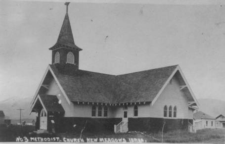
Caption for 98348: “The Methodist Church in New Meadows—year unknown, but probably around 1912? The building is still there and still in use.”
11-4-04
Before I continue with excerpts from the History of Meadows Valley magazine, I’ll make a couple comments. Reference is made in the following section about schools to the Middle District School. It stood north of Meadows, near what is now known as Cemetery Lane. That “lane” was the first road through the valley. Like many other roads of its day, it kept to the west-facing foothills to stay out of more soft and muddy ground and where it would dry or thaw faster.
The Middle District School mentioned here in 1945 is actually the second school built at the same location as an earlier school. It was a subject of discussion in one of our Meadows Valley Memories nights, and will be discussed in more depth at a future gathering. Although it is noted as still standing when the history “magazine” was written in 1945, it is no longer there. If I remember right, the schools up there were consolidated soon after this was written, and the school building was taken apart and used to build two local barns.
Bolin Abshire’s place is mentioned again—as a school location. This place sits right beside, and to the west of, the power substation east of New Meadows and south of the highway. The Bolin Abshire family lived on West Fork Road near Fruitvale until they moved to Meadows Valley in the late 1930s. Their place on West Fork was where Harold Hoxie lives now; it was the Tony Schwarz place for many years.
Schools in Meadows Valley—
The
high school district in Meadows Valley was bonded on March 21, 1924 when the first High School board were: Chairman, Jonathan McMahan;
Clark, Lee Highley, H.R. Ackley, Mrs. R.L. Campbell, Mrs. J.M. McCulley,
Mrs.
Emma Clark. The first superintendent was Joseph
Dilley, and
the assistant teacher was his wife, Miriam Dilley. The first
superintendent was
paid $1500 a year, and the assistant was paid $1300. The first high
school was
held in what is now Middle District grade school. Then it was moved to
Beaumont
Grade School, until the present high school building was built in 1939. [The
“present”
high school is now a church. It sits just east of the highway junction
at New Meadows.]
The Beaumont Grade School was built in 1911. Previous to this time there was no school in New Meadows. [This large, brick school in the north end of New Meadows is now apartments.]
The first school in Meadows Valley was a small one-room log cabin on Goose Greek, just across the road from Jack Iric's place. It was built in 1889 by some of the settlers. The first teacher was Mrs. William Campbell, mother of Harold Campbell.
The next school was held in a house out by Bolin Abshire's place. The teacher was Miss Florence Brown. Some of the students of this school were Mrs. C.C. Irwin, and the Clark brothers, Fred and Alfred. The Clark brothers rode horses, walked or skied about four miles to get to school. There was a certain trick played on Alfred Clark, but by popular demand it cannot be published.
Middle District was next, and for a while it was high school, grade school and all. It is the oldest school still in use in the valley.
We were unable to secure any information on the grade school at Old Meadows.
Cattle Raising Industry of Meadows Valley—
The Cattle Industry of Meadows Valley is the leading industry. Almost everybody who lives in the valley and owns any land owns some cattle, even if it is just a few milk cows. Then there are the bigger ranches that raise cattle to sell for beef in the fall of the year. The cattle raised in the valley at present are just the opposite type of their predecessors. The first cattle were tall, slim rangy type that never got fat enough to make good beef. The present type of cattle is short and chunky type which get fat quickly and are sold here or shipped to markets below, where they're sold in the sale ring by an auctioneer to the highest bidder.
The first cattle in
the
valley were owned by Carl White, which were the tall, slim
type. [I’m
assuming this name was supposed to be “Cal” White, and unless someone
lets me
know there was an early cowman named Carl White, I will correct this
in my
master copy.] The Circle C Ranch own the biggest herd of cattle in
the
valley at present, and have for a long time. They also own more land in
the
valley than anyone at present. Every fall there are several carloads of
cattle
shipped out of the valley to below markets by the cattle owners.
Information on
how many carloads were shipped this year was not made available.
Electricity—
Electricity was
first
brought into this valley by Mr. Chism and Ed Goodman, near the Keska
home, in
the year 1909. [A generator powered by Goose Creek.] Ross Krigbaum,
Thomas
Hendrick and John McCully bought the plant from Mr. Chism in 1911. They
built
the new plant above the Krigbaum home in 1911. The rates were quite
high, but
everyone in New Meadows and Old Meadows had electricity. The plant was
not
large enough to produce power for the ranches farther away.
In 1922, McCully bought out Thomas Hendrick and Ross
Krigbaum and ran it by himself until his death in 1942. It continued to
be
operated by Mrs. McCully's son. Harold Irick, until it was bought by the
Idaho
Power Company in 1948. Now that Idaho Power has taken over, the ranches
and
homes out in the country have electricity; also, the rates are lower.
The
power, however, is brought over the mountains from Long Valley, and the
old
power, plant is no longer in use.
The North and South
Highway—
The U.S. 95 North and South Highway was run through Meadows Valley in 1934 and was surfaced in the early spring, especially down the Salmon River, because of frost and swamp conditions. [“Surfacing” was a term used back then, meaning putting gravel on a road, not paving.] However, the highways are maintained, and improved each year. The highway runs north from here, down the Little Salmon River toward Grangeville, and southward down toward Weiser until it enters Washington [County]. It joins the S. 15 [now 55] here at New Meadows, which runs out through Old Meadows and on east toward McCall.
I’ll
have another segment of the magazine next week.
I need to correct a mistake from a while back. In the wide photo of the meadow where the Burnt Wagons monument is, my caption said it was looking east. The photo is actually looking west.
11-11-04
More from the “History of Meadows Valley” magazine put together by high school students in 1945.
The coming of the railroad—Quoted from the Meadows Eagle, December 28, 1911:
"The P. & I. N. depot at New Meadows is a model for neatness, convenience, and comfort. It is a two-story brick structure with stone trimmings. The lower floor is completely equipped for a modern depot, including electric lights, water and sewer connections, etc.
The upper floor is entirely used for the general offices of the Pacific & Idaho Northern. Each office is completely equipped with modern furniture used in railroad offices. The private office of Co. E. M. Heigho, the president, general manager, and the traffic manager of the P. I. N. Is very handsomely furnished in mahogany.
The other P. I. N, officials in New Meadows are Lee Highly, Chief engineer; R, J. Kennedy, assistant traffic manager; J. L. Soule, auditor; R.H. Williams, superintendent of transportation; A. H. O'Leary, superintendent of' maintenance; F.L. Miller., assistant secretary; Louis McLain, assistant treasurer; T.W. Foster, general master mechanic; E. A. Richard, store keeper; E.G. Dunn, agent; and Dr. Martin, Local Surgeon."
The railroad first came to New Meadows in 1911. This was also the year that the depot was built. The town of Meadows was started east of the present site of New Meadows about one mile. When the railroad came to Meadows Valley, it only came to the present site of New Meadows. The townsite was then moved down to New Meadows.
The company that first built the railroad to New Meadows was the Pacific & Idaho Northern. This railroad, however, sold out to the Union Pacific.
FOX FARMS
Sometime around 1924 a pair of foxes were brought to Meadows Valley. Unfortunately one of them escaped, and no increase was possible from this transportation until another mate could be secured, by which time other foxes were brought in. Then the unscrupulous promoters and inexperienced had to be eliminated, during which time quite a number of foxes were produced.
By 1928 there were a number of small fox farms in the valley, Jim Madison, Webster Curtis, Curt Harrington, Lafe Keener, C.C. Hargrove and the Smith family. Later a number of these were closed, and a new and modern Fox Ranch was built on Goose Creek, by H. C. Williamson and partner. The owners of this Ranch employed a man by the name of Claude Warr, who was a great lover of animals, and foxes became his favorite. The happy combination led to many good things for the foxes since he was almost constantly with them. He learned their language (yes foxes have what, amounts to a language) and went about his work constantly talking to the foxes and so gained their confidence. His understanding and influence became so great that the owner had microphones installed in the kennels and could then know by the way the mother foxes called to their little ones when all was not well with their family and would offer relief in case of distress to give aid to the very young pups. A maternity house was built and equipped with furniture invented on the spot.
In this house happened many things that men had never done before. Expectant mother foxes were brought in from 24-48 hours before the pups were to be born. They were weighed and placed in their little maternity houses till the moment came when professional help was needed, then they were taken to the delivery table. The pups were fed and weighed each morning until they were conditioned to be returned to the outside pens.
Short periods in the maternity house were 5 days, and the longest 33 days. During the operation of this maternity house, only one pup was lost, and he was destroyed by the mother. She was given two other pups who were raised to maturity.
From the record of this maternity house it was learned that fox pups gain 100% in weight in from 6-8 days, that they are very hardy, and if fed within the first hours after birth can stand great exposure and survive. A complete motion picture of the delivery of 6 pups was made, and is now in the hands of Dr. Thurston. Unfortunately this place had to be closed on account of shortage of labor during the war, but only needs the proper help and management to be restored.
This place was built from the sale of pelts, and cost $18,000.00 and shows a man can make a good living from fox farming. Some of the best-informed men in the fur business have stated that Meadows Valley is the best fur farm location in the northwestern states.
In 1945 there were still some
fox
farms in operation.
Caption for 95500.jpg:
“Curtis
Herrington with some of his foxes in the Meadows Valley, probably in the
1920s.
In the museum database, the name is spelled ‘Herrington, but in the
magazine it
is spelled Harrington; can someone tell me the correct spelling for that
particular person?”
11-18-04
More from the 1945 History of Meadows Valley.
Cattlemen’s Association—On January 7, 1914 the Cattlemen's Association of Meadows Valley was organized. Officers of the first year were President, John McMahan; First Vice President, Edward Osborn, and John A. Wilson was Secretary.
Officers in 1945 were S. J. Farrell, President; Ward Branstetter, Vice President; Rollie Campbell, Secretary-treasurer; Albert Campbell, Association representative; and Henry Clay and Howard Dryden were the advisory board members.
This association was started by J.A. Mitchell, W. H. Campbell, John McMahan, Edward Osborn, D. I. Royer, W. Branstetter, Henry Clay, C.A. Campbell, M.H. Dryden, Walter White, A. P, Krigbaum, E.D. Wallace, Ed Goodman, and Ota Becker.
The first meeting was held at John McMahan's residence, but changed to holding the meetings at the Forest Station in 1945. There were eighteen members the first year, and in 1945 there were ten members. They met once a year unless special meetings were called.
This organization has rubbed
poison weeds from range territory, built trails, built watering troughs,
built
drift fences, sowed grass seed, bought sheep allotment and added to
cattle
allotment. They offered rewards for conviction of theft of livestock.
They
became a member of the American Cattle Association.
Parent-Teacher’s
Association—In 1942 the PTA of New
Meadows was organized. The officers for the first year were Mrs. Reid
Soper,
President; and Mrs. Clifton Evans, Treasurer. There were thirty-nine
members
the first year and seventeen charter members. The organization was
sponsored by
Mrs. L. W. Buchholz who attended the P.T.A. convention. The present year of 1945 the officers were, Mr. Morin as President, Vice President
was Mrs. H. C. Rich as first and Mrs. Kinoff
as second, Mrs. Bower was the Secretary and Mrs. C.L. Buffaloe was Treasurer.
At the present there are 59 members and $232.93 in the treasury. In the second year the P.T.A. sponsored several High School parties. The school board, student body, and P.T.A. bought a nickelodeon for the high school. At that time the P.T.A. was making plans for improvements at the Grade School, including a fire Escape.
Ladies Aid—The Ladies Aid of Meadows Valley was organized in December 1926. Mrs. Byron Irwin was chairman of the first meeting, held at her home in New Meadows. The constitution and by-laws were written by Mrs. Mack. No record has been kept of the officers of the first year.
Officers of the organization then were Mrs. John Harm, President; Mrs.. Thomas Clauson, Vice President; Mrs. S.J. Farrell, Secretary; and Mrs. Carl Peterson was Treasurer.
Beginning in 1934 the members of the Ladies Aid Society made about 200 calls to the sick and shut in people. They collected clothing for the Children's Home, China Relief, Russian Relief, and European Relief. Mending and sewing was done for the Red Cross and the hospital, Approximately $4,100.00 was raised by the organization, and it was spent to pay $5.00 a month for ten years on the minister's salary. Drapes, decorations, new roof, piano, and a carpet was bought for the Church. Material, stove, rug, davenport, and chair, were bought for the parsonage. The labor was mostly donated. They made contributions to the Red Cross, Children's Home, Scout Building, War Fund, Council Hospital and people who lost their homes by fire. They gave gifts to the sick children and helped with the Christmas treats at Sunday School. They bought flowers for the sick and shut in. Less than $100 of this money had been sent to foreign missions.
There were about twenty-five
members the first year, and twenty-two in 1945; six of them were charter
members. There was about $50 in the treasury then.
They met at the home of the members. In August 1944 the name was changed from "Ladies Aid" to "Women's Society of Christian Service."
American Legion—The American Legion was organized and the national charter was granted by Congress in 1919. There are many American Legion branches in America, but American Legion Post 111 of Meadows Valley was organized in 1945, and thirty-five members joined the first year.
The officers of the first year were Mr. Swick as Commander, Mr. Noel Thomas as Adjutant and Secretary, and Mr. R.L. Cochran succeeded him as Commander for l945. At the end of 1945 there was $21 in the treasury.
The legion met the second Monday or the month in the R.P.L. Hall. It was started in France by Ouentin Roosevelt, the son to Theodore Roosevelt. It is the largest of the veteran's organizations. It had a membership of well over two million, and expected to have three and one half million by convention in the fall.
One thing of importance that was started by the American Legion Post 111 was the building of a hall for the Scouts of Meadows Valley. Other organizations helped, and now the Scouts own their own building. The American Legion encourages education by awarding a medal to the outstanding, boy and girl high school student each year.
11-25-04
Here is more of the history
of
Meadows Valley from the 1945 high school “magazine.” I shortened this
section
by leaving out long lists of names of those belonging to the various
organizations. After I finish this series, and correct any mistakes (if
anyone
contacts me with them), I plan to make the text of this magazine
available (for
reading or download) at the Council Valley Museum web site.
The Girl Scouts of Meadows
Valley
was first organized in 1937-1938. Their first leader was Mrs.
Samuel E.
Tyson, Assistant leader was Ruth Shobrook. Twenty girls registered the
first
year. In 1940 Mrs. Earl Miller was the leader. Thirty-eight girls
registered. In 1941 and 1942 There were
thirty-two girls registered,
and twelve Brownie Scouts.The year 1946, twenty-four girls scouts and
fourteen
Brownie Scouts were registered.
The Meadows Grange was
organized
October 4, 1933 with thirty charter members. The first year George S.
Mitchell
was the Master and Jenness Campbell was secretary. The first meeting
place was
at the I.O.O.F. Hall. The officers in 1945 were Bob Reumiser, Master;
Mrs. Ted
Clausen, secretary; and Mrs. W.E. Hanson was the treasurer. They met at
the
B.P.L. Hall. Then there were fifty members. It vas started by Mr. George
S.
Mitchell, Mrs. Harold Campbell, and Mr. Charles Wyman.
The Grange has always upheld
the
highest ideals for the Community and worked
to make this one of the best
communities. They bought salt, groceries, and coal for the benefit of
the
Grangers, and at the time were trying to secure the employment of a
County
Agent to help with various crops, live stock, and weed control.
In 1936 the Matron's Club was
organized. The Junior girls club started it, and it was an organization
for the
young married women. Thelma Abshire was treasurer for the first year.
Over
years they have done welfare work and donated to different causes.
At that time they had
$100 in their treasury. They met at the
homes of the members and at the B.P.L. Hall.
Wild Rose Rebekah Lodge No. 102 was organized March 8, 1911. At first there were eighteen members, and at present (l945) there are 114. Approximately $54 was in the treasury the first year, and in 1945 they had $340.87. It was started by the Odd Fellows and their wives. The meeting place was the I.O.O.F. Hall.
The Odd Follows Lodge was
organized on October 22, 1902.
The Women’s Club of the Meadows was organized in 1908 and federated in 1909. The colors of the second district were white and gold, and their flower was the Syringa. It was started by Mrs. C.B. Irwin, Mrs. A.B. Lucas, Mrs. J.E. Freeman, Mrs. G. S. Mitchell, Mrs. Caroline McMahan, Mrs. Orianna Hubbard, Mrs. McRea, Mrs. Morthias, Mrs. Adamson, Mrs. Gilbert, Ruth Mayo, Mrs. Bergh, Mrs. Turner, and Mrs. Jones. They met the first and the third Wednesday of each month. They held their regular meetings at different homes, and the special meetings were held at a hall.
The Club has not grown very much in the last few years. Many of the old members have passed on, some have moved on, others have organized another club called the Good Will Circle at Meadows, and some have joined in with the Boise Payette.
They have studied flower
culture,
had nature talks, world's fair side light, century of progress, history,
women
who have made history, public welfare, community betterment, Idaho
citizenship,
household hints, health, music, forestry, mining, Russia, impromptu
program by
post and teachers from 1883 to 1935 at teacher's reception. They have
organized
a Junior Club, had debates, and have studied the state capitol and
flower. They
have always donated to most worthy things, and have had splendid
meetings and
some grand times.
Mrs. J. A. Mitchell also said
that
at one meeting she had fifty club members at her home, and many times
Mr.
Mitchell hitched the horses up to the sled, and took a load of members
to some
club meeting before they had snow plows and town people had no way to
go. In
1934 there were 45 members.
The Ladies Auxiliary was
started
in 1934 at Cabarton, Idaho, and was then the Ladies Aid. Mrs. Flora
Morgan was
the first president. The membership was very small. After moving to
MacGregor
the membership grew to 25. Moving to New Meadows, there being a Ladies
Aid,
this organization was changed to the Boise Payette Auxiliary.
They help the Red Cross,
Children's Home, Community Hospital,, and Boy Scouts. Meetings are the
first
and third Thursdays of each month.
The Boy Scouts of Meadows Valley was reorganized February 29, 1943. Sponsoring the institutions were the Labor Union—1944, L.D.S. Church—1945, and the Odd Fellows Lodge—1946. They met each week at the Scout Hall. In 1945 twenty-six boys belonged, and it grew to eighteen members. Fourteen boys were first class scouts, and twelve were Star Scouts. They purchased eighteen uniforms. They also helped in all types of charity drives. There was also a strong Cub Scout organization.
The Labor Union of Boise Payette - Local A.F.L. #2733 has sponsored dances to raise money for the tuberculosis and infantile paralysis drives. They have given money to the Boy Scouts, and for school children's Christmas treats. They hold their meetings at the B.P.L. Hall.
Chamber of Commerce. This organization was started March 18, 1946. The first, meeting place was at LaFay's Hall. Mr. Evans and Mr. Crabtree started it. So far all they had accomplished was forming their organization and filling their committees for work.
The Good Will Circle was organized about 1935. At present there are about 20 members. They met every two weeks at the homes of members. They have painted, kalsomined, and put a new metal roof and new steps on the Old Meadows Church. They also furnished a room, and extra bed and numerous things for the hospital. They give to all charitable causes, and have done a great deal of good in the community. The ladies do quite a bit of sewing, and whenever anyone loses their home by fire, or any tragedy strikes, the Good Will Circle is one of the first organizations to give help.
The Rod and Gun Club of Meadows Valley was organized about thirty-four years ago.The year 1945 the officers were President Carl Shaver, Vice President Claude Buffalo, and Herb Fitz was the secretary. There were about one-hundred members then. They met at the I.0.0.F. Hall.
12-2-04
More on the history of
Meadows
Valley.
The Social life of old timers—Entertainment for the young people of the old times was very little and not often. Dances were held about every two weeks. They were not like those today because they lasted until daylight; they had fiddlers instead of an orchestra. They danced square dances, waltzes, mazurkas, polkas and others. George Clark and Pete Johnson were fiddlers for all occasions. The dance hall at Old Town was used for the dances.
There was a Literary Society which also helped entertain everyone. At these parties they sang, had readings read, debated various subjects. They took their basket lunches and ate after they were too tired to play any more games. Everyone, young and old, went to this Society.
During the winter, folks went
on
skis to parties and dances. Many times people from Round Valley came up
to
dances, and people from Meadows Valley went there. Christmas was
celebrated
with a dance and a tree. Christmas gifts were put on it for everyone.
July fourth, Independence
Day, was
celebrated at a grove east of Meadows. They had a speaker, had the
Declaration
of Independence read, and sang songs. They set tables and had basket
dinners.
Sometimes they took washtubs full of food. Everyone ate until there was
no more
to eat. Games were played, and egg races and foot races for the men and
boys
were enjoyed. To finish the night, a dance was held. Tickets cost $l.
The hotel
served a midnight supper at 50¢ a plate.
Horse racing and baseball games were enjoyed for a week at a time. People from Grangeville, Riggins, and other places came for the races. 'Tin Horn' gamblers came and purses were put up for the winning horse. The racetrack was located in back of the Loyal Campbell home.
The Riggins baseball team came up, and they and the Meadows team played their games by the week. Today we have basketball, football, baseball and other games at the High School gym.
Lumbering Industry In Meadows Valley—The first lumber mill in Meadows Valley was owned by George Clark. It was a small mill and was located near the Hot Springs. [I’m assuming this means Zim’s.] The Balbach Bros. owned two good sized mills. One was located near the Tommy Carr ranch. The other was located out on Mud Creek. This mill was the larger of the two mills.
The largest of the mills in the valley was the Cavette mill which was located where the shop is now located. [Anybody tell me what shop this refers to?] It had a dry kiln and a planer in it, which none of the other mills in the valley had. This mill burned about 1929. This mill was the last big lumber mill until Boise Payette Lumber Company moved to New Meadows in 1940. There have been other mills in the valley after the Cavette mill, but they were small mills. One of them was the Dryer's mill which is now located on the hill leaving the valley going toward Council.
The mills of the Boise Payette Lumber Company are located in Council and Emmett. April first, Jack Morgan took over the Boise Payette Lumber Company operations after having purchased it.
The Wiston Addition or the
Company's house is larger than New Meadows was before the Boise Payette
Lumber
Company took their houses from MacGregor and moved them here.
The lumber companies brought
money, social life and other benefits to the community. Also the lumber
company
has done a lot for New Meadows, and we hope that the
valley
will always prosper from it and other things.
[It’s hard to overstate how much the arrival of the Boise Payette Lumber Company changed New Meadows.]
12-9-04
The
1945 History of Meadows Valley included several articles copied from the
Meadows Eagle newspaper, a paper that did not exist for long and of
which there
are almost no copies remaining. The Idaho Historical Library has one
issue on
microfilm, and one or two people in Meadows Valley have a few original
pages
that will deteriorate and should be filmed for posterity. (Newspaper
paper will
not last forever, no mater what conservation measures are taken.)
One of the articles featured
from
the Meadows Eagle was about the beginnings of the Nez Perce War of 1877
just
north of Riggins —a subject about which I’ve written here several times.
The
following is about Elizabeth Osborn-Clay, who, for some reason is called
by her
middle name, “Katherine” here.
Meadows Eagle, 1911:
It is rare that one has the
opportunity of speaking to one of the pioneers of the country who has
passed
through one of the historic massacres of the state and hears the story
direct
from the lips of one who has suffered much at the hands of the
bloodthirsty
redskins.
Mrs. Katherine Clay, a fragile little brown-eyed woman about 65 years old, now living at Meadows, Idaho, had the terrible experience of seeing her husband and two friends murdered before her eyes by the Indians, and her four small children torn from her when she was carried away at this time, walking almost constantly for 24 hours, carrying a babe, only to meet the Indians, from whom she had been fleeing all this time and then compelled to walk for another 6 hours to reach a haven of safety, was enough to have killed or driven insane a less courageous and gritty woman.
Katherine Kline came over from Germany a mere slip of a girl with relatives, coming "round the Horn," and going in the spirit of adventure to the Warren Diggins in North Idaho. Here she married Mr. [William] Osborn, and after a short time spent at Warrens, they sold out their interests and went to the Salmon River Country. It was while living here on June 13, 1877 that Mrs. Osborn passed through the most horrible experience of her life. They were living at French Bar, what is now the town of Whitebird. The men of the family, Mrs. Clay says, were out helping the neighbors get in their hay when a messenger rode up and shouted that four men had been reported killed by the Indians on Slate Creek, not far away. The men were sent for, and Mr. Osborn and his brother-in-law, Harry Mason, commenced at once to arrange to get the people of the surrounding country together at the cabin of Old Man Baker, whose place was so built that it could be better fortified than any other cabin in the vicinity.
Mrs. Clay, then Mrs. Osborn, with her four children and Mrs. Walch, her neighbor, with two children, started with three men, Mr. Osborn, Mr. Mason and a man known as Big George for the Baker cabin. Having only three horses it was necessary that the children ride, and Mrs. Walch not being well, rode also, leaving Mrs. Osborn and the three men to walk.
Nervous, full of excitement, Mrs. Osborn darted ahead of the men all the way. Arriving at a creek so deep that they had to all use the horses to ford, Mrs. Osborn crossed first, and just as she came to the fence surrounding the Baker cabin, she spied the Indians. They at once commenced to fire, aiming high up. She sank to the ground and called to the rest of the party. Her husband reaching her, she pulled him down, taking the youngest child in her arms saying: "We might as well die together," believing it was their last moment on earth. In telling the story, Mrs. Osborn said, "The bullets were so thick that they seemed like snow." Dropping down as they did in the midst of the willows surrounding the Baker place. The Indians evidently lost sight of the party for they soon passed on to the Baker cabin.
After waiting a time the party cautiously crept up the creek to a shallow spot where they recrossed, this time on foot—the water coming to the waists of the women. It was necessary for the men to make six trips across the creek before they got the women and children all across. They had but one gun with them, and at this time but two cartridges left. One of the stray shots from the Indian's rifles had hit the little finger of Big George, who suffered intense pain.
To be continued next week.
12-16-04
Continuing the story of Elizabeth Osborn-Clay and the beginning of the Nez Perce War, quoting from the Meadows Eagle, 1911. Last week’s segment left off as Elizabeth, along with three men, Helen Walch and six children were trying to evade the Indians.
The little party left home at 2 o'clock the next morning. They held a council, and concluded the safest thing to do was to go down to Lewiston in a boat. At the store kept by Harry Mason, about a mile from the home of the Osborns, which was only a short distance from the present town of Whitebird, they knew they could get some boats. Arriving at the store they found that the Indians had been there and had stolen all of the whiskey and supplies. They started up to the Osborn home to get some supplies to take with them, and just as they reached the door of the cabin, Mrs. Osborn called out, "Here they come!" She being behind the party all this time, caught sight of a band of 18 braves winding down the hill, rods away.
At the alarm given by Mrs.
Osborn
the party at once hurried into the cabin, the women and children
crawling under
the bed. No sooner did the men bar the door than the Indians were upon
them,
and firing through the window. The first shot went directly through the
heart
of Mr. Osborn, who fell over dead not two feet from his wife. Other
shots
stunned both Mason and big George who was with the party. The Indians
then
started to burn the house, setting fire to one corner.
The women debated what they
should
do when they saw the fire, having apparently only two alternatives, that
of
being burned to death or tortured to death. Just then Big George, who
hard been
stunned by the shot which he had received, aroused himself and jumped on
the
bed to protect the defenseless women just as the Indians broke open the
door.
His brains were instantly blown out, and as Harry Mason raised his head,
he met
the same fate.
The two women and their six
helpless children were thus left to the mercy of the drink-crazed
redskins. In
telling of the horrible events of this awful day, Mrs. Osborn stated
that no a
child whimpered, even when the shots were fired. In spite of their long
journey, through every obstacle, and even going without food, they were
absolutely quiet.
When
the door was burst open, Chief Whitebird entered and assured the women
that he
intended to spare the women and children. In spite of his protests, they
were
treated shamefully, the chief seeming to have no influence over his
braves.
"They started to ransack the house," says Mrs. Osborn, “and I was so
nervous over all I had gone through that I was pretty sassy, I guess,
and
Whitebird Said, "You keep still; if you don't, I can't protect you."
The chief finally succeeded
in
getting the women and children out of the house, and they started for
the home
of Uncle John Woods, 12 miles way. On the way, they met Mr. Shoemaker,
who had
originally started with them in their flight from the Indians, but whom
they
had dropped behind at some point. Putting the youngest child of Mrs.
Osborn on
his back, he started ahead. He arrived first at the Woods home, where
both were
known, and was so stunned from the happenings of the day that he could
not tell
anything, and taking the little 2-year-old child on her lap, Mrs. Woods
learned
from it the full tragedy. "Pap shot dead, uncle dead, Indians shoot.
Momma
coming."
Mrs. Wood made out enough of
the
story to guess what had happened and her husband at once sent out a
friendly
Indian with the one horse they had, to meet the party.
Mrs. Osborn says that when
she saw
that friendly Indian, whom she had known before, coming on the Wood's
horse,
she fainted away. During all the horrors of the 24 hours she had kept
her
senses, but now that aid was in sight, she fainted.
The two families remained at
the
Woods home for six weeks when they went again to Warren's Diggings. Here
Mrs.
Osborn supported herself and children by taking in washing, the only
thing she
was able to do, and at the time she weighed only 84 pounds. About year
and a
half later she married Mr. Clay who died 19 years ago.
Mrs. Clay has lived to rear
six of
her eight children, to give them all a good education and to now enjoy
her old
age among her grandchildren. The terrible tragedy of the awful 13th of
June
1877, while still fresh in memory in its minutest detail, is now more
like a
horrible drama which she witnessed, rather than an actual happening of
real
life in which she played one of the star parts. Her home for some years
has
been at Meadows. She says that during the last six years she has lost
track of
Mrs. Walch, her companion of the tragedy.
12-23-04
Taken from the Meadows Eagle, Thursday, December 28, 1911:
"Nov. 17—It is estimated here
that the improvements in properties, business blocks, residences,
hotels,
school, etc., approximate $150.00 [sic], This is a wonderful
showing, in
view of the fact that the foundation for the $25,000 P. & I. N.
depot
practically the first building started in the new town, was put in only
a
little over a year ago. Most of the buildings here were built this year.
In
addition to having one of the finest depots in the state, New Meadows
will have
in Hotel Heigho, when completed in January, one of the finest hotels in
the
state. As a matter of fact, there are in Idaho at present only five
hotel
buildings that may be said to excel Hotel Heigho. This hostelry is
planned for
the accommodation of commercial travelers and tourists. The scenic
wonders of
this section of the state, the magnificent summer climate, the splendid
sports
that here offer themselves to the nimrod and hunter, are attracting the
tourist
and traveler to this part of the Gem State.
[The Hotel Heigho stood just
south
of the junction of Highways 95 and 55, and it faced west toward the
depot. The
hotel was a landmark in New Meadows, described as one of the finest
hotels in
Idaho, until it burned in
1929.]
Business District of New Meadows
The beautiful valley with its
30,000 acres of plow land, the millions of feet of tributary timber, the
rich
mineral resources made tributary by the P. & I. N. extension through
Long
Valley in the near future, are for the great development this town and
entire
surrounding territory.
Hotel Heigho, now under
course of
construction will be a 53-room hotel, the sixth finest in the State. It
is
built for the accommodation of
commercial travelers and tourists. This hotel will be
completed by the
first of the year and will cost $56,000.
New Meadows has the following
establishments:
Meyer & Metz [or Hetz?], $5000 store building; Howard & Loe, hardware dealers; Phil Hubbard, bakery; Mack Thompson occupies the upper floor with rooming house. Clarence LaFay, barbershop and I. N. Ripper's cigar and soft drink parlor, occupy the next building. The townsite building is next, and is occupied by W. H. Edwards' barbershop. Mr. Edwards lives upstairs. The Meadows Valley Bank is occupying temporary quarters next door. The Coeur d'Or building, owned by Mrs. Jo. Hancock, is occupied upstairs by herself as a rooming house. Below is the elite pool and billiard hall, owned by Percifield & Lond, formerly of Old Town. French & Dutcher, architects, have neat offices adjoining. Loe Brothers, general merchants, occupy the large building on the corner. To show that business is good in New Meadows, this firm made $1200 cash sales Saturday and Monday of last week, and their book account for the two days was $1200 more.
Howard & Howard's building comes next and is
occupied by
H. P. Shmitz's meat market.
Then
comes the Balbach building, occupied by the W. W. Donahue restaurant.
Opposite is the location of the $10,000 Meadows Valley Bank building, which is now under course of construction. J. H. Hill formerly of Nyssa, is the efficient cashier of this bank. The Dr. T. E. Martin Building is next, and is occupied in front by the New Meadows Post Office, James M. Hart being the postmaster. Dr. Martin has his office and residence in the rear. [It is really hard to determine where most of these businesses were, but I’m pretty sure the Meadows Valley bank mentioned as being under construction was the old brick IOOF building straight south of the present post office. I think I was told that Dr. Thurston had a clinic in the back part of this building until the late 1940s that he visited every week or so.]
Across the street is the Straight & Oldridge building used as card room, cigar, and confectionery and soft drink stand. The North side of this building is used by Mrs. H. B. Oldridge as a restaurant. The New Meadows Tribune occupies the next building with a splendid newspaper plant. Frank L. Roberts, formerly publisher and editor of the Payette Lakes Progress, is the publisher and editor of the Tribune. Balbach & Buiter are owners of the building. Mrs. M. M. Retch has millinery store in this building.
Before reaching the business district, the incoming traveler finds all the properties of the P. & I. N. railroad, of which Colonel E. M. Heigho is the president and general manager. The handsome depot, costing $25,000, is located here. The other P. & I. N. properties here are the freight station, car shops and round house, section house, tool house, large coal bins and stock yards. In this part of town is the Mitchell & Mathias forwarding house, where all freight for the interior points is handled. Opposite is Dryden & Sons livery stable.
I would like to thank Shirley Wing
for a very generous year-end donation to the
museum. Remember, Idaho gives a 50% tax credit for donations to
educational
organizations (museums are considered such) up to a total of $100, even
if you
don’t itemize.
12-30-04
I
thought you might enjoy a small break from the Meadows Valley theme, so
I’m
featuring a photo that might bring back a memory or two.
When I started school in 1958, the old school building that once sat about where Economy Roofing is now had just been condemned. The current grade school was still under construction, and kids were attending school in various buildings all over the area. The first few grades were put in the Legion Hall. First grade was in the basement at the south end. Erma Armacost was the teacher. Whenever I smell coal burning, it brings back memories of that time; a coal furnace evidently heated the building. (Or was it one nearby?) You don’t encounter that smell much these days. Once in a while, we were allowed to go across the street to the Pomona Hotel (shown at the right edge of the photo) to buy candy. I remember little wax bottles filled with a sweet liquid. I haven’t seen those in a while. If I remember correctly, we moved into the new school before it snowed that year.
Caption for photo: “The merry-go-round at the Legion Hall. This had to be 1958 or ’59. The kids are unidentified. The Pomona Hotel is at the right edge. I think Mr. & Mrs. Judd ran it about this time. The other building in the background was probably Carl Swanstrom’s law office at that time. If anyone can identify any of these kids, please let me know.”
Returning
to the History of Meadows Valley magazine, the following is the first
part of a
letter from George Mitchell, taken
from the
Meadows Eagle, Thursday, December 28, 1911:
Dear Sir: In response to your
request for a little write-up of my impression of Meadows and Meadows
Valley,
as seen from the inside; will say, that I can probably best do that by
giving
you a little narrative of my impressions, and what I have seen, as I
can, from
the time I came here down to the present time.
About twenty-four years ago, I came here, at that time just a mere boy, in company with my father and mother. I cannot say that my first impression of Meadows was very good, for like all youngsters I was pining for the companionship of my former playmates, but as is characteristic of the young, my memories of the young, my memories of former associates soon began to dim, and I found myself forming new acquaintances, now associates, and new ties which bound my heart to Meadows, and those ties and associations have grown stronger and stronger, with the passing years until today, Meadows Valley is to me, the dearest spot of all the earth.
At the time of my coming here the improvements and population of Meadows Valley were nothing as compared with what they are today. At that time the valley boasted but one painted house, in fact most of the homes were of the log cabin type, which is characteristic of the frontier. The land was practically all in its raw state, there was but little fencing, no roads, no town, no telephone service, and but once a week mail service. Those were some of the conditions confronting the early pioneers of this valley. With the nearest trading post sixty-five miles distant, the nearest physician the same distance away, and in order to reach this town one had to travel a road which our roads of the present time would be turnpikes in comparison, and with these same roads closed to travel throughout several months of the year from deep snow.
With such conditions as these which I have just portrayed prevailing, one may well say that it took men and women with stout hearts and strong convictions of the future development of this place, to endure the hardships and privation which were inevitable to the building of homes and starting the even meager improvements which were to grow and unfold into the grand proportions of what they are today. But even as many years ago as that, there were several who had proceeded us here and were busily engaged in the arduous task of carving out homes for the future.
To be continued next week.
2005
12-6-04
There was a photo mix up last week. Sorry about that. The picture with last week’s column was of a pioneer picnic that I’ll feature in the future.
Here is the second half of last week’s letter by George
Mitchell, taken from the Meadows Eagle,
Thursday,
December 28, 1911:
Perhaps there is no one thing, which is so clear an index of the progress of a community as the development of its schools. At the time that I came here, the whole valley maintained but one school, and that is the little old log structure which still stands at the lower edge of the town.
And there, many of the men and women who are now engaged in the active development of this valley received their educational training which fitted them for home building and good citizenship. But for the poor advantages for schooling which we had in those with but one teacher, which precluded the possibility of a graded system such as we have now, with our school house at the remote distance from many of the pupils, I am proud to say that all of those pupils are taking a position second to none in the development of this valley. Did I say all? No, for the Great Father has called some of those schoolmates home and are now peacefully sleeping in our little cemetery, while their souls have flown to a brighter and fairer land than ours, where trouble never comes and sorrow is unknown,
Such were the school
conditions in
those days. Today we have in our valley, and Price Valley which is
tributary to
this place, the schools ranging in cost of construction to twelve
thousand
dollars, in three of which the higher branches are being taught, and
employing
in all at the present time nine teachers, to which salaries are paid
amounting
to six hundred dollars per month. Some little progress in the way of
educational institutions eh? From one little school room with one
teacher to
our present facilities along the line.
The progress of our mail service has been a parallel one with our schools, as I have stated we had at the time I came here a weekly mail service, and one sack or possibly two was sufficient to hold all the mail that was brought in, but with our home development, our mail service was gradually increased from once a week to twice a week, and from that to three times a week. Now we felt pretty much as though we were beginning to amount to something when we were granted a mail service three times a week, but our progress was so rapid that we were soon granted daily service which we have enjoyed for some time past, and today there are dozens of sacks of mail unloaded at our office every morning, containing hundreds of pounds of mail and from our office mail is being sent out each day except Sunday to three points of the compass.
As with our schools and our mail, so has been the development of our lumber industries, from a little sash saw, with a capacity of about a thousand feet per day, to six mills with an aggregate capacity of hundreds of thousands of feet per day.
As to the development along
the
lines of agriculture, stock growing and kindred industries I feel myself
incompetent to wait, but suffice it to say, that it too, has kept pace
with the
line of progress of this splendid valley.
One of the most interesting things to me in the way of the development of our valley has been the birth and growth of our little town of Meadows from a post office and log hotel, to its present proportions. Mr. Calvin White earned the distinction of not only being one of the pioneers of this valley, but of also being the pioneer merchant of Meadows, and while the stock he carried was not large, it filled a long felt want, and many a poor devil was enabled to fill his haversack at his counter, and thus keep the wolf of hunger from the door, and at all times being able to meet the needs of the country.
The next in the line of merchants was Uncle John McMahan with M.E. Keizur, a close friend with whom I soon afterwards formed a partnership, a few years later the mercantile firm of Smith & Webb was brought into existence and sandwiched in between and following closely after the business enterprises which I have just mentioned came other needed business institutions such as our drug store newspaper, bank, hotels, feed and livery barn, blacksmith shops, etc., until today practically every avenue of business is well represented, with all the different, proprietors wearing that smile that won't rub off.
As to the beauties of the valley, the unparalleled resources which have brought about these wonderful developments, I will leave to a more able pen than mine to portray. But with our valley dotted with magnificent homes, fit for kings to dwell in, our people happy, prosperous, well clothed and fed, we may well say peace on earth, good will to men.
George S. Mitchell
Caption for photo: “This is the photo that should have been with last week’s column. It shows the merry-go-round at the Legion Hall. This had to be 1958 or ’59. The kids are unidentified. The Pomona Hotel is at the right edge. I think Mr. & Mrs. Judd ran it about this time. The other building in the background was probably Carl Swanstrom’s law office at that time. If anyone can identify any of these kids, please let me know.”
1-13-04
This is the last of the series from the History of Meadows Valley “magazine” first published in 1945. Near the end of the magazine was this dedication:
“We should like to dedicate this paper to those gallant pioneers of 60 years ago, who braved hardships, fought Indians, and died to make this lovely valley what it is today. We, the Journalism Class of 1946 and teacher, Mrs. Baker, do lovingly dedicate this volume to them. may everyone who reads the record of Meadows Valley, and the people who built our community, find enjoyment and inspiration. Forgive any errors we may have made, for we have done our best. Reprinted by Pep Club, 1967, Mrs. Louise Jones, advisor.”
Packer John Cabin—Takend from the Meadows Eagle, Dec. 23, 1911:
"Near the town of Meadows stands the famous log cabin in which two of the 'early territorial conventions were held during the formative period of the state's organizations as a body politic. In it first met the Republican convention of 1863 when Gov. Wallace was nominated for delegate in congress, and in it also met the state convention of 1864. It is a small one-roomed log building, erected in 1862 by John Welsh (known to fame as Packer John) and used by him to store merchandise in transit on pack horses from Lewiston, in northern Idaho, to Boise Basin, at that time celebrated as West Bannock, the richest mining region in southern Idaho. It was the popular stopping place for travelers and highly in favor with the early Argonauts as the Mountain House.”
“That it was well constructed is attested by the fact that it has stood in stress of sun and storm for almost fifty years. In fact it had been long overlooked and neglected until some two years ago, when the Women's Club of Meadows initiated a movement for its preservation. It then showed signs of decay and seemed in danger of falling into oblivion. The Women's Club rallied to its rescue and by interesting the legislature and secretary of the State Historical Society in its preservation have restored it to its pristine glory and insured its history from forgetfulness. Through the effort of the club and with the assistance of some of the men of the community, an appropriation was secured and the land whereon it stands purchased as a state park. The cabin was taken down, all decayed logs removed and replaced, with roof logs and a new covering of tamarack shakes put on. The floor was re-laid—two half windows put in, a quaint old door of pioneer architecture hung at the entrance with the peculiar long handmade wooden hinges of the first settlers who executed carpenter work with the ax and draw-shave. The proverbial latchstring provides the means of opening and locking the door and the whole made as near as way be a replica of the original. The stones of which the old fireplace was built were used in restoring the heating plant and the cabin made good for another fifty years. To suitably mark the structure, a bronze memorial tablet has been selected and in due course will be attached to the building with appropriate ceremonies.”
“There is probably no more
interesting historic building in the state than this, quaint, old Cabin
located
as it is at the foot of the picturesque range of mountains separating
Meadows
Valley from Long Valley and immediately on the first and oldest trail
between
the early mining camps of the territory. Now that the state owns it and
the
State Historical Society is caring for it, there is no doubt but it will
be
preserved for many years for the sons and daughters of the Commonwealth
to
enjoy.”
By 1879, the cabin was
already
described as being “in ruins.” I should note that it was also called the
“Goose
Creek Cabin” or “Goose Creek House” and was said to have been a “noted
hostelry” at one time.
It’s curious that this
article
doesn’t mention that Elizabeth Osborn Clay and her family lived in this
cabin
after her marriage to Tom Clay in 1880. As for it’s becoming the
property of
the Historical Society, the Sept. 30, 1909 Idaho Free Press said, “The
old
Packer John cabin, which stands on the banks of Goose creek at Meadows,
has
become the property of the State Historical Society and plans for its
preservation are being taken up. The historic old structure was owned by
John
Irick and donated to the society.”
According to an article in the Idaho State Historical Society’s files, for that 1909 restoration project, “A $500 appropriation to the State Historical Society provided funds for acquisition of this "old cabin as a state relic." A ten-acre site was purchased and fenced as well. The article continues, “The cabin was in good shape, although in the process of reconstruction it emerged with a new design quite different from the original. Packer John's Cabin became a state park by legislative designation, March 6, 1951. After Ponderosa State Park was created as a separate entity, Packer John’s Cabin site eventually was attached to that larger operation.
I
could have sworn that I read someplace that the cabin burned down at one
point
and was rebuilt, but I can’t find that reference now.
1-20-05
The winter of 1888-89 was as mild
one, with little snow. In Long Valley, settlement was just getting
started
(there were 150 to 200 residents), and the easy winter attracted a rush
new
homesteaders the following summer. People were so optimistic that they
even
planted fruit trees.
But
the
spring and summer of 1889 saw almost no rain. A severe drought hit the
entire
region. The Weiser River was lower than anyone could remember, and the
water
was warm. The Snake River
was so low at
Weiser that someone drove a wagon across it, and the water barely came
up past
the axles. The settlers in Long Valley were not able to put up much hay
for the
coming winter, but if winters were as short and mild as the one before,
they
weren’t worried.
Fires erupted in the tinder-dry
forrests that fall. The Weiser Leader, Sept 13, 1889 said that Frank
Harris
reported a big forest fire on the east side of “Galena mountain” near
the
headwaters of Hornet and Wildhorse Creeks. He said the fire was about
ten miles
in length and five to seven miles wide. A traveler out of Long Valley
wrote to
the Idaho World newspaper, “Following an old Indian trail up Big Creek
from
Long Valley, we struck the South Salmon…The forest fires have been
almost
everywhere, and I have seen thousands of millions of trees killed by the
fires
of this summer.” A week later, the same paper said that it had rained
around
Long Valley and hopefully put out some of the fires. But it also said
that 200
tons of hay had been destroyed by fires there. Both the rain and the
lack of
hay was an ominous sign of things to come.
By that December, the region may
already have had more snow than all the previous winter. And it just
kept
coming. By January there was three feet of snow in Long Valley, and
people were
happy to see it, even though it was accompanied by 20 below zero
temperatures.
The precipitation was very inconsistent. There was four feet of snow in Middle Valley (Midvale), six
inches in
Weiser, and three feet at Council.
Thirty feet was reported at Warren. At Bear and Cuprum, the snow
level
was at, or even below, normal.
By early February, the winter was
starting to wear on everyone. A report from Long Valley said, “We have
had a
very severe winter so far. Snow is twenty-eight inches deep. We have had
very
high winds and the snow is badly drifted, making it hard to keep the
roads open….Hay
is getting very scarce, and it looks as though the loss of stock will be
severe. Last winter was so mild and short that the people did not
prepare for a
winter like we are having.”
At the end of February, it looked
like winter was over. Rain, and a warm Chinook wind, melted much of the
snow.
Bare south-facing hillsides gave stockmen hope that their animals would
soon be
eating grass and not depend on the last scraps of hay that remained. In Long Valley, some horses had already
died,
not from starvation but exhaustion from pulling loads through
insufferable snow
depths. Cattle, however, had started to starve. Some ranchers
organized
to get their cattle to a better location. They somehow made a trench
through
seven-foot-deep snow over a four mile stretch to the Payette River and
drove
the cattle through it. From there, they took them down the river. Sleds
loaded
with hay brought enough nourishment to keep the cattle going. Just how
successful the effort was isn’t recorded. They may have gone over the
ridge
west of Smiths Ferry into Squaw Creek, which runs down to Ola and Sweet,
as
some other ranchers did that winter.
On April 5, just when it looked like
Long Valley had made it through the ordeal, the weather played a cruel
trick. A
snow storm hit that was worst than any that had come earlier. Supplies
couldn’t
make it into Long Valley and people ran low on food. Eventually the snow
melted, but rivers and creeks ran so high and the mud was so deep in
places
that some roads were impassible. It made freighting next to impossible,
but
some supplies did make it into the Valley and disaster was avoided. That
summer, a number of the settlers in Long Valley had had enough, and they
left
to find a less hostile climate.
In the Weiser River drainage that
spring, flooding was the worst in recorded history, with widespread
destruction
of roads, bridges, buildings, fences and livestock.
Caption for photo:
This is the picture
that
was mistakenly placed with my column a couple weeks ago. It shows a
group of
old time residents who had gathered for a pioneer picnic at Evergreen
Campground on July 29, 1956. The gathering started off with about 200
people,
but a rainstorm drove some away. Those remaining had their picture
taken.
Attendees at the 1956 Pioneer Picnic. Not all are identified, but the
following
are. Far left, Mr. and Mrs. Ellis Snow and Mr. and Mrs. Charley Ross of
Council; fourth from left. Jake Lafferty of Weiser, first supervisor of
Weiser
National Forest; next to him is Rev. Eunice Trumbo of Council; seated in
the
chair in the foreground is Mrs. Nettie McDowell, the oldest pioneer
attending;
kneeling next to her as Senator and Mrs. Herman Welker; behind the
Senator are
Mr. and Mrs. John Flynn, Mr. and Mrs. M. L. Canaan, Ivy Anderson, Mrs.
Earl
McMahan, Mrs. Bill Shearer and Mr. and Mrs. Knute Draper. At the right
of the
picture are Mr. and Mrs. Lawrence Nixon and Mr. and Mrs. Milo Wilkerson
of
Cambridge; Mr. and Mrs. Tom Holmes and children and Mr. and Mrs. Milton
Holmes
of Bear; Glen Welker of Council; and Mayor and Mrs. Frank Gwilliam and
Jerry
Wray of Weiser. Mayor Gwilliam, introduced Senator Welker, who was
principal
speaker. Standing on the car bumper in back is Robert Maxwell.
1-27-05
I’m very grateful to Barry McDaniel for loaning me an interesting letter written by Hazel Hubbard Branstetter in 1972 about her family’s journey West in 1910. The following is that letter, with my notes and comments within brackets [ ]. I have made a few corrections to spelling, punctuation and grammar. In some cases her handwriting was hard to read, so I may have a word or two wrong.
Mary and Hudson Hubbard came to Meadows Valley in 1908 because of the death of Harry Park, a brother to Mary Hubbard. She, being his only heir, came to finish proving up on his place, located on the west side of Meadows Valley, known as the “old Hubbard place.” While here, they stayed in the home of Henry Dreyer’s—parents of Hallie Dreyer. This house is still the home where Hallie lives today. After being here for six months, they liked the valley very much because it was so quiet and peaceful. They decided to go back to Tarrington, Wyoming and see their ranch and come to Idaho where the wind didn’t blow.
They sold the ranch and 200 head of Texas longhorn steers at $19.00 a head, the household furniture, etc, and began to prepare for our trip west. They fixed up 2 covered wagons and one top [tap?] buggy. They loaded up all our belongings that we could bring. One wagon was fixed with a built in mess cupboard in the back end, where all food, dishes, etc. were kept, with a door that was covered with oilcloth. When opened, it made the table to work on. We usually ate around the campfire.
One wagon was partitioned off in back with a small pen for the family dog and baby colt to ride when tired. There were my parents, Mary and Hudson Hubbard; grandparents, Thomas and Elizabeth Hubbard; one uncle, John Hubbard; a friend, Jim Bowie from Texas, and nine of us children: Clara, age 17; Ethel 14, Thomas and Hazel 9, Joe 7, George 6, Robert 5, William 3 and Marie 1 year and 4 months.
We left very early on a beautiful morning of June 21st, 1910, my father driving one wagon with 4 head of horses, my uncle John driving with 4 head of horses and my mother one with 2 head of horses pulling a wagon bed fixed with a set of bed springs on top, with a mattress on it for the little children to play or seep as we traveled. We had 2 saddle horses with which my grandparents drove the top buggy. Having 12 head of horses 1 colt and the family dog, we traveled from 15 to 20 miles a day, or some days until midnight, to where we could find water for the horses and a place to set up the tents.
Near Casper, Wyoming, when coming through a rocky gorge, five bandits rode out in front of us, wearing black masks and black hats. They ordered us to stop, holding guns in their hands, and said to get out of the wagons. One held a gun on us, and said, “Don’t move or I’ll shoot,” while the others raided our wagons, taking food, axes, a hatchet and one gun. Then they said, “Get going.” We were very scared of them, and left as fast as we could.
We met up with other caravans of wagons and people, and we traveled many miles together before parting, each to go his own direction. When we ran out of money, the men would hunt jobs on farms. We would camp for 2 weeks, and sometimes we hired out the horses also in the fields.
After coming over the great divide and into Idaho, we camped near Blackfoot, and planned to rest the horses for 2 days, do laundry and had located a patch of chokecherries to pick and make jam. We were all settled in the camp when all at once a bunch of 25 to 30 Indians on horses came riding up to our camp, yelling and riding around and around until finally the chief asked for some smoked meat, and other food. He then asked us to take care for a 9-year-old boy while they went and picked the chokecherries. They soon returned, taking the boy, and rode away.
To be continued next week.
This is encounter with Indians is very interesting. By 1910 all Indians had been remanded to reservations for at least a couple of decades. The ability for them to leave reservations was very controversial, and laws on the matter varied somewhat from state to state. Because government supplies of food was ridiculously inadequate I think most western states almost had to let Indians roam off the reservation to hunt and harvest berries, etc. Permits were often required, or sometimes even a military escort.
It was a terrible time for Native Americans; they were lost in a no-man’s-land between their familiar culture and a strange new world. It must have been like a stranger moving into your house, confining you to the basement, and then allowing you to come up to the partially demolished kitchen at night to scrounge for scraps of food.
Until after WWI, Indians were not even American citizens, so ironically as members of their own sovereign nations, they were treated more or less as foreigners. After the war, some of the Indians soldiers started thinking, “If I fought for this country, shouldn’t I be able to be a citizen?” Laws were soon passed to allow Indian veterans to become citizens. My impression is that the sovereign nation member versus U.S. citizen issue is still untidy.
I was unable to find much information about the post-reservation period from 1900 to 1920. I emailed Ken Swanson of the Idaho State Historical Society, and this was his response:
“There is very little research that I know of for Indian activities during that period. Relations were still very touchy. Many people, on both sides, were still alive who had taken part in the various conflicts. There was an incident in eastern Idaho, near Targee Pass about 1905-1910 where a group of ranchers killed a number of Indians after they reportedly stole a cow but I don't have good info on that incident. Over the years I have seen incidental accounts of Indians being preyed upon as late as 1915 in the West.”
I have to wonder if the Hubbards actually had much to fear from the Indians, but I can also understand how ingrained the fear of Indians was to people of that time and how intimidating this incident must have been. Cultural differences had to have played a part. As I wrote some time back, some traditional native mannerisms were—and still are—often misinterpreted as sullen or even hostile.
2-3-05
Continuing with the letter from Hazel Hubbard Branstetter about her family’s journey West in 1910. Last week, they had just had a frightening encounter with Indians.
We were so glad we had no trouble with them, but may father felt afraid they might return the next day. We decided to leave at 3 AM next morning. Coming over a mountain, looking down into a small valley we saw 50 to 70 Indian Teepees. We drove very slow and quiet so as not to arouse the dogs or people. We were very scared but made it OK.
We had many hardships and long dusty days getting to where we could find water and food and pasture for horses. We took our baths in creeks. They put hobbles on horses while they pastured. We were met at Evergreen, Idaho by Henry Dreyer, who drove a freight wagon between New Meadows and Evergreen every day. He escorted us to the valley on October 31, 1910 after dark. I will never forget seeing that first light in New Meadows as we came over the hill. I still think of it every time I see it at night.
[I’m pretty sure the Dreyer place was the old squared-log house beside the highway on the right just before you come into New Meadows from the west.]
We were so happy to know our journey was completed. Mrs. Dreyer had a bountiful supper ready for us, and huckleberry pie, which was the first I had tasted. Five of us children entered school in New Meadows in an old store building owned by Ed Kaiser until the Beaumont school was finished. Oreanna Hubbard was my teacher in the 3rd grade. We finished all 8 grades at Beaumont. At that time there was no high school here. There are only 3 of the Hubbards living today who made the trip. Hazel, Joe and William. Chester was born on the “old Hubbard place.” I have lived here for 62 years. There have been many changes in the valley and so much of the beautiful timber has been logged out.
My grandfather was born in Lincolnshire England on April 13, 1829. He was 19 when he came to the United States. He drove a buckboard team of mules from the east across the plains states to Nebraska. He later met Elizabeth Minshall and married, then moved to Tarrington, Wyoming and then to Idaho. My Uncle John Hubbard worked on the railroad in New Meadows. He fell from top of a freight car and hit a pile of rocks near Mud Creek and died on Sept. 23, 1916.
This summer, from June 17 to July 23, the Adams County Historical Society will he hosting the Smithsonian’s “Barn Again” exhibit about American barns—their design, purpose, history and the fact that we are losing so many. It will one of only six places in the state to do this, and it is quite an honor. The exhibit will be in the old P&IN depot, and will feature contributions from local communities. This spring I hope to gather photos of, and stories about, historic barns in the Council area. Others will be undertaking similar projects in Long Valley and any other local communities that want to participate. If you have an old barn, or even one that is not so old but has a unique design or story behind it, start thinking about organizing some photos and information about it. I’m looking forward to hearing from you.
Speaking of projects, here’s one that’s in the works right now. Don Dopf and I are working on another railroad book. This one is about the Idaho Northern Railway that ran from Murphy to Nampa and to McCall. We are looking for interesting photos, stories, names of employees who worked on the line, and interesting historic places along the line. I have dug up some fascinating stories already, and will very probably feature a couple in this column.
On another note, Alice Deeds tells me that three of the boys in the old picture of the merry-go-round at the Legion Hall are her sons.
2-10-05
Since
there
has been a lot of news and discussion of the Emmett to Indian Valley
highway proposal lately, I thought I would revisit the subject. The
Statesman
said this idea is at least 50 years old; I think it is significantly
older than
that. In any case, Indians undoubtedly used the route for centuries
before
Lewis and Clark came west.
The first recorded travel on this
route was in 1862 when Tom Goodale led a group of about 60 wagons from
the
present-day Boise area across the lower Payette River Valley and on
north. He
was looking for another of his famous Oregon Trail shortcuts, so he went
north
from what is now Emmett along a route that must have somewhat resembled
the
proposed highway route. Dunham Wright and his buddies took off for
Florence
from this wagon train and abandoned their wagons at Burnt Wagon Basin.
Although Goodale’s route never
became a popular Oregon Trail route, it was used heavily for a few years
after
that as a trail for fortune seekers coming east from Oregon during the
Boise
Basin gold rush.
When a mail route was established to
Indian Valley and on to Warren in 1874, it followed an existing trail
from
Emmett to Indian Valley. By 1877 the Statesman said this Emmett-Indian
Valley
route could be traveled by a 75-mile wagon road. It didn’t take much to
qualify
as a “wagon road” back then. It was probably what we would call a
four-wheel-drive
road in many places.
In 1889 there was talk of a slightly
different route, from Weiser, through “Paddock Valley” and Crane creek
to
Indian valley. The goal
was to avoid
the Midvale Hill.
The first real
action on an Indian Valley-Emmett road was started in 1950 when Adams
County
made plans for a gravel-surface road. At the time, there was a road
along at
least part of this route, but it was a very poor one—probably the one
mentioned
in 1877. The June 30, 1950 Adams County Leader said the road, "...has
been
a long cherished dream of a generation of people."
"The road will follow the old pioneer
trail first established in the early mining days when Warren and Florence
Camps
were active. The route is so
direct and
the total absence of engineering problems made it a natural route where
the
pioneer wagon trains could be taken through without any preparations. One pioneer of Adams County
relates that he
has driven a team of horses from Indian Valley to Emmett in a day." This
is interesting, considering it took two days for a wagon to reach Weiser
from
Council in the 1880s.
Lewis Daniels was a county commissioner at the time, and
construction finally got started about 1952. Logging contractor, Gordon
MacGregor, furnished the equipment at no cost to the county, and the
county
paid his employees and supplied the fuel. Henry Daniels remembers
helping to
survey the road; he was just out of high school at the time. He said it
was one
of the few roads ever surveyed one day and driven on the next; that’s
how fast
MacGregor’s men were working behind them. Washington and Gem Counties
also
worked on the road in their counties at that time to build it all the
way to
Emmett.
Lewis Daniels was convinced that there would be a paved
highway
through there within four years. Some of the same arguments were made
against
this as are being made now—primarily objections from towns along Highway
95
that would be bypassed. People back then didn’t have much concept of
environmental consequences, and as far as quality of life, they were
still in
the “more people is better” mindset.
Construction of this 1952 road motivated Washington
County to
gravel the roads in the Crane Creek area. Before that, the roads were
often
impassible in the winter or early spring, which was hard on the ranchers
out
there.
The present road between Emmett and Indian Valley is a
fairly good
gravel road, and it does save quite a few miles on a trip to Emmett, but
it is
very winding is some places. I timed it once, and if I remember right,
it took
almost exactly the same amount of time to go that route to Emmett or
around
through Payette. If you didn’t grow up driving on gravel roads, or if
you have
more sense than I do, it might take you longer to go the Crane Creek
way.
The debate about a four-lane highway between Emmett and Indian Valley will be a turbulent one. One thing is certain—if such a highway is built, it will significantly change life here. Be careful what you wish for.
2-17-05
Some time ago, Larry Smith gave me a photocopy a handwritten manuscript by his great, great grandmother, Mary Elizabeth Turner Rhett. She had some memories and stories about the beginning of the Nez Perce War and other events. Her account of the beginning of the war is second hand from her mother, and her mother was only seven at the time. Even so, her account seems to be fairly consistent with other accounts. The personal memories of family members add interesting details to the story.
-----------
My dad married a Swiss Italian woman, and they had five children: Harold Percey, Daisy Elizabeth, Laura Belle, Walter Dale and Victory Wayne. Walter Dale was killed in the Battle of the Bulge when the Germans took their guns away from them and shot the prisoners in cold blood.
My mother was born Feb. 20, 1870 at Slate Creek. When she was seven, the three young Indians who were starting the 1877 Indian War came to the house and bought a loaf of bread from my grandmother. Grandma always treated the Indians with respect and if a papoose was sick, she would go and do what she could to make it well. So no Indians would touch a thing on her place. The three young bucks, one was the son of the man that Larry Ott killed and took his property. The whites would not punish Larry Ott so it was the cause of the Indian War as much as because the government was going to put the Indians on a reservation.
The three young men, full of white man’s whiskey, rode up the main Salmon River to the cabin of Dick Devine and killed him, then turned back down the river and stopped at the Elfers place and killed the three men who were working in the hay field and went on back to where the Indians were camped at Tolo Lake.
An Indian family by the name of Moses lived on the Slippy Creek place and raised cattle. One of the young women called Tolo came to my grandmother’s place and took the stallion out of the barn—he was the only horse not out in the fields—and rode to Florence to warn the people that the Indians had declared war. At that time there were many miners and other people living in Florence. The stallion died from the effect of such a hard ride. People gathered into my grandmother’s stone cellar and wer cooped up there for over two weeks until the U.S. soldiers drove the Indians out of Salmon River. Many people were killed and the Indians started to go on their trek to Montana.
Tolo was afraid her people would kill her because she had warned the white people. She stayed at my mother’s house for quite some time. Every time my mother would cry from hunger, people would tell her the Indians would cut off her tongue. She took care of Mrs. Brushe and the children until Mrs. Brushe married Mr. Hadorn and moved across the river from the Robie Ranch.
There were a lot of Chinese mining in tunnels across the river from the Rhett Ranch. They lived in a store building on the north side of Slate Creek. Grandma sold lots of milk, eggs and vegetables to the Chinese. By that time my grandfather had left and gone to Montana. He had studied to be a doctor and had gone to college with William McKinley. It seems he was quite wild when young. He could not leave young girls alone, so he was a drop out from college before he received his doctor’s license. My grandmother was barely fifteen when she married grandpa. Her father was John Turner who brought his family to the Willamette Valley in 1853 and settled on a ranch near Albany, Oregon. The people built a tabernacle to his memory and named the town Turner Station. He was 113 years old when he died. Grandpa planted a black walnut tree at the Rhett Ranch at Slate Creek, which is an immense tree now. The Rhett brand was R on the left side.
Grandma went to help anyone who was sick, white or Indian, so her neighbors said she must be part Indian or she would not be such a friend to them. How mistaken can people be? Some of the finest people I ever knew were pure Nez Perce Indian. Chief Yellow Bull stayed at my house one night, but would not sleep in a bed. I had to put a mattress on the floor. His wife would not let him eat all the pancakes he wanted at breakfast. She said it would make him sick. He was near 100 years old then. He mourned for the fate of his people who loved the white man’s whiskey and were too easy to the white man’s blandishments.
The best 1877 Indian War story was written by Will Henry. It is the nearest to the true history of the happenings of that time. The name of the book is “From Where the Sun Now Stands.”
I was going home for Christmas holidays in 1913. I was going to school in White Bird at the time. The train going up the Clearwater was packed. No one offered me a place to sit until an Indian got up and gave me his seat. I love a gentleman!
While going to high school in White Bird some one set the school house afire. It burned down. Larry Ott lived in a cabin next to the school house, so it burned too. My mother always hated Larry Ott because he had killed an Indian and stole his home, causing the murdered man’s son to get full of white man’s whiskey and, with two more teenagers, started the 1877 Indian War. The Indians were camped at Tolo Lake and they had decided to go on the reservation with no fuss, but the government had given Joseph’s tribe the right to the Oregon grounds they occupied, then reneged on the promise. It was all a dirty business. Then when the drunken boys started the killings, the Indians decided they could do nothing but go to war.
After the school house burned, school was held in the new Methodist Church across the street from the Glatigny home where I lived. I started to go to a neighbor’s house to study Latin with a friend when I saw a flickering light under the church. I ran over and found that some on had stacked a lot of shavings and pieces of wood in a pile and set it afire. I ran to the parsonage and got a pail of water and ran under the church and threw the water on the fire. I returned to the parsonage for more water. I don’t remember how many pails of water it took to put out the fire. Then I went to my friend’s house to study Latin and told them what had happened. I heard the rocks roll on the hill back of the church while I was trying to put the fire out. So I almost caught the arsonist in the act of setting the fire.
There was quite and article in the paper about my courage. They said I might have been killed. I never thought of it. People came to Glatigny’s to compliment me for what I did, but I refused to be carried through town on the shoulders of some of my school companions the next morning at school. To me it was all in a day’s work. If anybody wishes to look up the paper, Free Press for 1912. I don’t remember the month, but it was in the fall. I don’t even remember if it was in Woodard’s White Bird paper or the Free Press that the article about me was printed.
2-24-05
The practice by railroads of bypassing existing towns to start a new one happened so frequently that it could almost be considered standard practice. For the Union Pacific Railroad in southern Idaho, the man in charge of killing and creating towns was Robert Strahorn.
As I noted in the P&IN book, when the Union Pacific pulled this stunt on Weiser in 1884, the editor of the Weiser newspaper called Strahorn the "general manager and chief schemer (sic) and trickster" for the Idaho & Oregon Land Improvement Co., and said, "Lying, scheming (sic) and misrepresentations have characterized all of Strahorn's dealings with the people."
Robert Strahorn had been a newspaper correspondent covering the Indian wars along the Powder River before being put in charge of publicity for the Union Pacific Railroad. To the unsuspecting reader, his guidebooks full of the romance of Western settlement seemed to come from an objective observer, but the books were in fact nothing more than UP advertisements to sell the thousands of acres in land the government had given the railroad. In 1881, Strahorn’s booklet, “Resources and Attractions of Idaho Territory” was published by the Idaho legislature, but was secretly funded by Union Pacific. It contained his typical hyperbole: “the healthiest climate in America, if not the world . . .the richest ores known in the history of mining . . . luxuriant crops , emerald or golden, trees blossom, and the perfume-laden, or bending to earth with their lavish fruitage.”
By the time the Union Pacific was building the Oregon Short Line across southern Idaho to Portland in 1883, Strahorn had become general manager of the Idaho and Oregon Land Improvement Company—an organization that was ostensibly independent of the railroad, but from which railroad officials and certain privileged insiders reaped windfall profits. Strahorn could basically put a branch line or a depot anyplace he wanted, and where he wanted was where it made him and/or the Improvement Company the most money.
As the OSL crept toward Boise and Weiser, the Treasure Valley was buzzing with speculation as to where the tracks would cross the Boise River. Boise was the largest city in the state, and residents assumed their town would be a prominent spot along this major transcontinental line. In the spring of 1883, Strahorn bought a ranch north of Boise, and then made sure the news of his purchase leaked out. Boiseans snapped up thousands of acres near Strahorn’s, confident they were in on the secret location of the railroad route. Strahorn even sold parts of the ranch at a handsome profit before announcing the actual route for the OSL that didn’t even come close to Boise. The town almost rioted. A mob hung him in effigy and promised to do so for real if they ever got their hands on him.
The rails were laid several miles south and west of Boise. Strahorn’s choice for a Boise River crossing was at a new town named Caldwell that he created on land at least partially owned by his Idaho and Oregon Land Improvement Company. A similar story was repeated numerous times, at Weiser, Hailey, Mountain Home, Payette and other locations, and made the company’s investors very rich men.
When branch lines extended from the main OSL tracks, this real estate game was imitated by the Pacific & Idaho Northern up the Weiser River, killing Salubria and Meadows, and creating Cambridge and New Meadows. Along the Payette River, the Idaho Northern Railway killed Van Wyck, Crawford, Thunder City and Roseberry, replacing them with Cascade and Donnelly, and it and tried to replace McCall with a town named Lakeport about a mile north of McCall.
If it happened this many times in just one little corner of Idaho, one can imagine the amount of devastation and deceitful dollars this practice created across the entire West.
3-3-05
Last summer I started to take items from 1951 and 1951 Adams County Leaders to share with you. It’s always fun to pull out the old newspapers, and since I don’t have any other brilliant ideas to write about, here goes.
Adams County Leader, February 8, 1952: Everett Woods died. He was a lifetime resident of Council. Born at Goodrich.
February 15: “Mrs. Hez Petty and baby arrived home from the hospital.” [Carol?]
February 22: “The Council high school Lumberjacks defeated Cascade high school 56-41 to win the Long Pin League basketball championship last Friday evening. Dick Hancock, Council guard, led the scoring with 19 points.” Funeral services were held for Jerry Dee McGahey, age 8, son of Mr. & Mrs. O.E. McGahey. Eileen Garver and Gene Nelson were married Feb. 12
March 7: The Fruitvale Cattle & Horse Association held their annual meeting at the Forest Service office. Members present were Isaac Glenn, Fred Glenn, E.F. Fisk, Everett Ryals, Melvin Ryals, Harvey Harrington and Fred Yantis. The Forest Ranger was Duff Ross. The Cuddy Mountain Cattle Association held their annual meeting the same day. The association’s president was Bill Hanson. Other members present were Ed Schroff, Bill Schmid, Ed Shannon, Art Thorpe, Fred Jewell, Verna Harrington, John Harrington, Glen Gallant, Mrs. Frieda Gallant, Bob Kampeter, Bill Kampeter, I.E. Robertson, Babe Thomas, Victor Oling, Harvey Harrington, R.H. Stover, Alvin Craig and Clarence Gibbs.
March 14: “Eddie Ludwig, Indian Valley pitching ace, left last week by air for St. Petersburg Fla., for spring training with the St. Louis Cardinals. Eddie, who performed with the Cardinal Class A club in the South Atlantic (Sally) league last season, has signed a contract with Columbus Ohio, of the Triple A American association this year.” The Leader called Eddie a “20 year old former Cambridge high school star.” “Eddie turned professional soon after his graduation from Cambridge high school in the spring of 1950. He was assigned to Pocatello of the Cardinal system in late June and finished the Pioneer league season with a record of nine wins and four losses. Promoted to the Sally league last year, Ludwig won 11 and lost 10 for Columbus, Ga. Most impressive, though, was his record of allowing an average of only 2.98 earned runs in each game he pitched. In 224 innings on the mound the Indian Valley hurler issued 140 strikeouts and walked 90, many of which were intentional walks.”
Council’s basketball team placed second in the district.
March 21: The Meadows Valley Cattle Association held its annual meeting. Officers were Jake Farrell, Ward Branstetter, Warren Osborn, Howard Dryden, Rollie Campbell and Bill Dryden.
A fire broke out in the boiler room at the Boise Payette mill at Council. “The blaze was believed to have started when a spark from the furnace caught fire to some saw dust in the rafters. Most of the rafters and other wooden structure inside the building were burned, although most of the equipment went undamaged. The fire did not spread to any of the surrounding buildings, mostly because of the metal roof and walls of the room.
April 4: The first services will be held in the new Congregational Church, which has been under construction for the past two years, on Easter Sunday. “It is planned to have a small balcony over the entrance which will be a class room and a family room for funerals or for a choir. A small room, which is the second floor of the tower, leads off this balcony and can be used as a pastor’s study or classroom. Since the construction has been governed entirely by available funds, the balcony as well as the steeple will not be built until more money is available.”
“Especial note should be taken of the beautiful stained glass windows which give added reverence to the sanctuary Some years ago, the congregation felt the need of rebuilding or doing extensive repairs. Frank Galey sr. was visiting his relatives, the Mellons, at Pittsburgh soon after, and as the church in which they worshipped was being torn down for a new church, Mr. Galey suggested that the windows might be useful for us. Mr. Tom Mellon was at once interested and after some correspondence, sent ten of their smaller windows to Council. The war halted building and the windows were stored in the basement of the court house, but when it began to look possible to build, the committee brought the windows from their hiding and made the measurements fit in to their use.”
“A light airplane flying through a snowstorm crashed in a narrow canyon about 9 miles north of Council, near the Otto Bodmer ranch Wednesday morning about 11 AM killing David Young, a passenger, and seriously injuring Braden E. Crawford, pilot of the ship.” Both men were pinned in the wreckage. The plane was spotted from the air “after a report was received from Alton Stover, who with his father, Lawrence Stover, have a ranch adjacent to the crash site, that an airplane had passed over the ranch at 11 AM flying in a snowstorm and that the sound of the motor had stopped suddenly. Stover, however, did not hear any noise of a crash….” “It appeared that the plane had come almost ‘straight down’ because no trees were sheared off.” [The plane crashed in Trial Gulch. The Stover ranch was northeast of where the pond is now at Glendale.]
Jane Shaw died.
3-10-05
ACL, April 18, 1952:
Council High School has the biggest graduating class in its history—31.
Graduates listed: Alma Averill, Janet Perkins, Sharon Wright, Orr Fay Reed, Dolly Hiroo, Edith Clelland, Thomas Wortman, Edna Wikoff Addington, Sidney Fry, Joan Lane, Fayth Newcomb, Loraine Waggoner, Pat Moore, John Williams and Dixie Stover, Lillian Morris, Frank Smith, Dauna Shaw, Jeanny Hand, Bill Avery, Francis Bower, June Stewart Fry, Dorothy Heathco, Darrell Holbrook, Helen Hoxie, Alta Francis, Colleen Jacobs, George Green, Eddy Mauzy, Henry Daniels and Lilly Bisbee. [There is a photo of this class on the wall at the High School.]
MEN ESCAPE DROWNING
“Albert Campbell of New Meadows and W. L. Grover, jr. of Pine Valley, Oregon, narrowly escaped drowning in Snake river Wednesday when the Brownlee ferry swamped and sunk near the Idaho side.
“The following account of the accident was given by Lee Alexander,
who
received his information from
people along the river while he and Mrs.
Alexander
were in that area,
returning from a visit to the
Ox Bow plant of Idaho Power on the river.
“Clark Childers of
Pine
Valley, Ore., had been feeding Albert
Campbell's cattle the past
winter. Mr. Campbell,
assisted by W. L. Grover,
jr., were transporting the herd to the Idaho side of the river
Wednesday and had hauled three loads
across and were returning
empty to the Oregon side for
their fourth load when one of
the spokes in the windless
broke, allowing the wheel to turn
free. The spinning windless struck
Mr. Campbell several
times, bruising him severely, and the free turning windless allowed the ferry to turn crosswise of the current. This caused the open pontoons of
the ferry to dip water on the
upstream
side and the strong current tipped it up sideways, filling the pontoons and
causing
the ferry to sink.
“As the ferry sank, the men grabbed two large planks that were used in transporting cars on the ferry, as the river carried them down stream. Soon a gate panel floated by and Mr. Grover climbed aboard that. As the men drifted down the river they drifted apart. Mr. Campbell was rescued by one of is employees, Don Whiteley, near the Bear Valley ranch about a mile down the river from the ferry on the Idaho side. Mr. Whiteley saw the accident and drove down to the Bear Valley ranch. Mr. Campbell arrived there and was in a whirlpool. A rope was thrown to Mr. Campbell, but he was too weak to hold it. Mr. Campbell went under, and when he came up a second rope was thrown to him. This time he was able to wrap it around his wrist and was pulled out.
“Mr. Grover drifted to the Oregon side of the river and was rescued by A. D. Robinette who had witnessed the accident while he sat in his car watching the men ferry the cattle across the river. Mr. Robinette drove down the river about 1 1/4 mile where he knew there was a boat, summoned help and went to the rescue in the boat. Both men were near exhaustion when rescued.
“Mr. Alexander said that the river was very high and the men were very fortunate to have been rescued when they were, as there are rapids a little further down the river which would have surely spelled disaster.
“Mr. Campbell was taken to the Community hospital, where it was found that he had no broken bones and where he was treated for exposure and bruises.
“Mr. Alexander reported that the ferry was still hanging to the guide cable Sunday when he was there, but that the sunken boat had pulled the cable into the water and that since then it had been reported that the ferry had broke loose and sunk to the bottom.”
“Sgt Jim Leslie, son of Mr. and Mrs. Dwight Leslie, arrived home Sunday from the East coast. Jimmy, who is in the U.S. Army, has been stationed in Germany the past 3 years. He has a 30-day furlough after which he has to report at Spokane, Wn. to be discharged.”
Minte Stutsman Ross died in Praire City, Oregon—wife of James M. Ross. Raised on Hornet Creek.
3-17-05
Bob Hagar sent me a story that was printed in the Denver Post newspaper in 1930. The Albert Hagar family lived about where the Coleman apartments are today, on South Fairfield Street.
“A Horned Owl by Teddy Hagar (Council, Idaho)”
“While on a duck hunting trip last autumn, my father shot a great horned owl, but only stunned him, so he was able to bring the bird home alive. As he was not badly hurt we decided to keep him for a pet, and he has become one of the most interesting pets we ever had. We named him Barney Google.”
“During the winter we kept him in a shed, and in the spring made him a house with a perch. We put a soft strap around his leg and fastened it with a long, fine chain to the perch. We fed him mice, gophers, ground squirrels and sparrows which we trapped for him. He liked the mice best and would swallow them whole.”
“We found that Barney could see just as well in the daytime as he could at night. His hearing was wonderfully keen, and he would turn his head at the slightest unusual sound. One day he kept craning his neck and looking up in the sky. For a while none of us could see or hear anything unusual until finally an airplane appeared, flying quite high. And no matter how high a hawk or and eagle would soar over our yard, Barney always would see it. He could turn his head squarely about and look straight in back of him or scratch the middle of his back with his bill.”
“Last week when the weather began to get warm, my sister and I felt sorry for Barney and turned him loose. He stayed with us one night and a day after that before he flew away. We hope he will enjoy his freedom and always find good hunting.”
Bob said, “I recall someone saying that a few days after they released the owl, Mrs. Carr—at her place up by the water tank on the hill—was chasing away some big owl that was after her chickens.”
A few more items from the 1952 Adams County Leaders:
April 25, 1952—“Born to Mr. and Mrs. Leslie Bowman of Council, a son on April 23, 1952” [Larry] The home of Mr. and Mrs. A.P. Thomas of Hornet Creek was destroyed by fire.
May 2, 1952—
“Mr. and Mrs. Dick Fisk of Fruitvale
are the parents of a son born April 26.”[Dale]
Andy Clelland bought the Council Meat Market from Clarence
Schroff, and
changed the name to the Council Food Market. “He will give up possession
of the
Wayside Drive Inn, in the near future.”
May 9, 1952—
At bottom of front page in large
print: “Dedication Dance—May 17th For New Council City Hall”
May 16, 1952—“Barr
Jacobs, president of the Adams County Fair and Rodeo board….”
May 23, 1952—Born to
Dr.
and Mrs. John Edwards, a girl, May 20 [Joyce]
Fire
at Shady Rest Cabin Camp—little damage. [The office was in the log
building on
Hwy 95 (N. Dartmouth) just north of 1st Ave. on the west side of the
Hwy, where
Mary Crosby had her floral shop.] A bond election passed to fund a new
water
well for Council. Not more than $15,000. Edith Clelland married Sgt.
William S.
Hover in Boise.
May 30, 1952—Nelma
Glenn
and Lottie Burt were selected as representatives to Girl’s State at
Pocatello. “Ralph Finn and
Hank Winkler
were down near Eagle Bar this week to look over some mining claims
belonging to
Mr. Finn. While there they also did a little fishing, catching a 6 ft.
sturgeon
which weighed 100 pounds. They report that cars can’t go beyond Big Bar
ranch
road as they road is washed out.” Edward Charles Rush died—father of
Mrs.
Lawrence Stover and Mrs. Ruth France. Eddie Ludwig has pitched three
winning
games and no losses so far this year.
June 6, 1952—
“Hugh Addington and Hub Fisk hurt
when airplane comes down in swamp.” They were returning from Lewiston.
Hugh was
the pilot. They were flying over the Fisk Ranch to attract Mrs. Fisk’s
attention so she could pick them up at the airport. The plane stalled
during a
turn and clipped the top of a tree, “going into a flat spin and plunged
into a
tulle swamp. The prop, right wing and landing gear on the plane were
damaged.”
Addington suffered cuts on his head and injured his back. Fisk injured
his
ankle. Both men were treated at the Council hospital.
June 12, 1952—Ron
Dunn
and Lowell Sayre will re-open the Wayside Drive Inn on June 18 and,
“…will
carry a small line of camping and fishing equipment, as well as some
sporting
goods, and a regular line of groceries.”
June 6, 1952—
Sixteen people from Council attended
a training class for Ground Observers at Midvale. Delmar Hallett is the
supervisor of the local Observation Post. Such posts are being
established
across the nation to track and report aircraft as part of the defense
effort.
Volunteer Observation Posts in Montana, Idaho, Oregon, Washington and
California will begin 24 hour operation as of July 14. More volunteers
are
needed.
We have already started gathering pictures of area barns for a museum exhibit in conjunction with the Smithsonian “Barn Again” program that is coming to New Meadows this June. We are going to need some fairly large picture frames—big enough to hold an 8X10 photo plus text—so if anyone has one they could donate, please contact me. (253-4582 or dafisk@ctcweb.net)
----------------------------------------------------------------
Caption for photo: “This photograph appeared in the 1930 Denver Post newspaper. The kids in the picture are Teddy Hagar, age 11 at the time, and Lily May Hagar, age 7. I believe Ted lives in Boise now. Lily May died just a couple weeks ago.
3-24-05
Adams
County
Leader, July 4, 1952: Idaho
Power
is extending a power line up Hornet Creek to the Glenn Harrington and
Everett Harrington ranches. A line will also be extended to the Ralph
Longfellow ranch at Granger Butte.
“Clarence Fredricks reports this
week that he has reopened the Shady Rest Station, and that he will be
open
seven days a week from now on. Mr. Fredricks reports that he will handle
gas
and oil, groceries and soft drinks.”
July
11,
1952: Mr. and Mrs. Bill Peterson and family of Boise took possession of
the
Council Hotel, having recently purchased it from Mr. and Mrs. John
Cannon.
July
18,
1952: Clarence Wikoff was injured when a part of a load of lumber he was
unloading fell on him. He was pinned beneath the lumber, unconscious,
for about
a half hour before he was discovered and taken to the Council hospital.
He had
a fractured pelvis and shoulder blade.
The Council Ground Observation
Post will not be one of those called
upon for 24 hour observation.
July 25, 1952: “Communities centering around Weiser and
the Hells Canyon area will join Sunday, July 27, at Kinney Point to
honor the
memory of members of the Wilson Price Hunt expedition.” Governor Len
Jordan and
several others will speak. “There will be a dance at Cuprum Saturday
evening,
as well as a big bon fire, when Blane Stubblefield will be present with
his
guitar.” The National Guard will serve meals for a reasonable price.
Police
cars will direct traffic.
August 1, 1952: A crowd of about 700 people attended the
Kinney Point celebration.
J.A.
Mitchell of Meadows Valley died. Born April 7, 1870.
Don
Strickfadden is the new Hospital Board Chairman, filling the vacancy
left by
Mrs. Harry Spence who recently moved away.
Born
to Mr. and Mrs. Emmett Woody, a daughter.
August 8, 1952: Mrs. Bessie Roeder died. Former Goodrich
postmaster
August 22, 1952: “Eddie
Ludwig,
who has been playing Triple A baseball with Rochester, New York, and is
the property of the St. Louis Cardinals, was called this week to fill
the
September draft quota for Adams County. He will be inducted some time in
September.”
An
engine exploded at the Bear sawmill, causing a fire that burned the mill
to the
ground.
August 29, 1952: Larry
Clay
of Meadows and Miss Hazel Gill of Grangeville were married.
The
opening social for the newly organized Mutual Improvement Association
will be
held Wednesday at the LDS hall at Fruitvale. Meetings will be held each
Wednesday evening.
September 5, 1952: Eddy Ludwig left for the Army.
“Oliver
Bacus and Edwin Kesler returned from Bainbridge, Maryland, Sunday, where
they
had been stationed with the U.S. Navy.”
September 12, 1952: Son born to Mr. and Mrs. Lawrence
Thomas. [Steve]
September 19, 1952: Earl Wayland Bowman died in Los
Angeles. Born March 13, 1875 in Missouri. Came to Council in 1902. Was
instrumental in establishing the Adams County Leader newspaper. Served
in the
State Senate in 1915. Was a well-known author. Buried at Forest Lawn
Cemetery.
Mrs.
William (Pearl) Brown died. She and her husband, ran several businesses
in
Council, including the Wayside Tourist Station which they operated at
the time
Mr. Brown died.
The
LDS Church is starting a Boy Scout troop at Fruitvale.
October 3, 1952:
The
body of J.C. Maddison of Meadows was found floating in the Salmon River
about
15 miles from Grangeville. He disappeared September 11 after he left his
hunting partner to search for water.
Council
will be featured in “Scenic Idaho” Magazine’s Christmas issue as the
“Gateway
to Hells Canyon.” A photographer has been taking pictures in the area.
[I know
there are issues of this magazine around. I think one is at the library.
There
are several pictures of Ralph Finn and other locals.]
October
17,
1952: “Harry Tomlinson of Council was accidentally shot just above the
hip
Sunday morning while hunting about 2 miles west of Evergreen. Mr.
Tomlinson was
riding a horse when he was shot.”
A son was born to Mr. and Mrs.
Jack Darland [Jim]
A monument to the Cuddy Mill was
dedicated at Cambridge on Sunday
October
24,
1952: The Keckler barber shop was sold to Darrell Skeen of Riggins who
has
moved to Council and is running the shop.
Jim Leslie and Pat Weems were
married.
Norman Kilborn is home from
Fairbanks, Alaska on a 30 day furlough from the Air Force.
The Council Beauty Shop closed.
Mrs. Afton Quast spent a week here tending to the business before
returning to
Bellevue, Washington. The beauty shop equipment was stored and the
building
leased to the Layne Bakery.
October
31,
1952: Harriet Carr died at her home in Emmett. Born Harriet Piper, 1868.
Wife of J. A. Carr who died in October of 1937. They came to Council in
1904.
She was the first Adams County Treasurer.
Helen Hoxie and Frank Jones
married.
November
7,
1952:
A new 381’deep well has been
drilled to supply Council. A new pump was also purchased.
Harry Johnson of New Meadows
died. Born 1878.
November
14,
1952: The Cambridge School District has awarded a $76, 500 contract to
add
a new gymnasium to the high school and build a new grade school at
Indian
Valley.
A girl was born to Mr. and Mrs.
Gene Nelson
Bessie Gallant and Bud Lindgren
married.
Council High School football
team has won its third consecutive Long Pin league championship.
3-31-05
November
21,
1952
Lewis E. Winkler died at the age
of 85. Born Oct. 7, 1867
in West
Virginia. Came to Idaho and Council with his parents in 1878. Operated
the
first blacksmith shop in Council and drew the first map of the Thunder
Mountain
country, which served as a guide to miners during the 1902 gold rush.
Carried
mail to Warren on skis for two years. Owned the Golden Rule near
Burgdorf mine
since 1914. He was the last surviving charter member of the Council I.O.O.F. lodge.
“Applesauce is again being
packed at Mesa Orchards on its continuous canning line. The plant has a
capacity for 3 ½ tons of finished canned sauce an hour. As soon as the
fresh
apples are all packed, the cannery will be on a two-shift 18-hour daily
schedule. In this modern cannery where the applesauce is processed
continuously,
only 8 minutes elapse from the time the apples are started on their way
until
the lid is sealed on the can. During this time, the four varieties of
apples
are blended to make a consistent high flavored , properly balanced acid
and
sugar combination have been peeled, cored, inspected, sliced, cooked
filled
into the can, and sealed. About 60 individuals per shift are required to
maintain this production line.”
“Each peeler operates a bank of
3 machines from which the peeled apples pass through chutes to the
inspectors
who trim the bruises, skins, and other defects. The apples are flumed in
a
diluted salt solution to prevent ‘browning’ to a dewatering water reel
where
they are washed prior to being elevated to the slicer. They are further
inspected before they drop into the continuous cooker where they are
mixed with
the proper amount of sugar. This cooker is fed by 90 lbs. Of steam
through 45
small steam jets located in the bottom and lower sides of the cooker.
During
the 3 minutes the apple is passing through the cooker, it has been mixed
with
sugar in the proper proportions and its temperature raised to the
boiling
point. The cooked apples are discharged into a paddle type pulper where
the
sauce is forced through a stainless steel screen and discharged over an
inclined tray into a 200-gallon holding tank. Four girls, using a
modified
milking machine, suck off the last defects that might have escaped the
previous
inspectors”
“From the holding tank, it is
pumped continuously through a pre-heater which maintains the sauce at a
proper
filling temperature. When this temperature is reached, valves open
automatically and discharge the pulp into a 5-nozzle filler. Cans
passing
through this filler continue through to the sealing machine at a rate of
125
per minute. From the sealer, the cans are automatically inverted and are
held 3
½ minutes to complete their sterilization before they are cooled to 100
degrees, where at this temperature they are conveyed to the storage
warehouse
and continuously labeled.”
“The Northwest Canner Convention
has acclaimed Mesa Applesauce as tops among all those packed in the
Northwest.
Visitors are always welcome to view this operation.”
December
5,
1952
The 1950 census counted 1,170
homes in Adams County. 1,006 were occupied at the time of the census.
94% were
single dwelling units, 25.8% were built in 1940 or later; 42% had hot
running
water and a flush toilet.
Hank Daniels and George Green
reported to Boise for their military draft physical.
The Boise Payette Lumber Company
sawmill at Council closed for the season due to cold weather.
December
12,
1952
George William McMahan
died. Born Nov. 29, 1879
at Durkee,
Oregon—son of Jonathan and Caroline McMahan. Came to Indian Valley in
the early
spring of 1887 with his parents. The family moved on to Meadows Valley
in 1892.
He and his brother, Edward, did much of the freighting from Weiser for
their
father’s store. Married Xena Rigdon in 1902. Farmed in Meadows Valley
until
1928 when he retired and continued to live in the area. Survived by sons
Walter
and Albert; daughter Mrs. Georgiana N. Wadell; two sisters, Mrs. Cora
Warr and
Mrs. Daisy Phillips; six grandchildren.
December
19,
1952
Mrs. Dessa Spears of Fruitvale
died at Blackfoot, Idaho. Pall bearers were Sterling McGinley, Lorne
Rice,
Charles Burt, Oliver Robertson, Isaac Glenn and Roy Bethel. Dessa was
the
daughter of George and Mary Tomlinson. Born 1878. Married Robert Spears
in
1897. Had ten children. Mr. Spears died in 1921 and the family moved to
Fruitvale until she became ill and went to live with her daughter.
Survived by
daughters, Mrs. Bertha Ryals, Mrs. Lecta Spencer, Mrs. Lucy McSparran;
sons
Martin and William; sisters Sarah Yantis, Emma Harp, Mrs. Edna McMahan;
brothers Harry and Henry Tomlinson.
Boise Payette Lumber Company
bought the Cascade sawmill of Hallack & Howard.
Vera Gayle Harrington (daughter
of Mr. & Mrs. Glenn Harrington) and Owen Mink married.
4-7-05
Tina Warner recently gave me a copy of information she put together about the Bear Cemetery and the people buried there. The amount of work that Tina did to gather and preserve this priceless historical documentation is truly admirable, and I’m sure it will be a valuable resource for years to come. She took pictures of each of the graves, and put them each on a page with information about the person buried there. With Tina’s permission, I thought I would share some of this information and see if I could add a few odds and ends.
Tina opens her collection with a history of the Bear Cemetery by Clarence Warner:
In 1897 Frank Smith
stepped on a broken doll's head, cutting his foot and died of blood
poisoning.
He was buried on a flower-covered knoll on his own ranch. Soon after
(the exact
date is unknown) Ben Wolverton was found dead in his cabin. No relatives
were known,
so the neighbors buried him near Frank Smith. Thus the cemetery was
started.
Ed Brown
was
from England. As far
an anyone
knew he had no
relatives in this country.
While
working for Joe Warner
in
1917, he fell out
of
the hay barn causing
his
death.
By 1931 there were
eighteen graves. One acre
was
set aside
from the Smith Ranch
(now
owned by Alice Stanley)
and
a board of
directors
was appointed. They
were
Lois (Smith) Robertson, Pearl (James) Smith
and Clarence Warner.
Pearl Smith was
secretary and
treasurer.
When she moved
away,
Mavis (Warner) McGahey took her place. Twenty-one people donated
ten
dollars each
making
a total of
$210. Many
people
donated their time and labor. This enabled a fence to be
built and many
other improvements to be
made.
For the
graves
that were not
marked
Frank Smith (grandson of
the former
Frank Smith) and Clarence
Warner
made a search for just the right
kind of rocks for markers.
Frank
Smith chiseled names on
them.
Later Bud McGahey
was able to get
the cemetery
on the
County Tax Rolls and with
help from
Jay Bennion put in
an underground
watering system, planted grass and had
a
well drilled.
In the spring wild flowers are in abundance and on
Memorial
day each
grave is remembered
with a bouquet.
Each year
a few people turn out
to grub
the ever-spreading sagebrush and weeds and to
set out
more flowers. There
are
now 34 graves.
One of the first graves in the list is that of Ed “Dirty Shirt” Brown. In 1910 Edgar Brown was living in Cuprum with a Walter J.Smith. He was born in July, 1870 in England. According to the Council Leader, May 22, 1914, Brown was driving the Council - Summit stage for Pete Kramer. Brown died when he fell from a barn where he was putting hay and broke his neck in 1917. He was employed by Joe Warner on his ranch on Bear Creek at the time.
Another grave is that of infant child of Charles and Alberta Dibble. No name is given for this baby who died in 1922. Charles Dibble worked for Huntley Ranch near Cuprum, and Alberta taught school at Bear. They had one other child, a girl named Marie June.
Pete Gaarden’s grave is historically interesting. I
would
think most people seeing his name for the first time must wonder if it’s a
typo. Evidently it’s a Danish name. Peter
L. Gaarden was born in Denmark
April
5, 1860 to parents
both
born in Denmark. In the Washington County Census
of
1900, Peter was listed as a
widower who arrived in America in
1882.
He lived in Missouri and Colorado before
coming
to Silver City, Idaho in
1890,
and then to Bear in 1895 at the age of 35. He married Margaret J.Jacobsons in Weiser, July 25,
1902. Margaret
(Maggie) was born
in Denmark
and had a 4-year-old daughter, Mary when the couple was wed.
Pete Gaarden and his family lived at Bear, and he was a well-known miner in the Seven Devils district. His principal mine was in Deep Creek, and old maps show a trail leading into that drainage from the south named the “Gaarden Trail.” He evidently was a partner in a sawmill with one of the Robertsons, as the museum has a photo of the “Gaarden & Roberston sawmill” near Bear.
Pete and Maggie had two daughters of their own. Maggie’s daughter, Mary, graduated from the eighth grade at the Bear school in 1912. She taught school in Adams County the next year, and was said to have been the youngest teacher in Idaho at the time. She must have just been filling in, because she didn’t start training at a teacher’s college until the following year.
In 1927, Pete was the road overseer in the Bear-Cuprum
area.
The next year, the Gaarden home burned down while Pete was away at his
mine. The next
year (1928),
the family's home
in Bear
burned
down, and the following year (1929) Gaarden died on April 6 at the age of 69
years plus one day. He
was buried in the Bear Cemetery on April 8.
99598—The girl is Mary Gaarden. Legendary Seven Devils Miner, Charlie Anderson, is mounted at center, and Pete Gaarden is afoot. Date unknown, but probably between 1912 and 1920.
00171—This is thought to be a young Pete Gaarden, but no positive identification has been made.
72058—Pete Gaarden is the second man from the left is this picture taken inside George M. Winkler’s hardware store in Council. The man on the far left is Tom Doughty; on the right side of the photo are (L-R) Charles Leonard, George A. Winkler and his father George M. Winkler. Winkler had this store from 1912 to 1918.
4-14-05
I’m continuing with items based on Tina Warner’s cemetery information.
Nancy and Walter James and their children, Anna, Pearl and Edgar, were very well-known in the Seven Devils Mining District. The couple married in 1887 when she was 19 and he was 24. They had been friends for years before they married. Twelve years after their wedding, they came to Landore in 1899 where Walter ran a butcher shop and a livery stable. Their youngest child and only boy, Edgar, was four years old at the time. When he finished grade school, he went on to attend high school at Weiser.
Anna and Pearl James were contemporaries of Winifred Brown (who later became Winifred Lindsay), and all three graduated from the eighth grade together in 1906.
On Christmas day, 1909, Anna James married a Council
man
named Ernest Adams. (She must have been quite young if she graduated from
the
eighth grade only three years earlier.) The happiness of their new
marriage was
marred by tragedy less than two weeks later. The Council Leader reported:
“Edmund James, only son of Walter James of Landore, died at Weiser where
he was
attending high school - scarlet fever.” It
must
have been heartbreaking for his family when they brought his body to the
Bear Cemetery for burial. The day of his funeral, Eva Warner wrote in
her
diary, "25 degrees. We all went to Edgar's funeral. Cold wind at
grave."
Pearl James married
William Smith at her parents house in Landore on September 18, 1913.
Just a few years
later,
the mining boom ended in the Seven Devils. By 1916, things had wound
down
significantly. The only mine still operating was the Arkansas mine at
the west
edge of Landore. When most of the town went up in flames that summer,
people
started moving away. The James family went just down the road to Cuprum
where
Nancy ran the Seven Devils Hotel and Walter worked at mining jobs.
When the grim
reaper
came for Walter on August 20, 1927, for reasons that are not clear, he
was in
Baker, Oregon. His body was brought back to Bear and was interred beside
his
son.
Just how long Nancy
lived in Cuprum and/or ran the hotel is not clear. The Leader reported a
fire
at Cuprum in March of 1930, saying it started in “the James house,
leased by
the Kleinschmidt Brothers.” The fire burned all the buildings north of
that
house to the “Anderson place.” The buildings lost were listed as the
dance
hall, Mrs. Sprague's buildings and two of Mrs. James houses. The Darland
Hotel
and Mrs. Mabel Sproul's home were spared.
When Nancy died at
the
end of November or first part of December 1930, her death notice was
among the
Bear items in the December 5th Leader. She
was buried beside her
son and husband. A metal fence
was placed around
the
graves but was removed
when
the cemetery was fenced and the underground
watering system was installed.
I’m starting to realize how close we are to June and the Barn Again exhibit at the New Meadows depot. I’ve heard from a few people who have barns and/or histories of barns. I’ll be contacting those people soon. I’m looking for more barns, so contact me soon if you have one that should be included. (P.O. Box 252, Council—dafisk@ctcweb.net—208-253-4582)
PHOTO CAPTIONS:
95114L Nancy and Pearl James at their house in Landore, 1904. Pearl married Bill Smith here nine years later, in 1913.
95131L Written across the top of this photo is “James Hotel, Landore.” This shot was taken about 1908 – 1910. Back Row L to R: Gus Lapke, __ Peterson, Walter James, Mrs. Nancy James, Frank Sullivan. Front: Pearl James, Lawrence Brown, Orson Smith
4-21-05
I’m continuing with items based on Tina Warner’s cemetery information.
T. G. JONES—1836-1912. The information that I have on Thomas George Jones is undoubtedly part fact and part fiction, so take some of this with a grain of salt.
Jones was born in
1836 in
Wales. Legend has it that Jones became rich by being in on the discovery
of the
Homestake gold mine in what is now South Dakota. A story of uncertain origin says that Jones went on a trip
one
time and brought back a Bible as a gift for his wife. Mrs. Jones may
have
appreciated the present until she found out that her husband had brought
back a
fur coat for his mistress. Mrs.
Jones
left him, and married his brother.
After this, it is said Jones went to the Yukon. It was sometime
after
that when he came to Idaho.
As to how T. G.
Jones
acquired real estate at Landore, another story says he won 20 acres
there in a
poker game from P&IN railroad magnate, Lewis Hall. At any rate,
Jones
appeared in the Seven Devils Mining District in 1898, filed a water
claim on
Indian Creek, and started dividing his land into lots for a town. It
wasn’t
long before almost 500 people were living in the town he named “Landore”
(meaning Land of Ore) after his home town in Wales where the largest
smelter in
the world was said to have been located.
Ed Ford had already
built
a cabin near the site of Landore when Jones arrived to build the second
dwelling there. Jones
named himself mayor, and used to stroll
around Landore dressed in a stovepipe hat and a black topcoat with
tails. He
leased the mining claims to others who did the actual work, and is said
to have
spent a lot of time with the saloon girls in Decorah..
Jones sold townsite
lots
to a number of people, and gave the Ladd Metals Company five acres on
which to
built the Landore copper smelter in 1904. The 1906 list of precinct
officers in
Washington County (Adams County was then a part of Washington County)
mentions
T. G. Jones’s son, George A. Jones, as a justice of the peace. The Council Leader, May 9, 1912, announced
that T. G.
Jones of Landore died suddenly Sunday afternoon at 4:00 PM.
The rest of this
information came from Karen McGuiness, and I’m not sure of its veracity.
Sometime in the early 1920's, T.G. Jones' son, George who had
no
interest in mining, George's wife Lottie, and their 15 year old daughter
Georgine, moved to Hollywood, California.
Many
people simply moved away without
bothering to sell the Landore lots they had purchased from T.G. Jones.
The lots
had been sold as small, patented claims inside his larger claim, and all
the
owners were listed on the title to this larger claim. Many of the owners
could
not be located, and it was not even clear who owned some of the lots.
Adams County eventually took the land for back taxes.
George and Lottie's daughter, Georgine Severs, who by then lived in
Portland,
went to the county commissioners and convinced them to sell all of the
Landore
property to her. The
commissioners
agreed because the title was in such a mess, they didn't see how they
could
ever have time to straighten it out.
The land was passed down to Georgine Severs' daughter, Georgine
Higgins,
who lived in in Van Couver, Washington. A Van Couver realtor named Karen
McGuiness
bought the Landore property in 1990.
Along the twisted trail of land dealings, the older Georgine had
sold
several lots that she actually didn’t own.
The final sale to McGuiness required unraveling a great deal of
red
tape, and I’m not sure it is unraveled even yet.
Caption for photo 95124L: Looking west down the main street of Landore, year unknown. L to R: Charles Jones, Mr. Jacobs, T.G. Jones, George A. Jones, Mr. Adanise (or Adaulise?) If Jones was a fancy-dressing lady’s man, he certainly doesn’t look like it here. The rotting logs from a few of the cabins in the background could still be found a few years ago; I’m not sure if they could still be located or not. The road still runs pretty much where the original one in this photo did.
4-28-05
I’m
continuing with items based on Tina Warner’s
cemetery information.
Many of you remember
Dale
Lake who served as our local veterinarian in the 1980s. He was/is quite
a
fiddler too. He remarried this past summer up at Bear. Dale’s father,
John
Harry Lake is buried in the Bear Cemetery. Harry Lake was
born at
Cascade, Idaho to August and
Thelma
(Ames) Lake, June 28, 1935
the
youngest of
4 children.
He attended grade school
in Homedale,
Idaho and graduated from Council
High School
after his parents bought a ranch on
Hornet Creek and moved
there.
Harry married Eva Inez
McGahey
at a lawn wedding at Lake's home
on Hornet Creek June
5, 1955.
Harry worked for the Golden
Rule
Store in Council and
the
couple lived in
Council.
After moving to
Lewiston,
Idaho, Harry began work
with
Morgan Brothers
Company where he worked
until
his death. Harry loved
square
dancing and
was a caller
for dances around the
area. He
is buried
at the Bear cemetery
near
his grandson. The couple
had
three children, Terri, Dale and
Tammy. (Dale’s oldest boy,
Randy, who
was born in Council in 1984, is now in Iraq.)
JERRY DEE McGAHEY—Jerry was born in the Council Hospital April 16, 1944 to Oscar Edward and Mavis Inez (Warner) McGahey. He died in February 1952 at the Bear School from an accident when he fell from the back of a horse and hit his head on a car bumper. He was only eight years old. Jerry was a happy little boy and enjoyed his dog and playing in the snow. He was buried at the Bear cemetery. He was survived by a sister, Eva, and his parents.
OSCAR EDWARD McGAHEY—Better known as “Bud” McGahey.
Bud’s
parents, Jack and Mary, moved to Bear in November of 1936, when Bud was
about
eighteen years old. (He was born May
2, 1918 in
Plymouth, Utah.)
One issue of the Leader said they came to
Bear from California, and another said Tule
Lake,
Oregon.
They bought their place from William T. Robertson
who had lived there for the past 35 years. The McGahey’s took over the
Bear
Post Office, which came along with the Robertson house, and Mary became
the
postmaster. (There is no such person as a “postmistress”; the only
official
designation is “postmaster” whether the person is male or female.) The
July 22,
1938 Leader reported that Mr. and Mrs. Jack McGahey were getting out of
the
store and Post office business, at least for a time. Mrs. McGahey resigned as Postmaster and turned the job over
to
Mr. Sid Brown of Weiser. He
will run
the store too.
Meanwhile, Bud McGahey married
Mavis Warner, in 1937. Mavis was the daughter of Joe Warner, and sister
to Bert
and Clarence. Bud and Mavis lived at Bear until Bud joined the
Navy
in 1943. He was
stationed
at Faragut, Idaho and in California
until his discharge
in
1946. They moved to
Lewiston,
Idaho where Bud taught
welding and auto mechanics at Lewis Clark
State
College. Following that, he
worked at
Dworshak, Little
Goose,
Lower Granite, Lower Monumental
Dams, and then at Brownlee Dams
from which he
retired.
Bud and Mavis moved back to Bear
until his
death
in 1994. Mavis still
lives at Bear.
Bud and
Mavis’s daughter, Eva, married Harry Lake. Bud’s obituary said he was
survived
by Mavis, and children Eva (Lake) Bureau and Dan McGahey and seven
grandchildren.
He was preceded in death by
his father and
son,
Jerry.
Since I mentioned Dale Lake as
a fiddler, many of
you will remember Roy Scriven who used to live at Cuprum. He died
October 15,
1982 and was buried in the Bear Cemetery. Roy was born in Granada,
Colorado,
December 2, 1907, To Bertha (Jenkins) and Charles Moore Scriven. He
lived
around Wildhorse, Bear and Cuprum much of his life. He trapped for furs
and had
a mine that he worked. He married Donita Moore in Council, Idaho in 1940
but
they were later divorced. There were no children. Roy played fiddle for
many of
the local dances. At his request, he was cremated and his ashes were
scattered
over the mountains near Cuprum. His friends set a plaque in a rock taken
from
his mine and placed it in the Bear cemetery as a memorial.
99025 Photo caption:
“Bud
and Mavis McGahey on their 40th wedding anniversary--1977.
5-5-05
The
Warner family has been a vital part of the
Bear-Cuprum community for over a century, and a number of them are
buried in
the Bear Cemetery. The patriarch and matriarch of the family were Amos
and
Phebe Warner.
Amos Warner was born
to Salmon
and Rebecca Billington, (Mason) Warner
May 9, 1839 in
Sagamon County,
Illinois. He
was the
fifth of their ten
children.
He married Phebe
Harding
in Salt Lake City
December 9, 1865. They
lived with his widowed father
in
Willard, Utah after
their
marriage until
they moved
to Malad, Idaho where
Amos
started a general
store
and stage stop. In 1883
he moved
his family to
Elba, Idaho
where
they took up land
by "squatters
rights." They ran a dairy,
and
made butter and cheese.
Their
twin daughters, Ada and Amy,
helped
their mother
with
the butter and
cheese making. Their
milk
house was built over a stream of water,
and
I would assume they used this feature to keep the dairy produce cold.
Having a “spring house,” built around or over a cold creek or spring,
was a
common practice before refrigeration, although most people didn’t have a
creek
running right under their house. Milk, butter, etc. was kept cold by
immersing
containers in the cold water.
In 1890
Amos
was moving his family to the
Clearwater
area, when he stopped at Bear to make some money working
on the Kleinschmidt Grade. They must
have like the area, because they stayed. Amos and his sons-in-laws
started the
first
school at Bear.
It ran
for
a term of
two
months. He and
his daughter,
Amy,
were successful in getting
a
post office in Bear.
The March 8, 1906 issue of the Weiser Signal
reported that “the old gentleman Warner” had died of heart failure. Amos
died at
Bear on April
14, 1906 and was
buried in the Bear Cemetery.
Less than three
months
after Amos died, Amos Warner, Jr. (Amos A. Warner) became ill and died
from
what his family thought later
was
appendicitis on June 28. He was born June 22, 1875
in Willard, Utah and came to Bear
with his parents.
Phebe Eliza (Harding) Warner was the sixth child of Dwight and
Phebe Holbrook Harding, and was born
in Nauvoo, Illinois
August 23, 1845.
She died
at
Bear September 2, 1909
and
is buried in
the
Bear Cemetery.
Phebe and Amos had
eleven
children, and also raised an Indian boy
they named Frank S.
Warner
who had been traded to Amos's brother who then gave
the boy
to Phebe and Amos
to raise.
When they moved to Bear in 1890, their
nine
surviving children, their spouses and three grandchildren came
with them.
One of those to come with Amos
and Phebe was
Charles Neven Fielding Warner, born December 15, 1882, at Willard, Utah.
He
spent the rest of his life at Bear. With hard work he acquired a large
ranch
and ran cattle in Hells Canyon and on Bear Creek. He married Lena M.
Hendrix
the 13th of June, 1913. The couple had two sons and were later divorced.
Charlie
raised the boys. He died at a Blackfoot, Idaho hospital November 9,
1957. His
funeral was held at his home at Bear.
He was preceded in death by his older son, Toby, and was survived
by
son, Lawrence, and six granddaughters.
The
Adams County Leader, June 4, 1937 reported that the
body of Toby Warner had been found in Snake River. Roy Janes (Toby)
Warner was born to Charles
N.F.
Warner and Lena
Marian
Hendrix Warner October 13, 1914 at Tenino,
Washington.
He lived his
entire
life at Bear and
along Snake River. He had
a homestead on Indian Creek
where he spent much
of his
time.
He drowned in Snake
River
May 24, 1937 but his
body
wasn't found until several
days
later. His death
was
ruled an accident although there
were
many people
who
felt he was murdered.
Heidi Cole wrote a lot about Toby and his
death in her book A Wild Cowboy. Toby was survived
by
his father, Charlie Warner,
his mother,
Lena Hogg and his brother,
Lawrence.
I’ll
have more about the Warners buried in the Bear
Cemetery next week.
Photo Captions:
98294—Amos Warner,
Jr.
98301—Phebe Warner
5-12-05
More
this week about the Warners buried at the Bear
Cemetery based on Tina Warner’s research.
One
of Amos and Phebe Warner’s sons was Joe. Joseph
Reuben Warner
was born September
14,
1877, in Willard City, Utah. He died in Council, Idaho May 2, 1939. Joe
moved
to Bear with his parents in 1890 when he was 13 years old, and he spent
the
remainder of his life there. He married Evelyn (Eva) Daisy Shelton
December 24,
1907 at Bear. After their marriage he homesteaded his allotment of land,
bought
two ranches on adjoining property and raised cattle."
Joe made many of the
tools
needed for his ranch. He tanned hides and made equipment for his horses.
He
made furniture, worked on many of the early automobiles in the area. He
enjoyed
dancing and he and his wife seldom missed one anywhere near. He whittled
items
for their home and toys for his children. Their home was always open to
friends
or strangers that happened by. His wife died in 1929 and he continued to
raise
his children and live on his ranch. He was survived by his three
children,
Clarence, Mavis (McGahey) and Bert and granddaughter, Eva.
Joe’s obituary (Adams
County Leader, May 5, 1939) reveals other children of Amos and Phebe not
previously mentioned here. The Leader said Joe had four sisters, that
one of
them was Mary Camp (more on her in another column), and another sister
was Ada
(Warner) Smith. Brothers Sam and Charlie Warner are mentioned.
Eva Warner—Evelyn
Daisy
(Shelton) Warner was born August 18, 1889 in Heppner, Oregon. She was
the
daughter of Frank and Belle Shelton. Her brother was Earl Shelton. Eva
and Joe
Warner were neighbors in their teen years. After marrying, they had the
three
children mentioned above.
Eva helped Joe on
their
ranch, working along with him clearing the fields, planting, raising a
garden
and all of the other chores of the times. The couple rarely missed a
dance
anywhere in the area and in her diary she told many times of getting
home at 7
AM and working all day.
Eva died in Weiser,
Idaho
January 12, 1929 at the age of 49. Bert was only four years old at the
time.
The
Shelton family lived where the road to Black Lake and
Landore (Forest Road 105) leaves the main Bear Road (Landore Road).
Going back
up the family tree a generation or two, we come to the grave of Alice
Saling.
She was born Alice Zipporah Webb, in England, January 10, 1843 (listed
on 1880
Census as 1836). She married Jerry (Jesse) Saling, born in Monroe
County, Mo.
The couple had two children (perhaps more). One child was Glen Saling;
the
other was Isabella (Belle) Saling, who married Frank Shelton. Alice died
in
1903 and is buried in the Bear Cemetery.
Belle
Shelton—I’m not sure about the spelling of her
name; in some places, it is spelled Isabella, and in others as Isabelle.
Lucinda Isabelle (Belle) Saling Shelton was born in Walla Walla,
Washington in
1870. Belle married Frank
Albert
Shelton. Frank was a mining promoter, and as such they moved and lived
in many
places around Idaho. They homesteaded the Shelton Place at the forks of
the
road leading up to Placer Basin, Black Lake and to Landore and Cuprum.
While
there Belle raised a large garden and grew strawberries. They fed the
miners
and freighters hauling to and from the mines, and had hay and stables
for their
horses. They lived near
the
Kleinschmidt Grade while Frank worked his mine at Shelton Gulch. Belle
died in
Boise, Idaho in 1936. She was preceded in death by a daughter, Eva
Warner, and
son, Earl. She was survived by her daughter, Edith Rudge and her
husband, Dick
Rudge.
Frank Albert Shelton
was
born April 13, 1859 in Davis County, Iowa to John Marrion and Mary Jane
(Mock)
Shelton. He married Isabelle (Belle) Saling on December 21, 1886 in
Marrow Co.
Oregon at W.H. Maloney's home. The couple had three children: Eva who
married
Joe Warner, Earl who married Jane (Warner) Bradford and Edith who
married Dick
Rudge. Both Eva and Earl preceded him in death.
In the 1890s, Frank
was a
local freighter and an expert with teams. After making a difficult trip
hauling
freight from Weiser to Council, he bet Council store owner, John Peters
$100
that “there was no team of four horses in the [Council] Valley that
could pull
one ton [to Council from Weiser] without getting stuck and requiring
assistance
to get out of the thousand and one mud holes.” Isaac McMahan took the
challenge
and made it through with a loaded wagon, even though it took three days
of
exhausting effort for the team. Such was entertainment in those days.
In 1902, the Council
Journal mentioned Frank as co-owner in "the well known Daisy Group"
of claims at Black Lake near the Salzer - Ford claims. That October, the
paper
said that Frank, Thomas Mackey and Joe Keithley of Midvale were
directors of
the "Mackey - Shelton Copper Co." of Bear, “with valuable claims
within three miles of the Snake.” Over twenty years later (1924), the
Council
paper reported that Frank had extensive mining claims in the Cuprum
area. The
1920 Census listed him as a mine operator in silver and copper mines.
There were
no actual silver mines in the Seven Devils Mining District, but much of
the
copper ore contained some silver. Frank Shelton died in Boise on
September 20,
1940.
Earl Shelton was born
September 23,1892 to Frank and Lucinda Isabella (Saling) Shelton at
Durkee,
Oregon. He married Jane (Warner) Bradford on December 24, 1912 at Bear.
Earl
and Jane had a ranch at Bear and lived and farmed there for many years.
Their
children, Lyle, Laura and Boyd were all born at Bear. Earl died August
28, 1936
in Boise as the result of a logging accident, and was buried in the Bear
cemetery near his parents.
Edith
Opal Rudge was born to Frank and Belle (Saling)
Shelton at Silver City, Idaho in 1895. She grew up at Bear but later
moved to
Boise where she worked for Syms-York Publishing Company and Boise
Capital News
and married Dick Rudge. Edith had no children but helped raise her
step-daughter, Thelma, and for many years cared for her parents. Edith
was born
with a crippled foot which caused her much pain all of her life but
loved to
dance and never missed an opportunity to do so. She died in Payette in a
nursing home in 1973, and is buried at Bear near her parents.
I’ll
have more on the Sheltons and Warners next week.
Caption for 95187L:
At the
Shelton house near Bear.Left to Right: Jim Potter, Edith, Earl and Eva
Shelton,
Elizabeth David, Belle and Frank Shelton
5-19-05
Clarence Marion
Warner was
born September 15, 1909 to Joseph Reuben and Evelyn Daisy (Shelton)
Warner at
Bear at the home of his grandparents, Frank and Belle Shelton. (His
paternal
grandparents were Amos and Phebe Warner.) He lived all of his life on
Bear
Creek. He was a rancher and engaged in logging with his brother for a
while. He
married Beth Kampeter in Weiser August 11, 1934 in Weiser.
Beth, was born
Elizabeth Percelia
Kampeter, on October
7, 1914 in Council, Idaho to August Fredrick and Mary Wilhelmia
Hildenbrand
Kampeter. She attended
grade school on
Hornet Creek near her parents ranch. (This is the present Gossard Ranch,
and
years ago was the William & Dora Black place.) Beth’s brother was
Bill
Kampeter. Beth attended one year of High School in Weiser before
graduating
from Council High School.
Clarence and Beth played for the dances at the schoolhouse and
loved to dance. He belonged to the Masonic Fraternity for many years.
Beth
loved to ride, work with Clarence doing outside work, and loved dancing
and
having friends visit their home. Beth was rarely ill, but when she was
sick
enough to call for the Ambulance on August 27, 1984, she died on the way
to the
hospital. Clarence lived another eight years, and died in the Weiser
Hospital
on May 3, 1992. The couple had no children.
As noted before, Amos
and
Phebe Warner had twin girls named Ada and Amy. They were the oldest
daughters.
Amy Phebe Warner was born (along with Ada of course) in Willard City,
Utah
February 21, 1867 to Amos and Phebe (Harding) Warner. She married Frank
J.
Smith March 20, 1887 at Almo, Cassia County, Idaho. The couple moved to
Bear
along with her parents and sisters and brothers. Amy and Frank
established the
second post office in the Seven Devils mining district in their house in
1892,
with Amy as postmaster. (The first post office in the mining district
was at
Helena about 1890.) The Smiths soon turned their homestead into a
stopping
place on the busy road to the mines, and took in overnight guests. Frank
and
Amy had five children—Jesse, Joel Eugene (Bill), Orson, Lois, Charlotte
Elizabeth.
Frank Joel Smith was
born
in Farmington, Utah to Wells and Miriam Davis Smith, January 19, 1860.
He
married Amy Phebe Warner March 20, 1887 at Almo, Cassia County, Idaho.
Frank
and his brother (Cad Smith, who married Ada Warner) ran a freighting
business.
On one of his trips to Weiser, Frank made a simple, thoughtful decision
that
would kill him; he bought a bisque doll for his three-year-old
daughter, Lois.
The story of Frank’s death stands out to me as a vivid illustration of
what
could happen in the days before antibiotics.
After playing with
her
doll, Lois left it on the floor by her bed. When four-month-old
Charlotte cried
for her bottle during the night, Frank got up to get it. In the dark, he
stepped on the doll and the brittle bisque head shattered. A sharp piece
of the
bisque cut deep into Frank’s heel and the wound quickly became infected.
Just
three days later—July 7, 1897—Frank died from blood poisoning, leaving
Amy with
five small children, a ranch, $250 in debt and the homestead that hadn't
been
"proved up." He was buried on a flower covered knoll on their ranch.
His was the first grave in what became the Bear Cemetery.
After Frank's death,
Amy
continued to live on the acres Frank had homesteaded and kept the store
and
post office. Three years after Frank's death she married Charlie Allen.
The
couple had one daughter, Nettie. Amy and Charlie were divorced in 1905.
Amy died at Hot Lake,
Oregon January 7, 1927. She was survived by all six of her children and
was
buried by her first husband, Frank Smith at Bear.
Photo captions:
99355
Clarence & Lawrence Warner in the early
1970s
99456
Beth Warner in front of the Bear
Post Office. The sign reads, "POST OFFICE- BEAR, IDAHO- EL 4400"
98295
Amy Smith
98227—Frank and Amy
Smith's home / post office at Bear. The woman and the children are
unidentified.
.
5-26-05
At least two of
Frank and
Amy (Warner ) Smith’s five
children are
buried at Bear. Jesse Frank
Smith was born
March 18,
1888 in Elba,
Idaho.
He moved
to
Bear, Idaho with his
parents in 1890 and spent
his
life in and around
Bear.
He married Mary Ann (Cornett) Lindgren
March 1, 1914 at
Windy Ridge,
Idaho (near Cuprum). They lived on
Indian Creek and at Bear
as
their family was growing up.
Jesse had a cabin at
Big Bar
and
spent his winters there
in later
years. Jesse was good with horses and always had
several.
He had a sawmill and cut lumber for several places
around
Bear.
He died
in
the Baker, Oregon Hospital April 30, 1974
and
was buried at
Bear
near his parents.
Orson Smith was
born at Bear, February 18, 1893. He
married Addie Ingeborg
“Bergie” Robertson June 25, 1919 in
Council.
The couple had two children,
Marion
Delores (Smith) Gault born April 16,
1920 and
Harold Orson Smith
born
November 3, 1921.
Harold “Ol’ Shep” Smith lives in Payette,
and has written a couple of very entertaining books about area history.
Orson spent 13
months in
France during World War I. After Orson's marriage, the couple lived at
Bear for
several years where he was overseer for county roads. He made wooden
items,
played the violin for the neighborhood dances and was the main barber in
the area
for several years. Orson died in Cambridge, Idaho July 5, 1942, and was
buried
in Cambridge, but his remains were later reburied at the Bear Cemetery.
Harold and Jesse’s
brother, Bill Smith married Pearl James. They are both buried at Weiser.
Another of Amos and
Phebe Warner’s eleven children was Mary, born
February 2, 1873, so she would have been about seventeen years old when
the
family came to Bear in 1890. In 1905, she married Bill Camp at her
parent’s
home. (This marriage, and that of Orson Smith to Bergie Robertson, were
a
significant in that they linked several pioneer families—the Warners,
Camps,
Robertons and Smiths.) Bill and Mary Camp were the parents of Barney,
Gene
and Ella (Weed). Bill Camp died in 1937. Mary died in January of 1959 and
was buried in the I.O.O.F. Cemetery beside Bill.
My 9-30-99 History
Corner
contained a lot of information from a Statesman interview with J. Barton
Webb.
He lived and worked at Iron Springs, and had detailed memories of the
area. His
mother is buried in the Bear Cemetery.
Lois (Francisco)
Webb was
born August 25,1840 at Georgetown, Tennessee. She married
William
Calvin Webb in Georgetown,
Tennessee in 1857.
The couple
had seven children, Wiley,
William
(twins) John, Mitchell,
James
Barton, Alice and Fannie.
William
died in infancy.
Wiley died in Arkansas
when
he was 35. Alice married Charlie
Sutton and she died in
Idaho when
she was
50. John
died at age 6,
Mitchell
at 15, Fannie at age
35.
In 1905 when James
Barton
Webb was 20 he left his birthplace at Searcy, Arkansas, to bring his
widowed
mother, Lois, to live close to her daughter, Alice, near Cambridge.
James B.
then went to work for the Iron Springs Mining Company in the Seven
Devils
Country and brought his mother with him. The next year they moved close
to Bear
and Council where he worked for the Wilkie and Kramer Sawmills. Lois
Webb died
March 12, 1911 and her son had a stone and a wrought iron fence
installed
around her grave at the Bear Cemetery. James
Barton Webb died
in Boise
when
he was 82.
The second grave at
the
Bear Cemetery was that of Ben Wolverton. Very
little is known about him. He
was found dead in
his cabin sometime after Frank Smith’s
1897 death, and was buried near Frank.
--------------------------------
Photo captions:
98303
Mary Warner Camp
98300 Jesse, Bill and Orson Smith—sons of Frank and Amy Smith.
6-2-05
It has never been clear to me just when construction on the old courthouse began. The Adams County Leader started having bits about it in 1915, and then the papers after September of that year were all lost. Most of us assumed that construction had at least started in 1915. Recently, a couple of women who are descendants of Phillip Walston were doing research in the new courthouse and ran across a legal appeal to the County Commissioners from Earl Walston and William Freehafer, dated December 20, 1915. The commissioners were Frank Hahn, Jonathan McMahan and R. T. Motley. Walston and Freehafer made reference to a decision the commissioners had made on December 13 as to where to locate the new courthouse—on the hill south of downtown.
In November, the Washington County Land & Development Company had offered four lots located across the street, north of where the high school is now, and on the west side of main street. Whether the land was offered for purchase or given to the county with strings attached is not clear, but, if the offer was accepted, the county was to build, within one year, a courthouse costing no less than $15,000. If the county failed to meet this condition, the land would revert back to the Land Company. This agreement was amended to say the courthouse had to be built within 18 months. Somehow a deed to this land had been filed at the courthouse in the book of deeds on November 23rd by mistake. The commissioners said the “conditions of said deeds [both the one year and the 18 month] are each of them onerous and objectionable and would not vest the said county with complete title thereto the same are hereby rejected.” A resolution was proposed that the deed be negated by conveying the deed back to the Land Company. Hahn and McMahan voted for the resolution, and Motley voted “no.” The resolution passed.
The appeal filed by Walston and Freehafer stated that this action by the commissioners was “is prejudicial to the public interests of the county of Adams, State of Idaho and of the people, taxpayers and residents thereof, and is in reckless disregard of the interests of said county and the people thereof….” The pair gave seven reasons why building a courthouse on the chosen property was a bad idea.
1—Because of all the digging involved, for drain and sewer pipes, the $15,000 amount would only cover the cost of a new courthouse if it were built in a favorable location, without all the rock present on the chosen site.
2—A blacksmith shop was located within 200 feet of the east side of the proposed site lots, and had been there for many years. They said, “noises issuing therefrom can be plainly and distinctly heard on said lots; immediately adjoining said lots on the north is the public hitching rack of the Village of Council,…the various odors from which can be distinctly discerned on said lots.” The hitching rack was where the park is now, downtown.
Thrown in with #2 was the argument that, on the south side of the property, “which because of the peculiar nature of the formation of its soil, will grow no known from of plant, grass, shrub, or tree; to the west of said lots, and sloping therefrom, is an impassible bluff or hill, access to which said lots, if any, must be up, along and over said bluff or hill.”
3—“Said lots have a soil, commonly known as solid rock, upon and in which there has not, within the memory of living man grown any form of plant….” Wow!
4—In order to excavate for the basement an various drainage pipes, “large sums of public money must needs be expended, in excess of that necessary to be expended therefor on other sites…offered said board…and which said offers are still pending….”
5—“That Frank Hahn and John McMahan, of said Board, the two members thereof who voted in favor of said order as passed and herby appealed from, made no personal examination of said lots for the purpose of ascertaining the suitability therefore as a site for the court house to be constructed…and heard no evidence whatever as to the suitability of said lots as site for said courthouse.”
6—“That in event that is deemed desirable to grow upon said lots and about a courthouse thereon, any form of plant shrub or tree, it will be necessary to expend large sums of public funds for the carting of soil upon said lots, and large sums of money will needs be expended for the purpose of blasting in the solid rock thereof, holes for the planting of such plants, shrubs or trees.”
7—“That there has been offered said Board and said county as a site for said court house, suitable lots, free from objection, to-wit, Lots 5,6,7 and 8 of Block 9 of the Moser Division of the Town of Council….” That a deed conveying these lots was prepared “at the suggestion of Commissioner Hahn of said Board upon terms indicated by him…as acceptable to said Board, and which said deed was by said order hereby appealed from declared in not proper form for no good reason….” “That said lots herein mentioned are located in suitable places, are of soil free from stone and gravel, will grow all forms of grass, plants, shrubs and trees, and said court house can be constructed thereon at the lowest possible cost to said county and to the taxpayers thereof….” Walston and Freehafer contended that the commissioners’ decision to build on the hill “was made in reckless disregard of the interests of the people and of the county of Adams.”
In response to the appeal, judge E. L. Bryan issued a judgment on January 27, 1916, saying the order to build a courthouse and jail on the previously selected site (blocks 4,5,6, and 7 of Block 2 of the Moser Division) “be the same and is hereby sustained, and that the appeal of the said appellants, be and the same is hereby dismissed.
So that’s how Adams County came to have a courthouse built on a hill of “what is commonly known as solid rock” and on which “there has not, within the memory of living man grown any form of plant….” It is also clear that construction of the building did not begin until 1916.
6-9-05
As many of you know, Quentin Higgins—a former Council area resident who now lives in Wenatchee, Washington—wrote a book about his life, called “Beyond the Mist Lies a Yesterday.” I thought I would write about some of the history Quentin recorded.
In my “Landmarks” book, I wrote the story of Hugh Whitney, the only outlaw Council can claim as its native son (more or less). Quentin’s uncle (his father’s brother), Bill Higgins, married Hugh’s sister, Florence Whitney. Bill’s brother, Dick Higgins, married Florence’s sister, Ethel. The Council Leader reported the marriage of Bill and Florence in its February 18, 1910 issue, saying Florence was the daughter of Fred Whitney of Cottonwood.
Daughters, Florence and Ethel.
According to the common knowledge of the day, as Quentin remembers it, Fred Whitney was a hard drinker, a wife beater and was equally stern with his children. On one occasion, Fred came home drunk and beat his wife with a chair, breaking her arm. Hugh happened to be cleaning a 30 caliber pistol when the beating happened, and when things got out of hand, Hugh stuck the pistol in his father’s ribs and said he would kill the old man if he ever beat his mother again. Hugh went on to a life of violence, committing several murders and robberies. For many years, he lived on the run from the law. Quentin remembered that once, during that time, “old man Whitney” stopped by the Higgins house to visit. Mrs. Higgins asked how he was, and he said he was doing OK, and “by the way, the rest of the family are doing okay also.” The Higgins family felt he was telling them that Hugh (and his brother, Charlie, who was on the run with him) were all right and he knew where they were. Before Fred Whitney left the Higgins house, he asked for a drink of water. After drinking what he wanted, he threw the rest on the floor. He seemed to do it without thinking, as if he always did that at home. Strange.
Quentin remembered Dr. William Brown who, after practicing at Salubria and the Seven Devils, settled in Council in 1916. He said Dr. Brown carried a supply of pills in his coat pocket, and when someone he was seeing on a house call needed a certain “prescription,” Doc Brown would reach in his pocket, pull out a handful of pills, blow the lint off of them and sort out the ones he wanted.
Quentin has memories of spearing salmon with his brother, Alfred, in the Weiser River with a pitchfork. One memory stands out is of Alfred, who was eight years old at the time, spearing a salmon in the shallow riffles. Quentin’s job was to dig gravel from under the pinned salmon and grab the tines under it to keep it from wiggling off the pitchfork as they raised it out of the water. As Alfred walked home with the pitchfork over his shoulder, the tail of the big fish stuck on it almost dragged on the ground.
The old Cottonwood School was where Quentin spent his first years of school. The school is still standing on what was the Woody Jones ranch near Cottonwood Road. I think it used to stand on the south side of Cottonwood Road, a couple hundred yards from the highway. It was a one-room school, which Quentin described as, “poorly heated and poorly lighted; the windows were small, and only on the north side of the building, with small ones on the east end. Heat was provided by a pot-bellied stove in the corner. Those seated near it would almost roast while those who sat farther away were always cold.” Like any other one-room school in the old days, it smelled of wet wool in the winter, as mittens, caps and coats were hung up to dry. In the late spring, the building was hot, with poor ventilation.
Anyone interested in buying one of Quentin’s books can contact him at 1593 Fuller St., Wenactchee, WA 98801 Phone: (509)667-8255 (509)665-9191 email:
grampapa18@aol.com
I would like to thank Evea Harrington Powers for a very generous donation to the museum in memory of Susie Harrington. Evea has been a loyal supporter of the museum and is very appreciated.
Caption for 95463.jpg—
The Cottonwood School on its original location.
6-16-05
Some of the old records at the museum are interesting. I ran across a pamphlet put out by the Associated Taxpayers of Idaho in 1953. It listed the annual salaries of each of the officers in each county in the state. For Adams County, these were some of the salaries: Clerk = $2,700; Assessor = $2,500. The Treasurer, Sheriff, and Probate Judge made similar amounts. Coroner = $150; Attorney = $1,800. The highest salary in the state was $4,500, which went to a number of officials in larger counties. The total in taxes collected in Adams County in 1953 was $220,374.
A County election ballot for 1912 had candidates running on several tickets that we don’t see anymore. Aside from the Democratic and Republican candidates, there were Socialist, Progressive and Prohibition Party candidates. On the Democratic ticket, James Hawley was running for governor, James Stinson for State Representative, Frank Weaver for Sheriff, George Gregg for Probate Judge, L.L. Burtenshaw for Prosecuting Attorney; for commissioners were George Steward, Thomas Mackey and William Branstetter. Council veterinarian, W.E. Fuller, was running for coroner.
On the Republican ticket were: for State Senator, Ed Barton; State Representative, Dr. William Brown; sheriff, John York; school superintendent, J. Dwight Neale; County Assessor, Philip Ware (his portrait is on one of the window panels at the old courthouse); Berry J. Dillon (I thought his name was Benjamin); County commissioner candidates were Thomas Hutchison, Frank Hahn and Jonathan McMahan.
On the Socialist ticket was Earl W. Bowman, running for State Representative, J.L.B. Carroll for Probate Judge, Philip Walston for County Assessor, Guy Walston for Commissioner, and H.H. Cossitt for Coroner.
There were no local candidates on the Prohibition ticket, but there were a number of State candidates.
Old maps of Council show a number of different street names than those currently used. I’m not certain if the names on some of these maps are merely proposed names or actual names; some maps made in the same year show different names.
On one 1900 map, Moser Avenue (always misspelled “Mosher” following the original misspelling on the first map) ran all the way east to include what we now call Illinois Avenue. What is now Galena Street, at least south of Illinois Avenue, was called “Meadows Street.” Fairfeild was “Barton Street,” Exeter was “Utter Street.”The short, east-west street just south of the current Ace building was called Bolan Street.
On the same 1900 map, in the part of town just east of the railroad (now the Weiser River Trail), Bleeker, Moser and Central Avenues are shown as they are now, but north of these are three other avenues that were probably planned on paper but never became a reality. In order, north from Central Avenue, they are McCullough, Lombard and 5th Avenues. McCullough Avenue was no doubt named after the family who owned the land in that area. There was quite a dispute over the McCullough farm property when the P.& I. N. bought it around 1906 when they were starting to build the tracks north from Council.
And speaking of the railroad, when the tracks originally were built into Council, they swept northeast south of town—something like the highway bypass soon will—and had a right of way consisting of all the land between Dartmouth and Clarendon Streets.
Apparently 1901 was a tumultuous year for naming streets; several maps from that year show different names on the same streets. Evidently the plan was to name all of the east-west streets after states. It is really hard to tell where these streets were in relationship to present ones, but it appears that south of what is now Illinois Avenue, the next east-west avenues were labeled Nevada, Utah, Ohio and Colorado Avenues, in that order. And north from Illinois Avenue, there was Iowa, Dakota, Alaska, Havana, and Oregon Avenues. Just how Havana fit into that theme is a mystery.
Caption for Council map.jpg:
“A map of a portion of Council drawn in 1900. Notice the corral and the orchard south and west of the public square. These would be remains of the original Moser homestead.”
6-23-05
The Smithsonian’s “Barn Again” exhibit opened last weekend at the old P&IN depot in New Meadows. It will be open every weekend through July 23. Most of us take barns for granted because we see so many of them. But we live at a time in history when the original purpose for many barns is fading from mainstream relevance. Before about 1940, more people than not either made at least part of their living from farming. Today, farmers and ranchers are a small minority of the population.
The majority of barns in west-central Idaho were built for two main purposes—to store hay and to shelter livestock. Most barns had a hay storage loft above the ground floor. Almost every barn in this area has a gable roof—meaning it sheds water from a central peak to two sides. And, with very few exceptions, the older barns have a horizontal extension of the gable peak at one end—a portion of the roof at the peak that hangs out beyond the wall, and usually comes to a point. There is undoubtedly a name for this structure, but I don’t know what it is. If anybody knows please contact me. I’m going to be giving a talk on local barns in New Meadows on July 16, and it would be handy to know what to call this architectural feature. For now, I’ll just call it a “gable extension.”
The purpose of the gable extension was for the use of a Jackson fork, or some other such device, to move hay from a wagon into the hayloft. This device was used in conjunction with a system of cables and a mechanism that traveled on a small rail along the length of the barn just under the peak. Again, I’m sure these things have names, but I’m not familiar with them.
A number of you know more about this process than I do, but I’ll make a stab at explaining it. There will probably be mistakes in this explanation, but here goes. A wagon full of hay would pull up to the barn underneath the gable extension where a cable hung down to where the wagon parked. A Jackson fork was the standard item on the end of that cable in this part of the country, but slings and other devices were also used. A Jackson fork looked a little like the head of a rake with five or six long, sharp, curved tines. When it came down to the wagonload of hay, it would hang with the tines down. The person on the wagon would lift up the part of the fork opposite the tines (think of it as the handle of the rake), snapping it into a latch so that the tines were now horizontal—like a rake hanging by the handle. The wagon person tipped the fork and stabbed the tines down into the hay, in a very similar manner to how one would with a pitchfork, to lift a portion of the load.
The cable from the Jackson fork went up to the traveling device that was parked on the end of the rail. The cable went through this device, then along the rail and on out through another part of the barn and down to the ground, with pulleys to guide it, until it reached a horse that the cable was hitched to it. In later years, the horse was replaced by a tractor. A child or a woman usually operated the horse or tractor since it was a job that didn’t take physical strength. If the hay was being stacked at a derrick, this person would be called a derrick driver, so I’ll use that term here. After the fork was loaded with hay at the wagon, the derrick driver would be signaled to pull the cable. The cable pulled the Jackson fork up until it hit the traveling device, causing it to release from its parked position and be pulled along the rail.
Remember the end of the Jackson fork that the wagon man snapped into and upright position? It had a long rope attached to the release of that latch. The wagon man gave the rope slack as the fork went up. When the fork reached the point in the barn where the man doing the stacking wanted it, he would yell “trip” or some other such signal to tell the wagon man to pull the rope to release the latch. The release of the latch let the tines tip down, and the hay would fall off. At this time the derrick driver was supposed to be paying attention and stop. This didn’t always happen, especially in the case of someone operating a noisy tractor who didn’t hear the trip signal or see the hay fall. A horse would probably feel the traveling mechanism hit the stop at the end of the rail at the end of the barn and stop walking. Tractors only do what you tell them to do, which sometimes resulted in the end of the barn being damaged. The (rear) end of the derrick driver might also receive some damage from an angry barn owner. I think most people laid a pole across the path of the tractor before the point where the cable could be pulled too far.
The wagon man would then pull the fork back along the rail until it hit the end of the rail under the gable extension, at which point the traveling mechanism would lock into its park position and release the fork down to the wagon to start the process over again. Of course the derrick driver had to give enough slack in the cable for this.
When I was a kid, we had a very tall barn with a driveway in between two hay storage areas. The rail took the traveling mechanism from the center out to either side of the barn. I guess it just depended on how the cable was hooked up. At that time, we were using a Jackson fork to put baled hay into the barn—stabbing each tine into a bale. We could only move four or five (maybe six?) bales at a time. I’ve heard that this was not uncommon between the days of loose hay and the advent of portable hay elevators. We had a bad combination of a) an old baler that didn’t make very tight bales, b) some grass hay that was very slick and hard to form into a tight bale, and c) a forty-foot-high barn which made for a long drop. Sometimes the explosions were spectacular when the bales landed.
Local hay growers also used to stack loose hay out in the fields instead of hauling it to a barn. They would use wagons on sled runners to haul and feed the hay during the winter. Derricks were used to stack the hay, and I think the most common type of derrick around here was a pole derrick, also known as an “A-derrick.” There are very few left standing these days. They basically consisted of a vertical pole held in place by a frame, with a boom pole fastened across the top of it. Again, the derrick horse pulled or slackened the cable to make the fork end of the boom pole go up or down. Someone had to pivot the boom pole by hand to move it between the wagon and the stack..
I would like to hear from anyone with a more detailed description of how all these contraptions worked. Also, I think it would be great if the museum could get a Jackson fork that is in reasonable shape. In fact, wouldn’t it be interesting to set up a truncated version of the barn system at the museum—with the track, traveling mechanism, etc.?! I know there are a number of these rusting away in the tops of local barns. Let me know if you have some of this stuff to donate.
I need to correct a mistake I made several weeks ago. In writing about the Smith boys at Bear, my mind wandered and I mentioned Harold Smith as bother to Jesse and Bill. I meant to say Orson instead of Harold. Orson was Harold’s father.
6-30-05
More about barns, in conjunction with the Smithsonian “Barn Again” exhibit at the New Meadows depot.
Although hay was the main crop stored in local barns, some barns had, or still have, granaries in some part of them. Usually this space within the barn was built with heavier construction and/or reinforced to withstand the considerable outward pressure of grain against the walls. Every crack and crevice had to be sealed to keep the grain from flowing out. You will find sheets of tin nailed to certain places on barn granary walls for this purpose. Often a tin can lid or the whole flattened can was used.
Granaries built from horizontal boards stacked flat on top of each other were fairly common before commercially built metal granaries became available and affordable. Walls built with two-by-fours nailed together in this fashion was a standard method. It took a lot of two-by-fours. I’m told that for many years there was a house about three miles north of Council that people called “the two-by-four house” because is was made in this way. It was at the approximate location of 2286 Highway 95 (the old Lloyd Brown place, which now belongs to Rod Lakey). This is just south of Lappin Lane on the east side of the highway.
The oldest barn in this area that remains standing may
be
the one built for Rasmus Hanson on Hornet Creek. Hanson hired Elisha Stevens of East Fork and Loring Sevey
of
Fruitvale to build this barn in 1896.
In later years, the Hanson place belonged to Sam King, and now
belongs
to his son, Larry Walling.
Carol Gallant sent me information about the barn on their ranch:
“The barn on the Gary Gallant ranch was built in 1916 by his grandfather, Earl Gallant and Sam Denney—Lawrence Denny’s (from Midvale) grandfather. It originally sat in the canyon a half-mile to the south and east from its present location. An indentation in the ground marks where the cellar sat along with an old fashioned yellow rose bush which marks the homestead. The site is now owned by Wilderness West. Because Gary’s grandparents were unable to grow a garden and the oldest child, Gladys Gallant Buckner, was ready to start school, they moved to the northern boundary line of the ranch. The adjoining neighbor, B.F. Price, let them use water to raise their garden and Gladys was closer to the Goodrich School. They moved the barn first in 1921. The barn was put up on logs, and Gary’s father, Glenn Gallant recalled a stump puller and a team of horses were used to move it.”
“Once the barn was moved, the household furniture was put in the may mow. A chimney stovepipe was put out the window so they could live there until the house was moved. The house burned in 1947. A shed that was also moved to the new location still stands because it is picturesque. Gladys, now 90, recalls that the milk cow remained for a time at the homestead and the chore was milking was a half-mile away from the house. Gladys remembers that by the time she had carried the bucket of milk home, cream had formed on the top.”
“The barn was originally used for workhorses or milking cows, but is now used mostly during spring calving to protect the new calves during bad weather.”
Caption for gallant 2.jpg: “The Gallant barn at Goodrich.”
Caption for hanson 2.jpg: “The old Rasmus Hanson barn on Hornet Creek.”
7-7-05
This weekend, Valley and Adams Counties will have exhibits at the Smithsonian “Barn Again” exhibit at the New Meadows depot. For Adams County it will be the same photos that were displayed at the quilt show.
Bob Spear has an extensive collection of antique tools, and he invited me over to his place to see his Jackson forks and two other mechanisms for moving loose hay into a barn or onto a stack. Both of the other mechanisms attached to a cable, the same way a Jackson fork did.
Caption for “Jackson b&w composite.jpg”:
“Various views of a typical Jackson fork. Bob had two of them—one with round tines, and one with square tines. When lifting hay, the fork was in a position similar to the image on the left. Hay was dumped by pulling a rope attached to a latch release loop (1) which pulled the spring loaded latch tongue (2). This allowed the wooden frame to which the tines were attached (3) to pivot downward while the iron frame to which the cable was attached (4) remained upright as it is shown here.”
Caption for “fork grabber B&W.jpg”:
“This mechanism was attached to a cable at the top iron loop. The hook-shaped tines were stabbed into the hay like claws, each tine pointing toward a central point. There are two tines one each side which, when lifting hay, were suspended by the iron ring at their top end (A). When a rope attached to a chain (B) was pulled, the piece to which the upper chains are attached (C) is released, allowing the chains attached in the middle of the tines at point “D” to support the weight and allow the tines to pivot downward, dumping the hay. Like a Jackson fork, it would be reset by the man on the wagon for each load.”
Caption for “fork harpoon b&w.jpg”:
“This one worked like a harpoon with releasable barbs. Just how the rope or ropes were attached to it is not clear, but the release rope must have gone down through the hole (arrow) in the frame. The points were stabbed down into the hay and the handles were lifted to the position of the left one in the photo, causing the “barb” to pivot inward to keep the hay from sliding off. Pulling the release rope would bring the handles down, as shown by the right side in the photo, causing the barb to pivot down inside the frame, allowing the hay to slide off.”
Caption for “hay trolley b&w close.jpg”:
“This is a typical trolley mechanism that ran on a rail in the top of a barn. There were a number of manufacturers that made similar ones. The rail can be seen at the left. Stan Matthews has this one set up in a garage at his place.
7-14-05
I was going through some old junk from the courthouse and found a transcript from a court hearing that caught my attention. I figured out it was from a hearing held on
Monday, February 1, 1921. The transcript is not complete, and the section we have starts with what I would assume this was the defense, as he tries to find any holes in the testimony. I have added comments within brackets.
Q—You may state your name, age, occupation and residence.
A—Wm. P. Bookman, 54, minister, my home residence is Race Track Montana.
Q--Where were you on the evening of the 26th of Jan 1921
A—Between the hours of 7 and 9:30 I closed my meeting—I was preaching there—closed my meeting at 9 o’clock.
[At first I was at a loss as to where they were talking about.]
Q—Are you acquainted with John Shaw?
A—Yes, first time ever met him was when I came here.
Q—Did you see him after the close of the meeting?
A—Yes sir.
Q—Just state to the court where you saw him, and the circumstances.
A—After I closed the meeting I put my books in my grip. I was standing near the pulpit—waited perhaps five minutes or more and I asked Mrs. Shaw what the people were waiting so long for before going out. I started out because Mrs. Shaw told me they were. I went out of the school house and leaned against a hay rack that was on Mrs. Shaw’s sleigh that I came in waiting for them to come out that we might leave. A number of people came out and were standing in front of the school house and I….
[Hmm, so it was at a schoolhouse. But which one? With the mention of other members of the Shaw family as the transcript went on, I began to wonder if it was the Middle Fork School.]
Q—Do you know the defendant here, Henry Teems?
A—I know him since I came here; he attended my meeting.
Q—Do you know whether he was present on the school ground when you went out?
A—He was not there when I went out, but came out later.
Q—Was he there when this remark you were going to make was made?
A—Yes, he was about 4 feet in front of me.
Q—Just go on and relate what occurred there.
A—When this young man made the statement that he did not ask any odds of those sons of bitches, referring to the school board, we will have a dance anyhow, this was after Mr. Harris had told them they could dance at his house.
Objection, and ans. as to Mr. Harris stricken.
Q—Just go on and state what occurred.
A—Then when Mr…this young man, Teems, made this statement, I heard John Shaw say you had better be careful what you are saying because we don’t want any trouble here. There were a number of men standing around. Henry Teems stood about 4 feet in front of me. The next thing I saw or heard Henry Teems stepped forward and took something out of his right hand pocket. I couldn’t see what he had. He stepped forward with his left hand on John Shaw’s shoulder, or the man right by him, I couldn’t tell which, any how, John turned his face to the right and Henry Teems struck him on the head and he fell forward unconscious on his face.
Q—You say you were leaning on the hayrack?
A—I was leaning just like this. I took a square and measured the distance, had Ben Shaw help me. It was 12 feet from the corner of the porch to where his head struck the ground in the snow. It was a little over 4 feet to where the hay rack was, allowing 2 ½ feet from the sleigh runner, to the outside of the rack and the rack was 7 ½ feet wide so it left a little better than 4 feet from the rack to where his head struck the ground. Somebody said, “Who struck him?” Then Mr. Teems said—Henry Teems—“Who struck him?” and Ben Shaw says “You struck him for I saw you.” Then Mrs. Shaw and Will Shaw and some others got hold of him to et him up. He was unconscious for some minutes—did not really come to himself until he got to the house. Mr. Teems left the scene then and cut across for home. I stood still there by the rack all this time.
[There were a couple less interesting questions here.]
Q—When John Shaw fell to the ground, how did he fall in relation to the sleigh there, toward the sleigh or from it, or parallel to it?
A—There is the porch, the school house runs east and west, he came off the porch and stood 6 or 7 feet from the porch as I stated. It was just 12 feet from the porch to where his head lay when he fell and it would be a little southwest of the door. The sleigh stood about here—4 feet from where his head was—out to the rack.
Recess until 1:15 o’clock P.M.
Mr. Bookman resumes his testimony.
Q—How long have you been residing in this community?
A—I do not remember the day I came out here, about 8 or 10 days ago I think.
Q—You are an ordained minister of the gospel?
A—Yes
Q—How long have you been such?
A—Every since I have been traveling as a missionary in 1906.
[There were a series of less interesting questions here.]
Q--Was there a team hitched to the hay rack?
A—Yes sir.
Q—In what direction was the team headed?
A—The school house stands east and west. The team would be headed nearly northwest if I understand the direction.
[There were many questions here about exactly where the team and hay rack was. Mr. Bookman said he borrowed a square from John Shaw to measure the distances the day before the court session. He described how teams were hitched on the north and south sides of the school each night that services were conducted.]
Q—You marked the position of John’s head where it was as he was prostrate on Friday night?
A—On Friday night the blood was there to show where it was. I marked it too, but not that night.
[There were many other questions about details here. I’ll continue with this transcript next week.]
Saturday would be a good day go visit the Smithsonian “Barn Again” exhibit at the New Meadows depot. I will be giving a talk at the library at 2:00 PM about Council area barns. It will include a lot of photos and interesting features of local barns.
7-21-05
Continuing with the hearing transcript about the assault on John Shaw, with my comments within brackets. By the way, the assault did take place at the Middle Fork School.
Q—What other persons were standing there when John Shaw addressed this other person whom you recognized?
A—This Henry Teem, another man, I don’t know his name but think they call him Shorty, he was standing there. There were a number I did not know. Mrs. Shaw was there and Ben Shaw, and Will came out just afterward and a number of others.
Q—Jane Shaw, then, Ben Shaw, came out of the school house after the blow had been struck.
A—No, they were out there at the time.
Q—Are there any windows on the west side of the school house?
A—No, the door is on the west end.
Q—What light there was came out of the door?
A—Yes, from a gas light directly in front of the door.
Q—Were you there at the time John Shaw got up?
A—No, I went over to John Shaw’s home. His wife and mother came out and were sobbing and thought he was killed and Will thought he was killed as there was a loud sound…(last part of sentence stricken by order of court)
Q—Would you recognize Shorty if you saw him?
A—Yes
Q—Would you recognize his name if you heard it?
A—Don’t know if I ever heard it.
Q—Mr. Mulvihill?
A—Witness identifies him.
Q—About how many feet was Shorty from John Shaw?
A—He was close to him, maybe 4 or 5 feet. He might have moved in a different direction though.
[There is a series of questions here asking Bookman to draw a diagram showing the locations of people, the hay sled, the school, etc. Then there is a series of questions about how good the light was outside the school door that night. Mr. Bookman said that he usually had three coal oil lamps or else a gas lamp and a coal oil light. He said, “I think we had a gas and a coal oil. I can’t say positive—that night I don’t know about.” He was sure there were at least two lights, but was not sure if they were burning at the time of the assault.]
Q—You don’t know anything about the location of the lamps which were in the building on the night of the 28th?
A—Sitting on the stand right in the east end of the room in front of the door.
Q—There was one lamp; are you sure?
A—Yes, I couldn’t read in the dark.
Q—You are not sure about any other?
A—Could not say positive that the little light was lit at that juncture. One night the gas light did not burn and we had two or three other lights.
Q—Was that a kerosene lamp on the stand?
A—Usually kept a little kerosene lamp and another lamp too.
[This is an interesting peek into a very different world than we live in—being used to bright lighting in buildings where we meet at night. Can you imagine how dim it must have been in the school?]
[The attorney asked Mr. Bookman to draw a line around the area where the light shined out through the school’s door, and Mr. Bookman said he couldn’t because he wasn’t sure about it. At one point later in his testimony, Mr. Bookman said the light outside the school was very dim, but there was snow on the ground, which he implied helped illuminate the area. There was no moon.]
Q—You said that Henry Teems approached John Shaw at the time that John had his hand on Frank Teems’s shoulder?
A—Just at the time when John Shaw said better be careful what you are saying, we don’t want any trouble here, that was the time he put his had on Frank’s should when he said that. Then Henry Teems stepped forward and struck John Shaw on the head. Took his hand from the right hand hip pocket. Put his hand in his hip pocket and stepped back.
[There was a long series of questions here, again trying to pin Mr. Bookman down on exactly where everyone was and how well he could see what happened. In answer to one such question, Mr. Bookman replied, “John Shaw, from the upper side of the rack, was about 17 feet. The rack was 7 ½ feet wide. He stood about 10 feet from the rack when struck.”]
Q—Somewhat on a hillside or slope?
A—Yes
Q—Slopes away from the school house?
A—Slopes toward the school house.
[Mr. Bookman testified that Henry Teems took one step forward and struck Shaw on the head, and that Shaw fell forward on his face “as if he was struck with a rifle.” He said John’s wife, mother, George Shaw and Mrs. Duree lifted him up immediately and turned him over, face up.]
[There was a long series of questions, asking Mr. Bookman to draw and label more on the map and about exact directions. At the end of the transcript, is “Plaintiff takes witness. Dismissed.”]
I’ll have the conclusion of this story next week.
7-28-05
The remaining pages of the Shaw assault hearing transcript begin on page 29, and there is no indication of how many pages are missing. It starts with the defense attorney questioning doctor William Brown about John Shaw’s injury. Dr. Brown said there was a contusion and swelling on Shaw’s left temple. The attorney asked whether it was caused by a glancing blow.
A—I couldn’t tell that. I dressed the wound.
Q—The wound on top of the head no doubt was caused then by a glancing blow?
A—It was torn
Plaintiff takes witness:
Q—I ask you to state, Dr. whether or not from the general appearance and relative position of the wound on the top of the head and the contusion on the forehead were not such as might be expected if one were struck over the head with a pistol?
A—It is possible.
Defendant:
Q—This wound on the top of the head, Dr. Brown, was evidently caused by a glancing blow was it not?
A—Undoubtedly.
Q—And the contusion on the temple, if that had been cause by a glancing blow, there would have been some tear would there not?
A—Not necessarily.
Q—What was the direction of the blow that caused the wound on top of the head?
A—Back forward
Q—And what was the direction of the blow that caused the contusion on the temple?
A—Nothing to indicate
Q—Would it have been possible for that wound and that contusion to have been made with one instrument in one blow?
A—Probably, owing to the character of the instrument.
Q—And a revolver could have done it wound it?
A—Possibly so.
Q—And if so, then the blow would necessarily have been from back forward?
A—Yes sir.
State rests.
After reading all this, I decided to check my newspaper notes, and sure enough, there was a report in the February 4, 1921 Adams County Leader about this hearing:
"As
the
outcome of a disturbance at the Middlefork schoolhouse on Friday night a
goodly number of the residents of that district were in Council on
Monday and
Tuesday, in attendance upon a trial in the Probate court. The defendant
was
Henry Teem, a young farmer of the Middlefork neighborhood, who was
charged with
assault with a deadly weapon."
"The
offense
being a felony, which carries a penitentiary sentence, the trial was in
the nature of a preliminary hearing. From listening to the evidence, we
gathered that on Friday night there was some argument at the
school-house and
that John Shaw was struck upon the head in such a manner that he was
knocked to
the ground and remained unconscious for a considerable time. Examination
by Dr.
Brown, as related on the witness stand, showed two wounds upon the head,
one of
which was severe and the other slight. Witnesses testified that they saw
Henry
Teem reach into his pocket and then strike a downward blow. Since Mr.
Shaw is
the taller man and, according to testimony, was standing erect at the
time he
was struck, it is obvious that the chief wound could not have been
created by a
blow from the naked fist. On the other hand, none of the witnesses gave
testimony indicating the character of the weapon, if any, that was used.
The
fact that a bob-sled was standing near where Mr. Shaw fell was entered
as an
element in the case and may or may not have had foundation in fact."
Evidently
the
defense tried to imply that Shaw could have hit his head on the hay
wagon
(the Leader said “bob-sled”) as he fell. That must have been the reason
for all
the questions about exactly where the hay wagon was, etc.
In
the
end, Henry Teems plead guilty and was fined $100. That would be about
$1,000 in
today’s money.
It’s interesting to note that John Shaw had married Essie Ball just eight months before this incident at the Middle Fork School.
We have a rare opportunity to see a silent movie on Saturday night, accompanied by live music—the way they used to do it. Don’t miss Nell Shipman's 1919 Silent Film, "Back to God's Country" in the old courthouse courtroom. It will start at 7:30.
8-4-05
One of the early founders of Council was John Peters. He was born in Germany in 1839, and came to America when he was twenty years old. At the time, there was still some gold fever in California, and Peters spent his first years in this country there, engaging in mining.
In 1863 the gold rush to Idaho was in full swing, but Peters waited until 1865 to seek his fortune at Idaho City. It took him thirteen years to find a bride in Idaho, but he married Anna Easley at Garden Valley in 1878 when he was almost forty; she was about 34. Around 1880 a baby girl named Maude was born to the couple. They also had a son, George, who died as an infant.
After Idaho City, the Peters family moved to Boise where he operated a general merchandise store for about a year and a half. In 1881, John took his family to Weiser where he ran a. brewery in the big brick building where Matthews Grain and Storage does business today (135 E Commercial). Before long, he branched out to Ruthberg—a long extinct town northwest of present day Cambridge—where a mining boom briefly flourished. He had a small store at Ruthberg and dabbled in mining.
In 1888, while still maintaining business interests at Weiser, Peters built the first store in the Council Valley. It was located nearly a mile north of the present center of Council, along what is now North Galena. A school stood near the store, and the town was almost established there. The Weiser Leader reported in its August 10, 1888 issue, "John O. Peters was here Thursday last from Council valley. He reports his business as gradually increasing, and says that he will coming week commence the erection of a new store building 18X28 feet in order to have room to carry a sufficient stock for the accommodation of his trade."
In the fall of 1891, the Peters family took in little Elizabeth David after her mother was sent to the asylum at Blackfoot. How long she lived with them isn’t clear, but she later attended school out of the area. Around this time, Peters moved his store to near the Moser place, in what is now Council. It stood about where Ronnies’ parking lot is now. The store burned in the spring of 1894. It was insured, but people in the area had become accustomed to no longer needing to take a wagon all the way to Weiser for supplies, so the loss was significant to the valley. By mid June, Peters resumed business, and started construction of a new store, probably just south of what is now the town square. On July 4, Isaac McMahan’s store at Alpine burned. Before long McMahan and Peters were partners in the new Council store. Peters also owned a hardware store in Weiser at this time. He was joined in the Weiser venture by William "Billie" Eckles, the Washington Co. Sheriff. Eckles later had a store in Salubria and then Cambridge.
According to his obituary, Peters left the partnership with McMahan and lived at Weiser for about three years during this period. He also ran a sawmill for a short time.
By 1899, Peters and a partner, Frank Raestle, started the "Council Meat Market." The partnership was short lived; Raestle sold out to Peters in July. By September, Peters sold the meat market to M.W. Addington who ran it for a number of years.
Peters went back to mining for a short stint before forming a partnership with J.F. Lowe in 1902. Their store stood just west of where Perters’s old store had been, northwest of the town square. When the town of Council was officially established the next year, Peters was on the first board of trustees, along with H.M. Jorgens, Lewis Shaw, J.J. Bolan and Isaac McMahan.
Peters sold his share of the store to James Jones in 1902. The split with Lowe may not have been on good terms. In August of 1906, someone left a candle burning on some rags and paper on the wooden sidewalk near the Lowe & Jones store. The building caught fire, but it was extinguished before it could do much damage. Lowe accused Peters of arson and had him arrested. Peters was found not guilty that fall.
The year of that fire, 1906, Maude Peters married George Gregg. Gregg was the principle of the school on the hill north of downtown, and Maude, who was only about 16 years old, taught the lower grades.
During the period after his partnership with Jim Lowe, Peters spent a winter in California visiting his brother. He then engaged in mining in the Seven Devils before going into business with his son in law, George Gregg. An ad in the October 30, 1908 Council Leader touted the Peters and Gregg store, featuring hardware, furniture and general merchandise. I think this store was west of where the Adams County Real Estate office is now. In 1909, Peters and Gregg had a furniture store in part of the Overland Hotel building. This building was where the Ace building is now.
During this time, Peters was not in good health. In the spring of 1909, John Olaf Peters reached the end of his earthly trail. The Leader reported, “Mr. Peters’ health has been failing for several years, but last Friday he felt better than he had for some time and walked up town several times during the day. He had just returned from up town about 5:30 o’clock feeling apparently well when he became suddenly ill at his stomach and went out on the porch and in less than five minutes he had bled to death from the breaking of an artery in the stomach.”
The October 5, 1911 Council Leader still contained and ad announcing, “Peters and Gregg sells furniture.” Maybe Anna Peters continued to have an interest in the business. Anna later moved to California where she died in 1935 at the age of 91.
Maude’s husband, George Gregg was the first probate judge when the county was formed in 1911. He didn’t enjoy the position for long; he had tuberculosis and died in the spring of 1914. He looks very gaunt in the photos of the first county officials. Maude married Reverend Emil Iverson, pastor of the Congregational Church, in 1918. In 1921, Reverend and Mrs. Iverson left for a vacation and didn’t come back. A couple months later, his letter of resignation from the church arrived. The couple had gone to Oakdale, California. Reverend Iverson died at Oakdale in 1936, and Maude died at the home of their daughter in Los Altos January 22, 1960.
Caption for 72006: “John, Maude and Anna Peters, about 1900.”
I MISSED ONE COLUMN HERE BECAUSE I WAS ON VACATION
8-18-05
A few decades ago, social and
community-oriented clubs were very common, and they had many members.
Today,
their number has dwindled to a very few. This makes it even more
remarkable
that this year the Worthwhile Club is celebrating its 80th
year of
helping to make Council a better place to live.
On
August 21, 1925,
twenty-one Council area women met at the home of Mrs. N.H. Rubottom to
establish a women’s club. Although a list of all the initial members is
not
available, the following women comprised most of the club: Mrs. Snow,
Mrs.
Rubottom, Mrs. H. A. Tatum ,Mrs. Elmer Kaas, Mrs. Wm. Spahr, Mrs.
George, Mrs.
Galey, Mrs. L.L. Burtenshaw, Mrs. Ross,
Mrs. Gordon, Mrs. Hoover, Mrs. McCune, Mrs. Stanfield, Maude
Nichols,
Mrs. Kaufman, Mrs. Hugh Addington and Mrs. E.E. Soutbard
The club had no official name until
the November 6th meeting, at which the name “Worthwhile” was
adopted. Their motto was, “In unity there is strength,” black and gold
were the
club colors, and the official club flower was the sunflower.
Over the years, the Worthwhile Club
undertook many community improvement projects. The first—improvement of
Council’s tourist park—was one that engaged them for several years. In
the
1920s, automobiles became common enough that people started traveling
long
distances in them. Towns often welcomed these travelers by creating a
camping
place for them, called, among other names, “auto camps,” or “tourist
parks.”
Council’s tourist camp was established in 1922 about where the high
school is
now. In 1926 the Worthwhile Club built a kitchen at the camp. That year
they
also sold Red Cross stamps and Christmas seals.
In 1927 the club donated jellies and
preserves to the Children’s Home. The next year they cleaned up the
tourist
park, and launched a project that would challenge them for many years.
That
project started with a small library and reading room in the Legion
Hall.
In 1929 they moved the library into
the Odd Fellows Hall, and performed a play “Flappers of 44” at Council
and
Indian Valley. In 1930 they cleared brush from the tourist park, held a
carnival and dance at the People’s Theater, and bought coal to heat the
library.
One
of
the more interesting meetings was held on October 16, 1931. It was
attended
by members of all the women’s clubs along the P&IN Railroad line:
Cambridge, Midvale, Meadows Valley, Indian Valley, Hornet Creek and
Council.
More than 100 women were present. That year, the Worthwhile Club helped
send a
carload of apples to the “drought district in Montana,” Canned fruit
sent to
the Children’s Home, and bought more books for the library. By 1932
there were
396 library books, and the club members undertook the task of cataloging
them.
In 1933 there was an outbreak of small
pox in the area that caused the regular club meetings for February and
March to
be canceled. The Board of Health evidently banned all public meetings
during
that period.
By 1934 the Worthwhile Club wanted a
permanent clubhouse and library building. With this goal in mind, they
purchased two tax delinquent, county-owned lots “across the street west
from
Gene Perkins’ for $10 each.” The following year, Mrs. Snow offered to
donate
the Cottonwood School to be remodeled as a clubhouse and library, but
the
members decided this would be too difficult.
In
1937
the club staged a fair and carnival, two parades and two dances. They
also
voted to move the library to the Congregational Church Annex.
The
March
19, 1938 meeting was unique. Husbands of the club members put on a spoof
of a Worthwhile Club meeting at the Odd Fellows Hall. All the ladies
were
weighed before a banquet, and again after it; their husbands were to pay
five
cents for each pound gained by their wives. The results were not
reported, but
someone said the scales must have been tampered with between the
weighings.
At
the
April 1, 1938 meeting, the committee on vaccination and inoculation for
small pox and diphtheria reported that over 1,000 such vaccinations had
been
given.
At the December 1938—Dr. Thurston
spoke to the club about a community hospital. This hospital—Council’s
first—was
established the next year, and the Worthwhile Club donated money for
furnishings. Also that year, the club hired Vivian Selby to take charge
of the
library.
In 1940 the club sponsored a project
to help “Sheriff Wade select uniforms for children acting as patrolmen.”
There
were 46 active members and 16 associates. During the late 1930s and
early ‘40s
the club sponsored several fairs, parades and dances.
To be continued next week. Come see
the exhibit about the Worthwhile Club’s 80 years of service at the
museum.
8-25-05
Continuing with the story of the
Worthwhile Club.
By
1941
there were 1459 books in the library, and Jean Westfall had replaced
Mrs.
Jack Lewis as librarian. That year the club donated a bed to the Grade
School
and another to the High School, donated to the Navy Relief Society,
helped fill
soldier’s kits, sewed for the Red Cross, and gave $5.00 toward sending
the
Adams County Leader to the boys in the Army. In
October
they
took charge of the parade in Council on “Scrap Rally Day” for the war
effort. According to club records, their parade float featured “Red
Devils cooking
Japs over an open fire.”
In 1946 the club moved the library
from the church annex to the Grade School Building. This, of course was
the
old, two-story school that stood near the present site of Economy
Roofing. The
club “adopted” a family in Holland to whom they sent several aid boxes.
That
year they also sponsored a scholarship to one of the normal schools
(teacher
colleges).
In 1947 the Worthwhile Club sent a
21-pound package of food costing $10.00 to Europe through CARE. Birthday
packages were sent to the veterans’ hospital.
The
club
minutes note that in June of 1949 new sidewalks were laid along the lots
owned by the Worthwhile Club—“this time with cement”—at a cost of
$62.50.
In
1951,
the club loaned the Town Board $400.00 to complete a new city hall
building and library. This was the building that now houses the museum
and fire
department. The next year, the library moved into the new building,
occupying a
20 X 30 foot room prepared especially for it. But the library was far
from
ready for use; shelves had to be built and other furnishings were
lacking. Even
so, for their September 1952 meeting, the club met in the new library
where
Miss Trumbo led the club in a ceremony, dedicating the new facility.
When the
city repaid $200 of the $400 it had borrowed, the Worthwhile Club used
the
money to buy furniture and books for the library.
The library officially opened in the
new City Hall building in January 1953. The city allotted $300 for books
and a
librarian, and furnished heat and lights. The library remained in that
building
for the next three decades.
Later
in
1953, the club sponsored a Library District election and covered all the
election expenses. A total of 99 votes were cast—77 in favor, 22
opposed. The
County Commissioners soon appointed the first library board.
By 1957 the club decided it had no
need for the lots it had purchased, and they sold them to Ralph Finn for
$750.
Over the next two years they used this money to fund the placement of
street
signs and house numbers in Council. Several other organizations helped
the
Worthwhile Club with this project.
In 1963, Idaho celebrated the 100th
anniversary of its becoming a Territory. The Worthwhile Club made and
sold
pioneer-style sunbonnets as part of this celebration.
Over the following years, the
Worthwhile Club undertook many projects. One of the most notable was
their
publishing of Marguerite Diffendaffer’s book, “Council Valley—Here They
Labored” in 1977, with assistance from the Idaho Historical Society.
This book
has served as an outstanding historical reference work, and although it
is now
long out of print, its text is available on the museum’s web site. (The
easiest
way to reach the web site is to go to <councilidaho.net> and click
on the
museum link.)
The Worthwhile Club has never stopped
supporting Council’s library. After the present library building was
erected,
the Worthwhile Club put in may hours in 1981 landscaping the grounds
around it.
Over the past half century, many civic
clubs and organizations have fallen by the wayside; they just aren’t
popular
these days. But the Worthwhile Club is one of the survivors. As of
August 21,
it has lasted 80 years—a remarkable accomplishment. (It should be noted
that
the Odd Fellows organization is also still active, and has been in
Council for
over 100 years.)
In
1989
the Worthwhile Club had 23 members. Over the next decade and a half, as
members aged and few new members joined, the club dwindled to the
present
eleven members: Robin
Dunnington,
Valerie Ivey, Virginia (Woods) Robinson, Dwila Probst, Lila Coates, June
Ryals,
Doris Harrington, Kathy Ashley, Laura Sue Mizell, Opal Newman and Debbie
Lucas.
(Ann Holcomb was a member until she recently moved away.) The next time
you see
one of these ladies, let them know you appreciate what they do.
Visit
the
exhibit about the Worthwhile Club’s 80 years of service at the museum.
Caption
for
photo 98216:
“Worthwhile
Club
members posing in their sunbonnets on April 19, 1963. Around this time
the
club had about 35 members. Those shown are:
1st row—Matilda Moser, Nancy Gould, Mrs. A. Kidwell, Myrtle Gould, Effie Kite, Irene McMahan, Helen Snow, Elsie Brown, Georgia York. Standing—Auby Taylor, Gladys Reynolds, Margaret Hamilton, Florence Brown, Mildred Averill, Mrs. Wikoff, Aline Lamb, C. Peterson, L. Clement, Olive Addington, Lillian Imler.”
9-1-05
Recently, I’ve been corresponding with a lady who is related to the Criss family. Sam and Harry Criss were merchants in this area back around 1900, and were Nadene Goldfoot’s great uncles.
In my
Landmarks book I wrote that two traveling
merchants
named Abe Cohen and Sam Criss began coming to the Council Valley as
early as
1894, selling clothing and dry goods. I must have been confused about
Cohen’s
first name; I can now only find references to Abe Criss, but not
an Abe Cohen.
Abraham Criss was born in Russia in 1852 and came to the U.S. about 1870. The 1880 Federal census of Livingston, Polk County, Texas, recorded a 26-year-old Abe Criss as born in 1854 in Russia. It has to be the same person and the birth date must be off. People didn’t keep track of things that that back then as closely as we do now. A lot of people born in rural areas before 1920 or so—my father for instance—didn’t have birth certificates until they applied for one later in life.
Abe is listed in the 1880 census as being a store clerk. Sarah Criss, who later is listed as his wife, is recorded as being 19 years old and also working as a store clerk. Both were boarding with the same family. Just a few years later, an 1884-1885 “Directory of Texas” shows a peddler named Abraham Criss living in Houston.
By 1900 Abe
and Sarah were living at Salubria. (Here he is again listed as born in
1852.)
It records the couple as having married 18 years, which would make their
wedding in 1882, which makes one wonder why they have the same last name
in the
1880 census. Sloppy record keeping or poor memory at the time of the
census?
Their children are recorded as Harry, age 17 and working as a salesman
(probably for his father I would think); Jessie Criss, age 9, and a
daughter
Harriett (? the name is not clearly written), age 6. There is a picture at
the
museum of the school on the hill north of downtown Council and all the
students. Jesse Criss is in the front row, holding a sign that reads,
“Council High
School.”
The 1900 Federal Census also lists Emanuel B. Cohen who was born in 1863 in Poland/Russia, 37 years old at the time and living in Salubria. He had been in the states for 11 years by 1900, and like Abe Criss, he was a merchant.
It
isn’t exactly clear if it was this Emanuel Cohen and Abe Criss who
started the
Cohen & Criss partnership as early as 1894, but it seems very
likely. By
1898, Cohen & Criss had built a big store in Council. It sat about
where
Ronnie’s is now. (Formerly the Merit store, then Shaver’s.) Abe Criss
died
suddenly of a heart attack in March 1901. Sam and Harry Criss became
well known
as local merchants, and Abe’s place in the picture may have been
overshadowed
by the longer careers of the younger generation.
On
the other hand, it isn’t even clear if Sam and Harry Criss were related
to Abe.
Abe had a son named Harry Criss, but he doesn’t appear to be the Harry
Criss
who was later in partnership with Sam Criss. By 1920, Sam Criss is the
only
Criss listed in the Federal census in Adams County, and his father is
listed as
having been born in Poland, not Russia. Plus, Sam is listed as having
immigrated six years after Abe. Such are the puzzles of the genealogist
or
historian.
Sam and
Harry Criss were devout Jews and would close their
store on Jewish holidays. Born in Poland, Sam’s native tongue was
Hebrew. The
partners were known as the "Jew peddlers" in their traveling days,
and their store became known as the "Jew Store." For most people
there was no animosity behind these titles. There is an old display case
in use
at the museum with “Jew Store” written by hand on an inconspicuous spot
to
identify where it came from.
In her research, Nadene found a record of Emanuel B. Cohen having died in August 1959 in Broward, Florida. And then found a record of Ida B. Cohen, who must have been his wife, who died January 1958 in Broward, Florida.
Nadene wrote: “Did I tell you that I finally found my own grandfather, Nathan Goldfoot and my grandmother, Hattie Jermulowske married in Council, Idaho in 1906 as I remember? Hattie was the sister of the wives of the Criss brothers, Sam and Harry. They were all in Council. How my grandfather Goldfoot got there is a mystery to me so far. They moved to Portland, Oregon, but my grandmother returned to Council to have her first child, Charles Goldfoot. Her sisters must have helped her with the delivery. Nathan Goldfoot later died in Portland in 1912 in a horse/wagon accident, so I have never been able to speak to him about our history.”
“I believe it was Harry Criss's wife, my great aunt Jenny Jermulowske, who said on the marriage certificate that she was living in Cuprum, Idaho before she married. I wonder why she ever wound up in Cuprum after coming here from Poland/Russia. She was probably with another sister. They married in Council in 1900.”
Nadene is looking for any information about the Goldfoot family in the Council area. If any of you readers have some information, please let me know.
Caption for 84008: “The Cohen and Criss store dominates the boardwalk along Council’s main street, July 4, 1901.
Caption for 72114: Looking north across Council’s town square in 1924. Sam Criss’s store sat where Ronnie’s is today. Under Carl Shaver’s ownership, the Odd Fellows Hall (just to the right of Sam’s) was demolished and the store expanded into that space in the 1970s. The “Sam Criss General Merchandise” printing on the front of the building is said to still be there today, under the modern façade.
9-8-05
A while back, Chuck Wolfkiel sent me a photocopy of a page or two out of a book he had when he was in about the fourth grade at the Middle Fork School. The year was 1949-50, and the teacher was Mrs. Audrey Wenrich. I hope I have listed the names in the right grade:
Second grade—Shirley Morris, Barbara Wolfkiel, Delilah Thompson, Tommy Stevens, Della Ruth Bartlett. Third grade—Bonnie Ball, Bobby Gilman, Beth Myers, Blaine Morris. Fourth grade—Lloyd Wolfkiel, Jimmy Myers, Pauline Wilson, Janice Thompson. Fifth grade—Gerald Thompson, Larry Widson. Sixth grade— Norma Gilman, Dallas Ball, Bruce Morris, Barbara Morris, Josephine Myers. Seventh grade—Joan Gilman, Carry Wilson. Eighth grade—Carol Ball, Delmar Thompson, Samuel Wilson.
Some time ago, the Record editor asked me about when the road up Goose Creek was built from Meadows toward McCall. I looked in my newspaper notes and found the following.
Weiser Signal, Feb 15, 1905
A petition to change the road from Meadows to Lardo [McCall] to go up Goose Creek, so as to eliminate "the big Meadow hill." [I believe the “big Meadow hill” refers to the big open hillside that you can see southeast of Meadows. You can still see the scar of an old road on it, but I’m not sure if that’s the original one or not. If anyone knows, please tell me.]
Meadows Eagle, Apr 30, 1908 - County Commissioners established a county road from Meadows up Goose Creek to connect with the Meadows - Payette lake wagon road.
Adams County Leader, Apr 23, 1923
"The Morrison - Knudson company, Boise contractors, have secured the contract to do the work of construction on the Goose creek canyon road..." from mouth of the creek to the County line. The detour during construction will be over the hill "on the route followed by the former road before the canyon road was built."
Some time ago, Al Becker sent me a narrative written by his great grandfather, Dick Rutledge, when his family moved to Long Valley in 1888. They left their original homestead near Baker City, Oregon, traveling in two wagons and driving about 20 horses and 20 to 30 cattle. The wagons were heavily loaded, especially for the terrible roads of that day. They were weighted down with a hay mower, hay rake, a plow, and many smaller tools necessary to survive far from centers of commerce: axes, saws, shovels, pitch forks, a cook stove, and “the barest minimum of household goods. They covered about 10 or 12 miles per day, crossing the Snake River at Olds Ferry and then following the Weiser River north.
This type of “backtracking” from west back to points east to settle was not uncommon for some reason. I’ve heard of a number of early settlers—the McMahans to name one family—who settled first in eastern Oregon, but later decided to come to the Council-Meadows area.
Mr. Rutledge wrote: “The passage through the Weiser canyon, from Council to the Meadows, was one to be remembered. The road was nothing but a wagon trail. With no bridges and no grading or dugways, it ran from one little bar or level place to another on opposite sides of the river. To follow these bars, it was necessary to ford the river from one side to the other. I have forgotten exactly how many of the fords there were, but there were not less than 24. These fords were just places to cross the river, filled with boulders from the size of a washtub down. The water was high from the spring snows and rushing down the canyon at a terrific rate. To cross one of these fords was some job with wagons piled high and with teams of half-broken cayuses as the motive power. Horses would fall down, rigging would break, drivers would be thrown from the seat. Sometimes a wagon would stick and teams had to be doubled to get it out. It was all in the day’s work, but after a very few miles of this we were all ready to make a weary and wet camp.”
The family reached Meadows Valley by the middle of June. The road over into Long Valley was too soft from spring runoff, and in some places snow-covered, so they stayed at Meadows until July 4. It is interesting that there was no bridge across the Payette River at the time. Mr. Rutledge said, “…we had to go on down the west side of the valley through the Tamarack swamps.” (Hmm..Tamarack Swamp doesn’t have the right ring to it for the name of a world-class resort.)
Caption for 05020.jpg—“Dr. Thurston panned his 8mm movie camera from east to south in the early 1930s to film the Middle Fork School and the adjacent CCC Camp. The most easterly CCC building is visible at the right edge of the picture. This image is a compilation of frames grabbed from the movie and spliced together; it’s not the clearest image, but it is one of only two pictures of the Middle Fork School that I know of.
Caption for 00181.jpg—Although the names of the
students
were listed on this photo, no order was given. From the list, you can see
that
many of the kids Chuck mentioned are here: Sam Wilson, Delmar Thompson,
Ruth
Kilborn, Carole Ball, Dallas Ball, Larry Wilson, Bruce Morris, Norma
Gilman,
Gerald Thompson, Joan Gilman, Lloyd Wolfkiel, Karen Wolfkiel, Janice
Thompson,
Beth Myers, Carrie Wilson, Tommy Stevens,
Jim
Myers, Bob Gilman, Delila Thompson, Beth Myers, Shirley Wilson, Bonnie
Ball,
Blaine Morris, Della Mae Bartlett, Pauline Wilson. The fence in the
background
seems to be the same one in the Thurston image.
9-15-05
Back in March I was going through the 1952 Adams County Leaders for stories. It’s time to start on 1953.
January 2 issue: Caryl Fausett and Dauna Shaw were married. William Frank Betzer died on December 22. He had a homestead on Johnson Creek and was an early freighter into the Seven Devils. Alma Ross of New Meadows died. She was only 52. Ed Kesler and Patricia Moore were married at Lovelock, Nevada. Abner Clarence Witchey, 78, of New Meadows, died.
Jan. 16: Walter Wilson, son of Billy Wilson, died. He was living in Clarkston, Washington. Ester Colton, former Indian Valley resident, died. Mrs. Phileta Jane Organ, 89, of Salubria, died—buried in Meadows Valley Cemetery. Mrs. Pauline Bower and W.A. Russell, of New Meadows, were married at Winnemucca, Nevada. Ad for the New Meadows Hotel & Lounge—Dancing Every Saturday Night—Playmore Ballroom.
Jan 23: Jimmy Higgins of New Meadows and Angela Hansen of Donnelly, were married. The MacGregor Logging Company announced changes. When operations begin in the spring, it will have two separate, self-contained logging units. This is to help employees keep from living away from home and community life. Council will be the center of one of the logging units. Kieford Lawrence has been promoted to superintendent of all company operations in the Council area. Merl Harp will be the foreman of the shops at Council. The other logging unit will be operating in the Boise National Forest. Ray Hoverson will be foreman of the truck shop. Ellis Wheeler will be foreman of the log shop. Mike Hibbard will be superintendent of this logging unit when it starts this spring. Hibbard has recently been elected Vice-President of the MacGregor Company.
Jan. 30: “Bob Mansell left Tuesday on a trip to get more machinery for the Price Valley Lumber Company’s new mill, which is being set up at slate Creek, out of Lucille, Idaho.” Called for military draft physicals—Melton Courthright of Indian Valley, Myron Cook of Fruitvale, and Henry Kinoff of New Meadows.
Forest roads built last year—extensions of the Little Weiser and West Fork of Lost Creek roads, both built by Boise Payette Lumber Company. Price Valley Lumber Company has started a road project up the East Fork of Lost Creek above Lost Lake to reach diseased timber in Butter Gulch.
“The Council Public Library opened last Saturday afternoon, January 24th. The library room is in the city hall and has been newly furnished and equipped with new desks, chairs, tables, and venetian blinds. There are about 800 books from the old Worthwhile [Club] Library and about 200 new books, including a fine up to date collection of children’s books. A pay shelf for adult reading starts with a few of the newest and most wanted books. The 3c a day rental will be used to add to the collection. The library will be open Tuesday and Saturday from 2 to 5 p.m., until the patronage warrants longer hours.”
February 6: The following may or may not be based on some real event at Fruitvale. Sterling McGinley (Anna Kamerdula’s father who ran the Fruitvale store) sometimes submitted some pretty wild and entertaining stories to the Leader.
“FRUITVALE PREPARES FOR BIG SHOOT (Sterling McGinley,
Staff Corr.) Weather permitting, Fruitvale is making preparations for a
big day
on Sunday, Feb. 8th, when the Ham and Bacon club put on their
final
shoot for the season.”
“Stands have been erected for the spectators; firing ranges have been changed to better positions and all streets roped off to avoid confusion in reaching the Firing Range.”
“As an added precaution, Chief of Police, Charles Burt has added several more men to his Force to maintain law and order and handling the huge traffic expected.”
“The bandstand and the City park is getting a new coat of paint, and the park itself a good cleaning, so again weather permitting, the Fruitvale Band will give their first open air Concert of the season.”
“As an added attraction, Deadshot Cody, grandson of the late buffalo Bill Cody, and his charming Indian wife will be on hand to give information and advice to prospective sharpshooters and also put on their celebrated act that astounds the world. With his first shot, Deadshot kills his wife, and in the twinkling of and eye he fires a second shot that brings her back to life. This itself is well worth seeing.”
“The ladies free Ham shoot has created unlimited enthusiasm and no doubt competition will be mighty keen. It is suggested that all participants guard their guns closely and examine their ammunition before the event as we understand that skullduggery is afoot.”
9-22-05
Adams County Leader, February 13, 1953: June Greene of
Donnelly and Vaughn Jasper of Council were married. Helen Branstetter (New
Meadows) married George Heath (England). “The March of Dimes dance and pie
social at Upper Dale last Saturday was quite a success. About $48.00 was
made
from sixteen pies, which were auctioned off by
Amos Tillford.”
Feb. 20: Patricia Hancock (Council) married Ray Lewis (Malad, Idaho). Emmett Ellis Green of Indian Valley died. Long Valley pioneer, John Jasper died. Was an early postmaster at Roseberry. The county commissioners issued beer licenses to: Ernest Winkler, Merit Store; Frank Johnson, Frank’s Market’ E.A. Wilson, Wilson’s Beer & Lunch; Wayne Plummer, Pastime Cigar Store; Clarence Fredrick, Ace Tavern; C.H. Ayers, Evergreen Park, Andy Clelland, Council Food Market; Orval Friend, Pine Ridge Grocery; Lillian Rogers, Ray’s Café; James H. Witherspoon, Spoon’s Place; Clarence and Vernon LaFay, LaFay’s Place; Lloyd E. Monks, Mabe’s Coffee Shop; Howard C. Sarvis, Boulder Creek Station; Charles E. Day, Cobblestone Store; Davidson & Shaver, Shaver’s; L.W. Lady, Lady’s Service Station; A.B. Bair, Alpine Service & Groceries; Joe Freeman, New Meadows Hotel; Clifford Johnson, Marvin’s; Jess A. Hopper, Council Hotel Bar; Talache Mines, Inc., The Mesa Company. Some of the above also received liquor licenses.
“Leroy Magnason and Hester Mills were quietly married in Nevada last Friday. Hester is the sister of I.E. Robertson and LeRoy owns an alfalfa ranch on the Ridge where the newlyweds will make their home.”
Feb. 27: Photo of the seventh and eighth grades students from Council who toured the Statesman plant at Boise. Among them were Dale Armatage, Dick Harrington, Billy Daniels, Patricia McFadden, Joy Edmundson, Belva Steelman, Esther Woods (teacher), Melvin Jenkins, Roy Gould, Thelma Woods, Mrs. Earl Newman (teacher), Dewey Moritz, Galen Duree, Ivan Waggoner and Bennie Lucker.
Lloyd Parks, 41, of New Meadows died after a long illness. The Wayside Drive Inn was awarded a beer license.
March 6: “Forest Supervisor J. G. Kooch reports the recreational use on the Payette National Forest has increased approximately 150 percent in the past ten years.” “The belfry has been added to the Congregational Church the past week, which adds much to the finished appearance of the building. A ceiling has also been completed in the basement and cement poured for the fireplace. Equipment is gradually being furnished for the Sunday school.” “LOST: in Midvale dressing room during ball game Feb. 14th; one brown leather bill fold containing $15.00 and drivers license; one wrist watch with leather band; one class ring. Liberal reward. Phone 17R3 New Meadows. Vic Armacost."
March 13: Ella Mack died. She once lived in New Meadows where Mr. Mack operated a drug store before his death in 1929. “Evergreen Park Station Under New Management—Mr. and Mrs. Cliff Ayers of Evergreen Park Station disposed of their property to ‘Cy’ Adams of McCall, and ‘Stew’ Stewart of Mesa, the first of the week.”
March 20: Mrs. Luela Keska died. She married Frank Keska in New Meadows in 1921. He died in 1944. [From Louise A. (Mrs. Harold R.) Ball, Bos 401, Wallowa, OR 97885 –Jan 30, 2006: She didn’t’ marry Frank Keska in 1921. He was already married to my grandmother, Mary Louise Wedding Greene before 1927 as she was still alive when I was born. She died April 1927 of typhoid fever. Frank and Mary Louise were married in 1912. Both are buried in the Meadows Cemetery.]
March 27: Legion Hall to be remodeled. Mrs. Olive Schmalle of Portland plans to open a new lodge and restaurant in Cuprum this summer. It will be called Hells Canyon Lodge.
“Cpl. Kenneth A. White, son of Mr. and Mrs. Knute White, of new Meadows, was one of the specially assigned Army me who participated (March 17) in the Atomic Maneuver at Camp Desert Rock, Nevada. He occupied a forward foxhole during the atomic blast and immediately after the blast charged forward in skirmishes to mop up an imaginary enemy theoretically weakened by the A-bomb blast.”
At the training school for Ground Observation Corps, assistant director G.O.C. Margaret Fry, Patsy Bethel, Mae Gallant and Pearl Hibbard received their wings for 10 hours training. “Some 90 people from Midvale, Indian valley and Council attended the meeting. More volunteers are needed at the Council post, this being the only branch of Civil defense that requires previous instruction.”
Bert Rogers and Shirley Ball were married at his mother’s house in Council.
April 10: Clarence Favre, formerly of Salubria, died. He was Mrs. Peebles’s uncle. Carl O. Moore died.
The Fruitvale Cattle & Horse Association held its annual meeting. Present were Isaac Glenn, E.F. Fisk, Dick Fisk, Everett Ryals and Harvey Harrington and Fred Glenn. The Indian Valley Cattle & Horse Association held its meeting. Among those present were George Hutchison, Earl Craig, B.F. Johnson, John Manning, Phil Stippich, Dean Craig, and Harry Ludwig. Ludwig resigned as Sec. Treasurer, a position he has held for 34 years, as he has “disposed of his ranch interest.”
April 17: The Meadows Valley Cattle & Horse Association held its annual meeting. Among those present were Jake Ferrell, Ward Branstetter, Warren Osborn, Rollie Campbell, Bill Dryden and Howard Dryden. Lilly Bisbee and Theron Ham were married.
9-29-05
Adams County Leader, April 24, 1953: Proposals are being solicited for a building to lease for use as the Council Post Office. “Delegates from ten Civic organizations of Council met at the high school Tuesday evening to discuss the prospects of establishing a Community Recreation area for Council. The possibility of having a picnic grounds and a tennis court built on the recommended sight south of the high school was talked over and the expense involved. Those organizations represented at the meeting were the Legion Auxiliary, Ardinelle White; P.T.A., Mae Gallant; Worthwhile Club, Esther Winkler, Civic Club, Lenora Piper; X Club, Duff Ross and Eddie Maw; I.O.O.F., R.H. Young; Beta Sigma Phi, Gwen Galey; Grange, Fred Noll; Rebekah Lodge, Ralph Finn; American Legion, Myron Paradis and K.O. Yeaw; and the high school, Lowell Sayre.”
“Born to Mr. and Mrs. Frank Jones, a girl on April 23rd.”
May 1, 1953: Mrs. Jenny Palmer, a long time resident of Council, died. She was the wife of Lester Palmer and was 40 years old. “Only 29 voters turned out for the municipal election, held at City Hall, Tuesday. Lewis H. Daniels was reelected with 24 votes and Perry Kilborn, the other candidate to win, received 22 votes.”
A farewell party was held for Oreanna Martin. She is moving to Weiser. “A Mothers’ and Daughters’ banquet was held Friday evening at the LDS church at Fruitvale.”
At the People’s Theater: Friday & Saturday—Bright Victory, starring Arthur Kennedy and Peggy Dow. Sunday & Monday—Abbott & Costello Meet Captain Kidd, starring Charles Laughton. Tuesday & Wednesday—Dreamboat, starring Clifton Webb and Ginger Rogers.
Ad: “Evergreen Park Tavern—“Cy” and “Stew” 13 miles north of Council on HWY. 95. Open until midnight every day—Delicious hamburgers, homemade chili—Breakfast served all day long. “You catch ‘em—we fry ‘em.”
May 8: Nelma Glenn [now Green] is co-salutatorian, along with Mike Spence, of the graduating high school class. Graduating are: Lilly Osowa (valedictorian), Nelma Glenn, Mike Spence, Marjorie Glenn, Bonnie Miller, Bonnie Morrison, Jessie Wilson, Ann Stewart, Robert Tomlinson, Rose Mary Daniels, Dick Hancock, Lucille Palmer, Leland Wheeler, Jack Piper, Bill Summers, Neal Winkler, Joan Wright, Phylis Heathco, Betty Emery, Annie Humphrey, Marvin McElhannon, Dorothy Adams, Gary Collins, Lottie Burt, Ronald Clark, Bill McCadden, Jennie Mae Kilborn and Myrna Harp.
There are ads for several Council churches, including the LDS Church (Nello Jenkins, first counselor) and the Re-organized Church of Jesus Christ of Latter Day Saints—Dale W. Uehlin, Pastor, Services at Adventist Bldg.
May 15: Darlene Carr is the valedictorian, and Patricia Nine is the salutatorian of the graduating class at New Meadows high school. Other graduates are: Winifred Hubbard, John Fields, George Whitney, Leata Carlock, Bill Sterling, Dell Cameron, Dick McLean, Bruce McLean, Bud McDougal, LeRoy Buchholtz, Donald Dillon Larry Johnson and Ronald Johnson.
The Adams County Spring Rodeo is to take place this weekend. There will be a dance at the Legion Hall where the winner of the beard contest will be announced.
“The first regular meeting of the Council Recreation Assn., was held at the high school, Friday, May 8th. Plans are underway for a public play area to be located on the lot with the Legion hall. Eventually the park will contain a tennis court, picnic tables, a fireplace, and children’s swings, teeters, slides, etc.”
Miss Trumbo received a telegram informing her of the death of former pastor of the Congregational Church, Rev. W. A. Roberts. He was the pastor here before Miss Trumbo.
“FOR SALE: Ballads of Idaho, 60c each. (Fourth book of verse by Orianna Martin), by the Emery Brothers of Wildhorse.” “FOR RENT: Upstairs apartment, furnished or unfurnished, next to Ferd’s Sweet Shop. See Ray Vondy.” “WANTED: Lawn mowers to sharpen. I have a power sharpener. George Pfann, Council.”
Mr. Norman Fliegel has purchased the Council Hardware store. “Mrs. Fliegal and their two small daughters will come to Council as soon as Mrs. Whittington can give possession of the home which was also a part of the transaction.”
10-6-05
Adams County Leader, May 22, 1953: “Thirty-one eighth grade graduates received diplomas at the graduation exercises held Thursday evening at the Council high school gym. Following are the members of the graduating class: Fruitvale—Maxine Glenn. Upper Dale—Karen Harrington, Jean Shaw. Council—Shirley Abraham, GlenAdams, Gordon Baker, Joy Edmunson, Sue Anne Evans, Dale Forrester, Joyce Gibleau, Katie Goodman, David Hunter, Romaine Lakey, Glenna Larsen, Tommy Ledington, Bennie Lucker, Eddie Martin, Patty McFadden, Jack Miller, Dewey Moritz, Jimmie Moore, Anna Marie Piper, Cleora Rice, Edward Taylor, Sandra White, Tommy Williams, Jamie Winters, Belva Woods, Thelma Woods, Shirley Van Oyen, Deanna York.
New Meadows eighth grade graduates: Billy Clausen, Jackie Blake, Barbara Richards, Roberta Rich, Leonard Clark, Raymond Schmalljon, Teddy Millspaugh, Darryl Dillon, Eva McLeod, Matt Wallace, Bobby Ratzat, Donna Morgan, Lucille Carveth, and Shirley Bedal.
Bonnie Carol Morrison and Gene Steelman were married.
May 29: James D. Mink died. Came to Council in 1918 and ranched on Cottonwood Creek until 1946 when he moved his family to Weiser.
June 5: “New Scientific Discovery Made By Fruitvale Mayor—A small group of business men from Council were in Fruitvale the last of the week to make a good will tour of that area. While passing the Fruitvale Merc. it was noticed that small round objects were dropping from the peach trees, next to the store, and bouncing across the road. Upon investigating the trees, which belong to Sterling McGinley, it was found that a nice crop of rubber balls had blossomed out. Upon inquiring of some of the neighbors, it was found that Sterling had secured a load of old tires from the MacGregor Logging Co., and had been smudging the trees most of the spring, at night. Evidently he had overdone it, thus creating the new Peach ball tree.”
“Mr. McGinley stated that he is still a little skeptical, wondering if maybe he hadn’t discovered a new rain cap for peaches to keep them warm and dry during the wet weather. In such case he states that he may have some of these caps on sale for $2.98 a piece and lower the price of peaches to 10c a pound.”
“P.S. These caps may be used on apples, oranges and grapefruit.”
The Nazarene Church has a new pastor. Rev. Will C. Bruner from Nampa has taken over the pastoral duties of Rev. G. A. Finch. Rev. and Mrs. Finch are moving to Notus to pastor the church there.
June 12: Janet Perkins and Ronald Dunn were married. “George Jones, an old time resident of the Seven Devils Mining District passed away Sunday May 31 at Long Beach, Calif. Mr. Jones lived at Landore in the boom days of that camp and still had mining interests in that region at the time of his death.” Tony Moritz died.
“Ralph Finn and Ted Hunt reported this week that they both had seen the flash of light caused from the Atomic bomb, set of in Nevada, on June 4th at 4:15 A.M.”
“There will be no Red Cross Swimming classes this year in Council as the pool is not available for instruction. The Chapter Chairman and a Committee of interested people requested the use of the pool but Mr. Lindsay, owner of the pool at Starkey, told them that he feels that there wasn’t enough interest or supervision of the members in the past, and that he felt it would be better to wait for another year before resuming the program. Mr. Lindsay feels that the facilities have been abused and that there were members that were supposed to return on the bus who didn’t. This led to confusion and to a program that lacks the coordination necessary to the best interests of both the students and the pool.”
June 19: Anna Marie Stewart and Robert Lester, along with Corinna Clelland and William Avery, were married in a double ceremony at the Congregational Church.
“The second annual Wilson Price Hunt celebration will be held at Cuprum and Kinney Point, July 18 and 19. The program will include a barbecue, saddle club parade, and an evening dance at Cuprum Saturday. Sunday, at Kinney Point, a brief address and music will be offered with the program to begin a about 1 p.m.”
Eddie Ludwig, who is now in the Army at Fort Ord, is pitching for an Army baseball team.
10-13-05
Adams County Leader, June 28, 1953: Joann Jacobs married Edward Mink at the Jacobs Ranch. Movie at the People’s Theater Monday & Sunday—High Noon.
July 10: Betty Emery and Hubert Ward were married. “J. I. Morgan, Inc. Purchase Four New Trucks—Jack Morgan, Gene Keska, Don Yokum, Lyle Maxwell and Dick McMillin flew from McCall to Spokane, Wa. Sunday. The four truck drivers each drove a new truck back, and Jack flew back.” Funeral services were held for David Hutchison who was killed in the Korean War.
July 17: Betty Byers and Joe Cole were married.
July 24: Teresa Millspaugh and William Close were married. Sheriff Frank Yantis and deputy Lyle Hellyer arrested two check forgers in New Meadows who were wanted by the FBI. Dr. Mary H. Ford and Dr. Craig Roan, both of Weiser, were married.[She is related to the Fords who owned the mines at Black Lake.]
July 31: Roberta Skeen and Lowell Madison were married. The Burt family held a family reunion at Fruitvale, with 121 members present. “Clarence Wikoff was taken to Community Hospital Monday after being involved in a motorcycle accident. Clarence had forgotten his lunch bucket and had returned home to get it. On the way back to work he hit some loose gravel near the Wayside corner, causing the machine to leave the highway. Clarence was thrown against a sign board, knocking him unconscious.”
August 7: The Phillips 66 Petroleum Company began marketing in the Council area on Monday, July 27. The following service stations are now handling Phillips products and soon will be identified with the Phillips colors and 66 shield: Council Auto Service, Evergreen Park Service, Fruitvale Mercantile, and Earl Miller’s Service (New Meadows). Hugh Addington will be the local Phillips agent. Addington has been well known as a distributor of petroleum products in this area since 1933.
August 14: James Harberd and Patricia Anderson were married.
August 28: Colleen Jacobs and Warren Pound were married. Ward Branstetter of Meadows Valley died.
September 4: “Virgil Seiple of the Mesa Company reports this week that one of the largest pear crops ever to be grown by the Company is now ready to pick. Pickers are needed and will start Saturday Sept. 5th and will work the 6th and 7th. There will be about 10 days picking with pickers getting 12c a box.”
September 11: Joel Richardson died at Boston, Mass. He once had a store where the Pomona Hotel now stands. He also owned a store at Tamarack. He was interred at the IOOF Cemetery at LaGrande, Oregon.
September 18: Christena Marie Ross, 72, a Council pioneer, died. “Mr. and Mrs. Cliff Ayers took possession of the Evergreen Park Tavern, Tuesday, when Cy Adams, former owner of the business, turned the holdings over to them, due to his bad health.” Hirman A. Reed, a former area sheep man, died.
September 25: Loraine Dooms and Hollis Burt were married. “Now that hunting season is on, a limited number of lockers are available at the Merit Store meat Dept., it was announced by Cy Winkler this week. Anyone wanting a locker is advised to get it now.” “To all persons holding lard cards from the People’s Service Market up to Jan. 1, 1953 are hereby notified that the lard saved for redemption has been in storage too long and is no longer any good. All cards expired 6 months after date of issue. Russell Evans, Former Owner.”
October 2: “X-Ray Unit to Visit Council, Oct. 5th & 6th—Anyone 15 years of age or older is urged to visit the X-ray unit in Council Oct. 5th, between the hours of 3 P.M. and 8 o’clock P.M. or from 12 noon to 8 P.M. Oct. 6th. Transportation will be furnished to anyone calling Ham’s Service Station, and the X-ray requires only one minute of your time. By X-ray you can be sure. It is better to learn the truth from a Chest X-ray while there is still time, than to proceed unaware that you have tuberculosis until it is too late. Free X-ray is made available to you through your Christmas seal purchases and your tax dollars. No disrobing is involved and the result of the X-ray is confidential.”
“Clarence Wikoff was released from a Boise hospital the first of the week, where he had been a patient for the past month. He was hospitalized here at Community hospital, and later transferred to Boise, after having been involved in an accident with his motorcycle. He returned home Tuesday.”
October 9: “Fred Laverne Mink, about 40, was instantly killed Wednesday afternoon when he was crushed between a tractor and combine. The accident occurred when the machines went out of control on a steep hill on his ranch in the Cottonwood creek area, south of Council.”
10-20-05
In the fall of 1953, Joe Warner, who was just a boy, was burned very badly in an accident. If I remember correctly, it involved a washing machine that was powered by a gas engine. The October 16, 1953 issue of the Adams County Leader contained a letter from his parents, Bert and Tina Warner, thanking the community for their financial and moral support.
In part, the letter read, “We want to take this means of thanking everyone for the benefit dance given for Joe, at Bear.” “Joe had his fourth set of grafts yesterday morning and will have to lie on his stomach until these heal. Probably for at least a week. If these grafts all take, we will be able to bring Joe back to the Community hospital. If some of them don’t take, it will mean another set of grafts. At any rate we should be able to bring him back, in from ten days to two seeks. The doctor told us that Joe’s hand and arm were alright now and most of his legs are covered. We don’t have any idea of how long he will be convalescing. I guess it depends on how quickly he overcomes the tenderness in the burned area.”
Also in that issue was a letter from Jess Hopper, praising the Council Hospital: “Just a reminder to the people of Council and Adams County: Lest we forget, we have one of the finest little hospitals in the world, right here in Council.” Of his stay in the hospital, he wrote: “Outside of a few aches and pains, those were for of the brightest days I have spent in Council. The hospital staff and the entire personnel at the Community hospital are to be congratulated on their efficiency, kindness, cleanliness, and everything it takes to build up and maintain the finest little organization of its kind I have ever known.” That week, the Leader listed 14 people who were admitted to the hospital, and 3 births. The three babies were: to Mr. & Mrs. Toney Cada, a boy; to Mr. & Mrs. Vaughn Jasper, a girl; to Mr. & Mrs. Art Deeds, a boy. (This had to be Darrell Deeds.)
October 23rd issue: Front page photo of Eddie Ludwig—“Pvt. Eddie Ludwig, son of Mr. and Mrs. Harry Ludwig of Council, wound up the season with 11 wins against 3 losses, while playing with the Fort Ord baseball team in California. He pitched 115 innings, getting 114 strikeouts, giving up 86 hits and 37 walks for an earned run, average of 1.61. Eddie also finished the season with a 425 batting average. Before entering the service, Eddie pitched for Columbus, of the American Association. Pvt. Ludwig who has been spending a furlough here with his parents, left Saturday for Camp Stoneman, California, where he is expected to receive orders for overseas duty in the Far East.”
Verla Woods, eldest daughter of Bill and Nancy Shaw, died Oct. 16—age 33. Sharon Wright married Rex Jones. Louise Wallace (formerly of Meadows) married Larry Brenner of Indiana. Phyllis Heathco (youngest daughter of Bertha Heathco) married Richard Green, son of Mildred Green of Indian Valley. “The L.D.S. weekday meetings will now be held at the Legion hall in Council on Wednesday of every week.” Albert Kampeter died—son of Mrs. Mary Kampeter, and brother of Bill and six sisters. Christina Dukovich died—lived in Council for the last 13 years. John W. Merritt, age 76 of New Meadows, died—resident of Meadows Valley for 51 years.
November 13 issue: “Born to Mr. and Mrs. Charles Hallett, of Council, a son.” Cyrus M. Kilborn, 72, of Mesa, died. Adams County received $12,582.11 as its 25% share of National Forest receipts for 1953. Mattie Moore, 67, of Weiser, died. Dixie Stover married Laverne Thomas. Dorothy Tedrow, 84, of Council, died.
November 20 issue: Everett C. Reed, of Council, died. Marie Keckler (Mesa) and Carroll Schmid (Goodrich) were married. The Council Valley Grange met last Friday, with 35 members present, and installed officers: Lester Gould, master; Charles Wolfkeil, overseer; Margaret Hamilton, lecturer; Cleo Nichols, steward; Chas. Lappin, assistant steward; Florence Hart, chaplain, Lee Hamilton, treasurer; Mrs. Cleaveland, secretary; Mrs. Cleaveland, gatekeeper; Ida Gallant, ceres; Trudy Lappin, Pomona; Mildred Woldkeil, flora; Alice Noll, lady assistant steward; Barr Jacobs, executive committee, Anna Mink, musician; Ann Jacobs, Home Ec. Chairman. Donald E. Lile (Council) and Helen Mayer (Millstadt) were married.
10-27-05
Before I get to more items from 1953 Adams County Leaders, I have a quiz for you. I will give the answer and comments after the newspaper notes. Can you guess what famous American said the following?
“I will say, then, that I am not, nor ever have been, in favor of bringing about in any way the social and political equality of the white and black races—that I am not, nor ever have been, in favor of making voters or jurors of negroes, nor of qualifying them to hold office, nor to intermarry with white people; and I will say in addition to this that there is a physical difference between the white and black races which will ever forbid the two races living together in terms of social and political equality. And inasmuch as they cannot so live, while they do remain together, there must be the position of superior and inferior. I am as much as any other man in favor of having the superior position assigned to the white race.”
Adams County Leader, November 27, 1953: “There will be a bazaar, supper and dance at the Alpine school house, Friday evening, Dec. 4th.” “Johnny Fisk of Pocatello was home for Thanksgiving to visit home for Thanksgiving to visit his parents, Mr. and Mrs. Jim Fisk.” William F. Parks died.
December 4, 1953: “Fire completely destroyed the lovely home of Mr. and Mrs. Earl McMahan near Fruitvale, Saturday evening. It is believed that sparks from the chimney ignited leaves on the roof causing the conflagration. The alarm was sounded in Council, and a number of people rushed to the McMahan ranch, and were able to save most of the contents of the house. Several men spent the night watching the smoldering ruins to prevent further damage.” [I believe this was the original old McMahan house of Isaac and Lucy McMahan. I still can’t believe they misspelled the name on McMahan Lane at Fruitvale; it’s should NOT be McMahon! What an insult to one of our pioneer families and our local history.]
“Mrs. Emma Brown, mother of Mrs. Bertha Keckler of Mesa, passed away at her home in Eureka, California, Saturday. Funeral services will be held in Cambridge.”
December 11, 1953: “The Boy Scouts have Christmas trees on sale at the Golden Rule store and the Wayside grocery.” “Col. Bill Welty of the Council Sale yard announced this week that he would operate the yard through the winter, if at all possible.”
December 18, 1953: Winifred Hubbard and Lee McLeod, both of New Meadows, were married. “Mary Drennan Lindsay is at home with her parents, Mr. and Mrs. Robert Lindsay of Starkey Hot Springs, for the holidays from Whitman college at Walla Walla, Wn.” In the Meadows Valley items: Mr. & Mrs. R.L. Campbell returned from a three-week trip to Florida; Darrell Campbell came home from Fort Ord for Christmas; Mrs. David Campbell held a bridge party—a few of the guests were Mrs. Jack Morgan, Mrs. Alice Richmond, Mrs. Gene Keska, Mrs. Lillian Witherspoon; a baby girl was born to Mr. & Mrs. Jimmy Higgins; John Fields was up from BJC to take in the high school Senior Ball.
For those of you who don’t know, Boise State University was initially Boise Junior College—BJC. In the Council items: “Home from BJC are Alma Averill, Neal Winkler, Dick Hancock and Bill Summers.” “Home for the holidays from the University of Idaho in Moscow are Pete Swanstrom, Mary Sue Youngblood, Andrew Finn, Delbert Naser and Lucile Palmer.” “Mr. and Mrs. Leslie Lile celebrated their Silver Wedding Anniversary” “Mrs. Harvey Harrington and Mrs. Everett Harrington were Weiser shoppers, Monday.”
The quote at the start of this column was from Abe Lincoln in his sixth debate with Steven Douglas at Quincy, Illinois, Oct. 13, 1858. It is not generally known that, although Lincoln was against slavery, he advocated sending blacks back to Africa. He said, “Let us be brought to believe it is morally right, and, at the same time, favorable to, or, at least, not against, our interest, to transfer the African to his native clime, and we shall find a way to do it, however great the task may be.”
In all fairness, Lincoln did believe African Americans had some rights, in the same debate with Douglas, he said, “...notwithstanding all this, there is no reason in the world why the negro is not entitled to all the rights enumerated in the Declaration of Independence—the right of life, liberty and the pursuit of happiness. I hold that he is as much entitled to these as the white man. I agree with Judge Douglas that he is not my equal in many respects, certainly not in color--perhaps not in intellectual and moral endowments; but in the right to eat bread without leave of anybody else which his own hand earns, he is my equal and the equal of Judge Douglas and the equal of every other man.”
It never fails to amaze me how simplistic, or even distorted, the common conception of history is. The usual sound bite is that the Civil War was fought to free the slaves. But think about that; even though the South may have been worried about their ability to continue slavery at some future point, slavery was perfectly legal below the Mason-Dixon Line. They didn't sacrifice hundreds of thousands of men (a majority of the fighting-age men in the South) just because they might lose their slaves at some future time. And if you had told the typical Union soldier that he was fighting to free the slaves, he may well have shot you; he was fighting to preserve the Union. Slavery was a hotly, and even violently, debated issue leading up to the war, but it became a central issue in the war half way through it on January 1, 1863 when Lincoln issued the Emancipation Proclamation, abolishing slavery. The war was not going well for the North, and he had to do something drastic. Until then, it was more a socio-economic conflict over state’s rights between the agrarian South and the industrial North, with slavery as a "hot button" issue in the mix. But the more complex issues don’t fit into a sound bite very well.
(And like another war that we're all too familiar with, the President--or the country in general for that matter--didn't have a plan for how to deal with blacks after the war...except to send them back to Africa. It became a social quagmire that is still being sorted out 140 years later.)
I can’t resist exposing one more common myth. George Washington never chopped down a cherry tree and told his father, “I cannot tell a lie.” This story may or may not have been written as fiction, but it came to be accepted as fact over time.
11-3-05
I ran across a couple odds and ends in the old courthouse material that might be of interest. One is a letter from May Robertson, dated October 4, 1916. The printed letterhead reads, “MAY ROBERTSON—Dealer in GENERAL MERCHANDISE. There is a preprinted, “Fruitvale, Idaho, ________, 191____” on the right below the main heading. Mrs. Robertson was operating the Fruitvale store—she and her husband, Albert, having bought it from O.C. Selman in 1912. They ran the store until 1920.
The letter reads:
Mr. Henke, Probate Judge,
Dear Sir, With reference to the affair we were down to see you about last week, we have had no notice of anything being done & are wondering what you & Mr. Burtenshaw [prosecuting attorney Luther Burtenshaw] are thinking of it, if any different from what you said when I saw you.
Mr. Shannon keeps inquiring & I am still of the same opinion with regard to them. The boy is very different, seems to be profiting by the scare—he has never been up to the store since I saw you & is tending strictly to school & home work.
But I believe it is true that Floyd Finn is 18 or 19 years & while I do not urge any severe penalty, I fear it is wrong not to approach him on the subject at all.
Yours very resp’y, May M. Robertson, P.M.
I have no idea what this was about, and anyone with a direct memory of it has most likely died by now.
Another letter from Fruitvale is dated November 21, 1914 and is apparently from a teenage girl. It is to P.A. McCallum, who was an attorney, but I’m not sure if he was an employee of the county, as a prosecutor, etc., at this time or not. It reads:
Mr. P.A. McCallum, Council, Ida.
Dear Sir,
I am writing you this letter to see if I can come to the hard time dance at council Friday night. I know it has been long enough now until people wouldn’t talk about it, so please have mercy on me and let me come.
P.S. Guess I will visit Mr. Henke before long.
An official letter with no signature because is it a carbon copy, is dated April 2, 1915 and addressed to A.L. Freehafer, who was a Council attorney and real estate man, who by this time had moved to Boise to work for the Public Utilities Commission. The letter was evidently from someone at the Adams County Courthouse:
Dear Mr. Freehafer,
Have you the original files in the estates of Thomas J. Stutesman and Rachael Smith: If you have I wish you would return them to me. I have had occasion to refer to them on various occasions and found them missing and Stinson thought that you had them.
The letter then refers to one of the most dramatic events in Council’s history that had just occurred—a fire that destroyed almost all the buildings on the north side of Illinois Avenue and the whole block where the Ace building is today:
“Our town underwent quite a change the other night. However it is for the best in the long run. The Hildenbrand block [Ace] being gone makes a fine open space from the old square to the Hancock barn. The town or the citizens ought to buy it and make a park of it. Some of us are going to try to have that done. Keep it in mind. It would make the property east of Fred Cool’s [Cool’s was where the public rest rooms are now, south of the square] valuable for business purposes up to Galena Street.”
There are four search warrants—each with a duplicate copy— issued to Sheriff Bill Winkler on August 20, 1932—to look for “Moonshine Whiskey and Beer. They all must have been issued on this date because Federal officers were in the area to go with Winker.
Winkler searched: 1) A building in New Meadows known as “the lunch room, situated between two service stations on the north side of the main street of the Village of New Meadows, and just west of the highway leading north therefrom.” where he found “moonshine whiskey, beer and beer mash, many empty bottles, bottle capper and rubber siphon, and arrested the man in possession of said premises and then turned all of said described property and man to the Federal Prohibition Officers who were with me….”
2) “That hip roofed house known as Rushton’s residence situated about 500 feet east of the Pea Packing plant” in New Meadows where he found moonshine whiskey and beer. There is a duplicate of this warrant for some reason.
New Meadows must not have been a total den of iniquity, as Winkler and the Feds did not find illegal booze when they searched Macks Drug store, nor at Paul Mitchell’s house located “about one half mile northeast of the Village of New Meadows, sections 13 and 24, Twp 19 N. R.1 East B.M.”
11-10-05
While doing research on the Idaho Northern Railroad, I ran across a shocking event in the Cascade News, November 7, 1947 that I had never read or heard about before. It happened in Marvin’s Café, which is the Seven Devils Café today:
Herman
Bower, 42, came into Marvin’s Café about 6:15 PM where his wife was a
waitress.
He sat at the lunch counter and spoke to his wife for several minutes.
Besides
the Bowers, there were five customers and a cook in the cafe. “Witnesses
reported that Bower jumped to his feet when his wife turned away to wait
on a
customer and pulled a .32 automatic from his coat pocket and shot his wife
through the head at a distance of three or four feet. She died almost
instantly. Then Bower put the gun to his own right temple and pulled the
trigger.” Although the bullet passed through his head, he lived about two
hours, dying at 8:25 PM. Bower owned and operated a sawmill near Bear, had
lived in the area for two years, and had one son, Dale, 17 who was in the
Navy.
I couldn’t help but notice that all through the 1947 Cascade newspapers, there was a report of a death as the result of a car wreck or some other violent accident in almost every issue. I have no idea why such tragedies would be so common at that time. On a lighter note, the May 7 issue featured photos of the Cascade High School graduating class of 1947. Among the ten graduates was Stanley Matthews. Stan, who has lived in Council for several decades now, grew up near the town of Van Wyck, which is now under Cascade reservoir, and has been a valuable source of information for the book about the Idaho Northern Railroad that Don Dopf and I are writing.
I stumbled across a tidbit that I thought was interesting. Christmas was not always a universally celebrated in this country. In Colonial America, people could celebrate the holiday freely at Jamestown, Virginia, while the same practice in Boston incurred a fine of five shillings. After the Revolutionary war, Christmas was viewed as an English tradition, and all things English were not popular right then. According to the History Channel.com, "Congress was in session on December 25, 1789, the first Christmas under America's new Constitution." The holiday remained unpopular for years, and Christmas was not declared a federal holiday until nearly a century later—June 26, 1870.
Some time ago, Charlie Norris asked me to look into the history behind his place at 4251 Dartmouth. I wasn’t able to find much about it; but I know is that it was a tourist camp for a while.
The 1920s were an interesting time, when automobiles started becoming affordable and people started making road trips. This was such a new phenomenon that there was no infrastructure in place to cater to travelers of this sort. Travelers had traditionally traveled all day, and then found a place to camp for the night. Of course there were hotels, but they were probably an expensive luxury to a lot of people. Since camping was the order of the day, communities started creating campgrounds for travelers. I suppose they did this, in large part, to benefit the community by getting travelers to linger in the area and spend money.
As early as
1920, plans were being made for national highways. In fact, what is now Highway 95, was then
the
“north-south highway” and was, as it is now, the only road going from
the
northern boundary of Idaho and down to the southern border. When Bernard
Eastman of Payette gave a talk in Council that year, he said the average
tourist
car contained four people, and that they each spend an average of four
dollars
per day on gas, oil, repairs, food, clothing, etc. According to the
economists
who keep track of such things, in modern dollars that would be about
$40. That
doesn’t sound like much, but I’m sure that, considering the depressed
farming
economy during the 1920s, this would have been a lot to local farmers
and
ranchers. Eastman predicted that 5,000 cars—about 20,000 people—would
pass
through Council the following summer. Eastman was traveling around the
state
urging communities to provide places for these tourists to camp.
I know of three tourist camps that
were in Council. The first was created in 1922, about where the old
football
field is, between the grade school and the high school. It was basically
a
grassy area where people could camp, and had a kitchen and “waiting
room.” One
of the Worthwhile Club’s first community projects was to build a kitchen
at
this camp. I’m not sure how long that camp was in existence.
Two
other
tourist camps existed in Council during the 1930s. The “Wayside” tourist
camp
was on the corner just south of where the Starlite Motel is now. It had
eight
cabins, a store, bathrooms with showers, a service station, and a
laundry room.
Even though it was said to have been established by Alva Ingram in 1931,
Billy
and Pearl Brown operated it that year when the Leader reported that the
place
had a new service station. Another mention of the place under Brown’s
management was made in 1933. The next owner may have been Claud Childers
who
sold it to a Dr. Carter in 1936. In the late 1940s, Andy Clelland owned
and
operated the establishment. He was probably followed by Ed Foster who
ran it in
1954. Ed Ludwig bought the Wayside about 1956, and owned it until the
early
1960s. Ed’s parents, Harry and Myrtle Ludwig, built the Starlite Motel
in the
1950s. The old store / gas station is still there on the corner.
The
“Shady
Rest” tourist camp was where Charlie Norris lives, on the west side of
the
highway leading north out of town, just north of Fist Avenue. It had
cabins, a
laundry room, showers, and a store. My info is sketchy, but the first
mention
of it in the Leader was in May 1952 when the paper reported that fire
had
damaged a building there. In July of that year, the Leader said,
“Clarence
Fredricks reports this week that he has reopened the Shady Rest Station,
and
that he will be open seven days a week from now on. Mr. Fredricks
reports that
he will handle gas and oil, groceries and soft drinks.” Clarence was the
oldest
child of Alice and Charlie Fredrick who may have had a hand in managing
the
place as well, up until at least 1956. I would appreciate hearing from
people
who remember exactly what was there. It would be wonderful to have a
picture of
the place when it was still in operation.
Evergreen was
evidently started as a tourist camp, as the Adams County Leader for May
21,
1937 announced, “Mr. and Mrs. Marvin Imler are building a new service
station
and tourist camp at Evergreen.” The Forest Service had established the
campground there in 1923. The campground has been closed for the past
several
years because the bridge was deemed unsafe, but I notice it is about
done, or
maybe is done by now.
11-17-05
Computer crash; no column
11-17-05
My computer crashed and ate my column for last week, along with all my email addresses. I have a printed list from a year and a half ago, so if any of you who have changed your email address in that time would send me your address, I would appreciate it. (My email address = dafisk@ctcweb.net)
Smokey Jones called to tell me that Herman Bower—the man who killed his wife and himself in 1947—was not actually the owner of the sawmill at Bear; it was Herman’s brother, Bill Bower. Herman’s nickname was “Dutch,” and he had another brother named Dave. Smokey worked for Bill Bower at the sawmill at the time of the tragedy. He said Dutch’s murder/suicide was really hard on Bill.
Since I finished the last of the 1953 Adams County Leaders, let’s see what went on in 1954.
January 1 issue: Pearl K. Winkler and Edgar Buchannan were married. Births—girl born to Mr. & Mrs. Melvin Lindsay of Indian Valley; girl born to Mr. and Mrs. Clifford Johnson of Council.
January 8 issue: Bonnie Miller of Council and Claude Morin of New Meadows were married. Roger Swanstrom and Yvonne Barman were married in Seattle. Born to Mr. and Mrs. Irving Zirpel of McCall, a boy.
January 15 issue: Births—a boy to Mr. & Mrs. Leslie Duncan of Riggins; a boy to Mr. and Mrs. Carl Preston of Midvale.
January 22 issue: “Don Shepard, 26, of Emmett and Harold Ole Frank, 29, of Klamath Falls, Oregon, are being held in the Adams County jail in Council, charged with burglary of Ken’s Service station in New Meadows, Saturday evening, Frank Yantis, Adams County Sheriff reported this week. Sheriff Yantis stated that about $400.00 in cash was stolen from the safe, after the safe door had been cut away, with a torch taken from the repair shop in the station. State police apprehended the men in Grangeville Sunday morning after an alarm had been sent out, the sheriff reports. Sheriff Yantis, Bert Hoffman and Kenneth Gardner drove to Grangeville, Sunday, returning Monday with the prisoners.
Mary T. Coriell, 42, passed away at her home in Indian Valley.
January 29 issue: Rose Mary Daniels & Norman Kilborn were married. Births—girl to Mrs. & Mrs. John Rice of Forks, Washington; girl to Mr. & Mrs. Howard Fetter of Council.
February 5 issue: “There will be a Pie Social and party at the Fruitvale school house in Fruitvale, Friday evening, February 12th, at 8 P.M. Proceeds from the affair will be turned over to the March of Dimes fund. Everyone is invited to attend.” Former Council schoolteacher, Cornelious Sweeney, died in February of last year.
February 12 issue: “VALUABLE LIVESTOCK MISSING—In Council Valley or immediate vicinity, an approximate twenty-five (25) head of boys are still missing from the rolls of Troop 320, Boy Scouts of America. Easily identified by uncombed hair, limitless energy, and astounding appetites. Size, color, disposition, or present occupation are of no particular consequence. Ample rewards for any assistance in getting the B.S.A. brand on any of these mavericks. Contact local Scoutmaster.”
At the People’s Theater Friday & Saturday— “Off Limits” starring Bob Hope & Mickey Rooney; “The Story of Three Loves” starring Peg Angeli & Ethel Barrymore. “For Rent: Rooms & Apartments by the month. Ph. 52, Pomona Hotel.”
February 19 issue: Ed Garver of Council & Shirley Nikles of White Hall, Montana, were married. Born to Mr. & Mrs. Michael Flannagan, of Donnelly, a girl. Douglas Piper of Council, and Janice Gramaglia of El Monte, California, were married in Las Vegas.
March 5 issue: “Fire of unknown origin completely destroyed the new livestock shed at the fairgrounds last Thursday, Feb. 26. The building was built last fall by members of the Adams County Fair & Rodeo Assn., to be used for 4-H livestock at fair time. The building was insured.” Miss Frances Bower, formerly of Council, and A.T. Peterson were married. Mrs. Faye Corey, 42, of New Meadows, died. Myrtle Louise Dreyer [of New Meadows ?] and George Lyons of Kooskia, were married.
“There will be a Ground Observer Corp meeting at the City Hall, in Council, this (Friday) eve at 8 o’clock. All members and interested person are urged to make a special effort to be present. There has been some changes made in reporting procedure, and at this time it will be explained. Also there will be practice in making calls.” In a separate ad: “It’s no joke!…Civilian volunteer plane spotters are urgently needed to warn against enemy planes that may sneak under our Radar Defenses. Wake Up! Sign Up! Look Up!”
Births—to Mr. & Mrs. Nolan Woods of Council, a girl. [Cheryl]; to Mr. and Mrs. Gene Fuzzell of Riggins, a boy; to Mr. & Mrs. Ross Muller of New Meadows, a boy.
“Mr. and Mrs. Ralph Bass left Wednesday to take over the management of the Merit Store in Cascade. Ralph has been with Merit Stores Inc., for the past seven years, and Mrs. Bass has spent most of her adult life in the store with her parents, Mr. and Mrs. Ernest Winkler. They will move their furniture as soon as a house is available, and Ralphie will enter school there in the near future.”
Caption for 95031.jpg—“Ralph Bass and Frances (Winkler) Bass—long time Council Merit Store managers. The Merit Store became Shaver’s and now is Ronnie’s.”
12-1-05
Elinor Hoover sent me a large manila envelope this past week. When I opened it, I about fell over. She had sent several pictures, but the one that amazed me showed Bill Hoover’s packinghouse in 1923. It was located on the southeast corner of Orchard and Missman Roads. Elinor said: “The photo of the packinghouse is one I have been searching for such a long time and just plain old good luck made it possible that it even existed. I thought you would be pleased to get it.” Pleased is an understatement. Bill Hoover was said to have had the second largest fruit-growing operation in the Council area, second only to Mesa Orchards. His packinghouse was so famous that legendary actor, Gary Cooper, toured it when he was in the area on a hunting trip in 1947. The following is Elinor’s information about the packinghouse.
“This building was built in 1923 before the days of
refrigeration and required six freight car loads of sawdust to fill the
walls
for insulation. The local newspaper called it a “monster”
packinghouse,
it was located two miles north of Council in the foothills of the Orchard
section on the southeast corner of Missman and Orchard Roads and could be
seen
for miles.”
This was a two-story
building. All entrances (two) were on the loading dock except for
one
door on the bottom floor at the west end of the building. Most of
the
building was storage space, and the floors boards on both floors were
spaced so
that there was approximately 3/4 to 1 inch space between the slats so air
could
circulate freely between the two floors. The processing room was on
the
south side of the building and was lined with windows.
The apples were brought in from the orchards by wagon, transported to the processing room and loaded onto a conveyor belt that had round holes in it. Any apple that fell though was a cull and was dumped outside; we fed them to the pigs, made cider and vinegar. Nothing was wasted.
The apples were then dumped into an acid bath, and pushed onto another conveyor belt, spray rinsed and rolled past workers who watched for worm holes or apples that did not pass the standards of color, shape, etc. These apples were then rolled past more workers called ring facers who fitted the prettiest apples into a ring to be placed on top of a bushel basket of fruit filled from the conveyor belt. At the end of the line, workers then put lids on the baskets, pasted the label on top that stated they were extra fancy and fancy apples from the Council orchards and grown and packed by William H. Hoover, and later by John W. Hoover. William Henry Hoover was a grower who prided himself in growing the best fruit possible, and his box labels announced the contents were “extra fancy” and “fancy” quality.
The fruit was then either stored or taken to the loading dock, loaded onto wagons, taken to the railroad cars waiting at the Hoover spur about a half-mile away. These cars then took the fruit to its final destination.
The Hoovers employed about 80 people during the harvest. The people who worked for the Hoovers were from the local community or were migrant workers.
The Hoover packinghouse was torn down around 1952. Pieces of the foundation were still visible until just a few years ago.
The Hoover spur that Elinor mentioned was about where
Darrell Brown’s place is where Orchard Road met the railroad. It was not
just
called the Hoover spur locally; it was labeled as such on railroad maps.
There
was a big building at the spur where apples were stored temporarily. If I
remember correctly, it was just west of where Darrell’s shop is now. The
spur
and the building have been gone for years, but pieces of the foundation
were
there until about the time Darrell built his shop. It would be nice to
have a
picture of it, but I have never seen one.
Tim,
I noticed, both in my letter to the editor and my column last week, that dashes or commas were omitted that made several sentences incomprehensible. That’s kind of embarrassing. I wonder if the formatting is different in our software, and the punctuation is not coming through in my emails.
If this column is too long, maybe you could just cut out however much of the last part of the newspaper stuff you need to, and/or eliminate one of the photos.
12-8-05
Back to the old Leader files.
March 12, 1954 issue: Stella Faye Corey of New Meadows died. Joe Messier of New Meadows died. He worked at the Haines Garage. Maud (Imler) Durham, formerly of Indian Valley, died at Weiser. (Marvin Imler was her brother.)
Boys born to: Mr. & Mrs. Virgil Battershell of Midvale, Mr. & Mrs. Dorsey Campbell of New Meadows, Mr. & Mrs. Leo Phillips of New Meadows, Mr. & Mrs. Robert Collins of Goodrich. Girls born to: Mr. & Mrs. John Warning of New Meadows and Mr. & Mrs. William E. Brown of Council.
March 19 issue: Walter Kline opened a barbershop in the IOOF building. A boy was born to Mr. & Mrs. William Anderson of Midvale; a girl was born to Mr. & Mrs. Vern Bedal of New Meadows. “Although there is considerable work going on at the Council Feed and Fuel, with the construction of the new addition, Noll and Reynolds with to take this opportunity to inform people that they are still open and in business.”
“Robert E. Smylie, Idaho Attorney General, recently announced that he would be a candidate for the Republican nomination for Governor of Idaho in the 1954 elections. Smylie, …has been Attorney General since 1947. He is thirty-nine years of age, married and has two sons. Smylies’s home is in Caldwell.”
March 26 issue: A girl was born to Mr. & Mrs. Eddie Maw of Council. Boys born to Mr. & Mrs. George Alkire of Riggins and Mr. & Mrs. Cleo Patterson of Riggins. Sarah Anderson, a pioneer of Meadows Valley, died. The Game Department released 203 pheasants in Council Valley and lower Hornet Creek.
April 2 issue: The Salutatorian of the 1954 Council High School graduation class is Carolyn Clelland; the Valedictorian is Robert W. Perkins. “Members of the Adams County Fair and Rodeo Assn., met last week to discuss plans for the annual spring rodeo, which will be held at the Fair grounds in Council May 15 and 16. Queen candidates for the show this year are Phyllis Berger of Indian Valley; Peggy Abshire of New Meadows; and Betty Lou Harrington of Council.” “Top square dance callers and fiddlers of the Pacific Northwest are expected for a square dance festival and Northwest mountain fiddlers’ contest in Weiser May 8. The affair is being sponsored by the Weiser Recreation commission.”
April 9 issue: Boys born to Mr. & Mrs. Wilfred Fox of Midvale and Mr. & Mrs.
Clarence Bauer of Meadows. “Rev. and Mrs. C. M. Slaughter came recently from Grangeville to fill the pulpit at the Hiway Tabernacle. Rev. and Mrs. McElhannon have been called to Homedale.” Lloyd Wolfkiel of Middle Fork is the local winner in a nation-wide essay contest sponsored by the Grange.
April 16 issue: “Dr. John Edwards will be on the TV program ‘Your Health; on KBOI, at 9 o’clock, this Friday evening.” The Valedictorian of the graduating class at Meadows Valley High School is Victor Armacost, son of Mr. & Mrs. Bailey Armacost; the Salutatorian is Lova Sayre.
April 23 issue: Loraine Waggoner (Council) and Reid Jackson (Ogden, Utah) were married. Gay Johnson married Virginia Evans of Sandpoint. Ora Fay Reed and Leland Wheeler were married. Mrs. Mildred Ladman of Mill Creek died.
April 30 issue: Margaret Dethman, daughter of Blake Hancock of New Meadows, married Larry Hollenbeck of Lewiston. Andrew Milton Hinshaw, 77, pioneer of Cambridge, died.
May 7 issue: Mary Babbit of Council married Lindel Winkleman of Spokane.
May 14 issue: Girls born to Mr. & Mrs. Lester Rolland of Mesa and Mr. & Mrs. Ed Kesler of Council. A boy born to Mr. & Mrs. Walter Draper of Council. Adams County Commissioners approved the appointment by Sheriff Frank Yantis of Helen R. Fisk as Deputy Sheriff “and requests that she take the oath of office.”
May 21 issue: “Parallel parking will go into effect this week end on main street in Council it was reported by members of the Village board. Men are busy working on the project as a cement ledge is being put down on the high side of the street, to enable people to open their car doors without hitting the sidewalk. By having the cars on both sides of the street parked parallel, cars will have more room to pass on main street, and also a new law stating that no vehicle is to back onto a highway, will be obeyed, as Highway 95 runs through Council.”
Susan Roeder and Bert Hoffman were married. Henry Martin, formerly of Council, married Loretta Ann Robinson of Nashville. Girls born to Mr. & Mrs. Bernard Stainbrook of Riggins and Mr. & Mrs. Martin Kaiji of McCall.
Roy and Linda Mink loaned me a couple of Mink family photo albums, and I have scanned over 200 photos from them for the Museum. The ones of the football teams in the 1920s are really interesting. The uniforms had almost unnoticeable shoulder pads, and the leather helmets left the players face wide open. The field looked like a weed patch that was mowed with a hay mower. Weiser had a football team as early as 1906, but Council didn’t organize one until 1922. Their first game was against Payette, and Council lost 10 to 0. The Leader said, "...some of our boys probably had never seen a football game until the present season, let alone playing the game themselves."
Captions for photos:
Football team.jpg – “A mean-looking Council team in the 1920s.”
Fred (Dick) Mink and team captain Joe Hancock.jpg – “ Fred ‘Dick’ Mink (left) and team captain, Joe Hancock. I’m not sure if these two pictures were taken the same year. Fred Mink and Joe’s brother, Leo Hancock, both graduated in 1926.”
Football, 1925.jpg—“A game at Council. Notice the field.”
12-15-05
Last week’s pictures of football boys aroused my curiosity, so I looked in the 1925 Adams County Leader to see who graduated from high school that spring. There were no Minks or Hancocks. The ten graduates were: Mary Graves Hamill, Violet Crystal McMahan, Herbert W. McMahan, Martha L. Knight, Arthur M. Purnel, Edward J. Pettit, Oliver J. Morrison, Carlos L. Weed and Irene V. Purnel.
The same paper mentioned that an airplane passed over Council. This was an event that people talked about for weeks.
Here are more notes from 1954 Adams County Leader newspapers.
May 28, 1954: George Fields died May 25. Mr. & Mrs. H. C. Dopp celebrated their Golden (50th) Wedding Anniversary. They lived at Fruitvale from 1943 to 1953.
Births: Boys born to Mr. & Mrs. Kenneth Mink of Cambridge, Mr. & Mrs. Jesse Main of McCall, Mr. & Mrs. Michael Patoray of New Meadows. Girls born to Mr. & Mrs. Martin Kaija of McCall. (The Kaija birth was reported in last week’s hospital notes also.)
June 4, 1954: Births—boys born to Mr. & Mrs. Boyd Mink of Council and Mr. & Mrs. Bob Westfall of Boise. Lillian Plummer and Kenneth Gardiner were married.
The Forest Service will sell the Council to Cuprum Telephone Line as government surplus, and is taking bids. “The telephone circuits extend from Council Ranger station to Cuprum, Idaho. The lines include two metallic circuits, one No. 9 galvanized iron wire and one No. 12 copperweld wire on poles over the 14 ½ miles from Council Ranger Station to Hornet Ranger Station. Twenty-six and one-half miles of No. 9 G. I. ground return circuit from Hornet Ranger Station to Cuprum. The ground return circuit consists of 9 miles of pole line and 17 ½ miles of tree line. Includes seven government owned telephone instruments that are attached to the line and now in use by permittees.”
A farewell party was given for Rev. & Mrs. Duane Buehler and son who have moved to Washington. Rev. Buehler was the pastor of the Assembly of God church in New Meadows for the past two years.
“Mr. & Mrs. Frank Jensen of Nampa are the parents of a daughter, Vicki Jo, born May 27. Mrs. Jensen is the former Joan Lane, daughter of Mrs. Wayne Plummer.”
Hezekiah Fremont Petty died. He is survived by his wife, Blanche, and five sons (Fremont, Merriman, Francis, and Hezzy) and nine daughters, one of which is Mrs. April Kampeter.
June 11, 1954: A/2c Donna L. Steelman and S/Sgt. Robert Blane Kesner were married in California. Girl born to Mr. & Mrs. William Randles of Council. Elizabeth Anne Forrester and Kenneth D. Wright were married.
June 25, 1954: Afton Logue of Council and Norman White of New Meadows were married. “The date for moving the old Weiser River bridge, east of Cambridge, Highway 95 has been set for next Tuesday, June 29, from 2:00 to 8 P.M. A new bridge will be constructed.” Girls born to Mr. & Mrs. Ralph Murry of Riggins and Mr. & Mrs. John Fry. Boy born to Mr. & Mrs. Gene Camp.
“Residents of Council are reminded that if the fire siren is blown, that all water hydrants must be turned off. Although there is no water shortage at the present time, it will be necessary to have the water turned off about town to increase the pressure, where it is needed.”
July 2, 1954: Marjorie Glenn of Fruitvale and Dick Clay of New Meadows were married. Margaret Crachet of Jennings, Louisiana and Richard Westfall of Council were married. Boys born to Mr. & Mrs. Bob Fogg of McCall, Mr. & Mrs.Gay Lee McLeod of New Meadows and Mr. & Mrs. Lewis White of Riggins. Girl born to Mr. & Mrs. Robert Purcell of New Meadows.
July 9, 1954: “Dewey Lee Moritz and Jack Miller, both of Council, had a narrow escape, Sunday, at McCall, when the boys, riding in Dewey’s car were forced off of the road, and into Payette Lake by an on-coming car. It is reported that the car first rested on a ledge in about 8 feet of water, when the boys escaped from the inside of the car, climbing to the top of the 1950 Chevrolet. After a minute’s rest, the boys struck out for shore, and at about the same time the car moved off of the ledge settling at approximately 140 feet under water.”
Larry Veiths, formerly of Fruitvale, married a Salt Lake City girl. Girls born to Mr. & Mrs. Russell Byers of Indian Valley and Mr. & Mrs. Boyd Moore of New Meadows.
“Sometime during Wednesday night, locks were pried off of two doors at Ken’s Service station in New Meadows, and approximately $140.00 taken from the safe. This is the second time the station has been robbed since the first of the year. The fellow who perpetrated the first crime is doing 15 years in the Idaho State Penitentiary, having been picked up by Adams County Sheriff Frank Yantis.”
The home of Guy and Katie Marble at Fruitvale was destroyed by fire. Neighbors managed to save most of their household articles.
“An accident occurred on the Middle Fork road, near the Gilman place Saturday when a truck and trailer belonging to B.M. Brown and sons of Nampa, loaded with sheep, was making the turn. The trailer tipped over and Herb Woods, traveling in the opposite direction in his pickup, was sideswiped, which caused him to leave the road and turn over, it was reported by Sheriff Frank Yantis. The pickup was demolished and twelve sheep killed. Mr. Woods escaped with only minor injuries.”
12-22-05
Adams County Leader, July 16, 1954: Myrna Joy Harp of Council and Lyle S. Prindle, Jr. of Cascade were married. Lucy Smith, a long time resident of Indian Valley, died. Donald Johnson of New Meadows and Lottie Belle Ouranda of Boise were married.
July 23, 1954 issue: Joyce Green of Council and Raymond Barnett of New Meadows were married. Girls were born to Mr. & Mrs. Richard Leicht of Council and Mr. & Mrs. Leonard Vaile of Council. Mary Farrell of New Meadows and Rodney Hoioos of Lewiston were married.
July 30, 1954 issue: Barbara Swanstrom, daughter of Mr. & Mrs. Carl Swanstrom of Council, and Walter Samulsky of Boise were married at Elko, Nevada. Twin girls were born to Mr. & Mrs. Charles Curtis of Riggins. A boy was born to Mr. & Mrs. Robert Nichol of Donnelly.
August 6, 1954 issue: Bill Anderson of New Meadows died. A girl was born to Mr. & Mrs. Donald Boos of New Meadows. Boys were born to Mr. & Mrs. Glenn Russell of McCall and to Mr. & Mrs. Bert Rogers of Council. Of course Bert Rogers was the editor of the paper at the time. This had to be Gary.
It was easy to tell it was an election year; the inside pages of the Leader were filled with pictures of sober-looking, very conservative men (no women) along with ads outlining their outstanding qualifications.
August 13, 1954 issue: A girl was born to Mr. & Mrs. Lawrence Ford of Cambridge. Lulu Shaffer of Council died. She was the aunt of Mrs. Ernest Wing.
Phoebe Emmerson of Fruitvale died. She married Sam Emmerson in 1917. They lived at Fruitvale for the past 21 years. In addition to her husband, she leaves a son, Lorne Rice, daughter Minnie Rice, three sisters and six brothers. I remember when Sam and Minnie lived on the east side of the north end of Monroe Street at Fruitvale. There is nothing left at that spot now. A shed stood near there until recently.
August 20, 1954 issue: Darrell Paradis and Inez Clelland were married. Mary Norgaard and Fred Roeder were married.
Elva Young died. Her husband, Robert, is the probate judge of Adams County. “Survivors besides her husband include a daughter, Mrs. Troy Perkins of Weiser; two songs, Marion Young of Boise, and Herschell Young of Council; a brother, William Kesler, of Montour, Ore.; three grandchildren and one great grandchild. She was born December 18, 1877 at Salubria. “She was believed to have been the second white child born in Adams county.” These last two statements don’t concur; the old site of Salubria is, and was at the time, in Washington County. Her parents, Alex and Martha Kesler stayed briefly at Indian Valley before coming to Council Valley, and Martha probably went to have Elva at a friend or relative’s house in Salubria.
Lillian Shelton of New Meadows died. “Survivors include her husband [Norval Shelton], a daughter, Mrs. Ruby Warwick of New Meadows; two sons, Delbert Shelton of New Meadows, and Marvin Shelton of Council, one brother, five sisters, twelve grandchildren and two great grandchildren.”
Girls were born to Mr. & Mrs. Frank Clay of New Meadows and to Mr. & Mrs. Howard Lakey of Midvale. Boys were born to Mr. & Mrs. Hollis Burt of Council and to Mr. & Mrs. Delbert Liggett of New Meadows.
Cambridge Furniture Company advertised a going out of business sale. It had been in business in Cambridge for ten years.
August 27, 1954 issue: A girl was born to Mr. & Mrs. Norman Kilborn, August 26.
Big ad inside with a drawing of a man driving a logging truck: “He’s one ‘other driver’ you don’t have to watch out for. It has become more of less of an adage that ‘it isn’t you but the other driver you have to watch out for.’ It’s always in the interest of safety and caution to remember that adage when driving. But - - when you travel southwestern Idaho’s roads…main highways or ‘backroads’…you can relax whenever you happen to meet one of the red or yellow trucks of Boise Payette’s independent logging contractors. And here’s why - - First, the driver of that truck knows his equipment intimately, can handle it expertly under any and all conditions. Second, he knows the road he’s traveling … every turn and dip in it. Third, his truck is the best obtainable, is always in top shape due to minute inspection before each trip. Fourth, he is courteous, gives all drivers he meets every consideration. Fifth, he’s proud of his job because he knows he is important to Idaho’s second largest industry and is contributing to the growth and prosperity of this state. He’s a nice guy and one you’ll like to meet - - especially on Idaho roads. But, as you do, remember your own driving. Drive as he does - - with all your mind and attention on driving and the road … and always observe the common courtesies of the road. Boise Payette Lumber Company. Mills at Emmett, Council and Cascade. General office: Boise.”
12-29-05
I would like to thank Shirley Wing for a very generous end-of-the-year donation to the museum. Thanks Shirley! We appreciate it.
All last week I was researching a book that I’m working on. This one is another railroad book that Don Dopf and I have in the works. It will be about the Idaho Northern Railway that ran to McCall. While reading the old Nampa Leader-Herald newspapers on microfilm, I ran across a few items that were of general interest.
In 1911, automobiles were really becoming popular. Cities like Nampa, Caldwell and Boise were issuing their own permits for cars. I’m not sure if they actually had license “plates” yet; I think they just had a piece of paper that they were supposed to display on the windshield. It was in August of that year that Oregon passed a law making the state in charge of motorized vehicle regulations instead of individual towns.
Meanwhile, in Idaho the phenomenon of motorized traffic was so new that laws and regulations were behind the curve, as illustrated by a 1911 court case in Nampa. A policeman on a bicycle had managed to stop a motorcycle that he thought was speeding. (I would say that’s a pretty good indication of how fast the motorcycle was zipping along if a bicycle could catch it.) The driver was evidently arrested, which seems awfully severe. The Nampa motorcycle club appealed the case on the grounds that the policemen could not tell how fast the motorcycle was going without some kind of speedometer to indicate the speed.
The reason I am reading 1911 Nampa newspapers is that this was the year that the Idaho Northern started construction up the Payette River from Emmett. It had been built from Nampa to Emmett in 1902, but construction had been halted because of a legal dispute over the right-of-way, among other things. An item that really had nothing to do with the Idaho Northern caught my eye. Anyone who reads newspapers from 80 or more years ago will notice how graphic the descriptions of accidents were. Here’s an example from the Nampa Leader-Herald, 8-8-11.
“A Greek laborer who had evidently fallen from the westbound passenger train early Sunday morning between here and Kuna, was literally ground to pieces and parts of his body scattered along the track for a distance of twenty feet or more. The body was discovered by the crew of eastbound No. 18 about 5 O’clock Sunday morning. As far as anyone can tell he was Italian or Greek, about 30 years old. It is thought probable that the fellow fell beneath the wheels from the trucks where he was riding the fast westbound passenger.”
I guess stealing a ride by lying on the braces and or framework underneath railroad cars is a practice that goes back many years. On the same day that the first man’s remains were found, and at about the same time, a young man named Joe Miller narrowly escaped the same fate while illegally hitching a ride the same way between Nampa and Caldwell. “After several hours on the trucks, one of Miller’s legs cramped and in spite of all he could do, it dropped from the rod on which it was resting and was caught between the ties and a rod or break-beam, and the bones snapped off above the ankle. After the broken leg dropped over the ties for some little distance, the lad was able to get it back to its resting place again, and when the train stopped in the yards here, he crawled from the car and made his condition known. He was taken to the city jail and made comfortable until he could be turned over to the care of Deputy County Physician Beller. Miller showed unusual nerve and it is a miracle that he did not lose his life by fainting, falling or being dragged from his place on the trucks when the leg was caught and dragging over the ties.”
Another story from that issue of the Herald-Leader
was
copied from the Meadows Eagle newspaper. Evidently there had been a
previous
incident of this kind.
“ANOTHER MEADOWS BEAR STORY—Sheep Herder Worsted In Round With Bear. Meadows Eagle: While sleeping peacefully out in the open, on the banks of Granite Lake last Thursday night, Herman Teglar, a sheepherder in the employ of P. E. Short, was awakened by an uproar in camp and sitting up in bed, was immediately felled by a powerful blow between the eyes, which was followed by a vicious attack by a bear, the cause of all the trouble. Tegler was frightfully clawed and bitten by the enraged animal before his dogs drove it away. His left side was torn to the intestines and there were eleven cuts to the bone on his head, which required eighteen stitches. The camp tender, fortunately coming to camp next day, found the injured man, delirious and with a blanket wound about his torn body wandering down the trail, and hastened with him to McCall. The news of this second attack upon a sheepherder by a bear spread rapidly and the story grew until several men have been killed and many injured, but the above is a true version.”
1911 was the year that Hugh Whitney was on the run after killing a man near the Montana-Idaho border. When the following report was printed, Hugh and his brother, Charlie, had just held up a bank in Cokeville, Wyoming. The date of the robbery is a little eerie to us today: 9-11-1911.
Nampa Leader-Herald, 9-15-11:
“STILL AFTER WHITNEY—BANDIT AND PARNER HELD UP COKEVILLE BANK –Posse Following Him Into Section In Which He Escaped Before.”
“The Pocatello Tribune of Thursday says that Hugh Whitney and his brother were seen Tuesday crossing the toll bridge at Chubb Springs, 30 miles north of Soda Springs, headed south through the country which Hugh traveled in making his escape from the posse which pursued him following the killing of Conductor Kidd. Joe Jones, chief detective of the Short Line; Deputy Sheriff Jim Francis of this city; Sheriff Fisher of Fremont county and Deputy Clem Booneville formed a posse at Idaho Falls to travel east and south along Whitney’s old trail to intercept him and are now in the field.”
“Elmer Bazzert, a sheepman, says the two Whitneys stopped at his ranch eight miles from Cokeville, the morning after the bank robbery and begged smoking tobacco. The same day they stole a feed and a pack horse from the Kinney ranch.”
2006
1-5-06
I ran across more news reports about the Whitney Brothers in the Nampa Herald-Leader. I guess I should remind readers that the Whitneys lived near Cottonwood Creek, south of Council before the notoriety of Hugh and Charley. This was in the 6-25-12 issue of the Herald-Leader:
“Dan Hansen, marshal of Cokeville, Wyo., died at that place Friday as a result of wounds received in a fight Thursday night with the Whitney brothers. Bert Dalton, an accomplice of the desperadoes, is in jail and has confessed his connection with the Whitneys. Peter Olson, a local banker, found a note on his gate post Wednesday night, demanding that $1,500 be left deposited Thursday night at a spot near the Bear river bridge. The note was signed ‘Hugh and Charley Whitney’ and contained a threat to kill Olson and his entire family unless the money was forthcoming. Olson turned the note over to Marshal Hansen, who went to the spot indicated and at once became engaged in a battle with the bandits. He received a bullet in the side at the opening of the fight. His horse was killed by a second bullet. The wounded officer was found by the roadside two hours later by an automobile party and was taken to town. Six armed guards are keeping watch over the jail to prevent the Whitneys from attempting to release their confederate.
In the 6-28-12 issue, it was reported that Bert Dalton was thought to be the killer of Marshal Hansen: “He tried to lay the blame on the Whitney brothers, but the Whitney brothers, by reputation fight in the open and Marshal Hansen was killed from ambush. Tracks left by Dalton showed beyond doubt that he is the murderer.”
”During our investigation we learned that Charles Manning, who has lived in Cokeville since the Whitney brothers became active in that section of Wyoming, is a friend of the Whitneys. He admitted that the Whitney brothers called on him the night before the murder and told him of their scheme to blackhand a resident of Cokeville out of $1.500. Authorities found that Manning had photographs said to have been taken three weeks ago of himself and the two Whitney brothers in an automobile. It was also learned that, on the night before the murder, Manning left with two big six-shooters and double belts of cartridges. When he returned he was without the weapons. It is the general opinion among citizens of Cokeville that Manning furnishes the Whitney brothers ammunition and other supplies and keeps them in touch with the movements of agents of the law. So convinced are the authorities in Cokeville that Dalton murdered Marshal Hansen that they will file charges against him. He is known to be a close associate of the Whitney brothers, but not of the dashing character of the two principal bandits.”
The 10-8-12 issue had an interesting bit about the
fact
that sheep were being herded to the new Idaho Northern railroad at
Montour
(between Emmett and Horseshoe Bend) to be shipped by rail to Twin Falls
for the
winter: “They come from
the Council
country and are driven from the range to Montour instead of to points on
the
P&IN road where they were formerly loaded. In driving to point on
the ‘PIN’
road sheepman were compelled to go through settle communities where they
could
not graze on the way. In driving to the new shipping point on the Idaho
Northern they can graze all the way, thus making it cheaper and much
more
convenient.”
You may recall that when Hugh Whitney shot the conductor and sheriff on the train, he was accompanied by a man named Albert Sessler (spelled Sesler on Whitney’s wanted poster). The 10-18-12 Helald-Leader contained the following. Notice how long the first sentence is:
“Nick Carlson, the man brought to Pocatello from
Green
River last week on suspicion of being the man who held up, shot and
robbed
President C. A. Valentine of the Farmers & Traders bank of that city
on the
night of July 4, is in reality Sessler, an ex-brakeman on the Short Line
who
was one of Hugh Whitney’s companions at the time the latter shot and
killed
Conductor Billy Kidd on a Short Line train near Spence over a year ago,
is the
firm belief of Chief of Police, John Ellis, of Pocatello, who brought
the
suspect back from Green River, put him through the third degree, and
yesterday
turned him over to Sheriff Cooper for safe keeping until a further
investigation can be made.”
“That Carlson, or Sessler, is a bad egg, has been definitely proven by letters found on his person. One of them is a from a man in Jackson Wyo., who addresses Carlson as Steadman, and contains mysterious allusions to ‘clouds gathering in the east and threatening storm.’ Another letter is from Belle Fisher, a notorious courtesan at Kemmerer, relating to some sort of a frameup between the two, which Chief Ellis believes refers to a conspiracy to burn some property in order to get insurance. While in Green River, according to scattered evidence gathered by detectives, Carlson had a large diamond, answer the description of one of the stones taken from Banker Valentine, concealed in the butt of his gun. This information was gleaned from inmates of a house of ill repute who state they saw the gem repeatedly. The officers have the gun, with an aperture in the butt large enough to conceal the diamond, but the stone is gone. While in Green river, Carlson sent a telegram to a young lady stenographer at St. Anthony, instructing her to notify a certain person that there would soon follow a registered letter for him containing matters in connection with ‘H. and C. Whit.’ In writing the message, Carlson ran his pen through the last three letters of the world ‘Whit.’ That the message referred to Hugh and Charley Whitney, the desperadoes, seems certain.”
1-12-06
At the suggestion of the new owner of the Record, I will be featuring my book “Landmarks—A General History of the Council Idaho Area” in this column in serial form. I will be adding notes and relevant commentary, using information that I’ve run across since writing the book. I will include footnotes when they are of interest.
On
old Courthouse Hill in Council, Idaho, there are many places where
basalt rocks
lie half-buried, peeking out of the earth. They have been there for
millions of
years, watching an incredible story unfold. They have seen many changes
since
being forced from the depths of the planet and pushed out over hundreds
of
square miles of the earth's surface as part of a huge, molten mass. Over
the
eons, these rocks have been covered with water, ice and finally with
soil. They
have been pushed, pulled, crushed and cracked-baked by the sun for
millions of
summers, and frozen by as many winters.
For thousands of relatively
recent
years, these rocks saw a colder climate. Huge patches of snow and ice
remained
unmelted for centuries at a time and slowly rearranged the surface of
the
earth. After these "ice ages," the rocks witnessed a proliferation of
life around them. In addition to a wide variety of plants, there were
large
mammals, including mammoths, mastodons, camels, sabertooth cats, ground
sloths,
horses and bison. And then a new species began to appear: man.
All races of man
are immigrants to Idaho, but one has been here a few thousand years
longer than
the others. It is thought that the first humans wandered across the
Bering
Strait land bridge from northeast Asia to North America toward the end
of the
last ice age, about 15,000 to 20,000 years ago.
When
it comes to information about these first Americans, one thing needs to
be
emphasized: archaeological excavations in this part of Idaho are so few,
and
the evidence from them so sketchy, that it is often difficult to reach
firm
conclusions. Native Americans in this area kept no written records, and
their
oral traditions contain more myth than hard fact. With few exceptions,
European
Americans only began serious study of Idaho's aboriginal culture in the
late
1930s. By that time, the oldest living Indians often had little personal
memory
of their ancestors' ways of living.
So far the
archaeological evidence seems to
indicate that humans first arrived in what is now Idaho about 14,000
years ago.
One site in Southern Idaho contains human artifacts dated at 17,000
years ago,
but this chronology is not universally accepted.
During the first era after human arrival here, it appears that this part of Idaho was used lightly by people who mostly passed through it. For a long time the climate for these early Idahoans was cooler and wetter than it is now. Most of their activities centered in the valleys along the Snake, Boise, and other major rivers. Then about 4,000 to 7,000 years ago the annual precipitation began to decrease and the temperatures generally rose. At the peak of this trend, the climate was hotter and drier than it is now, and much of southern Idaho became a desert. Because water was more abundant here in the higher valleys along the upper Weiser River, these areas became more populated. By about 3,000 years ago the climate had stabilized to something like we have today. (Footnote: Because evidence is so sparse and inconclusive, there are several, divergent theories as to the timing and nature or climatic changes in the Northwest in prehistoric times. The broad chronology given here outlines the general framework of most of them.)
The oldest, directly dated, native burial site in western Idaho was discovered at the southern end of the Meadows Valley, on the DeMoss ranch, in 1985. This Indian burial site was dated at about 6,000 years old. The remains of sixty individuals were found here, all within a two square meter area about two meters underground. This site contained evidence that early people here were not just subsistence hunter-gatherers, but had a complex and stable society that had time to perform detailed rituals.
Another
archaeological dig, the Hetrick site at Weiser in 1993, showed
continuous human
habitation beginning 11,000 years ago.
In
1962 an archaeological excavation was conducted where Highway 95 was to
be
re-routed over Midvale Hill. Evidence found there indicated that early
people
used this site as a seasonal camping place from about 2,500 B.C. to
2,000 B.C.
A quarry was found here where fine-grained basalt was flaked to make
stone
tools. While basalt is native to the Adams County area, obsidian-the
shiny,
black stone more commonly associated with early tool making-is not. Any
piece
of obsidian found in the vicinity of Council had to have been carried
here.
Much of the obsidian used by early people of this area came from Timber
Butte,
northeast of present day Emmett, Idaho. This was the closest source of
obsidian
to the Council area.
In
1972 another archaeological site was discovered when Highway 95 was
re-routed
down the northern side of Mesa Hill. Just up the hill from where a new
bridge
was to be built across the Middle Fork of the Weiser River, artifacts
very
similar to the ones at the Midvale Hill site were found. Again, stone
tools
were made here from fine-grained basalt. The site appears to have been
used as
a temporary campground from about 5,000 B.C. to 3,000 B.C.
Remains of pit houses and rock shelters in Hells Canyon indicate that people lived there from about 6,500 years ago until the time non-natives arrived in the early 1800s.
1-19-06
For
those of you who didn’t catch it last week, I’m starting a serialization
of my
“Landmarks” book in this column. I will be adding comments and
information
within brackets.
By
the time the second group of immigrants arrived on this continent--this
time
traveling west from Europe-two general groups of people had established
themselves in what is now Idaho. To an extent, the two native groups
were
separated by the natural geographic barriers of Hells Canyon, the Seven
Devils
mountains, and the rugged Salmon River country. To the north of these
general
boundaries was the "Shahaptian" or "Plateau" culture, which
primarily consisted of the Nez Perce tribe. To the south was the Basin
culture,
composed mostly of the Shoshoni (also spelled Shoshone) tribe. The
western edge
of Idaho south of the Snake River, and eastern Oregon, was home to the
Paiute
tribe.
Some
anthropologists think the Shoshoni are an offshoot of the Comanche
tribe; the
two tribes may have had a common language up until sometime between 1700
and
1800. Linguistic evidence suggests that both the Shoshoni and Comanches
had
ancestors in common with the Aztecs of South America. One theory is that
these
common ancestors migrated south of Idaho in the very early days of human
arrival
in America, and then subgroups drifted back here about 1350 A.D.
Apparently
there were already other people in southern and central Idaho at this
time, but
the Shoshoni culture quickly dominated. Their culture was more
technologically
advanced, and brought new knowledge and skills for hunting, fishing,
stone tool
making, pottery making, and harvesting plants for food. The new advances
may
have included the bow and arrow, which appeared at about that time.
[Before the
bow and arrow, the atlatl was a common weapon. The museum has a replica
of an
atlatl on display. It was made and generously donated to by Jack
Wassard.]
In
his journal of a wagon trip across Idaho in 1853, Henry Allyn
phonetically
spelled out the way the Shoshoni pronounced the name of their tribe as
"Shaw-shaw-nee." [I’ve often wondered where the spelling “Shoshone”
and the pronunciation as “show-shone” (long o, silent e) came from. To
me, this
first-hand account of the pronunciation of the tribe’s name seems pretty
dependable. Even so, “shaw” may have been how Allyn heard what could
have been
interpreted as more of a long “o” (show) sound. It’s my impression that
pronunciations often don’t translate well from one language to another.
As in
many languages, old-style Indian speech accented at least some vowel
sounds
that don’t seem to have a direct equivalent in English. It may be that
neither
“shaw” nor “show” is exactly correct. Try saying “show” with relaxed
lips
instead of forming a round shape, and you’ll see what I mean. In the
same way,
the “ee” sound on the end, may have been a non-accented “i” sound (as in
“it”)
that whites either mispronounced or dropped because it didn’t fit
English
speech patterns.]
The
Shoshoni were often referred to as the "Snake" Indians. Plains
Indians were said to have called them the "snakes" because the
Shoshoni painted snakes on sticks to frighten enemies. A more likely
source of
the name is the hand movement the Shoshoni used in "saying" their
tribal name with sign language. It involved a wiggling motion reminding
one of
a snake. This is possibly a linguistic link to the Comanche tribe; the
sign
language gesture for "Comanche" is the sign for "Indian"
followed by the sign for "snake" which involves wiggling the index
finger forward in a snake-like motion. The Snake River acquired its name
because the "Snake" Indians were the predominant tribe along its
course.
The names given to
various Shoshoni subgroups can be confusing because they have been
called
different names by different people. Whites often had trouble
pronouncing or
translating Indian names, and many times uncaringly came up with
distorted
versions, or they simply made up their own names for native groups. Many
of the
tribal names used today are non-native labels bestowed by European
Americans.
A
common term used to designate the lowliest of American aborigines was
"Diggers." The poorest of the Shoshoni who managed to survive in the
deserts of southern Idaho were often referred to by this name.
1-26-06
Aside
from a standard name meaning "the people" used by most tribes in
whatever language they spoke, even the Indians themselves were not
consistent,
by European cultural standards, in the names they used. Often it
depended on
where they were and what they were doing at the time. For instance, when
northern bands of the Shoshoni were in the mountains hunting mountain
sheep,
they called themselves "Tukadeka," meaning "Sheepeaters."
(The name is sometimes spelled Tukudika, Tukedeka, or Tukudeka.)
In general, the
Indians in the northern part of the Shoshoni territory were called
"Northern" or "Mountain" Shoshoni. The Mountain Shoshoni
group in Idaho most commonly known as the Sheepeaters was made up of
scattered
groups who ranged across the Seven Devils and Salmon River areas. They
survived
by constantly moving from one place to another, in small family groups,
over a
large territory. During the summer they roamed the headwaters of the
Weiser,
Payette, Boise, and Salmon Rivers. They wintered in lower elevations,
such as
along the main Salmon and Snake Rivers. Big Bar, in upper Hells Canyon,
was a
favorite wintering spot.
The Indians who spent a
great deal of time in the general Weiser River drainage were sometimes
called
the "Weiser Shoshoni" or simply as the "Weisers." They were
not necessarily a completely separate group from the Sheepeaters, and in
some
old accounts are referred to as such. The Weisers also traveled during
the
warmer months in small groups consisting of one or two families. They
often
gathered with other groups at a common winter camp at (or near) Indian
Valley
or near the mouth of Crane Creek. These groups or "bands" would also
come together at other times of the year to cooperate in building fish
weirs or
making drive lanes to trap large game animals.
Mountain
man Alexander Ross, who spent time among the Shoshoni in Idaho, said
that the
name Shoshoni in their language meant "inland." He said they seemed
to be divided into three main groups: the Shirry-dikas (dog-eaters), the
War-are-ree-kas (fish-eaters), and the Ban-at-tees (robbers). His
description
of the Ban-at-tees seems to indicate the Mountain Shoshoni and/or
Sheepeaters.
Ross's
opinion of this group was quite negative:
“The
Ban-at-tees, or mountain Snakes, live a predatory and wandering life in
the
recesses of the mountains, and are to be found in small bands or single
wigwams
among the caverns and rocks. They are looked upon by the real
Sho-sho-nes
themselves as outlaws, their hand against every man, and every man's
hand
against them. They generally frequent the northern frontiers and other
mountainous parts of the country. In the summer they go almost naked,
but
during the winter they clothe themselves with the skins of rabbits,
wolves and
other animals.”
“They
are complete masters of what is called the cabalistical language of
birds and
beasts, and can imitate to the utmost perfection the singing of birds,
the
howling of wolves, and the neighing of horses, by which means they can
approach, by day or by night, all travelers, rifle them, and then fly to
their
hiding-places among the rocks. They are not numerous, and are on the
decline.
Bows and arrows are their only weapons of defense.”
[As
I’ll mention later, as Ross said, the “real Sho-sho-nes,” - -
meaning the more southern, larger groups of
tribe - - thought of the Sheepeaters as rather backward. As Max Pavesic
said,
they thought of the Sheepeaters as we think of “hillbillies.”]
To some extent the
Shoshoni shared the northern edges of their territory with the Nez
Perce, and
the western edges with the Paiutes. The Nez Perce sometimes hunted,
fished, and
camped in the Seven Devils, Hells Canyon, and the upper reaches of the
Weiser
and Little Salmon Rivers. There is even evidence of Nez Perce habitation
as far
south as the mouth of the Weiser River. As a result of frequent contact
with
the Nez Perce, the Weisers and other Northern Shoshoni adopted a number
of
elements of the Nez Perce culture and life-style. The interaction
between the
tribes was generally, but not always, cordial. Legend has it that a
two-day-long
battle once occurred between the Nez Perce and Shoshoni over who would
have
free rein in the Meadows Valley. The battle reportedly occurred about a
quarter
mile north of the present town of New Meadows, and the Shoshoni lost.
[Footnote: Early in the 1800s there was continuous fighting between the Nez Perce and Shoshoni tribes over village sites along the Snake River and along Pine Creek on the Oregon side of the Snake. Seven Nez Perce village sites were totally destroyed, and four others depopulated, as a result of these bloody feuds. These may have included a village or campsite on Wildhorse Creek and one on Indian Creek.]
[My
10-25-01 History Corner detailed more about the conflict between
the Nez
Perce and the Shoshoni. There are a few good stories of battles between
these
tribes in a book in the Council library: Yellow Wolf by
L.V.
McWhorter. McWhorter spent years interviewing Yellow Wolf and other native
eye
witnesses to the Nez Perce War of 1877. (Washington State University has a
substantial collection of McWhorter’s writings and photographs.) This book
has
priceless insights about the cultural mentality of Indians in general
during
that time. There is at least one story of a battle between the tribes that
occurred between Riggins and New Meadows.]
Relations
between the Shoshoni and their Paiute neighbors to the west was
generally
friendly. The two groups had different (although related) languages, but
had
very similar tools, sociopolitical organization, religious practices,
and
general lifestyles. The Paiutes that moved to the east of their
traditional
territory to live with the buffalo hunting Shoshoni of Idaho and Wyoming
became
known as "Bannocks."
2-2-06
As with most Native
Americans, the
life-style of the Mountain Shoshoni can be divided into at least two
eras:
before the horse, and after the horse. Before the Weiser Indians
acquired the
horse (probably around 1750) they were a quite different people from the
classic, romanticized image we have of "the noble red man." For instance
the tipi is a post-horse dwelling. Before the Shoshoni got the horse,
and even
afterwards in some bands, the most common dwelling was a dome or
cone-shaped
"wickiup" made with poles covered with grass thatch or even sod.
Wickiups made with a roof of pine branches, brush, and bark, were
usually
constructed in forested areas.
At
campsites that became more permanent, wickiups were sometimes built over
a
depression or a hole dug into the ground that varied from one to four
feet deep
and ten to twenty feet across. These types of dwellings were more common
in
southern Idaho where villages were less transitory than those in the
northern
reaches of the Shoshoni territory. So far there is little, if any,
evidence of
native villages of a more permanent nature along the Weiser River.
[Since
writing Landmarks, local people have told me about round
depressions
left by lodge pits on No Business Creek and Kinney Creek.]
In
summer the Shoshoni sometimes erected temporary shelters by placing deer
hides
or other skins over a frame of willow branches. They also used caves and
other
natural shelters at times. In the post-horse years the Shoshoni
sometimes used
tipis made of buffalo hides. Sites have been found on the Payette
National
Forest where rings of stones remain that were used to hold down the
edges of
tipis.
The
pre-horse style of dress was more simple and plain. It's hard to imagine
Indians without fancy beadwork, but before Europeans introduced glass
beads,
woven cloth, and metal to Native Americans, the Weisers used only
porcupine
quills, bones, teeth, seashells (acquired through trade), and other
natural
materials to decorate themselves.
Another
item that has become synonymous with Native Americans is the bow and
arrow. But
it was only about 1,000 years ago that native Idahoans acquired this
weapon.
Until that time, the atlatl was the only mechanical means they had of
throwing
a projectile. The projectile was a dart resembling a long, heavy arrow
or very
light spear. Most of the so-called "arrow heads" that we find today
are actually points made for atlatl darts. Arrow points were generally
smaller,
and are sometimes misnamed "bird points." Shoshoni bows made of wood
and laminated with mountain sheep horn were highly prized among Indians
all
over the West. [The only example I’ve seen of such a bow was at the
Museum in
Teton National Park. This is an outstanding museum; see it if you can.
The bow
was surprisingly short- -maybe about 3 feet long or less, if I remember
right.]
Before the horse,
the Shoshoni subsisted by
hunting primarily small game and making optimum use of well over 100
species of
plants. According to Alexander Ross, even after they had horses the
Shoshoni
would eat about anything-including snakes, mice, lice and grasshoppers.
[One
has to understand how desperate Indians sometimes got for food during
certain
times- - especially in late winter / early spring.]
They sometimes used poison
tipped
arrows, had snowshoes, and used dogs for hunting and as pack animals.
[When Max
Pavesic was giving a talk at Cambridge, I asked him whether the Shoshoni
ate
dogs, as many other tribes did. He gave me a definite “no.” Later I read
a
first-hand account of some mountain men who traveled across southern
Idaho in
the early 1800s; at pretty much every Shoshoni village where
they were
guests, a dog was killed and cooked for dinner.]
Shoshoni winter camps were generally at low elevations to avoid snow and cold temperatures. They needed to be near a source of water and firewood. Food was stored under the sandy floors of their pit houses, hung in caves or trees, or buried nearby. Dried plants were often hung inside the wickiup. Winter provisions usually included dried fish and other meat, pemmican, berries, and roots. The horse somewhat altered the places where the Shoshoni wintered because the animals needed grass to eat. They never cut grass for their horses, but depended on the grass growing at the wintering site. If the winter was severe, and a suitable campsite was not found, horses sometimes starved.
2-9-06
First a correction. In my 9-22-05 column, I quoted the Leader’s 3-20-53 death notice for Luela Keska, which said she had married Frank Keska in 1921. Louise A. (Mrs. Harold R.) Ball, who now lives in Wallowa, Oregon, wrote to say that “Luella” and Frank were married in 1912 at Pollock. I’m guessing “1921” was a typo with the 2 and the 1 reversed.
You Meadows Valley people will recognize some of the names Louise mentioned: “My mother was Grace (or Myrtle) Madelen Greene who married James C. Madison April 9, 1922. Her mother was Mary Louise Wedding who had married Allen Greene. He was killed, and Mary Louise Greene (born June 1876) married Frank Keska (b.1869- d.1944) at Pollock, Idaho in 1912. They had 2 children. Eugene Frank Keska (b. Jan 4, 1914—d. 1967). Beatrice Keska Hancock, b. May 23, 1916 at Meadows, Idaho.” Louise’s grandmother, Mary Louise Wedding Greene, died of typhoid fever in April 1927 when Louise was two months old.
“My father, James C. Madison, was said to be the first white child to be born in Meadows Valley. He was born Dec. 13, 1884 and died Sept 1952. His father was Christopher Madison who was born in 1841 in Burlington, Iowa. He came out West as a cattle drover. He settled in the poorest and most rocky and hilly land. He was not a farmer. His mother was Julia Ann Evans. She was born October 12, 1856. She was 15 years younger than he was. She had married 2 times before she married him. Christopher died of a ruptured appendix on Oct. 22, 1896.”
Louise is the sister of Lowell J. Madison (who lives at Meadows), Leslie B. Madison and Gaylen M. Madison.
Now back to Landmarks.
Winter was always a challenge to native
survival, depending
to a great extent on whether they had stored, or could find, enough
food. One
of the first life-saving foods that could be harvested when spring
arrived was
the root and leaves of the Arrowleaf Balsamroot, sometimes informally
known as
"sunflowers." The first run of Salmon was also a vital, early-season
food source. The Weiser River was a major salmon spawning stream, with
several
species running up the river at different times over the summer. The
Shoshoni
would gather at various locations along the Weiser to harvest the fish.
They
most often speared salmon, but also used weirs made from willows or nets
woven
from sagebrush bark.
Two
other staples of the Weiser Indian's diet were chokecherries and
serviceberries. Chokecherries were pounded to crush the seeds, and the
juice
was squeezed out. The remaining pulp was dried and stored.
Serviceberries were
smashed and formed into cakes. Indians returned to the Council area to
pick
berries at least through the early 1900s.
Some
other common sources of early native nutrition include: 1
Seeds:
Crested wheatgrass, Bluebunch wheatgrass, Milkweed, Evening Primrose,
Goldenrod, Cattail (rush), and common sage (when other foods were
scarce).
Roots:
Cattail, Camas, Cous biscuitroot, and Bitterroot
Greens:
Tapertip Onion, Goosefoot (Lambs Quarter), Mint (boiled for tea)
Berries:
Hawthorn, Currant, and Rose
One
less common food source was the thin, inner cambium layer of bark from
pine
trees.
In the mid 1700s
the Shoshoni acquired horses, most likely from their Comanche cousins to
the
south. The Nez Perce acquired their first horses from the Shoshoni.
After the
Shoshoni acquired horses they were able to travel much farther, hunt big
game
animals more often, and meet socially in larger groups. Contact and
trade with
more distant tribes became more common. This contact brought social
changes
similar to those adopted by many other western tribes; the Shoshoni
embraced
many of the elements of Plains Indian lifestyle, including living in
hide
tipis, wearing more stylish clothing such as feathered headdresses and
war
decorations, and practicing certain dances of Plains origins.
[The Plains Indians were apparently the
coolest dudes around, as many tribes seem to have been copied their
style. It
is a little difficult sometimes, in looking at photographs of Indians of
the
western U.S. from the late 1800s, to detect original style elements of
their
tribe because they have so many Plains influences mixed in, or
completely
substituted for the original, traditional style.]
In general, between the
coming of
the horse and the arrival of the white man they enjoyed a period of
greater
prosperity than they had ever known.
The more conservative,
isolated Sheepeater groups who lived farther back in the mountains did
not
adopt many of the new ways. Because of the harsh terrain, they didn't
even make
as much use of the horse. Although they spoke the same language as other
Shoshoni, they retained an older, slower style of speech. Some other
Shoshoni
groups thought of the Sheepeaters as being quite backward.
Since
the Weiser Indians consisted of small, somewhat isolated bands, they may
not
have adopted as many of the changes as some of the larger groups of
Shoshoni.
Regardless, the horse did bring them more frequent visits from other
native
groups, especially from their Nez Perce neighbors to the north.
2-16-06
By
1800, ships had explored the northwest coast of the American continent,
but
non-natives knew nothing of the areas inland. After the Louisiana
Purchase in
1803, Spain, Russia, Great Britain, and the United States claimed this
region.
In 1804 President Thomas Jefferson sent Lewis and Clark to explore the
headwaters of the Missouri River and the area between there and the west
coast.
The
first Euro-Americans to pass through what is now Idaho were members of
the
Lewis and Clark expedition on their way west in 1805. On their return
journey
from the west coast in 1806, a party was sent to the Salmon River from
the
expedition's camp near present-day Kamiah to gather fish. The party did
not go
far toward the Seven Devils beyond the confluence of the Snake and
Salmon
Rivers, but mentioned that both rivers appeared "to enter a high and
mountainous country."
Lewis and Clark
asked some of their Indian guides to draw a map for them, showing the
principal
rivers of the area. When the Indians obliged, their drawing showed a
great
river flowing across Southern Idaho and swinging north to near where the
expedition was camped. Lewis and Clark called this body of water
"Lewis's
River," but it later became known as the "Snake River" because
of the dominance of the "Snake" Indians along its course in southern
Idaho.
The
Indians may have mentioned the Weiser River at this time, but the actual
naming
of the river came later. After Lewis and Clark returned east, Peter
Weiser, a
member of the original expedition, returned west with fur trappers
working for
Manuel Lisa. A map of their travels was forwarded to William Clark who
was
preparing a map of the Northwest. When his map was published, it showed
a
tributary of the upper Snake (where Lisa's men had been trapping and
exploring)
as "Wisers River." Clark had originally planned to call the Weiser
River the "Nemo," but the name Weiser prevailed. Weiser is pronounced
locally as "Wee-zur." There was some confusion later as to the origin
of the name when a well-known trapper named Jack Weiser became one of
the first
white men to trap in the Weiser River area.
The
first non-natives to start exploiting the Pacific Northwest were fur
traders
who followed close on the heels of Lewis and Clark. Beginning in 1807
the
region was the stage for stiff competition between the British Hudson's
Bay
Company and the Canadian Northwest Company. At the time there was no
clear
boundary between British and U.S. claims, and both countries wanted the
region.
Fur
companies sent representatives around Cape Horn by ship to the mouth of
the
Columbia River. From here trapping expeditions probed eastward as far as
Montana. Between 1808 and 1812 they established several "forts"
within the Columbia River drainage. These were not much more than cabins
where
they wintered and traded with Indians.
The first whites
to leave a written account of exploring close to the Council vicinity
came west
with an expedition sent by John Jacob Astor. Astor expanded his fur
company
interests to the northwest coast in the spring of 1811 by establishing
Fort
Astoria near the mouth of the Columbia River. It was known that the
Columbia
was somewhat navigable, and if Astor could find a land route between the
headwaters of the Missouri River and the Columbia he would be several
jumps
ahead of everyone else in exploiting the new territory.
Astor hired Wilson
Price Hunt to locate such a route. Hunt's expedition traveled west
across the
continent to reach what is now Idaho. After reaching the Henry's Fork of
the
Snake River in October 1811, they made dugout canoes from cottonwood
trees, and
proceeded in these crude boats down the river. By the time the Hunt
expedition
reached a spot near the present site of the town of Burley, they were
thoroughly defeated by the river. They found they could no longer ride
out the
rapids, and often could not climb out of the canyon to go around them.
The
party consisted of 65 people, including Marie Dorion - - a
seven-months-pregnant Indian woman and her two children, ages two and
four. The
group had lost much of their gear and was virtually without food. They
decided
to split into five groups. Three main groups continued north and west,
each
trying a different route.
The group led by
Hunt cut north to near present-day Boise, then on to where the town of
Weiser
would later be established. From there they proceeded up the Weiser
River, then
up Mann Creek to its head, and back to the Snake. As they continued down
the
Snake River toward Hells Canyon on the 6th of December, Hunt's party
rejoined
one of the other groups from the original expedition. Here, Hunt was
informed
that the west side of Hells Canyon was impassable, but that the
remaining party
under Donald McKenzie had continued north on the east side of the river.
All
three divisions of the expedition had seen no game, and were on the
brink of
starvation.
It seems strange
that the Hunt expedition saw no game animals along the Snake River as
they
approached the Hells Canyon area in December and January. Today that
area is
the wintering ground for great herds of deer and elk.
Hunt decided to
try a route north through the Weiser River valleys to reach the Columbia
River.
This route made sense considering Idaho geography. These valleys are the
least
mountainous way to reach the Salmon River drainage from southern Idaho.
However, the Shoshoni that Hunt met along the Weiser convinced him that
the
snow was too deep in this direction.
Hunt
then tried to get the Indians to guide him over an alternate route
toward the
west. These natives must have thought Hunt was out of his mind to be
trying
such a journey in the dead of winter. They wanted no part of it.
2-23-06
Carole
Gallant sent me an obituary for a lady named Marjorie Herron Lane who died
in
December of 2005. It said her parents, James and Stella Herron lived at
Goodrich, beginning in 1913, and ran a store and shoe repair shop. Does
anyone
know anything about this store and shop? Gary and Fred Gallant’s
grandparents, Abraham and Anna Schmid operated
the post office and store
at Goodrich from about 1918 through about 1941. Carole wondered who
owned the
store before the Schmids. I don’t know, but it looks likely that it was
the
Herrons.
The Herrons later operated a rooming house in Council. The first mention I find of the Herron’s establishment in town was in the Aug 21, 1925 issue of the Adams County Leader when a fire burned their house, along with several other buildings in that part of town near the Pomona Hotel (intersection of Main and Moser). The Herron rooming house (which apparently was also their home) seems to have been located about where the Council Telephone building is now, northeast of that intersection. They reopened another rooming house “near the depot” almost immediately. In 1928 they may have been associated with the Pomona in some way. 1932 found them in the shoe repair business, “west of the Merit Store,” when they bought Mr. Essy’s shop.
The last mention of the Herrons that I made note of was
in
1937 when Col. Bert Simpson leased their property “west of the tracks” to
hold
auctions every Saturday.
Now back to Landmarks.
After much arm twisting, and several gifts, Hunt was able to convince one of the Shoshoni men to guide his party over the Blue Mountains and on to the Columbia. The route they followed, with slight changes, later became part of the Oregon Trail.
One has to wonder
why the snow would have been too deep to the north of the Weiser River
drainage, but not over the Blue Mountains. By modern highway, the
highest point
between the Weiser and Salmon Rivers is between Price Valley and New
Meadows,
and is not significantly higher in elevation than Council. From there, a
trip
down the Little and main Salmon Rivers would have been hampered by
relatively
little snow. It may well be that the trail north followed ridges though
mountains high above the Salmon Rivers. Later, non-native routes did
just that.
Two examples are the Boise - Lewiston Trail through the Seven Devils,
and the
mail route between southern and northern Idaho in the late 1870s.
[Footnote: Idaho Tri-Weekly Statesman, July 7, 1877, commenting on the mail route between Boise and the Mount Idaho (Grangeville) area: "From the point where the Little Salmon trail leaves the mail route to the Main Salmon river at the mouth of the Little Salmon, the distance is 50 miles. Between the last named points the route is difficult, passing over a high and rugged mountain to avoid the deep canyons on the Little Salmon River."]
[The subject of the “Old Boise” or “Boise-Lewiston” trail has been researched lately, and may not have been more hype than reality. More on that later.]
Although
it would seem insane to travel over any kind of wild country in winter,
this
was the primary season of activity for trappers. Winter and early spring
was
when the beaver's fur was in prime condition. But one has to wonder why
Hunt
would make an exploratory journey in winter.
Donald
McKenzie, who led the group from Hunt's expedition north along the east
side of
the Snake River, was a rugged Scotsman from Canada. Weighing over 300
pounds,
this redheaded giant had tremendous physical strength and endurance. He
was so
energetic that he earned the nickname "Perpetual Motion." He was very
experienced in the fur business, and had a natural ability to lead men.
Because
of this, he had been an extremely valuable asset to the Northwest
Company, and
was retained by the Hudson's Bay Company when it bought out the
Northwest
Company in 1821. McKenzie later became governor of the Territory of
Manitoba,
Canada.
On the agonizing
journey toward the north, McKenzie's group of ten men had no horses or
food. As
they struggled along the snowless breaks of the Snake River they took a
route
high up along the ridge tops. Although they could often see the river
far below
them, they suffered terribly from thirst. Try as they might, they could
find no
game to shoot. Desperately hungry, the men dug through their packs,
finding and
eating any source of nourishment--including an old beaver hide.
Finally, probably
near the Seven Devils Mountains, the weakened and exhausted group was
caught in
a snowstorm. Their situation seemed utterly hopeless. Finding a
sheltered
place, they lay down and tried to resign themselves to certain death. It
was
then that one of the men looked out through the swirling blizzard and
beheld a
sight that must have made him think he was hallucinating. Up the hill
from them
was a bighorn sheep! The animal was humped up under a rocky overhang,
seeking
shelter from the storm just as they were. It must have taken almost all
the
strength one of the men had left to climb to a spot where he could get a
shot
at the sheep. Fortunately he managed to drop the animal where it stood;
had the
sheep been able to run any distance in that steep country, the men may
well
have been too weak to follow it. It's hard to imagine the elation these
men
must have felt. Their lives were saved. No one knows just where this
fortuitous
event occurred; it would be interesting to know the spot. No doubt the
men of
the McKenzie party would have thought it appropriate to erect a monument
there.
After a difficult journey that totaled 21 days, the McKenzie group reached the confluence of the Salmon and Snake Rivers. Historians have speculated the course taken by these men to reach this point, and to make a long story short, nobody really knows. They likely followed what would become known as the Boise - Lewiston Trail part of the way, but it is doubtful that they traveled through the most rugged part of the Seven Devils. They probably cut to the northeast, and may have traveled through some part of the Rapid River drainage. They may even have gone father to the east through Price Valley and hit the Little Salmon before the main Salmon River. At any rate, on the Salmon River they encountered Nez Perce Indians who took care of them and helped them continue down the Salmon, Snake, and Columbia Rivers. They arrived at Fort Astoria in February, about a month ahead of Hunt.
3-2-06
Apparently
following Hunt's descriptions of the territory, Robert Stewart of the
Pacific
Fur Company explored what is now central Idaho the next year (1812). He
reported that "Wiser's River" was "well stocked with wood and
water."
In 1813 John Reid,
a former member of McKenzie's group from the Hunt expedition, returned
to the
mouth of the Boise River to establish a trapping camp. With him was the
Indian
woman, Marie Dorion, her husband, and two of her children. Everyone in
this
expedition, except for Marie Dorion and her children, was killed by
Bannock
Indians early the following spring.
In 1818,
boundaries were agreed upon by most of the nations claiming the
Northwest. Great
Britain and the U.S. consented to allow citizens of both countries to
occupy
what is now the northwestern United States--at that time called "Oregon
Country." This led to intense competition between the two countries,
especially in exploiting its fur resources.
Donald McKenzie
returned to the mouth of the Boise River with a large group in the fall
of 1818
to trap and establish friendly relations with, and between, the Indians
of the
region. In this party was Jack Weiser, the man after whom some have
mistakenly
assumed the Weiser River was named. Also in the group was a Canadian
named
Francois Payette, after whom the town of Payette, the Payette River, and
the
Payette National Forest are named. Francois Payette trapped and explored
this
part of Idaho off and on for about 18 years, and was in command of Fort
Boise
for a time. He is considered by some historians to be one of the most
important
figures in the early history of southwestern Idaho.
Donald McKenzie
led three trapping expeditions into Idaho between 1818 and 1821.
Initially he
found a great deal of intertribal conflict, with the Shoshoni fighting
the Nez
Perce and other Shahaptian-speaking groups. There was also a constant
problem
with vicious Blackfoot war parties raiding deep into Idaho from Montana.
After
a number of council meetings McKenzie was able to bring relative
peace-at least
between the Idaho tribes. During these negotiations, the other groups of
Shoshoni denounced the Mountain Shoshoni as a cause of "constant
friction" with the Nez Perce. They were told that if they did not abide
by
the terms of the new treaty and "live like the other Snake tribes they
would be punished with death."
In the eastern
states it had been the practice of whites to induce Indians to do the
actual
work of trapping in exchange for trade goods. In the West, Indian men
generally
spurned trapping as women's work. However, by the time McKenzie left the
area
in 1821 many of the Shoshoni men had begun to trap.
During McKenzie's
later escapades in the Idaho area, he wanted to see for himself whether
the
Hells Canyon route was practical for travel. About 1819 he and a party
of men
pulled a barge up the Snake River, starting from the mouth of the
Clearwater
River. After almost two months of superhuman effort they actually made
it
through. It obviously was not worth the trouble. Nearly 50 years passed
before
anyone was foolhardy enough to bring another boat onto this stretch of
the
Snake River.
One of the first
recorded explorations of the Weiser River drainage is that of a trapping
excursion led by Alexander Ross in 1824. By 1826 American trappers had
penetrated deep into the Weiser River country as far as Payette Lake.
Working
for the Hudson's Bay Company, Peter Skene Ogden led a group of trappers
into
the Weiser River country in September of 1827. His party started
upstream from
the mouth of the river, but stopped after about twenty miles when their
progress became hindered by a narrow canyon with steep rock bluffs on
either
side. The next day they backtracked and traveled up Monroe Creek to a
point
near its headwaters, then northeast to the Weiser River. That night they
camped
near the present location of Midvale.
Ogden
had hoped for good beaver trapping along the Weiser, but soon found that
a
group of forty American trappers had beaten them to the area. Ogden
resented
finding Americans intruding on what he considered British territory. He
almost
moved on without setting any traps, but decided to try to deprive the
Americans
of any pelts that he could by taking every beaver possible. Ogden's
group soon
concluded the Americans had already eliminated the majority of the
animals.
This
conclusion is interesting, as Ogden's journal reveals how abundant
beaver must
have been here. On their first day on the Weiser they caught seventeen
beaver.
On the second day they caught thirteen, and after reaching the area
where the
Americans were camped, "only" nine. Evidently this was dismal
trapping. Ogden said the Americans complained "of the scarcity of beaver
in all directions, and are equally at a loss with myself where to find
any. . .
." The expedition continued north to the Little Weiser River, and camped
about five miles up this tributary. The location of this camp was in
Indian
Valley near the place where Alexander Ross had camped in August of 1824.
They
caught eight beaver that day. From here Ogden went south to Crane Creek,
then
east to the Payette River.
The
Weiser River continued to be heavily trapped at least through 1831
when a group led by John Work
scoured the Weiser and Payette River country thoroughly.
3-16-06
After Wilson Price
Hunt’s 1811 journey, the next major party to venture near the Council
area was
led by Captain Benjamin Bonneville. In 1832 Bonneville took a leave of
absence
from the U.S. Army to lead an exploratory expedition through the
Northwest.
Since claim to much of this territory was still in contention between
the
United States and England it was suspected that Bonneville might have
been
"spying" on behalf the United States. U.S. officials denied this
assertion, and no one has ever determined a clear reason for his
expedition.
By
this time, more outposts had been established in the vicinity of the
Columbia
River. After spending some time at a base camp in southern Idaho,
Bonneville
set out for Fort Walla Walla. Apparently Bonneville, like Wilson Price
Hunt,
was either undaunted by a journey of several hundred miles in the dead
of
winter, or else he was not aware of the rigors of the terrain and
climate. He
began this journey on Christmas day of 1833 with only three men, cutting
across
the Snake River plain of southern Idaho. Upon reaching the Blue
Mountains, they
encountered too much snow to continue west. As they had already traveled
part
of the way on the frozen surface of the Snake River, a decision was made
to
return to the Snake and continue in this fashion down the river through
Hells
Canyon. To their disappointment, the weather warmed and the water became
relatively free of ice except for narrow ribbons along the banks and
occasional
ice "bridges" that spanned the river. In spite of this they went on,
mostly using the ground along the shore when it was not too steep to do
so.
Imagine what it
must have been like for these men when they tested the ice. Picture
yourself
hundreds of miles from even the most crude outpost of civilization, in
the dead
of winter, on the back of a bug-eyed, snorting horse as he edges across
the
rumbling, settling ice, while untold millions of gallons of water plunge
mere
inches below you through the deepest canyon in North America. What must
the
nerves of these men endured on that last stretch of creaking ice before
they
admitted that it was just too foolish to continue?
Where the ice was
too thin, and rocky cliffs plunged straight down to the water, the party
sometimes climbed far up the side of the canyon. At one point, two of
their
horses plummeted into the river. One of these animals was rescued, but
the
other was swept away by rushing water. It is thought that Bonneville's
group
made it about as far north as the mouth of Thirty-two Point Creek (just
across
the Snake from Sawpit Creek and Sheep Rock) before the sheer rock walls
on
either side made it impossible to continue down the river bank, and
travel on
the ice became too foolhardy.
The party then
tried to climb over the mountains on the west side of the river, but
after
making it almost to the summit they could find no way through this
incredibly
rugged country. Their only alternative was to go back down the way they
had
come, but this proved even more difficult than the climb up had been.
After an
exhausting ordeal using rappelling ropes, they were able to get both
themselves
and their horses safely back to the river.
At this point they
considered killing their horses, drying the meat for food, and using the
hides
to make boats in which to continue down the Snake. Had he done this it
certainly would have been the last mistake Bonneville ever made.
Fortunately
they decided to try again to climb over the mountains to the west.
The
party back-tracked about four miles up river where they found a more
passable,
though still difficult, route over the summit, and succeeded in reaching
the
Imnaha River. At the Imnaha the starved and exhausted group found some
Nez
Perce Indians who fed and cared for them, and eventually guided them to
Fort
Walla Walla.
The
Nez Perce had always been friendly to whites. Captain Bonneville, as
well as
Lewis and Clark, noted that the Nez Perce were among the most friendly
Indians
they encountered in the West. This tribe continued to befriend the white
man up
until about 45 years later when their kindness and friendship were
rewarded
with imprisonment on a reservation.
Accounts written
by Washington Irving of the hardships of the Bonneville and Wilson Price
Hunt
expeditions in the Hells Canyon area were widely read. As a result, the
canyon,
and the Wallowa and Seven Devils mountains on either side of it, were
avoided
and remained relatively unexplored by whites for many years.
I would like to thank Orville Harp for a donation to the museum, and for a nice card with a photo of one of his irises that he raises at Gridley, California.
3-23-06
About 1840 the fur trade
started
to decline because of lower demand for beaver pelts in the East. As the
white
trappers faded from the scene along the Weiser River, the Indians went
back to
their old, undisturbed life-style. However, storm clouds were brewing on
the
eastern horizon.
In 1840 a branch
of the Oregon Trail was established over the Blue Mountains, and by 1843
there
was a flood of immigrants coming through the present-day Boise area on
their
way to western Oregon. One of the wagons that came through on this route
in the
1840s was that of the Allen family. Traveling with them on their way to
the
present site of Portland, Oregon was their young son, Levi Allen, who
would
later play a key role in the history of the Seven Devils and the valleys
along
the Weiser River.
In 1846 the United
States acquired what is now the Northwestern U.S. in a division of
territory
with the British, and even more settlers came through on their way to
Oregon.
Oregon Territory was created in 1848, and included what is now
Washington. In
1853 Washington Territory was created; it included what is now
Washington,
northern Idaho, and western Montana. This Territory was expanded in 1859
to
include what is now all of Idaho and Wyoming. Washington received its
current
boundaries when Idaho Territory was created in 1863.
During
the 1840s the Weiser Indians were not directly influenced by the hordes
of
people, wagons and livestock coming west on the Oregon Trail, but their
cousins
in southern Idaho found the campsites they had carefully used for untold
generations destroyed. The camps and streams were filthy from the
immigrant's
domestic animals, and the surrounding areas were bare of grass and
stripped of
fuel for fires. The Indians of the arid Snake River plain, who already
had to
struggle for subsistence "had to watch their food sources destroyed by
whites ignorant of Indian culture and blind to the delicate balance of
the
area's natural resources." Deprived of their usual sources of life, the
Shoshoni and Paiutes resorted to preying on wagon trains - - stealing
horses
and killing livestock. Whites retaliated, and the situation quickly
escalated
into full-scale war.
In 1854 Fort Boise
was abandoned because of this serious "Indian uprising." For a number
of years native Idahoans along the Snake River massacred whites at every
opportunity. Aside from futile efforts by military authorities, most of
what is
now Southern and Central Idaho was practically "given back to the
Indians." Some expected the vicinity would remain unsettled for another
50
years except as a stopping point for travelers who dared to pass through
on the
Oregon Trail under heavy military protection.
It
is hard to pinpoint an exact starting point for the settlement of Idaho
by
Euro-Americans, but probably the most influential domino to fall in the
series
of events occurred near California's Sacramento River in 1848. James
Marshall
was cleaning out the ditch down stream from the water wheel at John
Sutter's
sawmill when an unusual looking rock caught his eye. When he picked up
that
rock, which turned out to be a gold nugget, it was as if he sparked an
explosion that shook the entire world.
One
of the major motivations in the European "discovery" and conquest of
America was the lust for gold. Columbus and those who followed him,
including
the first white people to exploit Idaho, were motivated to a large
extent by
the possibility of finding untapped sources of this precious purveyor of
wealth
and power. Beginning the year after the discovery of gold at Sutter's
mill, a
tidal wave of humanity that was almost unprecedented in human history
surged to
California in a mad rush to strike it rich. This flood of tens of
thousands of
gold seekers soon splashed some of its overflow into the Northwest.
In 1852 E.D.
Pierce, a "forty-niner" and trader in California, came up the
Columbia River to the Clearwater River in Idaho. He soon suspected that
there
was gold in the area. During the next eight years there were a number of
gold
rushes to various areas in the Northwest, but resistance to any invasion
of
whites by the Nez Perce Indians prevented mineral exploration in the
Clearwater
and Salmon River areas. A treaty had been made between the United States
and
the Nez Perce to keep non-natives out of their homeland. Pierce,
however, was
determined to exploit the area, and worked incessantly toward that end.
Wrapped in a
self-righteous mantel of "Manifest Destiny," Pierce smuggled
prospecting equipment into Nez Perce territory on the North Fork of the
Clearwater in 1860. He did indeed find gold, and began to energetically
promote
the area. Word spread all over the west that a fantastic new gold region
had been
located.
Although he risked
starting a war with the Nez Perce, the unscrupulous Pierce invited
prospectors
to sneak into the area, and even guided them to the most promising
locations.
By May of 1861 nearly 1000 prospectors had invaded the Clearwater region
to
seek their fortunes, and many more were hot on their heels. Several
small towns
sprang up, including Pierce, Elk City, and Oro Fino. By the end of the
summer
the non-native population of the area that would become Idaho had gone
from
almost zero to over seven thousand, all located in the vicinity of the
Clearwater River.
[Pierce’s
illegal actions would be repeated many times in the West. Indians were
relegated to what whites considered worthless land and agreements to
that
effect were solemnly made, only to be violated later when anything of
value was
found there. Criminals like Pierce, whose crimes were committed against
people
that the dominant society devalued, have often received honored status
in
history. I’m not sure if Pierce has been honored with other namesakes,
but
there is at least one Idaho town named after him.]
That same year
(1861) gold was discovered
just to the south, and the boomtown of Florence was established. The
gold along
the Clearwater had been fairly evenly distributed in the ground with
few, if
any, rich veins. But around Florence the deposits were close to the
surface and
more concentrated. Here a man could become fabulously wealthy over
night. The
result was an even more intense rush of gold-seekers to the region.
Faced with such an overwhelming deluge, the Nez Perce gritted their teeth and bitterly did what they could to resign themselves to their fate -- at least for the time being.
3-30-06
I got a call from a Joyce Mustell asking if I had any information about her father and her birthplace. She was born in a cabin at a gold mining operation in 1935, somewhere in the vicinity of Bear. My first guess was that it might have been at Placer basin, since there was a resurgence of mining activity there in the ‘30s. But there was also gold mining going on in a couple other places during that time as well—at the Maid of Erin near Black Lake and on North Hornet Creek. Joyce said the cabin had a window over the kitchen sink that was the windshield from an old car. If that rings a bell for any of you readers, please let me know. Her father’s name was Robert Hull; her mother’s name was Alma. If anyone remembers them, I’m sure Joyce would love to hear about it. The Hull family apparently only lived in this area about 9 months. (This is apparently a different Robert Hull than the one who was looking for Bob Keyes a few years ago.)
Now back to Landmarks.
Shortly after it was established in
1860, the Oregon Steam
Navigation Company was growing rich by dominating transportation up the
Columbia
River to the Idaho gold fields. In the spring of 1862 the company made a
decision that would play a crucial role in the settlement of the Weiser
River
Valleys by hiring Levi Allen, a 23-year-old Portland man, to explore the
Snake
River Canyon south of Lewiston. In spite of the experiences of earlier
explorers, they were still eagerly hoping that commercial traffic could
make it
through Hells Canyon to southern Idaho.
Allen's group of
13 men, calling themselves the "Stubadore Company," started up the
Columbia
River from Walla Walla on March 12, 1862. They pulled their boat, loaded
with 6
tons of supplies, to Lewiston, which at that time was nothing but a city
of
tents pitched in the springtime mud. Except for the boomtowns along the
Clearwater River, much of Idaho was unexplored by non-natives.
Allen's expedition
continued up the Snake River and through the northern part of Hells
Canyon, but
soon discovered the obvious fact that a navigable water route through
the
canyon was nothing but a pipe dream. They returned to Pittsburgh Landing
where
they established a base camp.
Abandoning the
original plan, the group explored the general area. With horses rented
from
Indians who were also camping at Pittsburgh Landing, Allen and six
others of
the party journeyed south through the mountains along the east side of
the
Snake, arriving at the north part of the Seven Devils after four days.
Finding
deep snow there, they continued on foot, starting out at 3:00 AM in
order to
travel on the frozen snow crust. Carrying about 100 pounds each, they
were able
to struggle only about 6 miles each day. [How crazy would you have to be
to do
this anywhere, never mind hundreds of miles from civilization?]
After finding
Meadows Valley and the Little Salmon River, they climbed over into the
Payette
River drainage and followed this river south as far as Horseshoe Bend.
Here
they decided they had gone far enough.
Allen
and his men had gold pans with them, and were constantly looking for the
yellow
metal. They would have been stunned had they known how close they came
to
becoming fabulously rich. Just two months later, and only about 16 miles
from
where they gave up their southward exploration, one of the richest gold
strikes
in the West would be discovered in the Boise Basin.
From
Horseshoe Bend the group tried a shortcut back to the Snake River. When
they
arrived at Hells Canyon they could not find a way down to the river, so
they
began to backtrack toward the Little Salmon. Allen said:
“One night we camped in the Seven Devils close to the summit on the Snake River side. The next morning we could look down the mountain and see the Peacock mine, a copper property. We all went down the hill and looked it over. I told the boys we would take it up, but they all said they didn't want anything to do with it as it was too far from transportation. So I told them to help me, I would stake it.”
How prophetic this
concern about transportation was. From beginning to end, Seven Devils
mining
efforts would struggle under this crippling handicap.
Another
omen of the unpredictability of these mountains was the fact that
Allen's party
found the Peacock outcropping in early July, and celebrated Independence
Day in
the midst of a storm that dropped six inches of snow on them.
4-6-06
Near
present-day Cambridge, three wagons from Goodale's wagon train split
from the
party and headed north for the mines at Florence. The fate of these
wagons, and
the story of the eight young men who accompanied them, has become a
local legend.
That same year,
whites started using a trail up the Payette River, which went through
Long
Valley, past Payette Lakes, and on to Warren and Florence. These eight
men
either didn't know about this route up the Payette, or it had not yet
been
established. One has to remember that, at this time, Boise was not yet a
town,
and the vast area between there and Florence was totally uninhabited
except by
Indians. Other than the earlier fur trappers and very few prospectors it
was
virtually unexplored by non-natives. These men may have been the first
to
attempt to reach Florence from the south instead of via Lewiston; they
certainly were the first to attempt it with wagons.
The best known of
the men on this expedition was Dunham Wright, who was a distant cousin
of
Abraham Lincoln. Footnote: Two other young men who were along on this
expedition were Roll Rogers and John Swisher. Rogers was later (1880) a
sheriff
in Union County, Oregon at LaGrande. Swishser homesteaded at Richland,
Oregon
in 1878. This information came from a Record-Courier newspaper (Baker,
Oregon)
article, from the Sept. 23, 1948 issue, by W.W. Lloyd and Mrs. Edna A.
Mehlhorn.
Almost seven decades later,
Wright
returned to this area to recount his adventures. It was 1929, and
Council was
holding the first of several community "Pioneer Picnics." Wright,
then 87 years old, was the featured speaker at the event. The following
is
quoted mostly from his oratory to the large crowd, printed in the June
14, 1929
issue of the Adams County Leader. Some punctuation changes have been
made, and
comments added within brackets: [ ]. Quotes from other writings by
Dunham
Wright (in which he sometimes wrote in the third person) are included
within
parentheses: ( ).
Footnote: The speech came from the Adams County Leader, June 14, 1929. Additions within parentheses are taken from a letter written by Wright, in about 1922, to John York of Cambridge, Idaho. Wright sometimes wrote in the third person in this letter. It was published in Indian Valley and Surrounding Hills by Barry and Woods, pp. 5-7
I was here, in
these hills and valleys 67 years ago and was doing everything in my
power to
find a way out of here. . . . It was August 1862 that I passed through
this
district, and as we drove up this morning I wanted to see some of the
old
sarvice bushes from which we picked sarvice berries on that former
trip.
Friends, without those sarvice berries, I would not be with you today.
With seven other
men I left the main emigrant train of 60 wagons at Middle valley and
started to
go to Florence where rich placer diggings were reported. We started
with three
wagons. The first day we left one wagon and doubled our ox teams on
the other
two. Then we rolled rocks, cut trees, got down steep mountains by
tying trees
behind the wagons, and the hill sides were so steep that it seemed the
wagons
would tip over endwise. [They
went up the
Little Weiser River drainage.] Then we came to more difficulties and
finally
to what looked like the jumping off place. [This was near the head
of the
Little Weiser, overlooking the steep drop off into Long Valley.]
There we
abandoned the other two wagons and cut up the wood of them to make
pack
saddles. (One of the men was a carpenter and had some tools with him.
Cinches
and other straps were made from the canvas tops of the wagons. They
camped here
for about two weeks.)
We had to make
pack animals out of our cattle and that is a mighty hard thing to do.
Cattle
won't stand for it. But we put our blankets on them and we had one
pony that we
packed with our small quantity of flour and ammunition. (Everything in
readiness we took a long last sorrowful look at our old wagons that we
had
mutilated, leaving chains, trunks, and all other paraphernalia that
could not
well go on oxen's backs.)
Finally, when we
started with this pack train, we did not proceed far when the pony
rolled down
the mountainside and landed in a small lake at the bottom. (It took
two men
half a day to get him back, delaying our trip down the mountain, dark
overtaking us long before we were half way down, having to stop and
tie our
oxen to trees and so dark we had to feel for the tree, took our packs
off and
got into our blankets, etc. the best we could, tired, hungry and
thirsty. I
woke next morning almost 15 feet below my blankets.)
When we got the
pony out and repacked, we neglected to put on the ammunition, and went
away
without it. Then we found ourselves in a hostile Indian section
without
ammunition. The Indian signs were to be seen here - - figures with
arrows
sticking in them, and we knew what that meant. (The Indian trails had
pictures
of men made on peeled trees with red paint and an arrow left sticking
in them.)
We did not take to the Indian trail, but traveled after dark among the
lodge
pole pine -- tired, hungry, chilled, and anything but comfortable. I
was then a
boy of 20.
We followed down a
stream and came to a valley where there was high grass [Long Valley], and during camp, a yellow jacket
swarm
attacked our cattle, causing them to go bucking and bawling in every
direction
and scattering our food and bedding to every quarter of the compass.
(It was
the greatest stampede the world has ever known for the size of it I
think.
Eight big steers going bucking, spiking, bawling, tails in the air,
tinware
rattling like a chaviri, they turned their packs underneath them and
tramped
our bedding and wearing apparel into strings, and tinware into a
cocked hat,
the whole thing looked as though it had passed through a terrible
cyclone.) We
spent three days getting things together, salvaging what food we could
find
through the high grass and what clothing and quilts we could get that
would
hold together.
4-13-06
I
somehow left out the lead-up to last week’s column, which explained
about
Goodale’s wagon train from which Dunham Wright and his friends parted.
Here it
is.
The year 1862 was
probably more significant
to what was soon to become the territory of Idaho than any other. The
previous
April, the first threads of tension in the Eastern U.S. had snapped at
Fort
Sumter. By 1862 the national fabric had torn apart as the Civil War
swung into
its full, bloody stride. But the war took second billing in Idaho. In
this new
frontier, it was as if a curtain had opened, spot lights blazed, and
trumpets
blared. Thousands of fortune seekers dashed onto the pristine,
wilderness stage
to begin a frenzied performance.
If
one month of 1862 were to be singled out as the most pivotal, it would
be July.
Aside from Levi Allen's discovery of copper in the Seven Devils that
month,
another rich gold-bearing area was discovered by James Warren at what
became
known as "Warren's Diggings" or "Warren's Camp" about 23
miles southeast of Florence. The town established here was referred to
as
"Warrens" for many years, and later simply as "Warren."
[The
Warren mining area was a microcosm of frontier sentiments about the
Civil War.
The Southern miners lived more or less in their own town, named Richmond
(after
Richmond, Virginia) at the mouth of Slaughter Creek. Union sympathizers
stayed
about a mile downstream at a settlement they named Washington. Richmond
was
located on rich placer ground, so it’s site was obliterated as men dug
it up,
looking for gold. Washington survived and its name was later changed to
“Warren’s” after James Warren who discovered the first gold and helped
organized the first mining laws there. According to 1870 (five years
after the
end of the war) census information, of the 234 men living in the
Washington
(Warren’s) mining district, only 26 were from southern states; 125 were
from
northern states and 109 were from foreign countries.]
[W.A.
Goulder told of the day news arrived that shook the district: “Stephen
Waymire
. . . came upon the scene, bringing us the sad and startling news that
President Lincoln had been assassinated. At first, we thought he was
joking,
but we were soon convinced that his story, astounding and incredible as
it
seemed, was only too true. The young man’s eyes were filled with tears
and his
whole being seemed crushed under his burden of sorrow. No other word was
spoken
by and any of the company. We silently gathered our tools and we all
went
mournfully to our cabins. . . . A short repast, with the fewest words
possible,
was eaten and then all went to town, where we found the only flag in the
camp
at half-mast with groups of men standing around. . . .
The little town had been suddenly changed
from a scene of business activity and social gaiety to one of the
deepest
silence, gloom and sorrow.”]
At almost the same time as
the
strikes at Warren were found, enormous gold deposits were discovered in
the
Boise Basin northeast of present-day Boise.
Another major
event that fateful month was that Tim Goodale started a wagon trail
through the
heart of the Weiser Indians' territory. Looking for an Oregon Trail
shortcut,
Goodale took a train of about 60 wagons from Boise, through the Emmett
area,
and across the hills to near present-day Cambridge. Here the party was
at a
loss as to how to proceed for about two weeks. Exploring to the north,
the
intimidating appearance of the Cuddy and Seven Devils Mountains
convinced them
it would not be wise to continue in that direction. To the west they ran
across
John Brownlee's ferry, which he had just built across the Snake River
near the
mouth of what would become known as Brownlee Creek. [Footnote: According
to a
Record-Courier newspaper (Baker, Oregon) article by W.W. Lloyd and Mrs.
Edna A.
Mehlhorn, in the Sept. 23, 1948 issue, "The party had heard from packers
who traveled between Umatilla and Boise about Brownlee's ferry and a
route beyond
it that would take them back to the Oregon Trail at Flagstaff Hill near
present-day
Baker City."] Brownlee came to the wagon camp and made a deal with the
group to ferry the wagons across the Snake without charge if they would
build a
road to his ferry. This was agreed, and the road was built. It followed
a
well-marked Indian trail that already existed along this route.
While
the wagon train was camped in the Cambridge area, a girl named Martha
Jane
Robertson died on August 21 and was buried in that vicinity. A monument
commemorating this first non-native grave in this part of Idaho now
stands
beside the Cambridge museum.
Although it was
never adopted as a popular route for west-bound wagon trains, Goodale's
road
between Boise and eastern Oregon quickly became a major route traveled
by
thousands gold-seekers coming from Oregon to the Boise Basin. This
cutoff
became known as the "Brownlee Trail."
[There is a Brownlee Creek that flows east into the Payette River about five miles up stream from Horseshoe Bend where the Brownlee Trail came down to that river.]
4-20-06
Wright was nearly
overwhelmed by the ordeal. He felt they were hopelessly lost somewhere
in the
uninhabited vastness of the Rocky Mountains. The men camped at Payette
Lakes
for three weeks, trying to find a way out. They climbed to the top of
the
highest mountain they could find in an effort to detect smoke from a
friendly
campfire, but saw none. They almost froze at night, having nothing but a
few
blankets to sleep under. They soon had almost nothing to eat but
serviceberries. He noted that in this strange country the familiar stars
in the
sky were the only things he had ever seen before. His gold fever, which
had
burned hot until that point, left him and never returned.
Wright continued:
Like old Moses
leading the children of Israel out of the wilderness, we had to lead
out of
that wilderness, but while he was forty years at it, we were only
three weeks.
Finally we were obliged to take the Indian trail down the Salmon.
After many difficulties,
we saw in the distance what we thought was a band of elk, but what
proved to be
cattle. When we found they were cattle, we shouted for joy. We had
subsisted on
a little piece of bacon each morning and those sarvice berries. We
were hungry
and exhausted, but salvation was at hand.
The young men
eventually made it to Florence, but met with the same disappointing
failure to
strike it rich that most of the other fortune-seekers there had.
A few years later,
early residents of Indian Valley found the wagons abandoned by Wright's
party.
They burned what was left of the wagons to salvage the iron. Iron was a
hard-to-acquire material for early settlers because they were far from
any
place to buy it. A good blacksmith could turn almost any scrap of iron
into a
useful item.
The
settlers who found the wagon remains were puzzled as to who would have
taken
the wagons to such a remote spot-and why. It remained a mystery for a
good many
years before Wright's story became known. A local legend even developed
that
some kind of treasure was buried there, and a number of people dug
around the
site looking for it.
The location where
the deserted wagons were
found became known as "Burnt Wagon Basin." The Forest Service erected
a small monument at this location in 1963.
Dunham
Wright and his companions probably didn't know it, but their problem
getting
down the east side of the divide into Long Valley was caused by an
interesting
geologic feature which is characteristic of this part of Idaho. The
mountains
are generally steeper on the north and west sides and more gently
sloping on
the south and west sides. This phenomenon was caused by forces
associated with
plate tectonics. The "hot spot" at the surface of the earth that we
know as Yellowstone National Park was once far to the west of its
present
location. Actually it would be more proper to say that the land over the
hot
spot was once far to the east of where it is now. As the American
continent
drifted westward it slowly passed over the hot spot. At a time when the
hot
spot was under what is now southwest Idaho, tectonic forces somehow
caused the
landscape for hundreds of miles in all directions to form ripples
(mountains)
which tilted toward the hot spot. Council Mountain, like many other
mountains
to the northeast of where the hot spot was when this event occurred,
slopes
more gently on its west and south sides. Its east side is so steep that
it
sometimes forms sheer cliffs. This characteristic can be seen on even
relatively small hills in the Council area.
-----------------
The Adams County Historic Preservation Commission (the group that is working to revitalize the old courthouse) received a letter and five photos from a lady in Santa Ana, California the other day. She found the photos on the ground near a dumpster where she works. The only clues as to the location of the pictures were that on the back of one was written “Council” and “Hornet Creek.” All of the photos were related to the Wilkie family who used to live on Hornet Creek and at Fruitvale before 1912. Two were modern, color shots, and three were old. Two of the old ones show members of the Wilkie family; one shows the Art Wilkie house that stood just south of where the old Hornet Guard Station stood. The last time I checked, the foundation of this house was still there. I have written back to the lady, asking her how she found us. I’ll let you know if I get a reply.
Caption for Art Wilkie house…jpg:
“This one of the photos found near a dumpster in Santa Anna, California. It shows the Art Wilkie house on Hornet Creek. The museum photo of the house is taken from the side facing left in this photo.”
Caption for Photo 82002.jpg— “The Arthur and Lillian Wilkie Home on Hornet Creek about 1908. 1 & 2—Harry and Dora Whiffin 3—dog 4—Bernie _ 5—Adrian 6- Libbie 7—Lillie (Lillian Whiffin Wilkie) holding Audrey 8—Waldo Wilkie.”
4-20 issue column inches = 28 plus 2 photos
4-27-06
I got a response from the lady who sent the Wilkie photos she found by a dumpster in Santa Ana, California: “I was so excited to receive your letter. I am so attached to my old family photos, I could just let the pictures lay around the back and be destroyed. I really appreciate you taking the time to send the letter to let me know you received the photos and especially that you knew all about them. That was great!”
I offered to send her info about the Wilkies via email (which I have now sent). She said, “I would love to receive an email from you on the Wilkie family. Finding the pictures made me feel a little attachment to them. You are right I did not have much to go on, but there were a few clues on the back and I was able to figure out the County and then from there I found you on the Internet. To my advantage, because I work for an attorney service, I do have access to a lot more information on locating people etc. We have a special Skip Trace program to help us locate people and/or entities.”
Now for more from my Landmarks book. This is the section about Packer John’s cabin, which seems appropriate timing considering the current controversy about selling some property there.
It was also in 1862 that a
Lewiston man named John Welch (also spelled "Walsh" or
"Walsch") developed a business packing mail and supplies to the new
mining towns, and acquired the nickname, "Packer John," by which he
is better remembered. He established a route from Lewiston to the Boise
Basin,
following an Indian trail along the Salmon and Little Salmon Rivers.
This route
later became known as the "Packer John Trail" or the "Shortcut
Trail."
Late in the fall
of 1862 Welch was heading south with a pack string loaded with supplies.
When
he reached the head of the Little Salmon River in Meadows Valley he
couldn't
continue into Long Valley because of deep snow in the mountains. He
built a
small cabin near the base of the hill to securely store his supplies,
and
returned to Lewiston for the winter. The following spring he took
another load
of supplies to the Boise Basin, then returned to his cabin and took the
goods
he had stored to the Basin. Welch reportedly had a similar cabin on the
North
Fork of the Payette River.
When Idaho became
a territory the next year (1863) its political parties were looking for
a
central location to hold a convention. At the time, Welch's cabin was
very
probably the only building between Warren and the Boise Basin. Since it
was
located about half way between the only areas with any population in the
new
territory--Boise Basin and Lewiston--it became the site of Idaho's first
political convention that fall. Today a monument and a state highway
sign guide
travelers to the site of Packer John's cabin. It is located about 1/4
mile
north of the highway, just east of Old Meadows.
In
1880 John Welch and a partner, George Wirtz, discovered the gold
deposits at
Black Lake that led to the mining activity there. [Although this
statement in Landmarks
is literally true, to my embarrassment this was not “Packer John” Welch.
I have
recently learned that he did not live long after his packing days and
died in
the mid 1860s.]
The
following is an article about Packer John’s cabin from “History of
Meadows
Valley” a mimeographed “magazine”
produced
by Bessie Baker’s Meadows Valley High School English Class in 1945.
“It was the popular stopping
place
for travelers and highly in favor with the early Argonauts as the
Mountain
House. That it was well constructed is attested by the fact that it has
stood
in stress of sun and storm for almost fifty years. In fact it had been
long
overlooked and neglected until some two years ago, when the Women's Club
of
Meadows initiated a movement for its preservation. It then showed signs
of
decay and seemed in danger of falling into oblivion. The Women's Club
rallied
to its rescue and by interesting the legislature and secretary of the
State
Historical Society in its preservation have restored it to its pristine
glory
and insured its history from forgetfulness. Through the effort of the
club and
with the assistance of some of the men of the community, an
appropriation was
secured and the land whereon it stands purchased as a state park. The
cabin was
taken down, all decayed logs removed and replaced, with roof logs and a
new
covering of tamarack shakes put on. The floor was re-laid—two half
windows put
in, a quaint old door of pioneer architecture hung at the entrance with
the
peculiar long handmade wooden hinges of the first settlers who executed
carpenter work with the ax and draw-shave. The proverbial latchstring
provides
the means of opening and locking the door and the whole made as near as
way be
a replica of the original. The stones of which the old fireplace was
built were
used in restoring the heating plant and the cabin made good for another
fifty
years. To suitably mark the structure, a bronze memorial tablet
has been
selected and in due course will be attached to the building with
appropriate
ceremonies. There is probably no more interesting historic building in
the
state than this, quaint, old Cabin located as it is at the foot of the
picturesque range of mountains separating Meadows Valley from Long
Valley and
immediately on the first and oldest trail between the early mining camps
of the
territory. Now that the state owns it and the State Historical Society
is
caring for it, there is no doubt but it will be preserved for many years
for
the sons and daughters of the Commonwealth to enjoy.”
Caption for composite photo:
“This composite photo shows
Packer
John cabin at different times and conditions. The dates of these
pictures are
not known - - only that the upper left one is 1895 or later.”
5-4-06
I’ve
mentioned before that the sign on McMahan Lane at Fruitvale is
misspelled as
“McMahon.” The county is coming around to the idea of changing this, and
I’ve
been calling everybody I can who lives along that road to see if they
have any
objections to correcting the name. I haven’t been able to reach a couple
of
those folks, so if you’re one of them, and if you would like to comment
on
this, please give me a ring (253-4582).
Now
back to Landmarks and the importance of the year 1862.
Although it happened far
away,
another event in 1862 became a basic foundation stone to Idaho's future:
Congress passed the first Homestead Act, granting land to settlers.
(Footnote:
The first Homestead Act actually took effect on January 1, 1863)
By the end of 1862, the
writing
was on the wall; Idaho would never be the same again.
When what is now Idaho began
to be
settled in the early 1860s, the only established route to get here was
the
Oregon Trail. But when the onslaught of prospectors and settlers began,
it
surged eastward up the Columbia River.
Between
Idaho and the nearest major supply point to the east was a couple
thousand
miles of dust, rocks and sagebrush. Portland was much closer, and had
become a
sizable town after twenty years of settlement. Large quantities of goods
were
being transported to Portland by ships traveling around Cape Horn. From
Portland, steam ships carried cargo up the Columbia River. These ships
had to
portage passengers and cargo around impassable rapids such as those at
the
Dalles. (These rapids have since been eliminated by backwater from the
Bonneville Dam.)
Umatilla
Landing (at present-day Umatilla, Oregon) became the principal point at
which
freight wagons were loaded to take supplies over the Blue Mountains to
the
Boise area. In the early 1860s, it was not uncommon to see pack trains
with as
many as 100 animals carrying 250 to 400 pounds each traveling this
route. It
took thirteen days to cover the 300 miles to Boise City. Roads were soon
developed, and freight wagons took over this route.
During this time many people traveling to the Boise Basin gold fields used what was sometimes called the "Foot & Walker's Transportation Line." This was a humorous way of saying they walked.
[The next sentence in my book is “To get from Umatilla Landing to the Boise Basin, these fortune-seekers often used the ‘Old Boise Trail,’ also known as the ‘Boise - Lewiston Trail.’” This trail was recently nominated to be placed on the National Register of Historic Places. But it turns out the trail may well not have been all it was promoted as being. After the next paragraph from my book, I’ll comment more on this.]
From the Dalles, Oregon the Old Boise Trail went through Enterprise, Oregon, across the Snake River and up to Sheep Lakes in the Seven Devils Mountains. This last-mentioned part of the trail is marked on maps of the Nez Perce National Forest, but its route south from there is not shown on Payette National Forest maps beyond the Forest boundaries at Horse Heaven. Basically it went through or near Horse Heaven, then south to Lost Basin (just northeast of Smith Mountain). Here the trail forked, with one branch going south toward Cambridge. The other branch went east over the saddles at the heads of Bear Creek and Lick Creek to Railroad Saddle; through Price Valley and Meadows Valley, south over "Packer John Mountain" onto the Middle Fork of the Payette River; across the South Fork of the Payette at Garden Valley, and then climbed into the northern part of the Boise Basin. (Footnote = this info from Weiser Signal, Jan 21, 1905 and from Jesse Smith and Anna Adams oral interview tape transcript by Jim Camp, spring 1971)
[Dale Gray has recently investigated the history of the Boise Trail as part of the nomination for listing as a Historic Place, and found that the “Golden Age” newspaper of Lewiston was nearly the sole promoter of this trail as a route to the gold fields. Like most newspapermen of that era, as editor of the Golden Age, Mr. Leland did what he could to promote his town and bring traffic trough it. It may well be that the Boise Trail was his invention for this purpose, and the route may not have had the historic significance often ascribed to it during the 1860s and in later years.]
[ There were, of course, many trails traveled by animals and Indians throughout the area described. And fortune seekers may well have used them. But a trail over the Seven Devils would have been useable only late in the season, and prospectors were notorious for rushing into gold areas as early as possible in the spring. Gray says, “If Lewiston Traffic was using the Craig Billy crossing, they would easily rise up to the crest on a relatively gentle slope and would then descend to the Little Salmon route as soon as they could after bypassing the flooded sections of the Main Salmon. The Boise Trail provided this bypass and this may well have been its main function.”]
There was a trail up the Little Salmon (used by Packer John) that would have been a faster route to the Boise Basin from Lewiston. Gray points out: “If a period of significance could be established for the Boise Trail, it would likely extend from the first passage along the route by miners heading for Boise in the late spring of 1863 and end with the establishment of Fort Boise in early July 1863—a period of at most six or seven weeks and maybe as little as three.”]
[Another interesting quote from Gray: “The trail is shown making a sharp eastward turn and descending down to the Salmon in the vicinity of Tom Pollack's cabin. GLO records show his cabin in 1901 to have been near the mouth of Rapid River on the south-facing slope of the canyon. This is a few miles south of Riggins along the Little Salmon River.”]
[Later miners, during the Seven Devils mining ear (1880s to 1916), may have used a route credited with being “the” Boise Trail- - giving the legendary route added credibility.]
[And finally back
to the last comment on the Trail in Landmarks:]
Nez
Perce tradition says that the first horses acquired by that tribe were
taken
over a trail that sounds very much like parts of this one. The story
says that
a party of Nez Perce came down the trail to trade dentalia (a very
prized sea
shell used in trade) to the Shoshoni for several horses.
5-11-06
When Idaho Territory was
created
on March 3, 1863 it looked nothing like the present map of the state. It
included what is now Montana, Wyoming, and parts of North and South
Dakota and
Nebraska. Lewiston was considered so much closer to civilization than
any other
town that it was chosen as the territorial capitol. The Territory had
four
counties, ten mining towns, and an estimated non-native population of
20,000.
Three quarters of those people inhabited the Boise Basin area. For that
reason
the capitol of the Territory was soon changed to a new town that was
born just
that year: Boise City.
Beginning
in 1862, some miners started traveling up the Weiser and Payette Rivers
to
reach the mining areas around Florence and Warren. As the area around
Boise
City grew, the Weiser River route through the Council Valley became the
principal
avenue of travel for pack trains carrying supplies to the gold camps at
Warren.
This route was easier to travel than the more direct but torturous
terrain
along the Payette River. The Weiser River trail was also free of snow
earlier
in the spring.
Pioneers who
frequented the Council Valley in those early days told of huge groups of
Indians who gathered here. Perry Clark, a member of the Idaho
Territorial
Legislature and later an Indian Valley schoolteacher, described what he
saw
near the present town of Council. He said that from on top of the little
hill
just north of present day downtown, he could see "many hundreds of
Indians
and thousands of head of Indian horses at one sight, literally covering
the
valley as a blanket." Clark never actually lived here, but he named the
place "Council Valley" because he interpreted these gatherings as
being Indian "Council" meetings.
The word
"council" probably doesn't fit the principal nature of these native
gatherings. The Weiser Shoshoni spent most of the year roaming in small,
independent, family groups, and had little use for political
organization. The
Shoshoni were fond of festivals, and held large gatherings at least once
a year
where they would probably, among other things, hold council meetings.
But trade
was the most important function of these gatherings, enabling each group
to
acquire items that could not be found in its own local area. The next
priority
was probably having a good time. At these festivals the Indians would
engage in
competitive games like gambling and horse racing, and would generally
celebrate
the beginning of the salmon runs up the Weiser River. [Some people think
casinos should be below the noble Native American culture, but in fact
gambling
has been a part of Indian culture into the distant past. Because
spirituality
was so integrated into native life, the gatherings may also have had a
sacred
aspect.]
Before 1862 the
main, annual, Indian rendezvous in this region was held in the Snake
River
Valley between the mouth of the Boise River and the mouth of the Weiser
River.
Held in the early summer, it would last for a month or more. After the
introduction of the horse to Native Americans, members of more distant
tribes
began to attend the festive gatherings on the Snake River, and it became
one of
the bigger, annual, native gatherings in the Northwest. It must have
been an
incredible sight: thousands of Indians with their camps spread out
across the
valley, surrounded by enormous herds of horses.
Similar festivals
were also evidently held in the Council Valley during those times.
Alexander
Ross reported encountering such a native gathering in 1824 at a location
on the
Weiser River that would seem to indicate the Council Valley. Although it
is
thought that he grossly overestimated their numbers, he reported seeing
about
4,500 Indians with about half that many horses and 900 teepees.
It
is hard to tell just how prominent the Council Valley was in this
regard, or
how early such native gatherings were held here. For the period before
1862 all
we have are a few sketchy accounts and very incomplete archaeological
data. The
festivals here seem to have peaked about 1872 when about 800 Umatillas
(Cayuses), 500 Nez Perces, 75 Klikitats, and 1,125 Shoshoni and Bannocks
- -a
total of about 2,500 Indians -- gathered here.
After the sky
seemed to open up and rain white men around the Boise Valley in 1862,
the big
native festival that had been held along the Snake River was relocated
to the
more remote Council Valley to avoid contact with whites. This is why
Perry
Clark and others saw so many Indians here. This area was chosen partly
because
it had been relatively unaffected by the storm of white activity all
around it.
In addition, a Weiser Shoshoni chief named Eagle Eye was able to
maintain peace
between the various Indian groups who gathered here.
Although the
Shoshoni band that roamed the Weiser River drainage was composed of
independent
groups, they did recognize Eagle Eye as their principal leader. Born
sometime
during the fur trade era (1820s and 30s), he would have been in his 40s
or 50s
when white intrusion began in 1862. Eagle Eye was very effective in
preventing
native conflict with non-natives; he accomplished this partly by
minimizing
contact between the two races.
5-18-06
I have a question about the picture with this week’s column. I know who the man is; he’s my grandfather, Russell Merk - - my mother’s father. What I’m curious about is the building. The sign on the side of it says “Council Valley Grange” and that meetings were held every second and fourth Friday at 8 PM. But this doesn’t look like the present Grange Hall to me. Maybe I’m wrong. I’m not sure just what year this picture was taken, but I would guess the 1940s- -maybe a little earlier. Somebody please tell me if it actually is the current Grange building, or if not, where this would have been.
While I’m on the subject of the Grange, I’ll give you just about everything I know about the various Grange organizations in the area. The first reference I have to the Grange is in 1909 when the Dale Grange was organized. This would have been Upper Dale, as Lower Dale did not yet have a name. The Fruitvale Grange was organized in 1913 in what is now the Joslin home on the corner of Fruitvale-Glendale Road and Rome Beauty Avenue. In January 1926 a Grange was established at the “Council Orchards,” which was somewhere between Orchard Road and Mill Creek Road. Does anybody know exactly where? In any case, it didn’t last long; the Leader announced in April of that year that Instead of creating a new Grange at Council, the Orchard Grange would be "moved" to Council. That’s the extent of my encyclopedic knowledge of local Grange halls. I would appreciate hearing from anyone with more information.
Now back to Landmarks.
It
has been claimed that the Nez Perce name for the Council Valley was
"Kos-ni-ma" (pronounced Quashnima). The term supposedly
indicated "red fish" or salmon. There seems to be no evidence to
support this. (Footnote: There is no word even resembling Kosnima in Nez
Perce
or Shoshoni dictionaries, and their words for red or fish are not even
close.
One photograph of Starkey in the Council Valley Museum collection (photo
#96167) is labeled, "Quasnimah Springs - Starkey, Idaho." Just how
this fits into the legend is unclear.) The Shoshoni name most closely
associated with this general area might be "Seewooki." This word
generally referred to forested country, and, when used more
specifically,
indicated the people or vicinity of the Weiser River.
Several early
residents reported that the Indians centered their meetings in the
Council
Valley around five large pine trees located about three quarters of a
mile
north of present-day Council. (Footnote: This
info
came from an essay by Rose Freehafer. Miss Freehafer personally
interviewed
pioneer, Bill Camp, and quoted him in her essay. Camp, who spoke the Nez
Perce
language to some extent, said, "I was working for the Indians in the
early
days, and one of them told me that they [the five Council trees] were in
the
Kesler field." This field was about three quarters of a mile north,
northwest, of Council.)
Until the 1920s there were
five
pine trees in a field at that location, but the landowner later cut down
all
but one of them. Hugh Addington remembered the trees as standing more or
less
in a row.
In
1917, when Arthur Hallet acquired ownership of the land where the
Council trees
stood, all five trees were still there. Arthur's son, Byron (Buff)
Hallet said
the last tree died in 1928 and was harvested for firewood. Buff Hallet
planted
five young pine trees near the location of the original Council trees in
1986.
At this writing, these new trees are growing on the south side of
Airport Road,
straight south of the Council airport. (Footnote: Some of this info came
from a hand written
note,
signed by Byron F. (Buff) Hallett,
that
was with a piece of root from of one of the Council trees
donated
to the Council Valley Free Library
during
the 1980s.)
As early as the
1920s, the idea existed that an old pine tree located just south and
west of
where Highway 95 crosses Mill Creek was the one, and only, Council tree.
This
idea was revived in the 1960s. The origin of this idea is unknown. [Aside from a few other older
people telling
me about this idea of a council tree there, George Lafferty, son of J.B.
Lafferty (born 1918), told me that he remembered attending annual
celebrations
at this Mill Creek location as a young boy. A tree there was touted as
"the Council tree."]
5-25-06
I found out that my suspicions about the photo of my grandfather and the Grange Hall last week were not totally unfounded. That is the current Grange Hall in the background, and the picture was taken at the front entrance. But it was before the cloakroom was built onto it to form the present entrance. Gary Gallant filled me in. His parents, Fred and Ida Gallant were active members of the Grange for many years. Before the organization moved into the current building, meetings were held upstairs in the Odd Fellows Hall, which stood where the east half of Ronnie’s Market is now. I’m not sure when he established it, or when the building was erected, but at least in the 1940s, Charlie Hanson operated a Night Club at the current building and location of the Grange Hall. Some time in the late 1940s or early ‘50s, the Grange moved to Charlie’s building. Not too long after that, remodeled it, adding the cloakroom and obviously (from the photo) residing it.
Back to Landmarks.
In
1863 Reuben Olds
got permission to put a ferry across the Snake River at Farewell Bend
about 12
miles below the mouth of the Weiser River. Olds planned to capitalize on
gold
seekers coming to Idaho from the more settled areas to the west of
there. He
would also get business from wagons going west on the Oregon Trail. At
the
time, most travelers on the Trail crossed to the west side of the Snake
River
at Fort Boise, at the mouth of the Boise River. Some, however, waited to
ford
the Snake near Weiser.
The
first non-natives to live along the Weiser were William and Nancy Logan
who ran
away from their parent's homes near Baker to get married about 1863.
Bill and
Nancy figured that most wagons traveling on the Oregon Trail would soon
be
continuing along the east side of the Snake until they reached the
easier and
safer crossing provided by Olds's new ferry. As things turned out, they
were
right, and they took advantage of the fact for a short time. They built
a house
of willows and mud along the new route near the mouth of the Weiser
River, and
operated a successful roadhouse.
Before
long, the Logans moved a short distance up Monroe Creek. When Thomas
Galloway
and Woodson Jeffreys arrived at the present site of Weiser in 1864 there
was
nothing at this location but sagebrush desert. Galloway opened a stage
station
and supply house, and generally catered to the traveling public. The
spot
became known as "Dead Fall." In 1866 Jeffreys established the first
post office here under the name "Weiser Ranch." The post office was
closed in 1870, but reopened in 1871 as "Weiser." The location
changed its official title again in 1878 or 1880 to "Weiser Bridge."
This presumably derived from the fact that a bridge now spanned the
Weiser
River at this point. In 1883 the name was permanently changed back to
"Weiser."
The
town was just east of present-day downtown Weiser. After the Oregon
Short Line
arrived, the railroad built a depot west of the town. After a fire
destroyed
much of the business section of Weiser in 1890, the town moved west to
the
depot. For some time after the town moved, the original section of
Weiser was often
referred to as "old town."
Before
hordes of fortune seekers started occupying Idaho, fighting between
Indians and
whites had been mostly restricted to the area along the Oregon Trail.
But after
the non-native invasion of Idaho in 1862, the friction spread over a
wider
area.
During the 1860s
the relationship between whites and Indians almost everywhere in the
West
reached an all-time low. Hostile natives were on the attack in most
western
states. Some of the most horrible atrocities committed, both by Indians
and by
the U.S. military, took place during this decade.
The
government tried a combination of treaties and military force to gain
control
of the situation. For years nothing seemed to work. In Idaho, as
elsewhere,
resentment toward the Indians grew to the point that statements
advocating
genocide were openly made in newspapers. In 1867 one upstanding citizen,
in a
letter to the Statesman newspaper, recommended inviting all the Indians
to a
feast containing strychnine to "poison every man, woman, and child of
them." Finally in 1868, after a series of military confrontations
referred
to as the "Snake War," tensions in Idaho Territory were somewhat
reduced.
Caption for photo 05176: Lou Keckler was in town last year and gave the museum a couple of pictures; this was one of them. I can’t figure out where this was. The only info written on the back of the photo says, “Square house to left is Uncle Gus's," (marked with an arrow here) which would have been Gus Keckler's, but I have no idea where that was. Somebody who can recognize the spot, please give me a ring. (253-4582)
6-1-06
Settlement of the Weiser
River
Valleys
Meanwhile, the loop in the
Oregon
Trail to Olds Ferry had brought large numbers of emigrants across the
mouth of
the Weiser River on their way farther west. Travelers on the Oregon
Trail must
have felt like the children of Israel wandering in the desert after
months of
traveling through mostly desolate, sagebrush wasteland. By the time they
got
this far west it was late in the season, and the bone-dry countryside
was only
occasionally punctuated by feeble strips of green along its rivers. As
they
trudged along week after week they must have grown weary of seeing land
that
was devoid of trees other than scattered juniper. When they reached the
mouth
of the Weiser River the scenery was still the same depressing desert
drab, but
far off to the north they caught tantalizing glimpses of forest-clad
mountains.
The word that there were lush valleys along the Weiser River had to have
piqued
their interest.
With the winding
down of Indian wars in Idaho in 1868, some travelers decided to end
their
journey at the Weiser River. By this time most of the best land in
Oregon had
already been claimed. More than a few families continued on to Oregon,
but then
then backtracked to this area.
Mann Creek--a
tributary of the Weiser
River--formed the first farmable valley north of the Weiser area. The
main
travel route north from Weiser, to Mann Creek and beyond, followed an
old
Indian trail; it went up Monroe Creek, over into Mann Creek, and on over
the
hill into Middle Valley. From very early on, wagon roads followed this
trail to
reach the upper Weiser River valleys. This general route is still
followed by
Highway 95 today. Although Mann Creek was settled earlier, it didn't
have a
sufficient population to warrant a post office until 1876.
The next valley up
the Weiser River acquired the name "Middle Valley" because it was
between the upper and lower valleys along the river. The first settlers
came
here in 1868, but the actual town of Midvale wasn't officially
established
until 1903. The first bridge across the Weiser River (other than the one
at its
mouth) was built at Midvale near the site of the present bridge. The
first road
to points north crossed the river here and proceeded through the hills
to the
northeast.
The next valley up
the river was where the
Little Weiser River entered the main Weiser. This vicinity also began to
be
settled about 1868. It was named "Salubria Valley" because the
location was said to be "salubrious," meaning "pleasant and
beneficial to ones health." The community of Salubria was established
where the first wagon road entered the valley from the south-a little
over a
mile southeast of the present site of Cambridge. Salubria was granted a
post
office in 1870. The forming of an actual town began with the first
store, which
was erected in 1885. Salubria was the only town in that vicinity until
Cambridge was established along the railroad when the tracks reached the
valley
in 1900. Almost no trace of Salubria remains today.
North of Salubria,
the main Weiser River entered mostly narrow canyons with little farmable
land.
As a result, settlement followed the more open valleys along Little
Weiser
River to the east. Along this river, about ten miles from Salubria a
large
basin formed. It was called "Indian Valley" because the Weiser
Shoshoni often wintered there. Indian Valley began to be settled at
about the
same time as the Salubria Valley (1868).
To
the east of Indian Valley the terrain swept up into a high mountain
range that
ran north and south, separating the Weiser River drainage from Long
Valley. To
the north, the Middle Fork of the Weiser tumbled west to the main river,
slashing steep breaks along its course. This challenging obstacle to
wagon
travel farther north is probably why settlement of the Council Valley
lagged
behind that of the lower valleys.
[Not
long ago, I learned from a geologist that the hills near the mouth of
the
Middle Fork, including Mesa, are the remains of an alluvial fan formed
by
material washed out of the Middle Fork drainage eons ago.]
In
case you didn’t notice, the museum opened over the Memorial Day weekend.
A big
thank you goes to the wonderful people who volunteer their time to be
hosts
there. Drop in and see them!
Caption for photo: “The Ace Saloon and Council Hotel, sometime between 1938 and 1942, when Jim and Laura Ward ran the hotel. Notice the old school in the background on the right.”
6-8-06
Although
it would be almost another decade before the Council Valley would be
settled,
it did acquire at least one non-native occupant in 1868: a 32 year old
bachelor
named Henry Childs. Just
what enticed
Childs to this area is not certain, but he was known to have done some
mining
and trapping. He built a home and did some farming about 2.5 miles up
Hornet
Creek from the present site of Council. His place was located near where
the
Old Hornet road now branches from the Council - Cuprum road and goes
across to
the west side of the creek. Hornet Creek was named after a nasty
encounter that
Childs had with a nest of hornets while he was clearing brush.
[Footnote: This
incident with the hornets may have happened after the arrival of the
Moser
family, as the story seems to have come from them.]
In those early
days, the Salubria and Indian Valleys, and even Middle Valley, were
referred to
as the "upper Weiser," "the upper valleys" or the
"upper country." The Council and Meadows Valleys were later included
as part of the upper country. Early upper country residents referred to
the
Weiser area as the "lower country." This tradition continues today,
and the terminology has evolved further. Newcomers hearing an upper
country
person say they are going "down below" are often confused until it is
explained that this generally indicates a trip to anywhere between
Weiser and
Boise.
All during the fighting of
the 1860s, the Weiser Indians had mostly stayed to themselves in the
more
remote mountains of their territory. Even so, they were falsely accused
of numerous
atrocities. Typical of the mind-set of the time, Eagle Eye acquired an
unearned
reputation among many whites as being a murderous savage.
In 1867, based
only on rumors, the Weiser Indians were declared to be hostiles. A
scouting
party was sent from Fort Boise to find them, but Eagle Eye moved his
band into
the Salmon River mountains before the troops arrived. At the Indian's
abandoned
campsite along the Weiser River the soldiers found footprints measuring
17 1/2
inches long. The newspapers made big news out of this, and one of
several
legends of "Bigfoot" began. [Footnote: There actually was a hostile
Indian named Howluck in the Owyhee mountains at this time who was called
Bigfoot. The best known Indian called Big Foot was a Lakota Sioux who
was killed
at the massacre at Wounded Knee in 1890.]
In 1868, after
false reports that the Weisers had been causing trouble, soldiers were
sent
from Fort Boise to capture Eagle Eye's band. The Weisers were
forewarned, and
they moved north, but the troopers caught up with them near the present
site of
Riggins. The forty-one Indians in the group, including Eagle Eye, were
arrested
without incident and taken to Fort Boise. Among their possessions was a
pair of
moccasins over sixteen inches long, stuffed with rags and fur.
Apparently,
these were the source of the fake footprints seen the year before.
After a personal
meeting with the governor of the Idaho Territory, Eagle Eye was able to
convince him that the Weisers were peaceful and would cause no trouble.
The Indians
were released, but public pressure to put them on a reservation
continued. At
this time the population of the Weiser band fluctuated between 40 and
100
individuals.
Eagle Eye had no
intention of living on a reservation. He had seen how other Indians had
fared
after surrendering to this fate. Some of them were so destitute that
they had
resorted to begging on the streets of Boise. Eagle Eye let it be known
that if
the government would leave his band alone they would live in peace
without
relying on support from the government. The newly arrived settlers at
Indian
Valley also didn't want the Weisers removed from their area. They
realized that
Eagle Eye's peaceful group provided them with some degree of protection
from
more hostile natives that were roaming the countryside.
For the next few
years after the Snake War of 1868 there was little fighting between
whites and
Indians in Idaho--but there was constant tension. Groups of heavily
armed
Indians roamed freely throughout many parts of Idaho and Oregon. And
they were
not all well behaved. These natives were a source of constant anxiety
for the
settlers. To them the situation felt very much as it would to us today
if armed
motorcycle gangs were roaming Idaho.
White people in
those days generally thought of Indians as being very dirty. Since
whites of
that era usually only took a complete bath about once a year, we can
assume
that some American natives were pretty unsanitary by modern standards.
Indians
were viewed as a scraggly-looking people with a strange, backward way of
talking and mannerisms that often seemed rude. They were accustomed to a
hard-sometimes even violent-lifestyle, and some of them had "criminal
records."
Whites of that
time who didn't hold such negative opinions of Native Americans seemed
to go to
the opposite extreme. The resulting image of the "noble savage" was
cultivated mostly by Eastern liberals.
One can imagine
how barbaric white people must have seemed through Indian eyes. Native
Americans had a totally different view of private ownership and property
rights. To nomadic tribes, the idea of an individual owning a piece of
land was
very foreign. The survival of natives in much of the West depended on
being
able to roam the land freely, sharing it as a group. The idea of any one
person
owning a part of the earth was as ridiculous to them as someone owning
the air.
White people cut the earth-mother into pieces to be bought and sold like
their
prostitutes for whatever selfish purpose the owner pleased.
I’m looking for a place along the highway south of town to put up a 4’X4’ sign to let people know about the museum. We’ve already been given permission for one north of town. If anyone has property within a few miles of town where we could put this sign for three months during the summer, please contact me. (253-4582)
Caption for photo:
“Fred Emery in front of an old cabin. Looks like 1950s or earlier. Location unknown. (If anyone knows, tell me.) Old cabins like these are getting harder to find, and in another generation, may all be gone.”
6-15-06
The
Shoshoni lived by the seasons, traveling what are commonly called
"seasonal rounds" to wherever the next source of food was ready to
harvest. At certain times of year it was time to dig camas, and at
others to
catch and dry fish, etc. This life was deeply entrenched in cultural and
spiritual tradition. One might compare this lifestyle to a continual
series of
Easter or Christmas-like seasons full of cherished, traditional, and
sacred
activities-except that these activities concerned life and death
matters. When
whites established farms or built towns on locations that the Indians
depended
upon for their survival, it was devastating.
The Weiser Indians
would often camp on ground that was claimed by homesteaders, and
according to some
reports, sometimes turned their horses loose into settlers' grain
fields. There
were constant reports of Indian thievery that were often unfounded, but
too
frequently were true. Many of the displaced natives were desperate. They
had
been uprooted from the only way of life and survival they had ever
known, and
were trapped in a hostile, bewildering world. It is no mystery why many
Native
Americans became bitterly hostile toward whites.
In spite of the
abuse demonstrated against them, the Weiser Indians showed themselves to
be an
extremely tolerant people. Even after whites began to take away the
Shoshoni
wintering grounds by settling in Indian Valley, the Weisers remained
cordial to
them, even going so far as to show the invaders how to harvest and
preserve
salmon from the rivers. They also became a source of hired labor on the
farms,
helping with the harvest of crops.
There were members
of both races that made sincere efforts toward peaceful coexistence, but
the
unfathomable cultural gap between whites and the natives along the
Weiser River
(and everywhere else on the continent) ultimately proved so wide as to
be
almost completely irreconcilable.
All during the
1860s and 1870s there was a continual hue and cry to put all Indians on
reservations. But the management of reservations was a bureaucratic
quagmire;
the money sent from Congress to support impounded natives was
pathetically
inadequate. To keep Idaho Indians from starving they were allowed to
leave the
reservations and fend for themselves for extended periods.
In 1873 the Modoc
Indians in southwestern Oregon chose to fight rather than return to a
miserable
existence on their reservation. The resulting Modoc War instilled deep
apprehension in both whites and natives in Idaho. Everyone realized that
the
situation here was teetering on the brink of the same kind of disaster.
Even though Eagle
Eye's band kept a low profile, they were the target of a great deal of
white
resentment because the Weisers' home territory was the site of larger
and larger
intertribal gatherings. As tribes from outside the Council Valley began
to
visit this last place of refuge in growing numbers, some of the outside
Indians
stayed in the area permanently. In spite of the odds against peaceful
coexistence, Eagle Eye was able to maintain relative tranquillity
between the
whites and all the natives who visited or lived in his area.
In March of 1874
Eagle Eye was ordered to bring his band in to the Fort Hall reservation.
He
refused, and because of a lack of funds, the authorities were unable to
enforce
the order.
The next year
(1875) the Wallowa band of the Nez Perce tribe was ordered to surrender
to
reservation life, and their lands were opened to white settlement. This
was the
band of which Chief Joseph was a member, and was the last of the
free-roaming
bands of the Nez Perce. The Wallowas refused to submit, but the
government was
still too under-funded and disorganized to do anything about them or
Eagle Eye.
Legend has it that the following summer (1876) settlers on the upper Weiser heard rumors through local Indians about a big Indian victory over the whites. The battle had supposedly occurred very recently in the buffalo country east of the Rocky Mountains. Days later, vivid accounts came from Boise of how Indian savages had slaughtered Custer's Seventh Cavalry on the Little Big Horn River in Montana. The fact that the Weiser Indians had received word of this battle before local whites had heard about it left the settlers feeling very uneasy. News of the Custer massacre only accented the fears of Idaho whites, and deepened their resolve to rid the Territory of Indians. [I have not been able to trace the source of this story. It was told by old time Council area residents, and may or may not be true.]
6-22-06
By 1870 the heyday
of placer mining in the
Idaho Territory was over, and other occupations started becoming staples
of the
economy. The population shrank from its previous high of 20,000 to about
15,000.
By
1874 the expansion of railroad lines in the West had made supply routes
through
Utah more practical for Idaho than the one over the Blue Mountians from
Umatilla Landing. That year a mail route was established between Boise
and
Warren by way of Indian Valley, Council Valley and Meadows Valley.
Sometime in the
1870s another old bachelor, John Mulligan, established a home farther up
Hornet
Creek from Henry Childs. It isn't known just when he arrived here, but
it may
have been before the Mosers.
The family of
George and Elizabeth Moser was the first white family to settle in the
Council
Valley, arriving in the fall of 1876. When the Mosers first arrived at
the
present site of Council they camped along a tiny creek a short distance
west of
where the creek flowed between a small rocky knob and a larger hill that
stood,
somewhat conspicuously, in the southern part of the valley. This
campsite was
in what would someday be the west side of Council, just west of the
present
intersection of Moser Avenue and Railroad Street, near where the train
depot
later stood. The fact that much of the area was a jungle of brush
indicated
that there was good farmland underneath.
Near the hill east
of their campsite there was a fork in the well-worn trail leading
through the
valley. The west branch was an Indian trail that went up Hornet Creek to
the
Seven Devils Mountains. Even though copper deposits had been found in
the Seven
Devils fourteen years earlier, there was little or no mining activity
there
when the Mosers arrived. The main branch of the trail--probably also
originally
an Indian path--continued north. It was being used by pack trains
traveling to
and from the gold mining country around Warren and Florence. There were
still
no wagon roads north of Indian Valley at that time, but this trail was
well
traveled. Warren had swollen to a population of about 5,000, and pack
trains of
up to100 animals sometimes used this route just to supply the town with
flour
from Cuddy's mill near present-day Cambridge.
Soon the Mosers built a
log cabin just north of the creek and southwest of the larger hill.
Before long
they built a second cabin. In one old photo, it looks as if one of the
Moser
cabins stood right in the middle of what is now Moser Ave. Their
homestead
encompassed most of what would become the west side of Council,
including the
town square, Courthouse hill, and the land on which the schools now
stand.
In 1877, the year
after the Moser's arrived, two more families settled in the Council
Valley: the
Whites and Lovelesses. Robert and Elenor White and their children had
traveled
west with the Mosers, but spent the winter in Boise before continuing to
the
Council Valley. Robert later became Council's first Postmaster, first
school
teacher, and probably the first justice of the peace.
Zadock Loveless was a
widower who came here with his son Bill. They took up a parcel of land
that
adjoined the north end of the Moser property. Lucy McMahan, an early
pioneer of
the area, claimed that Loveless built the first house in Council in
1876, but
didn't live here until 1877.
At
this time, the Council area was known as "Hornet," "Hornet
Valley" or "Hornet Creek" because it was the point where Hornet
Creek entered the Weiser River. This was a common practice, leading to
informal
place names such as East Fork, Middle Fork, etc.
The new families had barely settled into their new locations, when a storm of terror blew in from the north.
I got a letter from Lou Keckler about the picture I put in my column a few weeks ago. He said the photo was taken looking east at the Mesa townsite. Thanks Lou!
6-29-06
This
week I’m starting the section of Landmarks about the Nez Perce War. It
was one
of the most dramatic times in this area’s history. Ironically, there was
no
violence from Indians- - or even any real threat-- anywhere closer than
Riggins
during this whole time, but you certainly could not tell this by the
actions
and attitudes of whites from Boise to Grangeville.
The
following semi-fictionalized account is based closely on historical
facts. Much
of it is taken from the Idaho Tri-Weekly Statesman, June 21, 1877
containing
the letter from Solon Hall to Milton Kelly, plus the June 26 issue of
that
newspaper.
The
morning of Monday, June 18, 1877 would be stamped on George Moser's
memory for
the rest of his life. He was going about his early chores and tending
to his
garden. It was the first garden at the family's new homestead, and the
plants
were off to a good start. Just as George finished propping up some
boards to
shade a row of small cabbage plants from the heat of the sun, he
looked up to
see a familiar figure riding around the foot of the little hill just
northeast
of his cabin. He always looked forward to seeing Edgar Hall; the
eighteen-year-old mail carrier was the nearest thing to a newspaper
the Moser
family had, and Edgar was certainly more current with his news. Even
at a
distance, George could tell something was wrong. Edgar was coming in
with his
horse at a hard trot, and his customary packhorse was not trailing
behind. As
the boy came closer, a chill went up George's spine; Edgar's horse was
drenched
with sweat.
This
day was one Edgar Hall would also long remember. He
was accustomed to long periods in the saddle as he carried mail
between Warrens
and Indian Valley. But he had never attempted to cover the 80 or so
miles of treacherous
mountains in 24 hours, and he was about to accomplish just that. Such
a ride
would have been difficult under the best of conditions, but Edgar had
just
covered the worst part of the trip in the blackness of night. The
frantic
advice of the Warrens postmaster to get back to Indian Valley and warn
the
settlers as soon as possible echoed in his mind with each passing
mile.
As
Edgar approached, George called out to him,
"What's wrong, son?"
Edgar
dragged his right leg over the back of the saddle
and dismounted stiffly as he spoke: "Indians killed 14 people along
the
Salmon river a few days ago. There's a big bunch of 'em and they're
comin' this
way."
George
Moser stood stunned for a moment, trying to absorb
the impact of Edgar's words. The two exchanged a few sentences that
George
could not later recall because his mind was reeling. As Edgar went on
his way
south, the Moser household exploded with frantic preparations to
abandon their
homestead for the relative safety in numbers at Indian Valley.
[It's
interesting to note that George Moser liked Edgar Hall so much that he
named is
only son, Edgar, after him. I got this information from Roy Gould, who
had
taken notes while talking to his uncle, John Gould.]
Word spread quickly, and the few settlers in the "Hornet" area fled to Indian Valley. Some took their livestock with them and planned to go to eastern Oregon until the next year.
Meanwhile,
news of the Indian uprising reached Boise via telegraph. General O.O.
Howard
sent a dispatch stating that the hostile Nez Perce were on their way
south
toward the Weiser River valleys. With the arrival of this news, the
Idaho
Tri-Weekly Statesman office exploded with activity. Milton Kelly, owner
and
editor of the Statesman, prepared a headline for the next day's edition:
""HOSTILE INDIANS IN NORTH IDAHO-29 Settlers Murdered-Indians making
for the Weiser."
"Judge
Kelly," as the Statesman editor was often called, was alarmed by the
possibility that the Indians were coming south toward white settlements.
He
asked the Governor to send arms to the most northerly and exposed
settlements:
those along the Weiser River. Kelly even volunteered to deliver the guns
himself. Governor Brayman promptly accepted Kelly's offer, and within
two hours
of the arrival of the news of the massacre Kelly was on his way north
with 25
needle guns, five pistols, and a thousand rounds of ammunition.
To
transport the guns and ammunition, Kelly had to use a wheeled vehicle,
so he
did not take the direct route via the Crane Creek trail. Instead he
booked
passage on the stage to Weiser. Near Weiser, Kelly was met by Woodson
Jeffreys
with a team and wagon. With Jeffreys were twelve mounted men who
received guns
and headed north with Kelly and Jeffreys. Kelly covered the 110 miles
from
Boise to Salubria in twenty-six hours, arriving on June 18th. No one
along the
way had heard about the massacre at Salmon River. Kelly's reaction had
been so
swift that Edgar Hall had only brought the news to Indian Valley that
morning.
Some of the settlers were skeptical about the truth of the story until
Kelly
showed them a copy of General Howard's proclamation that the hostiles
were
making for the Weiser River valleys.
On the day after Kelly left Boise, 25 more rifles were sent to Indian Valley by Governor Brayman.
Eileen Nelson called to fill me in about the picture of the Schroff place that I featured a couple weeks ago. Walter Schroff was her grandfather, and her father, Clarence, is in the picture. The house was on Pole Creek, and the location is probably on one of the more recently established places with homes up there. The Schroffs had a garden, a big barn, a cellar and all the other standard features of a homestead. Walter was from Austria, and Eileen said when she visited Austria there were many little canyons that reminded her of her grandfather’s homestead on Pole Creek.
Walter Schroff died in 1932 and is buried in the Hornet Creek Cemetery. His wife, Minnie, died the next year.
Caption for photo 72030: “Edgar Hall with his mail-carrying packhorse. The exact date is unknown.”
7-6-06
The
string of violent events that led to all this had begun in the spring of
that
year (1877). The government had decided it was ready to back its orders
for the
Wallowa band of Nez Perces to report to the reservation. The Indians
submitted
and moved in the direction of the reservation, but disaster ensued.
While the
main group of Nez Perce was camped near the town of Mount Idaho (near
present-day Grangeville), some resentful young warriors left camp and
settled
old scores by killing white settlers along the Salmon River. The first
murder
happened not far north of the present town of Riggins. Things snowballed
until
14 whites were dead and the situation was completely out of control. The
conflict that followed became known as "The Nez Perce War."
When
Edgar Hall arrived at Indian Valley on the morning of June 18th with
news of
the initial massacre, his father, Solon Hall, immediately wrote a letter
for
Edgar to take to Milton Kelly and the Governor. This was the same day
Kelly
arrived at Salubria, 12 miles away. When he wrote this letter, Solon had
no
knowledge of Kelly's arrival with guns:
Indian
Valley, June 18, 1877
Hon.
Milton Kelly
Dear
Sir:
The
Indians have broken out on Salmon river and have killed fourteen men. We
are
looking for trouble here every minute. If you can assist us in getting
something to protect ourselves with you will do us a great favor. We
send a
petition to the Governor for arms and ammunition; and if we can get
them,
please send them to Crystal Springs by stage or some other same
conveyance. If
the Governor asks security send word and I will be responsible. Please
go with
my son to the Governor. Edgar (the expressman) got to Warrens Saturday
night,
and started back the same night and came here in 24 hours from Warrens
--
getting in two days ahead of time. The Postmaster at Washington
(Warrens)
advised him to get back as soon as possible, as he feared that the
Indians
would cut him (Edgar) off the trail. My son, the bearer, will give you
all the particulars
as nearly as I could. Please do for us all that you can, and oblige.
Yours, &c.,
Solon Hall
[Southeast
of Weiser via Highway 95, there is a spot along the railroad that still
bears
the name “Crystal.” I think this was at or near the location of “Crystal
Springs” mentioned in Hall’s letter.]
After
his arrival at Salubria, Milton Kelly wrote this letter:
Salubria,
June 20th
I
reached here the next night after leaving Boise City, with guns and
ammunition
all right. Twelve men came up with me from the Lower Weiser and from
Mann's
Creek. No one had heard of the Indian outbreak. The news created great
excitement here and all along the road. I was only twenty-six hours to
this
place, 110 miles from Boise City. The families on this, the west side of
the
Middle Weiser Valley, gathered in here to Abernathy's place, Salubria
last
night; and the men brought all the arms they had--which were not
many--and
remained here, keeping a guard out all night. The arms I brought were
badly
needed--especially the ammunition. A company of twenty-five men will be
organized here to-day [sic] under Captain John Sailing, and scour around
the
outskirts of this and Indian Valleys to-day, hoping that Major Collins
and
command will be here to-night. The families on the east side of this
valley,
and those in Indian Valley, got together at Wilkins' place.
Major
Collins was the commander at Fort Boise. By "Wilkins' place" Kelly
probably meant "Wilkerson's," although the Indian Valley gathering
point was actually at William Monday's house. (Monday's name is spelled
"Munday" in most old accounts.) The settlers from Indian Valley and
Council (about ninety men, and fifty women and children) first gathered
at
Solon Hall's house on June 19th. That night, guards were posted in case
of
attack. One of the group later recalled, "They put out guards, but
forgot
to give the first lot out any cartridges, and they stood guard for about
four
hours with empty guns, and were so rattled (I guess that is the right
name for
it) they did not think anything about it until when the relief came they
asked
for the cartridges."
[It
surprises me, in reading old accounts of Indian conflicts, how few guns
and how
little ammunition the pioneers seemed to have. I think of those people
as being
armed to the teeth, both for defense and for hunting. Evidently this is
a
misconception.]
7-13-06
Continuing
with “Landmarks.” The settlers have heard the news of the Salmon River
murders
by the Nez Perce, and have gathered at Solon Hall's house at Indian
Valley. Some
time back I did a story about the old Solon Hall house. It is still
standing,
but hardly recognizable after an extensive remodel. The location is
maybe a
half-mile (at most) south of the Indian Valley store, and just east of
the main
road.
The next morning it was
decided
there was too much brush near Solon Hall's house, and the settlers moved
to
William Monday's place. Monday was the Postmaster at Indian Valley, and
the
post office was in his home. [At one time, I knew where Monday’s house
was, but
all I can remember now is that it was west of Halls, closer to the
present
Alpine store. If someone has the physical address, please let me know.]
That
day, June 20, would prove to be an eventful one. After writing his
letter that
morning, Milton Kelly accompanied twenty armed, mounted men to Indian
Valley
under the leadership of John Sailing and William Allison. Meanwhile, the
first
few families moving from the gathering place at Solon Hall's had reached
William Monday's farm. As they were settling in, someone looked down the
valley
toward Salubria and saw armed riders coming. Adrenaline pumped through
every
vein as the men grabbed guns and ran to the fence in front of Monday's
house.
One of the group recalled, "We were sure they were Indians. We supposed
they had passed through the hills and taken Salubria and a band of them
were
coming up there to take us too, and no one knew how many there were
behind."
[Much
of the information here comes from a typed, autobiographical memoir
written by
Ida Hitt. She was a pioneer of the Indian Valley and Salubria areas.
Hitt
Mountain, west of Cambridge, was named after her husband, Amos Hitt, who
is
mentioned later. Other accounts came from an anonymous author known only
as
“Alex” who occasionally penned a column entitled “The Old Timer” in the
Weiser
Signal during 1894.]
Milton
Kelly and the volunteers from Salubria who were coming to aid the
settlers had
no idea they were causing such panic as they rode up the valley. The new
guns
they carried flashed in the sun and made them look very formidable to
the
people huddled near Monday's house. Ida Hitt remembered the incident
vividly:
"The women and children ran in to the house, all but I. I caught up my
little cousin, and hid behind a bush with the intention when firing
began I
would run to the trees along the stream and follow down it, which I
believe yet
would have saved us."
One
of the settlers named Alex later wrote:
“The
house where we were was at the upper end of a lane leading from the
road, and
another house, Billy McCullough's, was at the lower end of the land,
close to
the road, so this handful of men determined to meet them at the foot of
the
lane and keep as many as possible from coming up to the house. The
nine--no,
only eight, as there was one coward among them; he wouldn't go. Mrs. Mc.
said
to him ‘Why don't you go?’ ‘I ain't any gun.’ ‘Take the ax that's good
for
one.’ But no, he wouldn't go but got in the house among the women, worse
frightened than any of them. The eight crept down through the tall rye
grass.
As they were going, Tom Price said, ‘Boys, every feller pick his man;
that __
on the big brown horse is mine,’ and they did. Each on had his man
picked, and
the only thing that saved them was that something got wrong with one of
the
saddles and they all stopped while the rider fixed it. They happened to
be just
on the other side of the house, so our men couldn't see them, and they
thought
they were preparing for a rush.”
As Kelly and the
volunteers started forward
again, they saw two settlers approaching on the road from Solon Hall's.
Instead
of turning up the lane to Monday's, they rode east to greet the two men.
At
some point while she was hiding in the brush, Ida Hitt heard William
Monday
shout, "You better throw up your hands, you damn sons of bitches!"
[The fact that Ida included this expletive makes me wonder what the one
was for
which she only inserted a blank in the previous quote! It must have been
worse.]
As
Alex put it, when the volunteers "saw the eight men with guns come out
into the road, it was their turn to be frightened, as they saw how near
they
had some of them come to being shot." William Allison later remarked
that
he was sure he would have been killed if he had turned up the lane. He
was the
man on the big brown horse that Tom Price had picked out to shoot.
Alex
continued:
“Well,
by night everybody in Council and Indian valleys were camped there--some
two or
three hundred, all told. A little fun was had, in spite of our fears, by
the
young folks getting a suit of women's clothing for the coward, who
brought his
bed and made it down among the women and children, but it did not hurt
his
feelings. He was a married man too, but his family were east and were
spared
the shame of seeing him display his cowardice. They made a corral of the
wagons
around the house and guards were stationed-this time with plenty of
ammunition.”
After
things settled down, Milton Kelly had time to evaluate the situation at
Indian
Valley. He later wrote:
“The
first object was to learn the feeling and condition of the Weiser
Indians--about seventy in number, under Eagle Eye. Solon Hall and other
citizens in this valley had already anticipated this movement and
runners had
been sent out, and the Indians were in camp at their regular camping
ground,
next to Hall's place and promised peace and friendship with the white
people
and that the men should remain in camp until the trouble was over.
Several
straggling Indians from the Malheur and Fort Hall agencies were seen who
had
permits from the agencies to travel and hunt, but went into the Weiser
band and
promised to be peaceable and remain in camp.”
Caption for photo:
Another photo from the Ford family collection. The caption for this photo read, “Lake Huntford.” It isn’t clear which lake this was, but the Fords gave names to many geographic features that were not officially retained on maps. I wonder if these ladies hiked very far in those long skirts and long-sleeved blouses.
7-20-06
Continuing with Landmarks.
The settlers from Council Valley have fled to Indian Valley for safety
in
numbers after the outbreak of the Nez Perce War of 1877.
Late in the day on the 20th,
George Riebold arrived from Warren with an urgent letter for the
Governor. The
letter was dated June 18, and started off with elegant penmanship; by
the end,
it had degenerated into more hastily-written scribbles. It went into
detail,
listing every person killed by the Indians. On the fourth page there was
reference to the town of Mount Idaho: "It is greatly feared that the
entire Settlement has been annihilated. . . ."
The letter ended
with a plea for help:
“They
have not made any raid upon us as yet, but we expect it hourly. We are
fortifying ourselves as best we can, but we are comparatively
helpless-there
not being sufficient arms and ammunition here to enable us to stand much
of a
siege. It is nearly certain that they will attack us, as several Indians
have
been seen skulking around in the mountains near us. The messenger, Mr.
George
Riebold, who carries to you this communication can tell you more
particularly
our situation and needs. The object of this communication is that you
immediately dispatch to us aid.
Very Respectfully Yours,
Jas. W. Poe”
Although
it was not mentioned in the letter, Riebold relayed news that an even
worse
disaster had happened involving the Nez Perce. While Edgar Hall was
starting
his desperate ride from Warrens to Indian Valley on June 17th, cavalry
troops
had clashed with the Indians just north of the present town of
Whitebird. The
soldiers were brutally defeated.
[One
of the most memorable moments during my research for Landmarks
was at
the Idaho State Historical Library and Archives in Boise. When I told
one of
the employees there what I was looking for, she went into a back room
and came
out with a big box containing papers. One of the items in that box was
the
letter above, and another was the following letter from Milton Kelly,
written
at Indian Valley about the situation there, and sent to Boise with
George
Riebold. Holding those letters in my hands was really moving. I don’t
think I
could have been more emotionally affected if I had been holding an
original
copy of the Declaration of Independence. Kelly used a pencil to scribble
the
letter on four sheets of plain paper- - pretty much like a newspaper
trimming,
in that it was a light brown in color and course in texture- - measuring
six
inches wide by almost nineteen inches long. His penmanship was so poor
that
parts of the letter were unreadable. I later found the same letter in
the
Statesman newspaper. It was apparently deciphered by Statesman
correspondent,
Joe Perrault who is mentioned in the letter. It appeared in the Idaho
Tri-
weekly Statesman’s, Jun 23, 1877 issue. Either Perrault had even more
difficulty reading Kelly's handwriting than I did, or he had another
copy, as
his version varies from the original that was sent to the Governor. The
letter
as printed here takes from both the original and Perrault's version.
Words
within brackets [ ] are generally from Perrault's version. "Curtis"
referred to in the letter was E.J. Curtis, Idaho's Adjutant General.]
“Indian Valley
Governor Brayman
June 20th 7'oclock PM
George
Riebolt has just arrived from Warrens with a letter which I enclose. He
has one
to you + He has much later [news] from the messenger from Slate [Creek].
The
soldiers had a fight in the White Bird canyon and lost 36 killed.
Indians say
they lost 13. They have driven all the stock along or near Salmon River
on this
side of Salmon River, and it is expected they will come this way at any
time.
There
have been several stray Indians here within the last few days, 3 were
coralled
and 7 passed by ; 2 from Malheur and 1 from Fort Hall - 7 unknown. The
local
Indians are all here and peaceable with only two out, said to be out
hunting. I
send you a list of names who want guns. There are 50 women and children
here
about one half are at Abernathy's in Middle Valley and the rest here at
Wm.
Munday's. There are about 90 men, but only 50 guns. I send you a list of
names
who want guns here and must have them and we must have 100 citizens who
can
come armed. The people here would feed them. Every kind of business is
suspended in all of the valleys. We want help in time, shall we get it?
Show
this to Curtis + Joe Perrault. [Two unintelligible sentences here] Also
send
arms and all the ammunition that can be spared for north Idaho and we
will send
them through from here. Hall's boy will be the carrier of this and
Riebolt will
be with him. I got here 26 hours from the time I started. Send 25 more
guns and
2000 rounds of ammunition by stage. Let the men get a team at Weiser and
come
to the Middle Weiser valley, the same way I did. In great haste,
Milton Kelly
On
the back of the last page Kelly penciled, "Those Indians are blood
thirsty. They are getting all the supplies and liquor they want and will
jump
on fresh horses and come here in 36 hours after they leave Salmon
[River] if
they come this way."
Some of the early
information that spread
about the conflict was untrue or exaggerated. Although it was initially
reported in the letter that 36 soldiers had been killed at Whitebird,
there
were actually 34 killed and four wounded. No Indians were killed until
later.
Among the 27 men Kelly
listed as having guns were Zaddock Loveless, Wm Lovelace [Loveless],
George
Moser, Robert White, James Harrington, and Wm R [Ryal] Harrington.
[Harrington's middle name, "Ryal", by which he was known, has also
been spelled "Reil". It is spelled "Ryal" on his
headstone.] Most of these were listed as living at "Hornet." Other men
were listed who would soon settle in the Council area, or would play a
roll in
its future: Thomas Price, Rufus Anderson, Calvin White, and Andy Bacon.
Also
among those gathered at Monday's house was the family of Alex and Martha
Kesler, and Alex's brother, Andrew (listed as Andy Kesler). They had
arrived in
the Salubria Valley about a year earlier, and would soon move on to the
Council
Valley. [Martha Kesler was about 3 months pregnant at this time.]
7-27-06
About the same time that
George
Riebold and Edgar Hall got to Boise with their pleas for help, other
letters
were arriving at the governor's office. The following are short
excerpts:
From
Salubria, June 19th: "There are lots of women and children and they are
scared to death. . . . "
From
Lower Payette, June 19th: "Our citizens in this section are in a bad fix
to defend themselves . . . we are liable to be attacked at any time,
& we
most earnestly request you to forward them [guns] by return stage."
"The Weiser Indians are on Hornet Creek, fishing."
No
date or exact location: "We the Citizens of Ada County, Weeser [sic] and
Hornet Vallies [sic] do request that immediate assistance be furnished
us in
the way of arms and ammunition. Our last mail brings us the intelligence
that
the Indians have murdered 14 of the citizens on Salmon R. and have made
threats
against this portion of our country & we know not what hour they
will be
upon us."
The
reason that citizens so readily asked the Territorial Governor for guns
was a
policy that had been set in place four years earlier (1873). The
Governor had
requisitioned "500 breech-loading Springfield rifled muskets, and also
25,000 round of metallic cartridges" from the U.S. Ordinance Department.
These guns were to be furnished to citizens of Idaho Territory that were
in
"exposed localities" and used for "the public defense."
Requests to the Governor for arms were required to be signed by "at
least
five good and responsible citizens."
By
June 21st, news of the cavalry's defeat at Whitebird had reached Boise,
and the
Statesman's headline screamed, "TWO THOUSAND INDIANS IN ARMS! -- Troops
defeated with heavy loss." The article that followed said, "The
country is wild with alarm. The Indians are massacring men, women and
children
in Camas prairie, and the settlers are fleeing in all directions for
safety." Attempting to justify its sensational headline, the paper
stated
that the bands of Joseph and White Bird had only about 200 members, but
if
other bands and tribes joined in there could be as many as 2,000
hostiles.
The
fear of various Indian groups banding together in this kind of "general
uprising" inspired communities from the Wallowa Valley in Oregon to
Boise
and beyond to become armed and ready to meet an Indian attack. Volunteer
militias formed everywhere. In almost every issue of the Statesman,
editor
Kelly angrily blasted the army-General Howard specifically-for
undermanning
forts throughout the Northwest. Kelly said there were only eight men
available
for duty at Fort Boise.
Milton
Kelly went back to Boise on June 23, but sent his right hand man, Joe
Perrault
(mentioned in Kelly's letter of the 20th) to Indian Valley to act as the
paper's correspondent.
Also
on the 23rd, Eagle Eye's band began a trek toward the more remote
Payette River
country. The Statesman reported it had seen,
a letter from Mr.
Wilkerson,
Cal White and other prominent citizens of Indian valley, saying that
Eagle
Eye's band was perfectly peaceable and would remain so and were afraid
to stay
where they were for fear if the Nez Perces came this way they would do
violence
or some kind of mischief to them for not fighting the whites. They
asked to
move their camp over to the Payette, 50 miles away, where they would
be out of
danger. Wilkerson and others have assented to this and wrote the
letter so that
they might not be molested by the settlers. The Indians started on
Saturday and
camped on Willow or Crain's creek on Sunday. . . .
In spite of a total lack of hostile native actions anywhere near them, the fortified settlers convinced themselves that every bush and tree concealed a murderous savage. Military units and groups of armed volunteers, including a crew composed of men from the Indian Valley / Salubria area, scoured the countryside.
Ida
Hitt told a story of such a "scouting party" in her autobiographical
manuscript. It occurred soon after the scare they got from Galloway's
volunteers:
After
the excitement died down, the older scouts decided to go out scouting.
Over on
Grey's Creek, 2 miles away, was a trail thru from the eastern part of
the
State, where one could ride close to the mountain without striking a
settlement. It was always used by Indians visiting from one tribe to
another.
When the men were ready to start we girls, there were 3 of us, told
them if
they brought in an Indian we would give them strawberries & cream
for
dinner. Strawberries were a rare treat as very few were grown any
place in the
state. But one of the girls' fathers was a gardener; he had sent for
strawberry
plants and replanted from shoots until he had a fine patch. It was
only
one-half mile from where we were gathered. With the scouts with us we
felt
there was a little danger, besides two young scouts with guns went
with us.
When
the scouting party returned, consisting of John
Sailing, A.F. Hitt [Ida's fiancé at the time], Tom Brassfield and I
forgot the
other names. They brought their Indian. Looking thru a spy glass they
discovered in the distance a lone horseman. He had a small white flag
on the
end of a staff in front of him. The men selected Grey's Creek to
conceal
themselves; there were bushes on each side, so two on each side of the
creek
crouched in the bushes with their guns drawn. When the Indian was in
the creek
they stepped out. The Indian threw up his hands but showed no
surprise. So
proudly the men marched in. The Indian had a small bundle in front of
him,
which he untied and held when they told him to get off his horse. When
Mr.
Sailing took it from him and unwrapped it, he held up a most gorgeous
headdress. On the front of the head piece it had a pair of goat horns
fastened
securely; the rest of it was covered with weasel tails. One man six
feet tall
put it on, and it touched the ground.
Tom
Hailey [Healey] (the squaw man) said he [the Indian]
was the war chief of the Bannock Indians. When the Bannocks went on
the war
path the next spring he wore it. The Indian claimed he was going into
the
mountains to bring in his father who was on a fishing trip with a few
others,
but why the headdress, a new rifle and a belt of cartridges? This part
of the
story of the Nez Perce war is not in the histories, but undoubtedly by
arrangement with the Nez Perce he was to collect the fishing band and
join the
war party, and they would have come right thru Indian Valley, been
joined by
Eagle Eye's band, who were located not much more than 2 miles from us
in the
canyon. What a slaughter of men, women & children there would have
been;
all prevented by 4 scouts bringing him in. This is unwritten history,
but true.
Well the scouts had their strawberries and cream, as did the rest of
the crowd.
While
Ida's assessment of the situation was inaccurate, her account certainly
illustrates the feelings of the time.
8-3-06
Milton Kelly wrote another
letter
from Indian Valley to the governor on June 23rd:
Gov.
Brayman:
On
receipt of the news of the outbreak of the non-treaty
Nez Perce
Indians in North Idaho, and the probability the Indians would
make
for Weiser Settlements in southern Idaho . . . [I] proceeded to Indian
Valley.
[I] Found the people, some ten families gathered in at Wm. Munday's
house in
great consternation over the news. My first object was to learn the
character
of the Weiser Indians in this valley; about 75 in number under Eagle
Eye, about
half bucks. They was scattered some but were soon brought in, and
professed
peace. They had heard the news from North Idaho but promised to a man
to remain
in camp and keep peace with the whites. [They] would send some of
their squaws
out to dig roots, but bucks would remain in camp. Found several
scatterings of Indians,
some from Fort Hall, two from Malheur Agency with permit from Indian
Agent to
travel and hunt. One bunch of seven bucks had gone through the valley
the day
before I arrived. Their destination, North Idaho, they were all well
armed with
from 40 - 50 rounds of ammunition. Eagle Eye's band is pretty well
armed. My
opinion is that these Indians will remain peaceable unless the
hostiles come
over, with a few that may go [to] the fighting ground. . . ."
Two
days later (June 25th) Captain Orlando Robbins arrived on the "upper
Weiser" and dispatched this letter from Indian Valley:
To
His Excellency M. Brayman, Governor of Idaho
Sir;
I
respectfully report the following. Arrived here this afternoon with my
command:
26 men besides the [illegible] transport wagon. I ascertain from
reliable
sources that there are hostile Indians this side of the mountains. No
hostile
act has as yet been committed. I think this section is closely watched
by
Indians. The friendly Indians have all left the Weiser. The people of
this
section are much alarmed. Women and children have left this valley - a
fort for
protection of families is being built on the Upper Weiser.
O. Robbins, Capt. Co. A.
Another
letter from Captain Robbins reported that he found the "settlers in [a]
fearful state of alarm, constructing [a] stockade &
fortifications-all
farms deserted & laid waste to loose stock (of which there is a
great
many)."
During
this time, Levi Allen was coming out of the Seven Devils mountains after
doing
assessment work at his mining claims. He later wrote:
We came out on our trip back to Montana, we stopped at the
farm
houses along Hornet Creek, but could not find any one to home...cows,
horsed,
chickens running around. Finally we came into Council Valley. There we
met a
man on horse back. We asked him where all the people was. He told us
that the
Indians had gone on the warpath and all the white settlers had
fortified
themselves at Fort Hall in Council Valley, and he said that the
settlers was
looking for the Indians at any time. He told us we had better go to
the Fort or
we would be taken by the Indians.
Allen's
mention of the settlers having fled to "Fort Hall" is obviously a
misunderstanding on his part.
As
Robbins mentioned, many of the women and children started leaving the
Salubria
and Indian Valley areas. They went to a fort that was built near Weiser,
or
traveled on to Boise. According to Alex "The Old Timer," some of the
settlers holed up at Monday's place became frightened and started for
the
Weiser area at eleven o'clock one night. He said, "Their going stampeded
the valleys on down, and at daylight the next morning they commenced
coming,
and all day a steady string of vehicles of all descriptions passed along
the
road and night found them all camped at Woodson Jeffrey's. But there was
not
sufficient grass and water for their teams, so in a day or two they
commenced
going back, and each valley built them a fort of their own."
The
settlers who gathered at William Monday's farm in Indian Valley stayed
there
for several days, before deciding to build a fort closer to Salubria.
Ida Hitt
described how the fort came about:
. . . they decided to go
down
to the upper part of Salubria Valley and build a fort. The settlers
from
Council and Hornet Creek were all there. At that time there was no
settlers in
Meadows Valley. The men selected a dry piece of land belonging to
Wilkerson
Bro. It was close to a hill where they built a rifle pit. The fort was
built of
upright posts, with a thickness of 3 ft. with loop holes to shoot
from. Then a
heavy gate was put up with two strong bars to lock it. The men from
Weiser
helped with the building.
Alex
the "Old Timer" said:
Indian
Valley built a stockade around the school house and all summer we
stayed there
most of the time, and everyone in that time eating their allotted peck
of dirt.
The crops were harvested after a fashion, most of the men going to the
fields
by day and returning to the fort at night.
We
had a laughable scare one night in the Indian valley
fort. Cal White lived close by and the dogs got after an old sow of
his and ran
her inside the stockade. Nearly everyone was asleep, or trying to, and
the way
she leaped over beds, grunting like all possessed, was enough to
strike terror
into us for a few minutes.
8-10-06
Pieces
of the story of the upper Weiser valleys in the weeks following the
initial
scare are found in Statesman articles from that time period:
June 26, 1877:
Report
from Milton Kelly: "The fact that several days had passed and no
confirmation of the report that the Indians were headed for the Weiser
gave a
better opportunity to organize and get more guns and ammunition to
defend
themselves." "Mr. Thomas Galloway left the Lower Weiser the next day
after we did. He reports that they have organized two companies, one at
Lower
Weiser and one at Upper Weiser and Indian valley of about seventy men in
both
companies and he is asking for arms and ammunition from the Governor to
arm
seventeen men in his company, he being the captain of the company at
Lower
Weiser." "Crops of all kinds on the Weiser are remarkably good. Never
saw better grain in any country. It is to be hoped that serious troubles
will
be averted and they will have the opportunity of gathering in a
bountiful
harvest."
June 28, 1877:
"Three
men from Indian Valley were out all night and saw many fresh Indian
tracks.
Anderson and Riebold started for Warrens with the mail on the evening of
the
25th and would travel all night. After they got over the summit of the
mountain
Riebold would take it on foot as it would be the safest way to travel.
Tom Clay
and party expected from Warrens to meet Riebold at Indian valley had not
arrived or been heard from. Riebold will return with men for the arms
sent to
Indian valley for Warrens. Andy Bacon, who lives on the main Weiser the
farthest up of anybody, came in from Goose creek and Salmon meadows over
the
summit of the mountain between Little Salmon and the Weiser the 25th,
says he
saw Indians all over the country between Goose creek and the Weiser
valleys,
one and two together as scouts, but no large bodies."
"Many
of the families who came out to the lower valley [Weiser] have gone
back. They
have fortified at Wilkerson's place and keep out scouts all the time to
give
the alarm of danger. The people say they might as well die as lose all
they
have and they will take chances and defend their property to the last."
"Some
suppose that the war will soon be put to an end - that it will be merely
local
- but my own impression is that it is more likely to prove a general
outbreak."
June 30, 1877:
"Capt.
Robbins . . . says that the Nez Perce scouts are watching his command on
the
Weiser and that they evidently have a line of signals and sentinels
extending
from the Weiser to their camp on the Salmon River. Their main object in
this is
most probably to guard against the approach of troops from this side. .
.
."
Rumors
that Indians burned Cuddy's mill are false.
Some
immigrants between Boise and Kelton, Utah are turning back because of
fear of
Indian attack.
A
Captain Bendire, who arrived on the Weiser and camped at Mann Creek with
45 men
had hurried there because he had heard that 60 men had been killed by
Indians
on the Weiser. He had been ordered to Boise, but upon hearing this
rumor, he
came to the Weiser.
July 3, 1877:
Page
3- "Lieut. John S. Gray, of Company 'A' Idaho Volunteers, came into town
[Boise] Sunday evening. He reports everything quiet on the Weiser and at
Indian
Valley. The women and children are carefully guarded at the Stockade
Forts, and
most of the farmers are busy tending to their crops. Scouts are kept out
all
the time, so that there is no danger of a surprise."
"The
Weiser Indians -- Several of the Indians recently encamped near Indian
Valley
on the Upper Weiser are now encamped near this city [Boise]. Their
professed
business is to beg for flour and other provisions to take with them to
the
Great Camas Prairie. They met with poor success as the citizens here are
unwilling to make Boise City a depot for gratuitous supplies to vagabond
Indians, whom the Government and humanitarians of the East believe to be
upon
Reservations under the civilizing and Christianizing teachings of
exemplary
Agents and devoted Missionaries."
Governor Brayman ordered Robbins' Co. "A" back to Boise on July 2nd because the presence of U.S. troops "makes his stay no longer necessary. He will bring back the arms entrusted to him for delivery, unless in his careful discretion he thinks proper to supply responsible and reliable resident citizens who have pressing need of them-taking receipts." signed, Governor Brayman.
8-17-06
Continuing
with Statesman newspaper quotes about the Nez Perce War and the panic at
Indian
Valley.
July 5, 1877:
Editor
Kelly thinks returning the guns from the upper country is a mistake
because no
one knows where the hostile Indians will go next.
July 7, 1877:
Page
one headline: "JOSEPH'S BAND MOVED CAMP - WHEREABOUTS UNKNOWN"
"Capt.
Robbins, chief of scouts, yesterday sent Oglesby with a message to
Bendire to
have Tom Price, one of the scouts, report at this place as soon as
possible."
July 10, 1877:
Fighting
on the Clearwater River near Mount Idaho. Soldiers are traveling through
Boise,
up the Weiser River to "Camp Bendire" and on north.
July 21, 1877:
The
Nez Perce are fleeing east on the Lolo Trail-General Howard is in
pursuit.
July 26, 1877:
Three
companies of infantry that have been camped at Indian Valley under the
command
of Major Egbert were ordered to Mount Idaho.
Major
Collins and soldiers from Fort Boise arrived at Indian Valley and "soon
made things lively about the residence of Mr. Calvin White." Collins'
company of infantry were ordered to stay at Indian Valley. "This will
give
the settlers confidence and allow them to harvest their grain. The
exposed
condition in which the departure of the troops would have left them
would have
prevented any work from being done as all the men would be required to
remain
on guard to avoid surprise."
July 31, 1877:
Editor
says everyone thought the Nez Perce would hole up in the mountains in
the
Salmon and Snake River area, and if run out, they would come down the
Weiser
River. No one dreamed they would retrace to the Camas Prairie.
Major
Collins sent two men to guard Cuddy's Mill.
Letter
from Statesman correspondent, Joe Perrault:
Indian Valley, July 29
Fort
Collins in this valley is now completed. It is made of logs, with
bastions,
etc., against which earthen breastworks have been thrown up. Major
Collins has
also had a good well dug inside the fort. Two large arbors have been
erected in
front of the fort; one for Major Collins and Lieut. Riley, the other for
the
soldiers of the company. Under these arbors they have pitched their
tents. . .
.
We stopped a moment to
examine Fort Growler in the Upper Weiser valley, and called at the
residence of
Mr. Wilkinson [sic], on whose farm Fort Growler stands.
Aug 4, 1877:
"Besides
Fort Collins in Indian Valley there were constructed during the Indian
excitement Fort Growler in Upper Weiser valley, Fort Jefferies in Lower
Weiser
valley and Fort Devens in Payette valley. These posts should be allowed
to
stand as historical souvenirs of the present Indian War."
Aug 7, 1877:
"Hornet
Valley" residents who left for Indian Valley fort would be safe to go
home
and harvest crops. "Hornet valley is about twelve miles in the
mountains,
nearly north of Indian Valley and is one of the most beautiful places in
Idaho."
Aftermath--
By
this time, it was known that the Nez Perce were being hounded by Federal
troops
in Montana, and it sank in that Weiser River settlers were not in danger
from
local natives. After things calmed down, the Council settlers went back
home.
The Moser family was concerned about their garden, but it had apparently
done
well in their absence. The little cabbage plants that George had shaded
with
boards had not only survived unattended, but had grown big enough to
push over
the boards.
In October of 1877, the Alex Kesler family moved from Indian Valley to the Council Valley. They settled on land that was just northeast of the Loveless homestead and the Council trees. The Kesler Cemetery is on what was the original homestead.
The stories of how panicked the settlers in this area were during the summer of 1877 illustrates the incredible fear that those people lived with. According to Indian Valley lore, for Solon Hall's wife, Margaret, the stress was too much. She was left home alone at Indian Valley a great deal of the time because her husband and sons (Edgar and Abner) were often gone carrying mail. She was hysterically afraid that Indians would attack her at these times. It seems ironic that it wasn't until August, after the tension in the region had eased, that her fear overcame her, and she took her own life. [This approximate date of her death is from the Idaho Tri-Weekly Statesman, Aug 30, 1877. Indian Valley Cemetery records say the date of her death was August 18.] Such stories are not altogether uncommon in the history of the West. More than a few pioneer women felt overwhelmed by feelings of being trapped and alone in the middle of nowhere.
The War Winds Down
The
Nez Perce War lasted all that summer [1877], but never came close to the
Weiser
River. The war mostly consisted of a deadly two-thousand-mile
cat-and-mouse
chase across several states, which ended in the Bear Paw Mountains of
northern
Montana. Although this band of Nez Perce was most often referred to as
"Chief Joseph's" band, he was not their principal leader. He was not
a war chief, but was in charge of the women, children, the elderly, and
livestock. Joseph was just about the only chief left to do the
surrendering at
the end of the chase in northern Montana. Many of the surviving warriors
fled
across the nearby Canadian border, leaving Joseph to make his famous
statement
in which he swore to "fight no more forever."
[There
is a fascinating book in the Council library for anyone who is
interested in
the story of the Nez Perce War or that tribe in general. It’s Yellow
Wolf—His Story by L.V. McWhorter. Yellow Wolf was one of
the Wallowa
band who crossed the Canadian border. This book has incredible insights
into
the life and thinking of the Nez Perce.]
Even
though most of the Wallowa band of the Nez Perce was bloodied and frozen
into
surrender in early October, for the Weiser Indians the ordeal was not
over.
Wanting no part of the conflict, they had retreated to remote areas.
Because
they had become virtual fugitives, many of them were unable to gather
food for
the coming winter. In August, Eagle Eye and most of the Weisers gave up
their
independence and surrendered to life on the Malheur Reservation in
eastern
Oregon.
The
Malheur Reservation was located on the North Fork of the Malheur River,
about
60 miles west of present-day Ontario, Oregon. Life on the Malheur
Reservation
turned out to be the same as on most other reservations of that day. The
Indians were told that they had to start living like white people, but
were
given no chance to do so. Food and other supplies were scarce or
nonexistent.
After one winter under these absurd conditions almost all of the Weisers
went
back to their home territory in March of 1878. After most of the other
Indians
also left the reservation, it was permanently closed.
The Bannock War
By May of 1878, tension
between whites and Indians all over the southern Idaho had deteriorated
the
breaking point. The final insult came when settlers allowed their hogs
to
ransack the camas fields near present day Fairfield. The camas there was
a
major food source for many Indians. Members of various tribes poured off
the
reservations in Oregon, Nevada and Idaho, and united under Bannock
leaders in
an all-out war against the whites. Groups of hostile Indians raided
ranches,
and even small settlements, in southwest Idaho and eastern Oregon. This
conflict became known as the "Bannock War."
By this time there were
enough people living in the Council Valley that the settlers here
decided to
build their own fort. They built it about 3/4 mile northwest of Moser's
cabin,
on Zadock Loveless's land, about 100 feet east of the river. This
location was
sadly ironic. The fort--a symbol of animosity, violence, and everything
that
had gone wrong between two races--was erected only a few hundred feet
from
living symbols of peace and prosperity: the five council trees.
The
families didn't live in the fort continuously that summer, but when
Indians
were seen or rumored to be anywhere in the area, the settlers quickly
moved in.
They stayed there for as long as two or three months at a time. The men
often
left the fort during the day to work their land. A bell was hung at the
fort as
an alarm signal to be rung if Indians were sighted. Robert White
organized the
first school classes ever held in the Valley while the children were
confined
in the fort.
The Weisers, and
other Indian groups who voiced opposition to the war, received threats
of
reprisal from the Bannocks if they did not join in the fighting. At
least some
members of the Weiser band went to war.
During the Weiser's stay
on the reservation, a younger Chief named Egan had overshadowed Eagle
Eye as
their dominant leader. Egan was born a Shoshoni, but had been raised by
Paiutes. After the band left the reservation, Egan was still very
influential.
Even though Egan knew the Indians could not win and he was reluctant to
join in
the Bannock War, he thought that they might at least win concessions
from the
government when the fighting ended. Egan soon became a principal war
chief,
helping to plan the strategy of a group of about 2,000 Bannock, Paiute
and
Shoshoni warriors.
It is not clear just what
Eagle Eye's role was during the war. Accounts of the conflict generally
refer
to "Eagle Eye's Weisers" as being involved in various battles even
though they were being led by Egan. It isn't clear whether Eagle Eye was
even
directly involved in the fighting.
In spite of being
seriously wounded during a battle early in the conflict, Egan led the
hostiles
in a series of raids through eastern Oregon. Military troops and local
militias
tried to stop them, but the Indians rolled north through the John Day
area like
a whirlwind--killing settlers, slaughtering and mutilating livestock,
and
destroying ranches. The warriors hoped to join forces with sympathetic
Umatilla
Indians near the Columbia River, but were finally stopped from
continuing in
that direction by a concentration of army troops in the Blue Mountains
and
gunboats on the Columbia River.
Caption for Baseball photo:
Jill Thorne of Pendleton,
Oregon,
donated this picture to the museum recently, along with several other
wonderful
photos. It was taken at an unspecified location. It seems like I vaguely
remember the remains of an old grandstand southeast of the grade school,
pretty
close to the highway in the late 1950s. Does anybody know about it, or
if it
wasn’t a grandstand, what it was? The photo apparently dates from
between 1912
and 1917. The Johnny Jorgans is the closest man in the stands. Back row,
left
to right: unidentified, Eddie Burtenshaw (son of L.L. Burtenshaw, first
Council
High School graduate in 1912, died in WWI), Slim Cooper, Harold Eddy,
Billy Brown
(team manager and Council businessman). Front row, left to right: John
Piper,
Charlie Winkler, Oliver Anderson (Aaron Anderson’s brother), Paul Pfann
(George
Pfann the blacksmith’s brother), George Winkler (Charlie’s brother),
Carl
Straight. Batboy, Lincoln Mitchell (George Mitchell’s brother), is
sitting on
the ground.
The April 25, 1919 Adams County Leader said that W.R. (Billie) Brown, manager of the proposed local baseball team announced the formation of a PIN league that includes Huntington, Payette, Weiser, Midvale, Cambridge and Council.
8-31-06
The Bannock War comes to a
bloody
end.
In mid-July the hostile
Indians,
under the leadership of Egan, met with a large force of Umatillas in the
Blue
Mountains, just a few miles southeast of Meacham Station. (Interstate 84
now
runs right beside the community of Meacham.) Egan's group expected great
victories now that they had been joined by the Umatillas. Instead,
disaster
resulted. Unknown to the hostiles, the Umatillas had made a deal with
the Army to
kill or capture Egan. The Umatillas tricked Egan and several other
warriors
into following them a short distance from camp where they killed and
scalped
Egan and 13 of his men.
Not satisfied with the
validity of the reports of Egan's demise, the army sent Captain Orlando
Robbins
to the massacre site to find proof. Robbins returned with grizzly
evidence:
Egan's severed head, and the arm that Robbins had wounded in a battle
just a
few weeks earlier. With the loss of their leader, and facing the
prospect of
facing both the army and the Umatilla nation, the hostiles disagreed as
to what
to do next. They split up, each tribe and band going its own way.
At this point it was
widely believed that since the Weisers were on their own they would turn
east
and raid into their home territory. On July 11, General Howard ordered
Captain
Harry Egbert and a battalion of soldiers to the Weiser River to protect
the
settlers.
Panic at Council
In describing the
settler's reaction when
they were told hostile Indians were headed for the Weiser River, Ida
Hitt said,
"To describe the terror of the people would be impossible." The state
of mind at the Council Valley fort was illustrated by an incident that
occurred
that summer. One day, probably in late June or early July, most of the
settlers
had left the fort to tend to their gardens. Those remaining at the fort
became
alarmed when they saw a cloud of dust rising to the south-the direction
from
which they expected any hostile Indians to come. In the dust, they could
see riders.
They immediately panicked, and instead of going inside the fort, they
gathered
up all the guns and ran to the thick brush along the river. Mammy White
carried
all the ammunition in her apron. The children were crying and screaming.
All
the dogs were barking. They later reflected that anyone--including
Indians--could have heard the commotion from a mile away. George Moser
was not
far from the fort when he heard all the noise and came running. When he
reached
the terror-stricken group they told him the Indians were coming. Moser
looked
down the valley at the cloud of dust, and seeing at least one wagon,
realized
that it was not a group of Indians. Soon a column of soldiers came into
clear
view. Everyone came out of the brush, feeling very relieved-and probably
a
little embarrassed.
It
may well have been that this troop of soldiers was a unit of territorial
militia under Captain A.J. Borland who came through the Valley at about
that
time. He reported that when he arrived in the upper Weiser he found the
residents
there in a state of near panic and reported, "I have seen considerable
excitement caused by Indian troubles, but never have seen anything that
equals
this."
The Indian threat to the
Council Valley proved to be minimal. Before the Weisers could get far
after
separating from the main hostile force in the Blue Mountains, they were
overtaken and attacked by the Umatilla Indians on July 17. Seventeen
Shoshoni
men were killed; 25 women and children were captured. Like all conflicts
with
the whites, the end result of the Bannock War was a forgone conclusion.
The
defeated Weisers broke up into many small groups and went into hiding.
More Settlers Arrive in the
Council Valley
During
the Bannock War, a wagon train of significance to the Council Valley
reached
Boise. This group of immigrants contained more people who would become
well-known pioneers of the Council Valley than any single wagon train
before or
since. It also must have been one of the most complexly interrelated
groups.
Among the crew were:
Hardy and Rena Harp, and
their two
small sons.
William and Jane Harp, and
two
sons.
Sam Harp (single).
Sixteen-year-old Elizabeth
Harp.
George and Martha Robertson.
(Martha was the sister of Hardy, William, Sam and Elizabeth Harp.)
James Copeland and his very
pregnant wife, Ida.
George A. and Letitia
Winkler, and
their children:
George
M.(1856-1920), Mark (1858-1921), William F. (1866-1939), Lewis
(1867-1952),
James (1869-1956)
The group was bound for the
Council Valley, enticed there by the presence of the Keslers. Martha
Kesler
(Alex's wife) was Letitia Winkler's sister and Ida Copeland's mother.
When the
group had reached Missouri, George M. Winkler (George and Letitia's son)
and
Elizabeth Harp had eloped and married before returning to the caravan.
Now the
Robertsons, Harps, Copelands, Keslers, and Winklers were all
"shoe-string" relatives through one marriage or another.
The
Harps and Robertsons decided to stay near Boise until they could decide
where
they wanted to settle. They later came to Council and Fruitvale. The
Winklers
and Copelands rolled into the Council Valley on August 6, 1878. The
worst of
the Bannock War was over, but the settlers here were still spending some
time
in the fort.
In
September, Ida Copeland gave birth to a baby boy, in a small log cabin
near the
fort. William Copeland became the first white child born in the Council
Valley.
Edgar Moser was sometimes been credited with this distinction, but he
was not
born until about four months later, in January of 1879. The first
non-native
girl born here was Matilda Moser, in 1881.
Elva Kesler (Alex and Martha's daughter) was born in December of 1877, almost a year earlier than Will Copeland, and would have been the first non-native child born here, but she was born in Salubria. [Some of Elva’s descendants have been under the impression that she was the first white baby born in the Council Valley. And in actuality, she was the first newborn to live here. The Keslers came to Council a couple months before Elva’s birth (October 1877), but Martha evidently went to a more populated (Salubria) area to give birth. This understandable, since only a few people lived in the Council Valley at the time. Elva later married RobertYoung. Her obituary can be found in the Adams County Leader, Aug 20, 1954.]
Lucy McMahan said, "In 1877 the settlers met to name the valley. The majority wanted to call it 'Moser Valley', but Mr. Moser objected to the name. So they decided to call it Council Valley. . . ." George Moser's nickname was "Buckshot," and some early residents referred to the community by that name, even long after it was officially named Council in 1896.
THE LONG VALLEY MASSACRE
The Bannock War would prove to be the only time when the interracial violence struck close to home on the upper Weiser River. Even though the War had reached its climax and the Idaho countryside was relatively calm, the August 22, 1878 issue of the Idaho Tri-Weekly Statesman, was filled with accounts of various military units in pursuit of hostile Indians all over the West. Almost as a side note, there was a brief remark among the news items from outlying areas. It said mail carrier, Solan Hall, had reported that Indians had stolen three horses at Indian Valley.
It was almost midnight as
19 year old Edgar Hall approached the outskirts of Boise City. His horse
stumbled and almost fell as the exhausted animal struggled to keep going
through the blackness. The bottoms of Edgar's pant legs were stiff with
dried,
lathered, horse sweat. He had been in the saddle for 16 hours without
rest. The
bones in his backside felt like they had cut completely through the
muscles to
rub relentlessly against the hard leather seat of the saddle, and his
legs
ached for relief.
His
mind flashed back to just a little over a year earlier when he had made
a
similar ride to Boise City beside George Riebold after the Nez Perce War
had
broken out. This time he was alone. He had left Indian Valley at 8:00 AM
that
morning, and the only thing that had kept him going for the past 100
miles was
the hope that Sylvester Smith was still alive and that Edgar could send
a
doctor to him in time.
About a day and a half
after the routine news of William Monday's stolen horses was printed,
the quiet
slumber of the troops at the Boise Barracks was disrupted about midnight
by
Edgar Hall, who was exhausted from an all night ride. He said that a
doctor was
badly needed. Three Indian Valley men had been killed by Indians, and a
fourth
victim was lying seriously wounded at Calvin White's cabin at Salmon
Meadows.
The story of the
Long Valley Massacre has been retold and expounded until the truth about
some
parts of the tragedy may never be known. There was only one eye witness
who
survived the massacre, and he left no first hand account. It is known
that on
Saturday, August 17, 1878, Indians stole some horses from farmers in
Indian
Valley. Stories of the number of animals that were taken range wildly
from
three horses to sixty. Whatever the number, William Monday seems to have
been
the principal victim of the crime.
One account of a possible
contributing factor in the thievery concerns an incident that reportedly
occurred earlier that summer. About 70 Indians under Eagle Eye's
leadership
were said to have been camped at Indian Valley. Tom Healey (also spelled
Healy
or Hailey) had an Indian wife, and the Indians were "holding
pow-wows" in the evenings on a hill near the Healey house. Healey told
them, "If you don't stop that, the whites will kill every last one of
you." So they stopped, but "kept plotting against the whites."
Because of this, a grudge was supposedly initiated against Healey and/or
whites
in general.
Another
story says that Monday had often cut down trees on land that Eagle Eye's
band
claimed. When the Indians complained, Monday is said to have sworn at
them.
More
than one account says that Monday was working for Solon Hall at the time
the
horses were stolen, harvesting hay or grain. Monday reportedly left his
team
tied to a wagon for the night, and they were gone the next morning.
Ellis
Snow's version sounds the most plausible: Monday owned a reaper drawn by
four
horses, and was cutting Hall's grain; the horses were stolen after they
had
been turned loose to graze for the night.
Monday was said to have
been friends with certain Indians, and had hired them to help on his
farm.
[From an interview with Irene McMahan, 1991. Irene, whose maiden name
was
McDowell, was raised at Indian Valley.] It's doubtful that the horses
were
stolen because of some personal grudge against Monday. The Indians were
probably
among the many wandering fragments of hostile bands, and they simply
took
advantage of an opportunity to engage in a time-honored Native American
sport:
stealing horses from an enemy.
On the next day after the
horses were stolen, Solon and Edgar Hall, and Jake Groseclose followed
the
tracks left by the Indians for about ten miles into the mountains to the
east,
then turned back. On Monday the 19th, Jake Groseclose again took up the
trail
accompanied by William Monday, Sylvester "Three Fingered" Smith, and
Tom Healey.
Caption for photo:
This is another of the photos
left
at the museum by Jill Thorne. It shows “Dead Shot” Reed’s family on the
South
Fork of the Salmon River in 1916.
9-14-06
Three-Fingered Smith
Of the four men who set out
after
the Indians who stole William Monday’s horses, probably the most
colorful
character was Sylvester "Three-Fingered" Smith. He was a tall,
slender man who received his nickname after an accident. Visiting with a
friend, Smith had one foot on the bottom rail of a fence; his hands were
folded
together, resting over the business end of his muzzle-loading shotgun.
His foot
slipped off the rail, his knee hit the hammer of the gun, and it went
off. When
the smoke cleared, one finger on each of Smith's hands was gone, leaving
only
three to a hand. One
imaginative myth
of how he lost his fingers says that they were shot off in a gunfight in
Silver
City.
Born in Virginia
in 1829, Sylvester S. Smith had come to Idaho at the dawn of the gold
rush in
1861. He staked a placer claim at Florence that turned out to be one of
the
richest in the area. Depending on which source one believes, the claim
was said
to have yielded either three hundred or three thousand dollars per day
at its
peak.[ Aaron Parker, Historian Sheila Reddy and the Adams
County
Leader (Jan 16, 1926) mentioned gold values for Smith’s claim. Reddy
said
$3,000/ day -- Parker said $300/ day. The lower figure would seem more
realistic, considering a dollar in 1861 would buy what about $20 would
today.] His claim was located
near what is now named "Smith
Gulch." Along with two partners, Smith also ran a store at Florence.
When
gold was discovered at Warrens, Smith and his mercantile partners were
some of
the first to set up camp there.
Smith
had married a girl from Oregon named Juanita while living in that state.
The
Smith's first child, Sam, was born in Oregon in 1866. Their second boy,
Warren,
was born in 1868 in the town after which he was named. Warren Smith was
said to
be the first white child born at Warren.
By
1872 the Smith family had settled on a homestead along the South Fork of
the
Salmon River at the mouth of Elk Creek. Their third son, Henry, was born
here.
A fourth son, Robert, was born to the couple about 1876. During the Nez
Perce
War of 1877, Three Fingered Smith was involved in bringing guns to the
Warren
area so that the citizens there could be better armed. The next year
found him
living at Indian Valley. By this time, he was 49 years old.
In Hot Pursuit
As the four Indian Valley
men set out after the horse thieves, they asked their neighbor, John
Anderson,
to go along with them. Anderson had some experience with Indians, having
been a
military scout in his younger days. He felt could not go with the
expedition
because his wife was over eight months pregnant, but he offered the men
some
words of advice. He warned that the Indians had a two-day head start on
them
and could not be overtaken if they really wanted to get away. He
cautioned that
if the Indians left an obvious trail it meant that they were a large
enough war
party to overpower any pursuers, and would probably ambush them. Mrs.
Anderson
recalled Smith making some sarcastic remark about her husband's advice
as they
rode away, implying he didn't respect it. [I’ve always questioned the
validity
of this story. If Smith was experienced in dealing with Indians, or in
military
matters in general, it seems that he would have respected Anderson’s
advice.]
The
four men apparently made camp somewhere along the route, and continued
the next
day, Tuesday the 20th. They followed what indeed was an obvious trail
made by
shod horses over the divide into Long Valley, about 30 miles south of
Payette
Lake. This was just north of the present town of Cascade and a very
short
distance northeast of the present dam. At the time, the vicinity was
referred
to as the "Falls of the Payette River."
About noon they followed
the tracks up a small, boulder-studded ridge that ran through the
valley.
Suddenly a lead slug slammed into Monday's chest. The Indians had waited
in
ambush, just as Anderson had said they might.
(Continued next week)
I would very much like to hear from the person who left some great old photographs at the door of the museum. Please contact me: 253-4583 or dafisk@ctcweb.net
Bob Davis was kind enough to take me on an adventure a couple weeks ago. Although I had been to the old townsite at Iron Springs, I hadn’t been able to find the mines. Bob knew right where they were and gave me the guided tour. One of the highlights of the trip was learning why the place was called Iron Springs. At the uppermost of the three main mines, where the tunnel once went into the mountain, there is a spring pouring water down the mountainside. Whether the spring was there before the tunnel was started or flowed out of it after it was excavated may be lost to history, but the water contains high concentrations of iron and sulfur. The bottom of the steam and pools are lined with both yellow and rust-colored deposits. The air around the spring has a sulfur smell reminiscent of a hot spring, but the water is cold.
An added bonus to the trip was seeing a young bull moose just below the mines and a black bear with her cub at the spring. There was also a nice three-point buck with a high rack hanging around the spring, and we could see where he had been licking at the minerals.
Caption for Photo 95467.jpg:
This photo of Three-Fingered Smith with one of his sons has seen better days. But if you look closely (in the original photo at least) you can see which fingers are missing. As near as I can tell, the ring finger is missing on his left hand and the index finger of his right hand are gone—both at the middle joint.
There are several versions of
the
ambush. One account of the attack says that an Indian called Monday by
name
just before the first shot was fired, and that this shot killed Monday
instantly.
The
following is Edgar Hall's account, as printed in the Statesman, of what
happened after Monday was shot. The story Hall heard was second-hand, as
he had
not been in contact with Smith before he rode to Boise for help. The
printed
story was fourth hand, and undoubtedly flawed:
At this moment Healy
and Groseclose dismounted, when the latter was shot in the breast, and
turning
to Smith said, "they have got me." Healy then got behind a rock and
asked Smith to stay with him.
Smith however,
being a man of experience in such matters, saw that they were
completely
outnumbered and at the mercy of the Indians, and not having dismounted
from his
mule, turned to flee, when he was fired upon by the Indians and shot
through
the thigh. The next shot took his mule from under him, and being on
foot and
running for his life, he was again hit by a shot, which broke his arm.
Smith says that
after leaving Healy, who was completely surrounded by the Indians, he
heard
about a dozen shots, and after a short interval, another shot was
fired, which
makes it certain that poor Healy met his sad fate at the hand of the
red
fiends.
Aaron F. Parker wrote the
only known version of the ambush told by anyone who spoke directly with
Three
Fingered Smith. Parker was one of the first people to interview Smith,
speaking
to him the day after the massacre.
[Much
of the information here is gathered from an article by Aaron F. Parker,
printed
in the Adams County Leader, Jan 16, 1926. Aaron Foster Parker was born
in
England in 1856. He began a career as a sailor in 1869. When a voyage
took him
to San Francisco in 1877, he left the ship and went on a prospecting
expedition
to the "Brownlee Country" of Idaho. During the next four years,
Parker was a miner, then Indian fighter, and then an amateur journalist.
In
1881 he took over the Nez Perce News newspaper. At some point he lost
his
hearing, but the setback didn't keep him from becoming one of the most
respected newspaper men in the State. (The preceding is from History
of
Idaho Territory, written in 1884, page 274. I believe the Council
Library
has a copy.) Parker later ran the Idaho County Free Press newspaper at
Grangeville, and was the Treasurer of Idaho County in the 1920s.]
According to Parker,
Monday and his companions approached the ambush site riding single file.
Monday, being in the lead, was the first to be shot, his horse being
killed
under him. He was wounded, but started firing after reaching the ground.
With
the exception of Smith, the others rode quickly forward and dismounted.
Parker
said that Three Fingers knew from experience that it was better to stay
mounted
under Indian attack.
As Healey led his horse
toward Monday, the animal was struck by a bullet. While distracted by
the now
panicked horse Healey was hit and fell mortally wounded, not far from
Monday
who was still firing wildly. (Evidence found at the scene later actually
seemed
to indicate that Monday was shot in the heart and died instantly.)
Parker
said that no Indians were ever visible during this melee. Groseclose was
the
next to fall, screaming as he fell, "They have got me, Smith!"
Up until this point only
single shots had been fired, as if the Indians were calmly and coldly
executing
their enemy. But as Smith rode forward, a fusillade erupted that
severely
wounded both Smith and his mule. He was hit twice through the right
groin, and
his left shoulder was crippled by two more shots. Smith then exhausted
every
cartridge he had in aimless fire. Running from the Indians, Smith hid in
a
grove of pine and willows about a half-mile above the ambush site until
he saw
the Indians round up their horses and leave.
Other versions, of
uncertain origin, make slight alterations to the tale:
1. Smith was hit in the
side, thigh, and right arm as he fled. Being left handed, he kept
shooting, and
the Indians didn't know he was wounded. He dove into an eddy in the
river and
got under some drift timber, sticking his nose up between to breathe; he
stayed
there until after dark.
2. Smith hid in a
hollowed out place under a big rock until dark.
3. Smith was shot thru
the thigh, neck, and right arm. He hid on an island in the middle of a
river
until the Indians left.
4.
Smith was shot twice though the thigh and then his left arm, and hid in
a grove
of pine and underbrush.
Regardless of the exact
nature of his injuries or how he evaded the Indians, Smith found himself
seriously
wounded and miles from anywhere. The nearest possibility of help, and
the
easiest route to travel, lay to the north. He decided to try to reach
the
Warren pack trail near Payette Lake on the chance he might encounter
someone.
He
found his wounded mule, and rode it north until the mule died. After
that he
walked, then finally crawled on his hands and knees. Over the course of
many
agonizing hours Smith struggled almost 30 miles.
Anyone who is interested in local history, and especially in our logging history should make special note of the oral history program coming up on September 28 at New Meadows. I will be moderating a panel discussion of loggers who will be telling many interesting stories. Audience input will be welcome too, so if you are an old logger, or just want to hear some great stories, come on up. It will be at the old PIN Railroad depot, starting at 7:00 PM.
Caption for 72027.jpg------
William Monday (also spelled "Munday")-- killed by Indians in Long Valley on Aug 20, 1878. He was a farmer and former Indian Valley postmaster.
9-28-06
The Aftermath of the Attack
On the second or third day
after
the Indian attack, Calvin White was on the trail near Payette Lake,
carrying
the mail to Warren. At a point near Payette Lake he heard a cry for
help. Going
to investigate, he found his former Indian Valley neighbor lying
exhausted on
the ground--no doubt covered with blood. White immediately took the
injured man
to his cabin in the Meadows Valley. [Ellis Snow said that White
personally told
him how he found Smith and took him to his cabin.]
A
man known as "Dr. Walker," who apparently was not a medical doctor,
was at White's cabin and went for help. He found a military unit under
the
command of Captain William F. Drum camped about 13 miles away near the
head of
the Weiser River. [It is not clear whether Drum was a Captain or a
Major. The
Statesman consistently referred to him as a Major, while Corless and
Parker
call him “Captain.”] Captain Drum had been stationed in the upper Weiser
and Payette
river valleys since earlier that summer. His presence there had made the
settlers feel secure enough to return to their homes and farming. Dr.
Walker
continued on to Indian Valley with the news of the massacre. Captain
Drum had
no doctor with his unit, and evidently asked Walker to see that one was
sent
from Boise.
At 8:00 AM on Friday,
August 23rd, Edgar Hall started his ride to Boise for a doctor. When he
reached
the present site of Weiser, he encountered Company E, First regiment of
Idaho
volunteers under the command of Thomas Galloway. Four members of the
volunteer
militia, Aaron F. Parker, John ("Jack") Smith (Monday's
brother-in-law), Steve Durbin, and Ike McKinney set out to try to
"recapture the stolen stock for the benefit of the widows, and with the
further hopes in mind of capturing or otherwise deposing of the
murderers." [This quote is from Parker, who should have the most
accurate
version since he was one of the men involved. Aitken (pp. 18 &19)
said that
George Hoffstetter and James Linder accompanied Smith, Durbin and
McKinney, and
that Parker was in a separate volunteer group. Barry and Woods (pp.
57-58) say
that Linder helped bury the murdered men and mark their graves. Parker
did not
help bury the men, so there is some mix-up here.]
Parker related the
experiences of the four volunteers from this point. The account is in
the third
person, even though he wrote it himself:
Their equipment
consisted of horse and saddle; a .50 caliber Springfield rifle; a very
limited
supply of cartridges; extra saddle blanket; one-half sack of
"self-rising" flour; and a few coffee berries and a pinch of tea to
chew on and prevent headaches for those who were accustomed to the use
of these
beverages in peace time.
In those primitive
days all civilian volunteers furnished their own other equipment for
light
marching order at their own cost. Under such conditions most of the
Indian wars
of the Pacific northwest have been fought; the volunteer companies
being always
in the field before troops arrived.
The four men traveled
throughout the night without stopping, and covered the 90 miles to
Calvin
White's in 22 hours. Here they rested and interviewed Three Fingered
Smith as
to the location and details of the ambush. This would have been August
24, four
days since Smith was wounded, and he must have been suffering terribly.
Early the next morning
the four set out for the ambush site. None of the men were familiar with
that
part of the country, but finally reached what they thought was the
approximate
place just before dark. Parker continues:
Here
they built a camp fire, mixed a batch of "self-rising," toasted on
willow twigs, and after a smoke and going through the motions of
spreading
their blankets, they silently stole away and back-tracked to another
camp two
miles up the trail they had followed, in the hope of deceiving the
Indians if
any were around in search of victims. Here they camped for the night,
each
taking turns of vigilant watchful waiting until daylight when they
returned to
the scene of the killings, and reconnoitered the topography of the
region and
inspected the bodies, which lay in positions as outlined by "Three
Fingers."
The scene of the
massacre and the details connected therewith will remain forever as
clear-cut
picture never to be effaced from the mind and memory.
Imagine for
yourself a trail lying at the base of a timber-clad mountain, with
huge slabs
of bare granite standing perpendicularly from which twisted scrub
pines and
mountain mahogany had grown from the fissures. Beneath the trail the
land
sloped gently to the broad open valley through which the river sang,
with no
protection save a few wash boulders protruding a few inches above the
soil....
Caption for 98260.jpg:
The ambush site as it looked
about
1929. Notice the U.S. flag flying just at the right side of the small
pine
tree. The flagpole is still there. The hillside is now covered with
trees and
looks quite different. The location of the graves in unmarked and the
area is
trashed- -a disgrace to the memory of these men and one of the most
dramatic
events in local history.
10-5-06
A New Twist to the Tale
I got a call from Larry Boehm with some missing pieces of the puzzle concerning William Monday’s stolen horses. Jake Groseclose, who was killed in the attack at Long Valley, had a sister named Rose Ann Groseclose. She later married Arthur Robertson and had a daughter, Mary Vivian (married Bill Boyles), who had a daughter, Jeanne, who married Larry Boehm. Larry said the story that passed down through the Groseclose/Robertson/Boyles families was that the massacre occurred because William Monday was not honest about the circumstances surrounding the theft of his horses.
Irene McMahan told me that Monday had been friends with certain Indians, and had hired them to help on his farm. Evidently Monday had kept an Indian man working for him all that summer of 1878 by promising him a certain horse at the end of the season. At the end of the grain harvest, Monday backed out on the deal. This was so typical of the interaction between whites and Indians in those days. Just exactly the details of their agreement, and whether any part of it was a misunderstanding instead of deception may never be known. At any rate, the Indian figured the horse was his and simply took it. He and or his buddies probably figured while they were at it they would punish Monday for his dirty dealing and took a couple extra horses.
When Monday asked his neighbors to help him retrieve the horses, he neglected to tell them about his deal with his Indian employee. When Jacob and Elizabeth Grosclose learned about this after their son was killed, it was, of course, a bitter pill to swallow. The story, the sorrow and resentment of Monday’s deceitfulness passed down through the generations.
There is no way to know exactly how factual this story is, but it certainly has a ring of truth to me. It fits with the way whites and Indians related back then, with human nature, and with other parts of the overall story. Bill Monday certainly paid with his life for rationalizing his behavior, and it’s a shame that he got others involved without telling them the whole story.
For reasons unknown, Captain
Drum
had not yet arrived at the site, even though his unit was much closer
and knew
about the attack at least a day earlier than the volunteers. Parker's
group
found 14 empty cartridges scattered around the bodies of the victims;
their
cartridge belts lay empty beside them. The rifles contained only empty
shells.
This evidently was all the ammunition the men had with them, as it
seemed to
Parker and the others that the Indians had not disturbed the bodies at
all to
steal anything. It appeared that the Indians had left in a hurry
immediately
after being unable to find Smith.
Parker continues:
They scouted around and
soon discovered and followed the broad trail up the mountain in the soil
of the
hillside.
Anticipating that troops
would soon be here and bury the dead, they maintained the pursuit for
two days
and nights, selecting well protected spots for camps and keeping
vigilant
lookouts for possible attacks. Approaching the summit, the soil of the
hillsides gave way to bare granite; the tracks became less recognizable,
and a
summer thunder storm accompanied by hail and torrential rain wiped out
the last
vestige of the trail, eliminating all hope of again picking up the hoof
prints.
The pursuers concluded to abandon the chase and return from whence they
came.
On the evening of the
fifth day, they again reached the battlefield and found that the bodies
had been
buried where they fell, and as a landmark to perpetuate their memory,
the troop
had inscribed upon one of the slabs behind which the enemy had laid
concealed,
the names of the victims and the date of the event under crossed rifles.
Here
they camped for the night in peace, and after raking the still warm
ashes of
the troopers' camp fires, they found bacon rinds which, after washing,
[were]
chewed to satisfy their hunger.
The
carving that the soldiers inscribed on the rock read, "MONDAY, HEALY AND
GROSECLOSE - KILLED AUG 20, 1878"
The next morning the four
volunteers met two soldiers from Captain Drum's company who were
scouting the
area south of the troop's main encampment at Payette Lake. Parker and
his
companions camped that night with the main military group on the lake,
then
went on to Calvin White's cabin at Meadows. There they found that Dr.
McKay had
left to return to Boise the day before, leaving the assurance that his
patient
was recovering so well that he "could not be killed with an axe." [Bill
Winkler said the doctor’s name was McKay, and that he had traveled some
260
miles from Boise to the Meadows Valley.]
The four volunteers returned to Weiser.
It was Drum's unit
who had buried Monday, Healey and Groseclose, and inscribed the memorial
on the
rock. Captain Drum
reported that the
bodies of the slain men were about sixty yards from the spot where they
had
been killed. He said:
The bodies had been
thrown together in a pile by the Indians, but had not been scalped or
mutilated. At the moment of attack Monday had been shot dead by a bullet
through the heart and had fallen from his horse, leaving his gun hanging
to the
horn of the saddle. The gun was found where it had been dropped by
Monday's
horse when he ran from the scene.
Groseclose was fatally shot soon after dismounting and his horse fell into the hands of the Indians, but being a vicious and refractory animal the horse escaped from them and was afterwards found running in the hills some distance from the scene of the murder and was with difficulty caught and brought in. Tom Healy made a fight with the Indians, from behind the rocks where he first took up a position, as three empty cartridges were found at that spot.
[Drum's details of Monday
being
killed instantly and his rifle remaining on his saddle does not match
Parker's
account of Monday continuing to fire after being hit.]
Parker reported that at
least some of the horses had been killed, saying, "The carcasses of the
horses were far apart in the valley."
Caption for 72029.jpg:
The inscription chiseled into the rock at the massacre site in 1878 is visible in this photo because someone has traced it with chalk. It still there today, but is hard to see. The bronze plaque commemorating the murders was placed here below the carved inscription in 1929.
Caption for 99557.jpg:
Jacob and Elizabeth Groseclose, parents of Jake Groseclose who was killed at Long Valley. Another son, Austin, stands behind them.
10-12-06
More Killing After the Ambush
Three-Fingered Smith is
reported
to have said that there were at least 75 Indians that ambushed his
group, but
Drum found sign of only fifteen at the most, and maybe as few as only
five.
Drum's
unit followed the Indians' trail at least eight miles past the ambush
site. At
"Pearsall's Diggins," they found the bodies of two prospectors who
had evidently been killed by the same Indians on the day after the
ambush. One
man was a Mr. Wilheim from Idaho City. No description was given as to
how or
where his body was found, but the Statesman printed a grizzly
description of
the second victim, Daniel Crooks of Mount Idaho:
Crooks was
found some distance from the
spot where the two were first attacked, lying in the grass on his
back. The
grass was beaten down all around him, as if a violent struggle had
taken place.
He had been shot through the body, and the last shot, which seemed to
have been
given where he was found, was in the head at close range, tearing
completely
off the frontal part of the skull and brain. He still held a rope in
his hand
and was probably running to get his horse. . . .
On the same day that
Monday's party had started in pursuit of the Indians (Aug 19th), another
group
of men had left Indian Valley to return to their mining site at
"Copeland's Diggings," which was somewhere in the general direction
the Indians had gone. The four men were, James Crews, S.F. Smith, Perry
Clark
(the man who named Council Valley) and Hornet Creek pioneer Henry
Childs. Drum
became concerned that the Indians may also have killed these men, so he
went to
Copeland's Diggings to check on them. There is no indication that these
miners
had any trouble.
Many
years later, Bill Winkler said that Three Fingered Smith knew the
identities at
least four of the Indians involved in the Long Valley Massacre. They
were
supposed to have been Eagle Eye, War Jack (Shoshoni), Chuck (Lemhi
Shoshoni),
and Booyer (Blackfoot). Winkler said that after spending "some years"
in Wyoming, Smith traveled about the country, locating and killing Chuck
and
Booyer. Apparently he couldn't locate War Jack or Eagle Eye.
This
is a good story, but there is no evidence to back it up. All during the
investigation there was no indication that anyone involved had a clue as
to the
identities of the Indians. The only recorded guess was made by General
Howard
at Walla Walla. He believed they were hostile Nez Perce from White
Bird's band
who had returned from Canada. One would think that if Smith knew who had
murdered three of his neighbors he would have immediately informed
Captain Drum
and anyone else who could bring them to justice. Aaron Parker met with
Smith
again only five years after the massacre (1883) and interviewed him a
second
time. Again, Smith evidently said nothing about the identities of the
Indians
or about his having wreaked revenge on them. If he had, Parker would
certainly
have included this in his account.
It
is no surprise that Eagle Eye was a prime suspect. He was usually blamed
for
every real or imagined native depredation that occurred within a week's
ride.
Ironically, there were eyewitness reports (which turned out to be false)
that
Eagle Eye had been killed in the battle with the Umatillas a month
before this
massacre.
Old
time Indian fighter, Ewing Craig "Pinky" Baird, who was an
independent Indian scout during this time and was later a Council
resident,
boasted that he had personally shot and killed Eagle Eye sometime after
the
massacre. Indians had killed a member of Baird’s family, and he held a
life-long grudge against all members of that race. He is said to have
assassinated a number of Indians in the Council area. Baird claimed that
he had
shot Eagle Eye in the back while the chief was getting a drink from a
stream. Either Baird
coldly executed an
Indian that he thought was Eagle Eye, or he was a bald-faced liar. Eagle
Eye
died of natural causes years later. Regardless of whether or not Baird
actually
believed he had killed Eagle Eye, he went so far as to give Bill or
Charley
Winkler a pair of moccasins that he claimed Eagle Eye was wearing at the
time
he killed the chief. These moccasins are now in the Council Valley
Museum.
Caption for photo 72018: Craig “Pinky” Baird—Indian killer.
10-19-06
After the massacre, Three
Fingered
Smith eventually recovered from his wounds, but his health was never the
same.
He continued to live at Indian Valley for a year or two. In 1879, he ran
for
election to the position of constable, but lost by one vote.
By 1883 Smith was
back living on the Salmon River where Aaron Parker met with him and
reviewed
the events of the massacre. Smith never lost the gold fever that had
lured him
to Idaho. In 1889 he made a significant gold discovery in a remote area
somewhere near the Middle Fork of the Salmon River.
In
the winter of 1889 - 1890, the Smith's youngest son, fourteen-year-old
Bobby,
volunteered for the hazardous job of carrying mail into a remote
location for a
man who couldn't make the trip. Bobby was not seen again until his body
was
found the following May.
Three
Fingered Smith died April 28, 1892 at his Elk Creek ranch at the age of
63. His
coffin was made from sluice boxes, as the ailing miner had requested the
day
before he died. He was wrapped in a buffalo robe, placed in the coffin,
and
buried on his ranch. [Juanita and Bob Smith were also buried on the
family's Elk
Creek ranch.] In spite of the wealth he had gained at Florence, Smith
died very
poor. This, his friends said, was mostly a result of his generosity,
"which he did not practice alone when he made lots of money, but to the
last days of his life." Several geographic features in the Salmon River
area are named after this pioneer: Smith Mt., Smith Knob, Smith Gulch,
and
Smith Saddle.
On August 21,
1929, fifty-one years after the Long Valley Massacre, a memorial service
was
held at the gravesite near Cascade by an organization called "The Sons
of
Idaho." A number of relatives of Jake Groseclose who were living during
the time of the massacre attended the service. A bronze plaque honoring
the
dead men was mounted on a rock at the site.
The Sheepeater War
The next year after the
Long Valley Massacre, Sheepeater Indians were accused of committing
several
murders along the Middle Fork of the Salmon River, and soldiers were
sent into
the area to capture them. Ironically, on August 20, 1879--exactly one
year to the
day after the Long Valley Massacre--one of the cavalry units sent after
the
Sheepeaters rode into a very similar ambush. One soldier, Private H.
Eagan, was
killed. The four-month-long campaign that became known as the
"Sheepeater
War" managed to round up a total of 15 warriors and about 36 women,
children, and old people. The Army lost over sixty mules and horses in
the
rugged mountains; a number of these were killed by falling off the
trail, down
precipitous mountainsides.
It's
interesting to note that among the captured Indians were two men that
Bill
Winkler said were involved in the Long Valley Massacre: "Tamanmo"
(also known as War Jack), and a Weiser Indian named "Buoyer"
(Booyer). A journal kept by a Lieutenant Brown listed War Jack as being
part Bannock
and part Nez Perce; it also said he claimed to be the successor to Chief
Eagle
Eye. Brown mentioned that Buoyer had only been in the area for about a
year,
and did not know the country well.
Washington County
This part of Idaho was originally part of a big county named "Ada." On February 20, 1879 the ninth territorial legislature drew a line through Ada County just south of Weiser. The portion of the county north of this line became Washington County; it basically comprised what is now Adams and Washington counties. There was a big controversy as to where the county seat of Washington County would be. Probably because it had the biggest population, Weiser won the honor, even though it was at the extreme southern end of the county.
I goofed a couple weeks ago (10-5 column), and left out one step in the generations leading up to Jeanne Boehm. I should have said Mary Vivian and Bill Boyles’ daughter, Velma, married Jack Aldrich, and Velma and Jack’s daughter was Jeanne who married Larry Boehm.
10-26-06
The End of Freedom
In
the early 1880's, a few Indians still roamed Idaho's mountains. Most
eventually
surrendered or were captured, and they were sent to the Fort Hall
Reservation.
Small groups of Weiser Indians were occasionally allowed to leave the
reservation
to hunt, fish, and gather berries in their old territory. This practice
continued into the early 1900s.
In
1881 settlers were still very afraid of Indian attack. A panic was set
off in
the Meadows Valley area when a trapper named Wilson sighted two Indian
boys 25
miles southeast from the there. Families rushed to a central location
for
defense, and a party of armed men was sent out to investigate. They
found only
a deserted camp where the Indians had apparently been surviving by
eating the
peeled inner bark of pine trees.
Shortly
after the panic, Aaron Parker, who was now editor of The Nez Perce News
in
Lewiston, remarked in his newspaper:
“Nothing
has been heard of the Indians seen lately in Long Valley. There is a
large
section of unoccupied hills and mountains between Long Valley, Indian
Creek,
Crane's Creek, and Willow Creek where they could range all summer. No
on can
say what farm or house they will burn or what farmer or stock herder
they will
first pounce upon and massacre."
Parker's
guess about a possible native hideout was dead on. Two small groups
under Eagle
Eye and Indian Charley had quietly established permanent homes at Dry
Buck
Valley, a very secluded valley south of Long Valley and west of
present-day
Banks, Idaho. These families built cabins, raised gardens, and planted
fruit
trees. By combining both white and native life-styles, they were quite
self-sufficient. Eagle Eye and Indian Charley were each able to die
here, as
they had lived--in peace. [The Emmett Index reported the death of Eagle
Eye in
its May 30, 1896 issue, on page 1. The Salubria Citizen, June 19,1896
quoted
the Index article.]
It
seems that this type of settlement by Indians would have been an ideal
solution
to any conflict between the cultures. For many years whites didn't even
know
they were there. But when they did find out about them, the dark side of
human
nature raised its ugly head. Even though the Indians filed for rights to
their
land under the Homestead laws, they were eventually coerced into giving
up even
this last fragment of their homeland. About 1900, the last remaining
members of
this group of free native people were incarcerated at the Fort Hall and
Lemhi
Reservations.
For
Native Americans, the concentration camp existence they were forced to
endure
on reservations must have been almost impossible to bear. In their
culture,
everything sacred--everything that gave purpose and meaning to their
lives--was
based on their relationship with mother earth, from whose arms they had
been
ruthlessly torn. What cultural values could they pass on to their
children when
almost every value they understood had been made irrelevant? It seems
bitterly
ironic that European culture--outwardly professing spirituality, but in
reality
based on materialism--brutally crushed a culture so totally immersed in
spiritual values.
All
but the last couple centuries of Native American history is mostly a
mystery.
The stories of their lives are nearly unknown, but their former presence
here
underlies everything that has followed them. The places where we now
live,
work, and play were a precious legacy handed down from native fathers
and
mothers to sons and daughters for more than 100 centuries longer than
the
blink-of-an-eye that our European culture has been here.
Imagine
a time line with each foot representing 1,000 years. [There is just such
a time
line painted on the wall at the museum.] Going backwards from the
present to a
point 14,000 years ago--about when the first Americans arrived here--the
line
would be fourteen feet long. On that line, Columbus arrived on this
continent
only six inches ago. The Mosers arrived to settle the Council Valley
less than
1 1/2 inches ago. The stories in this book are only one sentence
compared to
the volumes of forgotten sagas played out in this land before an alien
culture
conquered it.
Caption for Indians 1914.jpg:
Indians returned to the Council and Meadows Valleys for years after they were put on reservations. This photo was taken of a group of Indians traveling north on Cemetery Lane in Meadows Valley in 1914. Part of their means of support was the sale of items they made, such as leather gloves. One of their principal activities on these excursions seems to have been harvesting berries.
11-2-06
The 1880s
On
November 19, 1878, the first post office was established at what now
became
officially known as "Council Valley." Robert White was the
postmaster; the "post office" was nothing more than a small box that
he kept under his bed in his home just north of the present town.
By
1879 Jacob Groseclose had moved his family from Indian Valley to
Cottonwood
Creek, just a couple miles south of the Council Valley post office. Ryal
Harrington and Rufus Anderson also moved up from Indian Valley about
that same
year and established homes on Hornet Creek.
A
traveling Methodist minister named Sylvester Shrieve held the first
religious
service in the Council area in 1879. The first regular services were
conducted
by a Reverend Hopper who came up from Midvale once a month in the late
1880s.
By
1880 the Meadows Valley had a few settlers. Like the Council Valley,
there were
a few bachelors living there before Calvin and Lydia White and their
children
became the first family to arrive in the fall of 1877. [Lately, I was
told that
the patriarch of the Wilson family spent the winter of 1875 trapping
with a
partner in Meadows Valley and living in Packer John’s cabin.] By 1883
Cal White
had established a post office at Meadows and generally become the
founding
father of the community.
For
more than a decade after settlement began, there was no doctor in the
Council
area. Letitia Winkler was called on to attend births and make a number
of home
remedies. The nearest doctor was five hours away at Mann Creek until
1892 when
Dr. William Brown came to live at Salubria. This shortened the distance
from a
doctor to a little over three hours.
In
spite of the often-heard claim from those of "pioneer stock" that
they had never been sick a day in their lives, health was a constant
concern in
the days of settlement. Illnesses that today are thought of as being
relatively
mild took the lives of thousands a century ago. In a day before
antibiotics, a
simple scratch could quickly lead to blood poisoning and death. Deaths
from
typhoid were very common. Anyone who has ever walked through an old
cemetery
has noted the high rate of infant mortality. In 1900, ten percent of
babies in
the U.S. died at birth; sixteen percent died in the first year. Life
expectancy
was forty-seven years. Rheumatism and arthritis were no easier to bear
in an
era when homes were seldom insulated and often drafty. After the
railroad
reached this area, many Council Valley sufferers of these afflictions
journeyed
to the Hot Lake Sanitarium near La Grande, Oregon for "treatment."
Before
Weiser became established enough to have well-stocked stores, Council
Valley
residents often went to Boise or Baker City, Oregon for supplies. A trip
to
Boise and back took from ten days to two weeks. Even after a wider range
of
supplies was available in Weiser, the journey there took two days each
way with
a wagon.
Council
area settlers spent an enormous amount of energy clearing dense jungles
of
thorn brush, willows, and cottonwood trees to uncover the deep, fertile
soil
underneath. Many more acres have been cleared since the advent of the
crawler
tractor. Even today any ground in the river valleys that is not actively
farmed
or grazed begins to revert to its original overgrown state. One can
still see
thickets of brush and trees standing at the edges of any cleared land.
Crowded
shoulder to shoulder with their toes poised at the edges of the fields,
they
watch eagerly for any chance to creep back into their ancestral homes.
Early Growth in Council
Valley
In
1884 the Oregon Shortline Railroad reached Weiser. [The Oregon Short
Line
through Weiser was being built by the Union Pacific Railroad Company as
a link
from its transcontinental line at Granger, Wyoming to Huntington,
Oregon, where
it connected with a line coming east from Portland, Oregon.] Having a
railroad
as close as Weiser was a boon to the people of the Council Valley. It
meant
that they were that much closer to a real shipping point--that much
closer to
being connected to the outside world.
Partly
because it was now closer to a railroad, the population of the Council
Valley
area grew steadily throughout the 1880s. At this time there was nothing
to
suggest a town where Council is today--only the Moser cabin and
outbuildings.
In fact a community center was forming north of the present-day town. In
1879
the first real school (after the impromptu one in the fort) was built
about a
mile north of the present town. The
first
post office, run by Robert White, and the second one, conducted by
Alexander Kesler, were in their respective homes near the school. All of
these
locations were along what is now North Galena Street--then part of the
old
north-south trail through the Valley.
The
first business in the Valley was in the Moser home; they often housed
and fed
travelers in their cabin. The next business was probably a blacksmith
shop
established in 1884 or '85 by Frank Mathias. Mathias's homestead
encompassed
much of what is now the east side of Council. His home was at about the
present
location of 303 North Galena Street, and the blacksmith shop was just
south of
it on the same (east) side of the road.
By
1885 there were about 300 settlers living in the Council Valley. Mining
activity in the Seven Devils had picked up with arrival of Albert
Kleinschmidt. There were
enough
settlers living in the Cottonwood Creek area south of Council that a
post
office, called "Rose," was established there that year. It was named
after Rose Groseclose who later married Arthur Robertson. The Rose post
office
only lasted two years, closing in 1887.
In
the spring of 1885, this "news" item from the Council Valley appeared
in the Weiser City Leader: "There is a new town in this valley, which
already has two saloons and a blacksmith shop; they will probably call
it
Snortville, or Spitfire. There is a young lady in Council who loans
twenty
dollar pieces to all parties who can give good security."
One of the hallmarks of 19th century
newspaper writers was heavy doses of inside jokes and good-humored leg
pulling.
Part of this item in the paper, especially the part about the young
lady, may
have been in this vein. Nevertheless, it does indicate the beginnings of
a town
as opposed to a scattered community. The speculated names for the town
were
probably based on local nicknames. Robert White's nickname was "Uncle
Snort" because he was such a storyteller. The identity of the two
saloons
is a mystery, unless someone dispensed liquor out of his home, as there
were no
actual saloons here at that time.
Captions:
72024--"Robert and Elenor
"Mammy" White. Robert was Council's first postmaster, from November
19, 1878 to January 29, 1887.
72017—The Winkler family, not
long
after they arrived in the Council Valley. Bill Winkler (top center) was
12
years old when the family arrived in 1878. I think the boys standing are
(L-R)
Jim, Bill and Lewis—and the boys in the front are George M. (left) and
Mark.
The parents, George A. and Letitia, are seated on either end. If I have
the
order wrong, I’m hoping someone will let me know.
11-9-06
Insights From a Reader
I received a very interesting letter from George Winkler recently. He wrote:
“In one of your pieces you listed Matilda Moser as the first white girl born in Council Valley in 1881. My eldest aunt, Alice Winkler, was born in Council Valley September 29, 1879, and her sister, Agnes Winkler, was born there April 6, 1881. If your dates are correct, both Winkler girls may have been born before Matilda Moser.”
“The other information that may be of interest pertains to the William Mundy ‘Massacre.’ My great uncle, William Winkler, knew ‘Three Fingered’ Smith personally. Mr. Smith gave Uncle Bill the rifle he used in that gun battle. It was stolen when the museum was broken into some years ago and as far as I know it has never been recovered.”
“The story Mr. Smith told Wm Winkler was pretty much as you have reported it in the Adams County Record. His version was that after his friends were killed Mr. Smith made his way to the river where he found a pile of brush over the river where he stayed until the Indians gave up the search and left. He then made his way to Meadows where he was found by a mail carrier. This is the story I remember hearing Uncle Bill tell. I used to play with the rifle as a kid, in his house. I was most impressed by this story and the rifle. It was a .45-.70 Cardin—the type used by the army cavalry at that time.”
Now back to “Landmarks:”
As
previously noted, the first school building in the Council Valley was
built
north of the present town in 1879. It was a log building measuring about
sixteen feet square, with a shake roof. George M. Winkler was the first
teacher
there. The first professional teacher was David Richardson. Some
students
traveled five miles to attend.
By
1884 there were 40 children attending this school. There were complaints
that
one school was not enough in a district that now covered an area fifteen
miles
long. By the next year there was evidently another school somewhere in
the
area, as it was noted that the Council Valley had "good schools." By
1888 they were referred to as the "lower" and "upper"
schools. The lower school was the one was just north of the present
town.
It
is confusing as to when the second, "upper," school was built and
where. There is some evidence that it was the "White" school, three
miles north of town. This school stood on the east side of what is now
highway
95, just north of Lappin Lane. In 1890 the Council section of the Weiser
Leader
contained an item that seems to refer to the upper school:
Our citizens are trying to replace the old school house with a good substantial frame building, in the upper part of the valley, . . . To a stranger stepping into the old log structure, the first impression would be, "A hog house, by Jove!"
Matilda
Moser said that a new school was built in 1887 to replace the old, lower
school, after the old log building burned down. The new frame structure
was
near the old school site, on the east side of present-day North Galena
Street.
John
Peters came up from Weiser to establish the first store in the Council
Valley
in 1888. Contributing to the community center forming north of the
present
town, Peters located his store there near the lower school.
By
this time (1888) so many new families had moved into the Valley that the
Weiser
paper said the Council Valley was "cultivated clear up to the timbered
foothills."
Be Careful What You Wish For
The
winter of 1888 - '89 was very mild with little snow. By the following
summer a
severe drought had set in. The Weiser River was lower than anyone could
remember, and the water was warm. The Snake River was so low that a man
at
Weiser drove a wagon across it, and the water barely came up past the
axles.
[Settlement was just getting into full swing in Long Valley at this time, and the mild winter led newcomers to think this was typical winter weather. It prompted a new surge of settlement. The only problem the dry climate presented was that were not able to put up much hay for the coming winter, but if winters were as short and mild as the one before, they weren’t worried.]
[From my book in progress about the Idaho Northern Railroad through Long Valley: Fires erupted in the tinder-dry forests that fall. A traveler out of Long Valley wrote to the Idaho World newspaper, “Following an old Indian trail up Big Creek from Long Valley, we struck the South Salmon….The forest fires have been almost everywhere, and I have seen thousands of millions of trees killed by the fires of this summer.” A week later, the same paper said that it had rained around Long Valley and hopefully put out some of the fires. But it also said that 200 tons of hay had been destroyed by fires there. Both the rain and the lack of hay was an ominous sign of things to come.]
By
the fall of 1889 people were literally praying for rain or snow. That
winter
their prayers were answered . . . and answered . . . and answered again.
Snow
fell early and kept coming. By
January
snow was four feet deep in Middle Valley.
Mail carriers had trouble getting through the canyon between
Council and
Meadows, and thirty feet of snow was reported at Warren. For some reason
the
precipitation was not consistent throughout the region. In some places,
especially Bear and Cuprum, the snow level was at, or even below,
normal.
[In
Long Valley, the snowfall was a disaster. Ill-prepared settlers lost
large
numbers of livestock even though desperate measures were taken.
On
the first day of February the snow had settled to three or four feet
deep in
the Council Valley. That was the day it started raining.
Up
and down the Snake and Weiser Rivers, thick layers of ice broke up and
formed
huge jams. All over Washington County, angry chocolate torrents hurled
headlong
over riverbanks, destroying everything in their paths. Horses, cattle,
sheep,
and buildings were swept away like specks of dust in a windstorm. On
Hornet
Creek alone, 88 head of cattle and horses were drowned. Mud and
rockslides
wiped out wagon roads and railroads. Every bridge over the Weiser River
between
Council and Meadows was utterly obliterated. Transportation all over the
region
was at a complete standstill. It would be over 100 years before flood
damage of
this magnitude would hit this area again. [New Year’s Day 1997]
During
the month of February, the Council Valley went from having three or four
feet
of snow to the appearance of so much bare ground that some ranchers
turned their
cattle out to graze.
[Again
from my upcoming book:
“In Long Valley, some horses had died, not from starvation but
exhaustion from
pulling loads through insufferable snow depths. Cattle, however, had
started to starve. Some people cut willows along the creeks and fed them
to
cattle. Others reportedly resorted to emptying straw mattresses for
feed.”
George Gould arrived in the area about this time, and had considered
settling
in Long Valley, but the severity of this winter changed his mind. In
1890 he found
a place on Cottonwood Creek south of Council, then later moved to the
present
Gould ranch three miles north of town.]
The 1890s
In
1891, what is now the town of Council began to take form at its present
location. The establishment of a town at the present site--instead of
where it
started, a mile to the north--may have been instigated by a gift of land
by
George Moser. It is said that Moser donated a piece of ground just east
of his
house for a town square because he didn't want just a narrow street in
front of
his home. Such squares
were a popular
feature in small towns all over the U.S. at this time. Moser evidently
sold
portions of his homestead around the edges of the proposed town square,
as
businesses soon started sprouting up there.
The
first, real, commercial building at the present-day site of Council was
the
"Council Valley Hotel" (for a brief time called the "Council
Hotel"), built by John Hancock and Milt Wilkerson in the summer of 1891.
It was just on the east side of the town square. By August, Wilkerson
was
running the hotel, along with a feed stable that consisted of a corral
(and
maybe a small barn) just north of his two-story inn. The hotel also
contained a
bar where customers could find "everything that is nice to drink or
smoke."
As
the Council Valley Hotel opened for business, George Moser had his own
construction project well underway. He had found his cabins inadequate
to serve
both as home and boarding house. In the fall of 1891 he finished a
larger,
frame structure to serve the same home / hotel purpose. This two-story
building, known as the "Moser Hotel," was erected just east of their
old cabins, and across the street west of the town square.
Just
exactly when John Peters built a new store inside what would be the town
of
Council is not clear. The April 21, 1893 issue of the Idaho Citizen
paper
mentioned a new store at Council. It is most likely that this refers to
Peters's store, as a popular jingle of the time was, "Moser's Hotel and
Peters' store, Milt's Saloon and nothing more." Peters's store was located northeast of the Moser Hotel,
just
across the wagon road leading to Hornet Creek. On the other side of a
vacant
lot south of the Moser Hotel he built a large barn and feed corral.
[This
location seems evident from photos and descriptions in newspapers, but I
could
be wrong.]
The Council Valley
Hotel's name and appearance changed several times over the next few
years. At
first it was a narrow two-story structure. Some time in the 1890s John
Hancock
built a general merchandise store just north of the hotel. This must
have been
about 1893. More construction followed, and eventually all the buildings
were
connected into one, large complex that included several stores and
offices. At
one point in its evolution it was called the "Hancock House."
Eventually it became the "Overland Hotel."
The summer of 1894
was unlucky for two upper country merchants. In May, John Peters' store
at
Council burned to the ground. Right after the store burned, a strong
wind blew
the roof off his barn. He immediately rebuilt both, although the store
was
erected at a new location, on a lot just south of the Moser Hotel.
Meanwhile,
Peters' fellow merchant at Alpine, Isaac McMahan, suffered a similar
loss.
While Isaac and his wife, Lucy, were at an all night Independence Day
celebration at Salubria, their store burned. Before long the two
unfortunate
men joined forces; McMahan moved to Council and ran Peters' store. It
was known
as the "Cash Store," and was the only store in the Valley for a few
years.
By this time (1894) Moses
Addington and Charlie Whiteley had set up a blacksmith shop in Council.
It was
just south of the square, on the east side of the wagon road entering
town.
That year George Moser died while on a trip to visit his old stomping
grounds
in Arkansas.
In
1895 Council acquired what may have been its first resident doctor, J.C.
Lee.
He established his office in a building just south of the Council Hotel.
It seems ironic
that during this period of growth for Council, the U.S. was going
through the
worst economic depression the nation had ever seen. It began in 1892 and
lasted
through 1897. Things were
booming so
much in the valleys along the Weiser River that the editor of the
Salubria Citizen
whimsically stated, "The inhabitants of Washington county are getting
rich
faster than anybody in the world. There will be more millionaires right
here in
this county within the next two hundred years than anywhere else on
earth. . .
."
To
illustrate that wealth, the paper listed the assessment rolls for
Washington
County:
8 sawmills
7,747 common cattle + 637
beef
cattle + 1274 cows
3718 hogs
1621 work horses
3915 stock horses
15 musical instruments
(valued at
$2398 total)
3 water crafts
537 vehicles [wagons,
buggies,
sleighs, etc.]
5 bicycles
Sheep
were not mentioned, but not because they were few in number. In the fall
of
1896 over 20,000 head of sheep passed through the Salubria Valley in one
week
as they were herded down from higher grazing areas. Most of the upper
Weiser
River country was still virgin territory ripe for exploitation, and
exploited
it was. There were no grazing regulations, so it was every man for
himself on
the millions of acres of public land. This kind of abuse continued for
almost
another decade before the Forest Reserves were created.
Photo captions:
84033.jpg—The Council Valley Hotel, built in 1891. This is the first known photo taken in what is now Council. The hotel was the first real business establishment in Council, built in 1891 by Milt Wilkerson and John Hancock. It sat where the Ace building is today.
84014.jpg—The Council Valley Hotel with an addition and a new name.
72042.jpg—Looking south at the infant town of Council in 1896. The town square is in the center. Hancock’s General Merchandise store (2) sports circus posters on the side facing the camera. Just beyond it is the Council Valley Hotel (1). To the left of these buildings was a corral where horses were boarded. 3—Isaac McMahan & John Peters’s new store, built just that year to replace their “Cash Store.” The McMahans lived in the wing on the right side of the store. 4—The former Addington and Whiteley blacksmith shop. It now belonged to Bill Clark and was run by Jim Hill. Clark’s house is behind the shop. The road leading south followed about the same route as the present highway. 5—Robert and Mammy White’s house. Barn and corrals that probably belonged originally to John Peters, but were owned by the Whiteley Brothers about the time this picture was taken. 7—The “Cash Store” built by Peters and McMahan in 1894. 8—The Moser Hotel. 9—Moser’s barn. The Moser orchard is in the background. 10—One of these cabins was the first Moser home, and was the first structure built at the present site of Council. The fence in the foreground is where John Peters built his second store in the Valley. It burned in 1894. Between this fence and the Moser Hotel, the old road to Hornet Creek can be seen angling to the right around the foot of the hill.
11-22-06
Council Booms
On
April 29, 1896 the name of the "Council Valley" post office was
shortened to "Council." That year the Salubria Citizen reported what
several other newspapers had announced years earlier: "Eagle Eye, chief
of
the Dry Buck Indians is dead, and the tribes are making a powerful
lamentation
over his remains." "Dry Buck" referred to the area where Eagle
Eye and his family had been living. His tribesmen reportedly put his
body in a
pit for 10 days, then took it out and cremated his remains. Not wanting
to let
a good myth die, the paper reminded its readers that Eagle Eye "was a
leader of the band that killed Monday, Haley and Groseclose in Long
Valley
about 16 years ago."
In
1896 Idaho passed a constitutional amendment making it the fourth state
in the
nation to allow women to vote.
In
addition to the stores around the town square in what would become
Council, two
traveling merchants named Abe Cohen and Sam Criss served the area. They
began
coming to the Council Valley at least as early as 1894, selling clothing
and
dry goods. Their weekly ads in the newspapers declared:
COHEN & CRISS
The traveling merchants will
sell
you goods, and strange to relate they
DON'T WANT ANY CASH!
But prefer to take chickens, eggs, butter, hogs and such things, allowing the highest market price for everything, and they come right to your door and get the produce and deliver the goods.
By
1898 Cohen and Criss had a store in Council. The two men were devout
Jews and
would close their store on Jewish holidays. They were known as the "Jew
peddlers" in their traveling days, and their store became known as the
"Jew Store." For most people there was no animosity behind these
titles.
By
the spring of 1898, things were starting to boom in Council. Houses were
in
short supply. The Council Valley correspondent for the Salubria Citizen
reported, "The town of Council is the metropolis of this valley. The
town
has a population of about 75 people; supports three general merchandise
stores,
and a hotel, saloon, blacksmith shop, etc." And in a June issue of the
paper: "The government lands in this valley are being settled very
rapidly
this spring, and if it continues thus it will be but a very short time
when
vacant land in this section will be a thing of the past."
The P&IN
Ever since the
railroad had reached Weiser in 1884, many people had endorsed the dream
of a
rail line running north to the Seven Devils mining district. Late in the
summer
of 1898 it was announced that definite plans were being made for just
such a
project. The announcement that the Pacific & Idaho Northern line was
to
follow the Weiser River kicked the towns along this route into high
gear. Every
place between Weiser, Council, and the Seven Devils resembled a big ant
colony,
with swarms of people urgently coming and going. This was it! All the
sacrifices, all the work, and all the blood, sweat and tears of pioneer
life
were finally going to be rewarded with a connection to the rest of the
world.
Council would no longer be a struggling orphan off in some isolated
corner of a
vast wilderness.
On
May 18, 1899 a spike forged from Seven Devils copper was driven to
celebrate
the start of the tracks from Weiser toward the mines. By the summer of
1899
there were as many as 800 men laying tracks at the rate of a mile per
day.
During
this time (1898-99) there was a building boom in Council. A new school
was
built on the hill just north of downtown. A new post office, a drug
store, and
several other commercial buildings were built north of the town square.
A new
dance hall and a number of new homes also appeared. By the end of 1899
there
was a telephone in Council, located in Henderlite's Drug Store.
As the ribbon of
rails worked its way up the Weiser River, the towns along the route
experienced
what many other towns had as they were approached by a railroad. Saloons
always
sprang up in the towns along the construction route to cater to the men.
These
establishments usually included gambling and billiard tables, and all
the
tobacco and alcohol a man could want. It's hard to pin down just exactly
how
many saloons Council had at the peak of this wild period. Some say
seven;
others as few as five. A certain percentage of the men working on the
tracks
were always troublemakers or even criminals.
Prostitutes
followed the construction crews from place to place, and set up business
wherever they could. The Salubria paper started making disparaging
remarks
about a "little brown house" by the Weiser river bridge at Cambridge.
It was obvious, if one read between the lines, that it was a brothel.
The paper
also made reference to "soiled doves" camped in tents at Council.
Various buildings in Council housed prostitutes on their upper floors. [The
old
house that stood where Burgers & More is today, was said to be one of
these. I've also heard that one of the old houses still standing on the
west
side of Main Street (north of Moser Ave.) was one. It's really hard to
gauge
the accuracy any information regarding buildings that housed prostitutes
because people often choose a good story over the truth.]
Caption for 72064.jpg:
A horse-powered threshing
machine
and crew in front of the Cox & Winkler Blacksmith Shop about 1900.
This
shop was located on the present-day northeast corner of Moser and Main
Streets.
This would be the view in 1900 if you were looking northeast from where
the
Senior Center parking lot is today. Bill and Lewis Winkler ran the shop.
The
new school can be seen on the hill in the background.
11-30-06
Prejudice
All
during this general period [1880-1910], racism was the norm. Anyone who
didn't
fit the classic white, Anglo-Saxon, Protestant mold was openly
denigrated. When
hundreds of Japanese laborers were hired for construction of the
P&IN
Railroad at a wage of $1.25 per day, the Salubria Citizen editor
remarked,
"Of course one white man could do as much work as two of these dwarfs.
Consequently the former should, and we presume do, receive higher
wages."
Chinese
were despised as filthy and immoral. They were called "Chinamen" or
"Celestials" if one wanted to be polite, and "Chinks" or
"Pigtails" when more acidity was desired. In 1888 a Chinese man tried
to start a laundry business in Salubria. A town meeting was called, and
it was
decided the "Chinese must go." In 1900 someone planted a bomb in the
Chinese laundry in Council and blew it up. Fortunately the proprietors
escaped
serious injury. The incident was apparently regarded by most local
people as
little more than a practical joke. When Benjamin Day ran the Inland
Hotel in
Salubria, his advertisements emphasized that the neat and clean
establishment
employed no Chinese or Japanese.
When
a troop of black entertainers was scheduled to appear in Cambridge in
1901, the
local paper advertised the event as, "A whole stage full of niggers at
Yowell's hall on Friday evening, March 8." Later issues referred to
"the coon show" that had been in town. African Americans were
frequently depicted as being a happy, simple-minded subclass of beings.
But
another group engendered hatred that was even more blatant. The biggest
complaint against this group was that they believed a man should be able
to
have more than one wife. Mormons were the targets of incredible
political and
social heat, both locally and nationally, around the turn of the
twentieth
century. Many people were afraid that the LDS church would gain control
of the
government of Utah, Idaho and surrounding states. At one point, it was
openly
advocated that Mormons should be run out of Idaho.
Gunplay
The
first half of 1900 saw the two most notorious incidents of Council's
wilder
days. Both were fatal shootings.
The
first death occurred on January 5th. John Routson was a deputy sheriff
in
Council at the time, and he encountered a man named Sam Harphan on the
street
that Friday afternoon. Routson knew of Harphan's tendency to become
violent
after having a few drinks. Two years before, Harphan had been in a
drunken
brawl in a saloon at Warren. He and another man slashed each other with
broken
beer bottles until the saloon was said to have "looked like a slaughter
house." For reasons that may have had something to do with his
character,
Harphan acquired the sound-alike nickname "Hard Pan."
Harphan
was already starting on a drinking spree when Routson came across him. A
new
hotel was having a big dance to celebrate its opening that night, and
Routson
advised Harphan to avoid the dance if Harphan was going to be drunk.
Harphan
came to the dance in spite of these words of wisdom. A freighter named
Daniel
Moore was calling the dances that night, and had just called a round
dance when
Harphan sauntered up to him. Harphan demanded that Moore call a square
dance
because he didn't like round dances. Moore tried to stay calm,
explaining that
there would be a variety of dances during the evening.
A
heated argument followed in which Harphan was heard calling Moore a
liar. At
that point, Harphan pulled a pistol and clubbed Moore over the head with
it.
The blow knocked Moore to his knees. Before Harphan could do any more
damage,
Moore quickly pulled his own pistol and shot Harphan in the chest.
Harphan then
fired a wild shot that slammed into the group of people on the dance
floor.
Moore quickly fired again, hitting Harphan in the chest a second time.
One
can only imagine the stunned silence that must have followed the
deafening
booms of the pistols. Harphan's wild shot had injured one person; the
bullet
had struck the knee of a Mrs. Fisher, but she was not seriously hurt.
Harphan
died about thirty minutes later. Within a week, Sam Moore was exonerated
of any
crime when the shooting was ruled a justifiable homicide. A violin said
to be
the one played at the dance that night is now in the Council Valley
Museum.
Harphan
left behind a wife and at least one child-a boy named Bert. Bert
reclaimed his
family's honor in 1917 when he became one of the first casualties from
Council
in World War One. Council American Legion Post #72 was named after him.
The
spelling of the name, as used by the Legion Post, is "Harpham."
Caption for “grade school
finishing const—bert harpham& carpenter2.jpg”—Bert Harphan (on
right)
appears to be in his teens when this 1907 photo was taken of the new
grade
school in Council. The carpenter (on left) is holding a handsaw. For
those of
us used to power tools, it would be a very different process
constructing a
building with only hand tools.
12-7-06
Another Shoot-out
The
next killing in Council, only five months later, was even more dramatic.
Charles Bowman came off of a two-day drunk to discover he was flat
broke. He
had evidently been indulging at the Headquarters Saloon, and blamed his
lack of
funds on that establishment. This Council saloon, and another by the
same name
in the Seven Devils mining town of Decorah, was owned by George Bassett.
The
Headquarters Saloon in Council was said to have contained a brothel and
a
restaurant in addition to the saloon.
Bowman
went to the saloon, where George Bassett himself was tending bar, and
demanded
to get his money back. When he was refused, he left angrily. A few
minutes
later Bowman stormed back into the saloon carrying a rifle. The
Cambridge
Citizen said, "Just at that juncture the bar-tender had business behind
the bar in the region of the floor. . . ." Actually, Bassett had
suspected
that Bowman might pull something of this nature. Just before Bowman came
in the
front, Bassett had gone out the back, and entered the front door behind
Bowman.
Apparently Bassett wasted no time on formalities; he shot at least
twice,
hitting Bowman in the stomach and in the arm, shattering his elbow. A
Doctor
Loder was called, and he amputated Bowman's arm in an effort to save his
life.
The doctor's efforts failed; Bowman died on June 20th. As in the first
shooting, this homicide was ruled justifiable.
When
writer Earl Wayland Bowman (no relation to Charles) first came to
Council two
years later, he said he saw George Bassett "with his chair against the
casing of the hotel office door--he never gave anyone a chance to get
behind
him. They that live by the gun must watch--always watch!" It was this
kind
of melodramatic nonsense that perpetuated the myth of the western gun
fighter.
[Many people remember Gladys Bowman Knight, Earl Wayland Bowman’s
daughter, who
lived out her last years in Council. She was renowned as an eccentric
who wrote
a number of letters to the Council newspaper.]
Another
illustration of how wild Council was at this time, is the case of a gang
of
ne'er-do-wells who lived at Middle Fork. They were in a habit of riding
at a
gallop down Council's main street, shooting their pistols. The leader of
this
gang was arrested for this kind of behavior, and put into the jail that
was
located in the middle of the town square. The jail was made of
two-by-fours,
which the prisoner proceeded to set on fire. The act didn't get him much
except
lungs full of smoke, as the fire was quickly extinguished. This had to
have
occurred before 1908, when Council had a jail with brick walls. However,
a
prisoner once escaped from it by digging out some bricks.
Later this gang
robbed a sheep camp on Cuddy Mountain. One of the gang was killed by the
sheriff’s posse, and his body was brought back to Council for burial.
The rest
of the gang got away.
(Clyde Woods told me this
gang may
have been led by two brother's named Marksbury who were known as horse
thieves.
Glenn Gallant said some horse thieves named Marksbury were tracked to
Cuddy
Mountain. There was a shoot out in which Frank Marksbury was killed by
deputy
George Woods. Lester Thomason told Glenn that the fight happened in a
grassy
meadow at the very head of Orchid Canyon, at a spring that is about 50
feet
below the present road. This is before Skunk Cabbage Flat. There was a
cabin
about 100 yards above the meadow that was built and used by the grazing
association there. The cabin is long gone, and the road goes right where
it
used to sit.)
On the way back to
Weiser, the posse stopped in Council to have a drink at a saloon. They
left
their horses tied to the hitching rack at the town square with the dead
outlaw
still tied on one of them. After they had finished their refreshments,
the
posse went on its way.
It
was in the midst of this tumultuous time that the first newspaper in
Council
was born. Levi S. Cool started the "Council Journal" in October of
1900. The Journal was printed at least through 1904. Another paper, the
"Advance," went into competition with the Journal in 1902. The last
mention of the Advance is found in 1905. Very few copies of either paper
have
been preserved.
Captions for photos:
85007—Looking east on Moser
Avenue, about 1901. The Cox and Winkler blacksmith shop is on the left.
1—Emel
Carson’s “Council Harness Shop. 2—Cohen & Criss Store. 3—Overland
Hotel
(Ace building now.) 4—The Plaza Hotel (formerly the Moser Hotel).
84005—Looking west on Moser
Avenue
about 1906. This uncooperative horse was thrown to be shod. 1—Fred
Cool’s feed
store, formerly Steve Richardson’s store. This is the future site of the
Pomona
Hotel and later the Senior Center. X—Bill Winkler. J—Council Journal newspaper office, owned and operated by
Levi
Cool (Fred’s brother) until 1904, then run my Morgan Gifford. 2—Cox
&
Winkler Blacksmith shop.
4-13-06
I
somehow left out the lead-up to last week’s column, which explained
about
Goodale’s wagon train from which Dunham Wright and his friends parted.
Here it
is.
The year 1862 was
probably more significant
to what was soon to become the territory of Idaho than any other. The
previous
April, the first threads of tension in the Eastern U.S. had snapped at
Fort
Sumter. By 1862 the national fabric had torn apart as the Civil War
swung into
its full, bloody stride. But the war took second billing in Idaho. In
this new frontier,
it was as if a curtain had opened, spot lights blazed, and trumpets
blared.
Thousands of fortune seekers dashed onto the pristine, wilderness stage
to
begin a frenzied performance.
If
one month of 1862 were to be singled out as the most pivotal, it would
be July.
Aside from Levi Allen's discovery of copper in the Seven Devils that
month,
another rich gold-bearing area was discovered by James Warren at what
became
known as "Warren's Diggings" or "Warren's Camp" about 23
miles southeast of Florence. The town established here was referred to
as
"Warrens" for many years, and later simply as "Warren."
[The
Warren mining area was a microcosm of frontier sentiments about the
Civil War.
The Southern miners lived more or less in their own town, named Richmond
(after
Richmond, Virginia) at the mouth of Slaughter Creek. Union sympathizers
stayed
about a mile downstream at a settlement they named Washington. Richmond
was
located on rich placer ground, so it’s site was obliterated as men dug
it up,
looking for gold. Washington survived and its name was later changed to
“Warren’s” after James Warren who discovered the first gold and helped
organized the first mining laws there. According to 1870 (five years
after the
end of the war) census information, of the 234 men living in the
Washington
(Warren’s) mining district, only 26 were from southern states; 125 were
from
northern states and 109 were from foreign countries.]
[W.A.
Goulder told of the day news arrived that shook the district: “Stephen
Waymire
. . . came upon the scene, bringing us the sad and startling news that
President Lincoln had been assassinated. At first, we thought he was
joking,
but we were soon convinced that his story, astounding and incredible as
it
seemed, was only too true. The young man’s eyes were filled with tears
and his
whole being seemed crushed under his burden of sorrow. No other word was
spoken
by and any of the company. We silently gathered our tools and we all
went
mournfully to our cabins. . . . A short repast, with the fewest words
possible,
was eaten and then all went to town, where we found the only flag in the
camp
at half-mast with groups of men standing around. . . .
The little town had been suddenly changed
from a scene of business activity and social gaiety to one of the
deepest
silence, gloom and sorrow.”]
At almost the same time as
the
strikes at Warren were found, enormous gold deposits were discovered in
the
Boise Basin northeast of present-day Boise.
Another major
event that fateful month was that Tim Goodale started a wagon trail
through the
heart of the Weiser Indians' territory. Looking for an Oregon Trail
shortcut,
Goodale took a train of about 60 wagons from Boise, through the Emmett
area,
and across the hills to near present-day Cambridge. Here the party was
at a
loss as to how to proceed for about two weeks. Exploring to the north,
the
intimidating appearance of the Cuddy and Seven Devils Mountains
convinced them
it would not be wise to continue in that direction. To the west they ran
across
John Brownlee's ferry, which he had just built across the Snake River
near the
mouth of what would become known as Brownlee Creek. [Footnote: According
to a
Record-Courier newspaper (Baker, Oregon) article by W.W. Lloyd and Mrs.
Edna A.
Mehlhorn, in the Sept. 23, 1948 issue, "The party had heard from packers
who traveled between Umatilla and Boise about Brownlee's ferry and a
route
beyond it that would take them back to the Oregon Trail at Flagstaff
Hill near
present-day Baker City."] Brownlee came to the wagon camp and made a
deal
with the group to ferry the wagons across the Snake without charge if
they
would build a road to his ferry. This was agreed, and the road was
built. It
followed a well-marked Indian trail that already existed along this
route.
While
the wagon train was camped in the Cambridge area, a girl named Martha
Jane
Robertson died on August 21 and was buried in that vicinity. A monument
commemorating this first non-native grave in this part of Idaho now
stands
beside the Cambridge museum.
Although it was
never adopted as a popular route for west-bound wagon trains, Goodale's
road
between Boise and eastern Oregon quickly became a major route traveled
by
thousands gold-seekers coming from Oregon to the Boise Basin. This
cutoff
became known as the "Brownlee Trail."
[There
is a Brownlee Creek that flows east into the Payette River about five
miles up
stream from Horseshoe Bend where the Brownlee Trail came down to that
river.]
1902
The year 1902 started badly
for
Council; on January 20 the town had its first major fire. A clerk who
worked in
the Haas Brothers store (#1 in last week’s photo) was sleeping in the
back of
that building on the night of the fire. At about 2:00 AM he awoke,
surrounded
by smoke and flame. Making a desperate break for the door, he barely
escaped
with this life. The fire was thought to have originated in the Cohen
&
Criss warehouse in the alley about an hour before it awakened the clerk.
The
store was located just north of the town square. Fire spread rapidly in
both
directions, destroying almost all the buildings north of Illinois
Avenue. They
were soon replaced by a set of new businesses.
The Thunder Mountain
Gold Rush
In
the spring of 1902 the already frenzied pace in Council picked up even
more
when a gold rush began to Thunder Mountain in the remote area east of
present-day McCall. The story of how the gold rush started involves a
Cuprum
rancher and his investment of fifty dollars that returned him thousands.
Arthur
Huntley was a bachelor rancher who lived just south of Cuprum. He was
friends
with two brothers, Ben and Lou Caswell, who prospected near their ranch
along
Big Creek, northeast of McCall. The brothers often spent their winters
at
Huntley's ranch.
In
1895 the Caswells found what seemed to be a paying gold deposit near
Thunder
Mountain. Before they could pan enough gold to get them through the
winter, the
weather got too bad to continue. That winter they made a bargain with
Huntley
that if he would give them a grubstake of $50 they would split with him
whatever their new gold claim yielded.
The
claim turned out to be more profitable than any of them had dreamed. The
claim
soon yielded thousands of dollars worth of gold dust.
[The
following is from the book that Don Dopf and I are writing about the
Idaho
Northern Railway—the line that ran from Nampa to McCall. The link from
the
Thunder Mountain story to the Idaho Northern is that “Colonel” William
Dewey
was largely responsible for building the line and became involved with
the
Caswells and Thunder Mountain.]
During the
1896 season, the Caswells used a rocker to extract modest amounts of gold
from
quartz deposits on Monumental Creek. In preparing to move camp one day,
they
discovered that one of their mules was missing. While looking for the
mule, Lou
came upon a ledge containing an odd-looking white rock. He put a sample of
it
in his shirt pocket and returned to camp after finding the mule. The
brothers
crushed and panned the white rock (probably quartz) and were astonished at
the
amount of gold it contained. They named the nearby stream “Mule Creek” and
quickly staked a claim at the ledge, calling it the “Golden Reef.”
Over the next few years, the Caswells used sluice boxes to wash out gold, eventually whipsawing enough lumber to build 1200 linear feet of sluice boxes. In 1897 they were joined by their brother, Dan, and his partner, Wesley Richie. These men and Arthur Huntley shared the rewards of the mining operation, which steadily increased in yield.
Captions for photos:
72056.jpg—Looking south across the town square after the January 1902 fire. A—The Overland Hotel. B—Peters & McMahan Store 1—The Tank Saloon. 2—The old Peters & McMahan “Cash Store” 4—J.B.L. Carroll store. 5—The Plaza Hotel, which until recently was the Moser Hotel.
1902 composite--
This is a composite of two pictures from 1902. The view is looking west across the town square. The one on the right came from the attic of a house back East. The people didn’t know anything about it. It was taken by someone who was evidently sent from back there to evaluate the Golden Rule mine north of McCall. Since Council was the closest railroad terminus to the mines, everybody came through here. The 1—Tank Saloon. 2—Old Cash Store, which will become the Whiteley Brothers store by the end of the year. 3—Unknown 4-- J.B.L. Carroll store. 5—The Plaza Hotel. Notice that is this photo there is a sign across the front of the building. It wasn’t there earlier in the year in the other picture. 6—Winkler blacksmith shop. 7—I’m not sure if it is there yet, but Mrs. Arrington ran a boarding house about here around this time or maybe slightly later. Old pictures show that this area changed fairly quickly between 1900 and 1910. The Home Table Restaurant was about here as well. 8—The Lowe & Jones Store. 9—The Fifer building. Because the two photos were taken from slightly different angles, the horses are gathered around the well in the left photo, and it is at the left edge of the right one. It must have been soon after this that a frame was built over the well, probably to put a hoist of some kind on.
12-28-06
Thunder Mountain
[I’m continuing a section taken from my upcoming book on the Idaho Northern Railroad about the Thunder Mountain gold rush.]
By 1900, a few other prospectors had started taking gold out of the Thunder Mountain district. That year, Edward Dewey [William Dewey’s son] encountered the Caswell brothers at the Overland Hotel in Boise (later the site of the Eastman building), which was a common rendezvous for influential businessmen. Dewey was intrigued by a 70-pound chunk of rich gold ore the Caswells had with them, and bought it for the princely sum of $500. Colonel Dewey was in Pittsburgh at the time, and Edward shipped the ore sample to him, along with an inquiry as to whether his father was interested in investing in the Caswell’s claims. Upon receiving the ore, Colonel Dewey wired back, “Go ahead. Take the option.”
It was September of 1900 when William E. Borah drafted the legal agreement for Dewey to purchase five of the Caswell’s Thunder Mountain claims. The deal was to go through on January 1, 1903, at which time Colonel Dewey was to sign it and give the Caswells a check for $100,000 ($2 million in today’s dollars).
The Caswells were free to extract ore for themselves until Dewey took the option, paid them and signed the contract. And extract they did. During the 1900 season, the Caswells took out $5,000 in gold. In 1901, Dan Caswell uncovered a fabulous vein containing gold nuggets like grains of wheat. He quickly covered it up and the partners decided they would try to cancel their agreement with Dewey; it looked like $100,000 might be peanuts compared to what lay under the ground at their claims. In August they had legal papers drawn up to void the contract, and Arthur Huntley and Lu Caswell went to Nampa to deliver them to Ed Dewey. Dewey was not agreeable to the cancellation. Caswells and company had their attorney’s look for a loophole, but there was nothing they could do unless the Deweys failed to start a road to Thunder Mountain and make other improvements by November 1, 1901.
The Deweys had not been idle. During the summer of 1901, friends and advisors of the Deweys urged them to look into the Thunder Mountain claims before spending such a large amount of money. The Colonel sent two geologists to inspect the Thunder Mountain claims. They dug a few holes at random, expecting to find low-grad ore. But the famous Dewey luck came through once again; the geologists hit rich ore immediately. The report that came to Colonel Dewey in October exclaimed that the claims contained ore worth and estimated $10 million, and that with enough stamp mills they could produce one and a half times Dewey’s purchase price in one month! After that, there was no chance the partners could talk the Deweys out of signing on the dotted line.
The Deweys quickly did enough work to satisfy the legal requirements by November 1. On the 16th, the deposit of the $100,000 check into the Caswell’s account at the First National Bank in Boise became a ceremonious public event performed by Colonel Dewey and William Borah. It was said to be the largest check ever written in the state up to that time. A photograph of the check was featured in the Statesman newspaper, and may have done more than anything else to trigger the excitement of fortune seekers. The snow had hardly started to melt the following spring before thousands of men stampeded into the Thunder Mountain Mining District. It became known as the Thunder Mountain gold rush.
During this time, a Boise newspaper wrote the following:
Colonel W. H. Dewey of Idaho believes he is the richest man in the world or that he soon will be. There will be trumpet tidings from Idaho within two or three months, he says, tidings that will proclaim Idaho an American Transvaal or a United States Klondike, that will pale the fame of Cripple Creek or any other old diggings. The colonel carries in his pocket a little vaseline bottle filled with pure gold, all extracted from just three pounds of quartz. He knows a man who made a bet that a pound of rock from the new Idaho field would result in from $60 to $80 worth of gold.
The Caswells and their partners sold other claims (the Sunnyside claims) to the Belle of Thunder Mountain Company from Pittsburgh in 1902 for $125,000. All together, they raked in a total of $225,000 plus all the gold they had extracted over the years—enough to last them the rest of their lives.
[End of book excerpt]
It isn’t clear just how much money Arthur Huntley of Cuprum got from the deal he made with the Caswell brothers, but the $225,000 total would be worth 4 ½ million dollars in today’s money. With his share, Huntley was able to build a huge barn and a house that, by local standards at least, was a mansion. The mansion burned in 1934, but the remains of the elaborate barn still stand.
Photo captions:
95266.jpg—An idyllic view of
the
Huntley mansion. This is the east side of the house; the barn stood to
the left
(south). Today, the Council-Cuprum Road tees just to the right (north)
of where
the house stood. A left turn takes you to the Kleinschmidt Grade down to
the
Snake River. A right turn takes you to Cuprum and points north. Actually
the
road through Cuprum was part of the original Kleinschmidt Grade—the road
Albert
Kleinschmidt built from his mines to the Snake River. A house owned by
the
Speropulos family now stands where the Huntley house was.
98229.jpg—The Huntley barn in
better days. The wing on the left (west) side has been gone for years,
and now
the roof has a large portion missing.
1-4-07
A Hungry Rush
When
the Thunder Mountain gold rush erupted, there was no railroad in Long
Valley,
and Council was at the end of the nearest railroad to Thunder Mountain.
Consequently, hundreds of fortune seekers poured off the train at the
depot,
looking for supplies, entertainment, or a place to spend the night. One
commodity that was in high demand was a means of transportation from
Council to
the mines. The stage to and from the north was always full to capacity.
Charles
Luck was sent to investigate the Thunder Mountain area on behalf of
Eastern
investors. He described the transportation situation at Council in May
of 1902:
As
pack horses were an essential part of every outfit, every available
horse was
bought, and then the boys scoured the hills for cayuses. They drove
them into
corrals, wild eyed and with kinks in their tails. They roped and threw
them,
put on a breaking bridle, slipped the blinder over their eyes, cinched
on a
pack saddle and sacks of sand and let them buck. After two or three
days of
this they sold them to the Argonauts from the East for trustworthy
pack horses.
And the Easterners bought greedily. They knew a horse when they saw
one. It was
an animal with four legs, one on each corner.
In
the midst of this scramble, wagon loads of building supplies were making
their
way to Huntley's ranch where he was constructing an extravagant,
three-story
mansion.
According
to Carl Weed, there were about 10,000 people living in and around
Council that
summer. Many of them lived in tents. Earl Wayland Bowman described
Council when
he first arrived here during this frenetic time:
Dirty?
My gracious! There were pigs wallowing along the streets, beer kegs
piled out
by the half dozen saloons, trash and litter everywhere and dogs-dogs!
Suffering
saints, I never dreamed there could be so many in a place so small!
Don't
you remember the ricks of manure that lined the main street--the
accumulation
of God knows how many years from the old barn where the stage horses
were kept?
The Thunder Mountain rush was on, and everything was hurry and hustle and rustle. Pack trains stood in front of Lowe & Peter's. . . .
Freight wagons and mountain outfits lined the streets and Haworth's, Weed & Criss', McMahan's were busy - busy loading them for the hungry rush to the Devils, the Big Creek country, Thunder Mountain, Warrens.
There
was money everywhere. Things were moving and Lew Shaw's, Denny Ryan's,
the Old
Overland Bar -- where Bob Braden mixed any sort you wanted -- and all
the other
irrigation emporiums saved the populace from perishing on the arid
desert of
unquenched thirst!
Bowman
described downtown Council as "a street of shacks," and said,
"The school house was a rickety, squatty, frame building on top of
Council
Hill. . . . "
In
spite of Bowman's mention of freight wagons, etc. loading "for the
hungry
rush to the Devils," the Seven Devils mining district was actually
having
a dismal year. After the Thunder Mountain gold rush subsided somewhat,
the
nearness of the railroad helped revive the boom in the Devils. As many
as
eighty wagons were eventually employed by the mines to haul ore. They
turned
the road along Hornet Creek, and the streets of Council, into a river of
dust
as they rolled through town to unload heavy sacks of ore onto train cars
at the
east end of town.
In 1902 the first
automobile that had ever passed through Council stopped for a few
minutes in
the town square. At this time cars were little more than a rich man's
toy. Most
local people had never seen a car, and it drew quite a crowd. Lucy
McMahan said
the car created as much excitement in Council as when Lindbergh later
flew
nonstop across the Atlantic.
After
the 1894 death of her husband, Elizabeth Moser started selling off more
pieces
of her homestead. The part of Council that the Mosers owned is now the
"Moser Division." About 1900, a lawyer named William Perrill laid out
"Perrill's Division," which was formed northeast of downtown from a
part of the Frank Mathias homestead. Council was incorporated as a town
on Jan.
20, 1903.
"Judge"
Perrill was apparently an alcoholic. Only five years after establishing
the
section of the town named after him, he was arrested for writing a bad
check in
Provo, Utah. The newspaper there listed him as a "transient" and a
"habitual drinker." Earl W. Bowman wrote melodramatically of how
Perrill suffered "through black, lonely, horror-filled nights, that
noble
intellect--that really great soul fought the losing battle with the
slimy beast
of intemperance."
Caption, photo 84023.jpg—
These are the buildings that
were
erected to replace those burned in the 1902 fire that wiped out all of
the
buildings on the north side of downtown Council. This is looking
northeast
across Illinois Avenue. The building at the left edge of the picture is
a
millinery shop, soon to become the telephone office. B—Post Office and
“Council
Drug Company” store, run by H. M. Jorgens. Jorgens became Council’s
postmaster
in July 1902. C—Bud Addington’s Meat Market.
E—Use unknown, later known as the “Kay” building. F—At least for
a short
time, this was a second hand shop, run by Mink Skin Neal.
H—Leo Rainwater’s Grocery (at least at a
later date). I—Dr. Frank Brown’s building. The sign on the front reads,
“Council Townsite Ltd.—W. M. Perrill.” K—“Haas Bros. & Co.—General
Merchandise—Miners Supplies.” This store sat on the corner where the
Council
Valley Market parking lot is today. Carlos Weed was fond of saying the
“&
Co.” in the title was his father, Carl Weed, who was a partner and
eventually
took over the store. X—Carruthers & O’Toole warehouse beside the
railroad.
This business was advertised as providing the service of "forwarding"
goods to local merchants. O'Toole had been in business at Weiser for a
number
of years. The company there went out of business not long before this
was photo
taken.
1-11-07
J.H. Mohler came to Council in 1904 and opened a barbershop. Barbers in those days were often referred to as "tonsorialists," and barbershops as "tonsorial parlors." Barbershops sometimes featured bathtubs for customers to use. Taking a full bath was a rare luxury in those days, as water usually had to be heated in a pan on top of a stove. Mohler's establishment was the first in Council to have the opulence of hot and cold running water. He had his own water system, with a water heater, and pipes running to rooms containing porcelain bathtubs. Next door, in the same building as her husband's business, Mrs. Mohler had a millinery and dress making shop. Millinery, a popular art of that day, consisted of creating or decorating women's hats; using ribbons, feathers, and other trimmings.
A fire in 1904 burned several businesses south of the town square in Council. The former Peters & McMahan store was one of the buildings lost. Another was the "Tank Saloon," run by Bob Braden. When the alarm was sounded, townspeople came running and helped carry out what they could. The piano was saved, and as the flames raged out of control, Braden sat down at the piano and played a rousing rendition of "There'll Be a Hot Time in the Old Town Tonight."
The December 1905 issue of "Idaho Magazine" gives a priceless glimpse into Council's state of affairs in that year:
Its present population is about
1,000 hardy, self-reliant, intelligent people, grown thus from a
population of
about a quarter of a hundred ten years back. It is now a youth of only
seventeen, but it is conservatively estimated that five years hence when
it
shall have reached the age of manhood it will be the home of at least
5,000
prosperous inhabitants.
On Council's commercial, industrial
and professional calendar we find six general stores, one drug store,
one
planing mill, three saw mills, one harness shop, one hotel, three livery
stables, three blacksmith shops, three restaurants, one bakery, one
jeweler,
two millinery stores, one newspaper, one physician, two attorneys, one
meat
market, two barber shops, four saloons, two stage lines, one lodging
house,
four contractors builders and carpenters.
There are four comparatively large
canals, one taken from Hornet creek, one from Cottonwood creek, one from
the
East Fork of the Weiser, and besides these it has McMahon's [sic] canal,
all
aggregating 35 miles of irrigation waterways. Supplementing the
irrigation
capabilities above mentioned is a newly completed reservoir at the head
of
Hornet creek, which covers an area of 26 acres and is 10 feet deep.
Another
reservoir of the same depth and with an area of 100 acres will soon be
built,
and the total cost of both of these reservoirs will not exceed $600. The
Lost
Valley reservoir site, on the West Fork of the Weiser river, is
available for
all the Weiser valley below it.
Staple Products
The soil of Council valley insures on
an average, per acre, of wheat, 30 to 60 bu., barley 60 to 80 bu., oats
50 to
75 bu. (and oats run from 40 to 45 lbs. to the bushel) while alfalfa hay
in its
two cuttings per season averages from 5 to 7 tons per acre, and this is
one of
three of the most prolific potato producing areas in the Union, yielding
from
300 to 500 bushels an acre. Most gratifying are the results in dry
farming in
this section.
Melons, squashes, pumpkins and all
varieties of vegetables luxuriate, and they, like all produce grown in
the
valley, are marketed at handsome profit at home and in the neighboring
mining
communities.
Live Stock Industries
Not less than around 200,000 head of
sheep graze for at least six of the summer months in territory tributary
to
Council, and the revenue flowing from this industry enriches the town's
coffers
at least $40,000 annually. Of cattle and horses owned in the valley they
will
aggregate at least 10,000 head.
Shipments
The importance of Council as a
shipping point is strikingly indicated by the figures following. There
are
shipped annually about 50,000 head of sheep, 2,000 head of cattle, and
10 car
loads of wool,...
Prices of Realty
Business lots in Council, 50x140
feet, range in value from $50 to $1,000, but average $250 per lot.
Resident
lots, same dimensions, are quoted at from $25 up, while outside land,
improved,
averages $10 to $30 per acre, and raw land is on the market at from $5
to $10
per acre. Town property has in the last five years enhanced in value 500
per
cent and outside property in the meantime 500 per cent.
Transportation Facilities
The P.& I.N. Railroad has daily
passenger service, Sunday excepted, runs a sumptuous observation car on
all
passenger trains, and it is commonly admitted that this is the matchless
scenic
line of Idaho. Pertinent here and now to state that this railroad has
abandoned
a mile and a half of its old track and has relaid a new route to the
heart of
the town. A handsome new depot will soon beautify the town's western
hem.
A daily stage coach plies between
Council, Price Valley and the Meadows, and another stage line brings
Council,
Landore, Iron Springs and Seven Devils district into daily touch.
I would like to thank Shirley Wing for a very generous donation to the Council Valley Museum. Shirley is a former Council gal, and has been a supporter of the museum for years. Speaking of which, the museum needs volunteers to be hosts during the three months that it’s open during the summer. Several people who were volunteering are no longer able to do so, and we need replacements.
Caption for 75057-77.jpg---
This is a combination of two photos that shows the aftermath of the 1904 fire in Council. The view is looking north across the town square. The Overland Hotel is on the right. The school on the hill was built in 1898 and abandoned in 1907. The big space with no buildings at the foot of the hill (where Ronnie’s is now) was cleared by the fire of 1902.
1-18-07
More From Idaho Magazine--1905
Council enjoys Bell telephonic service, both local
and
long distance. Its good people live 2,600 feet nearer heaven than those
at the
sea's level.
A new wagon road is in process from
Council to Long Valley, which, when completed, will vouchsafe this town
the
coveted trade from that fruitful region, and in all probability, will
mean the
establishment of a daily mail service between these points. Furthermore
when
this road is fully repaired, it will mean that the swarms of pleasure
seekers
and summer visitors to the Payette Lakes will, while enroute to their
destination, come by rail as far as Council, . . .
Many thousands of acres of land,
between Hornet creek and the Weiser river, are still subject to entry.
A large vein of bituminous coal was
recently discovered within ten miles of Council [on Middle Fork],
and it
is hoped of course that its quality and quantity will make it practical
to work
the mine.
The Council - Meadows stage line was run by Frank Hahn. It made daily runs, except on Sundays. The four-seated coach could carry eleven passengers, and was pulled by a four-horse team. The journey to or from Council and Meadows took four or five hours one way, in good weather. Hahn also owned one of the livery stables in Council where he kept half a dozen driving teams, about ten saddle horses, and a number of vehicles. All of these were for rent as well as for his own business use. He also owned a 265-acre ranch about four miles north of town.
The "Council and Seven Devils Stage Lines" had been operated by Pete Kramer since 1899. One of his wagons held up to 12 people. His wheeled vehicles were generally pulled by four horses. In the winter, sleds pulled by two-horse teams were used. In 1904 a stage left Council at 1:00 PM, and reached Kramer's headquarters at "Summit" (about half way to the mining district) at 6:00 PM. After spending the night at Summit, passengers went on to Bear, arriving at about 9:00 AM. From there, connections could be made with the Bear - Landore stage, owned and operated by F. S. Knight. By this means, one could arrive at Landore about 12:30 in the afternoon. Later, stages made the trip in the course of a single day.
What was to be a Council landmark for many years was built in 1905. The meeting hall for the International Order of Odd Fellows (IOOF) was located just across Illinois Avenue, north of the town square. The Odd Fellows held their meetings on the upper floor, and the first floor was used for a number of functions. Over the building's lifetime, the rooms in the lower section served as a store, library, meeting hall, theater, church, bank, telephone office, schoolroom, and barbershop. The I.O.O.F. was one of at least a half dozen fraternal organizations that flourished in Council in the early days. It is the only one still functioning here today. The old Odd Fellows hall was torn down in the early 1970s to expand the Shaver's grocery store next door. It was replaced with a new Odd Fellows building in the south part of town.
The Forest Service & Grazing Issues
The United States Forest Service was brand new in 1905, having been created only that year. Land had begun to be set aside for the Department of Agriculture Forest reserves in 1902. In 1904 the Seven Devils Forest Reserve was established. It included the Seven Devils and Cuprum areas, and from there north to Camp Howard and the west side of Rapid River.
On May 25, 1905 the Seven Devils and Little Salmon Reserves were combined to form the Weiser National Forest. The forest headquarters were in Weiser. J. B. "Jake" Lafferty was the first Supervisor of the Weiser National Forest, appointed in 1906. Lafferty Park along the Council - Cuprum Road is named after him. When Lafferty first started, he was almost single-handedly in charge of thousands of square miles of Forest.
Lyle J. Watts, who succeeded Lafferty as Supervisor of the Weiser Forest, later became chief of the Forest Service in Washington, D.C. The Weiser Forest and Idaho National Forest to the east of it were consolidated in 1944, and the name was changed to the Payette National Forest.
During the winter of 1904-'05 there was little snow. As a result, the following summer was very dry. By September there were fires all over central Idaho. A fire that burned several whole sections near Council was rumored to have been intentionally started by someone with a grudge against the new Forest Reserve policies.
These policies were, at least in part, a reaction to the abuse of public grazing land. Sheep raising was big business in Idaho; the State was fourth in the nation in wool production. The overgrazing by sheep got so bad in the Council Valley that there was nothing left for the estimated 10,000 cattle and horses here. Luther Burtenshaw was instrumental in getting most of the Valley set aside for horses and cattle. With the cooperation of the Forest Service, sheep were restricted to the surrounding hills, except for a couple of trails that could be used to bring sheep to the railroad for shipment.
In the spring of 1906 the Forest Service implemented a policy that probably garnered more animosity around Council than any other. Instead of allowing unlimited grazing, permits were issued for a certain number of animals per stockman. That fall, another less controversial program was announced: a plan to plant new trees on Forest land.
Captions--
95154L.jpg:
Pete Kramer’s stage in front of the Pomona Hotel, about 1914. Left to right: driver Pete Kramer, Robert Bell (State Mine inspector) Stewart Rugg, Wm Brown, Della Shaw, Mildred Brown, Jesse S. Sherman (Mrs. Brown's father - age 88), Carl Twitchell (mining engineer), Inez Shaw.
98077.jpg
One of Kramer’s less glamorous vehicles (a sled), probably at Landore. Kramer is right of center in white shirt, tie and jacket.
1-25-07
The years of 1905 and 1906 saw another growth spurt in the Council Valley. Jobs were so abundant all over Idaho that workers were hard to find. Farmers were so desperate for hay crews that they offered as much as $2.50 per day plus board. [This was a high wage at the time. Council as only one of hundred of communities exploding with growth during the first decade of the 20th Century.]
The Weiser Signal contained this report on the Council Valley in January of 1906:
Almost
3,000 acres of land that one year ago was open to entry as homesteads
have been
apportioned and now every cove and canyon in the surrounding hills is
occupied
by some one who is busily building a home.
The population of the valley has increased nearly 60
per
cent, while land which 12 months ago was on the market at $20 an acre
now would
find ready sale at $50. A company ditch carrying 2,000 inches of water
has been
completed during the year, into the valley from the east fork of the
Weiser
river, and 4,000 acres of land has been reclaimed hereby.
A month later the Signal said, "The way population is increasing in Council, we think it would be a good idea to build an eight room school house instead of six." However, it said Council's population was 600, which was considerably less than the 1,000 that Idaho Magazine had reported in 1905. The newspaper was probably more accurate.
In 1905 a half mile of Pacific and Idaho Northern Railroad track was abandoned south and east of town, and a new line was built to a new depot on the west side of town. From there the company started building tracks north toward Meadows. By February of 1906 they had built about 14 miles of track along the Weiser River, reaching the mouth of the river's East Fork.
That same month this headline appeared in the Signal: "P&IN ROBS COUNCIL." Editor Edwin Lockwood claimed the railroad refused to place its depot inside the town of Council unless a huge amount of money was paid as virtual blackmail. In the next issue Lot Feltham, Secretary of the P&IN, had a letter in the paper stating that Lockwood's claims were untrue. Even though Feltham explained the matter was a misunderstanding, some people were not convinced that the company was being honest.
By the end of 1906 the railroad was extended toward Meadows as far as Evergreen. The actual spot where the tracks ended was in the large flat just down river from the present Evergreen Park. To reach Meadows, passengers had to continue by stage. By this time, the P&IN was under suspicion again, this time from the Idaho Statesman:
Weiser,
Dec. 16. - The Pacific & Idaho Northern railroad company has
purchased 900
acres of land two miles west of the town of Meadows. It is stated the
railroad
company has purchased the ground for the purpose of locating a townsite,
and
when the extension of the road, work on which is now in progress,
reaches that
point a station will be located there and work on the new town begun. It
will
be a bad proposition for the present town.
Inquiry at the offices of the Pacific & Idaho Northern develops the fact that this dispatch is altogether erroneous, as the company has purchased no land at Meadows whatever, and has no intention of going into the town building business.
Time would put the validity of this last claim in serious doubt, to say the least.
Caption for 95107.jpg--
Looking east at Dr. Frank Brown’s house, about 1901 to 1905. Dr. Brown is in the buggy at left. He probably covered many miles in this rig, making house calls. The Carruthers & O'toole warehouse is in background (just above the left side of the house roof) along the railroad tracks. As nearly as I can tell from matching up the hills in the background, this house seems to have been about 1/2 block north of Illinois Avenue on at Exeter St.
95301.jpg--
Looking east up Illinois Avenue about 1905, from what today would be in front of Ronnie’s Market. There is still a gap from the 1902 fire. The excavation may be preparation for the Odd Fellows building that was constructed on this spot in 1905. The first buildings after the gap are the Post Office, telephone office and drug store. Notice the telephone poles on the right side of Illinois Avenue. The big building in the center in the distance is a livery barn on the southeast corner of Illinois and Galena. The Overland Hotel is on right, and you can see the fence behind it that may still have formed a corral for boarding horses.
2-1-07
Telephone Service
There was a public telephone in a Council drug store in 1899, but the first residential telephone in Council was installed in Minnie Zink's house sometime after Dr. Frank Brown arrived in 1901. The Zink home, often referred to as the "Zink Hospital," was Minnie Zink's large house. It was built in 1899 on the northeast corner of the intersection of Railroad Street and Central Avenue. [Where Dennis and Bea Maggard live now.] Mrs. Zink regularly cared for invalids or injured people in her home. This was Council's first hospital and nursing home. The phone at the Zink Hospital was connected to Dr. Brown's office on the northwest corner of Galena Street and Illinois Avenue. [The location of today’s One-Eyed Jack’s, but in a small frame building until the present brick structure was built in 1913.]
The earliest telephone systems in small communities such as Council may have been single line systems in which everyone was on the same "party line." A crank on each phone turned a small electric generator that caused all the telephones on the line to ring. Each individual telephone was assigned a certain number of rings. If a telephone was assigned two rings, a caller wanting to call that phone would turn the crank on their telephone two times. Every telephone on that line would also ring, but because it rang twice, other people on the line would not answer. At least that's how it worked in theory. Other people on the party line often secretly (or even openly) listened in on conversations that were not meant for them.
When there were more than a few telephones on one line, this system became too cumbersome. The next step was to connect several lines at a "switchboard" controlled by an "operator." By 1904 it was reported, "The telephone business at Council has grown to such an extent as to warrant the employment of a telephone girl, and Miss Morrison . . . has accepted the position." To make a call through one of these early switchboard systems a caller would turn the crank on their telephone, which rang a bell or buzzer at the switchboard to get the attention of the operator. When the operator answered, the caller told her (operators were always women) the number or name of the person to whom the caller wanted to be connected. The operator then inserted plugs to connect the caller's line to the line receiving the call. Then the operator rang the receiving line the appropriate number of times.
For a number of years, Council, like most similar communities, had only a local telephone system with no long distance connections. As early as the 1890s, many communities in Idaho were pressing for long distance service. The Salubria Citizen reported in 1895 that there was a connecting line from Payette to Emmett, and from Emmett to Caldwell, which connected with the Bell Telephone Company's lines to the Boise area. In 1898 Boise was connected for long distance calling to several western states. Salubria had long distance service in 1899. In early 1900, towns in the Seven Devils mining district had only local exchanges, but lines were laid from Council to Cuprum by that fall. The lines were continued to Landore about the next year. In 1906 the Bell telephone company connected many local telephone systems in rural Idaho, including Council, to each other. In 1915, transcontinental connections were completed that gave Idaho nationwide service.
----------------------------------------------
Photo captions:
95462.jpg--Sheriff Bill Winkler and telephone operator Grace Taylor in the Council telephone office, 1908.
84015.jpg—The north side of Illinois Avenue in downtown Council in the early 1900s. This is pretty much a close-up from a little different angle from the big photo last week. The buildings are, left to right: Telephone office, drug store operated by J. H. Jorgen, meat market operated by Bud Addington (Addington is the man in a butcher’s apron), next two unknown. The first building in the next photo is partially visible at the right edge.
84018.jpg—On down the street from the previous street scene. "Mink Skin" Neal, a fur and junk dealer, is kneeling beside a badger. Neal was a colorful wanderer who didn’t seem to stay long in one place. A relative of his wrote a book featuring his exploits, which is in the Council library. Two of the other men are Soren Hanson (butcher) and Chester Stevens (bartender). The signs on the buildings (left to right) read: “OK Barbershop,” “Shamrock Saloon,” and “A.L. Freehafer - Notary Public.” Freehafer’s grandson is former U.S. Senator, Jim McClure. The next building is Dr. Frank Brown’s.
2-8-07
This
week I’m going to stray from Landmarks to delve into
the year 1906. Someone emailed an article about 1906 to me, and I’m
including
the information here. I can’t vouch for the accuracy of all these
claims, but I
have no real reason to doubt them either.
The average life
expectancy
was 47 years. Only 14 percent of the homes had a bathtub. Only 8
percent
of the homes had a telephone. There were only 8,000 cars and only 144
miles of
paved roads. (Idaho didn’t even start experimenting with paving
until
1927, when it put blacktop on 90 miles of road in the State that summer.)
The maximum speed limit in most cities was
10 mph.
(Council almost certainly had no speed limit, since only a couple cars
had ever
even been here.) The tallest structure in the world was the Eiffel
Tower.
The average wage in was
22
cents per hour. The average worker made between $200 and $400 per
year. ($4,000
to $8,000 in today’s dollars.) A competent accountant could
expect to
earn $2000 per year ($40,000 today), a dentist $2,500 per year, a
veterinarian
between $1,500 and $4,000 per year ($30,00 - $80,000 today), and a
mechanical
engineer about $5,000 per year ($100,000 today). (A dollar in 1900 to
1910
bought about what $20 would buy in 2000.)
More than 95 percent of
all
births took place at home. Ninety percent of all doctors had no
college
education. Instead, they attended so-called medical schools, many of
which were
condemned in the press and the government as "substandard."
Sugar cost four cents a
pound. Eggs were fourteen cents a dozen. Coffee was fifteen cents a
pound. Most
women only washed their hair once a month, and used borax or egg yolks
for
shampoo.
Canada passed a law that
prohibited poor people from entering into their country for any reason.
Five
leading causes of death were: 1--Pneumonia and influenza 2--Tuberculosis
3--Diarrhea 4--Heart disease 5—Stroke.
The American flag had 45
stars. The population of Las Vegas, Nevada, was only 30. Crossword
puzzles,
canned beer, and ice tea hadn't been invented yet. There was no Mother's
Day or
Father's Day. Two out of every 10 adults couldn't read or write. Only 6
percent
of all Americans had graduated from high school.
Marijuana, heroin, and
morphine were all available over the counter at the local corner
drugstores.
Back then pharmacists said, "Heroin clears the complexion, gives
buoyancy
to the mind, regulates the stomach and bowels, and is, in fact, a
perfect
guardian of health."
Eighteen percent of
households had at least one full-time servant or domestic help. There
were
about 230 reported murders in the entire U.S.
Here are
some newspaper notes from 1906. The Weiser
Semi-Weekly Signal reported these items in the first quarter of the
year: Harry
Orchard was linked to the murder of former Idaho Governor Frank
Steunenberg.
Two other suspects, Campbell and Harold, were arrested in Weiser, then
released, then rearrested in Council. There was an anti-Mormon article
on the
front page of almost every issue. A power plant was being built on the
Oxbow of
the Snake River to supply Baker and the Seven Devils with electricity.
J. J.
Jones bought the [Bill] Hartley ranch four miles north of Council [This
was
later, Lester Gould's ranch, now Steve Shumway's.] Ben Baird appointed
city
marshal to replace Dick Hinkley. Arrangements are being made in Council
to pipe
water to the town from the springs above. "The Eagles have bought ground
in
the Bolan block and will put up a two story brick building.
The lower floor will be rented for offices
..." They have over 70
members
now. San Francisco was destroyed by an earthquake. "L.L. Burtenshaw is
building a porch on the west side of his dwelling." (This is now the
Keith
Fish home, just across the alley, north of the bank.)
From
the Meadows Eagle newspaper, May 17, 1906--Albert
and Carrie Campbell graduated from __ school.
Weiser Semi-Weekly
Signal,
May, June and July, 1906: J.B. Lafferty, the newly appointed Forest
Ranger,
made the 75 mile trip from Pine to Boise between early in the morning
and noon
on his bicycle.
A
new town called "Yoakum Hot Springs" is being
platted 8 miles north of Meadows along the line selected by the RR as
the most
suitable through the valley. [Zim's] At Cuprum flag day festivities,
"Albert Tousley gave an interesting talk about the battle of Gettysburg,
he being in that great battle, also his experience at the break out of
the war
in West Virginia and the battle of Antietam." Amos Warner died at Bear
Thursday evening. East Fork Ditch Co., Limited formed by John Hancock,
Mark E.
Krigbaum, Robert Young, C. L. Whitley and J. E. L. Gerking.
Weiser Semi-Weekly
Signal,
August and September 1906: Boy born to the Will Camps. "Jim Winkler
and wife will leave for Roseberry in Long
valley next week, where he will take charge of a store for J. F. Lowe."
(This is the store that is still standing at Roseberry.) "For a number
of
years there has been known to exist a number of dens of these [rattle]
snakes
along the rocky bluffs that border Hornet creek valley, and a few years
ago an
effort was made to exterminate the largest colony, at which time more
than
three hundred were killed in one day without exhausting the supply. Failing in the effort to kill
them the
ranchers living adjacent to the den fenced the snakes in with a tight
board
fence." [Mentioned there
were no
rattlesnakes close to Council itself.]
Captions—
72016.jpg—Bill Hartley,
who
once owned the present Steve Shumway ranch at the Highway 95 wye about
six
miles north of Council.
95535.jpg--Dick Hinkley,
Council’s first marshal/constable, who was replaced by Ben Baird in
1906. This
photo was the source for one of the paintings on the window-coverings on
the
old courthouse.
2-15-07
Changes
By 1907 the school on the hill in Council was too small, even though a wing had been added that doubled its size. A new, two-story brick school was built that year on a large, empty lot in the southeast part of town. [About where Economy Roofing is today.] The old school was separated into two sections. One section was added onto the back of the Haas Brothers Store on the northeast corner of Illinois Avenue and Galena Street.
A group called the "Fraternal Order of Eagles" moved the other section of the school to the southwest corner of Illinois Avenue and Fairfield Street in 1908. [Where the theater is today.] The building became known as the "Eagle Opera House," and was Council's primary venue for all kinds of public meetings and events. As early as the turn of the century, traveling troops of entertainers had come through town and presented performances in any available building. Now the Opera House became a regular place for them to perform. The building was also used for every kind of public event: graduations, funerals, political meetings, and dances.
In 1907 the idea of commercial fruit growing caught on the Council Valley. Within the next few years, orchards began to compete with mining as the area's prime industry and claim to fame.
In the fall of 1908 Council finally got its first permanent newspaper. The first issue of the "Council Leader" was published on October 9, 1908 by editor, Ivan M. Durrell. The name of this paper was changed to the Adams County Leader about 1916. The paper continued under this name until it was purchased by the Council Record in 1997 and became the Adams County Record.
Early streets and sidewalks in Council were a problem. The first "sidewalks" were a few planks thrown on the muddy ground. Before long, properly built wooden walkways appeared, but they didn't hold up to the weather and hard use. The streets were a nightmare in springtime, turning into a slimy river of deep mud. Cement "crosswalks" were in place by at least 1905 to allow people to cross the street without sinking in the mud. In the spring of 1909 the editor of the Council Leader lamented that Council's "single file dilapidated [wooden] sidewalks . . . should be removed and new ones put down wide enough so that two ladies can pass without one having to step off in the mud." By that fall the town had new cement sidewalks.
1909
In 1909 the town of Fruitvale was established about 6.5 miles north of Council. [It would be more accurate to say a town “site” was established. Most early towns started with a dream and a drawing of the lots—a plat. That’s all Fruitvale was at this date, aside from the homes of the few people who already lived there.]
The economy of the Council area continued to expand rapidly. The claim was made that within sixty days during the summer of 1909, real estate prices doubled. But the town's wild days were over. By 1908 there was only one saloon left in Council, and even it closed in August. In November of 1909 a measure was on the ballot to determine whether the county would "go dry," meaning liquor sales would no longer be legal. Council voters were in favor of the measure by a margin of two to one. Those in the mining towns of Cuprum and Landore voted, by a similar margin, to keep liquor flowing. The Seven Devils voters were outnumbered, and the measure passed.
Probably the most memorable Independence Day celebration ever held at Council took place in 1909. People came from as far away as Weiser, making it possibly the largest gathering in Washington County since the days of the Indian festivals. About 2,500 to 3,000 people participated in the festivities, which included trap shooting, a baseball game, a "bucking bronco contest," and a dance. There were fruit and grain exhibits, and a circus with a tight wire act. Speeches by local dignitaries were enjoyed at a picnic under the shade of giant cottonwood trees at "the beautiful island park near the river." [The location of this "park" is lost to antiquity. There may have been on an island in the Weiser River that has since disappeared due to channel changes.] One of the most extravagant entertainments was a mock Indian attack on a wagon train east of town. The daring rescue of the wagon train was accomplished by two companies of the Idaho National Guard, assisted by a band of "pioneer scouts" under the command of Captain Miles Chaffee. The newspaper said this event would be "enacted on the same ground that genuine Indian battles were fought on 40 years ago." This was a gross exaggeration, but some of the men in the sham battle, such as Miles Chaffee, did have personal memories of fighting Indians.
98239.jpg—
This is one of my all time favorite pictures of Council. It was taken around 1910-1912, looking east across the town square. This is the only picture anywhere, that I know of, showing Fred Cool’s store (far right) and the street in front of it. The lettering on the front of Cool’s store reads, “Hay, Grain, Seeds—Coal Sacks and Storage—Custom Chopping.” On the hill in the background (arrow) is the Carlos Weed house, which still stands (empty at present) on the corner of School Avenue and Kidwell Lane. The Overland Hotel is prominent in the center, with a "Ransopher Drug Store" sign on the roof peak. Another sign at the northwest corner says, "State Restaurant." Notice the car in front of the hotel. This would have been a rare sight, and may have belonged to the photographer.
The big, dark building at left is the Odd Fellows hall, built in 1905. Next is a new building, built in 1909 as a bank in one half and a store in the other. The most recent use of this building was as Buckshot Mary’s, and before that was the Rexall Drug store for many years. The wagon parked in front of this building has a sign on the side reading,
"OK Express." This may be associated with the OK Livery Barn and dray (delivery wagon) business that passed from one owner to another until it came to Bill Hanson in 1920. The OK name became associated with Hanson, and it was his cattle brand. It continues today, and the stylized “OK” can be seen on the side of the barn at the John Brown ranch on Hornet Creek. This was the old Bill Hanson place, and belonged to Dick and Erma Armacost for many years. Originally it was the Peck place, after which Peck Mountain is named.
2-15-07
In January of 1910 the Opera House roof collapsed under heavy snow. The Eagles replaced it with a new, brick building on the same corner. About this time, the name of the Opera House was changed to the "People's Theater." During the early 1910s, moving pictures began to replace traveling entertainers, and by 1911 movies were shown there twice a week. The films had no sound, but were usually accompaniment by a live pianist.
The 1910 census showed a population in Council of 312 people. What was to be a Council landmark for many decades was built that year. The Pomona Hotel, located on the southeast corner of Moser Avenue and Main Street, was the most elegant building in town. The Mission style structure was two stories high, with a forty-four foot tower at one corner. The ground floor had a lobby with a fireplace, parlor, billiard room, and dining room. On the upper floor were nineteen guest rooms and two bathrooms. This fine old building was lost to fire in 1985.
There has been some confusion because of the location of Main Street. Main Street runs north and south one block west of the town square. It may have been named this because it was thought the main part of town should be built there. It never was. Illinois Avenue, which becomes Moser Avenue west of the town square, is, and always has been, the "main" street in Council.
Moser Avenue was spelled "Mosher" Avenue on the original plat of the town, and this mistake was perpetuated on maps and street signs for almost 100 years. At the time the map was drawn, George Moser was dead and Elizabeth Moser was illiterate. This may be why the mistake was not corrected. "Mosher" is said to be an old Jewish spelling of the name, and the engineer who drew the map may have only known of that spelling. It is obvious that the Avenue was named after the Moser family, and their name has never been spelled "Mosher" in any legal document, newspaper or public record. [Thankfully, the City has changed the street sign to the correct spelling, and a number of businesses on Moser Avenue now use the correct spelling. Now if we could just get the county to correct the spelling to McMahan Lane instead of “McMahon” Lane at Fruitvale.]
Cars started becoming affordable when the first Model T Ford was manufactured in 1908, but the $850 price tag was still expensive for the average person. By 1910 there were almost half a million motor vehicles registered in the United States; one in twenty people owned a car.
In the summer of 1910 the Leader announced, "Whiteley Brothers are the first residents of Council to bring an automobile to this valley. They have four which they recently shipped from St. Louis." At the beginning of the 1910s the only people who owned cars in the Council area were Dr. Frank Brown, and Mesa Orchards manager, Judah Gray. When an automobile came through the valley, it was the leading topic of discussion for weeks.
Captions:
03014.jpg—The brand new Pomona Hotel, built in 1910 on the southwest corner of Main Street and Moser Avenue- - now the site of the Senior Center. A. L. Freehafer moved his office to the east end of this building soon after it was built, and began selling real estate in addition to his law practice.
72096.jpg-- Moses Alexander, "the first Jewish governor of Idaho," addressing an audience inside the Eagle Opera House/People’s Theater, about 1913. This is the same building standing today. Notice the level floor (as opposed to the present inclined one) and the orchestra pit in the foreground. This building saw many a dance and graduation ceremony in addition of movies and vaudeville acts.
2-21-07
In January of 1910 the Opera House roof collapsed under heavy snow. The Eagles replaced it with a new, brick building on the same corner. About this time, the name of the Opera House was changed to the "People's Theater." During the early 1910s, moving pictures began to replace traveling entertainers, and by 1911 movies were shown there twice a week. The films had no sound, but were usually accompaniment by a live pianist.
The 1910 census showed a population in Council of 312 people. What was to be a Council landmark for many decades was built that year. The Pomona Hotel, located on the southeast corner of Moser Avenue and Main Street, was the most elegant building in town. The Mission style structure was two stories high, with a forty-four foot tower at one corner. The ground floor had a lobby with a fireplace, parlor, billiard room, and dining room. On the upper floor were nineteen guest rooms and two bathrooms. This fine old building was lost to fire in 1985.
There has been some confusion because of the location of Main Street. Main Street runs north and south one block west of the town square. It may have been named this because it was thought the main part of town should be built there. It never was. Illinois Avenue, which becomes Moser Avenue west of the town square, is, and always has been, the "main" street in Council.
Moser Avenue was spelled "Mosher" Avenue on the original plat of the town, and this mistake was perpetuated on maps and street signs for almost 100 years. At the time the map was drawn, George Moser was dead and Elizabeth Moser was illiterate. This may be why the mistake was not corrected. "Mosher" is said to be an old Jewish spelling of the name, and the engineer who drew the map may have only known of that spelling. It is obvious that the Avenue was named after the Moser family, and their name has never been spelled "Mosher" in any legal document, newspaper or public record. [Thankfully, the City has changed the street sign to the correct spelling, and a number of businesses on Moser Avenue now use the correct spelling. Now if we could just get the county to correct the spelling to McMahan Lane instead of “McMahon” Lane at Fruitvale.]
Cars started becoming affordable when the first Model T Ford was manufactured in 1908, but the $850 price tag was still expensive for the average person. By 1910 there were almost half a million motor vehicles registered in the United States; one in twenty people owned a car.
In the summer of 1910 the Leader announced, "Whiteley Brothers are the first residents of Council to bring an automobile to this valley. They have four which they recently shipped from St. Louis." At the beginning of the 1910s the only people who owned cars in the Council area were Dr. Frank Brown, and Mesa Orchards manager, Judah Gray. When an automobile came through the valley, it was the leading topic of discussion for weeks.
Captions:
03014.jpg—The brand new Pomona Hotel, built in 1910 on the southwest corner of Main Street and Moser Avenue- - now the site of the Senior Center. A. L. Freehafer moved his office to the east end of this building soon after it was built, and began selling real estate in addition to his law practice.
72096.jpg-- Moses Alexander, "the first Jewish governor of Idaho," addressing an audience inside the Eagle Opera House/People’s Theater, about 1913. This is the same building standing today. Notice the level floor (as opposed to the present inclined one) and the orchestra pit in the foreground. This building saw many a dance and graduation ceremony in addition of movies and vaudeville acts.
3-1-07
1911
Northward construction resumed on the railroad in 1910, and the first train rolled into the Meadows Valley in February of 1911. In spite of the fact that the railroad had denied purchasing land outside of the town of Meadows where the tracks were planned to go, the worst fears of the town were confirmed. Land had indeed been purchased, and a new town site called "New Meadows" had been laid out at the west side of the Meadows Valley where the rails ended. This meant death for the town of Meadows.
By 1911 the upper part of Washington County had grown so much that a plan was proposed to form a new county from the upper half. This idea was a sore subject with many people from the lower part of the county, if for no other reason than that the upper county produced significant tax income. In spite of this opposition, Adams County was created on March 15, 1911.
Council attorney L.L. Burtenshaw is often regarded as being the father of Adams County. He was a tireless advocate of secession from Washington County, and wrote the bill that created Adams County in 1911. It was Burtenshaw who came up with the name "Adams" for the new county. He reasoned that since Washington County was named after the nation's first president, the new county formed from the upper part of it should be named after the second president.
A big celebration was held in Council to commemorate the new county. The fountain pen used by Governor James Hawley to sign the bill creating Adams County was presented to L.L. Burtenshaw. This pen is now in the Council Valley Museum. Senator A.L. Freehafer was also given a great deal of acclaim for pushing the bill through the State legislature.
Because an election would not be held until November of the next year, Governor Hawley took steps to get the new county up and running. First the Governor designated Council as the temporary county seat. Next he appointed the first officials for the new county. Among those appointed was Luther Burtenshaw as prosecuting attorney. Another well-known young man, Bill Winkler, was appointed County Sheriff.
A Methodist church was built in Council in 1911. It was located just south of where Dartmouth St. intersects Illinois Avenue. Until then, the congregation had been holding its services in the I.O.O.F. Hall. The church was organized and pastored by Reverend James Baker. Baker, who homesteaded on Fort Hall Hill around the turn of the century, was primarily the pastor at the Cambridge Methodist Church. He also traveled around the general area holding services.
The Methodist church organized a Boy Scout Troop in Council in 1911. The County Leader editor said it was the first Boy Scout Troop in Idaho.
There were three newspapers in Adams County in 1911: The Meadows Eagle, The New Meadows Tribune, and The Council Leader.
95532.jpg—My mother’s great grandfather, James Lyman Baker (b.1848 - d.1920), about 1880. Baker was a Methodist preacher beginning in 1903 at Cambridge, and started a homesteaded just southwest of the Fort Hall Hill Highway summit the same year. He established a Methodist church at Council in 1910.
96065.jpg—A. L. Freehafer. On the back of the small souvenir card on which this picture was printed was written, “A swell guy and a smart old cookie" and "Sen. McClure’s maternal grandfather.” Freehafer was a teacher at the school up on the hill for the 7th & 8th grades. Later he was an attorney, a realtor and a State Senator.
95436.jpg—When the railroad was built from near Evergreen to New Meadows on 1910, this construction camp was home to some of the workers, mules and horses.
3-1-07
HUGH WHITNEY-OUTLAW
The story of the Council Valley doesn't contain any dramatic outlaw tales like those that have become so much a part of western lore. The area did produce two young men who became outlaws, but their crimes were committed elsewhere.
The Fred Whitney family moved to the Council Valley in 1908 from near Brownlee Creek on the Snake River. Their farm was about two miles south of Council, on the south side of Cottonwood Creek. The house was just north of the siding and loading docks where the Mesa Orchards tramway later met the railroad. [The site of the Whitney house was at present-day 1665 Highway 95.]
Hugh Whitney was the oldest of the seven children. As he and his brother, Charley, grew up they enjoyed shooting guns. They hunted squirrels, rockchucks, and other rodents, and spent hours shooting at various targets. Hugh is said to have been able to ride his horse down a lane at a fast gallop and hit every fence post with a slug from his revolver. The Gould boys, who were neighbors of the Whitneys as children, remembered how Hugh and his brothers could keep a tin can almost continuously bouncing along the ground with gunshots. [My old buddy, Dan Brown, told me this story. His uncle, Clarence Gould, told it to Dan. The Goulds lived at the end of Cottonwood Lane where George had homesteaded in 1890. They moved to the former George Winkler ranch three miles north of Council in the early 1900s.]
It was common knowledge among their neighbors that Fred Whitney was a hard drinker, a wife beater, and was equally stern with his children. On one occasion, Fred came home drunk and beat his wife with a chair, breaking her arm. Hugh happened to be cleaning a 30-caliber pistol when the beating happened, and when things got out of hand, Hugh stuck the pistol in his father’s ribs and said he would kill the old man if he ever beat his mother again.
By most reports, the Whitney boys were hard working and honest. But an old-time Council resident claimed that one of the boys tried to hold up the train with a shotgun when he was only ten years old. The engineer reportedly stopped the train and booted the boy's backside all the way home. As teenagers, the Hugh and Charley were employed on sheep and cattle ranches in the Council area, and later worked on ranches in eastern Idaho and western Wyoming.
In 1910 Hugh and Charley were herding sheep for Pete Olsen near Cokeville, Wyoming. Even though they were good workers, they wound up getting fired from that job. It seems Hugh had made the sheep too nervous and jumpy; to facilitate the prompt movement of the usually placid animals he had developed the science of herding them by means of carefully placed rifle and pistol shots. Perhaps as a result of his dismissal, Hugh had an altercation with the foreman of the outfit that resulted in the foreman being severely beaten. When the man died as a result of his injuries, Hugh was arrested by the Lincoln County sheriff near Green River, Wyoming. The next day, while awaiting transfer to Evanston for trial for manslaughter, Hugh escaped and left the state.
Continued next week.
Caption for Fruitvale school 1903.jpg:
Everett Nichols of Idaho Falls recently sent this wonderful photo of the Fruitvale school, taken about 1903. Everett’s grandmother was Emma Tomlinson (lived at the base of Fort Hall Hill). She lived to be 100 years old. Although it’s hard to make sense of it (there are 19 names and 21 people in the photo), this is what is written on the back of the photo:
Front row: Earl McMahan, Beth Robertson, Willie Nave, Oliver Robertson, Lota Seavy, Hugh Nave, May Sherer (teacher).
Second row: Harry Tomlinson, Dorothy Thompson, Emma Tomlinson, Claud Whiteley (in front of Thompson), Earnest McMahan, Albert Robertson, Myrtle Whiteley, Edna Tomlinson, Pete Robertson, Truser Seavy, Katie Nave. Joe Tomlinson sitting at end of school.
3-15-07
Robbery & Murder
In June of 1911, twenty three-year-old Hugh Whitney was working near Monida, Montana, on the Idaho - Montana border. One Friday night after he and his coworker, Albert Ross, had just been paid, they went into Monida for an evening of recreation with about $300 between them. It's not clear just what happened, but the next morning, June 17, Hugh and Albert awoke without a dime to their names. Hugh liked to play cards, but was never known to be a high stakes gambler. In whatever way the two were separated from their money, they were convinced that the pool hall where they had spent the evening had pulled a fast one on them. Figuring that they had a right to the hard-earned wages that had been "stolen" from them, they came back to the establishment and had a heart-to-heart talk with the gentleman behind the bar. The bartender seemed very sympathetic to the boy's plight and hastily refunded $200. Some might say the man's attitude was influenced by the fact that he found himself staring down the barrel of Hugh's revolver.
Satisfied that accounts had been honorably squared, Hugh and Albert leisurely boarded the train to Pocatello, putting the incident behind them with no hard feelings. The bartender, however, was somewhat malcontent with the boys' manners and promptly notified the authorities.
Deputy Sheriff Sam Milton boarded the train at Spencer, Idaho, and along with conductor William Kidd, entered the car where Hugh and Albert were engaged in a card game with two other men. The deputy put the two ranch hands under arrest, removing their pistols and carelessly placing the weapons on an empty seat across the isle. As he started to handcuff Hugh, the deputy became arrogant, calling Hugh a "dirty yellow cowardly S.O.B." and other obscenities. This brought Hugh's blood to the boiling point. He quickly grabbed his pistol from the seat and shot the deputy twice in the abdomen. Conductor Kidd grabbed Hugh, but while they were wrestling, Albert shot Kidd three times in the upper body at point blank range. Whitney later claimed that he wasn't trying to kill anyone, only trying to keep them from pursuing him. Passengers later reported that at least fifteen shots were fired by the pair.
After the sheriff and conductor were shot, Hugh or Albert pulled the bell rope that was used to signal the engineer. The men evidently knew the signals because they signaled the engineer to "stop quick." Passengers reported that when the engineer gave the usual short whistles in response to the bell rope signal, for some reason the pair shot twice through the compartment window. The Weiser newspaper said, "As the air brakes ground on the wheels of the train, the robbers stood in the corridor at the head of the car and held the passengers at bay at the point of a revolver. 'Throw up your hands,' one of them yelled, flourishing an ugly automatic revolver, 'the first man who moves is dead,' he threatened." The desperadoes then jumped from the train and disappeared.
Deputy Milton survived his two bullet wounds, but was handicapped for the rest of his life. The night after the shooting, conductor William Kidd died. The word went out that Hugh Whitney was wanted for murder, and he became a hunted fugitive. Just what happened to Albert Ross is unclear, but his name was mentioned on wanted posters as Albert Sesler. It was thought that the two men split up right after leaving the train.
72036.jpg—Adams County was created in the spring before Hugh Whitney began his criminal carrier in 191l. This building was the first Adams County Courthouse until the big brick one was completed on the hill in 1916. This building previously sat on the NW corner of Moser and Main and had been the Council Journal newspaper office. In this photo, it has been moved to the east side of Main Street (north of Moser Avenue). The little masonry room visible on the right edge was built as a vault for important documents. This building later became Bill Winkler's house.
84019.jpg—The first county officials, shown in the other picture, have moved around to the south end of the courthouse for a closer shot. L - R: Harlow H. Cossitt (coroner and hardware store owner), George F. Gregg (probate judge who is so gaunt because he is dying of tuberculosis), J.D. Neale (supt. of schools), C.W. Holmes (clerk and auditor), L.L. Burtenshaw (prosecuting attorney), India C. Hess (deputy recorder), William F. Winkler (sheriff) Front L - R: G. L. McCall (surveyor), James J. Jones (assessor and owner of the current Shumway Ranch), Thomas Mackey (commissioner, 2nd dist. - Bear), D. K. Lindsay (commissioner, 1st dist. Indian Valley), George S. Mitchell (commissioner, 3rd dist. and store owner, New Meadows)
3-22-07
Bob Hagar emailed me, asking where the name “Pomona” came from. In Roman mythology, Pomona was the goddess of fruit trees, gardens and orchards. When the Pomona Hotel was built in 1910, the name was probably motivated by the fact that the Council area was entering a fruit industry boom.
Now back to Landmarks and the Hugh Whitney story.
After jumping from the train, Hugh made his way to Dubois, Idaho, twenty-eight miles away, and appropriated a horse. The Weiser paper said, "After shooting and wounding Edgar McGill at Hamer, Whitney stole McGill's horse and rifle and started due west." Although Jackson Hole was not "due west," it was thought that Hugh was headed there. Blood hounds were put on his trail, but they proved to be ineffective.
Over the next few days, Whitney was hunted relentlessly by heavily armed posses. At one point he stopped an over-eager seventeen-year-old posse member who got too close to his hiding place by shooting the teenager in the shoulder and leg.
Later in the chase, Hugh's practice at shooting fence posts on the run served him well. At a ferry crossing on the Snake River, Rube Scott recognized him and tried to apprehend him. Hugh spurred his horse into a run straight at Scott and opened fire. Scott was lucky he wasn't killed, but a bullet hit his right hand, taking off his index finger. Another version of the story said Scott was a bridge watchman, and that he lost three fingers. Scott later traveled around the country dressed like a frontiersman, selling photographs of himself and telling the story of his gunfight with the famous outlaw, Hugh Whitney.
Hugh made his way back to his old haunts near Cokeville, Wyoming where his brother, Charley, was working on a ranch. There he managed to remain incognito until boys’ behavior took a turn for the worse. They sauntered into the Cokeville bank on the afternoon of September 11, 1911 with guns drawn. One account says the Whitneys relieved the bank of $600. Another reports the amount as $700. Yet another says that the time lock on the vault wouldn't open for another hour and forty-five minutes, so they took $100 from the cash drawers and $300 from bank customers.
Nampa Leader-Herald, September 15, 1911:
STILL AFTER WHITNEY—BANDIT AND PARTNER HELD UP COKEVILLE BANK
Posse Following Him Into Section In Which He Escaped Before.
“The Pocatello Tribune of Thursday says that Hugh Whitney and his brother were seen Tuesday crossing the toll bridge at Chubb Springs, 30 miles north of Soda Springs, headed south through the country which Hugh traveled in making his escape from the posse which pursued him following the killing of Conductor Kidd. Joe Jones, chief detective of the Short Line; Deputy Sheriff Jim Francis of this city; Sheriff Fisher of Fremont county and Deputy Clem Booneville formed a posse at Idaho Falls to travel east and south along Whitney’s old trail to intercept him and are now in the field.”
“Elmer Bazzert, a sheepman, says the two Whitneys stopped at his ranch eight miles from Cokeville, the morning after the bank robbery and begged smoking tobacco. The same day they stole a feed and a pack horse from the Kinney ranch.”
To be continued next week.
95326.jpg—Sheriff Bill Winkler received this wanted poster in the mail in the summer of 1911. It said that the railroad was offering a $1,000 reward for the arrest and conviction of Hugh Whitney. Governor Hawley said that the State would give an additional $500 for "the bodies, dead or alive, of the persons who wounded and killed Conductor William Kidd, in Fremont County, Idaho, on the 17th day of June, 1911."
3-29-07
Crime and Rumors of Crime
For a time after the Cokeville bank hold up, the Whitney brothers were blamed for just about every robbery in the West. It was even rumored that they had joined up with a member of the famous "Hole-in-the-Wall Gang." The Whitneys were once blamed for robbing a bank in Idaho Falls and one in California on the same day.
Nampa Herald-Leader newspaper, June 25, 1912:
Dan Hansen, marshal of Cokeville, Wyo., died at that place Friday as a result of wounds received in a fight Thursday night with the Whitney brothers. Bert Dalton, an accomplice of the desperadoes, is in jail and has confessed his connection with the Whitneys. Peter Olson, a local banker, found a note on his gate post Wednesday night, demanding that $1,500 be left deposited Thursday night at a spot near the Bear river bridge. The note was signed ‘Hugh and Charley Whitney’ and contained a threat to kill Olson and his entire family unless the money was forthcoming. Olson turned the note over to Marshal Hansen, who went to the spot indicated and at once became engaged in a battle with the bandits. He received a bullet in the side at the opening of the fight. His horse was killed by a second bullet. The wounded officer was found by the roadside two hours later by an automobile party and was taken to town. Six armed guards are keeping watch over the jail to prevent the Whitneys from attempting to release their confederate.
In its next issue, the Herald-Leader reported that Bert Dalton was thought to be the killer of Marshal Hansen, saying: “He tried to lay the blame on the Whitney brothers, but the Whitney brothers, by reputation fight in the open and Marshal Hansen was killed from ambush. Tracks left by Dalton showed beyond doubt that he is the murderer.” The paper continued:
During our investigation we learned that Charles Manning, who has lived in Cokeville since the Whitney brothers became active in that section of Wyoming, is a friend of the Whitneys. He admitted that the Whitney brothers called on him the night before the murder and told him of their scheme to blackhand a resident of Cokeville out of $1.500. Authorities found that Manning had photographs said to have been taken three weeks ago of himself and the two Whitney brothers in an automobile. It was also learned that, on the night before the murder, Manning left with two big six-shooters and double belts of cartridges. When he returned he was without the weapons. It is the general opinion among citizens of Cokeville that Manning furnishes the Whitney brothers ammunition and other supplies and keeps them in touch with the movements of agents of the law. So convinced are the authorities in Cokeville that Dalton murdered Marshal Hansen that they will file charges against him. He is known to be a close associate of the Whitney brothers, but not of the dashing character of the two principal bandits.
To be continued.
4-5-07
The end of the Whitney story.
At some point between 1911 and 1915, Sheriff Bill Winkler heard that Hugh Whitney was home visiting his parents. Winkler drove a wagon from Council out to the Whitney place to check on this. He had to have been somewhat apprehensive. "Uncle Bill" was not generally the type of man who went looking for trouble. Winkler was well aware of Hugh's proficiency with firearms. And there was the fact that Hugh had little to lose by killing one more person. On the other hand, Winkler was well-liked in the community, and was probably a friend of the Whitney family. He may have hoped this would work in his favor.
As Winkler later told the story, when he approached the Whitney place there was no one in sight. He walked up to the door and knocked. From inside the house, Winkler heard Hugh's voice call out, "Uncle Bill, I know why you come, but you aren't going to get me. I don't want to hurt you. Now you get back in that livery wagon and go back to town." Of his reaction to Hugh's advice to return to town, Winkler later remarked, "Don't you think I didn't!" Apparently Winkler never encountered Whitney again.
After the Cokeville bank robbery, the Whitney brothers went to Wisconsin and worked in a saddle shop for about a year. Then they found transient employment in Minnesota and Texas until they had saved enough money to buy a ranch near Glasgow, Montana under assumed names. [Glasgow is in northeastern Montana.] During World War I the brothers enlisted in the military and used their shooting skills on the battlefields of France.
In 1935 Hugh sold his Montana ranch holdings, got married, and moved to British Columbia. He died in Saskatoon, Saskatchewan in 1951 without ever serving a day in jail for his crimes. On his deathbed he confessed to what he had done and said that Charley had not been involved in any of his crimes except for the Cokeville bank hold up.
During his time in Montana, Charley, under the alias "Frank Taylor," lived the life of a model citizen. He served on the local school board, and was, ironically, on the board of directors of the Glasgow State Bank. He also made friends with the chief executive of Montana, Governor Connor. After Hugh died, Charley went to his friend, the governor, and confessed to the Cokeville, Wyoming bank robbery that he had helped commit over forty years earlier. Governor Connor gave Charley a letter to the governor of Wyoming, urging clemency for the former outlaw. When Charley appeared for his court hearing in Cheyenne he carried a stack of character references attesting to the fact that he had been a law-abiding citizen and a good neighbor since committing his one crime.
While the court considered its decision, Charley was kept in an unlocked jail cell. The bank that the brothers had robbed no longer existed, and only one victim could be located. The Judge granted Charley a full pardon. Charley only lived a few years after this, dying at his Montana ranch in 1955.
Photo captions:
95468.jpg-- Newspaper photos and headlines about the Whitney robbery of the Cokeville, Wyoming bank, presumably from the Denver Post for June 15, 1952.
00118.jpg—Sheriff Bill Winkler.
4-12-07
1912 – 1913
In the fall of 1912 the Leader said that since 1911 "the population has almost, if not quite, doubled in the new county. . . ." The paper reported that Council now had four big general merchandise stores, a bakery, and a dairy. It also bragged that "within a radius of 12 1/2 miles of Council there are at the last calculation 3,000 acres of orchard, worth at least $500 per acre. . . ."
That year the County Seat issue came to a head as the November election approached. Council, New Meadows and Fruitvale were all in the competition. Council won by a large margin.
In 1912 another large orchard company called "The Council Valley Orchards" started on the slopes northeast of Council, mostly east of highway 95 between Orchard Road and Mill Creek Road.
About 1912, the Council school produced its first high school graduate: Edward Burtenshaw. High school classes had evidently begun a few years before that, and were conducted in the same brick building as the grade school.
Runaways
The bustling period of the early 1910s seemed to be the heyday for horse runaways. One notable mishap occurred in May of 1912. Oscar Russell, a Hornet Creek lad of 13, was riding his saddle horse, innocently plodding east up Moser Avenue. At the intersection of Moser and Main there was a cement crosswalk-one of those that were installed so that pedestrians could make it across the street without disappearing in the mud during wet seasons. As Oscar's horse stepped onto and over the crosswalk, it slipped on the smooth surface and fell, spilling its rider. Oscar's right foot was tangled in the stirrup, and before he could get it out, the frightened horse leaped back to its feet and started running up the street. As the horse ran, its powerful back feet hammered Oscar over and over again. Finally, just past the old Moser Hotel, Oscar's body smashed into another cement crosswalk; the impact tore him loose from the stirrup. Ashen-faced onlookers picked up Oscar's mangled form and took him into a nearby house. As fate would have it, both of Council's doctors were out of town at the time. Oscar lay clinging to life for two hours until Dr. Frank Brown returned. The Leader reported the boy's condition:
He was suffering from concussion of the brain, as well as right side crushed in, right lung punctured, liver bruised, skin and tissues of right groin torn to the extent of eight inches by the pull on the limb when he broke loose from the horse, and the horse had also stepped on the inner part of the left knee and slid a great piece of flesh off. Aside from these injuries, the boy was scratched and bruised all over and it is a miracle how he lives. His right side is so drawn and torn that when he breathes, the air from the punctured lung bubbles up under the tissue in the torn place in the groin. At last accounts he was improving and his chances of recovery are better than was at first thought possible. A trained nurse will have charge of the patient at the Zink home, and although semi-conscious, there is yet hope.
A month after the accident, Oscar was on the mend and just recovering his memory. As his mind slowly cleared, the last thing he could remember was looking into the window of the new Gillespie drug store building that was being built on the northeast corner of Moser and Main. By the 4th of July he was feeling much better, and was able to enjoy the local festivities.
4-19-07
More Runaways
Almost exactly one year after Oscar Russell's accident, in May of 1913, two serious runaways occurred within three days. The first took place very near where Oscar was almost killed. A team pulling a dray (small delivery wagon) started running up Moser Avenue near the railroad depot. The Leader reported that at the corner of Moser and Main, "Jack Broomfield, who was visiting in town from Tamarack, made a heroic effort to stop them, but was dragged down and one horse and two wheels of the dray ran over his legs just above the knees. He was pretty badly bruised and his clothes were torn, but fortunately no bones were broken." The horses continued to run wildly, barely missing wagons parked along the hitch rack at the town square. When they dashed down a side street, heading toward home, the wagon smashed into a telephone pole and the team stopped.
Just two days later, John Hancock and Gene Koontz were headed down the street with one of their "OK Livery Co." drays when the team, as the Leader editor euphemistically put it, "took a notion to be stylish and headed down the street on their own account." Hancock was driving, and pulled so hard on the reins that they broke. The Leader said, "Mr. Koontz jumped out of the dray, but failed to remember that while up in the air his head was heavier than his feet, or else forgot to hold his head up when he alighted. Anyway he struck the gravel with his face and had the appearance of having had a hand to hand interview with a grizzly bear."
Other than the excitement caused by horses in 1912, Council was entertained by "Kit Carson's Buffalo Ranch Wild West and Trained Animal Exhibition" that June. Part of the show was billed as having a "real aeroplane--not a model" which was "guaranteed to give flights daily. It will circle the city and alight at the fairgrounds for the public's inspection."
On the night after Christmas in 1912 John Hancock was walking along a dark Council street when a shotgun blast shattered the air almost in his face. At first he didn't seem to be badly hurt, but complained that his left eye hurt. Over a month later, Hancock's eye was still causing him continual pain, and he was losing sight in it. It was decided that the eye should be removed, and upon doing so the doctor found a small piece of brass embedded in the back of the eyeball. It was never discovered who had attempted to kill Hancock. Ike Glenn claimed, years later, that it was Billie Brown because of a remark Hancock had made about Brown's wife.
Aside from building the first place of business in Council in 1891, John Hancock was remembered for serving as Adams County's game warden from 1921 until 1929 when the job was given to another man. If Ike Glenn's claim was true, it is ironic that Hancock's job was given to none other than Billie Brown. The Leader editor testily commented that Brown had been handed the job as a "political plum."
72040.jpg—This 1912 photos shows Soren Hanson and a companion in a Council Transfer Company wagon. The Hanson family later became more closely associated with the “OK” dray service mentioned in the runaway story. This type of light wagon, often called a “dray” was used to make local deliveries, such as transferring goods from the railroad to stores or taking mail to the Post Office. The “new” Whiteley store is in the background to the left and the false front of their old store is visible just over the near horse’s withers. This picture was taken looking southwest at the south end of the town square. The newer Whiteley store is now the sight of the Norm’s Corner building.
98328.jpg—John Hancock with his wife, and probably their daughter, at Bear in the 1920s.
4-26-07
Changes
Until 1913 the town square was used as a place to tie horses and park wagons. That year the hitching racks all around the square were taken out for "sanitary and appearance reasons." The place must have smelled and looked terrible from constant use by dozens of horses. The area was fenced and planted to grass so it could be used as a park. It wasn't too many years after that when locust trees were planted around the perimeter of the square. Some of the trees are still there.
Dr. Frank Brown added a Landmark to Council in 1913 when he built a large brick building on the northwest corner of Illinois Avenue and Galena Street. His old office, which had stood on that corner, was torn down to make way for the new building. "Dr. Brown's brick," as it became known, was one of the nicest buildings in town. It had indoor plumbing for water and sewer, was heated by steam, and wired for electricity. The lower floor was occupied by Lorton's Drug Store and the Council Post Office. The upper floor contained rooms for Dr. Brown's practice and the telephone office.
Local prices from the Council Leader, May 16, 1913:
Apples: 60 cents per box ($12.09 in today’s dollars)
Eggs: 15 cents/doz. ($3.02 today)
Timothy or alfalfa hay, baled: $11.00/ton ($221.65/ton today)
Oats $1.00/cwt Barley $1.00/cwt Wheat $1.30/cwt ($1 = $20.15 today--/cwt means per 100 pounds)
Today’s equivalent prices, in parenthesis after the original price, are derived by multiplying the 1913 value by 20.15. The equivalent value of money fluctuated, as illustrated by the fact that $1 in 1920 had the same value that $11.29 does now, so the modern equivalent prices for 1920 would be almost half of the 1913 value. WWI must have heavily influenced these values. Current values compared to 1917 ($1 = $17.87 today) and 1918 ($1 = 15.22) and 1919 ($1 = 12.97) show the steady drop over those years. An inflation calculator found at <westegg.com/inflation> can used to compare money values between any two years after 1800.
---------------------------------------------------------------------------
Captions:
98081.jpg—The north side of Illinois Avenue just before Dr. Brown tore down his old office building (far right in photo) and replaced it with his new brick building. The square seems to be fenced and there is a wood plank sidewalk along it.
98443.jpg— Dr. Frank Brown’s new building.
72069.jpg---This picture must have been taken about 1913 or 1914. The town square has been fenced and the hitching rails are gone. The plank sidewalk is also gone.
5-3-07
A Courthouse
In 1914 the population of Council was about 600. The first Adams County courthouse was on Main Street, about one half block north of Moser Avenue, on the east side of the street. It was moved here from the northwest corner of Moser and Main. The building had originally been the home and Council Journal newspaper belonging to Levi S. Cool. The county rented it from Lewis Winkler, and later became the home of Bill Winkler.
By 1913 it was obvious that a new and bigger courthouse was needed. Rooms in which to hold court were rented in various buildings around town. The sheriff and probate judge had offices in one building, the county superintendent in another, and the remainder of the offices in a third building. The Leader reported that county records were being stored in a "cheap frame building, in danger of loss to fire or theft." For the next couple of years the issue of whether the county could afford a new courthouse was debated. Finally in 1916 a large, brick courthouse and jail building was built on top of the rocky hill south of downtown. The County replaced this courthouse in 1999 with a new courthouse and jail at the north end of Council.
[In case you are confused by the current use of 1916 as the year for construction of the courthouse, fairly recently I ran across documents that make it clear that construction did not start on the building until 1916. The sign on the front of the old courthouse must have been optimistically ordered ahead of time.]
[I just got a letter from a friend of Dr. Roderick Neale, the son of J.D. Neale. J.D. Neale was the Adams County school superintendent who is shown in the photo of the first county officials that was published recently with this column. This month Dr. Neale, who is 95 years young, is coming to Council see the town where he was born. If there are any of you out there who remember the Neale family, he would probably appreciate hearing from you. Please contact me with any information, stories, etc.]
Elk
In 1915 there were no known elk in Idaho west of the Island Park Divide near the Wyoming border. When the fur trappers entered Idaho in the early 1800s there were small, scattered herds of elk in the Payette and Weiser River drainages. There is a record of trappers sighting a large herd of elk in Long Valley in 1831. Large groups of trappers, such as the Hudson's Bay expeditions, often killed as many elk as they could when they had the opportunity. This was made easier by the fact that fur harvesting was done mostly in the winter, when elk were congregated on their wintering grounds. Travelers on the Oregon Trail helped finish off the elk population when they passed though, sometimes roaming miles off the trail in search of meat. As a result, the elk in this part of Idaho were gone by the 1850s. By 1885 some feared that elk would become extinct in the whole State.
Earl Wayland Bowman persuaded the state Game Warden to use $5,000 to buy Yellowstone Park elk from the U.S. Government, and put them in Adams County. One source says the Government donated the elk: 35 cows and 15 bulls. In February of 1915 a train came through Council carrying the elk. They were to be released near New Meadows. When the train stopped in Council, a crowd of fascinated locals gathers to gawk at the strange new animals. [Old time Meadows Valley people have told me that, after the elk were unloaded at New Meadows, local cowboys hazed the elk out into the hills.] So that the small herd could build up its population, no elk hunting was allowed in this part of Idaho until about 1948. [My Dad used to talk about opening day that fall. A large herd of elk was staying in the head of the West Fork of the Weiser River (west of Lost Lake). At daybreak, he said it sounded like a war broke out. A number of monster bulls were taken that day.]
Caption for elk.jpg---
These elk, shown here at the New Meadows P&IN Railroad stockyards after they were unloaded in February 1915, are probably the ancestors of just about every elk in this area.
The Big Fire
In the middle of the night at the end of March, 1915 a fire started in the kitchen of Will Freehafer's restaurant on the north side of Council's downtown. The flames quickly destroyed every building between the cement bank building, which stopped it on the west, and Dr. Brown's big brick building on the corner to the east. The fire was so hot that it easily jumped south across Illinois Avenue and obliterated every fragment of the Overland Hotel complex. Possibly more than half of the businesses in town were destroyed by this fire.
Fortunately most of the buildings on the north side of the street were insured, and the owners built back immediately. Within a week after the fire, an ordinance was passed requiring new downtown buildings to be built with brick or cement. G.H. Dixon of Cambridge and J.W. Faubion of Caldwell put a brick making plant near the Weiser River bridge along the road to Hornet Creek, and made the bricks for the rebuilt businesses. The buildings were wired for electricity because a power line was expected to reach Council soon. All of the brick buildings built back after the fire are still in use at this writing.
The Overland Hotel businesses complex did not build back after the fire. Instead the land was sold to Sylvanus "Bud" Addington. In 1916 he built a large, brick building with a hotel upstairs, and a cafe and a garage / auto dealership on the first floor. The garage was the first one in Council. The structure is still in use as the “Ace” building.
By 1915 there were enough dairy farms and miscellaneous milk cows in the area to warrant building a creamery. It was located just southwest of the railroad crossing on the road to Hornet Creek, approximately at the present location of 309 Brady Street. The best-known manager of the creamery was Albert Hagar who ran the establishment for seventeen years.
In mentioning Evea Harrington Powers’s generous donation to the museum last week in honor of the memory of Nellie Roberts, I inadvertently used the last name “Robertson” instead of Roberts. I apologize for that. Robertson was her name years ago.
72052mod.jpg—The arrow points to Freehafer’s Restaurant where the 1915 fire started. The Bank of Council building (until recently Buckshot Mary’s) is the first one on the left. It is the only building in this picture that did not burn in the fire.
72132mod.jpg—Every building between the lines burned in the 1915 fire. This picture was taken about 1910, before Dr. Brown replaced his office with the current brick building. His old, frame building is shown here just past the right line.
The Miracle of Electricity Arrives
Thomas Edison lighted a section of New York City with electricity in 1882, but widespread use of this technology didn't reach rural Idaho until about the turn of the twentieth century. Electric lights appeared in Weiser in 1903, but no one in the "upper country" had entered the electrical age by that time.
Charles Macey was not far behind Weiser when he had an electric generating plant installed at his mine holdings at Iron Springs in the Seven Devils in 1904.
The present dam on the Oxbow of the Snake River south of Hells Canyon would not be built until 1961, but people were making big plans for that unique convolution of the river at least as early as 1905. A concrete dam planned that year was to be 800 to 1000 feet long. An electric generator was to be built at the bottom of a tunnel that would be blasted through the solid-rock neck of the bow. It was thought that the generator could supply power to an area including the Seven Devils mines and Baker, Oregon. The plan was finally abandoned about 1907 because of a lack of customers. Very few in the region had even a single light bulb in their homes. Such grandiose schemes that put the cart before the horse were not uncommon in those days.
The same year that the Oxbow scheme made the news (1905), Dr. Starkey built a hotel at his hot springs north of Fruitvale. He installed electric lights in each room of the hotel, and provided power by installing his own water-powered generating plant on Warm Springs Creek.
Meadows was the first town in the upper country to have electricity, receiving power in 1910 from a generator on the Falls of the Little Salmon River.
About this time, electricity was becoming the rage in the U.S. At first it was almost exclusively used for lighting, but people soon investigated just about every possible use for the new miracle. Since a railroad line was being contemplated north from Council to link Boise with Lewiston, it was proposed that it be an electric railway powered by generating plants built at intervals along the Salmon River.
In 1911 Isaac McMahan's nineteen-year-old son, Ernest, installed an electric power plant on their ranch at Fruitvale. The generator was driven by water from an irrigation ditch. Clarence Gould built an elaborate power plant on the Gould ranch, three miles north of Council, around this same time. The building that housed the Gould power plant is still standing, just east of the river on the Gould ranch.
Lyle Sall has stepped up to the plate to schedule volunteers for the museum this summer. He is looking for people to be volunteer hosts at the museum, starting on May 26 and ending Labor Day weekend in September. The shifts are three hours long, the job doesn’t require any experience, and basically entails just being there to safeguard the museum. You can volunteer for just one shift, one shift a week, or whatever fits your schedule. Please, if you have any time this summer that you could give to this good cause, give Lyle a call at 253-0095.
Captions for photos:
The cabin.jpg—The Ford Brothers established the mines at Black Lake, and built this cabin—exact location unknown.
The cabin dining room.jpg—This shot of the inside of the cabin is simply labeled, “The cabin dining room.”
The cabins sitting room.jp—Same corner, same bed, same woman, but the furnishings have been rearranged for this shot of “the cabin sitting room.”
Electricity Comes to Stay
General public access to electricity along the upper Weiser River began in 1912 when the Adams County Light and Power Company installed a large, water-powered generator on Rush Creek, eight miles north of Cambridge. The lights were turned on in Cambridge on Christmas day of that year.
Before power lines reached Council, private generators driven by small gasoline engines were used by a few businesses in town. By 1913 the Opera House and Dr. Brown's house had electric lights that were powered by this means. The next year, Charlie Warner (not the one from Bear) installed the first electric fan in Council in his barbershop for the comfort of his patrons.
Right after the big fire in 1915, Council signed a contract with the Adams County Light and Power Company to receive electricity from the Rush Creek plant. The first lights powered by this source were turned on in a number of homes and businesses here on August 28, 1915.
With electricity, a flame was no longer necessary for lighting, and communities were less threatened by the risk of fire. Before electric lighting, fires like Council's, where a whole section of a town would burn down, were common. Of course the primitive science of electrical wiring in the early days was not without its hazards either.
In 1923 a power line was extended north of Council to Orchard Road to supply the fruit packing plants there. A power line didn't reach the Fruitvale store until 1940. About the same time, line extensions gave lower Hornet Creek, and most of Council Valley, access to electricity. The power line reached Evergreen about 1950 or '51.
John Darland provided the first electricity in Cuprum with a small power plant in 1931. A power line finally reached the Bear and Cuprum area about 1979.
OK folks, this is it. The museum opens on the 26th and volunteers are badly needed. If you want to see the museum continue, please consider giving a little of your time to that end. The museum is only open for three months. Lyle Sall is doing the scheduling now; give him a call at 253-0095. If you have any questions, I’ll be glad to talk to you. My number is 253-4582.
Photo captions:
Hauling in the tram cable.jpg—This week I’m featuring more photos from the Ford collection, concerning the mines at Black Lake. This shot shows the tram cable being freighted in. Sections of the over two-mile-long cable were coiled onto one wagon and then looped back to the next until the whole thing was loaded onto a series of wagons in one piece. It looks like one team in the rear is pulling more than one wagon and that the “wagons” may have been more wagon frames that regular wagons. Each team appears to have at least four horses. This must have been quite a tedious job requiring well-trained animals.
4th of July at Cuprum.jpg—There is no year given for this photo of Independence Day at Cuprum, but it had to be between 1900 and 1914.
Rocky comfort – maybe.jpg—This picture appears to have been taken at Rocky Comfort on the way to the mining district.
1916 - 1917
The year 1916 saw the beginning of organized intermural sports in this region. As soon as the P&IN Railroad linked the towns along its route, it became easy for baseball teams to reach other communities for games, and every advantage was taken of this fact. Because the P&IN had become affectionately known as the "Pin railroad" or simply as "the Pin," a baseball league organized at Midvale in 1916 was called the "PIN League." The original PIN league consisted of baseball teams from Council, Cambridge and Midvale. New Meadows was soon added. In the 1930s, this league combined with the Long Valley League, which included Cascade, Donnelly and McCall. The new league was called the "Long Pin League." Riggins joined the Long Pin League in the 1940s.
In 1916 Council lost and gained a Doctor Brown. Dr. Frank Brown moved back to his hometown of Salem, Oregon, and Dr. William Brown came here from Landore. [Rod Neale, who recently visited Council, was delivered by Dr. Brown here in 1912. The Neale family had moved to Salem when Dr. Brown returned there, where Dr. Brown delivered Rod’s younger brother.]
A 1917 newspaper advertisement made the comment, "It is estimated that there are more than three autos in Idaho for every bath tub."
In November of 1917, a Landmark of the Council area met his demise. Levi Allen, the pioneer who had discovered the first copper in the Seven Devils, had been living in Spokane for some time. He had gone to the store to get some milk, and while crossing the street on his way home he was hit by a car and thrown 150 feet. His death seemed symbolic of the death of the mining boom in the Seven Devils which came at about the same time. By 1917 the mining district resembled only a shadow of its former glory, and would never recover.
About 1917 a road project was started through Idaho, called the "North - South Highway." It was the beginning of a modern highway system in the state.
World War One
The First World War broke out in Europe in 1914. In April of 1917 the U.S. reluctantly entered the war. Patriotic fervor was high in the Council Valley, and a number of local young men joined the military. Others were later drafted.
Two of the young Council men who were eager to get into the "War To End All Wars" were two brothers: Joe Hahn and Frank Hahn Jr. The boys' parents, and most of the family, went along when they signed up in Boise. On the way home, their car was struck by a train at a railroad crossing near Payette. Five of the six family members in the car were killed in the horrible wreck. Although she was seriously hurt, thirteen-year-old Alice was the only survivor. In one of life's tragic ironies, years later Alice's husband was killed by a train. [My father knew Alice, and spoke of how she suffered from what would now probably be called “post traumatic stress” from the wreck that killed her family.]
I recently learned that Ryan Hatfield has another book out. This one is about elk in Idaho, and gives more details about how they were imported into Adams County. Among many other stories, Ryan tells how Elmer Bacus (formerly of Hornet Creek) bagged the highest scoring bull ever killed in Idaho. (A full-body mount of this bull in on display at Cabela’s sporting goods store in Boise.) You can buy a copy of Ryan’s book at the Shell station in Council.
Photo captions:
95265L.jpg-- Frank Hahn. A painting of this photo is painted on one of the window covers on the old courthouse.
O5030.jpg—Dr. Frank Brown
The Shadow of Death
When the war ended in November of 1918, the joy was dampened by the awful knowledge that it was not the end of dying. People were still dropping by the millions, and not just in Europe.
The war had been the most horrendous the world had ever known, thanks to new inventions like airplanes, tanks, machine guns, submarines, trench warfare, and poison gas. But another blow followed the war like the second half of a combination punch. A plague spread across the United States that, by 1919, had killed half a million people--almost six times as many as the number of American soldiers that had died in the war. It was Spanish Influenza, and it killed more than twenty million people around the world. [I recently saw a documentary on TV that claimed something like 50 million people around the world died from that epidemic, worldwide.] In the Council area alone it claimed the lives of 16 citizens.
It had started in the fall of 1918, before the war had even ended, when reports came that thousands of flu cases had appeared at Army bases across the U.S. The front page of the November 8, 1918 issue of The Cambridge News proclaimed, "The War Is Over!” But the same issue announced the first flu deaths in that community. A later issue of the Cambridge paper reported that Council was having "the worst outbreak any community in this section has suffered."
Minnie Zink had a son fighting in the war. She and her daughter, Mary, and F.H. Morrison were kept busy nursing flu victims in the Zink hospital until they came down with it themselves.
In January, 1919 Ida Selby (age 40) and her son, Ray (age 20) died from the flu on the same day. Ida's other son, Chester, was in the army in France at the time. [Chet Selby’s daughter, Loraine Selby now lives at Fruitvale.]
Leo Jasper Rainwater, who ran a grocery store at 118 Illinois Avenue, was one of Council's early flu victims. He was known as a tireless worker, but shortly after the armistice of November 11, 1918 he was put in the Zink hospital with a bad case of influenza. By the end of the month he was dead. He was only 34 years old, and left behind a wife, and son who was not quite a year old. Shortly after Leo's death, Mrs. Rainwater sold the store and moved away. Although it never made big news in Council, the son, Leo James Rainwater, went on to study physics in California. He eventually worked on the ultra-secret Manhattan Project, and in doing so, helped invent the atomic bomb. From 1946 to 1952 he was a professor of physics at Columbia University. During that time, his research on the structure of the nucleus of atoms so advanced the knowledge in that field that he was awarded the Nobel Prize for physics in 1975. Rainwater died in 1986.
[In addition to the Nobel Prize, Rainwater received the Ernest Orlando Lawrence Memorial Award for Physics of the United States Atomic Energy Commission (1963). He was a member of the National Academy of Sciences, the Institute of Electrical and Electronics Engineers, the New York Academy of Sciences, the American Association for the Advancement of Science, and the American Physical Society. See New York Times, June 3, 1986 (probably Rainwater's obituary).]
Photo captions:
96001.jpg---Leo James Rainwater, Nobel Prize winner, born in Council.
98439.jpg--- Ivan M. Durrell (Leader editor), Leo Jasper Rainwater & Mr. Morrison with salmon caught near Starkeyn Hot Springs in 1914.
98443.jpg—Leo Jasper Rainwater’s store about 1914. This building burned in the 1915 fire. The building Rainwater built in its place is now Sam’s TV & Electric. When you go into that building, notice the old molded tin ceiling panels.
6-14-07
It was not technically the flu itself that killed most people, but the complications that it caused--usually pneumonia. Fred Brooks was a big, barrel-chested blacksmith who was known as one of the most robust men in the Valley. He caught the flu in the winter of 1918 -'19 at the age of 51. He never fully recovered from the damage the virus did to his kidneys, and died in October of 1919. He left behind seven children (the oldest was about age 13) and a partially blind wife.
At the peak of the epidemic, Council area schools were closed, churches stopped holding services, and the People's Theater shut its doors. All public gatherings were banned. A policy statement issued in Weiser summed up the no-nonsense attitude on the part of public officials:
“In the
hope of stamping out influenza, the Weiser City Council, in conjunction
with
the school board, has ordered that all absentees from school shall be
reported
by teachers and that investigation, looking to quarantine, shall
immediately
follow such reports. Police officers are authorized to call a physician
to
investigate any case of suspected influenza that has not been reported.
Violators of quarantine will be vigorously prosecuted.”
As waves of the epidemic eased in Council, public gatherings were allowed sporadically. Eventually three quarters or more of Council school kids had already had the flu, and the school was set to reopen. When it did, children who had not had the flu in their household were not required to attend. The Adams County Leader announced, “ . . . the Health Officer shall visit the schools each morning for purpose of inspection and, further, that teachers shall watch closely for any appearance of illness on the part of pupils in order that if any suspicious cases appear they may be immediately cared for."
By February 1919, the Leader printed an official notice by the Board of Health on the front page. It said that the Spanish Influenza epidemic seemed to be on the wane in the Northwestern U.S., but outlined strict precautions:
“All
cases of sickness in any way similar to influenza must be reported and a
physician called AT ONCE. Failure to do this is a misdemeanor punishable
by
fine. All cases of Influenza shall consider themselves in rigid
quarantine, the
quarantine extending not only to the person sick but to ALL MEMBERS OF
THE
HOUSEHOLD for at least one week following the outbreak of the disease.
Rooms
occupied by Influenza patients must be thoroughly disinfected with
formaldehyde
at the time that quarantine is lifted.”
As if Spanish Influenza weren't enough, a less endemic outbreak of smallpox hit Idaho, including the Council area, in 1919. There were 500 cases in the state that year.
Over the next couple of years, even isolated cases of the flu around Council caused scares that closed schools and public meeting places. In 1920 a few cases of the flu appeared across Idaho, but it was not as serious as the year before. In the spring of 1922, however, it was bad enough to be called an epidemic again. Once more the Council school, churches and other public places closed temporarily.
Photo captions:
Council pharmacy.jpg—The Council Pharmacy (in the building now occupied by One-Eyed Jacks) as it looked about the time of the flu epidemic.
Sam Criss store (etc.)—This undated photo of the Sam Criss General Merchandise store shows Pearl Mitchel, Tom Dowdy and Sam Criss standing on the porch. The porch was intentionally built high enough to load and unload wagons more easily. This building later became the Weed store. It sat where the parking lot for the Council Valley Market is today.
The Burtenshaws
The story of the Burtenshaw family is entwined with Council's history in general, but perhaps their most poignant story is linked with the War and the influenza epidemic.
Luther L. Burtenshaw and his wife, Nettie, had one child, Edward, who was seven years old when the family came to Council in 1901. "Burt," as he was known, built a home for his little family at 104 North Fairfield. The house is now the Keith Fish home, just across the alley north of the bank. Burt’s small law office was located only about one block away, on the north side of Illinois Avenue, where the bank parking lot is today. His office filing system was unique. Paperwork concerning active cases were impaled upon a series of nails along one wall. [I got this story from the late Judge Harold Ryan. Ryan's father, Frank, was a Weiser attorney and knew Burtenshaw well.]
When Adams County was formed, Governor James H. Hawley appointed Burtenshaw as the new county's first prosecuting attorney. Burt was reelected to that office a number of times. In the 1930s Burtenshaw became Adams County's State Senator. Because of his robust mannerisms and his deep, booming voice, some of his fellow Senators gave him the nickname "the Bellowing Bull from Council."
Burt was a fixture at high school graduation ceremonies, which were often held at the Opera House (now the People’s Theater). As a long-time member of the school board of trustees, he handed diplomas to many a Council graduate. He could also be counted on to give the oration at these, or many other occasions.
Burtenshaw was renowned for his trap shooting expertise. He reached his peak as a competitor in the sport after he was sixty years old. In 1930, at the age of 68, he shot 100 consecutive clay pigeons without a miss at the State tournament finals in Boise. Out of a total of 200 shots that day he only missed three times. The next year, at the age of 70, Burt placed close to the top in the National Trap Shooting Tournament. Burtenshaw became an honorary life member of the Pacific International Trap Shooting Association--a rare honor that had been bestowed upon fewer than a dozen people at the time.
Nettie Burtenshaw was no stranger to firearms herself, and was quite a deer hunter. After one particularly successful hunting trip in 1914, the editor of the Leader said of Nettie, "We will bank her against any woman huntress in the state."
The Burtenshaws' only child, Edward, had married, become an attorney, and was practicing law with his father when the U.S. became involved in the War in 1917. Edward was drafted and shipped to the battlefields of France. In fall of 1918 the Burtenshaws received crushing news in a telegram from the War Department: Edward had died on October 6. The family was shocked, but thought that it must be a mistake. They had just received a letter from Edward dated Oct 20, saying, "I am still in the land of the living . . . and . . . am well and feel fine." On the other hand, the Burtenshaws thought that he might really be dead, and that the date could have been wrong on the notice. To add to their tenuous grip on hope, just over two months after Edward's death notice came, a letter arrived at the home of Carney Johnson, a Midvale boy serving in France who was officially reported as having been killed in action. The letter was from Carney himself, saying that the report of his death was false.
The story of the Burtenshaw family and Ed Burtenshaw’s fate will continue next week.
6-28-07
The question of Edward Burtenshaw’s fate was eventually clear. Until this point, he had made it through the bloody conflict without a scratch, even having gone through the brutal battle of Argonne Woods. He had been called back from the front to teach a class, and it looked like the worst was over. Then, only ten days before the armistice was signed ending the war, he died from influenza. Three and a half months later, and half a world away, his wife gave birth to a baby boy. He was named Edward after his father.
More than two years passed before the family could get Edward's body shipped back to the U.S. Finally in June of 1921, Edward's wife and parents were able to lay him to rest under Council Valley soil. The community rallied around the grief-stricken family at one of the largest and saddest funeral services ever held in Council. It was conducted at the Opera House, which probably held more people than any other building in town. Even so, people overflowed into the streets.
The Adams County Leader expressed the heartfelt sympathy of the community:
The words of sympathy we would express to his bereaved wife and parents utterly fail us. Stricken as he was--in the early prime of a promising life, after having passed through the dangers and hardships of one of the most trying battles of the war and with a joyous home-coming near, no blow more severe could have been dealt those nearest to him except that as time makes grief less acute they will find consolation in the fact that in memory he will ever be listed in the great roll of honor of his generation.
In 1938 Luther Burtenshaw reached the end of his earthly trail, and was buried beside his son. The Leader commented, "The vacant place he leaves in the town and community cannot be filled because Luther L. Burtenshaw was himself, a character, separate and apart from other men, a man that will be missed by all who knew him." Nettie Burtenshaw moved to San Jose, California the next year. She lived to see two great grandchildren (Edward Junior's children) and one great-great grandchild before she died in 1965.
It would be interesting to know about the descendants of Ed Burtenshaw and whether they know these stories of their family’s past. If any of you genealogy researchers out there run across any information in this regard, please let me know.
-----------------
Captions for
photos:
95263L.jpg—This
picture of Luther Burtenshaw appeared in the Adams County Leader, date
unknown.
84001.jpg—The
sign,
yet to be hung, says it all: “L.L. Burtenshaw--Law Office and Notary
Public.”
This small building stood where the US Bank parking lot is today, and is
now
just north of the I.O.O.F. Cemetery. The end of Burtehshaw’s house (now
the
Keith Fish home) is just visible at the right edge in the background. I
assume
Burt is the guy next to the door, looking proud.
7-5-07
A New Era--The 1920s
Soldiers who survived the First World War often returned home with changed attitudes. Many of them left home as country boys, but came back feeling like men of the world. Men who had not traveled outside the county where they grew up suddenly found themselves in cultural crossroads such as New York, London or Paris. They came home more aware of world events and of lifestyles that were different than any they had previously imagined. This new worldliness, combined with incredibly rapid technological advances, led to a decade of unprecedented change.
Life had always been hard for men, but the lives of women had been even harder. Now, electrical appliances began to make the homemaker's burden lighter. In the 1920s, two thirds of American homes acquired electricity; and a multitude of conveniences, such as washing machines, radios and vacuum cleaners, were marketed. In that decade, the nation's annual refrigerator production went from less than 5,000 to almost 1 million. As always, rural Idaho lagged behind in these trends, but the trends were felt nonetheless.
The social changes for women were even more pronounced than those brought by technology. It was a decade of liberation. Even though Idaho women had been voting since 1896, they first won that right nation-wide in the 1920s. Women had traditionally worn long, almost formal dresses over painfully restrictive corsets and bustles; now they made a radical shift to a very loose, freewheeling look. Instead of long hair wound tightly into a conservative bun, they cut their hair and let it hang loose, in short "bobbed" styles. The editor of the Adams County Leader said in 1928, "Only two girls in Idaho, so far as the Leader knows, have managed to resist the vogue to have their hair cut. Council has the distinction of one and Boise the other." Meanwhile, men wore their hair slicked straight back and greased down.
The abundance of the "Roaring Twenties" started U.S. culture down the road of materialism. This decade saw the advent of nationwide advertising and mass marketing. Name brands became household words. Big business and buying stocks were in vogue. The standard American lifestyle of simple expectations jumped headlong into "keeping up with the Joneses"--with automobiles, electricity, and all the other luxuries one could acquire.
It didn't take Council long to become dependent on electricity. In 1924--just nine years after the first power line reached town--a wooden pipe froze and burst at the Adams County Light and Power Company generating plant, stopping the generation of power for almost three weeks. The Leader editor said, ". . . everything in the community is hampered or at a standstill for lack of power and lights."
The fly in the ointment of America's post-war prosperity was its rural areas. In 1920, for the first time in history, the population of the U.S. was more urban than rural. While the rest of the nation enjoyed the affluence of the twenties, many farmers were hit by hard times.
During the war, food production had increased dramatically to feed a hungry world. In spite of the fact that farmers expanded their acreages, the war caused a shortage of wheat in the U.S. that prompted the government to ask people to be conservative in its consumption. At the end of the war, the political situation in Europe was so dominated by hate, revenge and greed that people in Germany, Russia, and elsewhere, were literally starving to death. In spite of this obvious market for American farm products, politics intervened. Farm prices fell dramatically. Some Council area homesteaders had settled marginal land in the first place, and when an agricultural depression hit in the 1920s many were forced to sell out. Even for some established ranchers, like Arthur Huntley of Cuprum, it was the final blow that forced them to leave the way of life they loved.
Captions:
95283L.jpg—Boxing matches were a popular pastime in the 1920s. The dark building in the background on teh right is the Lowe & Jones store that sat about where Ronnie’s parking lot is today.
95035.jpg—The date for this photo is unknown, but it must be between 1915 and 1920. It shows some kind of military parade in Council. The Hancock and Bradley livery stable is the nearest building on the right. The sign at the right edge of the photo reads, “O.K. Dray Office.” The building in the center background was a livery barn until it became Hugh Addington's garage in 1925. It burned down in 1931. Left of it is the theater. There is a barrel in the middle of the street (just visible at bottom right) with traffic signs mounted on it that read “Keep to right.”
7-12-07
A Time of Change
By 1920 the boom days of Adams County were over, and life in the Council Valley settled into a less frenetic pace. The elusive mineral riches in the Seven Devils had defeated all but a few diehards, and the fruit industry was the one remaining jewel of hope.
Although Council was not expanding as it had previously, the population of the town had grown enough by 1920 that a large addition was built onto the school. It practically doubled the size of the building.
In 1922 a Parent Teacher Association (P.T.A.) was established in the Council Schools. That same year, comic strips made their first appearance in the Adams County Leader. A football team was also organized at the Council High School in 1922. That November the team played its first game in a contest against a team from Payette. Some of the Council players had never even seen a football game, much less played in one. They lost by 10 points without scoring a single touchdown.
In 1919 a few, local, ex-service men met in Council and organized a post of the American Legion. The post was named in honor of Bert Harpham, who was killed in action in France The next year the post bought the lot on the southwest corner of Moser and Main. Over the next few years they collected local contributions given as memorials to war veterans, and in 1923 built a two-story brick building. By 1928 the Legion Hall had become the regular site of high school basketball games. That same year Council's first library was started in the building by the Worthwhile Club. In the years since then, the Hall has been the scene of many dances, was used on two occasions for school classrooms, and served as a Senior Citizens' Center for several years.
The 18th Amendment was ratified in 1919, making alcoholic beverages illegal in the U.S. Even though Adams County had "gone dry" years earlier, Council still felt side effects of "Prohibition" all through the 1920s and into the 1930s. Because flagrant disregard for this law was so widespread, Prohibition led some to have disrespect for the law in general. Burglaries seemed to become more common here during the '20s and '30s. Stealing spare tires and wheels from parked vehicles was a common crime, maybe due to the fact that early tires were prone to frequent flats and were in high demand.
Although Council didn't have an actual crime wave during this period, the area did have a number of moonshiners. In the mid 1920s almost every Council Leader contained news of arrests for illegal manufacture, possession, or sale of alcohol. Perhaps the most famous of Council's moonshiners was Bob Barbour, who is said to have made some very fine whiskey.
One of the most traumatic events of the 1920s, or in all of Council's history for that matter, was when the First Bank of Council failed and closed in January of 1926. Many local people lost money. The bank's manager, N. H. Rubottom, was arrested and charged with embezzlement, but he was found not guilty. In spite of the verdict, resentment toward Rubottom was strong in Council, and he moved to Portland. Many people who lost money in the bank failure blamed Rubottom until the day they died.
---------------------------------------------------
Captions for photos:
72123.jpg—Sheriff Bill Winkler took this picture of Julius "Smilin' Bill" Parsons (left) posing with his confiscated booze-making equipment and New Meadows deputy Bill Steckman in 1922. During several summers in the 1920s the Council paper had a report of a busted moonshiner in almost every issue.
95244.jpg-- Famous alcohol distiller, Bob Barbour, about 1950.
7-19-07
Probably the biggest agent of change in the Council Valley in the 1920s was the automobile. Until this decade there were very few cars in the Council area. Bud Addington had proven to be a man of exceptional foresight when he built the first auto service and sales garage in Council in 1916.
The May 5, 1922 issue of the Adams County Leader contained interesting signs of the times. An advertisement for Charlie Ham's new service station appeared right next to an ad for the O.K. Livery Stable. Four years earlier, an even more striking contrast had appeared in another ad in the paper: "For Sale-California stake box wagon, also one Harley - Davidson motorcycle."
In the 1920s the automobile and the "auto truck" started to become the ubiquitous replacement for horses and wagons. By 1924 the price of a new Model T Ford had come down from the original price of $850 to a much more affordable $260. Before long, two out of three families in the U.S. had a car. Even though they were becoming more commonplace, automobiles were not taken for granted around Council. Throughout the early 20s when anyone in the Valley bought a car it was news worthy of mention in the local paper.
As people became accustomed to cars, airplanes took their place as a source of awe. The Leader announced that the first airplane to land at Council touched down in a field west of town in 1921. [This would only be the first airplane to land here only if the planes advertised to appear with the Kit Carson show in June of 1912 didn't show up.] In 1925 an airplane that flew over the Valley caused such excitement that it was written about in the newspaper.
Because the widespread use of cars brought an increased demand for better roads, more money was spent on highways in the 1920s than on any U.S. industry. Most of what is now Highway 95 was built during this decade, which helped to accelerate the pace of change around Council.
"Auto tourist parks" became popular in the early 1920s as many families began taking weekend picnics and camping trips with their cars. These parks were basically campgrounds where travelers could stop for the night. In 1922 an auto park was started just south of the present high school at Council. Grass and trees were planted, and a kitchen and "waiting room" were added.
Better roads brought more than tourists to the Council Valley. New plants and animals began to appear, and some were not welcome. Earwigs were an early arrival. Thistles and other noxious weed seeds spread rapidly, carried in the nooks and crannies of autos and trucks. In 1938 Jim Winkler found a new grass growing here that looked like a type of blue grass. He sent a sample to the State University where it was identified as Bulbous Blue Grass. The University said not to worry, but the grass is "not highly recommended." This grass is now common in every corner of the county, and is still not highly recommended.
Please call Lyle Sall at 253-0095 if you can donate a couple hours to watch the museum.
-----------------------------
Photo captions:
96084.jpg---Charlie Ham built this service station in Council in 1925. Charlie's wife, Eunice "Belle" Ham owned the station. An addition was built on about 1933 to '35. The land was purchased from the Odd Fellows. This is looking west, on the southwest corner of Galena and Illinois. The “Ace” building is behind the station. There are people around today who remember those big trees along the street. The people are, left to right: Mr. Wheeler, L.L. Burtenshaw, Hallie Ham, C.L. (Charlie) Ham. C.L. Ham was the father of Charles E. Ham; both were called Charlie.
98466.jpg—This circa 1912 photo came from an album belonging to Judah Gray. Gray was one of the founders of Mesa Orchards and was one of the first people in the Council area to own an automobile, having bought one by 1909. Dr. Frank Brown was the only other auto owner here at that time. The caption with this picture read, "Company auto with a party in mountains," so the car may actually have belonged to the orchard company. Notice the spare tire is only a tire (and probably a tube?). Every auto carried an air pump and tools for repairing inner tubes and changing the tire, as flats were very common.
Rankinshotel…jpg—This is a mystery photo that was emailed to me. The sign on the building reads, “Hotel Rankins.” The info with it identifies the people as John, Nancy, Bea and Joseph. Can anyone identify the location? The sender thought it was at Fruitvale, but the landscape doesn’t quite look right to me to be the old hotel building. I know that old Fruitvale hotel (that Joslins now own) once had an upper story, but the trees and terrain just don’t look right to me. It doesn’t look like the Stevens hotel building at East Fork either. I don’t think there was ever a building this large at Rankin Mill in the Seven Devils. That Rankin was H.D. Rankin, whereas there was a John Rankin who was a miner near the Heath district northwest of Cambridge. I did find a mention in the August 26, 1905 Weiser Semi-Weekly Signal that said the hotel at the Rankin mine burned. There was an A. Rankin who lived on the Ridge; the house had two stories and was on the place now owned by Vernon Thompson, but I don’t think it was ever a hotel. If you think you have a clue about this picture, please contact me.
7-26-07
Centralization
Another effect of better roads and more automobiles in the 1920s was that the area around Council began to centralize. In the predominantly rural society before the war, communication and travel were much slower, and social units were smaller. This area started out as many small, separate communities: Mesa, Goodrich, Middle Fork, Cottonwood (sometimes called Vista), Council, Fruitvale, Tamarack, Dale, Wildhorse, Bear, Helena, Decorah, Cuprum, Landore, etc. [Vista was a railroad siding that was located where the Cottonwood road meets the highway. The facilities here were used to load Mesa fruit before the Mesa siding was built. Later, it was used to load lumber from a sawmill that existed above Cookhouse Gulch. The spur was removed after the mill closed.] Most of these communities had a combination store / post office, and social life was centered around the school. Each would-be town often held its own celebrations and parades on such occasions as the Fourth of July. Travel was slow all of the time, and difficult or even impossible if the weather didn't cooperate. Most people lived out their lives close to home, and it took a special occasion to merit a trip to a neighboring community. On the other hand, if people were hungry enough for entertainment, they would sometimes travel a long way. Bill Winkler said that it was nothing out of the ordinary for people from Weiser and Payette to travel to Council for dances during the early days of settlement. It is hard for those of us in today's culture--constantly exposed to professionally produced entertainment--to understand what a special treat it must have been to even hear good music.
Several early towns in the Council area had grand dreams of becoming important regional centers. They each prided themselves on how "progressive" they were. Those who promoted their community were referred to as "boosters," and those less enthusiastic as "knockers." The philosophy of Manifest Destiny was still very much alive, and the concept of any limit to natural resources was seldom mentioned. Growth was virtually a religion. After announcing the arrival of another new family to Council in 1912 the editor of the Council Leader commented, "The more the merrier." This attitude had not lost its appeal in 1922 when the Leader editor exclaimed, "We need twenty thousand people in Adams County, and we need at least two thousand of these in the town of Council."
Even before cars came into use, it was obvious that it was more economical to build one school than five. As early as 1913 some of the less mountainous areas of the nation had begun to use "school wagons" that served the same function as school buses, transporting children from outlying areas to a school in a central location. This practice doesn't seem to have been used much here, if at all. Although it took several decades to complete the process, with the advent of cars and better roads, one-room schools in this area began to close, and children began to be bussed to Council.
Beginning in the 1920s people traveled to Council to do more and more of their buying, selling, and even their socializing. As it became impossible for the smaller stores to maintain competitive prices and selection compared to the higher-volume stores in Council, they too began to close.
Even the management of the roads themselves eventually became centralized. Up until the 1930s or 40s, each area had a local road overseer who was in charge of maintaining the roads in their vicinity.
--------------
Captions for photos:
95038L.jpg—The Upper Dale school about 1913. This school was the center of a vibrant community for many years, and the school is still used occasionally for social gatherings. This photo was copied from a 1913 Adams County Leader newspaper, so it isn’t very high quality.
00099.jpg—Even after cars became more common, people still often used the P&IN Railroad to get places. This picture was taken at Starkey Hot Springs. The railroad depot is on the right. The dance pavilion is on the left in the background. It has begun to dawn on me, after studying many photos of Starkey, that the dance pavilion was probably converted into the hotel that later became the Lindsay’s home. The location seems to be the same and the roof looks the same. This building burned and a greenhouse now stands on the old foundation. The current pool was built at the right end of the pavilion not long after this photo was taken.
95111.jpg--Wildhorse School about 1922. Right to Left: Zada Stanton, Mrs. Katie Marble (teacher), Carl Marble, Ellis Campbell, Floyd McFadden, Raymond Cole, Bill Haydon, Eleanor Campbell, Mabel McFadden, Mildred Haydon, Mary Haydon, Charley Emery, Harry Ellison, Clarence McFadden.
8-2-07
Entertainment in the Council area had always been "homemade" to a large extent. Singing around a piano was a very popular pastime. "Literaries" at which neighbors would entertain each other with songs, poems, or small dramatic performances were often held at the local schoolhouse. Of course dances held at schoolhouses had been a standard favorite for generations. These diversions continued to be popular into the '20s, but they had new competition.
By 1922, silent movies had completely replaced live entertainment at the old opera house--now called the "People's Theater." [Various issues of the Adams County Leader refer to the building as the "opera house." Beginning in the Oct 20, 1922 issue, and from then on, it is called the People's Theater.] The first "talkie" (movie with sound) was made in 1927, and they started being shown in Council within a few years after that.
The first commercial radio broadcast was made in 1920. By 1930 one in three American families had a radio. The first radio in the Council area was referred to as a "wireless telephone." It was built by hobbyists at Mesa in early 1922, and apparently could broadcast as well as receive signals. A few weeks later Hugh Addington, Mel Missman, and a Mr. Stoneman built a second radio in Council.
Before long, several people in town had radios. Very few stations could be received in Council at first. A brief conversation from that time illustrates how technologies change, but men and women don't. Charlie Roper came into Dale Donnelly's feed store and proudly exclaimed, "I turned on the radio last night and got Denver, Colorado!" Donnelly replied, "I turned on the radio last night and got hell!" [Paul Phillips told me that story.]
The sound from the earliest radios could only be heard by means of headphones, but the Adams County Leader speculated on the possibilities: ". . . it will be scientifically possible, at a cost less than that of a Ford car, to put in equipment in the town square so that our people can, for instance, hear a President deliver an important address thousands of miles away. This seems like a fairy tale; but it is a fact, and again demonstrates that in matters of science the world is progressing so rapidly that the imagination of the average man can scarcely keep up with the procession."
The editor's comment illustrates the overwhelming nature of the changes that started in the 1920s. The generation that was born from about 1890 to 1915 probably saw more technological changes than any other generation in history. In the course of their lives, many of them went from using horses and wagons to traveling through the sky in the company of several hundred other passengers aboard a jet going 600 miles per hour. A few decades after being awestruck by hearing a voice on the radio, they watched a live broadcast of a man walking on the moon.
The editor of the Cambridge Citizen was already in awe of the changes by 1900. He said, "Science has achieved wonderful results within the past half century. The aged man who follows the footsteps of his fathers is lost in the movements of the present. Electricity and steam are making a new world of this old world of ours, and man is demonstrating that he is but a little lower than the angels."
By 1929 Council had a population of about 500. Adams County had 29 school districts, with a total of 913 students enrolled.
95021.jpg—Sometimes events, like the recent loss of Hank Daniels, bring a picture to mind. I’ve often referred to people as Landmarks—people who are so much a part of Council that it’s hard to imagine their not being here. This photo shows some of our Landmarks, several of whom are no longer with us. It was taken in 1963 during the centennial celebration of Idaho’s becoming a territory. Back then Council’s economy was near the peak of the logging boom, and the town was thriving. Back row, L to R -- Hank Daniels, Del Layman, Ralph Finn, Middle row-- Joe Garver, Gary Yantis, Ralph Bass, Kieford Lawrence, Maida Lawrence, Florence Evans, Mrs. Myron Paradis. Kneeling-- Bill Welty, Bob Wininger, Gene Camp, Jess Mundell
95066.jpg—Homegrown entertainment at Bear, July 4, 1917.
72109.jpg—Dale Donnelly and J. L. Johnson inside Donnelly’s feed store, date unknown. (Somebody tell me which one is Donnelly.) This store stood about where the public restrooms are now, south of the town square.
8-9-07
A Witness to History
In the Record’s outlaw column last week about the Whitney brothers, I don’t think the photo was of the Whitney house. I was told this old house near Cottonwood where the trees are practically growing up through the buildings was Edgar Moser’s homestead. The Whitney house was southwest of there, near the old Mesa railroad siding (present 1665 Highway 95).
I got a letter from Quentin Higgins a while back, along with a photocopy of a program listing the students at the Cottonwood School for 1909. This was the year that the Goulds moved from Cottonwood Creek to north of Council. By this time, Hugh and Charlie Whitney were evidently out of school, and two years later would be on the run from the law.
In Quentin’s letter, which follows, he mentions Edgar Moser’s house. The Cottonwood School stood just south of Cottonwood Road, not far east of the present highway and the old Moser house.
“I found this Cottonwood school
thing the other day that goes back a few years, thought you might be
interested
in it.”
“My parents Ben
Higgins and Clara Peebles, with her brother Lin Peebles, were in the
eighth
grade. My Uncle Henry Higgins married Sadie Haines, sister of Lem Haines
of the
Haines, Oregon fame. Uncle Richard Higgins married Ethel Whitney and
Bill
Higgins married Helen Whitney, so we were sort of, tied in with the
Whitney
family. I enjoyed your story of Hugh and Charley Whitney; it was pretty
much
the way it had been told to mc many times over the years.”
“Steve Peebles
is
Lamar's dad. Both my grandparents were on she school board along with
Edgar
Moser who lived just west of the. Cottonwood school. Edgar was the
brother of
Matilda Moser. (We called her Tilda) I went to school with Roy Moser,
and had
Minnie Moser as my teacher for a couple of years. (Her sister was
married to
Vern Brewer.)”
“I knew
everyone on
the school list. I had met Ralph Whitney and his dad one time when they
came to
visit my parents. I remember the old man Whitney telling my mother that
the
family were all just fine, and that the other two boys were OK also.
Ralph
Whitney at the time was working for the Postal Service in San Francisco.
At one
time in the mid fifties I had a copy of Time Magazine with the article
about
the death of Hugh, and that Charley had been pardoned by the Gov. of
Wyoming. I
wish I could have kept the magazine but it somehow disappeared. I got a
kick
out of the Whitney family’s bank connection. The robbing of banks, and
Charlie
being on the board of directors of the bank in Glasgow, and one of my
cousins
who is a grandson of Helen Whitney Higgins is a retired president of a
bank in
Honolulu and now lives in Battle Ground, WA. in a beautiful home on the
golf
course. I visited him a couple of years ago. Its a weird world we live
in.”
“Last summer I
went
to Cascade, Ida. to check out the new ski lodge there, and had a nice
visit
with Owen Mink(also a cousin). I was surprised to see the beautiful lake
there.
The last time I had been in Long Valley there was no lake. Times and
valleys do
change, with the help of a little money.”
[The Cascade Reservoir was filled in 1948.]
Captions for photos:
Front of program: Teacher Matilda Moser’s photo is on the front of the 1909 Cottonwood School program.
Back of program: Several children of the Gould, Higgins, Peebles and Whitney families were listed on the program.
72010.jpg—Alice and Palmer W. Higgins and their eight children. No order is given, but he childrens’ names were: Richard, John, William J., Henry, Ben, Lee, Alice, and Ida Rose. Palmer was the first postmaster at Cottonwood. The couple had ten children, two of whom died young and were buried on the ranch. The site where they were buried became the Cottonwood Cemetery, the land being donated by the Higgins family. Alice and Palmer are buried in Cottonwood Cemetery beside their children. The Higgins homestead remained in the family until the 1960s when Palmer's son, John, retired and sold the farm to a Peebles.
8-16-07
The 1930s
When the stock market crashed in October of 1929, many Council people noticed little difference in their lives, at least at first. Many were already living a lean, self-reliant lifestyle. There was little mention of the Great Depression in the local paper all during the 1930s, but there were occasional signs that the economy was not good. As early as the summer of 1930 it was not unusual for transient people to come through Council asking for food.
In 1931 Alva Ingram established a service station and "auto camp" on the northwest corner of Illinois Avenue and Dartmouth Street (Dartmouth is Highway 95 north from town). The business was managed by Billie Brown, and had a lunchroom and several guest cabins. This establishment became known as the "Wayside Inn," or occasionally as the "Wayside Tourist Camp." At the same time, there was another auto camp with very similar facilities called the "Shady Rest" just two blocks north of the Wayside. These forerunners of modern motels featured more comfortable accommodations than the old tourist camps. By 1939 both establishments featured a laundry room, showers, and a grocery store.
The Wayside briefly belonged to Claud Childers before he sold it to a dentist named I.S. Carter. Carter had his office on the upper floor of the service station building. The Wayside changed hands a number of times over the years. The cabins were eventually superseded by a motel just north of the old service station.
1931 saw the arrival of one of the most revered men who ever lived in Council: Doctor Alvin Thurston. Dr. Thurston grew up in Chicago, was wounded in World War One, and then went to medical school at the University of Illinois. After his internship in Chicago and two years practice in Denver, he looked for a small town in which to settle down. He chose Council. The young doctor arrived here with his wife of two years, Mary, and their 5-month-old daughter. Life in Council was quite a change for them. There were few indoor toilets in Council at the time, and the Thurstons were taken aback when their first house had only an outhouse.
During most of Council's history, doctors had taken more serious cases to a hospital in Weiser, especially surgeries. This was also the case with X-rays, since the closest machine was in Weiser. Dr. Frank Brown had acquired a portable X-ray machine as early as 1913, but it was no longer here by the time Dr. Thurston arrived. In 1933 Dr. Thurston installed an X-ray machine in his office upstairs in the drugstore building. [The drugstore building was the brick building that Dr. Frank Brown had built in 1913 on the NW corner of Illinois Ave. and Galena St. Doctor's offices were upstairs in this building until about the early 1960s. Dora Gerber, Council's best-known dentist, had her office here in the 1940s.]
Many medical situations, including all births, were handled at the patient's home. This meant a great deal of travel for the doctor. Dr. Thurston wasted no time racing to and from house calls, and was known as the fastest driver in the region. To facilitate his winter trips, Dr. Thurston bought a kit and converted a Model A Ford into a snowmobile. The machine had a set of tracks on the rear and skis under the front tires. It was one of only two such snowmobiles in the area at the time; mailman Gene Perkins had the other.
Another cutting-edge technology that Dr. Thurston brought to Council was a home movie camera in 1933. His movie footage provides priceless images of life here during the 1930s and '40s. [We have footage of Dr. Thurston’s showing him and Gene Perkins running their snowmobiles up and down snowdrifts at Council.]
Dr. Thurston worked tirelessly to improve the medical facilities in Council. In 1939 he led the community in establishing a small hospital at the east end of town. This hospital served the area until a newer one was built in 1962. The community was deeply saddened when Dr. Thurston died in 1949.
00120.jpg-- Dr. Alvin Thurston in 1944. Born October 21, 1898; came to Council in 1931. Got the first Council hospital built in 1939. Died April 8, 1949. He was cremated and his ashes were scattered over the Council Valley.
95284.jpg-- George and Dora Childers in front of the Wayside Motel in 1935. People stayed in the cabins on left. This motel was at the very east end of Illinois Ave. where highway 95 turns north. The building behind the gas pumps is still there today.
72120.jpg—The first hospital in Council. Remodeled from the former Branson farmhouse at the east edge of town. It was just east of newer hospital built in 1962.
8-23-07
The CCC
In 1933 the Federal Government established a program to put young men to work during the Depression called the "Civilian Conservation Corps." The "CCC," as it was known, was a military-style organization, and the "camps" were even commanded by army officers at first. The main CCC camp in the Council area was located east of Highway 95, just north the Middle Fork of the Weiser River. In contrast to the Middle Fork camp, which had wood-frame buildings, the handful of more temporary camps in the Council area had canvas tent facilities. One of these tent camps was erected in Council, just across the street east of the Wayside Inn. Between 1933 and the beginning of the Second World War, the CCC boys built a number of National Forest roads and lookouts, and did other projects in the Council area.
The Civilian Conservation Corps worked closely with the Forest Service, and the arrival of the CCC in the Council area corresponded to the construction of a number of new Forest Service buildings just north of the Corps' Council camp in 1933. These buildings are still used by the Forest Service at this writing. [What was the main district office is now the visitor’s center.]
The Sporting Life
In the 1920s and 1930s, two "sports" were very popular in the Council area: drinking and fighting. The situation got so bad that The Adams County Leader noted in its Sept 18, 1931 issue: "There is an expressed opinion [by the County Commissioners] that rural dance licenses will be denied generally this year, or until such dances can be conducted in a better way as regards drinking and carousing." Local moonshining was so common that the event shouted in the paper's front-page headline four years later [Mar 22, 1935] probably had little real impact on area social life:
"IDAHO NOW HAS LEGAL LIQUOR FOR THE THIRSTY"
"Prohibition was repealed Tuesday in Idaho."
A New Chapter
By the end of the 1930s the fruit industry in the Council area was clinging to life by its fingernails. The local economy was approaching its lowest point and needed a light at the end of the tunnel. Two factors would provide that light. One would be new life for an existing industry, and the other a worldwide tragedy. Both would eventually bring prosperity.
The industry was logging, which was almost reinvented as a result of new technologies. In 1939 the Boise - Payette Lumber Company swept into Council, melting the economic chill like a warm wind. A new sawmill was built, badly needed employment was provided, and Council found itself in the middle of a boom that was compared to the coming of the railroad. The west side of Council grew significantly when Boise - Payette moved a number of structures to that area as homes for their employees.
-----------------------------------
Photo captions:
98408.jpg—This picture was copied from the Sept 29, 1933 issue of the Adams County Leader. It shows the temporary CCC camp [Camp F-68... Company 284] that was established at the east end of Illinois Avenue in Council that year.
05019.jpg—This picture was stitched together from some of Dr. Thurston’s home movies. It shows the CCC camp at Middle Fork. The shot was taken from the entrance on the highway, panning from almost north at the left end, to about east at the right end.
05062.jpg—One of the portable houses that was probably moved to the west side of Council by the Boise-Payette Lumber Company. There are still some of these in Council and New Meadows, although about all of them have been remodeled extensively.
8-30-07
New Schools
The increase in population put a heavy burden on Council's only school. Even though a large addition had been built onto it, the old building just wasn't adequate to continue serving as both a grade school and high school. Because there wasn't enough room in the school, high school students were attending classes in various buildings all over town. In 1941 a new high school was built at 101 East Bleeker Avenue, the site of the present high school.
The old brick school continued to be used as a grade school until it was condemned in 1957. The foundation and much of the mortar was crumbling, and some of the support beams were rotten. The engineer who examined it said that one of the brick walls was so deteriorated that it could literally fall down at any moment. The school was closed, and once again, students attended classes in various buildings around town. Some were even bussed to the Mesa school. Construction of a new grade school started in June, 1958, and classes began in the new building the following January.
By 1964 the high school was getting crowded, but voters turned down a bond to add on to the building. The issue became irrelevant when the high school burned to the ground on the night of October 15. One more time, 138 students trekked across town from one building to another to attend classes. The current high school building was completed in 1966. [I attended the first grade in the brand new grade school when it opened in January 1959. For the first half of the school year, first grade was in the basement of the Legion Hall and Erma Armacost was our teacher. I started my Freshman year when the new high school opened in 1966.]
World War Two
In the middle of all the excitement caused by the revitalized timber industry, Japan bombed Pearl Harbor on December 7, 1941. Many Council residents remembered for the rest of their lives exactly where they were when they heard the stunning news that the U.S. was in a World War for the second time.
Within weeks after Pearl Harbor, Council was making adjustments to war time. Like the rest of the nation, this area became involved in drives to collect scrap iron, rubber, and other vital materials for the war effort. Some basic necessities, such as sugar and gasoline, were rationed.
The Leader announced, "Our own military experts freely admit that surprise attacks by enemy planes this far inland are at least entirely probable and in fact, are expected." Instructions were given as to what to do when blackout alarms sounded. A new siren was installed to signal both air raid warnings and fires.
The names of friends and neighbors began to appear in the local paper--most times in lists of those joining the military or home on leave--but too often as killed, wounded, or missing.
Another local adjustment was noted in the Leader in 1943: ". . . so many people have moved away for the winter to work in the war industries and other centers of industrial work, that volume of business has dropped off in all lines of business endeavor." At least one business in Council closed for lack of customers.
In 1942 Mesa was proposed as a detention camp for Japanese Americans, but was considered too small at first. Later a few Japanese families were detained there. The security was very relaxed; some of the adults worked in the orchards, and the children attended Council schools.
98412.jpg—Council High School, 1941 to 1964. It stood on the same site as the present high school, and was 23 years old when it burned. The current high school is over 40 years old.
84002.jpg—Council Grade/High School as if looked after a major addition was built (the back half of the school).
98373.jpg—How many of you remember Lydia Newman, grade school principal during the 1950s and 60s?
9-6-07
First, a comment on the “Ask the Record” question from the August 23 issue of the Record. Someone asked why salmon don’t make it up the Little Salmon into Meadows Valley. Old timers said that Salmon Meadows (the first name for Meadows Valley) was host to numerous salmon until the North-South Highway (now Highway 95) was built. The part of this highway project between New Meadows and Grangeville began in 1919 and continued into the 1920s. Building down the narrow, rocky canyon along the Little Salmon was extremely challenging. When grading was done for the highway where the river drops into the canyon, it crowded right next to the river. In those days, little thought was given to environmental issues, and they probably didn’t even think about how the new highway grade would influence salmon runs. It seems to be the general consensus among long-time resident of Meadows Valley that after the highway was put in salmon could no longer make it past that point where the river drops. It’s been suggested that the concrete structures there were an attempt to mitigate this—maybe some kind of fish ladder. If anybody knows about this, please let me know.
More on the War
In 1942 Mesa was proposed as a detention camp for Japanese Americans, but was considered too small at first. Later a few Japanese families were detained there. The security was very relaxed; some of the adults worked in the orchards, and the children attended Council schools.
By the end of 1944 Council had lost about a dozen of its young men to the insanity across the sea. In its Christmas / New Year edition the Adams County Leader listed those killed and missing:
Killed in Action: Elwin Craddock, Donald Ham, Walter Shearer, Fred Johnson, Melvin Bacus, Merrill Bethel, James Johnstone, William Kirby, Donald Fuller, Vern Martin.
Missing in Action: Jack Martin, Bob Richardson, Curtis Green, Bob Hancock.
Some of the worst losses came during the last months of the war. During April and May of 1945 the front page of almost every issue of the Leader seemed to have the impact of a blow to the stomach:
Apr 13-President Roosevelt died
Apr 20-Jack Marshall killed in action.
May 4-Rex Wilson killed in Germany
May 11-Walter Schroff killed in Germany
May 25-Lee Garcia killed in Philippines on April 28.
June 15-Curtis Green now listed as "lost in action"
Germany finally surrendered to Allied forces on May 7, 1945. Fighting continued in the Pacific until August 14 when Japan surrendered. The Leader headline for Aug 17, 1945 screamed in huge letters: "IT'S ALL OVER--President Informs Nation of Peace Tuesday." The paper continued:
“Just shortly after 4 o'clock Tuesday afternoon [August 14], the word came. The old fire bell was the first to ring out the big news. It was shortly joined by the fire siren, the church bell, the mill whistle, locomotive whistles, auto horns, guns firing, and such other noises as could be conceived with the instruments at hand.”
“It seems unbelievable that the anxiety and the waiting is over; that our fighting men will return home; that we can again return to good, normal American living, and go about our daily tasks without the haunting fear that we or a neighbor will receive the word that someone dear has been reported missing or lost in action, or taken prisoner.”
Stores closed. People gathered in the streets to celebrate. There was a dance at the Legion Hall until midnight. Some people celebrated all night and into the next day.
-----------------------------
Photo captions:
Martin Brothers.jpg-- Bud and Jack Martin. Both of these sons of Mabel Hoover Perkins were killed in WWII.
95099.jpg—Young men from Adams County at the P&IN Depot at Council, headed for the war. The only one identified is Johnnie Harrington on the far left. If anyone can identify others, please let me know.
9-13-07
The Post-War Boom
As with World War One, the end of the Second World War marked the beginning of a new era for the Council Valley. From the agricultural bust of the 1920s, the Great Depression of the 1930s and the economic, physical and emotional sacrifices of the War, times had been hard. Now there was a post-war boom across the nation, and the local prosperity begun by the new timber industry could be enjoyed.
The 1940s also more or less marked the practical beginning of a new era of mechanization. When the North - South highway had been built in the 1920s to sweep in the modern age of the automobile, it was constructed the same way roads had been built for generations: with horse drawn equipment. Even though cars, trucks, and heavy equipment had been in use during the 1930s, a combination of poor economic conditions and a lack of technological development had kept machines from the universal role that they now began to play. During the 1940s the State and Adams County started using motorized machines to consistently keep main roads open all winter. Bulldozers began to push roads into vast areas of virgin timber.
Whenever there is change, some things are gained and some are lost. The new prosperity was marked by a sense of a disappearing heritage. The romantic days of settlement were definitely over. The list of pioneer Landmarks who died during the 1930s and early '40's is a virtual "Who's Who" of Council's early days:
1930 - James Lakey, Gene Koontz
1931 - Arthur Thorpe, Miles Chaffee, William H. Hoover
1932 - Charles Campbell, Soren Hanson, Minnie Zink, George Robertson
1935 - George Shaw, Jim Ross
1936 - August Kampeter, J.P. Gray, Isaac McMahan, James F. Lowe, Charles Ham, Charles Draper
1937 - Tom Glenn, Harry Criss, Bill Camp, John Kesler, Joseph A. Carr, Bill Glenn, Bud Addington.
1938 - Charley Allen, Luther Burtenshaw, Wm Ernest Baker,
1939 - Wm Copeland, Joe Warner, Seward Piper, Charles Poynor, Bill Winkler
1940 - Nim Duree, John Hancock, Fred Cool, James A. Finn, Palmer W. Higgins, Frank Glenn, A.L. Freehafer
1941 - George Phipps, Wm T. Robertson, Dr. Wm Brown
1942 - Hannah Ketcham, Lewis Harp, James J. Jones, Dunham Wright
1943 - Charles Anderson, Robert Harrington
1944 - Morgan P. Gifford, Bill Marks, Ulysses David Duree, Alva E. Alcorn
1945 - Carrie Lowe, N.X. Hanson, Mrs. Charles Lappin (Catherine)
Out of all of these pioneers, Bill Winkler, who died at the very end of 1939, probably saw more of the history of the Council area than anyone who ever lived. When he arrived in 1878 at the age of twelve, there were less than a dozen people living here. A blacksmith in his younger days, he was elected Washington County Sheriff in 1906, and became Adams County's first sheriff in 1911. He was appointed as Council's postmaster in 1915, but put the sheriff's badge back on in 1926. He continued as sheriff until poor health made him retire in 1935. "Uncle Bill" witnessed the construction of almost every building, road, and fence. He saw the arrival of every new family and every new technology. His collection of pioneer artifacts formed the foundation for the present Council Valley Museum.
72004.jpg—Three of the Council’s pioneers, January 8, 1921. L-R: William Harp, Bill Winkler (d. 1939), George Roberston (d. 1932). This photo was taken during the Harps’ 50th Wedding anniversary celebration at Fruitvale.
95212.jpg--Robert and Lillie Harrington. This photo was taken during their 50th Wedding Anniversary celebration in 1940. They were married on June 29, 1890 at Indian Valley. Robert died three years later. Lillie died in 1957.
9-27-07
I’m going to deviate from quoting Landmarks this week because I received some interesting information about previous columns.
I heard from George Winkler, who now lives in California. I had asked for info from anyone who might be able to identify more young men in the picture of them leaving the Council depot for WWII. George thinks the second guy from the right was his uncle, Henry Winkler.
I also got some information about Jack and Bud Martin who were killed in WWII. By way of Bob Hagar, I learned from June Shaw Wirthlin (CHS class of 1949, currently lives in Yuma, AZ) that their father’s name was Ira and that Bud was a tail gunner in the Air Force. Bud’s airplane went down over Borneo. The plane wasn’t found until some hikers stumbled across it on Valentines Day of l950. The remains of the occupants of the plane were buried at Arlington National Cemetery. Ira flew there for the ceremony.
Jack died on the USS Liscome Bay. Most of the following information comes from Wikapedia. “USS Liscome Bay (CVE-56), a Casablanca-class escort aircraft carrier during World War II named for Liscome Bay in Dall Island off Alaska's southeast coast. She was lost to a submarine attack during Operation Galvanic, the Allied invasion of the Gilbert Islands, with a catastrophic loss of life, on November 24, 1943.“
“After
training operations along the West Coast, Liscome Bay departed San Diego,
California, on 21 October 1943 and arrived at Pearl Harbor one week later.
Having completed additional drills and operational exercises, the escort
carrier set forth upon what was to be her first and last battle mission.
She
departed Pearl Harbor on 10 November, bound for the invasion of the
Gilbert
Islands.”
“The invasion bombardment announcing the United States's first major thrust into the central Pacific began 20 November at 0500, and 76 hours later, Tarawa and Makin atolls were captured. Liscome Bay's aircraft played their part in the 2278 action sorties provided by carrier-based planes which neutralized enemy airbases, supported landings and ground operations in bombing-strafing missions, and intercepted enemy raids. With the islands secured, the U.S. forces began a retirement.”
On November 24, Liscome Bay was an escort ship, traveling 20 miles southwest of Butaritari Island. The ship went to routine general quarters at 5:05 AM as flight crews prepared their planes for dawn launchings.
Five minutes later lookout shouted: "Here comes a torpedo!" The torpedo, from a Japanese submarine, struck abaft the after engine room and hit the aircraft bomb stockpile, causing a major explosion engulfing the entire vessel and sending shrapnel out 5,000 yards. "It didn't look like a ship at all," wrote Lt. John C. W. Dix, communications officer on the nearby destroyer Hoel, "We thought it was an ammunition dump....She just went whoom — an orange ball of flame."
At 5:33 AM, Liscome Bay sank, carrying 53 officers and 591 enlisted men down with her. Only 272 of her crew of 916 were rescued by nearby destroyers.
June Shaw Wirthlin wrote: “After the Liscome Bay was sunk the oil burned on top of the water. Ira went to see a young man that was from Boise and in the hospital there. He was very badly burned and covered with bandages on his face, arms and body. He knew Jack and knew that he did not get off the ship. Jack had just off duty and was going down to go to bed; the other one was just starting duty. He had wanted Jack to wait and have a cup of coffee, but he was too tired and went on down. Since this young man was on top, he got off, but was badly burned. He knew for sure that Jack did not, as he saw him go down stairs.”
10-4-07
First and apology to Bob Hagar. My typo last week credited Bog Hagar with contributing information. Sorry Bob.
Now back to Landmarks.
The Statesman printed a report on the mail route between Indian Valley and Warren in March of 1876:
The distance between the above named points is 125 miles over which the mail is carried weekly during summer and semi-monthly during winter. There is snow upon the entire route at present of varying depth, being about 22 feet deep on Sesesh mountain. Over this snowy route the mail is carried on snowshoes. The name of the mail carrier is Thomas Clay. There are no houses on the route except the cabins which Mr. Hall has built and provisioned for his own convenience. These have been raided upon and stripped twice during the present winter, once by deserters from Warrens camp, and once by the cougars or panthers. The average weight of mail carried is about 40 pounds.
In the warmer months, carriers packed the mail on horseback, and in the winter they traveled on foot with snowshoes or skis. In those days skiing was very different from the sport we know today. What we now call skis were called "snowshoes," and what we know as snowshoes were called "webs." Almost everyone made their own skis, which consisted of boiled and shaped wooden slats with a loop to hold the skier's foot. Instead of ski poles, a single, long, heavy pole was used, primarily for balance. Skiing was a way to get from one point to another rather than a sport. It was very literally a straight forward activity. When not traveling uphill or on more level snow, a skier simply pointed the skis down the mountain, more or less in a straight line, and let gravity do the rest. Slalom type turns were pretty much unheard of. If speed became excessive the pole was placed between the legs, and the trailing end was pushed into the snow to create drag.
To get the skis to slide properly, they needed constant attention. Every mail cabin was supplied with tallow, sperm oil and beeswax to apply to the bottoms of the skis. These primitive ski waxes left a handy, scent trail for wolves, bears, and wolverines to follow from one cabin to the next. These animals, especially wolverines, sometimes clawed their way into the cabins and ransacked them for food. One winter this happened to three consecutive cabins between Council Valley and Warren. The mail carrier had to endure three days of hard exertion on the trail without food. He finally made it to Moser's, but took several days to recover from his weakened condition.
ROADS
Early roads probably didn't closely trace the path of rivers for the same reason that native trails frequently avoided them. Rivers too often wedged through canyons that were choked with trees and brush, and boxed in by basalt barricades. On the other hand, outside of the narrower creek bottoms, there was less brush to impede travel than there is today. Early settlers were able to take their wagons through the forested areas near the headwaters of Hornet Creek and Crooked River by simply picking their way between the trees. After a trip along this route to the Seven Devils in 1890, a Walla Walla newspaper man said, "Mile after mile the road passes through it, the trees standing like columns out of a carpet of green, and free from obstructing underbrush." Ed Schroff once said, "People used to be able to drive a wagon about anywhere they wanted to on Pole Creek, but now you can't drive a jackrabbit through the brush with a sledge hammer."
There was less brush then because of frequent fires. This also brought about forests with fewer, but larger, trees than today. Many times the fires were the intentional work of man. Indians often set fires on their way out of this area in the fall. On his second expedition into this part of the West in the early 1830's Captain Bonneville encountered this fall tradition, describing a "sea of fire" with vast areas of choking smoke. Early settlers didn't bother trying to stop seemingly unlimited forest land from burning, and didn't have the resources to do so if they had wanted to. After about 1910 the Forest Service began its policy of fighting all forest fires.
[In the past few years the Forest Service has realized that fire has a needed place in forest health. The problem is that there is now a build up of almost 100 years of excess fuel—brush, small trees, etc.—and fires are much more severe than they would have been had they been allowed to burn more frequently. It is going to take decades to get the system back in balance. Controlled burns and allowing some fires to burn upsets some people, but in the view of most who seriously study the issue these, along with well-planned logging, are absolute necessities to avoid even worse consequences.]
95135L.jpg—This turn of the twentieth century photo of the Blue Jacket Mine Camp, on Garnet Creek northeast of Cuprum, shows the type of open forest that once dominated this region. This spot is now densely packed with brush and small trees and hardly recognizable. The walls of the old cookhouse (on right) are still standing. The two-story log office building (far left) recently collapsed.
99547.jpg—Bob Hagar sent this picture of several Council area men with their harvest of deer in the 1930s or 40s. The forest was more open, even this late in the century. Written on back: "Purnell, Prout, Rushton (?), Ingram, Schraff, McBurney, Bast, Denney.
10-11-07
Early Roads
To travel between the lower
Payette River and the upper Weiser River, Indians often used a trail
that went
through the hills south of Indian Valley. Mail carriers and pack trains
out of
Boise and Emmett used similar routes along Crane Creek or Willow Creek
to get
to Council, Meadows and Warren for many years. The Crane Creek route
became
known as the "Emmett Road." It apparently followed a route similar to
the present road that runs between Indian Valley and Emmett.
After Boise City was
established in 1863, miners started using Indian trails going north from
that
point along both the Payette and Weiser Rivers. They were followed by
packers
who carried supplies and mail to Warren and Florence.
By
the end of the 1860s, crude wagon roads had been developed up the Weiser
River
as far as Indian Valley. Even though the purpose was to get farther up
the
Weiser, these early roads didn't always stay close to it. The first road
from
Weiser to Council started north by going up Monroe Creek, then over the
low
divide to Mann Creek, much as Highway 95 presently does. Peter Skene
Ogden made
the first, recorded, non-native use of this route in 1827. He first
tried to
follow the Weiser, but was stopped by brush and steep bluffs along its
course.
This
first road continued north over Midvale Hill, also called the "Middle
Valley hill" or "Manns Creek grade" in the early days of settlement.
It was said to be "a steep, fearful stretch for any wagon." At the
future site of Midvale, the road crossed the river and meandered north
and east
across the hills to the Salubria Valley. There was no road up the
"Jewell
Canyon," as there is now, between Midvale and Cambridge until 1917.
Only
two years after John Cuddy established his flour and lumber mills west
of
Salubria in 1869, the 35-mile stretch of road between Salubria and
Weiser
became so well used that it was declared a county road.
The first wagon
road into the Council Valley also followed a non-river route. The road
was
started by the George Moser family when they arrived in 1876. There were
no
roads north of Indian Valley at the time. The Mosers probably followed a
pack
trail which, in turn, was undoubtedly whittled from an old Indian trail
by the
steel-shod hooves of thousands of pack animals.
Where the trail
led off the steep north face of Mesa hill, the Mosers were faced with
finding a
way to get their two, ox-drawn wagons to the bottom. Ruling out taking
the
wagons straight down the steep hillside, they were faced with traversing
the
side of a small canyon. George went back to a farm at Indian Valley and
borrowed a plow with which he cut a furrow down the west side of the
canyon. By
placing the upper wheels of the wagons in this rut, the family was able
to get
the vehicles down the hill without tipping them over.
In the following years, as more settlers came to the Council Valley, this crude route down Mesa Hill was improved. It became known as "the Moser Grade," and was used for many years. At this writing the old road is still visible on the north side of Mesa Hill, east of highway 95. [As noted elsewhere, this road was replaced by a set of switchbacks about 1920. Today, the road Moser started looks like a straight ditch, angling below the old switchbacks.]
05148.jpg—This road overlooking Little Payette Lake (in the distance) in 1902 was probably typical of most wagon roads in those days—steep and strewn with rocks.
98210.jpg—Freighters negotiated narrow wagon roads like this one in the Seven Devils Mining District near Helena.
10-18-07
The Perils of Early Roads
Early roads followed the easiest path; in order to avoid obstacles or find a place to cross a river, they often wandered far from the direction the traveler wanted to go. Bridges were expensive and usually required an organized community that could invest in such developments. Aside from the bridge at Weiser, the first bridge in Washington County is said to be one built across the Weiser River at Middle Valley [Midvale] in 1883. Another was built near Salubria soon afterward.
Before bridges were built, river fords were used. When rivers were too large to ford, ferries were used to float vehicles across. An early method of crossing the Weiser River to get to Hornet Creek involved using a small boat.
Neither boats nor fords were safe during spring runoff. The Jake Lakey family learned this the hard way in the spring of 1894. At the time, there were no bridges on the road up Hornet Creek, and Jake and his wife and baby had to cross the creek several times before they made it home from Council. At one of the crossings, the team balked right in the middle of the swift, muddy water. Just as Jake got out to urge the team forward, the raging torrent tipped the buckboard over, throwing Mrs. Lakey and their baby out into the raging river. Jake jumped toward them in time to catch the baby, and Mrs. Lakey was able to save herself by grabbing hold of Jake's coat. By making a desperate effort, Jake was able struggle to the shore with his family intact. Their panicked, wild-eyed horses were swept away to their deaths, lunging and kicking frantically to escape the twisted tangle of broken harness and buckboard.
Apparently the Hornet Creek road had been in terrible shape the year before this event. After work on it was done in the summer of 1893 the Salubria newspaper said that now "poor mortals may ride the length of the creek and not fracture a bone, overturn his vehicle or be so sore as to be unfit for exertion for a week afterwards."
The poor condition of early roads was such a serious and constant hindrance that local and national organizations were formed to promote their improvement. Local county government did what it could, but money and technology were often lacking. In the spring, roads sometimes became so muddy that travel was difficult, even by horseback, and was often impossible with a wagon. Heavy hauling jobs such as moving houses, mine equipment, or firewood was often put off until winter when the ground was frozen hard and snow conditions were right to use sturdy sleds or pole skids.
[On Tuesday, October 9, I attended the annual Idaho State Historical Society luncheon where I received an Esto Pertetua award. This award is given by the Historical Society for outstanding achievement in preserving Idaho history, so I feel very honored.]
--------------------0
Photos and Captions:
95251.jpg-- Frank Ballard's ferry two miles below Homestead, Oregon on the Snake River at the mouth of Antz Gulch.
95299.jpg—The Ballard Bridge replaced Ballard’s ferry in 1926. This picture was taken during the dedication ceremony for the new bridge that year. It was torn down by the Idaho Power Company before Hells Canyon Dam was filled in 1967. A man was accidentally killed during the demolition.
95268.jpg—Another shot of the Ballard Bridge dedication in 1926.
95341.jpg—You might recognize this location. There is another bridge in the same place today. This was the bridge over the Payette River as it flowed out of Payette Lake at Lardo. The photo is looking east and slightly south.
10-25-07
The Good Old Days
In 1919, Morgan Gifford told the following story that illustrates the condition of early roads in the Council area. It occurred about 1894:
In the good old days of long ago, before the advent of the railroad, we were under the necessity of transporting all our goods and machinery from Weiser by wagon, a distance of sixty miles; and such roads! No bridges; no grading; and in the spring no bottom to any of it. Always at about this time of year it became the painful duty of someone to go after a load of freight; and you can imagine about what kind of sport it would be.
The time of which I speak was an exceedingly rainy year, and in March the roads were in such condition as would "mire a saddle blanket." It was while this state of affairs were on that Frank Shelton, now at Bear, Idaho, pulled into the Valley. Frank was a teamster and freighter, and a good one; and although he had no load, he had nevertheless dragged the axle all the way from Weiser. His opinion of the roads registered zero and he so decided to express himself, and also further stated that there was no team of four horses in the Valley that could pull one ton without getting stuck and requiring assistance to get out of the thousand and one mud holes.
This notorious explosion of Frank's was made in the one little store that Council then boasted of, owned by John O. Peters and Isaac McMahan. The official freighter for Peters and McMahan was Olaf Sorenson, who was known as the best teamster in the country, and who owned a four-horse team that would pull anything loose at one end. Peters stated that he was satisfied that Sorenson could bring a ton through; Shelton thought differently, and said he would bet one hundred dollars that no four-horse team could do it. John O. Peter's faith in Sorenson was such that he at once 'plunked down' the $100 and the bet was on.
Next day they started for Weiser--Isaac McMahan, Olaf Sorenson, Frank Shelton and a few others, to see the fun. Shelton insisted that the lines be taken from Sorenson and given to McMahan, although McMahan was unacquainted with the team, but it was finally arranged that he would drive. Now, "Mack" was to pull one ton from Weiser to Council and was not to take more than three pulls in any one place. Well, you should have seen the fun! If ever a team covered itself with glory it was on this occasion; time and again both axles were dragging in mud and it would look like it was all off; but after three days of heart-breaking work "Mack" made it through and won the bet. I doubt if any other team in the county could have done it.
Such were the conditions then. Compare them with those of today. Nevertheless, we all had good times--going to dances and spelling schools--and did not think much of it.
03013.jpg—Council, looking south, about 1894. The Peters & McMahan store (white false-front just left of center) is so new that it doesn’t even have a sign on it yet. The buildings on the left are the Hancock store and the Council Valley Hotel. The large building on the right is the Moser house/hotel. The small, false-front building just to its left is Isaac McMahan’s first “Cash Store,” which he moved out of when he built the new store.
95461.jpg—Isaac McMahan and John Peters’s new store. Jackie Duree is in the buggy. The other people are unidentified.
11-1-07
A Reasonable Degree of Safety
In May of 1886, William P. Glenn, who was the Weiser postmaster and editor of the Weiser City Leader newspaper, accompanied the Washington County Commissioners on a trip to Council to inspect the site for a new bridge across the Weiser River west of Council. He reported that the mud was axle deep most of the way from Cottonwood Creek to Council and almost a constant mud hole from there to George Winkler's place three miles north of Council where they spent the night. (The George Winkler place later became the George Gould ranch.)
That summer a stage started running between Indian Valley and Meadows every other week. The Winkler place, mentioned above, was a regular stopping place for the stage.
By 1899 a stage left Weiser at 7 a.m., and arrived in Meadows 27 hours later. Not only was the trip long, it could be dangerous. That winter, within about one week's time, the stages between Council and Weiser tipped over six times because of muddy roads. The roads became so dangerous that the stage stopped taking passengers. The stage to the Seven Devils was also having a devil of a time. One day the tongue was broken out of the stage. The next day a horse was crippled. The editor of the Seven Devils Standard was moved to remark, "It would certainly seem that a county which possesses such great wealth as Washington county does, might have roads on which a person could travel at any time of the year with a reasonable degree of safety." (The Council area was still part of Washington County at that time.)
W.D. Shaw, Salubria postmaster and mail carrier, once had a horse get bogged down right in the middle of the road where it passed through rich, Salubria Valley farm ground. The watery muck was so deep that the horse drowned before Shaw could get it out.
The Old Routes
The first main road through the Council Valley seems to have followed the same basic route as present-day Highway 95, except in a couple places.
The road south from Council deviated from its present course near Cottonwood Creek. Here it turned off the present route of highway 95 and went west for about 200 yards, passing just north of the George W. Phipps house (the present Renwick place at 1725 Highway 95). From there, it turned south and crossed Cottonwood Creek.
The road entered Council from the south almost exactly as Michigan Avenue does now, except that it wasn't dug into the side of Courthouse Hill as much. At the Moser place, the road forked, probably just where the old trail had. The route to Hornet Creek angled around the west side of the hill, then west to cross the Weiser River. This continued to be the path of the county road until 1900 when laying out town lots took priority over direct lines of travel. At that time the Hornet Creek route (if coming from the south) became a 90-degree left to go west on Moser Avenue, then a right turn onto Railroad Street. (It is interesting that Railroad street would have this name so early since the railroad was on the east end of town until five years later.) About the time that Council was incorporated in 1903, the streets were arranged something like they are now between downtown and the river.
As it came into Council from the south, the other fork of the main road made a 90 degree right turn (east) onto Illinois Avenue, then made a 90 degree left turn (north) on Galena Street and continued north. When the North-South Highway was built, about 1921, it left town by turning north on Dartmouth Avenue at the east end of town as the highway does now.
The old road followed a path similar to present day North Galena Street past the Kesler homestead and Cemetery. From here the original path of the road is hard to trace. The 90 degree turn east to the present highway was made in 1899. The only clue as to the roads previous route is in the petition to the county commissioners for this 90-degree right turn. It asked for "a road from Council to Copper canyon" starting from where this corner is today, and running to "the present [1899] road." Just where Copper canyon was is a mystery. Grossen canyon may have been known by that name, as the new road was to go in that direction.
Readers who are familiar with the Gould Ranch may be interested to know that the old stage road is still in use there. It is the road going south from in front of the houses (on the east side of the creek).
----------------
Photo captions:
03007.jpg—The George A. Winkler place, which later became the George Gould ranch. This picture is looking west across the creek at the Winkler house, which was in about the same location as the main house. The old stage road came in from the south on the east side of the creek.
72088.jpg—This stage ran between Council and Meadows about 1900, before the railroad was built. It was a treacherous route in winter. This photo appears to have been taken at Meadows. Although this is a classic Concord type coach, open wagons and sleds were also used as stages in this area.
Stagecoaches
One of the photos featured last week showed a Concord-style stagecoach. The first coach of this type was built in 1827 by the Abbot Downing Company. I’m assuming they came up with the name, and that it was applied to all stagecoaches of this general design after that. The design employed leather strap braces under the passenger compartment, which gave a swinging motion instead of the jolting up and down of a spring suspension. Mark Twain said in his 1861 book Roughing It that the Concord Stagecoach was like "a cradle on wheels."
Concord stagecoaches were built so well that they earned a reputation for not breaking down, but just wore out. The were sold throughout South America, Australia, and Africa. Over 700 Concord stagecoaches were built by the original Abbot Downing Company before it closed in 1847.
The term "stage" originally referred to the distance between stations on a route, the coach traveling the entire route in "stages," but through constant misuse of the word it came to apply to the coach. “Stagecoach” came to mean any four-wheeled vehicle pulled by horses or mules--the primary requirement being that it was used as a public conveyance, running on an established route and schedule. Vehicles included buckboards and dead axel wagons, surplus Army ambulances, celerity [mud] coaches, and the deLuxe Concord.
In the end, it was the motor bus, not the train, that caused the final disuse of these horse-drawn vehicles. Many "automobile stage companies" were established in the early 1900s in more populated areas. After the main railroad lines were established, it was frequently not practical to go to a place of higher elevation by rail lines if the distance was short. A town 10 to 25 miles off the mail rail trunk, if it were 1000 or more feet higher, would be very difficult and expensive to serve by rail due to the steep grade. This final portion of the trip, during that 25-year period, was usually served by local stage lines, with a ride of less than a half day being typical.
Once the mainline rail service was established, the railroads actually stimulated stage line operations well into the 20th century. These were eventually replaced by motorbuses, and in the early days many local bus lines were called “motor stage” lines. By 1918 stagecoaches were only operating in a few mountain resorts or western National Parks as part of the "old west" romance for tourists.
Motor vehicles brought hard times for a number of small railroads by the late 1920s as well. A classic example was the P&IN that ran between Weiser and New Meadows.
An Idaho musician named Gary Eller is looking for songs about Idaho. He has received a grant to collect songs written about real people, places or things in our state, and I volunteered to help spread the word. Gary says:
“My bibliography now contains over 800 songs that are at least peripherally related to Idaho. About 150 are historically rooted and of primary interest, and about 80 predate 1910 and are of great interest. For songs predating about 1960, musicians rarely have anything for me. The best stuff comes from obscure, one of a kind publications and manuscripts (some handwritten) squirreled away in small libraries and museums. I'm betting there are some in shoeboxes in attics too, but without some solicitation of the type your column can provide, these are extremely difficult to find.”
So if any of you out there know of a song that fits in this category, please contact Gary at PGaryEller@aol.com or phone 208-442-8844. Gary is also looking for anyone who plays a hurdy gurdy--someone who plays the type that needs to be manually noted, not just cranked.
----------------------
Photo captions:
72092.jpg—An open-top stage between Council and News Meadows. If this is a road, is sure doesn’t look like much of one. All of the pictures here were probably taken between 1901 when the railroad reached Council, and 1911 when the line reached New Meadows.
95498.jpg—Another open-top Council - News Meadows stage in 1901.
98181.jpg—Another Council - News Meadows stage. This one looks like a larger than average Concord style. If anyone has information about the location shown here, please contact me. The box in the left foreground might be a well (just a guess). My guess as to the location would be Price Valley since there was a stage stop, sawmills and houses there over a wide time period.
11-15-07
More on the Old Roads
Two weeks ago, I ended this column writing about the road that came into Council from the south. The road forked, with one fork going up Hornet Creek.
As it came into Council from the south, the other fork of the main road made a 90 degree right turn (east) onto Illinois Avenue (at the same place it does today), then made a 90 degree left turn (north) on Galena Street and continued north. When the North-South Highway was built, about 1921, it left town by turning north on Dartmouth Avenue at the east end of town as the highway does now.
The old road followed a path similar to present day North Galena Street past the Kesler homestead and Cemetery. From here the original path of the road is hard to trace. The 90-degree turn east to the present highway was made in 1899. The only clue as to the roads previous route is in the petition to the county commissioners for this 90-degree right turn. It asked for "a road from Council to Copper canyon" starting from where this corner is today, and running to "the present [1899] road." Just where Copper canyon was is a mystery. Grossen canyon may have been known by that name, as the new road was to go in that direction.
Four miles north of Council, about a quarter mile south of the Y where Highway 95 now turns toward Fort Hall Hill, there is an old dirt lane that runs straight east from the highway. [Across from Shumway’s driveway.] One of the old routes through the valley made a 90-degree turn east here, on what is now this lane, to the base of the hill, then turned north again along the hill. It continued north across the route of the present highway, then turned up Fort Hall Creek on the north side of present-day 2451 Highway 95. [A few years ago I was walking out in the pasture behind this house—where Geoff Cole now lives—and found the old road bed.] Just before the Fort Hall Creek canyon narrows, the road split. The right branch went up the creek and over Fort Hall Hill. The left branch curved north and followed the side of the foothills all the way to Fruitvale. [This old road is still very visible from the Fruitvale –Glendale Road. It is just above the ditch.] The road came into Fruitvale from the east on Rome Beauty Avenue, just north of the old hotel building (2592 Fruitvale Glendale Road—now Joslin’s house). [My father remembered riding in a wagon along the old road, as a small child, and stopping at the old hotel to get the family’s mail, as it housed the post office at that time—about 1920.]
Such roads along west-facing hills were favored in those days because they were the first to be free of snow and mud in the spring. Another example of this was the old route through Meadows Valley (now named Cemetery Road) which followed the Valley's eastern foothills.
The Canyon
The road through the Weiser River canyon between Council and New Meadows has changed paths several times. When Calvin White, the head of the first family to settle the Meadows Valley, arrived there in 1878 there were no roads beyond Council Valley. To bring the first wagons from Council to Meadows, White and his partner, W. C. Jennings, followed the Weiser River bottom, crossing the river repeatedly. They finally gave up this tactic just beyond Starkey. From there they climbed up onto the ridge tops north and west of the river. Their exact route is unknown, but they reportedly passed through Lost Valley and Price Valley.
Later, White, along with some of the Winklers, helped build the first road to Meadows. This road bypassed the river bottom between Fruitvale and Glendale by going over Fort Hall Hill. On the south face of this hill, the road followed the flats to the west of the present highway and topped out at about the same place. Just north of the Fort Hall Hill summit, the road followed the first canyon back to the river bottom. From that point, depending on which source one believes, the road forded the river somewhere between 26 and 37 times before reaching Price Valley.
As use of the road increased, the constant fording of the river became impractical. Late in the fall of 1888, ten bridges were built across the Weiser in the Canyon. They lasted only a few months; massive flooding the following spring totally obliterated them.
------------------------------------------------------------------
Photo captions:
98060.jpg—This is one of my all time favorite photographs in the museum collection. It was taken from the old road, about a mile south of Fruitvale sometime around 1910. The camera was looking northeast. I have put this picture in the newspaper before and it didn’t come out very clearly, but I hope you can make out some landmarks. I’ve put a line along what looks like the railroad grade. There are a couple haystacks in the center that mark the Bill Glenn place. The smaller circle to their right indicates a small log building that is still standing today. The Glenn house must have been just to its left. I believe the white building in the circle just above that is the old McMahan schoolhouse. Just above the haystacks is the Isaac McMahan house. One of the larger buildings near the center must be Art Wilkie's Fruitvale Hotel. If anyone would like a copy of the original via email, drop me an email at dafisk@ctcweb.net and I’ll send one to you.
11-22-07
Early Routes
In the late 1880s or early '90s, Tolbert Biggerstaff established a stage station just north of the Fort Hall Hill summit. It was known as the "half-way station" between Meadows and the stage company's headquarters at Bernard Snow's ranch at Indian Valley.
Probably in the late 1880s, a road was built north from the East Fork along the hillsides east of the Weiser River. A stretch of the road referred to as "Mail Cabin Hill," between Strawberry and Evergreen, seems to have been the first part of this section to be built. Soon afterward, the section from East Fork to Mail Cabin Hill was evidently built. Apparently, after the road came down to the river from the top of Fort Hall Hill, it climbed back out of the river bottom at East Fork. This seems to have been the route until after 1904. Sometime after that, the stretch between the summit of Fort Hall Hill and East Fork was also built on the hillside. This route had to negotiate a steep dip to cross the East Fork by way of a bridge located just east of the present highway.
In 1896 stage contractors started using the Stevens stage station, on the bench just north of East Fork, instead of Biggerstaff's for their half-way station.
Council to Long Valley Road
Early settlers in Long Valley looked to the towns along the Weiser River and beyond as supply points. For these people, a journey to get supplies was not a short nor pleasant one. At first, wagons traveling to Long Valley had to go by way of Council and Meadows. In 1889 Washington County built a shortcut road from Indian Valley, up the Little Weiser River, to Long Valley. [Parts of this road later became the Van Wyck Sheep Driveway] Apparently this road was too poor to be widely used. Six years later, freighters were still hauling loads via Council and Meadows, taking eight to twelve days to make a trip from Middleton to Long Valley. About 1895 a shortcut road was proposed that would go east over the mountains just northeast of Council by extending an existing road up Mill Creek. By this road, Long Valley settlers could haul supplies from Council in four to six days. In addition to the road-weary freighters, Council merchants were enthusiastic supporters of the proposed road because they stood to gain a healthy increase in business.
During the Thunder Mountain gold rush of 1902, Council was the nearest rail point to this new miner's Mecca, and many of the "boomers" used the shorter Mill Creek route. Thousands of "argonauts" funneled through Council on their way to the new El Dorado. This may have produced the final push to complete this "Council to Long Valley Road" in September of 1902. [This road may be the same one later called the "Old Cascade Road."]
The way this road was built illustrates how things sometimes got done in those days. Often the county could not, or would not, foot the total bill for a road, so roads were frequently built as a joint venture between the county and the local users of the route. Sometimes the locals became impatient with the foot-dragging of county bureaucracy, and simply built the road themselves. The building of the Council to Long Valley road was mostly accomplished by individual efforts.
The first road between Meadows and Lardo (McCall) went over "the big Meadow hill" south of Meadows. About 1905, the present route up Goose Creek was established. A wagon road linking Warren and Lardo was also built about that time.
---------------------
Captions:
72091.jpg—The Biggerstaff Stage station at the top of Fort Hall hill, 1888.
84004.jpg—Looking southeast from the middle of Galena Street in 1902. The Diamond & Young Pack Train is loading up at the Weed store before making the long journey to Warren with supplies. The Kuntz & Hancock Livery Barn across the street looks deceptively small in this picture. To walk across the street and look inside, see the other photo.
72035.jpg—Inside the Kuntz & Hancock Livery Barn. Gene Koontz, left - R.C. Watt, right. This barn—very probably the biggest building in Council for many years--was built 1898 and used as a livery at least until 1922. It became Hugh Addington’s garage in 1925, and burned in 1931.
A Canyon Story
Travelers who had to get from Council to Meadows were stuck with the challenges of the dreaded "Canyon." The following is an expanded, and somewhat fictionalized, version of a story printed in the Weiser Signal, Mar 16, 1904.
It was a pleasant March morning as Frank Hahn stepped up proudly into the driver’s seat of his newly acquired bobsled. He had recently bought the Council-Meadows stage line, and he was confident it was a solid business venture. After raising cattle in Montana, and then managing as many as seven thousand sheep from his ranch near Weiser, this was an intriguing new career.
Frank had also purchased a livery stable on the north side of Moser Avenue, and he had his eye on a ranch about four miles north of town. [His livery was located at the approximate site of 100 Moser Ave.] The bright prospects that 1904 held for him and his family made him feel younger than his 47 years.
His customers filed out of the Overland Hotel and arranged themselves in the crowded vehicle. This would be a profitable haul, Frank thought to himself. He turned to the urbane-looking woman sitting primly beside him who was traveling from Boise to Meadows.
"Well, are you quite ready for the journey Mrs. Turner?” he asked.
"Yes, quite, Mr. Hahn," she replied, "I am simply weary of the confines of the indoors after the long winter. Besides, a woman must condition herself to the ardors of the frontier."
Frank gave the woman a warm smile; it came more from amusement at her remark about this being a "frontier" than out of friendliness. Mrs. Turner's remark about the long winter brought Frank back to matters at hand. There was still plenty of snow on the ground, and he had decided to take the sled instead of a coach. But it had been raining all night, and conditions along the road would be hard to predict. Mrs. Crowell had told him that, on good summer roads, her late husband usually covered the distance from Council to Meadows in four or five hours. Under ideal conditions, a sled could make the trip more quickly and provide a smoother ride too. But Frank could already see that the snow was far from being in ideal condition.
Frank flipped the reins and spoke to the horses. The sled glided ahead easily on the hard-packed snow on the street. As they turned north onto Galena Street at Dr. Brown's office, Carl Weed called out a friendly greeting from the porch of the Haas Brothers store.
As the horses patiently plodded up the valley, Frank watched for clues as to what the road through the Canyon might be like. The farther they got from town, the snow in the road became less packed and more mushy. Every stream was swollen past the confines of its banks.
As one passenger later related, "At every creek on the mountain, the water had cut a deep gully down through the ice and snow, and where the stage did not stand on end, we made flying leaps across, and wherever there was a depression, the horses broke through the well-soaked snow into the treacherous water beneath. . . ."
To be continued next week.
-----------------
Captions for photos:
95265L.jpg—Frank Hahn, about 1905. He operated the Council - Meadows stage line at this time. A stage made daily runs, except on Sundays. The four-seated coach could carry eleven passengers, and was pulled by a four-horse team. The journey to or from Council and Meadows took four or five hours one way in good weather. Hahn also owned one of the livery stables in Council where he kept half a dozen driving teams, about ten saddle horses, and a number of vehicles. All of these were for rent as well as for his own business use. He also owned a 265-acre ranch about four miles north of town where Bill Shore now lives (the old Barr Jacobs place).
72054.jpg—This was a common sight in the old days. Roads were not well maintained, especially in winter. This man is struggling to take the harness off of the team and get them up out of the snow.
12-6-07
The story of the Frank Hahn stage to New Meadows in 1904 continues from last week.
After coming down the north side of Fort Hall Hill the passengers felt the sled stop. They looked ahead past the team to see a few broken planks clinging to the soggy river banks were there had been a bridge across the Weiser just a few hours before.
Frank pushed his hat back on his head, scratched his scalp, and swore venomously under his breath. He had never been a quitter, partly out of plain stubbornness, and he was not about to let the river win this one. He had the passengers get out of the sled, unloaded most of the baggage, and tied the mail sacks securely on top of the seats. Urging the horses up to a likely looking spot just upstream from the bridge abutment, he cracked his whip and yelled, "Gettup!"
The horses--half out of habit, half startled by the noise--jumped out into the churning, chocolate river. Immediately the team went almost completely under water. For a second, only their noses and frightened eyes were visible. Frank felt the sled runners leave the riverbed as the sled began to float down stream. But before he could think of what to do about it, the team found footing and lunged up the opposite bank. Frank looked back at his passengers and smiled as if to say, "Nothing to it." Inside, he was wondering if he had made the right career move by getting into this business.
After unloading, Frank took the rig back across. This time, the horses were more confident, and the crossing went without incident. The rest of the baggage was loaded, and the self-assured stage man hurried back across. Proving the old adage that "haste makes waste," the rapid pace caused the sled--which for some reason was not designed for nautical use--to be pulled under the waves. As ice water and floating debris gushed into the sled, drenching Frank's legs, he rose to his feet preparing to jump for his life. Once again, just as things seemed hopeless, the sled runners hit bottom and slid up out of the merciless torrent.
By now, the passengers were not anxious to try this ferry cruise, but Frank assured them that he had a firm grasp on the situation. Apparently he was right; the final crossing went smoothly.
When the weary party pulled up to the Stevens stage station at East Fork, Frank dragged his watch out of his vest pocket. It was noon. His team was exhausted, and he was several hours behind schedule. Everyone in the sled was chilled to the bone and ravenously hungry.
The sour mood soon changed as Mrs. Stevens laid out a hot meal, and Mr. Stevens stoked the stove until the sides glowed red. While the stage passengers ate, the air was heavy with the smell of drying wool, and Mr. Stevens told stories of his adventures as an Army scout in Utah.
To be continued next week.
George M. Winkler, now of Oroville, California, wrote to set me straight about a picture I featured here in the November 1 issue. The name George has been passed down through the Winkler generations so many times that it gets confusing, plus the middle initials M and A have accompanied them, which adds to the effect. The museum information says that the picture was of the George A. Winkler place, which is now the Gould Ranch, about a mile north of Mill Creek and west of the highway. George wrote: “The picture is actually of my grandfather’s place located at the corner of Mill creek Road and highway 95, north of Council. My grandfather, George M. Winkler, was George A. Winkler’s oldest surviving son.” I will correct the museum record for this photo, and appreciate very much receiving the information.
Claude Bruce at Payette Museum looking for photos of, or information about, the old Mann Creek Hotel. Has a photo of it that was taken in the 1920s, but he is looking for an older photo. The hotel had a barbershop and boxing ring among other amenities. An old book, “Peggy the Nomad,” mentions stopping at the stage station there on the way to McCall. Claude would also like to find a copy of this book. If anyone can help with this effort, please contact me.
88006.jpg—Bill Winkler driving a sleigh that may resemble the one Frank Hahn was driving on his fateful trip to New Meadows. This blacksmith shop stood on the east side of Main Street, about half a block north of Moser Avenue. The first Winkler blacksmith shop was just south of it, on the corner of Moser and Main.
95161L.jpg—Pete Kramer used this larger sled—shown here at Cuprum--to transport passengers between Council and the Seven Devils Mining District.
95116L.jpg—Kramer’s stage sled again, this time at Landore. Kramer is the second man from the right. The man just to the right of the sled, with his hand on it, looks like Dr. William Brown. Notice the two women behind Kramer’s sled in some kind of smaller sled-type vehicle.
Continuing with the story of Frank Hahn’s stage ordeal in the canyon.
All too soon it was time to return to the trail. With a fresh team and lifted spirits, the travelers started out. Even though the road was in deplorable shape, the rest of the bridges were intact and they made relatively good time. Just past old miner Filley's cabin, they met one of Frank's employees, Tommy White, driving a bob-tailed cutter that carried several miserable-looking passengers. Frank and Tommy conferred, and both agreed that it would be easier to trade rigs than to try to get around each other on the narrow track.
As the sleds were unloaded and turned around, Tommy related the merry time he and his passengers had encountered on the road from Meadows. Having struggled to Price Valley, the front of his sled had suddenly plunged out of sight in a deep, mushy stream of snow and water. The half-buried, half-drowned horses could not get it out. Tommy had had to wade into the frigid mess, unhitch the team, and lead them out. While he worked to dislodge the sled, most of his passengers had opted to walk the remaining miserable mile to Norton's stage station. [Norton ran an establishment with a liquor license near present-day Tamarack.]
After Frank and Tommy got both sleds turned around and rehitched, Tommy's group made it to Stevens station and spent the night there. Some of Frank's passengers had decided not to wait for their sled. Tired of the constant jostling, they walked the remaining two miles to Norton's. By this time no one was up to the task of completing the journey to Meadows. After a stiff drink from Norton's bar, Frank joined his careworn customers in a good night's sleep.
The next morning broke bright and clear. Much to Frank's relief, the mushy snow had frozen solid. A team arriving from Meadows met Frank's sled at the impassable place where Tommy's had submerged. The sled was unloaded and pushed easily across the thin ice and hitched to the fresh team. The passengers had to jump across a narrow place where the raging, four-foot-deep stream narrowed to about three feet across. The mail and baggage was thrown across this gap.
The day quickly warmed up, the slush began to melt, and once again the sled was dragging through a continuous string of deep water holes and slush. At noon, Meadows came into sight, and the hellish trip finally ended with everyone surviving "the ardors of the frontier."
Bruce Addington contacted me about my guess that one photo of a Council-Meadows stage was taken at Price Valley. He said he was very familiar with the ridge in the background of that photo, and that my guess was correct. Bruce also had information about the picture of Dale Donnelly and J. L. Johnson that I featured here a while back:
“In case someone else hasn't told you, Dale Donnelly is the one on the left a bit “further back in the picture. J. L. is the one with the pipe. They are in the scale room of the store. The scales are on the left of the picture. There was a dirty window there and trucks backed in along side of the building to be weighed. Further back was the door to the ice storage.”
“The main
front room of the store was on the other side of the wall behind J. L.'s
back.
Dale Donnelly was a tall slender man with a big voice and a booming laugh.
J. L. Johnson was a quiet pleasant man and always in good
humor. Johnson
had a large house and provided room and board for a few people. Bud
Addington was living there when he passed away in 1938 or 39. I was
in
the first grade at the time.”
--------------------------
Photo captions:
72053.jpg—This picture was taken in 1909, not long after Frank Hahn’s struggle up the canyon. Notice the lead horse is down.
95259L.jpg-- Dr. and Mrs. Frank Brown in their sleigh in front on their house on Galena Street—about the current location of the Body Shop in Council. The Brown’s house was just north of his office, which was on the northwest corner of Galena and Illinois Ave. In 1910 they built a new house east of this one. The school on the hill is visible in the background.
98460.jpg—A closer look at a typical sleigh and a fine, matched team. Della White, the nineteen-year-old daughter of Council’s first postmaster, Robert White, was killed in such a sleigh when the team jumped a steam. The sleigh slammed into the far bank, throwing Della forward and killing her.
12-20-07
Post Script to the Canyon Story
Several freighters on the road during this time simply had to abandon their loaded wagons in the Canyon and walk out. Just the next month, people in Meadows were amused to see 23 horses parade into town instead of the stage. Frank Hahn had become so frustrated with trying to get a vehicle through the Canyon (which was now flooding), that he had resorted to putting the mail, 19 passengers, and their baggage on horseback to get them to their destination. It is no mystery why people in those days so joyously celebrated the coming of the railroad.
Tommy White, the other stage driver mentioned in the story, was the son of Robert and Elenor White, the second family to settle in the Council Valley. Another incident involving Tommy White happened in the Canyon the next year. In February of 1905, Tommy was driving his route alone from Meadows to Council. When he brought his team down the hill too fast, just below the Stevens station, he couldn't make the turn. Team, wagon and Tommy wound up 400 feet down off the bank, through brush and over logs and rocks. Both Tommy and the horses miraculously escaped the wreck without serious injury.
Five years later, Tommy White became infamous as the reputed murderer of a Seven Devils miner named Joe Brown. Brown's skull, with a bullet hole in the forehead, is now in the Council Valley Museum. There was never enough evidence to arrest Tommy, but he later met with a dishonorable end. The story says that Tommy was shot out of the saddle while swimming stolen horses across the Snake River. His body was never found.
When the railroad was extended from Council toward Meadows in 1906, it only went as far as Evergreen. The place where the tracks ended was in the large flat about a mile down river from the present Evergreen Park. A hotel, livery stable, freight house and several other buildings were erected there.
The comments of the Meadows Eagle editor in 1908 indicated that the road between Evergreen and Meadows hadn't improved much since Frank Hahn's ordeal: "The way to the Meadows leads over a steep, dangerous stage-road, which winds for sixteen miles from the end of the Pacific and Idaho Northern railway around precipitous cliffs, through forests and along the circuitous course of the wild Weiser river."
In 1908 serious consideration was given to building a road up the east side of the Council Valley, along the foothills. The road was to run from the Cottonwood road (then known as "Gould's Lane" because it ended at George Gould's house) all the way to Ed Tomlinson's place on Fort Hall Hill, but it was never built.
Until well after 1900, roads in the Council Valley area were very poor. And there were few roads into the mountains except for a few leading to sawmills or homesteads. As automobiles began to appear on the scene just after the turn of the 20th century, they could be used only in the summer and fall when the roads were dry and firm. For the rest of the year, cars were put in storage. They were placed on blocks to take the weight off the tires, and the water was drained from the cooling system to prevent damage from freezing. In 1913 Dr. Frank Brown set a new record by driving his car until late December. The following spring, the Adams County Leader reported: "Dr. Brown made his last auto trip last year on Christmas day, and his first trip this year on March 18. . . ." The editor cited this as evidence that this area was "not such a bad place when the automobiles only have to lay off that long."
----------
A Payette police officer named Ryan Bertalotto is looking for information and memorabilia related to area city police officers. He is putting together a historical collection and would like photographs, uniform patches, names of officers in the past (and dates they served if possible), and other information concerning Council’s police force in the past. Council seems to have only had a police force intermittently, and information seems to be hard to come by. The last officer he has received info about is Bill Clausen. If any of you have any of the things Ryan is looking for, please contact me.
Photos:
98349.jpg—Meadows main street as it probably looked in 1905 when Frank Hahn was battling the dreaded canyon.
95447croppped.jpg—Freight wagons between Council and the Seven Devils Mining District.
12-27-07
The North - South Highway
Early travel between northern and southern Idaho was a challenge. For many years, anyone undertaking such a journey had to take a very circuitous route. In 1895 Mr. Lorton, the Editor of the Salubria Citizen newspaper, traveled to an Idaho Press Association meeting in Lewiston by train. First he took a wagon to Weiser. This probably took him all day and in the opposite direction of Lewiston. At Weiser, Lorton boarded a train. His route--the shortest one by rail--was through Oregon, via Huntington, Baker City, Union, LaGrande, the Blue Mountains, Pendleton; then through Washington by way of Walla Walla, Colfax, and Pullman. From Pullman, he took the stage to Lewiston. Lorton arrived at 9:00 PM the second day after leaving Weiser, somewhat disgusted at having traveled a total of less than 200 direct-line miles from home.
Even if Mr. Lorton had wanted to make this journey by wagon, he probably would have taken a similar route. At that time a "State Wagon Road" linked most of the state from north to south, but it lacked a 27 1/2 mile stretch through the treacherous canyon of the Little Salmon River. Residents of the little town of Pollock found this very inconvenient; everything taken there had to be hauled in on pack animals.
By the next year (1896), there must have been a crude wagon trail between Meadows and the main Salmon, as it was reported that a wagon could make the trip "with a light load and some dodging." For the next several years there was much discussion about building a road down the Little Salmon, but no one seemed to be able to come up with the money. One idea was to make it a toll road to make it pay for itself. The road was finally built in 1901.
In the late 1910s cars became more common, and the U.S. made ambitious plans to build a national system of roads "that would make the highways of the ancient Romans . . . pale in comparison." In 1913 the main road through the Council Valley became part of the State Highway System. The official name for the road was the "Idaho-Pacific Highway."
A few years later, this road was to become part of the "Evergreen Highway" which was to run from Texas to the Canadian border at British Columbia. The State of Idaho participated in this project by planning a "North - South Highway." It was to run the length of the state from the southern border of the state to Canada. The cost was to be shared by each county through which the highway was constructed.
There was some debate as to whether the North - South highway should be built through Long Valley or through the valleys along the Weiser River. The towns along the Weiser managed to persuade the decision makers that building the highway through their communities would serve more people, and that the road would be open for a longer season of travel due to the warmer climate.
I’ll have more on the North-South Highway next week.
The three police patches shown in the photos this week are ones that Payette police officer, Ryan Bertalotto, is trying to find for his historical collection. They are patches that were worn by Council city officers. Ryan is also looking for information as to when they were in use and any other info about the city police department in the past, such as the size of the department, dates they existed, etc. Please contact me if you have any information. To see other patches that Ryan has collected, along with the information he has so far, you can go to this web site: <http://www.angelfire.com/id/ryanbertalotto/Adams.html>
-----------------------------
Photo captions:
Maybe you could put the other two patch pictures together and caption it something like: “Officer Bertalotto is looking for these two patches, as well as the patch in the other photo.”
Council_Police_2_ID.jpg--Ryan Bertalotto said about this patch, “I have had collectors state this patch was the last one used by Council Police in 1995. However, according to Sheriff Green of Adams County, the department hasn't existed since 1990.”
1-3-08
Work was started on the North-South highway as early as 1917. That year, a road was built through the canyon between Cambridge and Midvale on the east side of the river.
The next year the paper reported, "Enough work has been done on the north and south road in this county, both north of Fruitvale and in the vicinity of the Middle Fork hill [Mesa Hill], to indicate the vast improvement that will have been made when the work now planned has been completed.” At Mesa work had progressed, "extending from the southern slope to a point north of the summit. The new road, eliminating the grades that now separate the Indian Valley district from the remainder of the county and by natural route winding through the orchard and passing the townsite, will present a view that will be long remembered by every tourist who passes.”
The road leading off the north side of Mesa hill is an interesting example of the progression of road construction. For 45 years the road that was first started by the Moser family in 1876 was the only road between Council and Indian Valley. (It is still very visible today.) It plowed (pun intended) almost straight down the side of the mesa. By about 1920 automobiles had become common enough that there was a demand for roads that cars could easily travel. Most early autos were not very powerful and had undependable brakes. So, aside from general surface quality, the new roads needed hills that were not as steep as those of the old wagon roads. For this reason, when the North-South Highway was built down the north face of Mesa hill about 1921, it was a winding set of switchbacks. As cars got more powerful, were equipped with more dependable brakes and the pace of life became faster, road builders went back to the old-fashioned practice of going straight up and down hills, as evidenced by the current highway. The present and past highways on the White Bird and Lewiston hills are other classic examples of this progression. It seems ironic that these "jet age" roads have come full circle, back to routes resembling those scratched out for horse-drawn wagons.
In 1919 work began on the difficult stretch between New Meadows and Grangeville, including the famous switchbacks on Whitebird Hill. The part of the North - South Highway between the sheer rock cliffs along the Little Salmon River was especially difficult and expensive to build. In 1921 the Leader reported: "Two places in the canyon of the Little Salmon known as 'Devils Elbow' and 'Hells Half Acre' are now a broad paved way." In spite of this glowing description of the new "highway," it was actually nothing more than a narrow dirt road.
Auto
drivers
were relieved to hear that the new highway would follow a "water
grade" along the Weiser River north of Council instead of negotiating
the
treacherous Mail Cabin and East Fork hills, renowned as the most trying
obstacles to travel between Council and Grangeville. "East Fork" hill
may have referred to Fort Hall Hill
The highway was to be built via Starkey and Glendale instead of over Fort Hall Hill. At that time, the road up the Weiser River ended at Starkey. It had been a long struggle to get it that far. For many years the only way to reach Starkey was by means of a crude wagon trail that crossed the river a number of times by means of fords that were very rough and not usually passable until almost mid summer. As soon as the railroad was built, the train became the favored means of getting to the resort. About 1912 Dr. Starkey began a campaign to get a decent road built to his establishment. He fought the county commissioners for several years to get the job done. He even hired contractors and paid to have part of the road built himself. Finally in the fall of 1914 and summer of 1915 the county built a new road to Starkey, beginning at the end of the county road at Emsley Glenn's ranch about a mile north of Fruitvale. Emsley Glenn was Fred Glenn's father, and his home was at the present site of 2679 Fruitvale-Glendale Road (Doug Scism’s place). When this road became the main road to New Meadows about 1920, it was paved this far, and has never been paved any farther.
Photo captions:
98140.jpg—The North-South Highway (now Highway 95) near Mesa. Tramway towers along the road. The year is unknown, but it is before the highway was paved.
98433.jpg--The Goff Bridge on Highway 95 just north of Riggins, built in 1936. Just what kind of bridge spanned the river when the North-South Highway was built in the 1920s is not clear. This bridge is also known as the “Time Zone Bridge” because it marks the boundary between Pacific and Mountain time zones. Construction on the current bridge that replaced this one began in June of 1997. The bridge was named after early local pioneer John Goff.
99536.jpg—The brand new North-South Highway in 1921, somewhere along the Little Salmon River. Imagine building this highway through all those rocky areas with only horses, men and dynamite. Albert Hagar may be driving the wagon and team, which is very hard to see in the shadows.
1-10-08
During the time that this rerouting was being done for the North-South Highway, the State proposed the idea of building a more direct route to McCall from Boise by going through Emmett and Indian Valley. This idea was never carried out because it would bypass too many towns, but has often been reconsidered.
Construction began on the North - South Highway through the Council Valley in 1921, and was completed by the next summer. It was an improvement over the old road, even though the new "highway" was only a dirt road. The stretch between Council and Fruitvale was particularly troublesome because of numerous swampy areas. After this section was built, the State hesitated to approve it because it was in such poor shape.
During the construction of the highway between Council and Fruitvale, a large shed was built, just east of the new road and south of Fort Hall Creek, to shelter the horses that were used on the job. This was about 200 yards north of the present "Y," near the present location of 2448 Fruitvale-Glendale road [currently the Russell Allen home]. About forty horses were kept here and fed baled hay.
Hay was generally put up loose in those days, but a few stationary balers were in use. The large, heavy bales were generally used only when the hay had to be shipped because it was much more economical to ship densely packed bales than loose hay. After the job was completed, construction stable sites were usually littered with the wire that was used to bind the bales together. People salvaged baling wire and used it to repair almost anything. This is where the term "haywire" came from for anything that was broken or dysfunctional. Hay balers used wire to bind bales at least through the 1950s.
The cuts through the small, rocky hill about a quarter mile north of the stables took large amounts of "giant powder" to blast out the rock. "Giant" powder was a common brand name by which blasting powder became known in general. The tin canisters that the powder came in were scattered around this, and other, road cuts for years afterward. Local people found several uses for the canisters, including using them for milking stools.
It took several more years to complete sections of the highway to New Meadows. In May of 1923, a telling report in the Adams County Leader indicated the state of the art of auto travel on the new road. The first auto of the season had just made it through the canyon to New Meadows. Another car had made it a short time earlier, but that trip didn't count since the auto had to be pulled part of the way through snow slides by a team of horses.
The previous winter, Bob Zink had made an extremely daring auto excursion, traveling the North - South Highway all the way to Spokane, Washington. It was a journey to try the strength and endurance of any man. At one point the car broke through the ice on the road and sank to the axles in water.
Finally in 1925 the North - South Highway through the Council area was given a gravel surface. Even then, use of certain sections could not be counted on year around. This was particularly true between Council and Fruitvale. The highway between Cambridge and Midvale was sometimes impassable in springtime as late as 1930. Dry-season driving was also not without its hazards. Many wrecks occurred when a driver's vision was obscured by dust stirred up by another car. During the 1920s and '30s, it was common to see reports in the local paper of a dust-blinded driver running off the road somewhere in the canyon between Fruitvale and Price Valley.
I would like to thank Shirley Wing for a generous donation to the Council Valley Museum. It is very much appreciated.
------------------------------------
Photo captions:
95038.jpg—Building the Lost Valley Reservoir Dam in 1909. This is essentially the same method used to build the North-South Highway in the 1920s. Notice that at least one team is pulling an ordinary farm plow to loosen the soil, which was then shoveled into a wagon.
95039.jpg—This 1909 construction camp at Lost Valley Reservoir shows a temporary stable (far right) similar to the larger ones erected at the base of Fort Hall Hill when the North-South Highway was built to Fruitvale.
1-17-08
The carnage caused by auto wrecks was something that people had trouble accepting. Excess speed was blamed for many accidents. The velocities that alarmed people then seem very mild now. In 1919 the Leader contained this comment:
We read that Henry Ford has invented a new-fangled safety alarm that is especially intended to give warning against excessive speed. At thirty miles it shows a white light, at thirty-five a green light, and when the car strikes a forty-mile clip an instrument plays 'Near My God To Thee.'
In spite of all the challenges faced by early automobile drivers, the Leader editor said that if the pioneers of this area had had a graveled road such as the North - South Highway it "would have satisfied their wildest dream." In the same breath he mentioned that it would be even better if the roads could be paved.
In 1926 Congress created the Numbered Highway System that we know today. The North - South Highway officially became "US Highway 95," but locals continued to call it by its old name for many years.
The winter of 1928 - 29 was the first time the highway was cleared of snow and kept open for winter travel. It would not become common for snow to be plowed from lesser roads in the Council area for another ten years or more (1940s).
Before clearing roads became standard practice, it was still common to put away the auto for the winter and harness the team. Horse hooves and sled runners eventually packed the snow down to a passable surface for the old styles of conveyance-if conditions were right. The curse of any means of transportation came in the springtime. As the snow melted there was no way to stay on top of the slush. And as the ground thawed, it often became a mud bog. At these times it was said, "The roads have neither top nor bottom."
Idaho started experimenting with paving in 1927, putting blacktop on 90 miles of road in the State that summer. The workers had no experience with paving, but learned by trial and error. By 1930 Highway 95 was being paved in some places. By 1935 it was paved through the Council Valley, but the asphalt ended at the Glenn ranch, about a mile north of Fruitvale. In the late 1930s, before the highway could be paved between Fruitvale and New Meadows, plans were laid for another major route change.
For reasons that were a mystery to some and an outrage to others, the State decided the highway would follow the route of the old wagon road over Fort Hall Hill. Residents of Fruitvale were particularly angry. They had grown used to being conveniently in the thick of things along the main route of travel through the state. It made no sense to them to build a highway up and down a hill in the first place, and it would also serve fewer people. The editor of the Leader summed up the sentiment: "It has always been the custom of the highway engineers to eliminate as many hills as possible, and now it has come to pass that the highway department is trying to put one in the highway. It looks like plain foolishness to this writer." In their defense, State highway engineers said it would shorten the highway by four miles.
One story says the highway was changed because of interpersonal politics. The engineers who were planning the route were camping at Starkey. At the time, the resort was gaining a high-class reputation, and the owners discouraged the engineers from mingling with the more well-heeled clientele. The snubbed engineers took revenge by routing the highway away from Starkey.
In spite of public opposition, the new section of highway was built over Fort Hall Hill in 1938. The route was not used for through travel for another two years. The new road came to a dead end, as there was no bridge over the canyon just north of East Fork until December of 1939. Even after the bridge was finished, much of the new road was closed to traffic until after it was paved in the summer of 1940.
---------------------
Photo captions:
98010.jpg—This picture was taken about 1940, looking northeast at the homes at East Fork. The new bridge is just around the corner.
95253L.jpg--"This house is remembered by old timers as Lewis and Emily Harp's house. This view is at the foot of Fort Hall Hill, looking North northwest, north of the present highway across from where the highway passes a small rocky bluff. The old road went right by the house. On the porch: at left--Nora Harp (left), daughter of Hardy Harp, and Rena Harp, Hardy's wife.
1-24-09
Finishing Highway 95
In spite of public opposition, the new section of highway was built over Fort Hall Hill in 1938. The route was not used for through travel for another two years. The new road came to a dead end, as there was no bridge over the canyon just north of East Fork until December of 1939. Even after the bridge was finished, much of the new road was closed to traffic until after it was paved in the summer of 1940.
About the same time that the new Fort Hall Hill route was built, the trouble spots between Midvale and Cambridge were eliminated by building the present route on the west side of the river. The editor of the Leader thought the new road would be a death trap due to the steep drop off and from rocks falling into the road. He has occasionally been proven correct. [Sixty years later, this stretch of highway was widened, and barriers were placed on both sides, in the summer of 2000 to combat the problems the editor mentioned.]
By1940 the highway through Council was paved, but the Leader reported that on the side streets, "a good ten to fifteen minutes rain generally makes them so slick that driving a car is dangerous, and a half hour or so of rain about makes them impassable."
By the fall of 1940, Highway 95 was paved all the way from Weiser to Strawberry. [In the canyon south of Price Valley.] In 1941, the last section of the old highway on the east side of the canyon south of Tamarack was eliminated. Until this time, the highway had crossed to the east side of the railroad tracks and the river at Strawberry. It crossed back again just before Tamarack, where the old concrete bridge is still in use. After this last route change, all of Highway 95 between Council and Tamarack was on its present course. The last gravel-surfaced stretch of Highway 95, between Tamarack and New Meadows, was finally paved in 1948.
The Council - Seven Devils Road
In January of 1885 pioneer miner, Charlie Walker, outlined the distance from the Seven Devils mines toWeiser:
Weiser to Salubria = 35 miles
Salubria to Council via Indian Valley = 28 miles
Council to the head of Hornet Creek where the road ends = 14 miles
End of Hornet Creek road to the mines = 25 miles
Total distance from Weiser to Seven Devils mines = 102 miles, and can be traveled with wagon except the last 4 miles.
That same year (1885), the County improved the existing road, and completed it to the homesteads along Bear Creek. This county road was called the Council to Seven Devils road, but it still did not connect Bear Creek with the mines. At this time, activity in the Devils was just starting to pick up.
In 1888 Albert Kleinschmidt hauled the first ore out of the Seven Devils mines. The ore was packed on horses to the road at Bear Creek. The point where the pack animals were unloaded into wagons was a few miles north of the present community of Bear. From there the ore was hauled by wagon to the railroad at Weiser, and then shipped to a smelter in Wales. [There was no copper smelter in the U.S. Amazingly, the ore was so rich that it still yielded a profit.]
In the fall of 1890 a road was completed to the mines, and the first load of ore was taken all the way to Weiser in a wagon. This new road was a project Albert Kleinschmidt had underway that year: a road from the Peacock Mine all the way to the Snake River. This convoluted monument to the ambition of man became known as the "Kleinschmidt Grade."
To some, the completion of the Kleinschmidt Grade caused consternation. By way of Council, it took three days to travel from the Seven Devils to Weiser. But by using the new road, it reportedly took only two days to get from the mining district to Baker, Oregon. Weiser merchants braced themselves for a large drop in business as a result. Either because the travel time was misreported or because there were more amenities along the Idaho route, Seven Devils business continued coming to Weiser.
As mining development continued in the Seven Devils, more roads were built. In 1900 a shortcut route was constructed between Landore and Bear. That same year, a road was built to the gold claims at Black Lake.
-----------------------
Photo captions:
00156.jpg--- In 1894, Thomas Bates sent crews out to survey a railroad from Weiser to the Seven Devils mines. When Jeanne Boehm donated a copy of this photo back about 2000, on the back was written: "Bates survey crew at transfer house, Bear Creek" This must be the transfer point where copper ore was taken off pack animals and put in wagons before a road connected the mines to the outside world.
95435.jpg—On the Kleinschmidt Grade in 1912, near Tousley cabin. Left to Right: Mrs. Lulu White, C.R. (Rupert) Shaw, Mrs. Shaw, Franz Kleinschmidt (with shovel), Mr. Shaw is behind Kleinschmidt. They are probably clearing the way for Shaw's Winton Six auto, which was the first to make it through the Kleinschmidt Grade. This illustrates the type of road that freighters took wagons over. Talk about a rough ride!
1-31-08
THE RAILROAD
The importance of railroads in the 19th and early 20th centuries can hardly be overstated. Railroads were the lifeblood of any community. Trains were the primary method of transporting anything that had to be hauled very far. The steam locomotive was cutting-edge technology and was the fastest means of transportation on earth at the time.
In 1869 a railroad line was completed across the U.S. from coast to coast. A journey from Omaha to San Francisco that had taken three weeks now took only four days by rail. Not everyone could afford to take the train, and it would be several years before rail lines extended very far from the transcontinental line. As a result, many settlers continued to make the trip west to Idaho by wagon. [Those who could afford it had their wagons, livestock and possessions shipped part of the way by rail in what were called “emigrant cars.”]
During the earliest settlement, the nearest railroad to the newborn communities along the Weiser River was at Kelton, Utah. By 1874 the tracks had crossed Idaho's southern border, ending at the town of Franklin. In 1884 the Oregon Short Line Railroad reached Weiser. This was three years ahead of Boise, which got rail service in 1887.
Almost as soon as the rails hit Weiser, there was talk of laying tracks to tap the riches of the Seven Devils. From the very beginning, a practical way to transport ore out of these devilish mountains was one of the biggest factors working against mine operators. Excitement about this railroad ran high and it had much public support, but the cost and logistics of the project were not easily overcome.
There was some controversy as to whether to build the tracks down the Snake River, thereby serving the Seven Devils as well as linking the northern and southern parts of the state. In the end, the people along the Weiser River successfully persuaded the railroad company to build up the Weiser.
After years of dreaming, planning, and promotion, a railroad spike made from Seven Devils copper was driven at Weiser on May 18, 1899 to mark the laying of the first rails.
Plans for a Snake River route did not die, however. Simultaneously with the construction of tracks along the Weiser River, rails were laid down the Snake as well. For years, the Snake River rail route was constructed in fits and starts while financial problems plagued the project. Finally, in 1910, the builders gave up after reaching Homestead, Oregon.
Meanwhile, the Pacific and Idaho Northern (P&IN) company laid tracks up the Weiser River. Lewis A. Hall, a charismatic young man with Eastern money behind him, was the president of the P&IN. Hall was also president of the Boston and Seven Devils Copper Company which owned many of the mines and claims in the Seven Devils. This apparent marriage between the railroad and the mines led to giddy optimism and drew enormous amounts of investment money into the Seven Devils Mining District.
As seemed common practice in those days, the railroad apparently spent little time on organized, advance planning. People in Salubria were kept in suspense for months as to whether or not the tracks would bypass their town. The railroad may have known all along that it would not build the tracks to Salubria, but public perception was that even the railroad engineers didn't know what route they would take until after rails had been laid through "the Jewell canyon" into the valley. Late in 1899 Salubria's fate was sealed when the tracks were planned to go to the site of a new townsite called "Cambridge." The rails reached Cambridge on December 29.
Over the next fourteen months, backbreaking work by hundreds of men--using almost as many horses and cans of blasting powder--pushed the railroad grade north through rocky hills and across canyons. On March 13, 1901, the last spike on the P&IN was driven at the east end of Council by four young ladies. For now, this was as far as the rails would go.
I would like to thank Bonnie Miller Morin of Brooking, Oregon for a donation to the museum in memory of Neal Winkler.
------------------------
Photo captions:
72045—The railroad depot at Council, about 1910. This is looking north. The old steam engines needed to take on water every 25 miles in some cases, so there were water tanks like this one all along the P&IN line.
95502—One of the businesses at Salubria that either had to move to Cambridge or go out of business when the railroad bypassed the town in 1899/1900. This story was repeated many times all over the West. Railroads made a ton of money by routing their lines to land that they had bought cheaply. Rails ran the world, and nearby towns had no choice but to fold and move to the new depot site where land prices had suddenly gone up significantly.
2-7-08
For the communities that had struggled with the trials of seasonal wagon roads, the railroad was a decades-long dream come true. The Salubria Citizen editor pronounced the arrival of the rails as "the completion of what the oldest inhabitant has looked forward to with fond anticipation through all the hardships and privations of pioneer life. . . ." For Council Valley residents what had been a two day trip, one way, with horses could now be made in a little over three hours by train.
Before the tracks even reached Council, surveyors had plotted a route up Price Valley to the Seven Devils Mining District. West of Tamarack, about a mile of railroad grade was built between Lick Creek and Railroad saddle. The saddle takes it's name from this construction project. Presumably, this route would have followed the ridge west to Bear Saddle and Smith Mountain, then down a grade to the mines along Indian Creek and Deep Creek. What a scenic train ride it would have been along this ridge if the line had been built! It would have had the highest elevation of any railroad in Idaho.
Soon after that, the P&IN decided to take a shorter route to the mines via Hornet Creek. In another example of shoddy planning, after the railroad company had already started grade construction up Hornet Creek, some of the farmers along the way demanded more money than the P&IN wanted to pay.
Hornet Creek residents were not the only problem that stopped the tracks in that direction. In June of 1901 a special agent from the U.S. Land Department found 600 homesteads had been filed along the route of the P&IN extension to the Seven Devils "for speculative purposes." These people wanted to make a fast buck when the railroad needed to buy a right-of-way across their "homestead." Evidently their homestead claims were denied, since the agent reported, "These same lands will be reopened later for bonifide homeseekers."
The right-of-way problems were eventually settled in court, but tracks were never laid. Where the grade left Council, it stopped at a slough about 100 yards west of the end of Bleeker Street. Railroad grade was also built in several places along Hornet Creek, and is still visible near 2730 Council - Cuprum Road (the old Andrew Peck place, better known as the old Armacost place, now owned by John Brown).
Not long after the first train rolled into Council, T.G. Jones had already made a deal with the P&IN as to exactly where the depot would be erected near Landore. Crews had started building a grade for the tracks from Helena toward Council in 1899.
The grand designs for a railroad to the Seven Devils were never realized. Financing problems within the P&IN Company, and the constant failures of mining enterprises in the Devils, ultimately combined to kill the ambitious plan.
For several years after the rails reached Council in 1901, the tracks ended at here. The terminus and depot was at the east end of town, just east of the point where Dartmouth Avenue intersects Illinois Avenue. For many years, pieces of copper ore could be found lying on the ground from the days when ore wagons from the Seven Devils unloaded there.
In 1905 plans were made to continue building the tracks northward. About a mile and a half of track was removed, from the depot back to a place near the IOOF cemetery. Then the line was built north through the west end of town where a new depot was constructed.
North of Council, about six miles of grade had already been prepared for future construction. The planned destination of the tracks changed from time to time. There was some talk of it going on to Warren or Long Valley. Much promotion went into a plan to take the rails on to the north part of the State. One plan was to build an electric rail line between Boise and Spokane via Grangeville and Lewiston. Water powered generating plants would be built along the Salmon to power the trains.
There was a resurgence of the idea for a railroad down the Snake to Lewiston in 1906. At one point the Weiser paper guaranteed it as a done deal. It was never built.
96027.jpg—This week I pulled out a couple pictures from the museum files that don’t have much to do with the subject of my column. I’m pretty sure this one came from Paul Phillips. His father, Clarence Phillips, is the second man from left in this picture of salmon fishing on the Sesesh River, probably in the 1920s or 30s.
96007.jpg—The only people identified in this 1950s class photo at the old brick school in Council are the teacher Esther Woods (far right), and Larry Walling, Vonda Lawrence, Darlene Moritz and _ Johnson.
2-14-08
By the fall of 1905 one hundred men and sixty-five teams were working on extending the railroad grade up the Council Valley. It was reported, “ . . .contractors are paying the highest wages of any railway contractors in this part of the country-$4 per day for man and team and from $2 up for laborers."
By the end of 1906 the tracks were completed to "Evergreen." Again construction stopped for several years. People and supplies bound for the Meadows Valley had to continue north from Evergreen by wagon road.
In 1908 the train left Weiser at 10:00 a.m., arrived at Starkey at 1:04 p.m., and reached Evergreen 26 minutes later. The cost for a passenger riding from Weiser to Council "or any point north thereof and return" was $3.00. To ride from Council to Starkey, Glendale, East Fork, or Evergreen and return cost $1.00.
Construction on the line started again in 1910. Finally, in February of 1911, the first train rolled into the Meadows Valley. Very much like the story of Salubria and Cambridge, the railroad snubbed Meadows in favor of a new town called "New Meadows." In spite of that fact, there was much rejoicing at the arrival of the railroad.
As soon as the P&IN line linked the towns along its route, it became easy for baseball teams to reach other communities for games, and every advantage was taken of this fact. Because the P&IN had become affectionately known as the "PIN railroad" or simply as "the Pin." The teams that competed against each other were collectively called the "PIN League." The original PIN league was established in 1916, and consisted of baseball teams from Council, Cambridge, Midvale, and Weiser. New Meadows was soon added. In the 1930s, this league combined with the Long Valley League, which included Cascade, Donnelly and McCall. The new league was called the "Long Pin League." Weiser was eventually dropped, and Riggins joined the Long Pin League in the 1940s.
Edgar M. Heigho (pronounced Hi-ho) became president and general manager of the P&IN Railroad Company in 1903. "Colonel Heigho" was involved in many aspects of life in this area. He was also president of the Central Idaho Telegraph and Telephone Company, vice-president and director of the Weiser National Bank, director of the Meadows Valley Bank, and was involved with the Washington County Land and Development Company.
Heigho left his most indelible legacy as president of the Coeur d'or Development Company which owned and developed the New Meadows townsite. He was very instrumental in designing the layout of the town, especially in the placement and design of its principle brick buildings. A large, brick hotel called the "Hotel Heigho" was a landmark in New Meadows until it burned down in 1929. Heigho's former home in the northeast part of town is a hotel at this writing. Several streets in New Meadows are named after Heigho's wife (Nora) and children (Cedric, Virginia & Katherine).
Probably the most bizarre incident involving Heigho occurred in 1910. He became involved in a fistfight that resulted in a fatality. The person who died was not one of the participants in the fight. A woman who witnessed the battle became so distraught that she died of a heart attack. Heigho was arrested and charged with manslaughter because he had contributed to the woman’s death. The case went as far as the Idaho Supreme Court, but Heigho doesn’t seem to have been convicted. Details of the story can be found in my 12-2-99 column.
In 1918 Heigho was forced to resign from the P&IN after a series of strokes ruined his health. He died in 1926.
I was wondering if all the snow we’ve been getting has set any kind of record. It hasn’t yet right here, but it has up in the Coeur d’Alene area. The heaviest snow winter on record here seems to be the winter of 1948-49. I’m told the snow covered the fence posts and was wet enough that when it turned cold it crusted so hard that livestock simply walked out of their feed yards. Cattle and horses were running around everywhere and nobody could keep them in. The crust was so strong that a few people were even able to drive tractors on it! That spring the fences were a disaster from the weight of the snow that had frozen to the wires.
Captions:
95520.jpg—Nobody is sure, but this may be the record-breaking winter of 1948-49. It shows the buildings at Pine Ridge.
95263.jpg—Look familiar? This picture dates to around 1920. The roof of Frank Shelton’s barn at Bear was being relieved of its snow burden.
72103.jpg—Almost exactly 75 years ago (February 12, 1938) there was 4 ½ feet of snow on the ground at Council. Interestingly, the streets look very well cleared. Mechanized equipment was in its infancy at the time, and even the main highway was not kept clear of snow. Notice the horse team (or teams?) in front of the Weed Store on the left. The People’s Theater is the first (lighter) building in the background to the right of the street.
2-21-08
Changing Times
As soon as better roads were built through the Council Valley in the 1920s, and as cars and trucks came into routine use, the P&IN railroad began to see a decline in business. The company resented this because the railroad had been responsible for much of the success of the communities up and down its line. It had played an especially key role in the rise of the fruit industry here. Ironically, it had also paid significant amounts of taxes in the area--part of which went to build the auto roads that became its competition.
In an effort to compete, the railroad tried several alternatives to their expensive-to-operate steam engines. A unique passenger vehicle began service in 1920. It was little more than a gasoline-powered passenger bus converted to rail service, officially called the M-1. It broke axles frequently, and was pulled off the line in 1923.
In 1923 a diesel-powered passenger vehicle started running on the PIN line. The engine had such a long, slow piston stroke that the train jerked slightly when each cylinder fired. The resulting rocking motion was one reason it became affectionately known as the "Galloping Goose." About 1947, diesel engines that didn't directly drive the wheels came into use here. These engines were coupled to electric generators that powered electric-motor-driven wheels, and the "galloping" effect was eliminated. Several models of galloping goose vehicles were used on the P&IN over the years.
Many other rail lines across the U.S. had vehicles that people called a “galloping goose.” I suppose most railroads started using this type of vehicle to compete with cars at about the same time, around 1920.
As a result of financial problems, the P&IN was purchased by the Union Pacific Railroad in 1936. In 1950 passenger service between Weiser and New Meadows was discontinued. By the late 1980s the heyday of the railroad was long over. The rails between Tamarack and New Meadows were removed. In 1996 and '97 the tracks between Weiser and Tamarack were taken out. To old-time residents, the canyons along the Weiser River that for almost a century had echoed with the sounds of a train whistle, became strangely quiet.
If anyone out there is not familiar with the book that Don Dopf and I wrote about the P&IN line, they are still available for $20. Contact either Don or me to get a copy, or they are for sale in Cambridge at Kay York’s Heartland Gallery.
------------------------------------------------
Photo captions:
95497.jpg and 95286L.jpg—I’m not sure whne these photos of trains on the P&IN were taken, but it may well have been the record-breaking winter of 1948-49. The picture of the locomotive pushing a big pile of snow looks like trouble to me. It was not unheard of for snow to pack under an engine so hard that some of the wheels would derail. The Idaho Northern line down the Payette River was plagued with snow slides because of the steep mountainsides. One time a snow slide picked a locomotive up and sat if off the tracks. For a while during the winter of 1948-’49 that line was shut down because of snow.
2-28-08
MINING
The early settlement of Idaho was built on a foundation of mining. Mineral wealth induced the first non-native people to come here. These miners provided a market for the produce and labor of Council area homesteaders and enabled them to have more than a life of bare subsistence. Miners and homesteaders made possible the inception of stores, blacksmith shops and freight lines; schools, churches and opera houses; telephones, toilets and tonsorialists. The need to transport heavy ore from the mines provided the initial push to bring in the lifeblood of early commerce: the railroad.
Gold lured the first prospectors to what is now Idaho. Most of the gold taken from the earliest mining districts was found in "placer" deposits containing "free" gold in the form of nuggets or gold "dust." Sometimes placer gold could be found lying on the surface of the ground, in a streambed, or even on an ocean beach. Most Idaho placer gold was found under the surface of the ground where it had settled into low spots along ancient riverbeds. Miners removed the soil above the gold deposits, then washed or "sluiced" promising material with water to separate the gold. In most cases this was a process that anyone could do with simple hand tools, and a man could find a fast fortune with little more than a shovel and gold pan.
Gold imbedded in quartz veins was a different story. Some kind of mill was usually necessary to break up the ore so the gold could be separated from it. For this reason, little attention was paid to quartz mining in Idaho until the end of the 1860s when there seemed to be no new placer claims to exploit. During 1870 and 1871 a handful of the Territory's more ambitious miners processed quartz veins that held relatively free gold, using only picks, shovels and mortars.
Soon those willing to invest the time and money went after the tougher gold-bearing quartz ore lodes. This was risky business. The mills required to process quartz ore were expensive and difficult to bring into remote country. In one instance in the 1860's, it took 48 freight wagons to bring a single stamp mill from Umatilla over the Blue Mountains to a remote camp in the Boise area. Only a couple of the early quartz gold mines in central Idaho succeeded for long.
Stamp mills were the most commonly used ore mills in Idaho. A large wheel turned a camshaft that raised and dropped a series of rods. The rods had heavy cylindrical pestles on the bottom ends that hammered the ore. Ball mills, such as the one built at Placer Basin, worked like a giant rock tumbler. Heavy steel balls fell on the ore to break it up. A third, less common type of mill was the "arrastra." This mill, Spanish in origin and name, operated something like a huge flour grinder. It used a large, flat, horizontal stone or a series of round stones that rotated on top of a second horizontal stone surface.
For the first several decades of settlement in and around the Council Valley, many people had mining claims that they worked in addition to their principal vocation. For some it was little more than a hobby. For others, like Lewis Winkler, it was a second business that became a way of life. Lewis, in partnership with various people including his brother, Bill Winkler, ran a blacksmith shop for a number of years in Council. Every spring between 1914 and 1939 Lewis turned the shop over to someone else, and spent the summer working his Golden Anchor gold mine northeast of McCall.
There were (and are) two kinds of mining claims. A "patented" claim was purchased, and the owner had title to the land. Any other claim was "unpatented." A person holding an unpatented claim was required to have it "assessed" once every year in order to keep it. In the early days the claim holder had to perform $100 worth of work per year in order to keep rights to the claim.
-----------------
Photo captions:
97021.jpg---Buildings at the Golden Anchor Mine, probably in the 1930s. The long building in the center was a bunkhouse.
95495.jpg—Wedding portrait of Lewis Winkler and Nancy Harriet Cossitt Winkler about 1890.
00190.jpg—The ore mill at Black Lake is a classic example of the kind of investment that was necessary to extract gold from hard rock. The boy sitting on the stump in the foreground is Ted Hagar, age 12.
3-6-08
The Seven Devils Mines
Even though Levi Allen discovered copper ore in the Seven Devils in 1862, no mining was done there until more than twenty years later. One reason was the Indian wars that made the region dangerous all through the 1860s. Also, the Seven Devils were so remote and rugged that no one could figure a practical way to get the ore out. And even if they did get the ore out of the mountains, what could they do with it? Copper was a very new segment of the mining industry in the United States, and there was no great market for it. There wasn't even a smelter in America to process the ore.
In 1882 Marcus Daly finally got the ball rolling when he found copper deposits in Montana. He was actually looking for silver, but there was too much copper there to ignore. His interest in copper was undoubtedly fueled by the fact that Thomas Edison had just used the first commercial power plant to light a section of New York City. Electricity was the future. Copper was second only to silver as a conductor of electricity, and since copper was stronger, more abundant, and much cheaper, it was becoming the standard material for electrical wiring. The demand for copper, and the chance to get rich from it, increased dramatically in the early 1880s. By the middle of decade, even western towns like Boise were spinning webs of wire above their streets for telephones and electric lights.
At first (1882 - 1884), the Montana copper ore was shipped all the way to Swansea, Wales to be refined. After that (apparently about 1884), Daly built a smelter at Butte, Montana, and laid the foundations of what was to become the huge Anaconda Copper Company.
The Heath Mining District, northwest of Cambridge, was more accessible than the Seven Devils district, so it started booming a few years earlier. Ruthburg, the first town there, had a post office in 1881. Both the Heath and Seven Devils mining districts are in what is known as the "Snake River Copper Belt." This belt lies on both sides of the Snake River, beginning near Hitt Mountain west of Cambridge, and extending north about 120 miles to Craig Mountain near Grangeville. It varies from one to forty miles wide.
Many copper claims were staked in the early 1880s by individual prospectors in the "Hornet Creek Mining District," as the Seven Devils district was then called.
Because the last four miles between Bear and the mines could not be negotiated with a wagon, everything taken to the mines was hauled on foot or by pack animal.
In 1885 activity in the Devils started to increase. The biggest news that year was the arrival of wealthy Montana entrepreneur, Albert Kleinschmidt. Kleinschmidt and his partners were the first to have enough money and expertise to get things rolling. With Kleinschmidt's arrival, hopes in the area ran high. Stores, saloons, and sawmills sprang up at a townsite that later would be called "Helena" near the Peacock mine.
In 1888 Kleinschmidt hauled the first ore out of the Seven Devils. The ore was packed on horses the first four miles to the road at Bear Creek. The point where the pack animals were unloaded into wagons was a few miles north of the present community of Bear. [There is a corral on the east side of the road there.] From there the ore was freighted almost 100 miles by wagon to Weiser, and then shipped by rail to a smelter.
I would like to thank Otto Davis for a generous donation to the museum in memory of his wife, June. June was an ever-faithful volunteer at the museum, and she will be greatly. missed.
--------------------------
Photo captions:
95439.jpg—Levi and Olivia Allen. Levi discovered the copper deposits in the Seven Devils and is operated a series of sawmills in the Adams County area.
99511.jpg—Remains of buildings at Helena in the 1980s. The old townsite is now private property. A combination of logging operations and a fire in 1988 have left no sign of the old town today.
95077L.jpg—Helena in its heyday. L to R: Helena Postmaster Ferdinand Allers, Mr. Arthur (?), John L. Thompson, seated men unknown.
3-13-08
A Devil of a Road
In 1890 Kleinschmidt started building his "Kleinschmidt Grade" from the Peacock Mine all the way to the Snake River. His plan for the new road was to haul ore to the river with wagons, and transport it from there with a steamship. In October of 1890 the Kleinschmidt Grade was completed and the first load of ore was taken all the way to Weiser in a wagon.
Winifred Lindsay has often been quoted as saying the Kleinschmidt Grade was completed on July 31, 1891. I believe confusion was caused by the fact that the first direct mention of the completed road was in the Idaho Citizen, July 31, 1891 issue quoting W.H. Whyman of Helena: "He says business is dull in the Seven Devils since the completion of the Kleinschmidt wagon road." The Weiser Leader, Oct 31, 1890, said, "The new road has been completed directly to the mines, thus making a complete wagon road from Weiser to this great copper camp." Since a road from Council was not completed to the mines until 1893 or later, this has to refer to the Kleinschmidt Grade. A more obvious reference was made in the Weiser Leader, Nov 28, 1890, quoting from the Baker City "Bed Rock Democrat: "The road from Helena to Snake river landing, a distance of fifteen miles, is completed." This would too late in the year to use it much until the next summer.
It was a crushing blow to the mining district when Kleinschmidt's grand plan failed. The Snake River proved to be too shallow and rapid to run a steamship. A shadow of gloom and inactivity fell over the district. Kleinschmidt's defeat would not be the last time the transportation dilemma would strangle bold dreams of wealth in the Seven Devils. These mountains quickly earned a reputation as being as unfriendly to human endeavor as any place on earth.
Aside from the transportation problem, there was a deeper difficulty--literally. All over the mining district prospectors found tantalizing signs of mineral wealth that made their eyes gleam. The district was unique in that portions of the copper deposits ore were lying right on the surface of the ground instead of being buried deep in the earth. The ore did have some of the richest in copper content ever found; the problem was that appearances were deceiving.
In Montana, copper had been found in large, continuous veins. There was no reason to expect anything else in Idaho. But ancient geologic activity in the Seven Devils had stirred the minerals of these mountains into a giant rock salad. The copper here was found in intermittent pockets that ranged from the size of a car, to the size of a house. A tunnel would often be started into rich ore, but it would quickly hit worthless rock.
The cycle of activity in the Seven Devils developed into a monotonous pattern. First, a mining company formed, either for an individual mine or a group of them. Several times a single company bought up all the major mines in the district. These companies were usually financed by investors from the eastern U.S. Next, large amounts of money were spent on equipment and other improvements. This often took most of the season and was an economic boon to the area, providing local employment and income for everyone in the region from farmers to hardware merchants. Next, extraction of ore began. During this stage, any or all of the following happened: the ore vein ran out, transportation became too expensive, winter set in, or the money ran out. Giant mining companies backed by Eastern investors and individual prospectors following their dreams came and went. Many fortunes were poured into dry wishing wells in the Seven Devils.
Photo captions:
95110.jpg—Looking west across the town of Landore in the Seven Devils Mining District. The Arkansas Mine (the tailings piles anyway) is obvious at the far end of the main street.
05078.jpg—A map of the Arkansas Mine from a book by D.C. Livingston and F.B. Laney called "The Copper Deposits of the Seven Devils and Adjacent Districts" published by the Idaho Bureau of Mines and Geology in 1920.
95134L.jpg—This photo of a wagon hauling copper ore from a Seven Devils mine illustrates the challenges this terrain posed.
3-20-08
Riches Beyond Imagination
I’m sure many of you recognized the picture of the old Boise Payette sawmill at Council with last week’s column that was labeled as “Landore.” I apologize for that. The way this happens is that the over 2500 photos in the museum database each have a number. I typed in one wrong digit when I attached the photo to my column when I emailed it to the paper, and a totally different picture got sent. I hope some of you got a chuckle from my mistake.
Now, back to Landmarks:
In spite of the fact that efforts in the Seven Devils were met with failure time after time, exuberant optimism was the rule. All during the mining "boom" in the Seven Devils, newspaper editors never seemed to run short of extravagant praise. On the lighter side, it was once printed (tongue in cheek in the Idaho Citizen, Feb 5, 1891) that several people in the mining district had made a good living by shooting grouse that had gold nuggets in their craws. When they were more serious, editors constantly quoted experts as saying the Seven Devils held the richest copper deposits in the world. One paper (The Boston Daily Advertiser, June 16, 1890) claimed the wealth buried here could pay off the national debt. The winner of the hyperbole prize, however, had to be D.C. Boyd, editor of the Seven Devils Standard, when he printed, “ . . . the ore in sight on one mine in the Seven Devils is sufficient to yield four times the product of the whole United States for one whole year, or twice the entire product of the whole world, . . ."
Evidently, investors and adventurers of the day were gullible enough to swallow such tales, and personal fortunes and careers were wagered on the success of the mines. As a result, dissatisfied investors brought a third challenge to mining in the Seven Devils: law suits. Some mines were too bogged down in legal problems to do much digging.
One element that stood out in the memories of the old time miners was mud. Water was vital to placer gold operations. For this reason, mines were put into operation as early in the season as possible to take advantage of spring runoff. At this time of year roads became rivers of mud where wagons sank up to their axles.
Mud was an especially prevalent part of life in the Seven Devils Mining District because spring came late, winter came early, and every day counted. Early in the season, mine employees sometimes spent days removing snow banks from shaded parts of the road where it had not yet melted so that supplies could be hauled in and ore could be hauled out. At this time of year the smell of drying wool clothing hung heavily in the air of every stuffy cabin.
Throughout the 1890s things followed the standard Seven Devils routine: extravagant claims were made, mines changed hands, and fortunes were lost. The one bit of real progress was that a road was finally built from Bear to the Kleinschmidt Grade, connecting the mines to Council, about 1893. Meanwhile, other parts of Idaho were earning the State a ranking of third place in the nation for mining income.
Finally in 1898, hopes soared again. Another, smaller, steamship was launched on the Snake River to haul ore, and a smelter was built at Cuprum. The town of Landore was also established that year, and it was announced that a railroad would be built from Weiser to the mines. The Salubria Citizen summed up the renewed optimism: "Our ship has arrived, cargo discharged and she's sailed away again for another cargo. O! we're in it; and the transportation problem is solved." But the smelter and the steamship both failed. Optimism, and several mines, went down with them.
The Blue Jacket Mine carried on bravely. In 1899 and 1900 the company had 40 to 50 wagons on the road to Weiser, filling one railroad car with ore each week. In 1899 a railroad was actually started north from Weiser. In 1901 it reached Council. In spite of the resulting resurgence of confidence, the mood of the following several years fluctuated between dim and dismal. This was partly because of the Thunder Mountain gold rush in 1902. The huge gold discoveries there overshadowed the Seven Devils as the predominant destination for miners and money.
------------------------------
Photo captions:
95107.jpg--Dr. Frank Brown is in the buggy, at left, at his house in Council, sometime between 1901 and 1905. This is looking east, and as near as I can tell this house was about 1/2 block north of Illinois Avenue on Exeter Street. The Carruthers & O'Toole warehouse is in background just above the left end of the roof of the house. The warehouse was near the railroad depot at the east end of Illinois Avenue (until the railroad was rerouted in 1906)—about where the Chevron service station sat (now a vacant lot) where the highway turns north out of Council. During the mining boom in the Seven Devils, ore wagons would make their way up the dusty street through Council to the depot to unload onto rail cars. For many years copper ore could be found lying on the ground at the old depot site. The old railroad grade is still visible today in the vacant lots just south of this location.
95110L.jpg—This is the picture of Landore and the Arkansas Mine that should have appeared in last weeks issue.
Bluejacket.jpg—Two views of the Blue Jacket Mine in the Seven Devils. Today this steep hillside just above the road up Garnet Creek is covered with brush and hardly recognizable.
3-27-08
The End of the Dream
The Seven Devils Mining District earned a reputation for producing gold as well as copper. Deposits of gold ore were found at various locations along a strip beginning about four miles north of Bear and extending north about another 14 miles. The most successful gold mines were at Black Lake where an ore mill started production in 1902. More questionable gold diggings existed farther north at Iron Springs and Rankin's Mill.
In 1904 the Seven Devils faithful pinned their hopes to another savior when a copper smelter was built at Landore. It went into operation that winter, and soon produced its first "matte": a 24" X 10" X 12" bar of pure copper that weighed over 400 pounds. As nearly as I can tell, copper was going for 16.22 cents a pound in 1900. So, that 400-pound matte would have been worth about $64.88 in 1900. A dollar in 1900 would buy over 20 times more than it would today, so in today’s money that matte would have been worth about $1300 in 1900. At today’s price of around $3.50 a pound, the 400-pound matte would still be worth about $1400 today.
Anyone reading the local newspapers during the first days of 1905 could not have believed that anything other than prosperity had arrived in the Seven Devils. The place was a beehive of progress. The Landore smelter began processing 60 tons of ore every day. Towns flourished and grew. It seemed that every mining company was pouring tens of thousands of dollars into new machinery and mining hundreds of tons of "the richest ore in the world." Towns all over the world were beginning to use the new miracle of electricity, increasing demand for copper even more. The market price seemed to have wings. (The price of copper seems to have spiked at an all time high around 1915.) The U.S. was producing more than half of the world's copper supply, and there was no reason to believe the Seven Devils would not play a starring role in that production. It was just unimaginable that such a sure thing could go sour.
But it did. After several attempts to make it work more efficiently, the Landore smelter proved to be impractical. It shut down, and the downward cycle started once again.
By 1909 the old confidence reappeared like a long-lost relative wearing a new suit. Even the old fantasy of a railroad to the mines was dusted off and trotted out. In 1910 the mood was reinforced when the Arkansas mine began hiring every available man. This glorious facade of prosperity was sustained into the middle of the decade.
As always, the party ended. This time the players seemed tired of the game. Buildings began to be abandoned. Wagon traffic dwindled. After years of struggling against the odds, the Ford brothers abandoned their gold operations at Black Lake in 1914. By 1916 the Arkansas was the only major mine still running. When half of downtown town Landore burned to the ground that summer, not even the post office bothered to rebuild or find new quarters. By 1920 everything had ground to a halt. A few diehard individuals hung on in the Seven Devils, but the curtain had closed and the audience had gone home.
During the 1920s the Red Ledge mine, on Deep Creek near the Snake River, was heralded as the new champion of the mining district's future. But before much could be accomplished, the company became bound up in legal entanglements that dragged on for ten years. When the case was settled in 1937, the reborn company rushed forth to reap its fame and fortune and immediately fell flat on its face. Over the course of several decades at least one million dollars were spent on the Red Ledge, both at the mine and in the courtroom, without marketing a single pound of ore.
During the 1930s and '40s an increase in the price of gold resulted in a minor resurgence of activity at Black Lake and a major project at Placer Basin. The Helena copper mine was also rejuvenated at this time.
In 1952 demand for tungsten and molybdenum, which had previously been undesirable nuisance minerals in the Seven Devils, prompted the temporary reworking of a few of the old copper mines.
The Peacock, South Peacock and Queen mines have been intermittently worked by individuals in fairly recent years. The old Copper Cliff silver mine, just above Cuprum, was reopened and intensively worked for silver in the 1970s until prices sank too low.
At this writing all of the Seven Devils claims lie idle. A few rusting steam boilers, tailings piles and rotting log cabins rest between the folds of the mountains like bookmarks left to lead visitors to the stories lying there.
-----------------------------------
Photo captions:
98311.jpg--Payette National Forest Archaeologist, Larry Kingsbury, at the Peacock Mine in 1991. Copper Creek runs north in the background. The 1988 Eagle Bar fire had stripped away the brush and trees to reveal some of the previously hidden remains of the mining boom. At the old site of Helena, the outline of every cabin—even ones long absent-- was made visible by the fire. But by the time Kingsbury and I got up there to map out the old town, erosion had wiped out most of the clues. Larry did find an 1825 quarter on this day, which is now in the museum.
95145L.jpg—The Helena Mine is at the right edge of the road in this old photo. Today, the road is in the same place and the old tunnel entrance is still evident. There are also several old tunnels up the hill to the right. The Blue Jacket Mine was on the hillside to the upper left in the photo but isn’t visible here. In Heidi Bigler Cole’s book, A Wild Cowboy, this photo is miss-labeled as “Helena,” instead of “Helena Mine.” The mine was not really very near the old townsite.
4-3-08
Other Mineral Resources
Copper and gold were not the only materials of value mined in the Council area. Coal was found near Indian Valley as early as 1884. Other coal deposits were found on Rapid River, Crane Creek and the Middle Fork of the Weiser River. The Middle Fork deposit, discovered about 1895, had some pieces of coal that were eight inches thick. Several blacksmiths in the area used coal from Middle Fork to fire their forges during the 1890s. Coal was mined at Middle Fork least through 1908, but its contribution to local supplies and the economy was evidently negligible.
Mica, a crystalline mineral that forms in flat, clear sheets, was also mined along the Middle Fork of the Weiser River as early as 1884. The History of Idaho Territory, published that year, mentioned a mica mine that must have been here. Typical of grandiose writings of the time, the claims about the mine's production were exaggerated:
“Ninety miles northeast of Boise, near Weiser River, are two ledges, eight to ten feet wide each of mica. The mines are being developed, and thousands of tons of mica are now in the dumps. Clear, merchantable sheets, four by six inches in size, can be extracted in vast quantities.”
Gill Rinehart, known as "Mica Gill" was an early Middle Fork mica miner who built a cabin that stood on the ridge between Mica Creek and Corral creek until it was dismantled in 1998. The mica deposits on the Middle Fork were reworked to some extent during World War Two.
One local newspaper reported that oil was discovered just outside of Cambridge in 1901. If this discovery was real, nothing ever became of it.
Cuddy Mountain Mines
One of the enduring indications of how important mining was to early Council can be found on the town's street signs. Galena Street is named after the bluish gray mineral, galena, which is the primary source of lead. The best-known lead producing mines in this area were located on Cuddy Mountain.
The earliest mining activity on Cuddy Mountain occurred in the Heath Mining District on the steep southwestern slopes of the mountain, and was accessed through the Cambridge area. This area was a full-fledged mining district before the Seven Devils district got well started, but it faded sooner.
Interest in mining on Cuddy resurged in 1914 when John Freeze and Frank Peck discovered a gold vein near the head of Hornet Creek. (This was about eight miles west of the old Hornet Guard Station.) By 1924, new owners were turning one of these claims into a beehive of activity. Fifteen to twenty men were employed constructing roads and buildings. A sawmill and an ore mill were set up, and the sawmill supplied lumber to build a bunkhouse, a cookhouse, a warehouse, and four cabins. The next summer, this mine, by now known as the "Cuddy Mine," was running 24 hours a day with ten employees, and more buildings were under construction. I’m not sure if it’s still there, but there was still an icehouse standing at this site the last time I was there, just west of the road.
In 1928 the operators of the mine were using teams and wagons to haul ore to a point on Hornet Creek where it was transferred into trucks. Two tons at a time were hauled on the trucks.
The Cuddy Mine operated at least through the mid 1930s.
In the 1960s, iron ore was mined for a short time on the southern end of Cuddy Mountain.
-----------------------
Photos:
95335.jpg—Drilling blasting holes for dynamite, inside the Blue Jacket mine in the Seven Devils Mining District. Even though a few mechanical drilling machines were in use during this time (early 1900s), they don’t seem to have been used in the Seven Devils. The man on the left is holding a drill rod. They were either a straight chisel shape (like a screwdriver), or had a star shaped tip. The drill was turned slightly after each blow with a hammer (by the man on the right). Sometimes two men did the hammer work. Notice the candle on the scaffold just under the drill man’s knee. Before the flash from the camera lit the cavern, this was all the light they had. It’s hard to see, but these guys are drilling straight up into the ceiling of the tunnel.
95405.jpg—Inside a mine at or near the Red Ledge in 1926. Drilling with a pneumatic (air-driven) machine.
moser Plow road off Mesa Hill.jpg—The way the snow settled recently outlined the old road (arrow) that George Moser started with a borrowed plow in 1876 off of the north side of Mesa Hill. This road was in use until the 1920s when the paved road just above it was built. That’s the Middle Fork Road leaving the highway on the left.
4-10-08
Smokey Jones gave me some information about the tungsten mining that occurred at the Peacock Mine in the Seven Devils Mining District. Smokey drove a truck hauling ore from the Peacock to Council in 1952. He thinks Bill Shearer and Roy Scrivens owned the mine at that time. They were primarily mining for tungsten, but the gold, silver and copper in the ore also brought some money.
At the Peacock, a crew of men working with shovels filled an ore bin. The bin was down below the open pit so it could be done without machinery. The truck was filled via a chute from this bin, and every other day Smokey hauled two loads, of ten tons each load to a semi parked near the Forest Service buildings at the east end of Council. Interestingly, since that’s near the old depot where ore wagons used to load copper ore into railcars.
Smokey drove the semi, loaded with the 20 tons of ore, to Winnemucca, Nevada where he had a motel room reserved every other night. The next morning, he would unload the ore at a nearby mill and head back to Council. The next day the two-day cycle started over.
THE FRUIT INDUSTRY
Early settlers in the Council area tried to be as self-sufficient as possible. This was partly because they were far from any place to buy things, even if they could have generated cash to make such purchases. They also had a strong sense of individualism and independence that lingers in some of their descendants to this day. Whatever they could not or would not buy, they either made, grew, or got by without.
Food production was basic to their survival, and they tried growing a wide variety of crops. Early favorites were corn and beans. In the early 1890s one traveler through the valley noted that these two vegetables were being planted in almost every field. Some sugar cane was grown here very early on, and it became a popular crop in the 1920s and 1930s. Just after 1900, peanuts and tobacco were grown in Washington County-probably in warmer climates near Weiser.
One agricultural endeavor that was an early and immediate success here was fruit--especially apples. George Moser and George Winkler planted the first fruit trees in the Council Valley at about the same time, around 1880. Winkler was the first to actually harvest any fruit.
Although many early settlers grew a few fruit trees for their own use, William and Dora Black, who settled on Hornet Creek about 1888, are generally credited with starting the first commercial orchard in the County. Samples of fruit from the Blacks' orchard took a prize at the Chicago World's Fair in 1893, and some of their fruit was even sent to London and Paris for exhibition.
Even though local fruit was of high quality, the market was mostly limited to local sales for lack of a timely means of transportation. This changed with the arrival of the railroad at Council in 1901. By 1904 Benjamin Day, who now owned the Black place on Hornet Creek, was shipping apples to markets as distant as Walla Walla and Nampa. The next year he was sending apples to Chicago by the railroad car full, and area farmers were beginning realize that there was money to be made in fruit. By the end of 1905, about 5,000 new fruit trees had been planted in the Council area. A similar number of trees was planted here in the spring of 1906.
-----------------------
84032.jpg--William and Dora Black’s ranch on Hornet Creek. This was the first commercial orchard in Council area-- established 1889. This place later belonged to Benjamin Day, August Kampeter, Bill Kampeter, and then Mac Gossard,
72067.jpg—Another shot of the William Black place, looking east. I could be wrong, but I think the pine tree just right of center is where the graves of William and Dora Black’s the two little boys who died of diphtheria in 1892 are located. The pine tree and the white fence around the graves beside it are still very visible from the Council-Cuprum Road.
4-17-08
The Fruit Industry Blooms
Other fruit pioneers in the Council area about this time were A. E. Wiffin, Seward Piper, Morgan Gifford, Eliza Sorenson, and Joseph Carr.
These orchards were on the slopes just east of town. Carr, who arrived here in 1903, is credited by some as initiating the fruit growing boom in the Council Valley. In 1907 he took an exhibit of apples to the National Horticultural Congress at Council Bluffs, Iowa, and brought home seven silver cups as prizes, plus a number of medals and ribbons.
That same year (1907) local fruit men organized the Council Valley Fruit Growers Association. They encouraged the planting and promotion of commercial orchards, and triggered a dynamic chapter in Council's history.
By 1908 there were about 175 acres of young fruit trees growing in the Council area. The Growers Association sent an exhibit to the Boise fair and won 22 first prizes and 8 second prizes for their apples. Once again, apples were sent to the National Horticultural Congress in Council Bluffs, where they won 17 prizes.
Suddenly orchards were the rage in the area, and it seemed that everyone was jumping on the bandwagon. Local businessmen came up with a logo depicting a red apple accompanied by the slogan "The Home of the Big Red Apple" which was placed on envelopes, banners, and other promotional material.
The editor of the Council Leader newspaper championed the cause by bragging, "Council Valley possesses a peculiar climatic condition which worms cannot become climated to." He also claimed, "An apple failure on account of frost is something that has never been known of here."
In the spring of 1909, about 20,500 young fruit trees were shipped to the Council Valley to be planted. The Forest Service even joined in the frenzy by designating the Stevens Ranger Station near the East Fork of the Weiser River as an experiment station where various fruit trees were to be grown to determine which varieties were best suited for the local climate.
The most ambitious plan in the area was a project called the "Council Mesa Orchards." It would eventually be renamed the "Mesa Orchards Company." The goal was nothing less than the biggest orchard in the United States to be planted eight miles south of Council. There was already a post office at, or near, this location in 1908, under the name "Middle Fork." The name of the post office was changed to "Mesa" in 1912.
John J. Allison started the idea for Mesa Orchards in 1908. He had searched all over the West for five years for just such a place. The name "Mesa" was inspired by a trip Allison had made to Teirra Blanca, Mexico in 1903.
The land at Mesa was being dry farmed without much success by several homesteaders. Allison, along with George Weise and Oberlin M. Carter, organized the Weiser Valley Land & Water Company, which purchased several thousand acres from the homesteaders. [Sources vary as to how many acres were purchased, from 3,300 to 6,000. By 1919, there were 1250 acres planted to fruit.] The company then sold ten-acre parcels to individual investors at $400 to $500 per acre. For that price the company would plant fruit trees, care for them for five years, plus pay 3% interest on the buyer's investment. After five years the owner could operate independently, or the company would continue to do the work for 10% of the net profit. The company would also build a house for the buyer, charging what it cost the company for "materials, labor, and supervision."
More on the fruit industry next week.
Photo 98248.jpg—Looking west at Council in 1909 from the Joseph Carr place east of Council. This photo appeared on the front page of the Council Leader, March 18, 1910 courtesy of Bowman - Holmes Co. (realtors). Notice the rows of fruit trees in the foreground.
95285L.jpg-- Council Valley fruit exhibit at the National Horticultural Congress at Council Bluffs, Iowa in 1910. Joseph Carr of Council prepared this exhibit. I may be hard to see, but there are several trophies in the closest section of apples, which is the section for Washington County fruit. (Adams County was broken off of Washington County the next year.) Several such trophies—maybe even the ones in this photo—are on display at the Council Valley Museum.
84029.jpg--Idaho Governor J.H. Brady (center, with hat in hand) and Edgar Heigho, Vice President and General Manager of the P&IN Railroad standing behind a fruit exhibit at the Council railroad depot about 1909. The boxes in front of the table were full of apples before the crowd was invited to help themselves. This photo was on the front page of the May 21, 1909 Adams County Leader, and was made into postcards. The event was an excursion from Weiser to Council by 500 people attending the Oregon - Idaho Development Congress at Weiser.
4-24-08
Water Woes
One of the first hurdles to be overcome was getting irrigation water to the mesa. An ambitious scheme was devised whereby the company would take water out of the Middle Fork of the Weiser River. The only problem was that all the water rights to this river had already been claimed. Their solution was to build a $50,000 dam on Lost Creek, about 25 miles to the north, creating a reservoir. They would then trade this reservoir water for water they would take from the Middle Fork.
Before a single drop of water could be put on the Mesa Company's land, a seven-mile-long, wooden flume had to be built to convey the water from the Middle Fork, plus several miles of ditches had to be dug. The cost was estimated at $300,000.
To put things in perspective, the 50 grand spent on the dam would be equal to about one million dollars today, and the $300,000 for the flume and ditches would be about $6 million.
By the fall of 1909 the Lost Valley Reservoir dam was completed and Council Valley fruit had won several more top prizes at the Horticultural Congress in Council Bluffs. The Mesa Company ordered 80,000 nursery trees to set out the following spring, was building a sawmill on the Middle Fork to cut lumber for the flume, and had 100 men employed digging ditches.
In 1909, a new townsite was established about seven miles north of Council. In keeping with the local trend of the day it was called "Fruitvale," and most of the streets were named after apple varieties. Someone asked me recently if Fruitvale was named for all the orchards there. In fact Fruitvale never became a fruit-growing center. A few people had small orchards, but there were no packinghouses or commercial orchards. Lucy McMahan came up with the name for the town--probably because it was trendy. There was a division of Weiser named Fruit Vale at the time.
Profits on investments in apples here in 1909 were said to be $100 per acre on six-year-old trees, and $600 per acre on 10 to 12 year old trees. Peaches, pears, plums, grapes and prunes were also becoming popular. Strawberries were a favorite, yielding $500 to $900 per acre to the grower. Considering how fast and loose promoters played with facts and figures, it is anyone's guess as to what the actual profits were.
The desire of investors and homesteaders to get in on this type of moneymaking bandwagon produced a multitude of land schemes in the West during this period. A popular practice of promoters was to buy land cheap, plant fruit trees, then sell tracts at high prices to people from the east who had idealistic visions of a homestead in the great western outdoors. Thousands of acres were exploited in this manner, and it had a negative influence on fruit prices at times even though the land involved was often not suitable for growing fruit.
In the spring of 1910, local growers ordered 300,000 more trees, and the Mesa company was hiring every man it could find. Large advertisements started appearing in the Weiser newspaper:
LARGEST SINGLE ORCHARD TRACT IN THE U.S.
A 10-acre farm in Council Mesa Orchard will provide a living income for life.
72,000 trees planted in the last two months.
Water supply perfect and abundant and a perpetual water right follows the land.
In spite of these claims, irrigation was not adequate that year, and most of the trees died. Water was hauled in barrels on wagons until the irrigation system was finally completed in 1911.
-----------------------------------------------------------
Photos:
96068.jpg—The five trophies and ribbons won at the Horticultural Congress in Council Bluffs in 1909. Several of these awards are on display in the Council Valley Museum.
01017.jpg—A small section of the finished flume. The rotting remains of the flume are still very visible along the hillsides south of the Middle Fork Road.
0001.jpg—The flume under construction in 1910.
5-1-08
By 1912 another ambitious fruit growing effort was starting on the slopes northeast of Council, east of highway 95 and mostly between Orchard Road and Mill Creek Road. The powerhouse behind this project, called "The Council Valley Orchards," was C.E. Miesse (pronounced Mee-see) of Chicago. Miesse had been the president of the Weiser Valley Land and Water Company. Now, as president of this new company, he was overseeing the planting of 17,000 peach trees, 2,000 pear trees, and 13,000 apple trees on land that had previously grown nothing but "sage brush, rocks and a tangled mass of shrubbery." The goal was a 500-acre orchard that would employ 75 to 100 workers seasonally and 1500 workers to harvest the crop in the fall.
The "Orchard District," as this area came to be known, included independent fruit growers along with members of the "Council Orchard Company." The district developed rapidly, and soon had a population that supported its own school. The "Orchard School" was on the southeast corner of the intersection of Mill Creek road and Missman road.
Since newly planted fruit trees would not yield a crop until they had acquired some degree of maturity, both the Mesa and Council orchards adopted the successful practice of growing potatoes between the young trees. Asparagus was another crop grown in this way at Mesa. Asparagus kept sprouting up between the trees there years after the company had stopped planting it.
In 1911 a temporary school was built at Mesa. In the summer of 1912, one of the more expensive schoolhouses in Adams County was built at Mesa at a cost of about $5,000 [about $100,000 today]. This was a high cost per child since there were only nine students at the time. The building had two classrooms plus an assembly room upstairs for public gatherings.
By the fall of 1912 it was estimated that there were 3,000 acres of orchard within a twelve and a half mile radius of Council. The reputation of the Council area as a fruit-growing cornucopia was attracting investors from all over the U.S. That September some Illinois men arrived to look at the local orchards. According to the Council Leader, they had heard that "Council Valley was regarded as one of the safest and best fruit districts in the state." They proclaimed this area was "almost a miracle in fruit raising." The editor, who accompanied the men on their local tour, went on to say, "While going through Mr. Hildenbrand's big orchard he offered us one hundred dollars if we could find a single worm in his orchard."
The orchards didn't seem to have any problems with insect pests, but blight, a contagious disease that killed trees, was present and very much feared. A State fruit inspector made regular examinations of local orchards, and outbreaks of this affliction were taken very seriously. Several local orchard men were arrested and tried in court for not destroying their infected trees after the inspector had ordered them to do so.
Local fruit growing businesses continued to be successful, even through the agricultural depression of the 1920s, and provided badly needed seasonal jobs for local residents. But this self-proclaimed fruit grower's Eden was not to be without its serpent. As the automobile became more common and people and goods traveled faster and farther, noxious weeds and crop-damaging insects began to hitchhike into the area. By 1920 the blister mite, one of the worst enemies of fruit growers of that time, had appeared in orchards at Council and Mesa.
-----------------------
Photos:
01028.jpg—The Mesa School in its heyday.
98398.jpg—The back of the Mesa School a few years before it was torn down.
95069L.jpg—This photo give a hint of the scope and appearance of the Council-Mesa Orchards when the acreage was first planted.
97022.jpg—The place where this circa 1910 photo was taken east of Orchard Road is very recognizable today, but the fruit trees are all gone.
5-8-08
In 1919 the Mesa Orchards came under the ownership and management of David W. Van Hoesen and Charles Seymour. Van Hoesen was a corporate lawyer from New York. After visiting Mesa some years before, he bought out most of the Eastern investors who had become impatient with their rate of return. Van Hoesen gave up his law practice and came to Mesa with Seymour, who owned the remaining shares of the orchard company.
Van Hoesen and Seymour began an intensive program of improvements. The combination general store and post office was expanded, a large cookhouse was built near it, and a large repair shop with a community center on the second floor was erected. The two houses that were built for Van Hoesen and Seymour seemed like mansions compared to the average local dwelling. Several smaller houses were erected for the year-around employees. The packinghouse and storage cellars were enlarged, and a warehouse was built for storing the modern equipment that was purchased. A well was drilled in the center of the town-site. Before that time, potable water at Mesa was a scarce commodity.
The most unique facility was constructed in 1920--a $45,000 tramway to carry fruit to the railroad three and a half miles to the north. The tram had 48 wooden towers that varied in height from 20 to 45 feet. Its 42 steel baskets each carried six to eight boxes of fruit. A storage and loading facility was also built along the railroad tracks.
One feature the early promoters had promised never became a reality; originally a trolley line was to transport passengers to and from a railroad depot that was planned near the foot of the mesa.
It is hard to say whether the Mesa Orchards Company achieved its goal of having the biggest orchard in the nation. Some have claimed that it was the biggest orchard in the world. Since human nature ardently follows the adage that a good story is better than the truth, the actual size of the orchard in comparison to its peers is hard to pin down. At its peak in 1929, about 1,250 acres were actually growing fruit trees at Mesa--significantly short of its goal of 4,000 acres. A 1929 issue of the Adams County Leader printed what may be a realistic estimation of the Mesa Orchards as, "one of the largest commercial orchards under one head operated anywhere in the northwest."
A publication called, “A Guide in Work & Picture -- American Guide Series" first printed in 1937, with its most recent edition in 1968, said Mesa Orchards, at 1,200 acres, was "... one of the largest apple orchards in the world."
Mynderse Van Hoesen told a story that put the size of the orchards in context for him:
The tramway received a lot of publicity. I recall a couple of fellows arriving at the Orchards one day and asking if they could inspect the tramway. It turned out they were from Honolulu and had been sent to Mesa by some Hawaiian Pineapple interests to ascertain if the tramway would be feasible to transport pineapples from the fields to the cannery. Incidentally, we thought they would be impressed when we told them we had about 1250 acres in fruit trees, but upon being asked their acreage they replied that the small area they were thinking about contained about 12,000 acres.
In December of 1920, Charles Seymour was killed in a warehouse fire. Van Hoesen then took Horace Woodmansee as a partner. Woodmansee evidently bought out Seymour’s share from his family, as he moved into the former Seymour house. Woodmansee supervised the construction of an evaporator and several earth-covered cellars.
----------------
photos:
95109—The top end of the Mesa tramway. The top cable was a larger one that did not move. The lower one moved and the tram carriages had a clutch type device (visible in photo) that grabbed this cable. The carriages were disengaged from the moving cable for loading and unloading.
05028-- Mesa tramway baskets in the foreground. The closer one is loaded with a tarp covering it, and the other is returning empty. The Van Hoesen houses are visible in the background. Two of the three houses are still standing at Mesa; one burned. The camera seems to be looking southwest.
96147-- Charles Seymour, co-owner of Mesa Orchards with Van Hoesen until he died in a fire in December 1920.
96146-- David W. Van Hoesen who bought the majority share of Mesa in 1919.
5-15-08
In November of 1921, David Van Hoesen was elected State Senator from Adams County. He was serving a second term when he died at Boise in January of 1923. His son, Enderse, filled out the remainder of his father's Senate term, and was reelected to a second term. Enderse and his brother, Mynderse, took their father's former position as managers of the orchards along with Woodmansee. It was after the death of David Van Hoesen that the company incorporated under the name by which it is best known, "The Mesa Orchards Company."
During this time there were few "outside" owners of property. A few of the original investors owned small lots that were managed by the Company. Several local men owned and operated orchards at Mesa. Among them were Clyde Rush, Gus Keckler, Peter Dahlgren, John DenBoer, H.L. Brooks, Stephen Nock, the Messingers, and Ed Hart.
During the 1920s the Orchard District expanded until fruit trees covered almost the entire area between Mill Creek and Orchard Road east of the highway. Men such as William Hoover, Lawson Hill, Addison Missman, Tom Nichols, and Frank Scholl were some of the prominent producers. These men, and others, built "packing plants" where apples were sorted, boxed, and then shipped via the railroad.
Hoover's packing plant was located on the southeast corner of the intersection of Orchard Road and Missman Road. When it was built in 1926 it was said to be the biggest one in the Council area, second only to Mesa's. It had a cement floor, contained a grading machine, and could store almost 80 railroad carloads of apples. (The largest cars held 795 boxes and took about a day to load.) When the packing plant was built, it took six railroad carloads of wood shavings as insulation to fill the walls. Hoover employed 40 pickers during the harvest season of 1927, and kept at least 40 more workers busy at the packing plant.
The Hoover packing plant was considered enough of a local point of interest that movie star, Gary Cooper, was given a tour of it when he stopped through town in 1947.
Each box of apples from the Hoover plant was labeled with the number and kind of apples. Another large label on the end of the box featured a big red apple on which was printed, "Council Brand, Idaho Apples" and the image of several Indian chiefs holding a council meeting.
In the early 1920s a railroad spur was built to service the packing plants in the Orchard District, and the power line was extended to them as well. The rail spur left the main line about where Orchard road crossed the tracks, and went straight east about to the highway. Addison Missman (for whom Missman road is named) built a big packing plant next to the main rail line and just north of the new spur. Bill Hoover built a second building along the south side of the spur near the highway to facilitate loading fruit into railroad cars. Frank Scholl had a similar structure between Hoover's loading facility and the main rail line.
Charles Lappin had an orchard to the north of the Orchard District on Lappin Lane. He had one of the first commercial orchards in the valley when the "fruit boom" began about 1907. In 1927 he employed 35 workers during the apple harvest. Frank Galey was another well-known fruit man. He had a sizable acreage on Mill Creek.
Lawson Hill's place was on the southeast corner of Mill Creek Road and Orchard Road. Bill Spahr's was just across the road to the north. Mrs. Spahr (Lucy) taught school at the Orchard school for a time, in the 1920s. At this writing, the old Spahr orchard is the only orchard in that district that has remained more or less intact. The Spahr house (still standing at this writing) drew attention as being unusual when it was built in 1935. It was constructed with rock, and also sat on a natural rock foundation from which the basement was reportedly excavated with dynamite.
Tom Nichols built a packinghouse on the north side of Orchard Road, about a quarter mile east of Missman Road, in 1924. Years later Herb Woods converted the packing shed into a home (2378 Orchard Road).
----------------------------------------
Photos:
96146—David W. Van Hoesen
96145—Enderse Van Hoesen, son of David Van Hoesen. Enderse married Freda Soulen, sister of Harry Soulen. Harry was Phil Soulen’s father.
85014—The Mesa Store when Van Hoesen and Seymour owned the orchards. This building stood along the old highway long after the orchards were gone. Its demise came in October 1972 when Roy and Connie Mocaby’s new pre-manufactured home was being delivered. The house clipped a power line as it was going through Mesa and somehow caused a fire that burned down the old store building.
5-22-08
The stock market crash in the fall of 1929 proved to be the beginning of the end for the local fruit industry. As the nation sank into the Great Depression, local orchards were pulled down with it as fruit prices plummeted.
Because the fruit market failed to yield an adequate return, trees in the Orchard District were not maintained as well as they had been. The trees were older now, requiring more water, and water had become harder to get. Disease began to spread through the orchards, and many of the trees were destroyed. Only those trees that received adequate water and care survived the Depression years. Eventually most of the land in the Orchard District was sold off for homes and small farms.
There were four main reasons for the end of the fruit-growing boom in this, and other, areas:
1- Low fruit prices.
2- Cost of spraying. By the 1930s codling moths had apparently developed immunity to lead arsenate, which had been used to control them for many years. It took almost continual spraying during the growing season to keep the worms from taking over an orchard. Not every grower could afford this.
3- New Federal health regulations required the washing of apples with muriatic acid to remove lead arsenate. The cost of washing the apples was the least of the problems caused by this law. Muriatic acid hurt the keeping quality of apples, making refrigerated storage and transport almost a necessity. The average small grower only had cellars.
4- The accumulation of lead arsenate made it almost impossible to start new trees on ground where it had been sprayed routinely.
These were not the only problems caused by lead arsenate at Mesa. Thurn Woods remembered how the workhorses used in the orchards would slowly become sicker and sicker from eating the grass that grew between the trees. They would eventually have to be put down.
During the early days of the Depression, the Mesa Orchards seemed to be doing well, at least on the surface In 1933 more than 500 workers were employed to harvest apples. Each crew picked between 15,000 and 20,000 boxes. Eighteen trucks and 150 horses were used to transport fruit.
But by 1936 the Mesa Orchards were so far in debt that the court ordered its property to be sold. The property was purchased at a public auction by the Western Idaho Production Credit Association. According to the Leader, the price was $66,050. The orchards continued to operate under the management of F.H. Hogue.
Use of the Mesa tramway stopped about 1934; after the North - South Highway was built down the hill to the railroad, trucks were used to haul the apples to the tracks. Hugh Addington told Roy Mocaby that parts of the tram were taken to Sun Valley and used for the first ski lift there. In 1940 the tramway towers were in such dilapidated condition that the highway department declared the tram a safety hazard, and it was torn down.
In 1937 the management of Mesa was taken over by J.R. Fields. His father had been consulting horticulturalist there when the orchards were first started. The next year, the flume was rebuilt at a cost of $63,000.
The museum still needs some red fir logs to make timbers for the steam-powered sawmill. If you know of any available, please contact me.
-----------------------
Photos
98043—Workers at Mesa getting aboard the flatbed trucks that would take them out to pick fruit. The south side of the store is on the right.
95434—Workers in the packing plant at Mesa, sorting and packing apples into baskets for shipment.
99496—Some of the horses that may have been euthanized after eating the lead arsenate-laden grass at Mesa. In the background is one of the tramway towers.
5-29-08
In 1941, and for a few years thereafter, apple prices were high. Growers who had survived the depression did well.
In 1943 the Production Credit Association sold the Mesa orchards to a partnership that included orchard manager, J.R. Fields. The partnership was headed by A.H. Burroughs Jr., a relative of the founders of the Burroughs Calculator Company.
The Burroughs partnership hired Harry Spence to manage the orchards late in WWII. Spence had been director of the University of Idaho extension service. In the late 1940s, Spence resigned from Mesa to be a foreign agricultural attaché for the U.S. State Department.
During World War II, the government used houses at Mesa to hold a few Japanese-American families in detention. Many adults worked for the Mesa Company, and several children from these families attended school in Council.
Sometime in the 1940s Burroughs built a cannery at Mesa that made applesauce from the inferior apples.
The 1945 and 1946 seasons stood out as being profitable for Mesa. Demand and prices for apples were high, and the income in one of those years was said to be $1 million. The apple harvest at Mesa in 1947 was said to be the largest in its history--about 500,000 boxes. That October, six train carloads were being shipped per day. Apple prices were low that year, so profits were only average.
1948 proved to be another very productive year for the few remaining fruit growers around Council. But the following winter brought another low to the floundering industry. After 63 consecutive days of temperatures that never rose above zero, many trees were weakened and never produced well again.
The wooden flume continued to be used up until the Burroughs partnership sold the orchards to the Byron Ball family in 1954. It was abandoned when government regulations made the cost of rebuilding it unreasonable. With no flume, there was no use keeping the water rights from the Middle Fork, and they were sold. By this time there were only 700 acres of orchards left at Mesa. After a series of crop failures and the death of Mr. Ball in 1960, the orchards fell into disuse. About 1967 Emma Ball sold out to a rancher from Parma who took out many of the remaining trees to make better pasture. Later the purchase fell through, and Balls took the property back. The land has since been used for livestock production or subdivided.
Even if it were possible to resurrect the success of Council's fruit-growing glory days, it could never be the same. Like many other businesses, modern fruit orchards have streamlined and standardized their product for mass consumption until only a few varieties are now grown. Since 1900, about 6,000 known varieties of apples (86% of those ever on record) have become extinct. Local orchards used to grow many varieties of apples that few of us have even heard of today. In 1904 Benjamin Day exhibited 43 varieties of apples at the Idaho State Fair. Seventy-five varieties were exhibited from Washington County as a whole.
Perhaps the most sad and fitting epitaph for Council Valley's fruit industry came when the last of the apple trees planted by Council's first family were removed. George Moser had planted an orchard where the high school now sits. By 1940 all but three of the original trees had been removed. Out of respect for this Moser legacy, the street even curved around these last trees where they grew on the corner, northwest of the new high school. They were thought to be the oldest fruit trees in the valley. These stalwart old Landmarks that had witnessed the birth of a community gave their lives to the bulldozer for street improvements in May of 1942.
The museum still needs some red fir logs to make timbers for the steam-powered sawmill. If you know of any available, please contact me.
-----------------------
Photos
98037—“One of the barns at Mesa, and some of the spraying equipment.”
NOTE:
98143a
& 98142 are separate shots taken from the same place and almost fit
together, but not quite. If you could print them side-by-side with
98143a on
the left, it would be good. One caption might be adequate for both:
“Two shots showing the center of operations at Mesa, probably in the 1920s.”
6-5-08
THE TIMBER INDUSTRY
The first houses in the Council Valley were built using unsawed logs, but board houses were more desired by settlers. With the influx of people in the 1880s, several sawmills went into operation to satisfy the demand for lumber.
Old timers generally agreed that the first sawmill in the Council Valley was built on Mill Creek, northeast of town, in about 1885. It was located approximately where the creek crosses the present Forest boundary. The mill was operated by John Wilkerson, a Mr. Snow, Fred Beier and A.H. Martin. It was reportedly a circular saw, run by waterpower. Many of the first homes in the valley were built with lumber from this mill.
Calvin White and D.W. Jennings had constructed a sash type mill in the Meadows Valley in 1884. (A sash mill had a single, straight saw blade that reciprocated up and down.) Frederick Wilkie also put his sash mill into operation on Hornet Creek that summer.
Over the following years, sawmills sprang up at various locations in the mountains. These were generally small, water-powered mills. They were set up within easy reach of timber, and when all the suitable trees nearby were sawed, the mill was moved to a new location. When steam traction engines arrived in the area sometime after 1900, moving and powering sawmills became much easier.
Sawmills were often built at mine locations to provide lumber for employee housing and other buildings. Besides lumber, early local mills also made roof shingles, apple boxes, and lath slats for plaster walls.
Levi Allen and his son, Charley, were among the first to establish mills in this region. Levi had mills in the Salubria area, and may have erected the first mill at Indian Valley. At various times he also had mills at Payette, Cuprum, Landore and Starkey.
The arrival of the railroad at Council in 1901 expanded the market area for local sawmills. Steve Richardson established the first sawmill in Council that year. It was located just north of the Weiser River Bridge (on the Council - Cuprum Road) on the east side of the river. By 1910 Richardson had moved on to establish what may have been the first mill at Tamarack.
By 1909 Council had a planing mill with two planers and an edger, finishing lumber supplied by a sawmill on Hornet Creek. This may have been the beginnings of the Council Lumber Company--Council's first real lumber business--which filed articles of incorporation in 1911. The company continued until it went through bankruptcy and the mill was sold in 1925. The Jan 22, 1926 Adams County Leader mentioned "the Irwin Sawmill Co. at Council."
Through his brother, Bob, I received a quote from Ted Hagar about his memories of Mesa: “After the big war, I worked for the Sawtooth Company and its owner bought Mesa and started a big applesauce plant there. I remember in the Boise Office there was a display of about eight applesauce labels for the different companies that they packed for. I'm sure that some folks would argue that Del Monte applesauce was better than Safeway's brand, etc. When, of course, it all came out of the same tub. Also remember out in the used equipment lot were these huge rolls of used cable that came from the tramway.”
Folks, the museum is in a bit of a pickle. It should have opened on Memorial Day weekend, but didn’t. This is partly due to the fact that volunteers to man the place are really hard to find. Several of the volunteers we’ve depended on in the past have died, and new ones are not coming forward. There is a program available to us that will allow us to hire an employee for the summer (through Labor Day weekend) if someone will just take us up on it. It only pays $5.85 per hour, but the job mostly entails being there, and it would be an immense help to the museum, the community and me. The job would be 24 hours per week (for a total of about $140 a week). There is a phone and a TV/VCR to watch movies. Aside from some minor cleaning, the employee could do craft work or make paper dolls for all I care, as long at they’re there to host the museum. The person has to be over 55 years old and have a relatively low income. For details, contact Elee Coulter through the Chamber of Commerce office, or contact me.
6-12-08
The Timber Industry Gets on its Feet
By 1920, a few trucks (referred to as "auto trucks") were starting to be used to haul logs to Council. These first trucks are said to have been "Bull Dog" Mac trucks equipped with hard rubber tires. Up until the time trucks were used, the standard practice had been to saw the logs into boards at a mill in the woods, and then haul only the lumber to a planer mill located closer to a railroad.
In spite of the Depression, Matt Spencer started the Council Box and Lumber Company in 1935. (It was sometime referred to in the local paper as the Council Lumber Company.) It apparently was a sawmill with a planer. It was located west of the railroad tracks, just south of present-day 2243 Sawmill Road. The next year the mill was purchased by S.S. Bounds. That fall, the mill burned to the ground. The following year (1937) Bounds sold his lumber business to N. X. Hanson. Hanson, along with his partners, Carl Swanstrom, Matt Spencer, and Charles Jackson, rebuilt the mill and hired 25 men to run it. Almost as if the mill were cursed, it soon burned down again. Undeterred, the men immediately started from scratch one more time. By the fall of 1938 they had sawed 300,000 board feet of lumber, bought that much more standing timber, and were building logging roads.
Late in 1938 a dramatic change began in the Council area timber industry with the arrival of the Boise Payette Lumber Company. The headline of the Oct 14, 1938 issue of the Adams County Leader blazed, "Boise Payette Company Secures Option for Planing Mill Site Here." The company had initially planned to establish a small sawmill where the Wildhorse road now leaves the Council - Cuprum road. (This location was previously known as "Old Davis," but the name seemed to have fallen into disuse by 1938.) From there the company originally planned to truck the rough lumber to Council where it would be sent on to a bigger mill at Emmett for remilling. Later the company decided to build a planing mill on 53 acres of ground just north west of Council that they bought from Bill Winkler.
Work started on the sawmill at Old Davis in December of 1938, and a small community sprang up there. There was concern that the roads between the sawmill and Council would have to be completely rebuilt to stand up to the lumber hauling. But before this could become an issue, the lack of water at Old Davis forced the sawmill to shut down. The mill was dismantled, and some of the lumber and timbers that had already been sawed were used to build a large, steam-powered sawmill on the company's land at Council. The community at Old Davis continued as a logging camp for the families of loggers working for Andy Anderson.
Anders "Andy" Anderson was a logging contractor for the Boise Payette Company who made Old Davis his headquarters when the company brought him to this part of Idaho from Long Valley in 1939. He employed about 25 men, and his equipment consisted of six Kenworth trucks, one jammer, one D-7 and two D-8 caterpillars. The trucks had ten foot wide bunks (eight feet is the current maximum) and water-cooled brakes. Anderson was a pioneer in using trucks to haul logs, and he invented several methods of operation that were adopted industry-wide. His concept of putting a Cummins diesel engine in a Kenworth truck (instead of the standard gas engine) became the industry standard. Andy Anderson retired in 1944, selling out to Gordon MacGregor, another Boise Payette Co. contractor.
Gayle Dixon and Patty Gross are developing a list of people who worked on local forest lookouts. I know there are many of you out there who know who of some of these people were. Please contact Gayle (253-4765 or dxgr@ctcweb.net) or Patty (253-6004 at the library, 253-4503 at home or cvfl@ctcweb.net)
An employee is still needed for the museum through the summer. The museum has not opened yet because of this. Please contact me (253-4582 or dafisk@ctcweb.net) or Elee Coulter (253-6830 or councilchamber@ctcweb.net) for more information.
---------------------
Photos:
05048—Andy Anderson’s logging camp at “Old Davis” in the early 1940s. This camp was located at the junction of the Council-Cuprum Road and the Wildhorse Road. The place was changed a lot when the new highway was built. Several Boise-Payette Lumber Company portable houses like these wound up as homes in New Meadows and Council, and are still in use. Most have been remodeled or added onto.
98435—Andy Anderson’s logging trucks lined up at his shop at Council. Notice the water tanks above the cabs. These supplied water to cool the brakes. This must have been something Andy came up with after he moved to the Council area, as the tanks are missing on photos of these same trucks in Long Valley.
98436—The Council Lumber Company sawmill. The first mention of a company by this name in the Council newspaper came in 1901, and the last was in 1936. These were probably different companies. It is unknown which mill this is or when the picture was taken.
6-19-08
A Little Background on Local Logging
This will be a break from the syndication of my Landmarks book to give you a little sample of an upcoming book that Don Dopf and I are writing about the Idaho Northern Railway that ran between McCall and Nampa. The book is just about written and with any luck may be ready for sale by Christmas. Since I’ve been writing here about the local logging and sawmills, this, and the next few columns, will contain much of the Logging chapter from the book, along with additional comments and pictures. As you read these, bear in mind that any time James Barber, the Barber Lumber Company, Payette Lumber Company or Boise Payette Lumber Company are mentioned that these are the direct predecessors of the Boise Cascade Corporation.
The story of the Idaho Northern Railway would be incomplete without mentioning the crucial involvement of the timber industry in general, and of the Boise Payette Lumber Company specifically. Access to timber was a major motivation for the line’s creation and served as its primary source of revenue for most of its existence.
When Union Pacific built the Oregon Short Line in 1883, Coe & Carter cut timber for the ties that were laid through central Idaho. They established camps along the North Fork of the Payette River and hired 300 men to cut and float ties down the river.
In 1902, bigger operators moved into the area. Two men, along with their partners, would stamp their names on the Idaho Timber industry in a big way. Frederick Weyerhaeuser, his best-known associate, James T. Barber, and most of their cohorts migrated to Idaho from Minnesota and Wisconsin after timber stocks in that region were depleted. Weyerhaeuser and his associates formed the Payette Lumber and Manufacturing Company at Emmett in 1902, and the next year bought 160 acres three miles upstream from town (conveniently beyond Emmett’s taxable parameters), planning to build a sawmill.
The new company intended to drive logs down the Payette River, just as former loggers had done, but on a bigger scale. As early as the 1880s, a “flush dam” was built on the Payette River near Smiths Ferry. The remains of this dam are still visible in the river just below Smiths Ferry. A “flush” or “splash” dam was a temporary structure to back up water where floating logs were stockpiled. When it was time to take the logs downriver, the dam was removed, often with dynamite, and the rush of water swept the logs to their destination. At least that’s the way it was supposed to work. Previous log drives had been made from the South Fork of the Payette or below it. But Payette Lumber owned timber along the North Fork of the river, where shallow rapids would make logs hang up.
Payette Lumber formed a sister enterprise, the Payette
Improvement and Boom Company, for the purpose of blasting out deeper
channels
in the river. (It also hired J.J. MacDonald to build a wagon road between
Banks
and Smiths Ferry.) The company spent $100,000 overhauling the rapids,
building
flumes and installing the big splash dam just below Smiths Ferry that
backed up
over 36 acres of water. In April of 1904 Payette Lumber hired the firm of
McNish and Allen to cut and drive
Payette
Lumber's first harvest down the river.
Half
of the logs hung up along the way and never made it to the mill, and
four men
were drowned in the effort. All of these men’s bodies were not found
until two
years later (1906). Before Highway 55 was widened in the 1960s, four
crosses
stood along the road near Banks in their memory.
I’ll have more logging history next week. Be sure to read about the museum situation elsewhere in this issue of the Record.
----------------------
Photos:
splash dam big eddy.jpg—This photo was labeled as being a splash dam on the Payette River at Big Eddy, which is down river from Smiths Ferry, but it may actually be the Boise Payette Lumber Company splash dam at Smiths Ferry.
Splash dam remains.jpg—This is what is left of the splash dam just below Smiths Ferry today. This picture was taken from the Thunder Mountain excursion train. Highway 55 is visible on the other side of the river.
6-26-08
Log Drives
Continuing from the upcoming book on the Idaho Northern Railway.
Log drives were a very colorful part of Payette River history. From the 1880s to when the Idaho Northern took over the job, logs were transported to sawmills via the river. For most of the year, loggers lived in the woods, stockpiling logs to send downstream when the water ran high in May or June. When the splash dam below Smiths Ferry was opened, a mass of logs slammed down through the river channel with awesome force. It was a tremendous amount of work for river crews to get as many logs as possible to their destination. Logs would often hang up on rocks, brush, down trees, current eddies, gravel bars and any number of other obstacles. The river men, also known as “River Hogs,” followed the logs downriver in wooden boats. But it was frequently necessary to stand or walk on the slick, floating cylinders, using long pike poles to push and pull errant logs. Sometimes logs would pile up in a jam that took a team of horses and long chains to pull key logs loose to release the pileup. This was dangerous work; the men wore no life jackets, and logs could break free at any second, catching men off balance and suddenly sweeping down river with hundreds of tons of force. One or more men drowned during log drives almost every year on the Payette. In 1905, seven men drowned while working logs through a rough section called, “Hell’s Half Acre” on the South Fork of the Payette.
Farmers along the river dreaded the log drives. Logs sometimes washed up onto their pastures and fields, crashing through fences and leaving deep gouges when they were dragged back to the river. Complaints were made, but the timber industry was such a vital part of the area’s economy that farmers were left with little recourse but to patch up their property at their own expense.
One interesting element of the Payette River log drives was the “wanagon.” This was a kind of floating chuck wagon that followed the loggers down the river to provide hot meals. An old picture of a wanagon in the June 17, 1948 issue of the Emmett Index shows an open-ended canvas tent atop what appears to be a twenty by twenty foot barge.
Every year, often on July 4th, loggers held a picnic beside one of the millponds near Emmett, and had logrolling contests. Zoe Myer Clarkson wrote that the men wore, “two pairs of wool flannel drawers, with heavy flannel shirts and spiked shoes, and the colors were red and blue, which added a bit of color to this very dangerous work.” The spiked boots were a necessity for scrambling over the logs, but they made hamburger of wooden floors—or an opponent in a bar fight.
After Payette Lumber’s fiasco with driving logs down the river, it was obvious that logging along the Payette River would never succeed on anything but a small scale until a railroad reached the timber. Payette Lumber forged ahead with this in mind, surveying a rail route on its own. But they quickly learned they had walked right into the middle of the brawl between the ultra-competitive railroad empires of James Hill and Edward Harriman. (Hill & Harriman fought viciously for any new route in the West in order to gain profit and advantage over the other.) When the dust settled from the legal wrangling, buy-outs, arm-twisting and competing claims, Payette Lumber found itself brushed aside like a fly at a banquet.
Boise Payette gave up the railroad idea and went back to blasting out more channels in the river in 1907. They succeed it making the river more useable for limited log drives just in time for their competition to cash in on the company’s work. Claiming public access to the river improvements, the Michigan-Idaho Lumber Company moved into Emmett, and another Michigan-based operator, the Idaho White Pine Milling Company, set up a sawmill at Nampa. By 1908, Michigan-Idaho Lumber was cutting and driving logs to Emmett where it leased John McNish’s sawmill. About the same time, the White Pine mill at Nampa started retrieving logs from Emmett via the Idaho Northern Railway.
Continued next week.
I’m optimistic that the situation with the city and the museum will be worked out—possibly with the museum footing the heating bill, which will be much lower once what is now the fire department area no longer needs to be heated.
I have a question for you readers. When did Council High School sports teams begin to be called “Lumberjacks”? I’m guessing around 1939 or ’40 when logging took off here, but some of you are old enough to remember back farther than that, so please tell me what you remember about this.
----------------------
Photos:
Wanagon: “One of the wanagons (floating chuck wagons) on the Payette River. Date unknown.”
Payette River Log drive … “These teams are pulling logs back into the river during a log drive on the Payette River. Date unknown. This looks like it must have been near Emmett.”
7-3-08
Dirty Dealings
While Weyerhaeuser
and
Payette Lumber were busy on the Payette River, James Barber, along with
other
lumber magnates and former Idaho Governor Frank Steunenberg, had formed
the
Barber Lumber Company in 1902. Over the next few years, Barber Lumber
built a
large sawmill, and Barber Dam to power it, several miles up the Boise
River
from the Capitol. The company then drove a rail line into the Boise
Basin where
it extracted millions of board feet of timber. It also became mired in a
notorious timber fraud scandal that dragged the company through the
courts for
years.
In the Idaho Northern
Railway book, I detail the story of how former governor Steunenberg was
murdered and the resulting “trial of the century” that involved Senator
William
E. Borah who was also the attorney for the Idaho Northern. In the
separate
timber fraud investigations and trials, Steunenberg was found to have
been the ringleader
in a scam in which Barber Lumber Company would hire fake homesteaders to
file
on timberland and then sell it to Barber Lumber. Since he was dead,
there was
little the court could do.
Somehow Steunenberg
came
out of the controversy as a hero, with his stature occupying a prominent
spot
in front of the Idaho capitol building. William Borah was indicted for
involvement in the same timber fraud scam. After a scandalous legal
battle that
aged Borah beyond his years, he was eventually cleared of the charges.
About the time that the Barber Lumber Company was acquitted of wrongdoing, it merged with the Payette Lumber Company to form the Boise Payette Lumber Company (BPL) in 1913. Chares A. Barton was appointed General Manager.
By this time, construction of the Idaho Northern had reached Long Valley. It has been said that the BPL had a guiding hand in determining the route of the Idaho Northern as it surveyed through Long Valley, choosing the site of Cascade because of its proximity to company timber holdings just northeast of there in the “Crawford Nook.”
The Boise Payette Lumber Company later morphed into the Boise Cascade Corporation. It may never be known just how much timberland Boise Cascade wound up with from the fake homestead scam of Steunenberg and Barber Lumber, but it known that some of its holdings in the general area of the Payette River was obtained in this manner.
Up until
the 1880s, logging had been powered by the muscles of horses, oxen or men.
Two
inventions appeared almost simultaneously in 1881 to revolutionize the
industry. One of them was the Dolbeer
engine,
more commonly known as a “donkey engine.” John Dolbeer, a California
logging
magnate, invented the device named after him in 1881. The original model
was a
single-cylinder steam engine that powered a rope winch. (Rope soon gave
way to
steel cable.) The engine was so small that loggers thought it shouldn’t
be
rated in “horse” power, so they started calling it a “donkey” engine.
The name
stuck and was the common term for the machine from then on. The winch
dragged
logs to a central location (landing) where they could be loaded on
wagons or
rail cars. The engine and winch were mounted on heavy skids to make it
moveable
to different landing sites.
Donkey engines were
often
positioned on a ridge top where logs were decked (piled) at a landing.
From
there, the logs were slid down long wooden chutes to a river, or where
they
could be loaded onto rail cars. Sometimes gravity was all that was
required to
move the logs down the chutes. Often the chutes were greased to reduce
friction. On less steep ground horses or oxen were required to pull logs
along
the chutes. Although this was much more common before the advent of the
donkey
engine, the Boise Payette Lumber Company was still using teams for this
purpose.
95214L—Logging the way it used to be before the age of trucks. Clarence Scroff driving a team owned by S.P. Wilson. This load of logs contained 2,940 board feet of lumber.
95304—A team of horses pulling logs along a crude log chute. Date and location unknown.
7-10-08
I’m continuing this week with excepts from the logging chapter of the upcoming book about the Idaho Northern Railway that ran between McCall and Nampa.
The other invention that transformed the timber industry was the Shay steam locomotive. It was an engine that was custom-designed by Ephriam Shay specifically for logging. “Shay” logging came to be the generic term used to describe timber harvesting using a train to haul logs out of the woods. Although other makers copied Ephriam Shay’s original design, the name “shay” was applied generically any engine used to pull log trains. Shay type engines were smaller and lighter than most locomotives, were gear driven (multiple drive wheels all turned at exactly the same speed), giving them better traction on steep tracks. They had a lower center of gravity for negotiating rough tracks and sharp turns.
Spur lines into a timbered area to be harvested were branched from a main line. Shay lines often used a narrow gauge track, making it necessary to reload logs at the main, standard gauge track. Boise Payette Lumber’s tracks were standard gauge. Like many other logging outfits, BPL continued to use shay steam locomotives, even after newer oil-fired engines came into use. Although most of the Shay logging in this part of Idaho was practiced in Long Valley, some was done along the Weiser River using the Pacific & Idaho Northern line.
In June 1915, Boise Payette Lumber established logging headquarters about a quarter mile north of Cascade. It contracted with the fledgling Morrison-Knudsen Company to build grades for its shay line toward the Crawford Nook. Before the line could be completed, snow brought the project to a halt. Barton had his crews spend the winter of 1915-16 trying to haul logs out to the Idaho Northern tracks with horses and sleds, but the snow was too deep. When spring arrived to Long Valley, logging operations went into full swing.
By 1916, BPL had managed to buy out the White Pine competition at Nampa, but Michigan-Idaho Lumber remained a thorn in its side, holding a lease on John McNish’s Emmett mill and running logs down the Payette River. Unbeknownst to Michigan-Idaho Lumber, BPL had been negotiating a deal with McNish. Suddenly in June, McNish informed Michigan-Idaho that BPL now owned the sawmill. Adding insult to surprise, BPL insisted that Michigan-Idaho remove the seven million board feet of logs that were in the mill’s log pond. Michigan-Idaho Lumber attempted to establish another mill two miles away, but failed and admitted its defeat by selling out to Boise Payette Lumber in November.
Within days after acquiring the McNish mill, BPL was erecting a new and much bigger sawmill on the site. As the cement foundations for the mill were being poured, Emmett citizens considered the project a cause for joyous celebration. The Emmett Index said, “With ringing of bells, blare of bands, shooting of anvils and fireworks, honk of several hundred motor cars and wild cheering of a delighted people. From 8 o’clock, when the auto parade started, until well high midnight, Main street was filled to its capacity with a crowd of happy people.” In a day when cars were still relatively rare, the celebration featured an estimated 100 automobiles. Brass bands from Boise and Emmett played rousing numbers in the parade between the horse-drawn floats, and local dignitaries made extravagant speeches about the economic advantages the new mill would bring.
Most of the front page of the June 15, 1916 Emmett Index shouted the news about the new sawmill. Charles A. Barton announced, “The sawmill building will be 72 feet by 196 feet with a sorting shed 256 feet long. The mill will contain three 9-foot single cutting band mills of the latest type. The carriage will have 54-inch openings with steam set works and be operated by 14-inch steam feeds. There will be one 96 inch double edger and one 60 inch single edger and a 24 foot trimmer of modern construction.” This machinery would be powered by a 600 horsepower steam engine that would also drive a 750-kilowatt power generator. State of the art automatic machines would sort, stack, move and unstack lumber. The mill would turn out 200,000 feet of lumber in a ten-hour shift.
Photos:
96028—This huge load of firewood on Andy Anderson’s number 3 truck was raffled in Council at a “scrap rally" in 1942. One story says the logs came from Crooked River; another says from Lick Creek. The load was 30 feet long and 20 feet high and contained 27,800 board feet! This picture was taken at Lafferty Park on Council-Cuprum Road. The first man on the left is unidentified. The others are, left to right, Luther Taylor (scaler), Owen Smith, Art "Curly" Smith (driver), Andy Anderson, Pug Bowman (top loader) and Charlie Fry. Paul Phillips later drove this truck.
The raffle raised $850 for the USO. A Mrs. Nickels bought the winning ticket, but kept only the four bunk logs. The rest were auctioned and bought by Andy Anderson for $340.
05062—One of Boise Payette Lumber’s portable houses about to be loaded onto one of Andy Anderson’s trucks to be moved to a new camp in the 1930s.
7-17-08
Challenges & Changes
I’m continuing this week with excerpts from the logging chapter of my upcoming book about the Idaho Northern Railway that ran between McCall and Nampa.
In spite of the legal challenges to how they acquired timberland, Boise Payette Lumber wound up with large tracks of timber scattered across central Idaho. Much of it was gained by purchasing it from homesteaders. To just what extent these purchases were legal may never be known. The Emmett Index noted that Boise Payette Lumber owned 200,000 acres of timber—5,000 of which stood on State land—along the North and South Forks of the Payette River. It said the timber would be enough to supply to new Emmett mill for the next 40 years.
The new mill, which the company christened “Plant B,” was officially completed on May 1, 1917. That summer the crews in Long Valley fell behind in building shay lines and supplying the new mill with logs. To make up for lost time, Barton worked the logging crews all through the winter of 1917-18. By the spring of 1918 the mill had enough logs to hire a second shift.
Meanwhile, at Cascade, the town couldn’t resist annexing the BPL headquarters to boost its tax base in 1918. The company’s center of operations was virtually a town in itself, with 110 buildings and a population of 126. Charles A. Barton was furious and moved the community seven miles south, establishing “Cabarton,” a name derived from Barton’s name, “C.A. Barton.” On March 15, 1919, the community was granted a post office, and the name Cabarton gained official status.
Until Charles Barton chose his son, Everett, to manage Plant B at Emmett, J.P. Dion had held that position. Dion left BPL feeling very resentful about his dismissal. In 1924 he started settling old scores by starting a sawmill at Cascade and competing with BPL for timber. He tightened the screws the next year by bringing in a partner, the W. H. Eccles Lumber Company, which was an archrival of BPL in Oregon. Cascade hadn’t forgotten the snub from Barton when he had moved company headquarters, and the town made Dion and William Eccles feel very welcome. Eccles underbid BPL and generally made life difficult until he sold out in July 1927 to another bitter BPL rival: Denver based Hallack & Howard Lumber. The two adversaries worked feverishly to outdo each other, but the contest ended in a tie for all practical purposes when the Great Depression hit; both companies shut down operations in Long Valley in 1930. BPL consolidated its efforts into its Boise Basin timber operations.
The late 1920s saw an
odd
hodgepodge of equipment in use by logging operations. BPL hired a
contractor
who used a few trucks to haul logs in 1922, but it’s primary method
continued
to be shay trains. The company bought its first two crawler tractors in
1926.
These Cats, donkey engines and horses were all skidding BPL logs off of
mountainsides at the same time during that unique period.
In 1934, BPL closed down its operations in the Boise Basin and returned to Long Valley. Cabarton was uprooted and moved to a site two miles south of Donnelly in 1936. The name for the new company town was “MacGregor” after Edgar C. MacGregor, BPL’s logging superintendent. Edgar MacGregor died while the company headquarters were located here. His son, Gordon, was a timber cruiser for BPL, and went on to buy out Andy Anderson’s logging outfit. He left logging about 1960 and bought he Triangle Construction Company, which he renamed MacGregor Triangle Construction.
BPL also established a new sawmill in 1936. In order to reduce the costs of shipping so many logs all the way to Emmett, the company built “Plant C” on the South Fork of the Payette River near Banks. It lasted only three years, and was dismantled in 1939.
--------------------
Captions for photos:
99440—A Boise Payette Lumber Company Caterpillar tractor pulling a LeTourneau JR8 carryall scraper, grading a logging railroad grade in 1938. This early Cat burned just over four gallons of diesel per hour.
05052—Pug Bowman atop a truck being loaded by a jammer in the late 1930s. This would have been state of the art equipment in those days. I think this is a Boise Payette Lumber Company operation in the Council area.
7-24-08
Andy Anderson
When the Boise Payette Lumber Company started logging
in
Long Valley in 1918, trucks
were
still in their infancy. With their wooden spokes, weak axles, feeble
engines and brakes, and hard rubber tires, trucks of the day were
grossly
inadequate for heavy hauling. This was an era when people did big jobs
with
steam power.
But steam power had serious
limitations. One of these became apparent in freezing temperatures. Basically, steam engines were
a big metal
container full of water. In cold weather, operators had a choice between
laboriously
draining all the water from every reservoir and pipe every night, or a
fire had
to be maintained in the firebox 24 hours a day. It was more practical to do the latter.
Even when logging trucks came along, there was no such thing as antifreeze. What's more, the old trucks had water-cooled brakes which meant a water tank and lines full of water. When not in use during freezing temperatures, these trucks had to be drained, run continuously or put in a heated building. Most people just put their cars or trucks up on blocks, drained them for the winter, and went back to horse power.
In a remarkably short time, during the 1920s and early ‘30s, trucks evolved into much larger, stronger machines with steel wheels and pneumatic tires.
Hallack & Howard revived itself in Cascade in 1936, using trucks exclusively, and abandoning its shay lines. At about the same time, BPL also started seriously using trucks to haul logs. It continued to use shay locomotives as well, but horses were completely replaced by crawler tractors.
It was about this time that one of Boise Payette Lumber’s chief contractors made logging history. Anders “Andy” Anderson came to work for BPL in 1923 as a subcontractor. He soon displayed a unique knack for new logging technology. When the company wasn’t able to use a shay line to log a steep stand of timber near High Valley, the job was handed to Anderson. Using parts from several different trucks, he devised one that could haul surprisingly big loads and navigate an unheard of 40% grade. (A 100% grade is one in which the vertical rise is 100% of the horizontal distance, which would be 45 degrees. A 40% grade would rise 2 feet for every 5 feet of horizontal distance.) After inventing a creative layout of one-way roads, the construction of which was exponentially faster with crawler tractors, Anderson was able to move so many logs so quickly that he caught the attention of two national magazines. Pictures of his trucks appeared on the covers of both the Timberman and Motor Transport Magazines in 1936. He was also elected President of the Pacific Logging Congress.
But Anderson was not done yet. He replaced the standard gas engines in his Kenworth trucks with big diesel engines. This worked so well that it was copied by others and quickly became the industry standard. In those first inventive days at High Valley, Anderson improved truck loading and unloading methods and sped up operations even more. His trucks started to dominate national advertisements for Kenworth, Cummins, Beall and Firestone. At the end of 1937 he was lauded in West Coast Lumberman Magazine:
Loggers throughout the West have heard of Any Anderson who operates a truck logging camp in the pine country near Smiths Ferry, Idaho just south of Cascade. “Andy” startled some of the loggers at last year’s Logging Congress when he recited some of the things he was doing in his Idaho camp. Since last year’s Congress, “Andy” has been logging harder than ever and has established a reputation for having one of the smoothest running, progressive, successful, truck logging camps in all the west.
---------------
Photo captions:
lined up.jpg—Andy Anderson’s trucks lined up. I should know the location, but I don’t. I’m pretty sure it’s in Long Valley someplace. His trucks didn’t seem to have the water tanks (for cooling the brakes) on top the cabs until they came over to the Council area.
early 40s—An Anderson truck coming down a mountain logging road. Location unknown. Although all three of the photos this week (and several from previous columns) are from the museum collection, they originally came from Jim Camp.
Frank Hall early 40s—Driver, Frank Hall, watching his Anderson truck being unloaded at the main Idaho Northern tracks. This looks like Long Valley near Cabarton.
7-31-08
Moving On
By 1939, Boise Payette Lumber Company’s timber holdings in and around Long Valley were depleted, and it was time to move on. The whole operation, including the town of MacGregor, was loaded onto rail cars and moved northwest into the Weiser River drainage and headquarters at New Meadows. To accomplish this, they built a rail line that branched from the Idaho Northern mainline at the bottom of the grade just south of McCall. The route followed an old survey from the days of the Hill-Harriman railroad wars that was never built. There are some who claim this line connected the Pacific and Idaho Northern at New Meadows with the Idaho Northern for a brief time, but this is not true. BPL lacked enough rails to accomplish this. After all of the company’s buildings and equipment were on or cached along the new track, three miles of rails were taken up behind them and moved to the front to make the last stretch to New Meadows in 1940. Last year when I was interviewing retired Union Pacific regional accountant, Fred Hallberg, he clearly remembered being in the UP office and hearing it discussed when the line to New Meadows was built that there were not enough rails.
Illustrating his opinion of shays compared to trucks, Andy Anderson once bragged, “They never connected up the railroad; I hauled those steam engines over here on my logging trucks!”
As BPL was building the line to New Meadows, Metero-Goldwyn-Mayer was filming the movie “Northwest Passage” starring Gary Cooper, Robert Young, Spencer Tracy and Walter Brennan at nearby Payette Lake. Every time a BPL locomotive approached the one road crossing on the route, it would sound its whistle to warn automobiles. The sound of the whistle didn’t quite fit with the soundtrack of a movie set in an 18th century wilderness. The solution was an MGM employee silently waving a warning flag whenever a BPL train approached the crossing.
At New Meadows, BPL made no attempt to escape taxation, and became a vital part of the town. The 400 people from MacGregor almost doubled the population of the town. Many of the portable houses were planted permanently in the southwest part of town where they remain today in “Morgan Town,” named after BPL’s Chief Master Mechanic, John Morgan. These houses had been built at Cascade when BPL established its first Long Valley headquarters.
The town of Council benefited by the move as well; a big sawmill—Plant D—was erected there. The mill, and intensive logging by BPL in the whole area, and became a staple of the economy for the next half century. A number of BPL portable houses were moved to Council as well, and planted on the southwest part of town. When Gordon MacGregor (BPL timber cruiser and son of Edgar C. MacGregor) bought out Andy Anderson’s logging outfit in 1944, he also bought several of the portable houses at Council and moved them to the old site of Cabarton where he used them for ranch buildings. When the company moved on in 1940, BPL didn’t want to continue paying taxes on its 250,000 acres of logged over land in Long Valley. It put Gordon MacGregor in charge of selling it for $3.50 per acre. He only managed to sell one parcel besides the Cabarton town site, which he bought himself and established a cattle ranch there. His son, David MacGregor, still lives at Cabarton.
Soon after its move to the Weiser River drainage, BPL stopped using locomotives to harvest timber and went exclusively to hauling with trucks and skidding with Cats. It was also the era of power equipment in general, when chain saws took over for the old crosscuts and axes.
The loss of
BPL’s log traffic was as serious blow to the Idaho Northern’s pocketbook.
The
P&IN however, was suddenly flooded with logs (40 to 45 carloads every
day
by the late 1940s), beginning a new era for the line. The shipment of logs
from
along the Weiser River to the Emmett sawmill created a unique situation in
American rail history. After reaching the main OSL line at Weiser, the
logs
traveled on 14 miles of UP track, and then on to Emmett via the Payette Valley line. It was said to be the only run in the
U.S. that started and ended on different
branch
lines while holding a mainline
in-between.
--------------
Captions:
99534—The Boise
Payette
Lumber Company sawmill—plant D—built at Council in 1939-40. This
steam-powered
mill burned in 1958. The log pond is just out of sight to the right.
This photo
was taken in 1942 when the mill was new.
05017—Cabarton in
its
heyday. This picture shows a number of the portable housing units. Some
of them
have a little cupola with windows on top.
96033—Bill Wortman
guiding a log onto one of Andy Anderson’s trucks. In the original 1940s
photograph you can clearly see “Andy Anderson” printed on the side of
the
jammer, just in front of the open door.
8-7-08
The End of an Era
This is the last installment of sections taken from my upcoming book about the Idaho Northern Railway.
When the Idaho Northern Railway reached McCall in June of 1914, the Hoff sawmill was its chief customer. After Theodore Hoff partnered with Warren Brown, they bought a sawmill at Horseshoe Bend in 1926. In 1930 the partnership dissolved; Hoff left to run the Horseshoe Bend mill, and Carl Brown continued as the Brown Tie & Lumber Company. These two mills, plus Hallack & Howard in Cascade, kept the Idaho Northern in the black from 1940 to 1953.
The Idaho Statesman newspaper printed a review of Cascade’s contribution to the INRR business during 1947:
Twenty-two million board feet of finished and rough lumber were shipped from Cascade.
Fourteen million log scale feet of wood were received at the sawmill.
Forty rail cars of ore concentrates (primarily antimony and gold) passed through the Union Pacific station en route to California for smelting.
500 to 600 carloads of livestock that summered in Long Valley were shipped out.
100
carloads of oats were shipped.
Boise Payette Lumber returned to Long Valley in 1953, bought the Hallack & Howard mill at Cascade, labeling it “Plant E,” and restarted logging operations. In 1957, the Boise Payette Lumber Company merged with the Cascade Lumber Company of Yakima, Washington, and adopted the name by which it became known around the globe: the Boise Cascade Corporation. During the 1950s and 1960s, the Boise Cascade sawmill at Emmett was the third largest in Idaho and the fifth largest in the world.
The Boise Cascade Corporation eventually owned all the sawmills along the Idaho Northern, buying Brown’s McCall mill in 1964, and Hoff’s at Horseshoe Bend in 1975.
The logging industry all over the West started to decline in the 1980s. One by one, sawmills in west central Idaho began to close. The McCall mill was ahead of the trend on that score, closing in 1977. The Horseshoe Bend plant was next, in 1998. The Emmett and Cascade mills held out until 2001. The loss of these mainstays in the INRR’s income was like breaking one of its backbones after another, and eventually caused the death of a large section of the line. Today, the old Idaho Northern tracks, coming north from Nampa, end not far past the sugar factory. The line is intact from Emmett to where it comes to an abrupt end at Cascade. Several miles of the old grade south of McCall is now non-motorized trail, and more sections are in the planning stages for trail use.
I’ve been very negligent in keeping my readers up to date on the museum situation, and I apologize for that. The building is not for sale, and the museum will continue to occupy it. A few of us on the museum board met with the City Council on July 8 and agreed to look into ways for the museum to help pay for some of the building’s expenses. The City Council members made it clear that it was never their intention to get rid of the museum. I think things just got very disorganized and off on the wrong foot. At the next City Council on August 12 there will be more discussion on the issue of expenses and how to pay for them.
Photo captions:
99582.jpg—Arley
Duval (facing camera on far side of log) and an unidentified man bucking
a log,
probably in the early 1940s. They
are
using an early chainsaw that took two strong men to operate. The end
with the
engine had two handles—one on each side of the huge engine—and there was
a
single handle with a small chain guard bolted to the end of the bar for
the
second man to hang onto. The teeth on these saws were about twice as big
as
today’s saws, and the bar was about six feet long. Notice they have two
wedges
in the top of the cut to keep the saw from binding. (It would have been
extremely difficult to start a cut from the bottom side of the log.)
According
to the caption, these men were working for Brown's Tie &
Lumber Company
on the Idaho National Forest.
Emmett BP mill
1918.jpg—The new Boise Payette Lumber Company sawmill at Emmett in 1918.
8-14-08
A New Era for Council
I’m going back to quoting my Landmarks book again. In my last column before detouring to include sections of the upcoming Idaho Northern book, I was writing about how the Boise Payette Lumber Company had come to Council in 1938-’39.
Some
old time loggers claimed that Andy Anderson brought the first chainsaw
to this
part of the country. It is said to have weighed 180 pounds, and took
three men
to operate. Another story says the first chainsaw was a two-man
"Maul" owned by Toad Russell who worked for Gordon McGregor. (I
featured a picture of a couple guys using one of these last week.)
For generations,
lumberjacks had used axes and crosscut saws to fall and buck trees to
length.
The first power saws were "drag saws." They had a gas or kerosene
engine mounted on a heavy frame. The engine was attached, by means of a
pitman
arm on a flywheel, to a saw very much like a one-man crosscut that moved
back
and forth. These saws were set in a stationary position across a log,
and held
there by "dogs" (metal spikes on the underside of the frame) as the
saw worked its way through the log. Most drag saws could not be used to
fall
trees, only to cut them to length, so they were mostly used to cut
sections of
logs for firewood or fence posts instead of logging.
In 1943 the Boise Payette
Company brought two interesting chainsaws to this area. One was a big,
awkward
contraption weighing 80 pounds that sounds very much like the two-man
saw
mentioned above. It was probably operated by a man on each end-a handle
being
mounted to the bar for the man on the end opposite the engine. The
editor of
the Leader had evidently never seen a chainsaw before, and reported,
"The
saw itself is a wicked looking creature with removable teeth pieced
together
into a continuous chain which moves along a groove cut into the edge of
the
blade. The teeth operate toward the motor in one continuous motion,
piling out
the sawdust with unbelievable speed." The other saw was smaller and
lighter, with an electric motor powered by a generator mounted on a D2
Caterpillar tractor.
By the summer of 1940 the
Boise Payette Company mill at Council was in operation. The mill, the
new
technology, and the aggressive logging activity of the company brought a
growth
spurt to Council. The population expanded as many new families moved in.
About
a dozen "cabins" were moved to Council from the camp at Old Davis to
house these new arrivals. The cabins were put on land the company bought
on the
west side of the railroad tracks where some of them continue to be used
today.
That part of Council became known as "Milltown."
Mechanized logging had
started in the 1930s, but the Depression had put a damper on many
business
ventures. In spite of shortages of manpower and other basics during
World War
II, the demand for lumber and the momentum of the Boise Payette Co. was
high
enough to sustain a boom in the Council area. After the war, two
critical
factors came together to start a new era in logging.
First, the housing boom
that followed World War II created an unprecedented demand for lumber.
Second,
by that time chainsaws, logging trucks, crawler tractors and other
machinery
needed for modern timber harvest had become fairly dependable and
available. In
the old days it had been a monumental task to build a road into the
mountains
to harvest timber. With "cats" (crawler tractors) miles of roads
could be built with relative ease, even into the most remote areas. Cats
and
other machines also made it much easier to skid (drag) bigger logs to
landings
where they were loaded onto trucks.
Because
logging had been on a comparatively small scale up until this time,
there were
vast roadless tracts of virgin timber on every side of the Council
Valley.
Within only four decades after 1940, most of the Payette National Forest
(except for Wilderness Areas) was logged at least once, and the majority
of the
roads now in existence on the Forest were built.
As modes of
transportation improved and the area centralized, the timber industry
followed
the same trend. Most of the small sawmills scattered around the region
disappeared as it became more practical to haul logs to big mills like
the one
in Council.
8-21-08
Continuing with excerpts from
“Landmarks—A General History of the Council, Idaho Area.”
The Council sawmill, and its
associated logging operations, quickly became a vital anchor of the
local
economy. In 1957, the Boise Payette Company merged with the Cascade
Lumber
Company of Yakima, Washington, and adopted the name by which we know it
today:
the Boise Cascade Corporation.
In 1958 the fire siren
sounded in Council, and local citizens were stunned when they peered out
their
windows. The sawmill was engulfed in flames! The loss of this prominent
part of
the community was unthinkable. A new mill that sported all the newest
technology arose from the ashes, and it became even more of a source of
pride
than the old mill.
To
people in Council, the background sounds of clanging machinery and the
mill
whistle announcing breaks or shift changes was comforting reassurance
that the
anchor of the local economy was running smoothly.
By
the 1980s, several factors combined to bring a decline in the timber
industry
in the West. The end of an era for Council came when the Boise Cascade
mill
closed permanently on March 31, 1995.
The
factors that brought about the decline of the timber industry are
representative of the forces that continue to challenge the Council area
in
general. Among these are changes in supply and demand, global
competition,
environmental regulations, and competition for use of public land.
Underlying many these is the
continuing trend in American society away from an agrarian culture
toward an
urban one-with a shift toward service industries and an increasing
intolerance
for practices that even appear to damage the natural world.
The museum and the community suffered a tragic loss on Saturday night (August 16). Someone demolished the back door of the museum to break in. They broke open the donation box and stole the cash, including the change. But the real loss was 16 old pistols that Bill Winkler had collected over his lifetime. One was reportedly the outlaw Hugh Whitney’s. This has been a concern of mine forever. Besides the locks on the building, the guns were in a locked case that was bolted to the wall, and each pistol was wired to the back of the case. Of course anyone determined enough to rip open a two-inch-thick reinforced door that had heavy metal clamps holding it closed was not going to be stopped by those measures.
It’s anybody’s guess as to whether the scum who did this will be caught. Thanks to the paranoid folks who brandish the second amendment, there is no central stolen gun database in the U.S. It is even prohibited by law. So, if the thief is not caught, depending on whatever records individual police units keep, or depending on whether pawn shop owners follow the law, or if the guns are taken to a gun show where regulations or records are pretty much non-existent, these guns may never be returned to us.
If anyone has any information, or even small clues, about this theft, please let the sheriff’s office know.
The museum will continue to be open through August 31.
---------------------------------
Photo captions:
95110—The classic shot of the Boise Payette sawmill at Council that burned in 1958—looking across the millpond, which still there but empty.
95485—A picture of the not-quite-completed rebuilt sawmill in 1960, showing the burner.
8-28-08
Outlying Communities
I’m starting on the section
of
Landmarks that is about outlying communities around Council. Before
centralization started with the advent of cars, the area had many,
scattered
small communities that had their own school, and often a general store.
Middle Fork
There
is some evidence that the area near where Highway 95 crosses the Middle
Fork of
the Weiser River was called "Shaw" for a time because there were so
many members of the Shaw family living there.
The area has been known as "Middle Fork"
for most
of its history.
Before
a new school was built at Middle Fork in 1905, children in that vicinity
walked
to a log school near present-day 1665 Highway 95, just north of what
would later
be the Mesa siding. By 1912 there were 28 students attending a school at
Middle
Fork. The school was discontinued about 1940, and the students were
bused to
Council.
Like many other
communities, early Middle Fork had its own baseball team, and played
against
other teams in the area.
In
1937 the largest Civilian Conservation Corps (CCC) camp in the Council
area was
built west of the Middle Fork School, east of the highway. Unlike other
local
camps this one had frame buildings instead of tents. The CCC boys
constructed
much of the road up the Middle Fork as far as Bar Creek. While the CCC
was
building the road in 1940, Thomas Fletcher was killed in an accident. He
fell
and hit his head on a rock. Fletcher, like most of the young men at that
camp,
were from Louisiana. A plaque in his memory is bolted to a rock near the
place
he was killed, about seven miles from the highway. The camp closed
shortly
after 1940, and the buildings were moved to other locations. Today
almost
nothing remains to mark the former location of the camp.
Goodrich
According
to historian, Frank Harris, the name Goodrich "gets its name from an
early
pioneer of that section, who took his departure for other parts many
years
ago." This may or may not be true, but that name wasn't associated with
this community until 1912.
In
1890 a petition was presented to the County Commissioners to build a
road from
the Middle Fork of the Weiser through "Bacon Valley" to Salubria.
Evidently this was a name for Goodrich, or that general area; Bacon
Creek
enters the Weiser River just south of Goodrich. Both names (Bacon Valley
and
Bacon Creek) came from Andrew J. Bacon who was an early settler in that
vicinity. Bacon died in 1900 at the Soldiers' Home in Boise.
Some
other early settlers at Goodrich were Mr. and Mrs. John Rosti, who came
here
from Switzerland. John wrote home to his nephew, Adolph Grossen, and
persuaded
him to come to America in 1899. "Grossen Canyon" just northeast of
Council is so named because the Grossens homesteaded there. After
Grossen came
to the Council
area, he wrote to Abraham and
Anna
Schmid and Abraham's brother, Alfred, and persuaded them to come to
Goodrich in
1900. The Schmids later operated the post office and store at Goodrich
from
about 1918 through about 1941. Another early settler was Earl Gallant
who
arrived in 1909.
Elmer
Milligan established a post office in 1901 along the newly-built
railroad near
the point where Goodrich Creek joins the Weiser River. This post office
and
community was known as "Milligan," and Elmer was the mayor. The post
office was discontinued in 1906 when Elmer Milligan moved on to become
the
postmaster at Cambridge. The Milligan post office reopened in 1910 under
the
management of Milford Hopper. In 1912 the name was changed to Goodrich.
Sometime
around 1910 the community had enough families to warrant a school. By
1912
there were 20 students in attendance. The school was replaced by a new
one in
1915. Goodrich soon had a baseball team, and its own "orchestra" that
played all around the Council area. About 1956, the Goodrich school was
closed,
and the children were bused to Council. The Goodrich post office closed
when
the last postmaster, Fred Roeder, died in 1957.
Photo captions:
Middle Fork school—This blurry shot of the Middle Fork School comes from Dr. Alvin Thurston’s 8mm movie film footage taken in the late 1930s. This is looking southeast; Mesa is to the right out of sight.
05037--The Goodrich store and the Schmid home. The Crossley house sits at this approximate spot today. The shot is looking north or northwest, and the railroad tracks are visible going across the photo.
9-4-08
FRUITVALE
The
Fruitvale area was called "West Fork" in the very earliest days
because it was where the West Fork of the Weiser River entered the main
Weiser
River. The more general area was also called "Upper Council" or the
"Upper Council Valley."
Glenns
It
is hard to say exactly who established the first permanent home at
Fruitvale,
but the first patented (proved up) homestead was that of William D.
Glenn.
William
D. and Rebecca Glenn had ten children while living in Arkansas. Several
of
their sons figured prominently in the settlement of Fruitvale: Frank,
William
M., Joel and Tom. There were three other sons and four daughters.
The
Glenn family came west and apparently settled at the present location of
2657
West Fork Road in 1883. One of the first things the Glenns did was dig a
ditch
to their homestead from the West Fork in 1884. This ditch is still in
use, and
is known as the T.J. Glenn ditch, taking its name from Tom Glenn.
William Sr.
died in 1893, and Tom subsequently took over the homestead. Some of the
subsequent owners of this ranch: James Finn (1915-1920s), Bolan Abshire,
Tony
Schwartz (until c. 1990), Doug Scism
Joel Glenn, known as
"Joe," homesteaded the next farm down the road toward Fruitvale about
1903. In 1910 he built the house that is still in use at 2202 Ridge Road
. (My
house.) Joe Glenn was known in the area as a very good singer. His deep,
rich
voice was featured at many social gatherings. Joe sold this place to Jim
Fisk
in 1924 and moved to Toledo, Oregon.
Because he moved back to
Arkansas, Frank Glenn's descendants were better known in the Fruitvale
area
than he was. Frank's son, John Emsley Glenn, was born in 1878 in
Arkansas
before the family came west. He was always known by his middle name,
Emsley.
He, his brothers, and his sister, Walsa, attended the White school on
Lappin
Lane in the late 1880s and early '90s. They walked about five miles to
attend
this school. Classes lasted three months each summer. The general
vicinity of
the school, including Fruitvale, was known as the "Glenn District"
for a time.
Although it would seem
very late in the century for Indian warriors to travel freely off of a
reservation, the following story has been handed down in the Glenn
family. One
day, while Emsley and the other Glenn kids were making the five-mile
walk home
from school, several Indians in war paint came riding by, going very
fast. The
warriors paid no attention to the kids, and acted as though they didn't
see
them. It was later learned some whites had stolen horses from them, and
the
warriors were in pursuit. Some time later the Indians came back through
with
their stolen horses. They had caught the men starting to swim the horses
across
the Snake River near the mouth of Wildhorse and killed the men.
On the Emsley Glenn
homestead there was a deep hole in the river. (The Emsley Glenn
homestead was
at present-day 2679 Fruitvale-Glendale Road.) Several rock circles once
lay
beside the river where Indians were thought to have built sweat lodges.
It is
said that the natives would use the sweat lodges and then dive into the
cold
river water here. This hole was a good place to spear salmon. One
weighing 25
pounds was speared there in about the 1930s.
When
the railroad came through Fruitvale in 1905, it is said that Emsley
Glenn met
the workers who were preparing the grade, with rifle in hand. He would
not let
them set foot on his land until he was paid for the right of way through
it.
Emsley Glenn’s branch of the family is the most numerous around Council today. Emsley’s son, Fred Glenn, later owned his father’s place—where Doug Scism now lives. Fred married my dad’s sister, Amy Fisk. Their children are Tom, Nelma Green and Maxine Nichols.
-----------------------
Photo captions:
95274—At the Emsley Glenn place at Fruitvale about 1920. Left to right: Emsley Glenn, Albert Robertson, Millie (Robertson) Bethel with her son Willard, Mary (Robertson) Glenn with her son Fred.
72009--William D. and Rebecca Glenn who came to Fruitvale in 1883.
95365--Beth Roberston and Fred Glenn about 1949. Beth’s oldest sister, Mary Robertson, married Fred’s father, Emsley Glenn.
9-11-08
William M. Glenn homesteaded
about
a mile southeast of Fruitvale. William Glenn's house was northeast
(across the
creek) from the present house at 2514 Fruitvale-Glendale Road (the old
Ike
Glenn place, just north of the Parker house). He and his wife, Martha
(Mattie)
Hinkle Glenn had two sons, Isaac (Ike 1896 - 1975) and Herbie (c. 1894 -
1950).
Ike
said when he was just "old enough to run around" (probably about
1900), he sometimes saw Indians ride into the valley near their ranch.
They
rode single file, in a line about a half-mile long, and sometimes made
camp
down by the river. They usually followed a trail that came down Fort
Hall creek
and went up the first canyon south of "McMahan's Bluff," the bluff
that overlooks Fruitvale on the south. When the Indians came through,
they used
to buy squash and other vegetables from the Glenn family. On one
occasion an
Indian woman wanted more than vegetables. She tried to trade some beads
and
other things for Ike because she liked his pretty blue eyes.
Another
of Ike's first memories was of a cougar hunt. A mountain lion had been
killing
livestock in the Fruitvale area, so one morning after fresh sign was
found, the
settlers got together to hunt it down. They spread out in a semicircle
to the
north of where they thought the cat was, and methodically closed in. Ike
remembered
seeing the lion cornered in the rocks on the steep, east-facing hillside
just
south of McMahan's Bluff where the men shot it.
Ike
told another story that illustrates a common form of recreation for
young men
in the 1920s and '30s: fist fighting. One winter Clifford McMahan was in
Council, and some of the boys there challenged the Fruitvale boys
saying,
"Bring your boys in and we'll look 'em over." A bunch of Fruitvale
boys went down that night, including Ike, and Emsley's son, Fred Glenn.
At some
point, one of the Council boys took Ike's overshoes. When Ike tried to
take
them back, the fight was on. The only memory that stands out from what
must
have been a wild free-for-all was that Ike pinned a Council boy's head
between
the spokes in the wheel of a snow grader, and then started punching him.
Georgiana
Parker is Ike Glenn’s daughter.
Robertsons
George and Martha
Robertson arrived at Fruitvale in 1885. They had come west in the same
wagon
train as the Copelands, Winklers and Keslers in 1878. The Robertsons
homesteaded land just north of the future town site of Fruitvale and
west of
the Fruitvale Glendale road. The Robertson house was at the present site
of
2617 Fruitvale-Glendale Road—Amy Glenn’s house today.
In
1894 George Robertson and Loring Sevey dug the Robertson-Sevey ditch
that is
still in use today. The men had no transit or sight level to guide them
in the
project. They turned in the water as they went along, and used it as a
guide as
they worked.
Harps
Another
family that came West in the above-mentioned wagon train with the
Robertsons
was the Harps. The Harp family was a large one, and most of them didn't
spend
much time in one place, so it is hard to pin down just where and when
they
first lived at Fruitvale. They are said to have been some of the
earliest
settlers here. Lewis and Emily Harp lived at the foot of Fort Hall Hill
north
of the highway where no house or remnant remains today. My dad
remembered Emily
smoking a corncob pipe and spitting chewing tobacco with the best of the
men.
95231—Ike and Lillie Glenn in
front of their house at present-day 2824 Fruitvale-Glendale Road where
their
daughter, Georgiana Parker, still lives. This house originally stood
about a
quarter mile east of the Parker house and belonged to a man with the
last name
of Lymph. Ike dragged the house to the location of the present house,
using a
big block-and-tackle stump puller. When this house was replaced by the
current
Parker house, this one was moved to its present site, just west of the
high
school.
95294—Two Fruitvale Landmarks
standing by a local institution--Sterling McGinley (left) and Ike Glenn.
Sterling got tired of people stopping at his Fruitvale store asking, “Is
this
Fruitvale?” He had a sign made to answer the question before it was
asked, and
a similar sign still hangs over the old home/store/post office where
Sterling’s
daughter, Anna Kamerdula, still lives.
Two
things stand out in my memory of Ike Glenn—his rich, deep voice that
must have
resembled his uncle Joe’s, and the way he began every other sentence
with “By
Gosh…”
9-18-08
Miles Chaffee
Another arrival at
Fruitvale in the 1880s was Miles Chaffee. After originally settling at
Indian
Valley, he came to Fruitvale and homesteaded 160 acres south and west of
the
little hill that sits just west of "downtown" Fruitvale. The log barn
that Chaffee built there in 1894 was use until it was torn down in 1996.
Chaffee had been a
cavalry soldier for 18 years, serving much of this time involved in the
Indian
wars of Idaho Territory. The Aug 7, 1931 Adams County Leader contained
Chaffee’s obituary, which said he had served 18 years in the military.
An
undated (about 1930) Statesman article said he retired "after 13 years
of
`hunting the Indians." My dad told me Chaffee used to impress the
Fruitvale kids by rolling up his pant leg and showing them a scar on his
shin
that had been inflicted by an Indian arrow or bullet. Chaffee had been a
wagon
master under Col. Nelson Miles, served under General O.O. Howard, and
was a
sergeant in Company G under Captain R.F. Bernard during the Sheepeater
Campaign
of 1879. When Private Eagan was wounded in the Sheepeater Campaign,
Chaffee
assisted in amputating Eagan's leg. Eagan died a short time later from
loss of
blood.
The
little hill west of Fruitvale was on Chaffee's homestead. There was a
story
that outlaws came through the valley before anyone lived there, carrying
a load
of stolen gold. The outlaws supposedly buried their loot somewhere on
that
hill, and never returned for it. Chaffee dug holes in the hill for many
years,
looking for the buried treasure.
Chaffee
was a bachelor, and never married. He lived out his elderly years with
the Roy
Bethel family at the present site of 2608 West Fork Road (the old Ward
Fry
house, now Helen Glidden’s place). Just weeks before his death in 1931
at the
age of 82, Chaffee sold his ranch to J.H. McGinley (Sterling’s father).
Chaffee's place was later owned by Mel Ryals until about 1980. At this
writing,
it belongs to John Elsberry.
Mel Ryals grew up at
Fruitvale and
knew Miles Chaffee quite well. When he acquired the place, he said
Chaffee had
carved the year the barn was built—1894—on a beam in the barn. Mel saved
that
beam when he torn down the barn, but I haven’t been able to find out
what
happened to it.
Wilkies
The
beginning of a community at Fruitvale is inseparable from the story of
the
Wilkie family. Frederick Wilkie settled on Hornet Creek in 1882. He and
his
sons established one of the first sawmills in the Council area in 1884.
Two of
the older sons, Arthur (Art) and Richard (Rich), soon stood out as two
of the
most hard-working and ambitious businessmen in the region.
After
the railroad came through Council in 1901 the Wilkies wanted to be able
to
utilize this better means of transporting and marketing the lumber from
their
sawmills. But the road between Council and the areas where they milled
timber
in the head of Hornet Creek and Crooked River was an inadequate dirt
wagon
trail, and they could get little support for improving it. After the
railroad
was extended up the Weiser River toward New Meadows in 1906, their
nearest
access to the tracks was at present-day Fruitvale. Within the next
couple
years, Arthur Wilkie built a planing mill beside the railroad here.
At
that time the wagon trail to the West Fork of the Weiser River branched
off of
a crude wagon trail that only went about a mile farther north toward
Starkey.
The mill was probably built on the flat between the railroad tracks and
the
lone hill at the present site of Fruitvale.
In 1908 the lumber
operation was in full
swing, and things were looking good. The P&IN Railroad even built a
siding
at the mill. But that fall, sparks from the steam engine that powered
the
planer started a fire which destroyed the mill, the lumber yard, and the
engine
itself. Undaunted by what would have seemed to be a major setback, the
Wilkies
immediately built another, even bigger mill on the same spot.
For
reasons involving the ongoing investigation, I can’t say much about
this, but
there have been some VERY positive developments concerning the pistols
stolen
from the museum.
Photo captions:
72025—Miles Chaffee, one of
the
earliest settlers at Fruitvale.
72005—Frederick Wilkie, patriarch of the Wilkie family.
9-25-08
The Ambitious Wilkie Family
When the Wilkies established
their
planer mill along the railroad at Fruitvale, they needed a way to get
their
rough lumber to it. Under the name "Wilkie Traction and Transportation
Company," they built a road from Hornet Creek over "Pleasant Ridge"
(commonly known simply as "the Ridge") to Fruitvale. The original
road left what is now the Council-Cuprum Road near the Peck house (2730
Council
Cuprum Road—now John Brown’s place, which was the old Bill Hanson/ Dick
Armacost place) and went east across the hills. The remains of this old
road is
still very visible on the hillside just south of the above-mentioned
house. The road went
across to North
Hornet Creek, and on east up (or near) what is now known as "Traction
Gulch" to the present end of the North Fork of the Ridge Road.
From
here, it followed or paralleled the route of the present Ridge Road. The
Wilkie
road mostly followed the creek bottom instead of the side hills as the
present
road does. The change to the side of the hill was made because the old
route was
an almost impassable mud bog in wet seasons. Some of the road remained
along
the creek bottom until the 1940s.
Because the
Wilkies used a steam traction
engine (steam-powered tractor) to build the road and to haul lumber on
it, the
road was called the "Traction Road." This is undoubtedly the source
of the name given to Traction Gulch (which comes into North Hornet Creek
from
the east), even though it is not clear whether the road actually went up
this
gulch or just near it.
Sometime
between 1909 and 1912, farmers on the Ridge built a shorter road
connecting the
Council - Cuprum road to the Traction Road. This new, connecting road
started
near the Lower Dale School, went northwest up what was then known as
"Warner Gulch," and connected with the Traction Road where the road
now tees at the cattle guard (the intersection of Ridge Road and North
Ridge
Road). This Warner Gulch road, along with the Traction Road that went on
to the
present site of Fruitvale, became the county road now called Ridge Road.
(The
Warner Gulch portion of the Ridge road was probably built in the latter
part of
the 1909 - 1912 time frame, since there were more homesteaders later.
The April
24, 1912 issue of the Fruitvale Echo newspaper reported that this part
of the
road was being accepted as a county road, so it was probably fairly new
at this
time.)
At
the time the Traction road was built, there were five homesteaders
living on
Pleasant Ridge. By 1912 the Ridge had become a booming homestead area
with
about 26 families on scattered dry-land farms across the rocky hills
between
Hornet Creek and Fruitvale.
An Exciting New Project
People have been collecting Indian artifacts, such as arrowheads, in the Council area for many years. But the amount of actual archaeological study here is severely lacking. Although the Forest Service has documented the location and nature of artifacts on Federal land, many of the old Indian campsites are on private land. In cooperation with the Idaho Stare Historical Society, the Adams County Historic Preservation Commission is starting a study that will collect and organize information about archaeological sites in Adams County. A number of local people know about various Indian campsites, but this information has never been documented for future generations or for serious study.
A couple issues come up since this survey will involve private land. First, the specific locations of sites will not be made public. This information will only be made available to serious scholars. Information as to general locations and the nature of what is found will be made public because it’s of interest to all of us.
Next, if landowners volunteer information about sites on their land, this does not surrender any rights to anyone. The landowner retains all rights to their property, including any artifacts found there. The one exception to this is Indian grave sites, in which case the human remains belong to the relevant tribe.
At some point, we will have a public meeting or two at which State Archaeologist, Ken Reid, will be explaining the program and what to look for at potential archaeological sites. Ken was up here recently and we walked across a local field. Ken picked up several rocks that looked unremarkable to me, and pointed out that they had been cracked by heat--a sure sign that they had been used as part of a fire ring. We can look forward to learning more clues like this.
Right now, we need to start collecting a list of potential sites for inclusion in this important study. If you would like to take part in this project, and especially if you know of a place in Adams County where artifacts (such as arrowheads) have often been found, please contact me at 253-4582 or dafisk@ctcweb.net or PO Box 252, Council, ID 83612.
---------------
Photo captions:
84010 & 84030--Richard Wilkie at the throttle of a steam-powered traction engine in 1909. The engine is pulling four trailers loaded with 20,000 board feet of lumber bound for the Wilkie planer at Fruitvale. One picture was taken on the Ridge Road; the other (with trees in the background) seems to be closer to their sawmill. I’m not sure why there are boards sticking up at the rear of each trailer load. Maybe some way they maintained tension on the binders?
10-2-08
Traction Engines
The Wilkies were some of
the first people to use traction engines in this part of the country,
possibly
buying their first one in 1907.
The first such
steam-powered tractors appeared in the eastern U.S. about 1855, and were
used
only for plowing fields. Until a practical steering mechanism was
developed in
the 1870s, they did not come into widespread use. Stationary steam
engines had
been in use for some time in applications such as the Seven Devils mines
since
the 1880s, but traction engines seem to have appeared in the Council
area some
time after 1900.
The
most common use of traction engines here seems to have been to power
threshing
machines and sawmills. The Wilkies used their engines to power several
sawmills
and planing mills that operated all over this area. Prior to these
portable
steam engines, sawmills were often limited to locations where water
power was
available, such as at the original Wilkie mill site on Hornet Creek.
(This was
just south of the old Hornet Guard Station.)
Old
newspapers mention threshers operated by Jackie Duree, the Winklers, and
Press
Anderson before the turn of the century. These were almost certainly
horse-powered threshers. A few horse-drawn combines seem to have been
used in
this part of Idaho, but very few. It isn't clear just when people
started using
steam engines to power stationary threshers, but this was common by the
1920s.
Many of the farmers would cooperate to jointly use the few available
threshers.
Pug Robertson of Bear, and Jim Henson of Pleasant Ridge were two men who
traveled this area at harvest time, pulling a thresher from farm to farm
behind
their steam traction engines.
The
thresher was set up in a field, and power was supplied to it from the
traction
engine by means of a long belt. Before the thresher arrived, the grain
had been
cut, bundled and tied into sheaves. The sheaves were hauled to the
thresher,
and thrown into a feeder opening. The cleaned grain came out a chute and
into
sacks. Each sack was sewn closed by hand, with string and a special
needle
which was usually about 3 to 5 inches long. Sack sewers became very
skillful,
and took pride in the speed and quality of their work. The straw and
chaff came
out of the thresher through a long pipe or conveyer, making a big pile
on the
ground.
Great care had to be
taken that sparks from the steam engine's smoke stack didn't land on the
straw
pile, as it was extremely flammable. The loss of the straw and chaff
would not
be the problem; an entire grain field could turn into a raging inferno
in a
matter of seconds.
In addition to the crew
directly involved in threshing the grain, it sometimes took two or more
men to
operate the steam engine, including one to haul wood (or coal) and
water. One
of the motivations for developing gas-powered tractors, aside from
reduced fire
danger, was to reduce the number of men needed to run a threshing
operation.
There are two traction
engines in the town square (downtown) park in Council. The Case engine
is a
20-horsepower model, patented in 1899. It may be one that the Wilkies
bought in
the summer of 1910. It is said that this engine was used later by Jim
Hensen to
power the thresher that he operated on the Ridge and in the Fruitvale
area. It
may also have been used there for plowing.
I
still can’t say much about the stolen gun situation, except that we will
be
getting some, if not all, of them back. The investigation is encumbered
by the
fact that it involves a number of legal jurisdictions and the need to
keep
things confidential until all the crooks have been flushed from the
brush (so
to speak).
---------
Photo captions:
95068L--Pug Robertson's steam traction engine pulling a threshing machine.
98347---This picture shows the long flat belt that ran from the traction engine the threshing machine (out of sight at left). This may have been in Meadows Valley.
72064—The Winkler threshing outfit in 1899, in front of the Cox & Winkler Blacksmith Shop (where the WICAP building is today). Horses powered this thresher.
10-9-08
Fruitvale Established
Art
Wilkie went into partnership with several other men in 1909 and
organized the
lumber operations at the future site of Fruitvale under the name
"Lincoln
Lumber Company." The general area had, up to this time, been called
"West Fork." On January 25, 1909 a post office was granted to West
Fork and officially given the name "Lincoln." Almost immediately it
was renamed "Fruitvale." Lucy McMahan proposed this name. It may have
come to mind because the fruit industry was then the rage in the Council
area.
There was also a section of the town of Weiser called "Fruit Vale" at
the time. Fruitvale was never a major fruit-growing area.
A
young man named Andy Carroll became the first Postmaster. Carroll, a
friend and
sawmill employee of the Wilkies, was also Secretary and Treasurer of the
Lincoln Lumber Company. The post office was probably in the Lincoln
Lumber
Company store which records show was managed by Carroll in April of
1910.
Andy's father, Joseph Carroll, may also have been involved with the
store at
this time.
At
some point, the Wilkie brothers began to form a plan to make Fruitvale
the hub
of the local universe. Aside from serving their own lumber shipping
needs, they
realized that, with their new road, Fruitvale would be the nearest
railroad
point to upper Hornet Creek and all of the Seven Devils mining area. It
was
also very near the resort at Starkey Hot Springs, which, since being
reached by
the railroad, was becoming a very popular tourist destination.
In
October of 1909 Rich and Art Wilkie, along with J.L.B.(Joseph) Carroll,
Isaac McMahan,
Fred Brooks, George Robertson, Vollie Zink and Miles Chaffee formed a
public
corporation called the "Fruitvale Townsite Company Limited." The
company bought 80 acres of land at Fruitvale, and had streets and lots
surveyed
for a new townsite.
Rich Wilkie built and
owned the first store, sold fire insurance, was a notary public, and
helped
publish a newspaper called the "Fruitvale Echo." Art Wilkie owned and
operated the Fruitvale Hotel. He was also involved in logging operations
at Tamarack
during this time.
By
1910 things were going so well that the Wilkie brothers found the
traction road
inadequate to handle the demands that lumber and freight traffic placed
upon
it. They made plans to build a railroad line between Fruitvale and
Crooked
River, and organized a stock company to sell shares in the venture. The
planned
route was to parallel that of their traction road, but the rail line was
never
built.
The Fruitvale Echo began
publication in April of 1912. The new publication was almost immediately
a
thorn in the side of its rival, the Council Journal. The publisher was
listed
only as the "Fruitvale Commercial Club," but public perception seems
to have been that its editor was Rich Wilkie. The Echo was a convenient
vehicle
for his ambitious plans.
More
about Fruitvale next week.
Idaho Governor Butch Otter has declared October 2008 “Idaho Archives Month.” The Idaho State Historical Society has a wonderful collection of articles, and much more, that can be accessed on line. To search their collection, go to idahohistory.net and click on the “Research & Collections” link. The site also has a search feature that is very handy. There is a link to it at the very bottom of the first page, or you can add “search.html” to the idahohistory.net address like so: idahohistory.net/search.html. One of the new additions to their on-line archives is a complete list of people who were incarcerated in the old Idaho State Penitentiary between 1864 and 1947. The records include the prisoner’s legal name and aliases, prison number, crime, county or jurisdiction, age, year of birth, year of incarceration, and provides cross-references to establish the identities of inmates for whom individual case files have not survived.
----------
Photo captions:
72085---This is a special picture to me since I’ve lived most of my life with this approximate view to the north. This photo was taken in 1910 about ¾ mile west of Fruitvale, not far past my house where the Ridge Road takes a little drop down off the bench. Harold and Lorie Hoxie now live on the ranch whose buildings are just visible beyond the lead team. This is the old Tony Schwartz place, and it was probably owned by James Finn (Ralph’s father) at this time. The info for this picture says this is “Uncle Bill Harp” hauling lumber for the Wilkie Sawmill.
82003—This is another special picture, taken in 1907 at the same spot on the Ridge Road, only this time looking south southwest. Rich Wilkie is the man on the far right (marked with X). The other men are unidentified. According to what is written on the face of the photo, they were “taking engine on around from Fruitvale to saw mill in 1907.” At the time, Joe Glenn owned the field and haystacks in the background. My grandfather, Jim Fisk, bought him out in 1924. Notice that the rail fence in the background on the south side of the road was replaced by a wire fence by the time the 1910 photo was taken.
00214---Andy Herbert Carroll, about 1906. In 1909, the same year that Fruitvale was established and he became the postmaster, Andy married Olda Davis, the daughter of Byran and Nancy Davis. Tragically, Andy died of pneumonia only four years later (2-13-1912), at the age of 26. He is buried in the Hornet Creek Cemetery.
10-16-08
Choosing a County Seat
After Adams County was
created in
1911, Council was designated the temporary county seat until the next
election,
which would be in November of 1912. During the short life span of the
Fruitvale
Echo, Rich Wilkie waged an incessant, unrelenting, almost religious
crusade to
make Fruitvale the county seat instead of Council. Among other virtues,
he
proclaimed the central location of Fruitvale to be the pivotal
crossroads of
the new county.
For months after the Echo
first appeared in print, the new Council Leader editor, Fred Mullin,
patiently
ignored the soapbox editorials in the Echo as one would the tirades of a
younger sibling. His only comment was the veiled reference when the Echo
first
began publication, "It was only an 'Echo' drifted down from the
hills." Finally in September, Mullin reached his breaking point and cut
loose with a scathing front-page attack, responding to a comment the
Echo had
made about an article in the Leader. In one of the three separate shots
at the
Echo, Mullin said, “ . . . the poor thing does the baby act by crying
that we
abused it. If you can't stand it why don't you get a man in your place?"
In another issue, he referred to the Echo as "a dispenser of lies and
libels with an anonymity as editor."
Rich Wilkie spent a great
deal of time and energy traveling all over the new county, including the
Seven
Devils district, gathering 506 signatures on a petition to put Fruitvale
on the
upcoming ballot as an official candidate for county seat. When the
deadline for
filing the petitions had passed, Wilkie went to court to bar New Meadows
and
Council from appearing on the ballot. Represented by well-known attorney
Frank
Harris of Weiser, Wilkie claimed that Council and New Meadows didn't
gather the
number of signatures required by law. Wilkie contested 73 of the
signatures on
the New Meadows petition; he must have gone through them with a
fine-toothed
comb.
The controversy dragged on
for
months. Only a few days before the election, Judge E. L. Bryan ruled
that the
law didn't outline requirements for inclusion on a ballot in such a
case, and
that the contested towns could appear on the ballot.
At this time, some
Meadows Valley people were still steaming from the fact that the
railroad had
been built to New Meadows instead of the established town of Meadows.
They felt
that land investors at New Meadows had pulled strings in order to make
themselves wealthy. Some thought that Wilkie's motives in his lawsuit
were
suspiciously similar, as he and his family had much to gain from the
success of
Fruitvale.
When Election Day came,
the weather was miserable. A blinding storm with a mixture of rain and
snow
plagued the region all day. The weather proved to be an ill omen for the
dreams
of the Wilkie family. Council won the county seat election by a
landslide, with
a total of 919 votes. To add insult to injury, voters from the Fruitvale
precinct gave 76 votes to Council--a number almost equal to the total
number of
87 votes that Fruitvale received from the whole county! The Seven Devils
towns
proved to be the most supportive of Fruitvale, but only by a narrow
margin.
When it became clear that
Fruitvale was not going to become what the Wilkie family had hoped, they
seemed
to lose interest in this area, and left for greener pastures. Rich found
his
way to Idaho Falls, Idaho where he practiced law until his death in 1925
at the
age of forty-nine. Art also practiced law in the eastern part of the
state, at
Ashton and Idaho Falls. He moved to California in 1946 and died there in
1949.
I’ll have more on Fruitvale next week.
I’m still looking for information about Indian artifact sites. Nobody has contacted me so far. The Adams County Historic Preservation Commission will be working with the State Historical Society and the State Archaeologist to document Indian sites, and we need area people to help identify them. Please contact me at 253-4582 or dafisk@ctcweb.net or PO Box 252, Council, 83612.
-----------------------
Photo captions:
84011—Workers at the Wilkie sawmill in 1908. Those identified are Craig Wilkie, Frank Lauzon, Art Wilkie, Harry Gowen, Ralph Wilkie and Andy Carroll.
82002-- The Arthur and Lillian Wilkie home on Hornet Creek, located about 12 miles from Council where Mill Creek enters Hornet Creek, just south of old Hornet Guard Station. Taken about 1908, those in the photo are: 1 & 2 -Harry and Dora Whiffin 3- dog 4- Bernie (?) 5- Adrian (?) 6- Libbie (?) 7- Lillie (Lillian Whiffin Wilkie) holding Audrey Wilkie, 8-Waldo Wilkie on the step without a hat. The foundation of this house is still visible just south of the junction of the Council-Cuprum Road and the road that goes up on Cuddy Mountain.
10-23-08
Fruitvale Founding Families
The Carrolls
Joseph L.B.
Carroll and his wife, Miranda, hopscotched up the valleys along the
Weiser
River, operating successive general merchandise stores at Middle Valley
(Midvale), Salubria , and Council between 1899 and 1901. The Carroll
family
bought the Lick Creek Hotel and ranch in 1903, and Miranda became the
postmaster at the Bear Post Office in 1905.
Sometime
between 1905 and 1910, the Carrolls moved to Fruitvale, as one of the
founders
of the townsite. They lived on Monroe Street. Joseph was the teacher at
the
Glendale school in 1911. He was later elected Probate Judge for the
Fruitvale
Precinct on the Socialist party ticket.
Tragedy struck the
Carroll family twice in the next few years. Andy, died of pneumonia when
he was
not quite 26 years old. Just two years later, Miranda died at the age of
53.
The McMahans
Isaac
and Lucy McMahan were true Landmarks of the early Council and Fruitvale
areas.
Isaac and his brother, Jonathan, came west with their parents in 1876.
Jonathan
settled in the Meadows Valley and ran a store there. The story of Isaac
and
Lucy's mercantile business in Council is covered earlier in this book.
By
1903 Isaac was ready to retire from the merchandising business. He
traded the
store to Joseph Whiteley for Whiteley's ranch about a half mile
southeast of
Fruitvale. The Isaac McMahan house was at the present site of 2542
Fruitvale-Glendale Road. It burned down sometime around the 1930s. Earl
later
lived at 2554 Fruitvale Glendale Road, and one of the other sons lived
at 2303
McMahan Lane. Judging from old photographs, it appears that the store
was one
of the buildings that burned the next year, in the 1904 fire in Council.
At
Fruitvale, Isaac went into the cattle business in a big way. His cattle
had the
run of the land on the Ridge before homesteaders took up most of the
open
range, and he ran cattle on the area between Fruitvale and Lost Valley
before
the Forest Reserve was established. After several of his animals were
stolen
and slaughtered just east of the present site of Lost Valley reservoir,
the
drainage where the crime occurred was named "Slaughter Gulch." After
the Forest was established, McMahan held a grazing permit for 375 head
of
cattle. This permit was later sold to the Circle C ranch. That permit
was
probably even later split up among a few Fruitvale ranchers, as the
Circle C
has not owned it for decades.
In
1917 the McMahans bought the hotel building in Fruitvale (which had by
this
time become a Grange hall), and converted it into a store. [Now the
Joslin
house at 2592 Fruitvale-Glendale Road.] My dad (Dick Fisk) remembered
riding in
a wagon with his father as a young boy as they traveled up the old road
that
came into Fruitvale along the eastern foothills. That road is still very
visible above the ditch when you look east from the Fruitvale-Glendale
Road
south of Fruitvale. The road entered Fruitvale from the east on what is
now
Rome Beauty Avenue. Dad said they stopped at the McMahan store to get
their
mail.
In 1924 Isaac and Lucy moved
to
Portland, Oregon, leaving their sons to run the ranch. They came back to
Fruitvale in 1934. Isaac McMahan died in 1936 at the age of about 77.
Lucy died
in January of 1956.
Isaac
and Lucy had four sons-Earl, Ernest, Rollie and Lester-who lived at
Fruitvale
for many years. The road that ran through the original McMahan ranch is
now
named "McMahan Lane" although--to the chagrin of the McMahan family
and those of us familiar with them--it is misspelled on the road sign as
“McMahon.”
95469—The Lick Creek Stage Station/Hotel about 1900, very much as it looked when the Carrolls ran it a couple years after this photo was taken. At this time was operated by Al Jewell of Salubria, and the sign on the front of the veranda reads. "JEWELL HOUSE." This now the location of the OX Ranch Lick Creek headquarters.
99282—Earl and Irene McMahan in the 1960s. Photo by Gene Camp in the Museum collection.
10-30-08
A Horsehide Legend
The
following is a fictionalized and expanded version of a story that Ernest
McMahan to Dick Parker.
It
happened one summer day, probably between 1903 and 1907. Baseball was
the rage,
and almost every community had a team. That summer a young man from
Weiser was
working at a sawmill somewhere near Fruitvale. His name was Walter, and
he
wanted to play baseball. He was supposed to be able to throw a pretty
mean
pitch, so he was given a chance on the Fruitvale team. Everybody got
into
position for a game, and Walter began to fling the horsehide. The first
batter
swatted fiercely as the ball went zipping past him, but the wood caught
nothing
but air. Two pitches later, he was out. The next batter did no better,
nor did
the next. As the game went on, it became predictable--almost to the
point of
being monotonous. Whenever Walter was on the mound it was practically
certain
that no batter would make it to first base. Ernest McMahan, who stood
idly at
second base, later said all you needed to win a game of baseball was
Walter and
a catcher because the ball almost never went into the field when Walter
was
pitching.
The Fruitvale team soon defeated every team up and down the P&IN Railroad line. Looking for more of a challenge, they took on a team from Boise. The Boise team probably thought this was some kind of a joke. Fruitvale was just a few houses along a rough wagon trail in the middle of nowhere. It wouldn't acquire a store, or even an official name, until several years later. In spite of the Boise team's expectations, they left the field on the short end of a lopsided score.
Whether
the above story is completely true or not, Walter Johnson's talent soon
attracted the attention of scouts from the big leagues. In 1907 he was
signed
to pitch for the Washington Senators professional baseball team. He
stayed with
this team for the next twenty years, striking out over 3,500 batters. To
this
day some people say that he was the best pitcher that ever lived, and
that his
pitch was "the most dangerous weapon ever unleashed on a ball field."
Charlie Cox
C.E.
"Charlie" Cox was operating a blacksmith shop in Fruitvale as early
as 1908. The Cox house was at the present location of 2605 West Fork
Road. This
was later the Lorne Rice place, and much later belonged to Gary
Ringering.
Cox’s blacksmith shop was just north of the north end of Monroe Street.
Cox was experienced in all
kinds
of blacksmithing, but was especially renowned for his skill as a
wheelwright.
This specialty involved anything to do with making or repairing wagon
wheels.
Charlie
Cox was the postmaster at Fruitvale during the 1920s. In 1930 the Cox
family
moved to Payette. The old blacksmith shop was purchased by "the union
Sunday school" for their activities in 1938. Later, the shop was
converted
to a house. The last people to live there were Arlie and Betty Duvall.
After
both of the Duvalls died, the house was torn down about 1980. There’s
nothing
there today but a patch of dense brush and trees.
------------------
Photos and captions:
95511—A Council baseball team
posing in front of a store, about 1915. The store is unidentified, but
notice
the “foundation.” The people are identified on back of the original
picture as:
"1-Howard Rush, 2-Geo Winkler, 3-Lee Zink, 4-Marion Lee, 5-Charlie
Winkler, 6-John Piper, 7-Billie Brown, 8- Lincoln Mitchell, 9-Jeff
McMillian
(McMillan?), 10-Fred Mitchell, 11-Ed Burtenshaw, 12-Bud Sunday, 13-Jack
Gibbs.
(There are only 11 people in the photo, numbered 1 thru 11, but there
are 13
names on the back. I think #8 is the boy in the center.)
95271-- The Fruitvale store,
possibly when Charlie Cox owned it in 1923.
There is a sign over the porch that reads, "Post Office."
This store was later owned by Everett Ryals
in 1924. The people may be Pete Robertson and his car, and members of
the Ryals
family.
99246—Arlie Duvall in the
1960s.
Arlie was a fixture at Fruitvale when I was growing up. He was a
slow-talking
old guy who rolled his own cigarettes.
11-6-08
I’m going to interrupt my series about Fruitvale from my Landmarks book and write about subjects related to the archaeological survey that the Adams County Historic Preservation Commission is undertaking in cooperation with the Idaho State Historical Society.
The name for the town of Council came from the fact that large numbers of Indians gathered here for what early pioneers thought were “council” meetings. State archaeologist, Ken Reid, sent me a thesis written by Spike Ericson as part of Ericson’s requirements for getting a Master of Arts in History degree from Boise State University in 1994. This thesis is about the Indian gatherings in the Council and Indian Valley areas and the trade network that led to them. I will be taking much of my information here from that thesis.
The main tribes that gathered in the Council Valley in the 1870s were the various branches of the Shoshoni tribe (Bannock, Lemhi, etc.), Nez Perce and those from the Umatilla Reservation (northeastern Oregon), but a number of other tribes also participated at various times. Over 2,000 Indians would meet here, sometimes coming from hundreds of miles away. Observers noted that the vast horse herds brought by these natives outnumbered the people at the campsites. What an incredible sight that must have been! One witness said the teepees and horse herds covered the valley just northwest of the present town “like a blanket.”
The white people who witnessed these gatherings did not understand their purpose and misinterpreted them as council meetings. European-oriented culture didn’t understand the social structure (among other things) of native cultures. I guess they assumed that any large gathering of Indians had to have some organizational purpose. Early inquiries into Shoshoni social structure—on the subject of chiefs and leadership of various groups specifically—got an interesting response from the Indians. They didn’t seem to understand what the whites were asking them about. Ericson said: “The Shoshoni in this example answered inadequately to questions about leadership probably because the questions didn’t fit their experience. The researchers may have asked for descriptions of structures that were unrecognizable to the Indians.” Shoshoni social organization was very flexible, and leadership roles were not necessarily seen in terms of wealth, power and authority, as in white culture.
The meetings in the Council Valley were more about trade than anything else. A native trading network that covered much of the West had existed for untold centuries. Before the white invasion of Idaho in the 1860s (after gold was discovered) the Indians had gathered to trade and harvest salmon in the area along the Snake River west of Boise. In that area, five major rivers join the Snake: the Boise, Payette and Weiser Rivers from the east and north, and the Owyhee and Malheur Rivers from the west and south. Erikson called this area the “Six River” area. In the Shoshoni language, the area was known as “Sehewoki’i.” (It would be interesting to know exactly how that was pronounced.) In English the term means “willows standing in rows like running water.” Historian, Sven Liljeblad, said that after the acquisition of horses (around 1750), the Sehewoki’i “became the most important center of intertribal horse trade west of the Rockies.”
Bison (American Buffalo) once roamed southern Idaho, and were hunted by Indians. By sometime around 1840 these herds had disappeared, and buffalo were only found east of the continental divide after that. Some Idaho Shoshonis traveled over the mountains to hunt buffalo, and in doing so met, traveled and traded with other tribes--Nez Perce, Flathead, Crow, Pend d’ Oreille, Kootenai and Coeur d’ Alene. Some of these tribes traded with the Mandans of the upper Missouri River.
According to Erikson: “Some prominent Idaho Shoshone-Bannock groups adopted a huge annual migratory circuit of over 1,200 miles to accommodate buffalo hunting and trading on the Northern Plains, root gather at the Forth Hall bottoms and Camas Prairie, and fishing and trading at the Sehewoki’i area.”
More on this subject next week.
Photo caption:
Shoshoni_tip
11-13-08
Shoshoni Expansion
It’s interesting to note that Europeans had changed the lives of the Shoshoni and other tribes in the West long before Lewis & Clark came in contact with them. For instance, smallpox devastated the Shoshonis in 1781.
Shoshoni culture had a significant influence on other tribes. The Shoshoni came to the Idaho area from farther south, and according to Ericson, “were expanding out of the northern Great Basin into the great Plains when they acquired horses from Spanish settlements. The Shoshoni-Comanche then distributed horses to many of the Plains and Plateau tribes. [Plateau tribes being Nez Perce, Umatilla, etc.] It may be suggested that the expansion of the Plains culture (featuring equestrian buffalo hunting) which affected tribes of the Eastern Woodlands, the Columbia Plateau, and the Great Basin, actually began with the expansion of Shoshoni culture.”
It has even been theorized that the Shoshoni moved into what is now Idaho about a thousand years ago and dominated a group of people who were already living here. The Shoshoni brought more advanced technology, such as the bow and arrow, where only hand-thrown projectiles were in use before this. The atlatl was the most advance method of throwing a projectile until the bow and arrow. The projectile points for the atlatl was generally larger than those used for arrows. Many of us use the term “arrowheads” to refer to projectile points from both the atlatl and arrow, but atlatl points were usually bigger than arrowheads. Hopefully State Archaeologist, Ken Reid, will give a presentation here on this and other subjects early next year.
By the way, the Shoshonis made a short, fast bow that was very much in demand. It was made in some way from the horns of mountain sheep. The only one I’ve seen was on display in a museum in the Grand Teton National Park.
The location of the Shoshoni between the Plains and Plateau tribes put them in a good position to facilitate trade in the Northwest. The people living here before the Shoshoni arrived became intermediaries in substantial trade system an estimated 4,500 years ago at least, and of course their later acquisition of horses made travel for trade much easier, faster and more widespread. Trade along the Snake River increase dramatically after horses came into use.
Their geographic position as intermediaries resulted in the Shoshoni being multicultural to some extent. They adopted some of clothes, customs, language use and even lifestyles of the tribes they mingled and traded with. In analyzing the artifacts we study in our upcoming survey, it might be interesting to see how many of them came from outside the Shoshoni home area. For instance, beads made from seashells were common, and catlinite (hard clay from which pipes were made) came only from Minnesota, South Dakota or Manitoba, Canada.. The Shoshoni also had early connections with Spanish settlements to the south.
The local Shoshoni had one item that wound up being distributed far and wide. They had one of the few sources of obsidian—the best material for projectile points and cutting tools—at Timber Butte, which is up in the mountains west of the community of Banks, Idaho. Experts can determine which one of the known sources of obsidian that a particular piece came from.
I’ll have more on this next week.
The City has said that the museum can take over the little building that sits just south of the museum entrance. At one time, it was Council’s City Hall. We need to get information as to where, when and how it was used. Is that metal siding original? I would appreciate it if people who know some of this would contact me.
11-20-08
Trade & Trouble
In last week’s column, I worded one sentence poorly when writing about the Indian trade network in the West. Some may have misunderstood and thought I was saying that Indians acquired horses 4,500 years ago, which of course would have been long before Columbus. I was trying to say the trade network involving the Shoshonis existed at least that long ago.
Speaking of horses, Ericson wrote an interesting passage:
“A century after the Shoshoni distributed horse among their Plateau and Plains neighbors, they were still heavily involved in a wide-ranging horse trade. In the fall of 1821, for example, a large Shoshoni band traveled hundreds of miles to meet Kiowa, Arapaho, Cheyenne, and Comanche groups at the confluence of the Arkansas and Apishapa Rivers, just east of present-day Pueblo, Colorado. This huge intertribal gathering of over seven hundred lodges brought various nomadic horse-trading tribes to one large distribution point. The total number of horses at this even may have reached more than 20,000. The Cheyenne took horses northward to the upper Missouri and beyond, and the Shoshoni were middlemen taking horses back to the northwestern Plains, the Rocky Mountains, and the Columbia Plateau.”
According to prominent Idaho historian, Sven Liljeblad, the big trade rendezvous in the Six River a.k.a. Sehewoki’i started early in the summer when this area was one of the earliest locations of salmon runs. He said the Nez Perce came with their famous horses to trade. The eastern Shoshoni, who hunted buffalo, came “loaded with supplies of dried meat. The Paiute brought “neatly flaked arrowheads from the famous Glass Buttes.” Glass Butte is about 60 miles west of Burns, Oregon. Liljeblad said these gatherings occurred in connection with salmon fishing and harvesting camas, and added, “For a month or two, peaceful and busy trading alternated with ceremonial dancing, gambling, and merrymaking.”
Of course the Indians who gathered here wouldn’t have found much camas, but the Weiser was one of the best salmon spawning streams in the region. One of the reasons the Indians may have moved their annual meetings to the Council Valley was that the intense gold mining in the Boise Basin so badly polluted the Boise River that salmon stopped spawning in that river.
Another thing I found interesting is that the big annual gatherings in the Six River/Sehewoki’i area may have completely stopped during the latter half of the 1850s and about all of the 1860s. It was a time of so much conflict between whites and natives that the Indians may not have been able to do much but survive. Ericson said:
“During this time, peaceful Boise Shoshoni were hunted down and slaughtered by white civilian volunteers and the military alike. Local newspapers incited violence toward natives. Militia groups made up of amateur and professional Indian hunters engages in extermination of natives wherever they could be found. On one occasion, a bounty was offered on Indian scalps: $100 on men or ‘bucks,’ $50 on women, and $25 on children. [Source: Owyhee Avalanche newspaper, 2-17-1866] The situation was so desperate for the Boise Shoshoni that some of them were actually safer seeking refuge among the white population in Boise City. The white frontier attitude characterized by intense hatred of Indians was not often acted upon as long as the wretched ‘Lo’ remained within the city limits. Perhaps this was because atrocities were less likely to be carried out in front of large groups of witnesses. So, ironically, the safest place for many Boise Shoshoni was to ‘hang around town,’ as the newspapers often put it.”
It must
have been during this period that Craig “Uncle Pinkie” Baird earned a
reputation as an Indian killer. Baird claimed
that he
had shot and killed a local Shoshoni Chief named Eagle Eye someplace on
Squaw
Creek. (Squaw Creek runs south into the Payette River between Emmett and
Horseshoe Bend.) This
claim was false, but he may have killed a man he
thought was Eagle Eye. He gave Bill or Charley Winkler a pair of
moccasins that
he claimed Eagle Eye was wearing at the time he killed the chief. These
moccasins are now in the Council Valley Museum.
--------------------------
72018.jpg – Craig Baird.
Indian
killer.
11-27-08
First Council Gatherings
After 1869, the outright wars between Indians and whites pretty much wound down for a while. A reservation had been established at Fort Hall, and people in Boise acted insulted that the natives would leave it for any reason. Never mind that the Indians had no way to survive there. The Shoshoni also paid annual visits to Boise out of respect for their ancestors. Ernest Eagleson, Idaho’s Surveyor General in 1900, said that, “from Cottonwood Canyon below Table mountain, to the Boise river canyon above it, are still many signs of one of the larges prehistoric burial grounds in the northwest.”
Partly because they couldn’t survive on the reservation, and partly because they were not willing to give up their culture, Indians continued to travel to their traditional food sources such as Camas Prairie and the salmon-spawning Weiser and Payette Rivers.
In 1870 there was a relatively minor gathering of Indians near Middleton, but the next year complaints of roving Indians were reported all over central Idaho. There is some evidence that 1871 may have been the first year that Indians resorted to holding their annual trade meetings at Council.
Even though settlement up the Weiser River had reached Indian Valley by 1868, the river from there north was still unsettled. The Indians were in desperate need of salmon to get them through the winter. An indication of how much salmon they harvested comes from a report of that time about the Lemhi Shoshoni of eastern Idaho. Their traditional salmon spawning streams—the Lemhi and Salmon Rivers-- had been so “blocked off by whites” that they were only able to stock about one-third of their usual supply of dried salmon—only 10,000 pounds.
By the first week of July 1872, about 1,000 Indians were known to have traveled from Camas Prairie to the Council Valley. At this time, Milton Kelly--about whom I’ve written in my Landmarks book because of his involvement with the settlers at Indian Valley during the Nez Perce scare of 1877--was a retired Idaho Supreme Court Justice and the new editor of the Statesman. He wrote that the Indians “have no right to travel through here or congregate on the Weiser,” and that “They have no right off their reservation.”
Kelly was also alarmed when he learned that 600 Indians from the Umatilla reservation were traveling to the Council Valley as well. According to Council pioneers like Bill Winkler, these groups arrived here via the Brownlee Trail, which pretty much followed the general route Highway 71 between Cambridge and Brownlee Dam. The Shoshoni, and others from points south, arrived by way of Squaw Creek (goes north between Horseshoe Bend and Emmett), Crane Creek and Indian Valley.
In his July 11 edition Kelly wrote: “Altogether they will number over 2000. The principle object of this meeting is to have horse races, swap horses, trade squaws, gamble, and have a big pow-wow generally. Of course they will catch salmon and hunt a little . . . There is no safety for the Weiser, or any other neighborhood with such an army of savages.” He said in a subsequent issue, “The case that these Indians want to trade [with] the Umatillas for horses is not sufficient” cause for their presence in western Idaho, and that the citizenry should ”rise up and drive them back to their reservation.”
Idaho governor Bennett personally traveled toward Camas Prairie to try to stop the Indians from going from there to Boise or Council. It didn’t work. The Indians just kept coming.
That August the Statesman received a letter from the “upper Weiser,” which most likely would have meant Indian Valley. It said about the Indians, “If they attempt another raid through here we will give them some passes that will do them for all time and insure their safe transit to their happy hunting ground. We are a highly favored community, taxed by two counties, and burned out every fall by Indians! No wonder our country is sparsely settled.”
The Indians would have traveled along a trail through Indian Valley, coming north from Squaw Creek through the Crane Creek area. I’m not sure what being taxed by two counties meant; Adams County wasn’t split from Washington County until 1911. Mention of being burned out every fall must refer to the native’s practice of setting the country on fire as they left in the fall. Since these and other fires were frequent and no attempt was made to put them out, they had less fuel and burned with much less intensity than modern forest or range fires, and probably actually helped the ecosystem.
12-4-08
The Biggest Council Gathering
The native gatherings at
Council
may have peaked in 1872. It certainly seems to be the most documented.
According to the Statesman, about 800 Umatillas (Cayuses), 500 Nez
Perces, 75
Klikitats, and 1,125 Shoshoni and Bannocks -- a total of about 2,500
Indians --
gathered here.
The editor of the Statesman,
Milton Kelly, and others, continued their diatribes against Indians
traveling
off the reservations:
“A large body of armed
Indians,
well supplied with ammunition, with bad ones amongst them known to be on
the
rob and murder, with fresh blood upon their garments, and no object in
their
mission except to meet another lot of scalawag Indians for the purpose
of
gambling, trading and running horses, is enough to strike terror into a
defenseless neighborhood of women and children, and the sycophancy of
those who
preach good Indians and the policy of permitting them to prowl around
these
settlements, meets a just condemnation from the people.”
A man named Jack Dempsey
(obviously no relation to the boxer) was married to a Bannock woman and
sent a
description of the Council gathering in 1872 to the Statesman. Kelly,
however,
was so wrapped up in his indignant ignorance that he shrugged off
Dempsey’s
report, saying he did not “think it would interest our readers very
much.” How
priceless that description would be today.
The one scrap of Dempsey’s
description that the Statesman did print gives us an interesting clue as
to
what may have been the nearest thing to a “council” meeting at the
Council
Valley. Dempsey said the Nez Perce and Bannock delegations made some
kind of
“treaty of peace, and hereafter each are to have the right to visit the
other,
. . The treaty was celebrated with great pomp and parade.”
This
treaty probably involved a Nez Perce leader named Eagle From The Light.
Ever
since E.D. Pearce had starated a mining invasion of Nez Perce land in
1860,
Eagle From The Light had advocated war against the whites. When the
majority of
the tribe rejected war in an 1863 meeting, Eagle From The Light left in
disgust, traveling to the Council area to join Chief Eagle Eye’s band of
Shoshonis. (Eagle From The Light and his non-treaty group apparently
stayed in
the general area of the Weiser and Salmon Rivers until 1875 when he
moved to
the Flathead Reservation in Montana.)
In
the summer of 1872, Eagle From The Light’s band had little but bad luck
when
they traveled to Montana to hunt buffalo. They got into a scrape with
the Sioux
in which they were on the losing end and lost many of their horses. In
attending the trade gathering at Council Valley, Eagle From The Light’s
band
would have been able to replace some badly needed horses, plus gain some
support in opposing white oppression. The treaty that Dempsey reported
very well
may have been an effort by Eagle From The Light to form such an
alliance.
The
only other non-treaty band of Nez Perce was the Wallowa band, of which
Chief
Joseph was one of the leaders. They were having their own problems with
whites,
which of course would have a disastrous result in 1877. There have been
apocryphal accounts of Chief Joseph showing up in the Council/Cambridge
area--such as a story of his visiting John Cuddy’s flourmill near
present-day
Cambridge--but whether he or his band ever attended the Council Valley
gatherings, I don’t know. It’s probably doubtful, as the Commissioner of
Indian
Affairs seems to have kept pretty close tabs on various Indian groups
during
this period.
The
Umatilla Reservation agent, N.A. Cornoyer, made note of the Umatillas
that came
to Council in 1872. If 800 Umatillas did attend the Council gathering,
considering the fact that the reservation only had a population of 837
Indians,
practically every resident must have left the reservation to attend.
Cornoyer
said:
“…a
small party of the Bannock band of Snake [Shoshoni] Indians. . . paid a
visit
to these Indians, for the purpose of inviting them to come and see them,
and
make arrangements to trade with them. . .believing that much good would
result
from the restoration of peace and harmony between the tribes. I gave my
consent
for them to go. It being impossible for me to leave at the time, I sent
my
interpreter in charge of our Indians, with instructions to keep me
advised in
case any difficulty should arise. These Snake Indians procure large
amounts of
buffalo-robes, which they are anxious to trade with our Indians for
horses, and
our Indians took with them considerable number of their ponies for the
purpose
of making a trade. Our Indians have all returned much pleased with their
visit,
and although they did not trade to a great extent, I am satisfied that
it has
been productive of great good; and I have received letters from white
citizens
residing in the Snake country, who say that the good advice given by our
Indians
to the Snakes to remain at peace with the whites will no doubt have
weight with
these people.”
Apparently
he had no idea what Eagle From The Light was up to.
12-11-08
The Last of the Big Indian Gatherings
Last week I was writing about the 1872 Indian rendezvous in the Council Valley. Lemhi Shoshonis attended this gathering from eastern Idaho, led by Chief Tendoy. An important part of their trip was to trade for salmon. According to one estimate, they went home with as much as 10,000 pounds of dried salmon.
When Idaho’s Territorial congress convened in January of 1873, fear of natives was on the agenda. It passed an official Council Memorial, “Praying that a provision be made for the protection of the people of Idaho Territory from the Indians.” It said that during the summer, Boise, Ada (Council Valley was in Ada County at the time), Owyhee and Alturas counties were:
“…. infested with roving bands of Indians of the Shoshone, Bannock, Boise, and Umatilla tribes, and fragmentary bands of other tribes, and that the combined aggregate number of Indians who thus come into the above named counties each year will not average less than three thousand; that, while thus traversing, hunting and fishing in these counties, (as it seems by the treaties made with them they have the right to do,) no agent or authorized person claims the right to or exercises any control over their movements whatever. . .”
It went on to “pray” for a “grant of arms” for Fort Boise to be used by volunteer militias. Governor Bennett sent a copy of this memorial to the Secretary of the Interior with a letter in which he mentioned that every summer Idaho Indians, “ go to Camas Prairie in full strength, and there leaving their old men, and old women to dig roots, the others to the number of 1200 or 2000, including their young men, and warriors pass on into the white settlements in the valleys of the Boise, Payette, and the Weiser, and remain there for several months….” Bennett asked that a special commission be sent to the Indian gathering the next summer to re-negotiate the treaty and revoke Indians rights to hunt on unoccupied lands of the U.S.
Interior Secretary Curtis responded by sending “500 breech-loading Springfield rifled muskets, and also 25,000 rounds of metallic cartridges, with complete sets of accoutrements” to be distributed to the sparsely populated areas of Idaho after local volunteer militias were organized. Curtis said this shipment of guns was to “conserve the peaceful relations between the citizenry of the Territory and the Indians.”
Settlers at Salubria had heard about this request for weapons, and had already requested some of the guns because, “Indians congregate here in very large numbers every summer.”
Curtis also formed the special commission that Governor Bennett had requested, to convince the Indians to take up “pastoral pursuits.” The commission carelessly scheduled a meeting with the natives in July 1873—just when the Indians would be gathering at Camas Prairie and the upper Weiser. Some of the Indians stayed on the reservation to meet with the commission, but when the commissioners didn’t show up at the scheduled time, the Indians left for their usual haunts. The commission rescheduled for August at Camas Prairie, but arrived after the Indians had left. Another reschedule resulted in a meeting in October at Fort Hall at which a treaty was drafted that would take away the Shoshone-Bannock rights to hunt on unoccupied lands. The agreement was never ratified. Nevertheless, many whites considered the agreement a done deal and were indignant when the Indians continued to travel and gather. One Indian Valley settler wrote to the Statesman in September of 1873, “They have been making up the case now for six or seven years, and it looks worse every year. If our crops are not burned up by the red devils, we will gather the most grain that ever has been gathered in one year here.”
The Statesman reported an interesting group of Indians that traveled through Boise in the summer of 1874. It consisted of 25 men and one woman from the Umatilla reservation. They had an estimated1200 horses with them. They were probably on their way to Camas Prairie. That summer, Indians were so numerous on the upper Weiser River that settlers formed a militia and once again requested guns to protect themselves from “the tamahawk [sic] and scalping knife of the murderous savage.”
There is evidence that the 1875 Indian trade gathering was held in Long Valley instead of the upper Weiser River.
Whites kept a cynical eye on Indian trade in the summer of 1876 after the Custer disaster that June. The residents of the Umatilla reservation had 7,000 horses, and the agent had given them permission to sell them wherever they could. Many speculated that the horses were going to the Sioux in Montana, who of course were responsible for Custer’s demise. The statesman’s editor, Milton Kelly, reported that “hundreds of Indians from Montana, Nevada, Oregon, and other portions of Idaho” are again on the Weiser and Payette River areas, that they “continue to fish,” and “they will not give up these lands.”
1876 seems to have been the last year for Idaho’s big intertribal trade gatherings and even for intertribal cooperation. When the Nez Perce War broke out in 1877, fear and old rivalries won out. Bannock warriors scouted for the Army against the Sioux and Nez Perce. The next year (1878) the Umatillas double-crossed the Shoshoni in the Bannock War, and basically precipitated a massacre of the Shoshone-Bannock forces.
For many years after the big gatherings ceased, small groups of Indians ventured off the reservations. There are numerous reports of them coming through the Council and Meadows Valleys selling gloves and other handmade items as late as the early 1900s.
I’d like the than Otto Davis for a generous donation to the museum in memory of his late wife, June. June was a regular volunteer at the museum and is truly missed.
If anyone else out there would like to make a year-end donation, Idaho has a generous tax credit; you get half of your donation to an educational entity such as the museum taken directly off of your state tax. If you donate $100, you will get $50 off. The maximum qualifying donation is $100.
The need for funds will be especially acute in the coming months, as the museum’s oil furnace heating has been replaced by electric heat, and the museum is now responsible for paying the electric bill. Checks should be made out to the Council Valley Museum and mailed to PO Box 252, Council, ID 83612.
12-18-08
Histories of the Council Valley in the past have pretty much made it sound as if this place was a center of native gatherings for untold centuries. And although it is probably true that Indians met here in small numbers, the large trade festivals that the early pioneers saw, and named the valley for, seem to have been very short lived. The original trade gatherings were held near the mouth of the six rivers that enter the Snake River between present-day Weiser and Caldwell until about 1860. The 1860s were so fraught with fighting between whites and Indians that there was little opportunity for such gatherings. The facts seem to indicate that the first big trade gathering in the Council Valley came in 1871, and the last was 1876. The 1875 gathering seems to have been held in Long Valley, so that leaves only five years in which Indians gathered in large numbers in the Council Valley. Even then, it isn’t clear that every one of these gatherings was held at the same spot. Except for a few exceptions, old accounts tended to refer to the “upper Weiser River” not Council Valley in particular, much less any exact location in the valley. In Ericson’s thesis, he generally referred to the gatherings as having occurred at “Council or Indian Valley.”
Even though the big Indian meetings here may have been brief, that by no means makes them insignificant. What may be even more important than the big gatherings are the many sites around the area where Indians left signs of their presence for us to find even today. Quite a bit of archaeological research has been done on National Forest land here, but on private and state land, little or no effort has been made to document such sites. Knowing the locations and nature of enough of these sites might yield some important insights into how the natives of this area lived and traveled. That’s why the Adams County Historic Preservation Commission is trying to document such places. So far, almost no one has come forward with information. One landowner expressed concern that the government would somehow put limits on his land if the site turned out to be historically valuable. An example of what is probably the most significant archaeological discovery in this region should illustrate that such fears are unfounded.
In September of 1985 Craig DeMoss was digging out a spring a couple miles southeast of New Meadows. When he got down to a depth of about seven feet, he was startled to see human bones come up in his backhoe bucket—a lot of them. There were also stone tools. Craig stopped digging and called the Anthropology department at the University of Idaho. The university called the state archaeologist, and he spent the next two days supervising the removal of skeletal material and artifacts from the spring. It was hardly a traditional “dig.” The spring was a muddy mess, and a three-foot-diameter tile had been put in place. The tile filled up with water in a matter of minutes, so it had to be pumped out, and then someone would climb down into it to remove things for 5 or 10 minutes at a time before the water got too deep. The tile was even removed once to search through the surrounding fill. In a mess like this, it was impossible to know exactly at what depth each artifact came from; besides, the ground had probably shifted several times over the years since they were buried.
About 60 individuals were buried here. Initial study of the remains indicated that most were over 10 years of age at death, three were between 2 and 5 years old, and at least one was a baby. The graves were estimated to be between 5,000 and 6,000 years old. One bone was radiocarbon dated at 5965 years old, plus or minus 60 years. A 1993 publication said that the DeMoss site is the oldest directly-dated burial site in western Idaho. 460 of the stone artifacts found there were complete or nearly complete.
Even though the DeMoss site is about the most significant discovery in this part of Idaho, the DeMoss family legally owned of all of the artifacts. Any that were given to researchers were surrendered voluntarily. The human remains are another matter. These had to be returned to the Indian tribe of the region. The government has no claim or rights to the land whatsoever.
12-25-08
Fruitvale Businesses
I plan one or two more articles about Indian artifacts sometime before spring, but in the mean time, I’m going back to my Landmarks book where I left off.
The retail businesses at Fruitvale were
all located on the
east side of Main Street (now the Fruitvale Glendale Road). There was a
dirt
road bank in front of these stores in the early years, and steps led up
to them
from the street.
The
building that still stands at 2592 Fruitvale Glendale Road (Joslin’s)
was
originally built as a hotel. It must have been erected sometime around
1909 or
1910. Art Wilkie owned and operated the hotel for a time. He also lived
there
when he first moved to Fruitvale. In 1913 the Fruitvale Grange bought
the hotel
and turned it into their meeting hall. They raised the ceiling and did
some
other repairs, and held dances there in addition to their meetings. In
1917
Isaac and Lucy McMahan re-entered their former profession when they
bought the
building and converted it to a store. The post office was in this
building (C
on map) for at least part of the period that the McMahans ran the store.
In the
1920s the building again became a home, and has remained so ever since.
The first store at
Fruitvale was owned by the Lincoln Lumber Company, and managed by Andy
Carroll.
It was probably established in 1909, along with the post office it
undoubtedly
housed, since Andy was also the first postmaster. In 1910 Joseph Carroll
(Andy's father) built a new store building. The Lincoln Lumber Company
store
was discontinued, and its stock of goods, along with manager Andy
Carroll,
moved into the new store in July. In September of that year Carroll sold
the
store to Elbert E. Cook. The location of either of these two early
stores is
uncertain, but the one Carroll built and sold to Cook was probably in
the
center of the "block" (store B on map).
Also
in 1910, Rich Wilkie opened the "Fruitvale Real Estate Agency."
(Store C on map.) In the terminology of the day, he advertised that he
did
"conveyancing," which meant he drew up deeds, leases and other
documents concerning the transfer of title to property. He also sold
fire
insurance and was a notary public. Although he is not on record as such,
Wilkie
was apparently the editor of the "Fruitvale Echo" newspaper, which
was printed in this building.
In
1912, Frank Harp opened a confectionery with a lunch counter in a room
of
Wilkie's real estate building. Harp's most recent claim to fame had been
accidentally shooting himself with his own pistol three years earlier.
While
driving a wagon, he had left the pistol in his coat pocket beside him on
the
seat. When the coat bounced off the seat, the pistol discharged,
wounding
Frank--apparently not seriously. In the fall of 1912, Phillip Walston
bought
Harp's confectionery business. Walston was a Union soldier during the
Civil
War, and told stories of his adventures under General Sherman in the
infamous
"march to the sea."[Walston's house was at 2651 Fruitvale Glendale Road]
Business in this building apparently ended not long after this, and it
was
later converted to a house. [My mother, Alma Merk (Fisk) was born in
this
building in 1927.]
Also
in 1912 another store was built by O.C. Selman. (Store A on map.) The
post
office immediately moved into this building. Perry McCumpsey rented the
store
that summer and sold groceries and dry goods. That fall the store was
rented by
W.T. Walker. No sooner had Walker taken over the store than Selman sold
it to
Albert Robertson. The post office had continued in that store through
these
changes, and when Robertson bought it, he became postmaster.
Meanwhile, in
January of 1912, C.G. Nelson (or Nielson) had set up shop in the Cook
store
(B), selling candy, nuts, cigars, tobacco and stationary. In March,
while
Nelson was cleaning up after a small fire in his store (A), W.T. Walker
was
building a blacksmith shop on the corner of Main Street and Jonathan
Avenue.
Not one to let grass grow under his feet that year, Walker was also
helping Dr.
Starkey install his electrical power plant, and later briefly operated
the
Selman store, as mentioned. After McCumpsey's short stint at the Selman
store
(A), he jumped to renting the Cook store (B). Once again, Walker
followed McCumpsey,
buying out McCumpsey's stock and running the store until at least 1913.
The
ownership of the Cook store (B) is unclear after 1913, but it appears
that
Charley Cox bought it from Clarence and May Hull about 1920. The post
office
must have moved to Cox's store, as he became postmaster about this time.
In
1920 Henry Reams bought the Robertson store (A). Reams had the first
radio in
that community. My father said that it had no speaker, only headphones,
and the
only station that it could receive was KGO from San Francisco.
In 1924 Jim Ward bought Ream's store (A), remodeled it, and added living quarters onto the back. Ward was a renowned sawmill man in the Council area, having built and operated a number of them.
The
next year, Charlie Cox resigned as postmaster and sold his store (B).
The post
office was taken over by Jim Ward in his store (A). Ward's store seems
to have
been the only business in operation at Fruitvale from this time on.
By
1925 the State Highway passed right in front of the store, and Jim Ward
capitalized on this by installing a gasoline pump out front. Later that
year
Ward turned the store and post office over to his stepson, Everett Ryals
and
his new bride.
In
1928 Oliver Robertson (Albert's brother) bought, or at least assumed
management
of the store. In July of 1929 the Leader said that Robertson was selling
groceries, men's furnishings, confections [candy], tobacco, cold drinks,
tires,
tubes, gas, oil and grease.
Photo is map of Fruitvale and needs no caption.
---------------------------------------------------------------------------------------------------------------------
2009
1-1-09
In
1929
at Fruitvale, Everett Ryals and Jim Ward went into what was a popular
business
at that time: raising foxes for fur. That fall, the Fruitvale store was purchased by Ray
and
Anna Sailor.
Everett Ryals
bought the store again in 1931, and ran it through most of the
Depression. In
1932, the Leader contained this note:
"Everett
Ryals, Fruitvale merchant was in town Thursday attending to business
affairs.
He says the depression hasn't hit Fruitvale community noticeably except
that
people have no money. Of course money isn't much of an object now days
anyway-things to eat and wear is the important problem. Everett
furnishes those
items so why should the folks worry."
The
1920s had been so difficult for rural folks (there was an agricultural
depression most of that decade) that my dad said his family hardly
noticed a
change when the Great Depression hit in the ‘30s.
S.E.
McMahan (Ernest, also known by his nickname, "Peck") took over the
Fruitvale store and post office in the fall of 1937. He sold out to
Robert and
Josephine Caseman the next year. Josephine ran the store and Post Office
while
Robert continued as Adams County Assessor. They changed the name of the
business from the "Fruitvale Cash Grocery" to the "Fruitvale
Mercantile," the name by which it was known for the rest of its
existence.
There
had been a telephone in one store or another at Fruitvale, probably
since
before 1920. It was the first, and only, telephone in the area for some
time.
The store was also one of the first Fruitvale buildings to acquire
electricity.
Bob Caseman rigged up his own generator in 1940, but it was superseded
by a
power line that reached the store that winter. Several nearby homes were
also
wired at this time.
Josephine
Caseman's brother, F.S. (Sterling) McGinley, and his wife, Alma, took
over the
store in 1946, and ran it until they retired in 1964. All of the other
small
stores in Council's outlying areas (Mesa, Cuprum, etc.) had closed by
then. The
Fruitvale store was the last holdout-- the last vestige of a bygone era.
The
McGinley's daughter Anna Kamerdula and her husband, Henry, kept the
store
running until it closed in the 1970s. The post office continued to
operate with
Anna as postmaster until she retired on December 27, 1996.
In
1930, stockyards and loading docks were built along the railroad
northwest of
the Fruitvale store. That soon became a busy year for the loading docks.
In two
days in February, sixty-five gallons of cream were shipped out. In a
one-week
span that fall the train took on sheep, apples, and sugar beets.
Sterling
McGinley was the principle sugar beet grower, with Jim Fisk producing
lesser
amounts. McGinley
was
getting a twenty ton per acre yield at one point. In October of 1931 he
shipped out eight train carloads, each containing forty-four tons.
Wielding a
hoe in McGinley's beet fields provided employment for a number of
Fruitvale
youngsters during the early years of the Depression.
Another
crop that was grown in the Fruitvale area in the 1930s was peas. In an
attempt
to generate more business for the railroad, LeGrande Young, the general
manager
of the P&IN, convinced the San Diego Fruit and Produce Co. to rent
ground and
grow peas in the Meadows Valley, beginning in about 1927. In 1936 the
company
planted about 100 acres on the Abshire place (the old Tom Glenn ranch)
on West
Fork. The house there now is 2657 West Fork Road (Harold Hoxie’s).
The pea harvest
supplied a certain amount of
local employment, but the company also brought in outside help. Some of
the
migrant workers that came to pick the peas introduced another previously
unknown plant product to Fruitvale: marijuana.
Since
working on my Idaho Northern Railway book, I’ve learned that a
significant
amount of peas were grown in Long Valley during that time. The big pea
packing
plant at Donnelly is now a hardware store. I’ve heard it said that these
projects to grow peas in higher elevations was to avoid a disease or
pest that
was plaguing the crops at lower elevations, but I can’t document that.
I would like to thank several people for generous year-end gifts to the museum: Steve Schmoeger and Linda Barrett, Pete & Elaine Johnston and Shirley Wing. Their generosity and support are very much appreciated. I’ve been remiss in not thanking Mr. & Mrs. Rocky Byers for their help and support awhile back when it looked like the museum was in danger of losing our building. I apologize for the oversight. The museum’s situation with the city of Council has been resolved. The city was mostly concerned with the outrageous fuel bills from last winter. The museum is now paying the power bill for electric heat, which we keep at the minimum level needed to maintain the building and artifacts. The lower part of the building, where the fire department is housing their equipment until the new building is completed, is still being heated with the old oil furnace.
99501.jpg--L to R: Albert Roberston, Everett Ryals, Bertha Spears Ryals (Everett's wife)
98020.jpg--Robert H. Caseman—Fruitvale store owner (1938-‘46) and Adams County Assessor 1935 - 1941 and 1947 – 1949.
96170.jpg-- Alma and Sterling McGinley inside the Fruitvale store, about 1955.
1-8-09
This month begins my 16th year of writing this column. As we begin a new year, I can’t help but reflect on the passage of time. After all, history is pretty much the story of the passage of time and how things change. I never ceases to amaze me how much Council, and the world in general, has changed in just the past 100 years. In 1909 there were very few cars in the area; only a handful of wealthy local people had one. No one here had electricity, except for a few people with small gas or water powered generators. Other changes in technology—in medicine, communications (telephones), travel (airplanes), and more, have made this an entirely different world.
Many of us remember the Viet Nam War and the 1960s. People in 1909 looked back the same amount of time to the Civil War. In other words, the memories of that war were fresh. There were many Civil War vets around—many with missing limbs, since just about the only treatment for a serious wound to an arm or leg was amputation. Also, the worst of the horrible Indian wars of the 1860s would have been very well remembered as well.
People in 1909 would have remembered the Custer defeat of 1876 as well as we remember 1976. 1876 was also the year that Council Valley’s first family, the Mosers, arrived. People would have remembered the fort in which they retreated from the 1878 Bannock war just as well as we remember 1978. So in thinking about how long ago the ‘70s seem to us now, we can get a sense of now recent the first settlement was to people in 1909.
Council was in its adolescence, so to speak, in 1909. It’s infancy had passed, and it was still in the middle of a boom period of rapid growth. The fruit industry to just taking off with lightening speed, with hundreds of trees being planted. Homesteads were still being taken up. In some ways, things have come full circle in that regard. Many he old homestead sites that were abandoned in the 1920s and ‘30s are now occupied with homes once again. Hopefully we have started to learn that growth is not the panacea we once thought it was, and we are beginning to understand that sustainability is the only alternative.
OK, back to my Landmarks book.
Fruitvale Churches
In
the early days of Fruitvale, church services were sometimes held in the
McMahan
schoolhouse or the Grange hall. There was an upsurge in interest in
churches
here in the 1930s.
In
1934, Reverend F. D. Brown moved to Fruitvale to start a Nazarene
church. At
first, the Nazarenes held meetings in the school. The next year, they
bought
the abandoned Methodist church in Council. They dismantled it and used
the
lumber to build a small church at the east end of Jonathan Avenue at
Fruitvale.
It seems ironic that the Methodist church did not sustain a following in
the
Council or Fruitvale area. My mother’s great grandfather, James Baker,
who settled
on Fort Hall hill around 1900, was a renowned Methodist minister who had
established a number of churches in the West, including the one at
Council in
1911. His biggest success in this area was at Cambridge where he
pastored a
thriving congregation.
In
1938 the Nazarene congregation built a new church on the southeast
corner of
Dartmouth St. and Illinois Ave. in Council. The Fruitvale church was
converted
into a house where Fred and Irene Burt lived for many years (2272
Jonathan
Avenue). In the 1960s a new Nazarene church in Council replaced the one
built
in 1938. The old church was used for Sunday school classes until it was
demolished in the early 1990s.
The
first LDS church in the Council area was also located in Fruitvale.
Beginning
just after 1930, services were held in private homes there for a year or
two.
In 1932 Elder J.L. Sandidge began holding services in the Legion Hall in
Council. In 1934 construction of a log church was started just south of
Jonathan Avenue in Fruitvale (2263 Jonathan Ave). It was wired for
electricity,
as Fruitvale was expected to be connected to a power line before long.
The
building was completed and dedicated in 1935, but was formally opened on
Sept.
11, 1937. After the current LDS church in Council was built in the
1960s, the
old log building was used for a garage and storage. Pete and Chris
Friend
converted the old church into a home in the 1970s. They tore down the
building
about 1992.
I’ve been forgetting to mention that wrote an article about Council and its history that is in the current (January) issue of Idaho Magazine. Issues are available by subscription or at the City Market in Cambridge, and at McCall Drug.
Picture captions:
99528,jpg—The Mormon Church at Fruitvale as it looked before an addition was built onto it. This is now the site of Pete & Chris Friend’s garage.
95532.jpg— My great, great grandfather, James Baker, was a pioneer Methodist preacher in the Council-Cambridge area.
1-15-09
Fruitvale Schools
The
children of early residents of Fruitvale had to walk all the way to the
White
school, three miles north of Council. About the time that the Fruitvale
townsite was established in 1909, Fruitvale built its own school on land
donated by Isaac and Lucy McMahan. This was about a half mile southwest
of
Fruitvale. The
"McMahan"
school, as it was called, was very up to date, being a
frame structure set on a cement foundation. It measured 24 X 36 feet. By
1911
there were 40 pupils enrolled.
The
teaching profession in general was not held in high esteem by many in
that day,
although female teachers were considered a good catch for a single man.
If a
teacher was disliked by the students, it was almost traditional for them
(especially the older boys) to make her life as miserable as possible.
Turnover
in the job was often rapid, and it was not uncommon for a community to
need to
hire more than one teacher during a given year.
One
incident involving a Fruitvale teacher occurred in the spring of 1917.
The
teacher, W.E. Tyson, arrived at the school about 8:30 am, and started a
fire in
the stove. He carried in a load of wood, turned to go for another load,
and had
almost reached the door when " an explosion occurred that broke the
stove
into small pieces, scattering the wreckage, including stove pipes and
contents
of stove all about the room." Fortunately, Tyson was not hurt. Sheriff
Ham
was called to investigate, but evidently no one was arrested.
My dad told a story about
throwing the base of a shotgun
shell into the school stove. If I remember right, it had no powder in
it, so it
would have just been the primer. Even so, when it exploded, I think the
teacher
had just opened the stove door, and it scared her half to death.
During
school hours, a barn was provided at the McMahan School in which to keep
and feed
the horses that students rode to school from more distant points. The
school
board provided the hay. The teachers also sometimes rode horses to
school. One
of them was Irene White. She often boarded with local families. When
staying
with the Emsley Glenn family, their son Fred, rode double on the horse
with
Irene. He took a lot of ribbing about this from the other students, but
he
didn't mind because she was so well liked by all the kids.
Irene
began teaching here in 1923 at the age of 19. She had a kind way of
maintaining
discipline that earned respect and love from her students. She was full
of fun
at times too. In the winter she used to sled and ski down the hills with
the
kids during recesses. About the only time anyone remembered her losing
her temper
was once when Carl Finn hadn't attended to his studies. When Irene asked
him
about it, he made some smart aleck remark that made her angry. She drew
back
her hand as if she were going to hit him. In an effort to dodge a blow
that was
not delivered, Carl ducked his head sideways and hit his head on a nail
that
was sticking out of the wall. Apparently Carl was not seriously hurt,
but the
kind-hearted Irene felt bad about the incident.
Irene married Fred Burt in 1924, and lived the rest of her life in Fruitvale. She became a life-long friend of many of her former students. Irene White Burt died in 1973.
I would like to thank Brian and Carrie McMahan of McCall for a generous donation to the museum. It is much appreciated. Brian is a nephew of the McMahans who settled at Fruitvale. The road named after the McMahans is misspelled “McMahon” Lane, and I’ve been working on getting that corrected for several years. If this is done, it will make Brian, and other members of the McMahan family--as well as those of us who knew the families who lived at Fruitvale--feel like the world is just a little better place.
-----------------------------------------------------------
95282—This picture has a little bit of a mystery in that it lists “Irene Burt” as one of the students. It was taken at the Fruitvale School in 1928.
Here are the names listed for the photo. Top row: Georgia Jacoby, Hazel Elkins, Lillian Sailor, Clarcia Ivey, Miss Gertrude Brandau (teacher), and Billie Thompson. Second row from the top: Maynard Burt, Edna Hulse (Rice), Harold Burt, June Bethel (Childers), Robert Thompson, Myrtle Elkins, and Bill Spear. Third row from the top: Merrill Bethel, Marion Crowl, Freddie Thompson, John Fisk, Robert Caseman, and Fred Yantis. Front row: Lee Garcia (almost out of sight), Cleon Burt, Frank Yantis, Irene Burt, George Spears, Tessie Elkins, Albert Garcia, and Bud Caseman.
Now, Irene White was born in 1904 and became Irene Burt when she married Fred Burt in 1924. In 1928 she was 24 years old. So who is the girl in this picture who is identified as Irene Burt?
1-22-09
Katie Marble
The
next teacher at the Fruitvale school was a woman who became a local
legend:
Katie Cole Marble. Raised in Missouri, Katie began teaching in 1907. She
came
to Idaho in 1913 at the age of 24, and taught at the Lower Dale School
on
Hornet Creek.
Katie
filed on a homestead at Hornet Creek, eight miles from Council, and
apparently
did no teaching during this time. She was teaching again in 1916 at the
school
that had just been built the previous year at Pleasant Ridge. After
proving up
on her homestead, and a short teaching jaunt in Missouri, Katie came
back to
Idaho and married Guy Marble in 1918. They lived on his homestead on
Pleasant
Ridge, and Katie stopped teaching for a few years.
Beginning
in 1923, Katie taught at Wildhorse, then Middle Fork (1924-25),
Fruitvale (1926
- 27), Upper Dale (1928 - 29), Pleasant Ridge (1931), Upper Dale (1932),
Middle
Fork (1933 -1935), Indian Valley (1936 - 40), Crooked River (1941 - 42),
Fruitvale (1943 - 53), and North Crane Creek (1954 - 57). At the age of
68,
while doing janitorial work at the North Crane Creek School, Katie fell
and
broke her back. This ended her 45-year career as a teacher. Guy and
Katie spent
most of their remaining years living at Fruitvale.
At
one time, almost everyone living in the Council area had once had Katie
Marble
as their teacher. During her career, she taught her own brothers, one
sister,
her cousins, nephews, nieces, school mates, and her own grandsons. At
Fruitvale,
she taught the grandson of a former student. Katie Marble, a true
Landmark if
there ever was one, died in 1963 at the age of 74.
The
McMahan schoolhouse was in use up until the end of 1928, when a new
school was
built just up the hill, east of the Fruitvale store. For the next year
the old
school building was regularly used for dances until it was auctioned off
to
Lester McMahan for $80. About three years later the old building fell in
under
the weight of heavy snow. Lester said he had planned to tear down "the
old
shack" anyway. When Isaac and Lucy McMahan moved back to Fruitvale from
Portland in 1934, their sons built a little house for them to live in on
the
old school's foundation.
Classes
started in the new Fruitvale School after Christmas vacation ended in
January
of 1929.
One
notable luxury came to the school in 1945 when a new well was drilled.
The
water was pumped with an electric pump since Fruitvale now had
electricity. Up
until this time, water had been carried to the school from the store.
When
area schools began to consolidate in the late 1950s, the Fruitvale
School was
closed, and children from the area were bused to Council. Marvin and
Lillian
Imler converted the school into a home that is still in use by the
Justin
Getusky family.
The building was rotated slightly when it
was converted to
a house. The address is 2594 Fruitvale-Glendale Road.
I got a call from several people about the picture with Irene Burt in it. Turns out there were two Irene Burts. Charles Burt had a daughter, Irene, who is the girl in the picture with last week’s column. It’s nice that some historical mysteries can be solved; so many seem to have no answers. I also heard from my cousin, Randy Fisk, who is a teacher in Caldwell. He met the teacher in that picture, Gertrude Brandau, a few years ago. She married Clifford “Nip” McMahan, and died just a couple years ago. She was very young (as you can tell by the picture) when she started teaching at Fruitvale—maybe only 17 or 18 years old. Her son, Rob King, lives in the Caldwell area.
-----------
Photos:
07280—Guy and Katie Marble in the early 1960s.
99523—The Fruitvale School, built in 1928, and now the Justin Getusky home. Comparing the building in this position to how is sits now, one can easily see how much it was rotated. I would assume this was to put it on a new foundation and allow for new plumbing, etc.
1-29-09
Pleasant Ridge
The
area between Hornet Creek and the Weiser River was named "Pleasant
Ridge" and soon became known among locals simply as "The Ridge."
The
earliest settlers to set foot on the Ridge made note of a pile of rocks
about
five or six feet high that sat on top of a bare basalt knob. Nobody knew
who
put the rocks there, or why. The spot became known as "Eagle Point"
because eagles were sometimes seen there. The location is about a mile
and a
half west of Fruitvale and east of the Ridge Road. Many of us have
wondered
what the pile of rocks was all about. Was it some kin of “Indian post
office”
or cache marker? A couple of young guys took the pile apart years ago to
see if
anything was under it. Nothing.
What may be the
most plausible explanation for the rocks may be related to early
surveying
methods. The Council area was surveyed in the 1880s, using a method of
surveying that incorporated line of sight calibration with telescopic
instruments. On selected hilltops that could be seen for miles in many
directions, rocks were piled around the base of a long pole with a big,
white
flag attached to it. These flags served as reference points for
determining
survey lines. Ervin Bobo told me the he Ervin worked with a crew that
used this
same type of surveying method in the 1950s. The rock pile at Eagle Point
sits
on a bare hilltop that can be seen from many miles in several
directions, and
may be the remains of one of these flagpole supports. The Fruitvale area
was
just barely starting to be settled in the 1880s, and Pleasant Ridge was
homesteaded after 1900, so the pile could have been made by surveyors
before
anyone lived in the vicinity.
In
the early years of homesteading on the Ridge, many people came and went.
Some
stayed for only a short time before moving on without obtaining
ownership of
their homestead claims. One of the first to establish a home there was
Albert
Lewis about 1902.
In
1905, the Weiser Signal reported:
“Albert
Lewis, who lives on the bench between Hornet creek and the Weiser river,
...
threshed 650 bushels [of grain] to the acre. Mr. Lewis has lived on his
place
three years and took the land as a homestead. Besides the grain, he has
succeeded in raising a splendid crop of vegetables without irrigation
and is
making of what was three years ago a piece of supposed worthless
sagebrush
land, a beautiful and profitable home. There are several sections of
government
land yet subject to homestead entry in the vicinity of his place, . . .
.” The
"650 bushels to
the acre" has to be a misprint. Fifty bushels per acre would be more
believable.
Later
that year (1905) the paper said that there were ten homestead claims
made on
the Ridge within a two-week period.
---------------------------------------
Football 1920s---In
cataloging
photos recently, I ran across a couple showing football teams. This one
shows
the Council High School football team in the 1920s. I added the two guys
at the
right side: team captain, Joe Hancock, and Dick Mink. I don’t know if
they are
in the main picture, or if they are from slightly different years.
Football squad—I think this
picture of Council’s football team dates from the 1930s. The helmets
hadn’t
changed much. The team is standing in front of the same grandstand as is
at the
left side of the other picture. I think this old grandstand is the same
one
shown in a photo of the baseball team in the early 1900s. I also think I
remember this grandstand was still there in the late 1950s. Notice the
old
courthouse in the background in this photo.
2-5-09
The Fisk Family
Between 1909 and 1921,
twenty-five
homesteads were patented on the Ridge. Some of the ranchers at Fruitvale
and
Hornet Creek were not happy to see "their" spring range fenced off by
the newcomers.
My
grandfather, E.F. Fisk (known always as "Jim"), and his wife, Mary,
homesteaded on the ridge in 1912. They took over part of the Albert
Lewis
place, and lived in the former Lewis house. The house was about a
quarter mile
southeast of the summit where the Ridge Road from Fruitvale tees into
its North
Fork. My father, Dick Fisk, was born in the old Lewis house in 1913.
Around
1920 Jim Fisk shot what was believed to be the last wolf in the Council
area.
Early one morning the wolf was howling on a hillside not far from the
Fisk
house. Jim stuck his rifle out through a window and shot it. No wolves
were
ever seen in the area after that.
All the
homesteaders planted wheat, barley or oats, and the crops were
bountiful. They
didn't know how to rotate crops, or what else would grow on the Ridge.
During
the very dry year of 1922, grain crops were almost a complete failure on
the
Ridge. That year Jim Fisk tried planting some Siberian Cossack alfalfa
on his
homestead. It turned out to be a big success, growing to a height of
four feet
in some places. After
that,
other Ridge farmers started growing alfalfa as a hay and seed crop,
rotating grain for a year or two when the alfalfa started decreasing
production. By the 1930s alfalfa was the principle crop on the Ridge.
Often the
seed yielded higher profits than the hay.
Homesteads
were often abandoned or sold in the Council area, but the Ridge was
notorious
for defeating anyone making a home there. Lack of water was one of the
biggest
problems. There were, and are, only seasonal creeks here, and only a few
scattered springs that last into the summer. During the agricultural
depression
of the 1920s and the Great Depression of the 1930s, most of the
homesteaders
sold out or simply left before obtaining a patent on their land.
My
grandfather was able to hang on to his homestead, and expanded it into a
successful ranch by buying up several places from people who gave up and
sold
out. He bought the Joe Glenn place on West Fork in 1924, but also
maintained
his Ridge land.
About
the only other survivor on the Ridge after the 1930s was Jim Henson. He
said
that if he had had a wife and even one child to support he would have
had to
sell out sooner. In later years Henson also lived on part of the old
Albert
Lewis place, and eventually sold out to Fred Glenn. Fred’s daughter (and
my
first cousin), Nelma Green, recently put a home on that land.
For
many years no one lived on the Ridge. About 1980, Vernon and Grace
Thompson
built a house on one of the old homesteads and installed a power line to
it
from Hornet Creek. Now there are several other homes along that power
line or
an extension of it.
---------------
Photo captions:
95526---This picture was
taken
about 1936, looking west, near the spring and water trough along the
Ridge
Road. Dad always called it “the Phann Place,” but apparently Lester and
Mona
Marks lived here at this time. The people are, left to right—my uncle,
Hub
Fisk; Mona, Loretta and Lester Marks; my dad, Dick Fisk. Lester was the
only
Marks boy, and his five sisters all married sons of Robert Harrington.
image039—My grandparents at
the
old Lewis place on the Ridge, about
1918. Grandma is holding Sam. Standing are Amy (Glenn), my dad
Dick, and
Hub. John would be born in 1919. Sam was run over by a wagon and killed
in 1924
when he, Dad and Uncle Hub were moving furniture down to the place they
had
just bought from Joe Glenn (the place where I live now).
2-12-09
The Ridge School
In 1915 a schoolhouse was
built on Pleasant Ridge due to the influx of new homesteaders. At its peak the
Ridge
School had just over 30 students in first through eighth grades. As
people
moved away the school became obsolete. It closed in 1935. The Ridge
school
district (#16) officially lapsed in 1941, and the building was sold to
W.J.
Wilson the next year for $50. Over the next 50 years the old school sat
empty,
except for when it was used as a storage shed for machinery. One wall
was
removed for this purpose, which weakened the structure. During the late
1980s,
it began to lean more and more. Finally, it met the same fate as the old
McMahan School. It collapsed under the weight of heavy snow on the night
of
December 8, 1992.
Along the West Fork
Settlement
along the West Fork of the Weiser was more sparse than in many places.
Some of
the more notable homesteads were those of William Ryals, Benjamin
Dillon, the
Farliens, and James Finn.
William
and Laura Ryals had a log house across the river from the mouth of Rocky
Gulch
just after 1900. Laura was a daughter of George Robertson. The Ryals'
son,
Everett, was born at their homestead in 1904. William died about 1908,
and
Laura later married Jim Ward.
Benjamin
J. and Lena Dillon homesteaded on a flat along the river near the
southern
boundary of the Payette National Forest. B.J. Dillon was known to have
been a
schoolteacher in Council during at least 1908 and 1909. He also taught
at the
White School in 1910. The couple lived in Cambridge for a short time
after
that, while Mr. Dillon apparently moonlighted as a preacher in the
Council and
Cambridge areas. By 1911 the Dillons were again living in the Council
area. As
an attorney, Dillon was once described as "one of the ablest speakers in
the county." In 1912 he was elected Adams County Prosecuting Attorney.
He
resigned from this office in 1921.
Lena
Dillon was a schoolteacher, and taught at the McMahan schoolhouse, at
least
during 1911, 1912 and 1922. Her maiden name was Wiffen, and her sister,
Lillian, married Art Wilkie.
Jacob Farlien and
his sons Dan, Hank and
Bill, lived on a piece of land that is now surrounded on at least three
sides
by the National Forest. The Farliens were well known builders in this
area
around 1900, constructing houses, barns, and bridges.
The
most remote homestead up the West Fork was that of James Alexander
Randolph
Finn. This prodigious moniker was the target of the caustic wit of young
Fruitvale boys who enunciated it as "James Alexander
Ranned-Off-Again." Finn and his family homesteaded land along Lost
Creek,
just upstream from where that creek enters the West Fork, about 1913. To
reach
their place they built several miles of road around the steep, wooded
hillsides
along the east side of the West Fork. The Finns felt somewhat resentful
when
later homesteaders, cattlemen, fishermen and firewood gatherers took
advantage
of their hard-won thoroughfare for their own purposes. This was the only
road
up the West Fork until the present road was built in 1956.
The
Finn homestead had a garden, a berry patch and a few fruit trees. They
cleared
several acres of land on which they grew millet, oats, wheat and corn.
One of
the less desirable crops on the place was rattlesnakes. About
twenty-five or so
were killed there every year. One even made it into the house once. The
biggest
one was six feet long and as big around as a man's arm. There’s still a
rattlesnake den about half way up the mountainside north of the old Finn
homestead.
The
Finn family later moved to the old Tom Glenn place and lived there until
about
1928. One son, Ralph, became an Adams County Probate Judge for 13 years,
and
was a prominent citizen and merchant in Council area for many years.
Ralph’s
sporting goods and shoe-repair shop used to sit where the Adams County
Real
Estate office is today. Seems to me it disappeared around the early
1970s or
so.
In
more recent years the old Finn house at Lost Creek was burned down by
the
Forest Service. Finn Creek, a small tributary to Lost Creek at the
homestead
location, is named after the family.
-----------------------------
Captions:
98141---The Ridge School in
the
1980s. One window and some of the siding is now on display in the
Council
Valley Museum.
72075--- Benjamin Dillon with
his
students at the White School in 1910. Some kids walked several miles to
reach
this school. Left to right, starting with the top row:
John Harp, Frank Hahn, Ernest Winkler, Alex
Harp, Oliver Anderson, Myrlle Poynor, Millie Anderson, Elsie Anderson,
Eula
Middleton, B.J. Dillon (teacher). Front row: Joe and Harvie Hahn, Joe
McMinnmon, Ike Harp, John McMinnmon, Celia Poynor, unknown, Elsie Hahn,
Renie
Harp, Ivie Poynor, Grace Hayter, unknown, Charles Winkler, and Dewey
Harp.
97002--Benjamin J. Dillon and
his
first wife, Lizzie Maud Cortner, in 1888.
2-19-09
Lost Valley
About
1884 John Hancock and a friend drove some cattle west from Salmon River
into
the Seven Devils. It was a common for cattle and supplies to be brought
into
the mining towns there from Salmon River, especially before a road was
built
from Council. After spending some time looking for stray cattle in the
direction of the Snake River, the two men headed back east toward the
Salmon.
There were few trails, and they simply trekked in the general direction.
When
it got dark they made camp without really knowing where they were. When
Hancock
and his companion got ready to build a campfire they discovered they
only had
one match. After carefully preparing the tender and kindling, they
struck their
one and only chance at a warm supper and camp. The match flared up and
promptly
went out.
Soon
they heard what sounded like a cowbell in the distance. Following the
sound,
they found the camp of an old man who was in the area trapping beaver.
The man
invited them to stay for the night, and they gladly accepted. During the
course
of the evening, they asked their host where they were. He said, "About
six
miles west of Price Valley." Since Hancock and his companion admitted to
being lost, they called the place "Lost Valley."
Back
in the 1990s, when I was researching my Landmarks book, I was told about
a
Federal judge named Harold Ryan in Boise who’s father had homesteaded at
Lost
Valley. I was a little intimidated about contacting a stranger of such
status,
but when I called his office, he was very willing to talk to me. When I
showed
up at the agreed-upon time (January 18, 1994) at the Federal court
building on
State Street in Boise, I was confronted just inside the entrance by a
stern
security guard. He noticed I had a camera and asked me if I planned on
taking a
picture of Judge Ryan. I said, no, but the guard told me I would have to
leave
the camera there with him. This was long before 9-11, and I imagine the
security there is even tighter now.
Judge Ryan’s big corner
office
high in the building had huge windows overlooking the north end of
Boise. He
proved to be a very, down-to-earth guy, introducing himself as “Hal.”
Even
though he must have had more important things to do than shoot the
breeze with
me, we talked for what seemed like an hour. He told me that his father,
Frank Ryan,
had practiced law in Weiser and knew Council attorney Luther Burtenshaw
quite
well. He told me how Burtenshaw had a unique filing system involving
impaling
papers on nails driven along the wall of his office. Burtenshaw’s office
building now sits south of town near the cemetery, but originally stood
just
west of the current bank.
Judge Ryan pulled out a
couple of
big photographs of his father and uncle, and told me the whole story of
how
they had come to Lost Valley. He had my camera sent up so that I could
copy the
pictures; they are the ones accompanying this column. Below is the story
as I
wrote it in Landmarks.
About
1900, two brothers, Frank and Colonel Ryan, came west from Kansas,
intending to
take up land near Walla Walla, Washington. Near Payette, they were told
there
was good homestead land available near Council. While investigating this
vicinity they found themselves in Lost Valley, and liked the place well
enough
to lay claim to homesteads there. Frank built a cabin in the middle of
the Valley,
and Colonel erected his more toward one edge.
Both
brothers studied law during this time. Frank got his law degree in 1905.
Toward
the end of that decade, the Weiser Valley Land & Water Company made
plans
to create a reservoir at Lost Valley as part of their plan to get water
for
Mesa Orchards. This didn't coincide very well with the Ryan boys'
homestead
idea. A lawsuit followed. While the dispute was making its way trough
the
courts, the reservoir was built in the fall of 1909. The lawsuit was
settled
the next year. The Ryans proved, ironically, that the highest and best
use of
the land was as a reservoir site. They established that they should be
paid for
their homesteads on the basis of this value, and were paid $16,000 for
the two
homesteads--a substantial sum in those days.
Colonel went back to
Kansas and practiced law. Frank moved to Weiser, and built a house at
747 W 2nd
Street. He practiced law there, and was one of the directors of the
Weiser
State Bank when it failed in the late 1920s. Frank Ryan died in 1956.
My
dad told me that one of the Ryan cabins could be seen floating in Lost
Lake as
late as the 1920s, drifting near the east side of the lake, just south
of
Slaughter Gulch.
Just
a few years after talking with Judge Harold Ryan in Boise, I heard that
he had
died.
---------------
95509—Frank and Colonel Ryan with a team and wagon in front of Frank's cabin at Lost Valley.
95510--Frank Ryan on skis in front of his cabin. According to his son, Federal Judge Harold Ryan, these homemade skis were 9'6" long by 5" to 6" wide
2-26-09
Starkey
Hot water gushes out of the ground on a rocky bench, across the river and about a quarter of a mile north of the present pool at Starkey. Before the arrival of settlers, the crusted minerals on the rocks around what later would become known as Starkey Hot Springs provided a well-used deer lick.
Hot water disolves minerals
faster
than cold water and leaves deposits on surfaces that it contacts. These
deposits often attract wildlife that have a taste for them. Because of
this,
Indians found good hunting near hot springs. (Charlie Winkler said in
the early
days, anyone could find deer at the hot springs if he just waited around
that
area.) Indians
also used hot springs for
food
preparation and bathing. Some hot springs were regarded as important
ritual
sites.
Dr. T.J. Sherwood,
an elderly man, was the
first known owner of the hot springs property, in the 1890s. Sherwood,
and his
son Tom, built a large wooden "bathtub" and set up a tent around it
for use by the few patrons who risked driving over the rough wagon trail
to get
there. The trail forded the Weiser River at least nine times between the
hot
springs and the West Fork (Fruitvale).
The
first newspaper mention of Sherwood's hot springs was in 1894: "The Hot
Springs are getting to be quite a health and pleasure resort."
Dr.
Sherwood gave medical treatments of some kind that probably involved the
natural hot water. In those days people believed in the curative powers
of the
mineral waters from hot springs. Many Council Valley people journeyed as
far as
the Hot Lake Sanitarium near La Grande, Oregon for "treatment." The
hot water especially brought temporary relief then, as it does now, to
sufferers of rheumatism and arthritis.
Dr.
Sherwood died in 1898, and sometime later Tolbert Biggerstaff managed
the hot
springs. The first recorded mention of "The Biggerstaff Hotsprings"
is in 1902, when the Council Journal reported that eight-year-old Ernest
McMahan was taken there to be treated for rheumatism. Biggerstaff didn't
actually own the property until he purchased it from the U.S. Government
in
January of 1904. It would appear that Dr. Sherwood had made an effort to
homestead the site but died before he could get a patent on it. It must
have
then reverted back to the government, and then was sold to Biggerstaff.
Biggerstaff sold the hot
springs
to George Steward of Indian Valley in 1904. In the contract, Biggerstaff
retained ownership of the 100 X 100 foot piece of land from which the
hot water
flowed. Whatever the reason for this, his plans went awry after
Biggerstaff
died and his heirs neglected to pay the taxes. The small piece of ground
then
reverted to being a part of the original property.
Immediately
after buying the hot springs from Biggerstaff, Steward sold out to Dr.
Richard
S. Starkey, M.D., and his wife Anna, of Spokane, Washington. Dr. Starkey
was a
graduate of both medical and dental college. His specialties were "the
treatment of private diseases, all pulmonary affections, and alcoholic
and drug
diseases." He had practiced in Philadelphia and Spokane before coming to
Idaho.
Dr.
Starkey immediately set about to turn the hot springs into a true
"health
and pleasure resort." On a terrace on the hillside about fifty feet
south
west of the main spring, and about 200 vertical feet below it, he built
a 40' X
60' "sanitarium." While it was being built, the Council Advance
newspaper reported:
“When finished, each room
will
be equipped with electric lights, and hot and cold water, giving to
every guest
the conveniences of a metropolitan hotel while enjoying the rustic
delights of
life in the heart of the forest-far from the mad swirl of the busy
world. Below
the sanitarium, five terraces are being built which will be filled
with flowers
and shrubbery irrigated from the springs above. Below the terraces is
the main
plunge through which a living stream of water continually flows. Below
the
plunge the river runs-a helter skelter, mad-cap stream that's filled
with gamey
trout.”
More on Starkey next week.
-----------------------------
Captions:
72201—Dr. Sherwood, the first owner of Starkey Hot Springs.
72091—Dr. Richard Starkey, who developed the hot springs into a resort.
3-5-09
Starkey Improvements
In the first few months of
work,
Dr. Starkey spent $10,000 on his resort. The sanitarium had twenty rooms
and
three stories, with an "open ward" on the top floor. Electricity was
not yet one of the hotel's amenities, but it did have the very rare
luxury of
hot and cold running water. The "plunge bath" measured about 20' X
40' with sides consisting of a horizontal logs, lined on the inside with
vertical tongue and grove boards. At the north end of the pool was a
small log
building with several dressing rooms.
Most
of the improvements to the resort were to be financed by selling lots in
a
townsite that Dr. Starkey platted on the hillsides around the sanitarium
on
either side of Warm Springs Creek and Cold Springs Creek. Other sources
of
income were outlined in the December 1905 issue of Idaho Magazine:
In connection with the Sanitarium, the doctor will
organize an association whose object will be to furnish recreation and
pleasure
during the summer months. The membership fee of this organization will
be
$1.00, and for the rental of ground for camping purposes, for fuel and
the use
of the plunge bath, $1.00 more per week only will be the assessment.
Meals will
be served to such campers for 25 cents each. If the members sleep and
dine at
the Sanitarium, the rates will be but $1.00 per day, bathing privileges
included.
Starkey
petitioned the Postal Department and was granted a post office at the
sanitarium. It was called "Evergreen" when it opened in February
1906. Dr. Starkey was the first postmaster. The name for the new office
didn't
last long. That May it was renamed "Starkey." When the P&IN
Railroad extended the rails north from Council that year it named this
spot
along the tracks "Hot Springs." Railroad surveyors had used the
meadows along the river as a campground when they laid out the path for
the
railroad grade in the fall of 1905.
More
amenities of civilization appeared at Starkey in 1906. Frank Harp opened
a
barbershop at the Sanitarium, and a dance pavilion was built. Dr.
Starkey was
busy enough with other work that he turned the post office over to
Hannah
Ketcham. Hannah had only recently taken charge of the Council post
office, but
resigned to take over the one at Starkey.
By
that fall Dr. Starkey was already thinking about building a hotel on the
south
side of the river, closer to the tracks and more easily reached than the
lodgings at the hillside sanitarium.
The
public records of the events concerning Starkey between 1906 and 1912
are
sorely lacking. The next indication of the stirrings there is in March
of 1912,
when an electric generation plant was being installed. A
thirty-foot-wide dam
was built across Warm Springs Creek to power the generator. The Council
paper
reported: "The buildings, bath rooms and plunge are wired for light;
will
have electric heat . . . ." It is interesting to note that electric
lines
didn't reach Council until three years later (1915), and didn't reach
Starkey
until at least the 1940s.
That same year (1912) Dr. Starkey started digging the first version of the present pool on the south side of the river. It was to measure 40' X 80' and be 14 feet deep at the deeper end. In 1913 a big, new, two-story dance pavilion was constructed a short distance south of the pool, and dances were held every Saturday night during the summer.
---------------------------------
Captions:
00147—Looking north at Dr. Starkey’s sanitarium in 1911. The hot water gushed from the ground on the hillside beyond the hotel.
00148—Forest Service employees enjoying the hot water in the log pool.
95466—The dressing rooms at the north end of the log pool.
3-12-09
More Changes at Starkey
Regardless of the
improvements
made at the hot springs, people would not flock to it if they could not
easily
travel to the resort. The railroad was the favored means of getting
there,
partly because the only wagon road was still the old trail that
criss-crossed
the river by means of fords that were very rough and not usually
passable until
almost mid summer. By 1912 there was a demand for a means of access for
wagons
and the few automobiles then in the region. It was then that Dr. Starkey
began
a campaign to get a decent road built to his establishment. He fought
the
county commissioners for several years to get the job done. He even
hired
contractors and paid to have part of the road built himself.
On
September 1, 1913 there was a big Labor Day celebration at Starkey, with
music
by the Council Concert Band, shooting matches, a big barbecue, a bucking
contest, and a dance in the new pavilion. It was that winter that Dr.
Starkey
started using the natural hot water to heat the hotel by installing
steam
radiators.
In
1914, two years after it was started, the new pool was completed. It was
twelve
feet deep instead of the planned 14 feet, and was made with cement. It
opened
in September of 1914. That fall the County finally started construction
of a
new road to Starkey, beginning at the end of the county road at Emsley
Glenn's
ranch (now Scism’s) about a mile north of Fruitvale. It was finished in
the
summer of 1915. Another addition to Starkey that year was a 12' X 12'
railroad
depot.
One
serious hitch in the arrangement of the Starkey property was that the
hotel was
still on the hillside north of the river, apart from all of the new
attractions. Fate would soon intervene to resolve this problem.
For
some reason, after ten years of working to improve the resort, the
Starkeys
decided to sell out in 1915. The buyer was Reinhold Kleinschmidt
(Albert's
brother). In late July, just days after the sale was made, Kleinschmidt
and Dr.
Starkey went to a big, public meeting in New Meadows. The meeting was to
discuss building a railroad from New Meadows to Grangeville, and the
Governor
himself was scheduled to speak. In an effort to increase attendance at
the
meeting, the P&IN only charged half the usual fare to New Meadows.
When the
pair arrived back at the hot springs late that night, they met with a
grim
sight. The hotel had burned to the ground, along with all of
Kleinschmidt's
luggage.
Leaving Kleinschmidt to
carry on the dream in which they had invested so much, the Starkeys
moved to
Seattle where the doctor returned to a more traditional medical
practice. (At
Seattle, the Starkeys moved into a new, seven-room house at 4243 Seventh
Street
NE.)
Kleinschmidt
built a new kitchen, and set up a makeshift dining room on the dance
floor at
the pavilion to feed his guests. Before long he built a new hotel
building at
the south end of the pool. I didn’t realize this when writing my
Landmarks
book, but after examining the photos of the dance pavilion and the
hotel, I’m
convinced that they are the same building. The location and the roof of
each
are identical. I think Kleinschmidt remodeled the pavilion and turned it
into a
hotel. The hotel was later turned into a home, which mostly burned and
is now a
greenhouse.
Kleinschmidt announced plans
to
rename the resort "Medicinal Hotsprings," but the title didn't stick.
The name "Starkey" had become synonymous with the hot spring, and no
other name has ever been accepted by the public. A pet peeve of mine is
people
who call Starkey “Starkey’s.” It’s not, and has never been “Starkey’s.”
In
1920, two Council businessmen bought Starkey from Kleinschmidt. One of
the men
was Leonard Griffith who owned the Council Pharmacy. The other was Dr.
William
Brown. I’ll have more on Dr. Brown next week.
On
March 26, Gayle Dixon and I will be at the New Meadows Library to talk
about
Indian artifacts and collect information about ones found locally. The
program
will start at 7 PM, and we’re asking area people to bring in arrowheads
and
other Indian artifacts that have been found in the area. We will be
photographing these items and recording the general area where they were
found.
This is part of a project that the Adams County Historic Preservation
Commission is undertaking in cooperation with the State Historical
Society and
State Archaeologist, Ken Reid. We will be having a similar program in
Council
this spring (hopefully with Ken Reid present), so we hope people will
bring
artifacts to be documented here as well. Our goal is to learn more about
the
natives who once lived here.
----------------------------
00099—Passengers waiting for the train at the Starkey depot. The dance pavilion is in the background at left.
00101—The hotel and pool at Starkey in the 1920s. This is one of the pictures that convinced me that the dance pavilion was converted into the hotel. The pool seems to be covered with tarps.
3-19-09
Dr. Brown & The Lindsays
at
Starkey
The other partner in the
purchase
of Starkey was Dr. William Brown who by that time was already a local
Landmark.
Brown arrived in Salubria (near present-day Cambridge) as a young man in
1892,
with his bride, Emma, and their baby girl, Winifred. He was the 42nd
doctor
licensed in Idaho. In partnership with Eugene Lorton, he bought the
Pioneer
drug store from John Cuddy. The couple had another daughter, Mildred, in
1897.
Brown soon sold is interest in the drug store to Lorton, and in 1899 the
family
moved to the new town of Cuprum in the Seven Devils Mining District. Dr.
Brown
had been hired by the railroad to tend to the men who were to build the
expected rail line between the mines and Council. After the railroad's
plans
failed to materialize, the Brown family moved briefly to Decorah, and
then
settled at Landore.
At
each town, Dr. Brown and Emma operated a combination drug store /
general
store. The doctor was a jack-of-all-trades. He was a medical doctor,
licensed
pharmacist (often concocting his own unique remedies), optometrist,
postmaster
(actually Emma officially held this title), and merchant. In 1912 Dr.
Brown was
elected to the state legislature for one term. In 1916 the Browns moved
to
Council and built the home that is still in use at 201 North Clarendon
Street.
For a few years,
Dr. Brown attended to his practice while Griffith ran the hot springs.
Soon
after Griffith and Brown bought Starkey they held a "Water Carnival."
It featured "tub races, sack races, lighted candle races and water
polo" and a "Jitney Dance" afterward.
Griffith
apparently sold his interest to Brown about 1925. About this time, the
Brown
family started living at Starkey and managing the resort.
The Doctor maintained his
practice at his office in Council on Tuesdays and Fridays, and by
appointment
at the hot springs.
At
least during the 1920s, Starkey was said to be the only resort of its
kind in
the state of Idaho.
By
1928 Dr. Brown was nearing the age of 70. After a long and illustrious
career,
he and Emma decided to retire. They started spending their winters in
Phoenix,
Arizona. Their older daughter, Winifred, and her husband took over
ownership of
the hot springs property. Winifred was about 18 years old when the
Browns
bought Starkey, but she had never spent much, if any, time living there
until
now. She had embarked on a teaching career until she met and married a
man from
San Francisco named Robert Lindsay, in 1922. They had made their home in
California.
The
Lindsays immediately set out to completely reshape the facilities. The
first
thing they overhauled was the public entrance to the pool at the north
end.
They built the present dressing rooms and lobby with a second story
balcony for
spectators. Before this, spectators used to sit on benches right beside
the
pool. The result, in those days in which the smoker was the epitome of
social
elegance, was cigarette butts, matches, used pipe tobacco and other
trash, in
and around the pool. More dressing rooms were built along the east side
of the
pool. They made the walls out of local rock instead of lumber. The old
wooden
walls had been damaged by early cars that, after flying down the steep
entrance, didn't always have adequate brakes.
The
remodeling progressed well until one day the Lindsays found out their
bank
account had been frozen. This was in the fall of 1929 when the stock
market
crashed and officially began the Great Depression.
More
on Starkey next week. Copies of my book, “Landmarks—A General History of
the
Council, Idaho Area” (from which this column was taken) can be purchased
at the
Council Valley Library, or by mail by contacting me.
Don’t
forget the Indian artifact program at the Meadows Valley Library
Thursday night
(March 26) at 7 PM. Craig DeMoss told me that he will probably bring
some of
the artifacts from the incredible discovery on the DeMoss Ranch that I
wrote
about a few weeks ago. Please, anyone who has arrowheads or other Indian
artifacts that were found in the Meadows Valley (or in that area) bring
them to
this program. As I said last week, I’m planning another, similar program
in
Council for this spring, but this may be your only chance to see some of
the
DeMoss items.
-------------
Captions:
00104—The north end of the Starkey pool in the 1920s before the Lindsays built the present lobby, dressing rooms, etc. Notice the barrel floating in the pool and the spectators sitting along the sides. The old lobby is visible beyond the pool fence, and in the distance is a structure beside the railroad tracks near the depot that seems to have been associated with the railroad. My speculation is that it is a covered platform for passengers and luggage.
00105—The south end of the pool in the 1920s, showing the hotel.
96150—Emma and Dr. William Brown. After reading a part of what I had written about the history of Starkey, their granddaughter, Drennan Lindsay (Robert & Winifred’s daughter), noted that Emma would have been upset to be referred to by her first name in a book instead of Mrs. Robert Lindsay.
3-26-09
Starkey’s Peak Years and
Decline
as a Public Pool
In spite of the setback of
the
Depression, the Lindsays continued to make improvements to Starkey,
doing most
of the labor themselves. They hauled rock for the walls from a short
distance
up the road, and bricks from the old smelter near Winifred's girlhood
home at
Landore. The problem of cooling the 135 degree water to a more
comfortable
ninety degrees was accomplished by a new method the Lindsays discovered:
they
sprayed the water out over the pool, and it was cooled by the air before
it
entered the pool.
Some
of the work was done by students from Northwest Nazarene College in
Nampa for
$20 per month plus room and board and free swimming. A woodshed, several
cabins
and a tennis court were constructed during this time, and a great deal
of
landscaping was done. The Lindsays also remodeled the old hotel into a
home for
themselves.
The
Lindsays hired a cook, and served meals at the hot springs. Starkey soon
earned
star billing in the national publication "Best Places to Eat" by
Duncan Hines as the only restaurant Hines recommended in Idaho.
Breakfast cost
50 cents, lunch was 60 cents, and dinner was 75 cents. These were not
low
prices during the Depression. In 1931 the legendary Senator William E. Borah
stayed in
the hotel and socialized over dinner with Adams County Senator, E.G. Van
Hoesen.
During
the Depression, the Lindsays were probably the only people in the
country who
had a heated chicken house. It was, of course, heated with hot spring
water
that was piped through it.
During
the 1930s William and Emma Brown spent most of their time at their
Phoenix
home. The doctor didn't quite live to see the U.S. enter World War Two.
Dr.
William M. Brown, a true pioneer and Landmark, died in Phoenix in
October of
1941, just a few days short of turning 81.
Because
Bob Lindsay had been an officer in World War One, when the U.S. entered
the
Second World War he was put in charge of drilling the "Home Guard"
volunteer reserves, a local paramilitary unit. They practiced every
Friday
evening at the ball park in Council, and those who wanted extra practice
met
each Wednesday to drill at Starkey. In 1943 Bob was sent to Portland for
Army
duty, so Starkey was closed and his family went with him. The post
office at
the hot springs was also closed at this time, and never reopened.
The
Lindsays returned right after the war ended, and resumed operations of
the hot
springs. Winifred went back to her old profession, teaching at the high
school
in Council. When Bob died in the 1960s, Winifred was getting along in
age, and
didn't want to run the resort by herself. She put Starkey up for sale.
In an effort to
keep the hot springs open to
the public, a group calling themselves "The Starkey Recreational
Association" was formed. They spent more than a year trying to come up
with a way to purchase Starkey, but by 1968 it became evident that not
enough
money was available. During this time the Joseph Greer family managed
the hot
springs property. Finally in 1971 Chuck and Helen Lortz bought it.
Sometime
in the 1970s the home that the Lindsays had converted from the old hotel
burned
down. The Lortzes built a green house on the old foundation.
The Lortzes opened
Starkey to the public for a time, but encountered more problems than
they
wanted to deal with. Basically it was the old story of a few rude people
who
trashed the place with garbage and graffiti, depriving everyone else of
the
chance to enjoy what had become a local institution. At this writing
Starkey is
closed to the public except for summer swimming lessons and other very
limited
uses.
----------------
Captions:
00109—The Lindsay’s house,
remodeled from Starkey’s old hotel building. It burned in the 1970s.
98340—The lobby and
observation
deck that the Lindsays built looks very much like this today. This photo
was
taken before they installed the dressing rooms on the southeast side of
the
pool (at right), as this is the same wall shown in older photos.
99482—As I was growing up, my
dad
told me about a high diving platform at the south end of the Starkey
pool that
was twice as high as the high diving board I enjoyed (and thought was
plenty
high enough!) in the 1950s and ‘60s. (That ‘50s-‘60s high dive and its
stone
support structure are gone now.) Then, a few years ago, Galen York gave
the
museum a copy of this priceless picture that was taken during the 1920s
– 1930s
era. That’s probably Joe York who just jumped off the top.
Do you think this would pass modern safety
standards? Dad told me about one time when he landed wrong from this
platform
and how much it hurt from that height.
4-2-09
Glendale & East Fork
Glendale
This
location, about two miles down stream from the mouth of the East Fork of
the
Weiser River, may have received the name "Glendale" when a post
office was established here in 1895. The post office must have been in
the home
of the postmaster, George K. Boweing. The office was closed in 1904. The
name
was later used by the railroad to designate this place.
About
1910 a school was built at Glendale. This was a great convenience for
local
children who, until then, had to travel all the way to the McMahan
School at
Fruitvale.
By the way, the misspelling
of the
McMahan name on McMahan Lane at Fruitvale has finally been corrected! I
called
Brian McMahan at McCall, and he was delighted to hear this. He said he
would
tell all his relatives who will also be pleased to know that their
family name
is now properly applied to the road where the McMahans were such
prominent
pioneers.
By 1912 there was a railroad
depot
at Glendale, "almost at the front door of the school." There were
eleven students that year, and that number didn't vary a great deal for
the
next thirty years. The school closed in 1941, and students were bused to
Council.
Stevens Station -- East Fork
Elisha
and Ella Stevens ran a stage station, on the bench just northeast of the
mouth
of the Weiser River’s east fork, at least as early as 1895. The station
had a
hotel, saloon, and stable.
Elisha Stevens had
been a pony express rider, and an army scout in Utah. For his part in
aiding
the settlers at Monroe, Utah during the Black Hawk Indian war in 1866,
Elisha
Stevens's name is inscribed (along with a number of others) on a
historic
marker in the city park there. (This information comes from a book in
the
Monroe, Utah public library, "Sevier County Historic Sites,” and a
historic marker erected by Daughters of Utah Pioneers July 24, 1937
commemorating
the site of Fort Alma (Later Monroe) 1864-1867. Among the names of the
pioneers
inscribed on this marker are Elisha Stevens and Moses Gifford.)
While
the settlers were fortified near Monroe during the Black Hawk war,
Stevens
became close friends with Moses Gifford who was a Captain in the
Territorial
Militia. Ella, the baby girl that was born to the Gifford's during that
summer
in the fort would eventually marry Stevens.
In 1884, Elisha Stevens and the Giffords moved to Vale, Oregon. Elisha and nineteen-year-old Ella Gifford moved on from Vale, and were married on December 29, 1885 in the Territory of Idaho. Whether or not they made their home at East Fork at this time is not clear. The first newspaper reference to them here is in 1895. The Stevenses had three sons, Henry, Claude, and Leo, and a daughter, Violet. Ella's brother, Morgan P. Gifford also came to this area, making his home near Council.
Elisha
Stevens reportedly became wealthy by discovering gold in the Council
area.
About 1909, he moved his family to near Valles, Mexico, about halfway
between
Tampico and Mexico City, where he invested in 50,000 acres of land. When
the
Mexican Revolution broke out in November of 1910, the family had to
leave
everything they owned, including a crop ready to harvest, and run for
their
lives. Elisha Stevens died in 1926 at Redondo Beach, California. Ella
died in
Gardena, California in 1942.
Violet Stevens
married Tom Estes, and they built a house on the bench across the East
Fork,
south of the old stage station. Later the Forest Service put a Ranger
station
(called "Stevens Station") here, using the Estes home as one of its
buildings. The house was at that location until 1926 when it was moved
to near
the old Stevens Station. At this writing, it is in use as a home there.
The
house's address is 2810 U.S. Highway 95.
I
think the old Stevens home stood at or near its original location until
it was
torn down around 1980 or shortly thereafter.
4-9-09
Evergreen
Evergreen
was a very popular name for locations in the Northwest early in the
twentieth
century. For a time, the whole area between Starkey and Price Valley was
called
"Evergreen."1386 Later, this general area was known only as "the
Canyon." When the railroad was extended from Council toward Meadows in
1906, it only went as far as a specific spot called Evergreen. This
place where
the tracks ended was in the first large flat down river from the present
Evergreen Park.
The
first newspaper reference to this vicinity as Evergreen was in January
of 1907.
Early that year, a hotel was built and operated at the end of the tracks
by a
Weiser businessman named Ernest Record and his wife, Addie. Eventually a livery
stable,
a freight house, and several other buildings were erected here. The
stage line
that operated from Evergreen ferried passengers between the railhead and
points
north, such as Meadows, McCall and Warren.
At 2:30 AM one
September morning in 1909, residents of Evergreen awoke to the crackle
of fire.
The stables and sheds of the Idaho Stage Company were ablaze. Three
horses were
killed, and one stagecoach, five sets of harness and a quantity of feed
went up
in smoke. It was thought that a drunken sheepherder had been careless
with a
cigarette. The hotel and stage station was discontinued when the tracks
were completed
to New Meadows in 1911.
The present
Evergreen campground was
established by the Forest Service in 1923. The land there had been
homesteaded
by a man named Prell in 1903. In 1937, Marvin and Lillian Imler built a
service
station just south of the campground. This business continued in one
form or
another until the 1970s. The building (3100 U.S. Highway 95) is
currently Lila
Coates’s home. Power lines reached the homes in this part of the canyon
in
about 1950 or '51.
Tamarack
The
Weiser River leaves the wide meadows of Price Valley at Tamarack and
begins its
journey down the narrow canyon. Before this region was settled it is
said that
Indians often camped here to hunt and harvest salmon.
The earliest recorded structure at Price Valley was a mail cabin, probably built in the early 1870s. Price Valley, and the mail cabin that was called "Fort Price," were named in honor of mail carrier, Tom Price. Price was born in 1836 in Arkansas, had been a California pioneer, and was a scout during the Indian wars. He was one of the early settlers at Indian Valley, and became the first mayor of that municipality when it was still known by the name Price originated: "Sour-dough." Price was said to have been "a sort of nomad, living in different parts of the country, and had a host of friends." About 1884, he ran a soda mill on Mann Creek, and he lived on Hornet creek at one time. Price died at Indian Valley in 1916.
-----------------
00253—The Evergreen store sometime before 1958.
95520—Although I didn’t write about it, here is a picture of the Pine Ridge store, just south of Price Valley. This is probably during the winter of 1948-’49, which was a record year for snowfall. The road to Lost Valley Reservoir has left the highway here (not shown, but would be just out of sight to the left in this photo) for as long as most people who are still alive remember. But the original road to the reservoir started from near the present sawmill at Tamarack.
4-16-09
Price Valley & Tamarack
Price Valley was a favorite
camping
spot for freighters. Good fishing holes provided their dinner, and there
was
plenty of grass for the horses. By 1904 there was a roadhouse here run
by a man
named Norton. It was a stage station and saloon, and evidently had
facilities
for overnight guests. The next year the station was taken over by Mr.
and Mrs.
Joseph Riggs.
In
1905 Weiser sheep man, A.G. Butterfield, had a ranch in Price Valley.
Sometime
before1910, Steve Richardson established a sawmill here. In 1911
Richardson
established the first post office in his store here, and named it
"Tamarack." The Council Leader referred to Richardson in 1912 as
"Tamarack postmaster, merchant, sawmill man and lawyer."
The
vicinity had evidently attracted a number of residents by that time.
Many were
probably sawmill employees. In 1911 a school was built on land donated
by
Richardson. By
the
next year, the school had an average attendance of nineteen students.
After
the railroad reached Tamarack in 1910, a depot, loading platform, truck
scale
and siding were installed here. By the end of 1912 there were four
sawmills
operating at Tamarack. Richardson's mill sat right by the railroad
depot. The
Hawkeye Lumber Company mill was about a quarter mile south of
Richardson's, and
was managed by R.E. Shaw. The Nord & Co. mill, run by James O. Nord,
was
another quarter mile down the canyon. (Along with Richardson, Nord was
one of
the first Tamarack school trustees.) A Mr. Combs operated a mill about
two
miles north of Richardson's, at the edge of the valley.
A
tragic accident happened to a Haweye lumberjack during a log drive in
the
spring of 1913. A young, educated, Swedish man named Carl Nelson was
helping
run logs down the Weiser River to the mill. Carl had never been on a log
in the
water before. His inexperience, combined with the fact that the river
was still
running high with spring runoff, proved to be fatal. He fell into the
swift
water and was drowned under the logs. His body was packed in snow until
his
brother arrived to bury him.
The
Hawkeye mill continued to operate here at least until 1929, when it
encountered
financial problems.
The
only remaining mill, that of Nord & Company, changed owners several
times
over the years, but continues to operate at this writing. The mill was
originally on the east side of the highway to be near the river. It was
replaced by a new mill and an electric co-generation plant on the west
side of
the highway in the late 1980s.
The
post office and the sawmill at Tamarack closed for a short time during
World
War II when many people moved away. When the sawmill resumed operations
in
1945, the post office was reopened and Tamarack experienced a small
boom.
Things had slowed down enough in 1958 that the post office was
downgraded to a
substation. This meant it had mailboxes and a slot to mail letters, but
there
was no window service. Finally in 1959 the office was replaced by a mail
route
out of New Meadows.
Beginning
in 1920 a dam was planned across Price Valley to bring irrigation water
to
Council area farms. Meetings
and planning sessions were held all during the
1920s. In 1931, test holes were dug to see if bedrock was close enough
to the
surface to make a dam there feasible. The idea was publicly promoted as
late as
1937, but nothing came of it.
There
was a Civilian Conservation Corps camp in Price Valley in 1933.
---------------------------
Captions:
07053—Downtown Tamarack in
the
1930s.
95244L—The Tamarack School in
1912.
4-23-09
Bear
The
community of Bear sits along Bear Creek, about 30 miles northwest of
Council.
Bear Creek is the most common name for a stream in the State of Idaho.
There is
at least one in every county.
Bear
was born with the mining boom in the nearby Seven Devils. One of the
first
businesses was a hotel called the "Elk House" run by George Patterson
in 1885. Charles
Morse
operated another hotel, which featured a corral to accommodate the
horses
of the guests.
About
five families lived in the area of Bear in 1890, but there were soon
more as
the mines attracted workers. Early settlers along Bear Creek made the
trip to
Council only once or twice a year for groceries and supplies.
Arthur
and Rose Robertson settled on Bear Creek around 1890. Arthur was one of
the
first forest rangers in the Bear area.
Amos Warner was
another homesteader to arrive
at Bear in 1890. The Warner family soon comprised a good share of the
population of the community.
Frank
Smith married Amy Warner. They established a mail station at their
homestead
south of the present Bear Cemetery in 1890. In 1892 it became an
official Bear
Post Office. The Post Office was housed in the Smith's general
merchandise
store, which housed the Post Office. Beth Warner was the last Postmaster
at
Bear when the Post Office closed in 1972.
Frank Smith had
the misfortune of helping to
establish the Bear cemetery. In the summer of 1897, he got up in the
middle of
the night to give a bottle to their baby daughter. In the dark, he
stepped on
the head of a bisque doll. Sharp pieces of the bisque penetrated his
heel.
Within hours he showed signs of blood poisoning in his leg, but in the
days
before antibiotics there was little that could be done. Three days after
this
seemingly harmless incident, Frank was dead. His body was interred on
the
little ridge overlooking their homestead, becoming one of the first
graves in
what would become the Bear Cemetery.
Amos Warner and
his sons-in-law, Frank and Cad Smith, organized a school at Bear in
1890. The
first school was
actually located on Steve's Creek. There have been at least three
different
school buildings on Bear Creek since then. As was the case in many other
communities, the Bear schoolhouse was a center for much more than just
the
education of children. It functioned as the principal social center of
the
area, serving as a dance hall, public meeting place, theater (for plays,
literaries and other programs) and church. After the 1967-68 school year
was
finished, the Bear school closed permanently, and the local children
were
bussed to Council. The old school is still used for occasional dances
and other
social gatherings.
At this writing
Bear is still thriving as a community of private homes.
-------------------
00159—One of the earlier
schools
at Bear.
99456—Beth Warner at the Bear
Post
Office.
98131--Frank and Amy Smith’s
place
at Bear.
4-30-09
Cuprum
The
meadows along the road up Indian Creek at present-day Cuprum became a
favorite
camping place for the freighters hauling to and from the mines in the
Seven
Devils. In 1897 Nels Swanson established a store here. Soon more
structures
were erected around Swanson's. On December 1, 1897 a post office was
established with the official name, "Cuprum," which is Latin for
copper.
The
following spring (1898), the little town really began to boom. Cuprum
soon had
three general stores, two hotels, a hospital / drug store, a blacksmith
shop,
two livery stables, a newspaper (the Seven Devils Standard), an assay
office,
six saloons, a wholesale liquor store, post office (in one of the
stores), a
shoe repair & laundry, a barber shop, and several eating
establishments. As
was common in those days, several Cuprum businesses were sometimes
housed
within one building as illustrated by a sign on the front of
"Shorty's" which read, "Barber Shop - Boots & Shoes Repaired
- Laundry - Meals." Some have guessed the population of Cuprum at its
peak
(1898 - 1900) to have been as high as 1,000. One source says that there
were
about twenty-one homes in the town at one time.
One
of the main reasons for the growth of Cuprum was a copper smelter that
was
built at one end of town in 1897. By August of 1898 three separate
operators
had tried to make the smelter work. They all failed, and the smelter was
dismantled. [DF1]
The
community had a school at least by 1900. Attendance records are scarce,
but in
1912, the school had eight students. When the mining boom ended, the
population
of Cuprum quickly decreased. By 1926, the school district was
discontinued. The
school may have closed before that.
Mr.
and Mrs. John Darland were prominent citizens of Cuprum as early as the
1920s.
John was the deputy recorder for the mining district, and his wife was
the
postmaster in 1929. The Post Office was probably in their hotel, "The
Darland Inn." The hotel was spared in a fire that burned many buildings
in
the town in 1930. The Darlands brought the first electricity to Cuprum when they installed
a generator that year. Power lines didn't reach Cuprum until about 1979.
John Darland and his son, Jack were
representative of a
small number of men who continued to run small mining operations in the
Seven
Devils mining district long after its hey day was over.
Several of the old mines in the area have
been worked and reworked numerous times by individuals with mixed
results.
In
1947, the Darlands sold their hotel to Alice and Henry Petri.
The Petris remodeled it, installing indoor
plumbing and renamed it the "Copper Lodge". The lodge's claim to fame is that movie star, Gary Cooper,
came
there to hunt a bear, and stayed for two nights. He spent his time in the Cuprum area unsuccessfully hunting
for a
bear that had been killing George Speropulos' sheep. The Petris closed and sold the lodge about 1949.
At
this writing Cuprum consists of a community of private homes. A few
small
businesses have come and gone over the years.
-----------------
Captions:
96173—Some of the first buildings at Cuprum, about 1897 or ’98. Although there is no sign, this could be Nels Swanson’s store. Notice the stumps in the street.
97008—This July 3, 1898 or ’99 photo shows an addition on the building in the earlier photo. The sign on the addition reads, “HOTEL.” The stumps are still there.
95155L – The classic postcard view of Cuprum, taken in 1910. The hotel, visible at left, became the Seven Devils Hotel some years before this photo.
72119 -- The Darland Hotel at Cuprum in the early 1940s.
95406-- The Copper Lodge in the late 1940s. Same building, same tree, different sign. Hugh Addington is the man on the left.
5-7-09
Seven Devils Ghost Towns
Decorah
The
small town of Decorah sat between Cuprum and Landore, and only existed
for
about four years, from 1900 to 1904. As soon as Decorah started to boom,
many
Cuprum businesses moved there, evidently to be closer to the mines.
Landore and
Decorah quickly became rivals. Decorah catered more to pleasure-seekers,
and
Landore more to families. Decorah was the headquarters for the
"Decorah" mining claims.
The
town failed to compete with Landore and Cuprum, and was soon deserted.
Landore
In
1898, Thomas G. Jones acquired land here and divided it into lots for a
townsite that he dubbed "Landore" after his hometown in Wales.
By
the end of 1898 the little burgh had a population of 20 legal voters. In
1900 a
road was built from Landore to Bear that made for a shorter trip from
the mines
to Council. The shorter route caused Landore to replace Cuprum as the
dominant
town in the mining district. A number of Cuprum and Decorah businesses
moved to
Landore as a result.
Landore
grew rapidly, and by 1901 had a newspaper, a post office, several stores
and
hotels, and the luxury of long distance telephone service. The next year
was a
bad one in the Devils, and the area was very economically depressed as
mining
came to a standstill. The newspaper, the "Seven Devils Standard,"
which had only recently relocated there from Cuprum, packed up and moved
to
Meadows. Here, its name was changed to the "Meadows Eagle."
One of the Standard / Eagle editors, Ben
Edlin, later became editor of the Weiser Signal for a number of years.
Construction
of a copper smelter at Landore in 1904 rejuvenated Landore and the
mining
district in general. In one month the population of Landore went from
eight
residents to nearly 200. At its peak, about 1,000 people may have lived
here.
It was said that between 5,000 and 6,000 people once lived within a
seven-mile
radius of Landore during the mining boom.
Landore
rode the economic ups and downs of the mining cycles, but never
recovered from
the failure of the smelter and a major fire in 1916. By 1920 the town
was
virtually deserted.
For
years the smoke stack of the old smelter stood beside the road, but it
is now
gone. There are still a few rotting logs lying where cabins once stood.
Helena
If
you drive up the hill and west from Cuprum to the Sheep Rock
viewpoint—which is
very much worth the short hike out to the viewpoint—you will be very
close to
the site of Helena.
Helena
was the first town in the Seven Devils Mining District. The town sprang
up
sometime between 1884 and 1890 beside the Peacock Mine-the claim
discovered by
Levi Allen in 1862.
According to one
source, Helena once had a post office, three mercantile stores, six
saloons,
one brewery, two assay offices, two saw mills, and was served by two
small
dairies. By 1919 there was little left at Helena but about 25 deserted
log
cabins. In the late 1920s, the townsite was taken by Adams County for
back
taxes, and sold at auction.
In
1988 the Eagle Bar fire raged through the old townsite. For some reason
that I
can’t explain, that fall the outline of every former cabin was plain to
see. By
the time I got around to going back, with the idea of mapping the layout
of the
old town, the winter runoff had obliterated any trace of the cabin
outlines.
Since that time, the townsite has been logged over and there is almost
nothing
left. There is still a steam boiler and big winch at the Peacock Mine,
which
was right at the eastern edge of the town.
----------------------
Captions:
95339—Landore in 1908, taken
from
the hill southeast of town. The
smelter
is in the upper right corner of the photo.
95077L—Beautiful downtown
Helena in
1907. Just who is who is not clear, but one of these men is Postmaster,
Ferdinand Allers. Two others are a Mr. Arthur (last name unknown) and
John L.
Thompson
5-14-09
Other Seven Devils
Communities
Gold
claims at Placer Basin were worked from the 1890s through the early
1900s, then
again from 1934 to 1942. At its peak the mine had a 600 foot inclined
shaft, a
processing mill, several mine buildings and a few cabins.
Mining
operations began at Black Lake in 1900. A community called Black Lake
had at
least one store, which contained a post office. The most interesting
feature of
this operation was a mile-long tramway built to carry gold ore to a mill
below
the lake. A significant amount of gold was taken from the claims here,
but
expenses ate all the profits. The mines produced ore here until about
1914. One
of the claims was reworked in the 1930s.
The
two communities of Iron Springs and Rankin Mill lay in the rugged
mountains
north of Black Lake. Both were gold claims worked during about the same
period
as Black Lake. They yielded little if any good ore.
Well
folks, this is the last of this series from my book “Landmarks—A General
History of the Council, Idaho Area.” I hope you’ve enjoyed the
additional
remarks and photos. Remember, I still have the book for sale. Contact
me, or
buy one at the museum this summer if you want a copy.
Speaking
of the museum, it’s almost time to open for another season. The museum
will
open on Memorial Day Weekend—May 23. We will be looking for volunteers
to watch
the place. If you can spare a three-hour shift occasionally or once a
week,
please let me know. (253-4582 or dafisk@ctcweb.net)
This
year, the museum will display the cab from on top of the Peck Mountain
Lookout.
(They took it down last summer.) It has been quite a project putting it
back
together. The most interesting part of the exhibit may be the names and
comments that are written inside the cab by people who manned or visited
the
lookout since it was erected in 1935.
I’m
still trying to find fir timbers (or logs to saw them from) to mount the
steam-powered sawmill on. If someone out there can help, please let me
know.
While
stealing sections of my book to serialize in this column, I’ve come up
with a
few ideas for more columns, and there are tons more interesting pictures
in the
museum collection to put here. For now, I’ll finish this column with a
short
history of the Cottonwood Cemetery, sent to me by Ruth Raney of New
Meadows. It
was apparently written by Eldora Peebles. I’ve made a few punctuation
changes,
etc.
“Mr.
and Mrs. P.W. Higgins lost a baby girl. There being no cemetery in the
community, they buried her under a pine tree on their ranch. Not many
years
later they lost a boy. This caused them to see the need of a cemetery.
So they
chose this hilltop as the best place for the burial ground. Thomas
Higgins was
buried there in 1884, Trapper John Anderson in 1896, and John A. Higgins
in
1898. Several others followed. On December 15, 1909 Palmer W. &
Alice M.
Higgins deeded 1 acre of this hilltop to School District No. 20, located
bout 3
miles south of Council and east of Highway 95, to be used for a cemetery
only.”
“When
it ceases to be used as such, it reverts back to the ranch. It was
fenced the
following year by the Community and particularly maintained by them for
years
thereafter. Bill Phipps made the coffins for all the graves for many
years.
Rough boards were gotten from the sawmills of this valley, hand planed
by him
with a Jock and smoothing plane. Black satin was used for the lining,
gotten
from the first store in Council.”
“In
1947 the community ladies formed the “Good Neighbor Club.” One of their
projects was to have a clean-up day once a year in May for the cemetery,
which
was carried out very successfully. There were many unmarked graves. In
1955
John Shaw of the Middle Fork community made 51 stones for the unmarked
graves.
There are 70 graves in all; some are unknown. In 1958 a Cemetery
District was
formed in Adams County. Since then the caretaker is slowly making
improvements.”
-----------
96070—The Placer Basin ore
mill
around 1950 or before. It was a “ball mill” that used a tumbler
containing
baseball-sized steel balls to break up the gold ore. The skeleton of
this mill
stood on the site for many years.
00173—The community of Black
Lake
and the ore mill. A mile-long tramway stretched from the cliff above the
lake
to the ore mill shown here at the top of the photo.
98174—Peck Mountain Lookout.
The
cab at the top is now in the Council Valley Museum. Come see it. You
won’t have
to climb the stairs like you would have for the past seventy-some years.
5-21-09
Last year, I visited with Cheryl Weedon of Boise, and her mother, Genevieve Clabby Strait. Genevieve Strait is the oldest daughter of Genevieve Robertson Clabby and Robert Emmett Clabby. Cheryl gave me a copy of a memoir that her mother wrote. The following is the first part of this memoir.
The
Clabbys
moved from Nebraska to Weiser. They lived on a small acreage
about three
miles from town. After completing high school, Robert Emmett Clabby attended Utah Agricultural College in Logan where
he studied
forestry.
In 1907, he began his work with the United States Forest
Service as a Ranger.
During his years of service with the Forest Service, he acted as a Forest Ranger at Bear, Oakley, Boise, Indian Valley and Council, Idaho. In 1932, he was transferred to Malad and continued in this position until his retirement. He was a member of St. Marie's Catholic Church.
On April 18, 1915, he was married to Genevieve P. Robertson at Bear, Idaho. At the time of their deaths, they were the parents of seven children, 20 grandchildren and two great grand children. Mr. Clabby passed away.
Robert Emmett Clabby started with the Forest Service when it was first formed in 1905. He was a Ranger at Bear when he met Genevieve Robertson. Her parents owned the Post Office and store in Bear. They were married at Bear in April 18, 1915. They moved to Oakley where he was a Ranger until about 1916. Then he transferred to the District across from Arrowrock Dam. The only way to get there was to cross the dam in a boat. Two of his children were born while they lived there. Genevieve came to Boise, across the dam and then on down to Boise from Arrowrock, in a buckboard for the births of James and Louise.
In 1919, he was transferred to Bear where Marguerite was born in October 1919. They moved to Indian Valley in 1920 where Edward was born August 1921 and Don February, 1924. They transferred to Council in 1925. Inez was born September 1926 and Barbara April 1931.
The last move was to Malad in 1932. Emmett had to retire early because of ill health. He had a hemorrhaging ulcer, and as a result, had to have part of his stomach removed. In those days, it was a very serious surgery. He never really recovered from that. They continued to live there until they both died in 1969.
I’ll have another, more detailed section of these memoirs, and some very interesting pictures, in the coming weeks.
The museum will be opening on Saturday. Every year I get stressed just about to my limit trying to recruit and schedule volunteers, so if you can help watch the museum for a three-hour shift, either weekly or occasionally, please let me know. Your help is badly needed.
--------------------
RE & Genevieve Clabby m 4-15-1920.jpg—Robert Emmett and Genevieve Pearl Clabby. They were married April 15, 1915.
WT & Jessie Robertson house next to Bear store.jpg—William T. and Jessie Robertson in front of their house next to the Bear Store.
Bob Hancock 1920s.jpg—The most interesting part of this photo of Bob Hancock that Cheryl Weedon gave us is the sign behind him. In case you can’t read it, what can be seen says, “STRICTLY MODERN COUNCIL HOTEL—ONE BLOCK—and—Beds equipped with ___ springs—Furnished by G____ Co.” The sign on the brick building is advertising “OLD ___” cigarettes. The building may be the Merit Store. The Pomona Hotel was known as the Council Hotel for quite some time, beginning in 1928.
5-28-09
I’m continuing with the memoir written by Genevieve Clabby Strait—the oldest daughter of Genevieve Robertson Clabby and Robert Emmett Clabby.
I
was two years
old when we moved to Indian Valley. It was a two-story
house, and as you came
down the steps, the Victrola was right at the foot of
the steps. Out in the back was a garden; a lot
of chokecherries. Dad always had a cow.
Dad
was gone most
of the time in the summer. So we had a hired girl
to help mom. She had a cow and
chickens and a huge garden. Jim
went
with Dad quite a bit.
The
things I
remember about Indian Valley are playing in the ditch in front of the
house and
riding horses. (The reason I say riding horses and playing in the
ditch is
because there are pictures of Jim, Ed, Mickey and Muzzy sitting on a
horse and
of Jim and I playing in the ditch).
Jim
and Mickey and
I walked a half-mile to school with the Lindsay kids; the boys teasing
the
girls on the way to school. It was half-mile to school. You went
through town;
the school was right on down past the store. The
school was a two-room schoolhouse. It seems like the teachers
were a young
gal and a guy.
I
really liked
Leslie Gray and was heart broken when he was killed. He was drug to
death by a
horse. [Born 1916, died 1925--buried in the Indian Valley Cemetery]
One time at
school they took Leslie Gray out and gave him a beating. I was really
upset
about that. After he was killed, I thought they must be awfully sorry
now that
they spanked him.
We
would go in the
General Store after school. It was exciting to go in the store. I
remember
going to the store in a sleigh. It was in Indian Valley when mom had
to take
Mickey to Boise at least two times to have surgery on her foot. They
went by
train. You traveled by train
if you went to
Boise
or Weiser or
went to Starkey.
We
moved to
Council in 1925. As I remember the house in Council, you would go in
the door
and there was some sort of a hallway. That is where Dad's desk was,
where he
did his office work. Then there were two bedrooms off the hallway. Mom
and
Dad's bedroom was on the left. Mickey's and my bedroom was on the
right. Don
slept with Mom and Dad. When Inez was born, she slept with Mom and Dad
and Don.
Then when Barbie was born, she slept with Mom and Dad and Inez. Don
slept with
me. Jim and Ed had their room upstairs in a loft; it was a small area.
We
had a pretty
good-sized porch, an ice house and then there was a barn. We had cows
out in
some pasture and Jim had to go and milk the cows. He hated it. There
were
probably just a couple cows.
I
remember how
embarrassed I was when we moved to Council and going to school wearing
high-topped shoes when all the other girls had slippers. Mickey and I
soon got
our slippers (slippers with a button across -- Mary Janes -- sort of).
I was in
the second grade.
Grandma
Clabby had
the Blue Birds. It's like the Girl Scouts. She would take us to
Starkey Hot
Springs. In the Blue Birds, we mainly had fun and gathered flowers. We
would
camp. We learned how to sew and bake. I can remember the fun we had
when she
would pile us all in the car and take us to Starkey or somewhere. And
then in
the summer, we would go to Starkey with the tumbling class from
Council when I
was about 12.
------------------------
Photo
captions:
james,
marg, gen,
indian v 1920.jpg— James, Marguerite and Genevieve Clabby at their
home in
Indian Valley in 1920.
present
clabby
home location.jpg—This is the present site of the R.E. Clabby place at
Indian
Valley. The family lived here from 1915 to the early 1920s. From
Genevieve’s
description, it sounds like the place was about a half mile north of
the store.
re claby home, council 1920s.jpg—I believe this house is still standing, although very much remodeled, on California Avenue in Council. This picture was taken in 1956.
6-4-09
I’m continuing with the memoir written by Genevieve Clabby Strait—the oldest daughter of Genevieve Robertson Clabby and Robert Emmett Clabby.
We
moved to Council in 1925. As I
remember the house in Council, you would go in the door and there was
some sort
of a hallway. That is where Dad's desk was, where he did his office
work. Then
there were two bedrooms off the hallway. Mom and Dad's bedroom was on
the left.
Mickey's and my bedroom was on the right. Don slept with Mom and Dad.
When Inez
was born, she slept with Mom and Dad and Don. Then when Barbie was
born, she
slept with Mom and Dad and Inez. Don slept with me. Jim and Ed had
their room
upstairs in a loft; it was a small area.
We
had a pretty good-sized porch, an
ice house and then there was a barn. We had cows out in some pasture
and Jim
had to go and milk the cows. He hated it. There were probably just a
couple
cows.
I
remember how embarrassed I was when we moved to Council and going to
school wearing
high-topped shoes when all the other girls had slippers. Mickey and I
soon got
our slippers (slippers with a button across -- Mary Janes -- sort of).
I was in
the second grade.
Grandma
Clabby had
the Blue Birds. It's like the Girl
Scouts. She
would take us to Starkey Hot Springs. In the Blue Birds, we mainly had
fun and
gathered flowers. We would camp. We learned how to sew and bake. I can
remember
the fun we had when she would pile us all in the car and take us to
Starkey or
somewhere. And then in the summer, we would go to Starkey with the
tumbling
class from Council when I was about 12.
I
was the top/good
player on the basketball team. Because
I was
tall and had those long arms. I think I was a guard. Occasionally we
would stay
over night at McCall--go on the train to play basketball. In Junior
High we had
a good team. We beat Cambridge. I think we went to Cascade once.
McCall beat
us.
We
used to go out
on May Day. We made May baskets with crepe paper around it. We had a
Maypole
dance at the school. We would go and pick wild flowers, put them in
our May
baskets and ring doorbells around different places.
The
high school
was all the classes together--freshman, sophomore, juniors and
seniors--all
upstairs. The teacher, E.P. Joyce,
every time
he went to the Court House, he would ask me to watch and keep order.
So I'd
look out the window every once in a awhile and say, "Look out. Here
comes
E.P." And everyone would be quiet. There were not many kids in the
high
school; probably about 50.
I
remember once
this science project that everybody was supposed to make something. My
mind was
a complete blank; I had no idea. So this Noel
Hallett
I think his name was, he made me a little engine thing and I
didn't even
know how it worked. I turned it in. I just know the teacher knew I
didn't make
it. I was probably a sophomore in high school.
Noel
Hallett and
another kid thought I was really cute. They would try to out-do each
other. At
Valentine's Day, they both gave me wooden valentines. I think I got
more
valentines than anyone. I don't remember the other kid's name.
I
won the county spelling contest. I
was probably a sophomore. I got a certificate and I was supposed to go
to the
state but I didn't go. I guess we didn't have any money. I was the
valedictorian of the 8th grade. Grandma wrote my speech for me; I
still have it
somewhere.
-----------
Photo
captions:
95409—Council
High
School girl’s basketball team in 1927. Genevieve Clabby (born about
1916) would
have been a little too young to be on this team, but the uniforms
probably
hadn’t changed too much by the time she played for CHS. If anyone
knows who any
of these girls are, please let me know.
72083—Built in 1907, Council’s Grade School and High School occupied this building until it was condemned in 1958.
00046—Council Elementary School children in the 1920s, about the time Genevieve would have gone to school here. The third boy from left in the top row is thought to be Jim Poynor. The last boy on the right in that group of boys may be Paul Phillips. The teacher is Olive Addington. Notice the shoes that many the girls are wearing. The ones with a strap across the top are probably “Mary Jane” shoes. The basic style of the shoe includes a low heel, a rounded toe, and a single strap across the foot. The name came from the character, Mary Jane, in Buster Brown cartoons. She was Buster’s sister, and apparently wore this style of shoe. In 1904, the Brown Shoe Company purchased the rights to Buster Brown, and created a Buster Brown line for kids that included Mary Janes. In the 1920s, patent leather Mary Janes were very popular. This style of shoe had existed for decades before they became known by this name, and are still being sold today as Mary Janes.
6-11-09
I’m continuing with the memoir written by Genevieve Clabby Strait—the oldest daughter of Genevieve Robertson Clabby and Robert Emmett Clabby.
We
would go out to
Link's Pond and build a fire. I never had skates but I would get out
and skate
around on the ice--kids of all ages. There was a vacant lot where in
the summer
we would play games--the whole town. Then we had the theater. We could
go to
the movies whenever we wanted to--go down town whenever we wanted to.
It isn't
like nowadays; little kids couldn't be running around like that.
On
the 4th of
July, everybody in town would go down in the big square. We would
usually meet
the Snows there. We would have fried chicken and homemade ice cream
and
raspberries to put on the ice cream.
One
summer in
Council we were
quarantined
most of the summer with chicken pox. We had
to fumigate.
At
Council, we
played Post Office and wink eye. You would stand behind the guy and
wink at
somebody. The guy you winked at would try to get away before they
could be
tapped on the shoulder. In Post Office if you got a letter, you had to
go in
another room. He would give you a kiss.
Dad's
ranger
station was at Price Valley. Price Valley is between Council and New
Meadows.
He would be at the ranger station all summer. We always spent part of
the
summer at Price Valley and some of the time at Bear.
At
Price Valley
for our Saturday night baths, we would go up to the Indian Bathtub up
by New
Meadows. [I think she is referring to the hot springs near the bottom
of Goose
Creek grade, not Zim’s. If anyone knows differently, please let me
know.]
Probably once a week we would go shopping at McCall and then go down
to the
store at Tamarack to get most of our supplies. Driving there, you
would look
back and see dust just as far as you can see. Grandma Robertson took
us out on
a boat on Payette Lake at McCall, which was a big deal for us. It was
a
motorboat - a large boat because we could kind of walk around on it;
probably a
tourist boat. It was neat.
Before
we had a
car, we rode the train to Weiser, Boise or Starkey Hot Springs.
We
went to Grandpa
and Grandma's up at Bear for Christmas sometimes. It was 30 miles from
Council.
We went in a sleigh with straw in the bottom, lots of blankets and
bricks. And
we stopped at
different places and have the bricks heated--one place
was Hornet Creek. It was really
fun.
Mom
said that Dad
was a very restless person and he liked to move on. So consequently,
we moved a
lot. We were all very upset when we had to leave Council to move to
Malad. I
never really did get adjusted to moving to Malad. I didn't want to
make my home
there; I wanted to get back up here. Boise was always the place if we
could
come to, we would come to Boise. I like Boise.
I
liked Bear and
Price Valley. I never did get into the country down at Malad like I
did up
here.
-------------------
95242L—The Price Valley guard station, date unknown.
00237b&w—This shot of Leek’s Pond was taken in the 1930s. This pond was created by water backed up by the railroad grade when it was built about 1901. It is located just
southeast of Council. It was a popular recreation spot for several generations of local kids.
robertsons at bear c 1925—The Robertson and Clabby families at Bear in 1925. I think Genevieve’s parents are in the back right. Jessie and W.T. Robertson are in the back center.
6-18-09
Memories of Bear
I’m continuing with the memoir written by Genevieve Clabby Strait—the oldest daughter of Genevieve Robertson Clabby and Robert Emmett Clabby.
Grandpa
and Grandma
Robertson [William T. and Jessie]
moved to Idaho because Grandpa had a cousin at Bear
Creek. Grandpa Robertson's cousin persuaded him to come out. Grandpa
Robertson
had hay fever and it was supposed to help him.
We
were always
excited about getting Grandma Robertson's package at Christmas. (That
was after
I found out there was no Santa Claus.) It was really great fun when we
got to
Grandma's. She had popcorn balls; I always liked the popcorn balls.
And she
would have chicken and the snow was very deep. The store had a side
door; the
snow would be up so high, you could not even get in the side door.
Lots of
snow. It seemed like we would leave in the dark and it would be pretty
dark
when we got there. It was fun for us, the kids.
Once
in a while
Grandma would let us go in the store and pick out a treat. In the
summer when
we were up there, we would go huckleberrying. Then we got to get
whatever we
wanted for lunch in the store.
Sometimes,
Mick
and I (we both couldn't go at once) would go up to Bear to spend some
time to
visit. Before they got cars, we would ride the motorized stage; it was
kind of
open, with cellophane instead of glass. The stage would go to Bear,
deliver the
mail at Bear and then go to Cuprum. The driver would stay all night in
Cuprum.
Then the next morning he would come back. It was really a big day when
the
stage came. We got to go out and watch Grandma unpack all the goodies.
Bear
was mining
and running cattle. [Albert]Campbell from New Meadows had a lot of
cows. There
were a lot of cowboys around. I liked the cowboys and cowboy music.
Grandpa
fixed up a
campground down by the creek. Lots of people from down below--from
Boise,
Caldwell, Nampa and Payette would come up in the summer. Every year,
the same
people would come up. Grandpa would take them down some cream. He had
jersey
cows--really
rich cream. They would camp in
their tents. It was always people that he got to know through the
years. So
when he moved to Boise, he knew a lot of people.
Grandpa
had a
farm. He had some cows, chickens and horses. There was a chicken
house, a john
and a big barn--like the old style barns. They stacked hay in the
hayloft. He
did not milk in there -- there was another little place where he
milked.
Sometimes they had a hired man.
In
the summer,
Grandpa would be out haying and doing that stuff. Mick and I would go
up to
help Grandma out in the store. We would not go together; one of us
would stay
to help Mom.
The
buildings were
already built when they moved there. They added on; put a porch on the
store.
They did a little improving. Their house was connected to the store.
The store
was a big barn. You could buy everything from soup to nuts and even
clothes in
the store. It was pretty rough inside. I don't think anything was
finished--rough wood on the counters. They had some kind of soft
drinks, candy,
cigarettes, cheese and canned goods. It kind of seems like they had
some
saddles and blankets--a little bit of everything. Dry goods.
--------------------------
Photo
captions:
Jessie
& WT
Robertson, kids PO.jpg----The Robertson family in front of their Bear
home/store, July 4 about 1915. Back row, left to right: Jessie
Robertson,
Genevieve Clabby, Wm. T. Robertson, Irma Robertson. In front are
Jessie and
William’s children, Gladys and Philip.
William T Robertson home, Bear.jpg—This is the left part of the building in the other photo. This was the Robertson home.
Barn at Bear store.jpg---This is the Robertson barn that Genevieve wrote about.
6-25-09
I’m continuing with the memoir written by Genevieve
Clabby
Strait—the oldest daughter of Genevieve Robertson Clabby and Robert Emmett
Clabby:
They
used to have dances up at the
schoolhouse and on Saturday night we would all worry for fear that
some of the
drunks from the dance might come and cause trouble. Sometimes the
cowboys would
come by and bang on the door. Grandma wouldn't usually go out at
night. Grandpa
slept upstairs. I guess that was because he couldn't hear, I don't
know--and
Grandma had a cot right in the living room [to get away from his
snoring]. In the
daytime it was kind of like a sofa. She slept there and she had a gun
by her
side in case drunken cowboys came to the closed store from the dances.
I don't
know if she knew how to use it or not but she had it. Once and a while
they did
come after a dance. I don't think there was any trouble but we were
always
scared there might be; they didn't come very often.
The
gypsies would
come in several wagons; the same type of wagons that the sheepherders
had.
Grandma would have us all go out in the store and watch an area. When
the
gypsies came in we would keep an eye on them so they wouldn't rob
Grandma
blind. I was kind of scared of them. They had long skirts and bright
clothes.
They came through every few years not every year. They would pass
through and
probably go back towards Council. They were from everywhere; they just
roamed.
They were very good at stealing so you had to be very careful and keep
an eye
on them.
I
never saw a bear
in Bear. To my knowledge, I never heard anyone talk about seeing a
bear.
Grandma
Robertson
had a friend from Boston, Mabel Sprouse, and her family was very well
to do.
She followed Franz Kleinschmidt out to Cuprum and lived with him. As
far as I
know they were never married. As far as I know she was still married
to
Sprouse. So Mickey and I went over on the stage and stayed over night
with her.
It was very pretty up there. Every day she would go down to the creek;
she had
a creek right down below her house. She would go down and get some
water, heat
it and take a sponge bath. She had a Boston accent. She was quite
attractive;
she was very large, not fat very tall and hefty. Franz, as I remember
him, was
not very big he was kind of slight. Franz's parents owned the copper
mines up
at Cuprum. The Kleinschmidt grade was named after their family.
The
rest of this
column is a note from Cheryl Weedon, Genevieve’s daughter:
“Mom said Mabel Sprouse was
related to the
May Department store family She was married to a Sprouse and that must
have
made quite a scandal when she came west with Franz Kleinschmidt. It
also
accounts for why she and Franz never married. Mom said she was a very
prim and
proper woman and a great friend of Jessie Robertson and the family.
She said
her older brother, James, used to laugh at Mabel’s Bostonian accent.
She lived
in a rough cabin in Cuprum and mom and her sister Marguerite (Mickey)
used to
ride the stage up there in the summer to visit with her. She had to
carry water
quite a ways uphill from the stream. It must have been hard for
someone used to
more civilized ways. In later years, Mabel moved back to Boston and
Genevieve
Clabby visited with her when she traveled there to visit her youngest
daughter
in Maine.
Mom said Arthur Robertson was
William T’s cousin and that he was the one who convinced William to
come West
when his doctor recommended a change of climate for his asthma.
She doesn’t remember seeing him or even
hearing much about him when she was in Bear in the summers, even
though he was
William’s cousin.
Mabel
Sprouse at
Bear store.jpg—Mabel Sprouse standing in front of the Bear Store.
96174.jpg---A group relaxing at Black Lake during the mining boom. According to the information on the back of this Brown family photo, the people are, L-R: Priscilla Rugg, Winifred Brown, Mildred Brown, Franz Kleinschmidt and Mrs. Kleinschmidt. “Mrs. Kleinschmidt” has to be Mabel Sprouse.
7-2-09
I’m continuing with the memoir written by Genevieve
Clabby
Strait—the oldest daughter of Genevieve Robertson Clabby and Robert Emmett
Clabby:
Mom
and Irma
[Robertson—her sister] would ride horses from Bear down the
Kleinschmidt grade
over to Halfway Oregon to visit their friends.
Mary
Gaarden
was quite a
well-educated woman from Denmark. She was a good friend of Grandma
Robertson's.
She had a real neat home up past the schoolhouse. Neat, neat things in
her
home. She was real dark--a pretty lady. I don't remember her having
any kids.
I
remember the
Smith girls. They were Mickey and I's age and they thought they were
pretty
cool. This was when we were older--high school. They had long blond
hair. They
were, of course, after all the guys. They didn't like it too well when
we came
up there because they had the cowboys and all the young boys up there
to
themselves. Then, of course, Mickey and I were working at the store so
we could
get acquainted with the boys. They probably had dances but we never
went.
Grandma would never have allowed them to go.
After
moving to Malad, we traveled back
and forth from Malad to Bear in the summer. Most of the time Irma and
the boys
were with us. The luggage was piled on the running board on one side
of the car
and on top of the car. Mom, Mickey, Irma and Billy sat in front and
the rest in
back and Jim would hitchhike. (I wish I could hitchhike too). We
sometimes
stayed overnight in Jerome with Aunt Bess, Dad's sister.
Notes
from Cheryl
Weedon (Genevieve’s daughter):
Mom
said Irma
Robertson went to Albion to college and became a schoolteacher. She
taught at
Hornet Creek School and that’s how she met Clifford Emery. Clifford
worked for
the forest service and they moved to Boise when Clifford was
transferred there.
Alta and John were the infants of William T. and Jessie Robertson.
Their
gravestone was in the Bear cemetery simply as “Robertson babies.”
This
is the end of
the part of Genevieve’s memoir concerning the Council area. I will
have a
related column next week.
To
finish off this
week’s column I have a couple thoughts. Once in a while someone comes
through
town who used to live here years ago. Of course they see all the
changes in the
place, and the things that haven’t change bring back memories. These
people
usually say that they don’t know many people here anymore. Sometimes
they don’t
know anybody at all. There
is an old
song, “Rank Stranger” that sums up the feeling pretty well:
I wandered again to my
home in the
mountains
Where in youth's early dawn I was happy and free
I looked for my friends, but I never could find them
I found they were all rank strangers to me
Everybody
I met,
seemed to be a rank stranger
No mother nor dad --Not a friend could I see
They knew not my name--And I knew not their faces
I found they were all rank strangers to me
"They've all moved away," said the voice of a stranger
"To a beautiful land by the bright crystal sea"
Some beautiful day I'll meet them in heaven
Where no one will be a stranger to me
Everybody
I met,
seemed to be a rank stranger
No mother nor dad --Not a friend could I see
They knew not my name--And I knew not their faces
I found they were all rank strangers to me
-------------------------------
98316.jpg—The
date
of this gathering of Bear School students and others is not known, but
it must
be around 1912. Mary Gaarden is at the far right. The girl right of
center,
directly in front of the tree is Lois Smith. Teacher, W. H. Grant,
stands in
the rear at right. Grant also taught at Upper Dale and Fruitvale after
his
stint at Bear.
98320.jpg—Young
members
of the Smith and James families, around 1910-15. Lois Smith is at the
far right. The others are unidentified. Some of you relatives who can
identify
them, please give me a call.
98296.jpg—A
rare
picture of a young woman with her hair down. This is Lois Smith,
sitting on the
porch railing of the Huntley house about 1910-15. In those days women
let their
hair grow long and wore it up in a bun or something similar, as in the
other
photos. My grandmother, May Baker Merk, wore her hair up in a bun. One
evening
when I was a kid, I saw her with her hair down. It was nearly as long
as Lois’s
in this picture. I was shocked because it never occurred to me that
she had
long hair. In the 1920s younger women began to cut their hair in
short,
“bobbed” styles. This, along with the tight, slinky, short
(relatively),
dresses they wore, was scandalous to the older generation.
7-9-09
I was going to write about Robert Clabby this week, but some exciting developments are taking place right now concerning our local history. I’ve written here about the archaeological project that the Adams County Historic Preservation Commission is undertaking. That project is moving forward rapidly, and in fact should be in full swing about the time most of you get this paper. The plan at the moment is to do a thorough survey of a local site where many Indian artifacts have been found. We have hired Jerry Jerrems, and archaeologist from Boise who is very enthusiastic about the project.
What has excited all of us the most is a projectile point found by a local man a few years ago while digging a ditch. We are not releasing exact places where artifacts have been found, but this one was in the general area north of Mill Creek. The point was about three feet underground. It is about five inches long, and made from a white material. The exciting thing is that the point resembles a Clovis point, which is the oldest known type of projectile point in existence in America. It has slight differences from the Clovis style, but the initial guess at its age is about 10,000 years! This could be a very important find, not only to our local history, but to the western U.S.
While Jerry was looking around our museum, he became interested in the mastodon tooth and jaw fragment that we have on display. He wasn’t sure, but thought mastodons were not supposed to have lived here. I contacted Ken Reid, the state archaeologist and he referred me to Dr. Chris Hill at Boise State University. The following is our correspondence so far:
“Dr. Hill,
I was referred to you by Ken Reid, the state archaeologist. We temporarily have an archaeologist (Jerry Jerrems) up here in the Council area doing a project involving prehistoric sites in Adams County. He noticed a mastodon tooth and jaw fragment on display in our museum that was found locally. He remarked that he didn't think mastodons were known to have inhabited this region--mammoths, yes, but not mastodons. Could you please tell me if this is significant?”
“Dear Mr. Fisk,
Thanks for your note. I appreciate your interest in mastodons and mammoths and also the image of the point. It is a beauty. [I sent him a picture of the “nearly-Clovis” point.] Both mastodons and mammoths have been found in Idaho, although mammoths seem to be a bit more common. Finds of either kind are pretty important because they reflect two different kinds of past environments. Your mastodon tooth would indicate the likely presence of wooded wet habitats ("moose territory, today) during the Ice Age. It is valuable information and adds to the list of rare mastodon finds in Idaho. For scientific purposes the find would be important if the location of its discovery was known--the more precise the better. I am very glad to hear that you have such a potentially important fossil. When I worked in Montana I tried to get all the local museums to see what hidden gems were around; it turned into a very nice research project. I am currently working on such a project in Idaho and the adjoining areas so your note and question is very valuable. Is the location of the find recorded?”
Here is the info we have on this tooth and jaw fragment
in
the museum database:
TOOTH, MASTODON--"Mastodon tooth found near 1935 Kidwell Lane (Just east
of Council). Donor: Probably Eliza Sorenson. Examined by Don
Tyler
at the University of Idaho, Feb 18, 1994 and identified as a 3rd molar
from the
left side.
To my surprise, in further search of our database, I
found
that we also have this:
Mastodon Bone "Approximately 14" long. Top part of
a right side ulna of a mastodon (lower forelimb). Found at Crooked
River. Donated by Lawrence (Toots) Rogers.
So, readers, I have an important request. I know there are friends and relatives of Toots Rogers still around here. If any of you have any info as to the location on Crooked River where he found this bone, it could be very valuable. Also, if anyone knows a more exact location of where the mastodon tooth was found, or when or by whom, I would really like to have that information. My phone: 208-253-4582 Email: dafisk@ctcweb.net. A letter will reach me at PO Box 252 Council, ID 83612.
I also know that many of you have found projectile points (arrowheads) in this area. Whether or not another point like the “nearly-Clovis” one has been found by one of you if critical to know. If any of you have found one that resembles the one in the photo, even slightly, please contact me. Your personal information can be kept confidential, but it would be important to know the location of the find as exactly as possible.
7-16-09
Here’s a report on our State Historic Preservation
Office/Adams County Historic Preservation Commission project with
archaeologist
Jerry Jerrems.
Jerry came up for a quick overview of the area and
artifact
collection from our primary focus site in the Council Valley on July 1. He
took
a number of projectile points for detailed examination, sketching and
testing.
On Friday, the 10th. Several volunteers went out
to
the primary focus site north of Mill Creek and flagged fire-cracked rocks,
chips, etc. The alfalfa/grass field had just been cut but was starting to
grow
back, and the visibility was not great. We found lots of fire-affected
rocks
and a few chips. Probably the most valuable on-site info was obtained from
the
landowner describing where various artifacts had been found. We also
looked at
the location where the "nearly-Clovis" point had been found a couple
years ago. Although this point is an important local find, it may not be
as old
as the original guess. We now know that several more points with this base
configuration have been found in the area.
That afternoon we visited with two local collectors, and examined and photographed their artifact collections. Both men have been rabid local collectors their entire lives and know of many locations in the area where artifacts have been found. They know exactly where most of the pieces in their collections came from. Their knowledge of local archaeological sites is priceless, and we will be doing more research with them in the future. Some of the items in their collections aree very unique and rarely, if ever, documented. Although I’m not sure if these guys would mind being named, I didn’t want to do so here just in case they want their privacy. Many of you know who they are anyway. I hope that more collectors will come forward knowing that their privacy is secure and the locations of artifact sites will not be made public. We are also not the artifact police. We assume that artifacts have been collected on private or public land, and technically anything found there belongs to the landowner. But, to us, the knowledge gained from the sites and artifacts are much more important that whether the letter of the law was observed.
On Saturday David Valentine (Boise archaeologist / volunteer), Jim Camp, Jerry and I started a one-meter-square dig at the primary focus site. The ground was extremely hard, and to get it through the 1/8" screen required breaking up some stubborn clods. At the end of about 8 hours, we had recovered a number of fire-affected rocks and a few very small chips. Most of these were in the top foot or so. After we were done with the official part of the job, I dug down to about the one-meter level to see if we would hit any other soil type, but found only the same soil. The fact that there are so many fire-cracked rocks may indicate that this site was used for something related to processing with fire. The number of pestles also means that the Indians were processing something a lot here. Just what that was, we don’t know yet. The first thought for Jerry was camass, but given the dry nature of most of the valley (much of Council Valley seems to have been covered with sagebrush before irrigation) there may not have been enough camass here to make it a major processing center. Of course the climate may have been very different thousands of years ago.
On Sunday, Jerry
and I met Mark Smith at Meadows and photographed and noted the source of a
number of artifacts collected by Mark, Gayle Dixon, Larry Kingsbury and
others
a few years ago. The general location of each artifact had been
well-documented. I had to leave early, but got to see one site and make a
quick
visit to the DeMoss site. I get impression that there is much more work to
be
done on the DeMoss artifacts. After I left, Mark and Jerry were going to
visit
and document several other Meadows Valley sites. Jim Camp and Jerry
met
at the "nearly-Clovis" site later on Sunday to record info on it.
All in all, we just scratched the surface of what is
yet to
be discovered in the Adams County area. I am amazed, and I think Jerry is
too,
as to how many sites there are in the Council Valley alone, plus many
outlying
sites that have yet to be documented. I keep hearing of places near Crane
Creek
(just outside Adams County--in Washington County) that are incredibly rich
in
artifacts.
One thing that I hope will be improved is the coordination of information between the State Historic Preservation Office (and the State Historical agencies in general) and the Forest Service. (My impression is that info sharing between the state and BLM is better.) Especially in an area like ours, with Forest land composing much of the County and bordering private land in countless places, sharing info about prehistoric and historic sites/artifacts seems vital to the knowledge base. I sincerely hope the two entities will work to improve this situation.
--------------------------
Captions:
jerry.jpg---Jerry Jerrems down in the one-meter-square hole at the primary site. He is bringing up soil for testing. He thought the soil may be too acidic here to have preserved bones of any significant age.
primary site.jpg—David Valentine (left), Jim Camp and
Jerry
Jerrems at our hard-earned hole in the ground.
7-23-09
Surveying Hells Canyon
After writing about the Clabby family in several columns, I’m going to feature a memoir written by Robert E. Clabby. It was in this column eight years ago (9-20-01 issue) , but in light of the recent stories about the Clabbys and their adventures at Bear, I thought it would be interesting to run it again and add some recently obtained photos. I originally got this memoir from Gayle Dixon.
Clabby begins:
A lot of water bas gone under the bridge since September, 1906 when I began my first assignment on the Weiser Forest Reserve. Many changes took place, during my time and since, from what it was when first created. Vast areas of non-timbered lands were eliminated, homesteading under the act of June 11, 1906 reduced the acreage considerably, and slices were cut off for administration by other forests, even the name has been changed. While it may seem to the "old timer" that some of these changes should not have been made, I feel that they have all been made after due consideration and have all been for the best interests of management and progress.
My first assignment was as laborer (two dollars per day and board) on the survey of the west boundary of the Weiser [Forest], beginning at the mouth of Wild Horse Creek and extending north along Snake River .
J.B. Lafferty was Supervisor and Johnnie Jorgenson was his assistant. John H. Clark, a Civil Engineer was in charge of the work. Jorgenson accompanied Clark and myself from Weiser to Council where we outfitted for the work ahead.
Our crew when we started out consisted of John H. Clark, Basil Hinkley, Dan Bisbee, Harold Taylor, George Coffin (Cook), Charles Dennison (Packer) and R.E. Clabby.
[Clabby listed himself as a member of the group. Dan Bisbee was a Wildhorse resident and carried the mail to that community for a while.]
Our progress was quite satisfactory until we reached the mouth of Kinney Creek, where the line crossed Snake River, had we followed it, as shown by the Proclamation Map we would have been working in Oregon. As it happened we discarded the map and proceeded to meander Snake River.
We experienced a lot of difficulty and hardship in running the line from Kinney Creek north; none of us knew the country. Camps were made on the main ridge along the roads, and our work was on Snake River about 5,000 feet below. Our camp was established at the old town of Helena from where we ran the line as far north as Eagle Bar. That was quite an endurance test, walking down to Snake River to do about 4 to 6 hours work and then climb back to camp.
On one occasion, we failed to connect with our camp, so we made our way to John Eckles' Big Bar Ranch, where be put us up for the night. Getting an early start the next morning we projected our line to a point about the mouth of Kinney Creek. About 4 o' clock we started to climb up to the "White Monument,” the landmark where camp was supposed to be. For several reasons—the long hard climb, getting lost in the cliffs after darkness set in, six inches of snow on the ground, and sheer exhaustion—we built a fire and laid out from about 11 o’clock until daylight, when we resumed our search for camp. We found that we had come within about a ten-minute walk from Al Towsley's Cabin, where he had plenty of accommodations for all of us. How those sour dough biscuits disappeared after we began to satisfy our hunger after a 24-hour fast.
From Helena our camp was to be moved down towards the mouth of Granite Creek. Having no airplanes in those days, and just outlines of trails to follow, it was necessary for the pack string to travel by way of Landore, Smith Mountain, Black Lake, Iron Springs, Carbonate Hill, Horse Heaven, and hence down to the river. It was planned as a two-day trip, but no one knew the country. However the packer, cook, and one of the crew were to make this trip, while the balance of the party was to continue the line down the river to the mouth of Granite Creek.
Taylor and Hinkley found the work too strenuous and had quit, being replaced by the Holbrook brothers. Our first night out we laid around a campfire in the head of Brush Creek. Consumed the balance of the food we started from camp with, for supper.
[According to an article in High Country Magazine (Sept 1979 p. 18) the work of climbing up and down the 5,000 foot difference in elevation so exhausted the crew that they adopted the practice of surveying one day and then resting the next. Clabby doesn’t substantiate this claim in his account.]
I’ll continue Clabby’s story next week.
7-30-09
I’m continuing this week with the memoir written by Robert E. Clabby.
The second day we marked a line down the ridge between Granite Creek and Snake River, arriving at the Mark Hibbs Cabin on Granite Creek about sundown. There was no one home, but it appeared that the cabin was being inhabited. With some hesitation we pulled the latch string and entered the cabin. Our next thought was to get something to eat. Clark agreed to make the bread the other fellows began washing up dishes, peeling spuds, etc. Having but little knowledge of domestic science I volunteered to get some milk from the cow up in the corral. We were just nicely organized for supper when Hibbs rode in; he wanted to know who we were and what we were doing. Upon being told, we were welcomed to the best he had, glad to have us and glad also, that the cow had been milked.
Hibbs had killed two buck deer back in the "Dry Diggins Basin," and the next day he packed them down to the cabin. He left a good supply of the venison with us, after which he left for Joseph or some point in Oregon where his wife and children were living on account of school for the children. From there he was going to pack in his winter supply of food and salt for his cattle. I well remember that his larder was pretty well depleted in some articles of food. We were out of tobacco and there was no salt, sugar, or coffee, but plenty of flour, spuds, carrots and venison. Of course we were going to make out fine as our packer would be in right away with everything we needed—even a pair of shoes for myself, as I was absolutely barefoot.
Day after day went by but the pack train failed to arrive, and no word from the packer. That venison and bread became harder to eat each meal. During this waiting period, we continued the line down the river to a point below Three Creeks, and the Hilsley Bros. Ranch. I had to borrow Leon Holbrook's shoes to keep on this last piece of work.
After waiting about two weeks for the pack string with our camp to arrive, we decided to abandon the project and return to Landore. Dan Bisbee, who had been assigned to help the packer, arrived at the Hibbs ranch the night before, making the trip from Landore in two days. Our trip out to Landore was quite an endurance test also but uneventful otherwise. From Hibbs' to the cabin on Oxbow Creek required about 15 hours travel time, as we had to climb back to the head of Brush Creek, about 5,000 elevation, to get around the Box Canyon of Snake River. [Now known as Hells Canyon.]
Upon Clark's recommendation, after returning to Weiser, Snake River was proclaimed the boundary of the forest from Kinney Creek north.
My first ranger district assignment was on the Hornet Creek District, spring 1910, with headquarters at the present administration, but this was only for a few weeks, when I was transferred to the Bear District to take over the job being held by Ranger Robertson. [Arthur Robertson was one of the first forest rangers in the Bear area. The Hornet District headquarters that Clabby refers to was just north of where the Council-Cuprum Road turns north from Hornet Creek. At the time Clabby is writing about (1910) there was probably only a frame house and a barn here. Other buildings were added later. Use of the facilities were discontinued about 1990.]
It was about July 1, 1910 that I went to Bear. I had a fairly good knowledge of the country, while on the above-mentioned survey and also for a few months the season before as Forest Guard under Robertson.
There were no administrative improvements on the district. The Rocky Mtn. Bell System had a line from Council into Landore, making telephone communications available at Bear and Cuprum also. Landore consisted of a general store and post office, hotel, livery stable, a doctor, Wm. Brown, and about 15 families. Pete Kramer, an old pioneer mail contractor—carried the mail from Council. The Bear P.O. was located at the Wm. T. Robertson ranch. The route from Bear followed the old Landore road past the Bear Ranger Station and the Frank Shelton Ranch. Mining interests had built a road into Black Lake and Iron Springs—as well as from Landore to the old Peacock Mine at Helena and also down to Ballard's Ferry on Snake River.
Continued next week.
After more than a year of wading through red tape, I finally got permission from the State Highway Dept. to put up museum signs north and south of town. (I still need to cut off the tops of the posts.) I’d like to thank Tom & Judy Mahon and the Gould Family for allowing us to put the signs on their property.
-------------------------
Photo captions:
98323-- Bud and Charley Groseclose at the Bear Ranger Station—date unknown.
07227—This picture was captioned, “The Cook's domain. Seven Devils Ranger Station camp.”
07222-- The info with this photo said, “Hibbs Trail. Hibbs Camp to Seven Devils ranger station.”
07214—The info with this photo says “Hibbs and McGaffee--Cattle Barons of Seven Devils on visit to G.S. Camp at Horse Heaven.” (G.S. = Guard Station? There was a lookout there.)
8-6-09
I’m continuing this week with the memoir written by Robert E. Clabby.
I received my first fire fighting experience on a fire on Boulder Creek in 1909. I
discovered it from the Pollock Mountain Ridge. Being a little afraid to take my horses down through the windfalls I turned them loose and took off on foot to suppress the blaze --conditions seemed to be just right that hot afternoon and it had spread over quite an area before I reached it. Right there I received 16 days practical experience in fire suppression which was to be to my advantage later.
In June 1910 I attended a joint meeting between the personnel of the Weiser and Idaho Forests at McCall. This and a previous meeting I had attended in Boise, consisted largely of round table talks, the reading and discussion of the Use Book, etc. Timber cutting was given high priority on the program. At that time a ranger could issue free use of timber to settlers for improvement of their claim up to fifty dollars, but were unauthorized to make sales of any kind --the Forest Supervisor could make sales up to a certain amount.
I recall at this meeting the subject of fire fighting, brought out the feasibility of fighting fire at night --I stated that providing that a fellow had a lantern or kindled small fires along the line, so as to see where to go and avoid pitfalls in the dark, it was a good idea, but I got the laugh for advancing such an idea.
Soon after I took charge of the Bear Creek District, which embraced Wild Horse, Lick, Boulder, and Round Valley Creeks and the country west to Snake River, about July 1, 1910. Lawrence S. Wallace, Forest Guard from Des Moines, Iowa reported for duty. He was a congenial fellow about my own age. He was enthusiastic about the work but unfamiliar with the mountains and lacking in experience. He was to act as a smoke chaser and work on trails in the vicinity of North Star Butte. It was about the 28th of July we established his camp at Indian Springs --just got his tent pitched and things assembled inside, when one of those old fashioned electric storms occurred. The thunder roared and lighting flashed --but the down pour of rain failed to materialize. However, we weathered the storm in good shape and thought nothing more about for the time being, as it never occurred to us there was any possibility of fire resulting from lightning.
The next morning we packed up and went down on Boulder Creek, located quite a section of trail for him to work on as time permitted. We also done a little fishing that evening with good results. The next day we packed up and made our way around Pollock Mountain to the Indian Grave, where we camped. The following day was Sunday. We kind of slept in: after breakfast we shaved and cleaned up a little, then went out to look after our horses. From the top of the ridge we discovered two fires off toward the head of Squirrel Creek.
We immediately got busy and made our way to these fires --where we worked until Monday night when we considered these to be safe to leave. From our camp at the Indian Grave we thought we could see the smoke of a fire on the ridge between Fry Pan Creek and Rapid River. The next day we made quite a thorough search for this fire but failed to locate it. It was agreed that Wallace should return to the Squirrel Creek fires again before returning to his base camp at Indian Springs. I continued across Rapid River and up to Black Lake Mill. This camp was running with about 40 or 50 men.
The foreman, Gus Lapke, told me there was a fire on Lick Creek. As is was late in the evening then I stayed at the camp until morning and then continued on to Bear to find there had been five fires in that locality, all of which were out but one, located above the Carrick Diggins on Bear Creek.
Nick Phelan, who was then in charge of the Hornet Creek District, had been fighting these fires and was there to help me on this one --but it had gained a pretty good size, so it was decided to go to Landore and pick up a crew of the miners there. Only a few "second raters" volunteered. The others contended that 35 cents per hour was not enough money. This fire kept spreading and it required several days to get it under control. In the mean time a forest guard, C.E. Favre reported for duty and in the matter of a few days we had this fire under control.
------------------
Captions:
95185L-- The Carrick family at their cabin on Bear Creek. Their “diggings” was about 8 miles up Bear Creek from the Bear Post Office. Left to right: Tom (with a rifle), Florence, Mary and Doris Carrick, Cary Castle, with Bert, Leonard and Elmer Carrick. Note the line of fish between the two men in the middle.
Tom Carrick bought an interest in the Peacock Mine in 1887. He filed on a claim on Bear Creek in 1891. He later ran a butcher shop at Salubria (extinct town near Cambridge).
98384-- Hoke Smith Palmer using a sight to locate fire in the early days of the Forest Service. This was at Council Mountain lookout, apparently before a lookout building was built.
00173-- The Black Lake ore mill and townsite in the Seven Devils Mining District as it would have looked when Clabby stopped by and spoke with mill foreman Gus Lapke. The ore mill is the structure built on the cliff in the background.
95126L-- Gus Lapke (left) and Flem Fife at Landore.
8-13-09
Through some means of communication it was learned that there was a big fire in the bend of Boulder Creek, further on in Round Valley Creek, and one on the ridge between Fry Pan Creek and Rapid River (the same fire Wallace and I had hunted for) that all were under control with the exception of the latter one, but it was reported that Wallace and three men were working on it.
It was on August 20th that I went on to this Rapid River fire. I arrived at Wallace's camp about 8 o'clock in the evening. He had 3 or 4 men with him. They all were of the opinion they had this fire pretty under control and should have it safe early the next day. Early the next morning we took up work where they had left off the night before. It was easy trenching in the light lodge pole litter, but no one knew how much trench was necessary to enclose the area.
After eating my lunch, about 11 o'clock, I set out to make a thorough investigation. A lot of the burned over area was dead and I could walk right through it. However, there was a lot of smoke in Rapid River below the forks, and I wanted to make sure the fire had not crossed the river, but I thought it impossible for such an occurrence as the river was 40 feet wide. I had gotten out of the burn and was descending the steep slope of Rapid River fast. From a commanding point I sat down to watch for a break in the smoke to see if the fire was burning on the other side. I was soon rewarded, as I could see the fire was spreading rapidly on the other side. I also discovered that the flames were leaping up the slopes below me. It was there that the race began. That fire gave me the best race for my life I ever had. The air was full of smoke and dust and the wind was blowing a gale, it was blinding, dry standing trees were being blown over on all sides of me. The heat was becoming intense. However, I managed to outrun it and reach the burn just as the flames were licking at my heels.
Wallace and his crew were in camp with the horses, packing up getting ready to pull for the open country for safety. They were relieved that I had gotten back safely. This fire spread over an area estimated at 20,000 acres. Two bands of sheep belonging to Holt and Rhoades of Riggins were trapped; about 80% of then were suffocated. We estimated that embers from this fire were carried for a distance of 5 miles.
C. E. Favre (now chief of grazing R4) was in charge of a crew in the vicinity of Iron Springs. Wallace and I with a crew of about 30 men worked the Boulder and Squirrel Creek section. Snow and rain which occurred September 17 put an end to this fire. The men on this fire usually put in about 15 hours a day. There was no night work. Ed Brown ("Dirty Shirt") was the cook. He, Wallace and myself slept together in the same bed. John Roui, a homesteader from "Windy Ridge" built the fire for the cook about 3:30 each morning, for which he was allowed an extra hour. After getting the fire started, water on for mush and coffee, he would call for Brown. At the camp on Lonesome Creek, the fireplace was about 50 feet down the slope from our bed. Roui had built the fire and it was blazing up nicely. He went to the Creek below to get some water. Wallace raised up in bed, then dashed down the slope to the fire in his bare feet. He picked up a water sack full of water and extinguished the fire completely---came back and crawled back into bed. He had done this in his sleep, and knew nothing about it the next day, but he had bruised his heel, which became sore and bothered him the rest of the fall. You should have heard Roui, the fire builder, he thought it was a joke, but he did not take it as such. However, he never found out who had played the joke. Some of the old timers who worked on this fire were as follows: Joe Saulsbery, Sam Stephens, Frank Luzoun, Ed Brown, Dan Moore, Charles Anderson, Mel Hubbard, Howard Elliot, Frank Laib and others which I fail to recall.
This series of columns from the writings of Robert Clabby will conclude with next week’s article.
-----------
Photo captions:
98267.jpg—This is another shot of the Bear Ranger Station, which Robert Clabby ran for a time. Notice the tent pitched in the snow outside the cabin. The horse appears to be dragging a firewood log.
RE Clabby’s desk a Ranger Station.jpg—Robert Clabby’s desk, probably at the Bear Ranger Station.
09001.jpg—This picture from the Clabby collection shows many of the neighbors at Bear when W.T. Robertson ran the store/post office there (in the background). Kids in front: Ruth & Ray Allen, Phillip & Gladys Robertson. Others, left to right: Harry Gum, Arthur “Frenchie” David, Will Reynolds, Charley Allen, John Barr (in front), William T. Robertson, Mrs. Allen, Mrs. Gaarden, Irma Robertson, Genevieve Robertson, Elizabeth David. The dog (lower left corner) was the same age a Gladys Robertson and died at age 18.
8-20-09
This is the last of the series of columns quoting Robert Clabby’s memoir.
Deer were plentiful, but I do not recall that they were any more numerous than during later years. Blue grouse were in abundance. During August and September, a fellow riding along the trail would be within free shot of grouse all day long. We never made it a point to hunt them. We would make our camp where wood, water and horse feed were available and the grouse would be there. It was not uncommon to shoot them from our bed early in the morning.
L. F. Kneipp made the first grazing inspection of the Weiser in 1909. It was he who established ____ allotment boundaries between the sheep men. I do not recall
any controversies that resulted. Of course there was a little dissatisfaction with some of the operators who thought they should have been given a larger area. Gifford Pinchot visited the Weiser in 1908. I met him at the old Evergreen Station. This was the terminus of the P & I. N. Ry. at that time.
I worked under the following supervisors: [J.B.] Lafferty [1906-‘20], [Lyle] Watts [1920-22], [W.B.]Rice [1922-?] and [John] Rafael. All were fine fellows to work for with the exception of the latter who wanted to plan your work for you and know your innermost thoughts and actions. He thought nothing had been done or accomplished on the forest until he arrived on the scene. The following deputy supervisors worked on the Weiser during this time: Campbell, Pearson and Kogiol, and forest Assistants C. G. Smith and A. E. Oman. I knew and worked with all the old pioneer rangers who were as follows: Snow, Irwin, Robertson, Rawson, Evans, Phelan, Thomas, Paddock and Rutledge, and I had charge of the following districts at different times, Hornet, Bear, Indian Valley and Price Valley.
The following trails and improvements were constructed under my supervision--the Lonesome Ridge Trail from the Indian grave to Rapid River; another trail from a point below the Paradise Creek Crossing on Rapid River to the Pollock Mountain Ridge near the head of Hell Creek, the Squirrel Creek Trail from the head of Squirrel Creek around the east slope of Pollock Mountain to Smoky Campground and the section of (Trunk or French?) Trail from Mill Creek Station, up the little Weiser to Pegmatite Junction on the Middle Fork.
Pegmatite Junction was a name given to the forks of the trail after an old mica prospector, Gil Rhinehart, living a short distance below on Mica Hill, who was always talking about pegmatite. Echols Mountain was named after a Virginia sheepherder,
Minor Echols. Joes Gap, a point between Deep Creek and Six Lake Basin, was named after another sheep owner, Joe Allen who had an allotment in Six Lake Basin and the head of Granite Creek.
A great many changes have taken place since the Weiser was first placed under administration with J. B. Lafferty, the one ranger in charge, who laid the corner stone. I don't claim that my work was outstanding or even average but I do claim to have been instrumental in bringing about many of these changes.
This is the end of Robert Emmett Clabby’s memoir. I hope you have found it interesting.
The museum season will end on Labor Day weekend. A big thank you goes to all the great volunteers who have helped keep it going. I’m always looking for more volunteers.
-------------------
Captions:
07230—An unidentified camper with a batch of grouse for dinner. Several old accounts mention the abundance of grouse in the mountains around Council.
98241—Jake (J.B.) Lafferty, who was the first Forest Ranger in the Weiser-Council area about 1906.
98205—An old photo of a cabin that has probably rotted into the ground by now. Some of us remember many of these old artifacts from an earlier era. They are more rare every year, and someday there will be none left. Some people have remarked on how low the ceilings and roofs were in these old cabins. They were not that low originally; the bottom logs that are against the ground rot much quicker than the others, and the whole structure sinks lower as the bottom logs disintegrate.
99547—Old time deer hunting. This Hagar family photo has written on the back: "Purnell, Prout [probably Council postmaster George Prout], Rushton (?), Ingram [probably Alva], Schraff [Schroff?], McBurney, Bast [probably John].
8-27-09
By a stroke of fate, I was privileged to have some historical documents concerning the Adams County Rodeo recently. One of the most interesting items was the
Articles of Incorporation for the Adams County Fair & Rodeo Board, Inc. The document was signed on June 19, 1947 and filed with the State on June 27.
The articles stipulated that there would be 20 board members, but I don’t think they ever had quite that many. The original board members signed the articles of incorporation: Ray Phipps, Clarence Schroff, Claude L. Buffalo, O.C. Mink, Roy J. Stuart, Thomas G. Jones (of Landore fame), E.F. Fisk (my grandfather), E.L. Fischer, C.W. Townley, Arthur Osborn, Hal D. Fraiser, T.C. Carpenter, W.E. Gallant, L.S. Mathison, H.N. Quast. The attorney, Adams County Probate Judge, Robert Young, also signed the articles of incorporation.
On this original document, several amendments were made, undoubtedly at a later date. The most notable one is that the words “and Fair” were stricken to make it a rodeo board only.
A number of years worth of early meeting minute books were also among the items. The minutes for May 21, 1948 are the earliest and show that Ray Phipps was elected President of the rodeo board. New Directors elected: Ed Clay (New Meadows), Bud Pugh (Council), Ben Surber (Indian Valley) to replace: T.G.Jones, C.W. Townley and Arthur Osborn. Fischer, Fisk and Mink were appointed for the job of “locating and making preliminary arrangements for the purchase of a piece of land for Rodeo grounds.”
By October 1948 Barr Jacobs was rodeo board President. There was monetary accounting for the two day rodeo they put on. Income: $4,303.21 Expenses: $3,982.21 Cash in the bank: $321.62 Costs for building chutes and arena: about $900. New names that show up as members: Fred Noll, Ralph Finn, Lee Williams, F.E. Rogers, Charles Lappin, John Fraiser, Fred Babbitt.
Minutes from 1952 show that Barr Jacobs was still President. Board members included: Lou Daniels, Sonny Simpson, Butch Gallagher, Herb Fitz, Dick Armacost, Veril Holbrook, Virgil Wadell, Melvin Lindsay, Harmon Manning, Howard Raney, Ralph Robie, Fred Lappin, Buck Manis (elected Pres. that December), Wendell Stalker, Ralph Longfellow, Russell Evans. The yearly stock contractors for the rodeo were Stevens and Stippich. The cost of stock that year was $800 for two days.
Minutes from 1953 say that adult admission to the rodeo was $1. 50, kids paid 75 cents, and those under 12 were admitted free. Bronc riding payoffs were: $75 day money/ $10 entry; bareback bronc $60 day money/$10 entry; cow milking $20 day money/$10 entry; Bulldogging $30 day money / $10 entry; Calf roping $75; Steer decorating $30; all split 50-30-20 on average. Members that year included: Lee Hamilton, Howard Dryden, Henry Clay, Ralph Bass, Cliff Johnson, Hugh Addington, Bill & Ruby Welty, Chris Lakey, Ernest Winkler, Carl Swanstrom, Nate Morris, Clifford Keppinger, Afton Harrington, Everett Harp.
In 1955 Idaho Power was contacted about lights. In the summer of 1956 it was noted that Council Electric wouldl provide the arena lights at cost plus freight if rodeo board paid cash. I couldn’t find any mention of actually putting the lights up, but apparently they were put up shortly after this.
A 1956 envelope among the items sported a three-cent stamp.
In the May 4, 1956 minutes the board seemed to be selling raffle tickets for a “horse and outfit.” The end of the minutes read: “The President bet Ed Snow that Bill Welty could sell 150 horse tickets. The bet was two fifths of whiskey. Witnessed by the rodeo board.”
In 1957, Darlene Moritz and Beverly Keppinger (now Toomey) were the Queen contestants.
I got a call from a nursing home in Florida recently. They wanted some info for a lady who is a resident there—Glendora McDowell Bates. Mrs. Bates is turned 105 years old this month. She taught school at Lower Dale in 1939 and at Fruitvale in 1940. The home is celebrating her birthday, in part, by showing her a couple pictures I emailed them of those schools and some newspaper notes mentioning her as teaching there. Any of you who knew her or had her as a teacher can email her through Ann McCleod at this email address: ann.mcleod@baycare.org. Glendora was very excited to get the pictures, etc. so I’m sure she would be glad to hear from any of you.
-------------------
00209—The date of this photo is not clear, but seems to be about 1956. This is Daisy Downing with a horse she won at a drawing at the Council rodeo.
95250—This is the earliest picture of the Council (Adams County) Rodeo that I know of. I think this photo may have come from Dick Parker. The arena and announcer’s booth seem to be in the same place today. It looks like the chutes here are below the announcer’s stand too.
98369b-- Weiser Roundup rodeo, 1919. Can anyone tell me what building this is in the background?
9-3-09
I’m starting a new series of columns this week that
will be
taken from a letter written in 1945 by someone who took a trip to Idaho.
The
address at the top of the letter says 1223
N.
Sweetzer Ave., Los Angeles, 46, Calif. If you type that address into
the
google.com maps feature, it takes you to a house in north Hollywood,
between
Sunset Boulevard and Santa Monica Boulevard—right next to Beverly
Hills. You
can see a picture of the house if you zoom in to the street level
view. I have
no idea who the person was, unfortunately, and I don’t even remember
where I
got it.
Here
is the first part of the letter:
Dear
Folks,
This
is a narrative of our last auto
trip to Idaho, through Nevada, Oregon and California. On the first day
our trip
across the Mojave Desert to Bishop, California was very very hot and
disagreeable. We had a comfortable air cooled auto cabin at Bishop but
they
charged us $6.00 for it. [An auto cabin was a predecessor to
motels—separate
cabins instead of all one building. Six dollars in 1940 bought what
$75 would
in 2000.] A little kitten adopted us. We fed her so much milk that she
swelled
up like a football. She showed her appreciation by singing herself to
sleep on
the foot of the bed.
The
roads across Nevada were almost
level, wide and smooth. Maud drove most of the time. Our Cadillac
hummed along
so smoothly and quietly. How we enjoyed it. The altimeter which we had
just
installed worked perfectly. It
afforded
us much pleasure.
The
second night we stayed at
Winnemucca, Nevada. The cabin was cheap but dirty. Maud exhausted
herself
trying to clean the place. In spite of much grumbling on Maud 's part
we made
an early start next morning. Going North into Oregon the road was
level and
straight. The scenery was monotonous and very very few houses along
the way. We
arrived in Boise, Idaho about noon, where we engaged a very good clean
auto
cabin. Boise is a beautiful small city. The surrounding farm land is
scientifically cultivated, very fertile and pleasing to the eye. We
took Alma
Moorehead Hargrove and her husband to a chicken dinner. It was a
wonderful
meal. The Hargroves are quite prosperous. Their daughter is going to
marry a
very fine young U. S. Army Officer. We had dinner next day with my
cousin,
Addie McGuier. The Idaho Vegetables she served, especially the corn
and also
the fruit, were very very delicious.
That’s
all for this week. Next week they
arrive at Weiser. Speaking of Weiser, a couple folks said they thought
the
building in the background of the 1919 Weiser Roundup photo last week
was one
of the old Institute buildings. Well, it does resemble them in some
ways, but
is certainly not one of the Institute buildings now standing. It was
much more
elaborate in design. One of the Institute buildings has a clock tower,
but is
totally different. If you would like to see what the Institute
buildings look
like, you can, once again, go to the map tab of google.com and type in
Weiser
Institute. Again, zoom in to the street level view and you can see
each of the
buildings, and even take a tour of Weiser as if you are driving
around. I will
see if I can get some info on that building; surely the folks at the
Weiser
museum (which is housed in one of the old Institute buildings) can
identify it.
Troy Swanstrom (Carl Swanstrom’s grandson) is trying to locate the bookshelves that were in Carl’s law office. If I remember correctly Carl’s office was what is now the WICAP building on the corner of Moser and Main in Council. If anyone knows what became of these bookshelves, please let me know; Troy would like to buy them.
9-10-09
Our
next stop was Weiser, my
birthplace, where we visited many old friends. I gave my Hawaii
lecture to the
Lions Club. My, half brother, Newt Ripper, has built two small
cottages. He
lives in one and rents the other. He has a very good garden. In his
frozen food
locker he has a pig, and much fruit and vegetables. He gave us some frozen strawberries. They were wonderful. We
enjoyed a venison dinner with the Bert Townleys.
We
had a pleasant visit with Nell's
sister Melinda and her daughter Cora. We visited Allegra Eccles Thomas
and
family as we passed through Cambridge. In Weiser Canyon above Council
we called
on Emory Gildrey, who manages a State Fish Hatchery. In going to his
house over
a private road we passed over the. P. & I. N. R. R. tracks. The
auto frame
struck the rail and only by a hair's breadth were we able to get the
auto free.
A long logging train was coming down the Canyon a short distance away.
I was
really frightened. [I believe the remains of this hatchery are still
there,
although I don’t think the road to it crosses the railroad grade.]
After
a good visit with Emory we drove
on to Nez Perce, Idaho, through very beautiful, interesting scenery.
The
farmers on Nez Perce Prairie are making loads of money. Wm. Henke,
with whom we
stayed, was working for day wages not many years ago. Now he owns two
ranches
worth $24,000 each, $12,000 worth of farm machinery, town house and
plenty of
cash in the bank. Lately ranches have been bought and paid for from
earnings in
one or two years. Mrs. Covey sold in one year peas from part of her
farm for
$7,000.00. [Bear in mind
these are 1945
prices, which can be multiplied by 10 or 12 to equal today’s prices.]
It
turned cold in Nez Perce and rained
one day. I went down to the telephone office and on my return I got
rather
cold. I almost died with pain in my heart, chest and left arm `before
I could
get back to the Henke house. I was so frightened I decided to return
to Los
Angeles "pronto.”
The
next day an our way South we drove
down into the Salmon River Canyon where it was warmer and I felt much
better.
We visited an old friend, Inez Cole Rathburn, at Slate Creek. I fished
in Slate
Creek, where it runs through her back yard and caught nineteen fine
trout. The
limit allowed is twenty so I stayed within, the law.
While
I was fishing near the mouth of
Slate Creek, I saw a boat going down the Salmon River with a U. S.
flag as big
as the side of a barn flying from its masthead. Several people with
their
living equipment were on the boat. The Salmon-River is called the
river of no
return. It is so swift that a boat can go down, if lucky and properly
handled,
but can never return. A boat on the river is a very rare sight. I
found out
later that this was an exploring and surveying party of the U. S.
Coast a
Geodetic Survey.
9-17-09
I’m
interrupting the
1945 letter that I’ve been quoting to bring everyone up to date on
Glendora
Bates, the 105 year old woman who once taught in the Council area.
Glendora’s
parents
were Indian Valley pioneers, Albert and Nellie McDowell. Two of her
sisters are
better known in the area. Her older sister, Lillian, married Marvin
Imler and
they lived in the home they converted from the Fruitvale School for a
number of
years. Another older sister, Irene, married Earl McMahan and lived at
Fruitvale
for many years. Irene died in 1997 at the age of 102.
It turns out my mother was a student of Glendora’s at Fruitvale. I emailed Glendora a note from Mom and she was delighted to receive it. In here message, Mom mentioned that Don McMahan, Alverna Finn, Ivan Bethel and Holis Burt were also students at Fruitvale when Glendora taught there.
Glendora’s son, Jim Bates, lives near the nursing home where his mother is living. He emailed me to say:
“I attended school in Hornet Creek and also in Fruitvale when my mother taught there. I finished 7th grade in Fruitvale in 1942 and then we moved to Benicia, Calif. Where my mother when to work at the Benicia Arsenal. My mother is in good health, she reads (big print) without glasses, and plays Bingo with three cards. She is hard of hearing but able to hear the Bingo numbers. Tell your mother hello for me. I will E-mail a couple of pictures of my mother at her 105th Birthday Party. My Mother's name is Glendora Brown now.”
The nursing home sent the following info:
Glendora was born in
Indian Valley, Idaho on
August 21, 1904 to Albert and Nettie McDowell. Her twin sister Gladys
passed
away in the 60’s. She had two older brothers and two older sisters. One
sister
lived to be 99 and the other 101. She married Albert Bates and lived in
Santa
Rosea, California. They had on son, Jim Bates in Sept 1929. They were
divorced
in the early 30’s, she then returned to Idaho to attend school to become
a
teacher. In 1939 she taught grades 1-8 in a one room school in
Fruitvale,
Idaho. She moved to Benica, California in 1942 to work for the War
Department
at the Benica Arsenal during WWII. In 1947 after her son graduated high
school
and joined the service, she went to work for the Department of
Immigration and
Naturalization in San Francisco, California. She retired after 28 years
of
Government Service. Before her retirement she married Jack Brown. When
they
retired they traveled a lot and then settled down in Ojai, California.
Jack
passed away in 1989 and in 1997 she moved into the Independent Living
section
of John Knox Village in Tampa Florida. She continues to reside at John
Knox,
but now lives in the Med Center where she loves to read and without
glasses,
plays 3 cards at Bingo and loves Baseball.
----------------------------------------------
Captions:
05095a.jpg—Loren
Thomas
sent me this picture of a tree on Snowbank Mountain in the mountains
between Council and Cascade called “The Hangman’s Tree.” If anyone knows
the
story behind this tree, please contact me.
glendora1.jpg—Glendora
McDowell
Bates Brown during her 105th birthday party in Tampa,
Florida.
95045L.jpg--
Inside
the Fruitvale School in the 1950s-- a few years after Glendora taught
there.
Tthe students are, in no particular order: Jackie Williams, Betty Jean
Finn,
Carolyn Williams, Dennis Rice, Sherry Rice (now Jenkins), Barbara Jean
Cole,
Maxine Glenn (now Nichols), Neil Skelling, Sharon Blessinger, Gary
Yantis, Tom
Glenn, Carma Dopp, Karn Lee Martin, and Lee Yantis.
9-24-09
Continuing
with the 1945 letter about a
trip through Idaho.
After
much meditation, much advice,
favorable and adverse, and considerable trepidation, we decided to
drive down
into Wildhorse Canyon and visit our good friend Carmita Moore and
family.
The
characters in this part of this
narrative are human beings - Carmita Moore, her daughter Helena, her
son-in-law
Henry Schmit, Maud Jeffreys and O. A. Jeffreys, - goats, Billy and
Namie, --
pigs, Ophelia and Alfa, -- dogs, Paddy and Sport, -- cows, Sunday and
Monday,
-- cats, Nigger and Tiger, -- horses, Traveler, Monich (deer in Indian
language) Whizzer, Dusty, Silver, Captain, Seal, Jerry and Rainbow and
many
other animals, birds and varmints that must remain anonymous.
The
road down into Wildhorse Canyon is
steep, narrow, and there are many high centers. I did not know if I
could miss
those high centers as my Cadillac (1942) is so very low and also if it
could
pull up such a steep hill as the Wildhorse Canyon grade. Maud lifted
many a
stone off the road, and by skillful maneuvering and by building up the
road
with loose stones we managed to pass over all the high centers on our
way down
to the canyon floor. We drove on to a place where they were improving
the road.
The face of a rocky point was blasted away; the road was impassable.
We decided
to pull to the side of the road and sleep in the car and wait until
some one
came along.
The
Moores have no telephone, they did
not know we were coming and there were no houses near. Not long after
we
stopped we heard people talking. I assure you it was a pleasant sound.
Fortunately Helena and Henry had brought some boxes of pears on a hay
rack as
far as the blasted out road where they were being transferred to the
old mail
man’s wagon and he would see that they were delivered to the
store-keeper in
Council. We were very pleased to see the young folks and they were
surprised
and pleased to see us. They loaded us with our luggage on the hay
rack. I sat
on a cowhide suit case and Maud sat on a sack which contained my
fishing
clothes and rubber boots. I slid backward, forward and sideways like a
scooter
in the Venice Fun Zone as the wagon went down hill, up hill and
sidewise. Maud
did not slide on that bag but she tipped over several times, at which
times she
was as helpless as a turtle on its back. On one narrow grade one side
of the
hay rack extended out over space with the rushing Wildhorse Creek a
hundred
feet below and the other side of the hay rack occasionally striking
the
protruding rocks on the upper side of the grade. Henry handled the gentle team with skill and released the
rack
from the protruding stones.
--------------
95312 –Wildhorse Canyon, date unknown. This place was owned by Dan Bisbee.
99065—This is looking west from the Bisbee Ranch in the 1960s. It shows what the walls of the canyon look like in places. Photo is from Gene Camp's photo album collection.
99021—Two long-time Wildhorse residents and familiar faces to many--Arnold & Ruth Emery. Photo is from the Gene Camp collection.
10-1-09
I’m
continuing with the 1945 letter
about a trip through Idaho, but I thought I should add some
information. I
finally stumbled upon the origin of the letter. It was written by Dr.
A.O.
Jeffreys, who was originally from Weiser. His letter was published in
the
Weiser Signal newspaper, and later featured in Cort Conely’s book,
“Idaho
Loners” when he wrote about Helena Moore Schmidt
The
letter describes a trip into
Wildhorse canyon to visit the Moore family. For those unfamiliar with
the area,
the road down the Wildhorse River branches from the Council-Cuprum
Road
southeast of Bear. The Wildhorse enters the Snake River near Brownlee
Dam.
The
Moores lived on what became known
as “Starveout Ranch” not too far from the mouth of the Wildhorse and
up high on
a bench. Mr. Moore had the unusual first name of “Friend” and his
wife’s name
was Carmeta. Their daughter, Helena, married Henry Schmidt about 1937,
and Dr.
Jeffreys refers to them without explaining who they are. Oddly, Dr.
Jeffreys
does not mention Friend Moore in this section of his letter.
Continuing
with the letter:
At
the ranch they have horses, cows,
pigs, cats, dogs, chickens, and goats. They all seem to get along very
harmoniously. At dusk the goats begin to work their way up the almost
precipitous side of the canyon to their sleeping place, which is a
rocky shelf
almost to the top of a perpendicular precipice. From their bedroom
they have a
good view up and down the canyon.
Mrs.
Moore, Helena and Henry live in a
little house about 12 feet wide and 30 feet long. It contains one single bed and one double bed. About dark
the day
we arrived two men and their wives came to stay for the night. The men
had
fished all the way from the mouth of the Wildhorse Creek where it
empties into
the Snake River. They had caught lots of fine trout. The women were
exhausted
from their long hike. I wondered where we all were going to sleep. The
Moore's
easily solved that problem. Beds were made in the hay stacks and we
all slept
out in the open. Maud and I had the place of honor. Henry spread some
hay on
the hay rack and we slept there. It was wonderful. The air was so
fresh, the
stars so bright aid beautiful. My but we enjoyed it. We could see the
goats on
their rocky shelf hundreds of feet above us. Wildhorse Creek rushing
over and
around the big granite boulders made a sound louder than a murmur but
not the
volume of a roar, just the proper sound to lull us to sleep. The next
day I saw
the horses eating up our bed (of hay).
One
day we rode horse back several
miles up Wild Horse Canyon beyond No Business Canyon to the school
house, where
I delivered my talk on Hawaii to an appreciative audience. Some of the
people
rode horse back over ten miles down into the Canyon to hear me. One
member of
the audience said I saved her life when, as a young doctor, I
practiced in a
neighboring community. This is the story. The doctor whose practice I
was
taking told her parents that she was going to die with typhoid fever.
They
hesitated about calling me because I was so young and inexperienced
and if Dr.
Brown said she was going to die there was no use in calling in another
doctor.
At the insistence of the neighbors they did call me. I
examined her very
carefully and found that she did not have typhoid fever but had pus in
her
pleural cavity (empyema).
Wm.
Fifer the jeweler made a trocar for
me. It was rather crude and blunt but I managed to force it between
her ribs
into that abscess and out the pus spurted. Her life was saved. She,
her
daughters, sons-in-law, and grandchildren were in the audience that
day.
----------------
thurston pan 1935.jpg—Dr. Thurston and Charlie Ham with Wildhorse canyon in the background. In 1935, Carmeta Moore broke her leg. Because the one telephone at Wildhorse was not working, Helena rode a horse over 20 miles to the Bill Hanson place on Hornet Creek (later the Armacost place and now the John Brown place). Hanson’s phone and all the phones between there and Council were not working, so Bill drove with Helena all the way to town to get Dr. Thurston. The Dr. and two or three other men rode horses from Hanson’s ranch to attend to Carmeta’s broken leg. This composite picture was taken from several frames of Dr. Thurston’s home movie footage of the trip.
Eloise McClemmons & Helena.jpg-- Eloise McClemmons (left) and Helena Moore Schmidt. Eloise was the Wildhorse Postmaster. Taken from Dr. Thurston’s 1935 home movie footage.
95111.jpg—Wildhorse School, 1922. Right to Left: Zada Stanton, Mrs. Marble (Teacher), Carl Marble, Ellis Campbell, Floyd McFadden, Raymond Cole, Bill Haydon, Eleanor Campbell, Mabel McFadden, Mildred Haydon, Mary Haydon, Charley Emery, Harry Ellison, Clarence McFadden.
friend moore.jpg—Friend Moore, Helena’s father, in 1935. This is a freeze frame from Dr. Thurston’s home movie footage of the trip into Wildhorse to attend to Carmetta Moore’s broken leg.
10-8-09
While
we lived with the Moores we
enjoyed the most wonderful food that was ever served to human beings.
trout,
chicken, fresh venison, water melons, cantelopes cooled in the spring,
tomatoes
(the best), cucumbers, cauliflowers, brockley, onions, carrots,
potatoes,
blackberries, strawberries, peaches, many varieties of plums and
prunes, pears,
apples, crab-apples, apricots, walnuts, and canned fruits of all
kinds. Lots of
home made butter and thick cream. We enjoyed churning the butter.
One
night we heard a night owl hooting,
"Who are you?"
"Who
Who Are You?" Soon the
chickens were making a fuss. Mrs.
Moore went out with a shotgun and flash light. In a few minutes we
heard a
shot. That owl had made his last hoot.
Maud
and the women folks took a walk
down the Canyon. The dog, Paddy, accompanied them. A short distance
from the
house he began barking. They investigated and found that he was
barking at a
rattlesnake. They killed it with a long stick. It certainly was a big
one.
While
fishing on Wild Horse Creek, in
order to get around a big boulder, I was compelled to climb up a
rather steep
dirt bank. At each step,
I would slip
back in the dirt and gravel almost as far as I advanced. Eventually I
ascended
far enough to reach up and grasp a tuft of grass by which I was
enabled to pull
myself up to the level of the top. Just as my eyes reached the level
of my
hand, I saw a big rattlesnake coiled and buzzing his rattles near my
hand. Just
as I let all holds go and started to roll down that slope the
rattlesnake
struck, missing my face by a fraction of an inch. A rattlesnake bite
in the face
is always fatal. That rattler and I rolled down that bank together in
the dust,
dirt and gravel.
I
have met in my travels many traveling
companions, good, bad and indifferent, but I decided as I rolled down
that
incline with that rattlesnake that he was the most disagreeable fellow
traveler
that I had ever encountered. As soon as I could free myself of the
dirt and
small stones and get on my feet I "high tailed" it to a safe
distance. I turned around and saw the snake work his head out of the
dirt and stick
his wicked split tongue out between those ugly lips. When he got his
tail free
he started to buzz those rattles as he moved his head from side to
side ready
for a fight. I picked up a convenient stone and threw it with all my
might and
with the accuracy of a base ball pitcher at the head of that
angry
rattler. That rattlesnakes
reptilian career was ended. All that afternoon the fright from my
narrow escape
caused my hands to tremble so much that it was difficult for me to put
a
grasshopper on my fish hook.
It
was imperative that the Moores cut
and put in the barn the alfalfa on the mountain ranch and also can
some fruit
and tomatoes. It took some pack train to move us up to the
upper ranch.
There were five human beings, nine horses, two cows, two dogs, and two
cats. We
rode down Wildhorse Canyon a few miles then turned up Starve Out
Canyon. The
cows were ahead. They reached the ranch a long before we did. The cats
enjoy
traveling. The Moores take them wherever they go. They like to ride on
the top
of the pack on the pack horse but some times they slip back on the
horse’s hips
and when their claws stick into the horse's skin he bucks off the cat
and also
the pack. If the cats fall off they follow along in the trail and yowl
until
they are put on again. Usually they are carried in sacks tied to the
horn of a
saddle. A few minutes before we started, Mrs. Moore got a couple of
sacks,
called the cats, held the sacks open, and the oats walked in. After we
had
ridden for two or three miles one cat meowed that he was in trouble.
Mrs. Moore
examined and found that he was standing on his head. When she turned
him tail
down he was perfectly contented. It was not over fifteen minutes after
they let
the cats out of the sacks at the mountain house that one of them
proudly
marched up with a fat mouse.
Maud
rode up the mountainside like a
rodeo cow girl. She borrowed a pair of slacks from Mrs. Moore. They
were too
small in one dimension. I laced them up with twine string, still there
was some
of her anatomy exposed to the elements. She solved that difficulty by
commandeering my prewar shirt, wearing it with the tail outside, thus
covering
up the bare spot. The horses have been up the trail so often that they
do not
need any guiding. They stop and rest at certain places then go on
again with
their own volition.
Starve
Out Canyon is beautiful with its
many clear mountain streams, all kinds of trees and one high
waterfall.
---------------
10-15-09
I’m
continuing with the 1945 letter
written by Dr. A.O. Jeffreys. He is still writing about his visit to
Starveout
Ranch on the Wildhorse River.
The
commodious mountain ranch house is
built on a small level place on the mountain side. It is surrounded by
a nice
green lawn and many beautiful flowers. Near the house is a good
orchard with
almost all kinds of fruit that will grow in that climate. There is
cool, clear
pure spring water at each ranch house. They have no wagon at the
mountain
ranch. The hay is pulled in on skids. They have a mowing machine, hay
rake and
derrick fork. Everything is brought up here on pack horses. When they
brought
the mowing machine up the horse that was carrying the heaviest part
fell over
the cliff and was killed. I think it is marvelous that they have been
able to
bring up machinery, furniture, lumber, and all the other things and
appurtenances it takes to operate and equip a ranch on the backs of
horses over
a trail built along the side of a canyon, where one false step would
mean death
to horse or man or both.
In
this spacious ranch house they have
two big stoves, cream separator, washing machine run by gasoline
engine,
several bedsteads, linoleum and rugs on the floors, many large easy
chairs,
davenports, settees, sewing machine, extension dining table, full
length
mirror, book cases, radio, and many other things too numerous to
mention. I
enjoyed looking out the big broad windows with or without spyglasses
at the
surrounding rugged scenery. The Snake River Canyon (larger than the
Grand
Canyon) and the many lesser canyons leading into it, with their
precipitous
sides, corrugated by massive rim-rock
steps, at the pointed Cornucopia Mountains and the snow-capped
Baker
Mountains over a hundred miles away. I could look in any direction yet
I could
not see anything created by man. Many ranches are down in the canyons
but they
could not be seen. Living there one might, in fancy, feel that there
was no
other human being on earth, if it were not for the mail planes which
fly over
each day between Lewiston and Boise.
One
afternoon Helena decided to go down
into Wild Horse Canyon to the post office and get the mail. She took
along a
pack horse to bring back some supplies. She got back at 9:45 P. M. It
was very
dark. About dusk Henry called the cows from the pasture. Coyotes along
Starve
Out Canyon answered him by howling in that weird way that is
characteristic of
that wild animal. About that time Helena was riding along the trail
that winds
up the steep side of Starve Out Canyon. I asked her if she was afraid
when she
heard the Coyotes howl as she came up the trail in pitch darkness,
where one
false step would mean death. She has been riding up that trail since
she was
two years old and she has implicit faith and trust in her old horse
Traveler.
She said she is never afraid. She never carries a gun and has never
fired one.
Henry
is a versatile young man. He is a
good cowboy, carpenter, ranchman, excellent blacksmith, farmer, good
cook,
mechanic and can even play the violin. His wife, Helena, is just as
versatile
as he. She works right along with her husband in the field, on the
ranch and
out on the range with the cattle. She can play the piano, is a college
graduate, has a teacher's certificate, and is an excellent
housekeeper.
We
canned the fruit and tomatoes while
Henry and Helena cut and stored the hay away for the winter. As I said
before,
the ranch animals are very congenial. One of the cows tried rubbing
her nose on
a porcupine like she does with the pigs. The result was disastrous.
Her nose
looked like a pin cushion with those quills sticking in it. We tied
her up and
pulled out the quills with pliers.
The
day before we arrived in Wild Horse
Canyon, as Henry was walking through the alfalfa field he stubbed his
too on a
deer and killed it, or something like that, at any rate we were
obliged to eat
the venison. They have no refrigerator or ice but they managed to keep
that
meat fresh for ten days. Just as the sun goes down they tie a rope
around the
carcass, throw the rope over the limb of a tree and pull it up so no
wild
animals can reach it. Just as the sun comes up in the morning they
take it
down, wrap it up in quilts with canvas on the outside and put it on
the damp
ground in the shade by the spring.
During the week we were there the meat remained fresh and
delicious.
------------------
Photo caption:
99003.jpg—This week’s picture has nothing to do with Wildhorse, but the museum photograph collection contains many priceless old pictures of Council area residents that most people would never see unless they are published. Gene Camp took pictures of local folks in the 1960s and early ‘70s and put them in several albums that he donated to the museum. I plan to feature some of these photos from time to time because they bring back memories to those who knew the people. This photo shows Elva and Dallas Greenwood who lived on Hornet Creek for many years. Their daughter, Emily (Smith) still lives in the area.
10-22-09
I’m
continuing
with the 1945 letter written by Dr. A.O. Jeffreys.
While
we
were at the mountain ranch, one morning we discovered that several
chickens
had been killed. After an investigation we found that they had been
killed by
bobcats. Henry set traps and caught two of the big canines. A short
time before
we visited the Moores, the dogs bounded up from the grape arbor onto
the front
veranda. They were trembling and whimpering. Mrs. Moore, being alone,
locked
the door and stayed in the house all evening. In the Morning she
called the
dogs but they had disappeared. Several weeks later they found that one
had gone
down the canyon to one neighbor and the other up the canyon to another
neighbor. There being no telephones or roads the neighbors could not
notify
them for some time. Mrs. Moore went out to the grape arbor next
morning and
found the tracks of a big mountain lion.
There
is
a little lake below the ranch house. Wild Mallard ducks make their
nests in
the reeds near the lake, where they raise their young each summer. The
Moores
do not disturb them. Porcupines are annoying pests. They kill the
chickens, eat
the vegetables and destroy the fruit trees by eating off the bark.
After
we
finished the work at the mountain ranch house we reorganized our pack
train,
rode down to where the car was parked, loaded our suit cases into it
and by
picking out of the road a few rocks and building up the low places
with loose
stones as we did on our way down, we did not touch any high centers
and the
Cadillac went up the steep place easily at 20 miles an hour. When we
came to
steep pitches and sharp curves the hood of our Cadillac being so high
and long
I was unable to see the road ahead, therefore I got out, went forward
and made
a visual survey of the road and registered a mental picture of its
contour,
especially the high centers, then did blind driving like an aviator
doing blind
flying until I could see the road ahead again. We cut our visit a
little short
as the Fall storms were coming on and we did not want to be snowed in
and
forced to spend the Winter in Wild Horse Canyon.
We
marveled
at Henry Schmit's versatility, enjoyed his frank western friendliness
and common sense. Helena's unlimited energy, good nature, and open
hearted
cordiality amazed us. Carmita Cole Moore astonished us with her skill
at
cooking and serving meals and doing various household duties. Hot
cakes for
breakfast almost every morning, hot biscuits twice a day, and many
other tasty
and delicious foods were prepared and served with such dexterity and
ease. We
are proud that she is our old true loyal friend and has been for many
many
years. We can never thank Carmita, Helena, and Henry enough for their
hospitality
and generosity and the good time they gave us in Wild Horse Canyon. We hope we can reciprocate
some day.
We
had
to get a new tire at Weiser. The head of the Rationing Board is an old
old
friend of mine so he saw that I got the tire. We drove across Oregon
East to
West through the middle of the State from Ontario to Eugene.
P.
S.-- After we returned to
Los Angeles,
Henry wrote us that while they were taking us down into Wild Horse
Canyon to
our auto a female bear with her two cubs visited the ranch, broke into
the
store house and ate all the pears that we had picked, several cans of
tallow
and other food that was stored away for the Winter. She stayed around
the ranch
until all the fruit was picked. While we were there we enjoyed walking
around
the yard after dark. If we had come in contact with that she bear with
those
cubs she would probably have killed us as Mother bears are very
vicious when
they are with their cubs.
---------------------------------
Captions:
99008—This
week I’m featuring more
photos from Gene Camp’s album of pictures taken in the 1960s. This is
Ivan
& Bertha Moser.
99009--Roy
& Esther Magnuson
This is the last part of the 1945 letter
written by
Dr. A.O. Jeffreys.
In the
addendum which
follows, I hope I have succeeded in properly and esthetically writing
about a
rather delicate subject.
All old
fashioned farm and
ranch houses possess a satellite which almost always occupies a rather
prominent place in the landscape. Having lived in modernized buildings
for so
many years I had to renew my old boyhood acquaintance with this
institution
which Chic Sales has so well memorialized.
At the
lower ranch they had
moved the house but had neglected to move the satellite. After dark I
decided
to contact this institution. Henry told me it was up on the side of
the hill
above the alfalfa patch. I could just faintly see it in the distance
with the
aid of a powerful flashlight. I walked rather rapidly up the hill in
order to
save the precious flashlight batteries. My not too good heart was
pounding when
I reached the sanctuary. I was there only a short time when I realized
that I
was not alone. I did not know whether to be frightened, disconcerted
or
embarrassed. I tried to find the flashlight but it was so mixed in
with the
mail order catalogues and old papers that in my haste I could not find
it. I
did not know if my companion was a skunk, badger, porcupine or some
other
animal. While I was trying to decide what maneuver to undertake I felt
the old
dog, Sport, rub against me. To say the least I was relieved. He guided
me back
to the house so I did not have to use the flashlight on my return.
At the
upper ranch they have
erected this edifice on the perpendicular side of Starve Out Canyon, a
very
sanitary arrangement. It is built of logs about six inches in
diameter. The
spaces between the logs are not filled with mud and pieces of wood as
most log
buildings are; consequently the occupant has a fine view of the
surrounding
scenery. Two timbers about three inches in diameter have supported
this
building for over thirty years I felt, and still do feel, that a lot
of
confidence is placed in those two small timbers. If a person should
tumble to
his death down the side of that precipice in that sort of a structure
I am sure
he would consider it a rather embarrassing demise. No door is necessary as the face of the cliff shuts off all
view
from that side. Whenever salt or grease is deposited on wood,
porcupines will
eat the wood to get the salt. The perspiration from people's bodies
during
these many years has impregnated the wood around the apertures with
salt. The
porcupines have eaten the wood away until these circular apertures are
rather
large comparatively speaking. When I looked down through these
openings and saw
nothing but atmosphere below, I was just a little disconcerted at
using that
structure for the purpose for which it was built. No doubt at the time
the
architect, who designed and constructed this building, had the open
air
treatment of tuberculosis in mind because the sun’s rays as well as
the wind
pass beneath, over, around, and through this structure with
unobstructed
impunity.
Evolutionists tell us that many, many, many
years
ago our ancestors wore birds and you know that birds roost on limbs of
trees
high above the ground with perfect equanimity, poise, and confidence.
It is too
long ago since members of my family were birds. I simply cannot be a
bird on a
limb. I just could not feel at ease in that creation of man perched on
the
precipitous side of Starve Out Canyon.
That’s the end of Dr. Jeffrey’s letter. I hope you have enjoyed it. Carmeta Moore died in 1947--just two years after this letter was written. Henry Schmidt died about 1966. Helena Schmidt lived at Starveout Ranch until she died, still driving to and from Council on the treacherous road in her 90s. Just a few years ago she was found dead in her car, which had plunged off the Wildhorse road. This remarkable woman was featured in the book “Idaho Loners” by Cort Conley.
Bob Hagar sent some of my columns containing Dr. Jeffrey’s letter to Statesman columnist Tim Woodward, and Tim had this to say:
Boy, does
this bring back
some memories. Yes, Cort Conley went to interview Helena years ago.
About halfway
about the grade I stopped my car and told Cort he was driving the rest
of the
way. But it was worth it. Easy to see why she spent all of her 80-plus
years
there. Tough place to reach, but once you got there it was Shangri-La.
A few
years later,
her woodstove caught the house on fire while she was sleeping. It was
the log
house her parents had built. She got out, but lost everything,
including her
dog. Neighbors from all around contributed money, labor and building
materials,
which were flown in to build her a new home on the old site. A few
years after
that, she was trying to get to town during a winter storm, thought
better of it
and decided to turn around and go back. A fatal mistake. The car
slipped over
the edge while she was trying to turn around, and that was it for
Helena. She
truly was a back-country legend. One of the last in Idaho. I think the
only one
we have left now is Dugout Dick, and he’s gotta’ be in his 90s or
close to it.
In case
you didn’t
see a notice of this elsewhere, there will be a public meeting on
November 7th
about the archaeological project that the Historic Preservation
Commission did
this past summer. It will be at the Adams County Courthouse, in the
courtroom,
at 7:30 PM. Our project archaeologist, Jerry Jerrems, will be talking
about the
artifacts found and sites surveyed in our project. We’re hoping people
will
bring artifacts for him to look at. Hopefully State Archaeologist, Ken
Reid,
will also be there.
11-5-09
This week I’m featuring excerpts from a letter written by J. D. Neale in 1953. Mr. Neale was Adams County’s first superintendent of schools—appointed when the county was created in 1911. Although Mr. Neale was living in Arizona at the time, he wrote the letter while on vacation in Palma, Island de Majorca, Spain. He wrote it to an old college friend, Earl Royer. Of course some of the letter is of no interest to us, but I’ll quote the parts that might be. Mr. Neale must have been an excellent typist, as there are almost no crossed out or otherwise corrected places in his, five-page, single-spaced, type-written letter. He starts off with some unique punctuation, which I will include.
“To begin, it is pretty hard to toss off with a jaunty wave of the hand, 55 years right out of the center of a most active life, therefore, there are a few things to be said before I launch my own saga in reply to yours:-
“No like period in our national history has wrought the changes in American life and ways, economic, social and political, that the one since I shook your hand in March 12, 1899, has done; I’ll be here able to only mention a few of the multitude of changes, namely:-
“The National debt was then less than one billion dollars, likewise, the national Annual budget was then under one billion dollars; we were then still considering the advice given to this nation by its first president in his Farewell Address, as sound and good and wise where he advised us earnestly vs. ‘European entanglements or entanglements in the social, military or economic affairs of any foreign power.’ (maybe this is as good a place as any for me to state that I am still old fashioned enough to believe that the advice given his fellow Americans by Georgie de Wash. was sound and first class advice, both then and now; I see no proof to the contrary after our engaging in two fruitless European wars where we and our allies seemed to win the wars, nor since our latest debacle in Asia where we have in effect taken a sound licking).
“This, then 17 yr. old Guernsey County, Ohio boy had never then seen an automobile or any auto moving vehicle nor had many men then alive seen such; today, the streets of our cities, the rural highways and the farms are littered by automotive equipment in all sizes and purposes from a modern scooter to a modern bulldozer that can readily push twenty tons of rock and dirt like my father and one horse cultivator used to turn corners when plowing a potato patch.
“Then, wages and ‘salaries’ were a fraction of those now extant; the able professors who taught you and I at ONU, …-none of them received more than one dollar an hour for a few hours teaching each day; country school teachers did well then to get 35 dollars a month; graduate engineers in plenty could be had for from 70 to 110 dollars a month; farm wages were from 12 to 16 dollars a month and board; my broadcloth suit lined in finest silk in which I was married cost me 18 dollars; wool was from 14 to 26 cents per lb. and fat hogs and cattle from 3 to 4 cents a lb. at the marketing places. A good two-story frame house of six or eight rooms could be built for from 900 to 1600 dollars; skilled mechanics received 20 to 35 cents an hour. A lot of CHANGE since Jan. 1, 1899.
“Many more violent changes in American life and ways of living cold easily be mentioned but now I shall proceed to tell you a few of the many activities of my life since I last saw you about 55 years ago:-
“I was without a mother at five and a full orphan at ten; after my fther died I lived for three years with an uncle who was a martinet when it came to training a boy to work; I had a grandmother and sister who were kind to me and who greatly influenced my life; my sister was five years older and a teacher at the time. I was in Ada; I had earned and saved sufficient money for the time I was at ONU, but borrowed twenty dollars from my sister when I left there in March, 1899 and went ‘West’ as far as my money would carry me; during my time at Ada I had corresponded some with school officials re. securing a position as a teacher for the ensuing year and while I had no definite position in mind I had such information from a half dozen western states which enabled me to approach the idea of teaching in one of them with considerable confidence.”
I’ll have more from J.D. Neale’s letter next week.
Because of a serious illness in his family, archaeologist Jerry Jerrems has had to reschedule his presentation that had been planned for this Saturday evening. The presentation will now take place on Saturday the 14th. It will still be at the Adams County Courthouse courtroom at 7:30 PM. Bring your artifacts for Jerry to look at.
--------------
Photo caption:
84019.jpg—J.D. Neale is the 3rd man from the left in this 1911 photo of the first Adams County officials. Back row, L - R: Harlow H. Cossitt (Coroner), George F. Gregg (probate judge - dying of T.B.), J.D. Neale (supt. of schools), C.W. Holmes (clerk and auditor), L.L. Burtenshaw (prosecuting attorney), India C. Hess (deputy recorder), William F. Winkler (sheriff) Front L - R: G.L. McCall (surveyor), James J. Jones (assessor), Thomas Mackey (commissioner 2nd dist. - Bear), D.K. Lindsay (comm. 1st dist. Indian Valley), George S. Mitchell (comm. 3rd dist. New Meadows)
11-12-09
A big thank you goes to Carol Gallant for investigating the building shown in the 1919 Weiser Roundup photo that I featured a few weeks ago. She talked to Weiser historian, Betty Derig, author of “Weiser, the Way it Was.” In her book, Betty said, “The early rodeos were held at the field north of the old high school, part of which later became Memorial Park. The rodeos continued through the 1930s at a new location south of the cavalry barn where a big covered grandstand was erected.”
Carol said the present site of the rodeo is near the Cavalry barn location. The barn is gone now, but she remembers it as very ornate and having a steeple. Carol went on to say, “The reason Weiser had so many ornate brick buildings was that a rick yard was kitty corner from where the States Produce now sits. The State Highway yard is there now.” Many of you have seen the old bricks with “Weiser” imprinted on them.
In comparing the photocopies that Carol sent showing three Weiser schools that are no longer standing, none of them match the Weiser Roundup photo. But, as you can see, the building in the photo has a steeple. From studying the picture, it is evident that the building is facing north. Other photos of the same rodeo, looking the opposite direction, show the hills north of Weiser. There is also a big covered grandstand in these photos. So the tentative conclusion I would come to, even though the rodeo is obviously on the north side of the building, is that this building must be the cavalry barn. On the other hand, why the big windows on two levels? There are probably people at the Weiser museum who can solve this puzzle, but I haven’t had time to pursue it.
-----------------------------------
I’m continuing with J.D. Neale’s 1953 letter. I have reproduced most of Mr. Neale’s idiosyncratic punctuation here. After some scratching around, I found that Mr. Neale’s full name was John Dwight Neale.
“On March 13, 1899, I landed at Ogden, Iowa in Boone Co. with my trunk and bag and short overcoat and stiff hat which had been regulation attire at Ada; it was in the midst of a terrific blizzard and I can yet see the snow as it whipped off my trunk when discharged on the platform on the mainline of the Chicago Northwestern R.R. depot platform. Having the sum of three dollars and sixty cents in my pocket it was evident that if I were to live there I had to go to work; I immediately engages my services to a banker and cattleman named Hanely Jenkins to feed 60 head of fat steers for him.”
Mr. Neale listed several more farm jobs he held, then continued: “When the days were still hot I had taken exam. for a teacher and secured my Certificate and when it became colder in the fall I began teaching on the 16th day of October; I taught there seven mos. and the next summer worked as a carpenter again, and again taught in the winter months and in all spent about three years in Iowa before I made my big jump into the then frontier regions of The Big Bend Region of central Washington.”
For some reason, in Washington Mr. Neale seemed to be in the construction business instead of teaching. He wound up in Wilson Creek, Washington, which just east of the center of the state, about half way between Odessa and Soap Lake and south of Grand Coulee Dam.
“In Wilson Creek, Wash. in 1902, I built four stores and one residence; I there became acquainted with a man named James Wright from Bath, Me. with whom I worked in 1903 on the largest cattle ranch in central Washington, building a fine home there for an English lord named Thos. S. Blythe; during the over six months that Wright and I were down on the Blythe ranch below Moses Lake, (present site of a vast Govt. irrigation development) we saw only two white women, as everything there then was cattle and/or Indians on a nearby reservation as they roamed that whole country hunting salmon which they jerked and carried back to the reservation packed on their ponies.”
Later that summer Mr. Neale worked as construction foreman for a national lumber company. With his experience in construction, one has to wonder if he had input on building the first Adams County courthouse. After all, he was here at the time and was a county official.
I’ll have more of J.D. Neale’s letter next week.
Don’t forget the meeting about our local archaeological project. It will be at the new courthouse courtroom Saturday evening at 7:30. I apologize for the postponement of this meeting from last week. It was unavoidable.
11-19-09
I’m continuing with a letter written by John Dwight Neale in 1953. At this point, he had been working construction in Washington. Once again, I will include his unique punctuation, etc. You’ll notice at one point, he simply uses the letter “A” to mean acre or acres.
“From there I went back to Iowa and married a little school teacher and in the summer of 1904 held a good job on construction work in the city of Portland, Oregon; that fall I went over east of the Cascade Mts. where I had been engaged as principal of a school….”
“In this eastern Oregon teaching position, (my wife also taught), we remained four years and saved up considerable money; in 1907 I heard of a fine body of yellow pine timber away off in the Mts. of central Oregon that was going to be opened for entry under the stone and timber Act and went to look it over as one had to make and affidavit when filing that he had ‘recently’ examined it.”
“Getting to it was one heck of a trip, I’ll assure you but I was young and tough and ambitious and hardships meant nothing to me if I saw something beyond them worth while; the time came to get into the U/S/ Land Office at LaGrande, Oregon to make this filing. By the time my wife and I got there, 70 people were already ahead of us. Man No. 1 sitting on the curb at the door with a handkerchief wrapped around his hand and the door know so that when he fell asleep he would still be first man up. I went to the police and asked them what they were going to do with that line down there and they said, ‘Nothing, as long as people behave themselves and no one gets sick.’ We were nos. 70 and 72 in that line for ten days; when we left to eat our other wise, we hired someone to sit in our places. I got some blankets and a tent for my wife and myself lay on a blanket under the stars right in the street.”
“We finally got our land which cost me about 1200 dollars and which we soon sold for 3000 dollars; that was making money fast, even tho ruggedly, for me in those days.” [A dollar in those days would buy what $20 would buy today, so the Neales’ profit would equal $36,000 in today’s money.]
“That same fall, I went to western Idaho and there paid a sheepman 625 dollars for his relinquishment on a pretty good 160 A. and in March, 1908, moved from Oregon to the homestead to improve it and prove up on it as I never had any idea of farming it for long.”
“I broke up about 50 A. and had about 40 A. of wheat that yielded 40 bushels per A. That same Fall I was engaged as Supt. of the Schools at Cambridge, Idaho, ten miles from my homestead; in the Spring I commuted on the homestead and secured a patent signed by Wm. H/ Taft, then president of USA / I then purchased two 160 A. tracts adjoining my homestead and had under fence and with a good well and barns and other outbuildings a 480 A. ranch which I called El Rancho Bar Eighty One, (the year in which I was born).”
“Next Fall I was promoted and engaged as Supt. of the City Schools of Council, Idaho where I remained as Supt. of Schools for two years and then was elected for three, two-year terms a Supt. of Public Instruction of Adams County, Idaho, of which Council was the County Seat. During this time I served six years on the City Council and was also City Treas. and City Clerk and Police Judge.”
“This gave the country boy a tremendous amount of business experience as Council was a live and growing town and I really ran that town and attended to all the phases of its business for over six years. Meantime, I was dealing all the time in real estate and had sold El Rancho Bar 81 and by the time I was 30, I actually had saved and had at least 25,000 dollars which was a good deal of money for a kid, 40 years ago.” [It would equal half a million dollars in today’s money!]
I’ll have more of J.D. Neale’s letter next week.
The attendance at our archaeological meeting/presentation last Saturday evening was sparse, but those who did come were very interested. Our archaeologist, Jerry Jerrems, is becoming very aware of what a treasure this area is for prehistoric sites. Until now, most of the archaeological work in Idaho has been done in the deserts in the southern part of the state. This may well be the beginning of a change in that trend. The tentative conclusions that Jerry is leaning toward is that:
1) The prehistoric people who roamed this area combined elements of Plateau cultures (Nez Perce, Umatilla, etc.) and the Great Basin cultures (Shoshoni, Paiute, etc.)
2) One of the primary native activities in this area may have been harvesting and processing camas. Input from readers of this column would be most welcome on the subject of camas in the area and how much of it may have been here before settlement. Today there are only scattered patches of it. One theory is that there was a lot more of it before settlers brought in pigs (which are very fond of camas roots) and cleared land for farming. The reason for this theory is the abundance of mortars and pestles found here. Another possibility might be the processing of arrowleaf balsamroot (sunflowers) that are so common here. The seeds were roasted, ground and eaten; the young shoots were peeled and eaten raw or baked; the roots were cooked and eaten.
11-26-09
I’m continuing with a letter written by John Dwight Neale in 1953.
[In the next paragraph, Mr. Neale mentions his children who were born here. One of them was Roderick Neale, who visited his birthplace for last year the first time since leaving Council at a very young age. He is in his 90s, and said he was delivered by Dr. Frank Brown. Dr. Brown and the Neale family wound up in Salem, Oregon a few years later where Dr. Brown also delivered Rod’s younger brother. J.D. Neale also calls himself “Dwight” which was his middle name, and leads me to think that was known by this name.]
“Meantime, two of our three children were born in Council and Dwight began to wonder if he had not become too big shot for a small country town; I pondered that idea for a year or more; the Mayor of the town who lived across the street from our nice home came to me one day and said he had heard that I was considering selling out, (I had several rent properties, on of them a large livery barn); he said, as I well remember so well in later years:-“J.D., I hear you are talking of leaving Council; that would be the biggest dam fool thing you ever done; here, the kids and young people and all the dogs know and like you; you can get anything that you want here that we have to offer; we will send you to the State Senate and from there on you are smart enough to go places in this new state; you have all your friends here; if you leave none of them can do anything for you.”
“This and other similar talks I had with business friends in the town did not make it easy for an ambitious young man to pull up and leave it all, but he finally decided to go and sold out and in 1916 went down to Portland and was employed by a bank in its investment and bond department.”
J.D. Neale made a fortune in the investment banking field, lost some of it in the stock market crash of 1929, and continued in this business in San Francisco until 1943. At that point he moved to Arizona where he had invested in land. He developed and sold land and water systems in this rapidly growing area. In other words, he became quite wealthy—wealthy enough to be writing this letter while on an extended stay in Europe.
In his letter, Neale said;
“In my city life and business career, I have often thot of what the mayor of Council told my nearly forty years ago; I could no doubt have made as much money in Council Valley, Idaho with less effort but I would have missed a good deal of life and my children might not have had the same opportunities for achievements in their lives there as they have enjoyed under the large city influences.”
Neale and his wife had three children, one of whom died about age 5. Rod Neale, who visited Council as I mentioned, became a Beverly Hills surgeon. Lois married a doctor from San Francisco.
Next week, I will start another reminiscence by J.D. Neale, in which he describes what it was like to come back to visit this part of Idaho in 1938.
--------------
09029.jpg—Anyone who lived around Council in the 1950s and ‘60s remembers the old Idaho First National Bank. The bank space became the dry goods section of the grocery store next to it after the bank moved to its current location (now USBank) in 1971 or ’72. I don’t remember if the grocery was still the Merit Store at that time or if it had become Shaver’s yet. Recently, the bank space was renovated back to its approximate old area and layout. Seems to me the door and the windows are even in places similar to where they were when the bank was there.
09028.jpg—This picture must have been taken when the bank was newly installed, from inside the front door. It opened in May 1951. The Adams County Leader noted the plan for this 48’ X 81’ addition to the Merit Store in its March 14, 1941 issue. It was originally to be for a meat market and cold storage. Before this location, the “Adams County Bank” was in one half of the building currently occupied by the Council Valley Market. I’m not sure if it became an Idaho First bank and then moved, or if Idaho First just started a branch here in 1951. I’d like to know. I’d appreciate hearing from anyone who knows about this or who remembers what the store annex space was before the bank moved in.
09030.jpg—Inside the bank in 1969—Looking toward the back (north). I’m told Ed Strickfaden was bank president at this time. That may be Fay Yantis on the far left. Mr. Strickfaden may be the man standing in the isle. Shirley Wilson (now Ratcliff) worked there about this time, as did Maxine Glenn (Nichols).
12-3-09
For the past several weeks, I’ve been featuring a memoir by J.D. Neale who was one of Adams County’s first officials and an early city councilman in Council. In 1991, “Northwest Folklore” magazine printed another reminiscence by Mr. Neale. He wrote it on stationary “of the once elegant five story Hotel Washington, Weiser, Idaho….” He was evidently staying at the hotel on his way back south from Council. The magazine said, “One June 20, 1938, Mr. Neale visited his old homestead in Adams County, Idaho, driving a Cadillac instead of the team of 1908. His reflections comprise the substance of this piece,….” Mr. Neale’s writing was in the form of a long letter to his children. I have left out some of the passages that would not be interesting to us today.
“Coming back impresses on in many strange ways. The towns look about the same, yet are changed. The highways are often relocated from the old pioneer trails. The beautiful Weiser river and creek tributaries are flowing between green slopes and mts. and fields and look most beautiful and quite natural, altho a super lushness seems to be around them which is absent in many streams of the southwest.”
“Well, yesterday, Sunday, I treated myself to a most unusual experience. The clouds threatened rain, but I ate a late breakfast and then started the Cadillac up the pavement 60 mi. north. A carefully devised medical instrument would have disclosed I was strangely excited and highly anticipatory for some reason. I was alone, as I wished to be, going back to the haunts of other days where a young man, impelled by tremendous energy and ambition had sought success and a place and goods for him and his.”
“Twelve miles north of Weiser [Mann Creek] I saw the schoolhouse where I made my first campaign speech for myself. (I had made some for others years before, before I was a voter). Going with others to that schoolhouse back there in Oct. 1910, was the first time I ever rode in an auto and it broke down in a mud hole.”
“A bit further on was a barn that I had slept in on the hay with my dog and horses by me, in March 1908, when driving from Oregon to my homestead in Idaho. I remembered that I had just had smallpox and that I still had large sores and scabs in my hair and head. In other words, I was giving myself an outing early in march 1908, while convalescing from a heavy attack of smallpox which had overtaken me a couple of weeks previously in Oregon.”
“This long, winding hill up which (“The Middle Valley Hill”) I was traveling yesterday at the ‘winding road’ limit of 40 mi. per hr. on a pavement, had been a bear-cat in its terrible mud of 30 years before. I could even recognize the steeper places where I felt so sorry for my willing horses as they pulled the heavy wagon thru the deep mud my previous initial trip over it. I then thot of how God must have finally taken pity on the dumb animals and opened up for man’s uses, the long hidden resources of the earth and made petroleum the power which took men and their loads over these ruts rather than the sweat and pain and life-blood of dumb brutes which had to pull their lives out on those muddy mt. roads of only a generation ago.”
[The early Midvale Hill road to which Mr. Neale was referring had not been paved for too many years before his 1938 trip. Highway 95 was not paved at all until about 1930, when paving began on some sections. Just how much the route of the paved road had changed from the original wagon road, I don’t know, but probably not very much, as one can glean from Mr. Neale’s comments about recognizing certain places along it. In the 1960s, the highway over this hill was relocated to its present route, but you can still see the old, more winding highway very plainly in several places.]
---------------
1938_Cadillac.jpg—Mr. Neale mentions his Cadillac a number of times in his writing. This is what a 1938 model looked like. The models for the previous couple years looked similar.
99025.jpg—Another memory from Gene Camp’s photos. Bud & Mavis McGahey of Bear, on their 40th wedding anniversary party. The little boy in the foreground is Bert Davis.
12-10-09
Since featuring the photos of the old bank a few weeks ago, I’ve gathered a little more information. So I’m going to interrupt my J.D. Neale series and cover the bank story this week.
The annex that was built onto the Merit Store in 1941 was divided into two parts. The part closest to the store was a meat market operated by Lewis Daniels and Russell Evans. This section is still part of the “Ronnie’s” grocery store; the floor was raised recently from its former, lower level.
The west part of the annex contained a shop called the “Sugar Bowl”. The Sugar Bowl was run by Bob Dagget and Tom McCord and their wives. They sold hamburgers, ice cream, sodas, etc. and had a two-lane bowling alley. Before it was put in this building, the bowling setup had been in a vacant lot just east of the Seven Devils café building. We have one of the little bowling balls and a couple pins in the museum.
Idaho First National Bank bought the Adams County Bank in 1946 and continued to operate in the west half of the building that is now the Council Valley Market. The east half was the Golden Rule Store. Donald Strickfaden was the bank manager, not Ed as I said a few weeks ago. Ed is Don’s son, and was at one time the superintendent of the Idaho State Police.
The bank moved into the Sugar Bowl location in May of 1951. The Adams County Leader said, “The new bank office occupies the west half of the former Merit Store annex building. The quarters have been completely remodeled and furnished to provide increased convenience for both customers and employees. The new office boasts more than twice the floor space of the bank’s former quarters, enlarged customer lobby and counter space, a new vault for securities, records and safe deposit boxes, and a private booth for use by safe deposit customers.”
Bill Daniels called with some information. Bill worked at the bank from 1958 to 1972. By the time the photos I featured were taken (late ‘60s), Ed Kesler was the bank manager. The guy in one of the photos may have been Joe Johnson.
Nelma (Glenn) Green said she worked at the bank from 1953 to ‘58 and then was the "call girl" until l966. She said, “I remember the meat market next door, with the pop machine just inside the door, where losers of the nightly coin toss bought the soda. I worked with 'DT, Glen (“Jute”) Welker, (brother of Herman, the State Senator) and Norman Hansen who still lives around Cambridge. In the 60s there were a lot of people working there who are still around this area.”
Construction on the present bank building began in
the spring of 1971 and progressed rapidly. The store was Shavers when
the bank
moved to its current location. (I think Carl Shaver bought the Merit
Store in
1965.) Bill Daniels said after the bank moved out, a crew from the Boise
Cascade sawmill came over with heavy equipment. They tore out a section
of the
west wall, cut out the big concrete and steel vault and hauled it away
to use
as a dynamite storage vault. This may have been the one that sat along
the
Middle Fork Road for a long time.
Idaho First began business in the new building on
July 30 with a grand opening celebration. Area ranchers were
invited
to bring their branding irons and brand pieces of pine board to hang on
the
wall of the “Branding Iron Lounge” in the southwest corner of the bank.
Those
brands are hanging on the wall of the lounge today.
The walls of this lounge room have an interesting
history. The weathered board surface of the north wall where the brands
are
displayed came from an old homestead house near Munday Gulch at Indian
Valley.
Like many homesteads in the hard times of the 1920s, the house and
homestead
were abandoned. The Clifford Keppinger family later owned this property
and
donated the boards from the old house to the bank. The bricks in the
south wall
of the room came from the old Council Elementary/High School that once
stood
near the present location of Economy Roofing. The school was built in
1907 and
demolished in 1958. The bricks were made in Weiser.
On another note, the Council High School classes of 1960 through 1970 are planning a reunion next July. I’ve been asked to find contact info for the members of the class of 1970 that the organizers haven’t been able to reach yet. If you have contact info for the following people, please get it to me: Debbie (Lake) Greer, Robin Ham, Glenyce Hug, Jerry Krupp, Philip Kuntz, Shirley Layton, Loretta Main, John Naslund, Tim & Carol Petty, Richard Rudger, Lillian Shelton. If you were a member of a Council class that graduated during that decade, even if you didn’t graduate here, and you have not been contacted, the organizers are looking for you.
---------------
Captions:
opening.jpg—Bank manager, Ed Kesler, cutting the ribbon at the grand opening of the Idaho First National Bank in Council at its present location, on July 30, 1971. Those in the photo are, from left to right: Don Menter (President of the Council Chamber of Commerce), unidentified young man, Ed Kesler, Bill Hilliboe (City Council President), Thomas Frye (President, Idaho First national Bank), another unidentified young man.
inside.jpg—Inside the old bank location. I’m pretty sure the guy on the left is Joe Johnson and the woman in the back at the file cabinet is Fay Yantis.
12-17-09
This week, I’m going back to the second letter by J.D. Neale in which he describes his return to the Council area in 1938.
“I crossed the Weiser River at Midvale--a village not much changed. Then I went up to Cambridge where I was supt. of schools 30 years ago. That town looked changed as great trees were in the yards where none had been when I last saw it.”
“I began now to enter a region which was more familiar. I wanted to get out to my old ranch as soon as possible. I wanted to stand and look over those hills and vales and to think. But as I came to the turning off place about 8 mi. north from Cambridge it was then pouring rain in a typical mt. storm manner, so I kept on up the pavement 10 mi. or so to Council thinking I’d go back to the ranch today if it poured rain all day Sunday. The Mesa Orchards which were not planted and irrigated when I went to Council first, now looked like old apple orchards. Overlooking ‘Middle Fork’ it looked differently. Some sort of a great camp was there, probably a CCC headquarters. The road had been relocated in places.” [The camp Neale saw was a CCC camp—the biggest in the area.]
“I drove into Council by the ranch of old man Whitney, father of Hugh Whitney, one of the famous train robbers of a generation ago. The old man once said, ‘What do you think that dirty sheriff (Bill Winkler) asked me to do? He asked me for one of Hugh’s pictures.’ That was about the extent of Bill’s ability in hunting down outlaws.”
“As I drove along the highway into Council seeing the landscapes once so familiar, I seemed to have been there all of the time, they all looked so natural and real to me. Some changes in political (houses & c [et cetera] things), but the same old hills and valley, unchanged.”
“I drove up the main stem of the town and went about 6 mi. north. Off to my right was the house I built and from which I fell in June of 1912 crippling my left arm for life. The valley was smiling; green lush, quiet and lonely.”
“Then I drove back to the village, parked my car and walked around. Here, the house I built new in 1912, yet a good house with big trees in the yard. Across the st. from it the almost abandoned house where Malcolm was born; the barn and woodshed I had built, by it. The woodshed was roofed with boards and knot holes in them I had covered with tin and the tin patches were still there and the identical board or plank walk I had built in front of the house 28 years ago was still there as the planks were of a very heavy peculiar character easily recognized by me.” [If anyone knows where either of the houses just mentioned were, or where his Indian Valley place was, I’d like to know.]
“I walked up to my schoolhouse and looked in the windows into the large hall where I used to stand and see that the pupils marched in properly as the march was played.”
“I walked up before the house which my brother had built and noted the large trees your photo of 1936 showed. The house I sold Mrs. Cox where her daughter of 16 yrs. of age committed suicide was in good condition and occupied.”[ Adams County Leader, Feb 15, 1924---Mamie Cox hung herself - 15 years old (sister of Martha Poynor)]
“The Methodist Church I had built was entirely gone except the stones under it. The little parsonage was there yet. A good many, new small houses had been built around old houses.” [The Methodist church was just south of the corner where Hwy 95 turns west to downtown Council. The parsonage he mentions was standing until not that many years ago…late 1980s? Early ‘90s?]
“(When I first went to Council there were two banks there and another two in Meadows 30 mi. north. There were four banks in Weiser (in another county) and one at Midvale and one at Cambridge—10 banks in the two counties. During the hard days they all closed for failed. Now, there is one bank here in Weiser which is now the only bank in the two counties.)”
I’ll have more from Mr. Neale’s letter next week.
If any of you would like to make a tax deductable donation to the Council Valley Museum, this would be a good time to do so. Now that we are paying our electric bill, we need every dollar we can get. Idaho has a very generous tax credit; essentially, you get half of what you donate off of your state income tax for any donation up to $100.
12-24-09
I’m continuing with the second letter by J.D. Neale in which he describes his return to the Council area in 1938.
“As I came into Council from the little trip north of it, I took a picture of the little house in which Lois was born. It looks pretty well.”
“At the last large house where we lived in Council, trees I planted with my own hands 24 yrs. ago, are over 2 ft. in diameter. The yard is nicely kept. A garden is shooting up its greenery. Two of the big trees have been ‘girdled’ and are being thus killed. I thot of the time Jumbo [Neale’s dog] died and we buried him in that yard and a little boy 32 mos. old laid some flowers on the blanket in which I wrapped his body before we put the earth over it. He died just about the day that Lois and her mother came home from where she was born, so her baby eyes probably never saw Jumbo.”
“Then I went over to see Mrs. [Nettie] Burtenshaw. She looked well and natural but her memory is not very good and she often says strange things. Her home looked nice and the yard was green and flowering and well kept.”
“She told me that just four wks. ago that Sunday she and Mr. B. had driven south to the Mesa Orchards and that while she had gathered wild flowers, he had shot gophers and they had a nice day together; that the next day he had gone with some others to McCall where he had made a speech at some sort of a dedication; that he had been ill enroute and that he got home that night at 2 a.m., ill; that he was ill Tues. and Wed. but up and around; that Wed. eve. she had gone to bed first, not….”
[There is a note here that two pages of Neale’s letter are missing. This is too bad, because he is describing how one of Council’s founding fathers died. Luther Burtenshaw died on May 4, just about a month before Neale’s visit.]
“Then I drove down and stopped at the cemetery. As I walked thru it, I began to understand where most of those I had once known there were sleeping. The cemetery had been a new one 25 years ago. Now, many were sleeping there.”
“By the side of Edward Burtenshaw whose stone shows his military organization and the fact that he died overseas, “AEF,” is his father. She had a tombstone up already with his name and dates by birth and death and her own name with date of birth on it. The large flag pole, put up by his father no doubt, is by the grave of Edward. I thot of many things as I stood there by their stones. The smiling faces and curly haired heads of each of them I could see so plainly.” [Edward had died of the flu on October 6, 1918 just as WWI was ending. When his body was returned to Council in June of 1921, his was the biggest funeral in town up until that time.]
“I saw the names of many former friends, in the granite. In nearly every case I could recall particular things of personal interest. Here were the names of Isaac McMahan and his wife [Lucy], loyal personal and political friends of mine. There, ‘Manuel and Betty Oling,’ his wife. I remembered Manuel had come to America from Finland and for 15 years had worked in mines and the forest before he brot over Betty and her two grown children and how later they had two others 20 years younger. I thot here they had found a home together in America. There was the grave of Chas. Ham, once sheriff. Here of Bud Addington the stage driver who married the fiery red headed girl who seemed to have finally finished him.”
“There, Ed Emery and Arthur Robertson at whose homes in the hinterland I had been a guest years ago when County Superintendent. That is quite an experience to visit a final resting place of a local community 25 years afterwards, where you once knew most everyone.”
-----------------
95263L.jpg-- Luther L. Burtenshaw, one of Council’s founding fathers who was appointed, along with J.D. Neale, as one of Adams County’s first officials. Burtenshaw was a well-known attorney and wrote the bill that created Adams County when he was a state Senator. Because of his style of oratory, in he became Senate he became known as “The Bellowing Bull from Council.”
99172.jpg—The museum doesn’t seem to have a photo of Manuel and/or Betty Oling, but here is one of their son and daughter in law--Victor and Manilla Oling. (From the Gene Camp album.)
12-31-09
I’m continuing with the second letter by J.D. Neale in which he describes his return to the Council area in 1938.
“From Council I started south as the rain was over and the sun shining. I was soon at Indian Valley and turned sharply there and drove by the largest barn in the county, crossed the river and was over the hills. I soon passed the schoolhouse for which I drew the plans and the school district which I created. I drove up the hill and over its crest and there before me was the old ranch.”
“I drove down the same road to it which I had graded and located, 30 years ago. As I rounded the turn there sat the homestead cabin looking lonely but quite natural. All other buildings of whatever character were gone, utterly stolen I presume as there were sizeable barns; a granary; a store room and chicken house. Only the original cabin 14 X 16, (the leanto was gone), remained. The doors and windows were gone, stolen I think.”
“As I stood long inside that doorless and windowless cabin, many and strange thots and memoires crossed my mental stage: There, in that corner had been the bed I had carefully made. Over in that corner had been the clothes closet. Her in this one had been the cooking stove and the source of heat. In that corner had been the door leading into the kitchen or lean to. At that window the coyote harassed by the Tuttle stag hounds, had jumped up twice as I sat there one day inside while the hounds chased him by.”
“I remembered how glad Jumbo and I had been to get into that cabin from the rain and cold and angers outside. It had been more than a home to us then. It had been a shelter from the terrible rains; the frosty nights and the wild animals around us. For two or three weeks we had slept outside on the hillside. I had fixed a stable for the horses first as the cold rains of early March were terrible hard for them. When the cabin was fist built there were big cracks in it, later cover, but the roof over our heads and the floor under us under which the water could run rather than into our bed, was a great boon, even tho we at first had no door and slept on the floor. When your mother came over in June, days were warm and things a bit more comfortable. These things came back from the past as memory recalled them.”
“Standing by the door yesterday, I looked over those vales and hills. It again seemed I had not been away from them, as they seemed so natural and so part of my life. I looked at the wood and work in the building. It was honestly and well put together. It reflected even yet, the character of the one putting it together, else it would have long since fallen apart.”
“I stood in the cabin for an hour looking and thinking. I well knew no living soul except myself would have cast more than a casual glance into its barren interior but to me it represented something more than an old wooden cabin. It bridge over 30 very active years in the life of an ambitious and energetic man. It brot back his earlier aims and ambitions to gain and improve ‘land.’ It was a million miles from bands and the clang of great cities and of their life and bright lights. It was the stone upon which the other end of the bridge of memory rested. It stood there like a relic of some long passed epic tale, the farm seems utterly abandoned, although the fields are covered with a thick growth of tall grass like cheat-grass. My idea is that the former owner lost it to the Federal Land Bank or some other mortgage carrier and that is unoccupied condition and denuded character are due to this fact. Other farms around it are likewise abandoned, yet some hear it are not.”
“What does a man think about as he stands over some shining brook and looks down into it? Is the form and figure that of the man- -a very young one- -who looked down into that same brook and saw his image reflected back to him in 1908 or is the reflection the man sees in 1938 that of another man?”
“The hills and little brook singing its tiny song have not changed since that day in March 1908, when Jumbo and I and the horses pitched our camp among them.”
“I walked down where the first barn had been. I picked up horseshoes there. I took from the cabin some nails and wood I had made a part of it. The well was there, filled to the brim, surrounded by a fence to keep stock away from it. Exactly the same fence posts and corner bracings and anchors I had placed around my homestead in March 1908 were there. I even saw remnants of large tin cans I had filled with stone and hung on it in low sags to hold it down there in the same places.”
“I had parked the Cadillac on the road outside the wire gate. How strangely it looked as I saw it there at the foot of the hill! How far from a Cadillac car I had been when I built that road and fence and cabin and filed on that land. How little I then knew of cities and the people and ways of life in them! How far I then seemed to be from the 25th story of tall buildings and Phi Beta Kappas and AOA’s &c. Another world then and now. The hills surrounded us there together and even the Cadillac seemed content for the moment.”
“I took pictures of it all. No one except myself will see anything in them or wonder why. At 7:30 p.m. as I got into my car and drove down the hillside road where I stopped at the last turn and looked back for quite a while at that old scarred doorless cabin sitting on the hillside with the sun shining on it, feeling quite lonely as it seemed so surrounded buy loneliness. No life, no action, no farming operations, so livestock, only grassy, silent hills with the tine brook below singing a bright but subdued song.”
I’ll have more or Mr. Neale’s letter next week. If anyone knows where his Indian Valley homestead was, I would like to know.
I would like to thank Pete & Elaine Johnston, Shirley Wing and the Council Exhibit Committee for generous donations to the Council Valley Museum. Their generosity is very much appreciated!
1-7-2010
This is the last of the letter by J.D. Neale in which he describes his return to the Council area in 1938.
“In one hour I had driven the 41 miles back to this town, arriving just as darkness fell. It used to be one very long day’s drive, even by buggy, to Weiser, as roads were then longer. It now requires one hour of easy driving down the river and over Middle Valley Hill.”
“I mailed some letters at dinner time at the P.O. I saw an old frame building across the street with a sign ’Cozy Rooms’ on it. It struck me as looking like and old schoolhouse. Then it came to me: ‘Why that’s the same old frame building in which I lodged in August 1908 when I came from my ranch to Weiser to take the Teacher’s Exam for certification to teach in Cambridge.’ It was then known as ‘the old Weiser schoolhouse.’ “
“In this town I bot two new buggies and a new set of harness. Here I sat on the same platform with Gov. Brady and the then young Senator Wm. E. Borah where we all with others made political speeches in 1910 and I think mine was not much worse that theirs. Now Sen. Borah is an old wrinkled up fellow about 70 years old and Brady has been dead for 20 years.”
“Up at Council I saw some more of my handiwork. The present water system for the town is very largely the result of my dreams and energy. Up on the foothills above the towns were two fine springs. I always advocated acquiring them for a municipal supply. The mossbacks had wells. Each house had a well and about 30 feet from it and outside toilet.”
“I was elected on the town council and gained control of the local paper. I wrote many articles with the theme of ‘Pure water out of the heart of the mountain into the stomachs of the people.’ The idea gained momentum. Finally, we called and carried our bond election from the proceeds of which the springs were bot and the system built.”
“The two springs were bot and brot together in a concrete reservoir 80 feet (in pressure) above the town. Then pipelines distributed the water to the people in the village. That is why today Council’s streets are lined with big trees. There were very few here 25 years ago.”
“I was city clerk and treasurer and drew the deeds for those two springs and the pipeline rights of way and the checks which paid them $3500 for ‘A’ and $2500 for ‘B.’ I learned much of ‘bonds’ from this transaction.”
“I used to stop at the home of Chas. Campbell in Meadows Valley. His son Albert and I were close friends. Albert Campbell is now the biggest cattleman in Idaho and one of the very largest in the U.S. Last fall Albert shipped 106 carloads of cattle (over 3000 head), for which he received about $250,000 in cash. There were more than two train loads of them. He owns many ranches which control large public pasture areas.”
“Now this letter is for Lottie, Curtis, and Malcolm. My reading and moving picture times are usually used in writing. You should remember that I am carrying on a business which requires a good deal of correspondence [investment banking] and that all of it is done by myself. I seldom get to bed before 12 or 1 o’clock a.m. Today has been a holiday and I have written most of it. This is the only personal letter sent. I think some of it will be of interest to each.”
-----------------
Captions
99407.jpg—Albert Campbell. From Gene Camp’s album.
1-14-10 Remember the days before those *&%$#@! environmentalists got on their liberal high horses? Here’s a peek back into the good old days.
A 1932 letter to the Forest Supervisor in Portland, Oregon, from a Forest Ranger on the Mt. Hood National Forest:
“Reference is made to the garbage disposal at Eagle Creek Campground. In the past the garbage has been hauled to the Bridge of the Gods and dumped off into the swiftest current which is near the middle of the stream. Sergeant Grimm of the State Police, stationed at The Dalles, informs me that we will not be allowed to continue this practice, since it is in violation of the Oregon Game Code, Section 133.”
“It would hardly seem that Sergeant Grimm’s position is tenable in view of the fact that cities farther up the river are emptying their sewers into the river. Also they may be some leeway in interpreting pollution when one considers that it is five miles or less from the bridge to tidewater.”
“If we are not to be allowed to dump garbage in the river some other method of disposal will have to be found very soon because garbage has been accumulating at the camp ground for some time.”
The answer from the Forest Supervisor:
“Municipalities can legally dump garbage into river if sewers do not empty above intakes of domestic water supply systems. I will see the State Police here about dumping beyond the middle of the river. I should think they would not object because it is out of their jurisdiction. We may have to incinerate the garbage.”
Oh for the days when America was a free country!
I keep a file with ideas and materials for this column. In looking through it, I found a letter and article sent to me by Rhea Freese of Fairbanks, Alaska that she had sent me in 1996. In 2004 I featured a memoir written by Mariette Shaw Pilgrim in 1987 when she was 88 years old. Apparently I hadn’t realized that the material Ms. Freese sent had indicated that Mariette had died year (1996).
Mariette was the daughter of Ben James Shaw, who was the son of Henry Shaw. The Shaw family settled along the Middle Fork of the Weiser where Mariette was born in 1898. As an adult, she became a teacher and took her first job at the Bear school where she taught eight students in seven different grades. After that she taught in schools at Silver City, Bend, Oregon and Juneau, Alaska.
It was in Juneau in the early 1940s that Mariette undertook a monumental task—writing the first Alaska history and geography book, Alaska: Its History, Resources, Geography, and Government. “It was compiled from books and magazines which her students brought from home, and only after many late nights at the typewriter. The book was revised four times and was issued throughout Alaska. It can still be found listed in some libraries.” (Heartland Magazine, Fairbanks, AK, 1-16-1994) Interestingly, Idaho’s Caxton Printers published the book.
Another book she wrote, Oogaruk the Aleut, was printed by Caxton in1947. I found a rare second edition (1949) available on the Internet for $45.
Mariette married her husband, Earl Pilgrim in 1938. Earl was a dedicated miner who had an antimony mine in a remote part of Alaska. The couple operated the mine together for a time, but Mariette spent some years living apart from Earl, teaching. In Fairbanks, she became principal of the grade school. Not long afterward, she became the first female school district superintendent in Alaska, overseeing the Fairbanks area schools from 1948 to 1951.
While Earl mined his remote claims, Mariette traveled the world, teaching or as a librarian. She wound up in Portland, Oregon where she lived when Heartland Magazine featured the article about her and Earl.
Mariette Shaw Pilgrim is just one of many people who started life in the Council area and left here to lived fascinating lives. If you Google her name, you will find a number of references to the books she wrote.
1-21-10 First, I need to apologize for misattributing the Forest Service letters I featured last week. I got them from Jeff Canfield, not Jim Camp.
A few years ago, someone donated some records from the Cuddy Mountain Cattle and Horse Growers Association. Among them were the minutes from the first meeting, held to create the association on April 15, 1916 at the Hornet Ranger Station. The following are the minutes from that meeting and two others.
Mr. Ellis Hartley, temporary chairman called the meeting to order at 3:00 P.M.
Supervisor Lafferty gave a talk on the purpose and need of an association. This talk was followed by an open discussion.
A motion was made and seconded that an association be formed. Motion carried. One dissenting vote.
A constitution and set of By Laws was adopted.
Mr. Hartley was nominated President and elected by acclimation.
Mr. John Clifton was elected Vice President. Mr. P.H. Miller was elected Secretary Treasurer. New Secy. takes charge.
Clinton M. Mangin [Mangum?] Temporary Secy.
Minutes of meeting held in Council, November 17, 1916:
Annual Meeting called to order at 11-30 A.M. Ellis Hartley Presiding. Opening address by President. Adjourned until 2.oclock P.M.
1st—Talk by P.H. Miller on “Brand Inspection and Publication of Brand Book.” Discussion.
2nd—Address by J.B. Lafferty, Forest Supervisor
The following were appointed a Committee on Resolutions. A.O. Huntley, P.H. Miller, E.H. Day, Erastus Sherman and Albert Campbell
3rd—Talk on Cooperative Salting by John Clifton. Discussion.
4th—Address by Mr. A.O. Huntley. Building a better Type of Range Cattle. Discussion.
5th—Fixing the calving time by Ellis Hartley
Adjourned till after supper
--Evening Session—
Evening session convened at 7.oclock P.M.
Meeting called to order by the President
Reading of minutes of last meeting. Reading of resolutions passed by advisory board. Reading of Financial Report of Treasurer.
Meeting held at Upper Dale School, May 1919, 2 o’clock P.M.:
Mr. Long (?) Presiding. Minutes of the last meeting read and approved.
Moved and seconded that we accept the membership of Mr. Marshall Lewis [?] Carried
Talk by Hon. J.B. Lafferty followed by discussion.
Moved that we commit the association to the policy of having the advisory board cooperate with the Forest Service in the matter of acting on the applications of permits to graze on Dist. 5 in 1919. Carried. Adjourned. P.H. Miller, Secy.
A couple weeks ago I was saddened to read of the death of Evea Harrington Powers. Evea was the museum’s most generous financial supporter. Without her help, we could not have built on to the museum nor made it what it is today. Several of Evea’s relatives made donations to the museum in her memory: June Ryals, her son Mike and his wife Mary Ann, and Delpha Hutchison. On behalf of the museum, I thank them very much for their thoughtfulness and generosity.
--------------
00252—Arthur Huntley’s house just south of Cuprum and some of his purebred Herford cattle. In the minutes of the 1919 minutes, he gave a talk on “ Building a better Type of Range Cattle.” His cattle undoubtedly had the most advanced breeding in the area at the time.
98241—J.B. Lafferty, Forest Supervisor and namesake of Lafferty Campground. He was a true Forest Service pioneer and was the first supervisor of any Forest in this whole region.
1-28-10
Some time ago I wrote about Glendora Bates Brown who taught school here in the 1940s. Her son contacted me to let me know that Glendora died Jan 16 at the age of 105.
I’m sure some of you remember Gladys Knight—not the famous soul singer, but the Council woman who at one time wrote strongly-worded letters to the editor of this newspaper in the 1970s and ‘80s. Her invectives were often rants against communist threats to America. One of the things she is remembered for is wearing a fur wrap any time of year.
Gladys was very proud of her father and wrote a short book about him called, A Biographical Sketch of Earl Wayland Bowman –“The Ramblin’ Kid.” Most of the information that follows is from this book. Direct quotes are presented here within quotation marks.
Earl Bowman was born in 1875 in Missouri. His mother died when he was three years old. He remembered walking out of the room where his mother’s body was lying. For some reason he was sucking on a button at the time. As he sobbed in grief, he accidentally sucked the button down his throat. Apparently, it was assumed that he had swallowed the button. It would affect his health for the rest of this life and become a more interesting story 29 years later.
After his mother died, Earl traveled with his missionary father to Mexico where he became fluent in Spanish. He was a frail kid and seemed to have weak lungs. When smallpox hit the area where they were living, Earl’s father caught it and died.
As a young man, Bowman lived in several areas of the nation and held various jobs, including an apprenticeship at a newspaper in Salt Lake City and learning to cook under the guidance of a well-known English chef.
In 1902, when Earl Bowman was about 27 years old and living in Kansas City, Missouri with a wife and baby daughter, he suffered the first of two “nervous breakdowns.” Needing a change in his life, Earl flipped a coin to decide where he would take his family for a fresh start. The coin toss determined their destination: Council, Idaho. Here they took up an eighty-acre homestead.
“For a while he took the job of cooking for The Overland Hotel in Council. He found a small one-room apartment next door to the old landmark hotel and moved his family in. He wanted them near him because Council was ‘wide open’ in those days--it had seven saloons and men wore a gun on each hip. It was a motley crew he cooked for, for the most part, the usual influx of homeseekers in a new area opening up and hared-eyed miners hoping to find fortunes on Cuddy Mountain and The Seven Devils.”
“During the years in which he was proving up his homestead, he wrote editorials for several papers, including The Spokane Review. It was through one of his editorials on the potential for a newspaper in Council, that a man named Durral [Durrell] came to Council and established a newspaper. In later years it was known as The Council Leader, and later still, after Adams County was created, it became The Adams County Leader.”
Actually, the Council newspaper that Ivan Durrell established was called the Council Leader from its first issue on October 9, 1908. When the Leader started, the Weiser Signal newspaper said, "Council formerly had a paper, but the manager proved incapable of running, so the publication had to be discontinued." The earlier paper was the Council Journal, established in January of 1901. This newspaper’s office was not the northwest corner of Moser Avenue and Main Street.
It didn’t take any particular qualifications to run a newspaper in those days. In my experience of reading every available issue of his newspaper, Mr. Durrell was a terrible speller and typographer, and there were many misprints in his paper. At least that was my opinion until I read the following. Maybe I’m blaming the wrong person.
“Mr. Bowman walked from his homestead into Council each day (two and one-half miles) and back, making the five-mile trip on foot, to set type for the new newspaper. He wrote the editorials, reported the news, sold ads—in short, he did everything needed to get the newspaper organized and circulating.”
About this time, Earl was walking across his homestead property with his wife when he suddenly suffered a violent coughing spell. Out popped the button that he had “swallowed” 29 years earlier. He had carried it in his lung all that time. No wonder he had lung problems.
----------------------
Photos:
72069—The Overland Hotel complex about the time Bowman moved his family here from Missouri and into a small apartment “next door” to the hotel. I suspect the apartment was someplace within this complex. The left portion was the Ransopher Drug Store.
09246-- Earl Wayland Bowman
2-4-10
During his time here, besides
helping to establish a local newspaper, Earl Wayland Bowman was also a
realtor
in the Council area—a business in which he partnered with C.W.
Holmes who would soon become Adams County’s first
County Clerk in 1911.
Apparently,
Bowman did very well in his business ventures. In the spring of 1910 he
bought
one of the first automobiles to appear in Council. It was a “five
passenger White Steamer touring car.” Steam powered cars were not too
uncommon
in those days, and continued to be available into the 1920s from the
Addington
Auto Company in what is now the Ace Saloon building.
About the same time as he bought his car, Bowman & Holmes Realty built a new office building on the north side of Moser Avenue. It was featured a “two story brick front with cement walls.” The realty office was on the top floor, and the Council State Bank operated on the first floor.
Later that summer, the Council paper contained and ad for the “Washington County Land & Development Co.: Bowman and Holmes Co., managers.” This company had been established in 1909. In announcing its debut, the Leader said, "A corporation has been formed known as the Washington County Land and Development Co. for the purpose of developing Council Valley...." When the Pomona Hotel opened across the street from the Bowman & Holmes office in the fall of 1911, the Leader said the idea for the building was “originally that of the Washington County Land and Development Co.”
It was 1911 when the battle to establish Adams County was raging. “When the fighting was the fiercest and the deal-line close, Earl Wayland Bowman was called in to lobby for the new county. He spoke from the floor of both the House and Senate and there were many who credited him with being largely responsible for turning the tide.” Of course Council attorney, Luther Burtenshaw, was a senator at the time and steered the bill that established Adams County.
“In the wild scramble that followed the creation of Adams County, Bowman was again called to Boise to lobby for making Council the new county seat. There were three Contenders: Council, New Meadows and Indian Valley. [Gladys forgot to mention Fruitvale, and I’ve never hear that Indian Valley was in the running.] Council seemed the obvious choice since it was close to the center of the new county. It was battle royal, but once again Earl Bowman, by his eloquence and dynamic personality, played a decisive role in helping to make Idaho history.”
By 1912 Bowman & Holmes had moved out of their new building and attorney B.J. Dillon moved in. Gladys wrote of her father: “In 1912, he sold his homestead and moved to Council. For the next two years he did feature writing for the Boise Capital News, a job that required him to be away from home a good bit, traveling over southern and eastern Idaho.”
Adams County elected Earl W. Bowman as its State Senator for the 13th session of the Idaho legislature in November 1914. He moved his family to Boise for the winter.
It’s interesting that Gladys Knight, who was so anti-Communist, so idolized her father who was Idaho’s only Socialist Senator—possibly in all of Idaho’s history. As is turned out, Bowman became quite influential because of his unique party status. His vote was in high demand from each party. As Gladys put it: “There were 33 members in the 1915 senate session, pretty evenly divided as to partisan leanings. And the lone Socialist turned out to be a pretty ‘big wheel.’ “ Also, the Senate roll call went in alphabetical order, and Bowman was the first name on the list. As a result, his was always the first opinion heard on the floor.
In next week’s History Corner-- Earl Wayland Bowman brings elk back to central Idaho.
-----------------------
95426.jpg—In 1916, Sylvanus “Bud” Addington built the brick building that now houses the Ace Saloon and the Grubstake Restaurant. The part that is the saloon now was the Addington Auto Company. The building was erected on the spot where the Overland Hotel stood before if burned in the big fire of 1915. Bud and his son, Hugh, sold and repaired Dodge and Ford cars here, plus Fordson tractors until about 1925. They also briefly sold Baker steam-powered cars. Hugh’s son, Bruce now lives in Boise, and Bruce’s son, Dave is a Council electrician.
09248.jpg—Earl Bowman in his Council real estate office in 1910. Notice the apples stacked on his desk. This was the height of the fruit industry boom here.
Gladys Bowman Knight.jpg--Earl Bowman’s daughter, Gladys. In the 1920s and ‘30s she made a name for herself as a singer. The Los Angeles Times said her mezzo-soprano voice “has attracted considerable attention among radio fans the country over.” Gladys married Leonard Randall Knight and lived in Council during the last years of her life.
“In the spring of 1920, Earl Wayland Bowman entered the national literary world as a novelist, when The Ramblin’ Kid, a best-seller, was published by Bobbs-Merill Company. It was fist published in serial form by Munsey’s All Story Weekly the same year. His title, The Ramblin’ Kid, was the name he himself had been known by in the days when he earned his livelihood ranching Texas longhorns in Texas and new Mexico and later, when he moved from place to place doing print jobs, setting type by hand.”
“In 1923, Universal Pictures Corporation bought the moving picture rights. Since the starring role called for superb horsemanship, the internationally famous movie actor and horseman, Hoot Gibson, was chosen.”
“The picture had its premiere in Los Angeles the night President Warren G. Harding died suddenly in San Francisco. The show was interrupted to flash the shocking news on the screen. It was an unpropitious beginning but the movie went on to great popularity and in 1930 was made into a talkie with the author writing the scenario.”
“The success of The Ramblin’ Kid prompted Bobbs-Merrill to offer E. W. Bowman a contract for five more novels but, characteristically, he declined, saying that it was impossible for him to write under contract. Five more westerns? No, he thought not. H said he had put everything he had into The Ramblin’ Kid.”
2-11-10
This is the last of story of Earl Wayland Bowman. Again, unless otherwise noted, quotations are from the booklet written by his daughter, Gladys Knight.
As a member of the Fish & Game Committee, Bowman wrote a bill creating the “Black Lake Game Preserve”—the first game preserve created in Idaho. The Governor
signed the bill in February 1915. “He [Bowman] got the bill passed and, since there was not an elk in Idaho west of Island Park Divide (near the Wyoming line), he persuaded Jess Gowan, state Game Warden to use $5,000 of funds appropriated to his office, to buy elk from the United States government. Senator Bowman personally worked out the details and arranged to have two carloads of elk shipped from Yellowstone park on the P.&I.N. Railroad through Council and New Meadows to Black Lake Game Preserve. It was an exciting event and people all along the way came out to see the animals.”
Things moved swiftly after the bill was passed, with the elk arriving before the end of that month. The Council Leader, Fri. Feb 26, 1915, reported, "The 50 elk for the Black Lake preserve arrived in two cars attached to the passenger train on Tuesday, and nearly the whole town was down to see them. They were taken to New Meadows to be unloaded and two of them escaped and made of for the hills."
The game preserve was, as the name implies, in the Black Lake area and quite isolated. The elk were unloaded at the railroad stockyard at New Meadows and herded a short distance by local cowboys. The Council Leader, May 14, 1915 reported that J.W. Davis, deputy game warden, was in Meadows Valley checking on the new elk band and said they were "doing fine." As I’ve noted in previous writing, the hunting season on elk was closed in this part of Idaho for about 30 years after this initial reintroduction of elk.
The Black Lake Game Preserve covered 67,200 acres. The lower boundary of the preserve started on the west, near the mouth of Sawpit Creek, and extended straight east to about two miles past the Little Salmon River. From here, the boundary went six miles north, then back to the Snake River. It included all of Township 22 N., Range 1 East, 1 West, 2 West, and those Sections in 3 West east of the Snake River.
The Preserve was ultimately of questionable value. Very little information is available to show if the preserve actually increased the deer population during its 23-year existence. Eight years after the preserve was established, Geologists Livingston and Laney noted that the Seven Devils area was still "peculiarly destitute of large game." They said that the altitude and terrain were more conducive to Mountain Sheep and Goats that competed heavily for the available forage. The Black Lake Game Preserve was abolished by an act of the State legislature in 1935.
When the legislative session ended in the spring of 1915, Earl moved his family back to Council, renting “a new home on the hill just across the river-bridge from town.” He soon found himself traveling as a war correspondent on the U.S. – Mexican border, and making a lecture tour of southwest Idaho. The Bowmans moved to Boise again in the fall of 1916.
It was then that Earl had a number of stories published in magazines. Gladys donated of number of these magazines containing her father’s stories to the museum: The Golden Trail" magazine--June 1916; The Golden Trail: Homeseeker's Monthly 14 issues 1916 to 1919; Los Angeles Times - Illustrated Magazine--June 11, 1922; Ace-High Magazine--October 3, 1923; Argosy All-Story Weekly 6 issues, 1924; Munsey Magazine--October 1927; The Westerner Magazine--June, 1930; Ranch Romances Magazine (“Love Stories of the Real West”)--March 29 1940
Meanwhile Gladys was making news of her own. The Adams County Leader, Nov 6, 1925 said Miss Gladys Bowman "is attracting considerable attention as a radio singer of note in California."
The Adams County Leader (September 19, 1952) bore the news that Earl Wayland Bowman had died September 5th in Los Angeles. He was buried at Forest Lawn Cemetery at Los Angeles.
If you Google Earl Wayland Bowman, you will find that he wrote two more stories that were made into movies, and had a bit parts in two movies (1927 and 1931). The Ramblin; Kid was evidently re-released in 1929 as “The Long, Long Trail,” and was available on VHS tape at one time. This was Hoot Gibson’s first movie with sound. If you would like to read Bowman’s book, The Ramblin’ Kid is now available as a free text download from gutenberg.org. The book is also available from Amazon.com.
I would like to thank the Diamond Rebecca Lodge, which is disbanding, for a generous donation to the museum. This organization, which is associated with the International Order of Odd Fellows, was one of the oldest groups in the area, dating back to the earliest days of Council.
I’ve mentioned before that a big reunion is being planned for the Council High School classes of 1960 through 1970. We are still looking for some members of those classes. We are also looking for faculty members from those years. The following is a list of people we would like information about. I realize several of them are most likely dead by now, but I would like confirmation of any who are. If anyone has information as to how to contact these people, or if you have any questions, please contact me. 253-4582 or dafisk@ctcweb.net)
Douglas Bashaw, Fred Beckman, Marydon Been, Tom Brinkerhoff, Richard Brundage, Cara Byers, Mrs. Cameron (Librarian, 1969), Dan Cantrell, Henry Clouthier, James Davison, Nelva DeGroodt, Vern Edwards, J.R. Emigh, Mr. Fluharty, Faith Foltz, James Frank, Joseph Greer, Mrs. Hartrick, Ron Hill, William Holman, Mr. Holmes, Robert Hooper, Dolores Huffman, Miss Hugg, Reymond Ireland, Mrs. Iwerson, James Johnson, Janet Johnson, Alonda Klisis, Charlie Lappin, Gary Lappin, Ona Lay, Robert Maize, Mrs. Maize, Kenneth Moore, Emma Mount, Robert Nisbett, Myrna Peebles, Myrna, Richard Peters, Mr. Radford, David Sharratt, Donna Sherwood, Laurene Stanford, Jerry Stanford, Yvonne Swanstrom, Lester Thorup, Darwin Tyler, Ed Whitenett, Mr. Williams, Lloyd Wilson, Jack Wing, Mrs. Burgess, Mrs. Youngblood, Mrs. Joyce, Lillian Harvey, Mrs. France, Lydia Newman.
-------------------------
97013--Ruth McBirney (head librarian at Boise State College) and Gladys Bowman Knight holding a framed photo of Gladys's father, Earl Wayland Bowman. This photo appeared in the Statesman with an article about Gladys donating a collection of her father’s memorabilia to the college (now a university).
09249--Earl Wayland Bowman on his horse, "El Reno" in the hills near Boise--early 1920s
Argosy Cover—One of the magazines featuring one of Bowman’s stories.
2-18-10
In recent columns, I’ve mentioned the creation of Adams County. Here are a couple quotations from the Weiser newspaper at the time the bill was going through the legislature. I’ve abbreviated some mundane parts, and in the case of the second article, the microfilm photo didn’t clearly show certain words that are shown here as blanks.
Weiser Signal--January 31, 1911:
S.B. No. 74 Introduced by Senator Freehafer—Valuation $1,500,00.
Council County Seat.
Boise, Jan. 30.—Senator Freehafer, of Washington county, Friday introduced the much expected Washington county division bill, which calls for the creation of Adams county from the upper half of the present one, with Council as the county seat.
The line of division proposed starts near the mouth of….[description of boundaries]
It is said that opposition to the bill has been developing for some time, and that petitions are now or will be filed by people of Meadows, Cambridge and Indian Valley, although the delegation here seem to have no fear for the bill as at present drafted.
The new county, under the present form of the bill, will include Indian Valley, Council Valley, Meadows valley, Hornet Creek, Bear Creek, the Seven Devils country and Price Valley. The area of the two parts is about the same. The assessable valuation of the old county would be $3,000,000; that of the new (Adams) county would be 1200 to 1500.
Weiser Signal--February 28, 1911:
BY A VOTE OF 32 TO 21
Bill Creating Adams County Passed the House—
Fate of Measure in Hands of Governor
Notwithstanding ninety percent of the people of Washington county have shown the members of the legislature plainly that they were opposed to a division of the county, the measure creating Adams county from the Third Commissioner’s district of Washington county passed the house, last evening by a vote of 32 to 21, one more vote than that by which it was recommended for passage by the committee of the whole. The bill now goes to the governor, and what he will do is problematic. If he believes in majority rule he will veto it, but if he yields to political fixer the new county is a certainty.
Boise, Feb. 28.—There was a nervous tension all during the morning and afternoon sessions over Adams county. The members were not a bit loath to state that they had been labored with by both sides and they hardly knew what to do. Many things seemed to hinge on county ___--appropriations, bridge bill and everything else. When it was called by the clerk at about 4 o’clock almost every member was in his seat.
Galloway was the first to be recognized. “Mr. Speaker,” he said, “I feel that action on this bill should be deferred at this time. I have received notice that those who brought these petitions here and secured the signatures from the people in the upper country, falsified. I have received this word from Mr. Lucas of Salmon Meadows. I would like to ____ until tomorrow to get the exact ___ on this.”
“I move that the bill be indefinitely postponed,” shouted Representative Brewer.
“Oh, let us vote on it right here and now and be done with it,” said ___ of Boise county.
“I am going to vote against the bill,” said Morgan, “but I would like to have a chance to vote on it today and I would ask that Mr. Brewer withdraw his motion. The people of the state should know how we vote on these matters and I want my vote on the roll call. I might not dare to go near Adams county for two of three years, but I will vote ‘nay’ just the same.”
A roll call was repeatedly demanded, but the speaker recognized Davis. “I am like Mr. Morgan,” he said. I want to vote on the bill today and have it done with, but unlike him. I am going to vote for it. I think that the people have a right to create a new county if they want it and I insist that we vote on it now.”
The motion to indefinitely postpone was lost and the bill was passed 32 votes to 21.
According to Senator Freehafer, the author of the bill, the lineup was but little changed from what it was on Friday, when it was acted favorably on in the committee of the whole. He stated yesterday afternoon that while he had lost four supporters for the bill he had gained four.
--
I would like to thank Lisa (Gossard) Olson for a generous donation to the Council Valley Museum in memory of Kenny Schwartz.
--
Photo captions:
96065—Albertus L. Freehafer about 1905, one year before he was elected to Idaho’s State Legislature from Washington County. On the back of the souvenir card from which this photo came was written, "A swell guy and a smart old cookie." He was Senator James McLure's maternal grandfather. Freehafer also taught school in the school that once stood atop the hill north of downtown Council, and was an attorney and realtor.
72052—Council about the time Adams County was created. The Overland Hotel is at the right. The building at the left edge was The First Bank of Council at the time, and is still standing today. Recently, it housed Buckshot Mary’s, and for many years prior to that it was the Rexall Drug Store.
------------------------------
It isn’t clear just when Albert Freehafer’s brother,
William, arrived in Council. The first mention of him in the Council
paper came
in July 1910. He and his wife, Lilly, lived in a house just north of the
northeast corner of Moser Avenue and Main Street at the time, and
continued to
live there for many years.
2-25-10
Last week I mentioned that Albert Freehafer was the maternal grandfather of former Senator Jim McClure. I thought I’d fill out that picture a little.
When Albertus (Albert) L. Freehafer and his wife, Olive, came to Council in 1902 they had a four year old daughter, Marie. Albert took the job of principal of Council’s schools, which would have been the school on the hill north of downtown, and possibly nearby schools, such as the White School. While occupied with this position, he studied law, and passed his bar exam in 1905. At that point, he became a full time attorney in Council.
Weiser Semi-Weekly Signal, Nov 29, 1905--"Prof. Freehafer is putting up a new house on his ranch across the river." This house was north of the Council-Cuprum Road, just west of the Weiser River. The house was out of sight from the main road. Apparently they did not live there for very long, but moved to the west side of Main Street, about a block north of Moser Avenue. Apparently they didn’t sell that place when they moved.
One of Albert Freehafer’s first investigations as an attorney involved a mystery. The Weiser Semi-Weekly Signal, Dec 27, 1905 reported that a man had disappeared near Council:
"Last summer, a well-dressed stranger about 40 years old, of portly build, arrived here [Council], driving a little team of brown mules and leading a small bay saddle pony. He was of reticent disposition and while he mingled freely about the town with the people he never mentioned his name nor his business, other than that he was looking over the country in search of a location as rancher. While here, he traded the mule team to James Krigbaum for a team of horses. The following day he drove to Henderson canyon, about a mile east of town, unhitched his team threw the harness on the ground, unrolled his bed beside the wagon and went away up the canyon, apparently hunting. That is the last that has ever been seen of him."
The horses came back to Krigbaum's place along Hornet Creek on their own. A rancher named Grossen picked up the harness and put it in the deserted wagon. Nobody reported the man missing until winter set in. The paper said Constable R.D. Hinkley and Attorney Freehafer were investigating. As far as I know, the guy was never found.
Joseph Carr and A.L. Freehafer formed a partnership in a real estate, insurance and mining brokerage businesses in 1906 under the name The Western Idaho Real Estate Agency. That November, Freehafer was elected as one of two State Representatives from Washington County. By 1910 I think their office was a small structure abutting the east end of the Pomona Hotel on Moser Avenue.
Meadows Eagle, May 7, 1908--A.L. Freehafer is president of the Washington county Sunday School Association. The Secretary is Dr. Brown of Council.
In November of 1908 Albert Freehafer was elected to the State Senate from Washington County.
In September of 1909, a family came
to Council that would unite in destiny with the Freehafers. Andrew and
Daisy
McClure arrived from Boise to live just west of the Weiser River and south
of
what is now the Council-Cuprum Road. (2035 Council-Cuprum Road--the place
Dr.
Monger lived when he was here.) They bought the place, and the log cabin
that
came with it, from someone named Peterson. The McClures had an 18-year-old
daughter, Mary who they called “Mamie,” and a 13-year-old son, William.
It isn’t clear just when Albert Freehafer’s brother,
William, arrived in Council. The first mention of him in the Council
paper came
in July 1910. He and his wife, Lilly, lived in a house just north of the
northeast corner of Moser Avenue and Main Street at the time, and
continued to
live there for many years.
Albert Freehafer was reelected and became minority leader in the State Senate in 1910. The next year he formed a law practice partnership in Council with James Stinson. He was also appointed as Council’s city attorney that year.
As I noted last week, when Adams County was created in 1911, Albert Freehafer pushed the bill through the legislature. When the bill passed, Council celebrated with a bonfire on the hill north of downtown. At a later, and more official celebration, Governor Hawley spoke to a jubilant crowd.
In a letter to me, Jim McClure wrote about the local view of his grandfather’s work in getting the bill passed: “The people of Council were so grateful that they gave him a gold pocket watch (which I have) and a diamond stickpin (the diamond from which my sister in law has). Gifts like that were apparently acceptable then!”
Senator McClure continued: “When
Adams County was created, all the County records pertaining to the lands
in the
new county had to be transcribed from the Washington County records in
Weiser.
My aunt, Mamie [McClure], did that work. You will find all the
original
Adams County records in her handwriting. She worked in the County
Courthouse
until the place on Hornet Creek was sold and they moved to Payette.”
I’ll continue with the Freehafer/McClure story next week.
----------------------------------------------------------------------------------------------------------
3-4-10
About the
same time that Albert Freehafer was working to get Adams County created,
he was
involved in saving Packer John’s Cabin at Meadows. In August of 1911, the
Nampa
Leader-Herald quoted State Historian John Hailey: “This association of
ladies, headed by the indomitable Mr. and Mrs. A. B. Lucas of Meadows,
put us
to work and through the energy and good efforts of Senator Freehafer,
got a
small appropriation to rescue this venerable old convention hall from
decay.
Suffice it to say that the building has been taken down, decayed logs
taken out
and new ones put in, ten acres of land in and around it purchased,
arrangements
made to have the ten acres fenced and all at the total cost of less than
$500
to the state.”
In the first days of 1912, Albert’s wife, Olive,
gave birth
to a baby that died within two months. Almost exactly a year later,
William
Freehafer’s wife, Lilly, had a baby girl that they named Rose. Three
months
after his daughter’s birth, Will bought an interest in Albert Woodell’s
confectionery store, remodeled and built onto it, and converted it a
bakery and
lunchroom.
|
|
Albert traded his place across the river in 1913 to Dr. C.P. Gillespie for a new building (built 1912) on the corner of Main St. and Moser Ave. Albert’s law partner, James Stinson, bought a 50% interest in the building with Freehafer. It may have been about this time that Albert moved his family to the house I mentioned on the west side of Main Street. Bear in mind that I mean the real Main Street that runs north and south across Moser Avenue, not Illinois Avenue, which is Council’s main thoroughfare.
By 1914, Albert Freehafer was a busy man. He was chairman of Council’s board of trustees (the equivalent of mayor), was partnered with Joseph Carr in a Real Estate business, was director of the First Bank of Council (which merged with Council State Bank under Freehafer’s legal guidance), and had bought and sold an interest in the Golden Anchor gold mine.
When was appointed to the Idaho Public Utilities Commission as one of the first such commissioners in 1915, Albert moved to Boise. James Stinson regrouped by partnering with P.A. McCallum and moving into the Fifer building. The Fifer building was also housing offices of the county’s probate judge and sheriff, as the courthouse had not yet been built.
Meanwhile William Freehafer moved into Albert’s former house on Main Street. After his PUC position ended, Albert moved to Payette where he practiced law.
Sometime around 1918 Will Freehafer had a son, William E. Freehafer Jr.
By 1919, Albert Freehafer still owned part or all of the former Gillespie building, but it was now housing the Twite & Leonard Auto Company. The next June, William McClure graduated from the University of Idaho and went into a law practice with James Stinson. This partnership didn’t last long, as Stinson soon left Council.
Only a month after graduating, William McClure married Albert Freehafer’s daughter, Marie. In his letter, Jim McClure wrote about his parents: “He and my mother then established their home, east of the river. As you travel east across the bridge and towards town, their place was on the north side of the road at the first right-angle turn to the south. They lived there until they moved to Payette in 1924. My two older brothers were born while they lived there, but they were actually born in the old log cabin on the home place west of the river.” Marie evidently went to her in-law’s (Andrew and Daisy McClure’s) place to give birth.
In 1921, William McClure was elected Adams County's prosecuting attorney. It was around this time that William Freehafer and John Freeze established the Cuddy Mine on the eastern slope of Cuddy Mountain, where they would be engaged in extracting gold for years to come.
In 1923, one of William McClure’s classmates at the U of I, a young man from the Cambridge area named Carl Swanstrom, came to Council to practice law with McClure. Carl was appointed McClure’s deputy in the prosecuting attorney’s office.
I’ll have more on the Freehafer / McClure families next week, as well as stories about the Freeze and Freehafer’s Cuddy Mine.
---------------
Photos:
03014-- The Pomona Hotel on the southeast corner of Moser and Main in 1910, still getting its finishing touches. I think the building at the far end of the Pomona is the first Carr & Freehafer real estate office.
72046—The building at the left edge of this photo
was
built by a dentist, Dr. C.P. Gillespie, in 1912. Before it was built, the
Winkler blacksmith shop occupied this lot on the northeast corner of Moser
and
Main. In fact, Gillespie may have simply remodeled and put a second story
on
the old shop, which was the plan announced in the Council newspaper that
spring. By 1915 the building was occupied by attorney B.J. Dillon, and
Carr
& Freehafer Real Estate. Albert Freehafer would have been in Boise
around
this time, but he retained at least some ownership of this building, and
may
have kept his hand in the local real estate business. In August 1922 the
garage
was gutted by fire. Carl Swanstrom later had
his
office on this lot, and I can’t help but think he bought it from Albert
Freehafer.
72108—Council, 1905. Left to right--Lowe & Jones store, the Fifer building that Stinson and McCallum moved into in 1915, and the Sam Criss store (later the Merit Store, Shaver’s and now Ronnie’s.
3-11-10
In 1923, just a year after Carl Swanstrom joined him to practice in Council, year, William McClure moved his family to Payette and joined his father in law, Albert Freehafer, in his law practice. Swanstrom took over the Adams County prosecuting attorney position.
Future U.S. Senator, James McClure, was born to William and Marie McClure on December 27, 1924 in Payette.
The June 1, 1928 issue of the Adams County Leader said, "Bobby, Raymond and Jamie McClure, small sons of Mr. and Mrs. Will McClure of Payette..." are visiting their grandparents, the A.R. McClures.
The paper also reported that summer that Will Freehafer had left his car along Hornet Creek road overnight, and it was stripped of tires, battery and tools. Around that time, there were frequent reports of auto parts, especially spare wheels and tires being stolen.
Will Freehafer and John Freeze continued to be active in their Cuddy Mine holdings into the 1920s. They apparently sold this property, or at least an interest in it, by the end of that decade. The new owners employed over a dozen men, installed an ore mill, a bunkhouse, cookhouse, warehouse, four cabins and more. An icehouse insulated with sawdust stood above the road here a few years ago. (This was 8.5 miles from the Council-Cuprum Road from the junction at the old Hornet Guard Station.) I haven’t been back in years and it may be pretty much gone now. In 1925, the Cuddy Mine employed ten men and was yielding about $400 per day in gold. By 1935, Bud and Hugh Addington and Sylvester Levander owned the mine, and they were selling it to someone from Boise.
The price of gold went up significantly during the 1930s. During the previous couple of decades, the price had hovered around $20 per ounce. By 1933 it had gone to around $26, and in 1934 leveled off at around $34.50 for the rest of the Depression and through the ‘40s and ‘50s. (Just as a point of interest, by 1970 the price was still $36. By 1980 it had skyrocketed to a temporary peak of over $600 before leveling out at around $300 for a number of years. By 2004 it had returned to $300 or more and now it is over $1,000 per ounce.)
In the 1920s, several area gold mines saw a revival because of the price of gold. Placer Basin was one. During the winter of 1935-36 G.T. Hamill and his sons, Harold and Ray, had a "Big 30 horse power diesel caterpillar tractor" pulling "a monster bob sled carrying eight tons of ore to a load.” The Leader said, “The outfit operates night and day and loads out a couple cars of ore each week,..."
Freehafer and Freeze were also involved in the North Hornet Mines in the 1930s, setting up an ore mill there in 1932. By 1935 they had 15 to 20 men employed on North Hornet, installing a sawmill and other buildings. The next year the mine was in financial difficulty and the county sold it for back taxes. Twenty-eight buildings were listed in the sale.
In 1939 Albert Freehafer moved back to the Council area and lived for a time in his “cabin” at Starkey. Apparently he was at least semi-retired at this point, but began practicing law and selling real estate in Luther Burtenshaw’s old office. (Burtenshaw had died the year before.) The Leader mentioned that Freehafer, along with partners Bill and Lewis Winkler, were selling the Golden Anchor mine, which they had purchased in 1914.
Just the next year (October, 1940), Albert suffered a stroke while out hunting grouse and died within a few days. Andrew McClure died in 1945.
James McClure, who was given his grandfather Freehafer’s first name, Albertus, for his middle name, became one of Idaho’s U.S. Representatives for 6 years (1966-72) and U.S. Senator for 18 years (1972-90). Larry Craig followed McClure in the Senate. After leaving the Senate, McClure became a mining consultant and lobbyist in Washington, D.C. In September 1995, the new home of the College of Mines and Earth Resources at the University of Idaho was dedicated as James A. McClure Hall. On December 12, 2001, the Federal Building and U.S. Court House in Boise was renamed for McClure. In December of 2008, McClure suffered a stroke, from which he has mostly recovered. He and his wife have a home in McCall.
I have a question. Does anyone remember a Council High School janitor named Freehafer or someone with a similar name?
Also, I got a call asking if I knew of the whereabouts of Bonnie Craddock who graduated from Council High School about 1948. If anyone has information about her or the Craddock family in general, please let me know.
---------
Photos:
72097-- Adams County officials in the 1920s or ‘30s. Left to right in the front row: unkown, Matilda Moser, Inez Burger, Mabel Martin (Hoover), Mamie McClure, Jennie Lewis (superintendent of schools), unknown. Rear from left to right: Ed Wade, Bill Winkler, Carl Swanstrom, Dr. Alvin Thurston, and two unidentified.
98016—William R. McClure, James McClure’s father Adams County prosecuting attorney 1923 – 1924.
01025—Albertus Freehafer if the second man from the left. This photo was taken at Mesa Orchards around 1910. One of the other men may be a member of the Woods family.
3-18-10
Written by Eunice Skilling. Sent by her brother, Denzel Downing:
I can’t remember who sent me the piece of writing that I’m going to feature in my next two columns. It must have been a relative of Katie Marble, but I can’t tell you who wrote it. I’m sure some of you will remember several of these people. Those of you who don’t may find it an interesting story of the way things used to be.
First, for those who don’t remember, Katie Marble was a teacher in the Council area from 1913 to 1957. There was a time when she had pretty much taught at least one member of any family who lived in the area long enough.
Here is the letter. I’ve made a few changes to spelling and punctuation and added any comments within brackets.
Late August 1934 Marion and Daisy Downing had a sale and moved to Idaho. Daisy had not seen her sister Katie Marble for 25 years. She had talked about taking a couple of her children and going by train to see Katie. Finally Marion decided and said, “If you insist upon going we'll all go.” Eunice [Downing, later Skilling] had started the freshman year in high school at Calhoun two weeks prior.
Middle of September the 1926-27 model T Ford was loaded with the family Marion, Daisy, Ralph, Eunice, Koss and Denzel. It took us seven days to travel from Calhoun Missouri to Council, Idaho, about 1100 miles. This was before Freeways. We stayed each night except one in motels.
We rented Uncle Joe Cole's ranch located about a mile off the main road on Hornet Creek. Koss and I went to school at Upper Dale. Our teacher, Miss Williams, taught all lower grades and the first three years of High School. She taught at Council after Upper Dale.
August 1935 Marion wanted Daisy and kids to move back to Missouri for two reasons. His Mother, my Grandmother was in her last days of life with cancer of the stomach or liver. My Dad wanted my Mother to help take care of her. The second reason, he said, was that Ralph and I were going to the dogs because we were going to the neighborhood dances. When we went to them, we'd get home around 3:00 AM. Dad said we were too tired to do a days work.
Dad and a neighbor man that bought the Keyes Ranch were back yard mechanics, so they overhauled the old Model T Ford. On the first of September 1935 we started back with Ralph, 18 years old, driving. We got to Mountain Home Idaho when we had to stop at a garage to have the car fixed. The two back yard mechanics did not get the oil going to the pistons. That took a chunk of the little money that Mom had. The car was working OK, but we were without money when we got to Rock Springs, Wyoming. We camped east of town in the open sagebrush. Our meals were fried potatoes with lard we had. Our water was a 5-gallon milk can--all loaded with the limited wardrobe we had loaded on the driver’s side of the car. Cars are not made with running boards now--only with fenders over the wheels. Ralph took Mom to the telegraph station in Rock Springs to wire Dad for money.
The potatoes we had was the biggest we had ever seen. Dad had planted them on virgin soil near the irrigation ditch where there was plenty of water. I always wondered why we didn't have any apples to take with us.
My Mother went back to the telegraph station expecting to receive the money. She didn't have any identification except a family picture. The office would not give her the money unless she brought all us kids with her.
Ralph had taken the plate cover from the bands over the oil box to tighten the lower band, and upset the screws into the oil box. Ralph always said "It was life’s darkest moment" No transportation. No money. And we all had to appear at the telegraph
station. At least we could fry potatoes on a sage brush fire. Our camping spot is now covered over by the freeway.
Next week—getting out of a bad situation.
----------------
Photos:
00213-- Daisy Downing during the 1950s. She was a cook at Council restaurants from 1942 to 1965. She and Katie Marble were sisters, and aunts of Fred and Raymond Cole.
98034—This picture has little to do with the story, but does show Mable Downing and a car of about that era packing a passel of people. This picture from Pat Phipps Bethel (that’s her sitting on the fender) shows: George Heathco (driver), Dorothy Johnson, Mearle Heathco (front passenger seat). Just to right of George: Mable Downing (George & Minnie Phipp's sister who was visiting). Annie Johnson holding her son Elmer. Truda & Mami Heathco are in the rear sea at the far side. Minnie Phipps (face hidden) behind George's hat.
3-25-10
I’m continuing with the story of the Downing family’s adventures.
We had to hitch hike or walk to Rock Springs. We must have been at least a mile or more out. So Mom, Koss, Denzel and I hitched a ride. Ralph was a grown man at 18 so he knew his hitching with us might hinder a chance for a ride, so he came later. Mom received $85.00 I think. Dad always insisted that he sent more money, but we sure didn't get any more. Ralph and Mom went to the garage and the car was towed. They used a magnet to pull the screws out of the oil box. It was getting late in the day, so we stayed the third night camped in the same spot. We camped out each night on our return to the farm in Calhoun. Mom asked me to take care of her purse after we left Rock Springs. Some place where we stopped I put the purse on top of the car. After a distance I thought of where I had left it and I about died. We'd had enough trouble, but I got up enough nerve to tell Mom. Ralph stopped and thank the Lord the purse was safely riding.
The farm was 80 acres, all rich bottom ground and a quarter mile off the mail route. That lane was overlapped with horseweeds taller than the car; we were covered with yellow pollen. The first thing Ralph did the next morning was go to a neighbor to borrow a team and mower to cut the horseweeds down so we could get in and out
After the lane was cleared Ralph took Mom to help care for Grandma Downing. Denzel stayed with Ralph; Koss and I got our selves in to school. I was a sophomore and Koss went to the country grade school.
There was a creek dividing the farm west to east and a larger deeper creek named Tebo running north to south. The Tebo was deep enough we went horse back to school to get across the creek. Koss and I always rode double before the stock was sold at the sale. Koss had to wade the creek when we returned and no horses. Our school was 2 1/2 miles to grade school or when the Creek was up we had to go around by 2 bridges which made it 4 miles. Calhoun High was a 3-mile walk for me. That wasn't bad unless the mail route across the bottom had ankle deep dust, or in winter time when the road as freezing and thawing making walking miserable and almost impossible.
Grandma passed away in October. Dad was in Idaho until late December. He had lived with Nellie Roberston & husband part time. He picked apples at Mesa Orchard, living with others until the crop was picked. If I remember correctly he was paid 2 cents a bushel for picking. Then he worked at the diary of the man that helped mechanic that car that lived at Star Idaho. Dad returned by train!
Double cousin Roy Cole rented the farm while we were in Idaho. He pastured some horses. Then came a heavy rain and both creeks flooded which covered the farm except the three or four acre knoll where the house, barn and well were. Roy thought the horses would drown. He had never seen a flood like that. It happened many times when we lived there. The creeks come up fast and usually drained away in 24 hours. As soon as the creeks went back down Roy moved the horses back to Uncle Everett’s farm. He never attempted to put in a crop so for a couple months the lane to the house had not been used thus grew the horseweeds. Can you feature Roy being in the Navy, and got so upset because of the flood at the farm?
Most every Saturday while we were in Idaho that year you would find those two sisters walking up and down the streets in Council. My Mother would instruct me to clean house while she was gone. There was no way you can make up in one year what you've missed out for twenty-five years but they sure tried! Well the family in Idaho were so good to us and we loved meeting them.
-----------
Photo caption:
99414-- Fred & Ruth Cole. From Gene Camp's album.
4-1-10
Twenty years ago I started writing my first book on local history. It’s still unfinished. It got laid aside while I finished three other books, but now I’m back working on it. The book is to be a guidebook of sorts for the area between Council and the Seven Devils Mining District. In reading Butch Cornell’s recent book Thunder in the Mountains about the Seven Devils Mining District (which I highly recommend by the way), I ran across more of a story that I had found in old newspapers but about which Butch found a couple more references to round out the tale. His discoveries also made the story more bizarre, as you will see.
To piece this tale together, aside from Butch’s book, I consulted the 1900 Federal Census; an oral history interview of Jesse Smith and Anna Adams by Jim Camp, spring 1971; the Salubria and Cambridge Citizen newspapers (same paper, just moved); the Idaho Statesman; and The Seven Devils Mining District by Winifred Lindsay.
First a little background. The copper in the Seven Devils Mining District just north of Cuprum helped start the settlement of the Council area. Mining didn’t really get started up there until Albert Kleinschmidt arrived with money and expertise in 1885. He had the Kleinschmidt Grade built in 1990 to haul ore 22 miles from the Peacock Mine to the Snake River. The plan was to unload the ore wagons onto a steamship (the Norma named after Kleinschmidt’s daughter), which would transport the ore to a railroad that would provide transport to a smelter.
The steamship idea failed, and Kleinschmidt left the area, even though he kept investments in the mines until 1899 and his sons stayed here for years afterward.
Because of the remote and rugged location of the Seven Devils Mining District, transporting ore was a key issue. If the ore could be refined into actual copper, it would save hauling out tons of waste material. The idea of smelting ore close to mines was not a new idea, and came up repeatedly since the discovery of copper here. But smelting is an intensive and expensive process. First, it takes a massive amount of prolonged heat. Plus it involves more than just melting the metal out of ore. Even the most pure copper ore is a chemical compound of copper with other elements, such as sulfur. To produce copper, these compounds have to undergo a chemical reaction with a source of carbon, usually in a wood- or coal-burning furnace. Smelting uses reducing substances that will combine with those oxidizing elements to free the metal. In addition, almost no ore is pure, so a flux (such as lime) must be added to react with the impurities and carry them off as slag.
In 1897, after several years of little happening in the mining district, a New York company built a smelter at what would become the town of Cuprum. The town of Cuprum was so named because its existence was due to copper mining. In Roman times, copper became known as aes Cyprium (aes being the generic Latin term for copper alloys such as bronze and other metals, and Cyprium because so much of it was mined in Cyprus). From this, the Latin phrase was simplified to cuprum. That is why the symbol on the periodic table for the element copper is “Cu.”
Next week: a story right out of the pages of the National Enquirer.
-----------------------
Captions:
Freehafer photo.jpg--
A few weeks ago, I asked about a janitor at Council High named Freehafer. Bob Hagar sent this photo from the dedication page of an old yearbook. The dedication reads: “The annual staff of 1946-47, proudly dedicates the LUMBERJACK to a most faithful custodian, William E. Freehafer, who, in his competent way, has taken care of Council High School since the building was opened in 1941. “Bill,” ever courteous, ever considerate, ever willing to go out of his way to make school life smoother for others, has truly earned our respect, our thanks, and this humble dedication.”
Landore smelter.jpg—I don’t know of any photos of the Cuprum smelter, but this one at Landore might resemble it. Neither of the smelters worked cost effectively.
95240L.jpg-- The chimney from the Landore Smelter was all that was left after the building was burned and the machinery salvaged for scrap iron during WWII.
4-8-10
One of the more colorful stories from Cuprum’s past involves John Denny who ran a store there. Denny had owned stores in Salubria and Alpine. In both places, he had been the local postmaster, housing the post offices in his stores. Bob Barbour was Denny's partner in the Alpine store. In 1898, the men moved their business to Cuprum. They had Al Tousley build their new store building there. That November, Denny became Cuprum's second postmaster, installing the post office in the back of the store.
John Denny and his wife took in a girl named Garnet Beal, and raised her as their own. Whether she was legally adopted or not is unclear, but many in the community assumed as much. In fact the 1900 Census lists John (age 46) and Alice (43) Denny as having an 18-year-old adopted daughter Garnet Denny Beal living with them. Also boarding with them was a 42-year-old blacksmith named Joseph Bell.
Here is where the plot thickens.
In May of the year before (1899) the Statesman newspaper featured a request by a woman from Cuprum who was desperate to locate a blacksmith named Joseph J. Bell. She said she had known him to be in Colorado in March. He was described as being about 41 years old, dark hair and eyes, 5’ 10” tall, 160 pounds, lightly pockmarked face, and had most of the third finger of his right hand missing. The woman seemed to be Bell’s sister, and signed her urgent plea as “G. C. Bell.”
In February of 1901, the mining district was rocked with scandal. The Denny's marriage ended in an abrupt divorce under very interesting circumstances, even for modern sensibilities. The Boise and Cambridge newspapers both reported the divorce of Mr. & Mrs. John Denny, and both list Mrs. Denny’s name as Amanda instead of Alice. But each paper printed a different version of the bizarre story, confusing names and relationships almost beyond understanding.
The Statesman said Garnet Beal had come to visit her father’s brother, Joe Beal, in Boise. She then went to Cuprum to visit Amanda Denny, to whom she was distantly related by marriage. When Joe Beal asked Garnet to come back to Boise, she refused. Joe came to Cuprum to get her, but Amanda Denny reportedly took her to Oregon to evade Joe. Joe followed them to Oregon but lost their trail.
On the day the Denny divorce was granted, both papers seem to agree that
John Denny & Garnet registered at the Pacific Hotel in Boise as “J.A. Denny and Miss Denny, Baker City.” They apparently married shortly thereafter and took up residence someplace in Oregon, possibly Baker.
Joe Beal seems to have actually been Joe Bell, whose name the Statesman got wrong, saying:
…the former Mrs. Denny, the defendant in the divorce suit, is to marry James J. Bell, the Cuprum blacksmith who was missing for some time and to ascertain whose whereabouts some Cuprum woman wrote a pitiful anonymous appeal to the Statesman, the substance of which was published a the time. She claimed to be in great distress because of her inability to locate him. It is not known definitely who the woman is, although developments give rise to strong suspicion as to her identity.
Apparently the Statesman figured Mrs. Denny was the woman looking for Joe Bell. But could the 1899 Statesman missing person ad signed “G. C. Bell” have been Garnet Bell/Beal? Could she have actually been Joe Beal/Bell’s niece? Was she already planning a marriage with John Denny and looking for her uncle to make a love match for her adopted mother?
However it happened the arrangements for this amorous game of musical chairs seem to have been planned in advance with the mutual agreement of all concerned. Where was the Jerry Springer show when they needed it?!
When the dust settled, Bob Barbour must have been shaking his head in amazement. Having been left with the store to run, Bob soon made his own changes, moving it to the new town of Decorah.
-------------------
Captions:
95244—Bob Barbour in his later years. He is better remembered as a moonshiner than a storekeeper, and is said to have made a high-quality product.
96173—One of the earliest known photos of Cuprum, probably about the time of the Denny/Beal story. Mrs. Clark with her two teen-age daughters and small granddaughter on front porch of her hotel, which was soon added onto and became the Seven Devils Hotel.
95240—This is the photo of the Landore smelter chimney that I meant to submit last week. Somehow another photo was sent by mistake.
4-15-10
I found the letter that came with the Downing story. It came from Denzel Downing, and the story was written by his sister, Eunice Skilling.
Now, I’m going to start a series of columns on subjects closer to home.
The Bethels were a Fruitvale family back before I was born, and my parents knew them well. In fact, through a few marriages, you might say we are shoestring relatives. More on that later.
A few years ago I visited Willard Bethel who was living in Boise. Willard was June Childers’ brother, and both of them have passed on now. Willard gave me a copy of part of his autobiography to add to my local history reference material, and I thought I would share with you the parts that are relevant to our area. I will add comments here and there within brackets.
--
I was born in the small town of Fruitvale, Idaho on Jan. 6, 1918. World War One had ended only a few months before. In trying to figure why I was named Willard Orville, an aunt explained that it had something to do with the Wright Brothers and the publicity they got with the Army Air Corp. When I was little, it was Willard or Willie, but during my working years, I was mostly known as Bill.
Fruitvale was a village founded by my Grandfather, George Robertson, and another man who lived in the same area. [Actually, several other people were involved.] Both had a section or more of land and the village site was taken there from. The townsite was divided into a few good sized lots which they sold. The town never got very large. Total population was never more than 150 people.
When I was about 6 years old, George deeded 5 acres on the south end of his farm to my mother and dad. This became our homestead
[George and Martha Robertson lived where Amy Glenn’s house is now—just north of this acreage. Ward and Margaret Fry later owned this 5-acre piece of Bethel land. It now belongs to Helen Glidden. It is just on the north side of West Fork Road and abuts the old railroad grade (Weiser River Trail) on its east edge. Until the late 1980s there was a tall barn standing near where Helen’s house is now.]
My father, Roy Bethel, moved two houses, already built on the townsite and not in use, to a new location on the corner of our acreage. He fastened these together with an archway, installed a kitchen and made three bedrooms, and declared this to be OUR house.
It wasn't a great house but it was warm and comfortable. Dad dug a well, placing the hand operated pump at the end of the sink. That was the water supply. Hot water came from the tea kettle. A reservoir holding 5 gallons or so at the end of the wood burning cook stove gave bulk hot water for baths and washing up. On wash days, a copper boiler heated water on top the cook stove to wash and rinse clothing. The toilet was a two-holer located about 200 feet from the house. If it was real cold, a pot under the bed made do.
To be continued next week.
----------
Photos captions:
98031--Roy and Millie Bethel and son, Willard. Willard was born in 1918 and died in 1997. Millie Robertson Bethel was the daughter of George and Martha Robertson.
95517—The house built by Roy Bethel Sr. The right (east) section was originally a store at Fruitvale. My parents lived in this house (2608 West Fork Road), briefly, just after they were married in 1949. Ward and Margaret Fry lived in it all during the 1950s and ‘60s. Helen Glidden bought the place in the early ‘80s, had part of it torn down in the early ‘90s, and the remainder of it burned in the late 1990s.
95275--George Robertson and his wife, Martha Harp Robertson, about 1919. Their daughter, Millie, married Roy Bethel Sr.
4-22-10
Continuing with the autobiography of Willard Bethel.
By the time we had moved to this house [that Willard’s father put together], my sister, June [who later married Clarke Childers], had been born. She was eighteen months younger than I. I can remember playing in the lane which ran in front of our house. It was a wonderful place to feel the dust against your bare feet. Mom worried about the cars, but not so much as she did about the irrigation ditch running on the west boundary of our driveway. One time we were playing in the ditch--strictly forbidden activity--and several leeches became attached to our legs. June nearly had hysterics until Dad arrived. He applied a lighted cigarette to the vicinity of each leech causing it to withdraw. This treatment presumably kept the leech from leaving its head under our skin. I don't remember ever playing in the ditch again.
June and I had a reputation for getting into trouble. One time Mom had a neighbor girl watch after us for a couple of hours. We escaped her attention-and decided to explore an abandoned water wheel that had been built years earlier to grind corn and grain.
[I wonder if this was a wheel that powered a sugar cane mill. Willard’s mother, Millie Bethel, wrote: Father raised acres of sugar cane and owned a sugar cane mill--a one-horse powered mill. The cane was topped, stripped, and cut in the field. It was hand-fed into the mill, the cane juice was squeezed out, caught in containers, and taken to a large vat with a furnace beneath. Then the cooking, stirring, and skimming began. The children were official tasters and were eager for the job when it was time for the stir-off which was usually quite late at night. The delicious sorghum was put into gallon cans, labeled, and sent to Council merchants Sam and Harry Criss.]
It [the water wheel] was a familiar sight, recognized as dangerous, and we had been told to stay away from the water wheel. My young mind assured me that it would be perfectly safe to climb on. June never questioned my leadership. There was a flume leading from the ditch to the wheel providing access. Several feet below the wheel was a mud filled pond a few inches deep. Since no water had poured over the wheel in many years, the pond was covered with scum and algae. Once on the wheel, I called for June to join me. Her extra weight was all it took to make the wheel begin turning. We were dumped into the pond. The neighbor girl, who by this time was searching for us, heard our screams and came to the rescue. The next step was a dunking in the ditch to wash off the mud. Mom got a full report of our running away and we probably got a spanking.
I remember a lot of good times growing up, but there were a lot of bad times too. We were poor in material things, but not as poor as some of the other families in the area. I remember it being a treat to have bowl of cornflakes for breakfast instead of the usual hotcakes or hot cereal or bacon and eggs. Cornflakes cost hard cash, the other things we grew. We always had a few milk cows, and a garden, maybe as much as half an acre. It consisted of vegetables, beans, fruit and berries. There was always plenty for us and half the neighbors. There was always someone sitting down for meals with us it seemed. Mom never turned a hungry person, kid or adult, away. [There was an agricultural depression all over the U.S. during the 1920s, and many in the Council area felt the brunt of it.]
We were dressed as well or better than the rest of the children in the village. Mom was handy with a needle and had an old Singer sewing machine. Cash was always in short supply. What little there was came from dad working out and from selling cream to the creamery.
In the summer of 1923, and evangelist arrived in town. He had a wife, two kids and a couple of singers. This had been arranged by someone in the community. He set up a big tent in a small meadow near the Weiser River bridge. [This was about a quarter mile west of their house.] The word was passed along that Reverend Brown would be conducting camp meetings for the next few weeks. This was an exciting event-looked forward to with great anticipation by the young folks. Social events were few and far between at Fruitvale. The Reverend Brown must have been good. A bunch of the villagers got saved, including some of my relatives and my mother.
----------------
Photo captions:
95274-- Emsley Glenn, Albert Robertson, Millie Bethel, Willard Bethel, Mary Glenn and Fred Glenn. Emsley and Mary were Fred’s parents.
95271--The Fruitvale store as it looked about the time Willard was a boy. The man with the car is probably Pete Robertson. The others may be members of the Ryals family (who owned the store around this time).
4-29-10
A couple of weeks later [after the tent revival meetings], my mother was visiting Uncle Pete and his new bride Elvina. Viney, as we called her, and Pete had been imbibing in some of the famous Robertson home made whiskey. Prohibition was in effect, so someone had to make it for the community and my Uncles obliged. Pete and Viney had gone to the altar and Mom must have felt it her duty to set them straight on the evils of alcohol, especially when used by the SAVED. This didn't set too well with Viney. She called Mom a hypocrite. This upset Mom terribly and she began to bawl. My cousin, Fred [Glenn], was on the scene and felt it his duty to report all this to dad. Dad, upon hearing of the incident vowed to whip the hell out of Pete and run the Lewis tribe out of the country. The Lewis's were Pete's in-laws and so far as I know, innocent bystanders. At any rate, Dad jumped on our old-horse, Comet, and headed across the field to Pete's place. By the time he got there, Pete had passed out, and Viney had gone home with her folks so no blood was shed.
The combination of the river bridge and home brew reminds me of another time June and I got into trouble. We were older--eight and ten I suppose. Some relatives of the Ivys were visiting from Weiser and were camped on the same meadow as where the camp meeting had been held. [In the meadow near the bridge across the Weiser River, about a quarter mile west of the Bethel house. Until the early 1960s the road made a turn to the right to cross an old bridge. The old abutment is still there on the west side of the river, north of the present bridge.]
We had gone to the camp to visit. Our hostess was drinking home brew and offered us some. We had never tasted alcohol of any kind, having been taught that it was very bad for one. The invitation, so graciously offered, was hard to decline. The drink didn't taste good so some sugar was added to help the taste. It improved some but neither of us liked it much so declined further helpings. That evening during a debriefing of
our days activities, the home brew was mentioned. We were punished in some way or other and Mom paid a visit to the camp. No report was heard but relations between the Ivys' relatives and our family were not too cordial for sometime thereafter.
Council Valley was the ancestral meeting place for several tribes of Indians. In the early days it was wooded and pocketed with lush grass covered meadows. The Indians would gather for their annual Councils, hence the name of Council was applied by the early settlers. My grandfather [George Robertson], arriving in the late 1800's by
wagon train, settled in the upper end of the valley. Here he lived with his wife Martha, raised seven children and died in his 80s.
I was 70 years of age before I knew that he had a twin brother back in Missouri. Grandfather's family was never talked about that I can remember. It was only by going through records at the Idaho genealogical library that I was able to get any information about his generation. It was there that I learned a little bit about the rest of his family. He was old when I was young, but I still remember him working in the fields. Pioneer life took a great toll on the health and welfare of the early settlers.
Grandmother died when I was very young but I do remember how good she was to us children. When my brother Merril was born, I was about 5 or 6. We lived on the [Jim] Ward place at the time, which was a little less than half a mile from where my grandparents lived. [Laura Ward, Jim’s wife, was Millie Bethel’s sister.] Mom was having a hard time and Dad didn't want to leave her so he gave me a lantern and told me to bring Grandma to help. As young as I was, that trip will live in my memory as long as I live. The lane went through a deep woods, crossed two ditches before reaching the house. The shadows cast by the lantern were giant in my small eyes. There was a beaver dam on the Gould ditch. I was sure the beaver would be waiting for me at the bridge. It must have been late in the night when I arrived. I knocked on the door and Grandma met me in her night cloths. She knew how scared I must have been and told me what a brave boy I was. It was good to have her beside me as we walked home. Merril (Bud) was delivered in fine shape.
------------------
Photo captions:
95279--The children of George and Martha Robertson. Left to right: Mary Robertson Glenn, Oliver Robertson, Beth Robertson Hill, Pete Robertson, Millie Robertson Bethel, Albert Robertson, Laura Robertson-Ryals-Ward.
95401L—Digging up potatoes that were stored underground for the winter on the Robertson place at Fruitvale in 1912. Looking southeast. The hill in the background is the little lone hill west of downtown Fruitvale. The Bethel house was at the base of this hill, directly behind the center man. The people are unidentified, but man closest to tree on right may be Bill Harp.
5-6-10
Continuing with the autobiography of Willard Bethel.
Memories of my early school years come in bits and pieces. The school was located on the McMahon place, probably because someone gave the land on which to build. It was about half a mile from the village center. Some children had to travel as much as 3 miles. Those with the longest distances rode horseback or came in horse and buggy. Everyone else walked.
About the only thing I remember well was the smell of wet clothes drying by a big potbelly stove. Recess was fun. I especially liked BLACKMAN, a game where the children lined up on each end of the playing field. He who was "it" stayed in the middle and tried to catch children running from one end of the field to the other. Three slaps on the back by "it" and you joined him or her until all were in the middle of the field. The bigger and stronger always held out until the end.
When I was in the 5th grade, I was on the end of a game called "pop the whip." As I was flung off the end of the writhing line of children, I crashed into the foundation of the school building. The bone in my right leg was bruised. I limped for a few days while my leg became progressively more painful. My last day in school, I was limping home when the neighbor kids who drove a buggy to school from up on the West Fork, offered a ride.
The next month or so was a nightmare of pain as the infection (Osteomyelitis) destroyed bone in my right Tibia. [Osteomyelitis is basically a bacterial infection in the bone.] Doctor Thurston in Council operated to relieve the growing pressure. Since he had neither the skill or the facilities to operate on the bone, he referred me to Dr. Conant in Weiser, a town 60 miles to the south.
Mom (Millie) and I travelled on the-Galloping Goose, a one-car train that made daily trips from Weiser to New Meadows. Trouble piled on trouble. While Dr. Conant was x-raying my leg, he swung a high voltage apparatus in such a way that it came in contact with Millies' head, knocking her to the floor, unconscious. She came around quickly but continued to suffer from the incident for several years.
As a result of the X-ray examination, it was decided that I should be in the hospital for the operation that was required. The nearest hospital was the Holy Rosary in Ontario, Oregon. After a week, Mom was able to take me home. My leg continued to drain and pieces of old bone worked out. I remember one day Rowena Martin was passing by and asked about me. She was told about the bone sliver, misunderstood and passed the word that the whole bone was coming out of my leg. That caused quite a stir in the community and resulted in lots of callers to see what had happened.
During the next several months I walked on crutches when I was able to walk at all. The months passed by and not much improvement was evident. When my left hip began to ache and became swollen, my parents decided that more than the local
doctors could provide was needed if my legs were to be saved. My cousin, Everett Ryals, had lost his leg with Ostea, a few years earlier. There was no such thing as Sulpha or Penicillin at the time, and the only treatment available was the surgeon's knife. Someone had told my parents about the Shriners Hospital for Children in Portland, Oregon but getting me there was comparable to their going to the moon.
Finally a judge who belonged to the Masonic Lodge in Weiser heard of my plight and somehow made all the needed arrangements to have me admitted. He also provided
transportation to Portland in his own car.
More next week.
-----------------------
96087-- George Roberston and his grandsons, Ivan and Merril Bethel.
98030-- Everett Ryals, son of William Ryals and Laura Robertson Ryals, before he lost a leg to Osteomyelitis. Everett was born about 1904, so this may be around 1914. Laura later married Jim Ward.
99501--L to R: Albert Robertson, Everett Ryals, Bertha Spears Ryals (Everett's wife--she later married Bill Welty). Notice how Everett is standing. He lost a leg, in 1921 at the age of 17, to the same bone infection that Willard Bethel suffered from. It came very close to killing Everett. This picture may have been taken about 1925. Bertha and Everett were married that year and soon after this, they ran the Fruitvale store where their son, Mel was born.
5-13-10
Continuing with Willard Bethel’s autobiography.
Trying to tell the story of a life is a frustrating experience, I find. It is like telling jokes. You hear one and it reminds you of another. So it is with a life story. You remember one incident and before you can tell it, another incident comes to mind, perhaps not even remotely related. I have decided to tell my stories as they occur, trying to keep them at least in a ten-year bracket.
By the time I came home from the Shriners' Hospital, my three brothers, Merril, Roy and Ivan were old enough to interact. June, being the only girl at this time, was able to hold her own. We all loved to climb around the local hills. At the end of the upper valley was a bluff looking to the north. The Weiser River had been joined by the West Fork and cut a large rocky bluff where the river turned east for a few hundred yards. [Some locals call this “McMan’s Bluff” because it, and the surrounding land, was owned by Isaac McMahan and his descendants for many years.] This was a favorite spot for climbing, rolling rocks, and just looking at the view. One time June and I had gone there to play when the sky became dark with a summer thundercloud building over the valley. We were greatly amused to see each other’s hair stand on end with static electricity. God was with us. Nature picked another spot to discharge a lightning blast that surely had been targeted on our rocky perch.
I've had two other encounters with lightning. Our home stood at the foot of a small hill, probably a cinder cone left over from a time when the whole country was volcanically active. It was a hot muggy afternoon. Our old dog Bob was with me in the lane at the foot of the hill. Again there was a heavy build up of clouds over the valley. The potential for a strike was reached and lightning hit the top of the hill about 200 linear feet from where the dog and I were playing. A crash of thunder like the sound of doom instantly followed the most intense light I have ever seen. I was paralyzed with fear, but old Bob departed immediately for his hole under the house. He travelled the fifty feet in about three jumps but made one bad mistake. He picked the cat hole instead of the
dog hole. Only his head went through and the rest of him folded like an accordion. With one big yelp, he backed out and disappeared under the house. I was so amazed at his antics, I burst into a fit of laughing in spite of the scare from the lightning strike.
Another time several years later, I was working in a Blister Rust Camp in Northern Idaho. Maynard Burt and I decided to hike out to a small town on the St. Joe River to get away from the boredom of camp. It was in the evening. The sky became dark with the build up of a huge Cumulonimbus. We had stopped for a cigarette and were under a tree facing the wall of the canyon. Suddenly the bark on a lone pine tree across the valley peeled from the ground to the top. Lightning had struck from the ground to the cloud. The flash was so bright it took a minute or so to be able to see clearly again. Another effect of this strike was a globe of light, which acted like a helium filled balloon bounced several yards down the hill. I have been told that this effect is created when rock is pulverized. The electrical charge of the particles hold the shape of a ball. I know for sure that it was an awesome sight.
I, being the oldest and when I wasn't sick, drew the duty of watching the younger kids. Ivan was a toddler, so I was about ten years of age. My job was to look after him and keep him out of the irrigation ditch. We were both busy doing our own thing when I noticed something in his mouth. He was trying to eat a woolly worm. The stickers were all over his face and lips. He was getting very uncomfortable by the time I saw him. I immediately called for mom to come to the rescue. By this time he was screaming with pain. Mom said later that it took two hours to get all the stickers out.
Sometimes I wonder how we all survived to grow up. One day Roy was visiting with Aunt Mary Glenn (Fred’s mother), who lived about a mile from us. He was little and at the exploratory age. Mary left him for a few minutes during which time he got into the cupboard under the sink. A can of lye was open. He got into it and of course, it began to burn. He began to yell. When Mary got to him, she skinned off his clothes and dumped him into a painful of greasy dishwater left setting on the counter. There must have been enough grease in it to counteract the lye so he suffered no great damage.
---------------
Photo captions:
95365--Fred Glenn and his cousin, Beth Robertson, about 1949.
95404L—Pete Robertson and Mary Robertson Glenn. The house sat where Amy Glenn lives today.
5-20-10
Continuing with the autobiography of Willard Bethel.
Willard said that even though is mother taught him that smoking was bad, he picked up the habit early in his life. His father, Roy, smoked, and that was undoubtedly a factor. Willard wrote:
An event involving cigarettes occurred when June, Merril, Roy, Maynard and I went camping at Lost Valley Reservoir near Tamarack. We had finished haying and the folks turned us loose. I learned to drive at a very early age, so Dad let us use the Model "T" Ford for the trip. We had it packed full of bedding, groceries and fishing gear. The plan was to join my cousin Fred Glenn, who was working for Campbell's Circle C ranch. He had a spike camp at the reservoir. This job was as cowboy, looking after the cattle in the area.
[The cow camp at Lost Lake was near the northeast side of the lake. There is still a corral south of the old campsite. This old camp was the location for many an interesting story—most of which have died with the men who lived them.]
About half way up the canyon, we lost a wheel off the old Ford. This was scary but turned out to be no big deal. Roy or Merril grabbed the wheel before it rolled into the river. We got the wheel back on eventually and proceeded on our way. The Ford had a hard time making it up the steep part of the grade. Lots of pushing was required. When this failed, I turned the car around to climb the steepest part of the grade in reverse, this being the lowest gear in the car, therefore being the most powerful gear. We finally made it to the top.
We met Fred and set up a camp next to his tent. The lake was full of perch. We didn't have a boat so one of the first orders of business was to build a raft out of material at hand. In the evening we sat around the campfire. Fred produced a cigarette from which we all, except June, had a puff. She would have nothing to do with it and admonished us boys to lay off. I can remember to this day the euphoria of that particular cigarette. It was probably made better by the circumstances and surroundings. This all came out in the debriefing at the end of the trip. June didn't tell but some how mom got to the facts of the trip. How she knew we had been smoking, I never knew.
The Martins moved to Fruitvale in the late 1920's. Mrs. Martin, Rowena, was very frail and suffered from what we now know as Rheumatoid Arthritis. There were two boys, Marshall and Bill. Bill was slightly retarded but was a real nice kid otherwise. Marshall became one of my very best friends. The first time I saw him was in the middle .of the winter. He showed up in front of our house with his dog Bingo hitched to a sled. I was very impressed. Marshall was very intelligent. He was able to go to school in
Portland, Oregon where he stayed with Rowena's sister. The lessons he passed on to me, he was two years older, especially in science, had a bearing on my interest in all things of the physical and astronomical world of knowledge.
One day before grouse season opened, Marshall and I went to a dance. We got home real late and decided that instead of going to bed, we would take a blanket up in the hills so as to be on site for grouse hunting in the morning. The next thing I knew, Marshall awoke me to point out that we were surrounded by a flock
of blue grouse.
We
were able to bag out limit before the birds
ever became aware of our presence.
I’ll have more from Willard Bethel’s autobiography next week.
The museum is opening on Saturday (May 22) so I’m beginning the difficult job of looking for volunteers to help watch the place. Please contact me if you or someone you know can help.
-----------------------
Photo captions:
98386--Many accounts of “the old days” mention how plentiful grouse were. This is Hoke Smith Palmer who manned the Council Mountain lookout during the summer of 1918. He is holding up two grouse. This cabin was built in Log Cabin Gulch, a half mile from the lookout, circa 1912 by the Forest Service as a residence for the Council Mountain lookout.
98392--Chapman's boat dock and store on Lost Valley Reservoir about 1954. Chapman had twenty boats for rent. A sign on the floating shack says, "BOAT OFFICE." This picture is looking east from the southwest shore of the lake.
95483—I believe this is the same boat dock as shown in the other photo. This picture was taken in the 1960s when George Green ran this operation.
5-27-10
My father was a cowboy from the central Idaho counties of Owyhee and Canyon in his early years. His name was Ira Roy Bethel. He was born in Custer County Nebraska on July 29, 1890 of William Simpson and Hattie Bethel. They came to Idaho in the early 1900's to live in Dixie near Caldwell. He met my mother, Millie Hazel Robertson, who was born Jan. 15, 1898 at Fruitvale, Id. of George and Martha Robertson. They were married and had a son who they named Wayne. Wayne was a "blue" baby and died soon after birth. I , Willard Orville Bethel was born Jan. 6, 1918 at Fruitvale, Idaho. I am writing this as a part of my own story and to preserve memories of their lives and places where they lived.
Dad became a farmer soon after they were married. He said that coyboying was too rough a life for a family man. Mom kept house for him and their children. These are:
My self who married Jessie Lorene Bethel at Caldwell on Feb. 3, 1943 and who have two boys, Steve and Scott.
Helen June, who was born on June 18, 1919 at Emmett, Id. who married Clarke Childers at Council, Id. and who have two boys, Darell and Merrill. Roy Bethel, Jr. born 4/9/25 at Fruitvale who married Patricia Phipps and who have David, Joyce, and Tricia.
Merril Everett Bethel born 11/11/21 who was not married and died in the World War II at Saipan in the South Pacific on June 6, 1944.
Ivan George Bethel who was born 2/6/27 at Fruitvale and married Artis Shaw and whose children are Randy, Cindy and Deanna. Ivan died on Jan 17, 1987. Darlene Faith Bethel who was born at Fruitvale on Feb 11, 1939 who married Robert Trosper and had Cheryl, Terry, Mark and Gary.
My parents lived in various places--Caldwell, Dixie, Emmett, Sand Hollow--to name a few, then in 1923, dad bought two older houses in Fruitvale and moved them to the Robertson homestead on 5 acres given to my mother by her father. It was at this place, I and my brothers and sisters spent our younger years. In 1941, they moved to a small ranch near Harper, Ore. This didn't work out too well,
[There was a section here that was not relevant to the Council area. Willard moved back to Fruitvale until 1949, when Willard would have been 31 years old. The next section is about his teen years—the early 1930s.]
Merril was younger and tagged along with June and me. Mom finally gave up on converting us and allowed us to go to dances. This was the summer that my good friend Carl Marble's folks got a new Plymouth. We considered it the ultimate in fine streamlined cars. Since Carl was an only child, he got use of the new car quite often. [Carl’s parents were Guy and Katie Marble. The Downings that Willard mentions next, were the subject of a couple of recent History Corners.] The Downings, relatives of the Marbles, lived on upper end of Hornet Creek. They were part of the gang. Ralph went with June and I went with Eunice. We were in love of course. We went to dances and a favorite activity was to go swimming at Starkey Hot Springs.
I was old enough to work in the hayfields and other farm work
so
spending money was not a problem. There was not much but all we needed was
gas
for
the car, show tickets, etc. About time for school to start, the
Downings moved back to Missouri. My
heart was temporarily broken.
We
corresponded, Eunice and I, for
several months, but soon new loves took her place. It was time for school
again. We all went to Council schools. I don't remember my senior year as
being
particularity
eventful. There was the usual class play by the Seniors. There was only one girl and five boys in the class so we had to borrow some actors from the Juniors. On the Senior sneak, we drove to Payette for a picnic. The one subject I learned at Council that did me the most good was typing. Without that, I'm sure my life and career would have taken different
turns.
--------------
Photo captions:
72131-- This photo shows the 1932-33 Council High School basketball team in their uniforms standing in front of the school steps. Shown are (no order given ):Coach Phil Manning, Herb Purnell, Ted Hunt, Kenneth Yarbarough, Ed Snow, Swede Olson, and Bob Mathis.
95271L—Charlie Winkler’s drug store in the 1930s, when Willard was in high school. The telephone office was through the door behind the power pole. The boy at the right seems to be drinking from a water fountain.
09045—The Council Elementary/ High School as it looked about the time Willard was in high school. It stood between the present locations of Economy Roofing and the LDS Church. That’s why a street there is named “School Avenue.” The high school moved into a new building, built where the current high school is, in 1942. Willard would have graduated about 1936 or ’37. This picture was probably taken in the 1940s. This is the south side of the school. I’m not sure when the fire escape slide was added.
6-3-10
This is the last installment of Willard Bethel’s autobiography. Last week a featured a picture of Charlie Winkler’s drug store because I had planned to include the following paragraph, but got left out. Willard continues:
It was during this year that I became interested in Science Fiction. I have been a devotee ever since. Charlie Winkler, a distant cousin owned the drug store. [His drug store was in the two-story brick building on the NW corner of Galena St. and Illinois Ave.] When magazines became out of date, he would return the cover page to the distributor for credit. The coverless magazine went on sale then for five cents* which amount I could usually afford. Science Fiction didn't go too well in Council so there were usually one or two Amazing Stories or Wonder Stories magazines to buy. I found them fascinating. My other friends read cowboy mags or war stories such as "Wings". Not any of the stuff I liked.
[After graduating from high school and working some odd jobs] I decided that I was getting nowhere so decided to join the Civilian Conservation Corps (CCC). The CCCs was a program set up to put the young men of America to work. Their mission was to build roads, parks, trails, and any other work that needed to be done for the public good. The camps were set up and administered by the Army. Except that you were there by choice and could leave of your own free will, you might as well have been in the army. We had reveille, retreat and mustered for roll call and work. Our beds had to meet very rigid inspections.
There was a cookhouse, laundry, infirmary, shops and car pool. One of the plush jobs was being a truck driver. I didn't like it much to start with but after awhile it was o.k. I look back now on my fourteen months there with some of the fondest memories of my life.
I was asked if I would be
interested in working in the Infirmary. It was winter and cold so I jumped
at
the opportunity. It meant an extra 6 dollars a month as well. Merlin
Neilson
was the Sergeant in charge. I liked him real well. We were friends for
years.
Sick call always had a good turn out. Some with colds, some goldbricking
to
keep from going out on the road. One day a fellow showed up with a chronic
case
of Gonorrhea. He had contracted it two years before. I remember his moans
and
groans yet from the Doctor
massaging his prostate, the treatment of the day.
One Saturday, Merlin and I went into Council. Doc Thurston ran into us and asked us to give him a hand. We went with him to the county morgue where he was doing an autopsy on a lady who had been brought in the day before. [This probably would have been in Thurston’s office over the drug store, as there was no hospital in Council until 1939.] Her death was mysterious. He needed us to help handle her, so he said. This was the first time I had ever seen a dead person laid out, especially a lady without any clothes on. He opened the body.
Merlin immediately got sick and had to leave. It didn't seem to bother me so I stayed and watched. Thurston explained what he was doing and had me keep notes of what he found. Her veins were badly clogged with plaque. He pointed out scar tissue left from venereal disease sometime in the past. I do not remember what he decided was the cause of death except that it was not from foul play.
One of my earliest recollections is of music around the house. It was mom singing songs or fiddles, banjos, trombone, and guitar being played by my Robertson uncles. They were all musically inclined. Each one played one or more instruments. It was a tragedy when Uncle Albert got his hand caught in a buzz saw. This so crippled his hand that he was never able to play the fiddle again.
Sometime in the early 20's, Dad made a trip to Caldwell. When he returned, he had Grandma Bethel's old organ which she had given to him for Mom. Grandpa Bethel hauled this instrument all the way from Nebraska when they moved west on an immigrant train in 1899 or 1901. These trains had sections of cars for farm stock and machinery, a section of cars for household goods and a section of cars for the people immigrating to the west. Aunt Lula Cookson was on this train and about 6 years of age at the time. She tells of the children having to sit on the floor between the facing seats and of getting burned on the hot water pipes. The organ, nearly new at that time, is the same that I first learned to play 25 years later.
-------------
Photo Captions:
05019---The CCC camp at the Middle Fork of the
Weiser
River. This picture was stitched together from movie footage shot by Dr.
Thurston. The view is looking northeast with the highway on the left
edge.
Millie’s organ.jpg—This is Millie Bethel’s organ
that
Willard wrote about. Artis Shaw Bethel (widow of Ivan Bethel) donated it
to the
museum recently. Artis said Millie often played this organ and sang with
a
beautiful voice. The organ is not on display yet, but hopefully will be
soon.
6-10-10
The following was copied from the Weiser Signal, September 16, 1897. My comments are within brackets.
A Signal Reporter Takes Old Rube Unawares and worms from him some reminiscences of early days.
In the early spring of 1862 Jim Warren, prospector, miner, gambler, adventurer and pioneer of the west, left the then roaring camp of Florence, with four companions, for a prospecting excursion into the surrounding wilderness, then wilder than the jungles of Africa, and as yet but little familiar to men. Dissensions among the members of the little party arose and near the present Burgdorf hot springs, it split up, resulting in Jim Warren strapping a pack to his back and pursuing his wanderings alone. Chance brought him eventually on to the creek now known as Warren creek and he pitched his solitary camp (if a man can carry enough on his back to “pitch” camp with) almost on the identical spot where the town now stands. Here he found some pretty fair prospects, and also some excellent float quartz. But he was now about out of grub. Panning out seven pans of dirt, he saved the proceeds, took some samples of quartz and headed back toward Florence, where, duly arriving, he reported his gold discovery to Hank Deffenbecker, who afterwards ran a ferry on Salmon river near the wire bridge.
The gold was weighed and found to amount to 70 cents or 10 cents to the pan. Through this was no big thing it led to the expectation of richer strikes, and accordingly a party of 16 was quietly formed to investigate the new discovery. This original party of 16 men, the pioneers who made the rich strikes which brought thousands in their wake, were Rube Besse, Jim Warren, Hank Deffenbecker, Fred Osgood, O. L. Whiting, __ Russel, __ Wall, and nine others whose names would not return at will to Old Rube’s recollection. The date of their departure from Florence was July 15th, 1862.
At the mouth of French creek, they came across the four companions of Jim Warren, with whom he had started out earlier in the season. These four men were tinhorns and poor prospectors. Seeing Jim Warren with the crowd, it struck the four that Jim had made a strike and had gone after his friends to reap the harvest, and they started to follow the party. Jim and his friends saw they were followed, and, not cherishing any good feeling for his former companions, decided to throw them off the scent. Therefore they struck toward Payette River, above the Little Lake, and camped around several days between there and Secesh creek. The four, having been out since the first start with Jim in May, were most out of flour and bacon and of course could not stand a siege with the party fresh from a supply point, so they finally threw up the sponge and started back to Florence. This happened on the head of Secesh creek. The war of Secession [Civil War] then being the event of the time, “secession” was the first form of expressing the departure of the disappointed tinhorns, and because they had “seceded” and turned back, the creek was then and there dignified with the name Secesh creek, which it maintains today.
The party then hastened toward Jim’s discovery, camped on Warren Meadows and began staking off claims 150 X 200 feet. As each man also located a claim for every friend he had left behind at Florence, they soon had the Meadows staked off and clear up the creek to where Ball’s old arrastre now stands. Eight men were sent back to Florence with the horses after supplies, while the others were to prospect. By the time they got back with provisions, Summit Flat (first known as Osgood’s Flat) had been struck by those left behind. Here they got prospects of from $2 to $4 to the pan.
They abandoned the claims on the creek and in the Meadows and all went up and staked off the flat and went to mining at once. Rube and Frank Osgood went to work together and rocked out 100 ounces the first day [worth over $100,000 today], and 40 ounces [over $40,000 today] before dinner the next day, and of course at that time such returns looked bigger than they do in these Klondyke days. They Assay office had just been established at Boise then and this 140 ounces was the first dust sent out to see what it was worth. It assayed $14 an ounce.
When the eight men sent after provisions arrived in Florence, it was suspected that some rich find had been discovered by Jim Warren and his partners, this being increased by the report of the four tinhorns of how the party had led them around until they were frozen out. Excitement became magnified and many prepared to trail them out. The eight arrived back on Warren Creek (to learn of the Summit Flat discoveries and abandoned their old claims) on the 25th day of September. They were immediately followed by 600 miners, who swarmed along Warren creek and adjoining gulches, making rich finds everywhere.
In three weeks time 30,000 ounces of yellow dust were taken from Summit Flat. Ah, but those were the days?
[At today’s gold price, this would equal over $30,000,000.]
6-17-10
Last week I featured an article from a Weiser Signal newspaper from 1897. As far as I can tell this was not part of a continuous series, but the article below was printed in the July 28, 1897 issue.
After the article, there was this small advertisement: “Educate Your Bowels With Cascarets. Candy Cathartic, cure constipation forever, 10c, 25c. If C.C.C. fail, druggists refund money.”
RICH OLD WARREN--The Old Story of Its Early Life is Ever New--Steadily Growing in Value--Comment on Recent Changes Which Show a Strengthening of Its Golden Riches.
Lewiston Tribune—The old mining camp of Warrens which was discovered by James Warrens and party in 1861, has probably produced more ore from the same area than any mining camp in the northwest. Its placers in the early days of its history were shallow ground, requiring a very little sluicing off before reaching the pay deposit, which was shoveled into sluice boxes by hand.
The first discovery of gold in this camp was on Summit Flat, which is at an elevation of about 7,000 feet above sea level. As soon as the news was spread that the camp of Warrens was struck, from 3,000 to 5,000 men rushed in from Florence, Elk City and Orofino camps, which were near by. All the creeks and gulches were claimed and a few hill claims were taken.
The camp was uniformly good, but the richest pay was found on Warrens creek from the old town of Richmond, at the mouth of Slaughter creek, down Warrens creek to the old milk ranch, a distance of about four miles.
At the upper end of this pay streak of gravel deposit, it was from 5 to 7 feet deep, but became deeper until as it approached the milk ranch it reached a depth of 20 feet to bedrock from the surface and at this point the creek bottom widened out to nearly a mile in width and very flat, which made it expensive to work and difficult to get drainage. As it would require a large sum of money to put in machinery to keep out the water, no one would undertake the job until a few weeks ago, through the management of Edward Brooks, who has toiled for many years in trying to induce someone with capital to take hold of the property, when finally he succeeded in inducing eastern capitalists to prospect the ground.
The result was that they found the ground far richer than was represented and at once made a purchase of about a half-mile of the flat, including the claims of Brooks and Ed Kerwin, paying a sum in the aggregate of over $75,000. It is believed that these purchasers have secured one of the most valuable mining properties in Idaho, as millions have been taken out in the creek above, and just above this ground in a tributary where Bowman gulch empties into Warrens creek, $13 was taken from one pan of dirt. While Mr. Brooks has only received a small fraction of the actual value of this property, the sum he receives is ample to make him comfortable the remainder of his life. He contemplates investing a good portion of his capital in Lewiston property, which is properly selected will be safer and more surely profitable than a gold mine. Jim Poe, Ben Morris, Charley Faunce and Walter Dyer of our city, all had rich mines in Warrens.
Mrs. Brooks thinks Warrens is sure to be the chief mining camp in Idaho, not only in placer, but in gold quartz. The Geo. Riebold mine was bully demonstrated that the gold veins are permanent, and as machinery is being shipped in to work the Kescue and other mines and eastern capital has been attracted by the richness of these mines it will be but a short time until Warrens property will be eagerly sought for. Mr. Brooks has other properties in Warrens and will return to his favorite haunts in Warrens to spend his summer, but will return to Lewiston again in the fall.
6-24-10
This week I’m featuring a few newspaper odds and ends that I’ve run across.
In one of my May of 2007 columns, I featured an item from the June 25, 1912 issue of the Nampa Leader Herald newspaper that included this:
The
Whitneys were from Council, and I’ve written about their escapades several
times. Since my last mention of them in this column, I ran across an item
in
the same newspaper from an issue two months later. It said that Bert
Dalton
broke out of jail at Evanston, Wyoming with 5 other prisoners. Nampa
Leader-Herald—8-16-12:
“They overpowered the jailer, gagged and bound him and covered him with
blankets. Dalton took the jailer’s revolver and ammunition. Two of the
other
prisoners were captured again. It is supposed that Dalton’s confederates
have
helped him to escape.”
Later,
in same issue, it was announced that Dalton was captured a short
distance south
of Sandy, Utah, by Sheriff Joseph Sharp of Salt Lake county. Dalton was
caught
on a ranch where he went to work and was now in the Salt Lake City jail.
He
refused to say where the two other escapees were.
The following are interesting notes and quotes from old newspapers. I’m not sure which papers they came from, except where labeled, but the unlabeled ones are probably from Nampa or Emmett newspapers, as I was doing research on my Idaho Northern Railway book, which, by the way, will be available in the next few weeks.
The Boise Sentinel, 6-3-98: “The regularity with which congress kills every proposal to tax the rich men for the conduct of the war, shows clearly the forces that are in the saddle in our national legislature. With few exceptions the poor men do the fighting and also the paying.”
10-22-12: High school in Salt Lake City bans the “Rag” dance. Banned = “grizzly bear” and “Texas Tommy” “While the various rags and glides which make up this form of flitting about the floor have been barred at the public dance halls by police edict, the students in their high school expected that indulgence might be allowed them at their “hops” which are private affairs and without the jurisdiction of the police.”
10-25-12: “Robert Ludwig, a ranch owner near Cambridge, Idaho, cut his throat with a penknife and died in the police station at Galesburg, Ill., Monday. Ludwig was on his way from Idaho to visit his parents in Germany. Worry about the trip unbalanced his mind and he left the train at Galesburg and asked to be locked up. He had more than $600 in cash and a ticket to New York.”
10-29-12: At Nyssa—“The city fathers wisely decided that such
dances as
the turkey trot, the bunny hug, the grizzly bear and other racy
importations
from the Fiji islands and the slums of New York should be prohibited and
Marshal Butler will be called in to take charge of the first couple
violating
the rule in Nyssa. —Nyssa Journal”
5-9-13:
“A statistician has computed a table of
freak dances now popular in the United Sates. Here they are: “Fish Walk,
Grizzly Bear, Bunny Hug, Honey Hug, Turkey Trot, Spanish Tango, Texas
Tommy,
Banana Slide, Porcupine Roll, Buzzard Type, Angle Worm Wiggle, Chicken
Reel,
Dervish Dip, Aerial Dance, Boston Trot, Spotted Sock Schottische, Hop o’
My
Toes, Tassie Tango, Lunatic Horse Trot, Whirly Gig, Sea Sick Dip,
Eurythany,
Shin Digger, Chicken Scratch, Galloping Three Step, One Step, Hesitation
Hop,
Apache Dance, Fraternity Dip, Salome Glide, Donkey Ding, Casket Glide
Dramatic
Drag, Back Yard Bounce, Screen Scoot, Cutback Cuddle, Pay Dance Prance,
Location Limp, Ten Foot Trot, Silent Slide, Camera Ravort, Foreground
Frolic,
Hospital Hop, Switchback Sway, Crab Crawl, Parensis Slide, Sappho Glide,
Ace of
Diamonds.”
Emmett Index—2-18-15: Ban on Ragging at Nampa patterned after Boise law. “Under the code,…dancers must have their heads at least six inches apart and one arm must be either extended or loose. No girls under the age of 16 will be permitted at a public hall unless accompanied by a parent or guardian, or by their written consent.”
Emmett Index—3-4-15: J. H. Smith, engineer who was in charge of I. N. [Idaho Northern Railway that ran from Nampa to McCall] construction has been appointed state engineer by Governor Alexander. “Fred Wilkie, engineer of the Canyon canal during the latter part of its construction, has been named assistant engineer and will have special charge of Carey Act projects.” [Fred Wilkie was the son of Frederick Wilkie of Hornet Creek. Fred lived at the place just across the creek from the Upper Dale School at one time.]
5-23-13: “Secretary of State Gifford is convinced that there are several automobiles in Idaho. On Tuesday of this week he bought sufficient parcels post stamps to send out a ton and a half of the numbered license plates furnished by the state through his office. There was some delay in getting the plates from the manufacturer, and many owners who had paid the necessary fee were using temporary numbers or still carrying the one furnished under the old law by the various towns. The new tag is not so conspicuous as the one furnished by the city of Nampa and not so easily read.”
7-1-10
Recently I featured old newspaper articles about Warren. In those articles, references were made to other towns in the area that bore names related to the Civil War. The timing of the gold strikes in Idaho coincided with the start of the Civil War, so sympathies on both sides of the issue were obviously on the minds of the men who ventured into the wilderness that would someday become Idaho.
The first gold discoveries in what would become Idaho came in the summer of 1860, about a year before the first shots were fired in the war the following April. So there was already a surge of fortune seekers into the area before the war started.
At some point during the war, the U.S. imposed a military draft to enlist enough soldiers to conduct the war. Men who were not inclined to risk life and limb to keep the nation from dividing simply headed into the vast West.
By the time the Civil War was into its second year (1862) gold had been discovered at Florence, Warren, the Boise Basin and the Owyhee Mountains, so there were thousands flooding into these areas. Place names such as Atlanta, Dixie, Leesburg Secession Ridge and the Secesh River all relate to the Civil War. For those not familiar with the term, “secesh” is an abbreviated and phonetically altered version of the word “secession” meaning the act of seceding—formally withdrawing from an organization, or, in this case, a nation.
For a short time there were two towns near Warren called Washington and Richmond---in honor of the capitol cities of the United States of America and the Confederate States of America.
There must have been some heated discussions about the war in those days, but I don’t remember running across any accounts of outright battles. I guess anybody who had very strong feelings about the war would not have been out West, but would have been involved in the struggle on one side or the other instead of looking for gold.
Many of the early settlers to came to Idaho were from the South. This happened mainly after the war was over, and the South was so decimated by the fighting that there wasn’t much to hold people there. About a quarter of the men of fighting age were killed in the war. The numbers killed were hard to even imagine. That war happened at a time when weapon technology and war strategies were a tragic mismatch—advances in rifles, mortars, cannons, etc. combined with men facing off in rows on open fields. At Gettysburg alone, 50,000 men were killed in three days of fighting. Gettysburg, Pennsylvania was about the size of Council at the time. Can you imagine if that many dead bodies were left in the July heat for the people of Council to bury? It was a nightmare.
As I was saying before I got sidetracked, Southerners moved west by the thousands to places like Idaho after the war ended April 9, 1865. Idaho Territory (established a few months before the battle at Gettysburg in 1863) had a slight Democratic majority as a result of the migration. But the dominant Republican Party in Washington D.C. passed a law requiring any public official in Idaho, including legislators, take an oath of loyalty to the United Sates. Proud Southern transplants refused to take the oath. As a result the Territorial Secretary refused to pay legislators who would not take the oath in 1967. Helen Newell wrote about this episode in her book, Idaho’s Place in the Sun:
“The infuriated members organized a rough-house and threw the legislative furniture out of the windows. Territorial Governor David Ballard promptly sent over to the Boise Fort for troops to restore order. Within an hour they arrived and stood at rest in front of the legislative building.” [The capitol building was not built until 1913.]
“Within another half hour the legislative members, whether Confederate in sympathy or not, signed the oath and received their pay. Sometimes our strongest convictions are persuaded by our pocketbooks.”
By 1870, the political infighting had died down considerably.
7-15-10
Missing
7-15-10
Some of the folks attending the big high school reunion last weekend put their heads together and came up with a list of the kids shown in the photos featured in this column last week. Both pictures were from the 1950s, as they both show the graduating class of 1961. In the top picture, with Esther Woods as the teacher (6th grade), the kids are:
1-Dwain Shaw, 2-Larry Gibleau, 3-Bob Moffitt, 4-Karen Smith Pettigrew, 5-Irwin Mowrey, 6-Neal Gross, 7-Dennis Thomas, 8-Bonnie Fausett Yokum, 9-Lola Moore, 10-Jim Averill, 11-Darlene Moritz Williams, 12-Ken Ryan, 13-Sharon Woods Widner, 14-George Johnson, 15-Larry Walling, 16-Ben Summers, 17-Danny Hunt, 18-Denise ____, 19-Bill Tarter, 20-Ruby Hunter, 21-Larry Lee Daniels, 22-Vonda Vail Lawrence, T – Esther Woods.
In the other photo (7th Grade) they are: 1-Ed Woods, 2-Judy Stratton, 3-Ben Summers, 4-Vonda Vail Lawrence, 5-Bill Tarter, 6-Ruby Hunter, 7-Larry Walling, 8-Danny Hunt, 9-Dennis Thomas, 10-George Johnson, 11-Larry Gibleau, 12-Jim Averill, 13-Gary Gallant, 14-Larry Daniels, 15-Bonnie Fausett Yokum, 16-Irwin Mowrey, 17-Karen Smith, 18-Neal Gross, 19-Darlene Moritz Williams, 20-Dwain Shaw, 21-Sharon Woods Widner, T (teacher)– Ruth McConnell.
The book that I have been researching and writing for the past five or more years is finally printed and for sale! It is titled, “The Idaho Northern Railway.” To say that it is about the railroad that ran between McCall and Nampa is somewhat of an understatement because is covers much more than that. First of all, the line actually ran between Nampa and Murphy before it was built to Emmett and then on to McCall. The book details the events that led up to the building of the line as well as its construction, the present state of the line, plus the history of every spot along its route.
Like the P&IN book, this one has a wrecks chapter containing the stories of the things that have gone wrong when tons of rolling steel followed the laws of physics instead of what people would have preferred. The following is one of those stories. It is a dramatized version of the story I found in the Emmett Messenger newspaper dated Sept. 16, 1937.
About 2:00 o’clock in the morning in September of 1937, engineer Chester Finch pulled out from the Emmett depot with extra stock train No. 570, towing twenty carloads of sheep from Long Valley. About five minutes later, Finch sounded the standard crossing whistle as he approached the Valley Highway just east of the Boise-Payette Lumber Company sawmill. In the headlight of the engine, Finch thought he saw something on or near the crossing. He backed off the throttle. As the big locomotive rumbled closer to the crossing, Finch saw that there definitely was something on the crossing. There was a car approaching from the west side of the crossing, but whatever was on the track was much smaller than a car. Finch threw on the brakes for an emergency stop, but he could not stop the train before it reached the crossing. He felt a slight thud as the locomotive’s braking wheels squealed over crossing.
Night officer Emond was on patrol shortly before this, near the Emmett Post Office, when he encountered two men walking along the sidewalk. One of the men was George Cummings, a 28-year-old who was employed by a construction company working on the Black Canyon Dam. The other was Bill Payton, about the same age, who worked at a local auto shop. Officer Emond could tell the pair had been drinking but were not drunk. Considering the late hour, he advised them to go on home.
Just why Mr. and Mrs. Jim Herbert were out driving so late that night may never be known. As they approached the railroad crossing near the sawmill, a train was coming over the crossing, but it was going very slowly, with its wheels screeching from heavy application of the airbrakes. As they pulled up to the train, in their headlights the Herberts saw the crew hurry down off of the engine and back toward the crossing, but then stopping before they got to it. The pair got out of the car to see what was going on. As they walked up to see what the train crew was looking at, they froze in their tracks, too stunned to move. There was blood all over the rails and ties under a couple of the boxcars. At the end of the gore toward the engine, Mrs. Herbert saw the face of someone she knew—George Cummings. She looked away in horror before the full shock seeing what was left of the rest of him could overtake her. Mrs. Herbert worked at the Brubaker tourist park, where both Cummings and Payton lived. She later identified Payton’s body as well.
Nobody ever knew why the two men were on the crossing or why they hadn’t moved off of it. None of the clues made any sense. Like everyone else, the Emmett Messenger editor could only speculate: ”It is both possible and probable that one of the men may have fallen or caught a foot in the guard and the other may have been attempting to assist his companion across the guard. The men may also have become confused by the glare of the headlight from the train and the headlights of the car approaching the crossing from the west.”
The Idaho Northern Railway books are $20 ($25 if shipped) and are available from me (PO Box 252, Council, ID 83612) at the Council Valley Museum, or from Don Dopf at Cambridge (257-3533). Photos of the front and back cover, plus the table of contents can be seen at dalefisk.com (click on the “writing” tab).
7-22-10
Here’s another excerpt from my new book, “The Idaho Northern
Railway” about
the line that ran between Nampa and McCall. Part of the research
involved
interviewing an old engineer who was in his 90s at the time, and who has
since
died. Charlie Faris started working for the Union Pacific at the bottom
of the
wage and status ladder, and ended his career as one of UP’s most
experienced
engineers. This is his explaination of how the old steam locomotives
were
operated. It took years of experience to run one safely.
----------
When an engineer goes out to prepare a steam engine for a trip, he first registers out and goes to the engine set out for him. He will notice heavy chains on that side of a driver placed there to protect the engine from moving if the throttle leaks. When he gets up in the cab he will notice the water glass to see how much water there is in the boiler, then he will notice the steam gauge to see how much steam pressure he has. It will tell him how the fire is, and he may look in the firebox. He will notice two small one-half gallon cans of oil and a long stemmed oilcan in a tray on the boiler head. These small cans are commonly called “tallow pots” one for refilling long-stemmed oil cans and the other of valve oil for refilling the steam lubricator.
The engineer will turn on the steam air pump
and see
that the air brakes are set. He will look at and set the lubricator
through
sight glasses. There are five sight glasses—one for lubricating the air
pump
and two for valves, one on each side, and two for cylinders, one on each
side.
When he sets the lubricator he will adjust each one which drops up through
the
sight glass, and set each one to drop one drop per 30 seconds. After this
is
done, he will get down on the ground with the long-spouted oil can in hand
and
remove the two chains, and will then oil each side of the axle of the
drivers,
called the shoes and the wedges, the valve gear, and the crosshead gibbs
which
hold the pistons and slides. The main rods are lubricated by large alemite
guns
that are carried on the boiler head to keep warm.
The engineer and fireman are called 30 minutes before the train
crews
because of having to prepare the engine for service. The engineer will
test out
the sanders before departing the roundhouse, and will see that cylinder
cocks
are open to allow condensed water to get out of the cylinders to keep
from
knocking out the cylinder heads. After the trainman comes and gets the
engine
and places it on the train, a proper air test must be made to see that
each car
of the train will properly set up and release. Then you are ready to go
on the
proper signal.
When starting a steam train, the engineer will first place the
reverse
lever in what is commonly called the corner, or extreme forward
position, and
open the cylinder cocks to let out the water out of the cylinders. At
the same
time, he will turn on the sanders so the drivers will not slip, then
open the
throttle slowly. [Sand trickled onto the tracks helped the steel wheels
get a
grip.] Most experienced steam engineers can anticipate when the drivers
are
about to slip and ease off on the throttle. If the drivers slip then he
will
start over again allowing sand to get under all the drivers. As the
engine gets
up speed he moves the reverse lever up the quadrant, notch by notch,
until the
desired speed is attained, getting the most out of the steam and thereby
saving
the coal and sweat of the fireman if it is a hand fired engine. If the
Johnson
bar is left too far in the corner it will make the fireman work harder
causing
the engine to use more water and coal. Most firemen will note the
engineers who
hoot-it-up which means they move the reverse lever near to the center of
the
quadrant to get the most out of the locomotive with the least amount of
effort.
[Charlie said engineers who “hooted-it-up” were called “rappers.”
Working a
fireman half to death was called “hanging his hide on the coal gate.”]
The later-style steam engines had air-operated reverse levers and
also had
forced feed lubricators, with the exception of main rods which were
lubricated
by air alemite guns.
-------------
7-29-10
As in the P&IN book, the new Idaho Northern book outlines the history of each place along the line. One of those is Cascade. I think Council feels a little bit of a kinship with Cascade. Both towns are similar in size and have an economic history heavily influenced by the timber industry.
Today the tracks of the old Idaho Northern unceremoniously end about 200 yards northwest of the Ashley Inn, just before where they used to pass over the highway. The old grade stands above both sides of the highway just south of the bridge across the Payette River. The end of the grade on the east side of the road is bedecked with a waterfall and a large rock on which “Cascade, Idaho” is sandblasted.
The Thunder Mountain line ends its tour at the
Ashley Inn. This luxury hotel is just northwest of the old city dump
location.
The Cascade depot was just north of the Market Street railroad crossing.
The
section house was about 100 yards or less north of the depot. The depot
and the
section house have been moved out by the airport south of town and are
visible
from the highway.
In the early days of settlement here at the Falls of the Payette, there was a heartrending accident. Three sisters and their families lived here—the Dexters, the Lesters, and the Washburns. One day after the haying was done, the families gathered at the Falls for a picnic. While playing on the rocks above the falls, Kizie Dexter, a teenage girl, reached into the water to catch some minnows. She lost her balance and fell into the deep, rushing water. Her brother, a young married man, jumped in to and save her. Both were drowned.
When the Idaho Northern line was built to this location in 1913, a rancher named W.D. Patterson owned the property. When he had the town platted in 1914, the town was to consist of only about six blocks. The new town was named “Cascade” because it was near the falls where river cascaded down through the rock gap where the dam is now.
As usually happened in such cases, the future town started when the railroad built a depot, which instantly became the shipping point for the area. Businesses within a several mile radius of a depot naturally gravitated to it as a matter of practicality. Roseberry, Thunder City, Crawford and Van Wyck found their communities dissolving and flowing like water following economic gravity to Cascade.
Over a period of several years, Cascade grew as a collection of buildings that were moved from those towns, as well as newly constructed ones. The Crawford post office building was moved to Cascade in 1914, and the first Cascade Post Office was established in it on March 1, 1915. The Patterson store also moved here from Crawford. From Thunder City came the Methodist Church, Cromwell’s blacksmith shop and Logue’s General Store. Van Wyck contributed its Baptist Church and drug store.
A water-powered generator installed just below the present dam in 1918 supplied the first electricity at Cascade. Even though service was intermittent, it was a very welcome luxury. A man named Rising built a small dam at the Falls in 1925 and ran a power plant until he sold it to the West Coast Power Company. It was eventually taken over by Idaho Power and operated until 1947.
Cascade was incorporated as a village in 1917—the same year Valley County was created from parts of Boise and Idaho Counties. The town had about 600 residents at the time, and was appointed as the first, temporary seat of government. McCall had a larger population, so when the election of a permanent county seat was slated for 1920, there was a heated contest over where to locate it. Some said should be at Donnelly since it was nearest to the center of the county.
It was about this time that the Boise Payette Lumber Company came to Long Valley and parked its headquarters just outside the north end of Cascade’s boundary. This was at the present-day site of the Waters Edge RV Park. The pilings of an old trestle from a BPL logging railroad can be seen crossing the river near there when the water level is low.
Two of the factors weighed in determining a permanent county seat were population and tax base, and Cascade badly needed the 126 people and 110 buildings at the logging camp to be included in the town. The head of BPL’s logging operations, Charles A. Barton, fought to avoid annexation of his camp for months, but in the spring of 1918 the city corralled the camp inside its official parameters. Barton promptly loaded the logging town onto flat cars and headed south to a new location dubbed Cabarton—a play on the boss’s name, C.A. Barton. In spite of this loss, the 1920 election decided in Cascade’s favor and it became the permanent Valley County Seat. The first county offices were in the upper floor over the bank, but a new courthouse was soon built.
The timber industry has always been a major player in Cascade’s economy. The Boise Payette Lumber Company was the first to arrive, but competitors started appearing in the 1920s. Dion Lumber opened a sawmill at Cascade in 1924, but soon became W. H. Eccles Lumber in 1926. Eccles used narrow gauge shay tracks to log in the area. In 1928, Eccles sold out to Halleck & Howard Lumber. When the Depression hit, the mill closed for a time. In 1947, the mill employed 135 men and about that many in the woods. Fourteen million log scale feet of wood were received at the sawmill, and twenty-two million board feet of finished and rough lumber were shipped from Cascade. In 1953, Boise Payette Lumber bought the mill and operated it (later as the Boise Cascade Corporation) until it closed in 2001 and dismantled it in 2003.
----------
Photo captions:
Cascade mill2.jpg—This Boise Payette Lumber Company sawmill operated at Cascade until it was replaced by a more modern mill in the early 1970s. Auxiliary steam power for this mill was provided by the locomotive that now operates as a tourist attraction on the Sumpter Valley Railroad at Sumpter, Oregon. (Photo courtesy of Duane Petersen)
Trestle.jpg—The remains of this trestle across the Payette River at the north end of Cascade was built by the Boise Payette Lumber Company as part of their shay logging operation. When the river is low, the remains of this trestle is still visible today. (Photo courtesy of Duane Petersen)
8-5-10
Last Thursday night, Don Dopf and I each gave a presentation about the P&IN and Idaho Northern Railway lines to the Union Pacific Railroad Historical Society at their convention in Boise. There were train nuts there from all over the U.S. Part of my Power Point presentation covered the building of Cascade Reservoir and how it affected the Idaho Northern line. The following is from the Idaho Northern book.
The many irrigation and power generation projects undertaken during the Great Depression may have sparked the idea to build a dam at Cascade. The fact that farms around Middleton, Emmett and New Plymouth experienced occasional water shortages helped plead the case. Another factor was that, because of its location where the Payette River passed through a narrow gap in a ridge below a long, wide valley, it would be one of the most cost effective dams in the nation. The planned dam was to be 90 feet high, 770 feet wide at the top and 660 feet wide at the base. By comparison, the Anderson Ranch Dam was almost five times higher (456’), and had cost many times more than the estimated price of the Cascade dam. In addition, the new dam would store one-third more water (700,000 acre-feet)—enough to irrigate 110,000 acres (including 25,000 acres of new land near New Plymouth and Middleton) and provide flood protection.
By 1941 the U.S. Bureau of Reclamation was laying the groundwork for the dam. To start the project, contracts were awarded to build a new railroad grade to go above the dam and reservoir. The grade where the railroad turned up through canyon beside the falls, would be blocked by the dam, so a new three-mile stretch of grade was built out to the north, just west of the highway, which made a hairpin turn and looped back along the hillside 78 feet higher than the original grade in order to climb up to its new route above the water line on the east side of the reservoir. About the time that the new railroad grade was 95% completed, Japan attacked Pearl Harbor, launching the U.S. into World War Two. The War Production Board (WPB) decided construction materials were more critical to the war effort than to another reservoir, and the project came to a complete halt.
In the fall of 1944, the WPB removed the restrictions on materials, but it took until June of 1946 to get the dam project underway again. In January, bids opened for three separate projects: construction of the dam, completing the railroad bypass and clearing 7,000 acres of timber and other obstructions for the reservoir. When the bids came back in March, the only two bids for the railroad project were so high that the Bureau of Reclamation rethought the process. In April, it advertised bids for a single, combined dam and railroad project, so that one bidder would get both jobs.
By this time, some in the valley were concerned that the government would again restrict building materials. But this certainly didn’t prevent an explosion of growth in Cascade. That spring and summer it seemed a new business or home was under construction on every street. This started even before it was announced that the Morrison-Knudsen Company had been won the dam and railroad contract in mid April with a bid of $1,396,839.
The Idaho Northern book is not available in stores yet, but can be purchased at the Council Valley Museum or soon at the Council Library for $20….or I can mail one for $25. (My address: P.O. Box 252, Council, ID 83612)
--------------------------
Photo captions:
pre dam.jpg—This picture shows the Payette River and the railroad just above the falls at Cascade before the dam was built. This is looking north from close to where the dam sits now. The railroad tracks had to be torn out and moved 78 vertical feet higher around the ridge in the background.
reroute.jpg—To make the railroad grade climb higher around the Cascade dam, a length of track was built out into the meadow north of Cascade and just west of the current highway. A tight loop back to the south took the tracks up the east side of the ridge and over the top of it to be above the new water level of the planned reservoir. The grade for this loop is still very visible today from the highway, even though the rails and ties have been removed.
reroute2.jpg—The railroad reroute to go above the dam involved building a new steel bridge across the Payette River below the falls. The old wooden powerhouse flume runs below the new bridge in this photo. (All the photos this week are courtesy of Duane Petersen.)
|
steam engine.jpg—This steam
locomotive was used during the construction of the Idaho
Northern line. The car right behind the locomotive is the
“tender” which held the coal. One of the domes on top of the
engine held sand. |
8-12-10
I’m continuing with the story of the Cascade reservoir, from the Idaho Northern book.
About the first of June 1946, M-K started to work on the Cascade dam. By July, about half of the 15,000 acres the Bureau of Reclamation planned to buy for the reservoir had been purchased, and crews were laying 2,000 feet of new track every day on the railroad bypass.
Now Cascade was really starting to feel the effects of the massive project. Housing was in short supply, the schools were overcrowded and crime was at an all-time high. Local people were not used to locking their doors, but were advised to do so, especially at night.
One of the issues to resolve in creating the reservoir was that it was going to submerge Cascade’s six-inch water supply pipe, which brought water by gravity flow from a spring on Campbell Creek “high up on West Mountain.” The idea came up get the city’s water from the reservoir, but that suggestion was quickly dismissed. The Bureau of Reclamation opted to replace the pipeline with a new one around the reservoir. This was during the war years when men were scarce, and high school boys comprised most of the crew hired to dig the trench for the new pipe.
A major logistical element to preparing for the dam was the land to be flooded, who owned it, and what to do with what was on it. The area to be flooded was occupied by a number of ranches and homes. The owners were required to sell to the reservoir company, but they could lease their former property in order to keep using it until the land was actually flooded. If the former owner couldn’t afford the lease, or simply chose not to, other people often leased that property for grazing or farming.
To prepare for the reservoir, any objects that would rise above the new water level--buildings, farm machinery, trees, etc.--were removed, smashed flat or buried to prevent navigation hazards for boaters. Most of the buildings were sold and moved. Those not sold were torn down. The valley floor along the river was densely wooded with lodge pole pine trees. Loggers harvested these. On the west side of the river, the ground was steeper; the east side sloped up more gently from the river. There was a small waterfall called Tamarack Falls about where the bridge west of Donnelly is now. A hot spring plunge run by Jess La LaFever stood just up stream from where the dam is now. It featured a big cement pool, soaking tubs, a bar and a picnic area. There was a slaughterhouse south of the hot springs.
The Idaho Northern book is not available in stores yet, but can be purchased at the Council Valley Museum or soon at the Council Library for $20….or I can mail one for $25. (My address: P.O. Box 252, Council, ID 83612)
--------------
Photo captions:
98359 --The power plant at the falls of the Payette River near Cascade before the dam was built. The big wooden pipe coming to buildings was featured I a photo with this column a couple weeks ago, which showed the new railroad bridge being built over this pipe.
reroute2.jpg---Morrison-Knudsen equipment working on the railroad bypass grade in 1941.
8-19-10
I’m continuing with the story of Cascade Reservoir from our recently released book, The Idaho Northern Railway.
In the construction of the dam at Cascade, the issue that aroused the most public ire was the rerouting of the state highway through the valley. The argument involved the ridge that runs north northeast from Cascade, separating the valley into two distinct parts. This was the same ridge in which the dam was being built, and which made the dam so effective in storing water. Before the valley was flooded, Highway 15 (built in the 1930s) went through the saddle near the Falls, around Crown Point and north along the ridge, east of the railroad.
Since 11 ½ miles of the highway would be flooded all the way from Cascade to Arling, an alternative route had to be built. People were divided about whether the new highway should follow the railroad over the gap near the dam, or go farther up the valley before crossing the ridge. This controversy would smolder for at least the next year.
During the winter of 1946-47 work on the dam pretty much came to a halt until March. That month, M-K started building a new railroad bridge across the Payette River at Cascade. That spring, the highway issue burst into flames in headlines across the front page of the Cascade newspaper:
Idaho State Highway Department Bungles
Short-Sighted Policy May Bring Injury to Many People
With typical bureaucratic obstinacy the State Highway Department refuses to admit its error in selecting its re-routing of the highway north of Cascade, a location which is 250 feet higher than the other, most popular, suggested route.
The Highway Department location would go up what is known as the Nook, and thence go over the mountain through a 90-foot deep cut which is more than 1100 feet long, with a grade of five percent and better.
It was obvious which side of the issue the editor was on. He went on to say that locals knew from experience that the “smallest amount of snow, with a wind, would fill and block the 90-foot cut.” He advocated a highway going across the top of the dam, and said the state engineers “need only to divest themselves of their shiny oxfords and white-collared shirts, and don instead a blazer and a pair of loggers and take a look around up in this country and they would know a damn sight better.”
A month later, he cut loose with another tirade, running the headline, “Fight of Proposed Highway Gains Momentum.” A local businessman was quoted as saying, “We will drag this thing through the courts as long as we can.” The American Legion refused to sell some acreage it owned for highway right of way. Even the Black Canyon Irrigation District board weighed in, saying the alternative route along the shore of the reservoir would save $215,000.
When the State refused to survey to shoreline route to compare costs, a group of Cascade citizens hired their own engineer who came back with an estimated cost of $958,000 compared to the State’s estimate of $1,400,000 for their “Nook” route. The Arling School District threatened to refuse to bus its children to Cascade schools over the dangerous Nook route. Governor Robbins and the Idaho Commissioner of Public Works tried to calm the waters by issuing a statement that the Nook route would cost the same as the shoreline route and have fewer cuts and curves.
Continued next week.
The Idaho Northern book is not available in stores yet, but can be purchased at the Council Valley Museum or soon at the Council Library for $20….or I can mail one for $25. (My address: P.O. Box 252, Council, ID 83612)
8-26-10
I’m continuing with the story of Cascade Reservoir from our recently released book, The Idaho Northern Railway.
Whatever the facts actually were concerning the new highway route around the Cascade dam, and regardless of the strident protests by local people, the State built the highway over the Nook route. For a while, the new route came down the northeast side of the ridge and then made a 90-degree left turn at the bottom of the grade and went back to the old highway.
On July 2, 1947 the railroad bypass was officially completed, and train #386 made the first run over the new tracks. The newspaper listed the Union Pacific officials who were on board to inspect the project: General Manager Paulson of the South Central District of the Union Pacific; Division Engineer L. V. Chausse; local district Road Master W. F. Rader; station agents V. McMaster of Cascade, Russel Egoert of Donnelly and J. J. Gennett of McCall. The crew on the train consisted of Engineer Jim Driscoll, Fireman Elmer Tucker, Conductor E. V. Helt, and Brakemen N. P. Lee and D. A. Holiday. Meanwhile, a crew was tearing out the old tracks. The old grade followed what is now Vista Point Boulevard over the ridge—cutting right through the middle of the historic Long Valley Ambush site.
The new route added 4.15 miles to the Idaho Northern line between mileposts 99.7 and 109.1, bringing it from about 129 miles long to 133 miles. During 1947 the line was quite busy, with daily (except Sundays) mixed trains running in both directions. Extras were run for seasonal demands, such as during the cherry harvest in the Emmett Valley.
At the end of July, Morrison-Knudsen finished excavating a diversion tunnel, and blasted out the old Idaho Power dam that was holding water back from entering it. By November 1947 the dam was nearly completed. The gates to the diversion dam were closed and the water began to partially flood the valley above it for a temporary test. The actual filling of the reservoir began in the summer of 1948.
The cost of the dam itself turned out to be less than a quarter of the total cost of the entire reservoir project. A million dollars was spent acquiring property; $1,200,000 to remove trees, brush and buildings; $1,200,00 to reroute the railroad. In listing these expenses, the Cascade News editor couldn’t resist one last jab, noting that the biggest expense was “relocating Highway 15, known locally as Robbins’ Folly, which will cost a whopping $1,750,00.”
The Idaho Northern book is not available in stores yet, but can be purchased at the Council Valley Museum or soon at the Council Library for $20….or I can mail one for $25. (My address: P.O. Box 252, Council, ID 83612)
I received a letter last week from Afton Logue Fanger, a Council High School alumni who lived on Hornet Creek during her school years and now lives at Lyle, Washington. In my July 29 column I wrote about the drowning of Kizie Dexter and her brother near present day Cascade. Kizie’s was the youngest sister of Afton’s grandmother, Winnie Dexter Logue. Afton grew up hearing the story of this tragedy. The victims of the drowning are buried in the pretty little Crown Point Cemetery, on the ridge northwest of the dam. Many of Afton’s relatives are buried there as well. Both sides of her family homesteaded in Long Valley, and some lived at Van Wyck—a town about which I will write next week.
Afton’s Uncle, John Logue, was the first Senator from Valley County and helped draw the boundaries of the county. Another uncle, Merton Logue, was Valley County Sheriff for 23 years.
Afton told an amusing story about when the reservoir was filled. “I remember the day in our old Model A Ford, my dad thought he could still see the old highway well enough to follow it. It was barely under water at that point. My mom would liked to have ’put him under the water’ with 3 little kids in the car.”
She also wrote: “In the time capsule found when the Methodist Church was torn down recently were the names of all who helped build it in 1924. My dad told of he and his brother, Merlin, just being young teens, 14 & 15, when they hauled bricks from the railroad to the church site with Grandpa Logue and a horse and wagon. Their names are in the capsule.”
9-2-10
This week’s column is another excerpt from “The Idaho Northern Railway.”
The town of Van Wyck sat in an open, flat part of the valley located directly west of present-day Cascade. The site is now under water.
Van Wyck started as the first post office in Long Valley, established at the farmhouse of Levi Kimball on March 14, 1888. Kimball named the post office Van Wyck in honor of a friend in Kansas. A mail route with weekly service between Ola and Van Wyck was established that same year. A little community soon formed that became Long Valley’s first town. The Valley’s first school was also at Van Wyck; the school district consisted of most of Long Valley, with children coming from long distances to attend. The Oakes brothers of Caldwell established a store here “just north of the old Van Wyck bridge.”
By 1904, Van Wyck was the largest town in Long Valley, with three general stores, two saloons, two livery stables, two hotels, a drug store, two sawmills, a blacksmith shop, and had local telephone service. The Baptist church, built in 1903, is said to have been the first in Long Valley.
By 1910, the town had a population of 220, and had been surpassed by Roseberry (population 350). By 1907 the town had a weekly newspaper, “The Times,” and eventually had a harness and shoe store, a dentist’s office and a jail.
The Nampa Leader-Herald noted in 1911 that railroad representative,
J. F. Barnes, had purchased the hot springs and 400-acre ranch of a Mr. Jones at Van Wyck.
Many stories of pioneer days fade from memory, but one dramatic episode from Van Wyck’s early days was preserved in newspaper reports. By 1913, the railroad and Cascade had already stolen some of the older town’s glory, but the Van Wyck Hotel was still in business. Late in the evening on a Sunday in late April of that year, almost all of the residents of Van Wyck were asleep. But they wouldn’t be for long. Shouts started emanating from the hotel. Neighbors peeked out their windows to see flames shooting from the building and guests running for their lives. Within minutes the hotel was ashes. No one was killed, but some guests lost belongings.
Fires were common in those days of using the open flames of candles and kerosene lamps for lighting, and April was one of the most common months for fires to occur, so foul play probably wasn’t suspected—at least not until the following afternoon.
This Monday, like most in a small rural town like Van Wyck, was probably quiet. So the boom of the gunshot that rang out in the middle of town probably jarred a few nerves. Nobody saw where the shot came from. Nobody saw Shelton Bechtel, the proprietor of the late hotel, crumple to the ground. Typical of newspaper accounts in those days, the details of Bechtel’s injuries became public knowledge: “The bullet entered under the seventh rib on the left side and passing through the body, came out under the right arm. The wound is considered mortal and while the victim is still alive it is not believed he can live more than a few hours.”
Five days later, Bechtel was still alive, and the doctor even said he might recover. Nothing seemed to be known about the perpetrator of the crime, but a few days later the paper announced that Boise County Sheriff Hiatt had arrested John Emory of Van Wyck on the charge of attempted murder of Shelton Bechtel. The fate of Emory and the reason for his obvious hatred of Bechtel is lost in the shadows of history. The last report from the newspaper in early May was that Bechtel was still in critical condition, but recovering.
By the 1940s Cascade had overshadowed Van Wyck to the point that most of the businesses had moved, and only a few buildings remained. The Van Wyck Baptist Church had been moved to Cascade and used as the first school there. The drug store was also moved, as was Jesse Lefever’s barbershop. Bill Lewis’s blacksmith shop remained—patronized by local farmers, many of whom still used horse-drawn equipment. One of the huge old livery barns was being used for hay storage.
The Van Wyck School was a two-story brick building at the south end of town for grades one through eight. High School age students were able to attend school at Cascade, beginning in 1918. The last classes were conducted at the Van Wyck School during the 1941-42 school year. The building was bulldozed before the valley was flooded.
------------------
Photo captions:
98104—John Stewart (far right) and friends feigning a gun fight in downtown Van Wyck about 1905. Whether the Fisher Hotel on the left was the one that burned in 1913 or not is unknown. John Stewart was packing supplies to sheep camps from a grocery store in Van Wyck. Stewart was the father of Clyde Stewart, who was the father of Betty Stewart, who married Frank Smith of Council.
Van Wyck—Looking northeast at the long-gone town of Van Wyck, year unknown. The schoolhouse stands out at the right side of this photo. The dam now sits near the low point of the timbered ridge in the background, and this town site is under water.
9-9-10
Here’s another excerpt from the Idaho Northern book.
The town of Crawford was
just
northeast of present-day Cascade, near where Warm Lake Road meets Highway
55
today.
The town of Crawford got its start with the establishment a post office in September 1890. It may have been in a store owned by a man named Crawford. There was also a sawmill here at that time. By 1904, Crawford had a store, a large schoolhouse and local telephone service. By 1910 Crawford’s population was 200 and was the third largest town in Long Valley. By the time the town started moving to Cascade in 1914, reports mention Crawford’s Inter-Mountain State Bank, The Patterson General Store, and a “thriving creamery.” At some point, Crawford also had a real estate agency, livery stable, a meat market and a doctor. The Crawford Post Office closed on March 15, 1915. As late as the 1940s several empty buildings remained at the old site of Crawford. One of them was the old bank. Some were left because the old wooden bridge across the Payette River wouldn’t have supported their weight, and were moved after the present bridge and highway work was done in the late 1940s.
The town of Thunder City was located a few miles southeast of Cascade at the present junction of Highway 55 and Gold Dust Road. Thunder City started to form about 1898 as an outfitting point and stopover along the trail to the Thunder Mountain area.
By 1901, even before the migration of fortune hunters to Thunder Mountain turned into a gold rush, long pack trains of horses and mules were hauling supplies to the remote claims. The point where the route turned east to start up the long and arduous Thunder Mountain Road out of Long Valley was a natural place to rest, feed and water man and beast alike. A few enterprising individuals built facilities here to serve these pack outfits. Once the rush was on and a road was established, freighters plied it with massive loads of mining equipment pulled by teams of up to ten horses, and this stopping place became a hub of activity.
One of the first businesses established at or near Thunder City was a sawmill. Later, F.S. Logue & Bros. ran one store to sell dry goods and another for groceries and hardware. The dry goods store carried a full line of clothing, including boots and shoes. The grocery and hardware store had an associated warehouse where they stocked hay, grain, stock salt, farming equipment, wagons and sleds. Enos Smith ran a boarding house and restaurant. A Methodist-Episcopal Church was erected in 1905, followed by the construction of a parsonage in 1907. This is said to have been the first church in Long Valley. By 1907 there was the Thunder City Hotel, a livery and feed barn, a meat market, and a candy store that also sold “ladies’ furnishings.” The “Thunder” post office was established June 11, 1904 and was probably located in one of the buildings listed above. The Cromwell blacksmith shop was a busy place from all the traffic on the road. And of course there was a saloon.
The school at Thunder City was located about a quarter mile south of town on the west side of the present highway. Sketchy information indicates that there may have been an earlier school north of town.
When the Idaho Northern reached Cascade in 1913, Thunder City began to dissolve and gravitate to that location, along with Van Wyck and Crawford. The Methodist church and parsonage, the Logue General Store and the blacksmith shop were some of the buildings moved to Cascade. The church building was sold for use as a Catholic Church in 1924, and is still used as such.
The Thunder Post Office closed December 30, 1916, and mail service for the area was taken over by the Cascade office.
The movement of neighboring towns to Cascade after the arrival of the railroad was an interesting process. Some people sold their buildings and built new ones in Cascade. Some structures were pulled to their new location on skids by big teams of horses or oxen. This was facilitated by the fact that few buildings in those days had a concrete foundation. The third option was one born of the frequency of such situations; railroads had coerced so many towns into moving that specialists in moving buildings had evolved. One company that filled this niche was William Smith & Sons of Boise. Smith & Sons spent the whole month of December 1915 moving structures from Crawford to Cascade. Their specialty was what the Cascade News called “wrecking and rebuilding.” That year the paper said:
“In every instance these buildings were taken apart, piece by piece, and hauled to their destination here and reassembled. Especially is the moving of the Patterson building worth of mention, owing to the size of the structure. It is a full two-story building, 25 X 80 feet in dimensions, and has been built eight years. This building was torn entirely apart and reassembled with a total loss of 19 inches of siding and something near $2 was spend for new lumber to replace old boards and take up the shrinkage.
9-16-10
In
researching the Idaho Northern Railway, I drove along much of the old
route so
that I could describe its present condition and learn about the
locations along
the way. The rails still run north from Nampa, pass under the freeway
and then
go past the sugar factory. From
there,
the line goes out into farm land that is rapidly turning into
subdivisions.
Seven
miles north of Nampa, near Lincoln Road, the rails end, and from there
north to
Emmett, the old line is gone, and even obliterated in many places. These
tracks
were torn out about a year after the P&IN line through Council was
removed—1996. The right of way has reverted back to adjacent land owners
in
many cases. (Find who the property should go to was an extremely complex
and
time-consuming job for Union Pacific.)
As I
was following the old route of the Idaho Northern about two miles south
of
Middleton, I came upon a concrete monument beside Middleton Road, just a
stone’s throw southth of Lincoln Road. It commemorates one of the worse
massacres pertetrated by Indians along the Oregon Trail.
By
1854 travel on the Oregon Trail was heavy, and it was taking a toll on
natives
who lived along it. Indians in southern Idaho found the campsites they
had
carefully used for untold generations destroyed. The camps and streams
were
filthy from the immigrant's domestic animals, and the surrounding areas
were
bare of grass and stripped of fuel for fires. The Indians of the arid
Snake
River plain, who already had to struggle to scratch out subsistence "had
to watch their food sources destroyed by whites ignorant of Indian
culture and
blind to the delicate balance of the area's natural resources." Feeling
deprived of their usual sources of livelihood, the Shoshoni and Paiutes
resorted to preying on wagon trains—stealing horses and other livestock.
Whites
retaliated, and the situation quickly escalated into full-scale war. But
it
took a horrible slaughter to make whites aware of just how bad things
had
become.
On
August 20, 1854 a party of twenty emigrants pulled off the Trail toward
the
Boise river to make camp. Over half of the group was composed of the
Ward
family—William and Margaret Ward and their eight children—plus one of
William’s
sisters and her child. The oldest boy, Robert, who was sixteen, was sent
out with
the horses and 40 cattle to keep them from wandering off as they grazed.
He
soon came running back to camp saying that Indians had stolen one of the
horses. William Ward Jr., who was twelve years old at the time, later
said, “We
hitched up and drove out onto the road where it was more open. We had
barely
reached the road when we were surrounded by 200 Indians who immediately
attacked.”
The
travelers managed to hold off the assault until after dark when an arrow
killed
the last man with a rifle. After that, the Indians rushed the camp.
William
remembered that he and his brother, Newton, were running to escape when
arrows
hit them both.
William
said, “I was shot through the left side and lung, and the last I
remember they
were riding their horses over me. My brother was not so severely wounded
and
was knocked down again. That time he stayed quiet and was said to have
been
rescued by some men from a wagon train attracted to the scene by the
gunfire.”
Although it doesn’t seem to square with the above account of the rescue
of his
brother, William said he lay unconscious all that night. In the morning,
he
managed to stagger twenty-five miles back to Fort Boise.
A
member of another wagon train that came upon the carnage soon afterward
described the scene:
"Everything showed signs of a hard struggle. Six
bodies lay by the road partly covered, by persons who had been here
before. We
got our spades & some of us stopped & gave them a decent
burial. The
ground is covered with blood. The tent poles and a great amount of
half burnt
feathers lay around. No waggons left. I picked up a hat with two
bullet holes
in it and saturated with blood. I presume the owner received the ball
in his
head. A gun barrel was picked up. The stock broke off & badly
bent. It was
used I have no doubt by some man who was struggling desperately for
life. After
burying the dead I put up a notice to those behind to be on their
guard &
overlook the waggons. Every man now goes armed. Even the drivers carry
their
rifles in one hand & their whip in the other."
The
bodies of sixteen of the party were found. The men appeared to have been
killed
by arrows; the women were burned to some extent. Some speculated that
they were
tortured to death by fire and then clubbed to death. Two of the boys
were
carried away by the Indians and were later known to be dead.
Eight
days after the Massacre, volunteers from the Dalles, Oregon and soldiers
from
Fort Walla Walla arrived at the massacre site. They buried the dead they
could
find, and followed the Indians’ trail to near present-day Horseshoe
Bend. One
account says they killed three Indians in a battle there and four more
were
hanged at the Dalles, Oregon. Another story says all six were captured a
year
after the massacre, hung and buried at the mouth of Shafer Creek near
Horseshoe
Bend. Just how the guilt of any of these Indians was determined seems
unclear.
The
military was severely criticized for not having a better handle on the
Indian
situation and for not warning the emigrants on the Oregon Trail about
just how dangerous
travel had become. Indian hostility during this time was so bad that
Fort Boise
and Fort Hall were abandoned for several years. For a number of years
native
Idahoans along the Snake River massacred whites at every opportunity.
Aside
from futile efforts by military authorities, whites abandoned most of
what is
now Southern Idaho. Some expected the vicinity would remain unsettled
for
another 50 years except as a stopping point for travelers who dared to
pass
through on the Oregon Trail under heavy military protection.75
In
spite of the danger, travel soon resumed on the Oregon Trail.
At
the massacre site, the Boise Pioneer chapter of the Daughters of the
American
Revolution erected a granite monument on an acre of land set aside by
the
state. A bronze plaque on the monument lists the eighteen victims:
“William
Ward, 44; Margaret Ward, 37; Mary Ward, 18; Robert Ward, 16; Edward
Ward, 9;
Francis Ward, 7; Flora Ward, 5; Susan Ward, 3; Eliza White, 30; George
White,
4; Sammuel Mullagan, Charles Adams, William Babcock, Dr. Adams, Adolph
Schultz,
John Frederick, a man named Amen and an unidentified French-Canadian.”
Exactly 100 years
after the massacre, a group
including descendents of William Ward Jr., gathered at the monument to
commemorate the massacre. At that time, the grounds around the monument
had not
been maintained, and were overgrown by weeds and trampled by grazing
cattle. In
recent times, the Canyon County Historical Society has maintained the
grounds
as a state park. Although the concrete marker is along Middleton Road a
few
hundred yards to the west, the Ward Memorial State Park is on the north
side of
Lincoln Road, .17 mile west of where the old Idaho Northern grade
crosses
Lincoln Road.
--------------
Photo caption:
This priceless photo, donated to the museum by Cheryl Blackburn, shows the George Winkler homestead—year unknown. This house was right beside the present site of the old John Gould house, now occupied by Todd and Donna Nelson. (Donna is a granddaughter of George Gould.) I think maybe that right building is still there, just outside the Gould house back door, and has been used as a woodshed and storage shed for decades.
9-16-10
In
researching the Idaho Northern Railway, I drove along much of the old
route so
that I could describe its present condition and learn about the
locations along
the way. The rails still run north from Nampa, pass under the freeway
and then
go past the sugar factory. From
there,
the line goes out into farm land that is rapidly turning into
subdivisions.
Seven
miles north of Nampa, near Lincoln Road, the rails end, and from there
north to
Emmett, the old line is gone, and even obliterated in many places. These
tracks
were torn out about a year after the P&IN line through Council was
removed—1996. The right of way has reverted back to adjacent land owners
in
many cases. (Find who the property should go to was an extremely complex
and
time-consuming job for Union Pacific.)
As I
was following the old route of the Idaho Northern about two miles south
of
Middleton, I came upon a concrete monument beside Middleton Road, just a
stone’s throw southth of Lincoln Road. It commemorates one of the worse
massacres pertetrated by Indians along the Oregon Trail.
By
1854 travel on the Oregon Trail was heavy, and it was taking a toll on
natives
who lived along it. Indians in southern Idaho found the campsites they
had
carefully used for untold generations destroyed. The camps and streams
were
filthy from the immigrant's domestic animals, and the surrounding areas
were
bare of grass and stripped of fuel for fires. The Indians of the arid
Snake
River plain, who already had to struggle to scratch out subsistence "had
to watch their food sources destroyed by whites ignorant of Indian
culture and
blind to the delicate balance of the area's natural resources." Feeling
deprived of their usual sources of livelihood, the Shoshoni and Paiutes
resorted to preying on wagon trains—stealing horses and other livestock.
Whites
retaliated, and the situation quickly escalated into full-scale war. But
it
took a horrible slaughter to make whites aware of just how bad things
had
become.
On
August 20, 1854 a party of twenty emigrants pulled off the Trail toward
the
Boise river to make camp. Over half of the group was composed of the
Ward
family—William and Margaret Ward and their eight children—plus one of
William’s
sisters and her child. The oldest boy, Robert, who was sixteen, was sent
out
with the horses and 40 cattle to keep them from wandering off as they
grazed.
He soon came running back to camp saying that Indians had stolen one of
the
horses. William Ward Jr., who was twelve years old at the time, later
said, “We
hitched up and drove out onto the road where it was more open. We had
barely
reached the road when we were surrounded by 200 Indians who immediately
attacked.”
The
travelers managed to hold off the assault until after dark when an arrow
killed
the last man with a rifle. After that, the Indians rushed the camp.
William
remembered that he and his brother, Newton, were running to escape when
arrows
hit them both.
William
said, “I was shot through the left side and lung, and the last I
remember they
were riding their horses over me. My brother was not so severely wounded
and
was knocked down again. That time he stayed quiet and was said to have
been
rescued by some men from a wagon train attracted to the scene by the
gunfire.”
Although it doesn’t seem to square with the above account of the rescue
of his
brother, William said he lay unconscious all that night. In the morning,
he
managed to stagger twenty-five miles back to Fort Boise.
A
member of another wagon train that came upon the carnage soon afterward
described the scene:
"Everything showed signs of a hard struggle. Six
bodies lay by the road partly covered, by persons who had been here
before. We
got our spades & some of us stopped & gave them a decent
burial. The
ground is covered with blood. The tent poles and a great amount of
half burnt
feathers lay around. No waggons left. I picked up a hat with two
bullet holes
in it and saturated with blood. I presume the owner received the ball
in his
head. A gun barrel was picked up. The stock broke off & badly
bent. It was
used I have no doubt by some man who was struggling desperately for
life. After
burying the dead I put up a notice to those behind to be on their
guard &
overlook the waggons. Every man now goes armed. Even the drivers carry
their
rifles in one hand & their whip in the other."
The
bodies of sixteen of the party were found. The men appeared to have been
killed
by arrows; the women were burned to some extent. Some speculated that
they were
tortured to death by fire and then clubbed to death. Two of the boys
were
carried away by the Indians and were later known to be dead.
Eight
days after the Massacre, volunteers from the Dalles, Oregon and soldiers
from
Fort Walla Walla arrived at the massacre site. They buried the dead they
could
find, and followed the Indians’ trail to near present-day Horseshoe
Bend. One
account says they killed three Indians in a battle there and four more
were
hanged at the Dalles, Oregon. Another story says all six were captured a
year
after the massacre, hung and buried at the mouth of Shafer Creek near
Horseshoe
Bend. Just how the guilt of any of these Indians was determined seems
unclear.
The
military was severely criticized for not having a better handle on the
Indian
situation and for not warning the emigrants on the Oregon Trail about
just how
dangerous travel had become. Indian hostility during this time was so
bad that
Fort Boise and Fort Hall were abandoned for several years. For a number
of
years native Idahoans along the Snake River massacred whites at every
opportunity. Aside from futile efforts by military authorities, whites
abandoned most of what is now Southern Idaho. Some expected the vicinity
would
remain unsettled for another 50 years except as a stopping point for
travelers
who dared to pass through on the Oregon Trail under heavy military
protection.75
In spite of the danger, travel soon resumed on the Oregon Trail.
At
the massacre site, the Boise Pioneer chapter of the Daughters of the
American
Revolution erected a granite monument on an acre of land set aside by
the
state. A bronze plaque on the monument lists the eighteen victims:
“William
Ward, 44; Margaret Ward, 37; Mary Ward, 18; Robert Ward, 16; Edward
Ward, 9;
Francis Ward, 7; Flora Ward, 5; Susan Ward, 3; Eliza White, 30; George
White,
4; Sammuel Mullagan, Charles Adams, William Babcock, Dr. Adams, Adolph
Schultz,
John Frederick, a man named Amen and an unidentified French-Canadian.”
Exactly 100 years
after the massacre, a group
including descendents of William Ward Jr., gathered at the monument to
commemorate the massacre. At that time, the grounds around the monument
had not
been maintained, and were overgrown by weeds and trampled by grazing
cattle. In
recent times, the Canyon County Historical Society has maintained the
grounds
as a state park. Although the concrete marker is along Middleton Road a
few
hundred yards to the west, the Ward Memorial State Park is on the north
side of
Lincoln Road, .17 mile west of where the old Idaho Northern grade
crosses
Lincoln Road.
--------------
Photo caption:
This priceless photo, donated to the museum by Cheryl Blackburn, shows the George Winkler homestead—year unknown. This house was right beside the present site of the old John Gould house, now occupied by Todd and Donna Nelson. (Donna is a granddaughter of George Gould.) I think maybe that right building is still there, just outside the Gould house back door, and has been used as a woodshed and storage shed for decades.
9-23-10
Stories of the Old West are full of conflict between Indians and pioneers. I’ve always had a deep sympathy for Native Americans because their lands were so brutally taken from them. I’ve always thought the expression, “The only good Indian is a dead Indian” was one of ignorance and unjustified malice. However, a book I’m reading (Empire of the Summer Moon by S.C. Gwynne) has driven home to me why some people 150 years ago would have held this view.
The Indians in our area were of a culture that would be difficult for any of us to relate to. A number of their social customs and idiosyncrasies would probably have led us to look down on them. But, in general, they were not vicious, bloodthirsty savages. I had always thought this was the case with most, if not all, Indians. But I was very wrong. There was a tribe that was the personification of brutal, cruel, pointless savagery. They were the Comanches.
Interestingly, the Comanche tribe is thought to have branched of the Shoshoni tribe. For unknown reasons, it seems they left Wyoming and established a home in the southern plains. At first, they may have shared the cultural attributes of their Shoshoni cousins, but by the time the Spanish conquistadors pushed north into what is now Texas, these aborigines had become something quite different.
The Comanches were some of the first Indians to capture abandoned or escaped Spanish horses. They soon became unequalled experts at horsemanship. This was an opinion that seems to be universally agreed upon both by historians and people who lived at the time. Physically, the Comanches were somewhat short and ungainly looking, and they did not strike anyone as “noble savages.” But on the back of a horse they transformed into some of the most incredible trick riders and deadly instruments of war ever born. They would slide to the far side of their running horse—leaving almost no part of their body visible to the enemy-- and unleash a hail of arrows from under the horses neck with uncanny accuracy. If a horse was shot from under them, they almost always landed on their feet. So much for the part to admire.
As human beings, it is hard to see them as anything but monsters. The men of the tribe lived for two things—killing buffalo and killing people. Actually there were three things but the third falls under the second category. They took immense pride and pleasure in torturing people to death in the most slow and painful ways possible. Comparing these guys to Nazis would almost be an insult to Nazis.
When the Spanish arrived in the Southwest, they witnesses a migration of Apache groups out of the southern plains. The Apaches were relocating because the Comanches were simply exterminating them. Whole bands of the Apache tribe were simply wiped off the face of the earth by Comanches. The Apaches had to relocate or die.
The Spanish--with their armor, rifles and professional soldiers--had no better luck than the Apaches. They were stopped dead in their tracks when they tried to even set foot on the vast area the Comanches controlled.
The Comanches had few if any religious ceremonies, and little or no art or other cultural niceties. Their whole existence centered on the practical necessity of hunting buffalo to survive, and killing and robbing their enemies—an enemy being anyone whom they felt like attacking. Of course both activities were done on horseback.
They weren’t satisfied to just defeat an enemy—they killed every last man, woman, child and infant. There were few exceptions to this rule. One was that they took captives to work mercilessly as slaves. Another was that they took young women as breeding stock. I don’t think they gang raped the breeding stock captives as they customarily did to other women before killing them. If a slave woman had a baby and it was inconvenient to them, they simply killed it. In one documented case, slamming the baby against the ground didn’t kill it so they drug it to death behind a horse. In later years, capturing women and children for ransom became a profitable routine.
The other exception to the kill everybody rule was that they sometimes took children to raise as their own—a paradox hard for me to wrap my mind around. The most famous case of a white child being captured and raised as a Comanche was that of Cynthia Ann Parker. Comanches brutally butchered her parents in front of her when she was nine years old. She later married a Comanche man and raised three children with him. As an adult, she refused to return to European-American society, and when she was forced to, she virtually died of a broken heart. Her son, Quanah, was one of the most famous Comanche warrior chiefs, and went on to be a very important leader after the tribe was put on a reservation.
Next week I’ll have more on the Comanches and how tactics developed to fight them led directly to the development of the most famous weapon in the West.
----------------
Photo captions:
Cynthia Ann Parker.jpg-- Cynthia Ann Parker was captured by the Comanches and raised as their own. She later married a powerful Comanche chief and had three children by him. Photo courtesy of Southern Methodist University.
Quanah Parker.jpg-- Quanah Parker was the son of Cynthia Ann Parker and infamous Comanche chief, Peta Nacona.
9-30-10
The first non-natives to set foot in what is now Oklahoma and Texas thought they knew about Indians. But as the woodlands of the East quickly gave way to the open plains of the Midwest, they encountered something that they had never even imagined. They had never seen (or maybe even heard of) Indians who attacked on horseback. And saying they attacked on horseback was like saying a hurricane is a strong wind.
As the first explorers took their first tentative steps onto the plains, they were overwhelmed by how vast the land was and how they could travel for days without seeing a single landmark—just mile after mile of identical prairie and skyline. It was disorienting.
And then there were the Comanches. They swarmed out of nowhere, often at night. As they streaked by, forming an ever-tighter encirclement, the horses seemed to be riderless. And the metal-tipped arrows that rained with deadly accuracy were coming from short bows held by expert hands from under the horses’ necks. It was said that a Comanche archer could hit a target the size of a doorknob 4 out of 5 times from 50 yards away. I find that hard to believe. Even with modern compound bows with sights, that’s unusually good shooting.
The various bands of the Comanche tribe controlled an area in the southern plains that was about 800 miles across—some 200 million acres. And virtually no one challenged their right to it. Other tribes (and white explorers who wanted to survive) took huge detours around Comanche territory.
Once the Comanches defeated their enemy—and they almost always did—they would usually kill every last survivor as slowly and painfully as their years of practice enabled them to. It should be pointed out that they didn’t do this in response to white encroachment on their land; they were raping, murdering and robbing other Indians for many years before they ever saw a white person.
If the enemy was too strong to defeat quickly, the Comanches would vanish into the night, taking the enemy’s horses and leaving their foe to die in the vast wilderness on foot. If an enemy pursued them, they could outrun anyone, any time, anywhere. They had bred their hardy little mustangs to run faster and farther than any other horses—especially the white man’s grain fed mounts who couldn’t get enough energy from prairie grass. If the Comanche mounts wore out, those horses were killed and cut open to obtain a section of intestine. The warriors wrapped the piece of intestine around themselves, jumped on a less tired horse, and sucked on the contents of the intestine for sustenance. They could ride hard for days at a time this way. No one ever caught them.
Comanche warriors would almost never confront an enemy that was in a defendable position. They would simply go away and attack at a more opportune time. They would almost never stand and fight, preferring to scatter and/or outrun the enemy. Their one strategy was blitzkrieg offense. They never fought on foot, which was totally new to Euro-Americans who generally dismounted in combat.
Eventually, Euro-Americans started imitating the Comanches to defeat them—attacking without dismounting in a surprise blitzkrieg. Texas state militiamen (who became known as “Rangers”) were organized to fight the Comanches. But the muzzle-loading rifles and pistols of the day were no match for Comanche arrows. The Rangers could carry several muzzleloaders, but each could only fire once without having to be laboriously reloaded. Meanwhile a Comanche could unleash a dozen arrows in a few seconds.
The Rangers started using a new weapon invented by Samuel Colt. It was a five-shot pistol whose revolving cylinder had to be loaded in advance—pretty much like a muzzleloader but with five shots. Rangers carried several of the replaceable cylinders, which gave them more shots. Even though the early models had to be disassembled to reload, this new weapon was a revolutionary tool for horseback fighting.
The problem was, almost no one else was doing this kind of fighting, or at least had not realized its potential. Sam Colt went bankrupt because almost nobody else wanted his new pistol. The 1846 war with Mexico changed this. The Texas Rangers who fought in that war so impressed their contemporaries with their Colt pistols and their radical horseback tactics that every soldier suddenly wanted a Colt pistol.
A Ranger named Samuel Walker got together with Colt and redesigned the weapon. The original .36 caliber was increased to .44. The cylinders increased to six, the sights were improved and the frame became sturdier. I have to quote S.C. Gwynne here because he summed up the situation so well:
“The result, the Walker Colt, was one of the most effective and deadly pieces of technology ever devised, one that would soon kill more men in combat than any sidearm since the Roman short sward. It was a small cannon. I had an enormous nine-inch barrel and weighed in at four pounds nine ounces. Its revolving chambers held conical .44-caliber bullets that weighed 228 grains each. The powder charge—50 grains of black powder—made the new Colt pistol as deadly as a rifle up to a hundred yards.”
This pistol, followed by more models, made Sam Colt a legend and a rich man. Sam Walker only lived about a year after helping to design the Walker Colt, and was killed by a Mexican sniper’s bullet in October 1947.
--------------
Paterson colt.jpg—The earliest models of Colt’s revolvers were called a “Paterson Colt” because they were manufactured in Paterson, New Jersey. The first ones had no loading lever and had to be disassembled to reload. The trigger folded up out of sight and only came out when the pistol was cocked.
Walker Colt.jpg—The Walker Colt was a big improvement over the Paterson models. This monster weighed as much as some modern rifles!
10-7-10
Last weeks ad in the Record said my presentation about the Idaho Northern Railway would be on October 22, but that was a misprint. It will actually be this Sunday, October 10. The gathering will start at 5:30 and my Power Point program will start at 6:00 PM.
This week I’m going to start a series taken from the book’s logging chapter. In many ways, the story of the Idaho Northern line is the story of logging. Access to timber was a major motivation for its creation and served as its primary source of revenue for most of its existence.
Logging was a vital a part of Emmett’s economy from its earliest days. John Bayse built the first sawmill there in 1870, and by the 1890s a second mill was in operation. John McNish was one of the best-known early sawmill operators here. The Boise partnership of A. Rossi & Co. operated a mill in nearby Washoe from 1885 to 1900. All of these operations floated logs down the Payette River from the timberland upstream. The sawmills around Emmett had little competition, and garnered business from Boise, the Owyhee mining camps and even eastern Oregon.
When Union Pacific built the Oregon Short Line in 1883, Coe & Carter cut timber for the ties that were laid through central Idaho. They established camps along the North Fork of the Payette River and hired 300 men to cut and float ties down the river.
In 1902, bigger operators moved into the area. Two men, along with their partners, would stamp their names on the Idaho Timber industry in a big way. Frederick Weyerhaeuser, his best-known associate James T. Barber, and most of their cohorts migrated to Idaho from Minnesota and Wisconsin after timber stocks in that region were depleted. Weyerhaeuser and his associates formed the Payette Lumber and Manufacturing Company at Emmett in 1902, and the next year bought 160 acres three miles upstream from town (conveniently beyond Emmett’s taxable parameters), planning to build a sawmill.
The new company intended to drive logs down the Payette River, just as former loggers had done, but on a bigger scale. As early as the 1880s, a “flush dam” had been built on the Payette River near Smiths Ferry. A “flush” or “splash” dam was a temporary structure to back up water where floating logs were stockpiled. When it was time to take the logs downriver, the dam was removed, often with dynamite, and the rush of water swept the logs to their destination. At least that’s the way it was supposed to work. Previous log drives had been made from the South Fork of the Payette or below it. But Payette Lumber owned timber along the North Fork of the river, where shallow rapids would make logs hang up.
Payette Lumber formed a sister
enterprise, the Payette Improvement and Boom Company, for the purpose of
blasting out deeper channels in the river. (It also hired J.J. MacDonald
to
build a wagon road between Banks and Smiths Ferry.) The company spent
$100,000
overhauling the rapids, building flumes and installing a big splash dam
just
below Smiths Ferry that backed up over 36 acres of water. In April of 1904 Payette Lumber hired the firm of McNish and Allen to cut and drive
Payette Lumber's first harvest
down the river. Half of the logs hung up along the
way and never made it to the mill, and four men were drowned in the
effort. All
of these men’s bodies were not found until two years later (1906).
Before
Highway 55 was widened in the 1960s, four crosses stood along the road
near
Banks in their memory.
To
be
continued next week.
-------------
Photo
captions:
Splash
dam
at Big Eddy ISHS.jpg---“The Payette Lumber and Manufacturing
Company
splash dam near Big Eddy in the early 1900s.”
Splash
dam.jpg--What
is left of the splash dam today.
10-14-10
Log drives were a very colorful part of Payette River history. From the 1880s to when the Idaho Northern Railway took over the job, logs were transported to sawmills via the river. For most of the year, loggers lived in the woods, stockpiling logs to send downstream when the water ran high in May or June. When the flush dam below Smiths Ferry was opened, a mass of logs slammed down through the river channel with awesome force. It was a tremendous amount of work for river crews to get as many logs as possible to their destination. Logs would often hang up on rocks, brush, down trees, current eddies, gravel bars and any number of other obstacles. The river men, also known as “River Hogs,” followed the logs downriver in wooden boats. But it was frequently necessary to stand or walk on the slick floating cylinders, using long pike poles to push and pull errant logs. Sometimes logs would pile up in a jam that took a team of horses and long chains to pull key logs loose to release the pileup. This was dangerous work; the men wore no life jackets, and logs could break free at any second, catching men off balance and suddenly sweeping down river with hundreds of tons of force. One or more men drowned during log drives almost every year on the Payette. In 1905, seven men drowned while working logs through a rough section called, “Hell’s Half Acre” on the South Fork of the Payette.
Farmers
along
the river dreaded the log drives. Logs sometimes washed up onto their
pastures and fields, crashing through fences and leaving deep gouges
when they
were dragged back to the river. Complaints were made, but the timber
industry
was such a vital part of the area’s economy that farmers were left with
little
recourse but to patch up their property at their own expense.
One interesting element of the Payette River log drives was the “wanagon.” This was a kind of floating chuck wagon that followed the loggers down the river to provide hot meals. An old picture of a wanagon in the June 17, 1948 issue of the Emmett Index shows an open-ended canvas tent atop what appears to be a twenty by twenty foot barge.
Every year, often on July 4th, loggers held a picnic beside one of the millponds near Emmett, and had logrolling contests. Zoe Myer Clarkson wrote that the men wore, “two pairs of wool flannel drawers, with heavy flannel shirts and spiked shoes, and the colors were red and blue, which added a bit of color to this very dangerous work.” The spiked boots were a necessity for scrambling over the logs, but they made hamburger of wooden floors—or an opponent in a bar fight.
After Payette Lumber Company’s fiasco with driving logs down the river, it was obvious that logging along the Payette River would never succeed on anything but a small scale until a railroad reached the timber. Payette Lumber forged ahead with this in mind, surveying a rail route on its own. But they quickly learned they had walked right into the middle of the brawl between the railroad empires of James Hill and Edward Harriman. When the dust settled from the legal wrangling, buy-outs, arm-twisting and competing claims, Payette Lumber found itself brushed aside like a fly at a banquet.
Boise Payette gave up the railroad idea and went back to blasting out more channels in the river in 1907. They succeed it making the river more useable for limited log drives just in time for their competition to cash in on the company’s work. Claiming public access to the river improvements, the Michigan-Idaho Lumber Company moved into Emmett, and another Michigan-based operator, the Idaho White Pine Milling Company, set up a sawmill at Nampa. By 1908, Michigan-Idaho Lumber was cutting and driving logs to Emmett where it leased John McNish’s sawmill. About the same time, the White Pine mill at Nampa started retrieving logs from Emmett via the Idaho Northern Railway.
To be continued next week.
10-21-10
While
Weyerhaeuser
and Payette Lumber were busy on the Payette River, James Barber,
along with other lumber magnates and former Idaho Governor Frank
Steunenberg,
had formed the Barber Lumber Company in 1902. Over the next few years,
Barber
Lumber built a large sawmill, and Barber Dam to power it, several miles
up the
Boise River from the Capitol. The company then drove a rail line into
the Boise
Basin where it extracted millions of board feet of timber. It also
became mired
in a notorious timber fraud scandal that dragged the company through the
courts
for years.
Here
is
where the story starts to get convoluted, and it’s difficult to tell it
in a
straight line. I’m going to switch to a chapter in the Idaho Northern
book that
I titled “Big Trouble,” partly because it’s about big social, ethical
and legal
problems in Idaho and the whole nation, and because that is the title of
a book
by J. Anthony Lukas that covers this story and more. The story has some
direct
parallels to the issues our country faces today.
The tale of
the Idaho Northern connects to several of the most dramatic stories in
American
history. This ribbon of rails was about to be threaded into the fabric of
the country’s
major social movements and industries that were woven by the ambitious
plots of
powerful men. The same year that
the
Idaho Northern reached Emmett (1902), ominous circumstances were
gathering in
Idaho that would link a diverse cast of characters from all over the
nation. A
perfect storm of events would connect Idaho to social upheaval in the
rest of
America, and rivet the country’s attention on the state—and the murder
trial of
the century.
One of the principal motives for building a railroad up the Payette River was the vast region of virgin timber along its course. Even though William Dewey owned no timber properties, he had every intention of cashing in on this resource as he extended his rail line north toward Thunder Mountain. But in 1902, a powerful competitor entered Dewey’s domain—Frederick Weyerhaeuser.
Much of the nation’s lumber in the late 1800s came from the Great Lakes area. By the turn of the century, the large timber companies realized that the area would soon be cut over. One of the places they looked to for a new timber supply was the Northwest. Northern Idaho’s forests were closer to Eastern markets than the trees along the Pacific Coast, and by 1900 timber syndicates were purchasing large tracts of Northern Idaho timber. The mountains north of Boise were soon caught up in the timber boom, and Frederick Weyerhaeuser was in the thick of it.
Weyerhaeuser had become close friends with James Hill after the two became neighbors in Minnesota in 1891. Hill had acquired millions of acres of forest from the government when he built the Northern Pacific Railroad. He knew little about the lumber business, and sold Weyerhaeuser more than three million acres of timberland at a bargain price. This was one of the factors that put Weyerhaeuser on his feet and enabled him to build one of the world’s largest timber empires. By 1900 Weyerhaeuser owned more timberland than anyone in America. (Today the Weyerhaeuser Corporation is a multi-million dollar company with headquarters near Seattle, Washington and offices in Europe and Canada.)
-------------------
Photo captions:
Frederick Weyerhaeuser.jpg-- Frederick Weyerhaeuser came to Idaho after exhausting his timber holding in the eastern U.S. Here, he helped found what would eventually become the Boise Cascade Corporation, as well as another world-wide corporation bearing his name.
10-28-10
By 1902 Weyerhaeuser and his associates owned enormous tracts of timberland in the Payette and Boise River drainages. They formed the Payette Lumber and Manufacturing Company at Emmett that year. Their plan was to float logs down the Payette River to a sawmill at Emmett. In preparation, they did extensive work on the river to deepen it in places, and built a huge splash dam at Big Eddy to flush the logs down the river. In spite of their efforts, log drives proved to be economic failures. This focused even more attention on the fact that a railroad, such as the one William Dewey had in the works, would solve many of their problems.
Weyerhaeuser had connections to a lumber company operating on the Boise River through one of his former captains, James T. Barber. It was this connection that would tie him to bigger events in Idaho’s history—the stage for which had been set years earlier.
During the early settlement of the West, people were free to harvest trees in the forests however they pleased. This was permitted because it helped homesteaders and miners in their efforts to build homes and establish businesses. Before long, professional loggers grabbed the opportunity that this leniency allowed, cutting and selling as much free timber as they could. To stop large logging outfits from stampeding through this legal loophole, Congress passed the Timber and Stone Act in 1878. The Act offered the sale of 160 acres of timber at $2.50 per acre, as long as the timber was to be used for a homesteader's personal use. Big lumber syndicates circumvented this law by hiring people to file for homesteads and then buying the land from the homesteaders for little or nothing.
Idaho lawmakers tried to fight this fraud in 1894, but they faced a network of influential men who feathered their own nests. The State hired C.O. Brown to survey and record all unclaimed, timbered acreages so they could be reserved for State ownership. In 1896 newly elected Governor, Frank Steunenberg, chaired the board that authorized the approval of these surveys. Steunenberg’s board became very cozy with C.O. Brown, and gave Brown the exclusive contract to survey state timberlands. In 1898 state authorities discovered that only 18.5% of Brown’s land selections had timber growing on them! By then logging companies had grabbed up large tracts of timberland, and the State couldn’t get them back.
Years ago I noticed on maps that dozens of separate sections or parts of sections all over this part of Idaho were owned by the Boise Cascade Corporation. After learning about this timber fraud, I have to wonder how these properties were obtained. You may understand this more clearly as I outline Boise Cascade’s history.
It was Brown who drew Frederick Weyerhaeuser’s attention to Idaho timber tracts. One of the areas inexplicably neglected by Brown’s survey was 25,000 acres of heavy timber in the Boise Basin, northeast of Boise. Governor Steunenberg left office in 1900, and in 1902 he borrowed $15,000 (the equivalent of $315,000 today) from his friend and Coeur d’ Alene mine magnate, Amasa Campbell, to invest in this conveniently overlooked timber. Steunenberg’s connection to Campbell would soon play a roll in the dramatic fate of both men.
There is evidence that Steunenberg hired fake homesteaders, or “entrymen” to whom he loaned money to prove up on claims that grew timber. The entrymen then “sold” the proven claims to Steunenberg. Steunenberg recruited several Wisconsin timber men—including former Weyerhaeuser executive James Barber— to invest in this arrangement. With Steunenberg, the group established the Barber Lumber Company, with Steunenberg owning 25% of the shares and acting as “General Agent.” William Dewey’s friend and attorney, William E. Borah, was also a close friend of Frank Steunenberg, and the former governor recruited Borah as the Barber Company’s lawyer.
To be continued next week.
-------------
Photo Captions:
Barber.jpg—The Barber Lumber Company built a sawmill and Barber Dam, just up the Boise River from Boise. The dam was built to form a log pond--shown here to the right of the loads of logs.
Frank Steunenberg.jpg—Governor Frank Steunenberg was a founding member of the group who established the Barber Lumber Company, which was a direct ancestor of the Boise Cascade Corporation.
11-4-10
By 1902, timber fraud had become so rampant that the General Land Office and the Secretary of Interior reviewed all homestead claims and financing in Idaho. The Federal District Attorney for Idaho soon suspected a scam and began an investigation of Barber Lumber’s timber acquisitions. Special Agent Louis Sharp strongly pushed the case, but Steunenberg’s political connections and pressure from his wealthy ally, Amasa Campbell, put the investigation on the back burner for years. (This network of good old boys eventually succeeded in prodding the Secretary of Interior into completely eliminating the review of timber claims in 1906.)
Amasa Campbell had entered the thickening plot back in 1899 when his mines in the Coeur d’ Alene Mining District of northern Idaho were involved in one of the most violent labor strikes in U.S. history. The stage for strife in the silver mines of Northern Idaho was set by a long history of abuse by employers all across the country. The late nineteenth century was filled with social unrest, labor conflict, and even outright class warfare. Labor strife in the Coeur d'Alene mining district began in 1892, when silver prices had fallen into a severe slump. The mine owners claimed they couldn’t make a profit, and closed their mines. After negotiating a shipping rate reduction from the railroads, they offered to open the mines if the miners would accept a pay cut. The miners refused and declared a strike. They had fresh memories of the underhanded tricks that had been pulled on workers all over the country, and thought the pay cuts were nothing but a ploy to line the pockets the greedy mine owners. The mining companies brought in outside workers who they protected with private, company armies. This outraged the miners. Idaho had a constitutional amendment barring private armies, but it was not enforced.
Violence erupted, and at least five men were killed. Governor N. B. Willey (a former mine superintendent from Warren) proclaimed martial law in the area. Six hundred miners were arrested. Because the local jails couldn’t hold that many prisoners, the “bullpen,” which was basically a prison camp, was invented. The scab workers were brought back in and the union leaders were fired. The strike of 1892 was broken, but it left a bitter taste in the mouths of the miners.
By 1899 the Western Federation of Miners had rebuilt a strong union community throughout the Coeur d'Alene Mining District. When a pay dispute ignited another round of strikes and violence that spring, miners put 3,000 pounds of dynamite in the Bunker Hill and Sullivan ore concentrator and blew it to bits.
By this time, Frank Steunenberg was Idaho’s governor. He had campaigned as a supporter of the pro-union Populist Party, but in a move that seemed like a knife in the back to the unions, he declared martial law and asked President McKinley to send federal troops to break the strikes. Hundreds of union activists were arrested and kept in bullpens for months without trial. Martial law was enforced through the rest of Steunenberg’s term (a total of two years), and men were required to have a state permit before they could work in a mine. William Borah and another Boise attorney (and future governor) James Hawley were involved in prosecution of union officials. The stage was set for the tragedy that would soon follow.
More next week.
--------
Photo captions:
Amasa Campbell.jpg-- Amasa Campbell was a north Idaho mine owner and friend of Governor Steunenberg. Campbell supplied some of the money that Steunenberg used to finance his timber fraud scheme.
Borah.jpg—William E. Borah was an attorney, friend and partner of several of the powerful men in the tangled web of timber fraud, mining violence and State politics. He would soon become a well-known U.S. Senator.
11-11-10
The evening of Saturday, December 30, 1905 was quiet in the upscale residential district of the small but growing town of Caldwell, Idaho. Christmas had come and gone only five days earlier, and festive decorations still brightened the growing darkness. Frank Steunenberg—now out of office and in private business—walked along the street through eight inches of freshly fallen snow on his way home from an impromptu meeting. Approaching his house, he opened the front gate, stepped through and turned to close it. As he did so, an eight by four inch, ten-pound brick of dynamite exploded at the gatepost, demolishing the post, the gate, and several yards of the nearby fence and boardwalk. The concussion slammed Steunenberg, who was a big man, ten feet into his yard. As Frank lay bleeding in the snow, his pants, right shoe, and most of the clothing that had covered his right side had vaporized. His legs and right arm faired little better. He was so shattered that neighbors had to gather him up in a blanket to carry him inside his house. Semi-conscious, he lived for a few heartbreaking minutes as his family stood by in shock. Frank Steunenberg died at 7:10 PM. He was forty-four years old.
It was immediately suspected that his enemies in the Western Federation of Miners were behind the murder. The list of suspects was narrowed down to one man— Albert Horsely. For reasons that are not clear, Horsely only became known to the public as his alias, “Harry Orchard.” After lengthy interrogations by legendary Pinkerton agent, James MacParland, Harry Orchard confessed—not only to the killing of Frank Steunenberg, but also to blowing up Bunker Hill buildings in 1899 and to a number of other union murders. Orchard filled newspaper headlines nation-wide as the most prolific mass murderer in American history to that point—and he said he did it all on the orders of the Western Federation of Miners.
William Dewey was probably unaware that a man intimately involved in the 1899 Coeur d’ Alene strike—a man whose name would soon become a household word across America—had started his mining and union career in Dewey’s Trade Dollar mine. William Haywood worked his way up to become financial secretary and then president of Local 66 of the Western Federation of Miners (WFM) at Silver City. By the time of Steunenberg’s murder, “Big Bill” Haywood was the general secretary of the entire WFM. Harry Orchard claimed it was Haywood, along with WFM president Charles Moyer and a union member from Caldwell named George Pettibone, who had hired him to kill Steunenberg. All three were charged with murder.
Haywood’s trial in Boise began in the summer of 1907, and came to symbolize America’s class conflict. It was labeled “The Trial of the Century,” and reporters from all over the nation swarmed to Boise to cover it.
To understand the trial of the century, one must understand what the U.S. was like in the late 1800s and even into the early 1900s. It was a modern conservative’s dream come true. There was little or no regulation of business practices. There was no income tax. The average workweek was 59 hours at less than a living wage. (Seven-day workweeks of 70 to 80 hours were not unusual.)
If an employee was injured on the job that employee simply lost his job; there was no kind of compensation, even if it was the employers fault. There were no safety regulations. In the 1890s, over 2,000 RR workers were killed in accidents each year, and 30,000 were injured. In 1889 alone, 22,000 railroad workers were killed or injured. The average wage for a common railroad laborer was $124—$2,384 in today’s money—for an entire year.
There were no laws against child labor, and many children worked at dangerous jobs. Employers could use force to break a union strike. Money was power. Bribery of Congress was legal and wealthy businessmen paid Congressmen to get favorable legislation. (Some things never change.) Wealthy businessmen used any tactic to achieve even more wealth. Men such as Jay Gould, James Fisk, Commodore Vanderbilt and Daniel Drew ran huge monopolies that brutally eliminated their competition and then charged exorbitant prices.
This was the backdrop to the trial, and why it was of such interest to the rest of America. Writer J. Anthony Lukas said, “The Haywood trial may have been the first trial in American history in which the real target wasn’t so much the jurors in the box as the larger jury of public opinion. It bore the signs of a spectacular show trial, a great national drama in which the stakes were nothing less than the soul of the American people.” If you haven’t read Lukas’s book “Big Trouble” it is a fascinating account of the whole story surrounding Steunenberg’s murder and the social state of the nation at the time.
To be continued next week.
---------------------------------------
Photo captions:
related w haywood.jpg—The tangled web of powerful men that involved the Idaho Northern Railway, the timber industry, the national state of social unrest and the most sensational murder trial of the 19th century.
haywood.jpg—Big Bill Haywood started his career in the Owyhee Mountain mines owned by Idaho Northern Railway founder, William Dewey.
11-18-10
The evening of Saturday, December 30, 1905 was quiet in the upscale residential district of the small but growing town of Caldwell, Idaho. Christmas had come and gone only five days earlier, and festive decorations still brightened the growing darkness. Frank Steunenberg—now out of office and in private business—walked along the street through eight inches of freshly fallen snow on his way home from an impromptu meeting. Approaching his house, he opened the front gate, stepped through and turned to close it. As he did so, an eight by four inch, ten-pound brick of dynamite exploded at the gatepost, demolishing the post, the gate, and several yards of the nearby fence and boardwalk. The concussion slammed Steunenberg, who was a big man, ten feet into his yard. As Frank lay bleeding in the snow, his pants, right shoe, and most of the clothing that had covered his right side had vaporized. His legs and right arm fared little better. He was so shattered that neighbors had to gather him up in a blanket to carry him inside his house. Semi-conscious, he lived for a few heartbreaking minutes as his family stood by in shock. Frank Steunenberg died at 7:10 PM. He was forty-four years old.
It was immediately suspected that his enemies in the Western Federation of Miners were behind the murder. The list of suspects was narrowed down to one man— Albert Horsely. For reasons that are not clear, Horsely only became known to the public as his alias, “Harry Orchard.” After lengthy interrogations by legendary Pinkerton agent, James MacParland, Harry Orchard confessed—not only to the killing of Frank Steunenberg, but also to blowing up Bunker Hill buildings in 1899 and to a number of other union murders. Orchard filled newspaper headlines nation-wide as the most prolific mass murderer in American history to that point—and he said he did it all on the orders of the Western Federation of Miners.
William Dewey was probably unaware that a man intimately involved in the 1899 Coeur d’ Alene strike—a man whose name would soon become a household word across America—had started his mining and union career in Dewey’s Trade Dollar mine. William Haywood worked his way up to become financial secretary and then president of Local 66 of the Western Federation of Miners (WFM) at Silver City. By the time of Steunenberg’s murder, “Big Bill” Haywood was the general secretary of the entire WFM. Harry Orchard claimed it was Haywood, along with WFM president Charles Moyer and a union member from Caldwell named George Pettibone, who had hired him to kill Steunenberg. All three were charged with murder.
Haywood’s trial in Boise began in the summer of 1907, and came to symbolize America’s class conflict. Legendary attorney, Clarence Darrow, led Haywood’s defense team. William Borah, who by then was a U.S. Senator, was a principal player on the prosecution’s team. Reporters from all over the U.S. flocked to what was splashed across national headlines as “the trial of the century.”
Borah and Darrow—both larger than life characters of the day—threw every ounce of their oratory skills into the fight. One example from Borah:
"I remember again the awful thing of December 30th, 1905. I felt again the cold and icy chill, faced the drifting snow and peered into the darkness for the sacred spot where lay the body of my dead friend. And saw true, only too true, the stain of his life's blood upon the whitened earth. I saw Idaho dishonored and disgraced. I saw murder . . .no, a thousand times worse than murder. I saw anarchy wave its first bloody triumph in Idaho. Let us be brave, let us be faithful in this supreme test of trial and duty."
Darrow, referring to “Big Bill” Haywood:
"Gentlemen, it is
not for him alone that I speak. I speak for the poor for the weak for
the
weary. For that long line of men who in darkness and despair have borne
the
labors of the human race. The eyes of the world are upon you, you twelve
men of
Idaho. If you kill him, your act will be applauded by many. Where men
hate
Haywood because he fights for the poor and against the accursed system
upon
which the favored live and grow rich and fat."
After three months, since there was little evidence against Haywood except Harry Orchard’s testimony, he was acquitted. Later, Pettibone was also acquitted, and Moyer was released without trial. Orchard was sentenced to death, but in exchange for his confession and testimony his sentence was commuted to life in prison. He died at the old State pen in 1954.
------------
Captions:
Darrow1.jpg—Clarence Darrow defended the WFM officers in the trial of the century. He was probably the most celebrated American lawyer of the 20th centuryand worked as defense counsel in many other widely publicized trials. He was notable as a defender of the underdog and civil rights. One of his best-known trials was the Scopes trial concerning the teaching of evolution in 1925.
Harry Orchard.jpg—Albert Horsely, A.K.A. “Harry Orchard” who murdered former Governor Frank Steunenberg, was the most prolific serial killer in America in 1907.
11-25-10
In 1906, Weyerhaeuser and associates bought a third of Barber Lumber, bringing the company under the guiding hand of Frederick Weyerhaeuser’s vast empire. The reorganized company started making plans to build a rail line into the Boise Basin. James Hill—pushing hard for a connection between Montana and San Francisco—started building a rail line called the Gilmore & Pittsburgh from Montana to Salmon, Idaho in 1907. The line was extended toward the Boise River following resurveyed versions of the same routes that the Chicago & Northwestern had claimed. Weyerhaeuser surveyed out from his end of the world to meet that line from Salmon, but it would not be until 1915 that the Intermountain Railway would actually climb north from the Boise River along this survey. The Intermountain never connected with the Gilmore & Pittsburgh line from Salmon. After Barber Lumber exhausted its logging use, the line was not commercially viable and was abandoned in the 1930s. Much of the rail bed was adapted to form Highway 21 to Idaho City and beyond.
Since the time the Barber Lumber Company had been established on the foundation of Steunenberg’s fraudulent timber dealings, it had aggressively expanded. In 1903, it bought three homesteads three miles up the Boise River from Boise, started construction of a large sawmill there, and built Barber Dam across the river to provide power generation.
The company struggled with financial problems for several years. Soon after the Weyerhaeuser group joined the company in September of 1906, a competitor filed charges of fraud against them. On top of that, they were swept up in the 1907 Grand Jury timber fraud indictment of Senator Borah. Even after Borah was acquitted, Barber Lumber was not off the hook. The case dragged on for years.
In 1912 the U.S. District Court of Appeals in San Francisco ruled that the Barber Lumber partners had been innocent victims of Frank Steunenberg’s scheme. The State pushed the case toward the U.S. Supreme Court, but Borah interceded with the U.S. Attorney General and the case was dropped on March 16, 1912.
The Barber Lumber Company merged with the Payette Lumber Company in 1913 to become the Boise Payette Lumber Company, and soon became the principal user of the Idaho Northern Railway. After another merger in 1957, the company would become one of the world's largest lumber companies—the Boise Cascade Corporation.
Shortly after the Barber Lumber Company was acquitted of wrongdoing, it merged with the Payette Lumber Company to form the Boise Payette Lumber Company (BPL) in 1913. Charles A. Barton was appointed General Manager. BPL quickly became the economic backbone of the rail line as its principal shipper.
By this time, construction of the Idaho Northern had reached Long Valley. It has been said that the BPL had a guiding hand in determining the route of the Idaho Northern as it surveyed through Long Valley, choosing the site of Cascade because of its proximity to company timber holdings just northeast of there in the “Crawford Nook.”
------------------------------------
Captions:
Frank Steunenberg statue.jpg--A bronze statue of Governor Frank Steunenberg stands across the street from the front of the Idaho State Capitol building in Boise. The plaque bears an inscription sentimental enough to erase any memory of criminal activity. It reads, in part: "Rugged in body, resolute in mind, massive in the strength of his convictions, he was of the granite hewn."
00152.jpg—One of the earliest sawmills in the Council area was a water-powered one operated by the Wilkie family near where the Hornet Guard Station later stood. It’s had to make out which structure is the sawmill in this 1909 photo.
------------------------------------------------------------------------------
12-2-10
Up until the 1880s, logging
had
been powered by the muscles of horses, oxen or men. Two inventions
appeared
almost simultaneously in 1881 to revolutionize the industry. One
of them was the Dolbeer engine, more commonly
known as a “donkey engine.” John Dolbeer, a California logging magnate,
invented the device named after him in 1881. The original model was a
single-cylinder steam engine that powered a rope winch. (Rope soon gave
way to
steel cable.) The engine was so small that loggers thought it shouldn’t
be
rated in “horse” power, so they started calling it a “donkey” engine.
The name
stuck and was the common term for the machine from then on. The winch
dragged
logs in to a central location (landing) where they could be loaded on
wagons or
rail cars. The engine and winch were mounted on heavy skids to make it
moveable
to different landing sites.
Donkey
engines
were often positioned on a ridge top where logs were decked (piled) at
a landing. (Even today there are fragments of their long cables lying on
the
hillsides above the Payette River in places.) From there, the logs were
slid
down long wooden chutes to where they could be loaded onto rail cars.
Sometimes
gravity was all that was required to move the logs down the chutes.
Often the
chutes were greased to reduce friction. On less steep ground horses or
oxen
were required to pull logs along the chutes. Although this was much more
common
before the advent of the donkey engine, BPL was still using teams for
this
purpose.
The other invention was the Shay steam locomotive. It was an engine that was custom-designed by Ephriam Shay specifically for logging. “Shay” logging came to be the term used to describe timber harvesting using a train to haul logs out of the woods. Although other makers copied Ephriam Shay’s original design, the name “shay” was applied generically any engine used to pull log trains. Shay type engines were smaller and lighter than most locomotives, were gear driven (multiple drive wheels all turned at exactly the same speed), giving them better traction on steep tracks. They had a lower center of gravity for negotiating rough tracks and sharp turns.
Spur lines into an area to be cut were branched from a main line. Shay lines often used a narrow gauge track, making it necessary to reload logs at the main, standard gauge track. BPL’s tracks were standard gauge. Like many other logging outfits, BPL continued to use shay steam locomotives, even after newer oil-fired engines came into use. Although most of the Shay logging in this part of Idaho was practiced in Long Valley, some was done along the Weiser River using the Pacific & Idaho Northern line.
In June 1915, Boise Payette Lumber established logging headquarters about a quarter mile north of Cascade. It contracted with the fledgling Morrison-Knudsen Company to build grades for its shay line toward the Crawford Nook. Before the line could be completed, snow brought the project to a halt. Barton had his crews spent the winter of 1915-16 trying to haul logs out to the Idaho Northern tracks with horses and sleds, but the snow was too deep. When spring arrived to Long Valley, logging operations went into full swing.
By 1916, BPL had managed to buy out the White Pine competition at Nampa, but Michigan-Idaho Lumber remained a thorn in its side, holding a lease on John McNish’s Emmett mill and running logs down the Payette River. Unbeknownst to Michigan-Idaho Lumber, BPL had been negotiating a deal with McNish. Suddenly in June, McNish informed Michigan-Idaho that BPL now owned the sawmill. Adding insult to surprise, BPL insisted that Michigan-Idaho remove the seven million board feet of logs that were in the mill’s log pond. Michigan-Idaho Lumber attempted to establish another mill two miles away, but failed and admitted its defeat by selling out to Boise Payette Lumber in November.
-------------------
Captions:
donkey_engine.jpg—A typical Dolbeer steam engine, more commonly known as
a
“donkey engine” used to drag logs to a landing.
tamarack.jpg—A sawmill a half mile south of Tamarack, year unknown, but probably about 1910. By the end of 1912 there were four sawmills operating at or near Tamarack. Steve Richardson's mill sat right by the railroad depot, which I think was where the mill is today. A Mr. Combs operated a mill about two miles north of Richardson's, at the edge of the valley. The Hawkeye Lumber Company mill was about a quarter mile south of Richardson's, and was managed by R.E. Shaw. There seems to be another mill in this photo (you may not be able to make it out here) on the far side of the tracks, so it may be the Hawkeye mill. The mill in the foreground sat on the flat a half-mile south of the present mill, and is probably the Nord & Co. mill, run by James O. Nord.
-------------------------------------------
12-9-10
Within days after acquiring the McNish mill at Emmett, Boise Payette Lumber was erecting a new and much bigger sawmill on the site. As the cement foundations for the mill were being poured, Emmett citizens considered the project a cause for joyous celebration. The Emmett Index said, “With ringing of bells, blare of bands, shooting of anvils and fireworks, honk of several hundred motor cars and wild cheering of a delighted people. From 8 o’clock, when the auto parade started, until well high midnight, Main street was filled to its capacity with a crowd of happy people.” In a day when cars were still relatively rare, the celebration featured an estimated 100 automobiles. Brass bands from Boise and Emmett played rousing numbers in the parade between the horse-drawn floats, and local dignitaries made extravagant speeches about the economic advantages the new mill would bring.
Most of the front page of the June 15, 1916 Emmett Index shouted the news about the new sawmill. Charles A. Barton announced, “The sawmill building will be 72 feet by 196 feet with a sorting shed 256 feet long. The mill will contain three 9-foot single cutting band mills of the latest type. The carriage will have 54-inch openings with steam set works and be operated by 14-inch steam feeds. There will be one 96 inch double edger and one 60 inch single edger and a 24 foot trimmer of modern construction.” This machinery would be powered by a 600 horsepower steam engine that would also drive a 750-kilowatt power generator. State of the art automatic machines would sort, stack, move and unstack lumber. The mill would turn out 200,000 feet of lumber in a ten-hour shift.
In spite of the legal
challenges to how they
acquired timberland, Boise Payette Lumber wound up with large tracks of
timber
scattered across central Idaho. Much of it
was gained
by purchasing it from homesteaders. To just what extent these
purchases were
legal may never be known. The Emmett Index noted that
Boise
Payette Lumber owned 200,000 acres of timber—5,000 of which stood on State
land—along the North and South Forks of the Payette River. It said the
timber
would be enough to supply to new Emmett mill for the next 40 years.
The
new mill, which the company christened “Plant B,” was officially
completed on
May 1, 1917. That summer the crews in Long Valley fell behind in
building shay
lines and supplying the new mill with logs. To make up for lost time,
Barton
worked the logging crews all through the winter of 1917-18. By the
spring of
1918 the mill had enough logs to hire a second shift.
Meanwhile, at Cascade, the town couldn’t resist annexing the BPL headquarters to boost its tax base in 1918. The company’s center of operations was virtually a town in itself, with 110 buildings and a population of 126. Charles A. Barton was furious and moved the community seven miles south, establishing “Cabarton,” a name derived from Barton’s name, “C.A. Barton.” On March 15, 1919, the community was granted a post office, and the name Cabarton gained official status.
Until Charles Barton chose his son, Everett, to manage Plant B at Emmett, J.P. Dion had held that position. Dion left BPL feeling very resentful about his dismissal. In 1924 he started settling old scores by starting a sawmill at Cascade and competing with BPL for timber. He tightened the screws the next year by bringing in a partner, the W. H. Eccles Lumber Company, which was an archrival of BPL in Oregon. Cascade hadn’t forgotten the snub from Barton when he had moved company headquarters, and the town made Dion and William Eccles feel very welcome. Eccles underbid BPL and generally made life difficult until he sold out in July 1927 to another bitter BPL rival: Denver-based Hallack & Howard Lumber. The two adversaries worked feverishly to outdo each other, but the contest ended in a tie for all practical purposes when the Great Depression hit; both companies shut down operations in Long Valley in 1930. BPL consolidated its efforts into its Boise Basin timber operations.
----------------------
Captions:
05017.jpg—The community of Cabarton in its heyday. The buildings across the center of the photo were portable.
Use whichever one of the following you think will come out best or fit the space you have. You could crop a lot of the millpond out of the more horizontal shot.
BPL mill—emmett.jpg
or
Emmett-id-lumbermill.jpg --- “The Boise Payette Lumber Company mill at Emmet, built in 1916.”
--------------------------------------------------
12-16-10
The late 1920s saw
an odd hodgepodge of equipment in use by logging operations. The Boise
Payette
Lumber Company hired a contractor who used a few trucks to haul logs in
1922,
but its primary method continued to be shay trains. The company bought
its
first two crawler tractors in 1926. These Cats, donkey engines and
horses were
all skidding BPL logs off of mountainsides at the same time during that
unique
period.
In 1934, BPL closed down its operations in the Boise Basin and returned to Long Valley. Cabarton was uprooted and moved to a site two miles south of Donnelly in 1936. The name for the new company town was “MacGregor” after Edgar C. MacGregor, BPL’s logging superintendent. Edgar MacGregor died while the company headquarters were located here. His son, Gordon, was a timber cruiser for BPL, and went on to buy out Andy Anderson’s logging outfit. He left logging about 1960 and bought he Triangle Construction Company, which he renamed MacGregor Triangle Construction.
BPL also established a new sawmill in 1936. In order to reduce the costs of shipping so many logs all the way to Emmett, the company built “Plant C” on the South Fork of the Payette River near Banks. It lasted only three years, and was dismantled in 1939.
When the Boise Payette Lumber
Company started logging in Long Valley in 1918, trucks were still in their infancy. With their wooden
spokes, weak
axles, feeble engines and brakes, and hard rubber tires, trucks of the
day were
grossly inadequate for heavy hauling. This was an era when people did
big jobs
with steam power.
But steam power
had serious limitations. One of these became apparent in freezing
temperatures. Basically,
steam engines
were a big metal container full of water. In cold weather, operators had
a
choice between laboriously draining all the water from every reservoir
and pipe
every night, or a fire had to be maintained in the firebox 24 hours a
day. It was more practical
to do the latter.
Even when logging trucks came along, there was no such thing as antifreeze. What's more, the old trucks had water-cooled brakes which meant a water tank and lines full of water. When not in use during freezing temperatures, these trucks had to be drained, run continuously or put in a heated building. Most people just put their cars or trucks up on blocks, drained them for the winter, and went back to horse power.
In a remarkably short time, during the 1920s and early ‘30s, trucks evolved into much larger, stronger machines with steel wheels and pneumatic tires.
Hallack & Howard revived itself in Cascade in 1936, using trucks exclusively, and abandoning its shay lines. At about the same time, BPL also started seriously using trucks to haul logs. It continued to use shay locomotives as well, but horses were completely replaced by crawler tractors.
I’ll have more on the story of logging in this part of Idaho next week.
I’d like to remind any of you so inclined that Idaho has a very generous tax credit for donations to institutions such as the Council Valley Museum. A donation of up to $100 before December 31 will only cost you half of what you write the check for because you’ll get half of it taken right off of your state tax bill in April. So if you appreciate this column and the amazing photographs the museum collects and preserves, you might think about pitching in. Please send donations to PO Box 252, Council, ID 83612.
----------------------
Captions:
00124-- Gordon MacGregor (left) and John Kite (a Boise-Payette Logging Co. contractor) at a fund raising dance in the old American Legion Hall, in 1947. MacGregor is handing a check for $100 to Kite (dance committee chairman). Photo by Bob Lorimer of New Meadows.
99435 --The information provided to the museum for this picture says this is a MacGregor truck being loaded, although it looks suspiciously like an Andi Anderson truck. It has a number 5 on the grill. Notice the water tank over the cab for cooling the brakes. The license plate reads “2A 45.” This was probably before 1950 when the trucks lost the water-cooled brakes and probably the 10-foot-wide bunks.
------------------------------------------------
12-23-10
Many of you remember the Bledsoe family that lived at Council for many years. Jim and Jeanny had three children that I went to school with: Shawna, Mike and Dusty. Jim died in 2003, but Jeanny and the kids return to Council from time to time. Jim’s sister, Carol, lives near Parma and sent me a picture and info related to the Nord & Co. sawmill that was shown in a photo with this column a few weeks ago.
Jim and Carol’s grandparents, Hayes and Florence Bledsoe, traveled from Virginia to Nyssa, Oregon in 1903 or 1904. Hayes worked for sheep ranches in the region. The family also lived at Falks Store and Weiser before the couple found work at the J. O. Nord & Company sawmill at Tamarack about 1911. Hayes fell timber and Florence ran the cookhouse shown in the photo.
At that time, the railroad had just been built to Tamarack and New Meadows. The Bledsoes had three children by the time they came to Tamarack: Maxine, Ann, and Ira (b. 1907). Ira was Jim and Carol’s father. Before he died in 1984, Carol recorded an interview she did with her dad.
In the interview, Ira said they lived at Weiser when his father left to work at Tamarack. For most of this, I’ll just quote Carol’s interview transcript, with minor editing here and there:
Ira: Then when we got ready to go to Tamarack we went with old man Kent. Old man Kent worked for the Idaho Power Co. or the telephone company. He hauled poles, maybe telephone poles, and he had four great big mules. He went into the hills, and he'd cut these poles and that was his business. He made these power poles or phone poles or what ever they were. And when we went to Tamarack, we went with him.
Carol: By wagon?
Ira: By wagon, and had these big old mules pulling us. I remember it took us.... I think it took us three days to get there. And of course, Dad was there, and they were waiting for Mom to get there to start cooking for the mill.
Carol: This guy that you rode up there with, was he going up there to cut poles? Did he haul his poles clear to the lower country after he cut them?
Ira: He cut them and shipped them down on the railroad. His name was Joe Kent, he had a boy named Bill, and Mom and I stopped and saw him over at Butte Falls. He logged there for years, and he had a heart condition.... he passed away, not long after we saw him.
Carol: Were there some other ladies that worked in the kitchen besides your mom?
Ira: No, she cooked herself.
Carol: She did. How many people were eating there?
Ira: Well, I can't remember that, quite a few. These men that ate at the cook house were all single men you know, the married men had their wives around there and they ate at home.
Carol: Were they generally logging close enough that they weren't out in camp? I know you were in camp at one time. Were they usually logging close enough around that they could go to work each day from there?
Ira: Yeah, they were logging close until they moved up on Mosquito Creek, and that was too far for them to come in. So they moved the cook tents up there and she cooked up there. It was a pretty primitive set up about that time.
There was a spring near the cookhouse that supplied drinking water. Ira told this story: “The spring was dug just like a hole, like it had been drilled with an auger. And it was just straight down. The water was just as clear, and you could see the sand in the bottom of it. My mother and this other lady were standing there talking and I fell in that darn spring.... head first, and it was almost fitted.... almost fit the spring, you know. It was just like falling in a pipe. And I remember opening my eyes down in there, I could see the sand and how clear it was. Pretty soon Mom grabbed me by the feet and jerked me out of there. I guess I'd a drowned if she hadn't of got me out.
I’ll have
more from the Ira Bledsoe interview next week.
95243L --"Nord & Co.'s Saw Mill....." from J.D. Neale's, "First Annual Report - 1912.
---------------------------
12-30-10
I’m continuing with Carol Bledsoe Vande Voorde’s interview with her father, Ira Bledsoe, about his days at Tamarack.
Ira: Mom ran this
cookhouse, see, and there was a lady there, that her husband owned the sawmill, named Mrs. Nord. She had a
canary bird
and the canary bird died. So I decided
she
needed another bird, and I worked for days to catch her a sparrow, and I
caught
one. I took it up, she didn't seem very enthused, she didn't want it. But
anyway, I would go over to the store,
and I'd
get this lead foil. And I'd take it up to Mrs. Nord, and she would make
dishes
for me out of it. She was an artist at that stuff.
And
then
I would go down to the mill where they were working the oxen,
and
Fred Elliott--he was a great big redheaded fellow, big tall guy--and he
carried
that big old whip on his shoulder and snapped that out there and it would
pop.
I'd watch the oxen work, and then when
they'd start to the barn, he'd set me up on one of them, just any one of
them,
it didn't make any difference.
I'd
ride it to the barn and then when they'd come back from the
barn, I'd be there to ride them back.
That's
when
he hired me to keep these woodpeckers
away
from that old dead tree. (laughter, laughter) and I always said I was 21 years old before I realized why I was
keeping
the woodpeckers away from that old -tree.
Carol: Now, we didn't name the oxen.
Ira: Well, these oxen, they fascinated me. And this Fred Elliott, he was what they a bullwhack, and he carried this big old whip rolled up and hung up over his arm and shoulder, and they sure minded him, and they could really pull, and when they were pulling a heavy log, really pulling hard, their noses would be almost in the dirt. Their noses would almost be dragging on the ground.
Carol: How is their strength compared to a horse?
Ira: Oh,
I
don't know, I think that they've got a horse beat.
Carol: But, now say what the oxen's names were.
Ira: I can't remember the four of them, but Barney and Blue were the ones I remembered. And they were big. They weighed a ton. They were big.
I'll
tell
about being up in the camp up on Mosquito Creek. It was a portable
camp,
see. They moved up on Mosquito Creek, and my mother was still cooking,
and she had a tent, a built up tent, to
cook in, a big tent, and then they had houses,
kind
of just makeshift things.
They brought these logs down
through the valley on wooden tracks. The wheels were made on the
logging carts that they just fit these logs.
They pulled those with horses. Then when they got to the mill
the logs
were handled by oxen. We stayed out there this winter, my sisters
walked to school, it must have been a
couple of miles, or three miles, and there was always a lot of snow up there. The girls took their lunches in these
tobacco boxes. Kids used
them for
lunch pails, and mother had a button box
of
the same kind. One day Maxine took the button box to school instead of
her
lunch bucket.
Carol: So your Mom's cookhouse didn't feed both mills, it just worked for the one mill, right?
Ira: Just fed the one, the Nord and Company. But at that time that railroad track hadn't been into Tamarack very long. It only went to Tamarack; it didn't go over to New Meadows. They hadn't built it over there yet. [This had to be 1910.]
Carol: They were hauling lumber out of Tamarack by railroad train at that time?
Ira: Oh yeah, yeah.
Ira: Oh, well, and when we moved up on Mosquito Creek .... to the logging camp up there the girls had to walk into Tamarack to go to school. That's when Maxine took her button box, instead of her lunch bucket to school. And I'd go over to the bunkhouse and harass the men. On my way over, I'd always walk on the edge of the hog pen. I had to climb on stuff. And then I would walk over to the bunkhouse with them. This Fred Elliott liked me. He bought me a stocking cap for Christmas. He was tall and used to tie me to the rafters by my feet.Those loggers would leave me hanging there for awhile. And one evening I was walking home I fell in the hog pen and the darn hogs chewed up on me. I can remember when the hogs got out one time. One of them drank 5 gallons of kerosene; it darn near killed him.
Carol: What were some of the people's names that lived in Tamarack?
Ira: Fairhurst, Baucamper and Fillys, Nord, he run the mill, he was the boss of the Nord & Co.
Carol: Well now, when you came back to Weiser....then your dad no longer worked at Tamarack, he just sold his horses?
Ira: Sold his horses at Tamarack and didn't work there anymore. He went to work for the Butterfield Livestock Co.
That’s the end of the part of the interview that I’ll be featuring here.
A.G. Butterfield lived at Weiser, had a ranch in Price Valley (near Tamarack) and pastured sheep in the Council area. I believe Butterfield Gulch is probably named after him. The last mention of the Nord sawmill that I can find is in 1926. I think in some way J. O. Nord and Steve Richardson, or his son Joel Richardson, went into a partnership that became the sawmill business that has survived until today at Tamarack.
------------
Captions:
09276.jpg—This poor quality photocopy of a photo of Tamarack taken about 1920. The camera is looking southwest. The Nord sawmill was a half mile south of here.
10030.jpg—This shot was taken at a different time than the other photo of Tamarack, but is basically what you would see if the camera zoomed in on the buildings north (right) of the Dance Hall (which is not there in this shot). You can still see the school in the left background.
------------------------------------
2011
1-6-11
All during the time I was growing up, I heard my father and other ranchers talk about Albert “Camel.” I was an adult before I realized the name was “Campbell.” Everyone I knew pronounced it as “Camel.”
This will be the first of a series of columns about Albert and the Campbell family. But as a start to organize my thoughts about the subject, it brings back so many memories that I want to cover a few of them—more or less as a personal background for the Campbell material.
Way back when—more than 50 years ago—Albert ran cattle on the Warm Spring allotment of the Payette National Forest, which is the area north of Fruitvale between the West Fork of the Weiser and Highway 95. The north end of the allotment extends a few miles north of Lost Lake. I’m not sure if the cattle belonged to the Circle C Ranch (Campbell family) or if they wore Albert’s own OX brand.
The Warm Springs grazing allotment was the area where my family ran cattle for several generations. I just now realized that “running” cattle on the Forest might be an odd term to many people. It’s just one of those expressions I’ve never even thought about until now. What I mean is that we had a permit to graze cattle on that part of the National Forest during the summer.
My grandfather, E.F. “Jim” Fisk acquired the original permit back in the early 1900s. I’m not sure exactly now he went about getting it. Generally the grazing permit stays with the ranch and is not transferred unless it goes with the ranch’s cattle. And that doesn’t usually happen unless the ranch is sold or the rancher dies and leaves no one to operate the ranch. I don’t remember who got the permit that Albert Campbell had after he gave it up, but it was before I was old enough to know about it.
Grazing permits on the Forest are not very expensive, relatively speaking, at least in terms of the annual fee per animal. But it’s a big area where it’s an intimidating task to keep track of cattle scattered over it. It’s not uncommon for a cow, calf or bull to not show up after a summer on the Forest. That takes a big financial bite out of an enterprise that already has a low profit margin. Now that wolves roam the area, it’s an even more risky business.
My father, Dick Fisk, told me stories of what it was like to run cattle on the Forest before there were modern roads into the Warm Springs allotment. He often rode a horse from Fruitvale to the cow camp at the north end of Lost Lake. Dad spent a lot of time in the outdoors, but the only time in his life that he saw a mountain lion in the wild, aside from ones chased down with dogs, was during a horseback ride from Lost Lake to the Circle C Ranch headquarters in Meadows Valley.
Some time ago, Albert Campbell’s daughter, Charlotte Campbell Armacost, gave me access to a notebook containing memorabilia about her dad, the Campbell family and the Circle C Ranch. She agreed to let me use the information in this column. There isn’t enough space left to begin much more than this introduction this week, but I’ll get down to business next week.
Almost exactly 101 years ago, in January of 1910, heavy snow collapsed the roof of the Opera House that stood on the southwest corner of Illinois Avenue and Fairfield Street. A new brick building was built to replace the Opera House that summer. In one of life’s ironic twists, on December 28, 2010 that building also collapsed under heavy snow. The building is the old People’s Theater--one of the oldest buildings in town. It has been the site of many social gatherings besides vaudeville acts and motion pictures, including high school graduations and dances. It has been a true landmark. I doubt it will be repaired, and if not it will certainly leave and empty spot on that corner and in our hearts.
-----------------------
Captions:
99407—Albert Campbell as I remember him. This picture was taken in the late 1960s by Gene Camp.
72096—Inside the People’s Theater in 1916 at a campaign gathering for Moses Alexander who was running for Governor of Idaho. (He won.) This was before the floor was rebuilt at an angle. The orchestra pit is visible in the foreground.
-----------------------------------------------------------------------
1-13-11
As I said last week, this week I’m going to start a couple columns on the Campbell family of Meadows Valley. The source material came from Charlotte Campbell Armacost. Unless otherwise noted, quotations are from her material.
Charles Campbell (age 19) and his brother William (17) left their father’s home in Illinois in 1872 and headed west. Charles was given a 50 cent piece with the date of his birth on it--1853. His father told him to keep it unless he really needed it. He was never so poor that he had to spend this heirloom. Charles eventually gave it to his oldest son, Albert, who passed it on to his daughter, Charlotte. The coin now belongs Charles’s great grandson, Campbell Alexieff, grandson of Charlotte Campbell Armacost, with the same instructions for its use.
The brothers found work on a ranch near Truckee, California, and soon were also freighting ore and delivering supplies to miners. Over the next seven years, they earned reputations as hard workers who were dependable, and never lacked for profitable employment. But their dream was to have their own ranch, so they headed north, with two oxen pulling a wagon, to look for a place to establish themselves.
When they entered Idaho Territory in 1879, according to Charlotte’s notes, “there was still talk of marauding Indians and road bandits.” This was the year after the Bannock War, which was the bloodiest fighting this part of the West ever saw. That summer the military rounded up the last of the Mountain Shoshone in a campaign that became known as the Sheepeater War. Vigilantes had eliminated the worst of the outlaw gangs by this time, but the Idaho was still young and there were undoubtedly unsavory characters roaming about.
The Campbell brothers made their way through the Boise area and up the Weiser River, always looking but not finding quite the right spot to settle down. “Charles and William pushed their oxen higher into the mountains, and when they saw Meadows Valley, Charles and William knew that their search had ended. Here was a valley with timber, water, game, tall waving grass and very few farmers living in it. The valley appeared to be a paradise for any energetic young man unattached and free.”
Calving White and his family would have been living in the valley for about a year in 1879. By this time, most folks probably no longer called the place “Salmon Meadows,” but simply Meadows Valley. Cal White became the first postmaster at the beginnings of a town called “Meadows.”
The Campbell brothers would
have
reached the valley by way of a very primitive wagon trail coming from
Council. When Governor Norman
Willey traveled to
Meadows Valley the same year the Campbells arrived, he wrote:
“About 8
miles above Council valley post office the wagon road practically ends.
Mr. [Calvin] White, the
mail contractor, has
located a trail along the stream some 12 miles through the canyon to
where the
country again becomes open, but the ancient trail and the one latterly
most
traveled goes over the mountains west of the river. Last summer the
troops, in
their hunt for Indians, took their wagons over this route, under Mr. White’s guidance into Little Salmon valley and
brought them
safely away again. This road, such as it was, run in and out among the
gulches
and descended to the Weiser again at Fort Price [Tamarack]. A little
grading
for a mile or so will make this a pretty fair road, and the required
work will
doubtless be done the coming summer. From Fort Price there is a good
natural
road for about 8 miles into Little Salmon valley.”
Charles and Bill Campbell
established side-by-side, 320-acre homesteads toward the north end of
the
Valley. “The Homestead Act of 1863 allowed anyone to file for a quarter
section
of land (160 acres). The land was yours at the end of five years if you
had
built a house on it, dug a well, plowed ten acres, fenced a specific
amount,
and actually lived there. The Preemptive Right gave another 160 acres
that had
to be purchased.”
“As always with Charles, the important things came first, such as
building a corral at the creek, mowing enough wild grass to insure feed
for the
animals and protection for the hay, then building a cabin for the two
men to
live in through the winter. William later built a home of his own on his
homestead. Currently, William’s great grandson, Alvin Hall, lives on
William’s
homestead and still pastures cattle for other people in the summer
months.”
To be continued next week.
-------------
Captions:
Campbell oxen.jpg—William or Charles Campbell plowing with the two oxen
they brought to Idaho in 1879. The wagon that the oxen pulled contained
a few
farming implements, probably including this plow. The brothers never
farmed
together, but did share machinery.
Charles Campbell.jpg—Charles Campbell.
------------------------------------------
1-20-11
I’m continuing with the story of the Campbell family of Meadows Valley.
“Charles built a two-room log cabin as his home for the future. To earn
extra money to help him get started with his ranch, he worked with a
threshing
crew and took part of his wages in calves. Thus, he started his cow
heard with
seven calves. In the winter he helped at a small sawmill to earn extra
money.”
Charles also
built his own
sawmill to saw timber from his homestead. The mill was water-powered by
a
Pelton wheel, as were many such rural mills in the days before steam
power
became more common in this area. “When the mill began to take too much
of his
time, he sold it. However, he kept the Pelton wheel and used it to
generate
electricity for the house. Water was diverted from Six Mile Creek into a
small
pond above the ranch house. A water line was constructed from this pond
to the
ranch house for domestic water and beyond the house to a building where
the
Pelton wheel turned an electrical generator. The generator and switch
gear are
still in the building located about one hundred feet below the [Circle
C] ranch
house.”
“In the early years of the
Campbell brothers, muskrats were harvested for their fur, and some
breeding
pairs were sold. However, this project could not compete with the sale
of
cattle, and was abandoned as a money-making project before long.”
Butter from the milking
stock
was salted down in barrels and hauled to Warren where it was sold to
hungry
miners. The first hay crop they cut was laboriously harvested with a
hand
scythe. In those earliest days of settlement, a market for beef was not
anything to take for granted. Cattle often had to be driven over long
distances
for sale. Weiser was a prime destination, especially after the railroad
reached
it in 1882. Weiser was also the nearest source of basic supplies for
many years
until the Pacific and Idaho Northern Railroad was built up the Weiser
River.
The trip to Weiser and back took at least three days each way, if all
went
well.
Charles Campbell first encountered his future wife when he met the ten-year-old neighbor girl about a year after he arrived in Meadows Valley. Her name was Caroline Osborn. Some time back I wrote a detailed account in this column of how her father, William Osborn, was murdered right in front of her and her mother, Elizabeth, as one of the first victims of the Nez Perce War in 1877. Picking up the pieces of her shattered life, Elizabeth managed to support her family by washing clothes in the remote mining town of Warren.
I just bought a book that details the events of the first murders of the Nez Perce War. It was at McCall Drug, and is called “Forlorn Hope—the Nez Perce victory at White Bird Canyon” by John D. McDermott. It is very well researched and documented.
Two years after becoming a widow (the same year the Campbell brothers
came to Idaho--1879), Elizabeth Osborn married Tom Clay who packed mail
into
Warren. The couple realized that there was more of a future for their
family in
the Meadows Valley, and soon became one of the first families to settle
there,
arriving in 1880. For a short time, the Clay family lived in Packer
John's
Cabin until they could establish their own homestead.
Charles's first memory of Caroline Osborn was one of a "barefooted
little tot catching tadpoles." (Quoted in Heidi Bigler Cole’s book, “A
Wild Cowboy.”) Eight years later, they were married. Charles was 36
years old;
she was 18. “When asked by one of her interviewers in later years about
the
Valley at the time of her wedding in 1888 she remarked, ‘There were no
saloons
in Meadows. They arrived with a higher civilization a few years later.’
Caroline told of her wedding being held at the hone of her mother
Elizabeth
Klein Osborn Clay, which was a log house at Meadows. The entire
community of
about 50 people attended. The justice of the peace who performed the
ceremony
had to come on snowshoes from Council, even though it was May 1, 1888.”
Almost exactly a year after the wedding, their first child, Albert was
born. (Albert was Charles’s middle name.) They later had two girls,
Carrie and
Anna, followed by two more boys, Rollie and Loyal. Charles and Caroline
expanded their home along with their family until it eventually had five
large
rooms downstairs and eight bedrooms on the upper floor. The house is
still in
use today.
-------------------
Captions:
electric.jpg—Neal Osborn with the electrical equipment that his great,
great grandfather, William Campbell, installed around 1900.
Caroline Campbell.jpg—“In all their years of marriage, Caroline kept a
suitcase packed an placed under the bed so that when Charles decided to
take a
trip she was ready on a moment’s notice. He never changed this pattern.
He was
a nervous, energetic man who did not want to waste any time ever!”
-------------------------------------------------------------------
1-27-11
First, a correction. In a photo caption last week showing Neal Osborn with the electrical equipment, I said Neal’s great great grandfather, William Campbell, installed the equipment. I should have said Neal is the great great grandson of William Osborn and that Charles Campbell installed the equipment.
At the time Charles built the electrical system at his ranch, the nearest commercial electrical system was at Weiser. Several individuals in this part of Idaho built their own generating systems in the early 1900s. Clarence Gould built a water-driven one at the Gould Ranch north of Council, as did Isaac McMahan's nineteen-year-old son, Ernest, at their Fruitvale ranch. A few businesses in the area used gas-powered generators for temporary power before electrical lines reached them.
The Campbell’s two-room log cabin became a gathering place for young people. “If the road was impassable with snow, people came on snowshoes or home-made wooden skis. In better weather they road a horse or had a buggy, and it was nothing to see a young mother riding sidesaddle with a baby on her lap and children riding behind her. Children rode horses as soon as they could walk.”
“Albert, the first Campbell child, was born May 8, 1889. Carrie followed next on March 20, 1891. The log cabin became much too small for a growing family. Charles worked extra hours to earn enough money to make it possible to purchase lumber and build a larger, more suitable home to add the next three children: Anna, Rollie and Loyal to the family.”
“The home that Charles built after moving from the log cabin caught fire one night. Albert was the fist to discover the fire. All the children were ill with scarlet fever. Carrie raced out of bed, jumped on her horse and rode him bareback wearing only her nightgown and robe, galloping to William’s home for help. With many buckets of water the fire was squelched and all the ill children returned to bed after the fire was extinguished. Although they had been in bed to rest before the fire, the activity had no adverse effect on them.”
“Schooling
was
a problem for all the pioneers, not just the Campbell families. School
terms were likely to be from three to six months long. The
Campbell children attended the
Middle District School,
three miles from the ranch.”
“Middle
District
School was attended by all the Campbell children. They rode horses in
good
weather
and had the horses pull skis in winter. There was not always a rider
on
the horse pulling the skis as the
horse knew
where to go. The school had a small hay shed that provided shelter
for the
horses until they took the children home at the end of the day.”
“On their
way home from
school one day, Sadie Anderson [a neighbor] spooked the horse, with
four
[Campbell] children on its back and the horse dumped them. Luckily no
arms were
broken. Some say that Sadie didn't have a lot of love for the Campbell
family.”
“As a
youngster, Carrie
cried when Albert went to school so he put her on behind the saddle
and they
rode to school together. It was a
one-room
building with as many as thirty to forty pupils in all grades, some
of them
older than the teacher, who was paid forty dollars a month. Later
another room
and another teacher were added, and
some high
school subjects could be taken by any who had passed the eighth grade examinations.”
“One
of
those who did pass the eighth grade was
Albert, who attended
high school the following fall. Latin was a requirement that did not appeal to Albert. Albert informed
the teacher
that he did not need to take Latin to speak to the cows.
After a short
discussion, he decided to quit school, go home and go to work. His
brother,
Rollie, laughingly remarked, ‘Albert was exposed to high school for
three days
but it didn't take.’"
----------------------------
Captions:
Campbell house.jpg-- Charles Campbell built this home to replace the inadequate log cabin. Left to right: Rollie, Loyal, Caroline, Charles, Carrie, Albert, Anna. Charles and Caroline expanded their home along with their family until it eventually had five large rooms downstairs and eight bedrooms on the upper floor. The house is still in use today.
Wm Osborn gravestone.jpg---Caroline Campbell’s father, William Osborn, is buried south of White Bird, above the Salmon River at a site called the French Cemetery. His tombstone reads: “In memory of William Osborn born In Mass. May 9, 1825. Killed by the Nez Perces Indians, June 15, 1877. A devoted husband and early beloved father was torn from his happy family by the rude hands of savages. He has gone to a home where peace and happiness prevails.”
I don’t think this cemetery is the one near White Bird that you can see from the highway. I stopped there on Saturday and looked for William Osborn’s grave, but there don’t seem to be any graves there dating to before the 1880s or so. If anyone knows where the “French Cemetery” is, I’d like to know.
-----------------------------------------------------------------------
2-3-11
I’m
continuing
with the story of the Campbell family of Meadows Valley.
“Choices
in
the Campbell home were school or work. Rollie learned this lesson when
he and some friends were having a great time skipping school
at Middle District. They built a
small
fire and were having all kinds of fun when Charles came by in a buggy.
Charles
did not stop or say anything to Rollie at dinner or at bedtime. Rollie
related
that he was very worried as
he was
sure his father had seen him and expected a lot of trouble at dinner or bedtime. However, the next morning at breakfast
Charles told Rollie, "I see you
aren't getting much out
of school so you can go down to the field and plow." Rollie's mother,
Caroline, was very upset and protested
that he needed to go to school as the eighth grade exams were not
far away.
Charles calmly said, ‘There is another year a coming.’ And
so it was
that Rollie worked, and took the exams the following year.”
“Albert,
at
the age of ten, was sent by Charles to a ranch near Donnelly, Idaho,
and instructed
to
buy some cattle that were for sale if they looked like good ones and
to
bring them back to the Circle C
Ranch. He
carried the money in his pocket and paid for the cattle on
the spot and
retuned home with the cattle. Some say that the owner of the cattle helped him bring them back to Meadows
Valley.
Charles certainly passed on his work ethic to his children.
They learned
to carry a great deal of responsibility at an early age.”
“Early in
Albert's career he
helped buy and bring nearly one thousand head of cattle from Weiser to
the
Salmon River. On the way back home from the Salmon River between Bill
Campbell's home and the Circle C, his horse slipped in the mud falling
on
Albert's leg. Albert's leg was
broken. His
leg was set without anesthetic. His leg healed but not as straight as it should have been. The
doctors
offered to break it again and set it straighter but he declined the
offer.
While he was recovering, he worried that he might not be able to ride again so at a later date he
attended Links
Business College where he learned to keep
the
books for the Circle C and his ranch, the OX.”
“Rollie
finished
the eleventh grade. Later he was talked into attending Business
College in Hastings, Nebraska.
He lived
with relatives that winter. He returned home by train. Albert
stopped
the train in Cambridge and met Rollie with a horse. Off they went to
the Snake River to work cattle.
Rollie had
had little sleep and certainly didn't have the proper
clothes to ride
for several days, but all went well. As he related this story with a
twinkle in
his eye, it was apparent that that was just the way life was in those
days.”
“Rollie
remembered
he was given a new saddle on his ninth birthday. Albert was fifteen years old and had been camped at Rapid
River with
one hundred steers that they could not
sell.
Rollie rode his horse and new saddle to the camp and helped Albert
bring
the steers on a five-day
cattle drive
back to Meadows Valley. The cattle were driven along the trail
by the
river and stagecoach route.”
“An accident once occurred in Council where Albert was standing with his
horse by his side.
A young
boy was thrown from his horse and caught his foot in the stirrup.
Albert was quick to react and jumped on his horse, caught the runaway and
rescued the boy who was being
dragged.
Albert looked at the blood on the boy and fainted! His one great weakness after his experience with his
broken leg
being set without anesthetic was to faint at the sight of
blood.”
“Carrie
attended
the Lewiston Normal School for two years so she could teach. Annie attended a school in Portland, Oregon; and Loyal went to
mechanical school. Charles thought
an education was
important; but nowhere in the files is there any mention of his
education.”
“Caroline
spent
time in Portland so that Anna could attend school there. Loyal was younger and stayed with them. Loyal attended ninth grade
in the Weiser Institute which was a
boarding school.”
I would like to thank several people for contacting me about the location of the French Cemetery near Whitebird where William Osborn is buried. Apparently it is just above old Highway 95, between where it turns off of the newer highway and the bridge across the Salmon River.
--------------------------------
Captions:
Woods numbered.jpg---Darlene Morgan-Steward sent me this picture that she got from Herb and Jewel woods. We would like some help identifying the unidentified people in it. Please let me know if you can help. Those identified are:
Front row kneeling left to right 1--Thurn Woods, 2--Johnny Stewart,
3--Orley Hart, 4--Herb Woods, 5--Johnny Derry, 6--Cliff Moore
7--Ronnie
Moore [This looks like a
girl to me,
and may be Jewel (later Woods)], 8--Bud White, 9--Lizette Sims holding
baby and
dog.
Back row L to R. 10--Clyde Woods, 11--Otto Reimers (Bib Overalls), 12--Gertrude Reimers behind Otto, 13--Henry "Hank" Reimers, 15--Evelyn (Vern) Woods Durham (sp 16--Ola (Roy) Woods Mosher (sp) 17--Ruth Ham Husted, 18--Florence Hart is hiding behind Ruth Husted
--------------------------------------------
2-10-11
2-10-11
I’m continuing with the story of the Campbell family, with a few odds and ends from the writings of Charlotte Campbell Armacost.
“Bill Winkler was the sheriff in Council. Albert [Campbell]
was in
Council when the sheriff informed him that he needed to be in Council
the next
morning at 10:00 a.m. for a trial involving a dispute over the
ownership of a
steer so to stay in town until the next day. Albert had a different
idea. The train went through Council on
its way to New Meadows; so Albert told the Sheriff that he
would take
the train home and be back by 10:00 am the next day. When Albert
reached the
Circle C Ranch, he caught his best horse, saddled him, tied him in the barn with plenty of grain and
hay and
started early in the morning for Council on his horse. There
was no
highway at the time so he crossed at Mud Creek and rode toward
Council. He
arrived at 9:50 a.m. Sheriff Winkler was amazed that Albert made it in
time for
the trial. Albert's reply to his remarks were, "I told you I had to go
get
a horse and I would be here by 10:00 a.m."
“One of the recreational
thrills of
winter was racing horses across the ice on Payette Lake with men holding
on for
dear life as they guided their skis behind their horse. One such race took
place when Rollie wanted to be on the skis but Albert insisted that he
could do
a
better job of racing. Unfortunately, Albert fell and lost his skis,
but Old Pal
finished the race without him. Both Rollie end his wife were furious
with
Albert. Luckily Albert was not
hurt in the
fall from the skis. I, Charlotte, have always wondered how they got
horses all the way to Payette
Lake in those days. I
presume they rode there but it must have been a cold ride.”
“Carrie
married
a Doctor [Whiteman] and lived in Cambridge. Her children nagged her
for
a horse. She brought Old Pal to her home with the
understanding that if they did not care for him, she would open the gate and let him go back to the Circle C. Of course
her children did not take her seriously. The children did
not take care
of Pal as they had promised; so one night after dark, she opened the
gate and
let Pal go free. The next morning she had a call from the Circle C
Ranch that
Pal was back at the barn. Cambridge is fifty miles from the Circle
C barn. Even if Pal took short cuts over
the mountains, it was a long way for him to travel in one
night. Horses
and men rarely lost their way home.”
“The first car that Charles bought had a crank in the front that had to be cranked vigorously to get it started. One day in his haste to start the car he accidentally left the gear shift in reverse, and when the car started, it zoomed down a hill and into a mud hole. He unceremoniously and without humor told his sons to go hitch up the team of work horses an pull him out.”
[There must be literally a million stories like this from the days of the first cars. One of the most common stories is of people yelling, “Whoa!” when trying to stop a car because they were in such a habit of giving that command to a horse.]
“In 1990, Jean Vance interviewed Loyal and Rollie for an article published in The [Long Valley] Advocate newspaper. Loyal remarked, ‘I was almost born on a saddle horse; autos were scarce, although I remember having a Studebaker when I was eighteen or nineteen.’ Rollie remembered Carrie teaching them all how to drive a car. In describing the winters, Loyal and Rollie said no one really went anywhere in winter. The snow could be about five feet on the level, which allowed them to ski over the fences. Rollie recalled the winter of 1916-17 in which the snow closed the road and shut down the railroad for a month.”
-------------------
Photo captions:
#?---Albert as a young man.
Meadows found.jpg--Ken Walston has been doing some carpentry work at the Weiser newspaper office, and he ran across some old lead plates for printing photographs. This picture is one of them that Ken was able to process so that it’s viewable. It shows the old town of Meadows in the early 1900s. What a rare and valuable find!
--------------------------------------------------
2-17-11
The following was written by Charles Campbell.
"To the Editor of the Eagle Newspaper, dated December 28, 1911... Replying to your request for a statement of my experience and opinion of Meadows Valley as a place where a farmer and stock raiser can depend on a reasonably satisfactory return for his labor, will say:
I came to this Valley in the year 1879, when the nearest railroad station was Ogden, Utah, about 500 miles away. At the time I took up my homestead I had, perhaps, $500 in cash, a wagon and a team of small horses. The country was then new and the population of the Valley very small. All supplies needed in this part of the country were hauled from Boise over poor roads and mountain trails. The fact that I am still here, expresses my opinion of Meadows Valley as a place to live, and the other fact that I am not in the poor house tells how wonderfully easy it is for a man to make a living.
When coming to this Valley I was dazed by the natural resources. I found here the magnificent forests, which were used for fuel and all building purposes. Water was plentiful, and it could easily be carried from the streams and scattered over the acres of fertile but uncultivated land. For drinking purposes this water could not be excelled anywhere. The soil was rich, deep and fertile. In fact, so fertile that until this day we have used little or no fertilizer on any of our land.
I believe it is the greatest country in the world for raising stock. All kinds do well here, but it is especially good for cattle. When I came here the range was the feeding ground of elk and deer, with perhaps a dozen farmers giving attention to cattle and not more than 400 owned in the entire Valley. The nearest market was Boise and we had to bunch the cattle and drive them down there in order to find a buyer. From the very first, our stock took high grade and were in demand at prices near the top of the market. As the settlement of the Valley increased the cattle business became more and more the best paying branch of farming until, for several years, Meadows Valley has had the reputation of sending the market the largest number of good cattle in proportion to its size and the highest quality of beef on the market. From the fabled "steer and branding iron" my herd has increased until my shipments of stock the past year totaled about $22,000 and I am now wintering something over 1000 head. And I am but one of perhaps 20 men who have engaged in the cattle business in Meadows Valley with satisfactory results. I now own one thousand and forty acres of land, all of which is fenced and under cultivation with the exception of about one hundred acres, which is good timberland.
The sheep and horse business have been equally good and in some instances better. And what is true of cattle, sheep and horses is also true of hogs. Hogs can be raised on pasture topped with a little barley or wheat and put on the market at a bigger profit than in any corn country I know anything about.
The native grasses, mainly bunch grass, wild clover and red tops have been gradually plowed under and seed that would produce larger quantities of hay and pasture planted in their stead. Among these we find alsike, timothy and clover. [Alsike is a clover that was cultivated in Sweden as early as 1750, and was introduced into North America in about 1834.] We realized $92 per acre for alsike seed sold from a small portion of our farm last year and $50 per acre for timothy seed. Wheat, oats and barley are sure crops here and the quality or quantity of these grains cannot be excelled anywhere. All hearty fruits and crabapples can be successfully grown. Nearly all kinds of berries do well here.
The building of the railroad into Meadows Valley connects us with the outside world so that industrially, socially and commercially one will have to go a long ways before they can find a better place to live than in Meadows Valley.
Respectfully yours,
C. A. Campbell"
[It should be noted that the State Historical Society only has one copy of the Meadows Eagle newspaper on microfilm! Because newspaper contains so much acid, it does not last as long as other papers. An effort should be made to collect and microfilm the existing issues before they deteriorate beyond salvage. A good start would be to make a list of existing issues and who has them.]
-----------------
Hotel Salmon Meadows
05133.jpg—The caption on this picture reads, “Hotel Salmon Meadows.” This is one of many photos from Annie Utick of Helena, Montana. She found these photos in the attic of a house. They appear to be taken in 1902 by someone sent to report on the Golden Rule mining operations
05149.jpg—The caption for this photo from Annie Utick reads, “Saloon at Salmon Meadows.” It’s interesting that anyone still called Meadows Valley “Salmon Meadows” this late. Both names—“Meadows” and “Little Salmon Meadows” were in common use by the 1880s.
-----------------------------------------------
2-24-11
Here are some more interesting odds and ends about the Campbell family of Meadows Valley, quoted from the collection of Charlotte Campbell Armacost.
“The coming of the railroad to Meadows Valley in 1911 was extremely helpful in the expansion of commerce in the valley. The train made shipping cattle to market much easier and more profitable. The coming of the railroad was such a significant event that both Loyal and Rollie said it was one of their most memorable recollections. ‘Everybody in the county was whooping and a hollerin’. When we got the railroad it meant a lot,’ Rollie said.”
“Albert and Rollie found a small lake on Granite Mountain called Goose Lake and had the idea of building a permanent water storage facility for irrigating ranches in the Valley. Charles accepted the idea. A dam was built to create a reservoir. An existing irrigation ditch was enlarged and extended north to create an irrigation canal to provide water to irrigate the Ranch. Ward Branstetter and Charles Campbell with one other man started the work on the irrigation project, but in the end it was Branstetter and Campbell who developed the project, which stores six thousand acre feet of water. Loyal used horses to dig a ditch to connect the upper and lower lakes at Goose Lake. His wife, Mary, did the cooking for the crew. Loyal and Mary lived in a tent at the dam site. At the time, Goose Lake was reached by little more than a rough trail. This reservoir and the twelve-mile canal still provides water to the east side of Meadows Valley to the ranchers for irrigating and stock water. The project is now called the Goose Creek Canal and Reservoir Corporation.”
“While
all the building of the Circle C was going on,
Charles made sure that his five children
had a
good start in whatever they wanted to do and either loaned them
money or gifted
money
to them. Carrie had married a Doctor and Anna a farmer; and they
both lived
in Cambridge,
Idaho. Albert started his cattle ranch, the OX, in 1910 with his
first purchase
on Wildhorse Creek above the Snake River. [He married Grace Lufkin
in 1924.]
Rollie and Loyal both had ranches in Meadows Valley.”
“Charles Campbell had a unique philosophy for not hiring a man. He advised his son Albert, ‘Never hire a man with lace boots, who smokes cigarettes or who wears a straw hat. He will either be lacing his boots, lighting a cigarette or chasing his hat.’ "
“A story told by Rollie follows: There was a new hired man helping to build rail fences on the Circle C Ranch. He did not know many of the people connected with the ranch. Rollie and the other men saw Albert coming across the field on his horse and told the young man that the man on the horse was a new man on the ranch, had only been there three days and that he was a know–it-all who would try to tell them how to build the fence. They told the young man to just not pay any attention to him. Albert rode up and told the young man to turn the rail around as the big end of the rail should be on the low side so the fence would be level. The man puffed up like a toad to disagree, and Albert just rode off grinning, knowing that Rollie and the men had put the young man up to telling him off. How awful the man must have felt when he learned later that he had just met the boss.”
--------------------------------------------
rail fence.jpg-- Some of the rail fences that are still in existence on the Circle C Ranch. Charlotte said, “Miles and miles of split rail fences were built in Meadows Valley. When you count the number of rails, which sold for three cents each, and remember that logs were cut without chain saws, pulled to the Valley floor by tremendous work horses, then split by powerful men, it makes us know how fortunate we are for the many machines we have to help us with our work today.”
Campbell
family.jpg-- Caroline Campbell
and her five children, inside the Circle C Ranch. From left to right:
Back
row--Loyal, Rollie, Albert. Front
row--Anna,
Caroline Campbell, Carrie.
--------------------------------------------------------------------------
3-3-11
The Idaho Farmer published an article October 13, 1927 entitled "Circle C Ranch Is Good Setting for Novel," and the author said the following about haying season.
"The haying season was late this year and the mowing had just begun the day I was there in July. When it gets into full swing, haying on the Circle C requires between 20 and 25 men, lasts two or three weeks and results in some 2000 tons of hay. E.E. Conley, better known as Old Settler, has mowed hay for the Campbell's for 13 years and, while he isn't superstitious, he declared he didn't want to start mowing on Friday this year, his 13th at the ranch.”
“Of the total acreage at the two ranches (Round Valley and the home ranch) 100 acres are in grain—oats and barley: 1400 acres are in timothy and clover hay and 1100 in white clover and blue grass pasture. All the land on which the hay and grain are raised is under irrigation. It has never been found necessary to shift stock to keep the pasture land in good shape, but the cattle that run on the range, and especially the forest range, are under the supervision of the forest officials and the condition of the range is constantly being checked over and some rotation of stock has been practiced.”
“Incidentally, haying time means a lot more work in the kitchen, which fact started this story. During the regular seasonal work, the men eat at the big dining table with the family, but large as it is, the dining room won't provide adequate working space for 25-30 hungry men in action, so a long table is spread the length of the screened-in porch for the haying crew." End of article.
“In September, 1963 an article in The Idaho Daily Statesman related some facts about the Circle C Ranch day of shipping cattle to market. On that day, the paper reported, Mrs. Ernest McCann, (a great granddaughter of William Campbell), who cooks for the ‘crew’ big or small, served 33 ranchers, cattle buyers, hired men and visitors a real ranch style home cooked meal and was out of the spotless kitchen by 2 p.m. Dessert was glazed doughnuts which she'd made ‘about 100 of yesterday.’ During haying season, she reported they use about 100 pounds of potatoes and 50 pounds of flour a week. Nothing comes out of a box but is made from scratch.”
“As a young girl I, Charlotte, remember visiting my grandmother at the Circle C during haying season. I was fascinated with the amount of food prepared for the working men and the tons of loose hay that they cut and stacked each day. The hay was stacked in large rectangular haystacks. There were no machines, just men and horses. Some hay was stacked in the field and some loaded into the barn. To measure the tonnage of hay in a haystack the following formula was used. Subtract the width from the over, divide by 2, times answer by width, times length, and divide by 512. Albert always quipped that you wanted to pull the tape tight! (I have the tape measure he used on many of those stacks.)”
Haying would start with cutting the hay with a horse-drawn mower—which probably cut about a six-foot swath. Next dump rakes might be used to gather the hay into piles to be forked onto wagons. If the stack was in the same field, buck rakes would be used to bring big piles of hay to the stack.
Charlotte continues, “This bundle of hay would be lifted on top of the main
haystack by a Jackson Fork. The man standing on the ground [shown in one
photo]
has a rope that is used to dump the hay off of the Jackson fork when
told to do
so by the man on top of the haystack, the stacker. The stacker's job was very rigorous and required the
most
skill. Generally the boss would take the stacker's job.”
“For the stacker to get on top of the haystack
once it was started, he had to grab the Jackson Fork and be lifted up just like the hay. It was
common for the person driving the derrick horse to take the stacker as far in the air as he
could, far above the stack, and then let him swing in the air for awhile. This was an
example of ranch humor in the
hay
field.”
-----------------------
photo captions:
haying1.jpg--Stacking
hay
to store it for winter cattle feed. At the left of the picture is a man with a team
of horses and buckrake. There would be several buckrakes bringing hay for stacking. The Jackson Fork is
being pulled up by a cable hooked to the horse ridden by the boy in the
foreground of the picture. The other end of the cable goes up to a
derrick
above the haystack. Only a portion of the derrick is shown here.
haying2.jpg-- This picture of the derrick includes the boom not shown
in the other picture.
-------------------------------------------------
3-10-11
I
apologize for missing a column last week. That’s the first time in
years.
I’m
continuing
with the story of the Campbell family, mostly using the collected
writings of Charlotte Campbell Armacost.
Charles and Caroline Campbell, and their daughters and sons, transformed their ranch from a three hundred twenty acre homestead to one of the largest livestock operations in the state of Idaho. The Campbell brand, a "C" inside of a circle, would become legendary as the "Circle C," the name by which the ranch became known.
Early on, Charles indicated part of his philosophy toward acquiring land. One time Albert and Rollie wanted to use a horse and scraper to level some of the land they owned. Charles said, "As long as you can buy the ranch next to you for the same amount as it would cost to level your land, don't level it, because someday you will have machinery that will do it." Charles did not waste time with horse and scraper, just bought more land, and so the Circle C grew.
Years later, Albert related his viewpoint on land to his daughter, Charlotte: "If you own a good piece of land that will produce something don't sell it as there is only so much land in the world and the people will just keep coming and coming."
The Circle C Ranch was
incorporated June 1,
1920 with a value of two hundred thousand dollars.
The Circle C Ranch expanded from the homestead in Meadows Valley --mainly to the north. By purchasing land on the Salmon and Snake Rivers, the ranch gained access to winter range out of the snow and cold of New Meadows. In the spring the cattle returned to the higher, cooler elevation of Meadows Valley and the surrounding mountains.
Charles Campbell passed away
April
12, 1932. However, that was not the end of the dream Charles had had for a working cattle ranch in Idaho. Caroline
Campbell was elected President of the Corporation after her husband's
death.
Sons, Albert, Rollie and Loyal, with much encouragement from their
sisters,
Carrie and Anna, continued to purchase land and kept producing the best
Hereford cattle to be found anywhere.
The first cattle raised by the ranch had a lot of Texas longhorn blood,
but through the years the cattle were improved
until
the Circle C was famous for quality Hereford beef.
Albert
was
primarily in charge of buying land and buying and selling cattle, with
Rollie in charge of the day-to-day management of the Circle C. Loyal was
involved with irrigation water, ranch machinery, road building, and land
leveling.
At the age of twenty-one, Albert Campbell borrowed $3,000 and started
his own ranch northwest of Council, using he “OX” brand by which the
ranch
became known. Albert soon became a local legend as a cattleman. He
eventually
owned almost 14,000 acres. In addition to his own holdings, Albert
continued to
be the driving force behind the Circle C Ranch. This was especially true
after
Charles Campbell died in 1932. I’ll have more on the OX Ranch in another
column.
In the fall for many years Circle C cattle were shipped on the train to feedlots to the east. The Campbell ranches gained national recognition in 1937 when they shipped a record number of cattle (2,725 head) out of the Meadows Valley to Denver. The 108-car shipment was the largest cattle shipment in the history of the Union Pacific Railroad up to that time. As the cattle were loaded, the event was covered by a number of local and regional news media. Plans were made to put movie footage and photographs in Metro Goldwyn newsreels and Life magazine. Just how many of these grand plans materialized is uncertain, but when another record-breaking 125-car shipment was loaded on October 2-3, 1943, a photographer was there from National Geographic Magazine. Photos of the ranch hands loading cattle appeared in the June 1944 edition.
One of these shipments was filmed by Council’s Dr. Alvin Thurston, and a video is available of that footage through the Council Valley Museum. [Contact me if you would like a copy.]
I recently heard what would seem to be a myth about the border between Idaho and Montana. The story goes that the border, as seen on a map, resembles the facial profile of a man named George Colgate who died somewhere near the head of the Lochsa River. If anyone out there knows more about this, please let me know.
-------------------
Photo
captions:
shipment.jpg—This was the caption for this photo in the
June
1944 issue of National Geographic Magazine: “Visitors Line the Fences to Watch a Record
Shipment of 1200-pound Herefords. Cowboys move companies of cattle with
military precision. From widely separated pastures, groups reach the
pens with
perfect timing, so there is neither congestion nor delay. Here at New
Meadows
cattle lovers have come from far and near to watch this annual show of
beef on
the hoof moving to market.”
---------------------------------------------------------------------------
3-24-11
This will be the last in my series of columns about the Campbell family and ranches.
As I said last week, Albert Campbell started his own ranch, which was separate from the Circle C Ranch, even though he continued to help run the Circle C. The following is mostly Charlotte Campbell Armacost’s writing, along with a little of my own.
In 1910 when Albert was
twenty-one
years old, he started developing the OX Ranch. He purchased 203 acres land
on
Wildhorse Creek for $5500. The sale was actually made to Albert's
father. (Charles was helping Albert start
his ranch.) Albert brought his cousin, Arthur Campbell (William’s son),
into
partnership on the OX Ranch. This partnership dissolved in 1914, with
Albert
and Arthur dividing the land between them.
“The partnership dissolution did not stop Albert from expanding the OX Ranch. He acquired a homestead on the banks of Snake River from Loyal. Rollie related to Charlotte, "Albert was interested in buying a ranch near Loyal's homestead on the Snake River so he went there to help brand calves on the ranch by Loyal's property. On the way he hid his own branding iron in the brush before he got to the ranch. Before they branded, Albert made a deal and bought the cattle, ranch and all and put his own brand on the calves, just that quick," said Rollie. "He did not wait for lawyers and papers to be signed. No need to in those days; a handshake was enough."
“In
1953,
Albert was involved in a car accident
that
nearly killed him and diminished his capacity to participate in ranch activities.
He
was returning from an evening meeting with Carl Swanstrom, the family attorney, concerning Circle C Ranch
business. On
Highway 95 about one mile south of New Meadows a black horse came across
the
road in front of his car. He apparently hit the horse at full
speed and
his car veered off the road and ran up the adjacent hill where it stopped.
John
Goodman, a life-long friend, was the first person on the scene and did not
recognize Albert. He discovered who he was from business papers in the
back
seat of the car. Rollie told Charlotte
that
Albert's accident was the lowest day of his life.”
My uncle, John Fisk, was the Adams County deputy sheriff at the time, and, the way I heard it, Albert hit the horse on that long straight stretch where the highway crosses Mud Creek. I think Albert was not always known to waste time keeping within the speed limit. Speculation was that he was traveling significantly above the speed limit on that straight stretch when he hit the horse. Tall animals like elk, moose and horses tend to come right through the windshield when a car hits them, so it’s no surprise that Albert was severely injured.
“This accident had a significant impact on both the OX and the Circle C Ranches. The responsibility for the management of the Circle C fell to Rollie and his son David. Rollie also helped with some decisions for the OX Ranch. Albert was acknowledged to be one of the very best cattlemen and many felt the loss of his advice during his recovery.”
“After Albert's 1953 car accident he could not ride a horse or drive a car. His management ability was diminished but his family supported him in continuing to operate the ranch. When he passed away in 1979 at age ninety, the OX Ranch consisted of:
Deeded acres--14,000; Idaho leases--7,835 acres,; Forest Service and BLM leases--48,160 acres; Cattle capacity--1500 head.
At
its
peak, the Circle C Ranch owned 32,130
acres,
including 2,940 acres near Jackson Creek southwest of Council.
“As the number of stockholders expanded from the five children of Charles and Caroline to their grandchildren, the stockholders needs and interests expanded substantially. By 1972, there were thirty-two stockholders in the Circle C Ranch, all members of the Campbell family. For A very short time, Len Jordan, a former US Senator and Governor of Idaho, owned a few shares of stock, but he sold his shares back to the family. That was the only time anyone other than a Campbell family member owned stock in the Circle C Ranch.”
“For the entire life of the Circle C Ranch most of the profits were invested in expanding the land base and in later years to improvements to existing lands. Dividends were meager and some of the younger stockholders wanted money to improve their lives. Many of the grandchildren were not ranchers and lived in places distant from the ranch. The family was divided on the idea of selling the Circle C. Some members had spent most of their lives working to build the ranch into one of the most outstanding ranches in Idaho. It was an emotional meeting in 1972 when the family gathered to make the final decision about the sale. However, a majority of the stock was voted in favor of the sale and the family all accepted the majority view.”
“The sale of the Circle C in December, 1972, included seven separate ranches totaling 29,191 deeded acres, more than 105,000 leased acres and 6,000 branded cattle with all things necessary to operate a very successful ranch."
“For a time, the three investors who bought the ranch continued to run it as a single unit. Today, most of the Circle C has been divided and resold. Warren Osborn has the part of the ranch with the original house, barns and outbuildings. Steve Campbell still owns a part of the original place. The Round Valley property is now being subdivided for sale. It was originally four separate homesteads that the Campbells bought out.”
--------------------
Photo captions:
00241.jpg--This is a series of photographs which date to the about the 1930s. All of them come from 8mm home movie film shot by Dr. Thurston. Some of the shots were taken during spring branding at the Circle C Ranch; others were taken during one of the big railroad cattle shipments. If anyone has more positive IDs on those in doubt, please let me know.
C= Tommy Carr?; D=Rollie Campbell; I= Caroline Campbell (on left); J=Rollie Campbell; M=Dick or Baily Armacost; N=Albert Campbell; O=Loyal Campbell;
R=Dr. Thurston; S= Fitz Mink; W=Ed Osborn; X=Claud Childers; Y=Tom Clay?
98224.jpg—Left to right: Albert Campbell, Mark Winkler, Bill Peters. This picture was probably taken around 1910—about the time Albert was starting the OX Ranch.
------------------------------------------------------------------
3-31-11
Every once in a while, clues surface in the big puzzle of Council’s past. I was recently made privy to letters and documents from a bygone era at the Council Post Office. If they hadn’t been preserved by former Council Postmaster, Gene Nelson, they would have been lost to history. But he stashed away at his house, this group of documents that span a period from 1923 to 1937.
The earliest document Gene saved is a list of requirements for the Council Post Office. It seems to be in preparation for a change of location for the office the following spring. It is dated October 12, 1923, and listed a need for 186 small 44 medium sized boxes, and 12 drawers. Today the Council Post Office has a total of 778 boxes and drawers, not all of which are currently rented.
October of 1923 happens to be the month that George W. Prout was sworn in as Council Postmaster. In those days candidates for postmaster positions had to be nominated by the county committee of the political party in power at the time. Postmasters had to be appointed by the president, and approved by the U.S. Senate. In 1923, George Prout was a Democrat, the Democrats were the top dogs, they chose George as their nominee, and he was appointed as Council’s postmaster. When the next presidential election rolled around, the Republicans became the party to reckon with. Conveniently, George had just become a born-again Republican. He was reappointed. As fate would have it, the tables turned again in the 1936 election, back to a Democratic county committee. Wouldn’t you know it, Mr. Prout saw the light and converted back to the straight and narrow path of the Democratic Party. By this time, however, the county committee was not inclined to nominate poor old George. Instead they nominated James Poynor who was appointed that July.
Back in late 1923, when George Prout became postmaster, the Post Office was located in the north end of the first floor of Dr. Frank Brown’s big brick building on the NW corner of Galena Street and Illinois Avenue. Just the year before, Dr. Brown had moved to Salem, Oregon, and A. E. Alcorn was running the drug store in the front of the building. The local telephone office was next door to the Post Office in the building.
The following spring, on April 1, the lease on a new location for the Post Office began. The paper documenting this states a lease agreement between Sylvanous Addington and The United States of America for a 25’ X 50’ room, plus a 4’ hallway and 5’ X 6’ bathroom in a one-story portion of premises known as “the Addington Building.” The lease was to be in force for ten years, until March 31, 1934. Sylvanous, “Bud” Addington had built what we generally now call the Ace Building in 1916, after the disastrous fire of 1915 that destroyed the Overland Hotel on that lot. The Post Office was at the east end of Addington’s building. It was not in what is the most easterly building in that complex today, as that structure had not been built yet.
The lack of papers documenting events for a few years leave us in the dark as to how things went in the new location. In the summer of 1926 the “Star Bakery” opened next door to the Post Office and was operated by John Nelson. Nelson had been a cook for the Ford Brothers at their gold mining operations at Black Lake. After the Post Office moved out of Dr. Brown’s building, Nelson established his bakery in the former post office spot before following the Post Office across Illinois Avenue two years later.
In 1928 Bud Addington sold his building to Frank Tucker. A letter sent to Postmaster Prout from Washington D.C. that April announced the change in ownership “of the quarters occupied by your office.” Local attorney, Carl Swanstrom, would be the agent for the State Building and Loan Association of Wallace, Idaho who held the lien on the building, and Carl was authorized “to receive and receipt for the rentals.” At this point, no one knew what a headache the payment of rent on this office space would become. That part of the story will start in next week’s column.
----------------
05030.jpg—Dr. Frank Brown, not to be confused with Dr. William Brown. Frank was one of the founding fathers of Council. In 1913 he built the big brick building on the corner of Galena and Illinois that housed a drug store until the 1970s.
95271L.jpg—The building Dr. Frank Brown erected in 1913. The photo is from the late 1930s. In 1923, when George Prout became postmaster, the Post Office was in the corner of the first floor—to the right of the telephone pole. The telephone office door is directly behind the pole.
99115.jpg—Former Council postmaster Gene Nelson, his wife Eileen, daughter Ann and "Sonny" (Eugene Jr.) at their home on Orchard Road in the 1960s.
------------------------------------------------------
4-7-11
When Bud Addington sold his hotel-garage-post office-restaurant building to Frank Tucker in 1928, the Adams County Leader announced the building had been sold to the “Tucker brothers of Orofino.” I’m not sure where the “brothers” information came from or if it had any basis in reality. Future references only mention Frank Tucker and his wife, Isabel. The building soon became known as the Tucker Hotel.
John Nelson’s bakery next door to the Post Office didn’t last long. By the end of March a Mrs. Conant was contemplating a café in that space, and by August the Leader said a “new renter” was opening “the Tucker Restaurant next to the Post office.”
In 1929 Hattie Beck stead was appointed assistant Postmaster. Her mother, Hannah Ketcham, had been Council’s postmaster in 1906, and resigned that same year to become postmaster at Starkey. Hannah had been Adams County's first probation officer. Local kids called her "Mrs. Getum"
Things seemed to be uneventful at the Council Post Office for a couple years, but on August 17, 1931 postmaster George Prout wrote to the State Building and Loan Association of Wallace, Idaho and the first Assistant Postmaster General:
“Just received the enclosed notice from State Building and Loan Association regarding withholding rent from Frank Tucker and paying same to them. As my last instructions from your office directed me to pay the rent to Frank Tuck, please give me orders as t this request from the Association.”
“I spoke with Mr. Tucker regarding this advise. His answer was, ‘Well if you pay the rent to them, then without another contract to us, you will also have to look to them for fuel and light.’ You no doubt are aware that the rental contract calls for fuel, light and water.”
Papers show 1931 rent was $45
per
month. John Bast was paid $75 for a new roof in July. Problems with the
roof
would plague the building for years to come.
In a letter dated August 26, 1931 from the Fourth Assistant Postmaster General, Prout was instructed to pay rent to Mr. Tucker, as this is what the contract stipulated, saying: “If they desire the payment of rentals due to the failure of Mr. Tucker to comply with the terms of his purchase contract, it will be necessary that evidence be submitted showing the vesting of the title to the premises and that the contract with Mr. tucker has been canceled.”
Letter dated Sept 3, 1931—from the President and General manager of the State Building and Loan Association to postmaster Prout: “We desire that you hold any rent now due on the post office premises. We will communicate with the post office department and have this matter properly adjusted. The title of the property is vested in this association.”
Letter dated September 14, 1931, from Post Office Department to the State Building and Loan Association: “The property occupied by the post office at Council, Idaho, was originally leased by Sylvanous Addington and was transferred to your association February 29, 1928. You transferred the building, according to the records, to Frank W. Tucker and his ownership was approved effective October 1, 1928. This is borne out by a certificate of transfer which was approved by the General Accounting Office. In the face of this legal transfer to Mr. Tucker, it is not understood how the property is still owned by your association.”
“It will be necessary for you to produce documentary evidence to show that you still own the building before we will authorize the postmaster to pay you rentals.”
Letter dated September 29, 1931 from the Postal Dept. to Prout: “Pending the receipt of further information in the matter you should withhold rental due for the quarters both from Mr. Tucker and also the State Building and Loan Association Incorporated of Wallace, Idaho.”
Letter dated October 20, 1931 from the Post Office Department to Prout: “In answer to your letter of October 12, relative to fuel for your post office quarters which the lessor states he does not feel like providing due to a controversy over the title to the premises, you are informed that you may make purchases for fuel in small quantities as needed and deduct the cost from rental due for the quarters. Pending receipt of definite instructions from this Bureau no further payment of rental should be made.”
The October 16, 1931 issue of the Adams County Leader, Oct 16, 1931 announced that the Tuckers had closed down their hotel and restaurant and that the building was to revert to the mortgage holder.
The post office predicament continues next week.
--------------------
Photos:
72098—Looking west on Illinois Avenue in 1930. The Post Office is on the far left.
05090—A close-up view of the “Tucker” or “Ace” building showing a barber shop and café. These were next to the post office, which is just out of sight to the left. This picture was taken in the 1940s or ‘50s.
99133—Hattie Beckstead in the 1960s.
-------------------------------------------------------------------------
4-14-11
Letter dated December 4, 1931, from the acting 4th assistant Postmaster General to Council Postmaster, George Prout:
“It is noted that there has been no settlement with respect to the title to the premises, which is in controversy between the lessors of record, Mr. and Mrs. Tucker, and the State Building and Loan Association of Wallace. However, in view of your report that some action must be taken immediately to repair the roof of the building so as to prevent further damage of the mail, you may proceed with the work of having the repairs made, and have the expense deducted from the rent when it is authorized, either to the present lessors or to the State Building and Loan Association, should it be decided that the evidence is sufficient to warrant the latter to collect the rent. You should, of course, obtain competitive bids for the work and accept that of the lowest, responsible bidder.”
Apparently there is a missing letter from Mr. Prout to the State Building and Loan Association, as they replied on December 22nd: “In response to your letter of the 16th, we wired you today as follows: ‘This will be your authority to instruct John Bast to put new roof on Post Office building at cost not to exceed seventy five dollars and deduct from rent please get in touch with Mr. Bast immediately and have him do work.’ It is evident that the repairs that were made did not help matters. Will you be so kind as to look after this work and we know that Mr. Bast will do a good job.”
The loan company seemed to have a high opinion of John Bast. He had operated a carpenter shop in Council since at least 1920. In 1922 he moved a bridge on the Middle Fork of the Weiser River, and installed the bridge that still spans the West Fork about a mile west of Fruitvale. My dad’s father had a hand in installing that bridge as well, as he was the road supervisor for that stretch.
In 1932, I
assume it was the Forest Service, or at least the Federal government, that
bought the land in the east part of town to build a new Forest Service
headquarters. The land was purchased from the Pacific & Idaho Northern
Railway Company. (The original P&IN depot had been located just south
of
this land when the tracks arrived at Council in March of 1901.) John Bast
got
the contract to construct the Forest Service building on the site. These
buildings, which are still used by the Forest Service, were built the next
summer with the help of CCC crews.
Three years later (1936)
John Bast built the lookout tower on top of Horse Mountain. Over the
course of
his career, Bast built or worked on many of the buildings in Council and
had a
hand in a few at New Meadows. He retired in 1948, selling his carpenter
shop
and equipment to Joe Keckler.
In the opening days of 1932, this area felt the direct impact of the Great Depression. On January 7, 1932 Postmaster Prout wrote to Boise: “Last night I phoned you (Charley) about the closing of the Meadows Valley Bank. Today, his morning as soon as Telegraph office was open, I wired Third Asst’d P. M G. Finance Div. the information and asking them for permission to draw on Boise P. M. funds to pay Postal certificates.” Prout asked how to handle checks that would not now clear. “I know for example that you will have over $2,000 of checks which will be returned to me as not clearing, now the question with me is how to proceed to get this money for money order funds.
Before he finished this letter, a telegram arrived from Washington D.C. instructing him how to handle funds. But Prout still had questions about money owed before the bank closed, and added the following to his letter:
“Never having any transaction like this before I want information: - for example Jan. 5 Account 121 Herbie Glenn cashed in $2000. He wanted money orders for the amount I, not being able to get the money here as The bank is located at New Meadows, 30 miles away, I issued him M. [money] orders for amount, then sent check to Boise Postmaster, who has been handling them for me in exchange on some basis as he would a paid money order. But in the transfer time speeds along and the checks have not cleared and the Boise P. M. will return them to me, as they are drawn on bank and bank is closed.”
It should be noted that $2000 in 1930 would buy the about what $25,000 would today.
At this point, nobody seemed to know whether the bank would reopen. It didn’t. My grandfather lost some money in that bank failure, as did many other folks.
To be continued next week.
The Adams County Historic Preservation Commission is continuing its archaeological study of Adams County this summer. The goal is to learn as much as we can about the people who lived here before settlement (Indians). This area is incredibly rich with archaeological sites and clues to its past, but has been sadly neglected by archaeologists. The hope is that this can be corrected. If you have information about sites where artifacts have been found, please contact me. The information will be held in strict confidence and available only to archaeologists and serious academic researchers.
-----------------
Photos:
72101—Tucker Hotel February
1,
1931. The Tuckers lost this building that fall because they defaulted on
their
loan.
09113—The Forest Service,
Council District Ranger office in Council under construction in 1933.
That
could well be John Bast out front by the sawhorses. These buildings have
been
preserved, and look pretty much the same now as they did then.
-------------------------------------------------------
4-21-11
The saga of the Council Postmaster’s struggles with bureaucracy continues.
January 30, 1932 letter from the acting 4th Assistant Postmaster General, to Mr. Prout: “With reference to previous correspondence, relating to a change in ownership of the quarters occupied by the post office, you are informed that in a letter to the Federal Accounting Office, dated January 26, 1932, it is stated that while it appears from the evidence furnished the title is vested in Mr. Frank W. Tucker, inasmuch as there is a dispute, it is desired that the payment of the rent be withheld until you can secure and forward to this Bureau a certified copy of a court order showing that the question has been judicially determined.”
Letter dated March 16, 1932 from the State Building and Loan Association to Prout: “We have just informed Mr. and Mrs. Frank W. Tucker to incur no further expense on our behalf in connection with the former Addington property, including post office. In the event that snow is not all off the roof, and it becomes necessary to take care of some, will you be good enough to get in touch with someone and have the work taken care of, forwarding us the bill? We recall that you mentioned Mr. John Bast would be available for doing such work and we presume his charges will be reasonable for such common labor.”
Notice the use of the term “14th instant” in this next letter. This was a way of saying the 14th of this month, and seems to have gone out of style years ago.
April 22, 1932 from the acting 4th Assistant Postmaster General, to Prout: “In answer to your letter of the 14th instant, relative to certain expenses incurred by you in repairing the quarter occupied by the post office at Council, you are informed that the Department cannot reimburse you for any amount so expended as instructions have heretofore been issued to the effect that these expenses are chargeable to the allowance made for rental of the building and must be paid by the lessor of the premises.”
May 4, 1932 letter from postmaster Prout to John W. Philp, Fourth Assistant Postmaster General (reproduced here with spelling errors and quirky style as it appeared):
“Yours of April 22 Q Da 85 received and contents noted, re; reimbursement for repairs, of Post Office Quarters.”
“You have certainly gotten awfully twisted in some manner. April 14, I asked you for a copy of your letter, allowing me to buy fuel in small quantities and for proper papers to get the roof repaired. At that time I had mislaid your letters of said authority, but have since located them.”
“So please look up your letters of Oct. 20, 1931 Q-R184 regarding authority to keep office supplied with fuel and letter December 4 Q-Da-86 signed H. R. Nichol with reference to roofing”
“Then you come out in your first paragraph of letter April 22 and say I cannot be reimbursed for these expenditures. So as I said above, I don’t think you thoroughly understood just what my letter was in effect.”
“In regard to General accounting restoring the credit of $52.15. I received their letter to that effect, soon after writing you, so had their approval, before receiving this last letter from you, in which you state it could not be done.”
“I will again try to explain this deal to you:- Since this difficulty has arisen, and per your authority as letters of Oct 20 and Dec. 4 I have as has been necessary, bo’t fuel, paid light bills and other necessities, as were absolutely had to have in order to keep the office doing business, charging the same to Rent, keeping a good record of rent but retaining all, over moneys and turning it in to Central Accounting office.”
“Well, when my report reached Comptroller, he disallowed these items, as if I had to stand this expense out of my own pocket, when in reality it is coming out of rent. Fore example after paying this $52.15 for that first quarter we stilled owed somebody a balance due on rent of $82.85, which will make the total of three months rent at $5. per month $135.00.”
“Mar. 31, ’32 with upkeep paid, we still owed on rent $145.74 which represents six months rent.”
“Now I think this explains the expenditures thus far.”
“Now about the roof, Both parties will not advance may payment for the roof, That is Tucker won’t and State B. and Loan have authorized contractor to put on new roof at cost of $75.00 But contractor positively WILL NOT, do a thing towards it, until I promise to pay him for it. He says he will not take State B and Loan for pay and put roof on. Since this rejection of Comptroller for other expenditures have come, I want you to send me (This is what I asked for in letter of letter of Apr 14) papers for which I may have this roof replaced and that comptroller will allow, without any question, as I cannot afford to take this out of my pocket to pay it, when it should come out of rent.”
“As I have stated in several former letters, the roof leaks so much that at times the floor is just saturated with water and it has been necessary to keep surplus mail either up on shelves or remove it into main part of room and even on our work table when rains for any length of time, we have had to put a pail on table to catch the drops of rain.”
“Now through the winter the ceiling in back room has so thoroughly saturated the plastering that in two places perhaps six feet sq. in either place all plastering has fallen off.”
“When we received letter of Dec. 4 Q-Da-86, it was too late in the year then, as winter had set in and it was just moderate to such an extent that we have warm weather for an indefinite time, so thought would get the work done as soon as weather would permit, but this winter has been an exceptionally heavy one and we did not have any weather at all until just lately, that would justify uncovering roof to fix it right.”
“We are yet having a very rainy spring and have to keep shifting mail around whenever it is raining to keep it dry.”
“But (if) we are to have the roof fixed at all, this weather is the time to have it done, so now we want the right papers sent to us that will justify the Comptroller in acknowledging when sent in to him with our report.”
“The contractor has offered to do the job for $75.00 and Building and Loan wrote him and me to have the work done, but has worked for them before and he says they are so slow in paying him, he will not do the work until I guarantee to pay him. I do not want to guarantee this until I know I am right. This building, if I am correct is under lease yet for another year.”
“Now regarding the contention, the only thing I have been able to find, is from Mr Tucker. He claims he has had information from his atto#rney that the case is to be argued out before The Judge in next term of court, but did not know when or where the case would be heard nor the date.”
“He was advised that he would not be required to attend court, as it was a matter in which, with the evidence on hand, it would be decided by the Judge, on what The attorneys proved.”
“Trusting that this now gives you again all the information wanted an will arrange matters satisfactory—I am yours truly—George W. Prout P. M.-- Council Idaho.”
More confusion next week.
----------
Photo 72116—Council as it looked about 1940. The Post Office was just behind the Texaco sign.
-----------------------------------------------
4-28-11
May 11, 1932 letter from Prout to the acting 4th Assistant Postmaster General, Washington, D.C.: “Again referring to you in regard to the conditions of this building, we re occupying, and which I am now waiting for proper papers from you to have the roof repaired, there is in sight, I think a better deal by far, than fighting with Tucker and State Building and Loan for repairs here.”
“Should the roof be repaired, plastering has now fallen off ceiling until it must be replastered, then again, this location is really on the wrong side of the street, because of the lay of the land is such that all water has been running over to this side when freshet come in spring, so that at times, We have had to lay plank on the sidewalk, for people to walk through the water and it will still, in future be worse, because the Highway is now going through and that is raising the street still higher, so another spring this building will be worse than ever.”
“There is a building across the street, which is about two feet higher (That is the other side of the street, which is about average two feet higher than this side of street) and the building is many years newer than this one and it is in very good condition, owner by a man, who has it clear of incumbrances and this building, I am satisfied we could get on a ten year contract for the same rent as we are paying her $45.00. Said building will be vacated about Nov 1, 1932, provided we would want it. The contract on this building we are in I think runs out in April ’33, but there has been a continual fright her about it and repairs for the last two or three years, I have had a deal more trouble about repairs and fuel here than I have ever written the Department about, and as there is controversy over the ownership there will very probably, in future unless the building was sold for cash to some individual.”
“I have had a talk, with the owner of building across the way and told him, what would have to be fixed in his building, and while with the additional investment, $45.00 per mo. would not be quite as much as he is now receiving, he says that if we would take a ten year contract, he would be glad to figure on it definitely, so I told him I would write you and get your advise. Should I get the papers from you, for the repairing of this roof before I get an answer to this letter, I will hold off until I do get a reply from this letter as we have gotten through the snow and rain season, we can get along now, during this weather so, if you will give me an early reply as possible, it will be appreciated.”
May 24, 1932 letter from the acting 4th Assistant Postmaster General, to Prout: “Receipt is acknowledged of your letter of the 4th instant, in regard to the unsatisfactory condition of the post office quarters, you will please defer any action in regard to having the roof repaired, as it has now been decided to request and inspector to make an investigation to ascertain whether the lease should be terminated and other quarters secured.”
Letter from Post Office Inspector, Seattle, Washington, to postmaster Prout on June 11, 1932: “In connection with the investigation made by me in case of above number and subject, it is my opinion that if a new roof is placed on the Post Office Building in your village, the quarters now occupied by the post office should be satisfactory until the present lease expires on march 31, 1934; also that the annual allowances of about $100 for fuel and about $35 for light should be ample under ordinary conditions.”
“It is also my opinion that if Mr. Carl H. Swanstrom, Village Attorney and Trustee, carries out the promises he made to us today relative to the manner of handling snow on the streets during the coming winters; also to the installation of a large culvert to carry off the water from the street in front of the Post Office Building, you should have no further cause for complaint. For the information of the Department, I wish you would kindly advise in writing as to your views on the matters mentioned in this letter.”
----------------
Prout.jpg—Council Postmaster George W. Prout and assistant postmaster, Hattie Beckstead (visible only in silhouette) in front of the post office in 1930. The Billie Brown building across the street (#5) is the building to which Prout wanted to move the post office. But the post office stayed where it was until 1968 when it moved to the present structure. Other buildings: 1= Merit Store, 2= Odd Fellows Hall, 3=Howell Furniture Store (later drug store/Buckshot Mary’s), 4=?, 5= Left half was a meat market. W.R. “Billie” Brown’s wife ran this billiard hall / soda fountain, while Billie was the area’s game warden.
northside.jpg—This recent picture was taken from about the same spot as the one of Prout. The numbers correspond to the same buildings in the other photo, except #1 is where the Merit/Ronnie’s building expanded into the former Odd Fellows Hall lot.
Ace.jpg—The Addington/Tucker/Ace building today. The Post Office (arrow) was where the side room of the Grubstake Restaurant is today. The building just past it was not there in the 1930s.
-------------------------------------------------------------------
5-5-11
June 13, 1932 letter from Council Postmaster George Prout to Inspector J. S. Fitzgerald in Seattle: “Your letter of June 11 at hand, related to re-roofing the present Post Office Quarters as well as allowance for light and Fuel, including the proposition of Mr. Swanstrom as to handling the snow conditions and Culvert.”
“It is my opinion that when the above conditions are met that it will then place this office quarters in a very satisfactory condition again.”
“Relative to the plastering falling from ceiling in my farmer letters, it will not be necessary to do anything about that at this time, for the reason, said room is a work and storage room and with a new roof over same it will eliminate the leaking of rains and the remaining plastering on ceiling will stay, as long as it does not again become saturated.”
“I want to thank you very much for you prompt and courteous attention to this matter and trust that now everything will be in fine shape.”
George’s optimism didn’t last long. On June 21, 1932, the State Building and Loan Association wrote to Prout asking if Bast had put the new roof on the post office. Prout replied:
“In answer will say that last fall after receiving your request to have Bast roof the building, I put the matter up to him, but he refused to do so unless I agreed to pay him here as soon as he had the work done, but without authority from Govt., I would not take the responsibility. I then wrote The Department conditions and they finally authorized me to have the building re-roofed, but by the time I received their reply and Mr. Bast shipped in the reroofing, winter weather set in and it was too cold to run the tar.”
“So I had to get through the winter, best I could. Rooms wet through, more plastering fell off, I could not get any reply from you and to say the least I was thoroughly disgusted and disgruntled. Even the main room the rains was soaking through the ceiling.”
“I took the matter up again with the Department this spring telling them all particulars and they finally sent a Post Office Inspector here, to see about reroofing or moving the office.”
“He and I finally agreed that if the roof was fixed (and we talked with Bast) I would get along in this building until present lease expired, without asking for replastering as it really should be, so he took the case and notified me that he would take the matter up with the Department and recommend that the building be re-roofed , paying Mr. Bast and holding it out of Rent Money.”
“He stated that I should receive this authority not later than July 1, 1932, when I shall proceed according to their order.”
“Mr. Bast has the roofing on hand and is ready to go to work as soon as I get the authority to pay him.”
June 30, 1932 letter from acting 4th Assistant Postmaster General, John Philp, to Prout: “It has been decided to authorize you to notify Mr. Bast, a local contractor, of the acceptance of his bid to place a new roof on the post office building at a cost of $75, with the understanding that this amount will be paid by you from postal funds as soon as the roof has been satisfactorily completed, and that the amount will be deducted by you from the rent as soon as the ownership of the quarters has been determined and rental then due, less expenses, is paid.”
A July 5 letter from the Loan Association mentions that a repair job by John Bast to the post office roof at an earlier time had not held up.
Finally, a “General Voucher” issued by “The United States Service of the Post Office Department” dated July 21, 1932, certified approval to pay John Bast $75 for re-roofing the Council Post Office.” Bast signed it, verifying that he had received payment in full.
Did this roofing job finally do the trick? Were Postmaster Prout’s headaches over? Find out next week.
-------------------
Photo captions:
98017---Carl Swanstrom was the Adams County prosecuting attorney from 1925 to 1931 and from 1933 to 1972. His office for many years is now the WICAP building, across the street, north of the Senior Center. The Dec 28, 1923 Adams County Leader reported, "Carl H. Swanstrom has taken up residence at Council, where he will associate with W.R. McClure in the practice of law. Mr. Swanstrom was raised in Salubria Valley and was a classmate of Mr. McClure at the U of I. He has been appointed deputy prosecuting attorney for Adams County.”
98147—Carl Swanstrom always stood head and shoulders above his fellow citizens. Standing, left to right: Bill Hilleboe, 2-__, 3-__, 4-Charlie Winkler, 5-___, 6-Carl Swanstrom, 7- Archie Perkins, 8-Ernest Wing. Sitting: 1- Kieford Lawrence, 2-Ed Snow, 3-Gene Perkins, 4-__. If anyone can identify others in this photo, please let me know.
---------------------------------------------
5-12-11
Evidently the job John Bast did on the Post Office roof held up, as there are no more letters about it in the collection of letters that Gene Nelson salvaged.
An agreement dated July 23, 1932 was drawn up by Carl Swanstrom in which Frank and Isabel Tucker sold any ownership “in and to that certain building and premise in Council, Idaho, commonly known and called the ‘Tucker Hotel’ and ‘Post Office Building’ to the State Building and Loan Association. Addressing Postmaster Prout and the Post Office Department, it said, “And we do further expressly authorize and direct you and each of you to forthwith pay over to the said State Building and Loan Association all rentals now due,…”
The August 5, 1932 issue of the Adams County Leader contained this news item: "The big Addington building is now empty, except the Post Office, since the Tucker family vacated it last Saturday."
As clear cut as Swanstrom’s document should have made the situation, a carbon copy of a letter to the Post Office Dept. and Mr. Prout, dated August 27 (evidently from the State Building and Loan Association) stated: “The recent transaction between the Tuckers and the Association is not in the nature of a sale. The fact is that the State Building and Loan Association is, and for some four or five years, has been, the legal owner of the premises while Frank W. Tucker and Isabel Tucker, his wife, had only a contract to buy this building from the Association. The Tuckers became in default in their contract and by a settlement made with them, surrendered their contract and returned possession of the property to the owner Association.”
It would appear that Postmaster Prout paid the back rent to the Loan Association, as an August 30 letter from Prout to the Loan Association indicates that he paid them $36.70 too much rent, and that he would deduct that amount from the August rent.
Feeling the matter was surely settled, Mr. Prout went about his usual duties. A “Certificate of the Oath of Mail Messengers” dated September 12, 1932 shows that Francis Walling was hired as a “Mail Messenger” between the Council Post Office and Cuprum. As part of the oath Francis promised to “abstain from everything forbidden by the laws in relation to the establishment of post offices and post road within the United States; and that I will honestly and truly account for and pay over any money belonging to the said United States which may come into my possession or control; and I also further swear that I will support the Constitution of the United States: SO HELP ME GOD.” At the bottom of the document, Postmaster Prout signed a statement, saying he had administered the oath and that Francis was, “to the best of my knowledge and belief, not under sixteen years of age.”
I can just image George Prout
banging his head against the
wall in frustration when he got a letter dated September 16, 1932 from
the
Fourth Assistant Postmaster General, H. R. Nichol. (There must have been
more
than one person in this Post Office Dept. position, as other letters
from the 4th
PMG are signed by John W. Philp.) The letter said he had received Carl
Swanstrom’s documentation “regarding the transfer of the lease to the
post
office premises. These papers have been sent to the General Accounting
Office
for examination and you will receive further instructions.” Then came
the
bombshell: “In the meantime, please continue to withhold payment of the
rent.”
A
month and a half later (November 25), Carl Swanstrom came to Prout
asking what
had been decided about the rent. Prout typed out a letter to the Fourth
Assistant Postmaster General asking what was going on. A December 14
letter
came back asking for a certified copy of Swanstrom’s agreement.
Subsequent
letters make it plain that Prout had not actually paid the back rent. In
a
December 21, 1932 letter he states that the back rent amounts to over
$300.
The
Post Office saga continues next week.
-------------------------
Photo captions:
95432—This picture (year unknown) may show the Council High School class of 1930. Most of the kids in it are listed in the graduation program. Bottom Row: Francis Walling (Hired by Postmaster Prout in 1932), George Garrett, Stewart Walling, Joe Hancock, Hebert Wood (not Woods). Top Row: Mona Ham, Norman Johnson (principal and teacher), Audrey Purnell (Kilborn), Hazel Lee (Morris), Rose Ethel Freehafer, Margaret Wheeler, Marjorie Heron.
1930 grad.jpg---As the old theater was being torn down, two copies of this 1930 Council High School graduation program were found under the seats. They must have been dropped during the ceremony and wound up in some inaccessible nook where they hid for 81 years. The theater was used for graduations until a high school was built in 1941 on the same spot as the present high school.
--------------------------------------------
5-19-11
As
the
Post Office building rent debacle dragged on, a February 8, 1933 letter
from
the chief clerk to “Edgar L. Hays, RPC” (Railroad Postal Clerk?)
concerned a different
subject. The carbon copy in Postmaster Prout’s files is one of at least
seven
identical copies sent to all the postmasters along the P&IN rail
line and
to the General Manager of the railroad, LeGrand Young:
“Reference
is
made to your letter of February 5 in which it is suggested that a
way-pouch
be established from New Meadows to your train 2 at Council. Please be
advised
that pounces should be made in your train 1 from Fruitvale, Starkey,
Tamarack
and New Meadows as heretofore.”
“The
above named offices should prepare and dispatch out-going mails in pouch
labeled to your train 2 to be handled over bus now being operated
between
Council and New Meadows.”
“Mail
for
offices supplied through the New Meadows post office, including star
route
mail, should be dispatched in pouch made up for New Meadows. There is no
real
necessity for a way-pouch if this procedure is followed.”
“We
are
in receipt of information from the General Manager of the Pacific &
Idaho
Northern Railway that his company expects to have the line cleared to
New
Meadows in a short time.”
Letter from the Railway Mail
Service chief clerk to Prout,
February 17, 1933: “It does not appear advisable at this time to give
consideration to a reduction in the frequency of service between Council
and
Cuprum as there is a possibility of mining developments being increased
in that
vicinity and it would then be necessary to increase the frequency of
service
sometime during the four-year term.” It was around this time that the
price of
gold was high enough (and remember this was during the Depression) that
mines
at Placer Basin and Black Lake were reopened.
Another
letter from the chief clerk on February 27 addressing the way-pouch
issue, in
which he mentions that he does not “anticipate that the [rail] road from
Council to New Meadows will be closed for any great length of time.”
Evidently
the line was closed due to heavy snowfall.
Finally, after letters back and forth all during January, February and March, between Postmaster Prout and various officials discussing the required forms and approvals, the General Accounting Office notified Prout that he was authorized to pay the State Building and Loan Association back rent for October 1, 1931 to March 1, 1933. The total came to $523. 25, not counting expenditures for an unknown number of headache medications for all concerned.
Some relevant items from the Council
paper:
Adams County Leader, Dec 31, 1937-- Mr. and Mrs. Jim Ward bought the old Addington hotel building from the Mutual Mortgage Co. Maude Poynor has run the hotel and dining room for the past few years. It still houses the Post Office, Mac's Pool Hall, and a large storage room recently leased by the Utah Oil Refining Co.
Adams County Leader, Jun 2, 1944--Wrinkles sold the Addington hotel, occupied downstairs by coffee shop, Post office, Ace pool hall, ACA.
I keep forgetting to tell ya’ll that all three of my books are available now at Wildwood Books. Landmarks, the P&IN and The Idaho Northern are now all priced at $20 each.
Bill Daniels called to identify several of the men in the photo with Carl Swanstrom from two weeks ago. He said #3 in the upper row is Bob Daggett, and #5 was a Mr. Ingram (Alta?). In the front row, #4 is Art Thorpe. Thanks Bill!
-----------------
96034—Two women, one of whom is Vera Marks Harrington (on the right), in front of the Addington/Tucker/Ward Hotel building. The May 27, 1938 issue of the Adams County Leader said, "The pool hall, now owned by Les Palmer and formerly known as Mac's Place, moved ... into the new quarters provided by James Ward." [In the old Addington building] "The new location is in the same building, but is around the corner from its old stand. With the moving the name was changed and is now known as the Ace. Ralph Finn painted four aces in a deck of cards on the ceiling in each corner of the room and in the center."
95286L—This train pushing through snow near Tamarack in 1949 illustrates the difficulties faced in getting the mail (and everything else) through to New Meadows in winter.
99093--Art & Zollie Thorpe
--------------------------------------------------
5-26-11
In
January 1933 Council Postmaster George Prout was corresponding with the
chief
clerk at the Railway Mail Service district office in Pocatello. It seems
there
was a question as to whether the mail volume to Cuprum justified
delivering
mail to that post office three times per week. In those days, such a
mail
delivery route was called a “Star Route,” of which this one was #70165.
The
chief clerk said, “Are you in a position to furnish an estimate on what
the
reduction in cost would be if service was reduced to once a week between
Bear
and Cuprum the year round? In other words, do you believe the route, if
reduced
to once a week between Bear and Cuprum would be more attractive to
bidders? So
long as there is a post office at Cuprum consideration could not be
given to
elimination of star route services.”
No
further correspondence on this matter remains in the available documents
until
the next year. The route contract referred to above began on July 1,
1934 and
was awarded to Gene Perkins. He was to be paid $1790 per year to deliver
mail
to Bear three times per week and to Cuprum once per week. Gene was to
pick up
the mail after the train from Weiser arrived at Council with it, which
was
supposed to be 12:15 (no later than 1:30 PM) on Mondays, Wednesdays and
Fridays. He was scheduled to arrive at Bear on those days in two hours.
He was
to spend the night at Bear and leave the next morning (on Tues, Thurs
&
Sat.) at 8:30 AM, arriving back in Council by 10:30 AM. On Fridays, Gene
would
go on to Cuprum, leaving Bear at 4:00 PM and arriving by 6:00 PM. The
next
morning he would leave Cuprum at 6:30 AM, arrive at Bear by 8:00 AM and
then go
back to Council.
All
the
above times applied to when the roads were passable with a motor
vehicle. When
a team or horses had to be used, he was to leave Council at 6:30 AM and
arrive
at Bear by 3:00 PM (an 8 ½ hour trip instead of 2 hours). All other
times were
adjusted in a similar way, going to and from the same places each day
but
taking longer to do so.
Before
the
contract went into effect, Postmaster Prout wrote to the chief clerk at
Pocatello—a man with the unusual name, Mr. Orange Lemon—on June 30, 1934
(reproduced with typos and all):
“Now that the new Star route starts
in the change of time to Cuprum, I find a few questions asked me, that I
want
authority on. 1st, Patrons are asking me if I will send the
cuprum
mail to Bear, on the days that the stage does not go to Cuprum and The
Bear
Postmaster asked me if I could not hold Cuprum m#ial here until Friday
of each
week. so please give me instruction as to which I should do.”
“Messenger
on
said route asked me if the time could not be changed on leaving Bear on
Tuesday and Thursday from 9 A.M to 7 A M , when motor truck is #### not
used,
for this reason. Horses travel so much slower than car and when they
must be
used roads will be bad. The mail can be ready at Bear by 7 and instead
of
waiting at Bear for the time to go by, he can be making mileage on the
road,
which will mean considerable for him in bad roads and with horses.”
“I
told
him I suggested that to you at the time of contract and you thought time
could
be changed, whenever it figured out for the best interests of the mail
and I
would again call it to your mind. So if you will answer both of the
above
questions it will be very much appreciated.”
Orange
Lemon wrote back on July 5:
“(1) I believe it would be
advisable for the
carrier to take mail for Cuprum on all of his regularly scheduled trips
to Bear
so that mail will be available in the Bear post office for Cuprum
patrons
should they desire to call at the latter office for their mail.”
“(2)
You
may inform the new contractor that he may leave Bear at 7:00 AM on
Tuesdays and
Thursdays when motor vehicle cannot be used. I will recommend a change
in
schedule to that effect.”
-------------
96162—The Cuprum Post Office, date unknown. The sign above the door says "CUPRUM POST OFFICE - ELEV. 4276"
07150—The Cuprum Post Office sometime before 1925. Photo by George W. Paddon who was with National Geographic Magazine. The man shown is unidentified.
95077—The Cuprum Post Office in the late 1940s. John & Maude Darland ran the post office in the 1930's, before it was taken over by Henry & Alice Petri. Alice Petri is shown here, standing at the right side of the photo. The last postmaster at Cuprum was Ruth Russell when the office was discontinued in 1965.
---------------------------------------------------
9-29-11
I got an email from Ray Spets, whose family lived north of New Meadows in the early 1950s. He sent an article from a Lewiston newspaper article from 1950 that I’m reprinting here. I’ll have some comments and questions at the end.
Start of article:
Rumors of atomic warfare and the threat of a third world war have made their impact felt in the most remote sections of “Rugged Idaho.” The need to preserve records and historical material likely to be destroyed in such a conflict has led one Idahoan to rush construction of a depository for documents that, once lost, could never be replaced.
In the cliffs of the Little Salmon canyon, approximately 12 miles north of New Meadows, the Archives of Time now is in the process of construction. Designed to serve as a depository for records of this nation, the construction work is being rushed on a “round the clock” basis.
Chartered by the state of Idaho, the corporation will rush construction of vaults deep in the mountain cliffs as fast as hard rock miners can drill the tunnels and hollow out the huge chambers in the towering cliffs.
The Archives is the brain child of Lyle C. McDermott, Boise, who conceived the novel storage vaults after watching Sculptor Borglum working on the Mount Rushmore memorial in South Dakota.
“It occurred to me,” McDermott said, “that the nation needed a place, a repository, where records of the advance of the world civilization could be protected against the ravages of time. And the repository needed to be something greater than even the pyramids of the pharaohs, for even those monuments couldn’t resist the ravages of time.”
The Boise businessman started working on his idea long before the explosion of the first atomic bomb. He applied for a patent from the United Sates government in 1938 and was granted the exclusive building privileges in 1941. The outbreak of World War II prevented construction and McDermott didn’t begin serious work on his idea until the threat of atomic warfare became ominous.
There is now organized to further construction of the Archives and perpetuate it through posterity, the Archives of Time Foundation, Inc., a non-profit organization whose members gain access to the repository.
The foundation sets up the ways and means of financing construction of the repository as well as providing funds for its maintenance and perpetuation. As members pay to the foundation, a portion of the money is assigned to construction; the remainder goes to an endowment fund, the interest from which pays for the maintenance.
Members of the foundation will be eligible for storage spaces of varying sized and even entire vaults will later be available to groups as memorials, the founder said. The construction, protected by U.S. patent, will allow expansion until the repository could extend for miles.
The Little Salmon canyon was selected for a number of reasons, McDermott said. It is within a few hours of any point in the United States by air; it is far removed from any large center of population or military installation likely to be attacked in event of war; it has a modern highway, electricity, telephone and water readily available. The safety of the repository is guaranteed by the sheer cliffs that rise to a height of nearly 3,000 feet from the bed of the Little Salmon River.
The Little Salmon was selected in preference to the Vermillion cliffs area of Arizona because of the geologic formations. The cliffs of the Little Salmon show but minor faults and could survive the most tremendous blasts from explosives without material damage.
Construction of the entrance and the vaults themselves will be the finest the mind of man has conceived, McDermott said. The steel doors and lateral arrangements of tunnels would allow attendants to lock the Archives and defy anyone to enter in a period of less than two months.
The main tunnel has already penetrated more than 140 feet and construction of the first gallery is expected within 60 days. Deposit boxes will then be available to members of the foundation. Until that time, the foundation has made arrangement with banks to safeguard valuable papers and microfilm records.
Expansion of facilities can reach far beyond anything now planned, McDermott said. Facilities for microfilming records, lodges, facilities to care for guests of the foundation and expansion of galleries is limited only by demand, the founder said.
A heavy demand from industries, governmental units and historical groups is expected to take a majority of the space available. Provisions have also been made for boxes to be available to individuals.
Different than most repositories, members of the foundation are granted rights and privileges forever. The deed to the space may be passed along from generation to generation and make it possible for family groups to store records for long periods of time, McDermott said.
War and the rumors of war seem far removed in the silent canyon of the Little Salmon near the great Sawtooth primitive area, but work men read each day’s reports and redouble efforts to drive the tunnels into the gigantic cliffs. By the flickering shadows of their carbide lights the miners work in three eight hour shifts against the press of time and hope that the galleries of the Archives of Time will never be needed.
If need for such a depository should arise, these hard rock miners hope to have the work done in time.
End of article.
According to Alvin Hall, the location of this hole in the ground is down the Little Salmon canyon just above the little bridge near “Stinky’s” hot spring. The highway crosses from the west side of the Little Salmon to the east side at this bridge, and goes around a corner toward the north. There is a swimming pool on the left after the corner as the highway straightens and leaves the confines of the more narrow part of the canyon. On Google Earth you can see a road leaving the west side of the highway about a half-mile upstream from the bridge. The hole is not far up this road (if it’s the right one), near a little flat. The project was never completed, nor does it seem to have been used for anything. Alvin says the tunnel does not go very far into the hillside.
Lyle C. McDermott had mining interests in Idaho, and in 1937 he bought claims in the Elk City area. I know nothing else about him other than what is in the article.
So there you have it folks. If anyone can shed more light on how and why the project never came to fruition, let me know.
----------------------
Photo captions if you use them:
Structure.jpg—An artist’s conception of what the entrance to the vault was supposed to look like when finished.
vault.jpg—This is what the tunnel entrance looked like when the article was printed.
-------------------------------------------------------------------------------
10-6-11
Probably the main reason I became interested in local history was that my father, Dick Fisk, told so many stories about the past. And then there were my neighbors as I was growing up, from whom I also heard stories. A few years ago I ran across notes I had written when I must have been in my late teens or early twenties. They were things I had written down while talking to Ike Glenn. I had put the notes away and pretty much forgotten about them, but thankfully they weren’t lost.
Isaac “Ike” Glenn (1896-1975) was Georgiana Parker’s and Marjorie Clay’s father. By the time I came along, Ike lived on the place just northeast of Georgiana’s house, which is the original homestead of Ike’s father, Bill Glenn. My most vivid memory of Ike is his rich, deep voice and the fact that he sprinkled his sentences with “By Gosh.”
Ike said when he was "just old enough to run around" (5 to 7 years old?) Indians in a single file in a line about a half-mile long came down off of Fort Hall Hill and camped along the river. They used to buy squash and other vegetables from Ike's parents. Georgiana said the Indians once offered to buy Ike from his parents because they like his pretty blue eyes.
I was recently sent a clipping from a 1913 newspaper (the Weiser Signal I think). It said, “Isaac Glenn is carrying his arm in a sling. He was riding a fractious colt which threw him off, breaking his wrist.” Ike would have been about 17 years old at the time.
My dad said that the local blacksmith, Charlie Cox, had three daughters, Lillian, Anna May and Valona. He said Lillian really liked Ike. Ike told me people called her Lilly, and that she practically proposed to him. Both Dad and Ike said Charlie thought none of the Fruitvale boys were good enough for his daughters. Ike later wound up marrying a woman named Lilly, but it wasn’t Lillian Cox.
Among the more dramatic stories that Ike told me was about a time when he had moved some cattle from higher in the mountains, down to Shingle Flat. “Jimmy Jones,” as Ike called him, lived where Steve Shumway now lives (Lester Gould had it before Shumway). Jones owned some of the cattle that Ike moved and had evidently recently pushed the cattle higher on the mountain. Jones became so angry that he threatened Ike with a knife. Ike responded by pulling a .32-.20 pistol from his chaps pocket, and this ended the confrontation. James J. Jones if better known as a partner in the Lowe & Jones a store in Council and as one of Adams County’s first officials, appearing in the photo featured here recently.
Both Dad and Ike talked about the days of spearing salmon in the Weiser River. Ike said people often used spears with a rope attached. He said some Hornet Creek people once caught 136 salmon out of the river. He said there were no game wardens in the early days, and that John Hancock was one of the first game wardens. Ike told me that Billie Brown shot Hancock after Hancock had made a remark about Brown’s wife. As a result, Hancock became blind in one eye. Years later I ran across newspaper reports from 1912 of Hancock being ambushed in the dark by someone with a shotgun. A piece of brass lodged in his eye and he had to have the eye removed. Apparently, there was no official suspect in the shooting. Ike would only have been 16 years old at the time, but he undoubtedly heard the talk that went around town.
I’m not sure if it was Ike or Dad or both who told me a story about an incident involving "Swede" Olson and my grandfather, Jim Fisk, in the Fruitvale store. Olson was an older man who spoke broken English and lived up Jonathan Avenue in Fruitvale, past where Loraine Selby lives now. He was friends with my grandfather, but they got into an argument over a dam Grandpa had helped Swede build. One or the other accused the other of trying to make water run uphill from the dam. Swede called my grandfather a bastard, and Grandpa responded by hitting Swede. The blow knocked him back against a glass display case, which broke. Olson exclaimed, "You big brute! You hit an old man? I'll have you arrested!" Apparently Olson pressed charges, and Sheriff Bill Winkler came out to serve papers. Whether it actually went to court seems doubtful; the charges were dropped or dismissed at some point.
--------------------------
95402L—Fruitvale folks at a salmon spearing outing on the Weiser River. The adults are Jim and Lottie McVey on the left who lived on the Ridge, Joel P. Glenn, and Emsley Glenn’s wife Mary Robertson Glenn. Mary’s son, Fred Glenn, is standing in front of her. Everett Ryals is left of Fred. The other kids are probably McVey’s.
Jim&Mary.jpg—E.F. “Jim” and Mary Fisk, my paternal grandparents, in about the 1940s.
Ike Glenn.jpg—Ike Glenn in about the 1950s.
--------------------------------------------------------------------
10-13-11
Last week I got a call from Carol Strack, a descendant of Pete and Martha Kramer. It’s always interesting to me to find out what happened to prominent pioneers who left this area and disappeared from our local history.
Pete Kramer ran the stage line between Council and the Seven Devils Mining District during the mining boom. His wife, Martha, ran the hotel at their home and stage stop at the location initially called “Summit” and later “Kramer,” or less commonly “Halfway.” It was just toward Council from Crooked River, and just over the top of the summit between the Weiser River/Hornet Creek drainage and the Crooked River drainage. There is a historical sign there today.
In November of 1899 Pete Kramer got the mail contract between Council and Cuprum. At the time, he had been a naturalized citizen of the U.S. for ten years. He was single and living at Emily Clark’s boarding house in Cuprum. In April of that same year, his future wife, Martha Buffington, married a man named James Walton at Weiser. I haven’t found just when Martha divorced James Walton, but it couldn’t have been a long marriage. According to the 1910 census, she and Pete Kramer were married about two years later (c. 1901).
|
By 1900, a combination saloon and hotel called the Summit House was doing business at Summit, run by the Ross Brothers. The Ross brothers were probably Dick and James Ross. Dick Ross had a homestead just west of Kramer, and the Creek there is named after him. Dick was the City Marshal in Council in 1909, and a pair of brass knuckles that he confiscated from a troublemaker is in the Council Museum. |
At some point, the Kramers established their home and stage headquarters at Summit. At its peak of activity, it was quite a busy place. The Kramer house doubled as a hotel where Martha cooked for the guests. There was also a post office, saloon, store, bunkhouse, a log barn, corrals for the horses, wagon sheds, a livery stable and blacksmith shop. Some of these shared the same building. Dances were often held at Summit, and people would come from miles away.
The name “Halfway” or “Halfway Station” doesn’t seem to have been used nearly as often as Kramer or Summit. The name came from the fact that it was about halfway between Council and the mining district. Sometimes the stage stopped at there for the night, and continued on the next day. Eventually, Kramer got contracts to deliver mail all the way from Council to Black Lake and Iron Springs, and down to Homestead along the Snake River.
The 1910 census shows that Pete and Martha had two children, both boys. The older boy (age 10) was adopted and was listed as Joseph V. Kitchen. Joe was born in Pennsylvania to Thomas and Nellie Kitchen. His birth name was actually Victor Kitchen, but evidently the Kramers added Joseph as his first name.
Nellie Kitchen died (April 21, 1904) as a result of complications from giving birth to a baby girl who died ten days after her mother. I’m not sure how many Kitchen children there were, but Thomas was evidently unable to care for all of them. He sent Victor (Joe) and Ethel to live with an aunt in Boise.
When the aunt became abusive to the kids, they were taken by authorities and placed in a Boise orphanage. The Kramers evidently found Joe there and adopted him. Ethel was never adopted, and lived in the orphanage until she was 18 years old. Apparently there was another son, Allen, whose story I don’t know except that he eventually operated a grocery store in Pennsylvania.
The other boy in the Kramer household was listed in the 1910 census as Arthur J. Kramer, age 3. The J. stood for Joseph. For unknown reasons he was known as “Jack.” An astonishing revelation in the 1910 census is that Martha had given birth of a total of 8 children, only one of which was alive (Jack).
When Pete and Martha Kramer divorced in the spring of 1920, Jack was 13 years ol, and was listed as “Jack” in that year’s census. The census lists only Pete and Jack Kramer; apparently they lived together. Joe and Martha Kramer are not listed in the 1920 census for Adams County. It isn’t clear where they lived, but they must not have gone far. By 1923 Martha had married Sam Stephens, a man who ran the Cuprum Hotel.
Sometime between 1910 and 1920, Joe Kitchen’s his last name was changed to Kramer. In 1921 he married Lura Reffner, a schoolteacher at the Crooked River School, just up the road from the Kramer stage stop. Lura and her parents, Charles and Jennie Reffner, lived in that general area as well. Joe and Lura lived near the Reffners for an unknown number of years and had several children: Lois (the oldest), Charles, Edward, Robert, Martha, Janice and Marilyn. At some point, Joe Kramer taught school, but I have no record of where or when.
Sam and Martha Stephans operated the Cuprum Hotel through most of the 1920s. In 1928 they opened a general store in Cuprum, but sold both the store and the hotel to Mr. & Mrs. John Darland in November of 1929. Apparently Sam Stephens had been the deputy recorder for Seven Devils mining district, as John Darland took over that job from him at about the same time the hotel and store were sold. The following spring, Martha and Sam Stephens bought the Pomona Hotel in Council from the Council Leader editor, William Lemon. I have no record of their whereabouts in later years, or when or where they died. Carol thinks Martha may have died someplace in Idaho about 1954.
Pete Kramer left this area in November of 1922 and the Council newspaper said he moved to Hillsboro, Oregon. According to Carol Strack, Pete Kramer died in Cook County, Oregon on Dec. 27, 1955. (There doesn’t seem to be a Cook County Oregon; there is a Crook County.)
Joe and Lura Kramer moved to Los Angeles at some point and opened a grocery store. The last addition to their family, James, was born there. Lura’s parents, Charles and Jennie Reffner, subsequently moved to L. A. as well. At some point before the Reffners left, their house near Crooked River burned down. Charles had to go upstairs to rescue Jennie.
Lura Kramer passed away in 1963. She and her parents Charles & Jennie Reffner are buried at Gooding, Idaho. Joe Kramer died in 1979.
Lois Kramer (oldest child of Joe and Lura) is 89 years old and living in California. She married and moved away from the Council area when she was 18 years old.
Janice Kramer (daughter of Joe and Lura) married Philip Rowe in 1952. Carol Strack, who contacted me, is their daughter and lives at Idaho Falls. She has two brothers: Daniel and Philip.
Charles Kramer (son of Joe and Lura) is no longer alive, but he lived in Boise for many years.
Arthur Joseph “Jack” Kramer died April 11, 1931 at Portland, Oregon. Carol said he was digging in a cave and it caved in on him.
Lura Reffner Kramer’s sister,
Celia
Reffner, married a man named Hallett in Weiser. They had a son,
Donald Nelson Hallett. Later, Celia divorced
Hallet and
remarried Roy Teem.
From Leila Cornell: Pete
Kramer is
buried in the Juniper Haven Cemetery in Prineville, Crook County, Oregon.
His
wife Martha is buried at Canyon Hill Cemetery in Caldwell, Idaho under her
4th
husbands name of Walter Wright.
---------------
Photo captions:
Joe and Lura Kramer and their children: Lois, Charles, Robert, Martha, Janice and baby Marilyn. There is one extra, unidentified girl in the photo.
charles & jennie reffner.jpg-- Charles & Jennie Reffner
Thomas kitchen & kids victor & ethel.jpg—Thomas Kitchen and his children, Victor and Ethel, that he sent to live with an aunt in Boise.
Boise orphanage. jpg—The orphanage building where Victor Kitchen (Joe Kramer) and his sister, Ethel, wound up still stands on Warm Springs Avenue in Boise. I’m not sure what the building is used for today.
---------------------------------------------------------------------
10-19-11
Years ago, Carlos Weed loaned me a copy of the Idaho Magazine. It was the December 1905 issue, and it covered the Council and New Meadows area. It’s interesting to see a portrait of this area at that time. It was such a time of hope and optimism. Everything was new, and potential seemed limited only by the energy and ambition of the people.
Most of the following is directly quoted from the magazine, and my comments will be within brackets.
Council is advantageously seated on the Weiser River and on the P. & I. N. Railroad whose pioneer locomotive first poked its grimy nose into the town March 11, 1901. The town is the commercial center and supply point for not only all of Council Valley, a region phenomenally productive and a veritable paradise for sheepmen, but it is the supply point also for the great Seven Devils mining district, destined to be one of the greatest copper and gold producing camps in the world.
[This optimism about the copper mines was understandable because the ore was very rich. But it was deposited in scattered pockets instead of a continuous vein, and next to impossible to mine profitably.]
Council is fenced in closely on the east and west by great foot hills, piled upon each other's shoulders and which shield the town from the blasts of winter and insure the
most equable and congenial climate the year round. [Yeah, right.] The town is the present terminus of the P. & I. N. Railroad. While the road is now fast pushing on to the Meadows on its march northward, Council will be the point from which the railway extension will soon be built to pierce the Seven Devils country and all the conditions conspire to enforce the conviction upon the most conservative mind that it is destined to be one of the largest and most important cities on this line of road.
Its present population is about 1,000 hardy' self-reliant intelligent people, grown thus from a population of about a quarter of a hundred ten years aback. It is now a youth of only seventeen but it is conservatively estimated that five years hence when it shall have reached the age of manhood it will be the home of at least 5,000 prosperous inhabitants. [Council’s population never went much over that 1,000 and is now a little less than that.]
Among its engines of civilization is an inviting, three-department school house, which tops Council Hill—historic ground where the Shoshone and Nez Perce Indians were wont to meet and hold the great councils of their tribes. [They were not council meetings, but were more for trading and partying.] Some 150 pupils are presided over by an able corps of teachers; Prof. G. F. Gregg, principal, who is admirably assisted by Miss Olive Freehafer and Miss Maud Peters. The Congregational Church is an architectural gem, as also is its parsonage, structures which together represent an outlay of at least $2,500, and the souls' health of the community is zealously looked after by the members of this denomination.
The I. O. O. F. have recently erected a $3,500 building' one of the most commanding and pretentious in the town. Fraternally the place is well represented by the I. O. O. F., L. O. T. M. and United Artisans.
[I. O. O. F. stands for International Order of Odd Fellows and still exists in Council. I’m not sure what L. O. T. M. was, unless it was a misprint for K. T. O. M. = Knights of the Maccabees. Maybe it was Ladies of the Maccabees. United Artisans, a fraternal insurance organization, along with the Woodsmen of the World and the Ancient Order of United Workmen were social and/or fraternal organizations and burial societies that grew out of labor or craft guilds. Some of these fraternities conducted formal drill work, ceremonies and secret signs and passwords.]
[I’ll have more next week.]
------------------
Photo captions:
95369L.jpg-- John O. Peters, his daughter, Maude, and his wife, Anna. Maude is mentioned in the Idaho Magazine article as teaching at Council’s school on the hill.
John Peters built the first store in the Council Valley, about a mile north of the present town in 1888. Was from Weiser where he had several businesses. In 1896, he and Isaac McMahan built and operated a store just south of the town square.
95106.jpg—A group of students and a couple teachers at the school on the hill in Council about the time the Idaho Magazine issue came out. In not particular order, some of those in this shot are: Pearl Lindsay, Hazel Piper, __ Zink, Maggie Mitchell, Hattie Ketchum, Jay Piper, A.L. Freehafer, Hazel Zink, Penny Cunningham, Earl Walston.
99111.jpg—The I.O.O.F. Hall about 1968. It was built in 1905 and torn down in the 1970s. The east end of Ronnie’s Food Market now occupies its space.
95221L.jpg--This Congregational Church building in Council was erected about 1901. The church that is presently in use replaced it in the 1950s. For a short time, both churches stood side by side.
-----------------------------------------------------------
10-26-11
This week I had planned to continue with quotations from the December 1905 issue of “The Idaho Magazine,” along with a few bits of additional information. Once I quoted the first paragraph and started collecting information about Council’s newspaper, the Council Advance, I found enough for a whole column and didn’t get any further in quoting the Magazine.
The magazine said, “The Advance, since 1901, has jealously guarded the interests of all this section and has proven a potent factor in its moral and material advancement. Its founder and conductor meanwhile has been L. S. Cool.”
I don’t know much else about Mr. Cool except that he was a Justice of the Peace in Council in 1903. His brother, Fred Cool, was well known here and ran feed stores in at least two locations, including one with Dale Donnelly south of the town square.
Although Levi Cool owned the paper, Charles W. Jones was the editor for most of its existence. Charles Jones, always mentioned in the area newspapers as “C. W. Jones,” had his fingers in several entrepreneurial pies in the area. The first mention I can find of him is in 1899 when he had a copper mine named the “ Copper Chief” on the Snake River. He and Captain E.W. Baughman devised a plan to haul ore with a steam ship to the railroad at Huntington, or, believe it or not, through Hells Canyon to Lewiston. This was after Albert Kleinschmidt’s steamship plans had already failed. This was the kind of over-the-top optimism that was typical of those days. Local newspapers referred to Jones’s steamship as a “scow” named the “Hotel Weiser.” There is mention of Jones taking his scow from Weiser to his mine, and then the scheme seems to have been abandoned.
In 1901 Jones established the town of Decorah between Cuprum and Landore in the Seven Devils Mining District. He owned a saloon there, but sold it that year. He may have moved to Council to edit the newly established Advance at that juncture. The town of Decorah was short-lived. Its post office closed in 1903, and by the end of 1904 the town had pretty much been moved and incorporated into Landore.
1904 found Jones no longer running the Council newspaper. He was living at Landore in charge of several mines, including the Peacock, White Monument and Helena. He restarted the failed Cuprum copper smelter and operated it, at least semi-successfully, for about a year. He was also active in other mining activity in that area for a number of years. I have no idea what ultimately became of him.
For at least a week in 1902 Fred Wilkie (of the sawmilling Wilkie family from Hornet Creek) filled in as editor of the Advance. Wilkie went on to work for Boise area newspapers and also worked as an architect there. In 1915 he was appointed assistant to the Idaho State Engineer. The Emmett newspaper said, “Fred Wilkie, engineer of the Canyon canal during the latter part of its construction, has been named assistant engineer and will have special charge of Carey Act projects.”
Levi Cool sold the paper to Morgan Gifford in 1904. Gifford’s sister was married to Elisha Stevens who ran the Hotel / stage stop at East Fork.
At some time before 1904, the Advance newspaper merged with, or bought, the Council Journal newspaper. In announcing that Levi Cool had sold his newspaper to Gifford that year, the Weiser Signal referred to it as the “Journal-Advance.” The first issue of the Council Journal was dated January 23, 1901. The last issue that I can find is from October of 1902, so it may have merged or been bought by the Advance at that point. The last issue of the Advance to my knowledge was printed in October of 1905. The Council Leader, predecessor to the Adams County Leader, which became the present Adams County Record, began publication in 1908.
The location of the Council Journal office was on the northwest corner of Moser and Main in Council. After the paper folded (1905?), the building became the home of Lewis Winkler. Lewis moved the house across Main Street and north a few lots to “north of the Freehafer house” in 1910. The next year, when Adams County was created, Winkler’s house became the first Adams County Courthouse. I have featured several photos of this building in this column lately. At some point after the real courthouse was built in 1916, the building became the home of Bill Winkler and remained so at least through 1937. At some point I think Bill and Lewis lived together there.
Another newspaper named the Advance started publication at New Meadows in July of 1914. It was edited by Frank M. Roberts, who the Council Leader newspaper called the “former editor of the Tribune.” The first time the paper was mentioned in the Leader it was referred to as the Adams County Advance. This paper was evidently a flash in the pan; only a few months later (January 1915) the Leader mentioned the “defunct New Meadows Advance.”
-----------
Photo captions:
84005—The Council Journal newspaper office (J) in the background of this photo stood on the northwest corner of Moser Avenue and Main Street. Building number 1 is Fred Cools feed store. It was later the site of the Pomona Hotel and presently of the Council Senior Center. Building 2 is the Cox & Winkler blacksmith shop. Bill Winkler is indicated by an X above him. These men are shoeing a recalcitrant horse who had to be thrown to get the job done.
84016—This photo was taken about the same time at the other one. The camera has moved closer to the blacksmith shop. Bill Winkler is still marked with an X. The Journal office is again building J.
---------------------------------------------------------
11-2-11
This week I’m continuing with quotations from the December 1905 issue of “The Idaho Magazine,” along with a few bits of additional information. The magazine covered the businesses and people in the Council area. The following are direct quotes from the magazine, with additions within brackets.
On Council's commercial industrial and professional calendar we find six general stores, one drug store, one planing mill, three saw mills, one harness shop, one hotel, three livery stables, three blacksmith shops, three restaurants, one bakery, one jeweler, two millinery stores, one newspaper, one physician, two attorneys, one meat market, two barber shops, four saloons two stage lines, one lodging house, four contractors, builders and carpenters.
Alluring indeed are the inducements hereabouts for the establishment of a woolen mill as at least 200,000 head of sheep are grazed in the environs of Council. An excelsior factory, for dense and almost incalculable is the growth of cottonwood in all the country side. [The world "excelsior" seems to have more definitions than most other English words. In the sense it is used here the definition is: "Wood wool, known primarily as excelsior in North America, is a product made of wood slivers cut from logs and is mainly used in packaging, for cooling pads in home evaporative cooling systems known as swamp coolers, for erosion control mats, and as a raw material for the production of other products such as bonded wood wool boards.” Before the river bottoms were cleared, the Weiser River and other tributaries were lined with jungles of cottonwood trees.] And this balm or cottonwood, it has been demonstrated by experiment, makes the finest kind of pulp for wrapping and printing papers, and excelsior for mattress stuffing and for packing purposes.
Bright outlook also for a canning factory, as all fruits known to this latitude flourish, grow large in size and luscious in quality, and have been first prize winners at slate, national and international exhibits. Apples grown in this region are distinguished as among the finest and most delicately favored of any grown in the United States. Moreover, it is noteworthy of all fruits produced here that they are absolutely free from all worms or other pests. [The fruit industry here had yet to boom. In about four years, Mesa Orchards would be started.]
Tempting opening here also for a bank, a creamery, a laundry, an electric light and power plant, a foundry and a flouring mill. There is an exceptional opportunity for the founding of a horse ranch hereabouts, and the introduction of blooded cattle and horses is needed. [The bank, creamery and laundry would soon become a reality; the others did not. Cities were starting to acquire electrical power, but it would be ten years before Council would received electricity from the Rush Creek plant near Cambridge.]
The fact should be emphasized in conjunction with the inducements held out above, that power plants could be operated in Council comparatively cheap, as water power of enormous capacity are numerous as near as six miles above the town, and their energies could be bridled and conveyed to Council al a minimum expense.
Irrigation Waters---The base of the foothills abound in springs copious and perennial flow, and of such volume of water as to reclaim immense acreages. Farmers entirely control their own water systems, six or less commonly banding together to this end.
There are four comparatively large canals, one takes from Hornet creek, one from Cottonwood creek, one from the East Fork of the Weiser, and besides these it has McMahan's canal, all aggregating 35 miles of irrigation waterways. Supplementing the irrigation capabilities above mentioned is a newly completed reservoir at the head of Hornet creek, which covers an area of 26 acres and is 10 feet deep. Another reservoir of the same depth and with an area of 100 acres will soon be built, and the total cost of both of these reservoirs will not exceed $600. The Lost Valley reservoir site, on the West Fork of the Weiser river, is available for all the Weiser valley below it.
[It's interesting that the Lost Valley site had already been proposed as a reservoir site. At the time this article came out, the valley contained two homesteads owned by the Ryan brothers: Frank and Colonel. Legal disputes over building a dam would finally be resolved and construction would begin on it in 1909.]
-----------------
Photo captions:
95299L—A herd of sheep somewhere in the mountains near Council in the early 1900s. Before the Forest Service was created, tens of thousands of sheep were grazed freely on public land around Council.
99033.jpg—To Council area Landmarks, Erma and Dick Armacost. Dick was one of Albert Campbell’s top hands and had a ranch on Hornet Creek at the foot of Peck Mountain. Erma taught at least a couple generations of first graders at Council.
---------------------------------------------------------------------
11-9-11
I’m continuing with quotations from the December 1905 issue of “The Idaho Magazine,” along with a few bits of additional information. Again, the following are direct quotes from the magazine, with additions within brackets.
The importance of Council as a shipping point is strikingly indicated by the figures following. There ate shipped annually about 50,000 head of sheep, 2,000 head of cattle, and 10 car loads of wool, and the October shipments marked an increase of more than one third, especially in the livestock, over any previous month in the [rail]road’s history.
[In relating the following prices to today’s values, we need to multiply these figures by about 22 ½ times to realize what they would be in current dollars. I put the current equivalent in brackets.] Prices of Realty: Business lots in Council, 50 X 140 feet, range in value from $50 to $1,000, but average $250 [$5,625] per lot. Resident lots, same dimensions, are quoted at from $25 [$62.50] up, while outside land, improved, averages $10 to $30 [$25 to $75] per acre, and raw land is on the market at from $5 to $10 [$12.50 to $25] per acre. Town property has in the last five years enhanced in value 500 per cent and outside property in the meantime 500 per cent.
Transportation Facilities: The P. & I. N. Railroad has daily passenger service, Sunday excepted: runs a sumptuous observation car on all passenger trains, and it is commonly admitted that this is the matchless scenic line of Idaho. Pertinent here and now to state that this railroad has abandoned a mile and a half of its old track and has relaid a new route to the heart of the town. A handsome new depot will soon beautify the
town’s western hem. [Until now, the rails had ended at Council. The terminus was where the empty lot is at the east end of Illinois Avenue—just south of the Forest Service buildings. You can still easily see the railroad grade to this spot if you look south from there. It is very visible on Google Earth, especially where it backs up water to form a few ponds along the way.]
A daily stagecoach plies between Council, Price Valley and the Meadows, and another stage line brings Council, Landore, Iron Springs and Seven Devils district into daily touch.
Council is distant from Weiser sixty miles, from the Meadows thirty miles, from the Seven Devils district forty miles, from the Iron Springs district fifty five miles, from the Payette Lakes forty miles, and from Boise, the capital of the state, 140 miles by rail. [Most of these distances have been shortened slightly as road routes have been improved over the years. Even so most of the roads follow very similar paths.]
Miscellaneous--Council enjoys Bell telephonic service, both local and long distance. [Almost no one had a phone in their home. There were phones in a few stores.] Its good people live 2,600 feet nearer heaven than those at the sea’s level.
[The following refers to a road up Mill Creek and west to Long Valley.] A new wagon road is in process of repair from Council to Long Valley, which, when completed, will vouchsafe this town the coveted trade from that fruitful region, and in all probability, will mean the establishment of a daily mail service between these points. Furthermore when this road is fully repaired, it will mean that the swarms of pleasure seekers and summer visitors to the Payette Lakes will while enroute to their destination, come by rail as far as Council, and thereby save at least ten miles of travel. [People were already doing this. Council was the nearest railroad to Payette Lakes, and the P. & I. N., as it was slowly built to New Meadows over the next six years, would continue to be so until 1914.]
In an hours drive [by wagon of course] northward from Council are to be found seductive hot springs and a fine new sanitarium and pleasure resort [Starkey]. Gamey fish--trout, salmon and white fish-- densely populate the neighboring streams, and all this section, in fine, is a sportsmen’s paradise, for him with both rod and gun.
Many thousands of acres of land, between Hornet creek and the Weiser river, are still subject to entry. [Pleasant Ridge had not yet attracted many homesteaders, and the Wilkies had not yet built by the Ridge Road.]
A large vein of bituminous coal was recently discovered within ten miles of Council, and it is hoped of course that its quality and quantity will make it practical to work the mine. [This was a coal deposit along the Middle Fork of the Weiser. I’d still like to find this.]
Council has a village government constituted by the following representative citizens: P. W. Johnson, chairman, L. L. Burtenshaw, clerk, J. Whiteley, Treasurer; and J. H. Bolan, S. G. Addington and Sam Criss, trustees, David Richard is the equitable J. of P. [Justice of the Peace], Richard Hinkley the vigilant town marshal. The able and affable post master is H. M. Jorgens, and the efficient and obliging station agent is J. C. Crickmore.
-----------------------
Photos:
00147—This is how Starkey Hot Springs looked about the time the Idaho Magazine came out in 1905. The building was the “sanitarium.” It was located on the north side of the river from the present pool. Evelyn Snider’s new home must be pretty close to this spot. According to the magazine, it took an hour to reach the hot springs from Council. The crude wagon trail to it crossed and recrossed the Weiser River from where the road ended at Emsley Glenn’s place (now Doug Scism’s). The county finally built a road to the resort in 1914.
95535—Dick Hinkley, Council’s first town marshal.
95021—Remember when Idaho celebrated its Territorial Centennial in 1963? Many of these Council leaders are gone now. Back row, left to right: Hank Daniels, Del Layman, Ralph Finn. Mmiddle row, left to right: Joe Garver, Gary Yantis, Ralph Bass, Kieford Lawrence, Maida Lawrence, Florence Evans, Mrs. Myron Paradis. Kneeling, left to right: Bill Welty, Bob Wininger, Gene Camp, Jess Mundell.
-----------------------------------------------------------------
11-16-11
Most people in this area have driven Highway 55 through Long Valley, but I wonder how many know that the original “highway” through the valley is about a mile to the east. I’m not sure how much of the Farm to Market Road was the main thoroughfare in Long Valley before the railroad arrived, but at least part (if not all) of it was.
A mile east of Donnelly are the remains of Roseberry-- once the largest town in Long Valley. Frank Eld owns the old store building there, and has stocked it with many items from around 1904. Today, it functions as both a store and a museum. To see pictures of the store, go to roseberrygeneralstore.com.
The store has a definite connection to Council. In 1904 Jim Winkler and P. H. McDougal built and operated the store, which had an Odd Fellows Hall in the upper story. Just how involved Winkler was with the store, I don’t know. He owned a livery barn and feed store Council in 1905. He apparently sold his interest in the Roseberry store in November of 1908. He built the house where the Barry McDaniel family now lives on Brady Street in 1912.
In 1906, the Weiser newspaper noted that Winkler and his wife were going to Roseberry, “where he will take charge of a store for J. F. Lowe." James Lowe was a well-known Council store owner. Jim Winkler had property in Long Valley at least as late as 1925. He ran various businesses in Council until he retired in 1930.
Another Roseberry – Council connection is that Joel Glenn of Fruitvale married Cora Sult of Roseberry, and they had about ten children.
Most of the following is a
history of Roseberry, taken from what I wrote in “The Idaho Northern
Railway”
book.
Settlers had occupied most of the 160-acre homestead parcels around what would become Roseberry by 1888. W. B. Boydston may have been the first to live at the future townsite. In 1890, he built a cabin and barn on the southwest corner of the intersection that would become the center of town. Lewis C. Roseberry arrived the next year and established a post office. Mr. Roseberry named the post office after himself and was the first postmaster. The Pottenger & Sult sawmill was producing lumber nearby by about that time. When Mr. Roseberry left the area in 1892, his name remained.
Growth of the community was slow for almost two decades before the town was officially incorporated. In 1904, a Reverend Long had the Methodist Church built. The church is still there, although it was moved to Donnelly where it sat from 1914 until it was moved back to Roseberry in 1973.
A building boom started in 1906 and continued through 1907. By the end of 1907, Roseberry had a grade school, grocery store, creamery, livery stable, blacksmith shop, hotel, Odd Fellows Hall, bank, newspaper office (the Long Valley Advocate), hardware store, candy store, another church and seven homes. Roseberry became a major freighting center for shipments to the Thunder Mountain mines.
In 1907 the townsite was platted, and Roseberry presumably became an official town. By 1910 it had a population of 350 and was the largest town in the valley.
When the Idaho Northern surveyed through the valley, the city leaders offered the railroad 80 acres on each side of Roseberry as an incentive to build to their town. But, as railroads so often did, the railroad routed its line 1.3 miles to the west to land owned by the Dewey family instead. (William Dewey was the principal founder of the railroad.) The town of Donnelly was established along the rail route and instantly became the shipping point for the area. Businesses within a several mile radius of a depot naturally gravitated to it as a matter of practicality. Like the towns of Thunder City, Crawford and Van Wyck that the railroad had already killed, Roseberry found itself dissolving and flowing like water following economic gravity to the railroad.
Roseberry managed to maintain a post office until April 27, 1943. About the only building left at Roseberry in 1970 was the old Winkler-McDougal store. Frank Eld purchased and restored it that year. Along with the store and church, a total of 20 historic structures now stand at Roseberry. A Finnish barn, built in 1912, is the latest addition. The east end of the barn serves as the stage for the annual McCall Summer Music Festival in July.
-----------------
Photos:
85002--- Inside the Winkler & McDougal Store at Roseberry. Jim Winkler is behind counter on left, and Mr. McDougal is at right counter. No one else in the photo is identified. The woman nearest Winkler looks like an older version of the woman in the other photo. To see a modern picture, taken from about the same spot as both photos here, go to roseberrygeneralstore.com. (Compare the wallpaper, counters, shelves and more between the old photos and the new on at the web site. Frank has done an excellent job of restoring the original look.)
85004—Another shot inside the Winkler-McDougal store at Roseberry, Idaho.
10109--Joel Glenn's wife, Cora Sult Glenn, and children: Nellie, Clarence, Dora (died young - had twins), Martha, Katie, Elise, Anna, Effie, Cora (mother), Henry, Charles, Martin, Opal, Willie ("Bibs"), Elsie. Effie & Elsie were twins.
---------------------------------------------------------------
11-23-11
Tradition and facts often conflict. And we have a lot of traditions. Before I started seriously researching local history, what existed in writing was a hodgepodge of short essays and Marguerite Diffendaffer’s book, “Council Valley-Here They Labored. (By the way, her book is out of print, but the text is available, with corrections, at the Council Valley Museum web site.) Some of the essays came from people like Bill Winkler who were here in the very earliest days of local settlement. But even those old timers sometimes had an odd way of remembering things. They sometimes seemed to be promoting a picture of pioneer life that was defined by a set of commonly held myths. I guess they were a product of their time and culture just as we are. Maybe people a hundred years from now will look back on my writing as conforming to the stereotypes and myths of this era.
Frank Anderson once quoted a line to me that went something like, “A lie well told and stuck to is better than the truth.” It certainly is a principle that people adhere to when it comes to history. We have all kinds of traditional “history” that is little more than fiction. George Washington never chopped down the cherry tree, for instance.
Thanksgiving is another tradition based on so little history as to be pretty much completely made up from whole cloth. There is absolutely nothing wrong with having a day of giving thanks, but the tradition of it being based on some historical dinner between Pilgrims and Indians in 1621 is almost completely without factual basis.
First of all, there were any number of thanks giving events in American history that our culture could have latched onto as the historical foundation for our day of thanks. Texans claim such an event happened there years before the supposed 1621 Pilgrim/Indian dinner at Plymouth, Massachusetts. French Huguenot colonists held Thanksgiving feasts in present-day Jacksonville, Florida almost a hundred years before 1621 (1564).
Here is what historian and educator, Timothy Walch, has written:
“So what are the facts of that first Thanksgiving? In fact, the Pilgrims of the Plymouth Colony in today's Massachusetts did share a meal with the Wampanoag Indians in the autumn of 1621, but the rest of the details are uncertain. The only documentary evidence of the event comes from the journal of Plymouth Colony's governor, Edward Winslow, who noted simply that the colonists met with Chief Massasoit and 90 of his men for a feast that lasted four days. The only items listed in Winslow's journal were ‘venison and wild fowl,…’ "
“The Pilgrims and the Indians did not, as the myth has it, sit down at tables, bless their food or pass the serving dishes. It's more likely that food was set out on every available flat surface: tables, boxes, benches, and tree stumps. The meal was consumed without ceremony over three days, whenever someone was hungry.”
Walch notes that there were no such things as plates or utensils. (Forks hadn’t been invented yet.) They usually ate with their hands.
Every school child knows that Pilgrims wore black and white outfits, odd hats, starched bonnets, and liked big square buckles on their shoes, hats and belts.
So where did all the images we have in our tradition? The nation as a whole didn’t celebrate Thanksgiving until Lincoln proclaimed two Thanksgivings in 1863---one in August and one in November. Pilgrims didn’t enter the tradition until later that century when someone drew attention to the sketchy account in governor Winslow’s journal, and imagination took over from there. Buckles were part of the popular image of all things old and quaint in the minds of Americans in the late 1800s, so illustrations of Pilgrims---and Santa Claus too---were drawn wearing big square buckles. By then, the blunderbuss also fit into the quaint image, even though the Pilgrims had very few of them. Black and white clothing probably also fit into the old fashioned aura. Walch says, “It's true that they dressed in black on Sundays; but on most days, including the first Thanksgiving, they dressed in white, beige, black, green and brown.” (Notice how Walch even uses the very dubious term, “the first Thanksgiving.”)
In 1941 President Franklin Roosevelt established the current date for observance, the fourth Thursday of November. Thanksgiving is a wonderful American tradition that we all enjoy. Knowing the real story behind it illustrates how we often love “lies well told and stuck to” better than the truth.
--------------------
Photos:
00009—The photos for this week’s column have nothing to do with Thanksgiving, but I hope you find them interesting. This is the diversion dam for the Mesa flume and irrigation system, about 1909. Much of this dam is still there, up the Middle Fork Road a few miles past Fall Creek.
00010—This mill sawed the lumber for the Mesa flume. It sat on the flat just west of the house that now stands at the mouth of Fall Creek. The camera is looking east.
00011—The Mesa flume under construction in 1909. It was about seven miles long, and was in use until about the 1950s. Its remains are still visible from the Middle Fork Road.
10108—Skidding logs to the sawmill shown in the other photo. Tom Green may be the man on the far right.
---------------------------------------------------------------
11-30-11
This week I’m going to start a series of columns about communities along the Payette River. I’ll be basing the series on my latest book, “The Idaho Northern Railway.” I guess the best place to start would be where the name “Payette” came from.
Many natural features are named after historic explorers or pioneers. Francois Payette didn’t wait for someone to name something after him; this colorful French Canadian did it himself. Payette first laid eyes on central Idaho in 1818 as a member of Donald McKenzie’s first Snake River Expedition. Upon seeing what is now known as the Payette River, he promptly named it for himself.
Francois Payette, whose date of birth is unknown, was originally from Saint Roch de L’Assomption, a small town near Montreal, Quebec. In 1810, he went to work for the fur company of John Jacob Astor, and two years later traveled by ship to Fort Astoria near the mouth of the Columbia River. In 1814 he transferred to the Northwest Company when Astor sold out to this Canadian fur company. With McKenzie, a giant of a man who had also worked for Astor, Payette spent four years exploring and trapping beaver in an area that extended east to the Grand Tetons, south to Salt Lake, west to the Cascade Mountains and north to the Salmon River. During the 1820s, Payette worked with such renowned mountain men as Alexander Ross, John Work and Peter Skene Ogden. Ogden thought of Payette as one of his most trusted employees, and considered him a skilled hunter.
In 1834 Payette helped Tom McKay establish the first Fort Boise for the Hudson’s Bay Company near the mouth of the Boise River. Being one of the most experienced trappers in this part of the West, Payette was put in charge of the fort and all trapping and trading in the region for the company in 1835.
In 1836, the Whitmans and Spauldings stopped at Fort Boise on their way to establish missions farther northwest. It was in the fort on August 21, 1836 that Reverend Spaulding preached the first sermon in what is now Idaho, and possibly in the whole Northwest. Payette traded some of the Hudson’s Bay Company cows at Fort Nez Perce for some of the missionaries’ sore-footed cattle. After he acquired these milk cows, Payette was able to provide his men, and travelers, with milk and butter.
Following the Whitmans and Spauldings, other travelers started coming west along what would become known as the Oregon Trail. Since Fort Boise was on this trail, a better fort was needed to accommodate travelers. In 1837 Payette erected a bigger fort with high walls made of sun-dried bricks, and watchtowers at each corner. This fort was about a mile down the Snake River from the Boise River, and on the east side of the Snake. Travelers on the Oregon Trail saw little but desert for hundreds of miles, but when they arrived at Fort Boise, it must have been a delightful surprise. A traveler named Thomas Jefferson Farnham recorded his impression:
"Mr. Payette, the
person in charge at Boise as, received us with every mark of kindness;
gave our
horses to the care of his servants, and introduced us immediately to the
chairs, tables, and edibles of
his
apartments. He is a French Canadian; has been in the service of the
Hudson's
Bay Company more than twenty years, and holds the rank of clerk; is a
merry,
fat old gentleman of fifty, who, although in the wilderness all the best
years
of his life, has retained that manner of benevolence in trifles, in his
mode of
address, of seating you and serving you at table, of directing your attention continually to some little
matter of
interest, of making you speak the French language…”
Sydney Smith, who passed through the fort in 1839, said Francois Payette set a table laid with "fowls, Ducks, Bacon, Salmon Sturgeon, Buffalow and Elk... Turnips Cabbage & Pickled Beets..."
Francois Payette had a wife (who died in 1837), three sons: J. Baptiste (born in 1820 and probably the oldest child), Louis and Joseph. There were two daughters: Angelique (born at Fort Nez Perce in 1837), who died at the age of ten, and another daughter whose name seems to be lost to history. This nameless daughter married a fur trader named Joseph Pattee and lived at Fort Hall for a time. They had a daughter named Lizzie who married George Goodhart. Louis Payette had a daughter named Julia.
In 1844, Payette left the fur company and returned to Montreal. Just when and where he died is not clear. Some say he died in Canada. According to George Goodhart, Francois Payette died at the home of one of his (Francois’s) sons at present-day Payette in 1854 or ’55 and was buried on the Washo Bench overlooking the Snake River. Goodhart said he had helped bury Payette, and knew exactly where the grave was. The location of this grave, if it existed, has been lost.
In addition to the Payette River, Payette Lakes, the town of Payette and the Payette National Forest bear his name.
------------------------------
Photos:
00050.jpg—Does anybody know who any of these kids or the teacher are. The picture was taken in front of the old brick school in Council. It looks like it was in the 1950s. I would appreciate hearing from anyone with information.
00108.jpg—This hotel at Starkey Hot Springs later became the home of Winifred and Robert Lindsay. I’ve become convinced that it was converted from the dance pavilion that stood on that spot (or at least seems to have from looking at old photos). In last week’s Record someone referred to “Starkey’s” Hot Springs. Anyone calling Starkey “Starkey’s” is like hearing fingernails scrape a blackboard to me. Where did people come up with that? It has always been Starkey not Starkey’s.
------------------------------------------------------------------------------
12-7-11
Last week I wrote about the source of the name “Payette.” This week I’m going to start at the mouth of the Payette River and work my way up its course. I’ll be basing this column, and my next few columns, on excerpts from my latest book, “The Idaho Northern Railway.”
Most places in Idaho, including Adams County, can trace their beginning to mining in some way. Settlement of the Payette River Valley was very much a result of the gold strikes at the Boise Basin in the mountains northeast of present-day Boise, but the story starts even earlier with the great westward migration.
The Oregon Trail had come through what someday would become Idaho since the 1840s, but few people took an interest in the future state until gold was discovered here in 1860. After one of the biggest gold discoveries in American history occurred at the Boise Basin in 1862, people started pouring into that area by the thousands. To get there, many fortune seekers traveled the opposite direction of the usual flow of traffic on the Oregon Trail, going east from Oregon and Washington to reach Idaho.
During the early years of that migration to the Boise Basin there were only a few places to cross the Snake River; one of them was the Washoe Ferry near the present-day town of Payette. From there, the Payette River Valley formed a natural travel route that led east to within a relatively short distance of the mines.
The Lower Payette
Valley,
also known as the “Payette Gem,” is 35 miles long and averages 6 miles
wide.
The town of Payette is the Payette County
seat.
Payette came into existence as a railroad camp and storehouse when the
Union Pacific Railroad began construction in 1883. It was originally
called
"Boomerang" because a log boom was located there in the river to stop
logs that were floated down to sawmills. The timber industry followed
closely
on the heels of mining as a principal industry along the Payette River,
and it
lasted much longer.
I wrote about Falk’s store a few years ago in this column, but my more recent research may bring a few new particulars.
As the Oregon Trail proceeded northwest from what would become Boise City, one of its branches entered the Payette River Valley and met the new travel route to the Boise Basin at a point about these distances from present day towns: about 40 miles from Boise, 17 miles from Payette, and 12 miles from Emmett.
This intersection quickly became an important spot. In 1862 David Bivens established a stage station at the intersection. In 1864 the lower Payette River Valley area began to be settled. Two years later, a small fort was built near the Payette River near Birding Island. In the late 1860s, Charles Toombs established a business near the intersection. It was only a humble dugout, but it served as a store and post office. Toombs sold his business to A.L. McFarland in 1870.
In 1876 Nathan Falk built a store about a mile above McFarland’s store. About this time, conflicts with Indians had been such a concern (this was the year of Custer’s demise) that a bigger fort was built near Falk’s store, and it became known as Fort Jefferson.
Fort Jefferson became a place of refuge for area settlers the next year (1877) when the Nez Perce War broke out. Most people know about the fort that was built near Cambridge that year, and at Council the next year (1878) when the Bannock War started, but the fear from those Indian uprisings panicked people even much farther south.
According to one old timer, when word came that
Indians were rumored to be nearby or on the way, settlers from all over
the
Payette River Valley would “turn their livestock loose, move the furniture
out
into the sagebrush, and high-tail it to the fort with all the women and
kids.”
I suppose moving the furniture away from the house must have been to keep
it
from burning if the Indians set their house on fire.
In the 1870s, this community, now known as Falks Store, was even more prominent than Boise because of its location on the busy Boise Basin travel route. It is said to have been the only place on the route between the Basin and Baker City to buy basic supplies, and it was a stopping place for almost everyone who traveled the Oregon Trail. Even long after it had other competing towns in the area, Falk’s Store thrived on its established reputation as “the” place to buy supplies. It was reported that Nathan Falk sold $60,000 worth of goods in 1870. That would be roughly a million dollars in today’s money.
At its peak the community had a school, post office, blacksmith shop, meat market, hotel, feed stable, two saloons, Falk’s store and a couple other stores.
Like so many towns, Falks Store was a victim of the lack of a railroad. When the Idaho Northern Railroad reached nearby Emmett, Falks Store immediately found itself completely out of the commercial game.
A fire gutted the last store here in 1922, and the remaining abandoned buildings eventually rotted away. Today, nothing remains of Falks Store but a small cemetery on a low hill nearby.
Nathan
Falk
turned his attention to Boise where he had been in business with his two
brothers since 1864. Nathan Falk was one of the founding fathers of
Boise and
was a very prominent citizen until his death in 1903. His grave can be
found in
Boise’s Pioneer Cemetery on Warm Springs Avenue. Even though Nathan and
his
brothers were long gone, the Falk name continued to be attached to the
Falk’s
Idaho Department Store (Falk’s ID) until its closing in the 1980's. The
golden
oak dining room from his mansion is now in the Idaho State Historical
Museum.
Last week’s class photo has been identified as the Council Class of 1959 when they were in the seventh grade (1953-‘54). I’ve put a numbered copy on my Facebook page, although I accidentally put in two number sixes. From left to right, top to bottom the kids identified so far are:
1. Darrel Childers, 3. Selby Woods ? 4. Shirley Hibbard 5. Nolan Woods ? 6a. Marlyn (Johnson) Daniels 6b.Norvil Moritz 8. Carolyn Chapman 9. Dick Harvey 10. Kay Hunt ? 12. Darlene Paradis ? 13. Mrs. Opal McConnell 14. Harold Hoxie 15. Gail Lappin
17. Patty Hart 18. Harold Ladman 19. Gail Phillips 23. Carol Plummer 25. Crystal Gould
27. Marcia Mathison 28. Kay Hallett 29. David Rudger 30. Betty Woods--Others not identified: Gale Larson, Carl Wheeler.
---------------------
Photo
captions:
Falk.jpg—Nathan
Falk
emigrated from Eastern Europe to the U.S. as a teenager. Like Cohen and
Criss in the Council area, he was a Jewish merchant.
Falk2.jpg—Nathan
Falk,
his wife, Rosa and five of their six children about 1890.
-------------------------------------------------------
12-14-11
Once again, this week’s column is on excerpts from my latest book, “The Idaho Northern Railway.”
The town of Emmett started as “Martinsville” in 1863, and named for Nathaniel Martin. Martin, Jonathan Smith and their families were the first permanent settlers here at the river crossing for two of the most important trails to the gold strikes in the Boise Basin. The roadhouse and ferryboat started by Martin and Smith at the trail crossing quickly attracted other businesses.
One of the first structures in the valley was the “Block House,” built in 1863 down river about two miles from present-day Emmett. Blockhouses were common on the frontier of the 1700s. (The Daniel Boone era.) They were basically forts where people holed up during Indian hostilities. So the design and use of these structures were already well known by this time. The blockhouse near Emmett was built by four bachelors who turned their horse herds loose to graze along the river bottoms for the winter. It was two stories high and made from large, 24-foot-long, hand-hewn cottonwood logs. Since it was large and centrally located, it became a local meeting place. The first school along the Payette River was in the Block House.
In 1864 Doc Burdge came to the valley with his family and opened the first store and gristmill. The grinding stones from this mill are now in the Emmett City Park. The Burdge house was one of the grandest homes in the area. It still stands today, two miles west of Emmett on Cascade Road.
In 1870 the Martinsville post office was moved downriver four miles to the Payette River Ranch, also called the Government Ranch because of the government stockpiles there. The post office was named “Emmettsville” after Emmett Cahalan, a son of the new postmaster, Tom Cahalan. When the office was moved back to Martinsville the next year, the name Emmettsville was retained for the post office. In 1883 a township was platted here by James Wardwell on a quarter section homestead purchased for $1,000. On Dec 9, 1885 the post office’s name was shortened to “Emmett.” In 1900 the town was incorporated under this name.
Emmett’s economy has always centered around agriculture and logging, with sawmills and gristmills utilizing the power of the Payette River. John Bayse constructed the first sawmill in 1870. By the 1890s a second mill was in operation. Logs were brought to the mills by floating them down the river. By at least 1908 the McNish-Allen sawmill was bringing logs down the river. The sawmills at Emmett had little competition, and garnered business from Boise, the Owyhee mining camps and even eastern Oregon.
In 1916, the Boise Payette Lumber Company bought the McNish-Allen operation and started building a much larger mill. As the cement foundations for the mill were being poured that June, Emmett citizens staged a jubilant celebration. The Emmett Index said, “With ringing of bells, blare of bands, shooting of anvils and fireworks, honk of several hundred motor cars and wild cheering of a delighted people, … From 8 o’clock, when the auto parade started, until well high midnight, Main street was filled to its capacity with a crowd of happy people.” In a day when cars were few and far between the celebration featured an estimated 100 automobiles. Brass bands from Boise and Emmett played rousing numbers in the parade between the horse-drawn floats, and local dignitaries made extravagant speeches.
This sawmill was a major contributor to Emmett’s economy until it closed in 2001. During the 1950s and 1960s, the mill was the third largest in Idaho and the fifth largest in the world.
After the Idaho Northern railroad came to Emmett in 1902, this new form of transportation enabled a thriving fruit industry to develop. About 1906, electric lines were extended to Emmett from a power plant about 18 miles up the Payette River. A series of irrigation projects made it possible for more rapid expansion of the town as the major service center for farming and fruit growing. Because the Lower Payette Valley is known as the “Payette Gem,” early fruit packers adopted a label that read, “Gem of Plenty.” The Gem County Cherry Festival started about 1934, and continues to be one of the largest community celebrations in the state.
The Boise Payette Lumber Company erected a box factory about the same time it built the sawmill (1917-18). The boxes and baskets made here were used extensively by Emmett area orchards, and the factory employed 50 to 75 workers during cherry harvest. It made boxes and baskets until 1938, when cardboard boxes came into predominant use.
Emmett’s population in 2010 was 6,557. Like many other communities in Idaho, the farm and orchard land around Emmett is rapidly being lost to development.
-------------
Photo caption:
Emmettmill1981.jpg—The Boise Payette Lumber Company sawmill at Emmett in 1918. By the 1950s it was said to be the fifth largest sawmill in the world. It closed in 2001.
------------------------------------------------------------
12-21-11
A few miles up the Payette River from Emmett is the Black Canyon Dam. A previous dam, 15 miles farther upstream from here, was built in 1905. As early as 1907 the “Canyon Canal” started supplying water to an irrigation system in the Emmett area. The name “Canyon” was taken from fact that the canal intake was located in the Payette River canyon. Water was siphoned across the river from the north side to the south side.
Because of a greatly expanded need for irrigation water, the Morrison-Knudsen Company (now Washington Group) built the Black Canyon Dam for the Bureau of Reclamation in 1924. The 183-foot high dam was built on a natural dam site created by the huge black basalt rocks that blocked travel up the canyon, and for which the canyon was named. The water level behind the dam allows water to be diverted into canals that take water as far as Middleton and Payette.
Near the upper end of the Black Canyon reservoir, and on the south side of the Payette River opposite the mouth of Squaw Creek, is a place once known as Montour.
Settlement of this area started with a stage station and stopping place operated by two men named Buoner and Reeves. Aside from the abundant grass that grew here, this spot was chosen because it was near the intersection of the east-west road to the Boise Basin and the road up Squaw Creek to points north. The station had cottonwood pole corrals, and a barn that was built into the rocky hillside. The roof and front on the barn were constructed with thatch made from brush. There was also a stone cellar built into the hillside that was still in use a century later.
Buoner and Reeves sold out to a man named Gray who is said to have “paid” for the place with bogus gold dust called “Bummer Hill sand.” This heavy, shiny sand came from Bummer Hill near Centerville in the Boise Basin, and was often used by the crooked gold dust dealers that infested the area before vigilantes ran them out.
Either Gray made a legitimate purchase of the property or he wasn’t caught, as he sold it to a Mr. Reed. Reed sold the place to William S. Mitchell and a man named Martin about 1866. Mitchell and Martin built a one a half story frame building here and went into stock raising. The place became known as the Mitchell-Martin Ranch. Edson Marsh left a career in mining and came to work for the partners in 1867. He bought into the partnership four years later (1871). He may have purchased Mr. Martin’s share, as the place became known as the Mitchell-Marsh Ranch for the next ten years. During that time, the partners brought a ditch from the Payette River and began irrigated farming. A mail route was created through this location in 1864, and in 1870 a post office dubbed “Squaw Creek” was established in the ranch house, with William Mitchell as postmaster. The partners also started selling a few groceries and supplies, and boarding travelers.
After Edson Marsh’s half-sister, Nellie, married a man named John Ireton in 1874, Ireton sold his interest in a Squaw Creek ranch and bought a one-third interest in the Mitchell-Marsh Ranch. The partners soon expanded the ranch’s land and livestock holdings.
Not long after Ireton joined the partnership, Thomas Smythe came to live at the ranch and brought his renowned racehorses. He had been lucky in his Boise Basin mining ventures, and invested his money into racehorses. He lived with the Iretons, raising and selling horses for over thirty years. Smythe’s horses won many races all over the U.S. and became quite well known.
To be continued next week.
This is a little late in coming, but it seems all but one of the kids in the school photo (Graduating Class of 1959, Seventh Grade) from a couple weeks ago have now been identified. [museum photo 00050] From left to right, top to bottom, and using two number sixes (6a & 6b) they are: 1. Darrel Childers, 2. Lugean McBride, 3. Selby Woods, 4. Shirley Hibbard, 5. Nolan Woods, 6a. Marlyn (Johnson) Daniels, 6b.Norvil Moritz, 7. ___, 8. Carolyn Chapman (now Parsons), 9. Dick Harvey, 10. Kay Hunt, 11. Galen “Gale” Larson , 12. Darlene Paradis, 13. Mrs. Opal McConnell (teacher), 14. Harold Hoxie, 15. Gayle Lappin, 16. Dick Arnold, 17. Patty Hart, 18. Harold Ladman, 19. Gail Phillips, 20. Mickey Wright, 21. Gordon Bert, 22. Johnny Brown, 23. Carol Plummer,24. ___ Stratton, 25. Crystal Gould, 26. Mickey Howell, 27. Marcia Mathison, 28. Kay Hallett, 29. Leslie Ryan,
30. Betty Woods
----------------------------------
Photo captions.
01029.jpg—OK folks, here’s another mystery photo of a school class at the Mesa School in 1953. No one is identified, so readers, let’s hear from ya! (Email = dafisk@ctcweb.net Phone: 253-4582)
-----------------------------------------------------------------
12-18-11
Photo caption:
00048a--Here are two more school photos for which I’d like to find names. These are going back a little farther in time than previous pictures, but I’m hoping someone may recognize a relative. This shot seems to have been taken at a back or side entrance to the Council school building. I’m guessing later 1930s or early ‘40s. The teacher is Olive Addington. Please let me know if you can identify any of the kids.
00048b—This photo was taken at the same spot as the other one, again with Olive Addington as the teacher. I’m not sure if any of the kids are the same or even if it’s the same year, although Olive looks the same and is wearing the same dress.
-----------------------------------------------------------------------
I’m continuing last week’s story of Montour.
William Mitchell sold his share of the ranch to his partners in 1886, and before long the place became known by the name by which it would be best known: the Marsh-Ireton Ranch.
Mitchell and the Iretons planted many fruit and
hardwood trees, including some of the first peach trees in the valley.
People
came from near and far to buy fruit. Eventually the partners sold
all of
their cattle and concentrated on catering to travelers. During the peak of
the
traveling season, the house overflowed with guests. It was common
to
serve fifty guests at one meal. Besides those who stayed at the
Marsh-Ireton
house, many camped nearby and bought bread, butter, fruit, hay and grain
from
the ranch. The barn and corrals were similarly overwhelmed,
boarding as
many as sixty horses at a time. The blacksmith’s anvil rang from
dawn
until dark, as he repaired wagons and shod horses.
The Ireton’s daughter had very fond memories of the ranch:
It would be difficult to
find a more gracious combination of home, ranch house and roadhouse that
capable wife and mother created in that small farm house “by the side of
the
road.” It was a sweet, well ordered happy home; as the activity center
for the
large ranch it served its purpose well; and no traveler, no matter how
late he
came, how rich or how poor he was; was never turned from the door. A
courteous
welcome, a good meal and a clean bed were ready for all.
John Ireton’s brother, Lorenzo, discovered the first pay dirt in the Pearl Mining District (a short distance to the south), and established the “Minnie” mine. After he was killed in a snow slide in the winter of 1890-91, his funeral procession from the ranch to the cemetery at Sweet crossed the river on the ice.
Tenant families lived on and sharecropped some of the Marsh-Ireton ranchland. One of those was the Tom McCall family who later founded the town of McCall. The family lived here for several years while building up enough money and livestock to move to Payette Lake. Their son, Homer, died while the McCalls were living here and was buried near the Marsh-Ireton Ranch. Their daughter, Flora, taught school at Emmett while the family lived here.
As more and more people built homes near the ranch, the little community developed, with a school and a church. The post office here was called “Marsh” for many years.
By 1902, the Iretons were ready for a less busy life, and sold the ranch to a Dr. Platt. Edward Dewey (son of William Dewey who started the Idaho Northern Railway) bought it from Platt in 1909 as part of his grand railroad scheme. In 1911, Dewey also bought the nearby Looney & Oakes ranch and planned to establish a town and outlying communities on the 1,400 total acres. After the Idaho Northern was built through here in 1911, a town was platted and named Montour, and the rest of the ranch was divided into small farms. The name Montour came from William Dewey’s secretary, who thought the word fit the beauty of the location. Montour is actually a French word meaning “a frame” or “a setting.”
In 1912, Dewey managed to put a measure on the ballot proposing the transfer the Boise county seat from Idaho City to Montour. That August, Montour—“the newest town in Idaho”—celebrated its grand opening with big auction to sell 33 acres of platted lots. Announcing that Governor James Hawley would speak at the opening, the Nampa newspaper said, “A large brass band will be on the grounds all day to entertain the crowd, and there is a large shady grove where those who attend may rest in comfort. That the county seat will be removed to the new town is practically conceded in all parts of the county.”
Former ranch owners, Edson Marsh and Nellie Ireton also spoke to the crowd of 1,500 that gathered for the event.
To be continued next week.
Liz Wright called to identify four of the people in last week’s Mesa School photo. The teacher was Mrs. Blankenship, the first girl on the left is Norma Jean Bryant. The first two boys (left to right) are Farrell and Robert Forrester. Please let me know if you can identify any others, or if you know who any of the kids in this week’s photos are.
--
2012
1-4-12
Photo caption:
72130 numbered.jpg-- This is the Council basketball team in 1932-33. The are named in no given order: Coach Phil Manning, Herb Purnell, Ted Hunt, Kenneth Yarbarough, Ed Snow, Swede Olson, Bob Mathis, plus one unidentified boy (#4).
Ed Garver called about last week’s picture. He said Ted Hunt is in the top picture, front row, second from the right. He wondered if the fourth from the front right might be Gene Camp, but I don’t think so.
I labeled Ted Hunt in this week’s picture (by going from Ed’s ID in last week’s photo). And some of the others who looked like boys in last week’s pictures are numbered in case any of you can identify or match up any of them. I think #1 or #5 looks like Ed Snow.
ed snow.jpg—Ed Snow in the early 1960s (right) and early 1960s (left). Which kid do you think he is in the basketball photo?
------------------------------
I’m continuing with the story of Montour, Idaho.
By October of 1912, new Idaho Northern railroad stockyards had been completed at Montour, a new store celebrated its opening with a dance, and a dozen new houses were either finished or under construction. Several families were living there in tents, waiting to move into their new homes.
All that summer, the county seat debate raged. Along with Montour, the towns of Waverly and Horseshoe Bend circulated petitions toward getting on the ballot to vie for Boise County’s seat of government. In a battle that went all the way to the Idaho Supreme Court, Montour got Waverly removed from the ballot. On Election Day, Montour’s ambitions fell flat. Montour received a slight majority of votes for county seat, but a two-thirds majority was needed. Also that day, William Borah was reelected to the Senate and Woodrow Wilson won the presidency. Idaho had gone for Taft.
In addition to the county seat debate, Idaho’s population growth had provoked the issue of dividing several counties into smaller units. Both Canyon and Boise Counties were the subject of heated discussion as to how, where and whether they should be split. People in Long Valley wanted Boise County divided at Smiths Ferry. Payette was pushing to split Canyon County on premise that it would lower taxes, but most people believed Payette just wanted to become a county seat. Emmett was opposed to the Canyon County split. Finally on March 15, 1915 Montour became part of a new county that was created from sections of Canyon and Boise Counties. It was named “Gem” after the state’s nickname. Emmett became the county seat.
Montour’s aspirations for greatness were never realized. In 1941 a new highway bypassed it, and the school closed a short time later. In the 1950s and ‘60s, Montour consisted mostly of several homes, a small store and post office and a grain elevator by the railroad tracks.
Dean Palmer was a railroad section man at Montour during the 1930s. His wife, Esther, was the postmaster, and her father was a retired doctor living nearby. Dean sometimes used a three-wheeled handcar (the old hand-pumped type) to inspect the line. One day Palmer was patrolling along Black Canyon with the handcar when a bunch of buck sheep on the track started running ahead of him on the grade. He thought it was great fun until the sheep came to the tunnel, with Palmer close on their heals. It didn’t occur to him that the sheep might be afraid to go into the tunnel; they stopped in a cluster right in front of his speeding handcar. When the dust cleared, it was questionable who was hurt worse, Palmer or the sheep. The handcar derailed and piled Palmer down of the side of the grade. He managed to limp back to Montour where his father in law patched him up.
Years later, Stan Matthews (who now lives in Council) and Gene Wilson were working on the section crew out of Montour. In one of the sheds, back behind a big pile of odds and ends stored there, they found an old handcar—very possibly the same one Dean Palmer had used. Stan and Gene dug out the antique and put it on the track one evening and had a ball pumping it up and down the rails. They continued to recreate in this fashion until one day when a railroad official showed up to look around. He peeked inside the shed where the handcar was stored. Stan said, “The next morning, a truck came and hauled our toy off!” It probably wound up in a museum.
The last store at Montour closed in 1968. Sometime after the 1970s, the Bureau of Reclamation bought out most of the landowners and turned much of the area into a wildlife refuge and camping area. I will have more on the land buyout and Esther Palmer next week.
Shirley White called me about the Mesa School photo from 1953. Shirley is in the picture. The first girl on the left is Norma Jean Bryant the girl next to her is Judith Wright, then Betty Adams, Shirley Morris (White), and Walter Adams. Front row, left to right: Farrell Forrester, Robert Forrester, unidentified boy, Linda Ray McFadden/Kilborn. The teacher is Mrs. Walstrand.
--
1-11-12
Photos:
Palmer
House
1932.jpg—This is how the Plamer house at Montour looked in 1932.
Esther
Palmer.jpg—Esther
Palmer stood up to the federal government, and won.
Montour.jpg—Downtown
Montour,
year unknown.
-----------------
No
history of Montour would be complete without the inspiring story of
Esther
Palmer, the town’s postmaster and, as I mentioned last week, the wife of
railroad man Dean Palmer. The story here is lifted from the book Don
Dopf and I
wrote about the Idaho Northern Railway that ran through Montour. By the
way, I
have copies of all or our/my books for sale at the Record office now.
This part
of the book (below) was written entirely by Don.
Esther
Palmer, a feisty little 77-year-old woman, gained national acclaim in
the
early-70s when she stood up to the federal government—and won.
The
Palmers had moved into their neat little white framed home on fifteen
acres
across the street from the Montour Depot in 1921. The location in
Montour was
perfect for the young couple. Dean had easy access to his railroad job,
and
Esther could raise corn, sheep, and chickens in their huge back yard.
The
first sign of trouble came in the late ‘60s when floodwaters from the
adjacent
Payette River began encroaching on the community every
spring during runoff.
Black
Canyon Dam, built by the Bureau of Reclamation ten miles downstream from
Montour in 1924, was the source of the problem. Over the years, sediment had filled much of the reservoir
and the
upper reaches near the townsite, The river’s capacity to carry the heavy
spring
runoff was challenged by the sludge, and its banks next to Montour were
soon
breached nearly every year.
In
1973, 36 landowners decided to sue the federal government for the damage
caused
by the flooding, to the tune of four million dollars.
The
following winter, an ice jam on the river caused a sudden flood that
poured
over four farms and drowned livestock, prompting the Bureau of
Reclamation to
offer a buyout to the landowners. In the long run this would be less
expensive
than continual dredging.
Many
of the
landowners—wary of the futility of fighting the government, and fearing
the
feds
might
simply condemn their property—settled quickly and moved out.
Esther
Palmer, however, was not intimidated by the bureau’s strong-arm tactics.
Her
husband Dean, had passed away in 1971, leaving Esther and a daughter,
Frances,
to stand their ground.
Esther
rejected the bureau’s offer of $63,450 and was soon slapped with a
condemnation
order. When an official from the bureau stopped by to try and persuade
her to
change her mind, she threw him out.
She
told a news reporter,
“I’m not afraid of floods or much of anything
else. I’ve
meandered around San Francisco after dark and if you can do that, you
can do
anything. I’m going to fight to the end.”
News
of the passionately determined little old lady spread like wildfire. Her
story
was published in major newspapers across the country and even found its
way
into People Magazine in 1979. Ensuing letters of support soon
began
filling the Palmer mailbox on a daily basis.
One
such letter of support came from the federal prison in Alderson, West
Virginia,
from one Lynette “Squeaky” Fromme Manson, who had read about Palmer’s
stand
against the feds in the magazine. (Fromme was a disciple of Charles
Manson, and
attempted to assassinate President Gerald Ford in 1975.) The envelope
was
addressed: Mrs. Esther Palmer, Sole Occupant/Farm, 40 Miles North of
Boise,
Montour, Idaho.
Esther’s
celebrity spread far and wide, but she apparently wasn’t too amused over
all
the commotion and turned down an invitation to appear on “The
Tonight Show” with
Johnny Carson.
Her
strategy was to hire a good lawyer and to just sit tight, hoping the
feds would
just go away and leave her alone until a peaceful solution could be
worked out.
The
property was indeed condemned in 1979, but no one was willing to accept
the
challenge of evicting Mrs. Palmer.
The
ensuing legal standoff was resolved in 1981, when the government
capitulated,
bought the property for $85,000, and granted a “lifetime easement” to
Palmer,
allowing her to stay put as long she wanted.
U.S.
Attorney for Idaho, M. Karl Shurtliff, who worked out the agreement,
said the
government couldn’t bring itself to evict Mrs. Palmer. “People need to
have
roots and we really didn’t want to take her roots away,” said Shurtliff.
Palmer
remained on her property until sometime in the 1990s when she could no
longer
take care of herself. She lived her final days in a retirement home
before
passing away in 1998.
Her
homesite was never flooded.
In one of my columns about
Montour I mentioned that Flora McCall,
daughter of Tom McCall the founder of the town of McCall, taught school
near
Montour when the family lived there. I just found a newspaper item that
mentioned
that she taught in Council in 1895!
1-18-12 column & 2 photos
Photo captions:
Joaquin Miller.jpg-- Joaquin Miller was a contemporary and friend of the Johnson brothers of Council.
legs.jpg—The caption in the newspaper with this
illustration
read, “I fell asleep as I ate, and an Indian rubbed my swollen legs.”
The story below appeared in the “San Francisco Call” newspaper, in July of I892. It relates to the Council area in that Joaquin Miller was a friend of the Johnson brothers who lived in this area. Hannibal “Seven Devils” Johnson was a well-known poet, and his brother, Pleasant W. Johnson was the mayor of Council around 1905. The connection between the three men may have been that they all had roamed the West among the gold camps. Also, Miller was a much better known poet than Hannibal. Miller mentions Pleasant Johnson at the end of his story.
Joaquin Miller, born I837, was a colorful figure who was well known in California literary and social circles. He spent his last years in Oakland, in a home on the road that is now Joaquin Miller Road. His real name was Cincinnatus Hiner. He adopted the name "Joaquin" from the legendary California bandit, Joaquin Murietta.
The newspaper titled the story, “The Struggle For Life.” He said of telling the tale, “I undertake the task with reluctance, because in the first place there is little or no Instruction or moral weight in such work; and In the second place I recall that Incident only with a feeling of horror and an unpleasant beating of the heart. However, by noting one or two peculiar phenomena of nature a thing or two may be set down worth remembering, and by hastening over the horrible part much of the latter may be avoided.”
His story, with a few sections removed to keep it from being even longer:
The winter of I862-- in which Idaho and Montana were born-- was the most terrible that has ever been experienced west of the Rocky Mountains for forty years. There has been but one winter that at all approached it in length and breadth and awful battling of the elements. That was the winter of 1857, when the Indians, made desperate by hunger, rose up one night in Pitt River Valley, butchered all the white people and then helped themselves to the cattle. But this winter of '62! It simply tore down mountains. To this day as you sail up the Oregon coast you see great gray and white blotches on the face of the black mountains fronting the ocean, where the forest was melted loose and was sent plunging by sections down into the sea.
The snow had blocked the wheels of the world. The Civil War was booming and raging along the whole line of the Eastern States, and the boys in the mines, snowed in, frozen up, they wanted to know; they must know, don't you see? I had spent winters in the snows of Mount Shasta. Yes, I could and would walk from Walla Walla to Millersvllle, in Idaho, with a load of letters and papers on my back for the snow-bound boys. Only 200 miles!
Ike Mossman, my partner, now in Oakland, walked with me the first 100, to Lewiston, and could go no further. A lot of men were waiting there to go with the express, as usual. They dropped behind, in fragments; and when night fell and I still kept on. The last two of the lot touched a match to the resinous bark of a tamarack that stood by the gleaming, glittering trail of snow on the mountainside, and shook their bats and shouted in manly admiration, though they could go not a foot farther.
You see, I had to cross Camas Prairie that night, 18 miles, while the snow's crust was like steel. An hour of sun on this vast and gleaming sea of trackless snow-- it is a great wheat field now, I hear-- and you would sink in the snow to your knees.
I made it without a mishap or struggle of any sort; came up to the mountain station at the base of Mount Idaho with the morning star and awakened the men buried down there in the little cabin 10 feet under the snow with the Modoc war whoop. [Mount Idaho was just south of present-day Grangeville.]
Only 20 miles more and I would be with the boys in the mines. They had been good to me, and I thanked God that I had strength and skill to serve them now. What a welcome I should receive! I was more than gold to them, as they used often to say. They bad only gold for me, but for them I had the world--letters; love.
The fellows at the station took the greatest care. No, I should eat nothing at all at first; only coffee, then a crust, then beef broth and onions, meat at last; and by the great roaring fire I fell asleep as I ate, and an Indian with open palms rubbed my swollen feet and legs.
Hours and hours and hours of sleep, and then, half awake, lying full length with feet to the fire on the bearskins. Half awake? aye, more than wide awake, as the sun settled his account with the world and went his way. I, too, must be off.
My big leather bag of letters fitted me like a huge jacket; good armor against cold, bullets, wind and--wolves? I had a six-shooter in my left hand, and a small derringer nestled down in each flank. I bad encountered nothing at all the night before to alarm me.
To be continued next week.
1-25-12
Photo Captions:
72008.jpg—Hannibal F. Johnson was known as the Seven Devils poet. He had at least one mining claim on Rapid River. His brother, Pleasant, was Council’s mayor about 1905.
wolf.jpg—The newspaper story contained this illustration with the caption, “The wounded wolf seized my left hand in his long and bloody mouth.”
------------------------
Continuing with the story told by California poet, Joaquin Miller, in the San Francisco Call newspaper, July 1892:
I knew my brother was waiting, never so anxiously, at the other end of the road. I knew he came out every night as far as the foot of Dead Horse Hill, three miles. I could shout to him from the top of Dead Horse Hill, a mile, and he could shout back, so that in fact I had only 10 miles up and over the great black spur of Mount Idaho to make alone. But it was hard, steep, slick as glass in places, for all this was passable, so many feet polished these icy steps by day; no one daring to try the pass by night for fear of sudden storms in which at least a dozen men had already died right along here. It was only the dreaded Camas Prairie, now far behind me, that cut them off so entirely from the world. For no one, not even an Indian, would cross the sea of snow by night. And no one could possibly cross it by day, as I have explained.
The snow on either side of the narrow steep and dark trail reached my armpits; often my hat rim. I got to the top exhausted, dazed— in fact dizzy— from walking, climbing, cork-screwing that black and slippery serpent.
My both hands were bleeding from contact with, the sharp edges of the walls of snow, and I had long since stuck my pistol in my belt to surely keep the powder dry. But only three miles more and I would hall and shout above the pine tops down Dead Horse Hill, and I knew I would have answer!
I felt there was something behind me; I had not turned my head. I was too nearly dizzy already, and all my sense and strength was now in demand for the next few last miles. So I knew I had not looked back.
I not only knew that I was being closely followed by beasts, but I knew they were black; and I knew there were three of them; and I knew they were not down in the trail. I did not know what they were. But the one thing that must startled me was the ghostly fact that they made no noise. A dog makes a scratching sort of noise on the snow crust as he moves over it. A bear's claws will rattle like bones on the snow as he walks; all beasts, in fact, except those of the cat family, can be heard on occasions like this. But these black and ghostly beasts were as noiseless as are the dead.
I found myself almost flying, six-shooter in hand, for the summit was in sight; and the top was almost bare of now, swept by cyclonic tempests. I sprang on, on, up, out of my chasm of snow, and wheeled about. There they came— three— as I had seen them. They did not stop, and I fired instantly. I do not miss my aim with a pistol. There is more than one man besides myself, however, to tell that. The gaunt, ugly beast threw his head around, snapped viciously at a companion, and then sprang twice or thrice around, rolled down and was dead.
Five hundred yards more and I would be on the top of Dead Horse Hill and could be heard. I ran. I flew. I tried to shout as I ran, but feeling my voice gone. I wheeled about, a derringer in my light hand, and blaze away. The shaggy brute fell, but was up and on me instantly, ahead of the other one. You see my right hand is not strong or steady. Using the other I struck him in the teeth with my six-shooter; no time to shoot now. These old pistols were a good arm indeed; better than the new ones. But you had to take time to cock them, and it took two hands to do it; and then the long barrel made the pistol useless in a hand to hand fight. But now the horrible part of the whole story happened. The wedge which holds the pistol together by sad misfortune struck the teeth of the brute and flew out, leaving only the useless butt of the pistol in hand The wounded wolf seized this left hand and piece of pistol in his long and bloody mouth, and held on like death.
I got the other derringer out, but the other wolf smelt blood, and thrusting his nose in, I gave this brute the bullet, and he fell like a stone. Victory! for the other let go, as he couldn't swallow the pistol, and I tore the air with my yells as I sprang forward and down the steep hill, till I literally fell into the arms of my brother and his friends. Yes, they had beard the first shot, and had been shouting and yelling all the time as they climbed as fast as they could up the Dead Horse Hill to meet me. " But tho wind was blowing, and then my heart had been beating like mad. That is all. And if you want more of the details of this incident go to P. W. Johnson, 34 Montgomery street, San Francisco, who was one of the rescuing party that night with my brother. He is at the head of the Yaquina Bay Transportation Company, is entirely reliable and probably does not find it as unpleasant to recall the ugly night as I do.
2-1-12
photos and captions:
84005--- I’ve featured this picture lately, so it’s probably familiar. The building on the left is Fred Cool’s feed store and was later the site of the Pomona Hotel. The Council Journal Office is “J.” There is a picture someplace that was taken at the same time as this one, and it was printed in the little booklet called “There Was a Council Tree" in 1976. In that photo, the horse’s feet are facing the camera. If anyone knows where we can get a good copy of that photo please let me know!
98443—This picture of Dr. Frank Brown's big brick building was taken not long before the fire of April 1915 that burned all the buildings west of Brown's bldg. The Council Leader office is at the north (far) end of Dr. Brown's building.
----------------
The Story of Area Newspapers
by Dale Fisk
As editor of the Adams County Record, I feel honored to be in a position with such a history behind it. Over the past couple decades I’ve been reading the writings and rantings by early editors of this paper’s predecessors. In the old days, things could get pretty heated between the helms of two competing local newspaper. The example that comes to mind is the tiff between the editor of the Council Leader and the Fruitvale Echo in 1912. The Leader editor unleashed a scathing attack on the Fruitvale Echo, writing, "... the poor thing does the baby act by crying that we abused it. If you can't stand it why don't you get a man in your place?" The front page of that issue contained three separate shots at the Echo. I have no idea what started it.
The first newspaper in this area to regularly print Council news was the Weiser City Leader, established in 1882. It changed names and ownership several times over the years, but is essentially the same "Signal" paper as is printed there now.
The next was the Idaho Citizen, beginning in 1891 at Salubria. It soon became the Salubria Citizen, and when Cambridge was established in 1900, the paper moved there and became the Cambridge Citizen. The last issue of the Citizen that I could find came out in December of 1903. Issues between that time and 1910 are missing. According to my records, on January 13, 1911 the name of the paper was changed to The Cambridge News. Other info from the Internet links that paper’s history back to 1904. Another web site says the present Upper Country News-Reporter is the result of the merger between the Cambridge News, established 1922, and the Midvale Reporter, established 1909.
The first paper in what is now Adams County was the Seven Devils Standard at Cuprum in 1898, published by Charles W. Jones. Jones was a man with big dreams who didn't seem to stick with anything very long. He sold out to D.C. Boyd in February of 1899. The Standard was shortly taken over by Robert E. Lockwood and Frank Edlin. The paper lasted through July 1902 when it was moved to Meadows to be published as the "Eagle."
A short-lived newspaper called the Seven Devils Miner was published in that mining district in 1902, with J. H. Maxwell as editor.
Meanwhile,
Charles W. Jones is said to have established the town site of Decorah in
late
1900. If Jones did indeed
establish
Decorah, he apparently had no grandiose plans to ride this horse to fame
and
fortune, and bailed out very early in the game. By 1902, he was in Council, busily
publishing the "Advance" newspaper,
in
head to head competition with Levi S. Cool's "Council Journal" which had
published its first issue January 23, 1901.
The Journal office was located on the northwest corner of Moser
Avenue
and Main Street.
I don’t know much else about Mr.
Cool except that he was a Justice of the Peace in Council in 1903. His
brother,
Fred Cool, was well known here and ran feed stores in at least two
locations,
including one with Dale Donnelly south of the town square.
Although Levi Cool owned the paper, Charles W. Jones was the editor for most of its existence.
By June of 1904, C. W. Jones had moved back to the Seven Devils Mining District and was managing the Peacock Mine. It must have been around that time that Levi Cool acquired the Advance, merging it with his paper and calling it the “Council Journal - Advance.” (The last known issue of the Council Journal is dated October 19, 1902.) At some point Cool moved the newspaper’s office to his home across Main Street and north of his former address. This house later became the first Adams County Courthouse in 1911, and still later, it was Bill Winkler's home.
Levi Cool sold the Journal - Advance to Morgan Gifford in November of 1904, and moved to Weiser sometime in 1905. The last issue of the Advance to my knowledge was printed in October of 1905.
To be continued next week.
I got a nice letter and a couple pictures from Afton Logue Fanger. I didn’t know until now that she is Stan Matthews’ cousin. Afton said she enjoyed by columns about Montour. She said her mother was born (1915) and raised there, and added, “My grandpa, Howard Jones, was section foreman for that larger area up to Donnelly. Apparently Dean Palmer took this job just after my grandpa. All his life the name Esther Palmer was a household word around my mom. Mom thought a lot of her and always had a quote about what Esther had said or done.” She added, “Very sad my forever friend and classmate Liz Wright passed. We all loved Liz.”
2-8-12
Photos:
95227L -- Fred Mullin and an
unidentified helper inside the Council Leader office in 1911.
98025 --Bert Rogers
98026--Frank E. "Hine"
Rogers
98411 -- Carryl Wines, editor of the Adams County Leader in the newspaper’s office. The calendar on right dates the photo to April 1938.
99499 --The Adams County Leader newspaper office, built in 1935, and still standing. the original color was yellow stucco.
-----
Council seems to have had no newspaper for a few years, until in October of 1908 when Ivan M. Durrell published the first issue of the Council Leader. Durrell was a terrible speller and typographer, and made many mistakes. In 1911, stockholders in the community under the name “The Council Publishing Company” took ownership of the paper. Attorney James Stinson joined the Leader staff as editor, with Durrell as manager.
At this time, there were two other newspapers in the newly-created Adams County: the Meadows Eagle and the New Meadows Tribune. They were joined the next year (1912) by the Fruitvale Echo, and all four worked hard to promote their respective communities as the only one fit to become the center of government for the new county.
Information on the editorship of the Meadows Valley papers is sketchy, but we do know that Charles Hackney ran the Meadows Eagle in 1908, and Frank M. Roberts was at the helm of the Adams County Advance in 1914. Also in 1914, A. B. Lucas ran the Meadows Eagle / New Meadows Tribune. The masthead of this paper read, “Great is Meadows Valley and the Eagle is its Prophet.”
In 1912, James Stinson was replaced at the helm of the Council Leader by Fred Mullin who had been publishing the Long Valley Advocate. It is unclear where the Leader office was until this point, but in November of 1913, it was moved to a little building on the alley behind Dr. Brown's new brick structure on the northwest corner of Galena Street and Illinois Avenue).
Mullin was fond of editorializing, and had an acid pen when provoked. An in-print feud developed in 1914, between Mullin and William Freeman of New Meadows who was running for political office. Freeman finally ordered Mullin to cancel his subscription, writing, "Kill it! Pie it! Hell box it! Anyway to relieve me." To which Mullin replied, "The above pus runs from a sore in the Meadows valley that has been lanced and he wants to represent us in the state legislature."
In 1915, the Council Publishing Company was dissolved, and the paper was sold to Fred Michaelson who also served as Adams County probate judge. Michaelson had run a paper in Sauk Center, Minnesota where he employed a young man named Sinclair Lewis. Lewis later went on to become one of the best-known authors in the U.S. It was Michaelson who changed the name of the "Council Leader" to the "Adams County Leader".
Unfortunately, all the issues of the Leader from mid 1915 through 1919 that were kept in the newspaper's office were lost when the office was moved to another location in town. Those issues were never microfilmed. Most of the 1919 issues have been replaced recently, from those kept by Matilda Moser at the Courthouse. But the others, aside from a few, scattered issues, are a priceless window into the past that is gone forever.
By 1920 the Leader was the only newspaper being published in Adams County. That year, the office was moved to an apartment house on Michigan Avenue. This big, old, square, stucco building (Shirl’s Place) is still standing as an apartment building, and can be seen in old photos from as early as 1912. It is rumored to have housed prostitutes in the apartments upstairs during Council's wilder days.
In May of 1922, the paper was sold to E.E. Southard. He started printing the first comic strips to appear in the Leader. In 1926, William Lemon, another gentleman who served as probate judge for the County, purchased the paper.
When the Pomona Hotel was sold at public auction in 1928, Lemon bought it and moved there with his newspaper. During the depression, the paper almost went under. In 1937, the present Adams County Leader office building was built at 105 Michigan Avenue, just south of its old headquarters (the apartment building).
In 1937, Lemon leased the paper to his right-hand man, Carryl H. Wines. Wines ran the paper until 1944, when Lemon sold it to Frank E. and Harriet Rogers of Long Beach, California. Frank Rogers died in his sleep from a heart attack in 1949, and Harriet and their son, Bert, continued the paper. Shirley Rogers joined the team when she married Bert in 1953. Harriet retired in 1987.
Anson Longtin came to Council and established the Council Record in 1977. He operated the Record until he sold it to Tim Blevins shortly before Longtin died in 1995.
Bert and Shirley Rogers ran the Adams County Leader until Bert was hit by a car and killed in downtown Council on January 27, 1995. Their son, Gary, then took over the paper, with help from the family. Merrill Lundberg, owner of the Parma Review, was very helpful, and printed the paper every week.
In the spring of 1997, the Adams County Leader struck a merger deal with the Council Record, and the rebirth of both papers became the Adams County Record. The first issue came out on April 10, 1997.
Tim Hohs became the editor of the Record in 1997 until Cody Cahill took over in 2008. Lyle Sall bought the Record from Tim Blevins in January 2006
2-15-12
photo: NM Map.jpg
This sketch of New Meadows shows the locations of past and present buildings and has numbers corresponding to the descriptions.
---------------------
Compiled in 2006 and may be out of date as far as current use or owners.
1—Kenny Johnson Gas Station. Subsequent owners: Marty McCarty, Vince Barras, Ron Rookstool. The station was torn down, and David Kellogg built a new building, about 1997, called the Turning Point. As of 2006: gas station, convenience store, A&W drive in.
2—Two apartments that were joined together with two garage spaces in the center. They were torn down when Marty McCarty remodeled the station in the late 1960s—about ’66-’68.
3—The Dorsey Warr house. Torn down in the mid 1990s and an office building was built called the Dorsey Warr Building.
4—Gift shop that belonged to Nell Irwin (married Gordon MacGregor). Became a dentist office belonging to Dr. Orr. Torn down or burned. In the mid 1940s it was a restaurant woned by the Gabica family. Sold to the Brooks family. They sold it to Al and Una Richards about 1948.
5—About the 1920s a Chinese restaurant sat here. The restaurant burned down. Present site of the Library, built 1996-’97.
6—Blake Hancock built a drug store here. Herb Fitz bought it and was there until about 1967 when Gene LaFay bought it and ran it for about two years. After LaFay, it was owned and operated by Alice Widner. It was remodeled by Dr. Randy Fellman and now is the Meadows Valley Clinic.
7—Around 1950, Earl Watkins’ parents built a restaurant here. After they sold it, still in the 1950s, it became a medical clinic, and then the Post Office was added. The clinic moved across the street and west in 1959 into a new apartment building (#27), and the post office moved across to #27 at some point as well. This building (#7) was later remodeled and became the Kahili Club bar.
8—Clarence and Fannie LaFay built a small barbershop here in 1920. They ran it for a short time and lived in the back part of the building. Hazel Wisdom later ran a beauty shop here and also lived in the back.
9—The original building here was a restaurant owned by Bruce McDougal. It was then bought by Ray Bean and called “Ray’s Café.” Bean sold it to Lillian Rogers. There were several owners, including Eva Schidlowski. The restaurant was remodeled and is now “Loyd’s Fishing Tackle” shop
Daisy Downing managed Ray Cafe, for Ray Bean in 1947.
10—James Witherspoons father had a bar and pool hall here called “Spoon’s.” At one time was a barbershop. Miles Becker and Noel Thomas were barbers there. Present location of Sterling Bank.
11—Blake Hancock owned a building here that was shared by Joe Caha’s Creamery and a feed store.
11 ½--Between 11 & 12 was also owned by Blake Hancock. This was a liquor store, first operated by Mrs. McCulley, and then by Marg Gilderoy until she retired in the late 1970s. The liquor store was moved to Brown’s Mt. Market. It is now “Strutters”—a barber and beauty shop owned by Brad Oreyer.
12—Blake Hancock built and ran a grocery store here. Carl Shaver later bought it. In the late 1950s or early ‘60s, Shaver sold it to the Mormon Church and moved his store west across Heigho Ave. In the late 1970s Bill Brown bought the property, tore down the front of the building (keeping the rest of it intact) an made it into a convenience store—“Brown’s Mountain Market.” Gas pumps were added a few years after this.
13—Blake Hancock built a big white building here for storage for his grocery store. It was also used for this purpose by Shaver’s, even after the store moved across the street. When Hancock had it, he also stored caskets that he sold here. He was the caretaker for the cemetery, a job later held by Dorsey Warr and then Boyd Moore. For a short time in the 1930s this building was used as a gym where basketball was played, but it proved to be too small a space. When the show hall (LaFay’s, #24) was built, basket ball games were moved there because it was big enough to allow spectators.
M—Methodist Church, built not long after the town was established in 1911, and still in use.
14—Chester Irwin garage/ gas station. It burned one winter in the early 1940s and almost burned LaFay’s pool hall next door. But the brick walls of the garage confined the fire, and the roof collapsed inward, saving LaFay’s. A man named Calender from Cascade built a grocery store here in 1949. Hugh Crabtree ran it for Calender for many years before Rollie McGordan took it over. Carl Shaver bought it, and it operated as “Shaver’s” until 2002 when Len and Sharon Yancey bought it. It is now called “Meadows Valley Market.”
15—The original building here was a saloon that was moved from Meadows. Clarence LaFay bought it in 1920 or ’21. In 1937 Clarence demolished the old saloon and replaced it with a new building on the same spot. In 1993 Bud LaFay sold it to Rick and Karen Burden who opened an antique store called “Beyond the Tree.” They later converted it into a restaurant, bought the “Loadin’ Chute” bar next to it and combined the buildings to form the Sagebrush BBQ.”
16—Irwin Hotel—Noi Irwin had the hotel built. A few others owned it before the Jacksons. The Freemans bought it and put a bar in the front part of the building. Later, Bill and Wanda Ward owned it. Sometime after that, Danny and Ron Balbach bought it and tore it down, replacing it with a new bar called the “Loadin’ Chute.” They built part of this structure on some of the space formerly occupied by the Sullivan store (#17). The “Loadin’ Chute” was later part of the expansion of the Sagebrush BBQ (#15).
17—Jim and Cora Sullivan had a grocery and dry goods store here. They sold it to Calender, who also sold it. During the time it was a store—in the mid 1930s—Dick and Marie Wilson and their daughters, Marcia and Marion, lived in the apartment upstairs during several winters. The road to their ranch on Cemetery Road was not plowed, and it was too difficult for the girls to get to school from there.
The building later became a bakery that was operated by Bill LaFay (Bud’s cousin). In the mid 1960s a man named VonBrethorst ran an appliance and electrical shop here. Subsequent uses: Shorty Derrick’s son ran a shoe repair shop, Orris Tinsley ran a saw shop, Portiener had a boot repair shop. The building was eventually torn down.
18— Roy Davenport built a restaurant and stage stop here. He sold it to Ida and Scotty McDonald who ran it as the bus depot and restaurant for many years. After Ida and Scotty died in the 1970s the building was torn down. In 2005 it became part of the site of Bill Fairfield’s office/apartment complex.
19—Nothing had been built on this lot until 2005 when it became part of the site of Bill Fairfield’s office/apartment complex.
20—Charlie Johnson had a Standard Oil Station here, and built the house behind it. At some point it became a Phillips station. During the Standard Oil period, there was another building just east of the station that was used for storage. The Ben Koch family had it for many years, and sold it to Bill Freeman who still lives in the house but doesn’t run the business anymore.
21—Lucille Dillon’s brother, “Soaper” had a bakery here in 1942-43.
22—Jim & Cora Sullivan built a small shed and lived in it for a while. Then they moved to the Rollie Campbell house. They ran the grocery store across the street. The small shed became a telephone office.
23—Dan Nichols built a butcher shop here. Margaret Wilson then had a beauty shop here in 1942. A man named Lakey (from Indian Valley) bought the place and made it into a machine and auto shop. After that, “Dirty Bill” ran a second hand tool and parts store. The building was torn down in about the 1970s. Now the area is a parking lot for Granite Mountain Café.
24—Clarence LaFay built a show hall here in 1934. After his death, Fannie LaFay sold it to Pat Patoray (Marion Wilson’s husband) in the 1950s. The show hall had been used for basketball games, bowling, shows, movies, dances, roller-skating and community yard sales. When Pat Patoray acquired it, he started “Casey’s Corral” which was a dance hall. (Casey was his son’s name.) He held dances here with guest bands and people came from all over to listen and dance. Some of the bands: Hank Thompson, Buddy Knox and Dick Cates from Boise. In about 1962 or ’63 it was closed and Patoray moved his family to Lewiston.
After Patoray left, he sold it to VonBrethorst for storage. VonBrethorst was an electrician. He sold it to Paul Clagg. The hall burned in October 1979. Clagg then built a pizza parlor/café on this lot. Clagg sold it to Hal Cusick who owned it for several years. Cusick sold several times but got it back. He finally sold it to John & Darcy McDaniel and it is now called the Granite Mountain Café.
25—This was an empty lot until the 1960s when VonBrethorst built an appliance and electrical shop here. He leased the building and it was remodeled into the post office, which it still is.
26—Originally a small variety store. Jack Soden bought it and made it a meat locker and butcher shop. He and his wife, Alice, also owned and operated a slaughterhouse north of the airport along the highway. The concrete foundation is still there. After Jack died, Alice and Stanley Parrot ran the business for years. After Alice died the main building was demolished. The garage burned with an Edsel car inside it. Bill Fairfield owns the vacant lot today.
27—Before anything was built here, carnivals used to set up here in the summer. A large flat-roofed apartment building was erected here in 1958. It had five apartments, a medical clinic and the post office. The clinic had moved across the street from #7 in 1959. The post office also moved from #7 to this building at some point. The clinic and post office moved out, the post office moving to its current location (#25). Various businesses used the former post office space. The apartments were occupied until the build was demolished in 2001 by Mike Williams. Bill Fairchild currently owns the empty lot.
28—This building was originally built by a relative of Blake Hancock as a meeting place for the Boy Scouts. A library occupied the back of the building and the front was used for community events, including voting in election years. It sold in 2001 and is now the Bridgewater Antiques store.
29—This was a vacant lot until the City Hall and Fire station was built. The new fire station was built at the west end of town, and now the building only serves as City Hall. The first city clerk here was DeEtte McCarty.
30—George Wilson’s old two-story ranch house was moved here from Meadows. Una and Al Richards lived in it while they ran the Pine Knot Café. Bud and June Dixon lived here when they ran the café. Vince Barra bought the house and the café, and then Al Bent bought him out. Bent still lives in the house, but the café has been closed for years.
31—The Pine Knot Café building was built by a man named Richardson from Pollock. Jim Witherspoon ran it for several years. Al and Una Richards then bought it and operated the café until about 1961. They enlarged the restaurant. Bud and June Dixon owned and operated the Pine Knot for many years. They sold it and bought Zims. Wilsons and another couple bought the café, then sold it to Vince Barra who later bought the Crossroads. Barra sold it to a German couple. Al Ben now manages the property.
32—Gas station with a motel area in back. Fred Krahn owned it in 1956. There was a café here at one time, which Bud Dixon bought it and his brother ran it for a while. Bud tore the gas station down and put in the motel trailer next to the Pine Knot. It remains part of the Pine Knot properties managed by Al Bent.
33—This building, known as the IOOF Hall, was originally built as a bank in1911 as one of the first buildings in town. Lee Highley, engineer for the P&IN was a bank official. In later years the lower floor contained the Post Office and a doctor’s office. The upper floor housed the IOOF, Rebekah and Theta Rho meeting hall. When the Odd Fellows charter was revoked, the building was sold. It has been totally remodeled.
Bill Ecks blacksmith shop stood on the old C&M Lumber store lot. He did iron work, made horseshoes, shod horses and did repair work. He later pumped out septic tanks. His place burned, along with Ecks in it, about 1959. Ecks Flat between Meadows and McCall was named for his family.
Harold Bain built a Shell station on the east side of the intersection of Highways 95 and 55. He ran it for 30 or 40 years, and sold out in the 1960s to George and Bill Briggs. The building stood empty for a long time. Kimberland Meadows Golf Resort bought the building and used it for their office. They sold it to the Wilsons who made the Crossroads Café. Several people ran the café for brief periods, then it became an antique store owned by David Kellogg. The antique store was demolished, and Crawford Real Estate (as of 2006) are in the process of developing shops and condos.
This collection object (00238) from c. 1930s New Meadows is a series of seven images taken from the Conoco station. The camera view is looking north along U.S. H 95 where the highway turns north from downtown and heads east to the old Heigho house. Was this Kenny Johnson's station?
05018--unidentified boy with guitar and a young woman standing behind him
Casey's Corral night club in New Meadows about 1950s.
09043--Main street of New Meadows, c. 1950. Looking west. Truck in middle of street coming toward camera.
98358 Shows New Meadows looking east. Caption: "Forest Fires - Meadows Valley" Big cloud in background. Stores on north side of main street on left. Hotel Heigho in center distance - old bank building(?) on right edge is still standing (2011). Open ground in foreground except telephone pole right of center.
.
2-22-12
photos:
building 1. jpg
----------------
New Meadows Buildings – Part II
Last week I mistyped some of the info on building #7, so here it is again.
7—Around 1950, Earl Watkins’ parents built a restaurant here. After they sold it, still in the 1950s, it became a medical clinic, and then the Post Office was added. The clinic moved across the street and west in 1959 into a new apartment building (#27), and the post office moved across to #27 at some point as well. This building (#7) was later remodeled and became the Kahili Club bar.
So, starting where I left off last week, here are more buildings.
14—Chester Irwin garage/ gas station. It burned one winter in the early 1940s and almost burned LaFay’s pool hall next door. But the brick walls of the garage confined the fire, and the roof collapsed inward, saving LaFay’s. A man named Calender from Cascade built a grocery store here in 1949. Hugh Crabtree ran it for Calender for many years before Rollie McGordan took it over. Carl Shaver bought it, and it operated as “Shaver’s” until 2002 when Len and Sharon Yancey bought it. It is now called “Meadows Valley Market.”
15—The original building here was a saloon that was moved from Meadows. Clarence LaFay bought it in 1920 or ’21. In 1937, Clarence demolished the old saloon and replaced it with a new building on the same spot. In 1993 Bud LaFay sold it to Rick and Karen Burden who opened an antique store called “Beyond the Tree.” They later converted it into a restaurant, bought the “Loadin’ Chute” bar next to it and combined the buildings to form the Sagebrush BBQ.”
16—Irwin Hotel—Noi Irwin had the hotel built. A few others owned it before the Jacksons. The Freemans bought it and put a bar in the front part of the building. Later, Bill and Wanda Ward owned it. Sometime after that, Danny and Ron Balbach bought it and tore it down, replacing it with a new bar called the “Loadin’ Chute.” They built part of this structure on some of the space formerly occupied by the Sullivan store (#17). The “Loadin’ Chute” was later part of the expansion of the Sagebrush BBQ (#15).
17—Jim and Cora Sullivan had a grocery and dry goods store here. They sold it to Calender, who also sold it. During the time it was a store—in the mid 1930s—Dick and Marie Wilson and their daughters, Marcia and Marion, lived in the apartment upstairs during several winters. The road to their ranch on Cemetery Road was not plowed, and it was too difficult for the girls to get to school from there.
The building later became a bakery that was operated by Bill LaFay (Bud’s cousin). In the mid 1960s a man named VonBrethorst ran an appliance and electrical shop here. Subsequent uses: Shorty Derrick’s son ran a shoe repair shop, Orris Tinsley ran a saw shop, Portiener had a boot repair shop. The building was eventually torn down.
18— Roy Davenport built a restaurant and stage stop here. He sold it to Ida and Scotty McDonald who ran it as the bus depot and restaurant for many years. After Ida and Scotty died in the 1970s the building was torn down. In 2005 it became part of the site of Bill Fairfield’s office/apartment complex.
19—Nothing had been built on this lot until 2005 when it became part of the site of Bill Fairfield’s office/apartment complex.
20—Charlie Johnson had a Standard Oil Station here, and built the house behind it. At some point it became a Phillips station. During the Standard Oil period, there was another building just east of the station that was used for storage. The Ben Koch family had it for many years, and sold it to Bill Freeman who still lives in the house but doesn’t run the business anymore.
21—Lucille Dillon’s brother, “Soaper” had a bakery here in 1942-43.
22—Jim & Cora Sullivan built a small shed and lived in it for a while. Then they moved to the Rollie Campbell house. They ran the grocery store across the street. The small shed became a telephone office.
23—Dan Nichols built a butcher shop here. Margaret Wilson then had a beauty shop here in 1942. A man named Lakey (from Indian Valley) bought the place and made it into a machine and auto shop. After that, “Dirty Bill” ran a second hand tool and parts store. The building was torn down in about the 1970s. Now the area is a parking lot for Granite Mountain Café.
24—Clarence LaFay built a show hall here in 1934. After his death, Fannie LaFay sold it to Pat Patoray (Marion Wilson’s husband) in the 1950s. The show hall had been used for basketball games, bowling, shows, movies, dances, roller-skating and community yard sales. When Pat Patoray acquired it, he started “Casey’s Corral” which was a dance hall. (Casey was his son’s name.) He held dances here with guest bands and people came from all over to listen and dance. Some of the bands: Hank Thompson, Buddy Knox and Dick Cates from Boise. In about 1962 or ’63 it was closed and Patoray moved his family to Lewiston.
After Patoray left, he sold it to VonBrethorst for storage. VonBrethorst was an electrician. He sold it to Paul Clagg. The hall burned in October 1979. Clagg then built a pizza parlor/café on this lot. Clagg sold it to Hal Cusick who owned it for several years. Cusick sold several times but got it back. He finally sold it to John & Darcy McDaniel and it is now called the Granite Mountain Café.
25—This was an empty lot until the 1960s when VonBrethorst built an appliance and electrical shop here. He leased the building and it was remodeled into the post office, which it still is.
To be continued.
2-29-12
photo: 05018.jpg—
I don’t know who is in this picture, but it’s in Casey's Corral sometime around the 1950s. If someone can identify the people, please let me know.
NM map.jpg
---------------------
New Meadows Buildings, Part III
This is the last part of this series. Hopefully the information I’ve listed here will be built upon to make it more complete.
26—Originally a small variety store. Jack Soden bought it and made it a meat locker and butcher shop. He and his wife, Alice, also owned and operated a slaughterhouse north of the airport along the highway. The concrete foundation is still there. After Jack died, Alice and Stanley Parrot ran the business for years. After Alice died the main building was demolished. The garage burned with an Edsel car inside it. Bill Fairfield owns the vacant lot today.
27—Before anything was built here, carnivals used to set up here in the summer. A large flat-roofed apartment building was erected here in 1958. It had five apartments, a medical clinic and the post office. The clinic had moved across the street from #7 in 1959. The post office also moved from #7 to this building at some point. The clinic and post office moved out, the post office moving to its current location (#25). Various businesses used the former post office space. The apartments were occupied until the build was demolished in 2001 by Mike Williams. Bill Fairchild currently owns the empty lot.
28—This building was originally built by a relative of Blake Hancock as a meeting place for the Boy Scouts. A library occupied the back of the building and the front was used for community events, including voting in election years. It sold in 2001 and is now the Bridgewater Antiques store.
29—This was a vacant lot until the City Hall and Fire station was built. The new fire station was built at the west end of town, and now the building only serves as City Hall. The first city clerk here was DeEtte McCarty.
30—George Wilson’s old two-story ranch house was moved here from Meadows. Una and Al Richards lived in it while they ran the Pine Knot Café. Bud and June Dixon lived here when they ran the café. Vince Barra bought the house and the café, and then Al Bent bought him out. Bent still lives in the house, but the café has been closed for years.
31—The Pine Knot Café building was built by a man named Richardson from Pollock. Jim Witherspoon ran it for several years. Al and Una Richards then bought it and operated the café until about 1961. They enlarged the restaurant. Bud and June Dixon owned and operated the Pine Knot for many years. They sold it and bought Zims. Wilsons and another couple bought the café, then sold it to Vince Barra who later bought the Crossroads. Barra sold it to a German couple. Al Ben now manages the property.
32—Gas station with a motel area in back. Fred Krahn owned it in 1956. There was a café here at one time, which Bud Dixon bought it and his brother ran it for a while. Bud tore the gas station down and put in the motel trailer next to the Pine Knot. It remains part of the Pine Knot properties managed by Al Bent.
33—This building, known as the IOOF Hall, was originally built as a bank in1911 as one of the first buildings in town. Lee Highley, engineer for the P&IN was a bank official. In later years the lower floor contained the Post Office and a doctor’s office. The upper floor housed the IOOF, Rebekah and Theta Rho meeting hall. When the Odd Fellows charter was revoked, the building was sold. It has been totally remodeled.
Notes on other buildings:
Bill Ecks blacksmith shop stood on the old C&M Lumber store lot. He did iron work, made horseshoes, shod horses and did repair work. He later pumped out septic tanks. His place burned, along with Ecks in it, about 1959. Ecks Flat between Meadows and McCall was named for his family.
Harold Bain built a Shell station on the east side of the intersection of Highways 95 and 55. He ran it for 30 or 40 years, and sold out in the 1960s to George and Bill Briggs. The building stood empty for a long time. Kimberland Meadows Golf Resort bought the building and used it for their office. They sold it to the Wilsons who made the Crossroads Café. Several people ran the café for brief periods, then it became an antique store owned by David Kellogg. The antique store was demolished, and Crawford Real Estate (as of 2006) are in the process of developing shops and condos.
3-7-12
Photos:
97002-- Benjamin J. Dillon and Lizzie Maud Cortner. He was the County’s first elected prosecuting attorney.
95342-- George and Victoria Steward of Indian Valley. He was the first elected County Commissioner from Dist. 1.
95265L-- Frank Hahn--first elected County Commissioner from Dist. 2
95224-- Orianna Hubbard Martin, a teacher who was mentioned in the 1914 Tribune.
96098-- James Kesler--Jeweler, New Meadows and Council.
------------
Last August I featured items from the Meadows Eagle / New Meadows Tribune dated October 30, 1914. During a recent museum work day, we discovered two more issues of the New Meadows Tribune. They were in a stack of old Boise and Weiser newspapers that we hadn’t gone through before. These papers are priceless, as there are only a few copies in existence or on microfilm at the state historical library.
One issue is dated November 14, 1912. This was the first issue after the November 5 election in which the first Adams County officials were elected. There were already appointed officials in place, and this issue listed those who were newly elected: “Joint Senator” = E. M. Barton; Representative = Dr. W. M. Brown of Landore (he later practiced in Council and then bought Starkey Hot Springs); Sheriff = Frank Weaver; Prosecuting Attorney = Berry J. Dillion (his name was actually Benjamin J. Dillon); Assessor = P. H. Ware; Treasurer = Harriet A. Carr; Supt. of Schools = J. D. Neale; Coroner Dr. L. A. Harris. The County Commissioners = George E. Steward, 1st Dist.; Frank Hahn, 2nd Dist.; William Branstetter, 3rd Dist. Probate judge = P. A. McCallum.
The schedule for P&IN railroad service between New Meadows and Weiser, and then on to Boise via the Oregon Short Line, was listed. It gives an idea of just how fast the trains traveled. The train left New Meadows at 8:00 AM, arrived 20 minutes later at Tamarack, 40 minutes later at Fruitvale, 20 minutes from there to Council, 30 more to Goodrich, 24 to Cambridge, 23 to Midvale, 30 minutes to Weiser. That’s just over 3 ½ hours to get from New Meadows to Weiser. That would mean the train traveled, if you don’t deduct the time spent stopped at each station, an average speed of about 25 miles per hour. From Weiser to Boise took 3 hrs. 20 min. I’m not sure how many miles of rail lay between those two locations, but by the closest route via modern highway it’s about 74 miles. That makes the speed of the train, not counting stops, at about 23 mph. People back then thought these were phenomenally quick journeys compared to the several days it took with a horse and wagon.
The editor of the Tribune was Frank M. Roberts. In spite of the fact that Council had just won the election to become the county seat, the masthead of the paper still read, “NEW MEADOWS TRIBUNE—Destined to be—The Permanent County Seat of Adams County.”
A few of the names listed in local news: Miss Grace Crowell, Mrs. Oriana Hubbard (both teachers), Cal. R. Hubbard, Mrs. Clay Walker, A. H. O’Leary, and more.
Local businesses (at New Meadows unless otherwise mentioned): Meadows Valley Bank--George F. Brinson, store at Meadows--The New Meadows News Stand, Herbert Crager, Prop. (All the leading magazines, periodicals, daily papers, confectionery, cigars, tobaccos) in the Townsite building in New Meadows--Cash Meat Market, Harvey Knowles, Proprietor—Loe Bros. General Merchandise—Fred M. Suiter, Contractor and Builder—Balbach Brothers, pine and fire lumber, doors, windows, lath & shingles…largest plant in Adams County—Hotel Heigho, 52 rooms, electric light, steam heat, baths, strictly modern, will open in a few days—Coeur d’Or Development Co., Edgar M. Heigho, President—The S. & S. Co. Inc., clothes, groceries and more—Joe Towee’s “Little Café” and restaurant, fresh oysters, fish and crabs—the New Meadows Hotel, Alfred Meyer, Proprietor (3 blocks from RR depot and ½ block from first-class restaurant—Payette Lake House, $2 per day, Lardo—Harry Johnson Carpenter Shop—L.A. Harris, M.D.—R.J. Kennedy, notary public, office and residence in Post Office building—Fred D. Stover, notary public, office in depot—Meyers Bros. & Metz, contractors and builders—The Owl Barber Shop, Clarence LaFay, Prop., everything clean and up-to-date, hot and cold water—James Kesler, jeweler, watches, clocks, guns, ammunition, cutlery, fishing tackle—Eagle Café, C. F. Humprey [sic], Prop., meals served at all hours.
The back page of the paper contained a large ad featuring a picture of a Lyon-Taylor piano, with the headline: “How Would This Look In Your Home?” The ad said, “We paid $350 for it. Yours for nothing. Want this piano? It belongs to the person receiving the greatest number of votes in on First Voting Contest. Fill out the Coupon below and nominate yourself or a friend.” Second through 5th prizes were also listed, with a total of $1,330 in prizes, all but first prize being $230 to $260 down payments on a new piano. “How to obtain votes: Make your purchases at the S. & S. Co.’s store and get your friends to do likewise. Every dollar purchased in general stock means 200 votes, or, 1000 votes for every dollar in new subscriptions for the New Meadows Tribune, or 500 votes for each dollar for renewals.” In another part of the paper, the people receiving votes so far were tabulated. All were women, listed here from highest to lowest votes: Helen Toney (3,506,810 votes), Mildred Barham, Mrs. Hattie Loe, Francis Abshire, Dorris Hubbard, Nora Barnett, Mrs. H. Blackwell, Edith Russell, Lillian O’Leary, Lenore Ferrier, Mrs. Tom McCall, Minnie Clay, Mary Levengood, *Helen Richardson, Hazel Bean (114,000 votes). Judges were listed as Olive M. Highley, Fay R. Richard and Maggie Mathias.
*Helen Richardson was the daughter of Steve Richardson, the man to established Tamarack. She married Jack Broomfield who became the sawmill operations manager.
3-14-12
cocaine drops.jpg--- Cocaine drops for toothache. This was a popular medicine for children in 1885. Not only did the drops relieve the pain, they made the children very happy!
heroin.jpg-- A bottle of Bayer's Heroin. Between 1890 and 1910 heroin was sold as a non-addictive substitute for morphine. It was also used to treat children suffering with a strong cough.
Stan the man at Casey’s.jpg—Melody Merritt brought in this picture, taken around the 1950s at Casey’s Corral in New Meadows. This is a band her father, Stan Graham, formed, called “Stan the Man & His Jolly Sidekicks.” The band: Mary Lee Martin on piano, James Eugene Burtch on bass, Les Day on drums, Stan Graham on guitar, Norman Rutledge on steel guitar. Photo by Walt Rubey – Shore Lodge, McCall, Idaho. Stan lived at Huntington, Oregon and Mary Lee Martin, who was 15 years old in this picture, lived at Indian Valley. The rest may have been from near Weiser. They performed everywhere between Huntington and McCall.
----------------
This week I stole some material directly from an email that somebody sent to me. Back before there was a Food & Drug Administration and regulation of such things, all kinds of substances were sold legally.
Metcalf's Coca Wine was one of a huge variety of wines with cocaine on the market. Everybody used to say that it would make you happy, and it would also work as a medicinal treatment. Mariani wine (1875) was the most famous Coca wine of its time. Pope Leo XIII used to carry a bottle with him all the time. He awarded Angelo Mariani (the producer) with a Vatican gold medal. Mariani suggested that one should take a full glass with, or after, every meal. Children should only take half a glass.
One treatment for Asthma was 40% alcohol, plus 3 grams of opium per tablet. It didn't cure you. But you didn't care!
An advertisement (c. 900) for Cocaine Tablets, said that all stage actors, singers, teachers and preachers had to have them for a maximum performance. It was said to be “Great to smooth the voice.”
“Stickney & Poor’s Pure Paregoic” was a solution of opium for newborns. I'm sure this would make them sleep well. It also contained 46% alcohol. Dose: Five days old, 5 drops--two weeks old, 8 drops--five years old 25 drops--adults, 1 teaspoon.
As the email said, “It's no wonder they were called, "The Good Old Days". From cradle to grave... Everyone was stoned! “
--
In going through old issues of the Council newspapers looking for Rodeo royalty for Norma Ratcliff’s project, I ran across a few interesting items from the July 29, 1960 issue:
Roger Swanstrom was appointed as Senator from Adams County to fill the vacancy created by the resignation of Senator Lester C. Palmer.
Mr. & Mrs. Kieford Lawrence purchased the Council Hardware stock from Mr. & Mrs. Norman Fliegal. The Fliegals were to “continue with the lumber yard and building business.”
Hospital admissions: Mrs. Eva Lake of Council, Lyle Hellyer of Council, Mrs. Vera Ludwig of Council, Edith McGinness of Cambridge, Wayne Plummer of Council. “Born to Mr. & Mrs. Edward Ludwig of Council, July 26th, a daughter.”
“Mr. and Mrs. F. A. Armstrong have purchased the Hattie Finn home. Mrs. Finn and her daughters will make their home in Nampa.”
Shirlee Krigbaum, age 17, of New Meadows, was the Adams County Rodeo Queen.
Three men were killed when a converted B25 bomber crashed and burned in Wildhorse Canyon. The crew was dropping fire retardant on the Big Eckles Creek fire in upper Hells Canyon when the plane caught fire. When the plane crashed it started another fire. “The area is extremely rugged and nearly inaccessible to heavy equipment.” [I’m pretty sure parts of that aircraft are still there.]
Businesses in Council: The Seven Devils Café & Hotel with “Clean comfortable rooms.” “The Hobby Shop”—furniture & wood working to order, Paul and Nita Phillips. “Ross’s Corral” used and new cars—over 75 units to choose from, phone 299. Radke Furniture. The Utoco service station. Idaho First National Bank. Council Dry Cleaners. LaFay’s Rexall Drug. Muller Insurance Agency. The ID (Idaho Department) Store. Merit Store. Dora J. P. Gerber, dentistry.
At New Meadows: Meadows Valley Friends Church, pastor Randall Emry.
3-21-12
98213—This huge barn, belonging to George Steward at Indian Valley, was well-known everyone in the area. It stood about where the Indian Valley Community Hall is today. This is what it looked like in 1912. Jewell Woods was walking to school one winter morning when she saw the barn cave in from the weight of snow. This was when she was in the 8th grade, around 1924.
98416—George Steward and some of his Hereford cattle. He was one of the first in the area to breed Herefords. He also raised Palomino horses.
95012—The judges’ tower shows in the background at the county fair sometime in the 1920s. The viewing stands must be what is visible at the right.
95010 –These cowboys at the fair are swinging some pretty big loops!
95005—This may be Walt Manning on a bucking horse at the Indian Valley Fair.
----------------
I got a call from Jewell Woods the other day. She asked if I had any record of the Adams County Fair and Rodeo that used to be held at Indian Valley.
As you can see, the museum has
a
few photos of that event. Mel Manning let us copy these back in 1995. At
that
time, several people mentioned having old home movies. One of those was
supposed
to show the Adams
County
Rodeo in the 1930s. This would be priceless footage, so if anyone out
there
knows about such film, please contact me.
The first newspaper mention I can find of the fair is in
1922 when
the Adams County Leader said, “The annual Adams Co. Fair is held at
Indian
Valley.” In June of that year, the Leader said a racetrack was being
built at
the Indian Valley fair grounds. The paper mentioned the fair several
times
through the 1920s but never said anything about a rodeo.
Jewell said George Steward had a big barn at the
fairgrounds. It
stood about where the Indian Valley Community Hall is today. The
racetrack and
rodeo events were east of the barn. Steward grew beautiful flowers, and
he fair
featured a flower show. His barn housed livestock during the fair. In
1922
Steward was Postmaster at Indian Valley.
An October 1929 issue of the Adams County Leader said
that
truckloads of kids were taken to the Adams County Fair at Indian Valley
from
Council and Fruitvale. My father, Dick Fisk, remembered going down to
the fair
in one of those trucks as a kid.
The rodeo “arena” at Indian Valley seems to have been an
open
field with no fence around it, and the ground looks like it would make
for a
hard landing. Jewell said
she remembers
the viewing stands very well, having played on them as a girl. She also
said
she remembered vendors popping popcorn at the fair and selling it. She
doesn’t
remember how they did that, but there was no electricity there at the
time, so
they must have used some kind of portable wood or coal-burning stove.
I don’t know when the last fair or rodeo was held at
Indian
Valley. It may have been around 1930. Jewell thinks it might have
continued
until just before WWII. It was in June of 1940, before the U.S. had
entered the
war, that first rodeo was held at Council. An official rodeo board of
directors
was not elected until 1947. I don’t know where the first rodeo grounds
at
Council were, but in 1948 the Leader announced that the board of
directors of
the Adams County Fair and Rodeo was buying land just north of Council
and
planned to install equipment (chutes, stands, etc.).
Jewell said Cambridge also had a racetrack in the old
days. It was
south of the present rodeo grounds. The Meadows racetrack may have been
the
first in what is now Adams County. Calvin White seems to have been in
charge of
the races, and some people were still calling the place “Salmon Meadows”
when
the track was laid out in 1895.
If anyone has more information about the county fair
and/or rodeo
at Indian Valley, or can add anything to the Steward story, please
contact me.
3-28-12
98024—Jonathan McMahan. Much to editor Roberts’ dismay, McMahan seems to have lost out in the election of 1912, but was voted in as Adams County Commissioner from District 3 for two terms: 1915 -1917 and 1921 – 1923.
09119--Meadows men. Front row, left to right: Mr. Rigdon, unidentified, Jonathan McMahan, Edward McMahan (in white duster).
09120-- Top left--Caroline Magers McMahan, bottom left--Jonathan McMahan, top right--Lucy Barnes McMahan, bottom right--Isaac McMahan
----------------
I’m getting back to the old issue of the New Meadows Tribune that we found in the Council museum recently. It is dated November 14, 1912, right after the big election, and the editor, Frank M. Roberts, seems to have had a personal vendetta against A. B. Lucas. Lucas was a legislator in 1911 when the bill to create Adams County was passed, and he had carried news from “Salmon Meadows” to Boise about petitions that were signed to advocate creation of the new county being “falsified.”
Roberts starts in on Lucas with several separate sections:
“The Red-Headed Ticket seems to ‘haunt’ Lucas’ waking hours as well as his sleeping ones. He has played his last ‘Double-Cross’ game on the taxpayers of Adams county.”
“If it is not ‘impertinent,’ it might be asked if it is true that A.B. Lucas received ‘Forty-eight lots in Council’ for his influence for that place for county seat? We say ‘it might be asked’—that is if anybody is curious enough to do so.” Evidently this refers to Council becoming the county seat in the election a few days before.
The next section didn’t mention Lucas, but is interesting:
“Adams County has never had an opportunity to express her wishes on the Local Option question—and there is more whiskey shipped into this territory than when they had the ‘open saloon.’ Time there was ‘something doing’ in this line. If this business must be carried on, better that it be regulated and licensed that the roads and schools may get some of the benefits that follows the introduction and sale of the same.”
But then again:
“ ‘It was said on the streets,’ before election that Lucas had ‘said that he would spend a thousand dollars to defeat John McMahan for commissioner and New Town for the county seat!’ He may ‘pat himself on the back’ and say ‘well done good and faithful servant.’ I did it! And it he did say that he will find that those 46 votes will cost him many more dollars than the one-thousand said to have been pledged for that purpose.”
For two sections, he lays off Lucas:
“Our reporter was in error last week when he said that ‘An enthusiastic throng of nearly fifty New Meadows representatives went to Council Monday night to hear Senator Borah speak on national issues,’ as there was not a soul went to Council, but stopped off at Tamarack. Here is what we should have said, and this is from last week’s Eagle: ‘The Borah meeting at Council last Monday evening was a big success. About 50 went down from here.’ We publish this in order to correct and error in these columns.”
“It is somewhat gratifying to most everybody hereabouts that a number of would-be ‘leaders, bosses’ or what-nots who run around the country in the interest of the Bull Moosers, went down before the Republican forces in the ‘battle of the ballots’ Nov. 5th, here in Idaho. They claimed to be Republicans and if they are honest they will now come back to the party and if they are not let them ‘stand at Armageddon:’ join the Democracy or ‘go to the Devil!’ To hell with such Republicans anyhow, say we.”
And then:
“One would infer from Lucas’ remarks last week that the voters of Meadows Valley had been ‘herded’ like sheep and compelled to vote, whether they wanted to or not. He has proudly heralded forth the declaration that there is at least one man who ‘came down to discharge his duty as an American citizen on Tuesday last and returned, happy in the consciousness of having voted as a ‘free-man’ should. And that was without domination, dictation or a bribe of any power or influence.’ And as Mr. Lucas ‘herded,’ a bunch over there that he knows were not free from ‘domination’ etc., he may not publish their names.”
And one final swipe:
“We want to say a word in praise of the splendid work done by our Republican County Central Committee in this campaign. Without means; with no support from the papers, except the Tribune, in the county—handicapped by a double-jointed-Bull Moose-Democratic clique in Old Town and Council, they held their forces together and scored a winning on all except four men on the ticket whose defeat can be traced to a deal by the Old Town and Council ringsters, who, for personal spite knifed those four men. To A. B. Lucas and his few [very few] followers and henchmen, the defeat of John McMahan and the other candidates on the Republican ticket can be traced. The Committee’s work is deserving of the highest praise for holding Adams county in the Republican column and sending a Republican representative to the legislature.”
It must have been an interesting time for politics.
The missing newspapers make it hard to know what happened between 1912 and 1914 when Lucas is known to have been the editor of the very newspaper (by then called the Meadows Eagle / New Meadows Tribune) that had slammed him so relentlessly.
Last week I got a few things wrong concerning the location of barns at Indian Valley. The barn that was where the Community Hall is today was not the George Steward barn. That barn was more plain, and Jewell Woods remembered the boards being unpainted and weathered. The Steward Barn was down Monday Gulch Road, west of the store/IOOF Hall, on the south side of the road. The old Steward house is still standing near there. It was this barn that Jewell saw fall in, but it was sometime in the 1930s, not 1924. Jewell was born in 1924, so I was making her older than she is.
4-4-12
98244—This is the Case steam tractor (traction engine) that now sits in the park in downtown Council. The men with it may be Hugh Addington and Merlin Naser. Hugh’s son, Bruce Addington, recently donated his remaining interest in the steam tractors to the city of Council.
99433—Kenneth and Mildred Harrington in the 1960s. From the Gene Camp collection at the museum.
--------------------------
The History of Horseshoe Bend
This week I’m going back to my book, “The Idaho Northern Railway” that Don Dopf and I put together. It is for sale at the Record office or I can mail you a copy.
Horseshoe Bend is so named because it lies within a bend in the Payette River that is shaped like a horseshoe. North of here, the river flows almost straight south, but makes an abrupt turn to the west at Horseshoe Bend. This bend was a major landmark for early explorers and miners.
Near the mouth of Shafer Creek, about a mile south of the present town of Horseshoe Bend, there is a row of six graves. Eight days after the Ward Massacre of 1854 near present-day Middleton, volunteers from the Dalles, Oregon and soldiers from Fort Walla Walla arrived at Fort Boise. At the massacre site, they buried the dead they could find, and followed the Indians’ trail to what was then called the “Big Bend of the Payette” (Horseshoe Bend). Here they found an Indian camp, which they decided to attack. The men were organized and the bugler sounded “charge.” But, at the sound of the bugle, the Indians evacuated, and the charge encountered nothing but an empty camp. As the militia pursued the fleeing group, several Indian men were found and killed.
In 1855 a band of Bannock Indians were taken prisoner at Horseshoe Bend, and somehow it was determined that six of them had taken part in the Ward party attack. They were hanged and buried in the six graves at the mouth of Shafer Creek.
A principal travel route to the Boise Basin gold fields passed this bend in the Payette River on the south side of it. This heavy flow of traffic led to the first settlement at what was sometimes called the “Big Bend.” The Bend was a popular camping place on the way to the mines, as it was about one day’s journey from there, and was the last stopping place before the long climb to the Boise Basin.
William J. McConnell and John Porter started settlement in this area when they established homesteads a couple miles northeast of here on Porter Creek in 1863. That same year, Malon Moore established a stopping place along the well-traveled route on the Bend, but soon moved on. Early in 1865, W. H. Parkinson and Benjamin L. Warriner built a sawmill and gristmill here. That October, Warriner establish a post office named “Warrinerville” near the mill at the mouth of what would later be called Shafer Creek.
Garner Miner and his son-in-law, William Lynch, came to Horse Shoe Bend in 1864, and began to build a two-span bridge across the Payette River about where the highway bridge is now. It took several years to build, and was the only bridge on the Payette River for a time. It was not uncommon for such amenities built by private enterprise to charge a toll, but Miner let the public use his bridge at no charge. In 1866, Miner established a water-powered sawmill near the present site of Horseshoe Bend.
In 1866 a Kentucky miner named Felix Harris provided an alternative to the pack trails leading east from the Bend when he opened a toll road from here to Placerville (in the Boise Basin). The road was said to have cost $100,000, but the income from tolls was sometimes over $1,000 per day. Until this time, the only wagon road into the Boise Basin was through Boise City. The toll road cut 40 miles off of the journey for freight wagons coming from Oregon After the gold rush subsided, Horseshoe Band developed into a prosperous ranching and logging community.
.
The official name of the post office changed from Warrinerville to Horse Shoe Bend on September 11, 1867 when John Douglas became postmaster. By 1872 the little town had a hotel, church, sawmill, schoolhouse, blacksmith shop and several homes. Sometime in the next few years, the name “Horse Shoe Bend” made a subtle change to “Horseshoe Bend.”
I’ll have more on Horseshoe Bend next week.
4-11-12
Horseshoe Bend Depot in 2006.jpg—The old Horseshoe Bend railroad depot was moved to the north bank of the payette River, close to the center of Horseshoe Bend. When this photo was taken in 2006, it was the “Old Riverside Depot Inn.”
Horseshoe Bend.jpg—No caption
----------------------
Horseshoe Bend, Part 2
In the election of 1874, Horseshoe Bend challenged Idaho City for the location of the Idaho County Seat, claiming that since the mining boom was fading, Idaho City had “lost its grip.” Idaho City had a bigger population, but the center of the county’s population had shifted toward the Payette River Valley. Nevertheless, the measure failed.
By 1876 the community had a school (which also served as a church, and meeting hall for two lodges), blacksmith shop, sawmill, a large barn with stables, a store and a hotel. The stables, store and hotel were owned and operated by a bachelor named Hank Clark, who tried unsuccessfully to change the name of the place to “Clarksville.”
After the Boise Basin gold deposits were mostly mined out in the late 1870s, Horseshoe Bend lost some of its economic drive, and settled into being more of a farming and sawmill community than a town. However, mining continued to play a role in Horseshoe Bend’s economy, and from 1890 to 1910 mining was the chief industry in the area.
At the southeast end of Horseshoe Bend there is a diversion dam that was built by the Idaho-Oregon Light and Power Company about 1905. From the dam, a canal takes water about 2.5 miles down the north side of the river to a powerhouse. The main customer of the plant was the mining town of Pearl to the southwest. In 1906, after Pearl hit a slump, the power company extended power lines to Emmett.
Sometime around 1900 an apparent competition started between two communities—one on the south side of the river, and one on the north. Several businesses had located within the bend in the river on the north side. At some point a man named George Speigel bought up much of the land inside the bend on the north side and started trying to sell lots for astronomical prices. At the original community of Horseshoe Bend on the south side of the river, a townsite incorporated in 1904, and lots were selling for many times less. By 1909, almost every business within the bend had moved to the south side of the river. By this time, Horseshoe Bend had a general merchandise store, a telephone office, a store containing the post office, a two-story hotel, a blacksmith shop, an Odd Fellows Hall a combined home and butcher shop, and a school.
When the Idaho Northern was constructed, it put a bridge across to the north side of river before it reached the town. The Nampa Leader-Herald reported: “From Horseshoe Bend comes a report that the Idaho Northern depot will be located at the old Bend townsite, although it has been understood prior to this time, that it would be built two miles above the old town. A townsite has been laid out at the Bend an it is reported that George Spiegal is its chief promoter.” As happened so many times, the town had little choice but to move to the railroad. The post office and most of Horseshoe Bend moved across to the north side the river and centered around the new Idaho Northern depot.
In the 1920s a highway bridge across the river reunited the two communities. Construction of the highway required the removal of the school and it was replaced by one on the north side. The Village of Horseshoe Bend incorporated on August 15, 1947.
Theodore Hoff came to Horseshoe Bend from McCall and built a sawmill in 1938. In 1964 the Hoff mill was cutting 20 million board feet of lumber a year and acting as a mainstay of Horseshoe Bend’s economy, employing about 80 workers. Hoff built a new mill here in 1969-70, and increased his work force to about 250 employees. The company eventually included a sawmill at Union, Oregon, molding manufacturing plants at Caldwell and Homedale, two wholesale building material outlets, and retail building supply centers at Meridian and Weiser, Idaho, and LaGrand and Ontario, Oregon. At its peak the company employed 450 people. In 1975 Hoff sold the complex to the Boise Cascade Corporation, changed the name of his other businesses to “Hoff Companies, Inc.” and moved its headquarters to Boise. The Boise Cascade Corporation sawmill at Horseshoe Bend closed in 1998.
1st grade.jpg---The first grade class on the steps at the north end of the Legion Hall (SW corner of Moser & Main) in 1958. The teacher is Erma Armacost Back Row L-R: ___, ___, Kenny Whitlow, David Kent, Donny Whitlow, Jack Ryals, Perry Salters, Dale Fisk, __, __ Prendel, Larry Bowman.
3rd Row: John Jones, Jenna Muller (Edwards), Jerry Westfall, ___, Ronnie Salters, Deana Cameron, Bobby Dagget, Lillian Shelton, Scott Ham
2nd Row: Dianna Shelton (Ivey), Steve Husted, Lin Galey, Steve Thomas, Joyce Edwards, Hale Buchard, Carol Petty, Barry Manning, Robbin Ham
Front Row: Glennis Hug, Becky __, Val Vale, ___, David Addington, Marilyn Hellyer, George Molenbrink, Debbie Lake, John Ritter, Sue Travis.
98373--Lydia Newman was the Elementary School Principal when our class was in the first few days. I was afraid of her.
07283-- Daisy and Leonard Smith in the 1960s. Leonard was the custodian at the grade school when our class was there. I think Daisy must have helped him.
I guess you know you’re getting old when you’re the subject of the History Corner. Most of the kids in this picture will turn, or have already turned, 60 years old this year. For a few days in April of 1952 the Council Hospital had a little assembly line, of sorts, to produce little Baby Boomers. Larry Bowman was born on the 23rd, David Addington was born on the 25th, and I was born the next day, the 26th. I’ve put those dates with each of us in the accompanying picture.
The picture
shows the first grade class of Council Elementary School in the fall of
1958.
The old brick school that stood about where Economy Roofing now sits, had
just
been condemned in December of 1957, and classes were held all over town
while a
new grade school was being built. The 1st, 2nd, and
3rd grade classes
were conducted in the Legion Hall (Now Tater Tots Daycare), with "the
split grade" at City Hall (now the museum). The 4th, 5th and 6th grades were bused all the way to the
Mesa
school (now gone). The 7th
and 8th
grades were conducted in rooms in the high school (now replaced).
Our first grade class, under Mrs.
Armacost, was in the basement at the south end of the Legion Hall. (Mrs.
Armacost taught several generations
of
first graders.) After an extended Christmas vacation, we began classes
on
January 6, 1959 in a brand new school. We could still smell the drying
paint. Our class hit the
jackpot on new
schools. Eight years later, we were the first Freshman class to enter
the new
high school. Everything in the school—every desk, blackboard, chair,
bookshelf,
lab equipment…everything---was brand new. We graduated in 1970.
I
think it was in the 5th grade that a car wreck took the life of Jack Ryals
(6th
boy in the top row in the photo). It still makes me sad to think about it.
He
was my neighborhood friend at Fruitvale, and was very popular. Another car
wreck ended Val Vale's life when we in high school. Steve Thomas
disappeared in
Louisiana a few years ago and was never seen again. Debbie Lake died just
recently.
I don’t know who else is turning 60 this year, except for a couple friends—Jeff Canfield (April 6) and Linda Barrett (April 20). My condolences to anyone I’m neglecting to mention.
5-9-12
07100—Bernie and Art Sundh high-cutting a pine tree in the early 1940s. There were a few primitive chainsaws around by this time, but few smaller logging crews had one.
07286-- Nute Draper. Age 76. Taken August 10, 1960. He died April 13, 1961
09063—As a follow up on the “Where is This?” picture a couple weeks ago, here is a shot of the Ace Saloon building about 1940. Council Hotel, run by Jim & Laura Ward owned the Ace, with the Council Hotel upstairs, from 1938 to 1942. You can see the old school just to the right.
The Legacy of John Brownlee
The community of Gardena formed beside the old state wagon road that was built up the Payette River in 1911. Around 1930 the old road was abandoned and the current highway was routed on the opposite side of the river. The 292-foot bridge here was built in 1919 at a cost of $18,555.
Near Gardena, the old road can be seen on the hillsides across the river. The road stayed on the west side of the river all the way to Banks and is still visible along this stretch. From Banks, the road climbed up to Tripod Lakes and connected with the Sweet-Ola Road to Smiths Ferry. From near Smiths Ferry it followed an existing stagecoach road through Round Valley and Long Valley to McCall.
Highway 55 crosses Brownlee Creek about half way between mileposts 69 and 70. There are two Brownlee Creeks in west central Idaho within 60 miles of each other, and both are named after the same man. John Brownlee established a ferry near the present day site of Brownlee Dam (yes, also named after him) on the Snake River just south of Hells Canyon, in 1862. It became a funnel for so many fortune-seekers headed for the Boise Basin during the gold rush that the trail they used became known as the Brownlee Trail.
In 1864 Brownlee left the Snake River ferry and went into business toward the other end of the trail named after him. The ferry he established here was one of the first ferry licenses granted by the commissioners of what was then Boise County, Washington Territory. According to Nellie Ireton Mills, “The Brownlee trail followed down a long ridge and zigzagged sharply to the river’s edge near this point.” Brownlee Creek was named after the trail and the ferry (and yes, the man).
For the section over the mountains west of the Payette River, the Brownlee Trail followed an ancient Indian trail that passed near one of the few obsidian deposits in the Northwest used by natives to make arrowheads and tools. The obsidian is found on the north side of Timber Butte, about five miles northwest of here, and was carried and traded for hundreds of miles in every direction. Through microscopic examination, experts can determine if obsidian artifacts came from known sites such as Timber Butte.
There is an island just downstream from where Brownlee’s ferry crossed. In pioneer days, two Frenchman, whose names have been lost to history, lived in a cabin here. It became known as Frenchman’s Island.
Near railroad milepost 56.0 (Hwy milepost 70.3) there was a head-on collision of two railroad motorcars in the 1950s. Section foreman, Bob Bunn was on the northbound vehicle with his crew when another motorcar appeared, coming straight at them. Both motorcar crews bailed off, but Bunn stayed on his long enough to stop the car and throw it into reverse. The retreating car didn’t get very far before the two collided. There was a loud BANG, and tools and dust flew everywhere.
5-16-12
07276.jpg—The Lead Zone Mine, probably
07294.jpg—The Lead Zone Mine in 1991. My information seems to indicate that this was also known as the Edna May Mine. Anybody know?
(new scanned photos) lead zone time card.jpg—A time card from the Lead Zone Mine. Delvin Watkins sent this to me.
A Wild Chase
Stan Matthews has been a great source of information and stories for both of the railroad books I’ve worked on. He spent years on both the P&IN and the Idaho Northern lines. He told me the following story for the Idaho Northern book.
The escapade started about railroad milepost 59.5 (Hwy milepost 73.5) north of Horseshoe Bend, in 1948. Stan was just 17 years old, and had just started working for Union Pacific at Smiths Ferry. The section foreman there had just been fired, and Bob Bunn was the new foreman. One day Bob, Stan and another teenage employee took a motorcar down to Banks to do some work. The lineup issued for that day showed no other traffic was scheduled on that part of the line so they expected an uneventful trip as they headed back to Smiths Ferry.
About half way between mileposts 59 and 60, one of the crew looked back and his heart about jumped out of his chest when he saw the massive front end of a locomotive right behind them. The foreman panicked and immediately jumped off the motorcar. The boys figured if the boss thought it was wise to abandon ship that they had better follow him, so they jumped off too.
The locomotive turned out to be a light helper engine pulling no cars, and they felt pretty sheepish when it stopped to pick them up. At that point the motorcar was still chugging along up the track. And since it had lost the weight of its passengers, it had picked up speed. The idea of his empty motorcar speeding through Smiths Ferry and points beyond had no appeal to the foreman. There was nothing left to do but try to catch up with it.
Bob Bunn got out on the cowcatcher with a clinker hook—a six or eight foot long tool used to remove coal clinkers from the firebox—to hook onto the motorcar. Each time the engine was about to catch up to the motorcar, they would come to a curve and the engine would have to slow down. The little motorcar just kept going at the same speed. On the straight stretches, the engineer poured on the steam and they would catch up; then another curve would slow them down.
After a chase of about a mile and a half, on the straight stretch near milepost 61, the engine finally got close enough for Bob to hook the motorcar and secure it to the engine well enough that he could climb out and jump onto it—a dangerous maneuver at any speed. The teenagers thought it was just about the most fun they had ever had.
Both vehicles stopped long enough to put the crew back on the motorcar, and the little convoy finished the trip to Smiths Ferry. Foreman Bunn threatened the boys with dire consequences if they ever told anybody about the incident, and as far as Stan knows, railroad officials ever found out about it.
The Museum is opening this weekend. Come on by and bring the whole family.
5-23-12?
07256—This Paddon photo has the caption, “On the He Devil. Elevation 9387.” It was my assumption that if these guys surveyed the Seven Devils, that they erected this cairn. There is a taller cairn shown on another peak in this collection of 124 Seven Devils photos. If they weren’t surveying, why would they climb to the top of so many peaks?
07259—If you compare this shot to the smaller photo from last week, this one was taken from almost the same place, looking the same direction-- SW from He Devil. The scene hasn’t changed much.
Jeff on He Devil—Jeff Canfield on top of He Devil, 2010. The rock cairn now looks as if it has been taken apart and sloppily restacked, or maybe it has collapsed some over the years.
07241—The caption on this photo says, “The Chief.” Whether this is Paddon or not is unknown. The man seems to be using some kind of surveying device.
07184—The surveying device shows up again in this
photo,
captioned, “The Chief and the Mutt on Monument Mountain.”
-------------
Last week in the “Where is This?” feature, I said I would feature a picture of the men who put the rock cairn on top of He Devil.
The old photos here were taken by George W. Paddon sometime before 1925. Jesse Grogan, from Bend, Oregon donated them to the museum. According to Grogan, “Paddon was with National Geographic.” It appears he may have been surveying the Devils, and he certainly took many photographs. He was married to Effie Fuller and lived on Pole Creek for many years. Effie’s nephew, Donald Fuller, was one of the men from Council who were killed in WWII.
The collection of 124 photographs shows a group of several men with horses, tents and camping gear, but mostly show mountain scenes. If anyone has more info on this expedition or George Paddon, please let me know.
6-6-12
photos:
FAR.jpg—A poorly-focused photo of a fire affected rock (FAR). This one is a little smaller than many. Notice the 90-degree angle of the break.
FAR chip.jpg— Two views of a chip that popped off of a larger rock when it was heated by fire.
Lower Harrington.jpg—Pat Trainor, Barry McDaniel and Dr. Sappington screening soil from one of 20 test holes we dug last Friday. The holes were 8 to 10 inches in diameter and dug to a meter deep if possible before hitting rock. The dirt from each 10-centimeter layer was put through a 1/8” screen separately, and any stone flakes, projectile points or other clues were systematically recorded.
Once in a while I stop and look at the country around us and think about the people who were here long before us. At the museum you may have seen the line on the wall, with a mark every twelve inches to represent a thousand years. The line is 14 feet long to show 14,000 years. At the far end of the line (14,000 years ago) is about when the previous group of immigrants (Native Americans / Indians) arrived here.
Columbus reached America about 6 inches ago.
Adams County was first settled less than 2 inches ago.
So, for just about all of the 14 feet of time, except for our puny 2 inches, a culture totally different than ours inhabited this place we so recently call home.
The signs that this culture was here is all around us, mostly under our feet. There are literally hundreds of places near us where Indians left pieces of their lives behind. Many of us have found an “arrowhead” lying on the ground. But that’s only one of many clues to who was here before us.
Most of us would pay little attention to a broken rock lying on the ground. But broken rocks can tell a story. When rocks are heated past a certain point, they break. Rocks broken in a certain way can indicate that they were heated by a fire, and this can indicate an Indian campground. They generally break at about a 90-degree angle. Another artifact of “fire affected” rocks are little, more or less flat, chunks of rock that pop off the surface of a heated rock. (See photo.) Rocks heated by fire sometimes take on a reddish hue on one or more sides.
For the fourth year, the Adams County Historic Preservation Commission has received money to identify, and learn from, sites of prehistoric activity in Adams County. Almost no such work had been done in the county, aside from on National Forest land, until this project started in 2009.
Last week, Dr. Lee Sappington, professor of Anthropology and Archaeology at the University of Idaho, came down for his second visit here to continue the project. He has taught a number Adams County students at the U of I, including Gayle Dixon, Challis Bole and Olivia McDaniel.
Starting on Tuesday, a few of us volunteers went out with Dr. Sappington to record undocumented sites where there are signs of prehistoric (Indian) activity. While finding a projectile point (arrowhead, etc.) was welcome, this wasn’t the objective. Most of the clues we found were flakes/chips of stone left on the ground where someone in the distant past had made a projectile point or tool.
Imagine what it would have been like not to have any metal. Many of the tools you would need, especially cutting implements, would be made from stone. Of course arrow or atlatl points were used to kill an animal, but to gut, skin and cut it up you would need a cutting tool. You may not have carried a stone knife with you, but rocks are everywhere.
So, if you needed a blade to process an animal, you might be able to find a nearby rock of acceptable quality, pick up anther rock to use as a hammer, and knock off a sharp flake to cut with. The same basic technique was used to create arrow or atlatl points, except the tools and skill required were on a higher level, and you would use the best stone available—preferably obsidian.
Some people don’t realize that more often than not, the projectile points and tools that local Indians used were not made from obsidian. Many of the artifacts found in our area are made from very dense basalt, which is fairly common. Basalt is harder to make a tool from than obsidian, but it’s less fragile.
Any time you find a piece of obsidian around here, it was carried here from someplace else. The nearest source is Timber Butte, in the mountains north of Emmett and west of Banks. It is basically volcanic glass, and a tool made from it can be sharper than the finest surgeon’s scalpel.
The result of all this tool making is many stone flakes wherever a tool or point was made. Those flakes are one of the telltale clues one looks for in finding where prehistoric activity took place. And there are thousands upon thousands of them lying in, and on, the ground. Dr. Sappington can talk all day about stone flakes, what stage of the tool-making process they come from and more.
We really need to cooperation of landowners and local folks in the area to continue this project. So little archaeological work has been done here, and there is so much to learn.
While we were studying one site last week, a landowner asked a question that revealed a common misconception. She asked if we found something significant on her land if it could put restrictions on farming it. Nothing could be farther from the truth. We were guests on her land, and she could have asked us to leave at any time. Anything on her land belongs to her, with the one exception of human remains, to which Indian tribes have a legal right if the remains are of a “Native American.”
An archaeological site on private property does not take any control from the landowner in any way. Plus, we keep the location of the site confidential. We’ve been doing this for four years now, and I doubt more than have a dozen people know the location any of the sites that we’ve studied. The results of our studies are available only to serious students of archaeology.
I really hope people who have found local artifacts will contact me so that we can try to learn more. It’s hard to figure out what some artifacts were used for. Next year, if funding continues, we plan to invite people to bring artifacts for Dr. Sappington look at, identify, photograph and learn from. It’s all part of an effort to piece together the fascinating story of who was here before us.
6-20-12
photo: road.jpg---The South Fork Payette River Road Camp. The Emmett Ranger District web site said: “Forest Service crews from the Payette and Boise National Forests took four years to complete the South Fork Payette River Road (Banks-Lowman Road). They worked during the winter in cold, miserable conditions, living in tent camps as they approached Lowman.”
10090.jpg---John Kesler (left); the other man is unidentified. Writing on the photo indicates these were railroad ties produced under contract for the P&IN (Pacific & Idaho Northern) Railway. The photo is dated 1912. (Photo from Cheryl Blackburn.)
10087.jpg-- John & Edna Kesler, location unknown. If anyone can identify this place, please let me know. (Photo from Cheryl Blackburn.)
The towns of Crouch and Garden Valley are located in an isolated valley east of Banks along the South Fork of the Payette. For many years to only road into these communities was one climbed up to the Boise Basin from Horseshoe Bend and then descended back down to the South Fork. By 1912 the settlers along the South Fork were tired of the 65-mile-long journey to Boise when a more direct road was so close at Banks. That year they petitioned the state land board for a road from Banks through the “box canyon” along the South Fork. They raised $2,900 on their own, and asked the board for $5,000. The state only came up with $1,500 and made the people wait another three yeas before construction started. The canyon was a formidable adversary for the road builders in 1915. The solid granite walls of the canyon was so steep and inaccessible in many places that men had to be let down on ropes to place powder charges. The Forest Service extended the road on to Lowman.
Right at milepost 86 on Highway 55 was once the site of an inn renowned for its hospitality and excellent meals. Passengers on the Idaho Northern used to get off the train and walk across the river on a suspension bridge to the inn. Hank Gowels built the bridge and ran the establishment, which became known as the Swinging Bridge Inn. Whether it was a different building or not isn’t clear, but before the Swinging Bridge Inn earned a more legitimate reputation, there was a bootleg whiskey joint here called “Gal Camp.”
By the early 1930s, the inn had been torn down to make room for the new state highway. Before long, a new, two-story café with rental cabins replaced it, and the spot became known as “Ferncroft.” Establishments such as this were known as “tourist camps.” Also called “auto camps” or “auto parks,” they were the precursor to motels.
Ferncroft became a popular place to stay or enjoy a meal. Several owners operated it over a period of years. The main building was removed sometime after 1970, and the cabins have since been demolished. Part of the main building was incorporated into a home just north of the Cougar Mountain Lodge at Smiths Ferry on the east side of the highway. Today, fragments of the “swinging bridge” are all that is left of what was once a vibrant social spot.
The bridge at Ferncroft was sometimes used to get herds of sheep across the river. The sides were lined with burlap sacks to keep the sheep from seeing the precarious drop on each side of the narrow walkway.
Kesler Photos
I’m featuring two photos from a series of photos emailed from Cheryl Blackburn. Her great, great grandparents were Alex & Martha Kesler, her great grandparents were John & Edna Kesler and her Grandfather was Paul Kesler.
Cheryl said:
My grandmother lived in Council from about age 11 until she married my Grandfather in 1931. (They moved in 1933 to Eddysville, OR for a while then to Port Angeles, WA in 1937. Both of my Grandfather's sisters moved here as well, his brother John living in Vancouver, WA.) I've been working with a Kesler historian from West Virginia who I got information on where Alex and Martha were from in West Virginia. Alex and his brother, Andrew, got lost in the history, as they moved west and no one knew what happened to them, so I was very glad to be able to tell the historian where they settled.”
I left out a number of columns here because they were pretty much direct quotes from my Idaho Northern Railway book.
8-8-12
Photos:
Bob Wills.jpg—This poster advertising the appearance of Bob Wills and his Texas Playboys, occupies Delvin Watkins’ wall of similar posters advertising Little Jimmy Dickens, Hawkshaw Hawkins and numerous lesser known artists who performed at Casey’s Corral.
Delvin relics.jpg—Delvin Watkins in one of his rooms full of memorabilia. In front of him are WWI items, and out of sight to the left were a couple New Meadows High School baseball uniform shirts from way, way back, plus a couple baseball mitts from the Stone Age.
1957-Geo & Thelma….jpg—Casey’s Corral in the 1950s. The band is unidentified. The couple wearing glasses just below the center of the photo is George and Thelma Wittney. If anyone can identify others, please let me know.
Hank Daniels, Jimmy Widner, Delvin Watkins.jpg—Left to right: Hank Daniels, Jimmy Widner, Delvin Watkins. At the “Council Lounge” (probably the Ace) in 1963.
Patty Bronson, Pat Patoray…...jpg—Left to right: Patty Bronson, Pat Patoray, Alice Capps, Jimmy Widner, Gene Capps.
Last weekend our Hotwire bluegrass band played at Coeur d’Alene on Friday, and then at the Dahmen Barn in Uniontown, Washington the next night. On the way home, I stopped to visit Delvin Watkins. He had told me he had quite a collection of items pertaining to our area’s history. That was an understatement. The guy has a virtual museum, containing some really priceless relics.
I’m gonna go back and get a more complete history of Delvin and his family, but I’ll sketch out a few of the things I remember for now. His family goes way back in Meadows Valley. Dozens of blacksmith tools that his grandfather used now hang on the wall in one of Delvin’s many rooms full of history. His parents, Earl and Vivian Watkins took over the Tamarack store and post office after Earl’s health kept him from working very much. And that’s a story in itself.
Earl was a smoker. His throat started bothering him, so he went to Dr. Thurston, and the Dr. treated him for laryngitis or some such minor ailment until Earl finally went to a specialist in Boise. The specialist immediately recognized cancer and sent Earl to the Mayo Clinic. Earl had to have his voice box removed, but lived many years after that, with a hole in his throat. Vivian is still living. Earl’s sister, Erma, married Dick Armacost. A whole other article, and more, could be written about that couple.
Delvin and his sister, Darlene, sang and played in bands for years. Shortly after high school, Delvin started a professional career in music. The first room he showed me at his place had a racks along one wall filled with hundreds of LPs by every country music artist you can imagine. He has met, and/or performed with, many of them, and has autographed photos and other memorabilia. The opposite wall was covered with posters advertising appearances by top name bands from the 1950s and 60s. Several of them were for appearances at Casey’s Corral in New Meadows—an establishment that Delvin helped Pat Patoray create in 1957.
Delvin’s son, Shayne, and his wife, Alane, will be performing at the Council Mountain Music Festival on August 18.
I’ll leave it there for now and hope you enjoy the pictures.
8-15-12
09132.jpg—A few tramway towers and tailing from the Summit Mine above Black Lake are visible in the background of this Ford family photo. The girl on skis is unidentified. The picture was captioned: "August Snowshoeing."
98195.jpg—Lorne Rice (Warrens father -- on right) covered many miles on skis in the 1930s, going to and from the Golden Anchor Mine. He is the only one identified in this group of men on skis. Lorne also used dog sleds during that period.
99247.jpg—Edna and Lorne Rice in the late 1960s or early ‘70s, from the Gene Camp’s collection at the museum.
I’m getting back to the Idaho Northern Book and continuing with the story of Cabarton.
Bob Richmond spent his childhood in Cabarton, and worked his way up through the Union Pacific ranks, eventually retiring in 1981 as Vice President of the entire Union Pacific Railroad. Bob’s family arrived at Cabarton in 1923 when he was three years old. His father, W.E. “Slim” Richmond, was in charge of repairing log cars.
Bob completed his grade school education at the Cabarton School. During the Depression the school hired one teacher and used only one of the schools two classrooms. In better times, there were two teachers instructing separate classes. Some of the teachers that Bob remembered were Olive Teresa Billows, Mrs. Ashley, Cleona McMasters and
Mrs. Twilegar. Mrs. Twilegar was quite a character, and the kids called Mrs. “Two Legger.”
During the Depression, Bob and three other young men (about 7th or 8th grade) decided they wanted to go fishing at Big Creek, and decided their mode of transportation should be an old rusty handcar that was stored got in a shed at Cabarton. They sneaked the handcar out of the shed and started out. The handcar hadn’t been greased in a long time, and the old shay track was also rusty from disuse. Bob said it turned out to be twice as much work as if they had walked, and it was raining cats and dogs. In spite of the miserable conditions, the boys thought of it as a great adventure.
Bob’s mother, Alice Richmond, acted as a midwife while at Cabarton, and got to know a number of the women in the area through that avocation. One of them was Inez Shaver, a 27-year-old woman who lived one and a half miles west of Belvedire. Inez had given birth to three children in the five years previous to January of 1933. Her youngest boy was only three months old, his brother was two, and their sister was five years old. At the end of January the family needed a few items from town, so on Saturday, January 28, Inez left the children with her husband, Felix, and started to Cascade on skis. She planned to visit a few friends while she was out, and told her husband that if she wasn’t home by dark, it meant she was spending the night at the Richmond house at Cabarton. When she reached the railroad, it was easier to walk than ski, so Inez left her skis by the Belvidere water tank and continued the four miles to Cascade on foot. After doing her shopping, she walked the six miles to Cabarton and visited with Alice Richmond until about four o’clock. At about six o’clock, she was seen putting on her skis at Belvidere. By that time, the sun had gone down, and the temperature was dropping quickly.
Meanwhile, Felix Shaver watched anxiously for his wife. He went outside and looked toward Belvidere several times as darkness closed in. Finally he concluded she had stayed at the Richmonds. The next morning, Felix set out on skis to meet Inez. He had gone less than 200 yards from the house when he saw something lying in the snow ahead. One can only imagine the horror he must have felt when he realized it was his wife, frozen stiff with a look of agony on her face. The Cascade newspaper said, “Indications are that she became exhausted, as the snow, about four feet deep, was very loose, and finally got off the skis and attempted to make it to the house on foot, and had gone but a short distance when apparently she gave out, dying of exposure. Coroner Robb and Dr. Ward are of the opinion that her legs became frozen first, making it impossible for her to travel.” As she became weaker and weaker, Inez had started dropping packages to reduce her burden. The only packages she had with her at the end were the most essential—kerosene and tobacco.
When word reached Cascade, Coroner A. D. Robb and about ten men set out for Belvidere with a twelve-dog team and snowshoes. From Belvidere they “broke out a trail to the body, arriving with it in Cascade about seven o’clock in one of the heaviest snow storms of the winter.”
8-22-12
There were only two boys in Bob’s grade school graduating class. The Richmonds moved to MacGregor when the company moved its headquarters in 1936. After graduating from high school at Donnelly in 1937, Bob became a telegrapher for UP, working at several area depots. When working at the Banks depot in 1939, he watched the passenger trains going to McCall with Hollywood personalities on board to film the movie “Northwest Passage.” As telegrapher, he listened as telegrams came through the lines between actors Gary Cooper, Robert Young, Walter Brennan, Spencer Tracy and their friends at Hollywood.
As Vice
President
of Union Pacific, Bob attended meetings all over the U.S. Union Pacific
had a
fleet of luxurious cars for executives to use when traveling. They were
like
homes on wheels, with all the conveniences. Each car was named for one
of the
major cities along the UP system. As Bob was boarding one of these
yellow,
private executive cars to attend an annual inspection meeting in Sun
Valley, he
was pleasantly surprised to see the name printed on the side was
“Cabarton.”
Another alumni of a Cabarton childhood was Fred Hallberg. Fred (Born 1921) entered the first grade at the Cabarton school in 1926, and attended through part of his fourth grade year. The family lived 3 ½ miles from Cabarton, so Fred had a substantial walk to school. In the winter, Fred would strap on a pair of skis and harness a couple dogs that pulled him school between the rails on the railroad. Several other students also used this means of transportation, and it resulted in some big dogfights at the school. One winter morning that stood out in Fred’s memory, the temperature was 51 below zero.
Fred’s father, Eric Fred Hallberg, worked for the Boise Payette Lumber Company under Donkey Campbell. Mr. Hallberg made some of the last hand-hewn railroad ties in 1930 near Cabarton. The ties were flattened on two sides, and the bark was peeled off the remaining round sides using a “spud.”
Fred Hallberg went on to a long career with the Union Pacific Railroad as regional accountant out of Nampa. When he filled out his first employment application to work for the railroad, he did so on Ed Dewey’s old desk. Much later, Hallberg bought that desk and put it in his home.
95.32 Belvidere —Elevation 4747
1,997 ft. siding—50,000 gallon water tank, 24’ diameter X 16’ wooden tub high on a steel tower, concrete foundation, built 1915—gravity-fed from creek. Stockyard
This location was named for a Mr. Belvidere who was a friend of the Dewey family, who at times was a spokesman for the syndicate during the rail line’s construction. Belvidere never became a town; it mostly functioned as a water stop.
Nothing is left of the facilities today except the railroad’s “Belvidere” sign. There is a hot spring and pool a quarter mile west of Belvidere.
8-29-12
09041-- Ferd
Muller
in front of Council Chamber of Commerce office, about 1950.
The Story of
the
Council Golf Course
I would like to thank Margaret Muller for giving me this history of the
golf course, as told to her by her late husband, Ferd Muller. Ferd was a
leader
in Council’s business community for many years.
-
Sometime in the late 1960s the community of Council was given a
grant by
the Farm Home Administration to build
a
golf course and community
center or club house. A plot of land,
consisting of about
65 acres, was purchased south of town for the project. With the money from the
grant
and many hours of donated time, the project was finished. The Golf
Course was opened and was
operated and managed by either the City or the County. I am not completely sure which one, but I was told,
after 4 or
5
years it was decided to close the course because the membership fees and other income did not come close to paying
its costs.
For several years the Golf
Course was pasture for cattle. Then sometime in
the 1970s Ferd
Muller decided to purchase the land
and return it
to a Golf Course once
again.
Through the years, the golf course was leased to several different groups,
and a couple
times it was sold only to be
returned to Ferd because of the tremendous amount of work and money it took to support
the business.
The " Golf Course"
was actually three businesses: restaurant, bar and golf
course. Over the years
these businesses were leased, sometimes in conjunction with the golf course business, and
sometimes
without. Some
of the businesses
made
money, depending on who was
running them, but never
the golf course part.
Very seldom was the combined
income enough to offset the costs of the golf course.
One of the reasons
the operation of the
golf course was so costly,
was that it was all stretched
out on the 65 acres. Most golf courses are much
more
compact and are usually
on about half the amount of land -- less to water
and less to mow.
Ferd continued to subsidize the expenses of the golf course because he loved it so much. He was always excited and thrilled when there was a tournament or function. There were several weddings at the golf course, and many private as well as public functions for many years. As his personal partner and business partner, I was always in favor of closing the Golf Course part because of it's tremendous expense. I was over ruled and the golf course continued to exist through Ferd’s lifetime and beyond.
I am happy to say that today the remodeled golf course is now on about 35 acres and the costs of maintaining it are considerably less. With people in the community caring about it and knowing how much it ads to the community it will hopefully continue to be there for many more years.
9-5-12
photos:
Gamaliel – please make this one as big as practical to show the Neuman image:
95462.jpg—This 1908 photo of Council telephone operator Grace Taylor clowning around with sheriff Bill Winkler (she is wearing his pistol) shows an almost unnoticeable image of Alfred E. Neuman on the wall on the left. (Museum photo #95462)
Alfred neuman,jpg—An enlarged image of the part of the museum photo showing the calendar with Alfred E. Neuman on it.
Alfred neuman big.jpg—The image from the 1908 calendar advertising Antikamnia tablets “For pain and fever.” The tablets were manufactured by the Antikamnia Chemical Company of St. Louis, Missouri.
Alfred ad.jpg—An advertising postcard from 1930-1945 with a similar boy and slogan to Mad Magazine's Neuman.
Years ago, I thought I noticed something odd in one of the old pictures in the museum collection. Thanks to the magic of the Internet I was easily able to verify that I wasn’t imagining things.
What I thought I had noticed was a picture of Alfred E. Neuman on the wall in a 1908 photograph. I was familiar with Alfred through the covers of MAD Magazine, so this aroused my curiosity.
By simply typing “Alfred E. Neuman” into my search engine, I immediately found a Wikipedia page with the complete history of Alfred’s image. Not only that, but I found the exact calendar that is shown in the 1908 Council photograph!
Publications in the 1800s featured illustrated caricatures that were based on pseudo-scientific “physiognomy” of the time. This line of “science” evaluated people's character or personality from their outer appearance, especially the face. Illustrators of the day depicted the typical Irish immigrant as a bomb-throwing, ape-like creature. From Wikipedia: “Bigoted and humorous, these drawings soon supplanted the previous pictoral stereotype of the Irish bumpkin, and share similarities with the Neuman face. Prominent illustrators such as Joseph Keppler and Frederick Opper developed a carefree Irish couple who lived in squalor, yet were oblivious and content. These less threatening caricatures were soon adopted by advertisers to promote a variety of products.”
Versions of the Alfred E. Neuman image seem to have first been used as medical pictures of people with deficiency diseases or hormone imbalances; the faces of patients with Williams syndrome have been compared to Neuman’s. The picture on the wall in the museum photo is from a calendar issued by the Antikamnia Chemical Company. According to Wikipedia: “… the company made its appearance around 1890 in Saint Louis, Missouri. The trademark was registered that year, but the medicine was never patented. It was described as a coal-tar derivitave, but it was half or more acetanilid, a somewhat dangerous and habit-forming compound [that actually did reduce pain and fever to some extent]. The company also offered it mixed with codeine, which is addictive, quinine, and several other items either singly or in combination. A typical recommended dosage for Antikamnia with Codeine for treating "Worry (nervousness: 'the Blues')" was one or two every three hours.”
My guess is that this was the origin of the “What, me worry?” slogan, used at least as early as the 1930s.
The Antikamnia company was still doing well in 1904, but the passage of the Pure Food and Drugs Bill in 1906 virtually collapsed the company. Evidently it was still hanging on in 1908 when the calendar in the photo was issued.
Wikipedia: “The face had drifted through American pictography for decades before being claimed and named by Mad editor Harvey Kurtzman. Kurtzman first spotted the image on a postcard pinned to the office bulletin board of Ballantine Books editor Bernard Shir-Cliff. ‘It was a face that didn't have a care in the world, except mischief,’ recalled Kurtzman.” Neuman was first featured on the cover of the magazine (then called “The Mad Reader” ) in 1954. The name “Alfred E. Neuman” seems to have become permanently attached to the image in 1956.
Wikipedia: “The name Alfred E. Neuman was picked up from Alfred Newman, the music arranger from back in the 1940s and 1950s. Actually, we borrowed the name indirectly through The Henry Morgan Show. He was using the name Alfred Newman for an innocuous character that you'd forget in five minutes. So we started using the name Alfred Neuman. The readers insisted on putting the name and the face together, and they would call the ‘What, Me Worry?’ face Alfred Neuman.”
9-19-12
photo: Arling store.jpg—The store at Arling.
Center and Arling
Once again I’m dipping into the Idaho Northern book for this column. I’ve already covered the story of Cascade, the reservoir and the Highway route that replaced the part of the original Highway 15 that is now under water.
“Center” was more of a community than an actual town, located north of Cascade, about six miles south of where the highway crosses the Gold Fork of the Payette River. The name came from it being near the geographic center of Long Valley.
In 1889 a post office named Center was established in the home of Chesney Keeney, with Keeney as postmaster.
Some of the family’s who settled at Center: Koskella, Kantola, Harala, Lake, Downend, Nortune and Erickson. Many of these were from Finland or of Finnish descent. They were attracted to Long Valley for its resemblance to Finland.
The post office was discontinued in 1900 and mail went to Arling (which I will discuss next). The Center School sat about a mile south of the Center Post Office beside what later became old Highway 15. The school was open at least until 1946. The building was moved to Cascade before that part of the valley was flooded, and was used as an LDS Church for many years. It is now a summer home.
A community called “Arlington” was north of Center, straight west of a point .2 mile south of Highway 55 milepost 124. It began when the Center post office was moved there in 1900. The December 31, 1912 issue of the Nampa Leader-Herald said that Arlington was located on land belonging to George C. Taylor, vice president of the American Express Company.
After the Idaho Northern arrived in 1914, the post office was placed in the Carver family’s home. In 1915 the Postal Department shortened the name to “Arling” to avoid confusion with the post office at Arlington, Oregon. That year, the townsite of Arling was platted.
In 1920 John Goode bought the store at Arling from a Mr. Williams, the post office was moved into it and Goode became the postmaster.
Sometime in the early 1900s diphtheria hit the area, and several children in the Arling area died from it, including two of John Goode’s sons – four-year-old Arthur and seven-year-old Charles.
Soon after the railroad reached this spot, Arling became a livestock shipping point with stockyards beside the tracks. In 1912 or 1913 a grain and seed business was established at Arling. It consisted of large granaries and a warehouse. In 1923 this business became the Mountain Valley Seed Company, managed by Marshall Lewis. The company became a staple of Long Valley’s economy for many years, supplying a market for various grains and grass seeds.
The town had six buildings:
a school (which doubled as a meeting hall for Grange 334 and a church);
Goode’s
store; a seed warehouse, and three homes (including the one containing the
post
office).
In the early 1930s, State Highway 15 was built through Long Valley. Near Arling, the old wagon road that paralleled the railroad a half-mile east of the tracks was simply rebuilt and improved to form the highway. By that time, customers traveling by automobile composed the bulk of John Goode’s business, so he and his son, Francis, moved to near the highway and built a new store.
There was a school at Arling until 1939. The building was moved to Donnelly and used as a classroom until the high school was discontinued and those students went to McCall.
When the Bureau of Reclamation bought the land for the reservoir in 1941, the store closed and Francis Goode went to Boise to operate a store. Mail that had gone to Arling was sent to Cascade. The foundation of the old Goode store is still visible when the water level is low.
Before the reservoir was filled Morison-Knudsen moved the stockyards to a point along the current highway, near highway mile marker 124. The Arling railroad station was also moved east to the new tracks.
Arling Hotsprings, east of Highway 55, still bears the Arling name.
Tamarack Resort now
has a conference and meeting facility named “Arling Center” that
is
named after the two communities of Arling and Center.
9-26-12
Mr. and Mrs. Downs…jpg. -- Ruth Barnes boarded with Ossin E. and Maude Downs for 16 weeks while she taught at the Pleasant Ridge School. Evidently the place formerly belonged to Jim Henson, as the July 24, 1914 Council Leader mentioned “ O.E. Downs, of Pleasant Ridge, on the Jim Henson place.” Ossin was about 39 years old at the time, and Maude was about 33. They had a twelve-year-old daughter, Ethel, who Ruth said was very big for her age-- bigger than Ruth was. They must have had an older daughter, Florence Downs, as a girl by that name is in the photos of students.
way to school north.jpg – On the back of this photo, Ruth Barnes wrote: “Looking north on my way to school. I see a deep ravine at my very feet where you see the brush and the rock on the farther side. Across that I see the farm buildings of my boarding place. The house is left of the barn, and beyond that I see a wonderfully inspiring sweep of country gradually rising until the tips of the tree covered hills reach the sky. This too is far inferior to reality. All Pleasant Ridge is similar country to this shown.” This was the Downs place, now owned by Lee and D.V. Cole. This photo was taken from near the Viera house, about half a mile from the end of the North Ridge Road. It was just over a mile from the Downs house to the site of the old Pleasant Ridge School.
students at Ridge School 1915-16.jpg – Students at the Pleasant Ridge School in 1915-16: 1-Myrtle Johnson, 2-Truman Leach, 3- James Farlien, 4-Ethel Downs (age 12), 5-Florence Downs, 6-Hazel Marks (Harrington), 7-Jessie Farlien, 8-John Rankins (age 10), 9-Glenn Rodgers, 10-Mildred Marks (Harrington), 11-Ina May Leach, 12-Nilah Farlien, 13-Willie Farlien. Teachers’s note on the back of the photo: “This is the present sum total, but they have life enough for twenty youngsters.”
part of Pleasant Ridge Sunday School.jpg—The only note Ruth Barnes left on the back of this photo said, “Part of Pleasant Ridge Sunday School.” This is on the porch of the school, so I assume they were holding Sunday School services of some kind there. Unfortunately none of these folks are identified. (If anyone thinks they recognize anyone here, please let me know.)
A few weeks ago, when I was at the New Meadows Depot 100 year celebration, I just happened to be there when Mary Lou Jones from McCall came in with some photographs that her mother had taken back in 1915 and 1916. Mary Lou said her mother, Ruth Barnes, was a teacher at a rural, one-room school somewhere around Council. She pulled out about a dozen photos of the school that my dad had attended on Pleasant Ridge and of the people in that area that dad had told stories about. I just about fell over. This really made my day! Mary Lou generously allowed Carla Standley to scan the photos, and I got copies.
Most of you know that Pleasant Ridge is the area between the Weiser River and Hornet Creek. Most of us just call it “the Ridge,” and the road there is on current maps as “Ridge Road.” By 1915 there were enough homesteaders up there that a school was built about a mile northwest of the intersection of Ridge Road and North Ridge Road.
The July 16, 1915 Council Leader said, "Pleasant Ridge, No. 16, is a new school district on the bench, with W. D. Fitzgerald, Wm. Marks and D. J. Farlien trustees. They expect to bond for $1000 and build a modern one-room building." Bill Marks’ daughters, Hazel and Mildred, are shown in the photos. The each (along with 3 of their sisters) married sons of Robert Harrington.
Ruth Barnes must have been the very first teacher at the Ridge School. It was also her first teaching job, so she must have been very young. Judging from the descriptions she wrote on the back of the photos, she was quite taken with the scenic quality of the area.
My grandparents, Jim and May Fisk, were living on the Ridge by 1912, but they didn’t have any kids old enough to attend school in 1915. Hub was the oldest, and he was only three years old that year.
By 1920, a number of the families represented in these photos had given up their homesteads. Ethel Downs graduated from Council High School that year, so evidently that family had moved closer to town. That fall, the Downs family moved to White Salmon, Oregon.
-Later, from Mary Lou Jones: Mom “would probably have been 19 or 20 at that time - and the daughter of a fairly strict Methodist minister. I recall her saying that she didn't feel right about going to their weekly dances because it might reflect on her religious upbringing. Too bad because the tales of their loading the organ on a sled and carting it to various barns for these events made it sound like a lot of fun.
----------------
10-10-12
Photos:
96028 .jpg --A few weeks ago, David MacGregor was in Council trying to identify people in old logging pictures. This one shows a big load of wood logs that was auctioned off in Council as part of a U.S.O. "scrap rally" in 1942. One source says the logs came from Lick Creek, and another says Crooked River. - hauled out of Crooked River to Council and auctioned. The load was said to be 30' long X 20' high. The truck bunk was 10’ wide in those days. The logs brought a total of $840 for the U.S.O. A Mrs. Nickels (Nichols?) won a portion of the wood, but kept only the four bunk logs. Various other people and organizations won bids on other amounts of the load. The remaining logs went to Andy Anderson for $340. He owned the truck and ran the logging crew.
There are differing opinions as to who the men are in this photo. Paul Phillips identified them, left to right, as: Unknown, Luther Taylor (scaler), Owen Smith, Art "Curly" Smith (driver), Andy Anderson, Pug Bowman (top loader), Charlie Fry, Paul Phillips. The names that David MacGregor has on his copy of this photo has these names, left to right: Ray Plumber (Plummer?), _?_, Curley Smith, Harry March, Bill Wortman, Pug Bowman, Jim Fry.
If anyone can shed some light on the discrepancies between these names, please let me know.
72024.jpg -- Robert and Elenor "Mammy" White. Robert was Council's first postmaster, from November 19, 1878 to January 29, 1887. He kept the mail in a box under his bed.
In 1914, Hiram T. French published a big book called “The History of Idaho.” It was mostly a collection of biographies of pioneers or movers and shakers in various Idaho communities. What follows is the story of Robert White, found on page 800 of this volume. Typical of the romanticized style of the day, White is made out to be quite a hero and the truth is stretched a little bit. I’ve put comments within brackets. I also didn’t quote the more pointless sentences that were little more than flowery embellishments.
“Uncle” Bob White. to no one in Washington county, or indeed in this section of Idaho can the sight of the above name bring anything but a warmth to the hear, for there is probably no more beloved character in this district than “Uncle” Bob White, one of the first settlers in this part of Idaho. Not only is he loved for what he has done in years past, though the tales of kind and generous deeds that he performed during those days of hardship and privation make a part of the family history of many of the families in these valleys, but because of his kindly presence here among his fellow citizens of Council. He is now 85 years of age. The people of Council, in particular, have an especial affection for him, for he it was who first settled on the site of their growing little city, and it was about his house that the little settlement grew up. [I don’t take this too literally.]
“Uncle” Bob White was born in Arkansas, on the 14th of August, 1827. The lad grew up in the frontier settlement in Arkansas, and it was not until after the Civil war had been concluded that he came across the plains to Idaho. He had his family and his household goods loaded on wagons drawn by ox-teams, and accompanying him was George Moser, with his family. It was in 1876 that the little party set forth on the long journey that was to take them twelve months. They wee more fortunate than many travelers across the plains at this period, for they had no trouble of any kind from the time they started until their arrival in Idaho and their settlement in Council.
The two families were the only settler in this section for many months, but gradually others began to drift in and finally a little settlement was started. [Actually the Mosers went on to the Council Valley in 1876 while the Whites spent that winter at Boise.]
At the time of the arrival of the Whites and the Mosers an Indian council composed of the three Indian tribes then living in the valley as being held on the site where Uncle Bob White afterwards located, and so the settlement that grew up heron was called Council. [Once again, liberties were taken with the facts here. No natives were “living in” the valley; they camped here for certain periods and moved on. There were more than three tribes who met here, and it had little, if anything, to do with council meetings. The Whites didn’t settle on the spot where the Indians met.]
After the naming of the little village Uncle Bob was appointed postmaster and later he erected the first real building in the town. [The Mosers erected the first building in what is now Council.] Thus it was that the town had its very humble beginnings. The father and protector and angel of mercy, not only to those settlers who had erected their homes in Council, but also to the ranchers and trappers of the whole surrounding district, was “Uncle” Bob White. The only mail in those days was received from Indian Valley by pony express, and on a certain day every week the settlers would congregate t the postoffice to wait for the news from the outside world. [Edgar Hall, plodding along leading a packhorse to deliver the mail was hardly what we think of as the Pony Express.]
Mr. White married Miss Ellen B. Parnell in Arkansas in 1868 and Mrs. White is still living in Council. They became the parents of five children, three of whom are deceased. Robert and Della are deceased, also a baby who died in infancy. [Four-year-old Harriet died from drinking bad water on the way West in 1873.] William H. White, who makes his home in Montana and Thomas J. White are the two living children.
-
[Bob White was not overly ambitious. He homesteaded one hundred sixty acres but farming wasn't successful for him. He was a story spinner and an easy-going dreamer. He was a justice of peace for several years. Robert and Elenor moved to Weiser for a time. Bob did some work with his team of mules, such as plowing gardens and hauling wood from the nearby hills. They finally moved back to Council.]
[After Bob got too old to work he and Elenor, affectionately known to all as "Mammy White," were put on the county. They lived in a small house near the present high school. Valley residents who had known and loved them from earliest days contributed farm produce and shared special foods with them, making the county's burden of support quite small.]
]Bob died March 11, 1915. "Mammy" continued to be loved and cared for by friends until her death July 26, 1923. Robert, Elenor, Robert Jr., and Della are buried in the I.O.O.F. Cemetery.]
10-17-12
10018.jpg—This postcard photo shows an example of the masterful brickwork done by George Brinson that established his reputation as a top-rate builder in Adams County. This is the Hotel Heigho, sometimes known as the "Meadows Valley Hotel.” It stood southeast of Highway 95 and Highway 55. The hotel was a landmark in New Meadows, described as one of the finest hotels in Idaho, until it burned in 1929.
George F. Brinson
George Brinson was a well-known builder in the Council and New Meadows area. He built many of the founding structures of News Meadows, the old People’s Theater building in Council, and it would not surprise me at all if he had a prominent hand in erecting many of the old brick buildings in Council – including the buildings on the north side of downtown after the fire of 1915, the Addington/Ace building (1916) and the old courthouse (1916).
The following is an excerpt from Hiram French’s “History of Idaho,” published in 1914.
“One of the leading business men in New Meadows is George F. Brinson, head of one of the most important business houses in the town. Brinson was born in Central, Kansas, of the 12th of January, 1874.”
“The education of George F. Brinson was all obtained in the state of Idaho, at the public schools of Idaho Falls and Pocatello. When he left the school room to take up his work in the world he first went to work for his father, who was then engaged in contracting and building. Under the keen eyes of his gather he learned the carpenter’s trade and the watchful eye of the father saw to it that the lad was put through a hard apprenticeship and that when he was through he was an expert and dependable workman. He remained with his father for ten years, the experience which he gained during these years being invaluable to him. At the end of this period he started out for himself, locating at Weiser, and then as the line of the Pacific and Northern Idaho Railroad [sic] was extended and new cities and towns sprung up alongside the iron rails, he followed the trail of civilization along the line until he finally reached new Meadow, and this seeming the most desirable spot which he had yet seen, became his permanent home. The city was started in 1911 and he was the building of about half the buildings erected on the townsite. He is still prominent in the contracting business in this part of the state, but he has to give much time that he used to spend in the aforementioned business to the work of the mercantile establishment which he founded in February, 1912. This store bears over its door the words, George H. Brinson, [sic] Hardware, Implements, Lumber and Building Materials, and it is one of the most successful of the several houses of this kind established in New Meadows, having grown during the few months of its existence to large proportions.”
“Mr. Brinson has done some fine work in the building of New Meadows, being the contractor for the New Meadows depot, the new [Hotel] Heigho, as well as many of the other important buildings of the city.”
Brinson married Eveline Hilier of Weiser on April 2, 1905. “One child has been born to Mr. and Mrs. Brinson, a daughter, Helen, who was born in Weiser, in December, 1906.”
[George Brinson died in 1943 and is buried in the Meadows Valley Cemetery. Cemetery records say he was born in 1881, not 1874 as mentioned in French’s history.]
10-24-12
photo: Parker Lucas – This photo of A. B. Lucas’ son, Parker Lucas, appeared in the 10-30-1914 Meadows Eagle newspaper.
Roy Scrivens.jpg—Here’s another of David MacGregor’s old photo that he’d like to get all the people identified in. The first man on the left is labeled Roy Scrivens, but has Stutter Malloy in parenthesis. The second man is labeled Frank Wood, Jr., the next man is the one that needs a name, the fourth man is Frank Woods and the fifth is Frank Hall. If anybody can identify the 3rd man or can say if that’s actually Roy Scrivens, please let me know.
A. B. Lucas
Back in March my column featured excerpts from 1912 issue of the New Meadows Tribune. Part of it was about A. B. Lucas who lived in Meadows Valley. Lucas was a legislator in 1911 when the bill to create Adams County was passed, and between 1912 and 1914 Lucas editor of the Meadows Eagle / New Meadows Tribune.
Hiram French’s “History of Idaho,” published in 1914, has a section on Lucas. In those days, men were known by their first two initials and their last name. As you can see here, the author wrote a whole article about Lucas without mentioning his first name. I still don’t know what it was.
“It is hard to place A. B. Lucas of Meadows, Idaho, in any one phase of the world’s work, and say he is a banker, or an editor, or a politician, for he has so many interests that he can not be said to be distinctively of any one type. He is one of the Leaders in Meadows in both business and public matters, and is a man thoroughly capable of leadership, who has won his high position not through a place having been made for him, but through sheer force of merit and personal worth. A man of splendid executive ability, of keen judgment and a wide knowledge of men and affairs, acquired both through actual experience with the world and through a fine education, it is quite natural that Mr. Lucas should be place in the position of a leader, and regarded as a man of force and power.”
Lucas’ father, William U. Lucas set an example for his son. William was, at various times in Iowa, a minister, a Union officer in the Civil war, county treasurer, newspaper editor, state legislator and Iowa state auditor. After moving to South Dakota, William was elected to Congress from that state in 1890 and became commandant of the soldiers’ home.
A. B. Lucas graduated from Iowa State University in 1879 and took charge of his father’s newspaper, the Cerro Gordo Republican at Mason City, Iowa. “He conducted this paper until May, 1883, and gained the practical knowledge of the management of a newspaper that was to stand him in such good stead later in life. In 1883 he sold the paper and went to South Dakota, where in connection with his brother he conducted the Castalia Republican until 1884. He the started the Charles Mix County Bank and proved himself as able a financier as a newspaper man for the institution was a decided success. He conducted this bank until 1896 when he determined to leave South Dakota.”
Also while in South Dakota, in 1883 Lucas was “appointed United States Commissioner for that district.” “In 1886 he was elected probate judge of Charles Mix county, and in 1892 he was elected to the state legislature of South Dakota, an office which he held until 1896, when he resigned on his removal to Chicago. Durint this time, in 1892, he was appointed a member of the state board of agriculture of South Dakota and held this post until 1896, when he left the state.”
After that, Lucas worked in Chicago for the Deering Harvester Company for three years, went to California in 1900 and bought the Santa Paula Chronicle, bought and operated a farm near Santa Cruz in 1902, after which he became a revenue officer. In March of 1906 he came to Idaho.
“He bought property in Meadows and organized the bank, which he has since conducted as the Meadows State Bank, and which has proved to be a very successful and much needed institution, and which he holds the position of cashier and is a member of the directorate. In 1907 he established the Roseberry State Bank at Roseberry and became its president. Among his many interests in Meadows is that of the Meadows, Warren Roosevelt telephone Company, in which he is director and secretary. He is the editor and publisher of the Meadows newspaper and is president of the Meadows Real Estate Company, also being vice president of the Rock flat Mining and Milling Company, and director in the Overland Mining Company. In addition to all the work which these numerous offices evidence Mr. Lucas was appointed United States Commissioner in 1907 and has held this office ever since, and has carried on the work of the office with great success.”
“He has been a member of a number of fraternal organizations, among the Knights of Pythias and the Masons, in the latter of which he was Worth Master. He has dropped his membership in both of these, now, but still remains a member of the Modern Woodmen of America, in which he holds the post of secretary and of the Independent Order of Odd Fellow, in which he is secretary. In religious matters Mr. Lucas is a member of the Congregational church.”
“At Mason City, Iowa, in September, 1881 Mr. Lucas married Miss Ella M. Mayne, a daughter of Thomas and Margaret Mayne, and a native of the state of New York. Three children have been born to Mr. and Mrs. Luca. Carroll Mayne Lucas, the eldest, was born in Mason City, Iowa, in 1884. He married Miss Helen Scott of San Diego, California, and is now living at Meadows, where he hold the office of postmaster. He is a graduate of electrical engineer of the State University of California. The second son, Parker Vincent Lucas, was born in Castalia, South Dakota, in March, 1888. He married Miss Etta Denigan, a native of the state of Florida, and they have two children, Elizabeth and Elinor Lucas, both born at Roseberry, Idaho. Parker Lucas is a graduate of the Law Department of the University of the State of Idaho. The youngest son, Aaron Briney Lucas, was born in Piru, California, in April, 1900, and is now attending school in Meadows. Mrs. Lucas plays an important part in Meadows social life. She was the organizer of the Woman’s Club, the W. C. T. U. and Mother’s Club of Meadows and is at present chairman of the Legislative Committee of the state organization of woman’s clubs.”
10-31-12
photo: Roy Scrivens.jpg—Here’s another of David MacGregor’s old photo that he’d like to get all the people identified in. The first man on the left is labeled Roy Scrivens, but has Stutter Malloy in parenthesis. The second man is labeled Frank Wood, Jr., the next man is the one that needs a name, the fourth man is Frank Woods and the fifth is Frank Hall. If anybody can identify the 3rd man or can say if that’s actually Roy Scrivens, please let me know.
The Bivens family
Once or twice I’ve written about Falk’s Store near Emmett. I mentioned David Bivens, in passing, as having started the first store there, but I knew little about him. Recently I stumbled upon some information about the Bivens family on the Internet. Here are some quotes from that information, put on a web site by By Ron Marlow
“David Bivens first came to Idaho in 1862, crossing the plains as Lieutenant of the Atchison Wagon Train. They passed through Idaho and went to Oregon, laying out the town site of Union. The returned to Idaho and 1867 to stay, settling near Falk Store, on the Payette River.”
Bivens established a stage station at Weiser and also one at Falk, where the family later made their home. He was interested in the cattle business and since the range was open, they had a large herd. Each spring saw them on the road east to the nearest railroad in Nebraska, with hundreds of head of fattened cattle for market. William Stuart and Bivens drove their cattle to market together.”
In 1876, Bivens made a trip to Mexico and brought back some alfalfa seed, introducing alfalfa into this country. It was necessary to have water to raise this crop, so his son John, began the building of an irrigation canal. At that time it was called the Bivens and Pence Ditch, but is now known as the Lower Payette Ditch. This was about 16 miles long on the north side of the river, where Pence and Bivens had their homes. The ditch has been extended, until now it's more than 34 miles long, and serves all the ranches on the Weiser River.”
This next part is interesting because it mentions the road north of Emmett to Indian Valley. “The day before the Bannock War outbreak, David Bivens' oldest son, John, was carrying the mail from Payette to Indian Valley. He went across the hills through Sand Hollow, as there were no fences in those days, and that was miles near. While stopping at Sand Hollow to eat his lunch, an Indian overtook John and pull a gun on him. He managed to get his horse between himself and the Indian and got out his own gun. The Indian decided to engage in conversation with him. He then rode along with Bivens to Indian Valley. Bivens was convinced by the actions of the Indian that trouble was brewing and he advised settlers to that effect.”
The story Marlow tells here is really fascinating. It sounds very much like a version of the Long Valley Ambush, but is a completely different story, and one I had never heard:
“During the Bannock War the Indians stole a large number of horses, many of which belonged to the Bivenses. John Bivens was one of a party of 10, who pursued the Indians through Indian Valley to Council Valley, but five of the party headed back home. The other five followed the Indians into the Weiser Canyon. One of these men was William White, who was captain of the party. All were killed except Mr. Keithley, who was badly wounded. As he was out of ammunition, he rolled over the rocks into the river and went upstream instead of down, which saved his life. The Indians made a close search that he managed to evade them. He remained in hiding until after dark. Then he worked downstream in the water, never touching the bank for a distance of 25 miles, over a period of three days. Although seriously wounded, he reached Fort Jefferson, near Falk, and reported that trouble with the Indians. John Bivens had been with the first five people returning, thereby saving his life. He went with a message to Boise to the Lieutenant Governor and troops were dispatched to Payette. Al Jackson, John Bivens, Peter Pence, Al Young and 10 others accompanied the troops to the scene of the murders and buried the white men. They found no Indians.”
“John Bivens ran the ferry between Ontario and Payette for several years in the 1880s. When the wagon bridge was completed, the ferry was abandoned. This was the old Washoe Ferry that had been moved up the Snake River six miles, when the towns of Ontario and Payette were born.”
11-7-12
Early old time
fiddling
I found an article in a August 1930 Adams County Leader newspaper that I
thought was interesting. I’m not sure if it sheds any light on the old
time
fiddler contests at Weiser, but I suppose, if the article is factual,
what is
mentioned here might have started the movement. The article follows.
“Famous fiddler to be heard”
“Henry Ford protégé hit Council this week and will be heard at People’s
Theatre two nights – will also play for club dance.”
“The man who won Henry Ford, Thomas A. Edison and Harvey Firestone old
time fiddler’s contest, Frank M. Herrington, has come to Council to
spend a
week or so camping in the cool places of the nearby canyons. Since 1924
Mr.
Herrington has been Henry Ford’s fiddler. Mr. Ford himself, is said to
be an
old time fiddler, that is hard to bet [beat?] but, Herrington can show
Henry
how to do it scientifically, artistically and absolutely correct, so
Henry
passes the honors to Frank and adopts him as the champion old time
fiddler.”
“To combat wild jazz and bring back
the harmony of the old days of real music Mr. Ford and his pals, Edison
and
Firestone, sponsored the fiddling contests and out of them came
Herrington who
was a personal friend of Henry Ford in Michigan before Henry’s rise to
wealth
and fame.”
And not only is
Mr.
Herrington a fiddler. He is a jig dancer, a contortionist and an
athlete,
despite his seventy years of age.
“He is a unique character. Claims to know as many as five thousand tunes
according to the original music by heart, and can play most any of old
time
music that his audience may call for.
He will have
three-quarters of an hour for his part of the entertainment at the
Peoples
Theatre Friday and Saturday nights of this week. He has also consented
to play
for the Worthwhile Club carnival dance Tuesday evening of next week”.
“Quite a fellow – Herrington”
“Aside from being the champion old
time fiddler of the United States, F. M. Herrington, now sojourning in
Council
for a week, has been or is a lot of other things in the champion or
near-champion line”.
“He says he is that chap who was
widely advertised as “Kid Bailey” in the boxing world in years not so
long ago.
Kid Bailey may be remembered by the older school of boxing fans. He was
a
headliner in those days. But he does not care for boxing – he’d rather
sing and
play with the young people. He knows more Bible than most of the
ordinary run
of people and says he lives by its precepts the best he can. Likes the
Bible
way much better than the prize fighting way. But he does not advocate
asking
him to turn the other cheek too often. He might use prize fighting
tactics.”
A separate article announced the Worthwhile Club Carnival Dance:
“The women are in the forefront again, this time it’s the Worthwhile club, putting on a carnival and dance at the same time at Peoples theatre next Tuesday night, August 5th.” The paper said fiddler Herrington was to be “assisted by Charlotte Lemon and Alvin Osborne, piano and banjo.”
I find it curious that people in those days, and even before, usually capitalized the first word of a name, but not the second -- Worthwhile club, Peoples theatre. They did that for rivers too – Weiser river, Snake river.
11-14-12
photo: front, gene camp…..
Lunch time for the loading crew. This is another David MacGregor photo that he’s trying to get all the names for. Most of the men here have been identified (hopefully correctly). Sitting on the front of the jammer left to right: Gene Camp, Jack Philips, Gordon MacGregor. The man on top at left is Frank Smith. The other man is unidentified. If anyone thinks they know who it is, please let me know.
Life in days gone by
I sometimes find myself in awe of how people came out to the West and lived under the conditions they did. But then I stop and think about their point of reference. They had never known the comforts of such things as electricity, indoor plumbing, nylon ropes, houses with insulated walls, dentists who could repair a tooth instead of just pulling them (or even having tooth paste). Compared to modern times, a cabin on a lonely wilderness mountain had just about the same facilities as the average home in New York City. About the only significant difference was the distance to a place to purchase supplies.
It seems odd that people years ago took the time and effort to insulate their cellars, but not their houses. I know newspapers were commonly plastered onto the insides of walls to help insulate, and/or seal the walls. The old Congregational Church (now Community Church) parsonage had newspapers in its walls when it was torn down. When I was a teenager, I helped my dad tear down the old Spears house at Fruitvale. It stood across the street from Pete & Chris Friend’s house on Jonathan Avenue. I think the newspapers inside the walls dated to 1910. It may have been one of the carpenters who wrote on one of the boards, “January the 1, 1910 -- 20 below zero.” It makes me wonder if they were actually building the house in that kind of weather.
I don’t know if this was representative of houses in the 1920s and ‘30s, but my parents told stories of waking up on cold mornings and finding frost on their pillow. In some of the houses they lived in, they could see light through cracks in the walls and floors. It doesn’t seem like it would have been that difficult to cover such gaps. There had to have been a different attitude toward things that’s a little hard for me to understand.
Life was more fragile way back when. A person could die from a scratch. A local story illustrates that point. In the summer of 1897, Frank Smith who lived at Bear, got up in the middle of the night to give a bottle to their baby daughter. In the dark, he stepped on the head of a bisque doll. Sharp pieces of the bisque stabbed into his heel. Within hours, he showed signs of blood poisoning in his leg, but in the days before antibiotics there was little that could be done. Three days after this seemingly harmless incident, Frank was dead. His body was interred on the little ridge overlooking their homestead, establishing the first grave in what would become the Bear Cemetery. An antibiotic – something we pretty much take for granted today -- would have saved Frank’s life.
Today we jump in a car and drive for a half hour and cover a distance that it would take most of a day to cover on foot or horseback. And we do it in air-conditioned or heated comfort. People in 1900 only dreamed of roads like we have. A gravel-surface road was a rare luxury in rural Idaho until at least the 1920s.
Think about the simple act of going camping today compared with years ago. We have lighter, warmer sleeping bags. The stainless steel that our knives and basic tools are made from is far superior to what our great-grandparents had. We have backpacking stoves, tents and all kinds of amenities that are smaller, lighter and handier to use. And the clothes we have are lighter and warmer (or cooler). Wool has mostly been replaced by Thinsulate, nylon, Gortex, etc.
At the turn of the twentieth century, bathing once a year (other than a sponge bath clean-up here and there) was a common practice. You have to remember that getting hot water was a major chore when the only way to get it, for most people, was to heat it on top of a wood or coal stove.
And the changes have come slowly... some relatively recently. Indoor toilets were not taken for granted until about the l950s in rural Idaho. Dependable electrical service didn't reach the rural areas of much of the U.S. until after the Rural Electrification Act of 1936.
A power line didn't reach the Fruitvale store until 1940. At about the same time, line extensions gave lower Hornet Creek, and most of Council Valley, access to electricity. (There was power in Council in 1915.) A power line reached Evergreen about 1950 or '51. The power line only reached the Bear - Cuprum area about 1979!
11-20-12
photos:
00009.jpg – The diversion dam on the Middle Fork of the Weiser River where the Mesa flume took water out. Some of the concrete part of the dam (about where the man is standing) is still visible at this spot, but the recent flooding destroyed quite a bit of what had been there.
00011.jpg – The flume under construction. The old flume still clings to the hillsides above the Middle Fork, but it is about rotted away.
Mesa documents uncovered
It’s getting toward the end of the year, and time to remind folks that Idaho has a generous tax break for donations to institutions such as the museum. The museum is paying its own electric bills these days, plus we are going to be undertaking some remodeling of our downstairs storage area to make it more secure and useable. Part of that project will be funded from a small grant we got from the Idaho Historical Society that we have to match, and we can sure use some help. If any of you are thinking about a 2012 tax credit, please keep the museum in mind for a donation.
A few weeks ago I spent a couple days with Delvin Watkins who now lives near Lewiston, Idaho. The guy is a collector’s collector, and has been acquiring items related to Council and New Meadows history since he was young. He salvaged a pile of papers and miscellaneous things from old buildings at Mesa years ago, and he donated them to the Council Valley Museum. The papers shed some light on the inner workings of that project.
First a
little background. John J. Allison George Weise
and
Oberlin M. Carter, organized the Weiser Valley Land & Water Company
about
1908. Using money from investors from all over the country, they
purchased
several thousand acres from the homesteaders on the hills around what
would
later be known as Mesa. Their goal was to sell lots on which they would
plant
fruit trees.
At
that time, fruit growing was becoming the big thing to do in the
Northwest. The
Mesa project was only one of many similar efforts in the region. The
Northern
Pacific Railroad helped promote the industry, as much of the
fruitgrowing area
was within their service area – from Montana to Washington. In their
1910
promotional booklet, “The King of The Land of Fortune,” the king they
were
talking about was the apple. They said, “We know that orchard in the
East and
Middle West have for some reason been growing less and less productive.
In
respect to the care and attention given to orchard, and particularly the
apple
orchards, the orchardist of the Northwest excels.” The railroad company
continued, saying that 50 years ago, “not more than one-tenth as many
apples
were raised for commercial purposes in the United States as are raised
today.”
One
of the first hurdles to be overcome at Mesa was getting irrigation water
to the
young trees. An ambitious scheme was devised whereby the company would
take
water out of the Middle Fork of the Weiser River. The only problem was
that all
the water rights to this river had already been claimed. Their solution
was to
build a $50,000 dam on Lost Creek, about 25 miles to the north, creating
a
reservoir (Lost Lake). They would then trade this reservoir water for
water
they would take from the Middle Fork. Getting the water from the Middle
Fork to
Mesa required a seven-mile-long flume.
Construction
of the dam at Lost Valley started in September of 1909 and took just
over a
month to complete. By June of 1910, over 72,000 trees had been planted
at Mesa.
The water to irrigate them would come soon. At least that was the plan.
One of the papers from Delvin’s collection was a letter written by C. K. Macey, on June 18, 1910. By this time, Macey was the General Manager of the Weiser Valley Land & Water Company that operated the “Council-Mesa Orchards.” The letterhead announced the other officers of the company: Elias Nelson, Horticulturalist; C.E. Miesse, President; Prof. J. J. Allison, Vice President; Fred Brown, Secretary; C.F. Hatfield, Treasurer.
In his letter, Macey said, “the flume will be finished Wednesday or Thursday next, and we will have everything ready by then for irrigating the north part of the orchards which are under the open ditch.” He referred to several carloads of irrigation pipe that arrived, and about the ditches in which the pipe will be laid: “It will take four or five days yet to complete these ditches, and the pipe can be laid at the rate of at least half a mile a day when they start on it.” (The Council newspaper said the ditches cost $300,000.)
Reading between the lines, one can tell that Macey and the investors were concerned about the fact that their tens of thousands of young trees had not been watered yet, aside from some water hauled in wagons. But, Macey said, “ I have trampled all over the lands the last few days, and find the trees holding their own in good shape. We had quite a shower Thursday afternoon, which freshened everything up considerably.”
Macey’s letter contained details of $217,626.71 in expenses incurred by the company. Bear in mind that a dollar back then would buy what about $23 would buy today, so multiply these figures by 23 to equate them to current values. Some of the major expenses were: Slick Bros. Construction of Boise – $5,691.37 for ditch line; Caldwell Nursery - $2,536.46 for trees and plants; Allison & Gates of Council - $2,968 for clearing land; Payette Lumber & Mfg. Co. of Payette - $1,109.87 for “Log Scale, Saw Mill”; $1,156.95 for freight, lumber, ditch line, etc.; Seattle Coast Pipe Co., Seattle, Wash. $3,862.55 for “Stave Pipe to Ditch Line”; Boise City National Bank $2,273.60 for mortgage interest.
I’ll have more next week.
Somebody said the man on the left in last week’s logging photo (sitting beside Frank Smith) might be Leland Wheeler. I haven’t heard from anyone else on this one.
11-28-12
photos:
95040 – Building the Lost Valley Reservoir Dam, 1909.
00263 – Putting the finishing touches on the dam.
95069L – Some of the tens of thousands of young trees planted at Mesa.
More Mesa documents
Among the documents that Delvin Watkins gave us from Mesa is one with a heading of “The Weiser Valley Land & Water Co.” It evidently dates to about 1910. I will quote the interesting portions.
|
“(a) This Company has a permit for all of the waters at the headwaters of the Weiser River, and a permit to divert into the same basin the head waters of the Little Salmon River. We have further filed on another reservoir site, this giving us all of the reservoir sites in the Weiser Valley.” |
“We have constructed a dam twenty-five (25) feet in height, and there is now stored in our reservoir about ten thousand (10,000) acre feet of water. The foundation of this dam and the outlet tunnel have been completed for a dam seventy-five (75) feet in height, so that at a cost of not to exceed about thirty thousand ($30,000) dollars, the dam can be raised to a height of seventy-five (75) feet, and there can be stored in this reservoir not less than fifty thousand (50,000) acre feet of water.”
“To provide the water necessary for the lands we now own and control will require about ten thousand (10,000) acre feet of water; thus leaving available forty thousand (40,000) acre feet elsewhere.”
(b) We own and control about six thousand (6,000) acres of the finest orchard land in Idaho, situated near the confluence of the Weiser River proper and the Middle fork of the Weiser River, on what is known as the Council Mesa.”
“These lands are to be irrigated with water from the Middle fork; and as the low water flow of the stream had been filed on by the people near Weiser, the amount withdrawn is to be replaced by water dropped from the reservoir into the main river for their use, such substitution being permissible under the laws of Idaho.”
(c) The lands in this first unit are being planted to orchards and are being sold in five and ten acre tracts, delivered to purchaser at end of five years as bearing orchards.”
“The first subdivision of one thousand acres is nearly all plowed and most of it has already been planted and the remainder will be planted in a few days. “
“The water will be on the land on June 15th; the diversion dam having already been completed, the flume line graded, the flume lining hauled along the line and the flume is being built at the rate of over one thousand feet a day.”
(d) There is appended hereto a statement showing the assets and liabilities of the Company, and the probable profits to be realized from the development of the six thousand (6,000) acres of this first unit, which should be at least $1,600,000.”
The “first unit” was the Council Mesa, and units 2 and 3 were near Cambridge/Midvale and Weiser respectively. The next two pages contain figures of costs and estimates of profits. It isn’t always clear what has already been bought but the cost is being plugged in to figure the potential profits. The cost of “land and work up to date” was about $234,000 which would be equal to over $5 million today.
“Total Land: Owned in fee – 2200 acres; Controlled – 3680 acres; To be purchased – 640. Total – 6,520 acres.”
The next two pages of the document contain cost and income figures for the Second Unit – land near Cambridge and Midvale, and the Third Unit – land near Weiser. In the second unit, they figured they could buy 15,000 acres for $3,595,000 (over $82 million today) and sell them after providing water and electricity, and planting fruit trees at a profit of $2 million ($50 million today). The estimates for the third unit were very similar.
What an era this was! A company could get in on the ground floor of the development of an entire area, buy up water rights and land, and dream big dreams about what was possible. Sometimes ventures like this made people rich, and probably more often brought huge losses.
I’ll have more on the Mesa story next week. Don’t forget to consider a donation to the Council Valley Museum. You can donate up to $100 and get half of that back from the state (taken off of your state income tax).
This crew would have been the ones who planned the layout of miles of pipes and ditches that irrigated the trees.
05162--- Big wooden pipes were used as “siphons” to cross low places and canyons such as Fall Creek. Water entering one end of these pipes would rise to the same level at the other end. The end closer to Mesa would be slightly lower, and the water would spill into another section of flume. There is a section of one of these 3-foot diameter pipes in the Council museum.
00267--- A homeowner sits in front of her tarpaper-sided house at Mesa. Lots were sold to a number of people who actually lived on them in addition to growing fruit or other crops.
72048----A company store, with a post office in it, was an early element of the Mesa project. It would be replaced around 1920 by a more modern building.
I’m continuing this week with the story of Mesa, using documents found and donated to the museum by Delvin Watkins.
People at the beginning of the 20th century pretty much always painted a rosy picture of the prospects for a town or a business enterprise. The orchard land at Mesa was touted in glowing terms as a wonderful investment. Behind the curtain of the operation, however, things looked different. A letter with no signature to tell the writer, and no salutation to indicate to whom it was written spells out some of what was going on. It isn’t clear to me just who the “present owners” referred to here were; the land was still owned by the Weiser Valley Land and Water Company:
“When the present owners took over the project in the fall of 1910, there had been issued and was then outstanding $175,800 of first mortgage bonds….” “They were in form a fist lien upon a large tract of orchard land and upon the water supply and irrigation system therefore. That land was supposed to have been planted with apple trees and to have been sold to bona fide purchasers at not less than $500 per acre.” “There had been so deposited against the bonds then outstanding about $220,000 of mortgages, apparently covering nearly 600 acres of growing orchard.”
The present owners soon found: “Instead of being a flourishing enterprise, it more nearly resembled a mass of ruins. The flume line and irrigation system were only partially constructed and the contractors had not been paid and liens had been filed for large amounts. The few trees that were planted had died for want of water and had to be replaced in the spring of 1911. All work had been stopped for lack of funds and the whole proposition seemed to be headed for the rocks.”
Some
water was hauled in barrels on wagons to irrigate the trees until the
irrigation system was finally completed in 1911.
“The new owners were compelled practically to begin all over again, only they planned a larger development on different lines – discontinuing the plan of getting rich quick by unloading the proposition upon some one else for a profit. They acquired additional land until they owned about 4,000 acres in all and laid out and installed an extensive and expensive underground water system and started in, in good faith, to make the orchards the best in the country. They discontinued the issue of first bonds; but put out instead a new issue of $600,000 of 6% bonds, known as “Refunding Bonds….” “…making the bonds a direct lien upon all the land and other property…should be applied to the payment of the bonds. The stockholders of the Company took those bonds as issued…and used the proceeds in developing the property. They have besides put in nearly half a million dollars of their own money and the whole project is today one of the bet in the Northwest and the orchards are making good in every way and are really becoming famous. The planted land is now selling readily for $600 per acre and the problem is to get it planted fast enough.”
“…everything went along nicely until the first installment of old bonds became due. It was then discovered that the greater portion of the $220,000 of mortgages against which the fist bonds were issued were accommodation mortgages merely, made by members of the Company and clerks and stenographers without any intention of paying them and for the sole purpose of getting bonds certified and issued against them.”
I take the insiders in the company claiming “accommodation mortgages” as their saying, “I’m good for the money; trust me.” They made it look like they had invested in the company’s bonds, but it was just on paper to make it look like the company had enough money. I may be wrong.
“The first bonds were thus left unprovided for and could not be met when due and the somewhat anomalous situation occurred of a refunding bond, being better secured than a first bond and more certain of being paid.”
“This whole situation was, of course, a keen disappointment to every one concerned, although it was not the fault of any one now connected with the Company and the Trustee is in no way to be blamed therefore. The new management at once decided to make the old bonds good by reselling the land and putting up bona fide mortgages in place of the fictitious ones – but that process necessarily postpones the payments so that the first bonds are becoming due before the money is ready to meet them.”
I’ll have more on the Mesa story next week. Don’t forget to consider a donation to the Council Valley Museum. You can donate up to $100 and get half of that back from the state (taken off of your state income tax). Checks can be mailed to PO Box 252, Council, ID 83612.
00277.jpg-- "Visitor's Lodge," was written on this photograph from the J. P. Gray album.
In 1912, 97% of the Weiser Valley Land & Water Company was owned by five people: H. H. Harrison and James Gaunt of New York City; J. A. Wavle of Cortland, New York; J. P. Gray of Mesa, Idaho; and David W. VanHoesen, a lawyer from Cortland, New York. Van Hoesen was the president of the company, Gray was Vice President and General Manager, and C. K. Macey (formerly from Boise, now living at Mesa) was the Secretary/Treasurer.
Van Hoesen was also president of the Courtland County Traction Company, Treasurer of the Wallace Wall Paper Company, and Director of the Ekenberg Company and the Cortland Silk Company. Cortland, New York is about 20 miles south of Syracuse.
J.P. Gray also had roots in Cortland, and had recently resigned from positions as Superintendent of the Cortland Water Works Company and the Homer & Cortland Gas Light Company in order to manage the Mesa holdings.
Evidently
the
Weiser Valley Land & Water Company formed a subsidiary company
called
“The Mesa Orchards Incorporated.” The first indication of this in the
documents
comes in a September 1913 statement of financial condition and
organization of
both companies. Such statements to this point named only the Weiser
Valley Land
& Water Company, so it may be a safe bet to assume the Mesa Company
was
formed in 1913.
Of
the
Mesa Orchards Company, the statement said, “This is a subsidiary
corporation,
organized as an operating company, for the purpose of conducting the
company’s
store and other mercantile business and of erecting and operating
canning and
evaporating establishments and of managing the Company Orchard, etc.,
etc.”
When
the
company had trouble paying off the first bonds that matured, David W.
VanHoesen
propped up the Mesa Orchards Company with a great deal of his own money.
In
1914 he wrote: “During the past two years I have spent nearly $100,000
of my own
money upon this orchard proposition for which I have of course been
compelled
to take securities that are junior to the bonds. That money was
absolutely
necessary in order to care for the orchards properly and to carry the
proposition along in good shape. The
crux
of the whole thing of course is the success of the orchards; and I am
glad
to inform you that they have not been neglected, but have been cared for
and
developed in the best possible manner and are making good in every
way….”
He
continued:
“In
the
meantime, however, the bonds and coupons have been coming due with
startling
regularity. Every one connected with the Company has done his level best
to
meet them and prevent a default. The past three years have probably been
the
worst this Country has ever experienced in a financial way and nearly
every
kind of development has been checked and most Western enterprises have
been
forced to declare a moratorium. Notwithstanding those conditions, this
Company
has always before managed to pay its interest promptly and during the
past
three years has reduced the principal of its bonded-debt from $600,000
to
$337,000.”
“…if
the
Company could have planted and sold less than 1,000 acres more of its
land the
payments thereon would have met the bonds as they matured. The
extraordinary
condition s during the past year – the tight money, poor business and
finally
the War and the near panic resulting therefrom – rendered it absolutely
impossible to get any one interested in any way in a Western enterprise.
The Company
was not able to get the money to plant and develop any additional land
and was
indeed fortunate to be able to care for what had already been planted.”
“The
Company, therefore, is in the positions of having plenty of good assets
but no
money.” VanHosen claimed the land at Mesa, “has been conservatively
estimated
by those who have seen it to be worth more than twice the whole amount
of bonds
outstanding; but it is not cash and cannot be converted into cash
quickly.”
At one point in the letter from which all this comes, VanHoesen said, “Personally, I regret very much that the default could not have been avoided. If I had had or could have obtained the necessary money myself I would gladly have paid off the bonds….”
12-26-12
photos:
05169 -- The Gus and Bertha Keckler house at Mesa, date unknown, but it must have been about 1909 to 1912. This must have been one of the nicer homes, especially in those early days of the orchard.
05176 – I think this is looking north at Mesa, with Cuddy Mt. on the left and Council Mt. to the right. The Gus Keckler home, shown in the other photo, is in the distance about half way between the left edge of this photo and the center.
05178 – This photo must be from about 1910. It was taken looking north northeast from above the old Moser Grade off the north side of Mesa Hill. The Middle Fork of the Weiser River is in the background, and beyond it is Council Mt. All three of the photos with the History Corner this week were donated by Lew Keckler, the son of Gus and Bertha.
More Mesa papers
Here is more from the papers donated to the museum by Delvin Watkins.
A document dated November 15, 1912 lists the land that had been purchased by the Weiser Valley Land and Water Company: Council Mesa – 3,160 acres; Bacon Gulch – 240 acres; Midvale – 433 acres; Middle Fork – 160 acres; total – 3,993 acres. It said 1,389 acres had been planted to fruit trees, 1,222 acres of which had been sold to investors or on-site growers.
Document dated September 1, 1913: “Many prominent and prosperous business men and farmers located at different place, principally in the states on New York, Ohio, Illinois, Iowa and Kansas have bought our orchards either as an investment or for a future home. Several purchasers have already built homes and settled upon the Mesa and many more will do so when the 5-year development period has expired. The Company does not encourage home making at present, because it desires, as far as possible, to keep the orchards in on large tract during the development period so as to insure uniformity of care and cultivation. Settlers mean intertillage and varying methods of pruning and cultivation – which is not compatible with the Company’s purpose to make this the largest and best orchard in the United States.”
A professionally printed report dated December 1, 1913 began: “We re pleased that it is time to transmit to you our third annual report as it cannot help but bring to your notice that the time is not far distant when you will be in charge of your own property and receiving a fine income from it as well as being numbered among the fruit growers of Idaho. In accordance with the plan outlined in the last annual report, we did not plant any additional acreage this year but devoted our time entirely to the care of the trees already planted, and feel certain that as a result we can show one of the best cared for and best appearing orchards anywhere in the Northwest.”
Later, the annual report contained the following:
“During this season, as well as last, our working camp and the families located on the Mesa have been supplied from our small garden patches with all the vegetables of every kind that could be used, including sweet potatoes, tomatoes, sweet corn, water melons, cantaloupes, pumpkins, etc., all of which yield very abundantly and have been pronounced by the many guests we have entertained as being of the finest quality they ever tasted.”
“ We have also had an abundance of small fruits, including strawberries, blackberries, dewberries, currants, gooseberries, etc., and during the month of October and fore part of November have been eating strawberries of the very finest quality from our second crop. The vines blossomed profusely and bore continuously for nearly six weeks this fall after producing a heavy crop early in the summer, and we also had a second crop of blackberries at the same time.”
“There seems to be noting in the say of vegetables and small fruits that cannot be produced on the Mesa, and with a small garden patch between the trees everything hta is desired may be raised.”
“Our fruit is also by no means limited to apples, peaches and pears, as we can successfully raise both sweet and sour cherries, plums, apricots, nectarines and prunes. We are also raising grapes very successfully, both of the American and Euopean varieties, including Flame Tokays, Muscats and Malagas, and produced bunches of Tokays this season from two-year old vines that weighed three and four pounds. Of the American varieties, the Concord grapes do especially well here, and from a few two-year old vines we picked over a ton, the larger part of which we sold at four cents a pound wholesale.”
It would seem that this would be an indication of Mr. VanHoesen’s deepening involvement with the orchards. The document trail gets very thin for the period between 1915 and 1920, and I don’t know exactly what happened with the orchards during that time. But in 1919 the orchards came under ownership and management of David W. Van Hoesen and his partner, Charles Seymour. Van Hoesen bought out most of the investors who had become impatient with their rate of return. He gave up his New York law practice and came to Mesa with Seymour, who owned the remaining shares of the orchard company.
1-9-13
photo: The most unique facility installed at Mesa by VanHoesen
and
Seymour came in 1920: a $45,000 tramway to carry fruit to the railroad
three
and a half miles to the north. The tramway had 48 wooden towers that
varied in
height from 20 to 45 feet. Its 42 steel baskets each carried six to
eight boxes
of fruit. A storage and loading facility was also built along the
railroad
tracks.
05028 -- Closeup of Mesa tramway units. the closer one is loaded and covered with a tarp. The Van Hoesen houses are visible in the background. Seems to be looking southwest.
85010-- One of the Van Hoesen family houses at Mesa--this house burned down sometime between 1965 & 1985?
New owners for Mesa Orchards
Last week I was writing about a loan application that the Mesa Orchard Company was seeking and the information in their application letter. It was very clear that the company was in financial trouble.
The letter continued: “The plan now proposed is to bid the property off on a foreclosure sale at the amount of the first mortgage bonds – which with principal, interest and costs would be about $45,000.” “The next step would be to offer the property to the second mortgage bond holders at what it cost and to try to get enough of them to pay a assessment large enough to take it all over. If that could be done then the parties who bid the property off would get their money back quickly. If, however, the bond holders would not take advantage of that proposition then Mr. Gray would by the property at what it cost.” “The payment of the mortgage will be guaranteed by D. W. Van Hoesen of Cortland, N.Y., who is financially responsible and who has been connected with Mr. Gray in the development of the orchards. He is providing the balance of the purchase price and will take a second mortgage or Mr. Gray’s personal obligation for that amount. In other words, there is offered as security for the $25,000 desired, the same property that has heretofore been considered as good security for more than ten times that amount. Part of the land has been cleared and has raised an excellent crop of grain and it is Mr. Gray’s intention to bring the balance under cultivation just as fast as he can do it along with his orchard operations. The property, therefore, will be steadily improved and will produce enough in grain crop and other wise to more than pay the interest and carrying charges.”
Van Hoesen
and Seymour began an intensive program of improvements. The combination
general
store and post office was expanded, a large cookhouse was built near it,
and a
large repair shop with a community center on the second floor was
erected. The
two houses that were built for Van Hoesen and Seymour seemed like
mansions
compared to the average local dwelling. Several smaller houses were
erected for
the year-around employees. The packinghouse and storage cellars were
enlarged,
and a warehouse was built for storing the modern equipment that was
purchased.
A well was drilled in the center of the town-site. Before that time,
potable
water at Mesa was a scarce commodity.
I’ll wrap
up this Mesa series next week.
1-16-13
84050--- The Mesa school was one of the improvements D. W. VanHoesen brought to Mesa about 1920. The tallest girl on right side of sidewalk, wearing a long white dress is Evelyne Woods (born 1908). Beside Evelyne may be her sister, Ovaline (spelling?). The Blaine Woods family lived down Bacon Creek from the Mesa townsite about 1.5 miles.
09039-- Color photo. Mesa Store building. Probably 1960s or '70s. Looking SE across Highway 95 before it was rerouted. Gas pumps in front. Donor = Lou Keckler
85014-- Mesa store + post office = The Van Hoesen & Seymour store also housed the post office.
98043 – At it’s peak, Mesa Orchards hired hundreds of fruit pickers and had enormous packing houses and other buildings. I think every building shown here is now gone. The store is on the right and the camera was looking west, northwest.
I’ve covered all of the Mesa documents I picked up from Delvin Watkins, except for a handful of record sheets dated January and February of 1956. They are score sheets for canned applesauce. Measurements were recorded on these sheets every half-hour, starting at 8:30 and ending with the last entry at 4:30. Spaces for net weight, Degrees BriX (by refractometer) and temperature were filled in each half hour. Also, factors of color, consistency, finish, absence of defects and flavor were given a number rating each half hour.
Each sheet is signed by Cleone Frasier. At the bottom, near her signature, on some of the sheets, the number of cans is written. The highest number is “27,467 cans” and the lowest is “23,449 cans.” I suppose that would have been the number of cans of applesauce canned in a day. On the sheet dated January 26, 1956 the last measurements were taken at 12:00. After that point, written across the sheet is, “Out of Oil.” Apparently some piece of equipment had to be shut down for lack of oil and it stopped production.
The Byron Ball family bought the orchards in 1954, and at the top of some of the sheets, in a space labeled “Ref. or Cont. No.” is written “Ball Co.”
The
Balls
abandoned the flume when government regulations made the cost of
rebuilding it
unreasonable. With no flume, there was no use keeping the water rights
from the
Middle Fork, and they were sold. By this time there were only 700 acres
of
orchards left at Mesa. After a series of crop failures and the death of
Mr.
Ball in 1960, the orchards fell into disuse. About 1967 Emma Ball sold
out to a
rancher from Parma who took out many of the remaining trees to make
better
pasture. Later the purchase fell through, and Balls took the property
back. I
haven’t looked up how the property was sold off after that point.
There
is
something a little sad about the demise of what once was such a big and
important part of our community. Mesa Orchards touched the lives of
almost
everyone here, in one way or another, for nearly half a century. Now,
thousands
of people drive by Mesa without knowing what an amazing story took place
there.
2-6-13
95439—Olivia Moody Allen and Levi Allen.
Eugene Lorton – A Tulsa World photo of Eugene Lorton.
A tale of two Lortons
I’ve been unraveling somewhat of a mystery. In old accounts of Salubria and Cambridge, there are references to an Edward E. Lorton and to a Eugene Lorton. At first, I thought they might be the same person, but they weren’t. Whether they were related or not is still possible, but I couldn’t find a link.
Edward Lorton was born in Missouri in 1866. His parents, William H. and Mary Lorton came to Salubria in 1888. When Edward was 19 years old (c. 1885), he began teaching, continued until 1896, and at one time was superintendent of schools and a principal in Missouri. He graduated from the St. Louis College of Pharmacy in 1902, and evidently influence by his parents location, established a drug store in Cambridge that year. This was the first drug store in Cambridge. Edward married Beula F. McGinnis in 1901, and they had 3 sons: Garland, Gerald and Reginald. In addition to the drug store, the family owned a 200-acre farm in the area.
Eugene Lorton appears in a local newspaper in March of 1895 when the Salubria Citizen announced that Dr. William. Brown and Eugene Lorton bought the Pioneer drug store and fixtures of John Cuddy and would continue the drug business in the same building under the name “Brown & Lorton.” Edward Lorton was still in Missouri at this date, according to his biography in French’s “History of Idaho.” And even though French said Edward Lorton didn’t come to Idaho before his graduation from pharmacy college in 1902, the January 17, 1896 Salubria Citizen announced that E. E. Lorton had purchased the drug store of Brown and Lorton, and Dr. Brown would stay on as "drug clerk."
A biographer of Eugene Lorton wrote: “Born on a farm near Middletown, Missouri, on May 28, 1869, young Lorton accompanied his family as they worked on farms in Texas, Kansas, and Missouri. He concentrated his career interests on journalism beginning in his early teens and moved on to become the editor of a small Idaho weekly at age twenty.”
Lorton would have been 20 in 1889, and he may well have
been
the first publisher of the Idaho Citizen when it started in Salubria in
June of
1891.
Eugene Lorton married Sarah Moody in 1886. Their first child, a daughter named Edna, was born in Idaho about 1892. Another daughter, Alma, was born in Salubria two years later (about 1894).
Just to confuse the story a little more, let me back up a generation or two. Levi Allen is known for discovering the copper deposits in the Seven Devils in 1862 and for operating some of the first sawmills in this are. In 1871 he married a widow named Olivia Moody in 1871 who had two children, Sarah and Charles. Both children were adopted by Mr. Allen. Charlie Allen went on to become a legend in his own right. Sarah was a childhood friend of Winifred Brown Lindsay (her father was Dr. Brown mentioned above) and, of course, married Eugene Lorton. The Moody family had ties to Walla Walla, which is where Levi may have met Olivia. It may have been in early 1895 that Eugene Lorton moved his family to Walla Walla. The Idaho Citizen got a new editor in February of that year and the name changed to the Salubria Citizen. The 1910 census shows Eugene and Sarah living in Walla Walla. By that time they had another daughter, Mildred, who was born in Washington 8 years earlier (about 1902). They also had another daughter whose age is not specified in the info I could access.
Of Eugene Lorton’s early career, one biographer said he “worked in other managerial positions with a number of other newspapers in the Pacific Northwest and assumed an active role in Republican Party politics.
In 1911 Lorton moved his family to Tulsa, Oklahoma and bought an interest in the Tulsa Word – the state’s second largest newspaper. By 1917 he had complete ownership. He went on to become a political leader in the Oklahoma, was president of the Tulsa Chamber of Commerce, was and inducted into the Oklahoma Hall of Fame in 1940. He died in 1949. As direct descendant, Robert Lorton runs the paper today.
Meanwhile, back in our area, Eugene Lorton’s younger sister, Mida, was teacher. She is mentioned as teaching at Council in 1898. She died in 1909.
Edward Lorton’s brother, Joseph I. Lorton (born 1873 in Missouri), was a pharmacist who had drug stores in both Council and Cambridge. The January 31, 1913 issue of the Council Leader, said Joe bought the Ransopher drug stock and fixtures in Council, and would now operate only one of his stores. The next September, the Leader said, “J. I. Lorton bought his brother's store in Cambridge and will run both that store and his present one in Council.”
By 1922 the paper mentioned Joe Lorton, “who ran the Council Pharmacy, now of Cambridge.” Joe Lorton died in May 1956 at Cambridge.
The clues linking the two Lortons – Edward E. and Eugene – are tantalizing. Both have ties to Missouri, and both have family names in common. If any of you with access to Internet genealogy sites want to research this, please let me know what you find. Also, Edward E. Lorton disappears from local references after about 1920 or so. I think by 1935 he was living in Jackson, Oregon, with an older brother named Charles.
2-13-13
98404 -- George S. Mitchell of Meadows - one of first Adams County Commissioners appointed when Adams County was formed in 1911.
95508 -- The Kaizur & Mitchell General store in Meadows
98357 -- Main street of Meadows, looking east, sometime before 1911. You may not be able to make it out in this newspaper reproduction of this picture, but just to right of the "LIVERY - FEED & SALE BARN" sign, and above the wagon in the street is a white building with "WEBB" printed on the side. That might be the Smith & Webb store Mitchell mentions, or it may have been operated only by Mr. Webb. The largest building on the right side of street has a large sign that reads, "George Mitchell General Store."
I have always imagined that the pine tree on the left side of this picture is the same big one that stands on the edge of the highway in Meadows today. There is a house with a unique roofline just to the right of the Mitchell store, and there is an old house with that same roofline today in Meadows, and it is in the same place relative to the tree by the highway as the house and tree are in this photo. Somebody once told me this is not the same tree (or house?), but it sure looks like it to me. I would welcome information to support or disprove this.
05133 – The log hotel Mitchell referred to as being what was apparently one of the first two establishments in Meadows, along with a post office. This picture was taken in 1902 and was labeled “Hotel Salmon Meadows.” The hotel burned two years later.
George Mitchell
George Mitchell was a leading citizen of early Meadows Valley. Most of the following information comes from “History of Idaho” by by Hiram T. French.
Born in Iowa in 1873. His parents, John W. and Sarah Mitchell, came to Meadows Valley in April of 1888 where they farmed. George was the youngest of 7 children. He saved up enough to enter the cattle business, in which he stayed until 1897, making a good profit. “He first engages in the mercantile business in Meadows with Mr. Keezer [Kaisur], but sold out his interest in 1901 to go to Oregon.”
Mitchell only stayed in Oregon for a short time. When he returned, he bought another store in Meadows. He was a county commissioner of Washington County when it was split and Adams County was created in 1911, and was one of the first, appointed, Adams County Commissioners.
Mitchell was a member of the Odd Fellows and served as treasurer of his lodge.
In a December 1911 Meadows Eagle, he said when he first came here 24 years ago: “At that time the valley boasted but one painted house, in fact most of the homes were of the log cabin type,… The land was practically all in its raw state, there was but little fencing, no roads, no town, no telephone service, and but once a week mail service. With the nearest trading post sixty-five miles distant, the nearest physician the same distance away, and in order to reach this town one had to travel a road which our roads of the present time would be turnpikes in comparison, and with these same roads closed throughout several months of the year from deep snow. The whole valley maintained but one school, and that the little old log structure which still stands at the lower edge of the town. Today we have in our valley and in Price valley, which is tributary to this place, five schools ranging in cost of construction from one to twelve thousand dollars, in three of which the higher braches are being taught, and employing in all at the present time nine teachers.”
Mitchell said Meadows Valley had gone from “a little sash saw, with a capacity of about a thousand feet per day, to six mills with an aggregate capacity of hundreds of thousands of feet per day.”
He continued: “One of the most interesting things to me in the way of development of our valley has been the birth and growth of our little town of Meadows from a post office and log hotel to its present proportions. “ After listing Calvin White as the first merchant, Mitchell said: “The next in the line of merchants was Uncle John McMahan, with M. E. Keizur [Kaizur] a close second, with whom I afterwards formed a partnership. A few years later the firm of Smith and Webb was brought into existence and sandwiched in between.”
Weiser Signal, May 28, 1904
Bad fire in Meadows: "the whole half block of business houses on the east side of the street was destroyed - Hotel Meadows, an old Idaho landmark, and saloon owned by F.M. Hubbard, H.H. Bolan's saloon, a barber shop, Keizur & Mitchell's general merchandise store, and one or two other businesses.
1914, and again in 1922, 1925 listed as New Meadows postmaster
George S. Mitchell died in 1951, and was buried in the Meadows Valley Cemetery. His obituary added a few details to his story. He came to Meadows Valley in 1888 with his parents in a covered wagon from LaGrande, Oregon. He operated a store in Meadows, then moved to New Meadows and was the postmaster there for 20 years. (Newspaper references to his being postmaster are found in 1914, 1922 and 1925.) He was president of the Meadows Valley Bank for many years, and was County Commissioner in 1937 and ’38.
--
Leila Cornell solved the two Lortons connection mystery. She found that Eugene and Edward Lorton’s fathers were brothers, so the two Lortons were first cousins. She also found that Edward Ewell Lorton died at Jackson, Oregon in 1939. Thanks Leila!
2-20-13
photos: (the
portraits can be small – even on column wide).
95264L-- Dr.
Frank E. Brown
96149 – Dr.
William Brown
00120-- Dr.
Alvin Thurston.
88020
-- Dr. John A. Edwards
95107 -- Dr.
Frank Browns' new house. This is looking east, with the Carruthers &
O'toole warehouse at the railroad in background. This house seems to
have been
about 1/2 block north of Illinois Avenue, about at Exeter St.
Dr. Brown is in the buggy.
A hasty
history of area doctors
In the early days of
settlement, doctors were few and literally far between. People depended on
herbal remedies and people like Leticia Winkler. She was called on to
attend
births and concoct a number of home remedies. The nearest doctor was five
hours
away at Mann Creek until around 1891 when Dr. Sherwood arrived in Meadows
Valley. In 1892 Dr. William Brown came to live at Salubria. It took a
little
over three hours to get from there to Council.
In spite of the often-heard claim from those of "pioneer stock" that they had never been sick a day in their lives, health was a constant concern in the days of settlement. Illnesses that today are thought of as being relatively mild took the lives of thousands a century ago. In a day before antibiotics, a simple scratch could quickly lead to blood poisoning and death. Deaths from typhoid were very common. Anyone who has ever walked through an old cemetery has noted the high rate of infant mortality. In 1900, ten percent of babies in the U.S. died at birth; sixteen percent died in the first year. Life expectancy was forty-seven years. Rheumatism and arthritis were no easier to bear in an era when homes were seldom insulated and often drafty.
Soaking in hot springs was promoted as a cure-all in
those days. At least by 1894, Dr. Sherwood was treating people at what
would
later become known as Starkey Hot Springs. From around then, until he died
in
1898, Dr. Sherwood seems to have been the main doctor in the Council area.
However, in late 1895 local newspapers mentioned Dr. J. C. Lee as visiting
Council, but he seems to have left
the
area for a time. The March 11, 1898 Salubria Citizen said Dr. Lee had just
returned to Council after a
seven-month
stay in the East taking a special course. The same issue mentioned Dr.
Sherwood
treating someone in Meadows.
An 1898 Salubria newspaper ad said Dr. Over U. M. Over “will make you a full set of teeth for from $16 to $30 per set."
By
1899, Council was booming because of the plans for a railroad to reach
here and
the Seven Devils Mining District. Dr. Lee seemed to be the only doctor
in town,
although there was a new dentist named Henderson.
When the proprietor of Bassett’s
Saloon in Council shot and killed Charles Bowman in 1900, a Dr. Loder
amputated
Bowman’s arm before Bowman died. That same year, a Dr. Wetzel is
mentioned.
I kind of think doctor’s were as
footloose as much of the rest of the population in those days, going
from place
to place in search of the best location to make their fortune.
1901 saw the arrival of a man who
would become legendary in the Council area – Doctor Frank Brown. He
became one
of the town fathers, helping to establish several of its founding
businesses
and organizations.
Meanwhile, Dr. J. M. Lynch practiced dentistry in Council and the Seven Devils mining towns. In 1905 Dr. Starkey bought the hot springs and began practicing there, plus he also traveled to attend patients on occasion. The Weiser Semi-Weekly Signal, Aug 16, 1905: "Council, Aug 16 - Mrs. Ben Baird met with a peculiar accident Saturday which almost resulted fatally. While tightening the lid on a glass jar the jar broke cutting both her wrists so badly that before medical assistance could be secured she almost bled to death. Two small arteries were severed and she suffered greatly from loss of blood before Dr. Starkey who attended her could reach town."
Other doctors mentioned in Council: 1909 – Judah Gray. 1910 – Dr. Green (may have been a veterinarian), Dr. H. T. Low and R. B. Parris (dentist). 1911 – Dr. C. P. Gillespie (dentist), Dr. D. L. Martin, Dr. Henderson (dentist at Fruitvale). 1912 – Dr. W. E. Fuller (veterinarian).
In 1913 Dr. Frank Brown brought the first X-ray machine to Council. He also built the big brick building on the corner of Galena St. and Illinois Ave. that served as a drug store and doctor’s offices for decades. That building now houses One Eye Jack’s. Brown also made history that year by purchasing one of the first cars to come to Council -- a Ford “runabout.” During this era, serious surgeries were performed at a hospital in Weiser.
1914 – Dr. Clyde Watson. In 1916, Dr. Frank Brown moved away, and Dr. William Brown moved from Landore to Council. Dr. R. T. Whiteman of New Meadows is first mentioned in local newspapers that year.
1919 -- Dr. Burke, dentist, of Fruitvale. 1920 – Dr. I. Stanton Carter (dentist). 1922 -- Dr. Vadney. 1923 to 1931 -- Dr. D. P. Higgs. 1928 -- Dr. J. W. Dryborough.
Adams County Leader, Dec 13, 1929: Council has no doctor at all now that Dr. Brown is away. Nearest is Dr. Conant in Weiser.
In 1931 Dr. Alvin Thurston arrived in Council. He was one of the most, if not the most, revered doctor in the town’s history. His skills as a surgeon were the stuff of legends, and to hear people who worked with him tell it, he could practically walk on water. Dr. Thurston established the first hospital in Council in 1939.
Dr. Leavall arrived to practice dentistry in Council in 1937. Dr. Dora Gerber arrived for the same purpose in 1945.
In 1947, Dr. John Edwards joined Dr. Thurston at Council, and Dr. Bernard Strouth joined them around that time as well. Dr. Thurston died in 1949. Dr. Edwards (and Strouth?) were instrumental in building a new hospital at Council in 1962. Dr. Edwards died in 1972. His son, Mark, recently ran for sheriff.
3-6-13
99048 – Remember
Claud & Olive Ham? Remember the old Texaco service station they are
standing in here?
95314 --
Illinois
Ave. looking west in the 1940s. Ham’s Texaco is on the left, but about
all you
can see is the sign and the gable end of the building. If anyone has a
better
shot of the service station, I would really like to have one for the
museum. Council Feed &
Fuel in on
the far left. Just past what is now Sam’s TV is the Pastime pool hall.
Beyond
it is Marvin's Café, which is now the Seven Devils Café. Notice that
cars are
parked diagonally.
From Indian
Valley to
Warren in 1879
Back in 2003 I included a couple letters from N.B. Willey that he wrote to the Idaho Statesman in 1879. The letter was about his trip from Indian Valley to Warren, describing the country between. I have since found another letter from him to the Warren Times newspaper about the same trip. The two newspapers featured different letters, but they both contain duplicated sections. I’m going to combine them here, because each source contains a little different description of the areas along the route.
Bear in mind, this is April 1879. The first non-native family (the Mosers) arrived in the Council Valley only three years earlier. The Nez Perce War had occurred only two years before, and the Bannock War had taken place the previous summer. I’ll include any comments within brackets.
------
N. B. Willey
writes from
[Solon] Hall's Ranch, Indian Valley, Washington
County, March 25, 1879; A pleasant ride
of
fifteen hours from Boise City, upon
the
Umatilla stage brings us within the
limits
of this latest of our new counties
at
Weiser Bridge. From the bridge the
Indian
Valley stage line run weekly by Solon
Hall, takes us by two days easy
staging
to this place.
In favor of the
lower Weiser,
it may be said that the
trade of
Warrens tends in that direction and
a
town is likely to grow up on
the
stage road speedily. Everything up and down
the
county wears a prosperous look. The schools
are
well attended. We attended a customary
weekly exhibition
in Indian Valley and listened to
the oratorical
efforts of the youthful statesmen with
much
pleasure. Readings were given by Three-Finger
Smith's sons, Samuel and Warren. Warren
was
born on the ranch at the
mouth
of Elk Creek on south fork of
Salmon
river, and is now about 12 years
old.
[This was less than a year after Sylvester “Three-Finger”
Smith had been involved in the Long Valley Ambush in which he was the only
survivor and seriously wounded. Smith was still living at Indian Valley
with
his family.]
There followed a regular old-fashioned spelling
school, in which, yours truly, was
most
gloriously beaten by the Valley's most
beautiful
and accomplished young lady.
The mail route from Indian valley to Warrens, after leaving the former place generally follows the valley of the Weiser river to Council Valley and onward quite to its source, a distance of about 40 miles.
Council valley, where there is a post office, is a level and apparently very fertile enlargement of the main valley, 15 miles north of Indian valley. Hornet creek, a large branch of the Weiser, comes in here from the west. A large number of excellent locations of land my yet be made on this creek, as well as along the main Weiser, and its numerous other but smaller branches hereabout. Timber for all purposes is plenty on the hills near by, and water, if it should prove to be necessary for irrigation, is handy everywhere.
About 8 miles above Council valley post office the wagon road practically ends. The trail most traveled goes over the mountains west of the river, in and out among the gulches and descends to the Weiser again at Fort Price [Price Valley / Tamarack]. [Willey’s other letter states this slightly differently: “Mr. White, the mail contractor, has located a trail along the stream some 12 miles through the canyon to where the country again becomes open, but the ancient trail and the one latterly most traveled goes over the mountains west of the river.”]
Last summer the troops, in their hunt for Indians, took their wagons over this route, under Mr. White’s guidance into Little Salmon valley and brought them safely away again. This road, such as it was, run in and out among the gulches and descended to the Weiser again at Fort Price [Tamarack]. A little grading for a mile or so will make this a pretty fair road, and the required work will doubtless be done the coming summer. From Fort Price there is a good natural road for about 8 miles into Little Salmon valley.
----
To be continued next week.
3-13-13
72030 – Mail carrier Edgar Hall, son of Solon Hall of Indian Valley.
Edgar carried mail between Indian Valley and Warren in the 1870s. George
Moser
liked Edgar Hall so much that he named his son after him.
Meadows Valley, 1879
Continuing with the account of N. B. Willey’s 1879 trip to Warren. He is
now writing about Meadows Valley:
This valley is one of the prettiest
tracts of agricultural land yet unsettled
that
can be found within the limits of the United States. It is open prairie some ten miles long by three wide,
affords excellent grass without sage-brush and at least three-fourths of
it
awaits but the plow of the husbandman to yield the most bountiful crops.
Little Salmon, a branch of
Salmon
river, runs northward through it, and streams, large and small come in
from the
hills on each side. A large portion of the surrounding hilly country is
heavily
covered with pine, spruce and tamarack, but there is very good summer
range for
stock outside the valley.
The land is not yet surveyed. The standard meridian runs some six or eight miles west, and a persistent, and its is to be hoped successful, effort will be made by the present settlers and those contemplating settlement to have a couple of townships surveyed the coming summer. Surely their claims ought not to be disregarded, so long as the authorities are surveying tracts of land in the canyon of Salmon river, where almost no one but miners and few of them are ever likely to reside.
This valley is reported to be
400
feet higher than Indian valley, and the same distance lower than long
valley of
the Payette, which lies eight miles east, but I am not informed as to what
means were used to determine these figures. Snow fell here about 18 inches
in
depth the past winter, but at present writing the ground is nearly bare
and
plowing will soon commence. Wild geese, swans, ducks and cranes abound,
and
just now make the air vocal with their discords—not music. All these birds
stay
here throughout the summer; make their nests and rear their young. Wild
geese are
especially numerous. Their nests in early summer may be found here and
there
among the willows along the streams and sometimes in low trees and even on
large rocks, remote from water. Their eggs are prime eating if they can be
secured before the process of incubation has proceeded too far. If the
nests
are at all disturbed or the eggs handled, the bird abandons the place.
Salmon
do not come up into the valley, the rapids and falls below apparently
preventing them, but trout are very abundant. Towards the northern end of
the
valley is a hot spring. I have not seen it, but am told that a large
volume of
hot water flows out of the ground sufficient to keep the stream open in
winter
for a mile or two below.
Snow
fell here about 18
inches deep the past winter, but
ground
is nearly bare now and plowing
will
soon commence. Wild geese, swans, ducks
and
cranes abound and make the air
vocal
with their discords. Salmon do not
come
up into the valley but trout are
abundant.
Towards the northern end of the
valley
is a hot springs that a large volume
of
hot water flows out of the ground
sufficient
to keep the stream open in winter
for
a mile or two below.
Mr. Calvin White commenced work here on the first of last June. He built a fine double house, fenced and broke about ten acres and, as late as it was, raised a crop of wheat and barley, some potatoes and other vegetables. His wife, the only woman in the valley, with their seven children lived here during the entire Indian troubles of last summer, not wholly unconcerned it is true, and fortunately without molestation. Other settlers permanently established here, with stock, &c., about them are Messrs. Jennings, Jolly, Cooper, Williams and Smith. More families are expected within the coming summer, and there could hardly be a more suitable place for a desirable colony from the States.
Of course the fact of their being such a valley here is no new thing; it is on the direct road from Lewiston to Boise Basin, and hundreds, perhaps thousands passed through it in the early days. The Goose Creek House [Packer John’s Cabin] at the foot of the mountain, a mile from White’s was a noted hostelry, and abounded in good cheer in those days, and here some of the earliest political conventions of the Territory were held. But it has not been inhabited permanently for many years and is now a ruin.
People in those times said that the valley was too high and too cold for farming; the frost occurred every morning, that ice would form upon standing water every clear night in August. But the experience of those who have stopped here the last two years show these statements to be altogether incorrect. No better crops were raised in the Territory than those of Mr. White last year. Everything that was planted came to maturity untouched by frost. It is undeniable, however that frosts may be expected here later in the spring and earlier in the fall than in many other of our farming districts, but it is a question whether many parts of Idaho are not a little too hot and dry for advantageous farming without expensive irrigation.
3-20-13
photo: 72093 -- Packer John's Cabin, which Willey calls “Goose Creek
House” in his letter. I believe the cabin in this picture is a replica
of the
original cabin. [wrong, see later column]
Meadows Valley to Warren
This is the last section of N. B. Willey’s letter about his trip to
Warren in April of 1879.
At daybreak on Friday morning, April’s
11, Thomas Clay, the mail carrier
and
myself, struck out boldly from Cal White's
hospitable mansion for the Payette Lake,
8 miles east. The mail
has
been carried by Thomas Clay this
past
winter without a break of failure. In
the
early days perhaps thousands passed through;
it is on the direct road
from
Lewiston to Boise Basin.
The Goose Creek House [Packer John’s Cabin] at the foot of the mountain, a
mile from White's was a noted hostlery,
and
abounded in good cheer in those
days.
Here some of the earliest political
conventions
of the Territory were held. It has
not
been inhabited for many years and
is now
ruin.
Glancing in at the once famous Goose Creek House, we found the only occupants, a gray owl, moralizing upon its departed grandeur. A couple of miles up the mountain the snow grew deep and thenceforward snow shoes were our only practical means of locomotion. [I believe at this time, the trail from Meadows Valley to Long Valley went over the hill south of Goose Creek Canyon.]
The trail just skirts the northern end of Long
valley, which stretches away southward farther than the eye can reach. It
is a
splendid looking prairie country from five to eight miles wide, but it is
not
yet proven that it is not too elevated for the usual cereals to come to
maturity. A short distance back in the hills on the east side of it are
the
mining camps of Lake City, Copelands, &c., and a dozen or more men
The lake was still frozen, but the last rains have raised its surface so as to leave a rim of open water. Once upon the ice however, we had about 10 miles of fine traveling up the lake. In every direction there is now a bleak wilderness of snowy mountains, utterly barren and desolate, but in summer there is a pleasant and romantic scenery here as any in Idaho. The Northern half of this lake is rockbound and very deep, the lower portion has many shelving beaches. The shores are everywhere of granite, but in the center are two islands of basalt, suggesting the idea of a crater of a long extinct volcano”
This is the home
of
the redfish. Salmon swarm
up
the Payette as far as the lake
in
vast number, but do not pass it.
Redfish
are scarcely seen below it. The redfish
spawn in August
and
September along the sandy shores and
up
all the creeks of any size and
have
been taken in large quantities. Those
who
have occasion to pass over the lake
when
the first sheet of ice forms in the winter tell
marvelous tales of the abundance of
At the head of the lake the
mail carrier has a comfortable cabin where
he
stops
The bears and eagles live upon
the
redfish, and the deer and elk (some
of
these are huge fellows) upon the very luxuriant
grass
and in early winter some very fine
pine-martins
and fishers may be taken, but now
they
are all gone, there is not even
a
rabbit track to be seen. In the mountains between
this
valley and the South Fork of Salmon river the white mountain
sheep are said to dwell. I have
yet
to meet the individual who has
killed
or even seen one, yet shreds of
what
is claimed to be their white wool
are
often found.
From the Little Lake the route
winds
over the mountains, crossing the divide
that
separates the waters flowing into the
Payette from those flowing into Salmon
river, to the Warm Springs on
the principal
road from Warrens to Florence. Here our
host,
Fred Burgdorf, never fails to furnish
the
weary traveler a square meal and we
find
ourselves in the presence of a
man who
can mix a cocktail to some purpose.
During
this summer Fred plans to get a
fine hotel
built.
Another day's snowshoeing of 20 miles
brought us to Warrens, where you
must
The snow in Warrens basin is nearly
gone, and placer mining has commenced.
There
has been nothing doing in quartz
the
past winter.
An old pioneer of this camp, Chas.
McKay, was found dead lately near
his
cabin on the Southfork of Salmon,
14
miles east of here, under circumstances
which
indicated that his clothes caught fire
while
in bed and that in making for
the
river near by or returning from it he fell and died.
3-27-13
84008labeled— Council museum photo 84008: Looking northeast across Illinois Avenue (Council’s main street then and now) July 4th, 1901. Building 5 is Bud Addington’s meat market. Six months later every building in this photo burned down, except buildings 7 & 8. Bud would someday own the lot on which building 8 (the Overland Hotel) stands in this picture, where he will build what we know now as the Ace building.
72056—The rubble in the foreground is what is left of the buildings in photo 84008 after the fire of 1902. This photo was taken looking south, almost the opposite direction as photo 84008. In 1904 the little group of buildings on the other side of the town square (above the rubble in the photo) burned.
84023-- Building back after the fire of 1902. Building C is Bud Addington's new meat market. Building K is "Haas Bros. & Co.--General Merchandise--Miner's Supplies,” which stood where the Council Valley Market parking lot is today. X marks a building at the railroad; the tracks were moved west of town in 1905.
84015-- Bud Addington is standing in front of his new meat market, wearing a white butcher’s apron, sometime shortly after 1902. All of these buildings will go up in flames in 1915.
------------
I’m starting a couple columns on the history of the building that several generations have known as the Ace Saloon building. The story is so tied to the Addington family that the account has to start there. According to Marguerite Diffendaffer’s book Council Valley – Here They Labored:
“Moses (Mode) Addington was born in Georgia in 1853. He married Katie Sipe in her native state, Missouri. Three sons, Moses, John, and Sylvanus G. (‘Bud’), and a daughter, Minnie, were born before the families started west in 1886.”
“The Addington wagon train arrived in Council Valley in 1888 after two long, weary years on the way from Missouri. The group was entirely family members, including the grandparents, James and Matilda [Addington], their son Moses and his wife Harriet (‘Katie’), and their four children.”
Moses W. Addington was known around Council as “Mode.” I believe his son, who was also named Moses, was known as “Modie.” Mode was an experienced blacksmith, and went into that line of work at Council with Joseph Whiteley by at least 1894. He later had is own shop, and in 1899 bought a meat market on the north side of Illinois Avenue (see photo) and a slaughterhouse by the Weiser River. According to Diffendaffer:
“The slaughterhouse stood on the bank of Weiser River. Indians were still coming to the valley at that time. They camped below the slaughterhouse. When butchering was done they came to ask for the entrails, which they cleaned and ate. (The small ones were baked to a puffy crisp, like cracklings. The large ones were turned, cleaned, filled with fat, and baked. The heat caused them to puff and expand. This food was called mie-mie by the Nez Perce and was used as a seasoning.”
Everyone called Mode’s son, Sylvanus G. Addington, “Bud.” When his father bought the meat market 1899 it may have been Bud who actually ran it.
On January 20, 1902, about 2:00 AM, a clerk who was sleeping in the Haas Bros. store (see photo) awoke to fine the building on fire. The Cambridge newspaper reported: “The clerk who was sleeping there barely escaped with this life. Fire spread rapidly both ways, destroying Mrs. Morrison's building on one side and the Council hotel on the other. The Council Drug Co. destroyed... in this bldg were also the post office and telephone office... books, stamps, money orders and cash were saved. Meat market a total loss. Next building burned was Mrs. Criss' millinery. The fire is supposed to have originated in the Cohen & Criss warehouse at about 1 o'clock, but was not discovered for about an hour thereafter.”
As shown in the photos, most of the business owners built back, including Addington.
Mode Addington’s wife, Harriet, died March 19, 1903 and was buried in the Meridian Cemetery.
In the spring of 1906 the Weiser newspaper announced that Bud was, “having the building in the 'West End' which was formerly known as the Wanamaker property, enlarged and remodeled for hotel purposes." I don’t know where that hotel was, probably on Moser Avenue. It must have been a substantial building, as it was to have 5 rooms on first floor and 14 on second floor.
1909 was an eventful year for Bud Addington. His grandfather, James, died at Meadows in January 1909 at age of eighty, and was buried there. James’s wife, Bud’s grandmother, Matilda, died at Council (date unknown) and is buried in Kesler cemetery.
Bud had married Anna Biggerstaff around 1893. They had one son, Hugh, born in 1894. Bud and Anna were divorced in 1909. That same year, the Council paper said Bud was selling building supplies and cement.
To be continued next week.
Last week’s photo of Packer John’s cabin seems to have shown the original. It has no chimney, as it was built originally only to store supplies, and probably summer occupation while packing through the area.
4-3-13
85005-- Sylvanus "Bud" Addington—probably around 1916.
95062L – Looking northeast across the Council town square, about 1917.
I’m continuing with the story of the Ace Saloon building.
Just to recap, Council had three major fires in its early history. The 1902 fire burned the Addington meat market and most of the buildings on the north side of Illinois Avenue. Only two years later (1904) the buildings on the south side of the town square burned. These included the old McMahan and Peters store (which by now may have still been the OR&N Saloon) and the Tank Saloon. The Tank Saloon was the one from which the piano was dragged out and saved from the flames. While the building was burning, someone sat down at the piano and played a hardy rendition of “There’ll be a Hot Time in the Old Town Tonight.”
Pretty much all the businesses had rebuilt after the 1902 fire, and the buildings were only 13 years old when, in the spring of 1915, they all burned again. By that time, the First Bank of Council building (which later housed the Rexall Drug store and Buckshot Mary’s) had been built next to the Odd Fellows Hall. The walls were solid concrete. Dr. Frank Brown had erected a beautiful brick drug store and office building at the corner of Galena and Illinois in 1913. These buildings stopped the fire at both ends, but everything in between burned to ashes. In addition, the fire jumped south across Illinois Avenue and burned the big complex of connected buildings that I call the Overland Hotel complex. For some reason, nobody seems to have been ambitious enough to take any pictures of the aftermath or the rebuilding that followed.
Bud Addington lost a second meat market to the 1915 fire. His son, Hugh, remembered, “many hams, bacon, and other meats spread out on tables with everyone invited to help himself. The meat had gone through the fire and was very well cooked.”
Bud seems to have gotten out of the meat business at that point. He also had quite a herd of sheep that Hugh often helped to tend in the mountains near the Seven Devils Mining District. Bud sold his sheep to buy the lot on which the Overland Hotel had stood, and to build a new brick building there in 1916. This was what we now know as the Ace Saloon building.
That same year (1916) Adams County built a magnificent courthouse on the hill south of downtown. Even though the sign over the formal entrance says 1915 for some reason lost to history, the property on which to build wasn’t even decided until 1916.
Most, if not all, of the buildings that were built back in 1915 that summer after the fire were made using local bricks from a brick plant established near the Weiser River. I’ve always thought it might be reasonable to assume that the Addington/Ace building and the courthouse were built using these same local bricks. But, at least for the Addington/Ace building, Hugh Addington said his father hired two Weiser contractors named Lowe and Reader to furnish and lay the bricks. After the nine carloads of bricks arrived at the railroad depot, Hugh helped haul them to the building site on a horse-drawn wagon.
People said the ground was too swampy and the building would settle and crack. Bud wasn’t about to be defeated, and dug a trench four feet wide and five feet deep for a heavy concrete footing. He started with a four-foot square footing, which then narrowed to 18 inches across at the top where the bricks would be laid. Johnnie Bass was in charge of the carpentry, Archie Poynor was the plumber, and Ernest McMahan was the electrician.
When work started on the Addington building, Council had only been reached by electrical lines the year before. This was a structure on the cutting edge of technology. By the time it was finished in the fall of 1916, it cost $25,000 -- probably about $375,000 in today’s money.
It was originally the “Addington Auto Company” in the main bottom floor. The upstairs housed the Council Hotel. In 1917, Bud had a restaurant built onto the east end of his establishment (cost = $5,000), and rented it out to Harvey Hahn. A café has operated in that part of the building, under various ownerships, ever since.
I’ll have more on the Ace building next week.
4-10-13
00142—Bud and Hugh Addington about 1918 inside the Addington Auto Company.
Grader.jpg—Bert Hoffman, Sr. and Fred Schultz grading Michigan Street in Council, maybe about 1920. I’m not sure if this is one of Addington’s Fordson tractors.
By 1920, cars had become fairly common, even in the Council area. Not everyone had one by any means, but many people could afford a Model T Ford.
Hugh Addington wrote about the Addington Auto Company:
“We had the agency for the Model T Ford, and Fordson tractors, and Dodge and Buick. They came from the factory in boxcars. There were six tractors in a car, six Model T Fords, and they were all knocked down. The engines were all together and the rear-ends, but from there they had to be assembled. It would take Mel Missman, Rollie Missman and I about 6 hours to put one together. The Dodge and Buicks were all together, ready to run.”
“Dad and I had an argument on the size of the door in front. I wanted the door to be 10 foot or 12 foot. Dad wanted them to be 8 foot, so he finally flew off the handle and said, ‘Any one that can’t hit that 8 foot door ‘by God, can stay out,’ so that was settled. Well some of them didn’t quite make it in. There was a man here that owned the drug store by the name of Len Griffith, and a man in New Meadows by the name of Krigbaum; they got down in the basement of the drug store and when they came out they were really feeling good. Griffith owned a great big six-cylinder seven-passenger Winton car. They got in it and came down the street like a runaway team of horses; went around the square and started to go into the garage. They didn’t quite make it and hit the pier on the left side of the door and slid it back on the cement a good ten inches. They got out of the car and left it. Everyone was standing around wondering if the building was going to cave in because there are three steel ‘I’ beams in the front—one over each side of the door, and one over the door. Dad phoned down to Weiser for the contractor to come up and fix it. They put jacks on each side of the pier to take the weight and built a new pier. And that is how the crack got in the front of the building. That cost $100.00.”
In a January 1920 Adams County Leader, there was a large ad for Ford automobiles that could be purchased at the Addington Auto Company. The ad said the demand for cars far exceeded the supply, so customers needed to order as soon as possible to get on a first-come, first-served list. One thing I find interesting in the ad is this: “If you by a Ford car now, don’t think you have to ‘store’ it. It is no longer popular to ‘lay-up’ your car for the winter. Buy a Ford car now and use it now.”
The April 9, 1920 issue also contained the following: “The Addington Auto Company yesterday received a carload of Fordson tractors, and Mr. Addington has been giving demonstrations of the pulling power of the machine. Attached to a road drag, it lugged everything that got in its way, and it was the general opinion of those who watched the demonstration that the tractor is competent to do a marathon race with a bunch of gang plows.”
An August 1920 issue of the Leader reported that Bud Addington demonstrated one of his Fordson tractors at the McGinley ranch at Fruitvale. In those days, very few local people used tractors; they relied on horses. The editor remarked, "In ground too dry to be successfully worked with horse power, the tractor pulled a double disc plow set to ten-inch depth, at the prescribed rate of two and three-quarters miles an hour without faltering. As far as we understand, the machine would probably have kept on going as long as supplied with gas and oil."
The September 24, 1920 issue of the Adams County Leader said:
"According to Chicago manufacturers of buggies, the horse and buggy, in which our parents took much pride, has become so obsolete that buggies are now being manufactured only on special order. An official of one big manufacturing firms says that he has received but two orders for buggies in the past two years. He also stated that his firm makes them only on special order and that the prices run up to $2,000."
Adams County Leader, November 12, 1920, on front page:
"There are many persons who predict that gasoline-driven automobiles will become obsolete when the newly-devised Baker steam car is produced in quantities equal to public demand. Specimens of the chief working parts of the car were on exhibition at the Addington garage during part of the week and attracted much attention. The mechanism of the car presents a completely new plan of auto locomotion, and upon inspection the method appears so sound and free from technical and delicate parts that one wonders why some genius did not think of it long ago. The engine is placed in the rear of the car. The boiler, a coil affair, occupies the place given to the driving apparatus of a gas car. Twenty-seven gallons of water is carried and, it is stated, this quantity is sufficient for 700 miles of travel. After the water has been converted into steam and served its power-making purpose it is returned to the tank through a condenser and is thus used over and over again. Any low-grade fuel oil is used and it is claimed that a gallon of crude oil, hard cider or such, will drive the car twenty to thirty miles. the engine furnishes up to 400 horse power and, it is said, is capable of driving the car at a rate of 200 miles an hour--if any person should be fool enough to want to ride that fast. It can also be driven at a snail's pace. All in all, the 'wagon' looks like a sure winner and the members of the Addington Auto Co., who are agents both for the machine and stock in the manufacturing company, predict that it is destined to put benzene buggies in general in the second-class division."
I’ll have more on the Addington family and the Ace building next week.
4-17-13
72101—This picture was taken on February 1, 1931. The Tucker Hotel -- the former Addington building -- is on the right.
95036—In this photo taken around 1920 on Illinois Avenue, the People’s Theater is at the left in background. The dark building in the center/left is the Winkler and Co. building. By 1925 the Hancock and Bradley livery stable and O.K. Dray Office shown here belonged to Slim Williams. That year Bud and Hugh Addington, and Charles Paradise rented it and turned it into the Council Motor Company garage.
09267-- Possibly Guy Walston standing in front of the Palm Cafe and Bakery, which is actually behind him. I think the entrance to the hotel is beside him.
84004—this 1902 photo shows the Livery barn (on the right) on the southeast corner of Illinois Avenue and Galena Street. It was operated by Hancock and Kuntz at the time. Later Hancock partnered with Mr. Bradley before they evidently sold the barn to Slim Williams who rented it to Bud Addington and Mr. Paradise. A pack train is being loaded with merchandise for mines at Warren, at the store (left) owned by Carl Weed.
Ace building – Part IV
In October 1919 the Leader reported that Charles A. Warner (no relation to the Warners at Bear) turned over the Palm Cafe to Mr. Addington. This would have been the café in the east end of the Addington building. The 1920 census lists Conrad P. Walston as being the proprietor of the Palm Cafe. He was related to Warner.
In the fall of 1920 Anna Addington, who had been running the hotel upstairs from the Addington Auto Company, turned it over to Mrs. Otto Brauer who began leasing it.
The following spring (April 1921) the family received news that Bud’s 68-year-old father, Mode Addington, had been killed. Mode had left Council to live in Missouri in 1917, and had planned to return here at some point. But on the 19th of April, Mode got into an argument with a man named Bee Middleton over the ownership of a house. Both men drew guns and started shooting. When the smoke cleared, both men were dead and Middleton’s son was wounded. Mode’s body was shipped to Meridian and buried there beside his late wife, Harriet.
In 1922 Bud and Anna divorced. The Council paper said Bud had been “absent from Council for over a year” at the time. Meanwhile, Dr. I. S. Carter had established his dentist office someplace in the Addington building, possibly upstairs.
Mr. and Mrs. Otto Brauer retired from the hotel business in 1923 and turned the upper floor of the Addington building over to Mr. and Mrs. Fred Schultz. That same year, Dr. D.P. Higgs was advertising his office in room 1 of the hotel.
On April 1, 1924, the Council Post Office officially moved into the east end of the Addington Building. The contract detailed a lease agreement between Sylvanous Addington and The United States of America for a 25’ X 50’ room, plus a 4’ hallway and 5’ X 6’ bathroom in a one-story portion of premises known as “the Addington Building.” The lease was to be in force for ten years, until March 31, 1934.
1925 was a very eventful year for Bud Addington and his building. By this time he was back in Council. One day he was driving one of his Fordson tractors on a soft piece of ground when it tractor went over backward with him. Even though Bud was able to jump off in time to avoid being killed, one of his legs was badly injured. A month later he married Myrtle Perkins.
That same year Bud moved his garage business to a livery stable on the southwest corner of Galena Street and Illinois Avenue. For a short time, he and Hugh went into business there with Charles M. Paradise of Weiser under the name “Council Motor Company.”
When this transaction occurred in 1925, the Leader said the plan was for the old Addington Garage to become a hotel. Just exactly what happened, and when, isn’t clear. That December, Mr. and Mrs. Fred Shultz moved to the Pomona Hotel. I’m not sure if they stopped managing the hotel in the Addington building.
A 1925 issue of the Leader contained an advertisement for the Evergreen Café. This was the name of the café later known to be in the Addington building, so I’m assuming that’s where it was.
The old garage space in the building may have been vacant until August 1926 when the Leader reported, "The room formerly occupied as a repair shop by the Addington Auto company is being fitted up for John Nelson's bakery." That October the paper said, "The Addington rooms, over the former garage and bakery, have been leased to Mrs. Agnes Poynor," stating that she was "fitting up the rooms" and would open soon -- presumably as a hotel. At one point, the Leader mentioned there were 18 rooms upstairs in the Addington building.
The Mar 30, 1928, Adams County Leader said a Mrs. Conant planned to open a restaurant in the former Nelson restaurant next to the Post office. In August the paper simply said a “new renter” was opening the “Tucker Restaurant” next to the Post office.
Later that year Bud Addington sold his building to Frank and Isabel Tucker. The leader said they had “opened” the “"garage room" in their Addington Hotel building. Just what that meant is unclear.
A March 1929 the Leader said the restaurant in the Addington building, which was “recently bought from Tuckers by people named Moreno,” was named "The Evergreen Café." By June the paper reported that Anna Sailor had sold this restaurant. (Anna was the daughter of Mark Winkler Sr.) To add to the confusiont, the Leader said, in May 1929, that Anna Sailor bought the Evergreen Café. Somebody at the paper must have misunderstood some part of the transactions here.
The October 16, 1931 issue of the Adams County Leader announced that the Tuckers had closed down their hotel and restaurant and that the building was to revert to the mortgage holder. Tucker had defaulted on their loan to the State Building and Loan Association of Wallace, Idaho who held the lien on the building.
In August 1932 the Leader said, “The big Addington building is now empty, except the Post Office, since the Tucker family vacated it last Saturday."
4-24-13
11019—Bud Addington’s son, Hugh and his fuel truck were a common sight in Council in the 1950’s. Hugh’s son, Bruce, took over this job at some point.
95063L—This 1938 picture shows the Utah Oil sign painted on the front of the Ace building.
Ace building – Part V
The Depression years saw hard times for the old Addington building. Part of the building was unoccupied for an unclear amount of time, but Maude Poynor kept the hotel and the café open, and the post office was still in the east end of the structure.
Bud Addington died in 1937. At the end of that year, Jim Ward bought the building from the mortgage company that had repossessed it from the Tuckers.
Even though a pool hall named “Mac’s Place” began operating in the building, the former garage area was leased by the Utah Oil Refining Company (apparently as a storage area), so the garage atmosphere hadn’t completely been lost.
The Ace gets its’ name
The next year (1938), the pool hall moved into the old garage space. The Adams County Leader said, ""The pool hall, now owned by Les Palmer and formerly known as Mac's Place, moved ... into the new quarters provided by James Ward. The new location is in the same building, but is around the corner from its old stand. With the moving the name was changed and is now known as the Ace. Ralph Finn painted four aces in a deck of cards on the ceiling in each corner of the room and in the center." It has been called the Ace ever since.
At some point between 1936 and 1963, another structure was built against the east end of the Addington building. It was constructed primarily from lumber from a dismantled fruit-packing house on Orchard Road. This new structure housed the post office until 1968 when the current Post Office building was built.
At one point in 1939 the Leader mentioned “the Ace Cigar store in the Ward Building.”
In 1942 Ward sold the Ace building to Mr. and Mrs. Roy Wrinkle of Weiser. The paper still referred to the “Ace cigar store and pool hall.”
After only two years, the Wrinkles sold the building to Henry Parker and Ralph Doree.
The Leader said the building was, “occupied downstairs by coffee shop, Post office, Ace pool hall, USDA office and an apartment... plus the hotel rooms upstairs.”
In November of 1947 the Leader announced that Hollywood actor, Gary Cooper, was in Council. He had eaten at the Council Café (which I believe was in the Ace building) and toured the Hoover packing plant.
There was a period of time after WWII when gambling was legal in Idaho, and the Ace Saloon had a few slot machines. In the summer of 1947 several slot machines were stolen from the Ace.
In 1952 the Leader said Mr. and Mrs. Bill Peterson and family of Boise took possession of the Council Hotel, having recently purchased it from Mr. and Mrs. John Cannon. I’m not sure if that meant the whole building sold or not.
I haven’t researched the story of the Ace building since 1952. I’m sure it has changed hands several times. I don’t know when the hotel closed.
Over the years, at least one person has died in the Ace building of natural causes, and at least one man was murdered by his wife in the saloon. Some claim the building is haunted.
-
Here’s a mystery for you. If you were on Berkeley Street and then went west, the next street would be Clarendon Street. If you continued west, the next streets, in order, would be Dartmouth, Exeter and then Fairfield Street. Most people reading this would think this is obviously a description of how 5 streets are laid out in Council, Idaho. And they would be correct. But what is either an amazing coincidence or an intentional parallel, is that there are 5 streets in Boston, Massachusetts laid out in exactly this order and general direction. The recent bombing in Boston prompted Kevin Gray to look at a map of Boston near where the tragedy took place, and he told me about the street names. I haven’t been able to find out what the story is, but my guess would be that whoever named the streets in Council may have previously been a loyal resident of Boston. I’ll see if I can find more on this. In the meantime, if anyone knows anything about it, please let me know.
5-1-13
98419 -- Sons of Charles L. and Belle Ham. The photo was probably taken at their West Fork place around 1907. Left to right: Charles E., Francis, Hallie, Harold, Claude. Their oldest boy, William., is not in the photo.
95035—A little different photo than I featured in this column a few weeks ago, showing Hancock and Bradley’s OK livery barn. The sign anchored into a barrel in the center of the intersection of Galena Street and Illinois Avenue reads "Keep to right" on two panels at 90 degrees to each other.
Charles Ham and his legacy
There have been a couple of families in the Council area named Ham. This will be about Charles L. Ham, his wife, Belle, and their descendants.
Charles L. Ham was born in Sullivan, Illinois, March 10, 1868. When he was thirteen his family moved to Texas and stayed there five years. Next, he went to Walla Walla, Washington, and was married there December 25, 1889, to Eunice Bell Barnette. Eunice, evidently called by her middle name, “Bell or Belle,” was born March 12, 1871, at Wallula, Washington. (Wallula is just south of the Tri-Cities along east side of the Columbia River.)
The couple had a son, John, in 1890. He died at the age of 9. A daughter, Eva, was born in 1895 and only lived about a year. Both are buried at Prescott, WA where the Hams lived at the time. Five more sons were born at Prescot: William F. (1892), Charles E. (1894), Hallie P. 1897), Harold G. (1900) and Claude D. (1903).
Charlie and Belle moved to Fruitvale in July 1906, where they bought the Bud Addington ranch on the West Fork of the Weiser River, about 1 ½ miles west of Fruitvale. This was the present location of 2671 West Fork Road, owned for many years by LaDell and Margaret Merk. Charlie and Belle Ham’s last son, Francis, was born here in 1907.
Evidently Charlie was a road overseer for a while, as the June 6, 1912 Council Leader said in its Fruitvale section, “L. W. Riggs of Meadows took charge of the section here Saturday. He takes the place of C. L. Ham who resigned and moved onto his ranch west of town."
Also that year, Ham bought property in Council (Lots 13 to 18, block 11, Perrill addition) from Anna and J. O. Peters. The Leader also reported Charlie was building a “large barn on his ranch near Fruitvale.”
Just as WWI was erupting in Europe in 1914, Charlie ran for sheriff in Adams County. Other candidates from the Fruitvale precinct were Harrison Camp - Democrat - Justice of the Peace; and J. L. B. Carroll - Socialist, Probate Judge. My information doesn’t make it clear whether Ham won the election that November. According to Marguerite Diffendaffer’s book Council Valley – Here They Labored, he was sheriff in 1917 and ’18.
In 1917 he was mentioned in a news story. The Leader said Sheriff Ham investigated a stove explosion at the Fruitvale schoolhouse. Teacher, W. E. Tyson had arrived at the school about 8:30 AM, started the fire and carried in an armload of wood. He started outside to get more wood, and had almost reached the door when, "an explosion occurred that broke the stove into small pieces, scattering the wreckage, including stove pipes and contents of stove all about the room.” Tyson was not injured and said he thought someone put dynamite in the stove.
Ham’s term as sheriff ended in 1918, and he moved his family to Council either that year or the next. In 1919 he bought Hancock and Bradley’s OK livery barn and dray business.
The term “dray” was literally a type of delivery wagon, but it also referred to the business of delivering goods. For instance, in a day where everything moved by rail, Council stores needed their goods hauled from the depot to their location. The Council Post Office contracted with a local drayman to take the mail from the train to the post office.
Claude Ham graduated from high school in 1920 (along with Fred Lappin). Bill was around 38 years old by this time, Charles Jr. was about 36, Hallie around 23 and Harold about 20. At least two of the boys partnered with their father in the livery and dray businessas “C. L. Ham and Sons.”
There was another Bill Ham in or near Council at that time who wasn’t a son of Charles L. Ham. This Bill Ham was 21 years old in the 1920 census, was married to an 18-year-old woman named Florence, and they had a baby daughter.
That year (1920), their livery stable ads listed “autos for hire.” The Hams didn’t operate the livery for long. In late 1920 they sold it to Will Hanson and Frank Peck.
I’ll have more on the Charles Ham family next week.
5-8-13
88004 – Claude Ham in the 1970s or possibly later.
96084-- Charlie Ham's service station in Council, 1925. Left to right: Mr. Wheeler, L. L. Burtenshaw, Hallie Ham, C.L. (Charlie) Ham.
98495 -- Hallie P. Ham of Council-Jan 2, 1918-Navy--U.S.S. West Mead--June 28th, 1919.
99374--Claud & Olive Ham (Gene Camp photo).
72109—Charlie Ham’s gas station is the little building between the Lampkin store and the building that still stands in Council now called “Shirl’s Place.” In the original photo, the gas pump is visible on the curb in front of the station.
A gas station pioneer
In 1922 Charlie Ham established the first gas station in Council. The April 7, 1922 issue of the Adams County Leader, said Charles Ham Sr. had bought the W. T. Lampkin warehouse, would build a storefront and establish an "automobile accessory station" where he would sell gasoline.
According to Diffendaffer it was a Conoco service station, “south of the town square in the back of Ike Whiteley's building.” The Whiteley store sat on the corner where Clarke Childers later built his gas station, and was the location of “Norm’s,” and now the “Curiosity Spot.” (See photo) Actually, around 1919 Whiteley had sold the store to W. T. Lampkin.
The Adams County Leader, Apr 28, 1922, said H. H. Cossitt moved his tire vulcanizing shop into C. L. Ham's "auto service station." In what seems like a quaint sign of the era, the next month the Leader printed an advertisement for Ham’s service station right beside an ad for the OK Livery stable.
Diffendaffer said when “Conoco closed him out” Ham leased lots from the Odd Fellows Lodge and built a Texaco station. This was in April of 1925. The station was on the southwest corner of Galena and Illinois, which is the site of a parking lot today. According to Ham family lore, the lot where the station was built was actually purchased from the Odd Fellows by Charlie's wife, Eunice "Belle" Ham.
The Apr 10, 1925 Adams County Leader said, "The Ham service station has been moved from next door to the Leader Office to the Oddfellows lot near George Prout's Post office. Charley's lease had expired and it seems it could not be renewed, so a brand new filling station had to be built." This would indicate that the building just south of Charlie’s old station (now known as Shirl’s Place) housed the Leader office at that time. This building was known as the “Lemon Building” for a long time, as it belonged to Leader editor, William Lemon. The Leader office that many of us are familiar with, and which is still standing just south of the “Lemon Building,” was built in 1935.
In 1926, Charlie’s son, Harold, married Mona Richey of Caldwell. Claude’s had already married, and his wife, Olive, was teaching at the White School in 1927.
In March of 1927 the Leader announced C. L. Ham and Sons were building an addition to their service station: a ladies restroom. Evidently the service station was a local hangout, as the Leader said, “"If any one desires to know just how the presidential campaign is going to come out, call at Ham's service station on a warm afternoon or most any old time, and especially when Jack Rice is there from the summit, and the whole subject will be made plain."
According to Diffendaffer, the station added more space around 1933 to '35.
The Adams County Leader, Aug 28, 1936 announced that C. L. Ham had died. He was 68. The same issue contained the news that John Emsley Glenn (Fred’s father) had been killed in an accident at Placer Basin, and that a boy had been born to Mrs. Wm Krigbaum at Placer Basin. The next issue of the Leader contained Charlie’s obituary and also reported Earl Shelton of Bear had died.
Adams County Leader, Jan 5, 1943: Ice harvesting "... is not a very extensive operation, Mrs. Belle Ham and son Claude being the only ones who still carry on a once flourishing industry."
As far as I know, Claude must have continued the Texaco service station, as he operated it until it sold in the summer of 1971. Eunice Bell Ham died in October 1962. Olive Ham died in 1984, and Claude died in 1994.
I’m not sure who all the descendents of Charlie and Belle Ham were or are. I got last week’s picture of the Ham kids on the donkey from Ruth Husted, who was Bob Ham’s sister, but I don’t know which one of the boys their father was. Donald E. Ham was killed during WWII, but I’m not sure how or if he is a member of that Ham family either.
5-15-13
Mesa cannery.jpg – Looking northeast at Mesa, date unknown. 1 = cannery, 2= cellar, 3 = mechanic shop (still standing today), 4 = school, 5 = warehouse, 6 = water tank (barely visible).
Mesa applesauce revisited
I ran across a newspaper reference to Mesa’s applesauce in the November 21, 1952 Adams County Leader:
“Applesauce is again being packed at Mesa Orchards on its continuous canning line. The plant has a capacity for 3 ½ tons of finished canned sauce an hour. As soon as the fresh apples are all packed, the cannery will be on a two-shift 18-hour daily schedule. In this modern cannery where the applesauce is processed continuously, only 8 minutes elapse from the time the apples are started on their way until the lid is sealed on the can. During this time, the four varieties of apples are blended to make a consistent high flavored , properly balanced acid and sugar combination have been peeled, cored, inspected, sliced, cooked filled into the can, and sealed. About 60 individuals per shift are required to maintain this production line.”
“Each peeler operates a bank of 3 machines from which the peeled apples pass through chutes to the inspectors who trim the bruises, skins, and other defects. The apples are flumed in a diluted salt solution to prevent ‘browning’ to a dewatering water reel where they are washed prior to being elevated to the slicer. They are further inspected before they drop into the continuous cooker where they are mixed with the proper amount of sugar. This cooker is fed by 90 lbs. of steam through 45 small steam jets located in the bottom and lower sides of the cooker. During the 3 minutes the apple is passing through the cooker, it has been mixed with sugar in the proper proportions and its temperature raised to the boiling point. The cooked apples are discharged into a paddle type pulper where the sauce is forced through a stainless steel screen and discharged over an inclined tray into a 200-gallon holding tank. Four girls, using a modified milking machine, suck off the last defects that might have escaped the previous inspectors”
“From the holding tank, it is pumped continuously through a pre-heater which maintains the sauce at a proper filling temperature. When this temperature is reached, valves open automatically and discharge the pulp into a 5-nozzle filler. Cans passing through this filler continue through to the sealing machine at a rate of 125 per minute. From the sealer, the cans are automatically inverted and are held 3 ½ minutes to complete their sterilization before they are cooled to 100 degrees, where at this temperature they are conveyed to the storage warehouse and continuously labeled.”
“The Northwest Canner Convention has acclaimed Mesa Applesauce as tops among all those packed in the Northwest. Visitors are always welcome to view this operation.”
In that same issue, the Leader announced that Lewis E. Winkler had died at the age of 85. He was born Oct. 7, 1867 in West Virginia, and came to Idaho and Council with his parents in 1878. Operated the first blacksmith shop in Council and drew the first map of the Thunder Mountain country, which served as a guide to miners during the 1902 gold rush. Carried mail to Warren on skis for two years. Owned the Golden Rule Mine near Burgdorf since 1914. He was the last surviving charter member of the Council I.O.O.F. Lodge.
I have a question. Why is the location north of Evergreen park (about milepost 150.5 on Highway 95) named “Strawberry” called Strawberry? Where did that name come from? If anyone has heard even an unofficial story behind it, please let me know.
5-22-13
Levi Allen
In 1840, a branch of the Oregon Trail was established over the Blue Mountains, and by 1843 there was a flood of immigrants coming through the Boise area on their way to western Oregon. One of the wagons that came through on this route in 1849 was that of the Allen family. Traveling with them was their ten-year-old son, Levi Allen, who was later to play a key role in the history of the Seven Devils and the valleys along the Weiser River.
Levi Allen was born in Missouri in 1839. For a time, he was a cabin boy on a steamer between St. Louis and the upper Missouri River. When the Allen family came west in 1849 they wound up near Puget Sound where Levi later operated a shingle mill.
One of the sources I’ll be using for Levi Allen’s story is a paper by Winifred Brown Lindsay who wrote the first (as far as I know) history of the Seven Devils Mining District. Winifred was the daughter of Dr. William Brown. Dr. Brown practiced at Salubria, Landore, Decorah and Council before buying Starkey Hot Springs in 1920. Winifred began Levi Allen’s story here:
“Mr. Allen, who had been operating a saw-mill in the Blue Mountains for two years, states that at this time, 1862, he was "in the employ of the Oregon Steam Navigation Company," and it may be supposed that this company wanted information about the possibilities of steam navigation on the Snake and Salmon rivers above Lewiston.”
Before any railroads were built in the Northwest—before there were even wagon roads, aside from the Oregon Trail—most of the traffic into what would become Idaho came up the Columbia River. Shortly after it was established in 1860, the Oregon Steam Navigation Company was getting rich by dominating transportation up the Columbia River to the Idaho gold fields. Even though Hells Canyon had already been proven to be un-navigable, the company wanted to remove any doubt that the lower Snake couldn’t be exploited for profit.
The discovery of gold near Orofino in 1860 had generated the traffic up the Columbia and on up the Snake. Where the Clearwater River entered the Snake, businesses pitched tent stores, hotels and saloons to cater to the fortune seekers traveling through that location.
Lindsay: “It was March 12, 1862 , when Levi Allen with his crew of twelve pushed off into the Columbia river in the long heavy craft that had been Purchased from the Indians at the Fort Wallula Agency in Washington The boat was loaded with six tons of freight which cost about $2,000.00. Everything that the men considered essential for a six-months trip into an unexplored region of Idaho was included in the cargo: guns, ammunition, food clothing, drugs, two doctors, and of course their gold-pans. How much of the expense of these supplies was borne by the Oregon Steam Navigation Co. is not stated.”
“Under date of March 15, 186,2 in the weekly Walla Walla Statesman, appeared a short paragraph announcing that "a company of twelve men left this city on Wednesday (March 12) for Wallula intending to go from thence to the Salmon River in small boats. They think the river is sufficiently clear of ice for them to proceed at once on their journey- -- "
“It is highly probable that the members of the "Stubador Company," so designated by Mr. Allen, were mainly enlisted from his saw-mill crew. However, two men I. I. Lewis and Edmond Pearcy, may have been included because of their prospecting experiences, for they had already been disappointed in their ventures into the gold-fields of California and the gold-rushes into the Idaho fields of Florence and Orofino. They may have been the ‘two doctors’ that Allen mentioned, a designation easily applied to any man who had ever set a broken bone or plugged a bullet hole.”
“The winter had been long and unusually severe (-20° in
Lewiston) and the huge chunks of ice in the swirling waters of the
Columbia river, and also the twenty-foot mountains of ice on the
banks, presented untold hazards. Nevertheless, they set forth towards
Lewiston with eleven men on shore struggling with the tow-line and
two men managing the boat. It is estimated that it took them three to
four weeks to reach Lewiston, a booming "city of tents."
To be continued next week.
5-29-13
photo: 99049 – Former friends and neighbors, Carlos and Ella Weed. Lifetime Council residents and offspring of pioneers, they died within hours of each other in 1997 or '98.
Levi Allen – Part II
Since last week, I was able to contact the library at Idaho State University in Pocatello and get a copy of Levi Allen’s account of his 1862 trip. There are a few interesting details that Winifred Lindsay left out. It is a four-page typed manuscript that Levi evidently narrated to his grandson, George Allen. The first paragraph adds a couple things:
“I came to Puget Sound country in 1859, was in the shingle business at Tumwater, Washington. Left there in 1860 for Walla Walla, Washington. Was employed to run a sawmill for Rubie Bush and Armstrong on the Blue Mountains. Left there in 1862. Was hired by the Oregon Steam Navigating Company to explore the Snake River Canyon. Went to Wallula on the Columbia River. Bought a boat from the Indian agency at Fort Wallula. There were 13 men in the company, and we had everything that was necessary for such a trip -- two doctors in the company, with their full line of drugs. The outfit cost $2,000.”
In Allen’s description of Lewiston, he said: “you could buy any thing from a needle to an elephant. Plenty of saloons, gambling wide open, plenty of eating houses.”
Allen continued: “We stayed there two days, then pulled out up the Snake River to the mouth of the Salmon River. Then through the Snake River Canyon to the upper part of the canyon, and came back to what is known as Pittsburg Landing on the Snake River. There we set up our tents and made our permanent camp. We remained there about a week, hired eight head of horses from the Indians, and started out on a prospecting trip.”
Lindsay added some details, the origin of which are unclear: “They drifted back to a favorable camping spot (Pittsburgh Landing) where friendly Indians were already located and there established their permanent camp and made plans for their prospecting trip. From later developments, it would seem that six men were left in this camp to Guard the boat and supplies and to seek gold in the nearby streams. Allen, Lewis, Pearcy and four others started back up the Snake with their supplies loaded on horses rented from the Indians.”
A few years ago, the widow of Levi Allen’s grandson, George Allen, visited the Council museum and gave me a copy of a typed transcript of an interview with her late husband. George was the son of Charlie Allen. George got a number of things confused in his account, but I’ll include some excerpts here because they are interesting, even if they may not be completely factual. He starts talking here about the expeditions trip up the Snake from Lewiston. I’ve edited some of this for clarity and brevity.
(The Grand Rhonde River enters the Snake from Oregon several miles south of Lewiston.)
George: “They got up to Grand Rhonde and one of them broke his leg. They were gonna pull a raft up there and it didn’t work. So they bought some horses from the Indians and brought him [the man who broke his leg] back to Lewiston. And then they went back and crossed the river up there at Pittsburgh Landing. That’s where the best crossing was and that’s where the best trails were on the other [east] side of the river. They was pretty close to the Indians all the time.”
Interviewer: “From the Grand Rhonde then, did they go on up by land on the horses?”
George: “Yeah. They would ride along the Canyon until they got to Granite Creek. Then at Granite Creek, a man can get through the canyon at low water, but you couldn’t do it at high water. Right there this side of Hells Canyon Dam now, why, there’s a place in there that at low water you can get down the hill to it, but other than that you had to swim. So they left the Canyon there and went back over the hills and down in from Oxbow Creek. Then they went back up – I don’t know what to tell you there. There’s an old Indian trail up there between Deep Creek and the Snake River.”
Here, George’s account differs from Winifred Lindsays. I tend to trust her writing more, even though George is the one who wrote the Levi Allen manuscript as Levi told the story to him. I get the impression George may have been quite elderly when the interview was conducted, and his mind may not have been as sharp as it once was. Lindsay not only had access to the memoir dictated by Levi Allen, as well as one written by Isaac Lewis who was along on the expedition. George may have mixed in part of a story about a later prospecting adventure with his father, Charlie Allen.
To be continued next week.
6-5-13
photo: 96151 –The date of this photo is unknown, but it must be about 1910, someplace in the Seven Devils Mining District. L to R: Unknown, Mildred Brown, __James, Della Shaw, Winifred Brown (Lindsay). I just realized, the museum doesn’t have a good picture of Winifred Lindsay. If anyone has one, please let me know.
Levi Allen – Part III
Lindsay said the Levi Allen expedition, after leaving the Snake River, traveled far to the east before coming back to the Seven Devils area:
“The perpendicular walls of the canyon soon made further progress up the river a hazard so they climbed the high snow-covered ridge whose eastern slopes dropped towards the Little Salmon river, where after several days, they were again on bare ground and in more favorable hiking conditions. Following the Little Salmon to its source, they passed through broad meadows (Meadows Valley) and climbed over a low ridge to find a large lake (Payette) drained by a rushing torrent which they followed for several days until they reached a big bend in the river (Horseshoe Bend). Here they paused for a week's rest in order to rearrange their packs, mend shoes and to make "jerky"; this important food for the traveler was made by drying thin strips of venison which could be easily packed without spoiling.”
“It had been three months since they had seen a white man and two months since they had left their companions on the Snake. Not a day had gone by without using their gold-pans, but the gravel had yielded no reward. With reports of the fabulous wealth of the near-by Florence diggings so fresh in their minds, none had given up hope. Had they but it, they were now less that twenty miles from the undiscovered Idaho Basin which was to prove to be one of the rich gold strikes of the United States.”
At this point in Allen’s account, he said:
“We had been out about two months, and we could not agree on the route we should travel. Our trouble started first at Lewiston. The boys got some of Lewiston’s forty rod whiskey and it made trouble.”
Forty-rod whiskey is whiskey so strong it supposedly has the power to kill at that distance. Allen told about the trouble that had happened at Lewiston:
“It was my turn to sleep on the boat. We were camped about a miles above Lewiston on the Snake River. The boys came in about one o’clock in the morning full of forty rod whiskey, and I could hear them talking. They proposed to take out their proportion of the outfit and sell it in Lewiston. There were two of us on the boat that night, and we talked it over.”
“We had a late breakfast the next morning, and they told what they wanted to do. I told them that would compel the balance of us to sell, as we could not handle the boat alone. I told them if they wanted to pull out of the company, all right, but not a pound of provision should go with them. As they found out there was no way out of it, they decided to stay with the boat.”
“We never saw a white man for over three months. At Horseshoe Bend I got tired of this grumbling. I told them that I would pull out alone. I would take enough provisions to take me back to camp on the Snake River. One man said he would go with me. We took the back track, and the second day we all came together -- they had followed us up -- and the third night we all camped together again.”
Lindsay continued the story:
“They had been living well, for fish and game were plentiful, and it was the mushroom season. They retraced their tracks to the broad meadows t the head of the Little Salmon, and hoping to find a shorter route back to their comrades, they followed a ridge that led north-west towards the Snake river. This ridge led to the most pronounced peak in that area (Smith Mountain) and, following the natural contours of the ridges above the timber line, they reached the west side of the highest peak of the Snake River Canyon (White Monument). Here they could see for hundreds of miles and knew about where their base camp was located. The snow-capped Cornucopia peaks loomed in front of them, and they recognized the Blue Mountains to the north-west where they had been logging; and far below, at the bottom of the deepest and narrowest canyon in the U. S. glinted the waters of the Snake river.”
“Camping spots were never a problem, for, even at that giddy height, every little gully produced a stream of clear cold water. It was the first of July 1862 when they camped by a spring, the head-waters of Copper Creek but not until morning did they explore their surroundings. This was the first time Allen first saw what seemed like a gigantic, turquoise necklace glistening in the early morning light. He was excited. He called his men, and they all went down to inspect the out-cropping which was unlike anything that they had ever seen. Vivid peacock-hued rock, a ledge a yard wide and a hundred yards long bore no signs of gold, and Allen states that the men were not interested because, whatever it was, was too far from transportation. Allen prevailed upon them to help him locate the claim, and because of the colors, he called his claim ‘the Peacock.’ This marks the beginning of the Seven Devils Mining History.”
To be continued next week.
6-12-13
Levi Allen – Part IV
Before I get back to the Levi Allen story, I would like to find out what Friend and Carmeta Moore’s brand was on the Starveout Ranch down in Wildhorse. I would really appreciate it if someone who has an old brand book would look it up and let me know.
It’s interesting to note that Levi Allen was only 23 years old at the time he led the expedition into the wilds of what is now Idaho. It was Washington Territory then, becoming Idaho Territory the next year (1863). The town of Boise also didn’t exist until 1863. It’s hard to overstate the incredible changes that came to our part of the world as a result of the gold discoveries of 1862. It was an explosion of activity, the likes of which will likely never happen again. The Boise Basin became one of the biggest gold producing areas in the world, and Allen’s party was so close to where it was discovered just weeks after his group turned back toward the Snake River.
From Lindsay’s account:
“From Mr. [Isaac] Lewis' account, we learn that they enjoyed life at this high elevation for a week even though they celebrated the Fourth of July in a snowstorm, but their pleasure came to an abrupt end when they ran out of provisions. Mr. Allen is more explicit in that he wrote that they were out of salt, which is tantamount to food. Their route back to their boat has not been given, but the rocky gorges to the northern end of the Seven Devils range were negotiated in record time.”
“That fall, Allen and his crew were logging on the Clearwater river and splitting shakes for the Indian Mission at Lapwai. With the usual unreliability of frontier history, one account states that Allen was drowned in an eddy of the Clearwater, but in a volume issued by the Society of Montana Pioneers in Helena, Levi Allen is listed thus: ‘Place of departure for Montana, St. Louis, Mo; route travelled, across the plains; arrived in Montana, 1864; residence, Boise City, Idaho Terr. In employ of American Fur Company.’"
From Allen’s account:
“I finally went to Helena, Montana, and every year I went back to the Seven Devils to do the assessment work on the Peacock Mine. [A certain amount of work was required each year in order to maintain a mining claim.] I had done the work for three years.”
“While in Helena, Montana one day, I came across two boys that had been with me on our former trip, and they wanted to know all about the mine, and seemed to take an interest in the claim, so I told them I would give them an equal interest in the claim if they would go there and do as much work as I had done. I would give them an equal interest in the claim, and they said they would do it. So they went there and did the work. I would get letters from them every little while, but the stopped writing.”
“I was talking in the hotel one day to a man from Idaho -- he lived close to Weiser -- and he was telling me about a rich copper mine in the Seven Devils. He said there were two young fellows that had been working this claim, that they had worked for him on a ranch in the summer time, and in the winter would work on the mine in the Seven Devils. But one of the boys had died, and the other one had left the country and he had not heard from him. I never told the man I was a partner in the property. I saw from his conversation that claim was jumpable at that time. I at once started from Helena, Montana to the Seven Devils to represent the claim.”
In his confusing account, George Allen described his grandfather’s finding the Peacock claim and seemed to have combined it with later events:
“They went up there and they’d heard about a copper mine up there. When they got there, there were some guys working there and they were placer miners on top of this copper mine. They were doing pretty good. John and ___ and another guy (they lost two of ‘em) and Granddad and the other guy went down and camped on a creek and they waited up there and visited and those guys seemed to be pretty skeptical. They kinda thought they were escaped from the law some way. They made friends with them and they said, ‘You know you can stake over a placer claim and a placer claim over a hard rock claim.’ They asked if they could stake over the top of that and they said, ‘No, I wish you guys would take all this copper and go away with it.’ So they did just that, but the other guys had the first claim.”
Allen had to go through a lengthy court battle to acquire the legal rights to the Peacock claim. One of the men who challenged Allen’s rights to the Peacock was John "Scotty" Atwell. Years later, Isaac. Lewis and Levi Allen paid Atwell, Jesse D. Agnew and William Simpson $1,000.00 for all rights in the Peacock Mine.
Lindsay’s account contains this footnote: “I. I. Lewis and Levi Allen are recorded in the Adams Co. records as having paid Jesse D. Agnew, Wm. Simpson and John Atwell $1,000.00 for all rights in the Peacock Mine which leads one to suppose that they were a part of the Allen expedition.”
In May of 1896 the Salubria Citizen reported that John Atwell “committed suicide Friday night of last week by drowning himself in Monroe creek at Weiser.” The paper said Atwell had been despondent over financial problems, and noted that he had “lived in this county since 1862.”
More next week.
6-16-13
photo: 95439 – Levi Allen and his wife, Olivia. When they married, Olivia had two children, Sarah and Charlie. Together they had a son, Grover Allen, born in 1873 in Montana.
Levi Allen – Part V
After his Seven Devils discoveries, Levi Allen seems to have lived briefly in Boise, and then moved to Helena, Montana. Lindsay gives some history of that area and more:
“Helena was a fast-growing and booming; town, a mining center where the excited money-men of the Montana bonanzas were congregating, and Allen needed reliable patronage in the development of his Peacock mine.”
“It was not until 1867 that Allen first became associated with Granville Stewart who with his brother, James, traveled across the plains to California in 1850 and failed to find a fortune. It was in the winter of 1857-58 that a half-breed Indian from Montana (Idaho Territory at that time) told them where there was a stream filled with gold. The brothers took careful notes of the location, and in the spring of 1858 set out for Montana where they discovered and located claims along the stream in Alder Gulch. These placers proved to be one of one greatest bonanzas of the century. Even in that sparsely settled territory, the news of an easy fortune spread like wildfire, and their lonely little cabin was soon in the center of Varina City (changed to "Virginia City" during the Civil War).”
“But soon Alder Gulch and its neighboring streams, together with the Clearwater and Salmon river bonanzas, flourished and waned, but still the hordes of buoyant optimists surged westward, each man certain that he was on the avenue of success, and that, given a bit of luck, the road would lead to riches, power and prestige. As the population swelled, new territories were created, Arizona and Idaho in 1863, followed by Montana next year.”
“Free gold to be had just for the digging was becoming a scarce item. Meanwhile, the rapid industrialization in the East had created a demand for copper. Marcus Daly of Anaconda, Montana was diligently working with copper and in a decade (1870-'80) had become phenomenally rich and founded the Anaconda Copper Company. This was just what Allen needed to spur interest in his claims, for he had located two more besides the Peacock; they were the Helena and the White Monument.”
“In 1879 Granville Stewart and his friend, S. T. Hauler (later Territorial Governor of Montana) paid Allen $1500 for 1/4 interest in the three claims. Since they took no immediate action in any development work, it is highly probable that they wanted to insure being on the ground floor of any probable fortune.”
Levi Allen told this story:
“During an Indian War (1877) I was in the Seven Devils doing assessment work on my mining claims, having been at the mine for some time, and we had run out of provisions. We came out, and on our trip back in Montana we stopped at the farm houses along Hornet Creek, but could not find any one to home. Cows, horses and chickens were running around.”
“Finally we came into Council Valley. There we met a man on horseback. We asked him where all the people were. He told us that the Indians had gone on the warpath and all the white settlers had fortified themselves at Fort Hall in Council Valley. He said that the settlers were looking for the Indians at any time. He told us we had better go to the fort or we would be taken by the Indians. I decided I would go on.”
The mention of Fort Hall here comes from some kind of confusion. Obviously the fort referred to was between Indian Valley and Salubria, not Council, and it was not called Fort Hall. Allen continued:
“We got into Weiser, Idaho. There I bought a new team, and started for Helena, Montana, by way of Boise, Idaho. At the head of Lost River, I was just a few days ahead of the Indians. There was a wagon train loaded with provisions and whiskey; the wagons had just crossed the creek and got up on higher ground when the Indians came on them. There were five men and a woman. The Indians killed four men; one got away by crawling into a badger hole. The woman was red headed and they would not kill her. They drank all the whiskey they could hold, then set fire to the wagons. Lots of the canned goods rolled down the hill into the creek. We got some of the canned goods the next summer; they were all right. When I got into Helena there were lots of people going to the Yellow Stone park (the called the geysers) and several of my friends wanted me to go with them. I told them to wait a couple of weeks until my team rested, I would go, but they would not wait. Chief Joseph killed most of them.”
6-26-13
Photos:
Levi Allen – Part VI
Soon after 1880 Levi Allen moved his family to Salubria. During this period they lived for various amounts of time in the Seven Devils Mining District, which by 1885 had started to come alive with mining activity.
While the family was living at Salubria in 1886, their daughter, Sarah Moody Allen, married Eugene Lorton, who was a young local printer. As you may recall from a recent History Corner that Eugene Lorton later became owner of the very prosperous Tulsa, Oklahoma World. The couple had 4 daughters, one being Alma Lorton Morrison who later lived at Walla Walla.
In the 1880s, copper was not in great demand; there wasn’t even a smelter in the U.S. The invention and use of the telephone and electricity changed that situation. By the mid 1880s, even western towns such as Boise were spinning webs of copper wire above their streets. That decade saw the beginning of the copper boom in the Seven Devils.
Mining didn't really get started in the Seven Devils until Albert Kleinschmidt bought shares of the Peacock, Blue Jacket, Queen and Alaska Mines from Levi Allen (and Allen's partners) late in 1886.
It’s easy to see why there was so much excitement about copper in the Seven Devils. The first pair of wires strung between New York and Chicago weighed 870,000 pounds -- a full load for a twenty-two-car freight train; and the cost of the copper alone was $130,000 (almost 25 million of today’s dollars). Before long one-fourth of all the capital invested in the telephone was going to the owners of copper mines.
History sometimes tells an ironic and convoluted story if the right lines are connected. The Oregon Steam Navigation Company that hired Levi Allen—reorganized as the "Oregon Railway & Navigation Company"—reached east toward Idaho again in 1884, and connected its railroad with the Union Pacific's O.S.L. line at Huntington. The resulting transcontinental route generally paralleled the Oregon Trail that Levi Allen had followed as he came west to Portland with his parents. The copper that Allen discovered in the Seven Devils would later become the main motive for building a railroad up the Weiser River from that transcontinental line.
After Allen sold his mining claims in 1886, he seems to have concentrated more on sawing lumber. He established what was probably the first sawmill at Indian Valley that year. He is said to have had a mill “12 miles east of Indian Valle” at one time, but it is unclear whether this was the 1886 mill. He eventually moved this mill to near Salubria for several years. At various times, he is said to have also had sawmills at Cuprum, Landore and Starkey.
By 1891, his stepson, Charlie Allen, was old enough to partner with Levi in the sawmill business, and they built a mill in the Seven Devils Mining District. Charlie soon overshadowed Levi in the sawmill business, as well as in mining. In 1891 Levi sold his remaining mining claims for $19,000, which would be worth almost half a million dollars in today’s money.
In spite of his wealth, Levi kept on sawing lumber. In 1893 he put a mill “at the warm springs near Salubria.” That year he was given a contract to provide telephone poles for the area.
Sometime between 1893 and 1896 Levi Allen moved his sawmill to 30 miles north of Spokane, Washington and continued to operate a sawmill. He disappeared off the local radar after that until November 22, 1917. That day, Levi had walked to a store to buy milk near his Spokane home. While crossing a street, a car hit him and knocked and/or dragged him 150 feet, killing him. He was 82 years old.
Olivia Allen July 1, 1936..
7-3-13
photo: 84031--Landore, looking south at Landore with Charley Allen's sawmill in the foreground.
98295—Amy Smith Allen
98293—Amy and Frank Smith’s daughter, Nettie.
Charlie Allen - Part I
As I noted in my series about Levi Allen, when Levi Married Olivia Moody she already had a son named Charlie who had been born April 28, 1868 in Montana. Levi adopted both Charlie and his sister, Sarah.
Charlie grew up to be his father’s right hand man, going into the sawmill business with Levi by at least 1891. Their first such joint venture seems to have been a mill in the Seven Devils Mining District. Charlie also became involved in mining in the area. The Idaho Citizen contained the following story in its February 12, 1892 issue.
About Jan 1, in the Seven Devils, Charlie Allen set a dynamite charge in the bottom of a 110-foot shaft at the “Lobo” mine. It was about 6 PM so they put an extra big charge to have plenty of work the next day. He lit it and started up the ladders. At about the 65 foot level, he slipped when changing ladders and fell headfirst "until within 8 or 10 feet of the bottom when he turned and struck bedrock on his side and within 2 feet of a double charge of giant powder which went off a minute later." "Charley says as he lay there breathing like a steam boat coming upstream that he thought sure his time had come,..." After the blast, his 2 companions "...carefully lowered the ore bucket and then cautiously descended into the impenetrable darkness, fully expecting to find the lifeless and mutilated body of their companion, but were surprised to find him sitting comfortably in one corner of the shaft smoking a corn cob pipe...." He only suffered scratches and bruises, none serious. The paper said it was miraculous, but the men swore it happened.
Around the time Levi Allen left the area, Charlie leased Mathews' Meat Market in Salubria in March, 1894. It isn’t clear how long he operated this business, but in April of 1898 he was listed as being appointed constable of the Lick Creek precinct, which would have included Bear and probably the mining district. He was also running a sawmill near Cuprum that year. This mill may have been at Arthur Huntley’s ranch, just across Indian Creek from where Huntley would build his mansion. Winifred Lindsay said it was this sawmill that supplied the lumber for the first houses built at Cuprum.
In 1899 Charlie was evidently partners in the sawmill with Arthur Brown, as the Salubria newspaper announced they had bought a 30-horse-power steam engine and boiler for their sawmill. They only had water power before this, and had to stop production when the creek froze.
In March of 1900 Charlie married Amy Smith at Bear. She was the widow of Frank Smith and had five children. She and Charlie had one daughter, Nettie.
Allen was running two sawmills by 1902 – one at Cuprum and on at Landore. The ad in the Seven Devils Standard only mentioned Charlie as the proprietor, and said the mills were the only ones in the area. They produced everything from shingles to lumber. That June, Arthur Huntley bought the sawmill near his cabin, and shipped in a new planer to finish the lumber for his palaceous new home.
By the end of June, the Standard said the outlook in the mining district was so gloomy that Charlie closed his sawmill and was leaving for the gold fields at Thunder Mountain. 1902 was the peak of that gold rush, and came at the same time when the Seven Devils Mining District hit a slump.
The district got an infusion of new money in 1904, the Ladd Metals Co. started building a big smelter at Landore. Allen was hired to provide lumber for the smelter from his Landore sawmill. One report said the order was for 300,000 board feet, while a later report said 100,000. He was also to provide 1,000 cords of wood for smelter fuel. Other “wood choppers” were to supply at least 4,000 cords. (Wood turned out to be unsuitable for firing the smelter. When the smelter was burned for scrap iron in 1941, as many as 18 cords of this wood lay rotting inside it.)
I’ll have more on Charlie Allen next week.
7-10-13
photos:
72024--Robert and Elenor "Mammy" White. Robert White was Council's first postmaster from November 19, 1878 to January 29, 1887.
09001 labeled—Many of the neighbors at Bear, about 1912, when W. T. Robertson ran the store/post office there (in the background). Kids in front: Ruth & Ray White (children of Josie White Allen), Phillip & Gladys Robertson. Others, left to right: Harry Gum, Arthur "Frenchie" David, Will Reynolds, Charley Allen, John Barr (in front), William T. Robertson, Josie Allen, Mrs. Gaarden, Irma Robertson, Genevieve Robertson, Elizabeth David.
96164-- Joe Brown at his cabin. Brown’s skull (about all that was found of him the spring after he was murdered) is now on display in the mining tunnel at the Council Valley Museum. On the back of this photograph is written: “Joe E. Brown proudly poses in his 'store' clothes for this picture. He was prospecting in the Peacock area by 1899. He carried his sawed-off .22 across his back which accidently went off and killed him. His skull was found a year later and is now in the possession of W. B. Lindsay.” Winifred Brown Lindsay’s doctor father, William Brown, may have concluded this means of death, however modern pathologists examined the skull a few years ago and determined the hole in the forehead of Joe’s skull is an entry hole and there is a telltale sign of the bullet hitting the inside of the back of the skull.
Charlie Allen – Part II
The Weiser Signal contained a news item in it’s February 1, 1905 issue. Charlie Allen was reported as arriving at Weiser on the train from Council, in the company of Ova "Josie" Biggerstaff White. They went on to Boise from there. Josie’s late husband, Robert White, Jr. had died just the previous year. Just over a month after this trip to Boise, Charlie and Amy Smith Allen divorced. That October, Charlie and Josie White were married. Josie had two children at the time - Ray and Ruth White. Together they would have two sons, George and Ted.
History is full of legends, and they can get pretty convoluted. Josie’s late husband, Robert White, Jr., was named after his father who was Council’s first postmaster. Robert Junior’s brother, Tommy White, was rumored to have murdered and robbed Joe Brown at Brown’s mine in the Seven Devils Mining District about 1910. According to Hugh Addington (and undoubtedly a few other old timers) sometime after 1915, White and another man had stolen some horses, and were swimming them across the Snake River. As they started into deep water, shots rang out, and the two horse thieves met with the swift and unforgiving hand of vigilante justice. Their bodies were never found. Addington heard that the stolen horses belonged to Charlie Allen, and that it was Charlie that trailed the thieves to the Snake from somewhere near his home at Landore, and shot them.
In 1906 Charlie was listed as constable at Bear. Josie and Charlie’s son, George, was born about 1908. A couple years later (late 1910 or January 1911) Josie didn’t like the way Mrs. Burris, the Bear schoolteacher, had disciplined one of her children. Josie stormed down to the school with a club and beat Mrs. Burris so badly that some feared the teacher would die. The case went to court in January of 1911, but I haven’t been able to find the result.
Josie’s violent temper would soon bring even more serious consequences. That story next week.
7-12-13
photos:
72024--Robert and Elenor "Mammy" White. Robert White was Council's first postmaster from November 19, 1878 to January 29, 1887.
09001 labeled—Many of the neighbors at Bear, about 1912, when W. T. Robertson ran the store/post office there (in the background). Kids in front: Ruth & Ray White (children of Josie White Allen), Phillip & Gladys Robertson. Others, left to right: Harry Gum, Arthur "Frenchie" David, Will Reynolds, Charley Allen, John Barr (in front), William T. Robertson, Josie Allen, Mrs. Gaarden, Irma Robertson, Genevieve Robertson, Elizabeth David.
96164-- Joe Brown at his cabin. Brown’s skull (about all that was found of him the spring after he was murdered) is now on display in the mining tunnel at the Council Valley Museum. On the back of this photograph is written: “Joe E. Brown proudly poses in his 'store' clothes for this picture. He was prospecting in the Peacock area by 1899. He carried his sawed-off .22 across his back which accidently went off and killed him. His skull was found a year later and is now in the possession of W. B. Lindsay.” Winifred Brown Lindsay’s doctor father, William Brown, may have concluded this means of death, however modern pathologists examined the skull a few years ago and determined the hole in the forehead of Joe’s skull is an entry hole and there is a telltale sign of the bullet hitting the inside of the back of the skull.
Charlie Allen – Part II
The Weiser Signal contained a news item in it’s February 1, 1905 issue. Charlie Allen was reported as arriving at Weiser on the train from Council, in the company of Ova "Josie" Biggerstaff White. They went on to Boise from there. Josie’s late husband, Robert White, Jr. had died just the previous year. Just over a month after this trip to Boise, Charlie and Amy Smith Allen divorced. That October, Charlie and Josie White were married. Josie had two children at the time - Ray and Ruth White. Together they would have two sons, George and Ted.
History is full of legends, and they can get pretty convoluted. Josie’s late husband, Robert White, Jr., was named after his father who was Council’s first postmaster. Robert Junior’s brother, Tommy White, was rumored to have murdered and robbed Joe Brown at Brown’s mine in the Seven Devils Mining District about 1910. According to Hugh Addington (and undoubtedly a few other old timers) sometime after 1915, White and another man had stolen some horses, and were swimming them across the Snake River. As they started into deep water, shots rang out, and the two horse thieves met with the swift and unforgiving hand of vigilante justice. Their bodies were never found. Addington heard that the stolen horses belonged to Charlie Allen, and that it was Charlie that trailed the thieves to the Snake from somewhere near his home at Landore, and shot them.
In 1906 Charlie was listed as constable at Bear. Josie and Charlie’s son, George, was born about 1908. A couple years later (late 1910 or January 1911) Josie didn’t like the way Mrs. Burris, the Bear schoolteacher, had disciplined one of her children. Josie stormed down to the school with a club and beat Mrs. Burris so badly that some feared the teacher would die. The case went to court in January of 1911, but I haven’t been able to find the result.
Josie’s violent temper would soon bring even more serious consequences. That story next week.
7-17-13
Charlie Allen.jpg – Charlie Allen in 1934.
Charlie Allen – Part III
In his 1996 interview, George Allen gave a confusing account of a sawmill his father, Charlie, operated “above Council” at the time George was born. He said his dad “married a woman that owned the mill and land in there and he wanted it off the timber rolls, so he told Dad he could have all the time and get it out of his way. So be bought that mill and they ran it there, I don’t know how long, probably 2 or 3 years. And that’s where I was born.”
Charlie and Josie were married in 1905, George was born about 1908, and the family was living at Bear, with kids in school there, in 1910-’11. It may be that the family moved around more than the available information would indicate, plus Charlie was known to have had more than one sawmill running at a time.
At any rate, in the spring of 1912, the Allen family moved to Glendale where Charlie owned a sawmill.
The May 9, 1913 issue of the Council Leader said Mr. and Mrs. Charles Allen had moved to Council from “near Evergreen.” The paper didn’t report what had happened on May 4 at the couple’s home at Tamarack. As illustrated by the Bear schoolteacher beating, Josie had a violent temper. According to Nellie Stahl in Diffendaffer’s book, Josie had tried to shoot Charlie several times.
The following section comes from Diffendaffer’s book:
“Not knowing when she might actually try it, Charlie was careful not to leave any shells in his gun, but once he was tired and forgetful and failed to unload it. While he was eating dinner she took the gun and slipped outside. A sixth sense made him open the door in time to see her and knock the rifle (a .303 Savage) downward as she fired. He was shot twice in the leg. Leaving Charlie where he fell, she left, taking Ted, who was quite small. Charlie sent George for help.”[George would have only been about 5 years old at this time.]
“According to the Weiser Weekly Signal, this happened at Tamarack on May 4, 1913. The paper states clearly that the weapon was aimed at Charlie's head and that Josie meant to kill him and that this time the charges were far more serious than those of two years before when she beat a school teacher almost to death at Bear.”
“The doctor said the leg must be amputated, but Charlie flatly refused, saying, ‘If I'm going to Hell I'll go on two legs!’ Five days after the shooting the Allens moved to Council and rented a house behind the Zink hospital so Charlie would be close to the doctor and hospital.” [This 5 day period after the shooting is obviously based on the May 9 issue of the Signal that reported their move to Council being 5 days after the May 4 shooting, which of course doesn’t mean they moved to Council on the day the paper came out.]
“While he was hospitalized his best friend, Ike Whiteley, spent much time with him, smuggling in special things which he wasn't supposed to have. Charlie asked him to promise not to let them amputate his leg if he reached the point where he could not resist. Ike said he'd kill anyone who tried it, and that took care of the matter.”
Surprisingly, the Council Leader gave no report of the shooting. It’s first mention of anything related to the incident came in the June 27 issue:
“Delicate Operation -- Dr. Dudley came up Tuesday from Weiser and on Wednesday assisted Dr. Brown in performing a delicate operation on Charles Allen whose leg was broken by a shot from a rifle some six weeks ago. He could not be operated on at the time due to the mangled flesh about the bone. Wednesday the surgeons cut into the leg, removed five fragments of bone, dressed up the ends of the bone and put in three bone-plates, one on top and one on each side of the bone. There had been considerable destruction of the soft part around the bone, on account of which it will be some time before he can use the leg, but in the end he will have a good limb, possible a little shorter than the other.”
Diffendaffer: “The leg was saved but Charlie limped the rest of his life. He and Josie divorced soon after he recovered.”
7-24-13
photos:
95064L -- Jim Potter and Ira Gilcrest with, "about the last jerk-line outfit to freight into Black Lake." This is a ten-horse team pulling two wagons.
95447 -- This seems to be ore wagons somewhere between the mines and Council. There are two teams in this picture – both pulling two wagons. It’s hard to tell whether the closer team is eight horses or ten. The one farther away in an eight-horse team, and as in the other photo, a man is riding the left wheel horse (the one just in front of the wagon).
Charlie Allen – Part IV
The Council Leader newspaper chronicled some of the Charlie Allen family’s activities over the next few years after Josie shot Charlie. It’s interesting to note the Josie still seems to be in the picture:
Council Leader, Oct 17, 1913 - Chas. Allen able to be out on crutches now. Nov 7, 1913 - "Charles Allen and little son, George left Monday for Walla Walla, Wash., and Mrs. Allen has moved out to the ranch." May 1, 1914 - "Mrs. Josie Allen expects to move next week to her ranch near Bear." Aug 28, 1914 - Charlie Allen, former resident, visiting Council. Sept 11, 1914 - Mrs. Josie Allen and “her ranch near Bear” mentioned. Nov 20, 1914 - Chas. Allen operated on to remove steel plates in his thigh.
The 1920 census shows Charlie and George living near Cuprum. Geo was 12 years old.
The Aug 22, 1924 Adams County Leader reported that Mr. and Mrs. Charles Allen had bought the Rankin place on the Ridge, and Mrs. Allen will teach school in Council. The Rankin place was the Vernon Thompson place (El Rancho Costa Plenty). So here it is eleven years after Josie’s attempted murder of Charlie, and they’re either still married or Charlie remarried.
During the period after his injury, Charlie let no moss grow under him. Diffendaffer: “Among other things, Charlie was a freighter, driving the heavy clumsy freight wagons to various mining areas, hauling machinery, food, ore, or almost anything.”
Charlie’s son, George, remembered there being two wagons in tandem, pulled by six horses: “When I was a boy, I used to ride on those wagons. They had two big wagons. I’ll tell you, it’d make your hair stand on end once in a while.” He was referring to the wagon roads in those days, which were more or less like our four-wheel-drive roads today. And he was specifically talking about the Kleinschmidt Grade.
George describing the wagons and the Grade: “They had wheels about nearly four feet high, and big wooden boxes on it, and then the front had a tongue on it, and the back one just had a short tongue on it, like they do a trailer now on a car. I don’t know yet how they made those turns down there, but they did. It’s a better road nowadays. It would scare you to death.”
George said the Kleinschmidt Grade was not wide enough for two wagons to passé each other: “They put bells on the horses. When you heard a bell, you turned in the first place to pull out. Sometimes they’d have to unload to pull out. They’d have to shove the wagon half way over the hill and off the road. Then the guy with the load, he’d pull by and then they’d put the other wagon back on the road and go on. They got pretty catty at that.” Besides the bells, George said the drivers could often see another wagon coming from a long way off on that open mountainside. He thought the tandem wagons could haul 20 tons of ore, and it was usually the wagon coming up the grade that pulled off the road.
When asked if they always used six horses, George said: “Well they used six horse until they got down to… What’s the name of that damn saddle? But then they’d knock off two horses and tie them behind and lead them. They didn’t need any old horses.
George, about using wagon brakes: “They had great big, long cast iron shoes, and they’d bolt those to the hind wheels and then they’d hold ‘em back. One of those shoes didn’t last too long. They couldn’t brake them [the wagons]. They had old wooden brakes; they’d burn ‘em out in one trip. Then somebody got the idea of those shoes and went to the foundry and made these shoes, and they’d chain them on to the wheels and take them down there, and boy when you dropped one of them shoes you stopped!”
A story was told by in Diffendaffer’s book to illustrate Charlie Allen’s freighter's ability: “He had a small wirehaired dog that went everywhere with him. On a trip from Cuprum to Homestead, Oregon, down the perilous Kleinschmidt grade, Charlie reached the bottom and missed his little dog. He walked back and found him near the top. It seems the dog could not make it around one of the sharp turns in the road.”
7-31-13
95073L -- Howard Chambers, George Allen and Charles Allen (in no particular order). The location is somewhere in the Seven Devils area in 1926. George said he packed diamond drill rods and other supplies down to the Red Ledge Mine with pack trains of about 5 to 7 horses. “Some of the trail is pretty crooked and steep and it was quite a job. We packed gasoline to run the diamond drills - a lot of railroad track that we’d load back in the mine.”
Charlie Allen – Part
This is the last of the Charlie Allen story.
This item in the paper is a mystery to me: Adams County Leader, May 8, 1925 -
"Charles Allen of the Capital News, Boise...." The next April the Leader mentioned Charlie as living at Cuprum.
Diffendaffer: “Associated with mining all of his life, Charlie Allen's name appears in connection with the Yellow Jacket, Red Ledge, North Hornet, Peacock, and Blue Jacket mines, among others. He prospected on Deep Creek and Big Creek. As early as the snow melted he took a pack string and headed for his claims each year and returned before snow fell in the fall. In later years he did assessment work for several mining companies.”
George Allen referred to his father’s homestead “up Bear Creek, just the other side of Cuprum about seven miles.”
Adams County Leader, Sept 17, 1926 - Charles Allen, foreman of the Glenn Group of mining claims on North Hornet.
Adams County Leader, Apr 15, 1927 - North Hornet mine superintendent Charles Allen says big diamond drill will now do the work previously done by hammer and hand drill there.
Diffendaffer: “Charlie had done lots of hand drilling and powder work. In 1927 he was hired as Superintendent of North Hornet mine. The company took a big diamond drill in there, hoping to open up a really large vein, but in January 1928 the mine was closed due to the owner's involvement in litigation concerning their Red Ledge mine.”
“After Landore ceased to operate--the mines and smelter-Charlie and others were mining above White Monument. Supplies ran low so he walked to Landore, where he got a wheelbarrow, loaded it with a sack of flour and other supplies, and pushed it the many long uphill miles to their mine.”
On August 26, 1927, Charlie married Nellie Bond, stepdaughter of Grant Moore. They had one son, Charles Grant Allen.
About 1925 the Idaho Copper Corporation, controlled by George Graham Rice, Dr. Walter Harvey Weed and associates started activity in the Red Ledge area. In 1928 Rice and Idaho Copper were convicted of using the mails to defraud.. In 1931, the principal properties of the defunct corp. (including the Red Ledge mine) were taken over by the Butler Ore Co., which ran it until at least the early 1950s.
Adams County Leader, Jan 20, 1928 - North Hornet mine machinery being dismantled and removed by Charlie Allen. The mine shut down while Cooley Butler is in litigation.
Charlie Allen died May 9, 1938, at their home on Cottonwood. His marker in the I.O.O.F. Cemetery very appropriately depicts a miner and his pack string.
8-7-13
The Aug 17, 1945 Adams County Leader may have contained the best news it has ever printed. Huge letters on the front page read, "IT'S ALL OVER - President Informs Nation of Peace Tuesday." Below that, the article continued the story: "Just shortly after 4 o'clock Tuesday afternoon, the word came. The old fire bell was the first to ring out the big news. It was shortly joined by the fire siren, the church bell, the mill whistle, locomotive whistles, auto horns, guns firing, and such other noises as could be conceived with the instruments at hand." "It seems unbelievable that the anxiety and the waiting is over; that our fighting men will return home; that we can again return to good, normal American living, and go about our daily tasks without the haunting fear that we or a neighbor will receive the word that someone dear has been reported missing or lost in action, or taken prisoner."
Stores closed, people gathered in the streets to celebrate. Dance at the Legion hall until midnight, and some continued celebrating all night and into the next day.
Newspaper items over the next few weeks recorded life in the area. Mesa had a good crop that year; demand for apples was high and prices made orchards profitable. Mesa expanded its facilities, buying new equipment and erecting new buildings.
Catherine Lappin (wife of Charles Lappin) died toward the end of August. She was born in 1880, came to Council in March of 1904. Their places was just west of Council on Hornet Creek until February of 1905 when they moved to a ranch on what is now Lappin Lane (named after them) in Feb 1905.
A local legend, Dora Gerber, arrived in Council from Payette. She opened an office over the Alcorn Drug Store – the building that now houses One Eye Jack’s.
In September, George Childers’ wife, Dora, died. In October the Leader said it looked like Council was going to get an airport. Over several weeks, the paper promoted the idea. Twenty-six businesses, some individuals, and village of Council chipped in and bought land for the airport from Gene Paradis.
By the end of October, a 14-mile power line up Hornet was completed and power was turned on to thankful households. A few days later, Albert Hagar went missing. He was soon found where he had drowned in the Weiser River. Only two months later, Robert Jimmerson drowned while on his trap line.
The Fruitvale School got a new well, electric water pump, and "wash room facilities," and water no longer had to be carried from the Fruitvale Store.
Although the story didn’t appear on the pages of the Leader for the most part, the period after the end of WWII marked a surge in the timber industry in the Council and New Meadows area. Men coming home from the military needed jobs and America’s housing market was booming. The Boise Payette sawmill at Council had been operating since 1940, but now production ramped up. By this time, new technologies were changing the industry: chain saws, crawler tractors, better trucks and more.
Skipping to the fall of 1946, the Leader reported the deaths of several area pioneers: Jim Ward, Ella Baker, Mrs. Robert Caseman. The Idaho First National Bankarrived in Council, buying out a local bank. Council Feed & Fuel installed new platform scales.
In the first months of 1947,more pioneers disappeared. Agnes Poynor (George M. Winkler’s daughter) died in January. Her son, Jim Poynor, was the Council postmaster at the time. In early February, Fred Weed died. He had come to Council in 1902, had owned several businesses here, and served several terms as a probate judge.
Also in February: Ralph Finn retired from the Forest Service and took over the Council Shoe & Electric shop. Bill Welty announced his plan to set up a sale yard at Council. The Leader said, "He will hold his first sale in the Union Pacific stock yards and if it appears to be profitable and there is sufficient cattle offered, he will secure ground and erect a sales yard." Plans were being discussed for an annual rodeo at Council, and several locations for a rodeo ground were suggested.
March 1947: Carl Swanstrom’s 19-year-old daughter, Carolyn, died. Several big cottonwood trees on the south side of Illinois Avenue, next to Ham’s Texaco station in downtown Council, were cut down. This made downtown look a lot different. The trees were removed to make room for a new building that would soon house the post office. J. L. Johnson died.
April 1947: The Leader said the Evergreen fish hatchery would probably close. The facilities were run down, the water supply was insufficient, and the water temperature was inconsistent. Dr. John Edwards and his wife, Mary, arrived in Council from Vermont to join Dr. Thurston in medical practice. William R. Shaw died at age 88. This Shaw doesn’t seem to have been related to the Shaw family who settled on Middle Fork. His son, Delbert (better known as “Deb”) became famous for hunting rattlesnakes. The first Adams County Rodeo board was elected.
8-14-13
07292-- Council Feed & Fuel about 1946.
99271 -- The Council Sale Yard about 1970. The building is still standing and bears the old sign shown here.
11018-- The Evergreen Service Station on the SW corner of Michigan St. (Hwy 95) and Moser Avenue, about 1953 – most recently Ruben’s and now remodeled as the unoccupied “clock building” across from Ronnie’s Market. I believe the jewelry store on the right (about where Adams County Real Estate is today) was Jim Kesler’s.
95109—The starting point of the Mesa tramway. It must have been kept very busy in the fall of 1947.
I’m continuing to follow post-war events in the area.
In May of 1947 the Union Pacific Railroad tried the first diesel locomotive on the old P&IN line to New Meadows. Bill Welty was now leasing Union Pacific land northwest of the depot, and near the stockyards, to hold a weekly auction. Later that month he started construction on a sale yard.
The May 16 Adams County Leader announced that Dan Bisbee had died. He and his twin sister, Mary Emery, were Wildhorse pioneers.
By the end of May, the new Council Post Office was under construction on the lot where the big cottonwood trees had been cut down. This structure is still standing at the east end of the Ace Saloon complex and houses Foster Real Estate. It would serve as the post office until the present post office was built in 1968.
In early June, Jim Kesler sold his jewelry store in Council. He died a week later. Jim was born in Arkansas on April 25, 1874. His parents, Alex and Martha Kesler, came to Salubria Valley in 1876 and on to Council in June of 1877. He had a daughter, Alma (who married Fred Lappin) and son George. He opened his Council jewelry store about 1903, moved to Meadows for time, and then back to Council in 1919.
Although there isn’t much mention of it in old Council newspapers, gambling was legal in Idaho for a long time. The June 20 Leader mentioned that some slot machines were stolen from the Ace Saloon. Idaho law said local communities could allow gambling, and a number of them did. According the Cards Chat web site: “McCall is one of the cities where gambling establishments were common in the late 1800s and early 1900s, and it was home to Harrah's Casino as well. The town of Ketchum was one of the richest in the area and offered a number of gambling options, though the Sun Valley resort did not in the 1930s. That meant guests had to travel a mile to Ketchum, and many of them did go to the Alpine, Sawtooth Club and Casino, and Christiania. The latter was the most popular, having attracted many famous movie pokerstars as well as businessmen with connections to the mob. It all ended when table gambling was made illegal in the entire state in 1949. Slot machines and other forms of gambling were then outlawed by voters in 1953.”
The same June 20 issue reported that Evea Harrington married Harold Powers.
The Evergreen Fish Hatchery closed in July, in spite of objections from local sportsmen. That month saw the deaths of Fred Stiles and Carmeta Moore. Toward the end of the month, Fred Noll and Guy Renolds of Emmett bought Steelman's "Council Feed & Fuel." By that time, Bill Welty held a livestock auction at which were sold: 150 cattle, 30 sheep and 20 hogs. The top beef price: $23.80 per hundred for a steer belonging to Jim Fisk.
In early August, Harry LaDell Merk married Margaret Rush at Glendale. Later that month the new post office building was completed and occupied. A liquor store is moved into the former post office.
Alice Piper died in early September. Mesa was preparing for one of its biggest ever apple crops, hiring 500 workers and installing new equipment. Manager Harry Spence said the orchards were finishing the pear harvest, having shipped 10 train car loads
In early October, Earl Gallant died at Portland while accompanying a shipment of cattle there. He was born May 4, 1887. He came to Goodrich 1912 and married Frieda Anna Schmid in 1914. That month, Alma Merk had an emergency appendectomy at Nampa. (She married my father, Dick Fisk, two years later.)
The October 17, 1947 Leader said, "Jim Fisk and his boys are building their long planned for barn, which is 50 X 55 feet, with concrete foundation and uprights of heavy peeled logs. There will be machinery space, granary and hay storage." This barn is still standing on the ranch, about a half mile west of Fruitvale on Ridge Road. It was in the foreground of the Record’s front page photo of the fire on the Ridge a few weeks ago.
October saw the resignation of Ray Phipps resigned as Adams County sheriff. The commissioners appointed Ed Fischer to replace him. The Village of Council installed a sewer system in "Milltown,"which was the west part of town where a number of Boise Payette Lumber Company portable houses had been placed. A few remodeled versions of these structures are still standing.
By the end of October, Mesa was reporting the biggest apple harvest in its history: half a million boxes! The orchards were shipping out about six railroad carloads per day. By that time, 219 carloads had been shipped. The old tramway must have been really humming as it transported boxes and baskets of apples down to the Mesa siding.
8-21-13
72105 This image is an aerial photograph of Council as it appeared in January of 1948, the view is of Council from slightly north. Howard Jeppson (former resident of Council) and Fred Ulrich (of Boise) provided this photograph which would later appear in the Adams County Leader newspaper on February 6, 1948. The view shows the landscape of Council in winter, as seen from the airplane, looking north. One can see the sawmill in the upper left and the old school in the lower center.
95198L—The Ed and Mary Emery place on Wildhorse. Left to right as: Emma Bailey, Claud Emery, Mary C. Emery, Billie Emery, Archie Emery and Mary’s mother __ Bisbee.
99553 -- The three Lakey Brothers: Lewis (left front) John & Andrew. The woman and boy are unidentified.
1947-‘48
In last week’s column began with the death of Dan Bisbee in May of 1947. By November, his twin sister, Mary Emery also died. She and Dan were born October 12, 1872 in Canada. Mary came to Wildhorse in 1891 and she lived there until selling the ranch and moving to Council earlier that year. Her husband, Ed Emery, had died in September 1925. Their children were Archie, Claude, Billy and Charlie.
Aaron Anderson, who lived on Mill Creek, also died the same week as Mary Emery. He had been born on Hornet Creek on April 8, 1884. He married Mary Winkler 1907.
That month, actor, Gary Cooper was in Council on his way to hunt bear near Cuprum. He ate at the Council Café (now the Branding Iron) toured some of the local sights, including the Hoover packing plant.
Some time ago, I wrote about a murder-suicide that happened in Council early that month. Herman Bower shot his wife and then himself in Marvin’s Cafe {now the Seven Devils Restaurant).
The Leader began 1948 by explaining the name of the “X” Club “came when the old Lions club was disbanded, but the members felt need of a club of some kind. 'X' was the name selected, and the club carried on as a local service club." The Leader said they were thinking about changing the name. They must not have, as they still use it today. The paper didn’t say when the club was established.
The paper mentioned that the "Bealer Boys" were celebrating their first anniversary. I get the feeling this was a group of young men in the Council area, but know nothing about them. If anyone can fill me in, please do.
In May of 1948, John Bast retired and sold carpenter shop and equipment to Joe Keckler. Bast built many of Council's early buildings. Dorothy Brauer Lakey died that month. She was the wife of Lewis K. Lakey.
In the middle of June, a once-in-a-lifetime hailstorm hit Fruitvale. High winds drove the hailstones, destroying crops and property in a relatively small area. The storm only lasted 15 minutes, but accumulated six inches of hailstones in some places. The paper said those suffering the most damage were Jim Fisk, Marshal Martin, Henry Quast Sr., Ed Fischer and Fred Glenn.
Volunteers were working on Lafferty Campground, building four fireplaces, clearing brush, setting up tables, etc.
In the first week of July, two big barns at Bill Hanson’s place on Hornet Creek burned as a result of kids playing with matches.(This was old Peck place, now owned by John Brown.] Later that month, the Adams County Fair and Rodeo board of directors bought land just north of town, and were making plans to install equipment (chutes, stands, etc.).
Only about three months after his wife died (in May) Lewis Keithley Lakey, son of Lewis and Phoebe Lakey, died. He was born at Walla Walla, Washington in June of 1873. His home was east of sons were Otto, Keith and Ted. The paper said Lakeys homesteaded “what is now the Ben Bacus ranch.” Lakey Creek , which flows down from the east side of Cuddy Mountain to Hornet Creek, is named after this family.
At the end of September 1948, another pioneer died – George Gould’s wife, Viola. The Leader said she died “at the family home on Thursday of last week, following an extended illness.” She was buried at the Hillcrest cemetery at Weiser. She was born Viola Duree in 1873, to Isaac Jackson “Jackie” and Nancy Duree, and came to Midvale with her parents in 1884. She married George Gould on February 23, 1893.
In November, the Leader said the Steelman brothers, Clarence and Clyde, were erecting a new building, which had a hardwood floor, “across from Golden Rule store.” (I think this was the building the Record was in and is empty now.) Their new business was going to “handle electrical appliances, do plumbing and electrical wiring and appliance repair work.” The building was completed in December.
8-28-13
07049—The Pine Ridge Store in the winter of 1948-‘49.
95286L-Train at Tamarack, winter of 1948-‘49.
95442 -- Inside the Donnelly Feed & Seed store, year unknown. Dale Donnelly seated at left, J. L. Johnson, standing.
1949
On December 28, 1948, Adams County Leader owner and publisher Frank Rogers died, and his death was reported in the January 7, 1949 edition of his newspaper. His son, Burt, took over publication of the paper.
Later that month, Indian Valley pioneer Cora Lindsay Hutchison died.
In February, Dale Donnelly’s feed store in Council burned. The Leader said nothing was saved from the building. The feed store stood about where the public restrooms are today. The business was started by Fred Cool back around 1900 on the corner of Moser Avenue and Main Street, where the Senior Center is today. In 1910 the Pomona Hotel was built on that lot and Cool moved to the location south of the town square. He was later joined by Dale Donnelly about 1914. In 1919 Fred Cool went to Siberia for a year to work for the Red Cross while Donnelly managed the store. Cool retired, sold out his share of the store to Donnelly and moved to Portland to manage a hotel in 1922. As late at 1931 the Leader still contained ads for the Cool – Donnelly Company. Fred Cool died at Portland in 1940.
Annie Gould Johnson, daughter of Geo Gould, also died that month. She was born December 27, 1897. The Leader said her funeral might be delayed because of weather. There had been heavy snowstorms every day, with snowdrifts so deep that local highways closed. The snow trapped some deer at Fruitvale that were said to be starving. The Leader remarked, “Coyotes have been seen for the first time in several years, and are believed to have come into the community because of the deer." The community of Cuprum was completely snowed in, and the National Guard delivered fuel and food to residents there by using "weasels." The M29 Weasel was a military snow cat made by Studebaker during WWII.
The winter of 1948-’49 saw the heaviest snowfall in history for this area. Cambridge recorded 100 inches by mid February of 1949 – That’s four inches over 8 feet of snow! Trains were trapped in canyons along the P&IN and Idaho Northern lines, stopping mail delivery and other commerce. Many barn roofs caved in from the weight of snow.
In March of 1949 the Evergreen service station almost completely burned, and was rebuilt using pumice blocks. (A photo of this station was featured here two weeks ago. It stood on the corner of Moser Avenue and Michigan Street/Highway 95, where the clock building is now and where Rubens Station was.
The entire region was stunned when Dr. Alvin Thurston died that April. He was loved and respected throughout the county and beyond. Thurston had created the first hospital in Council in 1939.
In early May, Indian Valley pioneer Frank Murphy died.
On May 10, John Fisk (my dad’s brother) married Villa Jan Schnell of North Shoshone at Shoshone, Idaho. She was a lab tech at the State Tuberculosis hospital at Shoshone. John had contracted TB from a childhood friend, and had gone for treatment to a sanitarium at Gooding, Idaho in the fall of 1947. The next spring he had surgery at Holy Cross Hospital in Salt Lake City where he had part of one lung removed. John’s married to Villa didn’t last long and he later married Bonnie Bennett, with whom he had three children. John become Adams County Deputy Sheriff, serving in that capacity for 27 years and retiring in 1978.
9-4-13
photos:
99317 -- Myrtle and John Gould in the early 1970s.
00168 -- Rose Ann Groseclose at the age of 14. The long-gone "Rose" post office at Cottonwood Creek was named after her.
98023 – Herbie Glenn
95222 – This is the original Congregational Church in Council, around 1930 or so. A parking lot now occupies the space where it stood. Another church was built in 1950, just to the west of it (to the right in the photo), which is still standing, but will be torn down when the newest (3rd) church, is finished.
1950
During the first few months of 1950, the Adams County Leader contained news of the demise of a number of area pioneers.
In February of 1950, Pete Filley died. He lived at Strawberry and Filley Creek, which enters the Weiser River there from the east, is named after his family. He was born June 22, 1883, and came to Council with his parents in 1900. He was Tamarack Postmaster in the 1930s.
In March, John Gould married Myrtle Murry of Ontario, Canada at the George Gould home. In April, Charles Hansen died. He was born in Norway in 1877, and came to America in 1901. He lived at Burns, Oregon in 1907, and came to Idaho in 1932.
Later that month, Harry Spears of Fruitvale died. He was born in 1914. Eula Mae Cameron, Alma Fisk and Aloma Boone sang at his funeral. The pallbearers were “Dick and Melvin [sic] Fisk, Melvin Ryals, Russell Merk, Fred Glenn and Wallace Ivy.” “Melvin” Fisk must have been Hub (Herbert), as there was no such person as Melvin Fisk.
In May, Rose Groseclose Robertson Roberts died, leaving a long line of descendants. Rose Ann Groseclose, was born in Colorado about thirty milesnorth of Denver on July 1, 1867. In 1878, when Rose would have been ten years old, the family moved to Cottonwood Creek south of Council. That summer, her oldest brother, Jake, was killed by Indians in the Long Valley Ambush. The family moved to the Bear area where she met Arthur Robertson. They were married on August 17, 1888. They had eight children. Arthur died in 1925, and Rose married George Roberts in 1943.
The May 26 Leader reported the death of Herbie Glenn of Fruitvale funeral. His obituary read: "During the year 1880, William M. Glenn and his wife, Martha L. moved west from their home in Arkansas, travelling across the plains with ox and mule team and for about two years, made their home in Summerville, Ore. In the fall of 1882 the father came to this valley to see what opportunities there were for homesteading and finding available land in the Fruitvale neighborhood, returned to this valley in the spring of 1883 and filed a homestead on the land that ever since, or for a period of 67 years, has been continuously [occupied] by the Glenn family." Herbie was born in the original homestead house Nov 26, 1894. He was a WWI veteran and served as justice of the peace at one time. After the death of his parents, Herbie was a partner with his brother Isaac [Ike] in the family ranch. He never married.
Nellie Downs - Marks – Duke died toward the end of June. She was born 1889, and was married to William Marks who died in 1944. Children: Mildred, Hazel, Mae and Vera and Lester. After Bill died in 1944, Nellie married Lee Dukes of Cascade in 1946.
At the end of June, Gordon McGregor’s crew started working on a “short cut road” to Emmett. The Leader said the road from Indian Valley south to Emmett "...has been a long cherished dream of a generation of people." "The road will follow the old pioneer trail first established in the early mining days when Warren and Florence Camps were active. The route is so direct and the total absence of engineering problems made it a natural route where the pioneer wagon trains could be taken through without any preparations. One pioneer of Adams County relates that he has driven a team of horses from Indian Valley to Emmett in a day." This road has been proposed at least once since that time, but has never received much support. A gravel road does exist all the way to Emmett, but the dream of a highway has not been fulfilled. Somebody recently recommended a toll road as the solution.
The end of an era came when the Union Pacific Railroad removed the "galloping goose" from service on the railroad between Weiser and New Meadows, effective August 1. The Leader bemoaned, this would “discontinue the operation of motor passenger trains" here.
In September, construction started on a new Congregational Church. The Leader said the church leaders had analyzed the cost of remodeling, and decided to start from scratch. The new church was built west of the old church, and today it is the old church that is being replaced by a new church being built to the west of it.
In 1950, local hunters saw the first elk season in this part of the state since the elk were planted at Meadows Valley in 1915. Also that month, the Happy Hornet Club installed and dedicated a concrete bench in the town square park in honor of the boys on Hornet Creek who gave their lives in WWII: Melvin Bacus, Donald Stuart, Walter Schroff, and Rex Wilson.
9-11-13
photos:
99219 -- Dorothy and Clarence Steelman
09068-- Council City Hall, about 1959
11006- The right half of this building housed the Golden Rule Store, which opened in 1941. The left (west) half was originally occupied by the Adams County Bank, and it soon became the Idaho First National Bank. Eddie Ludwig bought the building in 1965. The April 29, 1965 Leader said, ““Ralph Bass of the Council Merit Store and Carl Shaver of Boise announce the sale of the former Idaho Department Store building to Eddie Ludwig, owner of the Wayside Grocery.””
1951
In early April of 1951, Henry C. Farlein died. He was 78. The Leader said Farlein, “a resident of Idaho for the past 50 years, passed away in his room in the Montgomery Apartments, Sunday morning.” I don’t know where those apartments were. He was born August 3, 1872 and never married. His obituary noted: “He leaves a brother, Dr. J. A. Farlein of Worland, Wyoming, two nieces, Mrs. Hubbard of New Meadows, Mrs. Elva Roberts of Klamath Falls, Oregon, and five nephews, Roy Glenn of Nampa, Jeff Glenn of Weiser, Earl and Jake Glenn of Cambridge and Otto Glenn of New Meadows. There are other relatives in Oregon.”
Plans were being made to build a new city hall building in Council. This is the old city hall building that the Museum is in now. Plans were to build a two-story structure, 30 by 60 feet, “located back of the present city building, and will be built, to a large extent, by volunteer labor which has been offered by the fire department and other interested citizens.” The upper floor was to be city hall and the library. A museum wasn’t mentioned, but the large room upstairs was shared by the library and the Winkler “Curio” collection for a number of years. The lower part was to house fire trucks and equipment. If I remember correctly, Lewis Daniels was one of the primary people behind this project.
The April 13, 1951 Adams County Leader reported that Henry Quast, Golden Rule store manager and Council Resident for ten years had died.
This was the hey day of the timber industry in Adams County. On the Payette National Forest, 24, 383,000 board feet of timber was cut in 1950 from 76 small timber sales and 16 larger sales. The Leader said, “More than 650 people are employed at mill and woods work by eleven firms at least partially dependent on Payette National Forest timber.” Many of the timber sales were in areas with no roads and virgin timber with big trees.
Elsie Grossen, 71, also died in April. She was born 1879 in Switzerland, came to U.S. in 1899, and was. the wife of Adolph Grossen. She was survived by sons, Raymond and Walter, both of Alpine; Mrs. Edith Selby (Council), Mrs. Effie Missman (Boise), and Mrs. Louise Barton (Cambridge); a cousin, Robert Wafler (Council); a number of grandchildren and great grandchildren – one of which is Council’s former mayor, Roy Grossen.
The funeral of Mrs. Minnie E. May of New Meadows was held that April. Her husband, Dale May was the janitor at the high school.
May 11, 1951: The big news was the opening of the new Idaho First National Bank. “The new bank office occupies the west half of the former Merit Store annex building. [Now the Ronnie’s Market—recently Shaver’s] The quarters have been completely remodeled and furnished to provide increased convenience for both customers and employees. The new office boasts more than twice the floor space of the bank’s former quarters, enlarged customer lobby and counter space, a new vault for securities, records and safe deposit boxes, and a private booth for use by safe deposit customers.” I believe the former location was the other half of the Golden Rule Store, which is now the Council Valley Market in both halves.
Bruce Addington was kind enough to send information about the Bealer Boys:
“This is how I remember it. A group of Council men would get
together on a regular basis mostly just to visit. They would all chip
in and buy a bottle of whisky. They decided to form a Club and
call themselves the Bealer Boys. They got the name from a comic
strip titled The Bealer Boys. They began to think of things they
could do to have fun and raise money. The began giving dances.
They would rent the Legion Hall and a good band and invite the
public.”
“The Bealer Boys had uniforms which
consisted of Levis, a bright blue silk shirt and a red bandana tied
around their necks. They put nicknames on the bandanas.
The nickname of my dad, Hugh Addington, was Hot Shot Bealer.
I was not old enough for school yet but I vividly remember watching
them having a good time at the dances. They wanted to spend the
money they made on worthwhile projects in Council. So their
wives formed the Worthwhile Club and put the money into such things
as starting and maintaining the Council Library, improvements to
the school and other worthwhile projects. As I heard it, after the
Bealer Boys disbanded they re-grouped as the X Club. The
Worthwhile Club continued to function for many years after that. My
mother Olive Addington was a charter member, and that was in the
early 1930s.”
Bruce and Nelma Green had different versions of which current building was referred to as being built by the Steelman brothers across from the Golden Rule store. Bruce said: “The new building across from the Golden Rule was indeed the same as the present thrift store. It housed Council Electric and was owned and operated by Clarence Steelman and his wife, Dorothy for many years.” Nelma said: “Steelmans' had all sorts of furniture, appliances and did electrical and plumbing. The thrift store was built by Rus Evans and Kieford Lawrence as a hardware and lumber, later taken on by (can't remember his name) as a Coast to Coast. That didn't last long.” So which is it? I do remember the Coast to Coast store being in the Thrifty Shoppe building.
9-18-13
98024—Jonathan McMahan, Adams County Commissioner 1915 -1917 and 1921 – 1923. He was the brother of Isaac McMahan of Council/Fruitvale.
10043--- 8th grade class at Council, 1950 -- Back row: Marion Fausett, Norma Humphrey, Delbert Ham, Laura Jenkins, __, Bebe Goodman, Gene Avery.
Middle row: Mrs. Newman, Carl Sund, Carolyn Clelland, Ray Shepard, Joyce Clelland, Bob Perkins, Chal Smith.
Front row: Ralph (Sonny) Longfellow, Jim Camp, Roberta (Birdie) Hancock, Orville Shaw.
98374 -- The south side of Council High School in the 1950s. Bill Hoxie at left, along with Betty or Ann Stewart. Sonny Longfellow in center (not clear which boy) and Marion Fausett on right.
99128 -- Florence and Orley Hart
More from 1951
The Council eighth grade graduates in the spring of 1951: Darrel Abraham, Marlene Adams, Loris Addington, Ralph Bass, Kay Bronson, June Daniels, Anita Fausett, Larry Finn, Fauna Francis, Georgianna Glenn, Gary Hutton, Bruce Jameson, Nello Jenkins, Donnie Kesler, Sylvia Keckler, Bob Lawrence, Fred McFadden, Marva Phillips, Lee Reed, Alvin Schnell, Marie Smith, Betty Stewart, Joe Summers, Clara May Wood, Grover Cameron and Wesley Armatage. From Middle Fork: Carrie Wilson and Joan Gilman. From Fruitvale: Barbara Jean. Wildhorse: Jerry Emery. Upper Dale, but not taking part in the graduation exercises: William Shaw, Signa Ann Thomas, Arlene Moffat and Kit Cole.
Adams County Leader, May 18, 1951: Mr. and Mrs. James Winkler, now living at Payette, celebrated their 50th wedding anniversary. They were married in Council March 31, 1901 at the home of the bride’s parents.
“Firemen were called to the Clarence McFadden home about 3 in the afternoon to extinguish a blaze in a barn said to be caused by a short-circuit in wires leading through the building. This fire was controlled with no loss reported. Monday evening a barn containing bales of straw and several sacks of grain burned at the Afton Harrington place on Hornet Creek.”
Carlos Weed was appointed County Assessor after Orley Hart resigned.
May 25, 1951: A farewell picnic party was given for the Opland family on the Hugh Addington lawn. J. M. Mathews, of Meadows, died.
June 1, 1951: There were three fires this week: at the Homer Colson dairy on Monday, the Frank Youngblood house on Wednesday and at the Bennie Reid home on Thursday. There was no serious damage from any of these fires.
Top students at New Meadows High School graduating class: Donna Nine, Helen Branstetter, Henry Kinoff and Melvin McDougal. Sarah Ann Andrew, of Indian Valley, died. She lived there 55 years.
June 8, 1951: Mrs. Clara M. Lynch died. Was married to Frank Marvin; they had two sons, Calvin and Leo. Mr. Marvin was killed in an accident in 1907. She later married William Lynch.
John Ballard died. He came to Mesa in 1936 and lived there until last year. He is survived by three sons--John of Council, Kenneth of Weiser and Harold of Selah, Washington; three daughters—Mrs. Florence Hart of Council, Mrs. Adeline Betzer of Hillsboro, Oregon and Mrs. Lou-Ann Read of Atlanta, Georgia.
George W. Prout, an Idaho pioneer and former Council resident, died. He came here in 1917 and was postmaster until 1936 when he moved to Boise. He was also superintendent of the Congregational Church Sunday School.
June 15, 1951: “Jonathan Edward McMahan* passed away at his home in New Meadows, Monday, June 4, at the age of 73. [*Name is wrong. Should be Edward Jonathan McMahan – son of Jonathan Wright McMahan.] He was born at Burnt River, Oregon, April 17, 1878 and spent his early childhood there. When he was eleven years old he moved with his family to Indian Valley, Idaho, and at the age of sixteen he moved to Meadows Valley. During the winters of 1896 and 1897 he packed the mail on his back and snowshoed into Warren, Idaho. In the winter of 1898 he carried the mail from Meadows to Goff, which was located at the mouth of Race Creek below Riggins. He owned an operated the first store in McCall.”
“At 23 years of age he established himself on his own ranch where he earned his living for several years until he had the misfortune of being thrown from a horse. The accident left him in a semi-paralyzed condition so that he has been more or less inactive since about 1929.” He married Lula Bradshaw in 1907, and had two children: Mrs. Mary Jones of Nampa and Eugene E. McMahan of New Meadows. “Mr. McMahan was preceded in death by one of his sisters, Mrs. Blake Hancock. Besides children, he is survived by one brother, George McMahan, Meadows; two sisters Mrs. Cora Warr, Sweet, Idaho, and Mrs. Mason Phillips, Lewiston, and two grandchildren.”
Martin Spears of Fruitvale hit a horse while driving down Fort Hall Hill. His is in the hospital recovering from a fractured pelvis and serious cuts and bruises. His car was “demolished and the horse, reported to belong to the Yantis brothers, was killed.”
Lewis Daniels sold his interest in the People’s Market to Russell Evans.
-
Mike Fisk sent his memories of the Council buildings in question:
“About the buildings, as I remember, the Council Hardware/Lumber was in the building where the Thrift store is now. Complete lumber and hardware, plus household items, dishes, pots and pans, etc. Lumber was stored out back, I think the bins are still there. To the west, where the original Record was, that was the paint store, with all kinds of paint and related supplies. Steelman’s store was where the vet office and other smaller stores are now. I don't remember the building being that big, as Fred Knoll's feed store was to the west, taking up some of the room and also the parking lot. When McAlvains bought it, it burned and they put in the building that is there now.”
“I don't remember a bank in the Golden Rule store, but I'm sure there was. The first bank I remember was in the west end of Ronnie's. I remember that the east part was dry goods, clothes, etc., and the west part where the partition is, was groceries. Coming from the Fruitvale store, I thought the Golden Rule was the Wal-Mart of Council. Faye Yantis and Mrs. Tarter worked in the store and they were nice ladies.”
9-25-13
99134 -- Clarence and Mildred Larson
00050B- Council Class of 59, Seventh Grade (about 1953): 1. Darrel Childers, 2. Lugean McBride, 3. Selby Woods ?, 4. Shirley Hibbard, 5. Nolan Woods ?, 6a. Marlyn (Johnson) Daniels, 6b.Norvil Moritz, 7. ___, 8. Carolyn Chapman (now Parsons), 9. Dick Harvey, 10. Kay Hunt ?, 11. Galen "Gale" Larson, 12. Darlene Paradis, 13. Mrs. Opal McConnell (teacher), 14. Harold Hoxie, 15. Gayle Lappin, 16. __, Dick Arnold, 17. Patty Hart, 18. Harold Ladman, 19. Gail Phillips, 20. __, Mickey Wright, 21. Gordon Bert, 22. Johnny Brown, 23. Carol Plummer, 24. ___ Stratton, 25. Crystal Gould, 26. Mickey Howell, 27. Marcia Mathison , 28. Kay Hallett, 29. Leslie Ryan, 30. Betty Woods
98241 – Studio portrait of J. B. “Jake” Lafferty, the first Forest Supervisor (Ranger) of what is now the Payette National Forest. Lafferty was appointed to the newly created Weiser National Forest in the spring of 1906.
00201 -- Downtown Council around 1950. Notice the cars are parked diagonally. Vern Newcomb's electric is visible in the old Billie Brown building that Newcomb remodeled in 1936. It’s the building with the “Maytag” and “Hotpoint” signs. Following the electric store and moving away from the camera are: Dean's Variety store, a bakery (now the Record office), the old First Bank building (which became Howell's Furniture about this time), the IOOF Hall, Merit Store, and finally a candy (sweet) shop/bowling alley (which would later become e annexed as a dry goods department as part of the Merit store/Shaver’s/Ronnie’s Market).
1951 continued
I’m continuing with bits and pieces of events recorded in the Adams County Leader newspaper in 1951.
Adams County Leader, June 22, 1951:
William M. Howard was buried at Meadows Valley Cemetery. Came to that area in 1905 and lived near Riggins for the past several years.
“Gale Larson, ten year old son of Mrs. And Mrs. Clarence Larson, received painful injuries by the accidental discharge of a .22 pistol while he and his father were hunting squirrels south of town last Sunday.” Shot himself in the leg. (See class photo.)
Engagement of Mary Harberd, daughter of Mr. and Mrs. J.E. Harberd of Council, to David Perkins of Pateros, Wn.
June 29, 1951:
A picnic was held at Lafferty Park to honor local pioneers. Some of those is attendance were J. B. Lafferty, H.E. Fuller, Mrs. Mabel Smith, Mrs. Alonzo Martin, F. M. Jewell and Francis Wilson.
“The Howell Co. hardware business, operated by Mrs. And Mrs. R.W. Howell since 1938, was sold this week to Mr. E. E. Whittington of Boise and A. J. (Butch) Gallagher of Weiser.” The Howells will be leaving Council.
Frank Laib of Meadows died. Born 1862, moved to Meadows 45 years ago, and later moved to Little Salmon River.
“Preliminary work on Hells Canyon Dam appears to be continuing….” This was probably not the same Hells Canyon dam that is on the Snake River now; it was not built until 1968. Dam building on the Snake was a rather drawn out affair involving legal challenges.
July 13, 1951:
Edward Filley died. Born 1905 and grew up near Tamarack. His mother, Minnie Filley, lives in Council.
“Idaho Horticultural Meeting to Be At Mesa”—Mesa Orchards mentioned as “one of the largest in the Northwest.” Harry Spence is the Mesa manager and first vice president of the Idaho Horticultural Society. Others involved in the meeting will be Virgil Stiple of Mesa; Frank S. Galey, Jr., Ernest Wing, J. W. Lofquist and John Hoover, all of Council. “There will be a tour of the 1300-acre orchard. Visitors will see a new apple sauce plant, speed sprayers, tillage equipment, and experimental plots.”
The X Club elected officers for the coming year: Don Strickfadden, Bull of the Woods; Barr Jacobs, Vice Bull; Wendell Stalker, Secretary; Jess Cuthbert, Treasurer; Bert Rogers, Tail Twister.
10-2-13
95030—Maybe somebody can shed more light on this photo that came from Hank Daniels a few years back. That’s the old Council High School in the background. According to museum records, the football player is Leland Wheeler and the coach is Joe Bronson. A note says Bronson left the area (or coaching?) in 1952. Is this the same Joseph Bronson mentioned in the August 17, 1951 Leader?
05038 -- The photo is one taken about 1900, showing the George Gould Ranch on Cottonwood Creek. The photo is taken looking northwest towards the house built by George Gould (center). He traded this ranch to the Beckstead family for their ranch 3 miles north of Council in 1909. This particular Cottonwood ranch was bought by J.D. Mink in 1918 and later purchased by John Frazier.
98149—A shot of the Gould house at Cottonwood, looking west down Cottonwood Lane.
More from 1951
Adams County Leader, July 20, 1951:
Fire destroyed the home and several outbuildings of Mrs. Mary Kampeter on Hornet Creek. “Bert Brewster and Ira Hurham announced the opening of their new lounge in the New Meadows Hotel.” If anyone can tell me where this was, please let me know.
The July 27 issue contained a wild tale by Sterling McGinley, “staff correspondent at Fruitvale,” about Bing Crosby catching an alligator in the Weiser River.
August 3 issue:
Delpha Shaw married Alva Hutchison of Cambridge. “It was reported this week that a marriage license had been issued to Herbert R. Fisk and Helen Phelen, both of Fruitvale. The license was issued at Caldwell.” They were married August 11 at the home of Mr. and Mrs. Al Faucett in Fruitvale.
August 17, 1951: Mary Lou Keckler married Joseph Bronson. Ray Campbell, 55, of New Meadows was killed in a logging accident.
August 24, 1951: Fire destroyed the ranch home of Mr. and Mrs. Fred Lappin north of Council. Nothing was saved.
August 31, 1951:
George Gould, early Council pioneer, died August 28. “With his passing, another chapter has been added to the stirring history of the Northwest.” Born in Canada, 1868. “In 1887 he came West to Lakeview, Oregon, and during the following school year taught in the school at Summer lake, Ore. Early in the following summer he moved to Idaho where he spent the summer months in ranch work on the Stewart ranch situated on the Payette River at what was then known as ‘Falk’s Store’ and which is now designated by one of the Idaho historical markers on Highway 52 southeast of Payette. In the fall of 1888, Mr. Gould came to Council valley and soon acquired ownership of the present J.D. mink farm on Cottonwood, and by 1890 he was established in both farming and cattle growing and had adopted the ‘90’ brand, still used by the family and well known throughout this part of Idaho.”
This “J.D. Mink farm” is the one at the east end of Cottonwood lane south of Council.. It was Gould who built the present house there. John, Clarence, Annie and Lester were all born on this ranch. The Gould “90” brand is still in use, and is a reminder of the year George got established in the cattle business. The Leader continued: “In 1909 Mr. Gould acquired the present farm in the valley and this has been the family home the past 42 years.” This ranch is three miles north of Council; it was originally homesteaded by George Winkler. George Gould married Viola Duree in 1893; she died in 1948.
A.L. Martin died. Born 1874; came to Council 23 years ago.
September 21, 1951:
Lorraine Selby married Lile Hellyer at McCall. The couple will live at the Wayside cabins. Bessie Bell and Roy Fry were married and will live at Council. He is employed by MacGregor Logging.
Carl Shaver of New Meadows was elected president of the Idaho Food Dealers association. Deb Shaw and Ted Hunt caught a 2-year old black bear in a trap at the Hoover Orchard.
October 5:
Edna Wikoff, daughter of Mr. and Mrs. Frank Wikoff, married Bruce Addington.
George Mitchell, Meadows Valley pioneer, died. Born 1873. Came to the area in 1888 with his parents in a covered wagon from LaGrande, Oregon. He operated a store in Meadows, then moved to New Meadows and was the postmaster there for 20 years. He was president of the Meadows Valley Bank for many years, and was County Commissioner in 1937 and ’38. This obituary failed to mention that he was one of the first Adams County Commissioners appointed in 1911.
October 12, 1951:
Marvin’s Lounge was taken over by Clifford Johnson and Dewey Moritz. Donald Rittenoure, Mesa warehouseman, died. Evelyn Evans, daughter of Mr. and Mrs. Wendell Evans, married Leslie Marvin, son of Mr. and Mrs. Cal Marvin. E. E. Whittington died. The Forest Service is asking hunters to shoot porcupines on site because of overpopulation in these areas: Middle Fork, East Fork and Squaw Flat.
10-9-13
95058-- Studio portrait of a young Chet Selby.
99057 -- Robert H. "Brig" Young
The last of 1951
A lot happened in 1951, but this is the last of my notes on that year.
Adams County Leader, October 26, 1951: Brig Young married Barbara Largent at Winnemucca.
November 2, 1951: Deb Shaw and Clarence Schroff opened a new meat market in Council.
November 16, 1951:
The Idaho Power Company purchased the electric facilities of this area from the West Coast Power Company in 1944. They began a half-million-dollar construction program to improve and extend electric service. According to L. W. Brainard, division manager from Payette, “When we commenced operations here, materials were scarce because of the war, and it was impossible at the time to expand the lines and facilities serving the area as rapidly as we wanted to. The old line, which served this area from Weiser, was badly overloaded. A new transmission line from Weiser through Midvale to Cambridge was built in 1945, but it could not be fully used because it was impossible to secure materials for substations.”
Chester E. “Chet” Selby, a life-long resident of the Council area, died at the age of only 55. He fought in WWI in a machinegun battalion, and was Adams County Sheriff from 1923 to 1927. For the past 11 years, he was employed by the Boise-Payette Lumber Company. Survivors: his wife, Edith; two daughters, Mrs. Alfred McGown (Vivian), and Mrs. Lyle Hellyer (Lorraine Selby), both of Council; a sister, Mrs. Clarence Hoffman (Opal) of Council, and two granddaughters.
December 7, 1951: Ferdinand H. Muller, Sr., died. He was born 1902, had been a resident of Council for 16 years, and was a dairyman until his retirement “about ten years ago.” Survivors: his wife; two sons, Ross and Ferd; a daughter, Mrs. Paul Hoff; his parents, Mr. and Mrs. Armour Muller of Wray, Colorado; two sisters; two brothers and six grandchildren.
“Mountain States Tel. & Tel. Expanding—Although the past decade saw the greatest population growth in the history of Council, the telephone growth was much more rapid, according to Jess W. Cuthbert, manager of the Mountain States Telephone and Telegraph Company.”
“Council’s population increased from 692 in 1940 to more than 748 today; an increase of 8.1 percent. In the same period, the number of telephones in Council grew from 126 to 294; an increase of more than 133 percent. Before World War II, telephone growth was generally moderate, but in the last few years of substantially higher incomes, the telephone has become more than just a convenience or luxury in most homes. This has caused a heavy demand for service from existing residents, which, added to the demand from new residents, has resulted in doubling the problem of providing a telephone to everyone wherever and whenever it is desired. In spite of this, tremendous strides have been taken. The $16 million invested in the past ten years in Idaho is more than the company had invested in the state during the preceding thirty years.”
December 14, 1951:
Mary E. Larkey died. Born 1863. Has lived here the past 41 years; many of those were at Fruitvale. She and her husband, James J. Larkey, were some of those who bought property at the new town site of Fruitvale in 1910. In 1913 their daughter, Fane, married Ernest McMahan. [Today (2013) Lorraine Selby lives in the house that the Larkey’s built in 1910.]
December 28, 1951:
June Stewart married John Fry.
Frank Roeder died. Born 1873; came to Council 1937.
Mrs. Louisa Mitchell, of New Meadows, died. Born 1865, married Andrew Mitchell in 1904.
10-16-13
95044 -- Wedding photo of Adolph Grossen, Elise Wafler, April 29, 1899.
95055 -- Bobby Wafler in front of the old Congregational Church.
Council parade 1960s – I’m getting a little ahead of the 1950s with this picture, but this was one of dozens of 1960s pictures found in the old Leader office recently. This looks like a homecoming parade. The economy was so much better then; the high school band had uniforms. What is now Council Valley Market was the Idaho Dept. Store, which gave S&H Green stamps with purchases. LaFay’s Rexall Drug store is now One-eye Jack’s. The only person I think I can identify is Richard Cheverton on the motorcycle on the left. The graduating year on his school sweater sleeve reads “66.”
1952
A relative of the McMahan family contacted me to point out a mistake in the June 15, 1951 issue of the Adams County Leader. The item starts, “Jonathan Edward McMahan passed away….” The actual name should have been Edward Jonathan McMahan. Jonathan Wright McMahan (1853-1925) was Edward’s father and was shown in the photo with my column.
Adams County Leader, January 4, 1952: Bobby Wafler died. “Robert Wafler, son of Mr. and Mrs. David Wafler, was born in Fruitgen, Switzerland, Sept. 22, 1883, the youngest of four children. He was orphaned at an early age and was cared for by an aunt and uncle, Mr. and Mrs. Anton Wafler, the parents of the late Mrs. Adolf Grossen.” Bobby became a member of the Congregational Church at the age of 15 (1908) and was the custodian of the church for more than 40 years. “A fitting memorial will be placed in the new church in recognition of Mr. Wafler’s long service in the church he loved. He is survived by Adolf Grossen and family, Walter and Raymond Grossen, Mrs. Glen Missman, Mrs. Junior Barton and Mrs. Edith Selby, along with many good friends.”
January 11, 1952:
“Rep. Chas Winkler will leave for Boise Saturday morning to attend the special session of the Legislature called for Tuesday. Mr. Winkler, as a member of the highway committee, will confer with the Governor, Saturday before the opening session.” The Governor at the time was Len Jordan. During his four-year term, slot machines were banned; employment, unemployment, and job training services were merged; and the state highway commission was initiated.
Elizabeth Winkler, mother of Charles Winkler, celebrated her 90th birthday.
“Wanted: Piano tuning and repairing. Write to Roy Glenn 123 3rd Road N. Nampa, Ida.”
January 18, 1952:
“Howard Dryden’s car was badly damaged, when he was hit head on at McCall, Sunday evening by Leland Waggner of McCall. Waggner had struck the Karen Engen children, who were standing by the side of the road, carrying the Engen girl 40 ft. on the bumper of his car. She dropped off the bumper a few seconds before hitting the Dryden car.” It’s interesting that the paper told of the damage to the car, but not how badly anyone was hurt.
“Mr. and Mrs. H. Rich visited their daughter, Norma Lou, who was injured in a wreck as she was returning from being married to Richard Klinkhamer in Winnamucca Jan. 6th. Fay Steckman and Herbert Clark were also married at the same time.”
February 1, 1952:
“Deer Becoming a Problem On Snake River—Mrs. Earl Rogers of Robinette, Ore., reports that the deer in that area have become a real problem to the ranchers. There are hundreds of the animals along the Snake river, eating hay and destroying trees. Mrs. And Mrs. Rogers have regular roundups of the animals, herding them away from their property, but in a few days they are back and as much a nuisance as ever.”
James Bracy, nephew of Mr. and Mrs. Newt Draper, died. He was a former resident of Council. “His wife is the former Hazel Bacus, daughter of Mr. and Mrs. Ben Bacus of Lewiston.”
Galen York and Carole Matthews were married at the Congregational parsonage.
Actors in the three act comedy play “January Thaw” presented at the school auditorium Saturday evening: Lucille Palmer, Gary Collins, Margery Glenn (Clay], Dorothy Adams, Ann Stewart, Nelma Glenn [Green], Mike Spence, Bob Tomlinson, Betty Emery, Jack Piper, Bill Summers, Dick Hancock, Leland Wheeler and Neal Winkler.
Arlene Waggoner, daughter of Mr. and Mrs. Ervin Waggoner, married Thomas Warner of Los Angeles.
Hospital Notes: “Mr. and Mrs. Ferd Muller Jr., are the parents of a daughter born Jan. 26.” I assume this was Jenna. “Master Johathan Edwards of Council was admitted for medical care Jan. 26.” Jonathan (“Jay”who must have been 2 years old at the time) and Jenna would marry each other a few years down the road. “Mr. and Mrs. Hezz Petty are the parents of a daughter born Jan. 31.” This was Carol.
February 8, 1952: Everett Woods died. He was a lifetime resident of Council. Born at Goodrich.
February 22: “The Council high school Lumberjacks defeated Cascade high school 56-41 to win the Long Pin League basketball championship last Friday evening. Dick Hancock, Council guard, led the scoring with 19 points.”
Funeral services were held for Jerry Dee McGahey, age 8, son of Mr. & Mrs. O.E. McGahey.
Eileen Garver and Gene Nelson were married Feb. 12.
10-23-13
1934 Meadows.jpg- - This is a little earlier than 1952, but since the basketball team was mentioned, here’s a shot from 1934 of the New Meadows High School team. This picture came from Virgil Gilderoy. Front row, left to right: Jim Witherspoon, Paul Johnson, Don Clark, Mitch Lockwood. Back row: Earl Watkins, Don Caward, _?_, Bert March. Can anybody identify the unidentified boy and/or the coach?
09078—Eddie Ludwig in his pitching hey day.
Territorial Centennial.jpg ----This year Idaho celebrates its Sesquicentennial – 150 since it became a territory. This picture was taken 50 years ago, in 1963, during Idaho’s Territorial Centennial. All the men have beards because there was a big beard growing contest. If you can fill in the blanks for the unidentified people, please let me know. 1- Hank Daniels, 2- Del Layman, 3- Red Hulin, 4- Gene Camp, 5- John Williams, 6- Carl Swanstrom, 7- Bonnie Patton, 8- Florence Evans, 9- Maida Lawrence, 10- Ivy Anderson, 11-Don Layman, 12-Diana Layman?, 13- Mae Ingram, 14- Barbara Layman (later married Kenneth Westfall), 15-?, 16- Norman Kilborn, 17- Kieford Lawrence, 18- Wendy Lawrence Ogden, 19- Doyle Lawrence, 20- Lillian Shelton, 21- Mary Hulin, 22- Bob Wininger, 23- Brenda Lawrence Buchanan, 24- Ralph Finn, 25- Ralph Longfellow, 26- Jess Mundell?, 27- Ed Snow, 28- Dewey Moritz. A clearer image of this picture is on our Facebook page.
March 7, 1952: The Fruitvale Cattle & Horse Association held their annual meeting at the Forest Service office. Members present were Isaac Glenn, Fred Glenn, E. F. Fisk, Everett Ryals, Melvin Ryals, Harvey Harrington and Fred Yantis. The Forest Ranger was Duff Ross. The Cuddy Mountain Cattle Association held their annual meeting the same day. The association’s president was Bill Hanson. Other members present were Ed Schroff, Bill Schmid, Ed Shannon, Art Thorpe, Fred Jewell, Verna Harrington, John Harrington, Glen Gallant, Mrs. Frieda Gallant, Bob Kampeter, Bill Kampeter, I.E. Robertson, Babe Thomas, Victor Oling, Harvey Harrington, R. H. Stover, Alvin Craig and Clarence Gibbs.
March 14: “Eddie Ludwig, Indian Valley pitching ace, left last week by air for St. Petersburg Fla., for spring training with the St. Louis Cardinals. Eddie, who performed with the Cardinal Class A club in the South Atlantic (Sally) league last season, has signed a contract with Columbus Ohio, of the Triple A American association this year.” The Leader called Eddie a “20 year old former Cambridge high school star.” “Eddie turned professional soon after his graduation from Cambridge high school in the spring of 1950. He was assigned to Pocatello of the Cardinal system in late June and finished the Pioneer league season with a record of nine wins and four losses. Promoted to the Sally league last year, Ludwig won 11 and lost 10 for Columbus, Ga. Most impressive, though, was his record of allowing an average of only 2.98 earned runs in each game he pitched. In 224 innings on the mound the Indian Valley hurler issued 140 strikeouts and walked 90, many of which were intentional walks.”
Council’s basketball team placed second in the district.
March 21: The Meadows Valley Cattle Association held its annual meeting. Officers were Jake Farrell, Ward Branstetter, Warren Osborn, Howard Dryden, Rollie Campbell and Bill Dryden.
A fire broke out in the boiler room at the Boise Payette mill at Council. “The blaze was believed to have started when a spark from the furnace caught fire to some saw dust in the rafters. Most of the rafters and other wooden structure inside the building were burned, although most of the equipment went undamaged. The fire did not spread to any of the surrounding buildings, mostly because of the metal roof and walls of the room.
10-30-13
photos:
98345 – The first school at Meadows.
05133 -- Hotel Salmon Meadows in 1902. This is the log hotel Mrs. Campbell referred to as having an “immense rock fireplace.”
Fred Gilderoy (left)…. Fred Gilderoy (left) and Bob Lorimer at the Shore Lodge Bar. Lorimer was a logger, but was well known as a photographer in the New Meadows area.
Memories of Florence Campbell
A couple weeks ago I visited Virgil Gilderoy at his home in Meridian. Virgil grew up in Meadows Valley; his father was Fred Gilderoy. Virgil has a number of historical photographs related to Meadows, plus several copies of the Meadows Eagle newspaper. I took photos of these, and thought I’d feature some of them here.
The December 28, 1911 issue of the Eagle was exceptionally valuable because it contained written memories by several area pioneers, plus pictures of them, their homes, and other Meadows building.
Evidently the Eagle editor asked a number of Meadows Valley pioneers to write down their memories. Maybe the most historically significant was a piece written by Florence Campbell, wife of William H. Campbell. She said she came to the valley in 1884:
“That fall and winter I taught the first Meadows school. This school was held for the first week or two in a small building owned by a Mr. Estabrook from Boston. It was then moved to a new cabin on Mr. Jenning’s ranch and situated a short distance north of Cal White’s old home.” Calvin White and his wife – a “immense rock fireplace in the old log hotel. Their daughter, Sadie White, was the first child born to the Meadows. I am not certain, but I think the first post office was established this year (1884). Johnny Clay had the mail contract, and with his assistants, carried the mail to Council and Warrens.” “Mother Clay mothered the valley…..” “Besides these, the first two families to remain permanently were Johnny Wilson with his excellent mother and sister, the two latter came from Scotland. Chris Madison and his wife who is now Mrs. George Glenn. Her mother them Mrs. Pierce, Mr. and Mrs. Latham, who were the parents of Mrs. George Clark, and a family by the name of Knight who afterward moved to Weiser. There were also a number of bachelors among whom I remember Mr. Jennings, Uncle Tom Cooper, [Wits, Wils] Williams, Leman Smith, Chas. and Wm. Campbell and some others. The first snow came on Thanksgiving Day that winter and after a short time became much deeper than it falls now and lay smooth and level over the valley, unbroken by a road or trail so that all going about had to be done on snowshoes. We managed to have a pretty good time that winter; there was a little literary and reading circle which met at the houses. A dance and fine supper at Chris Madison’s on Thanksgiving to celebrate his wedding which had occurred a short time previous and was the first marriage in the Meadows.”
“A Christmas tree at Cal White’s, a New Years dinner at Jenny Clay’s.”
“A number of people moved into the valley during the next year, and 85 or 86 we held our first Fourth of July celebration at the old log building which was then the new school house. Isaac Irwin, one of the newcomers, who afterwards represented the county in the legislature, made an excellent Fourth of July speech, going over the early history of the United States. …. We then and there started our fashion of Fourth of July dinners, which has been maintained ever since. In the afternoon there was a parade of puguglies*, led I believe, by Jim Latham. We have always celebrated this day and Christmas and for many years if was our custom to take all our family and other presents and have them hung on one common Christmas tree, or piled around it, so that we could all see what Santa Claus brought all the others. I remember that Charlie Lisle , one of the early teachers, had a very nice tree and program in the hall over Cal White’s old store.”
“The first minister to teach in the Meadows was a cousin of Dan and Clay Yoekum [sic], who used to come up here summers, the first resident minister was the much esteemed father of Andy and Sam Mitchell, who with his family settled in the valley at and early day. Soon afterwards, Jack Wisdom, another preacher, moved into Round valley and would walk from there to town to preach the gospel without pay. I do not think any of these early preachers asked pay for their services.”
*According to Wikipedia: “The Plug Uglies were a street gang (though most often referred to as a political club) that operated in the westside of Baltimore, Maryland from 1854 to 1860. The gang was involved in several assassinations and shootings in Baltimore. The violence of the Plug Uglies and other political clubs had an important impact on Baltimore. It was largely responsible for the creation of modern policing and a paid, professional fire department, as well as court and electoral reforms. These reforms, together with the election of a Reform municipal administration in October 1860 and then the Civil War, led to the breaking up of the Plug Uglies.”
11-6-13
photos:
Council HS band 1952-53:
A bunch of pictures were found in a box in the old Adams County Leader office. They mostly date from the 1960s, but this one came from the 1952-53 school year. It was on the front page of the May 1, 1953 Adams County Leader. Interestingly, it seems to be a reverse image; the wrong side of the negative was printed. You can tell because the “54” on the girl’s (Bea Edmundson’s) sweater on the far left is backward.
First row (seated) L-R: Fauna Francis, Kay Hallett, Jamie Winters, Kay Hunt, Glenna Larson, Sandra White, Thelma Woods.
2nd Row: Mirth Newcomb, Sue Ann Evans, Joan Tarter, Jimmie Moore, Nickie Hallett, Marcia Mathison, Joyce Clelland, Jerry Williams, Sonny Longfellow, Bob Palmer, Derrel Wright.
3rd Row: Donald Harvey, Ivan Waggoner, Edward Lappin, Roberta Hancock, Billie Clelland, Loris Addington, Jack Miller, Carol Ann Plummer, Diane Mathison, Lamont Kuba, Bonnie Miller, Delbert Ham, LeRoy Brooks, Dick Harvery, Jessie Wilson.
Standing: Bea Edmundson, Betty Lou Harrington, Marvin Moore, Mr. Robert McManus (director).
Bill Welty, John Williams, unknown… - Here’s another old Leader picture from the early 1960s. It was taken in Bill Welty’s auction barn. That’s Bill in the auctioneer’s stand (left) that overlooked the livestock ring. John Williams is standing beside him. I can’t identify the man standing below them; I’m hoping someone can tell me who he was.
auction audience c 1963.jpg—This is a priceless shot of the Welty’s livestock sale audience about 1963. You probably can’t see details well enough to identify many folks, but in the original you can see April Kampeter (1) and her daughters, Alice (2) and Helen (3) at the top left; maybe Penny Emery (8) in the darker glasses on the right side; and my dad, Dick Fisk (7) , along with my brother, Larry, and cousin (John’s son) Randall/Randy down to the left of Dad. I think 4 is Cleone Frasier. Number 5 looks like Georgiana Parker, but may be her sister, Margery Clay, and #6 kind of looks like Dick Clay. I put this picture on the Record’s Facebook page, where it will probably be easier to see faces.
In my September 11 column, and in the one before it I believe, there was some question about the origin of the Thrifty Shoppe building. Delvin Watkins filled me in:
Delvin said and his father, Earl Watkins, and Park Wonder built that building for Norman Fliegel. “The old lumber building was already there, so we built the hardware store in the lot between the two buildings before 1960. The Council Hardware was about four doors up from the Merit (Shaver’s) [now Ronnie’s] store. When we got the new one built down there, a fellow by the name of Skeet Beall put in a drug store in the old hardware store.”
This was about 1968. Beall died soon after this, and Lynn Pearson bought the business from his estate, and opened the drug store on March 16, 1969. Lynn operated the store until the summer of 1998 when he retired.
The May 15, 1953 Adams County Leader said Norman Fliegel had purchased the Council Hardware store, adding, “Mrs. Fliegel and their two small daughters will come to Council as soon as Mrs. Whittington can give possession of the home which was also a part of the transaction.”
Delvin said Fliegel didn’t keep the new hardware store very long. “He sold it to Russell Evans and Kiefford Lawrence. Beyond that, I don’t know what happened to it. Norman Fliegel and his dad had a hardware and lumber store in Weiser, and I think Norman returned there. For a time, Dad took care of the hardware store (new building) and I rand the lumber yard.”
Delvin added: “I could tell some stories about losing a load of sheetrock on the old Midvale Hill, a truck load of lumber going through the floor of the lumber yard building almost killing Earl Watkins, the bricks from an old chimney in the old building coming down and ruining an almost new pickup….” If you know Delvin, he’s pretty hard to get talking about anything. (Not.)
I’ve been posting a bunch of the old Leader photos on my Facebook page for people to see if they can identify folks in them. Join the fun if you’d like.
11-13-13
photos:
Fight polio – new scanned – Ads like this were common in the Leader in the 1950s.
Dorothy Stover.jpg -- This picture of Dorothy Stover was on the front page of the January 14, 1955 issue of the Leader.
Men.jpg- Here’s one I need help with on names. I’ve posted it on the Record’s Facebook page too if you’d like a better look at it.
Bertha Welty.jpg – Here’s a memory to go with the ones from last week. This is Bertha Welty if the Council Sale Yard office, probably about 1963. By the way, I still haven’t had anyone tell me who the guy is standing in the sale ring in last week’s photo.
1955
I’m going back to the old Leader newspapers. I included most of 1954 in this column back in 2005, so now I’m starting on 1955.
Jan 7, 1955 -- Mrs. Harold Campbell (Anna Jenness Campbell) died, age 66, in Pomona, Calif. – hit by a car. Born 1888, came to Meadows Valley to teach school in 1914 and married Harold Campbell in 1915.
John Keppinger died. Age 73. Born 1881. Moved to Indian Valley in 1907 with his wife, Gussie, and took a homestead. Farmed there until 1943 when they moved to Weiser. Son = Clifford.
Girl born to Mrs. Hezekiah Petty. Girl born to Mrs. R. M. Rogers.
Jan 14, 1955-- Wayne J. Coward will be the new Hornet District Ranger. This position was vacated last spring by Edward C. Maw.
“The Mesa Company has sold its 3,500 acre ranch to Bryan Ball, formerly of Dillon, Montana, and a large Montana livestock and ranch operator who is now making his home at Mesa, Idaho. A.H. Burroughs, Jr., Boise, the former owner, said the sale included all livestock, fruit packing and processing plants, including canning plant where Mesa-M Brand apple sauce is produced , farm and orchard equipment and other personal property, including the ‘Mesa-M’ Trade Mark.”
“A number of years ago Mesa Orchards consisted of approximately 1500 acres of fully planted apple orchard all in one tract, and was at that time the largest apple orchard in the world in one tract, under one management. A large part of the old orchard has since been pulled and now consists of about 650 acres of old apple orchard, 20 acres of old pear orchard and 160 acres of young orchard consisting of approximately 60 acres of pears, 40 acres of peaches, 40 acres of apples and 10 acres of prunes.”
“It is understood that Carroll W. Farmer, formerly of Sebastapol, California, and well known in the California canning industry, has leased the Mesa Cannery and expects to shortly start production by his Farmer-Dell Products, Inc. of Mesa-M Brand apple sauce from apples largely coming from the State of Washington, as Burroughs reports having previously sold most of the Mesa 1954 apple crop in the fresh market.”
“No price was announced but it is known that the sale was made subject to a $90,000.00 real estate mortgage held by Connecticut Mutual Life Insurance Company.”
Girl born to Mrs. Bud Galey.
Dorothy Stover recently completed 10 years service with the Mountain States telephone & Telegraph office. Started in Weiser in 1930, working for one year, then was not employed by the company until 1942 - 1943 when she worked at Weiser. Came to Council office in 1947 where she has since been an operator.
Jan 28, 1955
“Estus Short was found dead in his cabin at Meadows….” Was 74 and lived at Meadows the past 25 years.
Feb 4, 1955
John H. Edmundson is home on leave after completing basic training in the Air Force in California.
“Veteran employees of the J. I. Morgan company of New Meadows” were honored at a banquet at Shore Lodge. Awards (Elgin and Bulova watches) presented for years of service:
40 years: Herbert J. McFaul, Knute White.
39 years: Alvin A. Lowe, Mike Brozovich, Peter Kolak.
38 years: Alonzo H. Higgins, Kelley Kinoff.
37 years: Louis Saidoff.
35 years: Carl G. Peterson.
33 years: Edward Millspaugh, Joseph G. Maxwell.
32 years: Thomas W. Claussen, John J. Richardson, Millard E. Noland, Sr., Celsus R. Ball.
30 years: Raymond T. Clausen.
29 years: Clarence D. Clausen.
26 years: Frank J. Ross.
25 years: John J. Brodahl, James (Ted) Moore, Theodore Buichholz, Purl Fritschle, Vaughn A. Stykes, Edward N. Morgan.
18 years: Luke Nickman.
17 years: Thomas P. Lee.
11-20-13
photos:
11006-- Golden Rule Store, 1953
11009-- Inside the Golden Rule store, 1953. One of the girls is Anita Fausett.
11022-- Faye Yantis (left) and Carrie Dragper behind the counter at the Golden Rule Store. Girls are Gail Foster (m. Bob Perkins), Kay Bronson, Loris Addington.
February & March 1955
Notes from the Adams County Leader
Feb 11, 1955
Mrs. Eva Titmuss died Jan 31. Sister of Edgar Moser and Matilda Moser. Born in Arkansas in 1874. Came to Council with her parents (Geo. & Elizabeth Moser) in 1876. Married William M. Clark in 1898. He died in 1933 and she married Joseph Titmuss in 1935. Lived in or near Portland for the past 25 years.
Audrey Smith and Jack Clark married.
Feb 18, 1955
“Carroll W. Farmer, formerly engaged in the apple processing business in California, has leased the cannery from the new owners of the Mesa Company, Mr. and Mrs. Bryan Ball. Mr. Farmer is operating the canner under the name of Farmer-Dell Products, Inc, a corporation of the State of Idaho. A test run of the plant has just been completed.”
Meadows pioneer merchant Edward M. Keizur died Jan. 4 at San Diego, California. Ran a store with several partners at various times at Meadows.
Myrton L. McMahan (son of Albert McMahan) to wed Lois Wilson of Pocatello on Feb 28.
Miss Delores Belle Gross, daughter of Mrs. and Mrs. Ralph Gross of Council, married Earl Leroy Plymate of Klamath Falls, Oregon.
Sally Thurston to wed Earl Clark this summer.
Fernita Todd married Alton Stover (son of L. M. Stover)
Feb 25, 1955
Ethel Watkins died, age 56, of New Meadows. Wife of Earnest Watkins. Family moved to New Meadows in 1927. Survived by son Earl of Tamarack; daughter Erma Armacost; her mother; 4 grandchildren.
Mrs. Wilda Moffit died. Born 1912, daughter of William Hanson of Hornet Creek. Graduated Council High School in 1930. Bookkeeper at Golden Rule store for the past 3 years.
Ervin Waggoner will now manage the Golden Rule Store, and “Henry Quast is being transferred to the Nyssa, Oregon store known as Everybody’s store.” Quast has managed the Golden Rule since 1951. His father, Henry Quast, Sr. managed the store some years ago.
March 4, 1955 -- Clarence LaFay died. Born 1889, moved to Meadows 1909. Married Fanny Bagshaw 1909.
March 11, 1955
Felix J. Favre died. Born 1882. Moved to Salubria Valley at age 6 with his parents and lived there most of his life. Moved to Council 15 years ago.
Fruitvale Cattle Association met at the Council Ranger Station. Officers elected: President- Isaac Glenn, Vice President- Dick Fisk, Sec. Treasurer- Fred Glenn. Board members: Harvey Harrington, Fred Yantis.
Cuddy Mountain Cattle Association officers: Pres. Bill Schmidt, Vice President Dewey Moritz, Secretary Edwin Schroff. Advisory board: Johnny Stover, Lyle Harrington, Victor Oling. Forest advisory board: Fred Jewell.
Indian Mountain Cattle Association officers: President Homer V. Bott, Vice president Earl Craig, Sec. Treasurer B.F. Johnson. Advisory board: John Manning, Dean Craig, Phil Stippich.
Son born to Mrs. Jack Green, Indian Valley. Son born to Mrs. Ronald Dunn, Council.
Adams County Legislators: Senator Lester C. Palmer – Representative Charles Winkler.
March 18, 1955
Meadows Valley Cattle Association officers: President Dorsey Campbell, Vice President Oscar Branstetter, Secretary Warren Osborn. Advisory board members: R. L. Campbell, Charles Branstetter.
Son born to Mrs. Floyd Campbell, New Meadows.
Polio vaccine will be given to Adams County first and second grade students. “It will also be available to others through physicians at the same time. But parents were warned by Dr. Strouth not to jump to the conclusion that the current planning indicated the vaccine already had been proved effective. ‘The vaccine which will be furnished by the National Foundation of Infantile Paralysis is the same vaccine that was given to 440,000 children last spring,’ he said. ‘We do not know yet whether is really prevents paralytic polio. Until April, when we will learn the results of the evaluation study now being conducted at the University of Michigan, we cannot know if the vaccine is effective.”
March 25, 1955
Betty Stewart engaged to marry Frank Smith.
A girl was born to Mrs. Otto Lakey
“Mrs. Sadie Hagar and her son Bob, who was recently discharged from the Army, are in Boise to attend funeral services for her brother, George F. Bell, who died of a heart attack while driving a truck home from work in the Kuna area, Monday. Mrs. and Mrs. Bell were residents of Council from 1913 to 1917 when they moved to Boise.”
“Mrs. and Mrs. Marvin Imler are moving to the Imler farm in Indian Valley this week, having sold their home, formerly known as the Durham farm, to Rudolf Van Komen of Oregon Slope.”
A son, Kevin, born to Mrs. Dorsey Campbell.
11-27-13
photos:
72010 – The Palmer W. Higgins family. Palmer came to Council 1884 (probably with his parents), and settled on Cottonwood Creek. He was a postmaster for the “Rose” post office in the Cottonwood Creek area.
98029-- George Washington "Doc" Phipps and wife, Minnie, son Ray.
99504 – At the Bill Phipps cabin on Cottonwood Creek, which was built by G. W. Phipps in 1883. The place later belonged to Gay Johnson. Seated L-R: Bill Phipps, Minnie Phipps, George W. Phipps, probably Robert White.
98186 Cottonwood Creek Duree family - Jackie with long white beard, Nim at left house - board fence in foreground -
98187 -- The Duree house on Cottonwood Creek. Nim is standing at left. Jackie is the older man with a white beard sitting in the center.
Cottonwood history
Notes from the Adams County Leader, April to June, 1955.
April 1, 1955
Irene Daugherty died at the Council hospital. Born 1914, married Audrey Daugherty in 1948 and moved to Meadows last October.
Eddie Ludwig pitched four scoreless innings for the St. Louis Cardinals against the New York Yankees in a “B” game. Cardinals won 6 – 2.
Mr. and Mrs. Loren Chappell have moved to Council. Mr. Chappell is replacing Ray Rogers of the Fish and Game Commission. They will occupy the house that the Rogers family is vacating.
Tom Fields married Barbara Peterson.
Myrton L. McMahan (son of Albert McMahan of Meadows) married Lois Wilson.
Apr 8, 1955
Bernie J. Nichols died. Age 58, born 1896. Came to Meadows in 1908 with his parents.
Harvey and Everett Harrington bought the E. C. Clapp ranch. “Mr. Clapp purchased the place from Walt Steelman last fall….” “Mr. and Mrs. Harrington will make their home at the ranch in the near future.”
Bud Pugh married Dolly Harrington Reed.
Apr 15, 1955
James M. Ready died. Born 1906 at Thunder City, Idaho and lived in Long Valley for many years. Worked for J. I. Morgan for the past 14 years.
Girl born to Mrs. Kermit Stippich of Midvale.
April 22, 1955
Two-day-old son of Mr. and Mrs. Bruce Addington died. Leaves two brothers.
Edward “Jim” Fisk died April 25. Father of Herbert “Hub,” Dick, Amy, John.
Son born to Mrs. Boyd Moore of New Meadows
Showing at the People’s Theatre, Wednesday through Saturday: White Christmas, starring Big Crosby, Danny Kay and Rosemary Clooney.
Ad for Ferd’s Sweet Shop.
May 6, 1955
Dorothy Patton married Ray E. Whitney at the Pomona Hotel in Council. Whitney is the “youngest of the three Whitney brothers who recently purchased the hotels of Council.”
Girl born to Mrs. Robert Doggett of Midvale. Son born to Mrs. John Cushman of Council. Son born to Mrs. Jack Ruska of McCall.
Lewis Daniels was elected mayor of Council/chairman of village board. Kiefford Lawrence and Thurn Woods are street commissioners; Gene LaFay and Ferd Muller are water commissioners; Bob Johanntoberns is village marshal; Marion Ledington is night marshal; J. E. Harberd is the clerk.
May 13, 1955
Eva McGahey (daughter of O. E. McGahey of Bear) engaged to marry Harry Lake (son of August Lake of Council) in June.
The Wildhorse post office has been discontinued, according to Mr. and Mrs. Henry Schmidt, “after some 35 or 40 years, and their address is now Council.”
May 27, 1955
The good Neighbor Club will put markers on unmarked graves at Cottonwood Cemetery. They have researched the names and locations over the past year or two. [June 3 issue: there are 70 graves in the cemetery.]
Dan LeRoy of Riggins died.
Mesa cannery started operation on Tuesday, with 50 employees.
June 3, 1955
“The earliest settlement on Cottonwood [Creek] dates back to 1879 when Jacob Groseclose settle there and later kept a post office which was named Rose, after his daughter. The next settler was John A. Higgins, father of P. W. Higgins, father of the present John Higgins; next came Wm. and G. W. Phipps, better know as Doc; then Isaac J. Duree, father of Mrs. Edgar Moser and Mrs. George Gould; A. W. Peebles, father of Steve came about 1890 and Harv Houston settled on the present Lay place early in 1900.”
“In 1894 the Higgins family lost a second child and the people realized the need for a public burial ground. The present site was selected and Mr. and Mrs. Higgins made a grant of one acre of land. The deed was witnessed by the late Al Freehafer. Mr. Higgins was an educated man, a beautiful penman and was assessor for Washington and Adams counties which were then one and the same. The nearest doctor was at Weiser which meant one and a half days ride both ways, so Mrs. Higgins was called on often to give help in time of sickness.”
Mention of the museum in the library - Winkler collection.
Ferd’s sweet shop will supply you with “everything but the fish” lures, lines, poles, reels, etc.
Ad for Newcomb’s Plumbing and Electric – sells appliances
12-4-13
95029-- Mike Bledsoe (left) with Deb Shaw, handling a rattler.
I:/aphotos/newscanned photos/Deb Shaw from Leader—The picture on the front page of the June 10, 1955 Adams County Leader.
99060- Ralph and Eunice Finn.
09070- Woman in Council with a couger, about 1951.
The summer of ‘55
Before starting the notes from the Adams County Leader from 1955, I’m still looking for the origin of the name “Ashley’s Bridge.” Does anyone remember when it was not called that? Anybody have any clue?
June 10, 1955
Eva McGahey and Harry Lake were married June 5.
Front page photo of Deb Shaw and article: “Council Butcher Switches To Catching Rattlesnakes - by John McNelly. Weiser American – Pedestrians who heard rattling noises from the back of a pickup parked in Weiser the other day were not being tricked by their imaginations.”
“There were 50 rattlesnakes in there, and they were not happy. They had been captured within less than two days between Vale and Brogan, Ore., by Deb Shaw of Council, who makes his living catching rattlesnakes.”
“The snakes are not for zoos nor for companies that make medicine for venom. His rattlers are for eating. He sells them to a restaurant in Detroit which specialized in exotic foods.”
“Shaw says he used to catch rattlers by the dozen 20 years ago and send them alive to Balboa Park, Calif. But the zoo and venom market fell off and it wasn’t until he saw a want ad placed in a magazine by the Detroit restaurant recently that he went back into the snake business. He is a butcher by trade.”
“Hornet Creek Good – As soon as the weather warms up this spring he went out after the snakes, which like to get out in the sun in rocky country. He caught hundreds of them around Hornet creek near Council. When he sent a shipment of 200 several weeks ago, the Michigan state agricultural department asked the Idaho state veterinarian, Dr. A. P. Schneider, to inspect the shipment.”
“ ‘I told them I’d do it with a telescope, not a microscope,’ said Schneider. So the Michigan department waived its requirement and the Detroit restaurant got its snakes.”
“When Shaw stopped at Weiser with his Oregon snakes he said he had another 100 snakes hidden away up at Council. He carries the snakes in cylindrical containers with air holes punched through the top. When he gets them home he kills and skins them and packs them for shipping in a frozen state.”
“Uses Wire Hook – To catch the snakes Shaw uses a stick with a wire hook on it. After snagging his quarry he stuffs it into a gunnysack. ‘I have caught as many as 100 a day if the weather is right,’ he relates. He finds the snakes near their dens. ‘I know where there are probably 20 different dens – nine of them on Hornet creek. I’ll bet there are dens within 15 miles of Weiser.’ ”
“Shaw doesn’t like to show his snakes in public much. ‘These snakes can draw a heck of a crowd in a little bit,’ he explains. Too much noise and confusion gets the snakes riled up and they are apt to start biting one another. Some are as big around as his arm and range up to 50 inches long or so. They are timber and black diamond rattlers.”
“Never Bitten – Shaw has never eaten snake meat and has never been bitten by a rattler, although one did clamp its fangs onto his pant leg the other day. Despite the dangers he seems to like snake catching. ‘One thing I don’t have much competition in this occupation,’ Shaw says.”
June 17, 1955
Son born to Mrs. Chester Madsen.
Melvin McDougal (New Meadows) and Myrna Cooper were married.
Betty Stewart and Frank Smith married Sunday, June 12.
New Council Assembly of God church pastor is G. D. Hagglund, replacing C. M. Slaughter.
June 24, 1955
Mrs. Thelma Jones died. Born Thelma Oling, 1902 on Crooked River. Married Harley Jones in 1947. She was the sister of Victor Oling.
Girl born to Mrs. Claude Morin, Jr. of Council. Boy born to Mrs. Larry Clay of New Meadows. Boy born to Mrs. Glen Deasy of New Meadows. Girl born to Mrs. Galen York of Council. Girl born to Mrs. Robert Herman of Riggins.
Sarah Tomlinson Yantis died. Born 1884, came to Idaho in 1902, married Ralph Yantis in 1908 and farmed on Fort Hall Hill. Ralph died in 1928. Three surviving sons: Ray, Frank and Fred; two sisters – Emma Harp of New Meadows and Edna McMahan of Weiser.
July 1, 1955
Girl born to Mrs. Lee Hamilton of Council. Girl born to Mrs. William G. Anderson of Midvale.
Fish and Game put a $25 bounty on cougars state-wide for one year.
Ralph Finn sent Bing Crosby a “Finn’s Gander Getter” goose call and received a thank you letter from Crosby that was printed in the Leader. “I will try and drop in on your place of business next time I come through Council,” Crosby wrote.
July 8, 1955
A tower was recently built on the roof of city hall for the Ground Observer Corp.
Ida May Bacus died. Wife of Ben Bacus. They retired, sold their home on Hornet Creek in 1949 and moved to Lewiston. Born Ida May Matteson 1894, married Ben 1914.
Xenia McMahan, age 72, died. Born 1883 in Baker, Oregon. Survivors: Mrs. Virgil Wadell (New Meadows); two sons Albert McMahan (Meadows) and Walter McMahan (California); brother George Rigdon (Seattle); two sisters Mrs. Anna Field (Meadows) and Lila Camp (Seattle). Burial at Meadows Valley Cemetery.
Son born to Mrs. Robert Dillon of New Meadows.
Lawrence Mason was killed in a logging accident.
Burt family reunion. Long list of relatives.
Mr. & Mrs. George Gardiner bought the building that houses the telephone office in Council. (Northwest corner of Galena & Illinois). “Mrs. John Dillon moved back to her home. Mrs. Gardiner, Mrs. Dillon, Mrs. Ted Moore and Miss Roberta Rich are the operators until the dial system is completed which will be some time in August.”
12-11-13
72120 -- The first hospital in Council was the scene of many births and deaths in the 1950s. The structure was remodeled from the former Branson farm house at the east edge of town. This building was located just west of the newer hospital that was built in 1961-'62, which is now the Adams County Health Center.
00282- The Council Hospital when it was a hub of activity in the 1950s.
99489 - Clarence Phillips and wife Mary Lakey Phillips. This was Clarence’s first wife. Her death was announced in the July 22 issue. If I understand it correctly, Clarence later married Pearlie Schoonover and they had several children, including Paul Phillips.
99501 – The death of Albert Robertson (left) was announced in the September 16 issue. He is shown here with Everett and Bertha Ryals (married June 6, 1925) - the parents of Mel Ryals. She later married Bill Welty.
More from 1955
July 15, 1955
Obituary of Lawrence Mason
Married at New Meadows: Margaret VaLena Yost and Alvie Dean McKellip.
Girl born to Mrs. Rufus L. Beeman of New Meadows. Girl born to Mrs. Michael Patoray of New Meadows.
O. E. Buckles, 83, a pioneer of Meadows Valley, died June 10 in Canada. Came to Meadows in 1901. Carried mail for Layton Smith between Meadows and Warren and later between Meadows and Whitebird. Went to Canada about 1910. Brother of Mrs. Oattie Dreyer.
July 22, 1955
Girl born to Mrs. Robert Wiley of Indian Valley
Mary H. Phillips, 77, died. Mother of Mrs. Ernest Winkler. Born 1877. Married to John Phillips in 1895 and homesteaded in Long Valley.
Married at New Meadows: Beryl Reese and Marty McCarty.
Jesse Cameron married Howard McGinnis.
Fruitvale items -- "Mrs. Helen Fisk is working at the Golden Rule [store] this week in Carrie Draper's place. Carrie has been ill."
July 29, 1955
Katherine Fairhurst died.
Girl born to Mrs. David Hubbard of New Meadows. Girl born to Mrs. Lester Yardley of New Meadows.
Charles Lappin sold his ranch to Frank Schwartz of Grangeville. Mr. Schwartz will take possession this fall.
August 5, 1955
Theodore R. Buchholz, 50, of New Meadows, drowned after falling into Lloyd’s Lake after landing a fish. Was a welder for the Boise Payette Lumber company.
Married: Margie Coombs and Myron Cook.
Aug 12, 1955
Dora Bradbury, 49, of Council, died. Moved to Council with husband Claude in 1945.
Minnie Rush, 77, of Council died. Born 1877, married Edward Rush in 1896. Moved to Council in 1948.
Aug 19, 1955
Births at Council Hospital: Girl to Mrs. Lorne Rice of Fruitvale; Boy to Mrs. Wm. C. Close of New Meadows; Girl to Mrs. Earl Bain of New Meadows; Boy to Mrs. Andrew Battenberg of Council; Girl to Mrs. Elvira Ilett of Cambridge; Girl to Mrs. Vernon Hoss of McCall. [It’s interesting that the Council hospital served people from McCall, Riggins, Cambridge and all point between. Every week a dozen people or more were listed as having been admitted to the hospital. This was the old hospital that Dr. Thurston founded in 1939, converting it from an old house.]
Married: Delores Winters and Wayne Allen.
“Mr. and Mrs. C. L. Schoenhut of Cascade have purchased the Adams County Abstract company from J. E. Harberd….”
Ida Holbrook, former resident of Tamarack, died. Sister of Mrs. Ed Holbrook of Tamarack and aunt of Mrs. Clarence Larson of Council.
Aug 26, 1955
Augustus Henry Keckler, 80, died. Born 1875. “He was prominent in the development of the Mesa orchard district near Council, having moved to Idaho in 1910….” Married Bertha Brown of Indian Valley in 1913.
Married: Rosellen Dunn and Everett Bloom at New Meadows. Larry Nixon and Barbara Webb at New Meadows.
Girl born to Mrs. Wesley Armitage of Council. Girl born to Mrs. John Stewart of Midvale.
“Fire destroyed all three buildings at the fairgrounds in Cambridge, and completely wiped out all exhibits for the annual Washington County Fair & Rodeo….”
Sept 2, 1955
Fred Adam Riggs, 80, died. Meadows Valley resident for 55 years and was a rancher all his life. Born 1875.
Married: Louise Manning of Indian Valley and Herby Elrod
Births: Girl to Mrs. Mary Goodlein of Council; Boy to Mrs. Kenneth Gardiner of Council; Boy to Mrs. Floyd Nelson of Cambridge.
Sept 9, 1955
“Council grade school opened September 6th with an all time high enrollment of 217 pupils (and 1 pet crow). The first grade has 38 students; Second grade, 35 students; third grade 29 students, and the other grades average about 25 pupils. (The crow seems undecided as to whether he wants to be a fifth or seventh grader.)
Harry E. Golden, 81, died. Had lived at New Meadows since 1947.
James E. Gilman, 72, of Council, died.
Married: Afton White, daughter of Mr. and Mrs. Walter Logue of Council and Karl White of Boise. Lova Sayre and Al McLeod at New Meadows.
School started at Fruitvale, with Mrs. Mildred Averill teaching 12 students.
Sept 16, 1955
Albert Robertson, 73, of Fruitvale, died at the Council hospital. Born July 18, 1882 in Middle Valley, Idaho – son of George W. and Martha Harp Robertson. Was once Fruitvale postmaster and ran the store. Survived by one son and two daughters; 2 brothers (Pete and Oliver); 3 sisters – Mary McGinley of Fruitvale, Millie Bethel of Weiser, Beth Hill of California.
Girl born to Mrs. Gay Lee McLeod, Jr. of Meadows.
12-18-13photos:
99412 -- Celsus Ball
99174-- Claude & Ramie Childers
99175 close – Hugh and Olive Addington.
The last of 1955
Sept 23, 1955
Married: Jessie Wilson and Denzel Downing, both of Council. Anita Fausett and Raymond Rudger, both of Council.
Clarence L. Byers, 61, died. Married Rowna Westfall at Council in 1921 and lived at Indian Valley until moving to Payette in 1939.
Sept 30, 1955
Married: Charlotte Campbell, daughter of Mr. and Mrs. Albert Campbell of New Meadows, and Keith Smith of Gooding. Sharlee Ann Roe and Lyle McMahan, both of LaGrande.
William P. Reavis, 71, died. Born 1884, married Mary Ledington in Council in 1928 and lived in New Meadows until last December.
Oct 7, 1955
Married: Sue Youngblood and Bob Oehmcke.
Emma M. Craig, 76, died. Married Clarence E. Craig in 1903. Mr. Craig died in 1944. Survived by two daughters, Mrs. Ross Cornett and Mrs. Clifford Keppinger, both of Indian Valley; four sons, Elvin of Cambridge and Dean, Earl and Lavelle, all of Midvale; three bothers and a sister…..”
New homes are under construction for Mr. and Mrs. Wayne Plummer on their ranch east of Council, Mrs. and Mrs. Bert Hoffman in the west part of town; Mr. and Mrs. Russell Evans and Mr. and Mrs. Wayne Cloward are building “north of the drug store corner.” A “new home and motel units were completed at the Wayside by Mrs. and Mrs. Harry Ludwig some time ago.” [Now the Starlite Motel.] Mr. and Mrs. Ernest Winkler are settling into a new home just “completed next door to the home they recently sold to Mr. and Mrs. Bert Rogers.”
Dr. Dora Gerber is having a pumice block home/office built “one block south of the Nazarene Church.” Expected to be completed in November. [This building on Exeter Street now contains apartments.]
Oct 21, 1955: Boy born to Mrs. Norman Kilborn of Council.
Oct 28, 1955
Boy born to Mrs. Lee Cole. Boy born to Mrs. Don Williams.
Irma Wallace (formerly of New Meadows) married Cecil Harvey.
Donald Dillon of New Meadows married Thelma May Preston of Midvale.
Ad: Powder Puff Beauty Salon, located in the Council Hotel, owned and operated by Mrs. Ruby Welty.
Nov 4, 1955: Girl born to Mrs. Bob Tomlinson of Council.
Nov 11, 1955
Dial system installed at New Meadows – the Gem State Telephone Company “cut in its new dial board at New Meadows” converting about 170 telephone stations in that area to automatic dialing.”
Girl born to Mrs. Bert Hoffman.
Idaho Power signed a contract with Morrison-Knudsen to build the company’s Brownlee and Oxbow hydroelectric projects on the Snake River.
Nov 18, 1955: Over 300 people attended an impromptu welcoming ceremony when Morrison-Knudsen unloaded a 100-ton drag line and “a giant shovel” at Cambridge. This equipment will be used to construct dams on the Snake River. Brownlee Dam will be one of the 15 highest in the world.
Nov 25, 1955
From the Independent Record, Helena, Montana: Albert R. Kleinschmidt, 75, died November 10 “at the 4 K’s mine at Rogers Pass, 18 miles northeast of Lincoln….” “The body was found by a brother, Harry A. Kleinschmidt, and nephew, H. M. Kleinschmidt.” “Mr. Kleinschmidt was born in Helena Feb. 2, 1881, and was the son of prominent early day Helena residents. The Kleinschmidt family has been active in business and mining in this area since the father, A. R. Kleinschmidt, arrived in Helena from St. Louis, Mo., with two ox-cart loads of hardware. He later established a regular freight line from St. Louis to Helena and at one time owned 13 stores in Montana. The firm later became the Helena Hardware company and was sold to the Wilson brothers in 1911.” The sons, Albert and Harry….” “Albert and Harry, 73, had followed the mining engineering business at different periods for the past 50 years in the Helena area and in the Seven Devils mining area of Idaho.” Survivors: his brother, Harry A.; a nephew, H. M. Kleinschmidt. Will be cremated at Great Falls.
Boy born to Mrs. Robert Young of Council. Boy born to Mrs. Meriel McGinnis of Council.
Darlene Hall of Riggins, and granddaughter of Harold Campbell, married Ernest McCann of Baker. Both work for the Circle C at the home ranch.
Mr. and Mrs. Lee Cole have bought the Claude Bradbury ranch on Hornet Creek.
Dec 2, 1955
Girl born to Mrs. Edwin Kesler of Council. Boy born to Mrs. Jerry Lowe of New Meadows.
Helen Roberta Fisk, 34, of Fruitvale died Thursday night at the Community Hospital. Born March 19, 1921 in Tuttle, Idaho. Married Herbert Fisk August 3, 1951. Was clerk of the school board for the past year and a half. Survivors include son Michael and daughter Linda; parents are Mrs. and Mrs. Al Fausett of Council; twin brother Harold Fausett of Emmett; and two sisters, Mrs. Bernice Davis of Richmond, Calif., and Mrs. Viola Foster of Council.
“Reports from our local meat markets are that some 35 elk and 120 deer were processed in their plants making about 16,000 pounds of meat in lockers and home freezers in this area.”
Dec 9, 1955
Annie Reeves Johnson of Meadows Valley died Dec 2 at the Community Hospital. Age 79. Husband Harry died in 1952.
Girl born to Mrs. Gerald Hagglund of Council. Boy born to Mrs. Frederick Ross of New Meadows.
Berneice Waggoner, daughter of Mr. and Mrs. Ervin Waggoner of Council, married Jay Morell of McCall.
Dec 16, 1955
Ruth Kilborn of Council married George Bolopue of Portland.
Elmer Harp died in Washington. Interred at Winkler Cemetery.
Dec 30, 1955
Son born to Mrs. John Holmes of Indian Valley. Son born to Mrs. Jerry Callaway of New Meadows.
Double wedding at New Meadows: Betty Lou Ross and Floyd Hunt; Betty’s brother Eddie Ross and Della Ball (daughter of Celsus Ball) all of New Meadows.
12-25-13
99096 Vivian & Ted McGown
72007 – Council cowboys in 1905. Front row: Abraham Hinkle, Jacob Hinkle, Bill Camp. Back row: Lewis Winkler, James Winkler, Byron Camp.
09118 – Isaac and Lucy McMahan at Fruitvale.
99113 - Charley & Trudy Lappin
Early 1956
Jan 20 , 1956: Born to Mrs. Russell Byers of Indian Valley, a girl.
Jan 27, 1956
Married: Clyde Johnson (son of Gay Johnson) and Alberta Trout
Lucy McMahan, 89, died. Born 1866. Wife of Isaac McMahan. Survivors: four sons Lester, Rollie, Ernest and Earl McMahan.
Births: Boy to Mrs. Frank Smith of Council; girl to Mrs. Charles Snider of New Meadows; girl to Mrs. Bill Macy of Council; girl to Mrs. Lloyd Wilson of Council; girl to Mrs. Lyle Maxwell of New Meadows (baby died three weeks later).
Feb 3, 1956
Martha Coriell, 72, died. Born 1883. Came to Salubria Valley in a wagon train with her parents. Married Edward Coriell of Indian Valley in 1902 and they homesteaded there. Five children: Donald E. Coriell, William Coriell, Mae Burbidge, Lila Fialkowski, Wilma Ross. Husband died 1941.
“Housing facilities for crews who will work on construction of the Brownlee dam on Snake river are nearing completion, with 14 buildings reported more than 80 percent complete.”
Births: boy to Mrs. Donald Wisdom of New Meadows; boy to Mrs. Ray Whitney of Council.
Feb 10, 1956
Council City Board is contemplating laying a gravel base and oil mat on the town’s streets. Costs estimated to tax payers.
Robert A. Green, 67, died. Born 1889 and came to Idaho as small child with his parents. Had lived at Indian Valley “for the past 25 years and was a shepherd.”
Boy born to Mrs. A. W. Richardson of Council.
Obituary of Lucy McMahan. Parents were Samuel Barnes and Elizabeth Jackson Barnes. Lucy married Isaac McMahan in 1885 at Durkee, Oregon –moved to Indian Valley in 1887 and established a store they called “Alpine.” That store and post office burned on the night of July 4, 1894, after which they moved to Council (in August), buying the J. O. Peters store there. In 1903 Lucy and Isaac traded the store to Joseph Whitley for Whitley’s ranch at Fruitvale. Isaac died April 1, 1936. Lucy was living in the IOOF home at Caldwell where she fell and broke her hip. She died January 25.
Feb 17, 1956
James A. Winkler, 87, died at Payette. Born 1869 in West Virginia and moved to Council when he was nine years old. “He owned a grocery store in Council until he moved to Payette, Nov. 11, 1944.” Survivors: wife Mary; two daughters and grandchildren.
Boy born to Mrs. Everett Martin of Council.
Feb 24, 1956
Jack Wing will be the new Council High School superintendent. Also: “Charles Lappin, jr., custodian of the high school for the past two years, has been offered the same position.”
Census bureau released 1954 Adams County business info. The county had 35 total stores; 25 stores with a payroll, with a total of 77 employees. There were 37 unincorporated businesses. (In 1948 there were 59 total stores.) 1954 stores by type: Food 9, Eating/drinking 6, General merchandise 3, Appliances 2, Gas stations 10, Hardware 1, Drug 2, other retail 2.
Harry F. Boles, 71, died. Father of Lewis Boles of Council, Wayne Boles of Indian Valley, Mrs. Henry Brown of Indian Valley (one other son and a daughter outside the area).
Mr. and Mrs. Ted McGown attended the funeral at Meridian of Ted’s father, Alfred B. McGown who “homesteaded the place known as the Green ranch on Johnson Creek.”
Eddie Ludwig, pitcher for the Rochester, N. Y. Red Wings started spring training in Florida.
2014
1-1-14
96071—The Weed & Weed store in Council, operated by Carl Weed and his brother Charles, is in the background of this 1930s photo. Carl Swanstrom (far left) is the only one of the Legionnaires marching down the street.
10092-- Robert & Elva Young with children, Marion & Lila. Elva was John Kesler's sister.
99305-- Ed & Shirley Garver, Sandra and Darcy Garver, and Guy Hallett. Photo by Gene Camp.
March & April 1956
March 2, 1956: The Dept of Agriculture declared Adams County “an emergency area because of fruit crop losses caused by the severe freeze last November.”
March 9, 1956:
Carl Weed died in Ojai, California – Council pioneer merchant, father of Carlos Weed.
“Magpie poison baits are now available” through the county extension agent, from “your local Conservation Officer.”
Boy born to Mrs. Otto Davis of Council [Art]. Boy born to Mrs. Loren Widner of Riggins.
March 16, 1956
Boy born to Mrs. Pedro Olano of McCall; boy born to Mrs. Robert Pierce of Mesa.
Richard Hancock and Anita Rider were married at Fort Bragg, NC.
“More about Oiling Streets in Council” – Apparently there are no street names. In describing what streets might be paved: MacGregor shop road to Benzen’s; the Hornet creek road to Winters’ corner; the high school street west and north to the Village line near the sale yard, the Art Kidwell road, the road toward the Averill place to the corner of Sadie Hagars…
March 23, 1956
Robert P. Young, 84, of Council, died at the home of relatives in Boise. Born 1871 in Arkansas and moved to Adams County in 1893 – married 1899 in Council to Elva Kesler. Served terms as probate judge in the county and was elected county sheriff. Mrs. Young died Aug. 17, 1954. Survivors: sons Marion of Boise and Herschel of Council; a daughter Mrs. Troy Perkins of Weiser.
Elzo Mink, daughter of Bud Mink, was married to Jerry Kide of Newport, OR.
Born: girl to Mrs. Allan Buchanan of Indian Valley, boy to Mrs. Lawrence Thomas of council; boy to Mrs. Dick Fisk of Fruitvale [Larry]
March 30, 1956
Game Dept released hen pheasants in the area.
Girl born to Mrs. Ed Garver of Council. [Darcy]
Circle C cowboy Ed Clay, 38, presumed drowned in Snake River. He was thrown from his horse into the river near the mouth of Wildhorse River on Monday. “The other workers reported that Clay’s horse slipped into the Snake River and rolled over, throwing the rider free. They said Clay, heavily clothed in chaps and winter clothing, came to the surface about 30 yards downstream from where he was thrown from his horse and then disappeared. At the time of this writing, the body had not been found.”
For rent: two-room apartment at Ferd’s Sweet Shop.
April 6, 1956
Wallace Ivie, 61, died. Resident of Adams and Washington counties since 1928. Survived by 3 brothers: High, Clarence and Verne.
Girl born to Mrs. Eugene Hemminger of New Meadows.
Forest Service reported a record timber harvest from Intermountain national forests in 1955: 270,190,000 board feet – approximately 40,000,000 board feet more than in 1954 – a 20% increase.
April 13, 1956
Work done at Winkler Cemetery to remove sagebrush, and a new fence built. Plans made to make new plot of the graves to locate them. Anyone with info, please contact Charles Winkler.
Girl born to Mrs. Robert Clark of Riggins; Girl born to Mrs. John Holden of Council.
April 20, 1956
The body of Ed Clay was recovered from the Snake River on Tuesday near the site of the Oxbow- about 10 miles below the point where he fell in on March 26. “Clay was employed by the Campbell ranches at Halfway, Ore. He and some other men were moving cattle across the high water, where Wild Horse creek junctions with the Snake, when a calf got caught in the current and started floating down stream. Clay left the group and went after the struggling animal, but his horse went under, throwing him into the stream. A well-known rodeo performer of the area, Clay is survived by his wife, Loine, and a son, Jerry, 13; his parents, Mr. and Mrs. Henry T. Clay, New Meadows; one sister, Mrs. Floyd Gordon, Cascade; and five brothers, Tommy Clay, Whitebird, Idaho; Albert Clay, Weiser; Larry and Frank Clay, Riggings; and Dick Clay, Council.”
1-8-14
13151- Gene LaFay
13152 – Dr. Bernard Strouth, 1921 – 2011. In 1949 he established a practice with Dr. John Edwards in Council. Dr. Strouth also worked in Council with the American Cancer Society, helping to find people who had contracted low-grade polio after being vaccinated with the early Salk vaccine.
98328 -- John Hancock , wife Lulu, and possibly John’s daughter, listed in Lulu’s obituary as “Mrs. Len Snyder.” Photo was taken at Bear in the 1920s.
98028- Dode and Oliver Robertson
Norma Gilman Ratcliff- Norma Gilman (Ratcliff), 1956 Adams County Rodeo Queen.
More from 1956
April 27, 1956
Births: Boy to Mrs. Gene LaFay of Council, Girl to Mrs. Hubert Ward of Cambridge; Boy to Mrs. Carl Hutchison of Indian Valley.
Mrs. Lulu Hancock died.
Dr. John Edwards and Dr. Bernard Strouth have a new clinic building under construction just east of the Idaho Dept. Store on Illinois Ave. (This building stands just east of the Council Valley Market, and is currently empty.)
May 4, 1956
Obituary of Lulu Hancock. Born 1865. Married John Hancock in 1912 who was Adams County game warden for 18 years. Foster daughter is Mrs. Len Snyder and step-son is Blake Hancock.
Governor Smylie to speak at Tree Farm dedication May 16 at the Fair Grounds.
May 11, 1956
Donna Jean Nine of Meadows, married Edwin Jones.
William L. Freese, 87, died. Moved from New Meadows to Kamiah in 1927.
Births: Boy to Mrs. Dwight Towell of Midvale; Boy to Mrs. George Bolopue of Council; Boy to Mrs. Dale Harwick of Council.
May 18, 1956: Births: Girl to Mrs. Gen Fuzzell of Riggins; Girl to Mrs. Stanley Prindle of Council.
May 25, 1956
Married at Indian Valley: Mable Paradis (daughter of Gene Paradis) and John Taylor, son of Mrs. Scott Thorp.
Mr. and Mrs. Rass Jasper have taken over the Seven Devils Café, Hotel and Lounge. A new front has been installed on the building and a banquet room and several other changes made….
Oliver and Dode Robertson have opened a grocery store and gas station at the Wayside.
Married: Billie Clelland and Donald Kesler.
Births: Girl to Mrs. Lyle Hellyer of Bear; Girl to Mrs. Ray Todhunter of New Meadows; Boy to Mrs. Wayne Plummer of Council; Boy to Mrs. Helen Whitney of Council.
June 1, 1956: Births: Boy to Mrs. Elbert Cleveland of Council; Boy to Mrs. Dick Clay of Fruitvale.
June 8, 1956
Married: Glen Youngblood of Council and Melba Seewer of Boise. They will live in Meadows.
Blanche Petty died. Born 1881 – sister of Anna Kesler of Council. Married Hezekiah Petty in 1903; he died in 1954. They had 6 daughters (including April Kampeter of Council) and 2 sons, Francis Petty of Indian Valley and Hezz Petty of Council.
Carl Miller died. He had worked for Joe Caha at New Meadows for several years.
June 15, 1956
Births: Boy to Mrs. David Hubbard of New Meadows; Boy to Mrs. Frank Norris of Indian Valley.
June 22, 1956
Saloma Williams Keyes died at Weiser June 17. Wife of Karl Keyes and former resident of Hornet Creek.
Leo H. Marvin died – brother of Cal Marvin of Council. Leo lived in Council from 1902 to 1927.
Pam Goodman of New Meadows, plus Norma Gilman and Sue Ann Evans of Council are Adams County Rodeo queen contestants.
The Leader’s regular report on the county “Commissioners’ Proceedings” generally include little of the proceedings, but a long, itemized list of expenses paid. A lot of money was paid to local businesses and individuals for fuel, supplies, labor, etc. There was quite a list of “charities:” Salaries for physicians, $120; Clarke Childers, gas for transients, $3.38; Frank’s Market for H. Anderson; Horton Nursing Home, care for Surrey Freeman, $37; LaFay’s Rexall Drug, drugs for patients, $96.57; Bessie Wilson, care of Green and Barbour, $107.
In the classified ads, George Pfann wanted lawn mowers to sharpen. The Council Bakery and Beauty Shop building was for sale. Examples of phone numbers: 089J2, 72253, 090J2, 6-2489 (Nampa), 183 (Dr. Gerber’s office). Most Council numbers were three digits. The number for the office of doctors Edwards and Strouth was “No. 7.”
1-15-14
13142--This picture appeared on the front page of the July 6, 1956 Adams County Leader. Caption: "4-H Club members attending the Short Course at the University of Idaho are pictured above. Front row (left to right) Dixie Clarke, Linda Bodmer, Carolyn Williams, Bonnie Fausett, Gary Gallant. Second row: Ronnie McFadden, Emma Koch, Barbara Wolfkiel, Karen Wolfkiel, Karen Wilkie, George Johnson. Third row: Gene Gross, Lloyd Wolfkiel, Lee Hamilton (Adams County Agent)."
All were from Adams County. "Members had a chance to choose the topics the wished to study while there from a generous list."
00241k – Harold Campbell. This is a frame from Dr. Thurston’s 8mm movie footage taken at the Circle C Ranch in the 1930s.
99040 – Karen and Don Poulson. Photo by Gene Camp in the 1960s or early ‘70s.
99358 – Fred and Resa Yantis. Photo by Gene Camp.
99366 - Ann Yantis Shaw & Bill Shaw. Ann’s birth was announced in the August 3, 1956 issue of the Leader.
More Leader notes from 1956
June 29, 1956
Sandra Anderson and Norman Hansen were married. Both Cambridge High School graduates. They will make their home in Council.
Boy born to Mrs. Forest Gerulf of Tamarack.
Rhea Gerber, daughter of Dr. Dora Gerber, married Gerald Freese of Minnesota at the Council Congregational Church. Will make their home in Fairbanks, Alaska.
July 6, 1956
Elvin Clarkson of Nampa and Patty Rumiser of Meadows were married.
Boy born to Mrs. William Fitchett of Indian Valley. Boy born to Mrs. Ronald Johnson of New Meadows.
“Mrs. Arne Amundsen, nee Mary Madden, and children came Tuesday from Redmond, Wn., to make their home in Council. Mary will be supervisor of nurses at Community hospital and Mrs. Amundsen will join his family here after completing a commercial fishing season this fall.”
July 13, 1956
Harold C. Campbell, age 70 of New Meadows, died. Born at Meadows Feb 1, 1886 – son of William H. Campbell. Married Anna Jenness Richeson; she died in 1954. A daughter, Mrs. Dorothy Thrall, died in 1940. Survived by daughter Lela E. Hall of Riggins; brother Arthur Campbell, Burley; three sisters, Mrs. Clara Hanna, Portland, Ore, Mrs. Stella Hartley, Clatskanie, Ore. and Mrs. Mae Shrock, Baldin Park, Calf. – and 10 grandchildren.
Kip LaFay, infant son of Mr. and Mrs. Gene LaFay, died after heart surgery. Born April 21, 1956. Leaves brother, Kelly, sister Kay, grandmother Fannie LaFay of New Meadows, grandparents Mrs. and Mrs. Roy Wyman of Payette.
Girl born to Mrs. Donald Poulson of Council.
July 20, 1956
Council issued building permits to: Myron Cook, sr. for a dwelling, Weldon Gallant and Alta Ingram for garages.
Girl born to Mrs. George Alderson of Cambridge.
July 27, 1956
“Notice: All residents of the village of Council are asked to please turn off all water faucets at the sound of the fire alarm.”
The Council Community Hospital, Inc. has decided to establish a permanent building fund toward building a new hospital.
August 3, 1956
Moody M. Gilderoy died at the home of his parents, Mr. and Mrs. R. E. Gilderoy, in Council. Born 1912 at Weiser. Moved with his parents to New Meadows in 1928. Survived by 3 sons Marvin, Wayne and Larry; daughter Reta; two brothers Fred of New Meadows and Allyn of Boise; a sister Mrs. Walter Wallace of Eagle.
Reverend Jacob Cope is the new pastor at the Nazarene Church.
Girl born to Mrs. Fred Yantis of Fruitvale (Ann).
Fred E. Emery died. Born 1890. Spent most of his life in Seattle. Survived by mother, Mary Emery of Council, sister Mrs. Hugh Addington of Council. Three brothers Harold of Council, C. D. Emery of Ogden, Utah, William Emery of Seattle. Burial at IOOF Cemetery, Council.
1-22-15
05003 – This picture was on the front page of the August 10, 1956 Leader. The caption: “Pioneer Picnic - There were 200 present at the annual picnic held at Evergreen Camp grounds north of Council Sunday. An untimely shower during mid-afternoon caused many to leave for home. The above group were not scared out by the rain and they stayed to enjoy the rest of the afternoon. Among those identified are extreme left, Mr. and Mrs. Ellis Snow and Mr. and Mrs. Charley Ross of Council. Fourth from the left, Jake Lafferty of Weiser, first supervisor of Weiser National Forest. Next to him is Rev. Eunice Trumbo of Council; seated in the chair in the foreground is Mrs. Nettie McDowell, the oldest pioneer attending; kneeling next to her are Senator and Mrs. Herman Welker; behind the Senator are Mr. and Mrs. John Flynn, Mr. and Mrs. M.L. Caanan, Ivy Anderson, Mrs. Earl McMahan, Mrs. Bill Shear and Mr. and Mrs. Knute Draper. At the right of the picture are Mr. and Mrs. Lawrence Nixon and Mr. and Mrs. Milo Wilkerson of Cambridge; Mr. and Mrs. Tom Holmes and children and Mr. and Mrs. Milton Holmes of Bear; Glen Welker of Council; and Mayor and Mrs. Frank Gwilliam and Jerry Wray of Weiser. Mayor Gwilliam introduced Senator Welker, who was principal speaker. Standing on car bumper in back is Robert Maxwell, president.”
13143--This picture appeared in the August 31, 1956 Leader, showing Ken’s Chevron station in New Meadows at the intersection of Highways 95 and 55. The caption read: “Ken’s Chevron station is brand new, and now that all the dust is settled they are ready for their Grand Opening which will be a holiday fore everyone. Labor Day. They plan to serve free coffee and doughnuts to the adults and pop and ice cream to the kiddies.”
72038-- Fred Brooks in his blacksmith shop. This shop was located on the northeast corner of Galena St. and California Ave. (across the street north of the current post office). W. J. Wilson and George Pfann set up a blacksmith shop in this building and operated it (at least Pfann did) until Pfann died in August of 1956. Pfann lived in a little house just east of the shop. Brooks died from complications from the flu in 1919. My dad remembered Brooks being a very strong “barrel-chested” man. George Pfann and W. J. Wilson opened a blacksmith shop in this building in 1925 and operated it (at least Pfann did) until Pfann died in August of 1956.
The summer of ‘56
Before I get back to 1956, George Gardner pointed out a mistake in the July 8, 1955 Leader. The paper said that Mr. & Mrs. George “Gardiner” bought the building that houses the telephone office in Council. The name was spelled wrong – it should have been “Gardner,” as it was George’s father, George Gardner, Sr. – and the telephone office was at New Meadows, not Council.
August 10, 1956
Robert Hagar and Dolores Broderick were married July 21 at Bloomfield, New Jersey.
Married at Spokane: Howard Raney of New Meadows and Betty Wyman of Boise.
County Commissioners raised the sheriff’s salary from $2,500 per year to $3,100.
Full page ad containing four pictures announced the completion of “fine new and modern clinic” of Dr. John Edwards and Dr. Bernard Strouth. This building still stands next to the Council Valley Market and is now vacant.
August 17, 1956
“Mr. and Mrs. Floyd Reece of Enterprise, Oregon have leased the People’s Market from Ernest Winkler and will take possession September 1st. They have taken an apartment at the Pomona hotel where they will make their home. Mr. and Mrs. John Williams, who have managed the market for some time, have not decided definitely what they will do.”
“John Franklin has severed his connections with the Council Electric Service to become a partner in the Chevron Service station with Clarke Childers. Mr. and Mrs. Clarence Steelman extend their best wishes and publicly and personally thank him for is conscientious work during the six years he has been with them.”
Boy born to Mrs. Hal Frasier of Indian Valley.
Bids to be received for 60 tons of “treated or untreated slack coal” for Council High School.
August 24, 1956
Notice of municipal bond election. $29,000 bond “for the purpose of draining, grading, shaping and oil and rock surfacing of approximately 4 ¼ miles of the public streets within the Village of Council….” Voters can register with village clerk Ruth Winkler.
George Pfann died. He served as the village blacksmith for many years. Born in Kalastien, Austria, June 8, 1879, and came to America with his grandmother when he was 21 years old- joining other family members already here at Dunbar, Nebraska. He had been a blacksmith’s apprentice under his grandfather in Austria. George and a brother came to Adams County about 1912 and homesteaded on The Ridge on land “now owned by John Jacobs.” He later moved to Council and established a blacksmith shop, “which has been in business up to the time of his death.” He was one of a family of 16 children, “of whom 4 brothers and 7 sisters are still living.”
Married: Roberta Hancock (daughter of Mr. and Mrs. Leo Hancock of Council) and Michael Dulhanty.
August 31, 1956
Allen Dunham of Indian Valley married Deanna York of Council.
“A 120 foot concrete bridge is now under construction across the Weiser river on the Hornet Creek road, just west of Council. The Colonial Construction Co. of Spokane, Wn. is doing the job.”
1-29-14
99072 -- Clyde & Esther Woods
09055 Council schoolteachers, c. 1950. Left to right, Louise Daniels (in front of Lydia Newman), unknown, Mary Youngblood, Ethel Hammond, Mrs. Crissy Joyce, and Lillian Harvey. Miss Hammond came here from West Virginia and taught 6th grade in 1950-51 and 51-52.
98373 -- Lydia Newman (Mrs. Earl Newman)
13144—These pictures were on page 2 of the Sept 7, 1956 Leader.
13145 – This picture was on page 4 of the Sept 7, 1956 Leader, showing the new front on Claud Ham’s Texaco station. This station stood on the southwest corner of Illinois Avenue and Galena Street where a parking lot is today.
99279 -- Norben & Manilla Arterburn about 1973
September 1956
Sept 7, 1956 Adams County Leader
Frank Marvin and Alma Averill were married. Both of Council.
John Paul Cushman was killed in a logging accident near Tamarack. Resident of Council for past 5 years.
“An auction sale was held at the Middle Fork school house grounds Friday, to dispose of the buildings and furnishings belonging to the school district.”
Council Elementary school has 235 students enrolled. Teachers for coming year: 1st grade, Mrs. Erma Armacost; 2nd grade, Mrs. Clyde Woods, overflow from 1st & 2nd grades, Mable Riggers; 3rd grade, Crissy Joyce; 4th Lillian Harvey; 5th Ruth France; 6th, Norben C. Arterburn; 7th, Mrs. Robert McConnell; 8th and principal, Mrs. Earl Newman. High School Superintendent Jack Wing said 94 students were enrolled in the high school. “There are 12 new students, Betty Jean Finn, Loretta Warner, Sharon Cantrall, Tommy Stephens, Tommy Glenn, Charles Cox, Bill Muller and Steve McInelly, all Freshmen; Alan Patterson, Jean McInelly, Shirley Cox and Della Lee Smith, Sophomores.”
Boy born to Mrs. George Whitney of Meadows. Boy born to Mrs. Phillip Cameron of Council (Tim). Boy born to Mrs. Gene Krigbaum of New Meadows. Girl born to Mrs. Homer Colson of Council. Girl born to Mrs. Thomas Claxton of Indian Valley. Boy born to Mrs. Harold Swift of Riggins.
Married: Margaret Ann (Peggy) Wood of Weiser and Clifford E. Dunn of New Meadows.
Coach Roy Brown says 19 boys turned out for Council football team. “Returning lettermen include Jack Miller, 155 lbs., Q.B.; Gordon Baker, 170 lbs. H. B.; Dewey Moritz 180 lbs., F. B.; Ivan Waggoner, 160 lbs. H. B., Jeff Cloward, 140 lbs. G., Melvin Jenkins, 140 lbs., E.; Nolan Woods, 145 lbs. E.; Charles Gross, 165 lbs., F. B. Other members of the team are Harold Ladman, Carl Wheeler, Alan Patterson, Derrell Childers, Steve McInelly, Galen Duree, Pat Goodman, Bob Armitage, Gail Larson, Dick Harrington and Billy Daniels.”
Ad: Open for business Sept. 4 – Williams Custom Service (Formerly the C & S Packing Co.) – Custom killing, cutting, wrapping and freezing – If you liked the service given you at the Merit Store market, come and see us. John and Blanch Williams.
Sept 14, 1956
Boy born to Mrs. Jim Higgins of New Meadows. Boy born to Mrs. Charles Bray of Indian Valley. Boy born to Mrs. Robert Ham of Council (Tracy).
2-5-14
95244 – Bob Barbour, whose obituary in the September 21, 1956 Leader didn’t mention that he is perhaps best remembered as a producer of high-quality moonshine.
aaaaa – The siblings of Roy Baker. Roy’s obituary was in the October 5, 1956 Leader. Left to right: Bill Baker, Mae Merk, Wayne, Lucille Balderson, Grace Clemens, Albert, “Spike” (James Leslie Baker). Another sister, Ethel Jones, died in 1938.
99377 --Blake Hancock
99457 --William P. Lynch of Weiser, and his first wife, Pennie Barton Lynch. Bill helped build the Pythian Castle in Weiser and built several of the nice homes at Mesa.
98341 --William "Bill" Lynch in 1947. His obituary was in the October 5, 1956 Leader.
The autumn of 1956
Sept 21, 1956
Frank Planert, 91, died. Former Council resident. Born 1865. Lived in Idaho for 14 years. Father of Mrs. Mary Thurston of McCall (the late Dr. Thurston’s wife).
Leota A. Becker, formerly of New Meadows, died.
Robert M. Barbour died. Age 85. Born Dec. 10, 1870 at Independence, MO. Came to Weiser Aug 19, 1880 with his parents. The family later moved to Indian Valley where he attended school. “He worked on the Kleinschmidt Grade near Hells Canyon when it was constructed and later farmed at Cuprum, in the Crooked river area an at Council.” Survived by several nieces and nephews. Buried at Indian Valley.
Eddie Ludwig and Vera DeStafanis were married in Rochester, NY. “Eddie, a pitcher, played baseball with a Cardinal Farm System club at Sioux City, Iowa the past season. He won 9 games and lost 10, getting 130 strike outs in 150 innings. Eddie has been recalled by Rochester and will report there for Spring training.”
Otto Davis is the new employee at the Council Electric Service, learning the Appliance repair business. Ott has been employed with the Boise Payette Lumber Co. for the past several years as an Edgerman.”
Boy born to Mrs. Roger Swanstrom of Council. Boy born to Mrs. Ernest McCann of New Meadows. Girl born to Mrs. Rex Jones of Cambridge.
Sept 28, 1956
Emma MacMicken died. Resident of New Meadows for the past 42 years. Survivors: husband John MacMicken; three brothers Frank, John and Joe Caha; two sisters Josephine Caha and Anna Scott.
Girl born to Mrs. Roy Medley of Pollock.
“Earl C. Hoxie, 45, of Council, was killed Wednesday afternoon in a logging accident near Tamarack. Adams county coroner Ervin Waggoner said the men were skidding logs when something went wrong with a jammer and a heavy loading boom fell, crushing Hoxie.”
Bond issue passed to pave Council streets: 101 for and 38 against.
Photo on page 3 of “Interstate Bridge” at the foot of Kleinschmidt Grade. Brownlee Dam is under construction.
Oct 5, 1956
Drennan Lindsay, daughter of Robert and Winifred Lindsay of Starkey Hot Springs, married Peter Vanderpool of Palo Alto, California.
Oreanna Martin married E. Martin White in Phoenix. They will live in Tempe.
Boy born to Mrs. Thomas Thomason of Council.
Roy Harrison Baker, 41, of Horseshoe Bend was killed in a logging accident last Saturday near Scriver Creek. Buried at Cloverdale Cemetery, Boise. Born near Council, Dec. 12, 1914. Had lived at Horseshoe Bend for 12 years. Married Emma B. Neilsen Beyers 1837. Survived by wife, son Noel Gene Baker; daughter Laurel Baker; stepson Charles Beyers, stepdaughter Mrs. Allen Drake -- Four brothers James L. Baker, Grangeville; William E. Baker, Horseshoe Bend; Albert R. Baker, Anatone, Washington; Wayne L. Baker, Council – Three sisters Mae L. Merk, Weiser; Mrs. Grace W. Clemens, Grangeville; Mrs. Lucille Balderson, Council. Five grandchildren. Baker was working as a “hooker” for the Simplot Lumber Company and was struck on the head by a log while unloading logs.
Shaver’s bought the Valley Mercantile store at New Meadows. “The Shaver store in New Meadows was purchased from Blake Hancock by Frank Davidson in 1940. Mrs. Shaver became manager in 1941 and following the death of Mr. Davidson in 1943, he became a partner with Mrs. Davidson who retains her interest in the business. In 1953 Don Boos became active manager of Shaver’s and will continue as manager of the new store with Mrs. Rolly Megorden as assistant. The Valley Mercantile was owned by Rolly Megorden and Frank Callendar of Cascade with Mrs. Megorden managing the business. Plans are underway to remodel the Valley Mercantile building and move the present Shaver’s store stock to the new location about January 1st. The merging of the two stores is following the trend of the large centralized shopping centers……”
William P. Lynch, 84, Weiser pioneer carpenter, died. Buried at Council. He was a partner in the Lynch and Watkins building and contracting outfit for many years. They built the St. Agnes Catholic church. After WWI he moved to Council where he continued in the building business. Married Clara Marvin at Council in 1920. Survived by stepson Cal Marvin of Council; four sisters Margaret, Agnes and Katherine Lynch all of Seattle and Mrs. L. R. Aldrich of Billings, MT; two brothers….
2-12-14
photos:
13146 - Frank “Bud” Galey, Republican candidate for State Representative from Adams County.
13079 -- Les Palmer, Senator and hospital administrator.
98017 – Carl Swanstrom, Adams County prosecuting attorney 1925 - 1931 and 1933 – 1972.
13065 - Cal Marvin, Adams County Assessor
99041 - Lou Daniels
October 1956
Oct 12, 1956
Adams County Commissioners held a special meeting to “reorganize” the rural school districts in the Council area “into one Class B School District to be know as ‘B Class District No. B-13 of Adams County.’ ” Includes Dist. No. 1, Mesa; No. 23 Upper Dale; No.25 which is now constituted, includes former common school districts numbered 7, 11, 13, 20 and 55; No. 34, Fruitvale; No. 45, Goodrich; No. 49, Middle Fork and the included territory of rural High School Dist. No. 2. Special elections ordered at each district “for the purpose of submitting to qualified school electors, in and for each of such districts, the question of whether or not the proposal for reorganization of such school districts shall be approved.”
A fire did between $15,000 and $20,000 worth of damage to New Meadows High School. The northwest part of school was damaged, but not the gym.
Former Council High School graduate, Lloyd A. Hamill, married Lois Elizabeth Hardie in Los Angeles.
October 18, 1956
Former Meadows Valley man Lee F. Geinlin died at Clarkston, WA. “He was a fox farmer and owned and built the Richard Balback house.”
Boy born to Mrs. Frank Clay of New Meadows. Girl born to Mrs. Floyd Hunt of New Meadows.
Oct 26, 1956
Harry C. Ludwig died. Age 59. Born 1897 at Payette, married Myrtle Johnson in 1919. The couple ran a ranch at Indian Valley until 4 years ago when they moved to Council “and assumed operation of a motel.” Survivors: wife Myrtle; four daughters, Mrs. Lorraine Yokum of New Meadows, Mrs. Evelyn Anderson of Boise, Mrs. Helen Hansen of Council and Mrs. Frances Waldman of Boise; three sons, Harold Ludwig of Ontario, Ore., Edward Ludwig of Council and James Ludwig, stationed with the Army in Boise; his mother Mrs. Georgina Bivins of Council; two sisters, Mrs. Grace Steward of Indian Valley and Mrs. John Hoover of Council, and 10 grandchildren. Buried at Weiser Cemetery.
Boy born to Mrs. Bert Hoffman of Council. Boy born to Mrs. Caryl Fausett, New Meadows. Girl born to Mrs. Dawson Gaertner, Midvale. Girl born to Mrs. John Lake, Council.
Married: Nelma Glenn and George Green, at the home of her parents, Fred and Amy Glenn, at Fruitvale.
Photo on back page of Frank “Bud” Galey, a Republican candidate for State Representative from Adams County.
Nov 2, 1956
Mrs. Lillian Witherspoon retired as New Meadows Postmaster after nearly 16 years in that position. Hazel Wisdom is now temporary postmaster.
Boy born to Mrs. Claus White, New Meadows. Boy born to Mrs. John Taylor, Fruitvale. Girl born to Mrs. Carl Henry, Cambridge. Girl born to Mrs. Bert Rogers, Council.
“Lou Daniels is seeking his third term as County Commissioner. Lou was raised in the Swan Valley area of the upper Snake River and has spent his entire life in Idaho. He has resided in Council the part Fourteen years. Before coming to Council Lou had more than 17 years experience in engineering and superintending construction of roads, bridges, dams and other projects for the Forest Service.”
Cal L. Marvin is now seeking his third term in office as County Assessor. Earnest Finn is seeking the office of Adams County Probate Judge for the first time. “About a year ago Mrs. Finn became afflicted with a heart condition that required a very hazardous heart operation from which he has made a good recovery, but he will not again be able to engage in his former work of trucking and construction.” Frank Yantis is running unopposed for reelection as sheriff. Carl Swanstrom has been prosecuting attorney for 31 years and is running unopposed. Lester C. Palmer is running for running for reelection to the Senate. For the past 7 years Senator Palmer has been administrator of the Community Hospital, and has bee a long time member of the Board of Trustees of the Village of Council. Sylvester “Jake” Farrell is running for reelection; he is Chairman of the Board of Commissioners and has been on the commission for the past 22 years.
2-19-14
13059 -- Neal Newby - manager of telephone exchange at Council.
99094 -- Gertrude & Alpha "Tacky" Patton
13149 -- Afton Harrington - Republican candidate for County Commissioner, 2nd district. He lost to Lou Daniels.
13147 - Bailey V. Armacost, Republican candidate for Adams County Commissioner (3rd dist) in 1956 election. He narrowly defeated Jake Farrell.
November, 1956
Nov 9, 1956
Payette National Forest notes by Dick Leicht:
“We had 13 fires on the Hornet District and 12 on the Council District. Two man caused fires in Wildhorse Canyon burned approximately 500 acres and cost nearly $9,000 to suppress.”
“The road to Black lake was improved this summer. ‘Toad’ Russell and ‘Tackey’ Patton combined their talents to drill and blast rock while Bud McGahey widened and smoothed it with the cat.
“J.I. Morgan logging company has built 4 miles of road from Lost Valley Reservoir to Corrall Creek where they will start removing 8.6 million BF of timber.”
“Engineer Frank Wayne reports that four miles of graded road has been built in the Middle Fork of the Weiser River and three more miles cleared. This road, when completed will give access to Long Valley from Council.
“The West Fork project is temporarily suspended. A concrete bridge across the West Fork, 4 ½ miles of graded road with 2 ½ miles of it graveled was completed this summer. This project will be competed by June 30 of next year and will be graveled road from Fruitvale to the mouth of Lost Creek. Frank also stated a contract will follow immediately, which will give access to Lost Valley and Lick Creek from this road. These roads are permanent timber access roads.”
[The bridge across the Weiser River is about a half mile west of Fruitvale, just down the hill from where the Ridge Road branches from West Fork Road. The abutment of the old bridge that was replaced is still there on the west side of the river and just north of the present bridge. I remember watching the bridge being built, as we drove by on the old one.]
Girl born to Mrs. Charles Ford, Cambridge.
Neal A. Newby of Boise has taken over management of the Mountain States Telegraph and Telephone exchange in Council and will move his family here soon. Dale Harwick held that job for the past 3 years and is moving his family to Arco to run another office for the same company.
Adams County Election results:
For president: Stevenson 542 votes, Eisenhower 843. U.S. Senator seat won by Frank Church. Palmer won state Senator by a wide margin. Charlie Winkler won State Representative over Bud Galey by only 13 votes. County Commissioner, 2nd Dist.: Lou Daniels 778, Afton Harrington 515. Count Commissioner, 3rd Dist.: Bailey Armacost 691, Sylvester “Jake” Farrell 623. Probate Judge: Ernest Finn 712, Oliver Robertson 574. Assessor: Cal Marvin 909, J. W. Mitchell 447.
Nov 16, 1956 -- Son born to Mrs. Ed Mink November 3.
Nov 23, 1956 -- Mary S. Whitlow died in California. Long time local resident died Nov 6. She was 82. Survivors: husband W. W. Whitlow, six daughters, Mrs. Book Perkins, Mrs. T. P. Kelly and Mrs. Collis Lynes of San Jose; Mrs. James Moran of Hollywood, Calif.; Mrs. A. B. Kelly of Washington; and Mrs. Dan Lenos of Portland, Ore.; one son, W. A. Whitlow of Hollywood; 14 grandchildren and 21 great-grandchildren.
Nov 30, 1956
Married: Helen Joan Champion of Madras, Oregon and Gene A. Avery of Council.
Girl born to Mrs. Kenneth White, New Meadows.
Ronald D. Gilman, age 12, died of wounds suffered in a gunshot accident while hunting at Indian Valley. Survived by parents, Mr. & Mrs. Vern Gilman, brother Robert Gilman; two sisters, Norma Jean Gilman and Mrs. Joanne Armitage of Payette, and his grandmother, Mrs. Agnes Ball of Weiser.
New Meadows: “The Gem State Telephone Co. installed an outside telephone pay station at the corner of the drug store. The booth is painted red and is not a fire phone, but for use of all public calls.”
2-26-14
10105 – William Freehafer
Jolaine Winkler.jpg – Jolaine Williams’ engagement to Neal Winkler was announced in the December 14, 1956 Leader.
11004—The Council Food Market, about 1953. This building now houses Ameritite just east of the current Record office.
11010 – Inside the Council Food Market, about 1953. Andy Clelland is behind the meat case. If anyone can identify the woman, please let me know.
98420 --- Edgar Moser and his wife, Ida Duree Moser
Dec 7, 1956
Mr. and Mrs. William Freehafer, sr. celebrated their 50th wedding anniversary.
Zella Lafferty died at the Council hospital where she had been a patient for a number of years. Lifetime resident of Weiser. Her father, Charles T. Williams “is believed to have been the first druggist and one of the first postmasters of Weiser.” She married J. B. Lafferty in 1909 and they lived in Weiser continuously since then. Survivors: husband Jake; daughter Mrs. J. R. Wilson, Mill Valley, Calif.; two sons, Paul W. Lafferty, San Francisco; George E. Lafferty, Boise; a brother, Dick Williams, Weiser, and five grandchildren.
Married: Janet Thurston (daughter of Mary and Dr. Alvin Thurston) and Don McMahan (son of Earl McMahan). They will make their home at Fruitvale.
Forest Service notes: “The new concrete bridge across the Weiser river near Fruitvale has been completed and is now in use. This bridge is part of the West Fork Project.” (This bridge is about ½ mile west of Fruitvale on West Fork Road, just before the wye to Ridge Road.)
Dec 14, 1956
Mrs. Rosa May Purnel, 76, resident of Council since 1916, died at the home of her daughter, Mrs. Albert Kilborn in Mesa. Born 4-18-1880 in Ohio, married Harry Purnel 2-4-1906 in Indiana. He died in 1955. Survived by 7 daughters (including Ruth Morris of Council, Mrs. Kilborn) and two sons, 19 grandchildren and 11 great-grandchildren.
Girl born to Mrs. George Day, New Meadows. Girl born to Mrs. Oscar Branstetter, New Meadows. Girl born to Mrs. Tony Cada, Midvale.
“Mr. & Mrs. Skeet Richardson have taken over management of the Pomona Hotel. They advertise weekly and monthly rates for rooms and apartments as well as transient trade. A television set has been placed in the lobby for the enjoyment of their patrons.” (Mrs. Richardson’s name was Martha.)
Miss Susan Jolaine Williams of Boise and Neal Winkler of Council are engaged to marry.
Dec 21, 1956
Archie Emery bought the Lewis Daniels building on the main street formerly occupied by the Council Food Market. Mr. Emery is remodeling the interior.
Johnnie Franklin is back working at Council Electric Service. The store has installed two-way radios to stay in contact with service men anywhere in the area.
Dec 28, 1956
Edgar Moser, 77, died. Only son of George and Elizabeth Moser who homesteaded on the present site of Council. Born Jan 31, 1879 in Council. Married Ida B. Duree June 27, 1900 in Council. Farmed near Council until 1943 when he moved to Payette where he has lived since then. Survived by his wife, Ida ; a son Roy E. Moser of Glendale, Ariz.; three daughters, Mrs. Nancy E. Shaw of New Plymouth, Mrs. Hattie A. Brewer of Cokeville, Wyo., and Mrs. Minnie M. Creasey of Ogden, Utah; one sister, Matilda Moser of Council, and 10 grandchildren and 20 great-grandchildren. Burial a Weiser Cemetery.
Married: Delbert Ham (son of Claud Ham) of Council and Joyce Malter. Joyce is the granddaughter of Mr. and Mrs. E. A. Hellyer of Council.
Son born to Mrs. Bernard Ball, Mesa.
Married: Erma Jean Warner, daughter of Mr. and Mrs. Lawrence Warner of Bear and Airman Calvin Lee Wilburn, son of Mr. and Mrs. Bert Wilburn of Midvale.
Married: George Hutchison and Charlotte Jones, both of Indian Valley.
3-5-14
99097 -- Alice & Fred Noll
11013 – The front of Council Feed & Fuel on the SE corner of Galena and Illinois, in 1953. By 1957 the front of the store was painted with a red and white Purina checkerboard pattern. The girl on left is Pat Taylor.
11013b -- Inside the Feed & Fuel store, 1953. The little girl is unidentified.
96013 -- Lilly Harrington
January & February, 1957
Jan 4, 1957
Births: Girl to Mrs. Harold Parrish, New Meadows. Boy to Mrs. Victor Sherman, Midvale.
Married: Lois Fuller and William Henry Hoxie. Ann Mink and Frank L. Schwartz
Ferd and Stella Muller have leased the Sweet Shop to Alton and Fern Stover. The Mullers will continue to run the sports shop and insurance office ‘in the same quarters as before.”
“Fred Noll and Guy Reynolds who have jointly owned and operated the Council Feed & Fuel business for the past 10 years have dissolved their partnership and Mr. Noll will continue in the business alone.” Reynolds will retire and remain in Council. “Sammie Wilson” has been engaged to work at the store.
Ernest E. Hunt wrote from Portland. He taught school near Council “during 1883-85_87_92, in the log school house on Mill Creek, riparian brink, near highway, ….” He named a few old time freighters who hauled Seven Devils ore to Weiser: Simeon Hunt, Nim Duree, Bob Reavis, Abernathy. At Weiser the loads were “transferred to 24_horse and mule teams’ laden, large wagon boxes, for transportation, via highways to Salt Lake smelters, for processing. Ernest bivouacked with Grandfather and Grandmother Winkler, who were owners of the Halfway Stage Station, boarding house and tavern, where folks halted flight nites to enjoy rest, delicious food, genial hospitality….” “Ernest was known as the ‘Singing School Teacher,’ since he was an excellent vocalist. He taught school on Hornet four terms….”
January 11, 1957
Married: William Neal Winkler and Susan Jolaine Williams.
The Council volunteer fire dept. answered 12 fire calls in 1956, and 14 calls to the Council hospital “with the respirator.”
The Boise Payette sawmill at Council shut down for annual cleanup and repair. “The MacGregor Triangle Co., has been employed to remove the ‘deadheads’ from the pond and clean and deepen it to the normal 5 foot depth.”
Births: Boy to Mrs. Richard Balbach of New Meadows. Girl to Mrs. Donald Ader of Midvale.
Jan 18, 1957
Mr. and Mrs. L. W. Lady of Meadows celebrated their Golden Wedding Anniversary Dec. 23.
Earl Kiser, 66, died.
Girl born to Mrs. Herbert Elrod, Indian Valley.
Jan 25, 1957
Married: Jeanny Hand and Jim Bledsoe.
At a meeting with the State Highway Board in Boise, “Senator Lester Palmer and Representative Charles Winkler of Adams County and Senator Davis and Representative Higer of Gem County, urged some immediate and definite action be taken to start the planning on the proposed Emmett-Council highway via Indian Valley.” The counties have done much work to improve the existing road. The state didn’t seem interested.
Feb 8, 1957
Surrey Freeman, 79, of Meadows Valley, died.
Ground Observer Corps volunteers needed to “fill in ‘blind spots’ in the nation’s radar net and provide sufficient warning to alert military and civil defense forces and the populace to danger of attacking planes.”
Feb 15, 1957
Married: Carolyn Clelland and Galen Anderson. Charlotte Paradis and Don E. Whitney, both of Council. They will live in Council where Mr. Whitney runs the Council Hotel.
Mrs. Frank Scholl, 90, died in California.
Girl born to Mrs. Virgil Fairchild of Midvale.
Feb 22, 1957
Mrs. Lilly Harrington died. Born 1872 at Jamison, Oregon. Came to Hornet Creek with her parents at the age of 14, to the ranch now owned by her grandson, Everett Harrington. Married Robert Harrington on June 29, 1890 at Indian Valley. Had 16 children, all of whom but one is still living.
Survived by daughters: Mrs. Elsie Shearer, Mrs. Bessie Canaan, Mrs. Dollie Pugh (all of Council); Mrs. Leona Arzt of Weiser, Mrs. Martha Spivey of Kamiah, Mrs. Irma Shaw of Indian Valley, Mrs. Louise King of Eugene, Oregon; and Mrs. Lucille Kuhl of Creswell, Oregon. Seven sons: Verna R., Glenn, Kenneth, Lyle and John, all of Council; Harvey of Fruitvale, Alton of West Linn, Oregon. A sister, Mrs. Lottie Lakey of Myrtle Point, Oregon; a sister-in-law, Mrs. Eva Montgomery of Council – 22 grandchildren and 22 great grandchildren.
Lilly attended the Upper Dale School as a girl. “Her parents brought the first fruit vans into that district, and jars that were round on the bottom and sealed with pitch. Of the 800 quarts of canned fruit needed for the large family, 200 quarts were huckleberries, the others being sarvis berries and choke cherries.”
“When the youngest child was 14 years old, they sold the homestead (now owned by the son, Glenn), and after moving three times in one year, they purchased the old Stutsman place on Hornet Creek where they resided until the death of Mrs. Harington in 1943. Since then the mother had made her home with the children.”
Elizabeth Clay Freeman, 76, died. Born 1880 at Warren, married John Esten Freeman at Meadows in 1902.
3-12-14
99432 -- L-R: Debbie, Loraine, Clifford & Connie Johnson. Photo by Gene Camp, about 1970.
98033 -- L-R: Florence and Bill Ham, Lilla Williams, Charles Ham, Ethel Downs, Oliver Robertson
07370-- Byron Camp in his younger days, with two unidentified women.
07369 -- Byron Camp with an unidentified girl.
00241w—Edward Osborn. This is a frame from a movie made by Dr. Thurston in the 1930s.
March 1957
More notes from the Adams County Leader newspaper.
Mar 1, 1957
Births: Boy to Mrs. Donald Medley, Riggins. Girl to Mrs. Clifford Johnson, Cambridge.
“The West Fork of Weiser road up to the mouth of Lost Creek should be completed and surfaced by June 30 of this year. Providing funds are made available, and additional 12 miles of road will be constructed from the mouth of Lost Creek to Fawn Creek by way of Grouse Creek. Construction of Timber Operator roads during the next two years will complete a system which will connect the West Fork road with Lick creek on the West, and Lost Valley on the East.”
“Tentative plans are under preparation for a concrete bridge over the Middle Fork of Weiser approximately 11 miles upstream from Highway 95. This is also the beginning of reconstruction on the existing road to White Licks Camp ground. From White Licks, new construction is underway on a road which will, late in 1957, provide a surfaced road into Long Valley. This road will cross West Mtn. near No Business Mtn.”
Mar 8, 1957 - Boy born to Mrs. Frank Smith, Council. Girl born to Mrs. Wilfred Fox, Midvale.
Mar 15, 1957
Boy born to Mrs. Marshall Dryden, Meadows.
John E. Paradis was killed in a car wreck near Emmett. Son of Mr. and Mrs. Gene Paradis of Council. Born 1929. Survived by brothers Boyd and Howard of Council, Glenn (Pocatello); four sisters, Gertrude St. Germain of Emmett, Melva Plant of Kelso, WA, Darlene Taylor of Fruitvale, and Charlotte Whitney of Council.
Mar 22, 1957
Ferdinand D. McFadden died. Born 1876. Came to Idaho 1900, married Carrie Parker 1912. They had one daughter, now Mrs. Mabel Camp; five sons Floyd and Clarence of Council, Royal of Nampa, James of Athol, Idaho. One son, Raymond, and his wife, preceded him in death.
“Bill Ham retired from active duty March 1st after 20 years in the Texaco station owned and operated by his brother Claud Ham.” Their mother, Belle Ham, “was a partner until about a year ago when Claud took the business over.”
Crews started preparing Council’s streets for paving.
Country singer “Little Jimmy Dickens” to appear at the New Meadows High School gym.
Mar 29, 1957
Byron Camp, 83, died. Born in Kansas, and had been employed as a prison guard in Idaho, Wyoming and Montana. He was a barber at Cambridge and Riggins for many years, retiring in 1945. Survived by a sister, Mrs. Bessie Lafoon of Council and several nieces and nephews.
The Council sawmill resumed operations. Employs 46 men on two shifts. Dwight Leslie continues as Superintendent, and Hershel Tuttle as night foreman.
Edward Osborn, 85, died. Born at Warren, Idaho 1871. Saw his father killed by Indians in the Nez Perce War. Moved to Meadows in 1880. Carried mail to Warren on snowshoes and to Whitebird on horseback. Married May Taber in 1907. Survived by one son, Warren of Meadows; three sisters, Mrs. Carolyn Campbell, Mrs. Annie Krigbaum and Mrs. Minnie Dryden, and one brother, Henry Clay, all of Meadows.
Married at New Meadows: Joanne Rich and Donald Adair.
3-19-14
13045n--Council X Club in the 1950s or ‘60s. Left to right: 1-Floyd Cuthbert. 2-Bill Welty, 3-Ellis B. Snow, 4-Ralph Longfellow, 5- __ , 6__, 7-Ervie Shaw, 8-Neal Winkler, 9- __. If you know the missing names, please let me know.
05037-- The Goodrich store / post office (left). The camera is looking north or northwest from near the railroad tracks. The tracks are visible going across the photo.
72082 – Oliver Linder is the tall boy at the right end of the top row in this photo of students at the school that stood on the hill north of downtown Council, during the 1901-’02 school year. The sign held by a boy sitting in the front center reads, "Council High School."
First row (from left to right) are: unidentified, Vollie Zink, Fred Morrison, Jesse Criss, George Mitchell, Lee Zink, unidentified, Lester McMahan, Earl Walston, Bob Mitchell, and Audrey Henderlite. Those not-sitting, but in the first row from left to right are: Hester Bramley, Maggie Mitchell, and Eva Groves.
Second row (left to right): Charley Carroll, Ethel Mathias, Hattie Cossett, Rose Higgins, Pearl Mitchell, Pearl Lindsay, Mabel Barmley, Penny Cunningham, Rollie McMahan, Andy Carrol, and Guy Walston.
Third row (left to right): Professor Willis, Bertha Conningham, Hazel Piper, Minnie Addington, unidentified, Madge Taylor, Bertha Mathias, Jim Boland, and Willie Connaughton.
Top row (left to right): Hazel Zink, Jessie Hayworth, Prudy Linder, Miss Winckland, Agnes Linder, Hattie Ketcham, and Oliver Linder.
April, May, June, 1957
Notes from the Adams County Leader
April 5, 1957
Births: Girl born to Mrs. Floyd Cuthbert, New Meadows (Twila). Boy born to Mrs. Howard Fetter, Council.
Orval Friend, 63 of Tamarack, died. Moved to this area in 1952 when he purchased the Pine Ridge grocery, which he and his wife, Anna, operated until now.
Edward S. Shannon, 79, died. Came to Council in 1915 and lived here until 1951.
Fred Roeder, 66 of Goodrich, died. Born 1890 in Germany. He and his wife, Bessie, moved to Goodrich in 1944. She died in 1952 and he remarried Mary Norgaard. Mr. Roeder was Goodrich postmaster. (Bessie was the Goodrich postmaster at one time. It could be that Fred took the position when she died. When Fred died, the Goodrich Post Office closed and never reopened.)
May 3, 1957
Births: Girl to Mrs. Donald Davis, Mesa. Boy to Mrs. Muriel McGinnis, Council. Girl to Mrs. Merlin Halbert, Council.
Anna Cornett of Indian Valley died. Born 1879.
May 10, 1957
Mabel Muller married Jay Ferguson at the home of Ferd Muller, Jr.
Clarence Steelman, owner of Council Electric Service, has leased the Horning building in Cambridge and will open an electric and appliance store there. “Johnnie Franklin will be the manager and is moving his family to the house owned by Mrs. Tony Thomason, in the near future.”
Boy born to Mrs. Orval Johnson, Council. Girl born to Mrs. Robert Dillon, New Meadows.
May 17, 1957
“Notice: Recent expert medial opinion has decided that it is important for the children who received the immunization against polio in the 1955 school program (which was stopped after many reactions developed) to have a third or booster dose. This is contrary to the previous information which suggested that only a total of two doses were necessary for these particular children.”
A hailstorm dropped up to 8 inches of hail north of Council and damaged crops, including 200 acres of alfalfa. Hit a quarter mile of the highway.
Oliver Linder, 73, died. Born at Indian Valley 1884. Married Ada Draper in Council in 1947. She died in 1954.
May 24, 1957
Walter Ratzat, 26, a New Meadows logger, was killed in a car accident near Donnelly. Son of Mr. and Mrs. Carl Ratzat of New Meadows.
Girl born to Mrs. Richard Parker, Council (Kathy). Girl born to Mrs. Kenneth Gardiner, Council. Boy born to Mrs. Lewis White, Tamarack.
May 31, 1957
Boy born to Mrs. Richard Hancock, Council. Boy born to Mrs. Claude Morin, New Meadows. Boy born to Mrs. Eugene Nelson, Council.
June 7, 1957
The Council Community Hospital serves McCall, Riggins, New Meadows, Council, Cambridge and Midvale. Since 1953 it has admitted around 1,000 patients per year. Average number of patients per day = between 11.65 and 13.98. “We are faced with the eventual replacement of the present building, as there will come a time in the not too distant future when our present building will no longer be approved by the State Hospital Board.” The permanent building fund now contains $18,155.
“During the last calendar year the Payette National Forest had 117 fires with a total burned area of 538 acres.” “The previous years timber cut was more than tripled by the 1956 harvest of 74 million board feet on the Payette National Forest. The Council District timber harvest was 33 million board feet.”
June 14, 1957
Married: Thelma Woods (daughter of Mr. & Mrs. Clyde Woods) and George Rinehart of New Meadows.
Births: Boy born to Mrs. Donald Dillon, New Meadows. Boy born to Mrs. Karl Steward, Indian Valley.
Mr. and Mrs. Ernest O. Judd, formerly of Weiser, bought the Pomona Hotel. They have been remodeling and renovating the building, and will open a Realty office there. They have three children who will attend Council schools.
June 21, 1957
Births: Girl to Mrs. Ted Colson, Council. Girl to Mrs. Lee Cole, Council. Boy to Mrs. Eddie Ludwig, Council. Boy to Mrs. Gordon Schmill, New Meadows.
Jim Bossi, who has been assistant range on the Council Ranger District for the past year under Frank Youngblood, will be promoted to District Ranger of the Bridger National Forest in Wyoming on July 1.
Reverend Eunice Trumbo will be leaving the Congregational Church.
Hazel Wisdom will re-open a beauty shop in New Meadows on June 24.
3-26-14
83005 -- Reverend Eunice B. Trumbo. Miss Trumbo was pastor of the Congregational Church for many years.
99312 Lloyd & Mandy Wilson
Gale Molenbrink.jpg -- Gale Mohlenbrink
June-July 1957
June 28, 1957
Reverend Eunice Trumbo delivered her last sermon at the Congregational Church on Sunday.
Norma Gilman was chosen as Washington County Fair and Rodeo Queen.
Births: Girl to Mrs. Allan Buchanan, Indian Valley. Girl to Mrs. Grover Breshears, New Meadows.
Married: Belva Woods (daughter of Mr. & Mrs. Hubert Woods) and Sam Wilson (son of Mr. & Mrs. Lloyd Wilson) – both of Council.
Russell Byers, 36, was killed in an accidental explosion at the L. M. Stover ranch 8 miles north of Council (Glendale). A lifetime resident of Indian Valley. Married Jewell Moore (now Woods) in 1941. Survived by his wife; three daughters, Deloris (11), Judy (3), Penny (17 months); two sons, Elwin (14), Rocky (8); parents Mr. & Mrs. Earl Byers of Indian Valley; five sisters, Mrs. Francis Petty, Mrs. Roy Boehm, Mrs. Bert Stuart, all of Indian Valley, Mrs. Lyle Harrington of Council, Mrs. Joe Cole of Keyport, Wn.; and one brother, Ronnie of Indian Valley.
Bud & Esther Keller advertised that their Wayside Grocery is now open.
July 5, 1957
Married: Roberta Rich and John Fields of New Meadows.
Births: Girl to Mrs. Everett Martin, Council. Boy to Dr. & Mrs. John Edwards, Council.
July 12, 1957
Miss Eunice Trumbo now lives in California. She lived at Council for 20 years.
A hypothetical air attack warning will actually be received at Boise July 12 over the national warning system. It will be transmitted to all county sheriffs, and all counties “will be presented with simulated emergency problems to solve.” Report will include the bombing of Portland, Seattle and the Hanford nuclear facility. 3,000 evacuees to arrive at New Meadows from Oregon and Washington. Fallout from Hanford will cover Adams county from Council south. “Adequate shelter or evacuation measures must be taken.”
Girl born to Mrs. Kenneth Mink, Cambridge.
July 19, 1957
Births: Girl to Mrs. Allen Dunham, Council. Boy to Mrs. Audrey Richardson, Council.
Robert Green, 85, died. Resident of Council since 1909. Homesteaded on Johnson Creek in 1915. Survivors include three brothers, Grover of NC, Dan of NJ, and Tom of Council; one sister, Mrs. William Ruppe of NC…
Fred Abraham, 65 of Payette, died. Brother of Shirley McGinnis.
July 26, 1957
Boy born to Mrs. Lawrence Page of Cambridge.
Died: Margaret Westfall, 76, of Cambridge and Indian Valley since 1909. Married George Westfall in 1897 and moved to Cambridge in 1909. George died in 1948.
Deputy Sheriff John Fisk mentioned.
Married: James Robbins of Cuprum and Maureen Darland of Ohio. She is the granddaughter of Mr. & Mrs. John Darland of Cuprum.
Married: Wayne Burt (son of Mr. & Mrs. Fred Burt of Fruitvale) and Shirley Dodd of Emmett.
“Mr. and Mrs. Gale Mohlenbrink and sons, Michael and George, arrived last week from Weiser to make their home in Council. Mr. Mohlenbrink will be employed at the Council Hardware & Lumber Co., where he will have charge of the lumber yard.”
Darlene Moritz will reign as Adams County Rodeo Queen. (photo)
4-2-14
99389 -- George & Letha Kesler.
13077--Jack Wing, School Superintendent.
09055—Some of the teachers shown here at the old Council school about 1950 were listed in the Aug 30, 1957 issue of the Leader. Left to right: Louise Daniels (in front of Lydia Newman), unknown, Mary Youngblood, Ethel Hammond, Mrs. Joyce, and Lillian Harvey. Miss Hammond came here from West Virginia and taught 6th grade in 1950-51 and 51-52.
Ruth France.jpg—Teacher Ruth France.
07283—Leonard and Daisy Smith, school custodians.
07281—Leonard Smith.
August 9, 1957
Mary Lucile Kuhl died. Born Mary Lucile Harrington 1915 at Council. Married Chet Johnson in 1939; he died in 1947 and she married Carrol Kuhl in 1949. Sisters are Mrs. Wm. Shearer, Mrs. L. Canaan, Mrs. Bud Pugh of Council; Mrs. Leona Arzt of Weiser, Mrs. Lawrence Spivy of Kamiah, Mrs. Clarence King of Eugene, OR and Mrs. Gilbert Shaw of Indian Valley. Seven brothers: Verna, Glen, Harvey, Kenneth, Lyle, Johnnie and Alton Harrington, all of Council.
Marvin W. Osborn died. Born 1920 at Council.
Floyd Wesley Gordon, 59 of Cascade, died. Married Margaret Clay of New Meadows in 1938.
Births: Boy to Mrs. Lee McMullen, New Meadows. Girl to Mrs. Robert Smothers, Council. Girl to Mrs. Robert VanKomen, Cambridge.
August 1957
Aug 16, 1957
Births: Girl to Mrs. Edwin Kesler, Aug 9 – Cynthia Lee. Girl to Mrs. Delbert Hamm, Council. Girl to Mrs. Raymond Scott, Council. Boy to Mrs. Bill Avery, Cambridge. Girl to Mrs. Thomas Claxton, Indian Valley.
Ethel Thomason Stamper, 55, formerly of Council, died. Lived in Washington and Adams Counties, including Goodrich, from 1912 to 1955.
Aug 23, 1957
Mamie Zink, 64 of Boise, died. Moved to Council in 1909 and married Lee Zink in 1921. He died in 1940. Sister of Alta and Alva Ingram.
Married: Ron Clarke (son of Mr. and Mrs. P. H. Clarke of Council) and Ellen Peret of Hague, Holland.
Married: Joy Waddell and Lloyd Harvey.
The home of Daisy Downing in Council was destroyed by fire.
Aug 30, 1957
Zim’s Plunge purchased by Mr. and Mrs. Don Rowe and two daughter of Roseberg, Oregon. Bought from Mr. and Mrs. Earl Zimmerman.
Gene LaFay has purchased a pharmacy in Twin Falls and will move there with his family.
Council schools to open Sept. 3. High School teachers: Jack Wing (Superintendent), James Pfininger, Mrs. N. C. Radenbaugh, Robert C. Patterson, and Mr. and Mrs. John Larson. Grade school teachers: Mrs. Earl Newman (principal), Mrs. Ruth France, Mrs. Clyde Woods, Mrs. Dick Armacost, Mrs. Mable Riggers, Mrs. Lillian Harvey, Mrs. Mike Joyce, Norben Arterburn and Mrs. Cora Bell. George Winkler will drive the bus & route that Homer Colson has driven for several years. Charles Lappin and Mr. and Mrs. Leonard Smith are the custodians.
4-9-14
09053-- Shore Lodge at McCall, c. 1950.
99243—Amy and Fred Glenn at their Fruitvale home in the 1960s. Fred was the State Senator from Adams County about this time. He was Council school board chairman in 1957.
Casey’s Corral ’57.jpg -- This picture appeared on the back page of the September 27, 1957 Leader, announcing changes and plans for Casey’s Corral in New Meadows.
95297L—First grade teacher Erma Armacost leading a “rhythm band” composed 1st grade and 2nd grade classes in the old Council High School gym. This picture appeared on the back page of the May 10, 1957 Adams County Leader. The kids also performed square dances (in Western outfits). The paper said, "Mrs. Mabel Rigger and Mrs. Clyde [Esther] Woods, 1st and 2nd grad teachers, also assisted." Mrs. Armacost continued this rhythm band and square dance tradition for the next several years.
September 1957
Notes for the Adams County Leader.
Sept 6, 1957
Births: Boy to Mrs. Ray Whitney, Council. Boy to Mrs. Leo Phillips, New Meadows. Girl to Mrs. John Higgins, Cambridge.
A total of 338 students enrolled in Council schools: 93 in the high school and 245 in the Elementary.
Obituary of Thomas S. Osborn.
Logging accident killed Murle Ames of Council about 12 miles from Tamarack. Oren Lake and Ames, 32, were attempting to start an unidentified “rig” by pulling it with a pickup. “The rig started to roll out of control down the hill and Ames attempted to jump from the cab and was crushed under the rear wheels. The rig then left the road and hurtled over an 80-foot embankment dragging the pickup with it. Lake, who was in the pickup, was uninjured, and he walked seven miles into New Meadows to report the mishap.”
Sept 13, 1957
The Council school board is buying about 10 acres of land adjoining the high school grounds. “The purchase of this property marks the first step in the district’s plant expansion program. Chairman Fred Glenn stated that ‘the purchase of this property does not mean the district will immediately start their building program. The purchase of this property is made possible by the money received from the sale of the Fruitvale school building.’ When the school starts next year, District B-13 will be free of all bonded indebtedness.”
“Boise Payette Contractor Uses Air Tong --Wes Hug and Doug Riggs, logging contractors from Elgin, Oregon have started cutting approximately 2 million board feet of timber on company owned land in big Mud Creek, just west of New Meadows. The contractors are using a jammer equipped with an air tong. This type of tong is not new, but this is the first time an air tong equipped jammer has been used in this area. The air tong is mounted on the boom of the machine and requires only a jammer operator to load a truck, as the tong, worked by compressed air, will hook and unhook logs without having a man hook the tong on the log and then unhook the tong as is the case with most of the jammers used in this area.” This method is much safer, and “will eliminate the hazard of men being hit with logs falling off of the truck and from logs that pull free from the line type tongs.” “Logs will be trucked to the company reload at New Meadows where they ware loaded into railroad cars for the company sawmill at Emmett.”
Married: DeEtte Johnson and Martin McCarty.
Gordon Lester Schmill, 43, died as a result of a logging accident on Corral Creek near New Meadows. He was falling a tree that hit a snag, and a big limb broke loose and hit him.
The first 8.2 miles of the West Fork Road has been completed from Fruitvale to the mouth of Lost Creek. About 10% of the road north from Lost Creek is competed. “When finished there will be roads that top large stands of timber in the Grouse Creek, Sheep Creek and Corral Creek drainages and also tie in with the Lick Creek Drainage of the Hornet Ranger District. This project should be finished by October of next year.” “Another project just being completed is a $24,000 concrete bridge being built across the Middle Fork of the Weiser at Cabin Creek, 11 miles up the river from highway 95.” Seven miles of road reconstruction is nearly done, above the bridge. Seven of the ten miles of new road is also almost done “as far as the saddle at the head of No Business Canyon on West Mountain. The new road will follow the general route of the Old Donnelly trail. Twin Buttes started work August 24, 1956 and the Contractor, Grant Secrist, claims that the East side will be pioneered within 10 days and we can ‘drive down to Donnelly for a cup of coffee.’ However, Frank Wayne warns that the road will probably not be open to the public at all this fall.” “The Boise-Cascade Corp., has all ready started operations on some of their land in the vicinity of Jungle Creek.”
Births: Boy to Mrs. Lawrence Ford, Cambridge. Boy to Mrs. Luverne Voss, New Meadows.
“Four new families have come to Council to make their home from Elgin, Ore. They are Mr. and Mrs. Leslie Hug and children, Mrs. and Mrs. Bill Carson and children, Mrs. and Mrs. Douglas Riggs and children and Mrs. and Mrs. Clare German and family.”
Sept 20, 1957
Married: Glenna Larson and Ralph Turner. Opal McDowell and Celsus Ball.
Reverend Robert Whitaker is the new Congregational Church pastor.
Sept 27, 1957
The Circle C Ranch combined with other ranchers to ship 805 head of cattle = 29 carloads – to Denver.
Bids advertised to expand Shore Lodge in McCall.
4-16-14
14019--This photo of Casey Patoray was on the front page of the October 18, 1957 Leader. The caption: “Casey Patoray of New Meadows holds the distinction of being the only three-year-old in Idaho for whom a dance hall has been named. Casey's parents, Mrs. and Mrs. Pat Patory (Marian Wilson) remodeled a News Meadows dance pavilion where they hold Saturday ngith western dances. They have named it 'Casey's Corral,' and the young titular hero stands up with the band each Saturday night for half an hour of 'going through the motions' with his own guitar. He will take lessons in a few years. Casey has a two-year-old sister, April Sue.”
13041 – This picture was taken at the lunch counter at the Council Sale Yard, probably in the 1960s. Left to right: Porter Gottfried, Otto Davis, June Davis. June worked behind the counter. Many of us remember the intoxicating scent of cooking hamburgers that filled that room.
Mary, Nelma, Amy.jpg-- Three generations, left to right: Mary Fisk, Nelma Glenn (now Green) and Amy Fisk Glenn. Mary was my grandmother. Her obituary was in the Oct 18, 1957 Leader.
99087 -- Joe & Mildred Hancock in the 1960s. Joe was appointed to Council's City Board in October of 1957.
October – November 1957
Oct 4, 1957
Married: Faith Newcomb and Wayne Foltz.
Frank Fanning, 97, died at Weiser nursing home. Born Aug 8, 1860 in Canada. In 1935, when he was 74 years old, Fanning suffered one of the most bizarre accidents in the are's history. He was working at the Rucker sawmill on Crooked River, cleaning out sawdust from under the saw. He made the mistake of standing up in the wrong place – right under the spinning saw blade. The Leader reported that the saw cut to Frank's “brain cavity.” The next issue of the Leader reported Dr. Thurston as saying Frank would have a metal plate for part of his skull, but will be "normal again after a few weeks."
Births: Girl to Mrs. Karl Packer, Council. Boy to Mrs. Robert A. Williams, Council. Girl to Mrs. Otto Davis, Council.
Oct 11, 1957
Mary E. Fisk, 77, died Tuesday (10-8).
Boy born to Mrs. Alton Stover, Council.
Oct 18, 1957
Obituary of Mary E. Fisk. Born 3-13-1880 in Albany, New York. Married Edward F. “Jim” Fisk in 1910. Survived by sons, Herbert “Hub,” Dick, John; one daughter, Amy Glenn.
The Council school board is working on a plan for a new elementary school.
Boy born to Mrs. Verne Newhouse, Council.
Married: Jim Bossi and Arlene Warner.
Ferd Muller bought the Hinds building on Illinois Avenue in Council, where he will conduct his insurance business. George Hinds will move his Shoe Hospital to the Sweet Shop building and will take over the sport shop and confectionery. Harvey Hahn will continue his Real Estate business in the Muller building.
Oct 25, 1957
Births: Girl to Mrs. O. C. Qualls, Jr. of Midvale. Boy to Mrs. James Pfenninger, Council. Girl to Mrs. Gene Avery, Boise. Boy to Mrs. Elmer Cutler, Cambridge. Girl to Mrs. George Vetter, Homestead. Boy to Mrs. Harold Ogle, Homestead.
Joe Hancock was appointed “city board member” in Council to fill the vacancy left by Gene LaFay.
“ A second organizational meeting of twenty-two persons was held…for the purpose of forming a Council Chamber of Commerce. Articles of Incorporation and By-Laws were approved.
Nov 1, 1957
Delbert Johnson, 43, of Cambridge, died. Brother of Clifford and Dwight Johnson, and Dorothy Meyer.
Girl born to Mrs. John Taylor, Council.
Ruby Welty has leased the Powder Puff Beauty Salon to Margaret Brasley. Ruby is moving to Boise to teach Beauty culture at the State Beauty College.
Girl born to Mrs. Art Deeds.
Nov 15, 1957
“Charles Warner, 74, a resident of Bear, Idaho since 1890, died Saturday at Blackfoot hospital after a long illness.” Born 1882 in Utah. Married Lena M. Hendrix in 1913 at Council. One son, Lawrence of Bear ; three sisters, Mrs. LaVerne Haines of Boise, Mrs. Jane Shelton of Halfway, Ore., and Mrs. Mary Camp of Council.
Boy born to Mrs. Loren Chappell, Council.
Louis C. White, 37 of Tamarack, died as a result of injuries from a car crash 14 miles north of New Meadows. Survived by wife Josephine and four children.
Married in Nevada: Oliver Rice and Gladys Wallace, daughter of Mr. and Mrs. R. E. Gilderoy of Council.
Margaret Brasley has taken over the Powder Puff Beauty Salon.
Nov 22, 1957
Council school board is contemplating building a new grade school.
Enlargement of Lost Lake discussed. (This story could have come out of today's paper, because it's still being discussed.)
Nov 29, 1957
Boy born to Mrs. John Schwenkfelder, Cambridge.
------------
4-23-2014
00195-- This picture of a baseball game shows the old Council school in the distance on the right. The date is unknown, but may be as early the 1920s. The camera was looking northeast, at about what is now the west end of the football field (or the baseball field). The courthouse is on the hill at the left. The high school will be built in 1941, about where the house is shown down to the left of the courthouse. The present elementary school will be built, in 1958, just north of the barn-like structure at the lower right of the courthouse. The grandstand in the center of the photo was still standing in the 1960s.
07078-- The “old” Council School in 1907 as the finishing touches were being added to its construction. Beside the carpenter (whose name is probably Abercrombie ) is Bert Harpham. Harpham was killed in WWI, and Council's American Legion Post #72 is named after him. Written on the back of this photo: "Abercrombie built school & Pomona Hotel"
95290.jpg-- The old school as it looked not long before it was condemned. The photo is looking northeast.
84002.jpg – The old Council school. The photo I looking southeast, year unknown. The right half is the original part; the left half was added later.
School air old.jjpg – This picture taken from the air in 1948 shows the location of the old Council school on the southeast corner of Fairfield Street and School Avenue. The intersection is marked #2.
School location.jpg - A 2013 shot from about the same angle as the 1948 photo. The arrow indicates the creek in both pictures, and the numbers mark the same intersections.
December 1957 – Council's school condemned.
Dec 6, 1957
Girl born to Mrs. Bert Rogers, Council.
Maxine Witherspoon, 35, of New Meadows, died after a long illness.
Married: Carolyn Keith and Charles Farrell, both of New Meadows.
Dec 13, 1957
Gordon MacGregor of the MacGregor Triangle company, Boise, announced that “his firm has purchased the entire contracting facilities of the Tony Marrazzo Construction company, Boise.” MacGregor Triangle has been in business since 1944.
A house owned by Betty Lou Harrington and occupied by the Douglas Riggs family in north Council, was destroyed by fire.
Rev. Leonard Fuqua is the interim pastor of the Congregational church.
Claude L. Buffaloe died. Moved to New Meadows in 1945 where he operated the Buffaloe Station and cabins. Moved to Boise in 1954.
Hind’s Shoe Hospital is now located at Ferd’s Sweet Shop.
Dec 20, 1957
Girl born to Mrs. Ensley Barnett, New Meadows. Girl born to Mrs. William Hoxie, Tamarack.
Dec 27, 1957
Married: Ralph Longfellow and Judith Raschka.
Jake L. Gress died. Lived at New Meadows and worked at the Circle C Ranch from 1943 – 1953.
After a structural inspection of the Council school by an engineering firm, the school board has condemned the building. A long report from Engineer Earl C. Reynolds, Jr. was printed, containing the following information.
The older part of the building was constructed in 1907. “The veneer on the west wall has collapsed and been replaced with wood sheathing. The east half is approximately 40 years old.” West half: “There are stone and mortar pilasters 16 feet apart under the first floor beams. The mortar between the stones has almost completely deteriorated in the visible areas. It is possible to remove this mortar with very little effort, since it is about the same consistency as damp sand.”
“The foundation wall under the East half is 18-inch concrete. These walls contain several flaws that allow water to seep in from the outside. In some areas the walls have exfoliated to a depth of 2 inches. No reinforcing was visible. The exterior of the foundation above the ground line also shows signs of extensive deterioration. In several spots, the concrete can be scraped away with the bare hand.” Some beams in the crawl space are partially rotted. The roof is metal placed over the original wood shingles. “the masonry on the exterior walls is in an advanced state of decomposition. The bricks are badly weathered and their surfaces are generally soft. The mortar between the brick is generally soft and it was noticed in some particular areas, is completely gone on the outside course of brick. These areas are most evident on the south and east walls. The concrete window sills are badly deteriorated, particularly on the south side of the building.”
“Above the first floor windows on the south side, the masonry has bulged out to a severe degree.” “…two courses of brick have separated and rain water may be trapped in this area. If this should be the case, it would take very little freezing and thawing to completely disengage this part of the wall from the structure. Since this is one of the major bearing walls in the east half of the building, a failure in this area would cause a general collapse.”
“The masonry wall on the east end shows a leaning displacement of approximately 1 ½ inches at the top.” “Some of this displacement appears to be recent, and a wall failure in this area could be imminent.”
“The electrical wiring in the attic and the basement is exposed. It is composed of cloth-insulated wires supported on porcelain split-knobs attached to the floor and ceiling joists. Although there were no apparent breaks in the insulation, this type of wiring is outdated and creates a definite fire hazard.”
“The building is heated by a central, coal-burning furnace.” A recent inspection showed, “an increase in the size of the cracks at the east end of the stairway landing next to the east wall.”
“In view of the recent movements observed, it is entirely possible that failure of the masonry in this structure could occur at any time.”
“”In our opinion, the physical condition of the structure is such that a general failure could occur at any time. It is impossible to predict whether extensive collapse will occur immediately or whether the structure might remain reasonably intact for a few more months or even a few more years. It is apparent that the building is structurally dangerous and far below reasonable standards of safety for a public building of this nature.”
“We recommend that you take immediate action to condemn the building for future use in the interest of the safety of its occupants.”
----------------------------------
4-30-14
00195-- This picture of a baseball game shows the old Council school in the distance on the right. The date is unknown, but may be as early the 1920s.
The camera was looking northeast, at about what is now the west end of the
football field (or maybe the baseball field). The courthouse is on the hill at the
left. The high school will be built in 1941, about where the house is shown
down to the left of the courthouse. The present elementary school will be
built, in 1958, just north of the barn-like structure at the lower right of
the courthouse. The grandstand in the center of the photo was still standing
in the 1960s.
13089 – Ralph Finn
01028 -- Looking southeast at a Mesa school in its hey day. Council grade school students were bused here in 1958 until a new school was completed.
98020 – Robert H. Caseman, Adams County Assessor 1935 - 1941 and 1947 – 1949. He and his wife took over the Council Hotel (Ace building) in January 1958.
99207-- Lee and Ruth Husted were married in January 1958. Lee, affectionately known among local kids as “Sugar Pops,” was a sheriff's deputy.
January 1958
Notes from the Adams County Leader, 1958.
Jan 3, 1958
At a public meeting attended by 150 to 170 people, the Council School Board read the engineer’s report on the school and confirmed their decision to condemn the building. “President Fred Glenn and Secretary George Johnson, assisted by Jack Wing, Superintendent of Council schools, outlined the proposed resumption of classes as follows: Classes will begin on January 6, 1958. The first, second and third grades will be schooled in the American Legion hall, the split grade in the City hall, the fourth, fifth and sixth grades in the Mesa school building, the seventh and eighth grades in the High school.” “Hot lunch program will be maintained by utilizing the IOOF hall and hot lunches will be taken to the Mesa school at noon.” Needed items are being installed in the various buildings – desks, blackboards, etc. “Indoor toilets are being installed in the Mesa school.”
“Effective January 6, 1958, Mr. Dwight Leslie, Council Mill Superintendent, will be transferred to Cascade, Idaho.”
Ernest Finn died. Born 1916 at Fruitvale. He spent most of his working life outside this area, returning in 1948. Had heart surgery last year, his health improved and he was elected probate judge in 1956. Leaves his wife, Hattie, two daughters, Betty Jean and Connie; his mother Martha J. Finn of Yakima; two sisters, Edna Hardy of Yakima and Ernestine Martin of Fruitvale (brother in law Marshall Martin); three brothers Floyd E. Finn of Roseburg, J. Ralph Finn of Council and Carl F. Finn of Wenatchee, WA.
Jan 10, 1958
Former Council resident L. E. Griffith died in Iowa. Former druggist, and co-owner of Starkey with Dr. Wm. Brown. Mrs. Charles Winkler was his niece.
Mr. and Mrs. R. H. Caseman now run the Council Hotel. “The Ace cigar store and Lounge will open (today) Friday, and the café will remain under the management of Mrs. May James.”
Married: Ruth (Ham) McAllister and Albert Lee Husted, on Jan. 6. Ruth was attended by her brother, Robert Ham and his wife (Ruth’s sister in law) Joanne Ham.
Frank Smith, 71, died at Redmond, Oregon. Came to Council area from Missouri in 1902 and homesteaded on Cottonwood Creek where he lived until 1932. He has lived in central Oregon since then. Survived by wife Nellie, son Marion C. Smith; two daughters Beulah Mink of Council and Zelma Reitze of Portland; six grandchildren and two great grandchildren.
Former Idaho governor Len Jordan bought a large interest in the Circle C Ranch. The Jordans once ran a sheep ranch in Hells Canyon on property adjoining Circle C property. The Circle C has “upwards of 20,000 acres of deeded land” according to corporation president Rollie Campbell. “Campbell said the ranch maintained a herd of about 4500 cattle last year.“
Beer licenses issued by county commissioners: Joe Freeman, dba New Meadows Hotel and Club; Ernest Winkler, dba Merit Store; Vernon P. LaFay, dba LaFay’s Place; A. B. Bair, Alpine Service & Grocery; Vier F. Keller, Wayside Grocery; L. W. Lady, Lady’s Service; Carl Shaver and Mary Davidson, Shaver’s; R. H. Caseman, Pastime; Clifford Ayers, Evergreen Park Station; W. E. Lyons, Mabes Coffee Shop; Anna Friend, Pine Ridge Grocery; F. S. McGinley, Fruitvale Mercantile; Charles E. Day, Goose Creek Store; Frank Johnson, Frank’s Market; Theodore O. Stillman, Boulder Creek Station.
Jan 17, 1958
“Robert Ball, a vice president of the Idaho Power Company, talked to the Council Chamber of Commerce Wednesday noon on the controversy currently raging over fish facilities and propagation in the backwaters of the Company’s Hells Canyon Dams.”
Council School Board has hired Boise architect Nat J. Adams to design the new grade school.
The commissioners appointed Ralph Finn to “fill out the term of Probate Judge.” (To take the place of his late brother, Ernest Finn.)
Obituary of Gladys Van Komen.
Jan 24, 1958
Council School Planning Board recommends “to situate the school south of the high school so that the reduplication of teaching facilities necessary in the Council District be utilized to the utmost.”
The Gene LaFay family has sold their Twin Falls store and returned to Council.
5-7-14
99103 – Vi and Ray Plummer, about the early 1970s. Their marriage was announced in the Feb 28, 1958 Leader.
09062 – Zim's Plunge as it looked in the early 1950s.
00201--Downtown Council about 1950. The camera is looking northwest on Illinois Ave. Notice the cars are parked diagonally. Vern Newcomb's Newcomb’s Plumbing and Electric (also sold appliances) is visible in the old Billie Brown building (Newcomb owned it since 1936). This is the nearest building with a sign hanging from the front. Following the Newcomb's store and moving away from the camera are: Dean's Variety store, a bakery, the old First Bank of Council building (in 1951 it would become Howell's Furniture, then the Rexall Drug store, and most recently Buckshot Mary's), the IOOF Hall, Merit Store, and finally a candy (sweet) shop/bowling alley (which would become an Idaho First National Bank in 1951), and at an even later date annexed as a dry goods department as part of Merit store).
February, March, April, 1958
Feb 7, 1958
Obituary of Georgina S. Bivens.
Feb 14, 1958
Married: John Fisk and Bonnie Bradshaw (daughter of Mr. and Mrs. Bob Bennett), both of Fruitvale.
Dance every Saturday at Casey’s Corral, New Meadows.
Feb 21, 1958
Girl born to Mrs. George Johnson, Council. Son born to Mrs. Warren Osborn, New Meadows.
Feb 28, 1958
Married: Vi Shaw and Ray Plummer.
Girl born to Mrs. Dick Fisk (Elaine Whitney). Girl born to Mrs. George Lindsay, Cambridge.
Mar 7, 1958
A children’s pool has been added to Zim’s Plunge at New Meadows, plus the recreation hall has been redecorated and enlarged, according to owner Don Rowe.
John Brooke is the new Congregational Church minister.
Girl born to Mrs. Lyle Hellyer. (Camille Crosby)
Mar 14, 1958
On January 1, 1958 “The new Boulder Ranger District was created from parts of three existing Districts. The Boulder District lies north and east of Highway 95 and includes most of the Lost Valley and The Boulder Creek draninages.” (I belived this is now all part of the New Meadows Ranger District.”
Robert M. Cornett, 81, a pioneer resident of Indian Valley, passed away.
Boy born to Mrs. Bob Tomlinson, Council.
Mar 21, 1958
Powder Puff Salon, in the IOOF building, is now managed by Mr. Ervin Parrish.
Luther Rich, 78, of Goodrich died.
Mar 28, 1958
Bessie Clelland Wilson, 61, of Council died of a heart attack.
April 4, 1958
Notice of School Bond election in which voters will decide whether to borrow $185,000 to build new grade school. [In 2013 dollars, that would be $1,470,447.]
April 11, 1958
James Daniels, son of Lewis Daniels, died at Bend, Oregon.
Victor O. Hinkley, 71, of New Meadows, died at Salt Lake City.
Construction underway on Ox Bow dam on the Snake River. Brownlee Dam is almost complete.
Girl born to Mrs. Wayne Burt, Fruitvale.
April 18, 1958
Services held for Lewis James Daniels, 28.
Girl born to Mrs. Donald Poulson, Council.
April 25, 1958
Births: Boy to Mrs. Ernest Neal, Council; girl to Mrs. Kenneth Wiggins, Midvale; boy to Mrs. Donald Williams, Council; boy to Mrs. Dean Evans, Council; boy to Mrs. George Gardiner, New Meadows.
Paradise Pines rest home opened on the Little Salmon River 22 miles north of New Meadows. [This facility will burn down 9 years later – 1967.]
----------------------------------------------------------------------------------------------
4-14-14
13008—Looking southeast across the corner of Illinois Ave and Michigan St (Hwy 95) in Council, about 1958. Clarke Childers' Chevron station on left, courthouse in center, Evergreen (Utoco gas) station on right-- Kesler's Council Auto Service is right of center with no sign visible.
99086 – June and Clark Childers at their home on North Galena Street (now the home of Ken and Sherry Ward) in the late 1960s or early '70s. Photo by Gene Camp.
11019--Hugh Addington and his Phillips 66 fuel truck at Council.
09063-- The Council Hotel and Ace Lounge as it appeared in the 1940s and '50s.
11005--Inside the Merit Store (now Ronnie's Market) in the early 1950s. Employee Buff Hallet, Deanna York, Pat Taylor.
13004--Downtown Council in 1960. Merit's Store and Idaho First National Bank.
05046-- Darrell and David Deeds and other unidentified kids on the merry-go-round in front of Legion Hall, probably in 1958, when the lower elementary grades were holding classes in the Legion Hall while the new school was being built.
The merry-go-round may be the one from the recently condemned school. The Council Valley Museum now has the merry-go-round and hopes to install in near the museum.
The Pomona Hotel is at right edge, where Mr. and Mrs. Ernest Judd ran the hotel and Judd Real Estate.
95271L—This building that still stands on the corner of Galena St. and Illinois Ave. housed the Rexall Drug store in the front and the Mountain States Telephone Company in the back (visible just to the right of the power pole). This picture was actually taken earlier than the 1950s, but the building looked much like this for many years.
May-June, 1958
May 16, 1958
Brownlee Dam has begun storing water. “Two concrete bulkhead gates, each weighing 265 tons, silently dropped into place to block the upstream end of the [38’ diameter] diversion tunnel.”
May 23, 1958
Council school bonds sold to the State of Idaho at 3 ½ percent interest, to fund new elementary school.
Dr. Bernard Strouth and family will move to Boise as of June 1. Dr. Strouth came here 9 years ago.
Son born to Mrs. Jerold Balderson, Council. (Bill)
June 6, 1958
The Council sawmill “is being converted into a fir mill, and will saw the small logs, while the larger logs will be shipped to Emmett.”
Council businesses advertised: Idaho Department Store, Council Builders, Council Jewelers, Council Feed & Fuel, White’s Barber Shop, Adams County Leader, Hugh Addington - Phillips 66 Distributor, Childers’ Chevron Station, Evergreen Service Station (Utoco Gas & Oil), Ham’s Service Station (Texaco), Council Auto Service, Council Café, Sweet Shop, The Sport & Shoe Shop, LaFay’s Rexall Drug, Powder Puff Beauty Salon, Council Hotel Lounge / Ace Cigar Store, Seven Devils Café & Hotel, Newcomb’s Plumbing and Electric, Muller Insurance Agency & Real Estate, Council Hardware & Lumber Company, Council Electric Service, Merit Store, Council Sale Yard, Idaho First National Bank, Judd Realty, People’s Theatre, Mountain States Telephone Company,
June 13, 1958
Heber Rich resigned from the New Meadows Village Board, as he will be working out of town.
An unattributed article on the front page, containing inaccurate “historical” nonsense, included a made up location of the Council Tree: “The ancient ‘Council Tree’ still stands in the center of the valley about two miles north of town and about two-hundred feet west of Hi-way 95.” “No tribe ever hunted this valley or fished the streams until Council Time, when the forests and streams were called on to yield their food supply for the common good of all the tribes present.” “Tribal wars were halted at Council time as no hostilities were permitted here, the war would be resumed later unless as was often the case the war was settled by the ‘Chiefs’ under the Council Tree.” This may have been the origin of the myth that there was one Council Tree (there were five, all at one location) located near Mill Creek (they were south of the present airport). The rest, about wars being halted, etc., is almost certainly made up from whole cloth.
Married: Wanna Belle Woods and Dale Coriell.
Married: Sheryll Stewart and Ralph Bass, Jr.
June 20, 1958
Lillian Gosselink, 38, of New Meadows died at the Council hospital.
Dorsey Warr was appointed to the New Meadows Village Board to fill the term of H. C. Rich.
June 27, 1958 – Excavation started Monday on the new Council Elementary School.
----------------------------
Bev.jpg-- Beverly Keppinger (now Toomey) in 1858. The Leaders said the, “18-year-old girl, above, has been voted queen of the Adams County Fair & Rodeo, at Council, scheduled her Aug. 1-2-3. She also was queen of the Cambridge rodeo in 1956.”
carr.jpg-- The caption for this photo in the August 1, 1958 Adams County Leader: “Margaret Carr, above, is one of the Adams County Night Rodeo princesses. The big show which will offer some of the Intermountain West's top riders will be held Aug. 1-1. Each performance will be prefaced by a downtown parade.”
cliff.jpg – Clifford Keppinger (Bev Toomey's father). The caption for this photo in the August 1, 1958 issue: “Top riders from four states are expected to compete at the third annual Adams County Night roadeo Aug. 1-3, according to Cliff Keppinger, above, president of the Rodeo association which is presenting the show. He said that cowboys from Idaho, Utah, Nevada and Oregon have signed up for the show.”
Council paves streets
July-August, 1958
First a correction. The picture last week of the intersection in front of the Merit Store (now Ronnie's) that I guessed was around 1958 was a couple years off. Dennis Healey, knows cars of that era well, and says there is a 1960 Ford in that photo. So it has to be no earlier than that.
July 4, 1958-- Girl born to Mrs. Delmer Morris, Council.
July 11, 1958
Married: Don Harvey and Joyce Moser.
Girl born to Mrs. Lloyd Woody.
Married: Geneva Gibbs Petit (of Indian Valley) and Milford Armitage.
July 18, 1958
Married: Ellen McDowell and Eldon Carpenter.
Oiling (paving) Council streets now underway. Should be done by next week.
Boy born to Mrs. James Scoot, Council. Boy born to Mrs. Norman Kilborn, Council.
Mr. and Mrs. E. J. Keckler of Council celebrated their Golden Wedding anniversary.
July 25, 1958
Beverly Keppinger, age 18, will reign as Adams Co. Rodeo Queen, and was Cambridge Rodeo Queen. Queens attendants: Margaret Carr and Sue Ratcliff. Princesses: Pauline Wilson, Carolyn Williams, Loretta Warner, Barbara Parker, Linda Judd, Michele Ross, Linda Walstrom, Nelma Green, Maxine Glenn and Lyla Ellibee.
Donald E. Coriell, 50, formerly of Indian Valley, died.
Cora P. Warr, 81, died. Pioneer of Indian Valley.
Boy born to Mrs. Claus White, New Meadows. Boy born to Mrs. Hal Frasier, Indian Valley.
Aug 1, 1958
Norma Gilman (Ratcliff) has been invited to compete at Caldwell in the “Miss Rodeo Idaho Queen Contest” – all expenses paid. Norma was Adams County Rodeo Queen in 1956 and won the horsemanship trophy at the Weiser Rodeo this year.
Births at Council hospital: Boy to Mrs. Richard Balbach, New Meadows; Girl to Mrs. Myron Cook, Council; Boy to Mrs. Donald Emery, Council. Girl to Mrs. George Alderson, Weiser.
Aug 8, 1958
A 20-man delegation of men from Council, Emmett, Cambridge, Midvale, and Ola met with the State Highway board to urge construction of a “cut-off route from Emmett to Council by way of Indian Valley and Mesa junction.”
Council now has 4.17 miles of paved streets. Cost: $29,199.26.
Girl born to Mrs. Ralph A. Barton, Riggins. Girl born to Mrs. Don Howard, Fruitvale. Boy born to Mrs. Frank Shirts, Cambridge.
Married: Charlotte Campbell Smith (daughter of Mr. and Mrs. Albert Campbell) and Victor Armacost (son of Mr. and Mrs. Bailey Armacost).
Aug 15, 1958
Girl born to Mrs. Bill Evans, Tamarack. Boy born to Mrs. Donald Kesler, Weiser.
Died: Henry C. Dopp, 77, former Fruitvale resident (1947-’52).
–--------------------------
Mill burned.jpg – The August 22, 1958 Leader showed this picture with the caption, “The above picture was taken of the ruins at the Boise Cascade Corporation Sawmill, Council, following the disastrous fire early Sunday morning. Estimated damage was set at $500,000.”
98303--Mary Warner Camp
05018--Young Casey Patoray with guitar and Darlene Watkins standing behind him at
Casey's Corral night club in New Meadows in 1958. This photo was on the front page of the Sept 12, 1958 Leader, along with a recap of the story from a week earlier.
09097 – The Indian Valley School in recent years. It is now gone.
88014-- The Indian Valley School in the early 1950s. First row - Alyce Cameron, Albert Ratcliff, James Rawlinson, Billy Brown, Larry Green, Beverly Keppinger [Toomey], Jimmy Brown.
back row - Loyal Johnson, Phyllis Ware, Rodney Cameron, Geniece Ralwinson. Dale Coriell, Myrna Munger, Larry Cameron. Middle row - Mrs. Westfall, Ronnie Dunham, Phyllis Burger, Johnny Taylor, Mary Gray, Tom Green, Barbara Potts, Robert Potts.
Notes from the Adams County Leader from 1958.
Aug 22, 1958
The Boise Cascade Sawmill at Council was destroyed by fire. Estimated damage: $500,000. Cause not yet determined. Started about 1:00 AM in the filing room. The flames were fought by Council’s volunteer fire department, MacGregor Triangle employees and equipment, BLM and Forest Service men and equipment. Fire was under control after 4 hours. “Firemen were credited with saving the mill’s office and small repair shop, both some distance from the mill. Also saved were a ‘dry sorter’ used to separate lumber into grades, and a newly installed ‘chipper’ used to chip wood for a pulp and paper mill. Two Boise firms had just finished painting the exterior of the mill a few hours before the fire started. Normal production for the mill was 20 to 25 million board feet per year; 50 to 60 men were employed. Logs and men will be transferred to Emmett to maintain production.
The Council Chamber of Commerce passed a resolution, which read in part: “Approximately one third of the population of Council is directly dependent upon the local mill of the Boise Cascade Corporation for its livelihood. The destruction of the local mill is a major disaster to the economic life of Council, Idaho.” The chamber urged the company to rebuild the mill.
Boy born to Mrs. Don Davis, Mesa. Girl born to Mrs. Elmo Bronson, New Meadows.
Married: Patricia Ann Mine and Paul W. Whitmarsh. She is the daughter of Mr. and Mrs. Roy Nine of Meadows.
Aug 29, 1958
Brownlee Dam began generating power last Wednesday.
School will start in Council on Sept. 2. New teachers: Bob Hooper (Social studies and athletics) and Fred Beckman (vocational agriculture and science.) First, third and seventh grades will be taught in the Legion Hall. Second grade in City Hall. Fourth, fifth and sixth grades at Mesa. Eighth grad in the high school. Lydia Newman, principal and eighth grade, Erma Armacost, 1st grade; Coral Bell, 2nd grade; Crissie Joyce, 3rd grade; Lillian Harvey, 4th grade; Ruth France, 5th grade; Esther Woods, 6th grade; Norben Arterburn, 7th grade. “The Hot lunch program will not get started for two or three weeks, so it will be necessary for students to provide lunches for that period.” [These teachers taught these same grades for a number of years.]
Married: Thelma Rinehart and Kenneth Coffman.
Died: James M. Thomason, 50, of Cambridge.
Boy born to Mrs. Eddie Garver, Council.
Sept. 5, 1958
Died: Samuel W. Warner, 77, a Council resident since 1912. Survived by 3 sisters: Mary Camp of Council, Mrs. LaVerne Hines of Boise and Mrs. James Shelton of Halfway, Oregon.
“Miss Darlene Watkins of Council was chosen ‘Miss Casey’s Corral’ for 1958 at the 1st Anniversary dance held last weekend at Casey’s Corral. Among other things, her duties will be to be the perfect hostess, and introduce dignitaries that visit the Corral during dances, which in the near future will include visits from Gove. Robert E. Smylie, Rep. Gracie Pfost, and others. She has been featured with Casey’s C/W [band] over Casey’s County & Western time, heard over KWEI, and also has appeared on the Bonnie Wallis Show over KBOI T.V. as a vocalist.”
Claire Hurd is Meadows Postmaster, Boyd Moore is New Meadows Postmaster, Vivian Watkins is Tamarack Postmaster.
Thirty students are enrolled at the Indian Valley School. Mrs. Joan Holmes teaches the Upper Grades, with fifteen pupils, and Mrs. Fern Johnson teaches the Lower Grades with 15 pupils. Council grade school opened with 260 students – 10 more than the first day last year, and more are expected in the next few days.
00241l.jpg-- Caroline Osborn Campbell is shown on the left in this small images comes from movie footage shot by Dr. Thurston. This was during the loading of a Circle C cattle shipment at New Meadows in the 1930s.
football team.jpg--
Front page photo in the Oct 24, 1958 Leader: “Council's undefeated eight-man football team, which has already cinched a tie for the Long Pin League championship will attempt to become the first squad in western Idaho to wrap up a high school title Friday. The Lumberjacks can do it with a win over Midvale. Pictured here, front row, left to right: Gary Gallant, Bill Tarter, Pat Goodman, Darrell Childers, Steve McInelly, Bill Smith, Jim Averill, Bruce Kuehl and Deloy Dennis. Back row: Assistant Coach Bob Hooper, Gene Capps, John Parsons, Carl Wheeler, Lenard Lindren, Norval Moritz, Fred Parsons, Fred Schimpf, Gale Larsen, Gwen Duree and Head Coach Jack Wing.
85018--Ernest "Si" Winkler, Merit Store Manager in Council.
95031--Ralph Bass and Frances (Winkler) Bass
managers of Merit Store and later Shavers (Frances was Si Winkler's daughter)
Sept 12, 1958
Caroline Osborn Campbell died. Born at Warren, Idaho 1870. Father killed by Indians in 1877. Arrived at Meadows Valley in 1880 with her mother and stepfather Thomas Clay. Married Charles Campbell in 1880. Survived by: three sons, Albert, Rollie and Loyal Campbell; daughters Mrs. R. T. Whiteman and Mrs. Charles Organ of Cambridge; two sisters Mrs. Annie Krigbaum and Mrs. Howard Dryden; one brother Henry Clay.
Married: Jack Miller and Lorraine Van Moulken.
Boy born to Mrs. John Fisk, Fruitvale (Randall). Girl born to Mrs. Dean Fairchild, Midvale.
Sept 19, 1958
Ernest W. “Si” Winkler died September 16 of a heart attack. Born in Council Sept 5, 1893 to George M. and Elizabeth Winkler. Married Nellie Phillips 1917. Served in WWI, then became a partner in the Merit Stores, Inc. He managed the Council store for nearly 40 years, retiring just months ago. Survived by two daughters Mrs. Ralph Bass (Council) and Mrs. Harry March (Cascade); one sister Mary Anderson of Council; 3 brothers George A. Winkler of Emmett, Charles Winkler an Henry Winkler of Council.
Hank Thompson will be appearing at Casey’s Corral tonight (Friday).
Births: Girl to Mrs. Dick Clay, Meadows. Boy to Mrs. Harry Lake, Council. Boy to Mrs. Ferd Muller, Council. Boy to Mrs. Robert Young, Council.
Sept 26, 1958
Frank F. Bokamper, 80, died. A resident of Adams County since 1910. Married Lydia Draper in Council in 1918, worked in the timber industry until he retired in 1950.
“Clarence Coates and Mr. and Mrs. Earl Smith of Payette purchased the Evergreen Park property from Mrs. and Mrs. Cliff Ayers and took possession Monday, Sept. 22.”
Oct 3, 1958
James Blair Krigbaum, 87, died. Married Dora Woods of Indian Valley.
Boy born to Mrs. Cecil Bair, New Meadows. Boy born to Mrs. Jack E. Day, Cambridge.
Married: Afton Harrington and Darlene Caseman
Meadows: Howard and Louise Williams sold the Texaco station and Kabin Kort to Mr. and Mrs. Andrew Mansinne of California.
Oct 10, 1958
Married: Henry Daniels and Betty Gross.
Died: Edward N. Edmundson, 78. Four stepsons, including Dick and Bailey Armacost.
Oct 24, 1958
Front page photo of“Council's undefeated football team.
Girl born to Mrs. Gale Mohlenbrink, Council, Oct 16.
Oct 31, 1958
Lumberjack football team defeated Midvale to win the Long Pin League Championship. “The win over Midvale not only gave Council the championship of the Long Pin but of Southern Idaho as well. Kendrick, the North Idaho champions, was contacted for a game for the mythical state championship. Unfortunately Kendrick was unable to meet Council this year.”
Boy born to Mrs. Charles Ferrell, New Meadows. Boy born to Mrs. Robert VanKomen, Cambridge. Boy born to Mrs. George Bolopue, New Meadows. Girl born t Mrs. Gene Swift, New Meadows. Girl born to Mrs. Cecil Kellar, Cambridge.
-
13070 - Charles Burkholder, elected Adams County Sheriff in November 1958.
13082 – Robert Whiteman of Indian Valley -- attorney, judge, elected County Commissioner in November 1958. He died Feb. 3, 2011.
98334-- Charles Winkler
13139-- Jack Chapman's boat dock on the west shore of Lost Lake, July 4, 1954.This boat dock was later operated by George Green in the 1960s.
98392 – Written on the back of this picture: "Chapman's boat dock and store on Lost Valley Reservoir. 20 boats for rent." the sign on the floating shack says, "BOAT OFFICE."
Sheriff Frank Yantis killed
Notes from the Adams County Leader.
Nov 7, 1958
Boy born to Mrs. J. C. Humphrey, Council.
Election results: Charles Burkholder defeated Frank Yantis for Adams County Sheriff. Bailey Armacost won 3rd Dist. Commissioner, over Sylvester Farrel. In the First Dist. Commissioner race, Wm. L. (Roy) Boehm won over Robert Whiteman. State Representative race, Charles Winkler won against Wendell Collins. State Senator race, Lester Palmer defeated Bud Galey. Robert Smylie reelected Idaho governor.
Nov 14, 1958
Girl born to Mrs. Wayne Foltz, Council.
Tommy Thompson was brought from Elk City to be the shop foreman of the MacGregor Triangle Company at Council.
Nov 21, 1958
Boise Cascade Corp. announced it will rebuild the Council sawmill.
Died: Preston “Jack” Chapman, 68, of Council. Moved to Council in 1941, and “was employed by the Boise Payette Lumber Company. Later on the Chapmans operated a boat dock at Lost Lake for six years, but his health became so impaired they were forced to sell.”
Girl born to Mrs. Jim Higgins, New Meadows. Girl born to Mrs. Ronald Clarke, Council. Girl born to Mrs. Samuel Wilson, Council.
Nov 28, 1958
“Bud McGahey will open his new store, 'The Outdoorsman' Monday, Dec. 1st in the former Pastime building. Bud had purchased the Sport Shop stock and the shoe repair equipment from George Hinds and continued to operate the business in the Hind's building until he purchased the new location.”
Frank Yantis was killed Thursday morning at Mesa Siding south of Council. “Mr. Yantis, who had been the sheriff of Adams County for approximately six years, resigned recently and took a job driving a logging truck for Hug and Riggs. The accident occurred when the logs were being unloaded from his truck and a log fell on him.”
Married: Joan Donahue and Gerald Williams. He is the son of Mrs. and Mrs. John Williams of Council.
Died: James F. Greene, 84, of Council.
Dec 5, 1958
Obituary of Frank Yantis. Born to Sarah and Ralph Yantis at the family farm on Fort Hall Hill near Fruitvale on July 4, 1918. He and his brother, Fred, walked a mile and half across the hills to attend the Fruitvale School. Frank married Fay Cox in 1939; they had three children – Gary, Lee and Shirley. Fred, Frank and brother Ray operated the family farm “with their mother until her death in 1955.”
“A severe and prolonged illness required that Frank be hospitalized during 1949 and 1950, and being unable to engage in hard physical labor following his recovery, he accepted the appointment as a deputy sheriff of Adams County and eight months later, upon the resignation of Sheriff Waggoner, he was appointed Sheriff and was returned to that office in the election s of 1954 and 1956. In November of 1958 he resigned to take employment as a truck driver with Hug & Riggs and was engaged in that work when a tragic accident at the unloading dock took his life Thanksgiving Day, November 27, 1958.” “He was instrumental in obtaining radio communication facilities in the Sheriff's office and in official cars so that communications could be made almost instantly with other police officers of nearby counties and state police cars.” In addition to his brothers, he is survived by his uncles, Henry Tomlinson of Canada and Harry Tomlinson of Elk City, Idaho; and by his aunts, Edna McMahan of Weiser and .
–
Photos:
Hams.jpg – Bob and Joanne Ham about 1959. Kids left to right: Brandy, Robin, Tracy.
09086 – Council Elementary School when it was new, in 1959.
98427 Left to right: Bud Logue, Mick Blakely, Dewey Lee Moritz, Darlene Moritz, about 1951. This car was the "Hornet Creek School Bus" for a while.
99247 – Lorne & Edna Rice about the late 1960s.
Berts repair.jpg – I believe this is the shop originally started by Albert Kilborn and Don Davis in January 1959 on California Avenue in Council. Later owned by Bert Hoffman.
Dec 12, 1958
Died: Joe Dunham, 54, of Indian Valley. Survived by his wife, Mabel; son Gene Dunham (Seattle), daughter Beth Waddoups (Pocatello); 3 brothers, Donald, Ray and Jack Dunham all of Indian Valley; a sister, June Hess (Nez Perce).
Dec 19, 1958
Boy born to Mrs. Alva Hutchison.
Died: Dorothy Buchanan, 37, Meadows. Daughter of Howard and Minnie Dryden.
Bob Ham is recovering in a Boise hospital after a can of spray paint exploded while he was working on the MacGregor-Triangle Co. landing south of Council, injuring him about the head and eyes. [Bob lost one eye from this.]
Dec 26, 1958
From article, “Washington County As it was in 1892” by C. H. T. Smith, Weiser. Describing Salubria:
“In this small village at that time we had everything but a bank. We had plenty of stores, of which my father had one. Bernard Haas & Herman had a very large store, Wilson Bros. Were also in the Merchandise Business, but my dad soon bought them out. Bother and I, and my brother-in-law ran the store. There was a firm by the name of Neal & Swanstrom, also there was the large hotel, which was owned by Sam Percifield, also had a couple of other small hotels. The Taylor House was a very nice place but not very large.
“We had plenty of M.D.s as it took several in those days on account of they had horse-back or buckboard to cover the large area. Doctors were Dr. Hunt, Drown, Reynolds, Green, Lowder and Shaffer. The coldest and the bad storms did not stop that bunch of men. At one time we had three different Blacksmith shops, I think we had a couple more but I just can't remember names (too young). Oh yes, I can't forget our newspaper. I will tell you all about it in the next issue, (its a fact what I say about this boy, I know his little wife, she was an Allen, Levi Allen's only girls, had a couple of boys, Chas. And Grover. If Grover is alive he is in Spokane. Watch for the next issue, its about our newspaper man. I can prove every word I say about this boy. We also had a couple of churches in our town so you see we were not so bad. The Baptist and Methodists were the churches.” To be continued.”
1959
Jan 2, 1959
Article by E. B. Snow explained the cost obstacles to an irrigation project in which, “water could be delivered in a canal along the east side of the Valley.”
Mr. and Mrs. Rex Knapton of New Meadows celebrated their 35th wedding anniversary.
Died: Harley F. Cossitt, 64, at Hermiston, Oregon, Dec. 20.
Births:Boy to Mrs. Allen Dunham, New Meadows. Boy to Mrs. Carol Keithley, Midvale. Boy to Mrs. Frank DeCroo, Council. Girl to Mrs. Kenneth Gardiner, Council. Boy to Mrs. Raymond Arp, Council. Boy to Mrs. William Hoxie, Tamarack. Girl to Mrs. Raymond Bell, Cambridge.
Jan 9, 1959
“Council schools opened Monday following the Christmas holiday with Grade School students occupying the new Grade School building. Council area residents solved the problem of inadequate funds, to complete the building by donating labor for the interior finishing job during the holidays to make it possible to use the new building at this time. Painters are still working and the contractor has a crew at work putting last minute touches.” [I remember the smell of drying paint when we started having classes there. I was in first grade.]
Births: Girl to Mrs. Leslie Wright, Council. Girl to Mrs. Phillip Cameron, Council. Boy to Mrs. Garland Solders, Council.
Married: Dewey Lee Moritz and Lynette Ellibee.
Jan 16, 1959
Died: William A. Collins, 65, a resident of Council since 1929.
Married: Margaret Carr (daughter of Mrs. and Mrs. Tom Carr), and Darrell Campbell, son of Mrs. Floyd L. Campbell both of Meadows Valley.
Ferd Muller of Muller's Agency has purchased the Adams County Abstract Company from Mrs. and Mrs. C. L. Schoenhut and has moved the office from the Courthouse to his office on Main street.”
“ Albert Kilborn and Don Davis have purchased the lots east of Dr. Gerber's property and will erect a building to house a general repair and welding business.” The Lorne Rice home at Fruitvale was destroyed by fire. [This was at the place where Gary and Cheryl Ringering lived, now owned by Dan O'Day and occupied by Guenter DeVincent.]
Girl born to Mrs. Ralph Stephens, Midvale. Girl born t Mrs. Gordon DeSaveur, Midvale.
________________
13148 --Josephine Naser, elected Adams County Treasurer in1956. Photo from the Leader.
Crowd what.jpg – This picture,and the others with no caption shown here, came from a photo album containing pictures from the mid-1930s at Council. Most shots were of school students and teachers; none are identified. These kids would be in their 80s or even 90s now. If anyone can identify them, please let me know. I plan to leave the album at the Council Library for people to look and and, hopefully, shed some light on identities.
No captions:
Girl close2.jpg
boy close.jpg
boy downtown.jpg
January – February 1959
Notes from the Adams County Leader
Jan 23, 1959
“Adams County Treasurer Josephine Naser reports that $137,629.78 or 60 1/10% of the 1958 current real taxes were collected the first collection.”
“The American Legion Auxiliary wishes to thank everyone who contributed to the March of Dimes fund Saturday.” [The March of Dimes Foundationis a nonprofit organization founded by President Franklin D. Roosevelt in 1938 to combat polio. It has since taken up promoting general health for pregnant women and babies, and still does so today.]
A fourth generator was installed at Brownlee Dam, completing the power producing facilities. Oxbow Dam is under construction and scheduled for completion next year. Preliminary work has started for Hells Canyon Dam.
Births: Girl born to Mrs. Ralph Bass, Council. Girl born to Mrs. Donald Dillon, New Meadows. Girl born to Mrs. Harry Marti, Cambridge. Girl born to Mrs. Dean Sutherland, Council.
Died: Rebecca P. Mink, 87, a resident of Idaho for the past 57 years. Wife of James Mink (died 1953), moved to Council in 1918 and operated a cattle ranch. Moved to Weiser in 1946. Survived by five sons: Edwin C. Mink and Ira F. Fink, both of Weiser; Tanner C. Mink of Cambridge, and Owen and Leo Mink, both of Council.
Jan 30, 1959
Married: Glen H. Miles of Meadows and Dolly Dixon of McCall.
“Two committees were appointed by the Rebekah Lodge and Indian Valley Improvement League, and met for the purpose of calling a meeting to elect a group of men to investigate and purchase the fire equipment for the Indian Valley-Alpine district.”
“A new acoustic ceiling has been installed in the court room of the Adams County courthouse.”
“A Pot Luck supper at the Fruitvale Mormon church Friday, Feb. 6Th, 7 p.m. is for the purpose of raising money for the building of fund for the new church in Council.”
Feb 6, 1959
Salmon River ( Riggins) played the first basketball game in their new gymnasium.
Married: Robert Martin, son of Anna Martin of Council, to Linda Smith of Riggins.
Feb 13, 1959
Headline: “Indian Valley – Emmett Road Under Discussion”
Boy born to Mrs. Omar Shelby, Cambridge.
The Weiser – New Meadows bus line changed hands.
Local Mormons are looking for a place to build a church in Council.
Margaret Wilson Percifield died. Married jack Percifield in 1941.Survived by parents Mr. & Mrs. James Wilson of Meadows; sons Ronald and Douglas; two sisters, Mrs. Marcia LaFay and Mrs. Marion Patoray, both of New Meadows.
Article: “Washington County As it was in 1892 by C.H.T. Smith, Weiser.” Jim [Summers] was a wonderful man to be around with. My Dad used to send me over there for our fruit.” “His pet gun was a 44, Winchester, one of the best in those days. What interested me was when he came West. He could tell the threalers [sic – thrillers?] and I know they were true.”
98303 – Mary Warner Camp – died in February of 1959.
99101 – Park & Rowena Wonder and son, Jack. Their daughter, Mary, married Harold Ladman in March of 1959.
14020 – This picture was on the front page of the March 13, 1959 Adams County Leader. The caption read: “The Council High School Lumberjacks will enter the Regional Basketball tournament in Nampa, March 19-21, as the number 3 team from District 3 following their 68 – 59 loss to Melba Friday night at Cambridge.” Front row, Left to right: Gene Capps, Selby Woods, Gale Larson, John Parson, Tom Stephens. Second row: Ron McFadden, Steve McInelly, David Rudger, Jerry Travis. Third row: Gwen Duree and Coach Bob A. Hooper. Not pictured is Dick Williams. (Museum photo 14020)
Feb 20, 1959
George W. Anderson, 75 of Alpine, died at the home of his son, George Anderson. Came to Idaho in 1937 and to Alpine in 1950.
Zora Margaret Wood, 59, a lifetime resident of Meadows Valley, died. Born Zora Krigbaum 1899. Survived by husband Phillip Wood, brother Edelo Krigbaum, mother Mrs. Annie Krigbaum.
Mary Camp, 85 of Council, died.
The Gem State Telephone Company will “improve and extend telephone service in Adams, Idaho and Valley counties and provide additional service to 770 new subscribers, and will prove service to 1,374 existing subscribers. The system will be changed to dial service, with the new dial central offices to be located in Donnelly and New Meadow. The McCall battery system will also be converted to dial. Cascade and Riggins will be on the dial exchange. 99 miles of new lines will be strung and 91 miles of existing lines will be rebuilt to give better service.”
Washington County as it was in 1892 by C.H,. T. Smith, Weiser – “Well the first thing we needed in Old Salubria was to be connected with the outside world, and away we started. Mrs. Hullahan was in charge as the Surveyor to establish a telephone line to the city of Weiser. Mrs. Hullahan had for Chain Carriers and Stake men, Grant Godlove, the late J. I. Lorton and myself, Chs. Smith. The old timers needed this line very much. After the line was in operation, Mrs. Reynolds, then our Post Mistress, sang a song for Weiser. She was a very good singer. Her husband was at that time one of our leading doctors, of which we had six or seven other good doctors.”
“In the old days the wild birds we had were Sage Hens, Grouse, the Blue and gray, and the Prairie Chicken, now called the Pin Tail Grouse, now less than the old eastern Prairie Chicken. I have shot plenty of them with my old pal, J. I. Lorton. That was in the good old days. Thousands and thousands of these birds were around, and other wild life, but are now about all gone. The Canyon this side of Cambridge was full of the White Tail Deer, much smaller than the large Black Tail, and we had two different breeds of that deer. There is plenty about this wild life the state knows nothing about.”
Ad: “Now open for business – blacksmith work – welding – plow work – Lloyd Brown, located 3 miles north of Council on Highway 95 – Phone 092J1”
Ad for Mercury or Ford cars and trucks sold by Ross Muller at Ferd's Trailer Court in Council.
Feb 27, 1959
Obituary of Mary D. Camp. Came to Bear with her parents, Mr. and Mrs. Amos Warner, in 1890. Married William Camp in 1904 at Cuprum. Survived by daughter, Mrs. Carlos (Ella) Weed; four sons, Barney and Gene Camp of Council, Harry Camp of Boise, and Amos Camp of Homestead, Oregon.; two sisters, Mrs. Jane Shelton of Halfway, Oregon, and Mrs. Laverne Haines of Boise – 14 grandchildren.
The Indian Valley Rural Fire Dept. purchased a pump and 150 feet of hose from Albert Kilborn. They are discussing plans for a building.
Mar 6, 1959
Married: Mary Wonder and Harold Ladman. She is the daughter of Mr. and Mrs. Park Wonder. Both are seniors at Council High School.
The Indian Valley fire group decided on the name “Community Fire and Rescue Squad.” “Telephone number for week days, Frank's Market 251, or Scott Thorp 278; a number for Sundays will be announced later. The group will cover Indian Valley, Alpine, Mesa, Crane Creek and Salubria, where ever their help is needed and the call comes.”
Boy born to Mrs. Lee Cole, Council. Boy born to Mrs. Thomas Claxton, Council.
The new grade school was dedicated at a ceremony on February 28.
Mar 13, 1959--Boy born to Mrs. Norman Hansen, Cambridge.
- - - -
13004 – The Merit Store after the remodel. The picture comes from about 1959, but if someone can date the cars a little later, let me know.
95487 – Inside the Merit Store about 1959. The people are unidentified.
14029 -- The Legion Hall in Council, now Tater Tots Day Care, on the NE corner of Moser Avenue and Main Street. Looking at the east side in the mid 1930s.
14030 -- Downtown Council in the mid 1930s. The tall building on the left is the IOOF Hall, the next building was most recently Buckshot Mary's, but is shown in the other photo with this column as a furniture store. The next building, a bakery, is now the Adams County Record office, and next comes a meat market, which is now Amerititle.
March/April 1959
Notes from the Adams County Leader
Mar 20, 1959
Plans announced to rebuild the Boise Cascade sawmill at Council. Some concrete work will begin this fall.
The Council hospital has been operating on a temporary license and can continue only two or three more years without extensive remodeling to meet requirements. Federal funds are available to build a new hospital, but to meet the matching funds requirements, a bond would have to be approved by voters. The Chamber of Commerce passed a resolution urging the Board of County Commissioners to create a County Hospital Board and that the cooperation of the commissioners be given in submitting to the taxpayers the question of whether or not a new County Hospital shall be acquired.
Boy born to Mrs. Joseph Stirm, Council. Girl born to Mrs. Charles Hallett
Gene Swift from New Meadows has become a professional boxer.
Ad: Now open - General repair & welding – custom cat work – Kilborn and Davis, Council. [Albert Kilborn had a shop southeast of the Coleman Apartments.]
March 27, 1959
Married: Norma Gilman and Arvid Hemenway.
The Lumberjacks came in third in the Regional basketball tournament. (See the photo of the team in last week's column.)
Births: Boy to Mrs. Edward Ludwig, Council. Girl to Mrs. Kenneth Page, Council.
Council FFA Chapter received its charter. Chapter President Jim Averill, Bruce Kuhl, Fred Beckman, Bill Smith, Mike Fisk, Dennis Rice and Carl Henderson received the charter at an FFA convention at Idaho Falls.
Died: Mabel C. Paradis, 71, at Emmett. Came to Council 1937, then to Yellow Pine in 1942, Emmett in 1945. Survived by three brothers: Eugene and Myron, both of Council, and Charles of Corvallis, WA. She was preceded in death by brother Herbert, and sister Lottie McInturff.
Apr 10, 1959
The Merit Store has been “completely remodeled” and has new shelving, cases, coolers and freezers – new dry goods department, new acoustical ceiling tiles, a “modern exterior of brick and plate glass,” new entrance and sidewalk. The Idaho First National Bank next door also has “a new brick facing.”
Twin girls born to Mrs. Wayne Burt, Fruitvale.
Died: R. Emery Gilderoy, 79. Married Erma Wallace in 1910, moved to New Meadows in 1928 where they farmed until 1937. He was a deputy sheriff for Adams County for five years, beginning in 1937. Was a county conservation officer from 1943 – '46. Survived by his wife, one daughter, Mrs. Oliver Rice of Emmett; two sons, Fred Gilderoy of New Meadows and Allyn Gilderoy of Cambridge; a sister, Mrs. Belle Fisk of San Diego; a brother, Allie Gilderoy of Weiser. One son preceded him in death.
Died: Bessie Phillips, 55. Married Clarence H. Phillips 1946, after which they lived in Nevada for a year and them moved to Council for six years. Since 1952 they had lived in Nevada much of the time where Mr. Phillips was engaged in mining. Survived by her husband of Council; mother Mrs. Maude Bisbee of Council; four sisters, Mrs. Edna Thorp, New Meadows, Edith Weston of Pendleton, OR, Ramey Childers of Council and Lilly Ham of La Grande; 5 brothers, Ernest Rogers of Parma, Earl and Richard Rogers of Weiser, Lawrence Rogers of Council and Eldon Rogers of Casper, WY.
- - - -
13007.jpg – This picture and the other seem to have been taken on the same day and show adjacent parts of the south side of Illinois Avenue in Council, sometime around 1960.
13009.jpg – The dark building with the big false front (at the left edge in this shot, and the right in the other) later housed the Record office. It and the Council Hardware building (now the Thrifty Shoppe) are ones Delvin Watkins and others worked on for Norman Fliegel in 1959. I can't quite make out what the sign on the front of the big dark false front says – something like “Farm Home Supply.” If anyone can remember more about it, please let me know.
A new hardware store in Council
Excerpts from the Adams County Leader
Apr 17, 1959
County Commissioners decided to appoint a hospital board.
Births: Girl to Mrs. Dale Coriell, Council. Girl to Mrs. James Bumgarner, Cambridge. Girl to Mrs. Leonard Schmill, New Meadows.
Walter Draper, 36, died at McCall Hospital after a head on collision with a car driven by David Hubbard, 23, of New Meadows. (The Leader said, in its May 1 issue that Hubbard was sentenced to a year in jail for negligent homicide.) Born 1921. Worked for Brown Tie & Lumber. Survived by wife Irene, sons Glenn and Gary, daughter Teresa.
School health clinics scheduled. Recommended schedule for immunizations for these ages:
3rd month - 1st dose of Diphtheria, Whooping Cough and Tetanus.
4th month - 2nd dose of Diphtheria, Whooping Cough and Tetanus.
5th month - 3rd dose of Diphtheria, Whooping Cough and Tetanus.
6th month - 1st Smallpox vaccination.
12th month – Tuberculin Test (repeated every 3 years as long as is negative.
18-24 months – First booster for Diphtheria, Whooping Cough and Tetanus.
Entrance to school - 2nd booster for Diphtheria, Whooping Cough and Tetanus. Repeat Smallpox.
10th year (4th grade) – Third booster for Diphtheria and Tetanus. Small pox recheck. Repeat Small pox upon any known exposure. First Polio shot; second shot one month later; 3rd shot 8 months later, 4th shot one year later as a booster.
Idaho Power has completed a $800,000 fish ladder at Oxbow Dam.
Apr 24, 1959 - Boy born to Mrs. Harold VanKomen, Indian Valley.
May 1, 1959
Girl born to Mrs. Victor Sherman, Midvale.
Only 36 votes were cast in the election of village trustees: Joe Hancock, Ferd Muller, John (Bud) Jones.
“The Goodrich Community School house was the scene of a Community dinner Sunday, honoring the James Childers family. The Childers, long-time residents of Goodrich, have sold their ranch and purchased a farm near Council where they will be moving soon.
May 8, 1959
“Anyone wishing to get to the Hornet Creek Cemetery may use the new road through the Hezz Petty property.”
Boy born to Mrs. Elvin Clarkson, Tamarack.
“Work is progressing nicely on the new hardware store building near the People's Theatre, being built by Norman Fliegel, owner of the Council Hardware & Lumber Company. New lumber sheds have been erected at the rear of the present lumber yard site.”
[Delvin Watkins told about building this new hardware store. Delvin said, ““If there was already a building next to the theater, Fliegel bought it from Steelman and we did a big remodel and I’m sure added on the back to make it a lot bigger. I know we put a whole new roof and false front on it.” The big false front remark makes me think it has to be the now-vacant building that housed the Record newspaper in the 1980s and '90s. On the other hand, in the photos with this column, the store that is now the Thrifty Shoppe is the Council Hardware building.]
[Delvin said, before they erected or remodeled this building, “Fliegel’s hardware store was down on main street, about 4 doors up from the Merit Store. Whenever anyone wanted lumber or cement, etc. someone had to go down to the lumber yard, so that’s why he built the hardware tore next to that old lumber yard building. Dad and I and Park Wonder also fixed up that old building and built the lumber racks and storage out back. Fliegel wouldn’t let us use good lumber to build them, so we built them out of warped crooked lumber – JUNK. I’m sure they’re all gone now. Before we could build the lumber bins, we tore down what was left of an old blacksmith shop.” This would have been the old George Pfann blacksmith shop, which stood on the southwest corner of that lot south of the hardware and across the street from where the post office is now. Some of the old lumber sheds are still standing, on the north side of that lot, next to the ditch/creek.
---
95034L -- The Bear School as it appeared in the 1980s, and pretty much as it looks today.
99022 – Bert & Tina Warner in the Bear School, about 1970.
13099-- American Cancer Society volunteers, about 1958 – '59. Dr. John Edwards, standing ar right. Cleone Frasier (seated left), then Pearl and Shirley (Bass) Hibbard, Dr. Whitenack in plaid jacket. Dr. Whitenack practiced with Dr Edwards in the clinic after Dr. Strouth left Council in 1958. One of his sons was born while they were here. If anyone can identify the unnamed woman in the photo, please let me know.
Marvin Newell – new Forest Ranger
Notes from the Adams County Leader - 1959
May 15, 1959
Boy born to Mrs. Bobby Wininger, Cambridge. Boy born to Mrs. Milford Potter, Weiser. Girl born to Mrs. Norman Gilbert, Midvale.
Grade school students gave a spring performance. 1St & 2nd graders did a square dance and Rhythm band performance. The program concluded with a May Pole winding.
May 22, 1959
Married: Linda Dryden and Guy Royster, both of New Meadows.
265 grade school students visited the Mountain States Telephone office in Council. Manager is Neal Newby; Chief operator – Rosemary Kilborn; Operators – Maxine Glenn [Nichols], Rosalie Shepard and Donna Hallett.
“As of May 31st the 4th class independent Post Office at Tamarack will be discontinued. However, service will be continued June 1st, as a rural station, operated as a contract station, a branch of the New Meadows Post Office, at the same location and operated by the same post mistress, Mrs. Lois Bowen.”
Married: Emma Koch and Calvin Whitnah at New Meadows.
May 29, 1959
Married: Myron Paradis and Juanita Zielenski
Council School Board election: Dr. John Edwards was reelected for a three year term as trustee for the Council district, Don McMahan was reelected for the Fruitvale district. McMahan will take the place of Fred Glenn who decided not to run after 17 years on the school board, with 12 of those years as chairman.
Muller's real estate reports: Bill Moffett of Price Valley Timber Inc. at Tamarack has purchased the Bert Hoffman home, Bill Hover bought 35 acres from Wayne Plummer and plans to build a home, and Bill summers bought 20 acres east of Council and plans to build.
Married: Carrie Wilson of Council and Donald Ross of Vale, Oregon.
Boy born to Mrs. Richard Green, May 25.
“Visitors at the Leader office Thursday of last week were Mrs. Tina Warner, teacher, and her pupils from the Bear School, Ann and Linda Emery, Dan McGahey, Joe, Arlen and Pam Warner and little Gaye Warner, all of Bear. They also visited the Court House, Telephone office and Library. The school recently had a Science Fair with Arts and Craft exhibits, Community model house display, Rock display and the children did experiments.”
June 5, 1959
Births: Girl to Mrs. Frank Galey, Jr., Council, May 29. Girl to Mrs. Lyle Makin, Cambridge, May 29.
Reverend J.A. Cope will preach his farewell sermon on Sunday, June 7 at the Nazarene Church. The new preacher will be Richard Powers from Oregon.
Marvin Newell, who has returned from three years with the Air Force, has been appointed assistant ranger on the New Meadows district, replacing Gordon Colby who has transferred to the Targhee National Forest. Newell was employed her as a forester before leaving for the Air Force.
The new hospital board is working on a plan to build a new hospital.
June 12, 1959
Former Leader editor (1922 - 1926), Ernest E. Southard, 89, died at Colorado Springs, Colorado.
Girl born to Mrs. Henry Daniels, June 4.
-
99156 – Ella Camp Weed in her nurses uniform. Ella helped Dr. Thurston establish the hospital and worked for many years as a nurse in Council.
97007-- Dr. Thurston as a young man. He was33 years old when he came to Council.
72121-- This 1930 photo would have been taken a year before Dr. Thurston and family came to Council. Left to right: Mr. & Mrs. E. C. Hibbs, unknown, Mary Thurston with daughter Janet in front of her, unknown man and boy, Dr. Alvin Thurston.
88019 --In 1941 Lloyd C. (Bud) Grimes became the second manager of the hospital. He was also Dr. Thurston's indispensable helper and assistant .
72120—The original part of the first Council hospital, converted from a home in 1939.
The June 19, 1959 issue of the Adams County Leader contained a lengthy article entitled “A Brief History of the Community Hospital.” It was written by Dr. Alvin Thurston's daughter, Janet Thurston McMahan (Mrs. Donald McMahan). One thing that Janet didn't mention is that the hospital was originally someone's home. It was located in what is now an empty lot just west of the Adams County Health Center's front parking lot. During the 1950s, up to a half dozen babies were born here every week, so there are hundreds of us who were born there. Many of the people listed in the paper as having died, spent their last hours or minutes here.
The following is the first half of Janet's history; it will be continued next week.
“The hospital opened its doors to public service for the first time in September 1939. Prior to that date there were no hospital facilities between Ontario, Oregon to the south, and Grangeville to the north.
It was first known as the Council Nursing Home, consisting of six patient beds, a small combination surgery and delivery room, and minimal kitchen and laundry facilities, and was under the sole supervision of Miss Ella Camp, who acted as nursing staff, business manager, cook and laundress.”
[Ella Camp married Carlos Weed.]
“Earlier that summer a volunteer advisory council of ten members from area communities had been formed to oversee the necessary arrangements for establishing this institution. The original building and grounds were donated, a $2,500 loan was arranged to cover the remodeling costs, and the people of the community were asked to contribute the funds needed to buy equipment and furnishings. In August a road-building bee was held, to which some fifty volunteers enthusiastically responded, with the result that the street leading to the hospital was rendered serviceable in one day.
“On September 10, 1939 the first open house was held and attended by about fifty interested persons. At that time four patients had already been admitted, and the first surgery was performed on September 26th. Mrs. Fern Sterling, R.N. Of Cambridge was called upon for part time assistance to Miss Camp, and within a few weeks Miss Marie Brewer of Council was employed as the first practical nurse.
“In January 1940 articles of incorporation were filed by fourteen citizens representing all the communities in the area, and this institution officially became the Community Hospital, Inc., 'a benevolent, charitable and nonprofit organization under the laws of the State of Idaho for the purpose of carrying on, managing and operating a general hospital business for the care and treatment of sick, wounded, injured and infirm persons, and maintaining such schools and institutions as may be necessary for the education , training and housing of nurses and other help vital to the operation of such hospital work.' The original incorporators were: Alvin S. Thurston, James F. Dinsmore, Helen Gould, A. L. Hagar, Carl H. Swanstrom, Eugene Perkins, George Winkler, Mae Engram, J. R. Field, Clyde I. Rush, Sylvester Farrell, Lee Highly, Blake Hancock and Bessie Lindsay. According to the bylaws of the corporation, seven trustees including four officers were to be elected annually and annual meetings held for the purpose of conducting the business of the corporation.
“In the meantime, numerous organizations and individuals had responded to the request for donations with both cash and actual furnishings, and the hospital was well on its way toward becoming a going concern. By may 1940, when the first annual meeting of the Board of Trustees was held, a $225 profit shown for the first seven months' operation ws turned over for payment on the mortgage. A deed was officially recorded transferring ownership of the hospital and property to the corporation.
“In 1941 Lloyd C. (Bud) Grimes became the second manager, and Miss Hazel Knuttle headed the nursing staff. A two room cabin was added to the plaint facilities to increase the capacity to eleven beds. Then in 1942 the first major expansion and remodeling was undertaken to meet the increasing demands for facilities, including three more patient beds, an three-car garage, woodshed and storage room, a remodeled surgery, delivery room, nursery and supply room. Financial arrangements for construction were made through a second mortgage, and once again the community was called upon to help with the equipment and furnishings. The hospital was handling an average of six patients per day, and showed a real need for expanded room.”
“The bylaws of the corporation were amended that year to include presiding officers of several community organizations as exofficio members of the corporation. In that way, the community representation at the board meetings was increased.
-
00120 – This picture of Dr. Thurston is thought to date from about 1944, which would have been four years before he died April 8, 1949 at the age of 50. He was cremated and his ashed were scattered over the Council Valley. His daughter, Janet, didn't mention his death in her history, even though it was a tremendous blow to the hospital and the community.
00282—The Council Hospital about the 1950s. Looking NE at the front of the building. Janet mentions the concrete ramp up to the front door in her history.
13079--Lester "Les" Palmer became Council Hospital administrator in June, 1950.
This is the second, and concluding, part of this history, written by Janet Thurston McMahan (Mrs. Donald McMahan), which was printed in the June 19, 1959 Adams County Leader.
“In 1943 plans for a new north wing and nurses quarters were begun, and for the first time volunteer nurses aides were used. The hospital was still overcrowded, having as many as eighteen patients to occupy fourteen beds on occasion. Mr. C. W. Kunkleman assumed the role of manager, and Mrs. Kunkleman joined the nursing staff. In October 1943, the hospital was approved by the U. S. Department of Maternal Welfare and Child Hygiene for the care of wives and children of World War II soldiers. The following month is was accredited by the American Medical Association.
“During the war years, fundraising drives were soft-pedaled, but in 1945 a drive for a much needed central heating plant was launched. An in November of that year the north wing was completed and twenty patient beds made available.
“The following year the two mortgages were completely retired, and the new heating plant installed. Mr. Paul Hoff became manager, and at the annual board meeting the by-laws of the corporation were further amended to include presiding officers of all service organizations, fraternal groups, and village and county governing bodies ans ex-officio members of the corporation.
“New equipment added to the hospital had included a cement ramp, dark room and X-ray equipment, and autoclave. The 1947 annual report showed the hospital operating at a profit. Meanwhile, contributions from private parties and fund raising functions continued to greatly enhance the material furnishings, and responsible citizens had reason to feel justly proud of their hospital.
“In 1948, the State Department of Public Health inspected the plant and issued a report citing numerous changes necessary to bring it up to accepted standards. Therefore it was decided to make a concerted fund drive to raise $35,000 for further construction and remodeling. Committees were appointed from fourteen local areas, and substantial donations from outside sources were received. By May, 1949 nearly $12,000 had been collected toward this building fund, and a large share of that amount had been spent on a new surgery, emergency surgery, surgical equipment, delivery room, nursery, and the incorporation of the three outside cabins into the main building. Plans for additional nurses quarters, painting and renovating, kitchen reconstruction and new appliances, plus additional storage, were expected to consume the remainder of the building fund. Mr. David Campbell became manager in August, 1949.
“In June, 1950 Mr. Lester Palmer, our present hospital manager, assumed his duties. During the following months new flooring was laid, the garage and storage remodeled, the obstetrical ward completed , and general improvements made to the grounds. In 1952 a concerted benefit drive by organizations throughout the area netted $3,900, and organization heads of Midvale, Cambridge, McCall and Riggins were included as members of the board. In 1953 the Hospital Auxiliary was officially organized for the purpose of rendering additional patient aid and comfort and acting as an instrument of communication between the institution and the general public.
“In 1954, fifteen years after its opening, the hospital offered twenty-four patient beds and employed a staff of twenty-two. New equipment continued to be added, and the newest two-room addition was completed in 1955.
“To date the Community Hospital has admitted and cared for over 15,000 patients, and has continued to charge rates considerably below the national average. In the face of continually rising costs and the acute shortage of trained personnel, this record is probably little short of miraculous. The hospital now contains twenty-six patient beds and the present staff consists of twenty-two full-time employees under the supervision of Mrs. Palmer. The last annual report showed over $18,000 in the permanent building fund and about $1,300 in the Memorial Fund.
“Last year it was announced that the Hill-Burton Federal Aid program for hospital construction had approved this locality for fifty percent support toward a new building. The problem at hand is how to match the necessary funds for such construction in the best interests of the entire community. The most recent development is the decision to allow the county commissioners to appoint a tentative County Hospital Board for the purpose of pursuing this problem, which is far from being solved.”
-
Photos:
Malstrom.jpg-- 1959 Adams County Rodeo Queen Nancy Malstrom.
Ross.jpg – Princess Michelle Ross
Krigbaum.jpg – Princess Shirley Krigbaum.
June 26, 1959
Boy born to Mrs. Howard Paradis, June 24.
Mention of Fred Beckman, Council Vocational Agriculture teacher.
The home of Freida Gallant was damaged by fire.
July 3, 1959
Charles F. Lappin died. Age 86, born Sept. 16, 1872. Married Catherine Koostra at Union, Oregon in 1900. Came to Council in 1904. Mrs. Lappin died Aug. 25, 1945, and a son, John, died in 1934. Survived by two daughters, Mrs. Ivan S. Chapman of Wenatchee, Washington and Mrs. L. L. Sheddy of Lewiston, California; two sons, Fred and Charles Jr., both of Council; two sisters, Mrs. Frank Tosh (Illinois) and Mrs. Frank Painter (Utah). [Fred said when they first came to Council they lived just outside of town on Council-Cuprum Road before moving to the place that gave Lappin Lane its name.]
Woodhead Park is being developed on the Snake River (Brownlee reservoir) by Idaho Power.
Births: Boy to Mrs. Robert Hutton, Council, June 25. Son to Mrs. Dean Hodges, Council, June 26. Girl to Mrs. Paul M. Marti, Jr., Cambridge, June 27. Girl to Mrs. Laurence Page, Cambridge, June 28. Boy to Mrs. Lloyd W. Merritt, Riggins, June 28.
“Weiser - Council Veterinary clinic announces the addition of a new associate, Doctor Tats Matsuoka who” will live at Council.
July 10, 1959
Much construction in Council. Work has started on the Goodman sub-division in North Council, with spaces for seven homes. The first home is to be built for Mr. and Mrs. Russell Evans. Two more are to be built soon. “Mr. and Mrs. Dean Hodges have purchased the former Stamper house and are having it re-modeled. Mr. and Mrs. Ralph Bass have their home near completion, and Rev. J. A. Cope has remodeled the former Towner home which he and Mrs. Cope are now occupying. Mr. and Mrs. Jim Steelman will begin construction of a new home near the Carlos Weed property in East Council, and Norman Fliegel has his new Hardware store building about ready for occupancy.”
Married: Kathleen Merritt and James C. Rayback, both of New Meadows.
July 17, 1959
Births: Boy to Mrs. Glenn Peterson, Council, July 10. Girl to Mrs. Albert Altman, Meadows, July 13. Girl to Mrs. William Fitchett, Fruitvale, July 15. Girl to Mrs. Dewey Lee Moritz, Council, July 16.
Married: Betty Harrington and Bruce Donnelley. She is the daughter of Verna A. Harrington of Burns.
Boxer Gene Swift “now holds a record of 2 wins and 2 draws with one K.O. To his credit.”
Dr. Donald Whitenack will join the staff at the Council clinic.
Ad: Waggoner's Market, New Meadows, Idaho, “will be open for your approval” S&H Green stamps with every purchase. - Erv and Mattie Waggoner.
Ad: Cicero's Club – Council – Jess Mundell, Proprietor – now open 7 days a week.
One ad on back page shared by Shaver's store in New Meadows and Merit's store in Council. “We give Gold Strike stamps.”
Ad: Haines Garage & Machine Shop – On highway 95, 10 miles north of Cambridge.
July 24, 1959
Rodeo royalty: Queen = Nancy Malstrom; Princess = Michelle Ross; Princess = Shirley Krigbaum.
Married: Jim Camp and Laura Jenkins.
Married: V. Afton “Rass” Harrington and Virginia Frank.
”Hub Fisk and son, Mike, E. O. Judd and Tommy Glenn were at Black Lake Thursday of last week on a fishing trip. They were the first to go in by car this season. A pickup went in ahead of them.”
Girl born to Mrs. John Edmunson of McCall on July 19.
July 31, 1959
Three Adams County Fair & Rodeo parades are scheduled: Kids parade on Friday, horse parade Saturday, float parade Sunday.
Births: Girl to Mrs. Melvin Lindsay, Indian Valley, July 24. Girl to Mrs. James Penix, July 26. Boy to Mrs. Herbert Hibbard, New Meadows, July 28.
–
95223--Eunice Trumbo, former minister of the Council Congregational Church, died August 28, 1959.
Aug 7, 1959
“Gene Camp received severe head injuries in a logging accident in the Fawn Creek area Wednesday. He was taken to the Community hospital, Council, and later to a Boise hospital where his condition is still considered serious.”
Movie “The Shaggy Dog” to play at People's Theatre.
Girl born to Mrs. George [Nelma] Green, July 31.
Married: Wilma Packard & Wiley Daniels.
Married: Ramona Toothman and Delbert Ham.
Grand opening of Waggoner's Market in New Meadows scheduled for August 8.
Aug 14, 1959
Gene Camp improving at St. Luke's hospital after logging accident.
MacGregor Triangle. Logging operations are taking place on Fawn Creek.
Died: Nute Draper's brother in law, George E. Adams, 72.
Twin girls born to Mrs. Wesley of Council, August 8.
Aug 21, 1959
Boy born to Mrs. Kenneth Seid, Midvale, August 15. Girl born to Mrs. Darrell Campbell, New Meadows, August 19.
Aug 28, 1959
Married: Gail Mary Foster and Wayne Perkins. Tommy Brown, son of Mr. and Mrs. Bill Brown of New Meadows, and Barbara Nelson of Weiser. Jack Hubbard of New Meadows and Arlene Herring of Boise. Ruth Donart of Cambridge and Fred Miller of Pasco, WA.
Sept. 4, 1959
Girl born to Mrs. Billy Dean Evans, Tamarack, August 29.
“Coach Don Zimmerman of Meadows Valley high school reports that 15
boys have turned out for football practice this year.”
“Eunice
B. Trumbo, beloved former pastor of the Congregational Church of
Council, died Friday, August 28 at the Council Community hospital
following a short illness.” Born 1876. Pastor of Council church
from 1937 to 1957. Funeral in the church she served here so long.
Burial at Columbus Grove, Ohio.
545 students enrolled in Council schools: 274 in elementary and 110 in high school.
Sept 11, 1959
229 students enrolled in New Meadows schools: 76 in high school, 153 in elementary.
Died: Mr. and Mrs. Edgar C. Hibbs as a result of a car wreck in Montana. Lived just west of Council on Hornet Creek before moving to Montana.
Being shipped from New Meadows by rail: 26 carloads of sheep (250 per car) and 14 carloads of cattle.
Boy born to Mrs. Donald Wisdom, New Meadows.
Sept. 18, 1959
Girl born to Mrs. Norman Kilborn, Council, Sept. 14. Boy born to Mrs. Don Bohannan, Council, Sept 15.
Grand opening of Council Hardware & Lumber Co. - Sept 18-19.
Sept 25, 1959
Died: James E. Harberd, 72, former resident of Council, at Wenatchee, WA.
Girl born to Mrs. Ed Garver, Sept. 22.
Cooks at the Council school: Mrs. Andy Lay and Mrs. Otto Bodmer.
– - - - -
99122--Katherin & Wayne Plummer. Photo by Gene Camp in the late 1960s.
13045n--Council X Club, year unknown. Left to right: 1-Floyd Cuthbert. 2-Bill Welty, 3-Ellis B. Snow, 4-Ralph Longfellow, 5- __ , 6__, 7-Ervie Shaw, 8-Neal Winkler, 9- __
13190--4 generations photo. L-R: Signa Hutchison and son Clint Hutchison, Rose (wertz) Thomas and her son, Lawrence John Thomas. (Signa = Lawrence's daughter).
99418 – Hezekiah “Hez” Petty
October/November 1959
Oct 2, 1959
Died: Earl White, 60, Council businessman since 1931, on Sept. 25 which was the 33rd anniversary of he and his wife, Margaret. He was born at Meadows in 1898. Purchased the Chet Fuller shop in Council in 1931, which he operated until this final illness.
Died: Perry M. Kilborn, 53, of Bear.
Births: Girl born to Mrs. Donald McMahan of Fruitvale, Sept. 26. Boy born to Mrs. Otto Lakey, Council, Sept. 27. Girl born to Mrs. Clavin Betschart of Council, Sept 30.
Died: Cora Sullivan, formerly of New Meadows. She and her husband, James, owned and operated the New Meadows Mercantile store for a number of years.
Oct 9, 1959
Boise Cascade Corp. to rebuild Council sawmill. “Being and electric mill, the old familiar steam whistle will be a thing of the past at Council.”
Married: Alice Capps of Council and Russel Krahn of New Meadows.
Married: Shirley Barnett of New Meadows and Elwin Brown of McCall.
Mr. and Mrs. Rollie Megorden, who ran a general merchandise store in New Meadows, have bought the Keith's Men's Store in Payette.
Girl born to Mrs. Donald Wilson, Council, Oct. 5.
Deb Shaw bagged 35 rattlesnakes on North Hornet Creek. “He had caught more than 500 snakes in this spot since he started furnishing the delicacy for an eastern market.”
Died: James. A. St. Germain. Born at Midvale in 1936, and grew up in Council and Kelso, WA.
The Douwe de Boer family from Holland have moved to Council – sponsored by the Congregational Church. The couple has 8 children and will live in a house just below Starkey.
Oct 16, 1959
Births: Boy to Mrs. Wayne Plummer, Council, Oct. 10. Boy to Mrs. John Taylor, Council, Oct 13. Girl to Mrs. Floyd Cuthbert, New Meadows, Oct 13. Boy to Mrs. Marvin Snapp, Midvale, Oct 15.
Oct 23, 1959
Died: Ray Neil Myers of New Meadows – son of Mr. and Mrs. Otto Myers.
Boy born to Mrs. Lawrence Thomas, Council, Oct 17.
Ralph O. Johnson and Jack Burres took over management and operation of the Council Cafe the first of last week.
Oct 30, 1959
Construction has started on the new Boise Cascade sawmill in Council.
Died Oct 24: Martha Jane Finn at Yakima, WA. Formerly of Fruitvale – wife of James A. R. Finn whom she married in 1896 at Missouri. They came West in 1901, living 10 years in Oregon and 18 years in Idaho before moving to Yakima in 1930. One daughter is Mrs. Ernestine Martin of Fruitvale. Three sons: Floyd Finn of Roseberg, OR; Ralph Finn of Council, Carl Finn of Wenatchee, WA.... Hattie Finn and daughters of Council.
Nov 6, 1959
“Tex Ritter, the popular Hollywood singer of Western songs, was a guest at Mr. and Mrs. Oliver Steigel's Lodge at Cuprum over the weekend.”
Showing this week at the People's Theatre in Council: Disney's “Sleeping Beauty” on Sunday and Monday nights.
Local church services: Episcopal services at the home of Dr. John Edwards on the first Sunday of each month. Congregational Church, John Brooke, pastor. Hi-Way Tabernacle (Assemblies of God). Catholic Mass at the Council Grange Hall every 4th Sunday. New Meadows Methodist Church, Joseph Coulter, minister. Meadows Valley Friends Church, Randall Emry, pastor. New Meadows Assembly of God Church.
Nov 13, 1959
“Street Sign Project Underway in Council: The Federated Club project of putting up the street names is getting off to a good start.” Local organizations are cooperating with the Worthwhile Club for the project.
Girl born to Mrs. Charles Gross, Council, Nov. 11.
Nov 20, 1959
Girl born to Mrs. Gerald Williams of Council, Nov 16. Girl born to Mrs. Charles Lewis Gray of Indian Valley, Nov 17 of Indian Valley. Boy born to Mrs. William Franklin of Weiser, Nov 18.
BC mill progress: pilings in place, concrete being poured.
Nov 27, 1959
Died: Emory John Keckler, 81, resident of Council since 1918. Married Ruth Horton, 1908 and lived at Chicago until 1918. Operated a barber shop in Council for over 40 years. Son Joe lives in Council.
Births: Boy to Mrs. John Rutherford, Cambridge, Nov 24. Girl to Mrs. Hezekiah Petty, Council, Nov 24. Boy to Mrs. Robert Doggett, Midvale, Nov 25.
The Sweet Shop is under new management by Ross and Jean Muller.
-
98376--Audry and Albert Kilborn. I think this was at Mesa.
96130 – This picture of Deb Shaw appeared on the front page of the February 12, 1960 Adams County Leader, along with the story included here under that date.
95029—Deb Shaw with “Little Mike” Bledsoe, along with a friendly neighborhood rattlesnake.
99175--Hugh & Olive Addington
1959 ends and 1960 begins
Dec 4, 1959
Fire destroyed the grocery store and living quarters of Mr. and Mrs. Erv Waggoner in New Meadows.
Died: Mary E. Kilborn, 73, of Mesa. Came to Middle Valley with her parents in 1901, married Cyrus Kilborn in 1903. The couple farmed at Midvale until moving to Mesa in 1922. Cyrus died in 1953. Survived by one son, Albert Kilborn of Mesa; two daughters, Mrs. Jack Andrews of Indian Valley and Mrs. Leslie Phillips of Moyie Springs; a sister, Mrs. Belle Evans of Nampa.
Dec 11, 1959
Boy born to Mrs. Donald Williams, Council, Dec. 6. Girl born to Mrs. Ferd Muller, Council, Dec 7. [Must have been Tammy.]
Dec 25, 1959
Work completed on Indian Valley Community Hall – ceiling finished, walls lined with plywood and the orchestra stand was remodeled.
Jan 1, 1960
“Civil and Defense Mobilization Director Leo A. Hoegh says 'everyone, even those far from a likely target, would need shelter from fallout' in the event of an enemy attack. Mr. Hoegh pointed out that the Federal shelter policy is based on the knowledge that most of those beyond the range of blast and heat will survive if they have adequate protection from fallout.”
Births: Boy to Mrs. Arvid Hemenway of Weiser, Dec 26. Boy to Mrs. Ernest McCann of New Meadows, Dec 28. Boy to Mrs. Richard Powers, Council, Dec 31.
TOPS Club completed its first year in Council. A total of 240 lost by members.
Assembly of God church pastor L. Wright has left for Wyoming.
Jan 15, 1960
The DeBoer family is moving to Middleton.
New Assembly of God church pastor is Mrs. Helen G. Coleman
Jan 29, 1960
Radke Furniture of Emmett to open store in Council. Joe Hancock will manage the store.
Girl born to Mrs. Eldon Carpenter, Jan. 25
All houses in Council have been designated with an address number. The Worthwhile Club is selling numbers to put on houses. “Any profit from the sale of these numbers will be donated to the new park being started near the grade School.”
Feb 12, 1960
“Deb Shaw of Council left for California Monday where he will show his Rattle Snake hunting films, 'I Hunt Rattle Snakes' and 'Rattle Snake Hunter,' featuring Deb and Little Mike. Debs will tour four of the Southwestern states, showing the films. He also will do some snake hunting in Texas and Arizona. He plans to attend the annual meeting of the International Assn. Of Rattle Snake Hunters at Okeene, Okla., before returning home this summer.”
Feb 19, 1960
Boy born to Mrs. Loyal Johnson, Feb 14. Boy born to Phillip and Kay Prouty, Feb. 17.
“Hugh Addington, who has been in the wholesale petroleum business in this area since 1916, has retired. His son, Bruce, has taken over the business.”
“Hugh's dealings with wholesale petroleum first began in 1916 when he hauled as in barrels on a Model T Ford from a tank near the railroad. He emptied them into the tanks of a garage he and his father operated in the building now occupied by the Ace Cigar store. In August 1931 he became the wholesale agent for the Continental Oil Co. All gas was delivered to Council by railroad and pumped to the storage tanks at their present location. In 1945 General Petroleum purchased the holdings and Continental Oil Co., and Hugh became agent for Mobile. At this time the change was made from railroad deliveries to 'tank trucks' coming from Boise. Eight years later in 1953, Phillips Petroleum acquired all rights and contracts from General Petroleum, and he became the distributor for 'Phillips 66' until his retirement Feb. 1st of this year.”
“The Immunization program at the Council Grade school was completed this week, when students received Booster shots, Polio shots and Small Pox vaccinations. The program is sponsored by the County Health Dept.”
–
99087---Joe & Mildred Hancock
13162 - Ruth and Don Strickfadden (left) and Bill Hilliboe.
Lumberjacks.jpg --These pictures of the Lumberjack and Mountaineer basketball teams appeared on the front page of the February 26, 1960 Adams County Leader. Lumberjacks – front row, left to right: Cheer leaders Darlene Watkins and Linda Williams. 2nd row, kneeling left to right: John Stewart (manager), Eric Johnson, tom Stephens, Ed Woods, Ron Frank, Louis McFadden (manager). 3rd row, left to right: Steve McInelly, Gwen Duree, Fred Schimpf, Neal Gross, Jerry Travis, Coach Bob Hooper. Not shown: Ronald McFadden.
Mountaineers.jpg – Mountaineers, front row, left to right: Coach Don Zimmerman, Ken Belnap, Bob Anderson, Rollie Armacost, Ronald Armacost, James Barnett, Buddy LaFay and Gary Goodman, managers. Back row, left to right: Dick McCarty, Jim Yoakum, Dick Manely, Delbert Hubbard, David DeChenne.
Early 1960
Notes from the Adams County Leader
Feb 26, 1960
Births: Boy to Mrs. Allen Buchanan of Indian Valley, Feb. 19. Boy to Mrs. Frank Jones of Council, Feb. 21.
Mar 4, 1960
Births: Boy to Mrs. Bernard Ball of Mesa, Feb 28. Girl to Mrs. Clarence Fuller of Homestead, Oregon, Mar. 1.
Mar 18, 1960
“People's Theater Faces Possible Shutdown – There is danger that the Peoples' Theater may have to be closed in the not too distant future because of lack of sufficient support. Mr. and Mrs. Joe Hancock, who own and operate the theater, would like to keep it open and operating, but cannot afford to if there is not enough attendance to support the venture.”
Mar 25, 1960
Fourteen member from Council attended a Highway 95 Association annual dinner in Payette. Ferd Muller is president and Don Strickfadden was Master of Ceremonies. The rebuilding/ rerouting of the highway over Midvale Hill is planned to begin next year.
Married: Sue Ann Evans, daughter of Mr. & Mrs. Russell Evans of Council and Kenneth Ackerman of Ontario.
Married: Penne Baker, daughter of Mr. and Mrs. Ivan Baker, and Dick Harrington, son of Afton Harrington.
April 1, 1960
Births: Girl to Mrs. Harold Van Komen of Council, Mar 24. Girl to Mrs. Dean Fairchild of Midvale, Mar 28. Girl to Mrs. Donald Harvey of Council, Mar 28.
Council Feed & Fuel is now owned and managed by Wendell Collins. He took it over from Fred Noll.
April 8, 1960
Reports of record low snow levels at Brundage Mt., and very low in other places in the area where measurements were taken.
Girl born to Mrs. William Daniels, April 5.
“Mr. and Mrs. Jerry Williams have moved to Riggins where they will operate a services station which they recently purchased.”
The new Boise Cascade sawmill in Council is scheduled to be finished by June 1. The log carriage, designed by Westinghouse will be the “fastest sawmill carriage drive ever built.” The new mill will have a double-cut band mill, and a 35-inch Nicholson barker. “An overhead bridge crane will unload logging trucks, load the sawmill deck, and transfer large logs for shipment to the corporation's Emmett mill.” The logs will have to be sorted because “Council will be an all-fir mill and will saw only those fir logs which can go through the 35-inch Nicholson barker ring.” Concrete foundations have already been poured for the new structures.
- - - -
9-17-14
99425.jpg -- Boyd & Phillis Mink and daughter, Janet
99430.jpg – New hospital administrator Harold Whitaker with his wife, Reva and daughter, Debbie.
99409.jpg – The May 13, 1960 Leader listed “Huck” Paradis's name as Myron, but Gene Camp, who took this picture, labeled it: Homer "Huck" & Juanita Paradis.
The spring of 1960
Notes from the Adams County Leader
Apr 15, 1960
Girl born to Mrs. Boyd Mink of Cambridge, April 11.
Radke Furniture held their grand opening April 15.
Apr 29, 1960
Lester Palmer will resign after being Council hospital administrator for ten years,and will fill the same position at a hospital in Eugene, Oregon.
Births: Twin boys to Mrs. Cecil Curts, Midvale, April 22. Boy to Mrs. Howard Fetter, Cambridge, April 26. Boy to Mrs. Kenneth Worthington, Cambridge, April 27.
May 6, 1960
Girl born to Mrs. James Bumgarner, Cambridge, May 2.
Married: Vonda Vaile, daughter of Mr. and Mrs. Leonard O. Vaile, and David Lawrence, son of Mr. and Mrs. Kiefford Lawrence, April 15.
May 13, 1960
Harold Whitaker was appointed to be the new hospital administrator to replace Lester Palmer. “Mr. Whitaker has been employed as Laboratory technician at the Council Clinic and prior to that held the same position at the hospital for some time.” (Photo in Leader bunch)
Married: Linda Williams of Boise and Bob Gilman, son of Mrs. and Mrs. Vern Gilman of Council.
“Ralph Finn has purchased the Outdoorsman stock and machinery and is remodeling his building to better display the Sporting goods....”
“Mr. and Mrs. Myron “Huck” Paradis of Cascade are parents of a son, Scott Myron, Born Sunday, May 1st at Cascade.”
Girl born to Mrs. Kenneth Howard of Council, May 5.
“Mr. and Mrs. Fred Noll have purchased a lot north of the Freehafer home and plan to build on it in the near future.”
23 graduating seniors from Council High School: Donna Baetge, Lynda Bodmer, Dixie Clarke, Jerry Clay, Russell DeHaven (salutatorian), Gwen Duree, Betty Jean Finn, Marlene Gould (valedictorian), Penne (Baker) Harrington, Bruce Kuhl, Linda Kay Lappin, Carolyn Williams, David Lawrence, Frank Lucker, Karen Lee Martin, Ronald McFadden,Steve McInelly, Rosetta Moser, Mirth Newcomb, Roselinda Randle, Marilyn Steelman,Tom Stephens and Jerry Travis.
Article by Governor Robert Smylie about the new primary election law: “The only thing that has changed is this. When you go to the polling place to vote on June 6, you will have to ask for a Democratic ballot or a Republican ballot.” “As you will recall, the Democrats have been complaining for many years that the primary law as it existed before this change permitted the nomination of minority candidates. Many political observers thought that a change was overdue.”
May 20, 1960
For the past several issues, there have been articles about fundraising to buy trees for “the new Council park just south of the grade school. The Chamber of Commerce Park Committee “is in charge of leveling and seeding the ground as soon as ground conditions permit. The local School District has agreed to sink the necessary well, and this project is well underway.”
School Superintendent Jack Wing announced that he plans to retire from teaching and accept a position as field manager for a life insurance company. He has served as superintendent at Council since 1955.
William Martin, 44, of Paradise Pines near Riggins, died after living most of his life in Council. Survived by his father, Charles Martin and sister-in-law Ernestine Martin of Fruitvale, and a niece and nephew.
Engaged: Dixie Clark and Dwight Murphy.
Girl born to Mrs. Eugene Nelson of Council, May 13.
Boy born to Mrs. Kenneth Steele of Midvale, May 13.
9-24-14
photos 13012-15
May 27, 1960
Boy born to Mrs. Charles Ferrell of Meadows, May 22.
Census says Adams County population is 2,955.
Ad for the Hobby Shop in Council, operated by Paul and Nita Phillips.Furniture & wood working to order – refinish & repair – picture frames – folding lawn furniture.
Ad for Floyd's Shoe Shop in Cambridge.
June 3, 1960
Local Little League baseball teams are competing.
Engaged: Andy Finn and Jerri Hewitt
June 10, 1960
Married: Johnny Hutchison and Signa Thomas, May 22.
Engaged: Darlene Watkins and Gene Capps.
Mort Curtis was hired as the new Council School District Superintendent. Curtis is a U of I graduate and former Superintendent of the Cottonwood School District. “He and Mrs. Curtis, who is a Registered Nurse, and their four children plan to be in Council the first of next week.”
Married: Dixie Clarke and Dwight Murphy, May 27.
Births: Girl to Mrs. Vaughn Jasper of New Meadows, June 6. Boy to Mrs. Frank Shirts of Cambridge, June 3. Boy to Mrs. Donald Espy of Council, June 2. Boy to Mrs. Richard Parker of Council, June 5.
Mrs. Earl Wayland Bowman died in Los Angeles, California. Mr. Bowman died in 1952.
June 17, 1960
Mr. and Mrs. E.B. Snow celebrated their 50th wedding anniversary.
“Mrs. G. S. Freese and two sons few from Fairbanks, Alaska Sunday to be guests of her mother, Dr. Dora J.P. Gerber for a month or more.”
Girl born to Mrs. Dwight Towell of Cambridge, June 14. Boy born to Mrs. Guy Royster of New Meadows, June 10.
June 24, 1960 – Ad = Upholstery & rugs shampooed – Lee Husted, Council – phone N-390.
--
Oct 1, 2014
Photos: 13016 – 13019
General caption: Here are four more pictures of construction of the Boise Cascade sawmill at Council in 1959-'60. Photos courtesy of Delvin Watkins.
Caption for 13019 – Delvin Watkins and a coworker are standing on top of this steel framework for the new mill. Delvin said Harry Cowger was the foreman on this project.
Kieford Lawrence buys Council Hardware
Notes from the Adams County Leader newspaper
July 1, 1960
Married: Gene Capps and Darlene Watkins; Mirth Necomb & Ronald Riggs.
Boy born to Mrs. Harold Ladman of Council, June 26.
The Council – Weiser Veterinary clinic has added a new vet, Dr. Ronald Pottenger, who will live at Cambridge. The clinic plans to improve service to the Council area, with two men to cover the upper country “at all times.” “As in the past, veterinary facilities will be kept at the Council Clinic and calls should be left with Stewarts, Council 285 W.”
“Due to the necessity of being assured of adequate water pressure at all times; the fire deportment requests that all residents desiring to do any burning get permission before doing so. Call 139. Ray Welker, Fire Chief.”
“Catholic church Mass will be held the 4th Sunday of every month at the Council Grange hall at 4 p.m.”
July 8, 1960
By order of the Village Board: “I has become necessary to conserve water and the Village Board announces that beginning Sunday, July 10th, all residents west of Fairfield Street will irrigate on even calendar days and those east of Fairfield on the odd days.”
“The new sawmill being constructed at Council by Boise Cascade Corporation will go into operation about Aug. 1.” The mill is expected to employ about 35 men and run two shifts per day. It will accept logs up to 30” in diameter; any larger will go to the Emmett mill.
“The Council Hardware and Lumber Co. has the contract to erect a new three bedroom home for Mr. and Mrs. Mort Curtis, and work began the first of the week. It is located next to the new home recently purchased by Mr. and Mrs. James Smith, one block north of the Community Hospital.”
July 22, 1960
OxBow Dam is under contruction.
“Two fires in the Eckels Creek and Grassy ridge areas of the Payette Forest in Adams county have burned together and are still out of control in timber after some 9,600 acres have been burned over. Approximately 500 men and seven bulldozers are working in the area.” “Forest fire danger is extreme all over the state of Idaho and closing orders are expected her momentarily.”
Girl born to Mrs. Dale Coriell of Council, July 19.
“Two new homes are being constructed in the Goodman addition by the Council Builders. A three bedroom home is being built for Mr. and Mrs. Kenneth Howard, and a four bedroom home for Mr. and Mrs. Wendell Collins.”
July 29, 1960
“A
converted B25 bomber crashed and burned Wednesday, killing all three
men aboard and spreading out of control the fire it was trying to
check.” The fire was on BLM land on Wildhorse Creek, and “was
believed nearly contained until the plane crashed and started it
racing again.” “The blaze is near Payette National forest Land,
about 25 miles south of the big Eckles Creek fire which continued to
rage out of control in the Upper Hells Canyon region of the Snake
River.” The Eckles Creek fire is 25miles NW of Council and has
burned more than a week, consuming over 14,500 acres.
Roger
Swanstrom was appointed as Senator from Adams County to fill the
vacancy created by the resignation of Senator Lester C. Palmer.
Mr.
& Mrs. Kieford Lawrence purchased the Council Hardware stock from
Mr. & Mrs. Norman Fliegal. The Fliegals were to “continue with
the lumber yard and building business.”
Hospital admissions:
Mrs. Eva Lake of Council, Lyle Hellyer of Council, Mrs. Vera Ludwig
of Council, Edith McGinness of Cambridge, Wayne Plummer of Council.
“Born to Mr. & Mrs. Edward Ludwig of Council, July 26th, a
daughter.”
“Mr. and Mrs. F. A. Armstrong have purchased the
Hattie Finn home. Mrs. Finn and her daughters will make their home in
Nampa.”
Shirlee Krigbaum, age 17, of New Meadows, was the Adams
County Rodeo Queen. Princesses were Roberta Stewart and Michelle Ross
(now Micki Eby).
Three men were killed when a converted B25
bomber crashed and burned in Wildhorse Canyon. The crew was dropping
fire retardant on the Big Eckles Creek fire in upper Hells Canyon
when the plane caught fire. When the plane crashed it started another
fire. “The area is extremely rugged and nearly inaccessible to
heavy equipment.” [I’m pretty sure parts of that aircraft are
still there.]
Businesses in Council: The Seven Devils Café &
Hotel with “Clean comfortable rooms.” “The
Hobby
Shop”—furniture & wood working to order, Paul and Nita
Phillips. “Ross’s Corral” used and
new cars—over 75 units to choose from, phone 299. Radke Furniture.
The Utoco service station. Idaho First National Bank. Council Dry
Cleaners. LaFay’s Rexall Drug. Muller Insurance Agency. The ID
(Idaho Department) Store. Merit Store. Dora J. P. Gerber, dentistry.
At New Meadows: Meadows Valley Friends Church, pastor Randall
Emry.
A typical entry in the Council News Items: “Mrs. Gene LaFay entertained with a luncheon in her home Monday complimenting Mrs. Porter Johnson of West Pawlet, Vermont. Bridge ensued at two tables, with score prizes being won by Mrs. Don Strickfaden and Mrs. Russell Evans. Mrs. Ernest Wing won the Bingo prize and a gift was present to the honored guest.”
Married: Edward Lappin (son of Mr. & Mrs. Fred Lappin) and Mary Wells of Boise.
- - - -
(in New scanned/Leader bunch
Aug 1960 fair winners .jpg – This picture appeared on the front page of the Aug 12, 1960 Leader, with the caption: “Winners of the Statesman Newspapers' trophies at the 1960 Adams county fair in Council Saturday were Ralph Yantis of Fruitvale, grand champion steer; Gerald Balderson of Council, grand champion sheep consignor, and Jack Frasier of Council, who showed the reserve champion steer.”
13110---Council Auto Service in the 1960s.
96111---Merlin Naser (left) and George Kesler standing under canopy of Council Auto Service.
13020—The new Boise Payette sawmill green chain. Photo looking southeast.
98505-- These Council men posed for this picture just after enlisting in the military, June 7, 1918. Left to right: Charles Winkler, Alta Ingram, George A. Winkler, Alva Ingram, Dale Mullin. Alta and Alva Ingram were twin brothers. Alva's death was reported in the September 2, 1960 Leader.
Council Auto Service partnership changes
Aug 5, 1960
Married: Loris Addington (daughter of Mr. & Mrs. Hugh Addington) and Todd Close of McCall. Shirley Hibbard (daughter of Mr. & Mrs. Bud Hibbard) and Daryl Miller of Boise.
“Deb Shaw received a telephone call from New York on Wednesday inviting him to appear on the TV program, 'What's My Line.' Deb accepted the invitation and will be flown to New York as soon as arrangements are completed. Is prowess as a rattle snake hunter has brought fame to Deb throughout the nation.”
Births: Girl to Mrs. John Fry, Council, July 30. Girl to Mrs. Harry Lake, Council, July 30. Boy to Mrs. Tom Heinrick, Midvale, Aug 1. Girl to Mrs. Norman Wiggins, Midvale, Aug 4.
Aug 12, 1960
The hospital board received cost estimates for a new hospital: $371,000.
Shaw families held a reunion at Middle Fork on July 30-31.
“A partnership of some 25 years was ended this week when Merlin Naser sold his interest in the Council Auto Service to his partner, George Kesler, who will continue in the business.
Girl born to Mrs. Milford Potter, Weiser, Aug 8. Boy born to Mrs. Oliver Ader, Midvale, Aug 8.
Fred Noll is opening a new business: Council Saw and Motor Repair. “He has built a new building one block north of Swanstrom and Swanstrom Law office and is ready for business. The Nolls will also build a residence near the shop when plans are completed.” (East side of Main Street, north of Moser Ave.)
Aug 19, 1960
Boy born to Mrs. Paul Marti, Jr. of Cambridge. Boy born to Mrs. Lyle Hagen, Weiser. Boy born to Mrs. Delbert Liggett, Horseshoe Bend.
Aug 26, 1960
Mrs. Lamar Peebles is a new teacher (vocational home economics).She is the wife of a well-known local rancher. Richard Powers will teach music,and Fred Beckman is vocation al agriculture instructor, and Winifred Lindsay will be librarian and Latin teacher. “the new vocational argicultural outbuilding is being readied by both Mr. [Charles] Lappin and Mrs. Beckman with the installation of a heating plant.”
Boy born to Mrs. David Fairchild of Midvale, Aug 22.
Sept 2, 1960
Some local men are planning a golf course for Council. Carlos Weed “has a suitable site for the course, will install a sprinkling system and care for the grounds.” Gene LaFay is temporary chairman.
Alva Ingram, 63, an employee of the Idaho Dept of Laws Enforcement, died at his home in Boise from a heart attack. Born 1897. Moved with his parents to the Council area in 1912. Moved to Weiser in 1936 and Boise in 1935. Twin brother, Alta.
Council Little League team played at Boise and saw the sights. About 90 Little Leaguers and 25 adults made the trip.
Jack Cameron, 61, of Indian Valley died. Leaves a son; two daughters Mrs. Alyce Green of Indian Valley and Mrs. Joann Collins of Cambridge.
Boy born to Mrs. Robert Gilman, Council, Aug 30. Boy born to Mrs. John Rolland, Cambridge, Aug 30.
- - -
Oct 15, 2014
Photos:
Bev.jpg- This picture of Bev Keppinger appeared on the front page of the September 9, 1960 Adams County Leader, announcing her engagement to Tim Toomey.
95452 -- Dr. Fred Stovner, year unknown, holding an award plaque from the Council Chamber of Commerce.
99136-- Bob and Mary Waters. Photo by Gene Camp.
Sept 9, 1960
“Mr. and Mrs. Clifford Keppinger of Indian Valley have announced the engagement of their daughter, Beverly K. Keppinger, to Timothy C. Toomey, son of Mr. and Mrs. Ed Toomey of Weiser. Miss Keppinger was graduated from Cambridge high school and is employed by the Idaho First National Bank in Weiser. Here fiance was graduated from Weiser high school and is employed at Bestway Builders in Weiser. An October wedding is planned.”
“Mr. and Mrs. Bob Waters and family have purchased the Henry Helfrecht house and are now making their home there.”
Sept 23, 1960
A front page article showed an architect Nat J. Adams' drawing of the new hospital. Petitions for a bond election, to be held with the general election in November, will be circulated. Signatures must be of taxpayers, and equal to 30% of the number of votes cast for Secretary of State in the last election. A ten-acre plot northeast of the current hospital has been selected for the building's location.
Girl born to Mrs. Richard Williams, Sept. 21
Oct 14, 1960
Married: Tim Toomey and Beverly Keppinger.
Boy born to Mrs. Eugene Gross of Council, Oct. 9. Boy born to Mrs. John Edwards of Council, Oct. 9, 1960
Ad for Dr. Fred Stovner, veterinarian – 2 ½ miles north of Council – phone 090J2
Oct 21, 1960 – Married: Herbert Woods and Jewell Byers.
Oct 14, 1960
Married: Tim Toomey and Beverly Keppinger.
Boy born to Mrs. Eugene Gross of Council, Oct. 9. Boy born to Mrs. John Edwards of Council,
There are several issues of the Leader missing from the museum collection for the last half of October, 1960 until late December.
Dec 23, 1960
Boy born to Mrs. Raymond Barnett of New Meadows, Dec. 15.
Ad for Dr. Fred Stovner, veterinarian now has phone number 253-4791. Dentist Dora Gerber's number: 253-4295. An ad for Dr. Oren Boyer in Weiser gives a phone number of “12.” Council Clinic = 253-4251, while the clinic's Midvale office number was 201, the Riggins office was MA 8-3221, and the New Meadows office number was FI 7-2701.
Christmas advertisements from: Lola's Beauty Shop; Mr. and Mrs. L.W. Lady of New Meadows; Evergreen Service of Council; Variety Drug of New Meadows; Williams Custom Service – John, Blanche, Jay & Linda; Ken's Service, New Meadows; Fruitvale Mercantile – Sterling, Alma & Mart; The Sweet Shop and “the car business – Shirley Manser, Ross, Ron, Carol, Monte & Bill Muller; Northam-Jones Funeral home, Weiser; Muller's Agency; New Meadows Club & Hotel – Joe and Lois Freeman; Newcomb's Plumbing and Electric; Athena Club – Steve Cooper, Weiser; Evergreen Park – Clarence Coates; Council Barber Shop; Council Auto Service; Farm & Home Supply; Council Sale Yard – Honest Bill & the Gang; Council Hotel & Lounge – Charles, Gene, Margaret, Cook, Lawrence; Council Saw & Mower Repair – Fred & Alice Noll; Childers Chevron Station; Betty's Coffee Shop; Merit's staff; Wilson's Club – Jess Mudell, Proprietor; Ham's Service Station – Claude Ham, Prop.; Seven Devils Cafe & Hotel – Chris and Rass; Shaver's at New Meadows – Mrs. and Mrs. Vernon Steckman and crew; Wayside Grocery; The ID store of Council; Pine Knot Cafe, New Meadows; LaFay's Place – Bud & Marsha; Larry's Club, Cambridge – Speck & Marie Anscomb; LaFay's Rexall Drug, Council; Finn's Sporting Goods & Shoe Repair; Council Dry Cleaners – Ronald & Gene Lewandowicz.
-
10-22-14
99093--Art & Zollie Thorpe
95412—Harold Burns hauling steel beam for bridge below Homestead in 1926. The children are unidentified. The museum has a couple pictures of Burns hauling heavy equipment to the Peacock Mine.
09095-- This 1940 class photo shows Charles Hanson, whose death from a car wreck was reported in the January 1, 1961 Leader. In the photo are (top row, left to right: Alice Higgins, Jack Wing, Evea Harrington (Powers), Darrel Shaw, Shirley Hallett, Donald (Gene) Lawrence. Center row:
Wayne Barrons, Lilly May Hagar, Charles Hanson, Lois Bedell, Maxine Brewer. Bottom: Vivian Selby, Betty Lou Thorpe.
96010-- Somebody tell me what year this was. Mrs. Joyce generally taught 3rd grade, so my estimate is between 1955 and 1958. Names: 1) Maureen (Renee) Muller, 2) Freddie Gallant, 3) Marlene Robinson, 4) Janice Winkler, 5) ?Kenny Yeaw ?, 6) Ava Harrington, 7) Miss. Trumbo, 8) Mrs. Joyce, 9) Robert Coates, 10) Carole Strickfaden, 11) Jonathan Weed, 12) Patty Gibleau, 13) Stevie Hunt, 14) Julia Fedder, 15) Douglas Deeds, 16) Elaine Woods, 17) Peter Welch, 18) Karen Fleigel, 19) Charles (Butch) Johnson, 20) Teresa Youree, 21) Lora Lee Keckler, 22) Jack Frasier, 23) Marlene McGown, 24) Claude Bowman, 25) Marie Johnson, 26) Roger McFadden, 27) Alan Hamilton, 28) Marsha Humphrey, Glenn Draper is out of sight at bottom right.
Beginning 1961
Council entered 1961 with a booming economy, a new U. S. president, a new sawmill and plans to build a new hospital. Editor Bert Rogers cited a report that showed “new resident applications totaled $99,400 in Council for 1960.” He added, “This does not include remodeling or business buildings. Council has many new homes, a fine new grade school building, a new Boise Cascade mill, several new businesses....”
Jan 6, 1961
Hospital plans have received federal approval. “Total funds to be appropriated are $387,000 which includes the government share and a bond issue passed by residents of Adams County. The federal government provides 50 per cent of the total amount under the hill-Burton program.” Construction will start in the spring.
Married: Lee Ann Crabb and Report shows much building --New resident applications totaled $99,400 in Council for 1960. “This does not include remodeling or business buildings. Council has many new homes, a fine new grade school building, a new Boise Cascade mill, several new businesses....”.
Married: Alice Diggs, age 84, and Willis Peebles, age 79.
Married: LaVanna Ellibee (riggins) and David Rudger (Council).
Girl born to Mrs. David Lawrence of Council, January 1. Girl born to Mrs. Edward Garver of Council, January 3.
“ Mr. and Mrs. Russell Lassy and children of Brawley, Calif., are the new owners of the James Neal ranch of Middle Fork.”
Jan 13, 1961
Boy born to Mrs. Wayne Sutton of Midvale, Jan 8.
Lewis Daniels resigned as Council mayor after serving 12 years.
George W. Bruce died in Boise where he lived. He was a former resident of Council, beginning in 1946 when he operated the Wayside Auto Court for five years before moving to Boise.
“Mr. and Mrs. Art Thorpe have sold their ranch, equipment and most of their cattle to Walden Isom of Cedar City, Utah, who took possession Jan. 1st.” Thorpes lived there 41 years.
Mr. and Mrs. Harold Ladman have purchased the Lew Daniels home.
The American Legion has designated Saturday and Sunday, January 14 and 15, as “special days of prayer for President-elect John F. Kennedy.”
Jan 20, 1961
The home of the Bob Henenway family was destroyed by fire.
“Mr. and Mrs. Harold Whitaker purchased the Robert Stewart place on the highway and have moved there. Mr. and Mrs. Sam Wilson purchased the Whitaker home and Mr. and Mrs. Don Kesler purchased the house the Wilson's had occupied.”
“Idaho Power will invest between $17,000,000 and $20,000,000 in new service facilities in 1961, with a major portion being used to put Oxbow Dam into full initial production and to complete another new high-voltage transmission line.” The 200,000 kilowatt Oxbow project is expected to be completed by fall. Idaho Power will continue preliminary work toward building Hells Canyon Dam.
“The village truck will haul trash on Monday of each week instead of Saturday.”
Jan 27, 1961
Gordon MacGregor of the MacGregor Triangle Company announced the company has sold its “shops, office, and other camp facilities, located adjacent to the sawmill to Boise Cascade Corporation.”
Carrie Goodman, 83, one of Meadows Valley's oldest residents, died. She came here in 1888 and lived on the same homestead until 4 years ago. Her husband, James, died in 1942.
Harold Burns, 64, died. Resident of Council for the past 40 years. Grew up in Copperfield, Oregon and lived at Homestead, Oregon for many years. Worked in mining, then for Idaho Power, then for the Oregon State Chamber of Commerce, and was a guide in the Hells Canyon area.
Charles A. Hanson, 37, of Council was killed in a car wreck seven miles west of Ontario. He was the son of William and Lula Hanson. He is survived by three sisters, one of which is Mattie Thomas of Council.
A Centennial committee has been formed to prepare for Idaho's Territorial Centennial in 1963. Committee Chairman James Finn One says one goal is to mark the site of old Fort Hall before “no one knows its exact location.” “Several years ago I took Lewis Winkler out there to have him show me the site. It took him more than an hour to locate it, but when he did there was no mistaking it as the original site.” Finn said he would like to see “a concrete replica of the State of Idaho and get it properly engraved, to be placed in a wide place of the hiwayt and then put up a 4 or 5 ft. concrete shaft at the exact site, which is about 50 yards off the hiway.” The state has set aside money for the Centennial, “and we may as well have our just share.”
Edward M. Krigbaum, 85, former resident of Council, died Jan. 18. Survived by son Noel and one grandson.
Girl born to Mrs. Gene Capps of Council, Jan. 22. Girl born to Mrs. Daryl Miller of Council, Jan. 26.
- - -
10-29-14
07279.jpg – This picture appeared on the front page of the March 3, 1961 Leader, showing 7th and 8th grade Council school children who visited the Statesman, the legislature and the state museum recently in Boise. All names are left to right.
Front row: Roger McClure, Rick Ritter, Darrel Moser, John Balderson, Karl Diggs, Tommy Hill, Jack Frasier, Roger McFadden, Johathan Weed, Glen Coates, Ronnie Smith, David Nelson, Jerry Jenkins, Jim Waters, Doyle Duree, Ricky Daggett, Robert Coates.
Kneeling: Raymond Wilson, Claude Bowman, Steven Gerulf, Ralph Jenkins, Mike Curtis, Steve Brown, Douglas Deeds, David Cole, Alec Luker, Mike Ryals, robert Carrier, Mike Hohlenbrink, Glenn Draper, Ernest N. Wing, Wally Lindgren, Freddie Gallant, Don Fuller.
Third row: Teresa Youree, Alice Lucker, Sharon Coleman, Janette Steelman, Marie Johnson, Marlene McGown, Carol Muller, Bonnie Wilson, Becky Ham, Verlyn David, Jodean Keckler, Pauline Nicholson, Cleo Mount, Bunny LaMotte, Elaine Woods, Tudy Waters, Kate Ritter.
Back row: Audrey Isom, Yvonne McGinness, Patsi Smothers, Carol Strickfaden, Maureen Muller, Donna Fuller, Patty Gibleau, Marlene Robertson, Kathy Welker, Karen Fliegel, Pam Lappin, Ava Harrington, Dorothy Dahl, Vera Harrington, Lydia Newman, N. C. Arterburn.
13081.jpg – Marie McFadden, Adams County Deputy Clerk Auditor and Recorder in 1961.
Leader bunch “Mike Mohlenbrink...”--- This picturea appeared on the front page of the February 24, 1961 Leader. Council Boy Scout Mike Mohlenbrink was the guest of Senator Rollie Campbell for the Lincoln Day ceremonies on February 11 during a joint session of the Idaho House and Senate. The Leader said, “Top Scouts from throughout the state sat beside legislators from their home counties during the ceremonies....”
13003.jpg – This picture appeared on page four of the March 24, 1961 issue of the Adams County Leader as part of a “Shop At Home” page.
Feb 3, 1961
Married: Robert E. Day of Meadows Valley and Elizabeth Evans.
Photo on front page of Charter Members of the Council Lions Club, which was apparently just formed.
Feb 10, 1961
County officials listed: “Charles Burkholder, Sheriff; John Fisk, Deputy Sheriff; K.C. Bronson, Assessor; Vivian McGown, Deputy Assessor; Josephine Naser, Treasurer; Emma Wing, Deputy Treasurer; Marie McFadden, Deputy Clerk Auditor and Recorder; Carl H. Swanstrom, County Attorney; James R. Finn, Probate Judge; Edward E. LaFay, Coroner; Eva Walstrand, Justice of the Peace; Orval Manley, Justice of the Peace.” The commissioners are Wm. L. “Roy” Boehm, L.M. Mink and Bailey V. Armacost.
Ad for Betty's Coffee shop.
Feb 17, 1961 – Girl born to Mrs. Oris Tinsley of New Meadows, Feb. 9.
Feb 24, 1961
Front page photo (in Leader bunch “Mike Mohlenbrink...”) Council Boy Scout Mike Mohlenbrink was the guest of Senator Rollie Campbell for the Lincoln Day ceremonies on February 11 during a joint session of the Idaho House and Senate. “Top Scouts from throughout the state sat beside legislators from their home counties during the ceremonies....”
James W. Mitchell, 63, formerly of Meadows, died in Nampa. Born 1897 to James A. and Louisa Mitchell, and grew up in Meadows. Moved to Portland in 1940 and Nampa in 1947.
Fire destroyed the Hollis Burt home at Fruitvale.
Myrtle V. Linder, 67, died. Long time Indian Valley resident. Her husband, Pertle F. Linder, died in 1948. Survived by one daughter, Mrs. Allen Buchanan and 6 grandchildren.
Mar 10, 1961
Mr. and Mrs. Harry Lake have moved to Lewiston.
Boy born to Mrs. Dwight Murphy of Council, March 3. Girl born to Mrs. Richard Hamm of Council, March 3. Girl born to Mrs. Donald Whiteman of Pollock, March 5. Girl born to Mrs. Val Barfuss of Cambridge, March 5.
Idaho Power will fill Oxbow Reservoir on March 12.
March 17, 1961
Boy born to Mrs. John Green of Indian Valley, March 14.
Married: Thelda Taknen and Robert Ratzat.
Married: Peggy Abshire and Larry Johnson.
Charles A. Burt, 74 of Fruitvale, died. A Fruitvale resident for 32 years. Moved to Fruitvale in 1932. Survivors include wife Grace, daughter Joanne Ham, brother Fred of Fruitvale, brother Claude of Hermiston, OR.
Mar 24, 1961
Girl born to Mrs. Kenneth Gardiner of Council, March 16.
- - - - -
11-5-14
Photos:
13006 – This picture was taken in the spring of 1961. The Idaho First National Bank is on the right (now part of M&W Market). The parking lot is in the same place today; the white sign reads, “Merit Store Courtesy Parking Lot.” Next to that sign is one advertising the Pomona Hotel, which stood down the street to the left. Ralph Finn's Sporting Goods and Shoe Shop is next, and then “ Council Jewelers,” which was run by Cal Marvin. Somebody tell me what that next nondescript building is where the CTC building is today.
13010 – Another spring 1961 shot, showing the north side of Illinois Avenue. Radke Furniture is the first on the left, then the “Muller Agency,” operated by Ferd Muller, which is not the Record office. Next is Paul Phillips' “Wordworking Shop,” which is now Amerititle. Then an appliance store and Wilson's Lounge, both of which are part of Wilson's today. Next is the Seven Devils Hotel and Cafe. It isn't clear what occupied the old Rainwater building that now holds Sam's TV. Next is a vacant lot where the barber shop and the Longbranch Saloon were later built. And then the Rexall Drug.
99414 – Fred and Ruth Cole.
13007 – Another spring 1961 photo. "The Silhouette" Dress Shop is first on left. Ads for this shop started to appear in the Leader around Jan. 6, 1960. If anyone has more info on this shop, operated by someone named Joanne, I would like to hear from them. This building had been Ferd Muller's Sweet Shop not long before this. I'm told that Ferd sold the sweet shop to Alton & Fernie Stover and that Kathy Means had a shop there at one time. In the center of the picture is the People's Theatre, then Council Hardware and the Farm & Home Supply store.
13009 - South side of Illinois Avenue in the spring of 1961. Left to right: Farm & Home Supply, Council Builders, Steelman's furniture and appliance store, Council Feed & Fuel, Galena Street, Claud Ham's Texaco Station, Ace.
Spring 1961
Notes from the Adams County Leader
Mar 31, 1961
Boy born to Mrs. Elvin Drobny of Council, Mar. 29.
Charles Evans, 82, died. Lived at New Meadows for the past 15 years. One of his daughters is Mrs. B.R. Ennis of New Meadows.
Bonds for the hospital were sold to the state. Bids for construction and equipment will be opened April 5.
“The Bear-Cuprum families have hired Mrs. Fred Cole [Ruth] to switch the Dial telephone calls over to the Magneto line from 8 a.m. To 12 noon, six days a week. Please try to get your calls in in this time so you will be sure your calls will be answered. All Bear and Cuprum numbers come in as one ring at Mrs. Fred Cole's place. When she answers, give her your party's number or name. (Cut this out and place in your telephone book.)”
April 7, 1961
The contract for building the hospital has been awarded to Ross Leukenga of Nampa. His was the lowest bid, at $287,206.
Boy born to Mrs. Earl Bain of New Meadows, March 13. Boy born to Mrs. Leo Toney of Cambridge, April 1. Boy born to Mrs. Claus White of new Meadows, April 1.
Zim's Plunge and Resort is holding a grand opening under new management on April 8 & 9.
April 14, 1961
Boy born to Mrs. Stanley Slay of Council, April 9. Son born to Mrs. Donald Williams of Council, April 12.
Married: Duane Petersen of Cascade and Donna Morgan (daughter of Mr. and Mrs. Edward Nolan Morgan of New Meadows).
Karna Jo Paige, two-year-old daughter of Mr. and Mrs. Kenneth Paige of Council, died. “Surviving are her parents, a brother, Montie, and a sister, Kathleen, her grandparents, Mr. and Mrs. Frank Paige of Wilder, and Mrs. and Mrs. Marion Parsons of Council.”
Death notice for Nute Draper.
“The Silhouette” women's clothing store is “moving to the country.” “After the 15th, see us at JoAnne's or call 4864 for your fashions.”
Close out sale at Farm & Home Supply, Council.
- - - - -
11-12-14
07286-- This picture of Nute Draper was taken on August 10, 1960, only 8 months before he died.
Darlands.jpg – This picture of Mr. and Mrs. John Darland appeared on the front page of the April 21, 1961 Leader.
(Leader bunch, April 21, 1961....” – The location of this old photo on front page of the April 21, 1961 Leader has never been identified. James Finn said it was given to him by Mr. and Mrs. Claud Taylor of Council. Finn wrote: “They know it was taken above or below Tamarack, Idaho before the railroad came in, perhaps taken around the year 1900. The Taylors thought it was perhaps the old Freemount which was supposed to be just above Tamarack or it might be the old Woodland Stage Station or Way Station located in the canyon below Tamarack. I've contacted a number of old timers and none seem to know anything about this place, with the exception of Clay Sutton of Midvale. He tells me that his family moved into this country, from the Paloose, Wn., in 1906 and stopped there with their five wagon outfit overnight. He was sure it was in the canyon below Tamarack, but was not sure of the exact location.”
The P&IN railroad reached "Evergreen" in December 1906, and Ernest Record didn't build his stage station there until early 1907, so it doesn't quite fit with the Sutton time line of 1906 when they would have been traveling (summer/fall). So this seems to be a fairly obscure location – maybe at the mouth of Beaver Creek? If anyone has information, please let me know.
14047.jpg--This photo appeared on the front page of the Friday, April 28, 1961 Leader. Left to Right:
Keith Howard, MC at the Chamber of Commerce dinner in Council on the previous Saturday (22nd), Robert Hansberger (Boise Cascade Corp. President from Boise and guest speaker), Ralph Bass (outgoing Chamber President) and Dr. John Edwards (new Chamber President).
13162.jpg -- This photo was taken at the Council Chamber of Commerce dinner held at the Council Elementary School multipurpose room. The picture appeared on the front page of the April 28, 1961 Leader. Left to Right: Ruth Strickfadden, Don Strickfadden (Idaho First National Bank manager and Chamber of Commerce Man of the Year), Bill Hilleboe (Chamber secretary). Stickfadden reveiving Man of the Year award.
April 1961
April 21, 1961
Girl born to Mrs. John D. Jones of Council, April 15. Girl born to Mrs. George Green of Council, April 16. Girl born to Mrs. Eldon Carpenter of New Meadows, April 18.
Funeral for Nute Draper, 76, at the Congregational Church in Council. He was born at Council in 1884 and lived here all his life. Son of John and Mary (Harrington) Draper. Married Carrie Matteson in 1916 at Tamarack. He worked as a logger most of his life. “Surviving are his widow, Carrie, of Council; three sons, John of Grangeville, Robert of Prairie City, and Douglas of Prophetstown, Ill.; one daughter, Betty Draper of Klamath Falls, Ore.; two sisters, Mrs. Minnie Filley, Council, and Mrs. Lydia Bokamper of Port Angeles, Wn.”
Mr. and Mrs. John Darland celebrated their 63rd wedding anniversary. “They were married in Emmett in 1898 and lived many years in Emmett and Boise before moving to a ranch on Hornet Creek in 1914. In 1929 they moved to Cuprum where they operated the hotel and store for 18 years. Mrs. Darland was Postmaster until her retirement in 1951. Mr. Darland engaged in mining and worked for the Forest Service and is still substitute Postmaster.” (Photo in Leader bunch, “Mr & Mrs John Darland....”)
Edith Essy, age 77, died March 29, 1961. Married Charles Essy in 1909; he died in 1955. They lived at Evergreen from 1931 to 1951.
“R.J. (Bob) and Ruth Salter, owners of paradise Pines, have purchased and assumed operation of Riggins Hot Springs, on the big Salmon river. Paradise Pines, managed by Gary and Vaughnie Salter, is a Nursing Home ….”
Ad: Whispering Pines, 9 miles north of Council on Hwy 95 – Rock steam baths – Finnish – Swedish, Physical therapy, massage – by appointment only. [East Fork?]
April 28, 1961
Funeral at the Cuprum Cemetery for Bozo Nickolovitch “Nick Nickolas” who died at Pardise Pines Nursing Home on April 10. Born in Yugoslavia in 1880, came to America as a young man, worked in mines and railroads in Nevada and California. Came to Copperfield, Oregon (now Oxbow) in 1912 where he worked as a cook for several companies and the Forest Service. He lived at Cuprum for “some 40 years.” He had no relatives in America.
Kiefford Lawrence and Russell Evans were elected to the Council “city board.” Two new members were also elected to the New Meadows city board: Elmer Bouck and Jim Higgins, plus Rollie Campbell was reelected.
Nadine Solders (daughter of Mr. and Mrs. Walter Solders) married Donald M. Nixon of Cambridge.
- - - - - - -
11-19-14
13175.jpg --The Leader said this photo was taken on "Monday of last week." The Leader featured this picture on the front page of its May 5, 1961 issue, with the following caption: " Ground breaking ceremonies for the new $385,000.00 Adams County Hospital were held Monday of last week, at the site just east of the Community hospital with the above group attending: (l. to r.) Carl H. Swanstrom - County Attorney; Don Strickfaden, Chairman of the Community Hospital Board; Ferd Muller, member of the County Hospital board; Roy Boehm, Chairman of the Board of County Commissioners; Jack Mink, County Commissioner; Dr. Donald Whitenack; Bailey Armacost, County Commissioner; Dr. John A. Edwards; Harold Whitaker, Community Hospital manager. Above is Bob Johanntobern - Village marshal ans Street Commissioner." Bob Johanntoburn worked many years for the City of Council.
14050.jpg – This picture was on the front page of the May 26, 1961 Leader. Caption: “Leaders of Adams County's cancer crusade started their drive after a conference with Miss Marjorie Schlotterbeck of Boise, assistant executive director of the American Cancer Society's Idaho chapter. Seated from left are Mrs. John Frasier, public education chairman; Miss Schlotterbeck; Mrs. Bud Hibbard, county chairman; and Mrs. Shirley Miller, secretary. Standing are Dr. Donald Whitenack and Dr. John Edwards, medical advisors.
14049-- This picture was on the back page of the May 26, 1961 Leader. Caption: Back page photo as part of an ad for Haines Garage and Machine Shop : Left to Right: D.T. Strickfaden, Manager, The Idaho First National Bank, Council; C.W. Gass, farmer, Cambridge; Claude Haines, owner, Haines Garage and Machine Shop, Star Route, Cambridge; Norman J. VanOrder, owner of the New Idea 400 rake and Lloyd Yates, Zone Manger for General Implement Distributors Inc., distributor of New Idea Farm Equipment, Salt Lake City.
Construction starts on hospital
Notes from the Adams County Leader
May 5, 1961
Work has started on the new hospital. Excavation for footings and drains are underway. “A high capacity concrete plant has been set up near the courthouse. Pouring of foundation footings will be started this week.”
“Work on an ultra modern irrigation system is nearing completion at the W. H. (Bill) Spahr orchard on Mill Creek road. Bill states that from now on he can sit in his lounge chair by the picture window in their living room and do the irrigation by simply pressing a button on the arm of his chair. That's what the man said.”
Married: Shirley Kopijtka and Royce Wright of Indian Valley, May 2.
To Marry: Marilyn Meyer and Orville Shaw of Indian Valley, May 14.
“Wendell Collins, Manager of Farm Service, Cambridge, and Council Feed & Fuel at Council is in the chicken raising business in a big way. Currently he has 56,000 broilers nearing marketable weight, which were raised in the old packing sheds at Mesa.”
Girl born to Mrs. Henry Daniels, Council, April 27. Girl born to Mrs. Keith Morgan of Midvale, May 1. Girl born to Mrs. Norman Corbridge, Council, May 4.
May 12, 1961
Florence Downs Ham, 60, a resident of Council since 1910, died. Came to Council at age 9. Married William F. Ham 1917. Survived by her husband; 2 sons Wilber N. Ham and Theron Ham.
Girl born to Mrs. William Smith of Council, May 7. Girl born to Mrs. Wesley Armitage of New Meadows, May 8. Girl born to Mrs. John Seffens of Council, May 8.
Mentioned: Ed Wade was foreman of Mesa Orchard from 1927 – 1935, and served as Adams County Sheriff 1935 – 43. Worked construction 1943 – 1947. Moved to Payette in 1947.
May 19, 1961
Boy (Alan) born to Mrs. Dick Fisk of Fruitvale, May 12.
Married: Lawrence N. Merritt of Meadows and Sharon Ann Sayre of New Meadows
May 26, 1961
Museum photo #14050-- Front page photo: “Leaders of Adams County's cancer crusade started their drive after a conference with Miss Marjorie Schlotterbeck of Boise, assistant executive director of the American Cancer Society's Idaho chapter. Seated from left are Mrs. John Frasier, public education chairman; Miss Schlotterbeck; Mrs. Bud Hibbard, county chairman; and Mrs. Shirley Miller, secretary. Standing are Dr. Donald Whitenack and Dr. John Edwards, medical advisors.
Girl born to Mrs. Herbert Woods of Council, May 20.
Married: Virginia Edwards and Ross Muller.
11-26-14
13168- Pouring footings for the new hospital.
13209--Case Steam traction engine (probably driven by Hugh Addington) in front of the Council Auto service station in Council on Labor Day Weekend, 1958.
13017
13018 – The Boise Cascade sawmill under construction.
June 2, 1961
Boy born to Mrs. Wayne Foltz of Council, May 29.
June 9, 1961
Adeline Williams, 76, Idaho resident for 55 years, died. Born in Russia, married Johnny Martin in 1902 and moved to McCall in 1906 “where they were known for many years as the Musical Martens.” Mr. Martens died, and she remarried Dave Williams in 1943 and they moved to Meadows Valley.
Mr. and Mrs. Waldo Isom recently moved to Council.
Clarence Dunn, 19, of New Meadows, drowned while on a weekend outing near St. Maries.
June 16, 1961
Married: Orville D. Shaw and Marilyn Joy Meyer – both of Council.
Married: Lillian Merritt and Delbert Hibbard.
Water will now be rationed in Council, due to extremely dry conditions. Alternate irrigation days established.
Boy born to Mrs. Spencer Travis of Council, June 11. Girl born to Mrs. Victor Sherman of Midvale, June 8.
Ad for Collins Farm Service, Council.
June 23, 1961
Headline on front page: “Water emergency called by village board.” Same alternate day irrigation schedule as last week outlined for the town's residents.
Girl born to Mrs. Dale James, Council, June 17.
“Mr. and Mrs. George R. Cheverton, and son Richard, have moved here from California where they owned and operated theatres, and have purchased the Peoples Theatre in Council and the Rio Theatre in Cambridge, and a home in Council. Beginning July 1st, all students will be admitted for 50c admission, from 12 to 16 years. All children to 6 years free when with parents, and 6 to 12 years 25c.”
Small article on the Weiser River area said the Indians called it “Quasnemah,” the place of many fish. [There seems to be no such word in the Shoshoni or Nez Perce languages.]
June 30, 1961
Boy born to Mrs. John Williams of Council, June 25.
July 7, 1961
Minnie Filley, 75, died. She was a long time resident of Council. Born 1886 at Salubria, married Pete Filley in 1903 at Council, lived at Tamarack and Council where the late Mr. Filley was in the logging industry. “Survivors include a daughter, Mrs. Marion Foutz of Sacramento, Calif.; three sons, Alvin Filley of Boise, George of Richmond, Calif., and Lewis of Longview, Wn.; one sister, Mrs. Lydia Bokamper of Ellensburg, Wn.”
Died: Anna Heimsoth, 84. She was a resident of Council since 1909, born 1877, Married Henry Heimsoth in 1907. He died in 1954.
Boy born to Mrs. Jack Miller of Council, July 1.
“The job of fencing the Village – County dump grounds has been completed and a fire trench made around it. People are urged to take trash inside the fenced area, as a fine will be imposed for anyting left outside the dump grounds.” [The dump was on the hill just southeast of the present sewer lagoons, now owned by the Gibleau family.]
July 14, 1961
The Tamarack sawmill is now running two shifts and employs between 85 and 90 men.
Boy born to Mrs. Gary Lappin of Council, July 7.
- - - - - - -
12-3-14
Museum photo 13173 on front page July 28, 1961: “Work on the new Adams County hospital is progressing satisfactorily, as shown in the above photograph. The roof is on, partitions and plumbing in, and the heating and air conditioning plants are being installed. It is hoped that it will be completed well ahead of schedule. Ross Luekenga, Nampa, is the contractor. Ground breaking ceremonies were held May 1st with completion scheduled for early 1962.”
Aug 11, 1961
Front page: Aug 11, 1961 4-Ha.jpg and Aug 11, 1961 4-Hb.jpg
Aug 11, 1961 4-Ha.jpg--- “Champions in the fitting and show class of the Adams County Fair in Council were from left, seated, Donna Burger, Indian Valley, beef; Roger Ritter, Council, dairy; Larry Bacus, Council, Sheep, and standing, John Balderson, Council, swine.”
Aug 11, 1961 4-Hb.jpg-- “Winners of the Statesman livestock awards at the Adams County Fair in Council Saturday were from left, Everett Osborn, New Meadows, reserve champion, beef; Vianne Ritter, Council, lamb champion; Delbert Ogle of Indian Valley, hog champion and Randall Collins of Council, top beef exhibitor.”
99382-- Kenny Lucker, about 1970
Hospital construction, County Fair & Rodeo
Notes from the Adams County Leader
July 21, 1961
Headline: “Searchers find no trace of pastor lost at Brownlee – No trace has been found of Rev. George Hopper, 48, Pastor of the Cambridge Friends church, last seen swimming away from his capsized boat just before dark last Thursday night about 2 ½ miles from the dam on Brownlee reservoir.”
“Thomas Brown Carr, 81, prominent sheepman and resident of Adams and Washington counties for over 60 years, died at Gooding Monday following an illness of three years. Born 1880 at Edinburgh, Scotland. Homesteaded on Crane Creek in the early 1900s and lived at new Meadows from 1921 until 1934 when he purchased a ranch on Monroe Creek near Weiser where he lived until his illness three years ago.”
Died: Stanley Golovitch, 89, former Council resident.
Died: George Lucker, 72. Came to Council 17 years ago. He was a retired butcher. He is survived by his wife Pauline Lucker; seven sons, Benjamin, Frank, Alec, Kenneth and Theron Lucker, all of Council; Vernon of Indian Valley and Henry Lucker of Rainier, Oregon; three daughters Alice Lucker of Council, Mrs. Mary Elizabeth Corcelious of Denver and Juanita Baker of Leavenworth, Kansas.
Girl born to Mrs. Andrew Finn of New Meadows, July 18.
Married: Viola Brown and Charles M. Wallace at New Meadows.
July 28, 1961
Search continues for Pastor last seen in Brownlee Reservoir.
Third annual “Market Day” will be held at New Meadows at the Scout Hall: Buckaroo Breakfast, dinner, Bingo games, Fish Pond, Country Jail, Kissing Booth, Home Made Candy.
Vicki Keith was chosen queen of the Adams County Rodeo. Linda Malstrom and Michele Ross will be princesses. All are from New Meadows.
Boy born to Mrs. Steven McInelly of Council, July 23. Boy born to Mrs. LaMar Peebles of Council, July 23. Girl born to Mrs. Joseph Williams of Council, July 25.
Aug 4, 1961
Died: Ida Bell Moser, 82, of Payette. Born 1878 in Missouri and moved to Council as a small girl. She lived at Payette since 1943. Married Edgar Moser in 1900. Mrs. Moser died in 1956. Survivors include son Roy Moser of Glendale, Ariz.; three daughters, Mrs. Nancy Saw of New Plymouth, Mrs. Hattie Brewer of Thayne, Wyo., and Mrs. Minnie Creasey of Salt Lake City.
Boy born to Mrs. John Hutchison of Council, Aug. 1. Girl born to Mrs. Ronald Gilderoy of Council, July 31.
Construction started on Hells Canyon Dam. 23 miles of road will be built from OxBow.
Aug 18, 1961
Idaho Power will remove the Ballard Bridge on the Snake River, as it will be below the water level of the Hells Canyon Dam Reservoir.
Died: Mrs. Alta A. Hill, 73. Born in Council and moved to Yakima area in 1930.
Gary Wilson, 16, (Son of Mr. and Mrs. George Wilson) and Edward Wilson, 15, (Son of Mr. and Mrs. Henry Wilson) both of Meadows, died of injuries suffered in a motorcycle accident at the head of the Goose Creek Hill.
Aug 25, 1961
Boy born to Mrs. Gerald A. Willis, New Meadows, Au. 18. Boy born to Mrs. Robert Altman of Council, Aug. 18.
Died: Martin Fry, 61, of Indian Valley. He is survived by a brother, Charles Fry of Council.
- - - -
12-12-14
95269L--John O. Peters, his daughter,Maude (death announced in the Feb 5, 1960 Leader), and his wife, Anna. Peters built the first store in the Council Valley, about a mile north of town in 1888. Was from Weiser where he had several businesses. In 1896, he and Isaac McMahan built and operated a store just south of the town square, near where the Cool & Donnelly feed store would later stand.
00124--This is a photograph taken in 1947 at a fund-raising dance at the Legion Hall in Council. Gordon MacGregor (left) is handing a check for $100 to John Kite (dance committee chairman). Kite's death was announced in the March 18, 1960 Leader.
10014-- The Overland Hotel and Fred Cool store in Council, sometime around 1910. Looking southeast across Council's town square. The school is visible in the distance, just to the left of the feed store. Dale Donnelly became partners with Cool soon after this picture was taken, and it became “Cool & Donnelly.” It stood about where the public restrooms are in Council today. Donnelly's death was announced in the April 29, 1960 Leader. Donnelly bought Cool's share in 1922.
98239 with arrow – Looking east across Council's town square around 1910. Fred Cool's store is on the far right. Probably the only buildings still standing today are the old Buckshot Mary's store (first light-colored building from the left) and the old Carl Weed house, built in 1907 at the east end of School Avenue (indicated by the arrow).
Missed from 1960
I recently ran across a complete set of 1960 Adams County Leader issues, so I'm backtracking to cover some important events. Some of the death notices and obituaries were clipped from the initial set of issues that I found, so I've added several of those that were missing.
Jan 8, 1960
Died: Mattie T. Fry, 83, of Fruitvale. Married Enoch Fry in 1892. Moved to the McCall, New Meadows, Council area in 1919. Lived at Council and Fruitvale for the past 13 years. Mr. Fry died at Meadows in 1925. Leaves 6 sons: Grover, Angus, Roy (Council), Jim (Cascade), Ward (Fruitvale), Alec (Florida); a daughter and one brother.
Feb 5, 1960,
Died: Clifford D. Emery, 67, of Utah. His mother is Mary E. Emery of
Council; sister Olive Addington of Council; brother Harold.
Emery
of Council.
Died: Maude (Peters) Iverson in California. Daughter of Mr. and Mrs. John O. Peters who came to Council about 1887 – Mrs. Peters was a school teacher and he was a store owner. When Maude was ready for high school, they moved back to Weiser, remained there until she graduated and then returned to Council. “Mr. Peters built the house presently owned by Mrs. Ernest Finn; and he built a furniture store about half way between his home and the present Legion hall (where a hotel was at that time).”
“Maude Peters was married to Prof. Geo. F. Gregg in 1906 and to this union a daughter was born. Mr. Gregg became the first Probate Judge of the newly created county of Adams in 1911, but lived only a brief time after that. Mrs. Gregg, also a teacher, resumed that work and later became Co. School Supt.” Married E.L. Iverson, Pastor of the Congregational Church in Council in 1918. Moved to Calif. In 1921. Survived by daughter Mrs. Winona Burkhart of Los Altos Hills, five grandchildren and two great-grandchildren.
Does anyone know where Ernest Finn's widow, Hattie Finn lived in 1960? It sounds like the house on the SE corner of Moser Ave. and Railroad St., but I know of no hotel or furniture store ever being between there and the old Legion Hall (now Tater Tots Daycare).
Also, George Gregg had tuberculosis and looks very unhealthy in existing photos of him.
Feb 12, 1960 – Died: J.W. Wheeler in Washington. Lived in Council from 1923 to 1943 and was a custodian at Council grade school for 16 years. Brother of Bertha Heathco of Council.
Feb 19, 1960--Died: William V. Emery, 60, in Seattle. Came to Council in 1912. Moved to Seattle in 1920. Survived by wife Anna; mother Mary Emery and sister Olive Addington, brother Harold, all of Council.
Mar 11, 1960 – Died: John W. Frasier, 78, of Weiser. Was Adams county commissioner for a dozen years. Born 1881, Moved to Indian Valley in 1910 and ranched. Mrs. Frasier died in 1939. Remarried Lena Schillig and moved to Vale, OR. Survivors include son John Frasier of Council, son Hal F. Frasier of Indian Valley, daughter Mrs. Walter Grossen of Cambridge.
Mar 18, 1960 – Died: John A. Kite, 67, of New Plymouth. Moved to Council in 1940 where he was employed by the Boise Cascade Lumber Corp. until he retired in 1958 and moved to New Plymouth.
April 8, 1960
Died: Marshall F. Martin, 46, resident of Fruitvale for the past 35 years. Born 1913 and moved to Fruitvale with his parents, Mr. and Mrs. Charles Martin, at the age of 10. Married Ernestine Finn in 1940. Survived by his wife, daughter Karen Lee Martin and son Jerry Martin of Fruitvale, brother William Martin of Paradise Pines.
Died: Wilbert B. Gilmore, 81 a resident of Council since 1918. Came to East Fork/Stevens Station in 1918 where he lived the rest of his life. One daughter is Mrs. Clifford Johnson of Cambridge.
Apr 22, 1960
Died: Charles Thomas “Tom” Green, 83. Born Aug 12, 1876 in Kanas. Came to Idaho as a young man and was employed by Mesa Orchards when the trees were first planted. Married Aletha Alice Predeaux in 1914 at Mt. Home and the couple lived on Johnson Creek for many years until his retirement in 1950 when they moved to Council. Survivors include his widow of Council, two sons, Everett of Silver Lake, Oregon, and George Green of Council; a daughter Mrs. Marjorie Gibleau of Council, two brothers.
Apr 29, 1960 – Died: Dale Donnelly, 83, in Nampa. Born at Albany, Ohio Aug 23, 1876. Moved to Washington as a small boy with his parents,. Married Della Koontz at Prescott, Wn. in 1902 and moved to Council that year. Operated a seed company here. Moved to Caldwell in 1950 and Pocatello in 1955.
2-18-2015
The History Corners prior to this, for several months, had been quotes from the Adams County Leader. This column had some additional info:
13171 = From left: Future Nurses of America -- Sharon Moritz, Linda Carrier, Marlene Robertson, Louise Steelman, Maurene Muller, Phyllis Steelman, Carol Lee Strickfaden, Elaine Woods, Marlene McGown, receiving their pins from Mrs. Harvey Vieths, president of the Community Hospital Auxiliary.
13167d = Part of the crowd attending the dedication of the new Council hospital on May 8, 1962.
13167g = Harold Whitaker accepting keys to the hospital from Victor Durden and Don Strickfaden.
Dedication of Council's new hospital
The May 11, 1962 issue of the Adams County Leader featured 8 pictures taken at the dedication of the new Council hospital. A crowd of more than 400 attended the dedication of the 20-bed hospital. Governor Robert E. Smylie spoke, after being introduced by Council Mayor Ferd Muller. The Leader said:
“Following Smylie's remarks, Don Strickfaden, chairman of the old hospital board presented the key to the new $385,000 structure, to new board chairman, Vic Durden of New Meadows, who in turn entrusted it to Harold Whitaker, present administrator of the hospital.”
“Present at the ceremonies were Mrs. Ella Camp Weed, administrator of the first Council Community hospital founded in 1940, and Bud Grimes who took over the post in 1941. Also honored at the ceremonies were the late Dr. Alvin S. Thurston, who was responsible for the founding of the first hospital, and Dr. John Edwards.”
A while back, a box of pictures showed up in the old Adams County Leader office. The photos here, plus 5 others showing the dedication of the new Council hospital, were in that box. Most of those photos appeared on the front page of the May 11, 1962 Leader. Some of the pictures were damaged and clear enough to use here; they showed: Victor Durden of New Meadows, President of the Hospital Board speaking; Governor Smylie cutting the ribbon; Victor Durden accepting keys to the hospital from Don Strickfaden; Ferd Muller presenting Dr. John Edwards with a plaque; Carl Swanstrom presenting a plaque to Mrs. Mary Thurston and her daughter Mrs. Donald (Janet) McMahan, commemorating Dr. Alvin Thurston.
Yvonne Swanstrom (Roger's wife) remembered the dedication ceremonies well. She said she and Janet McMahan were wearing hats and gloves as members of the Hospital Auxiliary, serving cookies, tea, etc. When her father-in-law, Carl Swanstrom gave his talk, he said he was offering $25.00 (which amounted to 1/4 the cost of the hospital bill at the time!) to the first baby born 275 days from that day. Jan and Yvonne didn't know it at the time, but the were both pregnant. When they learned they were expecting, they dreaded the publicity they might get in the paper if they “won.” As it turned out, both Jan and Yvonne came very close to giving birth on the winning day. Jan had her baby in 270 days, and Yvonne had hers at about 276 days but he was a week over due, at least. There was a woman who won the $25, but Yvonne couldn't remember her name.
Yvonne said, “On about the the 274th day, the Hospital manager, Harold Whitaker, was at the drug store with his chum, druggist Gene LaFay, and they called me to say the stork was flying low around the hospital, and they would send me the castor oil if I would take it to induce.”
Other items in the same issue of the Leader:
Died: Lee Williams, 73, resident of Council since 1944. Survivors include one son Donald G. Williams of Council; two daughters, Mrs. Thomas Ogle of Indian Valley, and Mrs. Edgar McMorris of Corvallis, OR.
Died: George A. Winkler, 53, Council.
Married: Norval Moritz and Sharon Diggs.
An advertisement said Addington Petroleum in Council sells the “Tote Gote - America's No. 1 Trail Cycle.”
- - - - - - - -------------------- - - - -
Most of the History Corners during this period were quotes from the Adams County Leader without much comment, so they are not included here.
May 13, 2015:
99081.jpg-- A very familiar sight to Council folks in the 1960s. Librarian Ruth Winkler in the Council Library. The dark area on the other side of the bookshelves behind her contained the Winkler curio collection.
09068-- The Council City Hall/Library building about 1959.
99111.jpg – The Odd Fellows Hall about 1968. The east section of M&W Market now occupies this space.
History of the Council Library
The April 26, 1963 issue of the Adams County Leader contained an article about the history of the Council library by Mrs. W. H. (Lucy) Spahr. I'm featuring it here, along with some additional information.
At least as early as 1914, the Council school library was open to the public every Saturday afternoon. The beginning of a more organized library for the town began with the Worthwhile Club.
Mrs. Spahr: “In 1925 the newly formed Worthwhile Club decided that its first community project would be the establishment of a book shelf with the dream of a future library. There was no library in in Adams County... and the nearest place to borrow or rent a book was Weiser, which was quite a trip in 1925.
“The American Legion gave permission to use their basement, so the club started with an open house meeting, each guest to bring a suitable book. There were many individual gifts and book showers from clubs in the district and the state Traveling Library sent books regularly, but it was a constant struggle thru the Depression years to provide the funds for drayage, express, fuel, and the book clubs. There were white elephant sales, rummage sales, cooked food sales, benefit plays, and public card parties. The club women took turns acting as librarian, and somehow the book shelves kept growing.”
The library was started in the Legion Hall (now Tater Tots Daycare) in early 1929. The Leader said, "Books will be secured from the state free traveling library also." The library stayed in the Legion Hall for about a year, moving into the Odd Fellows Hall (now long gone) on the north side of Illinois Avenue in January of 1930.
Lucy Spahr continued: “The library was moved to the IOOF Hall as it was a more central location, but those early winters were so cold and the room so large to heat that it was a happy day when Jim Kesler offered to share his arm Jewelry store.”
Adams County Leader, Feb 28, 1930: "The room in the lower part of the Odd Fellows building which had been used for the library the past six weeks has been rented by Mr. Keckler for his barber shop,..." Library was then moved into the front part of the Odd Fellows banquet room. It was open Wednesday and Saturday afternoons.
Lucy Spahr: “When Mr. Kesler retired, the books were moved to the church annex and Miss Trumbo gave much time to the library while there, and greatly increased its popularity with the children.”
Adams County Leader, Aug 30, 1940: "...our town library is in the Annex of the Congregational church and is open on Wednesdays from 3:30 to 4:30 and on Saturdays from 2 to 4 P.M. A small rental library of new books is maintained a the parsonage where books rent for 3 cents per day."
Mrs. Spahr: “By 1946 the library had grown so much that it was crowding the church annex, so it was moved to the grade school building. This was a great help to the club women, as the teachers assumed the librarian duties. Many more children also began using the service.
“The club members still dreamed of a permanent library home, so in the fall of 1949 when the village voted to build a city hall, they asked for a room in the new building, and soon were engaged in a flurry of activity. Their fund ws used to install shelves, Venetian blinds, a desk, table and many chairs. The Village Board gave $300 for operating expense. The first librarian, Mrs. W. C. Hulin, was hire, and after twenty-three years of 'traveling,' a permanent library was established. The grade school boys moved the books to the new quarters, and again the club held open house, a book shower, and dedication services were conducted by Miss Trumbo.”
Mrs. Spahr: “The last phase of the project began in 1955, when a bill sponsored by Idaho Club women, PTA and Library Assn. Came up in the legislature. This bill provided for the setting up of library districts, with the county commissioners enabled to levy up to two mills as a direct, earmarked tax for the purpose of maintaining a district library. The bill was quickly passed by a large majority, but the measure must also be approved by the voters in the district. The Worthwhile Club women were the first group in the state to challenge the new bill. They petitioned the commissioners for an election, and in lieu of posting a hundred dollar bond, assumed the expenses of an election. They made the ballots, built the booths, and furnished the clerks, but felt well paid when, of 99 votes cast, 77 were in favor of the library district.
“Five trustees were appointed to serve until the next general election as the managing board of the library, which henceforth would be known as 'The Council Valley Free Library.' The district comprises about one third of the county and more than half of the population. The local board has regular meetings and is supervised by the state board. Mrs. Ruth Winkler is the present librarian, having succeeded Mrs. Ralph Fin, who gave many years of fine service. The present tax is sex tenths of a mill – the lowest tax in any library district.”
Although Mrs. Spahr said the Legislation and the library taxing district began in 1955, the library was evidently already in the new City Hall building. Leader, January 30, 1953: “The Council public Library opened last Saturday afternoon, Jan. 24th. The library room is in the city hall and has been newly furnished and equipped with new desks, chairs, tables and Venetian blinds. There are about 800 books from the old Worthwhile [Club] Library and about 200 new books, including a fine up to date collection of children’s books. A pay shelf for adult reading starts with a few of the newest and most wanted books. The 3c a day rental will be used to add to the collection. The library will be open Tuesday and Saturday from 2 to 5 p.m., until the patronage warrants longer hours.”
When I was a kid in the early 1960s, Ruth Winkler was the librarian. The back half of the big room upstairs (now occupied by the museum) contained the Winkler museum curio collection, even though Charlie Winkler didn't officially give it to the city until 1972. The near half of the room was the library. As I understand it, City Hall was in the small rooms on the east end of that floor. The fire trucks were kept in the bottom/basement floor.
In 1978 the present library building was put in place, using Boise Cascade classroom-type modular structures. The Worthwhile Club continued to help make improvements to the library and the landscaping around it. The library is still supported by a taxing district.
-------
14029.jpg – The earliest known photograph of the Legion Hall on the SW corner of Moser Avenue and Main Street. Looking at the east side. Today, this is the Tater Tots Day Care Center.
Ed Burtenshaw.jpg – Edward Burtenshaw was the only child of Luther and Nettie Burtenshaw, and one of the first two Council High School graduates in 1911.
The American Legion in Council
By Dale Fisk
The story of American Legion Post #72 in Council begins in June of 1919, only 8 months after the end of World War I. That month, a few people started organizing, and by December, they had established the Bert Harpham Post. In 1917, Harpham was one of the first men from Council killed in action in France, and the post was named in his honor.
Less than 20 years prior to this, Harham's father, Sam Harpham or “Harphan” as it was spelled in the Council newspaper, was a heavy drinker. Oh January 5, 1900, in a drunken stupor, he was shot to death after he used a pistol to club the caller at a square dance.
The Legion post soon bought a corner lot – the southwest corner of Moser Avenue and Main Street – from a Mrs. Hancock of New Meadows, and starting planning to erect a building.
In its October 29, 1920 issue, the Adams County Leader announced that the American Legion was collecting donations with which to build "a memorial in honor of the boys from this county who lost their lives in the war.” The paper said: “Instead of erecting a mere monument of cold stone it is planned to build a suitable American Legion building. Since the erection of such buildings has become quite general throughout the United States and their purpose fully known, there is no apparent necessity for discussion as to the good sense of the plan. The boys have contributed heavily out of their own purses, and it strikes us that every person who has a spare dollar can well afford to give something – and if all give in fair proportion to their means the problem will be solved without difficulty. Personally, we would dislike to walk past a soldier memorial in this county and feel that we had not contributed at least some small part of its construction. Come on, folks, let's 'kick through.' "
It evidently took a couple years to raise the funds. In July of 1923 the Leader said the building was under construction.
The building was soon used routinely for basketball games, as the local school had no gymnasium. It was also the scene of many dances, even into the 1970s.
In 1928 the Worthwhile Club established a “library room” in the Legion Hall, saying, "Books will be secured from the state free traveling library also." This was the beginning of the clubs years-long effort to establish a library in Council, which the eventually accomplished.
In 1930 the Legion post bought land southwest of the courthouse and highway for an athletic field. It still holds the deed to that property, which is south of the present elementary school.
In 1932 the Leader said, “Elder J.L. Sandidge of the reorganized church of Latter Day Saints began Wednesday night holding services at Legion hall, Council."
WWI
World War I may have engaged more Adams County men than any other war. The “war to end all wars,” as it was called, proved to be one of the most horrific in human history. At least four Adams County men were placed in Company “A” 347th Machine Gun Battalion: Pat Ferrell, Willard McDowell, Herbie Glenn and Edward Burtenshaw. This battalion participated in heavy combat in the Meuse-Argonne Forest that concluded with the crossing of the Scrape River and Capture of Audenarde in France. This battle was a part of the final Allied offensive of World War I that stretched along the entire Western Front. It was fought from September 26, 1918, until the Armistice on November 11, a total of 47 days.
Edward Burtenshaw's story is especially poignant. His father, attorney Luther Burtenshaw, was one of Council's founding fathers and was a pillar of the community. Edward had married, become an attorney, and was practicing law with his father when the U.S. became involved in the War in 1917. Edward was drafted and shipped to the battlefields of France. In fall of 1918 the Burtenshaws received crushing news in a telegram from the War Department: Edward had died on October 6. The family was shocked, but thought that it must be a mistake. They had just received a letter from Edward dated Oct 20, saying, "I am still in the land of the living . . . and . . . am well and feel fine."
Eventually more information came; Edward was dead. He had made it through the bloody conflict without a scratch, even having gone through the brutal battle of Argonne Woods, from which he received a citation for bravery.
Edward had made the rank of 2nd Lieutenant, had been called back from the front to teach a class, and it looked like the worst was over. Then, only ten days before the armistice was signed ending the war, he died from influenza, which was becoming a world-wide epidemic that would eventually kill millions. Three and a half months later, and half a world away, his wife gave birth to a baby boy. He was named Edward after his father.
More than two years passed before the family could get Edward's body shipped back to the U.S. Finally in June of 1921, Edward's wife and parents were able to lay him to rest under Council Valley soil. The community rallied around the grief-stricken family at one of the largest and saddest funeral services ever held in Council. It was conducted at the Opera House (later the People's Theater), which probably held more people than any other building in town. Even so, people overflowed into the streets.
Museum photographs
The Council Valley Museum has photographs of the following WWI veterans.
From Council:
Frosty McConnell, Ralph Peebles, Herbie Glenn, Verna Harrington, Clarence Gould, Oliver L. Anderson, Robert T. Whiteman, Frank Cossit, Lambetya A. Darland, Earl Fuller, Andy H. Gerulf, Hallie P. Ham, Elmer Harp, John W. Hoover, Orville C. Howe, Charles Winkler, Alta Ingram, Alva Ingram, George A. Winkler, Dale Mullin, Forrest D. Mullin, Gay D. Johnson, Leonard R. Knight, Harry L. Lakey, Lester K. Layton, Clare B. Lowe, Benjamin F. Marsh, William R. McClure, Charles E. Ham, Claude Childers, Gerry S. Beier, Frank L. Bramblee, Thomas F. N. Burns, Ingle W. Cox, Clifford D. Emery, W.L. Nichols, Gus Kroll, George E. McCallum, Robert J. Mitchell, Glenn Missman, Ralph H. Peebles, Howard J. Rogers, Paul E. Shaff, Chester E. Selby, Roy J. Shaw, Clifford Shultz, Charles E. Shultz, Harry Tomlinson, William R. Tucker, Samuel Warren, Bruce D. Whitney, Lee P. Zink, Ingle Cox, Vollie V. Zink.
Fruitvale: Fredrick F. Eakin, Harold G. Hamill, Robert M. Lindsay, Franklin L. Muckensturn (Muckenstrum), Oliver Robertson of Fruitvale, Frank Shinkle of Starkey, Solon L. Shinkle.
From Meadows Valley: Rollie L. Campbell, Pat Farrell, Revello M. Farrell, W.L. Nickols, William Patterson, Lee Higgins, of New Meadows, Ora Lutz, Chester E. Simmons, Henry Wilson.
Indian Valley: Pertle Linder, Willard McDowell, Jessie McDowell, John Manning
Cuprum: Carl Meneely, Collis A. Lynes
Mesa: Howard L. Rush, John E. Burch.
Dick Higgins of Cottonwood, William A. Whitlow of Bear, Oscar V. Karr of Tamarack.
1-27-2015
McGlinchey
Before the Council – Cuprum Road was rebuilt and paved, part of the McGlinchey cow camp cabin chimney was in evidence there near a cattle guard near where the Wildhorse Road leaves the Council – Cuprum Road.
John McGlinchey was an interesting character. I ran across a manuscript that was written by his daughter in 1954, from which I got the following information.
John McGlinchey was born in Pennsylvania in 1838. He died January 12, 1916 at Payette. As a boy, he lived in Ohio, and left home at the age of 12. At the age of 20 he was a merchant in Utah, then ran a store at Idaho City in 1862. He married there, but his wife and baby died in childbirth. He then moved to Wyoming where he was a sheriff for several terms, ran a store, and remarried. In 1883 he moved his family to Weiser, then to Meadows Valley the same year, where he raised cattle. His purchased homestead encompassed what is now Zim's Hot Spring.
From here on, I will mostly quote McGlinchey's daughter.
“Upon that property were located fine medical hot springs, and they were known as the McGlinchey Hot Springs for years. Mr. McGlinchey ran three brands of cattle, the three bar, bar compass and bar six. His summer range was on Crooked River and Lick Creek in the Seven Devil District. It was only twenty miles from our ranch at Meadows, straight across by trail to the cow camp. He wintered his cattle at Meadows.”
Now McGlinchey's daughter goes into a story that has to be taken with a grain of salt. By 1883 all Indians were living on reservations, but they were often allowed to travel back to their home territory to gather berries, etc. Most stories of their contact with settlers during those days describe a friendly interaction with settlers, often involving the sale or trading of beaded gloves or other hand-made items. As far as I know, there were no violent incidents at all and no reason for settlers to fear Indians. She continued:
“The Indians were very troublesome at that time [1883] and as the country was sparsely settled, Mrs. McGlinchey was in constant fear for her life; she was alone so much in the summer with her small daughter. The men were away at the cattle camp. There was only a small trail where part of the north and south [highway] was later built. That is the trail the Indians came over right to our door. If mother could see them in time, we would hide in the cabin with all the doors locked. Even then they would stay at the cabin, sometimes spending some time riding around the house. One time a band came through, and after spending some time riding around the house, they left and rode around the bend and disappeared.
“Mama waited two hours and then took the milk bucket, and with me following, went across the spring. At that time it was just a hole about one half mile around with boards and logs fixed as a path, or we could walk across, with one missed step you would be scalded. The barn was across the spring. Mother kept calling the cow, and as we reached the other side by the barn, she looked back and saw a big buck Indian coming around the bend. He was on horse back, swinging a rope. He had come half way around the spring to reach us, so she dropped the bucket and ran for the river. She reached the river ahead of the Indian, and carrying me on her back, waded across. The cattle were on the other side, but she never stopped for them. It was getting dark and the Indian did not come across the river, just sat there and watched us run.”
[I can just imagine him calmly sitting there, thinking, “Crazy white people.”]
“Chas. Campbell had just taken up a homestead 5 miles across from us, so Mama went to his cabin. It was quite dark when we reached there and we stayed there all night and Charlie sent two men back to our place, but the Indian had gone. We went back the next day, and when Dad returned he decided to move us down to Weiser. That was in 1885, and we had been in the Meadows for about eighteen months.”
The family soon moved to Payette, where they lived until John McGlinchey died in 1916.
McGlinchey's wife, May, married Wilbert Gilmore in 1902 at Baker, Oregon, and they owned and operated the Commercial Hotel. He died in 1960, and she died in 1977.
3-2-16
Japanese students at Council
It is common knowledge that Japanese Americans lived at Mesa in the 1940s and went to school at Council. What isn't so clear is why they were here. After doing a little digging, it appears that most of them came here after being released from detention camps after the war had ended.
One of the Japanese girls who lived at Mesa and attended school at Council was Shiz Sakoi. From various sources, I've pieced together at least part of her story.
Shiz Sakoi (born 1927) grew up on a farm with her parents and her five siblings. When evacuation inland to detention camps became mandatory, Shiz said, "They put up notices on telephone poles that ... the Japanese American citizens would be taken inland in two weeks. So [my family] had two weeks to sell our farm, farm equipment, vehicles, and household things. We sold tables for ten cents and beds for twenty-five cents ... we almost gave it away."
Shiz married Seiji Hata in Weiser in 1948. Again, from her obituary: “In 1951 they moved to Oregon and purchased acreage where they farmed for 54 years until they retired and moved to Ontario, Oregon, in 2005. Shiz Sakoi Hata died just a few moths ago, Nov. 22, 2015 at Ontario.
Shiz's sister, Chisato “Chi” Sakoi, graduated from Council High School in 1948 married Sho Wakagawa in 1952. Sho and Chi are listed in the phone book as living in Weiser, but when I tried to call, the number had been disconnected.
If anyone can supply answers to the unanswered questions here, please contact me. I'll have more on Japanese students here next week.
3-9-16
More Japanese students
Last week, I wrote about Japanese American students at Council High School after World War II.
Through Dr. Marc Iseri I was put in contact with Chi Sakoi Wakagawa's daughter, Leslie, who gave me Chi's phone number in the assisted living facility where she is living. I had a good conversation with them both. Chi's husband, Sho, has Alzheimers and is at a facility in Washington.
The Sakoi family only lived at Mesa for about a year before moving to Weiser, where Mas and Chi graduated from high school. Shiz was the only one of the 5 kids to graduate here at Council. Their younger sister, Tomi Sakoi, attended the Mesa School while they were there, and the eldest girl may not have lived at Mesa.
Chi said when the war ended and they were able to leave the Arizona internment camp, they were required to have employment someplace before they could leave the camp. She didn't know exactly why they came to Mesa, except there was work there. When they left the camp, she thought they were given something like $25 and travel fare to get to where they found employment.
Chi remembered living in the little bungalows on the east side of the highway. Her brother, Mas, was so dedicated to playing basketball that he walked to practice from Mesa. That's about 8 miles, and must have been an ordeal in the winter. On one occasion, the mirror of a passing vehicle hit him and knocked him down. The driver stopped, but when he saw Mas was Japanese, he refused to help him and drove away. Someone else did stop and gave him a ride. Chi said there were “No Japs!” signs in some stores in Council, so of course they never entered them. She said the kids at school had no problem with them, but the parents and older generations were not so kind.
Chi remembered Roger Swanstrom being protective of Mas and watched out for him when they played games out of town. It must have been quite a contrast in appearance, since Roger was around 6' 6” and Mas was around 5' 2”. Chi also remembers Arlene Waggoner, Owen Mink and others that she went to school with.
Two other Japanese CHS students were Bill and Shiz Komoto, both listed as being in the class of 1945. When a high school reunion was held in 1985, Shiz's last name was Hata, and she lived in Puyallup, WA, and Bill lived in Seattle. I could find no further info about either of them.
George Osawa, class of 1948 was living in Seattle in 1985. If this is the right George Osawa, a Japanese Relocation Camp File Summary says, “George Osawa from Seattle, Washington in King county. Born in 1931. Archival files from NARA show him as held at the Minidoka relocation or internment camp during World War II.”
Kazuko Sakahara
The only obvious exception to Japanese students attending Council High School after the end of the war was Kazuko Sakahara. She was a Junior at CHS during the 1942-43 school year, so she had to have arrived here before the spring of 1943. Japan didn't surrender until August 14, 1945. The 1943-44 yearbook lists her as in the class of 1945, which seems odd since she was a Junior two years earlier. She was Student Body Secretary that year ('43-'44).
Chi Sakoi Wakagawa thought Kazuko family probably lived inland far enough that they were not required to move into an internment camp. There were Japanese families in the Ontario – Weiser – Vale area who were not required to move.
The only info for a person named Kazuko Sakahra is an obituary for Kazuko "Kaz" Sakahara McCormick, who was originally from Tacoma, Washington and born before July 8, 1927, so would have been about 17 by the summer of 1944.
Archival files from National Archives and Records Administration show her as held at the Minidoka relocation or internment camp under the War Relocation Authority during World War II -- just one of 103,014 for Japanese Americans evacuated from the states of Washington, Oregon, and California to ten relocation centers operated by the War Relocation Authority during World War II.
Kazuko's obituary gives no birth date (only giving the year) and skips over her high school years, so it's hard to tell it this is the right person:
Kazuko "Kaz" (Sakahara) McCormick, Age 77, a resident of Framingham, [Massachusetts] since 1968, formerly of Charlottesville, Virginia, died Thursday, July 8, 2004 at her home in Framingham. She was the wife of 46 years to Neil G. McCormick of Framingham. Born 1927 in Tacoma, WA, and raised in Fife, WA, she was the daughter of the late Tojiro and Kazue (Hattori) Sakahara. She is graduated of the University of Washington, Seattle where she earned her BS degree in Microbiology. She later worked as a research technician in the Department of Microbiology, University of Washington, and as a clinical microbiologist at the Harborview Medical Center, Seattle. She later worked as a bacteriologist in the Microbiology Lab at Metrowest Medical Center in Framingham for 18 years before her retirement in 1992.
3-16-16
This is the third, and last, column about Japanese Americans who lived at Mesa in the 1940s.
After Pearl Harbor was attacked on December 7, 1941 the government was concerned about Japanese Americans who lived near the west coast. In early 1942, evacuation inland was voluntary. However, the bank accounts of Japanese Americans were frozen, which made it impossible for many to move. Those who could move often built homemade trailers to haul their belongings. Louis Waki, who lived in Watsonville, California at the time, remembered that the automobile wrecking yards were scoured by members of the Japanese community looking for parts with which to build trailers.
The following came from a history of the Japanese-American Citizens League, which was established in 1934:
“Word had reached Watsonville that a large apple orchard called the Mesa Orchard was for sale near Caldwell, Idaho. After a lengthy discussion the Japanese community decided to investigate the apple orchard, and should it prove suitable, the entire Japanese community would move there. Those community members able to afford it would put up what money they could; those who did not have the cash would work off their obligation once the community resettled in Idaho.
“A committee of several Nisei was commissioned to drive to Idaho and examine the property. [Nisei is a Japanese-language term for 2nd generation Japanese born in the country.] Since Nisei were still able to travel, (Issei [first generation immigrants] were restricted in their travel by that time), the men made the long trip to Idaho, carrying with them the responsibility for the future of the entire community. Meanwhile, the community began building trailers and wagons in preparation for the move.
“Mesa Orchard consisted of several hundred acres of apples, thirteen buildings including an apple dryer, packing house, seven two-bedroom houses, and some old farming equipment and trucks. The soil, however, was much less than suitable for apple production. Joe Morimoto recalls that 'the soil was nothing but rocks, and you could see the roots of the apple trees growing in and around them.' A veteran apple packer, Joe Morimoto, saw that the apple trees were much smaller than those in the Pajaro Valley, and the prospects for a crop that would support the entire Watsonville Japanese community were not good. The men drove back to Watsonville carrying the burden of the bad news about the Mesa Orchard.
“The community met to hear the report, and after hearing the description of the property, the Japanese community decided not to purchase Mesa Orchard. A year later the community's good judgment was borne out as Morimoto heard that the 1942 apple crop at Mesa Orchard was extremely small. 'It was a good thing we decided not to go,' says Morimoto, 'because that orchard would have killed us.'"
As will be shown later, the possibility of Japanese Americans buying land at Mesa caused quite a stir in Idaho.
Public opinion
A study of public opinion about Japanese in the U.S. after the war began was conducted by reviewing articles in the Idaho Statesman from February 27 to April 21, 1942. The following are excerpts from that study.
“March 15, in the midst of great controversy over proposed sale of a large tract of land near Council, in western Idaho, the Statesman pointed out editorially that despite objections to permanent Japanese colonizations, Japanese-Americans have the same rights as citizens whose ancestors were Italians or Germans.
“Possibly because the question of land purchase by voluntary Japanese evacuees arose several times during the period, the Statesman gave attention to land purchase proposals reported from New Mexico and Utah. Similarly, with the Department of Agriculture War Board chairman in Idaho predicting that the State would fall short of food production goals and the director of the state employment service stating that Idaho will face a 'tough' labor problem this year.
“The Governor, Chase A. Clark, however, did not appear to have taken a great deal of personal interest until a Japanese group, represented by a deputy sheriff of Monterey County, California, attempted to purchase a large tract of land 'Mesa Orchards' near Council, in western Idaho. During the Tolan investigation in early March, Governor Clark had said he feared sabotage and unfriendly treatment of Japanese by Idaho residents. However, when the proposed sale of Mesa Orchards came to his attention, he protested vigorously, sending protests to General DeWitt and other Army authorities in the western region. The tract had earlier been suggested as a possible location for the housing of aliens under guard, but the governor objected strenuously when it appeared the land might actually be sold to Japanese colonists.
“John Carver. U. S. Attorney in Idaho Falls, on March 14 told a group of farm, business and civic leaders that the Justice Department has determined that enemy aliens may come into Idaho regardless of protests. 'Aliens must be moved from the Pacific Coast. There are thousands of acres of crops which must be harvested in this area and aliens are a logical solution to the labor problem.
“The American Legion Boise Chapter adopted a resolution opposing sale of Land to Japanese. Again, March 29, the American Legion post commander at Council wrote the Statesman editor that his post had adopted a resolution opposing sale or lease of property in Adams County to Japanese. They would be willing to permit entrance of Japanese for purposes of relocating them only for the present emergency provided they are kept under proper military supervision and that suitable facilities of schools and other civil functions are provided for by the government.
“On March 1 Mary Barnes of Kuna wrote: 'Just why do we have to have those little yellow slant eyed Jap rats wished on us as beet workers? Don 'lb the little yellow buzzards know enough about our country through here and about our dams, bridges, etc., with out bringing a gang of spies here? Oh, of course they'11 be guarded, and how. But the greasy little worms will crawl out in the night and get information they shouldn't have. Why hire Mexican workers? The citizens of Boise Valley should rise up and protest, at least. We
shouldn't take it sitting down.'"
The May 1, 1942 Adams County Leader said Mesa orchards was considered as a Japanese detention camp, but was rejected as too small.
1-25-17
72128.jpg – Postmaster's meeting on June 29, 1922, probably at Starkey Hot Springs. The first two women on the left are Hannah Ketcham and Jessie Robertson (Bear), but I can't tell which is which. The third woman is Ivy Anderson (Indian Valley). The men are identified, but not in order and there is an extra name listed, as W.J. Anderson, E.G. Van Hoesen (Mesa), Fred Hunziker (Tamarack), H.N. Hunsaker (rural carrier, Indian Valley), C.E. Cox (Fruitvale).
I have been gathering excerpts from past issues of the Adams County Leader newspaper for this column, and most recently arrived at the end of the 1969 issues. For some reason the museum doesn't seem to have the 1970 issues, or at least I haven't been able to find them. I'm going to continue with 1971, but first I want to write about some interesting information I ran across while researching my History Corner column for the New Plymouth Record newspaper.
It's interesting how many parallels there are between lives in New Plymouth and Council. A number of people who lived in the upper Weiser River area retired to New Plymouth. People from that area were very familiar with Starkey Hot Springs, beginning very early on, and the New Plymouth newspaper frequently mentioned someone having gone to Starkey.
Starkey postmaster Hannah Ketcham (always spelled Ketchum in the newspapers) had roots in New Plymouth.
Ketcham is mentioned as being the proprietor of the Plaza Hotel (formerly the Moser Hotel) in Council in 1901. The May 12, 1910 issue of the New Plymouth Sentinel “Mrs. H. Ketchum was in the city last week, looking after her property interests. Mrs. Ketchum is a pioneer of New Plymouth, being here when the townsite was platted.” The town was established in 1894.
That fall the NP paper mentioned her again: Oct. 13, 1910 – “Mrs. Hannah Ketchum arrived from Council last Saturday, where she has been nursing a couple of typhoid fever patients.”
Hannah was born in 1858. I'm not positive, but I think her parents were P.R. Ketchum ( c. 1832 - 1910) and Susan Maria Ketchum (1841 – 1917) who were charter members of the New Plymouth Congregational Church, and both died in New Plymouth, having moved there in 1898. P.R. Ketchum's death notice in the Dec 29, 1910 Sentinel said P.R. Ketchum, 78, died on Christmas evening (Dec. 25) from a fall from a wagon three weeks ago. He leaves a wife and adopted daughter. He was a member of the village board of trustees.
My notes for the Adams County Leader, Mar 20, 1942: Hannah Ketchum died. born 1858. age 84. Her daughter is Hattie Beckstead. She cooked for the crew building the irrigation project at New Plymouth. "In 1900 when the railroad came in, she moved to Council and when 58 years of age [this would have been 1916], took up a homestead at Starkey where she was the postmistress for ten or twelve years.
Next week I'll have another New Plymouth – Council connection.
2-1-17
Albert Robertson
Albert Robertson lived most of his life at Fruitvale, and was a son of George W. and Martha Harp Robertson. His association with the Payette – New Plymouth area began in 1905 when he married May Shearer of Payette. A 1919 Leader mentions that May was a trustee of the Fruitvale school. In 1912 they bought and operated the Fruitvale store and Post Office.
The January 9, 1919 New Plymouth Sentinel reported: "On Monday of this week Albert Robertson, of Weiser moved to our little city with his wife and children and are ensconced in rooms over the post office until such time as they can find a suitable residence. Mr. Robertson has secured a term lease for the north room of the Smock block and is busy having it shelved and otherwise put into shape for the opening of a new and up-to-date to grocery store. Mr. Robertson was proprietor of a general store in Fruitvale for about five years, but sold out. He expects to be open for business about the 20th of this month."
New Plymouth Sentinel, Sept 5, 1919: “Mrs. Anna Ketchum, postmistress of Starkey, was the guest of Mrs. Robertson the first of the week, and while here looked after business interests."
The Feb 13, 1920 Sentinel listed Albert Robertson as being a victim of the flu, which was going around.
New Plymouth Sentinel, June 20, 1919: “Albert Robertson returned Tuesday morning from Midvale, where he has been the past three months putting in the crops on his 120 acre ranch near that place. His parents, Mr. and Mrs. George Robertson and brothers, Oliver and Peter accompanied him home, and were favorably impressed with this valley, They left Wednesday morning for Letha.”
New Plymouth Sentinel, Feb 9, 1922: “Mrs. Albert Robertson went to Payette for a visit with her mother, Mrs. Shearer.”
New Plymouth Sentinel, Feb 16,1922: “The Golden Rule Store has purchased the grocery stock of the People's Commissary and will start a grocery department about the first of March. Albert Robertson who has been proprietor of the Commissary will be employed by the Golden Rule. At present he is spending a few days with his mother at Council.”
Newspapers at Council and New Plymouth, as well as everywhere else in the nation, were filled with constant reports of illegal alcohol production in the 1920s.
Adams County Leader, Sept 7, 1928: Arrested and made to pay $500 bail for moonshining: Albert and George Robertson, and [their sister] Mary Glenn [wife of John Emsley Glenn and mother of Fred Glenn] of Fruitvale. Also Jesse Smith of Cuprum.
Adams County Leader, Sept 21, 1928: Pete, Albert and Geo Robertson and Mary Glenn found guilty in Federal court in Boise for violation of Federal Prohibition Act. Pete: 10 mos. and $500 Albert: 5 mos. and $300 Geo: 2 mos. + $200. “Quite a booze factory was destroyed at the Robertson ranch.”Mary's sentence was deferred.
Adams County Leader, Sept 29, 1933: George Robertson died - born 1851 - to Council 1883 - eight kids, 7 living: Albert, Pete, Oliver, Mary McGinley [Emsley had died and she remarried Ed McGinley], Laura Ward, Millie Bethel, Beth Hill (Portland). He lived at Fruitvale when he died, but lived a long time on his homestead on Mill Creek.
Adams County Leader, Sept 16, 1955: Albert Robertson, 73, of Fruitvale, died at the Council hospital. Born July 18, 1882 in Middle Valley, Idaho – son of George W. and Martha Harp Robertson. Was once Fruitvale postmaster and ran the store. Survived by one son and two daughters; 2 brothers (Pete and Oliver); 3 sisters – Mary [Mrs. Ed] McGinley of Fruitvale, Millie Bethel of Weiser, Beth Hill of California.
2-8-17
In response to some information about the Hillsdale School here a few weeks ago, I received some information about this school at Indian Valley from Carol Vande Voorte. Carol was Jim Bledsoe's sister. Many local folks remember big Jim who was a member of the Council community for many years.
The following is from Carol.
“Hillsdale was a one room school house with grades one through
eight. At the time my brothers and I attended there weren’t
students for all of the grades. There was a small barn for the horses
that some students rode to school. My brothers and I walked to
school. We would either walk south through the draw or go out the
lane and walk along the road. In the winter when the snow was deep,
Mom and Gary, the oldest would break trail for Jim and I who were
little kids. There was no plumbing at the school, so our water
was brought from outside in a bucket. We used a common dipper to
drink water from, which would be a real no-no in today’s world.
"The kids of Jim and Bessie Wilson lived the farthest away
and they rode horses to school as their place was the last one on the
road up the Little Weiser River. They were Ralph, Rosella and
Jessie. George and Inez Burger’s daughters, Gloria Dean and
Phyllis Jean attended.
"Also
attending were the following. Two sons of Henry and Gertrude Brown,
Billie and Jimmie. The Ira and Mabel Bledsoe kids, Gary, Jim
and Carol. Harold and Mary Coriell’s sons, Tom and Dale.
Stanley and Lawrence, sons of Harvey and Ruby Vieths. Elva May
Winfree, the daughter of Knute and Ann Winfree (they lived on the
road to Ben Ross Reservoir, but Elva May didn’t walk around the
road, she walked through the sagebrush in the back of their place
and
came out across the road from the gate to our lane.)
"When
Mr. Frank Hartley was teaching at Hillsdale he became ill and I
remember him being brought by sleigh to our place for my mom to take
care of him. The illness was short term and just something like
a cold or flu.
"I’m sure that Hillsdale School was
closed in 1943 or 1944. At that time we country (relative, huh)
kids had to go to town (Indian Valley) to school. The school there
was two rooms with grades one through four in one room and grades
five through eight in the other room. At one time Mrs. Avrill
from Council taught the upper grades. The high school kids were bused
to Cambridge……to Cambridge or Council…..that issue was highly
debated.
Some of the kids enrolled at the time were, Eddie and
Jimmy Ludwig, sons of Harry and Myrtle----Don and Jean Murphy,
children of Bill and Florence----Shirley and Carol Surber, daughters
of Ben and Celia----Velma Johnson, daughter of Ben and Hazel----Merle
and Iris McGinnis, children of Weldon and Mary----Louise and Lucille
Manning, twin daughters of John and Hildred---- Lawrence and Loyal
Johnson, sons of Edwin and Edna----Loren and Freda Gilbert’s kids
Dean and Sharlene----Paul Gentry, son of Sam and Reba----Ralph and
Annie Roses’ daughters, Mabel and Verla,----Myrna Munger, daughter
of Seth and Gertrude----Genece and Shirley Bodkin, daughters of Ray
and Zelma----Marvin and Mary Grey, children of Charlie and
Ruby----Betty and Ronnie Byers, son of Earl and Nellie----Beverly
Keppinger, daughter of Cliff and Irene----Tom and Dale Coriell, sons
of Harold and Mary----Ira and Mabel Bledsoe’s kids, Gary, Jim and
Carol----the Ray and Georgie Dunham boys, Allen and Ronnie----Nate
and Edith Morris’ kids, Shirley, Jack and Brian----a boy by the
name of Hollis House(I think he was a relative of one of the Linders,
Oliver or Pertle)----Emmett and Mildred Green’s kids, Tom and
Larry----Delpha Shaw, daughter of Gilbert “Gib” and Erma----Orie
and Vera Ware’s daughters, June, Barbara and Phyllis----Velma
Johnson, daughter of Ben and Hazel. I think Dick and Izola Coriell
and daughters, Joanna, Dixie and Judy had already moved to Cambridge
where they bought the Cambridge Telephone Exchange.
"Some
of the families had older and/or younger kids who weren’t attending
school at the time. I’m sure I haven’t mentioned some of the
kids. The younger ones are harder to remember. Fern and Edna
Johnson were teachers, as was Inez Burger.
"When we lived
in the Valley we didn’t have electricity. It was being
constructed up the east side of the river and it had just gotten
across the river from us to the Dick Coriell place when WWII broke
out. The war halted all domestic construction, so we and everybody
south of us didn’t get electricity until the war ended.
Added later: In my previous letter in my list of the students in the Indian Valley School I see that I failed to add the children of Loren and Freda Gilbert, Dean, Sharlene and Sandra and also the George and Laura Hutchinson kids, Alvie, Emery, Darlene Johnny.
-
Two bear stories
I received a story from Carol Vande Voorde that I thought I would feature here before I file it away and forget where I put it.
Actually, it is two stories involving the same man, Harry Clark, who had two encounters with two bears in one year, 1912. By way of explaining the characters, Harry Clark was Carol's grandfather. Lish Whitehead in the first story is Elijah Whitehead. Lish's sister, Malinda (Whitehead) Cable, was Harry Clark's mother-in-law (Carol's great-grandmother). I hope I got all that straight.
The following was a front page story in the Midvale Reporter newspaper, dated Thursday, March 7, 1912.
“KILLED A BIG BEAR -- Harry Clark was exhibiting an unusually large and beautiful cinnamon bear skin in town Monday. Mr. Clark and Lish Whitehead killed the big fellow on Cuddy Mountain last October, after an exciting time. He weighed 700 pounds, and the boys put nine rifle balls in him before he went to the bear heaven.
“Mr. Clark says that when Mr. Whitehead and he first sighted the big fellow, he was about 300 yards away and coming toward them. Both fired at the same time, both bullets striking him in the shoulder, crushing the bones. Notwithstanding his serious wounds, he came directly toward them, his big mouth wide open and his eyes looking like two balls of fire, and as Mr. Clark said, his mouth like a big piece of red flannel.
“He advanced the 300 yards between them through the chaparral and underbrush in less than three minutes, with the boys still pumping lead into him. When he finally succumbed and fell over, he was not more than 30 feet from the hunters. Nine bullets in all were pumped into him. The skin is the finest specimen that has been shown here for a long time.”
A 700 pound bear would be bigger than any Black Bear...if that weight is not an exaggeration. That, and the account of how hard he was to kill sounds like it may have been a Grizzly.
Harry must have been very fond of bear hunting, and what happened that same fall pretty nearly defies belief. The story below comes from the front page of the Midvale Reporter newspaper dated Thursday October 31, 1912.
“LASSO A BIG BEAR IN A TREE TOP – MEN RUN HIM INTO A TREE AND THROW ROPE OVER HIM AND CAPTURE HIM – Lassoing a bear is a fascinating and exciting sport, but it might prove disastrous to the lassooers if the rope should break. This was the experience of Harry Clark, Ad Ferguson, Dean Paradis and some others at Clare's Mill on Cuddy Mountain last Wednesday.
“Mr. Clark, while scouting in the timber around the mill, got onto the trail of a big black bear. He followed the trail and at last got so near bruin that he took to a tree to escape his pursuer. He went up and up until he had reached an altitude of fully 40 feet from the ground, where he stopped. The hunters did not want to shoot him at that height, so a long rope was procured and Mr. Clark climbed an adjoining tree and succeeded in throwing a rope over the big fellow, and with the help of the others, got him onto the ground. He fought and struggled fiercely, but the men finally succeeded in throwing him down and tying him, after which he was placed in wagon and taken to Mr. Clark's home
about three miles east of Midvale.
“Mr. Clark kept him three or four days, but he was so vicious that it was concluded it would be a wise plan to kill him as it was feared he might injure some person, so Mr. Clark knocked him in the head with an axe and had a feast of bear meat. Mr. Clark states he was about three years old and weighed near 400 pounds.
“Mr. Clark, who had a thrilling experience with a bear near that same spot last year, which he killed, will return there in a few days to hunt for other members of the bruin family. He states that section of the mountain is infested with bear, and if any person is looking for bear meat, that is the place to find it.”
I've never heard of Clare's Mill on Cuddy Mountain, so if anybody knows anything about it, please let me know.
3-15-17
I thought I would write about banks in Council and the surrounding area. First a little background. In the late 1800s railroads were t the nation’s largest industry, the United States. The big railroad tycoons got so caught up in seeing who could lay the most track and buy out competitors that they overextended their finances by borrowing money.
Smug magnates such as Jay Gould, Russell Sage and others too busy raking in money from crooked stock market manipulation, aggressive takeovers and threats to build parallel lines that they lost touch with what made the economy run. The nation’s bankers and investors were not so oblivious; railroad stock prices plummeted.
On top of this decline of the railroads, the United States was struggling to reserve enough gold to back its currency. Congress tried valiantly to save the situation, but even the possibility of national economic collapse didn’t stop rich industrialists from pulling strings to gain the highest possible profits for themselves. By the beginning of 1893 the U.S. Treasury was in deficit, gold was pouring out of the country and silver prices were diving. The gold reserve soon fell below the statutory limit of $100 million, which meant the Treasury was not obligated to redeem U.S. currency in gold. Public confidence collapsed. Key railroads went broke. The nation panicked.
Banks began to fail nationwide—128 in June alone. The price of silver dropped to $.64 per ounce resulting in the US silver dollar being worth only 50 cents. America's great silver mining industry collapsed, with mines closing from Aspen, Colorado to Coeur d’Alene, Idaho.
During 1893, nearly 15,000 companies failed, 500 banks went into receivership, and nearly 30 percent of the country's rail system was financially insolvent. Farmers in the West and South, already in a financial funk, found themselves sinking even deeper into despair. Labor strikes intensified throughout the country. For the next three years, the United States went into the deepest depression in its history. European investors pulled their money out of the United States, but it was too late; depression soon gripped the other side of the Atlantic as well.
The September 21, 1893 Weiser Signal announced: “The banking, hardware, and forwarding house of the Idaho Commercial Company, of Weiser, failed to open for business last Saturday, having gone into insolvency, with liabilities of $50,000 and assets at $70,000, according to the company’s statement. About $43,000 is due local depositors, and it is needless to state that cheerful spirits were at a big discount about this community after the failure became known.”
The U.S. was pulling out of this train wreck (no pun intended) by 1897 or so, and investment in a rail line from Weiser to the Seven Devils Mines and on to Lewiston became the talk of the region. The Pacific & Idaho Northern railroad was started from Weiser in the spring of 1899 and reached Council in March 1901. By that time the local economy was booming, in no small part due to the railroad.
Near the end of 1905 the Weiser newspaper announced: "The bank directors have rented half of the first floor of the I.O.O.F. hall for six months. They expect to have a building put up by that time. Harry Criss will rent the other half of the room and will move his stock of goods in."
After waiting for the arrival of a safe before it could open, the First Bank of Council opened in February of 1906, evidently in the Odd Fellows Hall, which stood where the east half of M&W Market is today.
In the spring of 1909, Jim Winkler excavated a site for a new bank just to the east of the Odd Fellows Hall, and construction began on a concrete-wall structure. It was completed by early that fall, along with new sidewalks. This building is still standing in Council, just east of M&W Market. It has housed a number of businesses over the years, including a furniture store, Rexall Drug store, Buckshot Mary's and, as of very recently, the Council Fitness Center.
Council's economy was good enough by February 1910 that a competing bank, The Council State Bank, opened in the Fifer building, which stood west of M&W, in the neighborhood of the parking lot. That bank may have moved at least once after it was in that location.
Things went relatively well until after WWI when the U.S. agricultural economy was left out of the “Roaring '20s.” N.H. Rubottom came to town and took over the First Bank of Council in 1923, and in January of 1926 the bank suddenly closed its doors. A number of Council businesses and individuals lost any money they had in the bank. Rubottom became local public enemy number one.
That December, Rubottom, was arrested and charged with embezzlement of $1300. Almost a year later (November 1927) his trial was moved to Weiser because enough unbiased jurors could not be found around Council. Local tempers were not calmed when Rubottom was found not guilty. In spite of the verdict, resentment toward Rubottom was strong in Council, and he moved to Portland. Many people who lost money in the bank failure blamed Rubottom until the day they died.
Adams County did not let the issue of its lost money rest, and took the bank to court. The case went all the way to the Idaho Supreme Court in 1928, and the county won. In January 1929 Adams County Leader announced: "At last! Adams county has a check for $20,422.25, which is the amount of special deposit held by First Bank of Council when the bank closed."
Of course by that time, the stock market had crashed an banks all over the country started falling like dominoes.
The Meadows Valley Bank lasted until 1932 and then closed its doors. That same year, the First National Bank of Boise, with nine affiliated banks in Southern Idaho, went out of business.
As the world teetered on the edge of World War, a new bank opened in Council in January 1940. The Adams County Bank occupied the same building as the First Bank of Council had, and shared it with they Howell Furniture Company. The Leader said, a doorway was cut through the cement wall "to allow entrance from the store" and it would be closed off again.
The Adams County Bank changed locations in the summer of 1941 after a new building was erected. This was the building that, until a year or so ago, housed the Council Valley Market. A new Golden Rule store occupied one half of the building.
In 1946 the Idaho First National Bank bought the Adams County Bank. [The first Idaho First National Bank was established in Boise in 1867. In 1951, it had 19 offices in the state.] The door of the bank's vault was moved out at some point and is now installed in the back of the Record office. It may be that this vault door was no longer needed and moved when the Idaho First National Bank moved into a structure on the west side the the Merit Store (now M&W) in 1951.
The present bank in Council was built in 1971 as another Idaho First National Bank. After a couple changeovers, it is now the US Bank.
June 21, 2017
Photo 72059 -
Building Council's jail - 1912
Sometimes it's fun to glean as much information as possible about a historical picture. This one has a lot of history associated with it.
Written across the top of the photo is, “Fixing first jail in Adams Co. Idaho 1913.” The information written on the back of it says, "Setting up the first steel jail in Council 1913." The steel cage was actually acquired by the town in 1912, as the April 18, 1912 Council Leader said a new jail was to be built soon for joint use by the county and the Village of Council just south of the old jail, and that a “modern steel cage had already been purchased.
In fact this picture was almost certainly taken in 1912, as the April 25 Leader said construction of the jail was “progressing” and it would be “ready soon.”
The camera is looking north, with Galena Street just to the right. The big Koontz & Hancock barn is at the right edge of the photo; it stood on the SE corner of Galena Street and Illinois Avenue. This puts the jail under construction here about where the museum is today.
Apparently the steel cage was moved onto the floor of the new building before the walls went up. (The floor in the photo is not even completed at this point.) It would have been impossible to get it in after the walls were built, unless a huge doorway was incorporated. This steel cage would have been incredibly heavy. When we put just one panel of similar bars up in the museum (about the size of the section of bars that the boys are hanging on in this picture) it took all the strength I had just to lift one end of it to stand it upright.
Evidently the “old jail” to which the Leader referred was the building just behind the one being built. It appears to be made of 2X6 boards laid flat. This construction method was pretty common for granaries, using 2X4s. It created very strong walls to withstand the force of the grain inside. Although it was almost never used in home construction, there was a structure just south of Lappin Lane along Highway 95 (the old Lloyd A. Brown place, where I think Rod Lakey lives now) called “the 2X4 house.” I don't have any history on it, so if anybody knows about it, please let me know.
Records about the first jails in Council are sketchy. Sometime around 1900 there was a jail made of 2X4s in the middle of the town square (now the park where the steam tractors stand). By 1908, Council had a jail from which a prisoner escaped "by digging the bricks out of the wall under the window in his cell." This seems so close to 1912 that it seems this would have been the “old jail” to which the Leader referred. I suppose it's possible that the 2X4 jail had bricks around a window, but that would seem odd.
On Election Day in November 1914, voters passed a $25,000 bond to build a courthouse and jail. Construction started in early 1916 and was likely finished by August, as this is what the bid contract specified. I can't remember where the information came from, but apparently the first jail, in what is now the old courthouse, was on the second/middle floor of the building until until prisoners were put to work digging out the basement area where a new jail was installed, probably sometime in the late 1930s or early ‘40s. I'm still looking for information on this, so if anyone has some, please let me know.
Sheriff Bill Winkler, who was Adams County's first sheriff, is on top of the jail in the photo. He was a Washington County sheriff before Adams County was created in 1911. Bill was also Council's postmaster two separate times. He came to Council Valley with his parents and siblings when he was 12 years old in 1878, so he saw the construction of every building, fence, road, etc. in the valley, except the Moser cabin and barn.
The man on the left is identified as “D. Ross,” almost certainly Dick Ross. He came to the area in 1883. In 1904, Ross had a ranch on Crooked River, about a quarter mile west of the Halfway (aka Kramer) stage station. Dick Ross Creek there is named after him. Ross was the City Marshal in Council in 1909, so he was probably still in that position when this jail was built. A pair of brass knuckles that he confiscated from a trouble maker is on display in the Museum, in the replica of Winkler's sheriff office. In 1913, Ross moved his family to Hornet Creek, and by 1920 had moved to Portland. By 1926 he had moved back to the Council area and was killed in an accident while working on bridge crew for P&IN Railroad. He was buried in Portland beside his wife.
The man beside Ross is either Jim or Lewis Winkler, both of whom were Bill Winkler's brothers.
July 19, 2017
98017.jpg – Carl Swanstrom
72097.jpg -- Adams County officials in the 1930s. Front row: Unknown, Matilda Moser, Inez Burger, Mabel Martin (Hoover), Mamie McClure, Jennie Lewis (Superintendent of Schools), unknown. Back row, left to right: Sheriff Ed Wade, Bill Winkler, Carl Swanstrom, Dr. Alvin Thurston, unknown, unknown.
The Swanstrom family
The Record is featuring the obituary of Roger Swanstrom who died recently, and I'm sure many people in the area under a certain age don't remember the significance of the Swanstrom family to our community. Growing up, I remember Carl Swanstrom as easy to spot in a crowd, as he was taller than everyone else. He was at least 6' 6” and if asked how tall he was, he sometimes replied “Five feet, 18 inches.” He was a very slender man, as were his sons, who were also very tall.
As early as 1892 there was a firm in Salubria (the town that preceded Cambridge) of Neal & Swanstrom. I don't know what their business was. In 1895 the Salubria Citizen newspaper announced that J.A. Denny and S.A. Swanstrom had dissolved their partnership in “the Salubria store.”
I don't know how many children Samuel August Swanstrom and his wife, Bertha, had, but they had a son named Carl. They lived in the Cambridge area.
Carl was born in 1897, went through school at Cambridge, and then attended the University of Idaho. The April 27, 1917 Cambridge newspaper said: "Carl Swanstrom returned home from Moscow, Thursday, to assist with the farm work. The University gave the boys their grades and said all who wished might quit – to help at home. Carl says about half the boys quit."
In 1923, after graduating the U of I with a law degree, Carl went into practice at Council with William R. McClure, his U of I classmate who was raised in Council. McClure was the Adams County Prosecuting attorney and Carl was appointed deputy prosecuting attorney. (McClure married Marie Freehafer, daughter of Council attorney A.L. Freehafer, in 1920, and their son became U.S. Senator from Idaho Jim McClure.)
By the next year, 1924, McClure resigned and moved to Payette, and Carl was appointed Adams County Prosecuting Attorney. He would serve in that capacity for the next 48 years!
At some point in the 1920s, Carl Married Irma Lillian Buell, known as Lillian. Their house was at 302 Whiteley Avenue, a half block west of the highway. I think Carl and Lillian built that house, which has since been extensively remodeled.
In 1927, Carl Swanstrom was the treasurer of the Council Chamber of Commerce. The next year, Lillian gave birth to a daughter, Carolyn. Another daughter, Barbara, and two sons, Roger (1930) and Carl (about 1932 or '33 – everyone calls him Pete) were born to the Swanstroms.
In the fall of 1936 Carl bought a lot from Bill Winkler and started building a law office on the northeast corner of Moser Avenue and Main Street in Council. (110 Moser Avenue.) This is now the WICAP office, across Moser from the Senior Center. The building was completed, and Swanstrom moved in, in January 1937.
During this time, Carl was also one of the directors of the Council Valley Lumber Company who had a sawmill on the west side of Council.
Carl was good friends with Dr. Alvin Thurston, and is shown in several of Thurston's home movies, particularly on camping trips to Black Lake and other locations. When Thurston established a hospital in Council in 1939, Carl was one of the hospitals founders. Other “original incorporators” of the hospital were: James F. Dinsmore, Helen Gould, A. L. Hagar, Gene Perkins, George Winkler, Mae Engram, J. R. Field, Clyde I. Rush, Sylvester Farrell, Lee Highly, Blake Hancock and Bessie Lindsay.
Carl and Lillian's daughter, Carolyn died from an illness in 1947, at the age of 19.
In 1967, the Village of Cambridge became the City of Cambridge, and Carl Swanstrom was appointed as City Attorney, although he still lived at Council and was Adams County's prosecutor.
By the summer of 1972, Carl was 75 years old and ready to slow down. He resigned from the office of County Attorney for Adams County, effective June 27. He lived four more years and died in 1976. He is buried at Weiser's Hillcrest Cemetery, as is Lillian who died in 1996.
----------------------------------
9-13-2017
10014-- Looking southeast across the town square about 1910 to 1914, with Fred Cool's feed store on the right. This business, with its accompanying scale, operated until the building burned in 1949.
The Cool Brothers
The Cool Brothers sounds like the name of a soul band from the 1970s. I doubt brothers Fred and Levi Cool were musicians, but they were important historical figures in Council in the early 20th century.
Levi Solomon Cool was 17 years older than Fred, and there seems to be no record of when or where he was born, but it had to have been about 1863. Fred was born in Iowa in 1880. There mother's name was Anna, but I found no information about their father.
Levi was in Council by 1900, and was editing the Council Journal newspaper that year. That paper seems to have been superseded by the Advance newspaper in Council in 1902, again with Levi Cool at the helm until 1904, which is when he sold the newspaper to Morgan Gifford. The July 18, 1903 issue of the Weiser Signal mentioned that Seward Piper resigned as Justice of the Peace at Council, and Levi Cool took his place.
Levi Cool built the Council Journal office, which also served as his home, in 1900 on the northwest corner of Moser Avenue and Main Street. (See last week's picture.) After Adams County was formed in 1911, this building was moved east across Main Street and north to the middle of the block, where it was remodeled to serve as the first county courthouse. After a courthouse was erected in 1916, Bill Winkler made this building his home.
Levi Cool may well have left Council after he sold the newspaper in 1904, as he is never mentioned in area newspapers after that.
The first mention of Fred Cool in local newspapers is when the Signal said he had opened a feed store on Main Street in Council in the spring of 1906. That November the Signal referred to Fred's store as “the Council Grain & Commission Co.” His store was on the southeast corner of Main Street and Moser Avenue, where the Senior Center parking lot is today.
Although there was no explanation, the May 28, 1909 Adams County Leader said there had been a “change in management” at the Cool store, but that the business would “continue in the same place.” That winter, Cool was advertising coal for sale and touting the fact that his coal shed had a capacity of 150 tons.
The next spring, the April 22, 1910 Council Leader announced: "The lot where Fred Cool's feed store now stands has been purchased, and the erection of the [new Pomona hotel] building will be commenced as soon as possible,...." the newspaper said Mr. Cool would move his building “down by the railroad.”
A month later, Cool bought a 90-foot lot straight south of, and across the street from, the town square and started construction on a new feed store. The Leader said his old store would be moved to the railroad and used as a warehouse.
The next year (1911) Fred Cool joined W.M. Woodland and purchased the dray business from W.G. Koontz. The term “dray” refers to a delivery cart or wagon. A dray business was basically a delivery service that people hired to haul various loads, such as delivering goods that had arrived at the railroad depot. Cool seemed to have been only an investor in the business, as Woodland operated it.
Cool's advertisements in the 1912 Leader mentioned, "Public weighing on a Fairbanks scale by a licensed weigher, at Cools." He also sold grain sacks, sack needles, twine and "pure river ice."
A Mrs. Bishop operated a restaurant on the east side of Cool's feed store until November 1912, When Josie Allen bought and ran it. Josie was the infamous wife of Charlie Allen who once severely beat a school teacher and tried to kill Charlie with a rifle. She only ran the restaurant for a couple months, turning it over to Mrs. P.A. Cypert in January 1915.
At some point late in 1914, Cool was joined in the feed store business by Dale Donnelly who had lived on Hornet Creek since 1906. From then on, the business was known as the “Cool – Donnelly Co.”
During this time, Cool was also a stockholder, along with 15 other prominent Council men, in the Council Publishing Co., which printed the Council Leader newspaper.
In the spring 1919 Cool left Council to spend a hear in Siberia working for the Red Cross. That summer he wrote a letter from Omsk, Siberia that was published in the Leader
While Cool was gone, Donnelly operated the feed store. The Council newspaper, which by then had become the Adams County Leader, said in its January 2, 1920 issue: “The Cool – Donnelly Co. has had a crew of men at work putting up ice taken from the Weiser river. The ice is something like twenty inches in thickness, and, says Mr. Donnelly, unusually cold.”
Cool returned from Siberia in May 1920 and became county chairman of the Red Cross. In 1922 he sold his share of the store to Dale Donnelly and moved to Portland, Oregon “for his health.” He kept at least some financial investments in Council, and the Leader occasionally reported on his activities. In January 1926 the Leader reported that Cool had been operating the Chamberlain Hotel in Portland (on SE Grand Avenue) for the past couple years. He even placed a few ads in the Leader, inviting all his former neighbors to stay there when in Portland.
Fred and Levi Cool's mother, Anna Cool, lived in the Chamberlain Hotel when she died in 1934. She was buried in the River View Cemetery. Fred was also interred there when he died in April 1940. His obituary mentioned a daughter, Mary, who lived in Burlingame, California (now a suburb of San Francisco).
Levi Cool died in northern California (Dunsmuir) in 1929 at the age of 66. He was also interred in Portland's Riverside Cemetery. His obituary mentioned three sons: Sylvan, Walter and Harold Cool.
Cool Creek, just south and east of Council, and which runs under Exeter Street at the south end of Council, was named after Fred Cool.
At least until 1931 Dale Donnelly's feed store was called the Cool – Donnelly Co. in the Council newspaper. The store building burned to the ground in 1949. Donnelly died at the age of 83 in Nampa in 1960.
----------------------------
9-20-2017
The Shoshone
This will be the first of several columns about historical events in, and along, the Snake River.
Before the advent of the internal combustion engine, the main means of transporting large amounts of cargo was via railroad or by rivers. As the Northwest was beginning to be settled, steamships explored up the Columbia River. In May 1859, the Colonel Wright was the first steamboat to reach the present site of Lewiston, and continued some distance up the Snake River. In 1861 she ascended the Clearwater River to within two miles of the forks,
In 1862, the Oregon Steam Navigation Company sent Levi Allen to see if a boat could make it up the Snake from Lewiston (by then a community of tents). Allen quickly concluded that any such attempt would be sheer madness, he and his crew struck out to explore the wilderness to the west of the river. In doing so, they discovered rich copper ore at a site later called the Peacock Mine in the Seven Devils Mining District. This discovery would later have a profound influence on the entire area between New Meadows and Weiser.
Also in 1862, gold discoveries at Boise Basin and in the Owyhee Mountains (Silver City, etc.) caused those areas to be flooded with thousands of fortune seekers, and the establishment of Boise in 1863.
Since Hells Canyon proved impassible, and the Snake was the only major waterway from the Columbia to the Boise/Owyhee area, the Oregon Steam Navigation Company built a 130-foot steamboat dubbed the Shoshone near the mouth of the Boise River (near Parma). All the iron and machinery had to be packed in by mule overland, and a forge was set up to hammer the iron into fittings. The timber for her hull and cabins was cut in the mountains and hauled or floated to the construction site, where it was sawn into planks and other components for the vessel. It cost the company as much to build Shoshone as it took to build three boats elsewhere – $80,000, which in today's dollars would be almost $2 million. The ship was launched in 1866 at Old Fort Boise.
The Shoshone drew less than two feet of water and had no difficulty navigating the river to Old's Ferry, at Farewell Bend. A regular schedule was established between Owyhee Landing (east of Marsing) and Farewell Bend. After three months of operation, their wood fuel supply was exhausted. One source says the mining traffic from the west (over the Blue Mountains) took a different route (most likely overland, crossing the Snake at Brownlee Ferry) business for the Shoshone fell off. The Shoshone was tied up at the dock near for over three years.
Not wanting to abandon it's expensive ship, the Oregon Steam Navigation Company decided to bring the ship down the Snake River to Lewiston. There was just one big problem: Hells Canyon.
On the first attempt, Shoshone's captain, Cy Smith, abandoned the
effort at Lime Point (near present-day Huntington, Oregon), saying
nearby Copper Ledge Falls, could not be run. The Shoshone was laid up
at Huntington for another year.
In March 1870, the Oregon Steam
Navigation Company assigned two of his best men, Capt. Sebastian
"Bas" Miller and Chief Engineer Daniel E. "Buck"
Buchanan, to bring the Shoshone through the canyon or wreck her in
the attempt. Just reaching the ship was a substantial journey. Miller
and Buchanan took a steamboat up to Umatilla and then took a
buckboard into the Blue Mountains. When the roads ended, they
traveled by sled over the snow; then, once the snow ended, by
horseback, on foot, and finally by canoe.
Miller and Buchanan finally reached Shoshone in mid-April 1870, found three men to compose a five-man crew. While Miller scouted out the river, Buchanan overhauled the engines, tried to remedy the leaky seams in the Shoshone's planks, which had dried, shrunk, and opened long gaps between the planks in her hull. They pumped water over the hull until the planks swelled up.
By April 19, 1870, judging that the river was high enough to make the run, Captain Miller ordered lines cast off. His plan was to drift down with the current, then run the engines in reverse to gain steering control in the rapids. Going over Copper Ledge Falls, just a few hundred yards downstream, the boat first spun around three times in a powerful eddy just above the drop. Here, the channel was divided by a small, rocky island at the foot of the drop. Then the bow went over and the whole boat tilted sharply downwards until the stern-wheel was helplessly spinning out of the water. Once the boat hit the bottom of the drop, the stern-wheel started to break up, throwing the boat out of control and into the rocks which tore off 8 feet of her bow. The twisting and wracking of the hull was so violent that it caused the boiler safety valve to fail, filling the engine room with steam and leaving the ship with no power.
–
9-27-2017
I'm continuing with the story of the steamship Shoshone and history along the Snake River.
Luckily, after barely surviving Copper Ledge Falls, just below present-day Huntington on the Snake River, the Shoshone was able to drift until it reached a spot where the crew could get the her to shore. Fortunately the smashed 8-foot section of the bow was above the waterline. The crew spent either all night or all day (depending on which source is correct) repairing the ship.
At 9:00 AM on April 21, they started down the river again, encountering big rapids where massive waves of water flooded the decks over and over again. At one point, and a huge wall of water came aboard, breaking into the engine room and washing big chunks of cordwood all about the engine room floor. As the men in the engine room dodged these hazards, the Shoshone ran through a passage so narrow that there were only a few inches clearance between the rock walls on both sides of the vessel. At 5:00 PM they tied up again and spent the next day repairing and reinforcing the ship.
When they set out again on the 23rd, two men scouted ahead for rocks and rapids. A strong wind had come up, and the high wheel house of Shoshone acted like a sail, blowing her from one side of the river to the other.
In preparation for running one difficult section, they stopped to make further repairs to the sternwheel and gather more wood for fuel. While they were cutting trees, a log rolled over Captain Miller and he was knocked unconscious until the next day. For the rest of the journey, he was in pain from his injuries.
The rest of the trip to Lewiston went without serious challenges, and they arrived on the 27th. As they neared the landing, Captain Miller hollered down the speaking tube to Engineer Buchanan, “Say, Buck, I expect that if this company wanted a couple of men to take a steamboat through hell, they would send for you and me.”
A crowd of astonished locals quickly gathered at the dock. The Shoshone's jackstaff and flag had broken off in the first rapids, then floated downriver, where it was recovered at Umatilla, which and conclusive evidence that the steamship had been wrecked and her crew dead.
After this, the Shoshone had a less perilous career, operating on the Columbia and lower Snake Rivers, and then on the upper Willamette and Yamhill Rivers. Ironically, after surviving the rocks in Hells Canyon, she struck a rock near Salem, Oregon in the fall of 1874 and sank. Efforts to raise her failed, although her machinery was salvaged and later installed in another steamship. In January 1875, rising water lifted her free, and washed her down river to Lincoln. There, a farmer salvaged her cabins, and turned them into a chicken coops.
Kleinschmidt
The discovery of copper by Levi Allen in the Seven Devils Mountains in 1862 was a major factor in Council's establishment, but copper, and some gold, was also found along the Snake River. Not much was accomplished in exploiting the copper in the Seven Devils District until Albert Kleinschmidt arrived on the scene from Montana in 1885.
By 1890 had built his infamous road, the Kleinschmidt Grade, from the Seven Devils mines down to the Snake River. In those days, railroads or navigable rivers were the only way to move heavy loads like copper ore, and Kleinschmidt's plan involved both. The Union Pacific Railroad had built the Oregon Short Line through Huntington, Oregon in 1884. Huntington is only about 2 miles from the Snake River, and about 60 miles up the Snake from a point once called “Seven Devils Landing,” which must have been at, or near, the foot of the Kleinschmidt Grade.
Kleinschmidt planned to haul ore to the Snake on wagons where it would be put on a steamship and taken upriver to the railroad at Huntington. For this purpose, Kleinschmidt hired Jacob Kamm and Jaspar Miller, of Portland, to build a a steamship that could haul 300 tons of ore. He named it “Norma” after his oldest daughter.
The Norma was 165 feet long, 35 feet wide, with a hole depth of 6 1/2 feet. It had a light, eight-foot draft. The deck house was 120 x 35 x 10', the cabin measured 80 x 35 x 9', and the pilothouse was 12 x 8 x 8'. I'm not sure just how it was measured (cylinder size, etc.?) but Norma's steam engine is said to have measured 16” X 84.”
The nearby Iron Dyke (mostly copper) and Cornucopia (gold) mines on the Oregon side of the river must have taken a keen interest in Kleinschmidt's steam ship idea, as they were also handicapped by the lack of transportation.
–
Oct 4, 2017
Photo: Norma steamship.jpg –
Last week I finished the story of the steamship Shoshone and started to tell about the steamship Norma that Albert Kleinschmidt commissioned to haul ore about 60 miles up the Snake River to the railroad at Huntington from the foot of this road to the river from the Seven Devils mines.
The audacity of entrepreneurs in those days never ceases to baffle me. The 130-foot-long Shoshone, with a draft (how much of the ship was below waterline, empty) of 2 feet (if that's accurate), could barely make it over Copper Ledge Falls just below Huntington, and was an economic failure. So what does Kleinschmidt do? He commissions a bigger ship, the Norma (160 feet) with a of 8 feet. It makes absolutely no sense.
There seems to be a bit of confusion among sources as to exactly when the Kleinschmidt road was completed and when the Norma was built. The August 8, 1890 Weiser Leader newspaper announced that steamship, Norma, was a failure. In late November, 1890, the Baker City "Bed Rock Democrat" newspaper said, "The road from Helena to Snake river landing, a distance of fifteen miles, is completed.” This is an obvious reference to the Kleinschmidt Grade. And yet several sources claim the Norma made it's maiden voyage in March of 1891 and that Kleinschmidt completed his road in July 1891. I think the actual year for both had to be 1890.
As early as 1885, Frank Ballard, who lived on the Oregon side of the Snake, had been using a small boat to take his garden produce across the river to sell it to the miners on the Idaho side. In 1890 Ballard decided to take advantage of Kleinschmidt's new road, and built a ferry across the river. It consisted of a platform floating on two iron pontoons, and was pulled by a system of steel cables and pulleys.
In March 1890, Captain James D. Miller was appointed to command the Norma. But the river was too low and Miller had to wait for the spring runoff to make a trial run. (This should have been the first clue that such a ship was impractical for year-around use here.) On April 21, Captain Miller piloted the Norma from Huntington to Seven Devils Landing and back, proving the trip could be made successfully, at least unloaded and during high water. One has to doubt if a way was found to routinely navigate Copper Ledge Falls just below Huntington, whether with or against the powerful current and sudden change in elevation. (The name “falls” is a little misleading, as this was just a very steep drop in the river, not an actual falls.)
The completion of the Kleinschmidt Grade caused some excitement in Baker City. Up to this point, all Seven Devils mining traffic came through Weiser and Council. Now, a road was being built from Baker to the Snake River. It took three days to travel between the Seven Devils and Weiser, but by using the new road, it reportedly took only two days to get from the mining district to Baker. Weiser merchants braced themselves for a large drop in business as a result. Either because the travel time was misreported or because there were more amenities along the Idaho route, Seven Devils business continued to come through Weiser.
It was that August, 1890, that the Weiser newspaper announced the Norma's “failure.” It should be no surprise that the Norma was not an economic success. A railroad bridge where the Oregon Short Line crossed the Snake from Idaho to Oregon just south of Huntington stopped a ship of Norma's height from being of any use farther up the river. One source says the price of copper “ plummeted.” The price did drop almost $3 per pound from 1890 to 1891, and the average U.S. price slid further: 1890 - $15.60 / 1891 - $12.80 / 1892 $11.60 / 1893 - $10.80 / 1894 - $9.50.
By the summer of 1891 the economy in the Seven Devils Mining District was showing stress. In July the Salubria newspaper said, “Business is dull in the Seven Devils since the completion of the Kleinschmidt wagon road." The Seven Devils Mercantile company, the largest general store in Helena, sold out and left the area. By August, there was talk of a "relapse of the boom" in the Seven Devils. Some mine employees were underpaid or their paychecks bounced, causing anger unrest in the mining district.
Kleinschmidt gave up on the steamship idea, and reportedly refused to pay for the Norma. Ownership reverted to the builders, Jacob Kamm and Jaspar Miller. Kamm and Miller sold the boat at a loss to C.W. Williams in 1892. Williams took the Oregon short line to federal court to force the railroad to put a draw on its Snake River bridge at Huntington, which would have allowed the Norma to go upriver past that point. Williams lost the case, but then petitioned the secretary of war to force the Oregon Short Line to alter the bridge. That effort also failed. Since Williams still owed money on the Norma, the boat passed back to the builders again. The Norma stood idle as Huntington until May 1895 when Kamm and Miller decided their only hope of avoiding a total loss on their investment was to take the Norma through Hells Canyon to Lewiston.
10-11-2017
Norma. Jpg – The steamship Norma. Date unknown. Can you imagine taking a ship this size through Hells Canyon!?
Wm P Gray.jpg – Captain William Polk Gray, expert pilot who commanded steamships all over the U.S. and who took the Norma through Hells Canyon in 1895.
The Norma starts down Hells Canyon
After Albert Kleinschmidt gave up on the steamship Norma and ownership reverted back to builders Kamm and Miller in 1895, in a desperate effort to salvage their investment the duo hired Captain William Polk Gray to take the Norma down the Snake River, through the treacherous Hells Canyon, to Lewiston. Gray was one of the most experienced steamship captains in the country at the time.
Gray of course knew of the Shoshone's misadventures, studied it, and decided to take Norma down during higher water. He also built an extra bulkhead into the bow and filled the hold with lumber and cord-wood to help withstand impacts.
On May 16th Gray took the Norma on a trial run and she performed well. On May 17 gray started down the the Snake River.
Gray wrote the following account of the trip. There is more than one version of this account, for some reason, and I will attempt to combine them.
“We left the Union Pacific bridge across Snake River near Huntington at 2:00 p.m., May 17, 1895. At Bay Horse Rapids, three miles down, while drifting in a channel improved by government engineers, we touched on what afterward proved to be a piece of two inch steel drill which had broken off and left when the engineers were working there some years before. The drill ripped several holes through the bottom and the boat swung around and damaged the stern-wheel badly. Working the boat to clear with spars and lines, we went down to J.A. Gray's Landing and repaired the wheel and patch the holes in the bottom.
"Left Gray's Landing on the 19th – no wind. I was steering, my brother, the mate [Fist Mate A.W. Gray], was watching the government chart. I saw indications of reefs for shoals and remarked: 'It don't look good, what does the chart say?' He replied: 'All clear – there is a black rock marked on the shore.' But I was not satisfied and rung the bell to stop. Almost immediately she struck the starboard knuckle, making a whole 40 feet long and 4 feet wide. I grabbed the chart and flung it out the window and we touched no reefs or rocks afterwards except at Copper Creek Falls. We had struck the edge of a reef about a foot under the muddy water which the Snake carries while in flood.
"We were drifting while the mate inspected the damages. I knew they were bad, but the crew had been discouraged at the Bay Horse trouble and I was afraid they would jump the job if we landed above Sturgill Rapids, 3 miles below us. From where we were, the boat could easily steam back to the bridge. I heard that Sturgill Rapids were very swift and it would be almost impossible to bring the boat back over them with our damaged side, so I kept on down slowly.
“The men gathered on the forward deck, and one man asked if I was going to land. I made no reply and soon we were below the rapids, where we landed. There was some talk, and I told them we would repair damages as much as possible. We had plenty of lumber and 40 cords of wood in the hull. The boat had bulkheads all through her. We built a bulkhead as close as we could to the hole in the side and pumped out the 6 bulkheads that had been flooded. The men had understood that we would go back over the rapids, and the evening before we were ready to start I had sounded the men out as to going on or going back. Every man wanted to go back.
"Approaching the engineer, I said, 'Charlie, this boat is worthless up here. What do you think of going back?' He replied: 'We came up to get her. I say go on or put her where they can't find her.' I replied: 'Charlie, you're my man. The boys think I am going to make a short trip down a few miles to test our new bulkhead, but we will forget to come back.”
“We left Sturgill May 21st, and after we had gone down stream about ten miles the boys accepted their fate.
[At this point the Norma approached John Brownlee's Ferry across the Snake near the mouth of what is now called Brownlee Creek. He had established the ferry here about 1862 to take advantage of flood of traffic from the west to the gold camps in the Boise Basin.]
“About 5:00 PM we came around a short point, and there was a steel cable across the river and less than eight feet above the water. I stopped and backed the boat instantly. A strong current was carrying us down to certain decapitation of everything above the main deck, but the boat was a good backer and Charlie answered nobly, and I managed to land her, head down, against a rocky cliff and the men wound several ropes around rocks enough to hold her with the engines working. I whistled several times for the ferryman to lower the wire, but no one moved and I sent the mate and two men across the river to lower the wire. When the mate asked the ferryman (Brownlee) why he delayed lowering the wire, Brownlee replied: 'I am doing it to prolong your lives. You have a bull headed fool running that boat and not a soul of you will live to go through that canyon. I have been on top of those cliffs, and I could jump across that canyon. I saw a drift log 100 feet long up and under one cliff and it never came up.'
Continued next week.
10-18-2017
Photo: Norma at Portland.jpg – The steamship Norma at Portland, after its perilous trip down the Snake.
The Norma continues down the Snake River
“The Snake never gives up her dead.” - John Brownlee
One might wonder at the stubbornness of Captain William Gray in deciding to take the Norma down the Snake, even though the odds were very much against him. Several members of Gray's family were professional river pilots, and in my research, I ran across a statement by Gray's brother, James T. Gray: “ It had become a tradition in our family that it was better to die trying than to live denying. In other words, failure to attempt was more of a disgrace than defeat while attempting.”
Last week, I left off where the Norma was approaching John Brownlee's ferry and a cable that was too low across the river to get past. Gray continued his account:
"The ferryman was slow in lowering the wire and it was dark when we hunted a landing below. I wonder if you can imagine the strain on a pilot on a stranger river known to be swift and treacherous, on a dark night, overshadowing mountains throwing impenetrable gloom over all, and no searchlight.
"About noon the next day we reached the landing above Copper Creek Falls and everyone walked down on the Oregon side to see them. They are more of a pour than a fall. From the brink of a cliff which jutted out into the still water at the foot of the cliff, I measured the drop at 18 feet. For an hour I watched and studied the currents, eddies and backlash of the water, and decided that the least damage to the boat would be done by dropping over the fall on the Idaho side and let the backlash hold me from the cliff as much as possible. The water pours over the fall and
[Gray's account is missing a line here.]
the current at about 300 feet below the summit of the fall. The under side of the pint of this cliff has been worn away until the over-hang extends over the water a good many feet and a considerable amount of the current passed under the cliff.
“When I returned to the boat I called the carpenter, who had been foreman on construction for years with the Oregon Steam Navigation Company and had asked to go with me for the excitement, and putting my foot down on the starboard guard about ten feet abaft the stem, said, 'She will strike about there. I want you to run in a bulkhead six feet back of that to the midship keelson, then have the mate back it up with cordwood in case the water should rush in hard enough to tear away your bulkhead.'
“He examined the falls and replied: 'You ain't intending to go over that place are you, you will drown us all?' I looked at him a moment and then asked: 'Tom you never had much notoriety did you?'
“ 'No, why?'
“ ' They have all our names that are on this boat, and if you should be drowned your name would be in every paper in the United States and Europe.' His reply: 'Oh go to hell,' sounded like the decree of fate. I replied, 'Put in the bulkhead Tom, we'll chance the other place.'
“An hour later the sounds of hammer ceased and I heard a mumbling. Walking softly to the bulkhead hatch, I hears: 'Damned old fool, going to be drowned for excitement because a damned fool wants notoriety.' But the bulkhead went in good.
“The next morning I made the only quarter-deck speech in my life. Calling the crew together I said: 'Boys, you have persuaded yourselves that there is danger to your lives in going over those falls, but there is not a particle of danger to your lives. This boat is built of wood enough to float her machinery and there is forty cords of wood in the hold. We could knock her bow and side in and while the wreck is floating we have boats enough to carry all of us ashore. There are life preservers enough for three apiece if you want the, but don't get excited and jump overboard. Snake River never gives up her dead. Now get ready to go.
"When we dropped over the fall we seemed to be facing certain destruction on the cliff below, but I knew my engineer was 'all there' and would answer promptly. We back slowly and within 10 feet of the rocks to starboard, her bow past the mouth of Copper Creek, where and eddy emptying gave her a slight swing about and I backed strong with helm hard to starboard – the bow must take its chances now, the stern must not.
"Almost before one could speak, the bow touched the point of the cliff just hard enough to break those guard timbers without touching the hull, and we bounded into the still water below. The carpenter who had stationed himself on the hurricane deck outside of the pilothouse with 2 life preservers around him stepped in front of the pilothouse and shouted: 'Hurrah, Cap! You start her for hell and I'll go with you from this on!'
"A little below Copper Creek Falls we entered the canyon and although a bright sun was shining outside, in the canyon it was twilight. I was too busy watching the surface of the river, but the men on deck said they saw stars through the gloom.
“We tied up on account of the wind the rest of the day at Johnson Creek, which is now the head of navigation, and reached Lewiston May 24th.”
10-25-2017
Kleinschmidt Tries Again
Photos:
wgrayolder.jpg – Captian William Polk Gray in later years.
Mabel anchor.jpg – The anchor from the steamship Mabel in the Council Valley Museum.
After Captain Gray and his crew got the Norma down the Snake River to Lewiston in 1895, the ship was leased to the Oregon Railway and Navigation Company and used on the Snake between Lewiston and Riparia until 1906. When the Deschutes railroad was built, the Norma served as a ferry across the Columbia River until a bridge was built above Celilo Falls. After that the ship was taken to Portland where, around 1915 – 1917, she was dismantled, and parts from it were used to build other ships.
Captain Gray and his wife bought 89 acres on the banks of the Columbia and platted 50 of it as part of a new town in Washington named “Pasco.” He was a local land agent for the Northern Pacific Railroad, served as county commissioner and was proud of his 10 cows, 100 hogs and 200 horses. He was "feeding over 400 of the Northern Pacific employees," he said. Gray founded the first Congregational Church in Pasco in collaboration with Luther and Clara Wilkins.
Three of the Gray daughters died from diphtheria during a two-day period. The Grays survived their other two children, Willeta and Hawthorne. Willeta passed away in 1922, and his last son, Hawthorne, died tragically in a successful attempt to earn the world record for high altitude in a free balloon in 1929.
William Polk Gray died on October 26, 1929 at his home in Pasco. Some years earlier, he had written a poem reflecting on how he wished to be remembered: "And when you have planted me deep in the ground And all ceremonies are thru, Just think of these words when you're strolling around, 'He kept the respect of his crew.'"
In 1898, three years after Gray's 1895 feat of bringing the Norma down the river, Kleinschmidt had another, smaller steamship built named the Mabel, hoping it could navigate the Snake River between the foot of his road to the railroad at Huntington. Very little seems to be known about the Mabel. A few clues can be found in area newspapers:
Salubria Citizen, Apr 8, 1898 – The steam ship, Mabel, is ready to operate.
Salubria Citizen, Apr 15, 1898 – Evidently referring to the Mabel: "Our ship has arrived, cargo discharged and she's sailed away again for another cargo. O! we're in it; and the transportation problem is solved."
Salubria Citizen, May 27, 1898 – The steam ship, Mabel, seems to be working fine. Cuprum is growing.
It isn't clear what happened with the Mabel, where exactly it ran, or when Kleinschmidt gave up on it. The September 20, 1900 Weiser Signal said, “The steamer Mable [Mabel], which has been tied up on Snake river for some time past, will be sold at sheriff’s sale September 29th to satisfy a judgment against the Seven Devils Transportation Company for $1300 and costs.—Huntington Herald.”
The anchor of the Mabel was found at some point and donated to the Council Valley Museum.
The same year that the Mabel was put on the river (1898) preliminary work was done for a spur railroad off the mainline from Huntington, fifty-eight miles north to the Iron Dyke copper mine on the Oregon side of the river (not far below the Oxbow). But the line didn't get far before work on it stopped.
In 1899 the P&IN railway started construction north from Weiser toward New Meadows. The line stalled at Council in the spring of 1901, with the terminus of the rails at the east end of Council. The depot stood in what is now a vacant lot just northeast of the intersection of Illinois Avenue and the new Highway 95 bypass. In 1905 construction resumed, this time going through the west side of Council.
That same year (1905) the precursor of what would become a major facility in the region began. The Oct 25, 1905 Weiser Semi-Weekly Signal announced that Godfrey Sperling of Boise and N.W. Power of Nyssa are beginning to plan a dam on the Snake River below Bay Horse rapids to generate electricity. It wasn't clear from this, but the project was to be at the Oxbow of the Snake.
Early the next year, the Feb 24, 1906 issue of the Signal said activity was taking place to create a power project on the Snake River Ox Bow. Machinery was on the way, and a tunnel, which was surveyed a year before, was to be dug through the "bow" to power an electric generator. The goal was to bring electricity to Baker and the Seven Devils mines.
11-1-2017
Exciting times along the Snake River
Anyone reading the area newspapers in 1905 and 1906 would have been sure that the future was very bright for the Seven Devils mines. The Landore smelter is processing 60 tons of ore every day. The towns are flourishing and growing. Every mining company was pouring tens of thousands of dollars into new machinery, and mining hundreds of tons of "the richest ore in the world." Towns all over the U.S., and even the world, are using the new miracle of electrical power, causing the demand for copper to increase.
Power poles started going up in Weiser in August of 1903, and power reached the town soon after. Even so, by the spring of 1906, the power plant project at the oxbow of the Snake was in doubt because it was too far from enough customers. But pessimism about this didn't last long, and by that summer activity along the Snake was at an all time high. Not only was a rail line under construction north from Huntington, but the Weiser Signal said it was a sure thing that a railroad was to be built down the Snake River from Lewiston to connect with it.
Operations at the Iron Dyke Mine, plus all the excitement about soon being on a railroad route and the early work on the power plant at the oxbow had attracted enough people that a community of sorts began to develop on the Oregon side of the Snake at the mouth of Pine Creek, just below the oxbow. According to the historian Lewis McArthur, a town had formed in the late 1890s called "Copper Camp." Another source says a town called Copperfield was platted around 1898. But there seems to be more of a consensus that the town was platted in 1906 or 1907. About that time, real estate investors bought Jake Vaughns 160 acre farm there. Vaughn had been one of the discoverers of the Iron Dyke Mine in 1897. He sold his interest in the mine and invested in 160 acres on the bench land along the mouth of Pine Creek where he farmed. After the investors bought Vaughn's land, they platted a town they called Copperfield.
Regardless of when the town began, it boomed after the power plant construction began in 1906. Many new businesses popped up in the new town, including eleven saloons and as many brothels, two hotels, two boarding houses, three stores, barber shop, post office, a tent hospital, meat market, a livery barn, and eventually a church and a school.
Gambling was not legal in Oregon, nor was it legal or to serve liquor on Sundays, but both laws were openly ignored. Even the 4-cell jail, which was seldom occupied, had a dance hall on the second floor above it. Employees of the power plant and those of the railroad frequently engaged in the organized team sport of fist fighting. There was a town marshal, but enforcement of laws was very loose.
By this time, Frank Ballard had died and his son, Jay, had taken over operation of the Ballard ferry. Frank had established a post office named “Ballard” on the Oregon side of the river that lasted until 1904. In the summer of 1906 the Northwestern Railway Company bought the ferry and all the associated buildings, land and mining claims. The company announced a plan to build a steel bridge across the river and build an electric line from the yet-to-be-built power plant at the Oxbow to Cuprum and Landore.
In November 1906 the Signal said $2 million was to be invested in power plant and associated facilities. To put that in context, that $2 million in 1906 would be equal to just under $60 million today. Such reports were probably viewed some skepticism, but it was also what people wanted to believe.
Another plan that was being considered was a new rail line between Baker and Copperfield. This plan, added to speculation of a rail line from Lewiston and the ongoing power plant work, renewed worries in the towns along the Weiser River that Baker would dominate business from the Seven Devils Mining District and the growing Snake River communities.
Work on the rail line down the Snake from Huntington included digging a 2,100-foot tunnel through the neck of the oxbow. At the same time, the separate tunnel being excavated by the power company had progress to the point at work began on a dam to divert water through the tunnel, plus a power plant at the end of the tunnel. All this inspired speculation that there was even talk of running a power line from the oxbow plant to Boise.
The dam that the Oregon Idaho Power Company was planning was to be 32 feet above the current water level, and 800 to 1000 feet long. Work on the dam, and the power plant as well, were hindered by the fact that there was, as yet, no rail line to it. Railroads were the main means of transportation in those days, and it was especially important for heavy materials and equipment such as was needed for the power plant and a dam.
-
11-8-2017
Photos:
tunnel.jpg – I'd like to thank Paul Westbrook for providing this picture, and others, of the oxbow power plant under construction. This one shows the tunnel through the neck of the oxbow. Paul's grandfather worked on this project. This may well be a copy of one of the photographs collected and possibly taken by John Bennett Curnock, dating from 1909-1910of the oxbow power plant project undertaken by the Idaho-Oregon Light and Power Company.
Power plant overview.jpg – A shot of the oxbow power plant complex under construction.
Late in the fall of 1907, a shadow fell across the Copperfield / Seven Devils area's optimism. The Nov 2, 1907 Weiser Signal reported: "Work on the new road [Railroad] between Huntington and Lewiston has stopped, and a force of 3,500 men have been indefinitely laid off. The cause is said to be the stringency of the eastern money markets. When work will be resumed is not known."
Notice the paper said “ between Huntington and Lewiston.” Evidently there was still optimism that the line building north from Huntington would go that far. Also, the report of 3,500 men being laid off seems like a high number for a small line going north from Huntington. Newspapers in those days were sometimes prone to exaggeration, which makes it hard to tell how accurate such things were.
The Signals offhand reference to “ the stringency of the eastern money markets” was quite an understatement. This situation was extremely serious, and became known as the Panic of 1907. Over a three-week period starting in mid-October the New York Stock Exchange fell almost 50% from its peak the previous year. Panic spread throughout the nation, and many state and local banks and businesses entered bankruptcy. The Snake River and Seven Devils Mines were directly connected to the initial cause of the crisis: it was triggered by a stock manipulation scheme involving the United Copper Company.
The panic was short-lived, thanks to the direct intervention by J.P. Morgan injecting large amounts of his own money into the system. There was no central bank or federal agency at the time to regulate the markets, and without Morgan's help, the crisis would have been much worse.
A year later (the fall of 1908) rich copper ore being extracted from the Peacock Mine in the Seven Devils district inspired another grand plan. The Nov 6, 1908 Signal reported: "New capitalist [backers]...intend to build a tramway from the mine to the new railroad that is being built down Snake River below Huntington at a cost of $50,000 and they will then be able to dump the ore right into the cars." An engineering team was even sent out to survey the route of the tramway. Spoiler alert: the tramway never happened.
In the spring of 1909 the area around Copperfield was filled with excitement over the fact that the railroad from Huntington was nearing the oxbow. Late that year, the first train reached the town.
News about the power plant was a little more mixed. The December 3, 1909 Council Leader said: "After completing the OxBow power tunnel, the contracting firm of J.G. White & Co. have resigned.... and will leave Copperfield Dec. 1 due to friction with the Arnold Company [who will] take over the construction until the contract is let to some other firm. The work still to be done consists of concreting the power house and constructing the dam across Snake river."
In 1910 the rails from Huntington reached its end point four miles north of Copperfield at the community of Homestead, which was a mining camp serving the Iron Dyke Mine. Construction was also completed on the power plant that year (1910). Copperfield’s population is said to have peaked at somewhere over 1,000 people.
In 1912 a man named Bozo Nickolovitch, also known as “Nick Nickolas,” arrived at Copperfield where he worked as a cook and for the Forest Service. The April 28, 1961 Leader contained the news of his death at the Paradise Pines Nursing Home near Pinehurst on April 10. The notice said he was born in Yugoslavia in 1880, came to America as a young man, worked in mines and railroads in Nevada and California, and then to Copperfield in 1912. The Leader said he lived at Cuprum for “some 40 years,” and had no relatives in America. His funeral was conducted at the Cuprum Cemetery where he is buried.
–
11-15-2017
The "Copperfield Affair"
In 1913 Oregon Governor Oswald West received a petition signed by fifty Copperfield residents (over half the population of about 80) saying that saloons sold alcohol on Sundays and to minors, and that illegal gambling went on all night. The petitioners also said the city council was composed mostly of saloon owners and their employees and that their appeals to Baker County Sheriff Ed Rand and District Attorney C.T. Godwin had gone unheeded.
In December 1913, Governor West, a staunch prohibitionist, ordered Sheriff Rand to close the town’s three saloons by December 26. Rand asked West which law he should invoke, since no citizen would be a witness against the saloon owners and he had no court order to close the saloons. This frustrated Governor West, and he tried another tactic.
In January (1914) Governor West sent his private secretary, Fern Hobbs, and five National Guardsmen to Copperfield to restore law and order.
Fern Hobbs was a very unusual and ambitious woman for her day, plus she had made some fortunate connections with influential people. Left on her own at the age of 12, she completed her high school education, and had fought her way through life working as a governess for a wealthy family before learning stenography and typing. As a bank secretary, she so impressed her boss that he recommended her to Governor West, and West hired her as his chief clerk. While working for the governor, she attended law school at Willamette University, graduating in May 1913. Female lawyers were a rarity at the time. She soon became the governors private secretary.
Hobbs was only about 25 years old and 8 months out of law school when Governor West had enough faith in her that he sent her to Copperfield. When she and the National Guardsmen arrived on the train on January 2, 1914, the town was festooned with bunting, and a hundred people turned out to greet her, including a welcoming committee of bouquet-bearing city councilmen. In spite of their bouquets, Hobbs presented all city councilors with resignation papers to sign. On the advice of an attorney, they declined.
In response, Hobbs handed the commanding officer of the guardsmen, Lt. Col. B.K. Lawson, the governor's Declaration of Martial Law, which he read to the assembled townspeople. It was the first time in Oregon since the Civil War that martial law was put into effect.
Having been in Copperfield only an hour or so, Hobbs turned the job over to col Lawson, and left town on the four o'clock train. This seems to be the end of her involvement in taming the town, but the fact that the governor sent her to Copperfield became a national news story, and was even reported in some foreign newspapers. The front page of many newspapers lavished praise on Hobbs, who was only 5' 3" and weighed 104 pounds, for subduing the wide-open Wild West “Gomorrah on the Snake.”
Col. Lawson arrested the city leaders, closed the three saloons in town and placed a soldier at the door of each. He confiscated all weapons, liquor and gambling equipment.
The National Guardsmen remained in Copperfield for several months bolstered by an additional attachment of 20 guardsmen. In March the National Guard commander turned over the keys of the city to a civilian acting mayor. More than a year later on Jan. 21, 1915, then-Governor James Withycombe officially revoked the declaration of martial law.
The mayor of Copperfield, and one of the city councilmen—both saloon owners—brought a suit against West, Hobbs and Lawson. The suits challenged the Governor's authority to declare martial law. The Baker County Circuit Court found that powers granted to the governor "cannot be taken away from him by the court, even should he abuse powers." It also maintained that the National Guard assumed the position of peace officers in Copperfield and that the governor could "act in his own discretion" as head of the executive branch of state government.
The case eventually went all the way to the Oregon Supreme Court. The Supreme Court upheld the lower court rulings that found the Governor had acted within his authority as Chief Executive.
11-22-2017
95025b.jpg-- Ballard Bridge over the Snake River below Homestead, Oregon-- built in 1926 or 1927 - torn down in 1967.
Bridge at Copperfield Oregon...jpg – This photo shows a bridge across the Snake River at the oxbow in 1916. This appears to be up river from the present bridge.
Dynamo on skidway.jpg – This is one of 19 pictures that Don Harvey's father, Earl Newton, Harvey, took during the construction of the Oxbow power station. This one shows the dynamo on one of the “skidways” down to the power station. With no heavy equipment, everything had to be done with man power or steam powered winches. From Wikipedia: “A dynamo is an electrical generator that produces direct current with the use of a commutator. Dynamos were the first electrical generators capable of delivering power for industry.” I wish I knew exactly what Idaho Power used or removed that remained of the old power plant at Oxbow. I don't even know if the plant ever generated any power, and if so, for how long.
After Copperfield was subdued by Fern Hobbs and the National Guard, the population quickly sank to about 50, and there were only 32 registered voters for the 1914 elections. There were only 13 students attending the school. The next year (1915) a fire wiped out much of what was left of Copperfield.
William Weigand was a Copperfield City Councilman, one of the original incorporators of the town, and was a principle saloon owner. At one point, after being arrested and Martial Law was declared, he tried to leave town in the dark of night on a railroad speeder car, but was caught by the guardsmen and confined to the depot. Weigand and was one of the original Copperfield property owners to take his case to the Oregon Supreme Court. He lost his case.
From “The Snake River of Hells Canyon” by Cort Conley and Johnny Carrey: “John and Garnett Denney, who had acquired the store and stock of William Weigand in 1916, relocated the store to Homestead in the spring of 1920.”
I can't find where Weigand owned a store, but maybe his saloon became more of a store at some point, or maybe the “store” was actually a saloon. At any rate, the story of John and Garnett Denney was somewhat scandalous, as revealed in the March 1, 1901 Cambridge Citizen newspaper, quoting a story from the Seven Devils Standard newspaper. It announced that J.A. Denny had divorced his wife, and: “On the day the divorce was granted, Mr. Denny and Miss Garnet Beal, who has been living with the Denny family for some years, were registered at one of Boise's hotels. Amanda Denny has married a Mr. Bell. Rumor has it that Mr. and Mrs. Denny planned the whole thing, and that Mr. Denny will marry Miss Beal.” Obviously John Denny/Denney did marry Miss Beal and they were together at least long enough to buy a store/saloon at Copperfield 15 years later.
Anther fire in 1917 left only the schoolhouse and the post office standing at Copperfield.
The plan to put a bridge across the Snake at Ballards Ferry became a reality in 1926. Apparently it took and act of the Idaho Legislature to approve the bridge between Idaho and Oregon, and the bill was "sponsored chiefly by a Democratic senator, Mr. Van Hoesen of Adams County,..." (Adams County Leader, April, 1925)
In November of 1921, David W. Van Hoesen was elected State Senator from Adams County. He was serving a second term when he died at Boise in January of 1923. His son, Enders, filled out the remainder of his father's Senate term, and was reelected to a second term. Enders and his brother, Mynders, took their father's former position as managers of the orchards at Mesa, along with Horace Woodmansee. It was after the death of David Van Hoesen that the company incorporated under the name by which it is best known: "The Mesa Orchards Company."
Copperfield clung to life as a community, in large part because of the Iron Dyke copper mine near Homestead, about 6 miles down the Snake. When the copper market slumped and the mine closed, the Copperfield post office closed in 1927. Rail service to the town ended in 1931, and thirty miles of rails were removed from Homestead south to *Robinette. The right-of-way was deeded to Baker County, which converted the rail bed into a county road. The school Copperfield school (District 68) was annexed to District 63 at Homestead in 1945. The old schoolhouse was sold for $1.
*Robinette was an unincorporated community about 25 miles south of Homestead (at the mouth of the Powder River) that sprang up along the railroad that was built north from Huntington in 1909. It was named after James E. Robinette who had homesteaded there years earlier. The townsite has been under the water of the Brownlee Reservoir since 1959.
A community at the old site of Copperfield came back to life to some extent when Idaho Power started building dams on the Snake River in the late 1950s. Brownlee Dam was finished in 1959, Oxbow Dam in 1961; and Hells Canyon Dam in 1967. Even though there is not an incorporated town there, the “Oxbow” Post Office was established on May 1, 1965, after moving the office from Homestead. Idaho Power built a school building for the children of construction workers at the old townsite, which later became a company office and community center.
Ballard Bridge was dismantled in 1967 because the water backed up by Hells Canyon Dam was going to flood it. While using a cutting torch as part of a crew that was cutting the bridge in two to drop it into the river, 32-year-old Richard Young fell into the river and drowned.
11-29-2017
More on Copperfield
I meant to start a new series this week, but I was able to locate more information about Copperfield and the Oxbow power plant through my friend David Valentine who is an archaeologist for Idaho Power.
Dave sent me a copy of Daniel Shepard's Portland State University Master's degree thesis, titled “A Town on Fire: The Copperfield Affair of 1914” from which most of the following info came, including all the quotations.
The town of Homestead was established before Copperfield, near the Iron Dyke Mine (discovered in 1897). “ The first settlement to spring up to take advantage of the mining rush near the Iron Dyke was Homestead [in 1898]. With enough miners and prospectors in the area the
town would build up to be the home of two saloons, several stores, a rooming house and a
post office. The mine, and those smaller ones located nearby, were so rich that they would
produce nearly 11.5 million pounds, worth approximately $2.4 million, of copper over a
twenty year period.”
“The Oxbow Electric Tunnel Co. was formed in 1904 to take advantage of the oxbow.” This, combined with the Iron Dyke's need for transportation, brought the railroad construction from the main line at Huntington. Shepard emphasized that people hung a lot of hope on that line continuing to Lewiston, putting the Oxbow on a major transportation route along a river grade all the way to Portland.
Copperfield was platted March 31, 1907.
The expenditure on the Oxbow power project was projected to be $2 million dollars. “That amount of money brought into the area, combined with the railroad’s own $1.5 million in investments and the millions of dollars of minerals thought to exist in the nearby countryside, were all reason for workers, businessmen, saloon keepers, gamblers, and prostitutes to flock to Copperfield.”
“At the height of the two construction projects, there were approximately 1,100 men working on the railroad, and 1,300 men working on the Oxbow Dam Project. These men were largely single and newly arrived immigrants. Since work on the two construction projects was performed on a twenty-four hour basis, shifts of workers were looking to sample Copperfield’s vice on a twenty four hour basis as well.”
“As of 1909, the Oregonian was highlighting the 'thriving municipality' of Copperfield
with a permanent population of “not less than” 400 people.”
“The first blow to Copperfield’s economy occurred with the completion of the line when the railroad released the workmen [after the line reached Homestead in 1910.]”
The second blow came from the power plant project. “By early 1913, the tunnel work for the Oxbow Dam Project was complete. This portion of the project accounted for the majority of workers still left in Copperfield, and with their job done, they were released.”
“What exactly happened to the dam project is difficult to uncover. [In 1913] the Ontario Argus newspaper said, 'The plant is over half completed.' Despite the continued optimism, Idaho-Oregon Light & Power Co. was in trouble.”
“Actual costs of the Oxbow Dam Project were consistently higher than projections, leading to repeated attempts to finance the project, and eventual failure to secure further funding.”
“The loss of thousands of workers as consumers, the failure of the Huntington-Lewiston rail line to turn into the next great continental railway, and the inability of the Oxbow Dam Project to materialize due to financial instability, meant the grand vision for Copperfield was dead. With the departure of the remaining workmen,many of the saloons and brothels moved on, leaving behind few vestiges of the town’s inglorious past and none of its aspirations. Copperfield had become just another boom and bust town, now well on its way to bust.”
“These same saloons had competed for the business of over 2,000, but now fought over perhaps fifty men, and if later accusations were any indication, the few under-age customers who resided in the area. The failure of the two construction projects necessary for its economic success led to a violent contest for customers among the town’s three saloons, resulting in several arsons, eventually drawing Governor West’s attention to the town.”
The arsons were apparently committed between two groups of saloon owners and their supporters. Remember by this time, the mayor and most of the city council members were saloon owners. The primary victims were saloons, but several other buildings burned as collateral damage. It was not uncommon for large parts of towns to burn down in those days – as happened in Council in 1902, 1904 and 1915. The Copperfield citizens who petitioned the governor said they feared for their safety.
Even after Copperfield was tamed by Martial Law, the 1915 fire was also intentional. “Arson was the clear culprit when it was discovered that the telephone lines between Halfway and Copperfield had been cut three hours prior to the fire, and a witness claimed to have seen a man riding a horse at high speed from the cut line towards Copperfield. If the case was ever solved, it was never mentioned in the newspapers. The few who remained eked out an existence in the furthest corner of Oregon, but never again could they aspire to what they had just a decade before. Copperfield was dead.”
Dec. 6, 2017
Photos:
E;/Record/NP History/ NP Postcards / substation.jpg – This Idaho-Oregon Light & Power Company electircal substation at New Plymouth was built for $3,000 in 1910.
record/aaatemp/oxbow: oxbow plant finished.jpg – An artist's rendition of what the Oxbow power plant looked like when finished.
Power plant.jpg – The Oxbow power plant nearly finished. I think that's the tunnel concrete that is barely showing on the right edge.
Oxbow power plant and dam
I've come up with a little more information about the original Oxbow dam and power plant project and what became of it. Some of the dates here conflict with what I wrote earlier, but I think the more recent references used here are more reliable.
The Oxbow Electric Tunnel Co. was formed in 1904 to take advantage of the oxbow. Evidently no work resulted.
Weiser Semi-Weekly Signal, Oct 25, 1905: Godfrey Sperling of Boise and N.W. Power of Nyssa are beginning to plan a dam on the Snake River below Bay Horse rapids [Oxbow] to generate electricity. In 1906, preparation began for the construction of three tunnels through the oxbow neck. Apparently little to no progress was made.
By 1907, eastern financiers, the Mainland Brothers (Sinclair and William) out of Wisconsin, had consolidated many of the electrical companies in Idaho and eastern Oregon to form the Idaho-Oregon Light & Power Company (IOL&P) and began plans for a dam and power plant at the oxbow. They borrowed $7 million and began work in 1908.
From Legacy of Light – A History of Idaho Power Company by Suan M. Stacy – “Things did not go well with the Oxbow project. If they had not realized it before, the investors now found out just now inhospitable Hells Canyon really was. To erect the dam, they first needed to build railroad access to the site, and that would take more than a year. The nearest shipping point was Baker, Oregon, 85 miles away, with seep grades on between that were nearly impassible in winter. The contractor spent a year and a half just getting construction materials to the site.”
The railroad from Huntington reached the oxbow and Copperfield late in 1909.
Booklet printed by the Oregon Light & Power Company, 1909: “The natural drop in the river at the oxbow is 22 feet. The dam will raise the drop to 62 feet through the tunnel. 65 miles of the 66,000-volt, aluminum wire transmission line to Boise, 120 miles away, is currently finished. Sub-stations ...have already been established at Boise, Emmett, Payette, Weiser, Ontario and New Plymouth.”
Council Leader, December 3, 1909: "After completing the OxBow power tunnel, the contracting firm of J.G. White & Co. have resigned.... and will leave Copperfield Dec. 1 due to friction with the Arnold Company [who will] take over the construction until the contract is let to some other firm. The work still to be done consists of concreting the power house and constructing the dam across Snake river."
By the end of 1910, IOL&P had made some progress, but the money was gone, and bills were piling up. They couldn't find investors, so they borrowed on a second mortgage. Needing $10 million, they could only scrape up a half million. They also faced intense competition in the Treasure Valley area from other power producers.
In 1913 the Ontario Argus newspaper said, “The plant is over half completed.” but financial trouble still plagued the Idaho-Oregon Light & Power Co. Actual costs of the Oxbow Dam Project were consistently higher than projections, leading to repeated attempts to finance the project, and eventual failure to secure further funding. The State Bank of Chicago sought to foreclose on IOP&L, and a stockholder war erupted in October 1913 when minority stockholders charged the majority with 'railroading' them to enforce their reorganization.
When the IOP&L went into receivership in 1913, the receiver revised the plans for Oxbow, eliminated the proposed dam, and installed a power plant using only the 18 feet of head from the water that flowed through the tunnel. So, even though some preliminary work had started on a dam, it was never completed until Idaho Power started building one in 1958.
In 1915 the IOP&L, along with five other failed power companies, was merged to form the Idaho Power Company, which was incorporated under the laws of Maine and began operating in 1916.
The Oxbow Project did not deliver any power until 1917, when its first transmission lines were connected to Halfway, Oregon.
From Snake River of Hells Canyon by Johnny Carrey, Cort Conley and Ace Baron: “When construction of Brownlee Dam was well underway, concurrent work began at the Oxbow site. At the time the company received authorization for Oxbow, the old Idaho-Oregon Light & Power generator was still boosting the voltage in the line from Huntington to Homestead with its 600 kilowatts per hour.”
Working for Idaho Power, the Morrison-Knudsen Company began construction on Oxbow Dam in August 1958. The entire river was routed through the old IOP&L tunnel, and they built a coffer dam to protect the dam site, so the work could be done. The company installed a fish trap on the foundation of the old IOP&L power plant just below the mouth of the tunnel. The force of water coming out of the tunnel began eroding the rock under the old foundation. To fix this, the coffer dam had to be blasted open to put the river back in its original bed, which put the dam construction site under 60 feet of water and stopped all work on the project for well over a month.
THE ADDINGTON FAMILY
95462.jpg – Sheriff Bill Winkler leaning on counter in the Council telephone office, and operator Grace Taylor at the switchboard with a pistol on hip in 1908.
84015----The north side of Illinois Avenue in Council, between 1902 and 1909. L-R: Telephone office (Minnie Addington could be the operator standing in the doorway), drug store operated by J.H. Jorgen, meat market operated by Bud Addington (in butcher's apron), next two unknown, 2nd hand store run by Mink Skin Neal. The Record office now occupies the space where the first two buildings are shown here.
The Addingtons
This week I'm starting a series about the Addington family. This family has been intertwined with the history of our area since the days of settlement, and two members of the family still live in the Council area: Dave Addington and Kay McDonald.
Members of the Addington family started west from Missouri in 1886 and arrived in the Council area in 1888. The group included James Moses Addington and Matilda Ann Addington and their son, Moses (“Mode”) Wiley Addington with his wife Mary Catherine (“Katie”), and their four children: Moses Mountainville (“Mode” or “Modie”), John, Sylvanus Gerome (“Bud”), and Minnie.
The senior members of this family died in this area. James M. Addington died at the age of 83 at Meadows in 1908. His wife, Matilda, died at Council in 1899.
First, I'm going to follow the carrier of their son, Moses Wiley Addington, who was the ancestor to all the Addingtons in Adams County. He was born in 1853 in Georgia. His wife, Katie, was born in 1849.
Since both Moses W. and Moses M. Addington were called “Mode, it isn't clear which one the Salubria Citizen newspaper referred to in 1895 when it said, "Mode Addington, an experienced blacksmith, has rented the Morrison shop and will run it for one year."
Four years later (1899) the Citizen mentioned, "John O. Peters has sold his meat market in Council to M.W. Addington, who will conduct the business in the future."
A year later, M.W. Addington was issued a liquor license in Council.
His wife, Katie, died in 1903. The March 20 Idaho Statesman: “Mrs. Addington Dead – Mrs. M. C. Addington, who underwent an operation for cancer at St. Alphonsus' hospital two weeks ago, died at the home of Dr. Lee on Eastman street yesterday morning and will be buried at 3 p.m. today at Meridian. Deceased was 53 years old and is survived by her husband and three children.
M.W. Addington went into the stage business in 1905, buying the Council - Meadows stage line from Frank Hahn. The sold it to Ross Krigbaum the next April.
I can't find much about his life until he moved back to Missouri in 1917. He was said to have planned to return to Council, but he married Luella A Porter in Missouri in 1919 and acquired some property near Seneca, Missouri.
A Missouri newspaper outlined the dramatic end to his life in 1921:
“On Friday, August 19, M.W. Addington, 61 years old, and J.C. Middleton, 51, shot and killed each other at the Addington home six miles southeast of Seneca. The shooting was the result of a quarrel over the possession of some land and the dispute had extended over several weeks. The tragedy was almost an exact reproduction of one occurring southwest of Seneca last March when J.O. Row and Lewis Bolin settled a dispute over land in the same way. Both men were expecting trouble and therefore both were armed. After a few heated words, both began firing and in all 13 shots were fired. They were only about 10 feet apart. Each of them took a few steps and fell dead. Clifford Middleton was wounded by a shot from Addington's gun. The body of Middleton was buried a New Salem east of Seneca. The body of Addington was shipped to his son at Meridian, Idaho.”
Addington was actually 68, not 61.
Another newspaper said the fight happened at about 8:00 PM as the result of Middleton refusing to move out of a home belonging to Addington, and: “The shooting took place in front of the Addington home. According to reports tonight, Addington had leased his farm to another person and had requested young Middleton to move out. The latter, it is alleged, refused. The elder Middleton is then said to have procured a stove for his son and was in the act of having it placed in the house when the argument developed, followed by the shooting.”
One of the Missouri newspapers remarked, “Young Middleton was shot in the body, but it is not believed he is dangerously wounded.” However, the August 26, 1921 Adams County Leader said “he may well die soon.”
Moses Wiley Addington was buried beside his first wife, Katie, in the Meridian Cemetery.
The only daughter of Moses W. and Katie Addington was Minnie Bell Addington, born 1888 in Missouri. She attended school in the school on the hill north of downtown Council. The first mention I find of her is in October 1905 when she took over management of the telephone office in Council. She is only mentioned again once in the newspaper, in 1906 when she “replaced by Grace Taylor at phone office.” It's hard to tell what exactly this meant.
Minnie married Gilbert Kimball at some point and they lived at Weiser. She died January1, 1930 from “Pulmonary tuberculosis,” and was buried in the Hillcrest Cemetery, Weiser.
-
72055x.jpg – The Whiteley Brothers, Ike and Sam, operated stores in two locations in Council. Their first store (marked 1) and then a second, bigger store (2). The camera is facing southwest across the town square.
00141n.jpg – The first Whiteley store in Council, the Whiteley family and others. Ike is resting his hand on a lady's shoulder who is probably his wife.
72091.jpg -- The Biggerstaff stage station on top of Forth Hall Hill in 1888. The first woman in front of the horses is Harriet Biggerstaff (Tolbert's wife). One of the other women is her daughter, Anna Biggerstaff who married Sylvanus "Bud" Addington.
Biggerstaffs and Whiteleys
To continue the story of the Addington family, I'm going to explore the Biggerstaff and Whiteley branch of the family tree.
Moses W. Addington's son, Sylvanus “Bud” Addington married Anna Biggerstaff and it is their descendants who live in the area today.
Anna's father, Tolbert Biggerstaff was born in Arkansas in 1851. He married a member of another soon-to-be Council pioneer family, Harriet Whiteley, who was the daughter of Joseph Whiteley. I guess I'll have to do a detour and do a brief summation of the Whiteleys and Biggerstaffs at Council. This may get confusing, but I'll try to make it simple.
Whiteleys
Whiteley Avenue in Council is named for this family, and the northeast part of town was called the Whiteley section or division of town. This usually happened when a family owned that land before it became part of Council, so this may have been the case.
There was a Charley Whiteley in Council by 1894 who was a carpenter and blacksmith, but was apparently not related to the other Whiteleys. Interestingly, he ran a blacksmith shop with one of the Mode Addingtons. There was also an A.R. Whiteley in town who dealt in shoe and harness sales and repair.
Joseph and Matilda Whiteley came to Council by 1906. Their children were Wilbor C., Bona M., Isaac A., Samual J. and Eda (married __ Koch). Wilbor was a butcher and had meat markets at various places in Council. Isaac and Samuel ran store in town.
Evidently Joseph Whiteley was married to another woman before Matilda (whose name I can't find) and they had a daughter named Harriet who, as I said above, married Tolbert Biggerstaff.
Biggerstaffs
Before going any further, I have to make a side note that Tolbert Biggerstaff's sister, Emily, married Lewis Harp and they came to Council about 1890. They lived near Fruitvale and had 15 children.
Tolbert and Harriet Biggerstaff came to the Council area either in 1886 or 1888. The had a ranch and operated a stage stop on top of Fort Hall Hill. They also owned what is now Starkey Hot Springs, until 1903. I don't think they did anything to develop the hot spring.
Tolbert and Anna had seven children: Anna, Ova, Josephine, Olive, Cora, Lida, Emma, and Arden C.
Ova "Josie" married Robert White, Jr., who died in 1906 and she married Charlie Allen. She had a violent temper. In 1911 she attacked woman who taught at the Bear Creek School with and heavy 18-inch-long club, injuring the teacher badly enough that she was hospitalized at Weiser. Ova was found guilty of assault and only avoided prison because she had several small children. Two years later she tried to kill her husband, Charlie. He managed to deflect the barrel of her rifle enough that it hit his leg, causing an injury had nearly killed him anyway. They were divorced, and she married several more times before she died in 1955.
Arden C. Biggerstaff evidently also had a temper. He was arrested for murder at Copperfield, Oregon in 1909 for beating an old man named Moore so badly that he died several days later, never having regained consciousness. Biggerstaff admitted having fought with him but protested he was
not responsible for his death. The evidence was only circumstantial, and he may have been acquitted. In later years A. C. Biggerstaff lived in California.
Olive married J. J. Jones, a well known Council store owner who owned the ranch later owned by Lester Gould and now by Steve Shumway.
Anna married Sylvanus G. "Bud" Addington. Their story begins next week.
12-27-2017
I don't know when Sylvanus “Bud” Addington married Anna Biggerstaff, but she gave birth to their only child, Hugh, on November 24, 1894. It's my understanding that this when they were living northwest of Fruitvale on West Fork Road, on the place owned for many years by LaDell Merk – 2671 West Fork Road.
However, I find in the February 22, 1895 Salubria Citizen newspaper that a Mr. Crawford has sold his ranch in “upper Council” to Bud Addington. So this may have been the place I just mentioned.
In the fall of 1899, Bud bought a meat market in Council from John O. Peters, located on the north side of Illinois Avenue downtown.
According to Marguerite Diffendaffer, in her book Council Valley,
Here They Labored:
“Bud Addington
was an early businessman in Council. He was a buyer for a large
meat-packing company and he also raised cattle and sheep. About 1899
he owned a meat market on Main Street [Illinois Ave.] and a
slaughterhouse by the Weiser River. There was a disastrous fire,
burning the entire block where the meat market stood [1902].
“The slaughterhouse stood on the bank of Weiser River. Indians were still coming to the valley at that time. They camped below the slaughter house. When butchering was done they came to ask for the entrails, which they cleaned and ate. (The small ones were baked to a puffy crisp, like cracklings. The large ones were turned, cleaned, filled with fat, and baked. The heat caused them to puff and expand. This food was called mie-mie by the Nez Perce and was used as a seasoning.”
Any Indians coming here at that time would have been coming temporarily off of a reservation.
In February 1906, Bud bought a hotel on Moser Avenue from a Mrs. Arbuckle. This was probably on the north side of Moser Avenue. Only a week after the newspaper reported this sale, the Weiser Semi-Weekly Signal said, "Bud Addington has sold all his stock cattle to Walter Rinehart."
That March, he was busily expanding his hotel. It was to have 5 rooms on the first floor and 14 on the second floor. Evidently the first floor included a restaurant. He moved into the building at the end of that month.
The April 14, 1906 Signal said, "Bud Addington sold his ranch seven miles north of town to John Koski."
The newspapers are quiet about Addington's activities for three years, but he evidently kept quite busy. Council Leader, May 28, 1909: "L.C. Washburn has purchased the dairy herd and milk business of S.G. Addington. Mr. Washburn will now be known as the milk man."
That July, the Council newspaper contained an advertisement that announced Bud was selling building supplies and cement. The next year (March 1910), the paper said he was the "purchasing agent for a large packing house."
In November 1912 the Leader reported, "E.D. Koontz has traded his ranch to S.G. Addington for the latter's town property just north of the Winkler hardware store." George M. Winkler's hardware store stood on the northeast corner of Illinois Avenue and Galena Street, where the parking lot is today.
The April 2, 1915 Leader referred to Bud Addington as a “sheep man,” however he also had a meat market at about the same site as his market that burned in 1902 on the north side of Illinois Avenue. Two nights before that issue of the Leader was printed, half of downtown Council went up in flames. For a second time, Bud's meat market burned down. Diffendaffer: “Bud’s son, Hugh, remembers many hams, bacon, and other meats spread out on tables with everyone invited to help himself. The meat had gone through the fire and was very well cooked.”
Hugh would have been 10 years old at the time. He probably wasn't old enough to herd sheep on his own yet, but at some point in his younger years, Hugh experienced the following.
Hugh was herding sheep almost at the top of White Monument above Towsley Cabin (in the Seven Devils Mining District) when a thunder storm came rolling across the mountains about mid afternoon. When Hugh saw the storm coming, he knew the sheep would bunch up stay put in the rain, so he went back to the shelter of the camp until it had passed. When he got back to the sheep, he noticed one of the four sheep who wore bells to help him keep track of the herd was missing. Then he noticed that some of the sheep were acting very strangely. They would be grazing and then suddenly fall over, get back up, and go back to eating. When Hugh went back to camp that night, his father, Bud Addington, was there with a bell in his hand. He asked Hugh if he was missing any sheep. Of course Hugh was missing at least the one bell sheep. Bud then said, "Let me show you something." He led Hugh up the hill where 38 sheep lay dead under a tree. They had evidently all been killed when lightning hit the tree!
1-3-2017
72052.jpg – Every building in this picture burned in 1915, except the one at the left edge, which at the time was the First Bank of Council. It is not the Council Fitness Center. This shot is looking northeast across Council's town square about 1910 or '11. Bud Addington bought the lot where the Overland Hotel stood and built the big brick “Ace” building that still stands today.
2017-253.jpg – 4 generations about 1919. Standing is Hugh Addington. Sitting at left is Hugh's mother, Anna Biggerstaff Addington (wife of Slyanus "Bud" Addington). Harriet Whiteley Biggerstaff (wife of Tolbert Biggerstaff) is holding Hugh and Olive's daughter, Glenna Addington.
2017-252.jpg – Four generations of Addington men, about 1919. Left to right: Hugh Addington, his father Sylvanus "Bud" Addington, and Bud's father, Moses "Mode" Addington holding Hugh's daughter, Glenna.
00046.jpg – This is the earliest picture that I can find showing Olive Addington, the teacher in this photo. It must have been taken around 1920 at the Council school.
In the big Council fire of 1915, the flames jumped to the south side of Illinois Avenue and burned down the big Overland Hotel building complex. Bud Addington bought the lots on which the Overland has stood, and in 1916 built a large brick building there. This structure has been known for many recent years as the “Ace” building.
Addington's new building was going up at the same time as the new Adams County Courthouse, and both almost certainly used bricks that were made at a plant west of town near the Weiser River. All of the brick structures on the north side of Illinois Avenue that were replaced after the fire were also probably built using these local bricks.
Addington's new building had a hotel in the second story and a cafe in the east, ground floor, section. The west side of the building was emblazoned with large letters reading, “Addington Auto Company.” The car dealership was located on the first floor of the building and had large, west-facing garage-type doors.
Bud's son, Hugh Addington must have married Olive Emery about 1917 or early 1918, as their first child, Glenna, was born December 18, 1918. Olive was the daughter of William Van Emery. I know little about that family, other than they had a house on Hornet Creek that stood a short distance southeast of where the Ridge Road meets the Council Cuprum Road. Olive had a brother named Glenn Emery. Olive was born in 1897, and taught at a number of school in the area.
The Addington Auto Company sold Dodge and Ford autos and Fordson tractors. Fordson tractors were manufactured by Henry Ford & Son Inc. from 1917 to 1920, by the Ford Motor Company (U.S.) and Ford Motor Company Ltd (U.K.) from 1920 to 1928, and by Ford Motor Company Ltd (U.K.) from 1929 to 1964. They later also built trucks under the Fordson brand name.
By January 1920, Hugh was 25 years old when he trained at the Ford factory in Detroit. It isn't clear just what he was taught, but the vehicles had to be assembled when they arrived at Council, so there was probably some instruction on that.
In January of 1920, Jess Lawrence bought 1/2 interest in Addington Auto Company. That April the Leader mentioned that Bud was Chairman of Board of Trustees for the Village of Council.
That fall, September 20, 1920, Hugh and Olive's daughter, Glenna, died. She was just short of 3 years old, and had never learned to walk.
By December of 1920 the Addington Auto Company was advertising Baker Steamer vehicles and promoting the company's stock. (Baker Steam Motor Car and Manufacturing Company Pueblo and Denver, CO: 1917 – 1924.) The ads said the cars and trucks run on any oil type fuel, “which is cheaper than gas.” Water was condensed after becoming steam, and reused. The engines were said to have fewer moving parts than a gas engine, and would last longer with fewer repairs. The reportedly got 20 to 30 miles per gallon and “will be the wave of the future.”
In 1922, Anna divorced Bud and moved to Prairie City, Oregon.
---
1-10-2018
79002.jpg – This is a series of images which shows a Fordson tractor pulling a grader, working along the city streets in Council. They appear to be working along near the city park or town square. This series is a set of four photographs scanned as one. and listed in the old data base as 79002a, b, c, d
See 72108 & 72114 for full shots of the buildngs on the left of the top left photo (Lowe & Jones and old Fifer buildings)
95036.jpg – This photo of a WWI era parade in Council shows the Hancock and Bradley livery stable and O.K. Dray Office in the big barn on the right. It stood on the southeast corner of Galena Street and Illinois Avenue. The camera is looking southeast from Illinois Avenue. The signs in the intersection read “KEEP TO RIGHT” and are planted in a barrel. The theater is in the background right, and the next closer building belonged to Winkler and Co. (probably George M. Winkler).
The livery barn became the Addington / Paradise garage in 1925. It burned down in 1931.
98310a.jpg – Tom Heady' s cabin on Deep Creek in 1991.
Addingtons in the 1920s
I left off last week's chronicle of the Addington family at 1922. Bud and Anna were divorced that year, their son, Hugh, had married Olive and they had a daughter who died very young.
Olive Addington was a teacher. The first record that I can find of her teaching is at a school on Hornet Creek in 1922, but which school is not specified.
I recently found that Olive had four brothers besides Glenn: Fred (born 1890), Harold, C.D. and William Emery.
Adams County Leader, June 1, 1923: "The Addington hotel will be taken over June 10 by Mr. and Mrs. Fred Schultz, Mr. and Mrs. Otto Brauer, who have had the place the past year or so, retiring from the business."
In the spring of 1925 the Addington Auto Company was still going strong and advertising repair work. That May, a Fordson tractor somehow went over backward while Bud was driving it. Fortunately he was able to jump free of the tractor. Even so, his leg was badly hurt, but not broken.
On May 9, 1925 Bud married his second wife, Myrtle Perkins. That year brought other major changes to the Auto Company. The July 31, 1925 Adams County Leader contained a somewhat confusing game of musical chairs, explaining that Slim Williams would be moving his livery and dray business to his home barn, his present barn would be rented to the Addington Auto Co. for a garage, and the “present garage building will become a hotel.”
That August, the Leader announced that the Addington garage was sold to Charles M. Paradise of Weiser, who planned to move the business to “the old livery barn.” I'm reasonably sure that the barn in question, in both the above newspaper mentions, was a large one that stood on the southeast corner of Galena Street and Illinois Avenue where the feed store parking lot is today. Apparently the sale was a little more complicated, as the Leader soon said Mr. Paradise had formed a partnership with Bud and Hugh Addington and would operate at the “Council Motor Company.”
In 1926 Hugh Addington went to work for the Red Ledge Mine, located 2 miles up Deep Creek from its confluence with the Snake River just below the present Hells Canyon Dam.
Pioneer miner Tom Heady discovered the Red Ledge copper deposit, and was one of the original owners of the claim in 1894. He had a cabin that is still standing along Deep Creek, a little under 2.5 miles up that creek where a tributary of Deep Creek, Heady Creek, is named after him. The cabin is just over a mile (as the crow flies) northwest of Sheep Rock.
According to a story told by Hugh, when Heady sold one of his mining claims for $12,000, Heady went to Portland where he spent 12 days spending every last cent he had to his name. Heady lived in Cuprum until at least 1919.
The group of mining claims was called "Red Ledge" because of the red color of the oxidized pyrite ore found there in about a 2,000 by 3,000 foot ledge. The Red Ledge properties eventually consisted of 23 patented claims, plus many unpatented lode and mill site claims, which cover about 1,500 acres. Most of the ore is low-grade. This may account for the fact that no ore has been commercially produced here, even though close to one million dollars has been invested. Today the major claims there belong to the Alta Gold Company of Winchester, California.
1-17-2018
95022.jpg -- This photo taken in 1950, shows some of the Red Ledge / Idaho Copper Company buildings at Eagle Bar.
95393.jpg -- Red Ledge Mine / Idaho Copper Company buildings at Eagle Bar in 1927.
2017-77.jpg -- The road down the Snake River and the Black Point tunnel. This tunnel is now deep under water behind Hells Canyon Dam.
95438.jpg – On the road to Eagle Bar in the 1920s.
Some work was done at the Red Ledge in 1914. The next year, a geologist noted that the water flowing out of one of the lower Red Ledge tunnels had so much iron in it that over one year's time, eight inches of vesicular iron oxide built up on the floor of the tunnel. By 1918, this depositing of iron oxides had almost closed off the tunnel. Little could be accomplished at the site, as there was no road to it.
Charlie Allen, the son of Levi Allen who discovered the first copper in the Seven Devils Mining District in 1862, became associated with the mine as early as 1923 and continued his involvement when the Idaho Copper Company acquired the claims in 1926.
When Hugh Addington started working for the company that year, the road over the ridge to the mine from Eagle Bar had still not been completed. Hugh started working there as a mechanic, setting up machinery. He had to walk nine miles down Deep Creek from the Peacock Mine to get to the camp at Eagle Bar, where he was to live while working at the Red Ledge claims. He sat up the first equipment at this mining site. Eagle Bar is 1.75 miles up river from the present Hells Canyon Dam via the present highway.
Before a road was built to the Red Ledge, supplies where put on skids attached to a winch cable somewhere between the Peacock Mine and Sheep Rock, and slid down the hill. Hugh said several skids were often chained together. "They would just sing down that grassy hill,” he said. “Then we would have to winch them back up the hill by hand."
One day the cable broke that held one of the skids. The skid was loaded with pipe and ore cart rail that went shooting down the mountain at tremendous speed. There were two men on the hillside below at the time, and, as Hugh said, it was a wonder that one of them didn't get "a rail put right through them." There may be pipe and rail scattered on the side of that mountain to this day. Several thousand gallons of gasoline were also sent down the hill on these skids, which had obvious potential for disaster.
In August of 1926 the Leader said Red Ledge Mine stock, which was priced at $1 per share a year before, had almost tripled to $2.87. The Wall Street Iconoclast newspaper predicted the stock would be $20 in 2 years.
Two months later, the Leader said the Ballard Bridge across the Snake and a road to the Red Ledge was underway. Actually the road was only slated to go as far as Eagle Bar for the time being, and this was where the mine headquarters were located.
For the construction of this narrow road, the company hired a fledgling contracting company out of Boise run by Harry Morrison and Morris Knudsen. Only four years later (1931), the Morrison - Knudsen Company became a household name when it joined with other companies to build Hover Dam.
The Idaho Copper Company spent an immense amount of money building wagon roads down the incredibly steep and rocky side of the Snake River canyon. At one point a road was built through a solid rock outcropping called Black Point by means of a long tunnel. The company also paid a large percentage of the cost of constructing the bridge across the Snake at Ballard's Landing
The December 24, 1926 issue of the Leader contained information that Pete Gaarden shared with the editor about progress on the Red Ledge project, saying: "1500 men are being employed in the big enterprise. Messers George and Childers...have been hauling immense quantities of freight by big trucks into the new mining country and they are still hauling." Gaarden said the road to Eagle Bar was being built mostly through solid rock “at great expense and continuous blasting.”
1-24-2018
8-foot-square-tunnel-into-red-ledge.jpg – The opening of the Red Ledge Mine tunnel as it looked when it was active. The opening measured 8X8 feet.
hugh-olive-wedding-1916.jpg – Hugh and Olive Emery Addington were married July 1, 1916.
red-ledge-mine-tunnel-1978.jpg – The opening of the Red Ledge Mine tunnel as it looked in 1978.
95388.jpg – This mucking machine at the Red Ledge Mine was air powered and could load an ore car inside a tunnel. Because the Red Ledge was in operation much later than the other Seven Devils operations, the equipment was more technologically advanced, such as the diesel engine mentioned above and this mucking machine. Ironically, these modern wonders were transported into the mine via very old fashioned technology: special freight wagons propelled by six horses pulling and ten pushing.
Starting the Red Ledge Tunnel
In 1926 the Idaho Copper Company, owned by Cooley Butler, either owned or managed the Red Ledge Mine, several claims in the Seven Devils Mining District, plus the North Hornet Mine. In 1978 Hugh Addington's granddaughter, Kay Addington McDonald recorded Hugh telling his experiences with that company. This first story evidently happened at the Red Ledge Mine, where all supplies were brought to the camp with six-horse teams pulling wagons on skids.
Hugh: “See, there was no road in there at all. Morrison Knudson was buildin’ a road along the edge of the river. It was a regular Klondike deal. We lived in tents for dog-goned near a year before we got any building set up and…heh…fifty men…and I’ll tell you, when you house up fifty men, and they can’t get away from each other, you better be careful, you could get a fight any time you wanted one. Oh! They get cranky!
“The man that was buildin’ the trail down there, Jess Ward, sent up to the Peacock [Mine] for a gallon of oil. Frank Lauzon, the superintendent at the Peacock, went up to the cook shack and went out behind there and found a Rosebud Syrup can and he took it down to the compressor house and her filled it up with Mobile A oil and sent it down there. Well, the darn thing got tangled up in the groceries somehow. So along in the winter…heh, heh…the boy that was waitin’ the tables and takin’ care of things there ran out of syrup, oil, and he didn’t know; it looked like syrup. He filled up every dog-goned pitcher with that oil. Well then, it was pretty dog-goned touchy, I’ll tell you.”
“I was sittin’ right by the superintendent eatin’ breakfast. We always had hot cakes for breakfast and, of course, I poured a whole lot of it on my plate. I heard somebody down at the other end of the table…they was three tables, long tables…say, ‘It’s oil!’. Well, I took a bite and the minute I took it I knew it was oil and I spit it out! I was sittin’ there with the MP and he took a mouthful of it and he swallowed his! And then he threw down his knife and fork and out of the tent he went. I thought, ‘Damn you. If you can eat that, I can too!’ and I tried another mouthful but I couldn’t go it. I spit her out. Finally they was just about to hang the superintendent. [Hugh broke up laughing here.] There was an awful rumpus. Jess Ward, the mine foreman, he come to his senses and he said, ‘I made that mistake. It was a can of oil that I was supposed to have got and it got in, tangled up, in the groceries.’ Jess got the men settled down. I’ll tell you, they was about to hang the superintendent!”
Hugh told of the initial opening of the Red Ledge tunnel. “We started to tunnel into that tunnel there. Instead of startin’ that tunnel in the rock they started it into the dirt and we went a hundred and seventy-five feet into that hill. It was an eight-foot square tunnel and I’ll tell you, that dirt was heavy, before they hit solid rock. But when they hit solid rock, it was just a wall, just like a cliff. They came down in the night and got me out of bed to start the compressor and they started drillin’.”
It was about this time that Hugh came within minutes of an early death. One late in the afternoon after the day crew had gone back to camp, Hugh was running an engine that blew smoke out of the tunnel before the night crew came on. He walked into the tunnel to open a valve, and just after he came back out, the tunnel collapsed. It took two days and nights to reopen the tunnel.
1-31-2018
95413.jpg and 95413b.jpg --Harold Burns hauling diesel engine from Eagle Bar to the Red Ledge Mine in 1926 or 1927. This may be the big diesel engine Hugh mentioned as running the air-powered equipment.
Red Ledge Map.jpg – This map shows where the Red Ledge operations took place and the road over the ridge from Eagle Bar to the mine, over which the big diesel engine was hauled in the other photos.
I would like to thank Joe Warner for correcting the info with the first picture that appeared with last week's column. The picture showed buildings at Big Bar, not Eagle Bar. I sincerely appreciate such corrections; history needs to be preserved as accurately as possible. Thanks Joe!
Here is more from Kay Addington McDonald's interview with her grandfather, Hugh Addington, about operations at the Red Ledge Mine.
“They was drillin’ twenty-four holes in the face of that thing, in that tunnel. They couldn’t pull it at first. They was pullin’ around. Now, pullin’ around is blastin’ it out. They was drillin’ five feet holes, five and six feet deep. You know, them electric caps are in what they call ‘lays’. One bunch’ll shoot. Then another bunch’ll shoot. Then another bunch’ll shoot.
“It was an eight-foot-square tunnel. We were really goin’ into that mountain. We got in there seven hundred feet when she shut down. They bought a lot of street car rail in Boise and hauled it down there for rail. We had forty-pound steel and six by sixes for ties. They had an electric locomotive and eight three-ton ore cars that were on Tempton bearings and everything was a workin’ just wonderful.
“They had two Butler muckin’ machines. Now, these muckin’ machines, they’d run one in, in front of the train, and then they would wedge it to the track so as to hold it. That muckin’ machine would reach out nine feet and then it would double right up and it would spin right around, it run by air, and dumped it into the car behind it. It was awful fast. The man that run it, he strapped himself to it to keep from getting thrown off. [This machine was pictured last week.]
“We had two of those and two machines on a bar and two jack-hammers runnin’ outside and I could hold a hundred pounds of air with that compressor. We had a wonderful compressor. We had a two stage compressor that had high and low cylinders, low compression on one side and high on the other. A big flywheel was in between. It weighed seven tons, that compressor, and the engine weighed nine tons that run it, a diesel engine. The fly-wheel that run it weighed a ton. The belt pulley on the engine was four feet in diameter, and the one on the compressor I think was seven, and it was an eighteen-inch leather belt. Boy, I’ll tell you, they had a fine bunch of machinery.
Hugh described how the big diesel engine was brought to the mine. The “logging truck” he mentions is not what we think of as a logging truck, but a heavy wagon designed to haul logs: “They brought it there on a loggin’ truck with six horses. When they took it up the mountain they had six horses in front [pulling] and four horses behind pushin’. They had them hooked up to a pole pushin’ on the back. They were pullin’ but we called it pushin’ because they were behind, shovin’.”
Kay McDonald added: “To turn the sharp switch backs on the steep grade, the crude road had a flat stretch at each corner where the truck would stop. The horses were unhitched and turned around. The harnesses and the pole were reversed so that the rear of the truck now became the leading wheels and the teams started up the grade again.]
The term “switchback” is an Americanism, of which Webster's dictionary dates the first use to 1863. The simplest origin of the term would be that a road at a switchback “switches” back the other direction. But could it also have referred to the switching teams back as described here?
“That country is a pockety deal. There’s no ledge. Those mines all through the Seven Devils and up there were in what we call kidneys. They’d find a body of ore and dig it out and they’d have to hunt for another one. There was no continuation of a ledge. That’s all that Red Ledge is, is a great body of ore sittin’ there. It’s been spewed up from down underneath in the makin’ of the world. All that whole country, Landore, Peacock, Blue Jacket mines and around there, they was all in pockets. [He explained that the Red Ledge is like a layer cake, layered with rich ore, then none, then ore, and so on.]
“That tunnel was to be nine thousand feet long when it got under Deep Creek and Deep Creek was to be nine thousand feet above it. They were goin’ to bring that water down through a shaft, bring it out and make their own electricity. Kennedy, the engineer, told me, ‘We’ll never get back under Deep Creek. That ledge is on a dip. We’ll get ore in about four thousand feet and we’ll have all the ore to run for years and years.’
-
2-7-2018
95112.jpg --Frank Xavier Lauzon. Winifred Lindsay said Frank was: “a wonderful story teller and Champion of the Liar's Club. He was capable of making a highly interesting story, if slightly improbable, out of minor incidents and personal experiences.” He was French Canadian, and was very well known in the Seven Devils Mining District. He is the one who found a used syrup can to put oil in when the crew put it on their pancakes. I'll bet he told that story well.
Cooley_Butler.jpg ---- Francis Cooley Butler, mining and construction millionaire.
15166.jpg -- Charlie Allen in 1934
georgegrahamrice.jpg – George Graham Rice, the consummate con artist.
The big scandal
Hugh Addington said: “They had surveyed out where the [Red Ledge] mill was gonna be just about a week before they shut down. The mines shut down because of a lawsuit.”
On November 4, 1927 operations at the Red Ledge and all the major Seven Devils mines came to an abrupt halt. Hugh was one of the last to leave the Red Ledge, closing up the operation.
Rumors flew about dirty dealings. Hugh Addington seemed to hold Frank Lauzon partially responsible for the shut down, but this was likely a misunderstanding, as Lauzon doesn't seem to have had any ownership in the mine.
Charlie Allen, step son of Levi Allen who discovered the first copper deposits in the Seven Devils in 1862, probably also took some heat from locals. He was in charge of the company's North Hornet Mine, located on Summit Creek (a branch of North Hornet Creek) not far north of the Council-Cuprum Road. Over the winter of 1927 – '28 the machinery of the North Hornet Mine was dismantled and removed as a result of the litigation.
The Adams County Leader said the legal dispute was about money, and who was in control of the Idaho Copper Company. Winifred Lindsay long time Idaho State Mine Inspector Robert Bell, and Stuart A. Rugg were investors in the Red Ledge.
But the buck stopped at Cooley Butler's desk. He was the top dog in the Idaho Copper Company.
Francis Cooley Butler (1868-1965) was the son of Irish immigrants and lived in Minnesota. He and his brothers, as Butler Brothers Construction, were principal contractors for the construction of the Minnesota State Capitol building from 1900 to 1905. As Butler Brothers Mining Company, they also became prominent in that industry in Minnesota in the early 1900s. Cooley is on record as owning a mine in the Grass Valley mining district of Nevada County, California in 1944. He seems to have had many mining investments and was a multi-millionaire. He died on September 18,1965 in Los Angeles County, California, USA at the age of 97.
Hugh Addington said: “They were sellin’ stock in New York on the Peacock to develop the Red Ledge. Butler was a smart old cuss. Everybody lost their money. I never bought any stock in it at all. I was afraid of it. They got into a lawsuit and he beat everybody out of it and got away with the money. They didn’t sell stock on the Red Ledge because they didn’t want it to get tangled up. There was too much money in it.”
When I started researching this legal situation, I had little to go on, except for an item in the February 3, 1928 Adams County Leader, which said Geo. Graham Rice was on trial in New York City for mail fraud, selling Idaho Copper Co. stock.
I thought Googling Rice's name was worth a shot, but didn't expect to find much. But Holy Cow! It turns out George Graham Rice was one of the best known con men in American history. As one writer put it: “He stood apart from all others thanks to the sheer audacity, pure nerve and nefarious brilliance of his scams. Against the dark rise of American greed in the early 20th Century into the Roaring Twenties, the dapper but devious 'GG' feasted on a nation of gullible prey with the flair of circus showman P.T. Barnum and on a financial scale comparable to modern fraudster Bernie Madoff.”
Rice became known as “The Jackal of Wall Street."
He was born in 1870 with the name Jacob Simon Herzig. At the age of 20 he was jailed for 2 years for theft. At 25 he spent 4 years in Sing Sing for forgery and theft. While there, he took another inmate's name: George Graham Rice. After that he worked as a newspaper reporter, then sold shady horse race tips, which was put out of business by the Post Office Department. Eventually he started selling fraudulent mining stock, mostly in Nevada and California. While spending a year in prison for this, he wrote his autobiography, “"My Adventures With Your Money " in 1913. In 1920 he was convicted for grand larceny. In 1928 Rice was sentenced to four years in the United States Penitentiary, Atlanta for defrauding investors with fake interests in the Idaho Copper Company.
2-14-2018
Rice faces.jpg – Born Jacob Simon Herzig, under his assumed name George Graham Rice took a number of aliases before settling on George Graham Rice, the name of a fellow prison inmate.
Rice News.jpg – The Goldfield Tribune rejoiced at Rice’s arrest by federal authorities.
The Idaho Copper Company remained in receivership until after George Graham Rice was convicted in Federal court, December 14, 1928. But the litigation dragged on for years after that.
In 1931 (evidently while serving his 4-year sentence) Rice was tried for tax evasion, but was acquitted. By 1933, when Rice was again jailed for mail fraud, his schemes were cited by Congress as a catalyst for the establishment of the Truth in Securities Act, a precursor to the creation of today's Securities and Exchange Commission.
Exactly how Rice's selling fraudulent Idaho Copper Company stock caused all the mines to shut down is unclear, but he certainly made a mess and caused a lot of jobs and money in this area. All company operations probably had to cease while the courts sorted out what was legitimate and what was not. It took several years. Apparently some time in 1935 Cooley Butler was able to regain his good name, as the Feb 8, 1935 Leader headline declared: "Red Ledge Property Potential Mining Wonder - Settlement of legal squabble nearing an end between Cooley Butler and Stockholders."
Winifred Lindsay said, “All claims were eventually consolidated under one head, and the Cooley Butler interests became owners and put the 'great wealth of copper' in storage for future use.”
Butler continued to invest in local mines. The December 10, 1937 of the Baker newspaper reported: “The large diesel engine and compressor, which has been at the Red Ledge Mine on the Idaho side of Snake river north of Homestead, has been dismantled and hauled to the Iron Dyke. The equipment includes air mucking machinery and when installed at the Iron Dyke will speed up the progress of the tunnel and it should be completed in a few months.”
The December 17, 1937 Leader said: “A deed was filed this week giving Cooley Butler clear title to the Idaho Copper Company holding at Red Ledge." As far as I can tell, Butler never reopened the mine and never sold an ounce of ore from it.
The Mining Journal, March 30, 1938: “Frank Lauzon of Homestead, Oregon is reported to be in charge of operations at the Iron Dyke mine near Homestead, owned by Cooley Butler, 745 Rowan Building, Los Angeles, California. The proposed 1,500 foot tunnel is now 400 feet.”
The last reference I can find to Butler's business adventures in our area comes from the Baker Democrat Herald, March 12, 1942, which said higher copper prices had prompted new work at the Iron Dyke and Red Ledge mines, owned by Cooley Butler. Diamond drilling equipment had arrived.
Cooley Butler died in 1965. A record online shows that the Butler Ore Company still owned the Iron Dyke Mine in 1977, with home offices in Minnesota. Cooley had a big family and was married more than once, so one would assume that one of his brothers or children had (and maybe still have?) control of the Butler Ore Company.
Addington notes
Hugh Addington's son, Bruce (who has not been born yet in our story here) sent me some information about his mother, Olive Emery Addington's family: “Mom was the only girl with 5 brothers. They were all born in Golden Colorado and Central Colorado. Her dad [William Emery] was a miner and worked in the gold mines in Colorado. Mom was approx. 15 years old when they came to Hornet Creek. Here are the names of the kids from the oldest to the youngest: Fred, Clifford, Glen, Olive, William and Harold. Glen was never well and died before the age of 24. You may remember Harold. He was known as Penny Emery. He lived in Council all his life and passed away in 1973 at the age of 73. He was in the Merchant Marines and was away much of the time. traveling the world in Cargo Ships. He and I were very close and spent a lot of time together hunting and fishing.”
2-21-2018
00142.jpg – Bud and Hugh Addington in their car dealership in what is now the Ace building, about 1918. Hugh's son, Bruce, said: “Ford taught dad everything there was to know about cars, including front ends, rear ends, transmissions and engines. Dad told me they smashed up a bunch of new cars with sledge hammers. Then the students, including dad, hammered them back into shape and painted them. I once had a picture of Bud standing in front of the Auto Company beside an advertisement for Stanley Steamers, but I no longer have it.”
99175.jpg -- Hugh & Olive Addington in the late 1960s.
After the Red Ledge Mine closed, it apparently never reopened. Hugh Addington returned to the business he and his father had operated.
The May 18, 1928 Adams County Leader contained an advertisement for “Hugh's Garage,” which was reopening in the Addington Building, “doing complete automobile repair.”
The next month, Hugh moved his repair shop to “the Donnelly building,” which was the east part of Dale Donnelly's feed store south of the town square. Addington was joining in an existing business with electrician Ernest McMahan and blacksmith George Pfann who had opened a garage here the previous November.
By late 1929 Addington, Pfann and McMahan had probably moved out of the Donnely building, as they had purchased the big barn on the NW corner of Illinois Avenue and S Galena Street and renovated it as a shop. In November of that year, Hugh was repairing a gas tank in his shop, welding a leak. Evidently he had not taken adequate precautions to rid the tank of any gas fumes, as there was a tremendous explosion. The end of the tank flew across the garage, ricocheting off several cars and then splintering the wall of the building. Fortunately Hug was not standing at that end of the tank and was unhurt. The Leader declared that, if he had been at that end, he could have been killed.
By the summer of 1930, Hugh had added a wrecker truck to his business, and was using it to bring wrecked or broken down vehicles to his shop. Meanwhile, Olive was teaching at the Mesa School.
In the spring of 1931, Hugh got careless again. This time he burned down the entire garage building, which still belonged to Pfann and McMahan. The Leader said Hugh carelessly threw a match aside and it landed in a pan of oil. That was the end of quite a historic building that had stood in Council since some time around 1900. It was a big barn that was a livery stable for much of its existence.
Bruce Addington wrote about his father's next career move after the garage fire: “Dad went to work for the U.S. Forrest Service as a mechanic, truck driver, dozer operator, carpenter and all around worker. He hauled the building material to the Hornet Creek Ranger Station and helped with the construction of it. One winter he built watering troughs; the next summer set them up at various springs in the mountains around Council. In those days the chief job of the Forrest Service was to take care of the Range for sheep and cattle. Logging was of little importance as yet.”
Right after they were married in 1916, Hugh and Olive Addington bought the house where they lived the rest of their lives. I believe this is the house at 205 N Clarendon Street, now owned by Bruce and Rachel Gardner
Bruce continued: “I was born in that house on Dec. 27, 1932. When I would come home to visit throughout the years I would sleep in the bedroom I was born in until we sold the house when I was 55 years old. When I was very young, the world was recovering from the Great Depression. The C.C. Corp was established by the Federal Government to provide employment for young men. They sent their wages home to their families. They worked for the Forest Service with my Dad. One of my first memories is of an entertainment program put on by the CCC boys at their camp on the Middle Fork of the Weiser River.
Bud Addington died near the end of 1937.
2-28-2018
11019--Hugh Addington and his Phillips 66 fuel truck at Council.
98244f.jpg – Hugh Addington and Merlin Naser bringing the Case steam traction engine to Council. It sits in the downtown park today.
98244b.jpg – Either Hugh Addington or Merlin Naser with the Advance steam traction engine they found at Placer Basin after they got it running.
2017-182.jpg -- Two photos showing Bruce Addington and his fuel tanks and buildings at Council. This facility was NE of the RR crossing near the depot...north of the street to Hornet Creek.
Adams County Leader,August 7, 1953: The Phillips 66 Petroleum Company began marketing in the Council area on Monday, July 27. The following service stations are now handling Phillips products and soon will be identified with the Phillips colors and 66 shield: Council Auto Service, Evergreen Park Service, Fruitvale Mercantile, and Earl Miller’s Service (New Meadows). Hugh Addington will be the local Phillips agent. Addington has been well known as a distributor of petroleum products in this area since 1933.
Bruce Addington wrote: “About the time I was born Dad entered the fuel business. There wasn't much demand for fuel in those days, so it was a part time job and he continued to work for the Forrest Service. Within the next 10 years the fuel business grew into a full time job, and he quit the Forrest Service.
In the 1950s Hugh Addington and Naser bought the Case steam tractor that sits in the town square park today from Lawrence Warner. They also found the smaller, Advance Thresher Company tractor that is now in the park abandoned at Placer Basin. The two men did extensive repairs on this second engine to get it running. Both engines were driven to Council under their own power.
As Merlin was driving the Case engine to town, he oversteered and it tipped over on its side in the Summit Creek draw between the Kramer summit and the North Hornet summit. Both the engine and Merlin were unhurt in the accident. The engine was left there until the next spring, when they got a logging truck to stop and help tip the engine back upright. Merlin and Hugh drove the engines in parades for several years. After Naser died, Hugh parked them in the park in the center of Council where they remain today.
Adams County Leader, October 5, 1951: Edna Wikoff, daughter of Mr. and Mrs. Frank Wikoff, married Bruce Addington.
Bruce Addington said Hugh retired in 1959 and Bruce took over the business: “I managed it for 7 years and sold it to Boyd and Phyllis Mink. I went back to driving logging trucks. Something I enjoyed much more. In 1968 and 1969 I drove for Simplot, hauling cattle. In 1970 I drove a flatbed semi for Latham Bros. I started driving for Associated Food Stores in March of 1971 and drove for them for 20 years. I covered 7 western states. In 1991 I bought my own truck and hauled long haul over 7 states. I retired in 1997. After that I enjoyed life and often drove trucks for my friends. I really enjoyed trucking and spent most of my life at that occupation.
“I have 4 children. Dave Addington of Council, Kay Addington MacDonald at Glendale, Max Addington lives at New Meadows and Bruce Van Addington lives in Boise. I have 7 grandchildren and 9 great grandchildren.
“To the best of my knowledge Mom [Olive] taught school from 1916 through 1931. After I graduated from high school she was County Superintendent of Schools through the 1950's until the office was discontinued.”
Hugh and Olive gave Bruce a younger sister, about 1937, named Loris. She also grew up in Council and graduated from CHS in 1955, along with Nello Jenkins, Don Kesler, Georgianna Glenn Parker, Wesley Armitage, Betty Stewart Smith and June Daniels, among others. If memory serves me, she was a flight attendant for a time. Her last name is now Van Pelt, and she lived in Portland the last I heard.
Hugh Addington died in 1980. Olive died in 1993.
–
3-7-2018
95129L.jpg – The Seven Devils Standard office is shown in the center of this street view of Landore. Editor Ben Edlin (inset). Charles Lynes (on a horse), Walter James (in his butcher's apron), Ben F. Edlin (in the Standard doorway), Arthur "Frenchy" David (to the right of Edlin), Dr. William Brown with his daughters Winifred and Mildred (at the entrance to Brown's store on the right).
2017-161.jpg – Meadows as it looked about 1902.
The Meadows Eagle
Copies of early Meadows Eagle newspapers are rare. The earliest ones that I know of are from 1903, and those are just fragments of a few pages. The only fragment with an issue date is from December 10, 1903. The volume number is missing. Volume numbers usually indicate the year of publication. Volume 1 would be the first year of publication. Judging from the volume numbers on issues from other years, the paper must have printed its first issue in 1899.
The editor or nature of the Eagle before 1902 are unclear. It was that year that Robert Edwin Lockwood and Benjamin Frank Edlin moved their Seven Devils Standard newspaper to what was still sometimes being called “Salmon Meadows.”
The Seven Devils Standard began publication at Cuprum in February of 1899 under owner/editor of D. Carlos Boyd. Boyd hired a young man, Edwin Elton, who had worked at the Salubria Citizen newspaper in 1895, “mornings and evenings before and after school.” He was the son of Salubria Baptist minister E.N. Elton. By June 1899, Elton was running the Standard on his own. In the summer of 1900 he was appointed Cuprum's Justice of the Peace.
That October, Elton handed the reins of the Standard over to Jay C. Savage, who became the editor. In the early summer of 1901 the paper moved its headquarters to Landore.
In early 1902, J.H. Maxwell started another newspaper in the mining district called the Seven Devils Miner. I don't know of the existence of any copies of this obscure newspaper. Maxwell quickly abandoned that effort, as he could not compete with the Standard.
Soon after the move to Landore, the Standard was operated by Ben Edlin who was about 33 years old at the time. It is said that his wife, Laura, was reporter, type setter, and may many times put out the paper alone with a hand press, with only the help of neighborhood kids. Jesse Smith was one of those kids.
At some point, Robert Lockwood owned, or co-owned, the Standard. At different times he was the editor of the Weiser Signal newspaper. Edlin had also been associated with the Signal and would continue to be in the future. In 1907, Lockwood was killed at the age of 39, when a gun accidentally discharged at his ranch at Riggins. Lockwood Saddle north of Cuprum is named after him.
Even the Standard gave up on running a newspaper in the mining district. The Council Journal newspaper (which made only a brief appearance in Council) announced in its July 31, 1902 issue that Lockwood and Edlin were moving their paper to “Salmon Meadows” and that, “The move was made necessary by the general suspension of work in the [mining] district."
So apparently Lockwood and Edlin took over publication of an existing Meadows Eagle newspaper, and printed the phrase, “Successor to the Seven Devils Standard” on the right side of its masthead. The left side read, “Meadows is the Gateway to Thunder Mountain.”
By 1904 Charles A. Hackney was running the Eagle. He ran it until at least April of 1908. (By 1907 Ben Edlin had moved on to manage the Weiser American newspaper.)
The story of the Eagle is sketchy from 1908 until the paper changed hands on August 1, 1911, and I can't tell who took it over.
The December 28, 1911 Meadows Eagle mentioned the News Meadows Tribune newspaper and said its publisher and editor was Frank Roberts, formerly publisher and editor of the Payette Lakes Progress.
The December 14, 1911 Council Leader newspaper said that there were three newspapers in Adams County: Meadows Eagle, New Meadows Tribune and Council Leader.
In its February 14, 1913 issue, the Council Leader announced that the New Meadows Tribune had been sold to Sylvester Kinney, "late of Salt Lake Tribune." Former owner and founder Frank Roberts was taking the old printing equipment to McCall to start a paper. Later that year (July 10 issue), the Leader said the first issue of Adams County Advance had been published at New Meadows and edited by Frank Roberts, former editor of the Tribune. Later the Leader referred to this newspaper as the New Meadows Advance. By January 1, 1915 the Leader mentioned the “defunct Adams County Advance.” (To add to this confusion, there was a Council Advance newspaper published by Levi S. Cool from 1902 to 1904.)
An issue of an October 30, 1914 New Meadows newspaper was discovered a while back, with a masthead calling it the “Meadows Eagle / New Meadows Tribune.” The editor was A. B. Lucas, and under the masthead was printed: “Great is Meadows Valley and the Eagle is its Prophet.”
Over the next few years, other newspapers quoted items for “the Eagle.”
The last mention that I can find of the Eagle is in the The (Cambridge) News newspaper for August 31, 1917 when it quoted a news item taken from the “Meadows Eagle.” Whether this was the Meadows Eagle / New Meadows Tribune is not clear.
If anyone can fill in some gaps in this chronology, please let me know.
3-14-2018
Eagle invoice 1902.jpg -- An Eagle invoice with the heading: "SUCCESSOR TO THE SEVEN DEVILS STANDARD -- SALMON MEADOWS EAGLE -- B.F. Edlin, Editor and Publisher. Below this heading is a list donors to aid Mrs. Belle Cochran after a December 15, 1902 house fire in which she lost her possessions.
09193.jpg -- Hotel Salmon Meadows--1902
Meadows Eagle newspapers
This week I'm featuring excerpts and information from Meadows Eagle newspapers. I'm hoping to initiate a project to gather images of all the existing Eagle issues. The original copies will eventually fall apart because newsprint has so much acidity that is basically decomposes, and there is nothing practical that can be done to save them. I'm hoping to establish a collection of digital photos of all the existing copies of the Eagle. For that I will need help. I would appreciate it if anyone who has a copy of the Eagle to either contact me (dafisk@ctcweb.net) or take a clear photograph each page of the issue(s), using the highest resolution you can. If this is not done, this important history will be gone forever. The Idaho State Historical Archives only has one or two issues of the Eagle on microfilm, so any others will have to be preserved by us for now.
The following 1903 issues consist of a few scraps from a couple issues that had fallen apart.
Unknown date, 1903:
Ad for N.F. Williams, General Merchandise, Lardo.
Ad for “Payette Lake Boat Line – Pleasure Steamer 'Lyda' – Sails Beautiful Payette daily, Visiting the Narrows, the Islands, Fall Creek, Point Comfort, Lapland Beach and other points of interest. Boats rented to pleasure parties on most reasonable terms. Row boats by Hour, Day, Week or Month. Heacock & McBride, Props.”
Ad: People's Drug Store, Meadows. E.I. Bohannan, Proprietor. The drug store featured a “new jewelry store offering watches and watch repair by C.H. Shepherd, Proprietor.
Fragment of an Ad for Meadows - Grangeville stage line operated by J.E. Freeman “... route to Pollock, Riggin [sic], Goff, Whitebird and other Salmon river points... connection at Grangeville with stage for the Northern Pacific at Stites. Stage leaves Meadows daily, except Monday at 7 a.m.; arriving at Grangeville at noon the following day. Leaves Grangeville daily, except Monday, at 10:30 a.m., arriving at Meadows the following day at 3:30 p.m.”
Ad for the Overland Hotel, Council, leased by G.W. Riggs. “Elegant cuisine” “Bar ...”
Ad for Hotel McCall at Lardo. Thomas McCall, Proprietor. “The Only Hotel on Payette Lake – America Has No Grander Resort!”
Ad for hardware store operated by J.N. Lyons. “Heating stoves, steel ranges, steel cook stoves.”
Fragment of an ad for a general merchandise store, “OU__ H__” “...for miners.” evidently in or near the post office. Drugs, patent medicines. Name of proprietor may have started with “McI...” McIntire?
12-10-1903 issue
Smith & Webb – “Groceries, Provisions, Drugs, Etc.- Miner's Supplies – Men's Furnishings – Crockery, Glassware, &c”
“Louis Skogsass [sic] has his Imense feed barn completed and the long line of stalls are filled nightly with regular boarders and transients.”
“Mrs. Grace Phelan arrived at Meadows last Thursday from South Fork, where she conducted a station during the season just closed. Her place has been unanimously voted the most __ homelike __ and best-provisioned house on the Thunder Mountain [trail?]. Mrs. Phelan made the trip from South Fork to Meadows, seventy-two miles on horseback and reported a very pleasant journey, although her party came over the Goose Creek cut off, which was in very dangerous condition. She will be remembered as having made the trip from Meadows to South Fork on foot last spring.”
Meadows Odd Fellows Lodge elected officers: George S. Mitchel, Noble Grand; H.C. Yoakum, Vice Grand; Charles A. Hackney, Secretary; William E. Webb, Treasurer.
The Woodmen elected officers: Venerable Consul, J.N. Lyons; Banker, Edward I. Osborn; Clerk, William J. Warr; Adviser, J.A. Mitchell; Escort, Charles A. Hackney; Watchman, J.E. Wallace; Sentry, Louis Skogsans [sic]; Managers, Noah Brown and Edward I. Osborn. “The camp has made rapid strides during its brief life....”
“The Rankin General Milling company of Pollock, a Denver and Chicago enterprise, of which B.J. Mack of Denver is secretary and manager, is operating mines and mills at Rapid river mining district in Washington county.”
Died recently: Francis Marion Crowell
More next week.
-
3-21-2018
95265L.jpg -- Frank Hahn. Hahn arrived in Council in 1904. Ran livery stable and stage line to Meadows - owned a ranch 4 miles north of town. He, his wife and most of their children were killed by a train at a RR crossing near Payette in 1917.
More Meadows Eagle issues
I'm continuing with excerpts from the Meadows Eagle newspaper. Please let me know if you have, or know of copies that we can preserve.
December 10, 1903
Meadows Eagle – Successor to the Seven Devils Standard – Meadows is the Gateway to Thunder Mountain. Issued Every Thursday. Charles A. Hackney, publisher.
“Mr. Charles A. Campbell, the Meadows rancher and mill man, is reported to be getting along badly at Weiser, and it is feared that further amputation of the hand and arm may be necessary.
“Notes from Iron Springs – J.C. Southerland, bookkeeper for the Iron Springs Mining Co., was in Weiser last week, says the [Idaho] World [newspaper]. Mr. Southerland stated that a new company has recently been formed in the Rapid River district to be known as 'The Idaho Mines Co., Ltd.' The company is financed by Buffalo __ capitalists. Mr. Southerland said...the new hoisting plant was practically ready for steaming up, the boiler maker and machinists engaged in making final connections when he left. This plant also included electric light dynamos and the camp will be brilliantly lit. There was about four and a half feet of snow at Iron Springs when Mr. Southerland left there. The mail goes in on snowshoes from Bear. Mr. Southerland, not being a snowshoer, came out by way of Pollock, the trail to that point being in fair condition.” [Skis were often called “snowshoes” in those days, so there is no way to tell if the paper was actually referring to snowshoes or skis.]
“Rankin Company – H.D. Rankin, president of the Rankin company, and Dan Jacobi, chief electrician of the company, were in Meadows Tuesday night. They were on their way to buy machinery for enlarging their plant at Rand. The methods of the plant have proved so successful that extensive enlargement is justified, and a great future is assured for the camp.” [The “town” of Rand was about a quarter mile up stream from Rankin's ore mill. The location was several miles down a branch of Rapid River, north of Black Lake. About 55 Rankin employees lived there at its peak. Ruth Lake (about 2 miles south of Rankin Mill) was named after Mr. Rand's daughter, Ruth Rand, who was the first child born in the town. Mr. Rankin claimed he was manufacturing nitric acid (to process the mine's ore) by extracting nitrogen from the air.]
“A Plucky Woman – One night last week, Mrs. Noah Brown drove a team hitched to a big sled from the stage station on the Little Salmon up to Falls House on Round valley. There are many points on this drive that would make a timid driver feel 'creepy' even in daylight, and Mrs. Brown's drive was quite a nervy feat.”
“Louis Jones came out from the Mount Marshall Mine last week...., making the sixty miles in two days on snowshoes. Louis says there are 40 men at work in the mine....”
May 12, 1904
“Oscar Agee has been at work for the past week at Charley Campbell’s new saw mill.”
IOOF Lodge meeting notice from M.E. Keisur – N.G. (Noble Grand?) Lodge No. 93 - meets Tuesday nights. Charles A. Hackney, secretary.
“R.E. Wilson of Cambridge was in Meadows several days last week on insurance business. While here he made an insurance plot of town and wrote a number of __”
“Charley Campbell is making extensive additions and improvements to his saw mill in the lower valley. A shingle machine and cut off saw were added and 32-foot addition built. Meyers Bros. of Meadows are building the addition.”
The Hotel McCall, Lardo, Idaho – Thomas McCall, proprietor.
May 12, 1904
Albert and Carrie Campbell graduated from __ school.
July 21, 1904
People mentioned: Mrs. Frank Hubbard, Mrs. James Loe, Long Valley rancher Ernest Moss, Mrs. Henry Beiers, Clyde Daniels.
“Mrs. D.J. Yoakum was brought up from the hot springs this morning, quite ill, to her town home.”
“Mr. and Mrs. R.E. Lockwood and George came up from Riggins....”
Obscured by a stain: “Marion Page and G__....have purchased _ __ __ George Gilderoy....”
Ad: Lyons & Warr General Hardware
Ad: Council and Meadows Stage Line – Frank Hahn, Proprietor. [Weiser Signal, Jan 9, 1904: Frank Hahn, of Weiser, has bought the Council - Meadows Stage line, formerly owned they the late Mr. Crowell. A.R. Krigbaum will carry the mail.]
-
3-28-2018
J Esten Freeman.jpg – J. Esten Freeman who operated the Meadows-Grangeville stage line.
Thomas Benton Snyder.jpg – Thomas Benton Snyder – telephone man and U.S. Court Commissioner.
AB Lucas.jpg – A.B. Lucas – U.S. Court Commissioner and will become the Eagle editor by 1914.
Ellis Baker.jpg – Ellis Baker, my great uncle. His father, James Lyman Baker, homesteaded on Fort Hall Hill and was a Methodist minister in the Cambridge area. Ellis later ran a hotel in Cambridge.
Eagle excerpts 1904 - 1908
July 21, 1904
“J. Esten Freeman, proprietor of the Meadows-Grangeville stage line, has had more or less difficulty in keeping good drivers on his line. In order to help avoid this trouble in the future, Mrs. Freeman last Tuesday morning presented her husband with a fine, lusty young driver, weight just nine pounds and all doing well. Esten thinks this presentation the greatest event that ever happened and even Grandma Clay, long accustomed to such happenings, feels just a little taller.”
“Thos. B. Snyder – U.S. Court Commissioner – Will receive all applications for Homestead filing and Timber and Stone Entries. Final proof taken on same. Meadows, Idaho.”
“W.E. Webb – Notary public, conveyancing, Office at Smith & Webb's. Meadows, Idaho.”
Homestead filing notices for Henry C. Branstetter, Caroline P. McMahan, among others.
Ad: W.B. Boydstun – Post office – store, Lardo, Idaho – Groceries and Miners' Supplies – Farm Implements.
Ad: The Hotel Agee in Meadows. “This Hotel has just been built... NO BAR.”
Big ad for “Race Meet at Meadows, Idaho” $1,100 in prizes. August 22 to 28. Quarter mile races, ¾ mile, 3/8 mile. ½ mile, 1 mile, two miles. Six days of racing. “Good band all week!”
For sale: “Falls House – One of the best-known and most popular road-houses in Idaho, goes with Well-equipped Sawmill in first-class condition, located on the only practicable mill site on the Little Salmon river. The mill has a twenty-horse power engine, planer, edger, cut. For particulars, call on or address John Clay, Meadows, Idaho.”
The Weiser Semi-Weekly Signal, Aug 5, 1905: From Meadows Eagle: Geo McMahan was carrying two reaper blades and caught his foot in a wire, tripping him, causing two of the points to penetrate his right wrist, slightly puncturing an artery."
Unknown date: Ad for A.B. Lucas – U.S. Court Commissioner – Meadows, Idaho – Applications for Homestead filings and Timber and Stone entries received.”
Meadows Eagle, Apr 23, 1908 - "The wave of temperance that is sweeping over the country is approaching flood tide in Idaho." Cambridge and Midvale have banned saloons. This is a local option, but editor Hackney advocates statewide prohibition. [Thisis the last mention of Hackney in the Eagle. Then: Adams County Leader, Dec 30, 1932 -- Charles Hackney, who once published the Meadows Eagle paper, has just closed the doors at the Silver City Avalanche paper. This is the end of this paper after 63 years in publication.]
Meadows Eagle, Apr 30, 1908 - County Commissioners established a county road from Meadows up Goose Creek to connect with the Meadows - Payette lake wagon road.
May 7, 1908
Electric lights being put in Meadows Woodman hall.
"The way to the Meadows leads over a steep, dangerous stage-road, which winds for sixteen miles from the end of the Pacific and Idaho Northern railway around precipitous cliffs, through forests and along the circuitous course of the wild Weiser river." [Until 1911 the end of the P&IN rail line was just south of the present Evergreen Park where there was a turntable to turn the engines around, and a hotel/stage station.]
"Will Moyer, with Smith & Webb [store in Meadows] since last fall, has taken charge of W.E. Webb's fine ranch, adjoining town, and his place in the store has been taken by Ellis Baker of Cambridge. Mr. Baker is a capable and worthy young man and is already winning the goodwill of the patrons of this popular house." [Ellis Baker was my great uncle, born 1884.]
-
4-4-2018
2018-174.jpg - - This photo of Sadie White Levander came from the Meadows Eagle. "First white child born in Meadows Valley." Daughter of Mr. and Mrs. Calvin White. "Now the wife of Homer Levander, the General Merchant at Goff." Evidently Homer Levander was a relative of John Levander.
Goff
Here are some more items from the Meadows Eagle newspaper.
Meadows Eagle, April 21, 1904
“During the last two weeks, the Little Salmon River has been on a 'tear,... stage drivers and their passengers have had many thrilling experiences between here and Pollock.”
“Lardo will vote bonds for a new school house.”
“Dave Brown, one of the proprietors of the *Goff-Grangeville division of the Meadows-Grangeville stage line, is a Meadows visitor this week.”
“The Meadows-Council stage line is running a string of saddle and pack horses this week for the transportation of passengers and mail, the roads being impassable for vehicles.”
"A mass meeting of citizens of Pollock and vicinity, having been called by capital E. L. Hollingshead, met April 19 for the purpose of appointing a committee to devise ways and means for the construction of a wagon road from Pollock up rapid River to Iron Springs and Black Lake. At this meeting the following committee was appointed:
"C.F. Macey, manager Iron Springs Mining Company; Ed Ford, manager Gold Coin Mining Co., Black Lake; H. G. Rankin, manager Rankin General Milling Co., Rand; E. L. Hollingshead, manager Weyant Mining Co., E. Adsley & Son, Charles Helms, of Pollock; Irwin & Clay, Riggins; J. O. Levander and Chas. Holt, of *Goff. The mining companies interested have agreed to build said road from Pollock, ___, mouth of Canyon to which said road is already completed, to Weyant, a distance of about 6 miles, provided the citizens interested in said road will raise $3000 of the amount required to build said road from Pollock to Weyant. The Iron Springs and Gold Coin Mining companies agree to build said road from Weyant to Iron Springs and Bear Lake, a distance of seven and a half miles."
Goff
The “time” bridge just north of Riggins is known as the Goff Bridge, and is just north of where Race Creek enters the Salmon River from the west side.
*The following description of the town of Goff was taken from the Grangeville Standard, Industrial Edition Newspaper – December 1904:
“One of the most picturesque places along the Salmon River is the stage station and post office known as Goff. It is the home of J.O. Levander, whose enterprise has made this station the beautiful point that it is.
“Goff is situated at the mouth of Race Creek, six miles below Pollock. It is the supply point for about a dozen fine farms situated along Race Creek, as well as a large part of the ever-busy mining country along the Salmon river. Mr. Levander first settled at Goff in the spring of 1896. He conducted a general merchandise store, a post office and a hotel. He also had a feed barn and made a business of keeping travelers. His station is the first stop over on the stage line between the Meadows and Grangeville and the only place between the two points where a lay over is made longer than it takes to change the horses.
“Two years ago Mr. Levander erected the fine hotel and residence shown in the accompanying cut. It is a real treat to the eye of the stranger who is making his first trip up the Salmon river. He is told that it is a short distance to Goff. He looks up the river and sees nothing but barren hills for miles. He is usually joked and no explanation given. He is just reconciling himself to a long wait and commenting in his own mind upon the estimate of defiance made by his fellow travelers, when he suddenly comes to the little cove in the hillside which he would have never guessed was there.”
[It is interesting that Riggins is not mentioned in the above article, although Riggins was well established by 1904.]
From other sources:
It is thought that Goff was a road station that was named after Mr. John Goff about 1871. John O. Levander started the first post office there about 1895. Mr. Levander was born in Sweden and came to the U.S. when he was a teenager. He was a freighter in Boise for several years and then raised livestock. There was once a ferry across the river near Goff, and later a swinging bridge was built near the town. There was still a hotel there in the early 1900s.
-
4-11-2018
2017-113.jpg – The Evergreen to Meadows Stage ran between the end of the P&IN line near Evergreen to Meadows before the line was completed to New Meadows in early 1911. This photo comes from a postcard mailed from McCall on Sept. 1, 1911. part of what was written on the back: “Have just reached McCall after wild ride in auto. It is 14 miles and we came flying. Paid $2.50 for myself & truck to McCall. Will be as much to Roseberry. Four horses on stage today. Dust awful. No dust in auto.” It isn't clear what part of the trip was by stage coach, but the railroad had reached New Meadows by this time.
2018-145.jpg – The town residence of A.B. Lucas. Anybody know where this was (or still is?)
Meadows Eagle, 5-12, 1904
"Charles Campbell is making extensive additions and improvements to his sawmill in the lower Valley. A shingle machine and cut-off saw were added and a 32 foot addition built."
Married: William Davis and Miss Ada Clay of Round Valley last Sunday.
Meadows Eagle, May 14, 1908 - Many buildings in Meadows are being wired for electricity. "The lights are popular."
Meadows Eagle, Jan 28, 1909 - Mr. C.S. Gibbs, vice president of the Council Valley Fruitgrowers association brought a load of apples to Meadows, but the road was so bad he had to leave half his load at the Stevens place. [Elisha Steven's stage station at the mouth of the East Fork of the Weiser River.]
Nampa Leader-Herald—9-5-11
From Meadows Eagle: Maney & Wells were the contractors for the RR to New Meadows. From Evergreen.
Council Leader, Dec. 14, 1911
There are 3 papers in Adams Co.: Meadows Eagle, New Meadows Tribune, Council Leader
Meadows Eagle, December 12, 1911
"Burt LaFay, of Denver, arrived from Montana during the week and will spend the winter with his father, William LaFay of this city. Burt is a noted Colorado athlete, and during the winter will give exhibitions of boxing."
"During the week William Branstetter had occasion to empty the coal oil can into another vessel and left the house and in the mean time a man on the place entered the kitchen and noticing the tea kettle was empty proceeded to fill it with water, (oil) out of the supposed water pale and as the wheat that was soaking was dry he poured water (oil) over it and went out. Mr. Branstetter returned and on entering the house 'went straight up,' anyway his hair did, and he is still wondering why the house didn't."
“The Jeanie Wren Club met Saturday afternoon at the home of Mrs. A. B. Lucas."
"The new [Beaumont] school house is nearly finished; the new church is up, and closed and in course of shingling. Next will be the new hotel; then the Natatorium, the Court House – in the County Seat and the Railroad."
County Seat election
After Adams County was created by the legislature in 1911, Council was appointed as the temporary county seat. The permanent center of government was to be determined by the voters in November of 1912. Almost a year ahead of the vote, things were already heating up. The railroad had basically issued a death warrant for Meadows when it established the terminous of the P&IN line at New Meadows in early 1911, and there seems to have been a little animosity between the two communities.
In this issue, the Eagle editor quoted the Weiser newspaper as saying: "The real candidates for the permanent County seat are Council and New Meadows, but in order to defeat the aspirations of the new town, citizens of the old town have shied their caster into the ring and Council is sitting supinely by and enjoying the fun while the people of Meadows Valley disfigure each other."
The Eagle editor responded: "The fact is that Meadows was the first announced candidate for the County Seat. Meadows wants the county seat as it wanted it at the time the county was created. It believes it has many and superior advantages. It will offer big inducements to get it. More than that it believes it is the choice of the people of the valley for it. It stands for the best interests of the people of the valley and will play neither the hog nor the dog in the manger. It wants the county seat in the Meadows Valley. If not in the old town – then in the new town. It is not fighting the new town. It will agree with New Meadows to submit the matter to the tax-paying voters of the precinct at a primary election and abide the result – the winner at such primary to become the candidate of the valley – the loser to support the winner. If this is the 'spirit' that disfigures anybody or anything, we don't know it. And that is the spirit that abideth in the Meadows."
A.B. Lucas wrote a long objection to something written by the New Meadows Tribune newspaper about the county seat issue.
Although it wasn't mentioned in the Eagle, Fruitvale was also aggressively campaigning to become the county seat.
-
4-18-2018
2018-192b.jpg – Hotel Meadows -- John Knox, proprietor. This picture appeared in the 12-28-1911 Meadows Eagle.
2018-198.jpg -- This photo came from the Meadows Eagle newspaper and shows the W.E. Webb & Co. store in Meadows.
2018-63.jpg – A better picture showing the W.E. Webb store in the center background. Date unknown.
2018-177.jpg – This photo from the Eagle was captioned "Rigdon family reunion."
Meadows Eagle - 1911
I'm continuing with items from the Meadows Eagle newspapers. The following come from the December 28, 1911 issue. This and several other issues are owned by Virgil Gilderoy who allowed me to photograph them. I am sincerely hoping that others who have copies of the Eagle to contact me or send high resolution photos of those priceless issues. These old newspapers will not last forever unless we preserve them in this way.
This issue contained biographical sketches of several Meadows citizens. The first was John Knox. The blanks in the text that follows are places where damage or poor photo quality obscured it.
John W. Knox ran Hotel Meadows. He lived in other areas of Idaho, including Emmett. “In 18__ he went to Long Valley camp of the Oregon Short Line railroad company under Coe & Carter, contractors.”
When the Oregon Short Line was built across southern Idaho in 1883-84, the firm of Coe & Carter got a contract to supply 250,000 railroad ties. They obtained timber in Long Valley to make the ties, and, in order to transport two sawmills to that area, they extended the road farther up Little Squaw Creek, through High Valley, and down to a ford across the Payette River that would become known as Smiths Ferry.
In 18__ Knox sold his Emmett holdings. On “the South Fork, he “located the Thunderbell (Thunderbelt?) group which he sold for ten thousand dollars. He went to the Salmon country and went into the cattle industry with the proceeds from his sale. He sold out in ___ and came to Meadows, investing in local real estate.”
Information about store owner W.E. Webb said he came to Meadows in September of 1886.
George Rigdon left Oregon about “20 years ago” to find government land and make a home. He first arrived July 1, 1891 and stayed for 3 months during the harvest season. “At that time there was very little land under cultivation. All one had to do was fence his land to keep the stock off and the next year he could cut a good crop of hay. For the many kinds of grasses grew in the greatest abundance. And to this day there are many acres of land that has been mowed for hay for the past 20 years, and I don’t know how much longer and are still. There is land here that has been seeded to timothy for twenty years that has been cut every consecutive year, and this year some of it yielded three tons per acre. Can you beat it in any other country. I settled here with my family in 1891. I am not sorry that I did so.”
-
4-25-2018
2018-188.jpg -- The home of “John McMahan” at Meadows. This issue contained this photo, along with and letter from him extolling the virtues of Meadows Valley. He said he had been a resident at Meadows for the past 17 years.
2018-169.jpg – O.N. Brown
2018-149.jpg – E.L. Bohannon came to Meadows from Coloroad in 1903. the Eagle said his Meadows store “stocks drugs and sundries.”
Meadows portraits, 1911
Here are some more biographical sketches of Meadows Valley folks from the December 28, 1911 issue of the Meadows Eagle newspaper. I have paraphrased much of this, but anything within quotes is as written in the Eagle, with blanks where the text was unreadable.
O.N. Brown, barely 40 years old, came to Meadows from the Snake River. He and his wife took up a “homestead ranch about four miles west of town...and have held it ever since.” They have a son, Jesse who is “now” 20 years old. Six years ago they sold their cattle and bought property in town where they lived until last year when they moved back to the ranch. Mr. Brown was one of the pioneer freighters of this country, between Meadows and Weiser, taking a week to make a trip. “His trips abbreviated as the railroad advanced so that now they are all in the upper country or in the mountains due east of Meadows or an occasional trip down the rocky course of the Salmon. Even so hazardous an occupation as freighting has its lure, and Mr. Brown expects to load up and __ his way into __ until the railroads have made it a thing of the past.
Walter White – well known rancher. Born at Idaho City 1867. Came to Meadows Valley with his parents in 1880. Took up a homestead just below the town of Meadows as soon as he was of age and is now one of the wealthy ranchers here. Married Miss Nellie Smith 18 years ago. She is the daughter of Senator Gilbert F. Smith. They have four children: Beula, Blanche, Nellie, Earl.
From other sources: Gilbert F. Smith served in the Idaho Legislature 1895-1896,1899-1901 and1903-1904. The July 3, 1896 Salubria Citizen newspaper reported that he killed a huge bear that measured 9 1/2 feet from tip of nose to end of tail.
John T. Mossman came to Meadows 1903, and located a homestead of 160 acres and bought 160 more acres. He is a very successful rancher and farmer. He and Ross Krigbaum were partners in the Evergreen-Lardo Stage company for “a long time” but sold in 1909 out to Mark Peterson, the “present” owner of the line. In 1909 he married Miss Lent Chrisholm [?] and they operate a ranch.
William LaFay, “our well know barber” came to Meadows two years ago.
5-2-2018
98404.jpg – George S. Mitchell ran a store at Meadows and was- one of first Adams County Commissioners, appointed in 1911.
95508.jpg -- The Keizer & Mitchell General store in Meadows, 1900. This was one of the first stores in town.
2018-164.jpg -- Mrs. George S. Mitchell. Photo from the Meadows Eagle.
07072.jpg -- Pearl Mitchell & Maggie Mitchell--sisters of George Mitchell.
98357.jpg – Main street of Meadows, looking east, some time before 1911. George Mitchell's General Store is just right of center.
George Mitchell
A letter from George Mitchell in the December 28, 1911 issue of the Meadows Eagle said he came here about 24 years ago as “a mere boy” with his parents.
“At the time I came here, the whole valley maintained but one school, and that little old log structure which stills stands at the lower edge of town.”
“Today we have in our valley and Price Valley, which is tributary to this place, five schools ranging in cost of construction from one to to twelve thousand dollars, in three of which the higher branches are being taught and employing in all at the present time nine teachers to which salaries are paid amounting to six hundred and fifty dollars per month.”
Mitchell said when arrived at Meadow there was weekly mail service, and one or two sacks contained all the mail, but now (1911) the town has daily service, “which we have enjoyed for some time past, and today there are dozens of sacks of mail unloaded at our office every evening containing hundreds of pounds of mail, and from our office mail is being sent out each day to except Sunday to three points of the compass.”
He mentioned that the area had gone from “one sash mill” producing about a thousand feet per day, to six mills producing hundreds of thousands of feet per day. Meadows had gone from “a post office and log hotel to the present proportion.
“Mr. Calvin White earned the distinction of not only being one of the pioneers of the valley, but also being the pioneer merchant of Meadows, and while the stock he carried was not large, but it filled a long felt want and many a poor devil was enabled to fill his haversack and thus keeping the wolf of hunger from the door. And from that date forward, our town began to grow….”
“The next in line of merchants was Uncle John McMahan, with M. E. Keizur a close second, with whom I soon afterward formed a partnership, a few years later the firm of Smith & Webb was brought into existence.”
-
5-9-2018
95543.jpg -- Stacking hay at the Branstetter ranch in Meadows Valley.
2018-181.jpg -- Putting hay into the A. Ross Krigbaum barn near Meadows. Photo from Meadows Eagle, 1911.
2018-191.jpg – The home of A.H. Butler at Meadows. Photo from Meadows Eagle, 1911.
J.A. Mitchell
J.A. Mitchell may have been a brother of George Mitchell, as the both arrived the same year. A letter in the December 28, 1991 issue of the Meadows Eagle, J.A. Mitchell said he came to Meadows Valley 23 years ago, May 1, 1888, “with my father, mother and two brothers” from the Grande Rhonde Valley of Oregon. “Father. My brother, John, and myself entered three of the choicest homesteads to be found in all Idaho. Later he purchased a relinquishment for my younger brother when he became of age.”
“For the first decade after coming here, the farmer and stockgrower depended almost entirely on the native grasses for both pasture and hay. The native wild clover and the ever present white clover showed that this valley was the home of the king of grasses. It was not long until it was found that timothy also had an affinity for this soil and for this climate.
“Scattered broadcasts upon the sod among the native grasses, timothy would take root and grow surprisingly. It seemed perennial and in time would crowd out the native grasses and give in hay from 2 to 3 tons per acre. That fact alone in light of the common market price of timothy and clover hay told the story of the value of Meadows Valley land.
“A year ago timothy hay sold for $8.00 per ton in the stack. This year, 1911, it brought $7.00 to $7.50 per ton. When saved and cut for seed, the average timothy field yields from 600 to 800 pounds of prime seed per acre. The market price of timothy seed ruled between 8 cents and 11 cents per pound, with instances where as high as 13 cents per pound was paid.”
Prior to the coming of the railroad, “we were obliged to freight by team and wagon some 17 miles to Evergreen, and before that, 30 miles to Council. When we first came to the valley, Weiser was the nearest railway station, and it was 98 miles away.”
Mitchel mentioned a round trip to Weiser took 10 days with a wagon. [O.N. Brown said “a week.”]
“Only a pioneer who has experienced the inconvenience of a lack of transportation can fully realize the advantage of having the [rail] road come. It has been the cause of buyers coming here for hay and grain and grass seed. Even now, several baling machines are being made ready to begin baling several thousand tons that before the advent of the railroad would have been sold in the stack for stock feed. That this hay will top the market, in the opinion of the shippers, and it will thus advertise to the world the fact that Meadows valley is one of the garden spots of the West.”
A. H. Butler
Letter from A. H. Butler: Arrived June 6, 1896 after traveling 3 days from Weiser.
Evidently Meadows Valley was relatively clear of brush and trees, as Butler said when he arrived, “A ribbon of willows marked the course of a stream across the valley.”
He spent the summer in the valley, but returned to Boise for the following winter. Returning the next June with his wife, they made their home in Meadows Valley. He mentioned that he bought an interest in the Rock Flat Mine.
-
2018-170 – W.C. Jennings of Meadows – former partner of Calvin White. Jennings and White brought the first wagons into Meadows Valley sometime after 1878.
Florence Campbell
The following is from a letter from Florence Campbell (Mrs. William Campbell) that was printed in the December 28, 1911 Meadows Eagle newspaper. She began by saying she arrived in Meadows Valley in 1884.
“That fall and winter I taught the first Meadows school. This school was held for the first week or two in a small building owned by a Mr. Estabrook from Boston. It was then moved to a new cabin on Mr. Jenning’s ranch and situated a short distance north of Cal White’s old home.”
“There were not many families in the valley at this time. Calvin White kept the post office and he and his genial wife dispensed gracious hospitality around the immense rock fireplace in the old log hotel. Their daughter, Sadie White [married Homer Levander of Goff], was the first child born to the Meadows. I am not certain, but I think the first post office was established this year (1884). Johnny Clay had the mail contract, and with his assistants, carried the mail to Council and Warrens.”
“Mother Clay mothered the valley, nursed the sick, comforted the sorrowful, extended a helping hand wherever needed, and made friends and strangers feel welcome to her house and table, as she has done ever since.”
“Besides these, the first two families to remain permanently were Johnny Wilson with his excellent mother and sister, the two latter came from Scotland. Chris Madison and his wife who is now Mrs. George Glenn. Her mother then Mrs. Pierce, Mr. and Mrs. Latham, who were the parents of Mrs. George Clark, and a family by the name of Knight who afterward moved to Weiser. There were also a number of bachelors among whom I remember Mr. Jennings, Uncle Tom Cooper, [Wits, Wils, wh?] Williams, Leman Smith, Chas. and Wm. Campbell and some others.”
“The first snow came on Thanksgiving Day that winter and after a short time became much deeper Than it falls now and lay smooth and level over the valley, unbroken by a road or trail so that all going about had to be done on snowshoes. We managed to have a pretty good time that winter; there was a little literary and reading circle which met at the houses. A dance and fine supper at Chris Madison’s on Thanksgiving to celebrate his wedding which had occurred a short time previous and was the first marriage in the Meadows.”
There was “A Christmas tree at Cal White's, a New Years dinner at Jenny Clay's.”
“A number of people moved into the valley during the next year, and '85 or '86 we held our first Fourth of July celebration at the old log building which was then the new school house. Isaac Irwin, one of the new comers , who afterwards represented the county in the legislature, made an excellent Fourth of July Speech. We then and there started our fashion of Fourth of July dinners, which has been maintained ever since. In the afternoon there was a parade of *puguglies, led I believe, by Jim Latham.”
[*The Plug Uglies were an American Nativist criminal street gang, sometimes referred to loosely as a political club, that operated in the west side of Baltimore, Maryland, from 1854 to 1865. The term plug uglycame to be used to identify an extremely tough ferocious fighter who could give a sound beating to an opponent.]
“We have always celebrated this day and Christmas, and for many years it was our custom to take all our family and other presents and have them hung on one common Christmas tree, or piled around it, so that we could all see and admire what Santa Claus brought all the others. I remember that Charley Lisle, one of the early teachers, had a very nice tree and program in the hall over Cal White's old store.”
“The first minister to preach in the Meadows was a cousin of Dan and Clay Yeokum [sic] who used to come up here summers. The first resident minister was the much esteemed Father Andy and Sam Mitchell, who with his family settled in the valley at an early day. Soon after, Jack Wisdom, another preacher moved into Round Valley and would walk from there to town to preach the Gospel without pay. I do not think any of these early preachers asked pay for their services.”
July 25, 2018 and August 1, 2018
Deep Creek hike
After researching and writing about the Red Ledge Mine in Deep Creek, as well as the Tom Heady cabin near there, I wanted to hike that area to see those historical places northwest of Cuprum.
As it turned out, Shawn Stanford had a similar hike on his “bucket list,” so on Monday, July 16, my son, Blaine and I, along with Shawn and Mendy Stanford drove up to Sheep Rock (elevation 6740' where we parked) to begin what I had estimated to be about 6 or 7 hours of hiking, plus some time looking around places of interest along a route between 6 and 10 miles long, depending on a couple of trail alternatives.
We could have started from the South Peacock Mine on Copper Creek, but it looked like a route from Sheep Rock might be about half the distance to the Tom Heady cabin. We set off down a good trail at about 10:00 AM, connected with the Copper Creek Trail which dropped steeply into Deep Creek, and arrived at the Heady cabin site (el. 4710') about noon, having dropped just over 2,000 feet in elevation.
Tom Heady built a cabin near the mouth of the creek named after him – Heady Creek. In later years the cabin and 12-acre piece of private land here belonged to Charlie Anderson who was an even better-known early prospector than Heady. Anderson discovered many of the mining claims in the Seven Devils Mining District. He may have modified Heady's cabin or even built a new one on the site.
To our surprise, the old log cabin was gone, and in it's place were several small structures, a larger building under construction, several large metal untility trailers, metal corrals, plus several units of lumber and 6X6 timbers. The only way we could figure that most of this had gotten there was via helicopter at considerable expense. The ownership of the land here is now listed as belonging to Conifer Pacific, Inc., a construction company in Hubbard, Oregon, just south of Portland.
From the Heady cabin site, we had trouble finding the trail from the cabin site on down Deep Creek and wound up too high on the hillside east of the creek. We should have turned back to find the right trail, but we came across an old trail that ran pretty much level and going the direction we wanted to go. It was also one of the most scenic trails I've ever experienced, with spectacular views of the area and fascinating twists and turns, under and over rock outcroppings where the drop off was a hundred feet straight down in places. Someone had done a lot of work on this trail long ago.
The Deep Creek Trail was known for many years as the “Gaarden Trail,” named after Peter Gaarden who reportedly established it and who had a cabin on Oxbow Creek near the mouth of Anderson Gulch, a couple miles north of Heady's. The trail we stumbled onto leads to the upper Red Ledge claims, and very likely to Gaarden's cabin on Oxbow Creek. I have no idea if there is anything left of Gaaraden's cabin.
This level trail paralleled Deep Creek, but the creek quickly dropped farther and farther below us on its steep descent to the Snake River. When we found ourselves high above Red Ledge Ridge with no indication that the trail was going to switchback down into the canyon toward the Red Ledge Mine, we decided to bail off the trail to get down to Deep Creek. Struggling over 1,000 vertical feet straight down the incredibly steep mountainside seemed to take forever in the hot afternoon sun, and took a heavy toll on our legs and general fatigue.
To be continued next week.
-
Photos:
Iron oxide.jpg – Iron oxide in the water flowing out of one of the Red Ledge Mine tunnels.
Orange rocks.jpg – Red Ledge Ridge should actually be called Orange Ledge Ridge, as it is covered with rust-orange rock.
Iron oxide.jpg – Terraces of hardened vesicular iron oxide have formed far out from the Red Ledge Mine tunnels.
Old road.jpg – The old road to the Red Ledge Mine is incredibly steep and narrow in places, and built through rock bluffs overlooking Hells Canyon Dam.
Deep Creek hike continued
I'm continuing with the story of a hike down Deep Creek on July 16, which I took with my son, Blaine, and Shawn and Mendy Stanford.
We arrived at the Red Ledge Mine somewhere around 4:00 PM. I was surprised at how narrow the canyon is at the tunnels, with little apparent room to maneuver equipment. The most obvious tunnel goes in only about 30 feet and dead ends. A heavy layer of orange dust in front of the opening is a fine powder that plumes up into colorful clouds at the kick of a foot.
The other tunnel opening is blocked by thick brush, has a smaller opening and has a fair-sized stream gushing out of it. The water contains to much iron that *vesicular iron oxide has hardened and built up on the floor of the tunnel, reducing the size of the opening (observed as early as 1918), plus the buildup now extends many yards down the hill, forming hard, rust-orange terraces reminding one of Mammoth Hot Springs in Yellowstone Park on a miniature scale.
[*Vesicular rocks have many visible cavities on the surface and throughout the inside – common in volcanic rocks that cool very quickly, trapping the air bubbles inside before they can be released. Basalt rocks usually have vesicular texture. Mendy noticed bubbles coming up through some small holes in the hardened iron oxide.]
A hundred yards or so down the creek from the mine is a wider, level area where three long-abandoned, mostly empty buildings that seem to be in fairly good condition, smelling of pack rats. All the old Red Ledge claims seem to belong to the Alta Gold Company, the same company preparing to mine at Stibnite.
From here we had to choose which route to take to the Snake River – the much shorter route down Deep Creek (about 2 ½ miles), but which appeared to be brush-choked in a narrow canyon, or the 1927 road up and over the ridge to Eagle Bar (over 4 miles). The trail below the Red Ledge had been nearly impossible to find in the thick brush and trees in places, which seemed odd since it had been a road at one time. We finally stumbled upon the base of the old road over the ridge, and, not knowing if the so-called trail on down the creek would be the nightmare we had seen it could be, we chose the old road, which now is a “good” trail.
In hindsight, I would have chosen the creek route. We could have climbed around the worst brush and still not have endured what the road trail offered us. The old road climbed, and then climbed some more, winding up around the ridge between Deep Creek and the Snake. Every time we thought we were done climbing, we came around a bend only to see the trail continuing to climb. By this time we were exhausted. By 7:00 PM we had not reached the summit. Our only consolation was that he views were amazing, including looking almost straight down on Hells Canyon Dam.
After coming around the end of the ridge overlooking dam, and with more climbing ahead, we could have bailed off the old road and made our way down what seemed like a short distance to the highway, but the mountain was steep and the previous climb down had made the thought of another descent with our exhausted legs seem less bearable than the road trail that would surely start downhill at any time, so we continued on the old road. It didn't stop climbing for some time. When it finally did, it seemed to go on an on, with the soles of my feet burning with every step.
The audacity and work it took to build this steep road, which appeared to have been no more than 8 feet wide in the widest spots, is hard to imagine. It must have required nerves of steel to drive over it, with wheels just inches from dizzying 2,000-foot drop-offs in places. It would have made the current Kleinschmidt Grade seem like child's play.
At the summit we had climbed over 1,600 vertical feet from Deep Creek (2,380') to almost 4,000' elevation, and then descended more than 2,200 feet to Eagle Bar (1,750'), arriving to where my wife, Anna, was waiting at about 8:30 PM. We had hiked a total of 13 miles.
From there we made the long drive back to Sheep Rock, and to dropped Shawn and Mendy off at their pickup at around 10:30. We made it home after midnight.
8-29-18
The Filley family
Notes from 1970 Adams County Leader newspapers
November 19, 1970
Died: Louis John Filley, 58. He was born in Nebraska in 1912 and was raised near Tamarack. The first mention of Louis Filley is in August of 1906 when the Weiser Signal newspaper referred to him as “Lewis” Filley “of the canyon.” The 1920 census lists him as “Lewis.” He was the youngest son of Pete and Minnie Filley (married in 1903).
The Leader newspaper said Pete had been postmaster at the Tamarack Post Office “for many years” when he resigned in 1942, however the Council Valley Museum has a certificate showing he was appointed to that office in 1937.
Filley Creek (misspelled “Filly” on most maps) which enters the Weiser River from the east side, about 3.5 miles south of Tamarack, is named after this family.
Pete and Minnie had five children, and their ages and places of birth in the 1920 census tell an interesting story of the family's wanderings. Edward, age 14, was born in 1905 in Idaho. Alven, age 12, was born about 1908 in Oregon. George, age 9, was born in Nebraska about 1911. Lewis, age 7, as stated in his obituary, was born in 1912. The baby of the family, a girl named Verl, was 11months old and was born in Idaho.
Edward is listed as a sawmill worker, even though he was only 14. His father, Pete age 36, is listed as an engineer employed at a sawmill. Minnie was 33 in 1920.
Pete died in February 1950, and his obituary said he was born in 1883 and came to Council with his parents in 1900. Edward died in 1951 in the Council area.
Minnie Filley's maiden name was Draper, and her brother was Nute Draper of Council. She was born in Salubria and she died in 1961 at the age of 75. Her obituary lists her survivors as “a daughter, Mrs. Marion Foutz of Sacramento, Calif.; three sons, Alvin Filley of Boise, George of Richmond, Calif., and Lewis of Longview, Wn.; one sister, Mrs. Lydia Bokamper of Ellensburg, Wn.”
November 26, 1970
Girl born to Mr. and Mrs. Myron Cook of Council November 19.
December 3, 1970
Died: Helen Snow, 87 of Council at a Boise nursing home. Born in 1883 in Nebraska, she moved with her parents to Idaho in 1905. She married Ellis B. Snow in 1910 and they lived at Indian Valley until 1924 when the family moved to Council.
Girl born to Mr. and Mrs. Ed Kesler of Council November 26.
December 10, 1970
Girl born to Mr. and Mrs. Chris Johnson of Council December 5.
A fire completely gutted the Council Electric Service store, owned by Mr. and Mrs. Doug McAlvain, Thursday morning. [They built a new building on the same lot the next year, which is occupied by the Heartland Animal Hospital and, until very recently, Council Farm & Feed.]
Died: Mrs. Daisy Ellen Cole Downing, 75, at Colorado Springs, Colorado. Born in Missouri in 1895, she married Marion Downing in 1916. She was a cook in Council restaurants from1942 until moving to Colorado in 1962. Katie Marble was her sister.
For those unfamiliar with Katie Marble, she became a local legend as a school teacher. Beginning in 1923, she taught in at least 10 area schools, over a period of 45 years. There was a time when almost everyone living in the Council area had once had Katie Marble as his or her teacher. During her career, she taught her brothers, one sister, cousins, nephews, nieces, school mates, and her own grandsons. At Fruitvale, she taught the grandson of a student she had taught years before. Katie Cole Marble died in 1963, at the age of 74. She and Daisy Downing were aunts to Fred and Raymond Cole.
9-5-18
96050.jpg – This is the only early picture I know of showing this part of Council near the railroad. It was probably taken between 1905 and 1909. The camera was looking straight east from the west side of the railroad and not far south from where the road to Hornet Creek crossed the tracks.
The large hip-roofed building in the background left is the Minnie Zink home, also known as the "Zink hospital," which stood on the NW corner of the intersection of N Railroad Street and Central Avenue.
The info with this photo says the picture was "taken from back of 1st base. Most of the crowd is out of sight back of Sage and on the other side. X is me."
The false-fronted store right of center has lettering on the front reading: "R.M. Brooks - General Merchandise." This is the store is the one the Signal said Brooks sold to J.M. Young in February 1909.
The dark building on the left is probably associated with the railroad.
Walter Johnson.jpg – The February 25, 1909 Signal reported: “The Weiser Wonder – Taking it for granted that Walter Johnson will pitch for the Washington club in the opening game with the New York Americans.” Baseball Hall of Fame member Walter Johnson, nicknamed "Barney" and "The Big Train," was a native son of Weiser. He played his entire 21-year baseball career as a pitcher for the Washington Senators. The Signal article contained some info on his recent pitching record. It is doubtful that Johnson was playing in the game shown in the other photo, but he very well could have, as the time frame is right, and he did play locally before he hit the big time.
History Grab Bag
Morris and Marla loaned me some old newspapers and clippings that contain some interesting historical items, and I'm sharing them in no particular order.
Statesman – Oct 4, 1937
“A week ago at New Meadows, 2,700 head of fat two-year-old steers were loaded into 108 railway cars and rolled to market. It was the biggest shipment of cattle by an individual owner ever sent over Union Pacific lines.” Entire page of photos. Buyer was Tim Lidston of Denver
Statesman – Oct 10, 1960
Campbell Bros. (Circle C Ranch) shipped 1,500 head of “white faced Herefords” on 60 railroad stock cars. Surpassed only by one previous shipment of 126 car loads. (No date given.)
Weiser American, February 25, 1909
“J.M. Young one of the pioneers and substantial citizens of Council valley has purchased the mercantile business of R.M. Brooks at Council and will hereafter conduct the same.”
“The Weiser Wonder – Taking it for granted that Walter Johnson will pitch for the Washington club in the opening game with the New York Americans.” The article contained some info on his recent pitching record. Walter Johnson, nicknamed "Barney" and "The Big Train," was a native son of Weiser. He played his entire 21-year baseball career as a pitcher for the Washington Senators.
Weiser Signal, Harvest and Historical Edition – October 2, 1930
In this issue of the Signal, Frank Harris authored an article in which he explained the origin of the name “Idaho.” It is completely fictitious, although Harris seemed to believe it was true:
Harris said a man who settled near the mouth of the Boise River had a garden and an Indian wife who he called “Ida” in 'remembrance of the girl he had left behind in Missouri.' A wagon train traveling through stopped at his oasis. The travelers asked how he managed to grow such a wonderful garden, and he replied, “Oh I make Ida hoe.” “The combination of the words 'Ida' and 'Hoe,' sounded so euphonious to the aesthetic ears of a young lady school teacher in the train that she was led to exclaim, in the language of Archimedes, although not I the Greek tongue, 'I have found it,' 'I have found it.' 'Found what,' said her old man. 'A name for this desolate country we have been traveling over since we crossed the Rocky Mountains. We will call it IDAHO.' If anyone should ever read this, he will know as much as the writer does about the origin of the name of our state.”
The real story is, when a name was being selected for a new territory in the West, eccentric lobbyist George M. Willing suggested “Idaho,” which he claimed was a Native American term meaning “gem of the mountains” or "the sun comes from the mountains." It was later revealed Willing had made up the name himself, and what was originally called Idaho territory was re-named Colorado because of it.
9-12-2018
1b.jpg – All three pictures shown here were taken during the construction of the C. Ben Ross Reservoir dam in 1936.
3b.jpg
9b.jpg
Building C. Ben Ross Reservoir
I ran across some articles from the Adams County Leader from around 1962 or '63 by Ellis Snow, in which he wrote about the history of Indian Valley. In one issue he wrote about irrigation water and creating the “Indian Valley Reservoir, ” by which he meant the C. Ben Ross Reservoir. The following is quoted from his article.
“All the water of the Little Weiser was appropriated by 1886. About 1911 the court adjudicated the water rights and allotted water to 5,280 acres in order of prior use.
“By July 15 of the average year, the stream flow diminished to the point that there was no longer sufficient water, and by August 1 there was perhaps enough to irrigate about 600 acres.
“Numerous attempts had been made to build a reservoir, but all failed because of the cost. In 1909 the Weiser Engineering Co. (R.J. and Lyle Wood) made a survey which resulted in a cost estimate of $110,000 based on price indexes of that time. In those days there was no alphabet of government aid such as W.P.A. It seemed impossible to finance the project, and the matter was dropped.
“In 1934, a year of nation-wide drouth, Congress appropriated to the states according to their apparent need. Under this drouth relief program Indian Valley residents succeeded in getting a project set up and a start was made in the organizational work.
“In 1935 came the W.P.A. (Works Projects Administration), the object of which was to provide jobs for the unemployed. We changed our project from drouth relief and entered into an agreement for a W.P.A. Project.
"In order to enter into a contract with the Government it was necessary to organize an irrigation district. An election was held with 69 votes cast – all in favor of the district. Milo Wilkerson, Ira Martin and Thomas Hutchison were elected as the first directors of the district.
"In order to carry out the district's obligations under the agreement with the W.P.A. it was necessary to raise $60,000. On January 11, 1936 a bond election was held to authorize bonding the district in the amount of $60,000. An outstanding example of community harmony and cooperation, 73 votes were cast in favor of the bond issue to one against.
“The directors appointed Ellis Snow as executive agent for the district and authority to work with the WPA. On February 4, 1936, Snow, together with Con Dewey, camp superintendent, and Bob Davis, construction superintendent, established camp and began construction of buildings.
"The camp was built and actual construction of the dam and canals to and from the Little Weiser River was underway about May. At the peak of activity as many as 150 relief workers were on the job. These men received $45 per month with board and bed. The dam was finished in December 1936 and we were able to store 45 feet of water in 1937. In July, 1937, the entire project was finished, marking the accomplishment of the 35-year ambition of the sponsors. So ended the water fights on the Little Weiser River.”
9-19-2018
00178.jpg – William F. “Bill” Winkler. He came to Council Valley in 1878 at the age of 12, and was about 9 years younger than Abner Hall who wrote to him.
72030.jpg – Edgar Hall, mail carrier in the 1870s, and brother of the letter writer.
72027.jpg – William “Billy” Black was killed, along with Jacob Groseclose and Tom Healy when ambushed by Indians near Cascade in August 1878.
A historical letter
I ran across a typed letter in the Idaho State Historical Society archives that I will be featuring in two parts, as it is too long for on column.
The letter was from Abner Hall to Bill Winkler. Winkler was an early pioneer of Council Valley and became the first Adams County Sheriff and served as Council's postmaster for a time. The letter has to have been written before 1940, as Winkler died near the end of 1939.
Abner and Edgar Hall were the sons of Solon Hall who was one of the earliest pioneers of Indian Valley. Solon and his sons were best known as mail carriers between Indian Valley and Warren in the 1870s.
The writer begins by mentioning a letter from Winkler and another letter from "Billy Monday's little girl, Minnie,” adding that she is now, "Mrs. Roney” of Boulder, Colorado. William Monday was Indian Valley Postmaster and is best known as being killed by Indians in the Long Valley Ambush in 1878.
The following quotes are from the letter. I have corrected some misspelling and punctuation.
“Will, it has been half a century since we have seen each other; a long time when you measure it by the span of human life.
"Edgar died in Portland in 1910.
"I will try to give you what information of the early days of Indian Valley that I can recall, although the Valley was settled sometime before we came then – in '73 – I think Cal Underwood at the lower end, old man *Spoon [Spoor?] next, Billy Monday, the Weddles next and a man named Curtis on the place later owned by Jim Wilkinson [Wilkerson?]; he was Post Master. There was Tom Price and his pardner John Merril on our old place and above us and the last Tom Haley, and old man Grey on Gray's Creek.
"The first birth I recall was to the Spoors. The mail came from *Hunts Ferry on the Payette to I. V. weekly and Lafe Lansdon of Manns Creek had the contract. I don't recall the price. [*I can't find any info on Hunts Ferry; he must have miss-remembered the name or used an obscure old name for Washoe Ferry, as that's the only early ferry I know of across the Payette River.]
----------------
9-26-2018
72028.jpg – Nellie Black, wife of William Black whom Abner Hall mentions meeting “ heart broken in the Middle Valley going down to her folks at Weiser,” after the murder of her husband by Indians in August of 1878 near Cascade.
A historical letter – Part 2
A letter from Abner Hall to Bill Winker, continued from last week.
“The route was changed to Weiser in '76 I think Dad got the contract. We made a trip or two to Hunts Ferry and then we carried it from Weiser. Young Jeffries [Jeffreys] – I think his name was Johney was PM. I can't recall the amount of the contract. Two days to each was and lay over 3 at Weiser. There was no route from Emmett in my time. Dad had a route from Horseshoe Bend via Snow (?) Creek to I. V. For about 1 1/2 years at $700 weekly. I rode it. Began in '75.
"The Indian Valley – Warrens route was let in '73 I think to Ben Morris and Bill Kelley of Warrens and Dad subcontracted and opened the route. The pay was a shade under $3000. Weekly 6 months and twict a month for 6 months. Tommy Clay carried it for several winters on snowshoes. Cal White got the contract next.
"I don't recall who rode for the M. D. for Smith as I was driving the mail to Weiser. When I made I. V. that trip they had started after the Indians, and when I was coming up next trip I met Billy's wife heart broken in the Middle Valley going down to her folks at Weiser.
"The Indians at I. V. was the Sheep Eater Band of the Bannock Tribe about 50 big and little. Eagle Eye Chief and War Jack his son in law and Chuck – I met him years later in Pocatello – were the outstanding ones I recollect.
"Those 2 squaws captured south of the ranch belonged to the band. They came from down on the Snake, over from the head of Hornet Creek, and were looking for the main band. We never learned how they became isolated. This is the recollection I have of the queries wrote.
"I have no photos of father or mother, but I will send you, later, pictures of three generations of the Halls, my branch.
"Did any of the boys on the Weiser who mixed up in the Nez Perce or Bannock Wars get on the federal pension list as the veterans of Indian Wars? Dad formed a company in I. V. about June 22, 1877 and rode to Boise and drew arms and ammunition – placed there by the federal government to arm any militia companies formed – from the territorial government to arm us. If so would you kindly give me the name or names of someone who could Cal me how they went about it?
"Don't take *Lockley's article in the Journal too seriously. In one of his write ups of me – he had 2 – he pictured me as the great gambler winning and losing the big thousands and etc. That was newspaper work. I told him of a winning of about $5000 – the only one – one night. And so he padded his article on that. [Hall may have meant Robert Lockwood who edited the Meadows Eagle and Weiser Signal around the time the Council Journal newspaper was published (1901 - 1904) and may have had an article in the Journal.]
Will, this is all for this time. Very Sincerely Yours, after Hall. 108 S. Main, Helena, Mont.
–
10-3-2018
Photo: 96027.jpg – I believe Paul Phillips donated this picture to the Council Valley Museum. It shows men and boys, about 1900, with salmon or stealhead they caught or speared on the Sesesh River. Paul's father, Clarence Phillips (1880- 1968), is second man from left.
A description of early Meadows Valley
The following article is from the New Meadows Tribune, March 7, 1912 – reprinted by the Idaho Statesman in its January 7, 1962 issue on page 7. A side note from the statesman said: "This copy of one of the first issues of the old New Meadows Tribune was furnished to the statesman for reproduction by Paris Martin of McCall, publisher of the Payette Lakes Star. The Tribune was started in 1911, and the reproduction on this page is the March 7 issue, Volume 1, No. 21. Like a number of others who have loaned early additions to the Statesman for reproduction, Martin has instructed that this paper be turned over to the Idaho State Historical Society for permanent keeping."
Article by Mrs. E. E. Clark:
In describing her family's journey from Virginia: "When we stepped off the train at Weiser into a dingy little shack dignified by the name of depot and surrounded by sagebrush as far as the eye could reach, our hearts sank into our boots, but, nothing daunted, we commenced the long journey of 100 miles by wagon road, to Meadows; after a few days sojourn in the little town; traveling three more days we reached the mouth of the canyon, which is now Fruitvale, and there we commenced to cross rivers. There is a legend to the effect that we crossed 35 rivers over a distance of 15 miles, or one river 35 times – so numerous were the rocky fords. Leaving the Canyon, a seen a restful beauty greeted our tired eyes as we came into the little valley of Price, known as Tamarack. There was Not a human habitation insight."
Here she seems to indicate that her family lived at price Valley for a time.
"After a few years we drifted into the wondrous Meadows Valley, and here we found a haven of rest. We saw a vast plain, dotted here and there with a few log cabins. The little town consisted of a store, post office and hotel, all three kept by Calvin White, one of the most noted pioneers of this region. Well I remember the old log hotel and huge fireplace which shed it's warm rays upon many weary travelers.
"Educational facilities were rather meager ... [unreadable section] ... little historical log cabin West of town, and at the same time I speak of, Arthur Folsom, John Jenny, and Mr. Lutz were some of the teachers. There was a paper called 'The Meadows Lark,' I think, edited in turn by two of the members, in which the news of the valley was given, and there were some unique personals, which brought confusion upon the heads and hearts of some of the young gallants present, amongst who were Charles Campbell, William Webb, John Mitchell, Jim Shepard, Ed Becker and others.
"Later on there were meetings in the new hall over the White store. Church was held in the same place. The first minister was the well-known father of Andy and Sam Mitchell.
"Mrs. Florence Campbell taught the first school in Meadows." [She mentioned Mrs. Tommy Clay, Mrs. J. O. Levander, Bessie Lathiam, Mrs. S. V. Freeman (the first woman to come to price Valley to live and the only one in the Valley for years – "She now resides in the little historic town of White Bird."]
"The leaping salmon was easy prey, the Weiser and Salmon Rivers carrying them in abundance where there are none now. [It is interesting that she would say this in 1912 before any dams existed on the Snake or Columbia Rivers.] One family would have as many as four or five coal oil cans of salted or smoked salmon for winter's the use, captured by themselves, and the mode of spearing them was exciting. I have seen my father stand in water to the armpits and throw them out to the bank with a dexterity incredible and one new to the sport."
10-10-18
Photos: Lyman Smith.jpg – Badly damaged by the years, part of this photo of Lyman F. Smith in the Meadows Eagle Newspaper is missing. Smith was a pioneer settle or Meadows Valley, an ex-soldier and ownere of several placer mines.
Harry Scheiler.jpg – Harry Schieler – Meadows Valley “electrician, inventor and mechanical expert.”
Charles Hackney.jpg – “Former editor of the Eagle and President Idaho Press Association.”
More Meadows Memorabilia
I was loaned a couple more Meadows Eagle newspapers and found a few new items, including the photos here from the December 28, 1911 issue which must have the the biggest issue the Eagle ever printed, and also seems to be the one most commonly saved.
The following, from an article about the New Meadows depot, comes from that issue of the Eagle.
"P.& I..N. Depot, Offices, Officials.
"The P.& I..N. Depot at New Meadows is a model for neatness, convenience and comfort. It is a two story brick structure with stone trimmings. The lower floor is completely arranged and equipped for a modern depot, including electric lights, water and sewer connections, etc.
"The upper floor is entirely used for the general offices of the Pacific & Idaho Northern. Each office is completely equipped with modern furniture used in railroad offices. The private office of Col. E. M. Heigho, the president, general manager and traffic manager of the P.& I..N. is very handsomely furnished in Mahogany.
"The other P.& I..N. officials in New Meadows are Lee Higley, chief engineer; R. J. Kennedy, assistant traffic manager; J. L. Soule, auditor; P. G. Williams, superintendent of transportation; A. H. O'Leary, superintendent of maintenance; F. S. Miller, assistant secretary; Louis McClain, assistant treasurer; T. W. Foster, general master mechanic; E. A. Richard store keeper; E. G. Dunn, agent; Dr. Martin, local surgeon."
The following comes from the March 11, 1909 Meadows Eagle
"An immense barn belonging to Frank Hahn of Council Valley was burned, with all its contents, yesterday morning. The barn sheltered six horses, one a fine stallion, a lot of hogs and cattle, also wagons, harness, farm implements, etc. No one was at home at the time and the cause of the fire is unknown."
"Improved Train Service to Boise – The Short Line will install a motor train service between Boise and Weiser. Trains will make the round-trip from each point every day. This innovation will be hailed with the light by the up-country people if it will enable them to make continuous trips to Boise and return."
"Harry Parks Dead – Harry Parks, a bachelor rancher of this valley, died last Monday at Starkey Hot Springs, where he had gone for treatment for stomach trouble. Funeral services were held here yesterday afternoon, conducted by Rev. T. H. Gilbert, followed by interment in the Meadows Cemetery."
"Forest Office Moved – Supervisor Bergh of the Idaho forest moved his headquarters to McCall, Payette Lake, today."
From the Long Valley Advocate: "Big Mill Changes Hands – John Lingren and attorney Finley Monroe, of Emmett, were in town last Saturday closing up a deal on Lingren's flour mill, located in this city. This deal has been pending for some time and was arranged through the Lucas Land company. Several hundred acres of land, some cash and securities, aggregating $14,000, were exchanged for the mill property and Messers. Sydney T. Parks, E. Culpepper, A. B. Lucas and P. V. Lucas are now owners of the mill."
From the Weiser Signal: "On Saturday morning there were taken from this county to the state prison for prisoners who had been found guilty at the present term of court. They were in the charge of Dan Ackley, head traveling guard who was assisted by one other traveling guard. The prisoners were Hattie McCormick charged with adultery, one year. W. H. Goodman, her co-defendant, 18 months. Tom Williams, forgery, one year and our. F. Cutler, forgery, one year. A large crowd of the morbidly curious gathered at the depot to see the prisoners take their departure."
10-24-2018
Photos:
2018-171.jpg – Thomas Benton Snyder of Meadows, President of the Meadows – Warren - Rosevelt Telephone Co.
ISA SNYNDER.JPG – Isa Snyder, son of Thomas Snyder and operator of the central telephone office at Meadows in 1911.
Mail routes and telephones
Last week I failed to label the photo of Charles Hackney, shown at the bottom right in my column.
This week I found some information under "Indian Valley Items” in a Statesman reproduction of the March 7, 1912 Meadows Tribune:
"Alex Davis, organizer for Oregon and Southern Idaho, for the Farmers Union of America, instituted a local for that organization at the Pleasant View school house, 6 miles south of here on Saturday, February 24. The local union started with 16 members. This is in a live dry farm neighborhood which will develop very fast in the next few years. Although only settled three or four years, it is beginning to be heard from. They have a fine new school house, a number of neat farm cottages, roads laid out, telephone connections, and are now working on a rural mail route.
"There is a fine field for a rural free delivery mail route out of Indian Valley, to cover the upper part of the valley, the Pleasant View neighborhood, the upper part of Hog Creek, the Mickey Gulch and Monday Gulch, or Richland neighborhoods, crossing the Little Weiser River at the Lindsay bridge and at the bridge in the Ware Lane. Such a route would serve 50 or 60 families, and would be about 20 miles long over very good roads. The local organizations in the neighborhoods mentioned are at work on this project."
The article mentioned the, "pedigreed stock of G. E. Steward of the Valley View farm, one-half mile west of this village." Steward raised Herford cattle.
"Local poets are sharpening their pencils in anticipation of the spring poems to be commenced shortly. However, we have reliable information that the ground hog committed suicide, so it is hard to tell what to expect in the line of weather. It may even result in this valley having a semi-tropical climate in the future. At present there is still snow on the ground, which protects the fall grain from the freezing nights."
Referring to the November election that would determine Adams County's seat of government, the article said: "We have learned with deep regret that a terrible revolt, against New Meadows as permanent county seat of Adams County, has broken out in our midst."
From the 12-28-1911 Meadows Eagle:
“One of the greatest blessings that inventive genius ever conferred on the farm home is the rural telephone. Meadows Valley is completely covered with these necessary conveniences for the farmer, and no home need now be without communication with both towns and their neighbors.
"The Meadows – Warren - Rosevelt Telephone Company is an incorporated organization with headquarters at Meadows. It's lines extend north to Grangeville where they connect with the Pacific States system for points in Idaho and Spone. ["Spone" may have been a typo and meant to be “Spokane.”]
"Another line runs north-easterly to Resort and thence to mining districts at Marshall Lake and Big Creek. A third wire runs to Lardo, McCall, Roseberry and Van Wyk, where long distance connection is made with the Pacific States system. At the different stations on all these lines connection is made with 'rural lines' and 'party lines' until a complete system covering the valley and the country is at the service of its patrons.
"The organization of the company and the management thereof is in the hands of Thomas B. Snyder – a resident of the valley for 20 years. In 1889 he moved to Idaho, settling first in Long Valley. In 1895 he bought the Ned Whitten Homestead one mile west of town, where he lived until he took up his residence in Meadows and left the ranch in care of a tenant. When the telephone company was organized Mr. Snyder was selected as president and has held the office continuously for six years. His son, 'Isa' is the operator in charge of the central station. Mr. Snyder served the people for a number of years as Justice of the Peace and also as United States Commissioner."
12-12-2018
Photos:
96120.jpg-- Dunham Wright at a Pioneer Picnic at Council in 1929.
99463.jpg – An unidentified woman beside the monument placed at Burn Wagon Basin, commemorating the adventure of Dunham Wright and his companions. Location: N44º37.47’ W116º10.31’. Poison Creek is almost directly east of it, and the monument is just east of the road.
More of the Dunham Wright story
In this column and in my Landmarks book, I have told the story of Dunham Wright and his companions who split from an Oregon-bound wagon train near Cambridge in 1862 and tried to take their wagons over the mountains to Long Valley. Their goal was to reach the gold camp at Florence Finding the mountainside too steep on the east (Long Valley) side, they abandoned their wagons and used their oxen as pack animals. Wright and his friends nearly starved trying to reach Florence, surviving on service berries and a small amount of bacon.
The October 8, 1933 Idaho Statesman newspaper contained a follow-up article by Wright, in which he said when they reached a pont12 miles from Florence they encountered some miners. Wright said: "We never found a more gracious people than the few miners we met. They gave us employment for the winter to build them cabins for the winter. It was here I learned to 'whip-saw'.”
Wright said by the time they reached the Florence area, everybody was leaving Florence and rushing to the new gold discoveries in the Boise Basin:
"So we took the fever and traced our steps up the Little Salmon and through Long Valley and crossed over the mountain from Horseshoe Bend on the Payette, to Granite Creek. This was on the first day of December,1862. Jef Stanferd was then building a large log cabin to be used as a saloon in what is now known as Placerville."
"On the evening of December 12 we camped on our discovery of a mining claim, and it snowed 12 inches that night. There was six of us in camp, and as we had traded all but two of our oxen off for better pack animals, arranging with a man who had a few pack animals who was going to Fort Dallas for provisions, to take our animals with him for half the load they might return with. This was the last we saw of them or the man who took them.
"Yet our to faithful old oxen were still with us, and it was still snowing to beat the band. They must be killed and their bones picked by us, which looks like cannibalism to do such a thing as they had been our faithful servants in time of need, both drawing and packing are loads on their backs. They were with us and our lost condition in the mountains, laying down at night at our bedsides, as though they realized are lost condition.
"It really looked inhuman to kill and eat them, but to save human life there was nothing else to do. No one of the six men would volunteer to shoot them. Such a thing could only be accomplished by drawing lots. The consequence was that I drew the short string and today, after a lapse of almost threescore and 10 years, it is a thing that lingers with me.
"All work had to be performed mostly in a snowstorm. The cabin had to be built. Fireplaces to be made. The snow finally covered the cabin until we had to make a stairway in the snow to get down into the building."
The group mined a claim from which they profited $16 a day each – the equivalent of $400 today! At the end of March, Wright sold out and went to Idaho City, then called Bannock City, where he found employment whip-sawing lumber.
Wright continued:
"I just received a letter from the editor of the Adams County Leader stating that their forest ranger had just discovered an ancient wagon in his district that has been there so long that a fir tree as much as a foot through has grown up between the hounds back of the front axle. This wagon is unquestionably one that I left there just 71 years ago this last August, when we had to double up our teams on to other wagons in order to travel through that Seven Devils [sic] country. Later on we had to abandon our two wagons and make pack saddles of them.
"The editor of the Leader makes mention that there is a chance of an effort being made to move this old wagon and place it in the pioneer relic room at the Statehouse in Boise. Should this old wagon be moved, a section of the tree that has grown up through it should go with it as evidence to show how long this wagon has been there, as many people now are skeptical of pioneer stories and many are from Missouri and must be shown."
The two wagons Wright mentioned, from which they made pack saddles for the oxen, were later found by early settlers who wondered how the wagons ended up on top of the ridge overlooking Long Valley. The wagons were burned to salvage the iron parts, and the location became known as “Burnt Wagon Basin.”
1-2-2019
99569.jpg – When this 1932 photo was taken of John S. Stewart, possibly on Council Mountain, methods of packing with horses and mules had changed little since the days of the legendary “Old Boise Trail.” Photo courtesy of the late Betty Stewart Smith (Mrs. Frank Smith).
The Old Boise Trail
I'm not even sure if the sign is still there, as it's been a while since I've been up there, but near the road leading past Smith Mountain to Black Lake, a sign was eerected by the Forest Service that told the story of the Old Boise Trail, also known as the Boise-Lewiston Trail.
After gold was discovered in the Boise Basin in 1862, most of the traffic to the gold fields came east from the settled areas of Oregon by way of the Columbia River. According to many old time accounts, a well-traveled trail from Lewiston to the Boise Basin came through the Seven Devils.
A trail, or trails, existed here since prehistoric times. Nez Perce tradition says that the first horses acquired by that tribe were taken over a trail that sounds very much like this one. The story says that a party of Nez Perce came down the "old war trail to the Boise Basin" to trade dentalia (a sea shell used in trade) to the Shoshoni for several horses.
The existence of a single “Old Boise Trail” was probably more hyperbole than reality. At the time of the Boise Basin gold rush, Lewiston was the only town in the northern or central part of what is now Idaho. The editor of Lewiston’s Golden Age newspaper began promoting Lewiston as the jumping off point for miners traveling to the Boise Basin in 1863, and the Boise-Lewiston Trail as the route to get there.
If the trail were heavily used, it would only have had such traffic in the summer and fall of 1863. After that brief window, almost all the gold rush traffic went over the Blue Mountains and through the new town of Boise City.
Dale Gray was hired by The Idaho State Preservation Commission to research the Old Boise Trail to see if it qualified for the National Register of Historic Places (NRHP). In a letter to me, Gray wrote about his research:
“The historic documentation available so far shows the trail, in two parts rising up from the Craig Billy crossing of the Salmon and from the Whitebird crossing of the Salmon to meet just south of the Pittsburg Saddle. From there, earliest sources show it continues on the ridge to a point to the west of Riggins where it runs down a ridge and hits the main Salmon just north of the its confluence with the Little Salmon. This route would have been well established by the spring of 1863 since it would have also been used by the 1862 Florence miners.
“That is all that is positively known of the route. Beyond is speculation along two divergent paths (so to speak). There is some documentation that the route then went up the Little Salmon to points south. This would provide an early spring / late fall route to the south. There was an established Indian trail up the Little Salmon that would have been used. This Ridge and Little Salmon route is supported by some of the earliest maps of the area and the GLO maps.
“However, this does little to explain the many references to the Boise Trail that runs along the east side of the Seven Devils and south through Horse Heaven and along Black Lake to points to the south. Most of the references to this route date from the late 19th and early 20th Century. The Cuprum mineral excitement in the mid-1880s may have extended the trail to the south.
“There was a system of 'Indian Trails' in this region that some early explorers used and undoubtedly were used by miners and stockmen. Ultimately, the trail along the ridge from Pittsburg Saddle, along the east side of the Seven Devils, to Black Lake and points south became known in the local culture as the Boise Trail. Of this there is no doubt. However, with a good portion of the route over 7,000 feet in elevation, it could hardly be considered an all-weather route.
“There is no doubt that the system of trails that have become known as the Boise Trail have been used since time immemorial by the Native Americans. Early explorers such as Donald McKenzie may have used portions of the trail. Early Florence miners in 1862 no doubt used the northern portions of the trail to bypass the lower Salmon and the southern portions were subsequently used by miners, stockmen and recreationists. However, similar things can be said of any number of other trails around Idaho. It is interesting, but hardly of NRHP significance.”
1-9-2019
Baseball
According to Wikipedia, by the early 1830s, there were reports of a variety of games recognizable as early forms of baseball being played around North America. In the mid-1850s, a baseball craze hit the New York metropolitan area, and by 1856, local journals were referring to baseball as the "national pastime" or "national game."
The first mention of baseball in our area was in 1890 when the Weiser Leader newspaper mentioned a baseball club in Council. The next reference comes in that same paper in 1894 when Bill Winkler got his nose broken by a baseball during a game. He was the catcher, and wore no face guard. Ouch!
Soon after that incident, the Salubria newspaper said the Council boys played baseball every Sunday and occasionally played against Salubria. Baseball seemed to have become very popular in this are by then. There was no railroad here then, so travel to and from games would have been by horse and wagon.
This changed when the P&IN line was completed to Council in 1901 and games between towns along the line became common. By 1912 baseball games were detailed in every issue of the Council Leader newspaper.
During this time, the small outlying communities around Council, such as Goodrich, Fruitvale, Upper Dale, Bear, etc., had their own schools and began to organize baseball teams. The May 9, 1913 Leader said Middle Fork had formed a baseball team and played Goodrich.
About this time (1913), basketball games began to be held. The Leader mentioned a series of games were to be held between Cambridge and Council. These were probably some the first such basketball games. Football, on the other hand was pretty much unheard of in the Upper Country. As early as 1906 there was occasional mention of a football game at Weiser.
Council's baseball team had developed enough by 1915 that it played a game against a Boise team. Council lost 4 to 1.
The Weiser American newspaper reported in May of 1916 that a new baseball league was organized at Midvale, to be called the P&IN League. There were 4 teams: Council, Cambridge, Midvale and Weiser. 24 games were scheduled.
In 1919, W.R. Brown, manager of a proposed Council baseball team announced the formation of a PIN league that included Huntington, Payette, Weiser, Midvale, Cambridge and Council.
In 1922, Council organized its first football team and showers were installed in the school (visible in the right background in one photo). The team's first game was held against Payette's team,and Council lost 10 to 0. The Leader editor said, “Some of our boys probably had never seen a football game until the present season, let alone playing the game themselves."
By 1925 the Council school had two playground basketball courts, but any intramural games would have been played in the Legion Hall. By 1928 basketball games at the Legion Hall were a regular event.
I'm not sure when football became a regular sport in the PIN League.
-
1-16-2019
00015.jpg – This picture shows trucks at Mesa Orchards about 1920. Although they are not logging trucks, the one mentioned coming to Tamarack in 1923 was probably similar.
15189.jpg -- Truck load of kids headed for the Indian Valley Fair in the 1920s. Judging by the open cab style, this looks very much like an early Mack truck. Note the solid rubber tires
Forests and log trucks
The National Forests in our area underwent a major reorganization in 1944, as outlined in the January 13, 1944 issue of The News (Cambridge) newspaper:
"The Weiser National Forest has been consolidated with the Idaho Forest and the headquarters will be moved from Weiser to McCall within a few weeks it was announced last week by John G. Kooch, who has been supervisor of the Weiser Forest for the past two years. The Idaho and Weiser National Forests will be renamed the Payette National Forest in order to eliminate state names for national forests and because the headquarters of the new unit will be located on Payette Lakes and the headwaters of the Payette River are within its boundaries. It will be composed of 10 Ranger districts. The Boise and Payette Forests have also been consolidated into one unit and will be known as the Boise forest. J. W. Farrell, the present supervisor of the Idaho National Forest with headquarters in McCall, who will be in charge of the new Payette unit, is a native of new Meadows Valley and is well known in the Weiser-Council territory. A principal forest Ranger will be located at Weiser in the Federal Building to handle the Mann Creek territory.
"When the Weiser national forest was first created more than 35 years ago, it was a logical administrative unit, but subsequent changes in the methods and speed transportation and communication had a stabilization of work which has come about since that time now make it a unit which is too small to warrant the maintenance of a separate organization.
"Selection of McCall as the headquarters for the new unit was indicated on account of the strategic central location, the high fire hazard in that vicinity and to the north, and a large investment in headquarters buildings.
"The new Payette National Forest as created by the consolidation of the Idaho and Weiser units will have a total gross area of 2,411,639 acres and will be made up of parts of the major drainages of the Salmon, Payette and Weiser rivers and will extend from Mann Creek on the south to the Chamberlain Basin country to the north-East. The new unit will Grays 11,250 cattle and 78,300 sheep owned by more than 200 permittees
"The approximate timber cut on the new unit in 1943 was over 50 million feet and the largest cut of any national forest unit in the Intermountain Region.
Trucks in 1923
The September 14, 1923 Adams County Record newspaper contained an article that illustrates the state of the art in trucks a the time. The following was under the heading, “New Truck For Nord & Co. – Horses Become Back Number With Big Lumber Concern.”
"Nord & Company, Tamarack lumbermen, are using a new 5 ton Mack truck, which arrived on the ground only recently, and which the company claims is doing excellent work. The truck calls over 3,500 feet of logs at a load and is making five trips a day a distance of 3 miles, whereas a four horse team of horses cannot Hall anywhere near that amount to a load and are able to make only two or three trips a day.
"Later, when the wet season approaches, it is planned to add a caterpillar to the equipment, as the Mac may not work out so well in that section on soft roads, whereas the caterpillar will move right along regardless."
During the 1920s and '30s, logging equipment improved steadily. By the time WWII ended in 1945, these advances plus a big demand for lumber bought a logging boom that will probably never again be equaled.
1-23-2019
Photos:
72042.jpg – Council around 1896, looking south across the town square from the hill north of downtown. 1- Council Valley Hotel. 2 - Hancock's General Mercantile. 3 – Isaac McMahan & John Peters' store. 4- Jim Hull's blacksmith shop. The building may have been owned by Bill Clark about this time. The post office at this time was right behind the blacksmith shop, and at one time was Bill Clark's house. 5- House of Robert and Mammy White. 6-- Originally John Peters' barn and corrals, but probably owned by the Whiteley Brothers by this time. 7-- McMahan and Peters' “Cash Store” building, built in 1894 and operated before erecting #3. 8 – Moser Hotel and home of the George M. Moser family. 9 - Moser's barn ( their orchard is in the background where the high school is today). 10 - Moser's first cabin (the first structure built in Council, 1876).
84009.jpg – Looking southwest, south of the town square in Council, and in front of Jim Hull's blacksmith shop. Freighters hauling the first gold dredge to be taken into Warren. Jim Hull standing at left in foreground with beard and hand on hip. Mark Winkler is shoeing a horse. Jim Huston in the buckboard with the white team. "Cash Store" in background. Moser Hotel at right edge.
72022.jpg -- Frank and Clista Mathias.
Blacksmith shops
In any community before the 1930s or so (maybe even later) the services of a blacksmith was essential. A skilled blacksmith could turn almost any piece of iron into a useful item. He was also indispensable for repairing an unlimited number of tools, machines, household items and much more. Since horseshoes were not mass-produced in ready-made sizes, blanks had to be sized and shaped to each horse – a job only a blacksmith could do. They could also custom make shoes, adding calks for traction or other unique features for a specific horse.
Since oxen were also sometimes shod, one could assume a blacksmith would be the one to do that.
The first blacksmith shop in Council was established by Frank Mathias n 1884. Frank and Clista Mathias's homestead encompassed much of what is now the east side of Council. Their home was at or near 303 North Galena street where Fred York's house stood until the early 1990s. The blacksmith shop was just south of their house on the same (east) side of the road.
The next reference I can find to a Council blacksmith shop is in 1894 when [Mode?] Addington and [Charlie?] Whiteley had a shop here.
Lewis Winkler was one of Council's best-known blacksmiths, but it's unclear exactly when he began this occupation. The first reference I can find is in 1895 when he and Frank Mathias worked together in a shop they rented a shop from Jim Hull and Mark Winkler while the latter two had gone mining.
It seems odd that Lewis Winkler and Frank Mathias did this, as they themselves were notorious for being absent from their shop(s) because they were at the Golden Rule mine, up on the South Fork of the Salmon River. All winter they mostly did blacksmithing, but in the spring they would disappear for the summer. However, we may take a clue from the fact that Lewis and Frank sold their blacksmith shop (or maybe their business, as they were supposedly renting the building) to Mark Winkler that June.
No more than a month later (July 1895) a local newspaper said, “Mark Winkler sold his interest in the blacksmith shop to Press Anderson. Press and Geo. [Jim] Hull have rented the shop of A. Morrison for five years. They have rented Morrison's house and will keep bachelor's hall."
Preston “Press” Anderson could be the subject of another whole column, as he was one of the more bizarre characters in Council's history. He was mentally ill and professed some very strange ideas. Which may be why a January 10, 1896 newspaper announced the dissolution of the partnership between Hull and Anderson.
This item from the Mar 27, 1896 Salubria newspaper is a mystery: Council - "Andrew Adams came up last week and closed the blacksmith shop, but have heard since that another gentleman has rented it and will commence work in a few days...." It could be that there was only one blacksmith shop in Council at this time. Subsequent references mention “the” blacksmith shop. This would have been the Hull shop shown in the photos here.
Salubria Citizen newspaper, April 17, 1896: "Mode Addington, an experienced blacksmith, has rented the Morrison shop and will run it for one year...."
Salubria Citizen, April 24, 1896: "McMahan has bought the [Cash] store building, barn and feed corral and the lots that Peters owned in Council." "He has also bought the lot of Mrs. Moser east of the blacksmith shop and will build on it this spring."This issue advertised, "Isaac McMahan's general merchandise store in Council Valley." This has to be the McMahan & Peters building shown in one photo here.
I'll have more on area blacksmiths next week.
1-30-2019
Photos:
72064. jpg – A horse-powered thresher is shown here in front of the Cox & Winkler Blacksmith Shop.
2019-17.jpg – Inside the Cox & Winkler Blacksmith Shop on the corner of Main Street and Moser Avenue shown in the other photo, but looking the opposite direction (south). Through the door you can see the new Pomona Hotel across the street.
At left is Bill Winkler. The man behind Bill is labeled only as “Jim,” so is probably partner Jim Cox. Just right of center is Lewis Winkler at the anvil. Brands burned into the wall at the left edge are Circle-C and OX. Two signs on the left wall read: "Hanford's Balsam of Myrrh - Heals Any Would or Sore." Dozens of used horse shoes are nailed to the ceiling joists. Stairs at left rear lead to upper floor. Barrels full of horseshoe blanks sit at the right foreground beside a barrel of water. Drill press at left, mounted on an upright beam.
72125.jpg -- Bill Clark, old time Council blacksmith, August 10, 1923.
98350.jpg – The Bill Clark blacksmith shop at Meadows. At left edge is a big wheel attached to the building and looks like it powered something.
Last week I left off at 1896 when there seemed to be one blacksmith shop in Council, south of the town square. By 1898 the April 8 Salubria Citizen said Council had "three stores, two blacksmith shops, two hotels and other enterprises...."
Salubria Citizen, Sept 16, 1898: Council - "Billy Clark, the blacksmith, has moved into his house south of his shop.” This fits with the reference of Bill Clark owning the shop in the 1896 photo.
The May 26, 1899 Salubria Citizen said coal deposits were found in Crane Creek canyon and somewhere in the Middle Fork of the Weiser River drainage, and that the coal from Middle Fork had been used by local blacksmiths for “several years.” It does not seem to have been good quality and probably was not used for long.
The July 7, 1899 Salubria Citizen, reported that Council had two blacksmith shops, noting: "The new blacksmith shop is open for business."
By 1900 blacksmiths were busy in all the outlying communities near Council. The Seven Devils Mining District was in full swing, with blacksmith shops in Cuprum, Landore, etc. The June 1, 1900 Cambridge Citizen, “John Clifton is putting in a complete blacksmith shop at his place on Crooked River. He says there are between 60 and 100 teams on the road now and a blacksmith shop is a necessity at that place.”
By this time the Winker Brothers (Lewis and Bill) had built a large shop on the northeast corner of Moser Avenue and Main Street (see photo) in partnership with Jim Cox.
Meanwhile, Charlie Cox was a very good wheelwright (built and repaired wagon wheels) and by 1908 had a shop at Fruitvale. The location was 2605 West Fork Road – now where the first house is, south of that road from where it leaves the Fruitvale-Glendale Road.
Weiser Signal, May 20, 1905: Bill Clark moved to Meadows to open blacksmith shop.
From a history written by Ellis Snow: “In the very early days, James Cahill had a blacksmith shop beside the county road on what is now [1963] the George Hutchison ranch. Later Semuel (Grandpa) Rynearson and his son, W.S. Rynearson had a shop where Pete Lucker now lives.”
In more recent years, Lloyd A. Brown, millwright at the Boise Cascade sawmill, did some blacksmithing. The February 20, 1959 Leader contained this advertisement: “Now open for business – blacksmith work – welding – plow work – Lloyd Brown, located 3 miles north of Council on Highway 95 – Phone 092J1.”
Adams County Leader, January 12, 1962 – Died: William Eck, 75, New Meadows blacksmith -- from burns suffered when his cabin burned. Lived at New Meadows 55 years, was a blacksmith and ran an auto repair garage until 10 years ago when he retired.
Continued next week.
I have put another historic video clip on the Council Valley Museum Facebook page, so check it out.
2-6-2019
Photos:
72038.jpg – Blacksmith Fred Brooks at his anvil in Council.
88006.jpg --This is the second Winkler blacksmith shop, located just north of the former Cox and Winkler shop. The camera was looking east south east on the east side of Main Street. Bill Winkler holding the reins
Blacksmiths – Part 3
Fred Brooks ran a blacksmith shop in Council from 1912 to 1919. The August 8, 1913 Council Leader said that Fred Brooks bought lots and moved his blacksmith shop to them. He also purchased a house and moved it. “The lots are south of his old location.” According to Carlos Weed, his house was about where the County Extension Office is today (203 1/2 Galena St), and is blacksmith shop was “across the road.” This was where the county park is today, west of the Extension office. You can watch the video of Carlos talking about this at “facebook.com/CouncilValleyMuseum.”
I'm not sure, but I think his first shop, before he moved south, was across California Avenue, northeast of the current post office. A clue might come from Delvin Watkins' statement that when he helped build lumber racks across the alley south of the hardware store (where the Thrifty Shoppe is today) in the 1950s, they tore down “what was left of an old blacksmith shop.” This might have been whatever was left of the original Brooks shop after he moved south.
My dad, Dick Fisk, remembered Brooks as a very muscular man who seemed to be the epitome of health and fitness until the influenza epidemic of 1918. Brooks caught the flu that winter and his health went down hill. By the summer of 1919 he leased his shop to Roy and Orville Howe and went to Ohio to recover. But he didn't recover. He died October 8.
In 1912 the Winklers sold their shop on the corner of Moser and Main to a dentist named C.P. Gillespie who remodeled the building for his office upstairs and a drug store on the first floor. Winklers built another 24' X 40' shop not far north of this building.
Almost as soon as it was built, Winklers leased their shop to George Pfann, a blacksmith who had just moved here from Seattle. Lewis Winkler left to go “prospecting” for the summer. (Pfann is pronounced “fawn.”)
Pfann evidently took a job as a machinist for the P&IN railroad for a while after that, and the newspaper reported in April of 1919 that Pfann had again taken charge of “the Winkler blacksmith shop.” That shop burned down in August 1925, and Pfann, along with W.J. Wilson, reopened the former Fred Brooks blacksmith shop (where the Courthouse Hill park is today). Pfann evidently lived in the old Brooks house, as he is said to have lived in a small house east of his shop (Extension office location).
Two years after this move, the paper said George Pfann moved his blacksmith business “ from the old Brooks shop to the new Council Motor Co. in the Lampkin Building” (Adams County Leader, Nov 18, 1927). This big brick building stood across the street south of the town square.
Pfann must have had itchy feet, as the June 1, 1928 Adams County Leader said “Pfann and [Ernest] McMahan have started to overhaul the red barn across from the Weed store for a garage... the building will almost be razed before it is rebuilt.” This big historic barn stood on the southeast corner of Illinois Avenue and Galena Street.
Adams County Leader, June 8, 1928: Hugh Addington moved his car repair operation to the Donnelly building, "having a combination with Messers Pfann and McMahan" as the mechanic of the team. Pfann is the blacksmith, and McMahan does electrical work. Judging from this, the Leader editor may have been wrong about the shop being in the Lampkin building, as Dale Donnelly's feed store was just east of the Lampkin building, about where the public restrooms are now.
Adams Council Leader, May 1, 1931: "Hugh Addington's garage and the building which belonged to George Pfann, and Pfann's blacksmith shop all went up in smoke Friday night...." The fire started when Hugh carelessly threw a match aside, and it landed in a pan of oil. This must have been the former barn on the corner of Illinois and Galena, as Dale Donnelly's building burned in January of 1949.
George Pfann died in August of 1956. His obituary said he was born in Kalastien, Austria, June 8, 1879, and came to America with his grandmother when he was 21 years old – joining other family members already here at Dunbar, Nebraska. He had been a blacksmith’s apprentice under his grandfather in Austria. George and a brother came to Adams County about 1912 and homesteaded on The Ridge on land “now owned by John Jacobs.” He later moved to Council and established a blacksmith shop, “which has been in business up to the time of his death.” He was one of a family of 16 children, “of whom 4 brothers and 7 sisters are still living.”
I'm not sure, but George's brother must have been Mike Pfann, and it may actually have been Mike who lived on the Ridge.
I have put another historical video clip on the Council Valley Museum Facebook page, so check it out.
2-13-2019
Photo: 95129c.jpg – Looking east across the town square in Council, 1902.
Council in 1902
I'd like to thank Rocky Bailey for a wonderful gift to the museum. He found a number of issues of old Council newspapers that had belonged to his late wife, Linda Rogers Bailey. Linda's parents, Bert and Shirley Rogers, operated the Adams County Leader newspaper (1908 - 1995) for many years and collected many years worth of back issues of that paper (which they donated to the museum), plus some of the Council Journal issues (1900- 1902), and even one of the Advance newspaper (1901-1904), of which there are only two or three issues still in existence, even on microfilm. Some of the old issues were evidently given to them by Charlie Winkler.
These newly discovered issues of those old newspapers are such a treasure because they add pieces to the big, mysterious puzzle that is local history.
I'll go through one issue of the Journal here, that of February 1, 1902. This was at the time that the gold discoveries of the Caswell brothers in the Thunder Mountain area in the wilderness east of Long Valley was starting a wave of fortune seekers into that remote area. This issue of the paper reported the sale of one of the Caswell's claims for $125,000, which would be the equivalent $3.5 million in today's dollars. The P&IN railroad had reached Council the previous spring, so Council was the closest rail point to the Thunder Mountain. Even as early as February 1, fortune seekers were pouring through Council on their way to Thunder Mountain.
A front page article in this issue: “Go To Thunder Mountain , Via the Council Route -- It's the Way Everybody Goes. Council is in condition to take care of the immense traffic which will commence in early spring to pass through this town and on to Thunder Mountain. Our merchants will have on hand a full line of all kinds of supplies that will be required by those going to seek their fortune in that land of gold. The proprietors of livery and feed barns will furnish pack horses either by lease or sale, or will deliver people and their luggage into the THUNDER MOUNTAIN in as short a time as possible and at reasonable rates. Don't forget that the Council route is the shortest into Idaho's wonderful gold fields.”
It is said that local people rounded up every available horse or mule to sell to the gold-crazed travelers. Sometimes the animals were barely trained and difficult to handle, but supply was short and demand was high. “Ben Baird advertised the services of his “Overland Barn” and offered to lease or sell complete pack outfits, or he would deliver people or goods to Meadows, Warrens, Grangeville, Stites, Lardo, or Thunder Mountain.
John O. Peters must have made a killing, as his hardware store offered: windows, building material, forks, shovels, farm implements, camping outfits, wire fencing and barb wire, building paper and carpenter tools of every description. Mining tools and nails from one penny to a 310 spike. Miners supplies and ranges, furniture, harness, boots & shoes “and everything in an up to date hardware store.”
The editor said,“Now is the time to talk the Mill Creek wagon road.” This road had been advocated since at least 1895 as a shortcut for Long Valley people traveling to Middleton for supplies. This route up Mill Creek and on east to Long Valley started being used by Thunder Mountain fortune seekers that spring, and by September an actual road had been completed.
A sign of how early in the year February 1 was for travel that year could be seen in a comment by the editor, “All vehicles are on runners this week.” Wheeled vehicles were always put in storage for the winter, and everything went by vehicles with runners (sleds, sleighs, etc.) The awkward period between snow-covered or frozen ground and firm ground was a season of mud that was often deep enough to bring transportation to a complete standstill for vehicles of any type, with the exception of trains.
But the Journal reported that The Journal reported, “A.C. Wolf and Thomas Neighbors arrived in Council Monday evening from Thunder Mountain. They were only five days on the route to Meadows, walking all the way. They report the trail in good condition.”
Another report said the trail had snow in places, but was passable.
The Journal said, “Josh Chambers, the Landore packer will start for Thunder Mountain in a few days in the interest of eastern parties.”
Other interesting items in this issue:
“Several loads of ore came down from the Devils this week on sleds.”
“Just received at S.F. Richardson & sons 4,000 pounds of the finest syrups ever shipped to Council.” This issue contained an ad for Richardson's “Big Store” – “dry goods, shoes, caps, hats, clothing, hardware,”
Byron Camp filed for divorce from Ethel E. Camp on the grounds of desertion “since on or about the 12th day of December 1900.” W.M. Perrill was his attorney.
Ad: “When in Landore, feed your teams at the C.C. Zumwalt and Co. Livery & Feed Stable
Ad: “Go the the Pioneer wagon and blacksmith shop, for all kinds of blacksmith and wagon work. Horse shoeing a specialty. Robt. Visel, Prop.”
Ad: Inquire at the Overland Hotel for daily stage line service for passengers and express to Council, Cuprum, Landore, and Decorah. Leaves Council every day except Sunday at 1 p.m. Arrives at Cuprum, Landor and Decorah at 8 p.m. Peter Kramer, Proprietor.
Ad: “M.C. Norman, City Transfer and Dray Line. Leave your orders at the Overland Hotel, and they will receive prompt delivery. Hack to and from trains.”
Photo:
72033.jpg – Transporting heavy boilers, like these being unloaded from a rail car at Council, was relatively easy compared to via the wagon onto which this one was being placed for the arduous haul to a mine in the Seven Devils Mining District.
I'm continuing with new information gleaned from early newspapers donated by Rocky Bailey.
The July 6, 1900 [Cambridge] Citizen contained an unusual ad: “I thought I was dead. Did you? I am still here and feeling good. Have a big supply of all kinds of General Merchandise. And as usual sell cheaper than you can afford to haul them in. John McMahan, Meadows, Idaho.”
The railroad had just reached Council in March of 1901, and the next month the April 6 Council Journal contained bits of news about progress on the rail facilities: “The R.R. Turntable from Cambridge is being moved to this place.”
Bear in mind that the rails ended at the east end of Illinois Avenue in Council, about where the empty lot is south of the old Forest Service office / Visitor's Center. It would not be rerouted to the west side of town until 1905.
That issue also contained this: “The construction crew on the P.&I.N. Are making their headquarters in Council and the Japs are numerous on our streets.” Crews of Japanese immigrants were hired to build the line from Weiser. When it continued north in 1905, Greek crews were hired.
Local people wasted no time putting the railroad to use. The Journal reported: “Ten carloads of horses were shipped from here last night consigned to Omaha. Five cars were for the government and the rest to be sold.”
The railroad opened up markets for local products, which would soon lead to a boom of the fruit industry as a way to market fruit outside the immediate area. It was also a boost to lumber producers. This issue reported the arrival of the first load of equipment for Steve Richardson's sawmill that he was building just this side of the Weiser River bridge on the road to Hornet Creek, on the north side of the road.
Richardson was also able to easily import goods for his store in town, as were other Council merchants. This had become a little easier since the tracks reached Cambridge the previous fall, but it was still a two-day round trip to haul anything from Cambridge to Council. But that was still for convenient that the 4-day round trip to do the same to and from Weiser.
A week later (April 13, 1901 issue) the Journal said: "The P. & I. N. people have commenced work on the location for the depot and excavating a place for the turn table."
Since Council was the end of the rail line, local stage operators got a boost in business, people such as Pete Kramer who hauled people to and from the Bear / Cuprum/ Landore area.
That issue also contained a reference to the baseball field at the west part of town that I showed in a picture a few weeks ago. The Journal office was located on the northwest corner of Main Street and Moser Avenue. Editor Levi Cool said: "Everybody come out Sunday to the ball grounds back of the Journal building at 2 p.m. why not organize a baseball team here? We have as good material and plenty of it as they have at any neighboring points, and could by practice stand a very good chance to carry off the Pennant from Weiser, Cambridge and even Payette."
The Journal reported on the road that was being planned through some of the roughest, rockiest real estate in the area: “Mr. R.E. Lockwood of the Weiser Signal came up on Tuesday's train, and while here called on the Journal office. Mr. Lockwood is one of the commissioners of the Salmon river road and is now consulting with the other parties of the commission on proposed road. This road is of incalculable benefit to residents in this valley and town.” Work had started on this road in 1901, but evidently the entire route was only passable on foot or with pack animals. by 1903 J.E. Freeman would be running a stage line from Meadows to Grangeville.
In August 1901 Seven Devils Standard newspaper announced a never-to-become-reality scheme: "Last Wednesday the surveyors completed the preliminary survey on the proposed aerial tramway that will be built by the Boston & Seven Devils Co. from the Peacock mines to Landore. The line will be 3 1/2 miles long and we understand the route is a very practical one."
Having the railroad as close as Council was also a boon for Meadows merchants. The February 8, 1902 Journal noted: “David & Noah Brown, R.J. Cochran, Tom Estes and Harry parks were in Council Tuesday, loading with supplies for Kiser & Mitchell, and John O. McMahan, the Meadows merchants.” News of large wagon loads of goods headed north from the rail terminus at Council became common.
2-27-2019
95405L.jpg -- Loren Rinehart, one of the men who surveyed the Long Valley Road. The location of this photo is unknown, but is probably his orchard east of Council. He is very likely one of the originators of the Sorenson – Rinehart Ditch, along with Olaf Rinehart.
The Long Valley Road
People in the area had been promoting a road over the mountains between Council Valley and Long Valley before 1902, but the rush of fortune seekers bound for the Thunder Mountain gold camps resulted in the final push to get it built. There a road up Mill Creek as far as the present forest boundary by the early 1880s that served a sawmill established by Milt Wilkerson and Fred Beier.
Settlers in Long Valley often came through Council to reach supply points at Middleton because the deep canyons along the North Fork of the Payette River between Smith's Ferry and Banks was snowed in and/or frozen 4 to 6 weeks later in the year than the Council route. Obviously a shortcut across the mountains would have enabled them to make the trip earlier, plus the roads south of Council had been established for a number of years and were likely much better roads than the relatively recent, and primitive, wagon trail down the Payette River.
The first such shortcut was a road between Indian Valley and Long Valley, followed the Little Weiser River on the west side of the mountains. Washington Council spent $250 to build it in 1889.
Salubria Citizen, Mar 1, 1895 said the road between Council and Long Valley was to go (if everyone will pitch in to pay for and build it) from the "...Day ranch in Long Valley and come over the mountain by the way of the Beier's saw-mill and down Mill creek to Council valley. The distance on a straight line is twelve miles." The road was fairly good half way up the mountain. It took eight to twelve days to make a freight trip between Middleton and Long Valley, but with the new road the paper said Long Valley people could "... get in their flour and other supplies from this section in from four to six days."
By 1901, the (Cambridge) Citizen newspaper estimated, “an early completion of the Council and Long Valley wagon road, will more than double the town's [Council's] present business."
Council Journal 3-18-1902: "Long Valley Wagon Road – The Journal learns from a reliable source it can be built for $2500 – in conversation with Charles Sailor of Lardo, we learned that the people of long Valley are ready and willing to do their part toward building this much talked of road. When built, this cut off will be the road to Thunder Mountain, consequently Council must be the outfitting point."
Council Journal, 5-29-1902: "L. L. Burtenshaw returned from Long Valley Monday, and reports that the citizens of that valley are highly elated at the prospect of the Council-Long Valley road being completed at an early date. The Long Valley people hold a meeting at Roseberry Friday, the 30th when they will select representatives who will meet at the Council Monday the second and agree upon the dividing point between the two valleys and arrange matters so that the contracts may be let and the work commence at once."
Council Journal, 6-19-1902: "L. J. Rinehart, Ben Baird and O. Sorenson* left early yesterday to view the Long Valley wagon road, and will blaze it out. They were accompanied by Chief Engineer Bethel of the P. & I. N., who took the shortcut to Marshall Lake. He will satisfy himself on this trip whether Long Valleyites intend building their portion of the road, and if they are in dead earnest, will do the surveying on his return. If the road is built it will add much to the importance of Council and make it the distributing point for merchandise, farm products and livestock between Council and long Valleys."
* Olaf Sorenson died 3 years later, in 1905. He was known as the best teamster in the country and was likely one of the originators of the Sorenson - Rinehart ditch, built in 1902.
Council Journal, 6-26-1902: "L. J. Rinehart, O. Sorenson and Ben Baird, the committee appointed to view the proposed wagon road from Council to Long Valley, returned from their mission last week. On their return they stake out a feasible route of easy grade. The people of Long Valley accompanied them from the other side to the summit, and it is presumed viewed their route. Chief engineer Bethel of the P. & I. N. Road over a portion of the proposed route with the viewers. The estimates for the building of the road very, Mr. Rinehart placing his at $2000, while the others range from that figure to $2500."
Council Journal, 7-3-1902: A force of 20 men started construction of the Long Valley road from the east end last week. "Charles Sailor of Lardo came over the cut off trail with a wagon Saturday he left there at 11 o'clock and arrived in Council before sundown. If such a feat as that can be accomplished over and unbroken trail, how much can the time be reduced when the road is completed? Mr. sailor stated the road would strike Long Valley at the Moss homestead, nearly midway of Lardo and Roseberry. The work is expected to be finished on that side in three weeks. Bids for the work from this side will be opened on the 12th day of this month and work is to commence in five days after the awarding of the contract, which calls for the completion of the road by September 1st.
“The building of this road will open up new channels of trade in which the people of both valleys will be greatly benefited. It brings us in touch with the stock raisers of one of the most extensive valleys in Idaho, who will want many of the farm products of Council Valley, as well as supplies from our merchants. It obviates the necessity of hauling supplies for over 100 miles, as has been the custom in the past."
This issue contained a notice sealed bids for construction of the Long Valley road from the Council side -- a distance of about 8 miles – to be received that the office of L. L. Burtenshaw until noon on July 12. "The road to be 7 feet wide in the clear, and to have turnouts or places for teams to pass, at least each half of a mile on the route."
Cambridge Citizen, July 17, 1903: [A recent issue told of a man who made it across the Council - Long Valley road, but had to cut some trees out. Said it needed work. ] A petition is being circulated asking "...the commissioners to appropriate $500 for the completion of the road which was begun last year."
Cambridge Citizen, July 24, 1903: Commissioners grant $300 to repair and complete the Council - Long Valley road on condition that Council people match that amount.
Cambridge Citizen, Sept 19, 1902: A celebration was held in Council of the completion of the Council to Long Valley road.
At least some stretches of this road (maybe all?) have since become Forest Service roads.
3-6-2019
95274.jpg – Photograph which was taken at John Emsley Glenn's place (now Doug Scism's). Mr. Glenn was known only as “Emsley,” and few people probably even knew is first name was John. Left to right: Emsley Glenn, Albert Robertson, Millie Bethel, Willard Betherl(Millie's son), Mary Glenn and Fred Glenn.
10025.jpg -- Luther & Nettie Burtenshaw in front of their house at 104 N Farifield in Council, which is still standing. The house was built in 1902. Photograph appeared in the December 1905 issue of Idaho Magazine.
Items from 1901 - '02
Here are a few items from Council Journal newspapers.
July 13, 1901
"Accidentally Shot near Council – Edwin Bantee, herding sheep 3 miles above Wilkie's sawmill on Hornet Creek at 4:30 PM Wednesday the 10th, was bending over [a] lame sheep [when] his revolver, a 45 caliber, slipped from his scabbard. The hammer struck a stone and the gun was discharged, the bullet entering about 2 inches below the apex of the heart and ranging upward and forward passing out just below the angle of the scapula. He walked a third of a mile to camp and was brought to Wilkies mill the next morning but was unable to stand the shock and loss of blood. He died Thursday at 9 PM. He will be buried at his home in Indian Valley Sunday afternoon. Mr. Bantee was 18 years old and leaves many friends and relatives to mourn his untimely end."
"H. F. Johnson [also known as Seven Devils Johnson the poet] will give a public exhibition of the new dry powder fire extinguisher in the Plaza on Saturday eve, July 20th. This display is to enable those who were not present at our former exhibition to examine this much-needed article. H. F. Johnson & Geo. Gould agents."
3-18-1902
"Death of an old pioneer. James H. Krigbaum, age 76, died at his home 3 miles North of Council, Wednesday, March 19. He leaves a wife and seven children – two married daughters and five sons, one of which is Ross Krigbaum. He will be laid to rest in the Kesler Cemetery.
"There is a strong talk among the business men of Meadows of organizing a company to erect a telephone wire from there to Council. It certainly would be a good paying proposition."
5-22-1902
"John Glenn filed on a tract of land in the upper part of the valley under the Homestead laws Friday." (This must be John Emsley Glenn, father of Fred Glenn whose children are Nelma Green, Maxine Nichols and Tommy Glenn.)
Apparently from the Weiser Signal: "Alex Boyd Escapes – With the assistance of some persons on the outside of the jail walls, Alex Boyd, a prisoner who had been sent to jail from Council charged with assault with a deadly weapon to await the action of the District Court escaped sometime during Sunday night. The party or parties who assisted him to escape evidently are well acquainted with the premises. Sheriff Gray sent out cards describing the escaped prisoner and efforts will be made to recapture him." (I can find no Council newspaper news on Boyd's crime.)
5-29-1902
"L. L. Burtenshaw has led a contract for a neat residence to be built north of Ira Baird's new house.” This is the house that, until recently, was the home of Val Fish, and now owned by Lyle Sall. The house had to have been built by July, and the July 24, 1902 Journal said, "Mr. Burtenshaw's residence is receiving a coat of paint."
“Messrs Sorenson and Rinehart completed their irrigation ditch and had the water through it Tuesday."
6-19-1902
"Henry Porterfield, the only coon in town, folded his tent like the Arab and silently stole away. Henry will be missed by the many who had work and little favors always wanting done. He was honest, smart and had seen much of the United States, British Columbia, Alaska and Mexico. Henry started this afternoon for Thunder Mountain."
"In an interview with a Journal scribe, Frank Gribben says that the Bell Telephone Company will build a line to Meadows and Lardo and probably on to Thunder Mountain this season. Messers. Gribben and Howard have the contract for getting out the poles for the Meadows line, and have enough poles for 10 miles of the distance and the balance will be ready by the 25th. The line will, it is expected, be in working order by the 15th of next month."
Photo: 05135.jpg – This is what the town square in Council looked like in 1902. Note all the horses tied at the center of the square. This picture was snapped by another man who, like Mr. Luck, was hired to travel into a remote mining area to report to shareholders in 1902.
Back in 1997 and 2000 I featured a story told by Charles W. Luck about a trip he took into the Thunder Mountain Mining District in 1902. I have since run across a little more information about Mr. Luck, and, since I've recently been writing about the Thunder Mountain gold rush and how it related to Council and Meadows, I thought I would revisit his story as well as other tales concerning that gold rush.
Charles Luck was born in Ohio in 1857, graduated from Harvard University, and became a minister. After studying in Europe and spending three years in Guatemala, he pastored churches in New England; Pocatello, Idaho; and Ogden, Utah. In 1898 he served as the first regular pastor of the Weiser Congregational Church. Shortly after 1900, he engaged in civil and mining engineering, a vocation which he followed until 1942 when his eye-sight failed him. He was county surveyor for Washington County for many years. In 1902 or 1903 he acquired a beautiful parcel of land extending into Payette Lake from the east. This area, known as Luck's Point, now contains many fine summer homes. He died in 1945 at age eighty-eight, and is buried in the Hillcrest Cemetery in Weiser beside his wife, Adella.
In his historical writings Ellis Snow said: “To Charles W. Luck of Weiser is due much credit for building of the congregational Church [in Weiser]. Mr. Luck was a man of many talents, including civil engineering and carpentry. He was a devoutly religious man who gave freely of his time and talent. Sufficient money to buy the material for the church building was raised in the community. Mr. Luck did the carpenter work himself. Regular church services began in 1896.
Council Journal, Apr. 6, 1901, under Weiser items: “Rev. E.W. Ashman of Jerome, Arizona, will occupy the pulpit in the congregational church. Succeeding Rev. Charles Luck resigned.”
Weiser Signal, August 15, 1901: "C. W. Luck and son, Charles, left Saturday for the upper Country. They will do surveying work at the Council, Payette Lakes and the Seven Devils."
The May 15, 1902 Council Journal contained an item that hinted at what would become a long story told by Mr. Luck: “Chas. W. Luck, Jesse Adamson, R. Woolston of Weiser, E. S. Hickey of Cleveland, Ohio and C. D. Wood, electrical engineer of Brooklyn, N.Y, compose a party which started today for the gold fields with seven pack horses. Mr. Luck takes a complete surveying and engineering outfit and a fine aneroid barometer for taking altitudes."
The May 1977 issue of "Frontier Times" magazine featured an article by Charles Luck about the above-mentioned 1902 expedition. He began:
“In January 1902 a mining broker in Salt Lake City engaged me to go in and report on Thunder Mountain for some wealthy clients of his in the East. "In May I joined the stream and assembled my outfit at Council, the railroad terminus on the west. There we camped for a while and watched the crowds go by. It was an outfitting station. The traders in that little town made money.
"As pack horses were an essential part of every outfit, every available horse was bought and then the boys scoured the hill for cayuses. They drove them into corrals, wild eyed and with kinks in their tails. They roped and threw them, put on a breaking bridle, slipped the blinder over their eyes, cinched on a pack saddle and sacks of sand and let them buck. After two or three days of this they sold them to the Argonauts from the East for trustworthy pack horses. And the Easterners bought greedily. They knew a horse when they saw one. It was an animal with four legs, one on each corner.”
One can imagine Mr. Luck looking out over the big open town square in Council, watching the variety of humanity streaming anxiously toward certain riches in the wilderness ahead. He commented:
“Several days more I sat and watched the crazy crowd stream by. My horses were on good pasture and we could live off the town and not deplete our supplies. Men were rushing to the snow barrier in the high mountains where they were feverishly digging trails through the snow and building pack bridges over swollen streams while they ate their supplies and their horses starved. Many a horse was barely kept alive on rolled oats, and many fell by the way.
Knowing the country and the conditions, I could time my movements to reach the high passes as soon as the sappers and miners had cleared the way. Most of them had come from cities in the East. Their white collars and stiff hats betrayed them. They wanted experience of the wild life; so it was only fair to stand aside and let them go to it.
“A party of young fellows from Pittsburgh camped next to me. Such an outfit! A silk tent, collapsible table, chairs and cots, the finest of woolen blankets, aluminum ware galore--it was rare and expensive--and toggery!”
I'll continue with more of Mr. Luck's story, plus more, next week.
-
Photo: 84004.jpg – A Diamond & Young Pack Train being outfitted in Council at Carl Weed's store (where the Council Valley Market parking lot is today) in 1902. Diamond & Young was a well-known packing business at this time and packed supplies to all the mining districts, including Thunder Mountain.
Packing horses bound for Thunder Mountain
I'm continuing with Charles Luck's story of his trip to the Thunder Mountain Mining District in 1902. He was describing some fellow travelers.
“Such wonderful clothing for sportsmen I had never seen before; the softest of leather, plush lined. Their guns of all kinds were just as wonderful. They were sportsmen all right. Anybody could see that at a glance. They were prepared to meet all the thrilling adventures they had found so truthfully described in those popular yellow covered histories of the Wild West. They bought a bunch of those well broken cayuses. A cowboy taught them to saddle and pack and throw the diamond hitch. I sat in my tent door and watched them the day they started. They had no idea of apportioning arranging and balancing their packs. From early morning until afternoon they worked with a will if not with intelligence. They put on each horse anything that happened to come to hand, and they piled things on as long as they could make them stick. Then came the diamond hitch. There were varieties of it that no packer in the mountains had ever seen.
“I couldn't help pitying the last fellow. Of course he had to take all that was left. He piled it bravely on. The wonder is that the cayuse stood for it. At last he got it to stick and threw over the hook of the last rope, caught the rope in the hook and stood wondering what to do. He had forgotten the combination. He didn't dare to leave the horse to inquire lest the horse also leave him. So he threw the end over and pulled it tight, then over and over again, winding it around the pack and the horse like thread on a spool. While in camp the boys had bought everything that they had forgotten before. These things were done up in store packages with white cotton twine. As they wouldn't stay in the pack, he tied them on at convenient places, like presents on a Christmas tree. Off he started leading the cayuse. It was a novel sight.
“After a while I followed to see how he was making it. A mile or so up the road I overtook him. One by one the bundles had dropped off and he had picked them up and was carrying them in his arms. As his hands were engaged, he had tied the halter rope around his waist. It was a perilous position; if the cayuse started, it would drag him to death. For a moment my conscience smote me. Ought I not to warn him of his danger? Then I reasoned that a fellow like that would probably be killed anyhow; and if it happened near a railroad, it would be easier to send his body to his friends.”
This party could have been that of C.W. Neff, as his group was in Council about the same time and described his experience:
"Arriving there [Council] late in the afternoon we do nothing but make inquiries as to the job ahead of us. Not many men around. These are mostly old. We find that hundreds, or maybe thousands, have gone on ahead of us, that a number have already been in and returned but none of these men are around to give us any information."
"Not many horses are available we hear, but hundreds have been brought to Council and sold in the last few weeks. By nightfall of the thirty-first we are the owners of four horses and have bought saddle blankets, pack saddles and allfallcases for each animal.
“The few buildings in the town were ranged at intervals along the west side and north end of an open field. In front of the main general store where we had bought and collected our possessions, the four horses bought the day before were brought on the morning of the jump off. Not one of us had ever put a pack on a horse. There were several natives lounging in front of the store to see what they might see.
“The horses had been tied to the rail standing quietly enough. They were now led up one at a time, and without a re-cinching, a pair of cases was hung on, a roll of bedding, tent or other bundle was placed between them, a long lash rope was wound clumsily around horse and pack, and the end tied where it seemed convenient. All the packs on, the rifles were tied securely on top.
“Ed took the lead, setting his face to the north. As before stated, the open square was like a small field. The road to Meadows led out from the northeast corner.”
The group hadn't even made it to the corner (by the current Ace Saloon building) when one the horses each bucked off its pack.
“It was highly entertaining to a few small boys on the outskirts of the field who, at the first buck, had let out fearsome yells. The show did not last long, but it was long enough to scatter the contents of the three packs widely over the field.”
Unlike Charles Luck, these local men helped Neff's group repack, showing them how to do it the right way, including a “squaw hitch” instead of the more difficult diamond hitch.
Continued next week.
3-27-2019
Photos:
95341.jpg – The old bridge over the North Fork of the Payette River near the river's outlet from Payette Lake at Lardo. Neither Neff nor Luck crossed this bridge, but turned north from Lardo on what is now the Warren Wagon Road.
05149.jpg – This establishment at Salmon Meadows was photographed in 1902, so Neff and Luck would likely have seen it. The sign at top center reads “Saloon – Meals At All Hours.”
09196.jpg – Looking northwest back at Meadows in 1902 from the old road over the ridge to Lardo and McCall. Meadows in marked with an X below the arrow.
I'm going to steal excerpts from the accounts of Charles Luck and C.W. Neff about their journeys from Council to Thunder Mountain 1902. Eventually they learned how to keep packs on their horses and set out up the Weiser River.
Neff said: “The road bore to the northeast, and we soon passed the last of the scattered ranches in the upper end of the valley. We had got a late start in spite of the fact that we had got up very early. We were climbing gradually into higher country, and the road became, in places, a quagmire, and there was still a lot of snow about.”
The wagon road left Council on what is now Galena Street, but I've never been able to determine it's exact route north from there. The original wagon trail seems to have gone out near the airport, past the Winker Cemetery and on to the George Winkler place, which later became the George Gould place and now belongs to Todd and Donna (Gould) Nelson (2301 Hwy 95). After the railroad was built north from Council in 1905 – '06 it probably influenced the road route and put it east of the tracks.
Before the late 1920s the road went east from the J.J. Jones / Lester Gould / Steve Shumway place just south of the Wye, where there is now a dirt road past Shumway's hay barn. It went north around the foot of the hill to where Geoff Cole now lives (2451 Hwy 95) and went up Fort Hall Creek north of the present highway. Just a stone's throw northeast of Cole's house, the road forked, with the left fork going round the foothills to Fruitvale.
Neff said: “ We saw men with horses camped along the road, and caught up with and passed men afoot with heavy packs on their backs. We tried to make our way along just outside of the well-traveled trail, but found this too difficult. Without any packs on our own backs, we found the going tough. So after seven or eight miles at the most, we stopped for our first camp along side a clear stream.”
This would have been someplace not far past Fort Hall Hill. From the summit, the old road went along a bench above, and east of, the current highway, and came down to Elisha Stevens' stage station on the bench above the mouth of the East Fork of the Weiser River. From there it continued around the hillsides east of the river. That road now only goes to the Edmunson homes, but even as late as the 1960s, one could drive all the way through to Strawberry. The old road between Matt Edmunson's and roads leading south from Strawberry is now pretty well obliterated.
The travelers' first goal was to reach Payette Lake. Luck wrote: “On the way to the lake we came overnight at the village of Meadows. This little town had about one hundred fifty inhabitants and seven saloons.” They spent the night here at “the hotel.”
The hotel was likely the log building “Hotel Salmon Meadows” established by Calvin White, as it was famous for its big stone fireplace, which Luck mentions.
Neff wrote: “We had no trouble with the horses on this second day, but men and horses were very tired when, at about supper time, we dragged our feet wearily across a snowy flat to the little cluster of buildings known as Meadows. In front of one marked "Livery Stable" we turned in, and at the door began to remove the loads from the tired horses. We crossed the street to a building which bore a sign marked "Meals and Beds."
This was evidently not the log hotel, as Neff describes it having a “great store-like room which was heated by a big sheet iron cylinder which would take cord-wood through the top.”
From Meadows, the road went southeast over the ridge to Long Valley. That road is still visible on the hillside.
The road would have arrived at Payette Lake at Lardo, where the road forked, with one fork going east across a wooden bridge to McCall where Tom McCall had established a post office, sawmill and hotel around 1894. The other fork went north along the west side of the lake and is essentially the current Warren Wagon Road.
Luck said: “Our start from the Lake was late the first day; for, even with experienced help, it takes considerable time to get a packtrain strung out. We had five horses all heavily loaded. It had rained the night before, and the day was so damp and cheerless that we decided not to camp the first night but to stay at Fisher station, an old stopping place on the Warren route about miles above the head of the lake.”
I'm not sure if I left out how many miles above the lake Fisher Station was when I copied this or if Luck left it out, but it would be interesting to know what and where the station was. C.W. Neff mentioned “Fisher Creek” as being somewhere between the lake and Burdorf. There is a Fisher Creek about 9 miles north of McCall.
Continued next week.
– -
4-3-2019
Photos: Burgdorf hotel.jpg – The Burdorf Hotel in better days. The flow of Thunder Mountain gold rush fortune-seekers through his establishment in 1902 enabled Fred Burgdorf to finance several such improvements.
05055.jpg – The caption that came with this photo reads: "U.S. Mail, 7,000 ft elevation-winter 1934." Neff mentioned seeing dog teams on his trip to Thunder Mountain.
Continuing with the stories of C.W. Neff and Charles Luck who were headed for the Thunder Mountain mining area, in separate parties, in 1902.
Neff said:
“Horses were down a good many times in the afternoon on the way to Fisher Creek.
“That afternoon we had our first sight of a dog team. Every winter the mail was carried between the lower end of the lake and Warren by this means. The trail was following the shoreline. Keeping not far off shore, the five dogs, harnessed in tandem order, came pulling a long low sled or toboggan. Sacks of mail were lashed upon it, and it had two light handles set like plow handles extending back. The driver was trotting in the rear. The dogs, or most of them, kept up a continuous yipping as they ran jauntily along. They actually seemed to be enjoying the work or to be proud of their job and willing to show off about it.
The next day was much like its predecessor except that there seemed to be more men on the trail. Horses went down floundering and ruining the trail.
“We camped in the snow at Little Lake. Next day was up hill. The going was better in the mornings, so we got an early start. After hard work with the horses, we got over Secesh summit which was ascended so gradually that we were scarcely aware of its height, except for the great depth of snow.
“ Next day was a comparatively short journey. The going in the snow was as bad as usual, and we were all tired enough when late in the afternoon we reached Burgdorf's, which according to all reports on the trail, was a grand stopping place. Old Fred was genial and his whiskey was said to be good. We took aff the packs and went into the big room which served as office, bar, and gambling room. He set out glasses and a bottle and gave a welcoming roar and invitational gesture.”
Fred Burgdorf was born in 1838 in Germany. He came to the U.S. In 1863, to Warren in 1864 and bought the hot springs in 1870. Some say a Chinese miner discovered the hot spring and told Fred about it. It may have been called “Warm Springs” in the earliest days, but was soon known as “Resort.” Fred established a post office there named Resort in 1898. The name was changed to "Burgdorf" in 1915.
A couple sources cite Fred's name as “Fritz,” so maybe that was the name he was born with but Americanized it to “Fred,” and Fred seems to be the name on almost all references to him.
In 1879, a corespondent for the Idaho Tri-Weekly Statesman wrote of his journey that included a stop at Burdorf. He said:
“From the Little Lake the route winds over the mountains, crossing the divide that separates the waters flowing into the Payette from those flowing into Salmon river, to the Warm Springs on the principal road from Warrens to Florence. Here our host, Fred Burgdorf, never fails to furnish the weary traveler a square meal and we find ourselves in the presence of a man who can mix a cocktail to some purpose. During this summer Fred plans to get a fine hotel built.”
Lewiston Tribune, 1900:
“He [Burgdorf] foreclosed a $500 mortgage on the property some thirty years ago, but the government never had any land surveyed in this section until two years ago. On the 7th of next month Mr. Burgdorf will make his final proof and secure legal title to the property he has held so long. The springs were first taken up in '64, two years before the government passed a law prohibiting the taking of hot springs.
“There are now two large pools, one for ladies, the other for men, each 65 X 25 feet, with hot pools 8 X 10. Cold water shower baths can also be taken by those so inclined.
“The temperature of this water is 113. A two story annex 30 X 30 feet is just being completed to the hotel.”
4-10-2019
Charles Luck told of his party's arrival at Resort, calling the place by the name that only came into common use later, indicating that he may well have written his account years later:
“That night we reached the Burgdorf Hot Springs. In the boom days of Warren a prospector had built his cabin here beside a hot spring that gushed copiously from the mountain side. By chance, the present proprietor passed that way and acquired the claimant's right. Some say that he got it for a song and some say that he didn't even sing but was lucky enough to hold four aces. At all events it fell into thrifty hands.”
His comments about how Burgdorf acquired the place don't seem to be supported by anything I've run across. See last week's column.
Luck didn't say more about the place until his return trip:
“Returning over the trail was somewhat uneventful, and yet it was at the Burgdorf Hot Springs that I ran into the one person who had really made a strike.
“Fred, the proprietor, wanted to find a parson to marry him. He was an old bachelor who had lived there in the wilderness for thirty years, nearly four hundred miles from the nearest railway station. For two weeks the bride and the marriage license had been waiting. Now great was the rejoicing. A minister had just arrived.” [Though Mr. Luck did not admit it in his memoirs, he was the minister.]
The May 29, 1902 Council Journal contained this item: "Miss Jeanette Townsend and Miss Margaret MacDonald late of Boston, Mass., will open up a restaurant in the Mitchell building the first of the week."
Just a few months later, the newspaper (July 24 issue) said this: "Miss Jeanette Townsend, formerly of Cripple Creek, Colorado, who managed the Colorado restaurant here a month ago, visited Resort, where she has concluded to make her future home. Fred Burgdorf and Miss Townsend became acquainted and the acquaintance ripened into love, with the result that Miss Jeanette returned Friday from Portland where she visited her mother and bought her a $1000 bridal trousseau. The marriage will take place at Resort on the 25th inst. Mr. Burgdorf is well to do, his fortune being placed at $65,000."
So it would appear that Luck's story of the Burgdorf wedding occurred on July 25, 1902. Although I can't find any previous reference Luck made to seeing Jeanette in Council, he said:
“And who do you suppose was the bride? The woman whom I had seen in Council. She had fearlessly set out on the trail to seek her fortune. With the instincts of a true prospector and with a prescience far beyond that of the male of the species, she knew pay dirt; she recognized gold when she found it. Why go all the weary miles to Thunder Mountain? In true mining fashion, she made a discovery, set her stakes, did the location work to hold her claim and got a legal patent on it.”
ICR (newspaper?) “Married: At Resort, July 28, 1902. Fred C. Burgdorf and Miss Jeanette Townsend, Minister, C.W. Luck.”
When they were married, Fred was about 64 and she was about 29.
The August 21, 1902 Grangeville Standard contained the following story, told by “Trevarthen, a Cripple Creek, Colo., mining expert.”
“I came to Fall Creek by the way of Weiser and Council, a young lady accompanied me on the stage from Council. I was surprised to learn that she was from Cripple Creek. Her name was Miss Jeanette Townsend. I had known of her, but had never met her personally. She had been in business in Cripple Creek but a fire made way with her stand and stock of goods. Then she started for Thunder Mountain to make a new fortune. That was early in the winter, before the roads were open beyond Resort.”
“Arriving at Resort, she found Burgdorf’s hotel over run with guests and Fred at his wits end to care for them. Being a lady of varied domestic as well as business accomplishments, she offered to assist in the hotel until the road opened. She did her work with such good cheer and judgment that the bachelor proprietor soon fell captive and offered his hand in marriage. She accepted the offer, going back to Cripple Creek for her belongings and was on her way back to Resort for the marriage when I saw her.”
Jeanette seems to be the right spelling of her name, and in fact is the spelling on her tombstone, although other spellings pop up here and there, as well as the last name “Foronsard” that appears in several other references I ran across. Newspapers often make mistakes, but Jeanette was a known business woman in Council and the paper mentioned her twice using the same last name Townsend. Plus the personal recollection of Trevarthen reveals no doubt in his mind of her last name.
One source says it was Jeanette who changed the name from Resort to Burgdorf.
Jeannette was born in Kentucky in 1867 and died at Portland on November 1, 1923. A Portland newspaper announced: “In this city, Nov. 1, Jennette [sic] Burgdorf aged 56 years. Beloved wife of Fred C. Burgdorf, aunt of Mrs. John Bliss of Long Beach, Cal.; sister of Belle Godlove of Medford, Or. Interment Mount Scott cemetery.” Records, however list her as interred at the Lincoln Memorial Park Cemetery.
Wikipedia says: “The resort was refurbished and expanded in 1902 by Burgdorf and his new young wife, a singer from Denver named Janette Foronsard. Following Janette's death in 1923, Burgdorf sold his interest and moved to Weiser.”
There is a Jeanette Creek Trail (#140) and Jeanette Campground just north of Burgdorf, named after Mrs. Burgdorf.
Fred Burgdorf died at Weiser on January 2, 1929. He had turned 90 just about a month earlier. The Leader said he had lived at his hot springs for over 50 years. He was buried at Portland in the same cemetery as Jeanette.
During the Depression, construction of a forest road up French Creek through Burgdorf by the CCC improved the accessibility for travelers. The hotel, rebuilt after a fire, continued to operate until 1964. This may actually be the hotel pictured here last week.
Today, the Burdorf Hot Spring is open to the public when the road to it isn't closed by snow. The rustic pool is still lined with logs along the sides, and has a sand bottom, much like it has been for many years.
4-17-2019
My entire life I have lived literally just on the other side of a mountain from one of the most interesting places on American continent, but until recently I had never seen parts of it.
The place is Hells Canyon. Of course I have been as far as Hells Canyon Dam a number of times, but I had never been beyond that point until this spring when Lyle and Barbara Sall kindly treated Anna and me to a jet boat ride down the Canyon.
There is a lot of history involved with Hells Canyon, so I thought a series centered on it would be appropriate.
The Snake River starts out as 40 rivers and small creeks in 6 different states, and grows into a major river, arcing across the width of southern Idaho before it turns north and is channeled into this narrow gorge. Farther north, the Snake is joined by the Salmon and Clearwater Rivers. After turning east, its waters merge into Columbia River and flow on to the Pacific Ocean.
This canyon is the deepest in North America. The mountains on the Oregon side rise to as high as 6,000 feet above the Snake in the deeper parts of the canyon. The Seven Devils on the Idaho side rise as high as 8,000 feet from the river. The Grand Canyon is 6,093 feet deep at its deepest point.
Early maps labeled Hells Canyon “Box Canyon,” “Box Canyon of the Snake,” "Grand Canyon of the Snake," or just “Snake River Canyon.” Early boatmen likened the passage through this canyon to a trip through hell. As early as 1895 a reference was made to the place as “Hell Canyon,” but as late as 1935 Forest Service maps still labeled it “Box Canyon.” The name Hells Canyon wasn't widely used until the controversy over dams here surfaced in the 1950's. One might find it mentioned as “Hell's Canyon,” but standard geographic practice dictates that apostrophes be omitted on place names.
Geologic history
I guess the place to start is close to the beginning, which was a few years back. Geologists tell us that the Hells Canyon area was once the west coast of the American continent, the land was flat, and the Snake River flowed south.
If someone were to tell you that when you are in the Seven Devils Mountains, you are on a tropical island, you would probably think they were crazy. But many geologists say this was is case. Over 100 million years ago the continents of the world were arranged much differently than they are now. The Earth's crust floats, in sections, on top of a molten mass. These sections move at a speed of two or three inches per year. This movement is one of the principle causes of earthquakes and volcanoes. Hundreds of millions of years ago, the section of the earth's crust that we now call North America was crowded to the east, closer to Europe. Over the eons, these two huge land masses moved slowly apart.
During this time, the west coast of our continent was located along what is now the western edge of Idaho. About 115 million years ago, as our continent drifted west, it encountered a chain of enormous islands, known as "Wrangellia," that were a part of a different section of the earth's crust.
The islands of Wrangellia slowly collided with the coast of North America and fused with it, forming the rest of the continent as we know it today. Some of these islands smashed into the main continent right here, and now compose what we know now as the Wallowa and Seven Devils mountains. Other islands formed parts of British Columbia and the Wrangell Mountains of Alaska. Vancouver Island is one of these tropical islands that just hasn't "docked" with the main continent yet.
Continued next week.
05002.jpg -- The ancient fish painting at the entrance to Red Fish Cave in the Allison Creek drainage just east of the Snake River.
Columbia Basalt flows.jpg – This shows the areas affected by the Columbia River Basalt flows. Eruptions were most vigorous 17–14 million years ago, when over 99 percent of the basalt was released. Less extensive eruptions continued 14–6 million years ago.
4-24-2019
One of the clues leading to the theory about the Wangellia land mass colliding with the American continent eons ago is the Martin Bridge limestone formation that runs from Lime, Oregon, running northeast, and ending in the mountains past Riggins.
This limestone is thought to be part of the reefs that were around the Wrangellia islands. The fossil remains of sea shells and corral found in this limestone were once up to a mile under the surface of the ocean, and are now about a mile and a half above that level. The fossils in the Martin Bridge are from organisms that are far different from those found on the original North American continent. They resemble fossils found in Asia and lead scientists to suspect that this island drifted from a tropical location far to the southwest.
Lime point, a large piece of limestone sticking up out of the earth along Limepoint Creek is one of the most visible pieces of this limestone belt. The reason that there is copper deposits on both sides of the Snake River here, especially in the Seven Devils Mining District, is that this metal ore is formed by the contact of limestone with certain other minerals.
Another marine related rock formation found in this area is "pillow lava," which only forms underwater. It has been found in the Seven Devils at almost 9,000 foot above sea level.
Limestone dissolves if it is exposed to water over a long period of time. As a result of this, many caves are found in this type of rock. About 25 caves exist in a single one-square-mile area in the Martin Bridge Formation on the Idaho side of Hells Canyon. The largest of these is Red Fish cave, located on the northern side of Allison Creek. It penetrates the mountainside for about 500 feet, with a ceiling height varying from about a foot to around 15 feet. It was evidently used by Indians in some way, as the entrance is marked by a primitive image of a fish drawn with a reddish pigment – hence the name of the cave.
The entrance to Red Fish Cave was unrestricted until a few years ago, but now a locked gate has been placed over it.
In the past few years, another significant cave has been discovered in the head of Allison Creek. At the entrance, the cave drops down something like 100 feet! A while back I asked the Payette National Forest geologist if he would give me some information on this cave for an article, but he said he wasn't ready to do that yet. The location of the cave is closely guarded, as it would pose an obvious risk to anyone attempting to explore it.
Papoose Cave on Papoose Creek, toward the Seven Devils from Riggins, is the biggest limestone cave in Idaho; possibly the largest in the Northwest. At about 945 feet in depth, it is one of the 10 deepest caves in the United States. The entrance to Papoose Cave is locked, and only experienced spelunkers are allowed in.
The most obvious geological feature of Hells Canyon, is the layers of basalt along the walls of the canyon. These were formed by repeated floods of lava from the Columbia River Basalt flows, mostly between 17 to 13.5 million years ago.
A number of gigantic, miles-long cracks in the earths crust, primarily to the north and west of here, spewed out basaltic magma that was so fluid that it spread out almost like water. Layers of this magma up to 200 feet thick and traveling at a rate of 25 to 30 miles per hour, covered as much as 20,000 square miles in a single flow. At least 19 flows flooded this area, filling some low spots with lava up to 3000 feet deep. After the basalt flows, this area was as flat as a pancake. These Columbia River Basalt flows were the largest Cenozoic basalt field in North America, covering an area about the size of the state of Washington (abut 77,000 square miles). The lava rock cliffs lining the Columbia River Gorge were created by these same flows.
The main part of the Blue and the Seven Devils Mountains were pushed up about 5.3 to 1.6 million years ago. "Right after" that (give or take only a few million years), during a period up until about 10,000 years ago, the climate here became wetter and cooler.
There were about four ice ages in this period, in which glaciers scooped out most of Idaho's mountain lakes. Six lake basin, a classic example of this glacial activity, and at least 25 other lakes in the Seven Devils area were formed by glaciers. On shaded ledges in Idaho's mountains, there are glacier-like pockets of snow year-around even today.
-------------------------
4-24-2019
One of the clues leading to the theory about the Wangellia land mass colliding with the American continent eons ago is the Martin Bridge limestone formation that runs from Lime, Oregon, running northeast, and ending in the mountains past Riggins.
This limestone is thought to be part of the reefs that were around the Wrangellia islands. The fossil remains of sea shells and corral found in this limestone were once up to a mile under the surface of the ocean, and are now about a mile and a half above that level. The fossils in the Martin Bridge are from organisms that are far different from those found on the original North American continent. They resemble fossils found in Asia and lead scientists to suspect that this island drifted from a tropical location far to the southwest.
Lime point, a large piece of limestone sticking up out of the earth along Limepoint Creek is one of the most visible pieces of this limestone belt. The reason that there is copper deposits on both sides of the Snake River here, especially in the Seven Devils Mining District, is that this metal ore is formed by the contact of limestone with certain other minerals.
Another marine related rock formation found in this area is "pillow lava," which only forms underwater. It has been found in the Seven Devils at almost 9,000 foot above sea level.
Limestone dissolves if it is exposed to water over a long period of time. As a result of this, many caves are found in this type of rock. About 25 caves exist in a single one-square-mile area in the Martin Bridge Formation on the Idaho side of Hells Canyon. The largest of these is Red Fish cave, located on the northern side of Allison Creek. It penetrates the mountainside for about 500 feet, with a ceiling height varying from about a foot to around 15 feet. It was evidently used by Indians in some way, as the entrance is marked by a primitive image of a fish drawn with a reddish pigment – hence the name of the cave.
The entrance to Red Fish Cave was unrestricted until a few years ago, but now a locked gate has been placed over it.
In the past few years, another significant cave has been discovered in the head of Allison Creek. At the entrance, the cave drops down something like 100 feet! A while back I asked the Payette National Forest geologist if he would give me some information on this cave for an article, but he said he wasn't ready to do that yet. The location of the cave is closely guarded, as it would pose an obvious risk to anyone attempting to explore it.
Papoose Cave on Papoose Creek, toward the Seven Devils from Riggins, is the biggest limestone cave in Idaho; possibly the largest in the Northwest. At about 945 feet in depth, it is one of the 10 deepest caves in the United States. The entrance to Papoose Cave is locked, and only experienced spelunkers are allowed in.
The most obvious geological feature of Hells Canyon, is the layers of basalt along the walls of the canyon. These were formed by repeated floods of lava from the Columbia River Basalt flows, mostly between 17 to 13.5 million years ago.
A number of gigantic, miles-long cracks in the earths crust, primarily to the north and west of here, spewed out basaltic magma that was so fluid that it spread out almost like water. Layers of this magma up to 200 feet thick and traveling at a rate of 25 to 30 miles per hour, covered as much as 20,000 square miles in a single flow. At least 19 flows flooded this area, filling some low spots with lava up to 3000 feet deep. After the basalt flows, this area was as flat as a pancake. These Columbia River Basalt flows were the largest Cenozoic basalt field in North America, covering an area about the size of the state of Washington (abut 77,000 square miles). The lava rock cliffs lining the Columbia River Gorge were created by these same flows.
The main part of the Blue and the Seven Devils Mountains were pushed up about 5.3 to 1.6 million years ago. "Right after" that (give or take only a few million years), during a period up until about 10,000 years ago, the climate here became wetter and cooler.
There were about four ice ages in this period, in which glaciers scooped out most of Idaho's mountain lakes. Six lake basin, a classic example of this glacial activity, and at least 25 other lakes in the Seven Devils area were formed by glaciers. On shaded ledges in Idaho's mountains, there are glacier-like pockets of snow year-around even today.
5-1-2019
Some geologists think that between the 3rd and 4th ice age (about 1.5 million years ago) what is now the Snake River may have drained to the sea through northern California. The theory is that there was a divide near the present oxbow of the Snake. From that point, water drained either north or south. In other words, the Snake River from that point south, ran in the opposite direction that it does now.
At some point, an uplift in the Earth's shifting surface blocked the Snake's main flow to the southwest. This caused a huge body of water called Lake Idaho to form in southern Idaho, which extended north to this area. Water from this lake began to over flow at the drainage divide near the oxbow, draining Lake Idaho toward the north, creating the present direction of the Snake's flow, and carving the beginnings of the deeper part of the canyon that begins near there.
A much bigger body of water that formed during the ice ages was "Lake Bonneville," a gigantic lake that covered much of northern Utah. When a weak spot suddenly gave way at the edge of this enormous lake at Red Rock Pass in the hills southeast of Pocatello, untold thousands of cubic miles of water rushed out. It sent about 1,000 times more water than the river holds now rushing down through present day Hells Canyon for over a year, cutting the Snake River canyon in southern Idaho, and continuing to wreak havoc for hundreds of miles.
As the lake drained and the water receded, it left behind giant gravel bars in the lower part of the canyon, rising as much as several hundred feet above the present level of the river. They are still visible today as streamlined hills in the canyon floor. The water also deposited enormous amounts of sediment. What remains of this sediment can be seen in the wider parts of Hells Canyon as flat benches along the canyon walls. Examples are especially evident at Pittsburgh Landing, Kirkwood Bar and Johnson bar.
Before Europeans arrived, the group of people we now call the Nez Perce (or at least some culture that evolved into the Nez Perce) spent time in Hells Canyon. The earliest indications of their being there dates to about 7,000 years ago. Given how hot it is down in that canyon in summer, one would imagine they hung out there in the winter. On the other hand, the climate in our region has changed since a few thousand years ago, so waaay back when, the seasonal temperatures in Hells Canyon may well have been different.
The first recorded account of European Americans entering what we now call Hells Canyon was in 1811 when Wilson Price Hunt wore out his hiking shoes in our neighborhood on behalf of John Jacob Astor. Along on this shindig was Donald McKenzie – a hulk of a man with legendary strength and endurance, if you believe the stories. On the verge of starvation (for some reason Hunt traversed the northwest in midwinter) the expedition split into two parties. Hunt went west over the Blue Mountains and established the basic route of what would become the Oregon Trail.
McKenzie led a group north along the high ridges on the east side of the Snake River. Historians have found it odd that they saw almost no wildlife along their route since the canyon hosts hundreds of deer, elk and other animals during more recent winters. Long story short, they barely survived the journey, eventually making it to the Salmon River and later reunited with Hunt at Fort Astoria.
During McKenzie's later escapades, he wanted to see for himself whether the Hells Canyon route was practical for travel. About 1819 he and a party of men pulled a barge up the Snake River, starting from the present site of Lewiston. After almost two months of superhuman effort they actually made it through. It was not worth the trouble (understatement). Nearly 50 years passed before anyone was foolhardy enough to bring another boat onto this stretch of the Snake River. It should be noted that the lesson learned about the canyon being impractical for navigation (understatement) this would not be the last time this lesson had to be learned the hard way.
The next expedition to venture in Hells Canyon was led by Captain Benjamin Bonneville in 1833. Once again, he undertook the journey in winter. Bonneville and the three men with him found too much snow on the Blue Mountains and decided to go down the Snake River. They hoped to travel on the ice of a frozen-over river, but there were mostly just ribbons of ice along the shores.
Where the ice was too thin, and rocky cliffs plunged straight down to the water, the party sometimes climbed far up the side of the canyon. At one point, two of their horses plummeted into the river. It is thought they made it about to the mouth of Thirty-two Point Creek (just across the Snake from Sawpit Creek and Sheep Rock) before they gave up the river route.
After a failed attempt to scale the canyon walls to the west, they tried a different route and finally succeeded in reaching the Imnaha River. Here the starved and exhausted group found some Nez Perce who fed and cared for them, and eventually guided them to Fort Walla Walla.
- - -
5-8-2019
In the 1880s people started homesteading along the Snake River in Hells Canyon on any tiny scrap of dirt where anything could grow. These must have been a unique type of people. What would motivate someone to live in such a remote place?
I've always guessed that it wasn't quite as big a step from “regular” life back then. Pretty much nobody had electricity, indoor plumbing, radio, television, telephones or cars, so, aside from the isolation, life might not have been that different from in a more populated area.
Living there it didn't seem to be a desire to avoid people. Those early inhabitants of Hells Canyon frequently visited each other, worked with each other, and generally cooperated in a “we're all in this together” attitude. Social interaction could not have been a simple matter, as the only way to travel along the river were via trails (one on each side of the river) that look challenging today, to say the least. It's obvious that someone has done a ton of work on those trails. Some of it was done by the Forest Service in later years, but the early trails were built and maintained by the homesteaders.
This brings to mind a time when Ralph Barton (Ace Barton's father) was riding to check on some cattle. Riding one horse and leading a pack horse, he came to a particularly sketchy part of the trail that lead around a rock bluff at Two Bars, across the river from Three Creeks, about 11 miles below Hells Canyon Dam. Ralph dismounted and attached the pack horse's lead rope to the saddle horse's saddle and began to lead them around the bluff. Looking over the edge of the trail, there was about 200 feet of thin air between him and the river. For reasons unknown, the pack horse pulled back and fell off the trail, pulling the saddle horse with it as they plunged down into the Snake.
This is the point where the guy in the Horse 4-H instructional video turns to the camera and says, “Kids this illustrates why you must never lead your horse with the lead rope wrapped around your wrist or looped around you in any way.”
And so, Ralph Barton, being at least as savvy as a Horse 4-H beginner, let go of the lead rope and lived to fight another day. He walked on upriver to check his cows, then hiked 2 miles down to Saddle Creek where he borrowed a horse from the Wilson family.
This is also a good illustration of why mules were more practical for these trails; they were/are less prone to panic, more sure footed, and generally less prone to do – as the National Horse Sense University handbook officially calls it – “stupid stuff.”
Those trails were (and still are) too narrow for two horses to pass each other in places. I'm told certain days of the week were designated for northbound traffic and others for southbound traffic.
There was, and I suppose still is, a trail up Saddle Creek that went over to the Imnaha River. People who lived along the Snake sometimes went all the way over the moutains to the tiny community of Imnaha to attend dances.
Barton, Hibbs and McGaffee are names that come up repeatedly in stories of Hells Canyon history. Martin and Ellen Hibbs arrived about 1902, Ralph and Lenora Barton settled there about 1905, and several members of the McGaffee family had homesteads in the canyon. These families bought, sold, traded or homesteaded a number of places up and down the river over the years.
Cattle and sheep were the choices of livestock for those early folks. Hay was hard to come by, as farm ground was scarce. Livestock was pastured near the river early in the season and moved higher and higher in elevation as the summer warmed up. Mart Hibbs' Cow Camp is shown on some maps, way up in the head of Little Granite Creek, and just northwest of the heart of the Seven Devils Mountains.
People also often spent most of their time at higher, cooler elevations during the heat of the summer, as temperatures down next to the Snake were almost unbearable at times.
One of the more dramatic tales is told about the time Ellen Hibbs became very ill, and her husband and neighbors rigged a way to transport her on a “bed” supported by poles lashed between two horses to make a hair-raising two-day trip over treacherous trails to nearest road and then on to a hospital.
In 1935 Mart Hibbs was murdered at his cabin. This veteran of the canyon was 71 years old and didn't seem to have an enemy in the world. It was later speculated that the man who shot him, Joe Anderson, mistook Hibbs for someone Anderson feared was coming to kill him. Anderson was found dead in Hibbs' burned down cabin with a bullet hole in his charred skull. There was also a bullet hole in the stovepipe, leading to speculation that Anderson, realizing he had killed the wrong man, had shot himself and the bullet went on to knock the stovepipe loose, causing the fire.
And no account of Hells Canyon folks would be complete without mentioning Len and Grace Jordan who ranched at Kirkwood Bar, just up river from Pittsburg Landing. Len later became Idaho's governor. Grace wrote about their experiences living in the canyon in her book, Life Below Hells Canyon. Len and Grace's son, Joe Jordan and his wife, Cindy, were residents of Fruitvale until not too many years ago, and have since died.
Many more stories of Hells Canyon can be found in the book Snake River of Hells Canyon by Johnny Carrey, Cort Conley and Ace Barton.
- - - - -
5-15-2019
On March 24 Lyle and Barbara Sall treated my wife, Anna, and I to a jet boat trip down the Snake River from Hells Canyon Dam to Pittsburg Landing and back. Council native Dusty Yates was our pilot on the big twin diesel engine Hells Canyon Adventures jet boat. (Dusty's father is Mark Yates, whose parents were Clint and Phyllis Yates.)
The river was running at 30,000 cubic feet per second (cfs), which is fairly high. I think Dusty said they can run it as high as 40,000 cfs. This was the company's first run of the season. Wild Sheep Rapid is not too far down stream from the dam, and it was a fun little roller coaster. The next real rapid was Granite Creek Rapid, which was about a Class 5. That was a fun one. I don't think we experienced the genuine “green room” effect, which is when the translucent green walls of water enclose you on all sides as you plunge down into the bottom of the biggest wave, but it was still quite a thrill. Had we been in a raft, it would have been a real nail-biter.
A few kids from Cambridge High School were with us for their annual hike in the canyon. When we stopped at the old McGaffee/Barton place on Sheep Creek, we encountered the main group of CHS hikers who were camping there. One couple in our group had rented the nice little house there for the night.
I think this was as far down the river as our tour was supposed to go, but Dusty received a request from three hikers at Pittsburg Landing who wanted a ride up the river to a place they planned to hike, so we had the pleasure of seeing Johnson Bar and Kirkwood Bar along the way to the . These are the first major bars along the river downstream from the dam.
We didn't get to stop at the old Jordan Ranch on Kirkwood, so last Wednesday my son, Blaine, and I drove to Pittsburg Landing for a hike to the place. It takes about 2 hours from Council to reach the landing. I had no idea there were so many homes way up in the mountains between the Salmon River between Whitebird and the Snake. Power lines and a mail route reach most of them. The road is paved somewhere around half the way to the top, and the it's a good gravel road all the way to Pittsburg Landing. We didn't encounter any snow. Pittsburg Saddle at the top is about 4,291 feet in elevation, and the road drops to 1,150 feet at the landing.
There is quite a bit of semi-level ground at Pittsburg Landing, part of which is owned by the federal government (since 1974-'75), but there were cattle grazing on much of it. There are Forest Service administration buildings there, toilet facilities, etc.
The Nez Perce used to winter here, and there are a number of petroglyphs, as well as lodge rings (probably hard to find today) and artifacts.
Nobody seems to know the origin of the name of the landing and the reason why the spelling leaves off the “h” at the end of what would normally be spelled “Pittsburgh.”This spelling was used as early as 1864. Somebody has a home directly across the river (Oregon side) from the landing's boat ramp.
Blaine and I set out up the well-maintained trail south along the river, not knowing quite what to expect. We soon found that the trail repeatedly climbs and descends, sometimes quite steeply, which took a toll on our legs.
About 2.4 miles by river, and much farther by trail, there is a private lodge on the Idaho side of the river near Kirby Creek. You can see some of it from the trail.
Poison Ivy is prolific along this trail, often hanging right out onto the edge of the trail. We saw dozens of Chukars, cactus plants, and about 7 hikers going back toward Pittsburg Landing.
By way of the winding trail, Kirkwood Ranch is 5 miles from Upper Pittsburg Landing where we parked, although a sign at Kirkwood says it's 6 miles. By boat, it's only about 4 miles. It took us 2 ? hours to make the hike.
At Kirkwood is the nice wood-frame house the Jordans lived in, plus a log house with a concrete floor built by Dick Sterling. Evidently the lodge pole logs he used were cut near Lost Lake. How Sterling got them all that way to Kirkwood is a mystery to me. I suppose they could have been floated part of the way. The Sterling cabin now serves as a museum.
Volunteer caretakers stay in the Jordan house, at least during the spring - summer season. A woman from Portland is the caretaker there for the month of May this year. While we were there, two jet boats docked and unloaded passengers, most of which were grade school students. The caretaker said this time of year lots of students arrive, as schools are letting out for the summer.
After touring the museum and the other points of interest at Kirkwood, we started back down the trail. The trail immediately climbs steeply several hundred feet. There are places where it wanders far from the river, in and out of creek bottoms, and points where one could jump right off into the river. There are numerous places where the drop off the edge is 100 to 200 feet, usually with rock ledges at the potential landing point.
We had worried that it would be super hot down in the canyon, but it wasn't, even at midday, and everything was still green, with some wild flowers in bloom.
By the time we reached the comfort of my pickup seats, I had experienced all the hiking I wanted for the day and more – at least 10 miles of up and down. As I write this, I can almost walk normally again...after a couple ibuprofen.
- - -
5-22-2019
In the 1880s people started homesteading along the Snake River in Hells Canyon on any tiny scrap of dirt where anything could grow. These must have been a unique type of people. What would motivate someone to live in such a remote place?
I've always guessed that it wasn't quite as big a step from “regular” life back then. Pretty much nobody had electricity, indoor plumbing, radio, television, telephones or cars, so, aside from the isolation, life might not have been that different from in a more populated area.
Living there it didn't seem to be a desire to avoid people. Those early inhabitants of Hells Canyon frequently visited each other, worked with each other, and generally cooperated in a “we're all in this together” attitude. Social interaction could not have been a simple matter, as the only way to travel along the river were via trails (one on each side of the river) that look challenging today, to say the least. It's obvious that someone has done a ton of work on those trails. Some of it was done by the Forest Service in later years, but the early trails were built and maintained by the homesteaders.
This brings to mind a time when Ralph Barton (Ace Barton's father) was riding to check on some cattle. Riding one horse and leading a pack horse, he came to a particularly sketchy part of the trail that lead around a rock bluff at Two Bars, across the river from Three Creeks, about 11 miles below Hells Canyon Dam. Ralph dismounted and attached the pack horse's lead rope to the saddle horse's saddle and began to lead them around the bluff. Looking over the edge of the trail, there was about 200 feet of thin air between him and the river. For reasons unknown, the pack horse pulled back and fell off the trail, pulling the saddle horse with it as they plunged down into the Snake.
This is the point where the guy in the Horse 4-H instructional video turns to the camera and says, “Kids this illustrates why you must never lead your horse with the lead rope wrapped around your wrist or looped around you in any way.”
And so, Ralph Barton, being at least as savvy as a Horse 4-H beginner, let go of the lead rope and lived to fight another day. He walked on upriver to check his cows, then hiked 2 miles down to Saddle Creek where he borrowed a horse from the Wilson family.
This is also a good illustration of why mules were more practical for these trails; they were/are less prone to panic, more sure footed, and generally less prone to do – as the National Horse Sense University handbook officially calls it – “stupid stuff.”
Those trails were (and still are) too narrow for two horses to pass each other in places. I'm told certain days of the week were designated for northbound traffic and others for southbound traffic.
There was, and I suppose still is, a trail up Saddle Creek that went over to the Imnaha River. People who lived along the Snake sometimes went all the way over the moutains to the tiny community of Imnaha to attend dances.
Barton, Hibbs and McGaffee are names that come up repeatedly in stories of Hells Canyon history. Martin and Ellen Hibbs arrived about 1902, Ralph and Lenora Barton settled there about 1905, and several members of the McGaffee family had homesteads in the canyon. These families bought, sold, traded or homesteaded a number of places up and down the river over the years.
Cattle and sheep were the choices of livestock for those early folks. Hay was hard to come by, as farm ground was scarce. Livestock was pastured near the river early in the season and moved higher and higher in elevation as the summer warmed up. Mart Hibbs' Cow Camp is shown on some maps, way up in the head of Little Granite Creek, and just northwest of the heart of the Seven Devils Mountains.
People also often spent most of their time at higher, cooler elevations during the heat of the summer, as temperatures down next to the Snake were almost unbearable at times.
One of the more dramatic tales is told about the time Ellen Hibbs became very ill, and her husband and neighbors rigged a way to transport her on a “bed” supported by poles lashed between two horses to make a hair-raising two-day trip over treacherous trails to nearest road and then on to a hospital.
In 1935 Mart Hibbs was murdered at his cabin. This veteran of the canyon was 71 years old and didn't seem to have an enemy in the world. It was later speculated that the man who shot him, Joe Anderson, mistook Hibbs for someone Anderson feared was coming to kill him. Anderson was found dead in Hibbs' burned down cabin with a bullet hole in his charred skull. There was also a bullet hole in the stovepipe, leading to speculation that Anderson, realizing he had killed the wrong man, had shot himself and the bullet went on to knock the stovepipe loose, causing the fire.
And no account of Hells Canyon folks would be complete without mentioning Len and Grace Jordan who ranched at Kirkwood Bar, just up river from Pittsburg Landing. Len later became Idaho's governor. Grace wrote about their experiences living in the canyon in her book, Life Below Hells Canyon. Len and Grace's son, Joe Jordan and his wife, Cindy, were residents of Fruitvale until not too many years ago, and have since died.
Many more stories of Hells Canyon can be found in the book Snake River of Hells Canyon by Johnny Carrey, Cort Conley and Ace Barton.
- - - -
5-29-2019
I ran across some autobiographical info by Dora Black who was a school teacher who lived on Hornet Creek in the late 1800s.
She was born Dora Elliot in Iowa in 1863. She was probably teaching at Bozeman, Montana when met and married William Black in 1883.
They lived there until 1888 when her father, Jeremiah Elliott, wanted them to come and live near him along Hornet Creek on land he had acquired in 1884.
Dora said: “He told us he would divide his land between his son Albert and me. As the land was not surveyed at that time and father had used his Homestead right, we decided to accept his offer. In August 1888 my husband and I rented our home, packed our belongings into a freight car. I, with our two boys, started, leaving Mr. Black to close out his business and then come later."
Dora arrived by train at Weiser and traveled to Council by wagon. She said: "The 70 mile trip was finished in due time and a month later Mr. Black came. Father built us a house after dividing the land as he promised.”
The Blacks lived at 2694 Upper Dale Road. The house later owned by the Kampeter and then Gossard families. The house at this location was torn down about 2013, and no house has taken its place. I'm told the land now belongs to Joe Iveson.
Dora continued: “We and my brother each staked enough more land adjoining to make a legal homestead; began working for our new home; fenced, took water from the creek, seeded hay ground. A year later we traded a milch cow to a nursery man in Boise for 3,000 the young fruit trees. We delivered the cow 100 miles to Boise, received the trees, which grew and for so well that we added more as they were able, until ours was the first and largest commercial Orchard in Washington, now Adams, County."
At its peak, the Black place had about 1500 fruit trees, and a half acre of strawberries. Samples of fruit from the Black orchards took a prize at the Chicago World's Fair in 1893, and some were sent to London and Paris for exhibition. This kind of success inspired other people in the Council area to start orchards, and the vicinity became famous for its high quality fruit. After the turn of the century, orchards sprang up all the way from Fruitvale to the famous Mesa Orchards.
Dora: "A little later the land was surveyed and opened for filing. At the date set at the Boise Land Office, all the men on Hornet Creek were in line while a number they had to for thought they had to stay in line all night for fear some one would get their claim. Many got their numbers wrong as it was, though finally they got straightened out and had many laughs afterward about the trip."
"We worked very hard, though on the whole we were prosperous and happy until December 1892 when the diphtheria epidemic of that year took away our two sons. There being only one doctor 35 miles away. He was overworked and sent us medicine too late, though it save the lives of six children of a neighbor.”
This diphtheria outbreak killed 9 people in the Council area. Harry Black was eight years old, and his little brother, Ralph, was only twenty months old. The nearest doctor was Dr. William Brown at Salubria (near present day Cambridge) Harry died on December 7, and little Ralph died the next day.
The boys were buried under a pine tree on the ranch. Later, the family wanted to move the boys bodies to a cemetery near Council, but authorities would not allow it. Diphtheria is an extremely contagious bacterial disease and it was feared that disturbing the graves might cause a new epidemic.
The graves are up the hill, only about 10th mile past the old Black house site. The white picket fence around the graves can be seen today in a hillside field to the north west of the ranch buildings, about 250 yards above (west of) the road.
In the spring of 2018, eleven-year-old Ethan Zollman, the son of Adams County Sheriff Ryan Zollman, died after falling from a horse and was buried near the Black boys.
Dora had been a teacher, beginning very early in her life, and she returned to this occupation. Between 1893 and 1895, she taught in almost every school in the Council area.
She wrote: “And soon after, father, too, passed away. After which it no longer seems like home so the next year we traded the farm for a hotel in Salubria, where we did well until the PIN road was built after which Salubria became a ghost town.
“We, with mother, came to Weiser where we, with brief intervals of absence, we have made our home. Mother died in 1910. One son was born since coming here, William Ashley Black.”
Dora's husband, William Black, better known as "Billie," was a jack of all trades who jumped from one career to another. At one point he and Dora ran the Vendome Hotel in Weiser.
In 1938, at the age of 74, Dora wrote: “My husband passed on, on September 17, 1931. I still live in the vicinity of Weiser and hope to continue until the time comes for me to join the vast majority."
Dora Black died in 1948; I don't know where. She doesn't seem to have been buried at the Weiser Cemetery.
Dora's brother, Madison, had a son named Howard who was a cousin of Ella Weed and Barney, Harry, Amos and Gene Camp.
- - - - - - - ------------- - -
6-5-2019
The story of Mining in the Seven Devils Mining District northwest of Council cannot be told without including the central role of Albert Kleinschmidt and his relatives.
Albert Reinhold Kleinschmidt and his siblings were born in Prussia (Germany) to Karl and Elizabeth Kleinschmidt. There were five children: Carl, Louis, Bertha, Rienhold H. (b. 1847) and Albert Reinhold (b. 1844). Karl died when the children were quite young. In 1856 Elizabeth emigrated to the U.S. With her children. Albert was 12 or 13 years old at the time.
Over the next few years the family lived in Maryland, Illinois and Missouri. It was evidently in Missouri where Albert met and married Ellen Harrison. The names Harrison and Reinhold appear repeatedly in the family, both as first and middle names, and is confusing.
Albert and Ellen arrived Helena, Montana sometime about 1866, traveling from St. Louis with two ox-cart loads of hardware. A newspaper said: “ He later established a regular freight line from St. Louis to Helena and at one time owned 13 stores in Montana. The firm later became the Helena Hardware company and was sold to the Wilson brothers in 1911.”
Albert's brother, Reinhold, was a Civil War veteran who fought for the Union. He came to Montana about the same time as Albert and was a partner in at least some of the same businesses. Brothers Carl and/or Louis may also have been involved, but Albert and Reinhold seem to have been the principal movers and shakers, and they became leading businessmen of Montana.
Mining in the Seven Devils district northwest of Council was getting nowhere until Albert bought majority interests in several mines there in late 1886. He had ore hauled out to the nearest road on Bear Creek on pack animals until 1890 when he began construction on a road all the way from the Peacock Mine to the Snake River.
The road was “competed” that same year, so one can imagine that it was little more than a crude course scratched out just enough to get wagons through. This convoluted monument to human ambition became known as the Kleinschmidt Grade. Today, most people think of the grade only as the part that goes down the steep switchbacks to the Snake.
Albert seems to have split his time between his Idaho mine investments and his home in Helena, Montana where Ellen seems to have stayed and gave birth to all of their children.
Children of Albert and Ellen Kleinschmidt: Norma, 1872–1961; Ellen, 1875–1969; Bertha, 1876–1943; Reinhold Albert, 1876 – 1939; Albert Reinhold, Jr., 1881–1955; Harry Gustav, 1883–1959; Franz Hugo, 1885–1939; Nestor Harrison (called Harrison), 1891–1938
Albert's son, Franz, came to live at Landore and was active in mining. The February 21, 1913 Council Leader said Franz was “directing operations at the Blue Jacket with good work force.” The ore was being hauled to Homestead, Oregon and then on to a Tacoma smelter.
Council Leader, Dec. 19, 1913: “Franz Hugo Kleinschmidt and Miss Mabella Ann Gilmore of Mass., married Dec 10, 1913 in Weiser. She arrived by train from the East in the morning and they married that afternoon. F.H. is the son of Albert Kleinschmidt. and he owns some rich copper mines. They will live at the Bluejacket mine.”
The May 7, 1915 Council Leader said Reinhold H. Kleinschmidt was here on business from Helena, Montana and visiting his nephew in the Seven Devils. The nephew must have been Franz.
Evidently Reinhold liked the area. In July 1915 he bought Starkey Hot Springs from Dr. Richard Starkey. Later that month there was a big meeting at New Meadows concerning the extension of the P&IN railroad to Grangeville. The future of the rail line was such a vital issue that between 500 and 800 people attended this meeting. Dr. Starkey and Reinhold attended, and while they were gone the hotel at Starkey burned to the ground.
Reinhold worked to rebuild accommodations at the hot spring, but by 1917 both he and his brother, Albert, were living at Weiser.
By this time, the bloom had faded from the mining district. As with every other investment in Seven Devils mines, the holes Albert Kleinschmidt dug into those mountains turned out to be dry wishing wells. The ore was found in pockets instead of continuous veins and could not be mined profitably, especially in such a rugged, isolated location where transporting ore greatly increased costs.
By 1920 Albert was living in San Francisco and died there that year. He was interred at a cemetery in Oakland. That fall, Reinhold sold Starkey and may have returned to Helena, as he was buried there when he died in 1922.
The mining claims stayed in the family for several generations.
Next week: The next generations of Kleinschmidts and their dramatic stories.
------------------------- - -
6-12-2019
In the late 1920s the Council Leader referred to “the Kleinschmidt brothers” as working claims in the Seven Devils Mining District. The brothers must have been Albert Senior's sons Franz, Harrison and Albert Jr., as all three are mentioned in the paper around this time.
When part of Cuprum burned in March of 1930, the Leader mentioned the Kleinschmidt brothers were leasing the James house. Albert Jr. was living in Weiser at the time.
The July 29, 1932 Leader quoted Franz as saying, "Cuprum is dead and awaiting burial until mining revives."
There is little mention of the Kleinschmidts throughout the 1930s until Harrison reached the end of his Earthly trail. It should be noted that his legal name was Nestor Harrison Kleinschmidt and is written as such on his tombstone. However in certain records his first name is listed as “Naylor” instead of Nestor. I have no idea why this is. At any rate, everyone knew him as Harrison, and he was always mentioned in newspapers by this name.
Harrison married Julia Graham Holtzclaw in 1917 at Helena, Montana. They had three children: Harrison Mercer (b. 1918), Graham Thornton (b. 1923) and Cort Albert Kleinschmidt (b. 1925). In 1933 Harrison and/or his family lived in San Francisco. (More on son Harrison Mercer Kleinschmidt later.)
Harrison was 47 years old when he spent the winter of 1937-'38 alone with his dog in a cabin near the Blue Jacket mine. He was 47 years old. Toward the end of March, he felt something very wrong in his chest. He sat down at his table and started to write a note stating that he had suffered a heart attack and needed help. Just how the note was to get to anyone is unknown. Maybe he planned to tie it to the dog and send him for help. As he wrote the note, Harrison fell off his chair onto the floor.
A week later, John Darland, Cuprum postmaster and proprietor of the Cuprum Hotel, became concerned that he had not heard from Harrison in about two weeks. Darland headed for the cabin, finding nine feet of snow in the area when he arrived. When he entered the cabin, Darland found Kleinschmidt dead where he had fallen. The unfinished note was lying on the table, and the pen he had used to write it was still clasped in his hand.
Evidently temperatures had been above freezing and Kleinschmidt's body had badly decomposed in the eight days since his death.
Darland went back to Cuprum and phoned sheriff Ed Wade and coroner Joe Ivie. Along with Alex Shaw, they took Dr. Thurston's "snowmobile" as far as Bear. The snowmobile was a Model A Ford with skis instead of tires on the front, and tracks driven by the rear wheels. (You can see a video of this machine in operation on the Council Valley Museum's Facebook page.)
The snowmobile couldn't make it any farther than Bear, so the men rode horseback to Cuprum. From there, they had to take skis the remaining six miles to the cabin.
Local people have claimed that Harrison's dog ate part of the dead man. But Sheriff Wade was quoted as saying, evidence showed the little dog tried to arouse its master by lightly nipping the man's cheek, but not biting deeply.
The men wrapped Kleinschmidt's decomposed body in blankets and strapped it to a pair of skis for the arduous journey back to Cuprum.
The Adams County Leader said Harrison had a wife somewhere, and a son who lived in Seattle, but due to the condition of his body, he was buried immediately in the Cuprum Cemetery. His photograph was integrated into the tombstone, and is still plainly visible.
The following January (1939) Harrison's brother, Reinhold Kleinschmidt, died at the Montana State Hospital at Warm Springs, Montana (near Anaconda). Although this was, and still is, a a psychiatric hospital, Reinhold died from scalding hot water somehow burned his lower back.
Only two months later, also in a psychiatric hospital – the Idaho State Hospital in Orofino –Franz Kleinschmidt died. The circumstances of these deaths are unclear, but must be a good story.
That same July of 1939, Harry and Albert Jr. were mentioned in the newspaper as mining at, or near, the Peacock Mine.
The trail goes cold again until the Adams County Leader, in its June 10, 1942 issue, reported that the Blue Jacket and Arkansaw Mines, “owned by the Kleinschmidt estate,” were being reopened by U.S. Bureau of Mines to look for Tungsten for the war effort.
The next mention I can find comes in November 1955 when Albert Jr. died at the age of 75 at the 4 K’s Mine at Rogers Pass Montana, about 50 miles, as the crow flies, northwest of Helena. He was found dead by his brother, Harry A. Kleinschmidt (age 73), and nephew, Harrison M. Kleinschmidt (son of Cuprum's Harrison). Albert Jr. was cremated at Great Falls.
Next week I'll undertake the strange tale of Harrison Mercer Kleinschmidt mentioned above.
------------------------- - -
6-19-2019
Harrison Kleinschmidt (who is buried in the Cuprum Cemetery) had three children with his wife, Julia. The eldest, Harrison Mercer Kleinschmidt, was born in 1918. Then came Graham Thorton in 1923 and Cort Albert in 1925. Presumably all were born in San Francisco.
Apparently Harrison Mercer was called Mercer or Merc by family and friends.
In the summer of 1939 Mercer Kleinschmidt was 21 and living in the Portland, Oregon area. A local newspaper reported that a “21-year-old playboy” from San Francisco by the name of Harrison M. Kleinschmidt was arrested in Portland as a “suspected pyromaniac.”
He was tried in Multnomah County for setting a fire that destroyed a barn and dairy cattle in southeast Portland. He confessed to lighting at least nine other fires in Oregon and California, starting in 1925, when at age 6 or 7, he burned down the family home in Oakland, California. Police said they traced him by the “peculiarly consistent manner in which the fires were set by a bundle of lighted cigarettes tied to matches.”
Mercer successfully pled not guilty by reason of insanity and was sent to the Oregon State Hospital for the Insane. This was only 11 months after his uncle Reinhold died at the Montana State Psychiatric Hospital, and nine months after his uncle Franz died at the Idaho State (mental) Hospital in Orofino.
Mercer Kleinschmidt later turned up in Helena, Montana, where it was noted in the November 19, 1946 Independent Record newspaper that he had been robbed by a “stick-up man” of $300 in cash, $70 in traveler’s checks, a watch and a ring.
Two years later he was still in Helena, living in the Hotel Florence and selling cars.
In February 1951, “Harrison Mercer Kleinschmidt of San Francisco” resurfaced when he sued the city of San Diego for $12,085 “for unlawful arrest, being held in jail without bail and without being allowed to communicate with anyone, for cash that was taken from his car during his detention, and for damage to the car by a dog confined therein.” His claim was denied.
The winter of 1953-'54 found Mercer at a lonely outpost at Rogers Pass, Montana, on the Continental Divide northwest of Helena, at an altitude of 5,610 feet. He was occupying a building at a mine there, which he owned along with three uncles. The mine was called the “4K Mine,” as it was owned by 4 Kleinschmidts. They were all interested in weather observations and established an official government weather station at this, and another, mine.
At 2:00 AM on Jan. 20, 1954, Mercer stepped out into the bitter cold checked the thermometer. The reading was later verified by the National Weather Service at 70 degrees below zero. At the time it was the coldest temperature ever recorded in the United States and it remains the record for the Lower 48 states. Since then, Alaska joined the union, and the U.S. record is now 80 below, set at Prospect Creek in Alaska in 1971.
A sign at Rogers Pass today commemorates the record low temperature that Mercer recorded.
On the very date of the record temperature reading, arguments were heard in the Oregon Supreme Court concerning Mercer's lawsuit against his dead maternal grandfather. He challenged the will of the late Graham Thornton (Holtzclaw) Woodlaw that left him just $10. Woodlaw, who died in 1950, said he’d already given Harrison $1,000, which he had squandered, adding that the $10 “expresses the regard in which I hold my said grandson, who deserted his mother and myself by taking sides against me in a lawsuit, and because he is a slacker, having shirked his duty in World War II.”
The court ruled that Mercer had the right to sue his grandfather, but I can't tell if the lawsuit gained him anything.
A year or two after his historic temperature recording, the 4k Mine closed and Mercer moved to Carmel, California.
Mercer’s last two uncles on the Kleinschmidt side, Albert and Harry, died in 1955 and 1959, respectively. Both were miners and engineers. Albert, 75, died at the Rogers Pass mine of natural causes. His body was found by Harry and Mercer.
Next week: The conclusion of the strange life of Harrison Mercer Kleinschmidt.
------------------------------------ - -
6-26-2019
In 1959 Harrison Mercer Kleinschmidt – the son of Nestor Harrison Kleinschmidt and grandson of Albert Kleinschmidt – published a 600-page book, “They Walk in Shadow,” under the pen name J.D. Mercer. The book was described as a “compendium on sexual variations with emphasis on the ambi-sexual and homosexual components.” It is speculated that he was working on this book while living at the 4K Mine that cold winter.
A marriage counselor and therapist in New York said of the book, “J.D. Mercer has spoken out sanely and courageously against the needless and inhuman persecution of sex deviants which still persists in our society and he makes suggestions for changes in our sex laws that invite serious consideration.”
“They Walk in Shadow,” has been cited in at least a dozen studies of homosexuality and gay rights, some very recently, and one in an article published just this year.
Harrison Mercer Kleinschmidt died on Oct. 28, 1972 in Palo Alto, California. His obituary said he was “an investor in several businesses related to the gay community,” including a sauna bath enterprise in Palo Alto and a bookstore in San Francisco.
The obituary referred to his “lifelong interests” in mining in Montana and Idaho and mentioned that a few years before Mercer had sold “some of his vast copper holdings” to a large Montana mining company. At about the same time, he invested in a company that manufactured rubber bumpers. It developed a design for a safety bumper used on taxicabs and buses in San Francisco. The obit said Mercer had once been a cab driver in Vallejo, and “always drove with deadly direction and determination,” and “Many who have ridden with him in various big cars often marveled at how he had so few accidents.”
Mining in the Seven Devils Mining District came to a virtual standstill by 1920, but it did continue, off and on, for decades. In the 1930s the price of gold increased enough to revive any mines containing enough gold – specifically Placer Basin and Black Lake.
In the 1960s Frank Robbins and Jack Darland started excavating old mining claims that had been inactive for the past 20 years. The Leader newspaper said: "Although the ore in this region is found in small pockets, it is very rich, and pockets are fairly prominent, some running as much as 70% copper and averaging 24% to 40%. Copper selling at eight dollars a percent means an average of $200 a ton or better. They hope to ship somewhere in the neighborhood of 200 tons a month." Their partner was Vernon McClure of M & W Construction Company of Midvale who provided the heavy equipment.
The Leader also mentioned that the properties being mined were still owned by the Kleinschmidt family, adding that the mines the Helena, Blue Jacket and Peacock which had yielded some of the richest ore in this area. The Leader: “The first shipment of 18 tons left Cuprum May 24, with more shipments ready to go as soon as the huge ore truck returns."
In 1971 the Copper Cliff Mine near Cuprum was reopened and operated as an open pit mine by Silver King Mines, Inc. until the early 1980s.
Apparently Mercer Kleinschmidt was still legally involved in mining interests in the Seven Devils Mining District long after his death. The July 27, 2012: Adams County Record contained a Legal Notice stating that 4 mining claims belonging to the late Harrison Mercer Kleinschmidt or his heirs would go to other claimants unless cause was given not to do so.
7-3-2019
Transportation has been a challenge for humans since the beginning of time, and a number of innovative methods of moving people and things have been used.
Early roads were a constant focus of concern. “Good Road” organizations formed all over the country, and probably especially in the less developed West, at least through the 1920s. Before the advent of heavy equipment, building a road was a completely different ball game.
There was one machine that came along before 1900 that could be classified at heavy equipment: the steam-shovel. But these were generally only used on big projects such as building a railroad or the Panama Canal. They were big and clumsy and very difficult to move from place to place, often requiring multiple teams of horses.
An interesting article from the November 22, 1935 Adams County Leader mentioned that new concrete abutments on “the Weiser River bridge” was being done with a steam shovel. I assume this was the bridge just west of Council. And the steam shovel used was probably a little more advanced than those used in 1900 or so.
One of the challenges of early roads was negotiating hillsides. When wagons were the main means of transport, roads often plowed nearly straight up and down a hillside. Shear horse, mule or oxen power took the loads up, and various means of braking were used for the trip down.
Then came early automobiles with poor brakes and weak engines. Switchbacks were the answer. Some people remember when a car trip from Weiser to the University of Idaho at Moscow required passing over switchbacks on Midvale Hill, Mesa Hill, Whitebird Hill, Winchester Grade and Lewiston Grade.
In the late 1800s and early 1900s, tramways were built to deal with moving products on big hills. As far as I can tell, this was a one-way arrangement, with the items being moved down off a high point and not up. These were a continuous length of cable held aloft by towers, with baskets, buckets or some type of container attached to the cable to carry the loads.
A tramway to move ore from the Summit Mine above Black Lake to the ore mill below the lake was completed in 1902.The December 28, 1904 Weiser Signal said the Black Lake mill began operation “three months ago” and was built in 90 days, once the materials arrived. “The mine and mill are connected by a two-mile tram. The mill is handling 75 tons of ore per day, and next spring will be up to capacity (150 tons).”
Other tramways in the Seven Devils Mining District were proposed but never built, such as a 300 to 400 foot tram from from one mine to the mill at Iron Springs.
According to the July 16, 1904 Weiser Signal, theLadd Metals Co. planned an aerial tram from the Peacock and White Monument mines to the smelter, “but now it appears a traction engine line will be nearly as cheap.”
The November 20,1908 Council Leader said A tramway was being surveyed from the Peacock Mine to the Snake River. What a sight this would have been!
A tramway built to deliver fruit from Mesa Orchards 3 ½ miles to the railroad was erected in 1919 and '20. The tram had 48 wooden towers that varied in height from 20 to 45 feet. Its 42 steel baskets each carried six to eight boxes of fruit. Charlie Winkler claimed much of the tramway cable used at the Mesa Orchards came from the Black Lake tram. The tram crossed the highway four times, and in 1940, the tramway towers were in such dilapidated condition that the highway department declared the tram a safety hazard, and it was torn down. One story says that parts of the tram were taken to Sun Valley and used for the first ski lift there.
A tramway more than 4 miles long was built at Lenore, Idaho – a tiny community along the lower Clearwater River – to move sacks of grain down off the prairie farmland to the south. It had 65 steel buckets, each of which could be loaded with five 40-pound sacks of grain.
From a 1990 Lewiston Tribune article: “The tram had to be started with an engine when it was empty, but the weight of the grain sacks would keep it running once it was loaded.” The tram was active until 1937 when a fire at the top terminus burned the cable mechanisms, allowing the cable to suddenly go slack. A falling loop of cable knocked the smoke stack off a locomotive that was passing Lenore, nearly four miles away from the fire. The tram was never rebuilt and farmers used the buckets for water troughs.
Tramways were built all over the U.S., and probably around the world, during this era. It would be interesting to know their stories.
- - -
7-10-2019
Photos:
98345.jpg – The Meadows Valley log school built in 1884.
This will be the first of several columns about schools in the county.
It's hard to overstate the significance of schools in the earliest days of settlement here. Schools were often the first public building in a community, so they served as a place for all sorts of gatherings – dances, church services, voting and political gatherings, and “literaries,” which was a general term for readings, poetry, spelling contests, story telling and more.
Since Indian Valley was the first settlement in what is Adams County, beginning in 1868, it was the location of the first school. It was still part of Ada County at the time, then Washington County was established in 1879, and Adams County in 1911. That first school was established as District 6.
According to Ellis Snow's history, written in the 1960s:
“Indian Valley had its first school in 1869, taught by George Curtis in his home on what is now the farm of Grace Steward.”
I don't know where Grace Steward lived in the 1960s. Her husband is listed as Clyde Steward in the 1920 census. A 1940 Metsker Map shows property belonging to her west of downtown Indian Valley on the south side of Monday Gulch Road, which I've been told was George Steward's place, so was she related to him? If anyone knows about this for sure, please tell me so we can determine the location of this first school.
Also, in other places, Ellis Snow said Ed Curtis was the first teacher instead of George. Snow said Ed Curtis "was the first resident of what is how Adams County as a matter of record," and that he had crossed the plains with Dunham Wright (of Burnt Wagon Basin fame) in 1862.
Snow:
“Some provision in territorial law provided for establishing public schools. One requirement was that there should be a certain number of eligible pupils. When a census showed the community couldn’t meet this requirement, the promoters wouldn’t admit defeat.
“Up the Little Weiser River stood a wickiup in which lived an Indian and his squaw and family. Up went the census taker to inquire: 'How many papooses?' 'Three,' said Mr. Indian. Thereupon the census report showed: Andy Johnson, three?making up the require number.
“Later, school was taught in a log building which had been erected for a fortress when the Indians caused trouble.”
Another account, this one written by a man who was there in 1877 when the fort was established during the Nez Perce “War” said the Indian Valley settlers “built a stockade around the school house and all summer we stayed there most of the time.”
Some of the first teachers at Indian Valley were Miss Loretta Hill (Mrs. R. E. Wilson), Thomas Jeffries, who later became county school superintendent, and Davie Richardson.
David W. Richardson will appear later in this history, as he was perhaps the first professional teacher in the area and taught in almost every school between Boise and Meadows Valley. He was generally known as “Davie Richardson”or "Uncle Davy."
Council's first school was also in a fort, the one built during the Bannock War of 1878. It was just north and a little west of the present town, not far from the river. Robert White was the first teacher and had that job for a couple of terms. He was also the first postmaster here. There is a little confusion as to whether a separate log structure was built after school was conducted in the fort. I'll see what I can find on that by next week.
According to the Weiser City Leader, Dec. 22, 1883, the first school in Meadows Valley opened Nov 26, 1883 with 10 pupils in a small log building. Florence Ellen Cook, who later married William Campbell, is acknowledged as the first teacher. However, she said she arrived in the valley in 1884. From her letter in the Meadows Eagle, December 28, 1911: “That fall and winter I taught the first Meadows school. This school was held for the first week or two in a small building owned by a Mr. Estabrook from Boston. It was then moved to a new cabin on Mr. Jenning’s ranch and situated a short distance north of Cal White’s old home.” “A number of people moved into the valley during the next year, and 85 or 86 we held our first Fourth of July celebration at the old log building which was then the new school house.”
- -
7-17-2019
Adams County Schools #2
As I said last week, the first school classes in Council Valley were held in the fort that was hastily built just northeast of the present town of Council in 1878 during the Bannock War. Robert White was the teacher.
The next year, a log structure was built about a half mile north of the present site of Council, along what is now North Galena Street, which at the time was a crude wagon road running north and south through the valley. The Alexander Kesler homestead was very near here, and the Kesler Cemetery is part of that original property.
One source says that Robert White continued to teach at least one year at this school. Another source says George M. Winkler was the first teacher there. Some students traveled five miles to attend what was the only school for miles in the entire valley.
Five years later, the Aug 9, 1884 Weiser City Leader said this school was under the tutelage of Davie Richardson. The newspaper declared that one school was not enough, as the district contained 40 school children and was 15 miles long. Given the original size of the log building, there is no way that many students would have fit into that 16-foot square room. Some children probably could not attend school because they lived too far from one.
A newspaper entry the next year (1885) referred to Council Valley having “good schools,” so there must have been another one someplace. I'm guessing it would have been the White School, which stood on the northeast corner of what is now Lappin Lane and Highway 95. It was not known by “White School” until later, and was referred to as the “upper” school because if was in the upper part of the valley. It served students who walked to the school from as far away as Fruitvale where the Glenn families comprised a healthy percentage of the population. As a result, everything north of the White School was often referred to as “the Glenn District.”
At this time (1885) about 300 people lived in the Council area.
Matilda Moser said that one of her first memories was of the log school near Council burning down. A new school was built in 1887 to replace it. This new frame structure was near the old school site, on the east side of present-day North Galena Street.
Matilda Moser wrote about this school:
“It was of rough lumber, box-type, and the desks and teacher's table and chair were handmade. That year the teacher was a Mr. Burgess, who was here temporarily from Indiana.
“By 1887 the school term had been changed to the summer months only and continued so until the present plan was adopted during the latter part of the 1890s. Until about 1900 school was held only during summer and lasted three months. Since none of that brief time was spent in the many diversions of present day the pupils acquired a very creditable knowledge of subjects taught.
“Other teachers who in the following years taught in this old schoolhouse were: Mrs. John 0. Peters, Mrs. William Black, Mr. Herbert Lee, Mr. D. W. Richardson, and Mrs. Lizzie Canary, whose home was in Weiser.”
In a 1957 letter to the Council newspaper, Ernest E. Hunt said he had taught“in the log school house on Mill Creek, riparian brink, near highway” from 1883 to 1885 and again in 1887 and 1892. These claims don't match the chronology of existing schools, but it might be safe to assume he meant the White School, which was only about a half mile north of Mill Creek. Even so, his time frames seem a little off. Hunt said he was known as “the Singing School Teacher,” because of his singing talents. He said he also taught at a school on Hornet Creek for four terms.
During the late 1880s there was no town in Council Valley, although there was a “post office,” which existed as a box of mail kept in the home of whomever was the postmaster at the time. John Peters came up from Weiser to establish the first store in the Council Valley in 1887 or '88. He built his store in the hub of the community, which at the time was north of present day Council along North Galena Street near the school, at what later became “the Bedwell place.” I have no idea where “the Bedwell place” was; if anyone knows, please tell me, as it would be good to know where the first store stood.
John Peters and his family lived in the building which housed the store. Mrs. Peters taught one term in the nearby school.
The location of the school and Peters' store very well could have become the town if it were not for George and Elizabeth Moser donating some land at Council's present site.
Meanwhile, at Indian Valley, Ellis Snow said: “In the early 1880s some sawmills had been established. A good substantial schoolhouse was erected on ground donated by John Anderson at the location of the present [1960s] two-room school.” A 1940 Metsker Map shows the school immediately northwest of the IOOF Hall, but those maps were notoriously inaccurate at times.
Continued next week.
7-24-2019
Cottonwood School
In 1972 Marguerite Diffendaffer interviewed Nellie Peebles Smith, daughter of Alfred and Eva Peebles, about here family's school experiences at the Cottonwood School. Nellie's father, Alfred Peebles, was clerk of the school board for twenty-four years at Cottonwood.
Nellie said: “About 1896 the school district was divided and schools were built in Council, on Middle Fork, and on Cottonwood. The first one on Cottonwood was about where Mesa tramway ended years later.” This log school was log school near present-day 1665 Highway 95, just north of what would later be the Mesa siding.
From the memoir of Mariette Shaw Pilgrim: “When I was about six years old, the new schoolhouse was built on Middle fork [about 1904]. Before that my older brother and sisters walked or rode horses to the old log house on Cottonwood. It was located on the later Whiteny place, just south of the Phipps ranch. [This was the George Phipps place, which was where Renwicks lived (1725 Hwy 95) just across the highway west of the Cottonwood Road.] The older Higgins, Beier and Houston kids attended. Some, I’m sure were near twenty years old. I remember sitting in a homemade desk whose top was far above me unless I stood on my knees. I also remember a family of ants that entered through a hole between the logs. They marched, one behind another, up the log to disappear through another hole.”
The fall term report of 1894 lists 30 students at the Cottonwood School.
The Weiser Semi-Weekly Signal, Nov 11, 1905: "A nice new school house has just been completed in the Cottonwood district...."
Nellie Peebles Smith said: “The second school was east of the highway on Cottonwood Lane. It was on a small knoll east of Fred Beier's lane.” This second school is long gone, but stood on the south side of Cottonwood Road, on the first knoll about 300 hundred yards east of the highway.
Fred Beier's sawmill on Mill Creek was one of the first in the area and gave Mill Creek its name. In 1889 Beier bought the homestead of Jacob and Elizabeth Groseclose at Cottonwood, and the Beier family lived there until Fred died. He donated the land on which Cottonwood school was built.
Nellie Peebles Smith:
“In those days school was not a full-time thing. From April until July the little ones went to school. The weather was good then and they did not have to wade deep snow. School was held three months in winter for big students. They were not needed so badly then at home to help with farm work. Most of those who walked in winter had rubber boots, but most often they were taken by team and sled.
“Progress was rated by readers, not by grades. Instead of being first graders they started in the first reader. When they finished the fifth reader they were through school. Later, when the grade system began, anyone who completed the eight grade was qualified to teach school. A very few got an eighth-grade education.
“Cottonwood could not keep a teacher. The big students were too hard to control. There were often grown boys, weighing as much as two hundred pounds, going to school. I don't know why they went because they apparently weren't interested in learning and they certainly were too big for anyone to force them to go. Their sole aim seemed to be to make life unbearable for the teacher.
“One year a small man came to teach. Pa said, 'You'll never be able to handle the winter school. Maybe the little ones.' He tried, though. They gave him a terrible time. If he had to leave the room to get a bucket of water from the spring they'd spit tobacco juice in his ledger and do all kinds of mischief.
“One cold winter day the boys had all been outside playing in the snow. When they came in they were coughing. That was all right with the teacher for awhile, but when it became obvious that they were forcing the coughs he told them to stop. Bill Higgins kept on. The teacher made him stand in front of the class. Bill cussed and cussed. (He said afterward he felt foolish talking and swearing like that before the smaller children.) He invited the teacher out behind the school, but the offer was refused. The boys all went to Higgins' place after school and plotted to beat up the teacher. The teacher knew what they were up to and he ran – leaving the country. He never came back.
Continued next week.
–
Nellie Peebles Smith continues with her description of the behavior of students at Cottonwood School:
“Boys had a habit of putting pins in the stool on which the teacher sat. It had a padded cushion and they put the pins in from the bottom so they weren't visible until someone sat on them. There were no churches in the area. Whenever a traveling preacher came through he would hold services in a schoolhouse. A traveling preacher came to Cottonwood and, of course, during the service he sat on the teacher's stool. He was surprised by the pins and fell backward 'tipping the stool over. He stood up, said, 'That stool must have had a weak leg.' And he went on preaching, never making any further comments on school boys' humor.
“John Root was a teacher at Cottonwood. Among his students was Jeph Locke, an ornery kid, about fourteen years old, who would not obey. One day in the school room Jeph was misbehaving so Mr. Root started toward him. Jeph scrooched down in his seat and his sister, Myrtle, jumped up and started screaming, "Don't you hurt him!" Mr. Root stopped and returned to his desk, not wanting to upset the students. When play time came and the students were outside playing, Myrtle gathered rocks in her apron and put them in her desk to throw at Mr. Root if he ever punished Jeph.
“Mr. Root remained as teacher for seven or eight years. When the next teacher came he was surprised to find that the students were fairly peaceable. He had been told that Cottonwood was the toughest school in the district, which it was before Mr. Root came.”
Nellie's sister, Linn Peebles, added:
“Mr. Root was a big man but very good – if you minded. The second day of school Jeph Locke caused a lot of trouble. Mr. Root licked him and after that he behaved much better. Mr. Root taught later in Council.
“The schoolhouse had only one room which was poorly heated and poorly lighted. Windows were small and few. Heat was provided by a pot-bellied stove in the corner. Those near it roasted while those farther away were cold. In winter there was always the odor of wet woolen coats, caps, mittens, and even underwear drying after the trip to school. In summer the room was uncomfortably hot, cooled only by open windows and door.
“Benches were used instead of desks, and slates and slate pencils instead of paper and pencils which came into use later. While those in the fifth reader were giving recitation the younger ones were studying and they had their turn to recite later.
“A far cry from today's chrome and tile restrooms was the odorous, fly-infested privy behind the schoolhouse. Water was carried in a bucket from the spring and set on a bench near the stove, in winter, to keep it from freezing. A drinking cup hung by the bucket.
“Lunches came to school tied in a napkin or cloth. Often the children of a family ate together as it was easier to pack the lunch that way. Sometimes a bucket was the container and, in later-years, a lard pail or a cut-plug tobacco pail was the standard lunch bucket. When the weather was bad the students ate at their-desks, but in summer lunches were spread outdoors.
“There were no physical education classes. Most students got plenty of exercise walking to and from school and doing farm chores. Recesses and noon were spent playing tag or ball, racing, jumping. rope, and similar games. Winter fun included throwing snow balls, building snow men and snow forts', or playing Fox and Geese in the snow.”
In 1919 Annie Gould, daughter of George Gould, taught at the Cottonwood school.
In 1940 the school had 17 students.
It's interesting to note that, on a 1940 Metsker Map, the land where the school sat belonged to Amelia Beier. Not only that, but the land set aside for the school district (No.20) is shown as being on the east side of the highway, just south of Cottonwood Creek, with would be at, or near, where the first Cottonwood School was.
In 1954 the Cottonwood School District was consolidated into the Council District No. 25. The school had very probably closed before that, as busing kids to Council made more sense.
I don't know when the school building was moved, but the last I knew, the Cottonwood school was still standing on what was the Woody Jones ranch, which now belongs to Neil Nielsen, south of Cottonwood Road (2305 Cottonwood Rd.). Woody was using it as a granary.
–
8-7-2019
1888 Council Valley had two schools, referred to as the “lower” and the “upper” school. The lower school would have been the one on North Galena and numbered District 25.
As to the upper school, it's very hard to determine where it was. In some references, it seems to be what became later known as the “White School,” three miles north of Council, on the northeast corner of what is now Highway 95 and Lappin Lane. It was School District 7.
However a 1894 fall term report lists twenty-seven students in the White School and fourteen students in the Upper Council school. To add to the confusion, a newspaper just the previous year had mentioned a “Middle Council” School, District 7, which was definitely the White School.
To add even more to the confusion, Fruitvale (which would not be platted or named as such until 1909) was occasionally referred to as “upper Council Valley” by 1890. The June 8, 1894 Salubria newspaper referred to Dora Black teaching at "upper dist. #34,” which I know was the district number of at what we now call Fruitvale. That September the paper said, “Mrs. Black will close school in Upper school district and begin a term in the lower district Monday.” A school report in the same issue for School District 34 / Upper Council listed 22 pupils, including Biggerstaffs, Ida and Etta Glenn; Mary, Laura and Albert "Robinson" [Robertson] and Tom Sevey.
Evidently the first “upper” school (wherever it was) was a log building, as the Sept 12, 1890 Weiser Leader newspaper said in its Council news column: “Our citizens are trying to replace the old school house with a good substantial frame building, in the upper part of the valley,..." "To a stranger stepping into the old log structure, the first impression would be, 'a hog house, by Jove!'"
By the early 1890s Amos Warner and his sons-in-law, Frank and Cad Smith, organized a school on Steve's Creek near Bear. They hired a teacher for two months, but there were only five local families to support the school, and they ran out of money to pay him or her. Each year they were able to raise funds for one extra month, and after 5 years they were able to keep the school open for six months. The first mention in local newspapers of a school at Bear is 1894, and it may have referred to the school on Steve's Creek.
By 1893 there was a school at Upper Dale, although it was called “Upper Hornet” at that time. The next year (June 1894) is the first newspaper reference I can find to “Lower Hornet School,” which I assume was what later became known as the Lower Dale School. It stood southeast of the intersection of Ridge Road and Council-Cuprum Road.
By 1896 there was a school at Cuprum and Lick Creek. The Lick Creek School was being taught by Miss Emma Edwards. You may never have heard of her, but by this time she had already done two things for which she is known. In 1895 she competed with several hundred other artists to design a new U.S. Half dollar, and won. Actually, she is not well known for this, as there is nothing on the Internet about this. The only reference I've seen is in the May 24, 1895 Salubria Citizen newspaper. She was staying in Salubria at the time she designed it, and editor Lorton said the woman on the coin was patterned after a young, local lady.
From Wikipedia: “[She] was born Emma Sarah Etine Edwards in 1856 to Emma Jeanne Catherine Richard and former Missouri Governor John Cummins Edwards in Stockton, California. In 1890, Emma stopped in Boise, Idaho to visit friends on her way home from the Arts Students League of New York. She decided to stay in Boise and began teaching art classes. In 1891, Edwards was invited to submit a design for the State Seal competition sponsored by the First Legislature for the State of Idaho. On May 5, 1891, Edwards was awarded $100 [around $2,500 in today's dollars] by Governor N. B. Willey for her design of the state Great Seal, which depicts a miner, a woman and various natural resources of Idaho.”
Idaho has the only state seal designed by a woman.
While she was teaching in the area, Emma boarded with Arthur and Pearl Huntley, in their “mansion” that stood just south of Cuprum. The property now belongs to the Speropulos family.
Emma later married James G. Green. She had no children, but helped raise her nephews. Emma Edwards Green died in Boise, Idaho on January 6, 1942 and was buried with her husband in Oakland, CA.
8-14-2019
In 1898 people in the Council area began to assume that railroad construction would soon start in their direction from Weiser. The town boomed. Construction started on a new one-room school on top of the hill just north of downtown. It was completed in late September, just in time for the start of the fall term on October 3 with Mida Lorton of Salubria teaching.
Matilda Moser said: “After two or three years another room was added. Teachers in the one-room building that I recall were: Miss Mida Lorton, whose term report showed an enrollment of sixty-six pupils, and who, was an unusually fine teacher, and Mr. John Root. In the two-room building in following years were Miss Maude Peters, Professor George G. Gregg, Mr. and Mrs. A. L. Freehafer, Mr. Willis, and possibly others.
“For a number of years community evening meetings were held at stated times in the schoolhouse for the purpose of holding debates, spelling, ciphering, or other forms of entertainment. Anyone present could take part. There were a few very good spellers, among them a few ex-teachers; and there was much good-natured fun.”
In 1899 the Indian Valley school had 58 students enrolled, ranging in age from 6 to 20. Some rode horses as much as 6 miles to school.
A newspaper mentioned the White School in the spring of 1901, but called it the “Biggerstaff” School. H.P. Lee was the teacher.
Harlow H. Cossitt was a carpenter who built many of Council's residences. In 1902 he and Charley Whiteley built an annex onto the schoolhouse on the hill. An advertisement in the Council Journal that same year stated, "H. H. Cossitt has a complete line of coffins, caskets and burial robes."
That same year (1902), Albertus and Olive Freehafer came to Council to teach school. They taught in the schoolhouse on the hill, Mr. Freehafer teaching the upper grades, Mrs. Freehafer the middle grades, and Maude Peters taught the lower grades. Mr. Freehafer was Council 's first school principal, serving as such for three years. The Freehafers were grandparents of former Senator, Jim McClure.
In 1905 Idaho Magazine wrote about Council: "Among its engines of civilization is an inviting, three department school house, which tops Council Hill. Some 150 pupils are presided over by an able corps of teachers; Prof. G.F. Gregg, principal, who is admirably assisted by Mrs. Olive Freehafer and Miss Maud Peters." That's a lot of kids to put into what was a relatively small building!
George Gregg and Maude Peters married each other in 1906. Maude was the daughter of John Peters, an ambitious, Weiser businessman who built the first store in the Council Valley along North Galena St. He later went into business with Isaac McMahan in a store just south of Council's town square. Maude was County Superintendent of Schools for several years. After marrying Maude, George Gregg joined his father-in-law, John Peters, in running a couple of successive business here.
Gregg was later appointed as the first probate judge in Adams County. He is shown in the well-known picture of the first County officials in 1911. Gregg looks very gaunt in this photo because he had tuberculosis and died from it only three years later, in 1914.
I don't have a very exact timeline for Meadows Valley schools, but a 1911 Eagle newspaper mentioned that “The school building occupied at present by the children of District Number nine was built in 1903 by George Clark. It was located two miles out of Meadows.”
Schools in the Council area often hired teachers who lived some distance away, sometimes as far as Weiser or beyond. A 1904 Eagle said, “Mrs. C.W. Chapman, for the past four months a teacher in the primary department at the Meadows school, left Saturday morning for Cambridge where she has been engaged to teach…..”
And the Nov 11, 1904 New Plymouth Outlook newspaper said Arthur L. Wilcox and Maude E. Harry were married at New Plymouth, and then traveled by train to Council, then 20 miles northwest of Council where they “will settle down on a homestead and Mrs. Wilcox will preside over the school in that district.” They expected to return to near New Plymouth after about a year. This school was most likely at Bear, from the description.
Meanwhile, at Landore in 1904 the population of the town had jumped from 8 people on June 7 to “nearly 200” by mid July as the Ladd Metals Co. ramped up operations. The Weiser Signal said, “Kate Cope of Weiser teaches the Landore school which has gone from 2 students to 16 in 30 days.”
As I wrote in an earlier column, a new school was built on Cottonwood Road in 1905.
Weiser Signal November 4, 1905: "Washington County Schools – Superintendent Mrs. Bartmas, County superintendent of schools, returned to the city Wednesday afternoon from the upper country where she had been on an official visit among the schools. Mrs. Bartmas has been a very busy official since the opening of the fall term and reports splendid progress in all departments all over the county. Since 1 September she has traveled 650 miles, nearly all by stage, and has visited 42 schools and reports all of them in prosperous condition." (Adams County was not been separated from Washington County until 1911.)
By 1906 the school on the hilltop in Council was very overcrowded. Residents of the district voted for a $6,000 bond to build a new, brick school with 6 rooms. An area newspaper remarked, "The way population is increasing in Council, we think it would be a good idea to build an eight room school house instead of six."
Weiser Semi-Weekly Signal, Aug 25, 1906: "The foundation for the new [Council] school house is completed and the brick kiln will be fired this week." This school was more or less where the Economy Roofing back lot is today. Much more on it later.
Weiser Semi-Weekly Signal, Oct 10, 1906: “Mr. Crim who was to build the new [Council] school, gave up the contract because he could not make brick from the material on hand. Brick was shipped from the lower country and work is being pushed.”
Also in the summer of 1906 a new Lower Dale School was being built. I'm not sure if it was built on the same location as the previous school, but this one was just southeast of where the Ridge Road meets the Council-Cuprum Road. Charles Warner lived at the first place up the road from here at the time, where Shirley Glemser now lives (2415 Council-Cuprum Rd.) so this was sometimes called the “Warner District.”
Weiser Semi-Weekly Signal, July 14, 1906: "Harlow Cossett [Cossitt] has the contract of building a new school house on Hornet creek near Mr. Warner's place."
Weiser Semi-Weekly Signal, Aug 15, 1906: "Connor Young and Mr. Cossitt are building the new school house on Hornet near the Warner ranch."
- - -
8-28-2019
The new, brick Council school was completed in 1907. The old school on top of the hill was separated into two sections. One section was added onto the back of the Haas Brothers Store on the northeast corner of Illinois Avenue and Galena Street.
A group called the "Fraternal Order of Eagles" moved the other section of the school to the southwest corner of Illinois Avenue and Fairfield Street in 1908. The building became known as the "Eagle Opera House," and was Council's primary venue for all kinds of public meetings and events. This building collapsed under the weight of snow in 1910 and was replaced with the brick building many of use remember as the People's Theater. It also collapsed under the weight of snow. On December 28, 2010 that building also collapsed under heavy snow.
Evidently the new brick school incorporated high school classes about 1908. The evidence is sketchy on this, but Edward Burtenshaw was the first Council High School graduate in 1912, so if it took him 4 years to go through high school, he would have been a freshman in 1908. Even so, students from Council and elsewhere sometimes attended high school at the Intermountain Institute at Weiser (1890 – 1933).
Cuprum - Dist. No. 39
The school building at Cuprum was established in 1899. The school sat up the hill north of the road and west of the center of town.
The school had no bell when it was first built. The local parents had already spent a great deal on equipping the school with modern two-seater desks, blackboards, a huge heating stove and other supplies, so they didn't want to buy an expensive bell. Twenty-five Blue Jacket Mine employees passed the hat and bought one. They had a bronze plaque engraved and attached to the bell that read, "Presented the the Employees of the Blue Jacket Mine, March 1900." Attendance records are scarce, but in 1912, the school had eight students.
The bell from the Cuprum school wound up, apparently on loan, in the Gray's Creek school near Indian Valley. After the school was abandoned, Ruth Russell managed to get it back to Cuprum and put it in her front yard. The last time I knew, the bell sat in the front yard of 4488 Council Cuprum Road in Cuprum.
Cuprum and the reset of the mining district was pretty well abandoned by 1920 and the school district “lapsed” in 1926. The district was incorporated into the Bear School District No. 35 in 1941.
Landore – Dist.. 42
The Landore School – sometimes called the Landore-Decorah School, as it evidently served both towns during Decorah's brief existence – was built down Indian Creek a short distance from Landore sometime between 1900 and 1904. By 1912, Council School Superintendent J.D. Neale said the Landore School was not in use "of late" because of the low population of the school dist.
The school may have revived somewhat by 1917, as the Meadows Eagle said that spring: "Mrs. Oriana M. Hubbard closed last week a very successful term of school at Landore and is now at home for a short vacation. She has been re-employed to teach a summer school in the same district and also re-elected to teach the school another year." The mining district was hanging on by its fingernails about this time, and by 1920 the school seems to have closed. That year the Adams County Commissioners petitioned to enlarge Cuprum School District 39 to include "Cuprum and Landore school districts heretofore lapsed,..." The petition was denied.
Along with the Cuprum school, the Landore School district was incorporated into the Bear School District No. 35 in 1941. Contradicting the earlier date, the newspaper said the Cuprum - Landore school district had lapsed in 1926. I think the earlier date is correct (by 1920) as Landore was almost a ghost town by then.
-
About 1910 Meadows Valley began to plan the construction of more school buildings. After the first school in a log cabin, another school was established about 5 years after the log school was built in 1882, “over on the flat about two miles west of Meadows.” Five years after 1882 would have been 1887, but one has to wonder if the school mentioned was actually the first Middle District School, built in 1889, with a somewhat vague location described here.
Louis S. Kogsans bought the log cabin school structure, and it was, “then used for a saloon, general merchandise store, shoe and harness repairing shop and dwelling house.”
The above quotes come from a December 28, 1911 Meadows Eagle newspaper. The paper continued: “Meanwhile the new school house had been moved to town and an addition built to it but the school kept getting larger until in 1909 the school district bought the old cabin again and put the primary department in it. The primary department grew too large for the cabin, and in 1910 they put the high school department in the cabin.
“At present the cabin is being used for high school department, but the Women's club is going to purchase it and transform it into a town reading room and library as soon as the school is moved into the fine new brick building.”
In this issue, County School Superintendent J.D. Neale said “The slogan of the Meadows High School is 'The Best School in Adams County,' and under the very able supervision and instruction of their superintendent Mrs. Clay Walker, they are by their industry and interest in their work proving the truth of the slogan.
“A fine new modern four room brick building is now completed and after the holiday vacation the school will be all assembled in the new building. We trust the work may be done in the new building will prove as pleasant and profitable to all as that accomplished in the old log cabin.”
From the same issue: "The valley boasts of three of the best school houses in the state. In the Middle district is a two-story graded high school. At New Meadows is a fine new for room brick school building. And in Meadows workmen are just putting on the finishing touches to a modern, up-to-date, two story, four room, brick schoolhouse.”
Also in this issue of the Eagle, George Mitchell said, “Today we have in our valley and Price Valley, which is tributary to this place, five schools ranging in cost of construction from one to to twelve thousand dollars, in three of which the higher branches are being taught and employing in all at the present time nine teachers....”
The 5th school must have been the one at Round Valley – Dist. 24. I little information on this school, but Linnea Hall has pinpointed the location. According to Carla Standley in her book, “Links To Our Past,” This school was actually just inside Idaho County and was shared with Idaho County School District 83.
Carla wrote: “In 1925, North School District #24 lapsed and was annexed into District #29, sending the students of Adams County to the Middle District. The students of Idaho County remained at the school.”
9-11-2019
The townsite of Lincoln was established in 1909, but that name was very soon changed to Fruitvale. The new name, which was Lucy McMahan's idea, came not from there being any big orchards there, but seems to have been in keeping with the fact that fruit orchards were becoming the rage at the time, here and all over the West.
That summer of 1909 Isaac and Lucy McMahan donated a small plot of ground for a school building about a half mile southwest of the townsite of Fruitvale. A 24' x 36' structure was erected. This school attracted students from as far away as Glendale until that fall when a 20' X 30' school building was constructed at Glendale (Dist. No. 55).
It was around 1910 that a school was built at Goodrich (Dist. 45).
In 1911 a temporary school was built at Mesa. The next summer, one of the more expensive schoolhouses in Adams County was built at Mesa at a cost of about $5,000. This was a high cost per child since there were only nine students at the time. The building had two classrooms plus an assembly room upstairs for public gatherings.
When Adams County was created from the northern part of Washington County in 1911, John D. Neale was appointed as the county's first Superintendent of Public Instruction. In 1912 he published a small booklet called, “The First Annual Report” on county schools. Among other interesting bits of information was the fact that the Bear school (Dist. 35) had 14 students. The Middle Fork school (Dist 49) had 28 students. Many of the schools in the county were used for church services, public meetings and voting places.
In his historical writing about Indian Valley in the 1960s, Ellis Snow said, "As the settlement grew, other districts were formed. Schools were established at Grays Creek, Alpine, Hillsdale, Richland and Pleasant View, making a total of six schools operating in the valley. All have now been abandoned except the two-room unit at the location of the original Indian Valley District No. 6.”
The March 7, 1912 issue of the New Meadows Tribune, under “Indian Valley Items,” mentioned The Pleasant View school house, “6 miles south of here.” Ron Dunham told me the Pleasant View School stood on the northeast corner of Monday Gulch Road and Dunham Road.
The Tribune continued: This [Pleasant View] is in a live dry farm neighborhood which will develop very fast in the next few years. Although only settled three or four years it is beginning to be heard from. They have a fine new school house, a number of neat farm cottages, roads laid out, telephone connections, and are now working on a rural mail route.”
In April of 1912 is when I find the first mention of schools at Wildhorse and Crooked River. That year there were 20 students in attendance at Goodrich.
Also about 1912, the Council school produced its first high school graduate: Edward Burtenshaw. High school classes had evidently begun a few years before that, and were conducted in the same brick building as the grade school.
In1913 the Adams County Leader contained two articles about “school wagons,” which were the equivalent of school buses. The article said the centralization of schools would be a good idea, except for the conditions of the roads, especially during the winter.
Also in 1913 Council students played what were likely their first basketball games with another school. The only opponent mentioned was with Cambridge, but I would assume there were others.
That fall the Leader announced that a new school district had been created, composed of parts of the White and Council Districts. I wasn't made clear, but the new district was the Orchard School, which stood on the south east corner of the intersection of Mill Creek Road and Missman Road. The Sept 26, 1913 Leader said, "School has commenced in the new school house on the Bowman place in the new district, with Mrs. Briggs teacher and 18 pupils enrolled."
It's interesting that the paper mentioned that the new school had reached “good water” with a 112-foot-deep well. I wonder how many wells here were not hand-dug around that time.
At the end of 1913, Adams County contained 25 school districts.
-
9-18-2019
For some reason, early references (1908) to Fruitvale in the Council newspaper refer to “Hillsdale” instead of Lincoln (Fruitvale's first official name) or Fruitvale. If the name was ever in actual use, aside from by the editor of the paper, it didn't catch on, and in fact another location became known as Hillsdale. The Hillsdale School, District No. 43, was established a few miles south of “downtown” Indian Valley, just southeast of where the inlet of C. Ben Ross Reservoir would later be.
Ed Manning built the one-room structure, with help from local volunteers. It was completed in the fall of 1901 and classes started with 31 students enrolled. At its peak, the school had 43 students.
Mrs. George Burger wrote a history of the school; her husband, George, attended the year the school started. The following quotes are from her writing, excerpted from a 1968 Adams County Leader:
“Most of the desks at that time were those designed to seat two pupils, but with the crowded condition, often three pupils shared a desk.
“There being no school buses in those days, usually the family living the farthest would start their children out with a hack drawn by a dependable horse. Children along the way would clamber on, and by the time school was reached, the hack was really loaded. A shed was built at the school to shelter the horses during the day. Pupils came from every direction, so there were a number of rigs and horses to be stable. Sometimes hay was bought for the horses and the older pupils cared for the animals.
“Of course there was no hot lunch program, and the children trooped in with a motley assortment of lunch buckets – the favorite being the old time Prince Albert tobacco can with the lid hinged and a handle on top. Any bucket or pail with a lid was the order of the day. Since our familiar paper napkin was unheard of, sandwiches were wrapped in a piece of newspaper, or often a small towel tucked in the pail to help keep sandwiches fresh, and also did duty as a napkin.
“The school term then (if there were sufficient funds to hire the teacher) was seven months, and at times only six.
"The seventh and eighth graders had a state test to take each spring. To complete the eighth grade the pupil had to have an 85 average. Seventh graders took physiology and geography tests, and the eighth grade had the rest of the subjects. It took three days to take the tests.
"For the community to become better acquainted with the teacher, she was required to have at least three programs during the year. These were usually Thanksgiving, Christmas and at the last day of school. No matter how many pupils there were, each one had to have some part in the program.
"Then the big families grew up. More families moved in. Some of those included: Brennen Frasier, Francis Buzzard, Halversons, Carsons, Keens, Lemons, Richardsons, Moleys, Hancocks, Lindsays, Hutchisons, McGees, Lockwoods, Coriells and Wilsons.
“Fewer children were in the district, and if there were less than 10, special permission had to be secured from the county superintendent to hold school. If less than six pupils were attending, that meant curtains for the school. Money was apportioned to each school according to the number on the census, making it difficult to maintain the school.”
This must be why, in 1914 the Leader mentioned that there was “no school at Hillsdale.”
Mrs. Burger: “Harmon Manning, Ruby Gray, Marjory Thorpe attended in the teens and of all others recall that this time Malvin Wilson, Dale Coriell, Clifford Keppinger, Melvin Lindsay, and Fern Walters still reside in the county."
Long time Council / Indian Valley resident, the late Jim Bledsoe, attended school at Hillsdale, as did his sister, Carol (Bledsoe) Vande Voorte. She wrote: There was no plumbing at the school, so our water was brought from outside in a bucket. We used a common dipper to drink water from, which would be a real no-no in today’s world. I’m sure that Hillsdale School was closed in 1943 or 1944. At that time we country (relative, huh) kids had to go to town (Indian Valley) to school.”
The Hillsdale School District was consolidated into the Indian Valley School District, as were those at Grays Creek, Alpine, Richland and Pleasant View.
Mrs. Burger: "The schoolhouse was sold to Irwin Bobo, torn down and the lumber used to add on to and improve the house where Wayne Boles now lives. The land where the school house once stood was half used by the intake canal to the Ben Ross reservoir. All that remains to remind one that the school once stood there are two yellow rose bushes planted by pupils to make an attempt to improve the grounds.”
9-25-2019
The Aug 28, 1914 Council Leader, said, "W.S. [Sid] Geddes, the contractor, has a new School House, in District No. 11 [Meadows Valley School District], nearly enclosed ...." I'm not sure what school this would have been, as it seems most of the schools in Meadows Valley were already built by this time. As noted last week, Sid Geddes also built the Richland School and probably several others. If memory serves me, I seem to remember he built the Ridge School.
Speaking of the Ridge School, the Sept 11, 1914 Sept 11, 1914 said, "Miss Lucille Wallace came up from Cambridge Tuesday evening and will teach at the ridge school, new district 16, near Fruitvale." This is a bit confusing, because there does not seem to have been a school building on Pleasant Ridge at this time. It was not until the next year (1915) that the Leader said: "Pleasant Ridge, No. 16, is a new school district on the bench, with W.D. Fitzgerald, Wm. Marks and D.J. Farlien trustees. They expect to bond for $1000 and build a modern one-room building."
Meanwhile, in December 1914, School Superintendent J.D. Neale had reported that there was a new school on Indian creek, ten miles below Cuprum, later described as "...on the very eyebrow of the beetling cliff above the Snake river,..." This is really a head-scratcher, as I know of no school at any such location. If anybody has a clue about this, please let me know.
At the same time, Neale mentioned a "new road directly west from village of Indian Valley and connecting with the public road at the Richland school house." This would have been Monday Gulch Road.
A while back I mentioned Goodrich establishing a school about 1910, and someplace (I think it was J.D. Neale's 1912 report) I ran across a mention that this school had 20 students in attendance in 1912. Adding another mystery to the mix, I find the Council Leader contained a notice in its August13, 1915 issue asking for bids for a school house to be built at Goodrich, Dist. 12, “this summer.” Again, if anyone can solve this discrepancy, please let me know.
1915 was evidently a big year for school construction. That fall the Leader mentioned a “new school room at Indian Valley.” This was evidently an addition to the school.
A major addition that nearly doubled the size of the school was also added that year to the east side of the Council School in 1915. Descriptions of the school from former students describe Christmas programs on a tiny stage in an upstairs auditorium, “and the back part was the library with a long counter and walls lined with books.” “The lunch room had an enclosed walkway from the main building. A board sidewalk went past the church right on up to a big rock on the edge of the school grounds.” “Each room had a 'cloak room' for coats and overshoes, and of course for naughty kids to sit sometimes. There were two big wide-open staircases going up on each end of the big hallway we entered from the front door.”
There are quite a number of people who still remember this old school, as it was in use until 1958 when it was condemned.
The Oct 22, 1915 Council Leader listed the voting places in each Adams County precinct: Mesa, school house; Goodrich, school house; Council, Eagles Hall [theater], Fruitvale, Grange Hall [now the Joslin house]; Meadows, I.O.O.F. Hall; Indian Valley, school house; New Meadows, Brown Hall; Tamarack, Dance Hall; Landore, school house; Bear, school house; Cuprum, school house; Summit, school house Dist. 8; Wildhorse, school house. [The “Summit” school, Dist. 8, was actually the Crooked River School.]
10-9-2019
In October 1919 bids were advertised for construction of a 20'X32' one-room school house at Wildhorse. It was to have a rock foundation, a brick chimney, and was to be completed by December 1. Whether that time table was met is unclear, but Leader mentioned a “new school at Wildhorse” a year later.
Exactly when Council established high school classes is a little hard to decipher. Edward Burtenshaw was the first, and apparently only, graduate in 1912. In 1920 the Leader listed the following Council High School graduates: Ben Dillon, Dorsey Donnelly, Lester Gould, Olive Hallet, Lila Moore, Crystal Weed, Daisy Hancock, Rhoma Hancock, Harry Fuller, Ethel Downs, Grace Fuller, Claud Ham, Martin McCall, Mable Poynor, Opal Selby, Thelma Lampkin.” May Marks (later Harrington) and her brother, Lester Marks, are listed as in “First Primary” classes.
Although the influenza crisis had more or less passed by 1920, the November 26 Leader contained this: "The Gray's Creek school started again this Monday morning, after a five-weeks vacation on account of smallpox."
November of 1921 marked a milestone in the Council School District when the first Parent Teacher Association (P.T.A.) was organized.
In 1922 there were only three Council High School graduates. One of them was Alma Kesler who later married Fred Lappin. That August the Leader said there were plans to enlarge the school and that there were now 7 high school rooms. Whether the school was actually enlarged is unclear, but somewhere I read that in the summer of 1922 indoor plumbing was installed in the school. That fall, the pipes froze and it had to be redone.
In the fall of 1922, a legendary teacher, Carrie Lowe, was appointed as Adams County School Superintendent after Oriana Martin Hubbard resigned. She was repeatedly reelected, and would hold that position for the next 20 years.
Carrie Lowe was born Carrie Blue in Kansas in 1870. Her very first job was teaching, when she was probably only a teenager. She graduated from the University of Kansas, and then took a teaching job at Weiser in 1897 where she met a fellow teacher named James Franklin Lowe. They married and moved to Council in 1902 where James went into partnership in a store with John Peters. James later partnered with James Jones in the Lowe & Jones store that stood about where M&W Market parking lot is today.
Carrie taught in the new school atop the hill in town, but soon got too busy raising their 4 children and stopped teaching until 1919. By that time the Lowes had purchased a ranch near Cottonwood Creek, their children were somewhat self-sufficient, and Carrie began teaching at the Cottonwood School. The next year (1920) their daughter, Janice Lowe, started teaching at area schools. As stated earlier, Carrie was appointed County Superintendent of Schools in 1922.
James Lowe died in 1936, having served as State Senator from Adams County from 1915 to 1919.
A written tribute to Carrie Lowe (author unknown) said:
“I first came to know Mrs. Lowe during the Depression. I somehow always thought of her as a teacher, though actually our first acquaintance developed through the women's club and the Red Cross. Because she had been the kind of county superintendent who visited each school several times a year, she knew the people and the conditions, and did a great deal in her quiet way to see that the right children received the right out-grown clothes she was able to secure, personally and through the Red Cross.
“She never learned to drive a car, so in her trips for school or Red Cross she always had someone take her to the outlying districts or else would go by stage (as we used to call it) and stay with one family or another until she could get a stage or right back.
“Life could not have been easy for Mrs. Lowe. There was never much money; her husband spent the last years of his life as an invalid. One of their sons was a semi-invalid, and his wife totally disabled for several years. Their deaths left to young girls. In 1942 she had refused to run again for county superintendent on account of her age; now with the care and most of the support of two granddaughters, she took a teaching position outside the county, then in the spring accepted a contract at Council High School.
“She took a small apartment [in the Pomona Hotel] in lieu of the home she had sold, and kept her teenaged granddaughters with her. Her health had always been good, but hardships and age were taking their toll. Her eyesight was failing fast, and she had to spend more time than she should correcting papers. More than once she came to school looking worn out; her age and her dignity kept her from complaining, but once she did admit that she worked too late at night, but that even with a strong light it was hard for her to see the penciled figures.
“The morning of February 22, 1945, the school and the whole community learned that we lost a friend. Quietly, and with as little fuss as she was accustomed to making, Carrie Blue Lowe had gone to her rest during the night. Need of an income had enabled her to keep up with her beloved work as long as she did, but I believe she might have kept on anyhow, because her work was truly beloved. I like to think that she was one of the builders of Idaho, in instilling the joy of learning and the pride of a job well done and too many children in the part of the West that was her home.”
10-16-2019
When Oriana Hubbard Martin resigned as Adams County School Superintendent in 1922 she took a position at New Meadows as the school principal.
Meanwhile in Council, the first football team was organized in October, 1922. The new plumbing in the big brick school was expanded to include showers on the first floor, and the team began practicing for their first game against Payette. They played 6-man football. I suppose the Council boys may have heard a football game on the radio, although I don't know if such things were broadcast in those early days of radio. The newspaper said the Council boys had never seen a football game, much less played in one. The Payette boys, on the other hand, had probably been playing the game for years, as newspapers mentioned Weiser holding games as early as 1906.
The players wore leather helmets with no face guards, and very little padding elsewhere compared to today's equipment. (See photos.) Injuries were probably frequent.
After just a few weeks of practice the Payette team arrived at Council, probably via a P&IN train, the first week of November. The football field was where the current football field is, south of where the elementary school is today, as photos from 1925 show the field there. It seems to have been bare dirt for the most part.
The game was a total rout. The score: Payette 10, Council 0.
Ridge School
In the school year opened at the Pleasant Ridge School September of 1923, my father, Dick Fisk, was about to turn 10 years old. Helen King was scheduled to teach at the one-room school, but resigned just before the term started and Cora Nunalee of Cambridge took the job.
To say the least, Miss Nunalee was a no nonsense teacher. Ernest McVey was the oldest student, about 14 years old, and his desk sat right in front of Dad's. To Dad, Ernest was so big that he seemed like a grown man. Evidently Ernest was looking idle on day, and Miss Nunalee told him to “get busy.” He replied, "I can't. You didn't assign any lessons." Miss Nunalee picked up a big geography book off of Dad's desk and knocked Ernest half out of his seat, then stepped around to the other side and knocked him back in. School discipline has lost some of its zip since those days.
Drinking water for the school was carried from a spring about 200 yards south of the school. Miss Nunallee sent Dad and another boy to the spring to fill a 5-gallon bucket of water and carry it back to the school. As they were carrying the full bucket up onto the school porch, the bottom of the heavy bucket caught on the floorboards and spilled water onto the porch right at Miss Nunalee's feet. She screamed, "You CLUMSY boys! You go right back and get another bucket of water!" The boys stood frozen in terror with their mouths open until she stomped her foot and snapped her fingers at the same time and screeched, “IMMEDIATELY!" They took off on a dead run.
It must have been about 1922, that Dad, his brothers Hub, Sam and sister Amy (Glenn) set off for school in subzero weather with fog so thick they couldn't see very far. Their house was about a quarter time east of where Ridge Road and North Ridge Road tees at the cattle guard. The school was about a mile to the northwest.
Little Sam must have been in the 1st grade, Amy would must have been in 2nd grade, Dad in 4th or 5th and Hub in 6th or so. They left the road because it was so badly drifted with snow, and they walked cross-country on the crust toward the school. The snow was so deep and drifted that the fences weren't even showing in a lot of places. As they walked, they got so cold they could barely talk, and they didn't really know where they were. Dad and Aunt Amy remembered that they weren't dressed warmly enough for the conditions. They said Hub led the way and the younger ones just followed him. Suddenly they heard the five-minute warning bell at the school ring behind them. They had walked past it. Dad always said that in another few minutes, they might have died, and that they were literally “saved by the bell.”
In 1924 Council High School had 7 graduates. Two of them were Claude Ham and Fred Lappin. Others. That year Albert Campbell married a teacher from Walla Walla named Grace Lufkin who had been teaching at Council.
Graduates from Council High School in 1925 were Mary Graves Hamill, Violet Crystal McMahan, Herbert W. McMahan, Martha L. Knight, Arthur M. Purnel, Edward J. Pettit, Oliver J. Morrison, Carlos L. Weed and Irene V. Purnel.
05108.jpg – The Johnson Creek School, established in 1926.
2018-66d.jpg – The back page of the 3-15-1926 Council High School newspaper, "The Counciler" advertised this upcoming school play.
2018-120.jpg – Viki Cole with one of the canvas backdrops from the People's Theater during final demolition of the building in the spring of 2011.
2018-120b.jpg – Three of the backdrop panels against what was left of the theater.
2017-61.jpg – The cast of "Mommy's Little Wild Rose" on stage at the People's Theater in 1926. Notice that two actors are in blackface
I'm behind the curve in welcoming Upper Country News-Reporter readers to my History Corner column, which I've been writing for the Council newspaper since 1993. The columns from that time through 2013 can be found on the Council Valley Museum web site: CouncilMuseum.com. (I need to update it with more recent columns.) Over the past several weeks I've been writing about schools in Adams County. In the future I will try to include subjects of interest to Cambridge area readers.
I've been covering schools in more or less in chronological order, and I'm now up to 1926. In the 1920s cars became almost common in our area (and all over the U.S.) as they had become more affordable. But the condition of local roads hadn't caught up with the need the new vehicles produced. In June of 1926 it was reported that the road between Council and Fruitvale, during wet seasons "is practically impassable," and that Midvale Hill was being "rock surfaced," which meant it was being graveled. Prior to graveling roads, and even afterward, knee-deep mud often plagued any wheeled vehicle.
It is possible that a few area schools changed from using wagons to using school buses during the '20s, although I have found no records of this until later. Even wagons or sleds were not commonly used here until school districts started to consolidate in the 1940s and '50s. Some more populated areas in the U.S. were using school buses by 1920. The design of the vehicles remained similar to wagons, with wood construction, seating along the sides, and a door at the rear. They weren't enclosed, and if they had any covering it might have had a tarp stretched over the top.
In May of 1926, Council High School had a graduating class of 10 students.
Near the end of 1926 a new school district was created in the remote valley along Johnson Creek north of Goodrich. It was formed formed from parts of the North Goodrich and South Lower Dale districts. The new school's students were primarily the children of Tom Green.
When the People's Theater in Council collapsed under the weight of snow in 2011, Kelly and Vicki Cole bought the building and demolished what was left of it. They found a number of painted canvas backdrops that were used for plays in the theater through the years, beginning at least as early as 1930. Many school plays were presented there, and the student actors often wrote their names and comments on the backs of the backdrops.
In March of 1926 Council High School students presented a play, “Mammy's Lil' Wild Rose” at the theater. The building was sometimes still referred to as the “Opera House.” I couldn't find any reference to this particular play or its actors written on the backs of the backdrops, but they could well have been used for this “Comedy drama of the Sunny South.” The play featured at least two of the actors wearing blackface and speaking dumbed-down stereotypical black lingo. Lillian Mortimer, a well known vaudeville actress and playwright wrote the play in 1924 and specified that the Mammy character be "made up with minstrel black (not mulatto) and mammy wig."
05108.jpg -- Johnson Creek School.
98261.jpg -- The original Crooked River School. The Forest Service donated this log building in the spring of 1912. In the back row, the second person is Manila Cliffton, and the boy in back on the right end is Dan Cliffton. A relative noted that the second child in front "might be Aunt Percie".The five children at right end of front row (excluding boy with hands in pockets on end) are Olings: Marie, Thelma, Carrie, Edith and Victor (no order given).
05054.jpg -- Crooked River school at Anderson's Logging Camp (junction of Wildhorse Road and Council-Cuprum Road.) in the early 1940s. Katie Marble (teacher), Ruth Oling, George Dukavich, Arline Albers, Pauline Clark, Deena Clark, Geneviene Albers, Joyce Albers, Alvin Sundh, Anna Holmberg, Jimmy Camp, Carl Holmberg, Carl Sundh, Connie Sundh.
The March 4, 1927 issue of the Adams County Leader listed all 28 active schools in the county, along with the number of students attending each. This is a partial list: White – 13; Crooked River – 4; Wildhorse – 16; Orchard – 23; Lower Dale – 22; Ridge – 10; Upper Dale – 43; Council - 194 students and 8 teachers; Bear - 18; Fruitvale – 44; Glendale – 9. There were a total of 721 students attending Adams County schools.
Near the end of 1927 a new school was established on or near Red Ledge Mining property along the Snake River, with 10 students attending. Olive Addington was the first teacher. The school only lasted through 1929.
Council High School started holding basketball games as early as 1913, and during the late 1920s regular games were held against other schools in the Legion Hall.
During the summer of 1928 the Fruitvale School District (No. 35) bought a piece of land from Everett Ryals (Mel's father) and started building a new school just up the hill southeast of the Fruitvale Store. It would replace the old McMahan School, which stood about a mile south of the store. By Christmas the new school was complete enough to hold a Christmas program in it, and after Christmas vacation classes started in the new building (January 1929).
In the summer of 1929 Adams County had 29 school districts, with 913 students between the ages of 6 and 21.
I ran across something from a past column about the Johnson Creek School, written by Barbara Bedell Kobs who attended that school: “In the years (1930-1930) I lived on Johnson Creek, my dad had 160 acres where Jackson Creek and Johnson Creek converged. [She obviously meant Little Johnson Creek, so I'll insert that from now on where she wrote Jackson Creek.] Johnson Creek was the main stream, and Little Johnson Creek was a much smaller stream. Our place was 9 miles from Council, 6 miles from the highway at Cottonwood. We walked it every Friday. I attended grades 1&2 in a one-room schoolhouse on upper Johnson Creek. Four children attended the school: myself, sister Lois, brother Aubrey and a neighbor boy Curtis Green. My first grade teacher was Oreana Martin, and 2nd grade teacher was Anna Barnum, then the school closed.”
By late 1931 the Crooked River School had closed. A school existed near the junction of Wildhorse Road and Council-Cuprum Road for a number of years before the Forest Service donated a log building for that purpose in the spring of 1912. That year, nine students attended the school. The school continued into the 1920s, but by 1927, the attendance was only four students. The school closed soon after this.
Lee Zink bought the old school building, moved it a short distance, and converted it into a half-way stage station for winter use. Otto Russell lived here for a time, tending the horses that were sometimes used to relay the mail on that part of the stage line.
Around that same time (late November 1931) the Grays Creek school burned down. Another school was built there in 1935.
In 1934 there were 20 boys and 8 girls attending the Fruitvale School. The next year (1935) the Ridge School closed because so many homesteaders had failed to make a living and had moved away.
School teachers were often single when they started teaching, but often married a local man before too long. Such was the case with Nancy Stover who came up from Nampa to teach at the White School about 1936. Two years later she married Clarence Gould who lived across the highway west of the school.
In 1938 the New Meadows School District held a bond election to build a new high school. It passed, and construction started in the spring of 1939 at the east end of New Meadows. The building is still there, but has been replaced by the present combination elementary / high school on the opposite end of town.
The September of 1939 a new school was started at “Crooked River.” This was actually near the original school in that vicinity, near the junction of Wildhorse Road and Council-Cuprum Road. The Boise Payette Lumber Company put a portable sawmill there and Andy Anderson, a logging contractor for the Boise - Payette Company, set up his headquarters here in 1939, resulting in the need for a school for the children of his logging crew. Katie Marble was probably the first teacher. School was conducted in one half of a portable building, and the teacher lived in the other half.
2019.239.jpg – A Council school bus in 1942.
95048L.jpg – The Fruitvale School students in 1952. Front row Left to right: Gary Yantis, Billie Cushman, Mike Ryals, Linda Phelon (Fisk), Anna Marie Cushman, and Mike Phelon (Fisk). Second row left to right: Danny Ryan, Denny Rice, Lee Yantis, Tommy Glenn, Shirley Yantis (Clure), and Kenny Ryan. Back row: Maxine Glenn (Nichols), Darlene Bethel, Sherrie Rice (Jenkins), Katie Marble (teacher).
2018.68.jpg – I really should have featured this picture last week, as it dates to 1937. This is the Council High School football team. Caption in the yearbook with this photo: "Six-man football being a new activity this year, was not received very enthusiastically by the students. After the second game, football was given up due to the lack of players, as so many had been injured." They beat Cambridge 51 - 0 but lost to McCall 0 - 31.
Back row, L-R: Tom Ham, Bob Caseman, James Hanson, Mr. Wolfe (coach). 2nd row: Rene Bounds, Howard Jeppson, Edmund Stanfield. Front row: Wilber Ham, Jack Wing, Neal Boggs.
In 1939 the Council area saw an economic and population boom caused by the arrival of the Boise Payette Lumber Company, which began cutting timber in the area and building a big new sawmill at the northwest end of town.
The school was immediately overcrowded, with 80 pupils in the high school and 185 elementary students. And 100 more students were expected to enroll that year.
The old brick school building just wasn't adequate to continue serving as both a grade school and high school. Because of the lack of space, high school students started attending classes in various buildings all over town.
In 1941 the Council School District passed a bond, and a new high school was built at 101 East Bleeker Avenue, the site of the present high school. The site had been the location of an “auto camp” until then, which basically consisted of cabins and tent spaces for travelers.
As the new high school was nearing completion, Japan bombed Pearl Harbor on December 7, and life changed drastically for the entire nation. The building was completed that month, at a cost of $48,500 (over $1.5 in today's dollars). Classes started after Christmas vacation, January 5, 1942.
Also in the fall of 1941 buses started being used to transport some students to Council to attend school. The Glendale School closed that August and the approximately 14 students were bused to Council.
At the same time, school districts in Adams County started to consolidate. The Red Ledge, Cuprum and Indian Creek Districts were consolidated into the Bear School District. This was mostly a bookkeeping measure as all these schools, except for Bear, had closed years before. The Bacon Gulch School District was made part of the Goodrich District.
In 1942 the Cambridge newspaper announced the arrival of one of the new-fangled buses, and the paper explained a little about how the machine was arranged: "The school bus, purchased by Independent School Dist. No. 8 for transporting pupils from Indian Valley and Salubria to the Cambridge school, arrived the first of the week. The bus is a 1940 Ford and has seats which will accommodate two pupils to the seat, three if they are real friendly. The front door can only be opened by the driver, and an emergency door at the rear can be opened only by a control from near the driver."
The Cambridge school already had at least one other bus, and in April someone stole three tires and wheels from the Cove School bus. The next week, the newsapaper said, "The pupils of the Cove Rural School District are being taken to school in Bill Jones' his pickup since the robbery of a wheel and three tires off the school bus last week."
Until 1945 the Fruitvale School had no indoor plumbing, and water had to be carried from the Fruitvale Store. That November a well was drilled, and an electric pump provided water to new "wash room facilities."
By 1946 the Council library had outgrown its space in the annex of the Congregational Church, so the books were moved to the grade school building. That year also saw the permanent closure of the Wildhorse School.
1952 saw the largest class of graduating seniors from Council High School up to that time, with 31 graduates: Alma Averill, Janet Perkins, Sharon Wright, Orr Fay Reed, Dolly Hiroo, Edith Clelland, Thomas Wortman, Edna Wikoff Addington, Sidney Fry, Joan Lane, Fayth Newcomb, Loraine Waggoner, Pat Moore, John Williams and Dixie Stover, Lillian Morris, Frank Smith, Dauna Shaw, Jeanny Hand, Bill Avery, Francis Bower, June Stewart Fry, Dorothy Heathco, Darrell Holbrook, Helen Hoxie, Alta Francis, Colleen Jacobs, George Green, Eddy Mauzy, Henry Daniels and Lilly Bisbee. [There is a photo of this class on the wall at the High School.]
10058.jpg -- Composite photo of the Middle Fork School about 1933, taken from 8mm movie footage filmed by Dr. Thurston, which is why it is poor quality. The shot was taken looking east from the highway.
10061.jpg -- Painting of the Middle Fork School and outbuildings by Lois Shaw Herman. Lois said the three windows on the south side of the school were later removed. The spaces were filled in and those windows were then added to the ones on the north side. The small building on the north side of the school was originally built for the teacher's quarters but later was used as a woodshed.
95043.jpg – On the horse is Nancy May "Minnie" (Shaw) Barbour who was born about 1880, so that's the only way we have to approximate the date of this photo showing the Middle Fork School in the background.
00181.jpg – Middle Fork School students, spring 1949. Edward Laughlin said: "Mrs. Wenrich was the teacher. 2nd row on far right end is Barbara Morris. Girl in front row 6th from the left is Shirley Morris. How do I know? I was there." Other students, in no particular order: Sam Wilson, Delmar Thompson, Ruth Kilborn, Carole Ball, Dallas Ball, Larry Wilson, Bruce Morris, Norma Gilman, Gerald Thompson, Joan Gilman, Lloyd Wolfkiel, Karen Wolfkiel, Janice Thompson, Beth Myers, Carrie Wilson, Tommy Stevens, Jim Myers, Bob Gilman, Delila Thompson, Beth Myers, Shirley Wilson, Bonnie Ball, Blaine Morris, Della Mae Bartlett, and Pauline Wilson.
In November of 1952, the Cambridge School District awarded a $76, 500 contract to add a new gymnasium to the high school and build a new grade school at Indian Valley.
Meanwhile, at Council, the baby boom was showing its effect, as reported in the May 22, 1953 Adams County Leader: “Thirty-one eighth grade graduates received diplomas at the graduation exercises held Thursday evening at the Council High School gym.”
1954 saw the biggest consolidation of school districts before or since that time. Again, some of these schools had already “lapsed” and closed (evidently not necessarily in that order) but were officially consolidated into the Council District, District 25: Glendale, Orchard, Lower Hornet, White, Pleasant Ridge, Johnson Creek, Cottonwood and Crooked River.
In 1956, all of the above schools, plus Fruitvale, Goodrich, Middle Fork, Mesa and Upper Dale schools were reorganized into a new district: District B-13. All the students who had attended the schools listed here and above were bused to the Council school. The Bear, New Meadows and Indian Valley Schools may have been the only remaining Adams County schools still operating after that time.
The Sept 7, 1956 Leader said, “An auction sale was held at the Middle Fork school house grounds Friday, to dispose of the buildings and furnishings belonging to the school district.” This leads me to believe the last active year for this school was the 1955 – '56 school year.
Lois Shaw Herman described the Middle Fork School: “As you walked through the front door, you came face to face with a big pot bellied stove. To your right along the back wall was shelves under the front window and across to the corner. This was for the water bucket, dipper, cups, lunch boxes, etc. The water had to be packed from a spring next door. Some time later there was a well and pump installed in front of the school, but I don't think it was too successful. On the wall to your left were the coat and hat hooks and shelf. The blackboard was across the front wall, around the corner and down the right side where the three windows had previously been. Of course the teachers desk was in front, and the floor was covered with desks.
“I don't know who first taught at this school, but the first teacher I remember was Mrs. Marble in about 1923 or 1924. My first teacher was Miss Poynor in 1926; I was five years old. As I found out later, the school had to have an attendance average of at least three students in order to continue classes there, so I helped. So did Fern Poynor, Miss Poynor's niece from town. She was about my age, and we were the only ones in that grade. I think it was called Primary at that time. But we kept the attendance up!”
Someone else told me there was an outdoor toilet about 100 yards from the school.
Lois refereed to a small building where the teacher stayed that later became a woodshed, and I think someone told me that at one time the teacher lived in a separate room inside the school itself.
The Middle Fork School was torn down soon after it was sold, in late 1956 or in 1957. I don't think there is anything remaining to indicate the former location of the school today.
The Sept 9, 1955 issue of the Adams County Leader newspaper said, “Council grade school opened September 6th with an all time high enrollment of 217 pupils (and 1 pet crow). The first grade has 38 students; Second grade, 35 students; third grade 29 students, and the other grades average about 25 pupils. (The crow seems undecided as to whether he wants to be a fifth or seventh grader.)”
I've heard a few stories about this crow that hung around the school. Apparently it was very tame.
A few months later, it was announced that Jack Wing would be the new Council High School superintendent. At the same time, it was reported that “Charles Lappin, jr., custodian of the high school for the past two years, has been offered the same position.” Charlie Lappin was the janitor for the school for quite a few years.
In those days, many area buildings burned coal for heat, and in August of 1956 the Council High School was taking bids to buy 60 tons of “treated or untreated slack coal.” Slack coal seems to be defined as small chunks of coal, or even coal dust.
The Fruitvale school closed after the 1955 - '56 school year. In the fall of 1956 the Fruitvale kids started classes in the old brick school at Council, but by Christmas vacation the school board had determined that the building was no longer safe. After Christmas break, in January of 1957 classes for elementary age students were held in various buildings around Council.
American schools systems were very active in vaccinating children in the 1950s. Polio was still casting its shadow over the world at the time. The May 17, 1957 Leader: “Notice: Recent expert medial opinion has decided that it is important for the children who received the immunization against polio in the 1955 school program (which was stopped after many reactions developed) to have a third or booster dose. This is contrary to the previous information which suggested that only a total of two doses were necessary for these particular children.”
I remember lining up and getting a polio shot, plus most of us born in the 1950s and '60s got a little scratch on our upper arm that was infused with smallpox vaccine, causing a small, round scar that we still have. Smallpox vaccines stopped being a part of routine vaccinations in the U.S. in 1972. After that time, there are some people who have a similar scar on their arm from being vaccinated for Bacillus Calmette-Guérin (BCG) to guard against tuberculosis.
When the Council schools opened in the fall of 1957, they were staffed by the following. High School teachers: Jack Wing (Superintendent), James Pfininger, Mrs. N. C. Radenbaugh, Robert C. Patterson, and Mr. and Mrs. John Larson. Grade school teachers: Mrs. Earl Newman (principal), Mrs. Ruth France, Mrs. Clyde (Esther) Woods, Mrs. Dick (Erma) Armacost, Mrs. Mable Riggers, Mrs. Lillian Harvey, Mrs. Mike Joyce, Norben Arterburn and Mrs. Cora Bell. George Winkler took over as bus drive on a route that Homer Colson had driven for several years. Charles Lappin and Mr. and Mrs. Leonard Smith were the custodians.
That year, 338 students were enrolled in Council schools: 93 in the high school and 245 in the elementary.
Also that year (1957), with 245 elementary students scattered all over town for classes, it was painfully obvious that a new elementary school had to be built. The district made plans to buy about 10 acres of land south of the high school, and the Leader said: “The purchase of this property marks the first step in the district’s plant expansion program. Chairman Fred Glenn stated that ‘the purchase of this property does not mean the district will immediately start their building program. The purchase of this property is made possible by the money received from the sale of the Fruitvale school building.’ When the school starts next year, District B-13 will be free of all bonded indebtedness.”
By the end of 1957 a structural engineer confirmed the condition of the old brick school, issuing a report. I have featured this report in previous columns, but one of the findings was that, in some parts of the foundation, “the concrete can be scraped away with the bare hand.” Quotes from the report: “The mortar between the brick is generally soft and it was noticed in some particular areas, is completely gone on the outside course of brick.” “The masonry wall on the east end shows a leaning displacement of approximately 1 ½ inches at the top.” “Some of this displacement appears to be recent, and a wall failure in this area could be imminent.” “In our opinion, the physical condition of the structure is such that a general failure could occur at any time.” The building was condemned. I'm not sure exactly when it was torn down Carlos Weed salvaged some of the materials an incorporated them into his house.
-
05046.jpg – Kids on the playground equipment at the Legion Hall (just out of sight on the left) in the fall of 1958 where classes were held while the new grade school was under construction. Pomona Hotel at right edge. Attorney Carl Swanstrom's office, 110 Moser Avenue, in the background is now a WICAP office.
2019-58.jpg -- Council Elementary School as it looked when it was new. Since the, an addition has been put on the east (left) end.
Right after the first of the year in 1958, about 160 people attended a public meeting in Council, at which the engineers report about the condition of the old brick school was read, and the school board confirmed their decision to condemn the building.
The Adams County Leader reported: “[School Board] President Fred Glenn and Secretary George Johnson, assisted by Jack Wing, Superintendent of Council schools, outlined the proposed resumption of classes as follows: Classes will begin on January 6, 1958. The first, second and third grades will be schooled in the American Legion hall, the split grade in the City hall, the fourth, fifth and sixth grades in the Mesa school building, the seventh and eighth grades in the High school. Hot lunch program will be maintained by utilizing the IOOF hall and hot lunches will be taken to the Mesa school at noon. Indoor toilets are being installed in the Mesa school.”
I was in the first grade when school started. Our class was in the basement of the Legion Hall, at the south end of the building.
The school board wasted no time in planning for a new elementary school. By mid January they had hired a Boise architect to design it. The plan was to locate the new school south of the high school, “so that the reduplication of teaching facilities necessary in the Council District be utilized to the utmost.”
By April, a bond election was announced, which, if approved, would mean borrowing $185,000 to build the new grade school. The bond passed, and the money was borrowed from the State of Idaho at 3 ½ percent interest.
Excavation for the building started at the end of June.
School started in September, with 260 students enrolled in the elementary grades – 10 more than the first day the previous year. Students once again were scattered all over to attend classes while the new school was being built. The Leader listed some of the teachers, whose names are very familiar to those of us in school at the time: Lydia Newman, principal and eighth grade; Erma Armacost, 1st grade; Coral Bell, 2nd grade; Crissie Joyce, 3rd grade; Lillian Harvey, 4th grade; Ruth France, 5th grade; Esther Woods, 6th grade; Norben Arterburn, 7th grade.
A few changes were made to the places where students would attend classes. First, third and seventh grades would be in the Legion Hall, second grade in City Hall, Fourth. The Leader announced, “The Hot lunch program will not get started for two or three weeks, so it will be necessary for students to provide lunches for that period.”
Meanwhile, thirty students were enrolled at the Indian Valley School. Joan Holmes taught the upper grades, with fifteen pupils, and Fern Johnson taught the lower grades with 15 pupils.
It seems that, in almost every case of a new school starting classes, those classes started right after Christmas vacation. This was the case with the new elementary school. We moved into it in January of 1959. The smell of paint drying was noticeable.
The Leader said: “Council area residents solved the problem of inadequate funds, to complete the building by donating labor for the interior finishing job during the holidays to make it possible to use the new building at this time. Painters are still working and the contractor has a crew at work putting last minute touches.”
The new grade school was dedicated at a ceremony on February 28.
When school board elections were held at the end of the school year in May, Dr. John Edwards was reelected for a three year term as trustee for the Council district. Don McMahan was reelected for the Fruitvale district, replacing Fred Glenn, who decided not to run after 17 years on the school board, with 12 of those years as chairman.
That same week, the Leader reported: “Visitors at the Leader office Thursday of last week were Mrs. Tina Warner, teacher, and her pupils from the Bear School: Ann and Linda Emery, Dan McGahey, Joe, Arlen and Pam Warner and little Gaye Warner, all of Bear. They also visited the Court House, Telephone office and Library. The school recently had a Science Fair with Arts and Craft exhibits, Community model house display, rock display and the children did experiments.”
12-26-2019
After Council High School burned to the ground in October of 1964, the town obviously needed a new school. By January 1965 a plan was proposed that included “two junior high rooms to relieve present pupil population pressure in the elementary school.” The current band room would be used for music rather than build a new facility in the new building. The architect didn't include a smokestack in his drawing, because of the school board was considering electric heat.”
The school board put together a 75- page document, listing the equipment, supplies and other items lost in the high school fire. Don Harvey won the bid to clean up the fire debris. The only other bidder was Jake Flower.
The proposed high school was designed to hold a maximum of 250 students, and it would initially serve 230.
Insurance covered about 46% of the cost of the proposed new facility. The remaining $320,000 was to be provided by a bond, if the district's taxpayers approved it at the polls on March 20.
On election day, the school bond was defeated by only 4 votes out of the 436 ballots cast. A two-thirds majority was necessary.
The Leader reported that several meetings had been held in an effort to design a new high school that the voters of the district would approve. The cost of a frame building was compared to a block building, and electric and oil heating alternatives were explored. “Fred Glenn, Fred Yantis and George Johnson made an all-day trip to Kamiah, Cottonwood and Keuterville to inspect those rather recent school buildings which have been the subject of so much local discussion as to costs and other related matters.”
In April, another public meeting was held on the high school plans. The Leader said: “The Board considered one possibility of either greatly reducing the size of the gymnasium, or eliminating it entirely, but concluded that a very large percentage of the voters of the district desired a standard sized gym with a seating capacity of around 550 people and on that account, no changes for that feature of the plant are proposed.” They also considered not building the junior high rooms.
Another bond election was held on May 1, and the $320,000 bond issue passed by only 6 votes.
The R.E. Rice Construction Company of Boise was the low bidder for construction of the new Council High School, at $478,600 which was $14.067 per square foot.
Toward the end of September, Ellis Snow turned the first shovel of earth at a ground breaking ceremony during half time of the football game against Riggins.
1-1-2020
By the end of October 1965, a year after Council High School had burned, a swarm of 25 workers and heavy equipment were making rapid progress, building its replacement. Work had started on September 20, 1965, and by December 1st, roofing was being put on.
With the structure more or less closed in, work continued through the winter. The March 31, 1966 issue of the Adams County Leader said: “Presently on the job are five brick layers and two hod carriers. Three roofers are rushing to a finish while the weather holds. In the interior of the building hardwood is going down on the gym floor. The hardest pressed are the ceiling tilers, who are working eleven hours daily to stay ahead of the others. Lighting fixtures should all be installed in the class rooms within two weeks.”
The Leader's May 19 issue stated: “After two years of [students]walking between classes, the new Council High School building has been completed. The commencement exercises of the class of 1966 will be the first activity to be held in the new building.”
In June, newly-elected school board chairman John Coleman announced that the new school was 99% completed and the school board had accepted the new building on a “conditions noted” basis.
Classes began on August 29, 1966 with a total of 438 students enrolled in the Council schools: 240 in the elementary, 70 in the junior high, and 131 in the high school.
Finally, in September, a dedication ceremony was held for the new Council Junior-Senior High School.
I was a freshman that year and, for the second time, I moved into a band new school building. Since everything in the old building had burned, all the desks, books and furnishings were new. I've always thought it was sad that so many photos of past graduating class, which were framed and hanging along the west hallway of the old high school, were lost. Some copies have been located and put in the present school, and the museum collection contains a few others.
The old high school was not an old building when it burned, having been in use only 22 years. The present high school building is nearly twice at age at 53 years.
While the new school was being built in Council, Meadows Valley was contemplating the need for its own new school building. Next week I will chronicle that story.
1-8-2020
The early 1960s saw several notable changes in New Meadows. The December 3, 1964 Adams County Leaders announced that the sewer lagoon at New Meadows had been completed, “Without a bond issue or government funds or outstanding debt.”
The Leader continued: “Original plans were laid in 1960 when government and state pressures made it obvious that something would have to be done about the emptying of sewage into the Little Salmon River as had been the custom for years. The village board wanted to do the sewer treatment project on a pay-as-you-go basis and laid their plans accordingly. In 1960 they found the location and purchased the land from the Union Pacific Railroad Company. This was river bottom land, covered with willows. Clearing began in 1962. In 1963 construction was started. The first project was to change the channel of the river to create enough room to build the three-pond lagoon. By the time the water has seeped through the three ponds and flows back into the Little Salmon, it is free of bacteria.”
The lagoon was ready for use and free of debt on October 31.
The following spring (1965), the Leader reported on more improvements:
“Public rest rooms at the city ball park were approved at the village board meeting Monday night. According to Chairman Jack Morgan the facilities will be constructed at the southeast corner of the field. Design for the buildings was made by Larry Peterson of C&M Lumber Co. Bids for construction will be let soon.
“In other action, the board agreed to help the Library Board in the building of an addition to the Scout Hall. City Labor and equipment will be available for the project. The board also heard reports that the city lagoon system is working well and functioning entirely as it should.”
In the fall of 1965, the hot topic in Meadows Valley was the idea of a new school building. Tabulation of school building questionnaires was the major topic of business at the October Meadows Valley School Board meeting.
The Leader said:
“Of the 92 questionnaires turned in by real property taxpayers, 62 were for a building program and 30 were against.”
“Out of the 62 voting yes, 35 voted for proposal No. 1, which is to add four classrooms to the present high school plant and to use the plant for grades 1 – 8, then to build a new high school at a different location. The rest of the yes votes were split with six for the proposal No. 3, twelve for proposal No. 4 and five offering other building suggestions.
“Because of lack of interest as evidenced by questionnaires, the school board has decided to table plans for a building program.”
That June, Larry Peterson started construction on the restrooms at the park. An that fall, Nita Branstetter was hired as Meadows Valley School District Treasurer to replace Jean Wheatley who had resigned.
The May 12, 1966 Leader said: “The Meadows Valley school board of trustees...designated May 21 as election date for a bond issue of $250,000 for a new building program. The board plans to remodel the present high school and convert it into a grade school for grades one through 8.” The voters did not approve the bond.
In November of 1967, a full-page ad in the Leader prompted readers at Meadows Valley to vote “yes” on a November bond election ballot. The bond would pay for a new high school – grade school building. A half-page ad on the back page, urged a no vote, saying Meadows Valley only needed a grade school:
"Our total enrollment in the New Meadows elementary schools is only 190 – odd students, with high school enrollment averaging something like 50 to 60 students. The graduating class sizes have ranged from only 4 students up to 18 or so for many years. A grade school is the prime requisite for the New Meadows community. Not a high school. The present high school was built just 27 years ago to accommodate 108 students. The student body has averaged something like half that figure for years.”
A two-thirds majority being required, Meadows Valley voters defeated the school bond issue by a vote of 171 in favor and 111 against.
Continued next week.
1-15-2020
The January 11, 1968 Leader said Elmer Bouck was the new Mayor of New Meadows, and Larry Peterson was a new City Councilman: "They replaced Blake Hancock, who had been in on the board for the last 35 years, and Jack I. Morgan, who had served on the board for the past 20 years. Neither of them ran for re-election.” Also on the City Council were Roger Libby, R. L. Campbell and Dorsey Warr. John Steck was re-appointed as city maintenance and law enforcement; Colleen Moore was re-appointed as city clerk.
Meanwhile, the Meadows Valley school board was still discussing alternatives concerning the construction of a new school building, or buildings.
In August of 1968, Meadows Valley school announced the following elementary school teachers for the coming year: Mrs. Bertha White, first grade; Mrs. Irma Keska, second; Miss Nancy Norseen, third; Barbara Littlejohn, fourth; Mrs. Norma Justice, fifth; Dennis Falk, sixth; Mrs. Jean Campbell, a grade and principal. High school teachers are: Mrs. Louise Jones, Business; Perry Justice, Science and Math; Stan Smith, English and Social Studies; Richard Horyna, Coach and Social Studies and Miss Liliana Martinez, Spanish.
Side note: That spring, Meadows Valley pioneer Tommy Clay died at the age of 81 in a McCall nursing home.
Another, slightly related side note from the March 14, 1968 Leader: "Former Meadows teacher to be married March 14 – Morris Krigbaum will be married to Marla Switz at Juneau, Alaska. Mr. Krigbaum was born and attended school at Meadows, returning to teach in Meadows Grade School prior to going to Alaska to teach. He is an English teacher at the Marie Drake School in Juneau; she is the school nurse there. Miss Switz is from Newton, Ohio and holds a teaching certificate as well as being a registered nurse."
That September, the Meadows Valley School District Board of Trustees announced there would be a bond election for a new grade school – high school combination on September 21.
Jumping the gun just a little, the Meadows Valley School Board of Trustees purchased 11 acres from Tom Carr “north of Taylor Street” for a new school building.
Near the end of September 1968, the Leader reported: "With 96 percent of the qualified voters of voting, Meadows Valley School District No. 11 patrons approved the school bond election for $297,000 last Saturday. The basic plan, which includes rooms for kindergarten and grades one through five, plus grades 9 through 12, a gym, Library, hot lunch facilities, and home economics lab, was passed with a 68.5 percent majority. The alternate plan, in the amount of $80,000 which would have added rooms for vocational shop, music, and drama, failed to pass. It received a 64 percent majority, but not enough to meet the requirements of 66 2/3 percent. Bids will probably be let in six months, with construction to start as soon as weather permits next spring.”
Construction began on May 27, 1969, following groundbreaking ceremonies. By July, foundations and floors were done and walls were going up. The completion date was scheduled for December 15, but was later delayed to the day after Christmas.
I didn't find a date for moving into the new school, but I assume, as so often happened with other new schools, that classes started right after Christmas vacation.
An open house and dedication ceremony was held on March 11, 1970.
The following are other items from the Leader.
October 15, 1970 – A rural fire district was been established in Meadows Valley. "A contract will be drawn up between the city of new Meadows and the Rural Fire District for the use of city fire equipment. The city council has hired Ken Johnson to build the new addition to the city hall which will house the other fire truck. With this addition, both firetrucks will be sheltered and heated."
January 28, 1971 – The McCall School District will be using the Meadows Valley school gymnasium. "An appraisal of the Beaumont school property was accepted by the [Meadows Valley school] board and they are now soliciting bids on the building. Persons interested in buying the building and either removing it from the property or tearing it down, are asked to contact Superintendent Vaughn for more information." Also: "The high school radio shows began broadcasting this week from KMCL in McCall and are being produced by the Journalism I class."
April 15, 1971: "Meadows Valley voters passed the trustee district rezoning proposal at the polls Wednesday in New Meadows. The purpose of rezoning is to more equally distributed the population among the five school trustees."
October 12, 1972: McCall students will use the Meadows Valley school gym this winter. "So far there have been three bids received on the sale of the Meadows school property, with others pending. The bids will be opened next Monday morning, October 16."
October 3, 1974: "The hearing on the annexation of Meadows Valley property into the McCall school district was postponed."
I think this will be my last column about area schools. I'll start with something written by Ruth Brown McFadden about the Mesa School:
“I started school at Mesa in September of 1924, and graduated from the 8th grade there in 1932. The Mesa School was rather a large building with two large rooms and a big hall and a full basement underneath.
“All eight grades went to school there. The first, second, third and fourth grades were in one room, and the firth, sixth, seventh and eighth in the other. Each room had big windows on one side. There were double doors in front, and as you came in there was a door on both sides; one side opened into a small storage room, and the other one went down stairs into a two-room apartment where the teachers could live.
“There were three or four steps that went up into the hallway. Both rooms had two doors each. At the end of the hallway there was a door going down to the basement where they kept the coal and wood, and a door going outside to the toilets – one for the boys and one for the girls. On each side of the door going downstairs was a small room. I think in later years they put inside toilets in them. [The toilets were installed in 1958 when the Council Elementary school was condemned and classes for the evacuated students were held in various other locations, including Mesa.]
“In the fall, during apple harvest, there would be a lot of extra kids in each room, as so many people came for the harvest and to work in the packing house and dryer.”
Indian Valley School
In 1960 a new Indian Valley School was built. That building now houses the post office and fire department. Before that time, the school stood more or less south of that building. The old building was moved and turned into a barn, but eventually became so run down that the owner burned it. The well that had served to old school continued to be used until, for some reason, it didn't seem appealing to use the orange-colored water that was coming out of it, and a new well was drilled.
In the fall of 1969 the Indian Valley School went from having two teachers to only one. The Leader said: “One teacher will handle students in grades one through five. Except that, as of this date, it appears there will be no first-graders next year." I don't know if older kids went to school at Cambridge.
Adams County Leader, January 18, 1973: “A Community and School Board meeting was held at the [Indian Valley] Hall Friday evening to discuss the Indian Valley School House. It was decided for the firemen to use part for the trucks, and the rest to be used for and by the community. The grounds could be made into a park to hold picnics etc."
In early 1973 the Indian Valley Post Office was located in the Thorpe home – the two-story house that still stands directly across the street south of the old store. The postmaster was Marjory Thorpe who maintained the post office in a room that was part of her house. Marjory retired in June of 1973 and Fern Johnson took over on June 30. The post office moved to a new location on August 28 as noted in the August 23, 1973 Leader:
"Indian Valley Post Office Changes Location – After providing mail service to the valley residents for around 55 years in the same location, the Indian Valley Post Office will be moved to the schoolhouse August 24. The Indian Valley Fire Department has obtained a long-term lease from the Cambridge school board, and remodeling has been completed to provide post office space. The rest of the building will be used to house the fire truck and provide a community center for meetings and other public gatherings."
Just exactly when the Indian Valley School closed is not clear, but it was around this time. In the early to mid 1970s the fire department bought the building and lot (around 400' X 400') for $1 and a few other considerations. Even though the Leader referred to the “schoolhouse,” the school may already have closed by the time the post office moved into that building; the fire department seems to have occupied all the remainder of it.
Ending notes
In 1971 Council seems to have intitiated its first Kindergarten. Leader, October 21, 1971: "Trustees of the Council School District decided last week to utilize the Emergency Manpower Act funds for a kindergarten. Superintendent Mort Curtis said the kindergarten will be a cooperative affair involving the school district, government and parents. The kindergarten teacher will be hired in the near future and the classes will be held in the Legion Hall."
After the 1967 -68 school year was finished, the Bear school closed permanently, and the local children were bussed to Council. Tina Warner was the last teacher there.
The Fruitvale School was sold in 1957. I'm not sure if it was Marvin and Lillian Imler who bought it initially, but they owned it sometime later and converted the school. into a home. I think they had to put a new foundation (or maybe even the first one) under the building, and to do so they rotated the building somewhat. The Justin Getusky family now occupied this home.
I hope you have enjoyed this series about schools. Please contact me if you can fill in any of the holes in, or correct, the information that I've written here.
1-29-2020
Several ponds were formed just southeast of Council when the P&IN Railroad grade was built into town in 1901. (The rails were first laid to the east end of town until 1905 when the plan changed and the line was rerouted to the west side of Council.) The grade filled in low places where water had previously drained on down to the Weiser River, forming those ponds, which are still there, in some form, today.
The best known of these ponds was Leak's Pond. It isn't clear how this little body of water got it's name. We might assume the person who owned the land there was named Leak, but I've never been able to verify that. (If anyone can tell me, please do.) I'm not even completely sure of the spelling, as it has sometimes been spelled “Leek's.”
Today, Leak's Pond is only a shadow of what it once was – filled in with cattails and debris to the point that little water is visible except during spring runoff. It is located just east of South Exeter Street, from a point maybe a hundred yards or so from the bypass turnoff.
The pond was an easy place to harvest ice in the days before refrigeration, as reflected in this quote from the Jan 14, 1921 Adams County Leader: "Ten days ago there was no local ice suitable for harvest, but since the late imitation of a cold snap the ice on Leek's pond is ten or more inches thick. Chester Selby, Lee Zink and Clarence Hoffman have the contract for putting up ice for the Council Meat Market, and are busy on the job."
Leak's Pond was very popular social gathering spot in winter. Drennan Lindsay described a night in the 1930s when she and her parents. Robert and Winifred Lindsay who owned Starkey, drove to town and out to Leak's Pond: “A huge bonfire blazed blazed in the night. It seemed as if everyone in town was there. On one long arm of the pond, the men played hockey, and on another the big boys played crack-the-whip. On a darker arm, couples skated arm in arm. Mothers skated with little kids. Some children had double-bladed skates. Others had old chairs that they slid around on the ice to hold themselves up. I had single-bladed skates, but my ankles flopped over. The men threw old tires on the fire and the embers flew and the night sparkled and everyone laughed.”
Dr. Thurston once tested a rubber raft and/or a kayak on Leak's Pond and filmed the exercise for posterity on his 8mm movie camera.
I'm not sure if there were ever enough fish in the pond to make it a fishing spot. If anyone knows, I'd like to hear about it.
Leak's Pond was less popular as the years passed, but I seem to remember people skating there in the 1960s.
Juvenile Delinquents
Whiles putting together the Yester Years column, I ran across an interesting article in the December 28, 1944 Upper Country News-Reporter:
"Some excitement was brought to Cambridge Saturday evening with the arrival of Joe Van Alst and Wilbur Watkins, both about 22, who had just been released from the Council jail for robbing a bunk house at New Meadows.
"According to available information the boys secured a room at the Cambridge Hotel and soon were entertaining at Ott's Pastime where one of the boys was playing with dynamite, which, according to Tuesday's Statesman, the boys had been experimenting with before their release from the Council jail.
"Later, Clifford Johnson discovered that several small items were missing from his car and went to the boys' room to retrieve same. Cliff found the room empty, but had no more than entered when one of the boys came in with Bud Buhl's hunting knife.
“After an exchange of a few words, Johnson was invited to leave the room in haste, which he did, only to return soon with several friends who found the boys, as well as small articles from nearly every room, gone.
“However, the boys were soon found hiding in the woodshed behind the hotel and were escorted to the village clink where they awaited the arrival of deputy Sheriff Al Walters whom they accompanied to Weiser."
2020.21.jpg – The first page of the Look Magazine article featured this half-page photo of Gary Cooper.
1.jpg – Left photo caption: “At the start of the bear hunt, the group takes a pack trip to the Seven Devils country above the Snake River. No snow had reached this level of Idaho.”
Right photo caption: “Ace marksman Cooper tries some target practice.”
2.jpg – Left photo caption: “Later, snow came down in quarter-sized flakes. With visibility less than 200 feet ahead, Cooper halts pack. Natives call this kind of storm a 'Cow Killer'.”
Right photo caption: “At Copper Lodge in Cuprum where Cooper stayed, he warms up at wood stove. He got up at six every day, breakfasted on venison, eggs and cereal.”
3.jpg – “Cooper uses chains on his car, breaks his own trail. The road which is maintained for lumber trucks had to be cleared of fallen trees. Still so bear in sight.
4.jpg – “Professional hunter Allen Wilson dusts away the top snow with his handkerchief to find tracks. Then dogs would scoot along trail, eyes buried in snow.”
The May 2, 1947 issue of Look Magazine featured the pictures shown here, along with captions telling about Gary Cooper's hunting adventure near Cuprum in November of 1947.
Under the half-page photo of Cooper dusted with snow and eating a sandwich, the article began:
“It's no secret around Hollywood that Gary Cooper takes to woods for a hunt whenever he has a chance. His devotion to the outdoors goes back to a ranch boyhood in Helena, Mont. It has resulted in a life-long interest in shooting, and an extensive gun collection.
“This fall when Cooper finished making Good Sam for Leo McCarey at RKO, he went on a bear hunt in Idaho. He ate his favorite onion sandwiches all day, rolled his own cigarets [sic]. You couldn't tell him from the natives.”
Below this were 4 sequential photos of Cooper rolling and lighting a cigarette.
At the top of the next page was the heading: “Gary Cooper goes hunting for a big, brown bear which is molesting the sheep of Adams County, Idaho. But all he gets is snow.” The rest of the page consisted mostly of the photos and captions shown here.
There were two more photos of Cooper hunting pheasants, and the text: “When group realized that the bear had gone into hibernation, they were chagrined. But Cooper, who has hunted all over U.S. and once hunted big game in Africa, went down to Weiser, Idaho, 'to bag a few birds.' Legal limit was three pheasants. That's what he got.”
Other articles in this issue included: “Can de Gaulle stop the Communists?” – Marlon Brando in “A streetcar named desire” – Ranch clothes fashions – General Eisenhower for President – Movie Review of “Call Northside 777” – Full page color Camel cigarettes ad.
I've heard that Cooper made more than one visit to the Bear / Cuprum area to hunt. Toots Rogers was said to have become friends with him. While in this area, Cooper ate at the "Council Cafe" (in the Ace building) and toured the Hoover packing plant that stood on the southeast corner of Orchard Road and Missman Road.
Mr. and Mrs. John Darland had operated the hotel in Cuprum as "The Darland Inn" until they sold it to Alice and Henry Petri in 1947. The Petris remodeled it, installing indoor plumbing and renamed it the "Copper Lodge." Cooper stayed there for two nights during his hunt for a bear that had been killing George Speropulos' sheep. The Petris closed and sold the lodge about 1949.
2-12-2020
I ran across some Record newspaper clippings containing articles by Lewis Daniels, the patriarch of the Daniels family in the Council area.
In the early 1940s, Lewis apparently worked for a few different contractors, building roads. He came to this area in May of 1942 to build some roads on the Weiser National Forest. He rented a cabin at the “Wayside Motor Court” for his family for a short time before moving into a barracks at the CCC camp that had been established where the Middle Fork Road left the highway. Apparently they didn't stay there long before renting a house that included an orchard.
Eventually he bought a house in Council, and he said, “There had been a skeleton sewer project in the earl 30s by the P.W.A. That covered the central part of Council, but the Depression was on and hardly anyone had money to hook onto the sewer.”
The Public Works Administration (PWA), part of the New Deal of 1933, was a large-scale public works construction agency. It built public works such as dams, bridges, hospitals, and schools. Originally called the Federal Emergency Administration of Public Works, it was renamed the Public Works Administration in 1935 and shut down in 1944.
What seems to have been Council's first water system was established in 1916. The local newspaper mentioned a new reservoir that held 100,000 gallons. Pictures of the town previous to this show multiple windmills, which would seem to indicate numerous private wells throughout town.
The Jan 28, 1921 Leader contained a notice from the Council Village Board, A.L. Hagar, Clerk: "Patrons of the local water system are notified that the reserve water in the local reservoir has been depleted to the danger point and that extra care must be used to prevent wastage in order that there shall be sufficient reserve water in case of fire. Presumably the storage supply has been reduced during the cold weather as a result of faucets being left open to prevent freezing of pipes. In the public interest it has become necessary that this must be done with extreme care against wastage, if it is done at all. Unless this notice serves its purpose it will be necessary that the meters, which have been dispensed with during winter, be put into action as a matter of public safety."
In 1935 the Leader mentioned that “more iron water pipe” was being laid in the Council water system. And then in 1937 an entire sewage system was apparently built for the town. The system emptied into a concrete tank, and from there into the river. It makes one wonder if any actual treatment was done before raw effluent was dumped into the river.
Part of the PWA work in town may be what the Adams County Leader mentioned in 1939 as sewer work taking place in Council, using “cement tile pipe.”
In the fall of 1947 the Leader mentioned a sewer system being installed for "Milltown," which was the part of Council west of the railroad.
Lewis Daniels' first job in this area was building logging roads into the Bear Creek area. The Foreset Sercvice furnished the equipment and the Boise Payette Lumber Company supplied workers. He said they “started to improve and sonstruct road at the Lem Haines place on Crooked River up over Rocky Comfort Ridge and down to Lick Creek.”
The original road along Rocky Comfort to the OX Lick Creek Ranch headquarters is still visible in places, on the east side of the road that Daniels and his crew built. The OX place was originally a stage stop and hotel during the mining boom. There is a grave someplace along that old road, the location of which is lost to history. Seven Devils Johnson, who happened to be there when the man died, wrote a moving poem about the grave and the man who died, called “The Grave of a Stanger.”
Daniels said from the old stage station “the road had gone over the ridge to Bear Creek. We built around Lick Creek Point to Bear Creek, then up the creek to the town of Bear.” This is the present route of the road.
In July of 1942 (if I understand Daniels' timeframe) he started road work in the Middle Fork area. He said: “Albert Kilborn pioneered a road into Horse Cabin Flats. We put a camp there as soon as we could drive over the trail he had made and worked both ways from camp. We had built a bridge acorss the Middle fork of the Wesier near the camp. We had to complete the road from the forest boundary to Little Creek, a distance of 17 miles. We did it in three months.”
I'll have more of Lewis Daniels' story next week.
I'm continuing with Lewis Daniels' stories of his work as the local Superintendent of Construction in the engineering department of the Forest Service. After Daniels' crew finished their road work in the Middle Fork area in October of 1942, they moved back to near Bear. He said: “I rented the Seven Devils Lodge, owned by Butch Galleger. It had been vacant for some time.”
The crew began building road “up toward the Forest Service guard station near Huckleberry Flats on Bear Creek.”
That winter, Daniels worked with Clarke Childers in the Forest Service shop at Council, repairing and maintaining equipment. In the spring of 1943 he put another crew together to finish the Bear Creek road and extended it past the guard station, completing that job on June 15.
In July, he resigned from his job at the Forest Service and took a position as manager of the People's Meat Market in Council for Ernest “Si” Winkler. This market was located where M&W Market is today. Not long after this, he and Deb Shaw, who was an experienced butcher, bought another shop in town and also leased Winkler's store. (Of course Deb Shaw was best known for his rattlesnake hunting business.)
When Shaw left the partnership, Daniels partnered with Russell Evans and developed quite an extensive meat business with a steam boiler and lard rendering kettles, and a fireproof smoke house. He said, “We had 400 lockers that were all rented during the war and for several years after, as there were not deep freezers available at that time.” Meat lockers were still available in the Merit Store at least into the 1960s, which was the same building Winkler owned (now M&W).
Whether the following statement is tongue-in-cheek or not, is not clear, but Daniels said, “In 1948, for reason beyond my control, I was elected to the Village Board of the Village of Council.”
For many years, Council was classified as a “village,” and not that many years ago that changed to “city.” The distinction seems to be related to the size (population) of an incorporated community, but also to its political organization. Daniels said there was no mayor at the time, but there were five Village Board members.
Daniels commented: “No one received any pay at any time in the 12 years that I remained on the board. Claude Ham was on the Village Board when I came on in Nov. 1948 and was still there when I resigned in the last week of January 1961. Claude was active in the work of the village and was chief of the volunteer fire department throughout my term wit the village, also serving in that capacity without pay. Claude operated a Texaco service station on the southwest corner of Illinois and Galena Streets which is now a parking lot.”
A new building
Daniels told how the Council City Hall building, which is now the museum, came to be around 1952:
“One meeting night, Miss [Matilda] Moser and Miss Trumbo came to the city meeting to ask for a place to be built to house the library. The board agreed to try to build such a place, as more room was needed for an office, and there was no place to house the fire truck or other equipment.
“The board delegated the job of seeing what could be done about it to [Clarence] Steelman and I, so we designed a building to house the fire truck and other equipment in the basement. The office and library would be on the first floor. We also made it big enough to have a museum on the first floor.
“The location was ideal in the side of a hill. We hired some of the MacGregor logging road crew to blast the lava for the basement and had local men pour the basement. We hired Chuck Arnold to lay the pumice blocks for 14 cents each. The blocks at that time cost 26 cents each, delivered. Art Kidwell did the rood. In no time at all we had the building at a cost of $9,000. The insurance company appraised it at $22,000 as soon as it was finished.
“Much of the money used to build the city hall came from revenue from slot machines, which were legal at that time but later outlawed.” Slot machines first appeared in Idaho about 1897 and were legal for a short time until they were outlawed about 1903. They were legal again in Idaho from 1947 to 1953.
The main room in the upper floor of the city hall building was divided in half, with Charlie Winkler's historical collection of artifacts and “curios” (inherited from his uncle, Bill Winkler) displayed in one half, and the library in the other half. The city office was in a smaller room down the hall past the bathrooms.
This will conclude my series about Lewis Daniels and his memories. First, I need to correct something I said in the first column of this series. Daniels didn't work for “ a few different contractors” before he came to this area. In fact he had been employed by the Forest Service in a number of locations, and coming here was a continuation that career.
Since Daniels had experience building roads, “a few leading citizens” asked him to run for county commissioner in 1950. He was elected and immediately set out to apply for federal matching funds for county roads. The previous commissioners had not done this, and Daniels said this had lost the county “more than a half-million dollars.”
One of the issues he set out to address was the fact that, in the winter, mail was being carried to three places in the county, using pack horses because the roads were so poor. He said, “One was from the road on Crooke4d River to Wildhorse,one from Bear to Cuprum and the other from Council to Goodrich.”
Daniels said, by matching federal funds; “we were able to do considerable road construction. In a few years, we had built and improved roads enough to that there was no more need for pack horses to pack mail.
Daniels explained how the Boise-Payette Lumber Company (which later became Boise Cascade Corporation) acquired so much land in our area before the Forest Service was created. The Timber and Stone Act made it possible for people to file homesteads on timberland. He said: “The Boise Payette Company encouraged their workers to file on timberlands, along the Middle Fork of the Weiser River and along the East Fork of the Weiser River. They filed on lands in every other section of land, thus tying up the lands so that no one else would be interested in the lands. They then bought the homesteads from the loggers who had no need or use for the lands in the first place.”
There is a huge story behind this practice because it was illegal. Boise Payette's predecessor, the Barbor Lumber Company – along with its secretary/attorney, William E. Borah (later a famous U.S. Senator) and Governor Frank Steunenberg – were prosecuted for engaging in this crime. Barbor Lumber escaped with a slap on the wrist, and Borah's career was nearly destroyed but he was found not guilty in a famous trial. Frank Steunenberg could have wound up in prison if he had not been murdered by Harry Orchard in 1905, which is why it is so ironic that a statue of him stands in front of the state capitol, bearing a plaque proclaiming his virtues.
For reasons that are not clear, Boise Payette was able to hang on to their illegally-obtained land, which is why their former holdings now dot the landscape all over central Idaho. Those holdings were later sold several times, finally winding up in the hands of the Wilkes Brothers who have now locked out the public.
Daniels continued his account about Boise Payette: “They were to cut the timber off their lands in Adams County over a period of 20 years, at which time the land would be turned over to the national forest. They had agreed to pay taxes on such timberlands to Adams County until the end of the contract. Ellis Snow told me ever since the beginning of the contract he had told every commissioner about the deal, but the officers of the Boise Payette Company would tell them different. They had never taken the trouble to find the truth.
As commissioner, Daniels put the Boise Payette parcels on the tax rolls. The lumber company tried to lie their way out of the situation, but Daniels had proof, so the county collected the taxes. I'm not sure how this arrangement turned out in later years. Just going by what Daniels said, it is not clear whether Boise Payette actually turned over some of their timber holding to the national forest, as specified in the “contract” he mentioned.
A few years ago I visited with Delvin Watkins (born 1938) who grew up in the Council / Meadows Valley area. He has collected local history and artifacts all his life, and it was from him that I got the Look Magazine article about Gary Cooper's bear hunt at Cuprum that I featured here a few weeks ago.
I mentioned that Lawrence "Toots" Rogers knew Cooper. Delvin said Cooper stayed at a cabin at the Rogers place near Bear several times. He said: “They might wake up one morning and see a rig parked out there and it would be Cooper come in the middle of the night. They had a bed for him, made up. Maybe they'd get up and he'd maybe he already had a fire going. And maybe he called ahead; I have no clue. I don't even think they had a telephone up there.”
Delvin told me about a time that Cooper helped Toots and Dick Armacost gather some cattle.
I'm not sure if our area became known to Gary Cooper and other famous people because of the filming of the movie “Northwest Passage” near McCall in 1938 (in which Cooper starred), but Delvin told of meeting Cooper, Bing Crosby and Ernest Hemingway at various times at New Meadows and McCall.
In 1954, while Delvin was still in high school at New Meadows, he wrote the following.
"Meadows Valley is not without its legend. This one concerns a lost wagon train of early immigrants.
"The stories say a man living near Meadows got lost one the fall while hunting. In his wanderings, he came upon a little basin with a heavy growth of lodge pole pine. He started across the basin to gain the top of a higher hill to locate landmarks and came upon the remains of 20 old covered wagons, drawn in a circle.
"The growth of lodge pole had come up right through the wagon boxes, and the stand was so thick that he could not see the wagon train until he was upon it. From all appearances, the wagons and their contents had not been bothered. It looked as though it might have been late in the fall, perhaps starting to snow, and the immigrants possibly were afraid to wait to take their wagons off the mountains and fled on horseback.
"There were old trunks full of clothing, letters, and household articles, all badly decomposed. The wandering hunter picked up a few articles for souvenirs and planned to go back later to look through the old trunks and find out what train it was and what was its destination.
"It has been tabbed the train of 'Ill Luck,' as the pioneers never came back after their wagons and possessions and not long after finding it, the hunter-discoverer died. He tried to tell where it could be found, but was not sure he could go back to it himself. It has not been rediscovered since."
In talking to Delvin lately, he said the wagons were supposed to have been in the Fish Lake area, which he assumed may have been a route the wagon train took to reach Long Valley from Meadows Valley.
After a divorce, Delvin's grandmother, Nellie, remarried Ira Pottinger and they lived in Canada until returning to Meadows in 1916. Delvin said: "That year he [Ira] tended bar in a saloon that stood next to the house in Old Meadows where Keiths live now [1954]. Ira says the owner had a pet bear that would wrestle the freighters, packers, cowboys, etc. Also Ira has tended bar in old VanWyck, Burgdorf and Warren. He knows all the tricks of cards, chick-a-luck, dice and all the others. Ira has spent since 19 six all of his days in Meadows Valley and around Payette lakes. Also not mentioned before in this story, Ira packed wool with a string of mules he bought when he first came to Idaho, from Gouge Eye (now Riggins) to Old Meadows. Now at the age of 82 Ira can recall the good old days when the gun was the law."
Delvin's parents, Earl and Vivian Watkins, bought the Tamarack store / post office from Ira Pottenger's youngest brother, Willy Pottenger, in the spring of 1946. Delvin said the Tamarack school had already closed when they moved there, maybe just the year or two before, so he didn't attend school there.
Delvin also tells a story of someone finding an abandoned, bronze cannon somewhere north of Round Valley. The original road or trail going north from there went up to a summit at the head of Trail Creek and wound down to the Little Salmon River near the mouth of that creek. (There is still such a road that branches from the Boulder Creek Road about a mile from Round Valley.) It is said the cannon was abandoned by Spanish explorers, but I find that far fetched, as I don't think early Spanish explorers ever ventured here. If there actually is, or was, such a cannon the most reasonable theory might be that it was abandoned by cavalry troops during the Sheepeater War of 1879. If anyone has heard more about this story, I would really like to hear from them.
In a little over a decade since Alexander Bell patented the first telephone in 1876, this new wonder of communication went from being mocked as a joke to being used all over the world. By 1892 enough lines were in place that one-half of the people of the United States were within “talking distance” of each other.
For quite some time, each community or city had their own telephone system, which was not necessarily connected to other communities. Small, independent companies or cooperative organizations often established these independent systems.
By 1889 Weiser has a phone system and Salubria evidently had a telephone or two, as those citizens started working on establishing a connection with Weiser that fall. A Mrs. Hullahan was put in charge as the surveyor to establish a phone line to Weiser. It would be several years before it was accomplished.
A “base line” between Boise and Huntington, Oregon was completed in 1893. Other lines radiated from Boise around that time as well, and by 1895 there were lines connecting Boise to Caldwell, Payette, Emmett and probably Weiser. The newspapers said that line “connects with the Bell Telephone Co.'s lines to all important points in Ada County and other lower country counties.”
This system was not connected to systems in other states, but three years later (1898), it was linked with California, Oregon, Washington, northern Idaho and Montana. Meanwhile, the mining companies in the Seven Devils were contemplating a connection to the base line at Huntington since that was the nearest line to the mining district.
No sooner was the copper spike driven at Weiser in the spring of 1899 to begin construction of the Pacific & Idaho Northern rail line north from Weiser, than rumors began that a phone line would soon be built, “to the Seven Devils via Weiser, Salubria and Council, thence to Lewiston." This speculation may have been because a phone line would have been easier to build along an established rail line, and that line was expected to reach all of the places mentioned. And sure enough, the Salubria Citizen newspaper announced that September that telephone poles were being laid out along the P&IN grade and that, "The long distance telephone will soon be helloing in Salubria." This prediction was accurate, and by the end of that month, Salubria was connected to the Boise network via a phone in the Inland Hotel.
Even though the railroad would not reach Council until March of 1901, a phone line apparently reached the town by November 1899, as the newspaper announced that Council now had long distance telephone service at Henderlite's drug store.
It isn't clear whether Council had its own local phone service before that. It is said the very first phone line connected Dr. Frank Brown's office on the northwest corner of Galena St. and Illinois Avenue with Minnie Zink's in-home hospital on the northeast corner of Railroad St. and Central Ave.
In 1900, towns in the Seven Devils Mining District had only local exchanges, but The Bell Telephone Company started a line from Council toward Cuprum that spring. By the end of May, what was called the Council-Landore line consisted of a series of poles extending up Hornet Creek to 12 miles from Council. By July the line seems to have reached Cuprum, as the Cambridge Citizen newspaper announced, “The Bell Telephone Co. has stored its tools at Carruthers and will not extend the line beyond Cuprum until next spring.”
The completion of this line to Cuprum meant that a few places along the way, such as Al Jewell's stage station at Lick Creek, had telephones. I would guess one was probably installed at Bear.
When their original telephone patent expired, the Bell Company found itself in competition with a maze of independent telephone enterprises. By 1901 there were six thousand of these little companies scattered across the nation. A large percentage of them were small mutual associations composed of farmers.
In 1906, W. E. Henke, who ran a general store at Indian Valley organized the Indian Valley Telephone Company. Ellis Snow said: “Poles were cut on the mountain east of the valley. Farmer-owned teams and wagons hauled and distributed the poles along the route. The line followed a direct route through the hills to Cambridge. The people of the valley were quite enthusiastic about the project, and a great deal of labor was contributed. Within a short time nearly every home in the valley had a telephone.” I seriously doubt that every home had a phone until years later. They were a luxury not everyone could afford.
I'll have more on local phone service next week.
On January 20, 1902 Council experienced the first of three major fires that would hit the town. Most of the buildings on the north side of Illinois Avenue downtown went up in flames. The telephone office, located in the drug store shown in the pre-fire photo here, was one of the losses.
New buildings soon replaced those burned, as shown in the photos here.
That spring there was talk of a phone line being built to Meadows, but it would not happen for years. Over a year later (October 1903) it was announced that a phone line would reach Black Lake and Iron Springs. It isn't clear when this line was actually built, but it was in place in 1904. Some of the wire and insulators can still be seen where that line was eventually extended to Rankin Mill.
Telephone systems were improved in 1901 when J. J. Carty invented a way to put four telephones on a single wire, with a different signal for each house. This development made the “party line'' possible and cut down on the need for so many lines coming into exchanges.
The the end of 1903, the use of telephones had increased in Council to the point that an “exchange” was needed to switch all the lines. Just what had existed before then is not clear, but it must have been very rudimentary with very few phones connected. The Weiser Signal, Dec 16, 1903 reported, "The telephone business at Council has grown to such an extent as to warrant the employment of a telephone girl, and Miss Morrison... has accepted the position."
By 1905 Meadows had a phone line. Where it was strung is not clear; it was not connected to Council. It may not have been connected to McCall, but the Weiser Signal said a line was under construction from Meadows to Warren and south from McCall to Van Wyck.
That year (1905) the Meadows Eagle newspaper said a telephone line was proposed to connect with the independent line that ran from Grangeville to Whitebird: "With the completion of this line, and the line from here to Van Wyck, direct communication will be established between the north and Boise. At present the citizens of Grangeville, when they desire to talk with Boise, are obliged to talk all over the states of Washington and Oregon and the expense is so great that the luxury may be enjoyed only the rich." A similar route was necessary for a journey between those points as well, because there was no road between Meadows Valley and Grangeville.
Talk was cheap when it came to building any big project in those days, but the line to Grangeville became a reality and was finished by the spring of 1906. This was part of a big push by Bell Telephone to extend its line to rural districts and connect communities.
3-25-2020
Before continuing with the telephone story, I want to cover a new mystery.
George Conger told me that Fred and Virgil Gilderoy told him about three circles on the ground in Round Valley that were apparently there before the first settlers arrived. George did some logging near there, I think he said in the 1980s, and found the circles.
He said the circles were round and about 30 to 40 feet across, which would seem overly large for tee-pee rings. (More on the size later.) The circles were visible because the outer edge was a raised to form a rim of sorts. The ground inside the ring didn't seem to be lower or higher than the surrounding ground. They were not spaced far apart – maybe about 20 feet between them, and not in a straight line but their arrangement could roughly form a triangle. They were located on the open ground south of Boulder Creek Road and west of where the road north to the head of Trail Creek branches off.
One legend that Fred Gilderoy had heard was that Spanish explorers spent a winter here and created the circles in some way.
So, I contacted Dr. Lee Sappington, the head archaeologist at the University of Idaho, to see what he thought. He said, “ I don’t think that 30-40 feet would be too large for a lodge, and that does seem to be a likely place for those, so I think that would be worth pursuing.”
As for the Spanish explorer angle of both this mystery and the legend of the cannon that was said to have been found north of Round Valley, Sappington said: “There are some reports of French Canadians in the Boise Valley in the 1770s but nothing that I know of about the Spanish. Spain was a pretty closed society (there were Canadian and American entrepreneurs/explorers but Spain didn’t permit individual enterprise) so it would have to be something official and that seems very unlikely. Also carrying cannons seems very unlikely……but if you did find a Spanish one it would be pretty likely to have the King’s mark on it. So I doubt anything Spanish at all.”
I mentioned that the only people who might have brought a cannon into that are could have been cavalry troops during the Sheepeater War, as they did come through this area. Maps available online show that both Captain R. F. Bernard and Lieutenant Edward Farrow traveled through Price Valley and Meadows Valley during that war, but don't show them going north of those points. More detailed maps and accounts of their routes are probably available at the State Historical Archives.
I did discover a legend of a lost cannon during the Sheepeater War, but it was not near Round Valley but in the Big Creek drainage, a tributary of the Middle Fork of the Salmon River. As part of the Payette National Forest Heritage Program ,Michael H. Koeppen wrote an article in 2011 about it.
Koeppen wrote:
“For many years rumors and stories have persisted concerning a cannon, more specifically a mountain howitzer, abandoned in the field by the soldiers. The fact that the mountain howitzer could be disassembled and carried by mules, and was available to soldiers at the time, leads to interesting speculation as to the validity of these tales.
“Over the years stories have been told of people finding the lost cannon, refusing to divulge its location, and taking it to the grave with them. One story concerns two brothers who saw the gun, took a photograph of it (which has since disappeared), and told the tale later in life calling it the 'Big Creek Cannon'.”
After listing several such stories, notably including one that said there were two cannons lost, Koeppen concluded: “Usually these stories are secondhand and sometimes third hand. Some stories, obviously false, place the cannon far from where the soldiers traveled.”
Koeppen said journals were kept by a number of the officers and enlisted men during the Sheepeater War, and “none of these men ever mention a cannon in the possession of any body of troops in the campaign. In fact there are numerous times when such mention would be appropriate, especially of an item as prestigious as a howitzer, yet nothing is said.” And: “It is unlikely that Farrow’s scouts would be so equipped considering the mobility required of this group.”
Koeppen described detailed surveys of battle sites:
“Extensive searches were made of likely areas for the cannon to be hidden, all with negative results. In addition, although numerous artifacts were discovered, none of them provided clues of a cannon being present. Since some of the cannon stories feature a gun placed in a cave or rock shelter, rocky areas were examined during the surveys.
“After considering the lack of evidence provided by the soldiers’ accounts ..., and from field investigations, it is the author’s opinion that it is unlikely that the soldiers possessed a cannon during the campaign of 1879. So until such a time that more evidence comes to light, the stories of the “Big Creek Cannon” while tantalizing, must be considered only legends.
So it seems the local cannon mystery remains unresolved.
I hope if those circles on the ground at Round Valley are still there that someone (hopefully the property owner) will let me know. Or if anyone knows exactly where they were, the circles would be a valuable resource to study and add to our knowledge of the people who lived here before us.
By 1909 the Midvale area had 25 phones installed and Indian Valley had 27. When anyone got a phone installed in their home, or even in a business, it got mention in the local newspaper.
In 1910 the Council Leader editor complained that Council was the only town in Washington County using the Rocky Mountain Bell Telephone exchange. Other towns were being served by independent companies. He urged a similar independent exchange here, saying it would be less expensive and allow more “freedom” to local customers, whatever that meant.
By 1911 there were still very few telephones in private homes. The Leader said a phone was being installed in the hotel, and "we hope that before long phones will be placed in a number of homes."
In 1912 the Indian Valley Post Office and the telephone exchange both moved out of the Henke store and into the IOOF Hall. That year, a line between Council and New Meadows was finally built. It probably helped that a rail line had recently been finished between the two points. The establishment of a central exchange system at New Meadows extended the “Weiser-Council toll line” from Weiser to New Meadows.
Evidently by 1913 Mesa and Indian Valley were not connected to the Weiser-New Meadows line, as the Leader reported that a movement was afoot to connect those areas. By the spring of 1914, they were still not connected.
Meanwhile the Forest Service was building lines to lookouts and ranger stations. The line between Council and Squaw Flat could eliminate a 10 hour journey between those points on the poor wagon roads of the day.
At some point between 1906 and 1914, the telephone office in Council was moved from the small building next to Jorgens store into the Odd Fellows Hall, one door west.
After Dr. Frank Brown built a big brick building on the NW corner of Galena & Illinois in Council in 1913 (still standing today), it began attracting businesses that wanted to be located in the most modern building in town. The Mountain States Telephone and Telegraph Co. moved its office from the Odd Fellows building to the rooms over the post office in Browns new building. The phone system was also updated in the process, with a new switch board and wiring. The Council telephone office remained in this building until the 1960s.
In 1915, Mesa and Indian Valley were connected directly to the Weiser-Council line and Council people could call their neighbors there for 15 cents per minute, as opposed to the previous price of 40 cents. That same year, transcontinental connections were completed that gave Idaho nationwide service. The Indian Valley Telephone Company continued to advertise itself as “A local company, backed by local capital.”
In 1935 Helena Moore (she married a couple of years later and her last name became Schmidt) came riding into the Bill Hanson place on Hornet Creek (2730 Council-Cuprum Rd – (later the Armacost place and now the John Brown place) with an emergency. Her mother, Carmeta Moore, had been knocked over by a horse in their corral, and she had badly broken her leg when she landed on a rock.
The Moores lived at one of the most inaccessible ranches in the country, way down along the Wildhorse River. There was a telephone somewhere at Wildhorse, but it was very undependable and wasn't working at the time, so Helena had ridden over 20 miles to the Hanson to reach a phone. The phone at Hanson's wasn't working either, so Bill took Helena to Council in his pickup. They stopped at various places along the way, and the phone lines were out of order all the way to town. It doesn't sound like the telephone service was at all dependable along Hornet Creek.
In 1936 the Bell Telephone office in Council moved from upstairs in Dr. Brown's building to the first floor. For a number of years after that, telephone service in the area seems to have settled into a routine, although the system was constantly growing, and the post-WWII years were especially prolific.
At the very end of 1951 the Council paper said: “Mountain States Tel. & Tel. Expanding—Although the past decade saw the greatest population growth in the history of Council, the telephone growth was much more rapid, according to Jess W. Cuthbert, manager of the Mountain States Telephone and Telegraph Company.
“Council’s population increased from 692 in 1940 to more than 748 today; an increase of 8.1 percent. In the same period, the number of telephones in Council grew from 126 to 294; an increase of more than 133 percent. Before World War II, telephone growth was generally moderate, but in the last few years of substantially higher incomes, the telephone has become more than just a convenience or luxury in most homes. This has caused a heavy demand for service from existing residents, which, added to the demand from new residents, has resulted in doubling the problem of providing a telephone to everyone wherever and whenever it is desired. In spite of this, tremendous strides have been taken. The $16 million invested in the past ten years in Idaho is more than the company had invested in the state during the preceding thirty years.”
In 1954 it was announced that the Forest Service would sell the Council to Cuprum Telephone Line as government surplus and was taking bids: “The telephone circuits extend from Council Ranger station to Cuprum, Idaho. The lines include two metallic circuits, one No. 9 galvanized iron wire and one No. 12 copperweld wire on poles over the 14 ½ miles from Council Ranger Station to Hornet Ranger Station. Twenty-six and one-half miles of No. 9 G.I. ground return circuit from Hornet Ranger Station to Cuprum. The ground return circuit consists of 9 miles of pole line and 17 ½ miles of tree line. Includes seven government owned telephone instruments that are attached to the line and now in use by permittees.”
July1955: Mr. & Mrs. George Gardner bought the building that houses the telephone office in New Meadows. “Mrs. John Dillon moved back to her home. Mrs. Gardner, Mrs. Dillon, Mrs. Ted Moore and Miss Roberta Rich are the operators until the dial system is completed which will be some time in August.”
November 1955: Dial system installed at New Meadows – The Gem State Telephone Company “cut in its new dial board at New Meadows, converting about 170 telephone stations in that area to automatic dialing.”
In the 1950s, telephone numbers were quite different than today's. The number for the Council office of doctors Edwards and Strouth was simply “7.” Examples of other numbers: 089J2, 72253, 090J2, 6-2489 (Nampa), 183 (Dr. Gerber’s office). Most Council numbers were three digits. Many numbers had an "R" or a "J" toward the end, followed by a one digit number (R4, R2, J2, J3, etc.). The letter told the operator what direction a certain switch on the switchboard needed to be thrown (to either R or J) and the number following the letter was the number of rings for the party on that line.
November 1956. New Meadows: “The Gem State Telephone Co. installed an outside telephone pay station at the corner of the drug store. the booth is painted red and is not a fire phone but for use of all public calls.”
Toward the end of the 1950s, automatic dialing systems started to replace operators. Until then, there was an operator on duty at the Council switchboard 24 hours a day. This was made unnecessary in 1959 when a dial system was installed. After that, the nearest operator was in Payette.
In February of 1959 the Council newspaper said the Gem State Telephone Company will “improve and extend telephone service in Adams, Idaho and Valley counties and provide additional service to 770 new subscribers, and will prove service to 1,374 existing subscribers. The system will be changed to dial service, with the new dial central offices to be located in Donnelly and New Meadows. The McCall battery system will also be converted to dial. Cascade and Riggins will be on the dial exchange. 99 miles of new lines will be strung and 91 miles of existing lines will be rebuilt to give better service.”
Continued next week.
In the 1960s telephone technology made advancements that made the systems more automated.
Adams County Leader, Nov 18, 1960: “In the still of the night, at midnight Saturday, November 19, every telephone in Council will be switched to dial operation. A completely new telephone system will be in service. Converting to dial was a costly undertaking of $90,000 said Mr. Newby. Over 500 telephones were converted necessitating a visit to every subscriber.” This brought seven-digit phone numbers with no letter prefix and the advent to the 253 prefix to local numbers.
Even this early, cell phones were predicted: “In the near future there can be many telephone wonders due. Among the items that telephone researchers are working on are a vest pocket radio telephone and person to person television. A couple of buzzes from the radio-telephone in his pocket would tell the ...man on the street that he has a call. The receiver-transmitter would enable him to answer his call.”
Auto-dial and other wonders were also predicted: “There could be an electrically operated device for use in local and long distance calling which will enable a caller to move an indicator opposite a frequently called number, lift the receiver, press a bar and an automatic dialer will do the rest. A new business telephone known as the 'Call Directory' already is on the market. It provides intercommunicating, transfer of calls, signaling and conference calling.”
Leader, March 31, 1961: “The Bear-Cuprum families have hired Mrs. Fred Cole [Ruth] to switch the Dial telephone calls over to the Magneto line from 8 a.m. to 12 noon, six days a week. Please try to get your calls in in this time so you will be sure your calls will be answered. All Bear and Cuprum numbers come in as one ring at Mrs. Fred Cole's place. When she answers, give her your party's number or name. (Cut this out and place in your telephone book.)”
By 1964 there were 542 telephones in Council, and calls per day averaged 1,650.
Leader, June 20, 1968: “At a recent meeting of the Council Chamber of Commerce, the membership went on record in opposition to the removal of the Mountain States Telephone Company's servicemen in this area. All servicemen to this area will now come from a central dispatcher in Payette and will take considerable time to arrive in Council."
Leader, May 15, 1969: "Council shows a significant increase in telephone additions, according to 1969 first-quarter statistics released by Mountain States Telephone. 'This telephone gain reflects a healthy and progressive economic atmosphere for neighboring Valley cities, also,' local telephone manager, J. E. Vegwert said. Council now shows a total of 666 telephones, a gain of 11 over year and 1968."
Leader, Dec 25, 1969: "A $50,000 rural telephone service improvement program featuring new underground cable networks and one, two, and four-party rural lines for 139 area farm subscribers, is now completed in Council." [The number of subscribers on rural lines were lowered from a maximum of eight parties to service normally available in urban areas only.] "26 miles of new cable were buried 3 feet underground along roadways and fields. Council's rural improvement project was part of Mountain Bell's multimillion five-year statewide project to provide urban telephone service in Idaho rural areas by year and 1969. Seven and eight party lines was the rule rather than the exception in 1964 when only 10% of rural Idaho telephone lines were for party or less."
Leader, Feb. 25, 1971: "Council now has 746 telephones, which is a gain of 21 over the year and 1969."
Leader, Sept. 9, 1971: Council telephone manager, C. E. Robin son said, "Mountain Bell has been burying cable for several years. The program has been stepped up each year and now has reached the point where we are retiring more poles than we are placing new." Last year in Idaho, 90% of the company's new cable was buried.
Leader, July 27, 1972: "The new addition to the Idaho Telephone Company's New Meadows dial house is being constructed.”
Party lines were eliminated in the Council area in the early 1980s. It was sometime around then that it became necessary to dial the 253 prefix instead of just the last four numbers.
Upper Country News-Reporter – January 13, 1994: "Two of the region's largest cellular telephone companies have decided the time has come to bring this area 'online,' making it a part of the world's rapidly expanding telecommunications network. Representatives from the Cellular One and U. S. West Cellular said they expect service will be available to area residents within the first quarter of 1994, and possibly as soon as this month. Service areas will include Cascade, Donnelly, McCall, New Meadows, and possibly Council."
Aside from the proliferation of cell phones, the most recent change to land line calls (within the past year or so) has been the need to dial the 208 area code, even for local calls.
Sheep have been a part of our area's history since the early days of settlement. It can't be known how many sheep roamed the mountains adjacent to the Weiser River; the land was open range for several decades, and no records were kept. Because it was open range and the government had not yet regulated grazing, there were conflicts between sheepmen and cattlemen, but I've found no accounts of violent encounters.
In a series of articles describing the history of the Council Ranger District, Archie Perkins and John Steffens wrote in the 1960s: “In the late 1800s and early 1900s an unknown number of cattle, sheep and horses were grazed on the mountains. Various stock trails became established, such as the Beaver Creek Sheep Trail from Woodland to Bluebunch Ridge; the Red Trail from Cottonwood Creek to the country beyond McCall; the Weiser River Canyon stock trail and the Van Wyck Trail from the Crane Creek area to Long Valley. The Van Wyck was known to have had as many as 150 bands of sheep cross it in one season. The last two stock trails are the only two now open.”
The Idaho Wool Growers Association established 1893 to promote the industry.
Robert Shirts came to Crane Creek in 1886 and started running sheep in the late 1890s. His son, Frank (1927-2017), followed in his father's footsteps in the sheep business. He and his wife, Mary, had ten children while living on their ranch on Pine Creek west of Cambridge. Frank Shirts Jr. continued the family tradition and still runs sheep all over western Idaho.
Belle Lydia Shirts (1889-1914) married John Stewart (1879 - 1969) who was also an early sheepman in our area. I haven't been able to find Belle's exact relationship to the Robert Shirts family, but I'm assured she is from that family. I think she could have been a sister of Frank Shirts Sr. and daughter of Robert Shirts, but that's just my guess. There are enough members of the Shirts family and Stewart descendants in the area that maybe one of them will contact me to share that info.
I can't find when John Stewart's parents, Robert (b.1886) and Ella (b.1900) Stewart, came to Idaho, but they were living at, or near, Salubria when John was born in 1879. Their graves are in the Indian Valley Cemetery. John was a sheepman and farmer most of his life. I don't know all the places he grazed sheep, but photos and other clues place him between Council Valley and Long Valley.
John and Belle Stewart had three children: Clyde (1910- 1985), George and Nellie. While George and Nellie left the area as adults, Clyde stayed at Council. He and his wife, had a daughter, Betty, who married Frank Smith (of the pioneer Smith family of Bear). Frank worked for Boise-Cascade for years and ran the road crew when I worked with him in the early 1970s. Frank and Betty are both gone now, but some of their children still live in the Council area.
John Stewart moved to California in 1948 where he died at the age of 90 in 1969.
Continued next week.
I'm continuing with the story of the sheep industry in our area.
I got a call from Linda Shirts Cauffman, oldest child of Frank Shirts Senior's 10 children. She informed me that Belle Shirts who married John Stewart was Robert Shirts' half sister.
Scottish emigrant Andy Little (grandfather of Idaho's governor Brad Little) ran one of the largest sheep operations in early Idaho. He ran sheep through the Boise Foothills into the high country beyond. He became known as the “Idaho sheep king,” and brought sheep ranching know-how to Idaho and established the industry in a state with lots of open range.
Basque sheep herders were often brought over from the Basque region of Spain to herd sheep. The Basques brought cultural traditions to Idaho that are still celebrated today. I have found no record of Basque herders in our area, but the doesn't mean some were not here.
In November of 1896 the Salubria Citizen newspaper said, “Over 20,000 head of sheep have passed through Salubria the past week, coming from the upper country.”
A tragic accident related to sheep occurred in 1901 near Hornet Creek northwest of Council. Eighteen-year-old Edwin Bantee was herding sheep when he bent over to tend to a lame sheep. His .45 pistol fell out of its holster and discharged when it landed, with the barrel pointing in an unfortunate direction. The bullet hit him in the chest two inches below his heart. Amazingly Edwin was able to walk the third of a mile back to his camp where he spent the night. The next morning someone “carried” Edwin to the Wilkie Sawmill. The newspaper account didn't say if a doctor was summoned, but he died about 9 o'clock that evening “of loss of blood and shock.”
In the early 1900s A.G. Butterfield of Weiser, owned several ranches, including one at Price Valley, and ran thousands of sheep in our area. I've always surmised that Butterfield Gulch along Bear Creek was named after him.
When the Forest Service was created in 1905, one of their first jobs was to resolve grazing conflicts between ranchers who had been using the open rangeland at no cost, grazing as many animals as they wanted any place they wanted to.
In 1906 the Weiser Semi-Weekly Signal reported that sheep were depleting the range in the Council area, leaving no feed for horses and cattle. Locals petitioned Major Fenn, the Forest Superintendent for Idaho, to set aside a strip along the southern part of the valley that was only for grazing cattle and horses. Major Fenn agreed to this arrangement and the paper said: "The country immediately adjacent to Council is set apart for the horses and cattle raisers and the hills are given up entirely to the sheep raiser. The main sheep trail for moving bands as now indicated crosses the Middle Fork bridge, thence up the divide, between the Middle Fork and Cottonwood creek, to the summit between Weiser and Payette Rivers. Another trail is designated which leads down the main branch of the Weiser River in order to allow the shipping of sheep from Council."
Since cattle and horses were (and are) not generally minded by a herder as sheep were (and are), and since there were almost no roads into the mountains, it made sense to leave the mountains to sheep grazing.
That year (1906) Idaho was the 4th largest producer of wool in the United States, with about 2,300,000 sheep.
From the history written by Archie Perkins and John Steffens: “In 1908, grazing permits were issued to the stockmen and certain portions of the districts were allotted to them to graze for the summer months. Some of the first permittees were Laidlow and Carr Sheep Company, D.K. Lindsay & Sons, Walt Little Sheep Company, W.B. Wooden, Winkler Bros., Lew Thompson, W.D. Shaw, A.A. Seay, George Gould, Deseret Sheep Company and the Hutchison Bros.”
I don't know where the Deseret Sheep Company was headquartered in those earliest days, but at least by 1925 the ranch headquarters were located north of Council, just south of Mill Creek on the west side of the highway, at the spot some claimed to be the location of “the” Council Tree. The word “deseret” comes from the Book of Mormon and meant “honeybee.” Brigham Young's view that the honeybee was very industrious led a proposal to give the name “Deseret” to what is now the state of Utah. Deseret came to be used in the names of several businesses.
I don't know if the Deseret Sheep Company near Council was related, but the Deseret Livestock Company of Utah was reputed to be the largest private landholder in Utah and the single biggest producer of wool in the world. Incorporated in the 1890s by a number of northern Utah ranchers who pooled their resources, the company was at the height of successful operations in the mid-twentieth century.
A spot at the head of the East Fork of the Weiser River is called “Deseret Cabin,” presumably because the sheep company owned, or at least used, the cabin that once stood there.
By 1912 the Idaho Northern Railroad had been built up the Payette River north of Emmett as far as Montour – a town that no longer exists, not far south of Horseshoe Bend. That October the Nampa Herald-Leader reported that sheep were being herded to the new railroad at Montour to be shipped by rail to Twin Falls for the winter: “They come from the Council country and are driven from the range to Montour instead of to points on the P&IN road where they were formerly loaded. In driving to point on the ‘PIN’ road sheepman were compelled to go through settled communities where they could not graze on the way. In driving to the new shipping point on the Idaho Northern they can graze all the way, thus making it cheaper and much more convenient.”
In 1919 the Adams County Leader said a sheep herder found the scattered skeleton of a man about 5 miles east of Kramer / Summit. The remains were assumed to be that of a sheep herder named William Johnson who worked for the Butterfield Livestock Co. and who disappeared about a year ago. A rifle with an empty shell in the barrel and with the safety tied with a handkerchief was with the skeleton in a position to indicate that the body may have lain across it. The Leader said: “A gold watch and some metal money was found with the skeleton. Upon being wound, the watch commenced running. Dr. Brown states that the skull was blown into bits and and he is making an effort to reassemble the pieces.”
Dr. Brown and Sheriff Young went to investigate, and found evidence that was not consistent with a suicide, and that foul play could not be ruled out. “The fact that one leg of the man's overalls was seemingly soaked with blood and that the blood had also worked down into the shoe is, at least at first thought, hardly in harmony with a suicide theory. It is not thought that this would have occurred after a skull-shattering head wound. It is stated that Mr. Johnson, whose remains the skeleton is supposed to represent, was married and had a family living near LaGrande.”
By 1919 automobiles were becoming more common, but the new vehicles were still a source of wonder. That September the Leader said: "On Sunday two auto-trucks, fitted with racks that looked like miniature stockyards and loaded with sheep, passed through town on the way north. It is possible that, in line with the progress of the times, the same animals will be brought through town next spring loaded in airships. Sure, the world do move."
In 1924 people were starting to object to sheep grazing in a particularly good huckleberry area north of Bear. Some advocated keeping sheep out of those huckleberries and maybe even creating a park. Sometime before the next summer, the request was granted to set aside an area for huckleberries where sheep could not graze, but not before there was considerable friction between the public and Forest Superintendent Rice, resulting in his transfer "to another less desirable station," as the Leader put it. The newspaper reported that, on one weekend in 1925, which was a prolific huckleberry year, there were about 26 car loads of people picking berries at the set aside area. I believe this is how Huckleberry Campground got its start.
In spite of the Great Depression, the sheep industry in Idaho may have peaked in the 1930s; there were hundreds of sheep ranching outfits in Idaho, running more than 2.7 million sheep, statewide. The Leader reported that the Fruitvale railroad stockyard was a busy place, with quantities of sheep, apples, and sugar beets being loaded onto cars.
In June of 1938 the Leader made a vague reference to “an altercation with a sheep man.” As I said before, I've found no evidence of range wars in our area, but there were some conflicts. In the fall of 1939, my grandfather, Jim Fisk, bought 40 acres of state land, just south of 40 acres he owned that had previously been purchased from the state by Joe Glenn whose place grandpa acquired. He paid the same amount, $400, that Joe had paid. Since this 40 was back behind the first 40, it became known in the family as the "Back 40."
Grandpa leased the remainder of that school section (section 16) for grazing. I'm not sure when he got that lease, but when they did, they had trouble with a man who had been grazing sheep there. Years ago there were remains of an old wire sheep pen along the old Ridge Road (in the timbered bottom, north of the pond and where the big canyon comes down from the east). After our family got the lease, my dad and Grandpa found a sheep herder turning his sheep on their Back 40. They confronted him, and the man reached for a rifle he had on his wagon. Dad happened to be wearing a pistol and pulled it out. Grandpa said, "Shoot him! Shoot the son of a bitch!" Dad stayed calm, and the sheep man climbed down off the wagon, looking scared to death. After the lease was explained, things calmed down and the matter was resolved. The sheep man evidently thought that Dad and Grandpa were just robbers of some kind. That's about as close to a range war between sheep and cattlemen as I know of in this area.
This is the concluding column of my sheep industry series.
Early in 1944 John G. Kooch, who had been supervisor of the Weiser National Forest for the previous two years, announced that the Weiser Forest had been consolidated with the Idaho Forest and the headquarters was moving from Weiser to McCall. The new Payette National Forest created by the consolidation had a total area of 2,411,639 acres and extended from Mann Creek on the south to the Chamberlain Basin country to the north-East. (Today's PNF total acreage is slightly less, at 2.3 million.) The new forest had grazing permits for 11,250 cattle and 78,300 sheep, owned by more than 200 permittees.
By 1947 Bill Welty had moved his auction business from the Weiser area to Council and was holding livestock auctions near the railroad stockyards at the west end of town. The August 1, 1947 issue of the Leader said there would be 150 cattle, 30 sheep and 20 hogs auctioned that week.
Leader, July 9, 1954: “An accident occurred on the Middle Fork road, near the Gilman place Saturday when a truck and trailer belonging to B.M. Brown and sons of Nampa, loaded with sheep, was making the turn. The trailer tipped over and Herb Woods, traveling in the opposite direction in his pickup, was sideswiped, which caused him to leave the road and turn over, it was reported by Sheriff Frank Yantis. The pickup was demolished and twelve sheep killed. Mr. Woods escaped with only minor injuries.”
In September of 1959, one rail shipment out of New Meadows contained 26 carloads of sheep (250 per car) and 14 carloads of cattle.
Tom Carr was a well-known sheep rancher in Meadows Valley. When he died in 1961 the July 21 Leader said: “Thomas Brown Carr, 81, prominent sheepman and resident of Adams and Washington counties for over 60 years, died at Gooding Monday following an illness of three years. Born 1880 at Edinburgh, Scotland, he homesteaded on Crane Creek in the early 1900s and lived at new Meadows from 1921 until 1934 when he purchased a ranch on Monroe Creek near Weiser where he lived until his illness three years ago.”
Here's another “sheep war” story from the June 17, 1965 Leader. Two Washington County ranchers, Alvin Legg and Jack Barinaga, were injured when they got into a fist fight over sheep and cattle grazing about 13 miles northwest of Cambridge. Both men were taken to a hospital with head injuries. Sheriff Jim Johnson said “shots were fired but that neither man was hit.” “It was over land actually,” said Johnson. “The cattle had been going over on sheep grazing and the sheep came over onto cattle grazing.” Johnson said the men owned several acres that interlocked but were not fenced, and that the conflict had “been coming to a head for the past year.”
Another stockman in Meadows Valley who raised sheep, in addition to cattle, was Jim Morehead. When he died in 1965 he had lived in the valley for 28 years. The Leader said he was a WWI Army veteran and spent most of his life in the sheep and cattle industry.
The 1960s may have been the peak years for livestock at local fairs. In 1967 entries included 16 steers, 19 sheep and 12 hogs. Reed Henderson had the grand champion steer. Debbie Johnson (now Rabideau) had the grand champion sheep.
The '60s also seemed to be the end of an era, as a number of long-time sheepmen either died or retired.
In 1967 the area newspapers announced the death of George Howard Stover, 61 a long time resident and sheepman of the Weiser area.
Isaac Cornett was another sheepman who died in 1967 at the age of 87. He was an Indian Valley / Crane Creek pioneer who had arrived in the area in 1882.
Sheepman John Stewart died in 1969 in California where he had been living since 1948.
Ralph Longfellow, whom some Council folks will remember, sold his ranch on the Snake River in 1969 to Lem Wilson of Grangeville. The sale involved 1,000 acres of land and 2,000 ewes. After 45 years in the sheep business, he and Mrs. Longfellow retired in Council.
Today, sheep numbers in Idaho range between 180,000 and 210,000 – far fewer that at the peak of the industry in the 1930s when about 2.7 million sheep roamed the state. One estimate says there are only about 40 sheep ranches left in the state. Even so, Idaho is among the top 10 states for sheep and lambs, with an annual wool production of about five million pounds.
Probably no other factor was responsible for settling America than the lust for gold. Even the very first “discovery” of the continent by Columbus was motivated, at least in part, by the possibility of finding gold.
Long before the western U.S. was settled, men wandered far into the wilderness, searching for gold. When settlement spread westward, gold was a factor in many conflicts with the native inhabitants. It never ended well for the Indians. The taking of the Black Hills is a classic example of the lust for gold eliminating any semblance of honesty or integrity when it came to treaty rights.
The same thing happened in what is now Central Idaho, when E.D. Pierce illegally sneaked onto Nez Perce land and discovered gold in 1860. The mad rush for gold that followed led to the settlement of much of Idaho in just the next three years.
From a column written by by Byron Defenbach: "When placer gold was discovered in 1860, there were practically no white people in what is now Idaho; one year later there were over seven thousand at Pierce." Idaho Territory was created Mar 3, 1863 and had 4 counties, ten mining towns and an estimated white population of 20,000. By 1870, the heyday of placer mining was over and other occupations pulled ahead... the population shrank to 14,999.”
At first, gold prospectors dug or panned for placer gold or “free gold” in the form of loose nuggets. This required only a gold pan and/or a shovel. Placer gold formed eons ago in alluvial, glacial or marine deposits, as opposed to quartz deposits where the gold formed inside crystallized veins of quartz where the gold was deposited during volcanic activity.
By 1870 miners started to work quartz veins where the gold had to be extracted by crushing and processing the surrounding rock. Even though this could be done with hand tools, serious quartz gold mining required more equipment and serious capital investment.
I haven't found reference to much placer gold mining in our area. The first records of actual mining I can find begin in the 1880s with copper mining in the Seven Devils. The first reference I find to gold is a claim filed in 1890 at Placer Basin. Why the spot acquired this name is not clear, since this was a quartz gold location, as were all other discoveries from there northward in the Seven Devils Mining District.
In 1891 the Salubria newspaper made the tongue-in-cheek statement that several people had been making a good wage by shooting Seven Devils grouse which had gold nuggets in their craws.
That year (1891) In 1891 Thomas Carrick of Salubria found gold on Bear Creek about 8 miles up the creek from the Bear Post Office and on the east side of the drainage.
Geologists have described the source of the gold as a quartz "gravel" about five feet thick, covering about two acres, and lying on top of bedrock. The gravel was apparently deposited by an ancient stream which came into Bear Creek from the east. The actual source of the gold itself has never been found. ("Mining Geology of the Seven Devils Region", Idaho State Bureau of Mines and Geology, U of I, March 1954, pamphlet #97, page 19)
Apparently the gold was extracted from the quartz gravel with water, as Tom and his brothers, John and William, built a “race” to their claim, and, under the name "Carrick and Company" filed a claim on all the water "in the first and second creeks south of the South Fork of Bear Creek." The location of the point of diversion for the ditch to his claim was listed as "500 yards above the trail leading from J.B. Evans ranch on Bear Creek to the Summers Mining District,...".(County records, Water Rights book A, page 43)
For a time after the Bear Creek strike, Tom Carrick and his family lived in a cabin on Bear Creek, near his mine, during the summer and went back to Salubria for the winter. In 1894 Carrick opened a butcher shop in Salubria, although he was still active in mining.
The old Carrick claims on Bear Creek were worked by one, unidentified, man from 1945 - '49.
More next week.
The August 12, 1897 issue of the Weiser Signal contained this: “The Caswell brothers who have been working a placer mine 60 miles east of Warren for the last years, passed through Council during the week going to Boise with their gold dust. They expect to return in about a week and buy a year’s supplies here and have them taken into Warren by team and pack from there.”
The Caswells often stayed with Arthur Huntley who lived where the Council-Cuprum Road tees, and one can go left to Kleinshmidt Grade or right to Cuprum. Huntley had given the boys $50 to get them through the 1896 season, in exchange for part of any gold they found. Right then, few people knew who the Caswells were, but in a couple years they would be famous and very, very rich. Their claims near Thunder Mountain would attract attention from across the nation.
The very next week, the Signal followed up on their story, reporting: “The Caswell brothers returned from Boise last night. They sold 85 ounces of gold dust at $12.65 per ounce.” That would have come to $1,075.25 in 1897 dollars. In today's dollars, it would equate to over $26,000.
Before the Caswells and Thunder Mountain became big news, other places drew attention. Brothers Edwin and Simeon Ford were miners and merchants from Cripple Creek, Colorado who came to seek their fortune in the Seven Devils in 1897. They had taken up claims along Indian Creek near the future site of Landore, and also at Placer Basin. In the spring of 1899 they had a crew working the Placer Basin claim and were extracting ore that yielded $300 per ton. (About $7,500 in today's dollars.)
The claim at Placer Basin had originally been discovered by Frenchy David about 1882. Some of the gold near the surface was in the form of "high-grade gold-bearing float quartz" which evidently resembled placer gold enough that the spot received the name "Placer Basin." Frenchy evidently only scratched the surface here, and found only low grade ore.
While they were digging at Placer Basin, the Ford Brothers also invested in claims around a lake north of there. They called the place “Nehalem,” which is a Salish language (Northwest coastal tribe) word meaning "the place where people live." The name didn't stick, and by 1900 the location was being called “Black Lake.”
Also around 1900, the Heath Mining District west of Cambridge / Salubria was making news. There were reports of rich strikes of copper and gold there, plus silver and lead. This area is said to be part of the same geological structure as the Seven Devils ore bodies.
In the spring of 1900, a gold strike at Nome, Alaska started a rush to that area. My grandfather, E.F. “Jim” Fisk wrote the following in a journal on June 6, 1930: “On this day @ 12 o'clock noon in the year 1900 I sailed for Alaska on the steamer "Raginhild" which I helped build—flanged her keel, built & placed her David's and built her coal bunkers. Johnnie Woods & Bill Bennett [were] her engineers. "Hostaff" a Norwegian was her Captain, while I acted as 3rd engineer; taking my stand at the engine. Landed at Cape Nome June 28th with 40 thousand other fortune seekers.
He said that when the ship landed at Alaska, men jumped out onto the beach with little sacks and ran up and down the beach looking for gold nuggets. Some nuggets had actually been found on the black-sand beaches at Nome, and these men hoped that they could find some.
More next week.
In 1880 John Welch and George Wirtz prospected along the Salmon and Little Salmon Rivers. Not finding any gold there, they headed up Rapid River and followed it all the way to its head waters. They were unaware of the copper discoveries just a few miles to the southwest that Levy Allen had found in 1862. This early in the game (1880), there was little activity, and no excitement, in the copper district as yet.
At Black Lake (which had no name at the time) they found two veins of high-grade gold-bearing quartz. One dyke (vertical wall) of gold-bearing quartz was about 300 yards east of the lake's outlet. They called this claim the "Maid of Arin."
Their other find was almost 1,000 vertical feet above the lake and beyond the big cliff overlooking the south end of it. Winifred Lindsay (more on her later) said they called this claim the “Gold Coin.” Another source says they called it the "Moose."
Welch and Wirtz undoubtedly would have preferred to have found placer deposits. Quartz ore meant the need for a mill, and acquiring a mill meant money. It would not be a simple or inexpensive task to transport even a small mill into these remote and rugged mountains. Welch and Wirtz took ore samples to Spokane where they persuaded a group of investors to grubstake them $50 per month in return for half of the gold taken from the claims.
The next summer (1881) they returned to the lake and began to dig in for a sustained campaign, building a cabin on the shore. But it wasn't long before the return on their investment wasn't fast or high enough for the money men in Spokane. Or maybe they started to realize just where and what the Seven Devils were. At any rate, the backers got cold feet and pulled out of the deal. Welch and Wirtz had worked all summer, being paid only for the first month – a total of $50. Discouraged, they walked away from the claims.
After a few years, Welch and Wirtz went back to the same Spokane investors and persuaded them to finance another attempt to develop the Black Lake claims. But while the claims lay abandoned (a certain amount of “assessment” work was required each year to maintain a mining claim) they became subject to relocation by anyone willing to do the annual assessment work. By the time Welch and Wirtz returned (sometime between 1887 and1891) two men from Moscow, Idaho, Joseph Phillips and John Henderson, had legally filed on the old Gold Coin / Moose claim high above the lake. It was apparently Phillips and Henderson who renamed the claim the “Summit” – the name by which it became known from then on.
Apparently Welch and Wirtz were able to refile on their old Maid of Erin claim, which they promptly sold to the Ford Brothers of Cripple Creek, Colorado for $11,000 ($275,000 in today's dollars) in June of 1893.
Winifred Lindsay, who grew up in the Seven Devils Mining District (her father was Dr. William Brown) knew and interviewed the Ford Brothers and wrote this:
“Cripple Creek Colorado was in its heyday, for every inch of ground seemed to yield gold, so excitement was running high, and this attracted every type of law-breaker. Many of the substantial citizens were looking for new, locations and investments.
“Edwin Ford, who had hoped that this high elevation would improve his wife’s health, had prospered in the mercantile business. Mrs. Ford had not regained her strength as they had hoped, and the environment not desirable, so when some samples of high-grade gold-bearing ore from the Seven Devils were shown to him and his brother, Simeon, both men were very much interested. These samples had come from the Black Lake prospects which had been located by John Welch and George Wirtz.
“The Ford brothers sent prospectors into the area to do exploratory work and to locate several claims in the copper belt along Indian creek, adjacent to the townsite which later became Landore.”
More next week.
In the spring of 1897 Welch and Wirtz had managed to buy back the claim they had discovered above Black Lake (the Summit) from Joseph Phillips and John Henderson who had filed on the abandoned location. They paid only $1,000 for the claim and immediately resold it to the Ford brothers for $40,000 (about $1 million in today's dollars).
It seems to me that this was typical of fortunes in the Seven Devils; the people who found and sold claims always seem to have made much more money than those who actually mined them.
Even though Edwin and Simeon Ford had first purchased mining claims in the Seven Devils Mining District in 1893, they apparently did not personally come to the area until 1897 or '98. In the April of 1898, about the same time that the U.S. declared war on Spain [Spanish-American War], the Salubria Citizen newspaper said, “Mr. Ford has arrived at Bear and is trying to get men to pack grub into the Welsh mine [Black Lake], where he will commence development work." Just which Ford brother this was is not clear, but Edwin seems to have been more active here than Sim.
Things developed slowly at Black Lake, but in the meantime (1899) the Fords were making their Placer Basin acquisition yield a profit. As I wrote previously, they were extracting ore that yielded $300 per ton. (About $7,500 in today's dollars.)
In 1900 new road to Black Lake was being completed and Johnny Rogers' saw mill was being transported to the lake. The road from Placer Basin the Black Lake cost the Fords $20,000 [half a million in today's dollars]. It tied into another new road that was being built to a point not far south of Placer Basin.
The old road to Placer Basin had gone from Cuprum, up Indian Creek to Landore and then around the mountains east of Indian Creek. The new road started north of Bear and joined the old road the divide between Indian Creek and Bear Creek. A mail cabin was established at this intersection, from which mail was carried to the gold claims in the Black Lake area.
The new road was not built as a better route to Black Lake, but as a shorter route from the mines to Council. The Standard said the new road, “will be shorter and less steep than the old route to Council, and will miss some of the old spots that were too muddy in wet seasons. In good weather the new road will save two days every trip for loaded teams, and during the muddy season, teams loaded for that section will make the trip in from three to four days less time.”
In August of 1900 a cyanide plant arrived by rail in Council, and the difficult job of getting it to Black Lake began. A year later, the cyanide facility was still under construction and was part of an ore mill complex located over a half mile to the east below the lake
It must have been in 1901 that the Fords started the enormous task of building a tramway to move ore from the Summit Mine to the ore mill. It would take a continuous length of cable over two miles long to reach from the mine to the mill.
From the mine to the cliff overlooking the lake was about two tenths of a mile, from which point an unsupported cable span of four tenths of a mile (over 2,000 feet) crossed the lake to the northeast shore. Winifred Lindsay said the span was 1,500 feet, but measuring the span on Google Earth makes it very close to .37 mile horizontal distance (1,953.6 feet). She noted that it was thought to have been the longest single span in the world at that time.
Just getting the cable to the lake was a challenge. It was freighted to the lake in one long piece, on two wagons. Anna Adams said that the crews worked almost a month "jacking it up over high dive, [and getting it strung out] from the mine to the mill across the lake."
More next week.
As early as 1899 the Ford Brothers partnered with Henry A. Salzer, from La Crosse, Wisconsin. One source says Salzer's son, B.F. Salzer, of Denver was also a business partner. However, Henry Salzer's obituary lists only one son, Kenneth. The obit does mention Henry's interests in the B.F. Salzer Lumber Company of Denver.
Salzer was apparently the main source of capital invested the Idaho Gold Coin Mining & Milling Company, and was the president. Ed Ford was the General Manager of the company, and Sim Ford was Superintendent of Mines. As stated on the stock certificates, the company was incorporated “under the laws of the state of Colorado.” A mine and milling operation in Colorado, in which the Fords were involved, and possibly also backed by Salzer, was named the “Gold Coin.”
In February of 1901, “Mining,” which was the Journal of the Northwest Mining Association, said: "The Salzer-Ford mining company are working eight men on a tunnel being run to tap the Summit vein 1000 feet deep, which will be completed about the middle of March. 2800 feet of development has been done. The vein is from 2 1/2 to 5 feet wide and the ore averages $150 per ton. The Maid of Erin, owned by the same company, is developed by 1500 feet of tunneling. The vein is 7 feet wide and the value of the or is $42 per ton. A cyaniding plant is to be put up this spring, the buildings being completed and machinery on the road. Electric light and power are to be provided."
By the fall of 1901 ore was being taken out of the Summit Mine above Black Lake (elevation approximately 7,800 feet ) and the ore mill was still under construction. (Location: 45°11'36.87"N 116°32'47.03"W) The mill was estimated to cost $100,000 ($2 ½ million in today's dollars). The sawmill was busy sawing lumber to build more buildings and a crew was hard at work putting up the tramway.
The 1899 report of the Idaho Gold Coin Mining & Milling Co. to the Idaho Inspector of Mines described the planned operation of the mill. It said the “Aireal Tram” from mine to mill would be 1¼ mile long and move 100 tons of ore in 24 hours. The cryptic description of the process at the mill reads: “Rock breaker 8000 lbs two sets plane rolls + scrapers. crush 14 mesh without drying. passed direct to leaching tanks by one ton car. 5–75 ton circular redwood tanks. 2½ lbs cyanide to 1 ton water leaches 12 hours then 12 hrs with weaker solution. then wash with two wash waters during a period of 24 hours more then sluiced out to tailings pile. solution precipitated on zinc shavings. product refined with acid + melted into high grade bullion. consumption of cyanide 1/2 lb per ton of ore treated. cost of treatment $1.30 ton.”
By November 1, 1901, operations at Black Lake had shut down for the season. Neither the mill nor the tramway had been completed.
By February of 1902, word of the Caswell Brother's discovery of gold near Thunder Mountain had made headlines in newspapers all over the country. The brothers sold their “Sunnyside” claims to a Pittsburgh firm for an astonishing $125,000 (over $3 million in today's dollars). Thousands of fortune seekers prepared to rush to the area, even though the snow would not be gone from the high passes for several months.
Council Journal, Feb. 1, 1902: “Go To Thunder Mountain , Via the Council Route -- It's the Way Everybody Goes. Council is in condition to take care of the immense traffic which will commence in early spring to pass through this town and on to Thunder Mountain. Don't forget that the Council route is the shortest into Idaho's wonderful gold fields.”
Meanwhile, gold discoveries, or at least rumors of them, appeared frequently in local newspapers. F. Furgeson and Dr. Frank Brown were said to have found “quartz properties” on Cuddy Mountain in partnership with Dr. Wm. Brown. Hannibal Johnson (the Seven Devils poet) and his brother P.W. Johnson had a gold mine called the Ajax on the West Fork of Rapid River. Other claims had been staked near Black Lake in the hope of finding more gold veins.
More next week.
The Journal of the Northwest Mining Association quoted the Seven Devils Standard newspaper in its November 1901 edition:
"Black Lake, Contrary to reports which have reached the Standard during the past few days, the Salzer-Ford company have suspended operations on their famous Black Lake property for the winter. The cause for the suspension was owing to the fact that the company was unable to secure the necessary piping and other material for the mine and mill. A party of Boise engineers have been engaged during the past week in surveying two tramway sites – one from the mine to the lake, about 2,000 feet long, and the other over a mile in length from the lake to the mill. Work on these big trams will be begun in the early spring.
"The amount of work done by the company during the past season is enormous. The upper tunnel was driven a distance of over 100 feet, and from this tunnel two drifts have been run about 100 feet each way. In this tunnel and drifts some splendid ore bodies were exposed. The lower tunnel was driven in a distance of 456 feet, and is about 125 feet below the upper one. Almost at its extreme length a drift was run a distance of 200 feet, when a fine ore body was tapped. Drifting was continued on the ore body for a distance of about 200 feet. At the point where the ore body was struck, a raise was extended to the upper tunnel. It is the intention of the managers to install hoisting works and sink a shaft from the lower tunnel to a depth of about 500 feet.
"Lack of piping, etc., for the mill prevents the company from operating this winter, much to the regret of the entire district and the country. At present and during the winter, to watchmen, Messrs. Greene and O'Keith, will be kept at the mines, and one at the mill."
Winifred Lindsay wrote: “The winter of 1901-1902 had been exceptionally severe, and Edwin Ford went to Weiser from Black Lake in July to recruit a force of men to shovel snow-drifts and slides from his road. The summer freighting season was short, and all the machinery for the cyanide mill was awaiting transportation in Council. Because of the late start, it took until the following May to get the mill operating.
“The Fords had a force of men working all winter trying to get their mill operating by the spring of 1902. By April, Mr. Ford was in Weiser rounding up a force of men to commence construction on the aerial tram from the upper mine, high above the lake, to carry the ore three-quarters of a mile to the mill. By May the cyanide mill was in full production and Mr. Ford brought out $5,000 in bullion to be shipped to the mint in Denver.”
Lindsay's statement that the mill was running and bullion being shipped by May 1902 might have been a little early, as the June 7, 1902 issue of the Seven Devils Standard newspaper announced that the road was now open to Placer Basin and Black Lake. This was because, as Lindsay mentioned, crews of men with shovels had cleared out enough snow that a wagon or sled could make it through.
By the end of July, Jim Ross was contracted to build 2 1/2 miles of road “at Ford's mill” and was hiring about 18 men and 10 teams to do the job. Where this road, or roads, were is hard to say. It could have included the road up to the Summit Mine.
Winifred Lindsay said:
“The Fords had been working the Black Lake claims for two years when the visionary, Spokane ($50.00 a month) "partners” of Welch and Wirtz demanded one-half interest in the claims. Since the claims had been vacated when Welch and Wirtz did not receive the promised backing, they refused to hand over any interest in their property. The "partners” started a lawsuit which was to remain in the courts for three years. Wirtz had put the Fords in a bad fix, for he did not appear at the trial, and because of this the Spokane parties got judgment on default.
“The Fords decided to appeal the case, and engaged a young Boise Attorney, Wm. E. Borah, who told them that there were only two ways that they could beat a judgment, either by proving faulty service of papers or by showing fraud. Borah chose to fight the case on faulty service of papers. He showed that when the Spokane parties sued Wirtz, the Ford brothers were actually in possession of the property and should have had their day in court. His argument was that the property had been made more valuable and that Wirtz might have gone in cahoots with the Spokane people for the purpose of dispossessing the Fords. That was the line on which Borah fought the case, which was carried to the Supreme Court and won. Borah said that the decision of the Supreme Court was one that would be quoted in similar cases through out the United States, and he considered it a very important decision.”
Continued next week.
The July 3, 1902 issue of the Mining Reporter said: "A daily mail service has been established by the Salzer-Ford company from Bear to Black Lake.”
The next month, the same publication wrote: "A. Plattz and H. A. Salzer of La Crosse, Wisconsin, are examining the Salzer-Ford properties in the Black Lake, Idaho district." This is the only indication that I've seen that Salzer ever actually visited his investments here.
That summer of 1902 saw an explosion of activity near Black Lake. Since the Ford Brothers had spent a small fortune building a road to Black Lake, it made it easier for others to exploit gold claims in that area.
An Ohio man named D.C. Nevin investigated the area north of the lake after seeing some high-grade gold ore from Placer Basin. With backing from investors in his home state he created the Iron Springs Company Limited, and began to develop the area along Paradise Creek about 5 miles north of Black Lake.
Winifred Lindsay had a different take on the genesis of the Iron Springs claims: “Charles Macy and John Ross first tried their luck an Camp creek, three miles north of Landore, with no success. They managed to acquire sufficient funds to pay "Frenchie" (Arthur David) , $1,000 for information concerning Iron Springs, and started their next development there. With some high-grade samples of are, obtained from Placer Basin, they interested investors (rumored to be teachers and preachers) from Youngstown, Ohio. Ross now had it made, and with some $10,000.00 thus acquired, decided to visit his old home in Scotland.”
In whatever way the mining operation began at Paradise Flat, by mid-summer 1902 local newspapers reported a “good force of men” at work there.
Charles F. Macey was the Superintendent of the Iron Springs operations. That summer of 1902 he hired a crew to build road from the Ford ore mill to Paradise Flat. At about the same time, Harry Dalton Rankin was building a road on north from Paradise Flat, over Holbrook Saddle and down into the West Fork of Rapid River where he purchased some gold claims from Tom, George, and Jim Potter, and Jim Ross. Rankin was a chemical engineer who claimed to have invented a process by which he could make nitric acid (to process gold ore) by extracting it from the air. More on that later.
The September 26, 1902 Cambridge Citizen newspaper quoted the Meadows Eagle: "The Iron Springs Mining Company's road is progressing nicely. Mr. H.D. Rankin begins this week building from West Fork to connect the Iron Springs road. This will put a wagon road through the heart of the Rapid river country."
By the end of 1902 a mining publication reported on the Iron Springs company's progress, saying there was a “cross-cut tunnel on the property four hundred eighty feet long and a fine three compartment shaft eighty feet deep that is equipped with a large new Allis-Chalmers hoisting plant good for fifteen hundred feed deep. This hoist was only recently completed. The company worked a big force of men all fall and put up a number of substantial camp buildings.”
Lindsay on Rankin Mill: “Eight or ten miles beyond Black Lake, there was a small development known as “Rankin’s Camp,” which operated for a comparatively short time. Rankin went into that section not long after the Fords built their road which was used at no expense to the Rankin interests, and built an extension on to their camp by picking out a road around Kern Mountain. They found a claim with some very high-grade ore running two to three-hundred dollars per ton in gold. After driving a couple of tunnels, Rankin put in a mill with which to make nitric acid from the air, with which he had to treat the ore.”
Finally, after two years of working to get the ore mill built at Black Lake, in September of 1902 the mill was put into operation, reportedly processing 50 tons of ore per day. The Cambridge Citizen newspaper commented, “The process is a new one, the ore being treated electrically. If the process proves a success it will revolutionize the milling of mineral bearing ores by reason of its cheapness and simplicity." At the time, the Fords had 40 men working at the lake.
Evidently the tramway was in operation by this time, but it was not quite working as expected. The original plan had been for the weight of the full ore buckets to move the cable along its circuit. But that October the Meadows Eagle newspaper said, “The Salzer-Ford company has been compelled to assist their gravity aerial bucket tramway with water power. The long span across Black lake seems to be too much for the gravity system."
Just now long the mill at Black Lake ran during the winter of 1902 - '03 isn't clear, but in the first days of 1903 the ore mill machinery for the Rankin's claims had been laboriously dragged much of the way to its home. The Cambridge Citizen said the machinery had made it to Black Lake, and the effort, "took a large number of men and 50 horses to get it through. They passed through 50 feet of snow."
As I wrote last week, it isn't clear how far into the winter of 1902-'03 the Black Lake ore mill operated. A crew may have stayed in that remote location all winter, as, even though the snow would have still been yards deep in early March of 1903, the Fords fired up the ore mill again. In the first 8 days of operation the mill reportedly yielded 40 pounds of gold. At the peak of the 1903 season, 60 men were working at Black Lake.
That summer, work continued at Iron Springs and Rankin Mill, with Rankin completing the transport and installation of his ore mill. Since the distance down Rapid River to the Little Salmon River was much shorter than the torturous route to Council, there was talk of building a road from Rankin's claims to Pollock, which was said to require only 12 to 14 miles of road. The mail and some supplies were already being delivered from Grangeville via Pollock on a route that was relatively free of snow while the road to Council was snowed in. Late that year an engineer surveyed a route for such a road “from Iron Springs to the road between Meadows and Pollock.” The road between Pollock and Meadows was an extremely crude wagon trail at this time, suitable for only light wagon loads, and I don't think there was any road (only a pack trail) north from Pollock. The Little Salmon River canyon was a road-building nightmare that was only conquered through decades of challenging work.
Along with the dream of a road to Pollock, Charles Macey was planning to match the Ford's accomplishment by building a tramway from the main mine to his Iron Springs mill on Paradise Creek.
Neither the tramway nor the road to Pollock came to fruition, but that summer of 1903 the townsite of “Iron Springs” was platted, a large sawmill and planer were shipped in and a town started taking shape. By fall the community had a store, hotel, seven homes, and a number of mine structures.
Lindsay on Iron Springs: “By September 10, 1903, Harry Macy [she must have meant Charles Macey] was appointed postmaster and machinery was arriving over the Black lake road, which was being used without contributing to its upkeep. When more funds were needed, good rich samples, the richest that could be found, were sent to Youngstown for testing and 'bait.' All went well until the investors decided that there should be some return on their stock and announced that a coterie of stockholders would arrive to inspect their property.”
Winfred Lindsay's take on the Iron Springs company was that it was nothing but a scam to pick the pockets of investors. More on that later.
Lindsay: The Fords were employing a full force of me in their mill as well as their Black Lake mines and were shipping their “bricks” to the Denver mint without interruption. They had their post office by September 18, 1903, and Robert M. Barbour was appointed postmaster.” Barbour established a store at Black Lake about this time, so one can assume the post office was in it.
Post offices in the Black Lake area seemed to be the trend that fall of 1903, as one was also established at the small community that developed about a quarter mile up stream from Rankin's mill. The community and the post office was named “Rand,” evidently after a man by that name. Ruth Lake (about 2 miles south of Rand) was named after Mr. Rand's daughter, Ruth Rand, who was the first child born at Rand.
Rand was not much of a town, but it did have a few cabins, a hotel and a blacksmith shop. That fall, a contract was signed to extend the phone line to Black Lake and Iron Springs.
Meanwhile, at Black Lake, Nick Klosanor evidently operated some kind of saloon, as he obtained a liquor license for it.
It's interesting to note the overt racism that was common in those days. The October 23, 1903 issue of the Cambridge Citizen newspaper contained an item about "the jolly coon" who had been a cook the previous winter at Cambridge was on his way to Black Lake to cook for the Fords.
As the end of 1903 approached, Rankin finished a flume to his mill that was over a mile in length, and a road was built from the mine to the mill. Meanwhile, the Weiser Signal reported on progress at Iron Springs: “The immense hoisting machinery is nearly all in place, and the shaft and engine houses about completed."
And a bit of political controversy made an appearance in the mining district. A 15-mile wide strip of the district was being disputed by Idaho and Washington Counties (now the northern part of Adams County) each county claiming the land. The mine owners said they would pay no taxes until the matter was settled.
Next week: A disastrous set-back for the Ford Brothers.
7-15-2020 (This was the issue that was messed up in printing)
It was a Saturday, October 31, 1903. At 5:30 that morning, an employee at one of the Black Lake bunkhouses woke up. It may have been the sound of an explosion from the direction of the nearby ore mill that shook the sleeper awake to see an eerie glow in the darkness. The ore mill was on fire!
Shouts of alarm must have rung out as men scrambled to the mill. But there wasn't much they could do. The fire had already spread to much to stop it. Compounding the issue was the fact that the fire hydrants and fire fighting equipment had been placed inside the mill and could not be reached because of the searing heat.
The Weiser Signal said, “"Attention was then turned to saving the bunk houses, commissary stores, etc, and saw mill plant, which were located a short distance from the mill plant. These were saved by hard work.” The Signal said the mill had cost more than $100,000 to install but was only insured for only $20,000.
The Idaho Mines Inspector Report for 1903 commented: “The Idaho Gold Coin Mining Company, who operated a fifty-ton cyanide mill until October, when the plant was unfortunately destroyed by fire. This plant is reported to have produced a total of $75,000 in gold bullion during 1903. Some detailed experiments had just been completed that would have greatly increased the capacity of the mill when it was burned down. It is reported that the mill will be rebuilt in the spring as the mines have a large reserve of ore developed.”
The “detailed experiments” involved how the ore was processed. The ore coming to the mill via the tramway seemed to contain too much moisture to process, so it had been put through a dryer before it went through the rolls.
Winifred Lindsay wrote: “In operating that first summer they discovered that they could crush the ore wet and get as good results as putting it through the dryer. They shut down the mill so that they could arrange a conveyor belt to pass over the dryer and deliver the ore straight to the rolls. After that change was completed in late October, they started up the mill and ran it that one afternoon.
They never knew exactly what happened, but Mr. Ford's opinion was that it was spontaneous combustion, and not incendiary, as someone reported. Sim Ford reasoned that the lime, which had to be used to counteract action in the ore, had settled to the bottom booth, mixed with the ore and caused an explosion. At 3:00 a.m. the whole mill was on fire, and since their fire hydrants had been placed just inside the doors to keep them from freezing, they had to watch everything burn, and saved only the zinc boxes. It was late in the season, so nothing, could be done about the mill that winter but to make plans for a new mill.”
"There has always been an unseen force holding back all kinds of progress in the Seven Devils, which may in a measure account for the burning of the Ford mill." – Thomas Nelson, editor of the Cambridge Citizen newspaper.
Ore continued to be stockpiled and other progress continued at the Black Lake mines during the summer of 1904, while a new ore mill was under construction near the first mill's ashes. The new mill was erected against a cliff face, with the first section above the top of the cliff where the tramway would dump the ore. From there, gravity assisted the movement of ore down through the rest of the mill.
A year after the fire, the new mill was completed and put into operation in October of 1904. The Signal said it took only 90 days to build the mill, once materials arrived. This time, some fire hydrants were placed outside of the buildings. The newspaper stated that the mill was processing 75 tons of ore per day, but expected to be “up to capacity” of 150 tons by the next spring.
Electricity was coming to some cities at this time (Weiser got electricity in 1903 or '04), and even though it would be several years before the Council area would be reached by electric lines, some remote communities, such as Black Lake and Iron Springs built their own hydroelectric generating systems, with which they powered lights. The new mill below Black Lake was wired for electric lights.
A former resident of Iron Springs resident said, “At night, with all three sections of the camp strung out for a mile and lit up, it made a pretty sight back in the heart of this isolated mountain place."
------------------------------ - - -
7-22-2020 (This issue contained both Part IX and Part X)
While the Ford's ore mill at Black Lake lay in ashes at the end of 1903, Rankin's mill was running smoothly, processing 25 tons of ore per day, with 55 men employed. In January of 1904 Rankin claimed he had succeeded in creating 500 lbs. of nitric acid in 30 minutes.
As so often was the case in the Seven Devils, much of the acclaim about the success of Rankin's process was exaggeration or outright falsehood. His process, which he patented, was supposed to make nitric acid by combining the molecules of air and water by means of an electrical charge. Rankin's main objective would seem not to have been to make his fortune by merely mining gold. He was an ambitious business man, and the principle stockholder in the Rankin Chemical Reduction Company based in Chicago, which reportedly had assets worth about $10 million. If he could prove that his nitric acid making device would be a practical part of mining operations, he could revolutionize the industry.
Only a month after Rankin's claim about how much nitric acid he was producing it reported that the power the electric plant could generate was insufficient to run all of his equipment. Rankin had enough power for his acid factory and lighting, but not enough for the ore mill.(Weiser Signal, Feb 17, 1904) This, however, may have only been what Rankin told the newspaper in trying to save face and the faith of investors in his invention. It is probable that he didn't have enough voltage to make nitric acid all along. Nitric acid (HNO/3) is composed of hydrogen, nitrogen and oxygen. Hydrogen makes up 11.1% of water, and is easily combined with oxygen, which composes 21% of earth's atmosphere. Nitrogen, on the other hand is much harder to extract from the air. Even though it makes up 78% of our atmosphere, it takes a very powerful surge of electricity, such as a lightening bolt, to link together the oxygen and nitrogen as Rankin was trying to do.
The problems with his nitric acid mill were not the only clouds in Rankin's sky. He still hadn't paid for the claims he had taken over from the Potter Brothers. By early 1904, the brothers were tired of waiting to be paid. They locked up the Star mine which was only about 50 yards above the mill, stood at the mine entrance with rifles, and would not let Rankin's employees remove any ore. (Weiser Signal, Jan 23, 1904. In the Febuary 6 issue, James Potter claimed the whole story was false.) The confrontation wound up in court, and the Potters and their partner Jim Ross won the case. Apparently this was too much for Rankin. In the summer of 1904, the Rand post office closed and everything was abandoned where it sat. Winifred Lindsay said Rankin walked out of Rapid River with nothing but the clothes on his back.
Rankin continued with his Chemical Reduction Company, with investments in several states. The publication “Metallurgical and Chemical Engineering” printed an article in 1911 containing the following.
“Big New Industry to be Located on the Bay – Rankin Process Company Picks Site Near Richmond for a Mineral Plan. Millions are Involved. Saving of By-Products of Ore May Change Face of the Mining Situation. Another chapter in the industrial development of the region about San Francisco bay was written yesterday when the Rankin Process Company of California, backed by Pittsburgh, Los Angeles and San Francisco capital, acquired fifteen acres of waterfront property at Sobranta, five miles north of Richmond, whereon a plant for the recovery of by-products in ores is to be established at a cost that will ultimately run into seven figures.
“No Obnoxious Fumes – From the new plan, according to F. A. Wright, business manager for the Rankin Process Company, there will be no smelter fumes. The company will put to use a laboratory process and commercialize it, the main secret of the treatment of the ore lying in a process for the saving of the nitric acid fumes and using the acid over and over again with a slight loss each time. The possibility of the process affecting the smelter industry, says Wright, is by no means remote....”
By the 1930s Rankin was living in California and still promoting his nitric acid process and promising to revolutionize the mining industry. But his promise never materialized. His method of creating nitric acid from the air apparently worked but never proved to be cost effective, plus competing chemists in Norway had developed a similar process by 1903.
Harry Dalton Rankin, born 1867, died in 1943 at the age of 75 at Los Angeles and is buried in the Forest Lawn Cemetery beside his wife, Winifred. He and Winifred had two sons and one daughter.
7-29-2020
While Harry Rankin abandoned his operation in the Black Lake area in 1904, the operation at Iron Springs expanded. At the end of that year, the Iron Springs Consolidated Mining Co. LTD was formed. The company included The Iron Springs Co. Limited, The Pactolian Mining Co. Limited, The Holbrook Mining Co. Limited, a controlling interest in the Iron Mountain Mining and Reduction Co. Limited and numerous other properties located on Rapid River and Bear Creek. The corporation also owned oil and gas fields in Ohio, Pennsylvania and Wyoming. This company also attained ownership of the Rankin ore mill and claims in July 1905.
Meanwhile, 1905 started with a series of heavy snow storms. The snow accumulation on the almost vertical mountainsides in the Seven Devils Mining District resulted in a number of avalanches. In IFebruary, a snow slide near Black Lake caught Lew Install, a Ford employee, and carried him 2,000 feet down a mountain. He was eventually able to stop himself against a tree. The Weiser Signal reported: "His snowshoes were broken to splinters, his clothing badly torn, and he was considerably bruised and shaken up by the blood-curdling descent."
Another slide, around the same time, near Iron Springs swept Victor English down a mountainside. He was badly bruised, but survived. Both slides were said to be over 300 feet wide. The treeless paths of centuries of repeated avalanches can be seen today in many places in the vicinity of Black Lake.
The Signal said about four and a half feet of snow fell around Black Lake, at the end of March, in just 2 or 3 days.
April of 1905 brought another blow to the Salzer - Ford Black Lake operation. A sledge hammer somehow got into a load of ore that was put into the rock crusher at the mill. When the hammer went into the ore crusher, the jaws of the big mechanism were demolished, and the mill had to be shut down until the crusher was repaired or replaced.
After the sledge hammer destroyed the ore crusher in the mill, another disaster struck in June 1905. The building containing Nick Klosaner's saloon and Bob Barbour's store at Black Lake was totally destroyed by fire. The building may well have also contained the post office.
Work continued in the mines. Excavating a 1000 foot drainage tunnel was underway to remove water from one of the mines. Excess water causing flooding was a common problem in mines in the spring.
The Idaho Mines Inspector Report (IMIR) for 1905 said:
“Owing to an accident, which put the big rock breaker out of commission temporarily, requiring a heavy piece of machinery that could not be gotten in over the deep snow, the mill was forced to suspend operations and has not since been started up, but an extensive plan of development was undertaken at the mine right after the mill shut down, which consisted of a deep cross-cut tunnel which will tap the principal vein of the group at a vertical depth of about 400 feet below its present lowest level. This cross-cut will be 1,400 feet long when completed. It was equipped with an air compressor and machine drill as soon as the plant could be gotten in after the roads opened in the spring and has been extended over half of the distance required to cut the vein, and the work is progressing at the present time with a good force of men.”
The air-powered drill arrived late that summer and was advanced technology for that era.
The new ore crusher was installed by late summer 1905.
Although the IMIR said the ore mill could process 100 tons of ore per day, at least two other reliable sources state the capacity was 50 tons per day. The report said ore from the Black Lake mines were yielding $10 in gold per ton (about $250 in today's dollars), adding, “The largest part of the gold output of Washington County for 1905 is credited to this mine.”
In 1920 mining engineers Livingston & Laney published a book in which they wrote about the Black Lake operation: “The mill as it was operated had a rated capacity of 50 tons, the principal equipment consisting of a big Blake crusher, two sets of Gates rolls, and five 80-ton tanks. No means of fine grinding were provided and no classification of the pulp was attempted, nor was any means installed for agitating the pulp in the tanks. None of the ore was crushed below 20 mesh and most of it only to 10 mesh. Extraction was, on this account, not very satisfactory.”
More next week.
The July 19, 1905 Weiser Signal boldly declared that a big gold strike had been made at Iron Springs, and that the ore was "literally covered with free gold" and thought to contain $7,500 to the ton. This was undoubtedly typical newspaper hyperbole. Regardless, the new Iron Springs Consolidated Mining Company was expanding its investments. In addition to purchasing Harry Rankin's ore mill and claims, it bought Hugh Kern's entire holdings of seven claims in that area.
Kern (also spelled Curren) was said to have been the first prospector to investigate the Rapid River area. His claims were south of Iron Springs, near Curren Mountain, which is named after him. One story says that Kern sparked the first interest the Rapid River area. He is said to have packed a fifty pound candle box full of gold ore to the Cornucopia mine in Oregon to have it milled. Just that one box was supposed to have yielded $2,500 (about $62,000 in today's dollars).
In the fall of 1905, a fifty ton capacity cyanide mill, similar to the one at Black Lake, was brought to Iron Springs. It was installed above the town at the "Iron Chief," the company's principle mine.
The "camp" at Iron Springs was strung out along Paradise Creek for about a mile and a quarter, with the mill at the upper end and Paradise Flat at the lower. The camp at Paradise Flat was more or less separate from the town of Iron Springs proper, with a distance of about a quarter mile between the two. There were less than a half-dozen buildings at Paradise Flat, and it was rumored to have been the red light district of Iron Springs.
J. Barton Webb came to work at Iron Springs in 1905. Years later, when interviewed by an Idaho Statesman reporter, Webb had this to say about Iron Springs:
“Typical of many towns in those days it was laid out in three sections which ran uphill. The first contained a large general store and post office. There were also a few houses close by this main building.
“On the next level, and quite high up, was the assay office, saw mill, and a large barn. Here also was the hotel, a two story structure which had a lobby and dining room which would seat about 60 or 70 people, and the kitchen which housed two huge wood ranges. Adjacent to the hotel was a large storehouse.
“The higher level of the town was where the mine was located. A large two-story building housed the hoist for the 3,000 foot shaft, and of course the engine and the boiler. Electricity was generated here for the whole camp and mine. At one side stood the blacksmith and tool shop.
“[That summer of 1905] it was necessary to shovel 10 feet of the snow out of the pass that led to Iron Springs via Black Lake. The job was necessary as six stagecoaches carrying stockholders from the East had to get to the mine by the Fourth of July. The holiday was celebrated by substituting dynamite, supplied by the company, for the firecrackers.
“Mail was delivered twice a week to Iron Springs and daily except Sundays elsewhere. Meat for the mining camp was supplied by the Rhodes Cattle Company who operated a slaughter house west of Pollock.”
Pollock at that time was the principle town in the area of the Salmon and Little Salmon Rivers, and was much bigger than Riggins. Before a road was built from the south to Black Lake and beyond, it was the main supply point for Iron Springs, Rankin Mill, Black Lake, and Wine Camp. Around 1900, and for many years afterwards, Pollock was located at its original site at the mouth of Rapid River, north of the present site of Pollock.
It is interesting to note that to reach Iron Springs, Webb traveled by team and wagon "up Rapid River to the end of the road some 15 miles west of Pollock." From here, it was a long day's walk to Iron Springs. When he arrived on May 2nd, two feet of snow covered the ground.
According to one source, in addition to the establishments already mentioned, there was also a livery stable and a saloon at Iron Springs. At its peak, there were about thirty homes. Because of the heavy snow in that area, many of the houses had covered walkways leading to the outhouses and woodsheds.
More next week.
About the time Iron Springs was making big strides in the summer of 1905, the hotel at Rand (near Rankin Mill) burned down. By this time all the Rankin properties were owned by the Iron Springs Company. The company was expanding the tunnel at its White Rose mine where a sensation had been caused among mining circles the previous summer when tellurium ore was discovered. This element (Te) discovered in 1782, is generally associated with copper mining. It is primarily used as an alloying agent. Small amounts of tellurium are added to copper and stainless steel to make them easier to machine and mill. Tellurium is also added to lead to increase its strength and resistance to sulfuric acid. Tellurium is a semiconductor, is used to color glass and ceramics and is one of the primary ingredients in blasting caps.
The Iron Springs Company also started construction of an “Elspass” mill and cyanide plant in 1905, which would take the rest of the year to complete.
That summer, A.W. Peebles found gold on Cuddy Mountain at a location reported as “300 acres said to be underlaid by a blanket formation of free-milling quartz of from ten to 50 feet in depth.” It would be another decade before serious gold mining would take place on Cuddy Mountain.
The Iron Springs cyanide processing plant was completed and put into operation in January or February of 1906. A mining publication reported: “It is operated by water power taken from Rapid River. The initial run extended over a period of fourteen hours and about 500 pounds of ore was handled. Reports indicate that the entire plant ran smoothly.” Another mining publication said, “The Iron Springs people are doubling the capacity of the old Rankin mill on the west fork and they will start this week to pack in 70,000 pounds of supplies and will work a large force all winter.”
That fall the Weiser Signal reported, "The precincts of Cuprum, Landore and Iron Springs will cast 500 votes next year.” This gives a clue about the population of the Seven Devils Mining District at the time.
The Salzer – Ford operation at Black Lake hit bad luck in the summer of 1906 when their fancy new air-compressor burned up, which threw a wrench into drilling progress for blasting in their mines. Even so, they completed a 1,200 drainage tunnel that season.
In the fall of 1906 there was much news about a gold discovery in the Weiser River canyon, somewhere above the mouth of the East Fork, by someone named Sullivan. That December the Weiser Signal said Sullivan's Del Val Mining Company had completed a half mile of road from the main road to their principle ore body, where they built cabins, a large stable and a store room for winter provisions. A hoisting apparatus was nearly completed at the time of this report. I don't know just where this mine was located, or how much gold was actually taken out of it. The last reference I can find to it is from the December 8, 1906 Signal, which reported that Dr. Starkey had some certificates of assays from samples from the Sullivan / Del Val mine showing “excellent” value.
It's interesting to note that the average wage for Idaho miners in 1907 was $3.50 a day (about $97 in today's dollars), and shift bosses were paid $5 per day on average (about $139 today).
Suddenly in August of 1907 it was announced that the Iron Springs Consolidated Mining Company filed for involuntary bankruptcy. Evidently it ceased operations, and by 1912 the State of Idaho declared the company a “ forfeitede incorporation,” meaning it was no longer an Idaho business. All references to operations at Iron Springs seem to disappear after 1907.
According to several sources the operators of the mining company were little more than Eastern swindlers who only mined the pockets of their investors. As Winifred Linday put it, “All went well until the investors decided that there should be some return on their stock and announced that a coterie of stockholders would arrive to inspect their property.”
Historian Frank Harris said the most notorious of the Iron Springs con men was a preacher named J. Edie Stewart. Harris said Stewart spent part of his time at the mining district, and the rest in the East, preaching on Sundays and selling worthless stock during the week: "He was too pious to make a sale on Sunday, but he would break the day to the extent of making an appointment with a prospective purchaser for the meeting on the next day. He was the grandest liar I ever knew, and I have met many." According to Harris, Frenchy David turned the tables on the preacher, selling Reverend Stewart several bogus claims, and receiving "enough money to buy a winter's grub and have several good drunks." It was rumored that Reverend Stewart ended up in prison in Ohio or Kentucky.
When the Iron Springs company went under, the buildings and equipment at Iron Springs on Rankin Mill were abandoned, and because the area was so remote, they were left mostly undisturbed. The wagon road to Rankin Mill soon deteriorated, as there was no reason to maintain it. As late as the early 1950s several of the buildings were still standing. Today, there is little left at Rankin Mill, and almost nothing at Iron Springs.
The June 10, 1908 Weiser Signal contained the following, which I suspect refers to the area where the North Hornet gold mines would eventually be developed.
“A good strike of free gold has been made by the Wilson-Pack company who have been working on claims on Hornet creek fifteen miles out from Council. The following dispatch was sent out from that place concerning the new strike Friday: Council, June 5.-- The greatest strike of free gold ever made in this section of Idaho is reported from the Wilson-Pack mine on Upper Hornet creek, 15 miles from Council. For the past several weeks they have been sinking a shaft on a prospect which showed $8 per ton from samples taken from the surface. A few days ago at a depth of 30 feet they encountered the main ledge and have just received reports from the assayer which shows returns of $20 per ton on samples taken 'hit-and-miss' from the pay streak. The ledge is said to be getting better as depth is reached and has good width and breadth. When news of the strike reached Council there was a rush for the district and practically all the ground within a radius of three miles has already been located. There is no doubt that the strike is a genuine free milling quartz proposition and what makes it more important still is the fact that it is within 15 miles of a railroad.”
I find no other reference to this area until the spring of 1909 when the Council Leader mentioned gold ore from claims belonging to “Nelson and Peck near Summit,” which matches the North Hornet mine location. Peck was Frank Peck, after whose family Peck Mountain is named, and I suspect Nelson was his neighbor, Robert Nelson.
By 1911 John Freeze and his partners, John Clifton and __ Spoor (no first name given) had also had a gold mine in the “Peck Mountain” area “near Summit.” References to their “Gold Standard” mine are found through 1913.
In 1909 the Leader reported on mines owned by "Hancock Copper Mines Co. of Idaho Limited," which was a major force in the copper mines in the Seven Devils Mining District for a number of years, with interests in several mines. That year they threw money at a gold mine “one mile east of Landore,” which puts it at, or very near, Placer Basin. In the spring of 1910 the Leader said, “This winter they have just completed a 50-ton mill to work their ores by plates and a Wilfley concentrator."
The gold claim the Hancock Company was working was said to have been “recently bonded of Arthur David.” Arthur “French” David was an early prospector in the district who discovered and sold a number of copper claims, including the one at Placer Basin (1882), although by this time the Ford Brothers had been working at Placer Basin for almost a decade, so it could well have been another of Frenchy's claims, although I don't know of any other place where a big ore mill operated.
Frenchy David is a story in himself. He had a number of gold claims just south of Placer Basin and a home on the first flat along that road after it branches from the Landore road along Bear Creek. His claims were at the southern end of the gold bearing strata that ran along a northerly line to Rankin Mill. Frency was very well-known and liked throughout the mining district. Frenchy's wife became mentally ill and was confined to an asylum at Blackfoot, Idaho, leaving him with a young daughter, Elizabeth. After she was an adult, Frenchy grew depressed and killed himself at the age of 74. (The whole story can be found in the archives of this column at CouncilMuseum.com.)
The March 10, 1910 Weiser American newspaper contained photos of expensive homes in Weiser, which included that of Edwin Ford. By this time, Ford was involved in the creation and management of Crane Creek Reservoir. He was president and treasurer of the Crane Creek Irrigation, Land & Power Company. Sim Ford also lived at Weiser at this time.
Things seem to have been quiet, as far as news about local gold mining in 1911 and 1912, but hear the end of 1913 the Leader said gold had been discovered at Goodrich. No more specific location was given, and I find no other mention of such a discovery, so it may have been little more than a rumor.
Winifred Lindsay said: “By 1914 the only mining operation the Seven Devils was at Black lake, and they were having trouble. World War I was expanding in Europe, and it was through German sources that they obtained cyanide which was a necessity for mill operation. The prices of cyanide became exorbitant, and they had to shut down the mill but continued to work the mine with a minimum crew.”
In 1914 the Black Lake mines employed only 2 men who excavated 50 feet of tunnel.
The June 26, 1914 Council Leader reported that John Freeze and Frank Peck had discovered a rich gold vein 1 1/2 miles north of Hornet Reservoir.
A mining report (Livingston & Laney , 1920) said the Freeze claim was “only a short distance below the old Forest Service cabin on Cuddy Mountain. “It has been opened for a distance of several hundred feet by several pits and shafts.... The property lies on a low ridge extending up from a flat, swampy glaciated basin. Deep tunneling is therefore, impossible.” I have no idea where “the old Forest Service cabin” was.
State Mine Inspector Robert Bell said the new gold claim was near head of Hornet Creek, about 8 miles west of Hornet Ranger Station. He said this "Last Chance" claim of Frank Peck and John Freeze looked very promising.
Various other excavations on Cuddy Mountain found some silver and galena. Galena is the ore from which lead is extracted. That's the origin of the name for Galena Street in Council. Bell mentioned that one mile west of the Last Chance claim there was a "high grade lead silver ore in the form of clean galena."
1915 was another year of decline for the Idaho Gold Coin Mining & Milling Company at Black Lake. The cyanide plant only operated for about 30 days. Eight employees dug 150 feet of tunnel, excavating 930 tons of ore that yielded 156 oz. of gold. A mining report stated that the total “workings” of the company in 1915 totaled 9,150 feet. It's fascinating to know there are still thousands of feet of tunnels and shafts inside the mountains there. Some of that footage has caved in, including most of the portals, but much of it has not.
In 1916 sixteen men were employed at Black Lake for a total of 60 days. They completed 130 more feet of tunnel and excavated 1,320 tons of ore. The ore mill and cyanide plant operated for "a short period," but long enough to produce 312.19 ounces of gold.
That August, the wind was knocked out of the Ford Brother's sails when word was received that their financial partner, Henry Salzer had been killed in an accident in, Minnesota. A newspaper there reported the details of the August 22nd tragedy:
"On the afternoon of the day of the fatal accident, Mr. Salzer, accompanied by Mrs. Salzer, was taking to guests ... to Ferndale, the summer home of John P. Salzer, Mr. Salzer's brother, in an adjoining county in Minnesota. On the steep and narrow road near Dresbach the automobile got beyond the control of the chauffeur and crashed into a buggy driven by a farmer who was just rounding a bend in the road. The shock wrecked the buggy and threw the automobile over the 75-foot bank. The machine turned over twice in the descent, coming to a standstill against a large tree at the bottom of the bank. The occupants were thrown out before the car made its first turn. Mr. Salzer was thrown against a stump, and the car crushed him against it as it passed. The others were thrown clear and suffered only bruises. The chauffeur and Mrs. Salzer were the first to reach Mr. Salzer's side, but he had already died. His back had been broken and chest crushed."
Henry Salzer's father, John Salzer, had immigrated from Germany and started a seed company – the La Crosse Floral Company at La Crosse, Wisconsin – which grew to be the largest mail-order seed house in America. Henry succeeded his father in that company, but also was invested in real estate, an insurance company, several lumber companies and a syrup company. His home in La Crosse (built 1912) is recognized as “one of the 20 most remarkable homes in Wisconsin.” The Salzer family sold the seed company in 1945.
To top off the tragedy of Salzer's death, it must have been the summer of 1916 when the following incident occurred at Landore (which by this time was almost a ghost town), as outlined by Winifred Lindsay: “John Thompson who was officially appointed postmaster by March 22, 1916 ... was an inveterate reader and would lie in bed, burning the mid-night candle, until he would fall asleep over his book. Late in the summer, just after Ford's winter supply of provisions had been stored with him, his candle burned too low, and the building with all its contents, except the post-office supplies, went up in flames which took everything on that side of the street, fortunately, all empty buildings. The families that remained now drifted to new locations, mainly to Cuprum, but Thompson still remained to take care of the post office, carrying the equipment in his pocket.”
Next week: An obituary for the Fords' Black Lake operation.
I apologize for the misnumbering of these columns lately. The column on the 19th should have been labeled Part – XIV (14) and last weeks should have been Part – XV (15).
After the death of Henry Salzer, the burning of the Ford Brothers' supplies at Landore, and the difficulty in obtaining cyanide because of World War I, things looked grim for the Black Lake operations in 1916.
Winifred Lindsay: “Sim Ford planned to continue work that winter with his faithful helper, Gus Lapke. With the loss of his supplies and the unfortunate death of Mr. Salzer, a prime mover in the company, it seemed futile to attempt reorganization.
“Theirs was the longest, continuous operation, under one management, in the entire Seven Devils Mining history. From the beginning, this was a legitimate and reasonable successful venture and shut down with no outstanding indebtedness of any kind.”
Total recorded production from the Black Lake mines between 1902 and 1916 was 14,037 tons of ore, which yielded 7,079 ounces of gold and 1,471 ounces of silver. The Maid of Erin Mine produced about 245,000 tons of ore and the Summit Mine 83,000 tons. For both mines, the ore would yielded about 0.12 ounce of gold and 0.1 ounce of silver per ton.
Livingston and Laney: "When the work was stopped in 1916 several thousand dollars worth of equipment and supplies, which could easily have been salvaged, were abandoned on the ground, most of which have either been stolen or wantonly destroyed."
Lindsay explained: The entire property, including machinery and supplies necessary for operation, was left intact because the company ceased to exist and there was no legal owner.
“As generally happens at the demise of a mining operation, everything too heavy to be carried off by human packrats was sold by the county for taxes.
The Ford brothers were originally from La Crosse, Wisconsin, which is how they got to know Henry Salzer there.
Edwin Ford went to Wenatchee, Washington in 1890 and bought dry land for $10 and acre. Irrigation soon made that land sell for $300 an acre or more. He married Hortense Alling at Denver in 1893, but “since the climate at Wenatchee did not agree with Mrs. Ford, he moved to the Cripple Creek mining district of Colorado” where they began construction of a general store. Excavation of the store's foundation revealed a rich gold vein. Ford's title to the lot did not include a mining claim; someone else owned the claim to it. That claim owner established the Gold Coin Mine and is said to have yielded $1.5 million from it.
In the late 1890s, while investigating the claims at Placer Basin and Black Lake, Ed became enamored with Weiser and invested in 600 acres of dry land on the “upper benches.” In 1906 he set out to irrigate that land by planning a dam on Crane Creek, buying out 14 property owners there, and organizing a holding company which spent $275,000 to build the dam, creating Crane Creek Reservoir.
Even though Ed was on the board of directors of the Idaho Gold Coin Mining & Milling Company and was financially involved in the mines, he was never involved in the mining operations.
Continuing to farm, Ed went into the chicken and egg business and had a general store in Weiser. A 1924 national poultry publication, “The Egg Reporter,” mentioned Ford's operation, saying, “Six hundred pullets on the Ford farm averaged 199.65 eggs [each] last year.” Edwin also was a director of the Weiser First National Bank, “a member of the firm of the Walker & Ford Drug Company, and “passed all the chairs in the Knights of Pythias Lodge” (their castle-like lodge building is still standing). His home was described in French's 1914 “History of Idaho, Vol.3 as “on the Sunnyside plat.” (Sim's granddaughter, Frances (more on her later), described it as “off Cove Road … about five miles out of town.”
Edwin's son, Edwin Ford, Jr., became a lawyer in New York and was employed in Chile for a time. His daughter, Hortense “Tensie” Ford became a veterinarian and married Craig Rowan, the well-known Weiser Veterinarian. Tensie died just this past January at the age of 92.
Edwin Douglas Ford, born 1-1-1863, died 1-22-1956 and is buried beside his wife, Hortense (1867 – 1936), at Weiser in the Hillcrest Cemetery.
After Sim Ford invested at Black Lake, he wrote to a Jessie Hunt, whom he had known in LaCrosse, Wisconsin, asking if she would marry him. They spent their honeymoon exploring the Black Lake area. Sim and Jessie built a house that still stands in Weiser on the NW corner of E Main and E 7th St./Hwy 95. After abandoning the Black Lake mines, Sim lived most of the rest of his life at Weiser, but went to live with a relative at Boise where he died.
Simeon Wetherbee Ford (1870 – 1966) is also interred in the Hillcrest Cemetery beside his wife, Jessie (1877 – 1950). Their son, Phillip Ford, like his cousin, Edwin Ford, Jr., went to work in Chile. He became the Associate Mine Superintendent of the El Teniente mine, which was, and still is the largest underground copper mine in the world.
Phillip and his wife, Elizabeth, moved to Weiser in 1952. They had a daughter, Frances, who was a Spanish/English teacher at McCall Donnelly High School for many years and now lives in Riggins. She donated two Ford family photo albums, from which some of the photos I've featured here were copied. She also contributed some vital information about the Ford family that I have included here.
Sim and Jessie also had a daughter named Frances Ford who was born on Halloween, October 31, 1903 – the very day the first Black Lake or mill burned. She died in 2001, and her ashes are buried with her parents in the Hillcrest Cemetery.
Soon after Sim Ford invested at Black Lake, he wrote to a Jessie Hunt, whom he had known in LaCrosse, Wisconsin, asking if she would marry him. They spent their honeymoon exploring the Black Lake area. Sim and Jessie built a house that still stands in Weiser on the NW corner of E Main and E 7th St./Hwy 95.
Sim and Jessie had a daughter named Frances who was born on Halloween, October 31, 1903 – the very day the first Black Lake ore mill burned. They had three other children: William G. (b. 1905), Eleanor (b. 1908) and Philip (b. 1910). Jessie worked all during their marriage as Weiser City Clerk, as well as the School Board Clerk.
After abandoning the Black Lake mines, Sim lived most of the rest of his life at Weiser. Just what ventures he went into after his mining career isn't clear, but it may well have been mine industry consulting. Jessie died in 1950.
Sim and Jessie's son, Philip Ford, like his cousin, Edwin Ford, Jr., went to work in Chile. He became the Assistant Mine Superintendent of the El Teniente mine, which was, and still is the largest underground copper mine in the world. Philip and his wife, Elizabeth, moved to Weiser with their ten-year-old daughter, Frances, in 1952. They lived with Sim until they built their own house in 1955 on the next lot north, which still stands, facing Court Street.
Sim's daughter, Eleanor, married Irving Lystad who became superintendent of the Boise Cascade sawmill at Council. About the time her brother, Philip, was finishing his house, Irving resigned from Boise-Cascade and went into business as a lumber-jobber for himself. Sim and the family decided Eleanor should have the house in which Sim now lived alone, so Irving and Eleanor moved in with Sim. Irving died unexpectedly in 1958 from a heart attack. Eleanor sold the house, and she and Sim moved to Boise where she taught at North Junior High until her retirement. Sim continued to live with his daughter until his death in 1966.
Simeon Wetherbee Ford (1870 – 1966) is buried in the Hillcrest Cemetery at Weiser beside his wife, Jessie (1877 – 1950). Their daughter, Frances, died in 2001, and her ashes are buried with her parents in the Hillcrest Cemetery.
Philip and Elizabeth's daughter, Frances Ford, was a Spanish/English teacher at McCall Donnelly High School for many years and now lives at Riggins. She donated two Ford family photo albums to the Council museum, from which some of the photos I've featured here were copied. She also contributed some vital information about the Ford family that I have included here. Thank you Francie!
Tour
I took quite a group of Meadows Valley folks on a guided tour from my house to Black Lake on Saturday (August 29). Aside from historic sites along the way, I showed them the old mill site below Black Lake. It was a little hard to locate, since many trees have grown up to screen it from the road since the last time I was there.
Then we visited the Maid of Erin mines. There are three collapsed portals – one upper and two lower ones.
When my son, Blaine, was here a month ago, he and I found part of a wooden sign just inside the portal of one of the lower tunnels. During the tour, we found the top part of that sign, which is pictured here. The sign was made in the late 1930s when the mine was reopened. (More on the reopening later.)
Blaine and I also located the rotted base of the tramway tower that stood on the northeast shore of Black Lake. We tried to find the cabin that once stood just south of it, but could find no trace. Paul Phillips, who worked at this mine in the 1930s, told me about a shaft that went straight down to the tunnels from on the ridge above them. Blaine and I think we found it, but it has totally collapsed, which is probably for the best.
The lower portal, where the sign was found, used to have very cold air blowing out of it, but it no longer is. I assume that means something collapsed and closed an opening where the air coming in.
More gold mining stories next week.
I'm simplifying the numbering of these columns for my own sanity. Romans might be the only ones who would object.
In the spring of 1918, news of an up-and-coming mine splashed across the front page of the Cambridge newspaper: "Iron Dyke Biggest Mine in Northwest – Walter Hovey Hill, of Boise, Vice President of the Adams County Light & Power Co., has been spending a few days in Cambridge. He says the Iron Dyke mine at Homestead is the largest single mine in the state of Oregon, and has now beyond doubt the largest and richest body of copper-gold or in the Northwest, excepting Alaska."
The Iron Dyke was just on the other side of the Snake River, near the community of Homestead, just a stone's throw below where the Oxbow Dam is today. The copper deposit, with some gold, was discovered in 1887, but serious production did not occur until 1915. From 1900 to 1965, approximately $3 million worth of copper was extracted, with the peak years being 1913 to 1920. Most mining operations ended in 1928, with sporadic operation continuing as late as the 1980s.
The exact location of the 1914 gold discovery by Frank Peck and John Freeze north of Hornet Reservoir on Cuddy Mountain is a little confusing. Various sources give slightly different locations. The best info I can find put it at 44.810653205 -116.733621342. The claim, or claims, were known as the “Last Chance,” “Freeze Prospect,” Cuddy Mine,” or “Cuddy Mountain Mine.”
It seems that Peck sold his interest in the claims to William Freehafer about 1921.
The Sept. 8, 1922 Adams County Leader said Freeze and Freehafer sold their Cuddy Mountain mining claims to Boise parties for $30,000 (almost a half million in today's dollars!). But this was inaccurate. Apparently they only took on an investor, J.N. Bishop, who became President and Treasurer of the “Cuddy Mountain Gold Mining Company.”
In October of 1924 the Leader mentioned Bishop for the first time, and said the company had 15 to 20 men working all summer on roads and buildings. It reported the mine as about 4 miles from “the foot of the mountain,” adding that a sawmill had cut a lot of logs for construction of a bunk house, cook house, warehouse, an ore mill, 4 cabins and more.
Leader reports: June 5, 1925 – Construction still underway at Cuddy Mt. Mines. Aug 28, 1925 – Cuddy Mt. Gold Mining Co. has a crew working 24 hours a day. Sept 4, 1925 – Cuddy Mine employing 10 men, working 24 hours a day, mining $400 a day in gold (about $5,600 in today's dollars). Nov 16, 1928 – Cuddy Mt. mines use teams to haul ore to a point on Hornet Creek where trucks can drive to. Two tons at a time are hauled on the trucks.
A 1929 Annual Report from the Cuddy Mountain Gold Mining Company to the Idaho Inspector of Mines lists J.N. Bishop as President and Treasurer; W.S. Gordon, Secretary; W.E. Freehafer, Manager; J.A. Carr, Statutory Agent. Bishop and Gordon gave their addresses as New York City. The company belonged to Bishop, Freehafer and John Freese [sic]. It said the mine was 20 miles from Council – 12 miles on what is now called the Council-Cuprum Road, plus 8 miles on a road built by the company. Twenty unpattented (leased, not owned) claims were listed. Average number of men employed: three. Wage per day: $5.25. Buildings: a house for Bishop, house for the superintendent (Freeze), mess house with kitchen and storeroom, bunkhouse for 30 men, steam-powered ore mill with engine house adjoining and room for fuel, and a sawmill that had “not been used for some time.”
In a letter accompanying the report, Bishop said, “The ore mill has not been put to full test yet, but we hope when we get it running to have 50 tons a day.” A 600 foot tunnel was expected to reach the main ore vein in another 100 feet. A 75 to 100-foot tunnel had been abandoned. A 40 to 50-foot deep shaft “at the top of the mountain” was abandoned “because exposed to snow and water.”
Bishop said he had personally paid $4,000 to build the road from the Council-Cuprum Road. He added: “We built an ore mill and then installed a Denver quartz crusher with mercury tables, and put in a 50 h.p. engine, built ore bins and tank for water, a flume 1800 feet to bring water to the tank, and about 200 or 300 feet of tunnel about 400 ft. from the top of Cuddy and about level with the ore mill and tanks and bins, etc. we sunk a shaft at the top of Cuddy about 40 feet and took out ore and ran the mill for a few days before the winter season came, and took out between $2000 and $3000 worth. When the snow and rain came naturally this opening filled with water, and we decided it would be best to go down the side of the mountain and drive another tunnel about 400 or 500 feet and cut the veins of ore that we had found on the top.”
More next week.
In his letter accompanying the 1929 mining report to the State Mine Inspector, Cuddy Mine President J. N. Bishop mentioned that someone had bought the Cuddy Mountain Gold Mining Company interests of Freeze and Freehafer a year earlier, but that person had failed to meet the requirements of the contract and the property was returned.
Adams County Leader, Dec. 13, 1929 – Will Freehafer came down the road from Cuddy mines with a tree tied behind his car to slow it down, in 6" of snow.
By 1935, Bud and Hugh Addington and Sylvester Levander owned the mine, and the Leader said they were selling it to someone from Boise. This would have been during a spike in gold prices that happened during the Great Depression when several gold mines in the area were reopened. More on that later.
In 1936 the Leader said the mine was doing well. A mill “built 15 years ago but was used but little" was to be put into operation that spring.
After the 1936 mention in the Leader, I couldn't find information as to how long the Cuddy Mountain Gold Mining Company operated.
In December 1976 Magma US Incorporated of Cambridge leased a group of 43 claims covering 900 acres that included the Cuddy Mine, as what were called the “Z” claims. Records show that, by January 1979 the claim had been abandoned or forfeited. Although it isn't clear if the Cuddy Mine was one of the Z claims undertaken in 1998 by Anglo Bomarc US Incorporated of Boise, that entity had the rights to a large number of Z claims on Cuddy Mt. as late as 2017. Several were in the immediate area of the original Freeze / Cuddy Mine claim. I can't tell if any mining was done, although they may have done some exploratory drilling.
Meanwhile, back in 1925 the county sold the Idaho Cold Coin Mining & Milling Co. claims at auction – Summit, Gold Coin, Maid of Erin, and mill site; totaling almost 300 total acres. In October, the Leader said J.A. Galenburg of Baker, Oregon was hauling the Black Lake mine machinery to Baker for use in other mines. To get this heavy equipment to the railroad at Council, he used 10 horses and 2 wagons hitched in tandem.
The circumstances are not clear, but in May of 1926 the Leader again announced that the county would auction off Idaho Gold Coin Company holdings at Black Lake. This time the acreage was listed as 405.24.
By 1926 E.W. Levander and George Larson were working a mine just over the western brow of Cuddy Mountain called the Edna May, which was close to, or even may have been, one of Jim Summers' old claims. In 1926, the 300 foot tunnel at the Edna May was yielding silver, lead and some gold, and the owners refused an offer of $165,000 for the claims.
1926 also saw the first public mention of the North Hornet Mine. Charlie Allen was the mine superintendent of the “Glenn Group” of mining gold claims there. In 1927 he brought in a “ big diamond drill” to do the work previously done by hammer and hand drill there. Cursed by the fraudulent stock sales by conman George Graham Rice (about whom wrote here some time back) the North Hornet mines had to shut down operations. Charlie Allen was tasked with dismantling and removing much of machinery in 1928. This mine, the Red Ledge and other claims remained inactive while the company's litigation dragged on for years.
A curious item appeared in the Leader in June of 1927, which stated that "Jacob Stites and associates" thought they had found a rich gold-bearing quartz vein on the Middle Fork of the Weiser River. The paper said: "Tom Glenn of Indian Valley and his brother, Ed, of Fruitvale, who are the pioneers who came here in the early days, are well acquainted with the old story of 'the Blue Bucket' find somewhere on the Middle Fork and which the finders covered, intending to return. Many of this section know of that old story. It was reported to have been near hot springs and near the old 'burnt wagons'." The article said the Stites find was 3 or 4 miles below the "burnt wagons" site.
First of all, I have no idea who Ed Glenn might have been, unless the Leader got the last name wrong. Tom Glenn was indeed a pioneer, once lived near Fruitvale and is buried in the Winkler Cemetery near Council. Second, I've never heard of a local blue bucket legend. There is a blue bucket legend along the Oregon Trail near Umatilla that tells of children traveling with a wagon train collecting gold nuggets in a blue bucket while out playing, but the site was never found again. Third, the only hot spring I know of anywhere in that vicinity would be White Licks.
In July of 1927 the Leader said G.T. Hamill and associates had discovered a rich ledge of lead - silver and gold on Cuddy Mountain adjoining the Cuddy Mines. This claim is very likely now one of the “Z” claims in that area.
More gold stories next week.
In June of 1920 the gold price per ounce sank to a low of $256. All during the 1920s, the price barely broke above $300. When the Great Depression hit, the price went up quickly. In 1930 gold was still worth just over $330, but it jumped higher each year, until by January 1934 it had more than doubled to $689. The price stayed over $600 until mid 1941 when the price went steadily downward for three decades before rising in more recent times.
With the increase in gold prices came a new gold rush in this area, and old claims were reopened. In 1935 Gilbert Hamill and his sons, Harold and Ray invested in Placer Basin. Before they built a mill, the raw ore was shipped to Murry, Utah for processing. That summer the ore was hauled to Council in trucks. The Leader quoted Giblbert Hamill: "Mr. Hamill, speaking of the road to the mine stated that transportation is one of their greatest handicaps. The road to Placer Basin is hardly entitled to the name 'road'."
That winter, the Hamills had a "Big 30 horse power diesel caterpillar tractor" pulling "a monster bob sled carrying eight tons of ore to a load.” The Leader said, “The outfit operates night and day and loads out a couple cars of ore each week,..." In 1936 the Hamills sold their Placer Basin holdings to a Portland and New York City company. The mine was closed in 1942 by Federal order because only strategic metal could be mined during the war.
Freehafer and Freeze (Cuddy Mine) were also involved in the North Hornet Mines in the 1930s, setting up an ore mill there in 1932. By 1935 they had 15 to 20 men employed there, installing a sawmill and other buildings. The next year the mine was in financial difficulty and the county sold it for back taxes. Twenty-eight buildings were listed in the sale.
The Maid of Erin Mine at Black Lake was reworked, starting about 1934, by a crew hired by Howard Hinsdale of Portland, Oregon and his partner, a man named Higgins, who was also from that area. A shaft went up the the surface above the tunnels, accounting for the strong draft that came through the mine even before it was reworked. The draft is now gone, and no cold air rushes out of the lower portal like it did a few years ago. Evidently something collapsed, cutting off the flow of air.
The Maid of Erin ore was taken to the mill at Placer Basin for processing. Alta Ingram used his 1 1/2 or two-ton truck to haul it. The road was in no better shape than it is today, and was very hard on tires.
By the 1930s the buildings at Black Lake were run down. In the summer of 1934 my father and Lester Marks rode horses all the way from Fruitvale to Black Lake and Rankin Mill. Dad said some of the buildings at Black Lake contained large stockpiles of canned goods with the paper labels rotted off, lengths of cable and rope, and various other supplies. By this time, trucks had become durable and common enough that people were driving into that area to salvage pipe and other things that the Ford Brothers had abandoned.
By this time, the road to Iron Springs had deteriorated into a poor four-wheel-drive track, and the road on to Rankin Mill was only a trail. This is still the case today, except the “road” is so narrow that only smallish ATVs can negotiate it. Rotting buildings still stood at all the mining camps.
The April 28, 1939 Adams County Leader announced that Pete Robertson of Fruitvale said he had invented a machine to locate gold. For some reason there was no more news of this machine.
By 1942 Art Thorpe of Council owned the Black Lake mill property and gave the Forest Service permission to burn what remained of the mill in order to salvage the scrap iron for the war effort. Frank Youngblood, along with two other Forest Rangers burned the mill and crews salvaged about 6 tons of iron.
Although it was not in the immediate area, the mines at Stibnite, far to the northeast of McCall, was going full blast in the 1940s, and many area folks spent their summers working in that remote location.
The March 25, 1943 Cambridge News-Reporter featured a letter from someone at Stibnite: "This is one of the largest producing mines of Tungsten in North America, if not the world, and Tungsten is so valuable to our war effort now. They are mining Antimony too, but are Not bothering with the gold now, as the others are so much more important. They are stripping the entire mountain. All the topsoil and rocks they are dumping along the road to widen the road between the mine and the mill. They have a larger open pit where they are taking the ore from, and also an underground mine. The mine and mill work night and day. They have three 8-hour shifts. I don't know exactly how many trucks they have, but it is quite a lot, as there is a constant stream of trucks coming and going to and from the mine. The carpenters work seven days a week and 8 hours a day. The whole camp works 7 days a week. Even the store is open on Sundays. And the one store supplies the entire camp. If you think the City Market and Jewell's and the Golden Rule are mobbed on Saturdays you should see this store every day of the week. It is a serve-yourself store, and it is like a mad house all the time. The hospital is near enough completed that they are taking patients in it, and it has already had its first baby born here the first week it was opened. We have close to 4 feet of snow."
In 1956 the Leader said, “The road to Black lake was improved this summer. ‘Toad’ Russell and ‘Tackey’ Patton combined their talents to drill and blast rock while Bud McGahey widened and smoothed it with the cat.”
In 1965 the Forest Service established the campground at Black Lake. At the same time, public demand for a campground at a very popular huckleberry picking site a few miles upstream from Bear resulted in the creation of Huckleberry Campground.
This concludes my series on gold mining in this part of Idaho. I hope you learned a couple things you didn't know. I didn't try to write about the several productive gold mines north of McCall, although their stories are interesting. But they are mostly outside my area of research over the years.
The Council-Cuprum road follows Hornet Creek west from Council until it leaves that stream and turns north up Mill Creek. A Forest Service road branches off here and continues west up Hornet Creek. This place where Mill Creek joins Hornet Creek has some history behind it. In recent times it was the site of the Forest Service Hornet Creek Guard Station, but I will first go back to the story of the first family to live here.
As nearly as I can tell, this is the first place the Frederick Wilkie family settled. Wilkie was a 42-year-old Union Army veteran who had fought in the Civil War. He had risen to the rank of Major and was known locally as "Major Wilkie".
When they arrived here in 1882, Frederick and his wife, Sarah, had four sons. Sarah, was only about 32 years old when she gave birth to a 5th son in the spring of the year after they arrived here (1883). For reasons that are not clear, almost exactly a year after the birth of her last son, Sarah died in March of 1884 at the age of 33.
A contributing factor to Sarah's demise may have been the burden put upon her from the fact that her husband, Frederick, was a semi-invalid. He had been hit in the side by a shell fragment during the war and never fully recovered. Much of the responsibility for keeping the family going fell to Sarah.
Sarah was buried on a wooded hillside that overlooked the wagon road (now Upper Dale Road) to their place, not far toward Council. This grave site is above the Council - Cuprum road, just north of where the Upper Dale road rejoins it. Sarah's grave is the only one with a marker, which is white stone, but Frederick is also interred there, as are five of his grandchildren and a cousin – a total of at least eight graves.
At the time of Sarah's death, her children where: Fred, thirteen; Art, eleven; Richard, nine; Ralph, six; and Craig, one."
Art's granddaughter, Susanne Newby, wrote: "By 1887, education in Idaho had become compulsory so the boys were required to attend school between the ages of eight and eighteen or until the completion of eighth grade. For the Wilkie boys, school meant a three mile walk or, in winter when the snow covered fences, three miles on skis or snowshoes.” Apparently this was near the present location of the old Upper Dale School, however it was almost certainly a different building.
The year after Sarah died (1885), Frederick bought a sawmill from A.F. Hitt, the man after whom Hitt Mountain near Cambridge is named. This was a "sash" type mill that had a saw blade that reciprocated up and down. It was outdated, even at that time.
By all indications, the mill was water-powered under the ownership of both Hitt and Wilkie. It is thought Wilkie placed the mill beside the creek in the depression that is still somewhat in evidence just north of the Council - Cuprum road, and just before the road turns up Mill Creek. It is probable that the creek here was named "Mill Creek" because of the presence of this early mill.
Also in 1885, just over a year and a half after Sarah died, Frederick married Fannie Fletcher. A girl and two more boys were born during their ten and a half year marriage. Frederick and Fannie were divorced in the spring of 1896. During the time that Fannie was married to Frederick, she taught school at Upper Dale and at several locations near Salubria and Midvale.
More next week.
10-21-2020
I'm continuing with information about the place where the Council-Cuprum Road leaves Hornet Creek.
There were very few sawmills in the Council Valley vicinity during the early years of settlement, and demand for lumber constantly increased as more and more people came to the area. By 1891, the Wilkie sawmill was not able to keep up with the demand for lumber. In 1894, they acquired new mill equipment. The new set up had two circular saws which were aligned so that one cut the upper part of the log, and the other cut the lower part.
The two Wilkie boys who had the most impact on our area were Art and Rich. As adults, they continued the family sawmilling business. Art's granddaughter, Susanne Newby, wrote: “When Art was twenty-five he and his brother, Richard, opened a sawmill in Wilkie Canyon. It was on the creek a few miles from the homestead. Together they built the sheds and buildings necessary to house the huge saws and equipment."
Art and Rich were instrumental in establishing the townsite of Fruitvale in 1909. The post office there was initially called “Lincoln” until Lucy McMahan came up with the name “Fruitvale,” which was more in keeping with the fruit industry boom in the Council are at the time. Fruitvale never was the site of any commercial orchards or even any large orchards.
It must have been late 1908 or early1909, when the Wilkies, under the name "Wilkie Traction and Transportation Company," built a road from Hornet Creek to Fruitvale. This “Wilkie traction road” eventually became officially known as “Ridge Road.”
The P&IN Railway line had reached Fruitvale in 1906, so their new road enabled them to haul their lumber to the railroad. The tracks were closer to their operations at this point than at Council. They also built a planing mill at Fruitvale to finish boards before shipping.
The Wilkies were some of the first people to use steam powered tractors, then called "traction engines," in this part of the country. Stationary steam engines had been in common use for some time in applications such as the Seven Devils mines. But these mobile engines were something new, at least in this area. One of the steam engines in Council's town square is thought to have belonged to the Wilkies.
At some point before 1912 Rich Wilkie moved to Fruitvale and sold fire insurance, was a notary public, and helped publish a newspaper called the "Fruitvale Echo." Art Wilkie, owned and operated the Fruitvale Hotel for a time. (Joslin's house now - 2592 Fruitvale-Glendale Rd..)
After Adams County was created in 1911, Rich Wilkie waged an incessant, unrelenting, almost religious crusade to persuade voters to make Fruitvale the county seat instead of Council in the election of 1912. That effort failed, and shortly thereafter most of the Wilkies moved from this area. Most of them wound up in eastern Idaho where they established themselves as leading businessmen.
Hornet Guard Station
The Forest Service had a frame house and a barn here on as early as 1909. In 1925, there were 3 Forest Districts in this area: Council, Bear, and Hornet. The headquarters of the Hornet District was located here.
In 1934, a woodshed - cellar, office, warehouse-garage, oil house, and barn were built here by the Civilian Conservation Corps. The Weiser Forest and Idaho National Forest to the east, were consolidated in 1944, and the name was changed to the Payette National Forest.
During the 40's and 50's, there were many changes in district boundaries in an effort to more efficiently manage the areas. Eventually, the Hornet District was consolidated as part of the Council District as it is today. As a result, in 1958 this former "Ranger Station" became a "Guard Station."
Due to more centralization, the improved roads, the utilization of airplanes and modern communications, plus problems with sewer and water systems, use of the Hornet Guard Station decreased until it was finally decided to eliminate the facilities here about 1990. At least one of the buildings was moved to the Ranger Station at Council.
Today, the spot is designated as “Hornet Park,” and has a large parking area, a toilet and some very interesting historical interpretive signs.
About six tenths of a mile south of Cuprum, a small dirt road branches from the Council-Cuprum Road and leads north west to the Cuprum Cemetery, located on a ridge about three or four hundred yards off the main road. Many of the grave markers have deteriorated or been destroyed, and there are only five headstones remaining, so the location and identity of all who are buried here is hard to determine.
There are 4 graves of unknown people, and two marked graves without names – one to the right as you come in the gate, and one to the left that is fenced. According to Tina Warner there are also two graves outside the fence.
Thanks to newspapers and contributions to FindAGrave.com by Leila Cornell and others, I was able to put together some info about some of the folks who were buried there.
Claude Leroy Pickler, Jr., Infant son of Roy and Elsie (Robbins) Pickler was born September 28, 1908 and died 30 September 1908 at Cuprum. He was three days old when he died of deformities. His parents were Claude LeRoy and Elise Pickler. He had 3 sisters. His father, Claude LeRoy Pickler, Sr. was known as “Roy.” He and Elise arrived in Cuprum about 1907, ran the Seven Devil's Hotel and Bar from at least 1908 to 1913, and had a ranch someplace south of Cuprum. In 1914 they had another son whose name I couldn't find, but it would have been William or Wardell. When this boy was born, the Council Leader referred to Roy as a “Cuprum merchant.” The Picklers left Cuprum in 1914 and had another son and a daughter. Roy died at the age of 79 at Halfway, Oregon.
Bozo Nickolovitch - Known as Nick Nickolas – No Headstone – Born December 24, 1880 / died April 10, 1961 at Paradise Pines Nursing Home near Riggins. Born in Yugoslavia in 1880, he came to America as a young man, worked in mines and railroads in Nevada and California. Came to Copperfield, Oregon (now Oxbow) in 1912 where he worked as a cook for several companies and the Forest Service. He lived at Cuprum for “some 40 years.” He had no relatives in America.
Mary F. (Burk) Sullivan AKA "Mother Sullivan" – Born November 25, 1846 in Pittsburgh, Pennsylvania / died July 18, 1905 at the Summit / Kramer Stage Station (buried the next day). She married Thomas Sullivan at the age of 18. They had a son, Michael who died at age 8 months, and a daughter, Catherine. She was “landlady” of the Seven Devils Hotel at Cuprum. Obituary in the Weiser Semi-Weekly Signal, July 26, 1905.
John Rom – Born December 25, 1862 / died August 11, 1924. Born in Austria, John arrived in the U.S. from around 1901 and his wife Francziska (Frances) arrived in 1907 with their two sons Franyo (Frank) age 10 and Jozsef (Joseph) age 6. Their daughter, Anna, came over after 1907 to marry George S. Degitz. John and Frances had a homestead on Windy Ridge south of Bear. He was buried at the Cuprum Cemetery Aug. 12, 1924. After John's death, Frances moved to Iron Dyke, Baker County, Oregon. She died in 1938.
S. Curtis Rood – No Headstone or marker – Born in New York about 1847 / died July 19, 1913. Curtis Rood was a carpenter and a prospector / miner in the Cuprum area.
Ole O. Taleen – No Headstone or marker – Born 1863 in Norway / died February 9, 1927. Taleen came to the U.S. in 1880. He came to Seven Devils Mining District "with the building of the railroad down Snake River and had worked in various mines in the district ever since." Around the first of February 1927, Taleen was found unconscious by two neighbors, George Null and Albert Guyette, in a house where he was living on the William Taylor ranch on Windy Ridge. They went for help but Taleen died before doctors arrived. One source said he had a stroke; another said his death was first thought to be foul play, but later investigation showed he had fallen and hit his head.
11-4-2020
I'm continuing with information about those interred in the Cuprum Cemetery.
Maria (Wiley) Aplington – Grave marker – Born August 19, 1860 in Eastern Canada / died July 25, 1918. Maria married Lewis Alfred Aplington in 1880, and they had 10 children. She died from Peritonitis, and Intestinal Adhesions. She was at the home of her daughter, Mrs. M.T. Taylor near Copperfield, Oregon at the time of her death. She was survived by her husband and eight of their children.
Wilma Lee Robbins – Although the information listed in the database of Adams County Cemeteries says this well-known local character is buried at Cuprum, the birth and death info ( December 30, 1922 - March 2, 1980) match someone by that name who is buried at Florence, Mississippi. If anyone has more info, please let me know. We really should set the record straight. Clue: her husband's name was Frank.
Nestor Harrison Kleinschmidt – Gravestone with photo – born October 18, 1892 / died March 18, 1938 at the age of 47. Son of Albert Kleinschmidt, he was known by his middle name, Harrison. Along with his brother, Franz, Harrison had been mining in the Cuprum area for many years. Toward the end of March 1938, he felt something very wrong in his chest. He sat down at his table and started to write a note stating that he had suffered a heart attack and needed help.
A week later, John Darland, Cuprum postmaster and proprietor of the Cuprum Hotel, became concerned that he had not heard from Harrison in about two weeks. Darland headed for the cabin, finding nine feet of snow in the area when he arrived. Darland found Kleinschmidt dead on the floor. The unfinished note was lying on the table, and the pen he had used to write it was still clasped in his hand. Kleinschmidt's body had badly decomposed in the eight days since his death. Local people have claimed that Harrison's dog ate part of the dead man. Darland went back to Cuprum and phoned sheriff Ed Wade and coroner Joe Ivie. Along with Alex Shaw, they took Dr. Thurston's "snowmobile" as far as Bear. The snowmobile was a model A Ford with skis instead of tires on the front. It was later used by Gene Perkins to carry mail on the Council - Cuprum route. The snowmobile couldn't make it any farther than Bear, so the men rode horseback to Cuprum. From there, they had to take skis the remaining six miles to the cabin. Kleinschmidt's decomposed body was wrapped in blankets and strapped to a pair of skis for the arduous journey back to Cuprum. Harrison had a wife somewhere, and a son who lived in Seattle, but due to the condition of his body, he was buried immediately in the Cuprum Cemetery. His photograph was integrated into the tombstone, and is still plainly visible.
Joseph Raymond Sears – Headstone. Born January 1847 / died January 31, 1927 at the age of 80 from pneumonia caused by influenza. He lived at Cuprum about 25 years, was postmaster when he died and was the long time deputy recorder for the Seven Devils Mining District. Winifred Lindsay referred to Sears as, " probably one of the most interesting characters of all those who ventured into that mining district."
John M. Schroeder – Headstone – Born July 11, 1878 / died February 6, 1901. John had worked at the Blue Jacket mine for 6 months when he went out back of the Blue Jacket cook house to get firewood. When he didn't return, his coworkers went to find him. They found him dead under heavy snow that slid from the wood pile just outside cook house.
Emma Firkins – Born about 1894 / died July 23, 1899 at the age of 5 year from burns. Obituary in the Statesman, Aug 1, 1899.
William Barnett – No marker – Born February 2, 1859 to Irish parents / died July 15, 1924 at the age of 65. William was single, had a homestead on Windy Ridge and worked at a sawmill at Cuprum. He was found dead, probably of heart disease, and buried the day after his death.
John McKinney – No marker – Born June 8, 1853 / died June 6, 1918. He was single and in 1910 worked at a sawmill in Cuprum. June 17, 1915 John acquired his homestead on Windy Ridge just outside of Cuprum, Adams County, ID.
Since I have written about the Cuddy Mine recently, and since the Woodhead Fire, which burned 96,614 acres between Cambridge and Crooked River, is now out, on Sunday, Anna and I drove up to the Cuddy Mine.
I hadn't been up there in several years, and I had forgotten how bad that road is in places. It seems to get progressively worse as it approaches the mine, with big rocks that even hit the bottom of my 4X4 pickup at one point.
Along the route to the mine, signs of the fire were not obvious until we got almost to our destination. Burned areas were pretty spotty, and it looked like the flames has crept along the ground in many places without killing too many trees. But the basin formed by Placer Creek, just north of Hornet Reservoir and just south of the mine, it burned hot, leaving the ground looking like the surface of the moon between standing black sticks. The fire swept over the Cuddy Mine site, which was a mixed blessing. It made it easy to see the collapsed tunnel portals and the tailing piles, but it also incinerated anything made of wood that might have remained from mine structures.
If there was much there before the fire, there is almost nothing now. It's hard to believe there were quite a number of buildings there. A very few scraps of roofing metal, and iron bolt or two, the collapsed tunnels and tailings is about all one can find there now. It's pretty obvious that erosion is going to be a serious problem; the recent rain and snow has already shown signs of affecting the ground that has been virtually sterilized in places by the heat.
Fires
Forest fires have been a part of local life forever. Here are a few area newspaper mentions.
Sept 13, 1889 – Big forest fire on the east side of Galena mountain near the headwaters of Hornet and Wildhorse creeks. Ten miles in length and five to seven miles wide.
July 29, 1905 – Large forest fire raging along Middle Fork and East Fork of Weiser River and Mill Creek and Cottonwood creek.
Aug 16, 1905 –More forest fires.
Sept 2, 1905 – Fire near Council has burned nearly all of sections 21, 22, and 28 T1N, R1E. It is said it was started by parties who have a grudge against the government reserve policy.
Sept 6, 1905 – Big fire near Warren
Sept 27, 1905 – The fires around Council are now under control.
July 18, 1924 – Big fire just West of Evergreen.
Aug 14, 1931 – Very dry summer in the west. Fires everywhere.
Sept 1, 1939 – Big lightening storm started 25 forest fires
July 28, 1966 – A tanker truck carrying gasoline crashed along Highway 71, about 19 miles northwest of Cambridge. The truck erupted in flames and exploded. The driver was killed and a 200 acre fire was ignited along Brownlee Creek.
Gerrie Stults called me about Wilma Robbins mystery at the Cuprum Cemetery. Gerrie and her husband, Bill, had a home in Cuprum for many years. Wilma was first married to Warren William “Bill” Robbins, and when he died she came to Cuprum and married James Frank Robbins, brother of her first husband. When she died, she was buried at Florence, Mississippi beside her first husband, but there is a gravestone here that her friends bought and first placed at Frank Robbins' home in Cuprum before it was moved to the Cuprum Cemetery. The stone has a photo of Wilma and no dates.
Gerrie also said J. R. Sears' stone at the Cuprum Cemetery was purchased by a Payette dentist friend of Sears' in the late 1950s, long after Sears' death in 1927.
95042L.jpg – Students in front of the Lower Dale School on Hornet Creek. This has to be the south side of the building. Back row (left to right): Johnnie Harrington, Dean Yarabrough, Willy Conk, Winifred Kaise, Fern Fuller, and Olive Ham (who was an instructor at this time). Front row (left to right): Ruth Perkins, unidentified, Alvin Fuller, Lewis Fuller, Bud Perkins.
95420.jpg – Two photos taken at west end of the Lower Dale School in the 1920s. The teacher is a very young Olive Emery Addington (Right rear in dark dress). The students are unidentified.
I've been going back through my files to find subjects about which I have not covered in depth. A number of times I have mentioned the Lower Dale School in this column, but I have never put what I can find on it in one place.
The first newspaper reference I can find to “Lower Hornet School,” which later became known as the Lower Dale School is in the June 8, 1894 Idaho Citizen newspaper, published at Salubria. The only information was that Lois Mitchell was to teach there. Another woman to teach there was Dora Black (Mrs. Wm. Black) who traveled six miles to reach the school from her home farther up Hornet Creek.
The next reference I can find is 12 years later: Weiser Semi-Weekly Signal, July 14, 1906: "Harlow Cossitt has the contract of building a new school house on Hornet creek near Mr. Warner's place." The same newspaper, Aug 15, 1906: "Connor Young and Mr. Cossitt are building the new school house on Hornet near the Warner ranch."
Charles Warner (not related to the Warners at Bear) lived at 2415 Council-Cuprum Road, which was about a quarter mile up Hornet Creek from where Ridge Road meets Council-Cuprum Road. (Where Glemsers lived.) No part of Ridge Road had been built in 1906, and the current route of Council-Cuprum Road didn't exist yet.
I don't know if this new school was being built at the same location as the previous Lower Hornet School, but the new one was erected a very short distance toward town from Ridge Road, on the north side of Council-Cuprum Road. (Approximately 44.78550, -116.50440)
There seems to be no reference to it as anything but the “Warner District” School until 1913 when it is mentioned as “Lower Dale.” There was already a school along Hornet Creek in 1906 at a vicinity called “Dale,” which was a vaguely defined area that basically included everything from the Wilkie place at the mouth of Mill Creek to the Hornet Creek Cemetery (which was called the “Dale Cemetery” at the time). So the new school was named “Lower Dale” to distinguish it from the upper school on Hornet Creek, which then started being called “Upper Dale.”
The Wilkie Brothers built the main Ridge Road in about 1908. Sometime between 1909 and 1912, homesteaders on the Ridge built a shorter road connecting the Hornet Creek road to the Wilkie road. It started just up from the Lower Dale school and went north west up what was known as "Warner Gulch," and connected with the Wilkie road where the road now tees at the cattle guard. This Warner Gulch road, along with the Wilkie road that went on to the present site of Fruitvale, became a county road in 1912, and is now called Ridge Road.
The last mention that I can find of the Lower Dale School (Dist. No. 13) being in operation was 1942. Just when it was no longer in use, I don't know, but the Lower Dale district was consolidated into the Council School District No. 25 in 1954, along with quite a number of other area schools.
[Later from Frank Schroff: The last year for Lower Dale school was 1944. Fern Muller and I graduated that year and then went to school in Council.]
Hanson Creek tumbles down off of the northeastern slopes of Cuddy Mountain and enters Hornet Creek, about nine miles from Council. The creek is named after the Rasmus and Anna Marie Hanson family who lived just north of it. They were both from Denmark where one source says they married in 1879. However, while in Denmark, they had a son, Soren, was born in 1871. I'm not sure what to make of that discrepancy. [*See correction in Part 3.]
When Soren was born 6-4-1871, Rasmus would have been 24 and Anna (born 11-21-1857) would have only been 13 years old.
The little family of three came to the U.S., and traveled West with a group of Mormons, arriving at Logan, Utah in 1881. They did not speak English at the time. The Danish spelling of their name was "Hansen," but the immigration officials misspelled it "Hanson" on their papers, so rather than fight bureaucracy, the family retained that spelling from then on.
While in Utah, a daughter, Christena Marie, was born (1881). After two years in Utah, they settled on Hornet Creek, about 1883, at what is now 2549 Council-Cuprum Road. The tongue-in-cheek story among the family was that Anna insisted on the move to Idaho because she didn't want Rasmus to adopt the Mormon practice of taking a second wife. The year they arrived here, another son, Nelson (Nels) was born (1883–1966).
The Hansons built a log home, thought to have been about 14' X 16'. Dry grass was put over poles forming the roof, over which dirt was layered. The cabin had a dirt floor, and cooking was done with a stone fireplace, as they had no stove. Matches (sometimes called “China matches”) were rare, so a fire was often continually maintained. After the Wilkies arrived and established their sawmill,the Hansons were able to build a house using lumber.
Rasmus and Anna eventually had 4 more children: William (1886–1975), Charley (1888–1899), Martha (1890–1919), and Anna Marie (1894 – 1942).
The family had two dogs, and there was a lean-to dog house on the side of the log cabin. Bill Hanson said, when he was just “a baby” his older siblings put him in the dog house and piled rocks over the entrance to keep him inside while they went off and played. When their mother told them not to do that, they put him under a wash tub and piled rocks on it so he couldn't get out.
Bill remembered not having fish hooks, so they used “a pin tied to a string” to catch fish, which he said worked quite well. In the spring of the year thousands of salmon came up Hornet Creek.
Even though all Indians were confined to reservations by 1880, groups of natives used to come through Hornet Creek twice a year in the early days of settlement, traveling up the creek in the spring, and then back down in the fall. One fall in the 1890s, as the Indians came through, they took the Hanson's little blond-haired daughter, Anna, with them. It took Rasmus two days to figure out what had happened to her. He was inclined to go after the Indians to get her back, but an Indian man advised him not to, and volunteered to go and bring Anna back. The Indians gave him the excuse that she had wanted to come with them. This type of casual abduction by the Indians seems not to have been an altogether unusual occurrence in those days.
Bill Hanson told about trading with Indians. Blanks here are words that were unclear: “After I was a good sized boy, why the Indians could come back and forth, you know, and make us moccasins and, you know they'd just save the deer hide and give 'em the deer hide and they'd __ __ a pair of gloves or moccasins or other. Of course they'd keep a percent for themselves, you know, but then they'd they'd always bring you something. We didn't have no trouble with them. In the fall of the year when they come down they'd bring half a venison and leave it there at the house, and then they'd want squash, and they'd want water melons, and stuff like that, and Father would just take the wagon out and tell them come load the wagon and take it out and then they could have the whole thing, and __ stuff like that because we didn't sell it; we didn't try to sell anything. And then after, of course they didn't get __ of course, even after I was married, why there was Indians going back and forth, but just smaller bunches, you know. But then they began, after cars, you know, they'd come with cars, __ __ just like the white people, going back and forth.”
Continued next week.
It's hard for me to imagine what it must have been like for Rasmus and Anna Hanson to completely uproot their lives in Denmark and travel half way around the planet – to leave a culture with thousands of years of accumulated customs, traditions, history, language and values – to adapt to life so different than anything they knew. The language issues alone would have been daunting. There were undoubtedly concepts expressed in Danish that could not be well translated to English, and there had to have been English expressions that mystified them. And then to encounter native people who had an entirely different world view from any European-based culture must have been hard to comprehend.
It must have helped to have life reduced to the bare necessities – a primitive log home, growing food or harvesting it from nature, etc. I always think it must have been less of a change for people in those early days, before, like us, they were accustomed to automobiles, electricity, telephones, radio, TV, synthetic materials, grocery stores with food from around the world, and so much more. The Hansons may never have seen a banana. [From the Internet: The arrival of the banana in North America occurred in 1870 when Captain Lorenzo Baker brought bananas he had purchased in Jamaica to sell in Jersey City.]
Rasmus and Anna had originally planned to settle in Meadows Valley. This may have been because, by 1883, more of the land in the Council area had already been claimed for homesteads, while Meadows Valley would have had more available land. However, the trail between Council Valley and Price Valley forded the Weiser River multiple times, as there were no bridges, and Anna didn't like the idea of that challenge. (Ten bridges were built in 1888, but they were all washed out when the snow suddenly went off just two yeas later, in the spring of 1890.
Hornet Creek, even though it was a much smaller steam, had it's own challenges, as illustrated by what happened to one of the Hanson's neighbors in May of 1894. At the time, the wagon road crossed the creek several times, and there were no bridges. Jake Lakey, with his wife and baby, was driving a buckboard across Hornet Creek in high water, and the team balked half way across, so Jake got out to urge the team across. The swift water tipped the buckboard over, throwing Mrs. Lakey and their baby out into the water. Jake was able to grab the baby from the water, and Mrs. Lakey caught a hold of Jake's coat. She was able to hang on until Jake struggled to shore. The horses were swept downstream and drowned.
During the mining boom in the Seven Devils Mining District (about 1885-1916) the Hanson family made extra money by selling vegetables to miners in the Seven Devils.
When William “Bill” Hanson started school, Mrs. Hanson taught herself to read and speak English as Bill was learning to read. Soren would have been about 12 years old when the Hansons arrived at Hornet Creek. The children would have attended the Upper Dale School, about 1.5 miles up Hornet Creek. In 1895 the school was attended by 26 students. That year, Bill Hanson was listed as a student there as “Willie.” He would have been about 6 years old at the time, so he was probably in the first grade. He dropped out of school by 5th grade.
In 1896, Rasmus hired Elisha Stevens of the East Fork stage station and Loring Sevey of Fruitvale to build a big barn on his place that is still standing. (In later years, the Hanson place belonged to Larry Walling, who died just this past May.)
In 1899 the Hanson's 11-year-old son, Charley, died. The circumstances of his death are not clear. It's interesting that he was buried at the IOOF Cemetery at Council instead of the Dale (Hornet Creek) Cemetery. In fact, none of the Hansons are interred at the Hornet Creek Cemetery.
Continued next week.
Bill Hanson's granddaughter, Signa Thomas Hutchison, cleared up the dilemma about Soren Hanson being born in 1871 and his “parents” being married in 1879. Actually Soren was the child of a previous marriage. Rasmus Hanson was married to Kirsten Jensen, and they had three sons: Soren and his twin, Jens, and Hans. Kirsten, Hans and Jens all died, leaving Soren as the only surviving child. Rasmus married Ane Marie Nielson in 1879. Signa noted the spelling of her first name as “Ane.” I would assume the spelling was Americanized later in her life, as her death certificate and gravestone both use the spelling “Anna.”
In an oral interview with Signa, Bill Hanson told about the horse races held at Council. The Council race track that Bill Hanson talked about was evidently created in 1897. He would have been about 11 years old:
“They had a race track from about where Welty's sale yard is, and out toward the mill, there was a race track. They had a mile and a half railroad ___ race track, and the Indians would come in, the white people would run 'em.
“I had an old gray saddle horse. He was long winded. He couldn't run very fast, but he run as fast as he could. One time I came down and a bunch of fellas, outside, they were young, you know, and they were running with the Indians, and betting of course, and putting up horses. Us kids were riding on the track and this fella comes in and says, “Can I have your horse for a little while?” I said, “No. He belongs to me.” Of course I was just a kid; ___ my horse.
“And he says, 'Where's your father?' And I said, 'Over there.' And of course I pointed him out to him. And of course he went and told Father all he wanted the horse for was just to run him against some of the other horses. And of course Father come back and told me, he said, 'That would be alright. He wouldn't keep the horse; he'd be your horse just the same. So I said, 'Alright.' And the fella he tried him out on the track, and saw that he was a pretty good horse; he was running, he had good wind. So he bet a bunch of the fellas.
“There was two Indians in it and three or four other fellas. There was 6 horses, I guess, in the race. And it was to get $100. Father was to get a hundred dollars, out of the.. if the horse...of the horse winning. So the started out, of course it was supposed to be a mile and a half race. And of course they started out and a tenth of a mile, my horse was way behind; he was, of course he was gaining on them. At a mile and a quarter, why he was gaining so fast he was going to get the lead, you know. And at the mile and a half he was 3 or 4 lengths ahead of everything; he was just run off and left them in the last half a mile or quarter of a mile. And of course I felt pretty good; of course I didn't know what money I'd get or anything about. Of course the fella give Father the hundred dollars, and Father gave me $25. Why I felt pretty big.”
Horse racing used to be quite a big deal in those early days. Many towns in this are had a race track of some sort. New Meadows had a very nice track as early as 1895. An area newspaper contained a six-day racing schedule, so it was nearly a week-long event.
Indian Valley had a new race track in 1917 and the newspaper reported either construction of another track or a rebuilding of the old one in 1922.
Bill Hanson said when his family first came to this area, they cut wild grass with a scythe to get enough hay to see their livestock through the winter. This was the general practice for early settlers, as they usually had no mowers or other equipment until after their communities were more developed.
Bill said his parents made land deals with neighbors, especially the Lakey families who had arrived on Hornet Creek before the Hansons (1881) and had claimed the land just up the creek from them, near a creek that later became known as Lakey Creek.
Bill said:
“Lakey wanted everything on up to Hanson Creek. Of course in those days they didn't call it Hanson Creek. But up there, they said there was some land around in there that was vacant. So they [Hansons] built up there – pitched a tent there where they built their house. There was a nice spring there, and everything, and some little meadows there.
“And then in 1900 why they surveyed it out. Then, well before 1900 ... 1895 was when they went in there. Well Lakey, he wanted part of it, and he wanted it all surveyed out. Why the lines, of course they moved to where the lines was. And one 40 Lakey wanted, and of course that's one of the 40s that Father and I was on too, you know – that is, he wanted it for his 160. So they, rather than having too much trouble, why they just divided his cut in two, you know. One took half of it, and the other took the other half.”
It took a few years to survey this part of the country so that land could be recorded properly. The Boise Meridian, established in 1867, is a longitude line that runs north and south through Adams County. It is one of the 35 principal meridians of the Public Land Survey System of the United States. Its longitude is 116° 23′ 35″ west from Greenwich and its principal baseline. The city of Meridian, Idaho lies directly on the Boise Meridian and is a namesake of the meridian. After the Boise Meridian was established, the other longitudinal lines were measured from it.
In 1902, Soren Hanson of Hanson Creek married a neighbor girl, Dora Lakey, from the next creek up the valley. The next creek up was, of course, Lakey Creek. Soren was about 31 years old at the time. Dora was about 21. In April of 1910, their first child, a daughter named Hazel, was born.
For a number of years, the local newspaper contained no mention of Rasmus Hanson. Sons Soren and Nels seemed to be the most active in the community and were mentioned occasionally.
Council Leader, Apr 11, 1912 in news of Dale (Upper Dale): "Geo. Russell and Soren Hanson are making quite a large ditch and have several men employed."
Later that year, the paper contained news of a tragic accident involving Nels Hanson. The October 10, 1912 Council Leader gave no details of the accident, but simply stated: "Nels Hanson had one of his hands cut off by a saw" at the Caviness sawmill. This is not accurate, as Nels never lost a hand. However there was a Neils Hansen that lived at Pole Creek, so the names were probably confused.
The next time Nels was in the news was less than a couple months later. The November 27, 1912 Council Leader mentioned “the Schroff sanity case” in which Nels had apparently accused Walter and Minnie Schroff of being insane. Then, in the December 13 issue Nels publicly asked the editor to print that he did not file a complaint against Schroffs as had been reported.
The insult to the Schroff's apparently hit a nerve with certain members of the Schroff family, as the following spring (April 1912) Nels had Walter Schroff's son, Ed, arrested for assaulting him. The case went to trial shortly thereafter, and the jury quickly found Ed not guilty.
Early in 1914, a case against Council attorney Luther Burtenshaw was taken all the way to Idaho Supreme Court by the Adams Co. Prosecuting attorney for signing Nels Hanson's name to "information" charging Walter and Minnie Schroff with insanity. Burtenshaw was acquitted.
There seems to be no more news of the insanity claim, at least not in the local newspaper. I'll bet there are some interesting details to this story.
Walter Schroff was a German immigrant and undoubtedly spoke with an accent. Side note: Walter's granddaughter, Eileen Schroff (daughter of Clarence Schroff), married Gene Nelson who was Council's postmaster for many years.
Update: As I said, none of the Hanson family are buried in the Hornet Creek Cemetery. I'm told Bill Hanson explained this. He said the family wanted to have the graves of the family in the same cemetery, so some remains were exhumed and moved to the IOOF Cemetery just south of Council.
Bill Hanson married Lulu May Sabin in November of 1909. Her parents gave them land where Nels Hanson built a home for them on North Hornet Creek. The house is still standing, just west of 2545 Council-Cuprum Road – the first place you come to on North Hornet, now owned by Don Horton.
While living at this place, the Hansons had three daughters: Lelia (1910), Wilda (1912) and Ann (1917). For each birth, Lulu went to stay with her parents in Bountiful, Utah.
It isn't actually clear whether Bill and Lulu still lived on the North Hornet place when Ann was born in 1917, as they sold that place about 1917 or '18 and bought the Andrew and Julietta Peck place (2730 Council-Cuprum Road).
The December 12, 1913 Council Leader contained a report that Rasmus Hanson had gone missing. With a number of close relatives in the area, one would think one of them would have known where he was. And maybe they did, as the next issue of the paper announced that he had been on a trip back to Denmark and was now back home.
Meanwhile, Soren and Dora Hanson had another child, a girl named Nina, in August of 1914. The next spring found Soren running a butcher shop in New Meadows. That endeavor didn't last long, and he sold that shop. I assume he continued in the meat trade in Council, as he had evidently been in this line of work in Council since the very early 1900s and would continue in it until at least 1930.
The next time the Hanson name appeared in the local newspaper, it was not good news. The 1918 influenza epidemic had waned somewhat in the area by the end of the year, but came back with a vengeance in January of 1919. The Cambridge newspaper reported 47 cases in Cambridge, 28 in Salubria, and about a dozen cases in the general Cambridge area, for a total of 96 cases.
Meanwhile, at Council there had been fewer flu cases, but 5 deaths, which the newspaper listed: “ Mrs. Borthwick and two children and Mrs. Soren Hansen and Mrs. Ellis Hartley." Soren Hanson's wife, Dora, must have been surprised to see her demise in print, as she did not die until 6 years later. However, Mrs. Ellis Hartley was the 29-year-old daughter of Rasmus and Anna Hanson who diddie on January 14 of pneumonia brought on by the flu. Martha (Mattie) Hanson Ellis was buried in a plot beside that of her husband, Ellis, in the IOOF Cemetery at Council, however he would not rest next to her for another half a century. He lived until 1970.
On March 22, 1919 Dr. William Brown delivered their fourth daughter, Mattie. She would later marry Lawrence Thomas and raise a family in Council. The same issue of the Adams County Leader that announced Mattie's birth reported that whale meat was now available at the Council Meat Market. Whale meat had become popular WWI because of the shortage of other meat, but this was the first time it has appeared in Council. Soren Hanson was very likely selling it.
Late in 1920 Bill Hanson partnered with Frank Peck to buy the livery and dray business of C.L. Ham and Sons in Council.
A “livery” – also called a livery yard or livery barn or livery stable – was generally a place where horses could be boarded for a fee. Today, if someone taking an airplane somewhere for a trip of several days would park their car in long term parking. In pre-automobile days, if someone came to town to take the train someplace, they had to leave their horse or team someplace where they would be cared for. Liveries also rented horses, so if someone arrived by train, for instance, they might need to rent a horse, or team and wagon, to travel out of town.
A dray was a sturdy wagon, designed for to haul a variety of loads. A dray service was a delivery business. A common job for a dray service in Council was bringing the daily mail from the train to the post office. Since most items shipped any distance were also delivered by train, stores could hire the dray service to deliver merchandise from the train to their business.
As early as 1917, the term “auto livery” started appearing in livery stable advertisements. I'm not sure what this meant, exactly, but it must have been something like long term parking, and/or car rentals. In more recent times, the term “Livery vehicle” refers to a vehicle for hire, including taxis and limousines. The term does not include other vehicles for hire that are driven by the customer.
*After they acquired the livery, Soren Hanson and Frank Peck changed the name to the “OK” livery and dray. The origin of the name is unclear, but judging by the picture featured last week showing the “OK Barber Shop,” it may have been a trendy business name at the time. Bill Hanson later used a stylized OK as his brand, which is still painted on a barn at this old ranch at Council-Cuprum Road.
[See 2021.19 image of a receipt from Hancock & Bradley -- O.K. Livery, Feed and Exchange Stable. Dated July 1, 1919.]
Hanson and Peck didn't keep the business for long; they sold it to M.C. Fuller and John Fields in the early spring of 1921.
It was also in 1921 that Rasmus died. After his death, his wife, Anna, moved to the home of her son-in-law, Ellis Hartley (widower of her daughter Martha “Mattie” – she had died in 1919) near Fruitland. She died there in 1940 at the age of 80. Both Rasmus and Anna are buried in the I.O.O.F. Cemetery at Council.
Adams County Leader, June 17, 1921: "Soren Hanson has purchased a new Overland car from Mr. Twite. Soren was for years a stage driver by profession, and the boys tell us that, when operating his new car the first time, he came to a sharp curve in the road and the car ran off the highway into a pasture while he yelled: 'Haw, you son-of-a-gun. Don't you know enough to stay in the road?' After trying the machine for a mile or two he took it back to the garage and ordered that it be fitted with reins and a set of breeching."
This story is partly tongue-in-cheek, but similar stories were common in the days of transition from horses to cars. When suddenly needing to take action while driving a car, people automatically resorted to familiar techniques, such as yelling “Whoa!” instead of stepping on the brake pedal.
I have never heard the details, but Soren Hansen had both legs terribly crushed while working at the Council Meat Market, about 1930. He died just a couple years later (1932) at the John Kesler home. I don't know if Soren was indigent, but John Kelser and his wife, Edna, had a contract with Adams County to care for indigent people. Soren's wife, Dora Lakey Hanson, died March 31, 1925. Both are buried in the I.O.O.F. Cemetery.
As I wrote, Bill and Lulu Hanson bought the Andrew and Julietta Peck place in 1917 or '18. This is where their daughter, Mattie Hanson Thomas was born in March of 1919.
The Hansons decided to sell the Peck place in 1920 and made a deal with Perry Warnock who was to buy it. The Hansons then bought the “Company Ranch” on Hornet Creek. I have no idea where that name came from, but it was known by that title for many years.
Warnock soon defaulted on the deal to buy the Peck place, so the Hansons sold the Company Ranch in 1922 or '23 and moved back to the Peck place. According to family history, they returned to find that Warnock had stripped the place of anything of value that he could take with him.
It was at the Peck place in 1923 that Lulu gave birth to a son, Charles.
In researching the Company Ranch, I ran across a few tidbits of info about it. Going on a very vague memory, I seem to remember the Company Ranch being at or near 2179 Old Hornet Road. In 1893 a Justice of the Peace named J.T. Townley was living at this ranch when George Gould and Viola Duree traveled there to have Townley officiate their marriage on February 23.
An Adams County Leader item in 1927 said a Caldwell bank had taken over the 1,100 acre Company Ranch several years before that from H.M. Holt. Two years later (1929) the place sold to Jeff Yarborough, and at some point it sold the Dewey Moritz. There were two Dewey Moritzes – Junior and Senior – and I'm not sure which one bought the place originally. However Dewey Moritz, Jr. was living there when his house (the one Hanson's had lived in) burned down in January of 1963. Moritz built a new house to replace the one that burned.
Just as an interesting aside, this appeared in the Sept 17, 1964 Leader: “Omar W. (Wirt) Campbell, 59, of 314 Commercial Street, Weiser, was killed instantly about noon Monday when a grinding wheel blew up in his face while he was working on the Dewey Moritz , Sr. , ranch about three miles northwest of Council on the Hornet Creek Road. Campbell, a field repair man for Steck Implement Co., Weiser, was grinding a shaft for a hay baler when the wheel blew up.”
Bill and Lulu Hanson's daughter, Ann Hanson Luekenga, wrote down some of her memories of growing up at the old Peck place. She remembered going to the Upper Dale School: “I walked or rode a horse two miles to school. We had to water the horses at lunch over at Hornet Creek. We always raced them and rode bareback. We had a one room school house that had 8 grades in one room.”
Ann wrote about the old Peck house: “It had 4 big bedrooms and another big room we used for storage upstairs, then another room above that which had a ladder to the roof. It was just empty, but could have been a bedroom. We didn't like to go up there--we were all cowards. We were scared of Mrs. Peck in our attic.”
Ann mentioned Frank Peck as being their “hired hand,” and said: “His dad had built our house, and it was his mother who had died in our house and we told everyone her ghost was in our attic room. Even after we were grown and had our own kids, they believed Ma Peck's ghost lived in the attic.”
Ann said her dad (Bill) “...had the whole house wired for carbide for our lights. That's what the miners use in their lamps when they go down into the mine. They dug a big hole in front where a large container of carbide was kept and piped into the house. The hole was covered by a huge wooden floor. We never had electricity because they didn't put the lines out until about 1950. Then when they did get it they used our copper carbide tubes and put the lines through them for our wiring.”
Ann: “Our place was the last stop by the stage, by the miners or whoever was going on up the road to the mines, to Oregon, Seven Devils Canyon or wherever they were going. They would leave their cars or trucks at our place and then take the caterpillar or whatever they had on up to the mines. We had a big place with two barns, sheds and a lot of property and people left their vehicles parked there while they took a sled or snow cat to go on up the road to deliver mail or whatever they needed to do.”
For many years, before the Council-Cuprum Road was paved all the way to Bear, the pavement ended near the Hanson place.
Continued next week.
Although Bill and Lulu Hanson's place (the old Peck place) was never actually a stage station, mail and freight men often used used it as such during the 1930s and early 40s. By that time, cars and trucks were in common use for delivering mail and goods, but in winter teams often had to be used to make it through. Most of the time, winter roads were passable by car to the Hanson place. From there on, teams were often used. There was a big, horse barn, with ten stalls on each side, west of the house, where the teams were kept.
(As noted last week, the pavement ended at the Hanson place for many years. I ran across my note that says the Council-Cuprum Road was paved all the way to Bear in 1995.)
Bill's wife, Lulu Hanson, died in 1940.
By 1948 Bill and Lulu's daughter, Mattie Hanson, had married Lawrence Thomas (in 1937) and they had at least a couple children by that time. One of those children was Dennis Thomas. He was kind enough to send an account of a drama that occurred in early July 1948:
“My cousin (Bob Moffat) and I were playing with matches in a lean-to playhouse that our older cousins had built on the side of our horse barn. As I recall, we were putting straws into the slot of an old broken kerosene lantern and lighting them, for what ever reason kids do things. We, of course, thought everything was out when we left, but apparently something smoldered for awhile, as the fire started several hours after we left. My mother [Mattie] and aunt saw the fire starting as they were walking between our house and my grandfathers place across the road. My mother ran to the barn to try and save some tack (she did save a couple of saddles and bridles). My aunt and cousin went to my other grandparents place (Greenwood's place now) to get help. All the men were gone from our place, haying.
“Our horse barn set on the south side of the road,
and a large cow barn set back a ways from the road on the north side.
As you imagine, a big dry barn burns pretty fiercely, and it caught
the cow barn on fire also, before any of the men could get back. The
barns must have been 30 or 40 yards apart, and I have an image in my
brain of a huge fire arc burning across the main road. By this time a
couple of MacGregor’s logging trucks had arrived, and the drivers
jumped out to help, but the fire was so huge nothing could be done
for the barns. They did save a pig pen building and machine shop that
had both caught fire from the sparks. Unfortunately, apparently they
didn’t get the machine shop completely out and it burned down also
during the night.
“As a little kid ( I think I was around
five) I assumed I was in for the Mother of All Spankings, but
strangely nothing was ever said to me, and I was left to punish
myself. I’d have rather taken the spanking.”
Five years later (1953) Bill Hanson sold the OK Ranch to Dick and Erma Armacost. They lived there all through the '50s and '60s, and I'm not sure when they sold it. Erma taught first grade in Council to at least a couple generations of kids, including me...and I think all of the Thomas kids.
I believe Bill moved to Council after selling the ranch. His daughter, Wilda Hanson Moffit, died in early 1955. She had graduated from Council High School in 1930 and was bookkeeper at Golden Rule store (which later became Council Valley Market).
Bill and Lulu's son, Charles, was killed in a car wreck seven miles west of Ontario in 1961 at the age of 37.
Bill's brother, Nels Hanson, moved to New Plymouth in 1920 and died at Fruitland at the age of 83 in 1966. His wife, Nellie Bly Hanson, who grew up on Hornet Creek and had married Nels in 1910, died in 1971.
Bill Hanson died in 1975.
I hope you have found this series on the Hanson family interesting. I was fortunate to have the help of Mattie's children (Signa Thomas Hutchison, Loren Thomas and Dennis Thomas) who supplied a number of details, and I thank them for that.
98399.jpg -- Enderse Van Hoesen (left) and Harry B. Soulen at Mesa. Enderse, who was co-owner of the Mesa Orchards Company, married Harry's sister, Freda. Harry Soulen Sr. started the business with the Mesa Sheep Company. Harry grew the operation to the point where they ran 10,000 sheep and 400 head of cattle on 32,000 acres of land in five Southwest Idaho counties. Harry’s son, Phil, who died in 2019, grew the family sheep operation to 47,000 acres of land in eight SW Idaho counties, with 12,000 sheep and 1,800 beef cattle at the peak of operations.
95382.jpg – A while back I mentioned that I didn't know if there were any Basque sheep herders in this area, but I discovered the museum has this picture of Tommie Muruaga, an Indian Valley Basque sheep herder. The year of the photo is unknown.
It was a chilly day in 1945, toward the end of October, in what some people called “Sandy Hollow” or “Sand Hollow” near Weiser. Clarence Lee Hart and Frank “Red” McCullough had been partners in their ranch there for 15 years and shared a cabin.
It isn't clear whether they ran sheep or cattle, but they had also worked for sheep outfits in the area, including those of John Stinger, Ernest Harris and Harry Soulen.
Harry Soulen was Phil Soulen's father and may be more familiar to current area residents, as Phil continued in the sheep business. He died in October of 2019. Some of the Stringer family members still live in the Weiser area, although John Stringer's sheep ranch was at Nyssa, Oregon.
We can assume Red McCullough was a red head. He was 48 years old. Hart went by his middle name, Lee, and was 46. That day, the men had been drinking, and Red had become particularly plastered. It isn't clear whether two high school boys, Robert Ahrens and Ralph Oster, were drinking with them, but at some point they helped Hart get the falling-down-drunk and on-the-fight McCullough into the cabin.
The following appeared in the December 6, 1945 The Upper Country News-Reporter:
"Crane Creek Cowboys Still Missing – John Stringer of Nyssa has offered a $200 reward for information leading to the location of Red McCullough, one of two missing cowboys employed by him. A similar reward was offered earlier by Stringer and Chet Thorsen for information leading to the locating of Lee Hart.
"Hart left the Ernest Harris ranch on Crane Creek November 19, and in spite of extensive search conducted by the Sheriff's office, and residents of Crane Creek and Midvale, no trace of him has been found. Hart was last seen at the Soulen Sheep Ranch November 20, when he reported that he was going to Midvale.
"Red McCullough, with whom Hart lived at Sandy Hollow for many years, made an equally mysterious disappearance on October 28, and it is believed there is a connection in the disappearance of the two men.
"A side of bacon, a half gallon bottle of syrup, tax receipts and canceled checks were found by searchers not far from Hart's cabin on Sandy Hollow Saturday. The bacon was concealed under some sagebrush and the syrup was hidden in a gopher hole, while the papers were in a glass jar in another hole. The items found were identified has having belonged to Red McCullough.
"Deputy Sheriff Al Walters left Weiser Wednesday afternoon with a boat and grappling hooks to search two small reservoirs a short distance from the cabin in which McCullough and Hart lived together for many years.
"There is no foundation to the rumor circulated here Wednesday that McCullough's body had been found in the Weiser River.”
The next issue of the News-Reporter (December 13, 1945) contained this:
"Hart-McCullough Search Continues – The search for Lee Hart and Red McCullough continues, and although neither of the men have been located, authorities believe that Hart is still someplace in or near the Crane Creek area from which he disappeared on the morning of November 17 and that it is a matter of time until he will be found.
"Persons interested in the case have ventured the theory that McCullough is dead, as Hart made that statement when last seen at the Soulen Sheep Ranch and that whether McCullough's death was planned or accidental, Hart must fear that he will be charged with his death. Hart is not sought on charges of any kind, and the search continues for a man who may be suffering because of circumstances which he feels might implicate him in the disappearance of McCullough.
"Information from various sources seems to indicate that there is no doubt that Hart is still alive and that it is expected that he will give himself up as soon as he is convinced that no charges have been filed against him. That is, of course, providing he is not guilty of any wrong doing."
It would be learned later that, during this time, Hart was surviving in the Owyhee Mountains, wearing only Levis and a shirt, starving and suffering from frostbite. The rest of the story next week.
1-27-2021
95509.jpg – Frank and Colonel Ryan at their homestead cabin in Lost Valley, sometime before 1909. Frank Ryan later became Washington County Prosecuting Attorney and was in charge of the prosecution of Lee Hart. Lost Valley Reservoir was later established where the Ryan homestead was, in order to create water rights for the orchards at Mesa. Frank's son, Harold Ryan (1923 – 1995) was an attorney and United States District Judge of the United States District Court for the District of Idaho. I visited him in his Boise office not long before he died and copied this photo, and another photo of the cabin, from his original prints.
In December 1945, over a month after two area ranchers turned up missing, the Upper Country News-Reporter contained the following in their December 20 issue:
"Hart Charged with Murder of Partner – Lee Hart, who was found by deputy Sheriff Al Walters in the Reynolds Creek area about 20 miles south of Marsing Friday, was officially charged with the murder of his partner, Red McCullough after confessing that he fired the shot that caused his death.
"In the confession obtained Sunday morning, Hart stated that he killed his partner in the kitchen of their cabin on October 28 with a .22 caliber pistol. Caviness said Hart told him he shot McCullough, 48, in self-defense when the latter threatened him with a rifle.
"Hart was found gaunt from hunger and red eyed from lack of sleep, with his hands and feet frostbitten after being hunted by authorities since his disappearance on November 20.
"During his 24 days in the back country Hart said that his food for many days had been grass from the rangeland and a porcupine, which he killed with a club. Dressed only in Levis and shirt, he took shelter in rock piles at night where he seldom lighted a fire 'because then I might have been seen.'
"It has been estimated that Hart had traveled some 500 miles on foot since he left Sand Hollow near Weiser. When found, Hart had worn out one pair of shoes and was wearing an old pair of boots which he had found on a junk pile, and his frostbitten feet were wrapped in burlap.
"Sunday morning, Hart, accompanied Sheriff A. S. Caviness, deputy Sheriff Al Walters, A. S. Jones, Art Pellaux, Dr. McGrath, Frank Ryan and Robert Flood to the spot where he had buried McCullough in lonely Wet Gulch about 4 1/2 miles from their cabin in Sand Hollow.
[In separate item in the newspaper: "Lee Hart has been found and has led authorities to wear his former cowboy friendly buried with a bullet through his neck."]
"Hart and McCullough had ridden the range together for about 15 years and were partners in their ranch at Sand Hollow. They also worked for other ranches of the area, including John Stringer of Nyssa, Oregon, who assisted in the search and who was with Deputy Walters when the latter found Hart wandering aimlessly through the Owyhee badlands.
"McCullough was born at *Echo. He worked for some years for the late Robert M. Stanfield in the sheep industry, and came to Washington County about 15 years ago, and resided since that time in the sand Hollow section." [*The only Echo I can find is a tiny town south of the freeway near Hermiston, Oregon.]
Upper Country News-Reporter – January 10, 1946, on the trial: "Two boys, Robert O. Ahrens and Ralph Oster, high school boys, were called to the stand and described how they were assisted by Hart in getting McCullough, who was in a drunken and fighting condition, into the Hart cabin on October 28, the day McCullough was shot."
Upper Country News-Reporter February 7, 1946: "Lee Hart, who was arraigned in District counsel, entered a plea of not guilty to the charge of murdering his former partner, Red McCullough." Trial date is set for February 18. "Hart's case will rest on a plea of self-defense, according to a statement made this morning by his attorneys, Herman Welker and George Donart. The case will be prosecuted by Frank Ryan, Washington County Attorney, and attorney Patrick Gallagher of Ontario."
Upper Country News-Reporter February 28, 1946: "Clarence Lee Hart, 46, was acquitted Saturday night of a charge of second degree murder in the shooting last October 28 of his cowboy partner, Frank (Red) McCullough, 48. Hart heard the verdict of a district court jury without display of emotion. The jury returned the verdict at 5:45 PM after an hour's deliberation. Hart was released after being held in jail more than two months awaiting the trial which began last Monday. Hart had testified Thursday that he shot McCullough while the two grappled in their cabin during an argument over the possible sale of McCullough's share of their cattle. Both McCullough and Hart had guns and both had been drinking heavily when the shooting occurred, Hart testified. Hart was captured in mid-December after he had wandered for 28 days through the Owyhee badlands. He had left the cabin about three weeks after his partner's death."
That seems to be the end of the story. I find a Clarence Lee Hart, born 1901, died 1988, buried in Arkansas. This would make him near the right age, but I can't tell if it is the same Clarence Lee Hart as in our story.
I ran across some information I got from Delvin Watkins that I thought I would share. The first is from an interview he did with two Meadows Valley pioneers, Bill and Fred Riggs, back in 1954.
Born in 1871 and '75, Bill was 83 and Fred was 79 at the time. Their early childhoods near Goldendale, Washington in the 1870s involved deadly conflicts with Indians and staying in a “block house,” somewhat like settlers in this area did with impromptu forts at Council and Salubria.
Delvin wrote: “In 1896 they left Washington for Idaho in covered wagons, bringing with them a small band of saddle horses, and the four horses hitched to the wagons. They arrived in Meadows Valley about noon, November 14, 1896. There was a little cabin on land they bought that they lived in that winter.”
I don't have much other info on the brothers. There were several people with the last name of Riggs in the general area. I did find that Fred Riggs died the next year after Delvin interviewed him. The September 2, 1955 Leader said Fred Adam Riggs died at the age of 80, that he was a Meadows Valley resident for 55 years and was a rancher all his life.
Another pioneer that Delvin interviewed was Ira J. Pottenger. Born in 1873 in Kansas, Ira came West with his parents, James and Martha Pottenger, in 1888 with a wagon train. At least part of the journey was made by transporting the wagons on flat rail cars. The Oregon Short Line had recently been completed from Wyoming to Portland, and Pottengers unloaded at, or near, Boise.
Delvin said the family settled in Long Valley in the late fall of 1888, an it took them 27 days to make the journey from Boise. At the time, the wagon trail went up Squaw Creek, over the mountains and down to Smith's Ferry. Ira's obituary said the family came to Long Valley late in the fall of 1889. Regardless of the year, they arrived in time to see the worst winter in the valley's history. The summer of 1889 was one of severe drought, forest fires and poor wild hay yields. By February 1990, snow and cold temperatures had stopped most transportation. Livestock began to die of starvation, and people nearly did. Delvin said Ira, who would have been about 17 years old, traveled on snowshoes to Boise for help.
Delvin said when the Pottenger family came to Long Valley they “threw up a two-room cabin with punchin floor.” I had to do a little research to figure out that he meant a “puncheon” floor, which refers to a floor made from split logs or heavy slabs with the face smoothed.
By the time he made that journey to Boise for help, Ira may have already been employed packing mail and supplies to Warren (Ira evidently told Delvin he was 15 at the time), carrying loads of up to 90 pounds, as Delvin said, “on his back in 20 feet of blowing snow over the high and mighty Secesh Summit into Warrens.”
Delvin continued:
“In that hard winter he learned to play the fiddle in a cabin near the Secesh Summit where a few years before an Idaho outlaw was captured for robbing a coach. From the year of 1890 to about 1920, Ira played for dances in Salubria Valley, old VanWyck, Meadows, Warrens, Burgdorf, Roseberry, Calgary Canada and other towns near there. Those who have heard or danced to his music, accompanied by his brother's banjo, will never forget it as long as they live. The last time Ira played he told all the folks in the hall if he ever played again they would bark like pine squirrels.
“In the summers of '89 and '90 Ira worked on the Flanigan Brickyards in Boise. [His obituary said he worked there “for a long time before returning to Long Valley.”] During the months from 1888 until 1900 Ira packed mail from Old Meadows and Long Valley to Warrens and Burgdorf.
“During the summer months Ira freighted supplies to almost every mining town in Idaho from Boise. From 1890 to 1904 he freighted into Warrens, Burgdorf, Idaho city and Florence. Also from Old Meadows he freighted to Old VanWyck, Roseberry, Salubria Valley and Indian Valley.
“Ira packed wool with a string of mules he bought when he first came to Idaho, from Gouge Eye (now Riggins) to Old Meadows.”
Around 1908 Ira was delivering a load of grain to Roseberry when he met Nellie Reeves Ehle. They were married in July of 1909. Nellie apparently had a son and a daughter by a previous marriage to a man named Ehle. They soon moved to Canada where they raised grain for 7 years.
Returning to Meadows Valley about 1916, Ira worked for the Forest Service for a number of years, and later was the janitor at the New Meadows grade school. He retired in 1950 and moved with Nellie to Weiser in 1959 where he lived the rest of his life.
Ira's youngest brother, Willie J. Pottenger, operated the store / post office at Tamarack in the 1940s. His wife became Postmaster in 1945 when the office was reopened after being closed for a time. Delvin's parents, Earl and Vivian Watkins, bought the store / post office from the Pottengers in the spring of 1946.
Ira died in 1967 at the age of 93 and was buried in the Meadows Valley Cemetery. Nellie died in 1971 and was laid next to Ira.
Ira's parents, James and Martha Pottenger, are buried at the Holmes Cemetery at Donnelly, as are his siblings, Willie, James and Edith.
Lee Hart
I heard from two men who remembered Lee Hart and Red McCullough. Jerrold Widner from Midvale said McCullough had a reputation as a mean drunk, and Jon Wray agreed. I think this was probably a major factor in Hart being able to claim self-defense.
Jon Wray, now age 81, knew Lee Hart very well. Hart was a very small man, standing not much over 5 feet tall, always wore a neckerchief, had a black handlebar mustache and was a good horseman. He served in the Army Air Force during WWII. He was a very quite guy and didn't drive until late in his life. He never married. At one point he ran about 100 head of cattle and had quite a string of horses. His brand was a heart with an arrow through it on the left hip.
Some time around the early 1960s Lee was diagnosed with cancer. Wray, who was just a young man at the time, lived with him and worked for him at Hart's ranch during some of this time as Hart's health deteriorated. Hart died in the Ontario hospital in May of 1964 at the age of 64 and was buried in the Kennedy-Applegate Cemetery at New Plymouth.
It's intriguing to think about what the Western U.S. was like before it was “settled.” Today we drive vehicles to most of the places we go, but of course the first Euro-Americans to explore the West had no roads. They did follow some established Indian trails, some of which had been used for thousands of years.
I wonder what these trails were like. In the thousands of years before they acquired horses, Indians traveled on foot, sometimes using dogs as pack animals and/or pulling travois. Travois were used more extensively among the Plains tribes, as the country was less steep, rocky, brushy and forested. Travois also were used in other parts of the world before the advent of the wheel.
Pre-horse Indians would have had to travel lightly. The heavy stone mortars and pestles we find at their camping spots were left there to use when they returned. This made sense even after they had horses and could haul much heavier loads.
When horses replaced dogs for pulling travois, it enabled to transport of heavier portable shelters – specifically teepees (also spelled “tipis.”) Although Northwest Indians made conical huts (wickiups) with animal hides, brush or bark covering them, it was the Plains people who invented what we now think of as teepees, constructed from heavy bison hides. (I'm not saying similar tent-like abodes were not used before or elsewhere; I mean the classic Plains teepee.) The word tipi originates from the Lakota language and the word “thípi,” which is often translated to mean “they dwell.”
A brain tanned bison hide is lighter than modern acid-tanned hide, but a teepee was still heavy. I found this on what seems to be a reliable online source:
“The poles for an average tipi weigh around 400 pounds, and a hide cover adds another 100 to 150 pounds. When Plains Indians acquired the horse, they could travel ten to fifteen miles a day using the poles as a travois and putting portions of the cover on each travois. Before the horse, however, dogs were the only pack animals, and it was a strenuous job for a family to move 500 to 600 pounds of tipi poles and cover, plus another 100 pounds or more of bison robes, stored food, and personal possessions five or six miles a day.”
I have to wonder if it was common to move such weight before the acquisition of horses.
The Plains Indians were the “cool dudes” of Native American culture, and when horses came along and natives traveled farther and shared cultural practices, other tribes copied some aspects of the Plains people, and teepees appeared, even in the mountainous parts of Idaho.
So, getting back to trails, a century or two of horses dragging heavy travois over the same trails (even once a year) would have made some pretty obvious pathways.
Lewis and Clark followed some of these Indian trails. They followed the Clearwater, Snake and Columbia Rivers to the west coast. This took them north of Hells Canyon, a gorge which proved to be a formidable barrier to travel. They sent a scouting party south as they passed north of Hells Canyon, which included Peter Weiser after whom our river is named, so they knew about the canyon.
Later explorers followed the path of the Snake River across what is now Southern Idaho, which formed part of a much easier passageway from the Rocky Mountains to the Cascade Range. This became the general route for several wagon trails used by west-bound immigrants.
In1860 gold was discovered near Orofino, which started a rush of fortune seekers to that area. That was soon followed by gold strikes at Florence and Warren. In 1862 one of the richest gold areas in North America was discovered in the Boise Basin northeast of what is now Boise. Much of the gold rush traffic came from Oregon, via Lewiston or the Blue Mountains, but also led to a massive emigration of Californians via the “Old California Trail” back toward Idaho.
Next week I'll tell how the first wagons reached Cambridge.
By the time gold was discovered near present-day Orofino in 1860, wagon trains had been coming west through what would become Idaho since the mid 1840s. During the era of Oregon Trail migration, approximately 250,000 head of livestock crossed the Snake River Plain each year. By 1862 the main wagon train routes had been used so much that grass for the oxen and horse had been grazed to nothing far from each side of the trails. This motivated the exploration of alternative routes where feed could sustain the animals.
This brings us to the story of Tim Goodale and the first wagons to reach present-day Cambridge.
Timothy Goodale (1810-1869) left his home in Potsdam, New York, in 1830 at age nineteen. Beginning as a fur trapper and trader throughout the West, he learned the routes of the Indians and several of their languages. He associated with Kit Carson, John C. Frémont, Frederick Lander, and many other notable westerners. Goodale could have become famous, but he was very humble and not at all a self-promoter.
At various times Goodale was also an explorer, mountain man, hunter, cattle and sheep drover, emigrant and military guide, surveyor, road builder, trading post operator, ferryman, Indian-emigrant relations mediator, U.S. mail carrier, Indian representative to the U.S. government, and finally an oyster farmer on the Oregon coast.
By 1860 Goodale had explored all of southern Idaho, and his reputation for geographical information exceeded that of nearly all professional guides.
All of the wagon traffic to Oregon was generally following the Snake River through southern Idaho. In 1862 Goodale persuaded a large emigrant company to accompany him over a more northern route from Fort Hall to Lost River, Wood River Valley, and Camas Prairie, coming back to an established route north of present-day Mountain Home, and then north to present-day Boise.
This northern route followed an old Indian trail “discovered” by Donald Mackenzie in 1820. John Jeffrey had started taking wagon trains on this route in the 1850s, but it was longer and so difficult that it fell into disuse. After the main route became plagued with Indian attacks and a major massacre, Goodale decided to take a huge wagon trail along this more northerly route in 1862. The path was also had not been depleted of feed for livestock.
Quite a number of wagon trains joined up to travel under Goodale's leadership, several joining along the way. It eventually became the largest wagon train to travel any section of the Oregon Trail and consisted of 1,095 people, 338 wagons, and 2,900 head of animals. It took this gargantuan group over 3 hours to get into or out of camp.
After rejoining the main Oregon Trail between present-day Mountain Home and Boise, the big wagon train broke up into smaller groups to travel on to the Boise River and the future site of Boise. At that time there was nothing resembling a town there. Although Boise City was formally established the next year (1863), even as late as 1864 one traveler described the settlement as “just a small mining town, the people mostly transient.”
The route on which Goodale took this wagon train was heavily used after this and became known at the “Goodale Cutoff.” Later, John Jeffrey was given credit for his contribution to the route and modern historians call it the Jeffrey-Goodale Cutoff.
By this time (1862) there was a high demand for travel to mining camps. A gold strike at Auburn, Oregon, southwest of Baker City (the general area of Sumpter) had been made the previous fall, and many of those following Goodale's guidance were eager to reach that area. A few wanted to reach the gold camp at Florence, north of the Salmon River. Goodale's wagons reached Boise about the firest week of August, and the gold strike at Warren happened later that month, so it was unknown when the Goodale train reached the Boise.
So, while most of the wagons from the huge wagon train went on down the Boise River and on to Oregon, in an effort find an alternative, shorter route to the Auburn, Goodale took about 60 wagons northward – heading into country had never been traveled by wagons before.
One has to remember that, at this time, the vast area north of the wagon trails to Oregon was occupied only by natives, and except for the earlier fur trappers, virtually unexplored by non-natives. The only exception to this were the few routes created by fortune-seekers traveling to the gold camps that had only recently been established. Maps of the area were blank, except for a few sketched in rivers, the depictions of which were partly guesswork.
This brings us to the question of why Goodale was so bold as to lead a large group of people into unknown territory and why he thought he could be wagons across the Snake River. The only reasonable explanation, is that Goodale had talked to people who had traveled from Oregon to the gold camps, crossing the Snake River west of present-day Cambridge at a new ferry that John Brownlee had built. It doesn't seem clear exactly when Brownlee established his ferry – either 1861 or 1862. At any rate, enough foot and pack animal traffic was using the route to motivate Brownlee to build it. At the time, the only gold camps in Idaho were at Florence and the Orofino area. From Brownlee's ferry, the fortune seekers followed an old Indian trail east over the mountains to the Weiser River near present-day Cambridge.
Next week: Goodale's historic wagon train heads north from the Boise River.
In early August, 1862,Tim Goodale took 60 wagons across the Boise River near present-day 8th Street near downtown Boise. From there, their route followed what would become Hill Road westerly to near the present town of Eagle. Going almost straight north from Eagle, they then turn northwest toward the Payette River and present-day Emmett.
Before they reached the Payette River, a party of prospectors caught up with the wagon train. They hadn't eaten in two days and had quite a story to tell. They had discovered gold in the mountains northeast of Boise – an area that would be called the Boise Basin. After their discovery on August 2, they had been attacked by Indians. One of the men, George Grimes, had been killed in the attack. His partners buried him in a prospect hole in a mountain pass, which is now called Grimes Pass. Apparently the significance of the gold strike was unclear at that juncture, as those seeking passage to distant gold camps could have turned northeast to the nearby Boise Basin, which was one of the biggest gold strikes in North America and would soon cause an explosion of population unequaled in the U.S. at the time.
At the south edge of the Payette River Valley southeast of present-day Emmett, Goodale led the wagons along an Indian trail down an extremely steep and very narrow ridge later called “Freezeout Hill” into the Payette River Valley. This became a much-used trail in and out of the valley.
Historian Rick Just wrote about how Freezeout Hill got its name: “The site got its name a couple of years later when a freighter and another wagon filled with valley residents tried the grade in the winter. The settlers rough-locked their wagon brakes in an attempt to skid it down the slopes. This method was sometimes called freezing the brakes. Call it what you will, the wagon slid into a gulch and the settlers trudged back up the hill to spend the night with the freighter who had decided not to risk the descent. They spent a bitter night on the ridge, which froze the experience in their minds. They would later describe it as being 'froze out of the valley.' That led to the naming of the place we know today as Freezeout Hill.”
The wagons crossed the Payette River at the site of what is now Emmett and proceeded west along the foothills on the north side of the river. Travel in the river bottom was too difficult at the time because of multiple, winding river channels, sloughs, and swampy areas; the south side of the river had similar challenges.
A route was developed on the south side of the Payette River in late 1863 or early 1864, as part of the “Umatilla to Boise City Road” for stages and freight wagons, and from then on many emigrants in wagons followed that route. This led to the establishment of Falk's Store beside the trail, which became a major restocking point for travelers and area settlers.
Goodale certainly knew about an Indian trail north from present-day Emmett through the Crane Creek area, but that route could not accommodate wagons without a great deal of work, so he detoured west toward he Snake River. (The Crane Creek route was opened the very next year, 1863.)
From near present-day Emmett, Goodale's wagon train crossed some low hills, eventually reaching a point near present-day Payette. From there, they followed the east side of the Snake River to a point about halfway between present-day Payette and Weiser. A spot at this approximate location became known as “Crystal” and is mentioned many times in historical records (specifically during the Nez Perce War of 1877) that seem to indicate it was a point from which there was a travel route to the north, passing east of present-day Weiser – a route which Goodale established for wagons with this 1862 wagon train. Crystal still exists as a railroad point, and you can see the sign along the tracks from Highway 95.
Goodale's route from Crystal went northward across the brow of low hills directly to the mouth of Mann Creek, which forms a valley that goes straight north almost 10 miles, which Goodale followed. Near the head of that valley, Goodale took the wagons over what is now called Midvale Hill. The reason he didn't simply follow the Weiser River instead of following Mann Creek and then climbing over those steep hills is that about 10 miles upstream from Weiser the river enters a narrow canyon lined with bluffs, which made wagon travel next to impossible.
Mann Creek bottom land pretty much ends where the highway now starts over Midvale Hill. Goodale's route left Mann Creek at the southern foot of Midvale Hill just east of the present Mann Creek Store/Cafe and more or less followed the route of what is now Thousand Springs Road to the northeast. Arriving at the current highway, it crossed the highway's path several times, back and forth, as it followed the rolling valley toward where it more or less paralleled the present highway down the hill into Middle Valley. Traces of the wagon road can still be seen in places along this route today.
I've mentioned before that wagons mostly went straight up and down hills, and the route down the north side of Midvale Hill is an example of how the later roads – specifically the North-South Highway that zig-zagged down the hill when it was built about 1920 – was replaced by the current highway that climbs more straightly up and down the hill, much as the old wagon route did.
The wagon trail that Goodale established over Midvale Hill was quite difficult and was avoided by future westward travelers in general. It became a route primarily used by local settlers, while the Crane Creek trail north from Emmett replaced it the next year (1863) for most long-distance travel, with avoiding Midvale Hill being one of the reasons.
The next year (1863), an account of at least one wagon following Goodale's route over Midvale Hill said it was “extremely rocky and rough, severely beating up the wagon and tiring animals and people!”
Next week, the wagon train continues north from present-day Midvale.
In last week's column, Goodale's wagon train had come down off of Midvale Hill and arrived in Middle Valley. The route seems to have been on the east side of the present highway, coming to the Weiser River about at the present site of Midvale and crossing the river about there. Years later, this general river crossing may well have determined the approximate location of the first bridge across the Weiser River after the one near present-day Weiser. The present bridge is very near where the original one stood.
From the river crossing, Goodale's wagon train angled northeast across the valley to the low hills. The route through the hills is described by Jim McGill in his book Rediscovered Frontiersman – Timothy Goodale: “ The route crossed between the present corner of the repeating, north-east-north-east jogging Valley Road from Midvale. Goodale's wagons passed over the top of the first small ridge next to Stage Coach Road before reaching Dixie Creek Road. Near the southern bottom of Stage Coach Road and up to the north, a quarter-mile of Class 1* swale crosses private land on the east side of the road. Crossing under the road and over the little pass on the east side of the graveled Stage Coach Road, a shallow swale is visible in an unplowed pasture. Wagons crossed Dixie Creek Road and climbed over the next row of higher foothills, on the saddle of which was found an extra wide wagon -worn swale, before dipping down to cross present Dixie Creek Road and then Hall Road. The the old trail turned north and soon crossed the Little Wiser River. Continued exploring and research in this area are needed.”
*Jim McGill is a leading figure in the Idaho Chapter of the Oregon-California Trails Association, which has a classification system for wagon trail remnants. Class 1 indicates wagon trail unaltered by more modern vehicles or road work. “There is visible evidence of the original trail in the form of depressions, ruts, swales, tracks, or other scars, including vegetative differences and hand-placed rock alignments along the trailside.” Lower classifications go through Class 5, with each indicating a lower certainty and integrity of the exact trail route.
The general route that Goodale's party established from Midvale to Salubria would be used (with a few changes) as the main route for future travelers for over half a century. This was the only road between Midvale and Salubria and Cambridge until 1917 when the North-South Highway (never paved) was built through the canyon on the east side of the river. (That road is still there, but the bridge at the north end of the canyon was washed out in the New Years Day flood of 1997.)
Exactly where the group camped after reaching the Little Weiser River is not clear, but while the wagon train was camped there, a girl named Martha Jane Robertson died on August 21, 1862. Her age was 18 years, 1 month, 16 days. Her body was buried on the south side of the Little Weiser, just northeast of the corner of Hall Road. A wagon tailgate, or at least some boards from a wagon, became her grave marker. Over the years the location of her grave was lost. Adding to the confusion, the wagon board marker was moved uphill to the south to a grave that was evidently assumed to be hers, but in fact was that of a man who died later. In more recent years the exact location of her grave has been determined by various methods, including the use of a cadaver dog. A monument commemorating this first non-native grave in this part of Idaho now stands in front of the Cambridge museum.
Goodale sent scouts over the mountains toward the Snake River to assess the trail for wagons, and they evidently made contact with John Brownlee. Brownlee came to the camp and made a deal with Goodale. He said he would give Goodale's group free ferry passage across the Snake if they would establish a wagon road from the Weiser River Valley to his ferry. It's hard to imagine Goodale had much choice but to make the route good enough for wagons, but maybe Brownlee's offer resulted in a little more road work than was absolutely necessary for this one wagon train to pass through.
Continued next week.
Dunham Wright later wrote in a letter to John York of Cambridge that the Goodale wagon train camped in the Weiser River Valley “at a loss as to how to proceed for about two weeks.” This may have been Wright's impression, but the time was almost certainly spent improving the Indian trail to the Snake River. Another source says they camped here for ten days. One can assume work parties were sent out with axes, saws and shovels to make the trail passable for wagons.
Dunham Wright has proven to be a little less than reliable as an accurate source of historical detail, as he liked to embellish his stories somewhat. It isn't known exactly how long Wright and the seven other young men, all about 20 years old, stayed at this wagon camp, as they left the group here with three wagons and set out for the gold fields at Florence.
The eight young men decided to take their wagons over the mountains to Long Valley to get to Florence. Goodale strongly advised against this, saying the way was too mountainous and rough to make it through. He was right, and the men abandoned their wagons on top of the ridge overlooking Long Valley. How they got that far seems like a miracle. They journeyed on to Florence on foot, using their oxen for pack animals and almost starving in the wilderness, but they eventually made it to Florence. Their wagons were later found and burned to salvage the precious iron, and the legend and mystery of the “burnt wagons” began. The entire story, and the exact site of the burnt wagons, can be found in my previous columns at CouncilMuseum.com.
When Goodale's group left the Weiser River Valley, they went northwest following Camp Creek, crossed over the ridge to Advent Gulch and the followed that creek to its head. Following the foothills, they climbed in and out of East Pine Creek, Little Pine Creek and Seid Creek. This route avoided the brushy creek bottoms along Pine Creek that Highway 71 follows.
Near where the highway crosses the summit, the wagons avoided going down into Brownlee Creek, turning west and then northwest, following ridges and reaching Middle Brownlee Creek just before it empties into the main creek. From there the trail seems to have followed Brownlee Creek all the way to the Snake River. Looking at some of the tight canyons, it's hard to imagine getting wagons through before there was any road down Brownlee Creek.
The place where Brownlee Creek met the Snake is now underwater, but it was just up river/south from Woodhead Park. The trail turned down river about 200 yards from the creek to reach Brownlee's ferry.
On the Oregon side of the Snake the trail went down river a short way to Road Canyon, which is almost directly across the river from Woodhead Park. Here, they followed the canyon up to the west to the top of the ridge. This part of the trail became known as the “Zig-Zag” Road, for reasons that are not exactly clear to me, but it must have zigged and zagged in some places.
As a member of the Idaho Chapter of the Oregon-California Trails Association, Gary Franklin of Cambridge played an active roll in locating and marking a number places where wagons tracks remain in the general Cambridge – Brownlee area. In one of the Association's 2003 newsletters, “Trail Dust,” he wrote: “Brownlee then paid $2.50 in gold per day, per man and animal, for them to build a wagon road out of the valley on the Oregon side. Known as the 'Zig-Zag Road,' it was carved into the hillside by man, animal, and plow. September 22, 1962, Samuel Hearing, 54, died and was buried on the Oregon side by a 'big bend' in the Snake River.” “The party took their leave of Tim Goodale at Browlee's Ferry, crossed westerly, and rejoined the main Oregon Trail at present day Baker City, Oregon. A monument to Tim Goodale stands close to the Flagstaff Hill, Oregon Trail Museum.”
Many of the Goodale party went on to the Auburn gold camp. The men who had discovered gold in the Boise Basin left the Goodale wagon train near Baker and continued on to Walla Walla where they resupplied and prepared for a return with men and equipment to exploit their discovery. Word of the new gold field spread like wildfire. It may have been too late in the season for many to try to reach the Boise Basin from Oregon and Washington that fall of 1862, but a flood of thousands of fortune seekers soon used Goodale's new route to get there. This cutoff became known as the "Brownlee Trail."
The part of the trail over Midvale Hill was not part of that well-used route, as by March of 1863 a trail north from present-day Emmett was opened for wagons through Crane Creek and rejoining the Goodale route just south of the future site of Salubria. That section became known as the “1863 Variant of the Northern Goodale Cutoff.” The entire trail from Boise to Baker became known as the Northern Goodale Cutoff. This label distinguished it from the earlier Goodale Cutoff through Southern Idaho, which was later called the Jeffrey-Goodale Cutoff.
Continued next week.
One report of Goodale's road from the Weiser River to the Brownlee Ferry divided it into three sections: 14 miles of “bad wagon road” to East Pine Creek, 10 miles of “good wagon road” to Brownlee Creek, and the last 3 miles on to the ferry “a good ferry and a good road.”
In the early 1860s, wagon travel routes were changing rapidly. As noted last week, Goodale's trail over Midvale Hill was immediately superseded by the Crane Creek 1863 Variant, except for local travel –for instance settlers traveling from the upper river valleys to Weiser for supplies. The 1863 Variant became the route used by most new settlers to reach the middle and upper Weiser River. A trail branched west at some point for those going to Middle Valley / present day Midvale area.
The very next year after Goodale led his group to Brownlee's ferry (1863) Rueben Olds established a trading post and ferry across the Snake River at Farewell Bend a few miles down the Snake from the mouth of the Weiser River. This led more travelers to stay on the north side of the Snake, but instead of turning north up Mann Creek, they continued to Old's Ferry. This route became a heavily used route.
Even before the ferry at Farewell Bend, Goodale's followers might have reached Baker faster, and with a great deal less work, if they had simply gone west from Boise along the established emigrant road. The Brownlee Trail route was 60 miles shorter from Walla Walla to the Boise Basin than along the Burnt River and Olds Ferry route, but the shorter route's difficulty for wagons resulted in much more use by travelers on foot or with pack animals than with wagons. It was heavily used by thousands who were unencumbered by wagons rushing from Oregon and Washington to the Boise Basin.
The story of Brownlee's ferry is somewhat sketchy in places. John Brownlee left the ferry at some point and went to the Boise Basin in search of gold. (More on that later.) Just when he left is unclear. He built a log house at the ferry, and when he left, Tim Goodale and his Shonshoni Indian wife, Jennie, lived in that house, apparently running the ferry for a couple years.
In the winter of 1863-1864, the ferry boat was lost when it was washed down the river. Brownlee reappeared long enough that spring to put in another, larger ferry vessel in the spring of 1864. Maybe because he was too busy seeking a fortune elsewhere, Brownlee neglected to improve the wagon route to the Weiser River. A few sources claim the ferry ceased to exist in 1864, but this was not the case.
After the Boise Basin gold rush calmed down, the trail and the ferry seems to have received less use, or may have even stopped operating for at time. At some point that probably coincides with the Goodale's leaving the area, Brownlee's log house burned down. Ike Powell built another cabin to replace it about 1867 and operated the ferry, which by all indications was not as profitable as it once was.
Meanwhile Tim and Jennie Goodale had wound up as pioneers at Netarts, Oregon near Tillamook. In 1867 the Goodales built the first house in that area. Records of that time mention a “prospering oyster business,” and “Schooners came in regularly from San Francisco, paying $.50 per bushel delivered on board.”
The Goodales, and at least one of their adult children, had established a small farm at Netarts, and Tim had evidently gone into the oyster harvesting business. That year, a man with mental problems tried to court Goodale's daughter and Tim put a stop to it. Not long afterward, the jilted suitor ambushed Tim along a road and killed him with a shotgun blast. The murderer left the area and was never caught. For reasons that are unclear the site of Goodale's grave has been lost, but it is somewhere near Netarts Bay.
James Ruth and T.J. Heath discovered valuable minerals ( gold, copper, silver and lead) on Brownlee Creek in 1874 near what became the town and mining district of Heath. In 1875 William A. West and O Gaylord acquired the Brownlee ferry and soon improved a road to it from Heath. Apparently business for the ferry increased during this mining activity. [Another source says the ferry franchise was granted to Bill West, G.W. Hunt, O. Gaylord and Jim Stevenson.]
Citing several sources, historian Dennis Partridge wrote: “West soon bought out Gaylord’s interests, and then established a mine of his own up the old “emigrant road,” near Goodale’s Pass. There he built a cabin that began the town of Ruthburg. Tucker wrote that the Pine Valley, OR, Post office was established in 1878, and then mail began to cross the [Brownlee] ferry that was at the site, to and from Salubria, ID. He also verified that according to the 1882 Union County, OR, Court Proceedings, a license was issued to Robert Browning for a ferry at the site, and he was still calling his ferry the 'Brownlee Ferry!' He had purchased the connecting toll road in Idaho from Ed Wilkinson.”
More next week.
When Captain William Polk Gray took Kleinschmidt's failed steamship, Norma, down the Snake River through the treacherous Hells Canyon to Lewiston in 1895, the Brownlee Ferry was still operating, and the ferry cable posed a danger to the ship. Captain Polk said, “About 5:00 PM we came around a short point, and there was a steel cable across the river and less than eight feet above the water. I stopped and backed the boat instantly.” Polk evidently thought John Brownlee was still running the ferry, as he referred to him as the ferry operator. Robert Browning was probably still running the ferry, and the similarity in names may have resulted in this confusion. The ferryman lowered the cable to let the Norma pass.
In 1910 the Union Pacific built a branch rail line down the Snake River to Homestead, Oregon, and a railroad station and post office named “Brownlee” was established at the Oregon side of the Brownlee Ferry.
A 1911 GLO map shows the "Brownlee Store" and the nearby "Smith House" on the west side of the Snake River at the Brownlee Ferry. The post office would have almost certainly been in the store. I have almost no information about the store or other features there, except for the fact that Harold Smith donated the pictures accompanying this column showing the store, warehouse, outbuildings and railroad siding there. I don't remember Harold telling me anything about his parents, Orson and Amy (Warner) Smith operating the store, but I have to wonder if it was Harold's uncle / Orson's brother, William Smith who married Pearl James. If anyone knows, please contact me.
In 1920 the ferry vessel at Olds Ferry was moved downriver and replaced the one at Brownlee Creek. Whether it got much business isn't clear, but it was at least used to move bands of sheep across the Snake. One source says some sheep men bought Olds Ferry, moved it to Brownlee Creek and operated it as a private ferry to get their sheep across the Snake.
After the Iron Dyke mine failed in 1928 the railroad was removed below Robinette, Oregon, several miles upriver from Brownlee, in 1934. The loss of the rails had to have been a severe blow to any commerce at Brownlee. (Even so, the post office operated intermittently until 1965.)
Whether the ferry at the mouth of Brownlee Creek operated continuously between the 1920s and 1952, the Adams County Leader reported an incident at the ferry in its April 18, 1952: “Albert Campbell of New Meadows and W. L. Grower, jr. of Pine Valley, Oregon, narrowly escaped drowning in Snake river Wednesday when the Brownlee ferry swamped and sunk near the Idaho side.” (One source says this was a privately operated ferry at this time.) A lengthy account of this accident can be found in my 3-10-05 History Corner at the Council Valley Museum web site: CouncilMuseum.com.
In 1958 water began backing up behind the new Brownlee Dam, located about 2 ½ miles below the Brownlee Ferry and Post Office. By this time the tracks were gone, and the post office would have had to move to above the high water line, if it did indeed continue to exist until 1965.
John Brownlee
It isn't well known, but after John Brownlee left his Snake River Ferry in 1864, he made history with another ferry on the Payette River where he had another Brownlee Creek named after him. Brownlee Creek flows east into the Payette River about five miles up stream from Horseshoe Bend. Highway 55 crosses Brownlee Creek about half way between mileposts 69 and 70. Either a continuation of the Snake River “Brownlee Trail,” or a separate trail by the same name, came down this Brownlee Creek and crossed the Payette River.
The ferry he established here was one of the first ferry licenses granted by the commissioners of what was then Boise County, Washington Territory. As his Snake River ferry was, this one was also heavily used by fortune seekers traveling to the Boise Basin. According to Nellie Ireton Mills, “The Brownlee trail followed down a long ridge and zigzagged sharply to the river’s edge near this point.”
For the section over the mountains west of the Payette River, the Brownlee Trail followed an ancient Indian trail that passed near one of the few obsidian deposits in the Northwest used by natives to make arrowheads and tools. The obsidian is found on the north side of Timber Butte, about five miles northwest of the mouth of Brownlee Creek, and was carried and traded for hundreds of miles in every direction. Through microscopic examination, experts can determine if obsidian artifacts came from known sites such as Timber Butte.
Whether Brownlee found any gold in the Boise Basin, I don't know. I have been unable to find any information about his life after this, including any indication of where he is buried. Whatever his fate, he certainly left his name stamped on the maps and legacy of our area.
Jacob Butler Lafferty was the first supervisor of what would become the Payette National Forest and witnessed the growing pains that came with the establishment of the National Forests. You will never see his full name, even in his obituary, with the exception of FindaGrave.com or some genealogy web site. He was always referred to as “J.B. Lafferty,” or sometimes “Jake Lafferty.” Even in his autobiography, My Eventful Years, he never once mentioned his first name.
Lafferty Park along the Council-Cuprum Road about 23 miles from Council is named after this legendary pioneer. More on that later.
Born in Missouri in 1874, he started West with his parents at the age of 7 in 1882. He noted a unique detail of the journey: “In the emigrant train a group of 10 or 15 boys from 7 to 13 years old insisted on walking most of the time, usually ahead of the wagons. Many of us were barefoot, and quite a- few toe-nails were lost on rocks along the way. Occasionally the soles of our feet would be bruised by stones. It would take a long time for the bruises to force their way through the thick; tough skin. I had two that summer.”
His narrative of the journey contained some other interesting details: “At Laramie, Wyo., which we reached early in June, we found a number of emigrants with teams who were signing up to work on the Oregon Short Line railroad, being built from Ogden, Utah, to Huntington; Ore. It was to unite there with a road being built east from Pendleton, Ore., by the Oregon Railway and Navigation Company.” [When completed to Portland in 1884, this was the third rail line to completely link the nation from coast to coast – the third transcontinental line.]
After rails started to cross the country, emigrants who could afford it often loaded their wagons and teams onto rail cars instead of making the entire trip the old-fashioned way. Lafferty said: “Father joined the party, and we were shipped by rail from Laramie to McCammon, Idaho, which was then the end of the road. The road from Laramie to Ogden was a narrow-gauge line. Seventy-two covered wagons were loaded, two to a flat car. At Ogden we were transferred to standard-gauge cars and taken to McCammon.”
They wound up at a railroad construction camp on the Portneuf River between McCammon and Pocatello, Idaho, where his father worked for the company building the line for a time. From there, they continued with their wagon. Another detail: “On the drive through the desert we carried a barrel of water for the horses.”
The family settled on a homestead at a place called “Five Points” in Oregon – a community, if it was one, that doesn't seem to exist anymore. However, there is a Five Points Creek at the approximate location Lafferty described as, “about 8 miles northwest of LaGrande.”
Once again, his father worked on the Oregon Short Line through the Blue Mountains during the summers of 1883 and '84. The rails were laid through LaGrande in1884, which turned the town into a center of commerce for the area. Incidentally, the rails reached Weiser from the other direction that same year and was a huge boost for the town and a welcome source of supplies for settlers along the Weiser River. (Even though it meant a trip over Midvale Hill. It took two days to reach Weiser from Council with a horse and wagon.)
Lafferty wrote: "The man in charge of logging for the mill at Five Points was Steve Richardson...” Later adding: “I heard that Steve Richardson, an old logger I had known for years, was moving his outfit to Idaho. I decided to go with him, and in October of 1899 I left Oregon. I rode my bicycle to Weiser, where Sister Flora was living. When Richardson came through, I joined him and went to the sawmill he had bought on Goodrich creek about 15 miles out of Salubria, a town just east of the present Cambridge.
“Richardson operated the mill there about a month, then moved it to a site on the Weiser river seven miles north of Council. [I'm guessing this was somewhere in the Fort Hall Hill area, although it could have been around Fruitvale.] I had planned to contract cutting logs for Richardson, but when I saw the ground the timber was located on, I decided it .was too steep, so I gave that up and cut logs for wages.
“Shortly after moving to the new site, one of Richardson's men fell on an ax and cut his leg. The ax severed an artery, which bled severely. He was a young man about my age, and we had become good friends. I stayed in camp that afternoon.
“Several older men took charge of the injured man, and they sent a man to Council for a doctor. But the doctor was out of town and could not be reached. I suggested they apply a tourniquet to the injured leg. They tied a handkerchief around his leg and pulled it as tight as they could, but they could not stop the bleeding. The young man was scared badly and kept saying he was going to die. I got into bed with him and tried to quiet him. The accident happened about 2 p. m. It was nearly 9 o'clock when he began to quiet down, and I thought it was because of ray talking to him. I had my arms around him when he died. Any Boy Scout of today could have saved his life. As soon as he died, I got on an old work horse and rode to Council. It was raining hard, and the road was muddy. I reached town a little after midnight, wet and cold. The hotel was full without a room. I sat by the stove the rest of the night. The young men's parents lived in California. I never knew whether they were notified. The next afternoon we buried him in a little cemetery near Council.”
Continued next week
Not long after coming to Idaho with Steve Richardson, J.B. Lafferty traveled to Weiser. He said coming back to Council, “I took the train to Midvale, where I transferred to the stage. It had been raining several days. The roads were so bad the stage company took off the regular stagecoach, which was liable to upset, and put four horses on a farm wagon." Such stories were common back then. The condition of roads was a constant issue.
Lafferty wrote about when the National Forests were created in 1905:
“The new government service interested me from the start, not for the handsome salaries paid but because of my love for outdoor life and particularly for the timber. The first U. S. civil service examination for forest supervisor was held in the West in the fall of 1905. I was one of 17 applicants to take the examination in this locality. The written questions were principally technical, meant for technically trained man, of which there were none in the group. However, the fact that 60% of the questions were practical in character permitted four of us to worm through.”
[One of the practical skills in the test was shooting small firearms.] “I made something of a record in the latter class. In 10 shots with a pistol at a target attached to a three-foot base and at a range of 50 feet, I missed the base exactly 10 times. Major Fenn said since I have not injured myself nor any of the onlookers he would let me pass.
“As a result of this examination, and at my request, I received an appointment as assistant ranger on the Boise forest reserve under Supervisor Fenn, effective April 1, 1906. My first field trip took me about 100 miles from Boise, to the South Fork of the Boise River. My expenses had to be paid out of my own pocket. I was gone six days and my expenses for that time amounted to $6.00 more than my salary.
“When the Seven Devils division of the Weiser reserve was established in May, 1906, I was placed in charge. I proceeded to the headquarters for the new reserve at Weiser, with a typewriter some printed forms and the title of 'Ranger in Charge.' My office was in a small two-room Luck building on Idaho Street, just back of the present bank building. I moved in with a home-made table and a couple of chairs and began the work of organizing and administering the Weiser forest reserve. I had no assistant; when a field trip was necessary, which was quite often that first summer, the office was locked until my return.
“The Weiser reserve originally contained about a a million and a quarter acres of land. It extended from Ola on the south to Whitebird on the north, and from the Snake River on the west to Payette River on the east, or approximately 120 miles north and south by 40 miles east and west. About 150,000 head of sheep and 25,000 cattle and horses grazed on the reserve that first season. To administer that large area, to look after the grazing of the permitted stock, to prevent the grazing of unpermitted stock along some 400 miles of unfenced boundary, to supervise the crossing of several hundred thousand head of sheep along driveways over the reserve, to look after the interests of hundreds of applicants for timber, and to protect the reserve from fires, I had a field force of two assistant rangers and eight forest guards.
“Fortunately there were no eight-hour-day nor 40-hour week laws in effect then. During the field season the average ranger put in something like eight hours twice a day.” [Elsewhere in his narrative Lafferty said, "I feel quite confident that for the first six or eight years I was in charge of the Weiser forest and during the field season, the average working hours for our officers came nearer to 80 a week."]
“Wages for common labor were $2.50 a day. Carpenters and miners were paid $5.00. Sheepherders and camp tenders received from $50 to $75 a month with board. A forest guard with two or three horses fully equipped and shod, who would maintain himself and his horses at his own expense, was paid $60 a month. [One dollar in 1905 would buy what about $29 would buy now. So $2.50 a day would equal $72.50 today – not a very attractive wage.]
“Under such conditions it was necessary to recruit a force of forest guards from men remaining unhired after all other employers had selected what they wanted. It is not surprising, therefore, that some of our men were not altogether perfect nor thoroughly competent. As a matter of fact, one guard was caught stealing sheep. Another, because of trouble he got into, left the state between days without the formality of notifying the forest supervisor's office. However, there were some young men who were really interested in the new organization and who liked that kind of work. By the process of firing and hiring, a crew of eight or ten good men was recruited for the Weiser Ranger force during the first two or three years. None of these was technically trained, but all were intelligent, ambitious and filled with enthusiasm for the future of the service.”
Apparently writing in the late 1940s, Lafferty wrote an article for the Weiser Signal newspaper. Much of it appeared later in his autobiography “My Eventful Years.” At the time the Weiser National Forest had been merged with the Idaho National Forest to form the Payette National Forest only a few years earlier – 1944.
Lafferty wrote:
“May 10, 1948, is the 42nd anniversary of the creation of what used to be the Weiser National Forest. At the time the first division of the forest was formed I was employed as timber a selector and land appraiser in Idaho is state land department. I had traveled over and become familiar with much of the timbered area of the state and was very much interested in the future conservation of the countries forests.”
During the early settlement of the West, people were free to harvest trees in the forests however they pleased. This was permitted because it helped homesteaders and miners in their efforts to build homes and establish businesses. Before long, professional loggers grabbed the opportunity that this leniency allowed, cutting and selling as much free timber as they could. To stop large logging outfits from stampeding through this legal loophole, Congress passed the Timber and Stone Act in 1878. The Act offered the sale of 160 acres of timber at $2.50 per acre, as long as the timber was to be used for a homesteader's personal use. Big lumber syndicates circumvented this law by hiring people to file for homesteads and then buying the land from the homesteaders for little or nothing.
Lafferty was right in the middle of the attempt to stop this deception. He wrote:
“For several years preceding the creation of the federal forest reserves, large timber companies used every possible effort to acquire title to the best and most accessible bodies of commercial timber in Idaho. These companies employed the same system then being used by large timber interests in the Pacific Northwest. They made agreements with individuals, preferably nonresidents, to obtain land under either the Homestead or the Timber and Stone act. The land was transferred to the timber companies as soon as title was secured from the government. The companies met all expenses and paid the individuals a lump sum, usually around $400 for a claim of 160 acres. Poorly paid schoolteachers from eastern and central states were satisfactory claimants for this purpose. They were glad to augment their small salaries and at the same time enjoy outings in the West during their vacations.
“In my re-examination of the state land northeast of Orofino, I noted 92 squatters' claims for homesteads. In my opinion none were legal.
“The acquisition of this land was managed so quietly and quickly that few of the local people knew to what extent it was being done. Those who did realize what was going on were thankful when the remaining timber lands were protected by formation of the federal forest reserves.”
This had been going on long before Lafferty came on the scene. Idaho lawmakers had tried to fight this fraud in 1894, but they faced a network of influential men who feathered their own nests. The State hired C.O. Brown to survey and record all unclaimed, timbered acreages so they could be reserved for state ownership. In 1896 newly-elected Governor Frank Steunenberg chaired the board that authorized the approval of these surveys. Steunenberg’s board became very cozy with C.O. Brown and gave Brown the exclusive contract to survey state timberlands. In 1898 state authorities discovered that only 18.5% of Brown’s land selections had timber growing on them! By then logging companies had grabbed up large tracts of timberland, and the state couldn’t get them back.
In 1902 Steunenberg sold timberland to a syndicate composed of some of the biggest logging companies in the Northwest. It didn’t help the situation look above board when Steunenberg soon became the “General Agent” for a new operation-- the Barber Lumber Company. Steunenberg’s good friend, William E. Borah was the attorney for the company. This company was partially owned by the Weyerhaeusers, Lairds and Nortons. (The Barber Lumber Company later merged with the Payette Lumber Company to become the Boise Payette Lumber Company, which merged again to become the Boise Cascade Corporation.)
An investigation began that dragged out for years through one court after another. All fingers pointed at Steunenberg as the ringleader of the scam, but the case was so adulterated by a good-old-boy network of timbermen and politicians that it took some unusual twists and turns and got buried in a pile of legal maneuvers.
When ex-governor Steunenberg was assassinated Dec 30, 1905 the state lost a key witness. In 1907 a Grand Jury handed down an indictment seeking the return of illegally obtained timberlands form “Barber Lumber Company et al.” William Borah, who by then was a U.S. Senator, was brought to trial first. Political overtones tainted the trial, Borah was found not guilty, and the whole case bogged down. Finally in 1912 the U.S. District Court of Appeals in San Francisco ruled that the lumbermen had been innocent victims of Steunenberg’s scheme. The State pushed the case toward the U.S. Supreme Court, but Borah interceded with the U.S. Attorney General and the case was dropped on March 16, 1912.
Today, a large statue of Frank Steunenberg stands in front of the Idaho State Capitol building, with an inscription lauding what a great man he was. Ironically, if he hadn't been blasted to death by Harry Orchard's dynamite, the statue would more appropriately depict Steunenberg in prison stripes.
And is it mere coincidence that the Boise Cascade Corporation owns dozens of small timber acreages dotted across Idaho? I can't say one way or the other, and records indicate that at least some of those plots were purchased legally. We may never know the whole story. Meanwhile, Steunenberg's image stands watch in front of the capitol to keep our legislators honest.
More on Lafferty next week.
Jake Lafferty mentioned that he came to Idaho with Steve Richardson in 1899. In addition to his sawmilling endeavors, Richardson established a store in Council on the southeast corner of Moser Avenue and Main Street. This is where the Pomona Hotel was built in 1910 and where the Senior Center is today. Fred Cool soon took over Richardson's building as a feed store. Cool later moved his feed store to south of the town square where he later went into partnership with Dale Donnelly.
Sometime before 1910, Steve Richardson established a sawmill at price Valley. In 1911 Richardson established the first post office in the his store here and named it "Tamarack." The Council Leader referred to Richardson in 1912 as "Tamarack postmaster, merchant, sawmill man and lawyer."
Tamarack had evidently attracted a number of residents by that time. Many were probably sawmill employees. It was that year (1912) that Richardson donated a piece of land here for the construction of a schoolhouse.
Lafferty said the following about Colonel Edgar M. Heigho, president and general manager of the P. & I. N. Railway: “[He] was the most egotistical and least considerate man I had ever met. [When construction of the rail line was under way to new Meadows] Heigho's employees began to cut timber wherever and whenever it was needed, regardless of location or ownership. The first few times timber was cut from government land I cleared up the cases by ante-dating timber sales.
“Meanwhile the Colonel was urged to look ahead and anticipate his needs to the extent that he could apply for the timber before cutting it. He was rather surprised and chagrined that anyone would question his authority and his right to cut timber as he needed it. He proceeded to have it cut that way. Finally I prepared a trespass case against the company.
“In the correspondence with Heigho that followed the filing of charges I finally stated that one of his main troubles was that he 'went off half cocked.' Col. Heigho took exception to the use of such language in a letter to the president of the Pacific and Idaho Northern Railroad. He sent my letter to the Forester and requested that I be discharged and a more refined and educated man be replaced at the head of the Weiser reserve. He stated in his letter that it was I and not he who had, 'acted precipitately.'
“Inspector F. W. Reed was sent out to investigate the charges. He made his report after a thorough inquiry which included several visits with the colonel. He began by saying that he had at first felt I showed poor judgment in the selection of a term to use in my letter to Heigho, but after completing his investigation he could not see how I could have selected a milder term. He finished by saying he thought no further action was necessary, that Heigho had lied, that he knew he had lied, and that he knew we knew he had lied. His suggestion that no further action was necessary proved correct. I have very little trouble with the colonel after that and in a few years we became quite friendly. Whenever he was on a train on which I rode, he always asked me to come into his private car, the Couer d'Or.”
Coeur d'Or (Heart of Gold) was also the name of the development company in which Heigho was an officer. Although in the following statement by Lafferty he said it was Heigho who selected the site for the town of New Meadows, it was likely the decision of the Coeur d'Or Development Company – which may, or may not, be only a subtle difference:
“Instead of making the northern railroad terminal at the old town of Meadows, Heigho selected a terminal site about a mile across the valley near the Little Salmon river, on low land which was frequently flooded.”
Railroads creating a new town to replace an existing town was a very common practice and made them tons of money by selling town lots at the new site. It happened twice on the P&IN line alone – replacing Salubria and Meadows. Even Weiser itself was a Union Pacific creation, having forced the original town to move to the UP depot that the company intentionally put just down the track from the original town when the Oregon Short Line was built.
Lafferty continued: “He [Heigho] named this terminal town New Meadows, and he planned to make it a boom town. He instructed all employees to live at New Meadows, and his train schedules all started and ended there. He predicted that in five or ten years it would have 10,000 people. To start the boom, Heigho built a large brick depot, a fair- sized brick hotel and a large brick residence. The hotel burned to the ground in the 20's. The residence is now an apartment- hotel. The depot still stands, although there is no passenger service.”
More on Lafferty next week.
J.B. Lafferty wrote about Forest Service personnel, and in the process touched on one of the more dramatic stories of local history. He began with this description of a man he had known:
“Elmer E. McGinnis was a redheaded Irishman who came here from Ogden, Utah. He actively maintained the alleged precepts of his race while with us. His district, the Brownlee country, included the home, headquarters and hang-out of most of the horse thieves and cattle rustlers in this part of the state. While he never went out of his way to look for trouble, he never left any work undone in order to avoid it. He received numerous warnings to let certain matters rest and stay away from certain localities. He ignored them when Forest Service business required him to do otherwise. He did get whittled up slightly with a knife at one time, but refused the offer to transfer from the district because he thought it would indicate he was scared. If he was scared, I will say that he kept it pretty well covered up.”
In 1917 McGinnis became involved with a murder case that Lafferty said “occurred a few miles from his headquarters.” The case was first brought to public notice in the April 13 Cambridge newspaper:
"Thomas Cavanaugh, Yale graduate and civil engineer, who went into the Heath District of Washington County, about two years ago, mysteriously disappeared March 12. The sheriff and his deputies are on the scene. It is believed that he was murdered, that his body was cut into pieces and either thrown into the Snake River or buried. Forest rangers have scouted the district in the hopes of getting some trace of him, but without success. It is the belief of many that he was killed during an attempt at robbery. Cavanaugh comes from a prominent family in New York."
The News (Cambridge) November 30, 1917 – From the Council Leader: – "Elmer Blank has been arrested on complaints filed by Ike Connor and G. E. Steward and placed under $2500 bonds. There are said to be about 20 counts upon which he will be tried, or as many of them as are necessary to secure a conviction. It is hoped that the effort will be kept up until this gang has been eradicated. Bill Boyles was indicted on a similar charge, but up to the present time has not been seen."
In its May 31, 1918 issue, the Cambridge newspaper quoted the Weiser Signal: "The biggest case of horse stealing known in this part of Western Idaho and Eastern Oregon in many years has come to light through the arrest several days ago of Blaine McGee and Jack Tullis of New Plymouth and Lester Stickney of Robinette, Oregon. Stickney became one of the gang about two weeks ago, at the time he and Tollis traded horses with Earl Robinette. It seems they would take horses from this section to Sturgill Creek and bring horses from there to the range west of Ontario. Sturgill Creek in Washington County is in one of the roughest and wildest districts anywhere in the Northwest. It is in this district that Tom Cavanaugh, a Yale graduate, was murdered by Dan Ruth, for which crime Ruth is now serving a life term in the pen at Boise."
Lafferty said: “McGinnis assisted in tracking down the murderer. He personally located the body of the victim which had been hidden in a snow bank and later helped to secure a confession of guilt from the murderer, Dan Ruth.”
The News (Cambridge) - June 14, 1918: "Boyles Is Convicted – Third Member of Notorious Gang Is Sent up – 'Guilty' was the verdict of the jury in the case of the state of Idaho versus William Boyles on the charge of cattle stealing. Boyles is, as evidence introduced in the case shows, the captain of a gang of thieves that have operated in the Brownlee country for a number of years and they have been designated as the 'Boyles Gang,' the other principal characters being known as Dan Ruth and Elmer Blank.
“It will be remembered that Ruth was tried and found guilty of the murder of, Cavanaugh and he is now serving out a life sentence imposed upon him by the court. Blank, who was one of the star witnesses in the Ruth case, was tried and convicted of the crime of horse stealing and sentenced to serve from 1 to 14 years.
"The defendant was represented by ex-governor J.H. Hawley and James W. Galloway, while the state's case was handled by County attorney George Donart and J. H. Nichols of Baker City. Boyles said that he had left the country and fled from the state because he was being accused of being a party to the killing of Tom Cavanaugh."
Lafferty concluded: “A short time later McGinnis was able to procure a transfer to the position of Special Agent in the Bureau of Internal Revenue where he enjoyed several years in tracking down bootleggers and still operators. After all this excitement, McGinnis finally died a natural death.”
More from Lafferty next week.
J.B. Lafferty witnessed the creation of the National Forests and wrote about the initial opposition to them:
“The average citizen was not directly affected and gave a little attention to the creation of the reserves. It was my opinion, when most of the forest reserves were organized in 1905 and 1906, that only a few of the local residents were in favor of them and that a somewhat larger number openly opposed. The great majority were either not interested or were noncommittal.
“Most of our troubles with grazing regulations came from the Stockmen who were accustomed to getting their summer range free and to using it when and as they saw fit.”
I remember my dad telling me that Isaac McMahan was upset about not being able to graze freely in the Lost Lake area. When the first non-native people came to the West, some acted as if they had no concept of the idea that natural resources like timber, grazing, game animals or land had any kind of limits. Like kids in a free candy store, they ate as much as they could as fast as they could. Obviously that could not continue.
Lafferty continued:
“Prior to 1890 practically all livestock in this locality was grazed on the low hills adjacent to the farms. From 1890 up to the time the reserves were created, the number of stock, especially sheep, increased rapidly. This necessitated grazing in higher mountainous country. The fight for this summer range became intense among sheepmen. Each tried to be first to reach the most desirable land, with the result that all the range was grazed too heavily and used too early in the spring. It became more and more evident that something must be done. However, most stockmen were opposed to the creation of government forest reserves because of the general belief that livestock grazing would be wholly prohibited within their boundaries.
“Many of the leading attorneys to whom the Stockman went for advice and guidance held that the Secretary of Agriculture had no constitutional right to regulate the grazing of livestock on forest reserves. They advise their clients to proceed to their summer range as usual, without a permit.
“With such advice it was inevitable that some of the more venture somewhat attempts to take their stock upon the reserves without permits. I recall one sheep man with two bands of sheep and without a permit who advised his herders to proceed to his accustomed range. I learned in advance of his intentions and, with Forest Guard Clarence E. Favre, appeared upon the scene just as the second band was being moved on to the reserve. I explained the regulations governing the grazing of livestock to the man in charge and asked him to remove the sheep. He refused. I then told him that he must move the sheep or we would.
“The man had been given instructions on what to do in such a case. He said, 'All right, you take them. Do you want to count them?' intimating that I be held responsible for any damage or loss that might occur on account of my action. I told him I did not propose to take possession of the sheep and did not want to count them; I was going to remove them from the reserve and if he was not there to take charge they would be turned loose without a herder. This did not seem to worry him. He called his dogs and sat down on a rock. I knew very little about sheep at that time but I did know it would be difficult during the heat of the day to turn them and drive them down hill and off the reserve without dogs. I offered the herder good wages for himself and dogs to help us do the job, but he was not interested. After several hours of exceedingly difficult work we did succeed in driving the sheep from the reserve. They graze without a herder for a week or 10 days. At the end of that time they were repossessed and taken away. I heard nothing further from the owner.
“Condemnation of the forest service [was] … dominated by about a dozen of the prominent wool growers who could afford to travel around the state and devote time to that work. [Lafferty listed the names of these wool growers, which included Andrew Little and A. G. Butterfield.]
“All stockmen were not opposed to the Reserves. Many realized the damage to the range done by overgrazing and grazing too early.”
More about Lafferty next week.
This will the the last in this series of columns about Jacob B. Lafferty. He described some of the early developments on our local forests.
“In 1907 and '08 we built a telephone line from Weiser to the Mann Creek Ranger Station over Hitt mountain to Brownlee and then over Cuddy mountain to the Hornet Ranger Station. We also put one in from Indian Valley to the Mill Creek station. Five stations then had telephones.
“We still had no suitable house for a ranger. In In 1908 we were given an appropriation for the construction of two Ranger station dwellings at $800* each. We had previously built a few one- and two-room cabins, either out of logs or rough boards, and had brought a couple of old abandoned and rat-infested cabins. The Rangers moved their families into these and called them homes.”
*According to an inflation calculator, $800 in 1908 would equal the buying power of $23374.73 in 2020
“In the fall of 1908 we constructed a four-room frame house with rustic siding at the Mill Creek station near Indian Valley. This was painted white with it with a green roof and was the talk of the community for some time. The following spring we put up a similar house at the Bear Ranger station. These white buildings with their green trim, surrounded by tall stately pine trees, were very attractive. They were probably more noticeable because of the fact that so few buildings in the mountains were painted at all.
“I believe it was in 1912 that we constructed the telephone line from Landore to the top of Smith Mountain, on across Rapid River to Indian Mountain, north to Cold Springs saddle at the foot of Pollock Mountain, then down by Smokey Ranger station on Boulder Creek and out to Round Valley. That same year marked the beginning of our lookout system. We maintained a lookout on Smith Mountain during the hazardous part of the season.
“In those days we hired men to WORK. It was hard to justify in our minds the hiring of a man to do nothing but sit on a mountain day after day and gaze at the scenery. We therefore first adopted the system of patrols. We would employee men to work on trail or telephone maintenance and instruct them to ride out to some nearby lookout point several times a day to look for smoke. This appeased our conscience for the time being but we soon learned that it did not give us adequate fire control. We gradually became reconciled to the idea of paying man just to sit and watch. It was understood that they should make general observations at least every 15 minutes.
“The first two or three years we maintained a lookout on Smith Mountain our equipment consisted of a crude fire finder made from a circular piece of sheet metal. That alidade was mounted from a pivot in the center of this disc so that it would revolve completely around the circle. A map covering the portion of the reserve visible from that location was then mounted on the metal disk and the completed instrument securely fastened to a wooden base. The base was accurately oriented so the north end of the map pointed toward true north. The accuracy of the instrument in locating fire depended upon the accuracy of the map and the orientation of the instrument. We had no shelter over this equipment. It was mounted on a pile of rock on the pointed top of Smith Mountain. For two or three weeks each summer flying ants congregated in these rocks. The ants were very annoying to the lookout man, but we knew as long as they remained there was little danger of his going to sleep on the job”
I think next week will be my last column about Jake Lafferty. I will sum up his post-Forest Service career and explain the origin of Lafferty Park.
05019.jpg – This image of the Middle Fork CCC camp is looking northeast with the highway on the left edge.. It is stitched together from Dr. Thurston's 8mm movie film.
98408.jpg -- The Civilian Conservation Corps. (CCC) camp at Council -- Camp F-68... Company 284. Looking east, probably up Illinois Avenue. This photo was copied from the Sept 29, 1933 issue of the Adams County Leader.
2018-6.jpg -- Shows the commemorative plaque, which is exactly seven miles up Middle Fork Road from the highway and about eight feet up from the road.. It reads: "In Commemoration of C.C.C. enrollee Thomas H. Fletcher who died July 26, 1940 while helping in the construction of this road."
09113.jpg -- Council District Ranger office – Weiser National Forest -- in Council (now the visitor center) under construction in 1933. The land was purchased from the P&IN Railway. John Bast got the contract to build the initial buildings on this site.
On 1920 J.B. Lafferty said he had become "discouraged with the Forest Service," and he resigned "to enter the real estate business." He said, "I also purchased my first automobile, a used Dodge." By 1920 automobiles were becoming affordable by many people. Auto manufacturers were still trying to figure out a way to make good tires, and flats were a constant curse. Lafferty said, "On my first trip with it, I had a flat tire. I drove out to the side of the road to fix it and found I had two flats. I had never fixed a tire before, and it took me three hours to repair the damage.”
Lafferty's next venture was operating a service station. At some point he went into partnership with Ellis Snow in a sawmill at Tamarack for a time. After selling that mill, he: "returned to Weiser and went into partnership with Earl Johnston in the implement business. At the end of the first year conditions were so bad that I decided to get out."
When the Civilian Conservation Corps (CCC) was created, he was appointed superintendent of the Council camp in 1933. The camp was along Illinois Avenue, east of the current bypass. It was also that year that the first buildings for the Forest Service headquarters in Council were built.
Laffterty wrote: "The camp operated at Council only three months that year. Supervisor Raphael used me for another month to landscape the grounds around the Ranger's headquarters in Council. In the summer of 1934 I was given the position of fire dispatcher on the Weiser Forest, with headquarters at Council. In 1935 the Weiser Forest was assigned another CCC camp, and I was made camp superintendent.
"The camp was located on Pine Creek, four miles west of Cambridge. We rebuilt the West Pine road into the forest, north down Mill creek to the Cambridge - Brownlee road. Then we rebuilt the road from Cambridge to a point about five miles below the Brownlee ranger station on Brownlee Creek. We moved camp from Cambridge to the Middle Fork of the Weiser the first week in 1938. The new camp site was six miles south of Council." This camp was just east of the highway, along the Middle Fork Road.
Lafferty said: "It was so muddy we had to pull the trucks with tractors. Our first work was building a road up the Middle Fork of the Weiser. It was on this job that one of the CCC boys was killed. He was playing during the noon hour, fell and struck his head on a rock. A copper plate was attached to a rock to mark the spot where he died.” The boy was Tom Fletcher. A witness to the fall said Fletcher was immediately knocked unconscious and was bleeding from his nose and mouth.
Lafferty continued: “Supervisor Raphael insisted that all the personnel board at the camp. I could hardly eat the food, began to lose weight and felt half sick all the time. I resigned during the summer of 1938 and returned to Weiser. When the Weiser schools open- ed that fall, I became janitor at the West Side school, a job I held for about five years. At the same time I worked for the Forest Service during summer school vacations, marking timber for cutting on a sale near Bear. I could make more money working for the Forest Service during the entire field season, so I quit the school work.”
During the period from 1941 to 1948, Lafferty worked intermittently as a seasonal Forest Service employee, during jobs such as marking timber.
In 1948 he started working for Produce Containers, Inc., at Weiser. He said: "I applied and got a job selecting timber suitable for making veneer. The company operated a box factory at Weiser and a sawmill at Cambridge, using logs suitable for veneer at the Weiser plant and sawing the rougher material into lumber at Cambridge. However, the sawmill lost money, so it was sold, and arrangements were made with the Boise Payette Lumber company to buy rough logs."
In 1949 a load of logs fell off of a truck and just missed landing on him. In jumping out of the way he landed on his shoulder, breaking the ball and socket joint. Dr. Edwards patched him up and the injury healed, but it bothered him the rest of his life.
After his wife, Zella, died in 1956, Lafferty continued to live in Weiser.
The June 3, 1965 Adams County Leader contained the following: "Died May 24: Jacob Butler Lafferty, 90, in San Rafael, California. Interment was in Hillcrest Cemetery, Weiser. Born March 12, 1875 [This was not quite accurate; he was born March 20, 1874] in Audrain County, Mo., the family moved to homestead in the Blue Mountains near LaGrande, Ore. in 1882. Mr. Lafferty came to Idaho about 1900 to begin a long career in the timber business. When the National Forests were created in 1905, he was appointed supervisor of the Weiser Forest. He left the service in 1920, but continued as a private timber man until retirement."
Next week's column will conclude my series about Lafferty.
Jake Lafferty was one of the few people in our are who made extensive use of a bicycle at the dawn of the 20th Century. He would often travel the expanse of his district on a bicycle.
He wrote: "I had my bicycle the first two years I was in charge of the Weiser Reserve. With it I made trips twice as fast as on horseback. I sometimes rode 50 or 75 miles after office hours. However, there were so many steep hills and rough roads that I finally sold my wheel for an easier, if slower, method of travel."
Shortly after his appointment in 1906, the Weiser Signal reported that Lafferty "made the 75 mile trip from Pine to Boise between early in the morning and noon on his bicycle.”
Lafferty's name remains on maps of our area in at least one spot. Lafferty Campground sits along the Council Cuprum Road 23 miles from Council.
In 1944 and 1947, this location was used as a camp site by a Forest Service timber sale crew while the Boise-Payette Lumber Company was logging in the area. Forester Dave Arrivee asked the company's logging contractor, Gordon MacGregor, not to cut the big pine trees at this camp area. MacGregor agreed, as long as the location was to be a public campground.
Lafferty was staying at this camp during this time. Lafferty and his good friend, Ellis Snow, were very interested in preserving the site as a campground, and they urged local organizations to buy the land for that purpose.
The Adams County Leader for Aug 20, 1948 reported that the campground was fenced and two additional fireplaces were built. The paper said, "The old buildings maintained by the brush camp eventually, will be removed."
Less than a month later, (Sept. 3) the paper said about 15 acres here had been sold to "the park committee" for $150 and referred to the spot as "Lafferty Park," adding "Since the park has been improved, it has been a busy place most every week and campers... enjoy the facilities."
The "park committee" that bought the campground was a composed of the Council X Club, the Cambridge Chamber of Commerce, and the Weiser Kiwanis Club. The organizations pooled their resources, and purchased the 15 acres. They did some development, including installing tables and a toilet. Ellis Snow persuaded them to name the camp after Lafferty.
In 1966, the land was donated to the Payette National Forest, and a new campground was finished by the next year. On August 6, 1967, dedication ceremonies were held here.
Today, Lafferty Campground has toilet and drinking water facilities and camping spots with fire pits.
I'll end this series about Jake Laffety with the words of author Ivan Doig from his book English Creek. The book chronicles the fictional story a Forest Service family in western Montana in the 1930s. The main character, Jick McGaskill, has this to say about men such as Lafferty:
"In any Forest Service family such as ours, lore of setting up the national forests, of the boundary examiners who established them onto the maps of America as public preserves, was almost holy writ. I could remember time upon time of hearing my father and the other Forest Service men of his age mention those original rangers and supervisors, the ones who were sent out in the first years of the century with not much more than the legal description of a million or so acres and orders to transform them into a national forest." "... the tales of them still circulated, refreshed by the comments of the younger rangers wondering how they'd managed to do all they had. Famous, famous guys. Sort of combinations of Old Testament prophets and mountain men, rolled into one."
In April of 1861 the Civil War erupted in the east coast. At that time, what is now Idaho was mostly a blank space on maps. Our state was just the eastern part of the vast Washington Territory. That began to change that year when Edwin Pierce sneaked, illegally, onto land set aside only for the Nez Perce Indians in the Clearwater River drainage. When he discovered gold there, it set off an explosion of gold fever that brought thousands of fortune seekers to the region. Although it risked starting a war with the Indians, Pierce invited prospectors to sneak into the area, and even guided them to the most promising locations. By May of 1861, nearly 1000 prospectors had invaded the Clearwater region to seek their fortunes.
Several small towns sprang up, including Pierce, Elk City, and Oro Fino. By the end of the summer, the white population of the area that would become Idaho had gone from almost zero to over 7,000 souls, all of whom were located in the Clearwater River area. By the next year, the residents numbered 9,000. The population caused the Washington territorial legislature to carve out an area they named Idaho County.
“Idaho” was a fabricated name, made up to sound like an Indian word by a man trying to come up with a name for what became Colorado. The first concrete use of the name seems to have been a steamboat that carried thousands fortune seekers up the Columbia River to the new mining camps. The mining camps soon became known as the “Idaho mines” because of this common means of reaching them. Following this lead, the new county created in Washington County was dubbed “Idaho County.” When the borders of a new Territory here was outlined in 1863, Congress followed suit, naming it “Idaho.” At least a couple myths have been created as a meaning of the name as “the gem of the mountains” or “light from the mountain” or “sun coming down the mountain. One caught on was that it came from a Shoshoni word “Edahow.” There is no such word in any language.
One of the more ridiculous sources of the name “Idaho,” and it actually got into print by an otherwise reputable historian, was that it came from someone seeing a woman (maybe an Indian woman) named Ida who was hoeing in a garden, hence “Ida hoe.”
Like all other gold discoveries, the early arrivals at the Clearwater gold strikes staked all the good claims, and gold seekers who arrived later started scouring the region for more of the precious metal. In August, a small group of men discovered gold in the mountains just north of the Salmon River, about 65 air miles south-southeast of Orofino. The camp went briefly under the name of “Millersburg,” but a miners' meeting soon settled on “Florence” in November 1861. The new name is said to have come from the first child born in the camp. The Washington territorial legislature made Florence the seat of Idaho County on December 20, 1861.
The gold along the Clearwater had been fairly evenly distributed in the ground, with few if any rich veins. But around Florence, the deposits were close to the surface and more concentrated. The result was an even more wild rush to the area. That winter was one of the coldest on record, and a substantial number of people died at Florence.
The following summer, the overflow of fortune seekers explored farther south, on the other side of the Salmon River. In July or August of 1862, about 25 miles as the crow flies south of Florence, and about 14 air miles east-northeast of present-day Riggins, James Warren hit pay-dirt. A camped dubbed “Warrens Diggings” soon accumulated over 2,000 inhabitants.
As the Civil War raged in the east, the southerners at Warrens Diggings called their area of the camp "Richmond" and northerners called theirs "Washington." Washington was established as the seat of Idaho County from June 1, 1869 until voters in the June 1875 election selected Mount Idaho over Slate Creek and Washington. (Mount Idaho would be superseded in 1897 by a town that formed around a Grange Hall just north of Mount Idaho named “Grangeville.”)
At almost the same time that summer of 1862, enormous gold deposits were discovered in the Boise Basin in the mountains north east of present-day Boise, and Levi Allen found copper near the southern end of the Seven Devils Mountains. It was also that year that Tim Goodale took his wagon train through present day Cambridge.
Warrens Diggings later became known as “Warrens,” and eventually just “Warren.”
During the first year of mining, an estimated two million dollars worth of gold was extracted from the Warren district. The placer-bearing gravel at Warren covered many miles along Warren Meadow, which made the area a rich gold producer for many years.
Supplies for Florence and Warren were brought pack trains from Lewiston, through Mount Idaho and on to Florence. From Florence, the trail dropped over 4,000 feet in elevation to the Salmon River and then climbed back up more than 4,000 feet to Warren. It is that trail and the associated stories that I will be writing about for my next column or two.
During the initial days of the mining camp of Florence in 1861, there were no wagon roads between there and the supply point of Lewiston. Everything moved to the gold camps by horses, mules or human backs. The 115 mile trail became known as the Florence Trail.
Mules were the most common pack animal, as they have a more dependable disposition than horses. Pack trains usually consisted of 14 to 20 mules, each carrying about 400 pounds. A few trains had up to 100 mules. The pack trains averaged 15 to 20 miles per day, with a few reportedly making 30 miles in a single day.
Mail carriers and packers also carried gold back to Lewiston. They were generally well-armed, as there was little or no established law enforcement. When winter snow prevented pack trains, “Boston Jackasses” were hired. These were men on snowshoes who were paid 40 cents per pound to carry loads of 60 to 70 pounds.
The first pack trail route began at Lewiston, elevation 756 feet, and reached a peak of 4,581 feet on Whitebird Ridge, where a cabin built by a Captain Francois in the fall of 1861 served as a way station for travelers. The trail was west of the current highway and went almost straight south to cross the current Whitebird Hill highway about a mile southwest of the summit. From there, the trail descended almost directly south to Whitebird Creek and the site of the present town of Whitebird. From there the route closely matches the current highway over the ridge to the Salmon River – a total descent of 3,003 feet from Whitebird Ridge to the river (elevation 1,578 feet).
The trail more or less followed the route of Highway 95 to Slate Creek, with one exception, that being a swing around the horseshoe bend just north of Slate Creek where the highway shortcuts via bridges. From the Salmon River, up the ridges southeast of Slate Creek the trail climbed almost 5,800 feet southeast to 7,365 feet above sea level at Dead Point. From there is descended 2,305 feet to cross Little Slate Creek at an elevation of 5,060 feet. A final climb of 1,060 feet brought the trail to Florence at 6,120 feet.
The demand for supplies at Florence and Warren, plus the foot traffic of fortune seekers led Moses Milner to build a trail from Mount Idaho to Florence in the summer of 1862, finishing it in July. Milner's trail eliminated the difficult stretch in and out of the Salmon River Canyon and soon became the preferred route to Florence. As soon as the Milner trail opened, thousands of people and pack animals beat the route into a well-worn pathway.
Much of the general path of the original trail is approximated by Forest Service roads between Grangeville and Florence, and it is possible to drive clear through to the Salmon River at a point downstream quite a distance from where the original trail met the river.
It took two or three days to go across the rugged mountains from Mount Idaho to Florence. The Milner Trail from Mount Idaho to Florence was later authorized by the territorial legislature, in 1864, as a toll trail, charging $3 per wagon and horse or mule, $1 per horseman, and 50 cents per loaded pack animal. The toll for wagons was apparently not collected until later, as no wagon roads, even to Mount Idaho, existed until about 1867.
It is estimated that from 1861 to 1939 between $15,000,000 and $30,000,000 in gold was mined and taken out of the Florence Basin.
After the discovery of gold at Warren, the trail was extended across the Salmon River to Warren. It went southeast and switch-backed down a ridge to a point just west of the mouth of what is now called Wind River, but was called Meadow Creek in those early years. That part of the trail down the ridge to the Salmon River is still maintained today.
The Salmon River posed a major obstacle to travel, but there was monetary motivation meet that challenge. One of the earliest ferries reportedly crossed at Elk Horn Creek, (called Elk Creek in those years), at the site of the Howard ranch, about 2 miles upstream from present-day Riggins. It was operated by the Shearer family. (About 1889 Orville and Flora Howard bought the Shearer homestead at Elk Horn Creek, and they raised stock, produce, and fruit that they sold to the areas mining camps.)
In 1867 a “wire bridge” was built near the mouth of Wind River. Idaho Semiweekly World newspaper, Idaho City, May 11, 1867: “Information came from the Lewiston Journal of April 26, saying mining would soon commence at Florence and Warren and the trail was still obstructed by snow. Salmon River was rapidly rising, and unusually high water was expected. The new trail up to the river is completed to Allison's and a new wire bridge at the mouth of Meadow Creek will be completed soon."
Remember Meadow Creek was what Wind River was called at that time.
The bridge was built by Augustus Woodward and J. M. Hunt. Huge coils of single-strand wire was packed over the mountains through the snow on mules and twisted into a cable on site. The lumber was whipsawed in the mountains above the river and pulled down to the river, either 3 miles or 5 miles, depending on which source you believe, on sledges. Towers were erected on abutments on each side of the river. One source said the bridge's span was 200 feet; another said 250. The cost of construction was said to have been “less than $12,000,” which would be about $225,000 in today's dollars. A toll of 75 cents (about $14 in today's dollars) per loaded animal was charged, and 35 cents for the return trip with an unloaded animal.
Continued next week.
The first news to come about the Wire Bridge across the Salmon River after it's building was a macabre tale of vigilante “justice.” Idaho World – July 18, 1874: "The Chinaman who assaulted the dangerously wounded August Berg with an ax while being taken by Sheriff McDonald to Warrens, was taken from that officer by a party of disguised men and suspended by the neck at the wire bridge on Salmon River. After hanging for about half an hour the rope was cut and his body allowed to proceed down the river."
The next reference comes when the region was buzzing with alarm about the Nez Perce War. June 21, 1877 Idaho Tri-Weekly Statesman: “Many of our men have gone to the Salmon river country, if the wire bridge is not burnt.”
The next news came four years later, in a somewhat tongue-in-cheek notice in the Lewiston Teller newspaper – July 5, 1878: "Notice – Is hereby given by the undersigned that no more wild cattle will be allowed to cross the wire bridge on Salmon River, and furthermore that I don't keep a race course. If they want to try them take them to the Brooklyn Bridge in New York, or to the Walla Walla race course. Thankful to the public for their patronage and kindness I remain, Robert Mansfield, salmon River, June 29th, 1878."
By this time, Mansfield apparently owned the bridge and was collecting the tolls.
Just a year later disaster struck. Lewiston Teller – June 27, 1879: "The Wire Bridge Gone – On Friday night last, after we had gone to press, the news arrived of the loss of the Salmon River wire bridge. As we learn the facts, the river was high, the surface of the water coming up near to the planking.
“About 25 head of cattle were crossing at the time, when the anchor to one of the cables on the north side gave way and one side dropped down so that the current struck it, and this caused the anchor to the other cable to also give way. The cattle and one horse were plunged into the turbid stream, and the horse and five head of cattle, not being able to reach the shore, were lost. The cables with the bridge immediately swung around to the south side of the river, and there hangs suspended from the anchors on that side.
“This bridge has stood the test of strain of trains of pack animals laden and drove his of cattle crossing it for a series of nearly 12 years, and has been of great service to the travel going to and returning from the Warrens camp and to summer travel going over the mountains to and returning from Boise. It is a great loss to people of Warrens just at this time, as they are now short of supplies in the district, and the salmon River is much swollen, and crossing it by boats difficult and very dilatory.
“At a very high stage the water came within three or 4 feet of the planking, showing a rise of about 50 feet in the river at that point, and the current was very rapid and seething.
"We learn that it is the purpose of Mr. Mansfield to reconstruct this bridge as soon as practicable, and we think the necessities of the travel in that direction demands an immediate rebuilding or replacing of the old one if possible."
As the World said, about the only alternative to the Wire Bridge was downstream at Shearer's Ferry. Considering that the river, that had been 50 feet below the bridge, had come to within 4 feet of it before the cable broke, one can only imagine what terror a ferry ride would have evoked with that kind of high water on the River of No Return!
During the last Indian “war” in Idaho, the “Sheepeater War,” one of the U.S. Cavalry leaders in the campaign against the Sheepeaters was Troop G of the 1st Cavalry led by Captain Reuben Bernard.
Lewiston Teller – August 22, 1879: “From a private letter sent by A. Foster from Shearer's ferry on Salmon River we learn that he was then in charge of Grostein & Binnard's mules, laden with government supplies for Bernard;s command; that Dave Munro met him there as courier from Bernard, who was on the south for of Salmon and in waiting for the supplies the message from Bernard urging that he make all possible speed to join the command on Elk Creek 4 miles above A. D. Smead's, one of Foster's packers, had received a sun stroke and was laid up at Shearer's. One of the mules had tumbled down the mountain, clearing himself from the side and top pack completely and escaped himself unharmed, cargo lost. The letter was written on the 14th. Foster expected to reach Bernard on the Monday following. Bernard had bought all the cayuses he could gather up in and about Warrens, with pack rigging, to use in carrying supplies."
Continued next week.
6-23-2021
At the end of 1879, the Idaho Semiweekly World (Idaho City) printed this in its December 2 issue: "The wire bridge being built across Salmon River on the trail from Florence to Warrens, has been blown down by a hurricane." I”m not quite sure what to make of this. Was the bridge already in the process of being rebuilt and had been damaged by wind?
The following June (1880) the Lewiston Teller had this notice in two consecutive issues: “NOTICE: That the undersigned are desirous of establishing a floating bridge across the Salmon river near the mouth of French creek, and will apply for a license to the board of County Commissioners of I.T., at their next regular meeting, fixing the rates of toll over the same. Shearer & Son, May 23d, 1880.”
Lewiston Teller, August 6, 1880: "John Carey is in town and informs us that he has bought of Robert Mansfield what remains of the Salmon River wire bridge, which includes the cables and some other portions not carried away by the late high water. Carey tells us that he is now engaged in rebuilding the structure and will progress with it as rapidly as possible. He will greatly strengthen the piers and abutments, elevate the towers to 18 feet, which will carry the planking far above the highest water ever known there, and lengthen the cables and anchor them firmly, so that they can't give way at any strain the cable can endure. He contemplates widening the bridge for loaded wagons, as the cables are sufficiently strong for that purpose and he is of the opinion that it will be but a short time when a good wagon road will be constructed from Mt. Idaho to Warrens, that the necessities of the Warrens camp will soon require that such a road be built, and that when built, the bridge will become a valuable piece of property."
Other reports say the new bridge was built by “the Carey Brothers,” so John may have partnered with his brother, James, for the project. I assume Carey Creek, which is on the south side of the river near the bridge site is named after John Carey or the Carey Brothers.
The bridge being built was reported as being four feet wide, which seems too narrow for wagons. Regardless, why would wagons want to negotiate this bridge, as there was no wagon road on either side of it? A wagon road had only been established as far as Whitebird by this time (1880), which led to a surge of settlement along the Salmon River.
Lewiston Teller – August 13, 1880: "John Carey has all the material all in readiness to reconstruct the wire bridge across Salmon River and proposes to have it ready for travel within a month from the present time."
Evidently Carey's rebuild was successful. I find no further mention the bridge until this in the Lewiston Teller – June 29, 1882: "Florence is almost deserted, some 80 or 90 Chinamen and five or six white men still hang out at the once flourishing gold harvesting field. The next place of any importance is the wire bridge owned by Lord John Carey, and he says if you put on too much style you can stop on the other side of the river. He is somewhat independent now, as his bridge is the only place on Salmon River, from its head to its mouth, where you can cross an animal unless you swim them. The Shearer ferry has been swept away."
I've found nothing as to why John Carey came to be called “Lord Carey,” but he was often called this.
Again there is a gap in newspaper references to the bridge. The next mention in in July 1886, with no further information. It's interesting that throughout the 1880s, Burgdorf was always called Warm Springs, even though Fred Burgdorf was running the resort.
Idaho County free press, June 03, 1887: “We understand the wire bridge is stripped.” A curious mention until the next week when the Lewiston Teller (June 16, 1887) said: “John Carey came down from Salmon River on Friday last, and reports plenty of snow in the mountains. He was compelled to strip his wire bridge to save it owing to the high water, and will return in a few days with bolts and other irons to repair the same, and everything will be in first class running order by the time travel opens in that section. It is on one of the best routes from here to South Idaho, and you can always get a good meal and plenty of feed for animals when you stop with 'Lord Carey.' “
By the end of June, the bridge was still not in usable condition. Lewiston Teller, June 30, 1887: “No mail arrived from Warrens on Monday as it was unable to cross the Salmon river. The ferry and bridge are not yet in working order.”Lewiston Teller, July 07, 1887: “A. Benson left yesterday morning for Warrens. He informed us that the wire bridge was again in operation and that his train would camp at that place today.”
That last reference was brought into question by the Grangeville newspaper the following week, but added confusion. Idaho County free press, July 15, 1887: “The wire bridge will be about ready for travel to-day or to-morrow.” Elsewhere in this issue: “The wire bridge is again open for travel.”
Apparently more than a few people were misinformed about the condition of the bridge. Lewiston Teller July 28, 1887: “Grostein & Binnard's train reached Warrens on the 19th instant –the first train in. They were compelled to swim Salmon river, as the bridge was not completed.” Grostein & Binnard's was a big general merchandise store in Lewiston. A pack train was evidently bringing new merchandise for the store.
Lewiston Teller, August 04, 1887: “A. Benson returned from Warrens on Friday last and reports having a hard time crossing Salmon river at the bridge, being obliged to wheel each pack mule's load separately across in a wheelbarrow, and then lead one at a time over the bridge. His train arrived in Warrens camp on the 18th of July.”
Continued next week.
As the struggle continued to keep a bridge across the Salmon River and maintain the vital trail between Florence and Warren in 1887, Thomas Edison was developing a process to put sound on his moving pictures. Grover Cleveland was president.
Aaron F. Parker was editor of the Idaho County Free Press at Grangeville, having recently moved to Grangeville from the Weiser area and had recently established this newspaper (1886). He had been among the volunteers to rushed to the Long Valley Ambush site near present-day Cascade in 1878, after William Monday, Tom Healey and Jake Groseclose were killed by Indians and Sylvester “Three-Fingers” Smith was wounded.
In the September 02, 1887 issue of his newspaper Parker wrote:“The wire bridge is in good fix, but I thought that the dollar Lord John Cary charged me to cross it was the biggest dollar I ever paid out. The bridge is now in better fix that it has been in any time since I have known it. The high water was over the abutments above the usual high water mark, and the canyon, Cary says, was just a sea of raging angry water.”
It is interesting that Parker misspelled John Carey's last name as “Cary,” however this was a very common misspelling at that time (I have retained the misspellings in my quotations.) Aaron Parker lost his hearing early in life, but the setback didn't keep him from becoming one of the most respected newspaper men in the State, and he would become Treasurer of Idaho County in the 1920s.
Idaho County free press, October 07, 1887: “John Cary is going to put up a small sawmill this winter on Boulder creek, to furnish himself with lumber to repair the wire bride, and build a new house, stable and barn.” I don't see a “Boulder Creek anywhere in that area on modern maps.
The November 17, 1887 Lewiston Teller mentioned the Salmon River bridge “kept by John Cary.” The paper said of the bridge: “The best accommodations can be found here for both man and beast. The bridge has been repaired and is now in a first-class condition for travel, also the grade on both sides of the river.”
Throughout 1888 “Lord John Carey” seems to have continued to maintain the bridge and collect tolls.
In the spring of 1889 the Idaho County Free Press expressed the challenge of maintaining trails and road in Road District No. 6, which encompassed the entire area between Mount Idaho, present-day Elk City and Warrens: “To maintain the trails over this vast mountain region there are just 136 men in Florence and Warrens from whom road taxes can be collected. There was a time when it was the richest district in the county, but the exodus of large numbers of tax-paying Chinamen in the last two years have cut the road tax revenues down to a point where it is no longer an object to anybody to be supervisor, and as a necessary result the office is now vacant.”
Idaho County free press, October 05, 1888: “James Sudwick, a well known mining expert and mineralogist...is negotiating with John Cary for the purchase of the wire bridge.”
Idaho County Free Press, 17 October 1890: “By the time this paper is distributed the Wagon Road will be completed as far as Florence. It follows the Milner trail for the whole distance, except that the grade down the North Fork of Slate Creek has been changed for the better."
“At the wire bridge John Carey and Billy Wilson greeted us with their old-time hospitality and we spent several happy hours with them. It is probable that Mr. Carey will soon reopen the old cut off trail from the saddle to Warren's, by way of Marshall Lake, which will make the distance to Warren's 25 miles shorter than the Wagon Road Route. This Trail was traveled considerably in the early days, and was only closed because there was not travel enough to keep it and the present Warm Springs [Burgdorf] Trail open. Mr Carey expects that the Wagon Road will stimulate the growth of Warrens to several hundred population, and in a camp of that size there is always enough business over such an important and time-saving cut off to justify the cost of maintaining it.”
This issue also mentioned: "The Bullion mine is developing into a splendid property." This mine was about 3 miles up the winding trail north of the wire bridge. It is still marked on maps today.
Continued next week.